
What You Missed
Summer 2019
Summer 2019
![]()
![]()
![]()
![]()
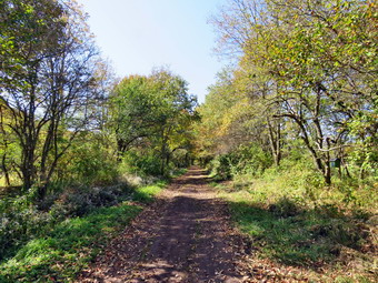
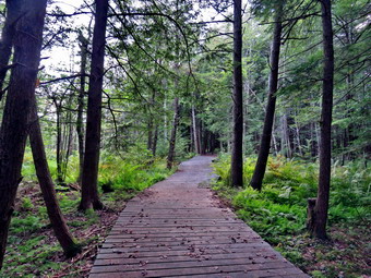
![]() On Saturday, July 29th, I wanted to get out for a hike after a long week at school. I knew that Cindy would want a relatively flat hike so I suggested we hike a section of the Catskill Scenic Trail from South Kortright to Hobart. I estimated this would be about 8 miles which is long but the walk is almost completely flat. It was cool and very foggy early in the morning so we delayed our departure. The weather report indicated a beautiful morning with no rain and highs in them 80's. I got dressed in a new White Sierra long-sleeved crew top that Cindy had gotten me for my birthday with a short-sleeved baselayer. The White Sierra top has InsectSheild and is quite light. I put on a pair of RailRiders hiking pants which are expensive but last along time and have features like deep pockets and a generous cut which I really like. The pants have Velcro closures at the ankles which I hoped would mean I did not need gaiters. The ticks have been very numerous so far this season especially farther south. I decided to wear my Vasque Taku hiking boots which fit well and have been discontinued. I grabbed a pair of Leki external lock poles I have been using lately and made sure I had two water bottles since I expected to hike at least 8 miles. I also added a new OR floppy hat which was another present from Cindy. I have decided it shields me from the sun and allows me to spray some insect repellant on it rather than on me. I put my gear in the car and Sheila in the back seat and waited for Cindy. Sheila loves to get out an hike anywhere and she had kept her eye on both of us as we were getting ready. As we left Livingston Manor just after 10:30 AM, it was still a little foggy and the temperature was in the low 70's. I drove north and west on State Route 17 to exit 94 (Roscoe) and headed north on Route 206 toward Downsville. From the top of Brock Mountain I could see that many of the valleys were still filled with fog or clouds. At the Pepacton Reservoir, I turned left to stay on Route206/30 and drove through Downsville heading toward Walton. Just after the light in Downsville, I turned right on Telford Hollow Road. After driving over the hill, I turned right at the bottom of the hill and drove out to Route 10. I turned right and drove toward Delhi. As we drove through Delhi there was a street fair going on and the town was packed. I continued on Route 10 north for 13 miles to South Kortright. I turned on CR-18 and drove across a beautiful stone bridge over the West Branch of the Delaware River. At the end of the road, I turned right and almost immediately found the point where the trail crosses the road across from the South Kortright Cemetery. I turned around and found a place where I could pull off the road and park. I set my GPS and we started north on the trail toward Hobart at 11:55 AM.
On Saturday, July 29th, I wanted to get out for a hike after a long week at school. I knew that Cindy would want a relatively flat hike so I suggested we hike a section of the Catskill Scenic Trail from South Kortright to Hobart. I estimated this would be about 8 miles which is long but the walk is almost completely flat. It was cool and very foggy early in the morning so we delayed our departure. The weather report indicated a beautiful morning with no rain and highs in them 80's. I got dressed in a new White Sierra long-sleeved crew top that Cindy had gotten me for my birthday with a short-sleeved baselayer. The White Sierra top has InsectSheild and is quite light. I put on a pair of RailRiders hiking pants which are expensive but last along time and have features like deep pockets and a generous cut which I really like. The pants have Velcro closures at the ankles which I hoped would mean I did not need gaiters. The ticks have been very numerous so far this season especially farther south. I decided to wear my Vasque Taku hiking boots which fit well and have been discontinued. I grabbed a pair of Leki external lock poles I have been using lately and made sure I had two water bottles since I expected to hike at least 8 miles. I also added a new OR floppy hat which was another present from Cindy. I have decided it shields me from the sun and allows me to spray some insect repellant on it rather than on me. I put my gear in the car and Sheila in the back seat and waited for Cindy. Sheila loves to get out an hike anywhere and she had kept her eye on both of us as we were getting ready. As we left Livingston Manor just after 10:30 AM, it was still a little foggy and the temperature was in the low 70's. I drove north and west on State Route 17 to exit 94 (Roscoe) and headed north on Route 206 toward Downsville. From the top of Brock Mountain I could see that many of the valleys were still filled with fog or clouds. At the Pepacton Reservoir, I turned left to stay on Route206/30 and drove through Downsville heading toward Walton. Just after the light in Downsville, I turned right on Telford Hollow Road. After driving over the hill, I turned right at the bottom of the hill and drove out to Route 10. I turned right and drove toward Delhi. As we drove through Delhi there was a street fair going on and the town was packed. I continued on Route 10 north for 13 miles to South Kortright. I turned on CR-18 and drove across a beautiful stone bridge over the West Branch of the Delaware River. At the end of the road, I turned right and almost immediately found the point where the trail crosses the road across from the South Kortright Cemetery. I turned around and found a place where I could pull off the road and park. I set my GPS and we started north on the trail toward Hobart at 11:55 AM.
 The trail is wide and flat for its entire length but does game some elevation on the section we hiked. The elevation gain is barely noticeable in all but a few locations. The first part of the trail passes through the backyard of some homes in South Kortright. At one point we came to a small fenced-in area with two miniature horses and another horse across the trail. I stopped to take a few pictures before continuing on the way. A young lady passed us on the trail walking quickly but did not answer our greetings. At .5 miles we crossed Madison Hill Road and continued on the other side. The day was almost perfect but we both noticed it was getting warmer as we hiked. At 1.8 miles we crossed CR-18 on a diagonal and parallel the road briefly. I began to notice that the color of the trees to the east was still mostly green but the trees to the west were beginning to turn color. I stopped to take a few pictures of the colors. A little further along a couple riding bicycles caught up to us coming from South Kortright. At 2.8 miles the trail again came close to CR-18 and I began to hear loud voices. As we walked further along the trail, it became clear that the voice was an auctioneer on a farm. The trail crossed the farm's driveway where some children were playing and then again crossed CR-18 at 3.2 miles. I knew we must be getting close to Hobart from my own calculations and the trail signs at the crossings. At 3.6 miles we came to the first substantial bridge which crossed Town Brook. Cindy stopped to get a drink and a snack while I took pictures of the brook and the bridge. We continued on the trail and were soon in Hobart. I decided I wanted to walk to an area where there was parking so that I could start there o the next hike. I crossed Pearl St and Maple Avenue and walked to the next trail sign on Railroad Avenue where I turned around.
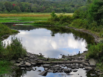
 I walked back to where Cindy had stopped and a large hound came running up to us. He seemed friendly enough but I am always upset by dog owners who let there dogs run loose. We eventually convinced the dog to get lost as we hiked back to Pearl Street. I had noticed a large cemetery and turned right on Pearl Sreet to walk to Locust Hill Cemetery. I took a few pictures and then returned to the trail. We set a very fast pace on the way back and I did not intend to stop at all. I got ahead of Cindy on some sections and did stop to take some shots and allow her to catch up. We passed all the "attractions" we had seen on the way out. As we neared South Kortright a couple passed us on bicycles with the fattest tires I had ever seen. The bikes were a heavy construction and the woman muttered about the trail as she went passed us. We continued along walking as fast as we could and in a short time the couple came up behind us and passed us again. By 3:05 we were back at the car after hiking 8.1 miles in 3 hours and 10 minutes for an average speed of 3.0 mph moving and 2.5 mph overall. The elevation gain stood at 290 feet. I walked over to the South Kortright Cemetery to take a few pictures. On the way back to the car, I noticed a pond covered in green duckweed. There appeared to be two animals in the pond. I took some pictures of the pond and then zoomed in on the animals which were ducks!
![]()
![]()
![]()
![]()
![]() On Wednesday, September 158th I came home from school and felt like taking a hike close to home but in a location that was not Round Top or Frick Pond. I decided to go to Huggins lake. The hike is less than 4 miles but has some good uphill and the lake at the end of the out and back hike is pretty. I was hoping to see the beginnings of some fall colors. The temperature was in the low 70's as we started getting ready at 3:30 PM. I got dressed in my White Sierra long-sleeved crew top that Cindy had gotten me for my birthday with a short-sleeved baselayer. The White Sierra top has InsectSheild and is quite light. I put on a pair of RailRiders hiking pants which are expensive but last along time and have features like deep pockets and a generous cut which I really like. The pants have Velcro closures at the ankles which discourage the ticks which have been numerous this season. I decided to wear my Vasque Taku hiking boots which fit well and have been discontinued. I grabbed a pair of Leki external lock poles I have been using lately. We left Livingston Manor just before 4:00 PM as I drove north on Old Route 17 and then up the Beaverkill Road. I turned left on Campsite Road and stayed to the right at the bottom of the hill to cross the covered bridge. At the end of the road I turned right and followed Berry Brook Road to the trailhead. We arrived at the road to the parking area to find it very rough with some erosion and a few branches in the way. I chose to chance it and easily made it to the small lot parking at 4:10 PM. I got my equipment ready and set my GPS. There were no other cars in the lot when we headed out on the wide woods road to the lake. The temperature was in the low 70's and there was a slight breeze making the conditions perfect. There was some sun and the skies were mostly blue as we started the climb up the hill. The hike isn't long and the trail is well-maintained and it looked like some work had been done lately as there were no blowdowns along the way. The first 1.2 miles is all uphill and gains almost 700 feet. Sheila was running up and down the trail and following game paths into the woods. After the initial climb, the trail descends, levels some and then climbs again until the final descent to Huggins Lake. The trail makes a sharp turn from southeast to north at about 1.6 miles. We enjoyed the downhill trek to the shores of the pond but I knew we would soon have to turn around and climb back up the hill.
On Wednesday, September 158th I came home from school and felt like taking a hike close to home but in a location that was not Round Top or Frick Pond. I decided to go to Huggins lake. The hike is less than 4 miles but has some good uphill and the lake at the end of the out and back hike is pretty. I was hoping to see the beginnings of some fall colors. The temperature was in the low 70's as we started getting ready at 3:30 PM. I got dressed in my White Sierra long-sleeved crew top that Cindy had gotten me for my birthday with a short-sleeved baselayer. The White Sierra top has InsectSheild and is quite light. I put on a pair of RailRiders hiking pants which are expensive but last along time and have features like deep pockets and a generous cut which I really like. The pants have Velcro closures at the ankles which discourage the ticks which have been numerous this season. I decided to wear my Vasque Taku hiking boots which fit well and have been discontinued. I grabbed a pair of Leki external lock poles I have been using lately. We left Livingston Manor just before 4:00 PM as I drove north on Old Route 17 and then up the Beaverkill Road. I turned left on Campsite Road and stayed to the right at the bottom of the hill to cross the covered bridge. At the end of the road I turned right and followed Berry Brook Road to the trailhead. We arrived at the road to the parking area to find it very rough with some erosion and a few branches in the way. I chose to chance it and easily made it to the small lot parking at 4:10 PM. I got my equipment ready and set my GPS. There were no other cars in the lot when we headed out on the wide woods road to the lake. The temperature was in the low 70's and there was a slight breeze making the conditions perfect. There was some sun and the skies were mostly blue as we started the climb up the hill. The hike isn't long and the trail is well-maintained and it looked like some work had been done lately as there were no blowdowns along the way. The first 1.2 miles is all uphill and gains almost 700 feet. Sheila was running up and down the trail and following game paths into the woods. After the initial climb, the trail descends, levels some and then climbs again until the final descent to Huggins Lake. The trail makes a sharp turn from southeast to north at about 1.6 miles. We enjoyed the downhill trek to the shores of the pond but I knew we would soon have to turn around and climb back up the hill.
 When we arrived at the lake, I noticed that the water level was high. We walked out along the dam on a narrow path through the weeds. The leaves had not really changed but a few leaves were beginning to show some color. It was still sunny and the skies were blue with puffy white clouds. The clouds and trees were reflected in the pond which was very placid. I dropped my pack and got out the camera to take some pictures of the trees and the pond. I also got some shots of the colorful flowers and the reeds around the dam. At the outlet I could immediately see that the beavers had dammed the water flow and that reeds had grown to all but block the outlet flow. I took a few more pictures of the lake and Sheila before returning to my pack and stowing the camera. I made sure that Sheila did not dive into the pond as the water was muddy. The only negative point about Huggins Lake is that there is only one trail and so there are no variations available. The ascent went smoothly for the most part as we climbed the hill back to the highest point on the trail. From there we started down the other side of the hill. I was surprised that I had labored a little climbing the hill at the beginning of the hike but felt very fresh on the way back. Sheila seemed very interested in following game trails off the main trail and I had to keep calling her back. We arrived back at the car at 5:45 PM after hiking 3.7 miles in 1 hour and 35 minutes with a total elevation gain of 950 feet.
![]()
![]()
![]()
![]() On Monday, September 16th I came home immediately after school and wanted to get in a short hike. I asked Cindy if she would like to go and she said "Yes". Cindy and I began to get ready to go with Sheila barking and running around frantically. Sheila misses the hiking as much as I do since I have returned to full-time teaching. The temperature was in the low 70's so I knew I should dress for warm weather. I put on my long-sleeved light Mountain Hardwear crew top. I knew this might be a little too warm but felt I don't mind being warm. I put on a pair of RailRiders hiking pants which are expensive but last a long time and have features like deep pockets and a generous cut which I really like. The pants have Velcro closures at the ankles. I decided to wear my Keen Targhee III boots which are supportive and surprisingly roomy. I grabbed a pair of Leki poles with external locks that I have been using lately. At 4:05 PM we walked out the door to start the hike. I grabbed Sheila's leash from the car and we walked up the driveway. I decided we would try to do just two figure 8's as I knew that was all Cindy would want to do. I aimed to hike for about an hour. Sheila was happy to get out as we headed down the driveway and across the street. We crossed the street and walked to the parking area by the Presbyterian Church. We walked to the back of the church and began the ascent of the steepest hill behind the church. The hill is short but gets the circulation pumping and is the steepest and longest climb on the "trail." Sheila helped me along by pulling me up the hill. When we got to the top of the hill, we started on the trail by turning left at the trailhead. I let Sheila off her leash so that she could explore. The trail bed is becoming worn it which means that a few people are using the trail. I am always happy to see that someone else uses the trails.
On Monday, September 16th I came home immediately after school and wanted to get in a short hike. I asked Cindy if she would like to go and she said "Yes". Cindy and I began to get ready to go with Sheila barking and running around frantically. Sheila misses the hiking as much as I do since I have returned to full-time teaching. The temperature was in the low 70's so I knew I should dress for warm weather. I put on my long-sleeved light Mountain Hardwear crew top. I knew this might be a little too warm but felt I don't mind being warm. I put on a pair of RailRiders hiking pants which are expensive but last a long time and have features like deep pockets and a generous cut which I really like. The pants have Velcro closures at the ankles. I decided to wear my Keen Targhee III boots which are supportive and surprisingly roomy. I grabbed a pair of Leki poles with external locks that I have been using lately. At 4:05 PM we walked out the door to start the hike. I grabbed Sheila's leash from the car and we walked up the driveway. I decided we would try to do just two figure 8's as I knew that was all Cindy would want to do. I aimed to hike for about an hour. Sheila was happy to get out as we headed down the driveway and across the street. We crossed the street and walked to the parking area by the Presbyterian Church. We walked to the back of the church and began the ascent of the steepest hill behind the church. The hill is short but gets the circulation pumping and is the steepest and longest climb on the "trail." Sheila helped me along by pulling me up the hill. When we got to the top of the hill, we started on the trail by turning left at the trailhead. I let Sheila off her leash so that she could explore. The trail bed is becoming worn it which means that a few people are using the trail. I am always happy to see that someone else uses the trails.
At the first trail junction, we followed Sheila as she turned right on the woods road which is the shallower approach to the trail system. We continued to follow the yellow trail to the first junction where we turned left and followed it to the next trail junction. I set a slower pace than usual so that I could just enjoy the walk. At the second junction with the blue trail, we turned right and started up the steep blue trail that leads over the summit of Round Top. Walking uphill we passed through a sea of green ferns that grew very close to the narrow trail. We walked across the flat summit of Round Top and started down the other side. I had trimmed much of the trail earlier in the summer but this part still had some branches encroaching on the trail. I sort of like the branches untrimmed as it makes the trail seem "wilder"! Soon we were back at the yellow trail. We turned right and walked the yellow trail to the next trail junction. This time we turned left and followed the yellow trail downhill toward the lookout. We continued down to the lookout where there wasn't much to see. We followed the yellow trail as it turned left and descended the hill to the first trail junction. The walk had gone quickly, so we turned around and started back up the hill back to the lookout. Sometimes Sheila and Cindy resist another loop but this time they had no objection. We followed the yellow trail uphill toward the lookout and turned right to continue up to the next trail junction with the blue trail. At the trail junction, we turned right to stay on the yellow trail. At the next junction we turned left to climb the shallower side of the summit ascent. We again walked across the flat summit and descended the steeper trail. About half way down the trail we met two local residents coming up the trail toward us. We stopped to talk for a few minutes and I was glad they were enjoying the trail. At the trail junction, we turned left and followed the yellow trail along the base of Round Top. At the next junction we turned right this time to follow the trail down to the woods road that leads out to the first trail junction. We completed the figure 8 ending up back at the very first trail junction. That was enough for us given the time. We walked out toward the trailhead where I put Sheila on her leash. We walked down the hill and through the church parking lot to the road and to our driveway. It was 5:15 PM and we had hiked around 2 miles in about an hour.
![]()
![]()
![]()
![]()
![]() On Sunday, September 15th, I wanted to get out and hike after church. When I got home the temperature was in the low 70's and the sky was blue with many white, puffy clouds. Cindy was not available so it would just be Sheila and I on the hike which meant we could get in a little more distance. Sheila got wind of what was going on and began running around the house barking. I got dressed in my White Sierra long-sleeved crew top that Cindy had gotten me for my birthday with a short-sleeved baselayer. The White Sierra top has InsectSheild and is quite light. I put on a pair of RailRiders hiking pants which are expensive but last along time and have features like deep pockets and a generous cut which I really like. The pants have Velcro closures at the ankles which discourage the ticks which have been numerous this season. I decided to wear my Vasque Taku hiking boots which fit well and have been discontinued. I put my OR Bugout gaiters and grabbed a pair of Leki external lock poles I have been using lately. We left Livingston Manor around 1:30 PM and I drove out the DeBruce Road about 6 miles to Mongaup Road. I turned left and continued up the road to the point where it splits. I stayed left on Beech Mountain Road and drove to the parking areas on the left. I pulled into the smaller parking area where there were two other cars. The larger area also had two or three cars in it. We got ready to head out on the Quick Lake Trail with a few insects circling. I set my GPS and we walked out on the short access trail to the register at 1:50 PM. The trail was damp and muddy in spots from the recent local rains that had fallen the previous evening and night. At Gravestone Junction we turned right on the Logger's Loop. After a short distance, we stopped so that I could take some pictures of the blue sky and billowing white clouds. We continued on the Logger's Loop to Times Square and along the way the trail continued to be wet in spots. At Times Square we turned right and started up the Big Rock Trail.
On Sunday, September 15th, I wanted to get out and hike after church. When I got home the temperature was in the low 70's and the sky was blue with many white, puffy clouds. Cindy was not available so it would just be Sheila and I on the hike which meant we could get in a little more distance. Sheila got wind of what was going on and began running around the house barking. I got dressed in my White Sierra long-sleeved crew top that Cindy had gotten me for my birthday with a short-sleeved baselayer. The White Sierra top has InsectSheild and is quite light. I put on a pair of RailRiders hiking pants which are expensive but last along time and have features like deep pockets and a generous cut which I really like. The pants have Velcro closures at the ankles which discourage the ticks which have been numerous this season. I decided to wear my Vasque Taku hiking boots which fit well and have been discontinued. I put my OR Bugout gaiters and grabbed a pair of Leki external lock poles I have been using lately. We left Livingston Manor around 1:30 PM and I drove out the DeBruce Road about 6 miles to Mongaup Road. I turned left and continued up the road to the point where it splits. I stayed left on Beech Mountain Road and drove to the parking areas on the left. I pulled into the smaller parking area where there were two other cars. The larger area also had two or three cars in it. We got ready to head out on the Quick Lake Trail with a few insects circling. I set my GPS and we walked out on the short access trail to the register at 1:50 PM. The trail was damp and muddy in spots from the recent local rains that had fallen the previous evening and night. At Gravestone Junction we turned right on the Logger's Loop. After a short distance, we stopped so that I could take some pictures of the blue sky and billowing white clouds. We continued on the Logger's Loop to Times Square and along the way the trail continued to be wet in spots. At Times Square we turned right and started up the Big Rock Trail.
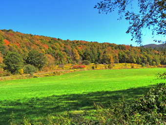
 The Big Rock Trail gains 600 feet over 1.1 miles to the junction with the Flynn Trail. Along the way there are three distinct spots where the trail gains elevation and then levels. Sometimes I am fooled by these sections but on this day I kept track of exactly where I was. I felt strong climbing the hill and we were soon at the junction with e Flynn Trail. We turned left and started out on the Flynn Trail toward Hodge Pond. It was refreshing to be walking on the flat ground on the trail we had recently trimmed. When we arrived at the junction with the woods road that continues to the old Boy Scout camp, we stayed to the left on the Flynn Trail. We walked down the hill under bright and sunny skies to the clearing at the outlet end of Hodge Pond. From the trail we walked over to the shores of the pond. I dropped my pack and got out my camera as Sheila headed to the pond to take a swim. As I began to take pictures, I noticed a few of the trees were beginning to change colors. I took pictures of the pond and the trees. I also took a few shots of Sheila in the water and the magnificent clouds hanging over the pond. Once I had enough pictures, I called Sheila and we headed back to the Flynn Pond. We followed the Flynn Trail along the west side of Hodge Pond avoiding the wet and muddy areas. Where the Flynn Trail veered to the left , we stayed right on the jeep trail around the back of the pond. We walked down the path to the shore of the pond where I took some more pictures of the pond and the clouds. After returning to the main trail we continued to the point where the woods road turns left and heads up the hill. We climbed the steep but short hill to what was once Beech Mountain Road. At the top of the hill we turned right and walked back to the Flynn Trail.
 A left turn on the Flynn Trail and a short walk brought us back to the junction with the Big Rock Trail. We turned right on the big Rock trail and began the 1.1 mile descent back to Times Square. As we descended the various sections, I began to hear noises from the woods on either side of the trail. The noises weren't exactly a howl and they were at some distance but there was definitely a "conversation" going on. I could not tell whether the calls were coyotes or people practicing coyote calls but I decided we would increase our pace down the hill. When we reached Times Square, I decided that we would not try completing the Logger's Loop. I did not want to find out the source of the calls and I knew our total distance would be over 6 miles. We continued straight across Times Square on the Big Rock Trail. This trail was also muddy as we kept up a good pace over the bridges and through the dark spruce forest. I did stop to take a few shots before continuing across the wooden walkways to the junction with the Quick Lake Trail. We turned left on the Quick Lake Trail and walked to the bridge over the outlet of Frick Pond. I stopped to take some pictures of the pond where some trees were beginning to change color. After finishing my photography, we walked up the hill to Gravestone Junction and continue out the trail toward the parking area. On the way out, I saw a dog ahead of us on the trail with its owners. I put Sheila on her leash and we soon caught up to them. We began to talk as our dogs got acquainted. The couple had recently moved to Willowemoc and were looking for places to hike. We walked together to the parking lot as I suggested places for them to hike. We arrived at the car at 4:35 PM after hiking 6.3 miles in 2 hours and 45 minutes. Our elevation gain was 973 feet with an overall pace of 2.3 mph.
![]()
![]()
![]()
![]() On Friday, September 13th I came home immediately after school and wanted to get in a short hike after a week of school and family commitments. I began to get ready to go with Sheila barking and running around frantically. Sheila misses the hiking as much as I do since I have returned to full-time teaching. The temperature was in the low 70's so I knew I should dress for warm weather. I put on my long-sleeved light Mountain Hardwear crew top. I knew this might be a little too warm but felt I don't mind being warm. I put on a pair of RailRiders hiking pants which are expensive but last a long time and have features like deep pockets and a generous cut which I really like. The pants have Velcro closures at the ankles. I decided to wear my Keen Targhee III boots which are supportive and surprisingly roomy. I grabbed a pair of Leki poles with external locks that I have been using lately. At 3:45 PM we walked out the door to start the hike. I grabbed Sheila's leash from the car and we walked up the driveway. I decided we would try to do four figure 8's to get a little more exercise. I aimed to hike for over an hour. Sheila was happy to get out as we headed down the driveway and across the street. We crossed the street and walked to the parking area by the Presbyterian Church. We walked to the back of the church and began the ascent of the steepest hill behind the church. The hill is short but gets the circulation pumping and is the steepest and longest climb on the "trail." Sheila helped me along by pulling me up the hill. When we got to the top of the hill, we started on the trail by turning left at the trailhead. I let Sheila off her leash so that she could explore. The trail bed is becoming worn it which means that a few people are using the trail. I am always happy to see that someone else uses the trails.
On Friday, September 13th I came home immediately after school and wanted to get in a short hike after a week of school and family commitments. I began to get ready to go with Sheila barking and running around frantically. Sheila misses the hiking as much as I do since I have returned to full-time teaching. The temperature was in the low 70's so I knew I should dress for warm weather. I put on my long-sleeved light Mountain Hardwear crew top. I knew this might be a little too warm but felt I don't mind being warm. I put on a pair of RailRiders hiking pants which are expensive but last a long time and have features like deep pockets and a generous cut which I really like. The pants have Velcro closures at the ankles. I decided to wear my Keen Targhee III boots which are supportive and surprisingly roomy. I grabbed a pair of Leki poles with external locks that I have been using lately. At 3:45 PM we walked out the door to start the hike. I grabbed Sheila's leash from the car and we walked up the driveway. I decided we would try to do four figure 8's to get a little more exercise. I aimed to hike for over an hour. Sheila was happy to get out as we headed down the driveway and across the street. We crossed the street and walked to the parking area by the Presbyterian Church. We walked to the back of the church and began the ascent of the steepest hill behind the church. The hill is short but gets the circulation pumping and is the steepest and longest climb on the "trail." Sheila helped me along by pulling me up the hill. When we got to the top of the hill, we started on the trail by turning left at the trailhead. I let Sheila off her leash so that she could explore. The trail bed is becoming worn it which means that a few people are using the trail. I am always happy to see that someone else uses the trails.
At the first trail junction, we followed Sheila as she turned right on the woods road which is the shallower approach to the trail system. We continued to follow the yellow trail to the first junction where we turned left and followed it to the next trail junction. I set a slower pace than usual so that I could just enjoy the walk. At the second junction with the blue trail, we turned right and started up the steep blue trail that leads over the summit of Round Top. Walking uphill we passed through a sea of green ferns that grew very close to the narrow trail. We walked across the flat summit of Round Top and started down the other side. I had trimmed much of the trail earlier in the summer but this part still had some branches encroaching on the trail. Soon we were back at the yellow trail. We turned right and walked the yellow trail to the next trail junction. This time we turned left and followed the yellow trail downhill toward the lookout. We continued down to the lookout where there wasn't much to see. We followed the yellow trail as it turned left and descended the hill to the first trail junction. The walk had gone quickly, so we turned around and started back up the hill back to the lookout. Sometimes Sheila resists another loop but this time she had no objection. We followed the yellow trail uphill toward the lookout and turned right to continue up to the next trail junction with the blue trail. At the trail junction, we turned right to stay on the yellow trail. At the next junction we turned left to climb the shallower side of the summit ascent. We again walked across the flat summit and descended the steeper trail. At the trail junction, we turned left and followed the yellow trail along the base of Round Top. At the next junction we turned right this time to follow the trail down to the woods road that leads out to the first trail junction. I still had some energy in me so we turned around and repeated the first loop. As we came around to the second trail junction we met a couple and their three year old daughter. They had just been to the summit and were walking back to their car. We talked and they said they were staying at Mongaup Campgrounds. I made suggestions about hikes at Frick Pond and to Mongaup Falls which they appreciated. We parted as Sheila and I began our ascent of the blue trail to the summit. We completed the figure 8 ending up back at the very first trail junction. That was enough for me given the time. We walked out toward the trailhead where I put Sheila on her leash. We walked down the hill and through the church parking lot to the road and to our driveway. It was 5:15 PM and we had hiked just less than 3 miles in just under an hour and a half.
![]()
![]()
![]()
![]()
![]() On Monday, September 9th, I wanted to get out and hike after school. When I got home the temperature was in the low 70's and the sky was blue with many white, puffy clouds. I asked Cindy if she would like to go to Frick Pond and hike and she said "Yes". Sheila got wind of what was going on and began running around the house barking. I got dressed in my White Sierra long-sleeved crew top that Cindy had gotten me for my birthday with a short-sleeved baselayer. The White Sierra top has InsectSheild and is quite light. I put on a pair of RailRiders hiking pants which are expensive but last along time and have features like deep pockets and a generous cut which I really like. The pants have Velcro closures at the ankles which discourage the ticks which have been numerous this season. I decided to wear my Vasque Taku hiking boots which fit well and have been discontinued. I put my OR Bugout gaiters and grabbed a pair of Leki external lock poles I have been using lately. We left Livingston Manor just before 4:00 PM and I drove out the DeBruce Road about 6 miles to Mongaup Road. I turned left and continued up the road to the point where it splits. I stayed left on Beech Mountain Road and drove to the parking areas on the left. I pulled into the smaller parking area. We got ready to head out on the Flynn Trail with a few insects circling our heads. I set my GPS and we walked across the road to get on the Flynn Trail at 4:15 PM. This trail is sited along what used to be Beech Mountain Road which was the access for the Beech Mountain Boy Scout Camp. As we walked the trail through the woods, the dog from the cabin near the parking area came running through the woods. His owner was calling for him but he was paying no attention. I did put Sheila on her leash as she gets nervous when other dogs approach. This is what usually occurs when we come to hike these trails. The owner just doesn't seem to care or isn't smart enough to remedy the situation. We stopped so that the owner might catch up to his dog but the dog was smarter. We walked to the end of the trail and stopped again at which point the owner was finally able to grab his dog. We turned right on the woods road and began to set a very quick pace up the Flynn Trail. The trail gains a little over 600 feet in 1.75 miles to the highest point at the junction with the Big Rock Trail. The day was somewhere between cool and warm with a sky that was quickly becoming overcast. Cindy and I both noticed that the woods were very quiet with almost no animal noises. We passed through the arch Cindy and I had cut through an enormous hemlock that had fallen across the trail.
On Monday, September 9th, I wanted to get out and hike after school. When I got home the temperature was in the low 70's and the sky was blue with many white, puffy clouds. I asked Cindy if she would like to go to Frick Pond and hike and she said "Yes". Sheila got wind of what was going on and began running around the house barking. I got dressed in my White Sierra long-sleeved crew top that Cindy had gotten me for my birthday with a short-sleeved baselayer. The White Sierra top has InsectSheild and is quite light. I put on a pair of RailRiders hiking pants which are expensive but last along time and have features like deep pockets and a generous cut which I really like. The pants have Velcro closures at the ankles which discourage the ticks which have been numerous this season. I decided to wear my Vasque Taku hiking boots which fit well and have been discontinued. I put my OR Bugout gaiters and grabbed a pair of Leki external lock poles I have been using lately. We left Livingston Manor just before 4:00 PM and I drove out the DeBruce Road about 6 miles to Mongaup Road. I turned left and continued up the road to the point where it splits. I stayed left on Beech Mountain Road and drove to the parking areas on the left. I pulled into the smaller parking area. We got ready to head out on the Flynn Trail with a few insects circling our heads. I set my GPS and we walked across the road to get on the Flynn Trail at 4:15 PM. This trail is sited along what used to be Beech Mountain Road which was the access for the Beech Mountain Boy Scout Camp. As we walked the trail through the woods, the dog from the cabin near the parking area came running through the woods. His owner was calling for him but he was paying no attention. I did put Sheila on her leash as she gets nervous when other dogs approach. This is what usually occurs when we come to hike these trails. The owner just doesn't seem to care or isn't smart enough to remedy the situation. We stopped so that the owner might catch up to his dog but the dog was smarter. We walked to the end of the trail and stopped again at which point the owner was finally able to grab his dog. We turned right on the woods road and began to set a very quick pace up the Flynn Trail. The trail gains a little over 600 feet in 1.75 miles to the highest point at the junction with the Big Rock Trail. The day was somewhere between cool and warm with a sky that was quickly becoming overcast. Cindy and I both noticed that the woods were very quiet with almost no animal noises. We passed through the arch Cindy and I had cut through an enormous hemlock that had fallen across the trail.
 We walked quickly up the trail stopping once so that I could take some pictures of the rock ledges. At 5:00 PM we had hiked the 1.7 miles to the junction with the Big Rock Trail. We turned left to walk down the Big Rock Trail. The trail was largely clear of branches and it appeared that someone had been hiking it. We set a very fast pace as we descended the trail passing through the various twists and turns that often make it seem like the bottom of the hill is close. We were soon at Times Square and I continued straight across to stay on the Big Rock Trail. I noticed that there were tire tracks in the mud and it seemed that some vehicle had been driven on the trail. New trail markers had been placed on the trail so I assumed it was the DEC that had placed them and had decided to use a vehicle to tear up the trails. I might be wrong. We continued to the bridges over the streams that feed Frick Pond. There was some water flowing under the first bridge but the stream that usually flows under the second bridge was completely dry. I took a few pictures before we continued along the Big Rock Trail. We passed over the series of wooden walkways which continue to deteriorate. If there is a plan on the part of the DEC to replace them, they have not made it known. At the end of the Big Rock Trail, we turned left on the Quick Lake Trail and walked to the bridge over the outlet stream. There wasn't much water coming out of the pond but I decided to stop to take some shots. After a few minutes, we continued up the hill to Gravestone Junction and out the trail back to the car. The Quick lake Trail back to the parking area was completely dry. We arrived at the car at 5:50 PM after hiking 3.9 miles in 1 hours and 35 minutes. The elevation gain was 670 feet and our moving speed was 2.6 mph!
![]()
![]()
![]()
![]()
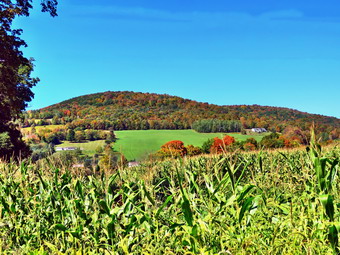
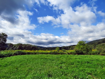
![]() On Saturday, September 7th, I planned to get out and hike about 8 miles locally. I decided that I might hike the snowmobile trails on the west side of Mongaup Pond. There isn't much to see or photograph but I had not hiked the complete loop in some time. When I woke up in the morning, the temperature was in the low 50's with a heavy fog hanging over the valley. I decided to hold off a little while before starting out on my hike. When I did get up, I asked Cindy if she would like to hike and she said she would. I knew she would want to hike a shorter distance without too many hills. Cindy asked about hiking the Delhi Rail Trails and I reluctantly agreed. Rail trails are flat and straight and the only goal can be to walk as fast as you can. I got dressed in a new White Sierra long-sleeved crew top that Cindy had gotten me for my birthday with a short-sleeved baselayer. The White Sierra top has InsectSheild and is quite light. I put on a pair of RailRiders hiking pants which are expensive but last along time and have features like deep pockets and a generous cut which I really like. The pants have Velcro closures at the ankles which I hoped would mean I did not need gaiters. The ticks have been very numerous so far this season especially farther south. I decided to wear my Vasque Taku hiking boots which fit well and have been discontinued. I put my OR Bugout gaiters as I did not know the nature of the trails we would be hiking. I grabbed a pair of Leki external lock poles I have been using lately. At around 10:00 AM we put our gear in the car and Sheila in the back seat. Sheila loves to get out an hike anywhere and she had kept her eye on both of us as we were getting ready. As we left Livingston Manor, it was still a little foggy. I drove north and west on State Route 17 to exit 94 (Roscoe) and headed north on Route 206 toward Downsville. From the top of Brock Mountain I could see that many of the valleys were still filled with fog or clouds. At the Pepacton Reservoir, I turned left to stay on Route206/30 and drove through Downsville heading toward Walton. Just after the light in Downsville, I turned right on Telford Hollow Road. After driving over the hill, I turned right at the bottom of the hill and drove out toward Route 10. Just before the intersection, I pulled into a parking area on the left side of the road. I had decided we would hike the entire West Branch rail Trail end to end as an out and back from this end. I took some pictures of the fields and the cloud-filled sky from the parking area. I set my GPS unit and we started out on the trail at 10:40 AM.
On Saturday, September 7th, I planned to get out and hike about 8 miles locally. I decided that I might hike the snowmobile trails on the west side of Mongaup Pond. There isn't much to see or photograph but I had not hiked the complete loop in some time. When I woke up in the morning, the temperature was in the low 50's with a heavy fog hanging over the valley. I decided to hold off a little while before starting out on my hike. When I did get up, I asked Cindy if she would like to hike and she said she would. I knew she would want to hike a shorter distance without too many hills. Cindy asked about hiking the Delhi Rail Trails and I reluctantly agreed. Rail trails are flat and straight and the only goal can be to walk as fast as you can. I got dressed in a new White Sierra long-sleeved crew top that Cindy had gotten me for my birthday with a short-sleeved baselayer. The White Sierra top has InsectSheild and is quite light. I put on a pair of RailRiders hiking pants which are expensive but last along time and have features like deep pockets and a generous cut which I really like. The pants have Velcro closures at the ankles which I hoped would mean I did not need gaiters. The ticks have been very numerous so far this season especially farther south. I decided to wear my Vasque Taku hiking boots which fit well and have been discontinued. I put my OR Bugout gaiters as I did not know the nature of the trails we would be hiking. I grabbed a pair of Leki external lock poles I have been using lately. At around 10:00 AM we put our gear in the car and Sheila in the back seat. Sheila loves to get out an hike anywhere and she had kept her eye on both of us as we were getting ready. As we left Livingston Manor, it was still a little foggy. I drove north and west on State Route 17 to exit 94 (Roscoe) and headed north on Route 206 toward Downsville. From the top of Brock Mountain I could see that many of the valleys were still filled with fog or clouds. At the Pepacton Reservoir, I turned left to stay on Route206/30 and drove through Downsville heading toward Walton. Just after the light in Downsville, I turned right on Telford Hollow Road. After driving over the hill, I turned right at the bottom of the hill and drove out toward Route 10. Just before the intersection, I pulled into a parking area on the left side of the road. I had decided we would hike the entire West Branch rail Trail end to end as an out and back from this end. I took some pictures of the fields and the cloud-filled sky from the parking area. I set my GPS unit and we started out on the trail at 10:40 AM.
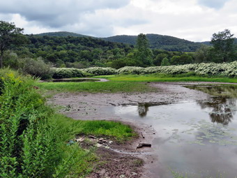 I had hiked this trail from the "middle" in July so I knew what to expect. It was clear that someone had used a tractor drawn mowing machine to clear the trail and there were only a few weeds leaning in at a few spots. Shortly after we started, I took some pictures to the north which included some part of the West Branch of the Delaware River. A little farther on, we came to a spot where there had been a large frog pond on the right side of the trail. I was surprised to see that the "pond" was almost completely dry with only little mud remaining. I took some pictures and then we continued on our way. After a short distance, I put Sheila on her leash as we were coming to an area where we had met a dog on Ur last hike. We passed through that area without meeting the dog. At 1 mile we came to the trail that comes down from the parking area on Route 10. The trail had been flat and dry with only a few damp spots. After this intersection, we ran into some muddy spots but they were easily avoided. At 1.6 miles a small spur trail led down to the river on the left side of the trail. I had not used this trail the last time but this time I walked down to the river. Upstream the river was almost dry with mostly mud flats. Downstream I could see more water and a small set of rapids. I took pictures in both directions and some close-ups of the river and Japanese knotweed. When I returned to the main trail, we continued our hike toward the opposite end of the rail trail. There was not much to see along the way except for some muddy areas and some garbage dumped down the bank form the road. As we approached the end of the trail, we came into the area of the Delaware County Landfill. The sights and sounds and smells were not very attractive so we quickly turned around and headed back the way we came. On the way back we decided to walk as fast as we could and did not stop. We were back at the car at 12:30 PM after hiking 4.8 miles in 1 hour and 50 minutes. My GPS unit indicated an elevation gain of 263 feet but that number was much closer to perhaps 50 feet. Our average speed was 2.6 mph with a moving average of 3.9 mph. I was ready to get in another short hike but Cindy suggested we return home to get ready for a party.
![]()
![]()
![]()
![]() On Wednesday, September 44th I came home immediately after school and wanted to get in a short hike. I asked Cindy she wanted to hike a few loops on Round Top. She said "yes" so we began to get ready to go. Sheila began barking, running around frantically and spinning in place. Sheila misses the hiking as much as I do since I have returned to full-time teaching for the rest of this year! The temperature was in the low 70's so I put on my long-sleeved light Mountain Hardwear crew top. I knew this might be a little too warm but felt I don't mind being warm. I put on a pair of RailRiders hiking pants which are expensive but last a long time and have features like deep pockets and a generous cut which I really like. The pants have Velcro closures at the ankles. I decided to wear my Keen Targhee III boots which are supportive and surprisingly roomy. I grabbed a pair of Leki poles with external locks that I have been using lately. At 4:10 PM we walked out the door to start the hike. I grabbed Sheila's leash from the car and we walked up the driveway. I decided we would try to do at least two figure 8's which might be enough given the situation. I aimed to hike for about an hour. Sheila was happy to get out as we headed down the driveway and across the street. We crossed the street and walked to the parking area by the Presbyterian Church. We walked to the back of the church and began the ascent of the steepest hill behind the church. The hill is short but gets the circulation pumping and is the steepest and longest climb on the "trail." Sheila helped me along by pulling me up the hill. The hill seemed much easier as I had been hiking the 3500 foot mountains with Bryce during the summer.
On Wednesday, September 44th I came home immediately after school and wanted to get in a short hike. I asked Cindy she wanted to hike a few loops on Round Top. She said "yes" so we began to get ready to go. Sheila began barking, running around frantically and spinning in place. Sheila misses the hiking as much as I do since I have returned to full-time teaching for the rest of this year! The temperature was in the low 70's so I put on my long-sleeved light Mountain Hardwear crew top. I knew this might be a little too warm but felt I don't mind being warm. I put on a pair of RailRiders hiking pants which are expensive but last a long time and have features like deep pockets and a generous cut which I really like. The pants have Velcro closures at the ankles. I decided to wear my Keen Targhee III boots which are supportive and surprisingly roomy. I grabbed a pair of Leki poles with external locks that I have been using lately. At 4:10 PM we walked out the door to start the hike. I grabbed Sheila's leash from the car and we walked up the driveway. I decided we would try to do at least two figure 8's which might be enough given the situation. I aimed to hike for about an hour. Sheila was happy to get out as we headed down the driveway and across the street. We crossed the street and walked to the parking area by the Presbyterian Church. We walked to the back of the church and began the ascent of the steepest hill behind the church. The hill is short but gets the circulation pumping and is the steepest and longest climb on the "trail." Sheila helped me along by pulling me up the hill. The hill seemed much easier as I had been hiking the 3500 foot mountains with Bryce during the summer.
When we got to the top of the hill, we started on the trail by turning left at the trailhead. I let Sheila off her leash so that she could explore. The trail bed is becoming more and more worn which means that quite few people are using the trail. I am always happy to see that someone else uses the trails. At the first trail junction, we followed Sheila as she continued straight up the hill toward the viewpoint. At the top of the hill we gazed out over the town but didn't stop as the view was very familiar. We turned right and followed the trail as it gently gained legation through a sea of ferns. At the next trail junction, we turned right to follow the yellow trail around the base of Round Top. I had been on the trail in July cutting back the brush and grass with my Stihl trimmer and loppers. I was glad to see that the trail was still nice and wide and had not been overgrown again. At the next trail junction we turned left and headed up to the summit of Round Top on the blue trail. As we hiked, I noticed that there were some branches encroaching on the trail and made a note to make another trip to do some trimming before winter. We were soon passing over the top of the hill and starting down the other side. The trail bed was a narrow path through a sea of green ferns which were quite pretty. At the bottom of the hill we turn left to follow the yellow trail to the next trail junction. This time we turned right and followed the yellow trail down to the woods road that returned us to the first trail junction. All the time Sheila stayed pretty close to us taking only a few off-trail excursions. When we reached the first trail junction, we turned around and walked back up the woods road. At the first junction with the blue trail we turned left and followed the yellow trail along the base of Round Top. At the second junction, we turned right and walked up the blue trail through the ferns to the summit of Round Top. We walked down the other side to the junction and turned right. We followed the yellow trail turning left and the next junction to walk down to the lookout. At the lookout we stayed to the left and walked down the hill to the first trail junction. Cindy and I agreed that we had done enough. We continued straight ahead and walked out toward the trailhead. I put Sheila on her leash and we walked won the hill, out through the church parking lot to the road and to our driveway. It was 5:20 PM and we had hiked over 2 miles in just over an hour.
![]()
![]()
![]()
![]()
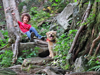
![]() On Friday, August 30th, I was ready to get out and hike with my grandson Bryce. My plan was to finally go to the Blackhead Range after several; aborted attempts. My plan was to hike Blackhead from the east and then hike Black dome leaving Thomas Cole for another day. When I awoke at 7:00 AM the temperature in town was 49 degrees and I hoped Bryce would come properly dressed. Bryce arrived at about 7:30 AM with long selves and long pants but no jacket. We found one he could wear since I didn't know what the temperature would be at the trailhead. I began to get my gear together closely watched by Sheila who knew that we always go hiking when Bryce is visiting. I got dressed in a new White Sierra long-sleeved crew top that Cindy had gotten me for my birthday with a short-sleeved baselayer. The White Sierra top has InsectSheild and is quite light. I put on a pair of RailRiders hiking pants which are expensive but last along time and have features like deep pockets and a generous cut which I really like. The pants have Velcro closures at the ankles which I hoped would mean I did not need gaiters. The ticks have been very numerous so far this season especially farther south. I decided to wear my Vasque Taku hiking boots which fit well and have been discontinued. I put my OR Bugout gaiters and added a new OR floppy hat which was another present from Cindy. I have decided it shields me from the sun and allows me to spray some insect repellant on it rather than on me. I grabbed a pair of Leki external lock poles I have been using lately and made sure I had two water bottles as I thought we might be hiking almost 7 miles over challenging terrain. At 8:00 AM I put our gear in the car and Sheila and Bryce in the back seat to get on the road to hike. The sky has bright and blue with some clouds. I headed out the DeBruce Road and at the end I turned left onto Route 47. We were soon passing by the Frost Valley YMCA. I continued on Rt 47 passing the trailheads at Biscuit Brook, Slide Mountain and Giant Ledge/Panther. There were a few cars at each spot but they didn't look very crowded. At Route 28 I turned right and drove 8 miles before turning left and heading north on Main Street in Phoenicia. At some point I realized a more direct route would have been Route 42 to Lexington but decided not to turn around. After a short distance, I turned left on Route 214 and drove north for 12 miles to Route 23A where I turned left heading toward Hunter. I turned right on Bloomer Road and at the end I turned right on Platte Clove Road. Where the road forked I stayed left on Platte Clove Road and continued straight ahead for 4.5 miles to Prediger Road. I turned right on Scribner Hollow Road and at the end I made a left on Route 23C. I was hoping I could find the big flag on the left at the turn onto CR-40 and was a little surprised it was there. I turned right on CR-40 and followed it into Maplecrest passing Barnum Road on the way down the hill. Where the road turned left, I turned right onto CR-56, Big Hollow Road, which led to the trailhead. We were following another car and the farther we went the clearer it became that the car was headed to the trailhead. I drove to the end of the road and parked in one of the remaining parking spots. I wanted to get started before the occupants of the other car so I set my GPS watch and hand unit. Bryce took off his coat as it was 66 degrees while I decided to leave my light windbreaker on for awhile. We walked up the road that leads to the red-blazed Black Dome Trail.
On Friday, August 30th, I was ready to get out and hike with my grandson Bryce. My plan was to finally go to the Blackhead Range after several; aborted attempts. My plan was to hike Blackhead from the east and then hike Black dome leaving Thomas Cole for another day. When I awoke at 7:00 AM the temperature in town was 49 degrees and I hoped Bryce would come properly dressed. Bryce arrived at about 7:30 AM with long selves and long pants but no jacket. We found one he could wear since I didn't know what the temperature would be at the trailhead. I began to get my gear together closely watched by Sheila who knew that we always go hiking when Bryce is visiting. I got dressed in a new White Sierra long-sleeved crew top that Cindy had gotten me for my birthday with a short-sleeved baselayer. The White Sierra top has InsectSheild and is quite light. I put on a pair of RailRiders hiking pants which are expensive but last along time and have features like deep pockets and a generous cut which I really like. The pants have Velcro closures at the ankles which I hoped would mean I did not need gaiters. The ticks have been very numerous so far this season especially farther south. I decided to wear my Vasque Taku hiking boots which fit well and have been discontinued. I put my OR Bugout gaiters and added a new OR floppy hat which was another present from Cindy. I have decided it shields me from the sun and allows me to spray some insect repellant on it rather than on me. I grabbed a pair of Leki external lock poles I have been using lately and made sure I had two water bottles as I thought we might be hiking almost 7 miles over challenging terrain. At 8:00 AM I put our gear in the car and Sheila and Bryce in the back seat to get on the road to hike. The sky has bright and blue with some clouds. I headed out the DeBruce Road and at the end I turned left onto Route 47. We were soon passing by the Frost Valley YMCA. I continued on Rt 47 passing the trailheads at Biscuit Brook, Slide Mountain and Giant Ledge/Panther. There were a few cars at each spot but they didn't look very crowded. At Route 28 I turned right and drove 8 miles before turning left and heading north on Main Street in Phoenicia. At some point I realized a more direct route would have been Route 42 to Lexington but decided not to turn around. After a short distance, I turned left on Route 214 and drove north for 12 miles to Route 23A where I turned left heading toward Hunter. I turned right on Bloomer Road and at the end I turned right on Platte Clove Road. Where the road forked I stayed left on Platte Clove Road and continued straight ahead for 4.5 miles to Prediger Road. I turned right on Scribner Hollow Road and at the end I made a left on Route 23C. I was hoping I could find the big flag on the left at the turn onto CR-40 and was a little surprised it was there. I turned right on CR-40 and followed it into Maplecrest passing Barnum Road on the way down the hill. Where the road turned left, I turned right onto CR-56, Big Hollow Road, which led to the trailhead. We were following another car and the farther we went the clearer it became that the car was headed to the trailhead. I drove to the end of the road and parked in one of the remaining parking spots. I wanted to get started before the occupants of the other car so I set my GPS watch and hand unit. Bryce took off his coat as it was 66 degrees while I decided to leave my light windbreaker on for awhile. We walked up the road that leads to the red-blazed Black Dome Trail.
 Surprisingly, the sign at the beginning of the trail makes no mention of the mountains in the list of destinations. As we started up the trail, Bryce was convinced we were going in the wrong direction! We hiked uphill crossing the Batavia Kill twice on bridges which were hardly necessary as the water level was so low. At .6 miles the trail split and we stayed left on the yellow-blazed Batavia Kill Trail. This sign mentioned Blackhead which made Bryce feel better. The trail continued to gain elevation at a moderate rate. We met one young man hiking toward us with some water bottles and I suspected he was staying at the lean-to just up the trail and was looking for water. He confirmed this and we continued in separate directions. At 1.5 miles we started on a switchback and at 1.6 miles we were at the junction with the blue-blazed Escarpment Trail. At this point we had gained almost 700 feet of elevation but I knew the major elevation gains were yet to come. We turned right and immediately started to climb over rocks and roots gaining elevation now more quickly. I stopped so that we could have a drink and so that I could take off my windbreaker. We continued on the trail as it became steeper with fewer places to catch a breath. I kept looking for some of the viewpoints that used to be present but these had disappeared as the trees grew. I did find a few places to take some shots and a limited viewpoint at around 2.1 miles. We got a drink and a snack before continuing up the trail. The last piece of trail to the summit was steep but short and we were soon at the junction of the Escarpment Trail and the Blackhead Mountain Trail. We had gained 1770 feet over the 2.45 miles from the trailhead! I turned left on the Escarpment Trail which again baffled Bryce. We walked a short distance to the rock which has "1936 Camp Steel" painted on it. This used to be a decent lookout but it too had been reclaimed by the trees. We walked back to the summit and I took some pictures of Bryce by the sign.
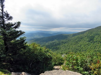 We walked straight ahead on the trail along the relatively flat summit of Blackhead and then began a gentle decent. I was looking for the lookout toward Black Dome hoping that it had not disappeared also. We began the steeper descent and a viewpoint appeared. I stopped to take some shots while Bryce went ahead a little. The viewpoint was limited by I heard Bryce exclaim that he had found a better one. I walked down the trail to him and found a wide-open lookout toward Black Dome. I took several pictures and noticed that the sky was getting dark and the wind was starting to blow. We began the steep descent to Lockwood Gap which was very dry and had a lot of loose stones. We were both careful and avoided any major falls. At 12:25 PM we had hiked 3.15 miles and had to make a decision. Black Dome is only .6 miles from Lockwood Gap but the climb I steep and it is hard to make any time either up or down. It does have a nice lookout to the south but I wondered how it would be with the skies so overcast. I really wanted to try to bag Black Dome but I did not want to get caught in a thunderstorm with an 8 year-old. In the end, I made the painful but adult decision to head down the mountain. We turned right on the Black Dome Trail and started down through the switchbacks. We almost immediately met a young couple hiking up. We discussed the weather and then went our separate ways. Within a few minutes the sun came out and then went behind some dark clouds. This alternated for the rest of the hike. I was disappointed that there was no clear view of the peaks from the trail as there once had been. I remembered the view of the peaks coming up the trail as one of the most intimidating in the Catskills! Hiking down the dry and rock strewn trail became old very fast but it was better than the Jimmy Dolan Notch Trail. One hiker caught up to us from behind and we exchanged greetings. Further down the mountain two groups of hikers passed us going up the trail. We were soon crossing the stream again on the bridges and made some time getting back to the car. We were back at the parking area at 1:30 PM after hiking 5.0 miles in 3 hours and 45 minutes for a moving average of 1.7 mph. This was sow but I had been holding back a little expecting to summit Black Dome. Our vertical gain was 1805 feet.
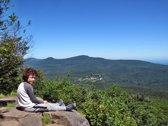
![]()
![]()
![]()
![]()
![]() On Monday, August 26th, I was ready to get out and hike with my grandson Bryce. My plan was to go to Tannersville to hike Indian Head as that was the last peak Bryce had not hiked on the Devil's Path. When I awoke at 7:00 AM the temperature in town was 48 degrees and I hoped Bryce would come properly dressed. Bryce arrived at about 7:30 AM with long selves and long pants but no jacket. We found one he could wear since I didn't know what the temperature would be at the trailhead. I began to get my gear together closely watched by Sheila who knew that we always go hiking when Bryce is visiting. I got dressed in a long-sleeved Columbia crew top with a short-sleeved baselayer. I put on a pair of RailRiders hiking pants which are expensive but last along time and have features like deep pockets and a generous cut which I really like. The pants have Velcro closures at the ankles which I like even when I wear gaiters. The ticks have been very numerous so far this season especially farther south. I decided to wear my Vasque Taku hiking boots which fit well and have been discontinued. I put my OR Bugout gaiters as I did not know how much mud would be on the trails we would be hiking. I grabbed a pair of Leki external lock poles I have been using lately and made sure I had two water bottles as I thought we might be hiking almost 7 miles over challenging terrain. I also added a new OR floppy hat which was another present from Cindy. I have decided it shields me from the sun and allows me to spray some insect repellant on it rather than on me. AT 8:30 AM I put our gear in the car and Sheila and Bryce in the back seat to get on the road to hike. The sky has bright and blue with some clouds. I headed out the DeBruce Road and at the end I turned left onto Route 47. We were soon passing by the Frost Valley YMCA. I continued on Rt 47 passing the trailheads at Biscuit Brook, Slide Mountain and Giant Ledge/Panther. There were a few cars at each spot but they didn't look very crowded. At Route 28 I turned right and drove 8 miles before turning left and heading north on Main Street in Phoenicia. After a short distance, I turned left on Route 214 and drove north for 12 miles to Route 23A where I turned right heading toward Tannersville. I turned right on Bloomer Road and at the end I turned right on Platte Clove Road. Where the road forked I stayed left on Platte Clove Road and continued straight ahead for 4.5 miles to Prediger Road. I turned right and continued to the trailhead parking. There were a few cars in the lot and one pickup had pulled in just ahead of us. An older man had his dog running around the parking lot showing complete disregard for anyone else present. Fortunately, he started off on the trail and I hoped we would not meet him again. The temperature was in the low 60's and there was a slight breeze so we both decided to keep on our light jackets. I set my GPS unit and we left the parking area at 10:15 AM under bright, sunny skies.
On Monday, August 26th, I was ready to get out and hike with my grandson Bryce. My plan was to go to Tannersville to hike Indian Head as that was the last peak Bryce had not hiked on the Devil's Path. When I awoke at 7:00 AM the temperature in town was 48 degrees and I hoped Bryce would come properly dressed. Bryce arrived at about 7:30 AM with long selves and long pants but no jacket. We found one he could wear since I didn't know what the temperature would be at the trailhead. I began to get my gear together closely watched by Sheila who knew that we always go hiking when Bryce is visiting. I got dressed in a long-sleeved Columbia crew top with a short-sleeved baselayer. I put on a pair of RailRiders hiking pants which are expensive but last along time and have features like deep pockets and a generous cut which I really like. The pants have Velcro closures at the ankles which I like even when I wear gaiters. The ticks have been very numerous so far this season especially farther south. I decided to wear my Vasque Taku hiking boots which fit well and have been discontinued. I put my OR Bugout gaiters as I did not know how much mud would be on the trails we would be hiking. I grabbed a pair of Leki external lock poles I have been using lately and made sure I had two water bottles as I thought we might be hiking almost 7 miles over challenging terrain. I also added a new OR floppy hat which was another present from Cindy. I have decided it shields me from the sun and allows me to spray some insect repellant on it rather than on me. AT 8:30 AM I put our gear in the car and Sheila and Bryce in the back seat to get on the road to hike. The sky has bright and blue with some clouds. I headed out the DeBruce Road and at the end I turned left onto Route 47. We were soon passing by the Frost Valley YMCA. I continued on Rt 47 passing the trailheads at Biscuit Brook, Slide Mountain and Giant Ledge/Panther. There were a few cars at each spot but they didn't look very crowded. At Route 28 I turned right and drove 8 miles before turning left and heading north on Main Street in Phoenicia. After a short distance, I turned left on Route 214 and drove north for 12 miles to Route 23A where I turned right heading toward Tannersville. I turned right on Bloomer Road and at the end I turned right on Platte Clove Road. Where the road forked I stayed left on Platte Clove Road and continued straight ahead for 4.5 miles to Prediger Road. I turned right and continued to the trailhead parking. There were a few cars in the lot and one pickup had pulled in just ahead of us. An older man had his dog running around the parking lot showing complete disregard for anyone else present. Fortunately, he started off on the trail and I hoped we would not meet him again. The temperature was in the low 60's and there was a slight breeze so we both decided to keep on our light jackets. I set my GPS unit and we left the parking area at 10:15 AM under bright, sunny skies.
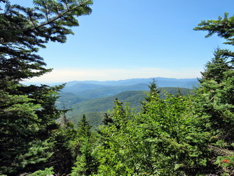 We started out on the red-blazed Devil's Path as we left the parking area. The trail was dry and showed a lot of use as this is a very popular route. At .3 miles the trail split and we stayed left on the Devil's Path. I like to ascend the east side of Indian Head as it is very interesting with viewpoints and rock scrambles. It is longer than the route up Jimmy Dolan Notch but that trail is one of my least favorites in the Catskills and misses the best lookouts. Over the next 1.3 miles we gained and then lost some elevation. Along the first half of the trail everything was remarkably dry and I remarked to Bryce that there is usually a lot of mud in this area. All the small stream were dry except for one and we stopped so that I could take some pictures of Bryce and Sheila on the small stone bridge. As we came to the second half of this part of the trail, I regretted my comment about mud. We ran into some very wet areas that spanned the trail and made us get creative to avoid sinking to our ankles. At 1.6 miles we turned right o stay on the Devil's Path. I decided not to visit the quarry to the left to save time and to avoid any possibility of a rattlesnake encounter. It was a very short walk to the next trail junction where the Devil's Path turns right and starts the ascent up the mountain. The sign at the junction indicates a vertical gain of over 1300 feet! We started up the trail and immediately encountered some steep little climbs over rocks and roots. I let Bryce know there were steeper areas to come but he seemed to relish the prospect. Some of the rocks were wet but Sheila and Bryce bounced up the trail almost running at times. We did stop at one point to get a drink and to stow our jackets in my pack. At 2.85 miles we had just made a left turn after climbing over 1000 feet from the beginning of the ascent. At this point we came to Sherman's Lookout which still was great views to the east. The span of the views is more than 10 degrees and takes in Kaaterskill High Peak and Round Top to the north and the Hudson River to the east. Also visible are the Catskill Bruderhof in the shadow of KHP and Plattekill Mountain to the southeast. I took off my pack and got out the camera and took pictures of the scenery. I also took some shots of Bryce and Shiela sitting on the lookout with the mountains and the river in the background. We got a drink and a snack and then started off on the trail again.
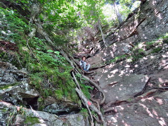 As we were climbing I was waiting for a near vertical ascent that I seemed to remember was on the trail somewhere. Just after we left Sherman's Lookout, we made a sight ascent and turned a little to the west as the trail flattened out. I told Bryce to watch for another lookout and we soon arrived at one pointed south. This viewpoint had grown in some so the views were more limited than in the past. I did take some shots of Overlook Mountain and Echo Lake before we packed up and headed out along the relatively level trail. Some things began to look familiar and I was pretty sure that the last major, nearly vertical climb, was just ahead. Bryce was ahead of me on the trail and I heard him exclaim "oh, my gosh!" And I knew he had found the climb. I told him to wait while I caught up and surveyed the ascent together. I could hear someone approaching from behind but I told Bryce to go up so that I could take a few pictures. He did and I took some shots at different levels as he climbed. He was soon at the top and two young men had reached me as they ascended the trail. I talked to them and they told me they were doing the entire Devil's Path in what sounded like two days. They had dropped their car at the Mink Hollow end of the Devil's Path and got a $70 ride to Prediger Road! They intended to stay at the Devil's Tombstone overnight and then complete the hike on Tuesday. I suggested they might try staying at the Mink Hollow lean-to and then hiking Plateau and Westkill the next day to better break up the hike. I let them pass me to do the ascent and get on their way. Once they had finished the climb, I let Shiela loose and she climbed up without a problem. I made my way up and joined Bryce and Sheila at another nice lookout to the east. This one had a great view of the false summit on Indian Head and a view of the Hudson. After I took some shots, we headed up the trail climbing some more through some rocks and walking along the edge of a cliff.
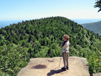 We got to a point where it seemed we had hit the summit so I took some pictures. We continued our walk and found a higher spot so I checked the Avenza app which indicated that we were at the summit. I took a few shots and found a limited viewpoint. This lookout clearly showed the television tower on Overlook at to the left of it the Overlook fire tower. I tried to take some pictures before we started our descent. As we started down the mountain, I looked for some views over to Twin as I remembered that there were some good ones. As we descended the rocky trail, no viewpoints appeared and I concluded that they had grown in over time. At 4.2 miles we were at Jimmy Dolan Notch which is the col between Indian Head and Twin. We got a drink and then turned right to begin the descent back to the car on the Jimmy Dolan Notch Trail. I remembered this trail as being a nightmare of rocks and roots and my memory was good! I think both Bryce and I simply went Ito an "automatic" mode trying to get down as quickly and safely as possible. We did meet a small group coming up the trail at around 2:30 PM and I wondered where they were going. The trail began to flatten but was still filled with rocks and roots. It had been reputed at least once and meandered back and forth making the agony that much longer. Bryce followed the blue blazes and I followed Bryce as we encountered muddy areas just to enhance the experience. In may areas there really was no trail to follow except for the markers. We again encountered a group of people starting up the trail and I wondered if they knew what they were getting into. I did not think they looked like they would be able to make any of the summits and I would not pick this trail for a casual walk. Finally, at 5.9 miles we completed the loop and had only the final .3 miles to walk back to the parking area. Even this last short walk was annoying. We were back at the parking area at 3:20 PM after hiking 6.2 miles in 5 hours and 5 minutes with a total elevation gain of 1845 feet. On the drive home I was feeling tired and wanted to talk to Bryce but he was already asleep!
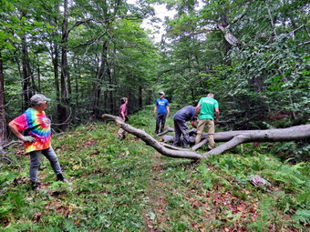
![]()
![]()
![]()
![]()
![]() On Sunday, August 25th I had planned to do some trail maintenance with the Willowemoc Trail Crew after preaching at the Grahamsville Reformed Church. The trail crew was scheduled to meet at the trailhead for Frick Pond at 1:00 PM. When I returned from church at 11:30 AM, the temperature was in the low 70's with plenty of sun and the conditions seemed perfect for the work we were going to attempt. As I began to get ready, Sheila was ready to go and stayed close to me but I had to tell her that she had to stay hoe this time! I got dressed in a new White Sierra long-sleeved crew top that Cindy had gotten me for my birthday with a short-sleeved baselayer. The White Sierra top has InsectSheild and is quite light. I put on a pair of RailRiders hiking pants which are expensive but last along time and have features like deep pockets and a generous cut which I really like. The pants have Velcro closures at the ankles which I hoped would mean I did not need gaiters. The ticks have been very numerous so far this season especially farther south. I decided to wear my Vasque Taku hiking boots which fit well and have been discontinued. I put my OR Bugout gaiters and added a new OR floppy hat which was another present from Cindy. I have decided it shields me from the sun and allows me to spray some insect repellant on it rather than on me. I put my pack in the car and added my trail maintenance tools. For tools I brought along my Silky Sugowaza and KatanaBoy saws, Fiskars axe, LT Wright Overland machete, Corona loppers and a pair of plastic felling wedges. I headed out the DeBruce Road at 12:30 PM and after six miles turned left on Mongaup Road. Where the road split I stayed left on Beech Mountain Road and drove to the parking lots. There were already several cars in the lots as I pulled in to park. Lisa was already there with several other people. A few other people arrived and we introduced ourselves and I talked about the work we would do. The plan was to walk up the Flynn Trail to the junction with the Big Rock Trail and start trimming the Flynn Trail to the junction with the Woods road. From here we would walk down to Hodge Pond and follow the Flynn Trail along the west side of the pond to the point where the Flynn Trail turns away from the pond. We would then trim the Flynn Trail to Junkyard Junction. Lisa and Kitty thought they would probably Leave a little early but Lou, Tom, John and I thought we would be able to walk the entire loop. I packed up my Silky Sugowaza and machete along with the felling wedges. I decided to carry the Corona loppers. We crossed the road at 1:05 Pm to begin our hike followed closely by another group of hikers.
On Sunday, August 25th I had planned to do some trail maintenance with the Willowemoc Trail Crew after preaching at the Grahamsville Reformed Church. The trail crew was scheduled to meet at the trailhead for Frick Pond at 1:00 PM. When I returned from church at 11:30 AM, the temperature was in the low 70's with plenty of sun and the conditions seemed perfect for the work we were going to attempt. As I began to get ready, Sheila was ready to go and stayed close to me but I had to tell her that she had to stay hoe this time! I got dressed in a new White Sierra long-sleeved crew top that Cindy had gotten me for my birthday with a short-sleeved baselayer. The White Sierra top has InsectSheild and is quite light. I put on a pair of RailRiders hiking pants which are expensive but last along time and have features like deep pockets and a generous cut which I really like. The pants have Velcro closures at the ankles which I hoped would mean I did not need gaiters. The ticks have been very numerous so far this season especially farther south. I decided to wear my Vasque Taku hiking boots which fit well and have been discontinued. I put my OR Bugout gaiters and added a new OR floppy hat which was another present from Cindy. I have decided it shields me from the sun and allows me to spray some insect repellant on it rather than on me. I put my pack in the car and added my trail maintenance tools. For tools I brought along my Silky Sugowaza and KatanaBoy saws, Fiskars axe, LT Wright Overland machete, Corona loppers and a pair of plastic felling wedges. I headed out the DeBruce Road at 12:30 PM and after six miles turned left on Mongaup Road. Where the road split I stayed left on Beech Mountain Road and drove to the parking lots. There were already several cars in the lots as I pulled in to park. Lisa was already there with several other people. A few other people arrived and we introduced ourselves and I talked about the work we would do. The plan was to walk up the Flynn Trail to the junction with the Big Rock Trail and start trimming the Flynn Trail to the junction with the Woods road. From here we would walk down to Hodge Pond and follow the Flynn Trail along the west side of the pond to the point where the Flynn Trail turns away from the pond. We would then trim the Flynn Trail to Junkyard Junction. Lisa and Kitty thought they would probably Leave a little early but Lou, Tom, John and I thought we would be able to walk the entire loop. I packed up my Silky Sugowaza and machete along with the felling wedges. I decided to carry the Corona loppers. We crossed the road at 1:05 Pm to begin our hike followed closely by another group of hikers.
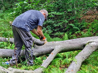 The temperature was 70 degrees was we quickly walked along the Flynn Trail through the woods. As we walked, we all picked up a few stick and removed them from the trail. As we turned right on the woods road that was once the extension of Beech Mountain Road, the dog from the cabin joined us. He would not return to his owner so we stopped and waited for him to come grab his dog. This happens every time I hike in the area as the owner apparently is unaware of leashes. The other hikers caught up with us and once the dog was gone I walked and talked wit them for some time. Eventually they separated and I talked to the workers in our group. Most had not been in the area before so I talked to them about the trails and the history of the area. It is a long climb toward the junction with the Big Rock Trail but it seemed to me we were moving very quickly and I was feeling full of energy. I knew that this was partly due to hiking 3500 foot peaks which made the smooth trail surface and easy grade feel so much easier. It was also true that talking to other people made things go more quickly. At about 1.25 miles we came to the point where I sometimes turn off the trail to visit an interesting clearing. As we continued up the trail, we ran into a rather large blowdown that was new. Fortunately, the tree had broken in several places when it fell. I used the saw to cut off some of the branches and others dragged them away. We cleared a path for hikers and I decided I would return with some bigger tools at another time. Our walk to the Big Rock Junction went quickly and we arrived after hiking 1.7 miles. Lisa and Kitty turned left to head down the Big Rock Trail while the rest of us continued straight ahead on the Flynn Trail. We immediately began to trim branches that were encroaching on the trail. We were careful to trim wide and high in preparation for snowshoers in the winter. Walking on a foot to three feet of snow means that some branches mat be hitting people in the face unless they are trimmed carefully.
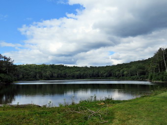 We continued along the Flynn Trail cutting branches until we arrived at the next trail junction. We stayed to the left to follow the Flynn Trail down to Hodge Pond. The grass on the trail had been mowed by OSI which owns the land. As we walked out into the sun, I noticed the apparent increase in temperature. I also noticed there was a breeze which helped offset the sun. As we approached Hodge Pond, I saw three hikers approaching us with an unleashed pitbull. The dog seemed friendly but this is just another example of how inconsiderate some people can be on the trail. We walked down the rest of the Flynn Trail and out into the field by Hodge Pound. We walked over to the shore and I took a few pictures. The sky was blue and there were nice white clouds to increase the contrast with the rest of the sky. After a few minutes, we walked back to the Flynn Trail and followed it along the west side of the pond. The trail was wet and muddy in places but tees were easily avoided. At the next trail junction we stayed to the left to take the Flynn Trail up the hill rather than the jeep road around the back of the pond. We cut a few branches before we passed through the gate. The Trail was a little damper with more muddy spots. We immediately began to lop branches and throw them off the side of the trail. We traded off several times as we had three sets of loppers for four people. I found the men I was working with were very eager to get the job done. They did a great job of trimming the trail all the way to the Quick Lake Trail at Junkyard Junction. It was 3:35 PM and we had hiked 3.4 miles which is a little more than halfway through the hike. We turned left to start the hike back and I informed the group that we did not have to do any more trimming. We set a quick pace as we walked and talked. The trail initially rolls some but eventually descends toward Iron Wheel Junction. The trail was damp and muddy in several places. We did come across several new blowdowns but I knew I could return later to work on them or allow the snowmobile club to remove them.
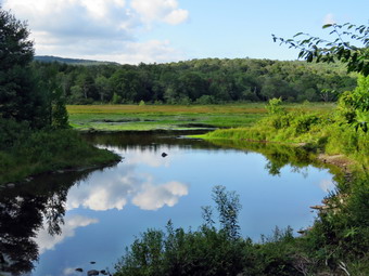 At 4:15 PM we turned right at Iron Wheel Junction after hiking 4.9 miles. The turn allowed us to stay on the Quick Lake Trail heading for Frick Pond. As we walked, I noticed that the mosquitoes had returned. The White Sierra shirt did a good job of keeping them off but they were landing and biting my hands and face. I stopped and sprayed on some repellant. We came to and crossed the small stream through the woods without a problem as it was almost dry. We walked through the spruce tunnel and out the other side. There were a few blowdowns but they were flat on the ground and easy to step over. This part of the trail was wet and muddy. We passed by the junction with the Big Rock Trail on the left and were soon at the bridge over the Frick Pond Outlet. I dropped my pack and got out the camera. I have taken hundreds of pictures form the bridge but can't resist stopping to take a few more. The water level was very low although some water was still flowing in the outlet stream. I pointed out Beech Mountain to the others since it is the highest point in Sullivan County. We walked up the hill from Frick Pond to Gravestone Junction. The memorial stone was still in place and had not been moved. We continued straight ahead on the Quick Lake Trail. The trail was dry for almost the entire way back to the car. We passed by the register and turned right to stay on the Quick Lake Trail. There were still other cars in the parking areas when we said our goodbyes and left. We were back at the cars at 5:00 PM having hiked 6.6 miles in 3 hours and 55 minutes with a vertical gain of 900 feet. We had stopped for 45 minutes and our pace was slowed in spots by the work we were doing.
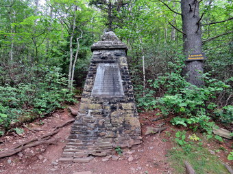
![]()
![]()
![]()
![]()
![]() On Friday, August 23rd, I planned to go to North South Lake and hike a loop of about 15 miles including the whole Escarpment Trail, North Point and stoppel Point. I knew this was an ambitious endeavor but I wanted to get as much in as possible since it is almost an hour and a half drive and I had not been there in some time. When I awoke in the morning, the temperature was in the high 50's and I knew it would be a perfect day to hike. I asked Cindy if she would like to go with us and she said "Yes" as long as I shortened the distance. I decided on a shorter loop along the Escarpment rail to the Palenville Lookout and then back through the site of the Catskill Mountain House. I began to get ready and Sheila was especially excited as I began to dress. I got dressed in a new White Sierra long-sleeved crew top that Cindy had gotten me for my birthday with a short-sleeved baselayer. The White Sierra top has InsectSheild and is quite light. I put on a pair of RailRiders hiking pants which are expensive but last along time and have features like deep pockets and a generous cut which I really like. The pants have Velcro closures at the ankles which I hoped would mean I did not need gaiters. The ticks have been very numerous so far this season especially farther south. I decided to wear my Vasque Taku hiking boots which fit well and have been discontinued. I put my OR Bugout gaiters as I did not know the nature of the trails we would be hiking. I grabbed a pair of Leki external lock poles I have been using lately and made sure I had two water bottles as I thought we might be hiking almost 9 miles. I also added a new OR floppy hat which was another present from Cindy. I have decided it shields me from the sun and allows me to spray some insect repellant on it rather than on me. I put my pack in the car and Sheila in the back seat and headed out the DeBruce Road at 9:45 AM. At the end I turned left onto Route 47 and passed by the Frost Valley YMCA. I continued on Rt 47 passing the trailheads at Biscuit Brook, Slide Mountain and Giant Ledge/Panther. There were no cars at Biscuit Brook and only a few cars the other spots. At Route 28 I turned right and drove a few miles before turning left and heading north on Route 42 toward Lexington. The road had been paved most of the way and the ride was fast and smooth. I drove all the way to Lexington where I turned right on Route 23A heading toward Hunter and then Tannersville. After passing through Hunter, I continued passed the junction with Route 214 and through Tannersville to North Lake Road. I turned left and drove to the entrance to the campgrounds where I turned right on Schutt Road. I parked in the lot at 11:15 AM where there were quite a few parks already present. I set my GPS and we crossed the road to start our hike on the Escarpment Trail. As we started out on the Escarpment Trail, there were several areas that were damp and muddy but the trail appeared well-used.
On Friday, August 23rd, I planned to go to North South Lake and hike a loop of about 15 miles including the whole Escarpment Trail, North Point and stoppel Point. I knew this was an ambitious endeavor but I wanted to get as much in as possible since it is almost an hour and a half drive and I had not been there in some time. When I awoke in the morning, the temperature was in the high 50's and I knew it would be a perfect day to hike. I asked Cindy if she would like to go with us and she said "Yes" as long as I shortened the distance. I decided on a shorter loop along the Escarpment rail to the Palenville Lookout and then back through the site of the Catskill Mountain House. I began to get ready and Sheila was especially excited as I began to dress. I got dressed in a new White Sierra long-sleeved crew top that Cindy had gotten me for my birthday with a short-sleeved baselayer. The White Sierra top has InsectSheild and is quite light. I put on a pair of RailRiders hiking pants which are expensive but last along time and have features like deep pockets and a generous cut which I really like. The pants have Velcro closures at the ankles which I hoped would mean I did not need gaiters. The ticks have been very numerous so far this season especially farther south. I decided to wear my Vasque Taku hiking boots which fit well and have been discontinued. I put my OR Bugout gaiters as I did not know the nature of the trails we would be hiking. I grabbed a pair of Leki external lock poles I have been using lately and made sure I had two water bottles as I thought we might be hiking almost 9 miles. I also added a new OR floppy hat which was another present from Cindy. I have decided it shields me from the sun and allows me to spray some insect repellant on it rather than on me. I put my pack in the car and Sheila in the back seat and headed out the DeBruce Road at 9:45 AM. At the end I turned left onto Route 47 and passed by the Frost Valley YMCA. I continued on Rt 47 passing the trailheads at Biscuit Brook, Slide Mountain and Giant Ledge/Panther. There were no cars at Biscuit Brook and only a few cars the other spots. At Route 28 I turned right and drove a few miles before turning left and heading north on Route 42 toward Lexington. The road had been paved most of the way and the ride was fast and smooth. I drove all the way to Lexington where I turned right on Route 23A heading toward Hunter and then Tannersville. After passing through Hunter, I continued passed the junction with Route 214 and through Tannersville to North Lake Road. I turned left and drove to the entrance to the campgrounds where I turned right on Schutt Road. I parked in the lot at 11:15 AM where there were quite a few parks already present. I set my GPS and we crossed the road to start our hike on the Escarpment Trail. As we started out on the Escarpment Trail, there were several areas that were damp and muddy but the trail appeared well-used.
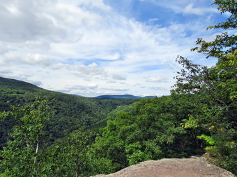 Initially, I let Sheila loose for a little while and she stayed close by. As we approached people, I either put her on her leash or instructed her to sit at the side of the trail. We crossed the two railroad grades and crossed Spruce Creek on the footbridge. Just after the bridge we came to the junction with the Scutt Road Trail and turned right down a woods road to stay on the blue blazed Escarpment Trail. The creek was nearly dry and I wondered what the many visitors headed to Kaaterskill Falls would think. We stayed to the left on the Escarpment Trail and kept meeting groups coming toward us from the falls. At .8 miles we came to the trail to the right that descends to the falls. After this point, we met fewer groups although we did encounter several walking toward us. We continued on the trail heading for the Layman Memorial. The trail to the memorial is downhill and the memorial is almost 500 feet below the elevation of the parking lot. The trail was very dry and I had stowed my poles in my pack. This did allow me to make a fast if somewhat reckless descent. We stopped briefly at the monument dedicated to a fire fighter who died in 1900 fighting a forest fire in the area. The view from the memorial was better than I remembered and it looked as if someone had cleared a few small trees. We could see down to the parking area for Kaaterskill Falls which was already full. Work may have been done to improve the trail to the falls and increase the safety for hikers but getting from the parking area to the trailhead may be the most dangerous part of the hike! I took pictures of the monument and from the viewpoint. The trail from the monument ascends back up to the escarpment and there are several short rock scrambles and high steps along the way. We were able to ascend without much problem to the area where the Escarpment Trail flattens some. It had been several years since I had taken this route and I had forgotten how beautiful and breathtaking the views can be. There are several famous named spots along the way but there are other, smaller lookouts that are just as nice. We passed the yellow shortcut trail at about 1.7 miles into the hike. Shortly after this we arrived at Sunset Rock and then Inspiration Point. There used to be signs designating these spots but they are gone. I assume they are now decorating someone's living room!
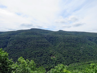 The view from the trail is to the south but the sun was hidden behind some billowing clouds most of the time. We could look up the Clove and see the Hunter Mountain Ski Area behind the houses of Twilight Park. The houses seem to hang on the side of the mountain and they must have spectacular views. Of course, Kaaterskill High Peak and Round Top are visible across the way. I could also see several stream drainages as they snaked there way down the mountain. From Inspiration Point we got our first look at the Hudson River. At 12:55 PM we had hike 2.7 miles and arrived at the junction with the horse trail that leads down to the Palenville Lookout and the Harding Road Trail. I started to walk straight ahead to go down to the Palenville Lookout as was my plan. At this point Cindy decided she did not want to make the descent! I was annoyed as this was my main objective but have learned that there is no use in discussing the route. From this point on I was most interested in just finishing the hike that Cindy had now planned. We turned left to continue to follow the Escarpment Trail. From the junction the Escarpment Trail heads more "inland" to the area of the site of the Kaaterskill Hotel. The trail has been rerouted in this area due to erosion but is well marked. At the top of a short climb the trail flattens and the walking becomes the easiest on the entire route. After a brief detour from the escarpment, the trail returns to the edge of the cliffs making a large bend to pass Split Rock and Boulder Rock. I continued straight ahead on the shortcut Trail as I knew Cindy would not want to hike any "extra" mileage.
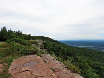 The trail was dry but there were several rocky areas which required a little scrambling to negotiate. As we approached the final descent to the Catskill Mountain House site, I walked out to a nice lookout. The view was very good and I put down my pack to get out my camera. I took pictures of the Hudson River and the edge of the escarpment cliff. After getting a drink and a bar, we worked our way down the trail to the open field that was once the site of the Catskill Mountain House. I kept Sheila by me as there were several groups of people present. We walked out to the edge of the cliff where I took some more pictures. I took pictures of the open space with a few well constructed benches. I also photographed the view and tried to imagine the hotel and its clientele at the height of its popularity. I put my camera away after which we started down the access road toward North Lake. We bore to the left on the access road rather than follow the trail and came to a parking area. I had hoped to walk a little farther and return by way of the Mary's Glen Trail and the trail on the north side of the lakes. I asked Cindy and she said she preferred to return to the car. I knew this would mean walking a lot on the roads but we turned left and started back. At 5.4 miles we were at the south end of South Lake. I wanted to take some pictures but was more interested in simply getting the hike done! We walked up the hill and back to the car covering 1.7 long miles on the road. We arrived back in the parking area at 2:25 PM having hiked 6.1 miles in 3 hours and 5 minutes with a little under 30 minutes of stopped time. Our elevation gain was just under 1240 feet. As we started the drive back home, we both decided it would be nice to stop at Pancho Villa's in Tannersville for a meal. Unfortunately, the restaurant was closed so we headed to Northern Farmhouse Pasta in Roscoe to buy some ravioli. They were sold out putting a fitting end to a less than perfect day.
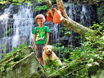
![]()
![]()
![]()
![]()
![]() On Tuesday, August 20th I wanted to get in a hike where there was a waterfall that might have been augmented by the recent rain. After visiting Russell Brook Falls the day before, I was pretty sure this was a good idea. The forecast was again calling for temperatures in the high 80's with high humidity and possible thunderstorms in the afternoon. I got a little extra sleep and awoke at 9:00 AM to find the at my grandson Bryce was at the house. For me this was great news as hiking with Bryce is always a pleasure. I decided we would go to the Neversink Unique Area at the end of Katrina Falls Road in Rick Hill and hike a loop that included High Falls. I had not been that far down the river in several years and was looking forward to it. The round trip hike is about 8 miles and Bryce would have no problem hiking this far. I began to get ready and Sheila was especially excited as I began to dress as we always go hiking when Bryce is at the house. I got dressed in a new White Sierra long-sleeved crew top that Cindy had gotten me for my birthday with a short-sleeved baselayer. The White Sierra top has InsectSheild and is quite light. I put on a pair of RailRiders hiking pants which are expensive but last along time and have features like deep pockets and a generous cut which I really like. The pants have Velcro closures at the ankles which I hoped would mean I did not need gaiters. The ticks have been very numerous so far this season especially farther south. I decided to wear my Vasque Taku hiking boots which fit well and have been discontinued. I put my OR Bugout gaiters as I did not know the nature of the trails we would be hiking. I grabbed a pair of Leki external lock poles I have been using lately and made sure I had two water bottles as I thought we might be hiking almost 9 miles. I also added a new OR floppy hat which was another present from Cindy. I have decided it shields me from the sun and allows me to spray some insect repellant on it rather than on me. I put my pack in the car and Sheila and Bryce in the back seat and headed south and east on the Quickway toward Rock Hill at 10:00 AM. I took the Rock Hill exit and drove down Katrina Falls Road until I saw the Dead End sign. There were no other vehicles in the lot when we arrived but as we were getting ready a car pulled in. I made sure Sheila was on her leash as I turned on my GPS and reset it to start the hike. The occupants of the other car had some questions and for the second hike in a row. I told them about the area another said they were going to try the hike to High Falls. I doubted that would be a good idea but let them make their own choice.
On Tuesday, August 20th I wanted to get in a hike where there was a waterfall that might have been augmented by the recent rain. After visiting Russell Brook Falls the day before, I was pretty sure this was a good idea. The forecast was again calling for temperatures in the high 80's with high humidity and possible thunderstorms in the afternoon. I got a little extra sleep and awoke at 9:00 AM to find the at my grandson Bryce was at the house. For me this was great news as hiking with Bryce is always a pleasure. I decided we would go to the Neversink Unique Area at the end of Katrina Falls Road in Rick Hill and hike a loop that included High Falls. I had not been that far down the river in several years and was looking forward to it. The round trip hike is about 8 miles and Bryce would have no problem hiking this far. I began to get ready and Sheila was especially excited as I began to dress as we always go hiking when Bryce is at the house. I got dressed in a new White Sierra long-sleeved crew top that Cindy had gotten me for my birthday with a short-sleeved baselayer. The White Sierra top has InsectSheild and is quite light. I put on a pair of RailRiders hiking pants which are expensive but last along time and have features like deep pockets and a generous cut which I really like. The pants have Velcro closures at the ankles which I hoped would mean I did not need gaiters. The ticks have been very numerous so far this season especially farther south. I decided to wear my Vasque Taku hiking boots which fit well and have been discontinued. I put my OR Bugout gaiters as I did not know the nature of the trails we would be hiking. I grabbed a pair of Leki external lock poles I have been using lately and made sure I had two water bottles as I thought we might be hiking almost 9 miles. I also added a new OR floppy hat which was another present from Cindy. I have decided it shields me from the sun and allows me to spray some insect repellant on it rather than on me. I put my pack in the car and Sheila and Bryce in the back seat and headed south and east on the Quickway toward Rock Hill at 10:00 AM. I took the Rock Hill exit and drove down Katrina Falls Road until I saw the Dead End sign. There were no other vehicles in the lot when we arrived but as we were getting ready a car pulled in. I made sure Sheila was on her leash as I turned on my GPS and reset it to start the hike. The occupants of the other car had some questions and for the second hike in a row. I told them about the area another said they were going to try the hike to High Falls. I doubted that would be a good idea but let them make their own choice.
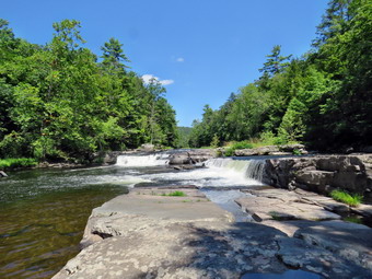 We set off down the woods road at 10:40 AM with the temperature hovering right around 80 degrees. The trail was completely dry and we made good time walking downhill. At the first trail junction, we turned left to stay on the main trail. The trail straight ahead leads down to the Neversink River and was covered in pine needles. As we neared the small bridge that crosses Wolf Brook, we could hear the water rushing in the stream. I decided not to stop to take pictures as the water was not that high and I wanted to stay ahead of the other group. We were soon headed up the small hill to the junction where the main trail splits. We turned left to make the loop in a clockwise direction since I had not used this route in some time. The trail started out flat but soon began to climb. It stayed dry with only a few damp spots and no water or mud. Over the next .9 miles, we gained almost 400 feet. The ascent was never steep, but we maintained a good pace which elevated my heart rate. There was evidence that the brush that had been overgrowing the trail had been trimmed back and several blowdowns had been cleared. As we walked, we picked up a lot of garbage left behind by a group of slobs. At 1.5 miles we came to another trail junction. The trail to the left leads out to the Wolf Lake Multiple Use Area, so we turned right to continue on the main trail which from this point on is mostly flat or downhill. After making the turn, we were headed south and soon crossed Mullet Brook on the upper bridge. The stream volume was ,WO but I stopped to take a few pictures of the stream and Bryce and Sheila on the bridge. We continued on the trail, and at 1.7 miles we made another right turn heading almost due west starting a long descent toward the Neversink Gorge. As we hiked, we watched for the short spur trail to the right which goes down to Mullet Brook Falls. It was a little farther along than I thought it was, but at 2.2 miles we made the right turn and walked down to the falls. The falls were flowing but the volume was not extraordinary. I dropped my pack and poles and took out the camera. Bryce climbed up on a rock to remove a towel from a tree and I took pictures of Bryce and Sheila on the rock. We picked up some more garbage. I worked my way over the rocks and toward the falls, I took a few shots and then walked almost to the base of the falls and took some more. There was a little too much sunlight but I tried to compensate as best I could. I was careful as some of the rocks were wet and slippery. I took pictures of the falls and the pool below. I worked my way back to my pack where Bryce and I stowed the garbage. We also got a drink and a snack before resuming our hike back out to the main trail. We turned right and continued down the trail. We heard voices coming toward us which turned out to be the group we had met in the parking area. It was clear they had not decided to go down to High Falls and I doubted they had even made it to Denton Falls. We passed by each other and continued on the main trail. At 2.7 miles we arrived at the junction with the trail to the left that leads to High Falls. We turned left to begin the 2 mile trip to High Falls.
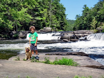 The hike to High Falls is mostly downhill and I knew that meant we would face an uphill walk on the way back. The trail follows the river and at 3.75 miles it turned south. The trail rolled some but once we turned south it was all downhill. The brush on the trail had been trimmed back but there were several blowdowns blocking the trail. At 4.5 miles we turned right on a yellow marked trail to go down to High Falls. At this point a path continues straight ahead but is not marked. The path continues south to Westerbrookville. We followed the trail down to High Falls. At the edge of the river we worked our way carefully to a wide shelf of rock just downstream from the falls. I put my pack down and got out my camera. I took wide angle shots upstream of the falls and then zoomed in on specific parts. I had Bryce and Sheila pose in several different as I took their pictures. We got a drink and another snack and then began the long uphill hike back to the trail junction. Even though the hike was uphill it seemed to go quickly. By 2:30 PM we had walked 6.7 miles and were back at the trail junction. We continued straight ahead on the main trail bypassing the yellow spur trail to Denton Falls. We were both tired enough and time was becoming an issue. The hike back to the car was rather straightforward as we crossed the lower bridge over Mullet Brook Falls. The trail was mostly downhill until at 7.5 miles we closed the loop and began retracing our steps to the parking area. We made the right turn and began walking uphill along the woods road. This part of the hike is only .6 miles with a very moderate grade but it seemed a little steeper on the way back. We arrived back at the car at 3:05 PM after hiking 8.2 miles in 4 hours and 25 minutes with 25 minutes of stopped time. The elevation gain was 1770 feet.
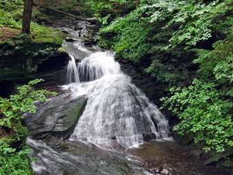
![]()
![]()
![]()
![]()
![]() On Monday, August 19th I wanted to get in a hike where there was a waterfall that might have been augmented by the recent rain. I had been confined to Livingston Manor for four days during the 50th Anniversary of Woodstock. The anticipated calls did not occur which seemed to be due to good planning on the part of the emergency services in the county. I asked Cindy if she wanted to go hiking in the Trout Pond area but she declined thinking the temperature and humidity would be too high. The forecast was calling for temperatures in the high 80's with high humidity and thunderstorms in the afternoon. I slept in after a late night and finally began to get ready at 10:30 AM with the temperature on the back porch reading 90 degrees. Sheila was especially excited as I began to dress as we had not been hiking in five days so she watched every move I made. I got dressed in a new White Sierra long-sleeved crew top that Cindy had gotten me for my birthday with a short-sleeved baselayer. The White Sierra top has InsectSheild and is quite light. I put on a pair of RailRiders hiking pants which are expensive but last along time and have features like deep pockets and a generous cut which I really like. The pants have Velcro closures at the ankles which I hoped would mean I did not need gaiters. The ticks have been very numerous so far this season especially farther south. I decided to wear my Vasque Taku hiking boots which fit well and have been discontinued. I put my OR Bugout gaiters as I did not know the nature of the trails we would be hiking. I grabbed a pair of Leki external lock poles I have been using lately and made sure I had two water bottles as I thought we might be hiking almost 7 miles over challenging terrain. I also added a new OR floppy hat which was another present from Cindy. I have decided it shields me from the sun and allows me to spray some insect repellant on it rather than on me. I put my pack in the car and Sheila in the back seat and headed for Roscoe on the Quickway a little before 11:00 AM. I drove out the Rockland Flats on Route 206. Just after the Roscoe Nursing Home I turned left on Morton Hill Road and followed it for 3 miles to the intersection with Russell Brook Road. I turned around and parked on the shoulder of the road to avoid parking in the private lot. The temperature was 73 degrees which was 10 degrees lower than in Livingston Manor!
On Monday, August 19th I wanted to get in a hike where there was a waterfall that might have been augmented by the recent rain. I had been confined to Livingston Manor for four days during the 50th Anniversary of Woodstock. The anticipated calls did not occur which seemed to be due to good planning on the part of the emergency services in the county. I asked Cindy if she wanted to go hiking in the Trout Pond area but she declined thinking the temperature and humidity would be too high. The forecast was calling for temperatures in the high 80's with high humidity and thunderstorms in the afternoon. I slept in after a late night and finally began to get ready at 10:30 AM with the temperature on the back porch reading 90 degrees. Sheila was especially excited as I began to dress as we had not been hiking in five days so she watched every move I made. I got dressed in a new White Sierra long-sleeved crew top that Cindy had gotten me for my birthday with a short-sleeved baselayer. The White Sierra top has InsectSheild and is quite light. I put on a pair of RailRiders hiking pants which are expensive but last along time and have features like deep pockets and a generous cut which I really like. The pants have Velcro closures at the ankles which I hoped would mean I did not need gaiters. The ticks have been very numerous so far this season especially farther south. I decided to wear my Vasque Taku hiking boots which fit well and have been discontinued. I put my OR Bugout gaiters as I did not know the nature of the trails we would be hiking. I grabbed a pair of Leki external lock poles I have been using lately and made sure I had two water bottles as I thought we might be hiking almost 7 miles over challenging terrain. I also added a new OR floppy hat which was another present from Cindy. I have decided it shields me from the sun and allows me to spray some insect repellant on it rather than on me. I put my pack in the car and Sheila in the back seat and headed for Roscoe on the Quickway a little before 11:00 AM. I drove out the Rockland Flats on Route 206. Just after the Roscoe Nursing Home I turned left on Morton Hill Road and followed it for 3 miles to the intersection with Russell Brook Road. I turned around and parked on the shoulder of the road to avoid parking in the private lot. The temperature was 73 degrees which was 10 degrees lower than in Livingston Manor!
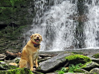 We got out of the car, I set my Garmin GPS unit and we started down Russell Brook Road toward the upper falls. The road was pretty dry and we made good time until a car came up the road and stopped. The occupants wanted to know the location of the falls so I told them to turn around and park in the lower lot. We continued to walk quickly downhill to the path down to the viewpoint above the falls. At this point the same car came back down the road and slowed as it approached us. The couple inside wanted to know how to get to the falls after parking. I again gave them directions and they drove down the road. We turned down the path to the upper falls, and I put down my pack and got out the camera. There was less water going over the falls than I thought as I took several shots with differing settings. Once I finished the photography, I packed up, and we walked down the road to the lower parking area. There were two cars in the lot as we bypassed them and walked down the woods road to cross Russell Brook. We crossed the bridge which had been redecked and found that the Japanese knotweed had been cut back at least 6 feet down to the ground. We continued on the road turning right on the path to the falls. This path was not trimmed but we pushed our way through the weeds. We walked over to the path down the bank. I could see the couple that had asked me questions ahead on the path to the viewpoint overlooking the falls. Sheila and I walked down the bank to the streambed and carefully descended to the brook. The falls were flowing with a good volume but not as much as I had anticipated. I got out my camera and took some pictures of the falls and then some of the stream. I took a few more pictures of the falls and a few of Sheila sitting in front of it. The couple were carefully descending the path and I was afraid they might slip as they both were wearing only sneakers. They stopped on the bank and we talked some. They had attended the Woodstock festivities from the state of Florida. The gentleman said he was a fly fisherman and regretted not having enough time to fish the streams in the area. After a Pleasant conversation, Sheila and I walked back up the stream bank and out to the main trail. I took a few shots of the knotweed before continuing the hike.
 At the trail junction just after the register, we continued straight ahead to walk up to Trout Pond. The trail was damp Ina few places but there was almost no mud. As we walked up the trail, it seemed that the skies were growing darker. I decide we would continue to the pond and the decide whether to turn around or continue the hike. When we arrived at the pond, we turned left and walked out to the "beach" at the outlet end of the pond. The level of the pond was very low and much of the beach was exposed. The skies were completely overcast with only a few streaks of blue toward the north. I took some panoramic pictures and then zoomed in on different parts of the scene. Sheila loves the water and jumped right in so I took a few shots of her in the water. Sheila decided she would go into overdrive and began running around at breakneck speed. When I leaned over to replace the camera in my pack, Sheila jumped over the pack and just under my chin! After getting a drink and a snack, I packed up and headed back to the main trail. We continued on the main trail on the east side of Trout Pond walking toward the inlet end and the lean-tos. The trail was not wet and was barely damp at all. No one was camping at the large campsite on the right side of the rail before the lean-tos or at the lean-tos themselves. As we crossed the bridge at the inlet end of the pond, I noticed that the inlet stream was not very high. I stopped to take some pictures of the pond from the bridge. Sheila alerted and I saw two people around the spawning box we had just passed. I assumed they were the owners of the other car in the lot. We continued on the trail turning right and started up a hill which is the shoulder of Cherry Ridge. At the turn, the trail was almost dry, and we easily walked up the hill. Many of the rocks were damp which made them slippery making for very poor footing. Not very far from the turn was a large blowdown along the side of the trail which partially blocked it. After we had walked for some time, I noticed a few large trees that had been cut with a chainsaw. I then remembered that there were places on the trail which previously had large blowdowns that were no longer present! I assumed a DEC crew had been sent through to clear the trail. Of course, since the crew had done their work there had been more storms, and there were several smaller blowdowns across the trail. Soon we were at the highest point on Cherry Ridge and starting down the other side.
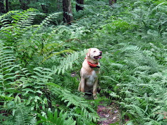 I anticipated that the trail would have quite a bit of water, but there was none even in places that are often under water. We continued on the trail ascending to the area where there is a forest of small birch trees. Many of these trees were blown down across the trail. This was also the only area where there was standing water and a few muddy areas. Soon we were at the woods road and snowmobile trail that runs by Mud Pond. I had considered walking down to Mud Pond, but decided that there was still the possibility of thunderstorms. We turned left and started the short walk uphill. This part of the trail was also completely dry. At the top of the hill, we began the long descent back to the trail junction where we had started. The descent lasts for .7 miles and drops 385 feet to a bridge that crosses the outlet stream from Trout Pond. This part of the trail was just as dry as the other sections. As we descended, we came to a spot where a small stream crosses and this time it was just a trickle. We continued down the hill on the main trail toward the campsite at the bottom of the hill on the left side of the trail. We continued on the trail crossing the bridge over the stream and walking back out to the trail register. We turned right and headed back toward the lower parking area on the main trail. We walked up the short path to the lower parking area and then up the road to the car. There were several cars in the parking area and I could see people down at the falls. As we neared the car, all of the cars that had been in the lot passed us coming up the road. We arrived back at the car at 2:05 PM after hiking 5.7 miles in 2 hours and 40 minutes with a 1150-foot total ascent. The temperature on the car thermometer was 73 degrees.
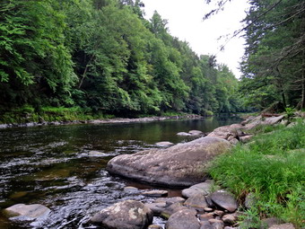
![]()
![]()
![]()
![]()
![]() On Wednesday, Agust 4th, I planned to do a rather long hike although I had not really solidified the destination. When I got up in the morning, it looked like rain was imminent although the forecast from the night before had not mentioned it. Cindy said she would like to go for a walk as long as it was less than six miles and relatively flat. I thought of the trail from Cold Spring Road down to the Neversink River. I explained the hike to Cindy and she agreed. We weren't in any really hurry to get going as it started to sprinkle in Manor and the radar looked like there might be rain in Monticello. I knew the trail was not clearly marked, so I created a geospatial PDF that I could use on my iPhone with the Avenza Maps app. This app not only shows where I am on a topo map but also shows the trail which makes it invaluable on trails that are not well marked. After the skies did not clear, we decided to get ready and go. We could make a decision once we saw what the conditions were like at the trailhead. I began to get my gear together closely watched by Sheila who knew that Cindy was also going hiking. I got dressed in a new White Sierra long-sleeved crew top that Cindy had gotten me for my birthday with a short-sleeved baselayer. The White Sierra top has InsectSheild and is quite light. I put on a pair of RailRiders hiking pants which are expensive but last along time and have features like deep pockets and a generous cut which I really like. The pants have Velcro closures at the ankles which I hoped would mean I did not need gaiters. The ticks have been very numerous so far this season especially farther south. I decided to wear my Vasque Taku hiking boots which fit well and have been discontinued. I put my OR Bugout gaiters as I did not know the nature of the trails we would be hiking. I grabbed a pair of Leki external lock poles I have been using lately and made sure I had two water bottles as I thought we might be hiking almost 7 miles over challenging terrain. I also added a new OR floppy hat which was another present from Cindy. I have decided it shields me from the sun and allows me to spray some insect repellant on it rather than on me. Just before 9:30 AM, we put our gear in the car to get on the road to hike. As we left the house, the temperature was in the low 70's but it was raining lightly and the skies were overcast. We left the house at about 9:30 AM and headed south on Route 17 toward Monticello. I got off at exit 105A and headed toward Broadway where I turned right. At the next light I turned left on St. John Street which soon became Cold Spring Road. I drove down Cold Spring Road looking for the parking area which I thought would be on the left. I had my iPhone map to help out so I knew I would find the spot eventually. At 7.45 miles from Broadway the parking area appeared on the left with a typical yellow on brown sign. The sign indicated that this parking area would allow access to the Neversink Unique Area which is exactly what I wanted. We parked at about 10:00 AM. It was raining here as well and I thought I might just take Sheila for a short walk and the return home. Cindy suggested that we start the hike as we had planned and see what happened along the way and I agreed. It took me a few minutes to set my electronics and read the signs and maps in the kiosk. I found where the trail appeared to leave the parking area since it was well worn but I did not see any blazes. We began our walk and within a few hundred feet there was a trail register and red blazes began to appear. I was surprised that the blazes were the "official" NYNJTC disks even though the trails are not an "official" NYNJTC trail.
On Wednesday, Agust 4th, I planned to do a rather long hike although I had not really solidified the destination. When I got up in the morning, it looked like rain was imminent although the forecast from the night before had not mentioned it. Cindy said she would like to go for a walk as long as it was less than six miles and relatively flat. I thought of the trail from Cold Spring Road down to the Neversink River. I explained the hike to Cindy and she agreed. We weren't in any really hurry to get going as it started to sprinkle in Manor and the radar looked like there might be rain in Monticello. I knew the trail was not clearly marked, so I created a geospatial PDF that I could use on my iPhone with the Avenza Maps app. This app not only shows where I am on a topo map but also shows the trail which makes it invaluable on trails that are not well marked. After the skies did not clear, we decided to get ready and go. We could make a decision once we saw what the conditions were like at the trailhead. I began to get my gear together closely watched by Sheila who knew that Cindy was also going hiking. I got dressed in a new White Sierra long-sleeved crew top that Cindy had gotten me for my birthday with a short-sleeved baselayer. The White Sierra top has InsectSheild and is quite light. I put on a pair of RailRiders hiking pants which are expensive but last along time and have features like deep pockets and a generous cut which I really like. The pants have Velcro closures at the ankles which I hoped would mean I did not need gaiters. The ticks have been very numerous so far this season especially farther south. I decided to wear my Vasque Taku hiking boots which fit well and have been discontinued. I put my OR Bugout gaiters as I did not know the nature of the trails we would be hiking. I grabbed a pair of Leki external lock poles I have been using lately and made sure I had two water bottles as I thought we might be hiking almost 7 miles over challenging terrain. I also added a new OR floppy hat which was another present from Cindy. I have decided it shields me from the sun and allows me to spray some insect repellant on it rather than on me. Just before 9:30 AM, we put our gear in the car to get on the road to hike. As we left the house, the temperature was in the low 70's but it was raining lightly and the skies were overcast. We left the house at about 9:30 AM and headed south on Route 17 toward Monticello. I got off at exit 105A and headed toward Broadway where I turned right. At the next light I turned left on St. John Street which soon became Cold Spring Road. I drove down Cold Spring Road looking for the parking area which I thought would be on the left. I had my iPhone map to help out so I knew I would find the spot eventually. At 7.45 miles from Broadway the parking area appeared on the left with a typical yellow on brown sign. The sign indicated that this parking area would allow access to the Neversink Unique Area which is exactly what I wanted. We parked at about 10:00 AM. It was raining here as well and I thought I might just take Sheila for a short walk and the return home. Cindy suggested that we start the hike as we had planned and see what happened along the way and I agreed. It took me a few minutes to set my electronics and read the signs and maps in the kiosk. I found where the trail appeared to leave the parking area since it was well worn but I did not see any blazes. We began our walk and within a few hundred feet there was a trail register and red blazes began to appear. I was surprised that the blazes were the "official" NYNJTC disks even though the trails are not an "official" NYNJTC trail.
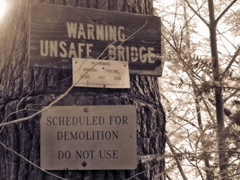 The day was warm but the rain soon tapered off although the trail, of course, remained wet and muddy in places. Everything was slick and slippery so we had to be careful as we hiked. We walked slightly uphill for .4 miles to the point where the map showed another trail coming in from the left. When we arrived at this point, I could not see the trail anymore as it was completely overgrown. The main trail on remains open because many fishermen use it to access the river. As far as I can tell there is no trail maintenance. We continued to walk along the wide marked trail and I noticed that whenever I stopped I was surrounded by insects. The White Sierra shirt was doing its job and I elected not to stop to put on insect repellant. At .55 miles the trail began to descend and this descent would continue for some time. At 1.1 miles we ran into an area where the trail became very wet for about a quarter of a mile. There had been several blowdowns along the way but there was a large one almost blocking the trail at about 1.25 miles. We continued downhill but at 1.4 miles the trail split with a single marker on a trail at the V. I knew from my previous hike to bear left and head downhill. We soon found the next red marker. The trail began to get very rocky but was still easy to follow. At 1.7 miles we came to an open area and the blazes made a 90 degree left turn off the road and down a small drainage. We followed the markers until they indicated a right turn which was backed up by a stone cairn. The trail continued to head south following a woods road.Along the way we ran into a huge blowdown that all but hocked the trail. I decided to take the long way around but Cindy was able to crawl over it. We both ended up back on the trail in the same place at about the same time. At 2.1 miles the trail ended on a jeep road that went both left and right. The road to the left was marked with blue markers as I remembered from the last time I had hiked here. We turned left to head down to the river. I remembered that some maps showed that this trail crossed the river. At one time there was a bridge across the river at this point but it had long since been demolished. Just after the turn we ran into another big blowdown blocking the trail and the trail in this area was very wet and muddy. The trail continued downhill until at 2.3 miles we came to Little Eden Brook. The brook was deep in places and running fast but it wasn't very wide. Cindy and I used a couple of stones to get across but Sheila decided she needed to take a dip. The trail leveled off a little and came to an open clearing. I remembered that the trail turned right here to get down to the river and there was once a sign. This time there was no sign but it was clear when the trail turned. At 2.6 miles we turned to the right toward the river. A wide jeep road continued straight ahead and also turned up the hill to the left. We walked along the road downhill and toward the river. The trail began to parallel the river and we walked along until I decided that at 2.75 miles I would cut down to the edge of the river.
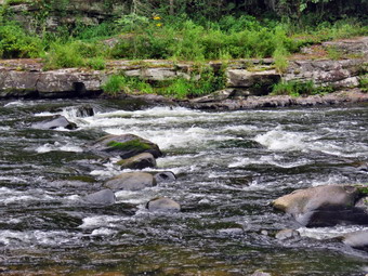 Cindy decided to stay on the trail but Sheila and I walked down the bank to the water. This time there were no anglers in the river. I dropped my pack and got out the camera to take some shots even though the skies were gray and the lighting a liable too bright. After a few pictures, we headed back up to the trail. We walked back the way we had come and I began looking for the signs that said "Unsafe Bridge" and "Scheduled for Demolition". The signs were well hidden but I found them and took some shots. I seemed to remember that one of the floods had damaged the bridge and that it had been removed. Apparently the state did not feel it was necessary to remove the sign! Sheila and I worked our way down a trail to the river's edge once again. I put down my pack and got out my camera to take a few more pictures. As I was finishing my photography, I noticed that it had begun to rain. This was not just a few sprinkles but a steady rain! We walked back up to the pointed where we had turned down to the river and where Cindy was waiting. We decided we might as well head back since we would get wet either way. We walked back up to the clearing and turned left to walked back to the red trail. We crossed Little Eden Brook again and turned right on the red trail. It was still raining although lightly and I knew it would be a long uphill trek back to the parking area. We continued to follow the trail and the markers which were much clearer on the way back than the way out. We continued to hike in silence uphill on the trail passing through the wet and muddy areas. I though we were keeping a pretty good pace uphill although the grade was not steep. As we hit the highest point on the hike and began to descend to the parking area, the rain stopped and the sun came out although I was thoroughly soaked. At 12:45 PM we were back at the parking area having hiked 5.6 miles in 2 hours and 35 minutes. The elevation gain was 815 feet. The temperature at the car was 72 degrees. It had taken us about an hour and 20 minutes to hike out and an hour and 15 minutes to hike back!
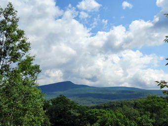
![]()
![]()
![]()
![]()
![]() On Thursday, August 8th, I was ready to get out and hike with my grandson Bryce and son-in-law Brad. I had thought we might go to the Blackhead Range and hike Blackhead and Black Dome. I did not know when Bryce might arrive in the morning but I got a text that said he would be at our house early. My mistake was asking how early he would arrive. I woke up at about 8:00 AM and walked downstairs to find out that Bryce had arrived an hour earlier. I was disappointed that no one had gotten me up earlier as I was anxious to get started since the Blackhead range is almost a 2 hour drive. I began to get my gear together closely watched by Sheila who knew that we always go hiking when Bryce is visiting. I got dressed in a new White Sierra long-sleeved crew top that Cindy had gotten me for my birthday with a short-sleeved baselayer. The White Sierra top has InsectSheild and is quite light. I put on a pair of RailRiders hiking pants which are expensive but last along time and have features like deep pockets and a generous cut which I really like. The pants have Velcro closures at the ankles which I hoped would mean I did not need gaiters. The ticks have been very numerous so far this season especially farther south. I decided to wear my Vasque Taku hiking boots which fit well and have been discontinued. I put my OR Bugout gaiters as I did not know the nature of the trails we would be hiking. I grabbed a pair of Leki external lock poles I have been using lately and made sure I had two water bottles as I thought we might be hiking almost 7 miles over challenging terrain. I also added a new OR floppy hat which was another present from Cindy. I have decided it shields me from the sun and allows me to spray some insect repellant on it rather than on me. Just before 9:30 AM, we put our gear in the car to get on the road to hike. As we left the house, the temperature was in the mid 60's and the humidity seemed low. The sky has bright and blue with some clouds. I headed out the DeBruce Road and at the end I turned left onto Route 47. We were soon passing by the Frost Valley YMCA. I continued on Rt 47 passing the trailheads at Biscuit Brook, Slide Mountain and Giant Ledge/Panther. There were a few cars at each spot but they didn't look very crowded. At Route 28 I turned right and drove a few miles before turning left and heading north on Route 42 toward Lexington. The road had been paved most of the way and the ride was fast and smooth. I looked at the time and decided that the Blackheads would again have to wait as I wanted to get hiking sooner than later. I decided we would go to Sugarloaf since Bryce had not yet hiked this 3500 foot peak. I drove all the way to Lexington where I turned right on Route 23A heading toward Hunter and then Tannersville. After passing through Hunter, I continued passed the junction with Route 214 and turned right on Bloomer Road. At the end of Bloomer Road, I turned right on Platte Clove Road. Where the road forked I stayed right on Elka Park Road and continued straight ahead at the next split. The road turned to dirt and we were soon at the Roaring Kill parking area where we would begin our loop hike. My plan was to hike a loop in a clockwise direction over the summit and back to the parking area.
On Thursday, August 8th, I was ready to get out and hike with my grandson Bryce and son-in-law Brad. I had thought we might go to the Blackhead Range and hike Blackhead and Black Dome. I did not know when Bryce might arrive in the morning but I got a text that said he would be at our house early. My mistake was asking how early he would arrive. I woke up at about 8:00 AM and walked downstairs to find out that Bryce had arrived an hour earlier. I was disappointed that no one had gotten me up earlier as I was anxious to get started since the Blackhead range is almost a 2 hour drive. I began to get my gear together closely watched by Sheila who knew that we always go hiking when Bryce is visiting. I got dressed in a new White Sierra long-sleeved crew top that Cindy had gotten me for my birthday with a short-sleeved baselayer. The White Sierra top has InsectSheild and is quite light. I put on a pair of RailRiders hiking pants which are expensive but last along time and have features like deep pockets and a generous cut which I really like. The pants have Velcro closures at the ankles which I hoped would mean I did not need gaiters. The ticks have been very numerous so far this season especially farther south. I decided to wear my Vasque Taku hiking boots which fit well and have been discontinued. I put my OR Bugout gaiters as I did not know the nature of the trails we would be hiking. I grabbed a pair of Leki external lock poles I have been using lately and made sure I had two water bottles as I thought we might be hiking almost 7 miles over challenging terrain. I also added a new OR floppy hat which was another present from Cindy. I have decided it shields me from the sun and allows me to spray some insect repellant on it rather than on me. Just before 9:30 AM, we put our gear in the car to get on the road to hike. As we left the house, the temperature was in the mid 60's and the humidity seemed low. The sky has bright and blue with some clouds. I headed out the DeBruce Road and at the end I turned left onto Route 47. We were soon passing by the Frost Valley YMCA. I continued on Rt 47 passing the trailheads at Biscuit Brook, Slide Mountain and Giant Ledge/Panther. There were a few cars at each spot but they didn't look very crowded. At Route 28 I turned right and drove a few miles before turning left and heading north on Route 42 toward Lexington. The road had been paved most of the way and the ride was fast and smooth. I looked at the time and decided that the Blackheads would again have to wait as I wanted to get hiking sooner than later. I decided we would go to Sugarloaf since Bryce had not yet hiked this 3500 foot peak. I drove all the way to Lexington where I turned right on Route 23A heading toward Hunter and then Tannersville. After passing through Hunter, I continued passed the junction with Route 214 and turned right on Bloomer Road. At the end of Bloomer Road, I turned right on Platte Clove Road. Where the road forked I stayed right on Elka Park Road and continued straight ahead at the next split. The road turned to dirt and we were soon at the Roaring Kill parking area where we would begin our loop hike. My plan was to hike a loop in a clockwise direction over the summit and back to the parking area.
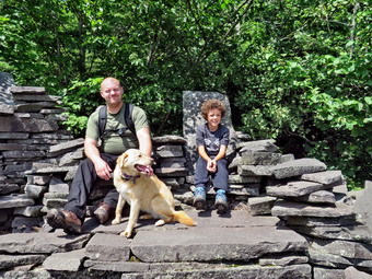 Just as we were about to start our hike another car pulled in and I could see they had a dog. I put Sheila on her leash as the couple in the car asked if we were coming or going. I told them we were starting our hike and they asked me if they should put their dog on a leash. I told them Sheila sometimes reacts poorly to other dogs. I set my GPS and we started out on the trail at 11:00 AM. The temperature was 72 degrees and the humidity seemed comfortable. As we hiked the .25 miles to the first trail junction, the skies were blue and there was plenty of sun. We tried to keep up a fast pace to stay ahead of the other hikers but the trails were very muddy and everything was slippery. At the trail junction we stayed left on the Pecoy Notch Trail hoping the other hikers would choose to go right. We kept up a good pace but soon we could hear the other hikers coming up behind us. I grabbed Sheila and walked off the trail as they passed us. We continued uphill through a patch of nettles. As the trail flattened we cam to the beginning of the bluestone quarries present in this area. We stopped and I got out my camera to take some pictures of the discarded stones and some which had been made into chairs by passing hikers. I took a few shots of Bryce and Sheila before I packed up and we continued on our way. We walked along the level but muddy trail and then came to an area where the trail descended to another part of the quarry. This area is called Dibble's Quarry and has a number of chairs and tables constructed from the stone that was left behind after the quarrying was over. I dropped my pack to tale some pictures while Bryce explored the structures. There was a nice view down Platte Clove and good views of Kaaterskill High Peak and Round Top. I took a few shots and noticed the sky was still blue with some white clouds and plenty of sunshine. I took pictures of the stone constructions and some of Bryce, Brad and Sheila sitting n the chairs. I had told Bryce to be careful where he walked and sat and I kept Sheila close to me. I had never seen any rattlesnakes in this area and had not heard of any reports but I still think caution is a good idea. I packed up and left the quarry to continue our hike. We walked through another area where there had been extensive quarrying and them crossed a small stream. At one time there was a bridge in this area but it is long gone. We were able to cross the stream easily as there was very little water. I though that crossing when the water is higher could be a problem. I did stop to take a few pictures upstream as the moss was very green and the small amount of water made it very attractive.
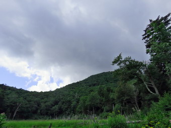 The trail continued to gain elevation but at about 1.5 miles we came to an area that, at one time, was a beaver pond. I remember the large dam and the large volume of water impounded. The dam Is now gone and the pond is slowly turning into a beaver meadow. At this point, we could hear the other hikers ahead of us. Soon they came toward us apparently done with their hike! I stopped to take some pictures. From one angle Twin Mountain is clearly visible. We walked a little farther and I took some shots of the pond from where the dam used to be with Sugarloaf now as the backdrop. At this point, Brad and I both noticed that the skies over Sugarloaf were very dark and that the wind had picked up. We discussed turning around but decided to continue. Shortly after the beaver meadow the trail turns right and begins to climb to Peco Notch at 1.9 miles. At this point the trail ends at the Devil's Path where you can turn left or right. Left would take us to Twin Mountain which Bryce had already climbed so we knew we would be turning right to go to Sugarloaf. We stopped to get a drink and a snack before attacking the climb up Sugarloaf which is very steep and difficult. As we started the ascent, we noticed that all the rocks and roots were very slippery and that other sections of the trail were muddy. This slowed us down considerably as we had to plan each step so that we would not slip. In many places we had to hold onto roots to pull ourselves up the steep slope. There are no vertical places but some that come very close. At 2.25 miles there is a path that leads out to an open rock ledge that has great views of Twin Mountain. We had to be careful since the path has a spot where you must drop off a rock. I was not too worried about the return trip as I had others that could help me. The view from the ledge was great and I took a lot of pictures of Twin including the impressive slide on it west slope. We returned to the main trail making it up and over the dropoff with only a little trouble. A viewpoint a little farther along was almost completely blocked with trees. We had noticed the skies were getting darker as we climbed and the wind was picking up. I began to pray that we would not get caught in a thunderstorm. I have been out a few times in torrential downpours with lightning striking around me and was not anxious to repeat that experience.
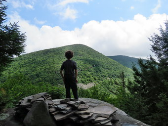 We continued our climb as I heard a peal of thunder. From Pecoy Notch to where the trail begins to level somewhat is .5 miles. In that distance the trail gains almost 800 feet at an average 25% grade. Even when the trail levels somewhat, it continues to ascend to the summit for another .5 miles gaining 270 feet. There were several spots where the trail would level and then ascend again. Each time I hoped it was the last until we finally passed over the summit. There area, of course, no markings at the summit but at some point we started a clear descent. We passed the spur trail to the lookout on the left. I wanted to stop but knew the views would not be good because of the weather. In addition, I wanted to keep walking as I felt rain was inevitable! The descent began moderately and then became serious. The western side of Sugarloaf is steeper than the eastern side which I steep. Everything was still slippery so we had to take greater acre than usual and plan our routes carefully. As we descended, the sun began to come out and I was happy the treat of rain had passed. At some point we could also see that we were actually in a cloud that was beginning to mice off the mountain. Our adventures continued as we descended 1150 feet in .85 miles to the Mink Hollow Trail averaging a 25% grade. Along the way I took my only nasty fall of the day but recovered quickly. The sign at the junction said 2.7 miles to the parking area which was a little longer than I remembered. As we turned onto the trail, the skies again became dark and a wind came up making me think that the threat of rain was again real. We followed the trail as it rolled up and won through patches of nettles. At one point we lost the trail blazes and had to bushwhack a little to the right to find it again. We never did find out how this was possible. Although the trail was flatter the rocks were still slippery and we continued to gain and lose elevation for the next 1.85 miles. I did stop at one small lookout that I had been to before. I took some quick shots of Plateau before continuing on the trail. At 5.7 miles into the hike we finally came to the point where the trail was all downhill. There were still plenty of muddy areas and lots of roots but the hiking was easier. We were all ready for the hike to be over but I was very glad it had not rained. At 6.6 miles we came to the turn for the Roaring Kill Trail that led us back out to the parking area. It was 4:45 Pm and we had covered 6.9 miles in 5 hours and 40 minutes with an elevation gain of 2570 feet. This was very slow but understandable given the conditions. On our way home it began to rain and the wind began to blow.
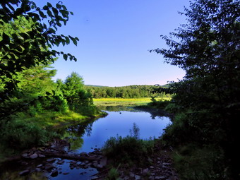
![]()
![]()
![]()
![]()
![]() On Monday, August 5th I planned to start hiking early with Bryce so that we could complete both Blackhead and Black Dome and maybe even Thomas Cole. On Sunday night I got a text saying Bryce had a dentist's appointment at 12:30 PM and I knew I would have to change my plan. Bryce would be at the house by 7:00 AM so I knew we could still get an early start but would have to hike locally. I decided we would simply go to Frick Pond and hike the big loop to both Frick and Hodge Ponds. Bryce arrived just before 7:00 AM and was ready to go so I began to get ready. The temperature was only 53 degrees and there was some fog in the valley. I began to get my gear together closely watched by Sheila who knew that we always go hiking when Bryce is visiting. I got dressed in a new White Sierra long-sleeved crew top that Cindy had gotten me for my birthday with a short-sleeved baselayer. The White Sierra top has InsectSheild and is quite light. I put on a pair of RailRiders hiking pants which are expensive but last along time and have features like deep pockets and a generous cut which I really like. The pants have Velcro closures at the ankles which I hoped would mean I did not need gaiters. The ticks have been very numerous so far this season especially farther south. I decided to wear my Vasque Taku hiking boots which fit well and have been discontinued. I put my OR Bugout gaiters to combat the ticks and any mud we would find. I grabbed a pair of Leki external lock poles I have been using lately and made sure I had two water bottles even though we would be out less than 3 hours. I also added a new OR floppy hat which was another present from Cindy. I have decided it shields me from the sun and allows me to spray some insect repellant on it rather than on me. Just before 7:30 AM, I put my gear in the car and Sheila and Bryce in the back seat. Since DeBruce Road was being paved, I drove out Old Route 17 to State Route 17 East toward Parksville. I got off at exit 98 and continued straight ahead at the intersection to Lily Pond Road. I turned left on Lily Pond Road and followed it for 5 miles to Willowemoc Road. Here I turned left onto Willowemoc Road and then almost immediately right onto Mongaup Pond Road. At the split in the road, I stayed to the left on Beech Mountain Road. When we arrived at the parking area, there were no cars in either lot. I got ready to get on the trail by setting my GPS.
On Monday, August 5th I planned to start hiking early with Bryce so that we could complete both Blackhead and Black Dome and maybe even Thomas Cole. On Sunday night I got a text saying Bryce had a dentist's appointment at 12:30 PM and I knew I would have to change my plan. Bryce would be at the house by 7:00 AM so I knew we could still get an early start but would have to hike locally. I decided we would simply go to Frick Pond and hike the big loop to both Frick and Hodge Ponds. Bryce arrived just before 7:00 AM and was ready to go so I began to get ready. The temperature was only 53 degrees and there was some fog in the valley. I began to get my gear together closely watched by Sheila who knew that we always go hiking when Bryce is visiting. I got dressed in a new White Sierra long-sleeved crew top that Cindy had gotten me for my birthday with a short-sleeved baselayer. The White Sierra top has InsectSheild and is quite light. I put on a pair of RailRiders hiking pants which are expensive but last along time and have features like deep pockets and a generous cut which I really like. The pants have Velcro closures at the ankles which I hoped would mean I did not need gaiters. The ticks have been very numerous so far this season especially farther south. I decided to wear my Vasque Taku hiking boots which fit well and have been discontinued. I put my OR Bugout gaiters to combat the ticks and any mud we would find. I grabbed a pair of Leki external lock poles I have been using lately and made sure I had two water bottles even though we would be out less than 3 hours. I also added a new OR floppy hat which was another present from Cindy. I have decided it shields me from the sun and allows me to spray some insect repellant on it rather than on me. Just before 7:30 AM, I put my gear in the car and Sheila and Bryce in the back seat. Since DeBruce Road was being paved, I drove out Old Route 17 to State Route 17 East toward Parksville. I got off at exit 98 and continued straight ahead at the intersection to Lily Pond Road. I turned left on Lily Pond Road and followed it for 5 miles to Willowemoc Road. Here I turned left onto Willowemoc Road and then almost immediately right onto Mongaup Pond Road. At the split in the road, I stayed to the left on Beech Mountain Road. When we arrived at the parking area, there were no cars in either lot. I got ready to get on the trail by setting my GPS.
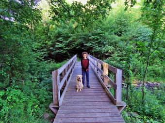 I was cool and Bryce actually seemed cold as we headed out at 7:55 AM on the woods road that connects to the Quick Lake Trail at the register. The woods road after the register box was damp in places but much drier than it had been earlier in the season. As we approached Gravestone Junction, I looked to the left at the memorial marker and found that someone had toppled the upper part of the marker off the base. I was stunned as this had not happened in the 15 years I had been hiking in the area. It is sad to me that as more people get out an hike the incidents of vandalism increase. Bryce and I tried to lift the marker but it was too heavy for us. At Gravestone Junction we stayed to the left on the red Quick Lake Trail crossing the stepping stones the Willowemoc Trail Crew had installed. We walked down to the pond and I removed my pack to get out the camera. The scene was much the same as always but I stopped to take a few pictures anyway. I took pictures of the Pond and Flynn's Point and some of Bryce and Sheila on the bridge. I picked up my pack and we crossed the bridge with Sheila madly dashing back and forth on the trail. We walked on the trail along the west side of the pond. The trail continued to be dry with only a few damp places. At the trail junction with the Big Rock Trail, we headed left to stay on the Quick Lake Trail. We were keeping a pretty fast pace as we headed for Iron Wheel Junction. Sheila was running around following game trails and chasing a few chipmunks and squirrels. We removed a few branches from the trail as we walked along. We passed through "spruce tunnel" to the small stream through the forest. The water was very low so we simply used a stepping stone to walk across. When we arrived at Iron Wheel Junction, we turned left to head toward Hodge Pond staying on the Quick Lake Trail.
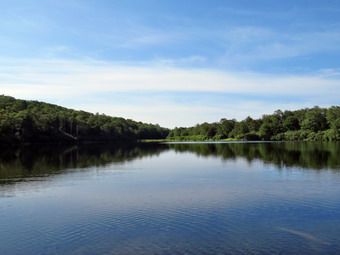 We kept a quick pace up the hilly part of the trail. The trail was washed out in several places and we continued to remove small obstacles. The trail was dry and the vegetation was drier than I though it might be. At one point we stopped and we both put on some insect repellant as the mosquitoes were becoming an annoyance. We continued on the trail until it leveled off and descended slightly to Junkyard Junction at 3.1 miles. We turned right at this intersection and headed across the Flynn Trail toward Hodge Pond. The Flynn Trail was mostly dry and the places that are usually under water were only damp. This allowed us to continue our fast pace. The trip across this part of the Flynn Trail went quickly. Soon we were at the gate where the trail turns right and heads down toward Hodge Pond. We reached the area near the shore of the pond and turned left to follow the jeep trail around the back of the pond. The sky was still blue but the clouds were diffuse and in undefined layers. I decided to stop for a few moments at the head of the pond to take some pictures and give Sheila a chance to swim. The pond was very placid and there were almost no sounds. Sheila went for a swim and I took a few pictures of her and the pond. On the east side of the pond we turned left up the hill toward the ruins of the Beech Mountain Boy Scout Camp. The climb up this trail is steeper than the trail from the outlet of Hodge Pond but it is also shorter! When we got to the top of the hill, we turned right to head back toward the Flynn Trail. Once we were back at the Flynn Trail, we turned left to head to the junction with the Big Rock Trail. We set a fast pace to the junction with the Big Rock Trail. We continued straight through the junction staying on the Flynn Trail. We had about 1.7 miles to go to get back to the car. This stretch can often seem long and boring but on this day Bryce and I were talking which made the trip seem shorter. Everything was very green but not interesting enough to take pictures. As we neared the gate, we came to the huge spruce tree that lies across the trail. Cindy and I had cut an opening through it to allow hikers to pass. This was still in good shape and allowed us to pass easily. We followed the Flynn Trail to the gate and then turned left to continue on the trail to avoid the private property around the cabin. We followed the trail through the woods and back to the car. There were still no other cars in the parking lots. We arrived at 10:30 AM after hiking 6.4 miles in 2 hours and 30 minutes with 890 feet of elevation gain. We stopped for only 15 minutes and our moving average speed was 2.7 mph.
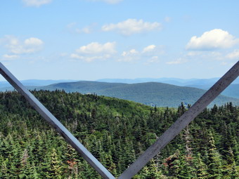
![]()
![]()
![]()
![]()
![]() On Friday, August 2nd, I was ready to get out and hike with my grandson Bryce. I had thought we might try some of the offtrail peaks on the DEP property around Walton. I changed my mind when I remembered that it was the 100th anniversary of the Balsam Lake Fire Tower. Laurie and Tom Rankin, who volunteer at the fire tower, would be presenting information at Morgan Outdoors from 4 - 7 PM Laurie's father was an observer in the BLM tower for many years. I though Bryce and I should hike to the tower and perhaps throw in Grham afterwards! Bryce had already done Balsam Lake but had not check Graham off his list. I did not know when Bryce might arrive in the morning but I got a text that said he would be at our house early. Bryce did arrive by 8:15 AM but had to eat breakfast first. I began to get my gear together closely watched by Sheila who knew that we always go hiking when Bryce is visiting. I got dressed in a new White Sierra long-sleeved crew top that Cindy had gotten me for my birthday with a short-sleeved baselayer. The White Sierra top has InsectSheild and is quite light. I put on a pair of RailRiders hiking pants which are expensive but last along time and have features like deep pockets and a generous cut which I really like. The pants have Velcro closures at the ankles which I hoped would mean I did not need gaiters. The ticks have been very numerous so far this season especially farther south. I decided to wear my Vasque Taku hiking boots which fit well and have been discontinued. I put my OR Bugout gaiters as I did not know the nature of the trails we would be hiking. I grabbed a pair of Leki external lock poles I have been using lately and made sure I had two water bottles as I thought we might do the two peaks and water is scarce. I also added a new OR floppy hat which was another present from Cindy. I have decided it shields me from the sun and allows me to spray some insect repellant on it rather than on me. Just before 9:30 AM, I put my gear in the car and Sheila and Bryce in the back seat. As we left the house, the temperature was in the low 70's and the humidity seemed low. The sky has bright and blue with some clouds. I headed north on Old Route 17 and turned right on the Beaverkill Road. I drove up the Beaverkill Road all the way to the very end. The further I drove the better the skies looked with some sun and expanses of blue with white clouds. We arrived in the parking area at about 10:10 AM to find two other cars present. As I was setting my GPS, a man appeared from the BLM trail, got in to one of the cars and drove away. We began our hike at about 10:15 AM by walking out the trail toward Balsam Lake Mountain. There were a few wet and muddy spots on the trail but the rest was absolutely dry. As we passed the trail register, we noticed that the door was unattached and stuffed in the register. The walk to the first trail junction seemed to go quickly as Bryce and I talked to each other. As soon as we made the turn, I realized that I had been hiking longer distances but on mostly flat trails. Bryce and Sheila were easily scampering up the slope while I followed. I was pleased that the climb did seem easier than I expected and went by quickly. In half a mile the trail gains 750 feet averaging a 28% grade. The trail faltered a little bit as we came to the spur trail that leads out to the lean-to and, just beyond, we passed the 3500 foot sign. The spring was just beyond and was flowing freely. We stopped for a moment so that Sheila could get a drink. The steps to the top were a little overgrown and they were slippery because they were wet. We came to the top of the steps where the trail flattens but continues to gain some elevation. We kept up a good pace and were soon passing by the trail junction to Alder Lake. The distance to Alder Lake is another 6.6 miles and I wanted to do that hike again at some point but it is best done with a car spot. We continued on the trail toward the tower and arrived in the clearing at 11:30 AM after hiking 1.7 miles and gaining almost 1200 feet from the trailhead.
On Friday, August 2nd, I was ready to get out and hike with my grandson Bryce. I had thought we might try some of the offtrail peaks on the DEP property around Walton. I changed my mind when I remembered that it was the 100th anniversary of the Balsam Lake Fire Tower. Laurie and Tom Rankin, who volunteer at the fire tower, would be presenting information at Morgan Outdoors from 4 - 7 PM Laurie's father was an observer in the BLM tower for many years. I though Bryce and I should hike to the tower and perhaps throw in Grham afterwards! Bryce had already done Balsam Lake but had not check Graham off his list. I did not know when Bryce might arrive in the morning but I got a text that said he would be at our house early. Bryce did arrive by 8:15 AM but had to eat breakfast first. I began to get my gear together closely watched by Sheila who knew that we always go hiking when Bryce is visiting. I got dressed in a new White Sierra long-sleeved crew top that Cindy had gotten me for my birthday with a short-sleeved baselayer. The White Sierra top has InsectSheild and is quite light. I put on a pair of RailRiders hiking pants which are expensive but last along time and have features like deep pockets and a generous cut which I really like. The pants have Velcro closures at the ankles which I hoped would mean I did not need gaiters. The ticks have been very numerous so far this season especially farther south. I decided to wear my Vasque Taku hiking boots which fit well and have been discontinued. I put my OR Bugout gaiters as I did not know the nature of the trails we would be hiking. I grabbed a pair of Leki external lock poles I have been using lately and made sure I had two water bottles as I thought we might do the two peaks and water is scarce. I also added a new OR floppy hat which was another present from Cindy. I have decided it shields me from the sun and allows me to spray some insect repellant on it rather than on me. Just before 9:30 AM, I put my gear in the car and Sheila and Bryce in the back seat. As we left the house, the temperature was in the low 70's and the humidity seemed low. The sky has bright and blue with some clouds. I headed north on Old Route 17 and turned right on the Beaverkill Road. I drove up the Beaverkill Road all the way to the very end. The further I drove the better the skies looked with some sun and expanses of blue with white clouds. We arrived in the parking area at about 10:10 AM to find two other cars present. As I was setting my GPS, a man appeared from the BLM trail, got in to one of the cars and drove away. We began our hike at about 10:15 AM by walking out the trail toward Balsam Lake Mountain. There were a few wet and muddy spots on the trail but the rest was absolutely dry. As we passed the trail register, we noticed that the door was unattached and stuffed in the register. The walk to the first trail junction seemed to go quickly as Bryce and I talked to each other. As soon as we made the turn, I realized that I had been hiking longer distances but on mostly flat trails. Bryce and Sheila were easily scampering up the slope while I followed. I was pleased that the climb did seem easier than I expected and went by quickly. In half a mile the trail gains 750 feet averaging a 28% grade. The trail faltered a little bit as we came to the spur trail that leads out to the lean-to and, just beyond, we passed the 3500 foot sign. The spring was just beyond and was flowing freely. We stopped for a moment so that Sheila could get a drink. The steps to the top were a little overgrown and they were slippery because they were wet. We came to the top of the steps where the trail flattens but continues to gain some elevation. We kept up a good pace and were soon passing by the trail junction to Alder Lake. The distance to Alder Lake is another 6.6 miles and I wanted to do that hike again at some point but it is best done with a car spot. We continued on the trail toward the tower and arrived in the clearing at 11:30 AM after hiking 1.7 miles and gaining almost 1200 feet from the trailhead.
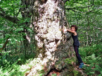 We walked over to the picnic table where I dropped my pack and got out the camera to take some pictures of the tower. There were two new signs on the tower celebrating the anniversary and giving some information about the tower. I leashed Sheila to the table since there were no other hikers present. Bryce and I walked over to the tower and climbed to the top to the landing just below the cab. Al though the sun was bright, a slight breeze made the temperature seem almost cool. I took lots of pictures in all directions as the conditions were the best I had experienced in some time. Sheila was not happy about being left behind but she was now relaxing under the table. We descended the tower and I released Sheila so I could take some pictures of Bryce and Sheila on the picnic table and the rocks next to the tower. We got a drink and a snack before packing up to continue the hike. We started down the Millbrook side of the mountain and I felt so good I began to think that hiking Graham was a real possibility. Bryce and I continued our talks which always makes the hike go faster. The hike down was tricky as there was loose dirt and slippery rocks. Having my poles saved me more than once but Bryce seemed to be able to negotiate the trail without a problem. We were soon at the bottom of the climb at the trail junction. I asked Bryce if he wanted to do another mountain and he said "Yes!" We turned left and made the commitment to climb Graham. On the way to the herd path, we met a couple coming toward us. We exchanged greetings and they told us they had not hiked Graham but were headed to the fire tower. I had not been up Graham in some time but was anxious to see what the countryside looked like from some of the lookouts. The herd path is now very easy to spot and is even more open than the last time I was there. Once we started on the path, we lost a little over 150 feet in elevation as we descended the trail to Graham. There were a few wet areas and some blowdowns that lay across the path. All of these were easily avoided and did not delay us. Walking downhill to then ascend a mountain is not my favorite thing but hiking with Bryce made it much easier.
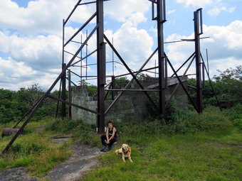 At 3.75 miles into the hike we began the climb up the mountain. From the beginning of the climb it is about .8 miles to the summit of Graham with a gain of 650 feet. There are some steeper portions but the average grade is 15%. Along the way we passed several areas where it looked like there might be some viewpoints but I knew the effort would be futile. At one point, we looked up to see a couple coming down the trail toward us. We talked briefly before continuing in opposite directions. As we continued up the trail, I looked to the left and saw an enormous tree I had not seen before. I wanted to take some pictures that showed the size of the trunk. So I had Bryce puts is arms around the trunk. I took some pictures and then had Bryce "measure" the circumference. Bryce had two move at least three times and maybe a little more . My estimate for the circumference was well over 15 feet. We continued up the trail and I looked for the viewpoint on the left side of the trail just below the summit. I found this with no problem but it was almost completely block by vegetation that had grown up. I could not see the telephone pole which at one time supplied the tower with power and communications through lines that ran from pole to pole. We bypassed this area and completed the walk to the top of the mountain. It was 1:35 PM and we had hiked 4.5 miles. The breeze was blowing across the summit and we got a drink and took a short rest. I took a few pictures of the ruins and a few more of the landscape before starting the return trip. The building at the top has started to collapse and I am not sure whether it is doing this on its won or with the "help" of visitors. We left the summit at 1:40 PM and made our way down the mountain and back out to the trail. Walking down the path back to the trail junction went quickly but there were areas where I had to pick my way carefully. The weather was still nice but the sun seemed to be going behind some clouds at times. When we got to the trail, we turned left and were back at the trail junction at 2:50 PM. We continued straight ahead back to the parking area. I looked for some views along the way but the leaves on the trees blocked any I could have found. I explained to Bryce that the trail had once been a road that connected the Beaverkill Valley with the Millbrook-Arena area. The stonework used to support the road is still evident in many places. We were soon passing the trail that ascends the steeper side of Balsam Lake Mountain. We continued on the trail back to the parking area and, I have to admit, this part seemed long. As we passed the trail register, we both noticed that the door had been fixed! We were back at the car by 3:40 PM having hiked 8.5 miles in 5 hours and 30 minutes which included over 45 minutes of stopped time. The vertical gain was 2165 feet.
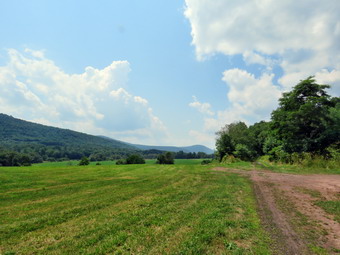
![]()
![]()
![]()
![]()
![]() On Tuesday, July 30th, I finished hiking the Delhi Rail Trail but wanted to hike more than the 3.9 miles we had already put in. There were many options but I decided to go to Bloomville to visit the Catskill Scenic Trail. This rail trail follows the route of the old O&W and other lines for 19 miles from Bloomville to Grand Gorge. I would like to hike the entire trail by using two cars. On this day I planned to simply hike out a distance and then hike back to the car. I left Delhi and drove north on Route 10 for 9 miles to Bloomville. Just after the enter of town, I saw a sign on the right for the trail and just after that a driveway to a parking area on the right. There was one other car in the lot when I pulled in and parked. The owner of that car was walking back toward it as I checked out the very informative sign at the trailhead. She said "Hello" as she opened her car door and I responded in kind. I could see that the trail was in great shape. It was hard packed with some cinder and some short grass here and there. I set my GPS and we started out on the trail at 12:30 PM with temperatures in the high 80's and high humidity. After a short distance, a large, sound foundation appeared on the left of the trail and I had to take some pictures. A little farther along was a stone marker and next to it a metal housing. I took more pictures including some of a nice bench. I quickly packed up and we continued on the trail. We passed a sign for the half marathon run that uses the rail trail from Bloomville to Stamford. I knew this would be a good way to check our mileage and speed. The trail was mostly shaded but at .75 miles it broke out into the open and I could see this would continue for some time. The heat from the sun and the heat coming up from the ground was truly oppressive. I did take some pictures of the farm fields and the hills as I thought it all very bucolic. I packed up and we headed for a bridge over a small stream where some trees gave us a little shade. I took a few pictures of the trail before continuing on. When we came to the marker for mile 1 decided to step up my pace to see how fast I could comfortably walk.
On Tuesday, July 30th, I finished hiking the Delhi Rail Trail but wanted to hike more than the 3.9 miles we had already put in. There were many options but I decided to go to Bloomville to visit the Catskill Scenic Trail. This rail trail follows the route of the old O&W and other lines for 19 miles from Bloomville to Grand Gorge. I would like to hike the entire trail by using two cars. On this day I planned to simply hike out a distance and then hike back to the car. I left Delhi and drove north on Route 10 for 9 miles to Bloomville. Just after the enter of town, I saw a sign on the right for the trail and just after that a driveway to a parking area on the right. There was one other car in the lot when I pulled in and parked. The owner of that car was walking back toward it as I checked out the very informative sign at the trailhead. She said "Hello" as she opened her car door and I responded in kind. I could see that the trail was in great shape. It was hard packed with some cinder and some short grass here and there. I set my GPS and we started out on the trail at 12:30 PM with temperatures in the high 80's and high humidity. After a short distance, a large, sound foundation appeared on the left of the trail and I had to take some pictures. A little farther along was a stone marker and next to it a metal housing. I took more pictures including some of a nice bench. I quickly packed up and we continued on the trail. We passed a sign for the half marathon run that uses the rail trail from Bloomville to Stamford. I knew this would be a good way to check our mileage and speed. The trail was mostly shaded but at .75 miles it broke out into the open and I could see this would continue for some time. The heat from the sun and the heat coming up from the ground was truly oppressive. I did take some pictures of the farm fields and the hills as I thought it all very bucolic. I packed up and we headed for a bridge over a small stream where some trees gave us a little shade. I took a few pictures of the trail before continuing on. When we came to the marker for mile 1 decided to step up my pace to see how fast I could comfortably walk.
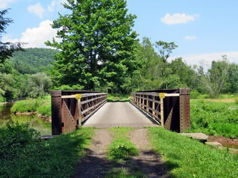 At 1.6 miles the West Branch of the Delaware River came close to the trail but it was muddy and shallow. At 2 miles we crossed the first bridge over the river. The builders had used the original train bridge as a support structure but had built a new treadway and handrails on top of it. When we got to the 2 mile marker, I checked my watch and found we had done it in 18 minutes which I considered very good since it was very hot. I decided to press on a little farther until the time was 1:30 PM. At 2.35 miles we crossed another bridge and another at 2.7 miles. I went a little farther and then decided to turn around. I knew I could still hike some more but I was getting bored. I also knew that Sheila was hot and I did not want to chance getting caught in any thunderstorms. We got a drink and the we turned around to head back. As I looked ahead I could see a man walking toward us. We passed with a brief greeting. I stopped to take some pictures of the bridge and the wetlands. We continued on the trail with as fast a pace as I could muster. Sheila took a minute to swim in one of the small stream which had clean cool and deep water. I stopped once more at the first bridge to take a few shots and then it was back to the car as fast as possible. Within the final mile, I looked up to see another hiker and this one had a dog. He stopped and controlled his dog which was a medium-sized Rottweiler. We passed by and I could not see whether or not he had a leash for his dog. As we finally approached the parking area we met one more younger man decked out with large headphones. He waved but I had to wonder why anyone would go out in nature and not listen to nature's music. When I got in the car, the thermometer read93 degrees. Even after I was on the road for a few minutes, it only dropped to 91 degrees. I Took Route 10 back to Delhi where I stopped to buy a drink. I continued on Route 10 to Telford Hollow Road which had been closed in the morning. The road was now open so I turned left and found a flagman who guided me through some work being done. A pole was being replaced. I assumed that a truck had come down the hill on Telford Hollow and failed to make the turn!
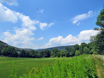
![]()
![]()
![]()
![]()
![]() On Tuesday, July 30th, I planned to complete hiking a series of trails in the Delhi, NY area by hiking the Delhi Rail Trail which starts on Sherwood Road. Rick Roberts had sent me a series of GPX tracks for some short forest trails and some rail trails that he wanted me to list on my websites. I wanted to go hike the trails myself so that I could get a complete GPS track of the hike. I also wanted to experience the trails so that I could give a description of what I found. This rail trail was the last one I had left and it seemed to be about 4 miles in total length. It was 64 degrees and very foggy when I got up early in the morning so I didn't hurry too much. The weather report indicated a beautiful morning with the possibility of heavy thunderstorms in the afternoon or evening. Around 9:00 AM, I got dressed in a new White Sierra long-sleeved crew top that Cindy had gotten me for my birthday with a short-sleeved baselayer. The White Sierra top has InsectSheild and is quite light. I put on a pair of RailRiders hiking pants which are expensive but last along time and have features like deep pockets and a generous cut which I really like. The pants have Velcro closures at the ankles which I hoped would mean I did not need gaiters. The ticks have been very numerous so far this season especially farther south. I decided to wear my Vasque Taku hiking boots which fit well and have been discontinued. I put my OR Bugout gaiters as I did not know the nature of the trails we would be hiking. I grabbed a pair of Leki external lock poles I have been using lately and made sure I had two water bottles as the temperatures were forecast to be in the high 80's. I also added a new OR floppy hat which was another present from Cindy. I have decided it shields me from the sun and allows me to spray some insect repellant on it rather than on me. I put my gear in the car and Sheila in the back seat. Sheila loves to get out an hike anywhere and she had kept her eye on both of us as we were getting ready. As we left the house at 9:25 AM, it was still a little foggy. When I tried to get on State Route 17, I ran into a delay for paving. I almost turned around to take Old Route 17 to Roscoe but then the flagman waved me through. I drove north and west on State Route 17 to exit 94 (Roscoe) and headed north on Route 206 toward Downsville. Along the way I go stuck behind a slow-moving truck hauling a trailer. At the Pepacton Reservoir, I turned left to stay on Route206/30 and drove through Downsville heading toward Walton. Just after the light in Downsville, I tried to turn right on Telford Hollow Road but a worker there informed me that there was an accident on the road. He assured me I could get through so I made the turn. In a little more than a mile, the road was closed and I had to turn around and drive to Walton on Route 206. In Walton I took Route 10 North toward Delhi which took me passed the West Branch Preserve. I continued through Hamden and on to Delhi. Just before the shopping center on the right, I turned right on Sherwood Road. Where the road made a sharp right turn, I continued straight ahead to park in the lot. The temperature was already in the low 80's and it seemed very humid. I set my GPS as we began our hike at 10:35 AM.
On Tuesday, July 30th, I planned to complete hiking a series of trails in the Delhi, NY area by hiking the Delhi Rail Trail which starts on Sherwood Road. Rick Roberts had sent me a series of GPX tracks for some short forest trails and some rail trails that he wanted me to list on my websites. I wanted to go hike the trails myself so that I could get a complete GPS track of the hike. I also wanted to experience the trails so that I could give a description of what I found. This rail trail was the last one I had left and it seemed to be about 4 miles in total length. It was 64 degrees and very foggy when I got up early in the morning so I didn't hurry too much. The weather report indicated a beautiful morning with the possibility of heavy thunderstorms in the afternoon or evening. Around 9:00 AM, I got dressed in a new White Sierra long-sleeved crew top that Cindy had gotten me for my birthday with a short-sleeved baselayer. The White Sierra top has InsectSheild and is quite light. I put on a pair of RailRiders hiking pants which are expensive but last along time and have features like deep pockets and a generous cut which I really like. The pants have Velcro closures at the ankles which I hoped would mean I did not need gaiters. The ticks have been very numerous so far this season especially farther south. I decided to wear my Vasque Taku hiking boots which fit well and have been discontinued. I put my OR Bugout gaiters as I did not know the nature of the trails we would be hiking. I grabbed a pair of Leki external lock poles I have been using lately and made sure I had two water bottles as the temperatures were forecast to be in the high 80's. I also added a new OR floppy hat which was another present from Cindy. I have decided it shields me from the sun and allows me to spray some insect repellant on it rather than on me. I put my gear in the car and Sheila in the back seat. Sheila loves to get out an hike anywhere and she had kept her eye on both of us as we were getting ready. As we left the house at 9:25 AM, it was still a little foggy. When I tried to get on State Route 17, I ran into a delay for paving. I almost turned around to take Old Route 17 to Roscoe but then the flagman waved me through. I drove north and west on State Route 17 to exit 94 (Roscoe) and headed north on Route 206 toward Downsville. Along the way I go stuck behind a slow-moving truck hauling a trailer. At the Pepacton Reservoir, I turned left to stay on Route206/30 and drove through Downsville heading toward Walton. Just after the light in Downsville, I tried to turn right on Telford Hollow Road but a worker there informed me that there was an accident on the road. He assured me I could get through so I made the turn. In a little more than a mile, the road was closed and I had to turn around and drive to Walton on Route 206. In Walton I took Route 10 North toward Delhi which took me passed the West Branch Preserve. I continued through Hamden and on to Delhi. Just before the shopping center on the right, I turned right on Sherwood Road. Where the road made a sharp right turn, I continued straight ahead to park in the lot. The temperature was already in the low 80's and it seemed very humid. I set my GPS as we began our hike at 10:35 AM.
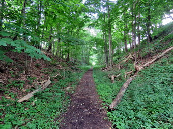 We walked uphill on a path that accesses the actual rail trail after about .25 miles. I decided to turn left and walk the longer section of the trail first. The surface was firm and dry in most places and definitely looked like a rail trail. There were a few sticks or the trail and a few weeds leaning in but otherwise the trail was in great shape. Most of the first part of the trail was shaded by trees and occasionally a breeze would blow. The trail parallels Route 10 so there is always the noise of traffic. The first part of the trail also parallels the West Branch of the Delaware River but at around half a mile the river swings south and away from the trail. We crossed at least two driveways or access roads but the trail on the other side was always easy to find. At one point the trail left the woods and opened up in the bright sun. I could immediately feel the change in temperature but there were some nice views of hill and the blue sky. I decided to take pictures on the way back and we reentered the woods. In most places there was a high bank on the right side of the trail from Route 10 but in other spots there was also a high bank on the left side of the trail. The walk was very flat and at just under 1.5 miles we turned around to head back. We were keeping a good pace and stopped only to take pictures in one spot. At 2.75 miles we were back at the access path to the parking area but we continued on to walk the other section of the trail heading east. This part of the trail was also flat and well-maintained. There wasn't much to see and there were several access roads that crossed the trail. After walking .4 miles from the access path the trail seemed to go to the right so we followed. This ended in a tangle of weeds so we went back down to the trail and forged straight ahead. This was just as bad as none of the high weeds and grass had been cut. The GPX track I had been given suggested the trail continued a few hundred feet more to the access road for a power distribution station but I decided to turn around. We walked back to the access path, turned left and walked back to the car. As we neared the parking lot, three more cars pulled so I put Sheila on her leash. It was just after noon and I thought maybe this was a popular place to eat lunch! We had hiked 3.9 miles in 1 hour and 30 minutes with an elevation gain of 270 feet. Our moving average was 2.9 mph which I expected on the flat trail. I decided that I wanted to hike some more and set my sights on the Catskill Scenic Trail starting in Bloomville which was only 9 miles away.
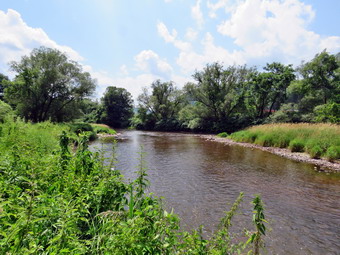
![]()
![]()
![]()
![]()
![]() On Monday, July 29th, I left the Lennox Forest on Arbor hill Road and headed north toward Delhi. I continued passed the golf course and after 2.5 miles parked on the left side of the road near the kiosk for the Smith Pond Trail. I really noticed the hear when I got out of the car and could see clouds starting to gather. I knew that the rounder hike was about 2 miles so I decided we would try it. I got Sheila out of the car and set my GPS before starting off on the trail. The sign said follow the orange disks which I found difficult because there were so few of them. The trail seemed very new in places and was more of a road or ATV track than a hiking trail. There was tall grass on either side in most places and the trail was very close to the road which was above on the bank. Most parts of the trail were dry but there were a few mud holes that were hard to get around. The trail was mostly flat with a few ups and owns along the way. At .5 miles I momentarily lost the orange markers crossing a very muddy area that had not been cut out. I picked up the trail on the other side and just a little after this we crossed an intermittent stream that had a bridge that seemed unnecessary. The trail took us through a rather dry wetland and to the edge of the river. I decided to wait for the return trip to take pictures. Not very much farther along the trail split with what seemed to be the main trail heading right and a marked hiking trail going left. I followed the main trail to a field where the hiking trail ,joined in also. We walked along the edge of the field in the open and I got a taste of the full intensity of the sun!
On Monday, July 29th, I left the Lennox Forest on Arbor hill Road and headed north toward Delhi. I continued passed the golf course and after 2.5 miles parked on the left side of the road near the kiosk for the Smith Pond Trail. I really noticed the hear when I got out of the car and could see clouds starting to gather. I knew that the rounder hike was about 2 miles so I decided we would try it. I got Sheila out of the car and set my GPS before starting off on the trail. The sign said follow the orange disks which I found difficult because there were so few of them. The trail seemed very new in places and was more of a road or ATV track than a hiking trail. There was tall grass on either side in most places and the trail was very close to the road which was above on the bank. Most parts of the trail were dry but there were a few mud holes that were hard to get around. The trail was mostly flat with a few ups and owns along the way. At .5 miles I momentarily lost the orange markers crossing a very muddy area that had not been cut out. I picked up the trail on the other side and just a little after this we crossed an intermittent stream that had a bridge that seemed unnecessary. The trail took us through a rather dry wetland and to the edge of the river. I decided to wait for the return trip to take pictures. Not very much farther along the trail split with what seemed to be the main trail heading right and a marked hiking trail going left. I followed the main trail to a field where the hiking trail ,joined in also. We walked along the edge of the field in the open and I got a taste of the full intensity of the sun!
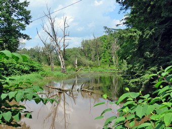 As we reentered the woods we began a short but steep climb which ended at Route 28 after passing a lean-to. I stopped long enough to take a picture of the trailhead sign and the lean-to which seemed to be used mostly as a substrate for graffiti. Nowhere along the trail had I seen a pond! After waling along the edge of the field I stayed to the right and took the hiking trail which lasted for about 100 feet. We stopped at the edge of the river so that I could take a few pictures and then continued back through the wetland to the intermittent stream. This time I walked up unto the bridge and saw a shallow body of water. I had found Smith Pond! I took a few pictures before getting back on the trail. As I approached the wet area where I had lost the markers I could see that the trail headed a little bit downhill toward the river avoiding the wettest parts of the bog. When it rejoined the woods road, I looked for markers and had to admit I had missed them in the way out. At 2 miles there was another place where the trail left the woods road and I tried to follow it. This part of the trail had not been cut out and was choked with grass and weeds. I returned to the woods road and tried to avoid the mud. At 2.1 miles, I could see where the trail marked with orange disks rejoined the woods road. We continued back out the trail to the car. It was 2:15 PM and we had hiked 2.2 miles in 58 minutes with and elevation gain of 260 feet. I thought about trying to finish the last rail trail but the distance was at least 4 miles, I was tired and the clouds were gathering. I decided to drive home and leave the final trail for another day.
![]()
![]()
![]()
![]()
![]() On Monday, July 29th, I left the West Branch Preserve on Route 10 near Hamden and drove north and east toward Hamden. After passing through Hamden, I turned right toward Delancey and then left on Back River Road. After 4 miles, I turned right into the parking area for the John Lennox Memorial Forest. I parked and then check my Avenza app to confirm that I was in the right place. I walked to the gate and found a sign that said "No Trespassing - Camp in Session" but the sign looked old. Another sign suggested calling the Cornell Cooperative Extension for permission to hike. I walked around until I got cell service and called the number only to find out it was disconnected. At that moment Jeff arrived and I told him the situation. We decided to hike as I had been asked to post the trail on my website. I started my GPS and we began the hike by passing through the gate and walking up a hill. Within less than a tenth of a mile the trail split and I decided to go to the right which was consistent with the GPS track a friend had sent me. The trail was a grassy woods road and our feet immediately picked up the dew which had still not disappeared. The trail continued to ascend as we headed south but at .3 miles it turned sharply to head northeast. The ascent continued. At .5 miles we were again faced with a split in the trail. Since nothing was clearly marked, I chose to bear to the right on a woods road. It soon became obvious that this was the wro9ng choice as the grass and weeds were very high indicating no one had been in the area for some time. I checked by GPX track on Avenza and found we were well north of the actual trail but that we should reconnect in a short distance. At .85 miles we turned right to get back on the trail we should have chosen and almost immediately turned right again on the trail that would take us to the lean-to.
On Monday, July 29th, I left the West Branch Preserve on Route 10 near Hamden and drove north and east toward Hamden. After passing through Hamden, I turned right toward Delancey and then left on Back River Road. After 4 miles, I turned right into the parking area for the John Lennox Memorial Forest. I parked and then check my Avenza app to confirm that I was in the right place. I walked to the gate and found a sign that said "No Trespassing - Camp in Session" but the sign looked old. Another sign suggested calling the Cornell Cooperative Extension for permission to hike. I walked around until I got cell service and called the number only to find out it was disconnected. At that moment Jeff arrived and I told him the situation. We decided to hike as I had been asked to post the trail on my website. I started my GPS and we began the hike by passing through the gate and walking up a hill. Within less than a tenth of a mile the trail split and I decided to go to the right which was consistent with the GPS track a friend had sent me. The trail was a grassy woods road and our feet immediately picked up the dew which had still not disappeared. The trail continued to ascend as we headed south but at .3 miles it turned sharply to head northeast. The ascent continued. At .5 miles we were again faced with a split in the trail. Since nothing was clearly marked, I chose to bear to the right on a woods road. It soon became obvious that this was the wro9ng choice as the grass and weeds were very high indicating no one had been in the area for some time. I checked by GPX track on Avenza and found we were well north of the actual trail but that we should reconnect in a short distance. At .85 miles we turned right to get back on the trail we should have chosen and almost immediately turned right again on the trail that would take us to the lean-to.
 I looked ahead and saw that the trail few much steeper without and end in sight. At that moment Jeff voiced the same idea! We continued climbing the trail through beautiful evergreen forest heading north to 1.1 miles where the trail began to curl to the east. In several places there appeared to be viewpoints on the left of the trail but they were all blocked. The trail continued to turn right until we were on the flat summit where we found a privy! We had climbed over 300 feet in .4 miles for an average grade of 14% but several sections approached 20%! As we walked around the top, I saw a trail down to a lookout and then realized there was also a shelter at that location. Since the trail had ended, we walked Dow the trail to the lean-to and lookout. The lean-to was in good shape and had a fire ring on top of a large, flat rock. Unfortunately, the viewpoint was blocked with trees as are so many. Cutting out this viewpoint would be rather easy as the access to the trees is off the trail we had just climbed. I took a few pictures and we started back down the mountain. When we arrived at the place where we turned up the hill at 1.8 miles, we turned right to complete a loop back to the parking area. The trail started out heading north bit almost immediately turned southwest. At 2,1 miles we were back at the trail junction where we had made our first turn at the beginning of the hike. We continued straight ahead through the gate and back to the cars. It was 1:05 PM and we had hiked 2.1 miles in 1 hour and 25 minutes with and elevation gain of 660 feet. The actual mileage staying on the correct trails is 1.9 miles with a 585 foot elevation gain. Jeff and I said parted so that he could head home. I decided there was time for one more hike to Smith Pond before the thunderstorms were predicted.
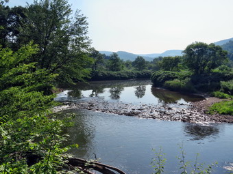
![]()
![]()
![]()
![]()
![]() On Monday, July 29th, I planned to hike a series of trails in the Delhi, NY area. Rick Roberts had sent me a series of GPX tracks for some short forest trails and some rail trails that he wanted me to list on my websites. I wanted to go hike the trails myself so that I could get a complete GPS track of the hike. I also wanted to experience the trails so that I could give a description of what I found. It seemed that the total length of all the hikes was well over 10 miles since some would require hiking out and back along the same trail essentially doubling the distance. I had already hiked one of the trails and though I might get in the other four but I knew that would be challenging. My day began earlier than expected with an ambulance call at 4:40 AM. When I got back, I decided it was too late to get any more sleep and that I might as well get ready to hike. It was cool and very foggy so I didn't hurry too much. The weather report indicated a beautiful morning with the possibility of thunderstorms as early as 2:00 PM. I got dressed in a new White Sierra long-sleeved crew top that Cindy had gotten me for my birthday with a short-sleeved baselayer. The White Sierra top has InsectSheild and is quite light. I put on a pair of RailRiders hiking pants which are expensive but last along time and have features like deep pockets and a generous cut which I really like. The pants have Velcro closures at the ankles which I hoped would mean I did not need gaiters. The ticks have been very numerous so far this season especially farther south. I decided to wear my Vasque Taku hiking boots which fit well and have been discontinued. I put my OR Bugout gaiters as I did not know the nature of the trails we would be hiking. I grabbed a pair of Leki external lock poles I have been using lately and made sure I had two water bottles since I expected to hike at least 7 miles. I also added a new OR floppy hat which was another present from Cindy. I have decided it shields me from the sun and allows me to spray some insect repellant on it rather than on me. I put my gear in the car and Sheila in the back seat. Sheila loves to get out an hike anywhere and she had kept her eye on both of us as we were getting ready. As we left Livingston Manor just before 8:30 AM, it was still a little foggy. I drove north and west on State Route 17 to exit 94 (Roscoe) and headed north on Route 206 toward Downsville. From the top of Brock Mountain I could see that many of the valleys were still filled with fog or clouds. At the Pepacton Reservoir, I turned left to stay on Route206/30 and drove through Downsville heading toward Walton. Just after the light in Downsville, I turned right on Telford Hollow Road. After driving over the hill, I turned right at the bottom of the hill and drove out to Route 10. I turned left and began to look for a parking area on the right. After a mile, I pulled into the small parking area marked "West Branch Preserve - Nature Conservancy". The temperature was in the low 70's but it seemed very humid. The sun had finally broken thorough and the sky was blue with a few white clouds. I put Sheila on her leash and set my GPS as we began our hike at 9:05 AM.
On Monday, July 29th, I planned to hike a series of trails in the Delhi, NY area. Rick Roberts had sent me a series of GPX tracks for some short forest trails and some rail trails that he wanted me to list on my websites. I wanted to go hike the trails myself so that I could get a complete GPS track of the hike. I also wanted to experience the trails so that I could give a description of what I found. It seemed that the total length of all the hikes was well over 10 miles since some would require hiking out and back along the same trail essentially doubling the distance. I had already hiked one of the trails and though I might get in the other four but I knew that would be challenging. My day began earlier than expected with an ambulance call at 4:40 AM. When I got back, I decided it was too late to get any more sleep and that I might as well get ready to hike. It was cool and very foggy so I didn't hurry too much. The weather report indicated a beautiful morning with the possibility of thunderstorms as early as 2:00 PM. I got dressed in a new White Sierra long-sleeved crew top that Cindy had gotten me for my birthday with a short-sleeved baselayer. The White Sierra top has InsectSheild and is quite light. I put on a pair of RailRiders hiking pants which are expensive but last along time and have features like deep pockets and a generous cut which I really like. The pants have Velcro closures at the ankles which I hoped would mean I did not need gaiters. The ticks have been very numerous so far this season especially farther south. I decided to wear my Vasque Taku hiking boots which fit well and have been discontinued. I put my OR Bugout gaiters as I did not know the nature of the trails we would be hiking. I grabbed a pair of Leki external lock poles I have been using lately and made sure I had two water bottles since I expected to hike at least 7 miles. I also added a new OR floppy hat which was another present from Cindy. I have decided it shields me from the sun and allows me to spray some insect repellant on it rather than on me. I put my gear in the car and Sheila in the back seat. Sheila loves to get out an hike anywhere and she had kept her eye on both of us as we were getting ready. As we left Livingston Manor just before 8:30 AM, it was still a little foggy. I drove north and west on State Route 17 to exit 94 (Roscoe) and headed north on Route 206 toward Downsville. From the top of Brock Mountain I could see that many of the valleys were still filled with fog or clouds. At the Pepacton Reservoir, I turned left to stay on Route206/30 and drove through Downsville heading toward Walton. Just after the light in Downsville, I turned right on Telford Hollow Road. After driving over the hill, I turned right at the bottom of the hill and drove out to Route 10. I turned left and began to look for a parking area on the right. After a mile, I pulled into the small parking area marked "West Branch Preserve - Nature Conservancy". The temperature was in the low 70's but it seemed very humid. The sun had finally broken thorough and the sky was blue with a few white clouds. I put Sheila on her leash and set my GPS as we began our hike at 9:05 AM.
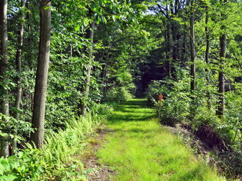 I had produced a geospatial PDF that I could use with the Avenza phone app so I felt we could easily follow the trail but I knew I probably wouldn't need it on the rail trail. We crossed the road and started through a field on the path that led toward the West Branch of the Delaware and the rail trail that parallels it. I was surprised that the path was mowed as short as a lawn which was good as I could see a heavy dew on the grass. At the edge of the field, we entered the forest where the trail had not been cut and my shoes immediately began to soak up the dew. We walked down a bank and were on the rail trail which went it both directions and was absolutely flat. I decided to turn right and walk west to the dead end. The grass and weeds on the trail were wet but it was otherwise in good condition. A few branches lay on the trail and a few more were leaning over it. I did notice that there had been quite a bit of horse traffic as I could see the horseshoe imprints and what horses always leave behind. The walk was very flat and just a little boring but that let us keep good pace. At about .8 miles there was a set of rapids in the river and a lookout that provided a good view. I stopped to take some pictures of the rapids and the hills in the background. After a few minutes, I packed up and we continued on the trail. Along the way some paths and woods roads branched off from both sides. At one of these Sheila started to run down toward the river and I assumed she had spotted some ducks. I called her back and we continued along the trail. At 1.55 miles the trail abruptly ended at a dead end behind the Delaware County Landfill. We turned around and headed back. I had intended to walk down to the river but I could hear ducks and did not want Sheila chasing them or jumping into muddy water. We were back at the place where we had started on the rail trail at 3 miles. We continued straight ahead to walk the more eastern end of the trail.
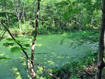 This was also flat with a little less vegetation on the trail. The river was on one side of the trail while the other side had a high bank which gave way to a deep gully. At one point there was a house above us on the bank and a dog started to bark. I thought the dog was tied up but it soon followed us down the trail paying no attention to its owner. I had Sheila on her leash but she showed little interest on the other dog. A little further down the trail, the deep gully was filled with water forming a large frog pond that was a bright green. I took some pictures and then turned to the other side of the trail and took some pictures of the wetland there. We walked to the end of the trail on Route 26 near the junction with Route 10. We turned around and walked quickly back to the trail to the car. We arrived back at the car at 11:10 AM after hiking 5.1 miles in 2 hours and 5 minutes with an elevation gain of 300 feet. The elevation gain is deceptive since I considered the trail completely flat! Our moving average was 2.9 mph which I though was good. I put Sheila in the car and saw that the other car in the lot was from Delaware Opportunities and was full trail maintenance equipment. It was then that I saw a new trail that extended from the left side of the parking area. I walked along this trail as I could hear string trimmers at work. I saw two men cutting the grass in an area surrounded by a split rail fence. I though it might be a picnic area or a horse corral. As I walked up to one of the workers I could see some small headstones and realized it was a small cemetery. The worker shut off his machine and told me that he and his partner maintain about 30 cemeteries in the county most of which are small family cemeteries. I thanked him for his work and returned to the car. Before I left for Lenox Forest, I decided to call my brother-in-law Jeff to see if he wanted to meet me for the hike. I was surprised that I could reach him as cell service is spotty in the county. He agreed to meet me as soon as we both could get there.
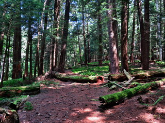
![]()
![]()
![]()
![]()
![]() On Saturday, July 27th, I had planned to hike a series of trails in the Delhi, NY area. Rick Roberts had sent me a series of GPX tracks for some short forest trails and some rail trails that he wanted me to list on my websites. I wanted to go hike the trails myself so that I could get a complete GPS track of the hike. I also wanted to experience the trails so that I could give a description of what I found. It seemed that the total length of all the hikes was well over 10 miles since some would require hiking out and back along the same trail essentially doubling the distance. I thought doing them all in one day would be possible but challenging. When I told Cindy where I was going, she said she wanted to come along. I immediately realized we would probably only be able to do two of the trails but I was happy to have someone hiking with me. In the morning is was cool and the weather report indicated a beautiful day with no rain in sight. I got dressed in a new White Sierra long-sleeved crew top that Cindy had gotten me for my birthday with a short-sleeved baselayer. The White Sierra top has InsectSheild and is quite light. I put on a pair of RailRiders hiking pants which are expensive but last along time and have features like deep pockets and a generous cut which I really like. The pants have Velcro closures at the ankles which I hoped would mean I did not need gaiters. The ticks have been very numerous so far this season especially farther south. I decided to wear my Vasque Taku hiking boots which fit well and have been discontinued. I put my OR Bugout gaiters as I did not know the nature of the trails we would be hiking. I grabbed a pair of Leki external lock poles I have been using lately and made sure I had two water bottles since I expected to hike at least 7 miles. I also added a new OR floppy hat which was another present from Cindy. I have decided it shields me from the sun and allows me to spray some insect repellant on it rather than on me. We put our gear in the car and Sheila in the back seat. Sheila loves to get out an hike anywhere and she had kept her eye on both of us as we were getting ready. As we left Livingston Manor at 10:00 AM, the sun was shining and the skies were bright blue with puffy white clouds. I drove north and west on State Route 17 to exit 94 (Roscoe) and headed north on Route 206 toward Downsville. At the Pepacton Reservoir, I turned left to stay on Route206/30 and drove through Downsville heading toward Walton. Just after the light in Downsville, I turned right on Telford Hollow Road. After driving over the hill, I turned right at the bottom of the hill and drove out to Route 10. I turned left and began to look for a parking area on the right. After a mile, I pulled into the small parking area marked "West Branch Preserve - Nature Conservancy". The temperature was in the high 70's and it seemed very humid. The sky was bright blue with plenty of sun and a few white clouds. I put Sheila on her leash and set my GPS as we began our hike at 10:35 AM.
On Saturday, July 27th, I had planned to hike a series of trails in the Delhi, NY area. Rick Roberts had sent me a series of GPX tracks for some short forest trails and some rail trails that he wanted me to list on my websites. I wanted to go hike the trails myself so that I could get a complete GPS track of the hike. I also wanted to experience the trails so that I could give a description of what I found. It seemed that the total length of all the hikes was well over 10 miles since some would require hiking out and back along the same trail essentially doubling the distance. I thought doing them all in one day would be possible but challenging. When I told Cindy where I was going, she said she wanted to come along. I immediately realized we would probably only be able to do two of the trails but I was happy to have someone hiking with me. In the morning is was cool and the weather report indicated a beautiful day with no rain in sight. I got dressed in a new White Sierra long-sleeved crew top that Cindy had gotten me for my birthday with a short-sleeved baselayer. The White Sierra top has InsectSheild and is quite light. I put on a pair of RailRiders hiking pants which are expensive but last along time and have features like deep pockets and a generous cut which I really like. The pants have Velcro closures at the ankles which I hoped would mean I did not need gaiters. The ticks have been very numerous so far this season especially farther south. I decided to wear my Vasque Taku hiking boots which fit well and have been discontinued. I put my OR Bugout gaiters as I did not know the nature of the trails we would be hiking. I grabbed a pair of Leki external lock poles I have been using lately and made sure I had two water bottles since I expected to hike at least 7 miles. I also added a new OR floppy hat which was another present from Cindy. I have decided it shields me from the sun and allows me to spray some insect repellant on it rather than on me. We put our gear in the car and Sheila in the back seat. Sheila loves to get out an hike anywhere and she had kept her eye on both of us as we were getting ready. As we left Livingston Manor at 10:00 AM, the sun was shining and the skies were bright blue with puffy white clouds. I drove north and west on State Route 17 to exit 94 (Roscoe) and headed north on Route 206 toward Downsville. At the Pepacton Reservoir, I turned left to stay on Route206/30 and drove through Downsville heading toward Walton. Just after the light in Downsville, I turned right on Telford Hollow Road. After driving over the hill, I turned right at the bottom of the hill and drove out to Route 10. I turned left and began to look for a parking area on the right. After a mile, I pulled into the small parking area marked "West Branch Preserve - Nature Conservancy". The temperature was in the high 70's and it seemed very humid. The sky was bright blue with plenty of sun and a few white clouds. I put Sheila on her leash and set my GPS as we began our hike at 10:35 AM.
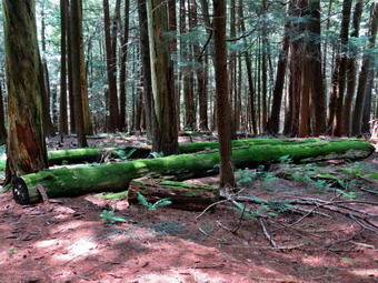 I had produced a geospatial PDF that I could use with the Avenza phone app so I felt we could easily follow the trail. The first part of the trail was a beautiful grass trail which had been closely mowed. When we came to a kiosk with a map, I was slightly confused. My GPX track indicated a total trail length of only 1 mile while the map showed an orange trail two miles long and another, shorter blue trail which was listed as almost one mile long. I decided we would just follow the trails and try to cover them all. We passed the kiosk and in a short distance came to a green trail on the left. This was puzzling sine the trail was not shown on the map. We turned left and followed the trail until it abruptly end after about . Miles. We turned around and retraced our steps to the main trail and turned left. In a short distance, about .3 miles from the trailhead, we turned left on the orange trail. The trail was still in good condition but now looked much more like a forest trail. The trail was listed as a new trail but it had obviously been used for some time as the trail bed was well-worn. We crossed a small stream with a small amount of water and Sheila was able to get a drink. The trail had a few sticks and blowdowns but it was easy to walk around them. It seemed like we were not on the trail that I had on my phone. When I checked the Avenza app, it showed we were not on recorded trail. We decided to keep following the orange trails as long as we could see the trail bed and the orange markers. The trail headed north for .7 miles gaining 670 feet on an 18% grade. I could tell that the grade and the increasing temperature were taking their toll on Cindy. After a total of one mile on the trail, we hit the highest point and the trail turned east. In another .15 miles, the trail turned south and started a long descent. This was easier for both of us but I noticed that there was a cloud of small flies around my head. They weren't biting but they were annoying.
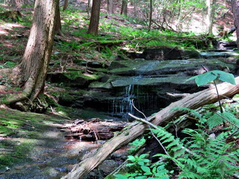 The trail continued to descend at a slightly shallower grade than the ascent. At 1.65 miles I saw the blazes for the blue trail coming in from the right and passed them. My intention was to complete the orange trail and then hike the blue trail. We continued south on the orange trail until at 2 miles we were almost back to the point where we had started on the orange trail. At this point the blue blazes indicated we should turn right and I followed. The trail immediately began an ascent which made Cindy groan but I explained it would be short. We stopped to get a drink and a bar while I took some pictures. The orange trail had moved mostly through hardwood forest while the blue trail we were now on was surrounding by huge evergreens. Some of them had fallen and were covered in brilliant green moss. There was a small, intermittent stream on the left side of the trail. The stream had cut a significant gully but now had only a trickle of water. We continued on Te trail but stopped again so that I could take some pictures of a small waterfall at 2.2 miles. I wondered what this might look like when there was a good volume of water flowing. As we packed up and began to move, two other hikers appeared on the other bank on the stream and I thought they were probably on the orange trail. At 2.25 miles the blue trail turned east, hit a high point and then intersected the orange trail at 2.35 miles. We turned right and retraced our steps down the orange trail. This time we stayed straight at the junctions and walked back out to the car. We had hiked 3.2 miles in 1 hour and 50 minutes with an elevation gain of 990 feet. Eliminating our "mistakes" brought the total length of the hike to exactly 3 miles. It was 83 degrees and humid but I was ready to cross the road and hike a section of the rail trail. Cindy declined the offer. As usual I was disappointed as a three mile hike means I was just getting warmed up! To make the best of the situation, I decided that I would rive to find the trailheads for the three other trails I wanted to explore. I found all of them easily which meant I could go back and hike them another day. I did notice that the temperature dropped to 77 degrees along Back River Road from Delancey to Delhi and then shot back up to 83 degrees!
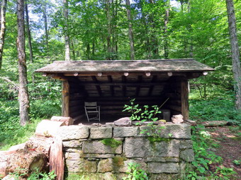
![]()
![]()
![]()
![]()
![]() On Thursday, July 25th, I had planned to hike a long hike somewhere close to home. I decided to park my car on Mary Smith Hill Road where the trail crosses and shuttle to the end of Pelnor Hollow Road. I would then hike the Pelnor Hollow Trail to the junction with the Mary Smith Trail. From there I would hike the Mary Smith Trail over Mary Smith Hill and back to my car. Some people had been asking about the status of the maintenance on these trails and the access at Pelnor Hollow Road. The trailhead at Pelnor Hollow Road is surrounded by private property and the owners do not want cars parked on their land. This is reasonable but at one time they had claimed hikers could not access the trail. Cindy agreed to help me drop my car at Mary Smith Hill Road and then drop Sheila and I at Pelnor Hollow. When I got up in the morning is was cool and the weather report indicated a beautiful day. I got dressed in a long-sleeved crew top with a short-sleeved baselayer. I often wear a long-sleeved top even on warm days as it protects me from the sun and allows me to spray insect repellant on it rather than on me. For this hike I knew there might be some areas of briars and this makes long sleeves almost mandatory. I put on a pair of RailRiders hiking pants which are expensive but last along time and have features like deep pockets and a generous cut which I really like. The pants have Velcro closures at the ankles which help keep out mud, sticks, stones and ticks. The ticks have been very numerous so far this season especially farther south. I decided to wear my Vasque Taku hiking boots which fit well and have been discontinued. I put on my OR Bugout gaiters to backup the closures on the pants as I was not sure if we would be hiking on trail or bushwhacking. I grabbed a pair of Leki external lock poles I have been using lately and put my BaHK Mad Hatter machete in my pack. I made sure I had two water bottles even as the hike is between 7 and 9 miles. I put my gear in Cindy's car and Sheila in the back seat of my car. Sheila loves to get out an hike anywhere and she had kept her eye on both of us as we were getting ready. As we left Livingston Manor a little after 10:00 AM, the sun was shining and the skies were bright blue with puffy white clouds. We drove north on Old Route 17 and turned right on the Beaverkill Road. I wanted to get hiking as soon as possible but we got stuck behind a truck carrying asphalt for paving! We drove north to Lew Beach where we turned left on Mary Smith Hill Road. After a few miles, the paving ended and the road became packed dirt. I wasn't sure of the condition of the road and more questions arose when we passed the "ROAD CLOSED" sign. As it turned out the road had been widened and cleared and was in good shape. After 3 miles, we came to the small parking area where the trail crosses the road. I parked my car and transferred myself and Sheila to Cindy's car. I drove back down Mary Smith Hill Road to the Beaverkill Road where I turned right. I drove back to the Beaverkill Campground Road and turned right. Where the road split I turned left on Carigie Claire Road until it passed over the iron bridge and met Beaverkill Valley Road. I turned right and drove until Pelnor Hollow Road appeared on the left. I turned left and began the uphill drive on the dirt road. After about a mile, we arrived at the end of the road and the effective beginning of the Pelnor Hollow Trail. I got Sheila out of the car, set my GPS, said goodbye to Cindy and started our hike at 11:05 AM.
On Thursday, July 25th, I had planned to hike a long hike somewhere close to home. I decided to park my car on Mary Smith Hill Road where the trail crosses and shuttle to the end of Pelnor Hollow Road. I would then hike the Pelnor Hollow Trail to the junction with the Mary Smith Trail. From there I would hike the Mary Smith Trail over Mary Smith Hill and back to my car. Some people had been asking about the status of the maintenance on these trails and the access at Pelnor Hollow Road. The trailhead at Pelnor Hollow Road is surrounded by private property and the owners do not want cars parked on their land. This is reasonable but at one time they had claimed hikers could not access the trail. Cindy agreed to help me drop my car at Mary Smith Hill Road and then drop Sheila and I at Pelnor Hollow. When I got up in the morning is was cool and the weather report indicated a beautiful day. I got dressed in a long-sleeved crew top with a short-sleeved baselayer. I often wear a long-sleeved top even on warm days as it protects me from the sun and allows me to spray insect repellant on it rather than on me. For this hike I knew there might be some areas of briars and this makes long sleeves almost mandatory. I put on a pair of RailRiders hiking pants which are expensive but last along time and have features like deep pockets and a generous cut which I really like. The pants have Velcro closures at the ankles which help keep out mud, sticks, stones and ticks. The ticks have been very numerous so far this season especially farther south. I decided to wear my Vasque Taku hiking boots which fit well and have been discontinued. I put on my OR Bugout gaiters to backup the closures on the pants as I was not sure if we would be hiking on trail or bushwhacking. I grabbed a pair of Leki external lock poles I have been using lately and put my BaHK Mad Hatter machete in my pack. I made sure I had two water bottles even as the hike is between 7 and 9 miles. I put my gear in Cindy's car and Sheila in the back seat of my car. Sheila loves to get out an hike anywhere and she had kept her eye on both of us as we were getting ready. As we left Livingston Manor a little after 10:00 AM, the sun was shining and the skies were bright blue with puffy white clouds. We drove north on Old Route 17 and turned right on the Beaverkill Road. I wanted to get hiking as soon as possible but we got stuck behind a truck carrying asphalt for paving! We drove north to Lew Beach where we turned left on Mary Smith Hill Road. After a few miles, the paving ended and the road became packed dirt. I wasn't sure of the condition of the road and more questions arose when we passed the "ROAD CLOSED" sign. As it turned out the road had been widened and cleared and was in good shape. After 3 miles, we came to the small parking area where the trail crosses the road. I parked my car and transferred myself and Sheila to Cindy's car. I drove back down Mary Smith Hill Road to the Beaverkill Road where I turned right. I drove back to the Beaverkill Campground Road and turned right. Where the road split I turned left on Carigie Claire Road until it passed over the iron bridge and met Beaverkill Valley Road. I turned right and drove until Pelnor Hollow Road appeared on the left. I turned left and began the uphill drive on the dirt road. After about a mile, we arrived at the end of the road and the effective beginning of the Pelnor Hollow Trail. I got Sheila out of the car, set my GPS, said goodbye to Cindy and started our hike at 11:05 AM.
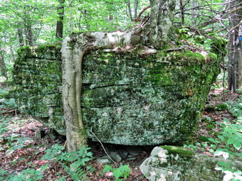 I put Sheila on her leash to keep her with me and off the private property that surrounds the easement New York State has to the state forest. The gate was open and signs posted by New York state indicated that there was no parking and that the land on either side of the woods road was private property. These signs continued all the way along the road to the state land boundary. I was obvious a wheeled vehicle had been on the road as the high grass was matted own. The road was wet and muddy in places but was passable. When we arrived at the first bridge, I was surprised to see that the old one had been replaced. I took some pictures before we continued up the road which was rocky and still wet. The second bridge was in poor condition and I wondered why someone had replaced one and not the other. We arrived at the cabin on the left side of the trail but no one was home. As we continued on the road I saw the state land signs appear. The road deteriorated making me believe that it would be unwise to bring any vehicle up the road. The gate at the end of Pelnor Hollow Road should be treated as the effective end or beginning of the trail. We eventually came to a wide spot in the trail where the road definitely ended. A sign indicated that the lean-to was .5 miles up the trail. The trail now narrowed from woods road width to trail width as we entered hardwood forest. It did seem that someone had driven a UTV through as I could see the tracks and the fact that some trail maintenance had been done. The walk to the lean-to seemed longer than a half mile and the trail had flattened. At 1.5 miles we came to the lean-to which appeared to be in good shape. I stopped to take some pictures and get a drink. There was a sign at the lean-to indicating distances which is unusual out in the middle of nowhere. I knew that passed the lean-to the trail could be hard to find and might be covered in briars but we pushed on anyway. It was immediately obvious that the trail maintenance continued beyond the lean-to and I began to suspect that a state crew had been at work. Everything was cleared to a width of from 4 to 6 feet in most places. Briars were cut back and branches and blowdowns cleared. The trail was easy to follow and pretty easy to walk. From the lean-to we walked about .7 miles uphill gaining 425 feet to just below the top of the hill. At this point the maintenance abruptly stopped and the briars had only a narrow path where someone else had walked.
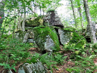 While I was disappointed that we would now have to negotiate through the briars, I decided we would push on. As we got to the top of the hill the trail and trail markers disappeared and I spent some time wandering around. Eventually I got out Avenza which helped but the biggest aid in navigation was following Sheila who has built-in CPS. Even when the trail and markers disappear I can follow her and that she is walking from marker to marker. We continued to struggle to follow the trail and avoid the worst of the briars. Not only were the markers few and far between but there was not much of a worn trail bed as this trail is seldom used. We started won off the top of the hill and lost the trail again. I was growing tired and knew we had over a mile to go and another hill to climb just to get to the Mary Smith Trail. At 2.75 miles the briars were again cut and the trail easier to follow. Whoever had cut out the trail had left everything where it had fallen which made walking a little more difficult but I was grateful for the work they had done. We continued to descend to the area between the two hills at 3 miles before starting up the next hill. At the top of the hill there seemed to be the possibility of some viewpoints on the right side of the trail. I knew from previous experience that trying to find a lookout would result in an area where trees and brush would block the view. There were a series of interesting glacial erratics perched on the hill and I took some pictures. At 3.9 miles we came to the intersection with the Mary Smith Trail and turned right to follow the trail out to Berry Brook Road. I had not been on the trail in some time and it did not look familiar as I thought it might. The trail is mostly downhill for 1.1 miles to the road. It was hard to keep a good pace as the trail was wet and muddy in spots and has some interesting twists and turns. We walked out of the woods to the power line right-of-way. I stopped and took some pictures of the puffy white clouds against the blue sky. After getting a drink, I followed Sheila as she made a beeline for the trail on the other side. We walked out to the road and immediately crossed following the trail into the woods. I was tired and had considered calling Cindy for a pickup. I was especially concerned about climbing Mary Smith Hill and the other unnamed summit after it but decided to complete the hike.
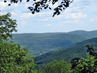 The trail almost immediately began to climb as we walked through a large stand of nettles. At this point the trail really began to gain elevation made a little more difficult by wet and muddy areas. The trail has some very steep areas but a few switchbacks help mediate the climb. I again stopped to take some pictures of the massive boulders along the trail. For about .4 miles the grade is 20% and then the trail levels some. At 5.9 miles we were at the highest point of the trail on Mary Smith Hill. We began to descend and then hike through a trail section that rolls a little along the ridge. At 7.1 miles we reached the top of an unnamed hill which is about 150 feet higher than Mary Smith Hill. I knew that from this point it was downhill all the way but I had forgotten how steep the downhill was. This part of the hike seemed to take much longer than I remembered and I knew this was because I was tired and ready to be back at the car. From the top of the hill we descended to a viewpoint at 7.5 miles which actually had a view to the south. I took some pictures and got a final drink. From the viewpoint the descent lasts only .4 miles but loses 500 feet on a 23% grade. It was slippery and needed some maintenance as there were blowdowns and brush and briars at various points on the trail. As we neared the bottom, I caught a glimpse of the car which was a welcome sight. We arrived at the car at 4:15 PM having hiked 8 miles in 5 hours and 10 minutes with an elevation gain of 2275 feet. When I got home, I had and e-mail from Ranger Dylan McCartney who is responsible for the Pelnor Hollow Trail. The trail is in DEC Region 4 and ranger McCartney works out of Stamford. His e-mail confirmed the access to the Pelnor Hollow trail through an easement. He also explained that he had been working on the trail with some stewards and would return to finish the work. I thanked him, offered my help and asked him to be sure to place some more markers.
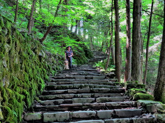
![]()
![]()
![]()
![]()
![]() On Wednesday, July 24th, I had planned to hike a long hike somewhere close to home. I had considered the part of the Finger Lakes trail that runs from Beech Hill Road to the Split Rock Lookout. From there I would backtrack to the junction of the Pelnor Hollow Trail and walk that trail out to Pelnor Hollow Road. Some people had been asking about the status of the maintenance on these trails and the access at Pelnor Hollow Road. The trailhead at Pelnor Hollow Road is surrounded by private property and the owners do not want cars parked on their land. This is reasonable but at one time they had claimed hikers could not access the trail. Cindy had agreed to help me drop my car at Beech Hill and then drop Sheila and I at Pelnor Hollow. When I got up in the morning is was cool and the weather report indicated a beautiful day. I asked Cindy if she would like to take a trip to Fillmore Glen which is in the Finger Lakes region northwest of Cortland. It is over a two hour trip for us and she initially declined but then agreed. We started to get ready at about 9:30 AM which was later than I had hoped! I got dressed in a new White Sierra long-sleeved crew top that Cindy had gotten me for my birthday with a short-sleeved baselayer. The White Sierra top has InsectSheild and is quite light. I put on a pair of RailRiders hiking pants which are expensive but last along time and have features like deep pockets and a generous cut which I really like. The pants have Velcro closures at the ankles which I hoped would mean I did not need gaiters. The ticks have been very numerous so far this season especially farther south. I decided to wear my Vasque Taku hiking boots which fit well and have been discontinued. I decided to forego my OR Bugout gaiters as we would be on the trail most of the time. I grabbed a pair of Leki external lock poles I have been using lately but knew I might not use them as Sheila would have to be on her leash most of the time. I made sure I had two water bottles even though I expected to hike only 5 miles. I also added a new OR floppy hat which was another present from Cindy. I have decided it shields me from the sun and allows me to spray some insect repellant on it rather than on me. We put our gear in the car and Sheila in the back seat. Sheila loves to get out an hike anywhere and she had kept her eye on both of us as we were getting ready. As we left Livingston Manor at 10:20 AM, the sun was shining and the skies were bright blue with puffy white clouds. I drove north and west on State Route 17 to Binghamton and then north on I81 to exit 12. From Homer I got on Route 90 heading north and west and drove 11 miles before turning right on Route 54. In 3.5 miles I turned right on Route 38 and almost immediately right into the park. I paid $7 at the park entrance, procured a park map and drove to a parking area in front of the visitor's center. We had stopped along the way once and visited the restroom before heading out on the trails so we began our adventure at 12:45 PM with the temperature in the high 70's.
On Wednesday, July 24th, I had planned to hike a long hike somewhere close to home. I had considered the part of the Finger Lakes trail that runs from Beech Hill Road to the Split Rock Lookout. From there I would backtrack to the junction of the Pelnor Hollow Trail and walk that trail out to Pelnor Hollow Road. Some people had been asking about the status of the maintenance on these trails and the access at Pelnor Hollow Road. The trailhead at Pelnor Hollow Road is surrounded by private property and the owners do not want cars parked on their land. This is reasonable but at one time they had claimed hikers could not access the trail. Cindy had agreed to help me drop my car at Beech Hill and then drop Sheila and I at Pelnor Hollow. When I got up in the morning is was cool and the weather report indicated a beautiful day. I asked Cindy if she would like to take a trip to Fillmore Glen which is in the Finger Lakes region northwest of Cortland. It is over a two hour trip for us and she initially declined but then agreed. We started to get ready at about 9:30 AM which was later than I had hoped! I got dressed in a new White Sierra long-sleeved crew top that Cindy had gotten me for my birthday with a short-sleeved baselayer. The White Sierra top has InsectSheild and is quite light. I put on a pair of RailRiders hiking pants which are expensive but last along time and have features like deep pockets and a generous cut which I really like. The pants have Velcro closures at the ankles which I hoped would mean I did not need gaiters. The ticks have been very numerous so far this season especially farther south. I decided to wear my Vasque Taku hiking boots which fit well and have been discontinued. I decided to forego my OR Bugout gaiters as we would be on the trail most of the time. I grabbed a pair of Leki external lock poles I have been using lately but knew I might not use them as Sheila would have to be on her leash most of the time. I made sure I had two water bottles even though I expected to hike only 5 miles. I also added a new OR floppy hat which was another present from Cindy. I have decided it shields me from the sun and allows me to spray some insect repellant on it rather than on me. We put our gear in the car and Sheila in the back seat. Sheila loves to get out an hike anywhere and she had kept her eye on both of us as we were getting ready. As we left Livingston Manor at 10:20 AM, the sun was shining and the skies were bright blue with puffy white clouds. I drove north and west on State Route 17 to Binghamton and then north on I81 to exit 12. From Homer I got on Route 90 heading north and west and drove 11 miles before turning right on Route 54. In 3.5 miles I turned right on Route 38 and almost immediately right into the park. I paid $7 at the park entrance, procured a park map and drove to a parking area in front of the visitor's center. We had stopped along the way once and visited the restroom before heading out on the trails so we began our adventure at 12:45 PM with the temperature in the high 70's.
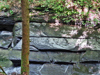 There weren't any signs for the trails near the main building but since the trails parallel the glen, we headed for the swimming area. There was a bridge just upstream from the swimming area and signs indicating the South Rim, Gorge and North Rim Trails. There was also a sign indicating the Gorge Trail was closed at bridge 7 because of damage to the trail beyond that point. I was disappointed as I knew the waterfalls grew larger upstream and because my hiking plan would have to be revised. We decided to hike out as far as we could on the gorge trail and then return and do a loop on the Rim Trails. We turned right where the sign pointed to the Gorge Trail and were surprised to find a long step of old stone steps. We expected to be going down into the gorge! I took some pictures of the steps including a few with Cindy and Shiela posed on them. We walked up the steps and came to another sign where the Gorge and South Rim Trail split. There was a huge oak tree at this junction so I took a shot before we turned left to start out on the Gorge Trail. We followed the trail over some flat ground and then descended some more steps to the Gorge Trail along the stream bed. We were surprised that there was barely any water flowing in the stream since several storms had recently passed through the area. I took some pictures of the interesting rock layers and the erosion. The glen is a mix of finely layered shale mixed with harder limestone which sometimes "caps" the shale. The shale erodes much more quickly than the limestone. We walked along the trail through the glen meeting a few people as we made our way over bridges and up and down steps. Some bridges were old but bridge 4 had been replaced with the new construction which includes two steel I-beams to support the decking. In a few spots I took some pictures but the day was actually too sunny for many good shots. Sheila was well-behaved on her leash even when other leashed dogs approached. At one point water was flowing over a limestone deposit and won into the glen. The flow was very light but I could imagine what this waterfall would look like in a wetter season. As we crossed bridge 6, we noticed two people in the streambed piling rocks. One was older and the other younger so I assumed they were father and son. I don't know why people feel free to violate park rules and vandalize park property. I have no interest in seeing anything but the beauty but consoled myself knowing that nature would take care of this during the next high water event! We continued on to bridge 7 and found a sign clearly stating the trail was closed. I had though we might press on but the sign was clear. We turned around and walked back along the trail. We met some individuals but most people were in pairs or in family groups. We walked up the steps to the junction with the South Rim Trail and turned left.
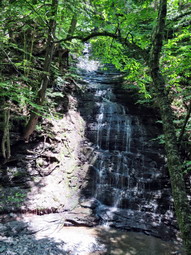 I guess the rim in South Rim Trail should have been and indication that we would have to climb. The ascent was a 13% grade for a bout a quarter mile and then the trail leveled some but still gained some more elevation. There wasn't much to see but it was quiet and we met only a few people. As we neared the point where we would again descend to the glen to pick up the North Rim Trail, we began to hear loud noises and music from below. My first thought was noisy hikers with a boom box. We came to a bench and a lookout that was mostly blocked by trees. I could look below and could see that the noise was coming from a crew working to rebuild the Gorge Trail! Cindy rested on the bench and had a snack while I took some pictures from various angles. I also got a bar and a drink before we packed up and continued on the trail. The trail neared the access road and some workers were gathered by their trucks. I asked about crossing the gorge and one worker said that we could use the bridge but that the trail down to the stream was muddy. The workers had been using a UTV which did make some ruts but we had hiked under worse conditions. We worked our way carefully down to bridge 8 and crossed to the red-blazed North Rim Trail. The trail initially headed upstream and then went through a series of switchbacks. Over .2 miles we gained about 150 feet on a 14% grade. At the top of the climb was another bench. The North Rim Trail went both right and left. The left branch continued about a half mile upstream to another water fall and a dam. I thought this would be a nice, quick walk but Cindy declined. I was disappointed since I wanted to see everything but we turned left to return to the car. The trail meandered some along the rim of the glen. In a few spots we had to gain a little elevation but the trail was primarily downhill. It was also mostly dry with good footing. At one point we ran into an small stream that had gut a small gorge of its own perpendicular to the main glen. We had to walk upstream for a short distance to a bridge to cross this stream. It finally occurred to me that this was the stream that we had seen entering the main glen from the Gorge Trail. We continued on the trail meeting no other hikers. As we neared the end of the trail, we came to a series of new steps which were wooden boxes filled with dirt and gravel. The wooden construction may not last as long as stone but they are much smoother and better looking. We descended the steps and came to the swimming area. We turned right and walked across a small lawn to a foot bridge across the stream. Next to the foot bridge was a ford across the stream for cars to cross from one side of the park to the other. We walked back to the car and arrived at 3:25 PM. We had hiked 5 miles in 2 hours and 35 minutes with and elevation gain of 1650 feet. We left Sheila in the car and walked over to a small cabin. The cabin is a replica representing the cabin where the 13th President of the United States, Millard Fillmore, was born in 1800. The original cabin was located about 5 miles from the park. I took some pictures of the cabin from the outside and a few on the inside. We walked back to the car to begin the 2 hour drive home.
On Sunday, July 21st, I wanted to get out and do some trail maintenance after church and before the afternoon heat and thunderstorms. I had surveyed Round Top across the street from my house and found it needed some serious trimming along parts of the trails. I decided I would take my Stihl FS 131 trimmer which is a beast when paired with Oregon square line. It is relatively light for what it does and cuts grass and brush easily. I am also impressed that in runs a long time on a tank of gas. When I got home from church, the temperature was 88 degrees and it was humid. The sun was out and I knew the temperature would rise. I got dressed in a long-sleeved crew top but decided to wear no baselayer. I usually wear long sleeves when I am doing trail work as they offer some protection. I put on a pair of RailRiders hiking pants which are expensive but last along time and have features like deep pockets and a generous cut which I really like. The pants have Velcro closures at the ankles which I hoped would mean I did not need gaiters. The ticks have been very numerous so far this season especially farther south. I decided to wear my Vasque Taku hiking boots which fit well and have been discontinued. I also put on a pair of OR Bugout gaiters to deal with the ticks and the "blowback" from trimming. I knew I would be carrying tools and not walking very far so I decided not to take poles. Besides the Stihl trimmer and gas container I took along the Corona loppers. Before I could get started, I had to reload string on the trimmer but this went quicker than I expected. I put my gear in the car and Sheila in the back seat. I decided to drive to the trailhead across the street since I could not carry everything I was taking with me. Sheila was happy to be going anywhere. I drove across the street at 12:30 PM and through the cemetery to the highest point where the trail begins. I got out the trimmer and fueled it. It stared immediately so I cut some of the grass at the trailhead before shutting it down and heading along the trail. At the first junction, we turned right and walked up the woods road. Just after the trail turned to the left, we encountered some brush and ferns hanging into the trail. I did not intend to trim all the ferns but did want to cut back the brush. I began trimming working my way all the way up to the junction with the blue trail. The trimmer was taking out some pretty heavy brush with no problem. As I was trimming Sheila was walking ahead or behind investigating various tracks and smells. At the trail junction I turned left and continued to cut a wide swath through the encroaching vegetation. As the trail continued it widened following an old woods road. I began to cut the trail back to the width of this road hoping I would only have to do this once or twice a summer. I kept waiting for the fuel to run out but I eventually came to the next trail junction. I turned right on the blue trail and trimmed a short way up the trail until the brush gave out and the ferns took over. I returned to the junction and continued on the yellow trail cutting the light brush and a few ferns along the way. I got to a place where there was no brush and all ferns so I shut down the trimmer for the walk back to the car. I noticed that my hands were really tingling which happens every time I use the trimmer. We turned left at the lookout and walked down the hill to the first trail junction. We continued straight ahead to walk back out to the car. I put my gear away and let Sheila jump into the back seat. When I turned the car on, the thermometer read 100 degrees! It was 2:00 PM and we had spent about and hour and a half making the trail nicer for others.
On Friday, July 19th, I wanted to get out and do some trail maintenance before the weather got too warm and humid. I decided to go to Beech Hill Road as I knew there were a few blowdowns to remove on the FLT as it starts up Cabot Mountain. I also wanted to do a little lopping of some branches hanging into the trail. Two days before I had gotten soaked as I walked through the field because the grass and weeds were waist high so I thought cutting them back would be a good idea. When I got up, the temperature was 70 degrees but I knew that it would only get warmer. I got dressed in a long-sleeved crew top but decided to wear no baselayer. I usually wear long sleeves when I am doing trail work as they offer some protection. I put on a pair of RailRiders hiking pants which are expensive but last along time and have features like deep pockets and a generous cut which I really like. The pants have Velcro closures at the ankles which I hoped would mean I did not need gaiters. The ticks have been very numerous so far this season especially farther south. I decided to wear my Vasque Taku hiking boots which fit well and have been discontinued. I also put on a pair of OR Bugout gaiters to deal with the ticks and the mud. I knew I would be carrying tools and not walking very far so I decided not to take poles. I also added a floppy hat which I have decided shields me from the sun and allows me to spray some insect repellant on it rather than on me. I took along my Fiskars axe, Silky Sugowaza saw, Corona loppers, a machete, and grass whip. I put my gear in the car and Sheila in the back seat. As we left Livingston Manor just before 9:30 AM, the sun was shining and the skies were almost cloudless. Sheila was happy to be going anywhere. I drove north on Old Route 17 before turning right on the Beaverkill Road. I passed through Lew Beach and turned left on Beech Hill Road Road. I drove up the road about 2.6 miles to the small pullout on the right side of the road at the beginning of the trail and pulled in to park. The temperature was cooler than in town and was around 73 degrees. When I got out of the car a slight breeze was blowing but it did feel humid. I started by cutting the grass and weeds around the trail register and then began cutting out the trail down to a kiosk near the woods. I had intended only to cut a narrow path but it kept getting wider and wider. The kiosk didn't have much current information but I cut around it anyway. I continued to cut some brush and weeds even after the trail entered the woods. The trail had been only damp on Wednesday but now was wet from the rains the night before. There were muddy areas and all the rocks were slippery. I returned to the car clearing a few more weeds as I went. I grabbed my loppers and saw and started back out on the trail to cut the large branch and a few others I remembered. I lopped and cut as I went and was soon at the point where the trail began to climb. It occurred to me that I had not seen the large branch I had come to dispatch. We walked a little up the ascent until I was convinced we should turn around. On the return trip I did not find the branch or any evidence of where it had been. Was I dreaming? Did someone come along and cut one branch? It is a mystery to me. I walked to the car and headed back home at 11:25 AM.
As I got closer to home, I realized I was still fresh and the temperature was still only 80 degrees. I decided to drive to the top of the Orchard Street Cemetery and do some work on the Round Top Trails. I parked at the trailhead and decided to take only my saw and loppers. Shiela seemed surprised we were getting out of the car again but was eager to go. We walked to the first trail junction where we turned right. There was a branch that had fallen and brought others down with it. It had broken off too high for me to completely eliminate it so I started to lop off branches and move them off the side of the trail. The Corona loppers have handles that extend and very wide jaws which are able to cut large branches. I continued to work switching to the saw where necessary. Eventually the area was cleared and we moved on up the woods road. There was another tree that had recent fallen and I began to make cuts with the saw. The work went quickly and I over the individual pieces off the trail. A little farther along, I dragged some other branches off the trail as we made a left turn to start a slight ascent. I was surprised when we ran into a lot of small branches and brush leaning over the trail. I used the loppers to clear many of these as far as the net trail junction with the blue trail. We turned left to stay on the yellow trail and found this entire section up to the next junction covered in brush leaning into the trail. I cut a few of the worst offenders but decided to leaving most of them until later. I thought I would bring my Stihil string trimmer to do the job. At the next trail junction, we turned right on the blue trail to head toad the summit of Round Top. There were more branches and some brush on the trail. I cut two small blowdowns on the way up and moved them off the trail. Soon there was less brush and more ferns as we crossed the summit. As we started down on the blue trail, we came to a medium sized white birch leaning low across the trail. I used the saw to cut off then top which fell off the trail. I though cutting the butt end might take some time but it went very quickly. I threw the trunk off the trail. We continued to descend to the trail junction and turned right on the yellow trail to continue to form our figure 8. At the next trail junction we stayed on the yellow trail by turning left. The rest of the trail was bordered by ferns all the way to the lookout. At the lookout we turned left and walked down the hill to the first trail junction and then straight out to the trailhead and the car. From there I drove across the street to the house. It was 12:30 Pm and we had spent about 3 hours doing trail work. The temperature was now over 90 degrees and the humidity was palpable.
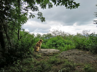
![]()
![]()
![]()
![]() On Wednesday, July 17th, I had planned to hike somewhere close to home and for a rather short time. The forecast was for 90 degree temperatures and high humidity followed by thunderstorms. I decided that I would go and hike Cabot Mountain from Beech Hill Road to see what maintenance needed to be performs. I maintain the trails from Alder Lake to Big Pond over Touch-Me-Not Mountain and Cabot Mountain to Beech Hill Road. I maintain this section of trail for the Finger Lakes Trail Conference as this is part of the Fingers Lakes Trail that stretches across New York State. When I got up, the temperature was already 70 degrees but I knew that it would only get warmer. I got dressed in a short-sleeved crew top with a short-sleeved baselayer. I usually wear long sleeves but I knew the temperature and humidity would be very high. I put on a pair of RailRiders hiking pants which are expensive but last along time and have features like deep pockets and a generous cut which I really like. The pants have Velcro closures at the ankles which I hoped would mean I did not need gaiters. The ticks have been very numerous so far this season especially farther south. I decided to wear my Vasque Taku hiking boots which fit well and have been discontinued. I also put on a pair of OR Bugout gaiters to deal with the ticks and the mud. I grabbed a pair of Leki external lock poles I have been using lately and made sure I had two water bottles even though I expected to hike only 2 hours. I also added a floppy hat which I have decided shields me from the sun and allows me to spray some insect repellant on it rather than on me. I put my gear in the car and Sheila in the back seat. As we left Livingston Manor at 10:00 AM, the sun was shining but the skies were overcast with some haze. Sheila was happy to be going somewhere but seemed a little "under the weather" from her shots on Tuesday. I drove north on Old Route 17 before turning right on the Beaverkill Road. I passed through Lew Beach and turned left on Beech Hill Road Road. I drove up the road about 2.6 miles to the small pullout on the right side of the road at the beginning of the trail and pulled in to park. The temperature was cooler than in town and was around 73 degrees. When I got out of the car a slight breeze was blowing but it did feel humid. I set my GPS unit and we started out on the hike by walking through the tall grass along the side of an open field. The trails had been very dry but heavy storms the night before had drenched the area. As we walked through the grass and weeds, my shoes and pants became soaked! As we entered the forest, I noticed all the rocks were wet and made note to watch my step.
On Wednesday, July 17th, I had planned to hike somewhere close to home and for a rather short time. The forecast was for 90 degree temperatures and high humidity followed by thunderstorms. I decided that I would go and hike Cabot Mountain from Beech Hill Road to see what maintenance needed to be performs. I maintain the trails from Alder Lake to Big Pond over Touch-Me-Not Mountain and Cabot Mountain to Beech Hill Road. I maintain this section of trail for the Finger Lakes Trail Conference as this is part of the Fingers Lakes Trail that stretches across New York State. When I got up, the temperature was already 70 degrees but I knew that it would only get warmer. I got dressed in a short-sleeved crew top with a short-sleeved baselayer. I usually wear long sleeves but I knew the temperature and humidity would be very high. I put on a pair of RailRiders hiking pants which are expensive but last along time and have features like deep pockets and a generous cut which I really like. The pants have Velcro closures at the ankles which I hoped would mean I did not need gaiters. The ticks have been very numerous so far this season especially farther south. I decided to wear my Vasque Taku hiking boots which fit well and have been discontinued. I also put on a pair of OR Bugout gaiters to deal with the ticks and the mud. I grabbed a pair of Leki external lock poles I have been using lately and made sure I had two water bottles even though I expected to hike only 2 hours. I also added a floppy hat which I have decided shields me from the sun and allows me to spray some insect repellant on it rather than on me. I put my gear in the car and Sheila in the back seat. As we left Livingston Manor at 10:00 AM, the sun was shining but the skies were overcast with some haze. Sheila was happy to be going somewhere but seemed a little "under the weather" from her shots on Tuesday. I drove north on Old Route 17 before turning right on the Beaverkill Road. I passed through Lew Beach and turned left on Beech Hill Road Road. I drove up the road about 2.6 miles to the small pullout on the right side of the road at the beginning of the trail and pulled in to park. The temperature was cooler than in town and was around 73 degrees. When I got out of the car a slight breeze was blowing but it did feel humid. I set my GPS unit and we started out on the hike by walking through the tall grass along the side of an open field. The trails had been very dry but heavy storms the night before had drenched the area. As we walked through the grass and weeds, my shoes and pants became soaked! As we entered the forest, I noticed all the rocks were wet and made note to watch my step.
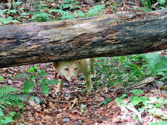 The first part of the trail is flat and there were a few wet spots. There are also many rocks which were covered in moss. Within a short distance, we came to a large branch that was blocking the trail. It appeared to be freshly fallen as it was very green and there was no trail that other hikers had used to avoid it. I had not brought any tools but it seemed that the blowdown could be removed with hand tools. The trail bed was well worn and the path easy to see which was good as the markers were often faded and far apart. The DEC has decreed that volunteers may no longer mark trails. This job falls on the foresters and rangers who have many other tasks to perform. Unfortunately, the trail marking has suffered as a result. At .2 miles the trail begins to climb and in about half a mile it gains almost 600 feet averaging a 20% grade. This is not as steep as the other side but is plenty challenging. We continued up the trail which has a few switchbacks and several flatter areas. The climb seemed shorter and went faster than I expected. At about .7 miles the trail levels off and then rolls over several bumps to the Cabot Mountain Vista at 1.6 miles. There were a few blowdowns across the trail and I decided to take pictures on the return trip. Most could be stepped or rolled over and did not slow me down. Removing them with hand tools would prove challenging. In areas where the sunlight could get through the trees there were some nettles although there were very few briars. Sheila meanwhile was having a great time bounding ahead and them coming back to find me. She occasionally followed some game trail. As we reached the flatter summit area, I found a few more blowdowns. The trail also became muddy in posts as the water does not drain well. The walk to the vista on Cabot Mountain seemed to take longer than I remembered but we arrived at the lookout at 11:30 AM. The sun was hidden behind clouds and there were darker clouds gathering all around. I did not want to get caught in a thunderstorm so did not plan to stay long. I took a few pictures of Sheila sitting on the lookout and then a few more of Little Pond. I also took some shots of the darkening clouds. I packed up and got a drink and a bar. By the time I shouldered my pack the sun was shining brightly but the dark clouds remained. We turned around at 11:35 AM and started to retrace our steps to the car.
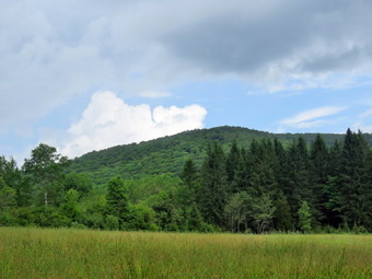 The walk back to the descent went very quickly even though I stopped to take some pictures of the various blowdowns. At one spot I stopped and removed a large trunk that had fallen in pieces. The trunk was rotting and removing it was relatively easy to remove it and clear the area. I could not get a clear view of the skies but did not want to find a storm was still brewing. We continued back on the trail to the steeper descent which proved to be tricky because of the dampness. We were soon on the flatter part of the trail where I stopped one more time to take pictures of the large branch that was freshly fallen. I knew we were almost back to the car and hurried my steps. We were back at the car at 12:35 PM. We spent 2 hours and 10 minutes hiking 3.0 miles with an elevation gain of 900 feet! I was definitely tired but could easily have done a few more miles given the same conditions. I drove back down Beech Hill Road and stopped to take some pictures of Cabot Mountain and some of the other hills in the area. I wanted to check out the status of the southern end of the Pelnor Hollow Trail at the northern end of Pelnor Hollow road. I drove out to the Beaverkill Road and turned right. At the Beaverkill Campground I turned right and then left on Craigie Claire Road. It began to pour down rain at this point and the rain continued for some time. At the iron bridge, I turned right on Beaverkill Valley Road and shortly after left on Pelnor Hollow Road. This road is packed dirt and the water was running down the road in rivulets. Despite the conditions it was an easy drive to the dead end. Along the way the "No Parking" and "Neighborhood Watch" signs made it clear that someone found visitors unwelcome. At the end of the road there was a gate which was open. There were signs that said "No vehicles" and "No parking". Beside these signs was one indicating that these were by order of the NYS DEC. I assumed this meant that hiking along the trail was permissible but I was not going to try it on this day.
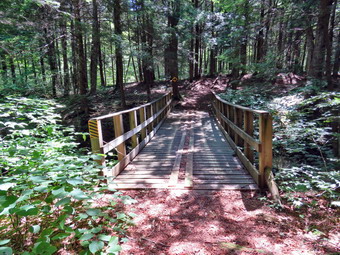
![]()
![]()
![]()
![]() On Monday, July 15th, I wanted to hike a difficult hike close to home after a weekend away at a wedding. I had eaten a little too much and had a little too much to drink and needed the exercise. Sheila certainly agreed after a weekend of inactivity. I considered several different options but decided to hike a loop from Long Pond to Mon Gaul Pond and back. I had not hiked the Long Pond to Mongaup Pond loop is some time and only once in a clockwise direction. I checked my own website and found that the total distance was 9.8 miles and remembered that it had two significant climbs over Mongaup Mountain and Middle Mongaup Mountain. When I woke up at 6:30 AM, I was still tired and decided to get a little more rest. When I awoke again at 9:00 AM, I felt much better and I began to get ready to hike. The temperature was 70 degrees and the humidity seemed low. I got dressed in a long-sleeved crew top with a short-sleeved baselayer. I knew this might be a little warm but the long sleeves dissuade the mosquitoes and shield me from the sun. I put on a pair of RailRiders hiking pants which are expensive but last along time and have features like deep pockets and a generous cut which I really like. The pants have Velcro closures at the ankles which I hoped would mean I did not need gaiters. The ticks have been very numerous so far this season especially farther south. I decided to wear my Vasque Taku hiking boots which fit well and have been discontinued. I also put on a pair of OR Bugout gaiters to deal with the ticks and the mud. I grabbed a pair of Leki external lock poles I have been using lately and made sure I had two water bottles as I expected we would hike for about 4 hours. I also added a floppy hat which I have decided shields me from the sun and allows me to spray some insect repellant on it rather than on me. I put my gear in the car and Sheila in the back seat. As we left Livingston Manor at 10:30 AM, the sun was shining gut the skies were cloudless. As I headed out DeBruce Road, I was quickly reminded that the road was being paved. We had to wait some time to be able to pass the area that was being paved. I drove through DeBruce and Willowemoc and turned left on Flugertown Road. I drove up the road to the end of the pavement and then continued on the packed dirt road to the point where the Mongaup Willowemoc Trail meets the road. I was surprised to see a forest ranger's trick parked on the side of the road. I pulled into an area just after the bridge and parked. I immediately set my GPS and the we started down the road at 11:00 AM. We turned right onto the trail and started a short climb. We immediately came to several blowdowns on the trail which would be a theme repeated innumerable times on the hike. I noticed that climbing was tiring but the trail soon leveled off.
On Monday, July 15th, I wanted to hike a difficult hike close to home after a weekend away at a wedding. I had eaten a little too much and had a little too much to drink and needed the exercise. Sheila certainly agreed after a weekend of inactivity. I considered several different options but decided to hike a loop from Long Pond to Mon Gaul Pond and back. I had not hiked the Long Pond to Mongaup Pond loop is some time and only once in a clockwise direction. I checked my own website and found that the total distance was 9.8 miles and remembered that it had two significant climbs over Mongaup Mountain and Middle Mongaup Mountain. When I woke up at 6:30 AM, I was still tired and decided to get a little more rest. When I awoke again at 9:00 AM, I felt much better and I began to get ready to hike. The temperature was 70 degrees and the humidity seemed low. I got dressed in a long-sleeved crew top with a short-sleeved baselayer. I knew this might be a little warm but the long sleeves dissuade the mosquitoes and shield me from the sun. I put on a pair of RailRiders hiking pants which are expensive but last along time and have features like deep pockets and a generous cut which I really like. The pants have Velcro closures at the ankles which I hoped would mean I did not need gaiters. The ticks have been very numerous so far this season especially farther south. I decided to wear my Vasque Taku hiking boots which fit well and have been discontinued. I also put on a pair of OR Bugout gaiters to deal with the ticks and the mud. I grabbed a pair of Leki external lock poles I have been using lately and made sure I had two water bottles as I expected we would hike for about 4 hours. I also added a floppy hat which I have decided shields me from the sun and allows me to spray some insect repellant on it rather than on me. I put my gear in the car and Sheila in the back seat. As we left Livingston Manor at 10:30 AM, the sun was shining gut the skies were cloudless. As I headed out DeBruce Road, I was quickly reminded that the road was being paved. We had to wait some time to be able to pass the area that was being paved. I drove through DeBruce and Willowemoc and turned left on Flugertown Road. I drove up the road to the end of the pavement and then continued on the packed dirt road to the point where the Mongaup Willowemoc Trail meets the road. I was surprised to see a forest ranger's trick parked on the side of the road. I pulled into an area just after the bridge and parked. I immediately set my GPS and the we started down the road at 11:00 AM. We turned right onto the trail and started a short climb. We immediately came to several blowdowns on the trail which would be a theme repeated innumerable times on the hike. I noticed that climbing was tiring but the trail soon leveled off.
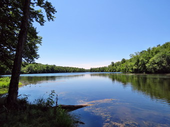 The first .5 miles gains about 250 feet to the trail junction. The red Long Pond Beaverkill Ridge Trail continues to the right but we turned left on the yellow Mongaup Willowemoc Trail which goes to the shores of Mongaup Pond. As we hiked I noticed that the trail was drier than I expected with several areas of dried mud. There were also fewer bugs hovering around me than I expected. The temperature was in the low 70's which made hiking very pleasant. The hiking trail in this area is also a snowmobile trail so it was wide and well-maintained with only a few blowdowns to block the path. It wasn't long before we crossed the private road to Sand Pond and then hit a low point as we crossed Butternut Creek, the outlet to Sand Pond. We walked along the creek for a short distance and then crossed one of the sturdy bridges at around 1.5 miles. I stopped to take a few pictures as I knew there were very few opportunities along the way. After the creek, the trail began an ascent of over 400 feet before descending to the shores of Mongaup Pond. There were some rocky sections along the way and I learned to take care as many of the rocks were slippery from condensation. We hiked 3.2 miles to the trail around Mongaup Pond where we turned right to head toward the upper end of the pond and the Mongaup Hardenburgh Trail. The trail around the pond is usually wet abut it was relatively dry as it had not rained in some time. After walking only half a mile, we were at the trail junction. We stopped at the edge of the pond and I took a few pictures. Sheila took the opportunity to swim even though the water was full of some type of floating weeds. Before we turned around and started the next part of the hike, I got a drink and a bar. I remembered that the Mongaup Hardenburgh Trail ascended the Mongaup Mountains and that the climb was interesting in spots. I also remembered that parts of the trail were not well marked or maintained with blowdowns and prickers. My memory was good as there seems to have been little maintenance with many blowdowns and branches encroaching on the trail. There were adequate blue markers though to mark the trail. For the next 1.5 miles the trail headed almost directly north gaining over 800 feet to the top of Mongaup Mountain at 5.2 miles with an elevation of just under 3000 feet. It looked like few others had hiked the trail and it remained hard to find. There were some steep but short climbs along the way. It was almost 2:00 PM and I felt we were taking a little too long to hike this route.
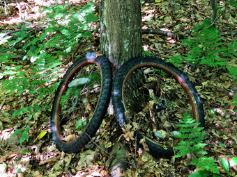 We started down the other side of the mountain and I noticed that the trail was even less distinct, less well marked and that there were quite a few blowdowns on the trail. We descended over 400 feet with some steep areas and places where the trail was completed obliterated by large blowdowns. I forgot that Middle Mongaup Mountain was only a few feet shorter than Mongaup Mountain! We regained almost all of our descent to reach the top of Middle Mongaup Mountain at 6.3 miles. My recollection of the trail was not complete so I was a little surprised when we descended again and then had to ascend East Mongaup Mountain to get to the trail junction with the Long Pond Beaverkill Ridge Trail. On the last section of our hike to the junction, the trail markers disappeared. At 6.9 miles, I was looking for the turn and almost missed it as there was no sign and the faded red markers were hard to see. We had been hiking through some prickers and over blowdowns on the Mongaup Hardenburgh Trail but that did not prepare me for the Long Pond Beaverkill Trail. Once we turned onto the that trail, it became immediately obvious that there had been no maintenance on the trail in some time. I stopped counting major blockages when I ran out of fingers. There were few markers and all but the last ones on the trail were faded to pink or white. In several places the blowdowns and the poor marking combined to throw me well off the trail. In fact the trail was not really a trail but a series of markers to follow when I could find them. Sheila was a big help in finding where we were supposed to be. She has the uncanny ability to follow the markers despite the fact that the trail is obviously little used. This trail has not improved in 5 years and it is a sign of the times that whoever is responsible for its maintenance just doesn't care! A good part of the trail became more like a bushwhack and I began to wonder if the trail had been abandoned. The problem, of course, is that there are too few volunteers to maintain all of the miles of trails. It seems that he trails to the 3500 foot peaks are maintained while some of the "lesser" trails are ignored. From trail junction to trail junction we dropped 850 feet in 2.5 miles. When we hit the junction with the Mongaup Willowemoc Trail, we turned left to descend the last .5 miles back to Flugertown Road. We arrived at the car at 5:05 PM which was later than I expected due to the poor condition of the trails. The hike was definitely a workout which is what I wanted but there were few photographic opportunities. We hiked 9.9 miles in 6 hours with 2225 feet of elevation gain along the way.
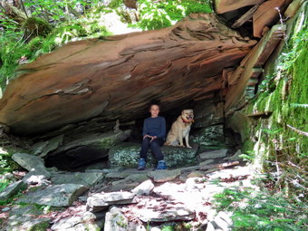
![]()
![]()
![]()
![]()
![]() On Tuesday, July 9th, I was ready to do a more challenging hike with my grandson Bryce and chose Westkill because of Diamond Notch Falls and the Buck Ridge Lookouts. Westkill is a special place for me as I spread the ashes of a previous hiking partner, Sheba, at the Buck Ridge lookouts. I got a text the night before that Bryce would be at my house around 7:00 AM which was fine as I wanted to get an early start. When I woke up at 6:30 AM the temperature was only 60 degrees and the humidity seemed low. Bryce did arrive just after 7:00 AM but needed a few minutes to eat the breakfast Cindy prepared for him. I got dressed in a long-sleeved crew top with a short-sleeved baselayer. I knew this might be a little warm but the long sleeves dissuade the mosquitoes and shield me from the sun. I put on a pair of RailRiders hiking pants which are expensive but last along time and have features like deep pockets and a generous cut which I really like. The pants have Velcro closures at the ankles which I hoped would mean I did not need gaiters. The ticks have been very numerous so far this season especially farther south. I decided to wear my Vasque Taku hiking boots which fit well and have been discontinued. I also put on a pair of OR Bugout gaiters to deal with the ticks and the mud. I grabbed a pair of Leki external lock poles I have been using lately and made sure I had two water bottles as I expected we would hike for about 4 hours. As we left Livingston Manor at 8:15 AM, the sun was shining gut the skies were slightly overcast. I headed out DeBruce Road and turned left on Route 47 at the end to head toward Big Indian and Route 28. There were a few cars at the Biscuit Brook parking area but the Slide Mountain parking area was beginning to fill up. The same was true of the parking for Giant Ledge and Panther. As we passed these spots where we have hiked before Sheila would "moan" as if she was asking me if we could stop and hike. I turned right on Route 28 and then left on Route 42 to head toward Spruceton. I knew that Route 42 was being paved and expected a delay. There was one car at the Halcott parking area along with a lot of construction machinery. We had to wait in line until the single lane cleared but after that we were able to drive to Spruceton Road unimpeded. I turned right on the Spruceton Road and drove until we came to the point where the road turns to dirt. To my surprise there seemed to be work going on to pave the road! Unfortunately, whatever they were using was a very poor quality and had not been adequately packed. I hoped they would improve the work before calling it finished. Along the road we passed the Spruceton Inn which was gained a nice reputation and also the West Kill Brewery where I had stopped on a previous trip. Since the road worked seemed to go on toward the end of the road I chose to park at the lot for Hunter as there were plenty of empty spaces. The temperature was 71 degrees and a slight breeze was blowing making it seem very comfortable. I set my GPS, put Sheila on her leash and we headed out to Spruceton Road at 9:45 AM. We turned left to walk toward the woods road that is the beginning of the actual trail.
On Tuesday, July 9th, I was ready to do a more challenging hike with my grandson Bryce and chose Westkill because of Diamond Notch Falls and the Buck Ridge Lookouts. Westkill is a special place for me as I spread the ashes of a previous hiking partner, Sheba, at the Buck Ridge lookouts. I got a text the night before that Bryce would be at my house around 7:00 AM which was fine as I wanted to get an early start. When I woke up at 6:30 AM the temperature was only 60 degrees and the humidity seemed low. Bryce did arrive just after 7:00 AM but needed a few minutes to eat the breakfast Cindy prepared for him. I got dressed in a long-sleeved crew top with a short-sleeved baselayer. I knew this might be a little warm but the long sleeves dissuade the mosquitoes and shield me from the sun. I put on a pair of RailRiders hiking pants which are expensive but last along time and have features like deep pockets and a generous cut which I really like. The pants have Velcro closures at the ankles which I hoped would mean I did not need gaiters. The ticks have been very numerous so far this season especially farther south. I decided to wear my Vasque Taku hiking boots which fit well and have been discontinued. I also put on a pair of OR Bugout gaiters to deal with the ticks and the mud. I grabbed a pair of Leki external lock poles I have been using lately and made sure I had two water bottles as I expected we would hike for about 4 hours. As we left Livingston Manor at 8:15 AM, the sun was shining gut the skies were slightly overcast. I headed out DeBruce Road and turned left on Route 47 at the end to head toward Big Indian and Route 28. There were a few cars at the Biscuit Brook parking area but the Slide Mountain parking area was beginning to fill up. The same was true of the parking for Giant Ledge and Panther. As we passed these spots where we have hiked before Sheila would "moan" as if she was asking me if we could stop and hike. I turned right on Route 28 and then left on Route 42 to head toward Spruceton. I knew that Route 42 was being paved and expected a delay. There was one car at the Halcott parking area along with a lot of construction machinery. We had to wait in line until the single lane cleared but after that we were able to drive to Spruceton Road unimpeded. I turned right on the Spruceton Road and drove until we came to the point where the road turns to dirt. To my surprise there seemed to be work going on to pave the road! Unfortunately, whatever they were using was a very poor quality and had not been adequately packed. I hoped they would improve the work before calling it finished. Along the road we passed the Spruceton Inn which was gained a nice reputation and also the West Kill Brewery where I had stopped on a previous trip. Since the road worked seemed to go on toward the end of the road I chose to park at the lot for Hunter as there were plenty of empty spaces. The temperature was 71 degrees and a slight breeze was blowing making it seem very comfortable. I set my GPS, put Sheila on her leash and we headed out to Spruceton Road at 9:45 AM. We turned left to walk toward the woods road that is the beginning of the actual trail.
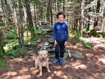 Walking on the material they had put on the road was not easy. I soon came to the conclusion that they were laying down the material they had stripped of Route 42! I don't know who came up with this idea but it seemed to be a bad one! We passed through the gate and started out on the trail toward the falls. The trail was nearly dry with only a few wet spots and I was surprised that the level of the stream was so low. The stream was beautiful and I was tempted to stop several times to take pictures. I decided to put this off until the return trip. At one point we looked up to see a trail runner coming toward us and I ushered Sheila off the trail to let him pass. Bryce and I wondered what route he had run but I suspected that it was not up the mountain. At the falls, we turned right on the Devil's Path and then right again at the end of the bridge. We looked at the sign there and laughed. The distances given were to the hundredth and they were obviously wrong. The sign put the Buck Ridge Lookouts beyond the summit. It is too bad that this is not the only mistake I have seen on DEC signs. I was again tempted to take pictures but decided to wait until the trip back. As we continued to follow the trail it began to get steeper and wetter in a few spots which made it slipperier. Many of the rocks had some condensation which also made the going difficult. I was beginning to get very warm so we stopped for a drink which made us both feel better. As we continued the ascent, I began to remember that the ascent was long and steep in some places and that the hardest part was right at the beginning of the climb. We came to a section of trail that requires some side-hilling but found it was much more worn in than I remembered. Sheila visited a spring to get a drink. I was feeling very tired as was Bryce. I got the feeling each of us might have given up but did not want to disappointed the other. Bryce began to tell me about the Percy Jackson books he was reading and this seemed to make the walk easier. It didn't take us long to get to a spot which is a near vertical climb. This is a short ascent but leads to a longer one. In the winter this is often a sheet of ice and can be exciting on the way up and the way down. Sheila and Bryce scrambled up without much trouble and I asked them to pose for a few pictures. After taking my shots, I followed making use of the roots as handholds. Once we passed this point there were still some steep areas to conquer. The mile climb from just after the falls to where the trail begins to level averages a 20% grade and can be very tiring.
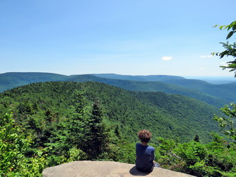 Once we got to the more level part there were still some small climbs and a few descents but the going was easier. From that point to Buck Ridge and the summit is still well over a mile. On our way to the rock overhang or "cave" we passed the 3500 foot sign. I could have sworn the sign used to be just above the overhand but I checked my GPS and the new placement seems more correct. When we arrived at the cave, Bryce and Sheila went "inside" and I took a few pictures before continuing. We were soon above the "cave" and after this the trail turns almost due west and levels off slightly. A hiker approached us from behind and I grabbed Sheila as I always do. We said "Hello" and he asked about how far we were from the lookouts. I said we were close and he continued on his way at a very fast pace. We finally came to the little descent before the final ascent to the Buck Ridge Lookouts. We worked our way down and were soon at the base of the final ascent. We climbed up to Buck Ridge arriving at 12:15 PM. It had taken us 2 hours and 30 minutes to hike a little over 3 miles! So much for keeping a good pace. The hiker we had met was at the lookouts and I suggested to Bryce that we go to the summit before taking a break. I shouldered my pack and we headed toward the summit. Hiking to the summit of Westkill is a short trip but serves no purpose other than to allow a hiker to claim they got to the summit. It is only about .1 miles and it took us about 15 minutes to get up and back to the lookouts. There is still a sign at the summit that says "Westkill Mt. Summit" and a large stone cairn. I took a few shots of Bryce and Sheila before w turned around and walked back to the lookouts. I leashed Sheila to a tree and gave her a drink. Bryce and I also drank some water and we ate me bars. I took pictures from the lookout to the south and then walked a little farther west to another lout to take some more shots. I also took some pictures of Bryce sitting on the edge of the lookout with his feet dangling over the ledge. I talked to the other hiker and found out he had taken two days to do the Devil's Path and was thinking of doing North Dome. Finishing that peak would complete is 3500 list! I discussed his options and he decided to continue on the Devil's Path to the right hand turn and then decide on a trip to North Dome. When he left, I released Sheila and we walked over to the lookout to the north where I had taken my favorite picture of Sheba. Sheila jumped up on the large boulder there but the view is almost completely blocked by trees now. I took a few shots and then we started back down the trail from Buck Ridge at 12:40 PM.
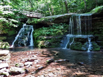 We tried to keep a quick pace on the way down without stopping but the going was not easy in some of the steeper spots. The trail has lots of rocks and roots on the upper part which slowed me down. Bryce and Sheila did not seem to mind and were bouncing along ahead of me. We met several individuals hikers on the way down and at least two were completing the Devil's Path in two days. We continued down the trail which was certainly easier than hiking up! We continued down the trail and met no ore hikers coming up. Just before the bridge at the falls, I saw some hikers at the bridge and put Sheila on her leash. When we arrived at the bridge, the hikers, who had a leashed dog, asked me about the trails. They decided on the "easier" option of hiking out the trail toad the Diamond Notch parking area. I took some shots of the rocks under the bridge and then some of the bridge. We crossed the bridge at the falls and negotiated the short but steep drop to the base of the falls. Sheila took several dips in the cool water and then began to dash madly around us. I took pictures of the falls with several different settings on the camera trying to get the soft, wispy effect that some people like. The stream has actually changed its course slightly and now flows more on the left rather than the right side of the bed. We climbed back up the bank to trail and continued back to the car. The walk out seemed long and when we got to the road we still had to walk back to the parking area. We were back at the car at 3:05 PM after hiking 7.0 miles in 5 hours and 20 minutes. The total ascent was 2150 feet. I was tired but glad we had made the trip. The hike did point out that I need to get in shape!
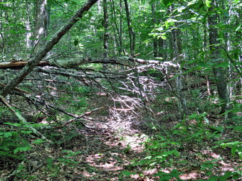
![]()
![]()
![]()
![]()
![]() On Monday, July 8th I had planned to do a longer hike near Long and Mongaup Ponds but decided to find a shorter route as I was scheduled to hike Westkill with Bryce the next day. I decided to go to Big Pond with some tools and clear two major blowdowns and a few smaller ones on the Touck-Me-Not Trail. I maintain the Finger Lakes Trail from Beech Hill Road over Cabot Mountain over Touch-Me-Not Mountain to big pond and then on to Alder Lake. This is about 7 miles of trail which includes some interesting climbs and some flatter sections. Most of the maintenance involves removing blowdowns and cutting back the nettles and briars. The temperature was forecast to be a little lower than it had been the previous few days with highs in the low 80's. When I got up at 6:30 AM, the temperature was only in the low 60's and it actually felt cool outside. I got dressed in a long-sleeved crew top with a short-sleeved baselayer. I knew this might be a little warm but the long sleeves dissuade the mosquitoes and shield me from the sun. I put on a pair of RailRiders hiking pants which are expensive but last along time and have features like deep pockets and a generous cut which I really like. The pants have Velcro closures at the ankles which I hoped would mean I did not need gaiters. The ticks have been very numerous so far this season especially farther south. I decided to wear my Vasque Taku hiking boots which fit well and have been discontinued. I also put on a pair of OR Bugout gaiters to deal with the ticks and the mud. I decided to go without hiking poles as I would be carrying poles. I decided to take only one water bottle as the hike is less than 3 miles round trip. I packed my Silky Sugowaza curved saw which can handle surprisingly large trees and my Fiskars axe. I also threw some felling wedges in my pack as I would not have any help if my saw became pinched. As we left Livingston Manor at 9:50 AM, the sun was shining brightly and I hoped for a productive trip. I drove up the Beaverkill Road with Sheila in the back seat more than ready to hike anywhere. We arrived at Big Pond at 10:10 AM and found only a few cars in the lot. A group of three hikers left the parking lot before us and we never saw them again. I set my GPS and carried my axe as we crossed the road to begin the hike. I began to remove obstacles on the trail and this continued for the whole hike. I cut a few branches but knew I would have to some back to trim the nettles and do some lopping. Within a few hundred feet there was a good sized branch hanging over the trail. It was supporting a large limb that had fallen and caused it to bend down. I trimmed a few smaller branches and the decided to cut the branch across the trail near the limb that was on top of it. I knew that I would have to watch out as I cut since the larger limb might fall. I was right! As I finished my cut, the large limb crashed down just missing me. Fortunately, I was unharmed and was able to clear the rest of the branches off the trail.
On Monday, July 8th I had planned to do a longer hike near Long and Mongaup Ponds but decided to find a shorter route as I was scheduled to hike Westkill with Bryce the next day. I decided to go to Big Pond with some tools and clear two major blowdowns and a few smaller ones on the Touck-Me-Not Trail. I maintain the Finger Lakes Trail from Beech Hill Road over Cabot Mountain over Touch-Me-Not Mountain to big pond and then on to Alder Lake. This is about 7 miles of trail which includes some interesting climbs and some flatter sections. Most of the maintenance involves removing blowdowns and cutting back the nettles and briars. The temperature was forecast to be a little lower than it had been the previous few days with highs in the low 80's. When I got up at 6:30 AM, the temperature was only in the low 60's and it actually felt cool outside. I got dressed in a long-sleeved crew top with a short-sleeved baselayer. I knew this might be a little warm but the long sleeves dissuade the mosquitoes and shield me from the sun. I put on a pair of RailRiders hiking pants which are expensive but last along time and have features like deep pockets and a generous cut which I really like. The pants have Velcro closures at the ankles which I hoped would mean I did not need gaiters. The ticks have been very numerous so far this season especially farther south. I decided to wear my Vasque Taku hiking boots which fit well and have been discontinued. I also put on a pair of OR Bugout gaiters to deal with the ticks and the mud. I decided to go without hiking poles as I would be carrying poles. I decided to take only one water bottle as the hike is less than 3 miles round trip. I packed my Silky Sugowaza curved saw which can handle surprisingly large trees and my Fiskars axe. I also threw some felling wedges in my pack as I would not have any help if my saw became pinched. As we left Livingston Manor at 9:50 AM, the sun was shining brightly and I hoped for a productive trip. I drove up the Beaverkill Road with Sheila in the back seat more than ready to hike anywhere. We arrived at Big Pond at 10:10 AM and found only a few cars in the lot. A group of three hikers left the parking lot before us and we never saw them again. I set my GPS and carried my axe as we crossed the road to begin the hike. I began to remove obstacles on the trail and this continued for the whole hike. I cut a few branches but knew I would have to some back to trim the nettles and do some lopping. Within a few hundred feet there was a good sized branch hanging over the trail. It was supporting a large limb that had fallen and caused it to bend down. I trimmed a few smaller branches and the decided to cut the branch across the trail near the limb that was on top of it. I knew that I would have to watch out as I cut since the larger limb might fall. I was right! As I finished my cut, the large limb crashed down just missing me. Fortunately, I was unharmed and was able to clear the rest of the branches off the trail.
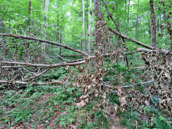 I packed up and we walked a little further up the trail to find the direct of the two major blowdowns at .4 miles. I put down my pack and took pictures of the large tree that had fallen across the trail taking another, smaller tree with it. I have a procedure that I use that works well in most cases. I removed all the loose branches and cut a few that were in the way. I then began to cut the top out of the tree by making several cuts and dragging the loose branches off the trail. In the end I had several large branches to cut but the saw took all but one easily. On the last cut I was not quick enough and my saw became trapped. After several attempts to free it with wedges, I realized I could make another cut with the ax. It took only a few minutes to make the cut and free my saw. Now, all I had left was the smaller tree that was still arching over the trail. It was pretty fitly supported and I considered leaving it until it fell. In the end I cut the trunk near the ground with the axe hoping it would fall. The top of the tree was entangled in another tree so I had to lift the butt end and move it. I knew I should be careful because at any minute the top could let go. This is exactly what happened! As the butt kicked out, I fell string my right shin and then the tree crashed down with a branch striking me in the same spot! I quickly evaluated my leg and found it sore but intact. This reminded me that I should not be working alone but that when I do I have to be more careful. I cut the rest of the tree off the trail, took some "after" pictures and then packed up to continue along the trail. The temperature had risen, it was more humid and the work was harder than I thought. The first mile of the trail gains about 775 feet with an average grade of 15%. Some places are almost flat which means there are a few steeper places. I began to notice that the blazing of the trail was becoming intermittent due to the fact that several trees with blazes had fallen. The DEC will no longer let volunteers put up the trail markers so the forester or rangers have to come out to blaze the trail. As the trail became steeper, I began to realize how tired I was. We passed through a stand of nettles and I knew another blowdown was ahead just short of the trail junction. At one point Sheila altered and I looked up to see a couple hiking toward us. I guided Sheila to the side of the trail and we said "Hello" as they passed.
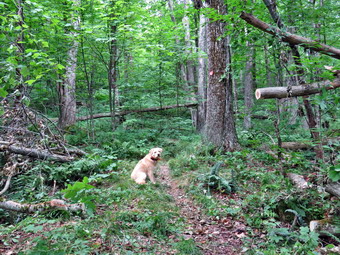 At 1.1 miles we came to the other blowdown. This tree was much larger and I wondered if my tools and I could handle it. I put my pack down and got out my camera to snap a few "before" shots. I began to remove loose branches and to cut other to remove. It wasn't long before only the largest branches were left. It was not clear to be whether or not any of these branches were supporting the tree trunk. I took no chances and cut everything that I knew could not act as a support. I then tackled the last branch. To my surprised the cut went quickly and the trunk did not move as it was counterbalanced on the butt end. I finished by making another cut to further clear the trail. I took my "after" shots and then packed up. I knew at this point I could turn around but decided to hike to the trail junction and then use the Campground Trail and the roads to get back to the car. We hiked up to the flatter part of the trail near the unction and I chose to removed one more small branch. As I was working, the couple who had passed us reappeared and thanked me for my work. We continued on to the trail junction and turned left on the blue Campground Trail. The Campground Trail is supposed to be maintained by the DEC but it looked as if little work had been done for some time. Within a few hundred feet we encountered a large blowdown which was difficult to negotiate and would require a chainsaw to remove. The sign at the trail junction said that the trail is .4 miles when it is actually almost 1.1 miles! We walked to the top of Touch-Me-Not Mountain and started down the other side. From the top of the mountain the trail drops 560 feet in .4 miles for an average grade of 26%. There are several areas where the descent is much steeper and the slippery oak leaves were not making the trip any easier. The trail eventually flattens as it near the parking area at Little Pond. The insects had not been a problem for most of the trip nut I began to notice them on this descent. We were soon at the parking area where I leashed Sheila and started the walk back on the Little Pond access road and Brakaboom Road. We walked out the access road and passed the main entrance. The walk out the access road is about .9 miles and is mostly downhill. We continued down to Barkaboom Road where we turned left and started the uphill walk back to the car. Having Sheila on her leash really helps as she pulls me up the hills quite nicely. I looked down at the stream and saw the old foundation. A "ditch" led from upstream through the foundation to farther downstream. This is a good indication that this was mill of some type and the stream led through the millrace and, most likely, and undershot wheel. This is further supported by the dam on Big Pond that looks as if it had a series of boards to control the water level. The walk back to the car went quickly and we arrived back at the lot at 1:25 PM. We had hiked 4 miles in 3 hour and 15 minutes with a vertical gain of 1055 feet. From previous hikes I could tell that I had worked for about 1 hour and 15 minutes.
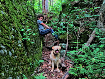
![]()
![]()
![]()
![]() On Friday, July 5th I wanted to get in a loner local hike and decided I would hike from Long Pond to Mongaup Pond on a loop including the Long Pond-Beaverkill Ridge Trail, Mongaup Hardenburgh Trail and the Mongaup, Willowemoc Trail. The total distance would be around 10 miles with some serious climbs over the Mongaup Mountains. As I was getting ready to go around 7:00 AM, the ambulance pager sounded and I was off on a call. When I returned from the call, I knew I still had time to do the hike but wondered if grandson Bryce would like to come to hike. I called my son Karl and said he could bring Bryce by around 10:00 AM and I readily agreed although I knew I would have to change the route I had planned. Just as Bryce was due to arrive a second ambulance call sent me out again. When I returned, Bryce was waiting and ready to go. I had most of my gear packed already and just needed to change into hiking clothes. As I began to get ready at 11:00 AM, the temperature was already in the low 80's and it seemed humid. I got dressed in a long-sleeved crew top with a short-sleeved baselayer. I knew this might be a little warm but the long sleeves dissuade the mosquitoes and shield me from the sun. I put on a pair of RailRiders hiking pants which are expensive but last along time and have features like deep pockets and a generous cut which I really like. The pants have Velcro closures at the ankles which I hoped would mean I did not need gaiters. The ticks have been very numerous so far this season especially farther south. I decided to wear my Vasque Taku hiking boots which fit well and have been discontinued. I also put on a pair of OR Bugout gaiters to deal with the ticks and the mud. I grabbed a pair of Leki external lock poles I have been using lately and made sure I had two water bottles as I expected we would hike for about 4 hours. As we left Livingston Manor at 11:20 AM, the sun was shining brightly and I hoped for a good day of hiking despite the crazy start for the day. I decided we would go to Big Pond and hike to Cabot Mt. The trailhead is relatively close and the hike has some easy spots but some challenging ones also. This would also allow me to evaluate this trail that I maintain for the Finger Lakes Trail Conference for work I would have to do in the future. I drove up the Beaverkill Road with Sheila and Bryce in the back seat more than ready to hike anywhere. We arrived at Big Pond at 11:40 AM to find the parking lot full of cars with more parking along the sides of the road. I looked in the lot by the pond and found a spot that must have been recently vacated and immediately pulled into it. There were a lot of loud people walking round and I hoped they would stay at the pond. I set my GPS and we crossed the road and got on the red Touch-Me-Not Trail to hike over the hill toward Cabot Mt. The trail starts with a nice little ascent to get the heart pumping and then levels off some.
On Friday, July 5th I wanted to get in a loner local hike and decided I would hike from Long Pond to Mongaup Pond on a loop including the Long Pond-Beaverkill Ridge Trail, Mongaup Hardenburgh Trail and the Mongaup, Willowemoc Trail. The total distance would be around 10 miles with some serious climbs over the Mongaup Mountains. As I was getting ready to go around 7:00 AM, the ambulance pager sounded and I was off on a call. When I returned from the call, I knew I still had time to do the hike but wondered if grandson Bryce would like to come to hike. I called my son Karl and said he could bring Bryce by around 10:00 AM and I readily agreed although I knew I would have to change the route I had planned. Just as Bryce was due to arrive a second ambulance call sent me out again. When I returned, Bryce was waiting and ready to go. I had most of my gear packed already and just needed to change into hiking clothes. As I began to get ready at 11:00 AM, the temperature was already in the low 80's and it seemed humid. I got dressed in a long-sleeved crew top with a short-sleeved baselayer. I knew this might be a little warm but the long sleeves dissuade the mosquitoes and shield me from the sun. I put on a pair of RailRiders hiking pants which are expensive but last along time and have features like deep pockets and a generous cut which I really like. The pants have Velcro closures at the ankles which I hoped would mean I did not need gaiters. The ticks have been very numerous so far this season especially farther south. I decided to wear my Vasque Taku hiking boots which fit well and have been discontinued. I also put on a pair of OR Bugout gaiters to deal with the ticks and the mud. I grabbed a pair of Leki external lock poles I have been using lately and made sure I had two water bottles as I expected we would hike for about 4 hours. As we left Livingston Manor at 11:20 AM, the sun was shining brightly and I hoped for a good day of hiking despite the crazy start for the day. I decided we would go to Big Pond and hike to Cabot Mt. The trailhead is relatively close and the hike has some easy spots but some challenging ones also. This would also allow me to evaluate this trail that I maintain for the Finger Lakes Trail Conference for work I would have to do in the future. I drove up the Beaverkill Road with Sheila and Bryce in the back seat more than ready to hike anywhere. We arrived at Big Pond at 11:40 AM to find the parking lot full of cars with more parking along the sides of the road. I looked in the lot by the pond and found a spot that must have been recently vacated and immediately pulled into it. There were a lot of loud people walking round and I hoped they would stay at the pond. I set my GPS and we crossed the road and got on the red Touch-Me-Not Trail to hike over the hill toward Cabot Mt. The trail starts with a nice little ascent to get the heart pumping and then levels off some.
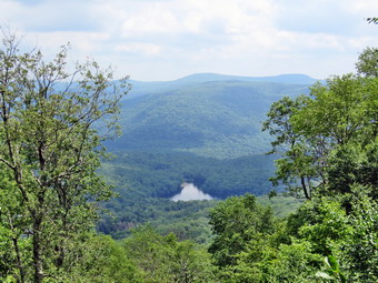 I was surprised to find the trails only damp wit only a few branches dipping down Bryce and I both removed some branches and pushed other out of the way. As we walked we encountered a tree or two across the trail that would need some tools to clear. Farther along as we began the real ascent up the mountain, the nettles began to encroach on the trail. They were pretty thick and I knew I would have to get my Stihl gas trimmer powered up to handle the! The air was very heavy and we took it easy as we climbed. The nettles disappeared in the shaded areas but came back again on the final ascent up the mountain. There was also another blowdown to clear.Over the first mile we gained 790 feet to the shoulder of Touch-Me-Not Mountain where the trail starts a descent. We continued to the junction with blue Campground Trail where we kept to the right on the Touch-Me-Not Trail and continued our descent. Along the way we descended through some slots between rocks and I stopped to pose Bryce and Sheila to take a few shots. We could hear other hikers ahead of us on the Little Pond Trail as we approached the trail junction at 1.6 miles. The sign said "Beaverkill Vista .5 miles" but I knew it was a little farther and that the climb was challenging. I asked Bryce if he want to climb the mountain and he said he did so we continued straight ahead on the red trail to climb up Cabot Mountain. We could see a hiker ahead of us but they were moving at an good pace. Sheila was all over the place looking for chipmunks, squirrels and, most of all, birds! We walked about a quarter mile to the base of Cabot Mountain. The nettles were again prominent but not as bad as they have been in the past. I t seemed to me that more people were using the trail and beating back the nettles. The vertical gain on the climb up Cabot is less than 500 feet but the horizontal distance is only .4 miles. The average grade is 25% with some areas over 30%. We climb up slopes with loose dirt and rocks with the help of some trees to hang onto. Just when I thought my legs might give out, we reached the top of the steepest climbs whet the trail levels off a little. We continued on the trail to the next short climb that leads to the plateau and the Vista. Ahead, we could see a couple coming toward us with a dog so I took Sheila by the collar and stepped off the trail. The other dog was on a leash and the couple offered encouraging words. It was there first time on the trail and I explained that I maintain the trail and have been on it many times. They thanked me and we moved on in opposite directions.
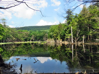 We climbed the last few feet and started walking along the flat trail to the lookout. As we approached, we could see the hiker we had seen before relaxing at the lookout. I tied Sheila to a tree and Bryce went out to sit on the lookout and dangle his feet over the edge. I spoke to the other hiker as sheet started off toward Beech Hill Road. She decided to turn around when I informed her she was at the best viewpoint. After she left, I walked out to the lookout and was surprised to find that it had been cut out. The view down to Little pond was clear and unobstructed and I could see the trees that had been cut below. I took some shots of Bryce and Sheila on the lookout and then some of the view down to the pond. The best pictures from this viewpoint were probably those of the white, puffy clouds in the sky. After taking some shots, we got a drink and shared a bar before I picked up my pack and reversed our course back down the mountain. We continued to the steeper part of the descent where I paused again to take some pictures of the massive rocks on the side of the trail. I posed Bryce and Sheila to take a few pictures before we continued our descent through the nettles. When we got to the trail junction, we turned right on the yellow Little Pond Trail and walked a short distance. We came to a large, flat rock that we had been to before with the whole family. We stopped and I took a few shots before continuing on to an open field. The field was once part of a farm and the foundation of the house is still present. We stopped again so that I could take some pictures of the surrounding hills and valleys. We continued on down the trail and encountered less water than is usually present but did find some muddy spots. At 3.5 miles we turned left off the woods road o follow the trail down toward Little Pond. Just before the final trail section to the pond, we stopped at a large beaver pond and dam on the left side of the trail. I took a few pictures and then we walked down to the loop trail around the pond. I took advantage of a privy that was open leaving Sheila in with Bryce. We walked around the west side of the pond stopping once so that I could take pictures of Touch-Me-Not Mountain on the other side of the pond. This allowed Sheila to cool off by taking dip in the water. We continued around the pond and followed the trail as it headed left off the road to cross the bridge at the outlet dam. I took a few pictures of the pond and Cabot Mountain before deciding to walk down the access road and back to the car on Barkaboom Road. I considered taking the trail back up Touch-Me-Not but in the end chose the road route. When we were in the shade and a breeze was blowing, the temperature was bearable. As we walked out into the sun, the temperature seemed to soar. The walk to Barkaboom Road is about .9 miles and when we reached the road we turned left to walk another.6 miles back to the car. I put Sheila and Bryce in the car and turned on the air conditioner. I walked to the shore of Big Pond to take a few pictures. We had walked 6.2 miles in just under 4 hours with an elevation gain of 1590 feet.
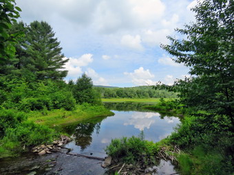
![]()
![]()
![]()
![]()
![]() On Wednesday, July 3rd I planned to hike with my grandson Bryce. Bryce is 8 years old but very athletic. I though about hiking Sugarloaf but settled on West Kill as it is slightly easier. I knew Bryce would like the falls and the rock scrambles along the way to the Buck Ridge Lookouts. I hoped Bryce would arrive before 9:00 AM so by 9:45 Am I decided to call my son to see if Bryce was coming. He informed me Bryce was NOT coming. I was very disappointed as I really wanted to hike a mountain! I asked Cindy if she wanted to hike and she agreed but we could not find a place we both wanted to hike. I decided I would tale Sheila and go for a longer loop hike at Frick and Hodge Ponds. As I began to get ready at 10:00 AM, the temperature was already in the mid 70's and it seemed humid. I got dressed in a long-sleeved crew top with a short-sleeved baselayer. I knew this might be a little warm but the long sleeves dissuade the mosquitoes and shield me from the sun. I put on a pair of RailRiders hiking pants which are expensive but last along time and have features like deep pockets and a generous cut which I really like. The pants have Velcro closures at the ankles which I hoped would mean I did not need gaiters. The ticks have been very numerous so far this season especially farther south. I decided to wear my Vasque Taku hiking boots which fit well and have been discontinued. I also put on a pair of OR Bugout gaiters to deal with the ticks and the mud. I grabbed a pair of Leki external lock poles I have been using lately and made sure I had two water bottles as I expected we would hike for about 4 hours. As we left Livingston Manor, the sun was shining brightly and I hoped for a good day of hiking despite the disappointing beginning. We headed out the DeBruce Road at about 10:20 AM. After about 6 miles, I turned left on Mongaup Pond Road and stayed left where the road split following Beech Mountain Road to the trailhead. When we arrived at the parking area, the large lot was almost full so I parked beside one car in the smaller lot. When I got out of the car, I heard loud music and shouting from the larger lot. The large group of young people seemed to be having a good time. I just wished they could have quieter fun.
On Wednesday, July 3rd I planned to hike with my grandson Bryce. Bryce is 8 years old but very athletic. I though about hiking Sugarloaf but settled on West Kill as it is slightly easier. I knew Bryce would like the falls and the rock scrambles along the way to the Buck Ridge Lookouts. I hoped Bryce would arrive before 9:00 AM so by 9:45 Am I decided to call my son to see if Bryce was coming. He informed me Bryce was NOT coming. I was very disappointed as I really wanted to hike a mountain! I asked Cindy if she wanted to hike and she agreed but we could not find a place we both wanted to hike. I decided I would tale Sheila and go for a longer loop hike at Frick and Hodge Ponds. As I began to get ready at 10:00 AM, the temperature was already in the mid 70's and it seemed humid. I got dressed in a long-sleeved crew top with a short-sleeved baselayer. I knew this might be a little warm but the long sleeves dissuade the mosquitoes and shield me from the sun. I put on a pair of RailRiders hiking pants which are expensive but last along time and have features like deep pockets and a generous cut which I really like. The pants have Velcro closures at the ankles which I hoped would mean I did not need gaiters. The ticks have been very numerous so far this season especially farther south. I decided to wear my Vasque Taku hiking boots which fit well and have been discontinued. I also put on a pair of OR Bugout gaiters to deal with the ticks and the mud. I grabbed a pair of Leki external lock poles I have been using lately and made sure I had two water bottles as I expected we would hike for about 4 hours. As we left Livingston Manor, the sun was shining brightly and I hoped for a good day of hiking despite the disappointing beginning. We headed out the DeBruce Road at about 10:20 AM. After about 6 miles, I turned left on Mongaup Pond Road and stayed left where the road split following Beech Mountain Road to the trailhead. When we arrived at the parking area, the large lot was almost full so I parked beside one car in the smaller lot. When I got out of the car, I heard loud music and shouting from the larger lot. The large group of young people seemed to be having a good time. I just wished they could have quieter fun.
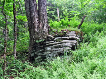 We headed out the woods road that meets the Quick Lake Trail at the register. We continued by passing the register and hiking out the Quick Lake Trail. The trail was still wet despite the work that had been done on the drainage. At Gravestone Junction we stayed left to walk down to Frick Pond. We stopped at the bridge and I took some pictures before packing up and continuing our hike. I took this opportunity to apply some insect repellant. We walked along the trail on the west side of Frick Pond staying left at the junction with the Big Rock Trail. We walked through the spruce tunnel and were able to cross the stream in the woods as the water level was lower. At Iron Wheel we turned left to stay on the red Quick Lake Trail and were at the junction with the snowmobile trail that leads to Quick Lake. This trail is often covered with high and wet grass. This day the trail did have some high grass and ferns but there was a clearly defined path. The trail headed west and ascended over 300 feet for the next .6 miles where it turned sharply north. The trail began to descend and at 2.6 miles the trail again turned west. All along the trail was covered in green ferns but there were quite a few insects. At 2.9 miles the trail again turned north and would continue that way until it met the Quick Lake Trail. Over the next 1.2 mile the trail gained 350 feet. I did stop to photograph some rock ledges along the way. The trail leveled and then dropped and rose several times. I began looking for the junction with the Quick Lake Trail. Several times unmarked trails led off to the left or right but we continued on the main snowmobile trail soon we were at Coyote Junction. We turned right and followed the Quick Lake Trail toward Junkyard Junction. The trail rose and fell several times for 1.2 miles to the trail junction. I stopped once aconite way to take some pictures of a large tree growing around a large rock. At the junction we turned left to pick up the Flynn Trail and follow it to Hodge Pond.
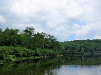 The walk along the Flynn Trail was about .5 miles to the trail junction near Hodge Pond. The Flynn Trail had a lot of branches hanging into the trail but it was drier than it had been and the trip went quickly. Soon we passed through the gate and walked downhill to the trail junction. I decided to turn left and walk around the head end of the pond on the jeep trail. We did not stop on the way but continued around the pond and down to the open field at the outlet end of the pond. As we approached the "beach", we could hear loud voices and see some of the young people we had encountered in the parking area. I walked to the edge of the pond and said "Hello" to a few of the people there. I let Sheila off her leash to take a swim and I threw a stick several times for her. I took some pictures of the blue skies and puffy white clouds over the pond. After a short stay, I packed up and we headed for the Flynn Trail to ascend the hill and move towed the junction with the Big Rock Trail. The trip up the hill went quickly and I did not feel tired. We stayed to the right at the top of the hill to continue on the Flynn Trail. This part of the trail also needed some lopping. We were soon at the trail junction where we continued straight ahead. I knew it was 1.7 miles back to the car and downhill all the way! I hoped we could make quick work of the descent and set a quick pace. We made the descent in 40 minutes and were back at the car at 2:45 PM having hike for 4 hours and 5 minutes. We had hiked for 8.8 miles with an elevation gain of 1405 feet.
![]()
![]()
![]()
![]()
![]() On Monday, July 1st I wanted to get in a longer hike and decided to head for Bear Spring Wildlife Management Area between Downsville and Walton. I have hiked almost all the trails in this area multiple times but had not been there is some time. The weather report was for sunny skies, no rain and highs in the high 70's. When I got up in the morning, I was tired from the trail maintenance work the day before and almost used this as an excuse not to go. Sheila was following me around and reminding me that I had promised I would take her out this day as she stayed home the day before! I started to get ready sometime after 10:00 AM. I got dressed in a long-sleeved crew top with a short-sleeved baselayer. I knew this might be a little warm but the long sleeves dissuade the mosquitoes and shield me from the sun. I put on a pair of RailRiders hiking pants which are expensive but last along time and have features like deep pockets and a generous cut which I really like. The pants have Velcro closures at the ankles which I hoped would mean I did not need gaiters. The ticks have been very numerous so far this season especially farther south. I decided to wear my Vasque Taku hiking boots which fit well and have been discontinued. I also put on a pair of OR Bugout gaiters to deal with the ticks and the mud. I grabbed a pair of Leki external lock poles I have been using lately and made sure I had two water bottles as I expected we would hike for about 4 hours. As we left Livingston Manor, the sun was shining brightly and I hoped for a good day of hiking. I drove north and west on State Route 17 getting off at Exit 94. From there I took Route 206 north to Downsville and continued toward Walton. Near the top of Bear spring Mountain I turned left on West Trout Pond Road and drove 2.2 miles south to the small parking area on the left side of the road near Middle Pond. My plan was to park on East Trout Brook Road at Middle Pond and hike up to Fork Mountain Ridge on Trail 4. From here I wanted to head north to the main parking area just off route 206. I planned to hike over to Wilson Hollow Road on Trail 1. From there we would hike out Trail 2 and use Trail 3 to go back down to Middle Pond and the car. All of the trails at Bear Spring are constructed with horses and snowmobiles in mind. This means there are NO BRIDGES so some water crossing can be tricky. It also means that the trail are wide and well maintained but without the traditional hiking blazes. There is an overview map at the main parking area at the top of Bear Spring Mountain and there may be maps in holders along the way at trail junctions. We arrived at the small parking area at about 11:20 AM and immediately started out by crossing the road to Trail 4.
On Monday, July 1st I wanted to get in a longer hike and decided to head for Bear Spring Wildlife Management Area between Downsville and Walton. I have hiked almost all the trails in this area multiple times but had not been there is some time. The weather report was for sunny skies, no rain and highs in the high 70's. When I got up in the morning, I was tired from the trail maintenance work the day before and almost used this as an excuse not to go. Sheila was following me around and reminding me that I had promised I would take her out this day as she stayed home the day before! I started to get ready sometime after 10:00 AM. I got dressed in a long-sleeved crew top with a short-sleeved baselayer. I knew this might be a little warm but the long sleeves dissuade the mosquitoes and shield me from the sun. I put on a pair of RailRiders hiking pants which are expensive but last along time and have features like deep pockets and a generous cut which I really like. The pants have Velcro closures at the ankles which I hoped would mean I did not need gaiters. The ticks have been very numerous so far this season especially farther south. I decided to wear my Vasque Taku hiking boots which fit well and have been discontinued. I also put on a pair of OR Bugout gaiters to deal with the ticks and the mud. I grabbed a pair of Leki external lock poles I have been using lately and made sure I had two water bottles as I expected we would hike for about 4 hours. As we left Livingston Manor, the sun was shining brightly and I hoped for a good day of hiking. I drove north and west on State Route 17 getting off at Exit 94. From there I took Route 206 north to Downsville and continued toward Walton. Near the top of Bear spring Mountain I turned left on West Trout Pond Road and drove 2.2 miles south to the small parking area on the left side of the road near Middle Pond. My plan was to park on East Trout Brook Road at Middle Pond and hike up to Fork Mountain Ridge on Trail 4. From here I wanted to head north to the main parking area just off route 206. I planned to hike over to Wilson Hollow Road on Trail 1. From there we would hike out Trail 2 and use Trail 3 to go back down to Middle Pond and the car. All of the trails at Bear Spring are constructed with horses and snowmobiles in mind. This means there are NO BRIDGES so some water crossing can be tricky. It also means that the trail are wide and well maintained but without the traditional hiking blazes. There is an overview map at the main parking area at the top of Bear Spring Mountain and there may be maps in holders along the way at trail junctions. We arrived at the small parking area at about 11:20 AM and immediately started out by crossing the road to Trail 4.
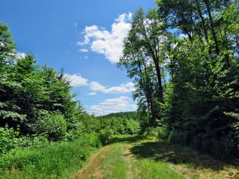 The trail rises 750 feet from the road to the ridge over 1.2 miles. It was wet in places and there was a good crop of nettles. There are almost no trail marking and I had only been on this trail a few times but the correct path was pretty clear. I did stop a few times to take some pictures but there were no clear views of the valleys or mountains. After passing through one switchback, we were at Trail 5 which runs the length of the Fork Mountain Ridge. I noticed that while we were walking in the shade the temperature seemed almost cool but this changed when we were in the sun. At the top of the ridge we turned right or northwest to hike along the Fork Mountain Ridge. I knew the total distance to the main parking area was a little over 3.5 miles and we made good time as the trail continued northwest over a few bumps. A 1.85 miles we passed by the shoulder of Fork Mountain but this was far from the highest point on the trail. All of the trails had been mowed with a tractor and field mower. Along the way were some very muddy and wet spots. Some of these were hard to avoid as they extended across the trail and into the woods on both sides. Sheila was having a great time as there seemed to be a lot of game birds along the way. By 1:05 PM we were 3.2 miles into the hike and crossed East Trout Brook Road to continue on the trail. We did stop for a minute to get a drink and a snack. At 4.05 miles we crossed Beers Brook Road and turned left to walk a few steps before picking up Trail 7. Up to this point there had been some muddy and wet areas but the next section of the trail was especially boggy. We continued almost directly north now toward Route 206 working our way around the puddles and mud pits. At 1:35 PM we crossed West Trout Brook road again and walked to the main parking area which was empty. We got another drink before following the very familiar Trail 1 that parallels Route 206, crosses East Trout Brook Road an then ascends slightly before dropping to Wilson Hollow Road.
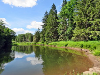 This woods road, designated Trail 2, is a grassy track and has never been paved but shows up on many maps with the same prominence as Route 206! At one time this area had a large clear cut area which allowed some nice views down the valley. The trees have grown up quickly and there are now no views. The skies were still blue and filled with puffy white clouds so I took a few shots. We continued the hike and found that this trail was a little less muddy but more uphill than I remembered. I was looking for Trail 11 which I had missed several times before. I found it although it did not seem well-used. We continued passed this trail along the ridge to Trail 3, the Middle Pond Shortcut Trail. I though about continuing on Trail 2 to add distance but I was a little tired a pretty warm. We turned right at 7.7 miles and walked along the edge of a freshly-mowed field to pick up the trail again. The rest of the trip is all downhill which my muscles appreciated. The walk down was a little better than I expected and the view from the top of the next clear cut a little worse. We walked out into a small field and I took some photographs before returning to the trail. We hit the trail junction with Trail 2 which winds its way around and down to this point. From here it was only .6 miles back to the car. Along the way we stopped at a small pond so that I could take a few pictures of the pond and a few down the valley. We stopped at the bridge at the outlet of Middle Pond and I was surprised that the water level in the pond was low despite a small beaver dam and the amount of rain that has fallen lately. I suspect that there is a beaver dam farther upstream. We walked slightly uphill from the bridge to get back to the car at 3:35 PM. We covered 9.2 miles in 4 hours and 15 minutes.
![]()
![]()
![]()
![]() On Sunday, June 30th I was committed to do some trail work at Frick Pond after church. Cindy decided she would go with me to do trim some Burch and remove blowdowns on the Quick Lake Trail to Frick Pond and on the Loggers Loop Trail. When we got home from church the skies looked like there might be some rain but we decided to get ready to go and meet the rest of the group at the parking area. I had told Lisa I would need one or two hands to help get this work done. Lisa wanted to work on the drainage issue which I find frustrating and a waste of time. The temperature was in the mid 70's as we began to get ready so I knew I would have to dress for a warm and humid outing. I had to explain to Sheila that she could not go on this outing but I promised her a longer walk the next day. I got dressed in a long-sleeved crew top with a short-sleeved baselayer. I knew this might be a little warm but the long sleeves dissuade the mosquitoes and shield me from the sun. I put on a pair of RailRiders hiking pants which are expensive but last along time and have features like deep pockets and a generous cut which I really like. The pants have Velcro closures at the ankles which I hoped would mean I did not need gaiters. The ticks have been very numerous so far this season especially farther south. I decided to wear my Vasque Taku hiking boots which fit well and have been discontinued. I also put on a pair of OR Bugout gaiters to deal with the ticks and the mud. I decided not to take my GPS or camera due to the potential for rain. I did pack a variety of tools including a pick, shovel two grass whips, loppers, my Fiskars axe, a machete and two Silky saws. At 12:45 PM we headed out the DeBruce Road. After about 6 miles, I turned left on Mongaup Pond Road and stayed left where the road split following Beech Mountain Road to the trailhead. When we arrived at the parking area, the large lot was almost full so I parked beside one car in the smaller lot. We walked over to meet the group and I recognized Russ and Harry. There was another young man and an older couple with Lisa. Lisa explained that Cindy and I would work on trimming and that she was going to work on drainage. Unfortunately, no one chose to come with Cindy and me which was not what I had planned. Cindy and I headed out the Quick Lake Trail trimming as we went. The older couple were walking along the trail but seemed confused about where they were and what they were supposed to do. Lisa and all the rest of the crew hurried by us. Almost immediately it began to rain. Cindy and I returned to the car to wait for the rain to pass.
On Sunday, June 30th I was committed to do some trail work at Frick Pond after church. Cindy decided she would go with me to do trim some Burch and remove blowdowns on the Quick Lake Trail to Frick Pond and on the Loggers Loop Trail. When we got home from church the skies looked like there might be some rain but we decided to get ready to go and meet the rest of the group at the parking area. I had told Lisa I would need one or two hands to help get this work done. Lisa wanted to work on the drainage issue which I find frustrating and a waste of time. The temperature was in the mid 70's as we began to get ready so I knew I would have to dress for a warm and humid outing. I had to explain to Sheila that she could not go on this outing but I promised her a longer walk the next day. I got dressed in a long-sleeved crew top with a short-sleeved baselayer. I knew this might be a little warm but the long sleeves dissuade the mosquitoes and shield me from the sun. I put on a pair of RailRiders hiking pants which are expensive but last along time and have features like deep pockets and a generous cut which I really like. The pants have Velcro closures at the ankles which I hoped would mean I did not need gaiters. The ticks have been very numerous so far this season especially farther south. I decided to wear my Vasque Taku hiking boots which fit well and have been discontinued. I also put on a pair of OR Bugout gaiters to deal with the ticks and the mud. I decided not to take my GPS or camera due to the potential for rain. I did pack a variety of tools including a pick, shovel two grass whips, loppers, my Fiskars axe, a machete and two Silky saws. At 12:45 PM we headed out the DeBruce Road. After about 6 miles, I turned left on Mongaup Pond Road and stayed left where the road split following Beech Mountain Road to the trailhead. When we arrived at the parking area, the large lot was almost full so I parked beside one car in the smaller lot. We walked over to meet the group and I recognized Russ and Harry. There was another young man and an older couple with Lisa. Lisa explained that Cindy and I would work on trimming and that she was going to work on drainage. Unfortunately, no one chose to come with Cindy and me which was not what I had planned. Cindy and I headed out the Quick Lake Trail trimming as we went. The older couple were walking along the trail but seemed confused about where they were and what they were supposed to do. Lisa and all the rest of the crew hurried by us. Almost immediately it began to rain. Cindy and I returned to the car to wait for the rain to pass.
The rain stopped in less than 15 minutes and the skies began to clear. Cindy and I started out ion the woods road that connects to the Quick Lake Trail at the register. Along the way we found the older couple walking toward us. We explained the pond was in the opposite direction. Cindy and I continued along the Quick Lake Trail trimming branches as we went. The branches need to be cut off considerably higher than sot people would think. This allows easier travel during the winter when several feet of snow are on the ground. We passed Lisa and another volunteer working an the same drainage issues we had addressed last time to no avail. As we approached Gravestone Junction we found the couple working to trim back some of the bushes and grass. They were doing a good job so we decided to turn right on the yellow Loggers Loop. The grass was high and very wet but no one had wanted to work on this important aspect of trail maintenance so it was left undone. Cindy and I continued to trim along the Logger Loop and eventfully met up with Russ and Harry who were trying to solve the wet and muddy trail issue. They had formed a sort of "bridge" over a muddy area with slippery logs perched on some rocks. Cindy and I talked to them for a minute and then walked along the drier side of the trail. We continued our way down to Times Square which was very wet. We stayed on the Loggers Loop by walking straight across Times Square and up the hill. Water was pouring out of springs on the trail. We immediately ran into our first blowdown and I dropped my pack to get to work. I normally take before and after pictures but did not have the camera with me this time. I few cuts with my Silky Sugowaza left me with several branches a pieces of trunk to remove from the trail. We picked up and started back up the trail passing by the seasonal pond on the right. As we passed by we ran into a swarm of mosquitoes. Shortly after the pound there as another, bigger lowdown. I dropped my pack and the first thing I did was to spray on some insect repellant. I used the saw to trim the tops and sallower trunks and then dragged them out of the way. That left me with a double trunk to work on. I used the Fiskars axe to cut off one trunk and remove it. I cut the other trunk off with the saw and pulled it off the trail. The left side of the trail was now clear and I knew the snowmobile club would clean up the rest. I decided I didn't want to leave the job almost done. I used a large branch as a lever and was able to pivot the large section of trunk remaining off the trail.
The sky kept getting dark and then clearing and Cindy and I were getting tired. I knew that Iron Wheel Junction was close and promised that once we got there we would head straight back to the car without doing any more work. We cam across a small lowdown across the trail which was easily dispatched with two cuts from the saw. We did a little more lopping and I cut a few bigger branches that were on the trail. As we approached the trail junction, I saw another blowdown which I had forgotten. This was the largest one so far and I regretted leaving my Silky KatanaBoy 500 saw in the car. I put the pack down and surveyed the situation. Cindy made some suggestions which sounded good so I made the cuts she suggested. The work went fast than I expected until I got to the last cut through the main trunk. I started in with the smaller Silky saw and was surprised how fast it went. I made the cut and then moved everything off the trail. We packed up and were soon at Iron Wheel Junction where we turned left on the red Quick Lake Trail. We started down the trail noticing several trees that would need to be addressed at some point in the future. We did trim a few more branches but kept a pretty steady pace. The stream in the woods was still high so we walked upstream to cross before getting back on the trail. I was annoyed that I had not brought Sheila as she would have been fine hiking with us! As we walked toward the junction with the Big Rock Trail, we cut a few last branches. We stayed on the Quick Lake Trail and crossed the bridge. The skies over the pond were blue with some nice clouds. He climbed up the hill and walked through Gravestone Junction. The Quick Lake Trail back to the car was still wet. As we were walking the last few hundred feet to that car, Cindy let out a loud exclamation. I looked around to see a trail runner who had come up from behind. He stopped to walk and asked me about other trails in the area. I described some other places he could try. We arrived back a the car at 4:15 PM having spent 3 hours and 15 minutes hiking 3.6 miles with an elevation gain of 390 feet. Of course, the work we did was the most important part and we were both tired.
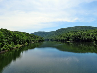
![]() On Friday, June 28th I was ready to go out for a hike one the first day after the close of school. I wasn't sure whether or not grandson Bryce would join me so I had several plans in mind. I thought about hiking Clabber Mounatin on the Cannonsville Reservoir or a route a Bear Spring. When I woke up early, I decided I would go to Bear Poring and hike 9 to 12 miles on the two central ridges starting at Middle Pond. This is not a difficult hike and it is one I have done before that it does allow a variety of options. Shortly after I made this decision, I got a text saying Bryce would be arriving at 9:30 AM! I though the Bear Spring hike might be a little long for Bryce in the heat so I decided we would hike the loop to the Rock Rift fire tower starti8ng at the Apex Bridge at the junction of Route 268 and Route 10. Bryce arrived a few minutes after 9:30 AM ready to hike. While he ate breakfast, I got my gear ready to go. The treasure was already in the high 0's and I expected it to go up from there. I got dressed in a long-sleeved crew top with a short-sleeved baselayer. I knew this might be a little warm but the long sleeves dissuade the mosquitoes and shield me from the sun. I put on a pair of RailRiders hiking pants which are expensive but last along time and have features like deep pockets and a generous cut which I really like. The pants have Velcro closures at the ankles which I hoped would mean I did not need gaiters. The ticks have been very numerous so far this season especially farther south. I decided to wear my Vasque Taku hiking boots which fit well and have been discontinued. I grabbed a pair of Leki poles with external locks that I have been using lately. I also put on a pair of OR Bugout gaiters to deal with the ticks and the mud. Sheila was happy to be going anywhere and watched me carefully making sure I would not forget her. We left Livingston Manor at 10:15 AM as I drove north and west on State Route 17 toward Binghamton. I got off at Exit 87A for Cadosia and followed Route 286 north to the Apex Bridge over the Cannonsville Reservoir. Where the road met Route 10, I turned left and made and immediate left into the parking area. It was 82 degrees and seemed humid as I set my GPS and put on her leash. We crossed the road and immediately picked up the Finger Lakes Trail which is blazed in white with occasional NYC/FLT disks. The New York City DEP has opened much of the land around its reservoirs for public use. This has allowed the FLTC to reroute miles of trail off roads. The initial part of the trail was a steep but short climb after which is leveled and turned southeast.
On Friday, June 28th I was ready to go out for a hike one the first day after the close of school. I wasn't sure whether or not grandson Bryce would join me so I had several plans in mind. I thought about hiking Clabber Mounatin on the Cannonsville Reservoir or a route a Bear Spring. When I woke up early, I decided I would go to Bear Poring and hike 9 to 12 miles on the two central ridges starting at Middle Pond. This is not a difficult hike and it is one I have done before that it does allow a variety of options. Shortly after I made this decision, I got a text saying Bryce would be arriving at 9:30 AM! I though the Bear Spring hike might be a little long for Bryce in the heat so I decided we would hike the loop to the Rock Rift fire tower starti8ng at the Apex Bridge at the junction of Route 268 and Route 10. Bryce arrived a few minutes after 9:30 AM ready to hike. While he ate breakfast, I got my gear ready to go. The treasure was already in the high 0's and I expected it to go up from there. I got dressed in a long-sleeved crew top with a short-sleeved baselayer. I knew this might be a little warm but the long sleeves dissuade the mosquitoes and shield me from the sun. I put on a pair of RailRiders hiking pants which are expensive but last along time and have features like deep pockets and a generous cut which I really like. The pants have Velcro closures at the ankles which I hoped would mean I did not need gaiters. The ticks have been very numerous so far this season especially farther south. I decided to wear my Vasque Taku hiking boots which fit well and have been discontinued. I grabbed a pair of Leki poles with external locks that I have been using lately. I also put on a pair of OR Bugout gaiters to deal with the ticks and the mud. Sheila was happy to be going anywhere and watched me carefully making sure I would not forget her. We left Livingston Manor at 10:15 AM as I drove north and west on State Route 17 toward Binghamton. I got off at Exit 87A for Cadosia and followed Route 286 north to the Apex Bridge over the Cannonsville Reservoir. Where the road met Route 10, I turned left and made and immediate left into the parking area. It was 82 degrees and seemed humid as I set my GPS and put on her leash. We crossed the road and immediately picked up the Finger Lakes Trail which is blazed in white with occasional NYC/FLT disks. The New York City DEP has opened much of the land around its reservoirs for public use. This has allowed the FLTC to reroute miles of trail off roads. The initial part of the trail was a steep but short climb after which is leveled and turned southeast.
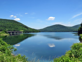 We found the trail wet and with several blowdowns. The biggest problem was that it was poorly marked and we often had to search for the next blazes. I had only hiked this trail two or three times before and nothing looked very familiar. I regretted I had not brought a map but felt the trail marking should be enough. At .8 miles, we came to a dirt road which I did not remember but we followed the arrows which indicated a left turn. We walked up the road for some distance but did not see any blazes. Although the lack of blazes are not uncommon, we decided to turn around and walk back to the point where the trail met the road. Just as we were almost back at our starting point I saw a blaze on the other side of the road. The blaze was well-hidden in the leaves and well off the trail. It was almost impossible to see the trail which is not good for a trail that extends across the state! We followed the markers which almost immediately led to mowed field. There were no markers to indicate which way to go but I could see a "notch" across the field on the left. We walked to this area and found a well-mowed trail which we followed. The trail continued to head southeast to a greater extent than I remembered. The blazes were still spread thin and the trail was obviously not well-used. At 1.4 miles we completely lost the blazes and markers! We walked back and forth and could find nothing. We decided to walk out to the road and then back to the car. I followed Bryce as he chose a route out to the road which was only 400 feet away. We turned right and hiked the mile back to the car. As we approached the parking area, all three of us saw a small fawn walk across the road and hide in the grass. As we continued to walk the mother came to the edge of the road but returned to the trees as several vehicles sped by. We did not see the fawn or the mother as we arrived at the road junction. I decided to walk out onto the Apex Bridge. I took some pictures of the reservoir and we then returned to the car. We got a drink and a snack and I noticed the temperature was 93 degrees.
 I decided to drive to the other access trail to the fire tower to see how far we were from making the connection when we turned to return to the car. I parked in the boat launch just southeast of the trail. I put Sheila on her leash and we walked the road to the beginning of the spur trail. It seemed a little cooler on this section of road and the walk was only a quarter mile. We crossed the road and headed uphill and north on the blue spur trail. After a total of .4 miles we turned left on the FLT although the route to the tower lay straight ahead. After only .1 miles we crossed an open area full of weeds and walk down a hill and up the other side to the area where we had turned back. We had missed connecting to the trail to the tower by about.15 miles. I was annoyed that the poor maintenance of the trail had resulted in our missing the connection. We turned around a returned to the trail junction. Bryce was very hot and a little tired so we returned to the car instead of trying for the tower on this day. I decided to drive north on Route 10 along the reservoir. I stopped several times to take pictures which is something I had wanted to do for some time. In Deposit I picked up State Route 17 south and east back to Livingston Manor. We had hiked only about 3.5 miles but it was fun to have an "adventure" with Bryce. We agreed we would hike to the tower on another day.
![]()
![]()
![]()
![]()
![]() On Wednesday, June 26th I was ready to go out for a hike when I got home from school early at 2:00 PM. I decided to go to Frick Pond to hike a route which I thought might be a variation of the Loggers' Loop. The temperature was 84 degrees so I knew I would have to dress for a warm and humid outing. I asked Cindy of she wanted to go but she thought it was too hot! I did not have to ask Sheila as she is always ready to hike. I got dressed in a long-sleeved crew top with a short-sleeved baselayer. I knew this might be a little warm but the long sleeves dissuade the mosquitoes and shield me from the sun. I put on a pair of RailRiders hiking pants which are expensive but last along time and have features like deep pockets and a generous cut which I really like. The pants have Velcro closures at the ankles which I hoped would mean I did not need gaiters. The ticks have been very numerous so far this season especially farther south. I decided to wear my Vasque Taku hiking boots which fit well and have been discontinued. I grabbed a pair of Leki poles with external locks that I have been using lately. I also put on a pair of OR Bugout gaiters to deal with the ticks and the mud. Sheila was happy to be going anywhere and crouched in the back seat with her head on the console. At 2:30 PM we headed out the DeBruce Road. After about 6 miles, I turned left on Mongaup Pond Road and stayed left where the road split falling Beech Mountain Road to the trailhead. When we arrived at the parking area, there were no cars parked and the temperature was 82 degrees. I set my GPS and we headed out the woods road to the Quick Lake Trail at 2:45 PM. We passed the trail register and headed toward Frick Pond. The trail was wet and muddy despite the work we had done to improve the drainage. At Gravestone Junction we turned right to get on the yellow Logger's Loop heading toward Times Square.
On Wednesday, June 26th I was ready to go out for a hike when I got home from school early at 2:00 PM. I decided to go to Frick Pond to hike a route which I thought might be a variation of the Loggers' Loop. The temperature was 84 degrees so I knew I would have to dress for a warm and humid outing. I asked Cindy of she wanted to go but she thought it was too hot! I did not have to ask Sheila as she is always ready to hike. I got dressed in a long-sleeved crew top with a short-sleeved baselayer. I knew this might be a little warm but the long sleeves dissuade the mosquitoes and shield me from the sun. I put on a pair of RailRiders hiking pants which are expensive but last along time and have features like deep pockets and a generous cut which I really like. The pants have Velcro closures at the ankles which I hoped would mean I did not need gaiters. The ticks have been very numerous so far this season especially farther south. I decided to wear my Vasque Taku hiking boots which fit well and have been discontinued. I grabbed a pair of Leki poles with external locks that I have been using lately. I also put on a pair of OR Bugout gaiters to deal with the ticks and the mud. Sheila was happy to be going anywhere and crouched in the back seat with her head on the console. At 2:30 PM we headed out the DeBruce Road. After about 6 miles, I turned left on Mongaup Pond Road and stayed left where the road split falling Beech Mountain Road to the trailhead. When we arrived at the parking area, there were no cars parked and the temperature was 82 degrees. I set my GPS and we headed out the woods road to the Quick Lake Trail at 2:45 PM. We passed the trail register and headed toward Frick Pond. The trail was wet and muddy despite the work we had done to improve the drainage. At Gravestone Junction we turned right to get on the yellow Logger's Loop heading toward Times Square.
 I stopped just after the trail junction to take pictures of the blue sky with puffy white clouds. We headed downhill toward Times Square avoiding several very muddy and wet spots along the way. At Times Square I found that the area was still wet from the water streaming down the Logger's Loop Trail. We continued straight ahead on the Logger's Loop starting a slight uphill climb on the wet trail. We continued our hike as the trail continued to rise and then flattened a little. I stopped at the pond on the right side of the trail to take some pictures. It was even more flooded than the last time I had hiked here. As I finished taking my shots, I realized that the biting insects were swarming around me. I took a few moments to apply some insect repellant which I hoped would fend them off. We continued our walk along the trail trying to avoid the water and the mud. We were soon at Iron Wheel Junctionwhere we turned left to head back toward Frick Pond on the Quick Lake Trail. The trail is slightly downhill which allowed us to keep up a good pace. We came to the small stream in the woods which had a little too much water to cross on the trail. We walked upstream a little and found a narrower spot to cross. Walking through the "spruce tunnel" was easier as it was a little drier than the rest of the trail. Eventually we walked out the other side where the trail was again muddy and wet. We arrived at the junction with the Big Rock Trail and I considered walking around the back of the pond but decided against it because of the insets. We turned right to follow the Quick Lake Trail to the bridge across the outlet of Frick Pond. I stopped at the bridge despite the fact that I have taken hundreds of pictures from it. I took a few shots of the bridge with Sheila posed on it. I also took shots of the pond with some interesting reflections and Flynn's Point. We continued up the hill and back to Gravestone Junction. At Gravestone Junction we continued out the Quick Lake Trail and back to the car. We arrived at the car at 4:15 PM having hike 3.6 miles in 1 hours and 30 minutes with an elevation gain of 390 feet.
![]()
![]()
![]()
![]() On Monday, June 24th I came home immediately after school and wanted to get in a short hike. I asked Cindy if her foot was better and if she wanted to hike a few loops on Round Top. She said "yes" so we began to get ready to go. Sheila began barking, running around frantically and spinning in place. Sheila misses the hiking as much as I do since I have returned to full-time teaching. The temperature was in the low 80's so I knew I should dress for warm weather. I put on my long-sleeved light Mountain Hardwear crew top. I knew this might be a little too warm but felt I don't mind being warm. I put on a pair of RailRiders hiking pants which are expensive but last a long time and have features like deep pockets and a generous cut which I really like. The pants have Velcro closures at the ankles. I decided to wear my Keen Targhee III boots which are supportive and surprisingly roomy. I grabbed a pair of Leki poles with external locks that I have been using lately. At 4:05 PM we walked out the door to start the hike. I grabbed Sheila's leash from the car and we walked up the driveway. I decided we would try to do at least two figure 8's which might be enough given the situation. I aimed to hike for about an hour. Sheila was happy to get out as we headed down the driveway and across the street. We crossed the street and walked to the parking area by the Presbyterian Church. We walked to the back of the church and began the ascent of the steepest hill behind the church. The hill is short but gets the circulation pumping and is the steepest and longest climb on the "trail." Sheila helped me along by pulling me up the hill. We slowed a little to let Cindy test her foot.
On Monday, June 24th I came home immediately after school and wanted to get in a short hike. I asked Cindy if her foot was better and if she wanted to hike a few loops on Round Top. She said "yes" so we began to get ready to go. Sheila began barking, running around frantically and spinning in place. Sheila misses the hiking as much as I do since I have returned to full-time teaching. The temperature was in the low 80's so I knew I should dress for warm weather. I put on my long-sleeved light Mountain Hardwear crew top. I knew this might be a little too warm but felt I don't mind being warm. I put on a pair of RailRiders hiking pants which are expensive but last a long time and have features like deep pockets and a generous cut which I really like. The pants have Velcro closures at the ankles. I decided to wear my Keen Targhee III boots which are supportive and surprisingly roomy. I grabbed a pair of Leki poles with external locks that I have been using lately. At 4:05 PM we walked out the door to start the hike. I grabbed Sheila's leash from the car and we walked up the driveway. I decided we would try to do at least two figure 8's which might be enough given the situation. I aimed to hike for about an hour. Sheila was happy to get out as we headed down the driveway and across the street. We crossed the street and walked to the parking area by the Presbyterian Church. We walked to the back of the church and began the ascent of the steepest hill behind the church. The hill is short but gets the circulation pumping and is the steepest and longest climb on the "trail." Sheila helped me along by pulling me up the hill. We slowed a little to let Cindy test her foot.
When we got to the top of the hill, we started on the trail by turning left at the trailhead. I let Sheila off her leash so that she could explore. The trail bed is becoming worn it which means that a few people are using the trail. I am always happy to see that someone else uses the trails. At the first trail junction, we followed Sheila as she turned right on the woods road which is the shallower approach to the trail system. There was a branch hanging down into the trail and I made a note to bring my loppers on the next trip. We continued to follow the yellow trail to the first junction where we turned left and followed it to the next trail junction. I set a slower pace than usual although Cindy seemed to be doing OK. At the second junction with the blue trail, we turned right and started up the steep blue trail that leads over the summit of Round Top. We walked across the flat summit of Round Top and started down the other side. Soon we were back at the yellow trail. We turned right and walked the yellow trail to the next trail junction. Here we turned left and followed the yellow trail downhill toward the lookout. At one point I looked up to find two women walking toward us. They asked us if we knew the trail and I proudly exclaimed "We built it!". I answered a few of their questions and suggested a figure 8 which covers all the trail there is. We continued down to the lookout where there wasn't much to see. We followed the yellow trail as it turned left and descended the hill to the first trail junction. The walk had gone quickly, so we turned around and started back up the hill back to the lookout. Sometimes Cindy and Sheila resist another loop but this time they had no objection. We followed the yellow trail uphill toward the lookout and turned right to continue up to the next trail junction with the blue trail. Along the way we met the women coming back toward us which means they had not done a figure 8 but would be able to take n the view from the lookout this time. At the trail junction, we turned right to stay on the yellow trail. At the next junction we turned left to climb the shallower side of the summit ascent. We again walked across the flat summit and descended the steeper trail. At the trail junction, we turned left and followed the yellow trail along the base of Round Top. At the next junction we turned right this time to follow the trail down to the woods road that leads out to the first trail junction. That was enough for me given the time. We turned left and walked out toward the trailhead. Just before we reached the kiosk, we saw two dogs roaming around with their owner calling them to no avail. This has happened before and is very annoying. I put Sheila on her leash and Cindy took the lead to run interference. Both dogs continued to ignore their owner but the bigger dog ambled away. It was the smaller dog that barked at us all the way down the hill! We walked out through the church parking lot to the road and to our driveway. It was 5:15 PM and we had hiked over 2 miles in just over an hour.
![]()
![]()
![]()
![]()
![]() On Sunday, June 23rd I wanted to et out for a longer hike. With one more week of teaching ahead of me I knew my opportunities would be limited. I decided to go to Frick Pond and hike up the Flynn Trail and then over to Mongaup Pond. From there we could hike back on the roads or use the trails for a little more distance. When I returned from church the thermometer was reading 78 degrees and it seemed humid. As I began to get my gear together, Sheila watched very closely. I got dressed in a long-sleeved crew top with a short-sleeved baselayer. I knew this might be a little warm but the long sleeves dissuade the mosquitoes and shield me from the sun. I put on a pair of RailRiders hiking pants which are expensive but last along time and have features like deep pockets and a generous cut which I really like. The pants have Velcro closures at the ankles which I hoped would mean I did not need gaiters. The ticks have been very numerous so far this season especially farther south. I decided to wear my Vasque Taku hiking boots which fit well and have been discontinued. I got my gear and Sheila in the car and headed out the DeBruce Road a little after 12:40 PM. After 6 miles, at Mongaup Pond Road, I turned left and continued to follow the road bearing left onto Beech Mountain Road at the fork. When we arrived in the parking area there were two other cars parked in the small lot. There was a pickup truck with a horse trailer in the larger lot and I immediately knew who it was. A couple from Livingston Manor insist on riding their horses on the hiking trails around Frick Pond. This is against the state regulations and they know it but do it anyway! It is annoying that they feel they can ignore the rules and leave horse manure wherever they go. Sheila was acting as if she hadn't hiked in a month as she ran around and headed for the Flynn Trail across the road. The temperature was 74 degrees and the skies were blue with most no clouds. I got my gear ready to go, set my electronics and headed across the road to get on the Flynn Trail at 1:05 PM. At the end of the trail through the woods, we turned right on the old Beech Mountain Road. I once again noticed that although the Flynn Trail ascends to the junction with the Big Rock trail, it seemed much easier now that I have been hiking a little more. We walked keeping a fast pace and the time seemed to pass very quickly.
On Sunday, June 23rd I wanted to et out for a longer hike. With one more week of teaching ahead of me I knew my opportunities would be limited. I decided to go to Frick Pond and hike up the Flynn Trail and then over to Mongaup Pond. From there we could hike back on the roads or use the trails for a little more distance. When I returned from church the thermometer was reading 78 degrees and it seemed humid. As I began to get my gear together, Sheila watched very closely. I got dressed in a long-sleeved crew top with a short-sleeved baselayer. I knew this might be a little warm but the long sleeves dissuade the mosquitoes and shield me from the sun. I put on a pair of RailRiders hiking pants which are expensive but last along time and have features like deep pockets and a generous cut which I really like. The pants have Velcro closures at the ankles which I hoped would mean I did not need gaiters. The ticks have been very numerous so far this season especially farther south. I decided to wear my Vasque Taku hiking boots which fit well and have been discontinued. I got my gear and Sheila in the car and headed out the DeBruce Road a little after 12:40 PM. After 6 miles, at Mongaup Pond Road, I turned left and continued to follow the road bearing left onto Beech Mountain Road at the fork. When we arrived in the parking area there were two other cars parked in the small lot. There was a pickup truck with a horse trailer in the larger lot and I immediately knew who it was. A couple from Livingston Manor insist on riding their horses on the hiking trails around Frick Pond. This is against the state regulations and they know it but do it anyway! It is annoying that they feel they can ignore the rules and leave horse manure wherever they go. Sheila was acting as if she hadn't hiked in a month as she ran around and headed for the Flynn Trail across the road. The temperature was 74 degrees and the skies were blue with most no clouds. I got my gear ready to go, set my electronics and headed across the road to get on the Flynn Trail at 1:05 PM. At the end of the trail through the woods, we turned right on the old Beech Mountain Road. I once again noticed that although the Flynn Trail ascends to the junction with the Big Rock trail, it seemed much easier now that I have been hiking a little more. We walked keeping a fast pace and the time seemed to pass very quickly.
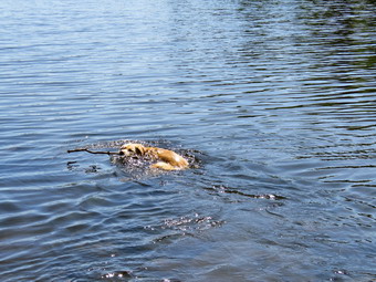 It didn't seem long at all until we were approaching the junction with the Big Rock Trail at 1.7 miles into the hike. By the time we were at the junction, we had already gained 600 feet and only had a little more elevation gain until we would start downhill. We turned right at the junction on the snowmobile trail and climbed another 120 feet to the highest point on the hike at a little over 1.9 miles. After hitting the high point, most of the rest of the hike was downhill. The Flynn Trail heads directly north from the trailhead but the snowmobile trail wanders first east, then south, the east, then north before finally heading southeast and south toward Mongaup Pond. As we descended from the high point we found evidence that there had been a stream of water flowing down most of the trail. The trail has become highly eroded and difficult to hike. Many of the rocks were covered with a thin film of water making them very slippery. The Flynn Trail and the snowmobile had been mostly dry to this point but now there was water running across and down the trail. Sheila was wandering off trail and then returning to us never getting very far away. At 3.1 miles we followed the trail as it turned southeast and then east still descending toward the pond. We finally hit a woods road and the trail leveled out. Just before getting to the roads that runs through the campground we came to a swampy area on the left and crossed a few small streams across the trail and some standing water. There were also several muddy areas and I hoped this wouldn't continue on the other trails. When we got to the roads, I wanted to put Sheila on her leash but I had forgotten it and improvised a lead with a hiking pole. We turned left and walked out to the main loop road to a T. We turned right and headed north toward the upper bed of Mongaup Pond. Eventually we turned right at an unoccupied campsite and walked toward the shore to pick up the trail around the pond in a clockwise direction. I took Sheila off her leash but told her "with" so that she would stay by me. We continued on the trail to the head end of the pond. I walked down to the shore and dropped my pack to take some pictures. I got out the camera and took some shots of Sheila swimming a fetching a stick. I also took pictures of the pond a few boats. I noticed the insects were starting to form a cloud so I got a drink and a snack and picked up my pack.
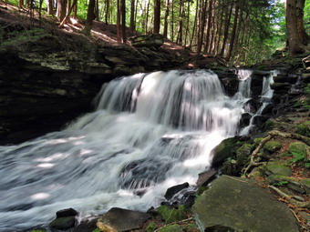 We continued around the pond in the snowmobile trail crossing several bridges and trying to avoid the wet and muddy areas which were much more numerous than I had hoped. At 5 miles we passed the junction of the Mongaup Willowemoc Trail on the left. I though about taking that trail to get back but knew that would lengthen the hike to over 10 miles. We continued on the snowmobile trail avoiding the mud as much as we could until we came to another junction at 5.75 miles. The trail to the rights leads out to the campsite so we turned slightly to the left to stay on the snowmobile trail. This trail passes by a swampy area on the right and some cliffs on the left. The result is that water runs off the cliffs toward the swap but gets trapped on the trail! This was by far the worst area for mud and water but it went by quickly. We were soon approaching and area of red pines that had been planted and I knew we were near the old Hunter Road that would take us back to the car. We followed the path through an open field and passed by some Japanese knotweed before turning right at 7.25 miles. We walked downhill on the old road which was wet but not muddy. I could hear Mongaup Falls ahead and at 7.6 miles we turned left to follow the informal path along the creek to the falls. I dropped my pack and took some pictures of the upper falls. When I walked back up to my pack, I noticed another pack and camera case and a family gathered at the base of the lower falls. I worked my way down the rocks next to the falls which were looser than I remembered. I told Sheila to stay so she wouldn't bother the family and took some shots of the falls from the side. Isa id "hello" to some of the people and then went a little farther downstream to get some shots of the falls head on. Sheila stayed where she was and I quickly completed my photography and we both went back to the upper level. I packed up and we headed back out to the main trail, turned left and walked up the hill to MonhGaup Pond Road. We crossed the intersection and walked up Beech Mountain Road back to the parking area d the car. It was 4:40 PM and we had spent 3 hours and 40 minutes hiking 8.1 miles. The elevation gain was 1190 feet most of which was the climb up the Flynn Trail. I was tired but felt good after the exertion of the hike.
![]()
![]()
![]()
![]() On Friday, June 21st I wanted to get out for a hike after I returned home from teaching chemistry for the day. Teaching has been fun and rewarding but also tiring but I knew I needed to get outside. I also wanted to et in a hike on the summer solstice even if it was a short one! By the time I returned home at 3:30 PM the temperature was 70 degrees. Although the skies were darkening, I decided to just go across the street to Round Top as we could easily return if it started to rain. I got dressed in a long-sleeved crew top but decided not to wear a baselayer. I put on a pair of RailRiders hiking pants which are expensive but last along time and have features like deep pockets and a generous cut which I really like. The pants have Velcro closures at the ankles which I hoped would discourage the ticks. I decided to wear my Vasque Taku hiking boots which have been my "go to" hiking boots. I had a pair of Leki external lock poles which I have been using lately. At 4:00 PM we walked out the door. I grabbed Sheila's leash from the car and we walked up the driveway. She pulled me up the driveway knowing exactly where we were going. We crossed the street with Sheila on her leash and walked on the street to the parking lot of the Presbyterian Church. From there we headed through the lot to the back of the church. We started the walk up the steepest hill behind the church. The hill is short but gets the circulation pumping as is the steepest and longest climb on the "trail." Sheila helped me along by pulling me up the hill. When we got to the top of the hill, we paused for a moment to take in the view before turning left at the trailhead. I let Sheila off her leash, and she began to explore the trail with her nose.
On Friday, June 21st I wanted to get out for a hike after I returned home from teaching chemistry for the day. Teaching has been fun and rewarding but also tiring but I knew I needed to get outside. I also wanted to et in a hike on the summer solstice even if it was a short one! By the time I returned home at 3:30 PM the temperature was 70 degrees. Although the skies were darkening, I decided to just go across the street to Round Top as we could easily return if it started to rain. I got dressed in a long-sleeved crew top but decided not to wear a baselayer. I put on a pair of RailRiders hiking pants which are expensive but last along time and have features like deep pockets and a generous cut which I really like. The pants have Velcro closures at the ankles which I hoped would discourage the ticks. I decided to wear my Vasque Taku hiking boots which have been my "go to" hiking boots. I had a pair of Leki external lock poles which I have been using lately. At 4:00 PM we walked out the door. I grabbed Sheila's leash from the car and we walked up the driveway. She pulled me up the driveway knowing exactly where we were going. We crossed the street with Sheila on her leash and walked on the street to the parking lot of the Presbyterian Church. From there we headed through the lot to the back of the church. We started the walk up the steepest hill behind the church. The hill is short but gets the circulation pumping as is the steepest and longest climb on the "trail." Sheila helped me along by pulling me up the hill. When we got to the top of the hill, we paused for a moment to take in the view before turning left at the trailhead. I let Sheila off her leash, and she began to explore the trail with her nose.
At the first trail junction, I followed Sheila as she continued straight ahead up the hill toward the lookout. I followed the yellow blazes up to the spur trail to the viewpoint and walked to the top of the hill. We made the turn to follow the trail uphill toward the next trail junction ignoring the lookout. At the junction, we turned right to follow the yellow trail along the base of Round Top. The vegetation is begging to close in and I made a note that trip with tools will be Ned soon. At the next trail junction, we turned left on the blue trail and walked up toward the summit of Round Top. Soon we were walking across the summit plateau. We started down the steeper side where I found the going pretty easy except for a few slightly muddy areas. Once we got to the yellow trail, we turned left and walked to the trail junction again. This time we turned right and followed the trail down to the woods road. We walked downhill on the woods road to the first trail junction finding one tree across the trail. I was still feeling fresh so we turned around to do another figure 8 in the opposite direction. We started back up the more gentle slope we had just descended. We followed the yellow blazes up the woods road to the next trail junction where we turned left to walk along the base of Round Top. At the next junction with the blue trail, we turned right and walked up the steepest hill on the trail. We made the summit of Round Top without a problem. Sheila was running around off the trail investigating various animal tracks. We walked across the summit and down the hill to the yellow trail. We turned right to again walk along the base of Round Top. At the next trail junction we turned left to walk down to the lookout. At the lookout we turned left and followed the yellow blazes on the trail back to the first trail junction. We continued straight ahead on the yellow trail to the trailhead. We walked down the cemetery hill under now sunny skies. At the base of the hill, I put Sheila on her leash and we walked back to our driveway. It was 5:00 PM and we had hiked 1.8 miles in just over an hour.