
What You Missed
Spring 2012
Spring 2012
![]()
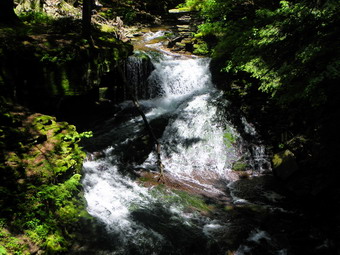
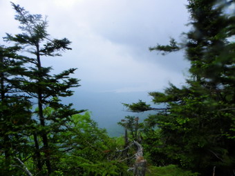
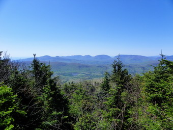
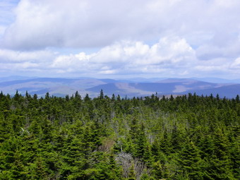
![]() On Thursday, June 14th, I decided to get Sheila out again since the weather forecast was spectacular. We had not been to Trout Pond in some time and I thought this would be a good choice. I also knew that the recent rains might have increased the flow at Russell Brook Falls. I had a number of jobs to take care of in the morning so that Sheila and I did not get parked on Morton Hill Road until 12:40 PM. We started down the road under very sunny skies. I immediately noticed that there was a swarm of small insects around my head but we continued anyway. Along the road there were two cars parked which is a rarity during the middle of the week. I took some time to walk off the road to my favorite viewpoint across from the upper falls. I took some pictures before we walked down to the lower parking area and then down the road to the falls. I almost decided to bypass the falls but changed my mind. Sheila and I jumped over a new downed tree and slid down the path to the stream bed. I took off my pack and hitched Sheila to a tree. After a few pictures. I retrieved Sheila and allowed her to frolic in the cold, running water. We continued our hike by returning to the main woods road and walking up to the outlet end of Trout Pond. We arrived at 1:15b PM after hiking 1.6 miles. As we turned down to the pond, I caught a glimpse of two animals headed up the hill away from the pond. They were "red" with bushy tails and I assumed they were red foxes. I tried to catch another glimpse but they were quickly gone. I took a few pictures of the pond before continuing to the inlet end and the lean-tos.
On Thursday, June 14th, I decided to get Sheila out again since the weather forecast was spectacular. We had not been to Trout Pond in some time and I thought this would be a good choice. I also knew that the recent rains might have increased the flow at Russell Brook Falls. I had a number of jobs to take care of in the morning so that Sheila and I did not get parked on Morton Hill Road until 12:40 PM. We started down the road under very sunny skies. I immediately noticed that there was a swarm of small insects around my head but we continued anyway. Along the road there were two cars parked which is a rarity during the middle of the week. I took some time to walk off the road to my favorite viewpoint across from the upper falls. I took some pictures before we walked down to the lower parking area and then down the road to the falls. I almost decided to bypass the falls but changed my mind. Sheila and I jumped over a new downed tree and slid down the path to the stream bed. I took off my pack and hitched Sheila to a tree. After a few pictures. I retrieved Sheila and allowed her to frolic in the cold, running water. We continued our hike by returning to the main woods road and walking up to the outlet end of Trout Pond. We arrived at 1:15b PM after hiking 1.6 miles. As we turned down to the pond, I caught a glimpse of two animals headed up the hill away from the pond. They were "red" with bushy tails and I assumed they were red foxes. I tried to catch another glimpse but they were quickly gone. I took a few pictures of the pond before continuing to the inlet end and the lean-tos.
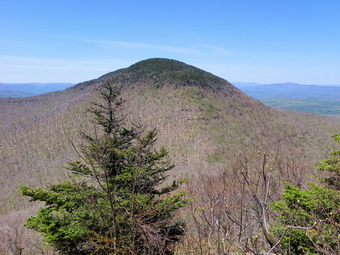
 As we approached the bridge there was a camper washing some dishes in the stream and another fellow at the upper lean-to. I took some pictures and then Sheila and I started up our Cherry Ridge. The day had grown warmer and more humid and the bugs surrounded me whenever we stopped. The walked up to the highest point on the hike on the shoulder of Cherry Ridge went quickly and the trail was in pretty good shape. The trail was a little overgrown in places and paying attention to good foot placement seemed to allow me to avoid any spills. Once at the highest point, we started the decent to the snowmobile trail near Mud Pond. We arrived at this junction at 2:25 PM having covered 4.1 miles in about 1 hour and 45 minutes! We turned left and walked up a little hill and then began the long descent back to the falls. From the area of the falls we walked out to the parking area and then back up Russell Brook Road to the car. We were back at the car at 3:00 PM having covered 5.7 miles in a total of 2 hours and 20 minutes.
![]()
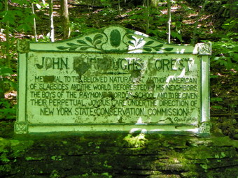
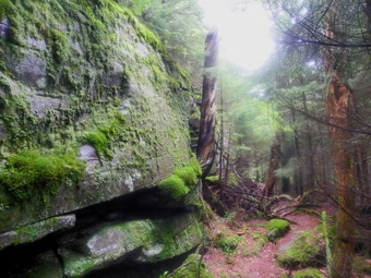
![]() On Wednesday, June 14th, I was sitting at home at about 8:30 AM contemplating where to hike. The weather forecast was favorable and I wanted to get out again. Lisa called at about this time to ask a question about the Burroughs monument in Rochester Hollow. An article she was reading told the story of the monument erected in 1921 by the Riordan School and an effort to restore the marker. I didn't know much about the monument and had never seen it as it was covered by snow the times I had been there. I suggested that we go there to find the monument and investigate the stone walls and foundations in the area. Lisa had to be back by mid-afternoon so I agreed to pick her up at her house at 9:30 AM. I did not want to bring Sheila as she still has to be on a leash. Sheba is still recovering from Lyme Disease and didn't seem too interested in hiking so I left home alone. I arrived at the appointed time and Lisa and I headed up the Beaverkill Road to Barkaboom Road. From there we took Route 30 and the NYC roads to Route 28. We turned right to head east through Margaretville, Arkville and High Mount. The turn onto Matayas Road is a left just after Rose Mountain Road and just before Big Indian. We parked at 10:20 AM and started our hike. The first 1.75 miles was slightly uphill and parallels a small stream. Our conversation had as a backdrop the sound of the water as it cascaded over the rocks in the stream. Part of the way up the wide woods road we stopped at two stone pillars. The area was obvious part of a large estate at one time and the stone columns formed part of the gate. After taking a few pictures, we continued our walk and by 11:05 AM we were at the sharp left turn where the monument was supposed to be located.
On Wednesday, June 14th, I was sitting at home at about 8:30 AM contemplating where to hike. The weather forecast was favorable and I wanted to get out again. Lisa called at about this time to ask a question about the Burroughs monument in Rochester Hollow. An article she was reading told the story of the monument erected in 1921 by the Riordan School and an effort to restore the marker. I didn't know much about the monument and had never seen it as it was covered by snow the times I had been there. I suggested that we go there to find the monument and investigate the stone walls and foundations in the area. Lisa had to be back by mid-afternoon so I agreed to pick her up at her house at 9:30 AM. I did not want to bring Sheila as she still has to be on a leash. Sheba is still recovering from Lyme Disease and didn't seem too interested in hiking so I left home alone. I arrived at the appointed time and Lisa and I headed up the Beaverkill Road to Barkaboom Road. From there we took Route 30 and the NYC roads to Route 28. We turned right to head east through Margaretville, Arkville and High Mount. The turn onto Matayas Road is a left just after Rose Mountain Road and just before Big Indian. We parked at 10:20 AM and started our hike. The first 1.75 miles was slightly uphill and parallels a small stream. Our conversation had as a backdrop the sound of the water as it cascaded over the rocks in the stream. Part of the way up the wide woods road we stopped at two stone pillars. The area was obvious part of a large estate at one time and the stone columns formed part of the gate. After taking a few pictures, we continued our walk and by 11:05 AM we were at the sharp left turn where the monument was supposed to be located.
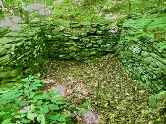
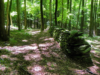 Where the road turned, Lisa and I split up to see if we could find the monument. I suspected it was a little further along on the road but I wanted to explore the woods. I found a rather well-defined path heading north and followed it until it all but disapprobation. At about this time Lisa called out saying she had found the monument on the road. I followed the path all the way back to the road and then headed west on the road a hundred feet or so to where Lisa was standing. The monument is just off the road to the north. It is need of restoration as the elements and son visitors have not been kind to it over the years. I took some pictures and then asked Lisa if we could hike into the woods and up the hill along one of the numerous stone walls. We headed along the stone wall to find that just a little further up the hill another wall paralleled it with what looked like a road between them. We turned a little east from that stone wall and crossed over another that was perpendicular to it. There was an extensive network of walls in this area and several small stone foundations. A long lane ran east-west and parallel to some of the walls. One of the foundations was just a built up platform whose function I could not guess. Farther up in the woods I came across the foundation I had spotted once during the winter. The woods and all of these features looked so different when not covered by several feet of snow! I walked back down from this area to the lane and found another, smaller foundation. I took more pictures. Lisa posed beside one of the stone walls to show it was higher than her head.
 We eventually decided to start back at about 11:50 AM by completing the loop. We walked along the lane and then turned left to head back down to the woods road. The road was overgrown in places and very wet in others. At one point the road opened up an there was a Len-to up the hill to our right complete with an outhouse. It appeared to be the same construction as a standard issue Catskill lean-to but was not marked on my map. We decided not to investigate and continued on to Rose Mountain Road. At about 3.9 miles we hit the road and began to walk down toward Route 28. We both remarked that the road down was steep and that we did not realize we had climbed so much on the woods road from the parking area. We continued on down the road commenting on the variety of the architecture found on some of the homes. By the time we reached Route 28, we had walked 1.4 miles on the road and dropped almost 900 feet. We took a left on Route 28 and walked a little more than half a mile back to Matayas Road. It was 1:00 PM when we got back to the car and we had covered 6.2 miles in just over 2.5 hours.
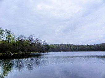
![]() On Monday, June 11th, I was ready to get out on a hike after more than a week of rain and track team commitments. I had spent the weekend at a high school near Syracuse with three members of the boys team who were competing in the state track championships. Sheila had not been out hiking in some time and that meant she was "eager" to go somewhere. Sheila is a very high energy dog and requires frequent exercise. I decided to go to Frick and Hodge Ponds since they are close to home and we were getting a late start. I knew that the trails might be wet as there had been a lot of rain. The skies were slightly overcast but there was no rain predicted. I did need to be at school by 3:00 PM to finish putting away track equipment, the last part of the track season. I got Sheila in the car and drove to the Frick Pond parking area. We got out of the car and were on the trail by 10:45 AM. My plan was to hike the loop around the two ponds by taking the Quick Lake Trail to the Flynn Trail back to the car. The Quick Lake Trail to Frick Pond was not as wet as I had expected and the recent trail maintenance had helped to divert some of the water off the trail. We got to the bridge across the Frick Pond outlet and I took a look at the view. The day was slightly overcast and I decided I had many better pictures of the area. As we walked around the pond, we stayed to the left on the Quick lake Trail. The blowdown along this part of the trail has simply become a fact of life. It seems no one is interested in clearing it so hikers have begun to take matters into their own hands and make their own trails around the mess. At one point we came to a log that was thigh high with ample space underneath for Sheila. Sheila decided to jump up on the log from a standing start. She had no trouble jumping up, balancing for a moment and then jumping down on the other side. By 11:25 Am we had hiked the 1.6 Niles to Iron Wheel junction and turned right to head toward Junkyard Junction on the Flynn Trail. This part of the hike was only a little wet but there was evidence of a lot of running water in the not too distant past. The walk seemed a little long but was pleasant as it was not too warm. At noon I saw the sign for the Flynn Trail to the right as we had hiked just over 3 miles. Even the Flynn Trail was only damp in most places with a few mud holes. We were soon at the gate and hiking down to the edge of Hodge Pond. I decided to take a right and go around the front of the pond. At 12:30 PM we stopped for a moment at the pond and Sheila immediately headed for the water. It seemed that only the leash prevented her from swimming across the pond. After a short break we headed up the Flynn Trail toward the junction with the Big Rock Trail. From this junction we headed down the Flynn Trail and back to the car. Along the way we encountered a mother partridge and some chicks. She made a lot of noise and wobbled away from her young brood. Sheila showed a definite interest in the birds. We were back at the car at 1:30 PM having hiked 6.5 miles in just over 2.5 hours. The GPS showed we had stopped completely for less than 5 minutes!
On Monday, June 11th, I was ready to get out on a hike after more than a week of rain and track team commitments. I had spent the weekend at a high school near Syracuse with three members of the boys team who were competing in the state track championships. Sheila had not been out hiking in some time and that meant she was "eager" to go somewhere. Sheila is a very high energy dog and requires frequent exercise. I decided to go to Frick and Hodge Ponds since they are close to home and we were getting a late start. I knew that the trails might be wet as there had been a lot of rain. The skies were slightly overcast but there was no rain predicted. I did need to be at school by 3:00 PM to finish putting away track equipment, the last part of the track season. I got Sheila in the car and drove to the Frick Pond parking area. We got out of the car and were on the trail by 10:45 AM. My plan was to hike the loop around the two ponds by taking the Quick Lake Trail to the Flynn Trail back to the car. The Quick Lake Trail to Frick Pond was not as wet as I had expected and the recent trail maintenance had helped to divert some of the water off the trail. We got to the bridge across the Frick Pond outlet and I took a look at the view. The day was slightly overcast and I decided I had many better pictures of the area. As we walked around the pond, we stayed to the left on the Quick lake Trail. The blowdown along this part of the trail has simply become a fact of life. It seems no one is interested in clearing it so hikers have begun to take matters into their own hands and make their own trails around the mess. At one point we came to a log that was thigh high with ample space underneath for Sheila. Sheila decided to jump up on the log from a standing start. She had no trouble jumping up, balancing for a moment and then jumping down on the other side. By 11:25 Am we had hiked the 1.6 Niles to Iron Wheel junction and turned right to head toward Junkyard Junction on the Flynn Trail. This part of the hike was only a little wet but there was evidence of a lot of running water in the not too distant past. The walk seemed a little long but was pleasant as it was not too warm. At noon I saw the sign for the Flynn Trail to the right as we had hiked just over 3 miles. Even the Flynn Trail was only damp in most places with a few mud holes. We were soon at the gate and hiking down to the edge of Hodge Pond. I decided to take a right and go around the front of the pond. At 12:30 PM we stopped for a moment at the pond and Sheila immediately headed for the water. It seemed that only the leash prevented her from swimming across the pond. After a short break we headed up the Flynn Trail toward the junction with the Big Rock Trail. From this junction we headed down the Flynn Trail and back to the car. Along the way we encountered a mother partridge and some chicks. She made a lot of noise and wobbled away from her young brood. Sheila showed a definite interest in the birds. We were back at the car at 1:30 PM having hiked 6.5 miles in just over 2.5 hours. The GPS showed we had stopped completely for less than 5 minutes!
![]()
![]() On Saturday, June 2nd, I had planned to do a hike starting at the end of the Finger Lakes Trail on the trail to Table. From here I was going to walk along the FLT as far as I could in 12 hours or so. This day was National Trails Day and the 50th Anniversary of the Finger Lakes Trail. The FLT Conference had planned section hikes along all 567.5 miles of the trail to celebrate the occasion. My plan fell through when the rest of my family came up with plans that took them away for the weekend and I could find no other ride back from wherever I ended the hike. When I went to bed on Friday night, I still wasn't sure what I would do in the morning especially because the forecast was for showers for most of the day. At 6:00 AM it was raining in Livingston Manor and I turned over to get some more sleep. By 8:00 AM the rain had stopped and the skies were clearing so I decided to meet a group to do one section of the hike. The meeting was to be at the Denning trailhead at 10:00 AM. I arrived at the trailhead to find Mary and soon Donna and Bruce arrived. Donna and Bruce were the hike leaders but they informed us it that we were it for this section of the hike. Shortly after 10:00AM we all piled into one car and drove to the parking area on Wild Meadow Road (Black Bear Road). We parked there, took a few pictures and started our hike toward the end of the Finer Lakes Trail at about 10:30AM. We knew the 13 mile hike would be mostly a road walk except for the last 3 miles on the trail from the Denning trailhead to the terminus of the trail. The end of the trail is about 1.5 miles from the Denning trailhead right where the trail branches off to cross the Neversink and ascend Table Mountain.
On Saturday, June 2nd, I had planned to do a hike starting at the end of the Finger Lakes Trail on the trail to Table. From here I was going to walk along the FLT as far as I could in 12 hours or so. This day was National Trails Day and the 50th Anniversary of the Finger Lakes Trail. The FLT Conference had planned section hikes along all 567.5 miles of the trail to celebrate the occasion. My plan fell through when the rest of my family came up with plans that took them away for the weekend and I could find no other ride back from wherever I ended the hike. When I went to bed on Friday night, I still wasn't sure what I would do in the morning especially because the forecast was for showers for most of the day. At 6:00 AM it was raining in Livingston Manor and I turned over to get some more sleep. By 8:00 AM the rain had stopped and the skies were clearing so I decided to meet a group to do one section of the hike. The meeting was to be at the Denning trailhead at 10:00 AM. I arrived at the trailhead to find Mary and soon Donna and Bruce arrived. Donna and Bruce were the hike leaders but they informed us it that we were it for this section of the hike. Shortly after 10:00AM we all piled into one car and drove to the parking area on Wild Meadow Road (Black Bear Road). We parked there, took a few pictures and started our hike toward the end of the Finer Lakes Trail at about 10:30AM. We knew the 13 mile hike would be mostly a road walk except for the last 3 miles on the trail from the Denning trailhead to the terminus of the trail. The end of the trail is about 1.5 miles from the Denning trailhead right where the trail branches off to cross the Neversink and ascend Table Mountain.
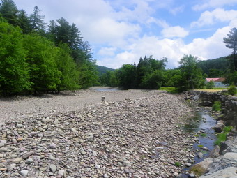
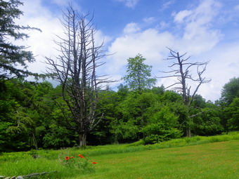 The walk down Black Bear Road to Round Pond went quickly and we were soon walking down Pole Road to Route 47, the Frost Valley Road. As the Neversink came into view, I took a few pictures from the hill. The river was high and muddy at this point. Road crews are still working to stabilize the bank that supports the road from erosion by the water. We turned right and headed for the Claryville Road. I stopped on the two bridges over the river to take a few pictures before turning right on the Claryville Road. Just upstream from the bridges I stopped again to take some shots of the cobble deposits left when the stream changed its course slightly during the fall hurricanes. It was about 11:30AM at this point and we had hiked 2.8 miles in an hour. I had elected to wear my Salomon trail running shoes instead of my hiking boots. This seemed to be a good choice as they are much more cushioned and have more support. We continued our walk as we passed through Claryville and headed toward the trailhead. The road crossed several tributaries and we stopped several times and I took some pictures. Around noon there was an especially nice stream so I stopped to take a few pictures and grab my sandwich to eat. We had noticed a plethora of yellow butterflies along pour route but their number seemed to increase the further we hiked. Around 12:30PM we hiked passed Red Hill Road that leads to the Red Hill fire tower. Just after 1:00PM we passed a small house that had windows that identified it as a former schoolhouse. Near this house were two dead trees that had very interesting shapes. I stopped to take a few pictures of the trees and the flowers near them.
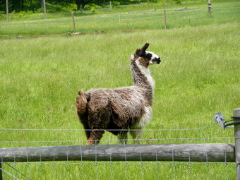 By 1:15PM we had hiked 7.8 miles and were at the East valley Ranch which belongs to Frost Valley. There was a lone alpaca in the field and I stopped to take a few pictures. The alpaca seemed mildly interested in me but would not turn around for a full frontal shot! After taking pictures, we continued on and finally passed Strauss House where the road turns to dirt. The dirt road was a little easier on the legs while hiking but the road starts uphill from this point. We noticed along the way that the river had change its course several times. In some places it was flowing almost perpendicular to the bank before making a 90 turn to again flow parallel to the road. In other place water was flowing through the trees and winding back and forth in odd pattern. At places along the way were 5 foot blue plastic tubes placed vertically. A peek inside one tube showed small trees being protected from the deer by the plastic. Mary and I got out ahead of Donna and Bruce so we continued on the road and were soon passing the Tisson House before arriving at the trailhead. It was 2:15PM and we had hiked 10.4 miles. We waited at the trailhead and Bruce appeared with Donna not far behind. Donna did not want to hike out to the end of the trail so Mary, Bruce and I headed out. I had changed to my boots since this part of the trail is always wet. We walked out the trail and all of us agreed that the soft earth was much nicer to walk on the hard macadam. The trail was wet but we made great time arriving at the end of the trail at 3:00 PM. We stopped to take some pictures before heading back. A young couple had started hiking out the trail at about 2:20PM with the intention of going to Table. While we were at the end of the FLT they were looking at the signs and trying to determine which way to go! We hiked back to the trailhead and arrived at the carts at 3:30PM. We had hiked 12.9 miles in 5 hours. Donna and Bruce got in my car for the ride to their car on Black Bear Road. We said goodbye to Mary and headed out. I really enjoyed hiking with these people and hope to do it again sometime. Donna and Bruce have both hiked all sections of the FLT and are going to start on the spur trails next.
On Wednesday, May 30th, I took Sheba out for a short hike over Round Top. Sheba has been a little lame lately and her Lyme test was very positive. All other tests were encouraging so I have been giving her rimedyl for her joint pain along with the doxycycline for the Lyme disease. I had been really missing her on hikes and thought that getting her out for some exercise would be a good thing. Once Sheba understood we were going for a walk she had a new energy in her step and trotted ahead of me. We crossed the road and headed up the hill by the cemetery before Turing into the woods to get on the road through the forest. We followed our usual route for a while before cutting up the hill just before the quarry. We walked around on ground we had not covered before until I eventually turned to Sheba and said "Home!" Sheba headed off like she knew where she was going but I soon realized that although we appeared to be heading in the right direction nothing looked familiar. Sheba tuned down a woods road that I had never seen before and trotted along like everything was OK. I was about to call her back and find the right route when I realized we were on the same road we had taken up just a little earlier. Sheba had somehow headed in the right direction and taken us to exactly where we needed to be. That's part of the reason why I miss her being with me on hikes!
![]()
![]() On Saturday, May 26th, I finally go to hike with Julie from New Hampshire. We had tried to get together on Thursday and Friday but the end of May is the championship part of the high school track season and I was busy. Julie had hiked Graham, Big Indian and Fir so she need just Friday, Balsam Cap, Doubletop and Blackhead to finish her 35's.'On Saturday we agreed to meet at 9:00 Am at the end of Moonhaw Road. When I left home, the forecast was for late afternoon thunderstorms so I was glad that we had decided on a relatively early start. As I drove out the DeBruce Road, I realized that I did not want to be on the DeBruce Road! I was far enough out that I decided to continue. I drove through Claryville and took Red Hill Road over to Sugarloaf Road and out to Route 52A near the Rondout Reservoir. From there, I drove to Sundown and out the Peekamoose Road to Moon haw Road. The parking areas along the Peekamoose Road appeared to be completely filled with campers. The parking areas at the Peekamoose and Ashokan High Point trailheads also looked busy. I did not bring either Sheba or Sheila on the hike. Sheila still needs to be trained so that I can let her hike without a leash. Sheba had been having some problems with lameness and I found out that her Lyme disease test was VERY positive! I arrived just after 8:45 Am to find Julie already waiting. We got ready and started our hike just before 9:00 AM. It was already hot and humid and the temperature was in the high 60's or low 70's. We bushwhacked up the hill through open forest and eventually found a wood road which we used briefly. There seemed to be many more paths through the woods than I remembered and some were quite clear. Our plan was to hit the Col between the two peaks and climb Friday first and then Balsam Cap. We followed some of the herd paths but they seemed to come and go. Eventually we decided we were headed too far to the north and started to head south. At this point we hit a path that looked very familiar and followed it to the col.
On Saturday, May 26th, I finally go to hike with Julie from New Hampshire. We had tried to get together on Thursday and Friday but the end of May is the championship part of the high school track season and I was busy. Julie had hiked Graham, Big Indian and Fir so she need just Friday, Balsam Cap, Doubletop and Blackhead to finish her 35's.'On Saturday we agreed to meet at 9:00 Am at the end of Moonhaw Road. When I left home, the forecast was for late afternoon thunderstorms so I was glad that we had decided on a relatively early start. As I drove out the DeBruce Road, I realized that I did not want to be on the DeBruce Road! I was far enough out that I decided to continue. I drove through Claryville and took Red Hill Road over to Sugarloaf Road and out to Route 52A near the Rondout Reservoir. From there, I drove to Sundown and out the Peekamoose Road to Moon haw Road. The parking areas along the Peekamoose Road appeared to be completely filled with campers. The parking areas at the Peekamoose and Ashokan High Point trailheads also looked busy. I did not bring either Sheba or Sheila on the hike. Sheila still needs to be trained so that I can let her hike without a leash. Sheba had been having some problems with lameness and I found out that her Lyme disease test was VERY positive! I arrived just after 8:45 Am to find Julie already waiting. We got ready and started our hike just before 9:00 AM. It was already hot and humid and the temperature was in the high 60's or low 70's. We bushwhacked up the hill through open forest and eventually found a wood road which we used briefly. There seemed to be many more paths through the woods than I remembered and some were quite clear. Our plan was to hit the Col between the two peaks and climb Friday first and then Balsam Cap. We followed some of the herd paths but they seemed to come and go. Eventually we decided we were headed too far to the north and started to head south. At this point we hit a path that looked very familiar and followed it to the col.
 Friday is known for its cliffs and ledges and with good cause. All along the herd path there were boulders and cliffs. The path actually leads straight to Balsam Cap so we took a right after about 2 miles to get up to the Col. From here the paths seemed to fade. At one point I knew it was possible to head left and climb up through the cliffs but I decided to head further into the Col and look for a way that was not quite as steep. We hit some ore ledges and cliffs but work through them until we were on the flatter top of the mountain. We knew that the canister had been relocated so we started to look for it. We followed several different paths with no luck. At one point we heard a dog "scream". We called and the dog came to us and was very friendly. She did not seem injured and had a collar with a Grahamsville address. We called for the owner but got no response. The dog continued to hike with us but twice yelped and ran away only to return. The last time we called for the owner again and heard him. We met up with the owner and his other dog and he explained that he had shock collars on both his dogs which explained the yelping. We split up and continued to search for the canister which Julie found at about 12:20 PM after nearly an hour of searching. We took a few minutes to sign in, get a snack and drink. Since we knew we had another mountain to go we headed back to the Col by a slightly different route. Once off the summit I started to head down but wandered to far west which Julie pointed out. We spent some time walking east to get back to the area where we had ascended to the Col. Once we were in this area, we found a herd path and started toward Balsam Cap.
 The herd path was pretty clear but I began to wonder if it was the one I had taken before since it seemed it was more to the west and higher. I also remembered that I had seen several "cliffy" areas which we were not seeing from the path we were on. I eventually figured out we were walking on top of the cliffs. The path we were on intersected the lower path. I recognized a path I had taken on the return from Balsam Cap last time. We walked out to the viewpoint over the Ashokan but it was completely covered in clouds and haze. As we walked the path bead steeper on the final ascent of Balsam Cap. On our way up we met a hiker who was coming over from an overnight at the Table lean-to. We chatted long enough to find out we was from New Jersey and was working on his 10th round of the Catskills! We continued our hike and were soon near the summit of Balsam Cap. We followed a few paths and hit the canister just before 2:00 PM. After signing in, we turned around and followed a slightly different route back until we passed the viewpoint. Just after the viewpoint, we decided to follow the path down and by 2:30 we were at the point where we had turned left up Friday. I tried to follow the exact path we had used to come up from Moon haw but kept wandering this way and that. Of course, the nature of bushwhacking is that there is no set path but I am usually better at stay on track. It took me some time to realize that the reason I am always on track on the way back is because I am following Sheba. At that point, I REALLY missed having her along! We arrived back at the cars at 4:15 PM having spent almost 7.5 hours covering 7.3 miles with a total elevation gain of 3100 feet. It was great hiking with Julie and I hope to finish with her on Doubletop.
On Monday, May 21st, I took Sheila headed across the street to do a short hike on Round Top. It had been over a week since I had hiked and I was ready to get out. This part of May is filled with track meets as we go into the championship part of the season. The track meets coupled with making plans for an upcoming wedding and some rainy weather had kept me off of the trails. As we crossed the street at 11:00 AM, I felt a few drops of rain but decided to try and get the hike in anyway. The forecast was for rain starting at noon and continuing on and off for at least three days! Sheila was more than ready to hike as she strained at the leash up the big hill behind the church. We cut into the woods and started out on the route we usually use. The trail and woods roads were a little damp but there was no mud or wet spots. The woods looked very different from the last time we had hiked this route about a month before. The trees have an almost full complement of leaves and the grasses and bushes were sprouting also. The vegetation gave the woods an entirely new look and some of the paths that had been obvious this winter were almost obscured. We walked passed the approach to the quarry and down the other side of the hill. I took the road that loops around the base of Round Top and headed around to the side near the Quickway. I started down our regular path but Sheila wanted to head in another direction so we walked closer to the ledges and over the top of one before descending the other side. The woods road took us down to the trail that parallels the highway and we stayed on that path until turning left on the woods road that leads to the clearing that overlooks Exit 96. We turned left at the clearing and walked up through the woods to the viewpoint and then competed the loop. There had been a few raindrops all along the way but there was an even heavier mist on the way back down the hill to the church. When we got to the church parking lot, the rain started to come down in earnest and we ran back to the house. We were both a little wet but happy to have been able to get in even a short walk.
![]()
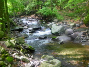
![]() On Saturday, May 12th, I decided to head up to the Blackhead Range as I had not been there for some time and I needed Black Dome and Thomas Cole for May. Attending a rare Thursday night track invitational had freed up Saturday and I was going to take advantage of that fact. I did have to be home for a dinner engagement so I thought the quickest route was to head up to Lockwood gap from the Batavia Kill parking area. From there we could do Black Dome and Thomas Cole and hike back to the col. Once in the col I could decided to summit Blackhead or just return to the car. As I drove out the Frost valley Road at around 8:15 AM there seemed to be a lot fewer cars in the parking areas than I would have expected on such a nice day. The temperature was in the high 50's and the forecast was for 70 degrees at some point. When I turned right on Route 23, I found signs indicating a bicycle race would pass through the area later in the day. We arrived at the Batavia Kill parking area at about 9:20 AM to find four cars already parked. Two cars drove in ahead of us but one parked and the other left. I assumed they were doing a car spot and were going to start their hike on Barnum Road. We were on the trail at about 9:20 AM. The trail and the Batavia Kill both showed signs of the recent rains. The creek was running high and the trail was wet on the lower parts. After crossing the two bridges, we came to the trail junction and headed right to continue on to Lockwood Gap. It seemed as if someone had done some trail maintenance since the trail was easier to follow than in the fall. The trail remains very rocky in places and can be steep. several switchbacks moderate the climb. I always enjoy the views of Blackhead and Black Dome that you get as you ascend the trail. Without many leaves on the trees the mountains seem to rise so high and precipitously as you walk the trail. By 10:20 AM we had hiked the 2 miles to the col and turned right to hike up Black Dome.
On Saturday, May 12th, I decided to head up to the Blackhead Range as I had not been there for some time and I needed Black Dome and Thomas Cole for May. Attending a rare Thursday night track invitational had freed up Saturday and I was going to take advantage of that fact. I did have to be home for a dinner engagement so I thought the quickest route was to head up to Lockwood gap from the Batavia Kill parking area. From there we could do Black Dome and Thomas Cole and hike back to the col. Once in the col I could decided to summit Blackhead or just return to the car. As I drove out the Frost valley Road at around 8:15 AM there seemed to be a lot fewer cars in the parking areas than I would have expected on such a nice day. The temperature was in the high 50's and the forecast was for 70 degrees at some point. When I turned right on Route 23, I found signs indicating a bicycle race would pass through the area later in the day. We arrived at the Batavia Kill parking area at about 9:20 AM to find four cars already parked. Two cars drove in ahead of us but one parked and the other left. I assumed they were doing a car spot and were going to start their hike on Barnum Road. We were on the trail at about 9:20 AM. The trail and the Batavia Kill both showed signs of the recent rains. The creek was running high and the trail was wet on the lower parts. After crossing the two bridges, we came to the trail junction and headed right to continue on to Lockwood Gap. It seemed as if someone had done some trail maintenance since the trail was easier to follow than in the fall. The trail remains very rocky in places and can be steep. several switchbacks moderate the climb. I always enjoy the views of Blackhead and Black Dome that you get as you ascend the trail. Without many leaves on the trees the mountains seem to rise so high and precipitously as you walk the trail. By 10:20 AM we had hiked the 2 miles to the col and turned right to hike up Black Dome.
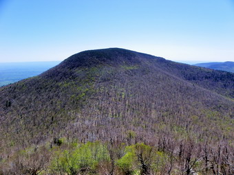
 At 3980 feet, Black Dome is the third highest peak in the Catskills. The trail to the summit starts rather gently and then turns into some rock scrambles as it nears the highest point. We climbed up through these areas with me giving Sheba a boost every now and then. Soon we were at the lookout which faces east toward Blackhead. I passed the first viewpoint and opted for the second which has a better view. Someone has cleared this lookout with tools as some small trees had been sawed off. This certainly makes for a nice lookout but I think people should leave the tools home unless they are doing trail maintenance and then they should stick to the trails! I took pictures of Blackhead and the countryside surrounding it including the lakes, Capra and Colgate to the south. We left the viewpoint and headed toward the summit. Along the way we met a solo hiker headed down to the col and we said "Hello" before continuing on. Once we climbed to the rather flat part of the trail, we walked to the lookout to the south which is very near the summit. We arrived at about 10:50 AM after hiking about 2.5 miles. We stopped briefly at the viewpoint and I took a few pictures before we continued on toward Thomas Cole. The trip down the mountain went quickly and we were soon in the flat area between the two mountains. With only a few leaves on the trees there were some limited views to the south from the trail. Soon we began the climb to the summit of Thomas Cole which, at 3940 feet, is only slightly lower than Black Dome. We hit the highest point on the trail at about 11:15 AM and 3.2 miles into the hike. I decided to take a little side trip off the trail to see if I could find the actual summit since it is not on the trail. Sheba and I walked off into the woods to the north and wandered around some until I judges we had hit the high ground. We returned to the trail and started back to Black Dome.
 As we passed the viewpoint on Black Dome, I was surprised that no other hikers were there. I was sure that more people would be on the mountain by mid-morning. We continued on down Black Dome to the col and near the bottom we began to hear voices. We met a group of about seven people heading up Black Dome. After a brief conversation we continued in our separate directions. In the col we met a family of three also headed up Black Dome. Sheba and I were both a little tired but Blackhead was so close I decided to head up to the summit. The trail is very eroded from hiking and water so many hikers have started to walk on the side of the gully that has been created. When we reached the lookout to Black Dome, we stopped for a snack and a drink. I took some pictures of Blackhead and some more of the lakes below. I also took some shots of the Devil's Path although they were hazy. After a short break, we continued to the top and walked the relatively flat path to the rock at the summit. I could hear some voices a little further along the trail but they seemed to be headed away from us. Since there is no view from the top, I decided to turn around and head back down to the col. I thought about descending the east side of Blackhead but I was not sure that Sheba and I were up to the steep descent. We were back at the Col by 1:00 PM about 5.8 miles into the hike. We met a black lab in the col who immediately ran back down the trail. Sheba seemed very interested in meeting this dog which is unusual. Soon the dog's owners showed up with overnight packs and we passed by each other with a brief greeting. The rest of the hike went quickly although the very last part over a series of small boulders in the trail was tedious. We were back at the parking area by 2:00 PM having covered 7.7 miles and 2900 feet of elevation gain in 4.5 hours.
![]()
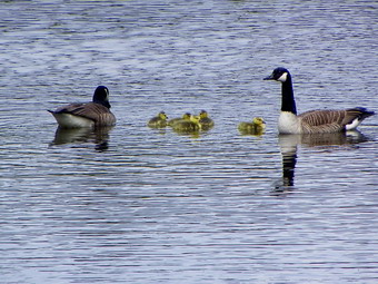
![]() On Friday, May 7th, I wanted to get out for a hike but the forecast was for thunderstorms. I decided to head for Frick and Hodge Ponds where I could choose from a variety of routes depending on the weather. I parked at the lot for Frick Pond at 11:15 AM and we got right to the hike. The trail out to the woods road looked nice after some of us had spent time on Sunday doing some trail maintenance. The woods road was very wet after the rain despite some efforts to redirect the water. Sheba seemed to be able to avoid the muddiest areas but Sheila needed my help as she wanted to "visit" every one of them. When we arrived at the first trail junction just before Frick Pond, I had planned to go right and head directly to Times Square and up Big Rock but Sheba turned left and we followed. I had not planned to take any pictures as I was more interested in hiking as far as we could before we had to head back. As we approached the pond, I saw some 3 pairs of geese on the pond and what appeared to be goslings with one pair! I tied Sheila to a tree and told Sheba to stay as I went down toward the pond. I took pictures of the pond, Flynn's Point and the geese. There were five goslings with the one pair and I got what turned out to be good pictures. At one point a goose from one of the other pairs approached the goslings. One of the parents made it very clear that they did not want any visitors. By this time Sheila was voicing her loneliness so I went and untied her and we crossed the bridge at the outlet. At the next trail junction Sheba led us around the back of Frick Pond to Times Square and we continued straight ahead up the Big Rock Trail. Sheila was setting a rapid pace as we headed up the trail which is not steep but ascends almost 600 feet over 1.1 miles to the Flynn Trail. At the Flynn Trail we turned left to head down to Hodge Pond. It was just after noon so we had made 2.3 miles in around 45 minutes.
On Friday, May 7th, I wanted to get out for a hike but the forecast was for thunderstorms. I decided to head for Frick and Hodge Ponds where I could choose from a variety of routes depending on the weather. I parked at the lot for Frick Pond at 11:15 AM and we got right to the hike. The trail out to the woods road looked nice after some of us had spent time on Sunday doing some trail maintenance. The woods road was very wet after the rain despite some efforts to redirect the water. Sheba seemed to be able to avoid the muddiest areas but Sheila needed my help as she wanted to "visit" every one of them. When we arrived at the first trail junction just before Frick Pond, I had planned to go right and head directly to Times Square and up Big Rock but Sheba turned left and we followed. I had not planned to take any pictures as I was more interested in hiking as far as we could before we had to head back. As we approached the pond, I saw some 3 pairs of geese on the pond and what appeared to be goslings with one pair! I tied Sheila to a tree and told Sheba to stay as I went down toward the pond. I took pictures of the pond, Flynn's Point and the geese. There were five goslings with the one pair and I got what turned out to be good pictures. At one point a goose from one of the other pairs approached the goslings. One of the parents made it very clear that they did not want any visitors. By this time Sheila was voicing her loneliness so I went and untied her and we crossed the bridge at the outlet. At the next trail junction Sheba led us around the back of Frick Pond to Times Square and we continued straight ahead up the Big Rock Trail. Sheila was setting a rapid pace as we headed up the trail which is not steep but ascends almost 600 feet over 1.1 miles to the Flynn Trail. At the Flynn Trail we turned left to head down to Hodge Pond. It was just after noon so we had made 2.3 miles in around 45 minutes.
 The hike down to Hodge Pond went quickly. The skies seemed a little darker at Hodge and I took some pictures. Sheila dove into the pond to splash around and I am sure she would have gone further out if she had not been on the leash. I decided to stay on the Flynn Trail rather than going around the back of the pond simply for some variety. We continued on the Flynn Trail around the pond and bore to the left as the trail ascends to the gate and then heads toward Junkyard junction. After the gate, the trail was very wet but not too muddy and we were at the junction by 12:40 PM having covered almost 4 miles in 1.5 hours. We turned left to head down the Quick Lake Trail and back to Frick Pond. There were some wet spots especially in the first part of this trail and then some running water as we approached Iron Wheel Junction. At the junction, we turned right to stay on the Quick Lake Trail. The blowdown on this trail continues to get worse since there has been no trail maintenance in years. Hikers continue to reroute the trail so that in some areas the walk never actually hits what was once the trail. The longer this continues the more work will have to be done to clear the many large trees that obscure the once clear woods road! When we crossed the small stream on the trail, Sheila took another opportunity to jump into the water. We were soon at Frick Pond where we found no geese. The hike back to the car went quickly. We arrived back at the car at 1:45 PM having covered 7 miles in 2.5 hours.
![]()
![]() On Monday, May 4th, I decided to head up the Beaverkill Road to hike Balsam Lake Mountain with the two dogs despite the gloomy skies. Sheila had proved she could hike hilly trail and now I wanted to get her out on some mountains. I waited until around noon for the showers to appear but despite the overcast skies there was no rain. As we left Livingston Manor and headed up the Beaverkill Road, the skies continued to become more threatening. The air was full of moisture and the air seemed "heavy" at the trailhead when I parked at 1:00 PM. There were no other cars present and I had seen none since Turnwood. We started to hike almost immediately and found there were some wet and muddy spot along the way. There was also some running water on the trail and some new blowdowns to avoid. Sheila was certainly ready to go as she set a fast pace along the woods road to the junction with the trail over the mountain. From the parking area to the junction is about .9 miles which we made in 15 minutes. We turned left up the steeper trail but Sheila showed no signs of slowing. There were a few insects around but I had to ditch my light windbreaker in favor of short sleeves as the temperature climbed into the high 60's. Soon we were passing the 3500 foot sign and heading for the spring. I was surprised that the dogs paused only briefly at the spring before continuing up the trail. Once on the summit plateau the pace quickened until the clearing and the fire tower were in sight. It was 1:45 when we got to the tower which meant we had covered 1.7 miles in 45 minutes.
On Monday, May 4th, I decided to head up the Beaverkill Road to hike Balsam Lake Mountain with the two dogs despite the gloomy skies. Sheila had proved she could hike hilly trail and now I wanted to get her out on some mountains. I waited until around noon for the showers to appear but despite the overcast skies there was no rain. As we left Livingston Manor and headed up the Beaverkill Road, the skies continued to become more threatening. The air was full of moisture and the air seemed "heavy" at the trailhead when I parked at 1:00 PM. There were no other cars present and I had seen none since Turnwood. We started to hike almost immediately and found there were some wet and muddy spot along the way. There was also some running water on the trail and some new blowdowns to avoid. Sheila was certainly ready to go as she set a fast pace along the woods road to the junction with the trail over the mountain. From the parking area to the junction is about .9 miles which we made in 15 minutes. We turned left up the steeper trail but Sheila showed no signs of slowing. There were a few insects around but I had to ditch my light windbreaker in favor of short sleeves as the temperature climbed into the high 60's. Soon we were passing the 3500 foot sign and heading for the spring. I was surprised that the dogs paused only briefly at the spring before continuing up the trail. Once on the summit plateau the pace quickened until the clearing and the fire tower were in sight. It was 1:45 when we got to the tower which meant we had covered 1.7 miles in 45 minutes.
 By the time we got to the tower the skies had cleared and I decided to go up to take some pictures. I tried Sheila to one of the tower legs and told Sheba to stay. I climbed to the landing below the cab and took pictures in all directions. Despite the cloudy skies, the visibility was good and the pictures interesting. After about 10 minutes, I headed back down, gave the dogs a drink and we started down the other side of the mountain. Descending is difficult for me without poles and with a dogs pulling me down the trail. We hit the main trail and turned right to go back to the parking area. The skies had brightened some and the sun was peeking through the clouds. The temperature was almost 70 degrees but the air was still very humid. We continued our quick pace on the hike back to the car. By 2:45 PM we were back at the car having covered 4.3 miles and a 1200 foot elevation gain in 1 hour and 50 minutes! I guess Sheila does mountains!
![]() On Thursday, May 3rd, I wanted to take get the dogs out after a couple of days of track commitment and rain. I decided to go to Trout Pond and walk the usual loop in a clockwise direction. The sky was overcast when we left Livingston Manor and that didn't change as I parked at the lot near the top of Russell Brook Road. We were on the road down to the falls at about 11:00 AM. Sheila was ready to go as I had to remind her not to drag me down the road! We quickly made the lower parking area and headed down to the bridge across the stream. We usually stop at the falls but it didn't look very different from the dozens of other times we had been there. I decided to skip the falls and we turned left after the register box to start up to Mud Pond. The road was damp near the bottom but was wet with running water by the time we reached the top and started down to the trail junction. We turned right on the trail over Cherry Ridge. This trail ascends for a while before dropping down to the shores of Trout Pond. It was good to be out and I soon removed the light windbreaker I had on as the temperature climbed into the 60's. The rain over the last few days had everything starting to sprout and was changing the brown to green. There did seem to be even more blowdown than usual along the trail bu7t much of it had missed the trail. Soon we were walking down the hill to the pond. The walk along the eastern shore was muddy in some places but not as bad as it has been in the past. We continued on down the road passing the outlet on the way. It wasn't long before we had competed the loop and were walking along the road back to the lower parking area. We were back a the car before 1:00 PM having covered the 5.5 mile hike in just under 2 hours.
On Thursday, May 3rd, I wanted to take get the dogs out after a couple of days of track commitment and rain. I decided to go to Trout Pond and walk the usual loop in a clockwise direction. The sky was overcast when we left Livingston Manor and that didn't change as I parked at the lot near the top of Russell Brook Road. We were on the road down to the falls at about 11:00 AM. Sheila was ready to go as I had to remind her not to drag me down the road! We quickly made the lower parking area and headed down to the bridge across the stream. We usually stop at the falls but it didn't look very different from the dozens of other times we had been there. I decided to skip the falls and we turned left after the register box to start up to Mud Pond. The road was damp near the bottom but was wet with running water by the time we reached the top and started down to the trail junction. We turned right on the trail over Cherry Ridge. This trail ascends for a while before dropping down to the shores of Trout Pond. It was good to be out and I soon removed the light windbreaker I had on as the temperature climbed into the 60's. The rain over the last few days had everything starting to sprout and was changing the brown to green. There did seem to be even more blowdown than usual along the trail bu7t much of it had missed the trail. Soon we were walking down the hill to the pond. The walk along the eastern shore was muddy in some places but not as bad as it has been in the past. We continued on down the road passing the outlet on the way. It wasn't long before we had competed the loop and were walking along the road back to the lower parking area. We were back a the car before 1:00 PM having covered the 5.5 mile hike in just under 2 hours.
![]()
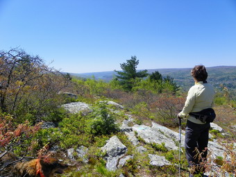
![]() On Sunday, April 29th, the weather was beautiful so Cindy and I decided to take a hike after church. After considering the long ride to Bear Mountain or northern New Jersey, we decided to stay a little closer to home and hike the Shawangunk Ridge Trail from Wurtsboro. We didn't want to take two cars so we planned to park at the VFW in Wurtsboro and hike out and back a few miles. I knew I was in for a workout since we were taking both dogs and Sheila is still on her leash most of the time. Having a dog on a leash makes using hiking poles impossible and I really miss them especially on the downhill parts. We parked at the VFW after noon and we were hiking by 12:15 PM. The trail markings can be confusing as they start out white ,turn to blue disks on state land and then have the aqua blazes of the Long Path once that trail joins. Actually, the first white blazed section is only a short spur trail that allows access to the SRT and ends at the junction with it. The trail rises with some steepness to the grade over the first half mile before making a switchback to avoid some rock outcrops. Within this first section, the white trail from the parking area joins the SRT and at this junction we turned left to head north. After only 1.1 miles, the trail passes over an open rock face with some nice views. We could see the Bashakill wetlands to the south and the Catskills in the northwest. Directly across to the west we could see Route 17 and a sand and gravel pit on the hill. In the valley below, the view we dominated by the Kohl's Distribution Center with the Wurtsboro Airport just to the north. Once we broke pout of the cover of the forest, we realized that the wind was quite strong as it whipped across the open ridge. At different times during the hike planes took off from the airport. In all but one instance the planes were towing gliders aloft. I took pictures from the ridge before we decided to continue on and get out of the wind.
On Sunday, April 29th, the weather was beautiful so Cindy and I decided to take a hike after church. After considering the long ride to Bear Mountain or northern New Jersey, we decided to stay a little closer to home and hike the Shawangunk Ridge Trail from Wurtsboro. We didn't want to take two cars so we planned to park at the VFW in Wurtsboro and hike out and back a few miles. I knew I was in for a workout since we were taking both dogs and Sheila is still on her leash most of the time. Having a dog on a leash makes using hiking poles impossible and I really miss them especially on the downhill parts. We parked at the VFW after noon and we were hiking by 12:15 PM. The trail markings can be confusing as they start out white ,turn to blue disks on state land and then have the aqua blazes of the Long Path once that trail joins. Actually, the first white blazed section is only a short spur trail that allows access to the SRT and ends at the junction with it. The trail rises with some steepness to the grade over the first half mile before making a switchback to avoid some rock outcrops. Within this first section, the white trail from the parking area joins the SRT and at this junction we turned left to head north. After only 1.1 miles, the trail passes over an open rock face with some nice views. We could see the Bashakill wetlands to the south and the Catskills in the northwest. Directly across to the west we could see Route 17 and a sand and gravel pit on the hill. In the valley below, the view we dominated by the Kohl's Distribution Center with the Wurtsboro Airport just to the north. Once we broke pout of the cover of the forest, we realized that the wind was quite strong as it whipped across the open ridge. At different times during the hike planes took off from the airport. In all but one instance the planes were towing gliders aloft. I took pictures from the ridge before we decided to continue on and get out of the wind.
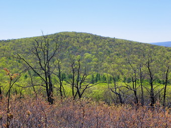 We had climbed about 600 feet from the parking area but the next part of the trail descended almost 400 feet before ascending the next ridge. The trail had several small switchbacks and crossed a woods road near the bottom. Once across the road we ran into several small streams that allowed the dog to get a drink. The next part of the trail passes over some very rocky ground with poor footing. The trail also passes through and area of the ridge that was burned several years ago. We could see that many of the trees were charred and some were dead. As we got higher on the ridge and started to walk out of the tree cover, we again noticed the wind. As we were climbing the ridge, we met two women coming back from their hike. They had hoped to make it to Cragsmoor but had turned back somewhere on the ridge we were climbing. The hike from Wurtsboro to Route 52 near Cragsmoor is about 9 miles and is best done with a car spot. As we climbed the ridge views began to appear again. The views were similar to those we had from the previous ridge. I got some nice shots of the ridge we had first ascended with the skeletons of the burned trees in the foreground. At about 2.25 miles a rather prominent trail or road crossed the SRT although nothing showed up on the GPS. I turned right and climbed the road to the top and found it continued over the ridge. I believe this road eventually meets Shawanga Lodge Road. We continued along our path as the trail rolled some through some brush. The trail eventually came to an area where there were some more views. This time we could see ahead to the next ridge and the Roosa Gap tower. The tower was once a fire tower and now is used for communications antennae. At this point we had hiked not quite 3 miles and Cindy wanted to turn around. I was a little more tired than usual having an active puppy on a leash and no hiking poles. We turned around just after 2:00 PM and headed back the way we came. The descents over the rocky trail sections were tiring as was the climb back up the first ridge. We did not stop on the way back as the views had not changed very much. We were back at the car at 3:40 PM having covered 5.7 miles in just under 3.5 hours.
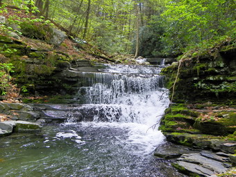
![]()
![]() On Friday, April 27th, I wanted to take a longer hike since I would be busy all day on Saturday with a track invitational. Connie was busy so I decided to head for Sam's Point near Ellenville to hike the big loop including Verkeerderkill Falls, the Escarpment and High Point. When I got up in the morning, the wind was blowing hard and the forecast was for sustained winds of 20 mph with gusts up to 40 mph. The temperatures were only supposed to be in the mid-40's so I changed plans and decided to hike the South Gully Trail which is more protected. When we got to the Loop Road and Sam's Point, I could decide to simply return or add some distance at Sam's Point. I parked on the shoulder of Route 52 by the South Gully trailhead just before 11:00 AM and Sheba and I got started right away. The first part of the trail dropped a little from the road to the stream that forms South Gully. At the bottom of the descent, I walked over to the stream and took a few pictures before getting back on the trail. This was the first time I had been on the trail since the hurricanes last fall and the changes are obvious. The stream is much wider as it has eroded the banks. Many places along the trail have blowdowns which were not there before. It seems that any tree that was dead or dying is now down and some area cross the trail. There are a few wet places on the trail but most are only in the area of small streams or spring with the rest of the surface being very dry. In places the trail almost disappears and hikers must sidehill. The slippery leaves and pine needles makes this section of trail interesting. Several times along the way we walked down to the stream and I took pictures of some of the small waterfalls and rapids. By noon we had hiked a little over 2 miles and crossed South Gully Road to continue the hike.
On Friday, April 27th, I wanted to take a longer hike since I would be busy all day on Saturday with a track invitational. Connie was busy so I decided to head for Sam's Point near Ellenville to hike the big loop including Verkeerderkill Falls, the Escarpment and High Point. When I got up in the morning, the wind was blowing hard and the forecast was for sustained winds of 20 mph with gusts up to 40 mph. The temperatures were only supposed to be in the mid-40's so I changed plans and decided to hike the South Gully Trail which is more protected. When we got to the Loop Road and Sam's Point, I could decide to simply return or add some distance at Sam's Point. I parked on the shoulder of Route 52 by the South Gully trailhead just before 11:00 AM and Sheba and I got started right away. The first part of the trail dropped a little from the road to the stream that forms South Gully. At the bottom of the descent, I walked over to the stream and took a few pictures before getting back on the trail. This was the first time I had been on the trail since the hurricanes last fall and the changes are obvious. The stream is much wider as it has eroded the banks. Many places along the trail have blowdowns which were not there before. It seems that any tree that was dead or dying is now down and some area cross the trail. There are a few wet places on the trail but most are only in the area of small streams or spring with the rest of the surface being very dry. In places the trail almost disappears and hikers must sidehill. The slippery leaves and pine needles makes this section of trail interesting. Several times along the way we walked down to the stream and I took pictures of some of the small waterfalls and rapids. By noon we had hiked a little over 2 miles and crossed South Gully Road to continue the hike.
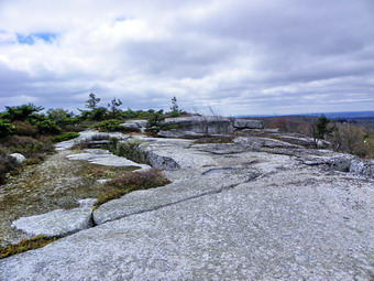 From South Gully Road the trail becomes a little steeper before leveling off near the top of the plateau. Over the first 2 miles we had gained just over 300 feet. In the next mile to the junction with the loop road, we gained almost 700 feet. We arrived at the Loop Road at 12:30 PM and I immediately noticed the wind. Along the trail I could hear the wind but we were protected by the trees. As soon as we broke out onto the loop road, the force of the find became obvious. The sustained wind speed was 20 mph with some gusts as high as 40 mph! I decided to hike in a clockwise direction around the loop so we turned left. Hiking on the road was easy compared to the trail. The road surface is flat and it is almost level with only a slight elevation gain. I heard a noise of machinery approaching as we walked passed the berrypicker's shacks and was surprised to see a LARGE dump truck coming toward us. I wondered what project was in progress on the plateau! (A sign near the visitor's center mentioned Loop Road Reconstruction.) As we hiked a series of cliffs appeared on our right. I had always been curious about these cliffs and when a path appeared on the right, we took the path and were soon on top of the cliffs. There were very nice views from the top of these cliffs and I took some pictures before realizing my hands were freezing and the wind was howling. We walked down to Lake Maratanza and through the brush to the shore. We stopped and I took a few pictures before we walked the path out to the loop road. We continued around the lake to the far side.
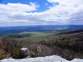 When we got to the far side of the lake, the wind picked up and formed whitecaps on the lake. When the waves hit the cement barriers on the near shore, the water splashed onto the road and sometimes made it over the road. I stopped to try to capture the whitecaps and breaking waves. I also was able to get views of the cliffs at Minnewaska and some of the other mountains. We avoided the waves and headed passed the road to the ice caves. I had thought about going down to the ice caves but was starting to get tired with over 4 miles of hiking to get back to the car. By 1:30 PM we had hiked 5.4 miles and were at the overlook at Sam's Point. The wind was blowing very hard as I snapped a few shots before leaving that exposed area. On the way down the road toward the visitor's center I noticed a large chuck of rock had fallen from the underside of one of the cliffs that makes up Sam's Point. We stopped so that I could take some pictures before continuing to the visitor's center where we made a right to get back to the South Gully Trail. Once we turned onto the trail, we kept up the fastest pace possible to get back to where I had parked. We stopped only for a drink as I just wanted to get back. We arrived at the car at 3:15 PM having covered 9.2 miles in 4 hours and 15 minutes. At some point in the hike I had though about stopping to take pictures of the waterfall on Route 52 but the only stop we made was at Stewart's in Ellenville for a drink!
![]() On Thursday, April 26th, I wanted to take Sheila out for another hike to get her some exercise. I decided to take only Sheila and give Sheba the day off. The weather forecast was for rain in the afternoon and I had track practice at 3:00 PM so I decided to stick close to home. I thought going to the Frick Pond area would be a good idea and planned to hike the Logger's Loop which I had not done in some time. When we arrived at Iron Wheel Junction, I would make a decision to hike back to Frick Pond on the Quick Lake Trail or to take the Quick Lake Trail to the Flynn Trail and Hodge Pond. I parked at about 11:00 AM and we got on the trail right away. The weather was warm but a breeze was blowing as we headed out the Quick Lake Trail to pick up the Logger's Loop Trail just before Frick Pond. At the trail junction we headed right and were soon as Times Square. Along the way the trail was marred by tracks that were too wide for an ATV. Some persons from "out West" had driven out the trail in a jeep despite the signs to the contrary. Their excuse was that they drive everywhere "out West". I hope they were fined for their careless and destructive behavior! Once at Times Square we headed up the hill on the Logger's Loop under ever darkening skies. The trail was wet in places but not as wet as it normally is. At 11:45 AM we had hiked 2,2 miles and were standing at Iron Wheel Junction. A light rain was beginning to fall but I decided to put on my Revo jacket and continue on the Quick Lake trail and to Hodge Pond. I had not taken any pictures to this point and did not plan to take any in the rain.
On Thursday, April 26th, I wanted to take Sheila out for another hike to get her some exercise. I decided to take only Sheila and give Sheba the day off. The weather forecast was for rain in the afternoon and I had track practice at 3:00 PM so I decided to stick close to home. I thought going to the Frick Pond area would be a good idea and planned to hike the Logger's Loop which I had not done in some time. When we arrived at Iron Wheel Junction, I would make a decision to hike back to Frick Pond on the Quick Lake Trail or to take the Quick Lake Trail to the Flynn Trail and Hodge Pond. I parked at about 11:00 AM and we got on the trail right away. The weather was warm but a breeze was blowing as we headed out the Quick Lake Trail to pick up the Logger's Loop Trail just before Frick Pond. At the trail junction we headed right and were soon as Times Square. Along the way the trail was marred by tracks that were too wide for an ATV. Some persons from "out West" had driven out the trail in a jeep despite the signs to the contrary. Their excuse was that they drive everywhere "out West". I hope they were fined for their careless and destructive behavior! Once at Times Square we headed up the hill on the Logger's Loop under ever darkening skies. The trail was wet in places but not as wet as it normally is. At 11:45 AM we had hiked 2,2 miles and were standing at Iron Wheel Junction. A light rain was beginning to fall but I decided to put on my Revo jacket and continue on the Quick Lake trail and to Hodge Pond. I had not taken any pictures to this point and did not plan to take any in the rain.
The next 1.2 miles up to Junkyard Junction seemed to go slowly but when we arrived at Junkyard Junction the rain had all but stopped. We turned right to pick up the Flynn Trail and head to Hodge Pond. The Flynn Trail was wet in places and the rain return but was never very hard. When we got to Hodge Pond we walked around the back of the pond and up the hill to the woods road that leads back to the Flynn Trail. I did this just for some variety. We made a left on the Flynn Trail and headed toward the junction with the Big Rock Trail. At 12:50 PM we had hiked 5.4 miles and I knew the rest of the hike was all downhill. We have hiked this part of the Flynn Trail so often that I almost fell asleep on the way down to the car. We were back at the car before 1:30 PM having covered 7.1 miles in 2 hours and 20 minutes for an average speed of 3 mph. My GPS showed our stopped time was about 3 minutes!
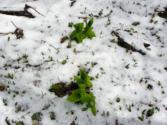
![]()
![]() On Wednesday, April 25th, I was ready to hike after a track meet and a few rainy days had kept us inside. I decided to head for Alder Lake to bushwhack from the parking area along some of the woods roads that parallel Cross Mountain Road and then up over Millbrook Ridge. After a walk along the ridge, I planned to head south toward the lake or the Millbrook Ridge Trail to get back to the car. I got a late start and did not get to Alder Lake until around 11:00 AM. The temperature was in the 40's and the skies were overcast and seemed to threaten precipitation which was not in the forecast. The sun was out but it still seemed cool as we walked back out the access road before cutting into the first parking area. We followed the road to the parking area and then out the back left corner. I had forgotten my GPS which was just as well since I needed some practice with only map and compass and there was no need for a track of a complete bushwhack of my own design. The road was mostly flat and paralleled Cross Mountain Road for some distance. Eventually the woods road converged with Cross Mountain Road and just before they met we turn right and headed up a steep hill. As we walked we continued to find woods roads that headed in different directions. As we would leave one road we would find another a little higher up. As we hiked there were a few deposits of snow down low and a few flakes in the air. We came across a track that went straight up the hill and took it. We eventually hiked up around and through some ledges which I thought were the top of the ridge. There were limited views of Barkaboom Mountain and the other ridges and valleys behind us. We paused at the top of a big rock and I took a few pictures. The snow in the air was increasing with some coming down as hard pellets. The higher we went the more snow was on the ground forming a white blanket over the green vegetation.
On Wednesday, April 25th, I was ready to hike after a track meet and a few rainy days had kept us inside. I decided to head for Alder Lake to bushwhack from the parking area along some of the woods roads that parallel Cross Mountain Road and then up over Millbrook Ridge. After a walk along the ridge, I planned to head south toward the lake or the Millbrook Ridge Trail to get back to the car. I got a late start and did not get to Alder Lake until around 11:00 AM. The temperature was in the 40's and the skies were overcast and seemed to threaten precipitation which was not in the forecast. The sun was out but it still seemed cool as we walked back out the access road before cutting into the first parking area. We followed the road to the parking area and then out the back left corner. I had forgotten my GPS which was just as well since I needed some practice with only map and compass and there was no need for a track of a complete bushwhack of my own design. The road was mostly flat and paralleled Cross Mountain Road for some distance. Eventually the woods road converged with Cross Mountain Road and just before they met we turn right and headed up a steep hill. As we walked we continued to find woods roads that headed in different directions. As we would leave one road we would find another a little higher up. As we hiked there were a few deposits of snow down low and a few flakes in the air. We came across a track that went straight up the hill and took it. We eventually hiked up around and through some ledges which I thought were the top of the ridge. There were limited views of Barkaboom Mountain and the other ridges and valleys behind us. We paused at the top of a big rock and I took a few pictures. The snow in the air was increasing with some coming down as hard pellets. The higher we went the more snow was on the ground forming a white blanket over the green vegetation.
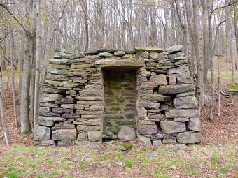 It turned out that we were not at the top of the ridge but we were on a flat area. I decided to walk along the cliffs and ledges to look for viewpoints. The area reminded me a lot of walking along Barkaboom looking for viewpoints. We walked until the flat area we were on started to disappear and no real viewpoints presented. I decided to head up to the top and find the highest point on the west end of Millbrook Ridge before heading back down to the lake. The brush was a little thicker near the to and we again had to work through some ledges but the land started to flatten. We walked to what looked to me like the highest point and found a cairn with yellow paint which I believe was a property line marker although I saw no others and this part of the ridge seemed to be well within the Balsam Lake Mountain Wild Forest. From the cairn we started to head directly toward the sun since it was now noon and I wanted to head generally south. The land sloped gently and we made good time finding some paths along the way At some point we began to run into some serious prickers which would plague us for some time. Some of the prickers were the regular blackberry/raspberry variety but others seemed to be roses of some type. The terrain became steeper as we dropped down some ledges and then hit a few open clearings. The prickers stayed with us even after I found a woods road to follow with a faint animal track. the problem with these woods roads is that they are open and get sunlight which allows the prickers to grow very nicely! At one point I looked up and got a view of Alder Lake and Cradle Rock Ridge. I took some shots but wanted a better view. We walked around trying to find a lookout but just found more prickers. We hit the woods road again and the track and continued to follow it back to the parking area at Alder Lake. I did find an interesting structure I had not seen before which was obviously part of the Coykendall estate. From the side it looked like a door into the side of the hill but the "door" was closed off. I think it must have been part of a stone wall of a building as there is a stone foundation nearby. We walked back to the car after spending about 2 hours and 4 miles exploring. My next adventure in this area will be to follow a similar route but walk farther out Millbrook Ridge to meet the trail that come up from Alder lake. I think I will do this BEFORE the prickers really come into their own.
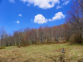
![]()
![]() On Friday, April 20th, I wanted to take a longer hike since I would be busy all day on Saturday with our first track invitational. Connie was busy so I decided to head for Dry Brook near Margaretville to hike the entire Huckleberry Ridge and Dry Brook Ridge Loop from Hill Road. I had done this hike only once before with my wife on a warm July day. Several miles of the lower loop were a sea of pricker canes with only a few red markers showing up here and there. We had to literally whack our way through these and try to find the trail at the same time. Cindy was so tired she waited a the Ploutz Road trailhead while I finished the loop over Dry Brook Ridge to the car. I was hit by massive cramps in both legs going up the last climb to Dry Brook Ridge. These were alleviated by finishing what water remained in my Camelbak. I was able to get to the car and pick up Cindy and Sheba. More recent trip reports seemed to indicate that the trail had been better maintained since our trip and I wanted to check it out. My previous GPS track indicated 11.2 miles but I remember4ed that we made a mistake so I was sure the loop would be under 11 miles! As I drove around the Pepacton Reservoir, the temperature continued to rise into the low 60's. I parked at the Hill Road parking area at 9:20 AM and we left the car just before 9:30 AM. The Huckleberry Loop trail is blazed red and heads south from Hill Road to meet Huckleberry Brook Road. The DEC sign indicated Ploutz Road was 5.4 miles ahead. The trail follows the road for about .7 miles to the trailhead parking area and then crosses the brook on a footbridge. The stream had some water in it and over the years has cut a channel into the rock which is completely smooth. After crossing the bridge, the trail heads steeply up the ridge using some switchbacks to keep the grade manageable. Because of the switchbacks the trail actually heads west before turning almost 180 degrees and heading southeast at 2 miles. Along the way the way were a few wet spots and a short walk along a woods road.
On Friday, April 20th, I wanted to take a longer hike since I would be busy all day on Saturday with our first track invitational. Connie was busy so I decided to head for Dry Brook near Margaretville to hike the entire Huckleberry Ridge and Dry Brook Ridge Loop from Hill Road. I had done this hike only once before with my wife on a warm July day. Several miles of the lower loop were a sea of pricker canes with only a few red markers showing up here and there. We had to literally whack our way through these and try to find the trail at the same time. Cindy was so tired she waited a the Ploutz Road trailhead while I finished the loop over Dry Brook Ridge to the car. I was hit by massive cramps in both legs going up the last climb to Dry Brook Ridge. These were alleviated by finishing what water remained in my Camelbak. I was able to get to the car and pick up Cindy and Sheba. More recent trip reports seemed to indicate that the trail had been better maintained since our trip and I wanted to check it out. My previous GPS track indicated 11.2 miles but I remember4ed that we made a mistake so I was sure the loop would be under 11 miles! As I drove around the Pepacton Reservoir, the temperature continued to rise into the low 60's. I parked at the Hill Road parking area at 9:20 AM and we left the car just before 9:30 AM. The Huckleberry Loop trail is blazed red and heads south from Hill Road to meet Huckleberry Brook Road. The DEC sign indicated Ploutz Road was 5.4 miles ahead. The trail follows the road for about .7 miles to the trailhead parking area and then crosses the brook on a footbridge. The stream had some water in it and over the years has cut a channel into the rock which is completely smooth. After crossing the bridge, the trail heads steeply up the ridge using some switchbacks to keep the grade manageable. Because of the switchbacks the trail actually heads west before turning almost 180 degrees and heading southeast at 2 miles. Along the way the way were a few wet spots and a short walk along a woods road.
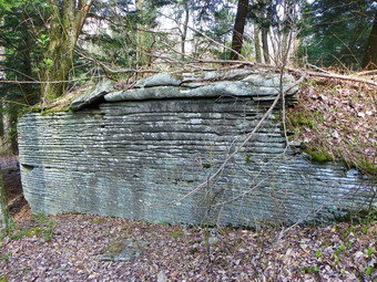 Once the trail turned to head southeast, we were walking on a road or path that became very narrow as it headed up through some pine trees. Near the top of this climb was a large glacial erratic and I stopped to take pictures and get a drink. From this point on the trail "rolls" over some small hills and passes through some clearings. One clearing was once a field and had a large stone cairn to mark the way. I stopped to take a few pictures before continuing on. The trail became very indistinct with very few blazes to mark the way. Some blazes were gone and others were on trees that were down. Blowdown along the trail also obscured the correct path. We began to run into areas where the trail was starting to get run over by prickers. The situation was not as bad as the last time I had hiked the loop but the growing season is still ahead of us! We ran across another large outcropping with very obvious layering. I took pictures before continuing. We reached the top of a small hill with what looked like a downhill section ahead of us. It was almost noon which meant we had been walking for about 2.5 hours. I thought we were keeping up a good pace and should have come to Ploutz Road by this time. I did not check my GPS as I use this mostly to record my track. We headed down the hill going almost due south before turning east and crossing a stream. This portion of the trail was very rocky and unstable under foot. As we crossed the stream I could see the road ahead. After crossing the road, we walked uphill to the trailhead parking area. The road looked in pretty good shape in this area but I knew there were some very rough spots between the end of the paved portion on the parking area! When we got to the parking area, we stopped for a drink and a snack. I checked the GPS and found we had walked at least 6.4 miles or a mile more than the DEC sign stated. I was not surprised since so many of the signs are wrong.
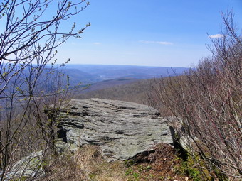 From the parking area we headed uphill to conquer Dry Brook Ridge. Just passed the parking area we crossed a country lane lined on both sides by stone walls. On one end is a large clearing surrounded by stone walls. I did not investigate the other end but I suspect the cattle barn was at the other end! My memories of the trail up to the ridge were that the trail was steep but it really wasn't too bad with only one steep spot near the top. From the parking area the elevation gain was over 1000 feet over 1.2 miles. We left the parking area at 12:30 and it took us only 45 minutes to get to the highest spot. By 1:20 PM we had hiked 7.7 miles and had arrived at the junction with the Dry Brook Ridge Trail. I knew that from this point on the trail was primarily downhill or flat with a few bumps. The walk from the junction to the viewpoints always seems longer than it should be but it went quickly. I stopped several times to take pictures but there was a haze over the hills and the reservoir so we moved on quickly. At 2:30 PM we arrived at the junction with the trail from German Hollow and Southside Road. We had already walked 10.2 miles as we made the left to head down the hill to the car. The temperature was comfortable and there was a slight breeze. The walk down to the car went swiftly as always. Walking through the tall red pine plantation over the thick carpet of needles is a most pleasant experience. The walk back to the car from the trail junction was a little over 2 miles. We were back at the car just before 3:30 PM. When I checked my GPS, I found we had covered over 12.4 miles in less than 6 hours with an elevation gain of 3200 feet. It may not be a 3500 foot peak but this hike is challenging. I wondered why my GPS distance was more than a mile longer than the last time. When I overplayed the two tracks, I found several areas where the previous track "smoothed out" a loop. The previous track had less than 300 points while the new GPS had recorded almost 2000! The increased number of points means greater accuracy and, in this case, a longer hike.
On Thursday, April 19th, I took Sheila and Sheba and headed for Round Top behind our church with the intention of doing a short hike in the beautiful weather. From the road up the cemetery hill, we turned right onto the path that starts the ascent of Round Top. At the first woods road we turned right and followed it up to the path that we use that connects that road with the next one up. We turned right on the next road and passed by the old bluestone quarry. We continued following the road until we got to the junction with the road that goes up the next hill. My intention was to cut the hike short here and just wrap around Round Top and head home. Sheba turned up the hill and Sheila and I followed. We climbed the next hill and continued to follow the road down the other side and around the far side of the hill. The weather was warm but not too hot and the walk was pleasant. Everything was very dry which made walking easier but I got the feeling that the smallest spark wood set the woods ablaze. Soon the road had wrapped back around the hill almost to the point where we had started up. At this point we turned right and continued to follow roads and paths around the base of Round Top. We passed another small quarry and followed a road down to the path that parallels the Quickway. After a short descent, we turned left on another road and walked to the clearing that overlooks exit 96. We started to bushwhack up the hill to the left to get back head toward the overlook of Livingston Manor. In the process, we scared up some deer who ran away slowly with tails held high. Sheila stared intently but did not pull on the leash. I did get the idea she was very interested! I let Sheba take the lead and she took us to the viewpoint. We walked down the woods road and back to the cemetery and then home. We walked about three miles and just under two hours in the warm weather and had a great time.
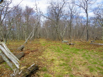
![]()
![]() On Tuesday, April 17th, I suggested to Cindy that we take a short hike up Denman Mountain with the dogs. She agreed and we headed off to Grahamsville. I turned onto Moore Hill Road just after the TriValley School and headed UP the road. Moore Hill Road is aptly named as it very quickly becomes steep and twisting as it gains elevation. The views from the road and the houses along the road are beautiful! I parked the car at the larger parking area at the corner of Moore Hill and Glade Hill Roads just before 10:00 AM and we started hiking immediately. The last few times I have hiked Denman I crossed the road and started out on the snowmobile trails. After a short walk on these trails, I had cut north through the woods as the trails go around the mountain and do not come near the summit. This time I decided to hike up the road and cut into the woods after the small parking area. The road is dirt and gravel after the larger parking area and was completely deserted with no traffic. As we hiked the road gained elevation gently and the weather was warm but not hot. I was able to let Sheila off her leash and she seemed more interested in exploring than bothering Sheba. It wasn't long before we passed the small pulloff and I began to look for a place to turn left into the woods. At about 1 mile into the hike we were still SSE of the summit but the road began to turn east. We turned into the woods and followed the contour of the land heading first northwest and the due west. We walked up a spine of land toward the summit and I began to pick up a path that was quite distinct. Around 1.3 miles the path began to look like a maintained trail and we followed it as it climbed the mountain. The path headed due west which was more toward the southern end of the summit plateau but we followed it was easy walking. Once at the top the path turned north and we continued on it as it headed directly toward the summit. The last time I had hiked Denman there had been a sea of ferns covering the top but on this day there was a sea of brown. The woods were extremely dry with few if any wet areas. We passed by an interesting rock formation and I stopped to take some pictures. Just a little further north I declared victory as I could find no higher ground. I noticed up ahead that there was a clearing and we walked to that area. The clearing had several woods roads that went in different directions and we stopped to get a drink. I took some pictures before we started to look for a viewpoint. It was 11:05 AM and we had covered 1.8 miles.
On Tuesday, April 17th, I suggested to Cindy that we take a short hike up Denman Mountain with the dogs. She agreed and we headed off to Grahamsville. I turned onto Moore Hill Road just after the TriValley School and headed UP the road. Moore Hill Road is aptly named as it very quickly becomes steep and twisting as it gains elevation. The views from the road and the houses along the road are beautiful! I parked the car at the larger parking area at the corner of Moore Hill and Glade Hill Roads just before 10:00 AM and we started hiking immediately. The last few times I have hiked Denman I crossed the road and started out on the snowmobile trails. After a short walk on these trails, I had cut north through the woods as the trails go around the mountain and do not come near the summit. This time I decided to hike up the road and cut into the woods after the small parking area. The road is dirt and gravel after the larger parking area and was completely deserted with no traffic. As we hiked the road gained elevation gently and the weather was warm but not hot. I was able to let Sheila off her leash and she seemed more interested in exploring than bothering Sheba. It wasn't long before we passed the small pulloff and I began to look for a place to turn left into the woods. At about 1 mile into the hike we were still SSE of the summit but the road began to turn east. We turned into the woods and followed the contour of the land heading first northwest and the due west. We walked up a spine of land toward the summit and I began to pick up a path that was quite distinct. Around 1.3 miles the path began to look like a maintained trail and we followed it as it climbed the mountain. The path headed due west which was more toward the southern end of the summit plateau but we followed it was easy walking. Once at the top the path turned north and we continued on it as it headed directly toward the summit. The last time I had hiked Denman there had been a sea of ferns covering the top but on this day there was a sea of brown. The woods were extremely dry with few if any wet areas. We passed by an interesting rock formation and I stopped to take some pictures. Just a little further north I declared victory as I could find no higher ground. I noticed up ahead that there was a clearing and we walked to that area. The clearing had several woods roads that went in different directions and we stopped to get a drink. I took some pictures before we started to look for a viewpoint. It was 11:05 AM and we had covered 1.8 miles.
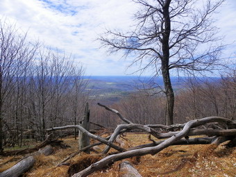 The last time I had been up Denman I had found a nice viewpoint on the west side of the mountain a little south of the summit. We headed west an began to look for this viewpoint or another. On many of the CHH peaks it seems as if a viewpoint is just ahead. The area that might have a view is almost always blocked by trees. We worked our way through the brush following some paths at times. Just above us a rather clear path led south but I thought it was a little high up for a view. We continued along without finding much except a clear view down to the snowmobile trail. Hiking when the leaves are not on the trees gives a totally different picture of the land. Eventually I spotted what looked like the area I had visited before and we head to it through some thicker brush. What I found was an area with some old downed trees and a lot of dead ferns. The last time through this area I was tripping over the logs which were hidden by the sea of green ferns. I found some views but I am not sure I got the same view as the last time. We continued to wander around the edge of the higher ground until Cindy had enough of pushing through the brush. On the southern end of the height of land a path headed ESE and down. We started out on this path which disappeared and reappeared. The dogs seemed to know where they were going so we followed them down the mountain. Soon I spotted the road and we walked to it just above the smaller parking area. We had hiked 2.7 miles and the trip down was only .5 miles. We walked back on the road arriving at the car at 12:15 PM. We had covered 3.5 mile sin 2 hours and 20 minutes which included a generous 40 minutes of stopped time. The weather was beautiful with a temperature in the mid 60's. To get back home we headed down Glade Hill Road which is steeper than Moore Hill Road and may have nicer views. We passed two different maple sugaring operations with extensive piping.
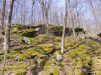
![]()
![]() On Monday, April 16th, I wanted to take the dogs out for a hike. The weather forecast was for sunny skies with a temperature of almost 80 degrees! I wanted to go to a different place or use a different route so we headed for the Frick Pond parking area to hike to Mongaup Pond. My intention was to hike up the Flynn Trail and then use the snowmobile trail to get to Mongaup. I wanted to return by bushwhacking up and over the ledges back to the Flynn Trail. I parked in the Frick Pond lot at 9:15 AM and we started our hike immediately. The temperature was already 60 degrees and was forecast to be 80 by the afternoon. We entered the woods and walked the short trail to the wide woods road that is the Flynn Trail. The skies were blue and the warm weather felt good at first. I let Sheila off her leash and tried to get her to curb her enthusiastic kamikaze runs which annoy Sheba! At 1.1 miles we were at the point where a right turn off the trail leads to an open clearing. This was the place I wanted to return to after hiking up the ledges. We continued on the Flynn Trail until we reached the four-way trail junction at 1.7 miles. It was 9:50 AM when we turned right to get on the snowmobile trail that leads to Mongaup Pond. The snowmobile trail continues to climb to the highest point on the hike at 2880 feet which is a 720 foot gain from the parking area. From this point the trail drops to Mongaup Pond but not without some Meade ring. The trail heads south then east then north before going east again and then south to the pond.
On Monday, April 16th, I wanted to take the dogs out for a hike. The weather forecast was for sunny skies with a temperature of almost 80 degrees! I wanted to go to a different place or use a different route so we headed for the Frick Pond parking area to hike to Mongaup Pond. My intention was to hike up the Flynn Trail and then use the snowmobile trail to get to Mongaup. I wanted to return by bushwhacking up and over the ledges back to the Flynn Trail. I parked in the Frick Pond lot at 9:15 AM and we started our hike immediately. The temperature was already 60 degrees and was forecast to be 80 by the afternoon. We entered the woods and walked the short trail to the wide woods road that is the Flynn Trail. The skies were blue and the warm weather felt good at first. I let Sheila off her leash and tried to get her to curb her enthusiastic kamikaze runs which annoy Sheba! At 1.1 miles we were at the point where a right turn off the trail leads to an open clearing. This was the place I wanted to return to after hiking up the ledges. We continued on the Flynn Trail until we reached the four-way trail junction at 1.7 miles. It was 9:50 AM when we turned right to get on the snowmobile trail that leads to Mongaup Pond. The snowmobile trail continues to climb to the highest point on the hike at 2880 feet which is a 720 foot gain from the parking area. From this point the trail drops to Mongaup Pond but not without some Meade ring. The trail heads south then east then north before going east again and then south to the pond.
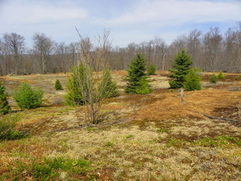 We arrived at the loop road at 10:45 AM after hiking 4.1 miles. I stopped to take some pictures of Mongaup Pond before continuing southwest on the loop road. I was looking for a place to start the bushwhack to the ledges and after about .3 miles on the road I found a woods road and took it. The road initially headed toward the ledges but then began to veer more north than west and away from the steeper ground. We turned due west to confront the steep ledges. As always a route presented itself and we headed up a path between some huge rock outcroppings. I stopped to take some pictures before continuing on up. Sheila seemed to be reluctant to go up the steeper slope and I realized it was her first time on this kind of terrain. We made it up through the first set of ledges to a flatter area before taking on the second set. Again, a route presented itself and we were soon at the top of the ledges. I wondered how close this was to the route we used descending the last time as nothing looked very familiar. At the top Sheba found a woods road which we followed briefly before turning west again to head for the clearing. When we broke out into the clearing, I was a little dismayed to find that the beautiful green carpet of moss was dry and brown. This area lies on top of a solid sheet of bedrock and is very sensitive to changes in moisture. I took some pictures before walking across the clearing to the Flynn Trail. The walk down the Flynn Trail is always a little "boring" but it seemed to go quickly. I had seen a few trout lilies blossoming along the way but there was an area on the trail near the trail register that had a carpet of flowers. I stopped to take a few pictures before finishing the hike. We arrived back at the car by noon having covered 6.4 miles in 2 hours and 45 minutes!
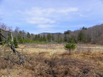
![]()
![]() On Saturday, April 14th, Cindy felt well enough to go for a hike on relatively flat ground. I suggested we take the dogs and head for the end of Wild Meadow Road (Black Bear Road) to hike the trail to the headwaters of the Beaverkill River. We had some early morning chores to get done so we didn't get started until afternoon. As we drove out to the trailhead on Wild Meadow (Black Bear) Road, we noticed that several of the hunting camps had members present. There had been some damage to the telephone and electrical lines along the road and the camp members were busy trimming trees and clearing the lines which are private after the first camp on the road. We parked at the end of the road near the turnaround since I did not think a snowplow would be called for on a day with temp in the 60's. We were hiking by 12:40 PM and walking along the road which leads to the last hunting camp. The walk along the road went quickly and we picked up the trail just passed the last camp where a truck was parked. As we hiked the road and then started out on the trail, we noticed that the forest was very dry. We did cross several streams which gave the dogs a chance to get something to drink. Sheila proceeded to try swimming in the small pools! At about 1.7 miles we passed the lean-to and noticed a small cooler by a stump at the side of the road. I debated putting in the lean-to but thought I would leave it and pick it up on the way back.
On Saturday, April 14th, Cindy felt well enough to go for a hike on relatively flat ground. I suggested we take the dogs and head for the end of Wild Meadow Road (Black Bear Road) to hike the trail to the headwaters of the Beaverkill River. We had some early morning chores to get done so we didn't get started until afternoon. As we drove out to the trailhead on Wild Meadow (Black Bear) Road, we noticed that several of the hunting camps had members present. There had been some damage to the telephone and electrical lines along the road and the camp members were busy trimming trees and clearing the lines which are private after the first camp on the road. We parked at the end of the road near the turnaround since I did not think a snowplow would be called for on a day with temp in the 60's. We were hiking by 12:40 PM and walking along the road which leads to the last hunting camp. The walk along the road went quickly and we picked up the trail just passed the last camp where a truck was parked. As we hiked the road and then started out on the trail, we noticed that the forest was very dry. We did cross several streams which gave the dogs a chance to get something to drink. Sheila proceeded to try swimming in the small pools! At about 1.7 miles we passed the lean-to and noticed a small cooler by a stump at the side of the road. I debated putting in the lean-to but thought I would leave it and pick it up on the way back.
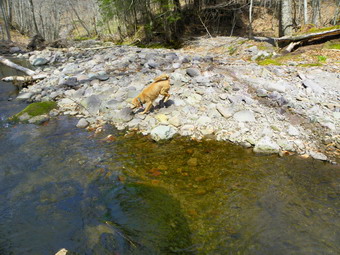 At about 2.3 miles we passed by a swampy area that is the origin of Fall Brook and contributes to the Beaver kill. We had been following Fall Brook for some time. The Beaverkill originates on the shoulder of Doubletop. This swampy area is always very wet but on this day was dry, at least near the trail. A little further on we met two fisherman coming from further up the trail. They happened to be a father and son I knew from Liberty. We talked briefly and continued in our separate directions. We did run into a few wet places on the trail until we finally ran out of trail. The Beaverkill has eroded away the trail so that hikers must walk up high on the bank or cross the river and bushwhack to the area where the trail picks up on the other side. Staying on the near shore and bushwhacking leads to a nice bridge but it is private property. We stopped at this point as was our intention. Sheila jumped into the river and played for some tine and I took pictures. When she is running around, it is hard to capture her antics. At about 2:00 PM we decided to head back for our 2.86 mile return trip. Along the way I stopped for some pictures of Doubletop across the swamp and though about the time I hike THROUGH the swamp to get to the summit of that mountain. The trip back went quickly and when we neared the lean-to we found the cooler was gone. We were back at the car at 3:15 PM having covered 5.7 miles in 2.5 hours. On our way back out to Pole Road we had to wait as the tree trimming operation had briefly blocked the road.
![]()
![]() On Friday, April 13th, I suggested to Connie that we hike from the Peekamoose parking area to Van Wyck and then follow the Catskill Divide to Table. From Table the trail would take us over Peekamoose and back to the car. I had though about doing this for some time since the route from Van Wyck to Table was new for me. I suggested this earlier in the week before my cold got worse! I almost called to postpone on Friday since I knew the hike was about 10 miles with 3000 feet of elevation gain but decided I was well enough to go. I got up early and did a few jobs before deciding that I just wanted to leave. I got my gear and Sheba and I left for the trailhead. The temperature warmed some as we drove toward West Shokan on the Peekamoose Road. I parked at about 8:35 Am and waited for Connie to arrive. There was one other car in the lot and Connie and another car arrived just before 9:00 AM. The other car was a father and his daughter who had started to do the 35s and had chosen Peekamoose for this day. As we all got ready to hike, I answered some questions and made a few suggestions. They seemed informed and pretty well equipped until I noticed both were wearing SANDALS! Of course, I NEVER wear sandals but I know others who do. I thought that despite the warm weather sandals were a questionable choice for the day. Connie and I started our hike by walking down the road to Bear Hole Brook and then heading off into the woods. Our intention was to head north along the ridge that leads directly to Van Wyck. Along the way we wanted to visit the two plane crashes. The lower crash site is a Korean War era fighter jet. The upper crash is a single engine plane crash that killed four people. We started off by following a woods road that headed slightly northeast but was easier than walking up the steep bank. At some point we headed off the road to the left and climbed the bank. Soon we were just to the west of an area I recognized from previous hikes. We found a woods road and followed it as it wound its way up the ridge north towards Van Wyck. We kept following woods road until we were in the area of the lower plane crash.
On Friday, April 13th, I suggested to Connie that we hike from the Peekamoose parking area to Van Wyck and then follow the Catskill Divide to Table. From Table the trail would take us over Peekamoose and back to the car. I had though about doing this for some time since the route from Van Wyck to Table was new for me. I suggested this earlier in the week before my cold got worse! I almost called to postpone on Friday since I knew the hike was about 10 miles with 3000 feet of elevation gain but decided I was well enough to go. I got up early and did a few jobs before deciding that I just wanted to leave. I got my gear and Sheba and I left for the trailhead. The temperature warmed some as we drove toward West Shokan on the Peekamoose Road. I parked at about 8:35 Am and waited for Connie to arrive. There was one other car in the lot and Connie and another car arrived just before 9:00 AM. The other car was a father and his daughter who had started to do the 35s and had chosen Peekamoose for this day. As we all got ready to hike, I answered some questions and made a few suggestions. They seemed informed and pretty well equipped until I noticed both were wearing SANDALS! Of course, I NEVER wear sandals but I know others who do. I thought that despite the warm weather sandals were a questionable choice for the day. Connie and I started our hike by walking down the road to Bear Hole Brook and then heading off into the woods. Our intention was to head north along the ridge that leads directly to Van Wyck. Along the way we wanted to visit the two plane crashes. The lower crash site is a Korean War era fighter jet. The upper crash is a single engine plane crash that killed four people. We started off by following a woods road that headed slightly northeast but was easier than walking up the steep bank. At some point we headed off the road to the left and climbed the bank. Soon we were just to the west of an area I recognized from previous hikes. We found a woods road and followed it as it wound its way up the ridge north towards Van Wyck. We kept following woods road until we were in the area of the lower plane crash.
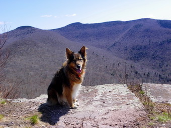 At around 10:00 AM we had hiked about 1.5 miles and I knew we were in the area of the lower crash. Connie headed a little further north and I turned to the west. Within a few hundred feet I caught a glimpse of metal in front of me and called to Connie as I walked over to the crash site. We took some pictures as we walked around the wreckage. It is still recognizable after almost 60 years. The stars and bars on the tail are still visible but faded. The cockpit and forward fuselage are non-existent but the tail section and engine are easily identified. The glide path is not completely clear. The wings are some distance from the plane. What has always bothered me is that some people find it necessary to scratch their names in the aluminum or to shoot holes in the wreckage. It is not clear to me why people would want to deface "monuments" like this or any other property for that matter. We left the crash site with Connie in the lead heading north. Her sense of direction is flawless and the bright sun made navigation easier. We had already removed some layers as it was nearing 70 degrees. After hiking about 2.75 miles we reached the upper crash site just before 11:00 AM. The debris from this crash is spread over a large area. As with the other crash, the forward part of the plane cannot be identified but the tail is almost intact. The glide path debris field indicates a glide path from the west or southwest but the tail section is pointed in that direction. The plane may have spun round and come to rest in its present position. As we left the plane crash site, we gain headed north directly toward the steepest part of Van Wyck. We decided that rather than look for a gentler grade we would attack the mountain head on. The slope was a 40% grade but less than .2 miles. The slippery leaves and loose soil made for an interesting ascent but soon we were near the top where the grade became more reasonable. We walked along the edge of the cliffs until we found the viewpoint.
 I had never been to this viewpoint before and it was wide open and very nice. The forest was still mostly brown with some green but I could only imagine what it will be like in the fall. I took lots of picture and we rested for about 10 minutes before pushing on. Our next stop was Table but it seemed we would have to drop down hundreds of feet and then climb that mountain again. We walked to the summit and then headed a little northeast to find the Catskill Divide. This is a ridge of land that separates the Delaware and Hudson watersheds. We found it and started to walk down a little from the summit. The Divide is about 50 feet wide and drops off on both sides. It is really and amazing "highway" between peaks and saved us dropping and regaining a lot of elevation. The area was pretty open and there was a slight path that was noticeable. We did descend about 350 feet to the col between Van Wyck and the next bump. There was no way to avoid this bump so we began another steep but short climb of about .3 miles. On the way up I stopped to take some pictures through the trees back to Van Wyck. Once at the top of the bump we dropped a little but then began a gain of over 600 feet to the top of Table. Near the top we skirted some thick forest by heading east but then struck out north through the last thick stand. We were surprised to see a good covering of snow near the summit and a packed and frozen trail we reached it at about 1:30 PM and 5/3 miles into the hike. We turned left to walk down the trail and then left again on the short spur trail to the lookout. It was a little hazy so the views were not spectacular and we turned around and started the descent toward Peekamoose.
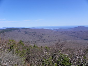 The distance between the summits is less than a mile but we took it easy as we had to descend and then ascend an icy trail. We hit the rock at the summit of Peekamoose at about 2:00 PM. We stopped to take a few pictures and then walked out to the viewpoint. I took a few shots and then it was time to start the long walk back down to the car. The hike to the top of Peekamoose and the hike back are always longer than I can recall. We did stop at the one lookout on the way down and also paused a moment at Reconnoiter Rock. Otherwise the trip down was a series of long descent with a few steeper areas and far too many rocks! We did meet several hikers coming up the trail who looked like they might have underestimated the hike. As we neared the bottom, I saw another hiker with three dogs ahead and attached Sheba to one of my hiking poles. I thought that it might be Heather Rolland who I had never met but I knew had several canines. I was wary as I had heard her dogs can be a little aggressive. When we met, I found out it was indeed Heather but that her dogs were really quite well-behaved and visited nicely with Sheba. We talked a little and then went in opposite directions. Eventually Connie and I hit the woods road that signaled the hike was nearing completion. It was still a longer hike to the car than I remembered. I was glad when I could see the road and very happy when we reached the cars. He had hiked 9.9 miles in just under 7 hours with about 3400 feet of elevation gain.
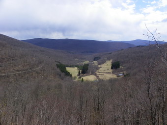
![]()
![]() On Wednesday, April 11th Lisa and Cindy were just getting over colds and I was beginning one. We decided to go to Barkaboom to explore for some viewpoints but not necessarily to go to the summit which has no view. We drove up the Beaverkill Road and made the left onto Alder Creek Road. Just before the entrance to Alder Lake, I turned left onto Cross Mountain Road. This road is always interesting as it is very narrow and rough with ruts! At the highest point on the road, just before it descends, I parked at a small pulloff on the left. We began our hike at about 1:15 PM by heading out on the woods road. As the road continues south, I turned east and up the mountain. After a short climb, we headed along the lower ledges where I had not been before. There wasn't much of a path and there were a lot of old pricker canes which foreshadowed what the area would be like later in the season. After about .5 miles of walking, we came across a viewpoint that was even more open than the ones on the ledges above. The views over to Millbrook Ridge were clear. There were also some nice, open views down to the Cross Mountain Camp below. The camp is on the site of what was the Edwards farm and has a pond a open fields. After taking some pictures, I walked along the ledges a little further but found no more viewpoints. We decided to go to the upper ledges and walked toward the base of the cliffs. The area between the two sets of ledges was a real "prickerfest"! At one point I decided to head up the steeper part of the ledges while Cindy and Lisa headed for a more gentle ascent. The route I chose was steep and seemed to be an old drainage but soon I was at the top of the ledges. I found the viewpoint Jim and I had discovered on the last hike. I took some pictures and then walked along the ledges looking for another viewpoint while waiting for Lisa and Cindy. I didn't find any other places that were open and soon I heard the ladies. I showed them the viewpoint and then we decided to head back. We took a slightly different line on the way back and hit the woods road a little to the southwest of our jumping off point. We walked the road back passing some nice rock outcroppings. We were back at the car by 2:50 PM having covered 1.7 miles in 1 hour and 40 minutes. The hike was short but the exploration was fun. After looking at the cliffs on the other side of the road a second time, I really want to climb up to Millbrook Ridge from Cross Mountain Road!
On Wednesday, April 11th Lisa and Cindy were just getting over colds and I was beginning one. We decided to go to Barkaboom to explore for some viewpoints but not necessarily to go to the summit which has no view. We drove up the Beaverkill Road and made the left onto Alder Creek Road. Just before the entrance to Alder Lake, I turned left onto Cross Mountain Road. This road is always interesting as it is very narrow and rough with ruts! At the highest point on the road, just before it descends, I parked at a small pulloff on the left. We began our hike at about 1:15 PM by heading out on the woods road. As the road continues south, I turned east and up the mountain. After a short climb, we headed along the lower ledges where I had not been before. There wasn't much of a path and there were a lot of old pricker canes which foreshadowed what the area would be like later in the season. After about .5 miles of walking, we came across a viewpoint that was even more open than the ones on the ledges above. The views over to Millbrook Ridge were clear. There were also some nice, open views down to the Cross Mountain Camp below. The camp is on the site of what was the Edwards farm and has a pond a open fields. After taking some pictures, I walked along the ledges a little further but found no more viewpoints. We decided to go to the upper ledges and walked toward the base of the cliffs. The area between the two sets of ledges was a real "prickerfest"! At one point I decided to head up the steeper part of the ledges while Cindy and Lisa headed for a more gentle ascent. The route I chose was steep and seemed to be an old drainage but soon I was at the top of the ledges. I found the viewpoint Jim and I had discovered on the last hike. I took some pictures and then walked along the ledges looking for another viewpoint while waiting for Lisa and Cindy. I didn't find any other places that were open and soon I heard the ladies. I showed them the viewpoint and then we decided to head back. We took a slightly different line on the way back and hit the woods road a little to the southwest of our jumping off point. We walked the road back passing some nice rock outcroppings. We were back at the car by 2:50 PM having covered 1.7 miles in 1 hour and 40 minutes. The hike was short but the exploration was fun. After looking at the cliffs on the other side of the road a second time, I really want to climb up to Millbrook Ridge from Cross Mountain Road!
![]()
![]() On Monday, April 9th, it was time to get out for some exercise with the dogs. I had spent Sunday celebrating Easter and gathering with my family and I was ready to hike. The route over Round Top just across the street is convenient but it gets boring after awhile so I decided to head for Long Pond to do a loop there. I thought about hiking the big loop that we usually do but in reverse starting with the road walk. I was concerned about the high winds but decided to go anyway. The temperature when we parked at 12:35 PM was 51 degrees but the wind made it feel colder. The first part of the hike is on Flugertown Road passed open fields and the wind was noticeable. Sheila was really moving along which kept Sheba and I moving also. After the first .5 miles or so the road becomes a "seasonal maintenance" road with a gravel/dirt surface. The "traffic" along this part is non-existent and we continued to make good time. The wind had abated some and we were sheltered by the trees. We did stop once on a bridge over the creek. Although the sunlight on the water was pretty it did not warrant pictures so we moved on. Soon we were passing by the turn onto the Mongaup-Willowemoc Trail and climbing a slight hill as the road continued to deteriorate. As we approached the point where the road turns to the peters Hunting Camp. I stopped to take some pictures of the camp with the hill in the background and then walked down to the camp and across the bridge. It was 1:20 PM and we had covered 2.6 miles. The bridge belongs to the hunting camp but they have recently given permission to reroute the hiking and snowmobile trails over the bridge. This avoids a stream crossing which is almost always swift and deep. We carefully followed the trail through their property and passed the beaver pond.
On Monday, April 9th, it was time to get out for some exercise with the dogs. I had spent Sunday celebrating Easter and gathering with my family and I was ready to hike. The route over Round Top just across the street is convenient but it gets boring after awhile so I decided to head for Long Pond to do a loop there. I thought about hiking the big loop that we usually do but in reverse starting with the road walk. I was concerned about the high winds but decided to go anyway. The temperature when we parked at 12:35 PM was 51 degrees but the wind made it feel colder. The first part of the hike is on Flugertown Road passed open fields and the wind was noticeable. Sheila was really moving along which kept Sheba and I moving also. After the first .5 miles or so the road becomes a "seasonal maintenance" road with a gravel/dirt surface. The "traffic" along this part is non-existent and we continued to make good time. The wind had abated some and we were sheltered by the trees. We did stop once on a bridge over the creek. Although the sunlight on the water was pretty it did not warrant pictures so we moved on. Soon we were passing by the turn onto the Mongaup-Willowemoc Trail and climbing a slight hill as the road continued to deteriorate. As we approached the point where the road turns to the peters Hunting Camp. I stopped to take some pictures of the camp with the hill in the background and then walked down to the camp and across the bridge. It was 1:20 PM and we had covered 2.6 miles. The bridge belongs to the hunting camp but they have recently given permission to reroute the hiking and snowmobile trails over the bridge. This avoids a stream crossing which is almost always swift and deep. We carefully followed the trail through their property and passed the beaver pond.
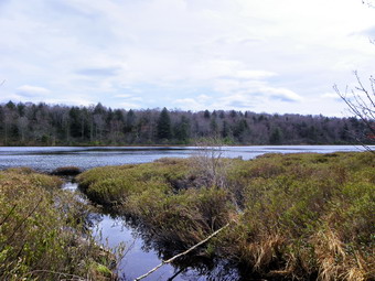 The road/trail started to climb and I released Sheila from her leash. The first thing she did was run full force into Sheba. Sheila has a lot of energy. I let her run free for some time since she now will always come when I call. As we approached a few muddy areas, I put her back on the leash as she loves to leap into these areas and dig! At 1:40 PM we made the turn onto the trail that leads back passed Long Pond to the parking area. We had completed 3.5 miles in just a little over an hour! The uneven surface of the trail and frequent muddy areas did slow us down some but we still made good time as we passed the spur trail to the lean-to and continued on toward the pond. At a little after 2:00 PM and 4.8 miles of hiking, we turned left on the spur trail down to the pond. Long Pond was higher than I expected and the sky by now was very overcast. I took a few shots and then we walked back up to the main trail. We kept up our fast pace as we walked up the last small hill. Hiking down the big hill to the car was harder than hiking up as there are a lot of loose rocks. We arrived back at the car just after 2:30 PM having hiked 6 miles in UNDER 2 hours!
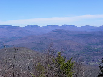
![]()
![]() On Saturday, April 7th, I decided to return to Moonhaw and hike to Samuel's Point. I wanted to actually get to the destination this time so I emailed a friend who suggested a general route and gave me some other tips. I parked at about 10:00 AM and Sheba and I started right in by crossing Wittenberg Brook. Sheba apparently did not like the looks of the fast flowing water so I had to encourage her to cross. Once across the brook we headed north on a woods road. When this road started to dip down, we bore right on what Hermit calls an ox road. I soon found out why it is an ox road as it became too steep for horses. We continued to head north sometimes on a road and sometimes striking out on our own. After about .9 miles, I decided that the road was headed too far to the west and we turned right to head northeast and UP the mountain. The climb was steep for about half a mile or so averaging over a 30% grade. I noticed we were headed up a ridge and turned away from it and toward Samuel's Point to the east. There was a short descent into a col between the bump we were on and Samuel's Point. After the col, we began the hike up to the Point. Hermit had advised me to skirt the laurel and walk around it and then up to the Point. I decided I wanted to make a straight line attempt and headed into the laurel...for about 50 feet. The laurel was so thick that I headed south to break out of its clutches and then walked the edge of the patch until there was clear sailing. As we started to walk up toward the highest point, I found many paths leading down. Since I had not been at Samuel's Point before, I thought there might be a better viewpoint down below and headed in that direction. After a short excursion, I found nothing and we clawed our way back up to path to the Point. After about 2.4 miles and 2 hours of hiking we arrived at Samuel's Point at just after noon.
On Saturday, April 7th, I decided to return to Moonhaw and hike to Samuel's Point. I wanted to actually get to the destination this time so I emailed a friend who suggested a general route and gave me some other tips. I parked at about 10:00 AM and Sheba and I started right in by crossing Wittenberg Brook. Sheba apparently did not like the looks of the fast flowing water so I had to encourage her to cross. Once across the brook we headed north on a woods road. When this road started to dip down, we bore right on what Hermit calls an ox road. I soon found out why it is an ox road as it became too steep for horses. We continued to head north sometimes on a road and sometimes striking out on our own. After about .9 miles, I decided that the road was headed too far to the west and we turned right to head northeast and UP the mountain. The climb was steep for about half a mile or so averaging over a 30% grade. I noticed we were headed up a ridge and turned away from it and toward Samuel's Point to the east. There was a short descent into a col between the bump we were on and Samuel's Point. After the col, we began the hike up to the Point. Hermit had advised me to skirt the laurel and walk around it and then up to the Point. I decided I wanted to make a straight line attempt and headed into the laurel...for about 50 feet. The laurel was so thick that I headed south to break out of its clutches and then walked the edge of the patch until there was clear sailing. As we started to walk up toward the highest point, I found many paths leading down. Since I had not been at Samuel's Point before, I thought there might be a better viewpoint down below and headed in that direction. After a short excursion, I found nothing and we clawed our way back up to path to the Point. After about 2.4 miles and 2 hours of hiking we arrived at Samuel's Point at just after noon.
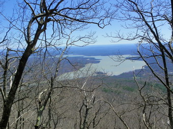 I us admit that I was a little disappointed with the views from Samuel's Point. I could get no clear views of the Ashokan and had to jockey for position to get the few shots not completely blocked by trees. I did walked along the edge of the point to get a few pictures of various hills. I also took pictures of some dry moss with some snow near it. We walked toward the center of the point since I wanted to see if there was a view of Wittenberg. There was a very limited view. I would like to hike to Wittenberg from this route sometime in the near future. We spent about 20 minutes on top before starting our return trip at about 12:30 PM. To return I sent Sheba up ahead and simply followed her all the way back. We avoided the trip through the laurel and, in places, Sheba found slightly easier paths than the ones we had taken on the way up. We didn't stop much on the way back except for a drink as it was hot and I was a little tired. We were back at the car by 2:00 PM having covered 4.7 miles in 4 hours with a total elevation gain of over 2100 feet. I am sure we will make better time on our next adventure to this area.
On Friday, April 6th, Brad and Krista were home for Easter. Brad was willing to go for a hike to exercise the dogs so we headed across the street to do the hike from cemetery to cemetery. The weather was warm and the sun was out which made hiking that much more fun. We repeated the route that has become the most common one for me by hiking passed the quarry. We stayed on the woods road and continued down the hill after the turn to the quarry. From that point we followed the woods road as it passed by some high ledges and steep hills on the right. There were only a few damp spots along the way. Eventually the road turned to the right and uphill. At this point we turned to the left to bushwhack as we headed downhill slightly still staying on the little ridge that goes toward the Quickway. This route heads southeast and passes through a nice grove of evergreens and over a few small streams. Eventually it becomes parallel to the highway. We dropped off the path a little to avoid a patch of barberries and roses before heading uphill and then dropping down to cross another stream or two. After about 2 miles we began the final climb up a hill to the woods road that goes near the Jewish cemetery. To get back we turned around and retraced our path following Sheba most of the way. Sheila was a little boisterous on the leash but is getting better. When we reached the woods road where we turned southeast we went to the left and then right up the hill on the road. The climb is rather steep and leads to the top of the unnamed hill that is south of Round Top. We continued over the hill and down the other side to the unction with the road we had taken around the hill earlier. We followed the road passed the quarry and then down the hill toward the Orchard Street Cemetery. From the top of the cemetery we headed back down to the church and across the street to the house. We hiked 4.4 miles in about 2 hours.
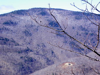
![]()
![]() On Thursday, April 5th, I was meeting Connie to hike to Samuel's Point from Moonhaw. When you stand on the summit of Wittenberg and look out over the Ashokan Reservoir, the hill that you see below that overlooks the reservoir is Samuel's Point. Connie had been there before so I decided I would just follow her lead. I brought my map and compass and GPS but didn't really plan ahead of time. I met Connie at the end of Moonhaw Road and we began our hike at about 9:15 AM. The weather was warm but a slight breeze kept it from feeling too warm. Although the stream sounded high, we crossed it without a problem and then walked slightly downstream to an area where the bank was not vertical. From this point on we started what would be a continuously steep climb. At first the climb was through open woods with only a few patches of brush. As we climbed we could clearly see Balsam Cap and Friday directly behind us. The cabin on the slopes of Friday was clearly visible as we climbed. At some point, we encountered some rocky areas but Connie easily found a way through them. At one point there was a difficult spot and Connie chose one way and I chose another. We regrouped on a rock that had a nice view of the cabin and we both took some pictures. We pushed through some laurel and then started to encounter some very steep ledges and cliffs. It was fun to pick our way through these and soon they began to level out as we neared the highest point. We took some more pictures along the way. By the time we were at the top of the ledges on more level ground we had covered less than a mile but had climbed over 1200 feet. The average grade was 32% with some pitches over 45%.It was around 10:40 AM so the entire climb had taken almost 1.5 hours!
On Thursday, April 5th, I was meeting Connie to hike to Samuel's Point from Moonhaw. When you stand on the summit of Wittenberg and look out over the Ashokan Reservoir, the hill that you see below that overlooks the reservoir is Samuel's Point. Connie had been there before so I decided I would just follow her lead. I brought my map and compass and GPS but didn't really plan ahead of time. I met Connie at the end of Moonhaw Road and we began our hike at about 9:15 AM. The weather was warm but a slight breeze kept it from feeling too warm. Although the stream sounded high, we crossed it without a problem and then walked slightly downstream to an area where the bank was not vertical. From this point on we started what would be a continuously steep climb. At first the climb was through open woods with only a few patches of brush. As we climbed we could clearly see Balsam Cap and Friday directly behind us. The cabin on the slopes of Friday was clearly visible as we climbed. At some point, we encountered some rocky areas but Connie easily found a way through them. At one point there was a difficult spot and Connie chose one way and I chose another. We regrouped on a rock that had a nice view of the cabin and we both took some pictures. We pushed through some laurel and then started to encounter some very steep ledges and cliffs. It was fun to pick our way through these and soon they began to level out as we neared the highest point. We took some more pictures along the way. By the time we were at the top of the ledges on more level ground we had covered less than a mile but had climbed over 1200 feet. The average grade was 32% with some pitches over 45%.It was around 10:40 AM so the entire climb had taken almost 1.5 hours!
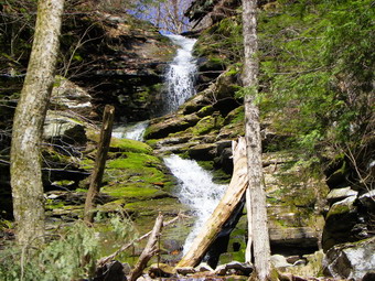 As the ground leveled we began to run into some very thick laurel as we wandered around looking for the highest spot and for a view. As we got near the eastern side of the summit we found limited views of the reservoir below. I could also see a rather prominent height of land to the northeast. After accounting for all the mountains, it was clear to me that we were looking at Samuel's Point. We still had some hiking to get to our destination. It was also clear that a direct route would mean dropping a lot of elevation which we would have to gain as we climb up the VERY steep side of Samuel's Point. We dropped off the height of land we were on and began to sidehill to see if we could find a ridge of land to get over to Samuel's Point. We walked along the side of the hill for about .3 miles and then had to make a decision. We could see a ridge ahead of us that would get us to our destination but it would involve more climbing and I had a commitment in the afternoon. I didn't want to bail out but in the end we decided to head up the slope again and return to the parking area. The way back to the top was steep but short and we were soon pushing our way through the laurel again. We hit the edge of the steeper ground where the laurel thinned and decided to start down. The ground was steep but there were no cliffs or ledges in the immediate vicinity. We continued down on a course roughly parallel to the route we had use in the morning but a little more to the north. We never did come across any ledges but eventually came across a woods road which we followed most of the way back to the parking area. By the time we were back I felt like I had done a very strenuous 6 miler. We were back at 12:30 PM and a check of my GPS showed we had covered 2.3 miles in 3 hours and 15 minutes for an average speed of under 1 mph! I knew that I would be returning soon to find another way to get to Samuel's Point. On the way home I drove back on the Peekamoose Road and stopped at several of the waterfalls. The volume of the falls was low but they were still pretty. BY this time the sun had shifted to illuminate the falls and it was almost too bright. I reminded myself to come in the morning to take some shots perhaps after a rain storm.
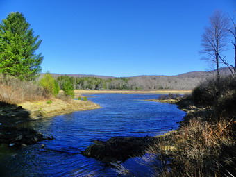
![]()
![]() On Tuesday, April 3rd, it was time to get out for some exercise with the dogs. I had spent the weekend celebrating Palm Sunday and participating in our choir performance and was ready to hike. The route over Round Top just across the street is convenient but it gets boring after awhile so I decided to head for Frick and Hodge Ponds to do a loop there. I thought about hiking around Frick and then up the Big Rock Trail to the Flynn Trail. We could then hike the Flynn Trail back to the car. We arrived at the parking area at 9:40 Am. Both dogs were more than ready to go. The temperature was in the high 40's but a stiff breeze made it feel cooler. We walked out the Quick Lake trail to Frick Pond trying to avoid some of the muddier areas. When we arrived at the pond, we found several pairs of ducks and geese on the pond. The sky was clear and blue so I stopped to take some pictures before heading over the bridge and around the pond. At the trail junction, we stayed to the right to take the yellow spur trail around the pond. The trail passes through some pines trees and has several wooden walkways over some wet areas. I was surprised to see a coating of snow on some of the walkways and a heavier layer in the woods. I took some shots so that others would believe me and then continued on to Times Square. At Times Square I did as planned and started up the Big Rock Trail. At this point I let Sheila off the leash and she enjoyed herself by running back up and down the trail. Sheila tends to run at Sheba and pass by very close which unnerves Sheba. I let this go on for a few minutes and then put Sheila back on the leash. She doesn't really seem to mind and it certainly gives me an upper body workout! There was some more snow as we ascended Big Rock and Sheila just had to play in it.
On Tuesday, April 3rd, it was time to get out for some exercise with the dogs. I had spent the weekend celebrating Palm Sunday and participating in our choir performance and was ready to hike. The route over Round Top just across the street is convenient but it gets boring after awhile so I decided to head for Frick and Hodge Ponds to do a loop there. I thought about hiking around Frick and then up the Big Rock Trail to the Flynn Trail. We could then hike the Flynn Trail back to the car. We arrived at the parking area at 9:40 Am. Both dogs were more than ready to go. The temperature was in the high 40's but a stiff breeze made it feel cooler. We walked out the Quick Lake trail to Frick Pond trying to avoid some of the muddier areas. When we arrived at the pond, we found several pairs of ducks and geese on the pond. The sky was clear and blue so I stopped to take some pictures before heading over the bridge and around the pond. At the trail junction, we stayed to the right to take the yellow spur trail around the pond. The trail passes through some pines trees and has several wooden walkways over some wet areas. I was surprised to see a coating of snow on some of the walkways and a heavier layer in the woods. I took some shots so that others would believe me and then continued on to Times Square. At Times Square I did as planned and started up the Big Rock Trail. At this point I let Sheila off the leash and she enjoyed herself by running back up and down the trail. Sheila tends to run at Sheba and pass by very close which unnerves Sheba. I let this go on for a few minutes and then put Sheila back on the leash. She doesn't really seem to mind and it certainly gives me an upper body workout! There was some more snow as we ascended Big Rock and Sheila just had to play in it.
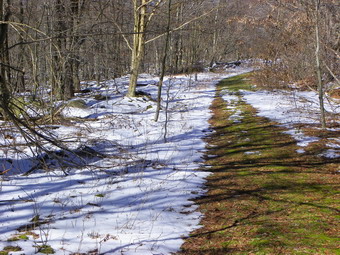 By 10:40 AM we had hiked the 2.25 miles to the junction of the Big Rock and Flynn Trails. I still felt fresh despite the ascent up Big Rock and the dogs seemed ready to go so we turned left on the Flynn Trail to head toward Hodge Pond. The walk down to Hodge went quickly and we were soon on the shores of the ponds. This was the first open water that Sheila had seen and she jumped in right away. If she had not been on a leash, I think she would have been swimming across the pond. I took some pictures of the pond and the beautiful blue skies and allowed Sheila to play in the water before we headed around the back of Hodge Pond and up the Flynn Trail. It was 11:20 AM and we had hiked about 3.6 miles. The Flynn Trail was damp in places but had now pools of standing water and few muddy spots. There was some snow along the way to Junkyard Junction. At the junction with the Quick Lake trail we turned left to head back toward Frick Pond. The temperature had risen to the 50's but there was still a breeze. By 12:10 PM we had hiked 5.7 miles and were at Iron Wheel Junction. Instead of continuing straight on the Logger's Loop, we turned right and stayed on the Quick Lake Trail. The hike down the Quick Lake Trail was not as easy as it could be as there was a lot of blowdown that has accumulated over several years. The DEC has not bothered to clear any of these trails and the snowmobilers concentrate on their own trails. A volunteer crew from the NYNJTC will be working in the area in the near future to help clear these trails. We were back at the car by 12:50 PM having hiked 7.3 miles in just over 3 hours.
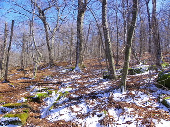
![]()
![]() On Friday, March 30th Jim Kennard and I had agreed to hike Barkaboom and Cradle Rock Ridge. After finishing Barkaboom, we headed for Alder Lake and arrived in the parking area at 1:00 PM to find no other cars. It didn't take us long to start our second hike of the day as we walked down to the lake and over the dam. We followed the trail around the south side of the lake until it began to head east. At some point, we headed a little to the southeast and up. The woods were very open and there was only a faint sprinkling of snow. I knew we would hit the western end of a ridge and have to walk along the ridge to the highest point. I like to get up to the higher ground as soon as possible and then have an easier hike across flatter ground and Jim agreed. The only problem with using this method was that we encountered some steep areas and some ledges we had to work through. The .6 mile hike from our turn off the trail to the flatter area near the top averaged about a 25% grade with some places being over 30%. In that short distance we gained over 700 feet in elevation. We took a few breaks along the way. Since there were no leaves on the trees, we could look down to see Alder Lake and Millbrook Ridge. Also, we could see back to Barkaboom and into the little valley where the Cross Mountain Camp is located. After about 1 hour and a little over a mile of hiking, we were on the summit ridge.
On Friday, March 30th Jim Kennard and I had agreed to hike Barkaboom and Cradle Rock Ridge. After finishing Barkaboom, we headed for Alder Lake and arrived in the parking area at 1:00 PM to find no other cars. It didn't take us long to start our second hike of the day as we walked down to the lake and over the dam. We followed the trail around the south side of the lake until it began to head east. At some point, we headed a little to the southeast and up. The woods were very open and there was only a faint sprinkling of snow. I knew we would hit the western end of a ridge and have to walk along the ridge to the highest point. I like to get up to the higher ground as soon as possible and then have an easier hike across flatter ground and Jim agreed. The only problem with using this method was that we encountered some steep areas and some ledges we had to work through. The .6 mile hike from our turn off the trail to the flatter area near the top averaged about a 25% grade with some places being over 30%. In that short distance we gained over 700 feet in elevation. We took a few breaks along the way. Since there were no leaves on the trees, we could look down to see Alder Lake and Millbrook Ridge. Also, we could see back to Barkaboom and into the little valley where the Cross Mountain Camp is located. After about 1 hour and a little over a mile of hiking, we were on the summit ridge.
 Once we were on the ridge, we continued to head southeast and up making sure we stayed on the highest ground around. It was a pleasant walk as the sun was out and the sky was bright blue with no clouds. After another .6 miles and 160 feet of elevation gain, we judged that we were at the highest point around. I took pictures of Jim and Sheba perched on a large boulder and we got a drink before heading down. I had noticed what looked like a marshy area to the north and we went over to check it out. The area would have been a marsh but there was little water available. We planned to head almost due north to get to the stream that runs into Alder Lake. Crossing the stream would put us on the Millbrook Ridge Trail which is the easiest way to get back to the parking area. The descent was more difficult than the climb as we kept running into areas of loose and mossy rocks. I felt like I was sidehilling the whole way down which was 700 feet over .6 miles. We eventually hit a drainage that was almost dry and followed it down to the stream. When I first looked at the stream bank, it seemed too steep to negotiate. I really didn't want to bushwhack west along the south side of the stream. I looked again at the bank and found a way down to the stream. The water crossing was easy but I wasn't sure how far we would have to climb on the steep bank on the north side of the stream. As it turned out the trail was very near and we were soon headed back to the lake on the trail. Once we got to Alder Lake we headed around the north shore. I took some pictures of Cradle Rock Ridge and stopped at the "lawn" to take some more. I also took some shot of Alder Lake and the stonework that remains from the Coykendall Mansion. The hike was 3.8 miles and took us about 3 hours. Nothing really looked familiar from previous trips and I was anxious to compare our route to the last route I had used. When I put the track on the computer, it was almost EXACTLY the same as the last time I had done the hike!
![]()
![]() On Friday, March 30th Jim Kennard and I had agreed to hike Barkaboom and Cradle Rock Ridge. Jim arrived at my house at about 9:45 AM and by 10:00 AM we were headed for Turnwood. We turned onto Alder Creek Road and then Cross Mountain Road just before the turn to Alder Lake. I had asked Jim if he would drive as I was not sure that my car would have enough clearance on Cross Mountain. As it turned out the road was rough but passable. I was glad that we did not meet any other cars as it was as narrow as ever. We parked at the very apex of the road just as it begins to descend on the other side. There is a small pulloff for two or three carts on the left side. A woods road start at the parking area and leads partway up the mountain. At 10:40 Am we headed out on the woods road and followed it a short distance before turning off the road to continue west and up. We walked through an swampy area with a small stream before climbing a little. After only .4 miles we had gained about 350 feet and were on a much gentler slope where we turned southwest to follow the ridge line to the highest point. Along the way looking to the left and right there seemed to be areas where there might be some views. I had walked to some of the areas on previous hikes and had found few if any viewpoints. We walked for about .5 miles and gained only 180 feet to get to the highest point on the mountain which was less than a mile from the car. The boulder near the summit looked familiar. We stopped for a drink and to shed some clothes as the skies had cleared and the sun was out.
On Friday, March 30th Jim Kennard and I had agreed to hike Barkaboom and Cradle Rock Ridge. Jim arrived at my house at about 9:45 AM and by 10:00 AM we were headed for Turnwood. We turned onto Alder Creek Road and then Cross Mountain Road just before the turn to Alder Lake. I had asked Jim if he would drive as I was not sure that my car would have enough clearance on Cross Mountain. As it turned out the road was rough but passable. I was glad that we did not meet any other cars as it was as narrow as ever. We parked at the very apex of the road just as it begins to descend on the other side. There is a small pulloff for two or three carts on the left side. A woods road start at the parking area and leads partway up the mountain. At 10:40 Am we headed out on the woods road and followed it a short distance before turning off the road to continue west and up. We walked through an swampy area with a small stream before climbing a little. After only .4 miles we had gained about 350 feet and were on a much gentler slope where we turned southwest to follow the ridge line to the highest point. Along the way looking to the left and right there seemed to be areas where there might be some views. I had walked to some of the areas on previous hikes and had found few if any viewpoints. We walked for about .5 miles and gained only 180 feet to get to the highest point on the mountain which was less than a mile from the car. The boulder near the summit looked familiar. We stopped for a drink and to shed some clothes as the skies had cleared and the sun was out.
 Jim and I decided to drop down from the summit to the top of the ledges and try to find a parallel route back to where we had hit the ridge. We ran into some pretty clear paths along these ledges and at one point I found a rock that had limited views to the south and east. We stopped to take some pictures before moving on. We continued to drop down through the ledges until the ledges turned into cliffs. We were able to walk along the top of the cliffs heading right back to our path up the hill. As we walked along the cliffs, I was looking for a viewpoint but was not really expecting one since I had not been successful in the past. At one point I looked ahead and saw a break in the trees and a large open rock face. We walked out to the rock and found that there were good views of Millbrook Ridge across the small valley with Cross Mountain Road clearly visible. Below us we could see the Cross Mountain Camp with open fields and a small pond. Even some of the hunting "shacks" along the road were easily seen. I took pictures of the valley and ridge and some of the mountains beyond before packing up. It was only a short distance along the cliffs and we spotted another viewpoint. This one had better views to the east and north and required a stop for a few more shots. Soon we were back on the path we had used earlier and we followed it back to the woods road and the car. The 2 mile hike had taken a little over 2 hours but the time we took to explore and find the viewpoints was time well spent!
On Wednesday, March 28th, Lisa wanted to go on a hike close to home which was perfect since the weather report included rain in the early afternoon. I took Sheila and Sheba across the street and met Lisa at the church around 10:00 AM. She wanted to hike from cemetery to cemetery and I was glad to show her the way. We repeated the route that has become the most common one for me by hiking passed the quarry. We stayed on the woods road and continued down the hill after the turn to the quarry. From that point we followed the woods road as it passed by some high ledges and steep hills on the right. There were only a few damp spots along the way. Eventually the road turned to the right and uphill. At this point we turned to the left as headed downhill slightly still staying on the little ridge that goes toward the Quickway. This route heads southeast and passes through a nice grove of evergreens and over a few small streams. Eventually it becomes parallel to the highway. We dropped off the path a little to avoid a patch of barberries and roses before heading uphill and then dropping down to cross another stream or two. After about 2 miles we began the final climb up a hill to the woods road that goes near the Jewish cemetery. To get back we turned around under ever darkening skies and retraced our path following Sheba most of the way. Sheila was a little boisterous on the leash but is getting better. When we reached the woods road where we turned southeast we went to the left and then right up the hill. The climb is rather steep and leads to the top of the unnamed hill that is south of Round Top. We continued over the hill and down the other side as the rain began to fall. Lisa had a rain jacket but I had only a water resistant softshell. As we headed back passed the quarry the rain intensified but was never very heavy. By the time I got home around noon I was pretty wet. We hiked 4.4 miles in about 2 hours.
On Tuesday, March 27th, I took Sheila and Sheba and headed for Round Top behind our church with the intention of hiking along the ridge from the Orchard Street Cemetery to the Agudas Achim Cemetery near Exit 97 on the Quickway. We hiked up the road on the edge of the cemetery and turned left on the trail through the woods. At the junction of the two woods road, I found that the deer head from a previous hike was gone but both dogs did seem interested in that spot. We stayed on the woods road and continued down the hill after the turn to the quarry. From that point we followed the woods road as it passed by some high ledges and steep hills on the right. There were only a few damp spots along the way. Eventually the road turned to the right and uphill. At this point we turned to the left as headed downhill slightly still staying on the little ridge that goes toward the Quickway. This route heads southeast and passes through a nice grove of evergreens and over a few small streams. Eventually it becomes parallel to the highway. We dropped off the path a little to avoid a patch of barberries and roses before heading uphill and then dropping down to cross another stream or two. After about 2 miles we began the final climb up a hill to the woods road that goes near the Jewish cemetery. To get back we turned around and retraced our path following Sheba most of the way. Sheila was a little boisterous on the leash but is getting better. When we reached the woods road where we turned southeast we went to the left and then right up the hill. The climb is rather steep and leads to the top of the unnamed hill that is south of Round Top. We continued over the hill and down the other side. We headed back passed the quarry and turned down through the woods to hit the road back to the trail to the cemetery. We continued back to the church and across the street to the house. We hiked 4.4 miles in under 2 hours.
![]()
![]() On Friday, March 23rd, I was planning to bushwhack North Dome and Sherrill as I had not done these peaks in some time. The approach to North Dome goes through and over some interesting ledges which require some scrambling. I had injured my right pinky the day before when Sheila bolted on the leash and it was still sore and swollen a day later. I decided that I wanted to do a "tamer" hike and headed for the Spruceton parking area to hike Hunter. I knew I wanted to Hike the loop to the fire tower but was undecided about other "side trips". When I left Livingston Manor the skies were sunny and the temperature was 55 degrees. As I drove toward Frost Valley the temperature rose to 65 degrees and the day was bright and beautiful. To my surprise the bridge on Route 47 passed the Panther hairpin turn was completed! It was nice to drive over it without having to slowly creep across the temporary structure holding my breath. Somewhere around Big Indian the skies became very cloudy and dark and the temperature bean to drop. It actually looked to me like it might rain as I drove up Route 214 passed Halcott. There were a few cars at all the trailheads and some hikers were just getting started. I turned right onto the Spruceton Road which is still in rough shape in places. Just outside of the hamlet the road bridge is being replaced and was down to one lane with a light. Further down the road there is a very rough patch where flooding eroded some of the road surface. The last part of the road is very rough but passable and work is being done to repair the road. I pulled into the parking area before 10:00 AM with the skies still overcast and the temperature at 55 degrees. Sheba and I started hiking just before 10:00 AM and the trail seemed in good shape with only a few wet spots. There was some evidence of increased erosion from the storms in the fall. I realized that I had been on Westkill since Irene and Lee but had not hiked Hunter since May of 2011, almost a year before!
On Friday, March 23rd, I was planning to bushwhack North Dome and Sherrill as I had not done these peaks in some time. The approach to North Dome goes through and over some interesting ledges which require some scrambling. I had injured my right pinky the day before when Sheila bolted on the leash and it was still sore and swollen a day later. I decided that I wanted to do a "tamer" hike and headed for the Spruceton parking area to hike Hunter. I knew I wanted to Hike the loop to the fire tower but was undecided about other "side trips". When I left Livingston Manor the skies were sunny and the temperature was 55 degrees. As I drove toward Frost Valley the temperature rose to 65 degrees and the day was bright and beautiful. To my surprise the bridge on Route 47 passed the Panther hairpin turn was completed! It was nice to drive over it without having to slowly creep across the temporary structure holding my breath. Somewhere around Big Indian the skies became very cloudy and dark and the temperature bean to drop. It actually looked to me like it might rain as I drove up Route 214 passed Halcott. There were a few cars at all the trailheads and some hikers were just getting started. I turned right onto the Spruceton Road which is still in rough shape in places. Just outside of the hamlet the road bridge is being replaced and was down to one lane with a light. Further down the road there is a very rough patch where flooding eroded some of the road surface. The last part of the road is very rough but passable and work is being done to repair the road. I pulled into the parking area before 10:00 AM with the skies still overcast and the temperature at 55 degrees. Sheba and I started hiking just before 10:00 AM and the trail seemed in good shape with only a few wet spots. There was some evidence of increased erosion from the storms in the fall. I realized that I had been on Westkill since Irene and Lee but had not hiked Hunter since May of 2011, almost a year before!
 We made the hairpin turn quickly and started the long but gentle climb to the turn up Hunter. The temperature increased as the sun came out and I began to get hot despite the fact that I was wearing a short sleeved shirt with my lightest windbreaker. The trail to the turn was a little rough but there was no snow or ice anywhere and this was continue for almost the entire hike. Soon we were at the trail junction having hiked the 1.7 mile distance in about 35 minutes! I was feeling good and Sheba was moving right along and I began to think about hiking out to the Colonel's Chair to see if there was any snow still on the slopes. I had not been out to the Hunter ski area in some time and though some pictures might be nice. As we made the turn, I decided to see how I felt when I got there since another option was to skip the Colonel's Chair and hike SW Hunter which I had not done in March. Our pace slowed a little as the grade on the trail to Hunter increased. When we reached the spring, I decided to flow the path that leads from the main trail away from the spring. I had never done this and found the path to be very wet. It led to another spring where a pipe had been driven into the hillside. The path continued passed the pipe and was actually blazed with yellow disks. I suspected that it led to the John Robb lean-to and so we continued to follow it. The trail led up through some rocks and then to the lean-to. I took the opportunity to drop my pack and remove the windbreaker which was soaked. I took some pictures of the valley and some of Rusk and Westkill. The sun was shining brilliance by now but there was a slight breeze. After a drink and a snack, we headed up through the rock scramble back to the main trail just below the 3500 foot elevation.
 By 11:05 AM we had hiked 2.5 miles and were at the turn for the Colonel's Chair. I knew that the hike was a little over 2 miles out and back but that the vertical drop was almost 450 feet! I decide that the views from the Colonel's Chair would certainly be better than those from SW Hunter so we turned and started down. The trail was wet in a few spots and very eroded. It wasn't long until we saw signs for the ski area. After a short, steep descent the trail followed a woods road out to the lift area. Just before the lifts we stopped at a lookout that has a statue of Rip Van Winkle. I took some pictures to the north and east and down into Hunter. Kaaterskill High Peak was very prominent as was the Blackhead Range. The sun was almost too bright for good photography! There was still snow on the slopes and there were more than a dozen people skiing down the very wet and granular slopes. We wanderer around and I took pictures of the slopes and the ski area. On the way back, we stopped at a new lift on a new double black diamond slope. There was a nice view to the north and west and Rusk was visible. After a short walk on the woods road, we met a couple hiking toward us. We said "Hello" to the only people we would see for the whole day. The hike back up to the main trail was easier than I had expected and went quickly. We turned left to hike the remaining mile or so to the top where we arrived at 12:35 PM. The trail up to the tower looked dry on the ascents but had a layer of water under the gravel which made it very muddy. Near the top where the trail leveled were the usual puddles and pools of muddy water but we were able to get around most of these.
 At the summit cabin, I dropped by pack and check the thermometer to find a temperature of 60 degrees in the shade. I got the camera and headed up the tower. The slight breeze at ground level became more vigorous as I ascended to just below the cab to take pictures. The day was bright and beautiful and I took a lot of shots in every direction. The Hunter ski area was easily visible which was interesting since we had been there a short time before. I descended the tower and walked back to my pack where I got a drink and ate my snaffle which I shared with Sheba. We headed back to the main trail and turned left to head down the mountain to complete the loop. This part of the trail is usually wet but was not bad on this day. We continued passed the turnoff for the Becker Hollow Trail and found some wet and muddy areas before starting the descent to the Devil's Path. The descent had some running water in places and was muddy in others. The erosion is unchecked by water bars and gets worse each time I hike it. By 1:35 PM we had hiked about 7.3 miles and were at the Devil's Acre lean-to. At this point I had already been considering hiking SW Hunter as I needed it for March. We continued passed the lean-to and up the hill toward the herd path the SW Hunter. When we arrived at the turn , we headed for SW Hunter. I knew the overall distance was less than two miles round trip and that the ascent to the canister was a little steep but short. Along the way there was some ice where hikers had packed down the snow but it was easy to walk around it. There were also some points which allowed a glimpse out at the scenery but none were clear enough to take pictures. We were at the canister by 2:05 PM after hiking 8.2 miles. I signed in and we immediately turned around and headed back. The return trip went quickly and we were soon back on the Devil's Path.
 The next part of the trail leads down along the side of the mountain and it was dry and easy to negotiate. We stopped at the last viewpoint that looks across to the other peaks and down the valley. I took pictures including some of SW Hunter. Back on the trail we ran into the usual muddy and wet areas but they were much less of problem than at any other time. After a slight gain in elevation, we began the long descent to the Diamond Notch Falls. This part of the trail is in incredibly poor shape. The water runs down the trail unrestrained by any water bars causing deep gullies and exposing rocks. The result is a very difficult and rough descent. Hikers, in an effort to avoid the rough trail, are starting to hike on the side of the trail which causes more erosion. We finally made it down to the falls at 3:40 PM about 10.9 miles into the hike. The bridge over the Westkill has still not been replaced. This surprised me as it is such a popular trail. I took pictures of the falls from above and then we made our way down to the stream bed. I took some more pictures before heading back up to the top. The stream has definitely changed its flow pattern with more water coming over the left side now. The walk back to the car revealed some serious erosion along the trail. In so0me Ares water washed over the trail taking much of the trail surface with it and leaving only large rocks. In other places The swollen stream has cut into the back and the trail has started slide into the stream. The walk to Spruceton Road went quickly and we walked the road back to the car to find one other vehicle parked there. It was 4:10 PM and we had covered 12 miles in just over 6 hours. Along the way we had visited most of the attractions that Hunter Mountain has to offer!
On Thursday, March 22nd, I took Sheila and Sheba and headed for Round Top behind our church with the intention of doing a short hike in the beautiful weather. As we started up the cemetery hill, another dog barked and Sheila pulled on the leash. Somehow my right pinky got caught in the leash. After I grabbed the leash, I inspected my finger to find it swollen and hurting. I decided to continue the hike since it didn't hurt that much and a walk always makes me feel better. We turned right onto the path that starts the ascent of Round Top and found, in the area of the first woods road, a deer head! Sheila seemed moderately interested so I quickly passed by that spot and walked up the hill to the viewpoint of the town. From here we turned right and up the hill toward the summit of Round Top. This was the route we had used for several years when snowshoeing but we had not used it for a least a year. It seemed strange going in that direction without snow on the ground. Once at the summit of Round Top we turned left and down toward the Quickway. At some point we crossed over a woods road and I though I might explore where it went but a quick look told me it simply wrapped around the hill and headed back to the summit. As we descended, we took a right and headed toward the ledges passing by the deer stand on the way. When we were at the junction that led up the next hill or back toward town, I decided to head back home. We followed the roads passed the path to the quarry and back down to the junction with the deer head. We walked back down to the church, crossed the road and were soon home. We spent a little more than an hour walking almost 3 miles in the beautiful sunshine with a temperature of almost 70 degrees.