| Pick a Scary 19 Peak: |
Patria HP
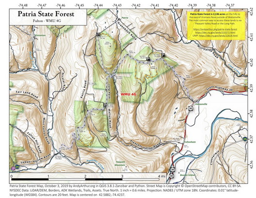
Patria HP is located in the Patria State Forest. Like many of the Scary 19 this high point can be reached from a very short hike from Snow Ridge Road. However, the easy way is not the most interesting way. It can also be accessed from the Patria Road parking area. For a more challenging approach, you can start from the parking area on Mallon Road and hike the Long Path and then bushwhack to the peak.
Clicking on the map below will allow you to download a full page, printable PDF map. (Courtesy of Andy Arthur)

| Quick Look | ||||
|---|---|---|---|---|
| Difficulty | Round trip | Total climb | Internet Map | Parking |
| 6.1 mi. | 1500 ft. | AllTrails | N42.5836 W74.4368 | |

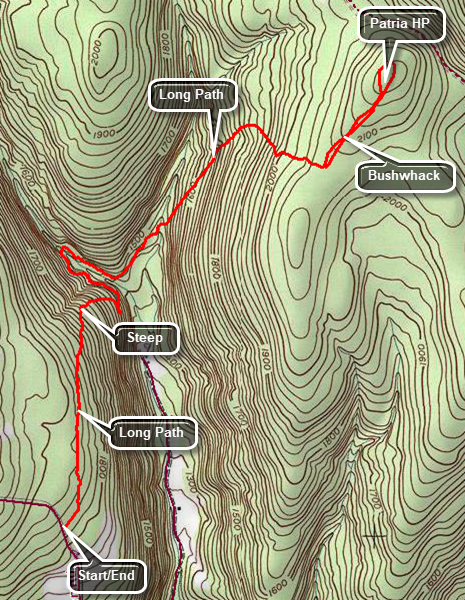
Head north on Route 30 through Margaretville, Roxbury and Grand Gorge. Watch for Max Shaul State Park on the left. Drive another 1.7 miles and turn left on Pleasant Valley Road At 2.1 miles from Route 30 Pleasant Valley Road heads right. Stay left on Mallon Road and drive 1.1 miles to the point where the Long Path crosses the road. Park on the side of the road making sure you are not impeding traffic. Get on the long path heading north. The first half mile of the trail is flat and seems easy. At .6 miles the Long Path begins to drop 400 feet in the next .5 miles. At the bottom of the descent the Long Path snakes around to cross a stream. On the other side the ascent begins. In .8 miles the Long Path gains over 600 feet at an average 15% grade. At 2.25 miles the trail turns from northeast to the southeast. At 2.6 miles the Long Path passes over a ridge. Turn to the northeast here and bushwhack about .4 miles to the highest point you can find. To return to your car reverse the route that you took on the way out.
 (The image shows the profile of the hike. Remember that all vertical profiles are relative!)