Wright Pond Cliffs
| Quick Look | |||||
|---|---|---|---|---|---|
| Difficulty | Round trip | Total climb | Location | Elevation | Internet Maps |
| 3.15 mi | 848 ft | N40.9755 W74.7039 Sussex | 1120 ft | AllTrails | |

The peak and Westby are on a private game preserve that only occasionally grants permission to hike. If you have a chance to go on a hike here, grab it and hike BOTH peaks! Don't even think of hiking without permission!
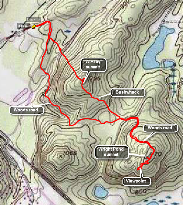
From Route 206 take the Andover-Mohawk Road east. Turn right on Roseville Road and then take the first left. You should start to see the POSTED signs for Hudson Farms. Park wherever the Hudson Farms employ yes tell you to park which is usually by "Wood Operations". Walk out on a woods road to the southeast. At about .8 miles the road turns east and you should stay on it. At 1.2 miles the road turns south and takes you up to the top of the peak. The high point is just off the trail to the right. For a good viewpoint follow the road over the peak and then bushwhack southwest. An open rock slab provides great views of Wright Pond. Get back on the road and follow down the mountain to about 2.3 miles. Start to bushwhack through open woods over some large rocks toward the northwest. Around 2.7 miles you should be on top of Westby. Continue to bushwhack northwest and descend a steep hill to meet the woods road just minutes short of the parking area.
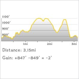
 (The image at the left shows the profile of the hike. Remember that all vertical profiles are relative!)