Waterloo Mountain
| Quick Look | |||||
|---|---|---|---|---|---|
| Difficulty | Round trip | Total climb | Location | Elevation | Internet Maps |
| 2.3 mi | 595 ft | N40.9228 W74.7553 Sussex | 1080 ft | AllTrails | |
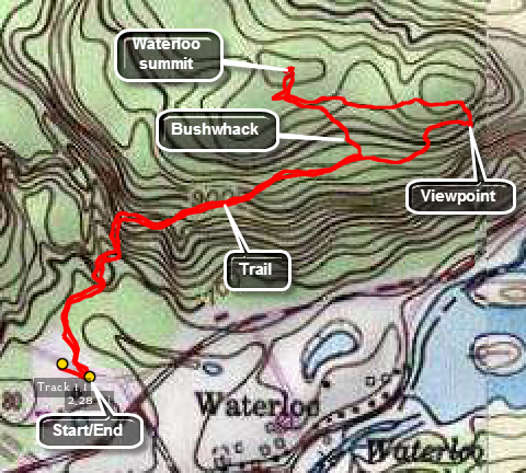
 Park on Waterloo Road which is an exit off I80 near Allamuchy, NJ. Parking is available across the road from the trailhead which is just west of Waterloo Village and Waterloo Valley Road. Start walking the trail which is rocky in places and initially has some steep spots. You can continue on the trail for about .8 miles to a nice lookout over Waterloo Lakes. From the viewpoint walk up the hill and take a sharp left onto a trail that leads almost due west. After about .3 miles you will be in the area of the high point which is off the trail. Walk off the trail to the high point and then return to your car by reversing your path.
(The map at the right shows the parking area and the hiking route as a modified out and back.)
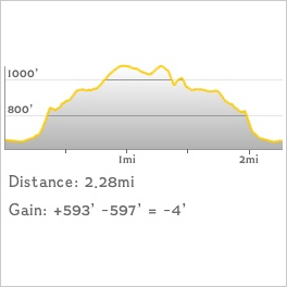
 (The image at the left shows the profile of the hike. Remember that all vertical profiles are relative!)
 (The image at the left shows the profile of the hike. Remember that all vertical profiles are relative!)