Kanouse Mountain
| Quick Look | |||||
|---|---|---|---|---|---|
| Difficulty | Round trip | Total climb | Location | Elevation | Internet Maps |
| 1.98 mi | 574ft | N41.0416 W74.4219 Passaic | 1184 ft | AllTrails | |
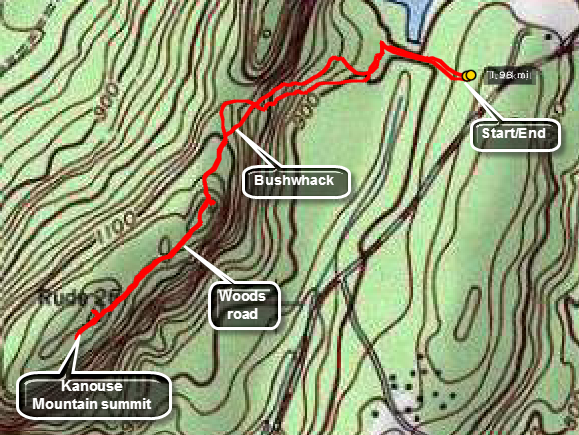
 From Route 23 travel north on Echo Lake Road. Watch for signs for the NWCDC. Park in parking area for the NWCDC. Hiking requires a yearly permit which you MST buy in person at this office but is good for all Newark Watershed property. Walk down the road to the dam across Echo Lake. The small control house near the center of the dam is interesting. At the end of the dam start to bushwhack southwest to the col on the Kanouse ridge. There is a short, steep ascent but you should find a woods road at the top that runs almost directly to the high point. From the col it should be less than .5 miles to the ridge. From the woods road you will have to bushwhack up to the high point. Follow your route back to the car.
(The map at the right shows the parking area and the out and back hiking route.)
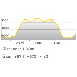
 (The image at the left shows the profile of the hike. Remember that all vertical profiles are relative!)
 (The image at the left shows the profile of the hike. Remember that all vertical profiles are relative!)