Cobb Hill
| Quick Look | |||||
|---|---|---|---|---|---|
| Difficulty | Round trip | Total climb | Location | Elevation | Internet Maps |
| .85 mi | 192 ft | N40.9879 W74.4632 Morris | 1160 ft | AllTrails | |
 Head south on Green Pond Road from Route 23 in New Jersey. After passing Green Pond, watch for Timberbrook Road on the left. Turn here and pass the cemetery and the chapel on the right. Some people park here. Watch for Dunham Road on the left and turn onto the road. Turn around and park on the right side of Dunham Road. Walk less than .5 miles through open woods to the top of the hill and then return the same way.
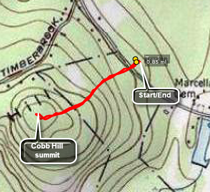
(The map at the right shows the parking area and the out and back hiking route.)
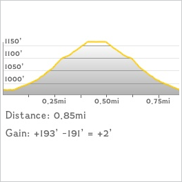
 (The image at the left shows the profile of the hike. Remember that all vertical profiles are relative!)
 (The image at the left shows the profile of the hike. Remember that all vertical profiles are relative!)