
What You Missed
Winter 2021-2022
Winter 2021-2022
![]()
![]()
![]()
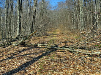
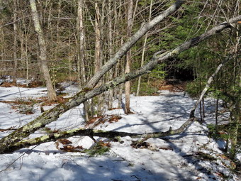
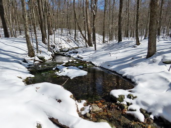
![]() On Monday, March 21st I wanted to get in a hike after a weekend of ambulance calls and Preaching in two churches. I now have track practice in the afternoon which limits my ability to go on longer hikes as I cannot enjoy myself knowing I have to be back at a certain time. I asked Cindy if she would like to go across the street to hike on Round Top and she agreed. As we started to get ready at 10:30 AM the temperature had risen to 46 degrees but it felt much warmer as there was no breeze. A quick look at Round Top revealed no snow and I felt the recent warn weather had probably eliminated all the snow and ice even in the woods. We decided we would not need any traction devices to complete a few loops. Sheila was ready to go as she really likes to hike and we had not been out in two day. I got dressed in my Mammut crew top but decided against a baselayer. I put on a pair of RailRiders hiking pants which are expensive but last along time and have features like deep pockets and a generous cut which I really like. The pants have Velcro closures at the ankles. I knew that keeping my feet warm and dry would not be an issue so I donned my Vasque Taku hiking boots which fit well and have been discontinued. I made sure I had a pair of Super Green insoles in the shoes to support my arches. I grabbed a pair of Leki external lock poles I have been using all season. Finally, I donned my Mammut hoody which blocks the wind and keeps me warm but has enough zippers to dump heat when needed. I put on a light hat and took a pair of light gloves. Cindy wore a similar outfit. At 11:00 AM we walked out the door to start the hike. I grabbed Sheila's leash from the car and we walked up the driveway. I aimed to hike two figure 8's but knew plans might change depending in the conditions. We walked out the driveway and crossed the street to walk along the street to the parking lot of the Presbyterian Church.
On Monday, March 21st I wanted to get in a hike after a weekend of ambulance calls and Preaching in two churches. I now have track practice in the afternoon which limits my ability to go on longer hikes as I cannot enjoy myself knowing I have to be back at a certain time. I asked Cindy if she would like to go across the street to hike on Round Top and she agreed. As we started to get ready at 10:30 AM the temperature had risen to 46 degrees but it felt much warmer as there was no breeze. A quick look at Round Top revealed no snow and I felt the recent warn weather had probably eliminated all the snow and ice even in the woods. We decided we would not need any traction devices to complete a few loops. Sheila was ready to go as she really likes to hike and we had not been out in two day. I got dressed in my Mammut crew top but decided against a baselayer. I put on a pair of RailRiders hiking pants which are expensive but last along time and have features like deep pockets and a generous cut which I really like. The pants have Velcro closures at the ankles. I knew that keeping my feet warm and dry would not be an issue so I donned my Vasque Taku hiking boots which fit well and have been discontinued. I made sure I had a pair of Super Green insoles in the shoes to support my arches. I grabbed a pair of Leki external lock poles I have been using all season. Finally, I donned my Mammut hoody which blocks the wind and keeps me warm but has enough zippers to dump heat when needed. I put on a light hat and took a pair of light gloves. Cindy wore a similar outfit. At 11:00 AM we walked out the door to start the hike. I grabbed Sheila's leash from the car and we walked up the driveway. I aimed to hike two figure 8's but knew plans might change depending in the conditions. We walked out the driveway and crossed the street to walk along the street to the parking lot of the Presbyterian Church.
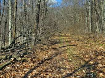
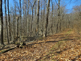
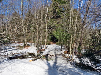
At the first trail junction, we followed Sheila as she turned right and started up the woods road which has the gentler approach of the two. There were a few branches on the trail from the winds that had passed through the area. I removed these branches either by dragging them off the trail or by using my poles on the smaller ones. There was no snow or ice on the trail and we could see none in even the sadist spots. I almost immediately started to get warm so I stopped to open the zippers on my hoody. We reached the end of the woods road and turned left up the hill on the trail. We continued up the trail to the first trail junction with the upper blue trail and turned left to follow the yellow trail along the base of Round Top. The yellow trail was bare with only a layer of wet leaves and a few branches here and there. At the next junction with the blue trail we turned right and headed up the blue trail toward the summit. Climbing without ice or snow was very enjoyable and I began to think it would be OK if winter was done. When we got to the switchback, we turned right and followed it until it came back to the main blue trail. The fact that the switchback sidehills in places made the walk a little more difficult. We turned right and then continued straight ahead and up the hill toward the summit of Round Top bypassing the white crossover trail. We continued over the summit and down the blue trail toward the junction with the yellow trail. There were a few muddy and slippery places but no snow or ice in sight. We continued down to the yellow trail and turned right and walked the yellow trail along the base of Round Top to the next junction with the blue trail. This time we turned left and walked the yellow trail downhill toward the lookout. We passed the "sitting rock" and were soon at the viewpoint. I took a quick peek at a view I had seen many times before and then turned left to start the steeper downhill. We passed by what used to be a side trail to the lookout that I blocked with brush. This side trail has a gap that hikers have to walk over and it can be dangerous for some people in the winter season. Unfortunately, some 'helpful' person had removed the brush without asking or knowing why it was there. The trip down to the first trail junction went quickly. We turned around and started back up the hill toward the lookout to start our second figure 8.
The back up the hill to the lookout was pretty easy and I seemed to have gotten a second wind. At the top of the hill we turned right to follow the yellow trail to the first junction with the blue trail. The one short climb along the way was easy and the poles helped. We turned right to followed the yellow trail around the base of Round Top. At the next junction with the blue trail, we turned left and headed up toward the summit. When we got to the white crossover trail we turned left and followed that trail. I wanted to make sure that I had walked all the trails to see how they had faired after some windy days. There was one small tree across the white trail which I was able to drag out of the way. We walked the white trail to the point where it intersected the blue trail. We turned left on the blue trail and then left again on the switchback in blue trail. Walking downhill on the switchback was a little tricky as it sidehills in several places. At the end of the switchback we turned left and walked downhill to the trail junction with the yellow trail. We turned left and again followed the yellow trail along the base of Round Top to the junction with the blue trail. This time we turned right and headed down the yellow trail to the woods road that leads to the first trail junction. As we walked down the road, I noticed all the interesting ledges to the right of the trail. At the first trail junction, I debated doing another loop of some kind but decided just to head out to the trailhead. We walked out to the trailhead and turned right. We walked to the road through the church parking lot and over to the driveway to the house. It was 12:10 PM and we had hiked a little over 2 miles in a little over an hour.
![]()
![]()
![]()
![]()
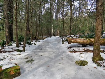
![]() On Friday, March 18th, I was ready to go back to Frick Pond to remove as many as eight blowdowns on the Flynn Trail. Cindy had an eye doctor's in the morning but said she would go with me in the early afternoon. It is very helpful to have two people to do the work and it is also safer. We knew that there would be no snow or ice where we were going so we did not bring our snowshoes although I did have my spikes in my pack. As we began to get ready at 12:45 PM the temperature was already 55 degrees with plenty of sun. As we started gathering our equipment and getting dressed, Sheila was very quiet but did not let me out of her sight. I got dressed in my Mammut crew top but decided not to wear a baselayer due to the warm temperature and the work we would be doing. I put on a pair of RailRiders hiking pants which are expensive but last along time and have features like deep pockets and a generous cut which I really like. The pants have Velcro closures at the ankles. I wore my Salomon B-52 insulated boots as they keep my feet warm and dry. I had recently put a pair of Protalus insoles in these shoes and was anxious to see how they performed. The insoles in most hiking boots are a flimsy and flat piece of material. I also applied a new waterproofing and leather preservative which has proved very effective. I also put on my OR Crocodile gaiters. Finally, I donned my Mammut hoody which blocks the wind and keeps me warm but has enough zippers to dump heat when needed. I put on a light hat and made sure I had a pair of light gloves. I made sure my Microspikes were in my pack just in case they were needed. I decided to go without hiking poles as I would be carrying tools. I decided to take only one water bottle as the hike is less than 2 miles round trip. I packed my Silky Sugowaza curved fixed blade saw which can handle surprisingly large trees and my Fiskars pack axe which is light but handles bigger trees very well. I also threw some felling wedges in my pack as they can be used if my saw became pinched. We got our gear and Sheila in Cindy's car and left Livingston Manor at 1:05 PM. I drove out the DeBruce Road about 6 miles to Mongaup Road and turned left to continue up the road to the point where it splits. I stayed left on Beech Mountain Road and drove to the Frick Pond trailhead. When we arrived at the parking areas, we found that the smaller lot had two cars parked so I pulled in and parked next to them. I set my GPS to record how long it took us to hike and clear the blowdowns. We crossed the road and started out on the Flynn Trail through the woods at 1:30 PM with the temperature at 62 degrees. The sun was shining brightly and it seemed even warmer than the air temperature.
On Friday, March 18th, I was ready to go back to Frick Pond to remove as many as eight blowdowns on the Flynn Trail. Cindy had an eye doctor's in the morning but said she would go with me in the early afternoon. It is very helpful to have two people to do the work and it is also safer. We knew that there would be no snow or ice where we were going so we did not bring our snowshoes although I did have my spikes in my pack. As we began to get ready at 12:45 PM the temperature was already 55 degrees with plenty of sun. As we started gathering our equipment and getting dressed, Sheila was very quiet but did not let me out of her sight. I got dressed in my Mammut crew top but decided not to wear a baselayer due to the warm temperature and the work we would be doing. I put on a pair of RailRiders hiking pants which are expensive but last along time and have features like deep pockets and a generous cut which I really like. The pants have Velcro closures at the ankles. I wore my Salomon B-52 insulated boots as they keep my feet warm and dry. I had recently put a pair of Protalus insoles in these shoes and was anxious to see how they performed. The insoles in most hiking boots are a flimsy and flat piece of material. I also applied a new waterproofing and leather preservative which has proved very effective. I also put on my OR Crocodile gaiters. Finally, I donned my Mammut hoody which blocks the wind and keeps me warm but has enough zippers to dump heat when needed. I put on a light hat and made sure I had a pair of light gloves. I made sure my Microspikes were in my pack just in case they were needed. I decided to go without hiking poles as I would be carrying tools. I decided to take only one water bottle as the hike is less than 2 miles round trip. I packed my Silky Sugowaza curved fixed blade saw which can handle surprisingly large trees and my Fiskars pack axe which is light but handles bigger trees very well. I also threw some felling wedges in my pack as they can be used if my saw became pinched. We got our gear and Sheila in Cindy's car and left Livingston Manor at 1:05 PM. I drove out the DeBruce Road about 6 miles to Mongaup Road and turned left to continue up the road to the point where it splits. I stayed left on Beech Mountain Road and drove to the Frick Pond trailhead. When we arrived at the parking areas, we found that the smaller lot had two cars parked so I pulled in and parked next to them. I set my GPS to record how long it took us to hike and clear the blowdowns. We crossed the road and started out on the Flynn Trail through the woods at 1:30 PM with the temperature at 62 degrees. The sun was shining brightly and it seemed even warmer than the air temperature.
 The Flynn Trail is sited along what used to be Beech Mountain Road which was the access for the Beech Mountain Boy Scout Camp. We walked the trail through the woods which had no snow or ice cover. We turned right on the woods road and set a quick pace up the hill. The trail gains a little over 600 feet in 1.7 miles to the highest point at the junction with the Big Rock Trail. The day was warm and the sun was out with the temperature rising. We had been clearing a few branches as we walked. The trail had a well-defined track which made walking pretty easy. At 1:45 PM we had walked .5 miles and were at the first blowdown. Although this was a small blowdown which I could simply drag off the trail, I took some "before" pictures. I put the camera down and dragged the large branches off to the side of the trail. The whole job took only a few minutes. I took some "after" shots and we continued along the trail. The next blowdown was also small and only a few hundred feet up the trail. I took some pictures and then made only two cuts with the saw to enable me to drag the blowdown off the trail. After taking some pictures, we began to hike again looking for the next challenge. At 2:00 PM we arrived at the next blowdown at .6 miles. This one had two parts with the first consisting of several larger trunks and the second many smaller branches. I took my "before" shots and then began to survey the blowdown. I used the Silky saw to remove the smaller branches that were in the way. Cindy stood by and watched so I had to cut and drag away the branches. I continued to use the saw to cut the larger branches taking time to drag them well away from the trail. When only the largest trunks were left, I grabbed the Fiskar's ax and sectioned the trunks. I dragged one section off the trail and was able to pivot the other to the side. I took some "after" pictures before turning my attention to the branchy blowdown just beyond.
 I noticed that I was getting tired and moving slower. The branches were projecting out into the trail blocking about half of it. I took pictures and then cleared some of the branches that were already free. After that, I started using the saw to cut and then remove smaller branches. I continued to cut but there always seemed to be more branches. Every time I removed a branch and tried to move it off the trail I seemed to have a problem. I finally used the ax to cut a few larger branches and the job was finished. I took some "after" shots before packing up to move on. It had taken almost an hour to clear the complex blowdowns. We walked up the trail and found another trunk lying across the trail. I took the pictures and then used the ax to cut off the branches at the top. I dragged them away and then turned my attention to the remaining trunk. I used the ax to section the two smaller trunks and with my last ounce of energy I threw them off the trail. I took a few more shots and then packed up everything so we could walk back to the car. It was so warm I packed my jacket for the trip back. The hike back was downhill all the way and went quickly. We arrived back at the car at 3:30 PM having hiked 1.3 miles in 2 hours. An hour and 25 minutes was spent working. The temperature had risen to 64 degrees! As we were putting our gear in the car, a young couple were looking at the maps at the trailhead. I asked them if they needed help and they said they were looking for a waterfall. I gave them instructions to Mongaup Falls but was not sure they understood where they were going.
![]()
![]()
![]()
![]()
![]() On Wednesday, March 16th, I was ready to go to Frick Pond to remove a blowdown on the Big Rock Trail on the west side of Frick Pond. I thought that when I was done I might be able to clear some of the blowdowns on the Flynn Trail. I asked Cindy if she would like to go and she said :Yes:. It is very helpful to have two people to do the work and it is also safer. We knew that there might be some loose snow but only a few inches and it would soft as the temperature was already 46 degrees as we began to get ready at 10:45 AM with plenty of sun. As we started gathering our equipment and getting dressed, Sheila was very quiet but did not let me out of her sight. I got dressed in my Mammut crew top but decided not to wear a baselayer due to the warm temperature and the work we would be doing. I decided to wear my Columbia Titanium insulated pants as it was still cool but thought that soon I might be exchanging them for my Railriders. I wore my Salomon B-52 insulated boots as they keep my feet warm and dry and work well with snowshoes. I had recently put a pair of Protalus insoles in these shoes and was anxious to see how they performed. The insoles in most hiking boots are a flimsy and flat piece of material. I also applied a new waterproofing and leather preservative which has proved very effective. I also put on my OR Crocodile gaiters. Finally, I donned my Mammut hoody which blocks the wind and keeps me warm but has enough zippers to dump heat when needed. I put on a light hat and made sure I had a pair of light gloves. I made sure my Microspikes were in my pack just in case they were needed. Cindy and I had decided not to take any snowshoes knowing the snow would not be deep enough and would be clumping easily. I decided to go without hiking poles as I would be carrying tools. I decided to take only one water bottle as the hike is less than 2 miles round trip. I packed my Silky Sugowaza curved fixed blade saw which can handle surprisingly large trees and my Fiskars pack axe which is light but handles bigger trees very well. I also threw some felling wedges in my pack as they can be used if my saw became pinched. We got our gear and Sheila in Cindy's car and left Livingston Manor at 11:00 AM. I drove out the DeBruce Road about 6 miles to Mongaup Road and turned left to continue up the road to the point where it splits. I stayed left on Beech Mountain Road and drove to the Frick Pond trailhead. When we arrived at the parking areas, we found that only the smaller lot had been partly plowed. There were two cars in the smaller lot so I pulled in and parked next to them. I took a look at the trail and found there was only a thin layer of snow and ice remaining proving the decision not to bring snowshoe. I decided I did not need to use my GPS as we were not going very far. We started out on the woods road from the parking area at 11:25 AM with the temperature at 56 degrees. The sun was shining brightly and it seemed even warmer than the air temperature.
On Wednesday, March 16th, I was ready to go to Frick Pond to remove a blowdown on the Big Rock Trail on the west side of Frick Pond. I thought that when I was done I might be able to clear some of the blowdowns on the Flynn Trail. I asked Cindy if she would like to go and she said :Yes:. It is very helpful to have two people to do the work and it is also safer. We knew that there might be some loose snow but only a few inches and it would soft as the temperature was already 46 degrees as we began to get ready at 10:45 AM with plenty of sun. As we started gathering our equipment and getting dressed, Sheila was very quiet but did not let me out of her sight. I got dressed in my Mammut crew top but decided not to wear a baselayer due to the warm temperature and the work we would be doing. I decided to wear my Columbia Titanium insulated pants as it was still cool but thought that soon I might be exchanging them for my Railriders. I wore my Salomon B-52 insulated boots as they keep my feet warm and dry and work well with snowshoes. I had recently put a pair of Protalus insoles in these shoes and was anxious to see how they performed. The insoles in most hiking boots are a flimsy and flat piece of material. I also applied a new waterproofing and leather preservative which has proved very effective. I also put on my OR Crocodile gaiters. Finally, I donned my Mammut hoody which blocks the wind and keeps me warm but has enough zippers to dump heat when needed. I put on a light hat and made sure I had a pair of light gloves. I made sure my Microspikes were in my pack just in case they were needed. Cindy and I had decided not to take any snowshoes knowing the snow would not be deep enough and would be clumping easily. I decided to go without hiking poles as I would be carrying tools. I decided to take only one water bottle as the hike is less than 2 miles round trip. I packed my Silky Sugowaza curved fixed blade saw which can handle surprisingly large trees and my Fiskars pack axe which is light but handles bigger trees very well. I also threw some felling wedges in my pack as they can be used if my saw became pinched. We got our gear and Sheila in Cindy's car and left Livingston Manor at 11:00 AM. I drove out the DeBruce Road about 6 miles to Mongaup Road and turned left to continue up the road to the point where it splits. I stayed left on Beech Mountain Road and drove to the Frick Pond trailhead. When we arrived at the parking areas, we found that only the smaller lot had been partly plowed. There were two cars in the smaller lot so I pulled in and parked next to them. I took a look at the trail and found there was only a thin layer of snow and ice remaining proving the decision not to bring snowshoe. I decided I did not need to use my GPS as we were not going very far. We started out on the woods road from the parking area at 11:25 AM with the temperature at 56 degrees. The sun was shining brightly and it seemed even warmer than the air temperature.
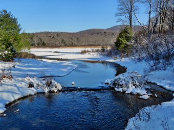
 We started out the woods road and then the Quick Lake Trail from the trail register. There was almost no snow and we are happy to there was scattered among patches of ice and open water. We continued straight ahead at the register on the woods road that heads out to the trail system. The woods road was completely covered in soft snow and ice which made it tricky walking. There was open water running across the trail in several places and ice covered some water in others. I was not having any problem with bare boots and Cindy had her poles to help her out. At Gravestone Junction we stayed left on the Quick Lake trail heading toward the bridge at the outlet to Frick Pond. The snow on the trail hid the ice underneath so I walked on the bare ground near the side of the trail. When we arrived at the bridge, I put my pack down and got out the camera. I was disappointed that the sky was a flat blue without any clouds but the scene was still pretty. I took some pictures of the bridge and some shots downstream as the water was high. I also took shots of the pond and of Beech Mountain. I returned to my pack and stowed the camera so we could continue our walk. The trail stayed about the same with snow and ice as we continued across the bridge toward the junction with the Big Rock Trail. We continued along the west side of Frick Pond and at the junction with the Big Rock Trail we headed right on the Big Rock Trail. Within a few hundred feet we came to the blowdown which all but blocked the trail. It was 11:55 AM when I put my pack down and took some 'before' pictures of the blowdown. I went to inspect the blowdown and was surprised that it was more complicated than I had remembered. A rather large tree had fallen at an angle across the trail and had hung up in the trees on the other side. The tree had a bifurcated trunk and was entwined with other, smaller trees. I called Cindy over to take a look and we began to develop a plan. What I wanted to do was to completely remove the whole blowdown as if it had never been there. Because of the way it was leaning and hung up, I knew I might have to settle for clearing enough to allow hikers to pass easily.
 I got the Silky Sugowaza saw and began to cut away the smaller branches that were in the way. I also cut a few saplings that I thought might be supporting the larger tree but nothing moved. Cindy began removing what I cut and piling neatly off the trail. It was not long before all that remained were the two larger trunks; one lay near the ground but the other was hung up in other trees. I took a few "during" pictures and then got my Fiskars ax. I used the ax to cut the smaller trunk off the edge of the trail. The cut went more quickly than I expected and Cindy and I were able to roll it well off the trail. At this point the trail was clear to hike with only the larger trunk hanging over the trail. I shook the trunk and it seemed well anchored but I wanted to see if we could remove it. I decided to use the ax to cut the larger trunk near the edge of the trail hoping we could flip the lower section off the trail and that the upper portion would fall to the ground. The height and angle of the cut I chose made the work difficult and the footing on the soft snow was tricky. It took some effort but I finally was able to cut through the trunk. The lower part was completely free and looked like we might be able to move it. The upper section remained firmly entangled in the branches of other trees. Cindy and I took our positions to flip the lower section off the trail. It was heavy and did not want to flip as we tried to roll it. We kept working on it until it was upright and for a moment I was not sure we could get it over. We were able to complete the flip and the section was well off the trail. I pulled on the upper section but it was not moving. I cut a few more branches that I thought might be holding it but nothing happened. There seemed to be one sapling that was still holding it against the other trees but I did not know what would happen if I cut it. I decided to give it a try and used the saw to cut through it. I was able to pull the sapling away but the trunk did not fall. I was able to grab the lower portion of the trunk and pull on it until it came crashing down. At that point I knew that it was just a matter of a little final cleanup. I used the saw to section the trunk into two sections. We moved the lower section off the trail and I dragged the upper section to the pile that Cindy had made. We cleaned up a few branches and I took my "after" pictures. I stowed the camera and saw and picked up the ax. We started back the way we had come at 1:10 PM. When I checked the time, I was surprised it had only taken an hour and 15 minutes to clear the blowdown. We were back at the car at 1:30 PM having spent 2 hour and 35 minutes hiking and clearing the blowdown. I was tired but felt good about the work we had done. The temperature was 58 degrees.
![]()
![]()
![]()
![]() On Tuesday, March 15th, I wanted to get out for the second day in a row as the weather was again beautiful. Since I had track practice in the afternoon, I decided I did not have enough time to really enjoy a long hike before going to school. I decided to return to Frick Pond to hike the Flynn Trail to the Big Rock Trail and back along the Quick Lake Trail. At 10:00 AM it was 48 degrees so I decided to dress a little less warmly than I had been. While I began to get ready, Sheila was always nearby making it very clear that she wanted to go. I got dressed in my Mammut crew top and added a long-sleeved baselayer. I decided to wear my Columbia Titanium insulated pants to keep the chill away but decided against wearing tights underneath. I wore my Salomon B-52 insulated boots as they keep my feet warm and dry. I had recently put a pair of Protalus insoles in these shoes and was anxious to see how they performed. The insoles in most hiking boots are a flimsy and flat piece of material. I also applied a new waterproofing and leather preservative which has proved very effective. I grabbed a pair of Leki external lock poles I have been using all season. Finally, I donned my Mammut hoody which blocks the wind and keeps me warm but has enough zippers to dump heat when needed. I put on a fleecy orange hat for warmth and donned a pair of light gloves. I made sure my microspikes were in my pack just in case I needed them at some point. We left Livingston Manor at 10:40 AM and I drove out the DeBruce Road about 6 miles to Mongaup Road. I turned left and continued up the road to the point where it splits. I stayed left on Beech Mountain Road and drove to the parking areas on the left. I pulled into the smaller parking area where there were no cars parked. I checked the trail and there was hardly any snow or ice at the beginning of the Flynn Trail. I decided to bareboot it but carry my microspikes in my pack. I set my GPS as we got ready to head out on the Flynn Trail with the temperature at 42 degrees. We crossed the road and began our hike at 11:00 AM.
On Tuesday, March 15th, I wanted to get out for the second day in a row as the weather was again beautiful. Since I had track practice in the afternoon, I decided I did not have enough time to really enjoy a long hike before going to school. I decided to return to Frick Pond to hike the Flynn Trail to the Big Rock Trail and back along the Quick Lake Trail. At 10:00 AM it was 48 degrees so I decided to dress a little less warmly than I had been. While I began to get ready, Sheila was always nearby making it very clear that she wanted to go. I got dressed in my Mammut crew top and added a long-sleeved baselayer. I decided to wear my Columbia Titanium insulated pants to keep the chill away but decided against wearing tights underneath. I wore my Salomon B-52 insulated boots as they keep my feet warm and dry. I had recently put a pair of Protalus insoles in these shoes and was anxious to see how they performed. The insoles in most hiking boots are a flimsy and flat piece of material. I also applied a new waterproofing and leather preservative which has proved very effective. I grabbed a pair of Leki external lock poles I have been using all season. Finally, I donned my Mammut hoody which blocks the wind and keeps me warm but has enough zippers to dump heat when needed. I put on a fleecy orange hat for warmth and donned a pair of light gloves. I made sure my microspikes were in my pack just in case I needed them at some point. We left Livingston Manor at 10:40 AM and I drove out the DeBruce Road about 6 miles to Mongaup Road. I turned left and continued up the road to the point where it splits. I stayed left on Beech Mountain Road and drove to the parking areas on the left. I pulled into the smaller parking area where there were no cars parked. I checked the trail and there was hardly any snow or ice at the beginning of the Flynn Trail. I decided to bareboot it but carry my microspikes in my pack. I set my GPS as we got ready to head out on the Flynn Trail with the temperature at 42 degrees. We crossed the road and began our hike at 11:00 AM.
The Flynn Trail is sited along what used to be Beech Mountain Road which was the access for the Beech Mountain Boy Scout Camp. We walked the trail through the woods which was covered in hard-packed snow which was a little slippery on the uphill parts. We turned right on the woods road and set a quick pace up the hill which was almost completely bare. The trail gains a little over 600 feet in 1.7 miles to the highest point at the junction with the Big Rock Trail. The day was cool but the sun was out and the temperature was rising. I began to get warm as we set a quick pace so we stopped so that I could open the zippers on the hoody. I had been clearing a few branches as we walked. The trail had a well-defined track which made walking pretty easy. We approached and passed the clearing to the right of the trail and kept walking uphill. We were soon at the junction with the Big Rock Trail. It was 11:50 AM and we had covered the 1.7 miles in 50 minutes. We turned left to walk down the Big Rock Trail. As I expected, the trail was almost free of snow but there was some ice were the trail had been packed by snowmobiles. The hike down the trail started out well but I soon discovered that I had to walk on the side of the trail to avoid some of the ice. I thought about putting on my spikes but decided against it. Despite these conditions the hike went quickly since we were setting a fast pace. This trail can be tricky as there are several levels that make it seem like the bottom of the hill. The large blowdowns that had been on the trail were now gone and I assumed the snowmobile club had taken care of them. As we started down the bottom third of the trail, the ice was gone and the trail was bare although there was some water. This was a result of the recent rain that had run down the "ditch" at the edge of the trail.
We were soon at Times Square and I thought about turning right to hike up and around the Logger's Loop to add some distance to our hike. I decided against this and we continued our hike by walking straight across Times Square to stay on the Big Rock Trail. The trail had some snow and several areas with water and mud. We crossed the two small bridges over the inlets to the pond but did not stop to take pictures. When we got to the area that was covered by tall evergreens, I thought about taking some pictures but the light was poor. The wooden boardwalks still had some frozen snow but were not as slippery as they looked and we crossed the bridges quickly. At the next trail junction, we turned left on the Quick Lake Trail to head for the bridge across the outlet of Frick Pond. We walked along the west side of Frick Pond to the bridge across the outlet of the pond. I stopped at the bridge for a minute but did not take any pictures. We walked up the hill toward Gravestone Junction and found some ice still present on the trail. We continued to Gravestone Junction and passed the Lobdell memorial marker. The marker is a memorial to two children who died in the 1930's in a fire that consumed their cabin. Thankfully, the stone was upright. I had not been cutting out the trail to the marker to discourage vandalism but it had been cleared. Once again "helpful" people were doing unauthorized work. The trail to the register was partly covered in snow and ice but there were three places where small stream were running across the trail. At the trail register we continued straight ahead to follow the woods road out to the car in the small lot. We arrived at the car at 1:10 PM having hiked 4 miles in 2 hours and 10 minutes with an elevation gain of 670 feet. The temperature had risen to 52 degrees.
![]()
![]()
![]()
![]() On Monday, March 15th I wanted to go for a hike near home as I had my first spring track practice in the afternoon and several tasks to get done before that time. We had received 6 to 8 inches of snow on Saturday and I thought we might get in a hike with snowshoes before the warmer temperatures during the week. Cindy said she wanted to go too but she had conditions. She wanted a short and flat hike while I had thought about a longer and hilly hike. We decided to go to Frick Pond and hike the loop around the pond. We started getting ready at 10:20 AM when the temperature was 32 degrees. I was hoping the temperature would be a little colder at the trailhead so that we could use the snowshoes without the snow clumping. Sheila was watching us quietly but making sure that we did not leave without her. I got dressed in my Mammut crew top and added a long-sleeved baselayer. I decided to wear my Columbia Titanium insulated pants to keep the chill away but decided against wearing tights underneath. I wore my Salomon B-52 insulated boots as they keep my feet warm and dry. I had recently put a pair of Protalus insoles in these shoes and was anxious to see how they performed. The insoles in most hiking boots are a flimsy and flat piece of material. I also applied a new waterproofing and leather preservative which has proved very effective. I grabbed a pair of Leki external lock poles I have been using all season. Finally, I donned my Mammut hoody which blocks the wind and keeps me warm but has enough zippers to dump heat when needed. I put on a fleecy orange hat for warmth and donned a pair of light gloves. Cindy and I decided not to take our snowshoes as the snow outside was already clumping. We both took our spikes just in case they were needed. I got all our gear in the car and put Sheila in the backseat and drove out the Debruce Road at 11:00 AM. I drove about 6 miles before turning left onto Mongaup Pond Road and continued to where the road split. I turned left onto Beech Mountain Road, and drove to the parking areas at the Frick Pond. The smaller lot was partly plowed but the larcener lot was still covered in snow. There were no cars in either lot so I parked in the smaller lot. The car thermometer read 34 degrees as I set my GPS to get ready for the hike. At 11:20 AM we headed out the woods road toward the trail register. The woods road was covered in 4 to 6 inches of snow and there was a track set. The track looked like at least one person had worn snowshoes on Sunday and there were several other sets of boot prints.
On Monday, March 15th I wanted to go for a hike near home as I had my first spring track practice in the afternoon and several tasks to get done before that time. We had received 6 to 8 inches of snow on Saturday and I thought we might get in a hike with snowshoes before the warmer temperatures during the week. Cindy said she wanted to go too but she had conditions. She wanted a short and flat hike while I had thought about a longer and hilly hike. We decided to go to Frick Pond and hike the loop around the pond. We started getting ready at 10:20 AM when the temperature was 32 degrees. I was hoping the temperature would be a little colder at the trailhead so that we could use the snowshoes without the snow clumping. Sheila was watching us quietly but making sure that we did not leave without her. I got dressed in my Mammut crew top and added a long-sleeved baselayer. I decided to wear my Columbia Titanium insulated pants to keep the chill away but decided against wearing tights underneath. I wore my Salomon B-52 insulated boots as they keep my feet warm and dry. I had recently put a pair of Protalus insoles in these shoes and was anxious to see how they performed. The insoles in most hiking boots are a flimsy and flat piece of material. I also applied a new waterproofing and leather preservative which has proved very effective. I grabbed a pair of Leki external lock poles I have been using all season. Finally, I donned my Mammut hoody which blocks the wind and keeps me warm but has enough zippers to dump heat when needed. I put on a fleecy orange hat for warmth and donned a pair of light gloves. Cindy and I decided not to take our snowshoes as the snow outside was already clumping. We both took our spikes just in case they were needed. I got all our gear in the car and put Sheila in the backseat and drove out the Debruce Road at 11:00 AM. I drove about 6 miles before turning left onto Mongaup Pond Road and continued to where the road split. I turned left onto Beech Mountain Road, and drove to the parking areas at the Frick Pond. The smaller lot was partly plowed but the larcener lot was still covered in snow. There were no cars in either lot so I parked in the smaller lot. The car thermometer read 34 degrees as I set my GPS to get ready for the hike. At 11:20 AM we headed out the woods road toward the trail register. The woods road was covered in 4 to 6 inches of snow and there was a track set. The track looked like at least one person had worn snowshoes on Sunday and there were several other sets of boot prints.
We continued straight ahead at the register and headed out the woods road toward Frick Pond. I felt a little guilty not wearing snowshoes but the snow was very wet and clumping on our shoes. As we walked, I noticed we were not sinking in much at all and that there appeared to be less snow than had fallen in town. The trail was covered in snow but there were several places wear small stream ran across the trail. There were also a few spots where the trail had some standing water. The drainage work we had done seemed to have helped in some places but made little impact in others. At Gravestone Junction, we turned right to get on the Logger's Loop heading toward Times Square. The snow coeditor remained about the same but the softening and melting continued to increase. I considered taking some pictures but the skies were a flat blue and I was more interested in pushing the pace. The walking was a little more difficult as with each footstep my boots would slip. We walked passed the designated campsites and followed the trail as it turned a little to the left to parallel the eastern shore of Frick Pond. The snow in this area was the deepest we found on the whole hike as the wind causes drifting of the pond. We started to walk downhill to Times Square and crossed a stream which drains water from the area of the Flynn Trail. I suggested we walk straight ahead up the Logger's Loop Trail to add a little distance but Cindy vetoed this. We turned left and started the short loop around Frick Pond which I knew was barely 2 miles. The Big Rock Trail had some wet and muddy areas which are almost impossible to drain. The snow here was minimal and there was still a track set down. We crossed the bridges over the outlet streams and found it was pretty but not remarkable. Entering the spruce forest is always a treat. The wooden walkways were covered in snow but just barely and the walking was easy. In one place, I noticed that the sections of walkway were offset vertically and I made a note to check on this as soon as the snow disappeared. When we reached the end of the Big Rock Trail, we turned left on the Quick Lake Trail to head toward the bridge across the outlet of Frick Pond. The trail had a good layer of snow but was little different than what we had already hiked. The pit we had worked on was completely frozen over and we got across without a problem. At the southern end of Frick Pond, we crossed the bridge finding the view beautiful as always. As we started up the hill, a dog came walking down the trail with his people right behind him. I grabbed Sheila but the other dog came to say "Hello". The other hikers got a grip on their dog. There were six young people all in bare boots. They said they were just going to hike around the pond. We walked up the hill to Gravestone Junction where we had turned right earlier. We walked back along the Quick Lake Trail and the woods road to the parking area. We were back at the car at 12:20 PM after hiking 2.0 miles in 1 hour. This made our overall speed 2.0 mph and our moving average 2.1 mph. The elevation gain was only 165 feet. The temperature was 40 degrees and the snow was very soft.
![]()
![]()
![]()
![]() On Friday, March 11th I wanted to get to hike after a week of ambulance calls and poor weather. My grandson Bryce was going to be at our house around noon and I wanted to hike with him. I went on a morning ambulance call and returned to find Bryce and Brynn at the house. We decided it would be best to go across the street to hike on Round Top. Bryce wanted to eat lunch so by the time we were ready to get going it was 1:00 PM. The temperature had risen to 30 degrees but it felt much warmer. Although a storm was forecast to drop up to a foot of snow on Saturday, a quick look at Round Top revealed little snow. I decided we would not need snowshoes or spikes. Sheila was ready to go as she really likes to hike and we had not been out in a while. I got dressed in my Mammut crew top and added a long-sleeved baselayer. I decided to wear my Columbia Titanium insulated pants to keep the chill away but decided against wearing tights underneath. I wore my Salomon B-52 insulated boots as they keep my feet warm and dry. I had recently put a pair of Protalus insoles in these shoes and was anxious to see how they performed. The insoles in most hiking boots are a flimsy and flat piece of material. I also applied a new waterproofing and leather preservative which has proved very effective. I grabbed a pair of Leki external lock poles I have been using all season. Finally, I donned my Mammut hoody which blocks the wind and keeps me warm but has enough zippers to dump heat when needed. I put on a fleecy orange hat for warmth and donned a pair of light gloves. Bryce had a jacket and hiking shoes that were adequate for a short hike. At 1:30 PM we walked out the door to start the hike. I grabbed Sheila's leash from the car and we walked up the driveway. I aimed to hike two figure 8's but knew that might be ambitious given the possible ice and snow we might still find. We walked out the driveway and crossed the street to walk along the street to the parking lot of the Presbyterian Church.
On Friday, March 11th I wanted to get to hike after a week of ambulance calls and poor weather. My grandson Bryce was going to be at our house around noon and I wanted to hike with him. I went on a morning ambulance call and returned to find Bryce and Brynn at the house. We decided it would be best to go across the street to hike on Round Top. Bryce wanted to eat lunch so by the time we were ready to get going it was 1:00 PM. The temperature had risen to 30 degrees but it felt much warmer. Although a storm was forecast to drop up to a foot of snow on Saturday, a quick look at Round Top revealed little snow. I decided we would not need snowshoes or spikes. Sheila was ready to go as she really likes to hike and we had not been out in a while. I got dressed in my Mammut crew top and added a long-sleeved baselayer. I decided to wear my Columbia Titanium insulated pants to keep the chill away but decided against wearing tights underneath. I wore my Salomon B-52 insulated boots as they keep my feet warm and dry. I had recently put a pair of Protalus insoles in these shoes and was anxious to see how they performed. The insoles in most hiking boots are a flimsy and flat piece of material. I also applied a new waterproofing and leather preservative which has proved very effective. I grabbed a pair of Leki external lock poles I have been using all season. Finally, I donned my Mammut hoody which blocks the wind and keeps me warm but has enough zippers to dump heat when needed. I put on a fleecy orange hat for warmth and donned a pair of light gloves. Bryce had a jacket and hiking shoes that were adequate for a short hike. At 1:30 PM we walked out the door to start the hike. I grabbed Sheila's leash from the car and we walked up the driveway. I aimed to hike two figure 8's but knew that might be ambitious given the possible ice and snow we might still find. We walked out the driveway and crossed the street to walk along the street to the parking lot of the Presbyterian Church.
We continued to the back of the church and began the ascent of the steepest hill behind the church. The hill is short but gets the circulation pumping and is the steepest and longest climb on the "trail." The trail up the hill was mostly bare with a path of snow at the beginning. At the top of the hill we stopped to look around. We could see there were still some white patches on the surrounding hills. We started on the trail by turning left at the trailhead. The trailhead was bare and that continued as we entered the woods. At the first trail junction, we followed Sheila as she started directly up the hill toward the lookout. The hill was completely bare with only a layer of leaves. Sheila loves the cold weather as she has some Husky in her and her longer coat has a warm undercoat. For some reasons she does not get the iceballs on her feet that plague some dogs. The climb up the hill was rather easy as there was no ice most of the way. I noticed that I immediately began to get warm but I was not ready to open the zippers to dump any heat. We passed by what used to be a side trail to the lookout that I blocked with brush. This side trail has a gap that hikers have to walk over and it can be dangerous for some people in the winter season. Unfortunately, some 'helpful' person had removed some of the brush without asking or knowing why it was there. At the top of the hill, we followed the yellow trail as it turned to the right and ascended through the woods. We began to find the trail covered in a layer of slippery slush which was wet but not too much of a problem on the flat parts of the trail. Ascending a short uphill proved challenging but we found some bare ground that gave us more traction. These conditions continued as we followed the yellow trail when it turned right along the base of Round Top. Walking was easier on the flatter ground even though some snow was still present. Every time we started up a small incline we had to look for alternate routes as the trail was too slippery. Sheila was running ahead and then back to us which was fine with me. We continued to follow the yellow trail toward the second junction with the blue trail. Bryce and I always have something to talk about. He told me about his school and I described some of my ambulance calls. We also had an interesting conversation about religion.
At the next junction with the blue trail, we turned left and started up the hill toward the summit. As we ascended, we confirmed that spikes would have made the hike much easier. Walking up the hill was slippery but I knew walking down the other side would be even more interesting. We bypassed the white crossover trail and continued over the summit of Round Top. We walked across the flat summit and started down the hill bypassing the white crossover trail. Bryce was doing much better than I seeming to have better balance. As soon as we started downhill, I knew it would be an adventure although Bryce, who was not using poles, was having an easier time. We turned left on the switchback which sidehills quite a bit. Walking this trail required us to find some places off-trail where there was some snow that allowed us to get some traction. At the end of the switchback, we turned left on the main blue trail and walked down to the junction with the yellow trail. Going downhill without and traction was dicey at best. At the junction with the yellow trail, we turned left and walked along the base of Round Top again following the trail. This time when we reached the junction with the yellow trail, we turned right and walked downhill carefully to the woods road. We followed the trail along woods road and back down to the first trail junction. I was not enthusiastic about walking the hills again but we decided to walk a small loop. We turned around and started back up the woods road we had just descended. On the way back up, I pointed out to Bryce some of the areas along the base of the ledges. Our ambulance corps is scheduled to participate in a low angle rope rescue drill with our fire department and the local forest ranger. I had pointed out to the ranger that many people hike these trails even though the are right in town and there could be a need to rescue someone who was injured. We continued back up the trail to the trail junction with the blue trail. We turned left and walked along the base of Round Top on the yellow trail. At the next trail junction with the blue trail, we turned left again and walked downhill toward the lookout. Even though this downhill is not very steep there were some tricky areas. At the viewpoint we turned left and walked down the hill to the first trail junction. This descent was easy since the trail was bare. We walked straight out the trail to the trailhead and turned right to start down the hill to the church parking lot. At the bottom of the hill we walked out through the parking lot to Rock Avenue. The roads were bare but we were careful crossing as drivers sometimes exceed the speed limit. After crossing the street to our driveway, we walked back to the house. We were home by 2:30 PM after hiking a little less than 2 miles in an hour. I was a little tired but glad we had gotten out. I promised myself that next time I would err on the side of picking an appropriate traction device.
![]()
![]()
![]()
![]()
![]() On Thursday, March 10th, I was ready to get in a hike after coming home from my 6:15 AM men's Bible study at church. Snow had fallen overnight and was sticking to the trees. I wanted to get some pictures before the sun came out and the snow fell off the trees. When I returned home, I asked Cindy if she would Ike to hike or perhaps snowshoe and she agreed. I had planned to hike the Flynn Trail to the Hodge Pond Lookouts but knew Cindy would not want to climb the hills involved. I change plans so that we would hike a loop near Frick Pond using the Logger's Loop. I knew that there might be some loose snow but only a few inches. When we were starting to get ready at 8:30 AM the temperature was 26 degrees but the sun was out and I knew it would get warm quickly even at the trailhead. As We started gathering our equipment and getting dressed, Sheila was very quiet but did not let me out of her sight. I got dressed in my Mammut crew top and added a long-sleeved baselayer. I decided to wear my Columbia Titanium insulated pants to keep the chill away but decided against wearing tights underneath. I wore my Salomon B-52 insulated boots as they keep my feet warm and dry and work well with snowshoes. I had recently put a pair of Protalus insoles in these shoes and was anxious to see how they performed. The insoles in most hiking boots are a flimsy and flat piece of material. I also applied a new waterproofing and leather preservative which has proved very effective. I grabbed a pair of Leki external lock poles I have been using all season. I also put on my OR Crocodile gaiters. Finally, I donned my Mammut hoody which blocks the wind and keeps me warm but has enough zippers to dump heat when needed. I put on a fleecy orange hat for warmth. I made sure my Microspikes were in my pack just in case they were needed. Cindy and I decided to take snowshoes knowing the snow would not be deep but that wearing them would preserve any track that was present or help us to create one. We both took our Tubb's Flex VRT which have the Boa binding. This system uses a thin steel cable system and a ratchet wheel which tightens it to give a custom fit and a secure binding. These snowshoes also have a televator to elevate the hiker's heel on ascents and take some strain off the calf muscles. This is a feature that you didn't know you needed until you try it and then it is hard to live without it! We got our gear and Sheila in Cindy's car and left Livingston Manor at 9:00 AM. I drove out the DeBruce Road about 6 miles to Mongaup Road and turned left to continue up the road to the point where it splits. I stayed left on Beech Mountain Road and drove to the Frick Pond trailhead. When we arrived at the parking areas, we found that only the smaller lot had been partly plowed. Neither lot had any cars and I pulled into the smaller lot and parked. I took a look at the trail and decided snowshoe would be best. Cindy and I started getting ready by putting on our snowshoes. I set my GPS and we started out on the woods road from the parking area at 9:15 AM with the temperature at 30 degrees. The sun was shining brightly and almost immediately the snow began to clump on our snowshoes. I decided to go back to the car and leave mine there while Cindy decided to keep her's on. I took off the snowshoes and decided to use only boots.
On Thursday, March 10th, I was ready to get in a hike after coming home from my 6:15 AM men's Bible study at church. Snow had fallen overnight and was sticking to the trees. I wanted to get some pictures before the sun came out and the snow fell off the trees. When I returned home, I asked Cindy if she would Ike to hike or perhaps snowshoe and she agreed. I had planned to hike the Flynn Trail to the Hodge Pond Lookouts but knew Cindy would not want to climb the hills involved. I change plans so that we would hike a loop near Frick Pond using the Logger's Loop. I knew that there might be some loose snow but only a few inches. When we were starting to get ready at 8:30 AM the temperature was 26 degrees but the sun was out and I knew it would get warm quickly even at the trailhead. As We started gathering our equipment and getting dressed, Sheila was very quiet but did not let me out of her sight. I got dressed in my Mammut crew top and added a long-sleeved baselayer. I decided to wear my Columbia Titanium insulated pants to keep the chill away but decided against wearing tights underneath. I wore my Salomon B-52 insulated boots as they keep my feet warm and dry and work well with snowshoes. I had recently put a pair of Protalus insoles in these shoes and was anxious to see how they performed. The insoles in most hiking boots are a flimsy and flat piece of material. I also applied a new waterproofing and leather preservative which has proved very effective. I grabbed a pair of Leki external lock poles I have been using all season. I also put on my OR Crocodile gaiters. Finally, I donned my Mammut hoody which blocks the wind and keeps me warm but has enough zippers to dump heat when needed. I put on a fleecy orange hat for warmth. I made sure my Microspikes were in my pack just in case they were needed. Cindy and I decided to take snowshoes knowing the snow would not be deep but that wearing them would preserve any track that was present or help us to create one. We both took our Tubb's Flex VRT which have the Boa binding. This system uses a thin steel cable system and a ratchet wheel which tightens it to give a custom fit and a secure binding. These snowshoes also have a televator to elevate the hiker's heel on ascents and take some strain off the calf muscles. This is a feature that you didn't know you needed until you try it and then it is hard to live without it! We got our gear and Sheila in Cindy's car and left Livingston Manor at 9:00 AM. I drove out the DeBruce Road about 6 miles to Mongaup Road and turned left to continue up the road to the point where it splits. I stayed left on Beech Mountain Road and drove to the Frick Pond trailhead. When we arrived at the parking areas, we found that only the smaller lot had been partly plowed. Neither lot had any cars and I pulled into the smaller lot and parked. I took a look at the trail and decided snowshoe would be best. Cindy and I started getting ready by putting on our snowshoes. I set my GPS and we started out on the woods road from the parking area at 9:15 AM with the temperature at 30 degrees. The sun was shining brightly and almost immediately the snow began to clump on our snowshoes. I decided to go back to the car and leave mine there while Cindy decided to keep her's on. I took off the snowshoes and decided to use only boots.
 We started out the woods road and then the Quick Lake Trail from the trail register. There was 2 or 3 inches of new powder with ice underneath and we were the first people to be on the trails. We continued straight ahead at the register on the woods road that heads out to the trail system. The woods road was completely covered in snow and the ice underneath made it tricky for my as I had no traction. There was open water running across the trail in several places and ice covered some water in others. I was not having any problem with bare boots but Cindy was having a lot of snow clumping on her snowshoes. At Gravestone Junction we stayed left on the Quick Lake trail heading toward the bridge at the outlet to Frick Pond. The snow on the trail hid the ice underneath so I walked on the snow near the side of the trail. When we arrived at the bridge, I put my pack down and got out the camera. I was disappointed that there was less snow on the trees where we were hiking than in town. I came to the conclusion that only snow had fallen at Frick Pond. In town the snow was preceded by some freeing rain that helped the snow stick to the trees. I took some pictures of the bridge and then some of Sheila and Cindy on the bridge. I also took shots of the pond and of Beech Mountain. The trail stayed about the same with snow and ice as we continued across the bridge toward the junction with the Big Rock Trail. We continued along the west side of Frick Pond and at the junction with the Big Rock Trail we headed left on the Quick Lake Trail. There were no foot prints but only a few inches of snow. The trail is slightly uphill which is not very noticeable under most conditions but was noticeable with the slippery snow covering it. There were areas of open water and soft ground under the snow which made picking each step important. We walked through the spruce tunnel where I stopped to take a few shots and came to the small stream across the trail. The stream was wider and deeper than it had been in the last few trips. Cindy made it across but got some water in her boot. I walked upstream and crossed just below the small waterfall taking a few pictures in the process. The walk up the trail was less tiring for me as I was not wearing snowshoes. There continued to be areas of open water and other places that were soft with water underneath the snow.
 When we got to the junction, I stopped to take pictures of the wheels and the untouched trails. The Logger's Loop is often packed by snowmobiles but on this day there was no track. I took a few shots and then was ready to turn right on the Logger's Loop toward Times Square. I knew going this way would be longer than turning around but I wanted to complete a loop. We turned right and began following the snowmobile trail which made for easier walking. Even though the trail began an ascent, my legs did not seem tired. The skies were a bright blue and the sun was out making it seem even warmer. The trail had several wet areas like much of the trail we had already hiked. We came to the large cherry tree that had broken off high up and fallen so that it was arching across the trail. This tree was not blocking the trail and it was clear it was not coming down soon. We came to the seasonal pond on the left side of the trail. There was enough water in the pond for me to stop and take some pictures before continuing downhill to Times Square. We walked straight across Times Square to stay on the Logger's Loop. The streambed which is usually dry or flowing with a small trickle had more water in it than I ever remember seeing. I took some shots and decided I wants to bushwhack upstream on a subsequent trip as I could not figure out where the water originated. The trail started uphill and my legs started to ache but I knew we didn't have far to go. Although the trail is slightly uphill we were setting a fast pace. Cindy was a little farther behind but I slowed a little so she could catch up. I heard a noise and looked back to see Cindy on the ground. She had caught a snowshoe on some ice and had fallen pretty hard. After a few moments she was able to get up with only a few sore spots. We continued walking on the trail and crested the hill to walk out to Gravestone Junction. We turned left at the Gravestone Junction and headed back to the car on the woods road. At the trail register, we continued straight ahead to stay on the woods road back to our car. It was 11:55 AM and we had spent 2 hour and 20 minutes hiking 4.0 miles. We had only stopped for 15 minutes! The elevation gain was a modest 400 feet. The temperature had risen to 34 degrees.
![]()
![]()
![]()
![]()
![]() On Saturday, March 5th I planned to go to the Neversink Unique Area to hike the loop including Denton Falls and Mullet Brook Falls. Fortunately, there were no overnight ambulance calls and none that interrupted me as I prepared for the hike! When I got up at 9:00 AM, it was 28 degrees but the sun was out and I knew the temperature would rise. I decided I would not need snowshoes but would definitely take along both my Kahtoola Microspikes and Hillsound Trail Crampons. I knew I was getting a late start and had heard that the Neversink Unique Area had been crowded. I planned to head for the end of Katrina Falls Road and if that was packed I could divert to the Wolf Lake MUA entrance. I started to get ready at 10:00 AM. I got dressed in my Mammut crew top and added a long-sleeved baselayer. I decided to wear my Columbia Titanium insulated pants to keep the chill away but decided against wearing tights underneath. I wore my Salomon B-52 insulated boots as they keep my feet warm and dry and work well with snowshoes. I had recently put a pair of Protalus insoles in these shoes and was anxious to see how they performed. The insoles in most hiking boots are a flimsy and flat piece of material. I also applied a new waterproofing and leather preservative which has proved very effective. I grabbed a pair of Leki external lock poles I have been using all season. I also put on my OR Crocodile gaiters. Finally, I donned my Mammut hoody which blocks the wind and keeps me warm but has enough zippers to dump heat when needed. I put on a fleecy orange hat for warmth. I put my gear in the back of the car and Sheila in the back seat. We left Livingston Manor at 10:30 AM as I drove east on the Quickway towards Rock Hill. I drove to Rock Hill and got off at exit 109. I turned right off the exit and drove to the parking area at the end of Katrina Falls Road. There was only one other car parked in the lot. The car was running with only the driver present. I took a look at the parking lot and the trail leading down toward the river. Everything was a sheet of ice and I immediately decided to put on the microspikes. When I went to set my GPS. I found the batteries were low and I left it in the car. I knew the route and had several recordings so I just needed to remember the times I hit certain points. The temperature was 34 degrees but felt a little colder and nothing seemed to be melting. The wide woods road was surprisingly icy so the spikes were the right choice. There was one blowdown across the trail but it was easy to step over. I could hear Wolf Brook roaring as we walked down the trail which parallels the brook. At .5 miles we came to a yellow spur trail on the right side of the main trail. A new sign indicated that this trail led to Hackeldam on the Neversink River. This was the area where a "swinging bridge" crossed the Neversink and was an important area of commerce and industry.
On Saturday, March 5th I planned to go to the Neversink Unique Area to hike the loop including Denton Falls and Mullet Brook Falls. Fortunately, there were no overnight ambulance calls and none that interrupted me as I prepared for the hike! When I got up at 9:00 AM, it was 28 degrees but the sun was out and I knew the temperature would rise. I decided I would not need snowshoes but would definitely take along both my Kahtoola Microspikes and Hillsound Trail Crampons. I knew I was getting a late start and had heard that the Neversink Unique Area had been crowded. I planned to head for the end of Katrina Falls Road and if that was packed I could divert to the Wolf Lake MUA entrance. I started to get ready at 10:00 AM. I got dressed in my Mammut crew top and added a long-sleeved baselayer. I decided to wear my Columbia Titanium insulated pants to keep the chill away but decided against wearing tights underneath. I wore my Salomon B-52 insulated boots as they keep my feet warm and dry and work well with snowshoes. I had recently put a pair of Protalus insoles in these shoes and was anxious to see how they performed. The insoles in most hiking boots are a flimsy and flat piece of material. I also applied a new waterproofing and leather preservative which has proved very effective. I grabbed a pair of Leki external lock poles I have been using all season. I also put on my OR Crocodile gaiters. Finally, I donned my Mammut hoody which blocks the wind and keeps me warm but has enough zippers to dump heat when needed. I put on a fleecy orange hat for warmth. I put my gear in the back of the car and Sheila in the back seat. We left Livingston Manor at 10:30 AM as I drove east on the Quickway towards Rock Hill. I drove to Rock Hill and got off at exit 109. I turned right off the exit and drove to the parking area at the end of Katrina Falls Road. There was only one other car parked in the lot. The car was running with only the driver present. I took a look at the parking lot and the trail leading down toward the river. Everything was a sheet of ice and I immediately decided to put on the microspikes. When I went to set my GPS. I found the batteries were low and I left it in the car. I knew the route and had several recordings so I just needed to remember the times I hit certain points. The temperature was 34 degrees but felt a little colder and nothing seemed to be melting. The wide woods road was surprisingly icy so the spikes were the right choice. There was one blowdown across the trail but it was easy to step over. I could hear Wolf Brook roaring as we walked down the trail which parallels the brook. At .5 miles we came to a yellow spur trail on the right side of the main trail. A new sign indicated that this trail led to Hackeldam on the Neversink River. This was the area where a "swinging bridge" crossed the Neversink and was an important area of commerce and industry.
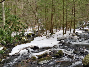 We turned left and walked down a sheet of ice to the small bridge that crosses Wolf Brook. I stopped to take some picture of the bridge and of the brook. The brook was flowing with good volume and I could see that the small channel above the bridge had widened and diverted some of the water. There was a lot of ice in the brook and along the shores. The bridge had been patched which was nice but a replacement would have been better. After I completed my pictures, we walked up the trail crossing the place where the brook had overflowed across the trail. Some stepping stones had been placed to make it easier for hikers to cross. At the top of the hill we came to the split in the trails with the red trail going left and the blue trail heading right. There was a new sign at the junction showing that the red trail to the right was the Mullet Brook Trail Loop and the Wolf Brook Access. There was a concern that people were getting lost in the Neversink Gorge due to the lack of signs and this is a welcome addition. Mileages had been and the sign indicated that the blue trail to the right went to Denton Falls. We stayed to the right on the blue trail which was well trimmed with only a few branches which I threw off the trail. The trail rolled up and down a little until we reached another yellow spur trail on the right that was labeled Old River Way. We continued straight ahead on the main blue trail. As we approached the bridge across Mullet Brook, I walked off the trail to the right and stopped at the edge of the brook. I took some shots of the brook and some of the small falls and rapids. When I was done, I returned to the main trail and walked uphill to the bridge. The bridge had been replaced a few years ago after it had almost fallen into the brook. I took some pictures of the steel I-beam construction and then asked Sheila to pose for a few shots. I also took some pictures upstream and downstream before continuing across and up the hill. The next yellow spur trail Lead down to Denton Falls so we turned right and followed the trail. I wanted to go to Denton Falls to see a falls on the Neversink as I expected the volume of water would be high. There was a sign but, again, it had no mileage. The trail was covered in hard-packed snow and the spikes were working well. It was disappointing that the markers were still few and far between. The missing markers cause hikers to make their own paths which makes the best path unclear. When we came to the steeper section of the trail that descends to the river, the trail became a sheet of hard ice and the microspikes were not getting a good grip. I knew I could turn around or try the Hillsounds. I decided on the latter and change spikes. The Hillsounds made all the difference as they were getting a much better bite into the ice. We followed the track down to the marked trail and then turned left to parallel the river. There are always some muddy spots on this section but all the mud was frozen and covered in ice. Walking along the narrow ledge covered in ice was tricky. When we got to the rocks "steps" that go down to the river, I was very careful to work my way over the roots and the ice. We walked out on the rocks and over to a large boulder where I dropped my pack and got out the camera. The water was high and flowing with power and there was a lot of ice in the river and on the banks. I took some pictures upstream and downstream although the sky was flat and overcast. I found a way to get downstream but the footing was very sketchy due to the high water and slippery rocks. I finally got to a point below the falls with good footing. I took pictures of the falls from several different angles and zooms. I also took shots downstream and upstream. I shot a video to get a feeling for the sound and power of the river. We walked back up the rocks to my pack where I stowed the camera.
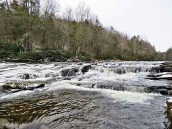 We started back up the trail. Sheila alerted and I looked up to see a woman walking toward us with spikes but no poles. She asked about the falls and I told her they were nice. She said her daughter was following with spike but the her friend had only YakTrax and had already slipped on the descent. I told her I would check on them and we continued along the trail. I met the daughter at the bottom of the descent and she continued on to meet her mother at the river. Their friend was "stuck" on the hill. I advised her that the falls was not spectacular and that it would be safer for her to wait where she was. We talked for a while and then Sheila and I continued up the trail. Ascending with the Hillsounds was no problem and we were soon at the top of the ascent on the more level trail. A family of four came walking toward us. I noticed that they all had spikes and the two children had poles. I was still concerned about their descent. We talked for a few minutes and then went our separate ways. I didn't get very far before I heard a scream and frantic voices. I immediately turned around and walked back to a point where I could see the family. The young boy had slipped and slid down the trail before a tree stopped him. I asked if he was okay and the father said he had scraped his hand. I volunteered my first aid skills but the father had something to bandage the hand. By this time the mother and daughter were coming back up the hill to meet their friend. Their friend had worked her way up the hill but now faced a steeper uphill or a sidehill section to get back to the flat part of the trail. I walked over to her and offered the use of my microspikes which she gladly accepted. Once she had these on it was relatively easy for her to walk on the slippery slope. As we were returning, Sheila decided to join us even though I had told her to stay. She lost traction on the steep slope and slid downhill on her belly rather quickly. Sheila just missed taking out one of the family members that was standing on the trail. Sheila recovered quickly and climbed back up the hill without any trouble. I was glad to see she was not hurt! I suggested to the three women that we could all hike together so that the friend could keep wearing my spikes. They readily agreed and we started back for the main blue trail. At the main blue trail, we turned right and immediately ran into another trail junction. The blue trail continues to the right and parallels the river heading toward High Falls. The red trail turns left and heads over the hill back toward the parking area. There was a sign indicating the purpose of the red trail but none for the blue trail.
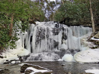 We turned left on the red trail to start the loop and to visit Mullet Brook Falls. The red trail was almost bare with leaves showing through only a small amount of snow. We talked and I learned that all three were experienced hikers who lived in the Monroe area. I gave them some hikes to waterfalls that they had not done. We turned left on the yellow spur trail to Mullet Brook Falls. We arrived at the falls and found no one else was there. We could see that the falls were spectacular with a good flow of water and ice frozen in front and on the sides of the falls. I put my pack down and got out the camera. I headed across the rocks to an area directly in front of the falls. I took a number of shots with different settings and zooms. While I was doing this, the rest of the party was also taking pictures ending with a few selfies of the group. When I was done, we worked our way back to my pack. I got a drink and we headed back out the yellow trail toward the main red trail. As we started up from the falls, the family we had met on the yellow trail to Denton Falls showed up. The young boy was a little subdued and said his hand hurt. They had not continued to the falls but had turned around which I thought was a good idea! On the way out we also met with a couple who had two large and young German Shepherds with them. They had their dogs on a leash so I leashed Sheila. We passed each other with a short greeting and all the dogs were well-behaved. We turned left on the red trail and headed uphill which usually tires me out but felt good on this day. For a half mile we walked uphill gaining 250 feet. On the way we met a couple coming toward us in short sleeves! They did have hiking boots but were not wearing spikes and did not have poles. We were soon at the upper bridge across Mullet Brook. The trees that had come down on the bridge had been cleared but the bridge needs repairs. We came to the spur trail that leads to a parking area in the Wolf Brook Multiple Use Area. I explained this was a good place to park if the lot at the end of Katrina Falls Road was full. We turned left to stay on the red trail passing by the trail leading out to the parking area. The rest of the hike was downhill except for the hill back up to the parking area. For the next .85 miles we lost 400 feet. There were no blowdowns across the trail but we did run into some areas where the trail was covered in a thick layer of ice. We wondered how the couple we had met who were not wearing spikes made it through these areas. We were soon back at the junction with the blue trail. We turned right and walked down the hill to cross the bridge over Wolf Brook. We turned right to follow the trail up the hill to the parking area. The steepest section of the trail was less than 10% but I was really tired by this time. Just before the parking area we met a group of six young women who did not look like they were prepared for the trails. None had hiking boots, spikes or poles. I spoke with them about the very icy conditions and suggested they try another hike. They said they were staying in Liberty and I suggested going to the Parksville Rail Trail which I had hiked in bare boots the day before. They thanked me for the suggestion and asked about the breweries in Livingston Manor and Roscoe. These young ladies were from Philadelphia and had just graduated from Drexel Medical School! We continued back to the parking area where I recovered my spikes. I usually hike alone but had a great time hiking with the group. We were back at the car at 2:25 PM after hiking 5.7 miles in 3 hours and 15 minutes. This included the stops to aid other hikers and to take pictures. We gained about 1220 feet in elevation. The temperature was 40 degrees as we left the parking lot.
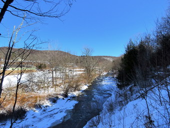
![]()
![]()
![]()
![]()
![]() On Friday, March 4th I wanted to get out for hike and was considering a couple of longer hikes in the area. When I got up at 8:00 AM, it was 25 degrees and the sun was shining. I thought about several hikes in the area at Trout Pond or even Giant Ledge. Some overnight ambulance calls and one in the morning made me rethink my choice of destination. When I finally returned home at 11:00 AM, I asked Cindy if she would like to go hike the Parksville Rail Trail and she agreed. The hike is only 3 miles round trip and it is very flat. There is a nice falls along the trail and I wanted to see what it would look like in the winter. I was pretty sure that the recent cold weather probably hardened everything on the trails making snowshoes unnecessary. I thought we would take our spikes just in case they were needed. As we started to get ready at 11:00 AM the temperature was still 26 degrees. I don't like to take Sheila out too often when the temperature is too cold but the high 20's seemed alright and has never shown any ill effects from the cold. I got dressed in my Mammut crew top and added a long-sleeved baselayer. I decided to wear my Columbia Titanium insulated pants to keep the chill away but decided against wearing tights underneath. I wore my Salomon B-52 insulated boots as they keep my feet warm and dry and work well with snowshoes. I had recently put a pair of Protalus insoles in these shoes and was anxious to see how they performed. The insoles in most hiking boots are a flimsy and flat piece of material. I also applied a new waterproofing and leather preservative which has proved very effective. I grabbed a pair of Leki external lock poles I have been using all season. I also put on my OR Crocodile gaiters. Finally, I donned my Mammut hoody which blocks the wind and keeps me warm but has enough zippers to dump heat when needed. I put on a fleecy orange hat for warmth. At 11:30 AM we put our gear in the car and Sheila in the back seat. I headed out Old Route 17 across the Flats and then took Old Route 17 and Service Road to the point where they meet Fox Mountain Road. Just after this intersection is the western parking area for the rail trail. We were surprised to see that the parking lot was not plowed as I had talked to the town supervisor about this before. It is a shame that the lot is not maintained as it would take about 15 minutes to plow and allow people access to the rail trail from both ends. There was not much snow in the lot although there was some ice. I pulled in and parked without any problems.
On Friday, March 4th I wanted to get out for hike and was considering a couple of longer hikes in the area. When I got up at 8:00 AM, it was 25 degrees and the sun was shining. I thought about several hikes in the area at Trout Pond or even Giant Ledge. Some overnight ambulance calls and one in the morning made me rethink my choice of destination. When I finally returned home at 11:00 AM, I asked Cindy if she would like to go hike the Parksville Rail Trail and she agreed. The hike is only 3 miles round trip and it is very flat. There is a nice falls along the trail and I wanted to see what it would look like in the winter. I was pretty sure that the recent cold weather probably hardened everything on the trails making snowshoes unnecessary. I thought we would take our spikes just in case they were needed. As we started to get ready at 11:00 AM the temperature was still 26 degrees. I don't like to take Sheila out too often when the temperature is too cold but the high 20's seemed alright and has never shown any ill effects from the cold. I got dressed in my Mammut crew top and added a long-sleeved baselayer. I decided to wear my Columbia Titanium insulated pants to keep the chill away but decided against wearing tights underneath. I wore my Salomon B-52 insulated boots as they keep my feet warm and dry and work well with snowshoes. I had recently put a pair of Protalus insoles in these shoes and was anxious to see how they performed. The insoles in most hiking boots are a flimsy and flat piece of material. I also applied a new waterproofing and leather preservative which has proved very effective. I grabbed a pair of Leki external lock poles I have been using all season. I also put on my OR Crocodile gaiters. Finally, I donned my Mammut hoody which blocks the wind and keeps me warm but has enough zippers to dump heat when needed. I put on a fleecy orange hat for warmth. At 11:30 AM we put our gear in the car and Sheila in the back seat. I headed out Old Route 17 across the Flats and then took Old Route 17 and Service Road to the point where they meet Fox Mountain Road. Just after this intersection is the western parking area for the rail trail. We were surprised to see that the parking lot was not plowed as I had talked to the town supervisor about this before. It is a shame that the lot is not maintained as it would take about 15 minutes to plow and allow people access to the rail trail from both ends. There was not much snow in the lot although there was some ice. I pulled in and parked without any problems.
 I looked at the trail and it had more snow than I thought it would. I decided to start out with bare boots and carry my spikes until they were needed. Cindy decided to put her spikes on at the car.
I set my GPS unit and we started on the trail at 11:45 AM with the temperature right at 28 degrees and with a slight breeze blowing. The trail had some boot prints as we walked up the slight grade in the sun. As we entered the shade of the trees, we both commented that it immediately seemed cooler. We walked along the trail and I was not having a problem without spikes. Sheila jet walking along the stream side of then trail very close to the slippery edge and I asked her to come back several times. We seemed to be setting a fast pace and were soon at the wooden walkways. I stopped, put my pack down and took out the camera. I took some shots of the stream below but was disappointed that the sky was overcast without any blue patches or white clouds. I also took some pictures of the rock cut that was made to allow the O&W railroad to lay track. We continued on the trail and came to the falls. I again dropped my pack to retrieve my camera. I wanted to get down to the streambed so that I could take pictures from in front of the falls. I started down the path which was untouched and was making good progress until the packed snow started to slide. I found that the snow layer was separating from the ice underneath. I grabbed a tree and decided to make my way back up to the main trail. This was easier said than done but I was able to make it back up. I was regretting not putting on my spikes but I am not sure they would have helped. I thought about trying again but decided to take my shots from the main trail! When I was done, I moved down the trail following Cindy who had gone on ahead. We both were warm when walking but started to cool off standing around. I stopped at a spot just above the falls and got the camera out again. I walked down to the edge of the stream and took pictures downstream toward the falls and upstream. I also took a few shots of the water flowing by and of the ice on the stream. I finished and walked back up to the main trail. We set a quick pace and were soon at the Parksville end of the trail. We immediate turned around and started back toward the car. I did not plan to stop at all on the way back and we stuck to that plan. We met no one else hiking on the trail. When we broke out of the shade into the sun, the temperature stemmed to shoot up. Cindy was having some problems with snow clumping on her spikes but we were almost down with our walk. We were back at the car at 1:15 PM after hiking 2.7 miles in 1 hour and 25 minutes with virtually no elevation gain.
I looked at the trail and it had more snow than I thought it would. I decided to start out with bare boots and carry my spikes until they were needed. Cindy decided to put her spikes on at the car.
I set my GPS unit and we started on the trail at 11:45 AM with the temperature right at 28 degrees and with a slight breeze blowing. The trail had some boot prints as we walked up the slight grade in the sun. As we entered the shade of the trees, we both commented that it immediately seemed cooler. We walked along the trail and I was not having a problem without spikes. Sheila jet walking along the stream side of then trail very close to the slippery edge and I asked her to come back several times. We seemed to be setting a fast pace and were soon at the wooden walkways. I stopped, put my pack down and took out the camera. I took some shots of the stream below but was disappointed that the sky was overcast without any blue patches or white clouds. I also took some pictures of the rock cut that was made to allow the O&W railroad to lay track. We continued on the trail and came to the falls. I again dropped my pack to retrieve my camera. I wanted to get down to the streambed so that I could take pictures from in front of the falls. I started down the path which was untouched and was making good progress until the packed snow started to slide. I found that the snow layer was separating from the ice underneath. I grabbed a tree and decided to make my way back up to the main trail. This was easier said than done but I was able to make it back up. I was regretting not putting on my spikes but I am not sure they would have helped. I thought about trying again but decided to take my shots from the main trail! When I was done, I moved down the trail following Cindy who had gone on ahead. We both were warm when walking but started to cool off standing around. I stopped at a spot just above the falls and got the camera out again. I walked down to the edge of the stream and took pictures downstream toward the falls and upstream. I also took a few shots of the water flowing by and of the ice on the stream. I finished and walked back up to the main trail. We set a quick pace and were soon at the Parksville end of the trail. We immediate turned around and started back toward the car. I did not plan to stop at all on the way back and we stuck to that plan. We met no one else hiking on the trail. When we broke out of the shade into the sun, the temperature stemmed to shoot up. Cindy was having some problems with snow clumping on her spikes but we were almost down with our walk. We were back at the car at 1:15 PM after hiking 2.7 miles in 1 hour and 25 minutes with virtually no elevation gain.
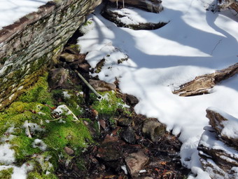
![]()
![]()
![]()
![]()
![]() On Wednesday, March 2nd, I wanted to get in a hike to a 3500 foot peak as it had been a long time since I had hiked one or put in a similar amount of effort on a hike. For some reason I now feel like I would like to do some of the high peaks. I decided to start out with Balsam Lake Mountain which is close to where I live and has a fire tower as an extra goal. I was concerned about the condition of the last section of the road which some people had reported was impassable. I decided to go there and try it myself! When I got up in the morning at 8:30 AM it was only 24 degrees with a slight breeze blowing. The forecast was for some overnight snow with little to no accumulation. The forecast was wrong as several inches of snow had fallen. I cleaned up the sidewalks and then started to get ready to go. As usual, Sheila was excited as she loves to be outside. I put on my Mammut long-sleeved crew top with a long-sleeved baselayer since the temperature was still below freezing. I decided to wear my Columbia Titanium insulated pants to keep the chill away and added a pair of light merino wool tights underneath. I wore my old Salomon B-52 winter boots which are still waterproof and fit well. I grabbed my Leki external lock poles which I have been using lately since twist locks have proved unreliable. I also added a fuzzy orange hat and light gloves since it was cool. I donned my Mammut hoody which has lots of zippers to dump heat if necessary. I added my OR Crocodile gaiters to further waterproof my lower legs and to keep the snow out of my boots. I did not know how much snow there would so I decided to take my Tubbs Flex VRT snowshoes which have the Boa binding. This system uses a thin steel cable system and a ratchet wheel which tightens it to give a custom fit and a secure binding. These snowshoes also have a televator to elevate the hiker's heel on ascents. This is a feature that you didn't know you needed until you try it and then it is hard to live without it! I also both packed a set of Kahtoola microspikes and Hillsound Trail Crampons. The latter have slightly longer spikes and are better on ice. I put our gear in the back of the car and Sheila in the back seat and left the house at 10:45 AM. I headed toward Roscoe on Old Rt 17 and I turned right on the Beaverkill Road. I headed north toward Lew Beach and Turnwood. There was snow on the road and more snow once I passed into the Town of Hardenburgh. The Beaverkill Falls were freely flowing with a very high volume and I thought I might stop on the way back for a few shots. The road conditions were pretty good but deteriorated when the pavement ended. I passed the White Castle and the Buddhist monastery and continued on as the amount of snow increased.
On Wednesday, March 2nd, I wanted to get in a hike to a 3500 foot peak as it had been a long time since I had hiked one or put in a similar amount of effort on a hike. For some reason I now feel like I would like to do some of the high peaks. I decided to start out with Balsam Lake Mountain which is close to where I live and has a fire tower as an extra goal. I was concerned about the condition of the last section of the road which some people had reported was impassable. I decided to go there and try it myself! When I got up in the morning at 8:30 AM it was only 24 degrees with a slight breeze blowing. The forecast was for some overnight snow with little to no accumulation. The forecast was wrong as several inches of snow had fallen. I cleaned up the sidewalks and then started to get ready to go. As usual, Sheila was excited as she loves to be outside. I put on my Mammut long-sleeved crew top with a long-sleeved baselayer since the temperature was still below freezing. I decided to wear my Columbia Titanium insulated pants to keep the chill away and added a pair of light merino wool tights underneath. I wore my old Salomon B-52 winter boots which are still waterproof and fit well. I grabbed my Leki external lock poles which I have been using lately since twist locks have proved unreliable. I also added a fuzzy orange hat and light gloves since it was cool. I donned my Mammut hoody which has lots of zippers to dump heat if necessary. I added my OR Crocodile gaiters to further waterproof my lower legs and to keep the snow out of my boots. I did not know how much snow there would so I decided to take my Tubbs Flex VRT snowshoes which have the Boa binding. This system uses a thin steel cable system and a ratchet wheel which tightens it to give a custom fit and a secure binding. These snowshoes also have a televator to elevate the hiker's heel on ascents. This is a feature that you didn't know you needed until you try it and then it is hard to live without it! I also both packed a set of Kahtoola microspikes and Hillsound Trail Crampons. The latter have slightly longer spikes and are better on ice. I put our gear in the back of the car and Sheila in the back seat and left the house at 10:45 AM. I headed toward Roscoe on Old Rt 17 and I turned right on the Beaverkill Road. I headed north toward Lew Beach and Turnwood. There was snow on the road and more snow once I passed into the Town of Hardenburgh. The Beaverkill Falls were freely flowing with a very high volume and I thought I might stop on the way back for a few shots. The road conditions were pretty good but deteriorated when the pavement ended. I passed the White Castle and the Buddhist monastery and continued on as the amount of snow increased.
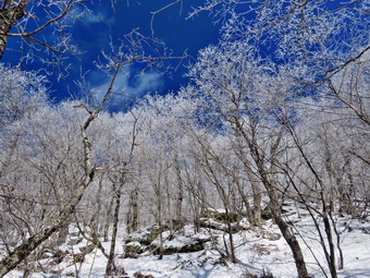 When I got to the "Seasonal Maintenance" sign, I could see that the plowing had stopped and there were several inches of snow on the road. It seemed that people had driven on the road when it was soft and muddy causing deep ruts to form. I was most concerned that there was ice under the snow which was hidden. Despite all the drawbacks, I decided to make a run to the parking area knowing I would not meet any other vehicles. The trip went well as I did not find any ice and had minimal problems with the ruts. We arrived at the parking area at 11:30 AM and found no other cars in the lot. I was not surprised given the state of the road. I can only assume that the remote location of the parking area and the weather forecast had something to do with the lack of cars. The temperature was 26 degrees and when I stepped out of the car the breeze hit me making it feel even cooler. Fortunately, the skies were blue with some nice white clouds and the ground and the trees were covered in a light blanket of snow. From the amount of snow and the trail reports I had read I decided to leave the snowshoes in the car and put on the Kahtoola Microspikes. I also kept the Hillsound Trail Crampons in my pack. I set my GPS and we were off at 11:35 AM. As we got on the trail, it was obvious that no one had been on this section of trail for some time. The snow was just the right temperature and consistency that it was not clumping on my shoes. The trail register had been repaired from the pieces that were there on my last trip. As we walked up the trail, there were a few blowdowns on the trail. Walking was easy as long as I stayed on the spine. If I walked to either side of the packed trail, the snow was soft enough that I sank it but only a few inches. I had to slow myself down a little bit as I was eagerly hiking at top speed. I knew when we started up the mountain I would need all my energy. We headed toward the first trail junction where I intended to turn left and hike up the steep side of the mountain. The approach seemed longer than I remembered and I was getting warm as we hiked so I opened the zippers on my hoody. We did run onto several blowdowns that would require tools to clear in the spring. We finally made the trail junction at .9 miles at noon. We turned left up the mountain without stopping as I was wondering how I would do on the steep but relatively short climb.
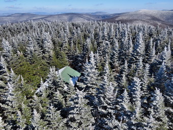 The first part of the trail is a gentle climb and I was feeling pretty good without stopping to rest. The spikes were working well for traction but the sun was out and the snow was beginning to melt a little. The softening of the snow meant that it began to clump on my spikes. This was disappointing as I knew I would have to contend with this at least until the summit! Over the next half mile the trail gains about 750 feet before leveling off which means an average of around a 28% grade! The trail has a lot of rocks and roots but these were all hidden under the blanket of snow making the walking easier than in other seasons. I began to breathe heavily but I slowed my pace and took a few breaks which allowed me to continue. Meanwhile Sheila was running far ahead on the trails and then taking off following game trails through the woods. I kept moving along with Sheila always ahead of me but not too far which encouraged me. The climb seemed much longer than I remembered and several times I thought we were near the trail to the lean-to but had another steep section to climb. The clumps of snow on my spikes required that I stop frequently and remove what I could. Finally we reached the trail to the lean-to and we continued straight up the hill through a steep climb. There are a couple of icy spots but I was able to work my way past them. We passed the 3500 foot sign and the trail became a stream from the spring just above. Finally we arrived at the spring where I stopped to get a drink and take a few pictures. As I looked around I saw that all of the trees were covered in hoard frost. The trees against the blue sky were beautiful. We left the spring and climbed the stone steps to the summit plateau where the trail flattens a little. I felt much better since I was not climbing. I walked a little farther and then stopped to take a few shots of the balsam fir trees covered in frozen snow. We passed the Millbrook Ridge Trail to Alder Lake and continued on to the fire tower clearing. We arrived at the tower clearing at 1:10 PM after hiking 1.7 miles. The skies were blue with white clouds and I knew that pictures from the tower would be nice. There was frozen snow on the trees and hoar frost on the tower above the tree tops. The frost seemed to get thicker higher up on the tower. I put my pack down on the picnic table. Sheila jumped up on the table top so I took some pictures before turning my attention to the tower. There was almost no ice on the steps so I removed my spikes for the climb. I had forgotten Sheila's leash so I knew she would try to comb the tower as I ascended. Sheila has no problem going up and down the steps but it makes me nervous. I walked over to the tower with my camera and noticed a pile of boards near the base of the tower. I knew these were to replace the steps and the landings and that the tower would not be open unless it was safe but they did make me pause for a moment. As I started to climb, I saw that some of the steps had already been replaced and were slightly wider and sturdier than the old steps. As I rose above the treeline, the wind hit me and made me colder. I took pictures of the surrounding landscape as I climbed and some shots of the frost on the netting at the top of the tower. I stopped on the landing just below the cab and looked around. The scene was beautiful and, as always, I knew that pictures could not do it justice. I took a number of shots of the trees covered in frost and cabin below and then turned my attention to the mountains. I took shots in all directions getting pictures of the Devil's Path to the north and some of Graham. Eventually I was satisfied I had enough pictures and wanted to get out of the wind. On the way down I took a few shots of Sheila on top of the picnic table. I walked back to my pack and put away my camera, took a drink and got out a bar.
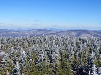 We headed down the Millbrook side of the mountain at 1:20 PM. We walked down the trail on the other side of the mountain passing the cabin. The trail was covered in packed snow and it was colder so it was not clumping on my spikes. Walking down the mountain seemed MUCH easier than the climb up the other side. As we descended, we began to run into some drifts and deeper snow. I began to drag my feet to set a track which was abscess technique. Soon we were approaching the junction with the Dry Brook Ridge Trail that connects Millbrook Road to the Beaverkill Road. There is a gate at the bottom of the trail and just after this gate was a pile of materials which I knew would have to be transported to the top of the mountain. We came to the trail junction with Sheila in the lead and I said to her "Back to the car" without making any signal Sheila immediately turned right and walked down the trail! There was a sign at the junction warning hikers to stay on the trails and that Graham Mountain was closed to all hikers. The trail was packed under the new snow but did not look very well-traveled. The sun was out and the temperature had risen so the snow began clumping again on my spikes. The clumping was worse this time than on the ascent! There were a few branches hanging into the trail and a few blowdowns. Most of the blowdowns were old and would require a chainsaw to remove. There were also a few new blowdowns. I looked down into the Gulf of Mexico several times but did not see or hear any water. The trail was narrow and slippery and I contemplated what slipping of the trail toward the gulf would mean. After just less than a mile, we were back at the trail junction where we had turned up the mountain earlier. I kept stopping to knock the snow off the shows. The clumps were causing me to walk with my heel dropped which was over stretching my Achilles tendons and calf muscles. We continued on toward the car by retracing our steps. We had been blessed with blue skies and sun all the way back from the summit and the trip had seemed to go quickly. We had met no hikers at all on the trip. We were back in the parking area at 2:35 PM after hiking 4.5 miles in 2 hours and 50 minutes with 25 minutes stopped time. We had climbed 1200 feet in elevation. The temperature at the car was 34 degrees. I drove straight home without stopping.
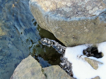
![]()
![]()
![]()
![]()
![]() On Monday, February 28th, I planned to go for a hike to Balsam Lake Mountain as I had not been on a 3500 foot peak in some time. There were no ambulance calls during the night so I has able to get some sleep and got up at 9:00 AM. I got some breakfast and was getting ready to hike when the pager went off. My driver and I ended up doing THREE calls out of our district before returning home. By the time I finished the documentation and returned hoe it was 1:30 PM and I knew Balsam Lake Mountain was out of the question. I asked Cindy if she would like to take a short hike somewhere and we decided on the Beaverkill Campgrounds. The maximum hike here is 3 miles but it is pleasant to walk along the river. We started to get ready immediately with the temperature still at 26 degrees with the sun shining brightly. We didn't know what we would need to wear on our feet so I decided to take along snowshoes and spikes. As usual, Sheila was excited and even more so since Cindy was going also. I put on my Mammut long-sleeved crew top with a long-sleeved baselayer since the temperature was still below freezing. I put on my Mammut long-sleeved crew top with a long-sleeved baselayer since the temperature was cool. I decided to wear my Columbia Titanium insulated pants to keep the chill away but decided against wearing tights underneath. I wore my old Salomon B-52 winter boots which are still waterproof and fit well. I grabbed my Leki external lock poles which I have been using lately since twist locks have proved unreliable. I also added a fuzzy orange hat and light gloves since it was cool. I donned my Mammut hoody which has lots of zippers to dump heat if necessary. I wanted to add my OR Crocodile gaiters to further waterproof my lower legs and to keep the snow out of my boots but Cindy had them on already so I decided to go without. We decided to take our Tubbs Flex VRT snowshoes which have the Boa binding. This system uses a thin steel cable system and a ratchet wheel which tightens it to give a custom fit and a secure binding. These snowshoes also have a televator to elevate the hiker's heel on ascents. This is a feature that you didn't know you needed until you try it and then it is hard to live without it! We also both packed a set of spikes. I put our gear in the back of the car and Sheila in the back seat and left the house at 1:50 PM. I drove out Old Route 17 toward Roscoe and turned right on Beaverkill Road. As we started the descent into the Beaverkill Valley, I turned left on Campsite Road and followed it down to the parking area near the Beaverkill Covered Bridge. The parking area was covered in snow and ice and had not been touched. The lot was empty so I pulled in and parked. A glance at the river showed that the level was high. There was very little snow so Cindy put on her spikes. I decided to walk over the bridge and out mine on when I reached the other side.
On Monday, February 28th, I planned to go for a hike to Balsam Lake Mountain as I had not been on a 3500 foot peak in some time. There were no ambulance calls during the night so I has able to get some sleep and got up at 9:00 AM. I got some breakfast and was getting ready to hike when the pager went off. My driver and I ended up doing THREE calls out of our district before returning home. By the time I finished the documentation and returned hoe it was 1:30 PM and I knew Balsam Lake Mountain was out of the question. I asked Cindy if she would like to take a short hike somewhere and we decided on the Beaverkill Campgrounds. The maximum hike here is 3 miles but it is pleasant to walk along the river. We started to get ready immediately with the temperature still at 26 degrees with the sun shining brightly. We didn't know what we would need to wear on our feet so I decided to take along snowshoes and spikes. As usual, Sheila was excited and even more so since Cindy was going also. I put on my Mammut long-sleeved crew top with a long-sleeved baselayer since the temperature was still below freezing. I put on my Mammut long-sleeved crew top with a long-sleeved baselayer since the temperature was cool. I decided to wear my Columbia Titanium insulated pants to keep the chill away but decided against wearing tights underneath. I wore my old Salomon B-52 winter boots which are still waterproof and fit well. I grabbed my Leki external lock poles which I have been using lately since twist locks have proved unreliable. I also added a fuzzy orange hat and light gloves since it was cool. I donned my Mammut hoody which has lots of zippers to dump heat if necessary. I wanted to add my OR Crocodile gaiters to further waterproof my lower legs and to keep the snow out of my boots but Cindy had them on already so I decided to go without. We decided to take our Tubbs Flex VRT snowshoes which have the Boa binding. This system uses a thin steel cable system and a ratchet wheel which tightens it to give a custom fit and a secure binding. These snowshoes also have a televator to elevate the hiker's heel on ascents. This is a feature that you didn't know you needed until you try it and then it is hard to live without it! We also both packed a set of spikes. I put our gear in the back of the car and Sheila in the back seat and left the house at 1:50 PM. I drove out Old Route 17 toward Roscoe and turned right on Beaverkill Road. As we started the descent into the Beaverkill Valley, I turned left on Campsite Road and followed it down to the parking area near the Beaverkill Covered Bridge. The parking area was covered in snow and ice and had not been touched. The lot was empty so I pulled in and parked. A glance at the river showed that the level was high. There was very little snow so Cindy put on her spikes. I decided to walk over the bridge and out mine on when I reached the other side.
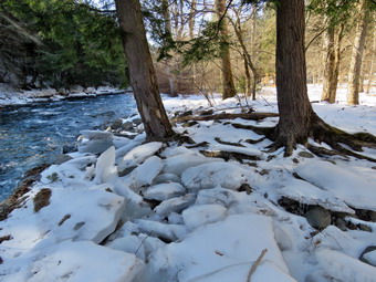 We started out at 2:10 PM by walking out of the parking lot to the bridge. I stopped for a few minutes to take some pictures upstream and downstream before continuing across the bridge to the trail. When we got to the other side, I looked at the trail and decided not to don my spikes. We turned left on a woods road that parallels the river and started down a short hill. Cindy had no problem as she had her spikes on. I was careful to look for snow rather than ice and made it down without a problem. We walked by a spring house and continued on the deserted woods road where there were only a few footprints. We came to an area with a little path down to the river. I walked down to the edge of the river very carefully as the rocks were slippery and the water looked deep and cold! I took some pictures downstream and some upstream to the bridge. There were some interesting icicles along the edge of the river and a culvert had spewed some water that was frozen on some bushes. I took pictures of both. Just after this area, the trail was even more eroded by water running across and under the trail than during our last visit. There was an area with several picnic tables which sit unused and rotting along the road. This was just the first of several similar areas. We walked by these tables which had not been used in many years. A little later we came to what was once a bathroom for some campsites that had long since disappeared. There were more tables in this area. I took the opportunity to take some more pictures of random picnic tables and the bathroom. I also took some shots of the snow covered woods road. There was a path over to the river so I walked over and found some large ice blocks that were on shore several feet above the level of the water. I took some pictures of the sun reflecting off the water both upstream and downstream and some more shots of the ice blocks all along the shore. In several areas the DEC had placed large rocks along the shore and covered them with heavy wire to reduce erosion. While I was getting ready to move on, Sheila alerted and we could see some deer running up the hill away from the river. Sheila started after them but came back as soon as I called her. At about .7 miles the woods road met the paved road that serves the campsites. Everything was unplowed and the snow was pristine except for some animal tracks. We continued on the road through the campsites and along the river. Many of the campsites had a cement block fireplace with a grill but some were upgraded to poured concrete. Everything was very quiet except for the water in the river. This was not surprising as the campsites are closed for the winter. I took some pictures of the empty campsites and the campsite road covered in snow. The skies were blue but lacked the interesting white puffy clouds that make for good pictures.
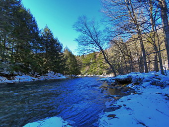 We walked to the last campsite where the trail ends and I walked down to the edge of the river around the ice blocks. I was careful to watch where I was walking as I did not want to break through the ice into the cold water. I stopped to take some pictures of the river especially downstream. I also took pictures of some more ice blocks. Sheila showed no interest in taking a dip but stayed close to the shore. We continued a little further but then turned back without following the path along the river after the last campsite which was covered in blocks of ice. We stayed to the left of the last bathroom and the way back walking on the other paved road through the campsites. This road parallels the one we walked out on to make a sort of loop. We stopped again to look at some interesting tracks. I took some pictures and speculated they were from something like an otter as I thought I could see where the animal had dragged its tail. We returned the way we had come although at a quicker pace. We still had not seen any people and very few cars had passed by on the roads. ! We walked through the bridge and turned right to go back to the car. I decided to go down to the river to take some pictures while Cindy went back to the car. Sheila does not like to be separated from me so she came along. The water level in the river was very high. I walked to the edge of the river and took pictures of the bridge and the river flowing under it. I walked downstream a little and made it too a flat rock that juts put into the stream. I took some more shots from that angle. When I was done we headed back to the car. We were back at the car at 3:45 PM having hiked 2.3 miles in 1 hour and 35 minutes with 20 minutes of stopped time. I had though about walking along the other side of the river but ultimately decided not to do so. The car's thermometer read 28 degrees but the sun made it feel much warmer.
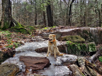
![]()
![]()
![]()
![]()
![]() On Wednesday, February 23rd, I wanted to get out for a hike which was a little harder than I had been doing. I also wanted to get in some elation gain do I decided I would hike to the Red Hill fire tower from the newer trailhead on Denning Road. The trailhead on Dinch-Coons Road is difficult to access in the winter as the road is not cleared and it is equally difficult when it is muddy. Many people park at the top of the hill where there is limited parking. It is a half mile downhill to the trailhead parking lot. The return trip can be nearly impossible if there is ice, packed snow or mud on the road. The new trailhead and parking area is on Denning Road 1.7 miles from the Claryville Post Office. By the time I came back from an ambulance call at 10:15 AM, the temperature was 45 degrees and the forecast was for almost 60 degrees in town. I knew the trailhead and summit would be cooler but that hiking would warm me up. I began to get ready with Sheila keeping a close watch on my movements. I put on my Mammut long-sleeved crew top with a short-sleeved baselayer since the temperature was already cool and I thought it might be cooler at the trailhead. I decided to wear my Columbia Titanium insulated pants to keep the chill away but decided against wearing tights underneath. I wore my old Salomon B-52 winter boots which are still waterproof and fit well. I grabbed my Leki external lock poles which I have been using lately since twist locks have proved unreliable. I also added a fuzzy orange hat and light gloves since it was cool. I donned my Mammut hoody which has lots of zippers to dump heat if necessary. I added a pair of OR Crocodile gaiters to further waterproof my lower legs and to keep the snow out of my boots. I decided I would not need snowshoes but that spikes would be a good idea. I put my Hillsound Trail Crampons in my pack and brought along the Kahtoola microspikes. The latter would probably be good enough as I expected some ice and some mud. I put my gear in the back of the car and Sheila in the back seat and we left Livingston Manor at 10:45 AM. I headed out the DeBruce Road passing through DeBruce and Willowemoc. At the end of the road I turned right on Route 47 and drove out to the Denning Road. Here I turned left and drove through Claryville. I drove 1.7 miles from the Claryville Post Office, we came to the new parking area on the right side of the road and pulled into the lot. There is a sign hanging from the support on the side of the road to designate the parking area and a kiosk with a description and maps. There were two other cars parked in the lot. I walked over to the trail and saw some ice and decided to put on the microspikes. I found one of the spikes had a broken link so I used my SOG multitool to repair it. I set my GPS unit and we walked to the back of the parking area and started up the trail at 11:20 AM with the temperature standing at 50 degrees.
On Wednesday, February 23rd, I wanted to get out for a hike which was a little harder than I had been doing. I also wanted to get in some elation gain do I decided I would hike to the Red Hill fire tower from the newer trailhead on Denning Road. The trailhead on Dinch-Coons Road is difficult to access in the winter as the road is not cleared and it is equally difficult when it is muddy. Many people park at the top of the hill where there is limited parking. It is a half mile downhill to the trailhead parking lot. The return trip can be nearly impossible if there is ice, packed snow or mud on the road. The new trailhead and parking area is on Denning Road 1.7 miles from the Claryville Post Office. By the time I came back from an ambulance call at 10:15 AM, the temperature was 45 degrees and the forecast was for almost 60 degrees in town. I knew the trailhead and summit would be cooler but that hiking would warm me up. I began to get ready with Sheila keeping a close watch on my movements. I put on my Mammut long-sleeved crew top with a short-sleeved baselayer since the temperature was already cool and I thought it might be cooler at the trailhead. I decided to wear my Columbia Titanium insulated pants to keep the chill away but decided against wearing tights underneath. I wore my old Salomon B-52 winter boots which are still waterproof and fit well. I grabbed my Leki external lock poles which I have been using lately since twist locks have proved unreliable. I also added a fuzzy orange hat and light gloves since it was cool. I donned my Mammut hoody which has lots of zippers to dump heat if necessary. I added a pair of OR Crocodile gaiters to further waterproof my lower legs and to keep the snow out of my boots. I decided I would not need snowshoes but that spikes would be a good idea. I put my Hillsound Trail Crampons in my pack and brought along the Kahtoola microspikes. The latter would probably be good enough as I expected some ice and some mud. I put my gear in the back of the car and Sheila in the back seat and we left Livingston Manor at 10:45 AM. I headed out the DeBruce Road passing through DeBruce and Willowemoc. At the end of the road I turned right on Route 47 and drove out to the Denning Road. Here I turned left and drove through Claryville. I drove 1.7 miles from the Claryville Post Office, we came to the new parking area on the right side of the road and pulled into the lot. There is a sign hanging from the support on the side of the road to designate the parking area and a kiosk with a description and maps. There were two other cars parked in the lot. I walked over to the trail and saw some ice and decided to put on the microspikes. I found one of the spikes had a broken link so I used my SOG multitool to repair it. I set my GPS unit and we walked to the back of the parking area and started up the trail at 11:20 AM with the temperature standing at 50 degrees.
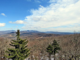 As we began the walk up the trail, the ice disappeared for as far as I could see so I stopped to remove the spikes. I also took some pictures of the nearly bare trail. We almost immediately came to a set of stone steps. They were well constructed and in just the right place to help out hikers. I also noticed that a woods road ran off to the right and thought about walking up it some other time. We continued up the trail and as we rounded a corner there was another stretch of ice. I could see past this patch to another bare area so I decided to keep the spikes in my pack. This pattern continued with some of the icy areas being very challenging to work over or around. We continued on the trail which was still in good shape even after it had been in place for over a year. The treadway was wide and flat with few obstacles. There were several switchbacks and it was obvious that one requirement of the construction was a moderate grade. The forest at these lower elevations was primarily evergreen which is unusual in the Catskills. We did run across a few branches on the trail which I removed. At .4 miles the trail turned sharply to the left in one of its many switchback and we entered an area of hardwoods. There was a small stream that ran across the trail and the construction crew had create a deep ditch along the side of the trail. The ditch directed the water across the trail and at that point there was a stone construction to allow the water to cross the trail and hikers to easily cross the water. This was repeated several other times on the trail. These areas were very icy as most of the water had frozen but on this warm day it was starting to melt. At .7 miles I could see a series of ledges ahead and stone steps that wound between them. I stopped to take some pictures but knew that this would be repeated several more times over the next quarter mile. Getting up the steps was tricky but I was able to walk on the front edge of the treads which had no ice. Each time I stopped to take pictures and each time Sheila posed nicely for some shots. Sheila was also having no problems walking over the ice. The last set of steps was the worst as they were completely covered in ice. I was able to work my way around them and back to the trail. At 1.3 miles we came to a trail junction with the trail that comes in from the Dinch-Coons Road trailhead. The signs indicated the Dinch Road trailhead was .8 miles to the left and the fire tower was .6 miles to the right. We stopped for a few minutes to get a drink and then continued toward the tower.
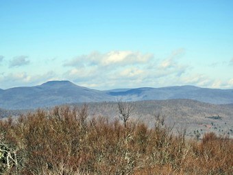 After walking a short distance, I began to see more ice ahead where the trail became steeper. I decided I would put the spikes on and leave them on to the tower. After the first patch of ice there was bare trail and mud. The spikes worked well on this surface but not as well on the bare rocks that are present in some places. After about a quarter mile, there was a spur trail to a spring on the right side of the trail and then a short switchback. This switchback was very icy and I was glad I had the spikes on. The grade increased from a consistent 10% to a steeper 20% and I could feel it. I had not climbed much on my recent hikes but this trip seemed to be easier than I had expected. There was plenty of sun which made me feel good but was also contributing to making me pretty warm. This warmth was offset by a stiff wind that blowing at 20 mph. The last .3 miles averages a little over a 20% grade and is challenging but did not seem too bad. There were some patches of snow and ice that made the last section a slog. At 12:50 PM we arrived at the tower clearing. There was another hiker sitting in the sun on the porch and we greeted each other. I walked over to one of the picnic tables, dropped my pack and got out my camera to take some pictures of the tower. I decided to tether Sheila to a picnic table knowing she would follow me up the tower. Unlike some dogs, Sheila has no problem climbing up and down the open steps but I did not want to chance it on this day. I inspected the steps and found no ice. I removed my spikes and started to climb the tower. Without looking, I could tell when I was above the treeline as the wind hit me at about 30 mph! I eventually made it to the landing below the cab. I began to take pictures of the surrounding scenery in all directions. There was no haze in any direction and the views were good in all directions. When there is no haze or fog, the views of the Catskill peaks from this tower are spectacular. There was snow on most of the peaks and the reservoir was easy to see. After taking quite a few shots, I descended the tower. I got a drink before starting the hike back down the mountain. The other hiker offered to take a picture of me but I declined. We began to talk and I found out he was a ham radio operator. The ham operators have a peak list of their own. They go to the peaks and broadcast their coordinates. Other ham operators who are listening find their location and everybody gets point.
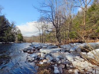 At 1:05 PM we started back down the trail. It had taken us 1.5 hours to hike to the summit and I hoped we would make the trip back go faster. I decided to put the spikes on and leave them on for the entire descent which would allow me to move faster. We moved quickly down the steeper section of the trail only having to be careful on one or two sections. As we approached the spur trail to the spring, Shiela alerted and I looked up to see three hikers coming toward us with an leashed dog well ahead of the. I put a leash on Sheila and asked the others to call their dog. They called their dog but the dog had no intention of listening. The dog approached Sheila and Sheila let it know she was not interested. The irresponsible dog owner came to secure his dog by the collar and mumbled an apology. The other two hikers passed by and Sheila and I continued our hike down the trail. The walk to the junction went quickly and as we approached we saw a hiker coming up the trail from Denning Road. I put Sheila on her leash and made the left turn to head back to the car. I expected to see the hiker but he had disappeared! I looked to the left and found he had decided to walk off trail to the trail that ascends the hill. We continued to keep a fast pace which was made easier by the spikes. As we started through the bottom section, Sheila began to alert and we saw a mother and three children stopped at the side of the trail. I put Sheila on her leash and we walked by them. They commented that Sheila was a pretty dog and I thanked them. We continued down the trail and were soon descending the last few steps to the parking area. It was 2:15 PM and we had hiked 3.7 miles in 2 hours and 50 minutes with 45 minutes of stopped time. The trip up took an hour and 30 minutes but the return trip only took us an hour and 5 minutes. Our elevation gain was 1170 feet. The temperature was still 50 degrees but there was now more clouds than sun. On the way home I stopped in DeBRuce to take some pictures of the Willowemoc Creek. The water was high and there were large slabs of ice on the shores and on the islands in the stream.
![]()
![]()
![]()
![]() On Friday, February 18th I wanted to get to hike after a week of ambulance calls, sporting events and terrible weather. My son-in-law Brad was at our house for the weekend so we planned to get out early before the end picked up. As often happens, two ambulance calls came in back to back delaying our hike until the afternoon. By the time we were ready to get going at 1:00 PM we were both tired and decided once again to go across the street to Round Top. At 1:15 PM the temperature was still only 22 degrees and a wind was blowing but the sun was out. Sheila was ready to go as she really likes to hike and we had not been out in a while. I got dressed in my Mammut crew top and added a long-sleeved baselayer. I decided to wear my Columbia Titanium insulated pants to keep the chill away but decided against wearing tights underneath. I wore my Keen Targhee II boots as I knew there would not be much snow. In fact, I did not think there would be much ice or snow left in the woods after the warm weather and rain that fell the day before. Since the temperature had dropped, I knew there might be some ice in places. I grabbed my Leki external lock poles which I have been using lately since twist locks have proved unreliable. I also added a fleecy orange hat and gloves since it was cool. I donned my Mammut hoody which has lots of zippers to dump heat if necessary. I added a pair of OR Crocodile gaiters to further waterproof my lower legs and keep them warm. I decided that the trails would be packed so I would not need my snowshoes and that we could probably walk around any ice on the trails. At 1:30 PM we walked out the door to start the hike. I grabbed Sheila's leash from the car and we walked up the driveway. I aimed to hike two figure 8's but knew that might be ambitious given the possible ice and my lack of conditioning. I grabbed Sheila's leash from the car as we headed down the driveway and across the street. We crossed the street and walked along the street to the parking lot of the Presbyterian Church.
On Friday, February 18th I wanted to get to hike after a week of ambulance calls, sporting events and terrible weather. My son-in-law Brad was at our house for the weekend so we planned to get out early before the end picked up. As often happens, two ambulance calls came in back to back delaying our hike until the afternoon. By the time we were ready to get going at 1:00 PM we were both tired and decided once again to go across the street to Round Top. At 1:15 PM the temperature was still only 22 degrees and a wind was blowing but the sun was out. Sheila was ready to go as she really likes to hike and we had not been out in a while. I got dressed in my Mammut crew top and added a long-sleeved baselayer. I decided to wear my Columbia Titanium insulated pants to keep the chill away but decided against wearing tights underneath. I wore my Keen Targhee II boots as I knew there would not be much snow. In fact, I did not think there would be much ice or snow left in the woods after the warm weather and rain that fell the day before. Since the temperature had dropped, I knew there might be some ice in places. I grabbed my Leki external lock poles which I have been using lately since twist locks have proved unreliable. I also added a fleecy orange hat and gloves since it was cool. I donned my Mammut hoody which has lots of zippers to dump heat if necessary. I added a pair of OR Crocodile gaiters to further waterproof my lower legs and keep them warm. I decided that the trails would be packed so I would not need my snowshoes and that we could probably walk around any ice on the trails. At 1:30 PM we walked out the door to start the hike. I grabbed Sheila's leash from the car and we walked up the driveway. I aimed to hike two figure 8's but knew that might be ambitious given the possible ice and my lack of conditioning. I grabbed Sheila's leash from the car as we headed down the driveway and across the street. We crossed the street and walked along the street to the parking lot of the Presbyterian Church.
We continued to the back of the church and began the ascent of the steepest hill behind the church. The hill is short but gets the circulation pumping and is the steepest and longest climb on the "trail." The trail up the hill was mostly bare with a snow bank at the beginning and a few icy patches on the way up the hill. At the top of the hill we stopped to look around. We could see there was still some white patches on the surrounding hills. We started on the trail by turning left at the trailhead. The trailhead was bare but as we entered the woods I was surprised at how much hard-packed snow and ice was still on the trail. We were able to avoid the icy patches but I started to think I had made a mistake and should have worn spikes. At the first trail junction, we followed Sheila as she started directly up the hill toward the lookout. The hill was completely with only a layer of leaves. Sheila loves the cold weather as she has some Husky in her and her longer coat has a warm undercoat. For some reasons she does not get the iceballs on her feet that plague some dogs. The climb up the hill was rather easy as there was no ice most of the way. I noticed that I immediately began to get warm but I was not ready to open the zippers to dump any heat. We passed by what used to be a side trail to the lookout that I blocked with brush. This side trail has a gap that hikers have to walk over and it can be dangerous for some people in the winter season. Unfortunately, some 'helpful' person had removed the brush without asking or knowing why it was there. at the top of the hill, we began to find the trail covered in ice and hard packed snow. The icy and snow continued as we followed the yellow trail as it turned right and started the gentle ascent through the open woods. The high winds that had blown on and off for the previous week had brought down some branches so Brad and I picked them up and moved them off the trail. Walking was no easy but was easier on the flatter ground. Every time we started up a small incline we had to look for alternate routes as the trail was too icy. Sheila was running ahead and then back to me which was fine with me. We continued to follow the yellow trail toward the first junction with the blue trail. At the first trail junction with the blue trail, we turned right to follow the yellow trail along the base of Round Top. There was a layer of hard snow and ice on this trail which continued to make walking difficult. Sheila decided to run ahead and the dash back toward us at high speed.
At the next junction with the blue trail, we turned left and started up the hill toward the summit. As we ascended, we confirmed that spikes would have made the hike much easier. Walking up the hill was slippery but I knew walking down the other side would be even more interesting. We bypassed the white crossover trail and continued over the summit of Round Top. We walked across the flat summit and started down the hill bypassing the white crossover trail. As soon as we started downhill, I knew it would be an adventure although Brad, who was not using poles, was having an easier time. We turned left on the switchback which sidehills quite a bit. Walking this trail required me to find some places off-trail where there was some snow that allowed me to get some traction. I made a note to work on this during the spring and summer. At the end of the switchback, we turned left on the main blue trail and walked down to the junction with the yellow trail. Going downhill without and traction was dicey at best. At the junction with the yellow trail, we turned left and walked along the base of Round Top again following the trail. This time when we reached the junction with the yellow trail, we turned right and walked downhill carefully to the woods road. We followed the trail along woods road and back down to the first trail junction. I was not enthusiastic about walking the hills again but we decided to walk a small loop. We turned around and started back up the woods road we had just descended. On the way back up, I pointed out to Brad some of the areas along the base of the ledges. Our ambulance corps is scheduled to participate in a low angle rope rescue drill with our fire department and the local forest ranger. I had pointed out to the ranger that many people hike these trails even though the are right in town and there could be a need to rescue someone who was injured. Brad and I continued back up the trail to the trail junction with the blue trail. We turned left and walked along the base of Round Top on the yellow trail. At the next trail junction with the blue trail, we turned left again and walked downhill toward the lookout. Even though this downhill is not very steep there were some tricky areas. At the viewpoint we turned left and walked down the hill to the first trail junction. This descent was easy since the trail was bare. We walked straight out the trail to the trailhead and turned right to start down the hill to the church parking lot. At the bottom of the hill we walked out through the parking lot to Rock Avenue. The roads were bare but we were careful crossing as drivers sometimes exceed the speed limit. After crossing the street to our driveway, we walked back to the house. We were home by 2:30 PM after hiking a little less than 2 miles in an hour. I was a little tired but glad we had gotten out. I promised myself that next time I would err on the side of picking and appropriate traction device.
![]()
![]()
![]()
![]() On Thursday, February 10th I planned to get out to hike a fire tower, either Balsam Lake or Red Hill. My plans were again changed by ambulance calls that left me sleeping in until 9:00 AM. I did some work around the house and when I checked the thermometer at 10:30 AM it was 30 degrees. I decided to go across the street and get in a short hike before the end of season track party. Sheila was ready to go as she really likes to hike and we had not been out for a few days. She was keeping a careful eye on me as I dressed. I got dressed in my Mammut crew top with a long-sleeved baselayer. I decided to wear my Columbia Titanium insulated pants to keep the chill away but decided against wearing tights underneath. I wore my old Salomon B-52 winter boots which are still waterproof and fit well. I grabbed my Leki external lock poles which I have been using lately since twist locks have proved unreliable. I also added a light hat and gloves since it was cool. I donned my Mammut hoody which has lots of zippers to dump heat if necessary. I added a pair of OR Crocodile gaiters to further waterproof my lower legs and to keep the snow out of my boots. I decided the snow would still be hard enough to just use spikes as I would only be out for about an hour. At 11:00 AM we walked out the door to start the hike with the temperature at 32 degrees which seemed warm compared to some of the temperatures the week before. I grabbed Sheila's leash from the car and we walked up the driveway. I aimed to hike two figure 8's and hike for about an hour. Sheila was happy to get out as we headed down the driveway and across the street. We crossed the street and climbed the snow bank on the ether side of the road to walk across the field to the back of the church. Any tracks I had made before were completed drifted in and the snow was deeper than I thought but hard and well consolidated. We walked to the back of the church and began the ascent of the steepest hill behind the church. The hill is short but gets the circulation pumping and is the steepest and longest climb on the "trail." I let Sheila pull me uphill with her leash . There was a track from some hikers and from kids sledding. At the top of the hill we paused for a minute so I could look around at the hills that surround the hamlet of Livingston Manor. The skies were bright blue with some white clouds. We started on the trail by turning left at the trailhead. There was still a good amount of snow in the woods and on the trail. There were tracks from other people but as far as I could tell none had worn snowshoes.
On Thursday, February 10th I planned to get out to hike a fire tower, either Balsam Lake or Red Hill. My plans were again changed by ambulance calls that left me sleeping in until 9:00 AM. I did some work around the house and when I checked the thermometer at 10:30 AM it was 30 degrees. I decided to go across the street and get in a short hike before the end of season track party. Sheila was ready to go as she really likes to hike and we had not been out for a few days. She was keeping a careful eye on me as I dressed. I got dressed in my Mammut crew top with a long-sleeved baselayer. I decided to wear my Columbia Titanium insulated pants to keep the chill away but decided against wearing tights underneath. I wore my old Salomon B-52 winter boots which are still waterproof and fit well. I grabbed my Leki external lock poles which I have been using lately since twist locks have proved unreliable. I also added a light hat and gloves since it was cool. I donned my Mammut hoody which has lots of zippers to dump heat if necessary. I added a pair of OR Crocodile gaiters to further waterproof my lower legs and to keep the snow out of my boots. I decided the snow would still be hard enough to just use spikes as I would only be out for about an hour. At 11:00 AM we walked out the door to start the hike with the temperature at 32 degrees which seemed warm compared to some of the temperatures the week before. I grabbed Sheila's leash from the car and we walked up the driveway. I aimed to hike two figure 8's and hike for about an hour. Sheila was happy to get out as we headed down the driveway and across the street. We crossed the street and climbed the snow bank on the ether side of the road to walk across the field to the back of the church. Any tracks I had made before were completed drifted in and the snow was deeper than I thought but hard and well consolidated. We walked to the back of the church and began the ascent of the steepest hill behind the church. The hill is short but gets the circulation pumping and is the steepest and longest climb on the "trail." I let Sheila pull me uphill with her leash . There was a track from some hikers and from kids sledding. At the top of the hill we paused for a minute so I could look around at the hills that surround the hamlet of Livingston Manor. The skies were bright blue with some white clouds. We started on the trail by turning left at the trailhead. There was still a good amount of snow in the woods and on the trail. There were tracks from other people but as far as I could tell none had worn snowshoes.
At the first trail junction, I followed Sheila as she turned right and started up the woods road which has the gentler approach of the two. There were a few branches on the trail from the winds that had passed through the area. I removed these branches either by dragging them off the trail or by using my poles on the smaller ones. The snow continued to be hard enough to support me as long as I stayed on the trail. When I stepped off the trail, I sank several inches into the snow. I almost immediately started to get warm so I stopped to open the zippers on my hoody. We reached the end of the woods road and turned left up the hill on the trail. We continued up the trail to the first trail junction with the upper blue trail and turned left to follow the yellow trail along the base of Round Top. The yellow trail was covered in about 6 inches of snow but it was all hard and packed. There were no new branches on the trail. At the next junction with the blue trail we turned right and headed up the blue trail toward the summit. Climbing with the spikes was much easier than with bare boots! When we got to the switchback, we turned right and followed it until it came back to the main blue trail. The fact that the switchback sidehills in places made the walk a little more difficult. We turned right and then continued straight ahead and up the hill toward the summit of Round Top bypassing the white crossover trail. We continued over the summit and down the blue trail toward the junction with the yellow trail. I was able to feel safe and secure with the spikes on my feet even though the snow was hard and there was some ice. We bypassed the white crossover trail again and continued down to the yellow trail. At the junction with the yellow trail we turned right and walked the yellow trail along the base of Round Top to the next junction with the blue trail. This time we turned left and walked the yellow trail downhill toward the lookout. We passed the "sitting rock" and were soon at the viewpoint. I took a quick peek at a view I had seen many times before and the turned left to start the steeper downhill. We passed by what used to be a side trail to the lookout that I blocked with brush. This side trail has a gap that hikers have to walk over and it can be dangerous for some people in the winter season. Unfortunately, some 'helpful' person had removed the brush without asking or knowing why it was there. The trip down to the first trail junction went quickly. We turned around and started back up the hill toward the lookout to start our second figure 8.
We immediately turned around and started back up the hill to the lookout. The spikes made the climb pretty easy and I seemed to have gotten a second wind. At the top of the hill we turned right to follow the yellow trail to the first junction with the blue trail. The one short climb was easy and the poles helped. We turned right to followed the yellow trail around the base of Round Top. At the next junction with the blue trail, we turned left and headed up toward the summit. When we got to the white crossover trail we continued straight ahead toward the summit. We walked over the summit and started down the other side bypassing the white crossover trail. We turned left on the switchback in blue trail. Walking downhill on the switchback was a little tricky as it sidehills in several places. At the end of the switchback we turned left and walked downhill to the trail junction with the yellow trail. We turned left and again followed the yellow trail along the base of Round Top to the junction with the blue trail. I noticed that the snow was getting a little softer as the temperature was rising. This time we turned right and headed down the yellow trail to the woods road that leads to the first trail junction. As we walked down the road, I noticed all the interesting ledges to the right of the trail. At the first trail junction, I debated doing another loop of some kind but decided just to head out to the trailhead. We walked out to the trailhead and turned right. We walked to the road through the church parking lot and over to the driveway to the house. It was 12:109 PM and we had hiked a little over 2 miles in a little over an hour.
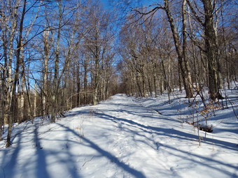
![]()
![]()
![]()
![]()
![]() On Wednesday, February 9th, I had planned to hike to Red Hill from the parking area on Denning Rd. I had asked Cindy if she wanted to go the night before and took her answer to be "Yes". I waited for her in the morning but by that time her answer was "no". I decided I did not have enough time to really enjoy the hike before going to school for our track party and pictures. Instead of Red Hill, I decided to go to Frick Pond to hike the Flynn Trail to the Big Rock Trail and back along the Quick Lake Trail. At 9:00 AM it was 22 degrees so I decided to dress a little warmly. While I began to get ready, Sheila was always nearby making it very clear that she wanted to go. I got dressed in my Patagonia long-sleeved 1/4 zip top with a long-sleeved thermal baselayer. I decided to wear my Columbia Titanium insulated pants to keep the chill away and decided to wear tights underneath. I wore my Salomon B52 winter boots which are supportive, surprisingly roomy and discontinued. I had recently put a pair of Protalus insoles in these shoes and was anxious to see how they performed. The insoles in most hiking boots are a flimsy and flat piece of material. I grabbed my Leki external lock poles which I have been using since twist locks have proved unreliable. I also donned my Mammut hoody which was enough zippers to dump heat when needed. I put on a fleecy orange hat for warmth and wore a light pair of gloves. I made sure to pack a pair of warm mitt. I also put on my OR Crocodile gaiters to deal with the snow and to keep my lower legs warm. I decided to take snowshoes knowing I could make a decision about wearing them at the trailhead. I took my Tubb's Flex VRT snowshoes which have the Boa binding. This system uses a thin steel cable system and a ratchet wheel which tightens it to give a custom fit and a secure binding. I made sure my Hillsound Trail Crampons were in my pack just in case I decided they were the best choice. We left Livingston Manor at 9:40 AM and I drove out the DeBruce Road about 6 miles to Mongaup Road. I turned left and continued up the road to the point where it splits. I stayed left on Beech Mountain Road and drove to the parking areas on the left. I pulled into the smaller parking area where a forest ranger's truck was parked. I looked over and saw it was Eric Stratton, the local ranger. I got out but left Sheila in the car. Eric got out of his truck and we greeted each other. Eric had not been working for some weeks as he and his wife had just had a baby! We talked about several trail-related topics until I decided I needed to get hiking. I checked the trail and the snow was rock hard. I decided to bareboot it but carry my Hillsound Trail Crampons in my pack. I set my GPS as we got ready to head out on the Flynn Trail with the temperature at 24 degrees. We crossed the road and began our hike at 10:10 AM.
On Wednesday, February 9th, I had planned to hike to Red Hill from the parking area on Denning Rd. I had asked Cindy if she wanted to go the night before and took her answer to be "Yes". I waited for her in the morning but by that time her answer was "no". I decided I did not have enough time to really enjoy the hike before going to school for our track party and pictures. Instead of Red Hill, I decided to go to Frick Pond to hike the Flynn Trail to the Big Rock Trail and back along the Quick Lake Trail. At 9:00 AM it was 22 degrees so I decided to dress a little warmly. While I began to get ready, Sheila was always nearby making it very clear that she wanted to go. I got dressed in my Patagonia long-sleeved 1/4 zip top with a long-sleeved thermal baselayer. I decided to wear my Columbia Titanium insulated pants to keep the chill away and decided to wear tights underneath. I wore my Salomon B52 winter boots which are supportive, surprisingly roomy and discontinued. I had recently put a pair of Protalus insoles in these shoes and was anxious to see how they performed. The insoles in most hiking boots are a flimsy and flat piece of material. I grabbed my Leki external lock poles which I have been using since twist locks have proved unreliable. I also donned my Mammut hoody which was enough zippers to dump heat when needed. I put on a fleecy orange hat for warmth and wore a light pair of gloves. I made sure to pack a pair of warm mitt. I also put on my OR Crocodile gaiters to deal with the snow and to keep my lower legs warm. I decided to take snowshoes knowing I could make a decision about wearing them at the trailhead. I took my Tubb's Flex VRT snowshoes which have the Boa binding. This system uses a thin steel cable system and a ratchet wheel which tightens it to give a custom fit and a secure binding. I made sure my Hillsound Trail Crampons were in my pack just in case I decided they were the best choice. We left Livingston Manor at 9:40 AM and I drove out the DeBruce Road about 6 miles to Mongaup Road. I turned left and continued up the road to the point where it splits. I stayed left on Beech Mountain Road and drove to the parking areas on the left. I pulled into the smaller parking area where a forest ranger's truck was parked. I looked over and saw it was Eric Stratton, the local ranger. I got out but left Sheila in the car. Eric got out of his truck and we greeted each other. Eric had not been working for some weeks as he and his wife had just had a baby! We talked about several trail-related topics until I decided I needed to get hiking. I checked the trail and the snow was rock hard. I decided to bareboot it but carry my Hillsound Trail Crampons in my pack. I set my GPS as we got ready to head out on the Flynn Trail with the temperature at 24 degrees. We crossed the road and began our hike at 10:10 AM.
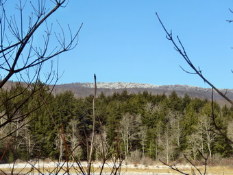 The Flynn Trail is sited along what used to be Beech Mountain Road which was the access for the Beech Mountain Boy Scout Camp. We walked the trail through the woods which was covered in hard-packed snow which was a little slippery on the uphill parts. We turned right on the woods road and set a quick pace up the hill despite a layer of new snow on top of the icy hard packed layer. The trail gains a little over 600 feet in 1.7 miles to the highest point at the junction with the Big Rock Trail. The day was cold but the sun was out and the temperature was rising. I began to get warm as we set a quick pace so we stopped so that I could open the zippers on the hoody. As long as we were stopped, I took a few pictures of the trail in both directions. I could hear branches cracking in the woods. I had been clearing a few branches as we walked. The trail had a well-defined and hard packed track which made walking pretty easy. As we approached and passed the clearing to the right of the trail, the track seemed to disappear and I started to sink a few inches into the snow. Snow had drifted across the track in this area but after a short distance the track reappeared. We kept walking uphill and we were soon at the junction with the Big Rock Trail. It was 11:05 AM and we had covered the 1.7 miles in 55 minutes. We turned left to walk down the Big Rock Trail. As I expected, the trail was well-packed by snowmobiles. It seemed that one machine had been on the trail since the new layer of snow had fallen but I had not seen or heard it. The hike down the trail started out well but I soon discovered that the thin layer of new snow covered a very slippery layer of ice beneath. I thought about putting on my spikes but decided against it. I did take to the side of the trail in the worst areas as the softer snow there allowed better traction. Despite these conditions the hike went quickly since we were setting a fast pace. I did stop to take a few more pictures. This trail can be tricky as there are several levels that make it seem like the bottom of the hill. The large blowdowns that had been on the trail were now gone and I assumed the snowmobile club had taken care of them. As we started down the bottom third of the trail, I noticed that the edges of the trail were bare with leaves showing through. This was a result of the recent rain that had run down the "ditch" at the edge of the trail.
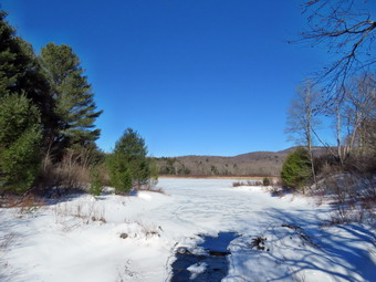 We were soon at Times Square and I thought about turning right to hike up and around the Logger's Loop to add some distance to our hike. I decided against this and we continued our hike by walking straight across Times Square to stay on the Big Rock Trail. The trail was completely covered in snow so there was no mud and no running water. We crossed the two small bridges over the inlets to the pond but did not stop to take pictures. When we got to the area that was covered by tall evergreens, I thought about taking some pictures but the light was poor. The wooden boardwalks were covered in frozen snow but were not as slippery as they looked and then we crossed the bridges quickly. At the next trail junction we turned left on the Quick Lake Trail to head for the bridge across the outlet of Frick Pond. I looked to the right and saw that no one had hiked the Quick Lake Trail. We walked along the west side of Frock Pond to the bridge across the outlet of the pond. I stopped at the bridge for a minute and took a few more photographs. We walked up the hill toward Gravestone Junction which was difficult as it was icy. We continued to Gravestone Junction and passed the Lobdell memorial marker. The marker is a memorial to two children who died in the 1930's in a fire that consumed their cabin. Thankfully, the stone was upright. I had not been cutting out the trail to the marker to discourage vandalism but it had been cleared. Once again "helpful" people were doing unauthorized work. The trail to the register was completely covered in snow but there were three places where small stream persisted in running across the trail. At the trail register we continued straight ahead to follow the woods road out to the car in the small lot. We arrived at the car at 12:10 PM having hiked 4 miles in 2 hours with an elevation gain of 670 feet. I was happy with the time as I thought it might take longer with the snow. The temperature had risen to 36 degrees and the snow was starting to melt.
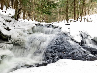
![]()
![]()
![]()
![]()
![]() On Saturday, February 5th I had not planned to hike after the ice storm the day before. I thought that I would give the road crews a chance to do their work. I was also trying to avoids falling branches brought down by the ice and winds. When I got up in the morning, it was 9 degrees which further supported my decision. I caught up on some work around the house including some work on the very icy sidewalk. By 10:00 AM the temperature was up to 18 degrees and the skies were blue with some sun. I decided I would try going to Mongaup Falls and Frick Pond just to get out of the house and get some much needed exercise. I started to get ready with Sheila watching my every move. I put on my Patagonia long-sleeved merino wool 1/4-zip top with a long-sleeved baselayer since the temperature was cool. I decided to wear my Columbia Titanium insulated pants with a light baselayer. I wore my Salomon B52 winter boots which are supportive, surprisingly roomy and discontinued. I had recently put a pair of Protalus insoles in these shoes and was anxious to see how they performed. The insoles in most hiking boots are a flimsy and flat piece of material. I grabbed my Leki external lock poles which I have been using since twist locks have proved unreliable. I also donned my Mammut hoody which was enough zippers to dump heat when needed. I put on a fleecy orange hat for warmth and wore a light pair of gloves. I made sure to pack a pair of warm mitt. I also put on my OR Crocodile gaiters to deal with the snow and to keep my lower legs warm. I made sure my Microspikes were in my pack just in case they were needed. I decided to take snowshoes knowing the snow would not be deep but that wearing them would preserve any track that was present and help me get good traction. I took my Tubb's Flex VRT snowshoes which have the Boa binding. This system uses a thin steel cable system and a ratchet wheel which tightens it to give a custom fit and a secure binding. These snowshoes also have a televator to elevate the hiker's heel on ascents and take some strain off the calf muscles. This is a feature that you didn't know you needed until you try it and then it is hard to live without it! I got my gear and Sheila in my car and left Livingston Manor at 10:15 AM. I drove out the DeBruce Road about 6 miles to Mongaup Road and turned left to continue up the road to the point where it splits. I stayed right as I wanted to park in the small pullout on the right so that we could hike to Mongaup Falls. Unfortunately, the plows had piled up snow on the edge of the road and had not plowed out the parking spots.
On Saturday, February 5th I had not planned to hike after the ice storm the day before. I thought that I would give the road crews a chance to do their work. I was also trying to avoids falling branches brought down by the ice and winds. When I got up in the morning, it was 9 degrees which further supported my decision. I caught up on some work around the house including some work on the very icy sidewalk. By 10:00 AM the temperature was up to 18 degrees and the skies were blue with some sun. I decided I would try going to Mongaup Falls and Frick Pond just to get out of the house and get some much needed exercise. I started to get ready with Sheila watching my every move. I put on my Patagonia long-sleeved merino wool 1/4-zip top with a long-sleeved baselayer since the temperature was cool. I decided to wear my Columbia Titanium insulated pants with a light baselayer. I wore my Salomon B52 winter boots which are supportive, surprisingly roomy and discontinued. I had recently put a pair of Protalus insoles in these shoes and was anxious to see how they performed. The insoles in most hiking boots are a flimsy and flat piece of material. I grabbed my Leki external lock poles which I have been using since twist locks have proved unreliable. I also donned my Mammut hoody which was enough zippers to dump heat when needed. I put on a fleecy orange hat for warmth and wore a light pair of gloves. I made sure to pack a pair of warm mitt. I also put on my OR Crocodile gaiters to deal with the snow and to keep my lower legs warm. I made sure my Microspikes were in my pack just in case they were needed. I decided to take snowshoes knowing the snow would not be deep but that wearing them would preserve any track that was present and help me get good traction. I took my Tubb's Flex VRT snowshoes which have the Boa binding. This system uses a thin steel cable system and a ratchet wheel which tightens it to give a custom fit and a secure binding. These snowshoes also have a televator to elevate the hiker's heel on ascents and take some strain off the calf muscles. This is a feature that you didn't know you needed until you try it and then it is hard to live without it! I got my gear and Sheila in my car and left Livingston Manor at 10:15 AM. I drove out the DeBruce Road about 6 miles to Mongaup Road and turned left to continue up the road to the point where it splits. I stayed right as I wanted to park in the small pullout on the right so that we could hike to Mongaup Falls. Unfortunately, the plows had piled up snow on the edge of the road and had not plowed out the parking spots.
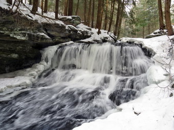 The road was plowed pretty wide and was clear of snow and ice. I decided to pull over as fast as I could and park on the side of the road. I parked and inspected my work and decided it would have to do. I walked over to the woods road down to the stream. I judged there WA enough snow to wear snowshoes. I walked back to the car where Sheila was whining since I had left her alone. I put on my snowshoes, shouldered my pack and let Sheila out of the car. It was 14 degrees with a wind blowing as we started our hike at 10:30 AM. We walked back to the woods road and down to the small bridge across the stream. I noticed that there were the impressions of snowshoes along then path we were taking. We walked along the edge of the stream which was frozen in places but not as much as I thought it might be. There was almost no ice on the trees and very little on the ground. The snow was frozen so hard that I really didn't need the snowshoes but they were offering good traction. We walked to a point even with the upper falls where I dripped my pack and got out my camera. I walked to a point just in front of the upper falls and took some shots using a few settings. The water volume was high from the rainfall the day before and there was not as much ice as I had hoped for. I finished taking pictures and went back to my pack to stow the camera. I shouldered the pack again. We walked to the narrow path that leads from the top of the lower falls to the bottom. I thought there was no way I could get down this path but there was quite a bit of snow so I gave it a try. I was able to get down to the streambed without a problem but chose not to think of getting back up. I walked to a point on a rock below the falls and got out the camera to take some interesting picture. The lower drop is much larger and higher than the upper drop and the volume of water was high. I took pictures downstream and then several of the falls. I made sure I used some different exposures and different zooms. When I was done, I stowed the camera and started to see how I was going to get back up the narrow path. Fortunately, the climb back up the path was easier than I thought and I was soon back up on the path back to the car. The wind had come up so I didn't want to stop to take pictures of the stream. I also did not want to leave the car on the road any longer than I had to so we walked back to the car without stopping. We were back at the car at 10:50 AM. I put my gear and Sheila in the car and started for the parking area at Frick Pond.
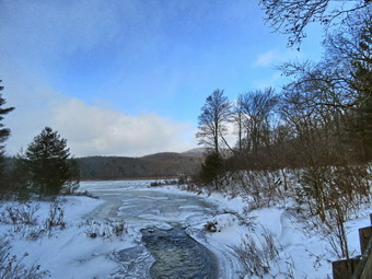 I turned the car around and turn right on Beech Mountain Road and drove to the Frick Pond trailhead. When we arrived at the parking areas at 10:55 PM there were no cars parked in either lot so I pulled into the smaller lot. The skies were sunny with a few clouds and a 15 mph wind blowing. The temperature was right at 14 degrees but the breeze made it feel cold. I did not bother to set my GPS unit as we were just going around the pond. I put on my snowshoes even though I knew I could barefoot or just wear spikes because the snow was frozen slid. We climb over a small snow bank and started out on the woods road to the register. I could see the outlines of snowshoes from another hiker but I could not tell when the print were made. I planned to walk around Frick Pond on the Quick Lake Trail, Big Rock Trail and Logger's Loop. As we walked out the woods road to Frick Pond, I found that the snow was frozen solid and that only three of the small stream across the trail were running. All of this made walking with the snowshoes almost like walking in any other season with boots. At Gravestone Junction, we stayed to the left on the Quick Lake Trail to go to the bridge at the outlet of Frick Pond. As we approached the bridge, I could feel the wind blowing stronger and noticed that snow was falling. We walked over the bridge and then stopped to get out of the wind. I took out my camera so that I could take pictures as I always do. I snapped a few shots as the wind blew the snow directly at me. I stowed my camera and we continued around the west side of the pond.
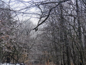 The spot that is always very wet and muddy was completely frozen over and covered with snow. We continued on the trail to the junction with the Big Rock Trail. The last time Cindy and I had hiked here we had turned left on the Quick Lake Trail and had to break through several inches of snow as no one had hiked in that direction. This time there were no tracks going in that direction as everyone had turned right on the Big Rock Trail. We also turned right on the Big Rock Trail and found the muddy area was also frozen solid making crossing it very easy. Being out of the wind made me feel much warmer. I was monitoring Sheila for signs that she was getting cold but I did not notice any signs. We continued over the wooden walkways which were covered in frozen snow. As we walked over the bridges over the inlet streams I looked for an opportunity to take some pictures but could not find any. We continued on the trail around the north end of the pond where the few wet areas were frozen. When we arrived at Times Square, I found that the Logger's Loop was well packed by snowmobiles. I considered lengthening the hike by climbing the Big Rock Trail but decided to turn right and head back. We continued our walk as the trail started uphill. It was hard to tell if someone had been hiking on the trail as the tracks had drifted in. I had been disappointed that there was no ice on the trees but as we crested the hill I saw that the trees were sparkling. There was some ice on the branches and the sun shining on them was responsible for the sparkle. I stopped to take some pictures of the trees with the sun behind them. It was hard to see what I was photographing as the sunlight was blinding. We continued our walk toward Gravestone Junction and turned left on the Quick Lake Trail. We walked back out to the parking area without seeing another person. It was 11:55 AM and we had hiked the 2.0 miles in 1 hour with an elevation gain for 150 feet. The temperature had risen to 16 degrees!
![]()
![]()
![]()
![]() On Tuesday, February 1st I planned to get out for the first hike of February. The night before I thought about going to Frick Pond or some other destination but I was beat from 8 ambulance calls over the weekend. When I got up at 7:00 AM the temperature was -7 degrees and I wondered if was going to be able to take Sheila anywhere. I did some work around the house and when I checked the thermometer at 10:30 AM it was 20 degrees. I decided to go across the street and get in a short hike before track practice. Sheila was ready to go as she really likes to hike and we had not been out for a few days. She was keeping a careful eye on me as I dressed. I got dressed in my Mammut crew top with a long-sleeved baselayer. I decided to wear my Columbia Titanium insulated pants to keep the chill away but decided against wearing tights underneath. wore my old Salomon B-52 winter boots which are still waterproof and fit well. I grabbed my Leki external lock poles which I have been using lately since twist locks have proved unreliable. I also added a fleecy orange hat and gloves since it was cool. I donned my Mammut hoody which has lots of zippers to dump heat if necessary. I added a pair of OR Crocodile gaiters to further waterproof my lower legs and to keep the snow out of my boots. The last time I had hiked on Round Top I had worn only my spikes. This turned out to be a bad idea so this time I knew I would wear snowshoes! I decided to wear my Tubbs Flex VRT which have the Boa binding. This system uses a thin steel cable system and a ratchet wheel which tightens it to give a custom fit and a secure binding. These snowshoes also have a televator to elevate the hiker's heel on ascents. This is a feature that you didn't know you needed until you try it and then it is hard to live without it! At 11:00 AM we walked out the door to start the hike. I grabbed Sheila's leash from the car and we walked up the driveway. I aimed to hike two figure 8's and hike for about an hour. Sheila was happy to get out as we headed down the driveway and across the street. We crossed the street and climbed the snow bank on the ether side of the road to walk across the field to the back of the church. Any tracks I had made before were completed drifted in and the snow was deeper than I thought and consolidated. We walked to the back of the church and began the ascent of the steepest hill behind the church. The hill is short but gets the circulation pumping and is the steepest and longest climb on the "trail." I let Sheila off her leash so that I could use my poles up the hill. There was a track from some hikers and from bids sledding. I tried to break a nice track as I ascended the hull. At the top of the hill we paused for a minute so I could look around at the hills that surround the hamlet of Livingston Manor. The skies were overcast with some sun and a few white clouds. We started on the trail by turning left at the trailhead. There was still a good amount of snow in the woods and on the trail. There were tracks from other people but as far as I could tell none and worm snowshoes.
On Tuesday, February 1st I planned to get out for the first hike of February. The night before I thought about going to Frick Pond or some other destination but I was beat from 8 ambulance calls over the weekend. When I got up at 7:00 AM the temperature was -7 degrees and I wondered if was going to be able to take Sheila anywhere. I did some work around the house and when I checked the thermometer at 10:30 AM it was 20 degrees. I decided to go across the street and get in a short hike before track practice. Sheila was ready to go as she really likes to hike and we had not been out for a few days. She was keeping a careful eye on me as I dressed. I got dressed in my Mammut crew top with a long-sleeved baselayer. I decided to wear my Columbia Titanium insulated pants to keep the chill away but decided against wearing tights underneath. wore my old Salomon B-52 winter boots which are still waterproof and fit well. I grabbed my Leki external lock poles which I have been using lately since twist locks have proved unreliable. I also added a fleecy orange hat and gloves since it was cool. I donned my Mammut hoody which has lots of zippers to dump heat if necessary. I added a pair of OR Crocodile gaiters to further waterproof my lower legs and to keep the snow out of my boots. The last time I had hiked on Round Top I had worn only my spikes. This turned out to be a bad idea so this time I knew I would wear snowshoes! I decided to wear my Tubbs Flex VRT which have the Boa binding. This system uses a thin steel cable system and a ratchet wheel which tightens it to give a custom fit and a secure binding. These snowshoes also have a televator to elevate the hiker's heel on ascents. This is a feature that you didn't know you needed until you try it and then it is hard to live without it! At 11:00 AM we walked out the door to start the hike. I grabbed Sheila's leash from the car and we walked up the driveway. I aimed to hike two figure 8's and hike for about an hour. Sheila was happy to get out as we headed down the driveway and across the street. We crossed the street and climbed the snow bank on the ether side of the road to walk across the field to the back of the church. Any tracks I had made before were completed drifted in and the snow was deeper than I thought and consolidated. We walked to the back of the church and began the ascent of the steepest hill behind the church. The hill is short but gets the circulation pumping and is the steepest and longest climb on the "trail." I let Sheila off her leash so that I could use my poles up the hill. There was a track from some hikers and from bids sledding. I tried to break a nice track as I ascended the hull. At the top of the hill we paused for a minute so I could look around at the hills that surround the hamlet of Livingston Manor. The skies were overcast with some sun and a few white clouds. We started on the trail by turning left at the trailhead. There was still a good amount of snow in the woods and on the trail. There were tracks from other people but as far as I could tell none and worm snowshoes.
At the first trail junction, I followed Sheila as she turned right and started up the woods road which has the gentler approach of the two. There were a few branches on the trail from the winds that had passed through the area. I removed these branches either by dragging them off the trail or by using my poles on the smaller ones. I continued to be careful to make a nice track although the forecast for rain and ice was discouraging. We reached the end of the woods road and turned left up the hill on the trail. We continued up the trail to the first trail junction with the upper blue trail and turned left to follow the yellow trail along the base of Round Top. The yellow trail was covered in about 6 inches of snow. There were only a few new branches here and there on the trail. I stopped to remove the branches or used my poles to flick the smaller ones aside. I was getting warmer as we hiked but I was not ready to open any zippers on my hoody. At the next junction with the blue trail we turned right and headed up the blue trail toward the summit. Climbing with the snowshoes proved to be much easier than using spikes! When we got to the switchback, we turned right and followed it until it came back to the main blue trail. The fact that the switchback sidehills in places made the walk a little more difficult. We turned right and then continued straight ahead and up the hill toward the summit of Round Top bypassing the white crossover trail. As we walked over the high point, I was pleased to pass by a small tree which I had removed so that it no linger encroached on the trail. We continued over the summit and down the blue trail toward the junction with the yellow trail. I was able to get a pretty good glide downhill on the snowshoes as it did not seem that anyone else had been over the summit. We bypassed the white crossover trail again and continued down to the yellow trail. At the junction with the yellow trail we turned right and walked the yellow trail along the base of Round Top to the next junction with the blue trail. Normally I would turn left here to do a figure 8 but for a variation I turned right and we started back up toward the summit.
We turned right on the switchback in the blue trail and followed it back to the main blue trail. We turned right and almost immediately right again on the white crossover trail. This trail had not been used by people but there were plenty of animals tracks. We followed the trail until it intersected the blue trail on the other side of the hill. We turned right and walked down to the junction with the yellow trail. Here we turned right and walked a short distance before I struck out to the left on a bushwhack along the top of the ledges that overlook the woods road. The snow was fresh and unbroken in most spots although we found several areas where deer had bedded down. I looked down over the ledges and was surprised by how far down it was. We continued walking downhill along the ledges as I looked for the spot to walk down to the trail near the lookout. I began following Sheila and she led me right to the spot. We turned left on the yellow trail just below the lookout. I glided down to the first trail junction which was made a little harder since several people had been on the hill without snowshoes. At the first trail junction, I debated doing another loop of some kind but decided just to head out to the trailhead. We walked straight out to the trailhead and turned right. We walked to the road through the church parking lot and over to the driveway to the house. It was 12:15 PM and we had hiked a little over 2 miles in a an hour and 15 minutes.
![]()
![]()
![]()
![]() On Thursday, January 27th I wanted to get to hike but had limited time as I had slept in after an ambulance call in the middle of the night. I had to be ready for track practice in the afternoon so I decided going across the street to Round Top was better than nothing. At 10:30 AM the temperature was still only 22 degrees but I knew it would be a short hike a and close to home. Sheila was ready to go as she really likes to hike. I got dressed in my Mammut crew top and add a long-sleeved baselayer. I decided to wear my Columbia Titanium insulated pants to keep the chill away but decided against wearing tights underneath. I wore my old Salomon B-52 winter boots which are still waterproof and fit well. I grabbed my Leki external lock poles which I have been using lately since twist locks have proved unreliable. I also added a fleecy orange hat and gloves since it was cool. I donned my Mammut hoody which has lots of zippers to dump heat if necessary. I added a pair of OR Crocodile gaiters to further waterproof my lower legs and to keep the snow out of my boots. I decided that the trails would be packed so I would not need my snowshoes but I thought adding microspikes would be a good idea. At 11:00 AM we walked out the door to start the hike. I grabbed Sheila's leash from the car and we walked up the driveway. I aimed to hike two figure 8's but knew that might be ambitious given the snow and my lack of conditioning. As we went outside, I stopped to put on the microspikes which always give me some trouble. I grabbed Sheila's leash from the car as we headed down the driveway and across the street. We crossed the street and mounted the snow bank on the other side. As we were walking across the field to the parking area by the Presbyterian Church, I noticed that the snow was pretty deep and unconsolidated. I begin to wonder if I would pay for my decision to forego the snowshoes!
On Thursday, January 27th I wanted to get to hike but had limited time as I had slept in after an ambulance call in the middle of the night. I had to be ready for track practice in the afternoon so I decided going across the street to Round Top was better than nothing. At 10:30 AM the temperature was still only 22 degrees but I knew it would be a short hike a and close to home. Sheila was ready to go as she really likes to hike. I got dressed in my Mammut crew top and add a long-sleeved baselayer. I decided to wear my Columbia Titanium insulated pants to keep the chill away but decided against wearing tights underneath. I wore my old Salomon B-52 winter boots which are still waterproof and fit well. I grabbed my Leki external lock poles which I have been using lately since twist locks have proved unreliable. I also added a fleecy orange hat and gloves since it was cool. I donned my Mammut hoody which has lots of zippers to dump heat if necessary. I added a pair of OR Crocodile gaiters to further waterproof my lower legs and to keep the snow out of my boots. I decided that the trails would be packed so I would not need my snowshoes but I thought adding microspikes would be a good idea. At 11:00 AM we walked out the door to start the hike. I grabbed Sheila's leash from the car and we walked up the driveway. I aimed to hike two figure 8's but knew that might be ambitious given the snow and my lack of conditioning. As we went outside, I stopped to put on the microspikes which always give me some trouble. I grabbed Sheila's leash from the car as we headed down the driveway and across the street. We crossed the street and mounted the snow bank on the other side. As we were walking across the field to the parking area by the Presbyterian Church, I noticed that the snow was pretty deep and unconsolidated. I begin to wonder if I would pay for my decision to forego the snowshoes!
We continued to the back of the church and began the ascent of the steepest hill behind the church. The hill is short but gets the circulation pumping and is the steepest and longest climb on the "trail." The trail up the hill was packed and the spikes were working fine. At the top of the hill we stopped to look around. We started on the trail by turning left at the trailhead. There was only about 6 inches of snow on the trail under the trees which was not consolidated. I was pretty sure I had made a mistake an should have worn snowshoes. I could see one set of footprints that had been made after the last snow. In fact, it looked as if the print had been made earlier in the day! It was clear the hiker had bare-booted it. At the first trail junction, I followed Sheila as she started directly up the hill toward the lookout. Sheila loves the snow as she has some Husky in her and her longer coat has a warm undercoat. For some reasons she does not get the iceballs on her feet that plague some dogs. The climb up the hill was slippery but seemed easier than I thought it might be. The spikes helped but snowshoes would have been better. I noticed that I immediately began to get warm and sweat so I opened some zippers to dump the heat. We passed by what used to be a side trail to the lookout that I blocked with brush. This side trail has a gap that hikers have to walk over and it can be dangerous for some people in the winter season. Unfortunately, some 'helpful' person had removed the brush without asking or knowing why it was there. We continued to the upper part of the lookout as I wanted to get a view of town with the snow. After a quick look, we followed the yellow trail as it turned right and started the gentle ascent through the open woods. Sheila was running ahead and then back to me which was fine with me as she was breaking the trail. We continued to follow the yellow trail toward the first junction with the blue trail. There were a few branches on the trail that I removed as we hiked. At the first trail junction with the blue trail, we turned right to follow the yellow trail along the base of Round Top. There was a layer of snow on this trail but it felt good to be walking on the level ground. Sheila decided to run ahead and the dash back toward me at high speed.
At the next junction with the blue trail, we turned left and started up the hill toward the summit. As we ascended, I confirmed that snowshoes would have made the hike easier. The spikes I was wearing could not penetrate the snow to get a grip and I kept slipping. We bypassed the white crossover trail and continued over the summit of Round Top. We walked across the flat summit and started down the hill, we bypassed the white crossover trail but turned left on the switchback. When we made the turn on the switchback, I noticed that the trail sidehilled quite a bit and that I was slipping downhill. I made a note to work on this during the spring and summer. At the end of the switchback, we turned left on the main blue trail and walked down to the junction with the yellow trail. Going downhill with the snowshoes felt really good. At the junction with the yellow trail we turned left and walked along the base of Round Top following the trail we had already broken. The broken trail made walking much easier. This time when we reached the junction with the yellow trail, we turned left again to start up toward the summit. This was not my usual route but I just wanted to try something different! We turned left on the white crossover trail and walked it to the main blue trail where we turned left. We walked down the blue trail and turned left to walk along the base of Round Top. After a short distance, we turned right to start bushwhacking across the top of the ledges. We walked along the edge of the ledges until we came close to the lookout. Here we walked down to the yellow trial and turned left to head back down the hill to the first trail junction. We walked straight out the trail to the trailhead and turned right to start down the hill to the church parking lot. At the bottom of the hill we headed across the field to the road. The roads were bare and I was careful to cross as I still had the microspikes on my feet. After crossing the street to our driveway, we walked back to the house. We were home by 12:15 PM after hiking a little more than 2 miles in 1 hour and 15 minutes.I was tired but glad we had gotten out.
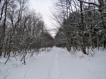
![]()
![]()
![]()
![]()
![]() On Tuesday, January 25th, I was ready to get in a hike that was not on Round Top! I decided to hike the Logger's Loop at Frick Pond. I knew some of this loop would be packed by snowmobiles so I though I could do it even if I had to break some trail. When I mentioned hiking to Cindy, she said she would like to come along. When we were starting to get ready at 9:45 AM the temperature was 26 degrees but I suspected it would be colder at the trailhead. As We started gathering our equipment and getting dressed, Sheila was very quiet but did not let me out of her sight. I put on my Patagonia long-sleeved merino wool 1/4-zip top with a long-sleeved baselayer since the temperature was cool. I decided to wear my Columbia Titanium insulated pants but didn't bother with a baselayer. I wore my Salomon B52 winter boots which are supportive, surprisingly roomy and discontinued. I had recently put a pair of Protalus insoles in these shoes and was anxious to see how they performed. The insoles in most hiking boots are a flimsy and flat piece of material. I grabbed my Leki external lock poles which I have been using since twist locks have proved unreliable. I also donned my Mammut hoody which was enough zippers to dump heat when needed. I put on a fleecy orange hat for warmth and wore a light pair of gloves. I also put on my OR Crocodile gaiters to deal with the snow and to keep my lower legs warm. I made sure my Microspikes were in my pack just in case they were needed. Cindy and I decided to take snowshoes knowing the snow would not be deep but that wearing them would preserve any track that was present or help us to create one. We both took our Tubb's Flex VRT which have the Boa binding. This system uses a thin steel cable system and a ratchet wheel which tightens it to give a custom fit and a secure binding. These snowshoes also have a televator to elevate the hiker's heel on ascents and take some strain off the calf muscles. This is a feature that you didn't know you needed until you try it and then it is hard to live without it! We got our gear and Sheila in my car and left Livingston Manor at 10:15 AM. We were surprised that the snow that had fallen overnight amounted to about two inches! I drove out the DeBruce Road about 6 miles to Mongaup Road and turned left to continue up the road to the point where it splits. I stayed left on Beech Mountain Road and drove to the Frick Pond trailhead. When we arrived at the parking areas, we found that both lots had been plowed after the previous large storm but had a layer of snow from the storm the night before. Neither lot had any cars and I pulled into the smaller lot and parked. As Cindy and I were getting ready, I heard a noise coming up the road which turned out to be a Town of Rockland plow. The operator plowed the small lot and then started on the larger one. The temperature was 24 degrees and a slight breeze was blowing. There was three inches of new snow and snow was still falling. The skies overcast and cloudy but some areas showed a little blue. I set my GPS and we both put on our snowshoes. We carried our spikes although I could not think of a place we would use them.
On Tuesday, January 25th, I was ready to get in a hike that was not on Round Top! I decided to hike the Logger's Loop at Frick Pond. I knew some of this loop would be packed by snowmobiles so I though I could do it even if I had to break some trail. When I mentioned hiking to Cindy, she said she would like to come along. When we were starting to get ready at 9:45 AM the temperature was 26 degrees but I suspected it would be colder at the trailhead. As We started gathering our equipment and getting dressed, Sheila was very quiet but did not let me out of her sight. I put on my Patagonia long-sleeved merino wool 1/4-zip top with a long-sleeved baselayer since the temperature was cool. I decided to wear my Columbia Titanium insulated pants but didn't bother with a baselayer. I wore my Salomon B52 winter boots which are supportive, surprisingly roomy and discontinued. I had recently put a pair of Protalus insoles in these shoes and was anxious to see how they performed. The insoles in most hiking boots are a flimsy and flat piece of material. I grabbed my Leki external lock poles which I have been using since twist locks have proved unreliable. I also donned my Mammut hoody which was enough zippers to dump heat when needed. I put on a fleecy orange hat for warmth and wore a light pair of gloves. I also put on my OR Crocodile gaiters to deal with the snow and to keep my lower legs warm. I made sure my Microspikes were in my pack just in case they were needed. Cindy and I decided to take snowshoes knowing the snow would not be deep but that wearing them would preserve any track that was present or help us to create one. We both took our Tubb's Flex VRT which have the Boa binding. This system uses a thin steel cable system and a ratchet wheel which tightens it to give a custom fit and a secure binding. These snowshoes also have a televator to elevate the hiker's heel on ascents and take some strain off the calf muscles. This is a feature that you didn't know you needed until you try it and then it is hard to live without it! We got our gear and Sheila in my car and left Livingston Manor at 10:15 AM. We were surprised that the snow that had fallen overnight amounted to about two inches! I drove out the DeBruce Road about 6 miles to Mongaup Road and turned left to continue up the road to the point where it splits. I stayed left on Beech Mountain Road and drove to the Frick Pond trailhead. When we arrived at the parking areas, we found that both lots had been plowed after the previous large storm but had a layer of snow from the storm the night before. Neither lot had any cars and I pulled into the smaller lot and parked. As Cindy and I were getting ready, I heard a noise coming up the road which turned out to be a Town of Rockland plow. The operator plowed the small lot and then started on the larger one. The temperature was 24 degrees and a slight breeze was blowing. There was three inches of new snow and snow was still falling. The skies overcast and cloudy but some areas showed a little blue. I set my GPS and we both put on our snowshoes. We carried our spikes although I could not think of a place we would use them.
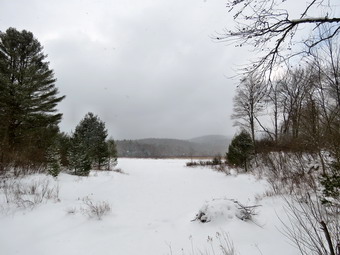 We started out the Quick Lake Trail from the parking area to the register and found that many people had been on the trail and it seemed as if only a few had worn snowshoes! This was typical as people are either ignorant of how bare-booting ruins a trail or just don't care. There was about 3 inches of new powder with 8 inches more of base off the trails. We continued straight ahead at the register on the woods road that heads out to the trail system. The woods road was completely covered in snow and we tried to set a good snowshoe trench. We did not see any open water but there was some ice. The snowshoes were working well and I did not notice that walking was much harder with them. At Gravestone Junction we stayed left on the Quick Lake trail heading toward the bridge at the outlet to Frick Pond. When we arrived at the bridge, I put my pack down and got out the camera. Taking pictures was difficult as the falling snow kept hitting the lens. Beech Mountain was almost completely obscured by snow. The track was well-packed as we continued across the bridge toward the junction with the Big Rock Trail. We continued along the west side of Frick Pond and at the junction with the Big Rock Trail we headed left on the Quick Lake Trail. We immediately noticed that all other hikers had stayed left on the Big Rock Trail. There was no broken track on the Quick Lake Trail which meant I would have to break the trail to Iron Wheel Junction. I had broken the track here in the past and it can be very tiring. The trail is slightly uphill which is not very noticeable under most conditions but was very noticeable as I broke through the snow. At least the snow had stopped falling. We walked through the spruce tunnel and came to the small stream across the trail. There was a snow bridge over the water and we crossed easily. I noticed at this point that my legs were tired especially my inner thighs. This always happens and comes from the constant lifting. I decided that I would try to go as far as Iron Wheel Junction to see if there had been any snowmobiles over the trail to pack the snow. As we walked we tried to set a nice trench. The walk up the trail was making me more tired the farther we went so I stopped occasionally to move some branches out of the way. The good part was that there was no open water or soft mud to impede our progress. I was really hoping that when we got to Iron Wheel Junction there would be snowmobile track which would make the walking easier.
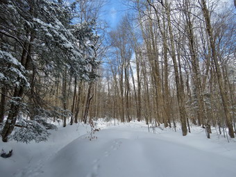 When we got to the junction, we could hardly see the iron wheel as it was almost completely covered by snow. The Logger's Loop was packed by snowmobile passes. I took a few shots and then was ready to turn right on the Logger's Loop toward Times Square. I knew going this way would be longer than turning around but I wanted to complete a loop. We turned right and began following the packed snowmobile trail which made for much easier walking. Even though the trail began an ascent, my legs did not seem as tired. As we walked we continued to clear some small branches. The skies cleared some and I stopped to take a few pictures of the trails with the ahead of us with the new snow. The sun came out briefly but disappeared almost as quickly. We came to the large cherry tree that had broken off high up and fallen so that it was arching across the trail. This tree was not blocking the trail and it was clear it was not coming down soon. We passed by the seasonal pond on the left side of the trail and continued downhill to Times Square. We walked straight across Times Square to stay on the Logger's Loop. The trail started uphill and only showed one or two sets of foot prints. My legs started to ache again but I knew we didn't have far to go. Although the trail is slightly uphill we were setting a fast pace. Cindy was a little farther behind but I slowed a little so she could catch up. We continued walking on the trail and crested the hill to walk out to Gravestone Junction. I again stopped to take some shots as the sun was peeking through the trees. We turned left at the Gravestone Junction and headed back to the car on the woods road. At the trail register, we continued straight ahead to stay on the woods road back to our car. It was 12:55 PM and we had spent 2 hour and 20 minutes hiking 3.8 miles on snowshoes. We had only stopped for 15 minutes! The elevation gain was a modest 400 feet. The temperature had risen to 28 degrees but the snow had stopped.
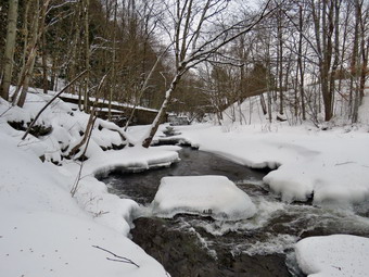
![]()
![]()
![]()
![]()
![]() On Wednesday, January 19th I wanted to get out for hike but did not want to go too far from home. Cindy agreed to go along if the trail was relatively flat and short. I knew that the deep freeze overnight had probably hardened everything on the trails making snowshoes unnecessary and any postholes dangerous. We agreed to hike the Parksville Rail Trail which is short, less than 3 miles, but has a nice waterfall. As we started to get ready at 9:30 AM the temperature was still 26 degrees. I don't like to take Sheila out too often when the temperature is too cold but the high 20's seemed alright and has never shown any ill effects from the cold. I got dressed in my Mammut crew top and add a long-sleeved baselayer. I decided to wear my Columbia Titanium insulated pants to keep the chill away but decided against wearing tights underneath. I wore my Salomon B-52 insulated boots as they keep my feet warm and dry and work well with snowshoes. I had recently put a pair of Protalus insoles in these shoes and was anxious to see how they performed. The insoles in most hiking boots are a flimsy and flat piece of material. I also applied a new waterproofing and leather preservative which has proved very effective. I grabbed a pair of Leki external lock poles I have been using all season. I also put on my OR Crocodile gaiters. Finally, I donned my Mammut hoody which blocks the wind and keeps me warm but has enough zippers to dump heat when needed. I put on a fleecy orange hat for warmth. For snowshoes Cindy and I decided to take our Tubbs Flex VRT which have the Boa binding. This system uses a thin steel cable system and a ratchet wheel which tightens it to give a custom fit and a secure binding. These snowshoes also have a televator to elevate the hiker's heel on ascents. This is a feature that you didn't know you needed until you try it and then it is hard to live without it! We knew these might not be necessary so we also made sure we had spikes with us. At 9:55 we put our gear in the car and Sheila in the back seat. I headed out Old Route 17 across the Flats and then took Old Route 17 and Service Road to the point where they meet Fox Mountain Road. Just after this intersection is the western parking area for the rail trail. We were surprised to see that the parking lot was not plowed. It is a shame that the lot was inaccessible as it would take about 15 minutes to plow and allow people access to the rail trail from both ends. I continued to drive into Parksville turning right at the stop sign on Short Avenue. I noticed the large lot at the corner was plowed but I turned right on Main Street and parked on the side of the street where there was plenty of room. My intention was to check out the trail and then park in the other lot. I got out of the car and walked to the point where the trail entered the woods. The snow wasn't very hard and it seemed that snowshoes would be the best choice. I did find that the trail was chewed up with postholes from ignorant people who did not know that they should wear snowshoes. It seemed many of them had come out after the first major snowstorm of the year. They had sunk deeply into the soft snow and ice.
On Wednesday, January 19th I wanted to get out for hike but did not want to go too far from home. Cindy agreed to go along if the trail was relatively flat and short. I knew that the deep freeze overnight had probably hardened everything on the trails making snowshoes unnecessary and any postholes dangerous. We agreed to hike the Parksville Rail Trail which is short, less than 3 miles, but has a nice waterfall. As we started to get ready at 9:30 AM the temperature was still 26 degrees. I don't like to take Sheila out too often when the temperature is too cold but the high 20's seemed alright and has never shown any ill effects from the cold. I got dressed in my Mammut crew top and add a long-sleeved baselayer. I decided to wear my Columbia Titanium insulated pants to keep the chill away but decided against wearing tights underneath. I wore my Salomon B-52 insulated boots as they keep my feet warm and dry and work well with snowshoes. I had recently put a pair of Protalus insoles in these shoes and was anxious to see how they performed. The insoles in most hiking boots are a flimsy and flat piece of material. I also applied a new waterproofing and leather preservative which has proved very effective. I grabbed a pair of Leki external lock poles I have been using all season. I also put on my OR Crocodile gaiters. Finally, I donned my Mammut hoody which blocks the wind and keeps me warm but has enough zippers to dump heat when needed. I put on a fleecy orange hat for warmth. For snowshoes Cindy and I decided to take our Tubbs Flex VRT which have the Boa binding. This system uses a thin steel cable system and a ratchet wheel which tightens it to give a custom fit and a secure binding. These snowshoes also have a televator to elevate the hiker's heel on ascents. This is a feature that you didn't know you needed until you try it and then it is hard to live without it! We knew these might not be necessary so we also made sure we had spikes with us. At 9:55 we put our gear in the car and Sheila in the back seat. I headed out Old Route 17 across the Flats and then took Old Route 17 and Service Road to the point where they meet Fox Mountain Road. Just after this intersection is the western parking area for the rail trail. We were surprised to see that the parking lot was not plowed. It is a shame that the lot was inaccessible as it would take about 15 minutes to plow and allow people access to the rail trail from both ends. I continued to drive into Parksville turning right at the stop sign on Short Avenue. I noticed the large lot at the corner was plowed but I turned right on Main Street and parked on the side of the street where there was plenty of room. My intention was to check out the trail and then park in the other lot. I got out of the car and walked to the point where the trail entered the woods. The snow wasn't very hard and it seemed that snowshoes would be the best choice. I did find that the trail was chewed up with postholes from ignorant people who did not know that they should wear snowshoes. It seemed many of them had come out after the first major snowstorm of the year. They had sunk deeply into the soft snow and ice.
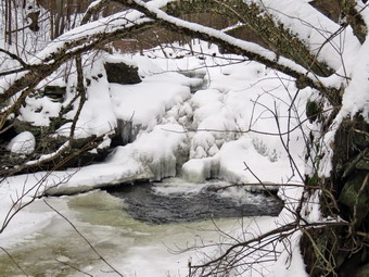 We decided to park where we were as it was closer to the trailhead and there were no other cars around. We put on our snowshoes to begin the hike. When I went to set my GPS unit I found it was not charged. This normally would bother me but I had a track already recorded so I knew I just needed to note the times. We started on the trail at 10:10 AM with the temperature right at 28 degrees but with no breeze blowing. The boot prints in the trail were every bit as annoying as I thought they might be and they were spread across the entire width of the trail. There was also a trail from a set of cross country skis. I was careful to avoid the ski tracks but picked a set of footprints and began to lay down a snowshoe track along the almost flat trail. It was cooler under the trees but as long as we kept moving we were warm enough. At about .4 miles we came to the Parksville Falls. The areas above the falls had a lot of ice with water flowing under it. The water was so clear we could see the bedrock beneath the flowing water. The volume of the stream was impressive despite the ice. I took some shot from the trail and then walked down a path to the edge of the stream. I took some more pictures upstream and then took some of the water going over the top of the falls. When I was done, I walked back up to the main trail and continued for a short distance to the area at the top of the falls. I noticed that there were now snowshoe tracks on the trail. It was hard to tell if there was more than one person or whether one person had walked out and back from the other parking area. In any case, whoever it was did not know how to lay down a single well-worn track! I took a few shots of the falls and then decided I wanted a closer look. I worked my way down a path through some deep snow toward an area in front of the falls that I have used before to take pictures. I was not able to get the direct view that I wanted because the snowshoes were not getting the kind of grip I needed and the trail was narrow. I did take some more shots and then worked my way back up to the main trail. Cindy was already well ahead of me trying to keep warm by moving. Sheila spent her time running up and down the trail between us. At .8 miles we crossed several bridges over an area that has some seasonal streams and drainage off State Route 17. At the end of the bridges I stopped to take some long distance shots down the stream. The skies were overcast and there was some haze so the pictures were not as dramatic as I had hoped. After taking some pictures, I continued along the trail westward toward the trailhead near Fox Mountain Road. I noticed that after the bridges there were few if any boot prints. I decided I would just walk to the point where the trees ended. When I got to that point, the pull of the other trailhead was too strong and I decided to walk all the way to the other parking area. Cindy stayed behind and Sheila and I set a quick pace. We continued to walk along the trail and broke out into the sun where it seemed warmer. We walked to the trailhead and then turned around to start back. Sheila kept whining and running ahead to find Cindy but she came back when I called. We met Cindy just as the trees began to overshadow the trail. I did not plan to stop on the way back so the return trip was much faster than the trip out. We continued to set a good snowshoe track. We continued to walk out the trail back to the car. We were back at the car at 11:50 AM after hiking 2.8 miles in 1 hour and 40 minutes with virtually no elevation gain.
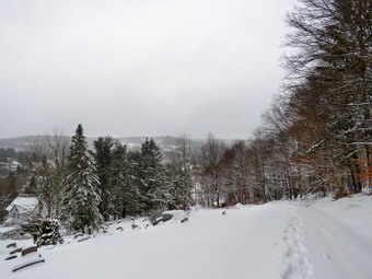
![]()
![]()
![]()
![]()
![]() On Monday, January 17th I wanted to get in hike after almost two weeks without getting out. I had a cold and in the past I have always hiked anyway. This year I decided to stay inside. Sitting at home may be a little crazy but I think it helped physically. Sunday into Monday we had received between 6 and 8 inches of heavy, wet snow. I decided it would be unwise to try to go to any trailhead as they would not be plowed which left me with another trip across the street to Round Top. I reasoned this would be a challenge as I was two weeks out of shape and the snowshoeing would add a level of difficulty. Fortunately, the ambulance calls that we were called to had been canceled and by 11:00 AM I was ready to get out. The temperature was 30 degrees and I worried that the snow would clump on my snowshoes which makes for a miserable outing. Sheila was ready to go as she really likes to hike. She normally behaves herself but could not contain her excitement after such a long layoff. I got dressed in my Mammut crew top and add a long-sleeved baselayer. I decided to wear my Columbia Titanium insulated pants to keep the chill away but decided against wearing tights underneath. I wore my old Salomon B-52 winter boots which are still waterproof and fit well. I grabbed my Leki external lock poles which I have been using lately since twist locks have proved unreliable. I also added a fleecy orange hat and gloves since it was cool. I donned my Mammut hoody which has lots of zippers to dump heat if necessary. I added a pair of OR Crocodile gaiters to further waterproof my lower legs and to keep the snow out of my boots. I grabbed my Tubbs Flex VRT snowshoes which have the Boa binding. This system uses a thin steel cable system and a ratchet wheel which tightens it to give a custom fit and a secure binding. These snowshoes also have a televator to elevate the hiker's heel on ascents and take some strain off the calf muscles. This is a feature that you didn't know you needed until you try it and then it is hard to live without it! I brought my pack along since it was the easiest way to carry my camera and Kahtoola microspikes. At 11:30 AM we walked out the door to start the hike. I grabbed Sheila's leash from the car and we walked up the driveway. I aimed to hike two figure 8's but knew that might be ambitious given the heavy snow and my lack of conditioning. As we went outside, I stopped to put on the snowshoes which is pretty easy with their binding system. I grabbed Sheila's leash from the car as we headed down the driveway and across the street. We crossed the street and mounted the snow bank on the other side. Walking across the field to the parking area by the Presbyterian Church was pretty easy even though this was my first time on snowshoes since last year.
On Monday, January 17th I wanted to get in hike after almost two weeks without getting out. I had a cold and in the past I have always hiked anyway. This year I decided to stay inside. Sitting at home may be a little crazy but I think it helped physically. Sunday into Monday we had received between 6 and 8 inches of heavy, wet snow. I decided it would be unwise to try to go to any trailhead as they would not be plowed which left me with another trip across the street to Round Top. I reasoned this would be a challenge as I was two weeks out of shape and the snowshoeing would add a level of difficulty. Fortunately, the ambulance calls that we were called to had been canceled and by 11:00 AM I was ready to get out. The temperature was 30 degrees and I worried that the snow would clump on my snowshoes which makes for a miserable outing. Sheila was ready to go as she really likes to hike. She normally behaves herself but could not contain her excitement after such a long layoff. I got dressed in my Mammut crew top and add a long-sleeved baselayer. I decided to wear my Columbia Titanium insulated pants to keep the chill away but decided against wearing tights underneath. I wore my old Salomon B-52 winter boots which are still waterproof and fit well. I grabbed my Leki external lock poles which I have been using lately since twist locks have proved unreliable. I also added a fleecy orange hat and gloves since it was cool. I donned my Mammut hoody which has lots of zippers to dump heat if necessary. I added a pair of OR Crocodile gaiters to further waterproof my lower legs and to keep the snow out of my boots. I grabbed my Tubbs Flex VRT snowshoes which have the Boa binding. This system uses a thin steel cable system and a ratchet wheel which tightens it to give a custom fit and a secure binding. These snowshoes also have a televator to elevate the hiker's heel on ascents and take some strain off the calf muscles. This is a feature that you didn't know you needed until you try it and then it is hard to live without it! I brought my pack along since it was the easiest way to carry my camera and Kahtoola microspikes. At 11:30 AM we walked out the door to start the hike. I grabbed Sheila's leash from the car and we walked up the driveway. I aimed to hike two figure 8's but knew that might be ambitious given the heavy snow and my lack of conditioning. As we went outside, I stopped to put on the snowshoes which is pretty easy with their binding system. I grabbed Sheila's leash from the car as we headed down the driveway and across the street. We crossed the street and mounted the snow bank on the other side. Walking across the field to the parking area by the Presbyterian Church was pretty easy even though this was my first time on snowshoes since last year.
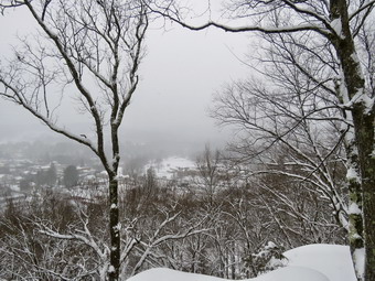 We continued to the back of the church and began the ascent of the steepest hill behind the church. The hill is short but gets the circulation pumping and is the steepest and longest climb on the "trail." I was surprised that the snow was not sticking to the snowshoes but the going was tough and I stopped several times on the way up the hill. At the top of the hill we stopped to look around. I got out the camera and took pictures of the cemetery covered in snow and of the snow covered trees. I also took some shots of the surrounding hills although the snow that was still falling obscured some of them. We started on the trail by turning left at the trailhead. There was only about 4 inches of snow on the trail under the trees which made the walking even easier. At the first trail junction, I followed Sheila as she started directly up the hill toward the lookout. Sheila loves the snow as she has some Husky in her and her longer coat has a warm undercoat. For some reasons she does not get the iceballs on her feet that plague some dogs. The climb up the hill was slippery but seemed easier than I thought it might be. I noticed that I immediately began to get warm and sweat so I opened some zippers to dump the heat. We passed by what used to be a side trail to the lookout that I blocked with brush. This side trail has a gap that hikers have to walk over and it can be dangerous for some people in the winter season. Unfortunately, some 'helpful' person had removed the brush without asking or knowing why it was there. We continued to the upper part of the lookout as I wanted to get a view of town with the snow. The view was blocked so we worked our way down to the lower ledge. I constantly have to call Sheila back as she likes to walk along the edges of ledges. I got out my camera and took some shot hoping they would show how beautiful the town appeared under a layer of snow. When I was done, I packed up and headed back to the yellow trail and followed it as it turned right and started the gentle ascent through the open woods. The snow was sticking to the north and west side of the trees so I stopped to take a few pictures. Sheila was running ahead and then back to me which was fine with me as she was breaking the trail. We continued to follow the yellow trail toward the first junction with the blue trail. There were a few branches on the trail that I removed as we hiked. At the first trail junction with the blue trail, I stopped to take some more shots of the unbroken trail toward the summit and the trail along the base of Round Top. We turned right to follow the yellow trail along the base of Round Top. There was a layer of snow on this trail but it felt good to be walking on the level ground.
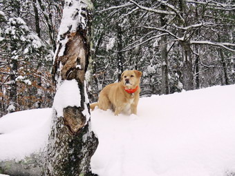 At the next junction with the blue trail, we turned left and started up the hill toward the summit. As we ascended, I could tell I was out of shape and tired! We bypassed the white crossover trail and continued over the summit of Round Top. We walked across the flat summit and started down the hill, we bypassed the white crossover trail but turned left on the switchback. When we made the turn on the switchback, I noticed that the trail sidehilled quite a bit and that I was slipping downhill. I made a note to work on this during the spring and summer. At the end of the switchback, we turned left on the main blue trail and walked down to the junction with the yellow trail. Going downhill with the snowshoes felt really good. At the junction with the yellow trail we turned left and walked along the base of Round Top following the trail we had already broken. The broken trail made walking much easier. This time when we reached the junction with the yellow trail, we turned right and started down the trail to the woods road that would lead us out to the first trail junction. This part of the trail is flat in places but is most a gentle downhill. Walking down the woods road was easy and we were soon at the first trail junction. We turned around and walked back up the woods road and trail to the first junction with the blue trail. Along the way I questioned whether this was a good idea as my inner thighs were aching. We turned left on the yellow trail and walked it along the base of Round Top. At the next junction with the blue trail, we turned right and started up toward the summit. When we reached the switchback, we turned right and followed it until it came back to the main blue trail. We continued up to the summit on the blue trail with me concentrating on what I knew was the last ascent! We continued over the summit and then down the blue trail to Te junction with the yellow trail skipping the white crossover trail along the way. At the junction with the yellow trail, we turned right and followed the well-broken trail along the base of Round Top. At the junction with the blue trail, we turned left on the yellow trail to walk down to the lookout. I was glad we were going downhill! At the viewpoint we turned left and followed the yellow trail back to the first trail junction. Gliding down the hill was fun. We walked straight out the trail to the trailhead and turned right to start down the hill to the church parking lot. At the bottom of the hill we headed across the field to the road. The roads were bare and I was careful to cross as I still had the snowshoes on my feet. After crossing the street to our driveway, we walked back to the house. We were home by 1:15 PM after hiking a little more than 2 miles in 1 hour and 45 minutes.I was tired but glad we had gotten out as the wind-chill on Tuesday was supposed to be below zero for a good part of the day!
![]()
![]()
![]()
![]() On Tuesday, January 4th I planned to get out for first day hike much sooner but ambulance calls, bad weather and cold conspired to keep me away from the woods. I finally decided I would get out even though I only had the time and energy for Round Top. I guess this is fitting as I have been going there a lot lately. I started to get dressed at 11:00 AM with the temperature a rather cool 22 degrees. Sheila was ready to go as she really likes to hike and we had not been out for some time. She was keeping a careful eye on me as I dressed. I got dressed in my Mammut crew top with a long-sleeved baselayer. I decided to wear my Columbia Titanium insulated pants to keep the chill away but decided against wearing tights underneath. I decided to wear my Keen Cascade hiking boots which are pretty new and fit well. I grabbed my Leki external lock poles which I have been using lately since twist locks have proved unreliable. I also added a fleecy orange hat and gloves since it was cool. I donned my Mammut hoody which has lots of zippers to dump heat if necessary. At 11:15 AM we walked out the door to start the hike. I grabbed Sheila's leash from the car and we walked up the driveway. I aimed to hike two figure 8's and hike for about an hour. Sheila was happy to get out as we headed down the driveway and across the street. We crossed the street and walked to the parking area by the Presbyterian Church. We walked to the back of the church and began the ascent of the steepest hill behind the church. The hill is short but gets the circulation pumping and is the steepest and longest climb on the "trail." Sheila helped me along by pulling me up the hill. There was a little snow which made the walking a bit tricky but it would have been impossible to wear spikes. At the top of the hill we paused for a minute so I could look around at the hills that surround the hamlet of Livingston Manor. We started on the trail by turning left at the trailhead where I let Sheila off her leash so that she could explore. There was still a small amount snow in the woods and a thin layer on the trail.
On Tuesday, January 4th I planned to get out for first day hike much sooner but ambulance calls, bad weather and cold conspired to keep me away from the woods. I finally decided I would get out even though I only had the time and energy for Round Top. I guess this is fitting as I have been going there a lot lately. I started to get dressed at 11:00 AM with the temperature a rather cool 22 degrees. Sheila was ready to go as she really likes to hike and we had not been out for some time. She was keeping a careful eye on me as I dressed. I got dressed in my Mammut crew top with a long-sleeved baselayer. I decided to wear my Columbia Titanium insulated pants to keep the chill away but decided against wearing tights underneath. I decided to wear my Keen Cascade hiking boots which are pretty new and fit well. I grabbed my Leki external lock poles which I have been using lately since twist locks have proved unreliable. I also added a fleecy orange hat and gloves since it was cool. I donned my Mammut hoody which has lots of zippers to dump heat if necessary. At 11:15 AM we walked out the door to start the hike. I grabbed Sheila's leash from the car and we walked up the driveway. I aimed to hike two figure 8's and hike for about an hour. Sheila was happy to get out as we headed down the driveway and across the street. We crossed the street and walked to the parking area by the Presbyterian Church. We walked to the back of the church and began the ascent of the steepest hill behind the church. The hill is short but gets the circulation pumping and is the steepest and longest climb on the "trail." Sheila helped me along by pulling me up the hill. There was a little snow which made the walking a bit tricky but it would have been impossible to wear spikes. At the top of the hill we paused for a minute so I could look around at the hills that surround the hamlet of Livingston Manor. We started on the trail by turning left at the trailhead where I let Sheila off her leash so that she could explore. There was still a small amount snow in the woods and a thin layer on the trail.
At the first trail junction, I followed Sheila as she turned right and started up the woods road which has the gentler approach of the two. There were a few branches on the trail from the winds that had passed through the area. I removed these branches either by dragging them off the trail or by using my poles on the smaller ones. We reached the end of the woods road and turned left up the hill on the trail. We continued up the trail to the first trail junction with the upper blue trail and turned left to follow the yellow trail along the base of Round Top. The yellow trail was covered in a thin layer of snow as was the woods off the trail. There were only a few new branches here and there on the trail. I stopped to remove the branches or used my poles to flick the smaller ones aside. I was getting warmer as we hiked but I was not ready to open any zippers on my hoody. At the next junction with the blue trail we turned right and headed up the blue trail, toward the summit. When we got to the switchback, we turned right and followed it until it came back to the main blue trail. We turned right and then continued straight ahead and up the hill toward the summit of Round Top bypassing the white crossover trail. As we walked over the high point, I was pleased to pass by a small tree which I had removed so that it no linger encroached on the trail. We continued over the summit and down the blue trail toward the junction with the yellow trail. The trail was solid and but the snow made the descent slippery. At the junction with the yellow trail we turned right and walked the yellow trail along the base of Round Top to the next junction with the blue trail. We turned left and walked down the yellow trail toward the lookout passing the sitting rock. Sheila was wandering off the trail following her nose.
When we reached the lookout, we turned left and followed the yellow trail followed downhill to the first trail junction. This descent was a little slippery but the poles made it manageable. We immediately turned around and started back up the hill to the lookout. At the top of the hill we turned right to follow the yellow trail to the first junction with the blue trail. The one short climb was easy and the poles helped. We turned right to follow the yellow trail around the base of Round Top. At the next junction with the blue trail, we turned left and headed up toward the summit. When we got to the white crossover trail we turned left and followed it across the hill and back to the blue trail. We turned left on the blue trail and then almost immediately turned left on the switchback. Walking downhill on the switchback was a little tricky as it sidehills in several places. At the end of the switchback we turned left and walked downhill to the trail junction with the yellow trail. We turned left and again followed the yellow trail along the base of Round Top to the junction with the blue trail. This time we turned right and headed down the yellow trail to the woods road that leads to the first trail junction. As we walked down the road, I noticed all the interesting ledges to the right of the trail. At the first trail junction, I debated doing another loop of some kind but decided just to head out to the trailhead. We walked out to the trailhead and turned right. We walked to the road through the church parking lot and over to the driveway to the house. It was 12:20 PM and we had hiked a little over 2 miles in a little over an hour.
![]()
![]()
![]()
![]() On Thursday, December 30th I wanted to get in a longer hike but the weather forecast was for heavy fog and light rain all day. Brad and I had responded to five ambulance calls from the previous evening to the early morning so we both slept in. When we got up, we did some chores around the house until we finally started to get read to hike at 1:30 PM. We decided to go across the street to hike on Round Top which would allow us to respond to a call should be pager go off. The temperature was a rather warm 42 degrees which made it feel like spring. Sheila was ready to go as she really likes to hike and she was keeping a careful eye on me as I dressed. I got dressed in my Mammut crew top but deiced I did not need a baselayer. I put on a pair of RailRiders hiking pants which are expensive but last along time and have features like deep pockets and a generous cut which I really like. The pants have Velcro closures at the ankles. I decided not to add gaiters. I decided to wear my Vasque Taku hiking boots which fit well and have been discontinued. I made sure I had a pair of Super Green insoles in the shoes to support my arches. I grabbed a pair of Leki external lock poles I have been using lately. I donned my Mammut hoody which blocks the wind and keeps me warm but has enough zippers to dump heat when needed. I put on a fleecy orange hat for warmth and because it was still hunting season. I wore a light pair of gloves although I did not know if I would Ned them. At 1:50 PM we walked out the door to start the hike. I grabbed Sheila's leash from the car and we walked up the driveway. I aimed to hike for about an hour. Sheila was happy to get out as we headed down the driveway and across the street. We crossed the street and walked to the parking area by the Presbyterian Church. We walked to the back of the church and began the ascent of the steepest hill behind the church. The hill is short but gets the circulation pumping and is the steepest and longest climb on the "trail." Sheila helped me along by pulling me up the hill. There was no ice or snow which made the footing very good. At the top of the hill we stopped to look around. The fog and the mist was so thick we could not see anything beyond the cemetery . We started on the trail by turning left at the trailhead where I let Sheila off her leash so that she could explore. There was no some snow on the trail but there was mud and a few leaves making it slippery.
On Thursday, December 30th I wanted to get in a longer hike but the weather forecast was for heavy fog and light rain all day. Brad and I had responded to five ambulance calls from the previous evening to the early morning so we both slept in. When we got up, we did some chores around the house until we finally started to get read to hike at 1:30 PM. We decided to go across the street to hike on Round Top which would allow us to respond to a call should be pager go off. The temperature was a rather warm 42 degrees which made it feel like spring. Sheila was ready to go as she really likes to hike and she was keeping a careful eye on me as I dressed. I got dressed in my Mammut crew top but deiced I did not need a baselayer. I put on a pair of RailRiders hiking pants which are expensive but last along time and have features like deep pockets and a generous cut which I really like. The pants have Velcro closures at the ankles. I decided not to add gaiters. I decided to wear my Vasque Taku hiking boots which fit well and have been discontinued. I made sure I had a pair of Super Green insoles in the shoes to support my arches. I grabbed a pair of Leki external lock poles I have been using lately. I donned my Mammut hoody which blocks the wind and keeps me warm but has enough zippers to dump heat when needed. I put on a fleecy orange hat for warmth and because it was still hunting season. I wore a light pair of gloves although I did not know if I would Ned them. At 1:50 PM we walked out the door to start the hike. I grabbed Sheila's leash from the car and we walked up the driveway. I aimed to hike for about an hour. Sheila was happy to get out as we headed down the driveway and across the street. We crossed the street and walked to the parking area by the Presbyterian Church. We walked to the back of the church and began the ascent of the steepest hill behind the church. The hill is short but gets the circulation pumping and is the steepest and longest climb on the "trail." Sheila helped me along by pulling me up the hill. There was no ice or snow which made the footing very good. At the top of the hill we stopped to look around. The fog and the mist was so thick we could not see anything beyond the cemetery . We started on the trail by turning left at the trailhead where I let Sheila off her leash so that she could explore. There was no some snow on the trail but there was mud and a few leaves making it slippery.
At the first trail junction, we followed Sheila as she started directly up the hill toward the lookout. The climb up the hill was slippery but seemed easier than usual. We passed by what used to be a side trail to the lookout that I blocked with brush. This side trail has a gap that hikers have to walk over and it can be dangerous for some people in the winter season. We continued on the yellow trail as it turned to the right and started the gentle ascent through the open woods. I was already getting warm from making the ascent in the hoody but not warm enough to open any zippers. Only a few leaves were hanging on to the trees while the rest formed a slippery blanket on the trail. Sheila was making her own way by staying on the trail sometimes and then running off-trail and chasing game trails. We continued to follow the yellow trail toward the first junction with the blue trail. There were a few branches on the trail that we removed as we hiked. At the first trail junction with the blue trail, we turned right to follow the yellow trail along the base of Round Top. There was still a thin layer of snow on this trail and it was slipperier than expected. At the next junction with the blue trail, we turned left and started up the hill toward the summit. We bypassed the white crossover trail and continued over the summit of Round Top. There was some snow on the trail which, in places, covered up some slippery mud. As we started down the hill, we bypassed the white crossover trail but turned left on the switchback. When we made the turn on the switchback, there was a layer of snow which made walking difficult as the switchback slants downhill. This reminded me that I needed to do some work in the spring to create a better path on the switchback. At the end of the switchback, we turned left on the main blue trail and walked down to the junction with the yellow trail. At the junction with the yellow trail we turned left an walked along the base of Round Top. This time when we reached the junction with the yellow trail, we turned right and started down the trail to the woods road that would lead us out to the first trail junction. On the way out, I pointed out to Brad the tree I had cut off the trail. Walking down the woods road was easy and we were soon at the first trail junction. I asked Brad if we could do another loop and he agreed. We turned around and walked back up the woods road and trail to the first junction with the blue trail. We turned left on the yellow trail and walked it along the base of Round Top. At the next junction with the blue trail, we turned right and started up toward the summit. When we reached the switchback, we turned right and followed it until it came back to the main blue trail. We turned right and almost immediately right again on the white switchback trail. The trails had been snowy on this side of the hill and the switchback trail was covered also. At the end of the switchback trail, we turned right on yellow trail and walked it along the base of Round Top. This time when we reached the junction with the blue trail we turned left and walked downhill toward the lookout. At the viewpoint we walked out to the edge of the upper lookout. I was a little surprised to see a young couple sitting on the rocks of the lower lookout. We said "Hello" and they responded. I was going to show Brad the spot on the opposing hill where a development was proposed. This did not prove possible as the fog was too thick to see much. We turned left and walked down the hill to the first trail junction. We walked straight out the trail to the trailhead and turned right to start down the hill to the church parking lot. At the bottom of the hill we headed across the church parking lot to the street. After crossing the street to our driveway, we walked back to the house. We were home by 3:00 PM after hiking a little more than 2 miles in 1 hour and 10 minutes.
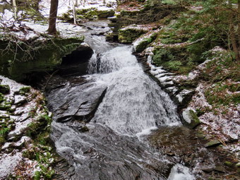
![]()
![]()
![]()
![]()
![]() On Tuesday, December 28th I planned to go hiking at Trout Pond after several days of ambulance calls. Brad was at the house and we did three calls overnight. I finally got to bed at 4:30 AM! I finally got up at 11:30 AM although I was still tired. I asked Brad if he would like to go hiking and he agreed. We began getting ready at 1:00 PM knowing another storm was rolling in and we would have to hike quickly as sundown was still rather early. As I started to get ready it was still only 35 degrees with some blue sky and white clouds. Sheila was pretty excited as I started to get ready as she always is when we go hiking. I got dressed in my Mammut crew top with a long-sleeved baselayer. I decided to wear my Columbia Titanium insulated pants to keep the chill away but decided against wearing tights underneath. I decided to wear my Vasque Taku hiking boots which are pretty beat up but fit well. I grabbed my Leki external lock poles which I have been using lately since twist locks have proved unreliable. I also added a fleecy orange hat and gloves since it was cool. I decided to wear my OR Crocodile gaiters as I knew there might be some mud and they keep my lower legs warm. I donned my Mammut hoody which has lots of zippers to dump heat if necessary. We put our gear in the back of the car and Sheila in the back seat. We left Livingston Manor at 1:25 AM as I drove north on the Quickway towards Roscoe. I got off at exit 94 and headed north on Route 206 towards Downsville. After crossing the Rockland Flats and passing the Roscoe Nursing Home, I turned left on Morton Hill Road and drove to the intersection with Russell Brook Road. There were at least five cars illegal parked in a "lot" at the intersection of the two roads. People see the open space and park there without thinking about the fact that the land is private. I did not want to drive down Russell Brook Road as it is a seasonal maintenance road and it did not look maintained. Fortunately, there was enough room for me to park on the side of the road which is legal. Several people were just leaving their cars to hike and some were returning. Brad and I decided to put on our microspikes to start the hike. I set my GPS unit and we started our hike at 1:50 PM by walking down Russell Brook Road. The spikes gave us a good grip allowing us to hike quickly. We caught up and passed a mother and her two young girls who seemed to be having a good time. As we headed down the steeper part of the road, we met another group of three hikers coming up the road with their dog. I pulled Sheila to the side of the road as the other dog, which fortunately was on a leash, went nuts growling and barking.
On Tuesday, December 28th I planned to go hiking at Trout Pond after several days of ambulance calls. Brad was at the house and we did three calls overnight. I finally got to bed at 4:30 AM! I finally got up at 11:30 AM although I was still tired. I asked Brad if he would like to go hiking and he agreed. We began getting ready at 1:00 PM knowing another storm was rolling in and we would have to hike quickly as sundown was still rather early. As I started to get ready it was still only 35 degrees with some blue sky and white clouds. Sheila was pretty excited as I started to get ready as she always is when we go hiking. I got dressed in my Mammut crew top with a long-sleeved baselayer. I decided to wear my Columbia Titanium insulated pants to keep the chill away but decided against wearing tights underneath. I decided to wear my Vasque Taku hiking boots which are pretty beat up but fit well. I grabbed my Leki external lock poles which I have been using lately since twist locks have proved unreliable. I also added a fleecy orange hat and gloves since it was cool. I decided to wear my OR Crocodile gaiters as I knew there might be some mud and they keep my lower legs warm. I donned my Mammut hoody which has lots of zippers to dump heat if necessary. We put our gear in the back of the car and Sheila in the back seat. We left Livingston Manor at 1:25 AM as I drove north on the Quickway towards Roscoe. I got off at exit 94 and headed north on Route 206 towards Downsville. After crossing the Rockland Flats and passing the Roscoe Nursing Home, I turned left on Morton Hill Road and drove to the intersection with Russell Brook Road. There were at least five cars illegal parked in a "lot" at the intersection of the two roads. People see the open space and park there without thinking about the fact that the land is private. I did not want to drive down Russell Brook Road as it is a seasonal maintenance road and it did not look maintained. Fortunately, there was enough room for me to park on the side of the road which is legal. Several people were just leaving their cars to hike and some were returning. Brad and I decided to put on our microspikes to start the hike. I set my GPS unit and we started our hike at 1:50 PM by walking down Russell Brook Road. The spikes gave us a good grip allowing us to hike quickly. We caught up and passed a mother and her two young girls who seemed to be having a good time. As we headed down the steeper part of the road, we met another group of three hikers coming up the road with their dog. I pulled Sheila to the side of the road as the other dog, which fortunately was on a leash, went nuts growling and barking.
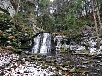 We continued down the road and were soon at the path that leads down to the lookout over the upper falls. We carefully worked our way down to the lookout. I was glad I had my spikes and poles as it was very slippery. I put my pack down and got out the camera. I took shots of the falls and some of the surrounding rocks ledges using different settings. When I was done, I packed up and we walked back to the road to continue downhill to the lower parking area. As we walked down the road, two cars from the lower lot came driving up the road and passed us. Both Brad and I wondered if they would be able to get up the steeper, slippery spots. When we arrived at the lower parking area, there was only one car parked and they seemed to be leaving. Just as we started out two hikers came up to the parking lot from the stream and we said "Hello" as we passed them. We started out on the Trout Pond Trail along a wide woods road that leads down to and across Russell Brook. As we crossed the bridge, I could see that the brook was not as high as I had seen it after some of the recent rain storms. The skies were starting to become more overcast and there was little blue left. We decided to go to the falls at the beginning of the hike as I did not know how dark it would be on the way out. The Japanese knotweed had died and was a red brown color so I took a few shots of it knowing it would be back in the spring. The history of this area is very interesting. Russell Brook Falls had been the site of a dam that impounded water for a waterwheel in Butternut Grove. The wheel was still there a few years ago. The area near the register box was the "landing zone" for loggers who cleared the evergreen trees, not for tanning but, for the production of wood alcohol. The trees were transported on narrow gauge railway that ran parallel to Russell Brook. The railway met the mainline O&W near Butternut Grove where the logs were unloaded. There were several acid factories in the area that produced wood alcohol. There was also a factory on the lower part of Russell Brook that produced khaki dye for the uniforms of American troops during World War I. We followed the path out to the falls and turned right to walk down to the streambed. I put down my pack and got out the camera to take pictures of the falls and the stream. Sheila immediately posed in front of the falls so I took some shots of her. I took some more shots of the falls using different settings to get the silky look that some people like. Water that had overflowed on the right side of the falls had frozen and was starting to develop into a mirror of the falls. I took pictures of the stream and then packed up to continue the hike. We walked back up to the path out to the main trail.
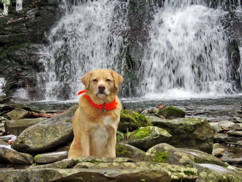 At the main trail, we turned right to head up to the pond. We continued passed the register box and up the main trail toward Trout Pond. There was a layer of ice on the trail and a small amount of snow. We considered removing the spikes but in the end we left them on. There was some water on the trail and mud in a few places. Soon we were at the outlet end of the pond and we walked over to the shore which was not as high as it had been earlier in the year. I dropped my pack to take pictures of the lake but the blue sky was now gone replaced by a solid overcast. I took pictures looking for the contrast between the bare trees, the overcast sky and the lake. Sheila decided not to take a dip as the water was cold. I took the time to take some pictures at the dam which had some water flowing over it. I packed up and we returned to the main trail where there was a group of three hikers. I put Sheila on her leash as they did not seem to want to move aside. The woman in the group asked if she could "Say Hello" to Sheila. She seemed offended when I said "No"! We walked the flat woods road toward the inlet end of the pond which was wet and muddy in many spots without much ice or snow. When we came to the bridge, I stopped to take a few pictures of the pond from just before the bridge and from the bridge itself. We crossed the bridge and stayed to the right on the Mud Pond Trail which would take us over Cherry Ridge and form our loop back to the parking area. There was new beaver activity and a small dam just downstream of the bridge causing the water to back up. The trail was very rocky and there did not seem to be much ice or snow so we removed our spikes. As soon as we continued up the trail, we began to run into more snow and ice making us wonder if removing the spikes was a good idea. The constant slipping on the ice and snow was slowing our pace but we were still moving at a good pace. We had been removing branches and small tree trunks as we hiked but now we began to run into more branches and some very large trees across the trail. There were at least three trunks that would most likely have to be cut with a chainsaw and would have to wait until spring.
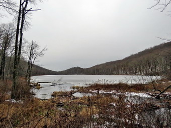 From the bridge at the inlet we began a climb of 430 feet over the next .75 miles. The trail headed west from the inlet until turning sharply south at around 2 miles. Along the way there were several blowdowns that had been cut by a DEC sawyer I met during the summer. The highest point on the trail was at 2.2 miles after which most of the rest of the hike is downhill. As we gained elevation, I began to notice that I was getting warm and sweating some so I opened the front zipper on my hoody. As we started down the other side, the trail had some mud in spots but there was little standing or running water and the snow and ice diminished. We did find several more large blowdowns which could be cut with and tools but would be a challenge. At 3.4 miles we had descended 420 feet from Cherry Ridge to the snowmobile trail near Mud Pond. We turned left here to head east but had to walk in the woods as the snowmobile trail had a lot of ruts and mud. It was beginning to get dark and we tried to quicken our pace. We ascended a small hill before starting downhill back toward the parking area. This section had a mix of mud, water, snow and ice. The downhill was a little slippery but the spikes were not necessary. There were some small streams flowing across the trail but their volume was low. All told, we dropped another 380 feet over the next .7 miles back to the bridge just before the trail register. We stopped on the bridge over the outlet stream from Trout Pond as it was flowing well. We continued on the trail to the junction. We turned right and continued on the main trail toward the parking area. I stopped to take a few pictures of the dead knotweed before continuing on. We continued across the bridge and up the trail to the parking area where there were no cars. We quickened our pace as the dark settled around us. We were back at the car at 4:35 PM and we had hiked 5.5 miles in 2 hours and 50 minutes with an elevation gain of 1120 feet. We had stopped for 20 minutes.
![]()
![]()
![]()
![]()
![]() On Monday, December 27th I planned to get out for a longer hike to Balsam Lake Mountain and Vly Pond but the weather forecast was calling for freezing rain and ice. I decided I would just take a short hike on Round Top while waiting for my daughter and her family to arrive from Pennsylvania. I had a few blowdowns to remove from the trail and this would be a good time to do it. I started to get dressed at 11:05 AM with the temperature a rather cool 26 degrees. Sheila was ready to go as she really likes to hike and she was keeping a careful eye on me as we dressed. I got dressed in my Mammut crew top with a long-sleeved baselayer. I decided to wear my Columbia Titanium insulated pants to keep the chill away but decided against wearing tights underneath. I decided to wear my Vasque Taku hiking boots which are pretty beat up but fit well. I grabbed my Leki external lock poles which I have been using lately since twist locks have proved unreliable. I also added a fleecy orange hat and gloves since it was cool. I donned my Mammut hoody which has lots of zippers to dump heat if necessary. I put my Silky Sugowaza saw in my pack as I knew it would be able to handle the small trees I was going to cut. At 11:25 AM we walked out the door to start the hike. I grabbed Sheila's leash from the car and we walked up the driveway. I aimed to hike two figure 8's and remove any blowdowns I found. Sheila was happy to get out as we headed down the driveway and across the street. We crossed the street and walked to the parking area by the Presbyterian Church. We walked to the back of the church and began the ascent of the steepest hill behind the church. The hill is short but gets the circulation pumping and is the steepest and longest climb on the "trail." Sheila helped me along by pulling me up the hill. There was no ice or snow which made the walking easier. A few small patches of snow and ice were scattered along edge of the road. At the top of the hill we paused for a minute so I could look around at the hills that surround the hamlet of Livingston Manor. We started on the trail by turning left at the trailhead where I let Sheila off her leash so that she could explore. There was still a small amount snow in the woods but none on the trail. The trail was almost dry as most of the precipitation had frozen on the trail.
On Monday, December 27th I planned to get out for a longer hike to Balsam Lake Mountain and Vly Pond but the weather forecast was calling for freezing rain and ice. I decided I would just take a short hike on Round Top while waiting for my daughter and her family to arrive from Pennsylvania. I had a few blowdowns to remove from the trail and this would be a good time to do it. I started to get dressed at 11:05 AM with the temperature a rather cool 26 degrees. Sheila was ready to go as she really likes to hike and she was keeping a careful eye on me as we dressed. I got dressed in my Mammut crew top with a long-sleeved baselayer. I decided to wear my Columbia Titanium insulated pants to keep the chill away but decided against wearing tights underneath. I decided to wear my Vasque Taku hiking boots which are pretty beat up but fit well. I grabbed my Leki external lock poles which I have been using lately since twist locks have proved unreliable. I also added a fleecy orange hat and gloves since it was cool. I donned my Mammut hoody which has lots of zippers to dump heat if necessary. I put my Silky Sugowaza saw in my pack as I knew it would be able to handle the small trees I was going to cut. At 11:25 AM we walked out the door to start the hike. I grabbed Sheila's leash from the car and we walked up the driveway. I aimed to hike two figure 8's and remove any blowdowns I found. Sheila was happy to get out as we headed down the driveway and across the street. We crossed the street and walked to the parking area by the Presbyterian Church. We walked to the back of the church and began the ascent of the steepest hill behind the church. The hill is short but gets the circulation pumping and is the steepest and longest climb on the "trail." Sheila helped me along by pulling me up the hill. There was no ice or snow which made the walking easier. A few small patches of snow and ice were scattered along edge of the road. At the top of the hill we paused for a minute so I could look around at the hills that surround the hamlet of Livingston Manor. We started on the trail by turning left at the trailhead where I let Sheila off her leash so that she could explore. There was still a small amount snow in the woods but none on the trail. The trail was almost dry as most of the precipitation had frozen on the trail.
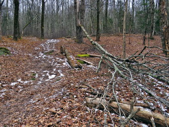 At the first trail junction, I followed Sheila as she turned right and started up the woods road which has the gentler approach of the two. There were a few branches on the trail from the winds that had passed through the area. I removed these branches either by dragging them off the trail or by using my poles on the smaller ones. As we reached the end of the woods road and turned left up the hill on the trail, we came to a large tree that had fallen parallel to the trail. Some of the branches were in the trail so I put my pack down and got out the camera. I took some 'before' pictures including a few of Sheila. I put the camera away and took out my saw. The branches were small so I cut the biggest and dragged them off the trail. I then cut the smaller branches and removed them as well. Within 15 minutes the trail was clear. I took some 'after' pictures of the cleared trail and then we continued up the trail to the first trail junction with the upper blue trail and turned left to follow the yellow trail along the base of Round Top. The yellow trail was covered in a thin layer of snow as was the woods off the trail. There were only a few new branches here and there on the trail. I stopped to remove the branches or used my poles to flick the smaller ones aside. I was getting warmer as we hiked but I was not ready to open any zippers on my hoody. At the next junction with the blue trail we turned right and headed up the blue trail, toward the summit. When we got to the switchback, we turned right and followed it until it came back to the main blue trail. We turned right and then continued straight ahead and up the hill toward the summit of Round Top bypassing the white crossover trail. As we walked over the high point, I found a small tree with some branches in the trail. I put down my pack and got out the saw. I made one cut to remove the small tree and a few other to remove some branches. After removing all the branches, I put the saw away as we continued over the summit and down the blue trail toward the junction with the yellow trail. The trail was solid and almost dry but I was glad I had my poles. At the junction with the yellow trail we turned right. We walked the yellow trail along the base of Round Top to the next junction with the blue trail. We turned left and walked down the yellow trail toward the lookout passing the sitting rock. Sheila was wandering off the trail following her nose.
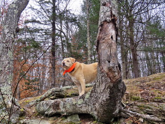 When we reached the lookout, I decided to walk down to the lower ledge to get a view of town. We worked our way down to the ledge. The views of town and the surrounding hills were great but the skies were very gray. I got out my camera and too a few shots including some with Sheila. When I was done we walked back up to the main trail followed it downhill to the first trail junction. This descent was a little slippery but the poles made it manageable. We immediately turned around and started back up the hill to the lookout. At the top of the hill we turned right to follow the yellow trail to the first junction with the blue trail. The one short climb was easy and the poles helped. We turned right to follow the yellow trail around the base of Round Top. At the next junction with the blue trail, we turned left and headed up toward the summit. When we got to the white crossover trail we turned left and followed it across the hill and back to the blue trail. We turned left on the blue trail and then almost immediately turned left on the switchback. Walking downhill on the switchback was a little tricky as it sidehills in several places. At the end of the switchback we turned left and walked downhill to the trail junction with the yellow trail. We turned left and again followed the yellow trail along the base of Round Top to the junction with the blue trail. This time we turned right and headed down the yellow trail to the woods road that leads to the first trail junction. As we walked down the road, I noticed all the interesting ledges to the right of the trail. At the first trail junction, I debated doing another loop of some kind but decided just to head out to the trailhead. On the way out I cut one more branch that was encroaching on the trail. We walked out to the trailhead and turned right. We walked out to the road through the church parking lot and over to the driveway to the house. It was 12:55 PM and we had hiked a little over 2 miles in an hour and a half. It took a little over 30 minutes to do the trail maintenance.
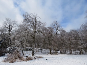
![]()
![]()
![]()
![]()
![]() On Thursday, December 23rd I wanted to try the new route to Hodge Pond From Shin Creek Road in Lew Beach. I did not have track practice or ant contests to time so I could take a leisurely walk. The Beaverkill Land Trust has created a parking lot on a woods road off Shin Creek Road in Lew Beach. The woods road leads to Hodge Pond near the site of the former Beech Mountain Boy Scout Camp. I spent some time doing chores around the house and waiting for the temperature to go up a few degrees but it seemed stuck at 26F. I asked Cindy if she would like to go but she declined. I was a little doubtful as the wind was blowing making it seems even colder. By 11:45 AM I decided I wanted to get out and knew we could always turn around if it was too cold for Sheila. I put on a Patagonia long-sleeved wool zip top with a long-sleeved baselayer since the temperature was cool in town but might be colder at the trailhead. I decided to wear my Columbia Titanium insulated pants and put on a pair of Mountain Hardwear tights as a baselayer. I wore my Salomon B-52 winter boots with a pair of Protalus insoles. These shoes are discontinued but seem to be warm enough and handle the snow and mud very well. I grabbed my Leki poles with external locks which I trust over the internal twist locks. I also donned my Mammut hoody which was enough zippers to dump heat when needed. I put on a fleecy orange and wore a light pair of gloves. I also put on my OR Crocodile gaiters to deal with the mud and water that I knew would be present. I made sure my Microspikes were in my pack just in case they were needed. There had been an ice storm the day before and it was snowing lightly in town. I knew this combination can be slippery even on flatter trails. I was even a little worried about getting to the trailhead as Shin Creek Road is "seasonal maintenance" inky and the road into the parking area is not maintained. I got my gear in the car and put an excited Sheila in the back seat. At 12:15 PM I drove north on Old Route 17 to the Beaverkill Road. I drove north to the four corners just after the Beaverkill Valley fire house. Here I turned right and started up Shin Creek Road. The drive on this road is beautiful but the road soon becomes a seasonal maintenance road and very rough. After the sign, the road was covered with snow over ice and it was obvious no one else had ventured past that point. When we came to the road on the right I turned and found it no worse than Shin Creek Road. I passed a small pulloff on the right and continued up the road to the parking area on the left. I pulled in to park and noticed the temperature was 21 degrees. When I stepped out of the car, a strong breeze was blowing and snow was lightly falling making me feel colder. I set my GPS and we began our hike at 12:35 PM by starting up the road.
On Thursday, December 23rd I wanted to try the new route to Hodge Pond From Shin Creek Road in Lew Beach. I did not have track practice or ant contests to time so I could take a leisurely walk. The Beaverkill Land Trust has created a parking lot on a woods road off Shin Creek Road in Lew Beach. The woods road leads to Hodge Pond near the site of the former Beech Mountain Boy Scout Camp. I spent some time doing chores around the house and waiting for the temperature to go up a few degrees but it seemed stuck at 26F. I asked Cindy if she would like to go but she declined. I was a little doubtful as the wind was blowing making it seems even colder. By 11:45 AM I decided I wanted to get out and knew we could always turn around if it was too cold for Sheila. I put on a Patagonia long-sleeved wool zip top with a long-sleeved baselayer since the temperature was cool in town but might be colder at the trailhead. I decided to wear my Columbia Titanium insulated pants and put on a pair of Mountain Hardwear tights as a baselayer. I wore my Salomon B-52 winter boots with a pair of Protalus insoles. These shoes are discontinued but seem to be warm enough and handle the snow and mud very well. I grabbed my Leki poles with external locks which I trust over the internal twist locks. I also donned my Mammut hoody which was enough zippers to dump heat when needed. I put on a fleecy orange and wore a light pair of gloves. I also put on my OR Crocodile gaiters to deal with the mud and water that I knew would be present. I made sure my Microspikes were in my pack just in case they were needed. There had been an ice storm the day before and it was snowing lightly in town. I knew this combination can be slippery even on flatter trails. I was even a little worried about getting to the trailhead as Shin Creek Road is "seasonal maintenance" inky and the road into the parking area is not maintained. I got my gear in the car and put an excited Sheila in the back seat. At 12:15 PM I drove north on Old Route 17 to the Beaverkill Road. I drove north to the four corners just after the Beaverkill Valley fire house. Here I turned right and started up Shin Creek Road. The drive on this road is beautiful but the road soon becomes a seasonal maintenance road and very rough. After the sign, the road was covered with snow over ice and it was obvious no one else had ventured past that point. When we came to the road on the right I turned and found it no worse than Shin Creek Road. I passed a small pulloff on the right and continued up the road to the parking area on the left. I pulled in to park and noticed the temperature was 21 degrees. When I stepped out of the car, a strong breeze was blowing and snow was lightly falling making me feel colder. I set my GPS and we began our hike at 12:35 PM by starting up the road.
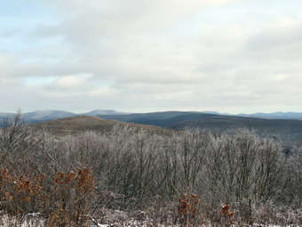 We walked over the gate and crossed the stream on a bridge constructed to support cars. My objective was to get warm and get to the lookouts on Beech Mountain so I passed up taking any pictures on the way up the road. The road was uphill all the way but the grade was gentle. The problem was that the road had a thin layer of snow that covered a layer of ice in most places. I watched Sheila to see where she slipped but this didn't work as she had "spikes" on all four feet! I walked in the center of the road on a strip of grass and leaves or along the sides of the road. Despite the footing, I was making good time and the hike was going faster than I expected. I was warming up but was not so warm that I wanted to open any zippers to dump heat. At 1.15 miles the road leveled and I recognized the site of the former Beech Mountain Boy Scout Camp. The cabins had deteriorated so much that the Beaverkill Land Trust had them cleared away. We walked out to the road junction and turned left and then left again on the woods road that goes toward the top of Beech Mountain. I wasn't really tired and was actually feeling much better so we pushed the pace a little. When we go to the old sand and gravel pit where the trail levels the sun came out and glistened off the snow on the trees but I did not see the ice on the trees I was hoping for. The trail began to gain elevation again and we passed by a spring house on the right where Sheila sometimes likes to dig in the water and get a drink. She decided not to get into the cold water on this day. There are several twists and turns along this road and it is sometimes hard for me to know exactly where I am. The amount if snow on the road increased as did the ice underneath. I continued to watch my step and only had a few minor steps. At 1.65 miles we came to a lookout on the left of the trail. The lookout had been "cut out" so that the hills and valleys beyond were much more visible. I decided not to stop for pictures as the view was not spectacular and I wanted to reach the other two lookouts. We followed the road uphill as it made a sharp right turn. Just after this the road turned to the left and another trail branched off to the right. We continued on the road to the left and passed over what would be the highest point on our hike. After this slight incline, the trail began to lose elevation and turned to the right. The trail opened up to a clearing with a beautiful view to the east.
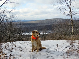 I was hoping there would be some snow on the 3500 foot mountains visible from this viewpoint and I was not disappointed. The panorama from this lookout takes in the Burroughs Range and many of the other Catskill peaks. There was also a layer of ice on the trees around the clearing and the sun was sparkling off them. I got out my camera and took pictures of the mountains to the east even though the sky was flat and without clouds. I also took some shots of the ice on the trees and found the skies blue with interesting clouds in that direction. When I was done, I picked up the pack and we continued on the woods road back up to the woods road around Beech Mountain. We climbed a short hill and turned left at the top. We walked clockwise around the summit of Beech Mountain and I noticed some very interesting ledges on the right side of the trail. Soon we arrived at the Hodge Pond Lookout. The lookout had been cut out but the brush is beginning to grow back. I put y pack down and got out the camera. I took pictures of the ledges behind the lookout and the snow on the trails. Sheila was wandering around on the icy lookout rock. I had her sit down and took a few pictures of her with the pond in ha background. The mountains around the had ice on the trees so I took some shots. After taking a few pictures down to the pond, I packed up and we continued on the dozen trail back to the road that climbs the mountain. We turned left on the road and almost immediately came to the other lookout facing west. I decided to take a few shots and the continue down the hill. I was feeling pretty good and not really paying attention to my footing. My feet began to slip on the ice but my poles saved me.I was much more careful the rest of the way to the junction with the road to the Shin Creek parking. At the bottom of the hill we turned right, walked along the flat part of the trail and started the 1.3 miles descent to the car. I had to be careful as the trip back seemed much slipperier than the walk in. We were back at the car at 1:25 PM and I regretted not lengthening the hike by going around Hodge Pond. We had hiked 4.3 miles in 2 hours and 10 minutes gaining 920 feet along the way. Our overall speed was 2.0 mph with moving average of 2.2 mph with 10 minutes of stopped time. The temperature was only 23 degrees but the sun was shining and the wind had died down.
![]()
![]()
![]()
![]() On Tuesday, December 21st I planned to get out for a longer hike but overnight ambulance calls meant hat I slept in. With track practice in the afternoon, I knew I did not have enough time to do anything except go across the street to Round Top. I almost decided not to go but knew I would feel better if I did. In addition, I wanted to hike on the first day of winter. I started to get dressed at 11:15 AM with the temperature a rather cool 30 degrees. Sheila was ready to go as she really likes to hike and she was keeping a careful eye on me as we dressed. I got dressed in my Mammut crew top with a long-sleeved baselayer. I decided to wear my Columbia Titanium insulated pants to keep the chill away but decided against wearing tights underneath. I decided to put on my Keen Cascade hiking boots which are new and fit well. I grabbed my Leki external lock poles which I have been using lately since twist locks have proved unreliable. I also added a fleecy orange hat and gloves since it was cool. I donned my Mammut hoody which has lots of zippers to dump heat if necessary. At 1:45 AM we walked out the door to start the hike. I grabbed Sheila's leash from the car and we walked up the driveway. I aimed to hike for about an hour. Sheila was happy to get out as we headed down the driveway and across the street. We crossed the street and walked to the parking area by the Presbyterian Church. We walked to the back of the church and began the ascent of the steepest hill behind the church. The hill is short but gets the circulation pumping and is the steepest and longest climb on the "trail." Sheila helped me along by pulling me up the hill. There was no ice or snow which made the walking easier. At the top of the hill we paused for a minute so I could look around at the hills that surround the hamlet of Livingston Manor. We started on the trail by turning left at the trailhead where I let Sheila off her leash so that she could explore. There was still a layer of leaves on the trail but they were almost dry and any mud was frozen pretty solid. It was much easier walking without the snow and ice that had been on the trail after the last storm.
On Tuesday, December 21st I planned to get out for a longer hike but overnight ambulance calls meant hat I slept in. With track practice in the afternoon, I knew I did not have enough time to do anything except go across the street to Round Top. I almost decided not to go but knew I would feel better if I did. In addition, I wanted to hike on the first day of winter. I started to get dressed at 11:15 AM with the temperature a rather cool 30 degrees. Sheila was ready to go as she really likes to hike and she was keeping a careful eye on me as we dressed. I got dressed in my Mammut crew top with a long-sleeved baselayer. I decided to wear my Columbia Titanium insulated pants to keep the chill away but decided against wearing tights underneath. I decided to put on my Keen Cascade hiking boots which are new and fit well. I grabbed my Leki external lock poles which I have been using lately since twist locks have proved unreliable. I also added a fleecy orange hat and gloves since it was cool. I donned my Mammut hoody which has lots of zippers to dump heat if necessary. At 1:45 AM we walked out the door to start the hike. I grabbed Sheila's leash from the car and we walked up the driveway. I aimed to hike for about an hour. Sheila was happy to get out as we headed down the driveway and across the street. We crossed the street and walked to the parking area by the Presbyterian Church. We walked to the back of the church and began the ascent of the steepest hill behind the church. The hill is short but gets the circulation pumping and is the steepest and longest climb on the "trail." Sheila helped me along by pulling me up the hill. There was no ice or snow which made the walking easier. At the top of the hill we paused for a minute so I could look around at the hills that surround the hamlet of Livingston Manor. We started on the trail by turning left at the trailhead where I let Sheila off her leash so that she could explore. There was still a layer of leaves on the trail but they were almost dry and any mud was frozen pretty solid. It was much easier walking without the snow and ice that had been on the trail after the last storm.
At the first trail junction, I followed Sheila as she turned right and started up the woods road which has the gentler approach of the two. There were a few branches on the trail from the winds that had passed through the area for a few days. There was one large tree that had fallen parallel to the trail just after the left turn off the woods road. Some of the branches were in the trail and would require tools to remove them. We walked up the trail to the first trail junction with the upper blue trail and turned left to follow the yellow trail along the base of Round Top. The trails were bare with only a few new branches here and there. I stopped to remove the branches or used my poles to flick the smaller ones aside. The walk was more reminiscent of a hike in the middle of the fall after he leaves have fallen. I was getting warmer as we hiked but I was not ready to open any zippers on my hoody. At the next junction with the blue trail we turned right and headed up the blue trail, toward the summit. When we got to the switchback, we turned right and followed it until it came back to the main blue trail. We turned right and then continued straight ahead and up the hill toward the summit of Round Top bypassing the white crossover trail. We walked over the high point and down the blue trail toward the junction with the yellow trail. The trail was solid and almost dry but I was glad I had my poles. At the junction with the yellow trail we turned right. We walked the yellow trail along the base of Round Top to the next junction with the blue trail. We turned left and walked down the yellow trail toward the lookout passing the sitting rock. Sheila was wandering off the trail following her nose. I looked up when I saw some movement . It was large grey squirrel that had been foraging and was surprised by my presence. The squirrel took off down the trail and out into the woods with some very high and long leaps and bounds. When we reached the lookout, we turned left to follow the yellow trail downhill to the first trail junction. This descent was a little slippery but the poles made it manageable. We immediately turned around and started back up the hill to the lookout. At the top of the hill we turned right to follow the yellow trail to the first junction with the blue trail. The one short climb was easy and the poles helped. We turned right to follow the yellow trail around the base of Round Top. At the next junction with the blue trail, we turned left and headed up toward the summit. When we got to the white crossover trail we continued up toward the summit as I wanted two full figure 8's. When we reached the white crossover trail on the other side we passed by it and turned left on the switchback in the blue trail. Walking downhill on the switchback was a little tricky as it sidehills in several places. At the end of the switchback we turned left and walked downhill to the trail junction with the yellow trail. We turned left and again followed the yellow trail along the base of Round Top to the junction with the blue trail. This time we turned right and headed down the yellow trail to the woods road that leads to the first trail junction. As we walked down the road, I noticed all the interesting ledges to the right of the trail. At the first trail junction, I debated doing another loop of some kind but decided just to head out to the trailhead. We walked out to the trailhead and turned right. We walked out to the road through the church parking lot and over to the driveway to the house. It was 12:20 PM and we had hiked 2 miles in a little over an hour.