
What You Missed
Winter 2019-2020
Winter 2019-2020
![]()
![]()
![]()
![]()
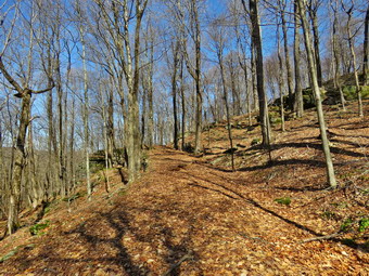
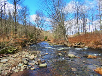
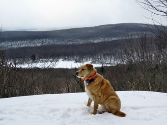
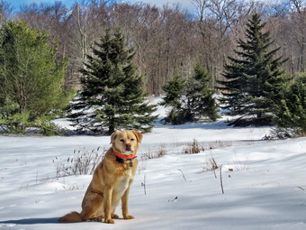
![]() On Wednesday, March 18th I wanted to get in another slightly longer hike close to home. Lisa had emailed me and suggested we go to the Frick Pond area to hike. I had been there many times in the last few months but agreed to go since I was anxious to have a hiking partner. We agreed to meet at the Frick Pond parking area at 11:00 AM. The temperature in the morning was 30 degrees but I knew it would being getting warmer throughout the day. At 10:15 AM I began to get ready and the temperature was still about 40 degrees. I got dressed in my Mammut crew top and decided that despite the temperature I would wear a light baselayer. I decided to put on my Columbia Titanium insulated pants to keep the chill away with light tights underneath. I wore my Vasque Talus boots which are all leather and seem to be almost waterproof although not very warm. I did not wear gaiters as I knew there would not be snow deep enough on the trail the warrant wearing them. I decided to take my new pair of Leki poles with external locks as the internal twist locks fail. I grabbed a light hat and gloves. Finally, I donned my Mammut hoody which blocks the wind and keeps me warm but has enough zippers to dump heat when needed. I decided to carry my microspikes in case they were needed. Sheila kept me in sight as I got ready to go making sure she would not be forgotten. I put my gear in the back of the car and Sheila in the back seat as we left Livingston Mnaor at 10"40 AM. I headed out the DeBruce Road to Mongaup Pond Road where I turned left and headed up toward Mongaup Pond. Where the road split, I stayed to the left on Beech Mountain Road where the road forks. When we arrived at the parking area there were three cars in the larger lot and none in the smaller. I parked in the smaller parking area and waited for Lisa to arrive. At 11:05 Am Lisa pulled in beside my car and we got ready to hike. We decided to hike up the Flynn Trail and do the large loop to Hodge Pond returning on the Quick Lake Trail to Frick Pond. I set my GPS unit at the trailhead and we crossed the road to start the hike at 11:15 AM. The skies were blue with a few white clouds and plenty of sun. The first part of the trail through the woods was damp but there was now mud, snow or ice. We turned right on the woods road which was once the extension of the Beech Mountain Road and started the 1.7 mile climb up the Flynn Trail to the junction with the Big Rock Trail.
On Wednesday, March 18th I wanted to get in another slightly longer hike close to home. Lisa had emailed me and suggested we go to the Frick Pond area to hike. I had been there many times in the last few months but agreed to go since I was anxious to have a hiking partner. We agreed to meet at the Frick Pond parking area at 11:00 AM. The temperature in the morning was 30 degrees but I knew it would being getting warmer throughout the day. At 10:15 AM I began to get ready and the temperature was still about 40 degrees. I got dressed in my Mammut crew top and decided that despite the temperature I would wear a light baselayer. I decided to put on my Columbia Titanium insulated pants to keep the chill away with light tights underneath. I wore my Vasque Talus boots which are all leather and seem to be almost waterproof although not very warm. I did not wear gaiters as I knew there would not be snow deep enough on the trail the warrant wearing them. I decided to take my new pair of Leki poles with external locks as the internal twist locks fail. I grabbed a light hat and gloves. Finally, I donned my Mammut hoody which blocks the wind and keeps me warm but has enough zippers to dump heat when needed. I decided to carry my microspikes in case they were needed. Sheila kept me in sight as I got ready to go making sure she would not be forgotten. I put my gear in the back of the car and Sheila in the back seat as we left Livingston Mnaor at 10"40 AM. I headed out the DeBruce Road to Mongaup Pond Road where I turned left and headed up toward Mongaup Pond. Where the road split, I stayed to the left on Beech Mountain Road where the road forks. When we arrived at the parking area there were three cars in the larger lot and none in the smaller. I parked in the smaller parking area and waited for Lisa to arrive. At 11:05 Am Lisa pulled in beside my car and we got ready to hike. We decided to hike up the Flynn Trail and do the large loop to Hodge Pond returning on the Quick Lake Trail to Frick Pond. I set my GPS unit at the trailhead and we crossed the road to start the hike at 11:15 AM. The skies were blue with a few white clouds and plenty of sun. The first part of the trail through the woods was damp but there was now mud, snow or ice. We turned right on the woods road which was once the extension of the Beech Mountain Road and started the 1.7 mile climb up the Flynn Trail to the junction with the Big Rock Trail.
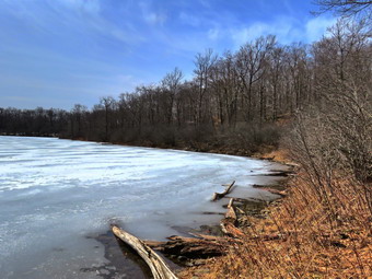
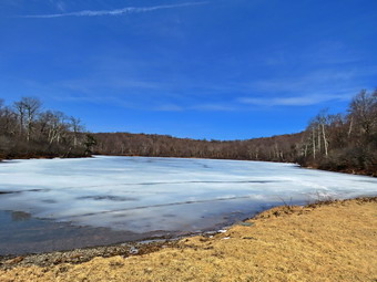 We began picking up loose branches that had fallen on the trail and continued to do so for most of the hike. We noticed that several blowdowns had been cut by chainsaw. I was a little disappointed and a little relieved. The trail was wet but there was no snow or ice and the sun on our backs felt very warm. Sheila was roaming around running up and down the trail. We passed through the "tunnel" Cindy, and I had cut in a large hemlock tree that had fallen across the trail. At one point we noticed a woods road just above the trail and decided we would investigate it. We walked up the bank to the road We walked on the road which was open in places and full of small beeches in others. We came to the road where there was a lookout on the left and some high ledges on the right. I suggested we walk up to the top of these ledges which we did. Once on top we walked along the edge of the ledges as I looked for a way to get back down to the road. I found a place and we walked down only to find we were back on the trail! I assume the road ended which means it did not really go anywhere. We continued on the Flynn Trail toward the junction with the Big Rock trail passing several blowdowns. We arrived at the junction at 12:15 PM taking about an hour to hike 1.7 miles. We continued straight ahead on the Flynn Trail passing through the gate that marks the beginning of the OSI property. A little further on, at the junction with the jeep trail, we turned left to walk the Flynn Trail toward Hodge Pond. Just after this intersection was an expanse of snow several inches deep was surprising since there was little snow anywhere else. At 2.4 miles we broke into the clearing at the southern end of Hodge Pond where there was a large amount of snow. I stopped to take a few shots before we continued straight ahead to walk across the clearing to the shores of Hodge Pond. I dripped my pack and got out my camera to take pictures of the pond. Sheila decided to walk out into the cold water to get a drink and then to walk on the thin ice. I took some pictures of her and then we packed up to leave. Lisa was concerned about returning to town in time for a meeting so we decided to walk around the pond and follow the Flynn Trail back to the car. We walked to the right of the pond and along the east side of the pond on a jeep trail. We continued around the pond on the jeep trail turning left at one point and walking down to the shore of the pond. I took a few pictures from this vantage point. We got a drink and a snack before returning to the jeep trail and walking around to the intersection with the Flynn Trail.
 We turned left and began the walk back. The trail was muddy in posts but the only standing water was just before we broke out into a field. This area once was the site of the mess hall for the Beech Mountain Boy Scout Camp. We continued on the trail back to the clearing at the outlet end of Hodge Pond. To follow the Flynn Trail, we turned right and walked up the hill. The walk up the hill can sometimes seem on and tiring but on this day it went quickly. We followed the Flynn Trail back through the woods to the junction with the Big Rock Trail and continued straight ahead. The rest of the walk was mostly down hill. At one point Sheila alerted an I saw a man approaching. He happened to be a friend of Lisa's so we stopped and talked for a few minutes. As we continued down the trail, we decided that we would try to find the end of the woods road we had explored and explore it a little more. We were soon at the point where an interesting clearing lies to the east side of the trail. A mother an her two daughters were approaching on the trail and we stopped to talk. These were also friends of Lisa's so we spent some time talking. As we continued down the trail, we saw the point where the road started and we turned left to take the road. A few hundred feet in we came to the lookout where we had been before. We realized that this part of the road was very short. Lisa decided to go back to the trail while I continued on the road. My object was to walk the length of this road until it met the trail again. Sheila and I set a good pace despite the small beeches that block are way. It turned out the walk was only .25 miles before we were back on the trail. I waited for Lisa and she soon appeared. We walked together down the trail and across the flats and soon reached the gate that marks the end of state land. We stayed to the left to continue on the Flynn Trail and to avoid the private property around the cabin. As we approached the trail register, we could hear some noise from the parking area. Back at the car we saw a family getting ready to hike and Lisa offered some suggestions. We were back at the car at 2:15 PM after hiking 5.9 miles in 3 hours with almost a half hour of stopped time. Our overall speed was just under 2 mph and our elevation gain was 930 feet.
![]()
![]()
![]()
![]()
![]() On Monday, March 16th, I decided to make good use of the three weeks off I had been given by the coronavirus panic. My school was closed and I though solo hiking would be the best "social distancing" for me. My hiking time has been limited by full-time teaching and coaching track. I slept in to about 9:00 AM trying to catch on some sleep from a number of ambulance calls. I asked Cindy if she would like to go but she declined as she was still fighting a respiratory infection that she has had for some time. At 10:30 AM it was 45 degrees as I began to get ready to hike with Sheila watching me very closely. I decided we would go to Trout Pond and hike the loop with a possible visit to Mud Pond. I knew the round trip was just under 6 miles which was a distance I could handle even though I have not been hiking as much as I would like. I got dressed in my Mammut crew top and decided that despite the temperature I would wear a light baselayer. I decided to put on my Columbia Titanium insulated pants to keep the chill away with light tights underneath. I wore my Salomon b52 boots which are insulated as I did not know if I would be walking through any snow or ice. I did not wear gaiters as I knew there would not be snow deep enough on the trail the warrant wearing them. I decided to take my new pair of Leki poles with external locks as the internal twist locks fail. I grabbed a light hat and gloves. Finally, I donned my Mammut hoody which blocks the wind and keeps me warm but has enough zippers to dump heat when needed. I decided to carry my microspikes in case they were needed. I put my gear in the back of the car and Sheila in the back seat. Sheila was especially excited as she had not been out all week. We left Livingston Manor at just at 11:15 AM and drove to State Route 17 toward Roscoe. I got off at exit 94 and got on Route 206 headed north through Roscoe and Rocklan. I followed it across the Delaware County line to Morton Hill Road. After a left turn on Morton Hill Road, I drove to the intersection with Russell Brook Road. I turned around and parked on the side of the road to avoid the parking area which is private. There was one car parked in the private lot and this has been a problem in the past. I set my GPS and we began our hike down Russell Brook Road at 11:40 AM. Russell Brook Road was almost completely bare as we started our hike.
On Monday, March 16th, I decided to make good use of the three weeks off I had been given by the coronavirus panic. My school was closed and I though solo hiking would be the best "social distancing" for me. My hiking time has been limited by full-time teaching and coaching track. I slept in to about 9:00 AM trying to catch on some sleep from a number of ambulance calls. I asked Cindy if she would like to go but she declined as she was still fighting a respiratory infection that she has had for some time. At 10:30 AM it was 45 degrees as I began to get ready to hike with Sheila watching me very closely. I decided we would go to Trout Pond and hike the loop with a possible visit to Mud Pond. I knew the round trip was just under 6 miles which was a distance I could handle even though I have not been hiking as much as I would like. I got dressed in my Mammut crew top and decided that despite the temperature I would wear a light baselayer. I decided to put on my Columbia Titanium insulated pants to keep the chill away with light tights underneath. I wore my Salomon b52 boots which are insulated as I did not know if I would be walking through any snow or ice. I did not wear gaiters as I knew there would not be snow deep enough on the trail the warrant wearing them. I decided to take my new pair of Leki poles with external locks as the internal twist locks fail. I grabbed a light hat and gloves. Finally, I donned my Mammut hoody which blocks the wind and keeps me warm but has enough zippers to dump heat when needed. I decided to carry my microspikes in case they were needed. I put my gear in the back of the car and Sheila in the back seat. Sheila was especially excited as she had not been out all week. We left Livingston Manor at just at 11:15 AM and drove to State Route 17 toward Roscoe. I got off at exit 94 and got on Route 206 headed north through Roscoe and Rocklan. I followed it across the Delaware County line to Morton Hill Road. After a left turn on Morton Hill Road, I drove to the intersection with Russell Brook Road. I turned around and parked on the side of the road to avoid the parking area which is private. There was one car parked in the private lot and this has been a problem in the past. I set my GPS and we began our hike down Russell Brook Road at 11:40 AM. Russell Brook Road was almost completely bare as we started our hike.
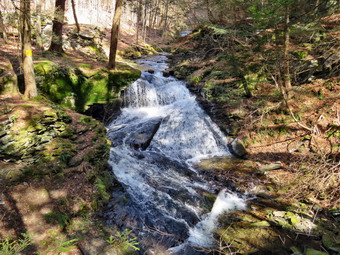
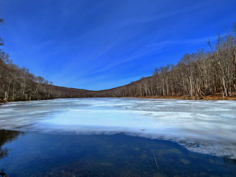
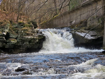
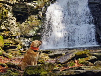 We continued on down Russell Brook Road to the overlook over the upper falls. There was enough water in the stream to make the upper falls interesting and I had not taken pictures there in some time. We worked our way down the bank where I dropped my pack and took out the camera. I took pictures of the falls from several angles and then put the camera away and walked back up the bank. We walked down to the lower parking lot which was empty. The road down to the bridge was clear except for a small amount of ice near the bridge. Just after the stand of knotweed, we turned right on the path that leads to the falls. We stayed to the right and walked along the path until we could turn to the right and walk down to the stream bed. This area was a little slippery and tricky to negotiate but we were soon in the streambed. I dropped my pack and pulled out the camera to take pictures of the falls. I made sure to have Sheila pose in front of the falls so I could take some shots of her also. After finishing the photography, we walked back out OT the main trail and turned right toward the trail register. At the trail junction, just after the register, we turned to the right to hike the gentler ascent to Trout Pond. The trail was damp in places with a small amount of mud which was easily avoided. There was some sun shining on the trail and I was beginning to get very warm. I stopped and opened all the zippers on my hoody which did seem to vent enough heat to keep me comfortable. When we arrived at the pond, we turned left and walked out to the "beach" at the outlet end of the pond. The pond was still covered in ice for the most part but there was some open water near the shore and the dam. The skies were blue but almost completely cloudless which was not very interesting. I took out the camera and took some pictures of the pond especially around the sore and the dam. There was still a large snow bank where the snow had drifted at the end of the pond. I took some pictures of the snow and then noticed Sheila was walking on the thin ice of the pond. Before I called Sheila off the ice, I took a few pictures of her. Sheila decided she would go into overdrive and began running around at breakneck speed including a few passes over the ice! After getting a drink and a snack, I packed up and headed back to the main trail. We continued on the main trail on the east side of Trout Pond walking toward the inlet end and the lean-tos. The trail was wet in spots with some fairly large puddles. No one was camping at the large campsite on the right side of the rail before the lean-tos or at the lean-tos themselves.
 As we crossed the bridge at the inlet end of the pond, I noticed that the inlet stream was flowing freely. I stopped to take some pictures of the pond from the bridge and spoke of the stream. We continued on the trail and I decided to turn left and walk out to the shore of the pond. I took some more pictures from here before walking back to the main trail and starting up the hill which is the shoulder of Cherry Ridge. At the turn, the trail was almost dry without ay snow or ice, and we easily walked up the hill. Not very far from the turn was a large blowdown along the side of the trail which had been cut and moved to the side. After we had walked for some time, I noticed a few large trees that had been cut with a chainsaw. I then remembered that there were places on the trail which previously had large blowdowns that were no longer present! I assumed a DEC crew had been sent through to clear the trail. Of course, since the crew had done their work there had been more storms, and there were several smaller blowdowns across the trail. As we began to climb the north-facing part of the trail, there was some snow on the trail and in the woods. Soon we were at the highest point on Cherry Ridge and starting down the other side. This side of the hill had now snow and the trail had only a few wet spots in isolated places. As we walked along Sheila alerted and I saw two dogs approaching us. One dog was a smaller white hound while the other was a larger brown dog which I thought might be a lab mix. The dog stopped and seemed confused. I put Sheila on her leash and she pulled toward the other dogs. I told the dogs to "Go away!" and they both turned around and ran away. I kept Sheila on her leash for some time think we would meet the dogs and their owner but then I let her off again. We continued on the trail ascending to the area where there is a forest of small birch trees. This was also the only area where there was standing water and a few muddy areas. Once again the dogs appeared and retreated when I spoke to them. I began to wonder and worry about the dogs and about their owner. Soon we were at the woods road and snowmobile trail that runs by Mud Pond. We turned right to walk down to Mud Pond.
 After about 500 feet, we turned left on a path that runs down to the shore of the pond. There was a campsite on the path and areas were very muddy. When we got to the shore of Mud Pond, I took some pictures although there wasn't much that was very interesting. We walked back up to the main trail and turned right. We continued straight ahead and up the hill on the trail. This part of the trail was also barely damp with a few small areas of running water crossing the trail. At the top of the hill, we began the long descent back to the trail junction where we had started. The descent lasts for .7 miles and drops 385 feet to a bridge that crosses the outlet stream from Trout Pond. This part of the trail was just as dry as the other sections. As we descended, we came to a spot where a small stream crosses and this time it was fairly swollen but easily crossed. We continued down the hill on the main trail toward the campsite at the bottom of the hill on the left side of the trail. No one was present at the campsite. We continued on the trail crossing the bridge over the stream and walking back out to the trail register. We turned right and headed back toward the lower parking area on the main trail. We walked up the short path to the lower parking area and then up the road to the car. There was one car in the parking area and another parked at one of the campsite halfway up the road. As we neared the car, I could see that the other car was stilled parked in the lot. We arrived back at the car at 2:35 PM after hiking 5.9 miles in 2 hours and 55 minutes with a 1160-foot total ascent. My average speed overall was just over 2 mph which I counted good for the conditions and the number of stops I made. As I drove down Morton Hill Road, an animal ran across the road. At first, I thought it might be a coyote but it had a very bushy tail. This led me to believe it was a fox.
![]()
![]()
![]()
![]()
![]() On Saturday, March 14th, I wanted to get in a hike as my hiking time has been limited by full-time teaching and coaching track. I had planned to sleep in but got up early. I did chores around the house and then decided to get ready for a hike. I asked Cindy if she would like to go and she agreed. Cindy has been fighting a respiratory infection for some time so we knew she could not hike for very long. At 10:30 AM it was 38 degrees as we began to get ready to hike. I decided we would go to Parksville and hike the rail trail. I knew the round trip was less than 3 miles which was less than I was prepared to do but would be just right for Cindy. I got dressed in my Mammut crew top but did not wear any baselayer. I decided to wear my Columbia Titanium insulated pants to keep the chill away but did not wear tights underneath. I wore my Keen Targhee III boots since I didn't feel that I needed insulated boots. I did not wear gaiters as I knew there would be no snow on the trail. I decided to take my new pair of Leki poles with external locks as the internal twist locks fail. I grabbed a light hat and gloves. Finally, I donned my Mammut hoody which blocks the wind and keeps me warm but has enough zippers to dump heat when needed. I decided to carry my microspikes in case they were needed. We put our gear in the back of the car and Sheila in the back seat. Sheila was especially excited as she had not been out all week. We left Livingston Manor at just before 11:00 AM and drove out Old Route 17 toward Parksville. Just after Fox Mountain Road, I pulled into the parking area on the right side of the road at 11:10 AM. The temperature was 37 degrees and a stiff breeze was blowing which made me almost regret not dressing more warmly. A pickup truck was parked in the lot and another car pulled in as we were getting ready. I set my GPS and we started out on the trail at 11:15 AM. As we walked along the first part of the trail, I noticed the car had a dog and several small children. One of the occupants asked about Sheila and I told her that she was not very friendly with other dogs. We never saw this group again on the hike.
On Saturday, March 14th, I wanted to get in a hike as my hiking time has been limited by full-time teaching and coaching track. I had planned to sleep in but got up early. I did chores around the house and then decided to get ready for a hike. I asked Cindy if she would like to go and she agreed. Cindy has been fighting a respiratory infection for some time so we knew she could not hike for very long. At 10:30 AM it was 38 degrees as we began to get ready to hike. I decided we would go to Parksville and hike the rail trail. I knew the round trip was less than 3 miles which was less than I was prepared to do but would be just right for Cindy. I got dressed in my Mammut crew top but did not wear any baselayer. I decided to wear my Columbia Titanium insulated pants to keep the chill away but did not wear tights underneath. I wore my Keen Targhee III boots since I didn't feel that I needed insulated boots. I did not wear gaiters as I knew there would be no snow on the trail. I decided to take my new pair of Leki poles with external locks as the internal twist locks fail. I grabbed a light hat and gloves. Finally, I donned my Mammut hoody which blocks the wind and keeps me warm but has enough zippers to dump heat when needed. I decided to carry my microspikes in case they were needed. We put our gear in the back of the car and Sheila in the back seat. Sheila was especially excited as she had not been out all week. We left Livingston Manor at just before 11:00 AM and drove out Old Route 17 toward Parksville. Just after Fox Mountain Road, I pulled into the parking area on the right side of the road at 11:10 AM. The temperature was 37 degrees and a stiff breeze was blowing which made me almost regret not dressing more warmly. A pickup truck was parked in the lot and another car pulled in as we were getting ready. I set my GPS and we started out on the trail at 11:15 AM. As we walked along the first part of the trail, I noticed the car had a dog and several small children. One of the occupants asked about Sheila and I told her that she was not very friendly with other dogs. We never saw this group again on the hike.
 Once we were on the trail and sheltered by the trees the wind abated and I felt warmer. The trail alternated between dry areas and muddy ones with extensive areas of ice in some sections. I took some pictures of the trail before continuing our hike. The rail trail runs parallel to the Little Beaverkill and the new section of State Route 17. It follows the route of the O&W railroad and is very flat. I kept looking down toward the river and I finally found a way to get down to the riverbed to take some pictures. I got my camera out of the pack and took some pictures of the river both up and down the stream. There were some rapids upstream with blue sky and clouds in the background. I worked my way back up to the main trail and we continued our hike. I looked ahead to see a group of 4 people coming toward us. As we passed each other, one member of the group said "Hello" and I recognized him as someone from Livingston Manor that I had hiked with before. We continued along the trail avoiding some ice patches. I once again I went down to the stream to take some pictures. The day was sunny, almost too sunny for pictures, but I took some shots anyway. Back on the main trail we passed several benches placed for people to rest in warmer weather. As we walked, I could hear an increase in the noise from the stream and I knew the falls was just ahead. I began to work my way down the steep bank to the stream bed just below the falls. The descent was tricky as loose mud covered the ice below. I finally made it to the stream, put down my pack and got out the camera. I took many pictures of the falls and some downstream as well. When I completed my photography, I scratched my way back to the top of the bank and the trail. The next stretch of the trail was completely covered in ice. There was a nice view from the trail down to the falls so I took some more pictures. I crossed the ice to Cindy who was sitting on a bench.
 We carefully picked our way along the trail trying to avoid the ice. Soon we were nearing the end or the beginning of the trail depending on your perspective. On the Parksville end of the trail we found a small garden and a very informative sign. The sign listed the businesses and hotels that existed in Parksville during its heyday. It also explained the role of the railroad in the dairy industry which was a thriving one in all of Sullivan County. As we were reading the sign the other hikers we had met approached us. We walked down the street and out to the road by the Dead End Café. There are many interesting buildings along a short stretch of road but most are unoccupied and crumbling. When we got to the road, we turned left and walked on a gravel path that paralleled the road. The path continued to a parking area and then exited the other side. We continued on this path passing the building which once held Memories where I had bought several items at auction. The path ended in another parking area so we had to walk the shoulder of the road to get back to our car. There was more traffic on the road than I had expected but the shoulder was wide and the drivers considerate. We arrived back at the car at 12:45 Pm after hiking 2.8 miles in 1 and a half hours. My GPS showed the elevation gain as 243 feet which I doubted but could have been from the descents to the river.
![]()
![]()
![]()
![]() On Sunday, March 8th I wanted to get in a quick hike after church since teaching, coaching timing sporting events had conspired to keep me off the trails. At 2:00 PM I visited the funeral home with my wife as a member of our church had passed away. When we got home, I decided to go across the street for a couple of figure 8's on Round Top. The temperature was right around 52 degrees with almost no breeze and lots of sun. Sheila was ready to go as she really likes to hike and she was keeping a careful eye on me as I dressed. Sheila misses the hiking as much as I do since I have returned to full-time teaching for the rest of this school year! I put on my long-sleeved Mammut crew top without a baselayer. I decided to wear my Columbia Titanium insulated pants despite the warm weather but knew I would not need tights underneath. I wore my Vasque Talus boots as I could see not snow on the hill. I grabbed a pair of Leki poles with external locks that I have been using lately. Finally, I also donned my Mammut hoody which blocks the wind but has enough zippers to dump heat when needed. At 3:35 PM Sheila and I walked out the door to start the hike. I grabbed Sheila's leash from the car and we walked up the driveway. I decided we would try to do at least two figure 8's which might be enough given the situation. I aimed to hike for about an hour. Sheila was happy to get out as we headed down the driveway and across the street. We crossed the street and walked to the parking area by the Presbyterian Church. The roads seemed clear with only water on the surface. We walked to the back of the church and began the ascent of the steepest hill behind the church. The hill is short but gets the circulation pumping and is the steepest and longest climb on the "trail." Sheila helped me along by pulling me up the hill.
On Sunday, March 8th I wanted to get in a quick hike after church since teaching, coaching timing sporting events had conspired to keep me off the trails. At 2:00 PM I visited the funeral home with my wife as a member of our church had passed away. When we got home, I decided to go across the street for a couple of figure 8's on Round Top. The temperature was right around 52 degrees with almost no breeze and lots of sun. Sheila was ready to go as she really likes to hike and she was keeping a careful eye on me as I dressed. Sheila misses the hiking as much as I do since I have returned to full-time teaching for the rest of this school year! I put on my long-sleeved Mammut crew top without a baselayer. I decided to wear my Columbia Titanium insulated pants despite the warm weather but knew I would not need tights underneath. I wore my Vasque Talus boots as I could see not snow on the hill. I grabbed a pair of Leki poles with external locks that I have been using lately. Finally, I also donned my Mammut hoody which blocks the wind but has enough zippers to dump heat when needed. At 3:35 PM Sheila and I walked out the door to start the hike. I grabbed Sheila's leash from the car and we walked up the driveway. I decided we would try to do at least two figure 8's which might be enough given the situation. I aimed to hike for about an hour. Sheila was happy to get out as we headed down the driveway and across the street. We crossed the street and walked to the parking area by the Presbyterian Church. The roads seemed clear with only water on the surface. We walked to the back of the church and began the ascent of the steepest hill behind the church. The hill is short but gets the circulation pumping and is the steepest and longest climb on the "trail." Sheila helped me along by pulling me up the hill.
We started on the trail by turning left at the trailhead where I let Sheila off her leash so that she could explore. The trail was completely bare with no snow and I could see no snow in the woods. The trail was mostly dry with a few spots of mud in spots. At the first trail junction, I followed Sheila as she continued straight up the hill toward the viewpoint. At the top of the hill, we continued on the trail turning right. We followed the trail as it gently gained elevation toward the junction with the blue trail. The trail surface was a little slippery but there was still no snow. At the next trail junction, we turned right to follow the yellow trail around the base of Round Top. There was a small amount of ice and snow on the trail and a little snow off the trail. At the next trail junction we turned left and headed up to the summit of Round Top on the blue trail. I had no problem making it to the top. We were soon passing over the top of the hill and starting down the other side. The trail continued to be slippery but I used my poles and we were soon back at the junction with the yellow trail. At the bottom of the hill we turn left to follow the yellow trail to the next trail junction. This time we turned right and followed the yellow trail down to the woods road that returned us to the first trail junction. All the time Sheila explored off-trail but stayed close enough to hear my voice. As we were approaching the junction, Sheila alerted and I saw a couple, their dog and young child coming down from the lookout. They continued out to the trailhead so Sheila and I walked to the first trail junction. When we reached the first trail junction, we turned around and walked back up the woods road. At the first junction with the blue trail we turned left and followed the yellow trail along the base of Round Top. At the second junction, we turned right and walked up the blue trail to the summit of Round Top. We walked down the other side to the junction and turned right. We followed the yellow trail turning left and the next junction to walk down to the lookout. On the way down I could see two young women ahead of us. At the lookout we stayed to the left and walked down the hill to the first trail junction. I was satisfied that I had done enough. We continued straight ahead and walked out toward the trailhead. The two young women stayed ahead of us as I put Sheila on her leash to walk down the hill. We continued out through the church parking lot to the road and to our driveway. It was 4:45 PM and we had hiked over 2 miles in just over an hour.
![]()
![]()
![]()
![]()
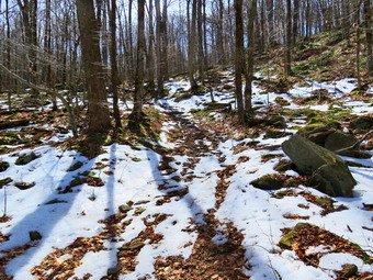
![]() On Saturday, February 29th, I wanted to get in a hike as my hiking time has been limited by full-time teaching and caching track. I had planned to sleep in after getting home late from a track meet but a 6:00 AM ambulance call ended that plan. The call didn't last that long so I went back to bed to get a couple extra hours of sleep. At 10:00 Am it was still 20 degrees as I went downtown to get some breakfast. A pretty good snow squall rolled in covering the grass and streets but soon stopped. I decided to go hiking to the Frick Pond area with the intention of hiking to the Hodge Pond Lookout. I began to get ready at 11:30 AM which made Shiela very happy. Since it was 24 degrees with a stiff wind blowing, I decided to dress warmly. I got dressed in my Mammut crew top with a long-sleeved baselayer. I decided to wear my Columbia Titanium insulated pants to keep the chill away with a pair of light tights underneath. I wore my Salomon B-52 insulated boots which have been discontinued but are my favorite boots for winter. I put on a pair of OR Crocodile gaiters as I did not know the depth of snow we would encounter. I decided to try out my new pair of Leki poles with external locks as the internal twist locks fail. I grabbed a light hat and gloves. Finally, I also donned my Mammut hoody which blocks the wind and keeps me warm but has enough zippers to dump heat when needed. I decided to carry my microspikes in case they were needed. I put my gear in the back of the car and Sheila in the back seat. We left Livingston Manor at noon and I drove out the DeBruce Road about 6 miles to Mongaup Road and turned left. I continued up the road to the point where it splits and stayed left on Beech Mountain Road. It was a short drive to the parking areas on the left. The large parking area had one pickup and a car and a pickup took up most of the room in the small lot since they did not know how to park. I parked in the small lot and noted that the temperature 18 degrees. When I stepped out of the car, the wind hit me and I was cold. I initially regretted not putting on a warmer top but I knew I would warm up on the trail. There was snow everywhere and some seemed to be relatively new. There was some ice under the snow which made for a slippery combination. I checked out the beginning of the Flynn Trail and found the snow well-packed but not icy enough to wear spikes. I set my GPS and shouldered my pack as we crossed the road at 12:15 PM to start our hike.
On Saturday, February 29th, I wanted to get in a hike as my hiking time has been limited by full-time teaching and caching track. I had planned to sleep in after getting home late from a track meet but a 6:00 AM ambulance call ended that plan. The call didn't last that long so I went back to bed to get a couple extra hours of sleep. At 10:00 Am it was still 20 degrees as I went downtown to get some breakfast. A pretty good snow squall rolled in covering the grass and streets but soon stopped. I decided to go hiking to the Frick Pond area with the intention of hiking to the Hodge Pond Lookout. I began to get ready at 11:30 AM which made Shiela very happy. Since it was 24 degrees with a stiff wind blowing, I decided to dress warmly. I got dressed in my Mammut crew top with a long-sleeved baselayer. I decided to wear my Columbia Titanium insulated pants to keep the chill away with a pair of light tights underneath. I wore my Salomon B-52 insulated boots which have been discontinued but are my favorite boots for winter. I put on a pair of OR Crocodile gaiters as I did not know the depth of snow we would encounter. I decided to try out my new pair of Leki poles with external locks as the internal twist locks fail. I grabbed a light hat and gloves. Finally, I also donned my Mammut hoody which blocks the wind and keeps me warm but has enough zippers to dump heat when needed. I decided to carry my microspikes in case they were needed. I put my gear in the back of the car and Sheila in the back seat. We left Livingston Manor at noon and I drove out the DeBruce Road about 6 miles to Mongaup Road and turned left. I continued up the road to the point where it splits and stayed left on Beech Mountain Road. It was a short drive to the parking areas on the left. The large parking area had one pickup and a car and a pickup took up most of the room in the small lot since they did not know how to park. I parked in the small lot and noted that the temperature 18 degrees. When I stepped out of the car, the wind hit me and I was cold. I initially regretted not putting on a warmer top but I knew I would warm up on the trail. There was snow everywhere and some seemed to be relatively new. There was some ice under the snow which made for a slippery combination. I checked out the beginning of the Flynn Trail and found the snow well-packed but not icy enough to wear spikes. I set my GPS and shouldered my pack as we crossed the road at 12:15 PM to start our hike.
 We had to climb over a low snow bank left by the plows to start out on the Flynn Trail. After that, the walk through the woods was relatively easy. When we turned right onto what once was Beech Mountain Road, there were several sets of footprints in the snow. I only saw bare boots although one may have had traction devices. I saw no reason to put on my spikes so we continued up the trail. As we walked up the trail, I was still cold despite some sun shining on my back. I set a fast pace up the Flynn Trail powered by the desire to keep warm! The Flynn Trail is uphill all the way for the first 1.7 miles to the Big Rock Junction. At one point Sheila alerted and I saw a young couple hiking down the trail toward us. I put Sheila on her leash and we exchanged greetings as we passed. I thought about asking them the route they took but we were passed them very quickly. A little farther up the rail I could see where they had turned around. From this point on there were no new tracks in the snow. We passed the mile mark around the point where there is a clearing to the right of the trail. I had been to this clearing on a previous hike so I continued on the main trail. and on this day it took almost an hour. I did see some snowmobile tracks coming over from Mongaup Pond and continuing down the Big Rock Trail. We continued through the junction and passed through the gate which is the boundary between state land and OSI popery. Unfortunately, at least one snowmobile could not read the sign that prohibits snowmobiles on this trail! We continued on the trail to the point where the Flynn Trail heads downhill to Hodge Pond. Here we turned to the right on the woods road and walked along the "high road" to the junction of some roads above the pond. There were no tracks here at all and there was some fresh snow but the walking was easy. At this junction a road turns left to go down to the pond. Just a little further on the road splits with the left fork passing by the old Beech Mountain Boy Scout Camp and ending up on Shin Creek Road in Lew Beach. To my surprise this road showed tracks of what looked like a pickup and there was some evidence of plowing. We continued straight ahead to climb the road up the hill which also had these tracks in the snow although they were old. The road was a little steeper than I remembered and a little longer.
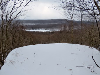
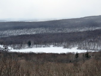
 I was tired but despite the incline I pushed the pace. As we passed an old quarry where the trail leveled some Sheila darted to the right side of the trail. I didn't know what she had seen but I called her back and she came quickly. The trail began to gain elevation again and we passed by a spring house on the right. There are several twists and turns along this road and it is sometimes hard for me to know exactly where I am. Eventually the tracks stopped and we were walking on unbroken snow. At 2.7 miles we came to a lookout on the left of the trail. The lookout had been "cut out" so that the hills and valleys beyond were much more visible. I decided to push on to the lookout and take pictures on the way back. We followed the road which made a sharp right turn. Just after this the road turned to the left but another trail branched off to the right. Sheila and I turned onto the trail on the right which was a little less defined because it was covered in snow. After a slight incline, the trail leveled. The snow was drifted and deep averaging week over 12 inches. In some places I broke through the crust and the snow reached almost to my knee! We walked along the trail with me following Sheila most of the time. The wind was still blowing and some flakes were now falling. At 2.9 miles we arrived at the Hodge Pond Lookout. This lookout had also been cut out giving a much better view than I had seen in years. I dropped my pack and took some pictures of the pond below and the hills in the distance. I also took some pictures of Sheila sitting on the lookout with the pond in the background. Some snow was beginning to roll in from the west and I decided we should get moving. On the walk back, I tried to avoid the spots where I had fallen through the crust. When we reached the lookout on the road, I stopped to take a few shots. I thought the view would be much the same as the lookout over the pond but it seemed different enough to warrant some pictures. The trip down was much quicker than the trip up and I avoided slipping on the ice by careful use of my poles. When we reached the bottom of the hill, I thought about walking down to Hodge Pond but decided to make the hike a true out-and-back. We walked out to the Flynn Trail, turned left and were soon at the junction with the Big Rock Trail at 4.6 miles. As we continued on the Flynn Trail I noticed that a good-sized group of people on snowshoes had passed through. It was hard to tell which way they were traveling but they had certainly packed down the snow. The trip down the Flynn Trail can seem to take forever but on this day it went quickly. The large hemlock across the trail came into sight and just after it the gate. We passed through the arch of the tree that Cindy and I had cut through the tree. Just before the gate, we turned left on the Flynn Trail to avoid the private property around the cabin. We walked the trail back to the car arriving at 3:20 PM. The vehicles in the lot were still there and as I put my gear in the car a small group of people on snowshoes came up the Quick Lake trail and across from the larger lot. We had hiked 5.8 miles in 3 hours gaining 1007 feet along the way. It was now 16 degrees and the wind was still blowing.
![]()
![]()
![]()
![]() On Saturday, February 22nd I had planned once again to hike Balsam Lake Mountain but, once again, circumstances intervened. The morning was occupied by a bots basketball game which I timed returning home at 1:00 PM. The temperature was in the high 30's and the sun made it feel warmer. I decided to go across the street and hike on Round Top. I began to get ready at 1:30 PM and Sheila showed her appreciation by barking and running around. I put on my long-sleeved Mammut top without a baselayer. I decided to wear my Columbia Titanium insulated pants to keep the chill away. I wore my Salomon B52 boots which are supportive and surprisingly roomy. They are my "go to" winter boots and were long ago discontinued. I grabbed my new pair of Leki external lock poles which I purchased since twist locks have proved unreliable. I also donned my Mammut hoody which was enough zippers to dump heat when needed. I put on a light hat and wore a light pair of gloves. I knew that snowshoes would not be needed but I also judged I would not need my spikes. At 1:45 PM we walked out the door to start the hike. I grabbed Sheila's leash from the car and we walked up the driveway. This in itself was tricky as there were still large patches of ice and Sheila wanted to pull me along. I decided we would try to do some figure 8's on the Round Top Trails. I aimed to hike for about an hour. Sheila was happy to get out as we headed down the driveway and across the street. We crossed the street and walked to the parking area by the Presbyterian Church. We walked to the back of the church and began the ascent of the steepest hill behind the church. There was more snow than I had anticipated and I almost regretted not wearing my spikes. The hill is short but gets the circulation pumping and is the steepest and longest climb on the "trail." Sheila helped me along by pulling me up the hill which was even more important due to the ice and snow on the hill. When we got to the top of the hill, we started on the trail by turning left at the trailhead. I let Sheila off her leash so that she could explore. The trail bed is becoming worn it which means that a few people are using the trail. I am always happy to see that someone else uses the trails. Once we entered the woods there was MUCH more snow than I had anticipated and it was packed down meaning spikes would have been ideal.
On Saturday, February 22nd I had planned once again to hike Balsam Lake Mountain but, once again, circumstances intervened. The morning was occupied by a bots basketball game which I timed returning home at 1:00 PM. The temperature was in the high 30's and the sun made it feel warmer. I decided to go across the street and hike on Round Top. I began to get ready at 1:30 PM and Sheila showed her appreciation by barking and running around. I put on my long-sleeved Mammut top without a baselayer. I decided to wear my Columbia Titanium insulated pants to keep the chill away. I wore my Salomon B52 boots which are supportive and surprisingly roomy. They are my "go to" winter boots and were long ago discontinued. I grabbed my new pair of Leki external lock poles which I purchased since twist locks have proved unreliable. I also donned my Mammut hoody which was enough zippers to dump heat when needed. I put on a light hat and wore a light pair of gloves. I knew that snowshoes would not be needed but I also judged I would not need my spikes. At 1:45 PM we walked out the door to start the hike. I grabbed Sheila's leash from the car and we walked up the driveway. This in itself was tricky as there were still large patches of ice and Sheila wanted to pull me along. I decided we would try to do some figure 8's on the Round Top Trails. I aimed to hike for about an hour. Sheila was happy to get out as we headed down the driveway and across the street. We crossed the street and walked to the parking area by the Presbyterian Church. We walked to the back of the church and began the ascent of the steepest hill behind the church. There was more snow than I had anticipated and I almost regretted not wearing my spikes. The hill is short but gets the circulation pumping and is the steepest and longest climb on the "trail." Sheila helped me along by pulling me up the hill which was even more important due to the ice and snow on the hill. When we got to the top of the hill, we started on the trail by turning left at the trailhead. I let Sheila off her leash so that she could explore. The trail bed is becoming worn it which means that a few people are using the trail. I am always happy to see that someone else uses the trails. Once we entered the woods there was MUCH more snow than I had anticipated and it was packed down meaning spikes would have been ideal.
At the first trail junction, I followed Sheila as she turned right on the woods road which is the shallower approach to the trail system. On the way up the old woods road, we came across several areas where I had cleared trees on previous trips. We continued to follow the yellow trail to the first junction where we turned left and followed it to the next trail junction. We kept a quick pace as we walked even though it was difficult to walk on the slippery snow. At the second junction with the blue trail, we turned right and started up the steep blue trail that leads over the summit of Round Top. As we ascended the trail, it became obvious that spikes would certainly have help the ascent. We walked across the flat summit of Round Top and started down the other side. I had trimmed much of the trail earlier in the summer but this part still had some branches encroaching on the trail. Soon we were back at the yellow trail where we turned right and walked to the next trail junction. This time we turned left and followed the yellow trail downhill toward the lookout. We continued down to the lookout and followed the yellow trail as it turned left and descended the hill to the first trail junction. Even this part of the trail had more snow than I had expected. The walk had gone quickly so I decided to do another figure 8 which pleased Sheila immensely. We turned around and walked back up the hill to the lookout. We continued to follow the yellow trail as it gained elevation to the junction with the blue trail. We turned right and continued to follow the yellow trail along the base of Round Top to the next junction with the blue trail. We turned left and walk up the blue trail to cross the summit of Round Top. The ascent went well as there was less now on this side of the hill and the grade is less than the other side. The descent on the other side was tricky without spikes but we did make it down without incident. At the trail junction with the yellow trail we turned left and followed the trail along the base of Round Top again. At the next trail junction, we turned right and walked down the trail to the woods road and out to the first trail junction. I checked the time and determined that we should return home given the time. We walked out toward the trailhead where I put Sheila on her leash. We walked down the hill and through the church parking lot to the road and to our driveway. It was 2:45 PM and we had hiked around 2 miles in a little over an hour.
![]()
![]()
![]()
![]()
![]() On Monday, February 17th, I had planned to hike to the Balsam Lake mountain fire tower since I had not done a 3500 foot peak in some time and I wanted a view. In the middle of the night the ambulance pager went off and I went to the building just in time to be canceled. When I got home, I had a time getting to sleep so I got up later than usual. The temperature at 8:00 AM was still in the teens and I did not want to take Sheba on a 6 mile hike up a mountain with the temperature that low. I decided to wait a while, alter my plans and go to Frick Pond. I used to think that hiking a Frick Pond so frequently was boring but I now find it comforting. I know every trail and distance around Frick and Hodge Ponds and can easily add or remove trails to make a hike of any length. By 10:00 AM the temperature had risen to 30 degrees and I started to get ready to go. I got my gear together and decided to dress warm. I got dressed in my Mammut crew top with a long-sleeved baselayer. I decided to wear my Columbia Titanium insulated pants to keep the chill away with a pair of light tights underneath. I wore my Salomon B-52 insulated boots which have been discontinued but are my favorite boots for winter. I put on a pair of OR Crocodile gaiters as I did not know the depth of snow we would encounter. I decided to try out my new pair of Leki poles with external locks as the internal twist locks fail. I grabbed a light hat and gloves. Finally, I also donned my Mammut hoody which blocks the wind and keeps me warm but has enough zippers to dump heat when needed. I decided to carry my microspikes in case they were needed. I put my gear in the back of the car and Sheila in the back seat. We left Livingston Manor at 11:40 AM and I drove out the DeBruce Road about 6 miles to Mongaup Road and turned left. I continued up the road to the point where it splits and stayed left on Beech Mountain Road. It was a short drive to the parking areas on the left. The small parking area was empty but there was one car parked in the larger lot. The temperature was 30 degrees and there was now wind blowing. There was snow everywhere and some ice but all of it was old. I cheeked out the beginning of the Flynn Trail and found the snow well-packed but not icy enough to wear spikes. I set my GPS and shouldered my pack as we crossed the road to start the hike at to get ready to begin the hike.
On Monday, February 17th, I had planned to hike to the Balsam Lake mountain fire tower since I had not done a 3500 foot peak in some time and I wanted a view. In the middle of the night the ambulance pager went off and I went to the building just in time to be canceled. When I got home, I had a time getting to sleep so I got up later than usual. The temperature at 8:00 AM was still in the teens and I did not want to take Sheba on a 6 mile hike up a mountain with the temperature that low. I decided to wait a while, alter my plans and go to Frick Pond. I used to think that hiking a Frick Pond so frequently was boring but I now find it comforting. I know every trail and distance around Frick and Hodge Ponds and can easily add or remove trails to make a hike of any length. By 10:00 AM the temperature had risen to 30 degrees and I started to get ready to go. I got my gear together and decided to dress warm. I got dressed in my Mammut crew top with a long-sleeved baselayer. I decided to wear my Columbia Titanium insulated pants to keep the chill away with a pair of light tights underneath. I wore my Salomon B-52 insulated boots which have been discontinued but are my favorite boots for winter. I put on a pair of OR Crocodile gaiters as I did not know the depth of snow we would encounter. I decided to try out my new pair of Leki poles with external locks as the internal twist locks fail. I grabbed a light hat and gloves. Finally, I also donned my Mammut hoody which blocks the wind and keeps me warm but has enough zippers to dump heat when needed. I decided to carry my microspikes in case they were needed. I put my gear in the back of the car and Sheila in the back seat. We left Livingston Manor at 11:40 AM and I drove out the DeBruce Road about 6 miles to Mongaup Road and turned left. I continued up the road to the point where it splits and stayed left on Beech Mountain Road. It was a short drive to the parking areas on the left. The small parking area was empty but there was one car parked in the larger lot. The temperature was 30 degrees and there was now wind blowing. There was snow everywhere and some ice but all of it was old. I cheeked out the beginning of the Flynn Trail and found the snow well-packed but not icy enough to wear spikes. I set my GPS and shouldered my pack as we crossed the road to start the hike at to get ready to begin the hike.
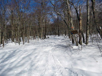 We had to climb over a low snow bank left by the plows to start out on the Flynn Trail. After that, the walk through the woods was relatively easy. When we turned right onto what once was Beech Mountain Road, there were several sets of footprints ion the snow. Most people seemed to have worn bare boots but at least two of the sets of prints were from snowshoes. As we walked up the trail, the sun was shining brightly and directly on my back and I warmed up quickly. At one point I stopped to take a few pictures and open some of the zippers on my hoody. We continued to 1.15 miles where there is a clearing on the right side of the trail. I decided to explore and walked off the packed trail. There was at least 8 inches of snow with a hard crust on top and since it was unbroken the going was slow. We walked up a small hill to the edge of the clearing. I put my pack down and got out the camera to take some shots of the large clearing with a blue sky in the background. Before I packed up, Sheila posed for a few pictures. We walked back to the trail and turned right to continue on the Flynn Trail. The trail dipped briefly before climbing the last .6 miles to the junction with the Big Rock Trail. I was happy to see that some snowmobiles had come over from Mongaup Pond packing the Big Rock Trail. I took some pictures at the junction before turning left to descend the Big Rock Trail. I was not happy to see that at least two machines had headed out the Flynn Trail which is off limits to snowmobiles. Walking down the packed Big Rock Trail seemed very easy and this was enhanced by the bright sunlight and blue skies. I stopped again to take a couple of shots and to get a drink as I was beginning to feel thirsty. The Big Rock Trail has several spots where the trail levels some and bends to the right. These spots sometimes fool me into thinking we are near to Times Square when we are not. On this day I was lost in my thoughts and the walk went quickly. At 12:25 PM we had hiked 2.95 miles and stood at Times Square where The Big Rock Trail and Logger's Loop cross. I decided that since I was feeling fresh we would turn right and hike the Logger's Loop to the Quick Lake Trail at Iron Wheel Junction.
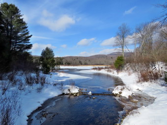 As we started out on the Logger's Loop, the trail was covered in ice with almost no snow. This did not last very long and soon we were again walking on the snow packed by snowmobiles. The trail heads northwest and gains about 200 feet in .8 miles where it turns southwest. Along the way I noticed the beauty of the high rocks and small cliffs on the right side of the trail. From the highest point on the trail we began to descend slightly to Iron Wheel Junction at 4.15 miles. We turned left to follow the Quick Lake Trail toward Frick Pond. This part of the trail had only a few footprints and the walking was much more difficult. We walked downhill to the small stream in the woods and found it was still too high to cross on the trail. A short trip upstream helped us find a place to cross and we were soon back on the trail. The rest of the walk through the "spruce tunnel" went quickly and we were soon at the junction with the Big Rock Trail. We stayed to the right on the Quick Lake Trail and walked to the bridge at the outlet of Frick Pond. I stopped for a few minutes to get some pictures. Each time I pass this way I seem to be attracted to the beauty of the scene. I took some pictures of Flynn's Point on Beech Mountain and some more of the pond and the outlet. I picked up my pack and walked to the top of the hill where Sheila was waiting. As we walked toward Gravestone Junction, Sheila alerted and I could hear people talking and a dog barking ahead. I put Sheila on her leash as the other dog, a small breed of some kind, approached. The owner eventually was able to call his dog while Sheila and I walked by. There was a group of people using a plastic toboggan to slide down the hill on the trail. The trail was now very smooth and I knew that when the temperature dropped it would become extremely slippery. I knew these people had no idea what they were doing but it still bothered me. So many people today only think about themselves and never consider the results of their actions. We continued along the Quick Lake Trail passing the register box to walk the last few hundred feet to the car. It was 1:45 PM and we had hiked 5.6 miles in 3 hours with an elevation gain of 925 feet.
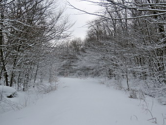
![]()
![]()
![]()
![]()
![]() On Saturday, February 8th I had planned to hike a 3500 foot peak and had settled on Balsam Lake Mountain. When I woke up, the roads looked in good condition and the temperature was in the mid 20's. I was ready to get dressed and hike a mountain! Just before 9:00 AM the ambulance pager went off and my plans were again altered. When I returned from the call, the conditions had not changed much but I decided I did not want to drive to the Millbrook trailhead to hike BLM. I decided once again to return to the Frick Pond area to hike some route. I was a little tired so I planned to hike a shorter route perhaps hiking up the Flynn Trail and down the Big Rock Trail which is a little over 4 miles. I got my gear together and decided to dress warm since the temperature was still below 30 degrees and a slight breeze was blowing. I got dressed in my Mammut crew top with a long-sleeved baselayer. I decided to wear my Columbia Titanium insulated pants to keep the chill away with a pair of light tights underneath. I wore my Salomon B-52 insulated boots which have been discontinued but are my favorite boots for winter. I put on a pair of OR Crocodile gaiters as I did not know the depth of snow we would encounter. I grabbed a pair of Leki poles with internal twist that I have been using lately. I grabbed a light hat and gloves. Finally, I also donned my Mammut hoody which blocks the wind and keeps me warm but has enough zippers to dump heat when needed. I decided to carry my microspikes in case they were needed. As I put my gear in the back of the car, I noticed that there was a rather stiff breeze blowing. I put Sheila in the back seat and we left Livingston Manor at 11:30 AM. I drove out the DeBruce Road about 6 miles to Mongaup Road and turned left. I continued up the road to the point where it splits and stayed left on Beech Mountain Road. It was a short drive to the parking areas on the left. Both parking areas were empty. The temperature was 25 degrees and there was a stiff breeze blowing. There were several inches of snow covering everything and there was some snow falling. I took a few pictures and then set my GPS and shouldered my pack to get ready to begin the hike.
On Saturday, February 8th I had planned to hike a 3500 foot peak and had settled on Balsam Lake Mountain. When I woke up, the roads looked in good condition and the temperature was in the mid 20's. I was ready to get dressed and hike a mountain! Just before 9:00 AM the ambulance pager went off and my plans were again altered. When I returned from the call, the conditions had not changed much but I decided I did not want to drive to the Millbrook trailhead to hike BLM. I decided once again to return to the Frick Pond area to hike some route. I was a little tired so I planned to hike a shorter route perhaps hiking up the Flynn Trail and down the Big Rock Trail which is a little over 4 miles. I got my gear together and decided to dress warm since the temperature was still below 30 degrees and a slight breeze was blowing. I got dressed in my Mammut crew top with a long-sleeved baselayer. I decided to wear my Columbia Titanium insulated pants to keep the chill away with a pair of light tights underneath. I wore my Salomon B-52 insulated boots which have been discontinued but are my favorite boots for winter. I put on a pair of OR Crocodile gaiters as I did not know the depth of snow we would encounter. I grabbed a pair of Leki poles with internal twist that I have been using lately. I grabbed a light hat and gloves. Finally, I also donned my Mammut hoody which blocks the wind and keeps me warm but has enough zippers to dump heat when needed. I decided to carry my microspikes in case they were needed. As I put my gear in the back of the car, I noticed that there was a rather stiff breeze blowing. I put Sheila in the back seat and we left Livingston Manor at 11:30 AM. I drove out the DeBruce Road about 6 miles to Mongaup Road and turned left. I continued up the road to the point where it splits and stayed left on Beech Mountain Road. It was a short drive to the parking areas on the left. Both parking areas were empty. The temperature was 25 degrees and there was a stiff breeze blowing. There were several inches of snow covering everything and there was some snow falling. I took a few pictures and then set my GPS and shouldered my pack to get ready to begin the hike.
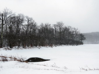 We crossed the road at 11:50 AM to start our hike. There was a thin layer of snow over a frozen layer of snow with ice underneath. This made for some very slippery walking. As we started the hike, a car pulled up to the small parking area. It looked like the occupants were checking out the maps on the kiosk. At this point the occupant of the cabin drove up the road in his pickup and I wondered if we would see his dog. The dog is a beautiful pointer of some type who will not listen to his owner. The owner has done nothing to train him and refuses to use a leash. Sheila and I walked out the Flynn Trail to the woods road and turned right. Almost immediately the dog from the cabin came running to meet us. The owner called him to no effect. Sheila and this dog seem to get along well but I told him "Go home" and had no more effect than the owner. I heard the owner calling so I stopped and waited so he could come get his dog. I looked around and saw that the owner was standing at the cabin making no attempt to come get his dog. I decided that I was not going to ruin my hike so Sheila and I continued up the trail with the other dog following us. We passed through the "tunnel" Cindy and I had cut in a large spruce tree across the trail. Snow was still falling lightly and the dog was still following. I began to retreat into my thoughts and the hike seemed to go quickly. At some point the other dog returned to his house. At 12:45 PM we arrived at the junction with the Big Rock Trail at 1.7 miles into the hike. I had thought I would turn down the Big Rock Trail but I was feeling better than I thought I would at this point. There were several inches of snow at this point and there was a hard crust. Walking was a little difficult as I kept breaking through the crust. We continued straight ahead on the Flynn Trail passing through the gate and arriving at the junction with the woods road toward Beech Mountain. We stayed left on the Flynn Trail to walk down toward Hodge Pond. I stopped to take some pictures of the snow covering the trees and then continued the hike to the pond. As we walked out into the field at the outlet end of the pond, I could see that the snow was falling over and around the pond. We walked to the shore of the pond where I could feel the wind blowing. I dropped my pack and got out the camera. I took some pictures of the pond and the area surrounding it. I didn't wait very long before packing up and heading to the right on the jeep trail around the pond.
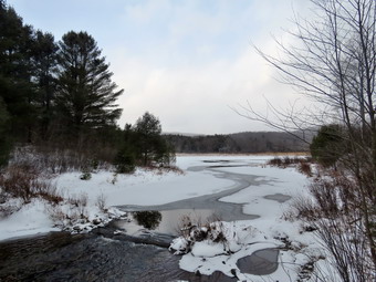 As we started to ascend the trail, there were drifts of snow more than a foot deep. On the way up the hill, I noticed that one of my poles had shortened. I tried to adjust and tighten it but it would not tighten. I took it apart and eventually fixed it. I had to do the same for the other pole. I reminded myself that I had other poles at home with external locks! Fortunately, the poles did not loosen again. We continued on the jeep trail around the back of the pond. Sheila alerted and I could hear some other hikers at the outlet end of the pond. I decided not to stop at the upper end of the pond so we walked around to the junction with the Flynn Trail. As we approached the junction, I could see a young couple hiking through and the Flynn Trail. We exchanged quick greetings and went our separate ways. Soon we were back at the outlet end of Hodge Pond where we turned right and retraced our route up the Flynn Trail. This part of the hike can seem long but in this day it went quickly. The snow had all but stopped and the sun was beginning to peek through the clouds in placed. We walked to the junction with the Big Rock Trail and arrived at 2:05 PM about 4.1 miles into the hike. I decided to turn right and hike down the Big Rock Trail. The downhill felt really good and I could see some footprints going down and coming up! This trail has several tiers that look very much the same. On this day the hike went quickly and we were soon at Times Square. I was very thirsty so I got a drink and a quick snack. We continued straight ahead on the Big Rock Trail around the back of Frick Pond. The conditions at this lower elevation were very different than higher up. There was less snow and some standing water on the trail. We walked over the bridges and wooden walkways without stopping as I saw no particularly special photographic opportunities. At the junction with the Quick Lake Trail, we turned left to head to the outlet of Frock Pond. As we crossed the bridge, I saw a very familiar sight. After crossing the bridge, I decided to stop and take a few shots. Only a few flakes were falling but the breeze lowered the temperature. After taking a few pictures, we continued up the hill toward Gravestone Junction. The hill was icy which did not bother Sheila at all but forced me to stay on the sides where the traction was better. At Gravestone Junction, we continued straight ahead on the Quick Lake Trail. This trail was mostly ice with a thin covering of snow to make it slippery. I thought about putting on my spikes but my poles helped with getting traction. I was surprised there was some open water flowing across the trail. We passed the register and walked the woods road back to the car. There were two other cars in the lot when we arrived at 3:15 PM. We had hiked 6.3 miles in 3 hours and 20 minutes. Our moving speed was 2.1 mph and the elevation gain was 935 feet.
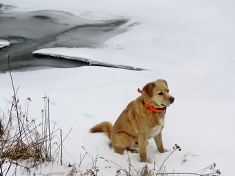
![]()
![]()
![]()
![]()
![]() On Saturday, February 1st I had planned to hike a 3500 foot peak and had settled on Balsam Lake Mountain. I had a track meet at West Point the night before. The meet ran late and I did not get home until just before 2:00 AM. I was able to sleep until 9:00 AM but then remembered I had a low-angle rope rescue drill with the LMFD and the NYS Forest Rangers. I went downtown and ate breakfast and then headed over to the corps building. After a quick introduction to what we were going to do, we headed toward Mongaup Pond to practice rescue techniques. The site was between the turnoff to Beech Mountain Road and the campgrounds. The scenario was a fisherman who had slipped and broken his lower leg over the bank and near the stream. We practiced rigging a stokes basket, loading the patient and transporting them up the bank over the snow-covered rocks and logs to the road where the ambulance was located. We also practiced bringing the patient back down the bank. After several trips, we gathered for a debriefing and everyone agreed that the drill was a success and that more should be scheduled. We returned to the ambulance building where I got to practice filling out the first ePCR for our corps. New York State has set a deadline for all corps to switch from paper records to electronic ones and our corps has taken the initiative to begin early. I returned home and mentioned hiking to Sheila who immediately went crazy. I decided, that despite my being very tired, we would head to Frick Pond to do a short hike. The skies were completely overcast but the temperature was 37 degrees. I got my gear together and decided to dress warm despite the relatively "warm" air temperature. I got dressed in my Mammut crew top with a long-sleeved baselayer. I decided to wear my Columbia Titanium insulated pants to keep the chill away with a pair of light tights underneath. I wore my Salomon B-52 insulated boots which have been discontinued but are my favorite boots for winter. I put on a pair of OR Crocodile gaiters as I did not know the depth of snow we would encounter. I grabbed a pair of Leki poles that I have been using lately. I grabbed a light hat and gloves. Finally, I also donned my Mammut hoody which blocks the wind and keeps me warm but has enough zippers to dump heat when needed. I decided to carry my microspikes in case they were needed. As I put our gear in the back of the car, I noticed that there was a rather stiff breeze blowing. I put Sheila in the back seat and we left Livingston Manor at 12:40 AM. I drove out the DeBruce Road about 6 miles to Mongaup Road and turned left. I continued up the road to the point where it splits and stayed left on Beech Mountain Road. It was a short drive to the parking areas on the left. To my surprise the smaller parking area was full of cars so I turned around and parked in the larger lot which was empty. I set my GPS and shouldered my pack to get ready to begin the hike.
On Saturday, February 1st I had planned to hike a 3500 foot peak and had settled on Balsam Lake Mountain. I had a track meet at West Point the night before. The meet ran late and I did not get home until just before 2:00 AM. I was able to sleep until 9:00 AM but then remembered I had a low-angle rope rescue drill with the LMFD and the NYS Forest Rangers. I went downtown and ate breakfast and then headed over to the corps building. After a quick introduction to what we were going to do, we headed toward Mongaup Pond to practice rescue techniques. The site was between the turnoff to Beech Mountain Road and the campgrounds. The scenario was a fisherman who had slipped and broken his lower leg over the bank and near the stream. We practiced rigging a stokes basket, loading the patient and transporting them up the bank over the snow-covered rocks and logs to the road where the ambulance was located. We also practiced bringing the patient back down the bank. After several trips, we gathered for a debriefing and everyone agreed that the drill was a success and that more should be scheduled. We returned to the ambulance building where I got to practice filling out the first ePCR for our corps. New York State has set a deadline for all corps to switch from paper records to electronic ones and our corps has taken the initiative to begin early. I returned home and mentioned hiking to Sheila who immediately went crazy. I decided, that despite my being very tired, we would head to Frick Pond to do a short hike. The skies were completely overcast but the temperature was 37 degrees. I got my gear together and decided to dress warm despite the relatively "warm" air temperature. I got dressed in my Mammut crew top with a long-sleeved baselayer. I decided to wear my Columbia Titanium insulated pants to keep the chill away with a pair of light tights underneath. I wore my Salomon B-52 insulated boots which have been discontinued but are my favorite boots for winter. I put on a pair of OR Crocodile gaiters as I did not know the depth of snow we would encounter. I grabbed a pair of Leki poles that I have been using lately. I grabbed a light hat and gloves. Finally, I also donned my Mammut hoody which blocks the wind and keeps me warm but has enough zippers to dump heat when needed. I decided to carry my microspikes in case they were needed. As I put our gear in the back of the car, I noticed that there was a rather stiff breeze blowing. I put Sheila in the back seat and we left Livingston Manor at 12:40 AM. I drove out the DeBruce Road about 6 miles to Mongaup Road and turned left. I continued up the road to the point where it splits and stayed left on Beech Mountain Road. It was a short drive to the parking areas on the left. To my surprise the smaller parking area was full of cars so I turned around and parked in the larger lot which was empty. I set my GPS and shouldered my pack to get ready to begin the hike.
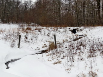 As we turned to walk out the back of the parking area on the Quick Lake Trail, a young couple and their dog appeared returning to the parking area. I put Sheila on her leash and they did the same for their dog. We exchange brief greetings and went our separate ways. We descended the steps and headed out on the trail Almost immediately we encountered a rather large branch in the trail. I picked it up and moved it out of the way. I wondered why the young couple had not done this and ho many people must had walked by that branch without making any effort to help clear the trail! At the register box, we turned left to stay on the Quick Lake Trail. The water on the trail was mostly frozen as the temperatures had been high the previous week. There was a coating of snow on the ice which made the walking slippery but we easily found ways to avoid most of the ice. Several groups of people were returning from the pond so I put Sheila on her leash. The first two groups exchanged greetings with me. A third group of adults and children came toward us and I said "Hello" twice but got no response. One woman was carrying a reusable shopping bag! I said "hello" to the last young man in line who was the only one that returned my greeting. At Gravestone Junction we stayed to the left and walked down the hill to Frick Pond. There was a breeze blowing off the pond and the scene was bleak and "blank". There was some interesting ice on the trees on Beech Mountain but I decided that it was late already and that we would push on. There were a lot of tracks around the pond. When we came to the junction with the Big Rock Trail, we stayed to the left on the Quick Lake Trail. A few boot prints were visible on the trail but most people had stayed right to walk around the pond. The trail was mostly frozen with a few soft spots. We walked through the spruce tunnel to the small stream through the woods. The water level was high enough to make me walk upstream and cross where the water level is lower. We regained the trail and walked uphill to Iron Wheel Junction. My plan had been to turn right here and follow the Logger's Loop to Times Square and back to the car. I felt pretty good at this point and decided to turn left and hike the Quick Lake Trail to Junkyard Junction. From that intersection I would hike the Flynn Trail back to the car. I knew that it would be getting dark as I finished but I felt prepared.
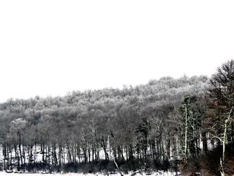 We turned left on The Quick Lake Trail and found that there were no other footprints on the trail. We walked uphill passing the turn to Quick Lake on the snowmobile trail. The walk is mostly up hill for a mile after which it rolls some to Junkyard Junction. As we walked, I noticed that the skies were even cloudier and I thought it might rain or snow. This part of the hike is always a little longer than I anticipate but by 3:35 PM we had hiked the 3.1 miles to Junkyard Junction. We turned right on the Flynn Trail and started heading southeast toward Hodge Pond. This .5 mile walk went quickly as it is flat to the gate and then downhill to the area near the pond. The trail was mostly frozen with a few areas of open, running water. We turned right near the pond to follow the Flynn Trail to the outlet end of the pond. As we passed through the open field the snow depth increased and, as I gazed, to my left I saw the ice on the trees on Beech Mountain. When we came to the clearing at the outlet end of the pond, I decided to walk to the edge of the water and take some pictures. I put my pack down and got out my camera. I took some shot of the pond and then some of the trees. Before packing up, I got a bar and a drink. I often forget to drink during the winter and then get massive leg cramps! We walked across the field and started up the hill on the Flynn Trail. I expected the uphill to be difficult but in reality it wasn't. At the top of the hill we stayed to the right and followed the Flynn Trail to the junction with the Big Rock Trail. We had now hiked 4.7 miles and it was 4:30 PM. It was beginning to get noticeably darker and I knew we had 1.7 miles to go. Fortunately the walk is almost all downhill with a short uphill and some flat portions. I increased my pace which did not phase Sheila in the slightest. There are several places on the trail which usually fool me into thinking we are closer to the end than we really are. We were soon passing through the arch Cindy and I had cut in the larger spruce tree. Just before the gate, we turned left to stay on the Flynn Trail and avoid the private property around the cabin. We walked through the woods and back to the car. We arrived at the parking area at 5:15 PM after hiking 6.4 miles in 3 hours and 25 minutes. The elevation gain was 915 feet. It was dark but still 37 degrees as I pulled out of the parking lot.
![]()
![]()
![]()
![]() On Sunday, January 26th I wanted to take a hike after I returned from church. Teaching full-time and other responsibilities have seriously cut into my hiking time and Sheila let's me know about it. When I returned from church. The temperature was in the high 30's but it was cloudy with moisture I the air. I decided to go across the street and hike on Round Top. I began to get ready at 12:30 PM and Sheila showed her appreciation by barking and running around. I put on my long-sleeved Mammut top with a light baselayer. I decided to wear my Columbia Titanium insulated pants to keep the chill away. I wore my Vasque Talus boots which are supportive and surprisingly roomy. I grabbed a pair of Leki poles that I have been using lately. I also donned my Mammut hoody which was enough zippers to dump heat when needed. I put on a light hat and wore a light pair of gloves. I knew that snowshoes would not be needed but I also judged I would not need my spikes. At 12:45 PM we walked out the door to start the hike. I grabbed Sheila's leash from the car and we walked up the driveway. I decided we would try to do some figure 8's on the Round Top Trails. I aimed to hike for about an hour. Sheila was happy to get out as we headed down the driveway and across the street. We crossed the street and walked to the parking area by the Presbyterian Church. We walked to the back of the church and began the ascent of the steepest hill behind the church. There was more snow than I had anticipated and I almost regretted not wearing insulated boots and spikes. The hill is short but gets the circulation pumping and is the steepest and longest climb on the "trail." Sheila helped me along by pulling me up the hill which was even more important due to the ice and snow on the hill. When we got to the top of the hill, we started on the trail by turning left at the trailhead. I let Sheila off her leash so that she could explore. The trail bed is becoming worn it which means that a few people are using the trail. I am always happy to see that someone else uses the trails.
On Sunday, January 26th I wanted to take a hike after I returned from church. Teaching full-time and other responsibilities have seriously cut into my hiking time and Sheila let's me know about it. When I returned from church. The temperature was in the high 30's but it was cloudy with moisture I the air. I decided to go across the street and hike on Round Top. I began to get ready at 12:30 PM and Sheila showed her appreciation by barking and running around. I put on my long-sleeved Mammut top with a light baselayer. I decided to wear my Columbia Titanium insulated pants to keep the chill away. I wore my Vasque Talus boots which are supportive and surprisingly roomy. I grabbed a pair of Leki poles that I have been using lately. I also donned my Mammut hoody which was enough zippers to dump heat when needed. I put on a light hat and wore a light pair of gloves. I knew that snowshoes would not be needed but I also judged I would not need my spikes. At 12:45 PM we walked out the door to start the hike. I grabbed Sheila's leash from the car and we walked up the driveway. I decided we would try to do some figure 8's on the Round Top Trails. I aimed to hike for about an hour. Sheila was happy to get out as we headed down the driveway and across the street. We crossed the street and walked to the parking area by the Presbyterian Church. We walked to the back of the church and began the ascent of the steepest hill behind the church. There was more snow than I had anticipated and I almost regretted not wearing insulated boots and spikes. The hill is short but gets the circulation pumping and is the steepest and longest climb on the "trail." Sheila helped me along by pulling me up the hill which was even more important due to the ice and snow on the hill. When we got to the top of the hill, we started on the trail by turning left at the trailhead. I let Sheila off her leash so that she could explore. The trail bed is becoming worn it which means that a few people are using the trail. I am always happy to see that someone else uses the trails.
At the first trail junction, we followed Sheila as she turned right on the woods road which is the shallower approach to the trail system. On the way up the old woods road, we came across several areas where I had cleared trees on previous trips. We continued to follow the yellow trail to the first junction where we turned left and followed it to the next trail junction. We kept a quick pace as we walked even though it was difficult to walk on the slippery snow. At the second junction with the blue trail, we turned right and started up the steep blue trail that leads over the summit of Round Top. As we ascended the trail, it became obvious that spikes would certainly have help the ascent. We walked across the flat summit of Round Top and started down the other side. I had trimmed much of the trail earlier in the summer but this part still had some branches encroaching on the trail. Soon we were back at the yellow trail where we turned right and walked to the next trail junction. This time we turned left and followed the yellow trail downhill toward the lookout. We continued down to the lookout and followed the yellow trail as it turned left and descended the hill to the first trail junction. The walk had gone quickly so I decided to do another figure 8 even though my feet were getting wet and cold. We turned around and walked back up the hill to the lookout. We continued to follow the yellow trail as it gained elevation to the junction with the blue trail. We turned right and continued to follow the yellow trail along the base of Round Top to the next junction with the blue trail. We turned left and walk up the blue trail to cross the summit of Round Top. The descent on the other side was tricky without spikes but we did make it down without incident. At the trail junction with the yellow trail we turned left and followed the trail along the base of Round Top again. At the next trail junction, we turned right and walked down the trail to the woods road and out to the first trail junction. I checked the time and determined that we should return home given the time. We walked out toward the trailhead where I put Sheila on her leash. We walked down the hill and through the church parking lot to the road and to our driveway. It was 1:05 PM and we had hiked around 2 miles in a little over an hour.
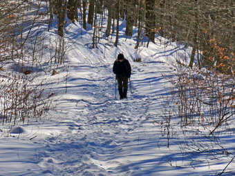
![]()
![]()
![]()
![]()
![]() On Monday, January 20th, I wanted to get out and hike on snowshoes but I knew there would probably not be enough snow for them to be effective. My plan was to drive to the Millbrook trailhead and hike Balsam Lake Mountain. I would rather hike from the Beaverkill trailhead but the road is not reliably maintained and the new snow that had fallen would prove a problem. When I awoke in the morning it was only 9 degrees and I knew I would have to wait. I always take Sheila with me and I thought anything below 20 degrees might be too cold for her on this hike. Eventually I began to get ready to hike. As soon as I started, the ambulance pager went off and I knew my plans would have to change when I returned. I returned home at 12:15 PM and asked Cindy if she would like to go for a shorter hike at Frick Pond. She agreed and we began to get ready. The temperature was only 19 degrees but I judged Sheila would be alright on a shorter hike. As I gathered my clothing and equipment, Sheila got wind of what was going on and began running around the house barking. I got dressed in my Mammut crew top with a long-sleeved baselayer. I decided to wear my Columbia Titanium insulated pants to keep the chill away with a pair of light tights underneath. I wore my Salomon B-52 insulated boots which have been discontinued but are my favorite boots for winter. I put on a pair of OR Crocodile gaiters as I did not know the depth of snow we would encounter. I grabbed a pair of Leki poles that I have been using lately. Finally, I also donned my Mammut hoody which blocks the wind and keeps me warm but has enough zippers to dump heat when needed. Both Cindy and I decided to carry our microspikes in case they were needed. As I put our gear in the back of the car, I noticed that there was a rather stiff wind blowing. I put Sheila in the back seat and we left Livingston Manor at 12:40 AM. I drove out the DeBruce Road about 6 miles to Mongaup Road and turned left. I continued up the road to the point where it splits and stayed left on Beech Mountain Road. It was a shirt drive to the parking areas on the left. I pulled into the smaller parking area and noticed that there were no other cars. The smaller lot had been partly plowed after the snowstorm but the larger lot was untouched. There was only about 4 inches of snow but the temperature was 17 degrees and the wind was noticeable. As we got out of the car, the dog from the cabin came to visit but the owner called him and this time he obeyed. I set my GPS and we got ready to head out on the Flynn Trail. The plan was to hike up the Flynn Trail and then descend the Big Rock Trail to Times Square. From the trail junction we would continue straight across to the end of the Big Rock Trail and then take the Quick lake Trail back to the car.
On Monday, January 20th, I wanted to get out and hike on snowshoes but I knew there would probably not be enough snow for them to be effective. My plan was to drive to the Millbrook trailhead and hike Balsam Lake Mountain. I would rather hike from the Beaverkill trailhead but the road is not reliably maintained and the new snow that had fallen would prove a problem. When I awoke in the morning it was only 9 degrees and I knew I would have to wait. I always take Sheila with me and I thought anything below 20 degrees might be too cold for her on this hike. Eventually I began to get ready to hike. As soon as I started, the ambulance pager went off and I knew my plans would have to change when I returned. I returned home at 12:15 PM and asked Cindy if she would like to go for a shorter hike at Frick Pond. She agreed and we began to get ready. The temperature was only 19 degrees but I judged Sheila would be alright on a shorter hike. As I gathered my clothing and equipment, Sheila got wind of what was going on and began running around the house barking. I got dressed in my Mammut crew top with a long-sleeved baselayer. I decided to wear my Columbia Titanium insulated pants to keep the chill away with a pair of light tights underneath. I wore my Salomon B-52 insulated boots which have been discontinued but are my favorite boots for winter. I put on a pair of OR Crocodile gaiters as I did not know the depth of snow we would encounter. I grabbed a pair of Leki poles that I have been using lately. Finally, I also donned my Mammut hoody which blocks the wind and keeps me warm but has enough zippers to dump heat when needed. Both Cindy and I decided to carry our microspikes in case they were needed. As I put our gear in the back of the car, I noticed that there was a rather stiff wind blowing. I put Sheila in the back seat and we left Livingston Manor at 12:40 AM. I drove out the DeBruce Road about 6 miles to Mongaup Road and turned left. I continued up the road to the point where it splits and stayed left on Beech Mountain Road. It was a shirt drive to the parking areas on the left. I pulled into the smaller parking area and noticed that there were no other cars. The smaller lot had been partly plowed after the snowstorm but the larger lot was untouched. There was only about 4 inches of snow but the temperature was 17 degrees and the wind was noticeable. As we got out of the car, the dog from the cabin came to visit but the owner called him and this time he obeyed. I set my GPS and we got ready to head out on the Flynn Trail. The plan was to hike up the Flynn Trail and then descend the Big Rock Trail to Times Square. From the trail junction we would continue straight across to the end of the Big Rock Trail and then take the Quick lake Trail back to the car.
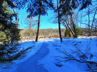 We crossed the road at 1:00 PM and got on the Flynn Trail which is sited along what was once the Beech Mountain Road. This road was the access for the Beech Mountain Boy Scout Camp. There was only about 4 inches of snow as we walked through the woods. When we got to the woods road, we turned right and began the ascent on the trail. We were surprised to find that the snow showed multiple boot prints and evidence of some snowshoes. We gathered that a group had taken advantage of the snow and had hiked on Sunday. I wondered how far they had gotten. The trail gains a little over 600 feet in 1.75 miles to the highest point at the junction with the Big Rock Trail. We passed through the arch Cindy and I had cut through an enormous hemlock that had fallen across the trail. We walked up the trail stopping a few times so that I could take pictures of the snow on the trail and in the woods. The snows began to get deeper but never exceeded 6 inches. At the trailhead, I wondered if I should have dressed more warmly but once we began hiking I was fine. There didn't seem to be any need for our spikes which made walking easier. We passed by the clearing on the right and continued along the trail. As we hiked, I pointed out to Cindy some of the blowdowns I had cleared the week before. As we neared the highest point on the trail, we ran into a few more blowdowns. I could also feel my legs beginning to get a little tired in the inner thighs but it was much less than with snowshoes. We reached the junction with the Big Rock Trail and decided we would continue with the plan and descend to Times Square. We had hiked the 1.7 miles uphill to the junction and now would have over a mile descent. After I took a few pictures, we turned left to walk down the Big Rock Trail and immediately appreciated the downhill. We were able to take long strides and almost glide downhill in may places. We set a faster pace as we descended the trail passing through the various twists and turns that often make it seem like the bottom of the hill is close. I had to wait for Cindy a few times as she was getting tired. I was glad I had chosen a shorter hike than the Millbrook approach to Balsam Lake Mountain! We were soon at Times Square and we continued straight across to stay on the Big Rock Trail. As we hiked around the back of the pond, I pointed out to Cindy a major blowdown I had cleared. We continued to the bridges over the streams that feed Frick Pond. There was some water flowing under both the bridges. I took a few shots before we passed over the series of wooden walkways which continue to deteriorate. At the end of the Big Rock Trail, we turned left on the Quick Lake Trail and walked to the bridge over the outlet stream. There was a nice flow of water coming out of the pond and the sun was forming an interesting pattern on the trees on the north side of the pond. The wind was blowing harder so Cindy walked up the hill while I took some pictures. After a few minutes, I continued up the hill to Gravestone Junction where Cindy was waiting. We continued on the trail and back out to the car. The Quick Lake Trail back to the parking area was completely covered in snow and most of the water was frozen. We arrived at the car at 3:20 PM after hiking 4.0 miles in 2 hours and 20 minutes. The elevation gain was 670 feet.
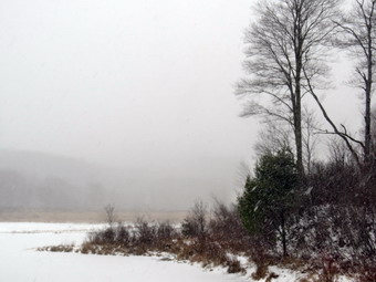
![]()
![]()
![]()
![]()
![]() On Saturday, January 18th I was ready to go out for a hike before the predicted snowstorm began at noon. I decided to go to Frick Pond to hike a route which I thought might be a variation of the Loggers' Loop. The temperature was 18 degrees with a breeze blowing. There was also a moist feeling in the air. I asked Cindy of she wanted to go but she thought it was too cold! I did not have to ask Sheila as she is always ready to hike. I put on my long-sleeved Mammut crew top with a light long-sleeved baselayer underneath. I decided to wear my Columbia Titanium insulated pants to keep the chill away and decided to wear light tights underneath. I wore my Salomon B-52 insulated boots even though there was only a little snow as they keep my feet warm and are waterproof. I grabbed a pair of Leki poles as I knew they would help getting traction on the ice. I also put on my OR Crocodile gaiters. Finally, I also donned my Mammut hoody which blocks the wind and keeps me warm but has enough zippers to dump heat when needed. I decided against snowshoes but put my microspikes in my pack in case they were needed. As I was getting ready Sheila stayed near me so that I would not "forget" her. I put my gear in the car and Sheila in the back seat. She was happy to be going anywhere and crouched in the back seat with her head on the console. At 11:15 AM we headed out the DeBruce Road. After about 6 miles, I turned left on Mongaup Pond Road and stayed left where the road split falling Beech Mountain Road to the trailhead. When we arrived at the parking area, there were no cars parked in the smaller lot but one in the larger. The temperature was 20 degrees. I set my GPS and we headed out the woods road to the Quick Lake Trail at 11:35 PM. We passed the trail register and headed toward Frick Pond. The trail was mostly frozen and covered in a light layer of snow. I walked along the sides of the trail to avoid the ice. There was a set of footprints heading out toward the pond and another returning. At Gravestone Junction we turned right to get on the yellow Logger's Loop heading toward Times Square.
On Saturday, January 18th I was ready to go out for a hike before the predicted snowstorm began at noon. I decided to go to Frick Pond to hike a route which I thought might be a variation of the Loggers' Loop. The temperature was 18 degrees with a breeze blowing. There was also a moist feeling in the air. I asked Cindy of she wanted to go but she thought it was too cold! I did not have to ask Sheila as she is always ready to hike. I put on my long-sleeved Mammut crew top with a light long-sleeved baselayer underneath. I decided to wear my Columbia Titanium insulated pants to keep the chill away and decided to wear light tights underneath. I wore my Salomon B-52 insulated boots even though there was only a little snow as they keep my feet warm and are waterproof. I grabbed a pair of Leki poles as I knew they would help getting traction on the ice. I also put on my OR Crocodile gaiters. Finally, I also donned my Mammut hoody which blocks the wind and keeps me warm but has enough zippers to dump heat when needed. I decided against snowshoes but put my microspikes in my pack in case they were needed. As I was getting ready Sheila stayed near me so that I would not "forget" her. I put my gear in the car and Sheila in the back seat. She was happy to be going anywhere and crouched in the back seat with her head on the console. At 11:15 AM we headed out the DeBruce Road. After about 6 miles, I turned left on Mongaup Pond Road and stayed left where the road split falling Beech Mountain Road to the trailhead. When we arrived at the parking area, there were no cars parked in the smaller lot but one in the larger. The temperature was 20 degrees. I set my GPS and we headed out the woods road to the Quick Lake Trail at 11:35 PM. We passed the trail register and headed toward Frick Pond. The trail was mostly frozen and covered in a light layer of snow. I walked along the sides of the trail to avoid the ice. There was a set of footprints heading out toward the pond and another returning. At Gravestone Junction we turned right to get on the yellow Logger's Loop heading toward Times Square.
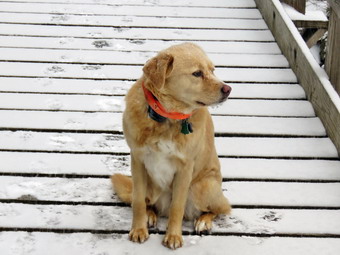 We headed out the trail passing several places where we had cut branches and some rather large trunks. Soon we were hiking downhill toward Times Square avoiding several muddy and wet spots along the way. At Times Square I found that the area was wet and that the trial ahead on the Loggers Loop was a sheet of ice. We continued straight ahead on the Logger's Loop starting a slight uphill climb on the icy trail. We continued our hike as the trail continued to rise and then flattened a little. I stopped on the trail near the pond on the right side of the trail to take some pictures. The trail was covered in snow from some snow showers earlier in the week. Just as I started to take some pictures, the snow started to fall right on schedule. I did not walk off the trail to take pictures of the pond as I wanted to get back home before the snow really started to fall. We continued our walk along the trail trying to avoid the icier spots which covered some water. It wasn't long before we were at Iron Wheel Junction where we turned left to head back toward Frick Pond on the Quick Lake Trail. The trail is slightly downhill which allowed us to keep up a good pace even though there was ice, water and mud on the trail. We came to the small stream in the woods which had a little too much water to cross on the trail. We walked upstream a little and found a narrower spot to cross. Walking through the "spruce tunnel" was easier as it was a little drier than the rest of the trail. Eventually we walked out the other side where the trail was again wet. We arrived at the junction with the Big Rock Trail and I considered walking around the back of the pond but decided against it because of the snow which was falling harder. We continued on the Quick Lake Trail to the bridge across the outlet of Frick Pond. I stopped at the bridge despite the fact that I have taken hundreds of pictures from it. I took a few shots of the bridge with Sheila posed on it. I also took shots of the pond even though the snow was falling hard enough to obscure Beech Mountain. I packed up and we continued up the hill and back to Gravestone Junction. At Gravestone Junction we continued out the Quick Lake Trail and back to the car. We arrived at the car at 1:10 PM having hike 3.6 miles in 1 hours and 35 minutes with an elevation gain of 380 feet. The temperature was 24 degrees and the snow was falling even harder.
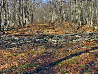
![]() On Sunday, January 12th I decided I would go to the Frock Pond area after church to removed some blowdowns on the Flynn Trail if the weather allowed. The previous day I had counted more than 10 blowdowns across the trail ranging from small, single trunks to much larger ones, The rain had moved off by morning but the wind was still gusting. I wanted to get he work in while I had the time and because of the forecast for snow at the end of the week, We left church at noon and came directly home. I decided I would go despite the wind but Cindy elected to stay home. I was disappointed to again be hiking alone and I knew I would not get as much work done without any help. The temperature was 55 degrees, the rain had stopped but the wind was still gusting. I knew I would not need to dress too warmly. I put on my long-sleeved Mammut crew top without a baselayer underneath. I decided to wear my Columbia Titanium insulated pants to keep the chill away but decided against wearing tights underneath. I wore my Salomon B52 boots since they are waterproof. I donned my Mammut hoody which blocks the wind and keeps me warm but has enough zippers to dump heat when needed. I added a pair of OR Crocodile gaiters. I out a pair of felling wedges in my pack and added my Silky Katanaboy and Sugowaza saws. I also took my Fiskars ax which is light but capable of cutting most trees. I got my gear into the car, put Sheila in the backseat and headed off to the trailhead at 12:40 PM. I drove out the DeBruce Road about 6 miles to Mongaup Road. I turned left and continued up the road to the point where it splits. I stayed left on Beech Mountain Road and drove to the parking areas on the left. I pulled into the smaller parking area and noticed that there were several cars parked in the larger lot. The parking area, which had been was completely covered in ice on the previous day, was clear of ice and snow. It was 1:05 PM when I set my GPS unit and crossed the road to start our hike up the Flynn Trail. The trail was clear of all snow and ice as we made our way to the woods road that the Flynn Trail follows up the hill. The trail was wet and muddy n spots. We passed through the tunnel Cindy and I had cut in am evergreen tree and continued on the trail. Soon Sheila alerted and I saw a couple coming down the trail toward us. We passed them and said "Hello" and Sheila went over to sniff their hands. We continued up the hill.
On Sunday, January 12th I decided I would go to the Frock Pond area after church to removed some blowdowns on the Flynn Trail if the weather allowed. The previous day I had counted more than 10 blowdowns across the trail ranging from small, single trunks to much larger ones, The rain had moved off by morning but the wind was still gusting. I wanted to get he work in while I had the time and because of the forecast for snow at the end of the week, We left church at noon and came directly home. I decided I would go despite the wind but Cindy elected to stay home. I was disappointed to again be hiking alone and I knew I would not get as much work done without any help. The temperature was 55 degrees, the rain had stopped but the wind was still gusting. I knew I would not need to dress too warmly. I put on my long-sleeved Mammut crew top without a baselayer underneath. I decided to wear my Columbia Titanium insulated pants to keep the chill away but decided against wearing tights underneath. I wore my Salomon B52 boots since they are waterproof. I donned my Mammut hoody which blocks the wind and keeps me warm but has enough zippers to dump heat when needed. I added a pair of OR Crocodile gaiters. I out a pair of felling wedges in my pack and added my Silky Katanaboy and Sugowaza saws. I also took my Fiskars ax which is light but capable of cutting most trees. I got my gear into the car, put Sheila in the backseat and headed off to the trailhead at 12:40 PM. I drove out the DeBruce Road about 6 miles to Mongaup Road. I turned left and continued up the road to the point where it splits. I stayed left on Beech Mountain Road and drove to the parking areas on the left. I pulled into the smaller parking area and noticed that there were several cars parked in the larger lot. The parking area, which had been was completely covered in ice on the previous day, was clear of ice and snow. It was 1:05 PM when I set my GPS unit and crossed the road to start our hike up the Flynn Trail. The trail was clear of all snow and ice as we made our way to the woods road that the Flynn Trail follows up the hill. The trail was wet and muddy n spots. We passed through the tunnel Cindy and I had cut in am evergreen tree and continued on the trail. Soon Sheila alerted and I saw a couple coming down the trail toward us. We passed them and said "Hello" and Sheila went over to sniff their hands. We continued up the hill.
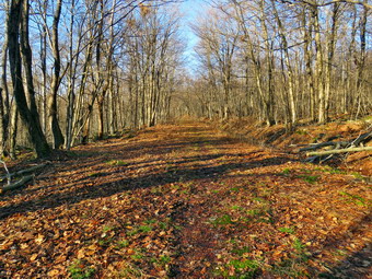 Around 1:37 PM we came to the first blowdown at about a mile from the parking lot. I always follow the same procedure when clearing large blowdowns. I took out my camera and snapped some "before" shots of the blowdown. I surveyed the blowdown which had one small trunk with several large branches. I removed all the loose branches and then got my small saw. I cut a branch and moved it to a brush pile and repeated that action many times. Eventually I cut the main trunk and removed it to the side of the trail. I took some "after" pictures and noted that it had taken about 30 minutes to do the job. I packed up and headed up the trail with Sheila close behind. I wasn't long until we came to the next job where I repeated a similar set of steps. This blowdown was a larger cherry log. This required I use the larger saw which has huge teeth. The big teeth remove material rapidly but it can be hard to keep it moving. After cutting the smaller branches I turned my attention to the main truck. It looked like I would have to cut it twice so I concentrated on the biggest diameter cut first. I did have a hard time keeping the saw going especially since the trunk wanted to shift and bind the saw. In the end I used the edges to keep the kerf open and used the smaller saw to undercut. The lower part of the trunk was heavier than I thought it would be but I saw able to move it off the trail. I made another cut near the top of the trunk and this one went faster. I was able to removed everything and take my after pictures. Even though there were fewer cuts and less material to move, the job had taken about 30 minutes. Walking to the next blowdown took a little more time and I was not sure how many more I could do. We arrived at 2:40 PM to find a pile of brush on the trail with a few central trunks. After taking my pictures, I began to use the small saw to cut away branches that were underfoot or interfering with my cutting. I had to make a lot of cuts and drag away a lot of branches! As I started to make the final cuts on the trunks, I realized that my back was aching. I decided to use my ax so that I could sue a different set of muscles. The sitting went a little more slowly than I had thought it might. I realized that the trunks were maple which is much harder than beech or birch. By 3:26 PM I had cut, cleared and stacked a large pile of brush and logs. I took my :after" pictures including few of Sheila lying by my pack. I decided that I was dome for the day so we turned around and started the downhill walk back to the car. I was satisfied with what I had accomplished all by myself and anxious to get back to the car. We refaced our route back to the parking area arriving at 4:05 PM. It had taken us 3 hours to hike less than 3 miles!
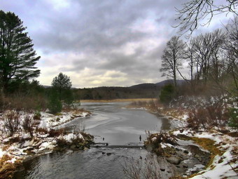
![]()
![]()
![]()
![]()
![]() On Saturday, January 11th I finally had a chance to get out for my first hike of the new year after almost two weeks. I had a morning breakfast meeting with my pastor. When I returned home, the temperature was almost 50 degrees and the rain had stopped. I knew I would not need to dress too warmly. I put on my long-sleeved Mammut crew top with a light long-sleeved baselayer underneath. I decided to wear my Columbia Titanium insulated pants to keep the chill away but decided against wearing tights underneath. I wore my Vasque Taku boots since I did not need insulation. I grabbed a pair of Leki poles that I have been using lately. Finally, I also donned my Mammut hoody which blocks the wind and keeps me warm but has enough zippers to dump heat when needed. I added a pair of OR Crocodile gaiters. I decided against snowshoes and microspikes since I expected the trails to be mostly clear of snow and ice. I got my gear into the car, put Sheila in the backseat and headed off to the trailhead at 11:30 AM. I drove out the DeBruce Road about 6 miles to Mongaup Road. I turned left and continued up the road to the point where it splits. I stayed left on Beech Mountain Road and drove to the parking areas on the left. I pulled into the smaller parking area and noticed that there was one other car. The parking area was completely covered in ice with a layer of water! A man with a dog was at the kiosk looking at the map. His dog was a 7 months old Muensterlander and they had been out "hunting" to train the dog. He warned me that the trail out to the pond was icy and even offered to lend me a pair of spikes. I told him I was grateful for the offer but thought I could make it. My plan was to hike to Iron Wheel Junction and walk the Logger's Loop to times Square. From Times Square, I would hike up the Big Rock Trail to the Flynn trail and then back to the car. It was 11:45 PM when I set my GPS unit and started out on the woods road to the trail register and the Quick Lake Trail. The temperature was 50 degrees.
On Saturday, January 11th I finally had a chance to get out for my first hike of the new year after almost two weeks. I had a morning breakfast meeting with my pastor. When I returned home, the temperature was almost 50 degrees and the rain had stopped. I knew I would not need to dress too warmly. I put on my long-sleeved Mammut crew top with a light long-sleeved baselayer underneath. I decided to wear my Columbia Titanium insulated pants to keep the chill away but decided against wearing tights underneath. I wore my Vasque Taku boots since I did not need insulation. I grabbed a pair of Leki poles that I have been using lately. Finally, I also donned my Mammut hoody which blocks the wind and keeps me warm but has enough zippers to dump heat when needed. I added a pair of OR Crocodile gaiters. I decided against snowshoes and microspikes since I expected the trails to be mostly clear of snow and ice. I got my gear into the car, put Sheila in the backseat and headed off to the trailhead at 11:30 AM. I drove out the DeBruce Road about 6 miles to Mongaup Road. I turned left and continued up the road to the point where it splits. I stayed left on Beech Mountain Road and drove to the parking areas on the left. I pulled into the smaller parking area and noticed that there was one other car. The parking area was completely covered in ice with a layer of water! A man with a dog was at the kiosk looking at the map. His dog was a 7 months old Muensterlander and they had been out "hunting" to train the dog. He warned me that the trail out to the pond was icy and even offered to lend me a pair of spikes. I told him I was grateful for the offer but thought I could make it. My plan was to hike to Iron Wheel Junction and walk the Logger's Loop to times Square. From Times Square, I would hike up the Big Rock Trail to the Flynn trail and then back to the car. It was 11:45 PM when I set my GPS unit and started out on the woods road to the trail register and the Quick Lake Trail. The temperature was 50 degrees.
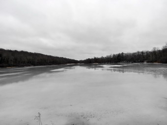 It became immediately obvious to me that I was going to be in trouble without spikes. There was still a lot of ice on the trail nut there did seem to be enough open ground that I thought I could hike safely. At Gravestone Junction, I turned left to head down to Frick Pond. The water level in the pond was a little higher than it had been and there was some ice over some areas of the pond. I had thought I would not stop to take pictures but I couldn't resist even though the scene was bleak. After taking a few shots, I put the camera in the pack and continued on the Quick Lake Trail around the pond bearing left at the next trail junction to stay on the red trail. The ice seemed to dissipate and there was very little snow. The trail was very wet and muddy and my shoes were getting pretty soaked. Soon we came to the "pine promenade" and the little stream through the woods. The water level in the stream was higher than it had been in some time and I had to walk upstream to cross without getting wet. Just before the junction there was a large branch and a pile of smaller ones on the trail and I removed these.We arrived at Iron Wheel Junction at 1.6 miles. Although the skies were dark and the wind had picked up, it was still warm and I was happy to be out. I decided to change my plans and try the big loop up the Quick Lake Trail toward Hodge Pond. We turned left on the Quick Lake Trail and started the long uphill climb toward Junkyard Junction. The trail had no snow or ice but was wet and muddy in places. I realized that I was sweating a lot so I stopped and opened up the sippers on my hoody. I also took off my hat and gloves as I was very warm. The long climb and slippery conditions continued to wear on me but it was still great to be out. We were headed for Junkyard Junction at 3.2 miles as Sheila followed a few game trails. The hike seemed a little longer than usual. I did see evidence that someone had cut some blowdowns on the trail including a very large one. I assumed this was the snowmobile club as it was clear a chainsaw was used. At Junkyard Junction, we turned right onto the blue Flynn Trail. I had hoped the trail would be a little drier but it was very wet and muddy. In some places pools extended across the entire trail forcing us to get around them by going into the woods. By this time my feet were wet so I was glad the day was warm. There were no major blowdowns but we continued to remove branches that littered the trail.
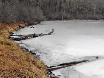 When we got to the gate, we turned right to stay on the trail and head down toward Hodge Pond. At 3.75 miles the Flynn Trail heads right but we turned left to go around the back of the pond. The jeep trail was damp but it was much easier to walk than the other trails. We turned right and walked down to the shore so that I could take some pictures. There was a layer of ice on the pond but I could not determine the thickness. I took some shots and then got a bar and a drink.We walked back to the trail and continued clockwise around the pond. We turned left on the woods road that ascended the hill to an area near what remains of the Beech Mountain Boy Scout Camp. At the top of the hill, we turned right on the woods road and walked to the Flynn Trail where we turned left. The Flynn Trail had a little snow where the trees shaded the trail but the walk to the junction with the Big Rock Trail went quickly. We continued straight ahead on the Flynn Trail and I knew it was only another 1.7 downhill miles to the car. As we walked, we began to encounter numerous blowdowns on the trail. Some where small and would require only one cut to remove them. Other blowdowns were more complicated and a few were larger. This continued until the area where there is a clearing on the left side of the trail about 1.1 miles from the parking area. After this point, there were only a few branches. This walk sometimes seems long, but on this day it went quickly. We walked through the arch Cindy and I had cut in a big evergreen tree and then turned left just before the gate to avoid the private property around the cabin. The trail through the woods had some ice and snow. As we approached the register, Sheila alerted and I saw another hiker approaching with his unleashed dog. I put Sheila on her leash and the other hiker asked if she was friendly. I answered "sometimes". We continued on the trail while the other hiker headed up through the woods to the driveway for the cabin! This is private property and I suspected that the hiker did not have permission to hike there. I almost called out to him but in the end let him go. I have turned back on hikes or altered my route to avoid private property so it always amazes me when people trespass. I am never sure whether they just don't care or are unaware but the result is the same. We continued on the trail and were back at the car at 2:45 PM. We had hiked 6.4 miles in just under 3 hours for a moving rate of 2.3 mph. Our elevation gain was 905 feet.
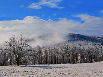
![]()
![]()
![]()
![]()
![]() On Tuesday, December 31st, I wanted to get out for a final hike of 2019. The storm on Monday had left a sloppy mess in the valleys but I could see ice on all the trees at 1800 feet and above. I decided to hike to the Red Hill Fire Tower since son-on-law Brad had never been there and I thought we could safely drive there. The roads in town were in good shape but I knew the back roads might be a problem especially when we started to gain elevation to get to Red Hill. I also knew the access road to the parking area for the fire tower would probably be impassable. We began to get ready around 11:30 AM. I put on my long-sleeved Mammut crew top with a light long-sleeved baselayer underneath. I decided to wear my Columbia Titanium insulated pants to keep the chill away and decided to wear light tights underneath. I wore my Salomon B-52 insulated boots even though there was no snow as they keep my feet warm and are waterproof. I grabbed a pair of Leki poles as I knew there were several climbs where they would come in handy. Finally, I also donned my Mammut hoody which blocks the wind and keeps me warm but has enough zippers to dump heat when needed. I decided against snowshoes but Bard and I both put microspikes in our packs in case they were needed. As I was getting ready Sheila stayed near me so that I would not "forget" her. We put our gear in the car and Sheila in the back seat. As we left Livingston Manor the roads were clear and the temperature was 37 degrees. I drove out the Debruce Road until it ended at Route 47. I turned right and drove to the Claryville Road where I turned left to drive through Claryville. I watched for Red Hill Road on the right and as I made the turn I could see the road was in good shape. As I drove up the hill, we immediately began to see a lot of ice on the trees and wires. There were some branches in the roadway. As the road began to level we ran into a contracted crew working on the power lines and the trees around them. I stopped to take some pictures at a point where there is a lookout on the right. It was sunny and the sunlight sparkled on the ice. I stepped into a field just enough to keep the wires out of my pictures. I took several shots of the hills with ice and some of the trees that were nearer and also covered in ice. After driving a total of three miles on Red Hill Road and I turned left on Coons-Dinch Road. This road is gravel and dirt and was in pretty poor shape . Just after the top of the hill, the road became rougher. At the beginning of the downhill cars were parked off the road on the right side and I found a spot to park. When we exited the car, we could see ice falling off the trees and here trees falling in the woods. I might have turned around but Brad encouraged me to hike. I took a few more pictures of the ice and then got ready to hike. Both Brad and I put on our spikes and I set my GPS. We were in no real hurry as another family with their dog had started just before us. I set my GPS and we started to hike at 12:40 PM with the temperature at 36 degrees. The road down to the parking area was covered in ice and snow and after a short distance there was a barrier that closed the road. The walking downhill was easy but I remembered we would have to walk back up the hill at the end of our hike. After .7 miles, we reached the parking area and headed off on the trail at a relaxed pace talking as we hiked.
On Tuesday, December 31st, I wanted to get out for a final hike of 2019. The storm on Monday had left a sloppy mess in the valleys but I could see ice on all the trees at 1800 feet and above. I decided to hike to the Red Hill Fire Tower since son-on-law Brad had never been there and I thought we could safely drive there. The roads in town were in good shape but I knew the back roads might be a problem especially when we started to gain elevation to get to Red Hill. I also knew the access road to the parking area for the fire tower would probably be impassable. We began to get ready around 11:30 AM. I put on my long-sleeved Mammut crew top with a light long-sleeved baselayer underneath. I decided to wear my Columbia Titanium insulated pants to keep the chill away and decided to wear light tights underneath. I wore my Salomon B-52 insulated boots even though there was no snow as they keep my feet warm and are waterproof. I grabbed a pair of Leki poles as I knew there were several climbs where they would come in handy. Finally, I also donned my Mammut hoody which blocks the wind and keeps me warm but has enough zippers to dump heat when needed. I decided against snowshoes but Bard and I both put microspikes in our packs in case they were needed. As I was getting ready Sheila stayed near me so that I would not "forget" her. We put our gear in the car and Sheila in the back seat. As we left Livingston Manor the roads were clear and the temperature was 37 degrees. I drove out the Debruce Road until it ended at Route 47. I turned right and drove to the Claryville Road where I turned left to drive through Claryville. I watched for Red Hill Road on the right and as I made the turn I could see the road was in good shape. As I drove up the hill, we immediately began to see a lot of ice on the trees and wires. There were some branches in the roadway. As the road began to level we ran into a contracted crew working on the power lines and the trees around them. I stopped to take some pictures at a point where there is a lookout on the right. It was sunny and the sunlight sparkled on the ice. I stepped into a field just enough to keep the wires out of my pictures. I took several shots of the hills with ice and some of the trees that were nearer and also covered in ice. After driving a total of three miles on Red Hill Road and I turned left on Coons-Dinch Road. This road is gravel and dirt and was in pretty poor shape . Just after the top of the hill, the road became rougher. At the beginning of the downhill cars were parked off the road on the right side and I found a spot to park. When we exited the car, we could see ice falling off the trees and here trees falling in the woods. I might have turned around but Brad encouraged me to hike. I took a few more pictures of the ice and then got ready to hike. Both Brad and I put on our spikes and I set my GPS. We were in no real hurry as another family with their dog had started just before us. I set my GPS and we started to hike at 12:40 PM with the temperature at 36 degrees. The road down to the parking area was covered in ice and snow and after a short distance there was a barrier that closed the road. The walking downhill was easy but I remembered we would have to walk back up the hill at the end of our hike. After .7 miles, we reached the parking area and headed off on the trail at a relaxed pace talking as we hiked.
 We crossed a small stream that was flowing freely and continued along the trail. All the trees were covered in ice which was melting. At times, a slight breeze blew which pelted us with ice. There were a lot of branches down on the trail and Brad and I began removing them as we walked. I am always surprised that other hikers will simply ignore these branches as if they were not there! A couple approached us with their dog on a leash and we said "Hello" as we passed. This would happen three more times on the ascent and once at the summit and all but one group had a dog. The trail has a few steep spots at the beginning but then levels out a little before beginning the final climb. We stopped a few times along the way so that I could catch my breath and to look at the beautiful forest. As we gained elevation we could see that the sun had disappeared and that we were in a fog or perhaps cloud. The last .3 miles which averages a little over an 20% grade was challenging. It did seem that hiking without spikes would be foolish. At 1:55 PM we arrived at the tower clearing and walked passed a family and there dog to one of the picnic tables in the clearing. It was clear that we were surrounded by a thick fog or cloud but at least we could see the trees around us. I dropped my pack and tethered Sheila to the picnic table. Unlike some dogs, Sheila has no problem climbing up and down the open steps and I didn't want her following us to the top as I knew the steps would be slippery. I took some shots of the tower and then Brad and I started to climb the steps. There was a which layer of ice on everything and I would not have attempted the climb without spikes. I took some pictures of the ice on the tower and we eventually made it to the landing below the cab. I began to take pictures of the surrounding trees, the cabin and Shiela. I took some shots of the ice on the tower and the trapdoor to the cab. We could see than no one else had been to the upper levels as the ice was undisturbed. The climb down was a little more harrowing then the ascent but soon we were on the ground. I took a shot of the cabin, got a drink and a bar and started the hike back. The trip down went fast and would have been quicker except we had to avoid the barnacles leaning over into the path. We also slowed to remove a few more branches. By 2:55 PM we were back at the regular parking area with only the walk up the road between us and the car. I have to admit that the .7 miles back to the car seemed much longer to me. We stopped a few times until I saw able to catch my breath. At 3:15 PM we were back to car and found we were the last ones to return. We had hiked only 3.8 miles in 2.5 hours but I was happy we had hiked on the last day of the year.
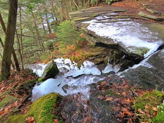
![]()
![]()
![]()
![]()
![]() On Saturday, December 28th I decided I wanted to hike to Jensen Ledges between Long Eddy and Lordville. I had been planning to do this for some time and the fairest for the day called for temperatures near 40 and partly sunny skies. I asked Cindy if she would like to go and she agreed. I was unsure of the road from Lordville to the trailhead so I decided we would try hiking from Long Eddy, a route I had never tried before. We began to get ready just before 10:00 AM. I put on my long-sleeved Mammut crew top with a light long-sleeved baselayer underneath. I decided to wear my Columbia Titanium insulated pants to keep the chill away and decided to wear light tights underneath. I wore my Salomon B-52 insulated boots even though there was no snow as they keep my feet warm and are waterproof. I grabbed a pair of Leki poles as I knew there were several climbs where they would come in handy. Finally, I also donned my Mammut hoody which blocks the wind and keeps me warm but has enough zippers to dump heat when needed. Cindy and I decided against snowshoes but we both put microspikes in our packs in case they were needed. As I was getting ready Sheila stayed near me so that I would not "forget" her. I got our gear into the car, put Sheila in the backseat and headed off to the trailhead at 10:00 AM. I left Livingston Manor and headed over Shandelee taking the backboards to get on Route 97 just south of Hankins. I headed north on Route 97 and it was a short drive to Long Eddy. We could Se that there was parking at the Basket Historical Society on Route 97 in Long Eddy but we decided to drive down Acid Factory Road to check out the route. I turned left and drove about .4 miles where the dirt road deteriorated an signs sated "No Motorized Vehicles". I could see that someone had ignored the signs but decided to drive back to the historical society and park. We parked and started out at 10:50 AM after I set my GPS. We walked north on Route 97 and almost immediately turned left on Kinney Road which became Acid Factory Road in a short distance. A small sign on the left side of the road explained some of the industrial history of Long Eddy which included logging and wood alcohol production. We continued down the road and passed the point where we had turned around. I let Sheila off her leash and we began walking the road which was covered in mud, water, ice and snow! I was not sure where the trail actually began but was looking for a gate which was mentioned in some accounts.
On Saturday, December 28th I decided I wanted to hike to Jensen Ledges between Long Eddy and Lordville. I had been planning to do this for some time and the fairest for the day called for temperatures near 40 and partly sunny skies. I asked Cindy if she would like to go and she agreed. I was unsure of the road from Lordville to the trailhead so I decided we would try hiking from Long Eddy, a route I had never tried before. We began to get ready just before 10:00 AM. I put on my long-sleeved Mammut crew top with a light long-sleeved baselayer underneath. I decided to wear my Columbia Titanium insulated pants to keep the chill away and decided to wear light tights underneath. I wore my Salomon B-52 insulated boots even though there was no snow as they keep my feet warm and are waterproof. I grabbed a pair of Leki poles as I knew there were several climbs where they would come in handy. Finally, I also donned my Mammut hoody which blocks the wind and keeps me warm but has enough zippers to dump heat when needed. Cindy and I decided against snowshoes but we both put microspikes in our packs in case they were needed. As I was getting ready Sheila stayed near me so that I would not "forget" her. I got our gear into the car, put Sheila in the backseat and headed off to the trailhead at 10:00 AM. I left Livingston Manor and headed over Shandelee taking the backboards to get on Route 97 just south of Hankins. I headed north on Route 97 and it was a short drive to Long Eddy. We could Se that there was parking at the Basket Historical Society on Route 97 in Long Eddy but we decided to drive down Acid Factory Road to check out the route. I turned left and drove about .4 miles where the dirt road deteriorated an signs sated "No Motorized Vehicles". I could see that someone had ignored the signs but decided to drive back to the historical society and park. We parked and started out at 10:50 AM after I set my GPS. We walked north on Route 97 and almost immediately turned left on Kinney Road which became Acid Factory Road in a short distance. A small sign on the left side of the road explained some of the industrial history of Long Eddy which included logging and wood alcohol production. We continued down the road and passed the point where we had turned around. I let Sheila off her leash and we began walking the road which was covered in mud, water, ice and snow! I was not sure where the trail actually began but was looking for a gate which was mentioned in some accounts.
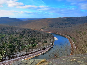 As we walked we passed several cabins which were in disrepair but also saw some very well-kept houses and cabins. I was beginning to wonder if we were on the right track when I looked ahead to see a gate. The gate was about 1 mile from the car and there were signs indicating state property. I could see some red trail markers and I knew we were in the right place. The road beyond the gate was definitely a woods road but the walking was relatively easy except for a few blowdowns which we easily avoided. There should have been no motorized vehicles on the trail but we saw plenty of evidence that someone had ignored these rules. The temperature was just below 40 degrees but a wind was blowing and the air felt damp. As we walked, we could look down to the Delaware River on the left. We could also see the railroads tracks which were doubled in at least one spot. The trail was dry in places and wet, muddy and icy in others. At 1,2 miles the trail began to turn from west to north. We had been walking an almost flat trail until at 1.6 miles it began to gain elevation. The grade was pretty gentle but the change was obvious. As we climbed I got warmer and opened the zippers on my hoody. At 2.25 miles the trail leveled some and then began to gain elevation again at a slightly steeper grade. There were some large blowdowns to work around as we neared the highest part of the trail which I knew meant the Ledges were near. We encountered some signs indicating that trespassing was not allowed. My understanding was that the Falcon Rod and Gun Club had given permission for hiking on the trail nut the signs made me wonder if the stays had changed.
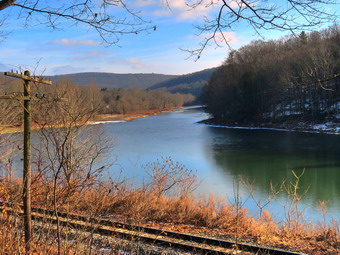 At 2.9 miles, the trail split and we turned left to head up to the Ledges. When we arrived, I made sure that Sheila stayed back from the edge as there was some ice. The skies were overcast and there was some haze. I took quite a few pictures of the river in both directions and a few across to the Pennsylvania side. Cindy and I then walked a little farther along the Ledges to the area of the quarry. Bluestone had been quarried here and there were many small pieces left over. Patient visitors had created some "furniture" a elaborate cairns. I took some pictures down to the river and some more of the cairns. I even took some shots of Cindy and Sheila sitting in a "chair". I could hear the waterfall just a little farther along and decided to visit it without taking my pack. Sheila and I walked the path to the waterfall as Cindy had declined the invitation. As we approached the waterfall, the ground was frozen and there was some ice. I though about the people who had fallen down the cliffs here and knew I had to be very careful. I could hear and see some people on Te main trail coming from Lordsville and told Sheila to stay close. I worked my way down to the edge of the stream and took some pictures of the falls including one of the steep drop. After finishing my photography, I put Sheila one her leash and we returned to the area of the quarry. The couple with a child and a puppy on a leash were at the quarry. I asked if they knew anything about the posted signs and they assured me that the arrangement for hiking had not changed. They also told me that the road from Lordsville to the trailhead was passable. I walked back to Cindy and noticed that the sun was now out. I took a few pictures from the quarry and then we walked back to the Ledges. I took a few more shots here as the sun gave the landscape a completely different look. Finally, I packed up and we started back. We knew the route back was almost all downhill and flat. I though the trip back would go quickly but was supplied when I looked up to see the gate! From the gate it was only a mile back to the car. We did take some time to look at some of the buildings along the way including a stone structure that was probably once used as a well house. I also took a few pictures of the river. Along the way we could hear voices from the river and we looked won to see two men in a small motorboat. On our way back to the car a local resident stopped us to ask us about our hike. We were back at the car at 1:50 PM having hiked 6 miles in 3 hours with an elevation gain of 730 feet.
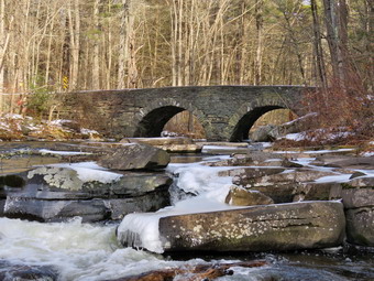
![]()
![]()
![]()
![]()
![]() On Thursday, December 26th, I wanted to go for a hike but had to be back rather early in the afternoon. I thought about going to Jensen Ledge but was not sure of the condition of the road that accesses the trailhead. I decided that I would take Sheila and go to the Tusten Mountain Trail and do the loop in a counterclockwise direction. The Tusten Mountain Trail between Barryville and Narrowsburg just off Route 97. I had not been to the area in several years and prefer not to go there unless the weather is cold due to the possibility of encountering rattlesnakes. The trail has a nice lookout over the Delaware River from the top of the mountain, a stone arch bridge and several stone quarries along the path. The temperature was in the low 30's when I got up and the skies were overcast so I did not hurry to get ready. I put on my long-sleeved Mammut crew top with a light long-sleeved baselayer underneath. I decided to wear my Columbia Titanium insulated pants to keep the chill away and decided to wear light tights underneath. I wore my Salomon B-52 insulated boots even though there was no snow as they keep my feet warm and are waterproof. I grabbed a pair of Leki poles as I knew there were several climbs where they would come in handy. Finally, I also donned my Mammut hoody which blocks the wind and keeps me warm but has enough zippers to dump heat when needed. I decided against snowshoes but put my microspikes in my pack in case they were needed. As I was getting ready Sheila stayed near me so that I would not "forget" her. I got my gear into the car, put Sheila in the backseat and headed off to the trailhead at 10:00 AM. I left Livingston Manor and headed over Shandelee to Youngsville to get on Route 52. I followed Route 52 through Jeffersonville, Kenoza Lake, and Lake Huntigton to Route 97. I turned left or south and drove for a few minutes. I realized I was not sure if I was going in the right direction or how far I should rive! I pulled over and found that, fortunately, I had internet access. I quickly brought up my own website and found I needed to drive about 5 miles south to Crawford Road. I followed my own instructions and turned right onto Crawford Road and drove down to the trailhead. Just before the boat access on the right, we spotted the small sign board and the trailhead parking on the right. We parked and I set my GPS as we started to hike out the access were hiking by 11:15 AM. The air felt cold and damp and the breeze made it feel even cooler. We walked along Tusten Road which is a seasonal maintenance road that parallels the river for less than a quarter mile. The surface of the road was covered in packed snow and ice which made then walk very slippery and I considered donning my spikes. As we approached the stone arch bridge that crosses a small creek that flows into the river, I decided to walk down the bank to a point just downstream of the bridge. This would give me the best angle to take pictures of the stream and the bridge. The bank was too slippery and steep to descend without spikes, so I stopped to put them on. We walked down to the edge of the stream and I took some pictures of the bridge and the water. I repositioned and took some more shots before walking back to my pack and stowing the camera. I noticed a man walking with is dog as they passed us, crossed the ridge and continued along a road. We walked to the bridge and stopped so that I could take some more pictures of the stream before continuing on. The road was icy in some places and snowy in others. There were even some bare spots. I put Sheila on her leash and we passed the man and his dog and did not see them again. As we walked I noticed a small pond on the right and realized that the water filled what was left of a stone quarry. I enjoy visiting quarries and mines as they tell a story of the past. I decided to keep walking and take pictures on the way back. At the .6 mile mark, a sign pointed to the trail on the right. Tusten Road continued straight ahead and I thought we might walk along it when we came back from the trail loop. We turned right and came to the trail register. The trails splits and hikers can choose to go left or right. I had always hiked the trail in the clockwise direction so this time we turned right to start the trail in a counterclockwise direction.
On Thursday, December 26th, I wanted to go for a hike but had to be back rather early in the afternoon. I thought about going to Jensen Ledge but was not sure of the condition of the road that accesses the trailhead. I decided that I would take Sheila and go to the Tusten Mountain Trail and do the loop in a counterclockwise direction. The Tusten Mountain Trail between Barryville and Narrowsburg just off Route 97. I had not been to the area in several years and prefer not to go there unless the weather is cold due to the possibility of encountering rattlesnakes. The trail has a nice lookout over the Delaware River from the top of the mountain, a stone arch bridge and several stone quarries along the path. The temperature was in the low 30's when I got up and the skies were overcast so I did not hurry to get ready. I put on my long-sleeved Mammut crew top with a light long-sleeved baselayer underneath. I decided to wear my Columbia Titanium insulated pants to keep the chill away and decided to wear light tights underneath. I wore my Salomon B-52 insulated boots even though there was no snow as they keep my feet warm and are waterproof. I grabbed a pair of Leki poles as I knew there were several climbs where they would come in handy. Finally, I also donned my Mammut hoody which blocks the wind and keeps me warm but has enough zippers to dump heat when needed. I decided against snowshoes but put my microspikes in my pack in case they were needed. As I was getting ready Sheila stayed near me so that I would not "forget" her. I got my gear into the car, put Sheila in the backseat and headed off to the trailhead at 10:00 AM. I left Livingston Manor and headed over Shandelee to Youngsville to get on Route 52. I followed Route 52 through Jeffersonville, Kenoza Lake, and Lake Huntigton to Route 97. I turned left or south and drove for a few minutes. I realized I was not sure if I was going in the right direction or how far I should rive! I pulled over and found that, fortunately, I had internet access. I quickly brought up my own website and found I needed to drive about 5 miles south to Crawford Road. I followed my own instructions and turned right onto Crawford Road and drove down to the trailhead. Just before the boat access on the right, we spotted the small sign board and the trailhead parking on the right. We parked and I set my GPS as we started to hike out the access were hiking by 11:15 AM. The air felt cold and damp and the breeze made it feel even cooler. We walked along Tusten Road which is a seasonal maintenance road that parallels the river for less than a quarter mile. The surface of the road was covered in packed snow and ice which made then walk very slippery and I considered donning my spikes. As we approached the stone arch bridge that crosses a small creek that flows into the river, I decided to walk down the bank to a point just downstream of the bridge. This would give me the best angle to take pictures of the stream and the bridge. The bank was too slippery and steep to descend without spikes, so I stopped to put them on. We walked down to the edge of the stream and I took some pictures of the bridge and the water. I repositioned and took some more shots before walking back to my pack and stowing the camera. I noticed a man walking with is dog as they passed us, crossed the ridge and continued along a road. We walked to the bridge and stopped so that I could take some more pictures of the stream before continuing on. The road was icy in some places and snowy in others. There were even some bare spots. I put Sheila on her leash and we passed the man and his dog and did not see them again. As we walked I noticed a small pond on the right and realized that the water filled what was left of a stone quarry. I enjoy visiting quarries and mines as they tell a story of the past. I decided to keep walking and take pictures on the way back. At the .6 mile mark, a sign pointed to the trail on the right. Tusten Road continued straight ahead and I thought we might walk along it when we came back from the trail loop. We turned right and came to the trail register. The trails splits and hikers can choose to go left or right. I had always hiked the trail in the clockwise direction so this time we turned right to start the trail in a counterclockwise direction.
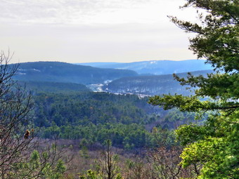 Over the next .4 miles the trail remained mostly flat but we did gain some elevation. The forest was mostly evergreen and there was almost now snow there. We crossed a small bridge and passed a lean-to and privy. There were several blowdown which were too big to move so we walked around them. At 1.2 miles the trail split. The yellow trail turned left while a red trail marked TMR continued straight ahead. As I was contemplating which choice I would make, an unleashed dog appeared from farther untie yellow trail. As soon as the dog saw us, he turned around and walked back u the trail. I decided we would stay on the yellow trail and so we turned left. Within a few hundred feet, we met the dog again and the people he was hiking with. The owner leashed the dog which wasn't really necessary and we stopped to talk briefly. Sheila and I continued on the trail which began to gain some elevation as it headed due north. We came to a mound of rock on the right side of the trail which I knew represented the castoff stone from the quarries. I took some pictures before stowing my camera and climbing the hill to the top of the pile of stones. On the left side of the trail was one of the quarries which was an extended cut along some cliffs. I stopped to take some pictures of the cut and the piles of discarded rock. We returned to the main trail where I took a few more pictures. I walked straight ahead while Sheila turned up the hill at about 1.5 miles. I called her back but then realized she was following the trail. I should know by now that Sheila has an uncanny ability to stay on trails even I they have not been recently traveled! We walked to the top of the steep but short climb where the trail turned left. The trail gained a little more elevation and then flattened as it followed the edge of the mountain. Some views were available through the trees but there is a better view at the highest point on the trail. I did stop to take a picture of a flat stone that had been removed from the quarry but not used. This stone had drill marks along the edge which were used to score the stone.
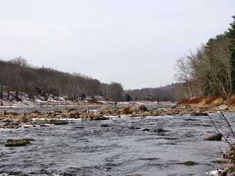 We continued heading due west until we came to the last short, steep climb to the highest point on the trail. The lookout here gave an expansive view so I took some shots. There was a haze over the valley and surrounding hills and the sun was directly ahead. Even though the conditions were not the best, I took pictures. When I finished, I packed up and we continued on the trail along the edge of the summit plateau which, being exposed to the sun, had little or no snow. At about 1.9 miles the trail turned to the left and started to descend to the southwest. I could see there was almost now snow on the trail ahead and decided to remove my spikes. The trail widened as it joined a woods road and the descent went quickly. As we started to get to a lower elevation where more trees covered the path, the snow returned. I debated putting the spikes back on but kept them off and walked in the softer snow beside the trail. I was surprised when the register box came into sight at 2.4 miles. We turned right to walk out to the woods road and I saw two boys stop briefly at the trail entrance and then continue north on the road. We walked out to the road and turned left to get back to the car. The road was still slippery but I continued to walk along the side to avoid the worst of the ice. I stopped at the quarry I had seen on the way out and took some shots. From that point on we just walked along the road, over the bridge, and back to the car. I put Sheila in the car and grabbed the camera. I walked down the bank to the Delaware River and took some pictures up and down the river. The water was flowing swiftly but there was some ice gathered near the shore. After taking some shots, I returned to the car. We had hiked 3 miles in just under 2 hours with an elevation gain of only 620 feet. I thought about going to Cobey Pond but decided to return home and leave it for another day.
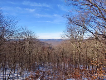
![]()
![]()
![]()
![]()
![]() On Monday, December 23rd, I asked Cindy if she would like to hike and she said "Yes". I though about going to the Hodge Pond Lookout to see what the view looked like without the leaves on the trees. Sheila seemed to be very excited about going as soon as she realized we both were getting out hiking clothes. The temperature at the house was pushing 40 degrees so I knew I would not need to dress too warmly. I put on my long-sleeved Mammut crew top with a light long-sleeved baselayer underneath. I decided to wear my Columbia Titanium insulated pants to keep the chill away but decided against wearing tights underneath. I wore my Salomon B-52 insulated boots even though there was no snow as they keep my feet warm and are waterproof. I grabbed a pair of Leki poles with external locks that I have been using lately. Finally, I also donned my Mammut hoody which blocks the wind and keeps me warm but has enough zippers to dump heat when needed. I decided against snowshoes but put my microspikes in my pack in case they were needed. We got our gear into the car, put Sheila in the backseat and headed off to the trailhead at 11:30 AM. I drove out the DeBruce Road about 6 miles to Mongaup Road. I turned left and continued up the road to the point where it splits. I stayed left on Beech Mountain Road and drove to the parking areas on the left. I pulled into the smaller parking area and noticed that there were no other cars. It was 11:45 PM when I set my GPS unit and we crossed the road to head up the Flynn Trail with the temperature at 41 degrees. We walked through the trail in the woods to get to the woods road that continued toward Hodge Pond. I had given Cindy my microspikes as she had forgotten hers and the trail was snow-covered and somewhat slippery. When we turned right on the woods that is the beginning of the Flynn Trail, there was one set of footprints that looked several days old. I was surprised the trail was so lightly used and that there were no other hikers out on such a beautiful day. We set a fast pace up the Flynn Trail powered by the beautiful weather but somewhat hindered by the slippery conditions. I removed several branches and one larger blowdown along the way. The Flynn Trail is uphill all the way for the first 1.7 miles to the Big Rock Junction and on this day it took almost an hour. We continued through the junction and passed through the gate which is the boundary between state land and OSI popery. We continued on the trail to the point where the Flynn Trail heads downhill to Hodge Pond. Here we turned to the right on a woods road and walked along the "high road" to the junction of some roads above the pond. At this junction a road turns left to go down to the pond. Just a little further on the road splits with the left fork passing by the old Beech Mountain Boy Scout Camp and ending up on Shin Creek Road in Lew Beach. We continued straight ahead to climb the road up the hill. The road was a little steeper than I remembered and a little longer. Up to this point Cindy had been right behind me but on the uphill she began to lad behind. The sun had started to melt some of the snow and ice which made the surface even slipperier but these were easily avoided.
On Monday, December 23rd, I asked Cindy if she would like to hike and she said "Yes". I though about going to the Hodge Pond Lookout to see what the view looked like without the leaves on the trees. Sheila seemed to be very excited about going as soon as she realized we both were getting out hiking clothes. The temperature at the house was pushing 40 degrees so I knew I would not need to dress too warmly. I put on my long-sleeved Mammut crew top with a light long-sleeved baselayer underneath. I decided to wear my Columbia Titanium insulated pants to keep the chill away but decided against wearing tights underneath. I wore my Salomon B-52 insulated boots even though there was no snow as they keep my feet warm and are waterproof. I grabbed a pair of Leki poles with external locks that I have been using lately. Finally, I also donned my Mammut hoody which blocks the wind and keeps me warm but has enough zippers to dump heat when needed. I decided against snowshoes but put my microspikes in my pack in case they were needed. We got our gear into the car, put Sheila in the backseat and headed off to the trailhead at 11:30 AM. I drove out the DeBruce Road about 6 miles to Mongaup Road. I turned left and continued up the road to the point where it splits. I stayed left on Beech Mountain Road and drove to the parking areas on the left. I pulled into the smaller parking area and noticed that there were no other cars. It was 11:45 PM when I set my GPS unit and we crossed the road to head up the Flynn Trail with the temperature at 41 degrees. We walked through the trail in the woods to get to the woods road that continued toward Hodge Pond. I had given Cindy my microspikes as she had forgotten hers and the trail was snow-covered and somewhat slippery. When we turned right on the woods that is the beginning of the Flynn Trail, there was one set of footprints that looked several days old. I was surprised the trail was so lightly used and that there were no other hikers out on such a beautiful day. We set a fast pace up the Flynn Trail powered by the beautiful weather but somewhat hindered by the slippery conditions. I removed several branches and one larger blowdown along the way. The Flynn Trail is uphill all the way for the first 1.7 miles to the Big Rock Junction and on this day it took almost an hour. We continued through the junction and passed through the gate which is the boundary between state land and OSI popery. We continued on the trail to the point where the Flynn Trail heads downhill to Hodge Pond. Here we turned to the right on a woods road and walked along the "high road" to the junction of some roads above the pond. At this junction a road turns left to go down to the pond. Just a little further on the road splits with the left fork passing by the old Beech Mountain Boy Scout Camp and ending up on Shin Creek Road in Lew Beach. We continued straight ahead to climb the road up the hill. The road was a little steeper than I remembered and a little longer. Up to this point Cindy had been right behind me but on the uphill she began to lad behind. The sun had started to melt some of the snow and ice which made the surface even slipperier but these were easily avoided.
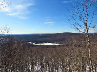 I slowed my pace to allow Cindy to catch up some and we soon passed an old quarry where the trail leveled some. The trail began to gain elevation again and we passed by a spring house on the right. At 2.6 miles we came to a lookout on the left of the trail. The lookout had been "cut out" so that the hills and valleys beyond were much more visible. I stopped to take a few pictures and to wait for Cindy. When she arrived at the lookout, she told me to continue as she took a break. I followed the road which made a sharp right turn. Just after this the road turned to the left but another trail branched off to the right. Sheila and I turned onto the trail on the right which was well defined but covered in snow. After a slight incline, we walked to 2.9 miles over flat ground to the Hodge Pond Lookout. This lookout had also been cut out giving a much better view than I had seen in years. I dropped my pack and took some pictures of the pond below and the hills in the distance. I also took some pictures of the rocks on the other side of the trail from the lookout and a few of the snow on the trail. I grabbed a drink and then turned back on the trail to return to where Cindy was waiting. When I reached Cindy, We headed back down the hill. The trip down was a little more exciting than the trip up due to the slippery spots that seemed much slipperier on the way down! When we got to the base of the hill at the junction of the roads, I stopped to take a few pictures of the old cabins from the Beech Mountain Boy Scout Camp. I had planned to walk down to Hodge Pond but Cindy asked that we continue straight ahead to the Flynn Trail. We walked out to the Flynn Trail, turned left and were soon at the junction with the Big Rock Trail at 4.6 miles. My plan was to hike down the Big Rock Trail and to walk around the back of Frick Pond. Again, Cindy asked that we take the Flynn Trail directly back to the car. I hate out and back hikes but I knew she was hurting so we continued straight ahead. The trip down the Flynn Trail seemed to take forever even though it felt we were setting a faster pace. Every time it seemed we were nearing the end, there was another section of trail. Finally, the large hemlock across the trail came into sight. We passed through the arch we had cut through the tree and turned left on the Flynn Trail to avoid the private property around the cabin. We walked the trail back to the car arriving at 2:50 PM. We had hiked 5.8 miles in 3 hours gaining 1020 feet along the way.
![]()
![]()
![]()
![]() On Saturday, December 21st I planned to sleep late as I had returned hoe just before midnight from a track meet at West Point. A morning ambulance call changed that plan. When I got home from the call, I did some chores around the house and then took a nap. By 2:15 PM I was ready to get outside to do some kind of hike. I decided to just go across the street and remove a large blowdown on Round Top. Sheila was ready to go as she really likes the snow and she was keeping a careful eye on me as I started to get ready. Sheila misses the hiking as much as I do since I have returned to full-time teaching for the rest of this school year! I started to get ready with the temperature hovering just below 30 degrees. I put on my long-sleeved Mammut crew top with a light long-sleeved baselayer underneath. I decided to wear my Columbia Titanium insulated pants to keep the chill away but decided against wearing tights underneath. I wore my Salomon B-52 insulated boots even though there was no snow as they keep my feet warm and are waterproof. I grabbed my Fiskars axe instead of a pair of hiking poles. Finally, I also donned my Mammut hoody which blocks the wind and keeps me warm but has enough zippers to dump heat when needed. I decided against snowshoes or microspikes since I planned to hike the gentle slope of the woods road to the blowdown and then return home. At 2:45 PM Sheila and I walked out the door to start the hike. I grabbed Sheila's leash from the car and we walked up the driveway. The driveway was the first indication that spikes might have been a good idea. The ice and packed snow made the driveway a slippery mess so I had to walk on the snow along the edge. Sheila was happy to get out as we headed down the driveway and across the street. We crossed the street and walked through the field to the back of the Presbyterian Church. We walked to the back of the church and began the ascent of the steepest hill behind the church. The hill is short but gets the circulation pumping and is the steepest and longest climb on the "trail." Sheila helped me along by pulling me up the hill which was covered in snow and ice.
On Saturday, December 21st I planned to sleep late as I had returned hoe just before midnight from a track meet at West Point. A morning ambulance call changed that plan. When I got home from the call, I did some chores around the house and then took a nap. By 2:15 PM I was ready to get outside to do some kind of hike. I decided to just go across the street and remove a large blowdown on Round Top. Sheila was ready to go as she really likes the snow and she was keeping a careful eye on me as I started to get ready. Sheila misses the hiking as much as I do since I have returned to full-time teaching for the rest of this school year! I started to get ready with the temperature hovering just below 30 degrees. I put on my long-sleeved Mammut crew top with a light long-sleeved baselayer underneath. I decided to wear my Columbia Titanium insulated pants to keep the chill away but decided against wearing tights underneath. I wore my Salomon B-52 insulated boots even though there was no snow as they keep my feet warm and are waterproof. I grabbed my Fiskars axe instead of a pair of hiking poles. Finally, I also donned my Mammut hoody which blocks the wind and keeps me warm but has enough zippers to dump heat when needed. I decided against snowshoes or microspikes since I planned to hike the gentle slope of the woods road to the blowdown and then return home. At 2:45 PM Sheila and I walked out the door to start the hike. I grabbed Sheila's leash from the car and we walked up the driveway. The driveway was the first indication that spikes might have been a good idea. The ice and packed snow made the driveway a slippery mess so I had to walk on the snow along the edge. Sheila was happy to get out as we headed down the driveway and across the street. We crossed the street and walked through the field to the back of the Presbyterian Church. We walked to the back of the church and began the ascent of the steepest hill behind the church. The hill is short but gets the circulation pumping and is the steepest and longest climb on the "trail." Sheila helped me along by pulling me up the hill which was covered in snow and ice.
There was a few inches of snow and then ice on top as we started on the trail by turning left at the trailhead. I let Sheila off her leash so that she could explore. The trail was completely covered in snow and ice. At the first trail junction, we turned right and started up the woods road where the walking was relatively easy. We turned off left off the woods road to follow the trail and immediately ran into the blowdown. I got right to work by clearing a few loose branches. I grabbed the axe and cut the top out of one of the trees that had fallen. The cuts went quickly as the wood was frozen. I dragged the two large branches off the trail and then removed a few more large branches. Another cut freed a large branch which I removed. One other small trunk had to be removed and I was almost done. I cut a large section of the trunk as it was hanging over onto the trail and then moved it to the side. The whole process had taken about 20 minutes. As I finished Sheila began to run up the trail. It was still early enough to take a little walk so I followed her up to the junction with the blue trail. I decided we would do a figure 8 as I did not want to come down the steeper side of the hill. We turned left and walked along the base of Round Top to the next trail junction. Here we turned right and began the climb to the summit. It seemed clear to me that the only tracks on the trail were the ones I had put there on the previous Tuesday. My tracks were frozen and it was difficult going without poles or any traction on my feet. At the top we crossed the flat summit and began to descend the other side. The descent was also slippery so I hung on to a few trees on the way down. At the junction with the yellow trail we turned right and again walked the yellow trail to the junction with the blue trail, This time we turned left and followed it downhill to the lookout. We continued to follow the yellow trail as it turned left and took us downhill to the first trail junction. I thought we were done but Sheila turned around and headed back up the trail to the lookout. I decided we would do a small loop so I followed her back up to the viewpoint. We followed the yellow trail as it turned right and continued to the junction with the blue trail. A right turn took us along the base of Round Top to the second junction with the blue trail. We turned right and followed the yellow trail down to the woods road. As we passed by the blowdown I had cleared I inspected the work and found it to be a good job. When we arrived at the first trail junction we turned left and walked out to the trailhead. I put Sheila on her leash and we walked down the hill, out through the church parking lot to the road and to our driveway. It was 4:00 PM and we had hiked about 2 miles in just over an hour including the time to do the trail work.