
What You Missed
Winter 2012-2013
Winter 2012-2013
![]()
![]()
![]()
![]()
![]() On Saturday, March 16th, Cindy and I had already hiked at Ferncliff Forest near Rhinecliff and had visited the tower on Stissing Mountain near Pine Plains. The last visit I had planned was to the Ninham Fire Tower in northern Putnam County. This was the tower that I had the least information about. I had planned to take the Taconic Parkway south to pick up Route 301 but the GPS had a slightly different route. When we got to Route 301 near Fahnestock Park, we turned right. By this time the skies were completed cloudy over and there was snow in the air. The further we drove the more snow fell. When we passed Fahnestock Park, I had an ideas that we were going in the wrong direction! After consulting the map, we turned around and headed in the opposite direction on 301. Soon we were passing West Branch Reservoir on the right with more snow falling. Just before 301 crossed the reservoir and entered Carmel, we turned right on Gypsy Trail Road (Route 41). We drove about 2 miles and found a sign for the Ninham Multiple Use Area on the right. We pulled in and parked and got ready to hike. There was almost no information at the kiosk but a gate road headed east out of the parking area. We walked down through some stone walls toward a pond but there was no indication of a tower. We turned around and saw a mountain biker headed toward us. We asked him about the tower and he told us it was a little farther down the road. We thanked him and walked back to the car. We continued for a short distance along Gypsy Trail Road. Just after a sharp bend, we found Mount Ninham Court on the left about 2.3 miles from Route 301. I turned left and drove to the end of the road where there was a small parking area. It was now 3:55 PM and the snow was light but steady.
On Saturday, March 16th, Cindy and I had already hiked at Ferncliff Forest near Rhinecliff and had visited the tower on Stissing Mountain near Pine Plains. The last visit I had planned was to the Ninham Fire Tower in northern Putnam County. This was the tower that I had the least information about. I had planned to take the Taconic Parkway south to pick up Route 301 but the GPS had a slightly different route. When we got to Route 301 near Fahnestock Park, we turned right. By this time the skies were completed cloudy over and there was snow in the air. The further we drove the more snow fell. When we passed Fahnestock Park, I had an ideas that we were going in the wrong direction! After consulting the map, we turned around and headed in the opposite direction on 301. Soon we were passing West Branch Reservoir on the right with more snow falling. Just before 301 crossed the reservoir and entered Carmel, we turned right on Gypsy Trail Road (Route 41). We drove about 2 miles and found a sign for the Ninham Multiple Use Area on the right. We pulled in and parked and got ready to hike. There was almost no information at the kiosk but a gate road headed east out of the parking area. We walked down through some stone walls toward a pond but there was no indication of a tower. We turned around and saw a mountain biker headed toward us. We asked him about the tower and he told us it was a little farther down the road. We thanked him and walked back to the car. We continued for a short distance along Gypsy Trail Road. Just after a sharp bend, we found Mount Ninham Court on the left about 2.3 miles from Route 301. I turned left and drove to the end of the road where there was a small parking area. It was now 3:55 PM and the snow was light but steady.
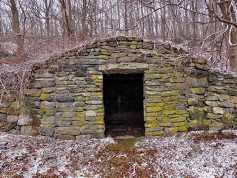
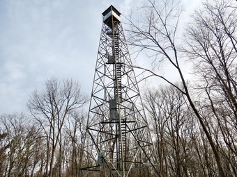
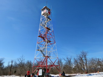
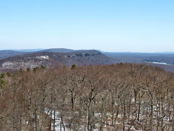
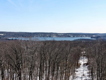
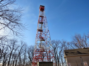
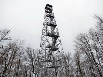
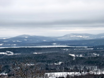
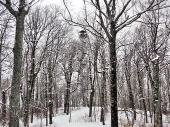
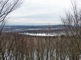
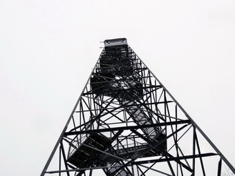 Again there was a kiosk without much information. We had to decide whether to take the road that went straight ahead or the one to the left. The road that went straight ahead had some power lines and phone cables along it which I decided probably went to the transmission towers that shared the summit with the fire tower. Before we left the parking area, I stopped to take pictures of the stone chamber. There are several of these chambers on the mountain and some claim they are very old and of Celtic origin. They don't look THAT old to me! We walked up the road which soon made a seeping right turn to head almost north toward the top of the mountain. The road was gravel but it was not flat. By 4:15 PM we had walked the .75 miles to the summit gaining just under 400 feet. This was another tower surrounded by trees and it was hard to get a clear picture. I decided to climb to the top even though I knew that the clouds and snow would be obscuring any view. As I mounted the first flight of stairs they seemed not very secure but I continued anyway. The steps were steel with serrated treads but the landings were wooden. The snow accumulating on those wooden landings was slippery! I again stopped below the cab to take some pictures. There really was no view so I climbed up into the cab. There is no roof on the cab and it reminded me of how poorly we treat our history. I climbed back down and we began our trip back down the road. I stopped to take some pictures of another chamber and of some stone walls. The stones in these walls were much larger than any I had ever seen before and there were a lot of walls throughout the area. On the way down we called Kurt to tell him to meet us for dinner. We arrived in the parking area at 4:45 PM after hiking 1.4 miles in 45 minutes. Cindy and I were both looking forward to dinner as we drove away following the voice of the GPS.
![]()
![]()
![]()
![]()
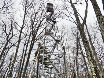
![]() On Saturday, March 16th, Cindy and I had already hiked at Ferncliff Forest near Rhinecliff and visited the tower there. We entered an approximate address for the Stissing Mountain Thompson Pond area and followed the directions. We followed Route 199 east until just before the village of Pine Plains. On our way we could see the tower high on a mountain just to the south of the road. There are several different trails to the top of the mountain but I had read conflicting stories about them. Many of these stories asserted that two of the approaches crossed private land and that any easements had been revoked. I decided we would use the trail from the Thompson Pond area on Lake Road and so we made the turn south off Route 199. We drove along the road for about 1.7 miles and found a gate on the right side of the road. The only information indicated that the Thompson Pond area is often flooded. There was no indication that there was a tower on a mountain. Looking back down the road in the direction we had come I noticed what looked like a cleft between the two mountains. The tower is on Stissing Mountain but Little Stissing Mountain lies just to the northeast. We drove back down the road and parked at a small lot on the east side of the road. Directly across from this was a woods road with a gate. This parking area is about 1.5 miles from Route 199. We crossed the road at about 12:15 PM, walked through the gate and began to immediately climb. The road was very eroded so we walked along the side when we could. There was only a little snow and ice at this elevation. After a little more than .25 miles we came to a fork in the trail marked by a stone cairn. I decided we would climb the steeper trail to the left and descend the more gentle one to the right. For the next .5 miles the trail averaged a 23% grade with some spots flatter and others steeper. There wasn't much snow but there were patches of ice. We were able to work around the icy areas and by 1:00 PM we were at the tower after only .75 miles.
On Saturday, March 16th, Cindy and I had already hiked at Ferncliff Forest near Rhinecliff and visited the tower there. We entered an approximate address for the Stissing Mountain Thompson Pond area and followed the directions. We followed Route 199 east until just before the village of Pine Plains. On our way we could see the tower high on a mountain just to the south of the road. There are several different trails to the top of the mountain but I had read conflicting stories about them. Many of these stories asserted that two of the approaches crossed private land and that any easements had been revoked. I decided we would use the trail from the Thompson Pond area on Lake Road and so we made the turn south off Route 199. We drove along the road for about 1.7 miles and found a gate on the right side of the road. The only information indicated that the Thompson Pond area is often flooded. There was no indication that there was a tower on a mountain. Looking back down the road in the direction we had come I noticed what looked like a cleft between the two mountains. The tower is on Stissing Mountain but Little Stissing Mountain lies just to the northeast. We drove back down the road and parked at a small lot on the east side of the road. Directly across from this was a woods road with a gate. This parking area is about 1.5 miles from Route 199. We crossed the road at about 12:15 PM, walked through the gate and began to immediately climb. The road was very eroded so we walked along the side when we could. There was only a little snow and ice at this elevation. After a little more than .25 miles we came to a fork in the trail marked by a stone cairn. I decided we would climb the steeper trail to the left and descend the more gentle one to the right. For the next .5 miles the trail averaged a 23% grade with some spots flatter and others steeper. There wasn't much snow but there were patches of ice. We were able to work around the icy areas and by 1:00 PM we were at the tower after only .75 miles.
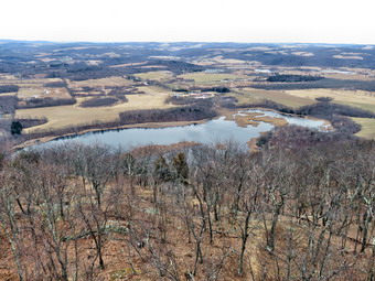 Once at the tower I dropped my pack and leashed Sheila to a tree. It was hard to get pictures of the tower as it is surrounded by trees. The temperature seemed to be dropping some as I got ready to climb the tower. Cindy decided to stay on the ground this time. I climbed to the landing below the tower and took pictures. This time the views to the east were better than those to the west. Directly below were Stissing Pond and Thompson Pond. These ponds have a bog environment which was evident in their formation even from far above. Further to the east I could see the Taconics. I took many photographs before climbing into the cab of the tower to look around. I descended the tower and shared a drink and a snack with Cindy before heading back down. We walked passed the tower on the trail to an area where one trail continued straight ahead and the other headed down. I was aware that heading in the wrong direction would put us far from the car. In addition, the trail we were on that headed down was very icy. At the bottom of a short descent the trail turned right to parallel our route up the mountain. At this point the ice was so prevalent that we decided to put on the spikes. We walked easily over the ice for the next .25 miles before it was obvious the spikes were no longer needed. We crossed a small brook and continued to head down the mountain. I caught am glimpse of Little Stissing and it was clear we were headed between the two mountains. At 1.6 miles we were back at the stone cairn and we retraced our steps to the car. We had covered 1.9 miles in about 1.5 hours with a long stop at the tower. Now it was on to the Ninham Mountain Fire Tower in northern Putnam County.
![]()
![]()
![]()
![]()
![]() On Saturday, March 16th, I asked Cindy if she would like to go somewhere to hike. She said "Yes" but I knew she would not want to hike any huge mountains or for very many hours. I suggested we go to some towers on the east side of the Hudson River and end the day by inviting Kurt, Aimee and Ariana to dinner at the Mayan Café in Wappingers Falls. She agreed and I called Kurt to arrange the dinner part. We knew that dogs were allowed where we were going as long as they were on a leash. I forgot the leash so we stopped to get one on the way. We headed toward Kingston and crossed the Kingston Rhinecliff Bridge on Route 199 with our first objective the tower at Ferncliff Forest between Rhinecliff and Rhinebeck. My directions were from Rhinebeck heading north so we turned south on river Road in Rhinecliff to head toward Rhinebeck. In only a few miles the road split and we turned left on Mount Rutsen Road which was the road we were going to take north from Rhinebeck! In about half a mile a parking area appeared on the right. The sign said "Ferncliff Forest" so we pulled in to park at about 10:15 AM. I had not brought our snowshoes but had packed the spikes just in case. One look around the parking area confirmed this decision as we saw only a few patches of snow or ice. There was a brochure at the kiosk but it had no map and there was no map at the kiosk. We headed up the wide road that led out of the parking area and almost immediately were on the shores of a small pond. There were some geese on the pond and there was a pavilion and a lean-to. We had no idea which way to go but a sign marked "Tower" appeared to point to the right, so we turned right along a trail. A chained off area on the left of the trail protected a brick arch at ground level. The arch seemed to lead to an old foundation. Further along the trail was another chamber which was more exposed. Surprisingly a five foot deep brick cistern on the right side of the trail was completely unprotected! The trail we were on head back down toward the road so we turned left on an unmarked path which ran into the East Tower Trail. We followed this trail to the tower. The total walk was .8 miles.
On Saturday, March 16th, I asked Cindy if she would like to go somewhere to hike. She said "Yes" but I knew she would not want to hike any huge mountains or for very many hours. I suggested we go to some towers on the east side of the Hudson River and end the day by inviting Kurt, Aimee and Ariana to dinner at the Mayan Café in Wappingers Falls. She agreed and I called Kurt to arrange the dinner part. We knew that dogs were allowed where we were going as long as they were on a leash. I forgot the leash so we stopped to get one on the way. We headed toward Kingston and crossed the Kingston Rhinecliff Bridge on Route 199 with our first objective the tower at Ferncliff Forest between Rhinecliff and Rhinebeck. My directions were from Rhinebeck heading north so we turned south on river Road in Rhinecliff to head toward Rhinebeck. In only a few miles the road split and we turned left on Mount Rutsen Road which was the road we were going to take north from Rhinebeck! In about half a mile a parking area appeared on the right. The sign said "Ferncliff Forest" so we pulled in to park at about 10:15 AM. I had not brought our snowshoes but had packed the spikes just in case. One look around the parking area confirmed this decision as we saw only a few patches of snow or ice. There was a brochure at the kiosk but it had no map and there was no map at the kiosk. We headed up the wide road that led out of the parking area and almost immediately were on the shores of a small pond. There were some geese on the pond and there was a pavilion and a lean-to. We had no idea which way to go but a sign marked "Tower" appeared to point to the right, so we turned right along a trail. A chained off area on the left of the trail protected a brick arch at ground level. The arch seemed to lead to an old foundation. Further along the trail was another chamber which was more exposed. Surprisingly a five foot deep brick cistern on the right side of the trail was completely unprotected! The trail we were on head back down toward the road so we turned left on an unmarked path which ran into the East Tower Trail. We followed this trail to the tower. The total walk was .8 miles.
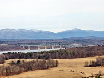 The tower is an International Derrick which was moved from South Carolina and erected at Ferncliff a few years ago. We took pictures from the ground of the tower and the leashed Sheila to a picnic table before climbing the tower. Sheila will try to follow us and does a pretty good job of climbing up. She is less enthuse about climbing down! We climbed to the top of the tower and found the cab open. The views to the east were OK but those to the west were outstanding. The Hudson River was below us with the bridge clearly visible. Below on the eastern shore were some fields separated by lines of trees. I took a lot of pictures in this direction at various zooms. On the eastern shore below was an interesting collection of buildings. The main building had what looked like a steeple but the rest of the building looked more like a barn. On the western shore were some industrial buildings. It was a little colder above the tree line so we headed back down. We decided to take the West Tower Trail back to form a loop since we knew we would not be hiking too much. The trail wound around a little but soon a sign advised us to take the Circle Trail back. This trail passed through some wet areas but we were soon on the opposite side of the pond we had seen earlier. We walked around the pond and then retraced our steps to the car. The total hike was two miles. I know that this area is a favorite when the weather gets warmer and I was glad to see it when nobody else was around! We were ready to head south to Stissing Mountain.
![]()
![]()
![]()
![]()
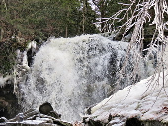
![]() On Thursday, March 14th, I was up early with plans to return to the Neversink Unique Area where I had been the day before. When I returned home on Wednesday and looked at the pictures of Mullet Falls, I was very disappointed. Apparently wiping a lens with the sleeve of a hiking softshell does not clean it sufficiently to take pictures! Most of the pictures from Mullet Falls were obscured by the smudges and smears on the lens! Sheila and I arrived at the Parking area at 9:35 AM and started our hike right away. There had been a snow squall in the evening which left a layer of snow on top of the ice. In addition, the temperature had dropped by about 15 degrees and the thermometer on my car read just over 20 degrees. We walked down to the first trail junction and turned left. My experiences from the day before led me to don my spikes at this point. We approached the first bridge and water crossing. Little had changed from the day before and we had no problem crossing. When we reached the top of the rise and were at the second trail junction, I decided to go left this time and do the loop in the reverse of the day before. I kept my spikes on a we hiked up the hill to the top of the ridge. After making the right at the top to stay on the main trail we walked the flat section for a little while. As we started to descend after the upper bridge, the trail was covered with packed snow and ice. On the descent on the other side, I watched for the spur trail to Mullet Falls on the right. After making the turn, we walked to the falls arriving at 10:40 AM after hiking 2.25 miles. I dropped my pack and leashed Sheila to a tree. I did not ant her rolling in some evil smelling mess as she did the day before! The falls were just as impressive as the day before in the volume of water and volume of sound. Since the air temperature was below freezing, the mist from the falls was freezing on the branches of the trees. The falls was still producing spray but the wind was blowing a little upstream this time. I took pictures from the trail and then ventured out onto the ice-coated rocks to get more pictures. I too some good shots from directly in front of the falls and moved up to take some of the plunge pool. When I finished, I return to pick up my pack and my dog and head back to the main trail. We turned right and were soon at the trail junction with the trail to High Falls. We turned right to complete the loop and bypassed the spur trail to Denton Falls. The rest of the hike went quickly and we were back at the car by 11:30 AM having hike 4.1 miles in under 2 hours! The pictures were much better this time and I combined the two days into one album.
On Thursday, March 14th, I was up early with plans to return to the Neversink Unique Area where I had been the day before. When I returned home on Wednesday and looked at the pictures of Mullet Falls, I was very disappointed. Apparently wiping a lens with the sleeve of a hiking softshell does not clean it sufficiently to take pictures! Most of the pictures from Mullet Falls were obscured by the smudges and smears on the lens! Sheila and I arrived at the Parking area at 9:35 AM and started our hike right away. There had been a snow squall in the evening which left a layer of snow on top of the ice. In addition, the temperature had dropped by about 15 degrees and the thermometer on my car read just over 20 degrees. We walked down to the first trail junction and turned left. My experiences from the day before led me to don my spikes at this point. We approached the first bridge and water crossing. Little had changed from the day before and we had no problem crossing. When we reached the top of the rise and were at the second trail junction, I decided to go left this time and do the loop in the reverse of the day before. I kept my spikes on a we hiked up the hill to the top of the ridge. After making the right at the top to stay on the main trail we walked the flat section for a little while. As we started to descend after the upper bridge, the trail was covered with packed snow and ice. On the descent on the other side, I watched for the spur trail to Mullet Falls on the right. After making the turn, we walked to the falls arriving at 10:40 AM after hiking 2.25 miles. I dropped my pack and leashed Sheila to a tree. I did not ant her rolling in some evil smelling mess as she did the day before! The falls were just as impressive as the day before in the volume of water and volume of sound. Since the air temperature was below freezing, the mist from the falls was freezing on the branches of the trees. The falls was still producing spray but the wind was blowing a little upstream this time. I took pictures from the trail and then ventured out onto the ice-coated rocks to get more pictures. I too some good shots from directly in front of the falls and moved up to take some of the plunge pool. When I finished, I return to pick up my pack and my dog and head back to the main trail. We turned right and were soon at the trail junction with the trail to High Falls. We turned right to complete the loop and bypassed the spur trail to Denton Falls. The rest of the hike went quickly and we were back at the car by 11:30 AM having hike 4.1 miles in under 2 hours! The pictures were much better this time and I combined the two days into one album.
![]()
![]()
![]()
![]()
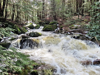
![]() On Wednesday, March 13th, Lisa called early in the morning to discuss a possible hike. We had tentatively planned to hike Bramley Mountain near Delhi on Tuesday but heavy rain forced a postponement. We decided that it might be too wet to head to Bramley but that the Neversink Unique Area in Rock Hill might be a good choice. I got my equipment ready, put Sheila in the back seat and picked Lisa up at her store around 9:00 AM. I had put on a baselayer since the temperature was still in the high 20's. I decided to leave the snowshoes home but packed the spikes as I though there might be some ice. We arrived at the parking area on Katrina Falls Road at about 9:40 AM and got ready to hike immediately. There was almost no snow when we started out but by the time we made the turn at the bottom of the hill we ran into patches of ice. Lisa immediately put on her spikes but I tried to walk around the icy areas. It wasn't long before I admitted that putting the spikes on would be much easier! We arrived at the first water crossing at the little wooden bridge across Wolf Brook. The water was high and making a suitable roaring sound. A little further on another arm of the stream had worked its way across the trail but was narrow enough to let us pass. We stopped to take some pictures and I took a short video for the visual and auditory effect. We crossed the brook and walked up the hill to the trail junction. I had planned to walk the loop and decided to bear right. The trail alternated between patches of ice and snow and completely bare spots. Soon we were in the area of Mullet Brook and the bridge that crosses below the falls. Here again the water was raging so we stopped for pictures. I worked my way down the bank and walked downstream a little to get the best shots. Sheila looked like she wanted to swim but I discouraged her. Despite my efforts she jumped in at least once near the bank in the calmer areas. After taking some pictures and a video, we walked back to the main trail and over the bridge.
On Wednesday, March 13th, Lisa called early in the morning to discuss a possible hike. We had tentatively planned to hike Bramley Mountain near Delhi on Tuesday but heavy rain forced a postponement. We decided that it might be too wet to head to Bramley but that the Neversink Unique Area in Rock Hill might be a good choice. I got my equipment ready, put Sheila in the back seat and picked Lisa up at her store around 9:00 AM. I had put on a baselayer since the temperature was still in the high 20's. I decided to leave the snowshoes home but packed the spikes as I though there might be some ice. We arrived at the parking area on Katrina Falls Road at about 9:40 AM and got ready to hike immediately. There was almost no snow when we started out but by the time we made the turn at the bottom of the hill we ran into patches of ice. Lisa immediately put on her spikes but I tried to walk around the icy areas. It wasn't long before I admitted that putting the spikes on would be much easier! We arrived at the first water crossing at the little wooden bridge across Wolf Brook. The water was high and making a suitable roaring sound. A little further on another arm of the stream had worked its way across the trail but was narrow enough to let us pass. We stopped to take some pictures and I took a short video for the visual and auditory effect. We crossed the brook and walked up the hill to the trail junction. I had planned to walk the loop and decided to bear right. The trail alternated between patches of ice and snow and completely bare spots. Soon we were in the area of Mullet Brook and the bridge that crosses below the falls. Here again the water was raging so we stopped for pictures. I worked my way down the bank and walked downstream a little to get the best shots. Sheila looked like she wanted to swim but I discouraged her. Despite my efforts she jumped in at least once near the bank in the calmer areas. After taking some pictures and a video, we walked back to the main trail and over the bridge.
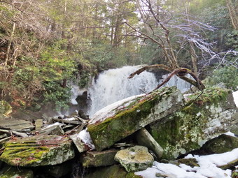 After crossing the bridge and walking uphill, we turned right on the trail that goes down to Denton Falls. There was little ice or snow on this trail and we were soon descending the final piece of the trail down to the Neversink arriving at 10:50 after hiking 1.85 miles. I decided to put Sheila on her leash just in case she wanted to go for a swim. The river was high and flowing as fast as I have ever seen it. I didn't want to have to pick up Sheila in Port Jervis! I was able to walk along the rocks to get just below the falls. I took quite a few pictures and shot another video. I made sure that the pictures overlapped since I thought they would make a nice panorama. The falls are hardly three feet high but the volume of water made the trip worthwhile. We headed back up the trail to the main trail and turned right. At the trail junction we kept to the left to start the loop. The trail straight ahead goes down to High Falls. It adds a bit of distance but the falls aren't too different from Denton Falls. After a brief walk uphill, we turned left onto the short trail down to Mullet Brook Falls. Even as we were making the turn we could hear the falls roaring ahead of us! The path now was covered with packed snow and ice. When the falls came into sight, it was all we could have hoped for. The volume of water was incredible as it shot off the rock ledge and crashed into the plunge pool below. There was one section that was still frozen and some spray had frozen on the trees nearby. I dropped my pack and got out the camera. After a few initial shots, I walked onto the pile of rocks just down from the base of the falls. I tried to take some pictures but the spray from the falls kept wetting the camera lens. I wiped the lens the best that I could. I took pictures of the falls, the pool, the outlet to the pool and the stream below the falls. Eventually it was time to leave and we started back. Sheila came running toward me with a smell the preceded her! She had rolled in something vile that was now covering her front left side! I walked her down to the stream and used her bandana to wash her as much as I could. We walked back out to the main trail and turned left to complete the loop. The trail in this area had a lot of snow and ice. As we climbed we noticed the rocky ledges to our right. Soon we crossed over another bridge spanning Mullet Brook. After a brief walk we were at a trail junction. Straight ahead on the trail leads to the Wolf Lake Multiple Use Area. We turned right and began to descend off the ridge. The snow and ice all but disappeared so I took off my spikes which made walking easier. The air was warmer than when we started but there was also a breeze. We hiked downhill for some time and eventually came to the trail junction just above the bridge over Wolf Creek. I thought about leaving my spikes off but did not want to spoil the day with a fall or a step into the brook or both! Once on the other side of the brook we made the right turn on the woods road back to the car and kept a quick pace until we arrived at the parking area at 12:50 PM. We hiked 4.9 miles in 3 hours and 10 minutes.
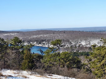
![]()
![]()
![]()
![]()
![]() On Saturday, March 9th,I decided to implement a plan I had been researching all week. The history of using towers to observe forest fires has always interested me. My grandfather was a new York State Forest Ranger associated with the Chapin Hill Tower near the Toronto Reservoir in southern Sullivan County. He was the ranger in that area from 1925 to 1959 and I remember him bringing his Studebaker fire truck home every evening from work. I have visited the five restored fire towers in the Catskills and several that are abandoned. I have also visited other towers in Harriman Park and in Delaware County. New York has only one active tower located in Sterling Forest on the new York-New Jersey border but New Jersey has 21 active towers divided into three districts covering the northern, central and southern areas of the state. I had visited four of the towers in District A, the northern district but did not get good pictures of two of those towers. My plan was to drive to the Delaware Water Gap to hike to the Culvers and Catfish Towers. These were the two I had been to before but did not photograph. I then wanted to visit the three I had not been to in the northern district. These three towers were in Budd Lake (Budd Lake Tower), Denville (Greystone Tower) and the Ringwood-Wanaque area (Ramapo Tower). None of the sites I could find on the internet were very helpful about the each location of these towers. Some towers that were marked on maps were communications towers. On many maps whether or not a fire tower is marked is "hit or miss". A call to the Andover, New Jersey headquarters of the New Jersey Forest Fire Service helped some. They were a little suspicious of my motives but gave me some information. I used Google Earth and satellite images to actually spot the towers. The Ramapo Tower was the hardest but eventually I spotted it. I was able to form a plan that I thought would get me to all five towers in one day barring any problems and allowing for New Jersey traffic.>
On Saturday, March 9th,I decided to implement a plan I had been researching all week. The history of using towers to observe forest fires has always interested me. My grandfather was a new York State Forest Ranger associated with the Chapin Hill Tower near the Toronto Reservoir in southern Sullivan County. He was the ranger in that area from 1925 to 1959 and I remember him bringing his Studebaker fire truck home every evening from work. I have visited the five restored fire towers in the Catskills and several that are abandoned. I have also visited other towers in Harriman Park and in Delaware County. New York has only one active tower located in Sterling Forest on the new York-New Jersey border but New Jersey has 21 active towers divided into three districts covering the northern, central and southern areas of the state. I had visited four of the towers in District A, the northern district but did not get good pictures of two of those towers. My plan was to drive to the Delaware Water Gap to hike to the Culvers and Catfish Towers. These were the two I had been to before but did not photograph. I then wanted to visit the three I had not been to in the northern district. These three towers were in Budd Lake (Budd Lake Tower), Denville (Greystone Tower) and the Ringwood-Wanaque area (Ramapo Tower). None of the sites I could find on the internet were very helpful about the each location of these towers. Some towers that were marked on maps were communications towers. On many maps whether or not a fire tower is marked is "hit or miss". A call to the Andover, New Jersey headquarters of the New Jersey Forest Fire Service helped some. They were a little suspicious of my motives but gave me some information. I used Google Earth and satellite images to actually spot the towers. The Ramapo Tower was the hardest but eventually I spotted it. I was able to form a plan that I thought would get me to all five towers in one day barring any problems and allowing for New Jersey traffic.>
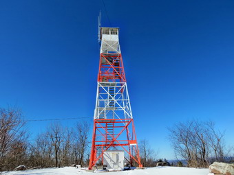 I left Livingston Manor at about 7:45 AM with Sheila in the back seat but without Cindy. She had decided that a lot of riding on back roads would not be enjoyable for her. I put the snowshoes in the car but was planning on weather in the high 40's or low 50's. I wore my Keen Glarus hiking boots but brought along my Salomon B-52's which are my preferred winter boot. I drove down to Port Jervis and through Matamoras to Milford. From there I crossed the Delaware River on Route 206 and headed for the area of Culvers Lake to visit the Culver Tower. There didn't seem to be too much snow along the roads in Sussex County. As I passed Culvers Lake I knew I had gone too far so I doubled back and found North Shore Drive and then the Sunrise Highway. Sunrise was not plowed but there was a parking area just a little past where the two roads met. A Stokes State pickup was plowing the snow and ice out of the lot. While I waited, I looked around and decided to put on my gaiters and winter boots. The temperature was still below freezing and there seemed to be more snow in the woods than along the roads. Sheila was anxious to get going so I parked in the lot when the plowing was done and we got out to start out hike at about 9:25 AM. I had never approached the tower from this direction before. It seemed to be the shortest route and would allow me to hike a short part of the AT that I had never hiked before. We walked down the closed Sunrise Highway at about 9:30 AM and after a short distance I spotted the sign for the AT and some white blazes. The trail turned right and immediately began to ascend the ridge. The snow was about 4 to 6 inches deep and I almost turned back for the snowshoes. I reasoned that there would be more snow on the ridge but decided to keep going. As we started up the ridge, I noticed one or two sets of boot prints which looked new. The trail had several switchbacks which I normally would appreciate but on this day I was more focused on a goal.
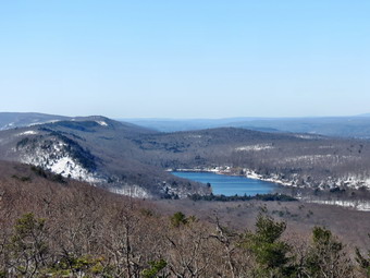 When we got near the top of the ridge and the trail moderated some there was a nice viewpoint. I wasn't going to stop but decided a few pictures wouldn't take too long. When we started up again, I looked down at the snow and found a little bit of blood. Sheila's main pad was healing nicely but she has two raw spots on either side of her left front paw. One spot was bleeding just a little but it didn't seem to bother her so we continued. I saw no more blood but kept checking for the rest of the day. The walk to the tower was slightly uphill with a few dips along the way. At some point, not too far past the lookout, the boot prints stopped. We, of course, continued on to the tower. At about 1.5 miles I looked up to see a tower ahead but found it was a communications tower. We continued on the AT for just a few hundred more feet and arrived at the fire tower at 10:20 AM. I took some pictures of the tower from different angles and took some more of the structure. I climbed the tower to just below the cab and found that there was a stiff breeze blowing. The sky was not the best for pictures and it was hazy, not very blue and there were almost no clouds. Once I was back on the ground, I picked up my pack and we headed back. As we approached the area where the other hikers had turned back, I looked ahead to see another hiker walking away from us with his dog. We soon caught up to him and he assured me that his lab, Stella, was friendly. The dogs seemed to get along well so we hiked back down the ridge together. At the parking area we went our separate ways. He returned home and Sheila and I got in the car to head toward the Catfish Tower further south in Warren County. It was 11:20 AM and we had hiked about 3.3 miles in just under 2 hours which I though was a good start for the day.
![]()
![]()
![]()
![]()
![]() After visiting the Culvers Tower, I headed west on Route 206 back in the direction we had come from earlier. I was going top take Route 560 to Dingman's Ferry but noticed that Struble Road seem to be a shortcut. This road also passes by Tillman's Ravine and I thought I could get a look at this area. I turned onto Struble Road and was immediately met by a "Road Closed - Local traffic Only" sign. I went back to the original plan and drove down Route 206 to Route 560. Eventually we ended up on NPS 615 through the Water Gap to Millbrook Village. I had not expected much activity at the historic site but things seemed to be in full swing with at least twenty cars in the lot. Maple sugaring seemed to be the main attraction but several buildings were open also. I turned onto Route 602 to head up the ridge. Just as I was beginning to think I had gone too far, the roadside parking area appeared next to the gate that blocked the fire road to the tower. There were two other cars parked already but I was able to park safely off the road. It was noon and we got started right away. I immediately noticed that the temperature was warmer and there was less snow. The snow that was present was melting nicely and the trail was muddy in places. The AT follows a woods road for a bit and then turns left off the road into the forest. After a brief hike, the trail again meets the road, follows it for a while and then leaves it again. Near the top of the ridge, the trail, again meets the road and follows it to the tower. As we approached the tower, I could hear voices. We arrived at 12:30 PM to find a small troop of Boy Scouts and a group of Korean hikers. I tied Sheila to a nearby tree and took pictures of the tower from two sides. I climbed the tower expecting a breeze but found the wind had died down. I took some pictures from just below the cab but the sky conditions had not improved much. From up high it was obvious that these towers offer an excellent view and a trained observer could easily spot fires for some distance around.
After visiting the Culvers Tower, I headed west on Route 206 back in the direction we had come from earlier. I was going top take Route 560 to Dingman's Ferry but noticed that Struble Road seem to be a shortcut. This road also passes by Tillman's Ravine and I thought I could get a look at this area. I turned onto Struble Road and was immediately met by a "Road Closed - Local traffic Only" sign. I went back to the original plan and drove down Route 206 to Route 560. Eventually we ended up on NPS 615 through the Water Gap to Millbrook Village. I had not expected much activity at the historic site but things seemed to be in full swing with at least twenty cars in the lot. Maple sugaring seemed to be the main attraction but several buildings were open also. I turned onto Route 602 to head up the ridge. Just as I was beginning to think I had gone too far, the roadside parking area appeared next to the gate that blocked the fire road to the tower. There were two other cars parked already but I was able to park safely off the road. It was noon and we got started right away. I immediately noticed that the temperature was warmer and there was less snow. The snow that was present was melting nicely and the trail was muddy in places. The AT follows a woods road for a bit and then turns left off the road into the forest. After a brief hike, the trail again meets the road, follows it for a while and then leaves it again. Near the top of the ridge, the trail, again meets the road and follows it to the tower. As we approached the tower, I could hear voices. We arrived at 12:30 PM to find a small troop of Boy Scouts and a group of Korean hikers. I tied Sheila to a nearby tree and took pictures of the tower from two sides. I climbed the tower expecting a breeze but found the wind had died down. I took some pictures from just below the cab but the sky conditions had not improved much. From up high it was obvious that these towers offer an excellent view and a trained observer could easily spot fires for some distance around.
 I got a quick drink and a snack, gave Sheila a bone and headed back down at around 1:00 PM. The melting snow was beginning to get slippery and the trail was very rocky. I managed to keep my footing but had to think about what I was doing. On the way down the ridge we met two couples on the way up. One couple had a golden retriever but she was a little too big for Sheila's taste. Once we were on the woods road back to the car, we met two or three family groups headed up to the tower. Sheila also decided it was warm enough to jump in the swamp! We were back at the car by 1:05 PM where I put the car GPS to work and typed in Budd Lake as my destination. The directions I got were almost identical to the printed directions I had from Google Maps so I decided to follow the GPS voice prompts. The hike to the Catfish Tower was only 2.1 miles and took an hour including the time for pictures. I was pretty sure we had time to get to the other three towers since they seemed to be very short walks. The biggest obstacle would be the increasing traffic and actually finding the towers.
![]()
![]()
![]()
![]()
![]() After visiting the Culvers and Catfish Towers in the Delaware Water Gap, we headed to Interstate 80 to get to Budd Lake. I thought the GPS was playing tricks on me when it said get off at Exit 27 east and then get right back on the highway and take Exit 26 heading west. After a moment's hesitation, I remembered there was no Exit 26 eastbound and I followed the GPS direction to the shores of Budd Lake. It wasn't long before we were on Fire Tower Road and at a dead end. It as 1:55 PM. A gate with a fire service sign convinced me we were in the right spot so I parked and we headed out on a woods road. I saw no sign of the fire tower but that did not surprise me as that is the rule rather than the exception. The day was getting warmer and the temperature was over 50 degrees! This was pleasant but it also meant the roads and trails were getting muddier. After only about .5 miles, we hiked up a rise and around a turn to arrive at the fire tower at 2:05 PM. I observed the same routine that I had at the two previous towers. I took pictures of the tower, climbed the tower to take some pictures of the view and then climbed back down. The view included Budd Lake which is the largest fresh water lake in New Jersey. We walked back down to the car after covering only .7 miles. At 2:20 PM I entered Denville as our destination on the GPS and we were off.
After visiting the Culvers and Catfish Towers in the Delaware Water Gap, we headed to Interstate 80 to get to Budd Lake. I thought the GPS was playing tricks on me when it said get off at Exit 27 east and then get right back on the highway and take Exit 26 heading west. After a moment's hesitation, I remembered there was no Exit 26 eastbound and I followed the GPS direction to the shores of Budd Lake. It wasn't long before we were on Fire Tower Road and at a dead end. It as 1:55 PM. A gate with a fire service sign convinced me we were in the right spot so I parked and we headed out on a woods road. I saw no sign of the fire tower but that did not surprise me as that is the rule rather than the exception. The day was getting warmer and the temperature was over 50 degrees! This was pleasant but it also meant the roads and trails were getting muddier. After only about .5 miles, we hiked up a rise and around a turn to arrive at the fire tower at 2:05 PM. I observed the same routine that I had at the two previous towers. I took pictures of the tower, climbed the tower to take some pictures of the view and then climbed back down. The view included Budd Lake which is the largest fresh water lake in New Jersey. We walked back down to the car after covering only .7 miles. At 2:20 PM I entered Denville as our destination on the GPS and we were off.
![]()
![]()
![]()
![]()
![]() As we headed for the Greystone Tower, I noticed that the directions that the car GPS was giving were slightly different from the Google Maps directions. The only information I had about the tower was from the Andover Headquarters that stated it was "off Casterline Road". As I approached the area, I again did not see a tower or, in this case, a road that looked like it might go to a tower. By the time we passed the Greystone Psychiatric Hospital I knew something was wrong so I turned around to retrace my route. As I drove I saw the tower on a hill ahead. Driving up the road I saw what might be a woods road. I parked the car by the side of the road and put Sheila on a leash to go investigate. We walked into the woods and arrived at a powerline right-of-way behind a housing development. This was NOT where we wanted to be but I did see the tower on the next hill! On our way back to the car I encountered two local residents that confirmed there was a road to the fire tower just a little farther along Casterline Road. We got back in the car and I drove up Casterline Road to find a paved road that went right to the tower. I parked at 3:20 PM at the end of the road near the tower. The Greystone Tower was moved from another location and when it was erected Aeromotor provided more steel to extend the height to 92 feet making it the tallest tower in new Jersey. This tower was surrounded by fencing so I only got pictures from the ground. This is one I will return to in fire season when an observer will be in the tower! So, this tower required no hiking. It was 3:30 PM and we had four towers down and one to go. I tried entering Ramapo, NJ into the GPS but that didn't work, I settled for Ringwood and Skyline Drive.
As we headed for the Greystone Tower, I noticed that the directions that the car GPS was giving were slightly different from the Google Maps directions. The only information I had about the tower was from the Andover Headquarters that stated it was "off Casterline Road". As I approached the area, I again did not see a tower or, in this case, a road that looked like it might go to a tower. By the time we passed the Greystone Psychiatric Hospital I knew something was wrong so I turned around to retrace my route. As I drove I saw the tower on a hill ahead. Driving up the road I saw what might be a woods road. I parked the car by the side of the road and put Sheila on a leash to go investigate. We walked into the woods and arrived at a powerline right-of-way behind a housing development. This was NOT where we wanted to be but I did see the tower on the next hill! On our way back to the car I encountered two local residents that confirmed there was a road to the fire tower just a little farther along Casterline Road. We got back in the car and I drove up Casterline Road to find a paved road that went right to the tower. I parked at 3:20 PM at the end of the road near the tower. The Greystone Tower was moved from another location and when it was erected Aeromotor provided more steel to extend the height to 92 feet making it the tallest tower in new Jersey. This tower was surrounded by fencing so I only got pictures from the ground. This is one I will return to in fire season when an observer will be in the tower! So, this tower required no hiking. It was 3:30 PM and we had four towers down and one to go. I tried entering Ramapo, NJ into the GPS but that didn't work, I settled for Ringwood and Skyline Drive.
![]()
![]()
![]()
![]()
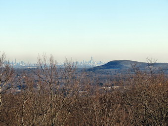
![]() After visiting four out of five fire towers there was only one left. The Ramapo Tower was supposed to be on the Ramapo Mountain ridge in Passaic County. The problem is that this ridge extends for some distance. I had located the tower with Google Earth and written down the latitude and longitude so I knew I would find it. After a half hour drive, we were on Skyline Drive headed south. The road climbed quickly and I had no idea exactly where the road to the tower was on my map. I stopped to think a little and saw that the access road was about a mile south of Conklintown Road. Armed with this information it was simple to drive one mile passed that road and find the access road to the tower at 4:15 PM. The road was marked as a private drive but I had been told it was permissible to walk to the tower. I put Sheila on her leash and we walked through the gate and up the road to the tower. The distance was only about .3 miles and took 5 minutes. I tied Sheila to a tree and took pictures of the tower. I climbed the tower to take some pictures of the view. I could see the Wanaque Reservoir to the west but when I turned east I was surprised. The New York City skyline was clearly visible! It was then I remembered that I had read a 1995 newspaper article that had an interview with the 23 year old observe. The reporter commented on the view which, of course, change a little after 9/11. A website covering these towers shows that the observer still works for the Forest Fire Service 17 years later! Sheila and I retraced our steps back to the car where we finished the days hiking at 4:35 PM. It was only a .6 mile "hike" but well worth the visit. Our total hiking distance for the day was about 7 miles and was overshadowed by the almost 300 miles of driving! I was tired but satisfied I had accomplished what I had set out to do. Now I have only 14 more towers in New Jersey to visit!
After visiting four out of five fire towers there was only one left. The Ramapo Tower was supposed to be on the Ramapo Mountain ridge in Passaic County. The problem is that this ridge extends for some distance. I had located the tower with Google Earth and written down the latitude and longitude so I knew I would find it. After a half hour drive, we were on Skyline Drive headed south. The road climbed quickly and I had no idea exactly where the road to the tower was on my map. I stopped to think a little and saw that the access road was about a mile south of Conklintown Road. Armed with this information it was simple to drive one mile passed that road and find the access road to the tower at 4:15 PM. The road was marked as a private drive but I had been told it was permissible to walk to the tower. I put Sheila on her leash and we walked through the gate and up the road to the tower. The distance was only about .3 miles and took 5 minutes. I tied Sheila to a tree and took pictures of the tower. I climbed the tower to take some pictures of the view. I could see the Wanaque Reservoir to the west but when I turned east I was surprised. The New York City skyline was clearly visible! It was then I remembered that I had read a 1995 newspaper article that had an interview with the 23 year old observe. The reporter commented on the view which, of course, change a little after 9/11. A website covering these towers shows that the observer still works for the Forest Fire Service 17 years later! Sheila and I retraced our steps back to the car where we finished the days hiking at 4:35 PM. It was only a .6 mile "hike" but well worth the visit. Our total hiking distance for the day was about 7 miles and was overshadowed by the almost 300 miles of driving! I was tired but satisfied I had accomplished what I had set out to do. Now I have only 14 more towers in New Jersey to visit!
![]()
![]()
![]()
![]()
![]() On Tuesday, March 5th, Lisa, Cindy and I had planned to hike to the Rock Rift Fire Tower. Since my last outing to the Cannonsville, I had done some research. I had spotted the tower on Google Earth and recorded its exact location. I also studied some maps and found the woods road and trail that was used for access to the tower. When the tower was planned the Conservation Department purchased a strip of land from Route 10 to near the top of Tower Mountain where they planned to erect the tower. On the maps the road seemed to be about .25 miles west of Fish Brook. Lisa and I had early morning commitment so we planned to meet at her store at 10:30 AM. Cindy and I put our gear in the car along with an excited Sheila and went to pick up Lisa. We drove up the Quickway to Exit 87A and headed north on Route 268. At Route 10 we turned right and headed east watching for Fish Brook Road and a likely spot for the access road just before the brook. As we approached the brook a woods road headed north. I turned around at Fish Brook Road and clocked the mileage and it was just right! I turned around again and parked at the boat launch parking right across from Fish Brook road. We all got ready to go packing our spikes but eschewing snow shoes. It was just before 11:30 AM as we walked the quarter mile west on Route 10 crossing over Fish Brook. As we started out on the road, I check the GPS coordinates I had written down and they matched exactly! There were only a few spots of snow down low as we climbed gently through a field and the well-defined woods road. The Catskill Mountain Club has plans to construct and blaze a trail along the old road to the tower. As we walked along the road I thought how easy it would be since the road, although not "an open trail" was easy to follow.
On Tuesday, March 5th, Lisa, Cindy and I had planned to hike to the Rock Rift Fire Tower. Since my last outing to the Cannonsville, I had done some research. I had spotted the tower on Google Earth and recorded its exact location. I also studied some maps and found the woods road and trail that was used for access to the tower. When the tower was planned the Conservation Department purchased a strip of land from Route 10 to near the top of Tower Mountain where they planned to erect the tower. On the maps the road seemed to be about .25 miles west of Fish Brook. Lisa and I had early morning commitment so we planned to meet at her store at 10:30 AM. Cindy and I put our gear in the car along with an excited Sheila and went to pick up Lisa. We drove up the Quickway to Exit 87A and headed north on Route 268. At Route 10 we turned right and headed east watching for Fish Brook Road and a likely spot for the access road just before the brook. As we approached the brook a woods road headed north. I turned around at Fish Brook Road and clocked the mileage and it was just right! I turned around again and parked at the boat launch parking right across from Fish Brook road. We all got ready to go packing our spikes but eschewing snow shoes. It was just before 11:30 AM as we walked the quarter mile west on Route 10 crossing over Fish Brook. As we started out on the road, I check the GPS coordinates I had written down and they matched exactly! There were only a few spots of snow down low as we climbed gently through a field and the well-defined woods road. The Catskill Mountain Club has plans to construct and blaze a trail along the old road to the tower. As we walked along the road I thought how easy it would be since the road, although not "an open trail" was easy to follow.
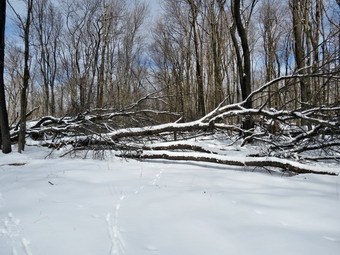
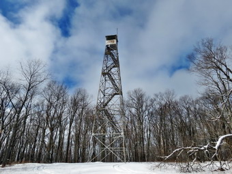 Somewhere around .65 miles the road became much harder to follow and UI would lose it and then find it again. There were also several different branches and paths. As we began to climb we also found that much of the trail was blocked by MANY large trees that had blown down over the years and had never been cleared. The tower was closed 25 years ago! We worked our way around the blowdown always trying to get back to the road. At .9 miles the road leveled and began to follow the contour until 1.25 miles where the fun really began. The snow had gone from patches to a sustained 6 to 8 inches. At this point the road began to ascend the last part of the mountain. There were a series of steep climbs followed by more level areas. One stretch was about a 30% grade. It was little difficult to climb but I knew it would really be "interesting" coming back down. At 1.75 miles the road leveled some although it continued to gain elevation. It also turned from due north to northeast. After missing this tower completely last time, I was very anxious to get a look at it but the only thing I could clearly see ahead were more trees blocking the path. We continued to walk around the trees in the road and at about 1.9 miles I finally caught a glimpse of the tower ahead and made a beeline for it. Like most towers it was situated in a clearing and like most had no view from the bottom. The first flight of stairs was missing and the floor of the cab was in pretty poor shape. The steps and landings are all wooden and some had seen better days. The main steel structure looked sound enough that I would have climbed it given an opportunity. I took pictures of the tower from several different angles. I also took some pictures of the trees against a beautiful blue sky. The total distance was just under two miles but it had taken us two hours to get to the top! I knew that the trip back would be quicker.
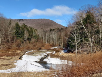 We thought about hiking to the communications tower and then to the roads to get back. I wasn't sure if this would take use across private property so we decided to retrace the route we had used to get up the mountain. I though we might try to straighten it out some but it was easier in most cases to simply follow our tracks. When we got to some of the steeper sections, we found getting down to be an adventure. The warmer temperatures had softened the slow and there was a nice layer of wet leaves underneath. We made it down without any spills and made even better time on the flatter sections below. At one point I did find the road where I could not find it on the way up. As we approached the open field at the end of the hike, I stopped and took a few pictures of the bare ground to contrast with the snow on the top. As we hiked back to the car, I stopped several times to take pictures of the mountains and the reservoir. We were back at the car by 2:50 PM. The hike up had taken around 2 hours while the return trip was about 1 hour and 10 minutes! We hike 3.9 miles in 3.5 hours with a little over an hour stopped. On the way back we decided to headed toward Walton and then use Beers Brook Road as a shortcut over Bear Spring Mountain to Downsville. We drove about 4 miles to Russ Gray Pond and found that the last mile of the road was unplowed! I started out on the unplowed surface since there was only a mile left to West Trout Brook Road. I decided this was a bad idea and returned to Route 10 to drive into Walton and then to Downsville. As we drove passed West Trout Brook Road on Bear Spring Mountain, we found it was also unplowed!
![]()
![]()
![]()
![]()
![]() On Saturday, March 2nd, I wanted to get out for another adventure to someplace I had not been before. The weather forecast called for snow showers but I decided to head north anyway. I wanted to hike to the fire tower in Leonard Hill State Forest in Schoharie County. I had read stories about the fire tower and I knew it was about a 2 mile hike to the tower along a road that could be driven with a four wheel drive vehicle. This sounded easy enough so we headed out. Unfortunately, I made my decision a little late so we didn't get started until about 9:30 AM! I took my wife's auto GPS and threw in my snowshoes. I knew I probably wouldn't need the snowshoes and had no intention of carrying them but it was easy to put them in the trunk. I headed toward Margaretville and then north on Route 20 through Roxbury and Grand Gorge. This ride is beautiful and usually enjoyable but I was in a hurry to get where I was going. A little outside of Grand Gorge I turned east on Route 990V and started to look for Flat Creek Road. I found the road but it had a ROAD CLOSED sign prominently displayed. Sometimes these signs mean "Proceed at your own risk" so I decided to check it out. After only a couple of miles, I came to...the end of the road. I turned around and drove east on 990V until another road heading north came up. I let the GPS guide me from there and we were soon headed to Broome Center. As we approached Broome Center, I saw the fire tower on the ridge! Leonard Mountain Road was a right turn in Broome Center and it had a "Seasonal Maintenance" sign posted. I believed the sign as the road was covered with a few inches of snow. The road climbed a hill and then leveled off a little. On the level portion the road was rutted from someone driving through the slush that then froze. My car handled it pretty well and after 1.2 miles I SW a sign for Leonard Hill State Forest. I parked where the snowplow had stopped and got out of the car. It was 24 degrees with a stiff breeze. I was glad I had worn a baselayer. There was 6 to 8 inches of snow. I was glad I had brought snowshoes. Sheila was just glad to be out again! I donned my snowshoes and started out along the road at about 11:15 AM.
On Saturday, March 2nd, I wanted to get out for another adventure to someplace I had not been before. The weather forecast called for snow showers but I decided to head north anyway. I wanted to hike to the fire tower in Leonard Hill State Forest in Schoharie County. I had read stories about the fire tower and I knew it was about a 2 mile hike to the tower along a road that could be driven with a four wheel drive vehicle. This sounded easy enough so we headed out. Unfortunately, I made my decision a little late so we didn't get started until about 9:30 AM! I took my wife's auto GPS and threw in my snowshoes. I knew I probably wouldn't need the snowshoes and had no intention of carrying them but it was easy to put them in the trunk. I headed toward Margaretville and then north on Route 20 through Roxbury and Grand Gorge. This ride is beautiful and usually enjoyable but I was in a hurry to get where I was going. A little outside of Grand Gorge I turned east on Route 990V and started to look for Flat Creek Road. I found the road but it had a ROAD CLOSED sign prominently displayed. Sometimes these signs mean "Proceed at your own risk" so I decided to check it out. After only a couple of miles, I came to...the end of the road. I turned around and drove east on 990V until another road heading north came up. I let the GPS guide me from there and we were soon headed to Broome Center. As we approached Broome Center, I saw the fire tower on the ridge! Leonard Mountain Road was a right turn in Broome Center and it had a "Seasonal Maintenance" sign posted. I believed the sign as the road was covered with a few inches of snow. The road climbed a hill and then leveled off a little. On the level portion the road was rutted from someone driving through the slush that then froze. My car handled it pretty well and after 1.2 miles I SW a sign for Leonard Hill State Forest. I parked where the snowplow had stopped and got out of the car. It was 24 degrees with a stiff breeze. I was glad I had worn a baselayer. There was 6 to 8 inches of snow. I was glad I had brought snowshoes. Sheila was just glad to be out again! I donned my snowshoes and started out along the road at about 11:15 AM.
 I realized that I was not sure of the exact location of the tower or what trail might lead to it. Since I didn't see much in the way of trails I decided to stay on the road. The road that started up the hill was at least two vehicles wide. I remembered the description that said the road led to the fire tower and the road we were walking was on my GPS. I also remembered the story that the fire tower was moved from Gilbert Lake State Park. It was relocated to Hubbard Hill but the Conservation Department named it after a nearby hill, Leonard Hill. At least this was how the story went! We continued to walk up the hill on the road and the snow continued to get deeper. We walked about .65 miles southwest until the land began to level off on the ridge. At this point we made a 90 degree right turn and headed along the ridge to the northwest. The road skirted the base of Hubbard Hill on our right and I kept looking for the tower through the trees. Several times I wanted to just bushwhack through the woods to the top of the hill but I knew the road should go right to the tower. We walked a little further and the trail continued to skirt the hill. At one point the road turned away from the hill but a trail continued straight ahead. At this point the snow was consistently 12 inches deep with some areas as deep as 18 inches. I though the trail might lead to another road to the top but it also led away from the hill. I decided to retrace my steps and bushwhack over the top of the hill. Sheila and I did this and took off through the woods. We walk to the top of Hubbard Hill and then walked around some. There was no tower! We walked back down to the road and I decided to follow it to the top of Leonard Hill which was about half a mile away. The road was pretty as it passed through a tunnel of pine trees. We walked on.
 We were now walking northwest again and right toward Leonard Hill. After only about .35 miles I looked to my left and saw...a fire tower. I was happy but also a little annoyed at a story which seems to have been incorrect! The Leonard Hill Fire Tower is on Leonard Hill! We continued to walk on the road which led us around the mountain and right to the base of the tower. I took off my pack and got out my camera to take some pictures. After I took a few shots while walking around the tower, my low battery light came on. I went back to my pack to change the batteries. I got out four AA batteries and opened the camera. Imagine my surprise when I remembered that the Canon has its own proprietary battery! Fortunately I had already taken pictures of the tower. The first two flights of stairs were missing and I normally take this as an invitation. On this day I was by Nyssa and decided to stay on the ground. I could see that the floor of the cab was missing but that the rest of the tower appeared to be in good shape. We walked to a lookout and I took some pictures there. The entire day was white and back and gray punctuated by only a little color. I was happy my battery lasted until I could get a few pictures. It was just before 1:00 PM when we started back after hiking 2.2 miles to the tower. I knew the return trip would be much quicker as we would be going downhill and could skip the excursion over Hubbard Hill. We made good time on the way back stopping for pictures only once. We were back at the car by 1:35 PM having hiked a total of 3.8 miles in two hours and 15 minutes. I thought about going someplace else for a short hike but decided against it. Other hikes in the area might include Vroman's Nose, the Middleburgh Cliffs, or Pratts Rock.
On Tuesday, February 26th, I decided that I wanted a new adventure as well as some exercise. The New York City Bureau of Water Supply recently opened much of the land around the Cannonsville Reservoir to hiking. This not only opened some new land but gave access to an abandoned fire tower called the Rock Rift Tower. I decided to drive up Route 17 and take Route 268 north to the reservoir. This would also be the first time Sheila had been out after several weeks as it seemed that her paw was healed enough to allow hiking. Just to be sure I put boots and socks on her front feet before we headed out. I was surprised that she seemed to object to them far less than Sheba did. I drove north and got off at the Fish's Eddy exit and then tried to find Route 268. I was on Old Route 17 for several miles and was convinced I was going in the wrong direction. I promised myself I would turn around if an interchange did not appear quickly. As I was about to reverse course an intersection appeared ahead and there was...Route 268. I started north and also started to gain elevation. The road began to develop a covering of snow but it was well sanded. Soon We arrived at Route 190, where I turned east. I knew that the tower was in the vicinity of Fish Brook Road which soon appeared on the left. I drove up the road which had a dirt surface covered by a thick layer of snow and some ice. For some reason I had not researched or recorded the exact location of the tower. From the road no tower was evident and most of the property was private and posted. I drove back down to Route 10 and drove east to the BWS Cannonsville Precinct building. The secretary at the precinct could not help much so I drove back west and parked in the roadside pulloff. I had seen some woods roads and decided to hike to the top of the hill using these roads to see what I could see. BY now it was about 10:00 AM and the sunny skies were getting darker and darker. There was very little snow so I took my spikes but left the snowshoes behind. Sheila was running in circles and was very happy to be out! We walked east on Route 10 before cutting into the woods to look for a road. Sheila was behind me and when I called her she came quickly...carrying one boot in her mouth. I removed both boots and stowed them in my pack. I knew we wouldn't be out too long an hoped her paw would be OK.
We started bushwhacking and then hit a woods road which soon disappeared. This pattern would repeat itself over and over as we climbed the rather steep hill over the next half hour or so. When we hit about 1800 feet the snow began to become more consistent and got deeper as we went up. I had also forgotten my gaiters. Sheila did not seem to mind the snow at all. I kept picking routes that took as toward the top of the hill. As we neared the top, the land became flatter but there was still a climb ahead that represented the highest spot on the hill. I decided to walk around the base of the hill for a bit and headed northwest around the hill. At some point I saw I was not getting anywhere and headed up to the highest point. This the where the snow began to get much deeper. I was at least 10 inches deep with some spots over a foot. It was also wet and heavy. We wandered around the summit plateau without finding the tower. I decided I wanted to head back down and we took a slightly different path for the first part of the way back. Eventually we dropped down off the highest point and explored a little around the base of some ledges. We then headed back to our route up and followed that back down to the car. We walked about 4 miles in two hours and got a good workout between the steep pitches and the deeper snow. I had an afternoon commitment but took the time before leaving the house again to put the track on my computer GPS software. It was clear that we were not even on the right hill! The tower was west of Fish Brook Road and we were in the hill to the east! To confirm this I located the new communications tower on then hill using Google Earth satellite view. I could see the fire tower just south of the communications tower in the woods. I will be returning as soon as I can to hike to the tower since I now have an exact GPS location. By looking at the maps there seems to be an old access road just to the west of Fish Brook Road but I don't know how open it is. The land on either side of the road is private but is wide enough to allow for some variation as we hike.
![]()
![]()
![]()
![]()
![]() On Tuesday, February 19th, Lisa was ready for a hike before her trip to Montana and I was ready to accompany her. We decided to attempt to hike to a lookout over Hodge Pond that Lisa had visited before. This was where we were headed some weeks ago when an injury to Sheila's paw stopped us. The weather report included snow and freezing rain starting at about noon so we knew we wanted to get done before the storm rolled in at full force. I met Lisa at her store downtown at about 9:30 AM and we headed out the DeBruce Road toward Frick. The temperature when we arrived at 9:45 Am was in the high 20's but a breeze was blowing that made it seem colder. Shortly after arriving we walked across the road and started up the Flynn Trail. There was only about 2 inches of snow and I was glad we had opted to leave the snowshoes at home. Lisa set a quick pace as we ascended the Flynn Trail which is uphill for about 1.7 miles. I marked a waypoint at around 1.5 miles where an interesting meadow lies off to the right. We arrived at the junction with the Big Rock Trail at around 10:45 AM hiking 1.7 miles in the snow in under an hour! In just a few more minutes we were at the next junction where then Flynn Trail continues down to Hodge Pond and a woods road branches off to the right. We turned right on the woods road to head toward our destination. Lisa asked how much farther I though it was and I guessed about 1.5 miles. At 2.2 miles we were at another junction where a road turns left to Hodge Pond and, just a little further on, another turns left to head out toward Shin Creek Road. Along this road on the left are the remains of the Beech Mountain Boy Scout Camp. A few cabins in extreme disrepair are all that remain. Lisa and I continued straight ahead up the hill.
On Tuesday, February 19th, Lisa was ready for a hike before her trip to Montana and I was ready to accompany her. We decided to attempt to hike to a lookout over Hodge Pond that Lisa had visited before. This was where we were headed some weeks ago when an injury to Sheila's paw stopped us. The weather report included snow and freezing rain starting at about noon so we knew we wanted to get done before the storm rolled in at full force. I met Lisa at her store downtown at about 9:30 AM and we headed out the DeBruce Road toward Frick. The temperature when we arrived at 9:45 Am was in the high 20's but a breeze was blowing that made it seem colder. Shortly after arriving we walked across the road and started up the Flynn Trail. There was only about 2 inches of snow and I was glad we had opted to leave the snowshoes at home. Lisa set a quick pace as we ascended the Flynn Trail which is uphill for about 1.7 miles. I marked a waypoint at around 1.5 miles where an interesting meadow lies off to the right. We arrived at the junction with the Big Rock Trail at around 10:45 AM hiking 1.7 miles in the snow in under an hour! In just a few more minutes we were at the next junction where then Flynn Trail continues down to Hodge Pond and a woods road branches off to the right. We turned right on the woods road to head toward our destination. Lisa asked how much farther I though it was and I guessed about 1.5 miles. At 2.2 miles we were at another junction where a road turns left to Hodge Pond and, just a little further on, another turns left to head out toward Shin Creek Road. Along this road on the left are the remains of the Beech Mountain Boy Scout Camp. A few cabins in extreme disrepair are all that remain. Lisa and I continued straight ahead up the hill.
 The snow had been gradually getting deeper as we continued hiking and now we were hiking in 6 to 8 inches with drifts over a foot high. I had an idea of where the road to the lookout veered off but wasn't completely sure. Lisa and I both agreed that things look a lot different in the winter when covered by snow! We continued to follow the road and passed the spring house on the right. The road I was thinking about was around the next bend and when we got there Lisa said that it looked familiar. We had hiked about 2.65 miles when we took the sharp right turn and hiked up a small hill. The trail leveled off and as we hiked we both noticed high ledges on the left. Looking at those ledges I was pretty sure there would be no viewpoint on them since there were tall trees blocking the view. We continued on and Lisa described the lookout as having a large and pointed rock. We were a little discouraged but then we saw...a large and pointed rock. It was 11:30 AM and we had hiked 2.9 miles. The lookout had a nice view from the road but the view was even better when I walked out onto the ledge. I was careful as there were signs that said "Danger"! The skies were growing grayer by the minute. I took pictures of Hodge Pond below and some of the hills beyond. I also snapped a few shots of the ledges before we turned around to head back. We knew that we could get back faster than the trip up but also knew we were racing the storm. On the way back we stopped at another viewpoint on the woods road. After this, we started back knowing that the storm was getting closer. At times we were almost running down the hills as the footing was surprisingly good. We were back at the Big Rock junction at 12:10 PM about 4 miles into the hike. As we descended the Flynn Trail, the snow began and it continued all the way to the car. We were back at the car at 12:50 PM after hiking 5.8 miles in just under 3 hours with a vertical ascent of 1100 feet.
![]()
![]()
![]()
![]()
![]() On Saturday, February 16th, Cindy and I wanted to go for a hike together. We didn't want to be away from home for too, long but wanted a new experience. We decided to hike the Tusten Mountain Trail between Barryville and Narrowsburg. Several people had suggested this trail even though it is less than four miles. Most said that the lookout over the Delaware River from the top was very nice. The temperature was quite a bit colder than earlier in the week an Cindy and I both put on an extra baselayer. I also decided to wear my insulated Salomon B52's. We knew there would not be much snow so I packed the spikes but left the snowshoes home. We both brought poles as we feel they add some security on slippery trails and also give us an upper body workout. We left Livingston Manor and headed south eventually ending up in Barryville where we turned north on Route 97. After about 10 miles, we turned left onto Crawford Road and headed down toward the river. Just before the boat access we spotted the small sign board and the trailhead parking on the right. We parked and were hiking by about 11:15 AM. The air felt cold and damp and the breeze made it feel even cooler. We walked along Tusten Road which is a seasonal maintenance road that parallels the river for less than a quarter mile. At this point a stone arch bridge crosses a small creek that flows into the river. We stopped at the bridge to take some pictures of the bridge and the stream before continuing on. The road was icy in some places and snowy in others. There were even some bare spots. As we walked I noticed a small pond on the right and realized that the water filled what was left of a stone quarry. I enjoy visiting quarries and mines as they tell a story of the past. I took a few pictures and we continued on the road wondering where we would find the turn for the trail. At the .6 mile mark a sign point to the trail on the right. Tusten Road continued straight ahead and I thought we might walk along it when we came back from the trail loop. We turned right and then made an immediate left to start the trail in a clockwise direction.
On Saturday, February 16th, Cindy and I wanted to go for a hike together. We didn't want to be away from home for too, long but wanted a new experience. We decided to hike the Tusten Mountain Trail between Barryville and Narrowsburg. Several people had suggested this trail even though it is less than four miles. Most said that the lookout over the Delaware River from the top was very nice. The temperature was quite a bit colder than earlier in the week an Cindy and I both put on an extra baselayer. I also decided to wear my insulated Salomon B52's. We knew there would not be much snow so I packed the spikes but left the snowshoes home. We both brought poles as we feel they add some security on slippery trails and also give us an upper body workout. We left Livingston Manor and headed south eventually ending up in Barryville where we turned north on Route 97. After about 10 miles, we turned left onto Crawford Road and headed down toward the river. Just before the boat access we spotted the small sign board and the trailhead parking on the right. We parked and were hiking by about 11:15 AM. The air felt cold and damp and the breeze made it feel even cooler. We walked along Tusten Road which is a seasonal maintenance road that parallels the river for less than a quarter mile. At this point a stone arch bridge crosses a small creek that flows into the river. We stopped at the bridge to take some pictures of the bridge and the stream before continuing on. The road was icy in some places and snowy in others. There were even some bare spots. As we walked I noticed a small pond on the right and realized that the water filled what was left of a stone quarry. I enjoy visiting quarries and mines as they tell a story of the past. I took a few pictures and we continued on the road wondering where we would find the turn for the trail. At the .6 mile mark a sign point to the trail on the right. Tusten Road continued straight ahead and I thought we might walk along it when we came back from the trail loop. We turned right and then made an immediate left to start the trail in a clockwise direction.
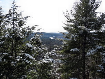 Over the next .4 miles the trail gained about 350 feet which made a good workout. There was some snow but the trail was bare in many places with some mud. As we neared the top of the climbed I looked to the left and saw the telltale evidence of a quarry. A track ran up the hill and there was a lot of waste stone pile around. Cindy and I left the trail to investigate this area. The quarry was small but I couldn't help but imagine the activity that took place here and the difficulty of carting the rock off the hillside. We investigated some ledges before making our way back to the trail. The walk along the trail was nearly level from this point on with a few more short ascents. At 1.2 miles on the trail we came to a sign that indicated the lookout was ahead. A wide woods road branched to the right at this spot and I made a note that we might want to explore its destination. After a short climb we were nearing the lookout. As I approached I spotted bald eagle sitting in a tree at the lookout. I wanted to get a picture but the eagle had other plans. We stopped at the lookout and I took some pictures of the river in the distance. The light was not favorable and I knew I would return on a better day. As I looked out I couldn't help but think that the view from Jensen Ledges was much better. Cindy and I decided to investigate the woods road at the intersection so we headed back in that direction. We walked the road for a while as it skirted the highest hill around. Once we got to a more gentle slope we cut up through the woods to get to the top of the hill. At the summit we found a stone cairn probably placed by some of the scout from the Ten Mile River Camp. We headed back down to the trail and back to the lookout.
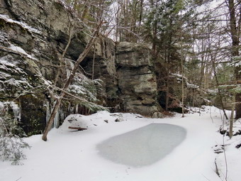 We decided to continue on the loop and started down the other side of the hill. This side had a more motherly exposure and was shaded by trees. There were several icy spots which we negotiated. Several more quarries appeared along the way. A rather large one on the left of the trail at 1.4 miles drew my attention. We walked to the base of the scrap stone pile which I climbed to get to the mine above. I took pictures but found it strange I could find no drill holes. Once back on the trail we descended to find a sign that gave us a choice of "gentle" or "steep". Just to the right of the sign was another quarry. This one was perhaps the prettiest so far with a small, frozen pond. I took pictures before we descended the gentle trail. The trail headed north but at about 1.6 miles made an almost 180 degree turn to head south and back toward the parking area. In this area signs lined the trail on the right warning that this was a "restricted area". I was disappointed as I could see an enormous pile of waste rock from the biggest quarry yet! I was in luck because at about 2 miles, the other trail came in from the right. I followed the trail as it led directly to the large quarry above. I took several pictures but it was hard to capture the size of the quarry and the amount of stone that had been removed. I walked back down to the main trail to rejoin Cindy. From this point it was only .7 miles back to the start of the loop. We still had to walk back along Tusten Road to the car leaving an excursion north on the road for another time. As we walked along the road we met the only people we would see for the day. At the bridge I walked down to the stream bed to take a few pictures of the rapids. I returned to the road and we walked back to the car. We were back at the car by 2:10 PM having competed a total of 4.4 miles and 940 feet of ascent in just under 3 hours. Hikers who stick to the trails and use the gradual ascent/descent will hike about 3.1 miles and climb about 640 feet. Our hike included several side excursions that were not part of the trail. After hiking, we drove north on Route 97 to Callicoon. Café Devine is a great place to eat and has a health food store next door.
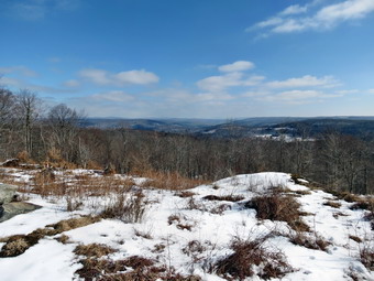
![]() On Thursday, February 14th, I decided to head out on another hike after a nice walk the day before. I again wanted to stay close to home and, after weighing the options, chose to hike on some private property on Shandelee. I had permission from the caretaker and the property has a nice viewpoint and a waterfall. I parked to hike at about 11:00 AM and immediately noticed that there was again more snow that I had anticipated. I debated going home for a pair of snowshoes but thought better of it. I started up a woods road toward the top of the ridge with a brisk breeze blowing and an air temperature in the twenties. I continued to follow woods roads but took a different route than I had before. At some point I noticed that I the road I was on was skirting the ridge. I struck out through the forest and ascended a small hill to find myself at the lookout to the northwest. I took some pictures and then headed out on the woods road that leads to the power lines. Along the way I investigated several other roads by taking a few turns but eventually returned to my route to the right-of-way. I took the "low road" and ended up on the right-of-way with a rather deep ravine cut by a small creek. I retraced my steps and followed a road that paralleled the creek until it didn't anymore. A well-worm animal path led me to a place to cross the stream and back up to the power lines. I walked down the right-of-way until I hit the creek again and then found another woods road that eventually led to the base of the falls on the far side.
On Thursday, February 14th, I decided to head out on another hike after a nice walk the day before. I again wanted to stay close to home and, after weighing the options, chose to hike on some private property on Shandelee. I had permission from the caretaker and the property has a nice viewpoint and a waterfall. I parked to hike at about 11:00 AM and immediately noticed that there was again more snow that I had anticipated. I debated going home for a pair of snowshoes but thought better of it. I started up a woods road toward the top of the ridge with a brisk breeze blowing and an air temperature in the twenties. I continued to follow woods roads but took a different route than I had before. At some point I noticed that I the road I was on was skirting the ridge. I struck out through the forest and ascended a small hill to find myself at the lookout to the northwest. I took some pictures and then headed out on the woods road that leads to the power lines. Along the way I investigated several other roads by taking a few turns but eventually returned to my route to the right-of-way. I took the "low road" and ended up on the right-of-way with a rather deep ravine cut by a small creek. I retraced my steps and followed a road that paralleled the creek until it didn't anymore. A well-worm animal path led me to a place to cross the stream and back up to the power lines. I walked down the right-of-way until I hit the creek again and then found another woods road that eventually led to the base of the falls on the far side.
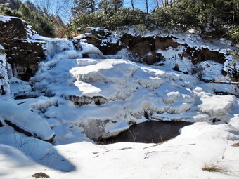 It was difficult to get pictures from the far side of the falls where I was but I did take a few. It was obvious that the main part of the falls was frozen and I really wanted some pictures from close up. I had crossed the creek here in warmer weather when I could see were I was stepping. The rocks now were covered in ice and snow and the water level was higher. The prospect of a dip in the cold water was not inviting so I took route that returned me to the car. I drove down to where the high line crosses the road and parked off the shoulder. I took my pack and poles and walked down the road to an opening in the guardrail. The descent down the steep bank was easier than I expected and I was soon positioned to take some shots. Unfortunately, the sun was now directly behind the falls making photography difficult. The falls were almost completely frozen near the top with only a small opening of flowing water. The water near the base of the falls was open and the sun sparkled off it as it flowed down the stream. I took a few pictures and decided to return some other day in the early morning or late afternoon when the skies were bluer and the sun at a more favorable angle.
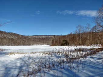
![]()
![]()
![]()
![]()
![]() On Wednesday, February 13th, I decided that I needed to get out after almost a week without a hike. I had been helping to nurse Sheila's paw along and did not look forward to a hike alone! I decided to stay close to home but was tired of the same old places. Huggins Lake came to mid since it is different even if the hike is short. The temperature was just below freezing when I left Livingston Manor and was supposed to climb slightly throughout the day. I drove up the Beaverkill Road and turned on the road to the campsites. My first surprise was the "Bridge Closed" sign at the intersection. I turned left to take the longer way around through Craig-E-Clare and across the new iron bridge. After driving up Berry Brook Road, I arrived at the access road to the parking area. The road was not plowed so I turned around and parked on the widest spot of shoulder I could find. I had my spikes with me but had left the snowshoes at home. I decided I didn't need insulated boots and wore my Asolo TPS 520 boots. When I crossed the road at about 10:45 AM and started up to the parking area, I was surprised to find several inches of soft snow. There was not enough snow to require snowshoes but if I had brought them I would have worn them. It was also clear that trudging through the snow was going to leave my feet damp as the old boots just don't seem to be waterproof anymore! I kept up a good pace on the trail but was missing the company of my dog! The first 1.3 miles are all uphill. Although the 700 foot gain is not too great, I always picture the hike as much easier than it is. Along the way there were some tracks which were snowed over. They were big enough to be boots but they wandered onto and off of the trail occasionally.
On Wednesday, February 13th, I decided that I needed to get out after almost a week without a hike. I had been helping to nurse Sheila's paw along and did not look forward to a hike alone! I decided to stay close to home but was tired of the same old places. Huggins Lake came to mid since it is different even if the hike is short. The temperature was just below freezing when I left Livingston Manor and was supposed to climb slightly throughout the day. I drove up the Beaverkill Road and turned on the road to the campsites. My first surprise was the "Bridge Closed" sign at the intersection. I turned left to take the longer way around through Craig-E-Clare and across the new iron bridge. After driving up Berry Brook Road, I arrived at the access road to the parking area. The road was not plowed so I turned around and parked on the widest spot of shoulder I could find. I had my spikes with me but had left the snowshoes at home. I decided I didn't need insulated boots and wore my Asolo TPS 520 boots. When I crossed the road at about 10:45 AM and started up to the parking area, I was surprised to find several inches of soft snow. There was not enough snow to require snowshoes but if I had brought them I would have worn them. It was also clear that trudging through the snow was going to leave my feet damp as the old boots just don't seem to be waterproof anymore! I kept up a good pace on the trail but was missing the company of my dog! The first 1.3 miles are all uphill. Although the 700 foot gain is not too great, I always picture the hike as much easier than it is. Along the way there were some tracks which were snowed over. They were big enough to be boots but they wandered onto and off of the trail occasionally.
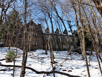 Once at the top of the hill I could see Huggins lake below and I began the downhill hike to the shore of the lake. At about 1.75 miles the trail turns sharply right and descends to the lake. The total elevation loss is only about 260 feet. The lake was completely frozen over and there were very few tracks along the shore. I took some pictures of the lake and surrounding hills. It is a quiet place without any really spectacular views. I found an old canoe on the shore seemingly waiting for the ice to melt. After a few more pictures, I turned around and headed back up the hill and down the other side to get back to the parking area. The temperature had risen to above freezing and I slipped several times on the descent. It was obvious that the layer of snow covered a layer of ice. I arrived at the car at 12:45 PM. On my drive back I began to think about the Dundas Castle. I stopped along the road and was able to get a few pictures. I had wanted to get permission to walk up to the castle for some time. I know many people simply go without asking permission but I decided to stop by the caretaker's house. The caretaker was in but denied me permission so I left. I was disappointed but have a few other avenues to explore to get permission. The hike to Huggins Lake and back was 3.9 miles in just under 2 hours with a vertical gain of almost a 1000 feet.
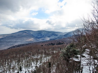
![]()
![]()
![]()
![]()
![]() On Sunday, February 3rd my friend Kevin wanted to go for a hike close to home but had to be back by about 4:00 PM. We decided to leave from Livingston Manor at noon and I suggested Giant Ledge as our destination. Kevin agreed and we were off on time. Sheila was still recovering from the laceration to her paw so it was just Kevin and I. The roads were a little better than the day before but there were still some icy patches. We arrived at the parking area just before 10:00 PM to find it almost full. We parked and got right on the trail. I knew we wouldn't need snowshoes but brought along spikes just in case. Just after crossing the road there were several icy patches which we negotiated without putting on the spikes. The temperature was in the mid 20's and there was no wind which made it feel much warmer than the day before. I had donned layers that were not quite as warm as Saturday and I was glad that I did. Kevin and I walked and talked as we ascended to the trail junction to Giant Ledge. We worked our way around several ice flows by simply walking on either side of the trail. We knew that on the way back traction devices would make the descent safer. By 1:10 PM we reached the trail junction, where there was another ice flow, and turned right to head to Giant Ledge. The air still seemed warm and the hiking was going quickly as we walked and talked. We walked across the relatively flat space before the small series of ascents and continued to find icy patches. Walking around them was still working for us so we did not put on spikes.
On Sunday, February 3rd my friend Kevin wanted to go for a hike close to home but had to be back by about 4:00 PM. We decided to leave from Livingston Manor at noon and I suggested Giant Ledge as our destination. Kevin agreed and we were off on time. Sheila was still recovering from the laceration to her paw so it was just Kevin and I. The roads were a little better than the day before but there were still some icy patches. We arrived at the parking area just before 10:00 PM to find it almost full. We parked and got right on the trail. I knew we wouldn't need snowshoes but brought along spikes just in case. Just after crossing the road there were several icy patches which we negotiated without putting on the spikes. The temperature was in the mid 20's and there was no wind which made it feel much warmer than the day before. I had donned layers that were not quite as warm as Saturday and I was glad that I did. Kevin and I walked and talked as we ascended to the trail junction to Giant Ledge. We worked our way around several ice flows by simply walking on either side of the trail. We knew that on the way back traction devices would make the descent safer. By 1:10 PM we reached the trail junction, where there was another ice flow, and turned right to head to Giant Ledge. The air still seemed warm and the hiking was going quickly as we walked and talked. We walked across the relatively flat space before the small series of ascents and continued to find icy patches. Walking around them was still working for us so we did not put on spikes.
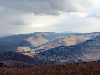 Soon we were at the final ascent to Giant Ledge where we met a couple descending. They had hiked all the way to Panther and were now coming back. They said that the views were good but that there was a lot of ice on the way up Panther. We continued to the top of the climb and walked toward the ledges. We met another group of perhaps 10 people all of whom were wearing some form of traction. Kevin and I walked down to the first lookout which apparently had not had many visitors. By the time we arrived the skies had changed a great deal. We had left the parking area under blue skies in all directions but I had noticed on the way up that the skies to the north and northeast beginning to darken. We arrived at the ledges just before 2:00 PM and my observations were confirmed. Toward the north the skies were dark with an approaching snow squall. Looking east and south toward the Burroughs Range, the skies were cloudy but still blue with some sun. In between, to the east, there was a mix of conditions. This situation made for interesting pictures since in one spot I could get three different sets of conditions. I took pictures and then we walked along the ledges to visit two more viewpoints. The dark skies in the north began heading toward us and we could see that snow accompanied them. We headed back down across the ledges and down the steep descent. We did not want to don spikes to climb over the rocks and even at the base of the descent we continued without them. We met two more hikers on their way up to the ledges despite the fact that it was late in the day. We arrived at the trail junction at about 2:50 PM and decided it was time to put on spikes. This made the final part if the hikes much easier as we were able to walk over most of the ice flows rather than try to get around them. At one point we met a lone hiker and her dog headed up. We wondered if she intended to try to get to the Ledges and back or whether she was just out for a short walk. She didn't seem to have much equipment with her. We removed our spikes when we got to the road and were back at the car by 3:30 PM having covered 3.3 icy miles in 2.5 hours.
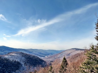
![]()
![]()
![]()
![]()
![]() On Saturday, February 2ndI wanted to do a 3500 foot peak but did not have a companion since Sheila was still recovering from a foot laceration. I asked Cindy if she wanted to hike and she said "Yes"> we agreed to hike Hunter from Spruceton. We dressed warmly as the temperature was not supposed to be above 20 and a stiff breeze was forecast. We got a late start and the roads were icy in places. On the way from Shandaken to Spruceton on Rt 42 we saw several cars at the Halcott parking area and several more parked at the side of the road near the new slide. These people appeared to have ropes and equipment for ice climbing and there was significant ice on some of the ledges at the top of the slide. We continued on to Hunter arriving just after 11:00 AM to find the lot almost filled! At the far end of the lot near was a large pile of gravel which took up quite a bit of space. We parked and immediately got on the trail. We decided against snowshoes but brought a pair of spikes each. It was icy all the way from the parking area to where the trail turns to the right after the bridge. We walked on the gravel or at the side of the trail. We had decided that using spikes would require us to put them on and then take them off several times as the ice was intermittent. The trail showed signs that a tracked vehicle had been used at some time when the earth was soft. As we continued up the trail toward the trail junction the sun came out. We stopped and I opened some zippers as I was getting warm. There was a new bridge on the trail across one of the larger streams. By 11:55 AM we had hiked the 1.75 miles to the trail junction and were ready turn right up the mountain. There was another large pile of gravel on the right and the tracks continued up the trail to the right.
On Saturday, February 2ndI wanted to do a 3500 foot peak but did not have a companion since Sheila was still recovering from a foot laceration. I asked Cindy if she wanted to hike and she said "Yes"> we agreed to hike Hunter from Spruceton. We dressed warmly as the temperature was not supposed to be above 20 and a stiff breeze was forecast. We got a late start and the roads were icy in places. On the way from Shandaken to Spruceton on Rt 42 we saw several cars at the Halcott parking area and several more parked at the side of the road near the new slide. These people appeared to have ropes and equipment for ice climbing and there was significant ice on some of the ledges at the top of the slide. We continued on to Hunter arriving just after 11:00 AM to find the lot almost filled! At the far end of the lot near was a large pile of gravel which took up quite a bit of space. We parked and immediately got on the trail. We decided against snowshoes but brought a pair of spikes each. It was icy all the way from the parking area to where the trail turns to the right after the bridge. We walked on the gravel or at the side of the trail. We had decided that using spikes would require us to put them on and then take them off several times as the ice was intermittent. The trail showed signs that a tracked vehicle had been used at some time when the earth was soft. As we continued up the trail toward the trail junction the sun came out. We stopped and I opened some zippers as I was getting warm. There was a new bridge on the trail across one of the larger streams. By 11:55 AM we had hiked the 1.75 miles to the trail junction and were ready turn right up the mountain. There was another large pile of gravel on the right and the tracks continued up the trail to the right.
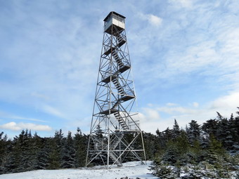 After the turn the trail got steeper and there continued to be ice flows across the trail in many places. We walked around these areas but they kept getting larger especially as we approached the spring near the lean-to. It was clear that the hikers ahead of us had donned spikes at some point. I could see everything from YakTrax to full crampons. When we reached the spring, we turned right as I intended to take the back way up to the lean-to. The ground was a little marshy but soon we reached the climb. I started to climb but quickly ran into a covering of ice with a frosting of snow. We decided to then back and walk up to the main trail to the lean-to. As we walked up the main trail the ice became even more prevalent and we decided to put on spikes. We walked over to the lean-to and stopped for a snack and a drink. I walked out to the viewpoint and took some pictures of the valley below. I was a little disappointed at the angle of the sun and the lack of fluffy white clouds in a bright blue sky! We walked back to the main trail and continued up the mountain. We were both glad that we had decided to wear the spikes as the ice continued to be a problem. The final climb up to the summit plateau seemed long and tiring to me and Cindy echoed that sentiment. Near the top we met two other hikers. One was headed down and one to the cabin. I said "Hello" to both but got barely a nod from either!
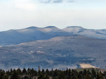 We stopped at the cabin where I dropped my pack and got out my camera. I took some pictures of the tower as the skies were blue with some nice clouds. I headed up the tower to take more pictures. As soon as I was above the tree line a sustained wind of at least 20 mph was blowing. The wind chill was making the temperature feel 10 degrees colder than on the ground. I took pictures from just below the cabin on the tower and then came down to another level and took some more. I could see skiers at the Hunter Mountain Ski Area with the zoom on the camera. Back on the ground it actually felt MUCH warmer. We gathered ourselves and started back down the mountain. It had taken about 2.5 hours to get to the tower and we were hoping it would take less time to get down. We don't really rush but made good time coming down the hill. We were able to simply walk over most of the ice flows. on the way down we met one of the hikers from the top who, again, didn't bother to acknowledge us. By 2:30 PM we had returned to the trail junction after hiking 5.5 miles. We decided it was time to remove our spikes. We continued on down the woods road. We had seen only two other hikers which did not account for all the cars so I assumed they had probably decided to do the loop. When we got back to the parking area at 3:15 PM the other hikers were still not back. We had hiked 7.2 miles in 4 hours. We got ready to go and as we pulled out the group was walking toward. Cindy and I decided we would go to Tannersville to Pancho Villas as we enjoy the food there. The food was good but the ride home seemed VERY long.
On Tuesday, January 29th Lisa And I wanted to get out before the "big melt" over the next two days. After a week of temperatures that never went above the 20's, we were scheduled to have two days of exceptionally warm temperatures perhaps reaching into the 50's! Lisa wanted to go to Frick Pond and hike to Beech Mountain to find a lookout on a ledge of rock. I wasn't sure of the exact location but it sounded a little like Flynn's Point which is currently designated as the highest point in Sullivan County. I put my gear and Sheila into the car and met Lisa at her store at around 9:30 AM. We drove to Frick Pond on roads that reflected the coming thaw. We started out on the Flynn Trail just before 10:00 AM. We started the hike on the trail through the woods. Before we were even on the wide woods road that makes up most of the Flynn Trail, Lisa noticed a small spot of blood on the trail. A little further along there was another and I called Sheila over to check her out. My first look did not reveal anything but we continued to see patches of blood. My second inspection revealed that Sheila had cut the pad on her front left foot. It was bleeding but not too badly and Sheila did not seem to notice it. I decided we would hike a little further since the snow was keeping it cool. We continued up the Flynn Trail but I kept seeing blood spots and I was getting more and more concerned. Near the top of the hill I told Lisa that we had to go back. On the way back Sheila did not seem to be favoring the paw and was not trying lick it. When we got back to the car, I got out some bandages and looked at her foot again. The cut was deep and bloody. I dropped Lisa and her shop and headed home to call the vet. I didn't think stitches would be appropriate but wanted a second opinion. The vet was able to take Sheila immediately and we drove to the office. After a quick inspection, he said that a bandage with some antibiotic cream and some oral antibiotics would be sufficient. He said it should heal in 10 days to 2 weeks. I was relieved but I know that Sheila will not be happy with "bed rest".
![]()
![]()
![]()
![]()
![]() On Saturday, January 26th Kurt was in Livingston Manor and we decided to get out for a snowshoe since the temperature had warmed up to the high 20's! For most of the week the temperatures had not reached the 20's during the day and below 0 at night! The wind had also been blowing making the wind chill dangerous for skin exposed for any length of time. I decided to take Kurt to Walnut Mountain and do some of the trail there so we got our gear in the car and headed out. I was a little worried that it might be too cold for Sheila but I knew we could make the hike as long or as short as we wanted. We arrived at about 1:30 PM at the main parking area to find the gate closed. I parked at the smaller area which was not a problem since we were the only car there. As soon as we got out of the car we noticed that the wind was whipping across the fields and that it was COLD! We got our snowshoes on quickly an headed for the trails. I had planned to start out with some of the more open trails but we immediately headed for the A1 trail that heads up the mountain. This trail is sheltered and we immediately noticed that we could no longer feel the wind. We hiked up the A1 trail to the junction with the A4 trail where we tuned left or south on the A4 trail. We continued on this until the junction with the A1 and followed the A1 by bearing left. The snowshoes we were wearing were not really need but gave us a good grip. The trails were well packed and we could see a mix of boot and snowshoe prints. When the A1 trail branched we followed it to the right as it headed west and north. I wanted to do some loops around the mountain. Eventually the A1 turned east and we were back at the junction with the A4. We had completed the lower loop around the mountain for about 1.7 miles.
On Saturday, January 26th Kurt was in Livingston Manor and we decided to get out for a snowshoe since the temperature had warmed up to the high 20's! For most of the week the temperatures had not reached the 20's during the day and below 0 at night! The wind had also been blowing making the wind chill dangerous for skin exposed for any length of time. I decided to take Kurt to Walnut Mountain and do some of the trail there so we got our gear in the car and headed out. I was a little worried that it might be too cold for Sheila but I knew we could make the hike as long or as short as we wanted. We arrived at about 1:30 PM at the main parking area to find the gate closed. I parked at the smaller area which was not a problem since we were the only car there. As soon as we got out of the car we noticed that the wind was whipping across the fields and that it was COLD! We got our snowshoes on quickly an headed for the trails. I had planned to start out with some of the more open trails but we immediately headed for the A1 trail that heads up the mountain. This trail is sheltered and we immediately noticed that we could no longer feel the wind. We hiked up the A1 trail to the junction with the A4 trail where we tuned left or south on the A4 trail. We continued on this until the junction with the A1 and followed the A1 by bearing left. The snowshoes we were wearing were not really need but gave us a good grip. The trails were well packed and we could see a mix of boot and snowshoe prints. When the A1 trail branched we followed it to the right as it headed west and north. I wanted to do some loops around the mountain. Eventually the A1 turned east and we were back at the junction with the A4. We had completed the lower loop around the mountain for about 1.7 miles.
We decided to continue around the mountain again on the A4 trail. This time when we arrived at the junction with the A1 trail we stayed right to follow the A4 south until it made and almost 180 degree turn to head around the mountain. We continued to follow the A4 north and then east as it started to swing around the summit. On the north side we followed a bike trail that took us up to the level just below the summit. We followed the path around the base of the summit going counterclockwise until we got to the bike trail that starts up to the summit on the east side. We had spotted a wooden structure that I had not seen before and wanted to investigate. On the summit plateau we started to the right to make a counterclockwise loop. We found that the wooden structure was a well-constructed "bridge" over a jumble of rocks. The path continued around the edge of the summit until we were back on the east side where we had come up. We walked back down to the A5 trail where we turned right and descended to the A4 trail. A left turn on the A4 and a right on the A1 brought us back to the open field where the A1 splits. We admired the view from the picnic table and then headed left on the A1 and back down toward the car. As we came back down to the parking area, I pointed out to Kurt the nice views to the north. We decided to walk around the field below the baseball diamond to get us up to 4 miles. Back at the car my GPS read 4.1 miles in just under 2 hours. By the way, Sheila seemed impervious to the cold as she dashed up and down the trails and followed some animal tracks into the woods.
![]()
![]()
![]()
![]() On Monday, January 21st I had hoped to get in a longer hike since I had no track practice. A long weekend including a two day track meet and preaching on Sunday had left me a little tired. I asked Cindy if she would like to get out for her first snowshoe and she said "Okay". She wanted a short and flat route so we chose to go to Frick Pond and hike around the pond and then use the Logger's Loop and Quick Lake trails to get back to the car. When we left the house the skies were completely overcast and the temperature was just below 20 degrees. The weather forecast said partly sunny but also indicated this might be the WARMEST day of the week. We arrived at the parking area just before 11:00 AM and got right on the trail. The condition of first part of the trail to the register made we wonder whether or not we should wear the snowshoes. The snow was thin and the trail well packed allowing rocks and roots to poke up through the snow. We continued on and found the snowshoes weren't really necessary but did give us good traction and a better workout over the short hike. As we walked over the bridge at Frick Pond, I decided not to stop and we continued around the back of the pond on the wooden walkways. At Times Square we turned left to head up the Logger's Loop. This part of the hike was the only uphill so we walked quickly. At 2.3 miles we were at Iron Wheel Junction where we turned left onto the Quick Lake Trail. I could easily have put on a few more miles but Cindy was tired as it washer first snowshoe outing. As we walked down the Quick Lake Trail and back to the pond, I pointed out the trail clearing work I had done in the fall. At the pond we retraced our path back to the parking area. When we arrived at the car, a black dog from the cabin came to greet us and he and Sheila hit it off. We were back at 12:45 PM having covered 3.8 miles in an hour an 50 minutes.
On Monday, January 21st I had hoped to get in a longer hike since I had no track practice. A long weekend including a two day track meet and preaching on Sunday had left me a little tired. I asked Cindy if she would like to get out for her first snowshoe and she said "Okay". She wanted a short and flat route so we chose to go to Frick Pond and hike around the pond and then use the Logger's Loop and Quick Lake trails to get back to the car. When we left the house the skies were completely overcast and the temperature was just below 20 degrees. The weather forecast said partly sunny but also indicated this might be the WARMEST day of the week. We arrived at the parking area just before 11:00 AM and got right on the trail. The condition of first part of the trail to the register made we wonder whether or not we should wear the snowshoes. The snow was thin and the trail well packed allowing rocks and roots to poke up through the snow. We continued on and found the snowshoes weren't really necessary but did give us good traction and a better workout over the short hike. As we walked over the bridge at Frick Pond, I decided not to stop and we continued around the back of the pond on the wooden walkways. At Times Square we turned left to head up the Logger's Loop. This part of the hike was the only uphill so we walked quickly. At 2.3 miles we were at Iron Wheel Junction where we turned left onto the Quick Lake Trail. I could easily have put on a few more miles but Cindy was tired as it washer first snowshoe outing. As we walked down the Quick Lake Trail and back to the pond, I pointed out the trail clearing work I had done in the fall. At the pond we retraced our path back to the parking area. When we arrived at the car, a black dog from the cabin came to greet us and he and Sheila hit it off. We were back at 12:45 PM having covered 3.8 miles in an hour an 50 minutes.
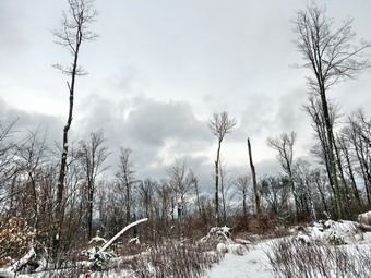
![]()
![]()
![]()
![]()
![]() On Thursday, January 17th I decided to go back to Denman Mountain to try to find a loop around the mountain on public land. Lisa and I had tried a route on Tuesday which had not taken us all the way around the mountain but had taken us to some interesting stone foundations. Between Tuesday and Thursday several inches of snow had fallen closing most schools on Wednesday. I knew conditions would be quite different so I brought along my Tubbs Alp Flex snowshoes and Hillsound spikes. The roads were mostly clear when I left the house but I did not know how well maintained Moore Hill Road would be near the parking area or if that parking area would be plowed. I needn't have worried since Moore Hill Road was cleared and well sanded and the parking area we arrived at 10:00 AM. The forecast was for rising temperatures and clearing skies but it was in the high 20's with a stiff breeze as we started out. The skies were overcast and I was anxious to get started to generate some body heat. We walked across the road to start our hike on the snowmobile trails that encircle the mountain. The snow was very crunchy and unbroken except for a few animal tracks that Sheila just had to follow. The first part of the hike was a little uphill but soon leveled off and then descended to a trail junction at about .5 miles. The left turn at this junction leads back out to Moore Hill Road and the road that cuts over to Denman Mountain Road. We turned right to stay on the trail around the mountain. At .85 miles we came to the path or woods road that Lisa and I had followed up from below on Tuesday. I knew that we had about 6 miles to do altogether and that we had a good start. I stopped to take a few pictures of the snow trail and trees but otherwise kept moving.
On Thursday, January 17th I decided to go back to Denman Mountain to try to find a loop around the mountain on public land. Lisa and I had tried a route on Tuesday which had not taken us all the way around the mountain but had taken us to some interesting stone foundations. Between Tuesday and Thursday several inches of snow had fallen closing most schools on Wednesday. I knew conditions would be quite different so I brought along my Tubbs Alp Flex snowshoes and Hillsound spikes. The roads were mostly clear when I left the house but I did not know how well maintained Moore Hill Road would be near the parking area or if that parking area would be plowed. I needn't have worried since Moore Hill Road was cleared and well sanded and the parking area we arrived at 10:00 AM. The forecast was for rising temperatures and clearing skies but it was in the high 20's with a stiff breeze as we started out. The skies were overcast and I was anxious to get started to generate some body heat. We walked across the road to start our hike on the snowmobile trails that encircle the mountain. The snow was very crunchy and unbroken except for a few animal tracks that Sheila just had to follow. The first part of the hike was a little uphill but soon leveled off and then descended to a trail junction at about .5 miles. The left turn at this junction leads back out to Moore Hill Road and the road that cuts over to Denman Mountain Road. We turned right to stay on the trail around the mountain. At .85 miles we came to the path or woods road that Lisa and I had followed up from below on Tuesday. I knew that we had about 6 miles to do altogether and that we had a good start. I stopped to take a few pictures of the snow trail and trees but otherwise kept moving.
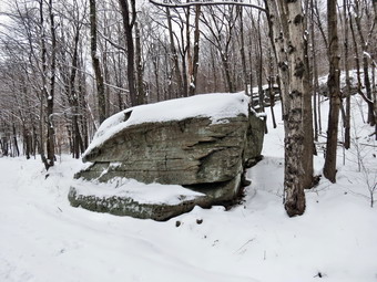 The snowmobile trail continued to send for the next mile but was always lower than the mountain on the right. Since the trail was lower, the water draining from the higher terrain made the trail very wet in places. Some of the water was frozen but in other places streams crossed the trail or formed small pools. At about 1.95 miles we came upon the ruins of a house or cabin on the right side of the trail. I took some pictures and then we continued on. We were heading mostly north and I knew that would have to change for us to get back to the unmaintained road that would take us back to the car. At 2.15 miles we were again at trail junction and I was sorry I had not brought a map. I decided to turn right sine that trail seemed to be headed more in the direction I wanted. For the next 1.2 miles the trail wandered back and firth and up and down but always wound around the mountain. The crusty snow made walking difficult for me but did not seem to slow Sheila down at all. Finally, at about 3.3 miles the trail turned in an easterly direction and headed directly for the road. For the next 1.5 miles the trail undulated up and down but always headed east. At 4.8 miles, around 12:25 PM we hit the road and turned right to head south and back to the parking area. I had never been on the upper part of the road and there were some interesting cliffs and one large boulder right next to the road. After about .8 miles we were on the section that Lisa and I had covered on Tuesday. At this point we picked up some boot prints and dog paw prints on the road. After a few ups and downs we were back at the car 1:10 PM. We had covered 6.4 miles in just over 3 hours of total time. Near the end of the hike the sun had peeked through the clouds and I took a few pictures before it ducked in behind them again.
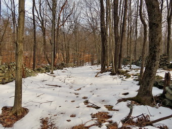
![]() On Tuesday, January 15th Lisa and I wanted to explore the hiking possibilities at Denman Mountain. The summit of this mountain, once thought to be the highest point in Sullivan County, is private but much of the rest of the land in the area is state forest. Our plan was to find a hiking route around the mountain and to record a GPS track and description. We met at Moran Outdoors, Lisa hiking store in Livingston Manor, at about 9:00 AM and headed for Grahamsville. Sheila was in the backseat making it clear that she was ready to go! Just passed the TriVally school we turned left on Moore Hill Road. We drove about 3 miles north to the parking area at the corner of Moore Hill Road, Glade Hill Road and Furman Road. The parking area was well plowed. The road north of the parking area is designated as "seasonal" and was not plowed. We parked and were hiking by 9:45 AM. Both of us decided not to take snowshoes as the recent warm weather had melted most of the snow in the area. When we departed Livingston Manor, the sky was clearing and for most of the drive there was blue sky and sun. As we began to walk the skies were overcast and the air seemed a little raw. Instead of heading out on the snowmobile trail just across from the parking area, we decided to walk down Moore Hill Road to find the trail marked on the Venture Out map. We walked for about half mile on the road before turning right on another seasonal road. As we walked down the road, there were several trails to the right but we chose to stay on the road. The road descended and passed some seasonal homes or hunting camps. Posted signs on both side began to make us feel we might be in the wrong place but we continued on until we saw sign indicating state forest. After1.2 miles the road turned sharply to the left. A glance at my GPS convinced me that this was the extension of Denman Mountain Road and that it would take us in the wrong direction. We turned right onto a woods road to continue the hike.
On Tuesday, January 15th Lisa and I wanted to explore the hiking possibilities at Denman Mountain. The summit of this mountain, once thought to be the highest point in Sullivan County, is private but much of the rest of the land in the area is state forest. Our plan was to find a hiking route around the mountain and to record a GPS track and description. We met at Moran Outdoors, Lisa hiking store in Livingston Manor, at about 9:00 AM and headed for Grahamsville. Sheila was in the backseat making it clear that she was ready to go! Just passed the TriVally school we turned left on Moore Hill Road. We drove about 3 miles north to the parking area at the corner of Moore Hill Road, Glade Hill Road and Furman Road. The parking area was well plowed. The road north of the parking area is designated as "seasonal" and was not plowed. We parked and were hiking by 9:45 AM. Both of us decided not to take snowshoes as the recent warm weather had melted most of the snow in the area. When we departed Livingston Manor, the sky was clearing and for most of the drive there was blue sky and sun. As we began to walk the skies were overcast and the air seemed a little raw. Instead of heading out on the snowmobile trail just across from the parking area, we decided to walk down Moore Hill Road to find the trail marked on the Venture Out map. We walked for about half mile on the road before turning right on another seasonal road. As we walked down the road, there were several trails to the right but we chose to stay on the road. The road descended and passed some seasonal homes or hunting camps. Posted signs on both side began to make us feel we might be in the wrong place but we continued on until we saw sign indicating state forest. After1.2 miles the road turned sharply to the left. A glance at my GPS convinced me that this was the extension of Denman Mountain Road and that it would take us in the wrong direction. We turned right onto a woods road to continue the hike.
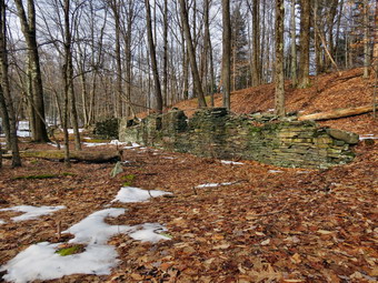 Although the woods road we were on was somewhat overgrown it was obvious that it had been important in its day. The road was bordered by a stone wall on either side as it climbed toward Denman Mountain. After about .3 miles on this woods road we found some stone foundations and stopped to take pictures on the ones on the right near the trail. Slightly further along there was another interesting wall against a bank on the left. I crossed some marshy ground that was partly frozen to take pictures. I found another foundation and some more walls. After taking a few shots, we continued to climb up the mountain staying on the woods road. I suspected that we would eventually intersect the snowmobile trail around the mountain. In another .4 miles we did meet the trail and had to decide whether to turn left or right. We decided that we wanted to see where this trail "started" so we turned right and followed the trail. The walking was easy and at about 2.3 miles into the hike we arrived at a trail junction. A small sign marked "Trailhead" clearly pointed to the left so we made the turn and walked up and over the southern shoulder of Denman Mountain. We could see a road on the right and soon we were back at the start of the snowmobile trail directly across from the parking area. At this point we had hiked under 3 miles and it was just passed 11:00 AM so I suggested to Lisa that we walk up the unplowed road for some distance. The walk on the road was mostly uphill on the way out and it was slippery! At some point we decided to turn around and head back to the car. On the way back Sheila picked up a rather large stick and asked me to throw it for her. We played that game until we were almost back at the car. We arrived back in the parking area at 11:50 AM having hiked 4.5 miles in 2 hours. I will be returning to the area as soon as possible to map the hike around the mountain which should be about 6 miles on snowmobile trail and dirt road.
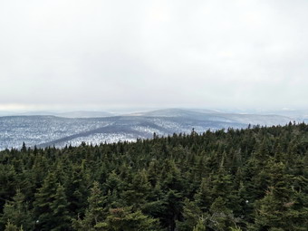
![]()
![]()
![]()
![]()
![]() On Saturday, January 12th, I decided I wanted to hike a 3500 foot peak and Balsam Lake was as good as any. I thought that, depending on the weather and my conditioning, that I might do Graham also. The weather forecast the night before was for dense fog in the morning caused by the snow that was still on the ground and an air temperature rising to near 50 degrees. When I woke up in the morning, the fog WAS very dense so I decided to leave the house at about 10:00 AM with Sheila on board. We headed up the Beaverkill Road which was well plowed and sanded. In Lew Beach I got behind a Town of Hardenburgh sanding truck which I followed until it turned up Alder Creek Road. I was glad to have it gone since it was slowing me down. I soon changed my mind as I passed Quill Gordon Lodge. At this point the road became more and more icy until I decided a hike up the mountain was not worth having an accident going there or on the way back! I backed up until I got to a driveway and then turned around. My first thought was to go someplace like Huggins Lake but I finally decided to try to get to the trailhead on the Millbrook Road to hike the mountain from that side. As I headed up the Barkaboom Road this began to sound like a very good idea since I had not hiked from that direction in a very long time. The drive seemed long since I was eager to get started but by 11:00 AM I parked the car in the lot and got ready to hike. I had looked at the trail as we passed it and decided I would wear my snowshoes. I had a bungee cord to strap them on my pack if I had to and I had also brought spikes. There were two or three other cars in the lot. The trail toward Dry Brook Ridge was also broken out so I wasn't sure where which direction the hikers had headed. It was warm so I was glad I had only one layer with my trusty Mammut Hoody on top. Sheila could hardly contain herself so I got her across the road quickly and onto the trail.
On Saturday, January 12th, I decided I wanted to hike a 3500 foot peak and Balsam Lake was as good as any. I thought that, depending on the weather and my conditioning, that I might do Graham also. The weather forecast the night before was for dense fog in the morning caused by the snow that was still on the ground and an air temperature rising to near 50 degrees. When I woke up in the morning, the fog WAS very dense so I decided to leave the house at about 10:00 AM with Sheila on board. We headed up the Beaverkill Road which was well plowed and sanded. In Lew Beach I got behind a Town of Hardenburgh sanding truck which I followed until it turned up Alder Creek Road. I was glad to have it gone since it was slowing me down. I soon changed my mind as I passed Quill Gordon Lodge. At this point the road became more and more icy until I decided a hike up the mountain was not worth having an accident going there or on the way back! I backed up until I got to a driveway and then turned around. My first thought was to go someplace like Huggins Lake but I finally decided to try to get to the trailhead on the Millbrook Road to hike the mountain from that side. As I headed up the Barkaboom Road this began to sound like a very good idea since I had not hiked from that direction in a very long time. The drive seemed long since I was eager to get started but by 11:00 AM I parked the car in the lot and got ready to hike. I had looked at the trail as we passed it and decided I would wear my snowshoes. I had a bungee cord to strap them on my pack if I had to and I had also brought spikes. There were two or three other cars in the lot. The trail toward Dry Brook Ridge was also broken out so I wasn't sure where which direction the hikers had headed. It was warm so I was glad I had only one layer with my trusty Mammut Hoody on top. Sheila could hardly contain herself so I got her across the road quickly and onto the trail.
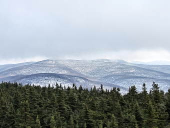 The snow on the lower part of the trail wasn't very deep and was beginning to be the consistency of mashed potatoes. I also didn't help that it was obvious that several people felt that snowshoes were optional. Snowshoes were not needed for the hike but the holes made by those without snowshoes made walking more difficult. When the temperature drops over the next week, these holes will freeze and become real "ankle-breakers". The trail register is a little over a quarter mile up the trail and between the trailhead and the register were several major blowdowns. There were one or two blowdowns after the register also. I could navigate over or under several of these but others required a detour. Some of the branches had been cut with a chainsaw. Since this is within less than half a mile of the trailhead, it would be nice if a DEC crew could remove them from this popular trail. I must admit that I didn't remember much of the hike in from this direction. The terrain was not as flat as I had remembered with about a 450 foot gain in the first mile. At this point the trail passes through a switchback and then continues to climb. Along the way I noticed what appeared to be a woods road head off to the left. It wasn't very distinct but I wondered if it could be the continuation of the upper road that forms part of the path to Graham. At some point I also noticed that the right side of the road was supported by laid up stone similar to that on the other side. This road used to connect the Beaverkill Valley to Millbrook and was well maintained. The trail continued to climb for another .3 miles before more or less leveling off until the trail junction and the final climb up the mountain at 2.25 miles. Along this part of the path I met a young couple in jeans and cotton shirts . They were not wearing snowshoes but seemed to be oblivious and having a good time. Just before the trail junction I met another couple who were on snowshoes. I decided to make the turn up the mountain at this point rather than continuing on to ascend the steeper side.
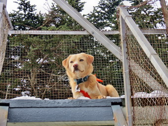 As I started up the mountain, I realized that I was a little tired but that I was not having the pulling sensation in my right upper thigh. My hips were a little sore. I stopped to get a Clif bar and realized that I had not taken a drink so far on the hike. After a short stop and a drink, I felt better although that may have been psychological. The snow on the back side of the mountain had not been exposed to as much direct sunlight and the temperature was a few degrees colder. This left more snow on the ground and there were several areas of drifting where the snow was at least a foot deep. The last .7 miles is all uphill and gains about 425 feet to the clearing with the fire tower. As we approached the tower, both Sheila and I could hear voices and when I looked up I saw two young ladies waving from near the top. It was 12:40 PM when we arrived. I dumped my pack at the picnic table and got out my camera as they headed down. They also were not using snowshoes. Both hikers were from Kingston and had tried to get up the Beaverkill Road. Since it was too slippery, they parked on the side of the road and hiked to the trailhead. I wondered why they had chosen the Beaverkill approach since the Millbrook trailhead would have been a shorter trip! I leashed Sheila to one of the tower support and then headed up. A soon as I was above the level of the trees, the wind hit me and I began to feel a chill. Most of the fog had cleared leaving just enough in some areas for interesting pictures. I took many shots including some through the tower and then quick descended to get out of the wind. The other hikers had disappeared and Sheila and I were soon on our way back down. I decided that it was late enough that I would not make the loop or try for Graham.
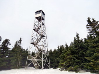 The trip down the mountain to the trail junction went quickly as I was able to "ski" much of the descent on my snowshoes. The trip up had taken about 30 minutes but the return was only a little over 15 minutes. We turned left to return to the car. Once we passed the cutoff to Graham I knew that the trail was downhill all the way. We were making good time! At some point Sheila seemed to be more interested in what was behind us and I turned to find another hiker and his yellow lab companion coming up behind us. Initially I put Sheila on her leash but the two dogs seemed to get along fine so I let them play. The other hiker and I talked as we walked and he soon realized that I had the CatskillHiker website and that he mad emailed me several times. Marc is originally from Switzerland and now splits his time as a web designer between New York city and Shandaken. I thought it was interesting that his dog is at least bilingual responding to both English and French commands. Having someone to talk to and walking downhill made the return trip go very quickly. We were back at the trail head by 2:15 PM having covered 6 miles in 3 hours and 15 minutes including the time at the tower. The time out was about 1 hour and 45 minutes but the return trip was 1 hour and 15 minutes!
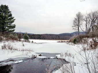
![]()
![]()
![]()
![]()
![]() On Wednesday, January 9th I had almost decided to stay at home and look forward to the end of the week. When I looked at the forecast for higher temperatures and then freezing rain and rain by Friday, I decided I had to get out for a few miles. I knew that the area around Frick Pond always seems to have more snow than any place locally. I got my gear on and loaded a "hyped" Sheila into the car and headed for Frock Pond. We were on the trail by 10:40 AM with completely overcast skies and temperatures in the high 20's. I again had by Tubbs Alp Flex snowshoes as they seem to handle all kinds of terrain. The cooler temperatures made me overdress with tights underneath my pants and a double layer on top underneath my Mammut Hoody. I had not brought a bungee cord to carry my snowshoes and so was committed to wearing them from start to finish. I was a little apprehensive when I saw the completely bare parking area! I need not have worried as the snow in the woods was still good enough for snowshoes although they were not necessary in most places. We headed out on the Quick Lake Trail to Frick Pond. When we arrived at the bridge across the outlet, I decided to stop and take a few pictures. At this point I was already very warm so I removed my baselayer and stowed it in my pack. As we continued around the pond, we stayed left at the trail junction to stay on the Quick Lake Trail. There was enough snow to cover the roots and rocks on this part of the trail an by 11:25 Am we had walked the 1.5 miles to Iron Wheel Junction. At the trail junction we turned right on the Logger's Loop Trail. This trail is open to snowmobiles and was well packed. The Logger's Loop is mostly downhill in this direction and the packed snow made traveling easy. By 11:55 Am we were at Times Square and abut 2.75 miles into the hike.
On Wednesday, January 9th I had almost decided to stay at home and look forward to the end of the week. When I looked at the forecast for higher temperatures and then freezing rain and rain by Friday, I decided I had to get out for a few miles. I knew that the area around Frick Pond always seems to have more snow than any place locally. I got my gear on and loaded a "hyped" Sheila into the car and headed for Frock Pond. We were on the trail by 10:40 AM with completely overcast skies and temperatures in the high 20's. I again had by Tubbs Alp Flex snowshoes as they seem to handle all kinds of terrain. The cooler temperatures made me overdress with tights underneath my pants and a double layer on top underneath my Mammut Hoody. I had not brought a bungee cord to carry my snowshoes and so was committed to wearing them from start to finish. I was a little apprehensive when I saw the completely bare parking area! I need not have worried as the snow in the woods was still good enough for snowshoes although they were not necessary in most places. We headed out on the Quick Lake Trail to Frick Pond. When we arrived at the bridge across the outlet, I decided to stop and take a few pictures. At this point I was already very warm so I removed my baselayer and stowed it in my pack. As we continued around the pond, we stayed left at the trail junction to stay on the Quick Lake Trail. There was enough snow to cover the roots and rocks on this part of the trail an by 11:25 Am we had walked the 1.5 miles to Iron Wheel Junction. At the trail junction we turned right on the Logger's Loop Trail. This trail is open to snowmobiles and was well packed. The Logger's Loop is mostly downhill in this direction and the packed snow made traveling easy. By 11:55 Am we were at Times Square and abut 2.75 miles into the hike.
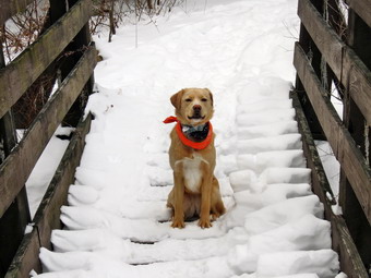 At Times Square we turned left to start up the Big Rock Trail. This trail was also packed by snowmobiles but the walk was harder due to the gain in elevation. From Times Square to The Flynn Trail is about 1.1 miles but the elevation gain is around 600 feet. The route has three different climbs with some flatter areas between them. I wasn't getting the pulling sensation in my upper left leg that I had on other snowshoe hikes but I was getting tired as we climbed. I realized that I have to go longer and deal with more climbing to get back in the condition I need to be in! We reached the Flynn Trail at 12:25 PM after hiking 3.85 miles. I thought I might make a loop down to Hodge Pond but I was tired1 and needed to get back home so that I could get to track practice on time. We turned right to walk down the Flynn Trail back to the parking area. There was at least one set of snowmobile tracks and this was annoying since the Flynn Trail is supposed to be off limits to snowmobiles. Sheila was still excited at this point and was running up the trail and back to me. She was taking a few excursions off the trail to follow animal tracks but was pretty close so I let her explore. As we neared the gate by the cabin I realized I had not brought Sheila's leash. I usually put her on a leash near the cabin as we have encountered some dogs there. The snowmobile tracks turned around at the gate and went back up the Flynn Trail. We continued to the parking area on the Flynn Trail. We were back at 1:10 PM having covered 5.6 miles in 2.5 hours.
On Monday, January 7th I had planned to hike Balsam Lake Mountain with my son Kurt but he was not available. By the time I got started I only had enough time for a short walk. I decided to head up over Round Top just behind my church and right across the street from my house. I wanted to get out since the forecast for the rest of the week was for warm temperatures which could easily do away with the snow in town. I got Sheila ready and we left the house to walk across the street a little before 10:30 AM. As we walked up the steep hill to near the top of the cemetery I could already tell that the snow cover had started to melt. Any place where the snow was exposed to direct sunlight was almost bare. We turned left into the woods and started up one of the many woods roads. I was happy to see that under the cover of the forest the snow was still there and some new snow had actually fallen throughout the week. I was carrying my GPS this time as I wanted to know exactly how much distance we covered on our "usual" loop. Sheila was, as always, happy to be out and was having trouble staying with me. Initially, it seemed cold despite the 32 degree temperature since a slight wind was blowing. We skirted the summit of Round Top and the old stone quarry. The woods road led us to another road that ascended the next unnamed and higher hill. The descent down the other side of this hill was steep and the diminishing snow cover made gliding difficult. Once we were down the other side, we made the turn to start back. Various woods roads allowed a fairly easy route until we cut through an area with some briars near another stone quarry. The return path that we took paralleled the Quickway and both Sheila and I could hear cars and trucks on the highway. At the stone quarry we started to head down toward the road to pick up another path that follows the road. Once we hit that path we walked down until another woods road branched to the left. This road was wide and broad with only one blowdown. After a short walk, the road led to a field that allow a view of the exit 96 interchange. We continued on the road as it started to bend north and then started a short bushwhack uphill and to the west to complete the loop. We had a quick look at town from another overlook before descending the hill to the area where we had entered the woods. All that was left was to descend the cemetery hill back to the church. The loop from the church was about 2.8 miles and took us around and hour and 15 minutes. From my house the hike is a little over 3 miles.
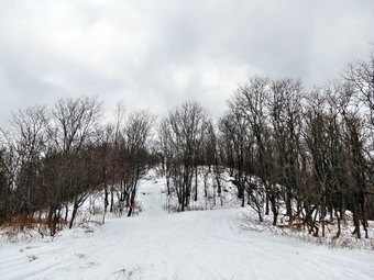
![]()
![]()
![]()
![]()
![]() On Saturday, January 5th I decided I had babied myself through a cold for long enough and was ready to get out. This decision was helped along by the fact that it was the first day in the week where the temperature was forecast to be above freezing! I will say that by resting a few days my cold seemed to be on the way out faster than if I had hiked! By the time I finished some morning "chores" it was getting late and my son, Kurt, and family were do in at about 2:00 PM. I was tired of hiking the usual places around Livingston Manor so I decided to go to Liberty to snowshoe at Walnut Mountain. We had sued the park this summer for cross country runs and I know the trails well. On New Year's Day Morgan Outdoors sponsored a snowshoe hike there but I was unable to go due to family commitments. I knew that others had probably been over the trails and that it was also popular with snowmobilers. I got my gear and put Sheila in the car with the temperature hovering in the low 30's. I decided to take my Tubbs Alps Flex snowshoes this time just for some variety. I resisted the urge to overdress and wore no tights under my Mountain Hardwear Winter Wander pants. I did put on my Mammut Hoody but wore only a single layer of Capilene under it. We arrived at the West Lake Street parking area at 10:35 PM to find only one other car parked. We were on the trail in a few minutes. We headed out the lower A2 trail until we got to the main parking area and then cut across to the picnic area. I was surprised to find the lot cleared of snow. We turned right and walked up the road to the area near the water tank and then continued on the A1 trail by bearing right. The trail was packed by snowmobiles which made the going easier. The first part of this trail is a gentle but long climb. Along the way we met a man walking with his 4-year-old chocolate lab. We talked for a minute and then continued on our separate ways. We walked passed the A4 trail on the left and the trail began to level. At about 1 mile we passed the A2 trail on the right and continued around the base of the mountain.
On Saturday, January 5th I decided I had babied myself through a cold for long enough and was ready to get out. This decision was helped along by the fact that it was the first day in the week where the temperature was forecast to be above freezing! I will say that by resting a few days my cold seemed to be on the way out faster than if I had hiked! By the time I finished some morning "chores" it was getting late and my son, Kurt, and family were do in at about 2:00 PM. I was tired of hiking the usual places around Livingston Manor so I decided to go to Liberty to snowshoe at Walnut Mountain. We had sued the park this summer for cross country runs and I know the trails well. On New Year's Day Morgan Outdoors sponsored a snowshoe hike there but I was unable to go due to family commitments. I knew that others had probably been over the trails and that it was also popular with snowmobilers. I got my gear and put Sheila in the car with the temperature hovering in the low 30's. I decided to take my Tubbs Alps Flex snowshoes this time just for some variety. I resisted the urge to overdress and wore no tights under my Mountain Hardwear Winter Wander pants. I did put on my Mammut Hoody but wore only a single layer of Capilene under it. We arrived at the West Lake Street parking area at 10:35 PM to find only one other car parked. We were on the trail in a few minutes. We headed out the lower A2 trail until we got to the main parking area and then cut across to the picnic area. I was surprised to find the lot cleared of snow. We turned right and walked up the road to the area near the water tank and then continued on the A1 trail by bearing right. The trail was packed by snowmobiles which made the going easier. The first part of this trail is a gentle but long climb. Along the way we met a man walking with his 4-year-old chocolate lab. We talked for a minute and then continued on our separate ways. We walked passed the A4 trail on the left and the trail began to level. At about 1 mile we passed the A2 trail on the right and continued around the base of the mountain.
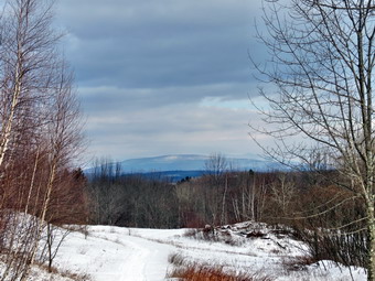 As we walked south we passed the trail that leads up to the next level. It was my intention to do several loops starting with the lowest and working up. At 1.65 miles we came to a trail junction with a field directly ahead. With the leaves off the trees there were some views so I stopped at a picnic table to take a few pictures. At this point the skies were still overcast and I took a few shots. From here we made a sharp left turn to follow the A4 trail around the mountain until we were back at the A1 trail having completed the loop. We started around again but this time took a trail on the left that winds its way up the mountain just after the A2 junction. This trail was NOT packed by snowmobiles and it was refreshing to be walking through fresh powder. The trail made a switchback and soon joined the A4 trail that makes a second and higher loop around the mountain. We turned right and headed south again. Along the way we met a woman with two large labs. They were not on a leash and were a little intimidating. I wish people were more considerate when walking and hiking in public places! Soon we were just above the field. At this point a trail which may be the A5 makes a sharp left and heads up to the highest loop around the summit of Walnut Mountain. We climb a little and then began the last loop on an unmarked path. Near the top the snow had drifted away from some places and toward others. The effect was 18 inch drifts in some spot and almost bare ground in others. We passed over some rough spots and walked close to some boulders with a nice ice flow. I took some pictures before completing the loop and walking down another trail and back to the A4. We turned left and walked back to the trail we had used to ascend from the A1 trail. Next, it was back down around to the lookout in the field on the A1. I was getting little bored with loops so I went straight ahead to follow the A1 trial back to the main parking area. We continued on the A1 to start another loop but this time took a right on the upper A2 trail. I was beginning to get tired and had some small muscle strains in my upper legs due to the gait of the snowshoes. We followed the A2 down to where it descends to a small stream and then continued to follow it back to the car. We were back at the parking area by 1:20 PM having covered 5.9 miles in 2 hours and 40 minutes.
On Monday, December 31st I was ready to get out after a weekend of family and church commitments. At some point on Sunday I realized I was coming down with the cold or flu as my throat was really sore. I decided to get out Monday despite the cold temperatures since the rest of the week was forecast to be colder and I knew I would probably be sicker! I decided to take Sheila across the street to the Livingston Manor Round Top for our first snowshoe hike of the year. I though we might do the 3 mile route which would be enough for me and would allow me to see how Sheila dealt with the snow. I had Sheila out last year when she was a few months old and she seemed to like the snow a lot. I wanted to make sure she would not get too cold or have problems with snow frozen in her paws. We walked across the street at just before 3:00 PM into a field with drifts more than a foot high. After taking Sheila across the street on her leash, I let her run free and she promptly headed up the cemetery hill just where I wanted to go. She seemed to have no problem running up the hill while I lagged a little behind. I was wearing my Crescent Moon Gold Snowshoes which I often use on flat or hilly terrain. These snowshoes have the best bindings of anything I have seen. However, they lack sufficient grip for climbing mountains. I also noticed that where the decking wraps around the frame the decking has started to tear. I made a note to e-mail the company to see what can be done as I almost always wear these shoes in snowy areas without rocks! At the top of the hill we turned from the road onto a woods road through the forest. The snow was unbroken except by a few animal tracks. Just a little farther up this trail we turned right again to head up and across the ridge that is part of Round Top. Sheila was so glad to be out she was running up and down the trail. We climbed up a little, flattened out and then dropped some. I considered skipping the next hill but decided we weren't that tired and would have enough daylight to finish. We ascended the next hill which is actually higher than Round Top and then dropped down the other side to circle around and complete the loop. We passed the second of two stone quarries and then dropped down to the path that parallels the Quickway heading west and north. We continued to bear left as we took another woods road and then bushwhacked up the hill. At some point along the final climb I was mentally congratulating myself on remaining upright for the while trip. At this point I stepped onto a short but sharp stump and fell forward. I was not injured but could have done without the snowy covering so late in the hike. We were soon at the viewpoint that overlooks Livingston Manor. From here we headed down the woods road and back out to the cemetery and then home. We completed the 3 mile loop in about 1.5 hours.
![]()
![]()
![]()
![]() On Wednesday, December 26th Brad and I decided to get out to hike off some of the Christmas feast. An impending storm for Thursday and Friday also made us anxious to get out before the roads became difficult. We decided to once again go to Frick and Hodge Ponds even though that would probably be our destination for snowshoeing once the storm passed. We got our gear and ushered a highly excited Sheila into the car. As we started out the temperature was in the low 20's so I decided to wear my Mountain Hardwear WinterWander pants with Mountain Hardwear tights underneath. On top I had my Mammut Hoody over a Patagonia Capilene top with a Mammut baselayer. I decided that for extra warm nth I would wear my Salomon B52 boots and Mountain Hardwear Nutshell gaiters. As we got out of the car at the parking area at 9:50 AM , I noticed that the temperature was barely 20 degrees and a breeze was blowing. I knew that I would warm up on the trail but was glad I had brought a hat and gloves. We started out on the Quick Lake Trail to Frick Pond. As soon as we made the turn onto the woods road by the register, it was obvious that despite the cold temperatures this was going to be a wet hike. In fact, after a few footsteps, I sank almost to my boot top in a muddy spot. The rain had flooded the trails before it turned to snow and there was standing water in some places with running water in others. We did not stop at the pond as we crossed the bridge. The day was overcast but not very interesting photographically. This time Sheila avoided the water which I thought was a good idea given the temperature. I decided not to take pictures but to just enjoy the walk at as fast a pace as seemed comfortable. After only a short distance, we ran into the first of what would be over a dozen blowdowns that we had cleared several weeks before and I commented to Brad about my handiwork. As we continued on the trail, it was a pleasure to hike unimpeded by the trees that once blocked the way! When we got to Iron Wheel Junction, we decided to do the big loop up to Hodge Pond. We made the left turn to continue on the Quick Lake Trail and found that some of the blowdown across the trail had been cleared. We also found that the snow graduated from a dusting to several inches as we gained elevation. The trail continued to be wet and muddy in places but we were soon at Junkyard Junction where we turned right to get on the Flynn Trail at 11:15 AM after hiking about 3 miles.
On Wednesday, December 26th Brad and I decided to get out to hike off some of the Christmas feast. An impending storm for Thursday and Friday also made us anxious to get out before the roads became difficult. We decided to once again go to Frick and Hodge Ponds even though that would probably be our destination for snowshoeing once the storm passed. We got our gear and ushered a highly excited Sheila into the car. As we started out the temperature was in the low 20's so I decided to wear my Mountain Hardwear WinterWander pants with Mountain Hardwear tights underneath. On top I had my Mammut Hoody over a Patagonia Capilene top with a Mammut baselayer. I decided that for extra warm nth I would wear my Salomon B52 boots and Mountain Hardwear Nutshell gaiters. As we got out of the car at the parking area at 9:50 AM , I noticed that the temperature was barely 20 degrees and a breeze was blowing. I knew that I would warm up on the trail but was glad I had brought a hat and gloves. We started out on the Quick Lake Trail to Frick Pond. As soon as we made the turn onto the woods road by the register, it was obvious that despite the cold temperatures this was going to be a wet hike. In fact, after a few footsteps, I sank almost to my boot top in a muddy spot. The rain had flooded the trails before it turned to snow and there was standing water in some places with running water in others. We did not stop at the pond as we crossed the bridge. The day was overcast but not very interesting photographically. This time Sheila avoided the water which I thought was a good idea given the temperature. I decided not to take pictures but to just enjoy the walk at as fast a pace as seemed comfortable. After only a short distance, we ran into the first of what would be over a dozen blowdowns that we had cleared several weeks before and I commented to Brad about my handiwork. As we continued on the trail, it was a pleasure to hike unimpeded by the trees that once blocked the way! When we got to Iron Wheel Junction, we decided to do the big loop up to Hodge Pond. We made the left turn to continue on the Quick Lake Trail and found that some of the blowdown across the trail had been cleared. We also found that the snow graduated from a dusting to several inches as we gained elevation. The trail continued to be wet and muddy in places but we were soon at Junkyard Junction where we turned right to get on the Flynn Trail at 11:15 AM after hiking about 3 miles.
The Flynn Trail was wet and muddy in places which slowed us down considerably. In addition, the slippery snow was beginning to take a toll on my legs. At the gate we turned to go down to Hodge Pond. In this short section of trail there were two large trees blocking our path. Both of these will need to be removed. When we got to Hodge Pond, we decided to walk around the back of the pond on the jeep trail. We were soon at the outlet end of the pond where we turned to climb the Flynn Trail to the junction with the Big Rock Trail. Sheila is always very intent on investigating various smells and tracks in the woods and this day was no different. She was wandering pretty far away from the trail following her nose but came quickly when I called her. The climb from the pond to the junction isn't steep at all but my legs were tired from slipping on the snow. We made the trail junction by noon with 5 miles behind us. We continued straight ahead on the Flynn Trail. This last 1.7 miles always seems long to me as there is not really much to see but having Brad along made it go faster. There are still quite a few trees across this part of the trail which should be cleared. Some are old and have been down for some time while others are newer. As we approached the gate, I made sure to keep Sheila close to me as we walked around another tree that blocks the trail in this area. Further down the trail we neared the register box and found that someone had cleared the trees that had blocked the trail. We were back at the car by 12:35 PM having covered 6.7 miles in 2 hours and 45 minutes. The progress in clearing these trails is good but more needs to be done to make the area completely accessible.