
What You Missed
Winter 2010-2011
Winter 2010-2011
![]()
![]() On Sunday, March 20th I wanted to get in a Catskill 3500 or CHH peak for the last hike of the winter. Since Cindy and Lisa wanted to come along, I suggested the Plattekill Mountain off Platte Clove Road. It is a bushwhack but the first part is trail and then a woods road leads to near the top. It is also relatively short to go up and back. Cindy vetoed this because of the word "bushwhack" and we settled on doing Hunter from the Spruceton parking area. We left immediately after church to go home and change and then picked Lisa up by 11:00 AM. The roads were in such poor shape that we were not at the trail head until 12:15 PM. We decided to wear our snowshoes since there was snow on the trail and we were off by 12:25 PM. The trail was covered for the most part to the hairpin turn up Hunter with a few bare spots where there had been water on the trail. The snow was mostly hard packed with ice in many places. Sheba and I were ahead of Lisa and Cindy and we were moving quickly up the trail. I waited several times for the others to catch up and then started off again. This part of the trail has a southern exposure and soon there were more bare patches than snow. I reluctantly rennet my snowshoes and carried them on my poles to the turn up the mountain. I also removed my midlayer as the temperatures were climbing into the 40's with the sun making it feel warmer. I could see that there was snow on the trail toward the summit as I waited for Lisa and Cindy to catch up. By 1:20 PM they had arrived but almost an hour for the 1.7 mile hike seemed long.
On Sunday, March 20th I wanted to get in a Catskill 3500 or CHH peak for the last hike of the winter. Since Cindy and Lisa wanted to come along, I suggested the Plattekill Mountain off Platte Clove Road. It is a bushwhack but the first part is trail and then a woods road leads to near the top. It is also relatively short to go up and back. Cindy vetoed this because of the word "bushwhack" and we settled on doing Hunter from the Spruceton parking area. We left immediately after church to go home and change and then picked Lisa up by 11:00 AM. The roads were in such poor shape that we were not at the trail head until 12:15 PM. We decided to wear our snowshoes since there was snow on the trail and we were off by 12:25 PM. The trail was covered for the most part to the hairpin turn up Hunter with a few bare spots where there had been water on the trail. The snow was mostly hard packed with ice in many places. Sheba and I were ahead of Lisa and Cindy and we were moving quickly up the trail. I waited several times for the others to catch up and then started off again. This part of the trail has a southern exposure and soon there were more bare patches than snow. I reluctantly rennet my snowshoes and carried them on my poles to the turn up the mountain. I also removed my midlayer as the temperatures were climbing into the 40's with the sun making it feel warmer. I could see that there was snow on the trail toward the summit as I waited for Lisa and Cindy to catch up. By 1:20 PM they had arrived but almost an hour for the 1.7 mile hike seemed long.
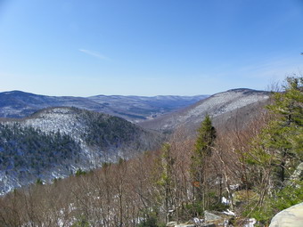
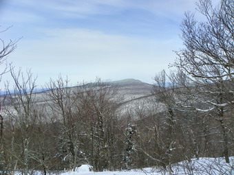
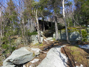 We made the turn up the mountain and headed for the spring and lean-to. The new location of the lean-to is just short of the 3500 foot sign and allows a beautiful view of the valley which I wanted Cindy and Lisa to see. Sheba and I waited for the others to catch up but Cindy, in particular, was having a tough time. We turned on the spur trail to the lean-to and walked to where the trail turns down through some rocks. This area was nothing but a sheet of ice and the fact that it is narrow made getting down with snowshoes difficult. I made it down OK and dropped my pack to get out the camera and take pictures. It was 2:10 PM and the 2.3 mile trip to the lean-to had taken 1 hour and 45 minutes. I knew we were not going any further this day! I walked over to the lookout and was treated to a nice view down the valley. I took shots of the valley, the Westkill Ridge to the left and the Rusk ridge on the right. When I got back to the lean-to I found that Cindy had decided to change to MicroSpikes to get down the icy patch and that Lisa had decided not to attempt the descent. I suggested that Cindy go to the viewpoint and I was determined to find a route that Lisa could negotiate on snowshoes. I walked just to the left of the privy, found some tracks and a snow covered track down. I walked over to Lisa and guided here down this new path. We spent some time at the viewpoint before heading back at about 2:35 PM. The trip down went more quickly but I removed my snowshoes just after the turn onto the Old Hunter Road and attached them to my pack for the rest of the trip down. We arrived back at the car at 3:40 PM with the descent taking just over an hour. We covered 4.6 miles on the hike but it took a total of 3 hours and 15 minutes. I understood the need to turn around but was annoyed we had not made the tower on such a beautiful day.
![]()
![]() On Thursday, March 17th I wanted to get in a Catskill 3500 peak before turning to track practice in the afternoon. I looked at my grid and was pleasantly surprised that Westkill was still available. I like the view from the Buck Ridge lookouts and the hike is relatively short. What I always forget is that short does not always mean easy and Westkill "fools" me each time I hike it. I knew that time was short so Sheba and I left home around 7:45 Am. Despite the poor condition of the roads I made good time and we arrived at the parking areas on Spruceton Road just before 9:00 AM. There was one car parked in the lot and the hiker asked "Are you here for Paul's finish?' My response of "Who is Paul?" made it clear that I was ready to hike solo. It appeared that the road to the upper lot had been repaired and since I wanted to put the snowshoes on immediately I drove to the upper lot and parked. The other car followed me and soon an entire group, many of them from the Rip Van Winkle Club, began to appear. I needed to move fast and did not want to hike with a group I did not know so I put on my equipment and started out at 9:00 Am keeping a fast pace to the falls. The Westkill was running high but not as high as I have seen it. The trail was covered in over a foot of snow except in areas of running water and we made the falls in around 15 minutes. I decided not to stop for pictures until we reached the top so we made the turn, walked along the creek and turned up the mountain. I did not see the group approaching on the other side. The temperature was about 31 degrees when we started and the skies were overcast belying the forecast for sun and temperatures in the 50's. The trail was hard packed snow in almost all places and this made walking easier in most places
On Thursday, March 17th I wanted to get in a Catskill 3500 peak before turning to track practice in the afternoon. I looked at my grid and was pleasantly surprised that Westkill was still available. I like the view from the Buck Ridge lookouts and the hike is relatively short. What I always forget is that short does not always mean easy and Westkill "fools" me each time I hike it. I knew that time was short so Sheba and I left home around 7:45 Am. Despite the poor condition of the roads I made good time and we arrived at the parking areas on Spruceton Road just before 9:00 AM. There was one car parked in the lot and the hiker asked "Are you here for Paul's finish?' My response of "Who is Paul?" made it clear that I was ready to hike solo. It appeared that the road to the upper lot had been repaired and since I wanted to put the snowshoes on immediately I drove to the upper lot and parked. The other car followed me and soon an entire group, many of them from the Rip Van Winkle Club, began to appear. I needed to move fast and did not want to hike with a group I did not know so I put on my equipment and started out at 9:00 Am keeping a fast pace to the falls. The Westkill was running high but not as high as I have seen it. The trail was covered in over a foot of snow except in areas of running water and we made the falls in around 15 minutes. I decided not to stop for pictures until we reached the top so we made the turn, walked along the creek and turned up the mountain. I did not see the group approaching on the other side. The temperature was about 31 degrees when we started and the skies were overcast belying the forecast for sun and temperatures in the 50's. The trail was hard packed snow in almost all places and this made walking easier in most places
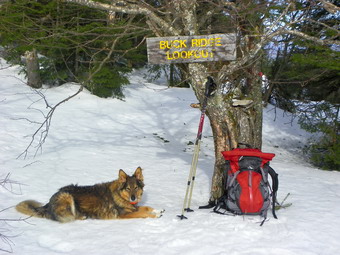
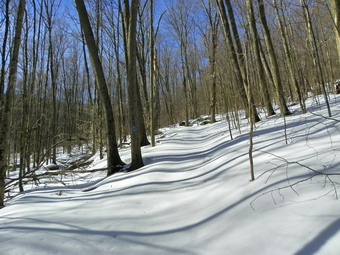
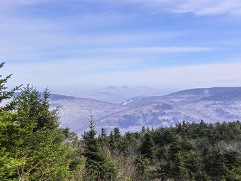 We made our way up through the series of switchbacks that alternate between steep areas and flatter spots. Around 1.5 miles we walked along the part of the trail which sidehills for several hundred feet with little evidence of a defined trail. Walking this in the winter on snowshoes is always challenging. As we ascended the snow pack became deeper and deeper until the trail markers were about the level of Sheba's ears. This made hiking interesting since there were many pointy branches that would normally be overhead but were now pointing at my face. In several spots there were a few branches in the trail and in others significant blowdown to walk around. This must have been present for some time as there were tracks that cut around most of the debris. Several of the steeper sections were icy and a little difficult to get up on snowshoes. I though about switching to my Yak Xtremes but by the time I had made the decision I was already up that section. I did wonder about the trip back down though! We were still on a fast pace and I found myself pausing occasionally to get my breath.These pauses are always cut short by Sheba's insistent stare! We made the rock shelter at 3500 feet by a little after 10:00 AM. I always take this as a signal that I am almost at the top forgetting that there is over a mile of hiking and another 300 feet of vertical gain to go! From the "cave" to the last ascent is a series of ups and downs and soon we were at the last climb to Buck Ridge. We arrived at the lookouts at around 10:45 AM and I dropped my pack to get a drink and a snack and take some pictures. There was some haze still hanging on the mountains but the views were still nice. I took shots from both sides of the lookout before putting the camera away. I had though I would not go to the summit but it is only .12 miles from the lookouts so I shouldered the pack and headed to the top. Once we hit the sign, we reversed course and headed back down.
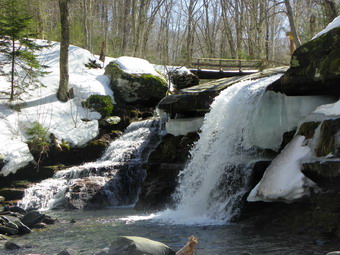 By this time the snow was starting to breakup a little and there was a granular layer on top of the packed snow underneath. The group of hikers had still not shown up. Sometime before the rock overhang I met a man and woman hiking toward the top. We chatted briefly and continued. A little behind them was the group of hikers strung out along the trail. One asked me to be on the lookout for a lost pole near the first steep ascent. The descent went quickly since I could "ski" down on the loose granulated area in most places. The steep, icy section proved to be more of a problem going down than coming up. The frozen snow made getting a grip with the snowshoes a problem. I chose to perform a glissade down the second half rather than change to other traction devices. The sidehill portion was even more interesting since the loose upper layer meant that it was difficult to get any grip with the snowshoes without sliding down the slope. This section slowed us down but it is short. Soon we were back at the creek walking toward the falls. As we approached the falls the accumulated snow made getting down to the creek bed somewhat easy and I took advantage of this. I was able to get some nice pictures of the falls without obstructions. Back on the main trail I took some pictures from the bridge and others from the opposite side of the falls before packing everything up and hurrying back to the car. We were back at the car by 12:35 PM, earlier than I had expected, having covered the 6.1 mile hike in 3.5 hours including the stops for pictures. I was tired but happy to be ahead of schedule for the drive home.
![]()
![]() On Tuesday, March 15th Lisa Lyons wanted to go hiking somewhere and Cindy and I put our heads together to come up with a local hike that was short but challenging. Cindy suggested the Campbell Mountain Trail from Route 206 between Roscoe and Downsville. I knew this wasn't very long but that there was some elevation gain. We decided to take snowshoes since there was still some snow in the backyard and we wanted to be prepared. We picked up Lisa at her shop around 9:00 AM and started toward the trailhead. We arrived at around 9:30 AM and had to park on the shoulder of the road as the roadside pulloff was not plowed. The temperatures was in the high 20's but a slight breeze made it feel colder. There was obviously enough snow remaining to make snowshoes a good idea. As we started down the trail it was obvious the crust would support our weight, at least until it started to melt as the temperature rose. I was a little cold since I had put on "lighter" clothing on the basis on the forecast but this only lasted a short time until I warmed up from the snowshoeing. The trail down started out with a nice snow covering but soon was devoid of snow with bare ground. These conditions would prevail tying the hike especially at the lower elevations. The areas most affected were those where there was running water. There is only one real stream crossing and that has a bridge but there were plenty of smaller rivulets and many had to be crossed while some ran down the trail for a distance. After half a mile we crossed the bridge and then dropped to the lowest point on the trail which is almost 200 feet down from the road. From here the trail starts a climb through a number of switchbacks to the top of Campbell Mountain. At 1.2 miles we made a left turn onto an old woods road and by 1.3 miles we were passing the lean-to. The trail switches back several times after that following the woods road and crossing a couple of wet areas. I got a little ahead of the women and reached the top at around 10:50 AM. I was 2 miles into the hike at an elevation of 2410 feet. I decided that Cindy and Lisa would not want to descend to Campbell Mountain Road so I picked up the pace as Sheba and I went down the other side.
On Tuesday, March 15th Lisa Lyons wanted to go hiking somewhere and Cindy and I put our heads together to come up with a local hike that was short but challenging. Cindy suggested the Campbell Mountain Trail from Route 206 between Roscoe and Downsville. I knew this wasn't very long but that there was some elevation gain. We decided to take snowshoes since there was still some snow in the backyard and we wanted to be prepared. We picked up Lisa at her shop around 9:00 AM and started toward the trailhead. We arrived at around 9:30 AM and had to park on the shoulder of the road as the roadside pulloff was not plowed. The temperatures was in the high 20's but a slight breeze made it feel colder. There was obviously enough snow remaining to make snowshoes a good idea. As we started down the trail it was obvious the crust would support our weight, at least until it started to melt as the temperature rose. I was a little cold since I had put on "lighter" clothing on the basis on the forecast but this only lasted a short time until I warmed up from the snowshoeing. The trail down started out with a nice snow covering but soon was devoid of snow with bare ground. These conditions would prevail tying the hike especially at the lower elevations. The areas most affected were those where there was running water. There is only one real stream crossing and that has a bridge but there were plenty of smaller rivulets and many had to be crossed while some ran down the trail for a distance. After half a mile we crossed the bridge and then dropped to the lowest point on the trail which is almost 200 feet down from the road. From here the trail starts a climb through a number of switchbacks to the top of Campbell Mountain. At 1.2 miles we made a left turn onto an old woods road and by 1.3 miles we were passing the lean-to. The trail switches back several times after that following the woods road and crossing a couple of wet areas. I got a little ahead of the women and reached the top at around 10:50 AM. I was 2 miles into the hike at an elevation of 2410 feet. I decided that Cindy and Lisa would not want to descend to Campbell Mountain Road so I picked up the pace as Sheba and I went down the other side.
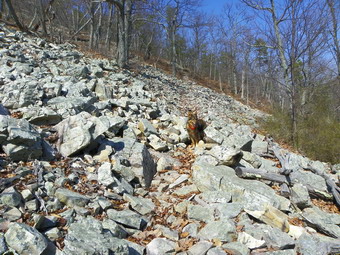
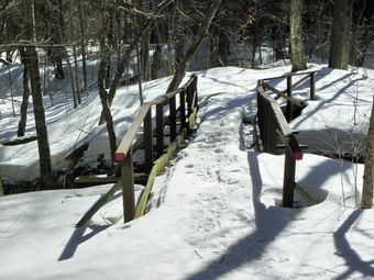 The trail down the other side does not take a direct route and descends 230 feet in about .45 miles. I had wondered why there was no evidence of snowmobile use and I found the answer when I got to the other end of the trail and saw the "TRAIL CLOSED" and "DETOUR" signs. Sheba and I turned around and headed back up the mountain at just passed 11:00 AM. We kept up a rapid pace until I saw Lisa and Cindy near the top of the trail, They waited until I met up with them and expressed no desire to go down to the road. On the way back Lisa and I bushwhacked over the highest point on the mountain while Cindy continued on the trail. The bushwhacking was easy due to the hard crust and we were soon back on the trail. There was no sign of Cindy. This did not surprise me since "down" is her best direction. Lisa and I hurried but we did not pick her up for some time. I knew Cindy was up ahead when Sheba took off up the trail like a rocket. After coming back together we descended together to the lean-to where we stopped for a few pictures before continuing. After negotiating a small water crossing, we continued ahead to cross the bridge where I also stopped for some pictures. On the way back I photographed the old foundations and walls near the trail that leads up to Route 206. The last time I knew one of them has a geocache but I did not have the coordinates. We were back at the car by 12:30 PM having taken 3 hours for the 5 mile hike. The temperature was in the low 40's just about matching the forecast.
![]()
![]() On Saturday, March 12th Karl and I wanted to hike in the mountains of Virginia. The closest mountains to Williamsburg are in Shenandoah national Park almost three hours away. We decided to go since the weather report was for partly sunny skies with temperatures in the 60's. I was concerned that my feet, which were sore from the previous day, would hamper me on the hike. I decided to try putting some simple, generic athletic tape across the forefoot and see how that worked. We left Williamsburg and about 7:00 AM and headed west on I64 through Richmond and Charlottesville. Near Waynesboro we turned north on Skyline Drive and entered the park. As we drove along Skyline Drive the views were beautiful but there was a haze hanging in the valleys and over the mountains. After about 30 miles of driving passed MANY overlooks and numerous trailheads we arrived at the trail head for Rocky Mount. Karl felt this was a good choice as the recent rains would have the creeks on the trails on the Rocky Mountain - Brown Mountain loop too swollen to be passable. We arrived just before 10:00 AM and parked. The temperature was in the high 30's with a stiff breeze. I wondered if it really would get any warmer during the day. From the car we walked downhill on Skyline Drive to the trail head and started down the trail to a point where the trail would split. I thought about climbing back up this hill at the end of the hike! Our intent was to hike around to the back of Rocky Mount and over the summit. By 10:55 AM we had hiked 1.3 miles and dropped 850 feet to the point where the trail split. We turned right and started to hike through a pleasant area right next to Gap Run.
On Saturday, March 12th Karl and I wanted to hike in the mountains of Virginia. The closest mountains to Williamsburg are in Shenandoah national Park almost three hours away. We decided to go since the weather report was for partly sunny skies with temperatures in the 60's. I was concerned that my feet, which were sore from the previous day, would hamper me on the hike. I decided to try putting some simple, generic athletic tape across the forefoot and see how that worked. We left Williamsburg and about 7:00 AM and headed west on I64 through Richmond and Charlottesville. Near Waynesboro we turned north on Skyline Drive and entered the park. As we drove along Skyline Drive the views were beautiful but there was a haze hanging in the valleys and over the mountains. After about 30 miles of driving passed MANY overlooks and numerous trailheads we arrived at the trail head for Rocky Mount. Karl felt this was a good choice as the recent rains would have the creeks on the trails on the Rocky Mountain - Brown Mountain loop too swollen to be passable. We arrived just before 10:00 AM and parked. The temperature was in the high 30's with a stiff breeze. I wondered if it really would get any warmer during the day. From the car we walked downhill on Skyline Drive to the trail head and started down the trail to a point where the trail would split. I thought about climbing back up this hill at the end of the hike! Our intent was to hike around to the back of Rocky Mount and over the summit. By 10:55 AM we had hiked 1.3 miles and dropped 850 feet to the point where the trail split. We turned right and started to hike through a pleasant area right next to Gap Run.
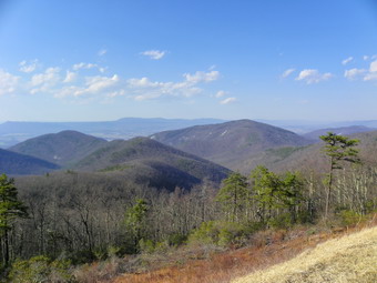
 The trail continued to descend as we hiked along Gap Run. The Run is normally pretty low and easy to cross and it was this day in several places. In other spots the recent rains had swollen the Run so that is was wider and deeper than normal. This made it difficult to cross in several spots. In three or four spots Karl walked one way and I walked the other looking for places to cross. Karl chose to throw some stones in the water but I, in all cases, found trees that had fallen across the run creating natural "bridges". The final crossing was the lowest point on the hike and was the widest and deepest. We walked upstream and found a tree trunk and used it to cross. Meanwhile, the dogs were having fun running across the streams and seemed to be saying "Let's go!" It was 12:20 PM and we had hiked 4.75 miles dropping some 1535 feet in elevation. We now started the climb up the back of Rocky Mount. The trail switched back and forth several times and there were one or two more water crossing that were easily managed. We climbed for the next 2 miles and gained almost 1500 feet to the summit of Rocky Mount. On the way up there were some nice views over to other mountains. Many have extensive talus slopes visible on their sides. We walked over two talus slopes on our own trail. As we started up the last climb, we met a hiker coming down from the summit. We talked briefly and warned him about the water crossings. He seemed pretty experienced and we went our separate ways. There were no views from the summit so we began to descend the other side at 1:55 PM and 6.75 miles into the hike.
 The summit of Rocky Mount proved to live up to it name. The trail down from the summit did have some view but there was still a haze hanging over most of the peaks. (When I got back and processed the pictures, many were better than I had expected!) After a brief pause for water and a snack, we started down the trail to the junction where we had turned earlier that morning. The 1.2 mile trip took us about 45 minutes and we arrived at the junction around 2:40 PM having dropped 815 feet. As we approached the intersection, the hiker we had talked to appeared! Since we had met him on the back side of the mountain well passed the halfway point, we concluded he must have really been moving especially considering the water crossings. We said "Hello" and then he was off. I was able to keep up for some time but eventually slowed down to enjoy the walk. The last 2.3 miles DID seem long as I suspected it would earlier in the day. The 850 foot elevation gain and 25 degree change in temperature contributed to the feeling. We were back at the car at 3:45 PM having covered 10.2 miles and 2900 feet of elevation gain in just under 6 hours. On the way back down Skyline Drive I stopped at six of the overlooks to take pictures on both sides of the road. Now I am "hooked" and want to return for other hikes. The athletic tape on my feet eliminated all irritation and cost a few cents as compared to the Dr. Scholl's pads at a dollar each.
![]()
![]() On Friday, March 11th I decided to return to York State Park with Cindy and Karl and the two dogs. I had liked my first visit so much I wanted to explore some more and share the experience with others. I particularly wanted to go to the "tower" on the river at the end of the Pumunkey Trail. My feet were still bothering me from the hike two days before. This time I remembered to use a liner sock under a pair of heavier, cushioned socks. We arrived in the parking area around 11:00 AM. It was much easier this time knowing where we were going. The grounds were much wetter from the recent rain. We immediately headed to the right of the visitor's center and got on the Woodstock Pond Trail. When we departed from Williamsburg, the skies were sunny and I expected them to stay that way. At the park the skies began to cloud over so that the atmosphere was much like two days before. The temperature was in the mid 50's which made just wearing a shirt appropriate but the breeze suggested a light windbreaker was in order. We walked from the trail down to the Bach and I took a few pictures of Karl and the dogs before we went back to the main trail. After passing the pond, we turned right on the Mattaponi Point Trail and were soon at the lookout platform above the bluff. From here we walked down to Fossil Beach. I again took a few shots and we walked around some before going back to the main trail and following it out to the Backbone Trail. We continued south on the Backbone Trail as I had on Wednesday and used the multi-use trail to get to the Pumunkey Trail. At the trail junction we turned left.
On Friday, March 11th I decided to return to York State Park with Cindy and Karl and the two dogs. I had liked my first visit so much I wanted to explore some more and share the experience with others. I particularly wanted to go to the "tower" on the river at the end of the Pumunkey Trail. My feet were still bothering me from the hike two days before. This time I remembered to use a liner sock under a pair of heavier, cushioned socks. We arrived in the parking area around 11:00 AM. It was much easier this time knowing where we were going. The grounds were much wetter from the recent rain. We immediately headed to the right of the visitor's center and got on the Woodstock Pond Trail. When we departed from Williamsburg, the skies were sunny and I expected them to stay that way. At the park the skies began to cloud over so that the atmosphere was much like two days before. The temperature was in the mid 50's which made just wearing a shirt appropriate but the breeze suggested a light windbreaker was in order. We walked from the trail down to the Bach and I took a few pictures of Karl and the dogs before we went back to the main trail. After passing the pond, we turned right on the Mattaponi Point Trail and were soon at the lookout platform above the bluff. From here we walked down to Fossil Beach. I again took a few shots and we walked around some before going back to the main trail and following it out to the Backbone Trail. We continued south on the Backbone Trail as I had on Wednesday and used the multi-use trail to get to the Pumunkey Trail. At the trail junction we turned left.
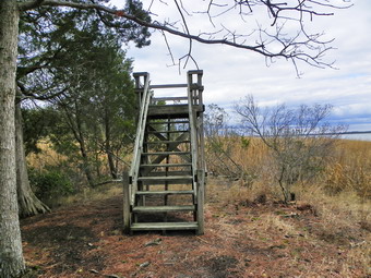 The Pumunkey Trail heads down to the beach and an observation "tower". The distance to the shore is about .85 miles with a drop of about 120 feet which is a lot for this flat hike. By this time my feet were again bothering me a lot and I was annoyed that I might not be ready for the BIG hike in Shenandoah on Saturday. We got down to the shore and found the "tower" which is a six foot high observation platform! The "tower" is not worth the hike but the views were OK. We hiked back up to the Backbone Trail and used it to get back to the parking lot and the car. We were back by 2:00 PM having covered 5 miles in about 3 hours. I had wanted to take Cindy and Karl on the "closed" Taskinas Trail loop but we wanted to get back home to the baby and my feet were not feeling any better!
![]()
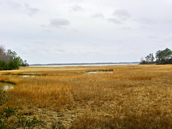
![]() On Wednesday, March 9th I was in Virginia with Cindy and Sheba to see the first grandson for first time! We arrived on Tuesday and the forecast was for heavy rain on Thursday so I decided to hike on Wednesday. I wanted someplace close and Karl told me about York State Park only 30 minutes north of Williamsburg. Of, course there wouldn't be much elevation but the park has 25 miles of trails and some interesting views of the York River, Taskinas Creek and some salt marshes. The first challenge was to find the entrance to the park! I took exit 231 off I64 and headed east toward Croaker. When I saw the sign for York State Park I turned right on Riverview Drive which were also the directions Karl had given me. After driving down the road for some time, I began to doubt that I had taken the correct turn as the road got progressively smaller. I turned around and headed back to where I had made the turn and went right. Soon I was on an access road to the...boat landing. I made a U-turn and headed back to Riverview. This time I stayed on the road and about a quarter mile passed where I had turned around signs pointed to the left for the access road to the park. When we arrived at the park, there were only two other cars in the lot. I was disappointed to find that there was no one on duty at the park to talk to about the trails. After leaving three dollars using the "honor parking system", I parked the car and Sheba and I started looking for trails at about 10:20 AM. I wore a long sleeved shirt with a light softshell on top which seemed about right when we started out. Although the temperatures were just short of 50 degrees the breeze made it feel cooler. I decided to keep Sheba on a leash until I coils see how many people were at the park.
On Wednesday, March 9th I was in Virginia with Cindy and Sheba to see the first grandson for first time! We arrived on Tuesday and the forecast was for heavy rain on Thursday so I decided to hike on Wednesday. I wanted someplace close and Karl told me about York State Park only 30 minutes north of Williamsburg. Of, course there wouldn't be much elevation but the park has 25 miles of trails and some interesting views of the York River, Taskinas Creek and some salt marshes. The first challenge was to find the entrance to the park! I took exit 231 off I64 and headed east toward Croaker. When I saw the sign for York State Park I turned right on Riverview Drive which were also the directions Karl had given me. After driving down the road for some time, I began to doubt that I had taken the correct turn as the road got progressively smaller. I turned around and headed back to where I had made the turn and went right. Soon I was on an access road to the...boat landing. I made a U-turn and headed back to Riverview. This time I stayed on the road and about a quarter mile passed where I had turned around signs pointed to the left for the access road to the park. When we arrived at the park, there were only two other cars in the lot. I was disappointed to find that there was no one on duty at the park to talk to about the trails. After leaving three dollars using the "honor parking system", I parked the car and Sheba and I started looking for trails at about 10:20 AM. I wore a long sleeved shirt with a light softshell on top which seemed about right when we started out. Although the temperatures were just short of 50 degrees the breeze made it feel cooler. I decided to keep Sheba on a leash until I coils see how many people were at the park.
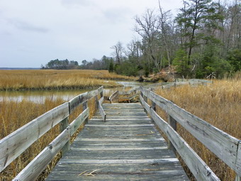 We walked toward the York River and down a path and a set of stairs toward the creek. This proved to be the place where canoes and kayaks can be rented during the season but no trails started here. We walked back up to the parking area and started to skirt the woods and finally found the beginning of Taskinas Creek Trail. As we approached the woods, a sign indicated the trail was closed due to storm damage. I chose to assume that closed meant "hike at your own risk" and went ahead on the trail. Although it was muddy in places, I really didn't see why the trail was closed. We crossed a muddy swill and worked our way around the wettest areas. Along the way were wooden structures that acted as viewpoints out onto the creek that ran through a salt marsh. At one several point some brush across the trail seemed to by placed to discourage further exploration but we pressed on. In these areas a new trail was flagged with orange markers. At one point a wooden bridge lay in ruins but we again picked our way across the wet areas. In other spots significant blowdown required a little agility to avoid. By the looks of some of these areas the "storm damage" was not recent and I wondered whether it would ever be fixed. As we continued around the edges of the creek, a particularly long boardwalk was in a bad state. I was warped in two different directions and some of the boards looked shaky. We worked our way across testing each section as we went. After this the trail climbed a little, a very little and turned away from the creek. A short walk brought us to a trail junction with the left branch indicating a way back to the parking area and the right heading toward a bridle trail. We turned left and headed back toward the visitor's center. At the next trail junction there was another split and nothing was marked. I decided to turn left.
 The left turn put us back on the trail next to the creek but on the newly flagged trail so I decided to see what it looked like. Basically the new trail was "not ready for prime time" but was passable and was sited to avoid some of the muddiest spots in an effort to avoid reconstructing the bridges. Eventually we were back on the main trail again for a while. When the brush blocked the main trail, we followed the new flagging. This time the trail was hard to follow and looked like it had just been laid down. There was a lot of sidehilling and bushwhacking. At one point the flagging simply stopped. I chose to bushwhack down a hill, across a swale and up the next hill to the main trail. This was relatively easy except for the slippery leaves and the fact that I had left my poles in the car. Back on the main trail we approached the same junction to the parking area or bridle trail as before. I had the idea that we would follow the bridle trail to the Marl Ravine Trail. This trail was marked for mountain bikes and was rated difficult. I had read that ALL the trails were open to hikers so I didn't think that would be a problem. I was wrong! When we got to the park road, we crossed ND walked to the bridle trail. The hiker in a red circle with a line through it made it clear this was "Horses Only". We walked back out to the road and toward the parking area. Just short of the parking area we turned right on the Backbone Trail which is a hike/bike trail. My new plan was to walk out to Woodstock Pond and the York River and then use the Backbone Trail to access some of the trails further to the south. The temperatures had risen to the mid-50's so I took off the jacket and stowed it and did not don the windbreaker I had brought along.
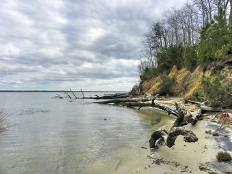
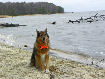
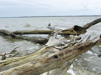 Just after turning onto the Backbone Trail we made a left onto the Beaver Trail to take us over to Woodstock Pond Trail. We turned left at the end of this short trail and then made another left onto the Woodstock Pond Trail heading north. At the pond we stopped so that I could take a few pictures of the pond and the York River. A pair of geese were on the pond and made it into several pictures. At the end of the trail, which is close to the Visitor's Center, we turned around and headed back the way we came. A short side trail leads down to the shore of the river. A small sand beach greeted us at the end of the trail. I took pictures of the beach and the drift wood that had waked up on the shore. The river is very wide here, perhaps more than a mile, and pictures of the opposite shore were indistinct especially on this overcast day. Back on the trail we pads the pond again and the made a left on the Mattaponi Trail that leads to Mattaponi Point. The Point has a wooden viewing platform with benches. The high, sandy bank is eroding away and I stood near the edge to take some pictures of the bank and the river's edge, strewn with driftwood, below. From the platform we walked down the trail to Fossil Beach. A set of steps lead down to the beach which did have a variety of shells with barnacle accretions. The real fossils are much harder to find. We walked up and down the beach and I took several pictures before heading back up to the main trail. The trail lead back out to the Backbone Trail. At the junction of these two trails was the remains of the foundation of a summer house of a prominent Williamsburg doctor. It was a little after noon and I did not want to go back just yet so we turned left on the Backbone Trail and headed south.
 The trail heads south and is crossed in several places by mountain bike and equestrian trails. Eventually, after about 1.2 miles, the trail turns into a multi-use trail at a gate. We continued on and took a left onto the Pumunkey Trail. It was about this time that I noticed that my feet were beginning to hurt. The inner aspect of my forefoot has begun to become irritated on long hikes and I had foolishly forgot to put on liner socks. This is really not a blister but it is uncomfortable just the same. It is a relatively new occurrence and one I could do without! I decided to wait until I got to a bench to change socks and perhaps put some padding on the affected area. A short distance down the Pumunkey Trail was a junction. Continuing straight ahead leads down to an observation tower by the river. This sounded interesting but I wanted to do the nearby loop. Had my feet been 100% I would have done both! We turned right on the Spurr Trail and then left on the Majestic Oak Trail. This trail ends near the river and just before the end is a VERY large oak tree, the Majestic Oak. The tree was very impressive and worthy of a few shots. Just beyond the tree were some benches where I sat and changed socks and put a pad on each foot. When we got back on the trail, my feet still hurt but they hurt less. We were now on the North Fork of the Powhatan Forks Trail. After crossing a boardwalk across a salt marsh, we followed the trail All the way out to the Backbone Trail.
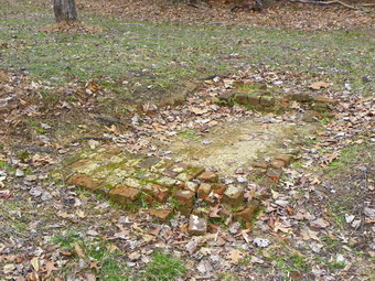 Just before we reached the Backbone Trail junction we encountered a clearing with some evidence of foundations and a well. The sign said that this was part of the main complex of the Taskinas Plantation. In the 17th and 18th centuries this was the site of large warehouses where tobacco and other products were stored before they were shipped to England. Shallow depressions rimmed with red brick are all that now remain. Once we got to the Backbone trail we hiked straight back toward the parking area which was about 1.8 miles away. My feet hurt but knowing we were headed back seemed to help. At the junction with the Mattaponi Trail we stayed on the Backbone Trail as it headed left. I a few manures we were back at the car. It was about 3:00 PM and the GPS read 11.1 miles. The hike had taken less than 5 hours with PLENTY of time for pictures. The GPS showed a moving average of 2.9 mph!
![]()
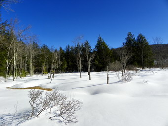
![]() On Thursday, March 3rd I was scheduled to pick up my sister at Stewart Airport at a little after 2:00 PM. I didn't want to be late so I chose the closest trails to my home which are the ones at Frick Pond. The rain and ice had hampered hiking along with family commitments and I was anxious to get out even for a short hike. When we arrived at the parking area, the temperature was in the high 20's with a slight breeze blowing. The skies were clear and blue and there appeared to be good snow cover unhampered by the recent rain. We were on the trail by 8:30 AM headed toward Frick Pond. The trail to Frick was generally good with a few open spaces due to the rain. Most of the water was frozen with only a few areas of open water to avoid. Once at the pond we stopped and I took some pictures of the white snow and the beautiful blue skies. There was still a LARGE snow drift on the other end of the bridge but this was easily avoided. At the trail junction around the side of the pond, we headed around the pond rather than up the Quick Lake Trail. At one point I stepped off the trail and walked out into an open area to take pictures of the pond. Again, beautiful blue skies and white snow.
On Thursday, March 3rd I was scheduled to pick up my sister at Stewart Airport at a little after 2:00 PM. I didn't want to be late so I chose the closest trails to my home which are the ones at Frick Pond. The rain and ice had hampered hiking along with family commitments and I was anxious to get out even for a short hike. When we arrived at the parking area, the temperature was in the high 20's with a slight breeze blowing. The skies were clear and blue and there appeared to be good snow cover unhampered by the recent rain. We were on the trail by 8:30 AM headed toward Frick Pond. The trail to Frick was generally good with a few open spaces due to the rain. Most of the water was frozen with only a few areas of open water to avoid. Once at the pond we stopped and I took some pictures of the white snow and the beautiful blue skies. There was still a LARGE snow drift on the other end of the bridge but this was easily avoided. At the trail junction around the side of the pond, we headed around the pond rather than up the Quick Lake Trail. At one point I stepped off the trail and walked out into an open area to take pictures of the pond. Again, beautiful blue skies and white snow.
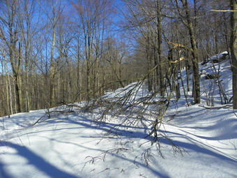 Once we were around the back of the pond we quickly hiked to Times Square. From here it was straight ahead and up the Big Rock Trail. The trail was packed by snowmobile traffic which made the surface a pleasure to hike on with snowshoes. The Big Rock Trail, while not a 3500 foot peak, gains some elevation and can be challenging if you hike fast without stopping. It seemed like we were at the top in no time where we turned right to go down the Flynn Trail and back to the parking area. The Flynn Trail appeared to be untraveled as we hiked down. In some places I did see evidence of snowshoe tracks and some cross country ski tracks. The high winds we had been experiencing were evident in the amount of blowdown on the trail both big and small! We were at the car before 10:30 AM having covered the 4 mile hike in UNDER two hours.
![]()
![]() On Saturday, February 26th I wanted to try AGAIN to hike Table and Peekamoose from the Denning trailhead. I had planned this hike several times over the previous two weeks and each time something got in the way. When Sheba and I left Livingston Manor at around 9:20 AM the air temperature was about 16 degrees but the forecast was for highs in the low 30's. Some new fallen snow covered the roads as I drove to the Denning trail head but in general they were in good shape. We arrived at the parking area just before 10:00 AM to find two other cars parked there. The lot had been plowed but it was in poor shape as Friday's warmer temps and rain had left a slushy mess that then refroze. I put on my snowshoes and shouldered the path and we left a few minutes after10:00 AM. It was hard to tell how many people were ahead of us. At least one person had decided to walk in bare boots. I always wondered how much fun it must be to sink in, pull the foot out and then repeat the process. I did noticed that the postholes disappeared a short distance into the woods and a new type of snowshoe track appeared. Lesson learned? We followed the same path that we had used on Wednesday with Lisa but at an accelerated pace. I could tell as I was out of breath by the time we reached the trail junction and turned right to go down to the river. I was also pretty warm by this time after only a little over a mile hiking. I had already opened all the zippers I could find and decided I would probably lose the midlayer after crossing the bridges. I was a little worried about the condition of the bridges given the warm temperatures, rain, snow and refreezing. I need not have worried as the bridges seemed much the same as a few days before. Sheba and I made it over the first bridge with no problem. The second bridge, the one with two logs, lay ahead! This time, for better or worse, Sheba decided to scoot across and made it with just one bobble. We stopped at the end of the bridge for a drink and a snack and for me to remove a layer. I was cool once I took off that layer but knew that I would warm up on the climb ahead!
On Saturday, February 26th I wanted to try AGAIN to hike Table and Peekamoose from the Denning trailhead. I had planned this hike several times over the previous two weeks and each time something got in the way. When Sheba and I left Livingston Manor at around 9:20 AM the air temperature was about 16 degrees but the forecast was for highs in the low 30's. Some new fallen snow covered the roads as I drove to the Denning trail head but in general they were in good shape. We arrived at the parking area just before 10:00 AM to find two other cars parked there. The lot had been plowed but it was in poor shape as Friday's warmer temps and rain had left a slushy mess that then refroze. I put on my snowshoes and shouldered the path and we left a few minutes after10:00 AM. It was hard to tell how many people were ahead of us. At least one person had decided to walk in bare boots. I always wondered how much fun it must be to sink in, pull the foot out and then repeat the process. I did noticed that the postholes disappeared a short distance into the woods and a new type of snowshoe track appeared. Lesson learned? We followed the same path that we had used on Wednesday with Lisa but at an accelerated pace. I could tell as I was out of breath by the time we reached the trail junction and turned right to go down to the river. I was also pretty warm by this time after only a little over a mile hiking. I had already opened all the zippers I could find and decided I would probably lose the midlayer after crossing the bridges. I was a little worried about the condition of the bridges given the warm temperatures, rain, snow and refreezing. I need not have worried as the bridges seemed much the same as a few days before. Sheba and I made it over the first bridge with no problem. The second bridge, the one with two logs, lay ahead! This time, for better or worse, Sheba decided to scoot across and made it with just one bobble. We stopped at the end of the bridge for a drink and a snack and for me to remove a layer. I was cool once I took off that layer but knew that I would warm up on the climb ahead!
 Just after the bridges and before the campsites as set of snowshoe tracks turned off to the left. I assumed that they were headed for Lone and Rocky along the Fisherman's Path. We stayed on the main trail and were making good time as we ascended the first hill on the way to Table. The sun came out and it seemed warmer and I again had to open up some zippers. We climbed up the second hill and reached the area where Lisa and I had stopped on Wednesday. We made this point at 2.8 miles into the hike in about 1.5 hours. The same distance had taken over 2 hours a few days early. Sheba and I were moving. We finished our ascent and again dropped down slightly before starting up Table. The trail up Table winds around some to avoid some steep climbing. The problem is that this causes some sidehilling which can be a problem but I didn't notice it much. We passed the spring and the lean-to and were soon at the 3500 foot marker. Around 3.65 miles into the hike at 3760 feet, I noticed a viewpoint on the left. We walked through the brush and had a relatively clear view to the north and west toward Rocky and Lone. The very tops of the peaks did have some ice and frozen snow and I took some pictures before we continued. At about 3.7 miles at an elevation of 3840 feet the tracks we were following went off the main trail to the right. I though that there was a viewpoint in this area but the tracks went into the woods a short distance and then turned back to the main trail. I couldn't see the lookout and was more interested in hitting the summit. In a few minutes we gained the rather flat top of Table at 3.8 miles taking 2 hours and 20 minutes for the trip. We started to walk across toward Peekamoose. On the way up I thought I was tiring and might skip Peekamoose. Once I was at the summit of Table my mood changed and I knew that I could easily make the other summit which is only .8 miles away!
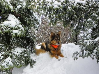
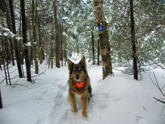 As we walked across the flat summit of Table, my path was partly obstructed at times by low hanging branches. The combination of ice and frozen snow had pulled many of them down into the trail. In addition, the trail markers which are usually at eye height were around my knees or almost even with Sheba's head. There apparently was a good, packed base underneath! At one point I looked up to see a dog, maybe a husky or husky-shepherd mix, not too far ahead. He came to "visit" us as his master called him back. The dog seemed friendly but Sheba was a little agitated. The hiker had on MSR Lightning Ascents which were the tracks I had been following since the trailhead. We talked for a minute and he said he was from New Jersey and asked about a viewpoint. I told him what I knew and we went in opposite directions. I didn't get his name but the dog's name was AJ. As we started down Table on the way to Peekamoose, we met another hiker which was sort of a surprise. He was followed by another and then four more, all headed toward Table. These guys had decided that MicroSpikes were appropriate for the day on a trail with several feet of snow in warming conditions! They did not look "green" from the equipment they were carrying so I wondered why they had made that decision. I said hello in passing and continued on. The trail from this point on was full of holes with some being barely noticeable and others at least knee deep! I know the arguments between destroying the trail and personal choice but in this case I think I fall on the side of inappropriate gear for the conditions.
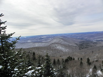 The .8 mile trip to Peekamoose seemed to go very quickly and by 12:45 PM we were at the boulder that marks the summit. We stopped and I took some pictures of Sheba at the summit and then started the long return trip to the parking area at about 12:50 PM. Again the trip between the peaks seemed to go by quickly. We heard voices ahead as we reached the col. It was the MicroSpikes aficionados headed back toward Peekamoose. They had parked on the Peekamoose Road and had bagged both peaks. They mentioned something about how well the snow on the other side was consolidated. I remembered this as I hiked back to Table trying to fill in some of their deepest holes as I went. As we descended the other side I forgot to stay on the main trail and took the little detour to the lookout which had not worked on the way up. I was pretty sure the lookout WAS there so I walked a little further off the trail and spotted it through the snow laden trees. I walked out onto the rock that forms the viewpoint being very careful on the icy, snow covered ledge. The view was fantastic as the sun had come out and the sky was blue with a few clouds. I took pictures but was not anxious to stay as the sky was getting darker and the wind had come up. Sheba and I quickly descended the mountain and made short work of the two short uphills along the way. Once we hit the Phoenicia-East Branch Trail we quickened our pace until we were at the trail head. I checked the trail register and there were five hikers from Bethlehem, PA on the Lone-Rocky trip. We were at the car by 3:10 PM having covered the 9.1 mile trip in just over 5 hours. The total ascent was 2850 feet and the GPS said the moving average was over 2 mph. I felt great and was happy to have gotten this hike in before the "nice" weather starts early next week.
![]()
![]() On Wednesday, February 23rd I wanted to try AGAIN to hike Table and Peekamoose from the Denning trailhead. I had planned this hike several times over the previous two weeks and each time something got in the way. I was about ready to leave the house at 8:45 AM when Lisa from Morgan Outdoors called and asked what I was doing. I told here and, to my surprise, she asked if she could come along. I have found that hiking with someone else actually is fun so I said "Yes" and we agreed to meet downtown at 9:30 AM. We drove out the DeBruce Road to the Frost Valley Road and from there through Claryville to the Denning trail head. The roads were in pretty good shape all the way to the parking area which was plowed, somewhat. There was one other car in the lot as we shoved off at 10:30 AM with the temperature barely in the double digits. The Tison house near the parking area is a favorite of mine and I found out of Lisa also. The owners of the house have extensive property holdings in the area. In fact, the Phoenicia-East Branch Trail passes through or alongside their property. The land is held in a trust with Frost Valley. The trail was well packed as we hiked along and we did not sink in at all. We had gotten around 4 inches of fresh snow in Livingston Manor but there seemed to be less in Denning. The track of the person or persons ahead of us meandered some to avoid the stream that cross the trail in some areas. By 11:10 AM we had traversed the 1.25 miles to the turn on the Table Peekamoose Trail. A new sign here indicated the end of the East End of the Finger Lakes Trail! We made the right turn and walked down to the West Branch of the Neversink and Deer Shanty Brook arriving at the first bridge at 11:30 AM. The first bridge, upon initial inspection, looked to be in good shape with a thick layer of frozen snow packed evenly across the surface. However, a closer look showed what many others have reported. The near caisson is completely emptied of stone. The river has undercut the caisson and the stone are gone. I do not think this structure will withstand the spring floods. The project is not one easily accomplished without lifting equipment and even with equipment it would be difficult at this time of year. We stopped briefly to take some pictures. The combination of stopping and a slight breeze convinced me that I would leave my midlayer on at least until we started to climb. The second bridge is always more interesting than the first. It is high and constructed of just two somewhat parallel logs with a cable to help maintain balance. This bridge was also covered with a layer of frozen snow. I had no problem crossing and neither did Lisa. Sheba started out on the bridge but seemed to have second thoughts. I was about to lead her down to the stream to cross the ice when she shot across the bridge at full speed. For an instant I had visions of my brave dog tumbling into the cold water below!
On Wednesday, February 23rd I wanted to try AGAIN to hike Table and Peekamoose from the Denning trailhead. I had planned this hike several times over the previous two weeks and each time something got in the way. I was about ready to leave the house at 8:45 AM when Lisa from Morgan Outdoors called and asked what I was doing. I told here and, to my surprise, she asked if she could come along. I have found that hiking with someone else actually is fun so I said "Yes" and we agreed to meet downtown at 9:30 AM. We drove out the DeBruce Road to the Frost Valley Road and from there through Claryville to the Denning trail head. The roads were in pretty good shape all the way to the parking area which was plowed, somewhat. There was one other car in the lot as we shoved off at 10:30 AM with the temperature barely in the double digits. The Tison house near the parking area is a favorite of mine and I found out of Lisa also. The owners of the house have extensive property holdings in the area. In fact, the Phoenicia-East Branch Trail passes through or alongside their property. The land is held in a trust with Frost Valley. The trail was well packed as we hiked along and we did not sink in at all. We had gotten around 4 inches of fresh snow in Livingston Manor but there seemed to be less in Denning. The track of the person or persons ahead of us meandered some to avoid the stream that cross the trail in some areas. By 11:10 AM we had traversed the 1.25 miles to the turn on the Table Peekamoose Trail. A new sign here indicated the end of the East End of the Finger Lakes Trail! We made the right turn and walked down to the West Branch of the Neversink and Deer Shanty Brook arriving at the first bridge at 11:30 AM. The first bridge, upon initial inspection, looked to be in good shape with a thick layer of frozen snow packed evenly across the surface. However, a closer look showed what many others have reported. The near caisson is completely emptied of stone. The river has undercut the caisson and the stone are gone. I do not think this structure will withstand the spring floods. The project is not one easily accomplished without lifting equipment and even with equipment it would be difficult at this time of year. We stopped briefly to take some pictures. The combination of stopping and a slight breeze convinced me that I would leave my midlayer on at least until we started to climb. The second bridge is always more interesting than the first. It is high and constructed of just two somewhat parallel logs with a cable to help maintain balance. This bridge was also covered with a layer of frozen snow. I had no problem crossing and neither did Lisa. Sheba started out on the bridge but seemed to have second thoughts. I was about to lead her down to the stream to cross the ice when she shot across the bridge at full speed. For an instant I had visions of my brave dog tumbling into the cold water below!
 Just after the bridge we passed the campsites and then started to climb. The Tubbs Mountaineer snowshoes worked well with a combination of grip and a good binding. To me there is something reassuring about a metal frame underfoot. I seldom use the heel lifts but Lisa suggested that I try them. They were much easier to get up and down than the ones on any other snowshoe I use but they stayed in place and gave good support. The climbs on Table are short so they benefited me more from helping me to get a good plant for the forefoot crampon than relieving pressure on my leg muscles. The trail switches back and forth in several spots to mitigate the steepness of the slope and avoid some obstacles. At about 2.3 miles we were at the top of a little hill and had to descend the other side before climbing again. This is only a small climb and descent but I always find it discouraging. At the top of this rise the trail conference maps mark a viewpoint with a star. This may have had a view at one time but the trees and bushes have grown up to block it. We turned slightly east from our southerly heading and up the other side we went making good time. Somewhere around 2.7 miles Lisa confessed that she was getting tired. I knew at the beginning this might happen and that the summit of Table would again allude me. I was willing to take her along as I have become more interested in talking and sharing common interests than returning to peaks I have already conquered. I suggested we climb a little more as I though there was a nice lookout at about 3200 feet. When we hit the lookout, I was a little disappointed since the view was only mediocre with some bushes blocking a clear view of the scenery. The weather was BEAUTIFUL and I decided to go up the trail a little further to find a better view. I walked up the trail but did not see any tracks over to the edge so I made some myself.I found one decent view and then bushwhacked along the edge to a point only a few hundred feet above the initial viewpoint. I had to fight with a push that tried to push me over the edge but in the end got a wide-open view. I called to Lisa and she headed up to where I was through the brush and trees. I dumped my pack and got out the camera to take some nice pictures of Table, Peekamoose, Van Wyck and Woodhull. I was also able to see all the way down to the parking area and the Tison house! Lisa also took several pictures. I removed my midlayer as I was getting warm with no breeze and bright sunlight.
 Eventually we decided to headed back starting the return trip at about 1:15 PM. We slipped and slid, mostly under control, down the steeper sections only the small hill to climb over. At the bridges I led Sheba down to the ice where she crossed much more easily than the first time across the two logs. We climbed up to the Phoenicia-East Branch Trail and turned left to head back to the parking area. The snow was getting soft and had been the whole way back which made walking a little more difficult. On the way back we met a young couple who looked fit but were not wearing snowshoes. They were walking right along the snowshoe trail seemingly unaware that they were ruining a nice set track with there deep post holes.I know this is a point of controversy and I really don't care if people want to hike in snow the hard way. I just wish people without snowshoes would stay out of the snowshoe track. If they want to sink in up to their knees, it would be much easier where no one has walked! We were back at the car by 3:00 PM. The car that had been there when we arrived was still parked. We covered 5.8 miles in 4.5 hours with my GPS showing a MOVING average of 2 mph. Maybe next time I will get to the top!
![]()
![]() On Tuesday, February 22nd Lisa from Morgan Outdoors wanted to preview a hike she was sponsoring to Jensen Ledges early in March. I agreed to go with her even though Cindy and I had been there on Friday since I wanted pictures on a sunnier day and had enjoyed the previous outing. This time I knew exactly how to get to the trailhead but Lisa and I wanted to try different routes to see which was the quickest, the shortest and had the easiest directions to follow. We headed west on State Route 17 and took the Hancock exit. We got on Route 97 south and took the turn for Lordville Road which is only about 5 miles from Hancock. After turning right on Lordville Road, I drove the 3 miles down to Lordville and then went straight ahead on the road that leads to the trail head. We parked and were hiking by 10:15 AM. The conditions were similar to my previous trip with slightly lower temperatures and some wind. The best part was that there was some sun with a blue sky and some clouds. The trail showed the effects of the warmer temperatures and melting that occurred over the weekend but there was also a layer of fresh powder on top. We walked and talked as we hiked up the trail. It didn't seem like we were rushing but we made good time. Lisa stopped at the stream to take some pictures of this very pretty spot. We arrived at the first Ledge at 11:00 AM taking only 45 minutes for the mile hike uphill. We stopped at the first viewpoint to see the sights and take pictures. At the second lookout we stopped for more pictures. The wind came up and made things a little cold but stepping back in the shelter of the trees solved the problem. After a drink and a snack, we headed back down. The trip down took about 40 minuets and we arrived back at the parking area around noon. The hike down would have been faster but we decided to bushwhack up the steep bank about halfway down to investigate some ice formations.
On Tuesday, February 22nd Lisa from Morgan Outdoors wanted to preview a hike she was sponsoring to Jensen Ledges early in March. I agreed to go with her even though Cindy and I had been there on Friday since I wanted pictures on a sunnier day and had enjoyed the previous outing. This time I knew exactly how to get to the trailhead but Lisa and I wanted to try different routes to see which was the quickest, the shortest and had the easiest directions to follow. We headed west on State Route 17 and took the Hancock exit. We got on Route 97 south and took the turn for Lordville Road which is only about 5 miles from Hancock. After turning right on Lordville Road, I drove the 3 miles down to Lordville and then went straight ahead on the road that leads to the trail head. We parked and were hiking by 10:15 AM. The conditions were similar to my previous trip with slightly lower temperatures and some wind. The best part was that there was some sun with a blue sky and some clouds. The trail showed the effects of the warmer temperatures and melting that occurred over the weekend but there was also a layer of fresh powder on top. We walked and talked as we hiked up the trail. It didn't seem like we were rushing but we made good time. Lisa stopped at the stream to take some pictures of this very pretty spot. We arrived at the first Ledge at 11:00 AM taking only 45 minutes for the mile hike uphill. We stopped at the first viewpoint to see the sights and take pictures. At the second lookout we stopped for more pictures. The wind came up and made things a little cold but stepping back in the shelter of the trees solved the problem. After a drink and a snack, we headed back down. The trip down took about 40 minuets and we arrived back at the parking area around noon. The hike down would have been faster but we decided to bushwhack up the steep bank about halfway down to investigate some ice formations.
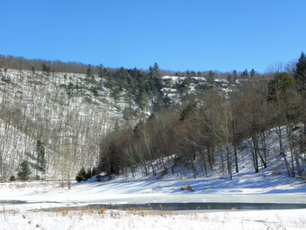 Since it was only noon, we decided to walk out to the river on the other trail that branches off from the trail head. This trail is also on private land. It did not seem that anyone had been on the trail for some time but we were able to follow a set of footprints. The path out to the river is pretty obvious and parallels a small creek. Near the river we walked up a bank to the railroad tracks. The views in both directions on the river were fantastic. The Ledges were easy to spot high and off to the left. The rather large cairn helped confirm the correct location. The tracks did not seem to be used but the line of flatcars on the siding blocked access to the river. Since I climb mountains, I didn't think climbing over the flatcars would be too hard and mostly I was right. After climbing over the cars, I walked down to the river. The views were even better with the railroad cars out of the way! After taking pictures I walked back up to the tracks and Lisa and I headed back to the car. We went back through Callicoon to stop at the cheese shop and eat at Café Devine. Back in Livingston Manor we compared the mileage for the different routes. The routes through Hancock, Tennanah Lake and Callicoon are all within 1 mile of each other. The Hancock route is probably the easiest to follow with the others providing more varied scenery.
![]()
![]() On Friday, February 18th I wanted to go hike Jensen Ledges near Lordville, NY. This location was recommended by Ike the postal carrier in Callicoon and Patty from Café Devine. The Ledges overlook the oxbow in the Delaware River and were promoted as a short hike with a big payoff. Cindy thought this sounded like a good idea and agreed to accompany us. We left Livingston Manor and used the back roads through North Branch and Callicoon Center to get to Callicoon on the Delaware River. From here we headed north on State Route 97 through Long Eddy. We didn't have clear directions to where we were going but knew we wanted to turn left on Lordville Road and head down to the river. After driving for over 7 miles, we decided we had gone too far and turned around in the vicinity of French Woods. We drove back to Long Eddy and stopped in the post office to ask directions. The Ledges area popular destination so I though I would have no problem getting some information from the postmaster. I was wrong! She was decidedly unhelpful bordering on rude. Fortunately, a local resident getting his male overheard my question and gave us GREAT directions to the Ledges. He said that you could hike in from right in Long Eddy but that parking might be a problem. He suggested we drive north on Route 97 for a little over 9 miles passed French Woods. A lake on the right would indicate we should turn left on the Lordville Road. We did this and the road was exactly where he told me it would be. We turned and headed down and toward the river. The road was a little narrow in places and was covered with snow and ice in places. I drove about 3 miles to get to Lordville. We could see the bridge and made a left turn at the bottom of the hill. Instead of turning right to go over the bridge we went straight ahead on a paved road that turns to gravel. This road does have several permanent houses sprinkled along it as well as summer homes and camps. There are several twists and turns and we began to wonder if we were on the right road. After about 3 miles, the road dead ends at the parking area for the Bouchouxville Trail. There are two trail registers and a small building with bathrooms and a picnic area. We arrived just before 1:00 Am and started hiking after putting on our snowshoes.
On Friday, February 18th I wanted to go hike Jensen Ledges near Lordville, NY. This location was recommended by Ike the postal carrier in Callicoon and Patty from Café Devine. The Ledges overlook the oxbow in the Delaware River and were promoted as a short hike with a big payoff. Cindy thought this sounded like a good idea and agreed to accompany us. We left Livingston Manor and used the back roads through North Branch and Callicoon Center to get to Callicoon on the Delaware River. From here we headed north on State Route 97 through Long Eddy. We didn't have clear directions to where we were going but knew we wanted to turn left on Lordville Road and head down to the river. After driving for over 7 miles, we decided we had gone too far and turned around in the vicinity of French Woods. We drove back to Long Eddy and stopped in the post office to ask directions. The Ledges area popular destination so I though I would have no problem getting some information from the postmaster. I was wrong! She was decidedly unhelpful bordering on rude. Fortunately, a local resident getting his male overheard my question and gave us GREAT directions to the Ledges. He said that you could hike in from right in Long Eddy but that parking might be a problem. He suggested we drive north on Route 97 for a little over 9 miles passed French Woods. A lake on the right would indicate we should turn left on the Lordville Road. We did this and the road was exactly where he told me it would be. We turned and headed down and toward the river. The road was a little narrow in places and was covered with snow and ice in places. I drove about 3 miles to get to Lordville. We could see the bridge and made a left turn at the bottom of the hill. Instead of turning right to go over the bridge we went straight ahead on a paved road that turns to gravel. This road does have several permanent houses sprinkled along it as well as summer homes and camps. There are several twists and turns and we began to wonder if we were on the right road. After about 3 miles, the road dead ends at the parking area for the Bouchouxville Trail. There are two trail registers and a small building with bathrooms and a picnic area. We arrived just before 1:00 Am and started hiking after putting on our snowshoes.
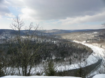
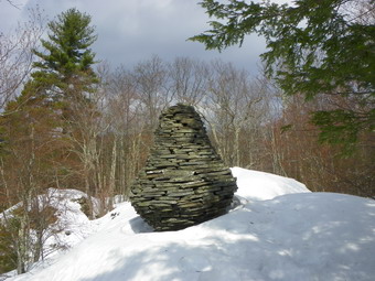 The trail to the Ledges is a wide woods road that starts out on private property. The owner has graciously allowed hikers to walk over his land to get to this beautiful lookout. The snow on this day was well packed and the temperatures started in the low 20's. By the time we had walked a half mile I removed my jacket and continued the hike in a long-sleeved Mammut shirt. The sun was out and the temperature was rising. For the first .65 miles the trail climbs the road gaining about 500 feet in elevation. There is a steep bank rising on the left and another steep drop falling to the river on the right. Somewhere along the way the land changes from private property to state forest. We stopped at a small stream and walked down to where the stream falls over the cliff to the river below. The water was frozen and made for some nice pictures. There is a view of the river from here but it is somewhat limited. We had never been hiking here before but I had the feeling the REAL Ledges were a little further on. We crossed the small stream without much problem. After a hundred feet or so a path led off to the right and I could see that there seemed to be a clearing at the end. We walked in that direction and within minutes had a spectacular view of the oxbow in the river and for miles beyond! It is impossible to describe how beautiful the view was. We had a partly sunny day with some overcast that gave a "mysterious" feel to many of the pictures I took. The hike to the Ledges was only about a mile and had taken 45 minutes. There was a lot to see. I walked along the "ledge" and found that much of it is man-made. Someone has laid up stone to form an artificial structure. On top is a large and quite artistic cairn and a "chair" made from stones. I have asked several people about this but no one seems to know the history. As we were on the ledges a hawk circled over us. Below the river was frozen in some places and open in others. Along the near bank were railroad tracks. Closer inspection showed a main track and a side spur with MANY flatbed rail cars on it.
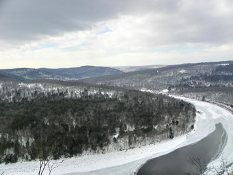 We spent some time here and then I decided to walk a little farther along the trail that paralleled the edge of the cliff. A few hundred feet down the trail another ledge opened up with, perhaps, and even better view of the same countryside. The position of this ledge did reveal some hills that were hidden from the other viewpoint. We took more pictures and got a drink and a snack. Since the hike had been so short, I decided to go back on the main trail and walk a little further. We walked another .33 miles to the next stream. Much of this was downhill and Cindy was not thrilled with the prospect of walking up to go back to the car. This stream was interesting but nothing spectacular so we turned around and started back to the car. I believe that walking in this direction along the trail would lead back to Long Eddy. Hiking in from Long Eddy or doing a through hike is on my "to-do" list! By the time we started back the snow was beginning to melt in the warm temperatures. We slipped and slid our way back to the parking area. The entire hike even with our extension was only 2.8 miles and took just under 2 hours to complete. Our moving average was 2 mph but we took a LOT of time to explore and enjoy the views.
![]()
![]() On Thursday, February 17th I had not been hiking for several days due to other commitments but did not have a lot of time to spend. I had been trying to get to Denning to hike Table and Peekamoose but it didn't seem to be working out. I decided to head up to Trout and Mud Ponds just north of Roscoe to check out what was going on there. This is an area I hike frequently but I had not been there since the major snows. It is also a popular snowmobile destination so I expected some of the trails to be packed. I decided to go early and packed Sheba and my equipment into the car and headed out. We arrived at the end of Russell Brook Road off Morton Hill Road at about 8:30 AM. The parking area was not plowed and Russell Brook Road is not maintained during the winter so I parked as far off the road as possible. We got started right away with Sheba leading the way at full speed. It was obvious that a number of snowmobiles had been down the road as the snow was well packed and made the walking very easy. The temperatures were in the mid 20's but the sun was coming through at times. Once we passed the falls, I decided to head up to Trout Pond first and do the loop anticlockwise. About half way up the trail I stopped to take a few pictures and then we continued on to the lake. We stopped at the out let end and I took some pictures. The sky was somewhat overcast but this makes for some interesting photographs. As I started to put the camera away, the sun peeked through and I took a few more shots. After a quick drink and snack, we headed up the eastern shore of the pond to the inlet area where the lean-tos are located. The walking was easy and we stopped again for photographs at the upper end of the pond. By this time the sun was starting to come out and things were warming up. When we turned to head up the trail, I was surprised to see that the snowmobile tracks continued right on around the pond and up the trail toward Cherry Ridge. This is a snowmobile trail but the last time I had hiked it there was quite a bit of brush and a few trees across the trail.
On Thursday, February 17th I had not been hiking for several days due to other commitments but did not have a lot of time to spend. I had been trying to get to Denning to hike Table and Peekamoose but it didn't seem to be working out. I decided to head up to Trout and Mud Ponds just north of Roscoe to check out what was going on there. This is an area I hike frequently but I had not been there since the major snows. It is also a popular snowmobile destination so I expected some of the trails to be packed. I decided to go early and packed Sheba and my equipment into the car and headed out. We arrived at the end of Russell Brook Road off Morton Hill Road at about 8:30 AM. The parking area was not plowed and Russell Brook Road is not maintained during the winter so I parked as far off the road as possible. We got started right away with Sheba leading the way at full speed. It was obvious that a number of snowmobiles had been down the road as the snow was well packed and made the walking very easy. The temperatures were in the mid 20's but the sun was coming through at times. Once we passed the falls, I decided to head up to Trout Pond first and do the loop anticlockwise. About half way up the trail I stopped to take a few pictures and then we continued on to the lake. We stopped at the out let end and I took some pictures. The sky was somewhat overcast but this makes for some interesting photographs. As I started to put the camera away, the sun peeked through and I took a few more shots. After a quick drink and snack, we headed up the eastern shore of the pond to the inlet area where the lean-tos are located. The walking was easy and we stopped again for photographs at the upper end of the pond. By this time the sun was starting to come out and things were warming up. When we turned to head up the trail, I was surprised to see that the snowmobile tracks continued right on around the pond and up the trail toward Cherry Ridge. This is a snowmobile trail but the last time I had hiked it there was quite a bit of brush and a few trees across the trail.
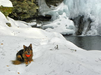 The packed trails allowed us to make good time as we hiked nearly as fast as we would without snow on the ground. We hit the highest point on Cherry Ridge at 2565 feet at about 10:00 AM or 1.5 hours for 2.75 miles. From here we headed down hill toward the trail junction near Mud Pond. I kept listening for snowmobiles but did not hear any. There was evidence that the brush and larger trees had been cleared on the trail. As we neared the trail junction I heard the sound of machines and could see them coming up the trail from below. I was careful to keep Sheba near as I anticipated they would turn up the trail toward us. Instead the first machine stopped and waited for the second at the junction and then they both took a break. When we arrived at the trail junction, I found two friends from Livingston Manor out for a ride. We discussed the trails since they had not been in the area before and then parted ways. Sheba and I turned left and headed around to close the loop we were hiking. As we descended the hill, the snowmobiles came back and passed us waving as they went. We arrived back at Russell Brook Falls just before 11:00 AM and I decided to walk over to the falls. The little slope down to the falls may have been the hardest part of the whole hike but it was worth it. The falls were almost entirely frozen with only a small area of running water visible. I took some pictures and then we headed to the upper falls. There wasn't much to photograph there so we went back down and headed up the trail to Russell Brook Road. We were back at the car by around 11:30 AM having covered the 6 mile trip in 2 hours and 45 minutes.
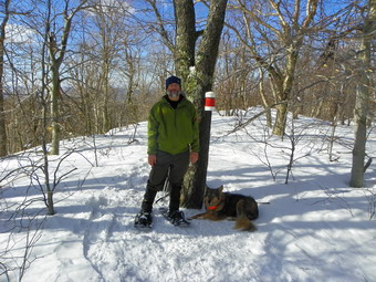
![]()
![]() On Monday, February 14th I went to hike Halcott with Jim Kennard. I was excited to be hiking with someone else and particularly with Jim since I am interested in is "other" hobby. Jim is a diver and has been involved in discovering over 200 shipwrecks in Lake Ontario, Lake Erie, Lake Champlain, the St. Lawrence River and the Hudson River. I expected to get some first hand information about his explorations. We agree to meet at 9:00 AM at the trailhead on Route 42. The weather forecast was for some rain or snow showers in the morning with temperatures rising into the mid 40's later in the day. Winds of from 10 to 20 mph were also in the forecast with gusts of up to 40 mph! When I awoke at 6:30 AM, it was 23 degrees in Livingston Manor and a stiff breeze was blowing. I decided to put away the lighter outfit I had planned to wear and go with what I have been wearing on 20+ degree days. We left Livingston Manor at around 7:45 AM. The DeBruce Road was not in good shape and neither was the road to Frost Valley. I got behind a Town of Denning truck but it was salting the road which was a good thing. The road continued to be in poor condition until I got to Route 28 which was completely clear. Along the way the temperature had slowly risen until it was up to about 40 degrees! I arrived at the trailhead parking a little before 9:00 AM to find Jim already there. We introduced ourselves at got ready to go. One reason that Jim had chosen this hike was that several forum posts indicated that people had hiked it over the weekend and the route was well broken. As we started up the slope next to the falls and walked across the top this seemed to be true as the bushwhack route looked more like a highway! It was our intent to follow this route directly to the can and come back the same way although we had no real idea how direct or how steep it was. After only a short distance, we stopped and I removed my midlayer as I was already very warm. The sun was beginning to shine through, there was no wind and even the slight uphills at this point were beginning to warm me up. Sheba had not been out in a couple of days and was very enthusiastic as she ran ahead and then doubled back.
On Monday, February 14th I went to hike Halcott with Jim Kennard. I was excited to be hiking with someone else and particularly with Jim since I am interested in is "other" hobby. Jim is a diver and has been involved in discovering over 200 shipwrecks in Lake Ontario, Lake Erie, Lake Champlain, the St. Lawrence River and the Hudson River. I expected to get some first hand information about his explorations. We agree to meet at 9:00 AM at the trailhead on Route 42. The weather forecast was for some rain or snow showers in the morning with temperatures rising into the mid 40's later in the day. Winds of from 10 to 20 mph were also in the forecast with gusts of up to 40 mph! When I awoke at 6:30 AM, it was 23 degrees in Livingston Manor and a stiff breeze was blowing. I decided to put away the lighter outfit I had planned to wear and go with what I have been wearing on 20+ degree days. We left Livingston Manor at around 7:45 AM. The DeBruce Road was not in good shape and neither was the road to Frost Valley. I got behind a Town of Denning truck but it was salting the road which was a good thing. The road continued to be in poor condition until I got to Route 28 which was completely clear. Along the way the temperature had slowly risen until it was up to about 40 degrees! I arrived at the trailhead parking a little before 9:00 AM to find Jim already there. We introduced ourselves at got ready to go. One reason that Jim had chosen this hike was that several forum posts indicated that people had hiked it over the weekend and the route was well broken. As we started up the slope next to the falls and walked across the top this seemed to be true as the bushwhack route looked more like a highway! It was our intent to follow this route directly to the can and come back the same way although we had no real idea how direct or how steep it was. After only a short distance, we stopped and I removed my midlayer as I was already very warm. The sun was beginning to shine through, there was no wind and even the slight uphills at this point were beginning to warm me up. Sheba had not been out in a couple of days and was very enthusiastic as she ran ahead and then doubled back.
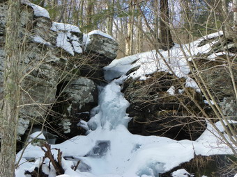 It was obvious that whoever broke the original route had a good idea of how to chose a path that eliminated a lot of steep climbing. The switchbacks that were built in did add some length to the hike but they were very well done. There were plenty of challenging little climbs along the way. Jim and I conversed about our former jobs, both of us are retired, and our families. Eventually I began to ask him questions about his diving and his shipwreck discoveries. Jim is very passionate about this subject and knows so much about the history and the circumstances of each wreck. Being an electrical engineer he has also helped to design and build some of the equipment that is used to discover and explore these views into the past. I was fascinated and the climb to the summit plateau went quickly. We stopped several times to enjoy the nice weather and to get a drink and a snack. Neither of us were in much of a hurry and there were even some nice views albeit ones that were hard to capture with a camera. Once on the summit plateau, we continued to follow the well broken track toward the canister. A blustery wind did start to come up but I was warm as long as we were moving. As we neared the canister, the track was filled with drifting snow but Sheba seemed to know the way and the area looked familiar to me also. Soon we were at the can. The wind was blowing constantly now and I was cold almost immediately. I considered putting my midlayer back on but in the end opted to close the pit zips and front zipper on my jacket which kept out the wind. I took a few pictures at the top of the canister and some of the surrounding hills. Belleayre Ski Area was clearly visible to the naked eye but difficult to capture with the camera. We grabbed a quick snack and the a drink before starting back. It had taken just about two hours to get up so I predicted about a one hour return trip.
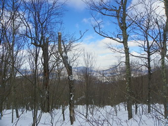
![]()
![]() On Thursday, February 10th I decided to return to Hubbell Hill and actually attack the summit this time! The air temperature was cooler than Monday hovering in the single digits to low teens AND there was a slight "breeze". This time I knew exactly where to park and we were on our way by 9:35 AM. Since Monday several inches of powdery snow had fallen and that had drifted in many places. We used the same ice bridge to cross the stream and then headed up through the first field. Our tracks through this field were all but obliterated by drifting snow but I could follow them if I watched carefully. It was harder breaking track here but still MUCH easier than Monday. The packed snow in our old tracks was able to support our weight. We just walked in our old tracks to the place where we had stopped on Monday. This time the 1.25 mile distance took only 45 minutes! I assessed the slop ahead and decided to head up directly to the small cliff band I could see above. I did not want to try to find a better spot since I didn't believe there really was one! The line I chose was slightly to the southeast as it seemed a little less steep in this direction. As soon as we stepped off the broken trail, we had to fight for every foot of ground. the snow was up to three feet deep with drifts even higher. At times I could walk on top but was always aware that the next step might find me hip deep. As we ascended I kept slipping back but pushed on anyway. I tried one line about two-thirds of the way up but it proved too steep and I tried another. We gained a flatter area only to be presented by another steep section. It took almost 40 minutes to struggle up 400 feet of vertical gain in .3 miles. At this point we were on the relatively flat summit plateau but still some distance from the highest point.
On Thursday, February 10th I decided to return to Hubbell Hill and actually attack the summit this time! The air temperature was cooler than Monday hovering in the single digits to low teens AND there was a slight "breeze". This time I knew exactly where to park and we were on our way by 9:35 AM. Since Monday several inches of powdery snow had fallen and that had drifted in many places. We used the same ice bridge to cross the stream and then headed up through the first field. Our tracks through this field were all but obliterated by drifting snow but I could follow them if I watched carefully. It was harder breaking track here but still MUCH easier than Monday. The packed snow in our old tracks was able to support our weight. We just walked in our old tracks to the place where we had stopped on Monday. This time the 1.25 mile distance took only 45 minutes! I assessed the slop ahead and decided to head up directly to the small cliff band I could see above. I did not want to try to find a better spot since I didn't believe there really was one! The line I chose was slightly to the southeast as it seemed a little less steep in this direction. As soon as we stepped off the broken trail, we had to fight for every foot of ground. the snow was up to three feet deep with drifts even higher. At times I could walk on top but was always aware that the next step might find me hip deep. As we ascended I kept slipping back but pushed on anyway. I tried one line about two-thirds of the way up but it proved too steep and I tried another. We gained a flatter area only to be presented by another steep section. It took almost 40 minutes to struggle up 400 feet of vertical gain in .3 miles. At this point we were on the relatively flat summit plateau but still some distance from the highest point.
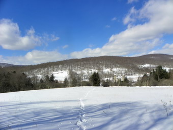 We walked to the highest point we could find and came across a path or woods road. The prickers were not completely gone. Some of the dead canes pulled at us as we passed by. At some point we would sink deep into the snow and I would realize there was a sea of briars underneath. We walked generally northeast for the next .3 miles and I finally declared victory at around 11:20 AM. The trip up had taken less than two hours this time. I knew it was possible drop down off the summit and take a "shortcut" back to our path up but in the end decided to follow our broken track back to the car. The views from on top were quite nice but hard to capture with a camera. Descending even the steepest sections was easier than I thought it might be. I sat back on the snowshoes and slid a good part of the way down. We again stopped in the fields so that I could take some photos. The day was much brighter than Monday with a nice blue sky. We were back at the car by 12:25 PM having covered the 3.6 mile adventure in under 3 hours! On the way back I stopped at several places on the Pepacton to take pictures of the reservoir.
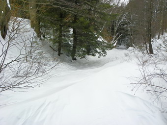
![]()
![]() On Wednesday, February 9th I wanted to get a hike in somewhere but with commitments in the afternoon I decided close to home was the best. Sheba and I headed for Frick Pond where I intended to take a quick hike around the Logger's Loop. I drove out DeBruce Road and up the Mongaup Road with questionable road conditions. We made it to the parking area by 11:00 AM and I donned my snowshoes while Sheba urged me to be quick. The temperature was only in the low 20's and the wind made it feel even colder. Once we entered the trees on the Quick Lake trail we were a little sheltered from the wind but it still felt cold. There was a lot of snow on the trail and when we got to the bridge over the outlet of Frick Pond this was even more evident. Snow drifts covered the bridge and there was a HUGE drift at the other end. In addition, snow covered the pond to the right and the stream on the left. The wind was whipping so we did not stop but walked around the side of the pond to the trail junction. We turned left to stay on the Quick Lake trail and walked along the wide road toward Ironwheel Junction. The trail has a lot of blowdown that has not been cleared from previous storms. The "trail" now passes around these areas and may soon become permanent. At about 1.5 miles we reached the trail junction and turned right on the Logger's Loop trail. I had stopped in several places to take pictures of the undisturbed snow. The Logger's Loop had some snowmobile tracks and was well-packed making traveling easier. We walked the 1.25 mile Logger's Loop and were soon at Times Square. From here we continued straight ahead back to the junction with the Quick Lake Trail near Frick Pond. The wind had died down and the sun was out so we took a quick detour to the pond so that I could take some pictures. We then headed back to the car covering 4 miles in about 1 hour and 45 minutes.
On Wednesday, February 9th I wanted to get a hike in somewhere but with commitments in the afternoon I decided close to home was the best. Sheba and I headed for Frick Pond where I intended to take a quick hike around the Logger's Loop. I drove out DeBruce Road and up the Mongaup Road with questionable road conditions. We made it to the parking area by 11:00 AM and I donned my snowshoes while Sheba urged me to be quick. The temperature was only in the low 20's and the wind made it feel even colder. Once we entered the trees on the Quick Lake trail we were a little sheltered from the wind but it still felt cold. There was a lot of snow on the trail and when we got to the bridge over the outlet of Frick Pond this was even more evident. Snow drifts covered the bridge and there was a HUGE drift at the other end. In addition, snow covered the pond to the right and the stream on the left. The wind was whipping so we did not stop but walked around the side of the pond to the trail junction. We turned left to stay on the Quick Lake trail and walked along the wide road toward Ironwheel Junction. The trail has a lot of blowdown that has not been cleared from previous storms. The "trail" now passes around these areas and may soon become permanent. At about 1.5 miles we reached the trail junction and turned right on the Logger's Loop trail. I had stopped in several places to take pictures of the undisturbed snow. The Logger's Loop had some snowmobile tracks and was well-packed making traveling easier. We walked the 1.25 mile Logger's Loop and were soon at Times Square. From here we continued straight ahead back to the junction with the Quick Lake Trail near Frick Pond. The wind had died down and the sun was out so we took a quick detour to the pond so that I could take some pictures. We then headed back to the car covering 4 miles in about 1 hour and 45 minutes.
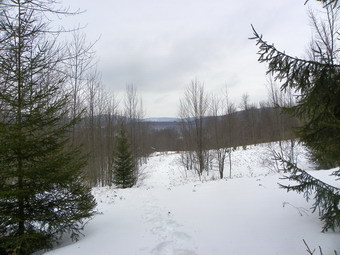
![]()
![]() On Monday, February 7th I decided to try one of the remaining CHH peak that has public access and headed toward Hubbell Hill in Delaware County. I drove up through Roscoe and passed the Pepacton Reservoir. After crossing the bridge, I stayed on Route 30 to Route 28 where I took a left. Shortly after I made the right onto the New Kingston Road, Delaware County Route 6, and headed 5 miles north to New Kingston. Just outside of New Kingston I turned right on Thompson Hollow Road. Just up the hill was the cemetery where most people park to begin their hike or so I thought. I could find no DEP access signs which should have been there even though the access is pretty narrow. I drove into someone's driveway thinking it might be an access point. No one was home so I drove back out and, since there was no place else to park, parked on Winter Hollow Road across from the cemetery. After consulting the VO map, it seemed to me that I had not traveled down Thompson Hollow Road far enough. I got back on that road and drove a little farther and...there was another cemetery. Somehow this never got mentioned in nay trip reports or I missed it! I found DEP access signs just passed the cemetery but there was no place to park. the farm was plowed out but there was no sign anyone had been there in some time. I considered parking there out of the way and leaving a note but ended up parking on the shoulder of the road right next to the DEP sign. I got my gear on and Sheba and I stepped over the snow bank at 9:55 AM. This was a little late as I had an afternoon commitment but the round trip distance is ONLY around 3.5 miles so I though it would be no problem. I was SO wrong.
On Monday, February 7th I decided to try one of the remaining CHH peak that has public access and headed toward Hubbell Hill in Delaware County. I drove up through Roscoe and passed the Pepacton Reservoir. After crossing the bridge, I stayed on Route 30 to Route 28 where I took a left. Shortly after I made the right onto the New Kingston Road, Delaware County Route 6, and headed 5 miles north to New Kingston. Just outside of New Kingston I turned right on Thompson Hollow Road. Just up the hill was the cemetery where most people park to begin their hike or so I thought. I could find no DEP access signs which should have been there even though the access is pretty narrow. I drove into someone's driveway thinking it might be an access point. No one was home so I drove back out and, since there was no place else to park, parked on Winter Hollow Road across from the cemetery. After consulting the VO map, it seemed to me that I had not traveled down Thompson Hollow Road far enough. I got back on that road and drove a little farther and...there was another cemetery. Somehow this never got mentioned in nay trip reports or I missed it! I found DEP access signs just passed the cemetery but there was no place to park. the farm was plowed out but there was no sign anyone had been there in some time. I considered parking there out of the way and leaving a note but ended up parking on the shoulder of the road right next to the DEP sign. I got my gear on and Sheba and I stepped over the snow bank at 9:55 AM. This was a little late as I had an afternoon commitment but the round trip distance is ONLY around 3.5 miles so I though it would be no problem. I was SO wrong.
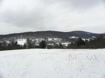 As soon as we hit the snow the problems began. There was a thick crust on top of 18 to 24 inches of snow and more in some places. The crust would not quite support my weight so I would take a step, there would be a pause and then I would break through. I would then have to pull the snowshoe back out of the hole I just made and up through the crust. This was incredibly difficult and discouraging! The stream was running fast, deep and cold but we found an ice bridge that held our weight and allowed us to cross. A woods road led up into a large field, through some trees and to another field. At this point I decided to turn a little more to the east and southeast to start to climb. We walked through some woods and to the high bank of a stream. I did not feel like descending down the bank only to climb the steep opposite bank. Hoping that the terrain leveled some further upstream, we slogged through the snow parallel to the stream. Soon it began to look like there was a woods road top the left and we headed in that direction. After climbing a stonewall, we found the woods road that led up from the fields below. It was then I knew that the easier route was just to stay on that road across the fields. We followed the road up through another clearing. At that point it seemed to me that the road was heading too far to the northeast so we turned a little more east and to our right. Soon we caught another woods road up through the trees. Eventually this road started to head too much to the southeast so we turned east to head more toward Hubbell Hill. The terrain became steeper and the snow deeper. I was having to stop frequently and our pace was really slow. BY 11:45 Am we were at the base of a much steeper slope. I could see snow drifts and small cliffs up the slope. It had taken nearly two hours to move 1.25 miles! I decided that given my schedule the summit of Hubbell Hill would have to wait for another day. At first I felt bad that I was turning around only ,5 miles from the destination but that feeling quickly passed. Lately I have realized that the mountains will be there when I return!
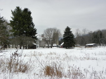 After turning around, we followed our tracks back the way we had come. Going downhill combined with the broken track greatly increased our pace. We stopped a couple of times so that I could take pictures of the opposite hills and the wide expanse of snow. When we reached the area where we had paralleled the stream, we stayed in the field and on the woods road. Breaking new track again was difficult but no more so than pushing through the trees and brush. We were back at the car by 12:45 PM. The return trip had taken half the time of the trip out AND we stopped for pictures. I kicked myself a little for not taking the time to go to the summit but knew I would be back soon. The entire 2.8 mile trip took 3 hours!
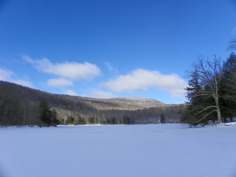
![]()
![]() On Thursday, February 3rd I was tired from the snowshoeing and shoveling the day before. I thought I might try a snowmobile trail someone had suggested between Amber Lake and Rockland. I drove up the Amber Lake Road and took a right at the top. I found what I thought was the beginning of the trail but it was posted as private property and there was no place to park to investigate. I decided to head for the Mary Smith Trail head on Berry Brook Road to hike the Mary Smith Trail east toward Mary Smith Hill. When I arrived at the trail head parking area, it was not plowed and there was nowhere to park. It was beginning to look like this was just an ill-fated day! I drove over to Shin Creek Road to investigate whether or not it had been plowed since someone had asked. The road was plowed and I drove passed the hairpin turn without a problem. Shortly after the turn there is an "estate" with a stone gate and this is as far as the road maintenance extended. At some point I will go back and ask for permission to hike the woods road from Shin Creek Road to the Hodge Pond area. The problem is to find out who owns the property rights. I turned around and drove back out to the Lew Beach Road. I though I might go home but instead turned right to check out Little Pond. The access road to Little Pond was not plowed as the park is closed for the winter but the space just outside the gate was cleared and I decided to hike up and around the pond. We started the long but gentle ascent to Little Pond at about 11:00 AM.
On Thursday, February 3rd I was tired from the snowshoeing and shoveling the day before. I thought I might try a snowmobile trail someone had suggested between Amber Lake and Rockland. I drove up the Amber Lake Road and took a right at the top. I found what I thought was the beginning of the trail but it was posted as private property and there was no place to park to investigate. I decided to head for the Mary Smith Trail head on Berry Brook Road to hike the Mary Smith Trail east toward Mary Smith Hill. When I arrived at the trail head parking area, it was not plowed and there was nowhere to park. It was beginning to look like this was just an ill-fated day! I drove over to Shin Creek Road to investigate whether or not it had been plowed since someone had asked. The road was plowed and I drove passed the hairpin turn without a problem. Shortly after the turn there is an "estate" with a stone gate and this is as far as the road maintenance extended. At some point I will go back and ask for permission to hike the woods road from Shin Creek Road to the Hodge Pond area. The problem is to find out who owns the property rights. I turned around and drove back out to the Lew Beach Road. I though I might go home but instead turned right to check out Little Pond. The access road to Little Pond was not plowed as the park is closed for the winter but the space just outside the gate was cleared and I decided to hike up and around the pond. We started the long but gentle ascent to Little Pond at about 11:00 AM.
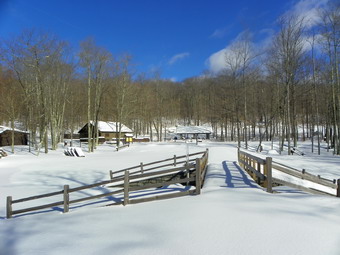 The snow on the access road was crusted and there was no obvious evidence that anyone had been there recently. After walking a bit, it became clear that there was a faint track in the snow and that walking in that track was easier than not. The snow was from 18 to 24 inches deep. The going was difficult as it consisted of stepping on top of the crust, breaking through, sinking in and then lifting the snowshoe back up against the crust. I began to feel it in my hips and I am sure than the trip and snow shoveling the day before had a lot to do with it. It took us a little more than 30 minutes to get to the shores of the pond. Coming across the parking lot I lost the previous trail and the really difficult nature of the snowshoeing became evident. I had though about doing the bigger loop over the vista or the one way trip from the head of the pond to the vista and back but was pretty sure that around the pond would be an adequate workout for a "fitness hike". We walked down to the beach which gave a nice, unobstructed view of the pond and Cabot Mountain. After taking some pictures, we headed back to the oath around the pond. The previous snowshoe track and some animal tracks made the going a little easier. We stopped at the head end so that I could take some pictures and then continued on around. I took some pictures of the "fireplace" on the side and the continued on to the bridge over the dam back at the outlet end of the pond. I took some pictures of the bridge and the pond from the bridge and then rejoined the trail back to the car. We were back at 12:50 PM having covered around 3 miles in just under 2 hours.
On Wednesday, February 2nd we had several inches of granular snow or sleet on top of about 6 inches of snow from the day before. I was debating whether or nor I wanted to go out when Lisa the owner of Morgan Outdoors, the hiking store in town, called to ask if I was going to snowshoe. We decided to start at my house and walk across the street and up the hill behind the church that we call Round Top. Cindy decided to come along and we decided on noon as a good starting time. At noon we were all equipped and ready to go including Sheba, of course, who is ALWAYS ready to go. We walked across the street and up the short, steep hill behind the cemetery. Once we cut into the woods the going got pretty tough as I was breaking trail uphill through 18 to 24 inches of snow and ice with a crust underneath. The crust would not support our weight so it was step, break through, sink down, lift snowshoe against crust and repeat for each step! There are no real trails although some woods roads appear every now and then. The first third to half of the hike is all uphill and the snow seemed to get deeper the higher we went. As we reached the top I decided we would not try for the next hill but we did walk down to the rock scramble descent before heading back to the top of the hill. At the top of the hill we began a long descent to the path that parallels and overlooks the Quickway. I like descending since I can sometimes get a glide going but the deep, crusty snow made this difficult. We soon were on the path and walking north parallel to the main road. A woods road that I did not remember appeared on the left. It was wide and appeared cleared and led directly to the clearing that overlooks the Exit 96 (Livingston Manor) interchange). We stopped for a moment and then walked through the clearing to the left parallel to the trees until we turned left into the forest. From here we started to ascend back to the place where we had started our first ascent earlier. It had been snowing or sleeting lightly most of the time but this had now turned to rain. Once we completed the loop it was back down to the church, across the street and home. We were out for about and hour and a little less than 4 miles.
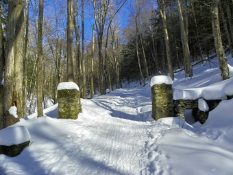
![]()
![]() On Monday, January 31st I decided to hike the "trail" at Rochester Hollow since I had heard that it was a popular destination for cross country skiing and snowshoeing. I thought I might also try a side-trip bushwhack to a nearby mountain in an effort to complete my Catskill Highest Hundred list. We left Livingston Manor around 9:00 AM and headed out the DeBruce Road to Route 47 passed Frost Valley to Route 28. The roads were in surprisingly poor condition until I got to Route 28 although all the trailheads along the way were plowed out. I turned left on Route 28 toward Belleayre and then, after just about a mile, made a right onto Matayas Road. I was surprised to find the road snow covered but clear. The trail head parking about a quarter mile in was also well plowed and it was obvious this area is very popular by the number of cross country ski and snowshoe tracks I found. Just after the trail head parking a gate blocks the road that is the trail up Rochester Hollow. The temperatures were in the high teens as we departed. I have been wearing my Tubbs Alps Flex snowshoes a lot as they have a combination of a good, solid binding and Goff traction. They do have a hard plastic decking which makes them noisy especially on hard snow. The walk up the road was beautiful and easy because of the well packed trail. There is a nice brook along the road and a mix of evergreens and hardwoods. It is obvious that the trail runs through a "hollow" as the land rises sharply on both sides. The hike is a continuous but gentle ascent from around 1400 feet to 2150 feet over around 1.7 miles. Somewhere along the way there were stone pillars that formed a gate across the road. The road had been heading first north and then northeast and at the point where we stopped it turned almost due west. It was here I decided to head north to investigate the surrounding landscape.
On Monday, January 31st I decided to hike the "trail" at Rochester Hollow since I had heard that it was a popular destination for cross country skiing and snowshoeing. I thought I might also try a side-trip bushwhack to a nearby mountain in an effort to complete my Catskill Highest Hundred list. We left Livingston Manor around 9:00 AM and headed out the DeBruce Road to Route 47 passed Frost Valley to Route 28. The roads were in surprisingly poor condition until I got to Route 28 although all the trailheads along the way were plowed out. I turned left on Route 28 toward Belleayre and then, after just about a mile, made a right onto Matayas Road. I was surprised to find the road snow covered but clear. The trail head parking about a quarter mile in was also well plowed and it was obvious this area is very popular by the number of cross country ski and snowshoe tracks I found. Just after the trail head parking a gate blocks the road that is the trail up Rochester Hollow. The temperatures were in the high teens as we departed. I have been wearing my Tubbs Alps Flex snowshoes a lot as they have a combination of a good, solid binding and Goff traction. They do have a hard plastic decking which makes them noisy especially on hard snow. The walk up the road was beautiful and easy because of the well packed trail. There is a nice brook along the road and a mix of evergreens and hardwoods. It is obvious that the trail runs through a "hollow" as the land rises sharply on both sides. The hike is a continuous but gentle ascent from around 1400 feet to 2150 feet over around 1.7 miles. Somewhere along the way there were stone pillars that formed a gate across the road. The road had been heading first north and then northeast and at the point where we stopped it turned almost due west. It was here I decided to head north to investigate the surrounding landscape.
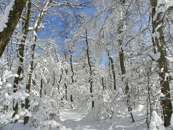 Just off the trail I found extensive and high stone walls. There were also what looked like foundations for buildings at several points. All this was covered in 18 to 24 inches of snow. I will definitely be returning in the spring to check out this area without the snow covering. I headed toward a nearby col between two peaks and then climbed some steep areas to a summit plateau. Some of the climbing was difficult because of the deep snow but none of it was very long. I did find some woods roads along the way near the top that made the going easier. A lookout along the way offered a great view of some other mountains in the area. The sky was very clear and quite blue which made for a nice photographic opportunity. On the summit plateau the trees were covered in ice and frozen snow. As I climbed the last steep section and this sight came into view it was a real surprise. It was like a whole different world. The snow on the trees did make the final push to the high point interesting as snow fell each time I touched a branch. I did find a few more roads at the top which took me to the highest place I could find by 12:20 PM. It had taken me 45 minutes for the first 1.7 miles and about 90 minutes for the next 1.3 miles! I could find no views from the summit but the trees were very pretty. We returned on the same route we had used to get to the top. This time the "bushwhack" back to the road took only 45 minutes and then rest of the trip to the car was about 35 minutes. We arrived back at the parking area around 1:40 PM with the round trip of about 6 miles taking about 3.5 hours.
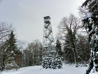
![]()
![]() On Saturday, January 30th Cindy and I wanted to snowshoe together. The day was bright and sunny but cold and we wanted a hike with a view. We decided to go to the Red Hill fire tower which is a relatively short distance but would be more challenging due to the snow. I was not sure whether or not the road would be plowed to the trail head but thought we could park wherever the plowed road ended and hike in from there. We drove passed the TriValley school and turned left on Route 55A. Our next turn was the left onto Sugarloaf Road which begins a long 4 mile climb until a left on Red Hill Road and a quick right on Coons Road. The trail head to the fire tower is about .5 miles after Rudolph Road splits off Coons Road. As I suspected Coons Road was plowed only a short distance after Rudolph Road. We parked near the "Seasonal Maintenance" sign leaving room for a snow plow to turn although I didn't think that was likely. I had managed to convince myself to wear some lighter layers as the temperature was in the high 20's. We started hiking just after 11:30 AM and there were snowshoe tracks down to the trail head. These tracks continued from the trail head to the tower. They were not brand new as some snow had accumulated over them but they formed a nice base for some distance. As we started the final climb to the top the tracks had drifted in and I broke out the trail to the tower. Cindy was having some trouble with the climb and we stopped frequently. We were at the tower by 1:30 PM taking a little under two hours to make the trip.
On Saturday, January 30th Cindy and I wanted to snowshoe together. The day was bright and sunny but cold and we wanted a hike with a view. We decided to go to the Red Hill fire tower which is a relatively short distance but would be more challenging due to the snow. I was not sure whether or not the road would be plowed to the trail head but thought we could park wherever the plowed road ended and hike in from there. We drove passed the TriValley school and turned left on Route 55A. Our next turn was the left onto Sugarloaf Road which begins a long 4 mile climb until a left on Red Hill Road and a quick right on Coons Road. The trail head to the fire tower is about .5 miles after Rudolph Road splits off Coons Road. As I suspected Coons Road was plowed only a short distance after Rudolph Road. We parked near the "Seasonal Maintenance" sign leaving room for a snow plow to turn although I didn't think that was likely. I had managed to convince myself to wear some lighter layers as the temperature was in the high 20's. We started hiking just after 11:30 AM and there were snowshoe tracks down to the trail head. These tracks continued from the trail head to the tower. They were not brand new as some snow had accumulated over them but they formed a nice base for some distance. As we started the final climb to the top the tracks had drifted in and I broke out the trail to the tower. Cindy was having some trouble with the climb and we stopped frequently. We were at the tower by 1:30 PM taking a little under two hours to make the trip.
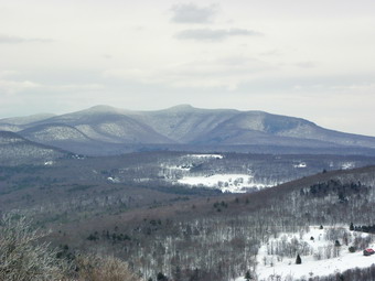 The tower steps and railing were covered in snow and ice and as I removed my snowshoes I debated donning my MicroSpikes for the trip up the tower. In the end I decided against them and climbed to the landing just under the cab. I was able to get some nice photographs in all directions. The skies were clear and blue and the surrounding countryside was covered in snow. As I turned to go down the tower, I lamented my decision to reject the MicroSpikes! I made it down OK and we started back down at about 1:50 PM. I really love descending in snowshoes as long as the terrain is snowy and free of rocks and roots. I leaned back on the shoes and "skied" down many of the inclines. We were at the trail head in about 30 minutes from the time we left the tower! Even Cindy couldn't believe how fast it went. The problem now was the uphill walk back to the car! I made it in about 15 minutes with Cindy right behind. So it was just under 4 miles in about 3 hours with plenty of time for pictures along the way.
![]() On Friday, January 28th I decided to return to Big Pond to see if I could find the trail to Alder Lake that I had "lost" on Tuesday. This time I had looked at my tracks on the computer and came armed with a map and a GPS track on my hand-held unit. We arrived at the parking area by Big Pond at around 9:00 AM and were hiking down Barkaboom Road to the trail head by 9:15 AM. The day was gray and overcast with snow flurries in the air. The temperatures was in the low 20's with a slight breeze but once we started to hike up to the snowed in parking area I immediately got warm as always. It was easy to follow our trail from Tuesday as it was well set in the 18 to 24 inches of snow. By 9:50 AM we had covered just over a mile and were in the area where I lost the trail on Tuesday. I found one additional trail marker I had missed and as it turned out we would only have had to walk about .1 miles in our original direction to stay on the trail. The trail climbed a small hill and I picked up a few markers only to lose them again. It was here that I learned that GPS tracks can and should only be used as general guides. In trying to find the trail I followed the GPS track OFF the trail through some pricker patches until my intuition and common sense took over and I regained the correct route. From this point on there were markers in most places but they were too few and the distance between them too far. The next mile was easy since it was all downhill but was made more difficult since I had to break the trail through the snow. I also began thinking about the climb on the return trip! We passed by an open area marked as a nameless body of water on most maps and on the GPS. It looked more like a marsh or swamp to me. To the right of the trail as we descended, was some evidence of the foundations of some buildings but they were covered by the snow and it was hard to see what and how big they were. BY 10:30 AM we had covered a little over 2 miles are had descended to a small creek that was an inlet to the body of water. After crossing the creek the trail started to ascend the hill on the other side. There was a "Trail" sign but the markers were yellow. There is only one trail in the area so I was surprised at the change in the color of the markers. This lasted for only a few markers and the markers...DISAPPEARED again! I was able to pick up a woods road and then found some RED markers that I followed up the hill for the next .5 miles to 2.6 miles into the hike. From here the trail descended again for about .6 miles to Alder Creek Road where we crossed the stream to get to the road. It was 11:15 AM and I was tired from breaking trail. None of the descents were very steep but I knew I would have to climb them on the return trip. Once at the road I decided that the weather was looking worse and that I did not want to hike the extra .5 miles to Alder Lake which I had seen many times before. We turned around and started back up the hill. Perhaps it was the knowledge of where we were going or the fact that the trail was already broken but the return trip seemed to go quickly. We were back at the car by 12:45 PM having covered the 6.4 miles in 3.5 hours. If you are going to hike this trail, my advice is to bring maps and a compass and keep a sharp eye out for the trail markers. A GPS can be some help also.
On Friday, January 28th I decided to return to Big Pond to see if I could find the trail to Alder Lake that I had "lost" on Tuesday. This time I had looked at my tracks on the computer and came armed with a map and a GPS track on my hand-held unit. We arrived at the parking area by Big Pond at around 9:00 AM and were hiking down Barkaboom Road to the trail head by 9:15 AM. The day was gray and overcast with snow flurries in the air. The temperatures was in the low 20's with a slight breeze but once we started to hike up to the snowed in parking area I immediately got warm as always. It was easy to follow our trail from Tuesday as it was well set in the 18 to 24 inches of snow. By 9:50 AM we had covered just over a mile and were in the area where I lost the trail on Tuesday. I found one additional trail marker I had missed and as it turned out we would only have had to walk about .1 miles in our original direction to stay on the trail. The trail climbed a small hill and I picked up a few markers only to lose them again. It was here that I learned that GPS tracks can and should only be used as general guides. In trying to find the trail I followed the GPS track OFF the trail through some pricker patches until my intuition and common sense took over and I regained the correct route. From this point on there were markers in most places but they were too few and the distance between them too far. The next mile was easy since it was all downhill but was made more difficult since I had to break the trail through the snow. I also began thinking about the climb on the return trip! We passed by an open area marked as a nameless body of water on most maps and on the GPS. It looked more like a marsh or swamp to me. To the right of the trail as we descended, was some evidence of the foundations of some buildings but they were covered by the snow and it was hard to see what and how big they were. BY 10:30 AM we had covered a little over 2 miles are had descended to a small creek that was an inlet to the body of water. After crossing the creek the trail started to ascend the hill on the other side. There was a "Trail" sign but the markers were yellow. There is only one trail in the area so I was surprised at the change in the color of the markers. This lasted for only a few markers and the markers...DISAPPEARED again! I was able to pick up a woods road and then found some RED markers that I followed up the hill for the next .5 miles to 2.6 miles into the hike. From here the trail descended again for about .6 miles to Alder Creek Road where we crossed the stream to get to the road. It was 11:15 AM and I was tired from breaking trail. None of the descents were very steep but I knew I would have to climb them on the return trip. Once at the road I decided that the weather was looking worse and that I did not want to hike the extra .5 miles to Alder Lake which I had seen many times before. We turned around and started back up the hill. Perhaps it was the knowledge of where we were going or the fact that the trail was already broken but the return trip seemed to go quickly. We were back at the car by 12:45 PM having covered the 6.4 miles in 3.5 hours. If you are going to hike this trail, my advice is to bring maps and a compass and keep a sharp eye out for the trail markers. A GPS can be some help also.
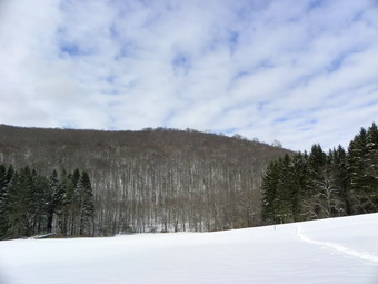
![]()
![]() On Wednesday, January 26th Lisa and I wanted to snowshoe together and I picked Bear Spring State Park between Downsville and Walton as our destination. Because there had been some recent snowfall, I decided to drive up the "main" road out of Downsville and turn left onto East Trout Brook Road. The road conditions were better than I though and soon we were driving past Launt Pond. We parked at a small roadside area on the east side of the road about 1.25 miles after the pond. The temperatures were mild for January, probably in the high 20's, and there was some sunlight. The sky looked blue to the south but more ominous toward the north. This was not surprising given the forecast for a storm blowing in from that direction! We arrived just before 9:45 AM and started hiking almost immediately. We walked down the trail to the dam that acts as a bridge across East Trout Brook and then turned right to walk along the creek. My intention was to do a loop which included walking along the stream, up to the ridge, back along the ridge and then back to the parking area. I didn't know how far we would get. We followed some tracks along the stream. Whoever made the tracks was not wearing snowshoes but the snow was soft enough that we could compact a trail pretty easily. The snow was deep in places from the recent fall and from drifting across the open fields on this route. This route wanders up and down but mostly down. It also stays near the stream for awhile and then heads away before coming back. It crosses some open fields and then runs through some brush. In one place it enters an "Avenue of Pines" with tall trees on either side.
On Wednesday, January 26th Lisa and I wanted to snowshoe together and I picked Bear Spring State Park between Downsville and Walton as our destination. Because there had been some recent snowfall, I decided to drive up the "main" road out of Downsville and turn left onto East Trout Brook Road. The road conditions were better than I though and soon we were driving past Launt Pond. We parked at a small roadside area on the east side of the road about 1.25 miles after the pond. The temperatures were mild for January, probably in the high 20's, and there was some sunlight. The sky looked blue to the south but more ominous toward the north. This was not surprising given the forecast for a storm blowing in from that direction! We arrived just before 9:45 AM and started hiking almost immediately. We walked down the trail to the dam that acts as a bridge across East Trout Brook and then turned right to walk along the creek. My intention was to do a loop which included walking along the stream, up to the ridge, back along the ridge and then back to the parking area. I didn't know how far we would get. We followed some tracks along the stream. Whoever made the tracks was not wearing snowshoes but the snow was soft enough that we could compact a trail pretty easily. The snow was deep in places from the recent fall and from drifting across the open fields on this route. This route wanders up and down but mostly down. It also stays near the stream for awhile and then heads away before coming back. It crosses some open fields and then runs through some brush. In one place it enters an "Avenue of Pines" with tall trees on either side.
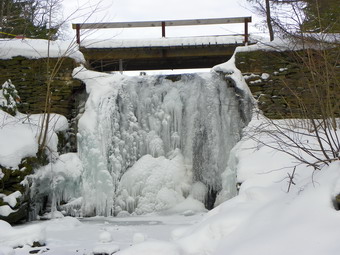 As we hiked we talked about the beauty all around us even though we weren't hiking mountains with spectacular vistas. The stream was quite pretty with ice formations in places and open water in others. The sound it made as the water splashed over the rocks was very relaxing. Around 1.8 miles Lisa let me know she was tiring some. We walked a little farther until the trail started to ascend and then decided to turn around. On the way back we stopped to walk down to the stream and take some pictures in several places. The walk back is all uphill but the slope is so gentle it hardly seemed like it. The walking was also easier since we had broken the track earlier. When we got back to the dam. I walked own to the stream and took several pictures of the frozen waterfall that had formed there. We hiked the 3.7 miles in a little over 2.5 hours with plenty of time for pictures.
![]() On Tuesday, January 25th I wanted to park at Alder Lake and hike the Millbrook Ridge Trail to the lookout over Beecher Lake. There had been quite a bit of snow but the roads, even the back roads, were in pretty good shape. Alder Creek Road was plowed all the way passed the Hardenburgh transfer station and even Cross Mountain Road seeming have been cleared. However, the access road into Alder Lake was not plowed and the gate was closed. I could have walked in from there but I could find no place to park that was off the road and out of the way. I decided to park at Big Pond and hike over the trail to Alder Lake and back. I parked at Big Pond and we were walking down the road to the trail head by 10:35 AM. When we jumped the snow bank and started up to the trail head it was obvious that no one had been there in some time. From the register box there was a faint trail but that was pretty well filled in by new or drifted snow. We crossed an open field and descended a small hill before ascending another, larger hill. By this time I was heating up since I, as usual, was overdressed for the occasion. Despite temperatures barely into the twenties I was sweating already. This is why I like zippers in general and the setup on the Mammut Ultimate Hoody in particular! We continued on the woods road that is the trail and after climbing the hill and made a left as indicated by the "trail" sign. This is where the fun began for the day! The trail markers disappeared and I was left wondering where to go!> After wandering around for a while we backtracked and I finally caught sight of one marker. I followed the path that this marker seemed to indicate and then backtracked again since I saw no others. When I became convinced we were on the right track, we continued in a generally easterly direction until the trail markers again became nonexistent. We wandered around for at least 20 minutes without finding any markers or any evidence of a trail. At this point I was too frustrated to think about a bushwhack and just decided to follow our trail back to the car. I would come back another day armed with maps and my GPS track to conquer this challenge! On the way back I did spot some markers and found a part of the trail I had missed. As we neared Big Pond I decided to hike around the pond. We took a left toward the pond and then hugged the shore around the pond. I knew that at some point we would have to hit the road to avoid walking across the front yards of some hunting cabins and second homes on the other side. At one point we walked through a wet area which caused a large amount of snow to freeze on the snowshoes. We headed across a small creek at the head of the lake and then struck out for what was marked as Post Road on the GPS. Again the GPS had a road marked that was barely a woods road. I did spot an old bridge across the creek that seemed to be part of this road. A little further on we again crossed a creek and then ran into some woods roads headed in the wrong direction. We bushwhacked a little to the west and caught a plowed road out to the Barkaboom Road. As we walked down the road I decided to re-enter the woods just after a large culvert and walk down to the shore. At this point we went out onto the ice since I saw evidence of snowmobiles and ice fishing. We walked down the pond until I found a hole and used my pole to measure about 18 inches of ice! We arrived back at the car by 1:00 PM having taken about 2 hours and 20 minutes to cover the 4 mile hike. Much of the "excess" time was spent scratching my head!
On Tuesday, January 25th I wanted to park at Alder Lake and hike the Millbrook Ridge Trail to the lookout over Beecher Lake. There had been quite a bit of snow but the roads, even the back roads, were in pretty good shape. Alder Creek Road was plowed all the way passed the Hardenburgh transfer station and even Cross Mountain Road seeming have been cleared. However, the access road into Alder Lake was not plowed and the gate was closed. I could have walked in from there but I could find no place to park that was off the road and out of the way. I decided to park at Big Pond and hike over the trail to Alder Lake and back. I parked at Big Pond and we were walking down the road to the trail head by 10:35 AM. When we jumped the snow bank and started up to the trail head it was obvious that no one had been there in some time. From the register box there was a faint trail but that was pretty well filled in by new or drifted snow. We crossed an open field and descended a small hill before ascending another, larger hill. By this time I was heating up since I, as usual, was overdressed for the occasion. Despite temperatures barely into the twenties I was sweating already. This is why I like zippers in general and the setup on the Mammut Ultimate Hoody in particular! We continued on the woods road that is the trail and after climbing the hill and made a left as indicated by the "trail" sign. This is where the fun began for the day! The trail markers disappeared and I was left wondering where to go!> After wandering around for a while we backtracked and I finally caught sight of one marker. I followed the path that this marker seemed to indicate and then backtracked again since I saw no others. When I became convinced we were on the right track, we continued in a generally easterly direction until the trail markers again became nonexistent. We wandered around for at least 20 minutes without finding any markers or any evidence of a trail. At this point I was too frustrated to think about a bushwhack and just decided to follow our trail back to the car. I would come back another day armed with maps and my GPS track to conquer this challenge! On the way back I did spot some markers and found a part of the trail I had missed. As we neared Big Pond I decided to hike around the pond. We took a left toward the pond and then hugged the shore around the pond. I knew that at some point we would have to hit the road to avoid walking across the front yards of some hunting cabins and second homes on the other side. At one point we walked through a wet area which caused a large amount of snow to freeze on the snowshoes. We headed across a small creek at the head of the lake and then struck out for what was marked as Post Road on the GPS. Again the GPS had a road marked that was barely a woods road. I did spot an old bridge across the creek that seemed to be part of this road. A little further on we again crossed a creek and then ran into some woods roads headed in the wrong direction. We bushwhacked a little to the west and caught a plowed road out to the Barkaboom Road. As we walked down the road I decided to re-enter the woods just after a large culvert and walk down to the shore. At this point we went out onto the ice since I saw evidence of snowmobiles and ice fishing. We walked down the pond until I found a hole and used my pole to measure about 18 inches of ice! We arrived back at the car by 1:00 PM having taken about 2 hours and 20 minutes to cover the 4 mile hike. Much of the "excess" time was spent scratching my head!
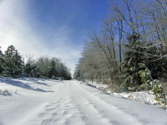
![]()
![]() On Saturday, January 22nd Cindy and I wanted to snowshoe in a location that had a "view" since the skies were clear and a deep blue. I was thinking about a 3500 foot peak but she suggested Minnewaska State Park. I was not happy about the choice as I did not want to drive that far and did not expect much of a view. We arrived at around noon to find that the parking fee was $10 instead of the $6 we were accustomed to paying. Undeterred we paid and turned right after the gatehouse to park in the lot nearest the Lower Awosting Carriageway. There were only a few cars in the lot and everyone seemed to be getting ready to snowshoe! We didn't want too much company so we got started right away with temperatures hovering in the high teems. As we started on the carriageway there was some broken trail to follow with some people choosing to take the Mossy Glen Trail just out of the parking lot. We stayed on the carriageway. It immediately became clear that Cindy had made the right choice. The trees were covered in ice and weighed Down with frozen snow. The sunlight sparkled off the trees and the powdery snow. We stopped to take a LOT of pictures in MANY places along the way. At about 1.4 miles most all of the tracks turned left and headed up the Blueberry Run Trail. Just before this point we met two hikers coming toward us on snowshoes but after the turn the snow was unbroken and even more beautiful. We continued on the carriageway toward Awosting. The trail is a long uphill which gets steeper as you approach the lake. The snow also got deeper in several places. We arrived at the lake shore at about 1:30 PM after covering about 2.75 miles. At this point we decided NOT to turn right and circle the lake since Awosting, as I found out during the fall, is the largest of the three "sky" lakes. Instead we turned left and headed toward the lookouts over Lake Awosting.
On Saturday, January 22nd Cindy and I wanted to snowshoe in a location that had a "view" since the skies were clear and a deep blue. I was thinking about a 3500 foot peak but she suggested Minnewaska State Park. I was not happy about the choice as I did not want to drive that far and did not expect much of a view. We arrived at around noon to find that the parking fee was $10 instead of the $6 we were accustomed to paying. Undeterred we paid and turned right after the gatehouse to park in the lot nearest the Lower Awosting Carriageway. There were only a few cars in the lot and everyone seemed to be getting ready to snowshoe! We didn't want too much company so we got started right away with temperatures hovering in the high teems. As we started on the carriageway there was some broken trail to follow with some people choosing to take the Mossy Glen Trail just out of the parking lot. We stayed on the carriageway. It immediately became clear that Cindy had made the right choice. The trees were covered in ice and weighed Down with frozen snow. The sunlight sparkled off the trees and the powdery snow. We stopped to take a LOT of pictures in MANY places along the way. At about 1.4 miles most all of the tracks turned left and headed up the Blueberry Run Trail. Just before this point we met two hikers coming toward us on snowshoes but after the turn the snow was unbroken and even more beautiful. We continued on the carriageway toward Awosting. The trail is a long uphill which gets steeper as you approach the lake. The snow also got deeper in several places. We arrived at the lake shore at about 1:30 PM after covering about 2.75 miles. At this point we decided NOT to turn right and circle the lake since Awosting, as I found out during the fall, is the largest of the three "sky" lakes. Instead we turned left and headed toward the lookouts over Lake Awosting.
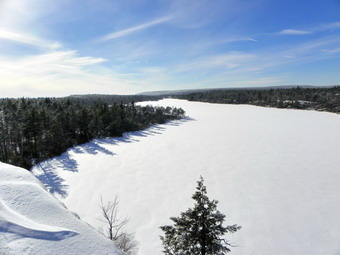 The trail we were on had been groomed for cross country skiing but I looked at our snowshoe tracks and they seemed to be doing less damage than the skaters. We stayed to the side of the trail and walked up to the viewpoints over the lake. Along the way we met and spoke to several groups who were skiing. The views of the Lake were spectacular and I took a lot of pictures before turning around and heading back down to the Upper Awosting Carriageway. I was especially interested in seeing the ice hanging down from Litchfield Ledge before turning off on the Blueberry Run Trail. As we passed the trail to Rainbow Falls, we noticed a sign that indicated the trail to the falls was for snowshoeing and the carriageway was for skiing only. I felt bad that we had violated the rules but this was the first sign we had seen. We decided to continue since it was less distance to the Blueberry Run Trail than going back the way we had come. We did stop to take pictures along the way particularly of the ice on the ledges. Although we were practically off the groomed trail one woman felt it necessary to inform us that we were in the wrong place. She may have been annoyed since we were snowshoeing faster than she could ski! By 2:45 PM we had traversed about 5 miles and turned left onto the Blueberry Run Trail.
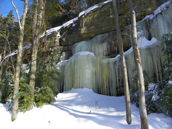 The Blueberry Run Trail descended a little steeply to the Mossy Glen Trail. Continuing straight ahead would have put us back on the carriageway but we decided to turn right and hike through Mossy Glen. This trail parallels the Peters Kill and then crosses it before intersecting the Lower Awosting Carriageway near the parking area. The trail was pretty and we took pictures of the stream and the fresh snow. The problem was that the ice and snow and so weighed down the branches that much of the trail was obscured. We had to push our way through thick laurel branches bent down under their load. At some point I wondered how we would cross the stream as most of the snow and ice bridges were incomplete and looked like they might collapse. I need not have worried as the trail led to a very sturdy wooden bridge across the Peters Kill. We got back on the carriageway, took some more pictures and returned to the parking area by 3:45 PM. We covered 6.8 miles in 3 hours and 45 minutes. On the way home on Route 44/55, we stopped at one of the lookouts to take some more pictures.
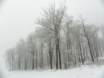
![]()
![]() On Wednesday, January 19th there was no school for the second day in a row due to snow and ice. I had no idea what conditions the roads were in but the temperature was around 34 degrees in town and I knew I could not stay home for two days in a row. The radar maps looked like Delaware County was colder and that it might be snowing. I decided to head for Bear Spring State Park near Walton to snowshoe. I had this in mind since I "discovered" Bear Spring last fall. My backup plan was to stop on Route 206 at the Campbell Mountain trail head if the roads looked questionable up ahead. We left home a little before 11;00 AM and the roads were only wet with no snow or ice. On the way up Cat Hollow on Route 206 the weather conditions changed and it started to snow. It was also obvious by the time that I reached the top of the mountain that the temperatures here had been colder and more snow had fallen. The trees with frozen snow were beautiful and I almost stopped at the pull off for Campbell Mountain but decided to head for Bear Spring instead. The trip through Downsville was uneventful but I again encountered more snow and evince of colder weather as I ascended Bear Spring Mountain. There was also a heavy blanket of fog on the mountains and some on the road. The cold layer of snow and the moist, warm air had combined to create the foggy conditions. I pulled into the main parking area for Bear Spring at the top of the hill. The road to the parking area was completely plowed and sanded and the parking area was also plowed. There was one truck parked when we arrived. I put on my Tubbs Alps Flex snowshoes and shouldered my pack to get on the trail. I was cold even though the temperature was around 28 degrees. I resisted the temptation to put on a warmer top and we headed off down the trail at around 11:40 AM.
On Wednesday, January 19th there was no school for the second day in a row due to snow and ice. I had no idea what conditions the roads were in but the temperature was around 34 degrees in town and I knew I could not stay home for two days in a row. The radar maps looked like Delaware County was colder and that it might be snowing. I decided to head for Bear Spring State Park near Walton to snowshoe. I had this in mind since I "discovered" Bear Spring last fall. My backup plan was to stop on Route 206 at the Campbell Mountain trail head if the roads looked questionable up ahead. We left home a little before 11;00 AM and the roads were only wet with no snow or ice. On the way up Cat Hollow on Route 206 the weather conditions changed and it started to snow. It was also obvious by the time that I reached the top of the mountain that the temperatures here had been colder and more snow had fallen. The trees with frozen snow were beautiful and I almost stopped at the pull off for Campbell Mountain but decided to head for Bear Spring instead. The trip through Downsville was uneventful but I again encountered more snow and evince of colder weather as I ascended Bear Spring Mountain. There was also a heavy blanket of fog on the mountains and some on the road. The cold layer of snow and the moist, warm air had combined to create the foggy conditions. I pulled into the main parking area for Bear Spring at the top of the hill. The road to the parking area was completely plowed and sanded and the parking area was also plowed. There was one truck parked when we arrived. I put on my Tubbs Alps Flex snowshoes and shouldered my pack to get on the trail. I was cold even though the temperature was around 28 degrees. I resisted the temptation to put on a warmer top and we headed off down the trail at around 11:40 AM.
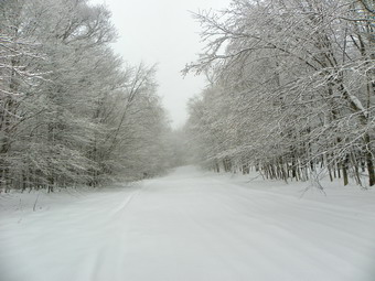 I was not sure exactly which route I was going to take. I wanted to do somewhat of a loop. The short loop was too short but I seemed to remember than the longer loop was over 6 miles. We headed down the wide trail which parallels Route 206 and heads east. The trail showed signs of snowmobile use but not recently. We were the first people on the trail and for a while we didn't even see any animal tracks. The trees were coated in frozen snow but everything had a surreal look because of the heavy fog. The Alps have a rigid plastic deck and the snow had a hard crust. Let's just say that the noise I was making was enough for an entire party of snowshoers. We wouldn't be surprising any wildlife on this day. The trail crosses a field and the descends and crosses East Tout Brook Road. On the other side it climbs some to a high point and a trail junction. Right is short and left is long. We turned left and walked down the hill to a wide trail or woods road that comes in from Route 206. We turned right at the bottom of the hill a little over 1 mile into the hike. The trail immediately passes a large clear cut area on the left which has nice views down the valley. The views this day were entirely blocked by the fog. I did take pictures of the snow frozen on the trees and the fog. From here it was simply a walk to where I would have to decide to turn around or start the loop. At 2.2 miles the trail that comes up from East Trout Brook Road and Launt Pond came up on the right. In about another mile the trail split and I decided that I would do the loop and go in the opposite direction I had gone last time. We turned right and walked along the edge of a field before entering the woods again.
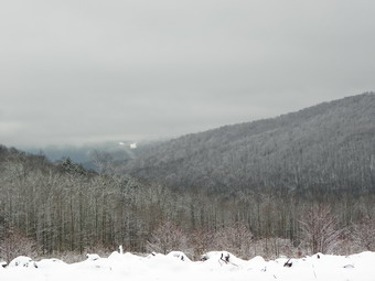 From the turn the trail heads due south with a few twists and drops 450 vertical feet over .85 miles. In the back of my mind I knew this meant I would have to climb back up to the ridge on the other side. The trail breaks out of the woods in another clear cut area. There is another nice view down the valley here. This one was also obscured by the fog but not quite as much as the other. I stopped to take some pictures, dropped to the lowest point on the hike, took some more pictures and then turned left to begin the return climb. The breeze came up at this point and some snow blew in as well as some more fog. I was hoping this was not going to be a major event and soon the wind died down and the snow stopped. For a little less than a mile we climbed about 480 vertical feet to the top of the ridge. None of this was very hard but I was beginning to get tired. I had my GPS in my pack but was not obsessively staring at it as I sometimes do. If I had I would have know that in 2 hours we had hiked about 5 miles including stops! Over the next 1.35 miles the trail is mostly flat with a few bumps along the way. The only side trail is one to the right just after the highest point. This trail leads into Downsville where snowmobilers can get food and gas. By 2:15 PM we had completed the loop and were 6.3 miles into the hike. From this point it was simple enough to just follow our tracks back. Several times I remember thinking that Sheba still had a lot of energy while I was tiring. By 3:00 PM we had walked another 1.8 miles back to the clear cut area where we turned up the hill to follow our tracks back to the car. At this point I noticed some bare boot prints in the snow. On East Trout Brook Road we passed a DEC truck and the occupant waved as we crossed the road and headed up the hill back to the car. We were back in the parking area by 3:00 PM for a total hiking time of just under 4 hours. I was surprised when I check the GPS and found the distance was 9.5 miles!
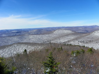
![]()
![]() On Monday, January 17th there was no school due to Martin Luther King Day and I decided that despite the cold I wanted do a snowshoe hike to a 3500 foot peak. I had been doing a lot of short and long snowshoe hikes but most were on flatter terrain and I had not done a 3500 foot peak since early in December. I decided on Table and Peekamoose since the trailhead is relatively close and I had not done both mountains in some time. I decided to delay my start a little but even when we arrived at the trail head around 9:00 AM the temperature was still in the single digits! I was layered for the weather but I always worry a little about Sheba. She is almost 13 years old but still seems to be able to handle most conditions. I still have not found a satisfactory solution to ice balls between her toes. There were two other cars in the lot and I put on my snowshoes and we got started right away. There was little or no wind blowing and on the way to the register box I knew I was again overdressed. The door on the register box was missing or rather it was lying at the foot of the support. After signing in, I opened the pitzips, traded my mitts for light gloves, opened my front zippers and continued up the trail. On the lower part of the trail there was less than a foot of snow and I kept contacting rocks and branches as I walked. Somewhere along this part of the trail, we met a lone hiker coming down from above. He was well equipped and has spent the night camped out on Peekamoose! He said that is 0 degree bag was barely warm enough. I bemoaned the lack of snow and he said there was more further up the trail. We continued along working our way up through the two or three rocky areas below Reconnoiter Rock. As we walked I was reminded that 6 or 8 miles of snow shoeing over rolling or hilly terrain is NOT the same as climbing a 3500 foot peak on snowshoes. We reached Reconnoiter Rock at about 10:30 AM and hiked right by as I intended to make a quick stop on the way back. At this point, the snow began to get deeper especially where it had drifted! I also began to remembered that this hike is not the walk in the park that I always think it is and doing it on snowshoes despite the well broken trail is tiring.
On Monday, January 17th there was no school due to Martin Luther King Day and I decided that despite the cold I wanted do a snowshoe hike to a 3500 foot peak. I had been doing a lot of short and long snowshoe hikes but most were on flatter terrain and I had not done a 3500 foot peak since early in December. I decided on Table and Peekamoose since the trailhead is relatively close and I had not done both mountains in some time. I decided to delay my start a little but even when we arrived at the trail head around 9:00 AM the temperature was still in the single digits! I was layered for the weather but I always worry a little about Sheba. She is almost 13 years old but still seems to be able to handle most conditions. I still have not found a satisfactory solution to ice balls between her toes. There were two other cars in the lot and I put on my snowshoes and we got started right away. There was little or no wind blowing and on the way to the register box I knew I was again overdressed. The door on the register box was missing or rather it was lying at the foot of the support. After signing in, I opened the pitzips, traded my mitts for light gloves, opened my front zippers and continued up the trail. On the lower part of the trail there was less than a foot of snow and I kept contacting rocks and branches as I walked. Somewhere along this part of the trail, we met a lone hiker coming down from above. He was well equipped and has spent the night camped out on Peekamoose! He said that is 0 degree bag was barely warm enough. I bemoaned the lack of snow and he said there was more further up the trail. We continued along working our way up through the two or three rocky areas below Reconnoiter Rock. As we walked I was reminded that 6 or 8 miles of snow shoeing over rolling or hilly terrain is NOT the same as climbing a 3500 foot peak on snowshoes. We reached Reconnoiter Rock at about 10:30 AM and hiked right by as I intended to make a quick stop on the way back. At this point, the snow began to get deeper especially where it had drifted! I also began to remembered that this hike is not the walk in the park that I always think it is and doing it on snowshoes despite the well broken trail is tiring.
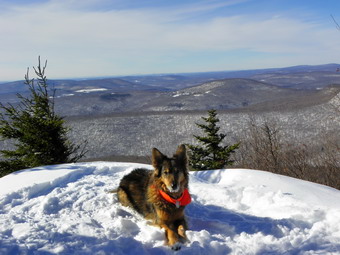 The hike up to the lookout involves more up than I remember with several scrambles through rocky areas, The snow also continued to get deeper even in areas where there was no drifting. Around 11:00 AM we were at the lookout and I stopped to take some pictures. The views were nice with blue sky and bright sun but there wasn't much to break up the vast expanse of tree and mountains. We got a drink and a snack and continued our hike across the relatively flat area before the last push up Peekamoose. As we reached the middle of the steep final ascent, we met the other person that was out on the trail. This young man seemed experienced and had just walked out to the lookout nearer the summit of Peekamoose. He appeared to be headed up to the top and I secretly enjoyed the fact that we had caught and passed this younger hiker. Sheba and I negotiated the last steep portions up to the summit and arrived at the large rock that makers the top at around 11:35 AM. We stopped to take some pictures including one of my poles, set at 125 Cm., with only the grips showing! I was tired and Sheba had a nice collection of ice balls on all four paws but I knew Table was less than a mile away. I knew that in under better conditions I could make it there and back in 35 to 45 minutes so I figured and hour on the broken but challenging trail. The trip down to the Col went quickly and the snow was solid and packed by the hiker who had camped out. Climbing up to Table proved to have few obstacles except for my tired leg muscles. We tagged the top of the mountain and then started back to Peekamoose. The trip back was almost a mirror of the one out with the descent being "fun" and the ascent back up to the summit of Peekamoose being work. It was around 12:35 when we got back to Peekamoose and I found myself reviewing the trip back in my mind. I could think of no areas of UP which was good since my UP muscles were shot!
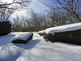 As we headed down the steeper part of the trail near the summit, I decided to go off to the left to a viewpoint I had been to once before. The views from the big boulder here were nice but very similar to the viewpoint right along the trail. I did spot what I thought might be a higher lookout and slogged through some snow to get there but it was largely blocked by trees. As we continued to descend I realized that we had not yet encountered the young hiker we had seen on the way up. I thought he might have turned around at the summit of Peekamoose but it is more likely he was resting at the spot we met him on his way back DOWN from the summits. We continued down to the flat area below the summit and I wandered off to another viewpoint that had similar views to the others. From here it was back down through some rocky areas to Reconnoiter Rock. We stopped to take a few pictures and then hurried down through the rock scrambles toward the parking area. Going down proved to be a little more difficult than going up as it often is. As we were almost down, we met a couple and their small dog going up. It seemed like they might be going to camp since it was later in the day but they didn't have enough equipment for a winter overnight. We were back at the car BR 3:00 PM having covered just under 9 miles in a total of under 6 hours. I would have liked our pace to be quicker but the fact that I was a little out of shape and the snow was deep on top probably accounted for the slow hiking.
![]() On Saturday, January 15th Cindy and I had some matters to attend to in the morning which did not bother us as the temperature was below 0! We got started around 1:00 PM and took two cars out the DeBruce Road. We parked one car at the parking area for Long Pond on Flugertown Road. We got in the other car and drove out to Wild Meadow Road (Black Bear Road) near Round Pond. The idea was to hike between the two cars without having to hike back on the trails or walk on the road. The one way distance is about 5 miles and I would not have minded returning to one car but Cindy liked the car spot idea! We parked and started down Basily Road Around 1:20 PM. The road is a "seasonal use" road and had not been plowed. The snow was packed by snowmobiles and larger vehicles using the road. I remembered the route as pretty flat but that was coming from the other direction. The first .85 miles of Basily Road are uphill and although the gain is only 300 feet it was a little tiring. I expected the snow to become deeper when we started on the woods road where the "civilized" part of Basily Road ends. This was not the case as the snowmobiles had been over the road many times. While we were hiking the route, we were passed by the same group of four sleds several times and a few other riders. All of these snowmobiles slowed down and were very careful as they passed us. Once we were on the woods road the hike was flat or downhill most of the way. At 2.1 miles we turned left off Basily Road and onto another woods road and the trail that leads passed the Long pond lean-to and back to Flugertown Road. At 2:40 PM and around 3.15 miles we passed by the side trail to the lean-to. The trail was a little uphill after the next left turn but soon we were descending to the car and the parking area. We arrived at 3:20 PM having completed the 5 mile snowshoe in 2 hours.
On Saturday, January 15th Cindy and I had some matters to attend to in the morning which did not bother us as the temperature was below 0! We got started around 1:00 PM and took two cars out the DeBruce Road. We parked one car at the parking area for Long Pond on Flugertown Road. We got in the other car and drove out to Wild Meadow Road (Black Bear Road) near Round Pond. The idea was to hike between the two cars without having to hike back on the trails or walk on the road. The one way distance is about 5 miles and I would not have minded returning to one car but Cindy liked the car spot idea! We parked and started down Basily Road Around 1:20 PM. The road is a "seasonal use" road and had not been plowed. The snow was packed by snowmobiles and larger vehicles using the road. I remembered the route as pretty flat but that was coming from the other direction. The first .85 miles of Basily Road are uphill and although the gain is only 300 feet it was a little tiring. I expected the snow to become deeper when we started on the woods road where the "civilized" part of Basily Road ends. This was not the case as the snowmobiles had been over the road many times. While we were hiking the route, we were passed by the same group of four sleds several times and a few other riders. All of these snowmobiles slowed down and were very careful as they passed us. Once we were on the woods road the hike was flat or downhill most of the way. At 2.1 miles we turned left off Basily Road and onto another woods road and the trail that leads passed the Long pond lean-to and back to Flugertown Road. At 2:40 PM and around 3.15 miles we passed by the side trail to the lean-to. The trail was a little uphill after the next left turn but soon we were descending to the car and the parking area. We arrived at 3:20 PM having completed the 5 mile snowshoe in 2 hours.
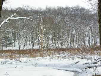
![]()
![]() On Wednesday, January 12th I wanted do a snowshoe hike to get some exercise and Frick Pond seemed close and inviting. Sheba and I arrived just before noon and got on the trail at the Frick Pond parking area. I wasn't interested in taking the same pictures again of this area so we kept a quick pace on the Quick Lake Trail out to Frick Pond. Where the trail splits before the pond I decided to change things up and headed right to Times Square. We arrived at around 12:20 PM taking a half hour for the 1 mile walk. At this point I decided to go straight ahead on the Logger's Loop to Iron Wheel junction. This is a long but gentle uphill pull of 1.2 miles which we made in a little over 30 minutes. From there we turned left on the Quick Lake Trail to go back to Frick Pond. We stopped briefly at the outlet to the pond and then continued back to the parking lot where we arrived at about 2:00 PM. We had snowshoed 3.7 miles in a little over 2 hours.
On Wednesday, January 12th I wanted do a snowshoe hike to get some exercise and Frick Pond seemed close and inviting. Sheba and I arrived just before noon and got on the trail at the Frick Pond parking area. I wasn't interested in taking the same pictures again of this area so we kept a quick pace on the Quick Lake Trail out to Frick Pond. Where the trail splits before the pond I decided to change things up and headed right to Times Square. We arrived at around 12:20 PM taking a half hour for the 1 mile walk. At this point I decided to go straight ahead on the Logger's Loop to Iron Wheel junction. This is a long but gentle uphill pull of 1.2 miles which we made in a little over 30 minutes. From there we turned left on the Quick Lake Trail to go back to Frick Pond. We stopped briefly at the outlet to the pond and then continued back to the parking lot where we arrived at about 2:00 PM. We had snowshoed 3.7 miles in a little over 2 hours.

![]()
![]() On Sunday, January 9th I wanted do a snowshoe hike after church. I got a later start than usual and scrapped plans to head for Balsam Lake Mountain and instead went to Frick Pond AGAIN. We arrived in the parking area at 1:30 PM and started out toward Frick Pond on the Quick Lake Trail. I chose to go out the Quick Lake Trail to Iron Wheel Junction and then take the Logger's Loop back to Times Square. When we arrived at the pond, we just kept hiking since the conditions were much the same as the day before and I was out for the exercise. It didn't take very long to get to Times Square. In fact, the 2.75 miles took only 1 hour and 10 minutes. I decided to climb up the Big Rock Trail and take the Flynn Trail back to the parking area rather than the shorter route around the pond. The Big Rock Trail was packed by snowmobile traffic which made the walking easier. Even though the trail can be challenging at a quick pace we were at the junction with the Flynn Trail, 3.85 miles into the hike, by 3:15 PM. The Flynn Trail showed only our tracks from the day before as Sheba and I headed back to the car. We arrived back just before 4:00 PM covering 5.6 miles in 2 hours and 20 minutes.
On Sunday, January 9th I wanted do a snowshoe hike after church. I got a later start than usual and scrapped plans to head for Balsam Lake Mountain and instead went to Frick Pond AGAIN. We arrived in the parking area at 1:30 PM and started out toward Frick Pond on the Quick Lake Trail. I chose to go out the Quick Lake Trail to Iron Wheel Junction and then take the Logger's Loop back to Times Square. When we arrived at the pond, we just kept hiking since the conditions were much the same as the day before and I was out for the exercise. It didn't take very long to get to Times Square. In fact, the 2.75 miles took only 1 hour and 10 minutes. I decided to climb up the Big Rock Trail and take the Flynn Trail back to the parking area rather than the shorter route around the pond. The Big Rock Trail was packed by snowmobile traffic which made the walking easier. Even though the trail can be challenging at a quick pace we were at the junction with the Flynn Trail, 3.85 miles into the hike, by 3:15 PM. The Flynn Trail showed only our tracks from the day before as Sheba and I headed back to the car. We arrived back just before 4:00 PM covering 5.6 miles in 2 hours and 20 minutes.
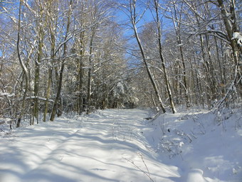
![]()
![]() On Saturday, January 8th Cindy and I wanted do a short snowshoe hike before my afternoon basketball games. Enough snow had fallen on Friday that most area schools were closed. The roads had been well cleared and when we arrived at the Frick Pond parking area, it too had been plowed out. The temperature was in the mid 20's with some sun and no wind to speak of. We arrived at the trail head around 10:15 AM and immediately put on our snowshoes and started up the Flynn Trail. The snow was absolutely fresh and unbroken. This made breaking trail a little difficult but I knew we would not be out for too long. Our plan was to hike up the Flynn Trail to the four-way junction at the top. From here we would head down the Big Rock Trail to Times Square around the back of Frick Pond and then back to the parking area. The conditions were nearly perfect as we headed up the Flynn Trail. Snow clung to must of the tree branches and the blue sky made a perfect backdrop. We enjoyed the scenery and didn't really push the pace arriving at the top of the Flynn Trail at 11:40 AM. The 1.75 mile uphill had taken us about and hour and twenty minutes. We paused a minute for a drink and a snack and so that I could take some pictures and then turned left and headed DOWN the Big Rock Trail.
On Saturday, January 8th Cindy and I wanted do a short snowshoe hike before my afternoon basketball games. Enough snow had fallen on Friday that most area schools were closed. The roads had been well cleared and when we arrived at the Frick Pond parking area, it too had been plowed out. The temperature was in the mid 20's with some sun and no wind to speak of. We arrived at the trail head around 10:15 AM and immediately put on our snowshoes and started up the Flynn Trail. The snow was absolutely fresh and unbroken. This made breaking trail a little difficult but I knew we would not be out for too long. Our plan was to hike up the Flynn Trail to the four-way junction at the top. From here we would head down the Big Rock Trail to Times Square around the back of Frick Pond and then back to the parking area. The conditions were nearly perfect as we headed up the Flynn Trail. Snow clung to must of the tree branches and the blue sky made a perfect backdrop. We enjoyed the scenery and didn't really push the pace arriving at the top of the Flynn Trail at 11:40 AM. The 1.75 mile uphill had taken us about and hour and twenty minutes. We paused a minute for a drink and a snack and so that I could take some pictures and then turned left and headed DOWN the Big Rock Trail.
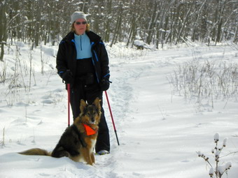 Hiking down a hill on snowshoes can be tricky if the terrain is rough but a real pleasure when it is smooth and even. Since the latter described the conditions on our way down Big Rock, we had great fun. By leaning back a little and pulling up the tips of the snowshoes we were able to almost "ski" down the trail. The 1.1 miles from top to bottom took only 20 minutes without really hurrying. We continued straight ahead at Times Square to go around the back of Frick Pond. By this time the blue sky had given way to overcast conditions and there was a little snow in the air. These conditions stayed with us and the snow increased until we were back at the car. The trail around the back of Frick Pond passed through a spruce tunnel. Several bridges cross small streams and a wooden causeway keeps hikers from having to negotiate what can be a very swampy area. By the time we got to the bridge over the outlet of Frick Pond the snow was rather heavy and I only took a few pictures before heading back to the parking area. We were back at by 12:45 PM having covered the 4 miles hike in about 2 hours and 20 minutes.
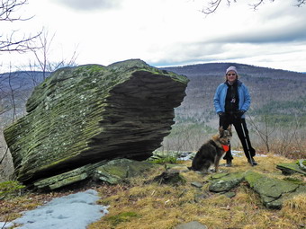
![]()
![]() On Sunday, January 2nd Cindy and I wanted to get out for the first hike of the New Year. We wanted to go on a short, local hike after church and I decided on the Split Rock Lookout on the Pelnor Hollow Trail. The lookout has some nice views and is close to home so we headed in that direction arriving in the parking area around 11:45 AM. When I signed in at the register, I noticed another retired Liberty teacher had signed in just before us but was headed in the opposite direction up the Mary Smith Trail to Mary Smith Hill. Cindy and I decided not to wear snowshoes and, since I didn't expect to encounter much snow we also decided to forgo the gaiters. The former was a good idea the latter not. The first part of the trail out to the power lines was wet but with little snow. Just after crossing the right-of-way we began to encounter patches of snow. For the rest of the hike to the ridge we found bare patches interspersed with as much as 8 inches of snow where it had drifted. It was good that the temperature was in the 40's or the wet snow down the back of our boots would have been even more annoying! The hike to the top of the ridge is about 1.1 miles but is a little steeper in spots than I remembered. The overall elevation gain is about 500 feet. The trail is poorly maintained with a lot of blowdown in the path. We cleared as many small trees and branches as we could. I was glad we were hiking after the briar season since there were still many canes in and along side the trail. The last descent to the lookout is steep and was slippery in places. We arrived at the lookout at 12:40 PM. The views are limited but they were relatively clear. The sun kept going in and out of the clouds. I took some pictures of the views from the lookout and some of the trail. I also took some shots of the large rock that stands at the viewpoint. We turned around and followed the same route back to the car. The descents were not as tricky as I had imagined despite the snow. We were back at the car by 1:40 PM having covered the 2.6 mile trip in just under 2 hours.
On Sunday, January 2nd Cindy and I wanted to get out for the first hike of the New Year. We wanted to go on a short, local hike after church and I decided on the Split Rock Lookout on the Pelnor Hollow Trail. The lookout has some nice views and is close to home so we headed in that direction arriving in the parking area around 11:45 AM. When I signed in at the register, I noticed another retired Liberty teacher had signed in just before us but was headed in the opposite direction up the Mary Smith Trail to Mary Smith Hill. Cindy and I decided not to wear snowshoes and, since I didn't expect to encounter much snow we also decided to forgo the gaiters. The former was a good idea the latter not. The first part of the trail out to the power lines was wet but with little snow. Just after crossing the right-of-way we began to encounter patches of snow. For the rest of the hike to the ridge we found bare patches interspersed with as much as 8 inches of snow where it had drifted. It was good that the temperature was in the 40's or the wet snow down the back of our boots would have been even more annoying! The hike to the top of the ridge is about 1.1 miles but is a little steeper in spots than I remembered. The overall elevation gain is about 500 feet. The trail is poorly maintained with a lot of blowdown in the path. We cleared as many small trees and branches as we could. I was glad we were hiking after the briar season since there were still many canes in and along side the trail. The last descent to the lookout is steep and was slippery in places. We arrived at the lookout at 12:40 PM. The views are limited but they were relatively clear. The sun kept going in and out of the clouds. I took some pictures of the views from the lookout and some of the trail. I also took some shots of the large rock that stands at the viewpoint. We turned around and followed the same route back to the car. The descents were not as tricky as I had imagined despite the snow. We were back at the car by 1:40 PM having covered the 2.6 mile trip in just under 2 hours.
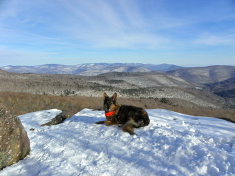
![]()
![]() On Friday, December 31st I had to take care of some business in the morning but I really wanted to hike somewhere in the afternoon. The weather forecast was for temperatures in the 40's with partly sunny skies. I thought it might be nice to got somewhere with a view and chose Giant Ledge. Sheba and I arrived at the trap at about 12:10 PM and found only two other cars in the lot. The parking areas for Biscuit Brook and Slide also had very few cars. We started to hike immediately and I carried my snowshoes across the road intending to put them on once we hit the trail. On the other side of the road it was obvious that the trail was well-packed and that no one else had worn snowshoes. I knew that there were places on the trail where I might need them but that there we many other spots where they would be a hindrance especially with the small amount of snow. I decided that I did not want to carry them on my pack and I went back to the car and put them in the trunk. I took my MicroSpikes and decided that if the snow got really deep and I started to posthole I would just turn around. Just passed the bridge, as we started up the hill we met a black lab carrying a stick and soon the owners. They carried snowshoes but assured me that I would not need them. This made me feel better and Sheba and I continued on our way. The trail was slippery in places but manageable except in the case of one or two ice flows which I walked around. This part of the trail usually fools me since as I climb the various ascents along the way I always think I am at the trail junction and then there is one more climb. This time I counted them! There are five different short climbs with the last being the one that ends with the trail junction. When we arrived at the junction with the trail to Giant Ledge and Panther, I checked my watch and found it had only taken 25 minutes. I thought this good under the conditions. We turned left and started the climb to Giant Ledge. The trail was still packed and the hiking went quickly. Even the last and steepest ascent was no problem and soon we were on top. Just as we started to walk to the first ledge we met a couple coming back. We stopped and talked briefly and then continued in our opposite directions.
On Friday, December 31st I had to take care of some business in the morning but I really wanted to hike somewhere in the afternoon. The weather forecast was for temperatures in the 40's with partly sunny skies. I thought it might be nice to got somewhere with a view and chose Giant Ledge. Sheba and I arrived at the trap at about 12:10 PM and found only two other cars in the lot. The parking areas for Biscuit Brook and Slide also had very few cars. We started to hike immediately and I carried my snowshoes across the road intending to put them on once we hit the trail. On the other side of the road it was obvious that the trail was well-packed and that no one else had worn snowshoes. I knew that there were places on the trail where I might need them but that there we many other spots where they would be a hindrance especially with the small amount of snow. I decided that I did not want to carry them on my pack and I went back to the car and put them in the trunk. I took my MicroSpikes and decided that if the snow got really deep and I started to posthole I would just turn around. Just passed the bridge, as we started up the hill we met a black lab carrying a stick and soon the owners. They carried snowshoes but assured me that I would not need them. This made me feel better and Sheba and I continued on our way. The trail was slippery in places but manageable except in the case of one or two ice flows which I walked around. This part of the trail usually fools me since as I climb the various ascents along the way I always think I am at the trail junction and then there is one more climb. This time I counted them! There are five different short climbs with the last being the one that ends with the trail junction. When we arrived at the junction with the trail to Giant Ledge and Panther, I checked my watch and found it had only taken 25 minutes. I thought this good under the conditions. We turned left and started the climb to Giant Ledge. The trail was still packed and the hiking went quickly. Even the last and steepest ascent was no problem and soon we were on top. Just as we started to walk to the first ledge we met a couple coming back. We stopped and talked briefly and then continued in our opposite directions.
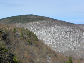 Sheba and I walked down to the first viewpoint and I took off my pack to get out the camera. It was 1"05 PM so the trip up had taken only 50 minutes with a couple of pauses to talk to people. We got a snack and a drink and then I started to take some pictures. The view was nice but there was nothing spectacular. I took some pictures of Sheba and then some of the Burroughs Range, Panther and the mountain beyond. In all we spent only about 10 minutes on the viewpoint before starting back. As we started to descend from the top, I could see a group of hikers below. Once we were down I saw that it was a group of four young people in their twenties. We stopped and talked about the beautiful weather and the rain predicted for the weekend. As I said goodbye I hoped they would be careful with the flying saucer one was carrying. Sheba and I picked up the pace and soon caught up to the couple we had met on top. They moved aside to let us pass but I suggested we descend together as I would be glad for the company. They agreed and we talked all the way back to the trailhead. They were from the city but have a home in Kerhonksen. They told me where they had hiked so far and I made some suggestions for other hikes. We made pretty good time going down being careful to slow down wherever ice was a problem. We met several groups coming up from the parking area. Perhaps four or five groups with from two to eight people. Many had dogs but all were well-behaved or on a leash. We were back at the parking area by 2:10 PM having covered the 3.5 snowy miles in under two hours. The descent would have been quicker had we made it alone but I was more interested in hiking with somebody for a change!
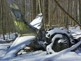
![]()
![]() On Thursday, December 30th I had planned a hike on the other side of the river near Beacon. I was going to meet my son Kurt and Hike to the South Beacon fire tower and then down to the Cornish Mansion near Bull Hill and finally out to Little Stony Point. Plans changed when Kurt said he wanted to come over to the Catskills to hike. We had a limited amount of time so I thought about and discard loner hikes like Peekamoose and Table and Vernooy Kill Falls from Peekamoose. I did consider hiking over Samson Mountain to Spencer Ledge but settled on hiking to the plane crashes on Van Wyck. I knew Kurt would enjoy the history behind these crashes and I had never been to the lower crash site. The lower crash site is a Korean War era jet located at N41.927483 W74.439583 (C Hayden). This is a Lockheed T-33A Shooting Star which is a single-engine, two seat aircraft and probably was used for training pilots. The upper crash is a single engine private plane located at 41.946383 W74.436833 ((C Hayden). Kurt met me at the TriValley school in Grahamsville and I drove out to Sundown and stayed left to head toward West Shokan on the Peekamoose Road. When we arrived at Bear Hole Brook, our jumping off spot for the bushwhack, it was clear there was no room to park. I continued on the road to the Peekamoose trailhead where I parked. We decided to carry our snowshoes down to Bear Hole Brook and then wear them for the hike. There appeared to be enough snow to make this a good idea even if they were only used for traction. We parked at the trailhead at 9:45 AM and were at the brook with snowshoes on by 10:00 Am. At this point it took me a moment to remember that we had to climb the steep bank up to the woods road for the beginning of the hike. Once we were on the woods road, things began to look familiar. We decided to stay on the road as long as we did not go north of the crash or head too far east away from it. After about .75 miles on the road, we decided that it was continuing away from where we wanted to go and we turned northwest and up a steep hill. Actually we headed for a cliff band and found one route that went up through it. Going up was difficult but I wondered about coming back down!
On Thursday, December 30th I had planned a hike on the other side of the river near Beacon. I was going to meet my son Kurt and Hike to the South Beacon fire tower and then down to the Cornish Mansion near Bull Hill and finally out to Little Stony Point. Plans changed when Kurt said he wanted to come over to the Catskills to hike. We had a limited amount of time so I thought about and discard loner hikes like Peekamoose and Table and Vernooy Kill Falls from Peekamoose. I did consider hiking over Samson Mountain to Spencer Ledge but settled on hiking to the plane crashes on Van Wyck. I knew Kurt would enjoy the history behind these crashes and I had never been to the lower crash site. The lower crash site is a Korean War era jet located at N41.927483 W74.439583 (C Hayden). This is a Lockheed T-33A Shooting Star which is a single-engine, two seat aircraft and probably was used for training pilots. The upper crash is a single engine private plane located at 41.946383 W74.436833 ((C Hayden). Kurt met me at the TriValley school in Grahamsville and I drove out to Sundown and stayed left to head toward West Shokan on the Peekamoose Road. When we arrived at Bear Hole Brook, our jumping off spot for the bushwhack, it was clear there was no room to park. I continued on the road to the Peekamoose trailhead where I parked. We decided to carry our snowshoes down to Bear Hole Brook and then wear them for the hike. There appeared to be enough snow to make this a good idea even if they were only used for traction. We parked at the trailhead at 9:45 AM and were at the brook with snowshoes on by 10:00 Am. At this point it took me a moment to remember that we had to climb the steep bank up to the woods road for the beginning of the hike. Once we were on the woods road, things began to look familiar. We decided to stay on the road as long as we did not go north of the crash or head too far east away from it. After about .75 miles on the road, we decided that it was continuing away from where we wanted to go and we turned northwest and up a steep hill. Actually we headed for a cliff band and found one route that went up through it. Going up was difficult but I wondered about coming back down!
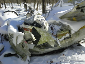 After ascending the short, steep climb we continued to head northwest and continued to climb but much less steeply. We did run into some rather thick brush and some blowdown but we just walk through or around it. Soon we were in the vicinity of the crash and started to look around. I looked downhill a little and saw an "unnatural" shape. The "shape" was the tail of the aircraft which became more obvious as we headed in that direction. The site was only about .7 miles from where we had turned off the road. The time was about 11:30 AM. The snow covered much of the debris field but the crash was unmistakable. The single Allison engine is remarkably intact as is most of the tail assembly. The "stars and bars" markings are still present as was a warning sign near the tail about the blast from the jet exhaust. The wings did not seem to be present with the rest of the debris. After a quick glance around, I spotted the right wings at least 50 feet from the site. The wings most likely sheared off as the plane hit the trees. We inspected the wreckage and took some pictures. I was distressed to see that some people have shown so little respect for the crash site. The tail has been used for target practice and others have scratched their names in the aluminum. This is a sad comment on the attitudes and education of people today! After getting a snack and drink, we considered hiking to the upper crash site. We both had family obligations and decided to head back in much the same direction as our original route. We paralleled our route up for a while and then walked perpendicularly to it until we intersected that our tracks. From there we followed our tracks back to Bear Hole Brook and arrived at about 12:55 PM. We stopped at the brook so that I could take some pictures. As I Was taking some shots, I noticed someone walking down the brook toward us. We greeted each other. He was a local resident who was home from college and had walked up the brook to the next set of waterfalls. We walked back to the parking area together. We arrived at the car at 1:05 PM having covered 3.5 miles in 3.5 hours. A short hike but an interesting one with my son. Since we had a little time left over, I drove up the road and parked at Buttermilk Falls to take some pictures. The falls were frozen and quite picturesque.
On Wednesday, December 29th I wanted to get out for some exercise but did not want to go too far from home. I decided to take Sheba and my snowshoes across the road and hike on the hill we call Round Top behind our church. We crossed the street and I put on the snowshoes although there wasn't too much snow in the field. We started to walk up the hill near the cemetery to Round Top and there was even less snow. When we turned left into the woods, I could see there wasn't much snow in the woods and that somebody had been walking the path in boots without any problem. I decided to keep the snowshoes on and see if there was more snow at a slightly higher elevation. As we climbed up to the lookout over Livingston Manor, the depth of snow did increase making the snowshoes usable but not a requirement. At the lookout we turned right up through the woods and I noticed some flagging along a woods road. On we went to the base of the first hill which we climbed with no problem. The snowshoes did help with the grip in some steeper spots. The higher we went the more snow there was and I was surprised at the difference from the base of the hill since the elevation gain in total is only a few hundred feet. We ascended the second hill and walked through almost a foot of snow to the place where we often descend to make a short loop. There didn't look like there was enough snow to slide down the hill so I decided to continue further. We walked down the other side of the hill and across a flatter area, through some trees and to the woods road that climbs the next hill. We followed the road to the top and experienced varying snow depths along the way. Once at the top we turned around to head back following the same path we had used on the way out. Back at the top of the first hill where we normally turn to descend to the Quickway viewpoint, I decided that it was late enough and the snow cover variable enough for us to simply follow our path back to the church. We did this and finished in about and hour and a half. This seemed much better than laying around the house but I am hoping for bigger snow falls soon!