
What You Missed
Summer 2024
Summer 2024
On Saturday, September 21st I put Sheena on her leash at 2:00 PM and walked her out the door intending to go up the driveway and back. I was tired but the weather was beautiful so We were glad to be out if only for a short time. When we got to the end of the driveway, Sheena did not show any of her previous reticence to cross the road. I was surprised but decided to follow her lead. We looked both ways but there was no traffic coming so we crossed to the other side. Sheena led en across the field next to the church and then around the back of the church. She turned left to head up the hill toward the trailhead. She seemed very anxious to get to the top but had to interrupt the walk to sniff around several times. When we got to the top, Sheena turned left as if to start a hike on the trails. I realized at this point that I was dressed in my corps shirt and BDUs and had not brought my phone. I decided we needed to go back to the house but Sheena had other ideas. She really wanted to go on the trails but I persuaded her to follow me down the hill. It took a little longer than usual to get to the church as Sheena was smelling everything in sight. She led my across the field to the point opposite our driveway. We made sure no traffic was coming and crossed to the driveway and walked back to the house. The progress Sheena has made in a few weeks surprises me. She is only 10 weeks old but seems to really enjoy hiking!
![]()
![]()
![]()
![]() On Friday, September 20th I planned to get out for a hike on Round Top with my new dog Sheena. This would be only her second hike but she had done well on her first outing. On that first hike we did just one small loop. This time I planned to do a big loop. After losing my hiking buddy, Sheila, on July 12th, I had been looking to get another dog. I was reluctant because I was so close to Sheila and she was such a great hiker. I also knew I needed to have another dog as we have not been with out one for 20 years! On Wednesday our Daughter-in-law Kathleen, sent us the name of someone who might have puppies.I called the woman and she said she had one female available and we decided to go check her out IMMEDIATELY! I think when we saw her Cindy and I both fell in love with her. She is a Feist-Cur cross which are actual types of dogs used on farms and for hunting in the south. She probably won't get to be more than 30 pounds which makes Cindy happy although I would have preferred a larger dog. She was born the day after Sheila died. We took her home and she slept with me on the couch all night. The dog slept but I did not sleep as much. Around 4:00 pm I decided we would go to Round Top again to get in a walk. I decided to take my pager with me so I could respond on calls. Sheena is not quite aware of my changing cloths to hike but I am sure she will be soon! I started to get ready to hike at 4:10 PM with the temperature at 75 degrees on the back porch. I got dressed in my White Sierra light crew top with no baselayer. I wore my Railriders hiking pants which are expensive but last along time and have features like deep pockets and a generous cut which I really like. The pants have Velcro closures at the ankles. I decided to put on my Keen Durand hiking boots which I ordered a half size larger than the previous pair. These shoes fit well out of the box but get much tighter when I add a decent insole. Without the third party insole, by feet hurt from the lack of support. I added a new pair of Xstance insoles in an effort to find the best support and cushioning for my feet. These insoles have shock absorbing gel pads, TPU arch support, and memory foam cushioning all wrapped in a breathable fabric. The insoles have been hyped by their manufacturer and they really do seem to deliver. I decided not to take any poles as the walk would be short and I would be holding Sheena's leash. At 4:20 PM I put Sheena on her leash and we walked out the door to start the hike. We headed down the driveway and to the street. Sheena has gotten used to walking on her leash to the end of the drive but get nervous as we get near the road. I finally had to pick her up and carry her as I crossed the street and walked to the parking lot next to the Presbyterian Church. I walked to the back of the church and began the ascent of the steepest hill behind the church. I tried putting Sheena down and she had no problem walking up the hill. The hill is short but gets the circulation pumping and is the steepest and longest climb on the "trail." Not having poles made it more of a challenge. I did not stop not on the way to the top of the hill but set a fast pace. I could feel that I had mot been hiking in a while. At the top I paused for a minute so I could look around at the hills that surround the hamlet of Livingston Manor. The skies were blue with no clouds and bright sunshine. Sheena was eager to enter the woods on the trail. The trail was dry and the temperature under the trees seemed cooler than in the sun.
On Friday, September 20th I planned to get out for a hike on Round Top with my new dog Sheena. This would be only her second hike but she had done well on her first outing. On that first hike we did just one small loop. This time I planned to do a big loop. After losing my hiking buddy, Sheila, on July 12th, I had been looking to get another dog. I was reluctant because I was so close to Sheila and she was such a great hiker. I also knew I needed to have another dog as we have not been with out one for 20 years! On Wednesday our Daughter-in-law Kathleen, sent us the name of someone who might have puppies.I called the woman and she said she had one female available and we decided to go check her out IMMEDIATELY! I think when we saw her Cindy and I both fell in love with her. She is a Feist-Cur cross which are actual types of dogs used on farms and for hunting in the south. She probably won't get to be more than 30 pounds which makes Cindy happy although I would have preferred a larger dog. She was born the day after Sheila died. We took her home and she slept with me on the couch all night. The dog slept but I did not sleep as much. Around 4:00 pm I decided we would go to Round Top again to get in a walk. I decided to take my pager with me so I could respond on calls. Sheena is not quite aware of my changing cloths to hike but I am sure she will be soon! I started to get ready to hike at 4:10 PM with the temperature at 75 degrees on the back porch. I got dressed in my White Sierra light crew top with no baselayer. I wore my Railriders hiking pants which are expensive but last along time and have features like deep pockets and a generous cut which I really like. The pants have Velcro closures at the ankles. I decided to put on my Keen Durand hiking boots which I ordered a half size larger than the previous pair. These shoes fit well out of the box but get much tighter when I add a decent insole. Without the third party insole, by feet hurt from the lack of support. I added a new pair of Xstance insoles in an effort to find the best support and cushioning for my feet. These insoles have shock absorbing gel pads, TPU arch support, and memory foam cushioning all wrapped in a breathable fabric. The insoles have been hyped by their manufacturer and they really do seem to deliver. I decided not to take any poles as the walk would be short and I would be holding Sheena's leash. At 4:20 PM I put Sheena on her leash and we walked out the door to start the hike. We headed down the driveway and to the street. Sheena has gotten used to walking on her leash to the end of the drive but get nervous as we get near the road. I finally had to pick her up and carry her as I crossed the street and walked to the parking lot next to the Presbyterian Church. I walked to the back of the church and began the ascent of the steepest hill behind the church. I tried putting Sheena down and she had no problem walking up the hill. The hill is short but gets the circulation pumping and is the steepest and longest climb on the "trail." Not having poles made it more of a challenge. I did not stop not on the way to the top of the hill but set a fast pace. I could feel that I had mot been hiking in a while. At the top I paused for a minute so I could look around at the hills that surround the hamlet of Livingston Manor. The skies were blue with no clouds and bright sunshine. Sheena was eager to enter the woods on the trail. The trail was dry and the temperature under the trees seemed cooler than in the sun.
At the first trail junction, we turned right on the woods road to start the more gentle approach to the trail system. Sheena was doing a good job of alternating between following and leading me. The trails were clear and I did not find any branches to move. I was surprised at the number of leaves that had fallen forming a cover on the trail. We continued up the woods road until the trail turned left. We followed it up the hill to the trail junction with the blue trail Sheena seemed to want to go straight ahead so that's what we did. When she wants to Sheena can have a great amount of energy. At this point she was bounding up the trail ahead of me. When we got to the white crossover trail, Sheena seemed to want to turn left onto it so we turned left. This trail is a little less used and Sheena was constantly trying to follow her nose off the trail. I hope to get to the point that I can trust her without a leash as I always trusted Sheila. For now, I encouraged Sheena to continue to walk with me on the trail. We eventually returned to the blue trail where we turned left and started down the hill toward the yellow trail. When we arrived at the trail junction, I decided to continue straight ahead on the yellow trail to complete a modified big loop. Sheena seemed to be bored and wanted to lay down in the sun or scurry off the trail. I had a heart-to-heart talk with her and we continued walking on the trail. We walked through the ferns which were starting to turn brown. There continued to be a cover of leaves on the trail. At the lookout we turned left to follow the yellow trail back to the first trail junction. Now Sheena was full of energy and wanted to run down the trail! At the trail junction we continued straight out to the trailhead. Sheena was willing to walk down the hill to just behind the church but then balked at going any further. I picked her up and walked through the church parking lot to my driveway. I put Sheena down and she willingly continue back to the house. It was 4:0 PM and we had spent half an hour walking around a mile. This isn't gettng me much exercise but it sure is nice to walk with a dog again!
![]()
![]()
![]()
![]() On Saturday, September 14th I planned to get out for a hike on Round Top with my new dog Sheena. Our first hike had been on the rail trail in Parksville which is relatively flat. I was hoping she would do Ok on the steeper trails on Round Top. After losing my hiking buddy, Sheila, on July 12th, I had been looking to get another dog. I was reluctant because I was so close to Sheila and she was such a great hiker. I also knew I needed to have another dog as we have not been with out one for 20 years! On Wednesday our Daughter-in-law Kathleen, sent us the name of someone who might have puppies.I called the woman and she said she had one female available and we decided to go check her out IMMEDIATELY! I think when we saw her Cindy and I both fell in love with her. She is a Feist-Cur cross which are actual types of dogs used on farms and for hunting in the south. She probably won't get to be more than 30 pounds which makes Cindy happy although I would have preferred a larger dog. She was born the day after Sheila died. We took her home and she slept with me on the couch all night. The dog slept but I did not sleep as much. Sheena is just starting to be aware of my changing cloths to hike and has started to watch me! I started to get ready to hike at 3:00 PM with the temperature at 70 degrees on the back porch. I got dressed in my White Sierra light crew top with no baselayer. I wore my Railriders hiking pants which are expensive but last along time and have features like deep pockets and a generous cut which I really like. The pants have Velcro closures at the ankles. I decided to put on my Keen Durand hiking boots which I ordered a half size larger than the previous pair. These shoes fit well out of the box but get much tighter when I add a decent insole. Without the third party insole, by feet hurt from the lack of support. I added a new pair of Xstance insoles in an effort to find the best support and cushioning for my feet. These insoles have shock absorbing gel pads, TPU arch support, and memory foam cushioning all wrapped in a breathable fabric. The insoles have been hyped by their manufacturer and they really do seem to deliver. I decided not to take any poles as the walk would be short and I would be holding Sheena's leash. At 3:10 PM I put Sheena on her leash and we walked out the door to start the hike. We headed down the driveway and to the street. Sheena has gotten used to walking on her leash to the end of the driveway but gets nervous as we get near the road. I picked her up at the end of the driveway and carried her arcoss theroad, through the field by the church and to the back of the church where the hill to the trailhead starts. The hill is short but gets the circulation pumping and is the steepest and longest climb on the "trail." Not having poles and carrying a squirming puppy made it more of a challenge. I did not stop not on the way to the top of the hill but set a fast pace. I could feel that I had not been hiking in a while. At the top I paused for a minute so I could look around at the hills that surround the hamlet of Livingston Manor. The skies were blue with no clouds and bright sunshine. I out Sheena down and she was eager to enter the woods on the trail but walked around the steps. The trail was dry and the temperature under the trees seemed cooler than in the sun.
On Saturday, September 14th I planned to get out for a hike on Round Top with my new dog Sheena. Our first hike had been on the rail trail in Parksville which is relatively flat. I was hoping she would do Ok on the steeper trails on Round Top. After losing my hiking buddy, Sheila, on July 12th, I had been looking to get another dog. I was reluctant because I was so close to Sheila and she was such a great hiker. I also knew I needed to have another dog as we have not been with out one for 20 years! On Wednesday our Daughter-in-law Kathleen, sent us the name of someone who might have puppies.I called the woman and she said she had one female available and we decided to go check her out IMMEDIATELY! I think when we saw her Cindy and I both fell in love with her. She is a Feist-Cur cross which are actual types of dogs used on farms and for hunting in the south. She probably won't get to be more than 30 pounds which makes Cindy happy although I would have preferred a larger dog. She was born the day after Sheila died. We took her home and she slept with me on the couch all night. The dog slept but I did not sleep as much. Sheena is just starting to be aware of my changing cloths to hike and has started to watch me! I started to get ready to hike at 3:00 PM with the temperature at 70 degrees on the back porch. I got dressed in my White Sierra light crew top with no baselayer. I wore my Railriders hiking pants which are expensive but last along time and have features like deep pockets and a generous cut which I really like. The pants have Velcro closures at the ankles. I decided to put on my Keen Durand hiking boots which I ordered a half size larger than the previous pair. These shoes fit well out of the box but get much tighter when I add a decent insole. Without the third party insole, by feet hurt from the lack of support. I added a new pair of Xstance insoles in an effort to find the best support and cushioning for my feet. These insoles have shock absorbing gel pads, TPU arch support, and memory foam cushioning all wrapped in a breathable fabric. The insoles have been hyped by their manufacturer and they really do seem to deliver. I decided not to take any poles as the walk would be short and I would be holding Sheena's leash. At 3:10 PM I put Sheena on her leash and we walked out the door to start the hike. We headed down the driveway and to the street. Sheena has gotten used to walking on her leash to the end of the driveway but gets nervous as we get near the road. I picked her up at the end of the driveway and carried her arcoss theroad, through the field by the church and to the back of the church where the hill to the trailhead starts. The hill is short but gets the circulation pumping and is the steepest and longest climb on the "trail." Not having poles and carrying a squirming puppy made it more of a challenge. I did not stop not on the way to the top of the hill but set a fast pace. I could feel that I had not been hiking in a while. At the top I paused for a minute so I could look around at the hills that surround the hamlet of Livingston Manor. The skies were blue with no clouds and bright sunshine. I out Sheena down and she was eager to enter the woods on the trail but walked around the steps. The trail was dry and the temperature under the trees seemed cooler than in the sun.
At the first trail junction, we continued straight up the hill with Sheena pulling me on her leash. At the top of the hill we continued on the yellow trail as it swung to the right. We walked uphill through the field of ferns that was rapidly turning brown. The trail was covered in leaves which were all a nondescript yellow color. We continued on the yellow trail passing the "sitting rock" amd up a small hill to the junction with the blue trail to the summit. I decided we would do a small loop to make sure Sheena could handle the walk. We turned right on the yellow trail and walked along the base of Round Top. Sheena seemed to be doing well as she was doing her best to do zoomies on a leash. She ran ahead to the end of the leash and then came running full-speed back at me until the leash ran out. She did this several times as we continued to the junction with the blue trail. When we came to the junction, we turned right to stay on the yellow trail. We walked down to the woods road and followed the yellow trail as it turned right. We continued down to the first trail junction with Sheena beginning to show some fatigue. We turned left and headed out to the trailhead. At the trailhead we turned right and walked down the paved road toward the church. Near the bottom, I pocked Sheila up and carried her through the church parking lot and across the road to our driveway. I put Sheena down in the driveway and let her lead me back to the house. It was 3:40 PM and it had taken us 30 minutes to hike a little less than a mile. Sheena seemed beat. She drank a lot of water and then laid down on the couch for a long nap.
On Friday, September 13th, I planned to go to Liberty High School to clean up the cross country trail so that runners could practice on it for their only home meet on October 1st. I ahd gotten permission from the owner of the property as the trail is not on school grounds. I Leo had found coverage for ambulance calls which is a rare occurrence. Cindy had agreed to go with me as I could use the help and like somebody with me when I am using sharp tools. I wanted to get to the school by 9:00 AM but an early morning call change my plans. When I got back from the call at 9:30 AM I changed into my hiking clothes. The temperatures was only 68 degrees but I knew I would warm up doing the work.I got dressed in my White Sierra long-sleeved top without a baselayer. I put on a pair of RailRiders hiking pants which are expensive but last a long time and have features like deep pockets and a generous cut which I really like. I decided to put on my Keen Durand hiking boots which fit well. I added a new pair of Xstance insoles in an effort to find the best support and cushioning for my feet. These insoles have shock absorbing gel pads, TPU arch support, and memory foam cushioning all wrapped in a breathable fabric. The insoles have been hyped by their manufacturer and seemed to be living up to their claims. I then started to load up the tools that I would need. I took my Fiskars ax, Silky Sugowaza and KatanaBoy saw, LT Wright machete, Corona loppers, and my Stihl string trimmer. I also had to take along fuel and line for the trimmer. We left the house at 9:45 AM and were at the start of the trail by 10:00 AM. We had cleared the trail last year and had used it for several home meets. Several small trees and fallen across the trail and the grass and encroaching brush had to be cleared. We took a look at the trees and decided to cut on the opposite side of the trail. The wood was dry and rotten so the cuts went quickly. When I was done, I was able to pivot the remaining piece off the trail to the other side. The other small tree I was able to cut in two places rather quickly and flipped it off the trail. That left one large tree that was high enough so most runners would not hit their heads. I moved some chunks of wood to open a path that would allow runners to avoid hitting their heads. I made a mental note to paint the trunk before the race! While I was moving some of the chunks of wood off the trail, Cindy was trying to use the loppers to trim some brush. The loppers need sharpening which is not easy and they work much better on larger diameter material. Cindy and I decided she should go home and get some other loppers. She left and I decided to fire up the string trimmer. I thought I might be a little short on fuel nut I filled the tank amd started in. I walked down the trail trimming all of the tall grass and weeds down to a manageable height. Once I got to the other end, I came back up the trail and trimmed even closer to the ground. In many areas I was down to the dirt! Cindy hadn't returned so I decided to use the string trimmer on the brush growing next to the trail and hanging over into the trail. I forgot This trimmer is a beast and will trim material almost as thick as my little finger! I walked down the trail once cutting the brush growing next to the trail. On the way back I cut the higher branches growing over into the trail. When I got back up to the road, Cindy was back. She looked at the trail and agreed it was almost finished! She used her loppers to trim a few branches and I used the trimmer to get some more that were higher up. By 11:30 AM there was nothing left to trim. We packed everything up and started back to Livingston Manor. The XC coach check out the trail and said she thought it looked great.
![]()
![]()
![]()
![]()
![]() On Wednesday, September 11th, I would have liked to get in a longer hike but was committed to covering ambulance calls. I covered a call in Liberty from late morning to early afternoon. When I returned I decided I wanted to take Sheena our new puppy for a walk on the Parksville Rail Trail. I did some work around the house and then asked Cindy if she would like to hike. We decided to go to the Parksville Rail Trail and hike from Fox Mountain Road to the falls and back. The Parksville Rail Trail is under three miles out and back but carrying a pack and keeping a quick pace helps increase the difficulty. Cindy likes the flat and short hikes! As I was getting dressed at 2:10 PM, I remembered how much Sheila liked to hike this trail and ate a swim at the falls. I hoped Sheena would be able to hike to the falls even if I had to carry her back. I found that since Sheila passed away I still feel she is with me on hikes and I have vivid memories of her on each trail. I got dressed in my White Sierra long-sleeved top without a baselayer. I put on a pair of RailRiders hiking pants which are expensive but last a long time and have features like deep pockets and a generous cut which I really like. I decided to put on my Keen Durand hiking boots which fit well. I added a new pair of Xstance insoles in an effort to find the best support and cushioning for my feet. These insoles have shock absorbing gel pads, TPU arch support, and memory foam cushioning all wrapped in a breathable fabric. The insoles have been hyped by their manufacturer and seemed to be living up to their claims. I grabbed a pair of Leki MicroVario poles I have been using for some time because they are light and lock without slipping. I knew I might not take the poles with me as the hike is short and I knew I might carry Sheena on the way back. I put our gear in the back of the car and left Livingston Manor at 2:25 PM. I drove out Old Route 17 toward Parksville and pulled into the parking area on the right side of the road just after Fox Mountain Rd. There were no cars parked in the lot when we arrived. I left my phone in the car so that I could enjoy the hike and started out on the trail at 2:35 PM under beautiful blue skies with towering puffy white clouds. The temperature in the sun has right around 80 degrees. I put a light leash on Sheena and found she was a little resistant to its use. I had to pull her along a little but found sending Cindy out from made Sheena follow her. Every now and then Sheena would stop and want to sniff around the trail.
On Wednesday, September 11th, I would have liked to get in a longer hike but was committed to covering ambulance calls. I covered a call in Liberty from late morning to early afternoon. When I returned I decided I wanted to take Sheena our new puppy for a walk on the Parksville Rail Trail. I did some work around the house and then asked Cindy if she would like to hike. We decided to go to the Parksville Rail Trail and hike from Fox Mountain Road to the falls and back. The Parksville Rail Trail is under three miles out and back but carrying a pack and keeping a quick pace helps increase the difficulty. Cindy likes the flat and short hikes! As I was getting dressed at 2:10 PM, I remembered how much Sheila liked to hike this trail and ate a swim at the falls. I hoped Sheena would be able to hike to the falls even if I had to carry her back. I found that since Sheila passed away I still feel she is with me on hikes and I have vivid memories of her on each trail. I got dressed in my White Sierra long-sleeved top without a baselayer. I put on a pair of RailRiders hiking pants which are expensive but last a long time and have features like deep pockets and a generous cut which I really like. I decided to put on my Keen Durand hiking boots which fit well. I added a new pair of Xstance insoles in an effort to find the best support and cushioning for my feet. These insoles have shock absorbing gel pads, TPU arch support, and memory foam cushioning all wrapped in a breathable fabric. The insoles have been hyped by their manufacturer and seemed to be living up to their claims. I grabbed a pair of Leki MicroVario poles I have been using for some time because they are light and lock without slipping. I knew I might not take the poles with me as the hike is short and I knew I might carry Sheena on the way back. I put our gear in the back of the car and left Livingston Manor at 2:25 PM. I drove out Old Route 17 toward Parksville and pulled into the parking area on the right side of the road just after Fox Mountain Rd. There were no cars parked in the lot when we arrived. I left my phone in the car so that I could enjoy the hike and started out on the trail at 2:35 PM under beautiful blue skies with towering puffy white clouds. The temperature in the sun has right around 80 degrees. I put a light leash on Sheena and found she was a little resistant to its use. I had to pull her along a little but found sending Cindy out from made Sheena follow her. Every now and then Sheena would stop and want to sniff around the trail.
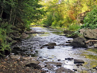 The first part of the trail was a little damp from some recent rain. It was drying on the top from the bright sun and slight breeze. Once we were on the trail and sheltered by the trees it was a little cooler and the trail was about as I expected with a few wet spots and some mud. The rail trail runs parallel to the Little Beaverkill and the new section of State Route 17. It follows the route of the O&W railroad and is very flat. We set a quick pace but were not racing to hike out and back as fast as possible. The water level in the stream was at a lower level than it had been in some time. We passed several benches placed for people to rest in warmer weather. The trail had a few small branches and a couple of larger ones which had fallen in the highs winds. I cleared these with my sticks. I wondered if we would run into any larger branches or trees down across the trail. The area just before the wooden walkways showed some interesting views but they were mostly block so we continued to hike passed this spot. We walked across the wooden walkways which had been raked and swept. They were starting to show some layers of mud from the runoff from the highway. We walked passed several trees that had been cut and cleared. We came to the mudslide that had brought several trees down across the trail. All of these trees had been cut with a chainsaw and removed. This are was pretty wet and muddy so I picked up Sheena and carried her across the muddiest areas. Just after this area was another tree that a crew had cut and cleared. As we walked, we could hear an increase in the noise from the stream and I knew the falls were just ahead. Sheena was beginning to look tired and even seemed to have a little limp! When we came to the falls it was 3:05 PM which meant it had taken 30 minutes to hike to the falls.
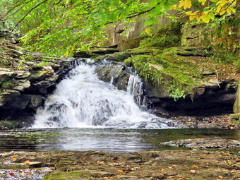
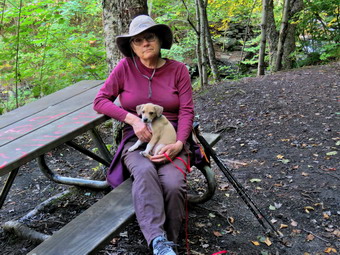 I decided to go down to the streambed to take some pictures. I asked Cindy if she would like to come along and bring Sheena to get a drink but she declined. Walking down the steep bank with my pack and no poles was a little tricky. I put my pack down and got out my camera. The water was lower than I expected but the falls were still interesting. I took pictures of the falls using different zooms and angles. I turned around and took some shots downstream. When I was done, I stowed the camera and wI worked my way back up to the trail. I snapped a few more shots from above the falls and a few more upstream. I also took pictures of Sheena and Cindy sitting on the bench. When I was done, we decided to turn around as Sheena seemed a little tired of walking. I picked her up and we started back toward the car. Sheena wasn't that happy about being carried but I contused until we passed the mudslide. I put her down and let her walk on her leash for a little while. After a short distance Sheena seemed more interested in sitting in the sun and using her nose to small everything. I knew the trip back should be quicker since I was carrying the dog but it did not go as quickly as I thought it would. We crossed the bridge and the walkways and continued toward the parking area. When we broke out of the trees into the sun, I could feel the warmth of the sun as did Sheena. We arrived back at the car at 3:30 PM after hiking 2 miles in 55 minutes including the time to take pictures! I checked my phone and there had been no ambulance calls while we were on the trail! I think Sheena will enjoy hiking when she gets a little older and bigger. Right now she is two months old and weighs only 7 pounds!
![]()
![]()
![]()
![]() On Thursday, September 5th I planned to get out for a hike on Round Top so that I could still cover ambulance calls. After losing my hiking buddy, Sheila, on July 12th, I had been looking to get another dog. I was reluctant because I was so close to Sheila and she was such a great hiker. I also knew I needed to have another dog as we have not been with out one for 20 years! On Wednesday our Daughter-in-law Kathleen, sent us the name of someone who might have puppies.I called the woman and she said she had one female available and we decided to go check her out IMMEDIATELY! I think when we saw her Cindy and I both fell in love with her. She is a Feist-Cur cross which are actual types of dogs used on farms and for humming in the south. She probably won't get to be more than 30 pounds which makes Cindy happy although I would have preferred a larger dog. She was born the day after Sheila died and her name is Sheena. We took her home and she slept with me on the couch all night. The dog slept but I did not sleep as much. In the morning I had issues I had to work on for the ambulance corps and chores to do around the house. When Cindy got home from church, we ate lunch and I eventually decided to take a short nap. I was woke up around 4:00 pm and decided I would go to Round Top to get in a walk. I would have loved to take Sheena but she isn't even 8 weeks old. I started to get ready to hike at 4:10 PM with the temperature at 68 degrees on the back porch. I got dressed in my White Sierra light crew top with no baselayer. I wore my Railriders hiking pants which are expensive but last along time and have features like deep pockets and a generous cut which I really like. The pants have Velcro closures at the ankles. I decided to put on my Keen Durand hiking boots which I ordered a half size larger than the previous pair. These shoes fit well out of the box but get much tighter when I add a decent insole. Without the third party insole, by feet hurt from the lack of support. I added a new pair of Xstance insoles in an effort to find the best support and cushioning for my feet. These insoles have shock absorbing gel pads, TPU arch support, and memory foam cushioning all wrapped in a breathable fabric. The insoles have been hyped by their manufacturer and they really do seem to deliver. I decided to take my Leki MicroVario poles with external locks as the internal twist locks fail. I did not put on gaiters or a hat. I took my cell phone with me because even though I planned to hike quickly, I was pretty sure I was the only EMT around to respond. At 4:20 PM I walked out the door to start the hike. I headed down the driveway and to the street. I crossed the street and walked to the parking lot next to the Presbyterian Church. I walked to the back of the church and began the ascent of the steepest hill behind the church. The hill is short but gets the circulation pumping and is the steepest and longest climb on the "trail." I did not stop not on the way to the top of the hill but set a fast pace. I could feel that I had been hiking more and was in better shape. At the top I paused for a minute so I could look around at the hills that surround the hamlet of Livingston Manor. The skies were blue with no clouds and bright sunshine. I continued the hike by turning left at the trailhead. The trail was dry and the temperature under the trees seemed cooler than in the sun.
On Thursday, September 5th I planned to get out for a hike on Round Top so that I could still cover ambulance calls. After losing my hiking buddy, Sheila, on July 12th, I had been looking to get another dog. I was reluctant because I was so close to Sheila and she was such a great hiker. I also knew I needed to have another dog as we have not been with out one for 20 years! On Wednesday our Daughter-in-law Kathleen, sent us the name of someone who might have puppies.I called the woman and she said she had one female available and we decided to go check her out IMMEDIATELY! I think when we saw her Cindy and I both fell in love with her. She is a Feist-Cur cross which are actual types of dogs used on farms and for humming in the south. She probably won't get to be more than 30 pounds which makes Cindy happy although I would have preferred a larger dog. She was born the day after Sheila died and her name is Sheena. We took her home and she slept with me on the couch all night. The dog slept but I did not sleep as much. In the morning I had issues I had to work on for the ambulance corps and chores to do around the house. When Cindy got home from church, we ate lunch and I eventually decided to take a short nap. I was woke up around 4:00 pm and decided I would go to Round Top to get in a walk. I would have loved to take Sheena but she isn't even 8 weeks old. I started to get ready to hike at 4:10 PM with the temperature at 68 degrees on the back porch. I got dressed in my White Sierra light crew top with no baselayer. I wore my Railriders hiking pants which are expensive but last along time and have features like deep pockets and a generous cut which I really like. The pants have Velcro closures at the ankles. I decided to put on my Keen Durand hiking boots which I ordered a half size larger than the previous pair. These shoes fit well out of the box but get much tighter when I add a decent insole. Without the third party insole, by feet hurt from the lack of support. I added a new pair of Xstance insoles in an effort to find the best support and cushioning for my feet. These insoles have shock absorbing gel pads, TPU arch support, and memory foam cushioning all wrapped in a breathable fabric. The insoles have been hyped by their manufacturer and they really do seem to deliver. I decided to take my Leki MicroVario poles with external locks as the internal twist locks fail. I did not put on gaiters or a hat. I took my cell phone with me because even though I planned to hike quickly, I was pretty sure I was the only EMT around to respond. At 4:20 PM I walked out the door to start the hike. I headed down the driveway and to the street. I crossed the street and walked to the parking lot next to the Presbyterian Church. I walked to the back of the church and began the ascent of the steepest hill behind the church. The hill is short but gets the circulation pumping and is the steepest and longest climb on the "trail." I did not stop not on the way to the top of the hill but set a fast pace. I could feel that I had been hiking more and was in better shape. At the top I paused for a minute so I could look around at the hills that surround the hamlet of Livingston Manor. The skies were blue with no clouds and bright sunshine. I continued the hike by turning left at the trailhead. The trail was dry and the temperature under the trees seemed cooler than in the sun.
At the first trail junction, I continued straight ahead up the hill toward the lookout keeping a quick pace to get more exercise. At the top of the hill I turned right and followed the yellow trail through a forest floor covered in ferns which were starting to lose some of their bright green color. I ascended the small hill walking through some brush that was encroaching on the trail. I liked the feeling of "bushwhacking" through to the first junction with the blue trail. I turned right on the yellow trail and started along the base of Round Top. Within a short distance, I came to a small tree that had been across the trail. I had cleared this tree and a few others on a previous trip. I continue along the yellow trail and ran into a few more places where I had cleared blowdowns. In other places, I picked up some branches and threw them off the trail. At the next junction with the blue trail I turned left and headed up toward the summit. I passed over the summit and started down the other side. I bypassed the white crossover trail but turned left on the switchback. I walked out into the forest on the switchback and then back to the main blue trail. I turned left on the main trail and walked downhill to the junction with the yellow trail. I turned left and walked along the base of Round Top on the yellow trail. I remembered how much Sheila like to run ahead and then come back toward me at full speed. She would pass by me and then turn around and come back at top speed, I still miss her more than I can say. I hope that I can get Sheena out on the trails sooner than later. I still talk to Sheola as I hike alone and can almost see her with me on the trail. At the junction, I turned right and headed down the yellow trail to the woods road. I could hear voices ahead of me and caught sight on one person walking away from me. When I got the woods road, I continued downhill and soon I was back at the first trail junction. A group of three or four people were hiking out toward the trailhead
I immediately turned around and started back up the woods road on the yellow trail. I continued to the point where the trail turned off the woods road and continued uphill through the woods to the trail junction. I turned left to follow the yellow trail along the base of Round Top. I hiked to the next trail junction and turned right to head toward the summit. After a short distance, I turned right on the switchback which took me out into the forest and then back to the main blue trail. I turned right and then right again on the white crossover trail. This trail showed more use than I had seen before. There were a few branches that I had to pick up and remove from the trail. I continued along the white trail until it intersected with the blue trail I turned right and head downhill to the junction with the yellow trail. I turned right on the yellow trail and followed it along the base of Round Top. At the next trail junction, I turned left to stay on the yellow trail heading toward the viewpoint. Walking downhill through the ferns was beautiful. When I came to the lookout, I turned left to follow the yellow trail downhill to the first trail junction. At the first trail junction I continued straight out to the trailhead. I turned right and walked down the road toward the church. I walked through the church parking lot to Rock Avenue. I crossed to the driveway and walked home. I was back by 5:25 PM after hiking about 2 miles in 1 hour and 5 minutes. I found that it only takes 4 minutes to walk from the trailhead to the house and that each figure 8 takes me 26 around minutes.
![]()
![]()
![]()
![]() On Saturday, August 31st, I slept in to try to make up for the sleep I had been missing from recent ambulance calls. A call in the early morning was the third in a row at that time! I had a lot of corps and church work to do and thee was a slight mist or light rain until about 1:00 PM. At that point I decided that I wanted to hike the Parksville Rail Trail. The temperature was 70 degrees which was comfortable even with the humidity. The Parksville Rail Trail is under three miles out and back but carrying a pack and keeping a quick pace helps increase the difficulty. As I was getting dressed, I remembered how Sheila would always watch my every move so that I would not leave her behind "accidentally". I miss her all the time but hiking without her is very difficult. I do feel she is still with me and catch myself looking back to see where she is. I got dressed in my White Sierra long-sleeved top without a baselayer. I put on a pair of RailRiders hiking pants which are expensive but last a long time and have features like deep pockets and a generous cut which I really like. I decided to put on my Keen Durand hiking boots which fit well. I added a new pair of Xstance insoles in an effort to find the best support and cushioning for my feet. These insoles have shock absorbing gel pads, TPU arch support, and memory foam cushioning all wrapped in a breathable fabric. The insoles have been hyped by their manufacturer and seemed to be living up to their claims. I grabbed a pair of Leki MicroVario poles I have been using for some time because they are light and lock without slipping. I did not put on gaiters or wear a hat. I decided not to take my pack and hike as fast as I could. I did take my cell phone but promised myself I would leave it in the car. I knew I was the only EMT around to answer calls but I also knew I need some time for myself. The only time I am not on call now is from 0600 to 1200 on Sundays when I am preparing for and preaching in church. I put my poles in the back seat of the car and left Livingston Manor at 1:20 PM. I drove out Old Route 17 toward Parksville and pulled into the parking area on the right side of the road just after Fox Mountain Rd. There were two cars parked in the lot when I arrived. I left my phone in the car so that I could enjoy the hike and started out on the trail at 1:35 PM under beautiful blue skies with many puffy white clouds.
On Saturday, August 31st, I slept in to try to make up for the sleep I had been missing from recent ambulance calls. A call in the early morning was the third in a row at that time! I had a lot of corps and church work to do and thee was a slight mist or light rain until about 1:00 PM. At that point I decided that I wanted to hike the Parksville Rail Trail. The temperature was 70 degrees which was comfortable even with the humidity. The Parksville Rail Trail is under three miles out and back but carrying a pack and keeping a quick pace helps increase the difficulty. As I was getting dressed, I remembered how Sheila would always watch my every move so that I would not leave her behind "accidentally". I miss her all the time but hiking without her is very difficult. I do feel she is still with me and catch myself looking back to see where she is. I got dressed in my White Sierra long-sleeved top without a baselayer. I put on a pair of RailRiders hiking pants which are expensive but last a long time and have features like deep pockets and a generous cut which I really like. I decided to put on my Keen Durand hiking boots which fit well. I added a new pair of Xstance insoles in an effort to find the best support and cushioning for my feet. These insoles have shock absorbing gel pads, TPU arch support, and memory foam cushioning all wrapped in a breathable fabric. The insoles have been hyped by their manufacturer and seemed to be living up to their claims. I grabbed a pair of Leki MicroVario poles I have been using for some time because they are light and lock without slipping. I did not put on gaiters or wear a hat. I decided not to take my pack and hike as fast as I could. I did take my cell phone but promised myself I would leave it in the car. I knew I was the only EMT around to answer calls but I also knew I need some time for myself. The only time I am not on call now is from 0600 to 1200 on Sundays when I am preparing for and preaching in church. I put my poles in the back seat of the car and left Livingston Manor at 1:20 PM. I drove out Old Route 17 toward Parksville and pulled into the parking area on the right side of the road just after Fox Mountain Rd. There were two cars parked in the lot when I arrived. I left my phone in the car so that I could enjoy the hike and started out on the trail at 1:35 PM under beautiful blue skies with many puffy white clouds.
The first part of the trail was mostly dry even though we there had been rain. I am sure this was from drying in the sun and breeze. Once I was on the trail and sheltered by the trees it was a little cooler and the trail was about as I expected with a few wet spots and some mud. The rail trail runs parallel to the Little Beaverkill and the new section of State Route 17. It follows the route of the O&W railroad and is very flat. I set a quick pace with the intention of hiking out and back as fast as I could go. At one point we looked up and saw a man and woman headed toward me with three dogs on a leash. I said "hello" and they returned the greeting. I also commented on how good the dogs behaved as they showed little interest in me and did not bark. The water level in the stream was about the same as on my last trip despite the periods of rain. I passed several benches placed for people to rest. The trail had a few small branches which I cleared with my sticks. The area just before the wooden walkways showed some interesting views but I stuck with my plan to keep walking. The walkways that had been raked and swept were starting to show some more layers of mud. I walked passed several trees that had been cut and cleared. We came to the mudslide that had brought several trees down across the trail. All of these trees had been cut with a chainsaw and removed. This area was very wet and muddy from recent storms. Just after this area was another tree that a crew had cut and cleared. I continued on the trail heading toward the falls. As I walked, I could hear an increase in the noise from the stream and I knew the falls were just ahead. I took a peek at the falls and continued on my hike on the trail toward Parksville.
I felt comfortable walking at the fast pace without a pack and was glad I had picked the appropriate choice of clothing. Soon I was nearing the Parksville end of the trail passing some rundown and dilapidated buildings which should be removed. Several of the buildings showed that work was being done on them. I arrived at the Parksville end of the trail at 1:59 PM where wI found the small garden and a very informative sign. The sign listed the businesses and hotels that existed in Parksville during its heyday. The Young's Gap Hotel had room for 600 guests! The sign also explained the role of the railroad in the dairy industry which was a thriving one in all of Sullivan County. The pack of barking dogs that often greets hikers were not present or chose to be silent. I began the walk back on the trail trying to walk as fast as I could. As I approached the falls, I accelerated my pace. It took me only 6 minutes to cover the distance from Parksville trailhead to the falls. I continued hiking and passed the falls and kept up the fast pace. A couple and their dog came walking toward me and the dog seemed like it really didn't care that I was there. The dog was walking nicely on a leash and I again commented on how well behaved it was. Seeing all the dogs reminded me that I did not have one. I still remember all the things that Sheila would do on hikes and how ell-trained she was. I crossed the bridge and the walkways and continued toward the parking area. When I broke out of the trees into the sun, I could feel the warmth of the sun. I arrived back at the car at 2:22 PM after hiking 2.7 miles in 47 minutes. This was an overall personal best for me and I was not even tired! I checked my phone and there had been no ambulance calls while I was on the trail! I had enjoyed the hike but would have enjoyed it more with Sheila!
![]()
![]()
![]()
![]() On Thursday, August 29th I had a call in the middle of the night so I slept in until almost 10:00 AM to try to catch up. When I got up I had some work to do amd was waiting for the first ambulance call of the day. By 1:15 PM I was done and decided to go for a walk. I was the only EMT around to go on calls so I decided to go across the street to Round Top. Round Top is always available for a hike and although there are few surprises it is always better than staying at home. I started to get ready to hike at 1:20 PM with the temperature at 80 degrees on the back porch. As I began to get ready, I remembered how Sheila would always watch me carefully as I was getting ready so that she would not miss a hike. I got dressed in my White Sierra light crew top with no baselayer. I wore my Railriders hiking pants which are expensive but last along time and have features like deep pockets and a generous cut which I really like. The pants have Velcro closures at the ankles. I decided to put on my Keen Durand hiking boots which I ordered a half size larger than the previous pair. These shoes fit well out of the box but get much tighter when I add a decent insole. Without the third party insole, by feet hurt from the lack of support. I added a new pair of Xstance insoles in an effort to find the best support and cushioning for my feet. These insoles have shock absorbing gel pads, TPU arch support, and memory foam cushioning all wrapped in a breathable fabric. The insoles have been hyped by their manufacturer and they really do seem to deliver. I decided to take my Leki MicroVario poles with external locks as the internal twist locks fail. I did not put on gaiters or a hat. I took my cell phone with me because even though I planned to hike quickly, I was pretty sure I was the only EMT around to respond. At 1:40 PM I walked out the door to start the hike. I headed down the driveway to the street. I crossed the street and walked to the parking lot next to the Presbyterian Church. I walked to the back of the church and began the ascent of the steepest hill behind the church. The hill is short but gets the circulation pumping and is the steepest and longest climb on the "trail." I did stop not on the way to the top of the hill. I could really feel that I had been hiking more consistently. At the top I paused for a minute so I could look around at the hills that surround the hamlet of Livingston Manor. The skies were blue with plenty of white clouds and some nice sun. Everything remained really green caused by the recent rains and the sunshine on other days. I continued the hike by turning left at the trailhead. The trail was dry as it had been several days since the last rain. The temperature under the trees seemed cooler than in the sun.
On Thursday, August 29th I had a call in the middle of the night so I slept in until almost 10:00 AM to try to catch up. When I got up I had some work to do amd was waiting for the first ambulance call of the day. By 1:15 PM I was done and decided to go for a walk. I was the only EMT around to go on calls so I decided to go across the street to Round Top. Round Top is always available for a hike and although there are few surprises it is always better than staying at home. I started to get ready to hike at 1:20 PM with the temperature at 80 degrees on the back porch. As I began to get ready, I remembered how Sheila would always watch me carefully as I was getting ready so that she would not miss a hike. I got dressed in my White Sierra light crew top with no baselayer. I wore my Railriders hiking pants which are expensive but last along time and have features like deep pockets and a generous cut which I really like. The pants have Velcro closures at the ankles. I decided to put on my Keen Durand hiking boots which I ordered a half size larger than the previous pair. These shoes fit well out of the box but get much tighter when I add a decent insole. Without the third party insole, by feet hurt from the lack of support. I added a new pair of Xstance insoles in an effort to find the best support and cushioning for my feet. These insoles have shock absorbing gel pads, TPU arch support, and memory foam cushioning all wrapped in a breathable fabric. The insoles have been hyped by their manufacturer and they really do seem to deliver. I decided to take my Leki MicroVario poles with external locks as the internal twist locks fail. I did not put on gaiters or a hat. I took my cell phone with me because even though I planned to hike quickly, I was pretty sure I was the only EMT around to respond. At 1:40 PM I walked out the door to start the hike. I headed down the driveway to the street. I crossed the street and walked to the parking lot next to the Presbyterian Church. I walked to the back of the church and began the ascent of the steepest hill behind the church. The hill is short but gets the circulation pumping and is the steepest and longest climb on the "trail." I did stop not on the way to the top of the hill. I could really feel that I had been hiking more consistently. At the top I paused for a minute so I could look around at the hills that surround the hamlet of Livingston Manor. The skies were blue with plenty of white clouds and some nice sun. Everything remained really green caused by the recent rains and the sunshine on other days. I continued the hike by turning left at the trailhead. The trail was dry as it had been several days since the last rain. The temperature under the trees seemed cooler than in the sun.
At the first trail junction, I turned right and started up the woods road which has the gentler approach of the two. There were a number of small branches on the trail from the winds that had passed through the area. I removed these branches by dragging them off the trail. It was a pleasure to walk on the trails and it was obvious more people were using them. Ferns and grasses were growing like crazy and some bushes were growing a little into the trail. I liked the experience of walking the narrow track. At the end of the woods road, I turned left up the hill on the trail. I continued up the trail to the first trail junction with the upper blue trail where I turned left to follow the yellow trail along the base of Round Top. I continued on the yellow trail along the base of Round Top. I came to the next junction with the blue trail and turned right to head up the blue trail toward the summit. When I got to the switchback, I turned right and followed it until it came back to the main blue trail. The fact that the switchback sidehills in places made the walk a little more difficult. turned right and then continued straight ahead and up the hill toward the summit of Round Top bypassing the white crossover trail. As I passed over the summit, I noticed that the trail showed much less wear and I assumed fewer people were taking the time to walk this trail. I continued over the summit and down the blue trail toward the junction with the yellow trail. I bypassed the white crossover trail again and continued down to the yellow trail. At the junction with the yellow trail I turned right and walked the yellow trail along the base of Round Top toward the next junction with the blue trail. Along the way I looked up to see a woman with two leashed dogs headed toward me. When the dogs saw me they started to bark. I walked a little farther and then walked off the trail to allow them to pass. We exchanged greetings as we passed. At the next junction, I turned left and started slightly downhill toward the lookout over town. I passed the "sitting rock" and continued downhill. Everything was very green especially the ferns. As I walked I reflexively turned around to look for Sheila. I still miss Sheila all the time but it seems I miss her more on hikes. I find that saying her names helps me. When I reached the lookout, I followed the yellow trail as it turned left and walked down the hill to the first trail junction. At the first trail junction, I could see the woman with the Twp dogs. When I reached the bottom of the hill the dogs approached me and the larger came over to lick my hand. I reached out to let the dog sniff my hand and, since that went well, I petted her. The woman is a dog walker and she said this dog was a cross between a German Shepherd and a Golden Reliever. I immediately turned around and started back up the trail.
Climbing the hill to the lookout seemed easier as I have been hiking more. When I reached the top of the hill, I followed the yellow trail as it continued passed the upper part of the lookout. Where the trail turned right, I followed it uphill passing through a large area of green ferns some of which were encroaching on the trail. I passed the sitting rock and continued uphill to the junction with the blue trail. Walking without Sheila was strange as I realized it was like she was still with me. I turned right to follow the yellow trail along the base of Round Top. At the junction with the blue trail, I turned left to climb the trail toward the summit. I passed by the white crossover trail and continued toward the summit. I approached the top, walked over the summit and started down the other side bypassing the white trail. I did turn left on the switchback in the blue trail. I followed it out into the woods and back again to the blue trail farther down the hill. I turned left on the main blue trail and walked downhill until we were back at the junction with the yellow trail. I turned left and again walked along the yellow trail to the next junction with the blue trail. This time I turned right at the trail junction and started to walk down the trail to the woods road. I continued on the woods road at a quick pace. When I reached the first trail junction, I continued to walk straight ahead out to the trailhead where I turned right. I walked downhill to the road behind the church. I walked out through the parking lot and across the street to our driveway. I was back home at 2:45 PM after hiking just over 2 miles in 1 hour and 5 minutes which included time spent talking to the dog walker. I was happy my walk was not interrupted by an ambulance call.
![]()
![]()
![]()
![]() On Monday, August 26th, I slept in to try to make up for the sleep I had been missing from recent ambulance calls. As I was getting ready to start the day, the ambulance pager sounded and I was off on a call. When I got back, I picked up some sandwiches and Cindy and I ate lunch. I decided that I wanted to hike and asked Cindy if she would like to go walk the rail trail. The temperature was 82 degrees so Cindy had her doubts but eventually agreed to go. The Parksville Rail Trail is under three miles out and back but carrying a pack and keeping a quick pace helps increase the difficulty. As I was getting dressed, I remembered how Sheila would always watch my every move so that I would not leave her behind "accidentally". I miss her all the time but hiking without her is very difficult. I do feel she is still with me and catch myself looking back to see where she is. I got dressed in my White Sierra long-sleeved top with a short-sleeved baselayer. I put on a pair of RailRiders hiking pants which are expensive but last a long time and have features like deep pockets and a generous cut which I really like. I decided to put on my Keen Durand hiking boots which fit well. I added a new pair of Xstance insoles in an effort to find the best support and cushioning for my feet. These insoles have shock absorbing gel pads, TPU arch support, and memory foam cushioning all wrapped in a breathable fabric. The insoles have been hyped by their manufacturer and seemed to be living up to their claims. I grabbed a pair of Leki MicroVario poles I have been using for some time because they are light and lock without slipping. I did not ut on gaiters or wear a hat. I put our gear in the back of the car and left Livingston Manor at 2:20 PM. I drove out Old Route 17 toward Parksville and pulled into the parking area on the right side of the road just after Fox Mountain Rd. There were two cars parked in the lot when we arrived. I left my phone in the car so that I could enjoy the hike and we started out on the trail at 2:35 PM under beautiful blue skies with towering puffy white clouds.
On Monday, August 26th, I slept in to try to make up for the sleep I had been missing from recent ambulance calls. As I was getting ready to start the day, the ambulance pager sounded and I was off on a call. When I got back, I picked up some sandwiches and Cindy and I ate lunch. I decided that I wanted to hike and asked Cindy if she would like to go walk the rail trail. The temperature was 82 degrees so Cindy had her doubts but eventually agreed to go. The Parksville Rail Trail is under three miles out and back but carrying a pack and keeping a quick pace helps increase the difficulty. As I was getting dressed, I remembered how Sheila would always watch my every move so that I would not leave her behind "accidentally". I miss her all the time but hiking without her is very difficult. I do feel she is still with me and catch myself looking back to see where she is. I got dressed in my White Sierra long-sleeved top with a short-sleeved baselayer. I put on a pair of RailRiders hiking pants which are expensive but last a long time and have features like deep pockets and a generous cut which I really like. I decided to put on my Keen Durand hiking boots which fit well. I added a new pair of Xstance insoles in an effort to find the best support and cushioning for my feet. These insoles have shock absorbing gel pads, TPU arch support, and memory foam cushioning all wrapped in a breathable fabric. The insoles have been hyped by their manufacturer and seemed to be living up to their claims. I grabbed a pair of Leki MicroVario poles I have been using for some time because they are light and lock without slipping. I did not ut on gaiters or wear a hat. I put our gear in the back of the car and left Livingston Manor at 2:20 PM. I drove out Old Route 17 toward Parksville and pulled into the parking area on the right side of the road just after Fox Mountain Rd. There were two cars parked in the lot when we arrived. I left my phone in the car so that I could enjoy the hike and we started out on the trail at 2:35 PM under beautiful blue skies with towering puffy white clouds.
The first part of the trail was completely dry even though we had some rain. I am sure this was from drying in the sun and breeze. Once we were on the trail and sheltered by the trees it was a little cooler and the trail was about as I expected with a few wet spots and some mud. The rail trail runs parallel to the Little Beaverkill and the new section of State Route 17. It follows the route of the O&W railroad and is very flat. I set a quick pace with the intention of hiking out and back as fast as Cindy could go. At one point we looked up and saw two women headed toward us with an older dog on a leash. We said "hello" and they returned the greeting. The water level in the stream was about the same as on my last trip despite the periods of no rain and then thunderstorms. we passed several benches placed for people to rest. The trail had a few small branches which I cleared with my sticks. There were a few larger branches and small trees that I was able to coax off the trail. I wondered if we would run into any larger trees down across the trail. The area just before the wooden walkways showed some interesting views but I stuck with my plan to keep walking. The walkways that had been raked and swept were starting to show some more layers of mud. We walked passed several trees that had been cut and cleared. We came to the mudslide that had brought several trees down across the trail. All of these trees had been cut with a chainsaw and removed. This area was very wet and muddy from recent storms. Just after this area was another tree that a crew had cut and cleared. We continued on the trail heading toward the falls. We looked up and saw a couple walking toward us they turned around near the falls and started back towards Parksville. As we walked, we could hear an increase in the noise from the stream and we knew the falls were just ahead. We took a peek at the falls and continued on our hike on the trail toward Parksville.
The weather was hot but less humid and I felt comfortable and was glad I had picked the appropriate choice of clothing. As we walked on the trail, the couple that had turned around were now headed back toward us. We said "hello" and so did they even though they were hiking at an impressive pace. Soon we were nearing the Parksville end of the trail passing some rundown and dilapidated buildings which should be removed. Several of the buildings showed that work was being done on them. We arrived at the Parksville end of the trail at 3:07 PM where we found the small garden and a very informative sign. The sign listed the businesses and hotels that existed in Parksville during its heyday. The Young's Gap Hotel had room for 600 guests! The sign also explained the role of the railroad in the dairy industry which was a thriving one in all of Sullivan County. The pack of barking dogs that often greets us waited until the return trip to start their barking. We began the walk back on the trail trying to walk as fast as we could. We looked up and again saw the same couple hiking toward us. It seemed like they were trying to add some distance or maybe just wanted As we approached the falls, we accelerated our pace. It took us only 8 minutes to cover the distance from Parksville trailhead to the falls. We continued hiking and passed the falls and kept up the fast pace. A man and his dog came walking toward us and the dog seemed like it really wanted to visit. I asked the owner the breed and he told me it was a Belgian Malinois. Coincidentally I had been thinking about that breed for our next dog! We crossed the bridge and the walkways and continued toward the parking area. When we broke out of the trees into the sun, we could feel the warmth of the sun. We arrived back at the car at 3:35 PM after hiking 2.7 miles in exactly an hour. I checked my phone and there had been no ambulance calls while I was on the trail! We had enjoyed the hike but would have enjoyed it more with Sheila!
![]()
![]()
![]()
![]() On Saturday, August 24th, my driver and I were returning from an ambulance call when we were dispatched To Mongaup Pond State Campgrounds for an injured hiker on a trail. We arrived with the Livingston Manor Fire Department at the trailhead for the Mongaup Hardenburgh Trail at the north end of the pond. We were told that a hiker had an ankle injury that had been splinted with a SAM splint by NYS Forest Ranger Howard Kraft. The injury was just bad enough to keep the hiker from walking. The ranger, family members, and some other campers had placed the patient on a backboard and were carrying them down from the southern shoulder of West Mongaup Mountain. They had requested extra manpower, an EMT, a Stokes basket and the fire department UTV. I conferred with the fire chief and campground supervisor. We decided that a few firefighters and I would head up the trail with the Stokes basket to make contact with the party. More firefighters would follow as they became available. I was given a radio to communicate with the ranger and the camp supervisor. The firefighters had radios to communicate with their command. We started out on the Mongaup Hardenburgh trail at about 1950 in the darkness. I know these trails better than most of the other responders and I also had my phone with the Avenza app and NYNJTC maps. I knew that the UTV would not be able to get very far on the hikingt trail which had numerous rocks and roots. Fortunately, a trail crew had recently clear the trail which did make hiking easier.
On Saturday, August 24th, my driver and I were returning from an ambulance call when we were dispatched To Mongaup Pond State Campgrounds for an injured hiker on a trail. We arrived with the Livingston Manor Fire Department at the trailhead for the Mongaup Hardenburgh Trail at the north end of the pond. We were told that a hiker had an ankle injury that had been splinted with a SAM splint by NYS Forest Ranger Howard Kraft. The injury was just bad enough to keep the hiker from walking. The ranger, family members, and some other campers had placed the patient on a backboard and were carrying them down from the southern shoulder of West Mongaup Mountain. They had requested extra manpower, an EMT, a Stokes basket and the fire department UTV. I conferred with the fire chief and campground supervisor. We decided that a few firefighters and I would head up the trail with the Stokes basket to make contact with the party. More firefighters would follow as they became available. I was given a radio to communicate with the ranger and the camp supervisor. The firefighters had radios to communicate with their command. We started out on the Mongaup Hardenburgh trail at about 1950 in the darkness. I know these trails better than most of the other responders and I also had my phone with the Avenza app and NYNJTC maps. I knew that the UTV would not be able to get very far on the hikingt trail which had numerous rocks and roots. Fortunately, a trail crew had recently clear the trail which did make hiking easier.
We got on the trail and stayed on the trail using what little light there was and fire department flashlights. Gordon and I outpaced the others who were carrying the Stokes so we slowed a little to keep them in sight. I found the trail pretty easy to negotiate and I only consulted Avenza once. In about 45 minutes to an hour we met the group coming down the trail. I quickly check the patient's blood glucose level, pulse and other vital signs. They indicated their ankle hurt and they were a little cold but otherwise were ok. When the Stokes arrived we moved the patient from the backboard to the Stokes basket, strapped them in and started back down the mountain. Eight people alternated carry the Stokes. I had the easy job of keeping tabs on the patient and lighting the way for those working to carry the patient. Even though the trip was downhill those carrying had to go slowly and watch out for tripping and slipping hazards. Te going was slow but no one skipped. By around 2120 we were at the UTV. I suggested that we attempt to help the patient to sit on the seat as riding in the Stokes on the back would be too risky. We were able to get the patient into the seat and we headed for the family at the trailhead. When we arrived, the OT decided they did not want to go to the hospital. I thought this was foolish decision and made it clear to the patient and family that this was not in the patient's best interest. They all thanked us profusely but the patient sign a refusal which I explain was "Against Medical Advise." We returned to our base after taking almost 3 hours to rescue the aptient. I expected that it was possible that we would get a call later but none came. I hope the patient recovers quickly. I enjoyed the hike and am thinking about doing another hike in the dark!
![]()
![]()
![]()
![]() On Saturday, August 24th I planned to get out for a hike on Round Top so that I could still cover ambulance calls. Several overnight calls had me sleeping in late. I started to get ready to hike at 1:30 PM with the temperature at 68 degrees on the back porch. I got dressed in my White Sierra light crew top with no baselayer. I wore my Railriders hiking pants which are expensive but last along time and have features like deep pockets and a generous cut which I really like. The pants have Velcro closures at the ankles. I decided to put on my Keen Durand hiking boots which I ordered a half size larger than the previous pair. These shoes fit well out of the box but get much tighter when I add a decent insole. Without the third party insole, by feet hurt from the lack of support. I added a new pair of Xstance insoles in an effort to find the best support and cushioning for my feet. These insoles have shock absorbing gel pads, TPU arch support, and memory foam cushioning all wrapped in a breathable fabric. The insoles have been hyped by their manufacturer and they really do seem to deliver. I decided to take my Leki MicroVario poles with external locks as the internal twist locks fail. I did not put on gaiters or a hat. I took my cell phone with me because even though I planned to hike quickly, I was pretty sure I was the only EMT around to respond. At 1:54 PM I walked out the door to start the hike. I thought I would never use her leash again but I purposefully decided to use it this time. We headed down the driveway and to the street. I crossed the street and walked to the parking lot next to the Presbyterian Church. I walked to the back of the church and began the ascent of the steepest hill behind the church. The hill is short but gets the circulation pumping and is the steepest and longest climb on the "trail." I did not stop not on the way to the top of the hill but set a fast pace. I could feel that I had been hiking more and was in better shape. At the top I paused for a minute so I could look around at the hills that surround the hamlet of Livingston Manor. The skies were blue with puffy white clouds and bright sunshine. I continued the hike by turning left at the trailhead. The trail was damp from the recent showers and there were a few muddy spots. The temperature under the trees seemed cooler than in the sun.
On Saturday, August 24th I planned to get out for a hike on Round Top so that I could still cover ambulance calls. Several overnight calls had me sleeping in late. I started to get ready to hike at 1:30 PM with the temperature at 68 degrees on the back porch. I got dressed in my White Sierra light crew top with no baselayer. I wore my Railriders hiking pants which are expensive but last along time and have features like deep pockets and a generous cut which I really like. The pants have Velcro closures at the ankles. I decided to put on my Keen Durand hiking boots which I ordered a half size larger than the previous pair. These shoes fit well out of the box but get much tighter when I add a decent insole. Without the third party insole, by feet hurt from the lack of support. I added a new pair of Xstance insoles in an effort to find the best support and cushioning for my feet. These insoles have shock absorbing gel pads, TPU arch support, and memory foam cushioning all wrapped in a breathable fabric. The insoles have been hyped by their manufacturer and they really do seem to deliver. I decided to take my Leki MicroVario poles with external locks as the internal twist locks fail. I did not put on gaiters or a hat. I took my cell phone with me because even though I planned to hike quickly, I was pretty sure I was the only EMT around to respond. At 1:54 PM I walked out the door to start the hike. I thought I would never use her leash again but I purposefully decided to use it this time. We headed down the driveway and to the street. I crossed the street and walked to the parking lot next to the Presbyterian Church. I walked to the back of the church and began the ascent of the steepest hill behind the church. The hill is short but gets the circulation pumping and is the steepest and longest climb on the "trail." I did not stop not on the way to the top of the hill but set a fast pace. I could feel that I had been hiking more and was in better shape. At the top I paused for a minute so I could look around at the hills that surround the hamlet of Livingston Manor. The skies were blue with puffy white clouds and bright sunshine. I continued the hike by turning left at the trailhead. The trail was damp from the recent showers and there were a few muddy spots. The temperature under the trees seemed cooler than in the sun.
At the first trail junction, I continued straight ahead up the hill toward the lookout keeping a quick pace to get more exercise. At the top of the hill I turned right and followed the yellow trail through a forest floor covered in ferns. I ascended the small hill walking through some brush that was encroaching on the trail. I liked the feeling of "bushwhacking" through to the first junction with the blue trail. I turned right on the yellow trail and started along the base of Round Top. Within a short distance, I came to a small tree that had been across the trail. I had cleared this tree and a few others on a previous trip. I continue along the yellow trail and ran into a few more places where I had cleared blowdowns. In other places, I picked up some branches and threw them off the trail. At the next junction with the blue trail I turned left and headed up toward the summit. I passed over the summit and started down the other side. I bypassed the white crossover trail but turned left on the switchback. I walked out into the forest on the switchback and then back to the main blue trail. I turned left on the main trail and walked downhill to the junction with the yellow trail. I turned left and walked along the base of Round Top on the yellow trail. I remembered how much Sheila like to run ahead and then come back toward me at full speed. She would pass by me and then turn around and come back at top speed, I still miss her more than I can say. I Oren talk to her as I hike alone and can almost see her with me on the trail. At the junction, I turned right and headed down the yellow trail to the woods road. When I got the woods road, I continued downhill and soon I was back at the first trail junction.
I immediately turned around and started back up the woods road on the yellow trail. I continued to the point where the trail turned off the woods road and continued uphill through the woods to the trail junction. I turned left to follow the yellow trail along the base of Round Top. I hiked to the next trail junction and turned right to head toward the summit. After a short distance, I turned right on the switchback which took me out into the forest and then back to the main blue trail. I turned right and continued over the summit of Round Top. I descended the other side and passed the white crossover trail. I set a fast pace down the blue trail to the junction. I turned right on the yellow trail and followed it along the base of Round Top. At the next trail junction, I turned left to stay on the yellow trail heading toward the viewpoint. Walking downhill through the ferns was beautiful. When I came to the lookout, I turned left to follow the yellow trail downhill to the first trail junction. At the first trail junction I continued straight out to the trailhead. I turned right and walked down the road toward the church. I walked through the church parking lot to Rock Avenue. I crossed to the driveway and walked home. We were back by 2:55 PM after hiking a little more than 2 miles in 1 hour. I found that it only takes 4 minutes to walk from the trailhead to the house and that each figure 8 takes me 26 minutes.
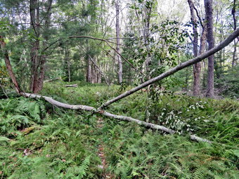
![]() On Thursday, August 22nd, the weather forecast was for a mostly sunny and warm day. I wanted to go to Frick Pond to clean up some blowdowns which were blocking the Quick Lake Trail. I managed to get an EMT and a driver to cover ambulance calls so I could spend time hiking. My grandson Bryce was scheduled to come to my house and he arrived at 9:15 AM with the temperature at 66 degrees. I asked Bryce if he would like to go to Frick Pond and do the work. He readily agreed and we started to get ready at 9:45 AM. Bryce is going into 8th grade this year and stands just short of 6 feet tall. He has endurance and strength and is a great hiking partner as we have so many interests in common. As I was getting dressed, I remembered how excited Sheila would get when we went for a hike. I got dressed in my White Sierra light crew top with no baselayer. I wore my Railriders hiking pants which are expensive but last along time and have features like deep pockets and a generous cut which I really like. The pants have Velcro closures at the ankles. I decided to put on my Keen Durand hiking boots which I ordered a half size larger than the previous pair. These shoes fit well out of the box but get much tighter when I add a decent insole. Without the third party insole, by feet hurt from the lack of support. I added a new pair of Xstance insoles in an effort to find the best support and cushioning for my feet. These insoles have shock absorbing gel pads, TPU arch support, and memory foam cushioning all wrapped in a breathable fabric. The insoles have been hyped by their manufacturer and they really do seem to deliver. I did not put on gaiters or a hat. I decided to leave my poles home as the walk was short and I would be carrying tools. I brought along my phone but resolved to leave it in the car as there was no service in the area anyway. I put my Silky Sugowaza Sugowaza saw and Silky KatanaBoy 500 saw in my pack. The Sugowaza is a fixed blade in a scabbard and is great for branches and smaller trunks. The KatanaBoy has very large teeth and a lot of them and folds. I also brought my Fiskars pack axe which is light but packs some punch. We put our gear in the car and left Livingston Manor at 10:10 AM. I drove out the DeBruce Road about 6 miles to Mongaup Road. I turned left to continue up the road to the point where it splits. I stayed left on Beech Mountain Road and drove to the Frick Pond trailhead. When we arrived at the parking areas, there were no cars parked in either lot. I pulled into the smaller lot and parked. The skies were blue with puffy white clouds and sone brighter sunlight. The temperature was right at 68 degrees which was about what I thought it might be. We started out the woods road to the register at 10:30 AM with Bryce carrying the pack. I was in charge of the ax.
On Thursday, August 22nd, the weather forecast was for a mostly sunny and warm day. I wanted to go to Frick Pond to clean up some blowdowns which were blocking the Quick Lake Trail. I managed to get an EMT and a driver to cover ambulance calls so I could spend time hiking. My grandson Bryce was scheduled to come to my house and he arrived at 9:15 AM with the temperature at 66 degrees. I asked Bryce if he would like to go to Frick Pond and do the work. He readily agreed and we started to get ready at 9:45 AM. Bryce is going into 8th grade this year and stands just short of 6 feet tall. He has endurance and strength and is a great hiking partner as we have so many interests in common. As I was getting dressed, I remembered how excited Sheila would get when we went for a hike. I got dressed in my White Sierra light crew top with no baselayer. I wore my Railriders hiking pants which are expensive but last along time and have features like deep pockets and a generous cut which I really like. The pants have Velcro closures at the ankles. I decided to put on my Keen Durand hiking boots which I ordered a half size larger than the previous pair. These shoes fit well out of the box but get much tighter when I add a decent insole. Without the third party insole, by feet hurt from the lack of support. I added a new pair of Xstance insoles in an effort to find the best support and cushioning for my feet. These insoles have shock absorbing gel pads, TPU arch support, and memory foam cushioning all wrapped in a breathable fabric. The insoles have been hyped by their manufacturer and they really do seem to deliver. I did not put on gaiters or a hat. I decided to leave my poles home as the walk was short and I would be carrying tools. I brought along my phone but resolved to leave it in the car as there was no service in the area anyway. I put my Silky Sugowaza Sugowaza saw and Silky KatanaBoy 500 saw in my pack. The Sugowaza is a fixed blade in a scabbard and is great for branches and smaller trunks. The KatanaBoy has very large teeth and a lot of them and folds. I also brought my Fiskars pack axe which is light but packs some punch. We put our gear in the car and left Livingston Manor at 10:10 AM. I drove out the DeBruce Road about 6 miles to Mongaup Road. I turned left to continue up the road to the point where it splits. I stayed left on Beech Mountain Road and drove to the Frick Pond trailhead. When we arrived at the parking areas, there were no cars parked in either lot. I pulled into the smaller lot and parked. The skies were blue with puffy white clouds and sone brighter sunlight. The temperature was right at 68 degrees which was about what I thought it might be. We started out the woods road to the register at 10:30 AM with Bryce carrying the pack. I was in charge of the ax.
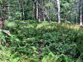 As we walked out the woods road, we cleared some branches from the wet and muddy trail. At the register we continued straight ahead on the Quick Lake Trail. From the register the trail was wet with some standing water and plenty of mud. There were a few larger branches in the trail but we decided to leave them for the return trip. On the way to Gravestone Junction, there were several branches that were hanging over into the trail. We also found two or three white birch trees bent over the trail because their roots had given way. I thought I might also cut those on the return trip. At Gravestone Junction we found another set of white birches leaning over the trail. We stayed left on the Quick Lake Trail heading toward the bridge at the outlet to Frick Pond. This area of the trail had plenty mud which was more than I had seen in some time. We continued on the trail and soon arrived at the bridge. I looked at the scene and decided I wanted to get to the work on the blowdowns. We continued around the west side of the pond where the trail was also wet and muddy. At the junction with the Big Rock Trail, we headed left on the Quick Lake Trail which was wet and muddy in places. We walked along the Quick Lake trail trying to avoiding several muddy areas until we ran into a small to medium sizd tree across the trail. I took some "before" pictures and then Bryce and I got to work. I cut off a large branch with the ax and then made a cut on the right side of the trail to top the tree. We moved the pieces off the trail. Bruce used the Sugowaza to cut the tree near the base. The wood was soft so all the cuts went quickly. We moved the last piece off the trail and moved on after I took some pictures of our finished work.
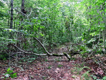 On our way up the trail to the "spruce tunnel", we encountered some more very wet areas. In the "spruce tunnel" we encountered several large trunks on the ground. There was one large trunk across the trail which was high enough to make hiker's crawl over it. This one would require a chainsaw! We continued to walk until we got to the stream through the woods. The water volume was higher than it had been for some time but we were able to cross using some stepping stones. A little farther up the trail was another large trunk but there was a small path around it. From this point the trail begins a gentle but steady climb to Iron Wheel Junction. The trail was damp and muddy in places and we ran into a few more blowdowns that could use a chainsaw. Soon we were at Iron Wheel Junction where we turned left to continue on the Quick Lake Trail. The recent rain and sunshine had stimulated the growth of the ferns and grasses making it appear that no one had been using the trail. Just after the turn we ran into a blowdown across the trail which we decided to remove. It was gnarly and thick in some places. I shot some "before" pictures and then we got to work. We cut off some smaller branches here and there to get them out of the way of the rest of the trunk. I again used the ax to make a cut on the left side of the trail to top the tree. There wasn't anything left but the main trunk.
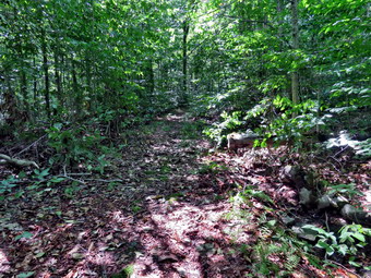 We decided to use the larger Katanaboy saw to cut through the thickest part of the trunk on the right side of the trail. Bryce started out and got an impressive amount cut. This wood was a lot harder than the previous trees. I took over and cut almost all the way through. Bryce took over and finished the cut and the large piece fell to the ground. Bryce and I had a tough time dragging this section so we moved it off the right side of the trail. I took my "after" shots and we moved on. We continued to hike up the trail as the grade became a little steeper. Bryce and I had been having a running conversation about many different topics which made the hike and the work go much quicker. I asked Bryce about carrying the pack and he said it was no problem! We passed the junction with the snowmobile trail where there had been a pile of brush on the trail. Cindy and I had cleared it during our last trip but Bryce and I picked up a few more branches. We quickened our pace and eventually arrived at the large blowdown we had cleared last time. The remaining trunks were large enough to require a chainsaw but Cindy and I had cleared enough so that hikers could more easily get through.
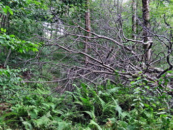 We continued up the trail and after about a quarter mile we encountered a branching blowdown with many branches blocking the trail. I put my pack down and got out my camera to take some pictures. Bryce and I looked at the mess trying to decide our plan of action. We cleared some loose branches and then Bryce waded in to start cutting off branches. As Bryce cut, I swamped and removed the branches to a brush pile. After cutting off two or three branches, I noticed Bryce was scratching his legs. I inspected the area where he had been standing and found a nice patch of stinging nettles! Bryce was wearing shorts! Bryce and I switched positions and I cut out a few more branches. We walked by the blowdown and I started to cut from the other side while Bryce removed what I cut. Our hardest cut was one overhead to remove a large branch hanging down into the trail. We used the KatanaBoy to get more reach and the cut went well. I had to jump back as it fell but I managed to get out of the way. I made a few more cuts and we cleaned up the remaining branches. I took a few "after" shots and we packed up. I thought about going further up the trail to cut some more of the blowdowns but we decided we were a little too tired.
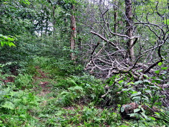 We walked down the trail and saw a young woman and her dog coming up the trail. We passed each other and she noticed we were carrying tools. She thanked us for the work but informed us there were several blowdowns on the Flynn Trail. We continued down the trail but stopped to cut another small branch across the trail and a small tree that was hanging over and into the trail. We finished up and started back down the trail toward Iron Wheel junction. At the trail junction, we turned right to stay on the Quick Lake Trail. Walking downhill was easier than the walk out and we kept a good pace as we continued to talk about all kinds of topics. We walked down the wet and muddy trail, crossed the stream, and walked through the spruce tunnel. We continued on the trail passing the junction with the Big Rock Trail. When we came to the bridge at the outlet end of Frick Pond, we noticed some ducks on the small pond at the outlet end of Frick Pond. We stopped and I took close-ups of the ducks and a few pictures of the scenery in general. When I was done taking pictures, we continued on the trail climbing up the little hill from the pond. We walked back to Gravestone Junction through some muddy spots. At Gravestone Junction, I looked at the birch trees and decided they could wait until another trip. We walked along the very wet Quick Lake Trail back toward the parking area trying to avoid the mud and water. Along the way we cut and removed a large branch that was laying in the trail. We were back at the car at 2:15 PM after spending 3 hours and 45 minutes hiking and clearing the blowdowns. The temperature was 68 degrees and the skies were still blue with clouds and sun. I drove back toward Livingston Manor. When we gained cell service, I found out there had been one ambulance call that was canceled.
![]()
![]()
![]()
![]() On Thursday, August 15th I planned to get out for a hike but could only do that on Round Top as I was the only EMT around to go on calls. Round Top is always available for a hike and although there are few surprises it is always better than staying at home. We had four morning calls so I was not able to start until the afternoon. I started to get ready to hike at 3:45 AM with the temperature at 81 degrees on the back porch. I asked my daughter's dog Pierce if he would like to go for a walk and he started jumping around like Sheila used to do. I got dressed in my White Sierra light crew top with no baselayer. I wore my Railriders hiking pants which are expensive but last along time and have features like deep pockets and a generous cut which I really like. The pants have Velcro closures at the ankles. I decided to put on my Keen Durand hiking boots which I ordered a half size larger than the previous pair. These shoes fit well out of the box but get much tighter when I add a decent insole. Without the third party insole, by feet hurt from the lack of support. I added a new pair of Xstance insoles in an effort to find the best support and cushioning for my feet. These insoles have shock absorbing gel pads, TPU arch support, and memory foam cushioning all wrapped in a breathable fabric. The insoles have been hyped by their manufacturer and they really do seem to deliver. I decided not to any poles as I would have Pierce on a leash. I did not put on gaiters or a hat. I took my cell phone with me because even though I planned to hike quickly, I was pretty sure I was the only EMT around to respond. At 4:05 PM I put Pierce on a leash and we walked out the door to start the hike. We headed down the driveway and to the street. We crossed the street and walked to the parking lot next to the Presbyterian Church. We walked to the back of the church and began the ascent of the steepest hill behind the church. The hill is short but gets the circulation pumping and is the steepest and longest climb on the "trail." I didn't have my poles but Pierce did a good job of pulling me up the hill. We did stop not on the way to the top of the hill. I could really feel that I had been hiking more consistently. At the top we paused for a minute so I could look around at the hills that surround the hamlet of Livingston Manor. The skies were bright blue but there were many puffy white clouds. Everything was really green caused by the recent rains and the sunshine on other days. We continued the hike by turning left at the trailhead. The trail was damp from the recent rains but there were only a few muddy spots. The temperature under the trees seemed cooler than in the sun.
On Thursday, August 15th I planned to get out for a hike but could only do that on Round Top as I was the only EMT around to go on calls. Round Top is always available for a hike and although there are few surprises it is always better than staying at home. We had four morning calls so I was not able to start until the afternoon. I started to get ready to hike at 3:45 AM with the temperature at 81 degrees on the back porch. I asked my daughter's dog Pierce if he would like to go for a walk and he started jumping around like Sheila used to do. I got dressed in my White Sierra light crew top with no baselayer. I wore my Railriders hiking pants which are expensive but last along time and have features like deep pockets and a generous cut which I really like. The pants have Velcro closures at the ankles. I decided to put on my Keen Durand hiking boots which I ordered a half size larger than the previous pair. These shoes fit well out of the box but get much tighter when I add a decent insole. Without the third party insole, by feet hurt from the lack of support. I added a new pair of Xstance insoles in an effort to find the best support and cushioning for my feet. These insoles have shock absorbing gel pads, TPU arch support, and memory foam cushioning all wrapped in a breathable fabric. The insoles have been hyped by their manufacturer and they really do seem to deliver. I decided not to any poles as I would have Pierce on a leash. I did not put on gaiters or a hat. I took my cell phone with me because even though I planned to hike quickly, I was pretty sure I was the only EMT around to respond. At 4:05 PM I put Pierce on a leash and we walked out the door to start the hike. We headed down the driveway and to the street. We crossed the street and walked to the parking lot next to the Presbyterian Church. We walked to the back of the church and began the ascent of the steepest hill behind the church. The hill is short but gets the circulation pumping and is the steepest and longest climb on the "trail." I didn't have my poles but Pierce did a good job of pulling me up the hill. We did stop not on the way to the top of the hill. I could really feel that I had been hiking more consistently. At the top we paused for a minute so I could look around at the hills that surround the hamlet of Livingston Manor. The skies were bright blue but there were many puffy white clouds. Everything was really green caused by the recent rains and the sunshine on other days. We continued the hike by turning left at the trailhead. The trail was damp from the recent rains but there were only a few muddy spots. The temperature under the trees seemed cooler than in the sun.
At the first trail junction, we turned right and started up the woods road which has the gentler approach of the two. There were a number of small branches on the trail from the winds that had passed through the area. I removed these branches by picking them up and throwing them off the trail. It was a pleasure to walk on the trails and it was obvious more people were using them. Ferns and grasses were growing like crazy and some bushes were growing a little into the trail. I liked the experience of walking the narrow track. We passed the large branch that Ashlynn and I had cut and removed from the trail. At the end of the woods road, we turned left up the hill on the trail. We continued up the trail to the first trail junction with the upper blue trail where we turned left to follow the yellow trail along the base of Round Top. We continued on the yellow trail along the base of Round Top. We passed the trunk that Ashlynn and I had cleared from the trail. Pierce was doing a pretty good job of walking on a leash. The only problem was that he was following his nose which took him off trail many times. We came to the next junction with the blue trail and turned right to head up the blue trail toward the summit. When I we got to the switchback, Pierce turned right and we followed it until it came back to the main blue trail. The fact that the switchback sidehills in places made the walk a little more difficult. We turned right and then continued straight ahead and up the hill toward the summit of Round Top bypassing the white crossover trail. As we passed over the summit, I noticed that the trail showed much less wear and I assumed fewer people were taking the time to walk this trail. We continued over the summit and down the blue trail toward the junction with the yellow trail. We bypassed the white crossover trail again and continued down to the yellow trail. At the junction with the yellow trail we turned right and walked the yellow trail along the base of Round Top toward the next junction with the blue trail. At the next junction, we turned left and started slightly downhill toward the lookout over town. We passed the "sitting rock" and continued downhill. Everything was very green especially the ferns which had sprung up even more since my last visit. As I walked we reflexively turned around to look for Sheila. I still miss Sheila all the time but it seems I miss her more on hikes. I find that saying her names helps me. As we reached the lookout, I saw a young man standing just off the trail listening to music. I spoke to Pierce to try to give the young man a "warning" but his msuic was loud. As we walked by he was startled and apologized for being in our way. We followed the yellow trail as it turned left and walked down the hill to the first trail junction. At the first trail junction, I immediately turned around and started back up the trail.
Climbing the hill to the lookout seemed easier as I have been hiking more. As we reached the top of the hill, the young man was still there listening to loud msuic and pointed in the opposite direction. We again startled the young man! We followed the yellow trail as it continued passed the upper part of the lookout. Where the trail turned right, we followed it uphill passing through a large area of green ferns some of which were encroaching on the trail. We passed the sitting rock and continued uphill to the junction with the blue trail. We turned right to follow the yellow trail along the base of Round Top. At the junction with the blue trail, we turned left to climb the trail toward the summit. We passed by the white crossover trail and continued toward the summit. We approached the top, walked over the summit and started down the other side again bypassing the white trail. We did turn left on the switchback in the blue trail and followed it out into the woods and back again to the blue trail farther down the hill. We turned left on the main blue trail and walked downhill until we were back at the junction with the yellow trail. We turned left and again walked along the yellow trail to the next junction with the blue trail. This time we turned right at the trail junction and started to walk down the trail to the woods road. We continued on the woods road at a quick pace. We turned left and walked straight ahead out to the trailhead where we turned right. We walked downhill to the road behind the church. We walked out through the parking lot and across the street to our driveway. We were back home at 5:15 PM after hiking just over 2 miles in 1 hour and 15 minutes. I was glad there were no ambulance calls wile we were hiking
![]()
![]()
![]()
![]() On Wednesday, August 14th I planned to meet Lisa and go for a hike on Round Top. We were supposed to meet in the morning but Lisa had some things to do at work so we rescheduled for 2:30 PM. As the appointed time rolled around, the sky grew cloudy and rain began to fall. There was some thunder but I did not see any lightning. We agreed to meet at the Presbyterian Church at 3:00 PM. I started getting ready at 2:30 PM when the skies were still dark with a few drops of rain falling. The temperature was 72 degrees. I got dressed in my White Sierra light crew top with no baselayer. I wore my Railriders hiking pants which are expensive but last along time and have features like deep pockets and a generous cut which I really like. The pants have Velcro closures at the ankles. I decided to put on my Keen Durand hiking boots which I ordered a half size larger than the previous pair. These shoes fit well out of the box but get much tighter when I add a decent insole. Without the third party insole, by feet hurt from the lack of support. I added a new pair of Xstance insoles in an effort to find the best support and cushioning for my feet. These insoles have shock absorbing gel pads, TPU arch support, and memory foam cushioning all wrapped in a breathable fabric. The insoles have been hyped by their manufacturer and they really do seem to deliver. I decided to take my Leki MicroVario poles with external locks as the internal twist locks fail. I did not put on gaiters or a hat. I took my cell phone with me because even though I planned to hike quickly, I was pretty sure I was the only EMT around to respond. At 2:50 PM I walked out the door to start the hike. I headed down the driveway and to the street and crossed the street to the parking lot next to the Presbyterian Church. Lisa was already parked and ready to go. We walked to the back of the church and began the ascent of the steepest hill behind the church. The hill is short but gets the circulation pumping and is the steepest and longest climb on the "trail." We did stop once on the way to the top of the hill. I could really feel that I had been hiking more consistently. At the top we paused for a minute so I could look around at the hills that surround the hamlet of Livingston Manor. The skies were still dark and we could hear some rumblings. We continued the hike by turning left at the trailhead. The trail was damp from the recent rains but there were only a few muddy spots.
On Wednesday, August 14th I planned to meet Lisa and go for a hike on Round Top. We were supposed to meet in the morning but Lisa had some things to do at work so we rescheduled for 2:30 PM. As the appointed time rolled around, the sky grew cloudy and rain began to fall. There was some thunder but I did not see any lightning. We agreed to meet at the Presbyterian Church at 3:00 PM. I started getting ready at 2:30 PM when the skies were still dark with a few drops of rain falling. The temperature was 72 degrees. I got dressed in my White Sierra light crew top with no baselayer. I wore my Railriders hiking pants which are expensive but last along time and have features like deep pockets and a generous cut which I really like. The pants have Velcro closures at the ankles. I decided to put on my Keen Durand hiking boots which I ordered a half size larger than the previous pair. These shoes fit well out of the box but get much tighter when I add a decent insole. Without the third party insole, by feet hurt from the lack of support. I added a new pair of Xstance insoles in an effort to find the best support and cushioning for my feet. These insoles have shock absorbing gel pads, TPU arch support, and memory foam cushioning all wrapped in a breathable fabric. The insoles have been hyped by their manufacturer and they really do seem to deliver. I decided to take my Leki MicroVario poles with external locks as the internal twist locks fail. I did not put on gaiters or a hat. I took my cell phone with me because even though I planned to hike quickly, I was pretty sure I was the only EMT around to respond. At 2:50 PM I walked out the door to start the hike. I headed down the driveway and to the street and crossed the street to the parking lot next to the Presbyterian Church. Lisa was already parked and ready to go. We walked to the back of the church and began the ascent of the steepest hill behind the church. The hill is short but gets the circulation pumping and is the steepest and longest climb on the "trail." We did stop once on the way to the top of the hill. I could really feel that I had been hiking more consistently. At the top we paused for a minute so I could look around at the hills that surround the hamlet of Livingston Manor. The skies were still dark and we could hear some rumblings. We continued the hike by turning left at the trailhead. The trail was damp from the recent rains but there were only a few muddy spots.
At the first trail junction, we continued straight up the hill to the lookout. The rumblings were now louder and closer. Lisa suggested that we stop at the lookout and then return to the parking lot. I countered with an offer to complete a small loop it Lisa insisted. Lisa and I walked to the left on the path out to the viewpoint. The view of town is beginning to grow in but we could see the school and most of the main buildings. We could also see the dark clouds. After a few moment and a few more rumblings, we turned around and quickly walked back down the hill to the first trail junction. From there we continued straight out the trail to the trailhead. We turned right and walked down the paved road to the church. Lisa and I talked for a moment before we said "Goodbye." I sat on the bench at the church under a portico and waited so see what the storm would do. I waited until about 3:25 PM when the storm seemed to clear. I decided to walk up the hill and see what the clouds looked like.
![]()
![]()
![]()
![]()
![]() On Tuesday, August 13th I wanted to go across the street to cut some blowdowns on Round Top. I had to teach CPR/AED and First Aid courses for coaches at Liberty Hs in the morning and id not know if I would have enough energy to do the work when I came back in the afternoon. For once I actually had another EMT covering calls until noon! I taught the courses and returned home b 1:15 PM. I decided it was now or never and started to get ready to go across the street. My granddaughter Ashlyn decided she wanted to go with me. Since I was the only EMT around to go on calls I knew I would take my phone with me to respond if a call occurred. We started to get ready to hike at 1:30 PM with the temperature at 76 degrees on the back porch. As I began to get ready, I remembered how Sheila would always watch me carefully as I was getting ready so that she would not miss a hike. I got dressed in my White Sierra light crew top with no baselayer. I wore my Railriders hiking pants which are expensive but last along time and have features like deep pockets and a generous cut which I really like. The pants have Velcro closures at the ankles. I decided to put on my Keen Durand hiking boots which I ordered a half size larger than the previous pair. These shoes fit well out of the box but get much tighter when I add a decent insole. Without the third party insole, by feet hurt from the lack of support. I added a new pair of Xstance insoles in an effort to find the best support and cushioning for my feet. These insoles have shock absorbing gel pads, TPU arch support, and memory foam cushioning all wrapped in a breathable fabric. The insoles have been hyped by their manufacturer and they really do seem to deliver. I decided to take my Leki MicroVario poles with external locks as the internal twist locks fail. I did not put on gaiters or a hat. I put my Silky Sugowaza curved saw in my pack as that was all I thought I would need to do the work. At 1:45 PM we walked out the door to start the hike. We headed down the driveway and to the street. We crossed the street and walked to the parking lot next to the Presbyterian Church. We walked to the back of the church and began the ascent of the steepest hill behind the church. The hill is short but gets the circulation pumping and is the steepest and longest climb on the "trail." Ashlyn was puffing a little and commented that she did not remember the hill being so steep. We did stop once on the way to the top of the hill but oaused only for minute before continuing. I could really feel that I had been hiking more consistently as the hill was easier than ever for me. At the top we paused for a minute so we could look around at the hills that surround the hamlet of Livingston Manor. The skies were bright and blue with puffy white clouds. Everything was really green caused by the recent rains and the sunshine on other days. We continued the hike by turning left at the trailhead. The trail was damp from the recent rains but there were only a few muddy spots. The temperature under the trees seemed cooler than in the sun.
On Tuesday, August 13th I wanted to go across the street to cut some blowdowns on Round Top. I had to teach CPR/AED and First Aid courses for coaches at Liberty Hs in the morning and id not know if I would have enough energy to do the work when I came back in the afternoon. For once I actually had another EMT covering calls until noon! I taught the courses and returned home b 1:15 PM. I decided it was now or never and started to get ready to go across the street. My granddaughter Ashlyn decided she wanted to go with me. Since I was the only EMT around to go on calls I knew I would take my phone with me to respond if a call occurred. We started to get ready to hike at 1:30 PM with the temperature at 76 degrees on the back porch. As I began to get ready, I remembered how Sheila would always watch me carefully as I was getting ready so that she would not miss a hike. I got dressed in my White Sierra light crew top with no baselayer. I wore my Railriders hiking pants which are expensive but last along time and have features like deep pockets and a generous cut which I really like. The pants have Velcro closures at the ankles. I decided to put on my Keen Durand hiking boots which I ordered a half size larger than the previous pair. These shoes fit well out of the box but get much tighter when I add a decent insole. Without the third party insole, by feet hurt from the lack of support. I added a new pair of Xstance insoles in an effort to find the best support and cushioning for my feet. These insoles have shock absorbing gel pads, TPU arch support, and memory foam cushioning all wrapped in a breathable fabric. The insoles have been hyped by their manufacturer and they really do seem to deliver. I decided to take my Leki MicroVario poles with external locks as the internal twist locks fail. I did not put on gaiters or a hat. I put my Silky Sugowaza curved saw in my pack as that was all I thought I would need to do the work. At 1:45 PM we walked out the door to start the hike. We headed down the driveway and to the street. We crossed the street and walked to the parking lot next to the Presbyterian Church. We walked to the back of the church and began the ascent of the steepest hill behind the church. The hill is short but gets the circulation pumping and is the steepest and longest climb on the "trail." Ashlyn was puffing a little and commented that she did not remember the hill being so steep. We did stop once on the way to the top of the hill but oaused only for minute before continuing. I could really feel that I had been hiking more consistently as the hill was easier than ever for me. At the top we paused for a minute so we could look around at the hills that surround the hamlet of Livingston Manor. The skies were bright and blue with puffy white clouds. Everything was really green caused by the recent rains and the sunshine on other days. We continued the hike by turning left at the trailhead. The trail was damp from the recent rains but there were only a few muddy spots. The temperature under the trees seemed cooler than in the sun.
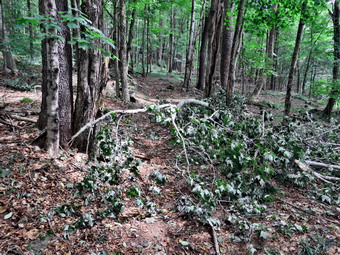 At the first trail junction, we turned right and started up the woods road which has the gentler approach of the two. It was a pleasure to walk on the trails and it was obvious more people were using them. Ferns and grasses were growing like crazy and some bushes were growing a little into the trail. I liked the experience of walking the narrow track. Not too far up the woods road was a very large branch that had fallen across the trail. I put my pack down and got out my camera to take some "before" pictures. After taking some shots, I put the camera away and got out my saw. Ashlynn and I cleared a few loose branches and then I started cutting while Ashlynn pulled the beaches away and piled them off the trail. The problem I kept running into was that some smaller branches were trapped beneath the large one that had fallen. The largest part of the blowdown was off the trail and I did not intend to cut it. I kept working to clear the entire trail while Ashlynn kept suggesting it looked good enough. I had my way and soon the trail was completely clear. I took some "after" shots and we continued hiking up the woods road. At the end of the woods road, we turned left up the hill on the trail.
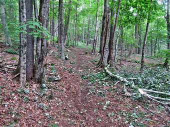 About halfway up, we met a boy and a woman hiking down the trail toward us. We stayd to the left and walked just off trail to let them pass. We greeted each other with a brief "Hello" and "Have a good day". I wonder sometimes if hikers realize that the trails do build and maintain themselves. The trail would be much better cared for if all hikers removed loose branches from the trails. We continued up the trail to the first trail junction with the upper blue trail where we turned left to follow the yellow trail along the base of Round Top. We immediately came to the trunk of a small tree that was poking out into the trail. I took out the saw and quickly removed it. We continued our hike along the yellow trail and soon came to two small trunk across the trail.
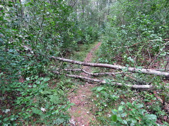 I took my "before" pictures and then got put the saw. I cut the top out of the upper trunk well off the trail on the right side. Ashlynn helped by stabilizing the trunk as I was cutting and putting enough pressure on it to keep the kerf open. When I was done cutting the top, I went to the other end of the blowdown and made a cut to isolate the middle section. After I finished, I picked up the middle section and threw it off the trail. The lower section was lying on the ground but I was able to get the saw underneath in a void and cut upwards. When I was done, I had one large section to get off the trail. I picked up the far end and flipped this section off the trail. After Ashlynn and I picked up some ore branches, I took my "after" pictures and packed up the camera and saw. We continued on the yellow trail toward the next junction. I knew I was done cutting but wanted to hike a little while longer.
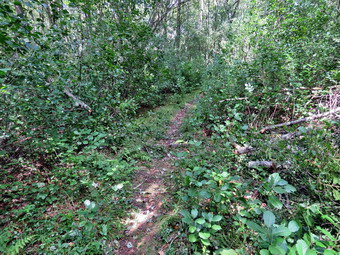 We came to the next junction with the blue trail and turned right to head up the blue trail toward the summit. We bypassed the switchback and headed up toward the summit. We bypassed the white crossover trail and soon passed over the summit. I noticed that the trail showed much less wear and I assumed fewer people were taking the time to walk this trail. We continued over the summit and down the blue trail toward the junction with the yellow trail. We again bypassed the white crossover trail again and continued down to the yellow trail. At the junction with the yellow trail I turned right and we walked the yellow trail along the base of Round Top toward the next junction with the blue trail. Ashlynn was not happy because she thought we were not headed home. I assured her that the route we were taking would bring us home but she was not convinced and seemed a little miffed.
At the next junction, we turned left and started slightly downhill toward the lookout over town. We passed the "sitting rock" and continued downhill. Everything was very green especially the ferns which had sprung up even more since my last visit. As I walked I reflexively turned around to look for Sheila. I still miss Sheila all the time but it seems I miss her more on hikes. I find that saying her names helps me. When I reached the lookout, we followed the yellow trail as it turned left and walked down the hill to the first trail junction. At the first trail junction, we continued to walk straight ahead out to the trailhead where I turned right. Ashlynn had to admit that I was right but it did not come easily. We walked downhill to the road behind the church. We walked out through the parking lot and across the street to our driveway. We were back home at 3:00 PM after hiking just over a mile in 1 hour and 15 minutes including the time we took to clear the blowdowns
![]()
![]()
![]()
![]() On Sunday, August 11th I planned to get out for a hike after church as I had not been out for almost a week. Numerous ambulance calls and heavy rain had curtailed my hiking. The morning was interesting as the remnants of Hurricane Debbby had dropped a lot of rain in the area of my church. As we turned up Horton Brook Road, we were ,et by "Road Closed" signs. We decided to try to make it to church and found several paces where thee was only one lane passable and others where there was debris on the road. Brad and I had done an early morning ambulance alls and were tiered when we returned from church. At 2:30 PM I decided to get out for a walk and let Brad nap. I decided I could only do that on Round Top as I was the only EMT around to go on calls. Round Top is always available for a hike and although there are few surprises it is always better than staying at home. I started to get ready to hike with the temperature at 72 degrees on the back porch which almost seemed cold after the high 80's and 90's of last week. As I began to get ready, I decided I would try taking Pierce, Brad and Krista's dog, with me on the hike. O knew he would be a handful and that I would have to keep him on a leash. When I said "Walk" to Pierce he instantly became excited and ran around alternating between me and the door! I got dressed in my White Sierra light crew top with no baselayer. I wore my Railriders hiking pants which are expensive but last along time and have features like deep pockets and a generous cut which I really like. The pants have Velcro closures at the ankles. I decided to put on my Keen Durand hiking boots which I ordered a half size larger than the previous pair. These shoes fit well out of the box but get much tighter when I add a decent insole. Without the third party insole, by feet hurt from the lack of support. I added a new pair of Xstance insoles in an effort to find the best support and cushioning for my feet. These insoles have shock absorbing gel pads, TPU arch support, and memory foam cushioning all wrapped in a breathable fabric. The insoles have been hyped by their manufacturer and they really do seem to deliver. I decided not to take any poles as I would have to keep Pierce on a leash. I did not put on gaiters or a hat. I took my cell phone with me because even though I planned to hike quickly, I was pretty sure I was the only EMT around to respond. At 2:50 PM I put Pierce on Sheila's leash and walked out the door to start the hike. I thought I would never use her leash again but I purposefully decided to use it this time. We headed down the driveway and to the street. We crossed the street and walked to the parking lot next to the Presbyterian Church. As we walked I noticed that Pierce really likes to use his nose and sniff everything in sight! We walked to the back of the church and began the ascent of the steepest hill behind the church. Pierce did a good job of pulling me up the hill. The hill is short but gets the circulation pumping and is the steepest and longest climb on the "trail." We did not stop not on the way to the top of the hill but I could feel that I had taken a few days off from hiking. At the top we paused for a minute so I could look around at the hills that surround the hamlet of Livingston Manor. The skies were blue with puffy white clouds and bright sunshine. We continued the hike by turning left at the trailhead. The trail was wet from the recent rains and there were more than a few muddy spots. The temperature under the trees seemed cooler than in the sun.
On Sunday, August 11th I planned to get out for a hike after church as I had not been out for almost a week. Numerous ambulance calls and heavy rain had curtailed my hiking. The morning was interesting as the remnants of Hurricane Debbby had dropped a lot of rain in the area of my church. As we turned up Horton Brook Road, we were ,et by "Road Closed" signs. We decided to try to make it to church and found several paces where thee was only one lane passable and others where there was debris on the road. Brad and I had done an early morning ambulance alls and were tiered when we returned from church. At 2:30 PM I decided to get out for a walk and let Brad nap. I decided I could only do that on Round Top as I was the only EMT around to go on calls. Round Top is always available for a hike and although there are few surprises it is always better than staying at home. I started to get ready to hike with the temperature at 72 degrees on the back porch which almost seemed cold after the high 80's and 90's of last week. As I began to get ready, I decided I would try taking Pierce, Brad and Krista's dog, with me on the hike. O knew he would be a handful and that I would have to keep him on a leash. When I said "Walk" to Pierce he instantly became excited and ran around alternating between me and the door! I got dressed in my White Sierra light crew top with no baselayer. I wore my Railriders hiking pants which are expensive but last along time and have features like deep pockets and a generous cut which I really like. The pants have Velcro closures at the ankles. I decided to put on my Keen Durand hiking boots which I ordered a half size larger than the previous pair. These shoes fit well out of the box but get much tighter when I add a decent insole. Without the third party insole, by feet hurt from the lack of support. I added a new pair of Xstance insoles in an effort to find the best support and cushioning for my feet. These insoles have shock absorbing gel pads, TPU arch support, and memory foam cushioning all wrapped in a breathable fabric. The insoles have been hyped by their manufacturer and they really do seem to deliver. I decided not to take any poles as I would have to keep Pierce on a leash. I did not put on gaiters or a hat. I took my cell phone with me because even though I planned to hike quickly, I was pretty sure I was the only EMT around to respond. At 2:50 PM I put Pierce on Sheila's leash and walked out the door to start the hike. I thought I would never use her leash again but I purposefully decided to use it this time. We headed down the driveway and to the street. We crossed the street and walked to the parking lot next to the Presbyterian Church. As we walked I noticed that Pierce really likes to use his nose and sniff everything in sight! We walked to the back of the church and began the ascent of the steepest hill behind the church. Pierce did a good job of pulling me up the hill. The hill is short but gets the circulation pumping and is the steepest and longest climb on the "trail." We did not stop not on the way to the top of the hill but I could feel that I had taken a few days off from hiking. At the top we paused for a minute so I could look around at the hills that surround the hamlet of Livingston Manor. The skies were blue with puffy white clouds and bright sunshine. We continued the hike by turning left at the trailhead. The trail was wet from the recent rains and there were more than a few muddy spots. The temperature under the trees seemed cooler than in the sun.
At the first trail junction, we continued straight ahead up the hill toward the lookout with Pierce giving me a good pull. I tried to keep a quick pace to get more exercise but Pierce was still using his nose extensively. I did find that a slight tug on his leash and a firm "Up" command moved him along. At the top of the hill we turned right and followed the yellow trail through a forest floor covered in ferns. We ascended the small hill walking through some brush that was encroaching on the trail. I liked the feeling of "bushwhacking" through to the first junction with the blue trail. I turned right on the yellow trail and started along the base of Round Top. Within a short distance, we ran into a small tree across the trail. I looked to see if I could move it off the trail. I concluded that I would have to return with tools to remove it. Pierce ducked under the trunl and I stepped over avoiding some sharp spikes. We continue along the yellow trail and ran into a few more trunks across the trail. I felt I could remove them so I leashed Pierce to a tree and got to work. One trunk was still connected to the roots in the ground. A couple of good kicks released and I was able to slide it off the trail. I picked up some branches and threw them off the trail. I walked a little further ahead and found a small trunk sticking out into the trail. I could not budge it so I returned to where I had leashed Pierce. He had managed to twist himself up in some brush but I easily freed him and we continued our hike. At the next junction with the blue trail we turned left and head up toward the summit. Pierce continued to pull on the leash to give me some help up the hill. We passed over the summit and started down the other side. We bypassed the white crossover trail but turned left on the switchback. We walked out into the forest on the switchback and then back to the main blue trail. We turned left on the main trail and walked along the base of Round Top on the yellow trail. We crossed over the tree trunk and continued toward the trail junction. At the junction, we turned right and headed down the yellow trail to the woods road. When we hot the woods road, we continued downhill and came to another large branch across the trail. This one was also too large to remove without tools so we walked around it. Soon we were back at the first trail junction.
We immediately turned around and started back up the woods road on the yellow trail. We passed by the large branch and continued to the point where the trail turned off the woods road and continues through the words to the trail junction. We turned left to follow the yellow trail along the base of Round Top. I looked ahead and saw two women and a girl headed toward us with a dog. I pulled Pierce off the trail to let the group pass. When Pierce saw the other dog, he started whining and tugging on his leash as if he really wanted to play. The group passed and we continued over the trunk across the trail. We hiked to the next trail junction and turned right to head toward the summit. After a short distance, we turned right on the switchback which took us out into the direst and then back to the main blue trail. We turned right and continued over the summit of Round Top. We descended the other side and passed the white crossover trail. At that point my phone sounded that there was an ambulance all. I signed in and called the control center. I also called a driver who said he was available. Pierce and I set a fast pace down the blue trail to the junction. Instead of turning right to complete the figure 8, we continued straight ahead on the yellow trail. When the trail hit the woods road, we turned right and hurried downhill passing the tree branch across the road. At the first trail junction we turned left and headed out to the trailhead. We turned right and jogged down the road toward the church. As we came to the church parking lot, we passed the group with the dog. Pierce again wanted to play but I discouraged him. When we came to Rock Avenue, we crossed to the driveway and hurried home. We were back by 4:05 Pm after hiking a little more than 2 miles in 1 hour and 15 minutes including the time to do some trail maintenance. I did a quick change of clothes and was off to the ambulance call.
![]()
![]()
![]()
![]() On Monday, August 5th I planned to get out for a hike but could only do that on Round Top as I was the only EMT around to go on calls. Round Top is always available for a hike and although there are few surprises it is always better than staying at home. I had a morning ambulance call and then attended a funeral with a rig and river. When I finally got home. It was 3:00 PM which still left time for a hike. I started to get ready to hike with the temperature at 86 degrees on the back porch. As I began to get ready, I remembered how Sheila would always watch me carefully as I was getting ready so that she would not miss a hike. I got dressed in my White Sierra light crew top with no baselayer. I wore my Railriders hiking pants which are expensive but last along time and have features like deep pockets and a generous cut which I really like. The pants have Velcro closures at the ankles. I decided to put on my Keen Durand hiking boots which I ordered a half size larger than the previous pair. These shoes fit well out of the box but get much tighter when I add a decent insole. Without the third party insole, by feet hurt from the lack of support. I added a new pair of Xstance insoles in an effort to find the best support and cushioning for my feet. These insoles have shock absorbing gel pads, TPU arch support, and memory foam cushioning all wrapped in a breathable fabric. The insoles have been hyped by their manufacturer and they really do seem to deliver. I decided to take my Leki MicroVario poles with external locks as the internal twist locks fail. I did not put on gaiters or a hat. I took my cell phone with me because even though I planned to hike quickly, I was pretty sure I was the only EMT around to respond. At 3:20 PM I walked out the door to start the hike. I headed down the driveway and to the street. I crossed the street and walked to the parking lot next to the Presbyterian Church. I walked to the back of the church and began the ascent of the steepest hill behind the church. The hill is short but gets the circulation pumping and is the steepest and longest climb on the "trail." I did not stop not on the way to the top of the hill but I could feel that I had taken a few days off from hiking. At the top I paused for a minute so I could look around at the hills that surround the hamlet of Livingston Manor. The skies were blue with puffy white clouds and bright sunshine. I continued the hike by turning left at the trailhead. The trail was damp from the recent rains but there were only a few muddy spots. The temperature under the trees seemed much cooler than in the sun.
On Monday, August 5th I planned to get out for a hike but could only do that on Round Top as I was the only EMT around to go on calls. Round Top is always available for a hike and although there are few surprises it is always better than staying at home. I had a morning ambulance call and then attended a funeral with a rig and river. When I finally got home. It was 3:00 PM which still left time for a hike. I started to get ready to hike with the temperature at 86 degrees on the back porch. As I began to get ready, I remembered how Sheila would always watch me carefully as I was getting ready so that she would not miss a hike. I got dressed in my White Sierra light crew top with no baselayer. I wore my Railriders hiking pants which are expensive but last along time and have features like deep pockets and a generous cut which I really like. The pants have Velcro closures at the ankles. I decided to put on my Keen Durand hiking boots which I ordered a half size larger than the previous pair. These shoes fit well out of the box but get much tighter when I add a decent insole. Without the third party insole, by feet hurt from the lack of support. I added a new pair of Xstance insoles in an effort to find the best support and cushioning for my feet. These insoles have shock absorbing gel pads, TPU arch support, and memory foam cushioning all wrapped in a breathable fabric. The insoles have been hyped by their manufacturer and they really do seem to deliver. I decided to take my Leki MicroVario poles with external locks as the internal twist locks fail. I did not put on gaiters or a hat. I took my cell phone with me because even though I planned to hike quickly, I was pretty sure I was the only EMT around to respond. At 3:20 PM I walked out the door to start the hike. I headed down the driveway and to the street. I crossed the street and walked to the parking lot next to the Presbyterian Church. I walked to the back of the church and began the ascent of the steepest hill behind the church. The hill is short but gets the circulation pumping and is the steepest and longest climb on the "trail." I did not stop not on the way to the top of the hill but I could feel that I had taken a few days off from hiking. At the top I paused for a minute so I could look around at the hills that surround the hamlet of Livingston Manor. The skies were blue with puffy white clouds and bright sunshine. I continued the hike by turning left at the trailhead. The trail was damp from the recent rains but there were only a few muddy spots. The temperature under the trees seemed much cooler than in the sun.
At the first trail junction, I continued straight ahead up the hill toward the lookout. I tried to keep a quick pace to get more exercise. At the top of the hill I turned right and followed the yellow trail through a forest floor covered in ferns. I ascended a small hill walking through some brush that was encroaching on the trail. I liked the feeling of "bushwhacking" through to the first junction with the blue trail. I decided that instead of doing figure 8's I would do loops instead. I continued straight ahead on the blue trail as it headed up the hill toward the summit of Round Top. As I walked, I caught myself looking back to see where Sheila was. Sometimes this was involuntary and sometimes I peaked back as it helped me feel she was still with me. I also found talking to her as I always did helped me. When I got to the switchback, I decided to continue straight ahead up the hill. From the look of the trail others had been doing the same thing. I bypassed the white crossover trail and continue up and over the summit of Round Top. As I started down the other side I noted that the trail was drier and that this actually made it slippery. I passed the white crossover trail and continued down to the junction with the yellow trail. I walked straight ahead on the yellow trail heading downhill to the woods road. I turned right in the woods road and followed the yellow trail to the first trail junction. It had taken me about 20 minutes to hike the big loop. I immediately turned abounded walked back up the woods road. I turned left on the yellow trail and headed uphill to the junction with the blue trail. I did notice there appeared to be a path to the "cave" formed by the rocks and ledges. At the trail junction I turned left on the yellow trail and walked along the base of Round Top. Some bushes were leaning into the trail but not really obstructing my hike. At the next junction wt the blue trail, I turned left and walked down a small hill passing the "Sitting Rock". I walked on the yellow trail downhill through a forest of ferns to the viewpoint. At the viewpoint, I followed the trail as it turned left and headed down the hill to the first junction. The skies were getting a little darker and a breeze was coming up but I decided to keep hiking. It had taken a little less than 15 minted to complete this small loop.
I turned around and started back up the hill toward the viewpoint. The climb went quickly and it seemed like I actually was stronger than when I started out. At the viewpoint I followed the yellow trail as it turned right. I walked through the ferns again. passed the sitting rock, climbed the small hill, and arrived at the junction with the blue trail. I turns right to follow the yellow trail along the base of Round Top. I remembered how Sheila would often start doing "zoomies" at this point in the hikes. I could see her running ahead and then turning on a time. She would then rush back toward me at top speed. I continued along the base of Round Top to the next junction with the blue trail. I turned right and followed the yellow trail down to the woods road where I turned right. I walked down the woods road to the first trail junction. The small loop had taken me 13 minutes. I turned around and started back up the woods road to the trail. I walked up the trail to the junction with the blue trail. I continued straight ahead up the blue trail passing the white crossover trail and heading toward the summit. I passed over the summit and started straight down the blue trail. I passed the white crossover trail and the switchback to continue straight down the hill. At the junction with the yellow trail I continued straight ahead on the yellow trail heading for the lookout. I had seen the ferns three times before so they did not make an impression this time. At the lookout I turned left and walked down the steep hill to the first trail junction. This last big loop had taken 20 minutes. I walked straight out to the trailhead where I turned right and headed downhill to the church parking lot. I walked out to the street and across the road to the driveway. I was home at 4:40 PM after hiking about 3 miles in 1 hour and 20 minutes.
![]()
![]()
![]()
![]() On Thursday, August 1st, I had been planning to get in a longer hike as I had a crew covering calls for the day but the EMT who was covering is no longer available. Covering ALL 24 hours of six days of the week is beginning to wear on me both mentally and physically. I decided to go to the Parksville Rail Trail and hike from Fox Mountain Road to Parksville and back as quickly as possible. The temperature was 88 degrees with increasing humidity. This made it a little uncomfortable for hiking but I decided to go anyway. The Parksville Rail Trail is under three miles out and back but carrying a pack and keeping a quick pace helps increase the difficulty. As I was getting dressed, I remembered how Sheila would always watch my every move so that I would not leave her behind "accidentally". I miss her all the time but hiking without her is very difficult. I do feel she is still with me and catch myself looking back to see where she is. I got dressed in my White Sierra long-sleeved top with a short-sleeved baselayer. I put on a pair of RailRiders hiking pants which are expensive but last a long time and have features like deep pockets and a generous cut which I really like. I decided to put on my Keen Durand hiking boots which fit well. I added a new pair of Xstance insoles in an effort to find the best support and cushioning for my feet. These insoles have shock absorbing gel pads, TPU arch support, and memory foam cushioning all wrapped in a breathable fabric. The insoles have been hyped by their manufacturer and seemed to be living up to their claims. I grabbed a pair of Leki MicroVario poles I have been using for some time because they are light and lock without slipping. I put my gear in the back of the car and left Livingston Manor at 2:10 PM. I drove out Old Route 17 toward Parksville and pulled into the parking area on the right side of the road just after Fox Mountain Rd. There was one car parked in the lot when I arrived. I left my phone in the car so that I could enjoy the hike and started out on the trail at 2:25 PM under beautiful blue skies with towering puffy white clouds.
On Thursday, August 1st, I had been planning to get in a longer hike as I had a crew covering calls for the day but the EMT who was covering is no longer available. Covering ALL 24 hours of six days of the week is beginning to wear on me both mentally and physically. I decided to go to the Parksville Rail Trail and hike from Fox Mountain Road to Parksville and back as quickly as possible. The temperature was 88 degrees with increasing humidity. This made it a little uncomfortable for hiking but I decided to go anyway. The Parksville Rail Trail is under three miles out and back but carrying a pack and keeping a quick pace helps increase the difficulty. As I was getting dressed, I remembered how Sheila would always watch my every move so that I would not leave her behind "accidentally". I miss her all the time but hiking without her is very difficult. I do feel she is still with me and catch myself looking back to see where she is. I got dressed in my White Sierra long-sleeved top with a short-sleeved baselayer. I put on a pair of RailRiders hiking pants which are expensive but last a long time and have features like deep pockets and a generous cut which I really like. I decided to put on my Keen Durand hiking boots which fit well. I added a new pair of Xstance insoles in an effort to find the best support and cushioning for my feet. These insoles have shock absorbing gel pads, TPU arch support, and memory foam cushioning all wrapped in a breathable fabric. The insoles have been hyped by their manufacturer and seemed to be living up to their claims. I grabbed a pair of Leki MicroVario poles I have been using for some time because they are light and lock without slipping. I put my gear in the back of the car and left Livingston Manor at 2:10 PM. I drove out Old Route 17 toward Parksville and pulled into the parking area on the right side of the road just after Fox Mountain Rd. There was one car parked in the lot when I arrived. I left my phone in the car so that I could enjoy the hike and started out on the trail at 2:25 PM under beautiful blue skies with towering puffy white clouds.
The first part of the trail was completely dry even though we had some rain over the previous two day. I am sure this was from drying in the sun and breeze. Once we were on the trail and sheltered by the trees it was a little cooler and the trail was about as I expected with a few wet spots and some mud. The rail trail runs parallel to the Little Beaverkill and the new section of State Route 17. It follows the route of the O&W railroad and is very flat. I set a quick pace with the intention of hiking out and back as fast as possible. At one pint I looked up and saw a young woman running toward me. I said "hello" and she returned the greeting. I gave her credit for running on such a hot and humid day. The water level in the stream was about the same as on my last trip. I passed several benches placed for people to rest in warmer weather. The trail had a few small branches which I cleared with my sticks. There were also some larger branches and small trees that I was able to coax off the trail. I wondered if I would run into any larger tress down across the trail. The area just before the wooden walkways showed some interesting views but I stuck with my plan to keep walking. The walkways that had been raked and swept were starting to show some more layers of mud. I walked passed several trees that had been cut and cleared. I came to the mudslide that had brought several trees down across the trail. All of these trees had been cut with a chainsaw and removed. This area was very wet and muddy from the storms. Just after this area was another tree that a crew had cut and cleared. I continued on the trail heading toward the falls. As I walked, I could hear an increase in the noise from the stream and I knew the falls were just ahead. I took a peek at the falls and continued on my hike on the trail toward Parksville.
The weather was hot and humid and I felt uncomfortable despite the appropriate choice of clothing. Soon I was nearing the Parksville end of the trail passing some rundown and dilapidated buildings which should be removed. Several of the buildings showed that work was being done on them. I arrived at the Parksville end of the trail at 2:51 PM where I found the small garden and a very informative sign. The pack of barking dogs that often greets me was absent. The sign listed the businesses and hotels that existed in Parksville during its heyday. The Young's Gap Hotel had room for 600 guests! The sign also explained the role of the railroad in the dairy industry which was a thriving one in all of Sullivan County. I turned around immediately and noticed a pole of garbage that piled by the small can used for disposal of bags with dog feces. I thought it would be nice if the Town of Liberty would place a larger garbage can there and empty it periodically. This'll encourage people to keep the trail free of garbage! I began the walk back on the trail trying to walk as fast as I could. As I approached the falls, I accelerated my pace. It takes only 6 minutes to cover the distance from Parksville trailhead to the falls. I continued hiking and passed the falls and kept up my fast pace. I crossed the bridge and the walkways and continued toward the parking area. When I broke out of the trees into the sun, I could feel the warmth of the sun. I arrived back at the car at 2:14 PM after hiking 2.7 miles in 49 minutes! This was a personal best for the walk without photography. I checked my phone and there had been no ambulance calls while I was on the trail! I had enjoyed the hike but would have enjoyed it more with Sheila!
![]()
![]()
![]()
![]() On Monday, July 29th I planned to get out for a hike but could only do that on Round Top as I was the only EMT around to go on calls. Round Top is always available for a hike and although there are few surprises it is always better than staying at home. I had an early morning call so I was not able to start until late morning after some brief showers passed. I started to get ready to hike at 11:00 AM with the temperature at 78 degrees on the back porch. As I began to get ready, I remembered how Sheila would always watch me carefully as I was getting ready so that she would not miss a hike. I got dressed in my White Sierra light crew top with no baselayer. I wore my Railriders hiking pants which are expensive but last along time and have features like deep pockets and a generous cut which I really like. The pants have Velcro closures at the ankles. I decided to put on my Keen Durand hiking boots which I ordered a half size larger than the previous pair. These shoes fit well out of the box but get much tighter when I add a decent insole. Without the third party insole, by feet hurt from the lack of support. I added a new pair of Xstance insoles in an effort to find the best support and cushioning for my feet. These insoles have shock absorbing gel pads, TPU arch support, and memory foam cushioning all wrapped in a breathable fabric. The insoles have been hyped by their manufacturer and they really do seem to deliver. I decided to take my Leki MicroVario poles with external locks as the internal twist locks fail. I did not put on gaiters or a hat. I took my cell phone with me because even though I planned to hike quickly, I was pretty sure I was the only EMT around to respond. At 11:35 AM I walked out the door to start the hike. I headed down the driveway and to the street. I crossed the street and walked to the parking lot next to the Presbyterian Church. I walked to the back of the church and began the ascent of the steepest hill behind the church. The hill is short but gets the circulation pumping and is the steepest and longest climb on the "trail." I did stop not on the way to the top of the hill. I could really feel that I had been hiking more consistently. At the top I paused for a minute so I could look around at the hills that surround the hamlet of Livingston Manor. The skies were completely overcast but the sun was so bright there was light coming through those clouds. Everything was really green caused by the recent rains and the sunshine on other days. I continued the hike by turning left at the trailhead. The trail was damp from the rains the night before but there were only a few muddy spots. The temperature under the trees seemed cooler than in the sun.
On Monday, July 29th I planned to get out for a hike but could only do that on Round Top as I was the only EMT around to go on calls. Round Top is always available for a hike and although there are few surprises it is always better than staying at home. I had an early morning call so I was not able to start until late morning after some brief showers passed. I started to get ready to hike at 11:00 AM with the temperature at 78 degrees on the back porch. As I began to get ready, I remembered how Sheila would always watch me carefully as I was getting ready so that she would not miss a hike. I got dressed in my White Sierra light crew top with no baselayer. I wore my Railriders hiking pants which are expensive but last along time and have features like deep pockets and a generous cut which I really like. The pants have Velcro closures at the ankles. I decided to put on my Keen Durand hiking boots which I ordered a half size larger than the previous pair. These shoes fit well out of the box but get much tighter when I add a decent insole. Without the third party insole, by feet hurt from the lack of support. I added a new pair of Xstance insoles in an effort to find the best support and cushioning for my feet. These insoles have shock absorbing gel pads, TPU arch support, and memory foam cushioning all wrapped in a breathable fabric. The insoles have been hyped by their manufacturer and they really do seem to deliver. I decided to take my Leki MicroVario poles with external locks as the internal twist locks fail. I did not put on gaiters or a hat. I took my cell phone with me because even though I planned to hike quickly, I was pretty sure I was the only EMT around to respond. At 11:35 AM I walked out the door to start the hike. I headed down the driveway and to the street. I crossed the street and walked to the parking lot next to the Presbyterian Church. I walked to the back of the church and began the ascent of the steepest hill behind the church. The hill is short but gets the circulation pumping and is the steepest and longest climb on the "trail." I did stop not on the way to the top of the hill. I could really feel that I had been hiking more consistently. At the top I paused for a minute so I could look around at the hills that surround the hamlet of Livingston Manor. The skies were completely overcast but the sun was so bright there was light coming through those clouds. Everything was really green caused by the recent rains and the sunshine on other days. I continued the hike by turning left at the trailhead. The trail was damp from the rains the night before but there were only a few muddy spots. The temperature under the trees seemed cooler than in the sun.
At the first trail junction, I turned right and started up the woods road which has the gentler approach of the two. There were a number of small branches on the trail from the winds that had passed through the area. I removed these branches by dragging them off the trail. It was a pleasure to walk on the trails and it was obvious more people were using them. Ferns and grasses were growing like crazy and some bushes were growing a little into the trail. I liked the experience of walking the narrow track. At the end of the woods road, I turned left up the hill on the trail. I continued up the trail to the first trail junction with the upper blue trail where I turned left to follow the yellow trail along the base of Round Top. I continued on the yellow trail along the base of Round Top. I came to the next junction with the blue trail and turned right to head up the blue trail toward the summit. When I got to the switchback, I turned right and followed it until it came back to the main blue trail. The fact that the switchback sidehills in places made the walk a little more difficult. turned right and then continued straight ahead and up the hill toward the summit of Round Top bypassing the white crossover trail. As I passed over the summit, I noticed that the trail showed much less wear and I assumed fewer people were taking the time to walk this trail. I continued over the summit and down the blue trail toward the junction with the yellow trail. I bypassed the white crossover trail again and continued down to the yellow trail. At the junction with the yellow trail I turned right and walked the yellow trail along the base of Round Top toward the next junction with the blue trail. At the next junction, I turned left and started slightly downhill toward the lookout over town. I passed the "sitting rock" and continued downhill. Everything was very green especially the ferns which had sprung up even more since my last visit. As I walked I reflexively turned around to look for Sheila. I still miss Sheila all the time but it seems I miss her more on hikes. I find that saying her names helps me. When I reached the lookout, I followed the yellow trail as it turned left and walked down the hill to the first trail junction. This trail was damp which made it a little slippery. At the first trail junction, I immediately turned around and started back up the trail. At this point my phone sounded indicating an ambulance call. I indicated that I was responding and quickly turned around and walked staright out to the trailhead. I turned right and walked downhill and crossed the parking lot to the road. I crossed to the driveway and quickly walked to the house. It was 12:15 PM and I had hiked about a mile in 40 minutes. I changed into an ambulance corps shirt and drove to the building to respond to the call.
I returned from the ambulance call around 2:00 PM and found the skies were blue and sunny. There were a few darker clouds to the north and west but I decided I would pick up my hike where I left off. I changed back into my White Sierra hiking shirt, grabbed my poles and headed across the street. I hiked up the hill behind the church at a very quick pace. I did stop at the top of the hill to admire the difference in the skies. After a few minutes, I turned left and started out on the trail system. I continued straight ahead at the first trail junction. Climbing the hill to the lookout seemed easier as I have been hiking more. When I reached the top of the hill, I followed the yellow trail as it continued passed the upper part of the lookout. Where the trail turned right, I followed it uphill passing through a large area of green ferns some of which were encroaching on the trail. I passed the sitting rock and continued uphill to the junction with the blue trail. Walking without Sheila was strange as I realized it was like she was still with me. I turned right to follow the yellow trail along the base of Round Top. At the junction with the blue trail, I turned left to climb the trail toward the summit. I passed by the white crossover trail and continued toward the summit. I approached the top, walked over the summit and started down the other side bypassing the white trail. I did turn left on the switchback in the blue trail. I followed it out into the woods and back again to the blue trail farther down the hill. I turned left on the main blue trail and walked downhill until we were back at the junction with the yellow trail. I turned left and again walked along the yellow trail to the next junction with the blue trail. This time I turned right at the trail junction and started to walk down the trail to the woods road. I continued on the woods road at a quick pace.
When I reached the first trail junction, I turned around and started back up the woods road I had just descended. I set a faster pace up the woods road and turned left to stay on the yellow trail as the woods road ended. At the junction with the blue trail I turned left to stay on the yellow trail along the base of Round Top. At the second junction with the blue trail, I turned right and began to ascend the hill. I turned right where the switchback led me out into the forest and then back to the main blue trail. I turned right and headed for the summit. I walked over the top and started down the other side. I again bypassed the white crossover trail and continued down to the next trail junction with the yellow trail. At the junction with the yellow trail, I turned right on the yellow trail and again walked along the base of Round Top to the second junction with the blue trail. This time I turned left and headed down the yellow trail toward the lookout. At the viewpoint where the yellow trail turned left I followed it and walked down the hill to the very first trail junction. I continued to walk straight ahead out to the trailhead where I turned right. I walked downhill to the road behind the church. I walked out through the parking lot and across the street to our driveway. I was back home at 3:15 PM after hiking just over 2 miles in 1 hour which was my fastest hike on this route in some time. I was glad I decided to finish out the hike and got one more figure 8 in than I usually do.
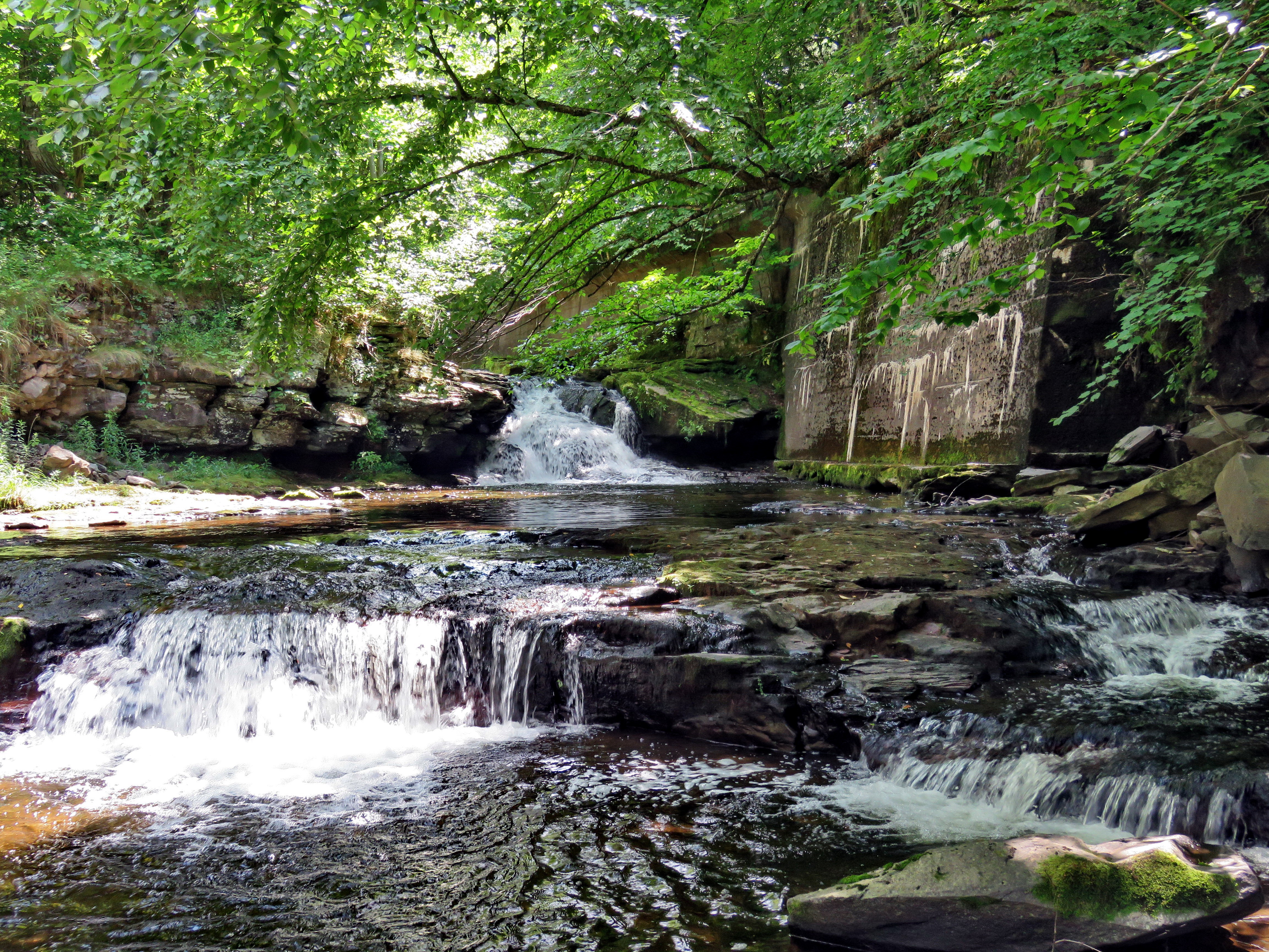
![]()
![]()
![]()
![]()
![]() On Friday, July 26th, I would have liked to get in a longer hike but was committed to covering ambulance calls. I did some work around the house amd then asked Cindy if she would like to hike. We decided to go to the Parksville Rail Trail and hike from Fox Mountain Road to Parksville and back. The Parksville Rail Trail is under three miles out and back but carrying a pack and keeping a quick pace helps increase the difficulty. Cindy likes the flat and short hikes! As I was getting dressed, I remembered it was two weeks since I lost my hiking companion Shiela. I found that since she passed away I still feel she is with me on hikes and I have vivid memories of her on each trail. I got dressed in my White Sierra long-sleeved top with a short-sleeved baselayer. I put on a pair of RailRiders hiking pants which are expensive but last a long time and have features like deep pockets and a generous cut which I really like. I decided to put on my Keen Durand hiking boots which fit well. I added a new pair of Xstance insoles in an effort to find the best support and cushioning for my feet. These insoles have shock absorbing gel pads, TPU arch support, and memory foam cushioning all wrapped in a breathable fabric. The insoles have been hyped by their manufacturer and seemed to be living up to their claims. I grabbed a pair of Leki MicroVario poles I have been using for some time because they are light and lock without slipping. I put our gear in the back of the car and left Livingston Manor at 11:15 PM. I drove out Old Route 17 toward Parksville and pulled into the parking area on the right side of the road just after Fox Mountain Rd. There were no cars parked in the lot when we arrived. I left my phone in the car so that I could enjoy the hike and started out on the trail at 11:30 AM under beautiful blue skies with towering puffy white clouds but with a little darkness and haze.
On Friday, July 26th, I would have liked to get in a longer hike but was committed to covering ambulance calls. I did some work around the house amd then asked Cindy if she would like to hike. We decided to go to the Parksville Rail Trail and hike from Fox Mountain Road to Parksville and back. The Parksville Rail Trail is under three miles out and back but carrying a pack and keeping a quick pace helps increase the difficulty. Cindy likes the flat and short hikes! As I was getting dressed, I remembered it was two weeks since I lost my hiking companion Shiela. I found that since she passed away I still feel she is with me on hikes and I have vivid memories of her on each trail. I got dressed in my White Sierra long-sleeved top with a short-sleeved baselayer. I put on a pair of RailRiders hiking pants which are expensive but last a long time and have features like deep pockets and a generous cut which I really like. I decided to put on my Keen Durand hiking boots which fit well. I added a new pair of Xstance insoles in an effort to find the best support and cushioning for my feet. These insoles have shock absorbing gel pads, TPU arch support, and memory foam cushioning all wrapped in a breathable fabric. The insoles have been hyped by their manufacturer and seemed to be living up to their claims. I grabbed a pair of Leki MicroVario poles I have been using for some time because they are light and lock without slipping. I put our gear in the back of the car and left Livingston Manor at 11:15 PM. I drove out Old Route 17 toward Parksville and pulled into the parking area on the right side of the road just after Fox Mountain Rd. There were no cars parked in the lot when we arrived. I left my phone in the car so that I could enjoy the hike and started out on the trail at 11:30 AM under beautiful blue skies with towering puffy white clouds but with a little darkness and haze.
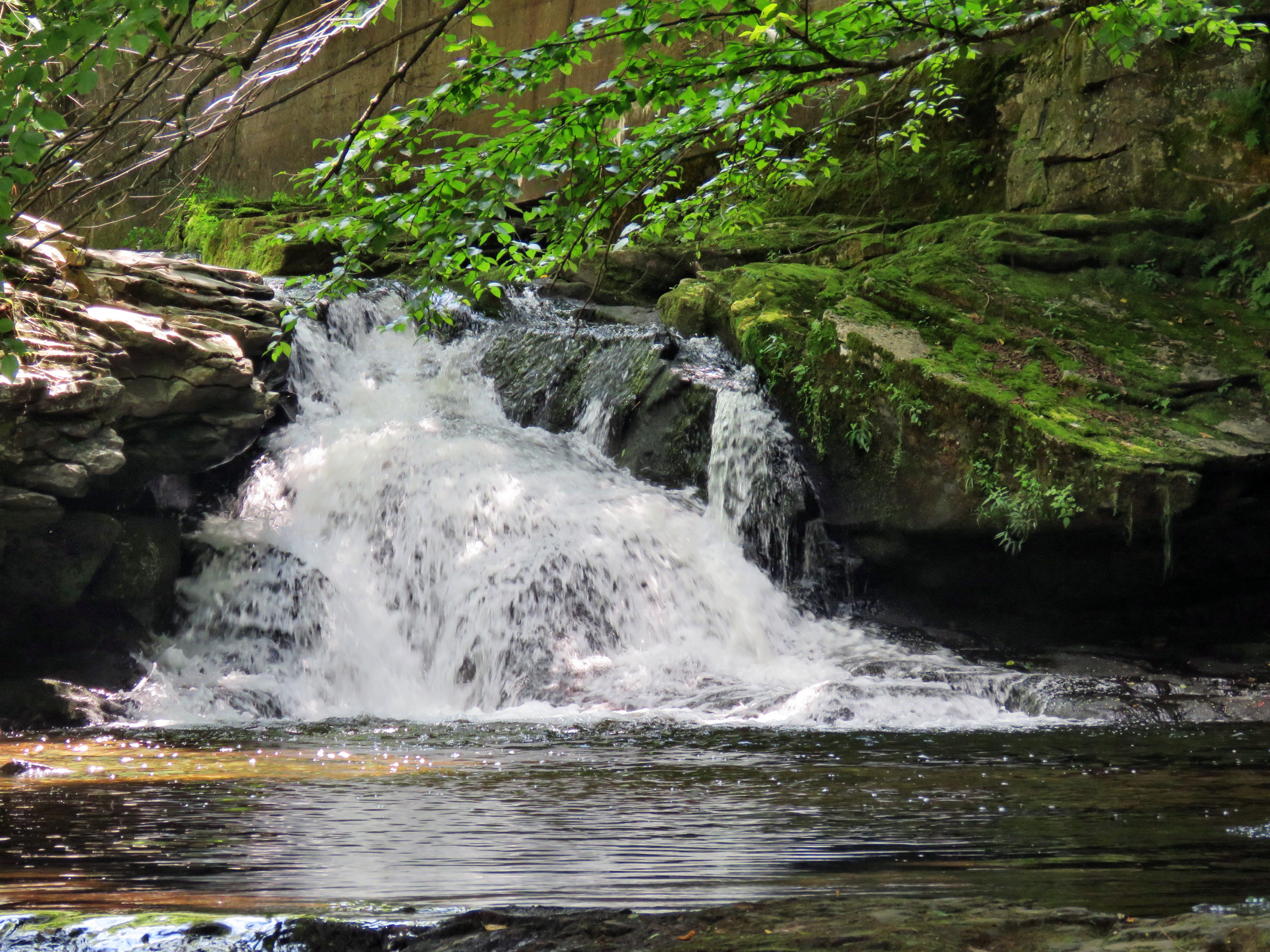 The first part of the trail was dry on the top from the bright sun even though we had some rain recently. Once we were on the trail and sheltered by the trees it was a little cooler and the trail was about as I expected with a few wet spots and some mud. The rail trail runs parallel to the Little Beaverkill and the new section of State Route 17. It follows the route of the O&W railroad and is very flat. We set a quick pace but were not racing to hike out and back as fast as possible. The water level in the stream was at the same level as it had been on my last trip. We passed several benches placed for people to rest in warmer weather. The trail had a few small branches and a couple of larger ones which had fallen in the highs winds. I cleared these with my sticks. I wondered if we would run into any larger branches or tress down across the trail. The area just before the wooden walkways showed some interesting views so I stopped to take a few shots of a viewpoint which is beginning to fill in. We continued our hike by walking across the wooden walkways. The walkways that had been raked and swept were starting to show some layers of mud. We walked passed several trees that had been cut and cleared. We came to the mudslide that had brought several trees down across the trail. All of these trees had been cut with a chainsaw and removed. Just after this area was another tree that a crew had cut and cleared. Just after this was a new, medium-sized tree that had fallen across the trail. I was annoyed at myself as I had not remembered to bring a saw to remove this blowdown. Someone had made a few cuts and threw the branches aside but not off the trail. I find it hard to understand why a person would want to start a job, not finish it, and do such a poor job. I knew this meant I would have to return in the next few days to clear the mess. We worked our way through the blowdown and continued on the trail heading toward the falls. As we walked, we could hear an increase in the noise from the stream and I knew the falls were just ahead. When we came to the falls, I decided to go down to the streambed to take some pictures. I asked Cindy if she would like to come along and she followed me down the path. This was the first time Cindy would see the falls from the bottom. Walking down the steep bank with my pack and poles was pretty easy and Cindy did not seem to have a problem. I put my pack down and got out my camera. The water wasn't actually as high as I had expected. I took pictures of the falls using different zooms and angles. I turned around and took some shots downstream. When I was done, I stowed the camera and we worked my way back up to the trail. I snapped a few more shots from above the falls and a few more upstream. When I was done, we continued on the trail toward Parksville. The trail continued o be damp with a few muddy spots.
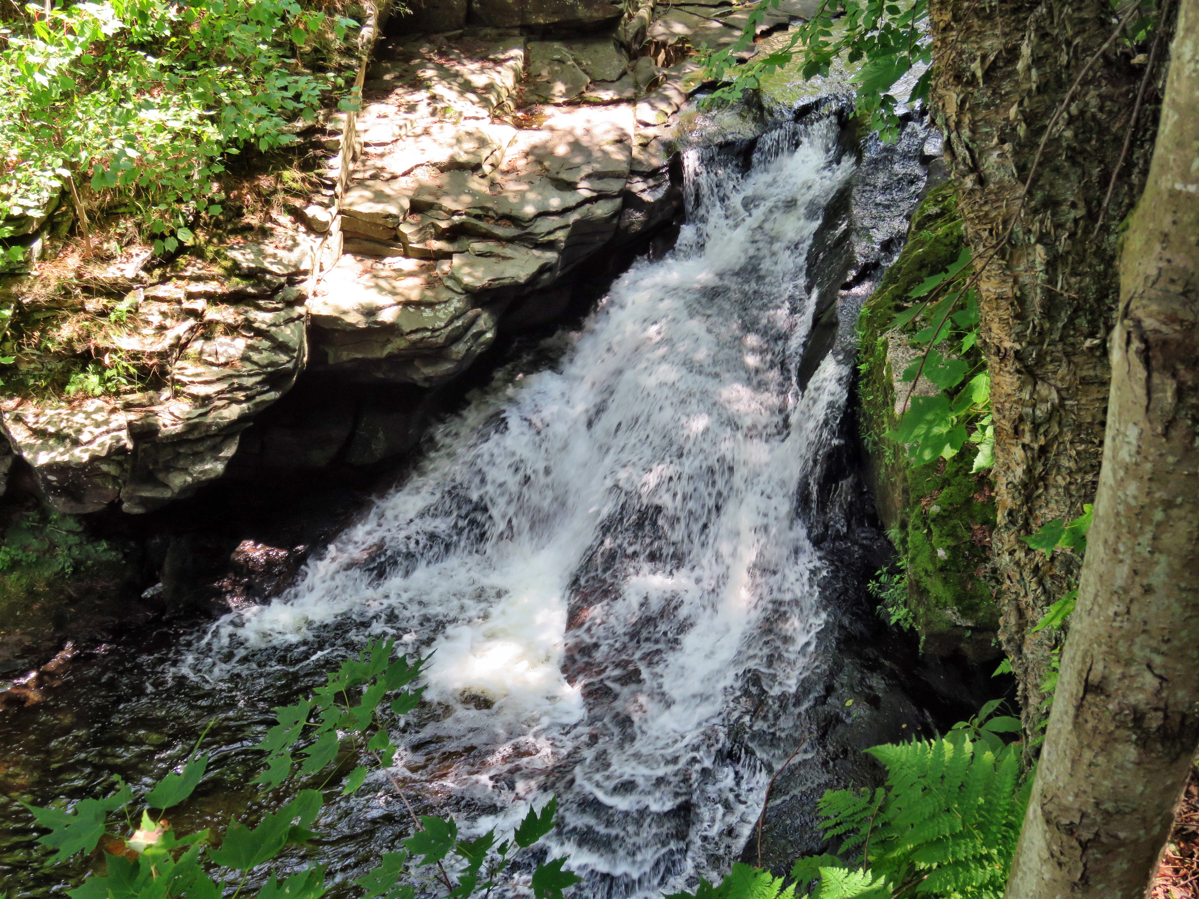 The weather was warm but I felt comfortable even though I was sweating quite a bit. Soon we were nearing the Parksville end of the trail passing some rundown and dilapidated buildings which are slowly being rehabilitated. Several of the buildings showed that work was being done on them. We arrived at the Parksville end of the trail where we found the small garden and a very informative sign. The pack of barking dogs that always greets us was absent. The sign listed the businesses and hotels that existed in Parksville during its heyday. The Young's Gap Hotel had room for 600 guests! The sign also explained the role of the railroad in the dairy industry which was a thriving one in all of Sullivan County. We turned around immediately and were confronted by the gate to the trail. The post had been pushed over and was laying on the ground. There was also a large pile of garbage people had tried into the receptacle for dog waste. For some reason there was no regular garbage can and no one had bothered to pick up the garbage. This relay spoils the hiking experience! We began the walk back on the trail. I knew the trip back would be quicker as I would not be stopping for pictures. We came to the falls and continued hiking. We passed the falls and kept up a fast pace. We walked through the blowdown across the trail and passed the mudslide. We crossed the bridge and the walkways and continued toward the parking area. When we broke out of the trees into the sun, I could feel the warmth of the sun. We arrived back at the car at 12:45 PM after hiking 2.7 miles in 1 hour and 15 minutes including the time to take pictures! I checked my phone and there had been no ambulance calls while I was on the trail! I had enjoyed the hike but we would have enjoyed it more with Sheila!
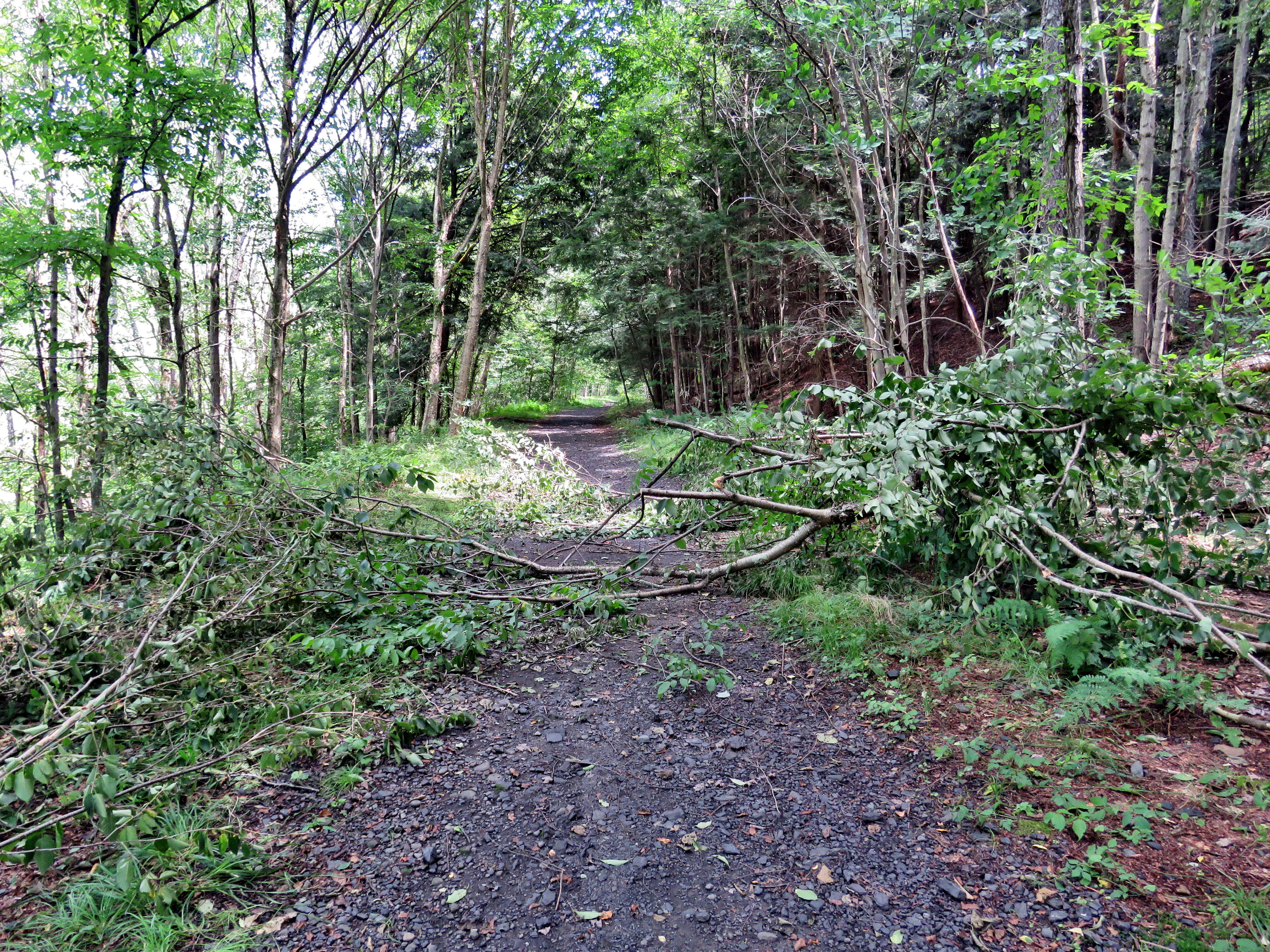
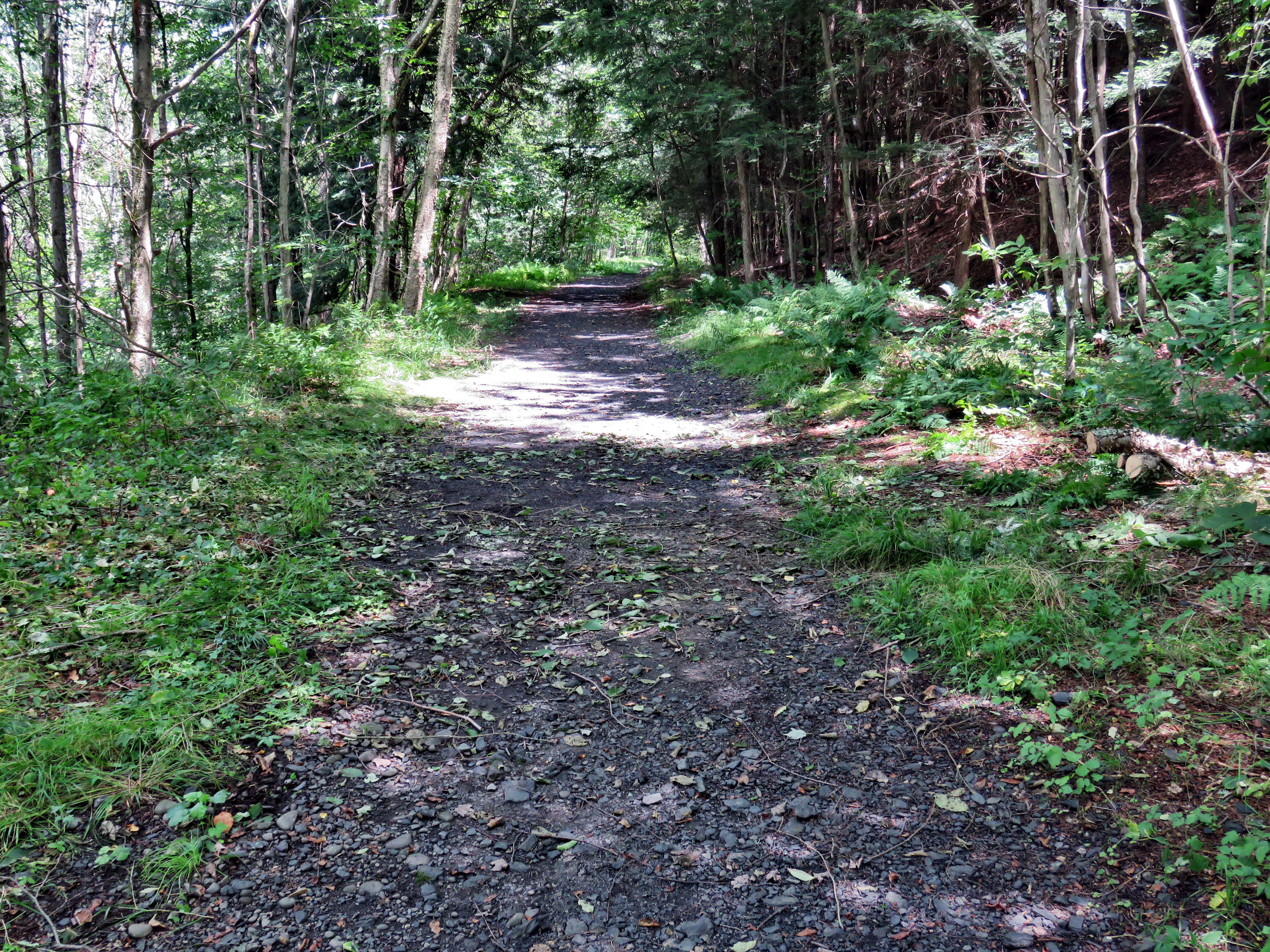
We returned home and I took the time to move the lawn which was getting long. The mowing didn't take much time and I was done by 1:30 PM. The entire time I was mowing I was thinking about the blowdown on the trail. I was still in my hiking clothes so I decided to go back and remove the blockage. I quickly put my Silky Sugowaza curved saw in my pack and put the pack in my car. I drove back to the parking area for the Parksville Rail Trail amd immediately started to hike. It took me 15 minutes to get to the blowdown. I took a few minutes to snap some "before" shots and then cleared all the loose branches I could find. I started cutting branches and throwing them off the trail at a remarkable pace. The saw seems the ideal tool to cut through the branches. In 15 minutes I had cleared everything, surprising even myself. I took my :after" shots and then spent 15 minutes hiking back to the car. As often as I clear trails, I still get a good feeling from doing it. I like making things better for people and the results are often dramatic!
![]()
![]()
![]() On Thursday, July 25th I was still tired from the church conference I had attended during the early part of the week. I was able to get some sleep amd got up around 9:00 AM. I am still having problems getting adjusted to not having Sheila around. I miss her all the time but especially during hikes. Shiela had hike every hike I have taken for over 12 years and I often find myself looking around on the trail to catch a glimpse of her. I did some work around the house including preparation for the church service on Sunday. When Cindy returned from her Bible study, she brought a hot sandwich which I apprecaited. When I was done, I decided to go across the street and hike on Round Top since I could still respond on ambulance calls. I began to get ready with the temperature at 75 degrees on the back porch. I decided to wear my White Sierra long-sleeved crew shirt without a baselayer. I wore my Railriders hiking pants which are expensive but last along time and have features like deep pockets and a generous cut which I really like. The pants have Velcro closures at the ankles. I decided to put on my Keen Durand hiking boots which I ordered a half size larger than the previous pair. These shoes fit well out of the box but get much tighter when I add a decent insole. Without the third party insole, by feet hurt from the lack of support. I added a new pair of Xstance insoles in an effort to find the best support and cushioning for my feet. These insoles have shock absorbing gel pads, TPU arch support, and memory foam cushioning all wrapped in a breathable fabric. The insoles have been hyped by their manufacturer and they really do seem to deliver. I decided to take my Leki MicroVario poles with external locks as the internal twist locks sometimes fail. I brought along my phone in case there were any calls. At 1:30 PM I walked out the door to start the hike without my constant companion. I aimed to hike for about an hour and complete two figure 8's. I crossed the street and walked to the parking lot next to the Presbyterian Church. I walked to the back of the church and began the ascent of the steepest hill behind the church. I used my poles effectively to help myself climb the hill. The hill is short but gets the circulation pumping and is the steepest and longest climb on the "trail." I did not have to stop on the way to the top of the hill and the trip went quickly. At the top I did not pause but immediately turned left to enter the woods at the trailhead.
On Thursday, July 25th I was still tired from the church conference I had attended during the early part of the week. I was able to get some sleep amd got up around 9:00 AM. I am still having problems getting adjusted to not having Sheila around. I miss her all the time but especially during hikes. Shiela had hike every hike I have taken for over 12 years and I often find myself looking around on the trail to catch a glimpse of her. I did some work around the house including preparation for the church service on Sunday. When Cindy returned from her Bible study, she brought a hot sandwich which I apprecaited. When I was done, I decided to go across the street and hike on Round Top since I could still respond on ambulance calls. I began to get ready with the temperature at 75 degrees on the back porch. I decided to wear my White Sierra long-sleeved crew shirt without a baselayer. I wore my Railriders hiking pants which are expensive but last along time and have features like deep pockets and a generous cut which I really like. The pants have Velcro closures at the ankles. I decided to put on my Keen Durand hiking boots which I ordered a half size larger than the previous pair. These shoes fit well out of the box but get much tighter when I add a decent insole. Without the third party insole, by feet hurt from the lack of support. I added a new pair of Xstance insoles in an effort to find the best support and cushioning for my feet. These insoles have shock absorbing gel pads, TPU arch support, and memory foam cushioning all wrapped in a breathable fabric. The insoles have been hyped by their manufacturer and they really do seem to deliver. I decided to take my Leki MicroVario poles with external locks as the internal twist locks sometimes fail. I brought along my phone in case there were any calls. At 1:30 PM I walked out the door to start the hike without my constant companion. I aimed to hike for about an hour and complete two figure 8's. I crossed the street and walked to the parking lot next to the Presbyterian Church. I walked to the back of the church and began the ascent of the steepest hill behind the church. I used my poles effectively to help myself climb the hill. The hill is short but gets the circulation pumping and is the steepest and longest climb on the "trail." I did not have to stop on the way to the top of the hill and the trip went quickly. At the top I did not pause but immediately turned left to enter the woods at the trailhead.
I entered the woods at the trailhead and continued on to the first junction. The trail was damp and muddy in some places from the rains yesterday. I continued straight ahead at the first trail junction. Climbing the hill to the lookout seemed eaier as I have been hiking more. When I reached the top of the hill, I followed the yellow trail as it continued passed the upper part of the lookout. Where the trail turned right I followed it uphill passing through a large area of green ferns some of which were encroaching on the trail. I passed the sitting rock and continued uphill to the junction with the blue trail. Walking without Sheila was strange as I realized it was like she was still with me. I turned right to follow the yellow trail along the base of Round Top. As I walked the old woods road, I found many bushes and small trees hanging into the trail. I made a note to bring a set of loppers next time or my Stihl string trimmer. I also noticed that many of the paint blazes need a touch up. At the junction with the blue trail, I turned left to climb the trail toward the summit. I passed by the white crossover trail and continued toward the summit. I approached the top, walked over the summit and started down the other side bypassing the white trail. I did turn left on the switchback in the blue trail. I followed it out into the woods and back again to the blue trail farther down the hill. I turned left on the main blue trail and walked downhill until we were back at the junction with the yellow trail. I turned left and again walked along the yellow trail to the next junction with the blue trail. This time I turned right at the trail junction and started to walk down the trail to the woods road. I continued on the woods road at a quick pace. Just before the first trail junction I found a large branch that had fallen across the trail during the recent wind storm. I made a note that I would have to return with some tools to remove it.
When I reached the first trail junction, I turned around and started back up the woods road we had just descended. When I ran into the large branch across the trail, I saw that I might be able to move it off the trail. I put down my poles and grabbed the branch. It took some effort but I was able to flip the whole branch off the trail. After I did a little cleanup work, I grabbed my poles and continued on the woods road. I set a faster pace up the woods road and turned left to stay on the yellow trail as the woods road ended. At the junction with the blue trail I turned left to stay on the yellow trail along the base of Round Top. At the second junction with the blue trail, I turned right and began to ascend the hill. I turned right where the switchback led me out into the forest and then back to the main blue trail. I turned right and headed for the summit. I walked over the top and started down the other side. I again bypassed the white crossover trail and continued down to the next trail junction with the yellow trail. At the junction with the yellow trail, I turned right on the yellow trail and again walked along the base of Round Top to the second junction with the blue trail. This time I turned left and headed down the yellow trail toward the lookout. At the viewpoint where the yellow trail turned left I followed it and walked down the hill to the very first trail junction. I continued to walk straight ahead out to the trailhead where I turned right. I walked downhill to the road behind the church. I walked out through the parking lot and across the street to our driveway. I was back home at 2:40 PM after hiking just over 2 miles in 1 hour and 10 minutes.
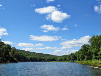
![]()
![]()
![]()
![]()
![]() On Friday, July 19th I planned to go to Russell Brook Falls in area of Trout Pond to leave the ashes of my dog Sheila in an area that we hiked so often. I arranged for ambulance coverage from 11:00 AM on which gave the the luxury of hiking without worrying about covering calls. As often happens the pager woke me up early for a call that was then cancelled! There's simply nothing like getting up and hurrying out the door to help someone only to be told you are not needed. Just before 11:00 AM when I was thinking about getting ready to hike, the pager again sounded for a call in our district. We responded quickly on the call and transported the pt the GH Catskills. On the way back from the call, the control center called us to respond to a call in Wurtsboro! We knew this meant we were the only crew available in the county so we went. The patient wanted to go to GH Middletown and we made the transport. By the time wi returned home it was after 2:00 PM but I knew I still hade time to do the hike I wanted. As I began to get ready to hike the temperature was 78 with low humidity and nice bright blue skies with white clouds. I got dressed in my White Sierra long-sleeved top with a short-sleeved baselayer. I put on a pair of RailRiders hiking pants which are expensive but last a long time and have features like deep pockets and a generous cut which I really like. I decided to put on my Keen Durand hiking boots which fit well. I added a new pair of Xstance insoles in an effort to find the best support and cushioning for my feet. These insoles have shock absorbing gel pads, TPU arch support, and memory foam cushioning all wrapped in a breathable fabric. The insoles have been hyped by their manufacturer and seemed to be living up to their claims. I grabbed a pair of Leki MicroVario poles I have been using for some time because they are light and lock without slipping. I did put on my wide-brimmed OR hat. I put my gear in the back of the car and left Livingston Manor at 2:40 PM. I drove north on the Quickway towards Roscoe and got off at exit 94 headeding north on Route 206 towards Downsville. After crossing the Rockland Flats and passing the Roscoe Nursing Home, I turned left on Morton Hill Road and drove to the intersection with Russell Brook Road. There were no cars sitting in the "lot" at the intersection of the two roads. People see the open space and park there without thinking about the fact that the land is private. I did not want to have to walk back up Russell Brook Road at the end of the hike so I decided to drive down the road to park in the lower lot. Russell Brook Road is a seasonal maintenance road and it did look like it had recently been maintained. There was a car parked at a spot about halfway down that is not a parking spot but I did not see any others until I got to the main parking area. I drove down to the lower parking lot and parked the car next to at least six others. Russell Brook Falls is popular as a falls and a swimming area. People also like to camp at Trout Pond.
On Friday, July 19th I planned to go to Russell Brook Falls in area of Trout Pond to leave the ashes of my dog Sheila in an area that we hiked so often. I arranged for ambulance coverage from 11:00 AM on which gave the the luxury of hiking without worrying about covering calls. As often happens the pager woke me up early for a call that was then cancelled! There's simply nothing like getting up and hurrying out the door to help someone only to be told you are not needed. Just before 11:00 AM when I was thinking about getting ready to hike, the pager again sounded for a call in our district. We responded quickly on the call and transported the pt the GH Catskills. On the way back from the call, the control center called us to respond to a call in Wurtsboro! We knew this meant we were the only crew available in the county so we went. The patient wanted to go to GH Middletown and we made the transport. By the time wi returned home it was after 2:00 PM but I knew I still hade time to do the hike I wanted. As I began to get ready to hike the temperature was 78 with low humidity and nice bright blue skies with white clouds. I got dressed in my White Sierra long-sleeved top with a short-sleeved baselayer. I put on a pair of RailRiders hiking pants which are expensive but last a long time and have features like deep pockets and a generous cut which I really like. I decided to put on my Keen Durand hiking boots which fit well. I added a new pair of Xstance insoles in an effort to find the best support and cushioning for my feet. These insoles have shock absorbing gel pads, TPU arch support, and memory foam cushioning all wrapped in a breathable fabric. The insoles have been hyped by their manufacturer and seemed to be living up to their claims. I grabbed a pair of Leki MicroVario poles I have been using for some time because they are light and lock without slipping. I did put on my wide-brimmed OR hat. I put my gear in the back of the car and left Livingston Manor at 2:40 PM. I drove north on the Quickway towards Roscoe and got off at exit 94 headeding north on Route 206 towards Downsville. After crossing the Rockland Flats and passing the Roscoe Nursing Home, I turned left on Morton Hill Road and drove to the intersection with Russell Brook Road. There were no cars sitting in the "lot" at the intersection of the two roads. People see the open space and park there without thinking about the fact that the land is private. I did not want to have to walk back up Russell Brook Road at the end of the hike so I decided to drive down the road to park in the lower lot. Russell Brook Road is a seasonal maintenance road and it did look like it had recently been maintained. There was a car parked at a spot about halfway down that is not a parking spot but I did not see any others until I got to the main parking area. I drove down to the lower parking lot and parked the car next to at least six others. Russell Brook Falls is popular as a falls and a swimming area. People also like to camp at Trout Pond.
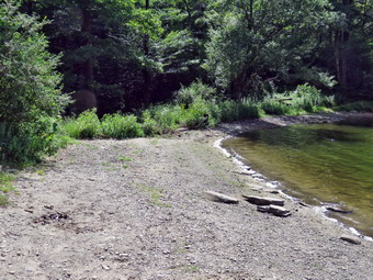 My intention was to hike with Sheila's ashes in a clockwise route around Trout Pond and back to the falls. I would then leave her ashes in a place near the falls that we had visited so often. This was certainly a bittersweet hike with many memories and my heart was heavy. I had brought my GPS unit even though we had done the hike before as I wanted to see how long and how fast we would go. I started our hike at 3:02 PM by walking down the woods road toward the bridge across Russell Brook. I meet three women coming up the path and said "Hello". The road was almost dry with no mud or water. As we crossed the bridge, I could see that the brook wasn't very high which was surprising as there had been a few recent rain storms. The Japanese knotweed had grown very high and dense but someone had cut it back from the trail. From the vehicle track, I assumed it was a DEC crew. I continued on the main trail toward Trout Pond. The history of this area is very interesting. Russell Brook Falls had been the site of a dam that impounded water for a waterwheel in Butternut Grove. The wheel was still there a few years ago. The area near the register box was the "landing zone" for loggers who cleared the evergreen trees, not for tanning but, for the production of wood alcohol. The trees were transported on narrow gauge railway that ran parallel to Russell Brook. The railway met the mainline O&W near Butternut Grove where the logs were unloaded. There were several acid factories in the area that produced wood alcohol. There was also a factory on the lower part of Russell Brook that produced khaki dye for the uniforms of American troops during World War I. I followed the main trail passed the register box and up the trail toward Trout Pond. The trail was almost dry which was a contrast to many times when it has been wet and muddy. I did notice that wherever the trail was damp or muddy that there were tire tracks that formed an impression into the trail. Crews come to work on the bridge and lean-tos and do a great job but cause problems on the trails which they do not fix.
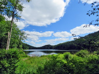 I continued on the trail toward Trout Pond. I wasn't consciously pushing the pace but the walk seemed to go very quickly as we passed the path to the first primitive campsite on the left. I could hear the outlet stream from Trout Pond. Soon I was at the outlet end of the pond and I walked over to the shore where the water was low enough to have a nice "beach". I dropped my pack to take pictures of the lake. The skies were still blue with clouds and sun shining. The views were much the same as they have always been but that did not stop me from taking pictures. I made sure to get shots of the pond but also some of the beach and the completely dry spillway. I remembered times when I was there with Sheila and she would swim to retrieve sticks or wade to cool off. I packed up and returned to the main trail to walk the flat woods road toward the inlet end of the pond. This trail is always wet but on this day it was almost dry! The small stream just before the trail junction near the leanto was completely dry. When I came to the bridge, I stopped to take a few pictures of the pond from just before the bridge and from the bridge itself. The inlet stream was dry and looked more like a road or rail than a streambed. I crossed the bridge and stayed to the right on the Mud Pond Trail which would take me over Cherry Ridge and form a loop back to the parking area. The trail was nearly dry but very rocky as we started to ascend the hill. My left foot was a little sore as I am nursing a ganglion cyst that keeps getting worse. As wI continued up the trail, I slowed a little as the grade increased. There had been some very large trees across the trail but they had been cut by a DEC crew or the rangers. These trails are maintained by the DEC so they are not cleared as often as those that are the responsibility of NYNJTC volunteers.
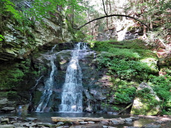 From the bridge at the inlet I climbed 430 feet over the next .75 miles. The trail headed west from the inlet until turning sharply south at around 2.3 miles. The highest point on the trail was at 2.2 miles after which most of the rest of the hike is downhill. I was surprised that I was not getting tired on the climb which made me feel great. As we started down the other side, the trail was still dry even in lace where it is usually damp. There was no standing or running water which I have come to expect. The relatively dry conditions continued for the rest of the trip making the hike more enjoyable than some of the last outings here. I ascended a small hill to the stand of small birch trees and then descended the other side where there was some damp areas. At 3.7 miles we had descended 420 feet from Cherry Ridge to the snowmobile trail near Mud Pond. I could see that the trail was just damp so we stayed on the woods road. We ascended a small hill before starting downhill back toward the parking area. Usually this section has some running water across it and some running down the trail. Today there was only a little water in the small stream near the bottom of the hill. All told, I dropped another 380 feet over the next .7 miles back to the bridge just before the trail register. I crossed the bridge over the outlet stream which did have some water. I wondered about the source of the water as none of it was coming from Trout Pond. I continued on the trail to the first junction where I turned right. I turned left on the path that leads to the falls. The path was very narrow and overgrown despite an indication that people were visiting the area. I walked to the spot where the path descends to the streambed and walked down to the bottom. I was glad there were no people present. The falls were barely trickle but were still pretty. I put down my pack and got out the bag which contained Sheila's ashes. I opened the bag and distributed the ashes to several different places around the falls. There was some finality to this but I knew I will continue to miss Shiela for a long time! I got out my camera and took some pictures of the falls at different angles and zooms. I also took shots of the stream. The volume was lower than I thought it would be but I realized that this area had not gotten much rain from the recent storms. I remembered how Sheila would pose in front of the falls while I took pictures of her. I returned to my pack and put away the camera. I walked back up to the path that runs out to the main trail. I turned left and continued on the main trail toward the parking area. I crossed the bridge and walked up the trail to the parking area. I was back at the car at 5:18 PM and had hiked 4.5 miles in 2 hours and 15 minutes with an elevation gain of 885 feet. I had stopped only 9 minutes for pictures. My moving speed of over 2 mph satisfied me with the rolling terrain.
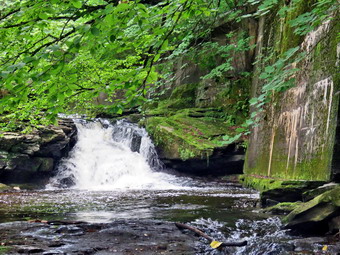
![]()
![]()
![]()
![]()
![]() On Tuesday, July 16th, I would have liked to get in a longer hike but was committed to covering ambulance calls. We went on a call in Liberty just before 8:00 AM and then responded in two more in Liberty before ever returning to base. When we did get back to base, I had three calls to document from today and one from last night. I eventually got to go home with the temperature at 89 degrees and creasing humidity. I thought about staying home but found and EMT to cover for a couple hours so I decided to go to the Parksville Rail Trail and hike from Fox Mountain Road to Parksville and back. The Parksville Rail Trail is under three miles out and back but carrying a pack and keeping a quick pace helps increase the difficulty. As I was getting dressed, I remembered this would be my first time hiking this trail without Sheila. I found that since she passed away I still feel she is with me on hikes and I have vivid memories of her on each trail. I got dressed in my White Sierra long-sleeved top with a short-sleeved baselayer. I put on a pair of RailRiders hiking pants which are expensive but last a long time and have features like deep pockets and a generous cut which I really like. I decided to put on my Keen Durand hiking boots which fit well. I added a new pair of Xstance insoles in an effort to find the best support and cushioning for my feet. These insoles have shock absorbing gel pads, TPU arch support, and memory foam cushioning all wrapped in a breathable fabric. The insoles have been hyped by their manufacturer and seemed to be living up to their claims. I grabbed a pair of Leki MicroVario poles I have been using for some time because they are light and lock without slipping. I put my gear in the back of the car and left Livingston Manor at 12:45 PM. I drove out Old Route 17 toward Parksville and pulled into the parking area on the right side of the road just after Fox Mountain Rd. There were no cars parked in the lot when I arrived. I left my phone in the car so that I could enjoy the hike and started out on the trail at 1:01 PM under beautiful blue skies with towering puffy white clouds but with a little darkness and haze.
On Tuesday, July 16th, I would have liked to get in a longer hike but was committed to covering ambulance calls. We went on a call in Liberty just before 8:00 AM and then responded in two more in Liberty before ever returning to base. When we did get back to base, I had three calls to document from today and one from last night. I eventually got to go home with the temperature at 89 degrees and creasing humidity. I thought about staying home but found and EMT to cover for a couple hours so I decided to go to the Parksville Rail Trail and hike from Fox Mountain Road to Parksville and back. The Parksville Rail Trail is under three miles out and back but carrying a pack and keeping a quick pace helps increase the difficulty. As I was getting dressed, I remembered this would be my first time hiking this trail without Sheila. I found that since she passed away I still feel she is with me on hikes and I have vivid memories of her on each trail. I got dressed in my White Sierra long-sleeved top with a short-sleeved baselayer. I put on a pair of RailRiders hiking pants which are expensive but last a long time and have features like deep pockets and a generous cut which I really like. I decided to put on my Keen Durand hiking boots which fit well. I added a new pair of Xstance insoles in an effort to find the best support and cushioning for my feet. These insoles have shock absorbing gel pads, TPU arch support, and memory foam cushioning all wrapped in a breathable fabric. The insoles have been hyped by their manufacturer and seemed to be living up to their claims. I grabbed a pair of Leki MicroVario poles I have been using for some time because they are light and lock without slipping. I put my gear in the back of the car and left Livingston Manor at 12:45 PM. I drove out Old Route 17 toward Parksville and pulled into the parking area on the right side of the road just after Fox Mountain Rd. There were no cars parked in the lot when I arrived. I left my phone in the car so that I could enjoy the hike and started out on the trail at 1:01 PM under beautiful blue skies with towering puffy white clouds but with a little darkness and haze.
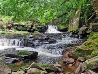 The first part of the trail was dry on the top from the bright sun even though we had some heavy rain overnight. Once I was on the trail and sheltered by the trees it was a little cooler and the trail was about as I expected with a few wet spots and some mud. The rail trail runs parallel to the Little Beaverkill and the new section of State Route 17. It follows the route of the O&W railroad and is very flat. I set a quick pace with the intention of hiking out and back as fast as possible. The water level in the stream was higher than it had been on my last trip. We passed several benches placed for people to rest in warmer weather. The trail had a few small branches and a couple of larger ones which had fallen in the highs winds. I cleared with my sticks. I wondered if I would run into any larger branches or tress down across the trail. The area just before the wooden walkways showed some interesting views but I stuck with my plan to keep walking. The walkways that had been raked and swept were starting to show some layers of mud. We walked passed several trees that had been cut and cleared. We came to the mudslide that had brought several trees down across the trail. All of these trees had been cut with a chainsaw and removed. Just after this area was another tree that a crew had cut and cleared. Just after this was anew, medium-sized tree that had fallen across the trail. I made a note to come back in the next few days to remove this blowdown. I worked my way through the blowdown and continued on the trail heading toward the falls. As I walked, we could hear an increase in the noise from the stream and I knew the falls were just ahead. When I came to the falls, I decided to go down to the streambed to take some pictures. Walking down the steep bank with my pack and poles was pretty easy. I put my pack down and got out my camera. The water wasn't actually as high as I might have expected. I took pictures of the falls using different zooms and angles. I turned around and took some shots downstream. When I was done, I stowed the camera and worked my way back up to the trail. I snapped a few more shots from above the falls and a few more upstream. When I was done, I continued on the trail toward Parksville.
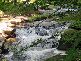 The weather was warm but I felt comfortable even though I was sweating quite a bit. Soon I was nearing the Parksville end of the trail passing some rundown and dilapidated buildings which should be removed. Several of the buildings showed that work was being done on them. I arrived at the Parksville end of the trail at 1:35 PM where I found the small garden and a very informative sign. The pack of barking dogs that always greets us was absent. The sign listed the businesses and hotels that existed in Parksville during its heyday. The Young's Gap Hotel had room for 600 guests! The sign also explained the role of the railroad in the dairy industry which was a thriving one in all of Sullivan County. I turned around immediately and began the walk back on the trail. I knew the trip back would be quicker as I would not be stopping for pictures. I came to the falls and continued hiking and passed the falls and kept up my fast pace. I crossed the bridge and the walkways and continued toward the parking area. When I broke out of the trees into the sun, I could feel the warmth of the sun. I arrived back at the car at 2:01 PM after hiking 2.7 miles in 1 Hour including the time to take pictures! I checked my phone and there had been no ambulance calls while I was on the trail! I had enjoyed the hike but would have enjoyed it more with Sheila!
![]()
![]()
![]()
![]() On Monday, July 15th I planned to get out for a hike but could only do that on Round Top as I was the only EMT around to go on calls. I have come to the conclusion that Round Top is like an old hiking buddy. It is always available for a hike and although there are few surprises it is always better than staying at home. I some ambulance calls throughout the day and it was 2:30 PM before I could start thinking about a hike. I almost decided not to bother but knew I would feel better if I took a walk. I started to get ready to hike at 2:45 PM with the temperature at 89 degrees on the back porch with high humidity. This would be my first hike on Round Top since I had lost my hiking companion Sheila. Round Top was our most frequent destination as it is so close to home. I asked Cindy if she wanted to go and she agreed which surprised me as she does not like hills. I got dressed in my White Sierra light crew top with no baselayer. I wore my Railriders hiking pants which are expensive but last along time and have features like deep pockets and a generous cut which I really like. The pants have Velcro closures at the ankles. I decided to put on my Keen Durand hiking boots which I ordered a half size larger than the previous pair. These shoes fit well out of the box but get much tighter when I add a decent insole. Without the third party insole, by feet hurt from the lack of support. I added a new pair of Xstance insoles in an effort to find the best support and cushioning for my feet. These insoles have shock absorbing gel pads, TPU arch support, and memory foam cushioning all wrapped in a breathable fabric. The insoles have been hyped by their manufacturer and they really do seem to deliver. I decided to take my Leki MicroVario poles with external locks as the internal twist locks fail. I did not put on gaiters as I knew the trails would be almost dry nor did I put on a hat. I took my cell phone with me because even though I planned to hike quickly, I was pretty sure I was the only EMT around to respond. At 3:00 PM we walked out the door to start the hike. We headed down the driveway and across the street. We crossed the street and walked to the parking lot next to the Presbyterian Church. We walked to the back of the church and instead of heading up the steepest road we stayed to the right to walk a more gentle slope. When the road split we turned left and walked a steep section to the trailhead. I liked this approach and it did add a little distance. At the top we paused for a minute so I could look around at the hills that surround the hamlet of Livingston Manor. The skies were a mixture of clouds and sun. Everything was really green caused by the recent rains and the sunshine on other days. We continued the hike by turning right at the trailhead. The trail was completely dry as it had not rained recently. The temperature under the trees seemed only a little cooler than in the sun.
On Monday, July 15th I planned to get out for a hike but could only do that on Round Top as I was the only EMT around to go on calls. I have come to the conclusion that Round Top is like an old hiking buddy. It is always available for a hike and although there are few surprises it is always better than staying at home. I some ambulance calls throughout the day and it was 2:30 PM before I could start thinking about a hike. I almost decided not to bother but knew I would feel better if I took a walk. I started to get ready to hike at 2:45 PM with the temperature at 89 degrees on the back porch with high humidity. This would be my first hike on Round Top since I had lost my hiking companion Sheila. Round Top was our most frequent destination as it is so close to home. I asked Cindy if she wanted to go and she agreed which surprised me as she does not like hills. I got dressed in my White Sierra light crew top with no baselayer. I wore my Railriders hiking pants which are expensive but last along time and have features like deep pockets and a generous cut which I really like. The pants have Velcro closures at the ankles. I decided to put on my Keen Durand hiking boots which I ordered a half size larger than the previous pair. These shoes fit well out of the box but get much tighter when I add a decent insole. Without the third party insole, by feet hurt from the lack of support. I added a new pair of Xstance insoles in an effort to find the best support and cushioning for my feet. These insoles have shock absorbing gel pads, TPU arch support, and memory foam cushioning all wrapped in a breathable fabric. The insoles have been hyped by their manufacturer and they really do seem to deliver. I decided to take my Leki MicroVario poles with external locks as the internal twist locks fail. I did not put on gaiters as I knew the trails would be almost dry nor did I put on a hat. I took my cell phone with me because even though I planned to hike quickly, I was pretty sure I was the only EMT around to respond. At 3:00 PM we walked out the door to start the hike. We headed down the driveway and across the street. We crossed the street and walked to the parking lot next to the Presbyterian Church. We walked to the back of the church and instead of heading up the steepest road we stayed to the right to walk a more gentle slope. When the road split we turned left and walked a steep section to the trailhead. I liked this approach and it did add a little distance. At the top we paused for a minute so I could look around at the hills that surround the hamlet of Livingston Manor. The skies were a mixture of clouds and sun. Everything was really green caused by the recent rains and the sunshine on other days. We continued the hike by turning right at the trailhead. The trail was completely dry as it had not rained recently. The temperature under the trees seemed only a little cooler than in the sun.
At the first trail junction, we continued straight up the hill toward the viewpoint. The hill seemed easy to me but I could tell Cindy felt the climb. At the viewpoint, we continued to follow the yellow trail as it headed right. The trail passed through a sea of very green ferns and passed the "Sitting Rock". We walked up a short hill and came to the junction with the blue trail. I decided that for variety I wanted to do some loops rather than figure 9's so we continued straight ahead on the blue trail. When we came to the switchback, we turned right and followed it out into the woods and then back to the main trail. We turned right and followed the blue trail over the summit passing by the white crossover trail. From the summit, we continued to follow the blue trail back down to the yellow trail. At the junction, we continued straight ahead on the yellow trail an followed it as it turned right onto the woods road. A downhill walk on the woods road brought us back to the first trail junction. I was ready to keep going but Cindy announced she was bowing out. Cindy headed home while I turned around and headed back up the woods road. At the end of the woods road I turned left and continued up the yellow trail to the junction with the blue trail. At the junction I continued straight ahead on the blue trail toward the summit. I again bypassed the white crossover trail. I walked over the summit and won the other side passed the white crossover trail. Immediately after the white trail I turned left on the switchback. I walked out into the forest until the trail switched back and returned me to the main blue trail. I walked downhill to the trail junction and continued straight ahead on the yellow trail passing the "Sitting Rock" and through the ferns. At the viewpoint I turned left and walked downhill on the yellow trail to the first trail junction.
I decided I wanted to some smaller loops so I turned around and again headed back up the hill to the lookout. I continued to follow the yellow trail up through the ferns to the junction with the blue trail. This time I turned right and continued to follow the yellow trail along the base of Round Top to the next junction with the hue trail. Here I turned right and followed the yellow trail down to the woods road. The woods road led me downhill to the first trail junction. My sense of symmetry made me turn around one last time and head back of the woods road to the trail to the junction with the blue trail. I turned left and continued to stay on the yellow trail along the base of Round Top to the junction with the blue trail. I turned left and followed the yellow trail down to the lookout and down the hill to the first trail junction. I walked straight out to the trailhead. I turned right and walked downhill and crossed the parking lot to the road. I waited to cross the road as several cars went by and then crossed to the driveway to the house. It was 4:35 PM and I had hiked a little a little less than 3 miles in 1 hour and 35 minutes. It was a pleasant hike and there had been no ambulance calls!
![]()
![]()
![]()
![]() On Saturday, July 13th, I decided I wanted to get out for a longer hike and the first hike by myself after losing my hiking companion Sheila. Her health took a turn for the worse and we took her to the vet for the last time on Friday. It seemed I might lose the opportunity as I was the only EMT around and responded to two calls in the morning. By 2:00 PM I decided I had to get out to get away from the house which seems so empty without my dog! I started to get ready at 2:30 PM with the temperature at 88 degrees on the back porch. I got dressed in my White Sierra long-sleeved top with a short-sleeved compression baselayer. I put on a pair of RailRiders hiking pants which are expensive but last a long time and have features like deep pockets and a generous cut which I really like. I decided to put on my Keen Durand hiking boots which fit well. I added a new pair of Xstance insoles in an effort to find the best support and cushioning for my feet. These insoles have shock absorbing gel pads, TPU arch support, and memory foam cushioning all wrapped in a breathable fabric. The insoles have been hyped by their manufacturer and seemed to be living up to their claims. I grabbed a pair of Leki MicroVario poles I have been using for some time because they are light and lock without slipping. I also took my OR wide-brimmed hat as it acts as good base for insect repellant which I find useful in the Frick Pond area. I got my gear together and left the house at 2:45 PM heading out DeBruce Road toward Mongaup Pond Road. It seemed strange no having Sheila in the back seat sneaking up to stand between the seats! After 6 miles I turned left on Mongaup Road. Where the road splits, I stayed left on Beech Mountain Road and continued to the parking areas at the end of the road. There was one car in the smaller lot where I parked and none in the larger lot. I was surprised that there weren't more people on such a nice day. The skies were blue with a lot of puffy white clouds with just a hint of dark clouds. I promptly set my GPS unit to get ready for the hike. The temperature was 79 degrees when I crossed the road to the Flynn Trail. I started up the Flynn Trail through the woods and at the end turned right on the woods road. The grass was dry but it was obvious that the recent rains had hit this area hard as I could see erosion on the main trail. I missed Sheila greatly and found it helped to "talk" to her as I hiked. She was the best hiking companion and a friend in so many ways. I began to climb the long hill to the junction of the Flynn Trail and the Big Rock Trail. I kept a steady pace thinking about my sermon for church and the walk seemed really short. I passed by the clearing on the right of the trail in what seemed like a very short time. I had decided that I would probably take no pictures as I just wanted to hike. I must have kept a good pace because before I knew it we had walked the 1.7 miles and 600 vertical feet to the junction with the Big Rock Trail. It was 3:45 PM when I hot the highest point on the hike at the junction with the Big Rock Trail. This meant I had covered the distance in 43 minutes which might be a personal best! I turned left and started down the Big Rock Trail toward Times Square. There were a few branches on the trail that I picked up and threw to the side. My feet were beginning to hurt a little bit as my toes were banging the front of my shoes. This is a problem I have never been able to solve completely. The walk down the Big Rock Trail to Times Square is 1.1 miles and the elevation drop is 570 feet. Along the way I saw two deer standing on the trail watching me. I thought about how Sheila would probably have started to chase the deer and would have come back when I called her. I stopped at one point and was surrounded by a swarm of biting mosquitoes which reminded me of one of the only drawbacks of hiking in this area. I immediately got out some natural insect repellant and sprayed it on myself and my clothing. This seemed to keep the insects at bay but some would make a run and come through to bite me. I was at Times Square at 4:15 PM under bright and sunny skies. It had taken me 30 minutes to hike down the hill. The area around Times Square was damp which contrasted with the dry trails up to this point. I decided to stick to my plan and turned right to start up the yellow blazed Logger's Loop which also was a little wet.
On Saturday, July 13th, I decided I wanted to get out for a longer hike and the first hike by myself after losing my hiking companion Sheila. Her health took a turn for the worse and we took her to the vet for the last time on Friday. It seemed I might lose the opportunity as I was the only EMT around and responded to two calls in the morning. By 2:00 PM I decided I had to get out to get away from the house which seems so empty without my dog! I started to get ready at 2:30 PM with the temperature at 88 degrees on the back porch. I got dressed in my White Sierra long-sleeved top with a short-sleeved compression baselayer. I put on a pair of RailRiders hiking pants which are expensive but last a long time and have features like deep pockets and a generous cut which I really like. I decided to put on my Keen Durand hiking boots which fit well. I added a new pair of Xstance insoles in an effort to find the best support and cushioning for my feet. These insoles have shock absorbing gel pads, TPU arch support, and memory foam cushioning all wrapped in a breathable fabric. The insoles have been hyped by their manufacturer and seemed to be living up to their claims. I grabbed a pair of Leki MicroVario poles I have been using for some time because they are light and lock without slipping. I also took my OR wide-brimmed hat as it acts as good base for insect repellant which I find useful in the Frick Pond area. I got my gear together and left the house at 2:45 PM heading out DeBruce Road toward Mongaup Pond Road. It seemed strange no having Sheila in the back seat sneaking up to stand between the seats! After 6 miles I turned left on Mongaup Road. Where the road splits, I stayed left on Beech Mountain Road and continued to the parking areas at the end of the road. There was one car in the smaller lot where I parked and none in the larger lot. I was surprised that there weren't more people on such a nice day. The skies were blue with a lot of puffy white clouds with just a hint of dark clouds. I promptly set my GPS unit to get ready for the hike. The temperature was 79 degrees when I crossed the road to the Flynn Trail. I started up the Flynn Trail through the woods and at the end turned right on the woods road. The grass was dry but it was obvious that the recent rains had hit this area hard as I could see erosion on the main trail. I missed Sheila greatly and found it helped to "talk" to her as I hiked. She was the best hiking companion and a friend in so many ways. I began to climb the long hill to the junction of the Flynn Trail and the Big Rock Trail. I kept a steady pace thinking about my sermon for church and the walk seemed really short. I passed by the clearing on the right of the trail in what seemed like a very short time. I had decided that I would probably take no pictures as I just wanted to hike. I must have kept a good pace because before I knew it we had walked the 1.7 miles and 600 vertical feet to the junction with the Big Rock Trail. It was 3:45 PM when I hot the highest point on the hike at the junction with the Big Rock Trail. This meant I had covered the distance in 43 minutes which might be a personal best! I turned left and started down the Big Rock Trail toward Times Square. There were a few branches on the trail that I picked up and threw to the side. My feet were beginning to hurt a little bit as my toes were banging the front of my shoes. This is a problem I have never been able to solve completely. The walk down the Big Rock Trail to Times Square is 1.1 miles and the elevation drop is 570 feet. Along the way I saw two deer standing on the trail watching me. I thought about how Sheila would probably have started to chase the deer and would have come back when I called her. I stopped at one point and was surrounded by a swarm of biting mosquitoes which reminded me of one of the only drawbacks of hiking in this area. I immediately got out some natural insect repellant and sprayed it on myself and my clothing. This seemed to keep the insects at bay but some would make a run and come through to bite me. I was at Times Square at 4:15 PM under bright and sunny skies. It had taken me 30 minutes to hike down the hill. The area around Times Square was damp which contrasted with the dry trails up to this point. I decided to stick to my plan and turned right to start up the yellow blazed Logger's Loop which also was a little wet.
The trail begins a rolling ascent over the next .8 miles. At about 3.3 miles there is an area on the right which is sometimes marshy and often looks like a small pond. I quick glance showed it was very dry and looked much like a field of ferns. I continued along the trail and I found that it was wet and muddy in many spots. This also meant there were more clouds of insets along the way. The trail continued to be wet and muddy which apparently was what the insects liked! I looked down at my arms and they were even biting me through my long-sleeved shirt! Eventually I continued along the trail and was surprised that the repellant actually worked. Soon I was at Iron Wheel Junction at 4 miles. I turned left to head back toward Frick Pond. The walk is mostly downhill but it was wet and muddy in quite a few spots. We were soon at the small stream through the woods which was as low as I have seen it this season. I walked over it with one step. I remembered how Sheila used to like to take a dip in this stream to cool off and then shake next to me to get me wet. I walked through the pine promenade and though about how many years ago it was completely blocked by large trees that had fallen across it and had never been cleared. One day a lone sawyer from the DEC limbed all the trees and section them. I came along behind him and threw all the limbs off the trail and rolled all the section away. There were a few large trunks across the trail but most were easy to step over. There was one large trunk that was a little hard to get over and I made a mental note that I should get it cut. The trail on the other side was wet in places but there was no standing water on the trail. At the next trail junction with the Big Rock Trail, i stayed to the right to keep to the Quick Lake Trail. I was soon at the bridge over the outlet of Frick Pond. Every time I get to this point I pause to survey the scene because it is so beautiful. I have many pictures of Sheila posing on the bridge solo or with some else. I walked up the hill from Frick Pond to Gravestone Junction. I noticed the trail was overgrown with grass and brush and needed some work. I continued back to the car along the Quick Lake Trail finding only a few wet spots. I was back at the car at 5:20 PM having covered 5.5 miles in 2 hours and 20 minutes with an elevation gain of 870 feet. The temperature at the car was about 78 degrees and the skies were still sunny.
![]()
![]()
![]()
![]() On Wednesday, July 10th, I had been planning to get in a longer hike as I had a crew covering calls for the day. The night before I got a text saying the EMT who was covering had something else to do! I decided to go to the Parksville Rail Trail and hike from Fox Mountain Road to Parksville and back. The temperature was 88 degrees with increasing humidity. This made it a little uncomfortable for hiking than the previous weeks. The Parksville Rail Trail is under three miles out and back but carrying a pack and keeping a quick pace helps increase the difficulty. As I was getting dressed, I again had to be careful to stay out of Sheila's gaze as it was too hot to take her out. I got dressed in my White Sierra long-sleeved top with no baselayer. I put on a pair of RailRiders hiking pants which are expensive but last a long time and have features like deep pockets and a generous cut which I really like. I decided to put on my Keen Durand hiking boots which fit well. I added a new pair of Xstance insoles in an effort to find the best support and cushioning for my feet. These insoles have shock absorbing gel pads, TPU arch support, and memory foam cushioning all wrapped in a breathable fabric. The insoles have been hyped by their manufacturer and seemed to be living up to their claims. I grabbed a pair of Leki MicroVario poles I have been using for some time because they are light and lock without slipping. I put my gear in the back of the car and left Livingston Manor at 2:40 PM. I drove out Old Route 17 toward Parksville and pulled into the parking area on the right side of the road just after Fox Mountain Rd. There was one car parked in the lot when I arrived and two young men beginning their hike on the trail. I left my phone in the car so that I could enjoy the hike, set my GPS and started out on the trail at 2:52 PM under beautiful blue skies with towering puffy white clouds.
On Wednesday, July 10th, I had been planning to get in a longer hike as I had a crew covering calls for the day. The night before I got a text saying the EMT who was covering had something else to do! I decided to go to the Parksville Rail Trail and hike from Fox Mountain Road to Parksville and back. The temperature was 88 degrees with increasing humidity. This made it a little uncomfortable for hiking than the previous weeks. The Parksville Rail Trail is under three miles out and back but carrying a pack and keeping a quick pace helps increase the difficulty. As I was getting dressed, I again had to be careful to stay out of Sheila's gaze as it was too hot to take her out. I got dressed in my White Sierra long-sleeved top with no baselayer. I put on a pair of RailRiders hiking pants which are expensive but last a long time and have features like deep pockets and a generous cut which I really like. I decided to put on my Keen Durand hiking boots which fit well. I added a new pair of Xstance insoles in an effort to find the best support and cushioning for my feet. These insoles have shock absorbing gel pads, TPU arch support, and memory foam cushioning all wrapped in a breathable fabric. The insoles have been hyped by their manufacturer and seemed to be living up to their claims. I grabbed a pair of Leki MicroVario poles I have been using for some time because they are light and lock without slipping. I put my gear in the back of the car and left Livingston Manor at 2:40 PM. I drove out Old Route 17 toward Parksville and pulled into the parking area on the right side of the road just after Fox Mountain Rd. There was one car parked in the lot when I arrived and two young men beginning their hike on the trail. I left my phone in the car so that I could enjoy the hike, set my GPS and started out on the trail at 2:52 PM under beautiful blue skies with towering puffy white clouds.
The first part of the trail was completely dry even though we had some rain overnight. I am sure this was from drying in the sun and breeze. Once we were on the trail and sheltered by the trees it was a little cooler and the trail was about as I expected with a few wet spots and some mud. The rail trail runs parallel to the Little Beaverkill and the new section of State Route 17. It follows the route of the O&W railroad and is very flat. I set a quick pace with the intention of hiking out and back as fast as possible. The water level in the stream was higher than it had been on our last trip. We passed several benches placed for people to rest in warmer weather. The trail had a few small branches and a couple of larger ones which I cleared with my sticks. I wondered if I would run into any larger branches or tress down across the trail. The area just before the wooden walkways showed some interesting views but I stuck with my plan to keep walking. The walkways that had been raked and swept were starting to show some layers of mud. We walked passed several trees that had been cut and cleared. We came to the mudslide that had brought several trees down across the trail. All of these trees had been cut with a chainsaw and removed. I looked up and saw the two young men walking not far ahead of me. Just after this area was another tree that a crew had cut and cleared. I continued on the trail heading toward the falls. As I walked, we could hear an increase in the noise from the stream and I knew the falls were just ahead. I could see that the two young men had stopped to look at the falls. When we came to the falls, I said "Hello" to the hikers, took a peek at the falls, and continued on my hike on the trail toward Parksville.
The weather was warm but I felt comfortable even though I was sweating quite a bit. Soon I was nearing the Parksville end of the trail passing some rundown and dilapidated buildings which should be removed. Several of the buildings showed that work was being done on them. We arrived at the Parksville end of the trail at 3:18 PM where I found the small garden and a very informative sign. The pack of barking dogs that always greets us was absent. The sign listed the businesses and hotels that existed in Parksville during its heyday. The Young's Gap Hotel had room for 600 guests! The sign also explained the role of the railroad in the dairy industry which was a thriving one in all of Sullivan County. I turned around immediately and began the walk back on the trail. I knew the trip back would be quicker as I would not be stopping for pictures. As I approached the falls, I met the two young men and stopped a few minutes to talk to them. I mentioned reading the sign and the railroads that had been in the area. I continued hiking and passed the falls and kept up my fast pace. I crossed the bridge and the walkways and continued toward the parking area. When I broke out of the trees into the sun, I could feel the warmth of the sun even though there was still a breeze. I arrived back at the car at 3:43 PM after hiking 2.7 miles in 51 minutes! This was a personal best for the walk without photography. I checked my phone and there had been no ambulance calls while I was on the trail! I had enjoyed the hike but would have enjoyed it more with Sheila!
![]()
![]()
![]()
![]() On Tuesday, July 9th I planned to get out for a hike but could only do that on Round Top as I was the only EMT around to go on calls. I have come to the conclusion that Round Top is like an old hiking buddy. It is always available for a hike and although there are few surprises it is always better than staying at home. I had an early morning call so I was not able to start until afternoon. I started to get ready to hike at 12:30 PM with the temperature at 86 degrees on the back porch. As I began to get ready, I tried to stay away from Sheila's watchful eye as I could not take her with because of the heat and her health concerns. I got dressed in my White Sierra light crew top with no baselayer. I wore my Railriders hiking pants which are expensive but last along time and have features like deep pockets and a generous cut which I really like. The pants have Velcro closures at the ankles. I decided to put on my Keen Durand hiking boots which I ordered a half size larger than the previous pair. These shoes fit well out of the box but get much tighter when I add a decent insole. Without the third party insole, by feet hurt from the lack of support. I added a new pair of Xstance insoles in an effort to find the best support and cushioning for my feet. These insoles have shock absorbing gel pads, TPU arch support, and memory foam cushioning all wrapped in a breathable fabric. The insoles have been hyped by their manufacturer and they really do seem to deliver. I decided to take my Leki MicroVario poles with external locks as the internal twist locks fail. I did not put on gaiters as I knew the trails would be almost dry nor did I put on a hat. I took my cell phone with me because even though I planned to hike quickly, I was pretty sure I was the only EMT around to respond. At 1:00 PM I walked out the door to start the hike. I headed down the driveway and across the street. I crossed the street and walked to the parking lot next to the Presbyterian Church. I walked to the back of the church and began the ascent of the steepest hill behind the church. The hill is short but gets the circulation pumping and is the steepest and longest climb on the "trail." I did stop not on the way to the top of the hill. I could really feel that I had been hiking more consistently. At the top I paused for a minute so I could look around at the hills that surround the hamlet of Livingston Manor. The skies were a mixture of clouds and sun. Everything was really green caused by the recent rains and the sunshine on other days. I continued the hike by turning left at the trailhead. The trail was completely dry as it had not rained recently. The temperature under the trees seemed cooler than in the sun.
On Tuesday, July 9th I planned to get out for a hike but could only do that on Round Top as I was the only EMT around to go on calls. I have come to the conclusion that Round Top is like an old hiking buddy. It is always available for a hike and although there are few surprises it is always better than staying at home. I had an early morning call so I was not able to start until afternoon. I started to get ready to hike at 12:30 PM with the temperature at 86 degrees on the back porch. As I began to get ready, I tried to stay away from Sheila's watchful eye as I could not take her with because of the heat and her health concerns. I got dressed in my White Sierra light crew top with no baselayer. I wore my Railriders hiking pants which are expensive but last along time and have features like deep pockets and a generous cut which I really like. The pants have Velcro closures at the ankles. I decided to put on my Keen Durand hiking boots which I ordered a half size larger than the previous pair. These shoes fit well out of the box but get much tighter when I add a decent insole. Without the third party insole, by feet hurt from the lack of support. I added a new pair of Xstance insoles in an effort to find the best support and cushioning for my feet. These insoles have shock absorbing gel pads, TPU arch support, and memory foam cushioning all wrapped in a breathable fabric. The insoles have been hyped by their manufacturer and they really do seem to deliver. I decided to take my Leki MicroVario poles with external locks as the internal twist locks fail. I did not put on gaiters as I knew the trails would be almost dry nor did I put on a hat. I took my cell phone with me because even though I planned to hike quickly, I was pretty sure I was the only EMT around to respond. At 1:00 PM I walked out the door to start the hike. I headed down the driveway and across the street. I crossed the street and walked to the parking lot next to the Presbyterian Church. I walked to the back of the church and began the ascent of the steepest hill behind the church. The hill is short but gets the circulation pumping and is the steepest and longest climb on the "trail." I did stop not on the way to the top of the hill. I could really feel that I had been hiking more consistently. At the top I paused for a minute so I could look around at the hills that surround the hamlet of Livingston Manor. The skies were a mixture of clouds and sun. Everything was really green caused by the recent rains and the sunshine on other days. I continued the hike by turning left at the trailhead. The trail was completely dry as it had not rained recently. The temperature under the trees seemed cooler than in the sun.
At the first trail junction, I turned right and started up the woods road which has the gentler approach of the two. There were a number of small branches on the trail from the winds that had passed through the area. I removed these branches by dragging them off the trail. It was a pleasure to walk on the trails and it was obvious more people were using them. Ferns and grasses were growing like crazy and some bushes were growing a little into the trail. I liked the experience of walking the narrow track. At the end of the woods road, I turned left up the hill on the trail. I could see that the frame and tarps that covered the mouth of one of the "caves" were gone. It looked like someone had cleaned up the area. I continued up the trail to the first trail junction with the upper blue trail where we turned left to follow the yellow trail along the base of Round Top. We continued on the yellow trail along the base of Round Top. We came to the next junction with the blue trail and turned right to head up the blue trail toward the summit. When we got to the switchback, we turned right and followed it until it came back to the main blue trail. The fact that the switchback sidehills in places made the walk a little more difficult. We turned right and then continued straight ahead and up the hill toward the summit of Round Top bypassing the white crossover trail. As we passed over the summit, I noticed that the trail showed much less wear and I assumed fewer people were taking the time to walk this trail. We continued over the summit and down the blue trail toward the junction with the yellow trail. We bypassed the white crossover trail again and continued down to the yellow trail. At the junction with the yellow trail we turned right and walked the yellow trail along the base of Round Top toward the next junction with the blue trail. At the next junction, we turned left and started slightly downhill toward the lookout over town. We passed the "sitting rock" and continued downhill. Everything was very green especially the ferns which had sprung up even more since my last visit.
When we reached the lookout, we followed the yellow trail as it turned left and walked down the hill to the first trail junction. This trail was very dry and the leaves made it slippery. At the first trail junction, I immediately turned around and started back up the trail. I could feel that I was more in shape and I did not have to stop to get up the hill. I ignored the trail to the lower lookout and followed the yellow trail as it turned right and headed uphill toward the junction with the blue trail. I hiked up a short but steep little hill and arrived at the trail junction. I turned right to follow the trail along the base of Round Top until I arrived at the next junction with the blue trail. I turned left to start the walk up the blue trail toward the summit. I simply continued over the summit bypassing the white crossover trail. I continued over the summit and started down the other side. We again bypassed the white trail continuing on the main blue trail. I turned left on the switchback in the blue trail. I followed the switchback out into the forest and then back to the main trail. I turned left and walked downhill to the yellow trail where a left turn again took us along the base of Round Top. At the junction, I turned right and walked down the trail to the woods road. I followed the woods road downhill with the ledges to the right. At the first trail junction, I turned left and walked straight out to the trailhead. I turned right and walked downhill and crossed the parking lot to the road. I waited to cross the road as several cars went by and then crossed to the driveway to the house. It was 2:10 PM and I had hiked a little over 2 miles in 1 hour and 10 minutes. It was a pleasant hike and there had been no ambulance calls!
![]()
![]()
![]() On Monday, July 8th I was very tired from the previous day when I got only 3 hours sleep due to a number of overnight ambulance calls. I was awakened by the fire sirens at 5:30 AM. The ambulance was not called so I worked until 6:30 AM when I took some tea to my wife. I went back to sleep at 7:00 AM and slept until 11:00 AM when I finally got up. I noticed that our dog, Sheila, was still having breathing problems and seemed bloated. I called the vet and got an appointment for 1:00 PM. My wife and I both took Sheila to the vet who examined her and took an X-ray. The results were not good and indicated tumors on her heart and spleen. The vet explained that she might have a few weeks of months to live. There is a medication that will help delay the inevitable. Sheila did not seem to be in any pain and still enjoys walking and playing so we decided to bring her home. This was devastating news for both of us. Shiela had hike every hike I have taken for over 12 years and is a member of our family. When I returned home, I decided to go across the street and hike on Round Top since I could still respond on calls. I began to get ready with the temperature at 90 degrees on the back porch. I tried to hide this from Sheila who was asleep as the temperature was too high for her to hike. I decided to wear my White Sierra long-sleeved crew shirt without a baselayer. I wore my Railriders hiking pants which are expensive but last along time and have features like deep pockets and a generous cut which I really like. The pants have Velcro closures at the ankles. I decided to put on my Keen Durand hiking boots which I ordered a half size larger than the previous pair. These shoes fit well out of the box but get much tighter when I add a decent insole. Without the third party insole, by feet hurt from the lack of support. I added a new pair of Xstance insoles in an effort to find the best support and cushioning for my feet. These insoles have shock absorbing gel pads, TPU arch support, and memory foam cushioning all wrapped in a breathable fabric. The insoles have been hyped by their manufacturer and they really do seem to deliver. I decided to take my Leki MicroVario poles with external locks as the internal twist locks sometimes fail. I wore my wide-brimmed OR hat to protect me a little from the sun. I brought along my phone in case there were any calls. At 2:00 PM I walked out the door to start the hike without my constant companion. I aimed to hike for about an hour and complete two figure 8's. I crossed the street and walked to the parking lot next to the Presbyterian Church. I walked to the back of the church and began the ascent of the steepest hill behind the church. I used my poles effectively to help myself climb the hill. The hill is short but gets the circulation pumping and is the steepest and longest climb on the "trail." I did not have to stop on the way to the top of the hill and the trip went quickly. At the top I did not pause but immediately turned left to enter the woods at the trailhead. I got no more than a 100 feet into the woods before the ambulance pager sounded and I head home to cover the call. I was home by 4:50 PM and decided to try to get the hike in. I did a quick change to my hiking shirt and decided not to wear my hat. I walked the same route down the driveway, across the street and up the hill behind the church. The temperature was still high and I could feel it and the high humidity sapping my strength. I got to the top of the hill without stopping.
On Monday, July 8th I was very tired from the previous day when I got only 3 hours sleep due to a number of overnight ambulance calls. I was awakened by the fire sirens at 5:30 AM. The ambulance was not called so I worked until 6:30 AM when I took some tea to my wife. I went back to sleep at 7:00 AM and slept until 11:00 AM when I finally got up. I noticed that our dog, Sheila, was still having breathing problems and seemed bloated. I called the vet and got an appointment for 1:00 PM. My wife and I both took Sheila to the vet who examined her and took an X-ray. The results were not good and indicated tumors on her heart and spleen. The vet explained that she might have a few weeks of months to live. There is a medication that will help delay the inevitable. Sheila did not seem to be in any pain and still enjoys walking and playing so we decided to bring her home. This was devastating news for both of us. Shiela had hike every hike I have taken for over 12 years and is a member of our family. When I returned home, I decided to go across the street and hike on Round Top since I could still respond on calls. I began to get ready with the temperature at 90 degrees on the back porch. I tried to hide this from Sheila who was asleep as the temperature was too high for her to hike. I decided to wear my White Sierra long-sleeved crew shirt without a baselayer. I wore my Railriders hiking pants which are expensive but last along time and have features like deep pockets and a generous cut which I really like. The pants have Velcro closures at the ankles. I decided to put on my Keen Durand hiking boots which I ordered a half size larger than the previous pair. These shoes fit well out of the box but get much tighter when I add a decent insole. Without the third party insole, by feet hurt from the lack of support. I added a new pair of Xstance insoles in an effort to find the best support and cushioning for my feet. These insoles have shock absorbing gel pads, TPU arch support, and memory foam cushioning all wrapped in a breathable fabric. The insoles have been hyped by their manufacturer and they really do seem to deliver. I decided to take my Leki MicroVario poles with external locks as the internal twist locks sometimes fail. I wore my wide-brimmed OR hat to protect me a little from the sun. I brought along my phone in case there were any calls. At 2:00 PM I walked out the door to start the hike without my constant companion. I aimed to hike for about an hour and complete two figure 8's. I crossed the street and walked to the parking lot next to the Presbyterian Church. I walked to the back of the church and began the ascent of the steepest hill behind the church. I used my poles effectively to help myself climb the hill. The hill is short but gets the circulation pumping and is the steepest and longest climb on the "trail." I did not have to stop on the way to the top of the hill and the trip went quickly. At the top I did not pause but immediately turned left to enter the woods at the trailhead. I got no more than a 100 feet into the woods before the ambulance pager sounded and I head home to cover the call. I was home by 4:50 PM and decided to try to get the hike in. I did a quick change to my hiking shirt and decided not to wear my hat. I walked the same route down the driveway, across the street and up the hill behind the church. The temperature was still high and I could feel it and the high humidity sapping my strength. I got to the top of the hill without stopping.
I entered the woods at the trailhead and continued on to the first junction. The trail was mostly dry as it had not rained recently. I continued straight ahead at the first trail junction. Climbing the hill to the lookout seemed easy as I have been hiking more. When I reached the top of the hill, I followed the yellow trail as it continued passed the upper part of the lookout. Where the trail turned right I followed it uphill passing through a large area of green ferns some of which were encroaching on the trail. I passed the sitting rock and continued uphill to the junction with the blue trail. Walking without Sheila was strange as I realized it was like she was still with me. It gave me hope that I will continue to get out once she is gone. WI turned right to follow the yellow trail along the base of Round Top. As I walked the old woods road, I found many bushes and small trees hanging into the trail. I made a note to bring a set of loppers next time or my Stahl string trimmer. I also noticed that many of the paint blazes need a touch up. At the junction with the blue trail, I turned left to climb the trail toward the summit. I passed by the white crossover trail and continued toward the summit. As I approached the top, I looked up to see a younger hiker headed down the trail. We said "Hello" and stopped minute to chat. He was doing laps and complimented me on the trail system I had created and maintain. I walked over the summit and started down the other side bypassing the white trail. I did turn left on the switchback in the blue trail. I followed it out into the woods and back again to the blue trail farther down the hill. I turned left on the main blue trail and walked downhill until we were back at the junction with the yellow trail. We turned left and again walked along the yellow trail to the next junction with the blue trail. Along the way, I met the other hiker completing one of his laps. This time I turned right at the trail junction and started to walk down the trail to the woods road. I started down the woods road at a quick pace.
When I reached the first trail junction, I turned around and started back up the woods road we had just descended. I set a faster pace up the woods road and turned left to stay on the yellow trail as the woods road ended. At the junction with the blue trail I turned left to stay on the yellow trail along the base of Round Top. At the second junction with the blue trail, I turned right and began to ascend the hill. I turned right where the switchback led me out into the forest and then back to the main blue trail. I turned right and headed for the summit but immediately turned right on the white crossover trail. I walked along the trail checking for blowdowns and brush in the trail. At the junction with the blue trail, I turned right and headed down the other side. At the base of the hill I turned right on the yellow trail and again walked along the base of Round Top to the second junction with the blue trail. This time I turned left and headed down the yellow trail toward the lookout. At the viewpoint where the yellow trail turned left I followed it and walked down the hill to the very first trail junction. I continued to walk straight ahead out to the trailhead where I turned right. I walked downhill to the road behind the church. I walked out through the parking lot and across the street to our driveway. I was back home at 6:00 PM after hiking just over 2 miles in 1 hour.
![]()
![]()
![]()
![]() On Thursday, July 4th I wanted to get out for a hike to extend my consecutive days with a hike to four. I promised myself that I would try to get out as many days as possible in July! I knew I would be the only EMT prepared to respond to calls until after noon so I did some work around the house. The forecast was for some sun in the afternoon so I began to get ready at 1:30 PM with the temperature at 85 degrees on the back porch. I got dressed in my White Sierra light crew top and a short-sleeved compression baselayer. I wore my Railriders hiking pants which are expensive but last along time and have features like deep pockets and a generous cut which I really like. The pants have Velcro closures at the ankles. I decided to put on my new Keen Durand hiking boots which I ordered a half size larger than the previous pair. These shoes fit well out of the box but get much tighter when I add a decent insole. Without the third party insole, by feet hurt from the lack of support. I added a new pair of Xstance insoles in an effort to find the best support and cushioning for my feet. These insoles have shock absorbing gel pads, TPU arch support, and memory foam cushioning all wrapped in a breathable fabric. I grabbed my Leki MicroVario external lock poles which I have been using lately since twist locks have proved unreliable. At 1:45 PM I put my gear in the car and Sheila in the back seat. I headed out Old Route 17 across the Flats and then took Old Route 17 and Service Road to the point where they meet Fox Mountain Road. Just after this intersection is the western parking area for the rail trail. The parking lot had one other car parked which surprised me for such a nice day.
On Thursday, July 4th I wanted to get out for a hike to extend my consecutive days with a hike to four. I promised myself that I would try to get out as many days as possible in July! I knew I would be the only EMT prepared to respond to calls until after noon so I did some work around the house. The forecast was for some sun in the afternoon so I began to get ready at 1:30 PM with the temperature at 85 degrees on the back porch. I got dressed in my White Sierra light crew top and a short-sleeved compression baselayer. I wore my Railriders hiking pants which are expensive but last along time and have features like deep pockets and a generous cut which I really like. The pants have Velcro closures at the ankles. I decided to put on my new Keen Durand hiking boots which I ordered a half size larger than the previous pair. These shoes fit well out of the box but get much tighter when I add a decent insole. Without the third party insole, by feet hurt from the lack of support. I added a new pair of Xstance insoles in an effort to find the best support and cushioning for my feet. These insoles have shock absorbing gel pads, TPU arch support, and memory foam cushioning all wrapped in a breathable fabric. I grabbed my Leki MicroVario external lock poles which I have been using lately since twist locks have proved unreliable. At 1:45 PM I put my gear in the car and Sheila in the back seat. I headed out Old Route 17 across the Flats and then took Old Route 17 and Service Road to the point where they meet Fox Mountain Road. Just after this intersection is the western parking area for the rail trail. The parking lot had one other car parked which surprised me for such a nice day.
The temperature was still 82 degrees under blue skies with diffuse white clouds as we began the hike at 2:05 PM. We walked under the Quickway on Fox Mountain Road and crossed the bridge over a stream. The bridge was reduced to one lane as it is being repaired. We stepped over the guard rail and started out on the trail. Almost immediately we came to what was left of the trestle supports that carried the trail tracks over the stream. We started to walk up the trail to the left of the trestle and immediately came to a blowdown that I had trimmed so that hikers could easily get around it. We walked around the blowdown and up the trail to the top of the trestle. As we entered the shade of the trees, it immediately seemed a little cooler. The trail is rather well defined and stretches ahead for some distance. Like most rail trails it was very straight. Town of Liberty Supervisor Frank DeMayo had told me that this was state land and the town had an agreement from the state to use it during the summer. I saw no POSTED signs along the right-of-way. The hope is to connect the Parksville Rail Trail to all the sections that stretch as far as Livingston Manor. We started to walk along the trail and I noticed there was quite a bit of loud traffic on the Quickway! The land drops off steeply from the rail trail to the Little Beaverkill on the right. There was a surprisingly good volume of water in the stream despite the lack of rain for almost a week. On the left were some "cliffs" which were the result of the railroad cutting a path for the tracks. We continued to walk along the well-defined trail. It was a pleasant walk except for the humidity which had returned with a vengeance. There are two places along the trail where there were piles of garbage. It is hard to determine why they are there. Both piles had tarps over them which seemed to indicate someone once valued the items. Near the first pile on the right is a VW Bug down over the side of the trail! We soon came to the gate on the trail which is odd since it is state land. No one seems to know why the gate is there or who placed it. We walked around the gate and continued on the trail.
Soon we came to a small pond on the right with a red building behind it. The building looked to be in good shape but the windows were all boarded up. The grass on the trail had not been mowed and was almost knee high. After hiking about 1.3 miles, we came to a driveway on the left which leads to the Sonoma Falls property. I knew this was private land and decided not to enter. I wish I could find out who owns the land and get explicit permission to walk around the property. It has been more than 12 years since I had last visited this area on a regular basis. At one time there was a campground on the property. Some local business people bought the property and built a cider mill and market. They took the time to construct some hiking trails along the stream. I remember that the falls were very nice with at least five separate drops which increased in height the farther upstream one ventured. We continued on the main trail toward Old Liberty Road and set a quick pace. The walk along the old road was interesting as there were some impressive rock cuts on the left. The waterway on the right had more water than I had seen there in some time. The walk was about .4 miles which was a little longer than I thought. When we arrived at Old Liberty Road, I saw that the trail actually continued straight ahead parallel to the road. I decided to explore this part of the trail on another visit. We turned around at 2:35 PM and walked back toward the car. We set a pretty fast pace on the way back and did not stop at all. There were a few photographic opportunities on the hike but we enjoyed the fast-paced walk. We were back at the car at 3:10 PM having hiked 3.2 miles in 1 hours and 5 minutes. The ascent was 160 feet but it is hardly noticeable as the trail feels flat when walking. I do hope the plans to connect the sections of the trails is successful!
![]()
![]()
![]()
![]() On Wednesday, July 3rd I planned to get out for a longer hike with my grandson Bryce as I had a crew covering ambulance calls. An early morning ambulance call had me up earlier than I expected and the EMT on duty did not respond so I did. When I got back from the call, Bryce was waiting for me. Unfortunately, I could not find an EMT to cover ambulance calls so I had to stick around town. I asked Bryce if he wanted to go for a hike on Round Top and he readily agreed. I started to get ready to hike at 10:30 AM with the temperature at 80 degrees. As I began to get ready, Sheila was keeping a careful eye on me as I dressed as she would hike every day. Sheila often examines and sniffs my clothing to make sure I am serious about hiking. I got dressed in my White Sierra light crew top with no baselayer. I wore my Railriders hiking pants which are expensive but last along time and have features like deep pockets and a generous cut which I really like. The pants have Velcro closures at the ankles. I decided to put on my Keen Durand hiking boots which I ordered a half size larger than the previous pair. These shoes fit well out of the box but get much tighter when I add a decent insole. Without the third party insole, by feet hurt from the lack of support. I added a new pair of Xstance insoles in an effort to find the best support and cushioning for my feet. These insoles have shock absorbing gel pads, TPU arch support, and memory foam cushioning all wrapped in a breathable fabric. The insoles have been hyped by their manufacturer and they really do seem to deliver. I decided to take my Leki MicroVario poles with external locks as the internal twist locks fail. I did not put on gaiters as I knew the trails would be almost dry but did put on a wide-brimmed OR hat. I took my cell phone with me because even though I planned to hike quickly, I was pretty sure I was the only EMT around to respond. At 11:05 AM we walked out the door to start the hike. Bryce put Sheila's leash on her and we walked up the driveway. I aimed to hike for a little over an hour and complete two figure 8's. Sheila was happy to get out even though she was panting almost immediately. We headed down the driveway and across the street. We crossed the street and walked to the parking lot next to the Presbyterian Church. We walked to the back of the church and began the ascent of the steepest hill behind the church. The hill is short but gets the circulation pumping and is the steepest and longest climb on the "trail." We did stop not on the way to the top of the hill. I could really feel that I had been hiking more consistently. I also realized that Bryce could have run up and down the hill several times while I was walking! At the top we paused for a minute so we could look around at the hills that surround the hamlet of Livingston Manor. The skies were a mixture of clouds and sun. Everything was really green caused by the recent rains and the sunshine on other days. Standing in the sun at the top of the hill made me believe the temperature really was 82 degrees! We continued the hike by turning left at the trailhead. The trail was covered in leaves and completely dry. The temperature under the trees seemed 5 degrees cooler than in the sun.
On Wednesday, July 3rd I planned to get out for a longer hike with my grandson Bryce as I had a crew covering ambulance calls. An early morning ambulance call had me up earlier than I expected and the EMT on duty did not respond so I did. When I got back from the call, Bryce was waiting for me. Unfortunately, I could not find an EMT to cover ambulance calls so I had to stick around town. I asked Bryce if he wanted to go for a hike on Round Top and he readily agreed. I started to get ready to hike at 10:30 AM with the temperature at 80 degrees. As I began to get ready, Sheila was keeping a careful eye on me as I dressed as she would hike every day. Sheila often examines and sniffs my clothing to make sure I am serious about hiking. I got dressed in my White Sierra light crew top with no baselayer. I wore my Railriders hiking pants which are expensive but last along time and have features like deep pockets and a generous cut which I really like. The pants have Velcro closures at the ankles. I decided to put on my Keen Durand hiking boots which I ordered a half size larger than the previous pair. These shoes fit well out of the box but get much tighter when I add a decent insole. Without the third party insole, by feet hurt from the lack of support. I added a new pair of Xstance insoles in an effort to find the best support and cushioning for my feet. These insoles have shock absorbing gel pads, TPU arch support, and memory foam cushioning all wrapped in a breathable fabric. The insoles have been hyped by their manufacturer and they really do seem to deliver. I decided to take my Leki MicroVario poles with external locks as the internal twist locks fail. I did not put on gaiters as I knew the trails would be almost dry but did put on a wide-brimmed OR hat. I took my cell phone with me because even though I planned to hike quickly, I was pretty sure I was the only EMT around to respond. At 11:05 AM we walked out the door to start the hike. Bryce put Sheila's leash on her and we walked up the driveway. I aimed to hike for a little over an hour and complete two figure 8's. Sheila was happy to get out even though she was panting almost immediately. We headed down the driveway and across the street. We crossed the street and walked to the parking lot next to the Presbyterian Church. We walked to the back of the church and began the ascent of the steepest hill behind the church. The hill is short but gets the circulation pumping and is the steepest and longest climb on the "trail." We did stop not on the way to the top of the hill. I could really feel that I had been hiking more consistently. I also realized that Bryce could have run up and down the hill several times while I was walking! At the top we paused for a minute so we could look around at the hills that surround the hamlet of Livingston Manor. The skies were a mixture of clouds and sun. Everything was really green caused by the recent rains and the sunshine on other days. Standing in the sun at the top of the hill made me believe the temperature really was 82 degrees! We continued the hike by turning left at the trailhead. The trail was covered in leaves and completely dry. The temperature under the trees seemed 5 degrees cooler than in the sun.
At the first trail junction, Sheila turned right and started up the woods road which has the gentler approach of the two. There were a number of small branches on the trail from the winds that had passed through the area. I removed these branches by dragging them off the trail. It was a pleasure to walk on the trails and it was obvious more people were using them. Ferns and grasses were growing like crazy and some bushes were growing a little into the trail. I liked the experience of walking the narrow track. We had started talking about running and school and several other topics. Bryce is 13 years old but talking to him is like talking to an adult. He has become very focused on his running and the work has paid off. At the end of the woods road, we turned left up the hill on the trail. I could see that the frame and tarps that covered the mouth of one of the "caves" were gone. It looked like someone had cleaned up the area. We continued up the trail to the first trail junction with the upper blue trail where we turned left to follow the yellow trail along the base of Round Top. We continued on the yellow trail along the base of Round Top. We came to the next junction with the blue trail and turned right to head up the blue trail toward the summit. When we got to the switchback, we turned right and followed it until it came back to the main blue trail. The fact that the switchback sidehills in places made the walk a little more difficult. We turned right and then continued straight ahead and up the hill toward the summit of Round Top bypassing the white crossover trail. As we passed over the summit, I noticed that the trail showed much less wear and I assumed fewer people were taking the time to walk this trail. We continued over the summit and down the blue trail toward the junction with the yellow trail. We bypassed the white crossover trail again and continued down to the yellow trail. At the junction with the yellow trail we turned right and walked the yellow trail along the base of Round Top toward the next junction with the blue trail. At the next junction, we turned left and started slightly downhill toward the lookout over town. We passed the "sitting rock" and continued downhill. Everything was very green especially the ferns which had sprung up even more since my last visit. Bryce and I continued to talk which made the hiking go quickly.
When we reached the lookout, we followed the yellow trail as it turned left and walked down the hill to the first trail junction. This trail was very dry and the leaves made it slippery. On the way down the hill we met a family group of 5 headed up the hill to the lookout. Bryce took Sheila off the trail and the family passed by with some "Hellos". A the first trail junction, we immediately turned around and started back up the trail. I could feel that I was more in shape and I did not have to stop to get up the hill. We ignored the trail to the lower lookout and followed the yellow trail as it turned right and headed uphill toward the junction with the blue trail. The family had stopped at the lookout so we were ahead of them on the trail. We hiked up a short but steep little hill and arrived at the trail junction. We turned right to follow the trail along the base of Round Top until we arrived at the next junction with the blue trail. We turned left to start the walk up the blue trail toward the summit. We simply continue over the summit bypassing the white crossover trail. On the way up we again met the family coming our way down from the summit. We passed by each other and continued on our separate hikes. We continued over the summit and started down the other side. We again bypassed the white trail continuing on the main blue trail. My phone rang and I spent some time talking to a representative of the company that produces the ePCR platform that we use. Unfortunately, she was not knowledgeable enough to answer most of my questions. We turned left on the switchback in the blue trail. We followed the switchback out into the forest and then back to the main trail. We turned left and walked downhill to the yellow trail where a left turn again took us along the base of Round Top. At the junction, Sheila and I turned right and walked down the trail to the woods road. We followed the woods road downhill with the ledges to the right. At the first trail junction, we turned left and walked straight out to the trailhead. We turned right and walked downhill and crossed the parking lot to the road. Bryce put Sheila on her leash as cars do not respect the speed limit on Rock Avenue. We waited to cross the road as several cars went by and then crossed to the driveway to the house. It was 12:20 PM and we had hiked a little over 2 miles in 1 hour and 15 minutes. It was a pleasant hike and there had been no ambulance calls!
![]()
![]()
![]() On Tuesday, July 2nd I was awakened by a morning ambulance call. When I returned home, I decided to go across the street and hike on Round top since I could still respond on calls. I began to get ready with the temperature at 80 degrees on the back porch. As I began to get ready, Sheila was lying on the floor watching me carefully to see which clothes I would choose. I decided to wear my White Sierra long-sleeved crew shirt without a baselayer. I wore my Railriders hiking pants which are expensive but last along time and have features like deep pockets and a generous cut which I really like. The pants have Velcro closures at the ankles. I decided to put on my Keen Durand hiking boots which I ordered a half size larger than the previous pair. These shoes fit well out of the box but get much tighter when I add a decent insole. Without the third party insole, by feet hurt from the lack of support. I added a new pair of Xstance insoles in an effort to find the best support and cushioning for my feet. These insoles have shock absorbing gel pads, TPU arch support, and memory foam cushioning all wrapped in a breathable fabric. The insoles have been hyped by their manufacturer and they really do seem to deliver. I decided to take my Leki MicroVario poles with external locks as the internal twist locks sometimes fail. I wore my wide-brimmed Or hat to protect me a little from the sun. I brought along my phone in case there were any calls. At 2:20 PM we walked out the door to start the hike. I grabbed Sheila's leash from my car and put it on her as we walked up the driveway. I aimed to hike for about an hour and complete two figure 8's. Sheila was happy to get out as we headed down the driveway and across the street. We crossed the street and walked to the parking lot next to the Presbyterian Church. We walked to the back of the church and began the ascent of the steepest hill behind the church. Sheila was panting heavily as it was very warm which I noticed also effected my ability to climb the hill. I released Sheila from her leash so I could use my poles effectively. The hill is short but gets the circulation pumping and is the steepest and longest climb on the "trail." I did not have to stop on the way to the top of the hill and the trip went quickly. At the top we paused for a minute so I could look around at the hills that surround the hamlet of Livingston Manor.
On Tuesday, July 2nd I was awakened by a morning ambulance call. When I returned home, I decided to go across the street and hike on Round top since I could still respond on calls. I began to get ready with the temperature at 80 degrees on the back porch. As I began to get ready, Sheila was lying on the floor watching me carefully to see which clothes I would choose. I decided to wear my White Sierra long-sleeved crew shirt without a baselayer. I wore my Railriders hiking pants which are expensive but last along time and have features like deep pockets and a generous cut which I really like. The pants have Velcro closures at the ankles. I decided to put on my Keen Durand hiking boots which I ordered a half size larger than the previous pair. These shoes fit well out of the box but get much tighter when I add a decent insole. Without the third party insole, by feet hurt from the lack of support. I added a new pair of Xstance insoles in an effort to find the best support and cushioning for my feet. These insoles have shock absorbing gel pads, TPU arch support, and memory foam cushioning all wrapped in a breathable fabric. The insoles have been hyped by their manufacturer and they really do seem to deliver. I decided to take my Leki MicroVario poles with external locks as the internal twist locks sometimes fail. I wore my wide-brimmed Or hat to protect me a little from the sun. I brought along my phone in case there were any calls. At 2:20 PM we walked out the door to start the hike. I grabbed Sheila's leash from my car and put it on her as we walked up the driveway. I aimed to hike for about an hour and complete two figure 8's. Sheila was happy to get out as we headed down the driveway and across the street. We crossed the street and walked to the parking lot next to the Presbyterian Church. We walked to the back of the church and began the ascent of the steepest hill behind the church. Sheila was panting heavily as it was very warm which I noticed also effected my ability to climb the hill. I released Sheila from her leash so I could use my poles effectively. The hill is short but gets the circulation pumping and is the steepest and longest climb on the "trail." I did not have to stop on the way to the top of the hill and the trip went quickly. At the top we paused for a minute so I could look around at the hills that surround the hamlet of Livingston Manor.
We entered the woods at the trailhead and continued on to the first junction. The trail was a little damp from the rains on Sunday. Sheila and I both seemed to have the same idea as I wanted to go straight up to the lookout and Sheila chose that path. Climbing the hill seemed easy as we have been hiking more. When we reached the top of the hill, we followed the yellow trail as it continued passed the upper part of the lookout. Where the trail turned right we followed it uphill passing through a large area of green ferns some of which were encroaching on the trail. We passed the sitting rock and continued uphill to the junction with the blue trail. We turned right to follow the yellow trail along the base of Round Top. As we walked the old woods road, I found many bushes and small trees hanging into the trail. I made a note to bring a set of loppers next time or my Stahl string trimmer. I also noticed that many of the paint blazes need a touch up. As we continued to the next junction with the blue trail, we came to the spot where a medium sized birch tree had fallen across the trail. I had removed this blowdown from the trail on a previous trip. At the junction with the blue trail, we turned left to climb the trail toward the summit. We passed by the white crossover trail and continued over the summit. We started down the other side bypassing the white trail. We did turn left on the switchback in the blue trail. We followed it out into the woods and back again to the blue trail farther down the hill. We turned left on the main blue trail and walked downhill until we were back at the junction with the yellow trail. We turned left and again walked along the yellow trail to the next junction with the blue trail. This time we turned right and started to walk down the trail to the woods road. Sheila and I started down the woods road at a quick pace passing another blowdown that had been lying across the trail. This larger blowdown I had also removed on our previous trip.
When we reached the first trail junction, we turned around and started back up the woods road we had just descended. We set a faster pace up the woods road and turned left to stay on the yellow trail as the woods road ended. At the junction with the blue trail we turned left to stay on the yellow trail along the base of Round Top. At the second junction with the blue trail, we turned right and began to ascend the hill. We turned right where the switchback led us out into the forest and then back to the main blue trail. We turned right and headed for the summit but immediately turned right on the white crossover trail. We walked along the trail checking for blowdowns and brush in the trail. At the junction with the blue trail, we turned right and headed down the other side. At the base of the hill we turned right on the yellow trail and again walked along the base of Round Top to the second junction with the blue trail. This time we turned left and headed down the yellow trail toward the lookout. At the viewpoint where the yellow trail turned left we followed it and walked down the hill to the very first trail junction. We continued to walk straight ahead out to the trailhead where we turned right. I put Shiela on her leash and we walked downhill to the road behind the church. We walked out through the parking lot and across the street to our driveway. We were back home at 3:30 PM after hiking just over 2 miles in 1 hour and 10 minutes.
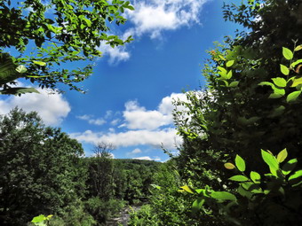
![]()
![]()
![]()
![]()
![]() On Monday, July 1st, I wanted to get in a hike for the first day of July. I was the only EMT around to answer calls but I though I could get out for an hour more or less. I decided to go to the Parksville Rail Trail and hike from Fox Mountain Road to Parksville and back. The temperature was only 65 degrees with a slight breeze blowing and low humidity. This made it much more comfortable for hiking than the previous weeks. The Parksville Rail Trail is under three miles out and back but carrying a pack and keeping a quick pace helps increase the difficulty. As I was getting dressed, Sheila stayed glued to the floor of my study. I got dressed in my Mammut long-sleeved top with a short-sleeved baselayer. I put on a pair of RailRiders hiking pants which are expensive but last a long time and have features like deep pockets and a generous cut which I really like. I decided to put on my Keen Durand hiking boots which fit well. I added a new pair of Xstance insoles in an effort to find the best support and cushioning for my feet. These insoles have shock absorbing gel pads, TPU arch support, and memory foam cushioning all wrapped in a breathable fabric. The insoles have been hyped by their manufacturer and seemed to be living up to their claims. I grabbed a pair of Leki MicroVario poles I have been using for some time because they are light and lock without slipping. I put my gear in the back of the car and Sheila in the back seat. We left Livingston Manor at 10:45 AM and drove out Old Route 17 toward Parksville. Just after Fox Mountain Road, I pulled into the parking area on the right side of the road. There were one car parked in the lot when we arrived. I left my phone in the car so that I could enjoy the hike. We started out on the trail at 11:00 AM under beautiful blue skies with towering puffy white clouds.
On Monday, July 1st, I wanted to get in a hike for the first day of July. I was the only EMT around to answer calls but I though I could get out for an hour more or less. I decided to go to the Parksville Rail Trail and hike from Fox Mountain Road to Parksville and back. The temperature was only 65 degrees with a slight breeze blowing and low humidity. This made it much more comfortable for hiking than the previous weeks. The Parksville Rail Trail is under three miles out and back but carrying a pack and keeping a quick pace helps increase the difficulty. As I was getting dressed, Sheila stayed glued to the floor of my study. I got dressed in my Mammut long-sleeved top with a short-sleeved baselayer. I put on a pair of RailRiders hiking pants which are expensive but last a long time and have features like deep pockets and a generous cut which I really like. I decided to put on my Keen Durand hiking boots which fit well. I added a new pair of Xstance insoles in an effort to find the best support and cushioning for my feet. These insoles have shock absorbing gel pads, TPU arch support, and memory foam cushioning all wrapped in a breathable fabric. The insoles have been hyped by their manufacturer and seemed to be living up to their claims. I grabbed a pair of Leki MicroVario poles I have been using for some time because they are light and lock without slipping. I put my gear in the back of the car and Sheila in the back seat. We left Livingston Manor at 10:45 AM and drove out Old Route 17 toward Parksville. Just after Fox Mountain Road, I pulled into the parking area on the right side of the road. There were one car parked in the lot when we arrived. I left my phone in the car so that I could enjoy the hike. We started out on the trail at 11:00 AM under beautiful blue skies with towering puffy white clouds.
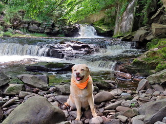 The first part of the trail was damp from the recent rains but was drying in the sun and a breeze. Once we were on the trail and sheltered by the trees it was a little cooler and the trail was about as I expected with a few wet spots and some mud. The rail trail runs parallel to the Little Beaverkill and the new section of State Route 17. It follows the route of the O&W railroad and is very flat. Almost immediately I could see a women coming toward us with here dog on a leash. I put Sheila on her leash and we passed by each other with a "Hello". I let Sheila off her leash and we continued to hike at a quick pace. The water level in the stream was higher than it had been on our last trip. We passed several benches placed for people to rest in warmer weather. The trail had a few small branches and a couple of larger ones which I cleared with my sticks. I wondered if we would run into any larger branches or tress down across the trail. Storms on Sunday had been damaging in many places in the county. I stopped at the area just before the wooden walkways and bridge and decided to take some shots of the stream and the clouds in the sky. The clouds in the sky were moving from east to west so the sky was constantly changing. The walkways that had been raked and swept were starting to show some layers of mud. We walked passed several trees that had been cut and cleared. We came to the mudslide that had brought several trees down across the trail. All of these trees had been cut with a chainsaw and removed. I looked up and saw a croup of people headed our way so I put Sheila on her leash again. There were at least eight people including some children who looked like they were out for a family hiked. We treated each other as we passed in opposite directions. I again let Sheila off her leash to continue the hike. Just after this area was another tree that a crew had cut and cleared. We continued on the trail heading toward the falls. As we walked, we could hear an increase in the noise from the stream and I knew the falls were just ahead. We got to the falls at 11L20 AM and Sheila started down the path to the streambed and I followed. The volume of water was higher than on previous hikes and the way the water was flowing created an interesting effect. At the bottom I removed my pack and got out my camera. I took some pictures downstream and then turned my attention to the falls. I decided to take pictures at different angles and different zooms. I shifted position to take more shots upstream. I used different zooms to get shots from different zooms and angles. I took shots encompassing the entire scene and then several close-ups of the main falls and the rapids below it. I like the noise of the falls and the volume of water which exude power but also bring me peace. Sheila got her feet wet in the stream and then posed for some pictures. When I was finished, I packed up and walked back up the path to the trail to the picnic table. I took some pictures of the falls from above and some upstream of the falls and rapids. We continued on the trail toward Parksville.
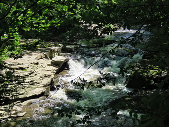 The weather was cool but the clothes I had worn were the best I could have worn. Soon we were nearing the Parksville end of the trail passing some rundown and dilapidated buildings which should be removed. Several of the buildings showed that work was being done on them. We arrived at the Parksville end of the trail at 11:35 AM where we found the small garden and a very informative sign. The pack of barking dogs that always greets us was absemt. The sign listed the businesses and hotels that existed in Parksville during its heyday. The Young's Gap Hotel had room for 600 guests! The sign also explained the role of the railroad in the dairy industry which was a thriving one in all of Sullivan County. We turned around immediately at 11:35 AM and began the walk back on the trail. I knew the trip back would be quicker as I would not be stopping for pictures. We passed the falls and kept up our fast pace. Just before the wooden walkways, I looked up to see two women coming toward us with three dogs. I put Sheila on her leash but the ladies and the dogs stepped off the trail to the right. Sheila and I walked by and the three dogs began to bark. Sheila looked at them and just walked on by. We crossed the bridge and the walkways and met the family group we had passed on the way out. When we broke out of the trees into the sun, we could feel the warmth of the sun even though there was still a breeze. We arrived back at the car at 12:00 PM after hiking 2.8 miles in exactly 1 hour! This tied a personal best for the walk with photography. I checked my phone and there had been no ambulance calls while we were on the trail! I had really enjoyed the hike!
![]()
![]()
![]()
![]()
![]() On Wednesday, June 26th, I planned to go for a hike with my grandson Bryce whoSe school has ended for the year. In addition, Lisa was anxious to get out on a longer hike. Wednesdays are good days to hike as I have a crew covering ambulance calls. Unfortunately, we had two overnight calls at the same time! By the time I got home it was 3:00 AM. I was scheduled to brief two EMTs on the new changes in our documentation system at 8:00 AM so I did not get much sleep. I wasn't sure if I wanted to hike but by the time I was done at the ambulance building I was feeling pretty good. When I returned home, Bryce was waiting for me. I texted Lisa and started to get ready to hike. I thought we would go to the Frick Pond area and hike up the Flynn Trail. Once on the Flynn Trail there were several choices we could make for our route. As I got my gear together at 9:00 AM, Sheila seemed to be in complete agreement with my decision as she followed me around as I was dressing. The temperature was in the high 60's and it felt at least that warm because of the bright sun. I put on a long-sleeved White Sierra crew top and a short-sleeved baselayer. I put on a pair of RailRiders hiking pants which are expensive but last a long time and have features like deep pockets and a generous cut which I really like. The pants have Velcro closures at the ankles. I decided to put on my Keen Durand hiking boots which I ordered a half size larger than the previous pair. These shoes fit well out of the box but get much tighter when I add a decent insole. Without the third party insole, by feet hurt from the lack of support. I added a new pair of Xstance insoles in an effort to find the best support and cushioning for my feet. These insoles have shock absorbing gel pads, TPU arch support, and memory foam cushioning all wrapped in a breathable fabric. The insoles have been hyped by their manufacturer and they really do seem to deliver. I also added a new OR floppy hat which shields me from the sun and rain. I put on my OR Bugout gaiters to repel the ticks which have been plentiful so far this season. Lisa arrived just before 9:30 AM. I put our gear in the car and Bryce and Sheila in the backseat. Lisa sat up front with me as I drove out DeBruce Road at 9:30 AM. After 6 miles I turned left on Mongaup Road. Where the road splits, I stayed left on Beech Mountain Road and continued to the parking areas at the end of the road. There were no cars in the lots so I parked in the smaller lot at 9:45 AM. I promptly set my GPS unit to get ready for the hike.
On Wednesday, June 26th, I planned to go for a hike with my grandson Bryce whoSe school has ended for the year. In addition, Lisa was anxious to get out on a longer hike. Wednesdays are good days to hike as I have a crew covering ambulance calls. Unfortunately, we had two overnight calls at the same time! By the time I got home it was 3:00 AM. I was scheduled to brief two EMTs on the new changes in our documentation system at 8:00 AM so I did not get much sleep. I wasn't sure if I wanted to hike but by the time I was done at the ambulance building I was feeling pretty good. When I returned home, Bryce was waiting for me. I texted Lisa and started to get ready to hike. I thought we would go to the Frick Pond area and hike up the Flynn Trail. Once on the Flynn Trail there were several choices we could make for our route. As I got my gear together at 9:00 AM, Sheila seemed to be in complete agreement with my decision as she followed me around as I was dressing. The temperature was in the high 60's and it felt at least that warm because of the bright sun. I put on a long-sleeved White Sierra crew top and a short-sleeved baselayer. I put on a pair of RailRiders hiking pants which are expensive but last a long time and have features like deep pockets and a generous cut which I really like. The pants have Velcro closures at the ankles. I decided to put on my Keen Durand hiking boots which I ordered a half size larger than the previous pair. These shoes fit well out of the box but get much tighter when I add a decent insole. Without the third party insole, by feet hurt from the lack of support. I added a new pair of Xstance insoles in an effort to find the best support and cushioning for my feet. These insoles have shock absorbing gel pads, TPU arch support, and memory foam cushioning all wrapped in a breathable fabric. The insoles have been hyped by their manufacturer and they really do seem to deliver. I also added a new OR floppy hat which shields me from the sun and rain. I put on my OR Bugout gaiters to repel the ticks which have been plentiful so far this season. Lisa arrived just before 9:30 AM. I put our gear in the car and Bryce and Sheila in the backseat. Lisa sat up front with me as I drove out DeBruce Road at 9:30 AM. After 6 miles I turned left on Mongaup Road. Where the road splits, I stayed left on Beech Mountain Road and continued to the parking areas at the end of the road. There were no cars in the lots so I parked in the smaller lot at 9:45 AM. I promptly set my GPS unit to get ready for the hike.
 The skies were bright and blue with puffy white clouds. We crossed the road and started out on the Flynn Trail which was badly eroded just off the road. We set a good pace through the woods on the trail. At the end of the trail we turned right on what was once Beech Mountain Road and started the long but gentle ascent to the junction with the Big Rock Trail. There was a slight breeze blowing which made us feel a little cooler than the 72 degree temperature. The trail was drier than I expected which made keeping a fast pace easier. We talked about many different subjects as I had not seen Bryce in some time and it was even longer since I had talked to Lisa. I was trying to make the junction as quickly as possible but also wanted to enjoy the hike. As we walked we removed small small branches and a few larger ones. It took us an hour to hike the 1.7 miles to the junction. We considered turning left of the Big Rock Trail but decided we could make Hodge Pond and then turn around and retrace our steps. We did not stop at the trail junction but continued straight ahead toward Hodge Pond. This section of the trail is almost flat and we passed through the gate separating state land from Beaverkill Land Trust property. At the split in the trail, we stayed to the left and followed the Flynn Trail down to the shores of the pond. I chose to do this since the walk back up this hill always seems long even though the slope is gradual. When we broke out into the clearing at the outlet end of Hodge Pond I could see that the level of the pond was much lower than during my last visit. As we headed toward the shore of the pond, I looked to the left at the Flynn Trail and saw that the water had receded and was no longer covering the trail. The beavers had dammed up the stream below the outlet and had also jammed the culvert. At the shores of the pond, Bryce put down the pack and I took out my camera to take some pictures of the pond. I took pictures of the green trees around the pond at different zooms. I also took some shots of the clouds over the pond. Sheila walked to the edge of the water and then walked in up to et cool. After taking some more pictures of her and the pond, I packed up and we turned around to follow the Flynn Trail back the way we had come. We stopped briefly at the outlet end so that I could inspect the situation. The beavers had built two dams below the culvert that conducted the water under the Flynn Trail. The dams had some rocks along the top and I wondered whether this was the work of beavers or people! Lisa had started the hike up the hill without us. I thought Bryce and I were setting a pretty fast pace but Lisa was nowhere in sight. The hike up the hill seemed easy and short. I attributed this to the discussion I was having with Bryce and the fact that I have been hiking more. At the top of the hill we still could not see Lisa and I was not sure which trail she had taken. We stayed to the right to follow the Flynn Trail back to the junction with the Big Rock Trail. As we passed the gate on the trail, we caught a glimpse of Lisa ahead of us.
 Lisa was waiting at the junction with the Big Rock Trail but began walking as soon as we saw each other. At the junction, we turned right and started down the Big Rock Trail toward Times Square. The downhill walk went quickly although I still am fooled by the three different descents all of which look like the last! Bryce and I moved some branches off the trail in various places as we hiked. We continued on the trail which was dry making walking easy. When we arrived at Times Square, we continued straight across on the Big Rock Trail even though we still had no idea where Lisa was. I was surprised that the area was much drier than my previous trip. The trail around the back of the pond was only slightly damp in spots. As we approached the two bridges over the inlet streams, we caught sight of Lisa kneeling on the first bridge. We stopped and I got out the camera to take some pictures of the wetlands at the north end of Frick Pond. Lisa pointed out some fish in the water before we started out on the trail again. All three of us walked together through the spruce trees to the walkways. As we crossed the wooden walkways, we noticed that many of the boards were loose and that entire sections seemed to be floating in the air. I hope that the DEC has a plan to address this situation but I am not aware that they do. We walked out from under the trees and had to skirt the only mud pit we found on the hike. At the end of the Big Rock Trail, we turned left on the Quick Lake Trail to continue on to the bridge over the outlet stream from Frick Pond. The trail continued to be dry. At the bridge, we stopped and I took off out my camera to take a few more pictures. I have many pictures from this spot but can never resist taking a few shots. I find this one of the most beautiful places in the Catskills. When I was finished taking pictures, I packed up and we continued on the Quick Lake Trail through Gravestone Junction. This area was overgrown with tall grasses and brush and I though about scheduling a trip to do the work. The woods road back to the car was only damp in a few spots. We set a quick pace back to the parking area. We arrived back at the car at 12:40 PM after hiking 5.6 miles in 2 hours and 45 minutes with only 13 minutes of stopped time. The elevation gain was 880 feet.
![]()
![]()
![]()
![]() On Thursday, June 20th I planned to get out for a Summer solstice hike. Unfortunately, I could not find an EMT to cover ambulance calls so I had to stick around town. An early morning ambulance call had me up earlier than I expected. When I got back from the call, I contacted by son Karl to see if he could bring grandson Bryce to Livingston Manor. He agreed and I decided to ask Bryce if he wanted to go for a hike on Round Top. Bryce arrived around 10:00 AM and I asked him if he wanted to hike. He readily agreed and I started to get ready to hike. The temperature at 8:00 AM was 68 degrees but that had wisent to 9 degrees. As I began to get ready, Sheila was keeping a careful eye on me as I dressed as she would hike every day. Sheila often examines and sniffs my clothing to make sure I am serious about hiking. I got dressed in my White Sierra light crew top with no baselayer. I wore my Railriders hiking pants which are expensive but last along time and have features like deep pockets and a generous cut which I really like. The pants have Velcro closures at the ankles. I decided to put on my Keen Durand hiking boots which I ordered a half size larger than the previous pair. These shoes fit well out of the box but get much tighter when I add a decent insole. Without the third party insole, by feet hurt from the lack of support. I added a new pair of Xstance insoles in an effort to find the best support and cushioning for my feet. These insoles have shock absorbing gel pads, TPU arch support, and memory foam cushioning all wrapped in a breathable fabric. The insoles have been hyped by their manufacturer and they really do seem to deliver. I decided to take my Leki MicroVario poles with external locks as the internal twist locks fail. I did not put on gaiters as I knew the trails would be almost dry. I took my cell phone with me because even though I planned to hike quickly, I was pretty sure I was the only EMT around to respond. At 10:30 PM we walked out the door to start the hike. Bryce put Sheila's leash on her and we walked up the driveway. I aimed to hike for a little over an hour and complete two figure 8's. Sheila was happy to get out evne though she was panting almost immediately. We headed down the driveway and across the street. We crossed the street and walked to the parking lot next to the Presbyterian Church. We walked to the back of the church and began the ascent of the steepest hill behind the church. The hill is short but gets the circulation pumping and is the steepest and longest climb on the "trail." We did stop not on the way to the top of the hill. I could really feel that I had been hiking more consistently. I also realized that Bryce could have run up and down the hill several times while I was walking! At the top we paused for a minute so we could look around at the hills that surround the hamlet of Livingston Manor. The skies were a mixture of clouds and sun. Everything was really green caused by the recent rains and the sunshine on other days. Standing in the sun at the top of the hill made me believe the temperature really was 92 degrees! We continued the hike by turning left at the trailhead. The trail was covered in leaves and completely dry. The temperature under the trees seemed 5 degrees cooler than in the sun.
On Thursday, June 20th I planned to get out for a Summer solstice hike. Unfortunately, I could not find an EMT to cover ambulance calls so I had to stick around town. An early morning ambulance call had me up earlier than I expected. When I got back from the call, I contacted by son Karl to see if he could bring grandson Bryce to Livingston Manor. He agreed and I decided to ask Bryce if he wanted to go for a hike on Round Top. Bryce arrived around 10:00 AM and I asked him if he wanted to hike. He readily agreed and I started to get ready to hike. The temperature at 8:00 AM was 68 degrees but that had wisent to 9 degrees. As I began to get ready, Sheila was keeping a careful eye on me as I dressed as she would hike every day. Sheila often examines and sniffs my clothing to make sure I am serious about hiking. I got dressed in my White Sierra light crew top with no baselayer. I wore my Railriders hiking pants which are expensive but last along time and have features like deep pockets and a generous cut which I really like. The pants have Velcro closures at the ankles. I decided to put on my Keen Durand hiking boots which I ordered a half size larger than the previous pair. These shoes fit well out of the box but get much tighter when I add a decent insole. Without the third party insole, by feet hurt from the lack of support. I added a new pair of Xstance insoles in an effort to find the best support and cushioning for my feet. These insoles have shock absorbing gel pads, TPU arch support, and memory foam cushioning all wrapped in a breathable fabric. The insoles have been hyped by their manufacturer and they really do seem to deliver. I decided to take my Leki MicroVario poles with external locks as the internal twist locks fail. I did not put on gaiters as I knew the trails would be almost dry. I took my cell phone with me because even though I planned to hike quickly, I was pretty sure I was the only EMT around to respond. At 10:30 PM we walked out the door to start the hike. Bryce put Sheila's leash on her and we walked up the driveway. I aimed to hike for a little over an hour and complete two figure 8's. Sheila was happy to get out evne though she was panting almost immediately. We headed down the driveway and across the street. We crossed the street and walked to the parking lot next to the Presbyterian Church. We walked to the back of the church and began the ascent of the steepest hill behind the church. The hill is short but gets the circulation pumping and is the steepest and longest climb on the "trail." We did stop not on the way to the top of the hill. I could really feel that I had been hiking more consistently. I also realized that Bryce could have run up and down the hill several times while I was walking! At the top we paused for a minute so we could look around at the hills that surround the hamlet of Livingston Manor. The skies were a mixture of clouds and sun. Everything was really green caused by the recent rains and the sunshine on other days. Standing in the sun at the top of the hill made me believe the temperature really was 92 degrees! We continued the hike by turning left at the trailhead. The trail was covered in leaves and completely dry. The temperature under the trees seemed 5 degrees cooler than in the sun.
At the first trail junction, Sheila turned right and started up the woods road which has the gentler approach of the two. There were a number of small branches on the trail from the winds that had passed through the area. I removed these branches by dragging them off the trail. It was a pleasure to walk on the trails and it was obvious more people were using them. Ferns and grasses were growing like crazy and some bushes were growing a little into the trail. I liked the experience of walking the narrow track. ryce moved one larger branch that was encroaching on the trail. We had started talking about running and school and several other topics. Bryce is 13 years old but talking to him is like talking to an adult. He has become very focused on his running and the work has paid off. At the end of the woods road, we turned left up the hill on the trail. I could see that the frame and tarps that covered the mouth of one of the "caves" were gone. It looked like someone had cleaned up the area. We continued up the trail to the first trail junction with the upper blue trail where we turned left to follow the yellow trail along the base of Round Top. We continued on the yellow trail along the base of Round Top. We came to the next junction with the blue trail and turned right to head up the blue trail toward the summit. When we got to the switchback, we turned right and followed it until it came back to the main blue trail. The fact that the switchback sidehills in places made the walk a little more difficult. We turned right and then continued straight ahead and up the hill toward the summit of Round Top bypassing the white crossover trail. As we passed over the summit, I noticed that the trail showed much less wear and I assumed fewer people were taking the time to walk this trail. We continued over the summit and down the blue trail toward the junction with the yellow trail. We bypassed the white crossover trail again and continued down to the yellow trail. At the junction with the yellow trail we turned right and walked the yellow trail along the base of Round Top toward the next junction with the blue trail. At the next junction, we turned left and started slightly downhill toward the lookout over town. We passed the "sitting rock" and continued downhill. Everything was very green especially the ferns which had sprung up even more since my last visit. Bryce and I continued to talk which made the hiking GP quickly.
When we reached the lookout, we followed the yellow trail as it turned left and walked down the hill to the first trail junction. This trail was very dry and the leaves made it slippery. We immediately turned around and started back up the trail. I could feel that I was more in shape and I did not have to stop to get up the hill. We ignored the trail to the lower lookout and followed the yellow trail. We followed the yellow trail as it turned right and headed uphill toward the junction with the blue trail. We hiked up a short but steep little hill and arrived at the trail junction. We turned right to follow the trail along the base of Round Top until we arrived at the next junction with the blue trail. We turned left to start the walk up the blue trail toward the summit. I was going to simply continue over the summit but Sheila had other ideas. Sheila turned left on the white crossover trail as if she wanted to make sure I inspected it. We continued to walk along the white trail until it met the main blue trail on the other side of the hill. There were no blowdowns blocking the trail. We turned left and left again on the switchback in the blue trail. We followed the switchback out into the forest and then back to the main trail. We turned left and walked downhill to the yellow trail where a left turn again took us along the base of Round Top. At the junction, Sheila and I turned right and walked down the trail to the woods road. We followed the woods road downhill with the ledges to the right. At the first trail junction, we turned left and walked straight out to the trailhead. We turned right and walked downhill and crossed the parking lot to the road. Bryce put Sheila on her leash as cars do not respect the speed limit on Rock Avenue. We waited to cross the road as several cars went by and then crossed to the driveway to the house. It was 11:35 AM and we had hiked a little over 2 miles in 1 hour and 5 minutes. It was a pleasant hike and there had been no ambulance calls!