
What You Missed
Summer 2014
Summer 2014
![]()
![]()
![]()
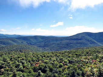
![]() On Saturday, September 20th, I was interested in red-lining a few of the trails I had not hiked in the Catskills. In the morning I hiked the Mink Hollow Trail from Mink Hollow Road to the Devil's Path. The trail was one of the worst I had hiked in the Catskills with an abidance of slippery rocks under foot most of the time. I was a little tired after hiking only 5 miles and the day was still completely overcast with the feeling of rain in the air. I decided to head over to Diamond Notch Road in Lanesville to check the condition of the access road to the parking area. The last time I was there I had decided not to attempt driving passed the end of the road onto the dirt and grass road that leads the .4 miles to the parking area. I finished the Mink Hollow Trail at 12:30 PM and drove back down Mink Hollow Road to Route 212. I followed Route 212 back to Route 28 and traveled west to Phoenicia. In Phoenicia I drove north on Route 214 to Lainsville where I turned left on Diamond Notch Road. The first part of the road was paved and even the gravel section after that was in good shape. Once I reached the end of the road, I made the decision to continue up the grass and dirt track to the parking area. As soon as I got on the road I almost regretted the decision as the road was very uneven with large rocks sticking up. My Lancer has all-wheel drive but not as much clearance beneath as I would like. I drove slowly and we made it to the parking area without too much difficulty. I was glad I had not met anyone along the way as there is no room to pass and there are very few spots to pull over. There was no question in my mid that we would have to hike the trail as I did not intend to drive up it again in the near future. We were on the trail by 1:05 PM under overcast skies. The first part of the trail seemed well-used and was rather well-maintained as it passed along Hollow Tree Brook. There wasn't much water in the brook but several spots showed promise as waterfalls when the water level increases. It wasn't long before we were walking on extremely rough trail with many rocks. At one point Sheila started off to the right and I called her back only to find the trail turned right, crossed a streambed and ascended a set of rock steps. I need to follow her lead more often.
On Saturday, September 20th, I was interested in red-lining a few of the trails I had not hiked in the Catskills. In the morning I hiked the Mink Hollow Trail from Mink Hollow Road to the Devil's Path. The trail was one of the worst I had hiked in the Catskills with an abidance of slippery rocks under foot most of the time. I was a little tired after hiking only 5 miles and the day was still completely overcast with the feeling of rain in the air. I decided to head over to Diamond Notch Road in Lanesville to check the condition of the access road to the parking area. The last time I was there I had decided not to attempt driving passed the end of the road onto the dirt and grass road that leads the .4 miles to the parking area. I finished the Mink Hollow Trail at 12:30 PM and drove back down Mink Hollow Road to Route 212. I followed Route 212 back to Route 28 and traveled west to Phoenicia. In Phoenicia I drove north on Route 214 to Lainsville where I turned left on Diamond Notch Road. The first part of the road was paved and even the gravel section after that was in good shape. Once I reached the end of the road, I made the decision to continue up the grass and dirt track to the parking area. As soon as I got on the road I almost regretted the decision as the road was very uneven with large rocks sticking up. My Lancer has all-wheel drive but not as much clearance beneath as I would like. I drove slowly and we made it to the parking area without too much difficulty. I was glad I had not met anyone along the way as there is no room to pass and there are very few spots to pull over. There was no question in my mid that we would have to hike the trail as I did not intend to drive up it again in the near future. We were on the trail by 1:05 PM under overcast skies. The first part of the trail seemed well-used and was rather well-maintained as it passed along Hollow Tree Brook. There wasn't much water in the brook but several spots showed promise as waterfalls when the water level increases. It wasn't long before we were walking on extremely rough trail with many rocks. At one point Sheila started off to the right and I called her back only to find the trail turned right, crossed a streambed and ascended a set of rock steps. I need to follow her lead more often.
 The trail gained 1000 feet in elevation over 1.4 miles to Diamond Notch. At this point there was an open spot that gave limited views down the notch to the south. As we walked a little farther on the trail, it leveled out some and passed between the Westkill Ridge on the left and another on the right. There was a deep gorge on the left of the trail and the area reminded me of Dutcher's Notch in the Blackhead Range. We began to descend over very rocky trail heading toward Diamond Notch Falls. We passed the Diamond Notch lean-to on the right side of the trail. Within only .5 miles I could see the bridge and hear some people at the falls. We walked across the bridge and I could see others working their way down to the base of the falls. There was almost no water in the creek but I knew I would have to take a few shots from the base of the falls. I tied Sheila to a tree, took out my camera and started down the bank. Once in the streambed I took a few pictures of the trickle of water going over the falls. I spoke briefly to the other people before returning to my pack and Sheila. I noticed a young man and woman walking over the bridge toward Westkill. They stopped and were looking over some maps. I put Sheila on her leash and walked over to them to ask if they needed some help. They were confused about which trail led to Geiger Point on the way to the Devil's Acre lean-to. I gave them directions and also suggested that the Buck Ridge lookout on Westkill was the best one around. I also told them to take the time to visit the Hunter fire tower. Sheila and I headed back up the trail toward Diamond Notch. Going up the rocky trail seemed easier than coming down and I was not looking forward to the final 1.4 miles of rocky descent. Once over the top we set a good pace on the descent and the rocks didn't seem to be as bad as I thought. As we walked down the trail we did meet a solo hiker headed toward Plateau and a group of three that though the might try Sugarloaf. I did not ask them why they chose this approach since the trails from the other side seem easier. We were back at the car by 3:05 PM having covered 4 miles in two hours with several stops along the way. The vertical gain was 1340 feet. The drive out seemed easier than the drive in and we were soon on our way home.
![]()
![]()
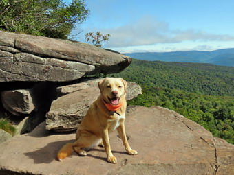
![]() On Saturday, September 20th, I was interested in red-lining a few of the trails I had not hiked in the Catskills. I had planned to get a very early start but an ambulance call in the middle of the night meant I slept a little later in the morning. The forecast was for most cloudy skies but there was a complete overcast when I woke up. We left Livingston Manor at about 8:45 AM and headed out the DeBruce Road to catch Route 47 to Route 28 in Big Indian. I took Route 28 to Route 212 in Mount Tremper and followed it all the way to Lake Hill. In Lake Hill I turned left on Mink Hollow Road and drove to the parking area at t5he end. I was wondering if the road would be passable all the way until I realized I had been here before when I climbed Oldebark. The road is paved to the parking area. There was one car parked as we started out on the trail at about 10:10 AM. The skies were still completely overcast with a heavy haze and the feel of rain in the air. We walked up the road until the trail veered to the right and we followed the blazes. The trail was pretty rocky and we had to cross over several streambeds. The streambeds were largely dry with only one requiring stepping from stone to stone. At about .5 miles the trail seemed to become wider and was clear of rocks giving me hope that this would continue. My hope was soon dashed as we were again walking along the bank of the stream where the trail had been eroded to only a narrow track. After this, we were again on very rocky ground following the dark blue blazes on an overcast day. The blazes were few and far between in some spots and at one point the trail seemed to split and there was a blaze on tree that sat right in the middle without indicating a turn. A quick look showed the way but searching for blazes on marked trail is...unexpected.
On Saturday, September 20th, I was interested in red-lining a few of the trails I had not hiked in the Catskills. I had planned to get a very early start but an ambulance call in the middle of the night meant I slept a little later in the morning. The forecast was for most cloudy skies but there was a complete overcast when I woke up. We left Livingston Manor at about 8:45 AM and headed out the DeBruce Road to catch Route 47 to Route 28 in Big Indian. I took Route 28 to Route 212 in Mount Tremper and followed it all the way to Lake Hill. In Lake Hill I turned left on Mink Hollow Road and drove to the parking area at t5he end. I was wondering if the road would be passable all the way until I realized I had been here before when I climbed Oldebark. The road is paved to the parking area. There was one car parked as we started out on the trail at about 10:10 AM. The skies were still completely overcast with a heavy haze and the feel of rain in the air. We walked up the road until the trail veered to the right and we followed the blazes. The trail was pretty rocky and we had to cross over several streambeds. The streambeds were largely dry with only one requiring stepping from stone to stone. At about .5 miles the trail seemed to become wider and was clear of rocks giving me hope that this would continue. My hope was soon dashed as we were again walking along the bank of the stream where the trail had been eroded to only a narrow track. After this, we were again on very rocky ground following the dark blue blazes on an overcast day. The blazes were few and far between in some spots and at one point the trail seemed to split and there was a blaze on tree that sat right in the middle without indicating a turn. A quick look showed the way but searching for blazes on marked trail is...unexpected.
We continued along the trail which began to climb more steeply but was still very rocky. The rocks had quite a bit of moss and were slightly damp which made getting a good footing important. I had not looked at the topographic maps or profile before the hike and did not realize that the hike would be 2.3 miles of ascent. Over the 2.3 miles we gained 1120 feet until the trail began to level off near the Mink Hollow lean-to. Two young men were at the lean-to where they had spent the night after hiking from Prediger Road on the Devil's path. They were headed out to climb Plateau and Westkill but didn't know whether they would do the rest of the hike in one day or two. I advised not to miss the Hunter fire tower and that hiking down Westkill and over St. Anne's in the dark could be a problem. They told me they had only one car parked at Prediger Road and did not know how they would get back there from Spruceton Road. They offered me some fruit and cereal but I declined and wished them luck. Sheila and I hiked out to the Devil's Path at 2.5 miles. We turned around at 11:20 AM and started back down the trail. The descent was as tricky as the climb since the rocks were still slippery. We met one man with a British accent who was looking for Plateau. He had a short-sleeved shirt and short with sneakers and carried one small water bottle! I gave him directions and we continued on our way. Very shortly we met another group who asked about the distance to the Devil's Path. I told them it was about .5 miles and they thank me. They intended to hike to Sugarloaf and back. I wondered why these hikers had chosen the southern route when the one from the north was so much easier. Sheila and I passed under the only major blowdowns on the trail and continued down to the parking area. We arrived at the car at 12:30 PM having hiked 5 miles in 2 hours and 15 minutes. The vertical gain was 1185 feet. I decided we would head over to Lainsville to check out the access road to the Diamond Notch parking area. The last time I was there I decided not to attempt the final part of the "road" which is only a grassy track with some rocks and deep ruts.
![]()
![]()
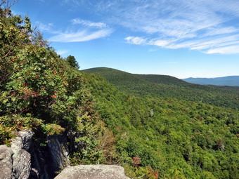
![]() On Friday, September 19th I wanted hike somewhere near home as I had a tennis match in the afternoon. I didn't really want to go to Trout Pond but thought it the best choice because of the number of variations for hikes. I decided that I would hike to the end of Trout Pond and then hike to Campbell Brook Road using Morton Hill Road to return. There was a heavy fog in the morning so I got some things done around the house and then left at about 9:30 AM. I got Sheila and my gear in the car and headed to Roscoe and out Route 206 to Morton Hill Road. After turning left on Morton Hill Road, I drove to the intersection with Russell Brook Road and parked on the side of the road to avoid trespassing on private property. We started down Russell Brook Road at 9:50 AM. I always like to park on Morton Hill Road because the walk down Russell Brook Road to the lower parking area is so enjoyable. The road to the lower parking area is in good shape for the most part and parking at the lower parking area is plentiful. The walk down the road went quickly and as we passed the upper falls I could see there was even less water in the stream than the week before. I decided at that point that visiting the falls was pointless. There was a single car in the lower lot as we turned right onto the trail that goes down to the bridge across Russell Brook. We walked to the trail junction and I decided at that point to take the slightly longer route by hiking toward Mud Pond and the around to the upper end of Trout Pond. We turned left, walked passed the large campsite on the right and headed up the hill. The hill is about .8 miles and gains around 400 feet which is enough to work up a sweat. When we reached the next trail junction, we turned right to head to Trout Pond. The day was warm and the sun was breaking through. I was a little pressed for time and decided the photographic opportunities would have to be exceptional for me to stop to take pictures.
On Friday, September 19th I wanted hike somewhere near home as I had a tennis match in the afternoon. I didn't really want to go to Trout Pond but thought it the best choice because of the number of variations for hikes. I decided that I would hike to the end of Trout Pond and then hike to Campbell Brook Road using Morton Hill Road to return. There was a heavy fog in the morning so I got some things done around the house and then left at about 9:30 AM. I got Sheila and my gear in the car and headed to Roscoe and out Route 206 to Morton Hill Road. After turning left on Morton Hill Road, I drove to the intersection with Russell Brook Road and parked on the side of the road to avoid trespassing on private property. We started down Russell Brook Road at 9:50 AM. I always like to park on Morton Hill Road because the walk down Russell Brook Road to the lower parking area is so enjoyable. The road to the lower parking area is in good shape for the most part and parking at the lower parking area is plentiful. The walk down the road went quickly and as we passed the upper falls I could see there was even less water in the stream than the week before. I decided at that point that visiting the falls was pointless. There was a single car in the lower lot as we turned right onto the trail that goes down to the bridge across Russell Brook. We walked to the trail junction and I decided at that point to take the slightly longer route by hiking toward Mud Pond and the around to the upper end of Trout Pond. We turned left, walked passed the large campsite on the right and headed up the hill. The hill is about .8 miles and gains around 400 feet which is enough to work up a sweat. When we reached the next trail junction, we turned right to head to Trout Pond. The day was warm and the sun was breaking through. I was a little pressed for time and decided the photographic opportunities would have to be exceptional for me to stop to take pictures.
Over the next 1.2 miles the trail gains another 400 feet rising to almost 2500 feet in elevation to the shoulder of Cherry Ridge. From that point he headed downhill for the next .8 miles losing 460 feet in the process until we were at the bridge across the inlet stream to Trout Pond. I could see that the lower lean-to was occupied but the campers were not home. I took a look at the pond from the bridge and saw nothing spectacle to make me want to stop to take pictures. I put Sheila on her leash as we passed the lean-to and turned left to get on the Campbell Brook Trail. The trails so far had been well-maintained with little encroachment by briars or bushes. Over the next .8 miles of trail we gained back 430 feet of elevation and were approaching the junction of the hiking and snowmobile trails. I knew the snowmobile trail intersected Campbell Brook Road and thought about taking it. I did not know how well the snowmobile trail would be cleared but in the end opted to try it for a different experience. The trail began by climbing a little more than the hiking trail but it was well cut out and easy to follow. The trail began to follow the edge of the hill so for the first .3 miles we headed almost due east. This made me a little nervous but I knew we had to hit a road that would take us back to the car. At 4.6 miles we turned north and walked another .3 miles continuing along the edge of the ridge. At 4.9 miles we began to descend heading east and then due north to intersect Campbell Brook Road near the junction with Morton Hill Road. We turned right on Campbell Brook Road and walked about .1 miles to Morton Hill Road. We continued straight ahead to follow the road back to the car. The walk along the road was pleasant and seemed shorter than I remembered. Sheila was well-behaved on her leash and we made good time covering the last 2.3 miles in 40 minutes. We were back at the car by 12:40 PM covering 8.3 miles in 2 hours and 50 minutes. We stopped for less than 5 minutes and had a vertical gain of 1585 feet.
![]()
![]()
![]()
![]() On Thursday, September 18th, I wanted to get in a hike not too far from home but with some elevation gain. I decided that hiking Dry Brook ridge from Hill Road fit the bill so Sheila and I left Livingston Manor at 8:45 AM and headed up the Beaverkill Road. I drove until we reached the Barkaboom Road where I turned left and drove to the intersection with BWS 9. I turned right on BWS 9 and continued to follow it and then BWS 10 to Southside Road just outside Margaretville. I continued on Southside to Huckleberry Brook Road where I turned right. Shortly after the turn I turned left on Hill Road and 1.3 miles to the parking pulloff on the right. The day was cool so I kept on my light windbreaker and even wore a hat. We crossed the road and began our hike just before 9:45 AM. The first part of the hike is a nice wide trail that ascends through a red pine plantation. The ascent continues for about 1.9 miles when the trail levels off after gaining 1130 feet. After passing through the pines we entered a predominantly hardwood forest before passing again through some pines. After that the trail opened up a little and we ran into some briars growing in the sunnier spots. There had been several blowdowns along the way which were not there the last time I hiked then trail. In addition, the brush was beginning to close in on the trail and it looked like there had been very little maintenance done recently. This is a shame because the trail is a popular one. There was nothing that would prevent hiking the trail but having to walk under, over or around the blowdown was annoying. After .9 miles, the trail leveled off and we walked to the junction with the blue Dry Brook Ridge Trail at 2.3 miles. As we turned right on this trail, I noticed the sign that said the Hill Road parking was 1.7 miles away. I had to laugh! I expect distances to vary some but .6 miles is a pretty big gap.
On Thursday, September 18th, I wanted to get in a hike not too far from home but with some elevation gain. I decided that hiking Dry Brook ridge from Hill Road fit the bill so Sheila and I left Livingston Manor at 8:45 AM and headed up the Beaverkill Road. I drove until we reached the Barkaboom Road where I turned left and drove to the intersection with BWS 9. I turned right on BWS 9 and continued to follow it and then BWS 10 to Southside Road just outside Margaretville. I continued on Southside to Huckleberry Brook Road where I turned right. Shortly after the turn I turned left on Hill Road and 1.3 miles to the parking pulloff on the right. The day was cool so I kept on my light windbreaker and even wore a hat. We crossed the road and began our hike just before 9:45 AM. The first part of the hike is a nice wide trail that ascends through a red pine plantation. The ascent continues for about 1.9 miles when the trail levels off after gaining 1130 feet. After passing through the pines we entered a predominantly hardwood forest before passing again through some pines. After that the trail opened up a little and we ran into some briars growing in the sunnier spots. There had been several blowdowns along the way which were not there the last time I hiked then trail. In addition, the brush was beginning to close in on the trail and it looked like there had been very little maintenance done recently. This is a shame because the trail is a popular one. There was nothing that would prevent hiking the trail but having to walk under, over or around the blowdown was annoying. After .9 miles, the trail leveled off and we walked to the junction with the blue Dry Brook Ridge Trail at 2.3 miles. As we turned right on this trail, I noticed the sign that said the Hill Road parking was 1.7 miles away. I had to laugh! I expect distances to vary some but .6 miles is a pretty big gap.
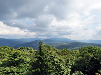
 The trail along the ridge follows the edge until about 2.7 miles where it veers away and heads a little to the east and northeast. Along the way there were a few more blowdowns across the trail. I also saw several areas of bear scat along the trail. It occurred to me that it was probably only one bear that had eaten a few too many berries! We were soon climbing the last of three short ascents to the area of the lookout. We were at the viewpoint around 11:10 AM. By this time I had removed my hat and had thought about taking off my windbreaker. I was glad I kept it on as there was a breeze blowing on the exposed rock face. Despite the had earlier in the morning, the views were excellent as most of the low clouds had cleared out. I took some pictures of the viewpoint and of Sheila. I took some more shots oft he scenery including some zoomed pictures that showed the low water level in the Pepacton Reservoir. After some minutes at the lookout, we turned around and headed back the way we had come. The trip back to the trail junction went quickly and we were soon headed back down the trail to the parking area. The trip down always seems to go quickly as it is all downhill or level. We arrived back at the car at 12:35 PM. We had hiked 6.6 miles in 2 hours and 50 minutes with an elevation gain of 1590 feet. The fact that the trip down was about the same time as the trip up proved that we had set a rapid pace on the ascent.
![]()
![]()
![]() On Monday, September 15th I wanted to get out hiking somewhere after a week filled with tennis practice and matches! I decided to head for Frick and Hodge Ponds as the area is close and lightly hunted. The early bear season had started September 6th and, from what I had heard, there had been a lot of activity. I got Sheila and my gear in the car and drove out the DeBruce Road to Fish Hatchery Road. I made a left and we were at the Frick Pond parking area and ready to hike by 9:05 AM. We walked out the Quick Lake trail to Frick Pond as I intended to hike the big loop in a clockwise direction. As we crossed the bridge across the outlet to Frick Pond I looked at the scene. The leaves on the trees were not a bright green but had not changed to fall colors. The water was very low in the pond and hardly any was overflowing into the outlet stream. I deiced I had many more interesting pictures in my "library" and that this hike would probably be done for the exercise! When we reached the next trail junction, we kept to the left and followed the Quick Lake Trail toward Iron Wheel Junction. The grass was not as wet as I had expected and there were only a few muddy spots on the otherwise dry trail. I began to notice horseshoe marks along the trail and other "evidence" that horses had been on the trail. I had never seen this before and was a little surprised. We reached Iron Wheel Junction at 9:35 after hiking 1.5 miles. Here we turned left to stay on the Quick Lake Trail with our next destination being Junkyard Junction near Hodge Pond. Just after the snowmobile trail turned to the left, we encountered a large tree across the trail and after that another smaller one. The second could probably be cleared with a small saw or axe but the first seemed like it called for a chainsaw. The walk to Junkyard Junction seemed to go quickly and we were that at 10:10 AM about 3.1 miles into the hike. We turned right to pick up the Flynn Trail to Hodge Pond.
On Monday, September 15th I wanted to get out hiking somewhere after a week filled with tennis practice and matches! I decided to head for Frick and Hodge Ponds as the area is close and lightly hunted. The early bear season had started September 6th and, from what I had heard, there had been a lot of activity. I got Sheila and my gear in the car and drove out the DeBruce Road to Fish Hatchery Road. I made a left and we were at the Frick Pond parking area and ready to hike by 9:05 AM. We walked out the Quick Lake trail to Frick Pond as I intended to hike the big loop in a clockwise direction. As we crossed the bridge across the outlet to Frick Pond I looked at the scene. The leaves on the trees were not a bright green but had not changed to fall colors. The water was very low in the pond and hardly any was overflowing into the outlet stream. I deiced I had many more interesting pictures in my "library" and that this hike would probably be done for the exercise! When we reached the next trail junction, we kept to the left and followed the Quick Lake Trail toward Iron Wheel Junction. The grass was not as wet as I had expected and there were only a few muddy spots on the otherwise dry trail. I began to notice horseshoe marks along the trail and other "evidence" that horses had been on the trail. I had never seen this before and was a little surprised. We reached Iron Wheel Junction at 9:35 after hiking 1.5 miles. Here we turned left to stay on the Quick Lake Trail with our next destination being Junkyard Junction near Hodge Pond. Just after the snowmobile trail turned to the left, we encountered a large tree across the trail and after that another smaller one. The second could probably be cleared with a small saw or axe but the first seemed like it called for a chainsaw. The walk to Junkyard Junction seemed to go quickly and we were that at 10:10 AM about 3.1 miles into the hike. We turned right to pick up the Flynn Trail to Hodge Pond.
The Flynn Trail had some muddy spots but they were easily avoided. There were also several more trees across the trail which made me wonder if there had been a significant wind storm in the area. I remembered that I had not been in the area for the whole summer and a few things had changed. When we arrived at the next trail junction near the shore of Hodge Pond I decided to turn left and walk the jeep trail around the pond and down to the outlet. Other plans had been forming in my mind but I decided that this route which is just under 7 miles was a good compromise. We walked down to the outlet end of the pond arriving at 10:35 AM with 4.2 miles behind us. We spent only a few minutes at the pond and then headed up the Flynn Trail toward the junction with the Big Rock Trail. At the junction we continued straight ahead aiming for the parking area at the bottom of the Flynn Trail. We encountered several more blowdowns including one with a well-worn path around it to the right. It seemed this tree must have been there all summer! As we neared the end of the trail Sheila shot ahead of me and I could see a black streak shoot across the trail heading toward Frick Pond. I called Sheila back as I did not want her playing with bears! She came back reluctantly after a couple of calls. I put her on her leash and we walked quickly down the trail as I turned several times to see if the one bear had a friend. We arrived back in the parking area by 11:20 AM having covered 6.7 miles in 2 hours and 15 minutes with an elevation gain Of 950 feet.
![]()
![]()
![]()
![]() On Friday, September 12th, I was ready to hike after a week of tennis and other commitments. I decided it was time to hike a 3500 peak which I had not done in some time. I thought about Slide and Cornell from Route 47 or Slide from Denning but I had limited time and settled on Giant Ledge and Panther where I had not been for some time. The forecast seemed to indicated that we would have some good views and I knew there wouldn't be too many hikers on the trails. We arrived at the parking area on Route 47 at about 9:40 AM and, to my surprise, found several cars already parked. It was a cool morning with an air temperature of about 52 degrees so I kept my light windbreaker on over a long-sleeved shirt. Sheila and I got started pretty quickly by crossing the road and heading out the trail. A few places were damp from the recent rain but the brook was almost dry. I let Sheila off the leash almost immediately after crossing the road and she was behaving by staying on the trail. The New York DEC had decided on an early bear season to control population and I could hear some shots from the hunting club further on down the road from Panther. We kept up a good pace but I forgot how annoying the many rocks that cover the trail to the turnoff can be! Despite The fact that we had been hiking double digit miles, I wondered how I would feel climbing again. I had no problem getting up the scrambles to the turnoff and, in fact, enjoyed the elevation gain all day. We finished the sixth short climb and arrived at the turn to Giant Ledge and Panther at about 10:05 AM. I didn't feel like we were hurrying but it took only 25 minutes to walk the .75 miles from the road.
On Friday, September 12th, I was ready to hike after a week of tennis and other commitments. I decided it was time to hike a 3500 peak which I had not done in some time. I thought about Slide and Cornell from Route 47 or Slide from Denning but I had limited time and settled on Giant Ledge and Panther where I had not been for some time. The forecast seemed to indicated that we would have some good views and I knew there wouldn't be too many hikers on the trails. We arrived at the parking area on Route 47 at about 9:40 AM and, to my surprise, found several cars already parked. It was a cool morning with an air temperature of about 52 degrees so I kept my light windbreaker on over a long-sleeved shirt. Sheila and I got started pretty quickly by crossing the road and heading out the trail. A few places were damp from the recent rain but the brook was almost dry. I let Sheila off the leash almost immediately after crossing the road and she was behaving by staying on the trail. The New York DEC had decided on an early bear season to control population and I could hear some shots from the hunting club further on down the road from Panther. We kept up a good pace but I forgot how annoying the many rocks that cover the trail to the turnoff can be! Despite The fact that we had been hiking double digit miles, I wondered how I would feel climbing again. I had no problem getting up the scrambles to the turnoff and, in fact, enjoyed the elevation gain all day. We finished the sixth short climb and arrived at the turn to Giant Ledge and Panther at about 10:05 AM. I didn't feel like we were hurrying but it took only 25 minutes to walk the .75 miles from the road.
 The trail after the turn was about as dry as the trail up to the turn with only a few damp and muddy spots. When the climb began we continued to push the pace. Just before the last climb to Giant Ledge a large tree had fallen blocking the usual path but other hikers had found a way around it. We climbed up the last rocky ascent and walked to the first lookout arriving at about 10:30 AM after the 1.5 mile climb. There were two people at the viewpoint so I decided to walk to the next as the views are the same from most of the lookouts along the way. We stopped at the next spot and had some great views of the valley below and the mountains beyond. I had thought we would hike right passed these lookouts without taking pictures but I couldn't resist stopping to take some shots. We continued on the main trail, descended to the col and began the climb up Panther. Parts of the Panther trail get a little steep at times but there always seems to be a switchback or flatter area. There were a couple of muddy places but most of the trail was dry. On our way up Sheila began to whine and I could hear the voices of the young hikers who had been at the lookout behind us. Sheila seemed to encouraging me to stay ahead of them and I took the challenge. On our way up one of the steeper climbs Sheila again began to whine and I looked up to see a woman with three dogs on leashes. The dog started to bay and pull at their leashes but seemed friendly enough. We passed quickly with just a brief "Hello". Sheila and I continue up the trail with Sheila checking out some of the paths that lead to limited viewpoints along the way. We were soon up the steeper climbs with only a final, short ascent of Panther to go. We arrived at the summit of Panther at 11:30 AM after hiking 3.2 miles. There was a string a prayer flags at the summit which did not add anything to my enjoyment. I took a few pictures before walking back to the viewpoint just below the summit. As we ascended the rock which acts as the lookout, the hikers behind us arrived and I directed them to the summit. I took a few shots of the scenery and then Sheila and I got back on the trail.
 Sheila was being very good and obeying all my commands even around other people. We headed down the trail stopping several times to explore some of the side paths. Several of these lead to fire rings and open areas without views. One or two paths lead to lookouts which have limited views during the late fall and winter when there are no leaves of the trees. As we started down the last descent to the col, we met the same woman with the three dogs. She was parked at Fox Hollow and had hiked from there over Panther and down to Giant Ledge. She works at a shelter that helps to rescue dogs and was taking some out for a walk. Before we parted I mentioned that Sheila's mother was rescued just before Sheila was born. We continued in opposite directions as Sheila and I descended to the col and then climbed back up to Giant Ledge. I hadn't planned to stop at the first lookout but decide to do so. The views were largely the same as on the way out except for some interesting clouds in the direction of Panther. I took a few shots and then we started the descent from Giant Ledge. On the first descent another hiker was coming up and I told him he had the right-of-way. He responded that he needed to stop to catch his breath so Sheila and I passed him on the way down. We talked for a moment and he complimented Sheila on her good behavior. He was obviously having trouble getting up to Giant ledge and I wondered how he faired getting up and back down. We continued down the trail and were soon at the turn. We headed right to get back to the car on Route 47. I had hoped to pick up the pace on the way back but the trail was so dry that the loose dirt and gravel made this impossible. We were back at the car at 1:30 PM having covered 6.3 miles in 3 hours and 50 minutes including numerous stops. The elevation gain was 2100 feet.
![]()
![]()
![]()
![]() On Sunday, September 7th, I asked Cindy if she wanted to go hiking after church. She agreed and we decided to go to the Trout Pond area as we had not been there in some time. We got Sheila and our gear in the car and left the house just after 1:15 PM and headed to Roscoe. I took Route 206 out the Rockland Flats and turned left on MortonHhill Road just passed the Roscoe Community Nursing Home. I drove up Morton Hill Road to the intersection with Russell Brook Road and parked on the shoulder of the road on the left side. We were walking down Russell Brook Road by 1:40 PM. As we walked down the road we noted that there was very little evidence of the rain from the night before as the road seemed very dry. One car was parked at the camping area on the left but no tents were set up and the occupants were absent as we walked passed the lookout to the upper falls we could see there was very little water in the stream. We had decided to walk down Russell Brook Road to see if we could get to the lower trailhead and then pick up the trail to Mud Pond from there. The road has been devastated by several floods and is closed just passed the main parking area where the state has placed some large boulders. Just passed this roadblock there is the first of several deep cuts across the road caused by the erosion of water running off the ridge on the left. We walked through the first and then another larger cut. Sheila was happily running down to the stream to get wet and then coming back up to the trail to shower us. At about 1.5 miles we came to a spot where the road had been completely eroded by the stream. We tried walking along the bank but it was too steep and slippery. We backtracked a little and climbed the bank, walked around the eroded area and then slid back down to the road. We continued our hike along the road which is very overgrown with weeds and brush and has a few major blowdowns. At 2.0 miles we were able to cross the stream on a few stepping stones since the water level was so low. In another .2 miles we crossed under the power lines and turned right on the trail.
On Sunday, September 7th, I asked Cindy if she wanted to go hiking after church. She agreed and we decided to go to the Trout Pond area as we had not been there in some time. We got Sheila and our gear in the car and left the house just after 1:15 PM and headed to Roscoe. I took Route 206 out the Rockland Flats and turned left on MortonHhill Road just passed the Roscoe Community Nursing Home. I drove up Morton Hill Road to the intersection with Russell Brook Road and parked on the shoulder of the road on the left side. We were walking down Russell Brook Road by 1:40 PM. As we walked down the road we noted that there was very little evidence of the rain from the night before as the road seemed very dry. One car was parked at the camping area on the left but no tents were set up and the occupants were absent as we walked passed the lookout to the upper falls we could see there was very little water in the stream. We had decided to walk down Russell Brook Road to see if we could get to the lower trailhead and then pick up the trail to Mud Pond from there. The road has been devastated by several floods and is closed just passed the main parking area where the state has placed some large boulders. Just passed this roadblock there is the first of several deep cuts across the road caused by the erosion of water running off the ridge on the left. We walked through the first and then another larger cut. Sheila was happily running down to the stream to get wet and then coming back up to the trail to shower us. At about 1.5 miles we came to a spot where the road had been completely eroded by the stream. We tried walking along the bank but it was too steep and slippery. We backtracked a little and climbed the bank, walked around the eroded area and then slid back down to the road. We continued our hike along the road which is very overgrown with weeds and brush and has a few major blowdowns. At 2.0 miles we were able to cross the stream on a few stepping stones since the water level was so low. In another .2 miles we crossed under the power lines and turned right on the trail.
 The trail begins with a short but somewhat steep ascent but then levels off some as it passes by a beaver pond. The trail needs maintenance as the weeds are high and the trail markers very scarce in areas. We stopped at the beaver pond where I took some pictures and noticed the low water level. The trail remained level as it followed the base of a ridge until about 2.9 miles where it began to climb. The ascent went on for .5 miles and gained 375 feet. The trail was parallel to the stream that flows out of Mud Pond. As we neared the top of the hill we could see Mud Pond through the trees and we headed through the woods to the clearing near the outlet. This proved to be a nice place to stop for a drink and a snack. Cindy sat on a rock while I threw a stick into the water for Sheila to retrieve. I took some pictures and then it was time to get back on the trail. At 4.0 miles the hiking trail turned right while a snowmobile trail went off to the left. I was ready to hike around Trout Pond and back but Cindy wanted to hike directly back to the car. We continued on the trail which was now following and old woods road passing the left turn to the trail around Trout Pond at 4.4 miles. We walked up the short hill and then started down the other side. By the time we were at the trail register box we had "lost" the 375 feet of elevation we had gained walking up the hill to Mud Pond. Just passed the register box we stopped and I took some pictures of the Japanese knotweed which gets larger every year. We decided not to go to the falls as there was so little water in the stream. It was a short walk out to the parking area and we were soon hiking back up Russell Brook Road to the car. I did decide to take some pictures of the upper falls from the lookout. The path down is very steep and I took quite a fall on the loose dirt and pine needles. I picked myself up, took some pictures and returned to the road. We were back at the car by 4:35 PM having hiked 6 miles in just under 3 hours with several stops along the way. The elevation gain was 1130 feet.
![]()
![]()
![]()
![]() On Tuesday, September 2nd, I got an early morning email from Lisa Lyons, the owner of Morgan Outdoors in Livingston Manor. Lisa wanted to take a short hike somewhere close to home. I called her and we decided to go to the Red Hill fire tower since it is close and has "destination" at the end. Lisa agreed to meet me at my house at 10:00 AM. When she arrived, we loaded our gear into my car, out Sheila in the back seat and headed out. I drove out the DeBruce Road to the Frost Valley Road. I turned right and drove to the Claryville Road where I turned left. In 2 miles I turned right on Red Hill Road and drove 3.8 miles to Dinch-Coons Road. I turned left on Dinch-Coons Road and drove up the hill on this rough dirt road and then down the other side. As the road enters the forest again just passed Rudolph Road, it gets very rough. I drove a total of 1.2 miles to the trailhead on the left. I parked in the lot an we got ready to hike by applying some insect repellant and adjusting our poles. We were on the trail by 11:00 AM. The trail seemed dry and the first stream crossing had almost no water. For the next .7 miles the trail winds its way up the hill on about a 10% grade. We kept up a pretty fast pace. We both commented that the trail surface requires some attention as there are many roots and rocks waiting to trip the unwary hiker. The final half mile of became much steeper with an average grade of 17% but some areas over 20%. It was a hot and humid day and we were both glad when we reached the summit at 11:40 AM.
On Tuesday, September 2nd, I got an early morning email from Lisa Lyons, the owner of Morgan Outdoors in Livingston Manor. Lisa wanted to take a short hike somewhere close to home. I called her and we decided to go to the Red Hill fire tower since it is close and has "destination" at the end. Lisa agreed to meet me at my house at 10:00 AM. When she arrived, we loaded our gear into my car, out Sheila in the back seat and headed out. I drove out the DeBruce Road to the Frost Valley Road. I turned right and drove to the Claryville Road where I turned left. In 2 miles I turned right on Red Hill Road and drove 3.8 miles to Dinch-Coons Road. I turned left on Dinch-Coons Road and drove up the hill on this rough dirt road and then down the other side. As the road enters the forest again just passed Rudolph Road, it gets very rough. I drove a total of 1.2 miles to the trailhead on the left. I parked in the lot an we got ready to hike by applying some insect repellant and adjusting our poles. We were on the trail by 11:00 AM. The trail seemed dry and the first stream crossing had almost no water. For the next .7 miles the trail winds its way up the hill on about a 10% grade. We kept up a pretty fast pace. We both commented that the trail surface requires some attention as there are many roots and rocks waiting to trip the unwary hiker. The final half mile of became much steeper with an average grade of 17% but some areas over 20%. It was a hot and humid day and we were both glad when we reached the summit at 11:40 AM.
 I dropped my pack and tethered Sheila to a picnic table. Unlike some dogs, Sheila has no problem climbing up and down the open steps and I didn't want her following me to the top. Lisa and I started up the tower with Sheila voicing her disapproval. Since there was no volunteer to man the tower, the cab was closed but the views from the last landing were good. There was a slight breeze which we both appreciated after the hot, humid climb. There were gray clouds in the sky and some haze over the landscape but I took pictures anyway. The conditions were different than I had seen before from the tower and I though the pictures might be interesting. We worked our way back Dow to the ground where I released Sheila and took a few shots of the cabin and the tower. We started back down at 11:55 AM keeping a fast but careful pace down the steepest part of the hill. The dirt was very dry and I had a few slips as I descended. Lisa and I had switched poles for the hike down. I took the MSR Swift 3 poles while Lisa used the Leki Khumbu poles with external locks. We both though that the Leki poles felt sturdier and more stable while the MSR poles were lighter. The locking mechanism on the MSR Swift poles allows some play in the pole sections so they "rattle" which does not engender confidence! We were back at the car by 12:35 PM making the ascent and descent time about the same. We had hiked 2.6 miles in 1 hour and 38 minutes with over 20 minutes of stopped time. The vertical gain was only 840 feet. This was a much shorter hike than I have been doing but it was a nice change since I have been hiking on almost flat trails.
![]()
![]()
![]()
![]()
![]() On Monday, September 1st I had just finished hiking from Ryan Road to Old Stage Road in the northern section of Thacher Park near Albany. I wanted to hike the last section of the East Berne to the northern end of Thacher Park. The section I had left was from the intersection of Stage Road and Route 443 to Beaver Dam Road on the southern edge of Thacher Park. I left the Ryan Road parking area just after 11:15 AM and drove back out Ryan Road to Route 157. I turned right and drove back out to Route 443 where I turned left. I drove 1.9 miles to Stage Road where I turned left and parked on the right hand shoulder well off the pavement. I decided to leave my poles in the car as I would be walking on roads most of the time and would have Sheila on her leash. We left the car at 11:30 AM and walked down Stage Road to Route 443. As we approached the road, I heard voices and assumed someone was walking on the road but soon saw a half dozen cyclist cruise by on a beautiful sunny day. We turned right and walked slightly downhill for .2 miles where we turned right to walk up a driveway toward the trail. The trail here was a grassy lane which was mowed and led us between two fields, passed a house on the left and up to Stage Road at .3 miles. We continued up the road passed a tree with a blaze. I was looking for more blazes that would direct a turn to the left. I wasn't sure where the next blazes might be but soon saw a rather tall runner coming down the hill. I immediately recognized him as the runner I had seen the last time I had hiked in the East Berne area. He recognized me and asked me if I was hiking the Long Path. I said I was and he assured me the blazes were just up the hill. The blazes indicating a turn were at about .6 miles but I could not tell whether they indicated an immediate turn or a one a little farther up the hill. I walked a few hundred feet up the hill and found nothing so I headed back and dropped down the bank on the left side of the road. I began following the hedgerow on the edge of the field and almost immediately picked up an aqua blaze. This was reassuring. I looked to my left and saw a nice view into the Schoharie Valley so I stopped and took few pictures. The day was becoming hotter and more humid and there was still a low haze hanging over much of the landscape.
On Monday, September 1st I had just finished hiking from Ryan Road to Old Stage Road in the northern section of Thacher Park near Albany. I wanted to hike the last section of the East Berne to the northern end of Thacher Park. The section I had left was from the intersection of Stage Road and Route 443 to Beaver Dam Road on the southern edge of Thacher Park. I left the Ryan Road parking area just after 11:15 AM and drove back out Ryan Road to Route 157. I turned right and drove back out to Route 443 where I turned left. I drove 1.9 miles to Stage Road where I turned left and parked on the right hand shoulder well off the pavement. I decided to leave my poles in the car as I would be walking on roads most of the time and would have Sheila on her leash. We left the car at 11:30 AM and walked down Stage Road to Route 443. As we approached the road, I heard voices and assumed someone was walking on the road but soon saw a half dozen cyclist cruise by on a beautiful sunny day. We turned right and walked slightly downhill for .2 miles where we turned right to walk up a driveway toward the trail. The trail here was a grassy lane which was mowed and led us between two fields, passed a house on the left and up to Stage Road at .3 miles. We continued up the road passed a tree with a blaze. I was looking for more blazes that would direct a turn to the left. I wasn't sure where the next blazes might be but soon saw a rather tall runner coming down the hill. I immediately recognized him as the runner I had seen the last time I had hiked in the East Berne area. He recognized me and asked me if I was hiking the Long Path. I said I was and he assured me the blazes were just up the hill. The blazes indicating a turn were at about .6 miles but I could not tell whether they indicated an immediate turn or a one a little farther up the hill. I walked a few hundred feet up the hill and found nothing so I headed back and dropped down the bank on the left side of the road. I began following the hedgerow on the edge of the field and almost immediately picked up an aqua blaze. This was reassuring. I looked to my left and saw a nice view into the Schoharie Valley so I stopped and took few pictures. The day was becoming hotter and more humid and there was still a low haze hanging over much of the landscape.
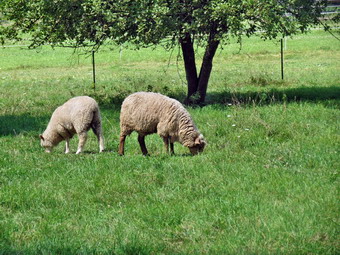 We continued to hike along the edge of the field and came to a break in the hedgerow. It seemed the Long Path continued straight ahead but that meant walking through a field of corn. I decided to walk on the other side of the hedgerow which was a mowed field. I walked to another hedgerow across the field and through an opening to another field. I thought probably the Long Path went to the end of the field and then turned into the trees. I could see some trail markers at the far end of the field so I crossed the field heading toward the markers. I stepped into the woods and found an aqua blaze on a tree. I followed the blazes through a wet and weedy area to a trail that led out to Sawmill Road at 1.3 miles. I put Sheila on her leash as I knew the rest of the hike was on the roads. We turned left on Sawmill Road and walked a short distance to Long Road where we turned right at 1.6 miles. The walk along Long Road was a little over a mile to the intersection with Elm Drive at 2.65 miles. We stopped at the intersection so that I could take a few more pictures of the blue sky with puffy white clouds. We turned left on Elm Drive and hiked the .75 miles to Bush Drive. These roads had a few hills along the way but they were so gentle it was if they weren't there. Just before the intersection with Beaver Dam Road, we stopped next to a field with some sheep. I took a few pictures before we continued out to Beaver Dam Road where we turned right. It was only .3 miles to the parking area on the left side of the road. We reached the parking area at 12:50 PM about 3.8 miles into the hike. We turned around and headed back the way we came. The day was even hotter now and every time we came to an area where trees blocked the sun it was more noticeable. I gave Sheila a drink and found a spot where she could get down to a small stream. A quick romp through the water seemed to have a very positive effect on her as she game bounding back up the bank! By 1:35 PM we had walked 6.4 miles are were back at the point where the trail turned off Sawmill Road into the woods. I decided to continue on the road and we walked a half mile out to Stage Road. We turned right and stayed on Stage Road all the way back to the car. We arrived back at the car at 1:55 PM after hiking 7.3 miles in 2 hours and 25 minutes with an elevation gain of 640 feet. This made a total of 12.8 miles in 4.5 hours for the day.
![]()
![]()
![]()
![]()
![]() On Monday, September 1st I wanted to go back to Albany County to hike part of the Long Path section from East Berne to the northern end of Thacher Park. My plan was to park on Ryan Road near the northern boundary of the park and hike to the northern boundary and the end of the Long Path "end to end" at Old Stage Road. This would give me only a section from Stage Road to Beaver Dam Road to complete this "last" section. Of course, I still have many miles to go from Fort Lee to the Catskills! I had taken two days off from hiking over the weekend for a family gathering on Saturday and because I was preaching at two churches on Sunday . This also gave my blood blister on my right heel some time to heal. The weather forecast had been switching back and forth between possible showers and clearing. By Monday morning the showers had been pushed back to late afternoon although there was a 20% chance or rain all morning. I decided to get an early start but delayed a little since there was also a call for heavy fog. We left Livingston Manor just after 8:30 AM and headed up the Beaverkill Road to the Barkaboom Road. At the end of the road I turned right on BWS 10 and took it to Route 28 in Margaretville. We turned right and then left to follow Route 30 through Margaretville, Roxbury, Grand Gorge and North Blenheim. In Middleburgh I turned right to head east on Route 145 to Cotton Hill Road just outside of town. I turned left on Cotton Hill Road and drove 8.3 miles to Route 443, the Helderburg Trail. I turned left on Cotton Hill Road and drove 8.3 miles to Route 443, the Helderburg Trail. I made a right and drove about 6 miles to East Berne and made a left onto Route 157A. At 2.5 miles I continued straight ahead on Route 157 where Beaver Dam Road turns right. I drove about 1.25 miles to Ketcham Road on the left. After turning left on Ketcham I made a quick right on Ryan Road and followed the paved and then gravel road .8 miles to a small parking area at the end. We were ready to hike at 9:05 AM under remarkably sunny skies.
On Monday, September 1st I wanted to go back to Albany County to hike part of the Long Path section from East Berne to the northern end of Thacher Park. My plan was to park on Ryan Road near the northern boundary of the park and hike to the northern boundary and the end of the Long Path "end to end" at Old Stage Road. This would give me only a section from Stage Road to Beaver Dam Road to complete this "last" section. Of course, I still have many miles to go from Fort Lee to the Catskills! I had taken two days off from hiking over the weekend for a family gathering on Saturday and because I was preaching at two churches on Sunday . This also gave my blood blister on my right heel some time to heal. The weather forecast had been switching back and forth between possible showers and clearing. By Monday morning the showers had been pushed back to late afternoon although there was a 20% chance or rain all morning. I decided to get an early start but delayed a little since there was also a call for heavy fog. We left Livingston Manor just after 8:30 AM and headed up the Beaverkill Road to the Barkaboom Road. At the end of the road I turned right on BWS 10 and took it to Route 28 in Margaretville. We turned right and then left to follow Route 30 through Margaretville, Roxbury, Grand Gorge and North Blenheim. In Middleburgh I turned right to head east on Route 145 to Cotton Hill Road just outside of town. I turned left on Cotton Hill Road and drove 8.3 miles to Route 443, the Helderburg Trail. I turned left on Cotton Hill Road and drove 8.3 miles to Route 443, the Helderburg Trail. I made a right and drove about 6 miles to East Berne and made a left onto Route 157A. At 2.5 miles I continued straight ahead on Route 157 where Beaver Dam Road turns right. I drove about 1.25 miles to Ketcham Road on the left. After turning left on Ketcham I made a quick right on Ryan Road and followed the paved and then gravel road .8 miles to a small parking area at the end. We were ready to hike at 9:05 AM under remarkably sunny skies.
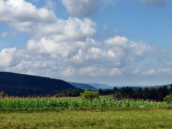
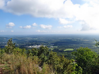
 There were two yellow trails out of the parking lot but I knew that we needed to head east toward the junction with the Long Path. The trail began by passing through a hardwood forest but then opened up until it was a grassy lane bordered by bushes. It seemed that there had been some rain from the storms the day before and also a heavy dew. I was concerned that my Keen boots wood eventually succumb to the drenching but my feet stayed dry. We headed east and descended a little for the first .25 miles and then made a 90 degree left turn before ascending slightly to the Long Path at .35 miles. The trail continued north along the escarpment for the next .6 miles ascending slightly. At about 1 mile we made a short but steep descent to a road used by hang gliding enthusiasts. Eventually we turned right off the road and crossed one of the many stone walls that crisscross the area. The roads were muddy and very slick in spots. When we had hiked to Ryan Road the last time, we had seen fissures in the woods and across the trail. There were even more of these on the trail and in the woods on this hike and they were both wider and deeper. We continued along the escarpment ascending slightly until the trail made a sharp left at 2.2 miles. A trail to the right led to the High Point lookout. We walked over to the viewpoint and it was truly spectacular despite the fog and haze. I dropped my pack and started to walk along the edge taking pictures as I went. Sheila and I had to be careful as the path was right on the edge of the rock which was slippery. There were also cracks in the rock that made negotiating this area tricky. I could see Albany through the haze and various mountain peaks to the north and east which I assumed were Mount Greylock and Vermont's Green Mountains. I picked up my pack and we walked back to the main trail to continue our hike.
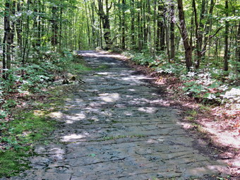
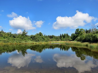 After the viewpoint, we walked through mostly hardwoods on a mix of trail and woods road. Along the way we met a mountain biker coming toward us and Sheila was well-behaved for which I was thankful. Shortly after that we encountered two young women and their dog and again Sheila was well-mannered. We continued to walk west all the while descending slightly. The trail started to follow the edge of some fields and at one point we had to cross one. The crossing was easy as the trail was well used. Eventually we turned left on a woods road and walked west toward Old Stage Road. Near the parking area we met another dog and his owner. At 3.4 miles we were at the end of the official Long Path and ready to head back. I had looked at the possibility of returning on the roads but that didn't seem possible. As we turned around I saw a sign indicating that the yellow perimeter trail would take us back to the Ryan Road parking area in just over 2 miles. I knew that I wanted to get in another 7 mile hike and that rain could be on the way so I decided to try this trail. We turned right and followed the trail along the edge of a field and then into the woods. The trail began an ascent to the highest point of the day and then, at 4.1 miles, we crossed Carrick Road at a parking area. The trail now began to follow a gravel woods road. Eventually the gravel ended and we were walking on bedrock. The bedrock was almost perfectly level and smooth. I had done this before in Minnewaska and other place but this bedrock went on for about half a mile! According to the GPS this was still considered Carrick Road. At some point we came to the hang glider road on the left. At this intersection we met a young woman who was waiting for her boyfriend who was "wheeling" some of the trails for races later in the month. She began to walk with us and we talked as we walked. She lives in Altmont but is very familiar with the Catskills and other hiking locations to the south. She is an active member of her local running club and helps organize races. We were walking along a grassy woods road and at 5.2 miles came to a pond. She turned around at this point and I took some pictures of the pond before moving on. The trail became more of a woods road and at 11:15 AM we were back at the car. We had hiked 5.5 miles in 2 hours and 5 minutes with an elevation gain of 480 feet. I was feeing great although the temperature was climbing and the humidity was high. I knew we could finish the next section so we headed for the intersection of Stage Road and Route 443.
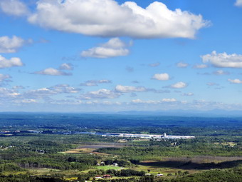
![]()
![]()
![]()
![]()
![]() On Friday, August 29th I wanted to go back to Albany County to hike part of the Long Path section from East Berne to the northern end of Thacher Park. Cindy wanted to go with me so I decided to hike the section in the middle which traversed some of the more interesting sections of John Boyd Thacher State Park including the Indian Ladder Trail. My plan was to park on Beaver Dam Road at the southern boundary of the park and hike to the northern end of the Indian Ladder Trail and then return to the car. This would give me two easily accessible places to park to complete the last two sections of the "official" Long Path. By hiking this section it would cut out enough mileage that I felt I could complete the final two sections in one day. I had taken three days off from hiking as I had developed a rather large blood blister on my right heel but this seemed to be getting better and I was looking forward to the hike. We left Livingston Manor just after 8:30 AM and headed up Route 17 to Roscoe where we picked up Route 206 to Route 30 at the Pepacton Reservoir. I turned right and followed Route 30 to the Dunraven Bridge where I continued straight ahead on BWS 10. I continued on BWS 10 to where it met Route 30 again just outside Margaretville. I turned right and then left to follow Route 30 through Margaretville, Roxbury, Grand Gorge and North Blenheim. In Middleburgh I turned right to head east on Route 145 to Cotton Hill Road just outside of town. I turned left on Cotton Hill Road and drove 8.3 miles to Route 443, the Helderburg Trail. I turned left on Cotton Hill Road and drove 8.3 miles to Route 443, the Helderburg Trail. I made a right and drove about 6 miles to East Berne and made a left onto Route 157A. At 2.5 miles I turned right on Beaver Dam Road and drove about 1.25 miles to where the Long Path enters Thacher Park I parked on the left where there was room for several cars just passed a gated woods road. We took off our jackets as the day was sunny and getting warmer and got the rest of our gear ready. I decided not to bring poles as I intended to keep Sheila on her leash most of the day in the park. We were ready to hike by 10:45 AM and headed into the woods to the trail. Thacher Park has its own trail system and the Long Path is co-aligned with these trails. I had a park trail map and a trail description form the NYNJTC site so I was confident we would find our way. I also knew that the blazes in the park were in good shape and that they were probably all we would need. A blue trail parallels Beaver Dam Road and the aqua blazes indicate a left turn so we followed. I remembered walking on this open trail through the pines the last time I was at the park. Within a few hundred feet the trail turned right onto a woods road and continued to follow a series of woods roads downhill until about .9 miles where we made a sharp right turn.
On Friday, August 29th I wanted to go back to Albany County to hike part of the Long Path section from East Berne to the northern end of Thacher Park. Cindy wanted to go with me so I decided to hike the section in the middle which traversed some of the more interesting sections of John Boyd Thacher State Park including the Indian Ladder Trail. My plan was to park on Beaver Dam Road at the southern boundary of the park and hike to the northern end of the Indian Ladder Trail and then return to the car. This would give me two easily accessible places to park to complete the last two sections of the "official" Long Path. By hiking this section it would cut out enough mileage that I felt I could complete the final two sections in one day. I had taken three days off from hiking as I had developed a rather large blood blister on my right heel but this seemed to be getting better and I was looking forward to the hike. We left Livingston Manor just after 8:30 AM and headed up Route 17 to Roscoe where we picked up Route 206 to Route 30 at the Pepacton Reservoir. I turned right and followed Route 30 to the Dunraven Bridge where I continued straight ahead on BWS 10. I continued on BWS 10 to where it met Route 30 again just outside Margaretville. I turned right and then left to follow Route 30 through Margaretville, Roxbury, Grand Gorge and North Blenheim. In Middleburgh I turned right to head east on Route 145 to Cotton Hill Road just outside of town. I turned left on Cotton Hill Road and drove 8.3 miles to Route 443, the Helderburg Trail. I turned left on Cotton Hill Road and drove 8.3 miles to Route 443, the Helderburg Trail. I made a right and drove about 6 miles to East Berne and made a left onto Route 157A. At 2.5 miles I turned right on Beaver Dam Road and drove about 1.25 miles to where the Long Path enters Thacher Park I parked on the left where there was room for several cars just passed a gated woods road. We took off our jackets as the day was sunny and getting warmer and got the rest of our gear ready. I decided not to bring poles as I intended to keep Sheila on her leash most of the day in the park. We were ready to hike by 10:45 AM and headed into the woods to the trail. Thacher Park has its own trail system and the Long Path is co-aligned with these trails. I had a park trail map and a trail description form the NYNJTC site so I was confident we would find our way. I also knew that the blazes in the park were in good shape and that they were probably all we would need. A blue trail parallels Beaver Dam Road and the aqua blazes indicate a left turn so we followed. I remembered walking on this open trail through the pines the last time I was at the park. Within a few hundred feet the trail turned right onto a woods road and continued to follow a series of woods roads downhill until about .9 miles where we made a sharp right turn.
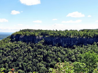 As we walked along the trail it became obvious to me that I had reversed the entire orientation of the park in my mind. I remember thinking the last time I was in the park that the spot we had parked was the farthest NORTHERN point. I don't know how I did this but the feeling stuck with me. After the right turn, we were headed east and walking over a small hill. There were several streams along the way but they were almost dry. At 1.5 miles we made an almost 180 degree turn and started to walk north. We passed behind the maintenance sheds and near the Knowles Flats picnic area before crossing Thacher Park Road (Route 157) at 1.7 miles. After crossing the road we were at the overlook with incredible views to the north and east. What was even more incredible is that there were only two cars at the far end of the parking area. The day was mostly clear with blue skies and a few white clouds. There was some haze in the distance but Albany was clearly visible. Several vultures floated on the air current but Sheila was more interested in the pigeons walking on the grass on the other side of the fence! We stopped to take many pictures from different angles and different places as we walked along the lookout from one end to the other. It was clear to both of us that the pictures would be nice but that being there was priceless. We moved on and started to follow the well-packed trail along the edge of the escarpment. Sheila was doing well as I asked her to move aside as the few people we met walked passed. There were limited views through the bushes but we had already seen the best. We soon broke out into an open field near the Minelot parking area and continued along the escarpment to the southern end of the Indian Ladder Trail at about 2.3 miles. The walking had been so easy and the distance so short that we both decided we would continue to walk north to the next parking area near Ryan Road. We decided to leave the Indian Ladder Trail for the return trip.
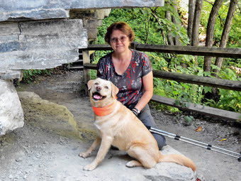 As we continued to walk along the edge of the escarpment, we continued to see the aqua blazes even though the park map indicated the Long Path follow the Indian Ladder Trail below. The Indian Ladder Trail closes in the early fall so it is the optional route. On our way north we crossed two streams. One had barely a trickle of water and the other was dry. This was disappointing as we knew this meant there would be no waterfalls on the trail below. We passed the northern end of the Indian Ladder Trail at 2.75 miles and continued to follow the blazes to a parking area and across the main entrance road and booth. When we got to the other side there was an open area and it was hard to spot where the blazes led. Cindy went right and I headed left and I soon found the blazes as the trail entered the trees. We were no on more of a trail than woods road but it was still easy to follow with only a few muddy spots. Along the way we could glimpse several more parking lots and picnic areas on the right and were impressed with how much space the park had to offer. At 3.1 miles we came out of the trees, walked along Hailes Cave Road and then re-entered the woods. At 3.4 miles we crossed an access road by a large pavilion and decided to walk out and across Hailes Cave Road. There was a nice picnic area here and some goods views but nothing we hadn't seen before. I took a few shots and then we retraced our steps to the Long path to continue our hike. I had been allowing Sheila off her leash on the trail since no one else was hiking. We passed through a field and as we entered the woods the signs warned of fissures in the woods and on the trail ahead. I decided to put Sheila on her leash to be safe. The area around the park lies primarily on a limestone bedrock which is easily eroded by acid in the water. We did see several fissures along and across the trail but only one was very large.
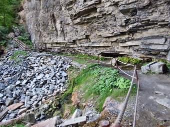 At 4 miles we made a right onto a woods road and passed from the state park into land owned by the Open Spaces Institute. To the left was a large open area with a woods road but we turned right. and began our steepest ascent of the day as the trail switchbacked up to the ridge. At 4.2 miles we made a sharp left following the blazes and at 4.35 miles came to the yellow blazed trail that led out to Ryan Road. I felt great! My foot wasn't bothering me and I was willing to continue but Cindy wanted to turn around and that was OK with me. We had cut over 4 miles off of the remaining 11 miles which meant I could finish the remainder in two hikes in one day. We turned around at 12:45 PM and retraced our route back to the northern end of the Indian Ladder Trail where we turned left at 5.7 miles to take the lower trail. Sheila had no problem walking down the stairs and the trail was every bit as impressive as I remembered. We stopped to take pictures many times. The limestone is rich in Devonian fossils but I resisted the urge to disturb the limestone to find some. There were now more people on the trail but most were polite and we passed each other without problems. We stopped to inspect some of the "caves" and underground streams. When we got to Minelot Falls there was only a few drops of water coming over the escarpment. A little farther along there was an overhang where we had stopped with Sheba and I had taken a picture of Sheba and Cindy. We stopped there to take pictures of Sheila and Cindy and Cindy took some of me with Sheila. The moment was bittersweet for me as I still miss Sheba and am sure I always will. The rest of the hike went quickly as we did not stop much even as we passed through the overlook. We were back at the car by 2:45 PM having hiked 8.7 miles in just under 4 hours. We had 1610 vertical feet but there were no significant climbs. We had stopped for about 25 minutes for pictures although it seemed like more time than that.
![]()
![]()
![]()
![]()
![]() On Monday, August 25th I wanted to go back to Albany County to finish the Long Path section from Switz Kill to East Berne. I planned to park where I had ended the last hike on Willsie Road. The weather forecast was good with no rain in sight and temperatures in the high 60's to low 70's. We left Livingston Manor just after 8:30 AM and headed up the Beaverkill Road to the Barkaboom Road. At the end of the road I turned right on BWS 10 and took it to Route 28 in Margaretville. We turned right and then left to follow Route 30 through Margaretville, Roxbury, Grand Gorge and North Blenheim. In Middleburgh I turned right to head east on Route 145 to Cotton Hill Road just outside of town. I turned left on Cotton Hill Road and drove 8.3 miles to Route 443, the Helderburg Trail. I made a right and drove 1.3 miles to Switz Kill Road (CR-1) where I turned right and followed it 4.6 miles to Willise Road where I turned left. I knew that I had to drive about 2.5 miles to where the trail crossed the road and that I had been there only the day before. Once I was in the vicinity I looked for the trail on both sides and could not find it! I drove back and forth at least three times before I got out my GPS and pinpointed the location. There was room to park two or three cars on the grassy shoulder and I thought that a prominent blaze or sign might be helpful! We were ready to hike at 9:30 AM. We started hiking northeast through some hardwoods and then entered a pine forest that seemed to have been planted. To our left I could see a beaver meadow but there were no paths down to it so we kept moving. The trail description mentioned stepping stones and pontoon bridges but there were none and none were needed.
On Monday, August 25th I wanted to go back to Albany County to finish the Long Path section from Switz Kill to East Berne. I planned to park where I had ended the last hike on Willsie Road. The weather forecast was good with no rain in sight and temperatures in the high 60's to low 70's. We left Livingston Manor just after 8:30 AM and headed up the Beaverkill Road to the Barkaboom Road. At the end of the road I turned right on BWS 10 and took it to Route 28 in Margaretville. We turned right and then left to follow Route 30 through Margaretville, Roxbury, Grand Gorge and North Blenheim. In Middleburgh I turned right to head east on Route 145 to Cotton Hill Road just outside of town. I turned left on Cotton Hill Road and drove 8.3 miles to Route 443, the Helderburg Trail. I made a right and drove 1.3 miles to Switz Kill Road (CR-1) where I turned right and followed it 4.6 miles to Willise Road where I turned left. I knew that I had to drive about 2.5 miles to where the trail crossed the road and that I had been there only the day before. Once I was in the vicinity I looked for the trail on both sides and could not find it! I drove back and forth at least three times before I got out my GPS and pinpointed the location. There was room to park two or three cars on the grassy shoulder and I thought that a prominent blaze or sign might be helpful! We were ready to hike at 9:30 AM. We started hiking northeast through some hardwoods and then entered a pine forest that seemed to have been planted. To our left I could see a beaver meadow but there were no paths down to it so we kept moving. The trail description mentioned stepping stones and pontoon bridges but there were none and none were needed.
 At .6 miles the trail turned left and crossed a bridge between the wetlands on our left and a beaver pond on the right. We stopped and I took some pictures before continuing on the trail. At .9 miles we reached Cole Hill Road where there was room to park several cars by a signboard. The day was already hotter than I had expected so I changed into a short-sleeved shirt before turning right on Cole Hill Road. For the next .3 miles we walked uphill and southeast until the road leveled off. Ahead and to the right I could see a spectacular view of Mt. Pisgah, Richmond, Ashland Pinnacle and Huntersfield. We stopped and I took some shots including some I though I could put together into a panorama. Once I had finished my photography we walked the rest of the way to Woodstock Road and turned left at 1.8 miles. The initial part of the road was uphill but then there was a short downhill and some level ground. On the right was a large private campgrounds with some "campers" that looked more like permanent residences. A little further down the road was Woodstock Lake which had a prominent "Private" sign at the entrance. I stopped to take a few pictures and the we continued to walk to where Woodstock Road turned right. We continued straight ahead on a paved road that led to the Albany Region Doppler RADAR tower for the National Weather Service. I took a few pictures and then we started to descend from Stafford Hill. The road was eroded in most places with exposed bedrock. near the bottom was a high rock ledge on the left. We began to enter a wet area which could have been a problem if there had been more rain. We turned due north at 3.8 miles and continued to descend. At 4.3 miles we turned right onto a gravel road which led us out into a field. It was easy to follow the road across the field to Joslyn Schoolhouse Road.
 We turned left on the road and then turned off it to the right. It seemed that the trail might follow an ATV track along the edge of a field but the blazes led us into the woods and through a pine plantation. This began the most annoying part of the hike as we had to side hill on some very dry and slippery ground. Near the bottom of the hill the ground became wet and muddy but we were easily able to pass. We began to follow a stone wall and crossed over it several times heading to the north. At 4.9 miles we crossed Fox Creek on a somehow shabby bridge. At this point we were at the edge of a field and it wasn't clear where the trial was situated. We walked on the left side of the field and up the hill towards Route 443 but I could find no blazes. I found a neatly kept trail but it led to someone's backyard so we went back to the field and walked parallel to the road until I could find a place to break through. Standing on the edge of the road I could see blazes to my right indicating that we should have walked along the edge of the field to an open spot. I looked across the road and saw blazes heading up into the field to begin the last section to the northern reaches of Thacher. After getting a drink and a snack, we turned left to walk the roads back to the car. The walk along Route 443 was about 2.5 miles and was slightly downhill. I knew this wasn't good as we would have to go uphill to the car. We passed several farms and walked through part of East Berne. There were some pleasant views and the traffic was surprisingly light. A runner came up behind us and startled us both. We said "Hello" and "goodbye" in one breath. Being out on the open road exposed us to the sun but so allowed us to experience a nice breeze. At 7.6 miles we turned left on Cole Hill Road and I could see a long stretch of flat and straight road. In the distance I could see that the road climbed steeply. The walk to the base of the hill was only .7 miles but it seemed longer. We stopped and I gave Sheila a long drink before starting up the hill. Actually the distance was only .5 miles and the vertical gain was a little over 300 feet. At the top of the hill we turned right onto Willsie Road to walk the .7 miles back to the car. On the way we passed one house with columns out front, a beautiful stone façade and grounds which were extensive and well-kept. We were back at the car at 1:10 PM having hiked 9.6 miles in 3 hours and 35 minutes with an elevation gain of 1180 feet.
![]()
![]()
![]()
![]()
![]() On Sunday, August 24th we had just finished a 9.2 mile hike from Fawn Lake to Gifford Hollow. It was only 1:30 PM when we finished and I decided to drive to the spot where we turned around at Gifford Hollow Road and Switz Kill Road to hike the first part of the next section of the Long Path. The drive was actually shorter than I thought and we were parked and ready to hike at 1:50 PM. We started by walking south on Switz Kill Road for about .7 miles. I was glad that the walk was uphill as I preferred the downhill at the end. We had started to walk so quickly that I had not let my GPS unit "find" us. The results was that the unit showed us wandering all over the place rather than following the road. I stopped and allowed it to get our position knowing that I would have to correct the track at home. We turned left onto Willsie Road which was flat momentarily and then began to climb gently up a hill. As we climbed up the hill, a farmer was cutting and conditioning his field before baling the hay. I liked watching the neat rows of cut grass fall into place as I grew up on a farm and have fond memories of haying. As we reached the top of the hill at 1.8 miles there was a nice view across Partridge Run to the Catskills. I stopped to take a few pictures and then we continued to walk along the road. At 2.1 miles the blazes on a telephone pole indicated we should turn left. There seemed to be a woods road on the left but I could see no aqua blazes on it. Just passed this the trail turned into the woods. The trail description mentioned a small parking area on the other side of the road but I saw none. We walked uphill and the down through some stands of pine and spruce with hardwoods between. There were several stone walls to cross. I wondered why we were walking almost due north when our objective was more to the east or northeast. As we walked, we began to hear gunfire and it seemed we were making turns that took us closer! Eventually we turned in the opposite direction and the sharp reports ended.
On Sunday, August 24th we had just finished a 9.2 mile hike from Fawn Lake to Gifford Hollow. It was only 1:30 PM when we finished and I decided to drive to the spot where we turned around at Gifford Hollow Road and Switz Kill Road to hike the first part of the next section of the Long Path. The drive was actually shorter than I thought and we were parked and ready to hike at 1:50 PM. We started by walking south on Switz Kill Road for about .7 miles. I was glad that the walk was uphill as I preferred the downhill at the end. We had started to walk so quickly that I had not let my GPS unit "find" us. The results was that the unit showed us wandering all over the place rather than following the road. I stopped and allowed it to get our position knowing that I would have to correct the track at home. We turned left onto Willsie Road which was flat momentarily and then began to climb gently up a hill. As we climbed up the hill, a farmer was cutting and conditioning his field before baling the hay. I liked watching the neat rows of cut grass fall into place as I grew up on a farm and have fond memories of haying. As we reached the top of the hill at 1.8 miles there was a nice view across Partridge Run to the Catskills. I stopped to take a few pictures and then we continued to walk along the road. At 2.1 miles the blazes on a telephone pole indicated we should turn left. There seemed to be a woods road on the left but I could see no aqua blazes on it. Just passed this the trail turned into the woods. The trail description mentioned a small parking area on the other side of the road but I saw none. We walked uphill and the down through some stands of pine and spruce with hardwoods between. There were several stone walls to cross. I wondered why we were walking almost due north when our objective was more to the east or northeast. As we walked, we began to hear gunfire and it seemed we were making turns that took us closer! Eventually we turned in the opposite direction and the sharp reports ended.
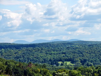 At 3.1 miles we crossed Irish Hill Road where there was a shale pit and room to park a few cars. The trail ascended briefly and I noticed that the aqua blazes shared the trees with state cross country ski trail markers. As we walked along the trail there were numerous woods roads, trails and ski trails that crosses the path. In general, the qua blazes were good enough to guide our course. We began to walk along an escarpment at about 3.3 miles. The trail description mentioned views but as is often the case the description had not been updated since there were no views! We crossed several more stones wall as we reached the highest point on the hike at 3.75 miles. Here it looked as if the trail continued straight ahead but the blazes led us to the right so we followed. We started to descend through some pines until we intersected Woolsie Road at 4.2 miles. Just before getting to the road we met a couple hiking with their dog. I put Sheila on her leash but the couple saw no reason to extend us the same courtesy! In fact, they ask that we stand still so that their dog would not follow us. Once we were on the road, I decided to head back to the car as we had cut over 4 miles off the next section. The hike on Woolsie road back to where we had entered the forest was .4 miles! We had walked 2.1 miles in the wrong direction through some interesting but not outstanding forest to avoid .4 miles of road! I have mixed feelings about this kind of detour. The walk back was mostly downhill and seemed to go quickly even though we were repeating what we had just done. We were back at the car at 4:15 PM having hiked 6.8 miles in 2 hours and20 minutes with an elevation gain of only 830 feet. I was a little tired and Sheila quickly made herself at home in the back seat. We had hiked 16 miles for the day in two different hikes!
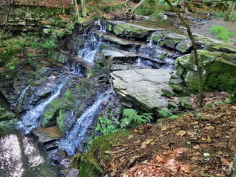
![]()
![]()
![]()
![]()
![]() On Sunday, August 24th I wanted to go back to Albany County to finish the Long Path section from the Albany County Line to the Switz Kill. I planned to park where I had ended the last hike at Fawn Lake which is rather remote. The weather forecast was good with no rain in sight and temperatures only in the 70's. I left Livingston Manor just before 8:00 AM. I got Sheila in the car and we headed up the Beaverkill Road to the Barkaboom Road. At the end of the road I turned right on BWS 10 and took it to Route 28 in Margaretville. We turned right and then left to follow Route 30 through Margaretville, Roxbury, Grand Gorge and North Blenheim. In Middleburgh I turned right to head east on Route 145 to Huntersland Road just out side of town. I turned left on Huntersland Road and drove 5.5 miles and made a left on High Point Road. When High Point Road met Sickle Hill Road after 3.8 miles, I turned right and followed Sickle Hill Road for 1.6 miles to Fawn Lake Road. I turned right on Fawn Lake Road on drove to the parking lot at the end of the road near Fawn Lake. There was already one car in the lot when we left parking area to begin our hike at 9:45 AM. We followed the trail as it left the upper end of the parking area on a snowmobile trail. After a slight ascent the trail began to descend to a trail intersection at about .5 miles. Here a trail to the left branched off to White Birch Pond. We stayed right on the Long Path and crossed a stream on a bridge. At .8 miles the trail came out to gravel Partridge Run Road where we turned right to walk down to Ravine Road at almost exactly one mile. The trail turned left and followed Ravine Road for a couple hundred feet before turning right again on Partridge Run Road. As we turned, I saw that a tent was set up in the field and there was a sign "BCRC". I decided not to stop and ask at this point as I wanted to keep up the pace of the hike. We continued on Partridge Run Road which was in pretty good shape but would require a high clearance vehicle to access. At 1.3 miles we walked off the main trail to the right to inspect a waterfall on Partridge Run. Sheila dashed about the top of the falls as I tried to get a few pictures. I could see that getting to the bottom of the falls would be difficult but not impossible. I decided to leave that exploration for another day and we continued the hike back on the main trail.
On Sunday, August 24th I wanted to go back to Albany County to finish the Long Path section from the Albany County Line to the Switz Kill. I planned to park where I had ended the last hike at Fawn Lake which is rather remote. The weather forecast was good with no rain in sight and temperatures only in the 70's. I left Livingston Manor just before 8:00 AM. I got Sheila in the car and we headed up the Beaverkill Road to the Barkaboom Road. At the end of the road I turned right on BWS 10 and took it to Route 28 in Margaretville. We turned right and then left to follow Route 30 through Margaretville, Roxbury, Grand Gorge and North Blenheim. In Middleburgh I turned right to head east on Route 145 to Huntersland Road just out side of town. I turned left on Huntersland Road and drove 5.5 miles and made a left on High Point Road. When High Point Road met Sickle Hill Road after 3.8 miles, I turned right and followed Sickle Hill Road for 1.6 miles to Fawn Lake Road. I turned right on Fawn Lake Road on drove to the parking lot at the end of the road near Fawn Lake. There was already one car in the lot when we left parking area to begin our hike at 9:45 AM. We followed the trail as it left the upper end of the parking area on a snowmobile trail. After a slight ascent the trail began to descend to a trail intersection at about .5 miles. Here a trail to the left branched off to White Birch Pond. We stayed right on the Long Path and crossed a stream on a bridge. At .8 miles the trail came out to gravel Partridge Run Road where we turned right to walk down to Ravine Road at almost exactly one mile. The trail turned left and followed Ravine Road for a couple hundred feet before turning right again on Partridge Run Road. As we turned, I saw that a tent was set up in the field and there was a sign "BCRC". I decided not to stop and ask at this point as I wanted to keep up the pace of the hike. We continued on Partridge Run Road which was in pretty good shape but would require a high clearance vehicle to access. At 1.3 miles we walked off the main trail to the right to inspect a waterfall on Partridge Run. Sheila dashed about the top of the falls as I tried to get a few pictures. I could see that getting to the bottom of the falls would be difficult but not impossible. I decided to leave that exploration for another day and we continued the hike back on the main trail.
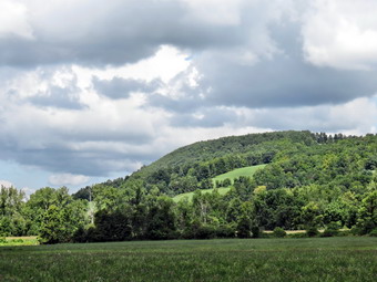 At 1.6 miles Partridge Run Road turned to the right and descended to cross a bridge over the stream. The Long Path head slightly left and came to an open area. We continued passed a gate on the road and passed a small pond on the right. A snowmobile trail came in from the left but we continued ahead to a fork in the trail. At this point there were no aqua blazes that I could find so I made a guess and turned right. As we walked I looked back and saw a blaze and soon picked them up ahead on the trail. The trail began to ascend to an escarpment above Partridge Run. The trail description from the NYNJTC website kept mentioning viewpoints but there NO VIEWS along the trail. There may have been some lookouts in the past but they are all overgrown and the trail description has, sadly, not been updated. At 2.4 miles we intersected another woods road and began to follow it until the trail turned off the road. The blazes were very clear in this area. At one point a switchback took us along a wall of rock and then to a higher level on the escarpment. At 3.9 miles we began a switchbacked descent to the Switz Kill Valley. We had been wandering around the escarpment in different directions but at 4.4 miles started to follow a woods road that paralleled the edge of a field. I began to hear noises that sounded like someone building a house. As we broke out into the last field on our descent, I could see the Gifford Hollow lean-to straight ahead with a group of people working on it. This is a new lean-to finished in 2012 as an Eagle Scout project and the troop appeared to be repairing and adding to the structure. I considered visiting them but decided to keep hiking. At 5.1 miles we made a sharp right and walked along the edge of a field to Gifford Hollow Road at 5.3 miles. We made the left turn onto the road and hiked out to Switz Kill Road at 5.5 miles.
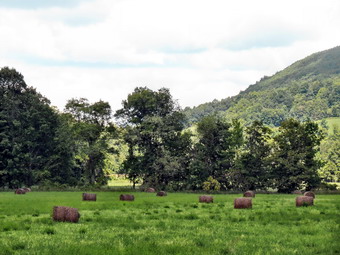 When I had looked at the maps while planning the hike, I saw that there was an option to follow some roads at least back to Partridge Run. I find returning along the same route to be boring so I decided to exercise the option. We turned around and walked back on Gifford Hollow Road but continued passed the point where the trail intersected the road. After .75 miles, I could see a sign for the Partridge Run Wildlife Management Area. As we approached my GPS indicated that this was where Partridge Run Road should be but I saw only an "indentation" on the side of the road. After a closer look, I realized that this was Partridge Run Road but that it had been closed for some time. The road markings on the GPS do not do a good job of distinguishing between paved road and abandoned road! I was also a little worried since the GPS showed the road ending just before it crossed the stream. I was committed at t5his point and the water level was low enough that I thought we could cross even without a bridge. The walk along Partridge Run Road reminded me a lot of the walk along Russell Brook Road near Roscoe. At some point the stream had been high enough to wash out a large part of the road. Sheila was having a good time visiting the stream every time she could find a deep pool. At one point I followed her down to the streambed and took some pictures of the channel. At about 7 miles we came across a sign that said "Bridge Closed Ahead". At 7.2 miles we came to the bridge which was intact if a little worse for wear. We crossed and continued on the road until we crossed another, new bridge at 7.7 miles. We walked up a little hill and were back at the point where we had been in the morning just below the waterfall.
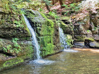 We continued to walk west on Partridge Run Road until at about 8 miles I could hear and see another waterfall on the stream below. I decided to descend to the stream and take a look. There was a drop of about 8 feet over a solid rock wall. Water was shooting out from only two places that had worm more deeply than the rest of the rock. I took some pictures from the side but decided to descend the steep bank to the area below the falls. I took a few pictures from the edge of the stream and then worked my way out onto some solid ground in front of the falls to take some more shots. On the way back I made a wrong step and had some of the stream come in over the top of my boot! We climb the bank to the road and continued out to Ravine Road. This time I stopped to ask three ladies who were at the tent what event was in progress. They told me that they were conducting trials for retrieves using ducks! Sheila seemed very interested! From this point on we simply followed our route from earlier back to the parking area at Fawn Lake. As we made the final left turn onto the snowmobile trail, we both heard people off to our right. I could see two people riding horses on the road. When we reached the road, I pulled Sheila off to the side so that the horses could pass without being spooked. I had noticed horseshoe tracks all along the trails and other evidence that horses had used the trails. I wanted to ask the riders how often they were in the area but they had ridden on ahead. We arrived back at the parking area at 1:30 PM having covered 9.2 miles in 3 hours and 40 minuets with an elevation again of 1460 feet. I did not have any place to be later in the day so I began considering doing another hike to cut some distance off the next section. I decided to drive to where we had just turned around and see how e felt at that point.
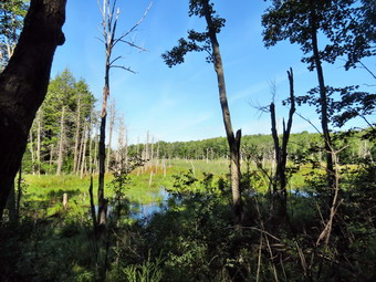
![]()
![]()
![]()
![]()
![]() On Tuesday, August 19th I wanted to go back to Schoharie County and Albany County line to start the Long Path section from the Albany County Line to the Switz Kill. I planned to park where I had ended the last hike on Lawton Hollow Road near the shale pit on the county line. The weather forecast was good with no rain in sight and temperatures only in the low 70's. I left Livingston Manor just before 7:30 AM. I got Sheila in the car and we headed up the Beaverkill Road to the Barkaboom Road. At the end of the road I turned right on BWS 10 and took it to Route 28 in Margaretville. We turned right and then left to follow Route 30 through Margaretville, Roxbury, Grand Gorge and North Blenheim. In Middleburgh I turned right to head east on Route 145 to Huntersland Road just out side of town. I turned left on Huntersland Road and drove 2.7 miles and made a left on Lawton Hollow Road. After driving 3.9 miles on Lawton Hollow Road, I pulled over to the left side of the road where there was a shale pit and room for several cars. Just passed this spot on the right was a "Welcome to Albany County" sign. We got ready to hike and started east on Lawton Hollow Road at 9:10 AM. The first .5 miles of the hike was slightly downhill on Lawton Hollow Road to the intersection with Bradt Hollow Road. The trail description said to turn right on a gravel road but the road was paved and had been for a number of years. The description certainly didn't mislead me but further reinforced the notion that these descriptions are old and have not been updated in some time. We walked south on Bradt Hollow Road for about .7 miles gaining about 260 feet in the process. I didn't see many aqua blazes and began to wonder if I had missed the turn off the road. Just over the top of a rise there was a brown and yellow sign for the Partridge Run Wildlife Management Area on the left side of the road. It had blazes that indicated a right turn onto a snowmobile trail. The trail had been mowed but was beginning to grow up again. There was a heavy dew and I wondered how my boots would hold up. From this point on most of the trail followed snowmobile and Nordic ski trails and woods roads. The aqua blazes were very clear and I only had to stop once or twice to make sure I was headed in the right direction.
On Tuesday, August 19th I wanted to go back to Schoharie County and Albany County line to start the Long Path section from the Albany County Line to the Switz Kill. I planned to park where I had ended the last hike on Lawton Hollow Road near the shale pit on the county line. The weather forecast was good with no rain in sight and temperatures only in the low 70's. I left Livingston Manor just before 7:30 AM. I got Sheila in the car and we headed up the Beaverkill Road to the Barkaboom Road. At the end of the road I turned right on BWS 10 and took it to Route 28 in Margaretville. We turned right and then left to follow Route 30 through Margaretville, Roxbury, Grand Gorge and North Blenheim. In Middleburgh I turned right to head east on Route 145 to Huntersland Road just out side of town. I turned left on Huntersland Road and drove 2.7 miles and made a left on Lawton Hollow Road. After driving 3.9 miles on Lawton Hollow Road, I pulled over to the left side of the road where there was a shale pit and room for several cars. Just passed this spot on the right was a "Welcome to Albany County" sign. We got ready to hike and started east on Lawton Hollow Road at 9:10 AM. The first .5 miles of the hike was slightly downhill on Lawton Hollow Road to the intersection with Bradt Hollow Road. The trail description said to turn right on a gravel road but the road was paved and had been for a number of years. The description certainly didn't mislead me but further reinforced the notion that these descriptions are old and have not been updated in some time. We walked south on Bradt Hollow Road for about .7 miles gaining about 260 feet in the process. I didn't see many aqua blazes and began to wonder if I had missed the turn off the road. Just over the top of a rise there was a brown and yellow sign for the Partridge Run Wildlife Management Area on the left side of the road. It had blazes that indicated a right turn onto a snowmobile trail. The trail had been mowed but was beginning to grow up again. There was a heavy dew and I wondered how my boots would hold up. From this point on most of the trail followed snowmobile and Nordic ski trails and woods roads. The aqua blazes were very clear and I only had to stop once or twice to make sure I was headed in the right direction.
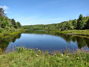 At 2.1 miles we crossed High Point Road and began walking through stands of Norway spruce and red pine. At about 2.7 miles we came into sight of a beaver pond and I stopped to take a few shots before continuing on the trail which turned right shortly after that. The trail stayed near the pond briefly and then turned away from it to the left. Just before the 3 mile mark we entered a lane through some spruce trees. I happened to look to my right and saw a spherical, black object. On closer inspection it turned out to be a bowling ball! As we continued to walk through a wet area ahead, I couldn't help but think about the person that would deposit a bowling ball in the woods. We began an uphill walk which brought us to Bradt Hollow Road at 3.6 miles. We walked out onto the road and turned right and almost immediately left onto a gravel road. We took the next right into a snowmobile trail. The blazes here were hidden and the grass on the trail was not mowed. The snowmobile trail paralleled the road for at least a quarter mile and I regretted not simply walking on the road. The trail began to swing east away from the road and began to follow an extremely straight woods road which seemed to be the boundary between private and state land. We walked mostly downhill for about a mile where we met Beaver Road. Many of the back roads aren't very different than the trails so I did not put Sheila on her leash. We turned left on Beaver Road and walked downhill for about .2 miles where the trail turned right off the road at 5.1 miles. The trail description stated that this turn was at 5.25 miles so when I didn't immediately see blazes, I began to wonder.
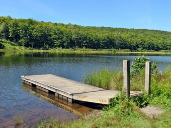 I picked up the blazes after a short walk into the woods and we continued downhill on a snowmobile trail that led us to Tubbs Pond which, strangely, was not marked on my GPS. We stopped by the dam and I took a few pictures of this secluded gem. We continued across the bridge just downstream from the dam. The bridge wasn't really necessary as there was little water in the stream. When we got to the parking area, we continued to walk on the access road to 5.8 miles where we turned right on Fawn Lake Road. The day was warm and a little humid but otherwise pleasant. It was only about .4 miles to the end of the road at the Fawn Lake parking area. The road paralleled the lake shore and as we walked I could hear people out on the lake in a boat. We walked to the upper part of the parking area to find where the Long Path continued on a snowmobile trail. We walked down to the lake and found a DEC truck. Sheila went for a swim while I took a few pictures. This was our turnaround spot for the day so we started back to the car at 11:30 AM. I decided I did not want to repeat the exact route we had taken out since there was nothing spectacular to see. We retraced our route back to Tubbs Pond and back up to Beaver Road. As we walked up Beaver Road we continued passed the trail and walked .3 miles out to Bradt Hollow Road. We stopped to get a drink and a snack. I stowed my poles and put Sheila on her leash. As we were about to leave, I noticed that there were several beautiful horses in a paddock next to the road. We turned right on Bradt Hollow Road and walked .9 miles to the intersection with Cook Hill Road. There was a small parking area here and a sign describing the wildlife management area. We followed Bradt Hollow Road to the right and I knew it was a simple matter of walking to Lawton Hollow Road on taking a left. The road was exceptionally straight and headed almost due north. At 9.9 miles we crossed High Point Road and at 10.3 miles we were back at the point where we had turned off the road onto the trail earlier in the day. It was just .7 miles back to Lawton Hollow Road where we turned left and walked the .5 miles back to the car. We were back at 1:15 PM having hiked 11.5 miles in 4 hours with a vertical gain of 1550 feet.
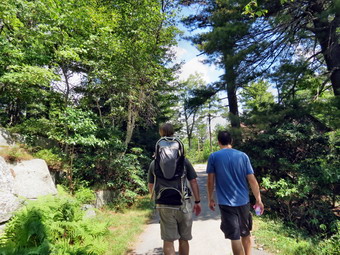
![]() On Sunday, August 17th Cindy and I had planned to meet Kurt and Ariana to hike at Minnewaska State Park at 10:00 AM and then eat later at the Mountain Brauhaus. We left Livingston Manor at 9:00 AM and left behind a sad dog who always likes to hike. On the way we called Karl and Kathleen to see our grandson Luke was after his recent run-in with some furniture and subsequent stitches. We happened to mention that we were going to hike and Karl said that he would meet us with grandson Bryce, 3 years old, and granddaughter Lily, 16 months old. We met Kurt and Ariana and waited for Karl to arrive. Just after 11:00 AM we were parked at the lower parking area at Minnewaska and ready to hike. Karl had Lily in a backpack and the rest of us were walking. We walked out the access road and passed the gatehouse. Our destination was the bottom of Awosting Falls on the Peters Kill. The trip out was all downhill and everybody was full of energy. Lily kept standing up in the backpack to see what was going on. When we got to the falls, the site of a recent Bear Grylls episode, we were a little disappointed. There was barely any water running over the falls and the pool below was showing the effects. We walked down to the streambed and I took some shots while the kids played by the water. We left to walk back up the path to the top of the falls as some others arrived. On the way back up we met more people coming down and two dogs. The dogs were friendly and the kids liked petting them. I decided we would try to hike up to the lake and see how the kids did on the long uphill. The trail curves back and forth but everyone seemed to be in good spirits as we ascended over 400 feet.
On Sunday, August 17th Cindy and I had planned to meet Kurt and Ariana to hike at Minnewaska State Park at 10:00 AM and then eat later at the Mountain Brauhaus. We left Livingston Manor at 9:00 AM and left behind a sad dog who always likes to hike. On the way we called Karl and Kathleen to see our grandson Luke was after his recent run-in with some furniture and subsequent stitches. We happened to mention that we were going to hike and Karl said that he would meet us with grandson Bryce, 3 years old, and granddaughter Lily, 16 months old. We met Kurt and Ariana and waited for Karl to arrive. Just after 11:00 AM we were parked at the lower parking area at Minnewaska and ready to hike. Karl had Lily in a backpack and the rest of us were walking. We walked out the access road and passed the gatehouse. Our destination was the bottom of Awosting Falls on the Peters Kill. The trip out was all downhill and everybody was full of energy. Lily kept standing up in the backpack to see what was going on. When we got to the falls, the site of a recent Bear Grylls episode, we were a little disappointed. There was barely any water running over the falls and the pool below was showing the effects. We walked down to the streambed and I took some shots while the kids played by the water. We left to walk back up the path to the top of the falls as some others arrived. On the way back up we met more people coming down and two dogs. The dogs were friendly and the kids liked petting them. I decided we would try to hike up to the lake and see how the kids did on the long uphill. The trail curves back and forth but everyone seemed to be in good spirits as we ascended over 400 feet.
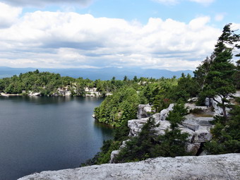 When we got to the lake, Bryce and Ariana were excited and I stopped to take some pictures. We walked to the left around the lake. I dropped down to several viewpoints to get some shots without trees or bushes in the way. As we started around the lake we came upon a Science Center. It was staffed and had interesting activities for the children. Kurt and I continued around the lake as I wanted to get as far as the gazebo. We stopped at several places to take pictures and actually walked a little farther than the gazebo. We did notice that the skies were getting dark so we headed back to the Science Center which was just closing for lunch. We began the trek back down the hill. Bryce was going strong and even Lily walked part of the way. Downhill was easier but our distance was creeping up around 3 miles. The parking areas near the lake were filling up as more and more people arrived on a beautiful day. Once we were back at the parking are, we got everyone ion the right vehicle and headed to the Brauhaus for lunch. We had to wait almost and hour for lunch but the staff provided some "toys" for the kids and served their meals first. Everyone had an enjoyable day and I must admit it was the best 3 miles I have hiked in a long time!
![]()
![]()
![]()
![]() On Saturday, August 16th I wanted to go back to Schoharie County and finish the Long Path section from Middleburgh to the Albany County Line. I planned to park where I had ended the last hike on Treadlemire Road. I had planned to do this on Friday but spent most of the early morning searching for an rescuing an injured logger. The weather forecast was good with no rain in sight and temperatures only in the low 70's. When I awoke in the morning it was 47 degrees in Livingston Manor with a heavy fog. I decided to go anyway although I wanted to have some decent conditions for photography since the trail description promised at least three "spectacular" viewpoints. I wanted to leave Livingston Manor early and did manage to get out before 8:00 AM. I got Sheila in the car and we headed up the Beaverkill Road to the Barkaboom Road. At the end of the road I turned right on BWS 10 and took it to Route 28 in Margaretville. We turned right and then left to follow Route 30 through Margaretville, Roxbury, Grand Gorge, North Blenheim and Middleburgh. Just over the Route 30 bridge in Middleburgh, I turned right on Route 145 and followed it to the other side of town where I turned left on Cotton Hill Road. After about 3 miles, I made a left on Treadlemire Road and drove just less than a mile to the parking area on the right. By 9:40 AM we were ready to hike and walked out the back of the parking area on a woods road. After a very short distance, we turned left and walked up a trail between two rocks with very interesting sedimentary layers. Within .3 miles we walked up a steep but short hill and arrived at the Cotton Hill lean-to. I looked for the "views to northern Schoharie County" as stated in the trail description but the trees blocked all the views and probably had for some time. I kicked myself for believing the trail descriptions which have proven to be wrong so many times!
On Saturday, August 16th I wanted to go back to Schoharie County and finish the Long Path section from Middleburgh to the Albany County Line. I planned to park where I had ended the last hike on Treadlemire Road. I had planned to do this on Friday but spent most of the early morning searching for an rescuing an injured logger. The weather forecast was good with no rain in sight and temperatures only in the low 70's. When I awoke in the morning it was 47 degrees in Livingston Manor with a heavy fog. I decided to go anyway although I wanted to have some decent conditions for photography since the trail description promised at least three "spectacular" viewpoints. I wanted to leave Livingston Manor early and did manage to get out before 8:00 AM. I got Sheila in the car and we headed up the Beaverkill Road to the Barkaboom Road. At the end of the road I turned right on BWS 10 and took it to Route 28 in Margaretville. We turned right and then left to follow Route 30 through Margaretville, Roxbury, Grand Gorge, North Blenheim and Middleburgh. Just over the Route 30 bridge in Middleburgh, I turned right on Route 145 and followed it to the other side of town where I turned left on Cotton Hill Road. After about 3 miles, I made a left on Treadlemire Road and drove just less than a mile to the parking area on the right. By 9:40 AM we were ready to hike and walked out the back of the parking area on a woods road. After a very short distance, we turned left and walked up a trail between two rocks with very interesting sedimentary layers. Within .3 miles we walked up a steep but short hill and arrived at the Cotton Hill lean-to. I looked for the "views to northern Schoharie County" as stated in the trail description but the trees blocked all the views and probably had for some time. I kicked myself for believing the trail descriptions which have proven to be wrong so many times!
After the lean-to, we started a descent and I realized that since we had started at the parking area at over 2000 feet the descent would be a long one. Of course, we would have to walk back up the hill at the end of the hike. We were following a nice combination of trail and woods roads and I was glad that the blazes were for the out part well placed and visible as there were numerous other paths and roads that crossed the trail. At 1.2 miles we hit what appeared to be a DEC access road which we followed out to Cotton Hill Road. The trail crossed the road and continued to descend briefly to a bridge across a stream. We had now descended over 700 feet from our starting point and had covered about 2 miles. We were now heading south but climbing on a woods road. Near the top of the hill at about 2.4 miles the trail turned off the road to the right and began an even steeper climb. It soon leveled off and then began to descend. At 2.7 miles we were on a woods road and made a sharp left before breaking out into an open area. Perhaps the highlight of the day was the PortaJon that was sitting out in the middle of nowhere! I was going to check inside but the sign indicated it was occupied. Even through this area the blazes were clear and we continued south. We continued to walk on the woods road along the western side of Canady Hill until about 3.5 miles where the trail turned sharply left and began a steep ascent. For some time I had noticed signs of active logging in the area and it was very noticeable on the ascent. The trail description said that we would "climb over the hill" which I took to mean over the summit but the trail took us well to the southwest of the top.
As we started to crest the hill I began to hear a series of dull thuds. Once we were over the top we began to descend on a woods road eventually coming to an open field. The "thuds" were now obviously gunfire most probably from a semiautomatic shotgun. The trail description talked about a "spectacular view" but there was no view. The gunfire continued and changed to the price of a high-powered rifle. I knew that his most likely came from a firing range but it was still making me nervous. I knew we were on private land and the situation reminded me that private landowners can do what they want with their own land! The trail leveled out and we were soon in an area that the trail description advised was "very wet". They got this one right. Sheila and I found some high ground and the aqua blazes and we soon made it to Canady Hill Road. The gunfire continued and I consulted my GPS and cell phone to choose an alternate return route. We had just hiked 4 miles and had about 1.5 miles to go to our destination where we could turn around. I estimated that walking the roads to avoid the gunfire would be at least 9 miles and perhaps more. I put off the decision until later. I stowed my poles and put Sheila on her leash as we turned right on Canady Hill Road and then made a quick left on Lawton Hollow Road.
The road immediately descended and then started to ascend again. The trail description mentioned "views" to both the north and south but there were no views. I don't know who writes these descriptions but they are not accurate. At 5.4 miles there was a gravel pit on the left with a few spaces for parking and just passed this a sign for the Albany County Line. We stopped briefly to get a drink and a snack and the turned around at 12:05 PM to begin our return trip. We walked back on Lawton Hollow Road to Canady Hill Road where we turned right. When we got to the point where we would have to turn onto the private land I listened and could hear no gunfire. I got out my poles, released Sheila and we crossed the half mile to the brow of Canady Hill in record time. Once we were over the top of the hill I breathed more easily. As we started down the steep descent back to the woods road, I heard the roar of approaching machinery which I assumed was a log skidder or truck. We continued our descent and never saw the source of the noise. We turned right on the woods road and started back toward Cotton Hill Road. This part of the hike was mostly downhill and we were at the road at 1:30 PM having covered 9 miles. I had thought about walking the roads from there back to the car but decided the shortest, most direct route was the best. We crossed the road and started our 1.5 mile ascent to the top of Cotton Hill. We passed the lean-to and started down the final bit of trail to the car when I began to hear gunfire again. We hurried down the woods road taking it all the way back to the parking area. I was glad to get back to the car at 2:25 PM having covered 11 miles in 4 hours and 45 minutes with a vertical gain along the way of 2360 feet. I* was disappointed that the trail description was 0 for 3 on views and that I had not had the opportunity to take any pictures.
On Friday, August 15th I wanted to go back to Schoharie County and finish the Long Path section from Middleburgh to the Albany County Line. I planned to park where I had ended the last hike on Treadlemire Road. At 2:00 AM the fire siren sounded and soon after that the ambulance pager went off. We were off to search and rescue a lost logger. When we arrived on the road closest to the logging area, I found out that the logger had been located by family and friends but no emergency personnel had made it to their location. I jumped into the first ATV/UTV with my medical equipment and we stared up the heavily rutted and very muddy logging road. Within less than a half mile the vehicle was stuck but at the same time we met the son of the logger who would lead me to his position. I grabbed my equipment and we started up the road. I was glad I had put on a hiking jacket and hiking boots and had brought along two different headlamps. As I followed the son up the road I stepped off into the woods several times since it was easier than walking on the logging road. The trail was all uphill but the son told me it was only a little more than a mile. We continued to hike and I knew we were well passed a mile. After taking a few turns we could hear the log skidder still running and we located the logger. He was lying on the ground and although his vital signs seemed good for his predicament he was in bad shape. A friend was with him and had started a fire/ I was able to use his cell phone to communicate with the control center. It seemed like hours before the a six-wheeled Polaris Ranger made it to the scene. The fire-fighters, another EMT and I backboarded the patient and put him in a Stokes basket for the trip down to the road. The driver of the ATV told me it was at least 3 miles and I believed him. The trip out seemed to take forever but the driver did a fantastic job under terrible road conditions. Several other ATVS had become stuck
and all but one had been cleared from the road. We transported the patient to our local hospital with the help of a paramedic unit. He was later transferred to a trauma center to better treat his serious injuries. We returned to base from the hospital and cleaned up the ambulance. I returned home at 6:45 AM and decided that I had hiked enough for one day!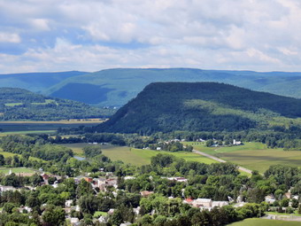
![]()
![]()
![]()
![]()
![]() On Thursday, August 14th I wanted to go back to Schoharie County and start the Long Path section from Middleburgh to the Albany County Line. I planned to park where I had ended the last hike in the Rotary Park in Middleburgh. Cindy and I had actually hiked a portion of this section when we walked along the Middleburgh Cliffs almost 5 years ago. The weather forecast was good with no rain in sight and temperatures only in the low 70's. I wanted to leave Livingston Manor early and did manage to get out before 8:00 AM. I got Sheila in the car and we headed up the Beaverkill Road to the Barkaboom Road. At the end of the road I turned right on BWS 10 and took it to Route 28 in Margaretville. We turned right and then left to follow Route 30 through Margaretville, Roxbury, Grand Gorge and North Blenheim, By 9:30 AM I was pulling into the Rotary Park near the Route 30 bridge over Schoharie Creek. I got my equipment ready by stowing my poles and putting Sheila on her leash for the walk through the streets of Middleburgh to "The Cliffs". We crossed the Route 30 bridge and turned right on Main Street (Route 145 east) and walked about .6 miles until Straub Lane appeared on the left. We turned left on Strain lane and continued to follow it until it became MT Path. We continued to follow the aqua blazes walking toward the ridge in front of us. The blazes led us behind the last house and up a faint road toward a shale pit and a steep bank. The trail continue up the steep bank and started to climb to the top of the cliffs. The blazes were very clear and the trail was cleared. Soon we were on a dirt trail that was still ascending to a rock outcrop. At this point there was a narrow passage between the rocks which required a big first step and then some upper body strength to get through the upper part of the passage. I was a little worried about Sheila but she found another way around, came down through the crack and then went back up! There was a nice viewpoint at the top so I stopped to take a few pictures of Middleburgh and Vroman's Nose
On Thursday, August 14th I wanted to go back to Schoharie County and start the Long Path section from Middleburgh to the Albany County Line. I planned to park where I had ended the last hike in the Rotary Park in Middleburgh. Cindy and I had actually hiked a portion of this section when we walked along the Middleburgh Cliffs almost 5 years ago. The weather forecast was good with no rain in sight and temperatures only in the low 70's. I wanted to leave Livingston Manor early and did manage to get out before 8:00 AM. I got Sheila in the car and we headed up the Beaverkill Road to the Barkaboom Road. At the end of the road I turned right on BWS 10 and took it to Route 28 in Margaretville. We turned right and then left to follow Route 30 through Margaretville, Roxbury, Grand Gorge and North Blenheim, By 9:30 AM I was pulling into the Rotary Park near the Route 30 bridge over Schoharie Creek. I got my equipment ready by stowing my poles and putting Sheila on her leash for the walk through the streets of Middleburgh to "The Cliffs". We crossed the Route 30 bridge and turned right on Main Street (Route 145 east) and walked about .6 miles until Straub Lane appeared on the left. We turned left on Strain lane and continued to follow it until it became MT Path. We continued to follow the aqua blazes walking toward the ridge in front of us. The blazes led us behind the last house and up a faint road toward a shale pit and a steep bank. The trail continue up the steep bank and started to climb to the top of the cliffs. The blazes were very clear and the trail was cleared. Soon we were on a dirt trail that was still ascending to a rock outcrop. At this point there was a narrow passage between the rocks which required a big first step and then some upper body strength to get through the upper part of the passage. I was a little worried about Sheila but she found another way around, came down through the crack and then went back up! There was a nice viewpoint at the top so I stopped to take a few pictures of Middleburgh and Vroman's Nose
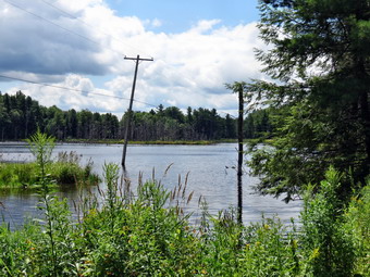 At about 2.2 miles we turned west and then north again as the blazes continued to follow ell-established wood roads. Other roads and paths crossed at different points but the blazes were always clear. After reaching a high point at 3.2 miles we turned from north to ESE onto a trail and off the woods road to descend to "The Gorge". At some point I looked at my GPS unit and it was "frozen". No button I pushed would work even the OFF switch so I removed the batteries. After replacing the batteries, the unit seemed to work fine but I had missed about .2 miles of the trail! We continued to descend eventually picking up another woods road and at 3.9 miles crossed "The Gorge". There was a pretty good sized ravine but the stream was almost dry. At 4 miles we made a right turn on woods road and started toward the northeast. The description I had mentioned a "stump fence" and some farm machinery but I didn't see them. We crossed Durfee Road at 4.8 miles and began a slight ascent. At 4.9 miles we made another right turn and started to walk southeast. Just after the 5 mile point we turned left on another woods road and found an old well on the right side of the trail. This was constructed in the 1930's so that fire fighters could fill there "Indian tanks" from this water source. Around 5.5 miles we turned onto a trail which paralleled a streambed. We walked the trail through some hemlocks and passed a house on the right before coming to Treadlemire Road at 5.9 miles.
 I had already decided to walk the roads back to Middleburgh but thought it would be a good idea to turn left on Treadlemire Road and walk to the parking area where I wanted to begin the last section of the hike. I gave Sheila a drink and got one myself along with a snack. We turned left and walked up the hill for about .5 miles until we got to the parking area. At this point it was 12:30 PM and we turned around and walked back down Treadlemire Road for .9 miles to Cotton Hill Road. Along the way we passed a pond and I decided to take a few shots as there were telephone poles in the middle of the pond. As I put my camera away, several ducks flew from the cover around the pond onto the water. Sheila was very good but I could see she wanted to jump in after them. When I took the leash to start back on the road, she strained a little bit to see if she could get to the edge of the water. We turned right on Cotton Hill Road and started our long downhill walk back to Route 145 into Middleburgh. The road was paved and we set a quick pace. There were several short climbs along the way but mostly the trip to Route 145 was 3 miles of descent totaling almost 1200 feet! At Route 145 we turned right and walked 1.1 miles back through Middleburgh to where my car was parked at the Rotary Park. We had covered 11.5 miles in 4 hours and 15 minutes with a total climb of 2370 feet. I decided to head into Schoharie which is only 5 miles away to visit the bookstore at the Old Stone Fort. The drive seemed to go very quickly and I was soon driving through the town but did not see the building I was seeking. I continued through the village and just as the road curved to the left I saw a sign for "The Stone Fort" straight ahead. I drove up the street, found the building and turned around to park in front. It was constructed as a Dutch Reformed Church and became one of three forts that helped protect colonists during the Revolutionary War. I found some books that I wanted but vowed to return with Cindy to tour the museum and the other six buildings.
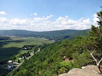
![]()
![]()
![]()
![]()
![]() On Monday, August 11th I wanted to go back to Schoharie County and finish the Long Path section from West Fulton to Middleburgh. I planned to park where I had ended the last hike in a small parking area on an access road at the northern end of Patri State Forest. Since I had walked out over the roads I knew they were passable and I knew right where the parking area was located. The weather forecast was good with no rain in sight but I was concerned since the temperatures were forecast to be in the 80's and this section had some road walking. I wanted to leave Livingston Manor early but somehow didn't get started until about 8:30 AM. I got Sheila in the car and we headed up the Beaverkill Road to the Barkaboom Road. At the end of the road I turned right on BWS 10 and took it to Route 28 in Margaretville. We turned right and then left to follow Route 30 through Margaretville, Roxbury and Grand Gorge. After passing through North Blenheim, I kept a watch for West Fulton Road on the left. I turned left on West Fulton Road and drove about 3 miles to the four corners in West Fulton. I turned right on Patria Road and drove the length of the road to the intersection with Greenbush Hill Road. I turned right and drive about .7 miles and turned right on Snow Ridge Drive. I knew that the "Private Property" signs on this road referred to the land and not the road since there is a state right-of-way. Where the road split, I stayed right on the unnamed access road. The road was a little more "rustic" than I remembered and it was barely wide enough for one car! Within a short distance we were at the small, grassy parking area on the left. I pulled in and immediately spotted the red blaze at the back of the lot where we had exited the last time. I let Sheila out of the car and got my gear ready to go. We started our hike at 10:10 AM by heading out the back of the parking area on the red trail. Within a few hundred feet we came to the Long Path and turned left to head out on the portion we had not hiked. We walked along a stone wall and immediately started to descend. As we continued to hike downhill it occurred to me that we had started at an elevation of over 2000 feet and that Route 30 through the valley had an elevation of under 700 feet. This would mean that we would lose over 1400 feet on the way out and have to regain the same elevation at the end of the hike. The distance was over 2 miles and I began to wonder how I would handle that after hiking more than 10 miles!
On Monday, August 11th I wanted to go back to Schoharie County and finish the Long Path section from West Fulton to Middleburgh. I planned to park where I had ended the last hike in a small parking area on an access road at the northern end of Patri State Forest. Since I had walked out over the roads I knew they were passable and I knew right where the parking area was located. The weather forecast was good with no rain in sight but I was concerned since the temperatures were forecast to be in the 80's and this section had some road walking. I wanted to leave Livingston Manor early but somehow didn't get started until about 8:30 AM. I got Sheila in the car and we headed up the Beaverkill Road to the Barkaboom Road. At the end of the road I turned right on BWS 10 and took it to Route 28 in Margaretville. We turned right and then left to follow Route 30 through Margaretville, Roxbury and Grand Gorge. After passing through North Blenheim, I kept a watch for West Fulton Road on the left. I turned left on West Fulton Road and drove about 3 miles to the four corners in West Fulton. I turned right on Patria Road and drove the length of the road to the intersection with Greenbush Hill Road. I turned right and drive about .7 miles and turned right on Snow Ridge Drive. I knew that the "Private Property" signs on this road referred to the land and not the road since there is a state right-of-way. Where the road split, I stayed right on the unnamed access road. The road was a little more "rustic" than I remembered and it was barely wide enough for one car! Within a short distance we were at the small, grassy parking area on the left. I pulled in and immediately spotted the red blaze at the back of the lot where we had exited the last time. I let Sheila out of the car and got my gear ready to go. We started our hike at 10:10 AM by heading out the back of the parking area on the red trail. Within a few hundred feet we came to the Long Path and turned left to head out on the portion we had not hiked. We walked along a stone wall and immediately started to descend. As we continued to hike downhill it occurred to me that we had started at an elevation of over 2000 feet and that Route 30 through the valley had an elevation of under 700 feet. This would mean that we would lose over 1400 feet on the way out and have to regain the same elevation at the end of the hike. The distance was over 2 miles and I began to wonder how I would handle that after hiking more than 10 miles!
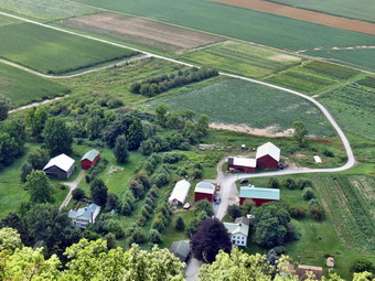 At about .5 miles the trail description I was following said that we should be turning right onto Hardscrabble Road. At about that distance the trail did turn right but the "road" was not as well-defined as some woods roads I had been on. When we had started out the trail was well marked but now the blazes were older, fewer and farther between. Several times I wasn't sure where to go but eventually found my way. More than once we came to a spot where other trails or woods roads branched off and there were no blazes to make the route clear. The trail description was very detailed about each turn but it is based on GPS mileage and small variations can make a big difference. At about 1.8 miles we exited the woods and started to walk down through a field. The path had been mowed by the land owner and Vroman's Nose came into view on the left. Where several paths crossed, we followed the snowmobile markers out to Hardscrabble Road sine there were no Long Path blazes. I stowed my poles and put Sheila on her leash and turned left to walk down to Route 30. As we walked down the road I noticed some aqua blazes on the left and knew I could return that way at the end of the hike. We turned left on Route 30 to hike east toward Middleburgh. The traffic on Route 30 was heavy but there is a nice wide shoulder. We picked up our pace but I immediately noticed that the sun was out and it was getting hot. As we walked the 1.5 miles along Route 30 to the base of Vroman's Nose, I enjoyed looking at the farms along the road. At 3.75 miles we arrived at the base of Vroman's Nose and turned left on the red trail. I stopped to get out my poles and to release Sheila from her leash. We had a drink and a quick snack before tackling the ascent at about 11:30 AM.
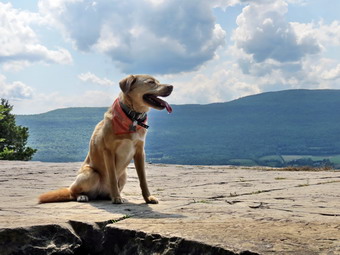 The red trail is by far the steepest access to Vroman's Nose gaining over 400 feet in just the first .2 miles and averaging over a 30% grade. In places there really isn't much of a trail and the footing is unstable. It would be foolish to attempt this ascent without hiking boots and poles! The trip from the road to where the trail levels out is about .5 miles and the vertical gain is over 500 feet. As we began to walk along the edge, various lookouts came into view. I learned after several trips that the best views are from the top so I waited until we were on the most level part before pulling out the camera. As we reached the open areas on top the first thing that struck me was the fact that we were alone. I had never visited without having a few people around and on weekends the hike is packed with people. It felt wonderful to be alone since it was quiet and I could get any shot that I wanted. I decided at this point to change from my long-sleeved shirt to a lighter, short-sleeved one. Besides being dry the new shirt allowed better air circulation and made me feel cooler immediately. The sky was not ideal for photography and the sun's position could have been better but thus didn't stop me from taking pictures. I kept the camera out as I took pictures while we walked along the edge. I took some of the farmland below in the valley and some of the hills beyond with views stretching south to the Catskills. As we reached the end of the flat portion and began our descent I took a few shots across Middleburgh to the Middleburgh Cliffs. We began our descent at 12:30 PM and followed the aqua blazes down the very eroded trail. Vroman's Nose is a victim of its own success. A great many people visit this remarkable attraction but little has been done to improve or maintain the trails. On this day the ground was powder dry and this, combined with loose rocks and leaves, made for a tricky descent. As we neared the bottom we continued to follow the aqua blazes to the right rather than the other trails that lead back to the parking area. At around 5 miles we came out onto Church Street where I put away my poles and put Sheila on her leash. We turned right to walk out to Route 30 where we turned left and almost immediately right onto Mulberry Lane. We walked down this short and straight street for about .2 miles where it abruptly ended at a sign that said "Bridge Closed".
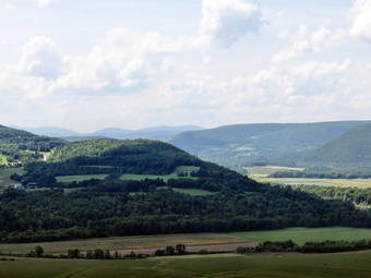 The description mentioned a "new snowmobile bridge". There was no bridge over the creek and it looked as if it had been washed out for some time. There was a short span on the other side and it was easy to cross Line Creek since the water was low. We walked over the span on the other side but I could find no blazes at all. The trail description said to turn right and "follow the hedgerow at the edge of the field". I am not sure what a "hedgerow" really is but I had a choice of beating my way through a tangle of bushes and brush or walking through the corn on the edge of the field. There were no "views west across the field" as the corn was over 7 feet tall! As we neared Schoharie Creek, there were still no blazes and the situation was the same. We tried to get near the creek and followed several paths that ended in an impenetrable tangle. I knew that we still had almost .5 miles of walking through a mess but decided it was better to continue than to turn back. Around 6 miles into the hike we finally broke out into an open area along the field and walked through some weeds to the Rotary Park. I caught a glimpse of an aqua blaze on a tree and almost laughed. We continued through the park to the road bridge across Schoharie Creek on Route 30. I stowed by poles and put Sheila on her leash. We turned right and walked over the bridge to the intersection with Route 145 and then turned around to start back. If you are attempting to hike this section, do NOT follow the various trail descriptions! Turn left on Route 30 at the end of Church Street and stay on Route 30 into Middleburgh. The problems I encountered have been encountered by other hikers. They are another example of the miscommunication between those marking the trails and those who write the descriptions. Even when hikers try to alert those responsible it seems there is no one to listen.
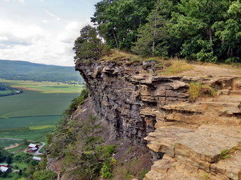 It was 1:10 PM when we turned around and we had hiked about 6.3 miles. I planned to walk all the way back to Hardscrabble Road on Route 30 avoiding the mess in the cornfield and the climb back over Vroman's Nose. I knew this would reduce some mileage and some climbing but that we would be exposed to the sun most of the way. Just as we turned the sun went under a cloud and the sky grew dark. I decided a little gentle rain would be OK as long as there was no downpour or lightning. Walking along the road was hot and boring even though we could keep up a good pace. At one point I let Sheila go down the bank to submerge herself in the water and this seemed to cool her down. By 1:45 PM we had walked 1.7 miles and passed by the trail up Vroman's Nose. We had saved about a mile and a lot of extra aggravation and exertion. At 2:10 PM we were 9.5 miles into the hike and ready to turn right onto Hardscrabble Road. As we began to climb a little my legs let me know it was going to be slow going. We turned right where the aqua blazes indicated and walked the freshly mowed path to the edge of the woods. The first climb was a challenge but the trail leveled just as I wanted to give up. We continued our walk with a few brief stops along the way. The final short climb to the level part of the trail that led back to the car went quickly. We were back at the parking area at 3:25 PM having covered 11.7 miles and 2360 feet of elevation gain in 5 hours and 15 minutes. The final climb from Route 30 was 1440 feet over 2.1 miles
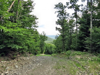
![]()
![]()
![]()
![]()
![]() On Friday, August 8th I wanted to go back to Schoharie County and start the Long Path section from West Fulton to Middleburgh. I planned to park in the hamlet of West Fulton on Patria Road and hike to the small parking area on the state land off Snow Ridge Road. The weather forecast was good with no rain in sight. I wanted to leave Livingston Manor early but somehow didn't get started until about 8:30 AM. I got Sheila in the car and we headed up the Beaverkill Road to the Barkaboom Road. At the end of the road I turned right on BWS 10 and took it to Route 28 in Margaretville. We turned right and then left to follow Route 30 through Margaretville, Roxbury and Grand Gorge. After passing through North Blenheim, I kept a watch for West Fulton Road on the left. I turned left on West Fulton Road and drove about 3 miles to the four corners in West Fulton. I turned right on Patria Road and crossed a small bridge. After turning around, I parked on the side of the road where the Long Path turns left to go through a field. I let Sheila out of the car and got my gear ready to go. We started our hike just before 10:00 AM by entering a field and hiking to a white pine tree with a white blaze. As we walked through the field, there was an abundant ground cover of purple flowers which the bees seemed to love. Several more blazes on pine trees led us to a pine forest and we immediately began to climb to a ridge. Within a little less than a mile the trail gained over 600 feet which really got me "warmed up" for the rest of the hike. The trail in this area was well-marked and easy to find as it followed old woods roads. My GPS mileage seemed to match the trail description that I had from the NYNJTC website. At about .8 miles we came out onto a woods road that was obviously being used for some purpose as it had recently been cleared. We walked uphill and then re-entered the forest. The trail took a dip at .9 miles and I began to see signs that said "State Forest" and I knew we had entered Patria State Forest. We ascended again to about 1.7 miles and then descended a little to cross Patria Road at 2.15 miles. There were quite a few woods roads in the area which crossed the trail and other places where the trail continued to follow a woods road. I knew it was important to watch the blazes as the land up to the state forest was private.
On Friday, August 8th I wanted to go back to Schoharie County and start the Long Path section from West Fulton to Middleburgh. I planned to park in the hamlet of West Fulton on Patria Road and hike to the small parking area on the state land off Snow Ridge Road. The weather forecast was good with no rain in sight. I wanted to leave Livingston Manor early but somehow didn't get started until about 8:30 AM. I got Sheila in the car and we headed up the Beaverkill Road to the Barkaboom Road. At the end of the road I turned right on BWS 10 and took it to Route 28 in Margaretville. We turned right and then left to follow Route 30 through Margaretville, Roxbury and Grand Gorge. After passing through North Blenheim, I kept a watch for West Fulton Road on the left. I turned left on West Fulton Road and drove about 3 miles to the four corners in West Fulton. I turned right on Patria Road and crossed a small bridge. After turning around, I parked on the side of the road where the Long Path turns left to go through a field. I let Sheila out of the car and got my gear ready to go. We started our hike just before 10:00 AM by entering a field and hiking to a white pine tree with a white blaze. As we walked through the field, there was an abundant ground cover of purple flowers which the bees seemed to love. Several more blazes on pine trees led us to a pine forest and we immediately began to climb to a ridge. Within a little less than a mile the trail gained over 600 feet which really got me "warmed up" for the rest of the hike. The trail in this area was well-marked and easy to find as it followed old woods roads. My GPS mileage seemed to match the trail description that I had from the NYNJTC website. At about .8 miles we came out onto a woods road that was obviously being used for some purpose as it had recently been cleared. We walked uphill and then re-entered the forest. The trail took a dip at .9 miles and I began to see signs that said "State Forest" and I knew we had entered Patria State Forest. We ascended again to about 1.7 miles and then descended a little to cross Patria Road at 2.15 miles. There were quite a few woods roads in the area which crossed the trail and other places where the trail continued to follow a woods road. I knew it was important to watch the blazes as the land up to the state forest was private.
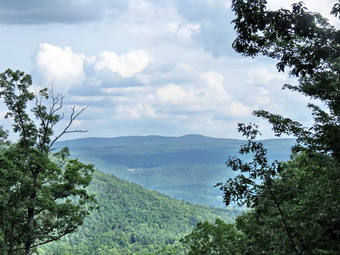 Once we crossed Patria Road we headed downhill and the trail began to look a little less traveled and the blazes a little older. We were walking east or northeast near a small seasonal stream through hemlocks. We crossed the stream and began to climb to the ridge again where the trail leveled off briefly and crossed Mallon Road at 2.95 miles. Along the way, as we passed an open area created by a blowdown, I heard some snuffling off to our left. I looked in that directed to see at least two bears walking through the brush in the opposite direction. I made some noise to let them know we were around and resolved to keep taking to Sheila or banging my poles occasionally for the rest of the hike. When we crossed Mallon Road, there was a small parking area on the other side with a signboard which had seen better days. We entered another reforestation area on a woods road and started to head almost due north until 3.8 miles. As we walked along a small stream with a deep gully, I heard some noise on the other side and looked up to see two more bears headed away from us. I made some noise and they moved a little faster after one looked over his shoulder. A little further along the trail crossed the stream and headed in the general direction the bears had gone. I continued to make some noise as we hurried through this area. The trail started to descend to Pleasant Valley at 3.4 miles and at 3.8 miles turned east and continued to descend to 3.9 miles where we turned right or south and walked along a steep drop. We passed several roads going down the slope and the trail finally turned onto one of these just short of 4 miles. The road descended to a stream as explained on the description I had. What the description did NOT explain was that the bridge had been washed away! Crossing the small stream was no problem but after the crossing I could find no blazes except for a few that had been painted over. I spent the next half hour walking almost a mile around the area looking for blazes and found none. I eventually had to give up and decided to retrace my steps to the car. I thought I might park off Snow Ridge Drive and hike back to the area to see where the trail disappeared. We turned around and started back up the hill. Just as the trail turned to the left, I noticed rather new blazes going straight ahead in addition to the blazes leading us back up the hill. I decided to follow these new blazes to see where they went.
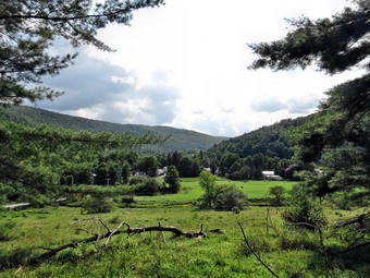 We followed the new blazes as they headed upstream to the northwest and in about .25 miles followed them down to a new bridge across the stream. Just after we crossed the bridge the trail turned southeast to head back downstream along what could have been the old Pleasant Valley Road. This is another example of how the Long Path north of the Catskills is a very "hit or miss" affair. In this case the trail maintainers had not painted over the old blazes down to the stream and had not made the turn upstream clear in any way. The trail description from the website relies on exact GPS mileages which means you must have a GPS unit and that any small variations will make the description questionable. If you make any makes, the written description became useless. In this case the description was clearly wrong as it did not mention the new route or the new bridge. I found out when I got home that if I had crossed the stream at the bottom of the hill and turned left, I would have hot the Long Path in about 400 feet. Why the trail had to be rerouted a half mile or more I do not know! We continued to the southeast until about 4.5 miles where the trail turned to the northeast off the "road" to continue on another woods road to another new bridge across a large stream at 4.75 miles. Both of these bridges are well-constructed and I wondered how the materials were transported in to this remote area. After crossing the bridge, we started an ascent along a nice woods road through pine forests heading northeast. At 5.2 miles the trail turned southeast but continued to ascend to 5.6 miles. At one point after making a turn, I looked ahead and could find no blazes. We walked a little farther and there were still no blazes. We walked back to the turn but the trail seemed to follow the road! We again turned around and headed up the road and finally found some blazes.
 At the top of the hill, the woods road and snowmobile trail continued straight ahead but the trail went off to the right. We started on the trail and immediately I had trouble following it since it seemed to be unused. The trail description mentioned a trail to the left out to a parking area at 5.8 miles. As We got to this mileage, I did not see a trail but there did seem to be an open space up a bank on the left. We walked up the bank to the open space and then to a gravel road. I turned left abut found the road headed in the wrong direction. We turned around and walked the opposite way heading east and slightly north. We passed through an area with some blueberry bushes and a bear stood up to our right to look around. From the noises on the left I knew there was at least one more. We again increased our pace and the bears ignored us. A short distance away we came to the parking area and I could see the red trail at the back of the lot. At this point I had already decided, although I know there are always bears around, that we would walk some of the back roads as part of our return trip. We continued out the access road to the state land until it joined Snow Ridge Drive. We continued on this gravel road until it met Greenbush Hill Road at 6.8 miles. Although these road were gravel, they were in good shape and I knew I could drive on them to park in the small parking area in complete this section. We walked downhill along the road for about .7 miles where we turned left onto Patria Road. At this point I was not sure whether we would walk all the way back on the road or use the trail for the last 2 miles.
 This road was paved for a short distance but then turned back to gravel when it entered the state forest. Our elevation was over 2000 feet and I knew we had started at around 1100 feet. This lead me to believe that Patria Road would be a nice downhill route all the way. I was wrong! As we walked along I could see a hill ahead and the road continued to ascend and descend hills along its length. I was surprised that several cars passed us as we walked along this seemingly1 deserted road. For a mile from the intersection the road was completely straight and headed south west. At 8.6 miles it turned to the south but continued to roll until it headed downhill to meet Mallon Road at 10 miles. The road was paved at this point and we continued downhill to 10.7 miles where we had crossed the road in the morning. I decided that we would walk the trail back to the car as it seemed much shorter. When I returned home I checked both routes. The road route which seemed much longer was only about .4 miles more. The trail had several switchbacks which made it longer than a more direct route. As soon as we turned from Patria Road onto the trail, we started a slight ascent which apparently had slipped my mind. It was 3:00 PM at this point and I was getting tired. The trail leveled some and then at 11.2 miles began a long descent back to the car. As we turned onto the well-developed woods road, there was a nice view ahead. I had not taken any pictures all day but stopped to snap a few shots. From here we followed our route from earlier in the day. The descent from the hemlock forest to the field seemed steeper than the ascent earlier in the day. As we walked won through the field I took some shot of the valley. I also took a few pictures of the purple flowers in then field. We were back at the car just after 4:00 PM having hiked 13.9 miles in 6 hours and 10 minutes. The corrected distance was 12.9 miles and all the distances given here reflect the corrections.
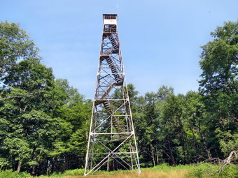
![]()
![]()
![]()
![]()
![]() On Tuesday, August 5th, Lisa, Cindy and I had planned to hike to the Rock Rift Fire Tower. I wrote down the exact latitude and longitude of the tower just in case we needed it. I also studied some maps and found the woods road and trail that was used for access to the tower. When the tower was planned the Conservation Department purchased a strip of land from Route 10 to near the top of Tower Mountain where they planned to erect the tower. On the maps the road seemed to be about .25 miles west of Fish Brook. Since our last trip to the tower, Rick Roberts and a finger Lakes Trail crew had constructed a trail to the tower using the old road and existing woods road. My recollection was that there was a trail from the Apex Bridge parking area to the tower and a spur trail from the boat launch area near Fish Brook Road. We met Lisa downtown at 9:00 AM and left for the drive up the Quickway to Exit 87A where we headed north on Route 268. At Route 10 we turned right and headed east for Fish Brook Road parking area. We parked at the boat launch parking right across from Fish Brook Road. We all got ready to go and headed west on Route 10 just before 10:00 AM. I knew we had to hike about a quarter mile and then cross the road o find the woods road that was being used as the trail. Somehow we hiked passed this spot and did not see the woods road or the start of the trail! By the time we were over .5 miles away I knew we had to turn around and hike back to the .25 mile mark. This time the woods road was pretty obvious and there was a new, blue paint blaze on the first tree on the woods road. I was surprised that there was no indication of the trail visible from Route 10! We climbed through a field on the well-defined woods road which had been groomed nicely. As we entered the woods, there was a trail to the left and the blazes changed from blue to white. The last time we had hiked here it was hard to follow the woods road and much of it was blocked by blowdown. The trail crew did a fantastic job cutting out and blazing the new trail!
On Tuesday, August 5th, Lisa, Cindy and I had planned to hike to the Rock Rift Fire Tower. I wrote down the exact latitude and longitude of the tower just in case we needed it. I also studied some maps and found the woods road and trail that was used for access to the tower. When the tower was planned the Conservation Department purchased a strip of land from Route 10 to near the top of Tower Mountain where they planned to erect the tower. On the maps the road seemed to be about .25 miles west of Fish Brook. Since our last trip to the tower, Rick Roberts and a finger Lakes Trail crew had constructed a trail to the tower using the old road and existing woods road. My recollection was that there was a trail from the Apex Bridge parking area to the tower and a spur trail from the boat launch area near Fish Brook Road. We met Lisa downtown at 9:00 AM and left for the drive up the Quickway to Exit 87A where we headed north on Route 268. At Route 10 we turned right and headed east for Fish Brook Road parking area. We parked at the boat launch parking right across from Fish Brook Road. We all got ready to go and headed west on Route 10 just before 10:00 AM. I knew we had to hike about a quarter mile and then cross the road o find the woods road that was being used as the trail. Somehow we hiked passed this spot and did not see the woods road or the start of the trail! By the time we were over .5 miles away I knew we had to turn around and hike back to the .25 mile mark. This time the woods road was pretty obvious and there was a new, blue paint blaze on the first tree on the woods road. I was surprised that there was no indication of the trail visible from Route 10! We climbed through a field on the well-defined woods road which had been groomed nicely. As we entered the woods, there was a trail to the left and the blazes changed from blue to white. The last time we had hiked here it was hard to follow the woods road and much of it was blocked by blowdown. The trail crew did a fantastic job cutting out and blazing the new trail!
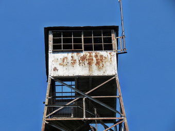 The trail is like a superhighway to the tower although there are some steep spots along the way. This would not be a good hike for a casual hiker and hiking poles, while not mandatory, are a good idea. From Route 10 to .9 miles into the hike we gained about 450 feet over .7 miles. The trail then levels for about .1 miles. After this there is a continuous climb for the next .6 miles that gains about 670 feet. This is an average of a 22% grade with some areas hitting 30%! The trail crew threw in a few switchbacks to give hikers a break and to avoid some blowdown. At around 1.7 miles the trail begins to flatten for the final .25 miles to the tower. At one point an ATV trail came in from the left and continued to the tower. There was some new blowdowns here but it was easy to get around. Last time we had walked directly to the tower as soon as we could see it but this time we stayed on the trail which led right to the base of the tower. Like most towers it was situated in a clearing and like most had no view from the bottom. The two flights of stairs were missing and the floor of the cab was in pretty poor shape. The steps and landings are all wooden and some have seen better days. The main steel structure looked sound enough that I would have climbed it given an opportunity. I took pictures of the tower from several different angles. I also took some pictures of the trees against a beautiful blue sky. The total distance was just under two miles but it had taken us an hour and a half to get to the top! I was pretty sure that the trip back would be quicker.
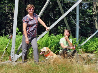 We thought about hiking to the communications tower and then to the roads to get back. I wasn't sure if this would take use across private property so we decided to retrace the route we had used to get up the mountain. We started back at 11:30 AM and walked down the mountain without stopping. Some of the steeper spots slowed us down a little but we were soon at the point where the white trail headed right or west. I would have hiked the trail just to see where it went but Cindy and Lisa wanted to return the car. We were back at the car by 12:30 PM making the trip down about an hour. I did notice more insects on the way down especially in the more open areas where there were ferns. There had been some wet areas along the way but I though the trail was great. I am hoping that the effort to restore the tower is successful as it will make the hike even more exciting. We hiked 3.8 miles in 2.5 hours with a vertical gain of 1236 feet. On the way back we decided to head toward Walton and then use Beers Brook Road as a shortcut over Bear Spring Mountain to Downsville. We drove about 4 miles to Russ Gray Pond and then up the hill on the dirt road to West Trout Brook Road! From there I drove out to Route 206 and drove through Downsville and back to Route 17 in Roscoe.
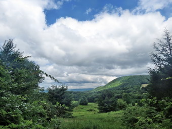
![]()
![]()
![]()
![]()
![]() On Monday, August 4th I wanted to go back to Schoharie County and complete the Long Path section from Conesville to Manorkill Falls to connect two sections that I had already completed. The weather forecast was good but the skies did not reflect it when I was ready to leave home. We got started at about 8:30 AM. I got Sheila in the car and we headed up the Beaverkill Road to the Barkaboom Road. At the end of the road I turned right on BWS 10 and took it to Route 28 in Margaretville. We turned right and then left to follow Route 30 through Margaretville, Roxbury and Grand Gorge. When I got to Route 990V I turned right and drove through Gilboa and West Conesville. Three miles after the intersection with the Prattsville road we were in Conesville. The most prominent building in town is the firehouse which has recreational fields next door. The parking lot at the firehouse is large so I parked in the most remote corner. I let Sheila out of the car and put her on her leash, got my gear ready to go and started our hike at 9:40 AM. We walked east on the main road to Champlin Road and turned right. The road had a hardpacked dirt surface and there were only a few houses near the beginning. After a short distance, there seemed to be only hunting cabins. I was watching for the point where the Long Path turns right off the road. I wasn't watching to carefully for blazes most of the way up the road but it seemed like about half a mile before one showed up. I thought we had hiked a little too far when the turn did appear but a check of my GPS showed we the mileage was exactly as posted. Just off the road was a sign explaining the trail was now on private property. There was also a small mailbox and a request for hikers to "sign in". I left a message which ended with a "Thank you" to the landowner for allowing me to use his land.
On Monday, August 4th I wanted to go back to Schoharie County and complete the Long Path section from Conesville to Manorkill Falls to connect two sections that I had already completed. The weather forecast was good but the skies did not reflect it when I was ready to leave home. We got started at about 8:30 AM. I got Sheila in the car and we headed up the Beaverkill Road to the Barkaboom Road. At the end of the road I turned right on BWS 10 and took it to Route 28 in Margaretville. We turned right and then left to follow Route 30 through Margaretville, Roxbury and Grand Gorge. When I got to Route 990V I turned right and drove through Gilboa and West Conesville. Three miles after the intersection with the Prattsville road we were in Conesville. The most prominent building in town is the firehouse which has recreational fields next door. The parking lot at the firehouse is large so I parked in the most remote corner. I let Sheila out of the car and put her on her leash, got my gear ready to go and started our hike at 9:40 AM. We walked east on the main road to Champlin Road and turned right. The road had a hardpacked dirt surface and there were only a few houses near the beginning. After a short distance, there seemed to be only hunting cabins. I was watching for the point where the Long Path turns right off the road. I wasn't watching to carefully for blazes most of the way up the road but it seemed like about half a mile before one showed up. I thought we had hiked a little too far when the turn did appear but a check of my GPS showed we the mileage was exactly as posted. Just off the road was a sign explaining the trail was now on private property. There was also a small mailbox and a request for hikers to "sign in". I left a message which ended with a "Thank you" to the landowner for allowing me to use his land.
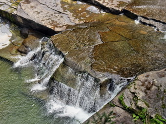 The next 2.7 miles of hiking is through private land as the Long Path heads almost due west and just to the north of Sickler's Mountain. The route is downhill most of the way. In this area, as in so many others along the Long Path north of the Catskill Park, there really isn't a trail. There may be paint blazes on the trees but there is little evidence that a trail was constructed or that anybody walks the route very much. There is little or no maintenance in most places. It can be very hard to watch the blazes and watch your footing at the same time. In my opinion, poles are a must in these sections! The fact that this part passes over private land may be thee explanation in this case. At 2.2 miles we passed north of the summit of Sickler's Mountain and I could see some very interesting cliffs. I did not want to violate the property owner's request that hikers stay on the "trail". We followed the paint blazes which often were placed along old woods roads. There were many more open areas which were heavily populated by briars and nettles! To complete the joy everything was very wet and there were clouds on insects to accompany us. At one point we turned onto a woods road and were confronted by what looked like a sea of nettles. I started to beat them down as I advanced and then had a closer look. They looked just like nettles including the "flower" but they had no filaments to deliver the "sting". I started to push my way through them but kept waiting for a "surprise" which never happened! As we got closer to Pangman Road there were a few places to get some views by walking off the trail. I stopped to take a few pictures and then continued on. As the "trail" entered some more open areas it was obvious that someone had cut back the weeds and brush and this continued all the way to the road. I was very grateful since this made walking much easier!
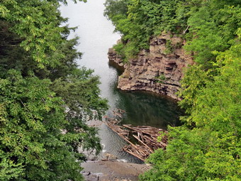 Pangman Road was about 3.5 miles into the hike and the straight line distance to Manorkill Falls was almost exactly a mile. I knew that the trail seldom takes a straight line! We walked all downhill from Pangman Road for .85 miles until we were almost at the Prattsville Road. Just before we got to the road the trail came very close to the edge of the gorge cut by the Manorkill. We stopped in several differed places so that I could take some pictures. The Manorkill was flowing slowly and lazily below and, in its present state, did not look like it could have cut such an impressive ravine. As we approached the road, the blazes turned north to almost parallel the road. I almost went out to the road but decided to follow the blazes. The first part was simply a zigzag through numerous blowdowns. After that, the blazes took us within sight of the Manorkill again near the area of the upper falls. The land below the trail was marked with orange paint so we continued to a spot where there was a lookout down into the gorge. Several different viewpoints provided good opportunities to take pictures of the falls and rapids. We continued out to the road where I put Sheila and her leash and stowed my poles. As we walked over the road bridge, we stopped so that I could take a few more pictures downstream on the Manorkill. The main falls is just below the bridge and I considered walking along the creek to see if I could get some pictures. I looked up at the sky and it was pretty dark. We still had 3 miles to walk back to Conesville on Route 990V and I decided we should get started. This road always seems busier than I think it should be. In most places it has a wide enough shoulder and Sheila and I had no problem walking. As we approached many of the houses along the road, I could see that they were rundown and many were uninhabited. It was clear many of them had been gear places to live at one time. One house in West Conesville was an impressive brick structure but it too was showing signs of disrepair. Sheila and I kept a good pace along the road and did not stop at any time. The skies cleared and there were only a few drops of rain. It was almost exactly 3 miles back to the car and slightly uphill and we Mae it in 55 minutes! We were back at the car by 1:10 PM having covered 8 miles in 3.5 hours with a vertical gain of 1290 feet. I now have to connect Greene County Route 10 to South Mountain Road. This is a tough route that travels over Mount Pisgah, Ritchmeyer Peak and Richmond Mountain. It is made even more interesting by the wide variety of briars and nettles along the route!
![]()
![]()
![]()
![]() On Friday, August 1st I decided to check out South Mountain Road after hiking from Creamery Road to Doney Hollow earlier in the day. The Long Path passes over Richmond Mountain and then drops to South Mountain Road near Cook Road. I thought if I felt like it we might even hike part of the route towards Conesville. We left the fishing access road hear Blenheim and headed south on Route 30 toward Grand Gorge. When we got to Route 990V, I turned left and drove passed the Schoharie Reservoir heading east towards Conesville. After passing the turnoff for the Prattsville Road near Manor Kill Falls, I drove another 3.8 miles through Conesville and turned right on South Mountain Road. I expected the road to be gravel or dirt but it was nicely paved. I drove three miles and noticed that much of the trip was uphill. At the three mile point I found Cook Road on the right and a CCC or woods road directly across from it. I was feeling like I could hike a few more miles so I parked on the woods road. Sheila and I were ready to go at 12:05 PM and we started back down South Mountain Road. I thought we might hike to the end of South Mountain Road or even as far and Champlin Road in Conesville. It was warm but there was a slight breeze blowing and there were fewer insects. I knew this would be an out and back road walk and was hoping it would go quickly. There were a few interesting "attractions" along then road. Within the first half mile there was a cemetery on the right which seemed to show more care than some of the others I had seen. Some houses along the road were obviously occupied while others seemed to be second homes or deserted. Some of the houses were new and well kept while others were older and run down.
On Friday, August 1st I decided to check out South Mountain Road after hiking from Creamery Road to Doney Hollow earlier in the day. The Long Path passes over Richmond Mountain and then drops to South Mountain Road near Cook Road. I thought if I felt like it we might even hike part of the route towards Conesville. We left the fishing access road hear Blenheim and headed south on Route 30 toward Grand Gorge. When we got to Route 990V, I turned left and drove passed the Schoharie Reservoir heading east towards Conesville. After passing the turnoff for the Prattsville Road near Manor Kill Falls, I drove another 3.8 miles through Conesville and turned right on South Mountain Road. I expected the road to be gravel or dirt but it was nicely paved. I drove three miles and noticed that much of the trip was uphill. At the three mile point I found Cook Road on the right and a CCC or woods road directly across from it. I was feeling like I could hike a few more miles so I parked on the woods road. Sheila and I were ready to go at 12:05 PM and we started back down South Mountain Road. I thought we might hike to the end of South Mountain Road or even as far and Champlin Road in Conesville. It was warm but there was a slight breeze blowing and there were fewer insects. I knew this would be an out and back road walk and was hoping it would go quickly. There were a few interesting "attractions" along then road. Within the first half mile there was a cemetery on the right which seemed to show more care than some of the others I had seen. Some houses along the road were obviously occupied while others seemed to be second homes or deserted. Some of the houses were new and well kept while others were older and run down.
One house had a wrought iron fence around it and what were once tennis courts on the other side of the road. Everything was slowly decaying which seemed sad. There was even one farm along the road. We were making good time as we approached Haner Road at 2.5 miles having taken only 45 minutes. From this point the road descended more steeply and I thought about the hike back up. It was almost exactly 3 miles to the intersection of South Mountain Road with Potter Mountain Road, the extension of Route 990V in this area. I decided to walk the extra .7 miles to Champlin Road in Conesville since this would be a good place to start our next hike. We had met only 3 carts on South Mountain Road and Potter Mountain Road wasn't too much busier. We arrived at Champlin Road at 1:15 PM. We stopped briefly so that I could give Sheila a drink. We then turned around and began the hike back. As we turned onto South Mountain Road, I looked at the hill ahead and groaned inwardly. he hike up the hill actually went pretty fast. I did notice that at one point there was a nice view down the valley but it was hazy and I just didn't feel like stopping to get out the camera. We continued our walk without stopping again. It did seem a little longer on the way back but we were still keeping up a good pace. We arrived back at the car at 2:30 PM having covered 7.4 miles in only 2 hours and 20 minutes. The vertical gain was only 750 feet most of which was the climb up South Mountain Road from Potter Mountain Road. On the drive home I thought about finishing the section from Conesville to the Prattsville Road. I also started to plan the hike over Mount Pisgah and Richmond Mountain to make a final connection between the Catskills and the area to the north.
![]()
![]()
![]()
![]() On Friday, August 1st I wanted to go back to Schoharie County and connect the Long Path sections I had hiked by walking from Creamery Road to from Doney Hollow.I wanted to leave Livingston Manor early and did get started at 8:00 AM. I got Sheila in the car and we headed up the Beaverkill Road to the Barkaboom Road. At the end of the road I turned right on BWS 10 and took it to Route 28 in Margaretville. We turned right and then left to follow Route 30 through Margaretville, Roxbury and Grand Gorge. After passing by Minekill State Park and Lansing Manor, I kept a watch for the fishing area access road on the right. Just before the Blenhiem sign I turned right on the road and pulled over to park on the shoulder. Sheila and I were ready to go by 9:30 AM as we walked out to Route 30 and turned right. We walked downhill to Creamery Road and turned left onto this dead end street. There were some paint blazes on a few trees and poles. Just after the turn there was a rather large and old cemetery up on the right bank. I had plans to get in at least 12 miles of total distance so I did not want to explore too much. At about .3 miles I spotted some blazes on the left although they were hard to see. We headed up a very steep bank and passed by the cemetery. I let Sheila off her leash as we climbed to some level ground. We turned right and walked along the top of the ridge and the blazes disappeared. This section of trail is so poorly marked and so unused it is almost impossible to follow. After walking for a while without seeing blazes, we back tracked and I found we should have turned left at about .35 miles. From that point the blazes were hit and miss and there was no trail to follow. I found myself stopping and staring through the woods to find the next blazes. Blazes were hidden behind foliage that had not been trimmed. I found blazes on downed trees that had not been replaced. Without Sheila, it would have been much more difficult! It seems that no one really cares about this section of trail and that theme continued all the way to Doney Hollow!
On Friday, August 1st I wanted to go back to Schoharie County and connect the Long Path sections I had hiked by walking from Creamery Road to from Doney Hollow.I wanted to leave Livingston Manor early and did get started at 8:00 AM. I got Sheila in the car and we headed up the Beaverkill Road to the Barkaboom Road. At the end of the road I turned right on BWS 10 and took it to Route 28 in Margaretville. We turned right and then left to follow Route 30 through Margaretville, Roxbury and Grand Gorge. After passing by Minekill State Park and Lansing Manor, I kept a watch for the fishing area access road on the right. Just before the Blenhiem sign I turned right on the road and pulled over to park on the shoulder. Sheila and I were ready to go by 9:30 AM as we walked out to Route 30 and turned right. We walked downhill to Creamery Road and turned left onto this dead end street. There were some paint blazes on a few trees and poles. Just after the turn there was a rather large and old cemetery up on the right bank. I had plans to get in at least 12 miles of total distance so I did not want to explore too much. At about .3 miles I spotted some blazes on the left although they were hard to see. We headed up a very steep bank and passed by the cemetery. I let Sheila off her leash as we climbed to some level ground. We turned right and walked along the top of the ridge and the blazes disappeared. This section of trail is so poorly marked and so unused it is almost impossible to follow. After walking for a while without seeing blazes, we back tracked and I found we should have turned left at about .35 miles. From that point the blazes were hit and miss and there was no trail to follow. I found myself stopping and staring through the woods to find the next blazes. Blazes were hidden behind foliage that had not been trimmed. I found blazes on downed trees that had not been replaced. Without Sheila, it would have been much more difficult! It seems that no one really cares about this section of trail and that theme continued all the way to Doney Hollow!
At about .5 miles we came out into a field and there were clear blazes along the edge. We walked to the corner of the field and turned left uphill. At the top there was a single blazes hidden under the leaves of a tree but there was no indication of which way to turn. I headed right and spotted a blaze on a tree. We had to wade through tall grass as there had been no trail maintenance. We walked down a steep and very slippery bank to come out to West Kill Road. We turned left on West Kill Road and thankfully began a road walk. The day was warmer than I thought and there were more insect out than there had been for some time. At .9 miles we passed by the turnoff onto Burnt Hill Road. At 1.15 miles the trail turned into the woods and ascended another steep bank through grass and briars to a small ridge. As we walked along the ridge, we were walking parallel to the road and within sight of it most of the time. We were on the trail for a little more than .1 miles when we were right back out on the road. I didn't see any blazes so we turned left and headed down the road. I began to see aqua blazes painted over and knew something was up. We walked back to where we had come out onto the road and I spotted some blazes on the other side of the road cleverly hidden under some brush. The "detour" had added on another .2 miles. We ascended another bank and started on a section of "trail" that may have been the worst I have been on in some time. There was no trail most of the time and hiking was more like a bushwhack. Blazes were few and far between and it was particularly annoying when there were no markers where there were possible turns. I had to hack my way through briars and brush and watch for the occasional blaze.
We finally got to a point where the blazes passed above a pond. There seemed to have been no effort made to dig a trail on the sidehill which left us to slip and slide our way along as best we could. The insect were especially thick in this area. At one point we came to a single paint blaze on a tree and a choice of two equally distinct trails. I went straight ahead to the edge of a marsh and then doubled back to find the blazes to the left. This turn was at about 2.2 miles and we came to West Kill Road with a hundred feet. The trail crossed the road and got a little better briefly as it descended to the bank of the West Kill. After this descent, the blazes again became hard to find and the trail seemed to meander around. The West Kill at this point is not spectacular but I might have stopped if not for the cloud of insects. This section only lasted for .4 miles although it seemed much longer. We climbed another steep bank and at 2.6 miles we were back on West Kill Road. We turned left and walked to the small parking area near a bridge where we had started a previous hike. We had walked a little over 3 frustrating miles and I had no intention of reversing the route. We turned around and walked back on West Kill Road to Route 30 a 2.1 mile walk that took only 40 minutes. We turned right on Route 30 and walked back up the hill to the car. It was 11:40 AM and we had covered 5.5 miles in 2 hours and 10 minutes. The vertical gain was about 900 feet. I decided it was early enough to head to South Mountain Road to find the spot where the Long Path comes down from the mountains to the road.
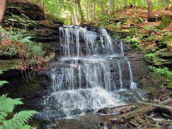
![]()
![]()
![]()
![]()
![]() On Wednesday, July 30th I wanted to go back to Schoharie County and complete the Long Path section from Doney Hollow to West Fulton. I had left off at Old Cemetery Road but starting there would mean driving on the state forest roads. The roads in the area seemed a little "primitive" so I planned to park in the hamlet of West Fulton and hike to where I had stopped and back. The weather forecast was so good but I had to be back for twilight track. I wanted to leave Livingston Manor early but somehow didn't get started until about 8:30 AM. I got Sheila in the car and we headed up the Beaverkill Road to the Barkaboom Road. At the end of the road I turned right on BWS 10 and took it to Route 28 in Margaretville. We turned right and then left to follow Route 30 through Margaretville, Roxbury and Grand Gorge. After passing through North Blenheim, I kept a watch for West Fulton Road on the left. I turned left on West Fulton Road and drove about 3 miles to the four corners in West Fulton. I did not see the picnic area mentioned in the description so I turned right on Patria Road. After crossing the bridge, I turned around and parked on the side of the road where the Long Path turns left to go through a field. I let Sheila out of the car and put her on her leash, got my gear ready to go and started our hike at 10:05 AM. We walked back to the four corners and continued straight ahead on Sawyer Hollow Road. We walked along the road gaining some elevation as we went. At about 1.3 miles we passed a fishing access for Panther Creek and at 1.4 miles the Long Path turned left to descend through a field to Panther Creek. The grass had been mowed to form a wide path down to the creek. Once we got near the creek the trail turned to the right and I let Sheila off her leash and got out my poles. We walked along a rather muddy trail for about .1 miles and then crossed the creek on a bridge. The bridge was old but sturdy and built high enough above the creek that it must have withstood many storms.
On Wednesday, July 30th I wanted to go back to Schoharie County and complete the Long Path section from Doney Hollow to West Fulton. I had left off at Old Cemetery Road but starting there would mean driving on the state forest roads. The roads in the area seemed a little "primitive" so I planned to park in the hamlet of West Fulton and hike to where I had stopped and back. The weather forecast was so good but I had to be back for twilight track. I wanted to leave Livingston Manor early but somehow didn't get started until about 8:30 AM. I got Sheila in the car and we headed up the Beaverkill Road to the Barkaboom Road. At the end of the road I turned right on BWS 10 and took it to Route 28 in Margaretville. We turned right and then left to follow Route 30 through Margaretville, Roxbury and Grand Gorge. After passing through North Blenheim, I kept a watch for West Fulton Road on the left. I turned left on West Fulton Road and drove about 3 miles to the four corners in West Fulton. I did not see the picnic area mentioned in the description so I turned right on Patria Road. After crossing the bridge, I turned around and parked on the side of the road where the Long Path turns left to go through a field. I let Sheila out of the car and put her on her leash, got my gear ready to go and started our hike at 10:05 AM. We walked back to the four corners and continued straight ahead on Sawyer Hollow Road. We walked along the road gaining some elevation as we went. At about 1.3 miles we passed a fishing access for Panther Creek and at 1.4 miles the Long Path turned left to descend through a field to Panther Creek. The grass had been mowed to form a wide path down to the creek. Once we got near the creek the trail turned to the right and I let Sheila off her leash and got out my poles. We walked along a rather muddy trail for about .1 miles and then crossed the creek on a bridge. The bridge was old but sturdy and built high enough above the creek that it must have withstood many storms.
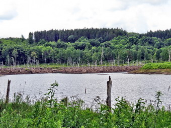 We were walking through hardwood forest and soon began to climb and then climb steeply. The trail ran close to a small creek with a good volume of water. Over the next .72 miles we would gain 710 feet with the trail grade average over 17%. I could immediately hear that the water in the creek was flowing over some rocks by the sound it was making. I walked over to where I could see the stream, which is not even marked on some maps, and found that when I looked upstream I could see several cascades and waterfalls. We continued walking up the trail to the first water fall where I stopped to take some pictures. I had intended to hike this section of trail as fast as we could but I have a weakness for waterfalls. I soon lost count of the number of waterfalls and, although I did not stop at every one, the number of pictures that I took. It seemed that each one was nicer than the previous and if it wasn't nicer it was different. Although the description I read mentioned these cascades they were much better in person than in words. As we neared the top of the climb and the last water fall, I stopped to take a few shots and found a stone structure in the streambed. I could see that a waterwheel had been mounted here. It was probably on overshot wheel that powered a gristmill. As we continued on the trail, we crossed Rossman Hill Road at 2.4 miles. On the other side of the road the trail became wet in places but soon I could see a pond up ahead. The trail continued to be wet and was a little indistinct but we made it to the shore of Looking Glass Pond without too much problem. There were two people fishing on the shore of the pond since it is accessible from Rossman Hill Road. We were 2.5 miles into the hike when we stopped so that I could take some pictures of the pond. The water level seemed low and the pond was surrounded by dead trees. We made a hard left and entered an evergreen forest.
 A sign at Rossman Hill Road had indicated that the lean-to was about a mile from the road. We were headed that way over relatively level ground. There were still some muddy patches and some roots to step over but this piece of trail made for pretty easy travel. Shortly after the pond we came to a road marked as Morey Road on some maps and Old Cemetery Road on others. The trail continued almost straight ahead but we turned left to investigate the Rossman Hill Cemetery. The cemetery was overgrown with high grass but there was some evidence that someone had visited recently as the grass was matted down and several graves had flowers in vases. Many of the stones were too worn to read but the ones that were legible showed that no one had been buried in the cemetery since the late 1800's. We walked a little further down the road since I wanted to see if I could locate the site of the Methodist Church which had been disbanded in 1930. The description was correct when it stated that no trace remained. we walked back to the Long Path to continue our hike. As we rounded a turn in the trail the lean-to was right before us. It seemed to be in good shape but I did not see a privy and the spring was further down the trail. I took a few shots and then we continued on toward our destination which was only .8 miles away in a straight line. Knowing trails seldom take the shortest route I wondered how much we would wander to get there.
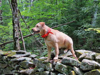 After the lean-to the trail began to head south which annoyed me since I knew we needed to go southeast. It seemed to be following some of the woods roads in the state forest but then suddenly veered off to traverse some very wet and muddy ground. We passed through or walked along a number of stone walls some of which were quite high. Sheila decided to jump up on one to get a good look around so I took her picture. I checked my GPS to find that we seemed to be going too far south but then at 3.8 miles we turned east. The trail started to descend a little more steeply to a stream where there was no bridge. The water level was low and we easily crossed and climbed the far bank. Through the trees I could see a road. As we continued to descend and approached the road there was another cemetery. This one was smaller and probably older than the one on Rossman Hill. I could not clearly read any of the grave markers. To me these cemeteries are part of the history of the region but I find it sad that they are all but abandoned with no one to care or care for them. We walked down to the road and turned left to walk to where the trail entered the woods since I wanted to be sure we had made the connection with the hike from the previous day. At 12:10 PM about 4.3 miles into the hike, we turned around to retrace our route back to the car. I knew it should take less time as I did not intend to stop to investigate or take pictures and the trip back was more downhill. We set a good pace on the way back. As we passed the pond, the two people were still enjoying their day. Soon we were on the steep descent to Panther Creek. The noise of the water in the stream was so alluring I almost walk over to take a look. I resisted the temptation and by 1:10 PM we had hiked 6.6 miles are were back at the bridge over Panther Creek. We walked along the edge of the creek and up through the field. I put my poles away and put Sheila on her leash. The road walk back seemed short and we were back at the car by 1:45 PM having hiked 8.2 miles in a little over 3.5 hours. The vertical gain was 1390 feet with 300 feet of this being the first road walk and 700 more feet coming on the ascent up Rossman Hill. I had thought I would also be able to hike from Creamery Road to Doney Hollow to connect two section of trail but it was a little too lake to accomplish this goal
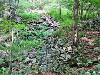
![]()
![]()
![]()
![]()
![]() On Tuesday, July 29th I wanted to go back to Schoharie County and start a new section of trail from Doney Hollow to West Fulton. I planned to break then hike into two sections with the middle point being the place where the trail meets Old Cemetery Road. The weather forecast was good but there was a chance of an afternoon shower. I wanted to leave Livingston Manor early but had to meet with a contractor at our church at 8:30 AM. The contractor arrived early and the meeting was short so I was able to leave just after 8:30 AM. I got Sheila in the car and we headed up the Beaverkill Road to the Barkaboom Road. At the end of the road I turned right on BWS 10 and took it to Route 28 in Margaretville. We turned right and then left to follow Route 30 through Margaretville, Roxbury and Grand Gorge. Just after coming to North Blenheim, I turned left on West Kill Road and drove a little over two miles where there was a small pulloff on the left side of the road. We got ourselves ready and started our hike at 10:05 AM by walking along the road and over a bridge to the point where the trail cut right into the woods. The trail followed a woods road but after a short distance left the road to climb a bank. After another short distance, the trail rejoined the road. I wondered why the trail didn't simply stay on the road! For the next 1.6 miles the trail stayed mostly on woods roads paralleling a small creek. There were no majestic views over the countryside but there was a lot of evidence of past habitation. At about 1.25 miles there was a large pile of stones across the stream. It took me a minute to realize that this was once a dam and the site of one of two water-powered sawmills. On the other side of the trail was a set of stone steps that led to a foundation. After taking a few pictures, we continued our hike. We were passing by the summit of Burnt Hill. The area got its name from the frequent fires that were purposefully set in the early 1900's to improve the blueberry crops.
On Tuesday, July 29th I wanted to go back to Schoharie County and start a new section of trail from Doney Hollow to West Fulton. I planned to break then hike into two sections with the middle point being the place where the trail meets Old Cemetery Road. The weather forecast was good but there was a chance of an afternoon shower. I wanted to leave Livingston Manor early but had to meet with a contractor at our church at 8:30 AM. The contractor arrived early and the meeting was short so I was able to leave just after 8:30 AM. I got Sheila in the car and we headed up the Beaverkill Road to the Barkaboom Road. At the end of the road I turned right on BWS 10 and took it to Route 28 in Margaretville. We turned right and then left to follow Route 30 through Margaretville, Roxbury and Grand Gorge. Just after coming to North Blenheim, I turned left on West Kill Road and drove a little over two miles where there was a small pulloff on the left side of the road. We got ourselves ready and started our hike at 10:05 AM by walking along the road and over a bridge to the point where the trail cut right into the woods. The trail followed a woods road but after a short distance left the road to climb a bank. After another short distance, the trail rejoined the road. I wondered why the trail didn't simply stay on the road! For the next 1.6 miles the trail stayed mostly on woods roads paralleling a small creek. There were no majestic views over the countryside but there was a lot of evidence of past habitation. At about 1.25 miles there was a large pile of stones across the stream. It took me a minute to realize that this was once a dam and the site of one of two water-powered sawmills. On the other side of the trail was a set of stone steps that led to a foundation. After taking a few pictures, we continued our hike. We were passing by the summit of Burnt Hill. The area got its name from the frequent fires that were purposefully set in the early 1900's to improve the blueberry crops.
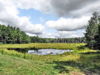 Within a short distance, at about 1.9 miles, the trail crossed Burnt Hill Road. The road was little more than a single lane dirt and gravel woods road at this point. We crossed the road and at 2.25 miles came to a short side trail on the left that led to a small but pretty pond. I could see a road or trail on the other side. We stopped and I took a few shots before continuing on the main trail. A little passed the pond we began a rather steep descent to Cole Hollow Brook. The ground was wet and the rocks covered with slippery moss. In .6 miles we dropped over 400 feet and I was not looking forward to the return trip up the slippery slope. We walked another quarter mile northwest along the brook before the trail came to Cole Hollow Road. Along the way there were several "pool diggers" in the brook. These artificial "waterfalls" oxygenate the water and help to erode small pools. Both of these actions help trout and other game fish to survive when the water level is low and the temperature rises. We turned left on Cole Hollow Road and walked to about 4 miles where the road turned left. We continued straight ahead on what is marked as Thomson Road on many maps. The old name for the road is Huckleberry Kingdom Road reflecting the importance of that "crop" in the area. We walked along this road for only about .5 miles where the road turned left into the woods. Just before this turn there was a homestead on the right side of the road. This was the site of the home of Henry Conklin. Conklin authored the book Through Poverty’s Vale, which details the difficulty of living in area in the 1840s.
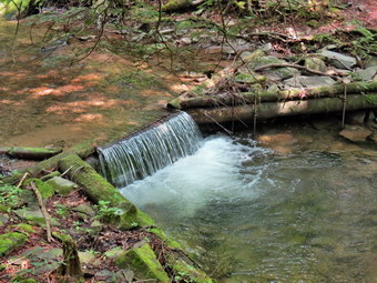 The trail traveled along a stream and there was a healthy crop of nettles to wade through. The trail is little traveled and the nettles were so annoying I thought about giving up and turning around. Fortunately, the trail entered a pine forest and seemed to follow a woods road which made the hike more pleasant in several ways. At about 5 miles we crossed a small stream on a bridge and the trail intersected with a gravel road. The road was marked as Old Cemetery Road on my GPS and I knew this was as far as I wanted to go on this section of the hike. I wanted to avoid the climb back up from Cole Hollow and wanted a different view of the area. I decided to hike south on Old Cemetery Road and then take one of the CCC roads south to Burnt Hill Road near the pond we had passed by earlier. It was 12:30 PM when we turned left onto the road and we were about 5.2 miles into the hike. Walking the roads was much easier than the trails particularly because of the level surface. At 6.3 miles we stayed to the right at a fork in the road to get on one of the many CCC roads in the area. This road had a very good gravel surface and was easy to walk although it headed uphill toward the pond and Burnt Hill. At 7.5 miles I was actually surprised that we passed so close to the pond we had been at earlier. It was obvious that the road I had seen earlier on the other side of the pond was the one we were walking on. I decided to continue out to Burnt Hill Road where we turned left and headed back toward the trail which we would take back to the car. As we were hiking along, I was thinking hard about something and missed the turn onto the trail. We turned around and after a very short distance Sheila turned left into the woods. I was about to call her back when I realized she had turned onto the trail! The rest of then hike was a repeat of what we had done earlier only in reverse. When we got to the point where the trail left the woods road, I could see why this was necessary. The woods road was severely eroded and all but disappeared into the small creek. We were back at the car at 2:15 PM having hiked 9.7 miles in just over 4 hours. The vertical gain was 1770 feet.
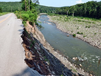
![]()
![]()
![]()
![]()
![]() On Friday, July 25th I was still a little tired from the hike day before. The weather forecast was so perfect I decided to go back to the Mine Kill Falls area and hike from Conesville To Mine Kill Falls. I knew this route had a lot of road walking and that this would make my estimated 12 mile route easier than hiking it all on trails. to leave Livingston Manor just before8:00 AM. We headed to Roscoe on Route 17. From Roscoe we went north on Route 206 to the Pepacton reservoir and turned right when we got to the T at Route 30. We followed Route 30 to the Dunraven Bridge and then took BWS 10 to Route 28 near Margaretville. We turned right and then left to follow Route 30 through Margaretville, Roxbury and Grand Gorge. In about 5 miles we were at the junction with Route 990V and turned right. I drove about 3 miles to Conesville and turned right on the Prattsville Road. Just after crossing the bridge, I parked on the side of the road. It was 9:20 AM and both Sheila and I were ready to start our hike right away! We walked back across the bridge to Route 990V and turned left to hike the shoulder oft he road back toward Gilboa. I had a trail description with distance but no real map to follow. The road had a lot of traffic but Sheila knows how to walk on a leash. The shoulder was wide enough in most places but did get narrow in some others. The road rolled a little until we passed the Gilboa-Conesville School on the right at about 1 mile. Just after this the road narrows for the ongoing construction on the dam. We crossed to the other side of the road briefly and started a descent to the post office. Just after the post office there is a small display of fossils found when excavating the reservoir. More fossils are in a small museum on Stryker Road. The museum in only open on summer weekends from 12:00 PM to 4:30 PM! The descent continued to 1.9 miles when we crossed Schoharie Creek on the road bridge. From here we walked up hill to the right turn onto Stryker Road. Stryker Road is now a dead end from both directions and is closed to through traffic. I did not know what caused this closure and was interested to find out.
On Friday, July 25th I was still a little tired from the hike day before. The weather forecast was so perfect I decided to go back to the Mine Kill Falls area and hike from Conesville To Mine Kill Falls. I knew this route had a lot of road walking and that this would make my estimated 12 mile route easier than hiking it all on trails. to leave Livingston Manor just before8:00 AM. We headed to Roscoe on Route 17. From Roscoe we went north on Route 206 to the Pepacton reservoir and turned right when we got to the T at Route 30. We followed Route 30 to the Dunraven Bridge and then took BWS 10 to Route 28 near Margaretville. We turned right and then left to follow Route 30 through Margaretville, Roxbury and Grand Gorge. In about 5 miles we were at the junction with Route 990V and turned right. I drove about 3 miles to Conesville and turned right on the Prattsville Road. Just after crossing the bridge, I parked on the side of the road. It was 9:20 AM and both Sheila and I were ready to start our hike right away! We walked back across the bridge to Route 990V and turned left to hike the shoulder oft he road back toward Gilboa. I had a trail description with distance but no real map to follow. The road had a lot of traffic but Sheila knows how to walk on a leash. The shoulder was wide enough in most places but did get narrow in some others. The road rolled a little until we passed the Gilboa-Conesville School on the right at about 1 mile. Just after this the road narrows for the ongoing construction on the dam. We crossed to the other side of the road briefly and started a descent to the post office. Just after the post office there is a small display of fossils found when excavating the reservoir. More fossils are in a small museum on Stryker Road. The museum in only open on summer weekends from 12:00 PM to 4:30 PM! The descent continued to 1.9 miles when we crossed Schoharie Creek on the road bridge. From here we walked up hill to the right turn onto Stryker Road. Stryker Road is now a dead end from both directions and is closed to through traffic. I did not know what caused this closure and was interested to find out.
 Walking on Stryker Road was a pleasure since the traffic was light. As we walked we passed a farm on the left that seemed to have exotic animals but none were present in the fields. At about 2.6 miles we passed the barrier that blocked traffic but I did not immediately see the reason. As we walked around the barrier, I could see that the creek had undercut the road on the right side making it dangerous for any traffic. I stopped to take a few pictures and noticed what seemed to be more erosion downstream. We continued to walk down the road with Sheila now freed from her leash as there was no possibility of traffic. At 3.1 miles ether were a series of rock ledges at the side of the road. The first did not look as promising as the second so I continued passed it. As I approached the second ledge, the road all but disappeared. I stopped to take a few pictures up and down the creek and of the damage it had caused to the road. A little farther along the road was down to a single track for walking! From the road I could see a huge area of erosion ahead where an entire hillside seemed to be in danger of collapsing into the creek! The road became a road again and started to climb. We came to the last barrier at around 3.3 miles and I put Sheila back on her leash. As we continued toward the Nickerson Park Campgrounds, I noticed ribbons and flagging along the road. At 3.5 miles we turned into the campground and followed the aqua blazes behind the store and down the main camp road. The flagging and ribbons continued through the campgrounds. At one point we cut to the right off the road onto a trail but then came right back to the road after a short distance. I was trying to follow the description that I had printed out but soon realized that the blazes were all that I needed. When we were passing by the pool, I asked someone about the flagging and they told me that the campgrounds would host a warrior run on Saturday! We continued through the campgrounds staying mostly on the roads and following the blazes.
 Eventually we ran out of campground roads and entered the woods on a trail at about 4.4 miles. The trail was muddy in spots and at about 4.75 miles began a short but steep climb. At the top the trail leveled and made a sharp right turn to head directly for Schoharie Creek. At 4.9 miles there was a nice viewpoint upstream and down to the water at least 50 feet below. Some clouds were beginning to appear in the sky allowing for better pictures. After taking a few shots we continued along the rim of the gorge. This continued for about a quarter of a mile and we stopped several more times so that I could get some more shots. During one stop, I heard someone behind us clear his voice. I was surprised to see a mountain biker right behind us! We said "Hello" and he asked some questions about the trail. I told him what I knew and Sheila and I continued on our way. Soon the trail descended steeply and then made a sharp left turn to run along the banks of a small stream parallel to the main creek. We walked upstream and took a break by walking down the steep bank to a rock shelf on the edge of the water. Sheila immediately dove in to swim as I took some pictures. When she exited the stream, she proceeded to shake off the excess water all over me! I though this was the Mine Kill but a look at the GPS showed we were just crossing a smaller stream. We continued to walk upstream until a set of stepping stones let us cross. On the other side we walked along the bank back downstream until the trail cut up the bank. At the top of the climb we were at a powerline right-of-way where the trail markers led us right and then left up the bank to the woods.
 At 5.8 miles we were within sight of the Mine Kill and we made a hard left to begin walking parallel to the stream. The distance I was getting on my GPS were farther than the distances in the description. The trail kept climbing and at 6.7 miles we passed the cutoff to the lower part of Mine Kill Falls. It was a quick walk to the parking area where I collapsed by poles and stowed them in my pack and put Sheila on her leash. We were now at 7.1 miles and I had decided to walk the roads back to the Nickerson Park Campgrounds. Surprisingly it was only about .4 miles on Route 30 and another mile to the campgrounds on Stryker Road. Along the way we passed by the staging area and start line for the Warrior Run. Once we were at the campground road, we simply reversed the walk from earlier in the morning. It went quicker than I thought it might. This time as we passed the farm we could here a peacock. Sheila seemed very interested in the sound but I encouraged her to keep walking. We turned left into Route 990V at 9.8 miles and walked down to the bridge. After crossing the bridge, we began the uphill climb passed the dam and school. When we had walked down the hill in the morning, I thought that walking back up would be tiring. We actually made very good time up the hill with Sheila giving me a little assistance. The final mile back to the car went quickly and the GPS had just registered 12 miles when we returned to the car at 1:50 PM. We had hiked 11.9 miles in just under 4.5 hours with a vertical gain of 1750 feet. I considered walking down the bank to get some pictures of Manor Kill Falls but decided the water volume was not sufficient to make the pictures interesting.
![]()
![]()
![]()
![]()
![]() On Thursday, July 24th I had planned to hike a section of the Long Path starting at Mine Kill Falls and heading north. After hiking the day before, I did not know if Cindy would feel like coming but she said she was interested so we decided to go. We wanted to get an early start but it always seems something interferes. After taking care of some issues, we were able to leave Livingston Manor just before 9:00 AM. headed to Roscoe on Route 17. From Roscoe we went north on Route 206 to the Pepacton reservoir and turned right when we got to the T at Route 30. We followed Route 30 to the Dunraven Bridge and then took BWS 10 to Route 28 near Margaretville. We turned right and then left to follow Route 30 through Margaretville, Roxbury and Grand Gorge. In about 6 miles we were at the entrance to Mine Kill Falls and turned right to park in the parking area. This was the first time we had been at these falls in the morning and I expected the light to be much better than in the afternoon. There were no other cars in the lot as we walked down the wooden stairs to the overlook platform. The light was coming from behind us as we took pictures of the falls under the bridge and the falls directly below us. The interesting patterns cut by the water overtime are probably better seen in person. We walked back up to the top of the stairs and then turned left to walk to the base of the falls. This part of the trail is also part of the Long Path. We walked to the plunge pool at the bottom of the falls and again had good lighting for pictures. As we started to photograph the sun came out from behind the clouds and was a little too bright. The amount of water going over the falls seemed small since I thought it would be augmented by the recent rain. After taking our pictures we walked back uphill to the car to begin the main part of the hike. We had already hiked .85 miles and spent about half an hour around the falls. The distances in the following description are minus the .85 miles we spent walking around the falls.
On Thursday, July 24th I had planned to hike a section of the Long Path starting at Mine Kill Falls and heading north. After hiking the day before, I did not know if Cindy would feel like coming but she said she was interested so we decided to go. We wanted to get an early start but it always seems something interferes. After taking care of some issues, we were able to leave Livingston Manor just before 9:00 AM. headed to Roscoe on Route 17. From Roscoe we went north on Route 206 to the Pepacton reservoir and turned right when we got to the T at Route 30. We followed Route 30 to the Dunraven Bridge and then took BWS 10 to Route 28 near Margaretville. We turned right and then left to follow Route 30 through Margaretville, Roxbury and Grand Gorge. In about 6 miles we were at the entrance to Mine Kill Falls and turned right to park in the parking area. This was the first time we had been at these falls in the morning and I expected the light to be much better than in the afternoon. There were no other cars in the lot as we walked down the wooden stairs to the overlook platform. The light was coming from behind us as we took pictures of the falls under the bridge and the falls directly below us. The interesting patterns cut by the water overtime are probably better seen in person. We walked back up to the top of the stairs and then turned left to walk to the base of the falls. This part of the trail is also part of the Long Path. We walked to the plunge pool at the bottom of the falls and again had good lighting for pictures. As we started to photograph the sun came out from behind the clouds and was a little too bright. The amount of water going over the falls seemed small since I thought it would be augmented by the recent rain. After taking our pictures we walked back uphill to the car to begin the main part of the hike. We had already hiked .85 miles and spent about half an hour around the falls. The distances in the following description are minus the .85 miles we spent walking around the falls.
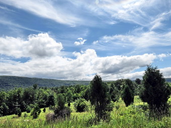 The Long Path has been rerouted to cross the Mine Kill on the Route 30 bridge as the crossing downstream proved to be unreliable. We walked out the entrance road for the park to Route 30 and turned right to cross the bridge. Just after the bridge the Long Path descended a steep bank on the right side of the road and I was sorry I had decided to leave my poles in the car. I let Sheila off her leash so that she could explore. The trail began to descend through some evergreens and paralleled the Mine Kill for about .5 miles. We hit a low point and the trail then started to turn ENE and away from the creek. We began to ascend gaining about 250 feet over the next .4 miles. We broke out of the woods at the main access road into the Mine Kill State Park. The Long Path continued along a path mowed in the grass and paralleled Route 30. The markings were pretty easy to follow. The park seems to be well-used and is installing a disk golf course to complement the pool, ball fields and courts. At 1.2 miles the Long Path turned right and headed downhill a little toward the soccer fields and picnic grove. We headed to the left toward a break in the trees which turned out to be a woods road where we turned left at 1.4 miles. The path was clearly labeled and blazed. Walking this path was easy on the feet and we soon came out of the trees to an open field with a series of cedar trees. The trees had been planted and protected by fencing to allow the deer to forage but not destroy the trees. The sun was out but a slight breeze was blowing. We walked slightly up hill through the field to the Visitor's Center for the Blenheim-Gilboa Power Project. We were about 2.1 miles into the hike when we passed the solar array and windmill. We waked over to the flagpole and found a beautiful view down the Schoharie Valley and into the lower reservoir. Water is pumped from the lower to the upper reservoir during off peak hours. During high demand hours the water is released and turns turbines to generate power. From the flagpole we walked in back of the Visitor's Center and then headed a little left to walk in front of Lansing Manor. I took some pictures before continuing on the Long Path heading north.
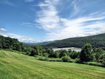 As we left Lansing Manor, the blazes became harder to spot but we soon saw that the idea was to walk around the edge of the "lawns" to a break in the woods. There were paint blazes but we had to really strain to see them. At 2.6 miles we entered the woods and the trail changed dramatically. The Long Path began to drop dramatically and it was obvious the trail was not much used or maintained. At 2.8 miles we began to fight our way through weeds and briars to a microwave tower. Just passed this point there was a nice lookout to the dam on the reservoir. I stopped to take a few more pictures before continuing the descent through the woods. I guess the blazes were clear enough as we found our way without too much problem. At 3.45 miles we came to the New York Power Authority North Access Road where there was a small parking area. I had thought we might turn around here or walk the road out to route 30. I consulted my GPS and found it was only a short distance on the trail to Route 30 and I suggested we hike the trail to the road and then use the road to return at least part way. We crossed the road and headed to the left. Soon we could see the blazes that indicated we should cross the road and head down another steep bank as the trail neared Schoharie Creek again. There was a jumble of weeds and vines but these had been cut back and we were soon very near the creek. We walked about .4 miles with the trail sandwiched between the road and the creek. At 3.9 miles the Long Path climbed to the road on a set of stairs. We turned right at the top and walked the outside of the guard1rail until we got to Route 30 where we turned left to walk the shoulder.
 What was not completely clear from the GPS was that Route 30 ascends from the North Access Road almost all the way to Lansing Manor. We were now also completely exposed to the sun. Sheila actually walks very nicely on her leash and gives me a slight pull up the hills. As we approached Lansing Manor, I suggested we walk down to the trail and follow it over to Mine Kill State Park so that we could avoid the traffic on Route 30. As we turned into Lansing Manor, we had been hiking uphill for about 1.6 miles. We turned left to walk down the entrance road to the trail about 5.7 miles into the hike. Cindy took a brief rest on a bench under the trees while we got and drink and while I took some pictures of the geese on a small pond. After the break we headed back to the trail that we had used earlier in the morning to get back to Mine Kill. At the park we walked out passed the pool to the main entrance road to Route 30. We turned left on Route 30 and hiked the last .7 miles back to the car. We arrived back in the parking area at a few minutes after 2:00 PM. We had hiked a total of ,8.8 miles in 4 hours with a verbal gain of 1460 feet.
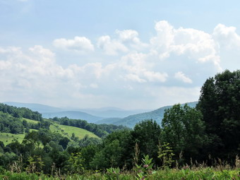
![]()
![]()
![]()
![]()
![]() On Wednesday, July 23rd I wanted to celebrate my birthday by hiking with Cindy and Karl. Karl had a real estate closing in the morning but said he would be ready by about noon. Karl made it to our hose at the appointed time and we were ready to leave by 12:15 PM. I had decided since time was limited we could do a short hike but we all wanted something new and a little different. I chose the new trails on Palmer Hill that had been constructed by the Catskill Mountain Club and opened this summer. When I looked on their website the description said that the trailhead parking was on Finkle Road about 2 miles east of Andes on Route 28. We all got into our car with our gear and, of course, Sheila and headed to Roscoe on Route 17. From Roscoe we went north on Route 206 to the Pepacton reservoir and turned right when we got to the T at Route 30. We followed Route 30 all the way to Route 28 and turned left. As we began to head up Palmer Hill we found Finkle Road on the right and pulled into the parking area. The view from the parking area was great. A signboard showed a picture of the view with all the peaks and hills labeled. All the peaks from Balsam Lake and Graham through Doubletop and Balsam were visible. There was some haze in the air. The temperature was in the high 80's and the humidity made it feel well over 90. Thunderstorms were predicted for around 4:00 PM so we started in on our hike almost immediately. The first half mile of the trail descends to a small brook. The trail passes through wide corridors which have been mowed through the grass and then enters the woods on an old road. Just after the brook crossing are the foundations from a farm and then the first trail junction.
On Wednesday, July 23rd I wanted to celebrate my birthday by hiking with Cindy and Karl. Karl had a real estate closing in the morning but said he would be ready by about noon. Karl made it to our hose at the appointed time and we were ready to leave by 12:15 PM. I had decided since time was limited we could do a short hike but we all wanted something new and a little different. I chose the new trails on Palmer Hill that had been constructed by the Catskill Mountain Club and opened this summer. When I looked on their website the description said that the trailhead parking was on Finkle Road about 2 miles east of Andes on Route 28. We all got into our car with our gear and, of course, Sheila and headed to Roscoe on Route 17. From Roscoe we went north on Route 206 to the Pepacton reservoir and turned right when we got to the T at Route 30. We followed Route 30 all the way to Route 28 and turned left. As we began to head up Palmer Hill we found Finkle Road on the right and pulled into the parking area. The view from the parking area was great. A signboard showed a picture of the view with all the peaks and hills labeled. All the peaks from Balsam Lake and Graham through Doubletop and Balsam were visible. There was some haze in the air. The temperature was in the high 80's and the humidity made it feel well over 90. Thunderstorms were predicted for around 4:00 PM so we started in on our hike almost immediately. The first half mile of the trail descends to a small brook. The trail passes through wide corridors which have been mowed through the grass and then enters the woods on an old road. Just after the brook crossing are the foundations from a farm and then the first trail junction.
 The trail junction is sort of a "times square" since at this point you can choose to do the upper meadow or lower meadow. Cindy suggested that any climbing that had to be done should be at the beginning of the hike and so we turned left to start to the upper meadow. The trail shortly entered the woods and began a half mile ascent to the highest point on the hike. The vertical gain was only about 250 feet and the average grade was around 9%. There were a few steeper areas which were between 15% and 20% for short distances. Along the way we saw some nice stone walls as we looped in a clockwise direction. At the high point we broke out into a field with some since views of the surrounding hills. The trail the began to descend for about .4 miles back to the trail junction losing around 200 feet. We turned left at the junction and almost immediately came to another split in the trail. The left fork has not labeled so we strayed to the right and continued to descend through paths mowed through the field. At 1.85 miles we hit the lowest spot on the hike and walk beneath some powerlines for a short distance. The skies that had been blue with white clouds were beginning to get grayer with much darker clouds. We left and then rejoined the powerlines and at 2.1 miles completed the turn and started back toward the trail junction. Our route roughly parallel our path on the way out but wound through the trees and had a few ups and downs. By 2.75 miles we were back at the trail junction and continued back up the woods road and back to the car. We were back in the parking area by 2:50 PM having covered 3.3 miles in a little under 1.5 hours. The vertical gain was only 650 feet. To get back home we drove into Andes and took the Tremperskill Road back to Route 30.
On Tuesday, July 22nd I to continue to work on the Shawangunk Ridge Trail. I decided to go to Minnewaska to hike the Jenny Lane Trail to the Rainbow falls Trail and over Litchfield Ledge. I knew that I could reverse the route to get back or decide to try a loop. Sheila and I left Livingston Manor and drove through Grahamsville on Route 55. We took a shortcut to Route 209 and then took Route 44/55 over the mountain to the Jenny Lane Parking area just before the Minnewaska State Park entrance. We started our hike along the road at about 9:00 AM and I missed the faint paint blaze and blue disk on the other side of the road the first time. We crossed the road and were soon on the trail which is less used than many in the park. Soon we came across a tree hanging in the middle of the trail and I knew we were on the Shawangunk Ridge Trail. We gained a little elevation and passed over some open rocks before coming to an area where the trail is deeply eroded and lined by laurel. I was watching my foot placement as many of the rocks were slippery. Just before a mile I looked ahead to see that some brush blocked the trail and that Sheila was simply sitting on the trail waiting for me. I thought this strange as she normally would just go around the obstruction but she does sometimes wait for me. When I got to her, I decided to walk around the brush to the left as it seemed others had gone that way. I took half a step into the brush and hear the unmistakable "zingggg" of an Eastern timber rattlesnake. I looked down and saw a four foot snake coiled and rattling as loudly as it could. Sheila never moved! I thought about going around. I thought about taking a picture! I finally did the right thing and turned around to hike back to the car! I had not expected to see a rattlesnake on the east side of Route 44/55 although I have seen them by the Peters Kill on the west side. I decided that if there was one there might be more and I did not want to take a chance with the Sheila. If I had been alone, which I seldom am, I might have walked around and continued the hike. I was disappointed that I had to cut the hike short but I feel it was the right choice. I decided that the rest of the SRT near Port Jervis and Minnewaska and wait until after the first snow as I now have seen rattlesnakes recently in both areas. Seeing the snake raised questions in my mind about rattlesnake bites and emergency medical care and I will be investigating the answers.
![]()
![]()
![]()
![]()
![]() On Sunday, July 20th I had planned to go with my wife, Cindy, to Mine Kill State Forest near Middleburgh and to hike part of the Long Path in that area. The weather forecast changed from sunny to overcast with a chance of rain. When We decided to change plans Cindy decided she did not want to hike. I wanted to continue to work on the Shawangunk Ridge Trail. I decided to go to Ellenville and park near the beginning of the South Gully Trail on Route 52 and hike south to at least the yellow connector trail. I had in mind about a 6 mile round trip and could always decide to go a little farther. This would connect the northern and southern sections of the trail I had already hiked. Sheila was ready to go even after a day off on Saturday and we left Livingston Manor after church around 11:00 AM. I took the Quickway to Liberty where I picked up Route 52 which I took through Woodbourne and Ellenville. As I drove up the mountain outside Ellenville heading toward Pine Bush, I pulled over just after the South Gully bridge. I turned around and parked on the wide shoulder. Sheila and I were ready to go 11:45 as we tagged the beginning of the South Gully Trail and then crossed the road to pick up the Long Path and SRT heading south. The trail descended from the road and the trail marking immediately disappeared at a T! We turned left on what is marked on the maps as Old Route 52 and soon found the aqua blazes of the Long Path which seemed to alternate with the dark blue blazes of the SRT. The road was wide and grassy at this point as we headed mostly uphill. We continued on the road which became MUCH rockier in places but continued to head uphill on a very slight grade. We crossed several small streams heading generally southwest. At 2.4 miles the trail suddenly turned 180 degrees and headed northeast to avoid descending into a deep ravine. At 2.6 miles we reached a trail junction with the yellow connector trail continuing straight ahead to a parking area on Route 52. This was as far as I "had" to go but not as far as I wanted to go. We turned right to stay on the Long Path and SRT.
On Sunday, July 20th I had planned to go with my wife, Cindy, to Mine Kill State Forest near Middleburgh and to hike part of the Long Path in that area. The weather forecast changed from sunny to overcast with a chance of rain. When We decided to change plans Cindy decided she did not want to hike. I wanted to continue to work on the Shawangunk Ridge Trail. I decided to go to Ellenville and park near the beginning of the South Gully Trail on Route 52 and hike south to at least the yellow connector trail. I had in mind about a 6 mile round trip and could always decide to go a little farther. This would connect the northern and southern sections of the trail I had already hiked. Sheila was ready to go even after a day off on Saturday and we left Livingston Manor after church around 11:00 AM. I took the Quickway to Liberty where I picked up Route 52 which I took through Woodbourne and Ellenville. As I drove up the mountain outside Ellenville heading toward Pine Bush, I pulled over just after the South Gully bridge. I turned around and parked on the wide shoulder. Sheila and I were ready to go 11:45 as we tagged the beginning of the South Gully Trail and then crossed the road to pick up the Long Path and SRT heading south. The trail descended from the road and the trail marking immediately disappeared at a T! We turned left on what is marked on the maps as Old Route 52 and soon found the aqua blazes of the Long Path which seemed to alternate with the dark blue blazes of the SRT. The road was wide and grassy at this point as we headed mostly uphill. We continued on the road which became MUCH rockier in places but continued to head uphill on a very slight grade. We crossed several small streams heading generally southwest. At 2.4 miles the trail suddenly turned 180 degrees and headed northeast to avoid descending into a deep ravine. At 2.6 miles we reached a trail junction with the yellow connector trail continuing straight ahead to a parking area on Route 52. This was as far as I "had" to go but not as far as I wanted to go. We turned right to stay on the Long Path and SRT.
 The trail immediately began to climb up a ridge and was at times steep. There were open rock faces to climb over and some were a little slippery from the accumulation of pine needles. Within a short distance there was an open rock face with some nice views to the west and north. I stopped to take some pictures despite a slight haze in the distance. I could see some of the Catskill peaks to the north. The ascent continued for another .6 miles gaining 675 feet with an average grade of right around 20% but with some areas nearly 30%. It was a nice climb and several times I thought I was at the top only to find higher ground ahead. I had thought about stopping at 3 miles but decided we would continue to the highest point on the ridge and turn around when the trail started to descend. In two or three more spots there were open views from rock faces and we stopped as I took some more shots. The trail began to level off at 3.25 miles and became completely overgrown by laurel and scrub oak. This neglect for the trail had been my experience on previous hikes and it is a shame. Not many people hike the trail so the vegetation does not get pushed back and since it is not much used it is not well maintained so people don't hike it! At about 3.4 miles we came across a young man sitting on a rock by the side of the trail. We talked for a few minutes. He said the trail ahead was even more overgrown. I showed him the Avenza app on my cell phone that displays many trail maps in pdf form and also shows your position and will record a GPS track. We walked a little farther to 3.5 miles and the turned around to come back at around 1:30 PM. The young man was gone and we set a quick pace as we had already seen what was to be seen. We passed the hiker after bit as he was sitting in the shade. The return trip went much faster as it was mostly downhill. I had to be careful descending to the woods road as the trail was steep and slippery in spots. We hit the woods road at 2:00 PM about 4.3 miles into the hike. The hike back form that point was uneventful but the rocky portions were annoying. We did meet a pickup truck headed toward us at one point. We were back at the car just before 3:00 PM having covered 6.9 miles in 3 hours and 12 minutes. The total vertical gain was 1594 feet.
![]()
![]()
![]()
![]()
![]() On Friday, July 18th I wanted to continue to work on the Shawangunk Ridge Trail near Wurtsboro. I decided to go to Wurtsboro and park near Haven Road to hike to the VFW in Wurtsboro to connect the northern and southern sections of the trail I had already hiked. Sheila was ready to go even after a long hike the day before and we left Livingston Manor just before 8:30 AM. I turned off the Quickway at the exit for Route 209 and headed south toward Port Jervis. I drove about 2 miles south and turned left on Haven Road. I followed the road as it crossed over the Basha Kill. At the first intersection I turned left and parked in the large lot. We got out of the car and were ready to hike by 9:05 AM. We headed northeast on the old railroad bed which makes up a good part of the SRT in this area. It was warm but not really hot and the humidity was manageable. As we hiked there were no blazes for either the SRT or Long Path but I have gotten use to this. Within a short distance was a nice viewpoint over the Basha Kill to the ridges beyond. It was still a little hazy and I decided to wait until the return trip to take pictures. As we hiked along there were some areas where recent storms had brought down large trees across the trail. None of the trail had been maintained in any way which is shame since it gets so much use. We continued along and encountered a few wet areas on the trail and some mud. There were also several places where old wooden bridges were needed to cross the water. These bridges are slowly deteriorating and the whole atmosphere was one of neglect. It is a shame as this is a beautiful area and used by many different types of people. I was wondering how we would get across Route 17 and at 1.8 miles I found out. There is a bridge over the old railroad bed that allows hikers and wildlife to pass under the highway without a problem! At 2.3 miles we ran out of trail and began the road walk to our turn around point.
On Friday, July 18th I wanted to continue to work on the Shawangunk Ridge Trail near Wurtsboro. I decided to go to Wurtsboro and park near Haven Road to hike to the VFW in Wurtsboro to connect the northern and southern sections of the trail I had already hiked. Sheila was ready to go even after a long hike the day before and we left Livingston Manor just before 8:30 AM. I turned off the Quickway at the exit for Route 209 and headed south toward Port Jervis. I drove about 2 miles south and turned left on Haven Road. I followed the road as it crossed over the Basha Kill. At the first intersection I turned left and parked in the large lot. We got out of the car and were ready to hike by 9:05 AM. We headed northeast on the old railroad bed which makes up a good part of the SRT in this area. It was warm but not really hot and the humidity was manageable. As we hiked there were no blazes for either the SRT or Long Path but I have gotten use to this. Within a short distance was a nice viewpoint over the Basha Kill to the ridges beyond. It was still a little hazy and I decided to wait until the return trip to take pictures. As we hiked along there were some areas where recent storms had brought down large trees across the trail. None of the trail had been maintained in any way which is shame since it gets so much use. We continued along and encountered a few wet areas on the trail and some mud. There were also several places where old wooden bridges were needed to cross the water. These bridges are slowly deteriorating and the whole atmosphere was one of neglect. It is a shame as this is a beautiful area and used by many different types of people. I was wondering how we would get across Route 17 and at 1.8 miles I found out. There is a bridge over the old railroad bed that allows hikers and wildlife to pass under the highway without a problem! At 2.3 miles we ran out of trail and began the road walk to our turn around point.
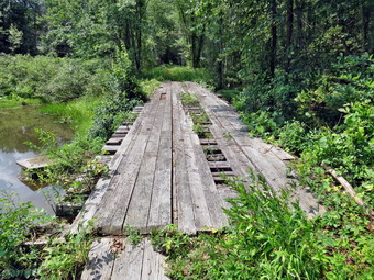 As we started the road walk, I check my map and could see that the railroad bed continued on and would cut some distance off the hike. I do not know why the trail turned left on South Road but we followed the assigned route. South Road eventually turned into Pennsylvania Avenue. It was rather pleasant walking on the flat and level road. As we neared town, we came across the D and H Canal Linear Park. A sign explained that Wurtsboro was named after Maurice Wurts who was the president and founder of the D and H Canal. There was also a stone snubbing post that was used to control the coal barges. When we arrived at Sullivan Avenue, the main street of Wurtsboro, we turned right and headed southeast, crossing the old railroad bed again at 3.8 miles. To this point the hike had been nearly flat and we had gained only 100 feet. This changed as we left the Village of Wurtsboro and headed up the hill to VFW Road. In truth the "climb" was only about 200 feet in .7 miles making an average grade of only 6%. The traffic seemed heavy but the shoulders of the main road were wide. When we arrived at the VFW post there were a few members present and we walked through the parking lot to the beginning of the trail just to make sure everything was connected. We turned around at 10:40 PM to return to the car after hiking 4.5 miles.
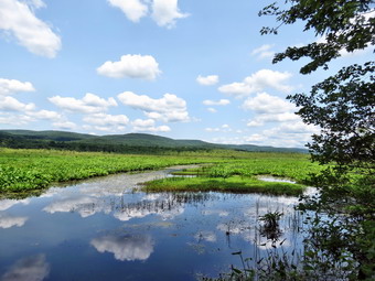 On the way back we stopped several times for some photography. As we descended into Wurtsboro I took a few shots of the clouds which where billowing and puffy. I noticed that there was an almost constant stream of takeoffs from the airport and in most cases it was a tow plane with a glider behind. We walked back through Wurtsboro and stopped at the Liner Park so that I could take a few pictures of the signs.
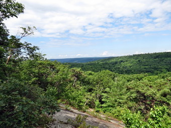
![]()
![]()
![]()
![]()
![]() On Thursday, July 17th I wanted to hike closer to home but still be able to work on a long distance trail. I decided to go to Wurtsboro and work on connecting the portions of the Shawangunk Ridge Trail that I had completed. I decided to hike the section of the SRT from Guymard Turnpike to Hawthorne Lake. My plan was to park on the Guymard Turnpike and to hike the trail to Hawthorne Lake and then return by reversing the route. I was a little apprehensive as the lower end of the hike is near the Leap ridge Trail where I have seen rattlesnakes in years past. Sheila was ready to go after several days on inactivity and we left Livingston Manor just before 8:00 AM. I turned off the Quickway at the exit for Route 209 and headed south toward Port Jervis. I drove about 11 miles south passing Route 211 and turned left on Guymard Turnpike. I followed the road through its twists and turns for about 2 miles to just before it crossed over the railroad tracks making an almost 180 degree turn. I found the small pulloff on the left side of the road and turned around and parked. I was careful to pick the parking spot without the "NO PARKING PROPERTY OF CONRAIL" sign! I was 8:40 AM when Sheila and I left the car and crossed the tracks to start our hike. The temperature was still in the high 60's so I chose to wear a long-sleeved shirt which seems to keep the bugs off me. Once we crossed the tracks I could not find any blazes but it seemed we should proceed along the tracks as that is what my maps seemed to indicate. The lack of blazes bothered me only a little as I have come to realize that the marking of the SRT and Long Path in this area is poor. We walked along the tracks for about .3 miles when I spied some aqua blazes on the trees in the woods to the left. We scrambled up the steep bank and found the trail. The blazes extend back behind us and I was anxious to see where the trail actually went on the way back. From this point on the trail rose and fell a little as we walked through both hardwood and softwood forest. Areas of the trail were muddy and we crossed several small streams and passed by a few small ponds. There were some very slippery places along the way and I was careful to keep my footing. At 1.6 miles we came to a woods road and turned right. Posted signs on both sides of the trail reminded me we should both stay on the trail. At one point the Long Path cut off to the left and we blazes changed from the aqua Long Path blazes to the dark blue of the SRT.
On Thursday, July 17th I wanted to hike closer to home but still be able to work on a long distance trail. I decided to go to Wurtsboro and work on connecting the portions of the Shawangunk Ridge Trail that I had completed. I decided to hike the section of the SRT from Guymard Turnpike to Hawthorne Lake. My plan was to park on the Guymard Turnpike and to hike the trail to Hawthorne Lake and then return by reversing the route. I was a little apprehensive as the lower end of the hike is near the Leap ridge Trail where I have seen rattlesnakes in years past. Sheila was ready to go after several days on inactivity and we left Livingston Manor just before 8:00 AM. I turned off the Quickway at the exit for Route 209 and headed south toward Port Jervis. I drove about 11 miles south passing Route 211 and turned left on Guymard Turnpike. I followed the road through its twists and turns for about 2 miles to just before it crossed over the railroad tracks making an almost 180 degree turn. I found the small pulloff on the left side of the road and turned around and parked. I was careful to pick the parking spot without the "NO PARKING PROPERTY OF CONRAIL" sign! I was 8:40 AM when Sheila and I left the car and crossed the tracks to start our hike. The temperature was still in the high 60's so I chose to wear a long-sleeved shirt which seems to keep the bugs off me. Once we crossed the tracks I could not find any blazes but it seemed we should proceed along the tracks as that is what my maps seemed to indicate. The lack of blazes bothered me only a little as I have come to realize that the marking of the SRT and Long Path in this area is poor. We walked along the tracks for about .3 miles when I spied some aqua blazes on the trees in the woods to the left. We scrambled up the steep bank and found the trail. The blazes extend back behind us and I was anxious to see where the trail actually went on the way back. From this point on the trail rose and fell a little as we walked through both hardwood and softwood forest. Areas of the trail were muddy and we crossed several small streams and passed by a few small ponds. There were some very slippery places along the way and I was careful to keep my footing. At 1.6 miles we came to a woods road and turned right. Posted signs on both sides of the trail reminded me we should both stay on the trail. At one point the Long Path cut off to the left and we blazes changed from the aqua Long Path blazes to the dark blue of the SRT.
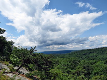 At 2.3 miles we came to an old wooden bridge over the tracks and the trail blazes indicated a right turn. I wondered how advisable this was since the bridge decking looked none too sturdy and a sign stated it was condemned! On the other side I could pick up no blazes even after walking down the road. We returned to the bridge and walked down the steep bank to the tracks and crossed over since I knew we were supposed to be down near the tracks. As we turned right to head south, I noticed the blue blazes going under the bridge behind us. This was another area I would explore on the return trip. I knew that we had to walk the tracks and then cut up to the left at some time. I did not know how far we had to walk and as we continued it seemed we were going too far. If I had any confidence in the trail blazes, I would not have been so anxious! Just when I though I might give up and turn around I could hear rushing water ahead. I knew that the trail cut into the woods near a stream and right after the stream I saw the blazes at about 3.1 miles. We turned left and immediately started the biggest ascent of the day. Over the next .8 miles we climbed about 600 feet through several switchbacks and areas of very challenging trail. At times it seemed we were walking in a rocky stream bed. At 3.6 miles there was an open rock face which served as a nice lookout. I stopped to take a few shots although it was still hazy. I thought about stopping on the way back if the haze had cleared. We were now in Huckleberry Ridge State Forest. From this point on I kept Sheila close to me as I was concerned about snakes! After finishing the climb we immediately started a slight descent and then another ascent. The trail was well packed in most places. There was an area of puncheons that were so slippery I decided to take my chances with the wet ground! Along the way I noticed a few medium-sized bear tracks in the mud. At 5.25 miles we broke out of the woods into the parking area near Hawthorne Lake. This was already turning out to be a little farther than it had measured but I wanted to see the lake and take some pictures. We walked along the road but there were no good views so we turned around to start back to the car.
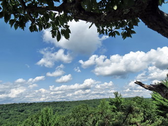 As we re-entered the woods, I saw a trail that seemed to head toward the lake. My feet were getting a little sore and I felt 10.5 miles would be enough for the day. We continued on the main trail and I chose a spot to stop and tape two toes that had hot spots. This helped I was able to continue with no problem. We stopped at the lookout again and I took a few more pictures as the haze had cleared and some puffy white clouds had rolled in. We descended the ridge to the tracks and started north. This part of the hike was very flat but walking on the stones of the railbed was uncomfortable. The puffy white clouds began to grow dark and I heard some rumbling so I assumed we would get at least some rain. When we came to the condemned bridge, We followed the blazes underneath the bridge and up the steep bank. The bank was slippery but I think it was a better route than across the bridge we continued on our way following the blazes back to the woods road where they were again aqua. The return trip was going quickly as I did not have to search and wonder which way to go. With under a mile to go, we were crossing a small stream when I stepped on a slippery rock and fell hard. I skinned my left knee and bruised my right hip but was otherwise was OK. I was again reminded that even a simple, almost flat hike can have some pitfalls. As we neared the end of the hike, I was careful to follow the blazes and not our original route. The blazes led up to and across the Guymard Turnpike on the other side of the bridge. We crossed the road and jumped the guardrail to follow the blazes down through the woods,1 across a small ditch and up to the tracks. At this point we walked beside the tracks to the area just across from our car. We crossed the tracks and were back at the car by 1:30 PM. we had covered 10.4 miles in 4 hours and 45 minutes with a vertical gain of 1794 feet all of which was in Huckleberry Ridge State Forest.
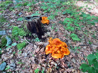
![]()
![]()
![]()
![]()
![]() On Saturday, July 12th I wanted to hike closer to home than New Jersey, The northern Catskills or Cortland. All these locations would help me work on some long distance trail but where too far from home. I decided to go to Wurtsboro and work on connecting the portions of the Shawangunk Ridge Trail that I had completed. I decided to connect the Basha Kill with the Graham Fire Tower hike we had done. My plan was to park on Route 61 (Otisville Road) near the Basha Kill and to hike the trail to the cutoff to the Graham Fire Tower. Sheila was ready to go despite the long hike from the day before and we left Livingston Manor just before 8:30 AM. I turned off the Quickway at the exit for Route 209 and headed south toward Port Jervis. I could immediately see some of the damage from the recent storms as several large tree lay by the side of the road or in yards. I drove about 6 miles south and turned left on Route 61. Just before the bridge over the Basha Kill I parked in a small lot on the right side of the road. I got out of the car to try to determine where the trail was located. I knew that it was located along Indian Orchard Road as we had hiked on that section when we hiked around the Basha Kill wetlands. I was unsure where the trail went from that point. I walked up the road with Sheila causing a scene since I had left her in the car. The Long Path marking seemed to indicate the trail went southeast on Route 61. I went back to the car an consulted the map on my cell phone as I had not brought along a printed map! It seemed that the trail did follow the road briefly before heading left into the woods. I put Sheila on her leash and got my gear ready and left the car at about 9:00 AM. We walked along the road for about .25 miles and found the point where the trail crossed the road. The bank was very steep and the trail went through several switchbacks as it climbed toward the top of the ridge. Over the next .75 miles we gained over 400 feet. The thing that surprised me the most was that the trail showed almost no signs of use. Also, it looked as if the trail markers had been put on the trees and little effort had been made to clear a trail or maintain what had been marked. This certainly would be easier if someone actually used the trail. The trail meandered back and forth and at about 1.75 miles we hit the highest point at 1035 feet. The trail never actually hits the highest point on the ridge which seems to be about 1200 feet.
On Saturday, July 12th I wanted to hike closer to home than New Jersey, The northern Catskills or Cortland. All these locations would help me work on some long distance trail but where too far from home. I decided to go to Wurtsboro and work on connecting the portions of the Shawangunk Ridge Trail that I had completed. I decided to connect the Basha Kill with the Graham Fire Tower hike we had done. My plan was to park on Route 61 (Otisville Road) near the Basha Kill and to hike the trail to the cutoff to the Graham Fire Tower. Sheila was ready to go despite the long hike from the day before and we left Livingston Manor just before 8:30 AM. I turned off the Quickway at the exit for Route 209 and headed south toward Port Jervis. I could immediately see some of the damage from the recent storms as several large tree lay by the side of the road or in yards. I drove about 6 miles south and turned left on Route 61. Just before the bridge over the Basha Kill I parked in a small lot on the right side of the road. I got out of the car to try to determine where the trail was located. I knew that it was located along Indian Orchard Road as we had hiked on that section when we hiked around the Basha Kill wetlands. I was unsure where the trail went from that point. I walked up the road with Sheila causing a scene since I had left her in the car. The Long Path marking seemed to indicate the trail went southeast on Route 61. I went back to the car an consulted the map on my cell phone as I had not brought along a printed map! It seemed that the trail did follow the road briefly before heading left into the woods. I put Sheila on her leash and got my gear ready and left the car at about 9:00 AM. We walked along the road for about .25 miles and found the point where the trail crossed the road. The bank was very steep and the trail went through several switchbacks as it climbed toward the top of the ridge. Over the next .75 miles we gained over 400 feet. The thing that surprised me the most was that the trail showed almost no signs of use. Also, it looked as if the trail markers had been put on the trees and little effort had been made to clear a trail or maintain what had been marked. This certainly would be easier if someone actually used the trail. The trail meandered back and forth and at about 1.75 miles we hit the highest point at 1035 feet. The trail never actually hits the highest point on the ridge which seems to be about 1200 feet.
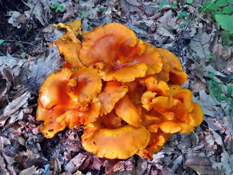 As we walked along the ridge, there were no opportunities for views and very little of interest. The most exciting moment was when we cam across a very large orange fungus on the forest floor! I stopped to take some pictures just to break up the monotony. Around 1 mile we made a turn onto a wide and well-maintained woods road and I thought it would be nice to follow it for awhile. This lasted until about 1.25 miles when we again turned into the woods as the trail left the road. At 1.8 miles we started on a slight descent and the trail seemed to split with the marked trail going to the right. We took the left fork which led to a nice viewpoint over the valley below. The day was somewhat hazy and there wasn't much to see but having some view was welcome. We stopped so that I could take a few shots. The Otisville Road was visible below and seemed very close. After taking some pictures, we went back to the main trail and began a descent to the road. The trail was more used here and was lined with a fluorescent green moss. In .2 miles we dropped a little over 200 feet and at the end we were almost at the road. As had been the case all along the markers really didn't indicate where we should go but we ended up on the side of the road. I looked around for some indication of which way we should turn. There were absolutely no markers or paint blazes to show where we should go. I again consulted my cell phone and decided to turn left and walk up the hill. I put Sheila on her leash and we walked a short distance without seeing any blazes. At this point some other hikers were walking down the road on the other side. We conversed and they said they were following the Long Path also and were surprised at the lack of markings. We talked for a moment and then headed in our opposite directions. I would respectfully request that those responsible for the trail improve the marking and do some maintenance to make it more obvious. We walked up Route 61 to Route 211 where a parking area on the left had some blazes. We crossed the road and I immediately recognized that we would be walking on the old railroad bed for the rest of hike out.
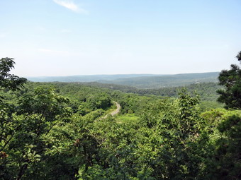 The railroad bed runs southwest and parallel to the existing Conrail tracks. It is very level and very straight for most of its length. The surface varies from hard-packed cinders to areas that have angular stones which makes walking more difficult. There are a few areas where water has accumulated but these are easily avoided. Sometimes it runs under the cover of trees but in other places it is completely open. The temperature was in the 80's on this day and it seemed very humid to me. I found that walking under the trees was cooler but there were more insects. When we broke out into the sunlight, it was warmer but there was a slight breeze and fewer insects to bother us. Shortly after the beginning of the railroad bed a huge powerline came in from the west and then followed the course of the railroad bed for some distance. At one point the two parted for a short distance but then joined again. At about 4.4 miles the powerline joined another and left the tracks. I knew that at about 5 miles we should run into the trails that went up the ridge to the Graham Fire Tower. Both the white Tower Trail and the red Ravine Trail originate in the same place but take different approaches to the top. We continued to walk but I did not see the markers for the trails. I thought parts of the hike began to look familiar but I had only been to the tower once and one part of the railroad bed looks a lot like the next. I kept checking my GPS against the map on my cell phone and became convinced that we had passed the trails. Soon we came to a side road off the railroad bed. I remembered this road from my previous visit and knew we had hiked almost to the Guymard Turnpike parking area.
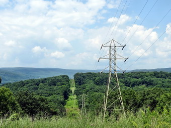 At 6.4 miles I finally decided to turn around and head back at about 11:35 AM. On the way back I kept looking carefully to my right for the trails. At about 7.8 miles I saw the red markers to the right and a quick look showed this was the trail to the tower. Just a little further down the main trail there was a grassy area on the right. Two trees had balzewas1 marked with three red and the other marked with three white indicating the beginning and end of the Ravine Trail and the Graham Fire Tower Trail. There were no signs on the main trail itself so be watchful when you hike this route. The trails are about 1.7 miles from the parking area on the Guymard Turnpike and 2.4 miles from the parking area at the intersection of Route 61 and Route 211. Once we found the trails I increased my pace. Sheila was already pretty far ahead and I called her back several times. She seemed to have a lot of energy for a hot day and a long hike! By 1:00 PM we had hiked 10.3 miles and were back at Route 61. I decided we would walk the Otisville Road back to the car as nothing on the SRT section had thrilled me. It was 1.7 miles back to the car and we arrived at 1:30 giving us a moving speed of 3.4 mph! We had covered 12 miles in 4.5 hours gaining 1376 feet in the process. I was glad to have connected two section of the SRT. I now need to connected High Point to Guymard and walk the short section from the Basha Kill to Wurtsboro to complete the trail.
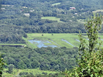
![]()
![]()
![]()
![]()
![]() On Friday, July 11th I was really ready to hike again after several days of heavy thunderstorms that made getting outside impossible! I wanted to continue my quest to complete some section of the long distance trails like the Long Path, FLT and AT. I decided to drive to northern New Jersey and park on Glenwood Road to hike "south" on the At toward Unionville. The AT actually heads west from Glenwood Road and passes through the Wallkill National Wildlife Refuge before getting to Unionville. Cindy and I had parked on Glenwood Road and hiked north so I knew exactly where I was parking. I got my gear ready to go and got Sheila in the car so that we could leave Livingston Manor right around 8:00 AM. I took Route 17 south and east to the exit for Florida. In only a little while the turn for Pulaski highway came up on the right so I turned and followed the signs to Pine Island. From Pine Island I headed south on Route 517 and then made a right on Route 565. When we passed the Vernon Township High School I knew we were close and I parked on the side of the road where the AT crossed. Sheila and I were ready to go at 9:15 AM. The temperature was in the high 70's and it seemed very humid to me. The first .1 miles was a slight downhill and we crossed some puncheons over marshy ground before beginning an ascent of about 1 mile. At about .6 miles we crossed a dirt road labeled Louemma Lane and I could hear what sounded like a camp at the lake to the north. We continued to hike to the top of a small hill gaining almost 500 feet in the first mile. After that we dropped slightly, before again gaining about the same elevation and coming to a lookout. The viewpoint was limited but I could see what looked like a marsh below. I took some shots before we continued to hike on the main trail. The hike had been mostly through hardwood forest and was a mixture of packed dirt in some spots and rocky traverses in others. We had met several groups of hikes along the way and with the exception of a few they were all hiking the AT from Georgia.
On Friday, July 11th I was really ready to hike again after several days of heavy thunderstorms that made getting outside impossible! I wanted to continue my quest to complete some section of the long distance trails like the Long Path, FLT and AT. I decided to drive to northern New Jersey and park on Glenwood Road to hike "south" on the At toward Unionville. The AT actually heads west from Glenwood Road and passes through the Wallkill National Wildlife Refuge before getting to Unionville. Cindy and I had parked on Glenwood Road and hiked north so I knew exactly where I was parking. I got my gear ready to go and got Sheila in the car so that we could leave Livingston Manor right around 8:00 AM. I took Route 17 south and east to the exit for Florida. In only a little while the turn for Pulaski highway came up on the right so I turned and followed the signs to Pine Island. From Pine Island I headed south on Route 517 and then made a right on Route 565. When we passed the Vernon Township High School I knew we were close and I parked on the side of the road where the AT crossed. Sheila and I were ready to go at 9:15 AM. The temperature was in the high 70's and it seemed very humid to me. The first .1 miles was a slight downhill and we crossed some puncheons over marshy ground before beginning an ascent of about 1 mile. At about .6 miles we crossed a dirt road labeled Louemma Lane and I could hear what sounded like a camp at the lake to the north. We continued to hike to the top of a small hill gaining almost 500 feet in the first mile. After that we dropped slightly, before again gaining about the same elevation and coming to a lookout. The viewpoint was limited but I could see what looked like a marsh below. I took some shots before we continued to hike on the main trail. The hike had been mostly through hardwood forest and was a mixture of packed dirt in some spots and rocky traverses in others. We had met several groups of hikes along the way and with the exception of a few they were all hiking the AT from Georgia.
 From the viewpoint the trail started a gentle descent. At one point I looked up to see a young woman hiking toward us. I was surprised to see she had only and Ipod and a bottle of water. As we talked she said she was a thruhiker and that someone had picked her pack and gear up in Unionville and was taking it to Warwick! As we parted I wondered how she would fair with so little equipment and at lest 12 more miles of hiking ahead of her. A little further on I met two other women. One was section hiking "only about 300 miles". The other woman had hiked half the AT in 2013 and was back to complete the trail this year. They reinforced the idea that a large "bubble" of AT hikers were coming through the northern New Jersey area at this time. We said "Goodbye" and Sheila and I embarked on a very rocky descent where we lost over 500 feet of elevation in just .6 miles. We crossed over Lake Wallkill Road and then walked about .5 miles through a rather damp area. We were on puncheons for a good part of this distance. At the end we came to a wide "road" on the edge of a marsh where we turned left. We met one thruhiker seated on a bench and two more as we walked southwest on the "road". I finally realized that we were on an old railroad grade and that this was the wildlife refuge. The railroad grade seemed to stretch on forever so I stopped to take some pictures of the marsh and the hills beyond. They sky even had some puffy clouds against a little blue! After only .25 miles the AT signs indicated we should turn right. I decided we would go a little bit farther before turning around. As we walked on a well-maintained path between two areas of the marsh I began to notice thousands of little grasshoppers. There were quite a few red-wing blackbirds and I noticed a blue heron standing in the marsh. I stopped to get out my camera sure that he would fly away before I could get a shot. The bird remained fixed and I got several good pictures. As the heron took to flight I tried to get some shots and succeeded in getting one.
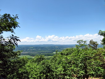 I decided we would continue around the marsh and after about .5 miles we made another right turn. At this point I decided to try to hike all the way around the marsh knowing that if a loop was not possible it would be a long way back. We were now hiking northeast toward Oil City Road. We passed a young man and woman with packs hiking in the opposite direction and said "Hello" as we passed. I stopped to take a few more pictures and to say "hello" to a wildlife biologist working in the marsh. At 11:45 AM we were 5 miles into the hike and made another right turn onto a path that paralleled Oil City Road. As we approach two women taking pictures, I asked if the trail went around the marsh and was received when they said "Yes". It was hotter and more humid now and I quickened my pace as I was anxious to get back under the trees. The path along the road was about .5 miles and at the end we made a right turn back onto the railroad grade. In another .5 miles we were back at the spot where the AT came out of the wood. We turned left and headed back toward the car. I was surprised that some of the climbs seemed so easy as I had not been looking forward to going up. There wasn't too much remarkable along the trail but I did stop at the viewpoint again to take a few shots. The haze had cleared and the white clouds in a blue sky were a nice backdrop. As we crossed one of the woods roads a little more than a mile from the car, we caught up to the young man and woman we had met while hiking around the marsh. We began to talk. They were thruhikers who were both from Wisconsin and on their first long distance hike. They seemed upbeat with both the physical capabilities and mental toughness needed to finish their journey. The young lady was looking forward to some ice cream and I suggested the Bellvale Creamery as they had planned to camp near Warwick. Soon we were at the car and we parted as they crossed the road to continue their hike. I estimated they had around 20 hard miles to get into Warwick! It was 2:00 PM and we had hiked 9.7 miles in 4 hours and 40 minutes with a total elevation gain of 1960 feet.
![]()
![]()
![]()
![]()
![]() On Sunday, July 6th I wanted to finish the AT in New York by returning to the Dover Oak and hiking east to Hoyt Road in Connecticut. This is about a ten mile section so I wanted to either do a car spot with another person or have someone help me spot me car at Hoyt Road. Fortunately, my son Kurt was available but not until 1:00 PM. I still thought we would have enough time to do the hike. This also allowed me to attend church before leaving for his house in Wappinger's Falls. I had though about doing this hike last week but after hiking three days in a row some thunderstorms moved in on Wednesday and hung around through Friday. I had a family commitment on Saturday so Sunday as the first day that was open. I left Livingston Manor at about 11:15 AM and headed down route 17 to I84. I took the Newburgh-Beacon bridge and ended up at Kurt's house just before 1:00 PM. He was almost ready to go and we headed toward Connecticut by picking up Route 21 east and then Route 55 east. Just .2 miles before the Connecticut border, we turned right on Hoyt Road. The parking area for the At is only about .25 miles up Hoyt Road on the right. We missed it the first time but found it on the way back. We parked Kurt's car and headed back west on Route 55. Fortunately, I had spotted Route 20 (Hoag's Corners Road) on the way over and it wasn't too far before we turned left on this road. We drove south and I knew there was no chance I could miss the Dover Oak on the left side of the road. There were a lot of cars parked but we found a space and parked at 2:15 PM and were hiking by 2:20 PM. I suspected many of the cars represented people hiking to the Cat Rocks on the other side of the road. We hiked up through a field on a well-worn track and stayed in the fields or on the edge for some time. In fact, a good part of the first mile was in the open. At about .6 miles I looked west and saw that the Cat Rocks were prominent on the opposing ridge. I stopped to take a few pictures before we continued on. After the first mile we began to descend and came to the wetlands around the Swamp River at about 1.4 miles. There was a boardwalk that crossed a small stream and then continued across the marsh at about 2.1 miles we crossed the Swamp River on a bridge. At 2.35 miles we crossed the Conrail tracks and found a special station just for AT hikers. Just beyond at 2.4 miles was route 22 where we turned left and hiked up the road a few hundred feet.
On Sunday, July 6th I wanted to finish the AT in New York by returning to the Dover Oak and hiking east to Hoyt Road in Connecticut. This is about a ten mile section so I wanted to either do a car spot with another person or have someone help me spot me car at Hoyt Road. Fortunately, my son Kurt was available but not until 1:00 PM. I still thought we would have enough time to do the hike. This also allowed me to attend church before leaving for his house in Wappinger's Falls. I had though about doing this hike last week but after hiking three days in a row some thunderstorms moved in on Wednesday and hung around through Friday. I had a family commitment on Saturday so Sunday as the first day that was open. I left Livingston Manor at about 11:15 AM and headed down route 17 to I84. I took the Newburgh-Beacon bridge and ended up at Kurt's house just before 1:00 PM. He was almost ready to go and we headed toward Connecticut by picking up Route 21 east and then Route 55 east. Just .2 miles before the Connecticut border, we turned right on Hoyt Road. The parking area for the At is only about .25 miles up Hoyt Road on the right. We missed it the first time but found it on the way back. We parked Kurt's car and headed back west on Route 55. Fortunately, I had spotted Route 20 (Hoag's Corners Road) on the way over and it wasn't too far before we turned left on this road. We drove south and I knew there was no chance I could miss the Dover Oak on the left side of the road. There were a lot of cars parked but we found a space and parked at 2:15 PM and were hiking by 2:20 PM. I suspected many of the cars represented people hiking to the Cat Rocks on the other side of the road. We hiked up through a field on a well-worn track and stayed in the fields or on the edge for some time. In fact, a good part of the first mile was in the open. At about .6 miles I looked west and saw that the Cat Rocks were prominent on the opposing ridge. I stopped to take a few pictures before we continued on. After the first mile we began to descend and came to the wetlands around the Swamp River at about 1.4 miles. There was a boardwalk that crossed a small stream and then continued across the marsh at about 2.1 miles we crossed the Swamp River on a bridge. At 2.35 miles we crossed the Conrail tracks and found a special station just for AT hikers. Just beyond at 2.4 miles was route 22 where we turned left and hiked up the road a few hundred feet.
 We crossed the road and again began to walk through some fields. At 2.7 miles we crossed Hurds Corners Road where there was some "trail magic" water. We met a section hiker here headed south from Cornwall, Connecticut. Just across the road was an electrified fence with a stile over it. It was one of three we would encounter as we made our way through the next set of fields. Sheila ran up one side and jumped down from the top! On the hill on the other side there was an interesting wooden water tower. I took a few shots of the tower and the stile before we continued our walk up the ridge by way of the fields. We entered the woods again at about 3 miles and then began a sustained ascent at about 3.4 miles. This lasted until we gained the highest point on the hike at 4 miles. This was on Hammersley Ridge just above Quaker Lake and the time was 4:10 PM. Unfortunately, there were no views to be had as we walked along. We had slowed a little on the climb as we were both a little tired from the exertion, the heat and the humidity. From the high point on the ridge we walked generally downhill for the next 3 miles heading northeast. Most of the walk was on packed dirt trail but there were a few rocky spots. I was glad Kurt was along since there was nothing remarkable about the trail in this area. At 5:30 PM a little more than 7 miles into the hike the trail turned almost due east and we started to ascend over two bumps that were part of Leather Hill. At 7.7 miles we crossed Leather Hill Road and continued east toward Duell Hollow Road. We started a steep descent at 8 miles which continued until we crossed Duell Hollow Road. On this descent we passed the Wiley Shelter which was completely occupied by a group of girls. They were in the shelter and setting up tents around it. We said "Hello" as we passed.
 As we continued down toward the road we passed the water supply for the shelter which was a well with a hand pump. I knew that after crossing the road we would not be too far from our destination. Of course the trail had one more "curve" to throw our way! We ascended from the road and then began to head south instead of east. This maneuver was to avoid descending into the gully cut by Duell Hollow Brook. In doing so the trail turned a .2 mile hiked into something over a .5 mile detour! We did cross the brook on an interesting foot bridge. We stopped so that I could take some pictures including one of Kurt and Sheila. There was one more short ascent on the other side and then another walk through some open fields. Just after this we began to descend through some trees and broke out onto Hoyt Road just north of the parking area. It was 6:40 PM and we had hiked 9.4 miles in 4 hours and 20 minutes. The vertical gain was 1730 feet almost all of which was on the ascent of Hammersley Ridge. Of course, we still had to drive back to my car which was parked next to the Dover Oak. This drive seemed very short but I was not looking forward to the drive home on the Sunday night of a holiday weekend! Because of the drive back, I decided not to stop by Kurt's house. Traffic, however, was much lighter than I expected and I was never stopped or even slowed much on the way home. I was pleased to have finished the At in New York especially since I could hike with my son. However, after meeting quite a few hikers who had started in Georgia I am humbled and also inspired by their efforts. I guess completing New Jersey will be next!
![]()
![]()
![]()
![]()
![]() On Tuesday, July 1st I wanted to continue my quest to finish the AT in New York by returning to the area east of Fishkill. After hiking part of the AT from Route 55 to Nuclear Lake the day before I wanted to finish the section between Nuclear Lake and the Dover Oak on Route 20. This would leave only 10 miles to the Connecticut border! After hiking over 9 miles the day before, I wasn't sure how much I would want to extend the hike. In addition this was supposed to be the hottest and most humid day of the week with the heat in sex well into the mid 90's. I decided to try to get the hike in before noon and then leave the last 10 miles for a car spot or drop off later. I awoke early and decided to get started as soon as possible Sheila and I left Livingston Manor around 7:00 AM and headed down route 17 to I84. I took the Newburgh-Beacon bridge and then exit 16N to get on the Taconic. At the next exit I took Route 52 toward Carmel. At the Stormville Post Office I turned left on Route 216 which I followed to Route 55. I turned right on Route 55 and within 1.8 miles found Old Route 55 which I followed to Dodge Road and finally to Route 20. I turned left on Route 20 which is locally called West Dover Road and within one mile found the point where the AT crosses the road. On the right side of the road was perhaps the biggest tree I have ever seen in person. The Dover Oak is said to be the largest oak tree on the AT and its circumference is truly impressive. I got out of the car to take a few pictures and immediately noticed the heat and humidity. After taking a few shots, I changed into a short sleeve shirt for the first time this summer and applied a liberal amount of insect repellant. Sheila was frantic by now so I let her out of the car and we crossed the road at 8:45 AM to begin the hike. The trail descended to a wet area which we crossed on some puncheons. After this the trail began a rather steep ascent to a shoulder of West Mountain and a viewpoint called the Cat Rocks. The ascent was .7 miles and we gained over 600 feet. There were several switchbacks that moderated the climb. We met one local man and his dog on the steepest part of the ascent over an open rock face. He said the views from the Cat Rocks were good which surprised me since I thought the haze would make them mediocre at best! On the middle part of the ascent we met a pair of brothers who had started on the AT in early March at Spring Mountain. They appeared to be in their early 20's and sported full beards. We passed the Telephone Pioneers Shelter and another hiker relaxing near the trail that went to the shelter. At the top of the climb the trail leveled out at the highest point which was around 1250 feet.
On Tuesday, July 1st I wanted to continue my quest to finish the AT in New York by returning to the area east of Fishkill. After hiking part of the AT from Route 55 to Nuclear Lake the day before I wanted to finish the section between Nuclear Lake and the Dover Oak on Route 20. This would leave only 10 miles to the Connecticut border! After hiking over 9 miles the day before, I wasn't sure how much I would want to extend the hike. In addition this was supposed to be the hottest and most humid day of the week with the heat in sex well into the mid 90's. I decided to try to get the hike in before noon and then leave the last 10 miles for a car spot or drop off later. I awoke early and decided to get started as soon as possible Sheila and I left Livingston Manor around 7:00 AM and headed down route 17 to I84. I took the Newburgh-Beacon bridge and then exit 16N to get on the Taconic. At the next exit I took Route 52 toward Carmel. At the Stormville Post Office I turned left on Route 216 which I followed to Route 55. I turned right on Route 55 and within 1.8 miles found Old Route 55 which I followed to Dodge Road and finally to Route 20. I turned left on Route 20 which is locally called West Dover Road and within one mile found the point where the AT crosses the road. On the right side of the road was perhaps the biggest tree I have ever seen in person. The Dover Oak is said to be the largest oak tree on the AT and its circumference is truly impressive. I got out of the car to take a few pictures and immediately noticed the heat and humidity. After taking a few shots, I changed into a short sleeve shirt for the first time this summer and applied a liberal amount of insect repellant. Sheila was frantic by now so I let her out of the car and we crossed the road at 8:45 AM to begin the hike. The trail descended to a wet area which we crossed on some puncheons. After this the trail began a rather steep ascent to a shoulder of West Mountain and a viewpoint called the Cat Rocks. The ascent was .7 miles and we gained over 600 feet. There were several switchbacks that moderated the climb. We met one local man and his dog on the steepest part of the ascent over an open rock face. He said the views from the Cat Rocks were good which surprised me since I thought the haze would make them mediocre at best! On the middle part of the ascent we met a pair of brothers who had started on the AT in early March at Spring Mountain. They appeared to be in their early 20's and sported full beards. We passed the Telephone Pioneers Shelter and another hiker relaxing near the trail that went to the shelter. At the top of the climb the trail leveled out at the highest point which was around 1250 feet.
 At .9 miles we came to a side trail on the right which led to an extensive open rock face. This was the Cat Rocks and there was about a 180 degree view to the east. The problem was that the sky was very "flat" with very little blue and not much in the way of puffy white clouds. In addition, the humid weather resulted in a haze hanging over everything of Pawling could be seen below but everything else was a blur. I took some pictures and resolved to come back to this spot on a better day and to bring Cindy with me. We walked back up to the AT and continued west toward Nuclear Lake. I knew we had about 2 miles to go and would have to drop some elevation to get to the loop trail around the lake where I had left off the day before. From the viewpoint the trail dropped some elevation to about 1.8 miles where we crossed some puncheons across a marshy area at an elevation of almost 1100 feet. Having a marshy area like this at a higher elevation is unusual. We gained some more and then at about 2 miles started to drop toward the lake. Over the next mile we lost about 350 feet on a gentle grade with a few steeper parts and switchbacks mixed in. We met a few more hikers headed in the opposite direction. One of these was a young man hiking solo who had started in Georgia at the end of February making him the hiker with the earliest starting data t5hat we had met. At almost exactly 3 miles we came to the loop trail where we turned around for the return trip. The return trip seemed to go very quickly but I noticed I was not enjoying these "repeats" very much any more. Much of the AT is not very scenic and repeating it is not at all appealing. As we approached the Cat Rocks a hiker caught up to us from behind. As he passed I asked if he was hiking the entire AT and responded that he was. This hiker was from Austria and had started on April 15 making him the hiker with the latest start than we had met. A little math led me to the conclusion that he was averaging 20 miles each and every day. We talked briefly and then started hiking again. He effortlessly pulled away even though we were setting a reasonably fast pace. On the way down the trail from the Cat rocks we met a few more hikers and a rather large group of local boys. The boys were making quite a bit of noise and I didn't want Sheila to feel threatened so we hurried along. The descent down the steep, open Rick face at the end was interesting but we were soon back at the car. It was hot and I decided to leave the last 10 miles to Connecticut for another day. I want to hike that stretch only once from the Dover Oak to the border! We were at the car by 11:35 AM after hiking 6 miles in 2 hours and 50 minutes. The elevation gain was a modest 1420 feet. The temperature was 90 degrees with a humidity of 60% pushing the heat index to 96!
![]()
![]()
![]()
![]()
![]() On Monday, June 30th I wanted to continue my quest to finish the AT in New York by returning to the area east of Fishkill. After hiking part of the AT from Route 52 to near Depot Hill Road the day before I wanted to finish this section. After hiking over 9 miles the day before, I wasn't sure how much I would want to extend the hike. When we returned to Route 55 from Depot Hill I would decided if I wanted to hike to the east toward Nuclear Lake. I awoke early and decided to get started as soon as possible Sheila and I left Livingston Manor before 8:00 AM and headed down route 17 to I84. I took the Newburgh-Beacon bridge and then exit 16N to get on the Taconic. At the next exit I took Route 52 toward Carmel. At the Stormville Post Office I turned left on Route 216 which I followed to Route 55. I turned right on Route 55 and within 1.5 miles found the AT parking area on the left. I parked and we were ready to hike almost immediately. It was 9:15 AM and the temperature was warm but cooler than the day before. We headed south on Route 55 and quickly crossed the road and headed west into the woods. The first part of the trail was a well-packed dirt track which was a little too close to "civilization" judging by the broken bottles. In less than half a mile we crossed Old Route 55 and met group of three hikers headed toward us. They recognized us from the day before as we said "Hello". After a very short walk in the woods, we came to the railroad tracks and cross them without a problem. There was a rather large beaver ponds on the other side and I put Sheila on her leash to prevent her from playing in the mud. Just after the tracks we met another couple who were hiking and who also remembered us from the day before. I think both of these groups had a better memory of Sheila than of me!
On Monday, June 30th I wanted to continue my quest to finish the AT in New York by returning to the area east of Fishkill. After hiking part of the AT from Route 52 to near Depot Hill Road the day before I wanted to finish this section. After hiking over 9 miles the day before, I wasn't sure how much I would want to extend the hike. When we returned to Route 55 from Depot Hill I would decided if I wanted to hike to the east toward Nuclear Lake. I awoke early and decided to get started as soon as possible Sheila and I left Livingston Manor before 8:00 AM and headed down route 17 to I84. I took the Newburgh-Beacon bridge and then exit 16N to get on the Taconic. At the next exit I took Route 52 toward Carmel. At the Stormville Post Office I turned left on Route 216 which I followed to Route 55. I turned right on Route 55 and within 1.5 miles found the AT parking area on the left. I parked and we were ready to hike almost immediately. It was 9:15 AM and the temperature was warm but cooler than the day before. We headed south on Route 55 and quickly crossed the road and headed west into the woods. The first part of the trail was a well-packed dirt track which was a little too close to "civilization" judging by the broken bottles. In less than half a mile we crossed Old Route 55 and met group of three hikers headed toward us. They recognized us from the day before as we said "Hello". After a very short walk in the woods, we came to the railroad tracks and cross them without a problem. There was a rather large beaver ponds on the other side and I put Sheila on her leash to prevent her from playing in the mud. Just after the tracks we met another couple who were hiking and who also remembered us from the day before. I think both of these groups had a better memory of Sheila than of me!
 From the tracks we began an ascent of about a mile toward the top of Depot Hill. The elevation gain was only about 540 feet but there were some steep areas. The trail was much rockier than before and I found I was a little tired. At about 1.9 miles we passed by the summit of Depot Hill without actually hiking over it. It seemed like we were descending but the trail was doing its normal undulation. We did pass by some wetlands and I noticed that the insect population increased dramatically. This area of the trail just before Depot Hill Road was also very rocky. At 2.3 miles we crossed Depot Hill Road which was barely a single lane gravel track at that point. We continued to walk for about another .2 miles but things immediately began to look familiar I knew we had overlapped the hike from the previous day. We turned around just before 10:30 AM and started back. The return trip went more quickly than I had anticipated and we were soon crossing the tracks and Old Route 55. I had decided to hike toward Nuclear Lake and perhaps take the loop trail around it. As we approached Route 55, we caught up to the couple who had recognized us from the day before. They were hiking very slowly but seemed to be enjoying themselves. They were from Maryland and had finished the AT in New Jersey in May and were working on New York. They hoped to hike all the way to Vermont. They did question me about a motel and I volunteered to drive them somewhere but they politely refused.
 We got to Route 55 about 4.75 miles at 11:35 AM and I decided to try the loop around Nuclear Lake. I crossed as did the couple. We said "Goodbye" and I wished them "Good luck!" as I did not expect to see them again. The distance from Route 55 to Nuclear Lake appeared to be about .6 miles but the trail kept winding this way and that extending the distance to 1.2 miles. We met a few people coming toward us and at least one hiker went passed us. We finally came to the first junction with the loop trail even though the lake was not in view. The AT so far had been level in places and rocky in others but there was very little up or down. I decided to stay on the AT along the west side of the lake and then follow the loop trail around from the upper end. At 6.5 miles into the hike, about 1.5 miles from Route 55, we got a look at the lake and walked down to the shore. I dropped my pack and got out the camera to take some pictures. I asked Sheila to stay out of the lake even though it had long ago been found to be clear of any radioactive materials. In the early 1970's there was an explosion at a small research facility on the shores of the lake. This scattered a small amount of radioactive material in the surrounding forest. The material was cleaned up and subsequent testing showed no more radiation than normal background. Shortly after the facility was closed and the building razed. I took a few pictures of the lake and what looked like a small, rocky island before packing up and heading out on the AT again.
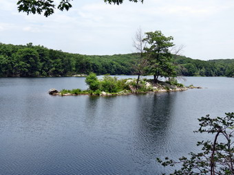 The trail became very rocky and descended to very near the shore of the lake. At one point I could hear Sheila in the water! We continued around the lake and at least twice my GPS unit showed us walking on or in the lake. I have learned to never depend on a GPS for complete accuracy! We continued around the lake and at 6.8 miles the AT turned left and we started hiking on the loop trail around the lake. I was disappointed that the trail stayed pretty far away from the water as I thought there might be some nice views from the cliffs that lined the eastern shore. This trail started out fairly flat but soon became rocky with a few short but steep ascents and descents. At one point Sheila walked off the trail to the right and I started to call her back as I wanted her to stay with me on the main trail. It was then that I noticed that she had found a path that went out to a very nice lookout. From the viewpoint I could see the small island and take a few pictures of it and the rest of the lake. We continued on the main trail meeting a few more hikers out for the day. Sheila was on her best behavior and we soon crossed the access road to the lake, re-entered the trees and completed the loop by rejoining the AT at 7.9 miles into the hike. It was now a little after 1:00 PM and the loop around the lake was almost exactly 2 miles. We only had the 1.2 mile walk back to the car. We turned left onto the AT and, after walking a few hundred feet, met the couple that we had seen at Route 55. I was a little concerned that they had hiked 1.2 miles while we had gone 3.2 miles but they seemed to be okay. As Sheila and I neared Route 55 I decided to take the blue shortcut trail back to the parking area. I wasn't too concerned about distance but wanted to avoid hiking along the main road. We were back at the car by 1:35 PM having hiked a total of 9 miles in 4 hours and 20 minutes. The vertical gain was about 1650 almost all of which was on the west side of Route 55 climbing Depot Hill.
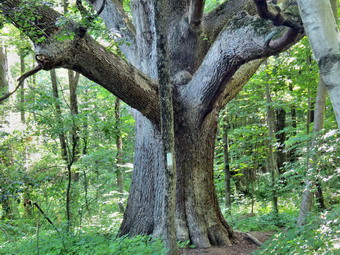
![]()
![]()
![]()
![]()
![]() On Sunday, June 29th I wanted to continue my quest to finish the AT in New York by returning to the area east of Fishkill. The hike from Route 52 to Route 55 was listed as 7.5 miles making a round trip of 15 miles which seemed a little long to me. I decided to start at Route 52 and hike as far as I could, probably to Depot Hill Road passed the Morgan Stewart Shelter. I left Livingston Manor before 9:00 AM and took Route 17 to I84 across the Newburgh-Beacon bridge. I took exit 16N to get on the Taconic but got off at the next exit on Route 52. I was not sure I would recognize the place where I ended my last hike in the area but I had no problem finding the spot at around 10:00 AM. I turned around and parked on the wide shoulder and Sheila and I were ready to go at about 10:05 AM. As we left the car and started up Route 52, I realized that I had parked by the access road to an AT parking area. I debated whether or not to move my car but decided in the end to keep hiking. We entered the woods and climbed a little before the trail leveled and we were walking along the edge of an open area. There were some very limited views but what impressed me the most was that the trail had been manicured and all the tall grass cut. Within 15 minutes we re-entered the woods and found very large maple tree. I stopped to take a few pictures from different angles. The sun was very bright which made taking shots tricky. I estimated the circumference of the tree to be at least 20 feet! We continued and in less than a mile came out onto a side street where the trail followed the road to the right. We continued to follow the blazes and turned left onto Mountain Top Road which took us over I84. The road came to a T on the other side and we continued straight ahead on the AT as it entered the woods. We walked down what looked like a new set of stone steps and across a brook. This was at about 1.4 miles into the hike and at 10:40 AM. The temperature was already in the 80's and the humidity seemed high. The trail however were dry.
On Sunday, June 29th I wanted to continue my quest to finish the AT in New York by returning to the area east of Fishkill. The hike from Route 52 to Route 55 was listed as 7.5 miles making a round trip of 15 miles which seemed a little long to me. I decided to start at Route 52 and hike as far as I could, probably to Depot Hill Road passed the Morgan Stewart Shelter. I left Livingston Manor before 9:00 AM and took Route 17 to I84 across the Newburgh-Beacon bridge. I took exit 16N to get on the Taconic but got off at the next exit on Route 52. I was not sure I would recognize the place where I ended my last hike in the area but I had no problem finding the spot at around 10:00 AM. I turned around and parked on the wide shoulder and Sheila and I were ready to go at about 10:05 AM. As we left the car and started up Route 52, I realized that I had parked by the access road to an AT parking area. I debated whether or not to move my car but decided in the end to keep hiking. We entered the woods and climbed a little before the trail leveled and we were walking along the edge of an open area. There were some very limited views but what impressed me the most was that the trail had been manicured and all the tall grass cut. Within 15 minutes we re-entered the woods and found very large maple tree. I stopped to take a few pictures from different angles. The sun was very bright which made taking shots tricky. I estimated the circumference of the tree to be at least 20 feet! We continued and in less than a mile came out onto a side street where the trail followed the road to the right. We continued to follow the blazes and turned left onto Mountain Top Road which took us over I84. The road came to a T on the other side and we continued straight ahead on the AT as it entered the woods. We walked down what looked like a new set of stone steps and across a brook. This was at about 1.4 miles into the hike and at 10:40 AM. The temperature was already in the 80's and the humidity seemed high. The trail however were dry.
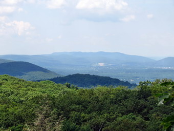 From the time we entered the trail the surface became rockier and where there were fewer rocks there were more roots. The hike was generally a gentle ascent heading for Mount Egbert. At around 3.4 miles I came across a viewpoint mentioned in some of the trail descriptions. The views were limited and the day was very hazy which made taking really interesting pictures almost impossible. I did take some shots and then called my son Kurt to see what he was doing. I thought he might be able to pick me up at Route 55 but he was already in Catskill, new York with a buddy looking for American Indian artifacts. I decided to continue with my original plan. Sheila and I resumed the hike which became steeper as we scaled Mount Egbert. We hit the summit at about 3.6 miles. What I found surprising was the number of people hiking this section of the trail. We met some groups and solo hikers coming toward us but mostly we passed groups of people headed in the same direction we were headed. Since there were so few cars at Route 52 where I had parked, I assumed that they were hiking longer sections than just a day hike. The size of their packs seemed to indicate this also. I said "Hello" to each group and Sheila was on her best behavior but I didn't interview anyone as it was hot and I was on a mission. Just after the summit of Egbert, I could hear some voices off to the right of the trail. I didn't know what they were doing over there and didn't pay much attention. As we started to descend, we came across the short side trail to the Morgan Stewart Shelter. We continued along the trail with what seemed like a long descent. What really happened was we went through a series of ups and downs. I was looking for another view to the north to match a description I had read.
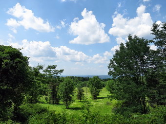 By the time we hit 4.6 miles we were well passed where the viewpoint should have been. We were also entering a low area with some marshy ground and the insects were increasing. It was hot and I was not inspired by the trail. I decided we would turn around and head back. I was annoyed we had not gotten to Depot Hill Road but knew it really didn't matter since we would have to hike the section from Route 55 back to the west anyway. As we climbed back up Mount Egbert and passed the Morgan Stewart Shelter we met two or three groups of hikers heading toward us. Again, I said a "hello" but pressed on. The hike back was generally downhill but there were enough short ascents to make things interesting. I slowed at the only lookout I had found but the haze was still there so we continued on. When we hit the overpass over I84 the temperature on the road was oppressive and we walked quickly to get back into the woods. There was a slight ascent from the road up a hill and then we were again passing the large maple. Just passed the tree we met a final group of hikers just starting out. They seemed equipped for a hike and I wondered why they had gotten such a late start. I stopped to take some pictures of the clouds in the blue sky since the haze had finally disappeared. We were back at the car at 2:30 PM and the temperature read 92 degrees. We had covered 9.2 miles in 4 hours and 20 minutes with about 22 minutes of stopped time. The total elevation gain was only 1690 feet but it seemed like more.
![]()
![]()
![]()
![]()
![]() On Tuesday, June 24th I wanted to finish a small section of the AT from the NY-NJ border to Bellvale Mountain. This would leave only 20 miles from Route 52 to the Connecticut border. The section I wanted to hike was only 1.6 miles one way but it was on the ridge and the hike to that point was over a mile and very steep. The day was forecast to be partly sunny with only a 10% chance of rain but when we left Livingston Manor at 8:45 AM it was almost completely overcast. I took Route 17 south and east to the exit for Florida. I followed Route 17A through Florida and Warwick and then toward Greenwood Lake. As I drove along the west shore of Greenwood Lake on Route 210 toward New Jersey, I wondered if I would spot the Martina parking lot that I wanted first time through. I spotted a sign for New Milford Township and turned right just before the sign to drive through the marina parking to the trailhead lot. I was surprised there were at least six cars already there. I parked in front of some boats and asked an employee if that would be Ok. He said "Yes" and thanked me for asking. I out Sheila on her leash and we headed out on the blue State Line Trail just before 10:00 AM. As soon as we were on the trail, I let Sheila off her leash and we continued up the trail. This trail must be quite popular as the ground is well-packed. In addition, people have walked off the trail wherever they wanted which makes the main trail hard to follow. The trail blazes can also be confusing so I was watching the paint very carefully. After wandering along the base of the ridge to the west for about a quarter of a mile the trail turns right or northwest and starts up the ridge. Although there are some switchbacks along the way, there are also some steep sections. The sidetracks continued to be a problem as did the faded blazes. Some parts of the trail are packed dirt but there are several sections with a lot of rocks which made walking harder. As we ascended I could feel that I was tired from the day before and was glad this would be a short hike.
On Tuesday, June 24th I wanted to finish a small section of the AT from the NY-NJ border to Bellvale Mountain. This would leave only 20 miles from Route 52 to the Connecticut border. The section I wanted to hike was only 1.6 miles one way but it was on the ridge and the hike to that point was over a mile and very steep. The day was forecast to be partly sunny with only a 10% chance of rain but when we left Livingston Manor at 8:45 AM it was almost completely overcast. I took Route 17 south and east to the exit for Florida. I followed Route 17A through Florida and Warwick and then toward Greenwood Lake. As I drove along the west shore of Greenwood Lake on Route 210 toward New Jersey, I wondered if I would spot the Martina parking lot that I wanted first time through. I spotted a sign for New Milford Township and turned right just before the sign to drive through the marina parking to the trailhead lot. I was surprised there were at least six cars already there. I parked in front of some boats and asked an employee if that would be Ok. He said "Yes" and thanked me for asking. I out Sheila on her leash and we headed out on the blue State Line Trail just before 10:00 AM. As soon as we were on the trail, I let Sheila off her leash and we continued up the trail. This trail must be quite popular as the ground is well-packed. In addition, people have walked off the trail wherever they wanted which makes the main trail hard to follow. The trail blazes can also be confusing so I was watching the paint very carefully. After wandering along the base of the ridge to the west for about a quarter of a mile the trail turns right or northwest and starts up the ridge. Although there are some switchbacks along the way, there are also some steep sections. The sidetracks continued to be a problem as did the faded blazes. Some parts of the trail are packed dirt but there are several sections with a lot of rocks which made walking harder. As we ascended I could feel that I was tired from the day before and was glad this would be a short hike.
 Over the next .8 miles we gain 650 feet to the top of the ridge. We passed one group of hikers sitting on the rocks away from the side of the trail. At the top of the ridge I found the SL sign from the day before and paused for a moment as a young man approached hiking from the south. Sheila did not bark which surprised me. The hiker and I struck up a conversation and Sheila actually allowed him to pet her which showed great progress. I mentioned the AT hikers we had encountered the day before at which time the young man informed me that he had started at Georgia on March 15th. He was from Iowa and had started alone but had met three other hikers on the trail that we had been traveling with for some time. We continued to talk for a while as we hiked to the state line. I took a picture of him there. I was surprised that his pack was not much larger than mine. At 1.5 miles, as we ascended to Prospect Rock, he went on ahead as we said "Goodbye". I stopped to take some pictures of the flag on top of the rock. Prospect Rock is the highest point on the AT in New York state. We continued on our way with me watching the sky as it was still very overcast. I was hoping it would not rain. From the top of Prospect Rock the trail descended for the next .9 miles. Sometimes we were walking along the knife edge of rock outcrops while other times we were walking through pine trees and over soft, marshy ground. At 2.4 miles we began to ascend Bellvale Mountain. The ascent was .4 miles and gained about 200 feet. Along the way, true to the description we encountered several rock scrambles. In some places I wondered if Sheila would look for a way around the rocks but in all cases she made it up seemingly without effort. One ascent was nearly vertical and had an aluminum ladder tethered to the rock face. I thought Sheila could climb the ladder so I took a picture of the ladder and then with Sheila at the base of the ladder. I turned away and then back to encourage Sheila to climb the ladder so that I could get a picture. Sheila was already at the top of the climb. Within an instant she came back down and then went back up as I started to climb the ladder. She did not use the ladder but simply went up the rock face! At the top of the climb we were on Bellvale Mountain where I had been before. There was a limited view and I took a few pictures.
 Once we were on the top of Bellvale Mountain we had reached the goal I had set. I started to think that this would make a very short hike and, inspired by the AT hikers, I decided to hike to the Village Vista Trail and down to Greenwood Lake. We could then use Route 210 to get back to the car. Unfortunately, although I have all the maps from the NYNJTC I decided to leave the pertinent map of the area at home. Still, I didn't think the Village Vista Trail was that far so we continued along the ridge. The trail repeated the descend and ascend pattern with the open rock faces and dark stretches through the evergreens. Some ascents were steep although brief. There were several large rock cairns along the way. After a mile of hiking I began to wonder how far I would have to hike to the Village Vista trail and thought about turning around. I finally decided that this was a challenge and that we had hiked at much as 18 miles in one hike last summer so we would continue no matter what. Finally, after more than 2 miles the terrain started to look familiar and we arrived at the Village Vista trail at 12:40 PM about 4.9 miles into the hike. As we turned right onto the Village Vista trail we met two AT hikers coming up from Greenwood Lake. Their look and hiking style was familiar with a no-nonsense, ground covering stride. The trail started out almost level but that change immediately as it began to descend to the lake. There were several switchbacks but the grade was still challenging and would be more so on the ascent. We did run across the "vista" but it was disappointing as most of the view was blocked by trees. I doubt too many people from the village brave this trail for such a limited view. We continued down the trail from the vista as it become steeper and rockier. Where the trail was not rocky it was dusty which made getting a good grip difficult. We finally broke out into a sand and gravel yard almost at the bottom of the ridge. The trail turned to the left on a road and then right back into the woods briefly before it came out onto some local streets. It was 1:05 PM and we were 5.65 miles into the hike. I estimated we had a little more than 3 miles to hike. We followed the streets out to Route 210. A pit bull ran out to accost us but a guttural growl from Sheila sent him running home. I was surprised that Route 210 had a pretty good shoulder for walking and we set up a quick pace. Route 210 was flat and level compared to the ridge we had just walked but my feet were beginning to get tired. There were a few hills but these were easily negotiated. I noticed the house numbers were decreasing and assumed that they started at the state border. After walking another 3.6 miles, the sign for the marina came into view and we turned right to walk up to the car. I gave Sheila drink and checked the GPS. It was 2:10 PM and we had walked 9.3 miles in 4 hours and 15 minutes. The vertical gain was only about 1660 feet which was less than I would have predicted. Most of that was accrued in the initial hike to the top of the ridge on the State Line Trail.
![]()
![]()
![]()
![]()
![]() On Monday, June 23rd I wanted to continue hiking the AT in New Jersey from the Warwick Turnpike to the New York-New Jersey border near Greenwood Lake. The forecast was for warm temperatures and clear skies so Cindy decided to come along. We got a later start than I had anticipated but this let some early morning haze burn off. We left Livingston Manor at about 9:30 AM and took Route 17 south and east to the exit for Florida. We followed Route 17A through Florida and Warwick until it turned into Route 94. We turned left on Warwick Turnpike and started to look for the pulloff on the left where Kurt and I had ended our hike on Saturday. I wasn't sure I would remember what the spot looked like and it was further along than I thought but we arrived quickly enough. I parked the car and we were ready to hike almost immediately. The first part of the rail passed over some puncheons and then through some hardwoods passing a field on the left. The trail surface here was packed dirt and we moved quickly. After ascending a small hill we began to descended to a wetter area and noticed an increase in insects almost immediately. We stopped to put on repellant and then worked our way through some wet spots where small streams crossed and over some puncheons that spanned muddy ground. We again ascended a little and then crossed another trail or path. At this point I noticed I did not have my GPS. I suspected that in our hurry to get going I had left it at the car. I knew I would not enjoy the hike without knowing where it was and recording our route. I told Cindy and she agreed to wait until I retraced the .7 miles back to the car. I don't know whether she did it on purpose but she said "I guess you'll be back be about 11!" This statement acted as a challenge so I dropped my pack and started to jog back to the car. I found my Solo Powermatic boots are not the best trail runners. On the way back I passed two young women coming toward me in two different spots. Both said "Hello" and both looked like they were hiking some distance as they carried larger packs. I made it to the car, picked up the GPS and started the journey back. I was back by 10:50 AM which made me happy but had put a strain on my feet and legs. We started the rest of our hike almost immediately.
On Monday, June 23rd I wanted to continue hiking the AT in New Jersey from the Warwick Turnpike to the New York-New Jersey border near Greenwood Lake. The forecast was for warm temperatures and clear skies so Cindy decided to come along. We got a later start than I had anticipated but this let some early morning haze burn off. We left Livingston Manor at about 9:30 AM and took Route 17 south and east to the exit for Florida. We followed Route 17A through Florida and Warwick until it turned into Route 94. We turned left on Warwick Turnpike and started to look for the pulloff on the left where Kurt and I had ended our hike on Saturday. I wasn't sure I would remember what the spot looked like and it was further along than I thought but we arrived quickly enough. I parked the car and we were ready to hike almost immediately. The first part of the rail passed over some puncheons and then through some hardwoods passing a field on the left. The trail surface here was packed dirt and we moved quickly. After ascending a small hill we began to descended to a wetter area and noticed an increase in insects almost immediately. We stopped to put on repellant and then worked our way through some wet spots where small streams crossed and over some puncheons that spanned muddy ground. We again ascended a little and then crossed another trail or path. At this point I noticed I did not have my GPS. I suspected that in our hurry to get going I had left it at the car. I knew I would not enjoy the hike without knowing where it was and recording our route. I told Cindy and she agreed to wait until I retraced the .7 miles back to the car. I don't know whether she did it on purpose but she said "I guess you'll be back be about 11!" This statement acted as a challenge so I dropped my pack and started to jog back to the car. I found my Solo Powermatic boots are not the best trail runners. On the way back I passed two young women coming toward me in two different spots. Both said "Hello" and both looked like they were hiking some distance as they carried larger packs. I made it to the car, picked up the GPS and started the journey back. I was back by 10:50 AM which made me happy but had put a strain on my feet and legs. We started the rest of our hike almost immediately.
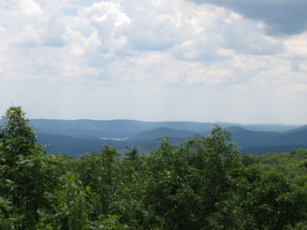 At 11:15 AM we came to Longhouse Drive about 1.5 miles into the hike. The trail turned left here and followed the road several hundred feet before turning right back into the woods. Three young women were gathered at the point where the trail entered the woods and we stopped to talk to them. They were hiking the entire AT and had started at Springer Mountain, Georgia on March 8th. Their home states were New Jersey, Washington and Virginia. I offered a little advice but they seemed confident in their maps and guidebook so we continued on. We were headed almost due east and for the next 1.1 miles the trail rolled some and we followed it as it avoided two swamps. The sky seemed more overcast than forecast and both of us thought that it might rain. At 2.6 miles the trail turned southeast and began to parallel the New York-New Jersey border as we began to ascend to the ridge. Over the next .5 miles we gained 285 feet and the terrain began to look more like the Bearfort-Bellvale Ridge that we had hiked from the north. The trail began to roll some now and at 3.3 miles we ascended to the top of a rock outcrop. There was a view of some water which was the first view of anything we had had on the hike. At this point the trail turned left to head north directly for the border. As we walked we came across some blue blazes and an SL marked on the rock. I knew that this was the State Line Trail and that the state line was close. We hit the border at 3.6 miles around 12:20 PM. We walked across the border and then stopped to take a few shots of the border and the USGS marker.
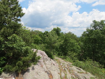 We turned around and began the trek back to the car. We stopped at the rock outcrop where the trail turns and had a drink and a snack. The young women hiking the AT began to appear one at a time. Two hiked passed us but then ether was a long wait so we decided to continue on our way. After hiking for about half a mile we met a young couple hiking toward us with overnight packs. We said "Hello" but didn't ask where they started or their destination. Soon the final hiker of the three AT hikers cam toward us. She was definitely walking slower than the others and appeared a little more tired. We tried to keep up a good pace as the insects were becoming much more bothersome and we simply wanted to get back to the car. As were on the last leg we heard a rustling in the trees to our left and a voice ahead of us called out that there were bears in the area. I grabbed Sheila and put her on her leash and we moved ahead quickly making noise. We met the other hiker who said he had seen a sow and three cubs. The cubs were up in the trees and the mother had run off a short distance. I really wanted to get a picture of the cubs but thought it prudent to get out of the area. He continued back toward the car while the other hiker walked passed the bears. he called out that he could see the up in the trees. We made short work of the final section of the trail arriving back at the car by 2:20 PM having covered 7.2 miles in 3 hours and 45 minutes. Strangely, my GPS track indicated that we had not crossed the state border when we definitely had. So much for relying on the accuracy of technology. We were both a little tired as the temperature was in the low 80's and the humidity had risen. We decided to stop to eat and agreed that El Bandido was the place. We had a good meal and returned home satisfied with our days adventure.
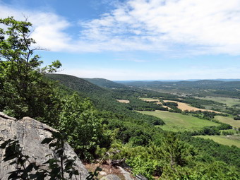
![]()
![]()
![]()
![]()
![]() On Saturday, June 21st my son Kurt was coming to Sullivan County and had time to do a hike with me. I was excited as we do not get to hike together often and I started to consider where we might go to hike. I wanted to continue the Long Path north of Windham but was also interested in hiking part of the AT in northern New Jersey. When Kurt arrived at about 9:15 AM I presented both choices and we discussed them. We decided to head for New Jersey to hike the AT and left almost immediately. My plan was to park on Barrett Road off Route 94 south of Warwick. This was in the middle of a section of the AT that I had not hiked. This would give us the opportunity to hike from the car to the Pinwheel Vista on Wawayanda Mountain an then hike back to the car. We could then decided if we still wanted to hike from the car to the Warwick Turnpike and back. The temperature was supposed to be in the low 70's which would be good for hiking. When we left the house it was only 52 degrees but we knew it would warm up rapidly as the sun was out and there were few clouds in the sky. We left Livingston Manor at about 9:20 AM and took Route 17 south and east to the exit for Florida. We followed Route 17A through Florida and Warwick until it turned into Route 94. Just before the New Jersey border we turned left on Barrett Road. Barrett Road climbing to the top of a ridge. At about 1.4 miles there was a pulloff on the right but there were no sings for the AT> I stopped and we asked a young couple just getting into their truck if the AT was near. He answered that we were in the right so we pulled in as they pulled out. I still didn't see any signs but the trail was well-worn. I walked away from the car and saw no blazes and then followed the car back to the road. The trail crossed just a little farther up the road and was marked with the white blazes I had wanted to see. I walked back to the car and we got our gear ready and were off at 10:30 AM. It was already in the high 60's but I kept on the long-sleeved shirt. We decided not to put on any insect repellant as there were none of them around.
On Saturday, June 21st my son Kurt was coming to Sullivan County and had time to do a hike with me. I was excited as we do not get to hike together often and I started to consider where we might go to hike. I wanted to continue the Long Path north of Windham but was also interested in hiking part of the AT in northern New Jersey. When Kurt arrived at about 9:15 AM I presented both choices and we discussed them. We decided to head for New Jersey to hike the AT and left almost immediately. My plan was to park on Barrett Road off Route 94 south of Warwick. This was in the middle of a section of the AT that I had not hiked. This would give us the opportunity to hike from the car to the Pinwheel Vista on Wawayanda Mountain an then hike back to the car. We could then decided if we still wanted to hike from the car to the Warwick Turnpike and back. The temperature was supposed to be in the low 70's which would be good for hiking. When we left the house it was only 52 degrees but we knew it would warm up rapidly as the sun was out and there were few clouds in the sky. We left Livingston Manor at about 9:20 AM and took Route 17 south and east to the exit for Florida. We followed Route 17A through Florida and Warwick until it turned into Route 94. Just before the New Jersey border we turned left on Barrett Road. Barrett Road climbing to the top of a ridge. At about 1.4 miles there was a pulloff on the right but there were no sings for the AT> I stopped and we asked a young couple just getting into their truck if the AT was near. He answered that we were in the right so we pulled in as they pulled out. I still didn't see any signs but the trail was well-worn. I walked away from the car and saw no blazes and then followed the car back to the road. The trail crossed just a little farther up the road and was marked with the white blazes I had wanted to see. I walked back to the car and we got our gear ready and were off at 10:30 AM. It was already in the high 60's but I kept on the long-sleeved shirt. We decided not to put on any insect repellant as there were none of them around.
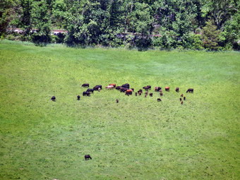 We began be ascending a small hill through some hardwoods and then descending the other side. He could hear voices to our left and a check of the GPS showed a development of residential housing in that direction. At .8 miles we descended to a small creek and met a father and daughter who were headed toward Wawayanda also. They had spent the night in a shelter and were headed south and west. I told them that the Pinwheel Vista was great and the Pochuck boardwalk was as interesting as all the descriptions made it sound. We passed them and crossed the small wooden bridge to get to the other side of the stream. The bridge was simply lying on the rocks and was tethered by a cable to a steel rod. I assumed this was to restrain it during high water! We continued our hike beginning a fairly steady but easy ascent toward the Pinwheel Vista. As we hiked we met several groups of hikes and a few solo travelers as well. Most were headed toward us and we said "Hello" to each as we passed. At 1.4 miles we encountered a slight dip and by 1.7 we hit a high point. At this spot there was a "mailbox" that acted as a sign-in for the AT. There was an sign that pointed left indicating and old lookout about .8 miles away. I had been to that lookout and found there was no view so we continued on a descent to the area just before the "Stairway to Heaven", the staircase that leads down to Route 94. A large stone cairn and blue blazes indicated the side trail to the right to the Pinwheel Vista. We headed out to the vista and arrived in minutes. We found a group of young people spread out on the highest point so we took the lower lookout to admire the view. The day was clear and I momentarily wished that there were more clouds in the sky. I dropped my pack and took out the camera to photograph the wide expanse below. We could see mountain on the horizon but the features closer to us were just as interesting. The puncheons through the field on the other side of Route 94 were easy to see. Below us was a small sand and gravel quarry. We could see that the parking on Route 94 was full and I was glad we had parked in a less used location. After taking pictures, we got a snack and a drink and headed back at about 11:35 AM. I checked the GPS and the distance we had hiked was only 1.8 miles. It was definitely time to leave as more and more people were arriving.
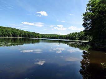 The hike back seemed to go very quickly and we encountered almost no hikers. I thought it strange that we never saw the father and daughter team. Since they were headed toward us I thought sure we would encounter them but we did not. The trails remained very dry except for a few isolated spots and the insect population was very low. As we hiked we talked about continuing past the car. We agreed that less than four miles was not a long enough hike! At 12: 40 PM we approached the car after hiking 3.6 miles and continued to Barrett Road. We crossed the road and continued on the AT as it began an ascent on an old road. We met a hiker coming down the road toward us and I could see another heading away from us farther up the hill. At the top of the hill we turned off the road to stay on the AT and started to descend a little. We passed the other hiker and continued on our way. The trail began to roll a little and we finally descended to cross Iron Mountain Road and then a small stream. Along the way we encountered a beaver lake or pond and I thought about taking pictures on the return trip. We ascended a small hill and found a Boy Scout troop spread out on the hillside for lunch. At some point we had passed into Wawayanda Park and the trail was blazed with blue markers as well as the white AT blazes. We descended the hill passed the troop and then crossed a park road. The trail started to ascend and then rolled some more and I knew we were less than a mile away from our destination at the Warwick Turnpike. At 5.8 miles we passed another beaver pond and then crossed another bridge. We could hear the traffic now and at 1:40 PM we were at the road having hiked 6 miles. I walk across the road and then returned to the other side and we headed back. Again, the return trip seemed to go quickly even though we stopped at both ponds to take pictures. There was no sign of the Boy Scout troop on the return trip and we met few other hikers. At 2:55 PM we were back at the car having covered 8.5 miles in 4 hours and 25 minutes. The vertical gain was 1940 feet.