
What You Missed
Summer 2013
Summer 2013
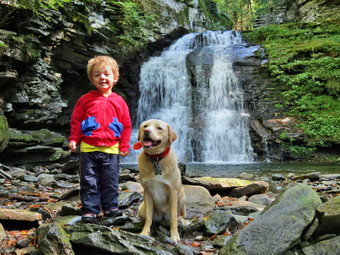
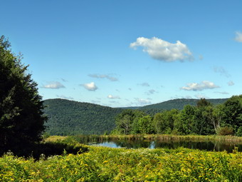
![]() On Friday, September 20th, I had planned to do my usual long hike by going to Bainbridge and hiking a section of the Finger Lakes Trail near Bainbridge. Parts of this trail are closed by the private property owner on October 1st so I wanted to hike this section before that time. Unfortunately, Cindy was not feeling 100% and did not feel she could handle the 2 and a half year old grandson, Bryce, without my help. I wasn't happy as I only get one day a week to do the long hikes but I decided I would take Bryce out for a hike locally. He walks around the "farm" with my son and daughter-in-law and has been across the street on Round Top several times. When he arrived, he was enthusiastic so we got ready, put Sheila in the car and headed for Morton Hill Road to hike to Russell Brook Falls. My intention was to park half-way down the road at the campsites and then hike down the road from there. I turned down Russell Brook Road which was a little rough and eroded. As we passed the campsites, there were people occupying them so I continued down the road and parked in the lower lot. There was a DEC truck and trailer at the end of the lot and another pickup truck parked there also. I was not happy that I had forgotten Sheila's leash but she is usually under control. I got Bryce out of his car seat and shouldered my pack. Both Bryce and Sheila seemed eager to get going so we headed down the road to the bridge over Russell Brook just below the area of the falls. As we crossed the bridge I could hear some machinery approaching and we stopped at the side of the trail to allow a backhoe to pass us. We crossed the road and walked the path toward the falls which we could hear easily. I told Bryce to be careful since the rocks were still damp and very slippery. He was anxious to see the waterfalls but took my hand as we approached the falls. I was prepared to walk right down to the stream bed but Bruce wanted to walk the path to the overlook. When we were able to see the falls, he was very excited. After a quick look, we headed back down the path and then down the bank to the stream bed. The bank was slippery and the rocks below even more slippery. Once we were next to the stream, I dropped my pack and took some pictures as the lighting was good. I took the time to position Bryce and Sheila and got one good shot of them with the falls in the background. We walked back up the bank and continued up to the overlook for the upper falls. Bryce walked up the path by himself and seemed determined to do it alone. When we got near the upper falls he waited until I dropped my pack and got out the camera. I took a few shots and then we walked together to a spot where we both could see the falls. After that, we decided to try to get down to the stream bed. This descent was trickier than below as it was much steeper and just as damp. We made it down without mishap and I took some more pictures. Sheila, of course, was happy to be able to run through the water and back up the bank several times. Bryce and I climbed back to the top and then headed back down to the main trail. I decided to walk back toward the parking lot and then see if Bryce wanted to hike some more. When we arrived at the lot, Bryce said he wanted to hike some more so we headed down Russell Brook Road. The road was pretty open until just near the stone barriers where some trees and fallen across the path. Along the way we passed under some pine trees and were bombarded by several pines cones released by marauding squirrels. We walked passed the stone barriers and I showed Bryce where the water had washed away the road in two places. At this point we turned around and headed back to the car. I got Sheila in the backseat and put Bryce in his car seat. He remembered he had a snack in his pack and insisted on consuming it on the way home. By the time we were on the highway back to Livingston Manor, Bryce was asleep. I look forward to MANY more days like this one.
On Friday, September 20th, I had planned to do my usual long hike by going to Bainbridge and hiking a section of the Finger Lakes Trail near Bainbridge. Parts of this trail are closed by the private property owner on October 1st so I wanted to hike this section before that time. Unfortunately, Cindy was not feeling 100% and did not feel she could handle the 2 and a half year old grandson, Bryce, without my help. I wasn't happy as I only get one day a week to do the long hikes but I decided I would take Bryce out for a hike locally. He walks around the "farm" with my son and daughter-in-law and has been across the street on Round Top several times. When he arrived, he was enthusiastic so we got ready, put Sheila in the car and headed for Morton Hill Road to hike to Russell Brook Falls. My intention was to park half-way down the road at the campsites and then hike down the road from there. I turned down Russell Brook Road which was a little rough and eroded. As we passed the campsites, there were people occupying them so I continued down the road and parked in the lower lot. There was a DEC truck and trailer at the end of the lot and another pickup truck parked there also. I was not happy that I had forgotten Sheila's leash but she is usually under control. I got Bryce out of his car seat and shouldered my pack. Both Bryce and Sheila seemed eager to get going so we headed down the road to the bridge over Russell Brook just below the area of the falls. As we crossed the bridge I could hear some machinery approaching and we stopped at the side of the trail to allow a backhoe to pass us. We crossed the road and walked the path toward the falls which we could hear easily. I told Bryce to be careful since the rocks were still damp and very slippery. He was anxious to see the waterfalls but took my hand as we approached the falls. I was prepared to walk right down to the stream bed but Bruce wanted to walk the path to the overlook. When we were able to see the falls, he was very excited. After a quick look, we headed back down the path and then down the bank to the stream bed. The bank was slippery and the rocks below even more slippery. Once we were next to the stream, I dropped my pack and took some pictures as the lighting was good. I took the time to position Bryce and Sheila and got one good shot of them with the falls in the background. We walked back up the bank and continued up to the overlook for the upper falls. Bryce walked up the path by himself and seemed determined to do it alone. When we got near the upper falls he waited until I dropped my pack and got out the camera. I took a few shots and then we walked together to a spot where we both could see the falls. After that, we decided to try to get down to the stream bed. This descent was trickier than below as it was much steeper and just as damp. We made it down without mishap and I took some more pictures. Sheila, of course, was happy to be able to run through the water and back up the bank several times. Bryce and I climbed back to the top and then headed back down to the main trail. I decided to walk back toward the parking lot and then see if Bryce wanted to hike some more. When we arrived at the lot, Bryce said he wanted to hike some more so we headed down Russell Brook Road. The road was pretty open until just near the stone barriers where some trees and fallen across the path. Along the way we passed under some pine trees and were bombarded by several pines cones released by marauding squirrels. We walked passed the stone barriers and I showed Bryce where the water had washed away the road in two places. At this point we turned around and headed back to the car. I got Sheila in the backseat and put Bryce in his car seat. He remembered he had a snack in his pack and insisted on consuming it on the way home. By the time we were on the highway back to Livingston Manor, Bryce was asleep. I look forward to MANY more days like this one.
![]()
![]()
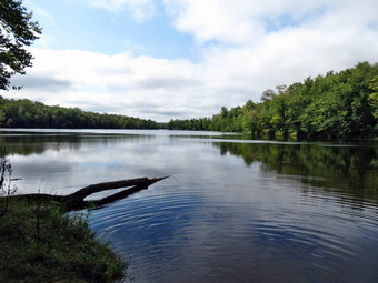
![]() On Thursday, September 19th, I wanted to do a longer local hike and decided to try the Mongaup Falls Loop that I had rejected on Tuesday. The total distance is about 8.2 miles but has relatively little elevation change. By the time I got some things straightened up around home it was about 9:00 Am. I loaded up Sheila and my gear and headed out the DeBruce Road toward the Fish Hatchery Road. I parked near the intersection with Beech Mountain Road and we were out and hiking by 9:35 AM. The temperature was still cool and I had on a long-sleeved top and light windbreaker. We walked down the woods road to the stream and then started up the hill to the first trail junction. A large road sign just on the other s the of the bridge announced "Road Closed"! I thought it strange sine the "road" on the other side was hardly passable! The trail was damp in spots but not really wet and I hoped this would continue as some places on the route are usually very wet. At the first junction we turned right to head towards the Mongaup Pond campgrounds. The snowmobile trail rolls a bit but generally gains elevation on its way to Mongaup. Even though it is relatively flat, there were very few wet areas along the way. At about 1.6 miles I began to notice ledges to the right and a swampy area on the left. This was the area that Cindy and I had bushwhacked in March to save some distance. At 10:15 AM, about 1.9 miles into the hike, we came to a junction and turned left which took us out to the campgrounds. I had forgotten exactly what we had done on the previous hike so I spent some time looking for the snowmobile trail that continues along Mongaup Pond toward the outlet end. What I should have done was make a right at the trail junction at the 1.9 mile mark! We walked the campground roads until the pond was in sight. I knew that following the roads would not get us to where we were going so I headed off into the woods heading east to bushwhack up to the trail. It was only about .2 miles through open woods until we were again on the snowmobile trail headed north along the edge of the pond.
On Thursday, September 19th, I wanted to do a longer local hike and decided to try the Mongaup Falls Loop that I had rejected on Tuesday. The total distance is about 8.2 miles but has relatively little elevation change. By the time I got some things straightened up around home it was about 9:00 Am. I loaded up Sheila and my gear and headed out the DeBruce Road toward the Fish Hatchery Road. I parked near the intersection with Beech Mountain Road and we were out and hiking by 9:35 AM. The temperature was still cool and I had on a long-sleeved top and light windbreaker. We walked down the woods road to the stream and then started up the hill to the first trail junction. A large road sign just on the other s the of the bridge announced "Road Closed"! I thought it strange sine the "road" on the other side was hardly passable! The trail was damp in spots but not really wet and I hoped this would continue as some places on the route are usually very wet. At the first junction we turned right to head towards the Mongaup Pond campgrounds. The snowmobile trail rolls a bit but generally gains elevation on its way to Mongaup. Even though it is relatively flat, there were very few wet areas along the way. At about 1.6 miles I began to notice ledges to the right and a swampy area on the left. This was the area that Cindy and I had bushwhacked in March to save some distance. At 10:15 AM, about 1.9 miles into the hike, we came to a junction and turned left which took us out to the campgrounds. I had forgotten exactly what we had done on the previous hike so I spent some time looking for the snowmobile trail that continues along Mongaup Pond toward the outlet end. What I should have done was make a right at the trail junction at the 1.9 mile mark! We walked the campground roads until the pond was in sight. I knew that following the roads would not get us to where we were going so I headed off into the woods heading east to bushwhack up to the trail. It was only about .2 miles through open woods until we were again on the snowmobile trail headed north along the edge of the pond.
I knew that the next trail I was looking for was the yellow Mongaup Willowemoc Trail which would be a right and would start our return trip. The temperature was getting warmer but I stubbornly kept my jacket on as we hiked along. At 3.1 miles we found the right turn onto the trail which is marked more with snowmobile disks that the yellow hiking blazes. I remembered that this trail climbed some but forgot that it is a rather long climb! Our next objective was a right turn onto a snowmobile trail just before Butternut Junction. We crossed two bridges along the way and I began to wonder about the exact location of the turn. I need not have worried since the trail junction came up right after the second bridge. The first 1.2 miles of this trail were all ascent punctuated by a few flatter areas. By 5.6 miles we were at the highest point on the trail at almost 2600 feet. The trail now started to descend and at 5.9 miles turned southwest and continued to descend. Several times I thought we were nearing the woods road that would take us back to the car but was misled by the similarities in terrain. At 6.9 miles we began another short ascent, crossed one more bridge and then met the woods road at 7.3 miles. We turned right on the woods road and began to walk northwest back to the first trail junction from earlier in the day. It was only .4 miles to the junction and mostly a descent. We continued to descend to the area of the stream and at 8.1 miles came to the path to Mongaup Falls. I had not planned on visiting the falls since there wasn't much water in the stream but I couldn't resist! We walked down the hill and over to the falls. The flow was not great enough to warrant taking pictures but I let Sheila play in the water some before heading back to the car. We were back at 12:45 PM having covered 8.3 miles in 3 hours and 10 minutes.
![]()
![]()
![]() On Tuesday, September 17th, I decided I wanted to get out for a local hike before going to school for cross country practice. Cindy said she would like to go and my initial thought was to do the Mongaup Falls Loop. I looked at my report from a previous trip and at the time and decided it was a little too far so we agreed on the Frick and Hodge Pond Loop. After I completed some chores around the house, we headed out DeBruce Road and made a left on Fish Hatchery Road. When we got to the parking area, there was a pickup truck parked in the lot. We were on the trail by 9:35 Am heading out the Quick Lake Trail to Frick Pond. The two large steel I-beams were still in the lot. I hope these will be used to replace the bridge at the outlet of Frick Pond before the winter snows fly! Despite the rain several days before, the trail was only damp with a little water running in a few spots. We were surprised to find very little dew on the grass despite the cool temperatures the night before. When we got to the trail junction with the Logger's Loop we stayed left on the Quick Lake Trail to Frick Pond. This area was mowed but the muddiest areas were barely damp. We didn't really stop at the bridge for pictures since the sky was a flat blue with almost no clouds and the pond had no wildlife. We continued across the bridge and we kept up a good pace as we passed by the pond and continued to the left up the Quick Lake Trail. It seemed that someone had been through doing a little trimming as the trail was clear. By 10:15M Am we had hiked the 1.5 miles to Iron Wheel Junction where we turned left to stay on the Quick Lake Trail. Parts of this trail were eroded but for the most part it was dry.
On Tuesday, September 17th, I decided I wanted to get out for a local hike before going to school for cross country practice. Cindy said she would like to go and my initial thought was to do the Mongaup Falls Loop. I looked at my report from a previous trip and at the time and decided it was a little too far so we agreed on the Frick and Hodge Pond Loop. After I completed some chores around the house, we headed out DeBruce Road and made a left on Fish Hatchery Road. When we got to the parking area, there was a pickup truck parked in the lot. We were on the trail by 9:35 Am heading out the Quick Lake Trail to Frick Pond. The two large steel I-beams were still in the lot. I hope these will be used to replace the bridge at the outlet of Frick Pond before the winter snows fly! Despite the rain several days before, the trail was only damp with a little water running in a few spots. We were surprised to find very little dew on the grass despite the cool temperatures the night before. When we got to the trail junction with the Logger's Loop we stayed left on the Quick Lake Trail to Frick Pond. This area was mowed but the muddiest areas were barely damp. We didn't really stop at the bridge for pictures since the sky was a flat blue with almost no clouds and the pond had no wildlife. We continued across the bridge and we kept up a good pace as we passed by the pond and continued to the left up the Quick Lake Trail. It seemed that someone had been through doing a little trimming as the trail was clear. By 10:15M Am we had hiked the 1.5 miles to Iron Wheel Junction where we turned left to stay on the Quick Lake Trail. Parts of this trail were eroded but for the most part it was dry.
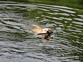
The hike up the Quick Lake Trail seemed to go by quickly as we walked and talked. By 10:55 AM we were at Junkyard Junction having covered about 3.1 miles. We turned right on the Flynn Trail and kept up our pace until we arrived at the gate and turned right to go down to Hodge Pond. At the shore of the pond, we turned left and walked the jeep trail around the back of the pond still talking to each other. Cindy noticed a canoe on the pond with a one fisherman. As we rounded the pond, the fisherman yelled "Is that you Ralph Bressler?" I answered in the affirmative recognizing the voice. We exchanged a greeting and told him we were headed for the "beach" at the outlet end of the pond. We continued down to the outlet end of the pond and Sheila immediately headed for the water. It was at this time I noticed she had lost her blaze orange neckerchief. I dropped my pack and headed back up the trail to see if I could find it. I searched all the way back to the trail junction but could not find it. By the time I got back to the "beach" my friend in his canoe was approaching. Both Cindy and I were impressed that he had carried the canoe the 5 miles round trip to the pond! We talked a little as I threw a stick out into the water for Sheila to retrieve. I repeated this several times, increasing the distance each time. Sheila swam out to the stick, grabbed it and swam back. She loves the water and never misses a chance to jump in! We said goodbye and headed for the Flynn Trail toward the junction with the Big Rock Trail. As we ascended from the pond, we met a group of hikers our age or older with several younger people. We found out that they were a group from the Frost Valley YMCA Camp. We hit the junction with the Big Rock Trail at 11:50 AM five miles into the hike with about 1.7 miles to go. The advantage of hiking the route in this direction is that the last part of the hike is all downhill. We walked down the Flynn Trail toward the parking area and the car. We were back at the car by 12:30 PM having covered the 6.7 mile distance in 2 hours and 50 minutes.
![]()
![]()
![]() On Friday, September 13th, I decided I wanted to close the gap I had created in my hiking of the Finger Lakes Trail by tackling map 26, the section from Cooper Schoolhouse Road to Masonville. I have learned to accept the fact that few other people have the time or willingness to hike with me. I was pleasantly surprised when Karl said he might be able to clear his calendar and hike with me. I told him to get to Livingston Manor as early as possible but having a two year old and 6 month old twins makes this almost impossible. I was hoping to leave by 8:00 AM which is late for me but Karl didn't arrived until after 9:00 AM. We left the house at around 9:35 AM but the ride to the starting point was only about an hour. We headed through Downsville, Walton and Bainbridge on Rt 206 and turned right on Town Line Road to get to Cooper Schoolhouse Road. The weather was supposed to clear but when we parked at 10:35 AM the skies were still overcast and there was a light drizzle. The rain would continue for most of the day turning from drizzle to light rain and then stopping only to repeat the pattern. I was a little worried about finding and staying on the trail as the map description mentioned wet areas, sparse blazes and numerous bramble patches! We walked southeast on Town Line Road for about .1 miles before cutting right into the woods on the trail. The next .6 miles of trail did have some puddles and other wet spots but we were able to get around or through them without too much trouble. The next .7 miles to Case Road was about the same as we climbed a small hill and then hit the road. We turned right on Case Road and followed the blazes on the road for about .15 miles until the trail again cuts into the woods on the left. It was fun to have Karl along as he took the lead and watched for the blazes most of the time. He also managed Sheila when she had to be on her leash. Over the next .9 miles we dropped some elevation to cross Searles Hill Road and then gained it back to again cross Case Road all the while heading generally south. There had been a few places along the way where the blazes were spaced apart and a few others where the weeds were high. I was pleasantly surprised that most areas were maintained and well marked contrary to the notes on the map! After crossing Case Road this time the trail skirted a field and then ran along the edge of the field and some lawns. It re-entered the woods and at about 3.4 miles started to parallel Newton Brook. When we arrived at the crossing of the brook at 3.6 miles, we had no problem stepping across. We continued to walk along the brook and at 4 miles crossed it again on a bridge. The trail led to a field and then back onto some woods roads until it again met Case Road at 4.3 miles.
On Friday, September 13th, I decided I wanted to close the gap I had created in my hiking of the Finger Lakes Trail by tackling map 26, the section from Cooper Schoolhouse Road to Masonville. I have learned to accept the fact that few other people have the time or willingness to hike with me. I was pleasantly surprised when Karl said he might be able to clear his calendar and hike with me. I told him to get to Livingston Manor as early as possible but having a two year old and 6 month old twins makes this almost impossible. I was hoping to leave by 8:00 AM which is late for me but Karl didn't arrived until after 9:00 AM. We left the house at around 9:35 AM but the ride to the starting point was only about an hour. We headed through Downsville, Walton and Bainbridge on Rt 206 and turned right on Town Line Road to get to Cooper Schoolhouse Road. The weather was supposed to clear but when we parked at 10:35 AM the skies were still overcast and there was a light drizzle. The rain would continue for most of the day turning from drizzle to light rain and then stopping only to repeat the pattern. I was a little worried about finding and staying on the trail as the map description mentioned wet areas, sparse blazes and numerous bramble patches! We walked southeast on Town Line Road for about .1 miles before cutting right into the woods on the trail. The next .6 miles of trail did have some puddles and other wet spots but we were able to get around or through them without too much trouble. The next .7 miles to Case Road was about the same as we climbed a small hill and then hit the road. We turned right on Case Road and followed the blazes on the road for about .15 miles until the trail again cuts into the woods on the left. It was fun to have Karl along as he took the lead and watched for the blazes most of the time. He also managed Sheila when she had to be on her leash. Over the next .9 miles we dropped some elevation to cross Searles Hill Road and then gained it back to again cross Case Road all the while heading generally south. There had been a few places along the way where the blazes were spaced apart and a few others where the weeds were high. I was pleasantly surprised that most areas were maintained and well marked contrary to the notes on the map! After crossing Case Road this time the trail skirted a field and then ran along the edge of the field and some lawns. It re-entered the woods and at about 3.4 miles started to parallel Newton Brook. When we arrived at the crossing of the brook at 3.6 miles, we had no problem stepping across. We continued to walk along the brook and at 4 miles crossed it again on a bridge. The trail led to a field and then back onto some woods roads until it again met Case Road at 4.3 miles.
It was 12:30 PM and at this point we had to make a decision. The map warned that the next crossing of Newton Brook, 1.7 miles ahead, might be difficult. I did not want to hike that far to find we could not cross easily. In addition, the skies were growing darker and I had no desire to get drenched. This left two choices. We could walk down Case Road to Route 206 and in to Bainbridge that way or we could walk Case Road back to the car and then park in Bainbridge and then walk the rest of the hike. We chose to turn left on Case Road and use it to get back to the car. We were at the lowest point on the hike so the first part of the walk up Case Road was uphill and we gain almost 400 feet in 1.4 miles to the point where we had last crossed. Along the way we spotted the point where the trail entered the woods and headed for Bainbridge. Within .5 miles, we crossed Searles Hill Road and Case Road turned to gravel and dirt. The next 1.5 miles was generally downhill but rolled a little. By 1:30 we were back at the car having covered 7.6 miles in a little under 3 hours. The rain had held off but we both agreed we were a little tired. Sheila was not! I drove out Case Road and turned left on Route 206 to head toward Bainbridge. We stopped near the sign for the town where the trail came up from the brook to meet the road. Karl and I walked down to the brook and found the crossing to be no problem. We discussed our options and decided that lunch and an early return sounded like the best idea. My plan is to return and in one or two days complete map 26 to close the gap. We found nowhere to eat in Bainbridge but we did visit the Pine Grove Grocery on Route 206. The store is operated by Mennonites and has many interesting products including nut butters, cheeses and bake goods. After buying some things, we head to Afton to eat in the Main Street Grill and Bakery. The meal was well worth the trip as they have many different wraps and burger selections. Karl and I both had the buffalo chicken wrap which was delicious. The bakery goods looked fresh and there was a nice variety. I purchased some cheesecake for Cindy before we headed home through Deposit.
![]()
![]()
![]()
![]() On Wednesday, September 11th I decided to hike locally before going to school for cross country practice. We had not been to Long Pond for some time so I decided we would go there despite the fact that the trails are always wet and muddy and the overnight rain promised more of the same! An early morning ambulance call delayed our departure and we arrived at the parking area just before 11:35 AM and started hiking right away. I prefer to walk out the trail and come back on Flugertown Road so we headed up the hill on the trail out of the parking lot. In the first .7 miles we gained 350 feet but this was pretty much the only ascent of the day. There was some water on this part of the trail but nothing we couldn't avoid. At 1 mile there is a side trail down to Long Pond but I decided to keep moving on the main trail. I also made up my mind that pictures were not necessary. On this day the sky was generally overcast and almost cloudless which did not make for ideal conditions for photography. The temperature was rising fast and was already in the low 80's! After passing the trail to the pond, the main trail started to get much wetter with some small puddles and muddy areas. At 1.3 miles we arrived at the trail junction. The trail to the left leads back out to Flugertown Road for a very short loop. We turned right to continue on the longer loop. At 1.7 miles there was a trail to the right that goes to the lean-to but we continued on the main trail. We had passed several "ponds" on the trail which were also very muddy and I was happy that Sheila avoided the mess. At 2.4 miles the trail ended on a woods road where we turned left and walked down to the junction with Basily Road at 2.75 miles. Turning right here would have taken us to Wild Meadow Road so we stayed to the left to head back to Flugertown Road. At 3.25 miles we crossed a small stream and walked through the Peters hunting camp crossing another stream in the process. Just after crossing the second stream the road made a sharp turn to the left and we followed. For the next 2 miles the road was a solid dirt surface and we made good time. The walk was pleasant as the road parallels Willowemoc Creek. Somewhere along the way I heard a tremendous crash and looked to the right to see a tree truck about 15 feet long and 18 inches in diameter crash to the forest floor. For a moment I thought about what could have happened had we been closer! Toward the end of this section I head some music ahead which sounded like a group of campers. What I found was a middle-aged man with loose dog that wanted to pester Sheila and myself. The owner had not though to leash his animal and had no control over it. I had leashed Sheila and encouraged her to move along away from the annoying encounter! At 5.4 miles we passed the dirt road to Sand Pond on the right and at that point Flugertown Road became a paved and maintained town road. It was only .5 miles back to the car. We arrived in the parking area at 1:30 PM having covered 5.9 miles in 1 hour and 55 minutes with only 38 seconds of stopped time.
On Wednesday, September 11th I decided to hike locally before going to school for cross country practice. We had not been to Long Pond for some time so I decided we would go there despite the fact that the trails are always wet and muddy and the overnight rain promised more of the same! An early morning ambulance call delayed our departure and we arrived at the parking area just before 11:35 AM and started hiking right away. I prefer to walk out the trail and come back on Flugertown Road so we headed up the hill on the trail out of the parking lot. In the first .7 miles we gained 350 feet but this was pretty much the only ascent of the day. There was some water on this part of the trail but nothing we couldn't avoid. At 1 mile there is a side trail down to Long Pond but I decided to keep moving on the main trail. I also made up my mind that pictures were not necessary. On this day the sky was generally overcast and almost cloudless which did not make for ideal conditions for photography. The temperature was rising fast and was already in the low 80's! After passing the trail to the pond, the main trail started to get much wetter with some small puddles and muddy areas. At 1.3 miles we arrived at the trail junction. The trail to the left leads back out to Flugertown Road for a very short loop. We turned right to continue on the longer loop. At 1.7 miles there was a trail to the right that goes to the lean-to but we continued on the main trail. We had passed several "ponds" on the trail which were also very muddy and I was happy that Sheila avoided the mess. At 2.4 miles the trail ended on a woods road where we turned left and walked down to the junction with Basily Road at 2.75 miles. Turning right here would have taken us to Wild Meadow Road so we stayed to the left to head back to Flugertown Road. At 3.25 miles we crossed a small stream and walked through the Peters hunting camp crossing another stream in the process. Just after crossing the second stream the road made a sharp turn to the left and we followed. For the next 2 miles the road was a solid dirt surface and we made good time. The walk was pleasant as the road parallels Willowemoc Creek. Somewhere along the way I heard a tremendous crash and looked to the right to see a tree truck about 15 feet long and 18 inches in diameter crash to the forest floor. For a moment I thought about what could have happened had we been closer! Toward the end of this section I head some music ahead which sounded like a group of campers. What I found was a middle-aged man with loose dog that wanted to pester Sheila and myself. The owner had not though to leash his animal and had no control over it. I had leashed Sheila and encouraged her to move along away from the annoying encounter! At 5.4 miles we passed the dirt road to Sand Pond on the right and at that point Flugertown Road became a paved and maintained town road. It was only .5 miles back to the car. We arrived in the parking area at 1:30 PM having covered 5.9 miles in 1 hour and 55 minutes with only 38 seconds of stopped time.
![]()
![]()
![]()
![]() On Friday, September 6th, I decided I wanted to finish map 21 of the Finger Lakes Trail by hiking from where I had left off at Solon Pond Road near Taylor, NY to Stoney Brook Road near Cuyler, NY. I had a family commitment in the early evening so my plan was to hike the trail out and use the roads to hike back. I have done this before and have some good experiences. Much of the Finger Lakes Trail has few views or exceptional attractions. The trail is a pleasant hike for the most part through state forests and across private lands where permission has been obtained. Walking back on the roads affords a different view which is sometimes better than on the trail. When Sheila and I left Livingston Manor, the temperature was about 40 degrees and there was a heavy fog. The fog persisted for much of the trip up Route 17 and I 81. I took exit 8 off I 81 at Whitney Point and followed Routes 41 and 26 north and east to Cheningo Solon Pond Rd. I drove north on the road for about 6.5 miles to Freeman Road. The map description said parking was available north of the road but I couldn't find any. I returned and parked on the side of Freeman Road at 9:00 AM. The temperature was 42 degrees but somewhere along the way the fog had lifted and the sun was out. Despite the sun I was feeling cool and left on the light windbreaker I had worn. I almost regretted not having brought the light hat and gloves but knew I would warm up quickly. Sheila, as always, was ready to go as we walked down Freeman Road following the white blazes. The road curved slightly at the bottom and we walked up to an old farmhouse that is now a hunting camp. It was at this point that I noticed there were no more blazes and none visible ahead. Looking back I could see a white blaze so we backtracked to find the trail. As it turned out t5he trail had turned left just before the hunting camp although it was difficult to see the turn. The trail went down into a deep ditch and then passed through a sea of waist high weeds! It had rained the day before and there had been a heavy dew. The map warned that this area could be wet but I was not prepared to be soaked from my boots to my hips! The ground underneath was marshy also making the start of this hike less than encouraging. The weeds and marshy ground didn't last long and we were soon climbing on damp and muddy ground. Over the next mile the trail climbed almost 600 feet to the top of a hill and then descended to Potter Hill Road at 1.8 miles. We had entered Cuyler Hill State Forest and the trail seemed to be well maintained if not well traveled.
On Friday, September 6th, I decided I wanted to finish map 21 of the Finger Lakes Trail by hiking from where I had left off at Solon Pond Road near Taylor, NY to Stoney Brook Road near Cuyler, NY. I had a family commitment in the early evening so my plan was to hike the trail out and use the roads to hike back. I have done this before and have some good experiences. Much of the Finger Lakes Trail has few views or exceptional attractions. The trail is a pleasant hike for the most part through state forests and across private lands where permission has been obtained. Walking back on the roads affords a different view which is sometimes better than on the trail. When Sheila and I left Livingston Manor, the temperature was about 40 degrees and there was a heavy fog. The fog persisted for much of the trip up Route 17 and I 81. I took exit 8 off I 81 at Whitney Point and followed Routes 41 and 26 north and east to Cheningo Solon Pond Rd. I drove north on the road for about 6.5 miles to Freeman Road. The map description said parking was available north of the road but I couldn't find any. I returned and parked on the side of Freeman Road at 9:00 AM. The temperature was 42 degrees but somewhere along the way the fog had lifted and the sun was out. Despite the sun I was feeling cool and left on the light windbreaker I had worn. I almost regretted not having brought the light hat and gloves but knew I would warm up quickly. Sheila, as always, was ready to go as we walked down Freeman Road following the white blazes. The road curved slightly at the bottom and we walked up to an old farmhouse that is now a hunting camp. It was at this point that I noticed there were no more blazes and none visible ahead. Looking back I could see a white blaze so we backtracked to find the trail. As it turned out t5he trail had turned left just before the hunting camp although it was difficult to see the turn. The trail went down into a deep ditch and then passed through a sea of waist high weeds! It had rained the day before and there had been a heavy dew. The map warned that this area could be wet but I was not prepared to be soaked from my boots to my hips! The ground underneath was marshy also making the start of this hike less than encouraging. The weeds and marshy ground didn't last long and we were soon climbing on damp and muddy ground. Over the next mile the trail climbed almost 600 feet to the top of a hill and then descended to Potter Hill Road at 1.8 miles. We had entered Cuyler Hill State Forest and the trail seemed to be well maintained if not well traveled.
 I had decided on this hike to consult my map and GPS less and just enjoy the hiking. The trail was clearly marked for the most part after the first problem on Freeman Road. From Potter Hill Road we climbed a little more and then dropped to the edge of a small stream and followed it uphill until we again crossed Potter Hill Road at 2.6 miles. From Potter Hill Road to Randall Hill Road the trail rolled up and down while heading north and a little west to skirt the summit of a hill. As we approached Randall Hill Road we descended to an unnamed brook and a bivouac area called Wiltsey Glen. There was a fire ring and a good water source. Here the trail turned west to follow the brook briefly and headed up to Randall Hill Road at 4.25 miles. As we hiked away from Randall Hill Road I watched for the orange trail on the left to the Rose Hollow Bivouac Area but missed it. The trail was in pretty good shape here but we did pass through some areas of briars and a few nettles. At 6.2 miles we hit the highest point on the hike as we summitted 2084 foot Randall Hill. From here it was only about .5 miles to Stoney Brook Road but a series of switchbacks lengthened that to about a mile. We arrived at Stoney Brook Road at noon just as the whistles were sounding. We had hiked 7.2 miles and were now ready to return to the car. I had looked at several different routes but decided to follow Cuyler Hill Road all the way back to the car. We got a snack and I put my poles in my pack and put Sheila on her leash. We turned left on Stoney Brook Road and hiked the short distance out tom Cuyler Hill Road where we turned left. The sky was now blue and the countryside was worthy of a picture. I didn't stop to take pictures, however, as the scene was much the same as last time. At 8.4 miles we passed Enzes Road on the left which I had considered taking back to Randall Hill Road. One look assured me I had made the right choice as the road immediately ascended a hill. As we walked down Cuyler Hill Road it seemed we were between two ridges. It was a pretty walk and along the way we found a nice, piped spring. We also passed by several goats in a pen. Sheila seemed very interested as they bleated a greeting. At 10.3 miles Randall Hill Road came in from the left and we continued on our chosen path. We turned left on Cheningo Solon Pond Road at 11.4 miles and started the last part of the hike back to the car. We were back at the car at 1:40 PM and I noted that the temperature was only 62 degrees. We had hiked 12.1 miles in 4 minutes and 40 seconds. The 7.2 miles hike out had taken us 3 hours while the 4.9 mile road walk was only 1 our and 40 minutes!
![]()
![]()
![]()
![]() On Wednesday, September 4th, I decided I wanted to return to the new trails created near the Pepacton Reservoir. The Shavertown Parcel is one area where new trails have been constructed by the Catskill Mountain Club on land opened to public use by the DEP. I asked Lisa if she would like to go and she agreed. We both decided on getting out as early as possible. I picked her up at her house a little before 8:00 AM and we headed up the Beaverkill Road and out Beech Hill Road to Route 30 on the Pepacton Reservoir. We arrived at the trailhead just before 8:30 AM and I parked along the road where there was room for two cars. We were ready to go just after 8:30 AM. I leashed Sheila to cross the road as she was ready to go but released her as soon as we started up the trail. The trailhead is now marked by a sign which was erected at the dedication on August 30th. The first .25 miles of trail climbs 200 feet as it heads directly north and up the side of Perch Lake Mountain. Soon the trail turned right on an old access road and continued to climb through the forest for another .25 miles. We broke out into a field and the trail leveled a little. The trail now turned northeast after passing some meteorological instruments and we descended to the edge of a small pond at .85 miles. The pink and white water lilies were gone but the pond was still pretty. This time the sky was bluer than it had been on previous visits but the puffy white clouds were still missing I took some pictures anyway. The day was sunny but the air was crisp with a hint of fall. Sheila could not resist the water and decided to go for a swim. I threw a stick into the water and she retrieved it several times without getting tangled in any water plants.
On Wednesday, September 4th, I decided I wanted to return to the new trails created near the Pepacton Reservoir. The Shavertown Parcel is one area where new trails have been constructed by the Catskill Mountain Club on land opened to public use by the DEP. I asked Lisa if she would like to go and she agreed. We both decided on getting out as early as possible. I picked her up at her house a little before 8:00 AM and we headed up the Beaverkill Road and out Beech Hill Road to Route 30 on the Pepacton Reservoir. We arrived at the trailhead just before 8:30 AM and I parked along the road where there was room for two cars. We were ready to go just after 8:30 AM. I leashed Sheila to cross the road as she was ready to go but released her as soon as we started up the trail. The trailhead is now marked by a sign which was erected at the dedication on August 30th. The first .25 miles of trail climbs 200 feet as it heads directly north and up the side of Perch Lake Mountain. Soon the trail turned right on an old access road and continued to climb through the forest for another .25 miles. We broke out into a field and the trail leveled a little. The trail now turned northeast after passing some meteorological instruments and we descended to the edge of a small pond at .85 miles. The pink and white water lilies were gone but the pond was still pretty. This time the sky was bluer than it had been on previous visits but the puffy white clouds were still missing I took some pictures anyway. The day was sunny but the air was crisp with a hint of fall. Sheila could not resist the water and decided to go for a swim. I threw a stick into the water and she retrieved it several times without getting tangled in any water plants.
 We continued around the pond and I took some more pictures of the pond. We walked back along the trail and then turned left at the sign that marked the turn for the extra 1.5 miles. This trail followed another woods road and gained a little over 200 feet in the next .5 miles. At times we couldn't see the next marker but I knew from previous visits we were on the right path. At around 1.5 miles into the hike the trail dipped to the left off the woods road to travel through an area with large boulders. Many were also covered by interesting mosses and lichens. Lisa really liked the area near the pond with the lookout over the reservoir and was enchanted by this rocky excursion. Once the trail rejoined the road it remained pretty flat for the next .8 miles. The trail began to turn around the mountain heading a little to the east and I knew that it would make a small loop and then bring us back to the trail we had come in on. The DEP parcel is surrounded by private property which made a loop hike impossible. We followed the woods road back to the pond and then took the access road back to the trail. We made the left on the trail and were soon back at the car. The trip back went much faster as it was mostly downhill. We were back at the car at 11:05 AM having covered 4.7 miles in 2 hours and 30 minutes with about a 1000 feet of ascent along the way.
![]()
![]()
![]() On Friday, August 30th, I decided I wanted to begin hiking map 21 on the Finger Lakes Trail. The total distance for this whole map is only 14.7 miles so I knew it would take only two trips to complete. A look at the map didn't show too many roads to act as shortcut on the return trip but there were some possibilities. Many sections of the Finger Lakes Trail are simply pleasant sections of trail without any views or points of interest and I have no problem using the roads to walk back to the car. Many of these roads are dirt or gravel and have more interesting views than the trails! I woke up to the ambulance pager at 4:45 Am which complicated my plans! After getting back, I debated whether I should attempt to hike on 4 hours sleep but in the end decided to go. Sheila is always ready so I got dressed and got my gear in the car as we left the house at about 6:45 AM. I decided to ignore the car GPS and stay on the highways rather than take the back roads. I took State Route 17 north and west to Binghamton through fog so dense I thought it might stay around all day. Near Hancock I stopped at a two car accident. I was amazed that these two cars "found" each other since there were so few of us on the road! Both drivers were uninjured but one car showed extensive damage. and then I-81 to exit 10 where I picked up route 41 going east for about 6 miles. As Route 41 curved to the south, I continued straight ahead on Telephone Road and drove 1.3 miles where I found a large parking area on the right. I drove a little farther and found where the Finger Lakes Trail crossed the road. I returned to the parking area, parked the car, got out my gear and was ready to go at 9:00 Am. I put Sheila and her leash and we crossed the road. A few hundred feet up the road we turned left or north and into the woods to start the hike. Sheila was glad to be feed as she bounded ahead of me. The trail was wet and muddy in spots with some very slippery rocks. The stream on the left side of the trail was almost dry. The trail started to ascend right from the beginning and by the time we crossed Cortland Two Road we had gained over 200 feet. The Cortland Two is a dirt and gravel road that connects Telephone Road to Taylor Valley Road and runs almost 5 miles between them. We crossed the road and began to ascend Mount Roderick. At 1.4 miles we passed by the summit after gaining another 200 feet. The trail seemed to be used and was well maintained. We were passing through Taylor Valley State Forest.
On Friday, August 30th, I decided I wanted to begin hiking map 21 on the Finger Lakes Trail. The total distance for this whole map is only 14.7 miles so I knew it would take only two trips to complete. A look at the map didn't show too many roads to act as shortcut on the return trip but there were some possibilities. Many sections of the Finger Lakes Trail are simply pleasant sections of trail without any views or points of interest and I have no problem using the roads to walk back to the car. Many of these roads are dirt or gravel and have more interesting views than the trails! I woke up to the ambulance pager at 4:45 Am which complicated my plans! After getting back, I debated whether I should attempt to hike on 4 hours sleep but in the end decided to go. Sheila is always ready so I got dressed and got my gear in the car as we left the house at about 6:45 AM. I decided to ignore the car GPS and stay on the highways rather than take the back roads. I took State Route 17 north and west to Binghamton through fog so dense I thought it might stay around all day. Near Hancock I stopped at a two car accident. I was amazed that these two cars "found" each other since there were so few of us on the road! Both drivers were uninjured but one car showed extensive damage. and then I-81 to exit 10 where I picked up route 41 going east for about 6 miles. As Route 41 curved to the south, I continued straight ahead on Telephone Road and drove 1.3 miles where I found a large parking area on the right. I drove a little farther and found where the Finger Lakes Trail crossed the road. I returned to the parking area, parked the car, got out my gear and was ready to go at 9:00 Am. I put Sheila and her leash and we crossed the road. A few hundred feet up the road we turned left or north and into the woods to start the hike. Sheila was glad to be feed as she bounded ahead of me. The trail was wet and muddy in spots with some very slippery rocks. The stream on the left side of the trail was almost dry. The trail started to ascend right from the beginning and by the time we crossed Cortland Two Road we had gained over 200 feet. The Cortland Two is a dirt and gravel road that connects Telephone Road to Taylor Valley Road and runs almost 5 miles between them. We crossed the road and began to ascend Mount Roderick. At 1.4 miles we passed by the summit after gaining another 200 feet. The trail seemed to be used and was well maintained. We were passing through Taylor Valley State Forest.
After the summit of Mount Roderick we dropped a little and the skirted another hill. At 3 miles the trail met the Cortland Two Road and we began a long descent. The map description warned that high water might make Cheningo Creek difficult to cross so I decided to continue on the Cortland Two to Taylor Valley Road. My plan was to take a look at the creek crossing on the other side. If it looked passable, we could use the trail on the return trip. The walk down Cortland Two was 1.7 miles and I thought about the climb on the return trip. I did not see where the trail headed right off the road to cross the creek but I did noticed at some point there were no more white blazes. Near the end of the descent the road turned from north to east and crossed Cheningo Creek and a very marshy area associated with it. The water looked high but was not flowing swiftly so I suspected some beaver activity near by. At the Taylor Valley Road we turned right and hiked .8 miles on the shoulder to the Cheningo Day Use Area. Across from the entrance was a North Country Trail kiosk and the place where the Finger Lakes Trail came across the creek from the Cortland Two. I dropped my pack behind the kiosk and took a quick trip down to the creek. The water was high and just covering a few of the stepping stones. Several of the stones had a nice layer of slippery moss. Beyond the creek the trail look very wet and I decided I might use the road on the return also! I picked up my pack and headed across the road to enter the day use area. White blazes point to the right but then sort of ended. I investigated some and found the blazes continued on a woods road at the right end of the area. This was the only place during the entire day that I had a problem with the blazes! We only followed the road for a short distance before the trail turned right and headed up Allen Hill. Over the next .6 miles we climbed through several switchbacks that turned a 20+ % grade into 12%. I actually like to climb most of the time and would not have minded a more direct root. The trail began to level at the top of a hill. Over the next .7 miles we continued to gain elevation to the west shoulder of Allen Hill whose highest point is on private land. We began to descend and soon came to a woods road where we turned right and began a long descent to Solon Pond Road. Over the next .9 miles we lost over 500 feet! I knew that when we reached the road we would simply turn around and be faced with climbing the hill we had just come down. We arrived at the road in the vicinity of Freeman Road just after noon. I was surprised to see that the since was closer to 8.2 miles than to the 7.8 or less I expected. We got a drink a snack before turning around to head back to the car.
After crossing the road, we sorted up the hill we had just come down. The climb seemed pretty easy and we were soon at the junction of the woods road and the trail. Instead of turning left to continue on the trail, I went straight ahead to meet Seacord Road which seemed to be a good alternative to the trail. I turned left, determined this was the wrong direction, reversed course and started down the dirt and gravel road. There was about as much to see on the road as on the trail but at least we were seeing something different. Somewhere along the way I noticed that my head was surrounded by a cloud of bugs. Until this point I had only dealt with a few horse flies. The cloud was mostly annoying but I hoped it would dissipate once we reached Taylor Valley Road. The walk was pleasant and all downhill. Over 2.2 miles on the road we lost over 700 feet of elevation. When we hit the Taylor Valley Road, I debated whether to take the trail or the road. The insects were still with use making us both miserable so I decided on the road and we turned right. I was deep in thought as we walked along the shoulder and would have passed by the Cortland Two but Sheila was paying attention so we turned left onto the road to start our final leg back to the car. The temperature was now in the high 80's and it was humid. The bugs persisted but I found the after I hiked the less I was bothered. Somewhere along the way a breeze started which was something I had been praying for! At 13.25 miles we were in the area where the trail meets the Cortland Two. I decided to continue on the road since it was a straighter shot back to the car. Over the next 1.3 miles the road ascended, dropped and ascended again. After this last ascent, it was all downhill for the next 1.4 miles to Telephone Road. At the road we turned right and walked the .1 miles back to the car. We were both a little tired. I had somehow tightened my pack so that both of my shoulder hurt. we had walked 16 miles in just under 6 hours arriving back at the car just before 3:00 PM. I again had taken no pictures since the hike was a series of roots, rocks and trees with no views worthy of snapping some shots. On the way back I stopped in Whitney Point for a snack and found a six pack of Ithaca Flower Power (beer) at the Sunoco!
![]()
![]()
![]()
![]() On Tuesday, August 27th, I decided I wanted to hike closer to home and avoid the two hour trips I had been taking. I had not hiked the Long Pond to Mongaup Pond loop is some time and had never hiked it in a clockwise direction. I checked my own website and found that the total distance was 9.8 miles and remembered that it had two significant climbs over Middle Mongaup and East Mongaup Mountains. I got my gear and Sheila and I started out just before 9:30 AM. We arrived at the trailhead on Flugertown Road and I parked just passed the trailhead on the side of the road. We were ready to hike at 9:50 AM when we crossed the road and started up the trail. The first .5 miles gains about 250 feet to the trail junction. The red Long Pond Trail continues to the right but we turned left on the yellow Mongaup Willowemoc Trail which goes to the shores of Mongaup Pond. As we hiked I noticed that although the ground and vegetation was wet from the rain the night before there were few bugs hovering around me. The temperature seemed almost cool with a nice breeze that made hiking very pleasant. The hiking trail in this area is also a snowmobile trail so it was wide and well-maintained with no blowdowns to block the path. It wasn't long before we crossed the private road to Sand Pond and then hit a low point as we crossed Butternut Creek, the outlet to Sand Pond. We walked along the creek for a short distance and then crossed one of the sturdy bridges at around 1.5 miles. After the creek, the trail began an ascent of over 400 feet before descending to the shores of Mongaup Pond. There were some rocky sections along the way and I learned to take care as many of the rocks were slippery from the rain and accumulated moss. We hiked 3.2 miles to the trail around Mongaup Pond where we turned right to head toward the upper end of the pond and the Mongaup Hardenburgh Trail. The trail around the pond is always wet and it was more so this day with large expanses of walking only half a mile we were at the trail junction. We stopped at the edge of the pond and I took a few pictures. Sheila took the opportunity to swim and I threw a stick for her several times before we turned around and started the next pert of the hike.
On Tuesday, August 27th, I decided I wanted to hike closer to home and avoid the two hour trips I had been taking. I had not hiked the Long Pond to Mongaup Pond loop is some time and had never hiked it in a clockwise direction. I checked my own website and found that the total distance was 9.8 miles and remembered that it had two significant climbs over Middle Mongaup and East Mongaup Mountains. I got my gear and Sheila and I started out just before 9:30 AM. We arrived at the trailhead on Flugertown Road and I parked just passed the trailhead on the side of the road. We were ready to hike at 9:50 AM when we crossed the road and started up the trail. The first .5 miles gains about 250 feet to the trail junction. The red Long Pond Trail continues to the right but we turned left on the yellow Mongaup Willowemoc Trail which goes to the shores of Mongaup Pond. As we hiked I noticed that although the ground and vegetation was wet from the rain the night before there were few bugs hovering around me. The temperature seemed almost cool with a nice breeze that made hiking very pleasant. The hiking trail in this area is also a snowmobile trail so it was wide and well-maintained with no blowdowns to block the path. It wasn't long before we crossed the private road to Sand Pond and then hit a low point as we crossed Butternut Creek, the outlet to Sand Pond. We walked along the creek for a short distance and then crossed one of the sturdy bridges at around 1.5 miles. After the creek, the trail began an ascent of over 400 feet before descending to the shores of Mongaup Pond. There were some rocky sections along the way and I learned to take care as many of the rocks were slippery from the rain and accumulated moss. We hiked 3.2 miles to the trail around Mongaup Pond where we turned right to head toward the upper end of the pond and the Mongaup Hardenburgh Trail. The trail around the pond is always wet and it was more so this day with large expanses of walking only half a mile we were at the trail junction. We stopped at the edge of the pond and I took a few pictures. Sheila took the opportunity to swim and I threw a stick for her several times before we turned around and started the next pert of the hike.
 I remembered that the Mongaup Hardenburgh Trail ascended the Mongaup Mountains and that the climb was interesting in spots. I also remembered that parts of the trail were not well marked or maintained with blowdowns and prickers. I was pleasantly surprised to find that the trail from the pond was very clear with well-placed markers and few, if any, blowdowns. For the next 1.5 miles the trail headed almost directly north gaining over 800 feet to the top of Middle Mongaup Mountain. It looked like others had hiked the trail and it remained easy to find. There were some steep but short climbs along the way but at 5.1 miles we were at the summit which is just under 3000 feet. It was noon and I felt we were making good time. We started down the other side of the mountain and I noticed that the trail was less distinct, less well marked and that there were quite a few blowdowns on the trail. We descended over 400 feet and then regained almost all of that to reach the top of East Mongaup Mountain at 6.2 miles. My recollection of the rail was not complete so I was a little surprised when we descended again and then had to ascend to get to the trail junction with the Long Pond Trail back to the car. At 6.9 miles I was looking for the turn and almost missed it as there was no sign and the faded red markers were hard to see. We had been hiking through some prickers and over blowdowns on the Mongaup Hardenburgh Trail but that did not prepare me for the Long Pond Trail.
 Once we turned onto the Long Pond Trail it became immediately obvious that there had been no maintenance on the trail in some time. I stopped counting major blockages when I ran out of fingers. There were few markers and all but the last ones on the trail were faded to pink or white. Any area exposed to sun had untamed prickers in a tangled mass across the trail. In several places the blowdowns and the poor marking combined to through me well off the trail Sheila was a big help in finding where we were supposed to be. A good part of the trail became more like a bushwhack and I began to wonder if the trail had been abandoned. The problem, of course, is that there are too few volunteers to maintain all of the miles of trails. It seems that he trails to the 3500 foot peaks are maintained while some of the "lesser" trails are ignored. From trail junction to trail junction we dropped 850 feet in 2.5 miles. When we hit the junction with the Mongaup Willowemoc Trail, we turned left to descend the last .5 miles back to Flugertown Road. We arrived at the car at 2:25 PM which was later than I expected due to the poor condition of the Long Pond Trail. The hike was definitely a workout which is what I wanted but there were few photographic opportunities. We hiked 9.8 miles in 4.5 hours with 2225 feet of elevation gain along the way.
![]()
![]()
![]()
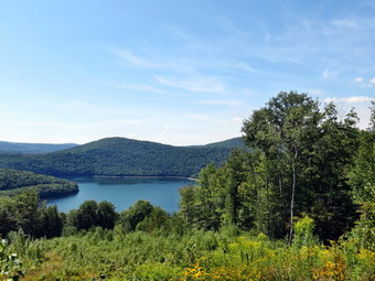
![]() On Sunday, August 25th, Cindy and I decided to return to the new trails created near the Pepacton Reservoir on the Shavertown Parcel. This trail was constructed by the Catskill Mountain Club on land opened to public use by the DEP. We had hiked the trail less than a week earlier but the sky conditions were not the best for photography. When I looked at the sky after church on Sunday there seemed to be some white clouds in a blue sky. The trail has a pond with a view of the reservoir and another trail through the forest along some old access roads. The loop around the pond is about 2 miles with the additional trail adding another 3 miles or a total of about 5 miles. We got a late start had still had plenty of time to do the hike. We loaded up Sheila and headed for the Route 30 bridge across the reservoir. After crossing the bridge, I turned left and parked across from the trailhead about .15 miles up the road. There had been a scheduled Catskill Mountain Club hike at 11:00 Am but there were no other cars parked by the side of the road. We were ready to go almost immediately and crossed the road just before 2:00 PM to start our hike. The first .25 miles of trail climbs 200 feet as it heads directly north and up the side of Perch Lake Mountain. Soon the trail turned right on an old access road and continued to climb through the forest for another .25 miles. We met several people hiking back down the trail and the first group told us there were more hikers up at the pond. We broke out into a field and the trail leveled a little and we met a few more hikers. Along this part of the trail we found some meteorological instruments with solar panels for power. One had a snow scale next to it while the other had a device to measure rainfall. The trail now turned northeast and descended to the edge of the pond at .85 miles. The pond had both pink and white water lilies growing in it as well as cattails around the edge. We stopped and I took some pictures as Sheila decided to go for a swim. I decided NOT to throw any sticks this time as Sheila had gotten tangled in some pond weeds the last time. We walked over to the lookout at the western end of the pond and found that there were some more hikers sitting just below the viewpoint. It was disappointing to see that the sky conditions were not that much better than the last time we had done the hike. There was only a little haze but there were few of the white, puffy clouds I wanted to see. I took a few pictures of the pond and a few of the reservoir from the viewpoint. We headed back down the trail but decided to skip the "extra" trail since there was not much to see. We walked quickly down the trail but not as quickly as Sheila. Once she has been in the water, she usually dashes back and forth on the trail at breakneck speed! This day was no exception. At one point she was running around and came to a deep ditch which surprised her. Sheila simply took to the air in an amazingly long leap which made her appear to be in flight. We arrived back at the car after hiking only 1.9 miles in less than an hour. We debated going to Kelly Hollow but in the end decided to return home. I will have to return again to find the sky conditions I want.
On Sunday, August 25th, Cindy and I decided to return to the new trails created near the Pepacton Reservoir on the Shavertown Parcel. This trail was constructed by the Catskill Mountain Club on land opened to public use by the DEP. We had hiked the trail less than a week earlier but the sky conditions were not the best for photography. When I looked at the sky after church on Sunday there seemed to be some white clouds in a blue sky. The trail has a pond with a view of the reservoir and another trail through the forest along some old access roads. The loop around the pond is about 2 miles with the additional trail adding another 3 miles or a total of about 5 miles. We got a late start had still had plenty of time to do the hike. We loaded up Sheila and headed for the Route 30 bridge across the reservoir. After crossing the bridge, I turned left and parked across from the trailhead about .15 miles up the road. There had been a scheduled Catskill Mountain Club hike at 11:00 Am but there were no other cars parked by the side of the road. We were ready to go almost immediately and crossed the road just before 2:00 PM to start our hike. The first .25 miles of trail climbs 200 feet as it heads directly north and up the side of Perch Lake Mountain. Soon the trail turned right on an old access road and continued to climb through the forest for another .25 miles. We met several people hiking back down the trail and the first group told us there were more hikers up at the pond. We broke out into a field and the trail leveled a little and we met a few more hikers. Along this part of the trail we found some meteorological instruments with solar panels for power. One had a snow scale next to it while the other had a device to measure rainfall. The trail now turned northeast and descended to the edge of the pond at .85 miles. The pond had both pink and white water lilies growing in it as well as cattails around the edge. We stopped and I took some pictures as Sheila decided to go for a swim. I decided NOT to throw any sticks this time as Sheila had gotten tangled in some pond weeds the last time. We walked over to the lookout at the western end of the pond and found that there were some more hikers sitting just below the viewpoint. It was disappointing to see that the sky conditions were not that much better than the last time we had done the hike. There was only a little haze but there were few of the white, puffy clouds I wanted to see. I took a few pictures of the pond and a few of the reservoir from the viewpoint. We headed back down the trail but decided to skip the "extra" trail since there was not much to see. We walked quickly down the trail but not as quickly as Sheila. Once she has been in the water, she usually dashes back and forth on the trail at breakneck speed! This day was no exception. At one point she was running around and came to a deep ditch which surprised her. Sheila simply took to the air in an amazingly long leap which made her appear to be in flight. We arrived back at the car after hiking only 1.9 miles in less than an hour. We debated going to Kelly Hollow but in the end decided to return home. I will have to return again to find the sky conditions I want.
![]()
![]()
![]() On Friday, August 23rd, I decided I wanted to finish hiking map 22 on the Finger Lakes Trail. The total distance for the whole map is about 23.5 miles and I had hiked up to mile 14.9 on Ridge Road which meant I had 8.6 miles more to go. I wasn't sure that I wanted to hike almost 18 miles so I consulted the maps for an alternative. It seemed by hiking out on the trail and then back on the roads I could save a few miles. Many sections of the Finger Lakes Trail are simply pleasant sections of trail without any views or points of interest and I have no problem using the roads to walk back to the car. Many of these roads are dirt or gravel and have more interesting views than the trails! We left the house at about 7:00 AM and I decided to head to Whitney Point and take Route 26 to South Otselic. This seemed like the route that stayed on major roads for the longest distance and I knew I could make good time this way. The car GPS kept insisting on directing me to smaller back roads but finally saw it my way when we passed Deposit on Route 17! I stopped in Whitney Point for gas and then followed Route 26 all the way to South Otselic where I turned left and then right onto Ridge Rd. After 4.25 miles on Ridge Road, we passed Buck Brook Road and found the Finger Lakes Trail crossing just after that. It was the first trip in a while where I made no wrong turns and found the parking spot immediately. It was 9:15 AM and we were ready to hike so we entered the woods to begin the trip. The trail from the road was well-maintained with some cut ferns in the trail that were not yet brown. The trail almost immediately crossed a small brook that was almost dry. From there we ascended a small hill and then dropped to another stream at 1.2 miles into the hike. There were few, if any, insects and the temperature was in the high 60's with a slight breeze making perfect conditions for hiking. The trail skirted McDermott Hill and began to follow a well-defined logging road. At about 2 miles we were hiking along the logging road when I realized that there were no longer any white blazes to be seen. We walked a little farther and then backtracked to pick up the trail which had veered right at about 1.9 miles. I looked for the turn blaze and found it...completely hidden by vegetation. The trail climbed a bit and then rejoined the logging road and continued to descend. Once again I was hiking on a logging road and looked up to find no blazes anywhere ahead. I backtracked again and found where the trail had again headed right at about 2.8 miles and started to ascend through the woods. The ascent seemed steep but in fact was not very challenging and was short. Over the next .4 miles we descended about 250 feet to Bucks Brook Road. Once at the road we turned left and walked .3 miles out to Route 26.
On Friday, August 23rd, I decided I wanted to finish hiking map 22 on the Finger Lakes Trail. The total distance for the whole map is about 23.5 miles and I had hiked up to mile 14.9 on Ridge Road which meant I had 8.6 miles more to go. I wasn't sure that I wanted to hike almost 18 miles so I consulted the maps for an alternative. It seemed by hiking out on the trail and then back on the roads I could save a few miles. Many sections of the Finger Lakes Trail are simply pleasant sections of trail without any views or points of interest and I have no problem using the roads to walk back to the car. Many of these roads are dirt or gravel and have more interesting views than the trails! We left the house at about 7:00 AM and I decided to head to Whitney Point and take Route 26 to South Otselic. This seemed like the route that stayed on major roads for the longest distance and I knew I could make good time this way. The car GPS kept insisting on directing me to smaller back roads but finally saw it my way when we passed Deposit on Route 17! I stopped in Whitney Point for gas and then followed Route 26 all the way to South Otselic where I turned left and then right onto Ridge Rd. After 4.25 miles on Ridge Road, we passed Buck Brook Road and found the Finger Lakes Trail crossing just after that. It was the first trip in a while where I made no wrong turns and found the parking spot immediately. It was 9:15 AM and we were ready to hike so we entered the woods to begin the trip. The trail from the road was well-maintained with some cut ferns in the trail that were not yet brown. The trail almost immediately crossed a small brook that was almost dry. From there we ascended a small hill and then dropped to another stream at 1.2 miles into the hike. There were few, if any, insects and the temperature was in the high 60's with a slight breeze making perfect conditions for hiking. The trail skirted McDermott Hill and began to follow a well-defined logging road. At about 2 miles we were hiking along the logging road when I realized that there were no longer any white blazes to be seen. We walked a little farther and then backtracked to pick up the trail which had veered right at about 1.9 miles. I looked for the turn blaze and found it...completely hidden by vegetation. The trail climbed a bit and then rejoined the logging road and continued to descend. Once again I was hiking on a logging road and looked up to find no blazes anywhere ahead. I backtracked again and found where the trail had again headed right at about 2.8 miles and started to ascend through the woods. The ascent seemed steep but in fact was not very challenging and was short. Over the next .4 miles we descended about 250 feet to Bucks Brook Road. Once at the road we turned left and walked .3 miles out to Route 26.
We turned right on Route 26 at 10:35 AM and hiked down the wide shoulder for .35 miles crossing the Otselic River to a fishing access on the right side. The map directions said to follow the blazes but there were none in the lot. We walked through the lot to a dirt road and turned left toward the river but I could find no blazes. We walked back to the lot and out a path toward the river. The path needed at the river bank. We walked back out to the dirt road. Just as the road made a sharp turn there was a red cone and what looked like a trail going up a hill and along the river. I decided to try this path even though there were no blazes. We hiked up the path and I found some white blaze indicating I had chosen correctly. The trail followed the river but stayed high on the bank for a short distance. At about 4.6 miles the trail began a series of switchbacks to climb Truman Hill. From the river we climbed about 550 feet to the top of Truman Hill crossing a road just before the summit. After the summit we descended the other side of the hill to another road where the trail paralleled but did not meet the road. This part of the trail was as confusing as any part I had been on. There were so many twists and turns I felt like I was going in circles! At 5.6 miles we turned south onto a logging road which was poorly marked. We stayed on the road for about .3 miles and then turned left and looped back north almost parallel to the road we just left. Over the next 1.25 miles we headed north, then east, then south, then west and then south again gaining about 350 feet along the way. At this point we were headed for Warner Road which was our ultimate destination and I though we would be there soon. This was not to be as the trail now headed east for the next .9 miles gaining and then losing elevation in the process. We were now hiking in primarily evergreen forest and I was hoping to find the Winston Braxton Memorial Bench which was supposed to be only .8 miles from the end of the trail section. At about 8 miles we began another 200 foot ascent for about half a mile passing the bench along the way. We were now headed south and downhill. After passing through an old quarry we walked through some more pines and at 9.2 miles we were on Warner Road. It was 1:00 PM.
I hadn't calculated the exact distance back on the roads but through I could save at least 2 miles. I was happy to have an alternative as this was not my favorite section of trail. After getting a drink and a snack, I pack my poles and we headed east on Warner Road for 1.35 miles to Route 26. Along the way the road became paved and we dropped 560 feet which I thought we would have to regain at some point to get back to the car. We did pass a nice sugarbush on Warner Road although I did not see the saphouse. I had already put Sheila on her leash so when we got to Route 26 we turned north and headed back toward the intersection with Bucks Brook Road. Route 26 has pretty good shoulders in most places but most vehicles were traveling quite a bit above the speed limit! We were only on the main road for 1.8 miles. At 12 miles we passed the fishing access area and at 12.3 miles we turned left on Valley View Road. It was a short walk to Buck Brook Road where we turned right and headed northwest along the brook. I let Sheila off her leash to go down to the stream to play and get a drink. The walk up Bucks Brook Road was perhaps the most scenic of the day. There was enough water in the brook for it to make some sound. There were several small cascades that I would not call waterfalls but they were varied and interesting, The walk up Bucks Brook Road was about 2 miles to Ridge Road and we gained about 425 feet which was less than I thought. We passed several nice places on the road one of which was for sale. At 14.3 miles we turned right on Ridge Road and walked the final .3 miles back to the car where we arrived at 2:45 PM. We had covered 14.6 miles and 2360 feet of ascent in 5.5 hours with only 15 minutes of stopped time. Map 21 is to the west and most trailheads are actually closer to home!
![]()
![]()
![]() On Thursday, August 22nd, I decided I wanted get out and hike after several days of nursing a summer cold. My decision came rather late in the morning so I thought I would stay close to home and chose Trout Pond as my destination. Sheila was all ready to go as she always is and we arrived at the junction of Morton Hill Road and Russell Brook Road at about 10:30 AM. I parked along the side of the road to avoid parking in the lot which is private property. As wee walked down Russell Brook Road, I was plagued by a swarm of insects including some mosquitoes with an appetite. I attributed this in part to some rain the night before which made everything a little damp and hoped they would soon go away. There was more water in the brook than I thought there would be and both the upper and lower falls were running nicely. There was one car parked in the lower lot as we passed through. I decided to skip the visit to the falls until the return trip and walked across the bridge to the trail register. I decided to head up the hill toward Mud Pond first for some variety as we had not hike in that direction for some time. The hike up the hill went quickly and didn't seem as strenuous as I remembered. When we got to the trail junction, we turned right to start over Cherry Ridge toward Trout Pond. Everything was nice and green and bright. The skies were sunny but the a little flat with very few clouds. We kept up a good pace as I was more interested in the exercise than the scenery. We walked up the hill and down the other side arriving at the inlet bridge at about 11:40 AM. We had covered 3.5 miles in just over an hour! Sheila likes to play in the water so we walked to the edge of the pond where she promptly dove in. The water was shallow but I decided to throw a stick for her anyway. My first throw went pretty far out, I thought, but Sheila barely had to swim to get it. I put a little extra effort into the next few and she was able to swim a little to retrieve the stick. Back on the trail we walked over the bridge and along the east side of the pond toward the outlet. As we approached the other end, I could see a woman on the "beach" at the outlet and decided to skip the visit as I was not really interested in pictures. Sheila and I continued our fast pace down the hill and were soon at the trail register. I decided that I did not need to visit the falls so we walked back up Russell Brook Road to the car. We were back at 12:20 PM having covered 5.4 miles in under 2 hours!
On Thursday, August 22nd, I decided I wanted get out and hike after several days of nursing a summer cold. My decision came rather late in the morning so I thought I would stay close to home and chose Trout Pond as my destination. Sheila was all ready to go as she always is and we arrived at the junction of Morton Hill Road and Russell Brook Road at about 10:30 AM. I parked along the side of the road to avoid parking in the lot which is private property. As wee walked down Russell Brook Road, I was plagued by a swarm of insects including some mosquitoes with an appetite. I attributed this in part to some rain the night before which made everything a little damp and hoped they would soon go away. There was more water in the brook than I thought there would be and both the upper and lower falls were running nicely. There was one car parked in the lower lot as we passed through. I decided to skip the visit to the falls until the return trip and walked across the bridge to the trail register. I decided to head up the hill toward Mud Pond first for some variety as we had not hike in that direction for some time. The hike up the hill went quickly and didn't seem as strenuous as I remembered. When we got to the trail junction, we turned right to start over Cherry Ridge toward Trout Pond. Everything was nice and green and bright. The skies were sunny but the a little flat with very few clouds. We kept up a good pace as I was more interested in the exercise than the scenery. We walked up the hill and down the other side arriving at the inlet bridge at about 11:40 AM. We had covered 3.5 miles in just over an hour! Sheila likes to play in the water so we walked to the edge of the pond where she promptly dove in. The water was shallow but I decided to throw a stick for her anyway. My first throw went pretty far out, I thought, but Sheila barely had to swim to get it. I put a little extra effort into the next few and she was able to swim a little to retrieve the stick. Back on the trail we walked over the bridge and along the east side of the pond toward the outlet. As we approached the other end, I could see a woman on the "beach" at the outlet and decided to skip the visit as I was not really interested in pictures. Sheila and I continued our fast pace down the hill and were soon at the trail register. I decided that I did not need to visit the falls so we walked back up Russell Brook Road to the car. We were back at 12:20 PM having covered 5.4 miles in under 2 hours!
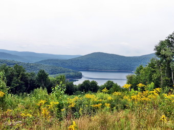
![]()
![]()
![]()
![]() On Monday, August 19th, I decided I wanted to hike the new trails created near the Pepacton Reservoir. The Shavertown Parcel is one area where new trails have been constructed by the Catskill Mountain Club on land opened to public use by the DEP. The trail descriptions mentioned a pond with a view of the reservoir and another trail through the forest along some old access roads. The loop around the pond was supposed to be about 2 miles with the additional trail adding another 3 miles or a total of about 5 miles. The description mentioned that the first part of the trail to the pond was a little steep but that the rest was relatively flat. Cindy decided she would like to go so we loaded up Sheila and headed for the Route 30 bridge across the reservoir. After crossing the bridge, I turned left and found the trailhead about .15 miles up the road. I turned around and parked off the side of the road across from the beginning of the trail. We were ready to go almost immediately and crossed the road at 11:05 AM to start our hike. The first .25 miles of trail climbs 200 feet as it heads directly north and up the side of Perch Lake Mountain. Soon the trail turned right on an old access road and continued to climb through the forest for another .25 miles. We broke out into a field and the trail leveled a little. Along this part of the trail we found some meteorological instruments with solar panels for power. One had a snow scale next to it while the other had a device to measure rainfall. The trail now turned northeast and descended to the edge of a small pond at .85 miles. The pond had both pink and white water lilies growing in it as well as cattails around the edge. We stopped and I took some pictures as Sheila decided to go for a swim. I threw a stick into the water and she retrieved it several times. On the last retrieval she decided to swim through a patch of pond weeds. She promptly got tangled in the mass but was able to power through the mass dragging most of it to shore. It was a moment that caused us some apprehension and I was all ready to jump in if she needed help! We walked around the pond on the west side and found an outstanding lookout over the Pepacton. The only disappointment was that the sky was "flat" and white without clouds or any real color. There was also a haze over the reservoir and surrounding hills but I took pictures anyway. I intend to return on the first day with blue skies and puffy clouds.
On Monday, August 19th, I decided I wanted to hike the new trails created near the Pepacton Reservoir. The Shavertown Parcel is one area where new trails have been constructed by the Catskill Mountain Club on land opened to public use by the DEP. The trail descriptions mentioned a pond with a view of the reservoir and another trail through the forest along some old access roads. The loop around the pond was supposed to be about 2 miles with the additional trail adding another 3 miles or a total of about 5 miles. The description mentioned that the first part of the trail to the pond was a little steep but that the rest was relatively flat. Cindy decided she would like to go so we loaded up Sheila and headed for the Route 30 bridge across the reservoir. After crossing the bridge, I turned left and found the trailhead about .15 miles up the road. I turned around and parked off the side of the road across from the beginning of the trail. We were ready to go almost immediately and crossed the road at 11:05 AM to start our hike. The first .25 miles of trail climbs 200 feet as it heads directly north and up the side of Perch Lake Mountain. Soon the trail turned right on an old access road and continued to climb through the forest for another .25 miles. We broke out into a field and the trail leveled a little. Along this part of the trail we found some meteorological instruments with solar panels for power. One had a snow scale next to it while the other had a device to measure rainfall. The trail now turned northeast and descended to the edge of a small pond at .85 miles. The pond had both pink and white water lilies growing in it as well as cattails around the edge. We stopped and I took some pictures as Sheila decided to go for a swim. I threw a stick into the water and she retrieved it several times. On the last retrieval she decided to swim through a patch of pond weeds. She promptly got tangled in the mass but was able to power through the mass dragging most of it to shore. It was a moment that caused us some apprehension and I was all ready to jump in if she needed help! We walked around the pond on the west side and found an outstanding lookout over the Pepacton. The only disappointment was that the sky was "flat" and white without clouds or any real color. There was also a haze over the reservoir and surrounding hills but I took pictures anyway. I intend to return on the first day with blue skies and puffy clouds.
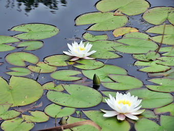 We continued around the pond and I took some more pictures of the pond and the lilies. Cindy spotted some fish in the pond and I managed to get one picture before Sheila jumped in. The trail around the back of the pond was flagged but not completely cleared out but we continued around anyway as we walked back to the trail that we had descended to the pond. We walked back along the trail and then turned left at the sign that marked the turn for the extra 1.5 miles. This trail followed another woods road and gained a little over 200 feet in the next .5 miles. At times we couldn't see the next marker and were left wondering if we were on the correct path but it all worked out. At around 1.5 miles into the hike the trail dipped to the left off the woods road to travel through an area with large boulders. I took some pictures as the sedimentary layers were so clear on the rocks. Many were also covered by interesting mosses and lichens. Once the trail rejoined the road it remained pretty flat for the next .8 miles. The trail began to turn around the mountain heading a little to the east. We assumed it would continue east and then head south to loop around the mountain. We followed the flagging and markers as they looped around and ended up...back on the same trail we had come in on. We did not know where we had gone wrong but it was a little too late to go and explore to correct our mistake. We followed the woods road back to the pond and then took the access road back to the trail. We made the left on the trail and were soon back at the car. The trip back went much faster as it was mostly downhill. We were back at the car at 1:30 PM having covered 4.7 miles in 2 hours and 20 minutes with about a 1000 feet of ascent along the way.
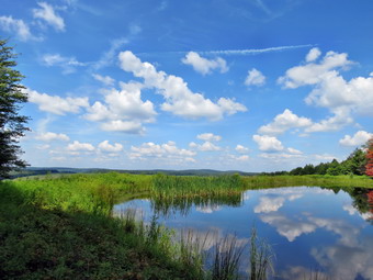
![]()
![]()
![]()
![]() On Saturday, August 17th, I decided I wanted to continue hiking map 22 on the Finger Lakes Trail. The total distance for the whole map is about 23.5 miles and would probably have to be divided into four days of hiking. I had already hiked from Stoney Brook Road in Cortland County near Lincklaen to Paradise Hill Road in Madison County earlier in the week. My plan was to park on Paradise Hill Rd and hike to Ratville Road or Ridge Road before turning around. I did not have to get up very early on Saturday but awoke early anyway. I got my gear together and Sheila and I were ready to leave Livingston Manor around 6:45 AM. I had one set of directions from Google maps which took me through Cortland and then put me on Route 13 from there. The car GPS has a different route using exit 8 off I81 and I decided to follow it. The route included many smaller roads but got us to Lincklaen Center in good time. Now the problem was that I could not find Paradise Hill Road as there was no sign with that name. After a quick correction of a wrong turn I found the road and started up the hill. I knew that the Finger Lakes Trail crossed near the junction with Woods Road but this road also did not have a sign. I continued on Paradise Hill Road until it was clear that I had passed the Finger Lakes Trail crossing. I pulled over and used my hiking GPS which showed me I was almost a mile passed where I wanted to be. I turned around and found the Finger Lakes Trail crossing rather quickly. There was just enough room to get off the pavement and park on the grassy shoulder although the ditch seemed a little deep. I got me pack ready and we headed across the road on the trail at about 9:15 AM. There didn't seem to be too many insects so I decided not to apply the repellant. Within a few minutes we crossed Woods Road and began ascending a Stage Coach Hill. I didn't mind climbing as I knew it would be a descent on the way back. Just as soon as we hit the high point we began to descend dropping almost 600 feet to Dublin Road where we turned right. I thought about his ascent on the way back after hiking over 10 miles!
On Saturday, August 17th, I decided I wanted to continue hiking map 22 on the Finger Lakes Trail. The total distance for the whole map is about 23.5 miles and would probably have to be divided into four days of hiking. I had already hiked from Stoney Brook Road in Cortland County near Lincklaen to Paradise Hill Road in Madison County earlier in the week. My plan was to park on Paradise Hill Rd and hike to Ratville Road or Ridge Road before turning around. I did not have to get up very early on Saturday but awoke early anyway. I got my gear together and Sheila and I were ready to leave Livingston Manor around 6:45 AM. I had one set of directions from Google maps which took me through Cortland and then put me on Route 13 from there. The car GPS has a different route using exit 8 off I81 and I decided to follow it. The route included many smaller roads but got us to Lincklaen Center in good time. Now the problem was that I could not find Paradise Hill Road as there was no sign with that name. After a quick correction of a wrong turn I found the road and started up the hill. I knew that the Finger Lakes Trail crossed near the junction with Woods Road but this road also did not have a sign. I continued on Paradise Hill Road until it was clear that I had passed the Finger Lakes Trail crossing. I pulled over and used my hiking GPS which showed me I was almost a mile passed where I wanted to be. I turned around and found the Finger Lakes Trail crossing rather quickly. There was just enough room to get off the pavement and park on the grassy shoulder although the ditch seemed a little deep. I got me pack ready and we headed across the road on the trail at about 9:15 AM. There didn't seem to be too many insects so I decided not to apply the repellant. Within a few minutes we crossed Woods Road and began ascending a Stage Coach Hill. I didn't mind climbing as I knew it would be a descent on the way back. Just as soon as we hit the high point we began to descend dropping almost 600 feet to Dublin Road where we turned right. I thought about his ascent on the way back after hiking over 10 miles!
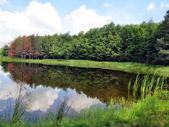 There was excellent parking on Dublin Road and although the surface was dirt and gravel it seemed driving it would be no problem. We walked down Dublin Road for .3 miles and then took the trail into the woods on the left. Most areas of the trail were only damp but there were some wet and muddy areas especially where woods roads crossed the trail. It was only .5 miles to Mariposa Road but several switchbacks stretched this to 1 mile. We also gained back over 400 feet of elevation as we crossed the road. Immediately after the crossing the trail looked as it someone had used a lawnmower to cut the vegetation. This continued for some distance as we passed through Mariposa State Forest. The fact that somebody acted enough to cut out the trail buoyed my spirits. It was less than a mile from Mariposa Road to Bamberry Road and the trail undulated a little along the way. At 3.5 miles we crossed a stream on a nicely built bridge. It was the only bridge across any of the streams on the hike but most of the stream were almost dry. Sheila took a minute to get a drink and run through the water before we headed uphill on the trail. As we crossed Bamberry Road we entered private property. The trail on the other side of the road was hard to spot as it had not been cut out at all. We walked through some high weeds and into an evergreen forest where I found white blazes on the trees. In only .4 miles from the road was a junction with the Link Trail which connects with the North Country Trail. The North Country Trail when completed will stretch from Crown Point, NY to North Dakota passing through seven states over 4600 miles! In New York the trail will follow much of the Finger Lakes Trail starting at the trail junction with the Link Trail. We continued passed the Link Trail and I found a sign that said "FLT to Adirondacks, Long Path, Catskills". From this point the map was relatively silent about the next two miles which was a shame since this was by far the trickiest part of the hike!
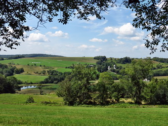 Somewhere around 4.9 miles we came out of the trees into a field. The grass was high and there was only the hint of a trail. I was lucky to spot a post in the high grass with a white blaze. Just beyond this post was another and then...nothing. I headed for the edge the of the field near the trees and, again, was lucky to spot some faded white blazes on some trees. We followed those blazes through high grass and brambles until we came to a barbed wire fence with a stile that had a white blazes. The stile was 4 or 5 feet high and was basically a ladder in the shape of a triangle. It looked like there was plenty of room under the fence for Sheila and I expected her to take that route. As I climbed the alder I felt something on the back of my leg! Sheila climbed up the ladder and then climbed down the other side. I wanted to take a picture but a swarm of bees on the other side discouraged me! The big problem was that I could not find where the Finger Lakes Trail headed. I consulted my compass and map and it was clear we should head east along a country lane. As we walked I did pick up a few blazes but not many. We walked along the lane for about .2 miles as it skirted the edge of the field after which we turned south and entered a pine forest. The next section of trail was constructed to head south while staying out of the farm fields and to do this it took several interesting turns. Along the way I spotted a pond but did not want to walk across private property to get there. A little further along the trail passed right by the shore the of the pond and we stopped so that I could take some pictures. The pond was small and very isolated. There were some reeds growing on the shores and the water was very still. The most interesting part was the way the sky and clouds were reflected he the pond. There was also a stand of trees that seemed to be changing color. I took some pictures and we got a snack before heading on down the trail. Not too much further along we stopped again so that I could take a few more pictures of the countryside.
 We continued along the trail descending to Ratville Road which we reached at 7.3 miles. It was about 12:30 PM and I was tired. I knew that I wanted to take the bypass route on the way back which is used when the private property is closed for hunting. I looked at the map and began to think I would use the roads to hike back to the car. I estimated that it would be between 4 and 5 miles on the roads as opposed to more than 8 miles on the trail. I like hiking on the country roads as I often see sights as interesting as those on the trails. In this case hiking the roads would allow me to hike another mile on the trail to Ridge Road and have some variety on the return trip. There was a place to pull a car off the road but I hoped there would be better parking on Ridge Road. We crossed Ratville Road and immediately ran into some blowdown. The rest of the trail was well marked and easy to follow as we hiked a little over a mile to Ridge Road. The trail did ascend and then descend a small hill along the way. The last part of the trail followed a nice stone wall for some distance before finally crossing Ridge Road where there was plenty of room to park several cars. We turned around here and headed back over the hill to Ratville Road where we turned left on the dirt and gravel road. The road went downhill and then uphill a little until it met Mariposa Road. We stopped and I put Sheila on her leash and put my poles in the pack before we turned right on Mariposa Road. In only .3 miles we turned left on Lincklaen Center Road where we were confronted by a hill. As we walked along we saw a lot of farming going on. There were barns with silos and large herds of dairy cattle. Some farmers were haying and we passed one farmer who was taking break after emptying a hay wagon. We stayed on Lincklaen Center Road for about 2.3 miles as it lost about 400 feet to the intersection with Paradise Hill Road in Lincklaen Center. I knew that we would have to again that loss back and more to get to the car. Near the intersection was a farm where there were several white-faced Herefords and their calves. I would have stopped to take pictures but I just wanted to get back to the car. We turned right onto Paradise Hill Road and walked through Lincklaen Center and then started to climb Paradise Hill Road. The distance was 1.6 miles and we only gained 460 feet but I was glad Sheila was pulling me and I was happy when we got to the car at 3:00 PM. We had walked 9.3 miles on the trails and 5.1 miles on the roads for a total of 14.2 miles and 2270 feet of ascent in 5 hours and 40 minutes. I noticed my right calf was hurting again and that the Keen boots, like many hiking boots, have very little arch support. I will try to remember to add a pair of insoles next time to see if they help.
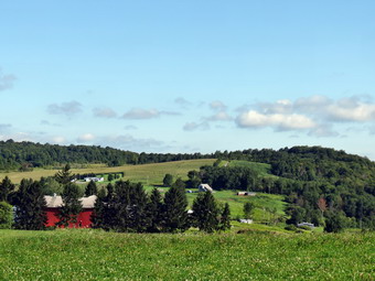
![]()
![]()
![]()
![]() On Thursday, August 15th, I decided I wanted to begin map 22 on the Finger Lakes Trail. The total distance for the whole map was only about 23.5 miles and would probably have to be divided into four days of hiking. After looking at the map, my plan was to park on Stoney Brook Road in Cortland County near Lincklaen and hike to Paradise Hill Road in Madison County. The trail also passed through Chenango County at some point which meant we would be hiking in three counties over 6.6 miles. I thought about going on to, Dublin Road which was another 2 miles but decided to see how I felt when I got to Paradise Hill. When I awoke at 5:30 AM, I had a sore throat and felt lousy! I considered skipping the hike and turning over for some more sleep, but knew I would probably feel better if I went. I knew that Sheila would like to get put after being home for two days and this acted as some extra motivation. I got everything ready to go and left Livingston Manor a little after 6:30 AM for the 2 hour and 15 minute trip. I took State Route 17 northwest to Binghamton and then I81 north to exit 11 near Cortland. From there I took Route 13 northeast. Along the way I passed through Truxton and decided to stop to get gas. I noticed a memorial across from the gas station with a man in a baseball cap. After gassing up, I went to look at the memorial which was dedicated to John J. McGraw. McGraw was born in Truxton and went on to play baseball and manage the New York Giants. His record for victories is exceeded only by Connie Mack. From Truxton I continued on Route 13 until making a right on LinckLaen Road. After another right on Cuyler Hill Road, I found Stoney Brook Road and tuned left. The road had the now familiar "Seasonal Maintenance" sign and lived up to its name as it was vary "stony". I drove up a small hill and parked where the Finger Lakes Trail came in from the left. After consulting the Finger Lakes Trail map, I decided to continue just a little further down the road to park where the map said the trail section actually began. I took off my light jacket even though it was cool knowing it would get warmer throughout the day and that I always warm up as I hike. There didn't seem to be too many insects around so I skipped the repellant. After consulting the map again, I realized that after a short piece of trail in the woods, the hike would be about 4 miles of road walking followed by another 2.2 miles in the woods. I wasn't happy about the road walking but it couldn't be avoided so we started out at 8:50 by crossing the road to get on the trail.
On Thursday, August 15th, I decided I wanted to begin map 22 on the Finger Lakes Trail. The total distance for the whole map was only about 23.5 miles and would probably have to be divided into four days of hiking. After looking at the map, my plan was to park on Stoney Brook Road in Cortland County near Lincklaen and hike to Paradise Hill Road in Madison County. The trail also passed through Chenango County at some point which meant we would be hiking in three counties over 6.6 miles. I thought about going on to, Dublin Road which was another 2 miles but decided to see how I felt when I got to Paradise Hill. When I awoke at 5:30 AM, I had a sore throat and felt lousy! I considered skipping the hike and turning over for some more sleep, but knew I would probably feel better if I went. I knew that Sheila would like to get put after being home for two days and this acted as some extra motivation. I got everything ready to go and left Livingston Manor a little after 6:30 AM for the 2 hour and 15 minute trip. I took State Route 17 northwest to Binghamton and then I81 north to exit 11 near Cortland. From there I took Route 13 northeast. Along the way I passed through Truxton and decided to stop to get gas. I noticed a memorial across from the gas station with a man in a baseball cap. After gassing up, I went to look at the memorial which was dedicated to John J. McGraw. McGraw was born in Truxton and went on to play baseball and manage the New York Giants. His record for victories is exceeded only by Connie Mack. From Truxton I continued on Route 13 until making a right on LinckLaen Road. After another right on Cuyler Hill Road, I found Stoney Brook Road and tuned left. The road had the now familiar "Seasonal Maintenance" sign and lived up to its name as it was vary "stony". I drove up a small hill and parked where the Finger Lakes Trail came in from the left. After consulting the Finger Lakes Trail map, I decided to continue just a little further down the road to park where the map said the trail section actually began. I took off my light jacket even though it was cool knowing it would get warmer throughout the day and that I always warm up as I hike. There didn't seem to be too many insects around so I skipped the repellant. After consulting the map again, I realized that after a short piece of trail in the woods, the hike would be about 4 miles of road walking followed by another 2.2 miles in the woods. I wasn't happy about the road walking but it couldn't be avoided so we started out at 8:50 by crossing the road to get on the trail.
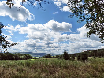 We walked to the first trail junction where an orange spur trail headed to Chippewa Falls. At this point we turned left to follow the Finger Lakes Trail and the Onondaga Trail back out to Stoney Brook Road at .3 miles. We turned right and walked out toward Cuyler Hill Road. I stopped to put my poles away, leash Sheila and take some pictures of the farm country against the blue but cloudless sky. At Cuyler Hill Road we turned right and walked downhill for over 1.5 miles to Lincklaen Road where we turned right. I was feeling better as we hiked although it was still cool with a breeze blowing. As we walked down the hill, I thought about the return hike up that same hill! Lincklaen Road had a pretty good shoulder and good sight lines so walking it wasn't too bad. Sheila gets better on the leash every time we go out unless there are birds involved. The walk wasn't unpleasant it was just that it was a road walk. Along the way there were many dogs most of which were chained. At 3.5 miles we passed from Cortland County into Chenango County. At 3.6 miles we made a left onto County Rt 12 and at 4.2 miles entered Madison County. After walking uphill slightly, I spied the Finger Lakes Trail sign on the right side the of the road at 4,4 miles. We crossed the road and stopped so that I could get out my poles and take Sheila off her leash. Sheila responded by dashing up and down the trail as we climbed a small hill on a woods road. The road was pretty wet so I was glad when the trail turned left off the road and continued to ascend the hill through mostly hardwoods. The trail was well marked and maintained and walking was pleasant. Ahead at 5.0 miles was a stream described as "reliable" on the map. I thought this might make it hard to cross since the map also mentioned a bypass trail. When we got to the stream, I took one giant step and was across and I never saw the bypass trail. We were now hiking through evergreen trees and their needles made nice, soft carpet for walking. At 5.2 miles we came to the Paradise Garden Lean-to complete with fireplace and picnic table. I kept with my policy of not taking lean-to pictures and we headed uphill away from the lean-to.
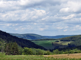 Just before hitting a logging road at 6.1 miles, I noticed the orange bypass trail on the left. We continued across the logging road and walked through some pines along the edge of a large field. At one point Sheila alerted but I could not see why until I looked in the field to find a farmer with a tractor and sprayer. We continued to walk making one stop so that I could take some more pictures of the bucolic landscape which now included puffy, white clouds against the blue sky. Soon we were descending through some hardwoods to Paradise Hill Road. I was still feeling fresh but I didn't know how I would feel hiking back on the roads and up Cuyler Hill. I decided to turn around as was my plan. On the way back we took the bypass trail which was even less used than the main Finger Lakes Trail. It was wet in places but was an interesting change from the main trail. We soon made a short but steep descent to the "reliable" stream. Apparently the bypass trail is simply a shortcut that bypasses the lean-to and not the stream! We crossed the stream and retraced our steps back to the road. I put away the sticks and put Sheila on her leash for the return trip. The trip back seemed faster than the trip out probably due to my familiarity with the route. Even the walk up Cuyler Hill wasn't too bad as Sheila has learned to pull when asked. As I was walking the last mile or so, I regretted not extending the hike a few more miles. I thought about moving the car and then doing as second hike then a better plan came to mind. I decided to hike back to the car and then hike the spur trail to Chippewa Falls. I knew there probably wouldn't be too much water at the falls from the warnings on the map and the waterfalls guidebook. I wanted to go anyway to get in a few more miles and to get an idea if returning to the falls in a wetter season would be a good idea. We were back at the car by 1:35 PM having hiked 12.7 miles with 2300 feet of ascent.
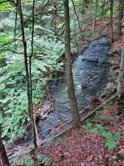 We paused only briefly at the car before crossing Stoney Brook Road to begin the hike to the falls. Only .1 miles in we came to the trail junction and continued straight ahead on the orange spur trail. The Finger Lakes Trail used to take this route until the landowner and the base of Chippewa Falls rescinded his permission to allow hiking on his land. The white blazes were removed and replaced with the orange ones. Almost as soon as we got on the trail it was clear that there had been no maintenance for some time. There was barely a path through the ferns and high prickers. In several places there were significant blowdowns that blocked the trail. I thought that a warning on the Finger Lakes Trail Conference map might have been a nice idea. I almost turned around but thought better of it since I have handled much worse conditions. The trail climbed a little initially but then dropped over 350 feet in the last .8 miles to the falls. The trail paralleled a stream for the last part of the hike and the stream was all but dry. I thought this probably did not bode well for the falls! When we arrived at the falls, the drop from top to bottom was truly impressive. I had seen figures from 50 to 200 feet. From what I could see the height was somewhere in between although it was hard to judge as the bottom of the falls was hidden by vegetation. I took some pictures of the main drop which answered my question about returning when more water was present. These falls with a moderate to heavy flow of water would be very interesting. After a brief stop, Sheila and I turned around and retraced our path to the car. The rounder to the falls was only 2.9 miles out and back with an ascent/descent of around 600 feet. Our total for the day was 15.6 miles in 6 hours with around 2350 feet of ascent and descent.
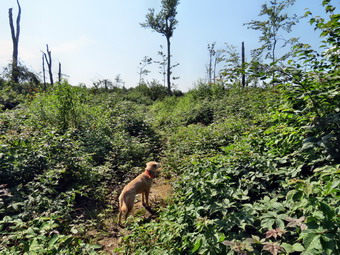
![]()
![]()
![]()
![]() On Monday, August 12th, I decided I wanted to finish map 23 on the Finger Lakes Trail. The total distance for the whole map was only about 13.7 miles and I had already covered the first 6.9 miles from Otselic State Forest to Grover Brown Road in North Pharsalia. My plan was to park on Grover Brown Road where the Finger Lakes Trail crosses and hike to the end of the map section at North Tower Road near the Berry Hill Fire Tower. I probably shouldn't have tried to hike at all on this day as I had "stubbed" a toe the night before and it had turned several different colors. In the morning it still hurt but I decided to hike anyway. I didn't have any commitments in the afternoon so I left the house at about 7:30 Am expecting to arrive at around 9:30 AM on Grover Brown Road. I am getting to know Chenango county pretty well so I headed to Deposit on Route 17 and took Route 8 north to Sidney. Just north of Sidney I took the route to Norwich where I picked up Route 23 west. I thought I had located Grover Brown Road in North Pharsalia on my last trip but as I approached the road the car GPS informed me that I had already passed my destination. The street that I thought I wanted had a hand labeled sign announcing that it was One Eye Street. I turned around and looked carefully for Grover Brown Road as I drove east. I was lucky to spot the road as the sign had been knocked down and only partially put up again. The road started as a paved road that seemed to split somebody's farmyard. It quickly deteriorated to a "limited maintenance" road at which point it no longer registered on the GPS. I drove over the rough gravel surface and up the hill for a total of .6 miles from Route 23. As I was driving I questioned whether I should be driving on this track but continued anyway. I drove passed the point where the Finger Lakes Trail crosses the road and turned around in a wider spot at the top of the hill. Just passed this spot there was a gate that closed the road. I pulled over where the Finger Lakes Trail crossed and parked the car just off the road. I wondered for a moment if I was far enough off the road but then realized that no one would be coming up this remote road to this deserted area! We were ready to hike at about 9:40 PM after I had applied some insect repellant to stave off the horseflies a small cloud of tiny insects! The first .6 miles of the hike consisted of walking down Grover Brown Road to Route 23. We turned right and walked .7 miles along the shoulder to Fred Stewart Road. This road heads south to Route 10 which was our destination. The Finger Lakes Trail, however, left the road several times to enter the forest. We walked south on Fred Stewart Road for .6 miles, turned right on Center road and then made a quick left back onto Fred Stewart Road. The road at this point had a gravel surface and a "seasonal maintenance" sign but was in good shape. After walking another .1 miles, we turned right into the forest where the bugs again appeared to escort us.
On Monday, August 12th, I decided I wanted to finish map 23 on the Finger Lakes Trail. The total distance for the whole map was only about 13.7 miles and I had already covered the first 6.9 miles from Otselic State Forest to Grover Brown Road in North Pharsalia. My plan was to park on Grover Brown Road where the Finger Lakes Trail crosses and hike to the end of the map section at North Tower Road near the Berry Hill Fire Tower. I probably shouldn't have tried to hike at all on this day as I had "stubbed" a toe the night before and it had turned several different colors. In the morning it still hurt but I decided to hike anyway. I didn't have any commitments in the afternoon so I left the house at about 7:30 Am expecting to arrive at around 9:30 AM on Grover Brown Road. I am getting to know Chenango county pretty well so I headed to Deposit on Route 17 and took Route 8 north to Sidney. Just north of Sidney I took the route to Norwich where I picked up Route 23 west. I thought I had located Grover Brown Road in North Pharsalia on my last trip but as I approached the road the car GPS informed me that I had already passed my destination. The street that I thought I wanted had a hand labeled sign announcing that it was One Eye Street. I turned around and looked carefully for Grover Brown Road as I drove east. I was lucky to spot the road as the sign had been knocked down and only partially put up again. The road started as a paved road that seemed to split somebody's farmyard. It quickly deteriorated to a "limited maintenance" road at which point it no longer registered on the GPS. I drove over the rough gravel surface and up the hill for a total of .6 miles from Route 23. As I was driving I questioned whether I should be driving on this track but continued anyway. I drove passed the point where the Finger Lakes Trail crosses the road and turned around in a wider spot at the top of the hill. Just passed this spot there was a gate that closed the road. I pulled over where the Finger Lakes Trail crossed and parked the car just off the road. I wondered for a moment if I was far enough off the road but then realized that no one would be coming up this remote road to this deserted area! We were ready to hike at about 9:40 PM after I had applied some insect repellant to stave off the horseflies a small cloud of tiny insects! The first .6 miles of the hike consisted of walking down Grover Brown Road to Route 23. We turned right and walked .7 miles along the shoulder to Fred Stewart Road. This road heads south to Route 10 which was our destination. The Finger Lakes Trail, however, left the road several times to enter the forest. We walked south on Fred Stewart Road for .6 miles, turned right on Center road and then made a quick left back onto Fred Stewart Road. The road at this point had a gravel surface and a "seasonal maintenance" sign but was in good shape. After walking another .1 miles, we turned right into the forest where the bugs again appeared to escort us.
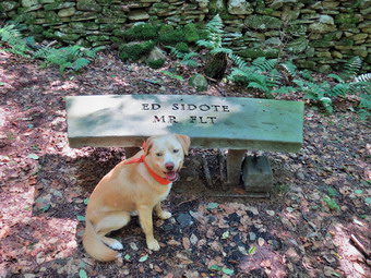 The trail surface was pretty flat with only a few rocks and I noticed that I wasn't having too much pain in my injured toe. From the description on the map I knew that we would meet an old CCC road in about .8 miles. After a short walk I could see a clearing ahead and we walked out into a clear cut area. This was not mentioned on the map! The trail was overgrown with prickers which flourish in the sunlight. The trail was barely visible in most places and there were few blazes to guide the way. I followed Sheila who was able to pick out the trail in most places. We made only one wrong choice which I quickly corrected when I noticed a blaze to our left. The trip through the clear cut was actually short and after that we entered an evergreen forest. We came to the CCC road, turned left and hiked along the road for .3 miles to the point where the Finger Lakes Trail left the road on the right. The trail now was wider and cushioned by pine needles. We came to a stone wall where the trail turned right and just after this, at 3.6 miles, was a stone bench dedicated to Ed Sidote. Mr. Sidote chose this place. He is #3 on the FLT End-to-End list and has served the Finger Lakes Trail Conference as president and in many other capacities. We stopped for a minute to take pictures and get a drink and then continued on our way. Just after the bench we came upon a stone foundation on the right. I knew this signaled that we were close to Fred Stewart Road again and did not stop to take pictures. Shortly, we crossed the road and continued downhill to the CCC road where we turned right. After .3 miles on the road, the trail again entered the woods on the right.
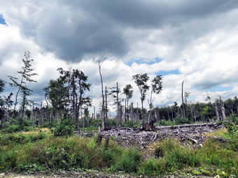 Over the next 1.3 miles the trail ascended and descended a small hill staying parallel to the road until meeting it again at the intersection with Hoag-Childs Road. At this point the rest of the hike was a road walk to North Tower Road. My toe was hurting a little but I had also developed a pain in my right calf. I debated turning around and completing the rest of the hike at another time but quickly decided that I would "tough it out"! Fred Stewart Road was now paved so I put Sheila on her leash and we walked downhill for .5 miles to Route 10. We passed Dave Markham's machine shop where water was available. At Route 10 we turned left and start to walk east to North Tower Road. Route 10 is busy and has no paved shoulders for walking. It does have good sight lines so that we could get over when cars or trucks were coming. The walk was mostly up hill and the sun was bright. On the last uphill I spotted a turkey in the road which ducked back into the woods. When we approached, a covey of partridges flew up and we could hear the clucking of some turkeys. Sheila was very interested but I encouraged her to walk on by. At the top of the hill we passed a beautiful home with a stone wall out front and a columned porch. In about .8 miles we were at the corner of Tower Road where we got a drink and a snack and turned around. The hike back on Route 10 was quick and we made good time back to the road intersection. I decided that we would walk back all the way on the road since it was easier to walk and had a dirt and gravel surface. It seemed that this route would also save some distance as it was absolutely straight. As we hiked the insects returned but were manageable. I kept Sheila on her leash as we had met several trucks along the way. In 1.2 miles we were at the point where the trail crossed the road and we continued north crossing the CCC Road. In another 1.3 miles we were at the point where we had first entered the woods. Along the way we passed another area where the trees were "disturbed". I stopped to take some pictures but could not decided whether this was a clear cut area or was caused by some other "disaster". We walked back out to Center Road and turned right and then left to follow Fred Stewart Road back to Route 23. From here we simply retraced our steps to Grover Brown road and then to the car. The final uphill on Grover Brown Road was easier than I thought it might be. We were back at the car at 2:10 PM having covered 12.4 miles in 4.5 hours. The vertical gain was over 1500 feet but most of this was on the roads. The trip out on the trail was 6.8 miles while the return journey was 5.5 miles saving 1.3 miles and a little over 20 minutes as I had hoped.
![]()
![]()
![]() On Sunday, August 11th, Krista and Brad were at the house with their dog Pierce. After church we decided to all go to Frick Pond to do a short hike. Pierce is not yet used to hiking so he would have to be on a leash but we thought it would be a good start. We used two cars to drive to the parking area since four people and two active dogs in one car seemed impossible. Luckily the ride is short and we arrived at the Frick Pond parking area at 11:50 AM ready to hike. It was immediately obvious that the recent rain had brought out the insects so we slathered on the insect repellant and were off. We decided to hike out the Quick Lake Trail to Frick Pond and take it to Iron Wheel Junction. The steel I-beans were still in the parking lot and the trail to the Frick Pond outlet had been cut out even wider than before. I assume that the bridge will be replaced soon but have not been able to confirm my assumption. We stopped at the bridge briefly to allow the dogs to play in the water. Pierce was a handful on his lead but Krista and Brad did not feel comfortable letting him run free. The longer we stood around the more insect appeared so we quickly crossed the bridge and headed around the left side of the pond. At the trail junction we stayed left to take the Quick Lake Trail to Iron Wheel Junction. The trails were wet from the rain and it was obvious in places that the water had been flowing freely on the trail. By the time we got to Iron Wheel Junction the rest of the group wanted to then right on the Loggers Loop and Sheila and I reluctantly agreed. I didn't want to cut the hike so short and particularly did not want to walk the Loggers Loop as it is always wet! We made the turn and quickly found out I was right about the trail as it was very wet with soggy areas and some large puddles. The conditions were also ripe for swarms of insects which had no respect for the insect repellant I was wearing. At that point the only good things about the trail was that it is relatively short. We walked the 1.3 miles in under 30 minutes arriving at Times Square at 1:05 PM. From there we stayed on the Loggers Loop back to the trail junction with the Quick Lake Trail. We turned left and walked back to the parking area. We arrived back at the car at 1:30 PM having hiked 3.8 miles in one hour and 40 minutes. I was actually happy to be back at the car as the insect situation made hiking miserable. I hoped that it would be better on Monday in Chenango County.
On Sunday, August 11th, Krista and Brad were at the house with their dog Pierce. After church we decided to all go to Frick Pond to do a short hike. Pierce is not yet used to hiking so he would have to be on a leash but we thought it would be a good start. We used two cars to drive to the parking area since four people and two active dogs in one car seemed impossible. Luckily the ride is short and we arrived at the Frick Pond parking area at 11:50 AM ready to hike. It was immediately obvious that the recent rain had brought out the insects so we slathered on the insect repellant and were off. We decided to hike out the Quick Lake Trail to Frick Pond and take it to Iron Wheel Junction. The steel I-beans were still in the parking lot and the trail to the Frick Pond outlet had been cut out even wider than before. I assume that the bridge will be replaced soon but have not been able to confirm my assumption. We stopped at the bridge briefly to allow the dogs to play in the water. Pierce was a handful on his lead but Krista and Brad did not feel comfortable letting him run free. The longer we stood around the more insect appeared so we quickly crossed the bridge and headed around the left side of the pond. At the trail junction we stayed left to take the Quick Lake Trail to Iron Wheel Junction. The trails were wet from the rain and it was obvious in places that the water had been flowing freely on the trail. By the time we got to Iron Wheel Junction the rest of the group wanted to then right on the Loggers Loop and Sheila and I reluctantly agreed. I didn't want to cut the hike so short and particularly did not want to walk the Loggers Loop as it is always wet! We made the turn and quickly found out I was right about the trail as it was very wet with soggy areas and some large puddles. The conditions were also ripe for swarms of insects which had no respect for the insect repellant I was wearing. At that point the only good things about the trail was that it is relatively short. We walked the 1.3 miles in under 30 minutes arriving at Times Square at 1:05 PM. From there we stayed on the Loggers Loop back to the trail junction with the Quick Lake Trail. We turned left and walked back to the parking area. We arrived back at the car at 1:30 PM having hiked 3.8 miles in one hour and 40 minutes. I was actually happy to be back at the car as the insect situation made hiking miserable. I hoped that it would be better on Monday in Chenango County.
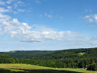
![]()
![]()
![]()
![]() On Tuesday, August 6th, I decided I wanted to start map 23 on the Finger Lakes Trail. The total distance for the whole map was only about 13.7 miles and I decided to start the hike and turn around at a point where I could park and finish the map section on another day. The forecast for South Otselic included a possible shower in the afternoon so I wanted to get an early start so that I could finish before the showers which were forecast for around 4:00 PM. I also wanted to get home since I had to attend an EMT class in the evening. I didn't set an alarm but awoke at 5:30 AM anyway. I hurried around to get all my equipment ready and was able to leave Livingston Manor at about 6:30 AM. Despite the insistence of the GPS to take only back roads I drove up Route 17 to Binghamton and headed north on I81. I took the Whitney Point exit and then got on Route 26 north to South Otselic. I drove through the town and turned right on Stage Road. I drove to the end and took a left on Will Warner Road. The road was dirt and gravel and passed a few houses and a farm at which point I saw the "Seasonal Maintenance" sign. The road got a little rougher as I drove on looking for the point where the Finger Lakes Trail crossed. Just after this point I knew I could park on Partridge Hill Road. I didn't see any Finger Lakes Trail signs and the first right was not marked with a road sign. The road did have a brown and yellow sign which might have once said "Otselic State Forest" but was now impossible to read. I stopped the car and got out to look for the Finger Lakes Trail but couldn't find it. I decided to drive on a little further. As I did I realized that I was now on the section that was labeled "rough" on the Finger Lakes Trail map. Fortunately the section was short but unfortunately the next road sign indicated that I should have stayed where I initially stopped the car. I drove back over the rough road and parked the car. To make sure I was in the right spot, I walked east on Will Warner Road to find the Finger Lakes Trail sign which was about .1 miles up a small hill. I returned to the car to get my pack and poles. I took a few pictures from Will Warner road to the west when there was a nice view. Sheila and I left the car to start the hike at 8:30 AM. The fog was all but gone and the sun was coming out but the temperature was only 51 degrees. I wisely decided against wearing he light jacket I had on. We turned right onto the trail and almost immediately ran into some wet spots on the trail. I was pleased to see that the trail, maintained by the Bullthistle Hiking Club of Norwich, was recently cut out and reblazed! Over the next .7 miles the trail dropped over 300 feet to Thompson Brook before ascending slightly to meet Stage Road. As we were losing elevation I thought about the return trip knowing that I would be tired. I stopped at Thompson Brook to take a few pictures before walking up to Stage Road.
On Tuesday, August 6th, I decided I wanted to start map 23 on the Finger Lakes Trail. The total distance for the whole map was only about 13.7 miles and I decided to start the hike and turn around at a point where I could park and finish the map section on another day. The forecast for South Otselic included a possible shower in the afternoon so I wanted to get an early start so that I could finish before the showers which were forecast for around 4:00 PM. I also wanted to get home since I had to attend an EMT class in the evening. I didn't set an alarm but awoke at 5:30 AM anyway. I hurried around to get all my equipment ready and was able to leave Livingston Manor at about 6:30 AM. Despite the insistence of the GPS to take only back roads I drove up Route 17 to Binghamton and headed north on I81. I took the Whitney Point exit and then got on Route 26 north to South Otselic. I drove through the town and turned right on Stage Road. I drove to the end and took a left on Will Warner Road. The road was dirt and gravel and passed a few houses and a farm at which point I saw the "Seasonal Maintenance" sign. The road got a little rougher as I drove on looking for the point where the Finger Lakes Trail crossed. Just after this point I knew I could park on Partridge Hill Road. I didn't see any Finger Lakes Trail signs and the first right was not marked with a road sign. The road did have a brown and yellow sign which might have once said "Otselic State Forest" but was now impossible to read. I stopped the car and got out to look for the Finger Lakes Trail but couldn't find it. I decided to drive on a little further. As I did I realized that I was now on the section that was labeled "rough" on the Finger Lakes Trail map. Fortunately the section was short but unfortunately the next road sign indicated that I should have stayed where I initially stopped the car. I drove back over the rough road and parked the car. To make sure I was in the right spot, I walked east on Will Warner Road to find the Finger Lakes Trail sign which was about .1 miles up a small hill. I returned to the car to get my pack and poles. I took a few pictures from Will Warner road to the west when there was a nice view. Sheila and I left the car to start the hike at 8:30 AM. The fog was all but gone and the sun was coming out but the temperature was only 51 degrees. I wisely decided against wearing he light jacket I had on. We turned right onto the trail and almost immediately ran into some wet spots on the trail. I was pleased to see that the trail, maintained by the Bullthistle Hiking Club of Norwich, was recently cut out and reblazed! Over the next .7 miles the trail dropped over 300 feet to Thompson Brook before ascending slightly to meet Stage Road. As we were losing elevation I thought about the return trip knowing that I would be tired. I stopped at Thompson Brook to take a few pictures before walking up to Stage Road.
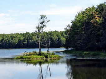 Once on Stage Road we turned left and walked a few hundred feet up the road to where the trail crossed the ditch and headed into a field. The map description did not mentioned a field and the blazes all but disappeared. I kept looking for blazes as we hugged the edge of the field and I finally found one or two. When we got to the top of the hill, I stopped to take a few pictures of the idyllic countryside. The grass had a heavy covering of dew which usually soaks through my shoes but although the leather looked wet my feet seemed to stay dry! Over the next 1.1 miles the trail continued to ascend but dipped several times to cross streams. Most of the streams did not have bridges but on this day none were needed as the stream were very low despite the recent rain. The last ascent from a stream to Church Road was a little steep. There were a few places where there may be waterfalls when the stream has more water. I did stop at one spot to take a few pictures. We crossed Church Road at about 2 miles at which point the trail leveled some and the surface was more even. We passed a trail register and then at around 2.5 miles we passed a blue blazed trail on the right to the Perkins Pond Lean-to. The trail to the lean-to was listed as .4 miles so I decided no visit was necessary. At 3.3 miles we crossed Johnson Street which I found to be an interesting and since it is a dirt road far from any town. The trail had gained a little elevation and we were hiking at about 2040 feet before descending to the dam at the south end of Jackson Pond. As we walked out onto the dam, we saw two men inspecting the spillway in the middle of the dam. I dropped my pack to take some pictures of the pretty little pond. The water was still and there was a small island near the south end. The sky at this point was clear and light blue with only a few clouds. The dam inspectors left so I picked up my pack and headed across the dam to the access road on the other side. I could find no white blazes but deiced to follow the access road out to John Smith Road. After a short distance, I found white bales going into the woods on the right so I followed them. Soon it was clear the blazes were leading back to the dam! When I got to the dam, I did find turn blazes on a narrow pole near the spillway. This was NOT explained on the map description. If you hike this section walk to the spillway, turn right and descend through a small field or clearing to pick up the blazes of the Finger Lakes Trail. We turned around and followed the blazes back to the access road and turned right to walk out to John Smith Road. I saw no blazes on the access road or at the intersection with John Smith Road. We walked east on the road and quickly picked up the trail and turned right into the woods. Apparently the Finger Lakes Trail had crossed the access road and continued through the woods to John Smith Road. I know that the Finger Lakes Trail Conference tries to keep the trail off roads but this is another example of a section of trail that is not intuitive and not well marked!
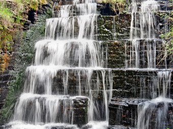 We had been hiking mostly south but the trail now turned east and leveled off before starting to descend again. Along the way at about 5.5 miles we passed through and old CCC camp. (Your mileage may vary since I made some errors along the way. The mileages on the Finger Lakes Trail maps seem pretty accurate.) We stopped and I took a few pictures of the old foundations and walkways which are very hard to recognize. In just 80 years the forest has reclaimed most of the buildings. At 5.7 miles we hit Elmer Jackson Road and turned right. We walked down the road following the blazes until we approached a small pond. There was a DEC truck with three people parked near the dam. We exchanged greetings and I noticed a kiosk for the Pharsalia Wildlife Management Area near the truck. We turned left to walk over the dam to the pond. There was a small bridge with an interesting spillway underneath. We walked over the bridge and I dropped my pack and got out the camera. I took some pictures from the bridge and then descended the bank to the stream to get pictures of the bridge and spillway. The light was really too bright but I got a few good shots before walking back up to the trail. I checked my watch and GPS and found it was just after 11:00 AM and we had covered just under 6 miles. I had hoped to be a little farther along at this point but this section of trail had some interesting features! I decided I wanted to get to Grover Brown Road which the map put at 6.9 miles. There was supposed to be parking on where the trail meets the road and I knew it would make a good starting place when I returned the second half of this section. We walked across the dam and took a right to follow Canasawacta Creek the for the next mile as described on the map. What the map failed to mention was that the trail dropped to the creek and then ascended several times until pulling away from the creek and starting a steep ascent at 6.7 miles. At about 6.4 miles we passed a blue trail that heads out to Bear Wallow Road where there is parking and shortly after another blue blazed trail that leads to a beaver meadow. We continued on the main trail which skirts the DEC boundary line with private property and follows a woods road. After just under 7.5 miles, we were at the point where the trail met Grover Brown Road where there was enough room to park one or two cars. The road was dirt and gravel but looked no worse than some of her other roads I had been on. It was less than a mile to Route 23 in North Pharsalia. The time was 11:40 AM and I was happy to be turning around to head back. I intended to hike back without stops and to make the best time possible.
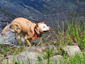 We turned around and started back on the trail keeping a good pace. As we walked along the creek, I saw some small but interesting waterfalls. I stopped briefly to take some pictures before continuing along the trail. We continued walking quickly back toward Elmer Jackson Road and shortly after walking to the road we passed through the CCC camp again. We crossed John Smith Road on the trail and walked the short section we missed earlier before arriving at the dam on Jackson Pond. The sky was much bluer now and had some nice clouds. I decided to take a few pictures and Sheila decided to go for a swim! I took my pictures and watched Sheila swim around just for the fun of it. I took some pictures of her "dog paddle" and then had to call her back as she was heading across the pond! As always, the dip in the water energized her and she ran wildly in circles around me. I promised myself we would make no more stops as we crossed he dam and ascend the trail on the other side. We continued on crossing John Street and Church Road. We were making good time but the constant ups and downs were beginning to make me tired. Somewhere after Church Road Sheila "alerted" and I looked up to see two hikers coming toward us. We stopped to talk for a minute. They were from Rochester and had hiked sections of the Finger Lakes Trail before. They had just started from Stage Road and were hiking to Perkin s Pond to stay overnight. Once we parted Sheila and I got going quickly descending along a stream and then crossing it before hiking along ascent to the filed near Stage Road. At the top of the field, I stopped to take my last pictures of the day. We descended to Stage Road and then to Thompson Creek. After crossing the creek, we had only about .6 miles to go to get back to Warner Road but there was a 300 foot climb along the way which seemed hard after almost 14 miles of hiking. Once we were on Warner Road we turned left and hiked the .1 miles back to the car. It was 2:35 PM and we had covered 14.5 miles in 6 hours with over 2200 feet of climbing.
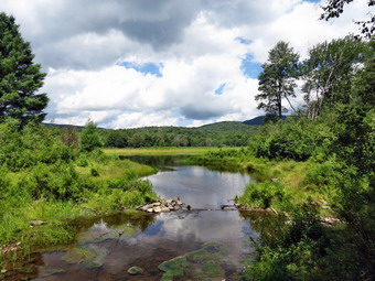
![]()
![]()
![]()
![]() On Saturday, August 3rd, I decided I wanted to get out for a hike in the afternoon. I had to pick my car up from the dealer's early in the morning after some repairs to the all-wheel drive system but that plan was interrupted by an early morning ambulance call. By the time I was ready to think about hiking, it was already noon so a long distance hike away from home was out of the question. I decided to visit Frick and Hodge Ponds as they are close to home and allow a variety of routes. I put my gear he the car along with an excited Sheila and headed for the parking area on Beech Mountain Road. I had a little trouble getting up Mongaup Road as two out-of-town drivers seemed to be unsure of where they were going or that they were on a two way road! When I arrived at the parking area just before 1:00 PM, there were a few other cars parked which is rare even on a weekend. I also notice two large steel I-beams in the lot. I assume 1 these will be used to replace the bridge at the outlet of Frick Pond. This would be a good idea since this is a popular hike and the bridge is in poor condition. Sheila and I got right on the trail and headed out the Quick lake Trail to Frick Pond. Despite the rain, the trail was only damp with a little water running in a few spots. When we got to the trail junction with the Logger's Loop we stayed left on the Quick Lake Trail to Frick Pond. This area was mowed but the muddiest areas were barely damp. We stopped at the bridge so that I could take some pictures of the bridge itself and also some of the pond. I have taken hundreds of pictures here but I am always compelled to take a few more. The clouds on this day were puffy and well-defined against the blue sky. Sheila took a swim in Frick Pond which charged her up as usual. We continued across the bridge and met a lone male hiker coming toward us. I put Sheila on her leash but the hiker seemed to want to pet her. Sheila started to bark but the hiker let her smell his hand and all was good. We talked for a minute and he said he had seen another group hiking the trails. We kept up a good pace as we passed by the pond and continued to the left up the Quick Lake Trail. The ferns were starting to grow overt he trail but the rest of the trail maintenance we had done earlier in the summer made much easier. By 1:25 PM we had hiked the 1.5 miles to Iron Wheel Junction where we turned left to stay on the Quick Lake Trail. Parts of this trail were eroded but for the most part it was dry.
On Saturday, August 3rd, I decided I wanted to get out for a hike in the afternoon. I had to pick my car up from the dealer's early in the morning after some repairs to the all-wheel drive system but that plan was interrupted by an early morning ambulance call. By the time I was ready to think about hiking, it was already noon so a long distance hike away from home was out of the question. I decided to visit Frick and Hodge Ponds as they are close to home and allow a variety of routes. I put my gear he the car along with an excited Sheila and headed for the parking area on Beech Mountain Road. I had a little trouble getting up Mongaup Road as two out-of-town drivers seemed to be unsure of where they were going or that they were on a two way road! When I arrived at the parking area just before 1:00 PM, there were a few other cars parked which is rare even on a weekend. I also notice two large steel I-beams in the lot. I assume 1 these will be used to replace the bridge at the outlet of Frick Pond. This would be a good idea since this is a popular hike and the bridge is in poor condition. Sheila and I got right on the trail and headed out the Quick lake Trail to Frick Pond. Despite the rain, the trail was only damp with a little water running in a few spots. When we got to the trail junction with the Logger's Loop we stayed left on the Quick Lake Trail to Frick Pond. This area was mowed but the muddiest areas were barely damp. We stopped at the bridge so that I could take some pictures of the bridge itself and also some of the pond. I have taken hundreds of pictures here but I am always compelled to take a few more. The clouds on this day were puffy and well-defined against the blue sky. Sheila took a swim in Frick Pond which charged her up as usual. We continued across the bridge and met a lone male hiker coming toward us. I put Sheila on her leash but the hiker seemed to want to pet her. Sheila started to bark but the hiker let her smell his hand and all was good. We talked for a minute and he said he had seen another group hiking the trails. We kept up a good pace as we passed by the pond and continued to the left up the Quick Lake Trail. The ferns were starting to grow overt he trail but the rest of the trail maintenance we had done earlier in the summer made much easier. By 1:25 PM we had hiked the 1.5 miles to Iron Wheel Junction where we turned left to stay on the Quick Lake Trail. Parts of this trail were eroded but for the most part it was dry.
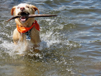 By 2:00 PM we were at Junkyard Junction having covered about 3.1 miles. We turned right on the Flynn Trail and kept up our pace until we arrived at the gate and turned right to go down to Hodge Pond. At the shore of the pond, I decided to turn left and walk the jeep trail around the back of the pond. This time we continued down to the outlet end of the pond. I dropped my pack and got out the camera to take some more pictures of puffy, white clouds against a blue sky. I picked up a stick and threw it into the pond and Sheila immediately retrieved it. I repeated this several times, increasing the distance each time. Sheila swam out to the stick, grabbed it and swam back. She loves the water and never misses a chance to jump in! I got a drink, put my camera away and headed he the Flynn Trail to the junction with the Big Rock Trail. We hit the junction at 2:50 PM 5 miles into the hike with about 1.7 miles to go. The advantage of hiking the route in this direction is that the last part of the hike is all downhill. We walked down the Flynn Trail and as we neared the end we began to hear voices. We could see a family group ahead of us so I put Sheila on her leash as we came down the last part of the woods road and entered the trail on the left. We could have easily caught up to and passed the group but I decided to take it easy as it was only a short distance back to the car. When we were back in the parking lot, I spoke to the others hikers. They also had a dog who was a very well-behaved boxer. We were back at the car by 3:30 PM having covered the 6.7 mile distance in 2 hours and 25 minutes.
![]()
![]()
![]() On Wednesday, July 31st, I decided I wanted to finish map 24 on the Finger Lakes Trail. The total distance for the whole map was only about 11.8 miles and I had already hiked the first 6.0 mils. I did not want to park on the "main" road in East McDonough so I decided to take Route 220 west from Oxford to Chestnut Road. I then planned on taking Shortcut Road to the point where the Finger Lakes Trail crossed the road. From there I would have to hike north to the trail register outside of McDonough and then back to the car to cover that section of the trail. I got an early start from Livingston Manor and took the route through Deposit and Sidney which is becoming a familiar drive. The weather forecast was for sunny skies but I drove through several areas of heavy fog. The further north and west I drove the clearer it became. By the time I was driving west on 220 the sun was out although the temperatures were still cool. I found Chestnut Road which had a gravel surface and found I had to turn right on Corbin Road and then make a quick left on Shortcut Road. As soon as I got on Shortcut Road I questioned the decision. The road was mostly packed dirt with large cobbles. It was one car wide with deep ditches on both sides. I thought I might only have to drive about a half a mile but backing up for half a mile did not interest me! I continued along Shortcut Road and found a few pulloffs along the way. At about .7 miles there was a woods road that crossed the road and signs for the Finger Lakes Trail. There was enough room to pull my car off the road and maybe room for one more car. As soon as I got out of the car the horse flies found me so I applied a liberal layer of repellant to all exposed areas. We were ready to hike at 9:00 AM and started north on the woods road toward the trail register where I had ended my previous hike. The road was muddy mess with deep puddles and ruts. I couldn't tell whether this was from logging or recreational use. Fortunately this lasted for only about .15 miles where the trail and road bent to the right. From that point on the road was straight and hard packed. It was wet from the rain the day before but this was manageable. Strangely, the road we were on was labeled Finger Lakes Trail on my GPS! It was only about .9 miles to the trail register where we turned around and headed back to the car. We were back at the car at 9:35 having already covered 1.8 miles.
On Wednesday, July 31st, I decided I wanted to finish map 24 on the Finger Lakes Trail. The total distance for the whole map was only about 11.8 miles and I had already hiked the first 6.0 mils. I did not want to park on the "main" road in East McDonough so I decided to take Route 220 west from Oxford to Chestnut Road. I then planned on taking Shortcut Road to the point where the Finger Lakes Trail crossed the road. From there I would have to hike north to the trail register outside of McDonough and then back to the car to cover that section of the trail. I got an early start from Livingston Manor and took the route through Deposit and Sidney which is becoming a familiar drive. The weather forecast was for sunny skies but I drove through several areas of heavy fog. The further north and west I drove the clearer it became. By the time I was driving west on 220 the sun was out although the temperatures were still cool. I found Chestnut Road which had a gravel surface and found I had to turn right on Corbin Road and then make a quick left on Shortcut Road. As soon as I got on Shortcut Road I questioned the decision. The road was mostly packed dirt with large cobbles. It was one car wide with deep ditches on both sides. I thought I might only have to drive about a half a mile but backing up for half a mile did not interest me! I continued along Shortcut Road and found a few pulloffs along the way. At about .7 miles there was a woods road that crossed the road and signs for the Finger Lakes Trail. There was enough room to pull my car off the road and maybe room for one more car. As soon as I got out of the car the horse flies found me so I applied a liberal layer of repellant to all exposed areas. We were ready to hike at 9:00 AM and started north on the woods road toward the trail register where I had ended my previous hike. The road was muddy mess with deep puddles and ruts. I couldn't tell whether this was from logging or recreational use. Fortunately this lasted for only about .15 miles where the trail and road bent to the right. From that point on the road was straight and hard packed. It was wet from the rain the day before but this was manageable. Strangely, the road we were on was labeled Finger Lakes Trail on my GPS! It was only about .9 miles to the trail register where we turned around and headed back to the car. We were back at the car at 9:35 having already covered 1.8 miles.
We crossed the road and stayed on the woods road which was also a snowmobile trail. After walking for a little, I looked up and could find no white blazes for the Finger Lakes Trail. I was in a quandary since I had been on sections of the Finger Lakes Trail that were not marked on snowmobile trails but had also made the mistake of following some of these trails which were not part of the Finger Lakes Trail. I walked back a little but could find no blazes. In the end I decided to continue since the GPS still labeled this as the Finger Lakes Trail and the worst I could do is end of on Chestnut Road a little too far to the west. We walked for .8 miles until we hit Chestnut Road. Since I saw no signs for the Finger Lakes Trail I knew we were too far to the west so we turned left and headed east on Chestnut Road. It was another .7 miles before we found the point where the Finger Lakes Trail crossed Chestnut Road. We turned south into the Finger Lakes Trail and walked 2.2 miles to Ludlow Road. The trail seemed little used and many blazes were faded but it was obvious in most places. In several spots there were large blowdowns across the trail. Some had been there a long time and the trail was blazed around them. In other places we had to work our way around the blockages and then try to find the trail on the other side. When we got to Ludlow road we turned left and followed it to Tucker Road where we turned right and crossed the creek. Just after the bridge, the trail turned left into the woods and followed a woods road. It was only a short distance to the blue blazed side trail on the left to the Ludlow Creek lean-to. I bypassed the lean-to and continued on to the next landmark. The map description mentioned a pile of rocks near the trail of unknown origin. There was even a suggestion of a Native American burial! I was excited until I saw the pile of rocks which was small and unimpressive. The trail entered private land and the road became grassy and very marshy in places. The maps labeled it Spruce Swamp which I thought was a good name. We began to encounter more insects including mosquitoes but we hurried through the area.
The last part of the trail seemed like it might be difficult to follow as described on the trail map. It included an open field which can make things difficult. When we got to the open field we simply walked along the edge of the field outside a barbed wire fence. Within minutes the familiar buildings near Stone Quarry Hill Road came into view and we were soon at that road. We walked down to County Route 3 to the end of the trail section. We immediately turned around and walked back to where the trail entered the field. I got a drink and a snack and gave Sheila the same. It was 11:45 AM and we had covered 7.6 miles in 2 hours and 45 minutes. We started back on the trail retracing our route as there were no convenient roads to walk. When we got to where the Finger Lakes Trail crossed Chestnut Road we continued straight ahead. I was anxious to see what this section of trail we had missed earlier looked like. I was also interested to see how I missed the trail earlier in the day. The trail was actually very nice as it passed through some conifers and then hardwoods. It was much more direct than the route we had taken earlier and was only .6 miles compared to the 1.5 miles earlier. As we emerged at the car I looked for the trail blazes and they were very clear. This was another time that I wanted to blame the blazing but it was my fault for not paying attention carefully. We were back at the car at 1:35 PM having covered 12,6 miles in 4.5 hours 1200 feet of ascent. By the time I got back I realized that I had not pulled my camera out of the pack once! I almost always take pictures of something but this section of trail was mostly trees, rocks and roots!
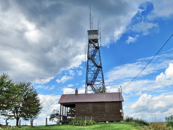
![]()
![]()
![]()
![]() On Monday, July 29th, I decided I wanted to start map 24 on the Finger Lakes Trail. The total distance for the whole map was only about 11.8 miles and I briefly toyed with the idea of hiking the whole thing out and back for a total of 23.6 miles. I thought better of this and decided to hike from Berry Hill to McDonough one day and from McDonough to Stone Quarry Hill road on another day. The forecast for Oxford included a possible shower in the morning but I decided to go anyway. For most of the trip the skies were overcast with fog and haze. I got a pretty early start from Livingston Manor pulling out at around 7:00 AM. Depending on the instructions I followed it seemed to be between 1 hour and 45 minutes and 2 hours. In the end I took Route 17 to Deposit and then Route 8 north to Sidney. From here I followed the car GPS which always picks the shortest route but not necessarily the best roads. The instructions had me taking some "shortcuts" on some back roads but the directions were accurate and we arrived on Tower Road just before 9:00 AM. I turned left off County Route 10 and drove about .3 miles to the access road to the Berry Hill Fire Tower. I had decided to park there to visit the tower and then do the hike. By the time I parked at the tower the fog was beginning to lift and the sun was coming out. I was hoping for a cool but sunny day with a blue sky filled with white clouds! I took some pictures of the to the and the cabin ay its base. I also found a USGS benchmark and a cornerstone marked NY. I took pictures of these and then turned my attention to climbing the tower. I remembered reading something about a gate to restrict access but was pleased that there was none. I began to climb the stairs which is when I found the gate on the second or third set of stairs. The gate was closed and locked but it looked like I could climb over or around it. I decided I would stop at the gate and I took some pictures from that level. Although the pictures were not as good as could have been obtained from higher up on the tower, they were interesting as they showed the mist lifting from the fields. Back on the ground I walked over to the cabin and found that an effort is underway to have petition the DEC to allow the tower to be restored. Currently, the top of the tower has several radio antennae and the cab is filled with equipment. The tower is an International Derrick erected in 1934 and is 59' 3" tall. By 9:00 AM we were ready to begin our hike so we headed down the access road to Tower Road.
On Monday, July 29th, I decided I wanted to start map 24 on the Finger Lakes Trail. The total distance for the whole map was only about 11.8 miles and I briefly toyed with the idea of hiking the whole thing out and back for a total of 23.6 miles. I thought better of this and decided to hike from Berry Hill to McDonough one day and from McDonough to Stone Quarry Hill road on another day. The forecast for Oxford included a possible shower in the morning but I decided to go anyway. For most of the trip the skies were overcast with fog and haze. I got a pretty early start from Livingston Manor pulling out at around 7:00 AM. Depending on the instructions I followed it seemed to be between 1 hour and 45 minutes and 2 hours. In the end I took Route 17 to Deposit and then Route 8 north to Sidney. From here I followed the car GPS which always picks the shortest route but not necessarily the best roads. The instructions had me taking some "shortcuts" on some back roads but the directions were accurate and we arrived on Tower Road just before 9:00 AM. I turned left off County Route 10 and drove about .3 miles to the access road to the Berry Hill Fire Tower. I had decided to park there to visit the tower and then do the hike. By the time I parked at the tower the fog was beginning to lift and the sun was coming out. I was hoping for a cool but sunny day with a blue sky filled with white clouds! I took some pictures of the to the and the cabin ay its base. I also found a USGS benchmark and a cornerstone marked NY. I took pictures of these and then turned my attention to climbing the tower. I remembered reading something about a gate to restrict access but was pleased that there was none. I began to climb the stairs which is when I found the gate on the second or third set of stairs. The gate was closed and locked but it looked like I could climb over or around it. I decided I would stop at the gate and I took some pictures from that level. Although the pictures were not as good as could have been obtained from higher up on the tower, they were interesting as they showed the mist lifting from the fields. Back on the ground I walked over to the cabin and found that an effort is underway to have petition the DEC to allow the tower to be restored. Currently, the top of the tower has several radio antennae and the cab is filled with equipment. The tower is an International Derrick erected in 1934 and is 59' 3" tall. By 9:00 AM we were ready to begin our hike so we headed down the access road to Tower Road.
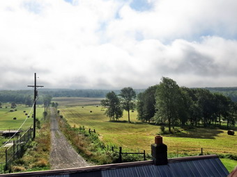 Once we got to Tower Road we turned left to hike out to County Route 10 where the section of the Finger Lakes Trail actually began. Once we were at Route 10, we turned around and hiked back to the access road, passed it and continued south on Tower Road which had a nice gravel and dirt surface. We passed a barn with no farmhouse nearby and several other trailers or cabins before coming to the point where the trail entered the forest at about .75 miles. The trail was very wet from the rain the day before and I thought this was going to be a problem throughout the day! Once we were a hundred feet into the woods the trail tried up considerably and was only damp as we hiked through a stand of tall pines. At 1.2 miles we crossed Tower Road and headed west briefly before turning south and crossing Preston Road at around 2.1 miles. The trail rolled a little but was mostly downhill at we walked south. Over the next 1.4 miles the trail made several twists and turns but generally headed south and downhill. The trail seemed to follow an old road and only left that road when it was blocked by blowdowns. There were some interesting rock formations along the way and a set of small bridges over some wet areas. There was also a larger bridge over a stream. All of these were slippery from the rain and required careful foot placement. At 3.5 miles we were at one of the parking areas at Bowman Lake State Park. The trail headed down to the beach area and when we got there I dropped my pack and took some pictures. The park had a small but beautiful lake with a nice beach and a roped swimming area. I took some pictures and then we headed behind some buildings on the trail. The blazes seemed to lead up to the park road but then I could not find them again. We turned right on the road and continued to the next intersection where I picked up the blazes on a road to the left which passed by the Nature Center. I think the trail actually followed the shoreline behind the concession stand and then came up to the road. This route seemed abandoned as if most people simply followed the road as I had. We continued to follow the blazes on the road and eventually passed the park entrance and came to Sherman Road at 4.2 miles where we turned right. The map description said turn right and then left but I did not see a place to turn left. The turn was actually about .1 miles down the road and it would have been nice if the trail description on the Finger Lakes Trail Conference map mentioned that!
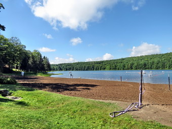 As soon as we turned into the woods the trail became very wet with large pools of water but there were only a few and then the trail was only damp again. The trail took us southwest for about .7 miles and along the way we crossed Bowman Creek on a bridge. The description sated it was a steel I beam bridge but did not make it clear that it was just a steel I beam. The I beam was laid on its side and spanned the creek with a handrail on one side. I stopped to take some pictures as this was a unique bridge. Sheila enjoyed a romp in the water before we walked out to Bowman Road which again took us south. The road was deserted so I let Sheila stay off her leash. After .8 miles, Bowman Road ended at Route 220 in East McDonough. I was going to turn around but thought I would check out the beginning of the next section. The trail description seemed a little hard to follow but was completely correct. We crossed the road and walked through an opening in a chain link fence to cross a playground. On the other side we found a woods road that began a climb to a trail register at 6.0 miles. I could easily have walked some more but it was about 11:30 AM and I decided I would turn around and leave the rest for the next time. On the way back I decided to follow Bowman Road back to the park. After we passed the point where the trail entered the woods, I found the Gale Cemetery on the left side of the road. The cemetery was very old and the grass was high. A few flags were present at some graves. I took a few pictures and read some of the headstones. The last burial I could find was 1912! We continued on passed the cemetery and crossed Sherman Road to enter the woods at the end of Bowman Road. A short trail brought us to the south shore of Bowman Lake where I again dropped my pack to take some shots and Sheila enjoyed the lake.
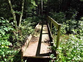 After picking up my pack, we continued along the shore of the lake and picked up the blue blazes of the Kopac Trich which ran around the lake. As we walked by a marshy area on the shore a blue heron flew up and crossed the lake to land on her other shore. I took out my camera and used the zoom lens to spot the bird. The heron started to fly along the far shore and I was lucky enough to snap few pictures. We continued to follow the blue blazes until they met the white blazes of the Finger Lakes Trail behind the concession stand and then followed them back passed the beach and to the parking area where the trail entered the woods. We hiked the trail to Preston Road where I decided to turn right and follow Preston Road to Tower Road. Most sections of the Finger Lakes Trail are interesting and some are scenic but few have inspired me to walk them in both directions! We had not been bothered much by insects but both Sheila and I were plagued by horse flies as we walked north on Tower Road. We walked the last 1.3 miles on Tower Road rather quickly although I did stop to take some pictures just before turning onto the road to the tower. The sun was shining and the white clouds billowed into a blue sky. I took some pictures of large, round hay bales in the fields against the blue sky and clouds. I also stopped on the access road to take some more pictures including several more of the tower. We were back at the car by 1:30 PM having covered 12.0 miles in 4.5 hours. On the way back I ignored the shortcuts provided by the GPS and went through Norwich which seemed like a very nice town. Another day will finish this section of trail and then I will have to plan again.
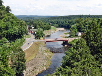
![]() On Saturday, July 27th, Cindy and I decided to visit the newly opened Rosendale Trestle after hiking Overlook Mountain. We set Rosendale as our destination in the Garmin Nuvi car GPS and followed the instructions it came up with, for the most part. On the way to Kingston we passed through Woodstock which was packed with people having a good time. Their good time made getting through traffic a little difficult but we were soon head for Kingston on Route 28. We turned south on Route 209 which upset the GPS as it wanted us to go into Kingston. My intention was to simply go south on Route 209 until we got to Route 213 east to HighFalls and Rosendale. I made the mistake of following the GPS directions again and we traveled some winding back roads until we hit Route 213 just outside of Rosendale. As we headed toward Rosendale the trestle came into view and we turned onto Binnewater Road. The trestle was quite impressive and I was even more excited to go visit it. After .3 miles on Binnewater Road, the parking lot appeared on the left and I pulled in and parked at about 2:00 PM. At the back of the parking lot were the kilns used to bake the dolostone mined from Joppenberg Mountain just across the road. The result was a natural cement that was highly sought after. The "mines" have largely collapsed as they were not shored up and some collapses are still taking place. After photographing the kilns, we crossed the road and got on the rail trail. The Walkill Valley Rail Trail now runs continuously from New Paltz almost to the rail trail in Kingston. The plan is to connect these two sections as soon as possible. We walked along the well groomed rail trail meeting walkers going in both directions and quite a few people riding mountain bikes. At one point I could see a depression in the side of the mountain and a path that led to it. As we approached the depression the cool air poured out. This was one of the collapsed mines. I took some pictures and then walked along the base of the mountain to find several other mine openings. I walked back up to the rail trail to meet Cindy and we headed for the trestle.
On Saturday, July 27th, Cindy and I decided to visit the newly opened Rosendale Trestle after hiking Overlook Mountain. We set Rosendale as our destination in the Garmin Nuvi car GPS and followed the instructions it came up with, for the most part. On the way to Kingston we passed through Woodstock which was packed with people having a good time. Their good time made getting through traffic a little difficult but we were soon head for Kingston on Route 28. We turned south on Route 209 which upset the GPS as it wanted us to go into Kingston. My intention was to simply go south on Route 209 until we got to Route 213 east to HighFalls and Rosendale. I made the mistake of following the GPS directions again and we traveled some winding back roads until we hit Route 213 just outside of Rosendale. As we headed toward Rosendale the trestle came into view and we turned onto Binnewater Road. The trestle was quite impressive and I was even more excited to go visit it. After .3 miles on Binnewater Road, the parking lot appeared on the left and I pulled in and parked at about 2:00 PM. At the back of the parking lot were the kilns used to bake the dolostone mined from Joppenberg Mountain just across the road. The result was a natural cement that was highly sought after. The "mines" have largely collapsed as they were not shored up and some collapses are still taking place. After photographing the kilns, we crossed the road and got on the rail trail. The Walkill Valley Rail Trail now runs continuously from New Paltz almost to the rail trail in Kingston. The plan is to connect these two sections as soon as possible. We walked along the well groomed rail trail meeting walkers going in both directions and quite a few people riding mountain bikes. At one point I could see a depression in the side of the mountain and a path that led to it. As we approached the depression the cool air poured out. This was one of the collapsed mines. I took some pictures and then walked along the base of the mountain to find several other mine openings. I walked back up to the rail trail to meet Cindy and we headed for the trestle.
 Just before we stepped out onto the trestle, I noticed a few paths leading up the ,oaten on the left. They all looked well worn, were steep and were covered with loose rock and dirt. I made a note to explore them on the way back. We walked out onto the trestle which was really impressive. It is over 900 feet long and 150 feet above the Rondout Creek. The restoration included reinforcing the steel of the trestle, putting down a composite walkway and erecting fencing. There were great views to both the east and west on Rondout Creek. To the north and east Joppenberg Mountain loomed over the trestle. We walked to the opposite side and then walked back. From then trestle I took many pictures in all directions before walking back to the west end. Cindy did not want to try climbing up the mountain but I thought I would give it a try. I climbed up the steep bank holding on to roots and small trees slipping as I went. Ahead I saw where the path split and became even steeper. I didn't want Cindy to wait too long for me and I wasn't sure of the best path so I decided to turn back. I put my hand on a rock to ease myself down. When I looked down at the rock, I could not believe my eyes. The rock's seemed to have been split open and there were trilobite, crinoid and worm fossils of several different types. I took some pictures and then looked for other, similar rocks. I made only a cursory search but could find no more. I descended the hill and reported my find to Cindy. I definitely want to go back to see if I can climb to the top of Joppenberg and find some more fossils. The entire walk was just about a mile but was well worth the visit.
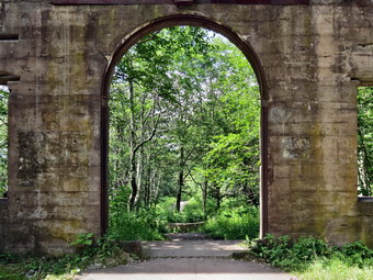
![]()
![]()
![]()
![]() On Saturday, July 27th, I decided to hike to Overlook Mt. from Meades Mountain Road since Alan Via was going to be there as a tower steward. It would be nice to talk to Alan at the tower and I wanted to deliver some glucosamine chews for his dog, Bookah. Cindy agreed to accompany me as this approach is less than 5 miles on an access road. Along the way are then ruins of the Overlook Mountain House which she had also never seen in person. We decided not to bring Sheila along as there are rattlesnakes on the mountain. They are reclusive and stay out of the way of people but Sheila likes to explore off trail and we felt the risk was too great. Cindy had been to a concert the night before and there was no real hurry to leave in the morning anyway. We left Livingston Manor around 9:00 AM and headed out the Frost Valley Road to Route 28 east toward Kingston. In Mount Tremper we took Route 212 and then Church Road and McDaniels Road to the parking area. When we arrived at about 10:30 Am the lot was already overflowing and I parked off the pavement. Unfortunately, people visiting the Zen conference center across the road insist on filling the parking area despite ample parking for them on the grounds and despite the signs asking them not to park at the trailhead! We started up the access road at just passed 10:30 AM and hit a quick pace right away. The road was in pretty good shape with some spots slightly eroded. We passed a few people on the way up and met a few headed down. Some people were walking and some were trail running. The road is never really steep but it is not a gentle climb either. The first 1.75 miles averaged a 14% grade as we gained almost 1300 feet to the site of the Overlook Mountain House. We stopped to explore and take some pictures. The ruins look quite different in the summer with leaves on the trees than in the early spring or fall. Cindy suggested that it would be a nice winter snowshoes and I agreed. After taking some shots, we got back on the main trail to the summit and the fire tower. In a few hundred feet we passed the turnoff to the trail to Echo Lake and Platte Clove. It was less than half a mile to the summit.
On Saturday, July 27th, I decided to hike to Overlook Mt. from Meades Mountain Road since Alan Via was going to be there as a tower steward. It would be nice to talk to Alan at the tower and I wanted to deliver some glucosamine chews for his dog, Bookah. Cindy agreed to accompany me as this approach is less than 5 miles on an access road. Along the way are then ruins of the Overlook Mountain House which she had also never seen in person. We decided not to bring Sheila along as there are rattlesnakes on the mountain. They are reclusive and stay out of the way of people but Sheila likes to explore off trail and we felt the risk was too great. Cindy had been to a concert the night before and there was no real hurry to leave in the morning anyway. We left Livingston Manor around 9:00 AM and headed out the Frost Valley Road to Route 28 east toward Kingston. In Mount Tremper we took Route 212 and then Church Road and McDaniels Road to the parking area. When we arrived at about 10:30 Am the lot was already overflowing and I parked off the pavement. Unfortunately, people visiting the Zen conference center across the road insist on filling the parking area despite ample parking for them on the grounds and despite the signs asking them not to park at the trailhead! We started up the access road at just passed 10:30 AM and hit a quick pace right away. The road was in pretty good shape with some spots slightly eroded. We passed a few people on the way up and met a few headed down. Some people were walking and some were trail running. The road is never really steep but it is not a gentle climb either. The first 1.75 miles averaged a 14% grade as we gained almost 1300 feet to the site of the Overlook Mountain House. We stopped to explore and take some pictures. The ruins look quite different in the summer with leaves on the trees than in the early spring or fall. Cindy suggested that it would be a nice winter snowshoes and I agreed. After taking some shots, we got back on the main trail to the summit and the fire tower. In a few hundred feet we passed the turnoff to the trail to Echo Lake and Platte Clove. It was less than half a mile to the summit.
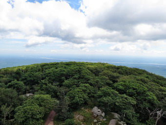 We decided to pass by the tower and cabin and to visit the overlook first. We walked out to the open ledge of rock that forms the overlook and found no one there. This made taking pictures easier so we immediately took some shots. It was hazy down by the Hudson River and Ashokan Reservoir but the sky was interesting and the lighting was OK. The village of Woodstock was easy to see below us. After taking our pictures, we walked back to the cabin and then out to the tower. Alan was there as he promised along with another volunteer. I was surprised to find Hermit, Ralph Ryndak, there also! We talked for a while and I delivered the dog treats to Alan. It made me feel better that he left Bookah behind for the same reason that Sheila was at home. Cindy and I headed for the tower. I had never been in the cab as I had always hiked it in the "off season" so I was eager to see what the view was like. The windows in the cab were all closed which meant the view was, in some ways, better from the landing below the cab. I did take some pictures through the windows which adds an interesting effect. After taking a few shots from the cab, I dropped down to the landing below and took some more. I included a few shots through the stairs with some pieces of the tower in view. I was able to get a picture of the ruins peaking through the trees. We descended the tower and then walked back out to the overlook where Alan and Ralph and several others had gathered. By this time the rock ledges were well populated and I was glad I had taken pictures before. Ralph had brought a good pair of binoculars and we took pictures using them to spot various landmarks. Cindy and I had planned to stop by the Rosendale Trestle on the way home so we said goodbye and started down. Alan alerted me as to the location some American chestnut on the way down. The new shoots were growing from a stump and a dead tree right where Alan said would be and I stopped to take a few pictures. We were back a the car by 1:15 PM having taken 2 hours and 45 minutes to cover 5 miles and 1640 feet of ascent. Of that time 45 minutes was spent taking pictures and conversing. When we left the parking area, we headed for Kingston and then toward Rosendale on the back roads to visit the newly opened Rosendale Trestle which is part of the Walkill Valley Rail Trail.
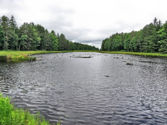
![]()
![]()
![]()
![]() On Wednesday, July 24th, I decided I wanted to try to complete map 25 on the Finger Lakes Trail. The distance appeared to be 6.7 miles one way or 13.4 mile round trip. I was not sure whether or not I would break this into two shorter hikes or just hike through. When I woke up at 6:30 AM it was barely 60 degrees in Livingston Manor and the forecast for Oxford called for temperatures to rise only into the high 60's. This was good news after hiking in temperatures which were almost 30 degrees higher the previous week. We arrived on Basswood Rd just before 9:00 AM and I carefully pulled my car over on the side of the road just off the pavement. We were out and hiking by 8:55 AM and the temperature did seem so much cooler! The first part of the hike proceeded east for about .75 miles on Basswood Rd and Brookbanks Rd to the corner of Puckerville Road. At this point I looked at the stream and decided to take the high water bypass route on Puckerville Rd. It must have rained over some since Monday as the stream was much higher. I also had forgotten my waders (kitchen garage bags with rubber bands)! We turned right on Puckerville Rd and hiked about .6 miles to where the trail cut into the woods to join the main Finger Lakes Trail. The trail along the road was not blazed so watching carefully the for the point where it reentered the woods was important! As we entered the woods I stopped to release Sheila from her leash, get out my poles and apply insect repellant. Having done that we soon joined the main trail to continue the hike. For the next 2.9 miles the trail passed through mostly hardwood forest and gained about 500 feet. The trail did not seem well used and the blazes were faded to be almost invisible in some places. There were several wet areas where old half log bridges and some corduroy were positioned to try to help. Both of these were very slippery. In one area the trail passed near a large field where the trees were few and far between. This allowed the prickers and the ferns to take over to make the trail virtually disappear. This combined with the lack of blazes made following the trail very difficult. Eventually the trees returned and it became easier to follow the trail. We passed through some fences that had openings with boards over the top to restrict the height of what could easily pass through. In one area Sheila found a bird's nest with three robin's eggs on the ground. She began to paw at it which I discouraged on principle. As we passed I thought that the nest had probably been on the ground for weeks at that breaking one of the eggs probably would have released a most vile odor! By 10:30 Am we had walked 4.25 miles and were at Shapley Road where I had intended to turn around. I was feeling remarkably fresh and decided to hike all the way to the end before turning around.
On Wednesday, July 24th, I decided I wanted to try to complete map 25 on the Finger Lakes Trail. The distance appeared to be 6.7 miles one way or 13.4 mile round trip. I was not sure whether or not I would break this into two shorter hikes or just hike through. When I woke up at 6:30 AM it was barely 60 degrees in Livingston Manor and the forecast for Oxford called for temperatures to rise only into the high 60's. This was good news after hiking in temperatures which were almost 30 degrees higher the previous week. We arrived on Basswood Rd just before 9:00 AM and I carefully pulled my car over on the side of the road just off the pavement. We were out and hiking by 8:55 AM and the temperature did seem so much cooler! The first part of the hike proceeded east for about .75 miles on Basswood Rd and Brookbanks Rd to the corner of Puckerville Road. At this point I looked at the stream and decided to take the high water bypass route on Puckerville Rd. It must have rained over some since Monday as the stream was much higher. I also had forgotten my waders (kitchen garage bags with rubber bands)! We turned right on Puckerville Rd and hiked about .6 miles to where the trail cut into the woods to join the main Finger Lakes Trail. The trail along the road was not blazed so watching carefully the for the point where it reentered the woods was important! As we entered the woods I stopped to release Sheila from her leash, get out my poles and apply insect repellant. Having done that we soon joined the main trail to continue the hike. For the next 2.9 miles the trail passed through mostly hardwood forest and gained about 500 feet. The trail did not seem well used and the blazes were faded to be almost invisible in some places. There were several wet areas where old half log bridges and some corduroy were positioned to try to help. Both of these were very slippery. In one area the trail passed near a large field where the trees were few and far between. This allowed the prickers and the ferns to take over to make the trail virtually disappear. This combined with the lack of blazes made following the trail very difficult. Eventually the trees returned and it became easier to follow the trail. We passed through some fences that had openings with boards over the top to restrict the height of what could easily pass through. In one area Sheila found a bird's nest with three robin's eggs on the ground. She began to paw at it which I discouraged on principle. As we passed I thought that the nest had probably been on the ground for weeks at that breaking one of the eggs probably would have released a most vile odor! By 10:30 Am we had walked 4.25 miles and were at Shapley Road where I had intended to turn around. I was feeling remarkably fresh and decided to hike all the way to the end before turning around.
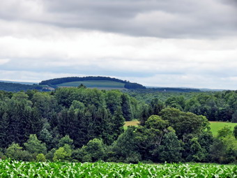 When we crossed Shapley Road, we entered Wiley Brook State Forest. The trail looked more used here and it passed through a large stand of conifers which reduced the undergrowth. We hiked up a hill before the trail leveled off and eventually joined a well-defined woods road. Within .5 miles from Shapley Road, we came to a blue-blazed spur trail on the right which led to a bivouac area near Mud Pond. We continued on the woods road until at about 5.5 miles I noticed that there were no blazes on the road. I backtracked and found a blazes so turned around and walked to the edge of a field where there was no indication of which way to turn. I went left and walked he edge of the field but found no markers. I walked back and turned he the other direction but still no blazes. I was very annoyed because I could almost see where we needed to be in the distance but I did not want to trespass to get there. I decided at this point to return to the car, move to the other end of the trail and hike in from there. The walk back to Shapley Road went quickly and on the way back I composed a letter of complaint to the Finger Lakes Trail Conference about the lack of proper marking especially at the field. When we got to Shapley Road, I decided to walk the .1 miles to Puckerville Road and return to the car on the roads. I would usually choose to walk on trails but the remaining section had little to recommend it and I had just been over it. In addition, the cooler temperature meant walking on the roads was easier than the previous week. We were on Puckerville Road at 11:50 AM and hiked the 2.25 miles all the way to Brookbanks Road by 12:30 PM. On the way we passed the point where we had cut into the woods from the high water bypass. We stopped at the corner of Brookbanks and Puckerville roads so that I could examine a small waterfall under the bridge. It looked as if there was chute which would indicate an old mill. I wanted to take some pictures but the angle from the bridge was not good and the area was heavily posted. The walk from the corner back to the car was only .7 miles and we were back at 12:45 PM. Just before we got to the car two partridge and a turkey flew up from the side of the road. Sheila showed remarkable restraint on her leash as she is a natural bird dog! We had covered 10 miles in 3 hours and 50 minutes with an ascent of 1150 feet. Now it was time to drive to Cooper Schoolhouse Road to find where the last part of the trail was located!
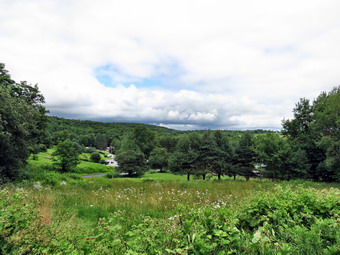 The drive to Cooper Schoolhouse Road was easy and involved driving down Puckerville Road and taking a left. After the left, it wasn't even a quarter mile to the corner of Cooper Schoolhouse Road where there was just enough room to park the car on the shoulder of the road. On the way down Puckerville Road I noted the entrance to Wiley Pond and also the field where I had ended the first portion of the hike! We started our hike at 1:00 PM by hiking down Cooper Schoolhouse Road for about .2 miles and then cutting into the woods on a trail which was pretty well marked. The trail passed through an area of tree routes and marshy spots, crossed a stream and then parallel the stream for some time. At about .2 miles we turned left onto a grassy road and walked another .2 miles before turning left off the road back onto a trail. Over the next .6 miles the trail went up and over a small hill. It passed through some hardwoods and hit at least one other woods road. It was pretty well marked which was good since several other paths, trails and roads crossed it. I kept looking at my GPS to see where we would hit our path from earlier in the day. I was surprised to see that we were heading away from the field where we had turned around! At 1.2 miles we hit the main Finger Lakes Trail about 350 feet short of the trail. I was very annoyed that there had been no blazes for the turn until I looked at a tree that was marked with turn blazes. I look again from further back and it was clearly visible if a little faded. I do not know how I had missed this both on the way out and the way back. I think the natural tendency would be to stay on the woods road and that a note could be made on the Finger Lakes Trail Conference maps that the turn is there. So, some of the areas of his trail need some maintenance and some marking but missing the turn was all my fault! Sheila and I turned around and headed back to the car. We arrived back at the car just before 2:00 PM having covered 2.3 miles in just under an hour with only a 360 foot ascent. The total for the day was 11.9 miles with 1450 feet of ascent in just under 5 hours. Before driving home, I decided to stop at Wiley Pond to take some pictures. I also drove to Shapley Road to take a few more shots of the countryside. When I had passed this way on the hike, the skies were blue with white, puffy clouds. By the time I took some pictures, the skies were more overcast with some dark clouds. A few drops of rain fell as I started the drive home.
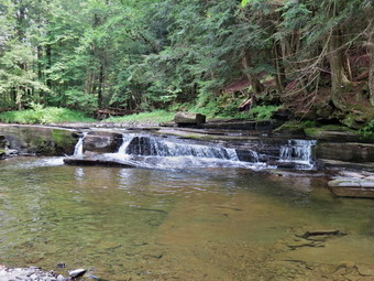
![]()
![]()
![]()
![]() On Monday, July 22nd, I decided I wanted to try doing a second hike after completing 10.6 miles form Stone Quarry Hill Road to South Oxford Bridge. I left Stone Quarry Hill Road at about 1:30 PM to drive to the parking spot and the east side of South Oxford Bridge. I parked at about 1:35 PM and we started out almost immediately. The white blazes took us up to Route 32 and then south for .7 miles where we turned left on Basswood Road. The sky began to grow darker but there were still some bright areas, so I decided to continue rather than turn back. After a slight .4 mile uphill walk on Basswood Road, we turned right onto a private woods road. There was a car parked on the road and I assumed the occupants were hiking part of the trail. We walked to a gate on the road and saw two people walking toward us. I said "Hi" as we passed. The trail description was a little unclear from this point on but the blazes were very clear and I just followed them and Sheila. The trail wound its way down to Bear Creek and then began to parallel the stream. I began looking for the waterfalls that the description promised. We walked along the stream for the next two miles but I found NO WATERFALLS. There were a few areas where some water dropped one or at the most two feet over some rocks but none of them counted as waterfalls in my book. The waterfalls on the first hike of the day on Bowman Creek were more interesting. We did stop once or twice so that I could document this fact and take some pictures of these rapids. Sheila found a deep pool where she could swim so all was not lost.
On Monday, July 22nd, I decided I wanted to try doing a second hike after completing 10.6 miles form Stone Quarry Hill Road to South Oxford Bridge. I left Stone Quarry Hill Road at about 1:30 PM to drive to the parking spot and the east side of South Oxford Bridge. I parked at about 1:35 PM and we started out almost immediately. The white blazes took us up to Route 32 and then south for .7 miles where we turned left on Basswood Road. The sky began to grow darker but there were still some bright areas, so I decided to continue rather than turn back. After a slight .4 mile uphill walk on Basswood Road, we turned right onto a private woods road. There was a car parked on the road and I assumed the occupants were hiking part of the trail. We walked to a gate on the road and saw two people walking toward us. I said "Hi" as we passed. The trail description was a little unclear from this point on but the blazes were very clear and I just followed them and Sheila. The trail wound its way down to Bear Creek and then began to parallel the stream. I began looking for the waterfalls that the description promised. We walked along the stream for the next two miles but I found NO WATERFALLS. There were a few areas where some water dropped one or at the most two feet over some rocks but none of them counted as waterfalls in my book. The waterfalls on the first hike of the day on Bowman Creek were more interesting. We did stop once or twice so that I could document this fact and take some pictures of these rapids. Sheila found a deep pool where she could swim so all was not lost.
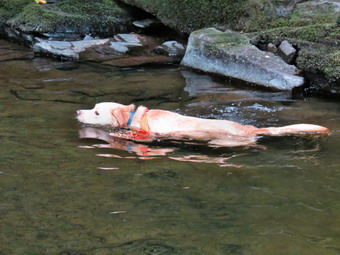 At about 3.4 miles the trail began to pull away from the creek and start uphill towards Basswood Road. It was just before 3:00 PM when the thunder started and the rain began to come down. When we were in the woods, we were protected but the trail began to wind through some more open clearings where we were getting a little wet in the light rain. This final part of the trail was completely overgrown with brush and weeds. In many places I had to hack through milkweed and goldenrod just to make a path. In other areas, I could not stand up straight as there was only a low "tunnel" through the bushes. We broke out into some conifers near the trail register just before entering the field that would take us up to Basswood road. I decided to put my camera and GPS in a plastic bag and to put on my rain jacket. I also decided that hiking back on the road was the quickest way to the car. As we started to walk up through the field, the rain subsided. As we turned left on Basswood Road, the rain all but stopped. I didn't dare take off my rain jacket as I knew that would chase the rain to start again! This Mountain Hardware rain jacket is made of Dry-Q which really does seem to breathe better than any other material I have used. I was already sweaty but I didn't seem to get any wetter. I am anxious to try it on a day when I can put it on over relatively dry clothing. For 1.7 miles we walked mostly downhill on the road until we were at the private woods road where we had entered the trail. From this point is was about .4 miles back to Route 32 and 1.1 miles back to the car. I began to feel the effects of carrying a pack for over 17 miles. I really needed to stop and stretch but I just wanted to get back to the car! We arrived at the parking area at 4:10 PM having hiked 6.8 miles in 2.5 hours. The totals for the day were 17.4 miles in 7 hours. I now have just 7 miles or 14 miles rounder to complete map 25.
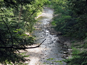
![]()
![]()
![]()
![]() On Monday, July 22nd, I decided I wanted to continue section hiking the Finger Lakes Trail. After looking at the trail on map 26, I decided there was too much road walking to do in 90 degree temperatures. There were also sections that the map describes as "poorly marked" and "brambles ahead". I looked at map 25 which starts west of Oxford and heads south and east to just north of Bainbridge. There seemed to be some road walking but most of the hiking seemed to be on trails with some running parallel to streams with waterfalls. The total trail length was just 15.5 miles but I did not have a car spot and would have to walk any hike both ways. I wanted to get up early and hit the trail before 8:00 AM but I didn't get up until 6:30 AM. The drive was just less than two hours and I didn't have much trouble finding the road or parking area to start the hike. At 8:50 AM I parked he car next to the sign that said "FLT Parking" on Stone Quarry Hill Road off Route 3. We were ready to hike shortly after this. I had on a longsleeved shirt to discourage the insects but did not think to put on repellant to begin the hike. We walked down the road to Route 3 where we turned right and then immediately left on Fred Wilcox Road. The road rolled a little as it passed some houses and a farm and at 1.3 miles we continued on the road which turned to French Road and quickly to dirt. A walk of around .2 miles more placed us at the beginning of the trail through the forest which was clearly marked. I decided to stop on put on some insect repellant before entering the woods. Upon entering the woods the trail climbed a little over a small hill and then started to descend. The woods were mostly hardwoods and even though some areas were wet there were very few insects. There were some trees down across the trail but it did seem well marked in most places. There were a lot of horseshoe prints on the trail and other evidence that the trail had been used by horses. Over the next 1.9 miles we dropped about 500 feet in elevation eventually hitting a woods road and then skirting the edge of a field to end up at Buckley Corners.
On Monday, July 22nd, I decided I wanted to continue section hiking the Finger Lakes Trail. After looking at the trail on map 26, I decided there was too much road walking to do in 90 degree temperatures. There were also sections that the map describes as "poorly marked" and "brambles ahead". I looked at map 25 which starts west of Oxford and heads south and east to just north of Bainbridge. There seemed to be some road walking but most of the hiking seemed to be on trails with some running parallel to streams with waterfalls. The total trail length was just 15.5 miles but I did not have a car spot and would have to walk any hike both ways. I wanted to get up early and hit the trail before 8:00 AM but I didn't get up until 6:30 AM. The drive was just less than two hours and I didn't have much trouble finding the road or parking area to start the hike. At 8:50 AM I parked he car next to the sign that said "FLT Parking" on Stone Quarry Hill Road off Route 3. We were ready to hike shortly after this. I had on a longsleeved shirt to discourage the insects but did not think to put on repellant to begin the hike. We walked down the road to Route 3 where we turned right and then immediately left on Fred Wilcox Road. The road rolled a little as it passed some houses and a farm and at 1.3 miles we continued on the road which turned to French Road and quickly to dirt. A walk of around .2 miles more placed us at the beginning of the trail through the forest which was clearly marked. I decided to stop on put on some insect repellant before entering the woods. Upon entering the woods the trail climbed a little over a small hill and then started to descend. The woods were mostly hardwoods and even though some areas were wet there were very few insects. There were some trees down across the trail but it did seem well marked in most places. There were a lot of horseshoe prints on the trail and other evidence that the trail had been used by horses. Over the next 1.9 miles we dropped about 500 feet in elevation eventually hitting a woods road and then skirting the edge of a field to end up at Buckley Corners.
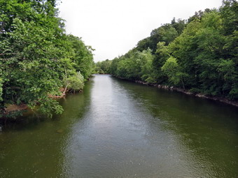 At the corners the trail was clearly visible on the other side of the road so we crossed and quickly came to one of several stiles on the trail. These stiles were triangular frames with crosspieces that straddled the fences. They allow you to climb up and over the fence. In most cases the fences were in disrepair and the stiles were superfluous but it was an interesting touch. The trail now paralleled Bowman Creek and we could hear the water below. In several spots we could see down to the creek and spot several of the waterfalls along the way. I looked for ways to get down to the stream bed but none were obvious and I was on a mission anyway. For the next 1.7 miles the trail ran along the creek and in general descended as we headed toward Route 12. In several spots we gained a little elevation and then dropped it again as the trail avoided deep drops into some small ravines. Near the end of the trail we passed a sign that described a sawmill that existed on the creek in 1875. I spotted the foundations down near the stream bed but decided to forego the visit. We crossed another stile and then walked along the edge of a field to a short trail that led down to Route 12. We turned left and walked a few hundred feet to South Oxford Bridge Road. It was a short walk to the bridge over the Chenango River. Just before the river were faint remnants of the Chemung Canal in a cornfield. On the other side of the bridge were some abandoned Conrail tracks and a small parking area. My plan was to turn around and return to the car and then park the car here for the second part of the hike. We stopped on the bridge so that I could take some pictures before turning around. It was 11:00 AM and we had hiked 5.25 miles.
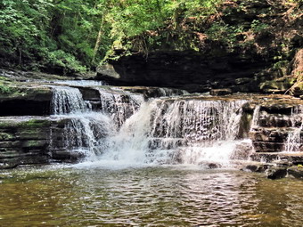 The return trip was a little "boring" but seemed to go quickly. As we walked along Bowman Creek I was even more aware of the waterfalls below and just before making a turn on the trail, I saw a path that seemed to lead down to the stream. This was about 3.6 miles from the beginning of the trail or 6.7 miles on the return trip. The bank was steep but we made our way down to the stream bed. I dropped my pack to take pictures and Sheila immediately jumped in the water. It was shallow in most places but there was one deep pool which she enjoyed. Soon it was time to scramble back up the bank and return to the main trail. As we neared Buckley Hollow Road I could see some more falls right near the bridge over Bowman Creek. We crossed a small tributary and walked up to Buckley Hollow Road. It looked like the land next to the falls was on private property and it occurred to me that the others falls may have been also! As luck would have it, someone was near the falls and they owned the property. I asked permission to photograph the falls and they were nice enough to agree! We walked to the bridge and down to the stream bed on the other side. I took a few pictures before we returned to the road, walked up to Buckley Corners and turned right on the trail. We walked back along the edge of the field and then started a long but gradual 1.5 mile climb regaining the 500 feet we had lost earlier in the hike. At 8.9 miles we hit the high point on the trail and then descended to French Road where we turned left to begin the road walk back to the car. Walking the road was not interesting and the little hill seemed bigger on the way back but the walk went quickly. We were back at the car by 1:20 PM having covered 10.6 miles in 4.5 hours. This was probably enough for one day but I was attracted to the description the of the next section of the trail which touted the waterfalls along Bear Creek. The skies were blue with puffy white clouds so I decided to drive to South Oxford Bridge to begin the next section of the hike.
![]()
![]()
![]()
![]() On Friday, July 19th, I decided I wanted to go back the area north of Deposit to hike the Finger Lakes Trail from Shears Road to Masonville. This would complete map 27 of the Finger Lakes Trail. The hike is 5.6 miles one way so the rounder would be 12.8 miles since I had no one to do a carspot with me. My plan was to park on Shears Road and hike north for about 4 miles and then return to the car. I would then drive to Masonville and hike the other 2.4 miles from there. This has worked for me in the past and seems to make the hike shorter. It also allows Sheila and I to cool off in the air-condition car between hikes. I knew that the heat index was supposed to be over 100 in the afternoon and that an early morning start would be a good idea. I was also concerned about the insects as I had encountered an almost unbearable cloud of mosquitoes in this area on my last hike! I got up early and we were leaving Livingston Manor before 7:00 AM. I drove to exit 84 on State Route 17 and then headed north on Route 8 for about 10 miles. I turned left on Shears Road across from the Hardwood Hills Golf Course and parked on the left side of the road just passed the Arctic China State Forest sign. It has just before 8:00 AM and it was already hot and humid. There was a slight breeze blowing as I slathered on the insect repellant. We walked down the road passing the sign and turned left into the woods to begin the hike. The trail began on a woods road and the first things I noticed was that the trail seemed used and that there were numerous blazes. Some sections of the Finger Lakes Trail seem to be unused and the blazes are faded and very far apart. This trail was well blazed for the entire length and seemed to be used by hikers, bikers and horses. This was one of the few sections I could have walked without the maps! Unfortunately, the trail was wet and this meant there were insects. The bugs weren't too bad but they certainly detracted from the experience. The trail stayed on the woods road and headed west for just less than a mile climbing slightly all the way. At this point it turned north and continued to climb to just over a mile before descending to Beales Road. When we crossed the road, there was a trailhead kiosk and limited parking.
On Friday, July 19th, I decided I wanted to go back the area north of Deposit to hike the Finger Lakes Trail from Shears Road to Masonville. This would complete map 27 of the Finger Lakes Trail. The hike is 5.6 miles one way so the rounder would be 12.8 miles since I had no one to do a carspot with me. My plan was to park on Shears Road and hike north for about 4 miles and then return to the car. I would then drive to Masonville and hike the other 2.4 miles from there. This has worked for me in the past and seems to make the hike shorter. It also allows Sheila and I to cool off in the air-condition car between hikes. I knew that the heat index was supposed to be over 100 in the afternoon and that an early morning start would be a good idea. I was also concerned about the insects as I had encountered an almost unbearable cloud of mosquitoes in this area on my last hike! I got up early and we were leaving Livingston Manor before 7:00 AM. I drove to exit 84 on State Route 17 and then headed north on Route 8 for about 10 miles. I turned left on Shears Road across from the Hardwood Hills Golf Course and parked on the left side of the road just passed the Arctic China State Forest sign. It has just before 8:00 AM and it was already hot and humid. There was a slight breeze blowing as I slathered on the insect repellant. We walked down the road passing the sign and turned left into the woods to begin the hike. The trail began on a woods road and the first things I noticed was that the trail seemed used and that there were numerous blazes. Some sections of the Finger Lakes Trail seem to be unused and the blazes are faded and very far apart. This trail was well blazed for the entire length and seemed to be used by hikers, bikers and horses. This was one of the few sections I could have walked without the maps! Unfortunately, the trail was wet and this meant there were insects. The bugs weren't too bad but they certainly detracted from the experience. The trail stayed on the woods road and headed west for just less than a mile climbing slightly all the way. At this point it turned north and continued to climb to just over a mile before descending to Beales Road. When we crossed the road, there was a trailhead kiosk and limited parking.
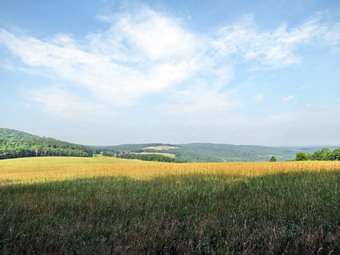 As soon as we crossed the road, the insects all but disappeared! The trail entered an evergreen forest and wound its way through the trees until again hitting a woods road. The road climbed very gently passing a field on the left. At 3.0 miles there was a viewpoint over the field and across the valley to the west over some hills. A small bench provided a resting spot and was placed there by the TriTown Hikers. After hitting a high point, the trail began to descend over the next mile. At 4.2 miles we arrived at the blue spur trail to the right. The trail went to the Getter Hill lean-to just 250 feet off the trail. The lean-to was built in 2011 and looked new. It had the typical open front with a fireplace but also sported a picnic table, an outhouse and a nearby stream. It was at this point that I had intended to turn around but it was only 9:20 AM. We had covered 4.2 miles in 1 hour and 20 minutes. Since there was only 2.2 miles to go and we were moving so fast, I decided to go on to Masonville. We hit a low point as we crossed the bridge over a stream and then the trail began to climb again. I continued to find horseshoe prints and other evidence that horses had been on the trail. Sheila was having fun following all sorts of game trails and harassing the local birds. The trail climbed for about .8 miles and then started to descending, meeting another woods road. From here it was all downhill to Masonville. Over the next 1.15 miles we would lose 500 feet of elevation.
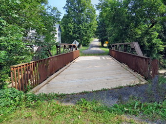 \
At 5.7 miles we hit Getter Hill Road and turned left to descend the dirt road which soon turned to pavement. Once we were on the pavement and in the sun the heat of the day became more evident. The walk down the road was short and as we neared Route 206 we took a right on a grassy lane which ran parallel to the road. Even this section of the trail was well marked with blazes! Once on Route 206 we turned right and walked along the road for .2 miles before turning left on Church Street. Just .1 miles more and we were at the Church Street Bridge which was our destination. The bridge was a road bridge at one time but had been closed to cars. The Finger Lakes Trail Conference donated decking which was installed by the people of Masonville to make a nice foot bridge over Masonville Creek. I dropped my pack to take some pictures. I got a drink and a snack before picking up my pack to start the 6.4 mile trek back. The bright sun was no fun as it beat down on as on the paved roads. Walking back up Getter Hill Road seemed to take forever. Once we turned back into the woods it didn't seem as hot and a breeze blew up to further cool us off. I will admit that the ascents on the way back seemed harder than the ascents on the way out. Still, the return trip went almost as quickly as the trip out. When we crossed Beales Road there were a few more insects but it seemed the one from the morning were taking a break. We didn't stop at all on the return trip except for me to catch my breath once or twice. We were back at the car at 12:30 PM having taken 2 hours out and 2.5 hours back. We covered 12.7 miles in 4 hours and 40 minutes with about 2380 feet of ascent. The temperature on my car thermometer stabilized at 94 degrees as I drove out Shears Road.
\
At 5.7 miles we hit Getter Hill Road and turned left to descend the dirt road which soon turned to pavement. Once we were on the pavement and in the sun the heat of the day became more evident. The walk down the road was short and as we neared Route 206 we took a right on a grassy lane which ran parallel to the road. Even this section of the trail was well marked with blazes! Once on Route 206 we turned right and walked along the road for .2 miles before turning left on Church Street. Just .1 miles more and we were at the Church Street Bridge which was our destination. The bridge was a road bridge at one time but had been closed to cars. The Finger Lakes Trail Conference donated decking which was installed by the people of Masonville to make a nice foot bridge over Masonville Creek. I dropped my pack to take some pictures. I got a drink and a snack before picking up my pack to start the 6.4 mile trek back. The bright sun was no fun as it beat down on as on the paved roads. Walking back up Getter Hill Road seemed to take forever. Once we turned back into the woods it didn't seem as hot and a breeze blew up to further cool us off. I will admit that the ascents on the way back seemed harder than the ascents on the way out. Still, the return trip went almost as quickly as the trip out. When we crossed Beales Road there were a few more insects but it seemed the one from the morning were taking a break. We didn't stop at all on the return trip except for me to catch my breath once or twice. We were back at the car at 12:30 PM having taken 2 hours out and 2.5 hours back. We covered 12.7 miles in 4 hours and 40 minutes with about 2380 feet of ascent. The temperature on my car thermometer stabilized at 94 degrees as I drove out Shears Road.
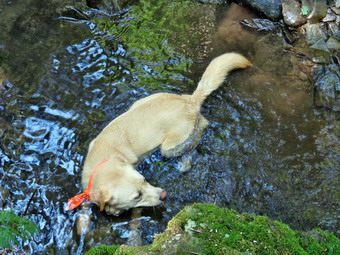
![]()
![]()
![]()
![]() On Tuesday, July 16th, I decided I wanted to go back the area north of Deposit to hike the Finger Lakes Trail through Arctic China State Forest. My plan was to park on Shears Road and hike south to the Steam Mill State Forest parking area on Route 8. The hike seemed to be about 5.1 miles so reversing it for a total of 10.2 miles seemed to be within our abilities. I knew that it was going to be even hotter than the day before and expected no break in the humidity. I was concerned that the nearly twelve miles the day before in the heat and humidity had made me a little tired especially when climbing. When Sheila and I left Livingston Manor it wasn't yet 70 degrees so I hoped we could get most of the hike in before he temperature hit 90 degrees. I took State Route 17 to exit 84 for Deposit and then headed north on Route 8. After passing the Steam Mill SF parking area, I started to watch for Shears Road on the left. I passed the ice cream stand marked on the Finger Lakes Trail Conference map and knew I had gone too far. When I turned around, I found that Shears Road is right next to the ice cream stand but has a hand lettered sign. I drove up the road looking for FLT signs, white blazes and parking spots. I found where the Finger Lakes Trail intersected the road from the north just before the Arctic State Forest sign. There were a few blazes on some trees and a telephone pole but I could not find where the trail went back into the woods to head south. I also could not find much in the way of parking. I decided to park in the Steam Mill Forest lot and hike north to Shears Road and then back. I parked at just before 9:30 AM and went across the road to find the Finger Lakes Trail. There was a path into the woods but it was not labeled or blazed near the road. I walked into the path and found a white blaze. I remember hoping that this was not a harbinger of things to come. As it turned out, it was! I went back to the car and Sheila who was not patently waiting. There didn't seem to be too many insects around but I spread on a liberal coating of repellant anyway. We hit the trail across the road at 9:35 AM. The trail almost immediately hit an old road and then crossed a stream on a nice bridge which was another Eagle Scout Project from the 1990's. The bridge seemed very sturdy with two supporting pylons and was well above the stream bed. The approaches were steep but had iron cleats to improve traction. After this, the trail wound through some evergreens and started to gain some elevation. It was damp in places and muddy in others. I remember that the map description mentioned a lean-to but when I consulted the map I had already passed it. I have no idea how I walked by the lean-to but did not intend to go back and look for it.
On Tuesday, July 16th, I decided I wanted to go back the area north of Deposit to hike the Finger Lakes Trail through Arctic China State Forest. My plan was to park on Shears Road and hike south to the Steam Mill State Forest parking area on Route 8. The hike seemed to be about 5.1 miles so reversing it for a total of 10.2 miles seemed to be within our abilities. I knew that it was going to be even hotter than the day before and expected no break in the humidity. I was concerned that the nearly twelve miles the day before in the heat and humidity had made me a little tired especially when climbing. When Sheila and I left Livingston Manor it wasn't yet 70 degrees so I hoped we could get most of the hike in before he temperature hit 90 degrees. I took State Route 17 to exit 84 for Deposit and then headed north on Route 8. After passing the Steam Mill SF parking area, I started to watch for Shears Road on the left. I passed the ice cream stand marked on the Finger Lakes Trail Conference map and knew I had gone too far. When I turned around, I found that Shears Road is right next to the ice cream stand but has a hand lettered sign. I drove up the road looking for FLT signs, white blazes and parking spots. I found where the Finger Lakes Trail intersected the road from the north just before the Arctic State Forest sign. There were a few blazes on some trees and a telephone pole but I could not find where the trail went back into the woods to head south. I also could not find much in the way of parking. I decided to park in the Steam Mill Forest lot and hike north to Shears Road and then back. I parked at just before 9:30 AM and went across the road to find the Finger Lakes Trail. There was a path into the woods but it was not labeled or blazed near the road. I walked into the path and found a white blaze. I remember hoping that this was not a harbinger of things to come. As it turned out, it was! I went back to the car and Sheila who was not patently waiting. There didn't seem to be too many insects around but I spread on a liberal coating of repellant anyway. We hit the trail across the road at 9:35 AM. The trail almost immediately hit an old road and then crossed a stream on a nice bridge which was another Eagle Scout Project from the 1990's. The bridge seemed very sturdy with two supporting pylons and was well above the stream bed. The approaches were steep but had iron cleats to improve traction. After this, the trail wound through some evergreens and started to gain some elevation. It was damp in places and muddy in others. I remember that the map description mentioned a lean-to but when I consulted the map I had already passed it. I have no idea how I walked by the lean-to but did not intend to go back and look for it.
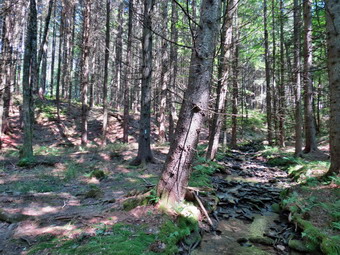 For the next .7 miles the trail continued to gain elevation and head south. At just over 1 mile into the hike it swung west and continued to climb to 1.5 miles. From here the trail descended gradually to an area near Dunbar Road where there is a camping area. As we walked on the trail I could see the gate on the woods road that crossed the trail. Soon we came to a gate in the middle of the forest. There didn't seem to be any reason for the gate. What bothered me more was that there was a Y in the trail and no obvious blazes in either direction. Sheila had been ranging a little too far and wide looking for birds but now she came back and chose the right branch. After a few hundred feet there was finally a blaze. The blazes on this section of trail are very old. Some blazes are covered by brush and in many areas there are quite far apart. The trail started to gain elevation to 2.35 miles at which point it started to drop. I wasn't having too much trouble with the climbs but they weren't very steep. At 3 miles we passed a sign explaining that the area had been planted with hardwoods in the 1903's to create a mixed forest. The hardwoods have now taken over and the softwoods are being logged to create a hardwood forest. This explained why there was an open area on our left. The trail dropped from about 2100 feet to 1650 feet over the next mile as it descended into China Ravine. The ravine itself was wide and impressive but had only a small stream running through it. There was a single plank "bridge" across the stream which was hardly necessary. I stopped so that Sheila could get a drink and get wet and so that I could take some pictures. We crossed the stream and headed up the trail parallel to the ravine. By now we were headed north and soon we left the ravine behind. The trail gained almost 500 feet over the next 1.2 miles. We were walking through a pine forest with many smaller trees springing up on the forest floor. The smaller trees were crowding the trail and they were a little prickly.
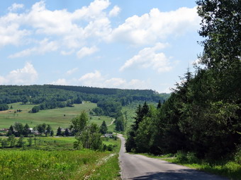 The trail got a little damper which means the number of insects, particularly mosquitoes, increased! There were few if any blazes along this part of the trail. At about 4.5 miles we entered some hardwoods and a grassy area. Again there were no blazes and the mosquitoes were now hovering in a cloud. The trail came to another Y with no blazes so I headed right and down toward Shears Road. I found one blaze along the way. I decided to stop to reapply repellant which turned out to be the wrong decision as the mosquitoes swarmed. Sheila and I sped up our pace and entered a stand of pines as we neared the road. There were no blazes but the road was just ahead. When we broke out onto the road the swarm of mosquitoes all but disappeared. I looked back at the trail from the road and understood why I could not find it when I drove down Shears Road earlier. There was no sign to indicate that there was a trail and the "mouth" of the trail was overgrown. Just across from the trail was room for one car on the side of the road. At this point, I did not want to go back on the trail. The hiking was not very hard but the insects were unbearable. I decided we would walk out Shears Road to Route 8 and then walk south to the car. The distance was only 2.25 miles but it was in the open with the sun beating down. As we walked down Shears Road I found where the Finger Lakes Trail came in from the north just below the Arctic State Forest sign. There was a small pullout overgrown with grass a little up from the sign on the opposite side of the road. Sheila and I walked out to the main road and then back to the car by 12:40 PM. We both drank some water and were glad to have the air-conditioning. The temperature was 91 degrees. We had covered 7.1 miles in 3 hours with about 1360 feet of ascent. This left only one more section from Masonville to Shears Road to complete map 27!
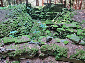
![]()
![]()
![]()
![]() On Monday, July 15th, I decided I wanted to begin map 27 of the Finger Lakes Trail which includes the an area from Deposit north to Masonville. I knew that the temperature was supposed to be in the high 80's with matching humidity but I still wanted to do the hike. The other complication was that I had no car spot and would have to hike both out and back. The section of the Finger Lakes Trail from Steam Mill State Forest on Route 8 to Route 27 near the Cannonsville seemed to be about 5.2 miles for a total hike of 10.4 miles. What was not clear from the map was exactly how much climbing would be involved! I gathered my gear, pout Sheila in the car and we headed for Deposit and Route 8 north toward Masonville. About 9 miles north of Deposit I saw the sign for Steam Mill State Forest and found the small parking area on the right side of the road. I parked at 9:00 Am, put on a liberal amount of bug repellant and headed out on the trail. The trail followed an old logging road and began to gain some elevation as we at first walked along a stone wall. The trail description talked about a viewpoint at the height of land but I didn't find any. There was a view of a logged area but nothing else. We descended the other side of the hill and dropped down to Steam Mill Road. We crossed the road and then walked across the brook. I was already soaked with sweat just .9 miles into the hike. Over the next .5 miles we hiked across some wetlands and then through some evergreens. Eventually we started to hike through some hardwoods until we came out on Barbour Brook Road. We turned left on the road and continued to walk uphill until the trail turned off the road onto a snowmobile trail. We walked a short distance on the trail but I could find no blazes. I walked back to see a turn blaze near the beginning of the trail so I thought we were headed in the right direction. We walked back out on the snowmobile trail for about .4 miles until I saw private property signs. I consulted map, compass and GPS and it was clear we were headed too far north and were on the wrong side of a hill! Since I had seen no blazes, I was at a loss and walked the snowmobile trail back toward the road thinking we would have to return to the car and start at the other end of the trail! As we approached the road I caught sight of another turn blaze and then more blazes on the trail as it passed by the hill to the south. The problem was that the blazes were not well done and I was not paying close enough attention.
On Monday, July 15th, I decided I wanted to begin map 27 of the Finger Lakes Trail which includes the an area from Deposit north to Masonville. I knew that the temperature was supposed to be in the high 80's with matching humidity but I still wanted to do the hike. The other complication was that I had no car spot and would have to hike both out and back. The section of the Finger Lakes Trail from Steam Mill State Forest on Route 8 to Route 27 near the Cannonsville seemed to be about 5.2 miles for a total hike of 10.4 miles. What was not clear from the map was exactly how much climbing would be involved! I gathered my gear, pout Sheila in the car and we headed for Deposit and Route 8 north toward Masonville. About 9 miles north of Deposit I saw the sign for Steam Mill State Forest and found the small parking area on the right side of the road. I parked at 9:00 Am, put on a liberal amount of bug repellant and headed out on the trail. The trail followed an old logging road and began to gain some elevation as we at first walked along a stone wall. The trail description talked about a viewpoint at the height of land but I didn't find any. There was a view of a logged area but nothing else. We descended the other side of the hill and dropped down to Steam Mill Road. We crossed the road and then walked across the brook. I was already soaked with sweat just .9 miles into the hike. Over the next .5 miles we hiked across some wetlands and then through some evergreens. Eventually we started to hike through some hardwoods until we came out on Barbour Brook Road. We turned left on the road and continued to walk uphill until the trail turned off the road onto a snowmobile trail. We walked a short distance on the trail but I could find no blazes. I walked back to see a turn blaze near the beginning of the trail so I thought we were headed in the right direction. We walked back out on the snowmobile trail for about .4 miles until I saw private property signs. I consulted map, compass and GPS and it was clear we were headed too far north and were on the wrong side of a hill! Since I had seen no blazes, I was at a loss and walked the snowmobile trail back toward the road thinking we would have to return to the car and start at the other end of the trail! As we approached the road I caught sight of another turn blaze and then more blazes on the trail as it passed by the hill to the south. The problem was that the blazes were not well done and I was not paying close enough attention.
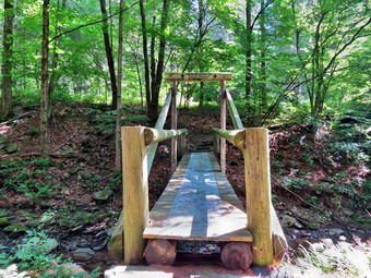 Once we found the trail we continued our hike reaching a high point of land and then descended a little before climbing again to a ridge. From here the trail descended steeply for the next .6 miles losing 500 feet. Each time we did one of these descent I was thinking about the ascent on the return trip. It hot and humid and getting worse. I was a little tired and began to wonder how hard it would be on the return. At the bottom of the descent we came to Dry Brook Road. We crossed the road and came to a stream with a nice kingpost bridge constructed as an Eagle Scout project in 1994. I stopped so that Sheila could get a drink and so that I could take some pictures. From here we began to ascend again as we headed for the Dry Brook lean-to. The wettest parts of the trail were spanned by planks held together with screening. Within .2 miles we passed a blue blazed trail on the left which led to a cistern for water. We continued to climb and in another .4 miles we were at the Dry Brook lean-to. It was clean with a fire pit and picnic tables in front. Our climb continued for another .2 miles to Rocky Point. There are several large boulders here which must be of glacial origin since they are on the highest point around. The trail continued over Rocky Point and then descended steeply to Route 27 near the Cannonsville Reservoir. The drop to the road was almost 800 feet and I knew I would have to turn right around and climb that 800 feet on the return trip. It was 11:40 AM and we had already hiked over 5 miles in 2 hours and 40 minutes. I decided to turn around at Rocky Point and return to the car. I knew that once we were back at the car we could get cooled off and I could decide whether to attempt the ascent to Rocky Point from Route 27 or save it for another day. We turned around an headed back the way we cam minus the mistake. I could feel that my muscles were tired particularly as we climbed but my overwhelming feeling was boredom. We had just hiked this section of trail and hiking it in reverse didn't add much to the experience! We arrived back at the car at 1:50 PM having hiked 9.4 miles in just under 5 hours. I was amazed when I looked at the GPS and found that our total ascent was 2600 feet!
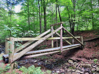 As I drove away from the parking area I began to feel refreshed by the air conditioner and decided to try hiking the 2 mile round trip from Route 27 to Rocky Point and back. As we headed back toward Deposit I turned north on Route 10 just outside of town and headed toward the Cannonsville. The drive was actually very pretty as the road passes the dam and over several bridges. I turned left on Route 27 and parked near the boat launch just south of Mormon Hollow Road. When I opened the door, I was hit by a blast of hot and humid air. I decided to go through with the plan knowing that if I turned around at any time it would be all downhill on the way back. We walked north on the road for about .1 miles and then turned left on a logging road which was marked with an arrow and an arrow on the road. The road began to gain elevation slowly and then became steeper. There weren't too many blazes but just enough to keep me from making a mistake. At about .6 miles from the Route 27 the trail turn right off the logging road and started to ascend to Rocky Point. The ascent grew steeper and was complicated by numerous blowdowns across the trail. The ascent went on for only .3 miles but was nearly a 20% grade overall. Once at the top we hiked passed the point we had come to from the other direction and then turned around to return. The trip down the trail to the logging road was slow going because of the steepness and the blowdowns. Once we were on the logging road we set a fast pace back to the main road and then to the car. We were back by 3:25 PM having covered 2.1 miles in 1 hour and 10 minutes with an elevation gain of 780 feet. The totals for the day were 11.5 miles in a little over 6 hours with a total ascent of 3380 feet!
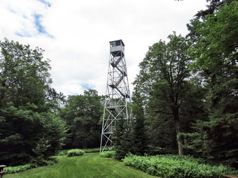
![]()
![]()
![]()
![]() On Sunday, July 14th, I decided to join an outing planned by Lisa Lyons, the owner of Morgan Outdoors in Livingston Manor. Lisa had arranged for a special tour of the Time and the Valleys Museum in Grahamsville followed by hike to the Red Hill Fire Tower. When church was over at 10:30 AM I hurried home to change into my hiking gear. I couldn't take Sheila and she let me know that she was not happy about being left behind. I got to the museum at 11:10 AM to find Lisa still in the parking lot. Most of the people who had committed to coming had called hours before to cancel. I felt badly for Lisa who takes the time to plan these great events! Carol Smythe met us in the parking lot and led us into the museum. I had beaver been in the museum before and it is a MUST VISIT place for everyone who is interested in the history of the area. As we walked in there was a three dimensional map of the area with lights to represent various types of locations. Pushing button lights up all the locations of tanneries. Pushing another button shows the locations of all the schools. All of this was constructed by talented local volunteers. We went upstairs to meet George and Helen Elias who were instrumental in getting the Red Hill Fire Tower restored. They live on Red Hill. We talked to each other about the fire tower but also about a wide range of information about days gone by. I had to look twice at the room we were in since it was set up much like my grandmother's kitchen. Another wall held many different hand implements including and ice saw, hog hobbles and a scythe. I was able to identify most of these! As we were leaving I took ,a quick [peak into another room. This room had a high ceiling, a big fireplace and a baby grand piano! I will be going back soon to explore all the exhibits.
On Sunday, July 14th, I decided to join an outing planned by Lisa Lyons, the owner of Morgan Outdoors in Livingston Manor. Lisa had arranged for a special tour of the Time and the Valleys Museum in Grahamsville followed by hike to the Red Hill Fire Tower. When church was over at 10:30 AM I hurried home to change into my hiking gear. I couldn't take Sheila and she let me know that she was not happy about being left behind. I got to the museum at 11:10 AM to find Lisa still in the parking lot. Most of the people who had committed to coming had called hours before to cancel. I felt badly for Lisa who takes the time to plan these great events! Carol Smythe met us in the parking lot and led us into the museum. I had beaver been in the museum before and it is a MUST VISIT place for everyone who is interested in the history of the area. As we walked in there was a three dimensional map of the area with lights to represent various types of locations. Pushing button lights up all the locations of tanneries. Pushing another button shows the locations of all the schools. All of this was constructed by talented local volunteers. We went upstairs to meet George and Helen Elias who were instrumental in getting the Red Hill Fire Tower restored. They live on Red Hill. We talked to each other about the fire tower but also about a wide range of information about days gone by. I had to look twice at the room we were in since it was set up much like my grandmother's kitchen. Another wall held many different hand implements including and ice saw, hog hobbles and a scythe. I was able to identify most of these! As we were leaving I took ,a quick [peak into another room. This room had a high ceiling, a big fireplace and a baby grand piano! I will be going back soon to explore all the exhibits.
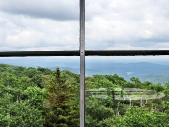 Lisa and I left the museum at about 12:10 PM to go to the Red Hill trailhead. We weren't sure if other people would be there for the hike. I had assumed that such a popular location would be packed on a Sunday afternoon. When we arrived at 12:30 PM there were no other cars in the lot. I was disappointed since I had hoped that the tower would be manned and the cab open. Lisa and I set out to hike as quickly as we could. The trail was damp in places but all of the blowdown had been cleared and we made good time. We arrived at the fire tower at 1:15 PM taking only 40 minutes to hike the 1.3 miles with 800 feet of elevation gain. When we arrived, I was pleasantly surprised to find that the tower was manned by George who lives on Red Hill. I took a few shots of the tower and then climb to the top. I could tell when I was above the treeline since there was a nice breeze blowing. The day was mostly clear with only a little haze. There was an alidade in the cab and labels on the side of the cab to help identify various mountains. I located Doubletop, Graham and Balsam Lake Mountain in one direction and Slide in another. A faint glimpse of the Rondout Reservoir could be seen. I took many pictures before heading back down he the base. After talking to George for a few minutes, Lisa and I headed back down. We did meet one other hiker on his way up. We were back in the parking area at 2:15 PM having covered 2.6 miles in 1 hour and 40 minutes with around 800 feet of ascent.
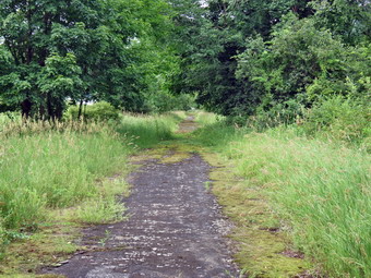
![]()
![]()
![]()
![]() On Friday, July 12th, I decided I wanted to go back to the Cannonsville Reservoir area to continue to hike sections of the Finger Lakes Trail. I did not have a partner to spot a car so that I knew that a 6 mile section would be a 12 mile hike. My plan was to hike the first section on Map 28 on the Finger Lakes Trail starting near Mormon Hollow Road on Route 27 and ending at Fletcher Road where I had been the day before. This part of the trail was accurately represented on the existing Map 28 so I printed out a copy of the map and directions to take with me. I got my gear ready and put Sheila in the car for the 50 mile drive to the start of the hike. I took State Route 17 west toward Hancock and got off at the Cadosia exit. I got on Route 268 to Route 10 where I headed south toward Deposit. Route 10 crosses over several arms of the Cannonsville reservoir in several different places so the ride was very enjoyable. I passed Dryden Road and Chamberlain Brook Road and then turned right on Route 27. When I got to Mormon Hallow Road, I knew I had gone too far so I turned around drove back about .3 miles to park on the side of the road near a boat launch. I got Sheila out of the car and we started to north on Route 27 at about 9:40 AM. The skies were completely overcast and the temperature seemed lower than the last few days. After .2 miles I noticed the Finger Lakes Trail sign on the left side of the road and a blazes on the guardrail on the other side. We jumped over the guardrail and walk a short distance on a trail that eventually intersected an old road. Walking on the old road was interesting and soon we were at the corner of Route 27 and Route 47 where we turned right on the road and crossed the river on a road bridge. I stopped to take a few pictures down the valley before continuing. After only .2 miles, the Finger Lakes Trail cut into the woods on the right and we followed it through a stand of pines. There wasn't much of a trail to follow but at least the blazes here were clear. This would be the case for the rest of the day except in some places neither the trail nor the blazes were clear! After .3 miles, we came to the edge of Loomis Brook. The water wasn't very high but it was deep enough to prevent walking across with boots. Even the able strung across the stream didn't help. I tried throwing some rocks in the stream but in the end took off my boots and waded across. I was surprised that my feet dried quickly and warmed up after my dip in the cold water.
On Friday, July 12th, I decided I wanted to go back to the Cannonsville Reservoir area to continue to hike sections of the Finger Lakes Trail. I did not have a partner to spot a car so that I knew that a 6 mile section would be a 12 mile hike. My plan was to hike the first section on Map 28 on the Finger Lakes Trail starting near Mormon Hollow Road on Route 27 and ending at Fletcher Road where I had been the day before. This part of the trail was accurately represented on the existing Map 28 so I printed out a copy of the map and directions to take with me. I got my gear ready and put Sheila in the car for the 50 mile drive to the start of the hike. I took State Route 17 west toward Hancock and got off at the Cadosia exit. I got on Route 268 to Route 10 where I headed south toward Deposit. Route 10 crosses over several arms of the Cannonsville reservoir in several different places so the ride was very enjoyable. I passed Dryden Road and Chamberlain Brook Road and then turned right on Route 27. When I got to Mormon Hallow Road, I knew I had gone too far so I turned around drove back about .3 miles to park on the side of the road near a boat launch. I got Sheila out of the car and we started to north on Route 27 at about 9:40 AM. The skies were completely overcast and the temperature seemed lower than the last few days. After .2 miles I noticed the Finger Lakes Trail sign on the left side of the road and a blazes on the guardrail on the other side. We jumped over the guardrail and walk a short distance on a trail that eventually intersected an old road. Walking on the old road was interesting and soon we were at the corner of Route 27 and Route 47 where we turned right on the road and crossed the river on a road bridge. I stopped to take a few pictures down the valley before continuing. After only .2 miles, the Finger Lakes Trail cut into the woods on the right and we followed it through a stand of pines. There wasn't much of a trail to follow but at least the blazes here were clear. This would be the case for the rest of the day except in some places neither the trail nor the blazes were clear! After .3 miles, we came to the edge of Loomis Brook. The water wasn't very high but it was deep enough to prevent walking across with boots. Even the able strung across the stream didn't help. I tried throwing some rocks in the stream but in the end took off my boots and waded across. I was surprised that my feet dried quickly and warmed up after my dip in the cold water.
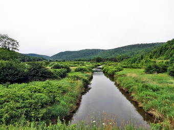 Just after crossing the stream I noticed some old iron lying around which could have been a bridge at one time. The trail now started to ascend on a woods road and then crossed an open clearing without any blazes. Over the next 1.3 miles the trail stayed mostly on woods roads and gained about 850 feet of elevation. The open road made walking easier than on some trails but the openness made it easy for nettles to grow. There was an excellent crop of nettles along most of the length of this part of the trail! The damp areas that the nettles seem to prefer also gave rise to clouds of insects! I was dragging little when we finally got to the top and entered a grove of pine trees. The temperature her was cooler and the bugs were not as numerous. For the next .55 miles we walked along the ridge descending slightly as we walked. We passed through a field and then met Old Chamberlain Brook Road which descended through the forest and then crossed a field to meet Chamberlain Brook Road. The section through the forest seemed to be maintained but had several large blowdowns. At Chamberlain Brook Road there was no indication of which way to turn but I chose left. We walked down the road and in a little over .1 miles I noticed an FLT disk on a pole on the left side of the road. A mowed trail through a small field indicated the Finger Lakes Trail turned here but there were no markers to indicate the turn. We crossed a small brook on a footbridge and then started an ascent through a very wet area. The trail here was not well marked but soon we were near the top of a ridge and I could hear machinery. The lack of good blazes continued as I had to consult my maps, compass, GPS and dog to find the trail as it descended slightly off the ridge and onto a woods road. Not too much farther along I again ran out of blazes until Sheila showed my that the trail actually ascended the ridge to our left and bent back on itself a little. This part of the trail was through some pine trees and was quite pleasant except for the climbing. Soon we were at the highest point and I consulted my map. The map told me we had almost a mile to go and that we would descend over 400 feet.
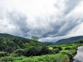 We started down through some prickers and nettles and were soon walking along the edge of a marsh where the trail was very wet. We continued to follow the trail. I was anxious to get to the end as we had already walked 5.7 miles and were still getting farther away from the car. Finally we walked out of the woods into a clearing that I recognized since it was at the top of Fletcher Road where I had been the day before. It was 12:50 PM and we had hiked a little over 6 miles. I gave Sheila a drink and a treat hike I got a snack and pout on more insect repellant. We did wait too long before turning around and retracing our steps. Even though I had just been over the trail, I still made a few mistakes on the way back. As we walked up Old Chamberlain Road, I noticed the blue blazes for the high water bypass trail just before we were to turn off the road. I decided I did not want to take off my boots again and that we would take the bypass trail. The trail followed a woods road down to Lewis Road. The road went through several switchback but was only about 1.1 miles long although it dropped 700 feet. At the end of Lewis Road we turned left on Route 47 and walked the road toward Route 27 and the car. At one point the Finger Lakes Trail actually cut back into the woods on the left but we had already covered that part of the trail so I decided to stay on the road. As we crossed over the river again, the skies were getting dark and I took a few more pictures. I had intended to walk the road back to the car but decided to drop down to the trail. This allowed Sheila to run free which was good for but of us! When we got back to Route 27, I put Sheila on her leash and we walked back to the car. We arrived at the car at 3:20 PM having covered 11.6 miles in 5.5 hours!
![]()
![]()
![]()
![]() On Thursday, July 11th, I decided I wanted to go back to the Cannonsville Reservoir area to continue to hike sections of the Finger Lakes Trail. I did not have a partner to spot a car so that I knew that a 6 mile section would be a 12 mile hike. My plan was to park at the Apex Bridge and hike west for about 6 miles or until I hit a suitable stopping point. Since the maps had not yet been published, I contacted Rick Roberts to confirm the location of the trail. I got my gear ready and put Sheila in the car for the 40 mile drive to the start of the hike. I took State Route 17 west toward Hancock and got off at the Cadosia exit. I got on Route 268 to Route 10 where I parked in the lot by the bridge. I got my gear and put Sheila on her leash and we started to walk back across the bridge to the beginning of then hike. I stopped near the center the of the bridge to take some pictures and then we continued across where we started our hike at 9:35 AM. We walked back across the ridge and turned right to walk through the parking area and then along the guardrail on Route 10. I found that too many inconsiderate people had thrown bottles to the side of the road and I didn't want Sheila to cut her feet! I decide we would walk on the road for about .75 miles where the Finger Lakes Trail cut down the bank on the left to Old Route 10. At the bottom we turned right and walked along what was left of the paved road. At first it was covered with vegetation but eventually more of the road could be seen. We walked passed a gate and then down toward the reservoir. Just before the water the trail cut up the back to the right but I decided to walk down to the reservoir. There was a lot of driftwood on the shore but it was easy to see the road as it entered the water. I took some pictures of the reservoir while Sheila swam around in the water. I began to throw some sticks into the deeper water and took pictures as Sheila swam out to get them and paddled back. Soon it was time to go back to the trail and climb the bank to Route 10.
On Thursday, July 11th, I decided I wanted to go back to the Cannonsville Reservoir area to continue to hike sections of the Finger Lakes Trail. I did not have a partner to spot a car so that I knew that a 6 mile section would be a 12 mile hike. My plan was to park at the Apex Bridge and hike west for about 6 miles or until I hit a suitable stopping point. Since the maps had not yet been published, I contacted Rick Roberts to confirm the location of the trail. I got my gear ready and put Sheila in the car for the 40 mile drive to the start of the hike. I took State Route 17 west toward Hancock and got off at the Cadosia exit. I got on Route 268 to Route 10 where I parked in the lot by the bridge. I got my gear and put Sheila on her leash and we started to walk back across the bridge to the beginning of then hike. I stopped near the center the of the bridge to take some pictures and then we continued across where we started our hike at 9:35 AM. We walked back across the ridge and turned right to walk through the parking area and then along the guardrail on Route 10. I found that too many inconsiderate people had thrown bottles to the side of the road and I didn't want Sheila to cut her feet! I decide we would walk on the road for about .75 miles where the Finger Lakes Trail cut down the bank on the left to Old Route 10. At the bottom we turned right and walked along what was left of the paved road. At first it was covered with vegetation but eventually more of the road could be seen. We walked passed a gate and then down toward the reservoir. Just before the water the trail cut up the back to the right but I decided to walk down to the reservoir. There was a lot of driftwood on the shore but it was easy to see the road as it entered the water. I took some pictures of the reservoir while Sheila swam around in the water. I began to throw some sticks into the deeper water and took pictures as Sheila swam out to get them and paddled back. Soon it was time to go back to the trail and climb the bank to Route 10.
 We crossed Route 10 at 10:30 about 2.3 miles into the hike. The trail immediately began to climb and gained 250 feet in .3 miles before leveling off and then descending. At 3.1 miles we crossed Faulkner Road and walked through a wet area and then on a trail parallel to Dryden Road before dropping down to Dryden Road and turning right. At this point I wasn't too sure about the route the Finger Lakes Trail was supposed to take as it had been rerouted in this area but used some of the roads from the original route. Dryden Road had more houses along it than I had expected and there was a nice brook on the right side of the road. After walking along the road for about .75 miles, we were at the intersection of Dryden road and Finch Hollow Road. I could see blazes to the right on Dryden Road but headed left anyway since I though this was the way we should go. In less than .25 miles Fletcher Hollow Road split to the left and there were Finger Lakes Trail signs indicating we should turn up Fletcher Hollow Road. The road was a dirt road and was pretty steep at the beginning. I could see one house above us as we hiked. When the road curved passed the house, a man on the porch waved to us which made me happy. We continued to walk up the road which I could have driven most of the way with my car. The road did deteriorate slightly the further we went. There was a stream on the left which always seems to generate insects. Acerbating about .5 miles on the road we came out into a field where the direction of the Finger Lakes Trail was unclear. I walked straight ahead and whacked some weeds covering the Finger Lakes Trail sign and saw the blazes as they went into the wood. We were now about 5.4 miles into the hike and this seemed like a good place to turn around. I gave Sheila a drink and a bone and I got a snack before heading back at 11:50 AM. The walk back went quickly as it was mostly downhill. When we were back at the point where the trail went into the woods, I looked at my GPS and decided to walk down Dryden Road to Route 10 and walk it back to the car. The walk down Dryden Road went quickly and at 12:40 PM we were turning left on Route 10. In a little more than .3 miles we were back at the place where the trail crosses Route 10. I decided that we would hit the train again since it wasn't much longer than walking the road and Sheila could be off her leash. By 1:25 PM we had hiked 9.5 miles and were back on Route 10. It was only .75 miles back to the car and we were there by 1:35 PM having covered 10.3 miles in 4 hours.
![]()
![]()
![]()
![]()
![]() On Tuesday, July 9th, I decided that after hiking the section of the Finger Lakes Trail from the Apex Bridge to Chase Brook I would hike the section from Beers Brook to Chase Brook without a car spot. This was important to me since it would complete the section of the Finger Lakes Trail from its terminus near Table Mountain to the Apex Bridge. I was a little tired from hiking from Apex Bridge to Chase Brook earlier and the insects, the 90 degree temperature and the 70% humidity didn't make things any easier. I drove from the Apex Bridge back to Beerston and parked just opposite Beers Brook Road on Route 10 to begin the hike. We started at about 1:25 PM by walking across Route 10 and about .1 miles up Beers Brook Road before turning right on the new section of the Finger Lakes Trail. For the next .75 miles we walked along what was once a road of some kind. It was flat and very straight passing between the DEP barracks and the shooting range. I had heard no shots from the range so I used this new section of trail. If hikers here shots they should use the bypass by hiking south on Route 10 to just past the barracks where a blue trail cuts right into the woods and empties out on the new section of trail after the firing range. At just less than a mile the trail goes to the left and off the road entering a stretch of pine trees. It was cool in this area and the pine needles were soft under foot. At 1.2 miles the trail enters an open area and then crosses Route 10. Where we were to go at this point was not completely clear but I found the Finger Lakes Trail marker slightly north on the opposite side of the road. The trail wanders down to a path along the West Branch of the Delaware and the Cannonsville Reservoir.
On Tuesday, July 9th, I decided that after hiking the section of the Finger Lakes Trail from the Apex Bridge to Chase Brook I would hike the section from Beers Brook to Chase Brook without a car spot. This was important to me since it would complete the section of the Finger Lakes Trail from its terminus near Table Mountain to the Apex Bridge. I was a little tired from hiking from Apex Bridge to Chase Brook earlier and the insects, the 90 degree temperature and the 70% humidity didn't make things any easier. I drove from the Apex Bridge back to Beerston and parked just opposite Beers Brook Road on Route 10 to begin the hike. We started at about 1:25 PM by walking across Route 10 and about .1 miles up Beers Brook Road before turning right on the new section of the Finger Lakes Trail. For the next .75 miles we walked along what was once a road of some kind. It was flat and very straight passing between the DEP barracks and the shooting range. I had heard no shots from the range so I used this new section of trail. If hikers here shots they should use the bypass by hiking south on Route 10 to just past the barracks where a blue trail cuts right into the woods and empties out on the new section of trail after the firing range. At just less than a mile the trail goes to the left and off the road entering a stretch of pine trees. It was cool in this area and the pine needles were soft under foot. At 1.2 miles the trail enters an open area and then crosses Route 10. Where we were to go at this point was not completely clear but I found the Finger Lakes Trail marker slightly north on the opposite side of the road. The trail wanders down to a path along the West Branch of the Delaware and the Cannonsville Reservoir.
 This part was pretty but also pretty buggy. I dropped my pack and got out the camera to take a few shots from the bank. Sheila managed to scare up a few ducks who quickly swam and flew across the river. If the bank had not had so much brush, I think Sheila would have been in the water! At 1.5 miles the trail left the path and turned left crossing a field of tall grass and ending up at the base of the bank that forms Route 10. The grass was starting to overgrow the trail and will need some trimming or more hikers to beat it down. We walked along the base of the bank as it slowly began to climb sidehilling as we went. At 1.7 miles we were again at Route 10 with no clear idea of where we should go. I chose south and within a few hundred feet the Finger Lakes Trail sign appeared on the left. The trail here cut up into the woods and the trail began to get wetter and muddier and the mosquitoes became more numerous and more aggressive. The trail for the next .8 miles rolled up and down over some little hills but continued to be wet. On this section of trail some of the wettest spots were hidden under vegetation and several times I sank into the muck. At around 2.5 miles I was at Chase Brook Road. It was 2:20 PM and I had to decide how I would return to the car. I had clocked the way back on Route 10 and found it was only 2 miles but that was 2 miles on the hot road under a blazing sun. I decided to go back on Route 10 as it was the shortest way and I did not want to challenge the mud and bugs be returning all the way on the trail. Walking the road was flat and straight and boring and hot! We made great time covering 1.1 miles in under 20 minutes. Sheila did not seem to mind the heat on her feet but I was simply hot and bored. At 3.65 miles we were back at the spot where we had first crossed Route 10 and I decided to go back into the woods and through the pine grove. This was a good choice as the insects here were fewer and it was cool. We quickly hit the old road and from there it was a straight shot to Beers Brook Road. As we approached the bypass trail, I listened but heard no shooting. I considered taking the bypass just to see what it was like but in the end returned to the car by way of Beers Brook. We were back at 3:05 PM having covered 4.8 miles in an hour and 40 minutes. Of course, the one way distance was about 2.5 miles. Combining the two sections and hiking one way between Beers Brook and the Apex Bridge would be only 7.5 miles!
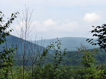
![]()
![]()
![]()
![]()
![]() On Tuesday, July 9th, I wanted to explore sections of the Finger Lakes Trail near the Cannonsville Reservoir. What I really wanted to do was hike the section between the Apex Bridge and Chase Brook that we had blazed the day before and the section from Chase Brook back to Beers Brook. This would give me every section from the end of the trail near Table Mountain to the Apex Bridge. The problem was that these two section combined were about 8 miles so that hiking the entire stretch would be a 16 mile round trip without a car spot. I knew that Lisa, the owner of the local hiking store, might want to hike this so I contacted her. She said she was interested but could not leave Livingston Manor until about 9:30 AM and that she could not take the time to do the whole hike. Because of these two reasons, I had almost decided to go it alone. I thought better of this and proposed we take two cars to do the Apex Bridge to Chase Brook section together. Once we had done that section I could decide whether or not I wanted to do the other by myself. Lisa agreed and I met her at her shop at 9:30 AM and we headed for the Cannonsville. Sheila had not been out in two days so she was ready to hike. We drove through Roscoe and Downsville toward Walton. I decided to take the back roads and turned left on West Trout Brook Road at the top of Bear Spring Mountain and then right on Beers Brook Road. The road quickly turns into a dirt road with seasonal maintenance for several miles. At the end of Beers Brook Road we turned south on Route 10 and drove several miles to Chase Brook Road. I parked my car in the parking area near the beginning of the road and put my gear, my dog and myself in Lisa's car for the drive to the beginning of the hike just over the Apex Bridge. We parked at about 10:35 Am and Alamo immediately crossed the road to begin the hike. The trail blazes looked good but the trail was wet from some rain the night before. I was glad we had put on some insect replant as the bugs were pretty thick especially in the wetter places. In particular the mosquitoes seemed to be out in force! At about .7 miles we walked off the trail to the right to a small rock ledge. This represented one of the only viewpoints on the hike. There was still a haze hanging over the hills and the view was limited but I took a few pictures before we continued along the trail.
On Tuesday, July 9th, I wanted to explore sections of the Finger Lakes Trail near the Cannonsville Reservoir. What I really wanted to do was hike the section between the Apex Bridge and Chase Brook that we had blazed the day before and the section from Chase Brook back to Beers Brook. This would give me every section from the end of the trail near Table Mountain to the Apex Bridge. The problem was that these two section combined were about 8 miles so that hiking the entire stretch would be a 16 mile round trip without a car spot. I knew that Lisa, the owner of the local hiking store, might want to hike this so I contacted her. She said she was interested but could not leave Livingston Manor until about 9:30 AM and that she could not take the time to do the whole hike. Because of these two reasons, I had almost decided to go it alone. I thought better of this and proposed we take two cars to do the Apex Bridge to Chase Brook section together. Once we had done that section I could decide whether or not I wanted to do the other by myself. Lisa agreed and I met her at her shop at 9:30 AM and we headed for the Cannonsville. Sheila had not been out in two days so she was ready to hike. We drove through Roscoe and Downsville toward Walton. I decided to take the back roads and turned left on West Trout Brook Road at the top of Bear Spring Mountain and then right on Beers Brook Road. The road quickly turns into a dirt road with seasonal maintenance for several miles. At the end of Beers Brook Road we turned south on Route 10 and drove several miles to Chase Brook Road. I parked my car in the parking area near the beginning of the road and put my gear, my dog and myself in Lisa's car for the drive to the beginning of the hike just over the Apex Bridge. We parked at about 10:35 Am and Alamo immediately crossed the road to begin the hike. The trail blazes looked good but the trail was wet from some rain the night before. I was glad we had put on some insect replant as the bugs were pretty thick especially in the wetter places. In particular the mosquitoes seemed to be out in force! At about .7 miles we walked off the trail to the right to a small rock ledge. This represented one of the only viewpoints on the hike. There was still a haze hanging over the hills and the view was limited but I took a few pictures before we continued along the trail.
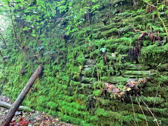 At .75 miles the trail turned left and entered a rock cut from the O&W railroad. For the next several miles the hike would be on the old rail bed. We stopped and took pictures of the rock cut and the walls of the cut. The lighting and the high humidity made taking good pictures difficult. This is one of these places that is probably better experienced in person rather than in pictures! The rocks were cover5ed in moss and the trail was a little wet and muddy. I could not find any drill holes so I assume the cut followed natural fissures in the rock and the that the workers were experienced quarrymen. In one area there was a wall of laid stone placed to hold back the bank from collapsing into the cut. We continued our hike along the rail bed but at about 1.2 miles Lisa realized she had lost her Kleen Kanteen that was hanging from a carabiner. We turned around and found it about .2 miles back so our distance increased by .4 miles from this little "detour". We continued the walk along the rail bed to about 3.2 miles where the trail turned right and away from the rail bed. In this area a trestle crossed a creek and the trestle had been removed. The trail crew bypassed this area and installed the first of three bridges over the creek. The bridge is a short span but will be very welcome in seasons where the water in high. The blazes along the rail bed were easy to see and the trail was well cleared from our work the day before. Along the way I pointed out some "artwork" on a large stone which said "FLT 2013" with a hiker next to it. I also pointed out the foundation of a springhouse just off the left of the trail which has a good, clean flow of water. As we turned of the rail bed, I missed a trail marker despite having been there the day before to help blaze the trail! We walked down to the creek and then back up to the trail where I corrected my mistake. After the short detour we regained the rail bed and continued to hike passing over another small bridge along the way. The trail bed in this area showed several areas of erosion and the trail crew did a good job of constructing the trail to get around these areas.
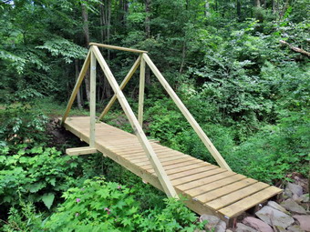 We were soon nearing the area where the trail cuts off the rail bed to the left. Just before it does is another, large stream. The stream is spanned by a nice kingpost bridge constructed by the trail crew. The crew was able to get a pickup truck to the bridge to deliver the construction materials. At 3.85 miles we walked passed the arrows that pointed to the trail on the left. As we neared the gate on Chase Brook Road, I knew I had missed the signs so we backtracked through an area of deep mud and turned to follow the trail as it dipped down to an old road. The road was concrete and at the road we turned right to follow it back to Chase Brook Road. The blazes along the road were few and far between and many were on the road surface. These blazes were obscured by some dense vegetation and would be useless in the winter! The Japanese knotweed had all but obscured the trail in places. I believe we crossed over a small bridge over a stream but it was hard to tell. At one point the blazes disappeared and we were faced with the choice of walking uphill to a gate or continuing on the road. We chose to continue on the road but soon ran out of road and walked up to Chase Brook Road. My plan had been to walk down the road to the car but just across the paved road we saw the trail markers. We walked across the road and picked up the trail as it followed a woods road through some evergreen trees. The road was really pretty and we were soon back at my car. It was 1:00 PM and we had walked a total of 5.7 miles in 2.5 hours. The actual distance was 5.1 miles after accounting for a few errors on our part. We got into my car and drove to Lisa's car at the Apex Bridge. Lisa went back to Livingston Manor and I decided I had to hike the other section of trail despite the insects, the 90 degree temperature and the 70% humidity!
On Monday, July 8th, I wanted to go to the Cannonsville Reservoir area to help Rick Roberts from the Finger Lakes Trail Conference blaze a new section of trail that has moved the Finger Lakes Trail from over 10 miles of road walking onto newly opened DEP land. I was very tired from an ambulance call that consumed over 3 hours of my sleep but decided to go anyway. I pulled in to the DEP substation at Beerston just before 8:30 AM and waited but no one appeared. I decided to check out s the of the parking areas along Route 30 thinking I had made a mistake about the meeting place. No one WA at the parking areas and I was annoyed at myself for not confirming the time and place. I checked the substation one more time and met Rick there. We had to wait for two other people and spent some time talking until they arrived at 9:00 AM. I left my car at the substation and rode with Rick to Chase Brook Road where we left his truck and got into Scott's car to ride with Scott and Cathy to the Apex Bridge. We parked there and entered the woods on the new trail. The other member of the party was Rick's beagle Scout who was very well-behaved and seemed to have a great day. The trail bugs were out but were kept at bay by some repellant. The trail was in great shape and some blazes had already been placed by other maintainers. When asked what I wanted to do, I told the truth and said I would rather clear brush than paint blazes. For the rest of the time on the trail Rick and I cleared while Cathy and Scott did a great job of painting. We "improved" some of the blazes and made sure that any brush obscuring them was removed. Sometimes the trail was new trail but often it followed woods roads. Eventually it joined the old rail bed for the O&W railroad which made it wide and straight for a good part of the way. Where the trail first joined the rail bed there was a nice rock cut. In one place it was obvious that the some had been laid up to prevent the bank from collapsing onto the tracks. The cinders from the bed were very evident and coal was present in many places. We also found quite a few ties and one telegraph pole. At one point the trail left the railroad bed and skirted an area where there had once been a trestle. The trail crew had constructed three bridges on the last part the of the trail nearest to Chase Brook. The last was a small but very impressive kingpost bridge. This bridge was less than half a mile from Chase Brook Road and Rick's truck but it was one of the wettest sections. We were back at the truck by 12:30 PM having taken about 3 hours to blazes a three or four mile section of trail. At this point we went back to my car as I had to leave. We ate lunch together and talked before I headed home. Rick, Cathy and Scott were going to try to blaze another short section before the rain started. I am looking forward to returning to this area to hike from Beerston he the Apex Bridge in the near future.
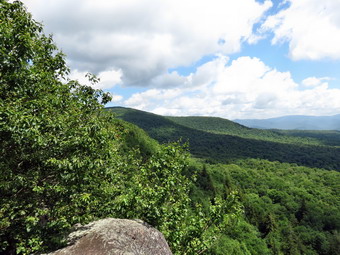
![]()
![]()
![]()
![]()
![]() On Friday, July 5th I wanted to get in another hike before the weekend brought various ambulance corps and family commitments. I decided to go to Giant Ledge since the skies were blue with billowing white clouds which always seems to create some great photographs at Giant Ledge. After completing some tasks around the house, I grabbed Sheila and we headed out DeBruce Road toward the Frost valley Road to Giant Ledge. I thought I could make the trip quickly but it seemed every other car wanted to look at the sights and travel about 30 mph. I followed two cars on the Frost Valley road and the further we went the more convinced I was that they were going to Giant Ledge also! There was a group starting hike at the Biscuit Brook area and the Slide Mountain parking lot had a half dozen cars. As we approached the Giant ledge parking area, I could see that it was almost full and that the two cars were going to park there. I was able to park at the very end of the lot nearest the trailhead at about 10:40 AM. I got Sheila ready and we crossed just behind a rather large family group from the two cars. We passed that group and kept a good pace to put some distance between us and them. They kept up until we hit the ascents and then they dropped back. On one of the ascents I met a woman and her dog coming back from the ledges. We continued up to the trail junction passing a few more hikers on the way before making the left turn toward Giant Ledge. My muscles were tired from hiking during the week and I could really notice it on the ascents. The trail began to get very wet and muddy and I was waiting for the swarms of insects to show up like they did the day before. They never did and the hike was almost insect free which was a blessing!
On Friday, July 5th I wanted to get in another hike before the weekend brought various ambulance corps and family commitments. I decided to go to Giant Ledge since the skies were blue with billowing white clouds which always seems to create some great photographs at Giant Ledge. After completing some tasks around the house, I grabbed Sheila and we headed out DeBruce Road toward the Frost valley Road to Giant Ledge. I thought I could make the trip quickly but it seemed every other car wanted to look at the sights and travel about 30 mph. I followed two cars on the Frost Valley road and the further we went the more convinced I was that they were going to Giant Ledge also! There was a group starting hike at the Biscuit Brook area and the Slide Mountain parking lot had a half dozen cars. As we approached the Giant ledge parking area, I could see that it was almost full and that the two cars were going to park there. I was able to park at the very end of the lot nearest the trailhead at about 10:40 AM. I got Sheila ready and we crossed just behind a rather large family group from the two cars. We passed that group and kept a good pace to put some distance between us and them. They kept up until we hit the ascents and then they dropped back. On one of the ascents I met a woman and her dog coming back from the ledges. We continued up to the trail junction passing a few more hikers on the way before making the left turn toward Giant Ledge. My muscles were tired from hiking during the week and I could really notice it on the ascents. The trail began to get very wet and muddy and I was waiting for the swarms of insects to show up like they did the day before. They never did and the hike was almost insect free which was a blessing!
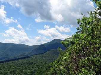 We continued to pass hikers until we got to the last ascent to the ledges. I was not looking forward to "fighting" people on the ledges to get a view and take pictures. When we arrived at the first lookout at 11:25 AM there was no one there! I was surprised but grateful. Sheila likes to walk right up to the edge of the ledges which makes me nervous. I dropped my pack and took out the camera to take some shots. Another hiker showed up and asked me some questions about the ledges. We walked back to the main trail and continued on to the last major lookout where we stopped so that I could take some more pictures. I considered continuing on to Panther but I was not prepared to deal with the number of other hikers he the trail. We turned around and walked back to another lookout where we found the large family group that we had passed at the beginning of the hike. I took a few pictures and then got Sheila and I a little something to eat and a good drink. We started back down the trail and met numerous groups of hikers coming up the trail. Sheila behaved herself well as I had to put her on her leash several times. We were back at the parking area at 12:40 PM. I counted the cars and there 26 perked in the lot and along the sides of the road! We had hiked 3.2 miles in 2 hours with plenty of time for pictures and some to talk to other hikers.
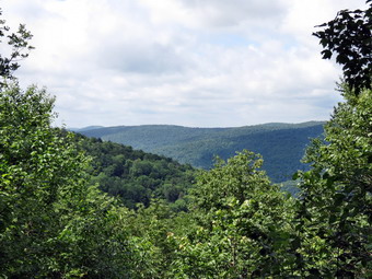
![]()
![]()
![]()
![]()
![]() On Thursday, July 4th, I wanted to continue to explore sections of the Finger Lakes Trail near Downsville. Most of these sections are not too interesting by themselves as they don't have many views. The attraction for me is that they are part of a larger picture. I asked Cindy if she would like to do a car spot and she agreed. Our plan was to park one car at the covered bridge park in Downsville and then go to the intersection of East Trout brook and West Trout Brook Roads where we start the hike. The weather forecast had only a very slight chance of rain for the afternoon so we were not too worried about getting wet. We had hiked part of these trails before when we explored Bear Spring Wildlife Management Area and knew that many of the trails were horse trails. This presents a problem since there are few bridges across the creeks since the higher water does not, apparently, bother horses or riders. The good news is that the trails are also used by snowmobiles so there are some bridges. By the time we spotted a car in Downsville and drove to the starting point it was 10:15 AM. The temperature was already in the high 70's and the humidity seemed very high. We parked in the large parking area and walked across the road and down the Trail 8 to East Trout Brook. As soon as we got there we could see the creek was a little too high to cross without getting wet. We walked out to the road and headed north to a snowmobile bridge that was only about .2 miles away. We crossed the bridge and walked out to a trail junction. I turned right when I saw an FLT marker and started to walk south. Cindy asked if we should go her other way but I thought I knew where I was going. When we arrived at the stream without seeing the trail we were supposed to take up to the ridge, I knew I was wrong. Fortunately, it was a quick walk back to the trail junction where we only had to walk about a hundred feet to a field to catch Trail 12 to head up to the ridge. As we entered the woods I could tell that this trail was a little steeper than I remembered and also a little longer! We followed the trail up for the next .8 miles heading mostly east. Along the way the trail changed from a grassy horse trail to a muddy and rutted logging trail. At least this kept the nettles in check. What was not in check were the insects. We stopped briefly to put some "natural" repellant which gave the bugs a good chance to home in on us. At the trail tuned north an continued to ascend but more gently. At 1.7 miles the trail leveled off and our total ascent was 860 feet. At this point we walked off the trail to the left to the of the only viewpoints on the hike!
On Thursday, July 4th, I wanted to continue to explore sections of the Finger Lakes Trail near Downsville. Most of these sections are not too interesting by themselves as they don't have many views. The attraction for me is that they are part of a larger picture. I asked Cindy if she would like to do a car spot and she agreed. Our plan was to park one car at the covered bridge park in Downsville and then go to the intersection of East Trout brook and West Trout Brook Roads where we start the hike. The weather forecast had only a very slight chance of rain for the afternoon so we were not too worried about getting wet. We had hiked part of these trails before when we explored Bear Spring Wildlife Management Area and knew that many of the trails were horse trails. This presents a problem since there are few bridges across the creeks since the higher water does not, apparently, bother horses or riders. The good news is that the trails are also used by snowmobiles so there are some bridges. By the time we spotted a car in Downsville and drove to the starting point it was 10:15 AM. The temperature was already in the high 70's and the humidity seemed very high. We parked in the large parking area and walked across the road and down the Trail 8 to East Trout Brook. As soon as we got there we could see the creek was a little too high to cross without getting wet. We walked out to the road and headed north to a snowmobile bridge that was only about .2 miles away. We crossed the bridge and walked out to a trail junction. I turned right when I saw an FLT marker and started to walk south. Cindy asked if we should go her other way but I thought I knew where I was going. When we arrived at the stream without seeing the trail we were supposed to take up to the ridge, I knew I was wrong. Fortunately, it was a quick walk back to the trail junction where we only had to walk about a hundred feet to a field to catch Trail 12 to head up to the ridge. As we entered the woods I could tell that this trail was a little steeper than I remembered and also a little longer! We followed the trail up for the next .8 miles heading mostly east. Along the way the trail changed from a grassy horse trail to a muddy and rutted logging trail. At least this kept the nettles in check. What was not in check were the insects. We stopped briefly to put some "natural" repellant which gave the bugs a good chance to home in on us. At the trail tuned north an continued to ascend but more gently. At 1.7 miles the trail leveled off and our total ascent was 860 feet. At this point we walked off the trail to the left to the of the only viewpoints on the hike!
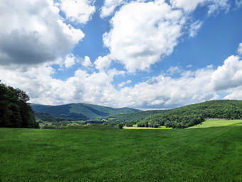 For the next .3 miles the trail was level or descended slightly and was mostly grassy horse trail. At 2.0 miles the FLT turned to the right and onto the private property of a logging company. The first few hundred feet were rough trail but then we hit a woods road. The road rolled a little with some ups and downs heading first northeast and the east. It was very wet and the insect increased so that they formed a swarm around my head. I had to be careful to keep my mouth shut and was constantly batting them away. I finally stopped and tried my extra strength DEET which really didn't seem to be much more effective. At 3 miles the trail turned SSE and started to drop continuously. The insects stayed with me and walking paralleled to a small stream did not help. The trail crossed a power line right-of-way and beyond that point it was even muddier and wetter. It was clear that something larger than ATVs had been using the road. As we neared the bottom there seemed to be a camp off to the left of the road. I was happy when we could see Route 30 since I knew the insect plague would be alleviated. The total distance since we had stared to descend on the woods road was 1.8 miles and we had dropped 1020 feet. We turned left on Route 30 and began hiking into Downsville. The terrain was flat but walking in the direct sun wasn't easy. We walked into town, took a right on Main Street and walked back to our car which was a distance of 1.7 miles on the roads. Our total distance without the mistakes was 6.5 miles in almost exactly 3 hours since we arrived at the car at 1:15 PM. Our moving average was 2.5 mph which would have been a little faster since we actually covered a little more distance. We drove back to my car at the horse camp. Cindy headed home in her car while Sheila and I hiked from the horse camp up toward Fork Mountain. There was a short stretch of trail I had never hiked which is part of the Finger Lakes Trail and I wanted to make sure I bagged it! I was glad it was only about .3 miles. As soon as we walked that small section, we headed back to the car. On the way home I noticed the beautiful white, puffy clouds and decided to stop at the Pepacton Dam to take a few pictures.
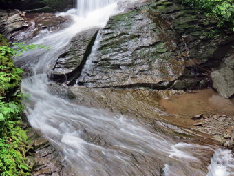
![]() On Tuesday, July 2nd, I was tired of staying inside because of rain or threat of rain. I decided to go somewhere local where I could get in a short hike in between showers. I chose Trout Pond since I thought the recent rains would enhance Russell Brook Falls. I got Sheila in the car and drove to Roscoe under dark skies. The temperature was 78 degrees and the humidity was oppressive. I parked at the intersection of Morton Hill road and Russell Brook Road being sure to stay on the shoulder on the road since the small parking area is on private property. Sheila was happy to be out and ran around and around as we hiked own the road. The erosion on the road showed that the area had received some rain but I did not hear the brook roaring as it should be. We stopped at the overlook for the upper falls and I was surprised to see a rather "normal" volume of water passing through the falls. The tree that had been in the middle of the falls was gone so I took some pictures before getting back on the road. There were two cars in the lower parking lot as we walked down the road to the bridge and across it toward the falls. The huge patch of Japanese knotweed was fully restored and larger than ever as we cut by it to get own to the streambed. I dropped my pack to take some pictures. The flow over the falls was not as spectacular as I had hoped but was adequate for a few shots. The skies were still gray as we headed up the woods road toward Trout Pond. The walk went quickly but as we approached the pond it began to rain. The rain was light but I did not want to get soaked if the storms grew worse. I took a few pictures and debated my options. I had thought about walking passed the lean-to to Campbell Brook Road and then making a loop by walking back on Morton Hill Road. In the end I decided to return as the rain grew a little harder. As soon as we started back the rain let up and the skies became bluer. I almost turned around but continued back toward the falls at which point the skies grew gray. At the lower parking area some DEC workers were trimming the grass as Sheila and I headed down Russell Brook Road to extend our distance a little under blue skies once again. When we reached the first rather large gap in the road, I decided to turn around and head back. As we walked back I started thinking about visiting Tompkins, Falls, Beaverkill Falls, Angel falls and Buttermilk Falls. By the time we got back to the car I decided that I was not really in the mood for a road trip with little or no hiking. We had gotten in about 4 miles in under 2 hours which at least made Sheila happy!
On Tuesday, July 2nd, I was tired of staying inside because of rain or threat of rain. I decided to go somewhere local where I could get in a short hike in between showers. I chose Trout Pond since I thought the recent rains would enhance Russell Brook Falls. I got Sheila in the car and drove to Roscoe under dark skies. The temperature was 78 degrees and the humidity was oppressive. I parked at the intersection of Morton Hill road and Russell Brook Road being sure to stay on the shoulder on the road since the small parking area is on private property. Sheila was happy to be out and ran around and around as we hiked own the road. The erosion on the road showed that the area had received some rain but I did not hear the brook roaring as it should be. We stopped at the overlook for the upper falls and I was surprised to see a rather "normal" volume of water passing through the falls. The tree that had been in the middle of the falls was gone so I took some pictures before getting back on the road. There were two cars in the lower parking lot as we walked down the road to the bridge and across it toward the falls. The huge patch of Japanese knotweed was fully restored and larger than ever as we cut by it to get own to the streambed. I dropped my pack to take some pictures. The flow over the falls was not as spectacular as I had hoped but was adequate for a few shots. The skies were still gray as we headed up the woods road toward Trout Pond. The walk went quickly but as we approached the pond it began to rain. The rain was light but I did not want to get soaked if the storms grew worse. I took a few pictures and debated my options. I had thought about walking passed the lean-to to Campbell Brook Road and then making a loop by walking back on Morton Hill Road. In the end I decided to return as the rain grew a little harder. As soon as we started back the rain let up and the skies became bluer. I almost turned around but continued back toward the falls at which point the skies grew gray. At the lower parking area some DEC workers were trimming the grass as Sheila and I headed down Russell Brook Road to extend our distance a little under blue skies once again. When we reached the first rather large gap in the road, I decided to turn around and head back. As we walked back I started thinking about visiting Tompkins, Falls, Beaverkill Falls, Angel falls and Buttermilk Falls. By the time we got back to the car I decided that I was not really in the mood for a road trip with little or no hiking. We had gotten in about 4 miles in under 2 hours which at least made Sheila happy!
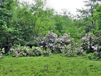
![]()
![]()
![]()
![]()
![]() On Saturday, June 29th, I wanted to continue to explore sections of the Finger Lakes Trail near Downsville. I knew that a new section of trail had been created to move the trail off Campbell Brook Road and Route 30 to trails through the woods. I asked Cindy if she would like to do a car spot and she agreed. Our plan was to park one car at the covered bridge park in Downsville and then go back to Route 206 on the way to Downsville where we start the hike. We were aware that we might have to fit the hike between rain in the morning and rain in the afternoon but this had been the case for several weeks now. By the time we spotted a car in Downsville and drove back to the starting point it was 10:00 AM. We hiked down the trail from the road. The trail was wet in most places with some running water and some mud. Many of these trails are snowmobile trails so that they are well maintained. We walked on the trail as it paralleled the brook and then crossed on the foot bridge. After descending for about .7 miles, we began to climb and over the next .9 miles we gained about 600 feet of elevation. We passed the side trail to the Campbell Mountain lean-to and continued to ascend. I was not sure where the new section of trail began but not far passed the lean-to was a FLT sign pointing to the right. The new section of trail started on a snowmobile trail and I signed in at the trail register. The trail was wide but not well marked. There were no FLT signs or blazes and the snowmobile markers were few and far between. For the most part this was not a problem on the first part of the trail which was either level or descending. We passed through some nice clearings with laurel in full bloom. At one point a partridge made a feeble attempt to get off the ground and Sheila started to salivate. I advised her to leave the bird alone. It was clear this was a mother partridge trying to draw attention away from her chicks that were under a bush along the trail. Soon we ascended slightly to the top of Campbell Mountain. The markings on the trail were now non-existent. We came upon some nice yellow signs warning about turns and then as we started down a hill...nothing! We backtracked to see if we had missed something but no markers or blazes showed up. We decided to continue on the wide trail even though there were no markers! After descending the hill we picked up another snowmobile sign and shortly after the first FLT marker since the beginning of the trail! We continued on the trail and found no more markers.
On Saturday, June 29th, I wanted to continue to explore sections of the Finger Lakes Trail near Downsville. I knew that a new section of trail had been created to move the trail off Campbell Brook Road and Route 30 to trails through the woods. I asked Cindy if she would like to do a car spot and she agreed. Our plan was to park one car at the covered bridge park in Downsville and then go back to Route 206 on the way to Downsville where we start the hike. We were aware that we might have to fit the hike between rain in the morning and rain in the afternoon but this had been the case for several weeks now. By the time we spotted a car in Downsville and drove back to the starting point it was 10:00 AM. We hiked down the trail from the road. The trail was wet in most places with some running water and some mud. Many of these trails are snowmobile trails so that they are well maintained. We walked on the trail as it paralleled the brook and then crossed on the foot bridge. After descending for about .7 miles, we began to climb and over the next .9 miles we gained about 600 feet of elevation. We passed the side trail to the Campbell Mountain lean-to and continued to ascend. I was not sure where the new section of trail began but not far passed the lean-to was a FLT sign pointing to the right. The new section of trail started on a snowmobile trail and I signed in at the trail register. The trail was wide but not well marked. There were no FLT signs or blazes and the snowmobile markers were few and far between. For the most part this was not a problem on the first part of the trail which was either level or descending. We passed through some nice clearings with laurel in full bloom. At one point a partridge made a feeble attempt to get off the ground and Sheila started to salivate. I advised her to leave the bird alone. It was clear this was a mother partridge trying to draw attention away from her chicks that were under a bush along the trail. Soon we ascended slightly to the top of Campbell Mountain. The markings on the trail were now non-existent. We came upon some nice yellow signs warning about turns and then as we started down a hill...nothing! We backtracked to see if we had missed something but no markers or blazes showed up. We decided to continue on the wide trail even though there were no markers! After descending the hill we picked up another snowmobile sign and shortly after the first FLT marker since the beginning of the trail! We continued on the trail and found no more markers.
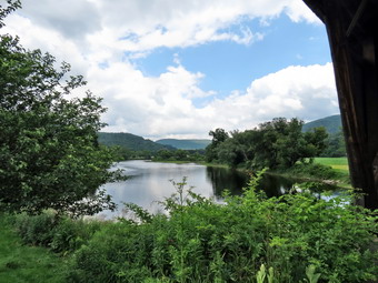 At 3.3 miles we broke out into a field with no indication of where we should go. We tried following the trail but nothing seemed to be cleared. Eventually we reached a point where there simply was no more trail. We turned back and tried one more possible direction. We decided to retrace our steps back to the car and try again some other time. On the way back I looked up and saw a sign that was now my left and the sign said "Downsville". We had missed this sign on the way through the first time but it was NOT easy to see! We decided we would go in this direction hoping it would get us to our destination. Again there were few markers or blazes. This trail took us around the other side of the mountain and at one point we were only a few hundred feet from our earlier aborted attempt. The further we continued on the snowmobile trail the more we were convinced it was the right trail. Eventually we saw the white blazes used for the FLT pointing off the snowmobile trail to the right. We tried to follow the blazes until we found that they were pointing down another old woods road which we followed for some time. The road was well eroded and filled with a nice crop of nettles. At one point the trail left the road to avoid some blowdown and then regained the road. Further down another set of blazes indicated that we should leave the road and descend to another woods road. This road paralleled a small brook that was making quite a bit of noise. At the base of the hill we crossed the brook and walked through a backyard to a driveway and then down to Mink Brook Road. There were FLT blazes along the way and the owners of the property have generously allowed hiking across their property. From a previous scouting trip I knew that the bridge on Mink Brook Road was being replaced but I felt we could cross the brook. We crossed the brook and walked down to Back River Road. After walking along Back River Road, we turned right on Bridge Street to cross over the Delaware River on the covered bridge. We stopped at the old Downsville Cemetery to read the historical description. We also stopped at the bridge so that I could take a few pictures. We crossed the bridge and walked over to our car. A couple at the park had been walking their two two-year-old Great Danes and I could not resist taking a picture of these two magnificent animals! We were back at the car by 2:00 PM and missed all but a few drops of rain. We had hiked 8.2 miles in 4 hours with around 1200 feet of ascent but over 2200 feet of descent. Without the extra hiking caused by the poor trail marking, the hike would have been almost exactly 7 miles!
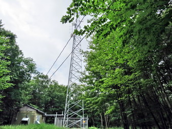
![]()
![]()
![]()
![]()
![]() On Wednesday, June 26th, I was a little tired from hiking the two previous days. I wanted to hike some part of the Long Path or Finger lakes Trail that I had not hiked previously. Most of the Long Path sections were further to the north or south than I really wanted to go. I looked at some section of the Finger Lakes Trail near the Cannonsville Reservoir, Walton and Downsville. One new section from Campbell Mountain to Downsville I wanted to hike with my wife. Other sections were long an might be best to do with a car spot. I decided to hike from Route 10 near Walton to Houck Mountain. I knew that most of this hike was on roads and would go quickly. Not having a second car meant I would have to do the hike and then return to the car. Sheila and I left Livingston Manor about 8:00 AM and headed for Walton on Route 206 through Downsville. At the top of Bear Spring Mountain, just before heading down into Walton, I turned left of West Trout Brook Road which was hard packed dirt. I made a right at the next intersection on Beers Brook Road which was also a dirt road at this point. After a short drive, we passed Russ Gray Pond at which point the road was paved. After a little more than 3 miles, a road on the left headed up and I assumed that it was Houck Mountain Road although I saw no sign. In another .6 miles or so, I turned right on Route 10 and parked in the DEC parking area a few hundred feet down the road at about 8:45 AM. The skies were overcast and the humidity was high. The temperature was about 66 degrees and I chose to keep on my long-sleeved shirt although I knew I would need to change it at some point. I put Sheila on her leash and we started back to Beers Brook Road on Route 10. We turned up the road and made good time as we approached what I hoped was Houck Mountain Road. At 8:55 AM we made the turn and I immediately noticed a small sign with the name of the road nearly covered by vegetation. There was also a white blaze for the Finger Lakes Trail. The road began to climb immediately and although it was not as steep as some trails it was relentless. After heading southwest briefly the road turned southeast but continued to climb. Sheila likes to pull on her leash and it actually helped the climb as I had not brought my poles. I also had left my maps behind thinking that everything would be clearly marked and forgetting that my GPS does a very poor job with roads. In fact, there were few blazes along the road and I wondered several times if I would be able to find where I needed to go.
On Wednesday, June 26th, I was a little tired from hiking the two previous days. I wanted to hike some part of the Long Path or Finger lakes Trail that I had not hiked previously. Most of the Long Path sections were further to the north or south than I really wanted to go. I looked at some section of the Finger Lakes Trail near the Cannonsville Reservoir, Walton and Downsville. One new section from Campbell Mountain to Downsville I wanted to hike with my wife. Other sections were long an might be best to do with a car spot. I decided to hike from Route 10 near Walton to Houck Mountain. I knew that most of this hike was on roads and would go quickly. Not having a second car meant I would have to do the hike and then return to the car. Sheila and I left Livingston Manor about 8:00 AM and headed for Walton on Route 206 through Downsville. At the top of Bear Spring Mountain, just before heading down into Walton, I turned left of West Trout Brook Road which was hard packed dirt. I made a right at the next intersection on Beers Brook Road which was also a dirt road at this point. After a short drive, we passed Russ Gray Pond at which point the road was paved. After a little more than 3 miles, a road on the left headed up and I assumed that it was Houck Mountain Road although I saw no sign. In another .6 miles or so, I turned right on Route 10 and parked in the DEC parking area a few hundred feet down the road at about 8:45 AM. The skies were overcast and the humidity was high. The temperature was about 66 degrees and I chose to keep on my long-sleeved shirt although I knew I would need to change it at some point. I put Sheila on her leash and we started back to Beers Brook Road on Route 10. We turned up the road and made good time as we approached what I hoped was Houck Mountain Road. At 8:55 AM we made the turn and I immediately noticed a small sign with the name of the road nearly covered by vegetation. There was also a white blaze for the Finger Lakes Trail. The road began to climb immediately and although it was not as steep as some trails it was relentless. After heading southwest briefly the road turned southeast but continued to climb. Sheila likes to pull on her leash and it actually helped the climb as I had not brought my poles. I also had left my maps behind thinking that everything would be clearly marked and forgetting that my GPS does a very poor job with roads. In fact, there were few blazes along the road and I wondered several times if I would be able to find where I needed to go.
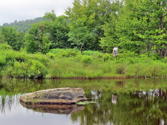 The walk up the hill was monotonous most of the time with no views and little to do but walk. To our left the terrain fell away rapidly and to the right it rose almost as steeply. Any possible views were blocked by the abundant vegetation. I noticed a lot of Japanese knotweed even at higher elevations. There were really no houses along he way although there were several dirt roads or driveways that might have been for hunting camps. We climbed for 1.9 miles from the intersection where we turned onto Houck Mountain Road and gained over 1100 feet in the process. At this point the road leveled slightly and then started to descend which did not make me happy. I was not looking forward to having to reclimb the hill on the return trip! I was also wondering whether or not I could find Tower Road. Within about .25 miles a dirt road appeared on the left and there was a very clear sign marking it as the "DOT Tower Road". I noted there were some nice views at this intersection but I was more concerned with getting to my objective and back before the rains came. Sheila and I were both thirsty so I took the opportunity to get us both a drink and to change into a short-sleeved shirt. As we walked on Tower Road, we climbed a little and then began to descend. I was surprised to find several "places" along the way. Some seemed to be hunting camps but one may have been a residence. Soon the road got a little rougher and we began to climb toward the area at the summit where the communications towers are located. Just short of the top, a trail turned off to the left and a sign marked it as the Finger Lakes Trail. We turned here and walked through some long grass before coming out onto a well-mowed path. Apparently the maintenance crew at Bear Spring had been mowing the horse trails! The white blazes and FLT signs clearly marked the Finger Lakes Trail and we continued to follow them. In one of my hikes I had passed by a turn on one of the horse trails that was marked "Tower Detour". I hoped this was where we were headed since it would connect me to a part of the Finger Lakes Trail that I had completed. Soon we were walking down a little hill and were at the intersection that I remembered. It was 10:25 AM when we turned round and headed back at which point I found my "up" muscles were sore!
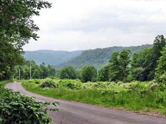 When we got back to Tower road, I decided that the skies looked like the rain might hold off so we turned left to go up to the towers. Within a few hundred feet we were at a fork in the road and we headed left. There was a small building at the end of the road with a sign that mentioned the building was used in air traffic control. We went back to the intersection and took the other fork which led to three communications towers. They were not very "scenic" nut I took some pictures anyway. After this we headed back down Tower Road at a good pace. At the point where the road flattened a little there was a cabin on the right and I noticed a small pond across from it. I stopped to take few pictures and tighten my shoe laces for the trip down the hill. A little further along there was another pond on the left side of the road that I had missed on the way up. This one was almost covered in water lilies so I took some pictures there as well. At the intersection of Houck Mountain Road and Tower Road I stopped to take a few pictures and to put Sheila on her leash. Sheila is always ready to go but she seemed a little tired as we were almost 7 miles into the hike! The walk down the paved road back to Beers Brook Road seemed to go quickly and tightening my laces stopped some of the "toe bang". We were at Beers Brook Road just after noon after covering 8.8 miles. The trip back to the car flew. We completed 9.5 miles in 3.5 hours with an average moving speed of 3.0 mph.
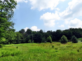
![]()
![]()
![]()
![]()
![]() On Tuesday, June 25th, I had planned to hike somewhere with Lisa and Cindy. When I stopped in on Monday, Lisa informed me she was going to a buying show in southern New Jersey for two days. Fortunately, Cindy still wanted to hike. We decided to stay close to home and go to Hodge and Frick Ponds so that I could show her our trail clearing efforts. We ate breakfast with our son Karl and then head out to hike arriving at the parking area round 10:00 AM. Thunderstorms were predicted for the afternoon and I had gotten wet on the last couple of hikes in the area. Before leaving we both put on some insect repellant as they were already beginning to swarm. We headed across the road and started up the Flynn Trail. Sheila was running up and down the trail following her nose despite the fact that we had hiked on Monday. When we got near the area where there is a clearing off the right side of the main trail we both agreed it would be worth the short walk. We headed through the woods to the clearing and found it was a bright green and that the sky was blue with some white clouds. I took a few pictures but we decided not to walk around for too long due to the weather forecast. Back on the main trail we were soon at the junction with the Big Rock Trail. As we continued on Flynn Trail, pointed put some of the areas where we had cleared a path. We decided to head down to the outlet end of Hodge Pond to allow Sheila to swim in the water there. At the shore of the pond I removed my pack and got out the camera to take some pictures of the pond. Sheila jumped right in to get a drink and to cool off in the water. I threw a stick in the water and took pictures as Sheila swam out to get it and swam back with it in her mouth. I did this several times with bigger sticks and longer throws. Soon the bugs were getting thick so we had a quick drink and a snack and then continued around the back of the pond. We made the turn back onto the Flynn Trail at the far side of the pond.
On Tuesday, June 25th, I had planned to hike somewhere with Lisa and Cindy. When I stopped in on Monday, Lisa informed me she was going to a buying show in southern New Jersey for two days. Fortunately, Cindy still wanted to hike. We decided to stay close to home and go to Hodge and Frick Ponds so that I could show her our trail clearing efforts. We ate breakfast with our son Karl and then head out to hike arriving at the parking area round 10:00 AM. Thunderstorms were predicted for the afternoon and I had gotten wet on the last couple of hikes in the area. Before leaving we both put on some insect repellant as they were already beginning to swarm. We headed across the road and started up the Flynn Trail. Sheila was running up and down the trail following her nose despite the fact that we had hiked on Monday. When we got near the area where there is a clearing off the right side of the main trail we both agreed it would be worth the short walk. We headed through the woods to the clearing and found it was a bright green and that the sky was blue with some white clouds. I took a few pictures but we decided not to walk around for too long due to the weather forecast. Back on the main trail we were soon at the junction with the Big Rock Trail. As we continued on Flynn Trail, pointed put some of the areas where we had cleared a path. We decided to head down to the outlet end of Hodge Pond to allow Sheila to swim in the water there. At the shore of the pond I removed my pack and got out the camera to take some pictures of the pond. Sheila jumped right in to get a drink and to cool off in the water. I threw a stick in the water and took pictures as Sheila swam out to get it and swam back with it in her mouth. I did this several times with bigger sticks and longer throws. Soon the bugs were getting thick so we had a quick drink and a snack and then continued around the back of the pond. We made the turn back onto the Flynn Trail at the far side of the pond.
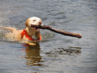 As we walked up this part of the trail, I pointed out a little more of the trimming we had accomplished less than a week ago. The Flynn Trail was only damp despite the showers on Monday night and we made good time to Junkyard Junction. At the junction we turned left onto the Quick Lake trail and walked downhill toward Iron Wheel Junction. There were places in the trail where walking over the rounded rocks was tricky. There was also one very damp spot in a clearing. The bugs began to get out of control making the hike less enjoyable! At Iron Wheel Junction we turned right to stay on the Quick Lake Trail and continued downhill toward Frick Pond. When we crossed the small stream, Sheila again found the deepest spot to cool off. The skies were darkening at this point and we thought we heard some thunder in the distance. We hurried down the trail along the shore of Frick Pond to the bridge at the outlet end. I had to stop to take a few shots the as the lighting was interesting. Some rain began to fall but lasted for only a few minutes. We continued on the Quick Lake Trail back to the trail to the rater and the parking area. The last section of trail from the pond to the register was wet as always but we worked our way around the wettest spots. We were back at the car before 1:00 PM having covered about 6.8 miles with several stops. On the way home it began to rain.
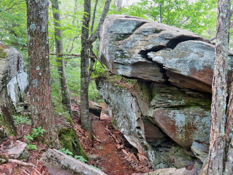
![]()
![]()
![]()
![]()
![]() On Monday, June 24th, I was ready to get out and get some exercise after a weekend filled with graduation and graduation parties. I decided I wanted to check out the work that NYNJTC the trail crew had been doing to reroute the Long Path off the roads near Phoenicia. I knew that they had done several miles of construction from near Route 28 over Romer Mountain. I also thought I knew where the trailhead was located! My plan was to drop some paperwork at Liberty HS and then head out through Neversink and take the West Shokan Road to Route 28. From the junction with Route 28 I would drive west to Phoenicia, park at the trailhead and start the hike. As I drove out the West Shokan road, I was tempted to stop at Ashokan High Point but stuck to my plan. When I got near Phoenicia, I realized that I didn't know exactly where the trailhead was located as Lane Steep was not directly off Route 28 as I thought. After driving around for a while, I decided to turn onto Woodland Valley Road and take a right at the end of the bridge rather than a left as I normally would to go to Woodland Valley Campsites. this was supposed to be High Street but it was not marked. After the turn, I watched for Lane Street on the right and soon found it. I drove to the end only to find to private residences. A more careful inspection revealed at short access road at the and of the street and a nice parking area big enough for at least 6 cars. I parked at about 10:05 AM and we were soon on the trail. The insects were swarming so I put on some "natural" insect repellant which worked me some extent. I am convinced that only a high percentage of DEET really deters the swarm! The trail has not yet been marked with disks but is very easy to follow in most places by the work that has been done and the presence of orange, pink and read and white checkerboard ribbons! The trail was damp in many spots which seemed to encourage the formation of insect clouds. I was also concerned about my late start as thunderstorms were predicted for the afternoon. Right from the beginning the trail starts to ascend. At about .4 miles I took a little detour off the main trail to a spring and then back to the main trail. I was very impressed with every asp the of the trail construction! This was not just a clearing of the easiest path. There were switchbacks, water barriers, stone steps and many other features that showed the construction was done with planning and forethought by expert trail builders!
On Monday, June 24th, I was ready to get out and get some exercise after a weekend filled with graduation and graduation parties. I decided I wanted to check out the work that NYNJTC the trail crew had been doing to reroute the Long Path off the roads near Phoenicia. I knew that they had done several miles of construction from near Route 28 over Romer Mountain. I also thought I knew where the trailhead was located! My plan was to drop some paperwork at Liberty HS and then head out through Neversink and take the West Shokan Road to Route 28. From the junction with Route 28 I would drive west to Phoenicia, park at the trailhead and start the hike. As I drove out the West Shokan road, I was tempted to stop at Ashokan High Point but stuck to my plan. When I got near Phoenicia, I realized that I didn't know exactly where the trailhead was located as Lane Steep was not directly off Route 28 as I thought. After driving around for a while, I decided to turn onto Woodland Valley Road and take a right at the end of the bridge rather than a left as I normally would to go to Woodland Valley Campsites. this was supposed to be High Street but it was not marked. After the turn, I watched for Lane Street on the right and soon found it. I drove to the end only to find to private residences. A more careful inspection revealed at short access road at the and of the street and a nice parking area big enough for at least 6 cars. I parked at about 10:05 AM and we were soon on the trail. The insects were swarming so I put on some "natural" insect repellant which worked me some extent. I am convinced that only a high percentage of DEET really deters the swarm! The trail has not yet been marked with disks but is very easy to follow in most places by the work that has been done and the presence of orange, pink and read and white checkerboard ribbons! The trail was damp in many spots which seemed to encourage the formation of insect clouds. I was also concerned about my late start as thunderstorms were predicted for the afternoon. Right from the beginning the trail starts to ascend. At about .4 miles I took a little detour off the main trail to a spring and then back to the main trail. I was very impressed with every asp the of the trail construction! This was not just a clearing of the easiest path. There were switchbacks, water barriers, stone steps and many other features that showed the construction was done with planning and forethought by expert trail builders!
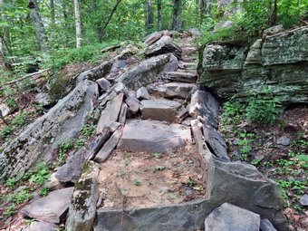 We walked through pine forest and then stands of hardwoods. The trail would ascend and then level off a little. Interesting cliffs rose on the right while the terrain dropped off to the right as we continued to climb. Somewhere around 2 miles the trail flattened a little and followed the contours on the side of the mountain ridge to the right. There were hints of views through the trees but I could find no views along the way. I didn't look too hard for views as I was concerned about storms and there was a heavy haze hanging over everything I could see. The most interesting part of the trail was where it passed between two large rocks with some steps leading up to the path between. At about 3.0 miles we reached another large rock at the top of a hill. From this point I found it heard to find the trail although I could spot the ribbons. I realized that this was where the work had been suspended so that the crews could start from the other end! I decided to follow he ribbons for a little farther to Se what I could see. The track was pretty clear and it looked like others may have been hiking the path. It wasn't exactly bushwhacking but it wasn't clear trail either. At 3.7 miles I had just finished climbing a little hill. I really wanted to just keep hiking on through but I knew I had no sure way of getting back to the car and did not have a plan for heavy rain. We turned around and headed back to the car at about 12:10 PM. Going down was definitely easier than the trip out especially when we got to the trail. We arrived back at the car at 2:00 PM having taken a little less than four hours to cover 7.4 miles. At home, when I put the track on my GPS software, I realized how much work was yet to accomplish since there was at least 3 miles more between where I stopped and the site of the work camp on the other side. I can't wait to hike this part end to end when it is finished or...maybe, before it is finished.