
What You Missed
Spring 2022
Spring 2022
![]()
![]()
![]()
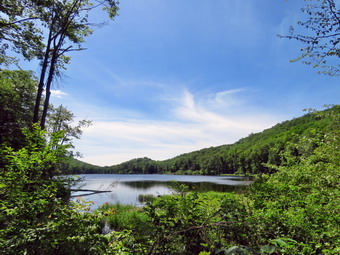
![]() On Monday, June 20th I wanted to get out to hike after a weekend of family commitments and ambulance calls. I had planned to do a longer hike but an overnight ambulance call delayed my start as I needed to get some sleep. I decided to go across the street to hike on Round Top. I asked Cindy if she wanted to go and she said "Yes". As I started to get ready at 12:45 PM the temperature had risen to 68 degrees with partly sunny skies. I decided to put on my White Sierra light long-sleeved crew shirt. I wore my Railriders hiking pants which are expensive but last along time and have features like deep pockets and a generous cut which I really like. The pants have Velcro closures at the ankles. I decided to wear my newer Keen Cascade hiking boots with a new pair of Fulton cork insoles. I felt I need more foot support as I was having some pain especially in my Achilles' Tendons. I grabbed a pair of Leki external lock poles I have been using for some time. I decided to wear my wide-brimmed floppy hat for some protection from the sun. At 1:15 PM we walked out the door to start the hike. The forecast for the late afternoon included some showers so I wanted to get finished as soon as possible. I grabbed Sheila's leash from the car and we walked up the driveway. We walked out the driveway and crossed the street to walk along the street to the parking lot of the Presbyterian Church. We walked to the back of the lot and began the ascent of the steepest hill behind the church.
On Monday, June 20th I wanted to get out to hike after a weekend of family commitments and ambulance calls. I had planned to do a longer hike but an overnight ambulance call delayed my start as I needed to get some sleep. I decided to go across the street to hike on Round Top. I asked Cindy if she wanted to go and she said "Yes". As I started to get ready at 12:45 PM the temperature had risen to 68 degrees with partly sunny skies. I decided to put on my White Sierra light long-sleeved crew shirt. I wore my Railriders hiking pants which are expensive but last along time and have features like deep pockets and a generous cut which I really like. The pants have Velcro closures at the ankles. I decided to wear my newer Keen Cascade hiking boots with a new pair of Fulton cork insoles. I felt I need more foot support as I was having some pain especially in my Achilles' Tendons. I grabbed a pair of Leki external lock poles I have been using for some time. I decided to wear my wide-brimmed floppy hat for some protection from the sun. At 1:15 PM we walked out the door to start the hike. The forecast for the late afternoon included some showers so I wanted to get finished as soon as possible. I grabbed Sheila's leash from the car and we walked up the driveway. We walked out the driveway and crossed the street to walk along the street to the parking lot of the Presbyterian Church. We walked to the back of the lot and began the ascent of the steepest hill behind the church.
The hill is short but gets the circulation pumping and is the steepest and longest climb on the "trail." At the top of the hill we stopped to look around. I noted that a crew was mowing the cemetery which certainly needed it! We started on the trail by turning left at the trailhead. The trailhead was dry and that continued as we entered the woods. At the first trail junction, we followed Sheila as she continued straight ahead up the hill to the lookout over town. When we reached the top of the hill, we followed the yellow trail as it turned to the right and ascended through the woods. The trail continued to be dry with only a few damp spots here and there. When we reached the junction with the blue trail we turned right and followed the yellow trail along the base of Round Top. At the next junction with the blue trail, we turned left and started up the trail to the summit. We bypassed the white crossover trail and continued on the blue trail over the summit. As we started down the other side again bypassed the white trail but turned left on the switchback on the blue trail. People were slowly beginning to use the switchback which I put in to avoid erosion on the main trail that used to continue straight up the hill. When the switchback came back to the main trail, we turned left and headed downhill to the yellow trail. We turned left and followed the yellow trail along the base of Round Top At the junction with the blue trail we turned right to stay in the yellow trail and descend to the woods road that brought us back to the first trail junction. The woods road was dry and the descent was easy.
We immediately turned around and started back up the woods road and the yellow trail. At the junction with the blue trail, we turned left and walked the yellow trail along the base of Round Top. At the junction with the blue trail, we turned right and started up the hill. He turned right on the switchback and followed it until it wound its way back to the main trail. We turned right and then almost immediately right again on the white crossover trail. We followed this trail along the shoulder of Roudn Top until it came to the blue trail. We turned right and headed downhill to the yellow trail. We turned right and followed the yellow trail along the base of Round Top to the junction with the blue trail. We turned left to stay on the yellow trail and walked down hill through the ferns to the lookout. At the viewpoint we turned left on the yellow trail and walked down the steep hill to the very first trail junction. We walked straight out to the trailhead and turned right to start down the hill to the church parking lot. At the bottom of the hill we walked out to the parking lot. We walked through the parking lot to Rock Avenue. After crossing the street to our driveway, we walked back to the house. We were home by 2:30 PM after hiking a little less than 2 miles in a little more than an hour.
![]()
![]()
![]()
![]()
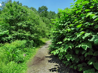
![]() On Friday, June 17th I planned to get up early and go to Giant Ledge and Panther. Am early morning ambulance call changed those plans. When I got home at 12:30 PM, I did not feel like doing the longer hike especially as the forecast included a chance of thunderstorms. I decided to go to Trout Pond and cut the knotweed that was encroaching on the path. I knew I would be only a few minutes away from the car if there was a thunderstorm. I asked Cindy if she would like to go and she declined. I did not ask Sheila as I knew she would always prefer to get out of the house even though she would be sitting around fro a good part of this outing. I began getting ready at 12:45 PM with bright blue skies and puffy white clouds with a few areas of dark clouds. As I was getting ready the temperature was 75 degrees. Sheila was pretty excited as I started to get ready as she always is when we go hiking. I got dressed in my White Sierra light crew top which blocks the sun and isn't too warm. I wore my Railriders hiking pants which are expensive but last along time and have features like deep pockets and a generous cut which I really like. The pants have Velcro closures at the ankles. I decided to wear my old Vasque Talus hiking boots which are pretty beat up and will soon have to be retired. I grabbed my Leki external lock poles even though I would probably not do much hiking. I wanted to wear my OR BugOut gaiters as the ticks have been pretty numerous late but somehow forgot them. I brought along my LT Wright Overland machete which I keep very sharp and is ideal to cut the knotweed. I put my gear in the back of the car and Sheila in the back seat. We left Livingston Manor at 1:00 PM as I drove north on the Quickway towards Roscoe. I got off at exit 94 and headed north on Route 206 towards Downsville. After crossing the Rockland Flats and passing the Roscoe Nursing Home, I turned left on Morton Hill Road and drove to the intersection with Russell Brook Road. There were no cars sitting in the "lot" at the intersection of the two roads. People see the open space and park there without thinking about the fact that the land is private. I decided to drive down the road to park in the lower lot as that is where my work would be. Russell Brook Road is a seasonal maintenance road and it did look like it had recently been maintained. In fact, the road looked as if a fresh layer of gravel had been aid down and rolled. As I drove down the road, I had the feeling that I would meet one of the forest rangers in the parking area but when I arrived there were only a few cars parked.
On Friday, June 17th I planned to get up early and go to Giant Ledge and Panther. Am early morning ambulance call changed those plans. When I got home at 12:30 PM, I did not feel like doing the longer hike especially as the forecast included a chance of thunderstorms. I decided to go to Trout Pond and cut the knotweed that was encroaching on the path. I knew I would be only a few minutes away from the car if there was a thunderstorm. I asked Cindy if she would like to go and she declined. I did not ask Sheila as I knew she would always prefer to get out of the house even though she would be sitting around fro a good part of this outing. I began getting ready at 12:45 PM with bright blue skies and puffy white clouds with a few areas of dark clouds. As I was getting ready the temperature was 75 degrees. Sheila was pretty excited as I started to get ready as she always is when we go hiking. I got dressed in my White Sierra light crew top which blocks the sun and isn't too warm. I wore my Railriders hiking pants which are expensive but last along time and have features like deep pockets and a generous cut which I really like. The pants have Velcro closures at the ankles. I decided to wear my old Vasque Talus hiking boots which are pretty beat up and will soon have to be retired. I grabbed my Leki external lock poles even though I would probably not do much hiking. I wanted to wear my OR BugOut gaiters as the ticks have been pretty numerous late but somehow forgot them. I brought along my LT Wright Overland machete which I keep very sharp and is ideal to cut the knotweed. I put my gear in the back of the car and Sheila in the back seat. We left Livingston Manor at 1:00 PM as I drove north on the Quickway towards Roscoe. I got off at exit 94 and headed north on Route 206 towards Downsville. After crossing the Rockland Flats and passing the Roscoe Nursing Home, I turned left on Morton Hill Road and drove to the intersection with Russell Brook Road. There were no cars sitting in the "lot" at the intersection of the two roads. People see the open space and park there without thinking about the fact that the land is private. I decided to drive down the road to park in the lower lot as that is where my work would be. Russell Brook Road is a seasonal maintenance road and it did look like it had recently been maintained. In fact, the road looked as if a fresh layer of gravel had been aid down and rolled. As I drove down the road, I had the feeling that I would meet one of the forest rangers in the parking area but when I arrived there were only a few cars parked.
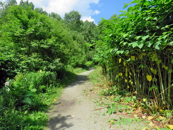 We started out at 1:25 PM by walking down the woods road toward the bridge across Russell Brook. The road was damp but not very muddy. As we crossed the bridge, I could see that the brook wasn't very high as we had not had any recent rain storms. We walked to where the stand of knotweed begins on the right and I dropped my pack. I immediately leashed Sheila to a convenient bush making sure she was in the shade. I took out my camera and took some "before" pictures of the knotweed which was starting to overgrow the trail from the right and some bushes on the left side. I put the camera away and got out the machete. The job of cutting the knotweed is pretty straight forward. I cut a few stalks and then threw them on the opposite side of the trail and then repeated it. My object was to cut the knotweed back to the posts that were buried in the stand. Since it had rained the night before, the knotweed was full of water but cutting it was rather easy. The knotweed is a grass similar to bamboo. It does off in the late fall so that the stand of knotweed is flatten out and brown. Anyone would think that it could not possibly come back but it does every spring. If it is not cut back it overgrows the path so that hikers would need a machete to get through it. I kept cutting and piling until a couple came along looking for the falls. I gave them instructions and they went in the opposite direction! I continued cutting and piling some of the stalks on the trail to remove later. The skies began to darken and the wind came up but no rain fell. Sheila was behaving well and I made sure she had some water to drink. The couple returned from their car and walked out to the falls. I cut some of the woody bushes on the left side of the trail. Loppers would have been better but the machete did a good job and it really opened up the trail. Another couple came by and we talked about the falls, the loop around the pond and the history of the area. When they left, I continued to cut as several groups passed by. I finally was approaching the path to the falls. At this point a group of three people were walking down the trail from Trout Pond and one of them was Forest Ranger Stephen Ellis. We had worked together several times and immediately recognized each other. He stopped to talk to me a helped me finish cutting an cleaning up the main trail which I really appreciated. He shared with me that he was going to cut out the area and thanked me for beating him to it. We walked back to my pack and Sheila was very polite and even sniffed Ranger Ellis' hand I took the time to take some after picture before we walked back to the parking area. We again stopped to talk for a few minutes and the parted ways. Ranger Ellis had "stealth parked" his truck farther down Russell Brook Road. I was back in my car at 3:25 PM after taking 2 hours working. I knew that I wanted to return to cut out the path to the falls perhaps bringing my Stihl string trimmer to get the work done.
![]()
![]()
![]()
![]()
![]() On Tuesday, June 14th I planned to get in a slightly longer hike with a little elevation gain. From Saturday morning to Monday afternoon I had been on over a dozen ambulance calls including a trip to Garnet Middleton and I needed to get away! I asked Cindy if she would like to go to Trout Pond and she agreed. I had been up early for ambulance call and though I might go back to bed but I decided to stay up and go hike. We began getting ready at 9:30 AM with bright blue skies and puffy white clouds with plenty of sun. As we were getting ready the temperature was 62 degrees. Sheila was pretty excited as I started to get ready as she always is when we go hiking. I got dressed in my White Sierra light crew top which blocks the sun and isn't too warm. I wore my Railriders hiking pants which are expensive but last along time and have features like deep pockets and a generous cut which I really like. The pants have Velcro closures at the ankles. I decided to wear my old Vasque Talus hiking boots which are pretty beat up and will soon have to be retired. I wasn't expecting some water and mud and thought the old shoes would be the best choice. I grabbed my Leki external lock poles which I have been using lately since twist locks have proved unreliable. I also wore my OR BugOut gaiters as the ticks have been pretty numerous late. I put our gear in the back of the car and Sheila in the back seat. We left Livingston Manor at 9:50 AM as I drove north on the Quickway towards Roscoe. I got off at exit 94 and headed north on Route 206 towards Downsville. After crossing the Rockland Flats and passing the Roscoe Nursing Home, I turned left on Morton Hill Road and drove to the intersection with Russell Brook Road. There were no cars sitting in the "lot" at the intersection of the two roads. People see the open space and park there without thinking about the fact that the land is private. I did not want to have to walk back up Russell Brook Road at the end of the hike so I decided to drive down the road to park in the lower lot. Russell Brook Road is a seasonal maintenance road and it did look like it had recently been maintained. In fact, the road looked as if a fresh layer of gravel had been aid down and rolled. I drove down the road but this time I did not stop to look at the upper falls. There was a car parked at the camping area on the left side of the road and a tent was pitched. I drove down to the lower parking area where one other car was parked. The car was not parked in the correct direction so it was taking up at least three spots. I didn't anticipate that this would be a big problem on a Tuesday but the place can be pretty full on a weekend.
On Tuesday, June 14th I planned to get in a slightly longer hike with a little elevation gain. From Saturday morning to Monday afternoon I had been on over a dozen ambulance calls including a trip to Garnet Middleton and I needed to get away! I asked Cindy if she would like to go to Trout Pond and she agreed. I had been up early for ambulance call and though I might go back to bed but I decided to stay up and go hike. We began getting ready at 9:30 AM with bright blue skies and puffy white clouds with plenty of sun. As we were getting ready the temperature was 62 degrees. Sheila was pretty excited as I started to get ready as she always is when we go hiking. I got dressed in my White Sierra light crew top which blocks the sun and isn't too warm. I wore my Railriders hiking pants which are expensive but last along time and have features like deep pockets and a generous cut which I really like. The pants have Velcro closures at the ankles. I decided to wear my old Vasque Talus hiking boots which are pretty beat up and will soon have to be retired. I wasn't expecting some water and mud and thought the old shoes would be the best choice. I grabbed my Leki external lock poles which I have been using lately since twist locks have proved unreliable. I also wore my OR BugOut gaiters as the ticks have been pretty numerous late. I put our gear in the back of the car and Sheila in the back seat. We left Livingston Manor at 9:50 AM as I drove north on the Quickway towards Roscoe. I got off at exit 94 and headed north on Route 206 towards Downsville. After crossing the Rockland Flats and passing the Roscoe Nursing Home, I turned left on Morton Hill Road and drove to the intersection with Russell Brook Road. There were no cars sitting in the "lot" at the intersection of the two roads. People see the open space and park there without thinking about the fact that the land is private. I did not want to have to walk back up Russell Brook Road at the end of the hike so I decided to drive down the road to park in the lower lot. Russell Brook Road is a seasonal maintenance road and it did look like it had recently been maintained. In fact, the road looked as if a fresh layer of gravel had been aid down and rolled. I drove down the road but this time I did not stop to look at the upper falls. There was a car parked at the camping area on the left side of the road and a tent was pitched. I drove down to the lower parking area where one other car was parked. The car was not parked in the correct direction so it was taking up at least three spots. I didn't anticipate that this would be a big problem on a Tuesday but the place can be pretty full on a weekend.
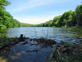
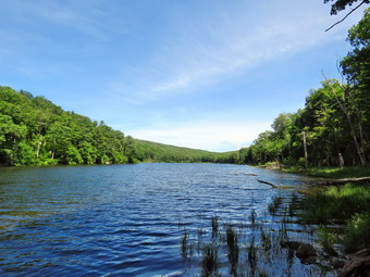 I set my GPS unit and we started our hike at 10:15 AM by walking down the woods road toward the bridge across Russell Brook. The road was damp but not very muddy. As we crossed the bridge, I could see that the brook wasn't very high as we had not had any recent rain storms. We decided not to go to the falls at the beginning of the hike and to save a visit for the return trip.The Japanese knotweed that had died and was a dead brown color was now bright green and overgrowing the trail. The history of this area is very interesting. Russell Brook Falls had been the site of a dam that impounded water for a waterwheel in Butternut Grove. The wheel was still there a few years ago. The area near the register box was the "landing zone" for loggers who cleared the evergreen trees, not for tanning but, for the production of wood alcohol. The trees were transported on narrow gauge railway that ran parallel to Russell Brook. The railway met the mainline O&W near Butternut Grove where the logs were unloaded. There were several acid factories in the area that produced wood alcohol. There was also a factory on the lower part of Russell Brook that produced khaki dye for the uniforms of American troops during World War I. We followed the main trail bypassing the path out to the falls. We continued passed the register box and up the main trail toward Trout Pond. The trail was almost dry which was a contrast to my last trip when it was covered in water with several small streams flowing across the trail. Cindy was pushing the pace and the walk seemed to go very quickly as we passed the path to the first primitive campsite. We could hear the outlet stream from Trout Pond and I explained to Cindy how, on my last visit, I had walked down to the stream and bushwhacked up to the dam at the outlet end of Trout Pond. I told her about all the interesting rapids and small falls I had seen. Soon we were at the outlet end of the pond and we walked over to the shore where the water was high which limited the size of the "beach". I dropped my pack to take pictures of the lake with the blue sky and puffy white clouds. I immediately noticed the battery was low. After taking a couple of shots, I went to my pack to change batteries and found I had no spare battery. Sheila took a quick dip and I packed up and we returned to the main trail to walk the flat woods road toward the inlet end of the pond. This trail is always damp but on this day the large ponds that had been present the last time were almost dry! The small stream just before the trail junction near the leanto was easily crossed. When we came to the bridge, I stopped to take a few pictures of the pond from just before the bridge and from the bridge itself. At this point the camera gave up for good but I was almost relived as I wanted to just hike. We crossed the bridge and stayed to the right on the Mud Pond Trail which would take us over Cherry Ridge and form our loop back to the parking area. There was new beaver activity and a small dam just downstream of the bridge causing the water to back up. The trail was nearly dry but very rocky as we started to ascend the hill. As we continued up the trail, we both slowed a little as the grade increases. There had been some very large trees across the trail but they had been cut by a DEC crew or the rangers.
 From the bridge at the inlet we had climbed 430 feet over the next .75 miles. The trail headed west from the inlet until turning sharply south at around 2.3 miles. The highest point on the trail was at 2.2 miles after which most of the rest of the hike is downhill. As we started down the other side, the trail had some mud in spots but there was no standing or running water. The relatively dry conditions continued for the rest of the trip making the hike more enjoyable than my last outing here. We ascended a small hill to the stand of small birch trees and then descended the other side where there was some mud. At 3.7 miles we had descended 420 feet from Cherry Ridge to the snowmobile trail near Mud Pond. I could see that the trail was just damp so we stayed on the woods road. As we made the left turn, we could see two hikers heading out the trail toward Mud Pond. I hoped they knew where they were going as the trail is always wet and comes to a dead end at what was Russell Brook Road. We ascended a small hill before starting downhill back toward the parking area. This section had some running water across the trail but very little mud. There was also a stream that paralleled the trail but the volume was very low. The last stream that we crossed on the trail had a good flow but was easy to cross. All told, we dropped another 380 feet over the next .7 miles back to the bridge just before the trail register. We stopped on the bridge over the outlet stream from Trout Pond and I pointed out to Cindy how high it had been last time. We continued on the trail to the junction. and turned right and continued on the main trail toward the parking area. We decided not to go to the falls as we have been there so many times. We continued across the bridge and up the trail to the parking area where there were now 4 cars parked. We were back at the car at 12:45 PM and we had hiked 4.3 miles in 2 hours and 30 minutes with an elevation gain of 863 feet. We had stopped for only 12 minutes.
![]()
![]()
![]()
![]()
![]() On Friday, June 10th, I wanted to go to Frock Pond to remove some blowdowns on the Loggers Loop. These blowdowns are usually handled by the snowmobile club but their fall maintenance trip was too far away for me to wait. My track season had ended so I had as much time as I needed to hike and clear the trail. I asked Cindy If she would like to go as it is a good idea to have somebody else along when doing this kind of work. We started to get ready at 11:15 AM when the temperature was 70 degrees on the back porch. I suspected it would be cooler at the trailhead. As I started gathering my equipment and getting dressed, Sheila was very quiet but did not let me out of her sight. I got dressed in my White Sierra light crew top which blocks the sun and isn't too warm. I wore my Railriders hiking pants which are expensive but last along time and have features like deep pockets and a generous cut which I really like. The pants have Velcro closures at the ankles. I decided to wear my old Vasque Talus hiking boots which are pretty beat up and will soon have to be retired. I was expecting a lot of water and mud and thought the old shoes would be the best choice. I also put on my OR BugOut gaiters to deal with the mud and insects that I knew would be present. I put my Silky Sugowaza curved saw in my pack along with two plastic felling wedges. I decided I would forgo the hiking poles in favor of carrying my Fiskars pack ax. This ax is very light but seems to do the job even on larger trees. I would have liked to carry the larger Silky Katanaboy 500 folding saw but I did not want the extra weight. We got our gear and Sheila in my car and left Livingston Manor at 11:35 AM. I drove out the DeBruce Road about 6 miles to Mongaup Road and turned left to continue up the road to the point where it splits. I stayed left on Beech Mountain Road and drove to the Frick Pond trailhead. When we arrived at the parking areas, there were a few cars parked in both lots. I pulled into the smaller lot and parked. The skies were bright and blue with some interesting clouds.
On Friday, June 10th, I wanted to go to Frock Pond to remove some blowdowns on the Loggers Loop. These blowdowns are usually handled by the snowmobile club but their fall maintenance trip was too far away for me to wait. My track season had ended so I had as much time as I needed to hike and clear the trail. I asked Cindy If she would like to go as it is a good idea to have somebody else along when doing this kind of work. We started to get ready at 11:15 AM when the temperature was 70 degrees on the back porch. I suspected it would be cooler at the trailhead. As I started gathering my equipment and getting dressed, Sheila was very quiet but did not let me out of her sight. I got dressed in my White Sierra light crew top which blocks the sun and isn't too warm. I wore my Railriders hiking pants which are expensive but last along time and have features like deep pockets and a generous cut which I really like. The pants have Velcro closures at the ankles. I decided to wear my old Vasque Talus hiking boots which are pretty beat up and will soon have to be retired. I was expecting a lot of water and mud and thought the old shoes would be the best choice. I also put on my OR BugOut gaiters to deal with the mud and insects that I knew would be present. I put my Silky Sugowaza curved saw in my pack along with two plastic felling wedges. I decided I would forgo the hiking poles in favor of carrying my Fiskars pack ax. This ax is very light but seems to do the job even on larger trees. I would have liked to carry the larger Silky Katanaboy 500 folding saw but I did not want the extra weight. We got our gear and Sheila in my car and left Livingston Manor at 11:35 AM. I drove out the DeBruce Road about 6 miles to Mongaup Road and turned left to continue up the road to the point where it splits. I stayed left on Beech Mountain Road and drove to the Frick Pond trailhead. When we arrived at the parking areas, there were a few cars parked in both lots. I pulled into the smaller lot and parked. The skies were bright and blue with some interesting clouds.
 I noted that the temperature was 68 degrees with a slight breeze and that I felt a little cool. We started out the woods road to the Quick Lake Trail at 11:55 AM. From the register on the trail was wet with some standing water and some flowing water and lots of mud. I wasn't able to avoid some of the water but it was shallow and I walked through it. As we approached Gravestone Junction there was one small tree leaning over into the trail. I dispatched it easily with the saw and cut a few prickers that were hanging into the trail. The prickers gave me more trouble than the tree showing that having the right tool makes all the difference. In this case the right tool would have been a pair of loppers. As I was working, we heard voices ahead and two young women appeared with two dogs. One dog was on a leash and one was not. I immediately leashed Sheila and took her to the side of the trail. The dog that was off leash simply walked by but I wish dog owners would learn to use some common courtesy! At Gravestone Junction, we turned right to get on the yellow Logger's Loop heading toward Times Square. The trail was damp and had more muddy spots than the Quick Lake Trail. I stopped after a short distance and took some pictures of the white clouds, the blue sky and very green vegetation. As we continued, the trail did look like hikers had been using it and bypassing some of the muddiest spots by creating walkarounds. These let the muddiest sections dry out but also widen the trail. Our crew has tried to get some of these areas to drain but it is very difficult as the trial is worn in deeper than the surrounding area. Soon we were hiking downhill toward Times Square with me looking for the first blowdown. I found that the small tree had been cut by some "helpful" hiker. I hoped that no one else had "helped" or I trip would be wasted. I have several areas that need attention and try to plan to do the work. We crossed a stream that parallel's the Big Rock Trail but it was almost dry. Earlier in the year the stream had a good volume of water. The source of the water is a mystery although I assume it must be from seasonal springs and runoff. We stopped for a minute and I applied some insect repellent and let Cindy use some. The mosquitoes in particular were pretty dense and biting every chance they got. The repellent did work well. At Times Square we continued straight ahead on the Logger's Loop which was wet and muddy but not as bad as I have seen it in the past. We started a slight uphill climb on the trail but the hiking was relatively easy. The trail flattened and we came to the small, seasonal pond on the right side of the trail. The pond had more water than during my last trip but really wasn't a pond at this point. I was surprised as I thought it might have some water from the recent rains. I stopped to take a few shots of what was now almost a meadow and then continued our walk avoiding the water and the mud.
 Shortly, we came to a tree with many branches across the trail. I dropped my pack and took out my camera to get some 'before' shots. Most of the branches would be easy and drag away. The biggest problem was that the larger end of the trunk was hung up in another tree off the trail. I tried swinging it back and forth to see if it would come down. The trunk moved quite a bit but did not budge. I knew I would have to make my cuts and be constantly on the lookout if the tree came loose. I got out the saw and started to cut each branch and neatly stack them off the trail Cindy was enthralled with the work I was doing as she stood watching my progress. Eventually, there were just two small trunk left as all my cutting and pulling had not dislodged anything. I used the ax to cut one of the trunks and then cut the other one. I made the cut so that the remainder of the trunk would swing off the trail. The maneuver worked so I took some after shots and we moved on. As we continued on the Logger's Loop we came to two large plastic culverts lying ion top of the ground. The DEC has started a project to replace the metal culverts and to install culverts were they were needed but did not exist. That project began at least three years ago but was not completed and the black culverts stand out like a sore thumb. I have no idea whether these have been forgotten or are on a work schedule somewhere. As we walked downhill and came to a large culvert there was another blowdown across the trail. This one did not have many branches but the trunk had a large diameter which would make it difficult to cut. I again out down my pack and got out the camera to document the job. I then used the saw to cut away as many small branches as possible. Cindy made this easier by moving the branches while I cut. Soon we were left with a large rotten trunk and a live but slightly smaller one. We worked on chopping sawing and bashing the rotten trunk until we had removed enough to make the trail more than ;passable. We had only the live trunk on the ground to removed. I knew I would have to use the ax as the trunk was right on the ground and I could not cut it with the saw. To complicate things further, a good part of the blowdown hung over the stream and I did not want it all to fall in the water. I decided to cut the upper end of the blowdown so that the remaining trunk would pivot toward the ground and hold the rest of the tree out of the stream. This plan worked well and only the large part of the blowdown remained. I decided to go to the other side of the trail and make a cut with the ax. I knew the section would be heavy but I hoped I could pivot it, spin it and roll it downhill off the trail. The cut took me a little longer than I thought it would as I was getting tired. Once I cut all the way through I was able to remove the section from the trail. I was feeling good as I was 3 for 3! I took some after pictures and we continued on to Ironwheel Junction.
 It wasn't long before we were walking downhill and climbing a small hill to Iron Wheel Junction. The trail from the junction is slightly downhill which allowed us to keep up a good pace even though we had to work our way around a significant amount of water and mud. When we came to the small stream in the woods, we found the water level elevated compared to our last trip. Sheila decided to take a dip and I took some shots of her. Cindy used some stepping stones to get across but I walked upstream to a spot I thought was shallower. Walking through the "spruce tunnel" was easier than some of the rest of the hike but there was still water and mud. There were a few blowdowns that would best be cleared by chainsaw including one that was solid with a large diameter. This blowdown was higher off the ground than the others and another tree beside it with some branches that made getting across the larger trunk difficult. Down went the pack and out came the camera. I used the saw to cut away everything except the large trunk which would definitely need a chainsaw! I took some 'after' shots and we moved on. Eventually we walked out the other side where the trail was wetter and muddier. We arrived at the junction with the Big Rock Trail and turned right to stay on the Quick Lake trail and head toward the bridge at Frick Pond. The trail was wet and muddy in several places. What had been a huge mud pit was easier to cross due to the work the trail crew had completed. We continued on the Quick Lake Trail to the bridge across the outlet of Frick Pond. We crossed the bridge and stopped at the other side. I dropped my pack to get out the camera despite the fact that I have taken hundreds of pictures from this location. The skies were blue with white clouds which was ideal for photography. I tried to get some pictures of several fish breaching the water but they were too fast for me. I also took shots of the pond and of Beech Mountain. I packed up and we continued up the hill and back to Gravestone Junction. This section of trail was also muddy and seemed to be getting worse on each trip. At Gravestone Junction we continued out the Quick Lake Trail and back to the car. We arrived at the car at 3:15 PM having hiked 3.7 miles in 3 hours and 20 minutes with an elevation gain of 380 feet. Much of this time was devoted to the work of clearing the blowdowns. The temperature at the car had risen to 75 degrees.
![]()
![]()
![]() On Wednesday, June 8th Lisa contacted me to see if I wanted to hike on Round Top. I countered with a hike on Beer Mountain. She agreed and said she would be at my house at 10:15 AM. I asked Cindy if she would like to go and, to my surprise, she agreed. Cindy is not fond of hiking up hills! I did not ask Sheila as she is always ready to go! Beer Mountain is the hill behind the Upward Brewery in Livingston Manor. The property was originally purchase by a wealthy developer who hoped to build a casino on top of the hill. Those plans fell through as did the developer's fortune. Eventually, a group of businessmen bought the land and built the brewery. There is a small pond on the property and it is nicely landscaped. The owners also enhanced the hiking trails on the property and they are open to the public although I am sure the brewery would appreciate a purchase! The trails were the site of a trail run on Saturday and I walked a small section. I started to get ready at 9:45 AM as the skies cleared from overcast to bright blue with puffy white clouds. I got dressed in my White Sierra light crew top which blocks the sun and isn't too warm. I wore my Railriders hiking pants which are expensive but last along time and have features like deep pockets and a generous cut which I really like. The pants have Velcro closures at the ankles. I decided to wear my old Vasque Talus hiking boots which are pretty beat up and will soon have to be retired. I wasn't expecting a lot of water or mud but thought the old shoes would be the best choice. I grabbed my Leki external lock poles which I have been using lately since twist locks have proved unreliable. At 10:15 AM Lisa pulled into our driveway and I suggested we drive separately to the brewery. We put our gear in the car and Sheila in the back seat and I drove to Main Street and headed south on Shandelee Road toward Youngsville. About half a mile from the traffic light in town I turned left at the sign for the brewery just before Treyz Hill Road. I turned left at the sign that said "Beer Mt Parking" and parked in the lot next to Lisa. I got my gear ready and put Sheila on her leash. We started out at 10:25 AM with the temperature right at 70 degrees. A slight breeze was blowing but the skies were bright and sunny.
On Wednesday, June 8th Lisa contacted me to see if I wanted to hike on Round Top. I countered with a hike on Beer Mountain. She agreed and said she would be at my house at 10:15 AM. I asked Cindy if she would like to go and, to my surprise, she agreed. Cindy is not fond of hiking up hills! I did not ask Sheila as she is always ready to go! Beer Mountain is the hill behind the Upward Brewery in Livingston Manor. The property was originally purchase by a wealthy developer who hoped to build a casino on top of the hill. Those plans fell through as did the developer's fortune. Eventually, a group of businessmen bought the land and built the brewery. There is a small pond on the property and it is nicely landscaped. The owners also enhanced the hiking trails on the property and they are open to the public although I am sure the brewery would appreciate a purchase! The trails were the site of a trail run on Saturday and I walked a small section. I started to get ready at 9:45 AM as the skies cleared from overcast to bright blue with puffy white clouds. I got dressed in my White Sierra light crew top which blocks the sun and isn't too warm. I wore my Railriders hiking pants which are expensive but last along time and have features like deep pockets and a generous cut which I really like. The pants have Velcro closures at the ankles. I decided to wear my old Vasque Talus hiking boots which are pretty beat up and will soon have to be retired. I wasn't expecting a lot of water or mud but thought the old shoes would be the best choice. I grabbed my Leki external lock poles which I have been using lately since twist locks have proved unreliable. At 10:15 AM Lisa pulled into our driveway and I suggested we drive separately to the brewery. We put our gear in the car and Sheila in the back seat and I drove to Main Street and headed south on Shandelee Road toward Youngsville. About half a mile from the traffic light in town I turned left at the sign for the brewery just before Treyz Hill Road. I turned left at the sign that said "Beer Mt Parking" and parked in the lot next to Lisa. I got my gear ready and put Sheila on her leash. We started out at 10:25 AM with the temperature right at 70 degrees. A slight breeze was blowing but the skies were bright and sunny.
We walked toward the pond and then turned right a little to start up the hill with the brewery on our right. We found the dirt path and signs where the trails begin. We started up the hill and immediately came to a trail junction. I knew the trail to the left worked its way through a pine forest passing some rock ledges to a dirt road. This was the path of the race from Saturday which I had walked. I also knew that a skunk lived in that area so I suggested we continue straight ahead. This trail soon flattened and went through a switchback as it worked its way toward the top of the hill. The weather was nice and the trail was beautiful with a few ledges and rocks. We broke out of the trees onto a gravel road that had been built for construction vehicles to work on top of the hill. I had just been here two days ago so I decided to limit my photography as the conditions were almost the same. We continued straight ahead on the road to the summit of Beer Mountain. A little further along we came to an area where the red shale had been removed to help build the road. We continued on toward the summit where the trail continued straight ahead. We turned left to walk to the clearing at the top. The summit had a large fire pit and some picnic tables. I set down my pack and got out the camera to take some pictures of the surrounding hills and the clouds in the sky. The trees had grown up since my last visit 8 years before and the views were not quite as good. After I had taken a few pictures, I shouldered the pack and we walked back to where the trail continued down the back side of the hill. This section was downhill for .35 miles as we lost over 200 feet at an 11% grade. The trail had quite a few loose rocks and slippery pine needles. Blowdowns had been cut and painted with orange paint so the runner could see the. I was surprised that near the bottom of the descent a tree trunk spanned the trail. I was able to easily walk under it but anyone who was 6 feet or more might have a problem. At the end of the descent the trail began to ascend again. The ascent was less than a quarter mile but I could feel the 15% grade. The trail began to descend and we were soon at the point where we had started the final ascent to the summit earlier. This time we turned right on the gravel road and began to descend the gravel road. We came to the point where the "skunk" trail intersected the road. We continued on the road! Within a short distance, the trail flatten as it returned us to the grounds of the brewery. We had been out for only an hour which I knew meant that we had hiked only 2 miles. We returned to our cars. We were back at the car at 11:30 PM after hiking 2 miles in 1 a little over an hour. The elevation gain was 450 feet which surprised me a little as it felt like more!
![]()
![]()
![]()
![]()
![]() On Monday, June 6th I wanted to explore the trails on Beer Mountain. Beer Mountain is the hill behind the Upward Brewery in Livingston Manor. The property was originally purchase by a wealthy developer who hoped to build a casino on top of the hill. Those plans fell through as did the developer's fortune. Eventually, a group of businessmen bought the land and built the brewery. There is a small pond on the property and it is nicely landscaped. The owners also enhanced the hiking trails on the property and they are open to the public although I am sure the brewery would appreciate a purchase! The trails were the site of a trail run on Saturday and I walked a small section. I started to get ready at 11:30 AM as the skies cleared from overcast to bright blue with puffy white clouds. I got dressed in my White Sierra light crew top which blocks the sun and isn't too warm. I wore my Railriders hiking pants which are expensive but last along time and have features like deep pockets and a generous cut which I really like. The pants have Velcro closures at the ankles. I decided to wear my old Vasque Talus hiking boots which are pretty beat up and will soon have to be retired. I wasn't expecting a lot of water or mud but thought the old shoes would be the best choice. I grabbed my Leki external lock poles which I have been using lately since twist locks have proved unreliable. At 11:45 PM I put my gear in the car and Sheila in the back seat. I drove to Main Street and headed south on Shandelee Road toward Youngsville. About half a mile from the traffic light in town I turned left at the sign for the brewery just before Treyz Hill Road. I parked in the lot which was empty. I got my gear ready, put Sheila on her leash and set my GPS. We started out at 11:55 AM with the temperature right at 75 degrees. A slight breeze was blowing but the skies were bright and sunny.
On Monday, June 6th I wanted to explore the trails on Beer Mountain. Beer Mountain is the hill behind the Upward Brewery in Livingston Manor. The property was originally purchase by a wealthy developer who hoped to build a casino on top of the hill. Those plans fell through as did the developer's fortune. Eventually, a group of businessmen bought the land and built the brewery. There is a small pond on the property and it is nicely landscaped. The owners also enhanced the hiking trails on the property and they are open to the public although I am sure the brewery would appreciate a purchase! The trails were the site of a trail run on Saturday and I walked a small section. I started to get ready at 11:30 AM as the skies cleared from overcast to bright blue with puffy white clouds. I got dressed in my White Sierra light crew top which blocks the sun and isn't too warm. I wore my Railriders hiking pants which are expensive but last along time and have features like deep pockets and a generous cut which I really like. The pants have Velcro closures at the ankles. I decided to wear my old Vasque Talus hiking boots which are pretty beat up and will soon have to be retired. I wasn't expecting a lot of water or mud but thought the old shoes would be the best choice. I grabbed my Leki external lock poles which I have been using lately since twist locks have proved unreliable. At 11:45 PM I put my gear in the car and Sheila in the back seat. I drove to Main Street and headed south on Shandelee Road toward Youngsville. About half a mile from the traffic light in town I turned left at the sign for the brewery just before Treyz Hill Road. I parked in the lot which was empty. I got my gear ready, put Sheila on her leash and set my GPS. We started out at 11:55 AM with the temperature right at 75 degrees. A slight breeze was blowing but the skies were bright and sunny.
 We walked toward the hill with the brewery on our right toward the dirt path and signs where the trails begin. We started up the hill and immediately came to a trail junction. I knew the trail to the left worked its way through a pine forest passing some rock ledges to a dirt road. This was the path of the race from Saturday which I had walked. I also knew that a skunk lived in that area so I decided to continue straight ahead. This trail soon flattened and went through a switchback as it worked its way toward the top of the hill. The weather was nice and the trail was beautiful with a few ledges and rocks. We broke out of the trees onto a gravel road that had been built for construction vehicles to work on top of the hill. I took a few shots of the area and the decided to continue straight ahead on the road to the summit of Beer Mountain. A little further along we came to an area where the red shale had been removed to help build the road. I took some pictures of this quarry before continuing to the summit. Near the summit the trail continued straight ahead but I turn left to walk to the cleared at the top. The summit had a large fire pit and some picnic tables. I set down my pack and got out the camera to take some pictures of the fire pit and the surrounding hills. The trees had grown up since my last visit 8 years before and the views were not quite as good. After I had taken a few pictures, I shouldered the pack and walked back to where the trail continued down the back side of the hill. This section was downhill for .35 miles as we lost over 200 feet at an 11% grade. The trail had quite a few loose rocks and slippery pine needles. Blowdowns had been cut and painted with orange paint so the runner could see the. I was surprised that near the bottom of the descent a tree trunk spanned the trail. I was able to easily walk under it but anyone who was 6 feet or more might have a problem. At the end of the descent the trail began to ascend again. The ascent was less than a quarter mile but I could feel the 15% grade. The trail began to descend and we were soon at the point where we had started the final ascent to the summit earlier. This time I turned right on the gravel road and began to descend the gravel road. We came to the point where the "skunk" trail intersected the road. I thought about turning left on the trail but decided to continue on the road. Within a short distance, the trail flatten as it returned us to the grounds of the brewery. We had been out for only an hour which I knew meant that we had hiked only 2 miles. I considered doing another loop of some kind but decided to return to the car, We were back at the car at 12:55 PM after hiking 2 miles in 1 hour. The elevation gain was 450 feet which surprised me a little as it felt like more!
![]()
![]()
![]()
![]()
![]() On Sunday, June 5th I wanted to get out for hike after a week of track meets and ambulance calls. I had explored some of the trails on Beer Mountain, the hill behind upward Brewery in Livingston Manor, and wanted to return to hike there. Cindy agreed to go after church. When we got home from church, we both agreed that the brewery would be too busy on the weekend and that we should make other plans. I had spoken to some people, who had hiked the rail trail from Parksville toward Livingston Manor on Saturday and it sounded interesting. Cindy agreed with my plan so we started to get ready just before 1:00 PM. I got dressed in my White Sierra light crew top which blocks the sun and isn't too warm. I wore my Railriders hiking pants which are expensive but last along time and have features like deep pockets and a generous cut which I really like. The pants have Velcro closures at the ankles. I decided to wear my old Keen Targhee II hiking boots which are pretty beat up and will soon have to be retired. I wasn't expecting a lot of water or mud but thought the old shoes would be the best choice. I grabbed my Leki external lock poles which I have been using lately since twist locks have proved unreliable. At 1:15 PM we put our gear in the car and Sheila in the back seat. I headed out Old Route 17 across the Flats and then took Old Route 17 and Service Road to the point where they meet Fox Mountain Road. Just after this intersection is the western parking area for the rail trail. The parking lot had one car parked but the owner seemed more interested in resting than hiking.
On Sunday, June 5th I wanted to get out for hike after a week of track meets and ambulance calls. I had explored some of the trails on Beer Mountain, the hill behind upward Brewery in Livingston Manor, and wanted to return to hike there. Cindy agreed to go after church. When we got home from church, we both agreed that the brewery would be too busy on the weekend and that we should make other plans. I had spoken to some people, who had hiked the rail trail from Parksville toward Livingston Manor on Saturday and it sounded interesting. Cindy agreed with my plan so we started to get ready just before 1:00 PM. I got dressed in my White Sierra light crew top which blocks the sun and isn't too warm. I wore my Railriders hiking pants which are expensive but last along time and have features like deep pockets and a generous cut which I really like. The pants have Velcro closures at the ankles. I decided to wear my old Keen Targhee II hiking boots which are pretty beat up and will soon have to be retired. I wasn't expecting a lot of water or mud but thought the old shoes would be the best choice. I grabbed my Leki external lock poles which I have been using lately since twist locks have proved unreliable. At 1:15 PM we put our gear in the car and Sheila in the back seat. I headed out Old Route 17 across the Flats and then took Old Route 17 and Service Road to the point where they meet Fox Mountain Road. Just after this intersection is the western parking area for the rail trail. The parking lot had one car parked but the owner seemed more interested in resting than hiking.
 I set my GPS and we started out at 1:30 PM with the temperature right at 70 degrees. A slight breeze was blowing but the skies were bright and sunny. We walked under the Quickway on Fox Mountain Road and crossed the bridge over a stream. We stepped over the guard rail where I saw a definite trail on the right. Almost immediately we came what was left of the trestle supports that carried the trail tracks over the stream. I stopped to take a few pictures. There was so much sunlight that I knew the pictures might not be the best. I knew I could always return on a morning when there was less sun. I packed up and we walked up the trail to the top of the trestle. As we entered the shade of the trees, it immediately seemed a little cooler which was a relief. I was surprised to find that the trail was well defined and stretched ahead for some distance. Like most rail trails it was very straight. Town of Liberty Supervisor Frank DeMayo had told me that this was state land and the town had an agreement from the state to use it during the summer. The hope is to connect the Parksville Rail Trail to all the sections that stretch as far as Livingston Manor. We started to walk along the trail and I noticed there was quite a bit of traffic on the Quickway! The land dropped off steeply to the Little Beaverkill on the right. On the left were some "cliffs" which were the result of the railroad cutting a path for the tracks. We continued to walk along the well-defined trail. It was a pleasant walk without many insects. There were two places along the trail where there were piles of garbage. It was hard to determine why they were there. Both piles had tarps over them which seemed to indicate someone once valued the items. We soon came to a gate on the trail which was odd since it was state land. No one seems to know why the gate is there or who placed it. We walked around the gate and continued on the trail,
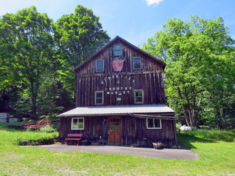 Soon we came to a small pond on the right with a red building behind it. The building looked to be in good shape but the windows were all boarded up. I took some pictures of the pond and then we continued on the trail. After hiking about 1.3 miles, we came to a driveway on the left which leads to the Sonoma Falls property. I knew this was private land but two town supervisors had said it was alright to visit it. It had been more than 12 years since I had visited this area. At one time there was a campground on the property. Some local business people bought the property and built a cider mill and market. They took the time to construct some hiking trails along the stream. I remember that the falls were very nice with at least five separate drops which increased in height the farther upstream one ventured. I took a few shots of the main building which still had the lettering from the cider mill. The business closed when not enough people would go out of their to visit. We walked to the stream just behind the building and I got my first look at the falls. They had not changed much! There was a falls right in front and one visible farther upstream. I started taking the first of what would be a large number of pictures. We walked the trail up to the second falls but it was hard to get a clear shot. Getting down to the base of the falls looked a little dangerous so I settled for some shots from the top. I walked a little farther upstream to the third set of falls and worked my way down to the stream bed. I was able to get some good shots head on at the falls. After taking some more shots, Sheila and I walked back up the bank to where Cindy was standing. My wife does not like getting too close to the edge of the streams and prefers to admire from a safer distance. We continue to walk and came to a small pond at the base of the highest falls so far. I took some wide angle shots and some that were zoomed in. I wanted to get some shots of the upper falls so we walked up the path a short way. Cindy decided to stay were she was while Sheila and I continued up a steep hill to a point across from the upper falls.
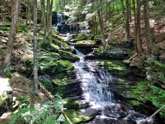 I took some shots and then decided to continue a little further up the steep hill. As I crested the hill, another even more impressive and higher falls came into view. I put my pack down and started taking shots. To get some better pictures I walked a little farther. When I finished my photography, I decided to return to Cindy even though I suspected there might be more falls upstream. Once we met Cindy we walked back down the trail toward the main building. We decided to walk over to a small building by a small pond. The sign said "Stock Pond" and offered fish for $11 each with $3 for cleaning! I took some pictures of the sign, the building and the pond before packing up and walking back out to the trail. I decided I wanted to walk all the way out to Old Liberty toad and set a quick pace as I knew Cindy would rather turn around. The walk along the old road was interesting as there were some impressive rock cuts on the left and a very lazy river on the right. The walk was about .4 miles which was a little longer than I thought. When we arrived at Old Liberty Road, I saw that the trail actually continued straight ahead parallel to the road. I decided to explore this part of the trail on another visit. Sheila and I turned around and walked back to Cindy. We set a pretty fast pace on the way back and did not stop. For the 1.63 miles back we averaged just over 3 mph. We were back at the car at 3:40 PM having hiked 4 miles in 2 hours and 10 minutes with 0 minutes of stopped time. The ascent was 335 feet almost all of which was the climb to the waterfalls. I do hope the plans to connect the sections of the trails is successful!
![]()
![]()
![]()
![]() On Wednesday, June 1st I wanted to get out to hike after more than a week of track meets, ambulance calls and bad weather. I had planned to do a longer hike but overnight ambulance calls delayed my start as I needed to get some sleep. I decided to go across the street to hike on Round Top. I planned to try to vary my regular routine and get in a few loops for two or three miles. As I started to get ready at 11:30 AM the temperature had risen to 70 degrees with partly sunny skies. It was almost as warm as the day before so I decided to put on my White Sierra light long-sleeved crew shirt. I wore my Railriders hiking pants which are expensive but last along time and have features like deep pockets and a generous cut which I really like. The pants have Velcro closures at the ankles. I decided to wear my old Vasque Taku hiking boots which are pretty beat up and will soon have to be retired. I made sure I had a pair of Super Green insoles in the shoes to support my arches. I grabbed a pair of Leki external lock poles I have been using for some time. I decided to wear my wide-brimmed floppy hat for some protection from the sun. At 11:45 AM we walked out the door to start the hike. The heat and humidity were high but not as bad as they had been. The forecast for the late afternoon included some thunderstorms so I wanted to get finished as soon as possible. I also had a final meeting with my track athletes that had qualified for the state qualifier meet. I grabbed Sheila's leash from the car and we walked up the driveway. We walked out the driveway and crossed the street to walk along the street to the parking lot of the Presbyterian Church. We walked to the back of the lot and began the ascent of the steepest hill behind the church.
On Wednesday, June 1st I wanted to get out to hike after more than a week of track meets, ambulance calls and bad weather. I had planned to do a longer hike but overnight ambulance calls delayed my start as I needed to get some sleep. I decided to go across the street to hike on Round Top. I planned to try to vary my regular routine and get in a few loops for two or three miles. As I started to get ready at 11:30 AM the temperature had risen to 70 degrees with partly sunny skies. It was almost as warm as the day before so I decided to put on my White Sierra light long-sleeved crew shirt. I wore my Railriders hiking pants which are expensive but last along time and have features like deep pockets and a generous cut which I really like. The pants have Velcro closures at the ankles. I decided to wear my old Vasque Taku hiking boots which are pretty beat up and will soon have to be retired. I made sure I had a pair of Super Green insoles in the shoes to support my arches. I grabbed a pair of Leki external lock poles I have been using for some time. I decided to wear my wide-brimmed floppy hat for some protection from the sun. At 11:45 AM we walked out the door to start the hike. The heat and humidity were high but not as bad as they had been. The forecast for the late afternoon included some thunderstorms so I wanted to get finished as soon as possible. I also had a final meeting with my track athletes that had qualified for the state qualifier meet. I grabbed Sheila's leash from the car and we walked up the driveway. We walked out the driveway and crossed the street to walk along the street to the parking lot of the Presbyterian Church. We walked to the back of the lot and began the ascent of the steepest hill behind the church.
The hill is short but gets the circulation pumping and is the steepest and longest climb on the "trail." At the top of the hill we stopped to look around. I noted the work that a crew had done over the weekend in repairing some headstones that had fallen over. I was surprised that there were quite a few that still remained toppled and I hoped the crew would be back to finish the job. We started on the trail by turning left at the trailhead. The trailhead was dry and that continued as we entered the woods. At the first trail junction, I followed Sheila as she continued straight ahead up the hill to the lookout over town. When we reached the top of the hill, we followed the yellow trail as it turned to the right and ascended through the woods. The trail continued to be dry with only a few damp spots here and there. When we reached the junction with the blue trail we continued straight ahead on the blue trail and started up the steeper hill. When we came to the switchback in the blue trail, we turned to the right and followed the switchbacks that people were slowly beginning to work in. When the switchback came back to the main trail, we turned right and headed for the summit bypassing the white crossover trail. We crossed over the summit and started down the other side again bypassing the white crossover trail. When we came to the junction with the yellow trail, we continued straight ahead and down the yellow trail to the woods road. We followed the yellow trail along the woods road back to the very first trial junction.
We immediately turned around and started back up the woods road and the yellow trail. At the junction with the blue trail, we continued straight ahead on the blue trail toward the summit of Round Top. At the intersection with the white crossover trail, we turned left and followed that trail along the shoulder of Round Top to the blue trail on the other side of the hill. We turned left on the blue trail and almost immediately left on the switchback in the blue trail. We followed the switchback back to the blue trail and turned left. When we reached the yellow trail we continued straight ahead on the yellow trail toward the lookout. We passed the "sitting rock" and turned left as the yellow trail turned left at the viewpoint. It was a short trip down the steep hill to the first trail junction. We turned around and walked back up the hill. I had been tiring a little but walking up the hill seemed easy. We followed the yellow trail as it turned right at the lookout. We walked the trail through a sea of ferns to the junction with Te blue trail. This time we turned right and walked the yellow trail along the base of Round Top. At the next junction with the blue trail, we turned right to stay on the yellow trail and started down to the woods road. We walked down the woods road back to the first trail junction. We turned left and walked straight out to the trailhead. We turned right to start down the hill to the church parking lot. At the bottom of the hill we walked out to the parking lot. We walked through the parking lot to Rock Avenue. After crossing the street to our driveway, we walked back to the house. We were home by 12:45 PM after hiking around three miles in a little more than an hour.
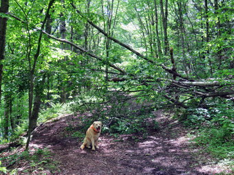
![]()
![]()
![]()
![]()
![]() On Tuesday, May 31st I wanted to get out for a quick hike after a week of track meets and ambulance calls and before any afternoon thunderstorms. I knew that there was a rather complex blowdown on the Parksville Rail Trail and thought I might go remove it as I had gotten permission from the town supervisor. I knew there was a trail cleanup on June 4th which is National Trails Day but I did not think they would be carrying axes and saws. I started to get ready ay 11:15 AM with the temperature at 70 degrees under sunny skies. Sheila's expectant gaze and sharp bark "encouraged" me to hurry up getting ready. The Parksville Rail Trail is close to my house and has a nice waterfall. The hike is less than 3 miles round trip and it is very flat. I knew that there might me a few muddy areas. I got dressed in my White Sierra light crew top. I wore my Railriders hiking pants which are expensive but last along time and have features like deep pockets and a generous cut which I really like. The pants have Velcro closures at the ankles. I decided to wear my old Vasque Taku hiking boots which are pretty beat up and will soon have to be retired. I wasn't expecting a lot of water or mud but thought the old shoes would be the best choice. I decided against taking hiking poles as I would be carrying my trail maintenance equipment. I put my Silky Sugowaza saw in my pack and brought along my Silky Katanaboy 650, Fiskars pack ax and Council Tools American felling ax. At 11:35 AM I put our gear in the car and Sheila in the back seat. I headed out Old Route 17 across the Flats and then took Old Route 17 and Service Road to the point where they meet Fox Mountain Road. Just after this intersection is the western parking area for the rail trail. The parking lot had no cars parked.
On Tuesday, May 31st I wanted to get out for a quick hike after a week of track meets and ambulance calls and before any afternoon thunderstorms. I knew that there was a rather complex blowdown on the Parksville Rail Trail and thought I might go remove it as I had gotten permission from the town supervisor. I knew there was a trail cleanup on June 4th which is National Trails Day but I did not think they would be carrying axes and saws. I started to get ready ay 11:15 AM with the temperature at 70 degrees under sunny skies. Sheila's expectant gaze and sharp bark "encouraged" me to hurry up getting ready. The Parksville Rail Trail is close to my house and has a nice waterfall. The hike is less than 3 miles round trip and it is very flat. I knew that there might me a few muddy areas. I got dressed in my White Sierra light crew top. I wore my Railriders hiking pants which are expensive but last along time and have features like deep pockets and a generous cut which I really like. The pants have Velcro closures at the ankles. I decided to wear my old Vasque Taku hiking boots which are pretty beat up and will soon have to be retired. I wasn't expecting a lot of water or mud but thought the old shoes would be the best choice. I decided against taking hiking poles as I would be carrying my trail maintenance equipment. I put my Silky Sugowaza saw in my pack and brought along my Silky Katanaboy 650, Fiskars pack ax and Council Tools American felling ax. At 11:35 AM I put our gear in the car and Sheila in the back seat. I headed out Old Route 17 across the Flats and then took Old Route 17 and Service Road to the point where they meet Fox Mountain Road. Just after this intersection is the western parking area for the rail trail. The parking lot had no cars parked.
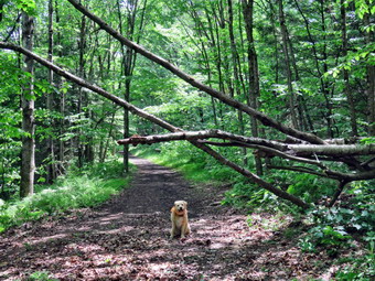 I grabbed the Katanaboy and the Fiskars pack ax and we started on the trail at 11:50 AM with the temperature right at 74 degrees. I knew that if I needed the bigger ax it would be a short trip back to the car. A slight breeze was blowing but the skies were bright and sunny and it was humid. As we entered the shade of the trees, it seemed a little cooler which was a relief. The stream volume looked lower than I had seen it in some time. Sheila was taking her own route and following her nose. A little after this we came to a point where a small stream enters the Little Beaverkill to augment its flow. Shortly, we ran across the rather large blowdown that was blocking the trail. It was 12:05 PM when I put down my pack and got out the camera to take my before pictures. Sheila came over to pose in front of the blowdown so I took some pictures of her. There was one large tree than had fallen across the fence and onto the trail from state land. This tree had taken down another medium sized trunk. There was one smaller trunk that had bent across the trail and was hung up. I knew this might be the hardest to handle. As always I used the Sugowaza to remove branches and some of the smaller trunks. I threw the pieces over the bank and far away from the trail. By 12:20 PM I had trimmed all the smaller branches and removed them from the trail. I continued to use the Sugowaza and Fiskars ax to clear the smaller trunks. I switched to the Katanaboy to cut the large birch which went quicker than I expected as it was decayed. Clearing these larger pieces was more difficult than I expected. The largest section I simply rotated and left it off the trail near the fence.
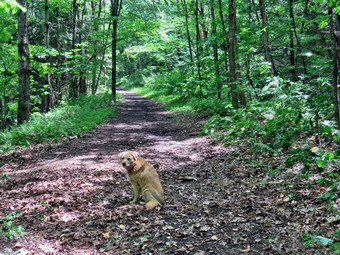 By 12:48 PM, all that was left was the small tree that was leaning across the trail. It was hung up on the other side of the trail so I started to rock it. I rock it back and forth as much as I dared but it would not come down. I used the Fiskars ax to cut the tree near the ground. As soon as the trunk was severed it hit the ground and dug in. I had gained nothing as the anchor was almost as strong as before the cut. I checked by rocking the trunk but it was still hung up and I could not pull the butt end free. I put the ax to work again and made a cut 5 or 6 feet up the trunk. This didn't seem to help much but I was determined not to let this small trunk beat me. I dragged away the piece I had cut off and then grabbed the section that was still hung up and began to rock it and pull the base along the trail. I heard some cracking and crashing and the trunk dislodged and hit the ground. I used the ax to divide this section into two and dragged one piece off to the side. The final piece was still hung up a little. I was unable to free it completely so I used the saw to make a few cuts off the trail. With the final section free, I threw the last piece off the trail. I was a little tired and pretty sweaty from the high humidity. I cleaned up the trail and then took some "after" pictures. I packed up everything and headed back to the car at 1:00 PM. We were back at the car by 1:15 PM. We had only been out for an hour but I felt we had gotten some exercise and done a service.
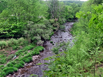
![]()
![]()
![]()
![]()
![]() On Friday, May 27th I wanted to get out for hike after a week of track meets and ambulance calls. I had a lot of other work to do so I decided to hike across the street on Round Top for the exercise. Around 11:00 AM I started to think about getting ready when my grandson Bryce walked in. This was a surprise as I did not expect him but I was very happy he was there. We said "hello" and I immediately asked him if he would like to hike the Parksville Rail Trail. Bryce said "Yes" as he likes to hike and we started to get ready with the temperature at 70 degrees under cloudy, overcast skies. Sheila's expectant gaze and sharp bark "encouraged" me to continue the hiking plans. The Parksville Rail Trail is close to my house and has a nice waterfall. The hike is less than 3 miles round trip and it is very flat. I knew that there might me a few muddy areas. I got dressed in my Mammut crew top even though I knew it might be too warm. I wore my Railriders hiking pants which are expensive but last along time and have features like deep pockets and a generous cut which I really like. The pants have Velcro closures at the ankles. I decided to wear my old Vasque Taku hiking boots which are pretty beat up and will soon have to be retired. I wasn't expecting a lot of water or mud but thought the old shoes would be the best choice. I grabbed my Leki external lock poles which I have been using lately since twist locks have proved unreliable. At 11:15 AM we put our gear in the car and Sheila in the back seat. I headed out Old Route 17 across the Flats and then took Old Route 17 and Service Road to the point where they meet Fox Mountain Road. Just after this intersection is the western parking area for the rail trail. The parking lot had no cars parked.
On Friday, May 27th I wanted to get out for hike after a week of track meets and ambulance calls. I had a lot of other work to do so I decided to hike across the street on Round Top for the exercise. Around 11:00 AM I started to think about getting ready when my grandson Bryce walked in. This was a surprise as I did not expect him but I was very happy he was there. We said "hello" and I immediately asked him if he would like to hike the Parksville Rail Trail. Bryce said "Yes" as he likes to hike and we started to get ready with the temperature at 70 degrees under cloudy, overcast skies. Sheila's expectant gaze and sharp bark "encouraged" me to continue the hiking plans. The Parksville Rail Trail is close to my house and has a nice waterfall. The hike is less than 3 miles round trip and it is very flat. I knew that there might me a few muddy areas. I got dressed in my Mammut crew top even though I knew it might be too warm. I wore my Railriders hiking pants which are expensive but last along time and have features like deep pockets and a generous cut which I really like. The pants have Velcro closures at the ankles. I decided to wear my old Vasque Taku hiking boots which are pretty beat up and will soon have to be retired. I wasn't expecting a lot of water or mud but thought the old shoes would be the best choice. I grabbed my Leki external lock poles which I have been using lately since twist locks have proved unreliable. At 11:15 AM we put our gear in the car and Sheila in the back seat. I headed out Old Route 17 across the Flats and then took Old Route 17 and Service Road to the point where they meet Fox Mountain Road. Just after this intersection is the western parking area for the rail trail. The parking lot had no cars parked.
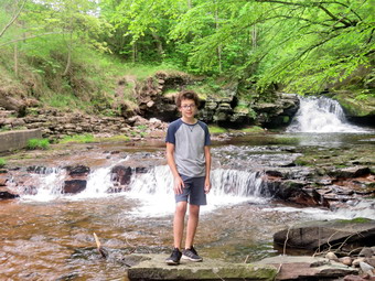 We started on the trail at 11:30 AM with the temperature right at 70 degrees. A slight breeze was blowing but the skies were overcast. As we entered the shade of the trees, it immediately seemed a little cooler which was a relief. The stream volume looked lower than I had seen it in some time. but I knew the falls would have enough water to be interesting. Sheila was taking her own route and following her nose. A little after this we came to a point where a small stream enters the Little Beaverkill to augment its flow. A little farther upstream we could see that a large tree had fallen across the main stream. I pointed out to Bryce some of the markers that delineated the O&W right-of-way. I also told him a little about the railroad and the proposed upgrade to the railtrails in Sullivan County. We ran across a rather large blowdown that was blocking the trail. I knew that I could clear it and had been given permission by the town supervisor. I did not know who was responsible for maintaining the trail and do not want to step on any toes. We were soon at the wooden walkways where I stopped, put my pack down and took out the camera. I took some shots of the stream below with the bland and overcast skies. I put away the camera and picked up my pack to continue over the walkways. The wooden surface was dry and had a coating of dried mud. The problem is that a rock slide has blocked the culvert under the small bridge causing water, mud and stones to be diverted over the walkway. Unblocking the culvert and covering the walkways with some screening would help.
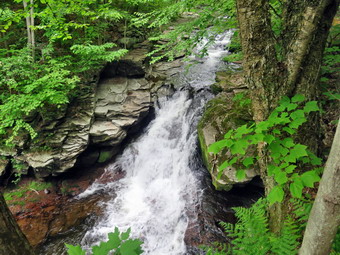 We continued on the trail and came to the falls. I wanted to get down to the streambed so that I could take pictures from in front of the falls. It was relatively easy for Bryce and I to work our way down the bank to the streambed. It was even easier for Sheila! I got out the camera and took some shots down stream and the turned my attention to the falls. I took numerous pictures of the falls and the area in front. The water was very clear and the red rock beneath the water really showed through. Sheila, of course, was right with me and decided to take a swim in the cool water. Bryce walked out in a rock and I sent Sheila to pose with him so that I could take some pictures of them. When I was done, we worked our way back up the bank. I took a few pictures of the falls from the edge of the trail where I had a good view. We continued on the trail to a bench where a path leads down to the stream. I left my pack on the table and took the camera with me to the stream's edge. I took shots upstream and downstream with some close-ups right in front of me. I repositioned myself and took some more pictures downstream toward the falls. I finished and started to walk back to the bench. I saw a man pushing a stroller coming from Parksville and asked Bryce to put Sheila on her leash. The man passed by and I walked to the bench to stow the camera. The trail was a little muddy in places but we had no trouble walking around those spots. We set a quick pace for the rest of the hike to the Parksville end of the trail. Just after the gate at that end, we stopped to read the sign which outlined the milk that the O&W transported. The sign also mentioned the large number of hotels that had been in the area. We turned around and headed back to the car. It wasn't long before we met the man with the stroller coming back. It was then that we realized that he had a German shepherd lying in the stroller. He explained that she had lost the use of her back legs but this hadn't effected her voice. We continued on the hike but I kept thinking about his dedication to his dog. We set a quick pace without stopping and without seeing any other people. We were back at the car at 12:50 PM after hiking 2.8 miles in 1 hour and 20 minutes including the stopped time for pictures. There is virtually no elevation gain on the hike except the short trips down to the streambed.
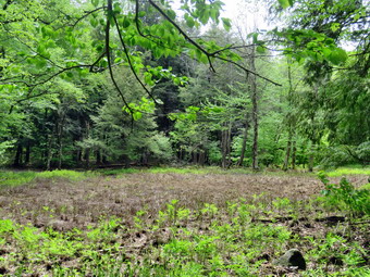
![]()
![]()
![]()
![]()
![]() On Tuesday, May 24th, I was ready to get in a hike that was NOT on Round Top near my house. I had track practice in the afternoon so I decided to stay local and hike the Loggers Loop at Frick Pond to see what might have come down in the last wind storm. I started to get ready at 10:15 AM when the temperature was 65 degrees on the back porch. I suspected it would not be much cooler at the trailhead. As I started gathering my equipment and getting dressed, Sheila was very quiet but did not let me out of her sight. I put on my Mammut long-sleeved crew top without a baselayer since the temperature was so warm. I wore my Railriders hiking pants which are expensive but last along time and have features like deep pockets and a generous cut which I really like. The pants have Velcro closures at the ankles. I decided to wear my old Vasque Taku hiking boots which are pretty beat up and will soon have to be retired. I wasn't expecting a lot of water or mud but thought the old shoes would be the best choice. I grabbed my Leki external lock poles which I have been using lately since twist locks have proved unreliable. I also put on my OR BugOut gaiters to deal with the mud and insects that I knew would be present. I got my gear and Sheila in my car and left Livingston Manor at 10:30 AM. I drove out the DeBruce Road about 6 miles to Mongaup Road and turned left to continue up the road to the point where it splits. I stayed left on Beech Mountain Road and drove to the Frick Pond trailhead. When we arrived at the parking areas, there were no cars parked in either lot. I pulled into the smaller lot and parked. The skies were bright and blue with some interesting clouds.
On Tuesday, May 24th, I was ready to get in a hike that was NOT on Round Top near my house. I had track practice in the afternoon so I decided to stay local and hike the Loggers Loop at Frick Pond to see what might have come down in the last wind storm. I started to get ready at 10:15 AM when the temperature was 65 degrees on the back porch. I suspected it would not be much cooler at the trailhead. As I started gathering my equipment and getting dressed, Sheila was very quiet but did not let me out of her sight. I put on my Mammut long-sleeved crew top without a baselayer since the temperature was so warm. I wore my Railriders hiking pants which are expensive but last along time and have features like deep pockets and a generous cut which I really like. The pants have Velcro closures at the ankles. I decided to wear my old Vasque Taku hiking boots which are pretty beat up and will soon have to be retired. I wasn't expecting a lot of water or mud but thought the old shoes would be the best choice. I grabbed my Leki external lock poles which I have been using lately since twist locks have proved unreliable. I also put on my OR BugOut gaiters to deal with the mud and insects that I knew would be present. I got my gear and Sheila in my car and left Livingston Manor at 10:30 AM. I drove out the DeBruce Road about 6 miles to Mongaup Road and turned left to continue up the road to the point where it splits. I stayed left on Beech Mountain Road and drove to the Frick Pond trailhead. When we arrived at the parking areas, there were no cars parked in either lot. I pulled into the smaller lot and parked. The skies were bright and blue with some interesting clouds.
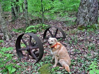 I set my GPS unit and noted that the temperature was 68 degrees with a slight breeze. We started out the woods road to the Quick Lake Trail at 10:45 AM. From the register on the trail was wet with some standing water and some flow water. I wasn't able to avoid some of the water but it was shallow and I walked through it. At Gravestone Junction, we turned right to get on the yellow Logger's Loop heading toward Times Square. The trail was damp and had more muddy spots than the Quick Lake Trail. The trail did look like hikers had been using it and bypassing some of the muddiest spots by creating walkarounds. These let the muddiest sections dry out but also widen the trail. Our crew has tried to get some of these areas to drain but it is very difficult as the trial is worn in deeper than the surrounding area. Just after we made the turn, I looked up to see some amazing clouds in the very blue sky. Many times pictures of the sky do not seem to do the scene justice but I just had to take some shots. In a few minutes we started back on the trail. Soon we were hiking downhill toward Times Square. We ran across one blowdown that I knew I could remove with hand tools so I put it on my list. We crossed a stream that parallel's the Big Rock Trail. Earlier in the year the stream had a good volume of water but now was almost dry. The source of the water is a mystery although I assume it must be from seasonal springs and runoff. At Times Square we continued straight ahead on the Logger's Loop which was wet and muddy but not as bad as I have seen it in the past. We started a slight uphill climb on the trail but the hiking was relatively easy. The trail flattened and we came to the small, seasonal pond on the right side of the trail. The pond was completely dry which surprised me as I thought it might have some water from the recent rains. I stopped to take a few shots of what was now a dry meadow and then continued our walk avoiding the water and the mud. I was thinking that I was lucky that there were no major blowdowns across the trail but that was a mistake. Shortly, we came to a tree with many branches across the trail. The tree would require tools to remove and I knew the snowmobile club would not be around until the fall. I began to plan the removal of the trees.
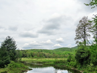 As we continued on the Logger's Loop we came to two large plastic culverts lying ion top of the ground. The DEC has started a project to replace the metal culverts and to install culverts were they were needed but did not exist. That project began at least three years ago but was not completed and the black culverts stand out like a sore thumb. I have no idea whether these have been forgotten or are on a work schedule somewhere. The rest of the Loggers Loop to Iron Wheel Junction that had several deep ponds on my last trip were almost dry. As we walked downhill and came to a culvert there was another blowdown across the trail. This one did not have many branches but the trunk had a large diameter which would make it difficult to cut. It wasn't long before we were walking downhill and climbing a small hill to Iron Wheel Junction. I took a few pictures of the wheels and some of Sheila posed by the wheels. We turned left to head back toward Frick Pond on the Quick Lake Trail. The trail is slightly downhill which allowed us to keep up a good pace even though we had to work our way around the some water and mud. When we came to the small stream in the woods, we found the water level very low compared to our last trip. Sheila decided to take a dip and I took some shots of her. I used a stepping stone to get across. Walking through the "spruce tunnel" was easier than some of the rest of the hike as there was little water and mud. There were a few blowdowns that I would have to clear including one that was solid with a large diameter. Eventually we walked out the other side where the trail was again wet and muddy. We arrived at the junction with the Big Rock Trail and turned right to stay on the Quick Lake trail and head toward the bridge at Frick Pond. The trail was mostly dry and what had been a huge mud pit was easier to cross due to the work the trail crew had completed. We continued on the Quick Lake Trail to the bridge across the outlet of Frick Pond. We crossed the bridge and stopped at the other side. I dropped my pack to get out the camera despite the fact that I have taken hundreds of pictures from this location. The skies were overcast which was not ideal for photography. I did get some pictures of a lone duck swimming on the pond. I also took shots of the pond and of Beech Mountain. I packed up and we continued up the hill and back to Gravestone Junction. This section of trail was also muddy and seemed to be getting worse on each trip. At Gravestone Junction we continued out the Quick Lake Trail and back to the car. We arrived at the car at 12:30 PM having hiked 3.7 miles in 1 hour and 45 minutes with an elevation gain of 380 feet. Our time stopped was 12 minutes. The temperature at the car had risen to 70 degrees.
![]()
![]()
![]()
![]() On Sunday, May 22nd I wanted to get out to hike after more than a week of track meets, ambulance calls and bad weather. I had planned to do a longer tike after preaching in Jeffersonville but three overnight ambulance calls made me scale back my plan and go across the street to hike on Round Top. I planned to get in a few loops for two or three miles. As I started to get ready at 12:30 PM the temperature had risen to 88 degrees with partly sunny skies. It was almost as warm as the day before so I decided to just put on a shortsleeved cotton T-shirt. I wore my Railriders hiking pants which are expensive but last along time and have features like deep pockets and a generous cut which I really like. The pants have Velcro closures at the ankles. I decided to wear my old Vasque Taku hiking boots which are pretty beat up and will soon have to be retired. I made sure I had a pair of Super Green insoles in the shoes to support my arches. I grabbed a pair of Leki external lock poles I have been using for some time. I decided to wear my wide-brimmed floppy hat for some protection from the sun. At 12:35 PM we walked out the door to start the hike. The heat and humidity were palpable. The forecast for the late afternoon included some thunderstorms so I wanted to get finished as soon as possible. I grabbed Sheila's leash from the car and we walked up the driveway. We walked out the driveway and crossed the street to walk along the street to the parking lot of the Presbyterian Church. We walked to the back of the lot and began the ascent of the steepest hill behind the church. The hill is short but gets the circulation pumping and is the steepest and longest climb on the "trail." At the top of the hill we stopped to look around. We started on the trail by turning left at the trailhead. The trailhead was dry and that continued as we entered the woods. At the first trail junction, I followed Sheila as she continued straight ahead up the hill to the lookout over town. When we reached the top of the hill, we followed the yellow trail as it turned to the right and ascended through the woods. The trail continued to be dry with only a few damp spots here and there. We followed the yellow trail when it turned right along the base of Round Top at the first junction with the blue trail. Walking was easier on the flatter ground. Sheila was running ahead and then back to me which was fine as it gives her more exercise. We continued to follow the yellow trail toward the second junction with the blue trail.
On Sunday, May 22nd I wanted to get out to hike after more than a week of track meets, ambulance calls and bad weather. I had planned to do a longer tike after preaching in Jeffersonville but three overnight ambulance calls made me scale back my plan and go across the street to hike on Round Top. I planned to get in a few loops for two or three miles. As I started to get ready at 12:30 PM the temperature had risen to 88 degrees with partly sunny skies. It was almost as warm as the day before so I decided to just put on a shortsleeved cotton T-shirt. I wore my Railriders hiking pants which are expensive but last along time and have features like deep pockets and a generous cut which I really like. The pants have Velcro closures at the ankles. I decided to wear my old Vasque Taku hiking boots which are pretty beat up and will soon have to be retired. I made sure I had a pair of Super Green insoles in the shoes to support my arches. I grabbed a pair of Leki external lock poles I have been using for some time. I decided to wear my wide-brimmed floppy hat for some protection from the sun. At 12:35 PM we walked out the door to start the hike. The heat and humidity were palpable. The forecast for the late afternoon included some thunderstorms so I wanted to get finished as soon as possible. I grabbed Sheila's leash from the car and we walked up the driveway. We walked out the driveway and crossed the street to walk along the street to the parking lot of the Presbyterian Church. We walked to the back of the lot and began the ascent of the steepest hill behind the church. The hill is short but gets the circulation pumping and is the steepest and longest climb on the "trail." At the top of the hill we stopped to look around. We started on the trail by turning left at the trailhead. The trailhead was dry and that continued as we entered the woods. At the first trail junction, I followed Sheila as she continued straight ahead up the hill to the lookout over town. When we reached the top of the hill, we followed the yellow trail as it turned to the right and ascended through the woods. The trail continued to be dry with only a few damp spots here and there. We followed the yellow trail when it turned right along the base of Round Top at the first junction with the blue trail. Walking was easier on the flatter ground. Sheila was running ahead and then back to me which was fine as it gives her more exercise. We continued to follow the yellow trail toward the second junction with the blue trail.
At the next junction with the blue trail, we turned left and started up the hill toward the summit. As we ascended, there were only a few damp spots which were somewhat slippery. We bypassed the white crossover trail and continued over the summit of Round Top. We walked across the flat summit and started down the hill bypassing the white crossover trail. We turned left on the switchback which sidehills quite a bit. At the end of the switchback, we turned left on the main blue trail and walked down to the junction with the yellow trail. At the junction with the yellow trail, we turned left and walked along the base of Round Top again following the trail. This time when we reached the junction with the yellow trail, we turned right and walked downhill carefully to the woods road. We followed the trail along woods road and back down to the first trail junction. As we walked we took a good look at the ledges that line the trail. We continued back to the first trail junction. I immediately turned around and headed back up the woods road following the yellow blazes. Sheila seemed to be a little reluctant but soon turned around and followed me. At the end of the road, we followed the yellow blazes up the hill to the junction with the blue trail. We turned left and walked the yellow trail along the base of Round Top. When we reached the next junction with the blue trail, we turned right and started up the hill toward the summit. We turned on the switchback in the blue trail and followed it out and then back to the main blue trail. I was going to again bypass the white crossover trail but Sheila insisted on following the crossover trail. The trail was in good shape with no major blowdowns. At the end of the crossover trail we turned right on the blue trail. We simply followed the blue trail downhill to the junction with the yellow trail. We turned right and again followed it along the base of Round Top. This time when we reached the junction with the blue trail, we turned left and followed the yellow trail downhill to the viewpoint over town. The view was much the same as on many trips before. We continued to follow the yellow trail as it turned left and headed downhill to the first trail junction. From there we walked straight out to the trailhead and turned right to start down the hill to the church parking lot. At the bottom of the hill we walked out to the parking lot. We walked through the parking lot to Rock Avenue. After crossing the street to our driveway, we walked back to the house. We were home by 1:45 PM after hiking around two miles in a little more than an hour.
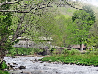
![]()
![]()
![]()
![]()
![]() On Saturday, May 14th, I wanted to get out for a hike near home that was not on Round Top. I decided to go to Beaverkill Campgrounds as I was interested to see the level of the water in the Beaverkill after the recent dry spell. There were two ambulance calls overnight so I slept a little later than usual and got up at 10:00 AM. I got some breakfast and started to get ready with the temperature at 65 degrees with some clouds in a blue sky with the sun shining. I knew that showers were forecast for the afternoon so I wanted to get going as soon as possible. As usual, Sheila was excited but was trying to be the "good dog". It was so warm and the hike is so short that I just put on a short-sleeved cotton t-shirt. I wore my Railriders hiking pants which are expensive but last along time and have features like deep pockets and a generous cut which I really like. The pants have Velcro closures at the ankles. I decided to wear my Vasque Taku hiking boots which are pretty beat up and will soon have to be retired. I grabbed my Leki external lock poles which I have been using since twist locks have proved unreliable. I put my gear in the back of the car and Sheila in the back seat. We left the house at 11:15 AM as I drove out Old Route 17 toward Roscoe and turned right on Beaverkill Road. As we started the descent into the Beaverkill Valley, I turned left on Campsite Road and followed it down to the parking area near the Beaverkill Covered Bridge. There were a few cars parked in the lot but I saw no people. A glance at the river showed that the level had dropped quite a bit since my last visit. The last time I had been here the had water covered the sandy beach and the rock I usually stand on to take pictures was underwater. Today, both of these were exposed.
On Saturday, May 14th, I wanted to get out for a hike near home that was not on Round Top. I decided to go to Beaverkill Campgrounds as I was interested to see the level of the water in the Beaverkill after the recent dry spell. There were two ambulance calls overnight so I slept a little later than usual and got up at 10:00 AM. I got some breakfast and started to get ready with the temperature at 65 degrees with some clouds in a blue sky with the sun shining. I knew that showers were forecast for the afternoon so I wanted to get going as soon as possible. As usual, Sheila was excited but was trying to be the "good dog". It was so warm and the hike is so short that I just put on a short-sleeved cotton t-shirt. I wore my Railriders hiking pants which are expensive but last along time and have features like deep pockets and a generous cut which I really like. The pants have Velcro closures at the ankles. I decided to wear my Vasque Taku hiking boots which are pretty beat up and will soon have to be retired. I grabbed my Leki external lock poles which I have been using since twist locks have proved unreliable. I put my gear in the back of the car and Sheila in the back seat. We left the house at 11:15 AM as I drove out Old Route 17 toward Roscoe and turned right on Beaverkill Road. As we started the descent into the Beaverkill Valley, I turned left on Campsite Road and followed it down to the parking area near the Beaverkill Covered Bridge. There were a few cars parked in the lot but I saw no people. A glance at the river showed that the level had dropped quite a bit since my last visit. The last time I had been here the had water covered the sandy beach and the rock I usually stand on to take pictures was underwater. Today, both of these were exposed.
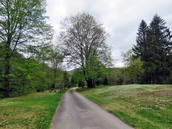 We started out at 11:35 AM by walking out of the parking lot to the bridge with the temperature at 70 degrees. Clouds had now started to close in forming an almost complete overcast. When we got to the other side, I was surprised to see that the gate just off the road was fully open! I looked at the trail and saw that it was very dry. We turned left on a woods road that parallels the river and started down a short hill. We passed the spring house and continued on the deserted woods road where I could detect no recent footprints. We came to an area with a little path down to the river. Just passed this area the trail had been eroding due to the water running down the bank. The DEC had replaced a culvert pipe and installed a second. They had also brought in fill and packed it to reconstruct the path. I found this interesting as the campsites along this path are no longer used and are abandoned. I walked down to the edge of the river very carefully as the rocks were slippery and the water looked deep and cold. I took some pictures downstream and some upstream to the bridge. There were several places where trees at the edge of the river had fallen into the water testifying to the power of the river when it is high. When I was done, we got back on the trail and passed several areas with unused picnic tables. They sit unused and rotting along the road, a testimony to better days. We walked by these tables which had not been used in many years. A little later we came to what was once a bathroom for some campsites that had long since disappeared. There were more tables in this area. There was a path over to the river so I walked over and found the water was sparkling in the sun and was very clear. I took some pictures of the sun reflecting off the water both upstream and downstream. In several areas the DEC had placed large rocks along the shore and covered them with heavy wire to reduce erosion. At about .7 miles the woods road met the paved road that serves the campsites. We continued on the road through the campsites and along the river. Many of the campsites had a cement block fireplace with a grill but some were upgraded to poured concrete. Everything was very quiet except for the water in the river. This was not surprising as the campsites are closed until Memorial Day. It was obvious that some crews had been working to clear downed trees and those that had deteriorated. The trees had been sectioned and piled and they lined the road. I took some pictures of the empty campsites and the campsite road as well as the piles of wood. The skies continued to cloud over and block the sun.
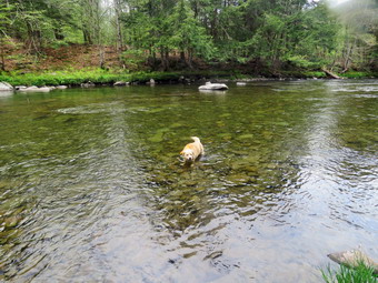 We walked to the last campsite where the trail ends and I walked down to the edge of the river. I was careful to watch where I was walking as I did not want to slip into the cold water. I stopped to take some pictures of the river especially downstream. Sheila decided to take a dip in the cold water and I took some shots of her. I encouraged her to get out but she stayed in for a while. We continued a little further passed the last campsite and walked a path along the river. The water was very clear with a slight greenish tint from looking through to the bottom. As we walked back passed the last campsite, we stayed to the left of the last bathroom to walk back on the other paved road through the campsites. This road parallels the one we walked out on to make a sort of loop. We returned the way we had come although at a quicker pace. We still had not seen any people on the trails and very few cars had passed by on the roads. As we approached the bridge, I saw that there was a large group of people on the beach by the bridge and more cars parked in the lot. I had thought about taking some pictures of the bridge but gave up that idea. We walked through the bridge and turned right to go back to the car. We were back at the car at 12:30 PM having hiked 2.7 miles in 1 hour and 15 minutes. The car's thermometer read 74 degrees and the sun had come back out making it feel even warmer.
![]()
![]()
![]()
![]() On Friday, May 13th I planned to go for my first hike in a week. When track season ramps up my time becomes even more limited. Coupled with an increasing number of ambulance calls further limits hiking. In addition, I had been sick since turning from a Saturday tack meet where the weather was not ideal. I took it easy for three days and returned to practice on Thursday. Doing this seemed to allow me to recover more quickly than usual. I slept late as we had another overnight call. After doing some work around the house, I decided to go across the street with Sheila to hike on Round Top. I am lucky that I have a place so close to hike but it has become very familiar. I have found that even a short hike helps to keep my blood pressure in check and I am hoping I can get my weight down also. As I started to get ready just before 1:00 PM, the temperature was 72 degrees but overcast without much direct sun. The forecast was for afternoon showers and a few drops had already fallen. Sheila was ready to go as she really likes to hike and we had not been out for some time. She was very vocal about hurrying me along. It was warm enough that I decided to just put on a short-sleeved NYNJTC cotton shirt. I wore my Railriders hiking pants which are expensive but last along time and have features like deep pockets and a generous cut which I really like. The pants have Velcro closures at the ankles. I decided to wear my old Vasque Taku hiking boots which are pretty beat up and will soon have to be retired. I made sure I had a pair of Super Green insoles in the shoes to support my arches. I grabbed a pair of Leki external lock poles I have been using for some time. At 1:15 PM we walked out the door to start the hike. I grabbed Sheila's leash from the car and we walked up the driveway. I thought we could hike two figure 8's which I knew from experience should take a little over and hour. We walked out the driveway and crossed the street to walk along the street to the parking lot of the Presbyterian Church. We stopped to talk a friend who had just finished cutting the grass at the church and then continued on our hike.
On Friday, May 13th I planned to go for my first hike in a week. When track season ramps up my time becomes even more limited. Coupled with an increasing number of ambulance calls further limits hiking. In addition, I had been sick since turning from a Saturday tack meet where the weather was not ideal. I took it easy for three days and returned to practice on Thursday. Doing this seemed to allow me to recover more quickly than usual. I slept late as we had another overnight call. After doing some work around the house, I decided to go across the street with Sheila to hike on Round Top. I am lucky that I have a place so close to hike but it has become very familiar. I have found that even a short hike helps to keep my blood pressure in check and I am hoping I can get my weight down also. As I started to get ready just before 1:00 PM, the temperature was 72 degrees but overcast without much direct sun. The forecast was for afternoon showers and a few drops had already fallen. Sheila was ready to go as she really likes to hike and we had not been out for some time. She was very vocal about hurrying me along. It was warm enough that I decided to just put on a short-sleeved NYNJTC cotton shirt. I wore my Railriders hiking pants which are expensive but last along time and have features like deep pockets and a generous cut which I really like. The pants have Velcro closures at the ankles. I decided to wear my old Vasque Taku hiking boots which are pretty beat up and will soon have to be retired. I made sure I had a pair of Super Green insoles in the shoes to support my arches. I grabbed a pair of Leki external lock poles I have been using for some time. At 1:15 PM we walked out the door to start the hike. I grabbed Sheila's leash from the car and we walked up the driveway. I thought we could hike two figure 8's which I knew from experience should take a little over and hour. We walked out the driveway and crossed the street to walk along the street to the parking lot of the Presbyterian Church. We stopped to talk a friend who had just finished cutting the grass at the church and then continued on our hike.
We began the ascent of the steepest hill behind the church and continued directly up the hill to the trailhead. The hill is short but gets the circulation pumping and is the steepest and longest climb on the "trail." My goal was to make it all the way up the hill without stopping. I was surprised that I made it as being sick had compromised y breathing! At the top of the hill we stopped to look around but there wasn't much to see that I hadn't seen before. We turned left and entered the woods to begin our hike. The trailhead was very dry and that continued as we entered the woods. I was not surprised that the trails were so completely dry. I had heard several calls for brush fires lately in Sullivan County despite a burn ban. Just before the first trail junction there was a small tree that had broken off. It had been hanging into the trail but someone had bent it back off the trail and secured it being another tree. I made a note to bring a saw to remove it completely. I followed Sheila as she turned right and started up the woods road which has the gentler approach of the two. There was a slight breeze which cooled us off and Sheila was panting while I was feeling a little dry. We reached the end of the woods road and turned left up the hill on the trail. We continued up the trail to the first trail junction with the upper blue trail and turned left to follow the yellow trail along the base of Round Top. The yellow trail was dry in this area also and largely clear of branches. At the next junction with the blue trail, we turned right and headed up the blue trail toward the summit. When we got to the switchback, we turned right and followed it until it came back to the main blue trail. We turned right and then continued straight ahead and up the hill toward the summit of Round Top bypassing the white crossover trail. We continued over the summit and down the blue trail toward the junction with the yellow trail. Everything was very dry. We continued down to the yellow trail and turned right and walked the yellow trail along the base of Round Top to the next junction with the blue trail. This time we turned left and walked the yellow trail downhill toward the lookout. We passed the "sitting rock" and were soon at the viewpoint. A quick peek at the view showed nothing new but I did notice that the skies were now blue with white clouds. We turned left to start the steeper downhill. The trip down to the first trail junction went quickly. We turned around and started back up the hill toward the lookout to start our second figure 8.
The trip back up the hill to the lookout was pretty easy which, again, surprised me because of my recent downtime. At the top of the hill we turned right to follow the yellow trail to the first junction with the blue trail. We turned right to followed the yellow trail around the base of Round Top. At the next junction with the blue trail, we turned left and headed up toward the summit. When we got to the white crossover trail, we continued on the blue trail as I wanted to get the full length of the hike. We hiked the last short section to the summit and then followed the blue trail down the other side. We bypassed the white crossover trail but turned left on the switchback in the blue trail. We followed the switchback until it again rejoined the main blue trail. We turned left and headed down the main blue trail. We walked downhill to the trail junction with the yellow trail. We turned left and again followed the yellow trail along the base of Round Top to the junction with the blue trail. This time we turned right and headed down the yellow trail to the woods road that leads to the first trail junction. As we walked down the road, we passed by many interesting ledges to the right of the trail. At the first trail junction, we turned left and walked out to the trailhead. We turned right and walked down the hill to the church parking lot. We crossed the parking lot and Rock Avenue to get to our driveway. It was 2:25 PM and we had hiked just over 2 miles in a little over an hour.
![]()
![]()
![]()
![]() On Friday, May 6th I wanted to get out for a longer hike as I did not have track practice in the afternoon. That plan was interrupted by an ambulance call that took a good part of the morning. I did get home by 11:00 AM but decided to stay close to home as I was not feeling well. I decided to take Sheila to hike the Parksville Rail Trail. I am looking forward to the time when the county can get some of these pieces of rail trails connected to form a longer trail. I started getting ready at 11:15 AM. It was 58 degrees and the skies were blue with some white clouds. Sheila's expectant gaze and sharp bark "encouraged" me to continue the hiking plans. I decided I would not bother with my pack which I only take to carry my camera. I had many recent pictures and thought it would be nice to just set a fast walking pace. The hike is less than 3 miles round trip and it is very flat. I suspected that the trail might be a little wet and muddy. I got dressed in my Mammut crew top but knew I would not need a baselayer. I wore my Railriders hiking pants which are expensive but last along time and have features like deep pockets and a generous cut which I really like. The pants have Velcro closures at the ankles. I decided to wear my old Vasque Taku hiking boots which are pretty beat up and will soon have to be retired. I wasn't expecting a lot of water or mud but thought the old shoes would be the best choice. I grabbed my Leki external lock poles which I have been using lately since twist locks have proved unreliable. I knew I would not need a jacket even though there was a slight breeze. At 11:35 AM I put my gear in the car and Sheila in the back seat. I headed out Old Route 17 across the Flats and then took Old Route 17 and Service Road to the point where they meet Fox Mountain Road. Just after this intersection is the western parking area for the rail trail. The parking lot had no cars parked.
On Friday, May 6th I wanted to get out for a longer hike as I did not have track practice in the afternoon. That plan was interrupted by an ambulance call that took a good part of the morning. I did get home by 11:00 AM but decided to stay close to home as I was not feeling well. I decided to take Sheila to hike the Parksville Rail Trail. I am looking forward to the time when the county can get some of these pieces of rail trails connected to form a longer trail. I started getting ready at 11:15 AM. It was 58 degrees and the skies were blue with some white clouds. Sheila's expectant gaze and sharp bark "encouraged" me to continue the hiking plans. I decided I would not bother with my pack which I only take to carry my camera. I had many recent pictures and thought it would be nice to just set a fast walking pace. The hike is less than 3 miles round trip and it is very flat. I suspected that the trail might be a little wet and muddy. I got dressed in my Mammut crew top but knew I would not need a baselayer. I wore my Railriders hiking pants which are expensive but last along time and have features like deep pockets and a generous cut which I really like. The pants have Velcro closures at the ankles. I decided to wear my old Vasque Taku hiking boots which are pretty beat up and will soon have to be retired. I wasn't expecting a lot of water or mud but thought the old shoes would be the best choice. I grabbed my Leki external lock poles which I have been using lately since twist locks have proved unreliable. I knew I would not need a jacket even though there was a slight breeze. At 11:35 AM I put my gear in the car and Sheila in the back seat. I headed out Old Route 17 across the Flats and then took Old Route 17 and Service Road to the point where they meet Fox Mountain Road. Just after this intersection is the western parking area for the rail trail. The parking lot had no cars parked.
I set my GPS unit and we started on the trail at 11:50 AM with the temperature right at 60 degrees. The breeze that was blowing which made me feel cool but I knew I would warm up as we hiked. As we entered the shade of the trees, it immediately seemed a little cooler. The stream volume looked high but not as high as during the last visit. I knew the falls would have enough water to be interesting. Sheila was taking her own route and following her nose. We came to the point where a small stream enters the Little Beaverkill to augment its flow which happens several times along the trail. I found some of the markers that delineated the O&W right-of-way along the left side of the trail. We were soon at the wooden walkways where there is a nice view of the stream. The wooden surface of the walkways was dry but it was clear there had been a coating of mud. The problem is that a rock slide has blocked the culvert under the small bridge causing water, mud and stones to be diverted over the walkway. Unblocking the culvert and covering the walkways with some screening would help. We continued on the trail and came to the falls. I normally go down to the streambed to take pictures but on this day I walked to the picnic table to get some views from above. I walked to the edge of the trail where I had a good view. We continued on the trail to a bench where a path leads down to the stream. I walked down to the stream's edge to get a better look and the returned to the main rail. The trail had been damp and a little muddy in places but we had managed to walk around these areas. We set a quick pace for the rest of the hike to the Parksville end of the trail. Just after the gate at that end, we stopped to read the sign which outlined the milk that the O&W transported. The sign also mentioned the large number of hotels that had been in the area. We turned around and headed back to the car without stopping and without seeing any other people. We were back at the car at 12:15 PM after hiking 2.8 miles in 1 hour and 15 minutes. There is virtually no elevation gain on the hike.
![]()
![]()
![]()
![]() On Wednesday, May 4th I had planned to get up early and get away from Livingston Manor for a hike. I thought about going to Frick Pond or Trout Pond or even Alder Lake. All these plans were cancelled by some overnight ambulance calls and one in the early morning. I had to get some sleep and finally got up at 10:00 AM. I had a track meet in the afternoon if it was no cancelled as the forecast rain moved in. I decided once again that my only choice was to head across the street to hike on Round Top. I think that I could now do this hike blindfolded but I am still lucky that I have a place so close to hike. I have found that even a short hike helps to keep my blood pressure in check and I am hoping I can get my weight down also. As I started to get ready the temperature was 60 degrees but overcast without much sun. Sheila was ready to go as she really likes to hike and she was very vocal about hurrying me along. It was warm enough that I decided to just put on my Mammut longsleeved crew top. I wore my Railriders hiking pants which are expensive but last along time and have features like deep pockets and a generous cut which I really like. The pants have Velcro closures at the ankles. I decided to wear my old Vasque Taku hiking boots which are pretty beat up and will soon have to be retired. I made sure I had a pair of Super Green insoles in the shoes to support my arches. I grabbed a pair of Leki external lock poles I have been using for some time. I did not see any need for any jacket because it was so warm. I also knew I would not need a hat or gloves. At 10:45 AM we walked out the door to start the hike. I grabbed Sheila's leash from the car and we walked up the driveway. I thought we could hike two figure 8's which I knew from experience should take a little over and hour. We walked out the driveway and crossed the street to walk along the street to the parking lot of the Presbyterian Church.
On Wednesday, May 4th I had planned to get up early and get away from Livingston Manor for a hike. I thought about going to Frick Pond or Trout Pond or even Alder Lake. All these plans were cancelled by some overnight ambulance calls and one in the early morning. I had to get some sleep and finally got up at 10:00 AM. I had a track meet in the afternoon if it was no cancelled as the forecast rain moved in. I decided once again that my only choice was to head across the street to hike on Round Top. I think that I could now do this hike blindfolded but I am still lucky that I have a place so close to hike. I have found that even a short hike helps to keep my blood pressure in check and I am hoping I can get my weight down also. As I started to get ready the temperature was 60 degrees but overcast without much sun. Sheila was ready to go as she really likes to hike and she was very vocal about hurrying me along. It was warm enough that I decided to just put on my Mammut longsleeved crew top. I wore my Railriders hiking pants which are expensive but last along time and have features like deep pockets and a generous cut which I really like. The pants have Velcro closures at the ankles. I decided to wear my old Vasque Taku hiking boots which are pretty beat up and will soon have to be retired. I made sure I had a pair of Super Green insoles in the shoes to support my arches. I grabbed a pair of Leki external lock poles I have been using for some time. I did not see any need for any jacket because it was so warm. I also knew I would not need a hat or gloves. At 10:45 AM we walked out the door to start the hike. I grabbed Sheila's leash from the car and we walked up the driveway. I thought we could hike two figure 8's which I knew from experience should take a little over and hour. We walked out the driveway and crossed the street to walk along the street to the parking lot of the Presbyterian Church.
We began the ascent of the steepest hill behind the church and continued directly up the hill to the trailhead. The hill is short but gets the circulation pumping and is the steepest and longest climb on the "trail." At the top of the hill we stopped to look around but there wasn't much to see with the overcast. We turned left and entered the woods to begin our hike. The trailhead was very dry and that continued as we entered the woods. I was a little surprised that the trails were so completely dry. I understood why I had heard so many calls for brush fires in Sullivan County. Just before the first trail junction there was a small tree that had broken off. It had been hanging into the trail but someone had bent it back off the trail and secured it being another tree. I made a note to bring a saw to remove it completely. I followed Sheila as she turned right and started up the woods road which has the gentler approach of the two. There was no breeze and Sheila was panting while I was feeling a little dry. We reached the end of the woods road and turned left up the hill on the trail. We continued up the trail to the first trail junction with the upper blue trail and turned left to follow the yellow trail along the base of Round Top. The yellow trail was dry in this area also and largely clear of branches. At the next junction with the blue trail we turned right and headed up the blue trail toward the summit. When we got to the switchback, we turned right and followed it until it came back to the main blue trail. We turned right and then continued straight ahead and up the hill toward the summit of Round Top bypassing the white crossover trail. We continued over the summit and down the blue trail toward the junction with the yellow trail. There were a few damp spots on the summit but everything else was dry. We continued down to the yellow trail and turned right and walked the yellow trail along the base of Round Top to the next junction with the blue trail. This time we turned left and walked the yellow trail downhill toward the lookout. We passed the "sitting rock" and were soon at the viewpoint. A quick peek at the view showed nothing new so we turned left to start the steeper downhill. The trip down to the first trail junction went quickly. We turned around and started back up the hill toward the lookout to start our second figure 8.
The trip back up the hill to the lookout was pretty easy and I seemed to have gotten a second wind. At the top of the hill we turned right to follow the yellow trail to the first junction with the blue trail. We turned right to followed the yellow trail around the base of Round Top. At the next junction with the blue trail, we turned left and headed up toward the summit. When we got to the white crossover trail we continued on the blue trail as I wanted to get the full length of the hike. We hiked the last short section to the summit and then followed the blue trail down the other side. We bypassed the white crossover trail but turned left on the switchback in the blue trail. We followed the switchback until it again rejoined the main blue trail. We turned left and headed down the main blue trail. We walked downhill to the trail junction with the yellow trail. We turned left and again followed the yellow trail along the base of Round Top to the junction with the blue trail. This time we turned right and headed down the yellow trail to the woods road that leads to the first trail junction. As we walked down the road, we passed by many interesting ledges to the right of the trail. At the first trail junction, we turned left and walked out to the trailhead. We turned right and walked down the hill to the church parking lot. Our quiet hike was interrupted by a small, noisy dog which kept its distance. We crossed the parking lot and Rock Avenue to get to our driveway. It was 11:55 AM and we had hiked just over 2 miles in a little over an hour.
![]()
![]()
![]()
![]() On Monday, May 2nd I wanted to make up for the day before. On Sunday, I ha planned to come home from church and take Cindy and Sheila out for a real hike. As we were getting ready to hike, the ambulance pager sounded and I responded. When I returned around 3:00 PM there was still enough daylight get in a hike so we again got ready and again there was an ambiance call. By the time I returned home there was not enough time to get out for a walk. Now I wanted to get out for even a short walk before track practice as the weather was sunny and warm as it had been the day before. Whenever I have a limited amount of time to hike, I head across the street to hike on the trails I created on Round Top. I can do a few loops to get in two or three miles and waste no time on driving to a trailhead. I asked Cindy if she wanted to go and she agreed which pleased Sheila who likes to hike with both of us. As I started to get ready at 12:00 PM the temperature had risen to 60 degrees with partly sunny skies. It was almost as warm as the day before so I decided to just put on a longsleeved cotton T-shirt. I wore my Railriders hiking pants which are expensive but last along time and have features like deep pockets and a generous cut which I really like. The pants have Velcro closures at the ankles. I decided to wear my old Vasque Taku hiking boots which are pretty beat up and will soon have to be retired. I made sure I had a pair of Super Green insoles in the shoes to support my arches. I grabbed a pair of Leki external lock poles I have been using for some time. I did not see any need for any jacket because it was so warm. I also knew I would not need a hat or gloves. At 12:15 PM we walked out the door to start the hike. I grabbed Sheila's leash from the car and we walked up the driveway. We walked out the driveway and crossed the street to walk along the street to the parking lot of the Presbyterian Church. We walked to the back of the lot and began the ascent of the steepest hill behind the church. The hill is short but gets the circulation pumping and is the steepest and longest climb on the "trail." At the top of the hill we stopped to look around. We started on the trail by turning left at the trailhead. The trailhead was dry and that continued as we entered the woods. At the first trail junction, we followed Sheila as she continued straight ahead up the hill to the lookout over town. When we reached the top of the hill, we followed the yellow trail as it turned to the right and ascended through the woods. The trail continued to be dry with only a few damp spots here and there. We followed the yellow trail when it turned right along the base of Round Top at the first junction with the blue trail. Walking was easier on the flatter ground and allowed us to catch our breath. Sheila was running ahead and then back to us which was fine with me. We continued to follow the yellow trail toward the second junction with the blue trail. I was enjoying talking to Cindy in the beauty around us.
On Monday, May 2nd I wanted to make up for the day before. On Sunday, I ha planned to come home from church and take Cindy and Sheila out for a real hike. As we were getting ready to hike, the ambulance pager sounded and I responded. When I returned around 3:00 PM there was still enough daylight get in a hike so we again got ready and again there was an ambiance call. By the time I returned home there was not enough time to get out for a walk. Now I wanted to get out for even a short walk before track practice as the weather was sunny and warm as it had been the day before. Whenever I have a limited amount of time to hike, I head across the street to hike on the trails I created on Round Top. I can do a few loops to get in two or three miles and waste no time on driving to a trailhead. I asked Cindy if she wanted to go and she agreed which pleased Sheila who likes to hike with both of us. As I started to get ready at 12:00 PM the temperature had risen to 60 degrees with partly sunny skies. It was almost as warm as the day before so I decided to just put on a longsleeved cotton T-shirt. I wore my Railriders hiking pants which are expensive but last along time and have features like deep pockets and a generous cut which I really like. The pants have Velcro closures at the ankles. I decided to wear my old Vasque Taku hiking boots which are pretty beat up and will soon have to be retired. I made sure I had a pair of Super Green insoles in the shoes to support my arches. I grabbed a pair of Leki external lock poles I have been using for some time. I did not see any need for any jacket because it was so warm. I also knew I would not need a hat or gloves. At 12:15 PM we walked out the door to start the hike. I grabbed Sheila's leash from the car and we walked up the driveway. We walked out the driveway and crossed the street to walk along the street to the parking lot of the Presbyterian Church. We walked to the back of the lot and began the ascent of the steepest hill behind the church. The hill is short but gets the circulation pumping and is the steepest and longest climb on the "trail." At the top of the hill we stopped to look around. We started on the trail by turning left at the trailhead. The trailhead was dry and that continued as we entered the woods. At the first trail junction, we followed Sheila as she continued straight ahead up the hill to the lookout over town. When we reached the top of the hill, we followed the yellow trail as it turned to the right and ascended through the woods. The trail continued to be dry with only a few damp spots here and there. We followed the yellow trail when it turned right along the base of Round Top at the first junction with the blue trail. Walking was easier on the flatter ground and allowed us to catch our breath. Sheila was running ahead and then back to us which was fine with me. We continued to follow the yellow trail toward the second junction with the blue trail. I was enjoying talking to Cindy in the beauty around us.
At the next junction with the blue trail, we turned left and started up the hill toward the summit. As we ascended, there were only a few damp spots which were somewhat slippery. We bypassed the white crossover trail and continued over the summit of Round Top. We walked across the flat summit and started down the hill bypassing the white crossover trail. We turned left on the switchback which sidehills quite a bit. At the end of the switchback, we turned left on the main blue trail and walked down to the junction with the yellow trail. At the junction with the yellow trail, we turned left and walked along the base of Round Top again following the trail. This time when we reached the junction with the yellow trail, we turned right and walked downhill carefully to the woods road. We followed the trail along woods road and back down to the first trail junction. As we walked we took a good look at the ledges that line the trail. We continued back to the first trail junction. We immediately turned around and headed back up the woods road following the yellow blazes. At the end of the road, we followed the yellow blazes up the hill to the junction with the blue trail. We turned left and walked the yellow trail along the base of Round Top. When we reached the next junction with the blue trail, we turned right and started up the hill toward the summit. We turned on the switchback in the blue trail and followed it out and then back to the main blue trail. We again bypassed the white crossover trail and continued on the blue trail over the summit and back down the other side. We simply followed the blue trail downhill to the junction with the yellow trail. We turned right and again followed it along the base of Round Top. This time when we reached the junction with the blue trail, we turned left and followed the yellow trail downhill to the viewpoint over town. The view was much the same as on many trips before. We continued to follow the yellow trail as it turned left and headed downhill to the first trail junction. From there we walked straight out to the trailhead and turned right to start down the hill to the church parking lot. At the bottom of the hill we walked out to the parking lot. We walked through the parking lot to Rock Avenue. After crossing the street to our driveway, we walked back to the house. We were home by 1:40 PM after hiking around two miles in a little more than an hour. The rain had just started Our track meet was cancelled.
![]()
![]()
![]()
![]() On Friday, April 29th I wanted to get out for a hike, even a short hike, after several days of track meets and ambulance calls. I waited until 11:00 AM when Cindy returned home and asked her if she wanted to go across the street on Round Top. She said she would like to go and we started to get ready. Round Top is a short set of trails but it does not require us to drive and is very handy for a quick walk. Sheila was making it clear she wanted to go outside and was thrilled that Cindy was going with us! I have found that even a short hike helps to keep my blood pressure in check and I am hoping I can get my weight down also. As I started to get ready the temperature was 62 degrees with plenty of sun. Sheila was ready to go as she really likes to hike and she was very vocal about hurrying me along. It was so warm I decided to just put on a longsleeved cotton T-shirt. I wore my Railriders hiking pants which are expensive but last along time and have features like deep pockets and a generous cut which I really like. The pants have Velcro closures at the ankles. I decided to wear my old Vasque Taku hiking boots which are pretty beat up and will soon have to be retired. I made sure I had a pair of Super Green insoles in the shoes to support my arches. I grabbed a pair of Leki external lock poles I have been using for some time. I did not see any need for any jacket because it was so warm. I also knew I would not need a hat or gloves. At 11:45 AM we walked out the door to start the hike. I grabbed Sheila's leash from the car and we walked up the driveway. I though we could hike two figure 8's which I knew from experience should take a little over and hour. We walked out the driveway and crossed the street to walk along the street to the parking lot of the Presbyterian Church.
On Friday, April 29th I wanted to get out for a hike, even a short hike, after several days of track meets and ambulance calls. I waited until 11:00 AM when Cindy returned home and asked her if she wanted to go across the street on Round Top. She said she would like to go and we started to get ready. Round Top is a short set of trails but it does not require us to drive and is very handy for a quick walk. Sheila was making it clear she wanted to go outside and was thrilled that Cindy was going with us! I have found that even a short hike helps to keep my blood pressure in check and I am hoping I can get my weight down also. As I started to get ready the temperature was 62 degrees with plenty of sun. Sheila was ready to go as she really likes to hike and she was very vocal about hurrying me along. It was so warm I decided to just put on a longsleeved cotton T-shirt. I wore my Railriders hiking pants which are expensive but last along time and have features like deep pockets and a generous cut which I really like. The pants have Velcro closures at the ankles. I decided to wear my old Vasque Taku hiking boots which are pretty beat up and will soon have to be retired. I made sure I had a pair of Super Green insoles in the shoes to support my arches. I grabbed a pair of Leki external lock poles I have been using for some time. I did not see any need for any jacket because it was so warm. I also knew I would not need a hat or gloves. At 11:45 AM we walked out the door to start the hike. I grabbed Sheila's leash from the car and we walked up the driveway. I though we could hike two figure 8's which I knew from experience should take a little over and hour. We walked out the driveway and crossed the street to walk along the street to the parking lot of the Presbyterian Church.
We began the ascent of the steepest hill behind the church and stopped once or twice as we were setting a fast pace. The hill is short but gets the circulation pumping and is the steepest and longest climb on the "trail." At the top of the hill we stopped to look around and then entered the woods to begin our hike. The trailhead was dry and that continued as we entered the woods. I was a little surprised that the trails were completely dry. Just before the first trail junction there was a small tree that had broken off and was hanging across the trail. I made a note to bring a saw to remove it. We followed Sheila as she turned right and started up the woods road which has the gentler approach of the two which I thought Cindy would appreciate. There was no breeze and Sheila was panting while I was feeling a little dry. We reached the end of the woods road and turned left up the hill on the trail. We continued up the trail to the first trail junction with the upper blue trail and turned left to follow the yellow trail along the base of Round Top. The yellow trail was dry in this area also and largely clear of branches. At the next junction with the blue trail we turned right and headed up the blue trail toward the summit. When we got to the switchback, we turned right and followed it until it came back to the main blue trail. We turned right and then continued straight ahead and up the hill toward the summit of Round Top bypassing the white crossover trail. We continued over the summit and down the blue trail toward the junction with the yellow trail. There were a few damp spots on the summit but everything else was dry. We continued down to the yellow trail and turned right and walked the yellow trail along the base of Round Top to the next junction with the blue trail. This time we turned left and walked the yellow trail downhill toward the lookout. We passed the "sitting rock" and were soon at the viewpoint. A quick peek at the view showed nothing new so we turned left to start the steeper downhill. We passed by what used to be a side trail to the lookout that I blocked with brush. This side trail has a gap that hikers have to walk over and it can be dangerous for some people. Unfortunately, some 'helpful' person had removed the brush without asking or knowing why it was there. The trip down to the first trail junction went quickly. Although Cindy was reluctant, we turned around and started back up the hill toward the lookout to start our second figure 8.
The trip back up the hill to the lookout was pretty easy and I seemed to have gotten a second wind. At the top of the hill we turned right to follow the yellow trail to the first junction with the blue trail. We turned right to followed the yellow trail around the base of Round Top. At the next junction with the blue trail, we turned left and headed up toward the summit. When we got to the white crossover trail we turned let and followed that trail across the slope below the summit to the main blue trail. We turned left and then left again on the switchback in the blur trail. We turned left and head down the main blue trail. We walked downhill to the trail junction with the yellow trail. We turned left and again followed the yellow trail along the base of Round Top to the junction with the blue trail. This time we turned right and headed down the yellow trail to the woods road that leads to the first trail junction. As we walked down the road, we noticed all the interesting ledges to the right of the trail. At the first trail junction, we turned left and walked out to the trailhead. We turned right and walked down the hill to the church parking lot and over to the driveway to the house. It was 1:10 PM and we had hiked around 2 miles in a little over an hour. I was happy that Cindy had come with us.
![]()
![]()
![]()
![]() On Monday, April 25th I wanted to get in a hike before track practice as the weather was again sunny and warm as it had been the day before. Whenever I have a limited amount of time to hike, I head across the street to hike on the trails I created on Round Top. I can do a few loops to get in two or three miles and waste no time on driving to a trailhead. As I started to get ready at 12:15 PM the temperature had risen to 60 degrees with partly sunny skies. It was almost as warm as the day before so I decided to just put on a longsleeved cotton T-shirt. I wore my Railriders hiking pants which are expensive but last along time and have features like deep pockets and a generous cut which I really like. The pants have Velcro closures at the ankles. I decided to wear my old Vasque Taku hiking boots which are pretty beat up and will soon have to be retired. I made sure I had a pair of Super Green insoles in the shoes to support my arches. I grabbed a pair of Leki external lock poles I have been using for some time. I did not see any need for any jacket because it was so warm. I also knew I would not need a hat or gloves. At 12:30 PM we walked out the door to start the hike. I grabbed Sheila's leash from the car and we walked up the driveway. We walked out the driveway and crossed the street to walk along the street to the parking lot of the Presbyterian Church. We walked to the back of the lot and began the ascent of the steepest hill behind the church. The hill is short but gets the circulation pumping and is the steepest and longest climb on the "trail." At the top of the hill we stopped to look around. We started on the trail by turning left at the trailhead. The trailhead was dry and that continued as we entered the woods. At the first trail junction, I followed Sheila as she continued straight ahead up the hill to the lookout over town. We passed the path to the left that goes out to the lookout and I saw that most of the brush I had placed to block the trail had been removed by some "helpful" people. The path has a gap that could trip up some hikers and I have tried to indicate it is not a trail be removing the blazes and blocking it with brush. When we reached the top of the hill, we followed the yellow trail as it turned to the right and ascended through the woods. The trail continued to be dry with only a few damp spots here and there. We followed the yellow trail when it turned right along the base of Round Top at the first junction with the blue trail. Walking was much easier on the flatter ground and allowed us to catch our breath. Sheila was running ahead and then back to us which was fine with me. We continued to follow the yellow trail toward the second junction with the blue trail. I was enjoying the beauty around me and was getting lost in my own thoughts.
On Monday, April 25th I wanted to get in a hike before track practice as the weather was again sunny and warm as it had been the day before. Whenever I have a limited amount of time to hike, I head across the street to hike on the trails I created on Round Top. I can do a few loops to get in two or three miles and waste no time on driving to a trailhead. As I started to get ready at 12:15 PM the temperature had risen to 60 degrees with partly sunny skies. It was almost as warm as the day before so I decided to just put on a longsleeved cotton T-shirt. I wore my Railriders hiking pants which are expensive but last along time and have features like deep pockets and a generous cut which I really like. The pants have Velcro closures at the ankles. I decided to wear my old Vasque Taku hiking boots which are pretty beat up and will soon have to be retired. I made sure I had a pair of Super Green insoles in the shoes to support my arches. I grabbed a pair of Leki external lock poles I have been using for some time. I did not see any need for any jacket because it was so warm. I also knew I would not need a hat or gloves. At 12:30 PM we walked out the door to start the hike. I grabbed Sheila's leash from the car and we walked up the driveway. We walked out the driveway and crossed the street to walk along the street to the parking lot of the Presbyterian Church. We walked to the back of the lot and began the ascent of the steepest hill behind the church. The hill is short but gets the circulation pumping and is the steepest and longest climb on the "trail." At the top of the hill we stopped to look around. We started on the trail by turning left at the trailhead. The trailhead was dry and that continued as we entered the woods. At the first trail junction, I followed Sheila as she continued straight ahead up the hill to the lookout over town. We passed the path to the left that goes out to the lookout and I saw that most of the brush I had placed to block the trail had been removed by some "helpful" people. The path has a gap that could trip up some hikers and I have tried to indicate it is not a trail be removing the blazes and blocking it with brush. When we reached the top of the hill, we followed the yellow trail as it turned to the right and ascended through the woods. The trail continued to be dry with only a few damp spots here and there. We followed the yellow trail when it turned right along the base of Round Top at the first junction with the blue trail. Walking was much easier on the flatter ground and allowed us to catch our breath. Sheila was running ahead and then back to us which was fine with me. We continued to follow the yellow trail toward the second junction with the blue trail. I was enjoying the beauty around me and was getting lost in my own thoughts.
At the next junction with the blue trail, we turned left and started up the hill toward the summit. As we ascended, there were only a few damp spots which were somewhat slippery. We bypassed the white crossover trail and continued over the summit of Round Top. We walked across the flat summit and started down the hill bypassing the white crossover trail. We turned left on the switchback which sidehills quite a bit. At the end of the switchback, we turned left on the main blue trail and walked down to the junction with the yellow trail. At the junction with the yellow trail, we turned left and walked along the base of Round Top again following the trail. This time when we reached the junction with the yellow trail, we turned right and walked downhill carefully to the woods road. We followed the trail along woods road and back down to the first trail junction. As we walked we took a good look at the ledges that line the trail. Our ambulance corps is scheduled to participate in a low angle rope rescue drill with our fire department and the local forest ranger. I had pointed out to the ranger that many people hike these trails even though the are right in town and there could be a need to rescue someone who was injured. We continued back to the first trail unction. We immediately turned around and headed back up the woods road following the yellow blazes. At the end of the road, we followed the yellow blazes up the hill to the junction with the blue trail. We turned left and walked the yellow trail along the base of Round Top. When we reached the next junction with the blue trail, we turned right and started up the hill toward the summit. We turned on the switchback in the blue trail and followed it out and then back to the main blue trail. We again bypassed the white crossover trail and continued on the blue trail over the summit and back down the other side. We simply followed the blue trail downhill to the junction with the yellow trail. We turned right and again followed it along the base of Round Top. This time when we reached the junction with the blue trail, we turned left and followed the yellow trail downhill to the viewpoint over town. We continued to follow the yellow trail as it turned left and headed downhill to the first trail junction. From there we walked straight out to the trailhead and turned right to start down the hill to the church parking lot. At the bottom of the hill we walked out to the parking lot. We walked through the parking lot to Rock Avenue. After crossing the street to our driveway, we walked back to the house. We were home by 1:40 PM after hiking almost two miles in a little more than an hour.
![]()
![]()
![]()
![]() On Sunday, April 24th I returned home from preaching at a local church intending to stay in and get some work done in the afternoon. I was tired from attending our first track invitational in Sidney on Saturday. I ate lunch and got a few things done. I probably would have stayed inside but the weather was beautiful and Sheila was making it clear she wanted to go outside! I have found that even a short hike helps to keep my blood pressure in check so I decided to go across the street to hike on Round Top with Sheila. As I started to get ready at 3:00 PM the temperature was 65 degrees with plenty of sun. Sheila was ready to go as she really likes to hike and she was very vocal about hurrying me along. It was so warm I decided to just put on a longsleeved cotton T-shirt. I wore my Railriders hiking pants which are expensive but last along time and have features like deep pockets and a generous cut which I really like. The pants have Velcro closures at the ankles. I decided to wear my old Vasque Taku hiking boots which are pretty beat up and will soon have to be retired. I made sure I had a pair of Super Green insoles in the shoes to support my arches. I grabbed a pair of Leki external lock poles I have been using for some time. I did not see any need for any jacket because it was so warm. I also knew I would not need a hat or gloves. At 3:15 PM we walked out the door to start the hike. I grabbed Sheila's leash from the car and we walked up the driveway. I aimed to hike two figure 8's which I knew from experience should take a little over and hour. We walked out the driveway and crossed the street to walk along the street to the parking lot of the Presbyterian Church.
On Sunday, April 24th I returned home from preaching at a local church intending to stay in and get some work done in the afternoon. I was tired from attending our first track invitational in Sidney on Saturday. I ate lunch and got a few things done. I probably would have stayed inside but the weather was beautiful and Sheila was making it clear she wanted to go outside! I have found that even a short hike helps to keep my blood pressure in check so I decided to go across the street to hike on Round Top with Sheila. As I started to get ready at 3:00 PM the temperature was 65 degrees with plenty of sun. Sheila was ready to go as she really likes to hike and she was very vocal about hurrying me along. It was so warm I decided to just put on a longsleeved cotton T-shirt. I wore my Railriders hiking pants which are expensive but last along time and have features like deep pockets and a generous cut which I really like. The pants have Velcro closures at the ankles. I decided to wear my old Vasque Taku hiking boots which are pretty beat up and will soon have to be retired. I made sure I had a pair of Super Green insoles in the shoes to support my arches. I grabbed a pair of Leki external lock poles I have been using for some time. I did not see any need for any jacket because it was so warm. I also knew I would not need a hat or gloves. At 3:15 PM we walked out the door to start the hike. I grabbed Sheila's leash from the car and we walked up the driveway. I aimed to hike two figure 8's which I knew from experience should take a little over and hour. We walked out the driveway and crossed the street to walk along the street to the parking lot of the Presbyterian Church.
We began the ascent of the steepest hill behind the church and stopped once or twice as we were setting a fast pace. The hill is short but gets the circulation pumping and is the steepest and longest climb on the "trail." At the top of the hill we stopped to look around and then entered the woods to begin our hike. The trailhead was dry and that continued as we entered the woods. I was a little surprised that the trails were completely dry. At the first trail junction, I followed Sheila as she turned right and started up the woods road which has the gentler approach of the two. There were a few branches on the trail from the winds that had passed through the area. I removed these branches either by dragging them off the trail or by using my poles on the smaller ones. There was no breeze and Sheila was panting while I was feeling a little dry. We reached the end of the woods road and turned left up the hill on the trail. We continued up the trail to the first trail junction with the upper blue trail and turned left to follow the yellow trail along the base of Round Top. The yellow trail was dry in this area also and the branches that had been laden with snow the week before had sprung back into place. At the next junction with the blue trail we turned right and headed up the blue trail toward the summit. When we got to the switchback, we turned right and followed it until it came back to the main blue trail. The fact that the switchback sidehills in places made the walk a little more difficult. We turned right and then continued straight ahead and up the hill toward the summit of Round Top bypassing the white crossover trail. We continued over the summit and down the blue trail toward the junction with the yellow trail. There were a few damp spots on the summit but everything else was dry. We continued down to the yellow trail and turned right and walked the yellow trail along the base of Round Top to the next junction with the blue trail. This time we turned left and walked the yellow trail downhill toward the lookout. We passed the "sitting rock" and were soon at the viewpoint. I took a quick peek at a view I had seen many times before and then turned left to start the steeper downhill. We passed by what used to be a side trail to the lookout that I blocked with brush. This side trail has a gap that hikers have to walk over and it can be dangerous for some people. Unfortunately, some 'helpful' person had removed the brush without asking or knowing why it was there. The trip down to the first trail junction went quickly. We turned around and started back up the hill toward the lookout to start our second figure 8.
The trip back up the hill to the lookout was pretty easy and I seemed to have gotten a second wind. At the top of the hill we turned right to follow the yellow trail to the first junction with the blue trail. We turned right to followed the yellow trail around the base of Round Top. At the next junction with the blue trail, we turned left and headed up toward the summit. When we got to the white crossover trail we continued on the blue trail toward the summit. I wanted to do two complete figure 8's rather than cut off some distance on the crossover trail. We continued up and over the summit and started down the other side. By this time Sheila and I were both thirsty. As we descended the other side of the hill, we again bypassed the white trail but turned left on the switchback in the blue trail. Walking downhill on the switchback was a little tricky as it sidehills in several places. At the end of the switchback we turned left and walked downhill to the trail junction with the yellow trail. We turned left and again followed the yellow trail along the base of Round Top to the junction with the blue trail. This time we turned right and headed down the yellow trail to the woods road that leads to the first trail junction. As we walked down the road, I noticed all the interesting ledges to the right of the trail. At the first trail junction, we turned left and walked out to the trailhead. We turned right and walked down the hill to the church parking lot and over to the driveway to the house. It was 4:20 PM and we had hiked a little over 2 miles in a little over an hour. I was happy that Cindy was home after attending a church women's retreat at Spruce Lake in Pennsylvania.
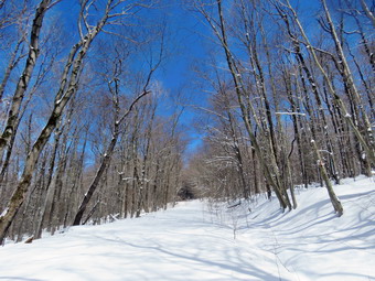
![]()
![]()
![]()
![]()
![]() On Wednesday, April 20th, I wanted to get out and hike to a higher elevation to see how much snow I could find. My grandson Bryce was at the house and was agreeable to hike. Bryce is 10 years old and can easily keep up with me on any hike! Rather than travel too far we decided to go to Frick Pond and hike the Flynn Trail where I knew there would be snow. This would give us some choices of how far we wanted to hike. I had some things to do around the house and at the ambulance building so we did not start getting ready until 11:00 AM when the temperature on the back porch was 38 degrees. I decided to dress a little warmly with layers as I did not know how much warmer it would be at the trailhead. While we began to get ready, Sheila was always nearby making it very clear that she wanted to go. I got dressed in my Mammut crew neck top with a long-sleeved thermal baselayer. I decided to wear my Columbia Titanium insulated pants to keep the chill away but knew I would not need tights underneath. I wore my Salomon B52 winter boots which are supportive, surprisingly roomy and discontinued. I had recently put a pair of Protalus insoles in these shoes and was anxious to see how they performed. The insoles in most hiking boots are a flimsy and flat piece of material. I grabbed my Leki external lock poles which I have been using since twist locks have proved unreliable. I also donned my Mammut hoody which was enough zippers to dump heat when needed. I put on a fleecy orange hat for warmth and wore a light pair of gloves. I made sure to pack a pair of warm mittens. I also put on my OR Crocodile gaiters to deal with the snow and to keep my lower legs warm. I decided not to take snowshoes as I knew the melting snow would ball up on the bottoms and that any postholes would soon be gone. I made sure my Hillsound Trail Crampons were in my pack just in case I decided I needed them. We left Livingston Manor at 11:15 AM and I drove out the DeBruce Road about 6 miles to Mongaup Road. I turned left and drove up the road until we came to a Town of Rockland road crew clearing trees that had fallen across the road. I considered turning around to hike somewhere else but decided to wait. The crews cleared a path in less than 5 minutes and we continued on our way to the point where the road splits. I stayed left on Beech Mountain Road and drove to the parking areas on the left. I pulled into the smaller parking area which was partly plowed but where no cars were parked. The larger lot remained unplowed. I checked the trails and found at most 3 inches. No one else had been hiking and the snow was pristine. I decided to bareboot it but carry my Hillsound Trail Crampons in my pack. I set my GPS as we got ready to head out on the Flynn Trail with the temperature at 37 degrees. We crossed the road and began our hike at 11:30 AM.
On Wednesday, April 20th, I wanted to get out and hike to a higher elevation to see how much snow I could find. My grandson Bryce was at the house and was agreeable to hike. Bryce is 10 years old and can easily keep up with me on any hike! Rather than travel too far we decided to go to Frick Pond and hike the Flynn Trail where I knew there would be snow. This would give us some choices of how far we wanted to hike. I had some things to do around the house and at the ambulance building so we did not start getting ready until 11:00 AM when the temperature on the back porch was 38 degrees. I decided to dress a little warmly with layers as I did not know how much warmer it would be at the trailhead. While we began to get ready, Sheila was always nearby making it very clear that she wanted to go. I got dressed in my Mammut crew neck top with a long-sleeved thermal baselayer. I decided to wear my Columbia Titanium insulated pants to keep the chill away but knew I would not need tights underneath. I wore my Salomon B52 winter boots which are supportive, surprisingly roomy and discontinued. I had recently put a pair of Protalus insoles in these shoes and was anxious to see how they performed. The insoles in most hiking boots are a flimsy and flat piece of material. I grabbed my Leki external lock poles which I have been using since twist locks have proved unreliable. I also donned my Mammut hoody which was enough zippers to dump heat when needed. I put on a fleecy orange hat for warmth and wore a light pair of gloves. I made sure to pack a pair of warm mittens. I also put on my OR Crocodile gaiters to deal with the snow and to keep my lower legs warm. I decided not to take snowshoes as I knew the melting snow would ball up on the bottoms and that any postholes would soon be gone. I made sure my Hillsound Trail Crampons were in my pack just in case I decided I needed them. We left Livingston Manor at 11:15 AM and I drove out the DeBruce Road about 6 miles to Mongaup Road. I turned left and drove up the road until we came to a Town of Rockland road crew clearing trees that had fallen across the road. I considered turning around to hike somewhere else but decided to wait. The crews cleared a path in less than 5 minutes and we continued on our way to the point where the road splits. I stayed left on Beech Mountain Road and drove to the parking areas on the left. I pulled into the smaller parking area which was partly plowed but where no cars were parked. The larger lot remained unplowed. I checked the trails and found at most 3 inches. No one else had been hiking and the snow was pristine. I decided to bareboot it but carry my Hillsound Trail Crampons in my pack. I set my GPS as we got ready to head out on the Flynn Trail with the temperature at 37 degrees. We crossed the road and began our hike at 11:30 AM.
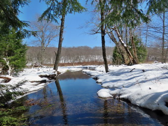 The Flynn Trail is sited along what used to be Beech Mountain Road which was the access for the Beech Mountain Boy Scout Camp. We walked the trail through the woods which was covered in 2 to 3 inches of slushy snow. I immediately noticed that every step that I took was a plant and a slip which I knew would create fatigue the further we hiked. We turned right on the woods road and set a good pace up the hill despite the slippery snow. The trail gains a little over 600 feet in 1.7 miles to the highest point at the junction with the Big Rock Trail. The day was cool but the sun was out and the temperature was rising. I began to get warm so we stopped so that I could open the zippers on the hoody. As long as we were stopped, I took a few pictures of the trail in both directions showing off the pristine, white snow. I could hear branches cracking in the woods from the weight of the heavy snow. I pointed out to Bryce some of the blowdowns Cindy and I had cleared several of which were impressive. I began to feel a hotspot on the back of my right heel and hoped it would not be a problem. As we approached and passed the clearing to the right of the trail, the snow was noticeably deeper and we started to sink a few inches into the snow. The depth was now 6 to 8 inches. Snow had drifted across the track in some areas increasing the depth of the snow. We kept walking uphill and we were soon at the junction with the Big Rock Trail. I expected the snow would be deep here and it was. We were now walking through 10 to 12 inches of snow! It was 1:15 PM and we had covered the 1.7 miles in an hour and 45 minutes. This was more than twice the time it usually takes me. I considered trying to hike to the lookout on Beech Mountain but decided against it. We turned left to walk down the Big Rock Trail. As I expected, the trail had lots of snow but the depth decreased as we descended. I was a little surprised there were no snowmobile tracks. The hike down the trail went well and Bryce and I both remarked that we were able to get a controlled glide. It was definitely easier than the uphill hike. The hike went quickly since we were setting a fast pace. I did stop to take a few more pictures. This trail can be tricky as there are several levels that make it seem like the bottom of the hill. The large blowdowns that had been on the trail were now gone and I assumed the snowmobile club had taken care of them.
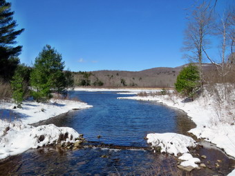 We were soon at Times Square and I thought about turning right to hike up and around the Logger's Loop to add some distance to our hike. I decided against this and we continued our hike by walking straight across Times Square to stay on the Big Rock Trail. The trail was completely covered in several inches of snow but we found areas of deep mud underneath. We crossed the two small bridges over the inlets to the pond and this time I stopped to take pictures. The sun was out now and gave a warm feeling to the setting. When we got to the area that was covered by tall evergreens, I took some pictures even though the light was poor. The wooden boardwalks were covered in snow but were not as slippery as they looked. I took some shots and then we crossed the bridges quickly. I pointed out another larger blowdown Cindy and I had cleared. At the next trail junction we turned left on the Quick Lake Trail to head for the bridge across the outlet of Frick Pond. I looked to the right and saw that no one had hiked the Quick Lake Trail. We walked along the west side of Frick Pond to the bridge across the outlet of the pond. I stopped at the bridge for a minute and took a few more photographs. I took a couple of Bryce and Sheila on the bridge before we walked up the hill toward Gravestone Junction. We continued to Gravestone Junction and passed the Lobdell memorial marker. The marker is a memorial to two children who died in the 1930's in a fire that consumed their cabin. The trail to the register was almost completely covered in snow but there were a few places where small stream persisted in running across the trail. Just short of Te trail register there were footprints coming from the parking lot. There seemed to be quite a few people but the prints abruptly stopped indicating the people had turned around! At the trail register I checked to see if they had signed in and a party of 8 was signed in with a notation that they had stayed 2 hours. My first thought was that they must be very slow hikers. I assumed that they had not planned properly and were not equipped to handle the conditions. We continued straight ahead to follow the woods road out to the car in the small lot. We arrived at the car at 2:55 PM having hiked 4.2 miles in 3 hours and 25 minutes with an elevation gain of 690 feet. The temperature had risen to 42 degrees and the snow was starting to melt.
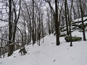
![]()
![]()
![]()
![]()
![]() On Tuesday, April 19th I wanted to get out to hike in the snow that had fallen overnight. It seemed we had only gotten an accumulation of 3 or 4 inches in town as a lot of the precipitation had fallen as rain. I wanted to bet to a higher elevation and see what had fallen there. I shoveled my walks and the ambulance building and then stayed on call for any ambulance calls. We only had one vehicle that ran off the road and the driver was not injured. I finally decided to go across the street to Round Top at around 2:00 PM. As I was getting ready to go it began to snow again but the temperature was 37 degrees. Sheila was behaving herself nicely but was always in a position to keep her eye on me. I got dressed in my Patagonia wool 1/4 zip top but decided against a baselayer as the wool is very warm. I decided to wear my Columbia Titanium insulated pants as it was cool even though I had been using my Railriders recently. I knew that keeping my feet warm and dry would be an issue so I got out my Salomon B-52 which are insulated and as waterproof as anything I have. I made sure I had a pair of Portalus insoles in the shoes to support my arches. I grabbed a pair of Leki external lock poles I have been using all season. Finally, I donned my Mammut hoody which blocks the wind and keeps me warm but has enough zippers to dump heat when needed. I put on a fleecy orange hat and wore a pair of light gloves. I add my OR Crocodile gaiters to keep my lower legs warm and dry. I decided to carry my pack as it is the easiest way to take my camera with me. I decided I did not need snowshoes but had still had spikes in my pack. At 2:30 PM we walked out the door to start the hike. I grabbed Sheila's leash from the car and we walked up the driveway. We walked out the driveway and crossed the street to walk through the field to the parking lot of the Presbyterian Church. Much of the snow had already melted on the roads and even the snow on the grass was mostly slush.
On Tuesday, April 19th I wanted to get out to hike in the snow that had fallen overnight. It seemed we had only gotten an accumulation of 3 or 4 inches in town as a lot of the precipitation had fallen as rain. I wanted to bet to a higher elevation and see what had fallen there. I shoveled my walks and the ambulance building and then stayed on call for any ambulance calls. We only had one vehicle that ran off the road and the driver was not injured. I finally decided to go across the street to Round Top at around 2:00 PM. As I was getting ready to go it began to snow again but the temperature was 37 degrees. Sheila was behaving herself nicely but was always in a position to keep her eye on me. I got dressed in my Patagonia wool 1/4 zip top but decided against a baselayer as the wool is very warm. I decided to wear my Columbia Titanium insulated pants as it was cool even though I had been using my Railriders recently. I knew that keeping my feet warm and dry would be an issue so I got out my Salomon B-52 which are insulated and as waterproof as anything I have. I made sure I had a pair of Portalus insoles in the shoes to support my arches. I grabbed a pair of Leki external lock poles I have been using all season. Finally, I donned my Mammut hoody which blocks the wind and keeps me warm but has enough zippers to dump heat when needed. I put on a fleecy orange hat and wore a pair of light gloves. I add my OR Crocodile gaiters to keep my lower legs warm and dry. I decided to carry my pack as it is the easiest way to take my camera with me. I decided I did not need snowshoes but had still had spikes in my pack. At 2:30 PM we walked out the door to start the hike. I grabbed Sheila's leash from the car and we walked up the driveway. We walked out the driveway and crossed the street to walk through the field to the parking lot of the Presbyterian Church. Much of the snow had already melted on the roads and even the snow on the grass was mostly slush.
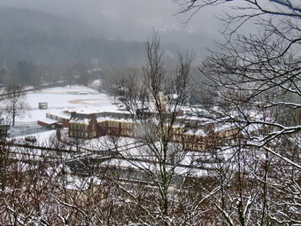 We began the ascent of the steepest hill behind the church and stopped once or twice as we were setting a fast pace. The hill is short but gets the circulation pumping and is the steepest and longest climb on the "trail." The trail up the hill was covered with snow but no one had been out walking or sledding! At the top of the hill we stopped to look around. Although it was overcast and snow was falling, I got out my camera to take some pictures. I took shots of the trees with snow on the branches and some more of the hills around town. We started on the trail by turning left at the trailhead. The trailhead was covered in snow and that continued even as we entered the woods. There were still only a few inches of snow on the trail but it was slippery! At the first trail junction, I followed Sheila as she continued straight ahead up the hill to the lookout over town. The ascent wasn't too hard but we were getting hit with some of the snow and ice coming off the trees. We turned left on the path that goes out to the lookout. I had placed brush to block the path but had been removed by some "helpful" people. The path has a gap that could trip up some hikers and I have tried to indicate it is not a trail by removing the blazes and blocking it with brush. At the viewpoint I put down my pack and got out the camera. The conditions were not great for photography but I took some pictures anyway. I asked Sheila to go up to the lookout above so that I could take a few shots of her. When I was done I worked my way to the upper level and we followed the yellow trail as it turned to the right and ascended through the woods. The trail continued to be covered in snow and there was more snow as we continued the walk. The deeper snow was probably due to the increasing elevation and the fact that we were on the north and west sides of the hill. We followed the yellow trail when it turned right along the base of Round Top at the first junction with the blue trail. I stopped and took more shots of the snow which had formed a heavy coating on the branches. The bushes lining the yellow trail were leaning over and blocking the trail. I was able to "clear" a path by knocking the snow off them causing them to spring up an off the trail. Walking was much easier on the flatter ground and allowed me to catch my breath. Sheila was running ahead and then back to me which was fine with me. We continued to follow the yellow trail toward the second junction with the blue trail. At the next junction with the blue trail, we turned left and started up the hill toward the summit. As we ascended, there was more and more snow which made walking a little more difficult.
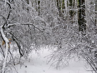 We turned left on the white crossover trail and followed it back to the blue trail on the other side of the hill. We turned left on the blue trail and then almost immediately left on the switchback which sidehills quite a bit. The slippery layer of snow made this section a little difficult to walk. At the end of the switchback, we turned left on the main blue trail and walked down to the junction with the yellow trail. At the junction with the yellow trail, we turned left and walked along the base of Round Top again following the trail. This time when we reached the junction with the yellow trail, we turned right and walked downhill carefully to the woods road. We followed the trail along woods road and back down to the first trail junction. As we walked we took a good look at the ledges that line the trail. Our ambulance corps is scheduled to participate in a low angle rope rescue drill with our fire department and the local forest ranger. I had pointed out to the ranger that many people hike these trails even though the are right in town and there could be a need to rescue someone who was injured. We continued back to the first trail junction. At this point I was ready for another figure 8 so we turned around and walked back up the woods road to the junction with the blue trail. We turned left to stay on the yellow trail and walked to the next junction with the blue trail. This time we turned right and started up the steep hill. We turned right on the switchback in the blue trail and followed it until it rejoined the main blue trail. We turned right and almost immediately right again on the white crossover trail. We followed that trail across the side of the hill to the blue trail and turned right. At the junction with the yellow trail at the bottom of the hill, we turned right and again walked along the base of the hill. When the yellow trail turned left, we followed it downhill to the lookout. After turning left, we continued down the steep hill to the first trail junction. This time we continued straight ahead out to the trailhead. We turned right to start down the hill to the church parking lot trying not to slip on the snow. At the bottom of the hill we walked through the parking lot to Rock Avenue. The roads were bare but we were careful crossing as drivers sometimes exceed the speed limit. After crossing the street to our driveway, we walked back to the house. We were home by 3:45 PM after hiking a little less than 2 miles in an hour an 15 minutes.
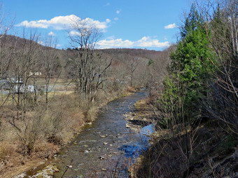
![]()
![]()
![]()
![]()
![]() On Friday, April 15th I wanted to get out for hike with my son-in-law Brad. It would be our third outing in a row and we had worked hard the day before on some trail maintenance. We had a couple of ambulance calls in the morning and did not start getting ready until 1:15 PM. It was 56 degrees and the skies were blue with some mice white clouds. Sheila's expectant gaze and sharp bark "encouraged" me to continue the hiking plans. I decided we would go hike the Parksville Rail Trail as it was close and has a nice waterfall. The hike is less than 3 miles round trip and it is very flat. I knew that there would be no snow or ice but suspected that the recent rainstorms may have made the trail wet and muddy. I got dressed in my Mammut crew top but knew I would not need a baselayer. I wore my Railriders hiking pants which are expensive but last along time and have features like deep pockets and a generous cut which I really like. The pants have Velcro closures at the ankles. I decided to wear my old Vasque Taku hiking boots which are pretty beat up and will soon have to be retired. I wasn't expecting a lot of water or mud but thought the old shoes would be the best choice. I grabbed my Leki external lock poles which I have been using lately since twist locks have proved unreliable. Finally, I donned my Mammut hoody which blocks the wind and keeps me warm but has enough zippers to dump heat when needed. I suspected that I might not need the jacket but there was a slight breeze. I put on a light hat and brought a pair of light gloves. At 1:35 AM we put our gear in the car and Sheila in the back seat. I headed out Old Route 17 across the Flats and then took Old Route 17 and Service Road to the point where they meet Fox Mountain Road. Just after this intersection is the western parking area for the rail trail. The parking lot had no cars parked.
On Friday, April 15th I wanted to get out for hike with my son-in-law Brad. It would be our third outing in a row and we had worked hard the day before on some trail maintenance. We had a couple of ambulance calls in the morning and did not start getting ready until 1:15 PM. It was 56 degrees and the skies were blue with some mice white clouds. Sheila's expectant gaze and sharp bark "encouraged" me to continue the hiking plans. I decided we would go hike the Parksville Rail Trail as it was close and has a nice waterfall. The hike is less than 3 miles round trip and it is very flat. I knew that there would be no snow or ice but suspected that the recent rainstorms may have made the trail wet and muddy. I got dressed in my Mammut crew top but knew I would not need a baselayer. I wore my Railriders hiking pants which are expensive but last along time and have features like deep pockets and a generous cut which I really like. The pants have Velcro closures at the ankles. I decided to wear my old Vasque Taku hiking boots which are pretty beat up and will soon have to be retired. I wasn't expecting a lot of water or mud but thought the old shoes would be the best choice. I grabbed my Leki external lock poles which I have been using lately since twist locks have proved unreliable. Finally, I donned my Mammut hoody which blocks the wind and keeps me warm but has enough zippers to dump heat when needed. I suspected that I might not need the jacket but there was a slight breeze. I put on a light hat and brought a pair of light gloves. At 1:35 AM we put our gear in the car and Sheila in the back seat. I headed out Old Route 17 across the Flats and then took Old Route 17 and Service Road to the point where they meet Fox Mountain Road. Just after this intersection is the western parking area for the rail trail. The parking lot had no cars parked.
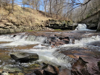 I set my GPS unit and we started on the trail at 1:50 PM with the temperature right at 58 degrees. The breeze that was blowing convinced me to keep on my hoody. As we entered the shade of the trees, it immediately seemed a little cooler. The stream volume looked high but not as high as during the last visit. I knew the falls would have enough water to be interesting. Sheila was taking her own route and following her nose. Just after entering the woods we came to a small tree that had broken off and was leaning across the trail. This blowdown was there on my last trip but I had hoped someone would have removed it! Brad and I were able to push it out of the way and Brad lifted it over the fence and out of the way. A little after this we came to a point where a small stream enters the Little Beaverkill to augment its flow. I was able to get a good angle and some good light to snap a few shots. I pointed out some of the markers that delineated the O&W right-of-way. I also told him a little about the railroad and the proposed upgrade to the railtrails in Sullivan County. We were soon at the wooden walkways where I stopped, put my pack down and took out the camera. I took some shots of the stream below with nice blue skies and white clouds. I put away the camera and picked up my pack to continue over the walkways. The wooden surface was wet and had a coating of mud. This made a slippery layer but it was better than during my previous visit. The problem is that a rock slide has blocked the culvert under the small bridge causing water, mud and stones to be diverted over the walkway. Unblocking the culvert and covering the walkways with some screening would help. Brad and I looked at this area for some time and came to the conclusion it might take a small backhoe to clean it out!
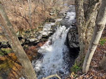 We continued on the trail and came to the falls. I wanted to get down to the streambed so that I could take pictures from in front of the falls. It was relatively easy to work my way down the bank to the streambed. I got out the camera and took some shots down stream and the turned my attention to the falls. I took numerous pictures of the falls and the area in front. The water was very clear and the red rock beneath the water really showed through. Sheila, of course, was right with me and making me nervous by getting very close to the cold, rushing water. When I was done, we worked our way back up the bank. I took a few pictures of the falls from the edge of the trail where I had a good view. We continued on the trail to a bench where a path leads down to the stream. I left my pack on the bridge and took the camera with me to the stream's edge. I took shots upstream and downstream with some close-ups right in front of me. I repositioned myself and took some more pictures downstream toward the falls. I finished and walked back to the bench to stow the camera. The trail had been wet and a little muddy in places but we had managed to walk around them. From the falls to the other end of the trail there were several very wet areas and a lot of mud. We set a quick pace for the rest of the hike to the Parksville end of the trail. Just after the gate at that end, we stopped to read the sign which outlined the milk that the O&W transported. The sign also mentioned the large number of hotels that had been in the area. We turned around and headed back to the car without stopping and without seeing any other people. We were back at the car at 3:15 PM after hiking 2.8 miles in 1 hour and 25 minutes including the stopped time for pictures. There is virtually no elevation gain on the hike except the short trips down to the streambed.
![]()
![]()
![]()
![]() On Thursday, April 14th I wanted to go to the Long Pond area to look for some blowdowns on the Long Pond Beaverkill Ridge Trail off Flugertown Road. Some hikers had reported some blowdowns on the first section starting at the junction with the Mongaup Willowemoc Trail. My son-in-law Brad was visiting and I knew he would want to go along. Brad and I have worked together many times before and he really gets the job done. At 10:15 AM we started to get ready with the temperature at 70 degrees! Sheila was watching quietly but making sure that we did not leave without her. I put on my Mammut long-sleeved crew top but decided against a baselayer since the temperature was warm and getting warmer. I wore my Railriders hiking pants which are expensive but last along time and have features like deep pockets and a generous cut which I really like. The pants have Velcro closures at the ankles. I decided to wear my old Vasque Taku hiking boots which are pretty beat up and will soon have to be retired. I wasn't expecting a lot of water or mud but thought the old shoes would be the best choice. I grabbed my Leki external lock poles which I have been using lately since twist locks have proved unreliable. I usually leave them home when I do maintenance but Brad was available to carry some tools. I decided not to take a jacket, hat or gloves as the weather was so warm. I was aware that severe thunderstorms were predicted for the afternoon so we would have a limited amount of time to get some work done. I did take my Silky Sugowaza saw, Fiskars pack axe, and two felling wedges. We put all the gear in the car and put Sheila in the backseat and started out the DeBruce Road at 10:40 AM. I drove 11 miles to Flugertown Road and turned left. I drove another 2 miles up Flugertown Road passing onto the seasonally maintained road. I drove across the first bridge and parked in a spot on the right side of the road. I set my GPS unit and we began our hike at 11:00 AM by walking back down Flugertown Road to the point where the trail crosses the road.
On Thursday, April 14th I wanted to go to the Long Pond area to look for some blowdowns on the Long Pond Beaverkill Ridge Trail off Flugertown Road. Some hikers had reported some blowdowns on the first section starting at the junction with the Mongaup Willowemoc Trail. My son-in-law Brad was visiting and I knew he would want to go along. Brad and I have worked together many times before and he really gets the job done. At 10:15 AM we started to get ready with the temperature at 70 degrees! Sheila was watching quietly but making sure that we did not leave without her. I put on my Mammut long-sleeved crew top but decided against a baselayer since the temperature was warm and getting warmer. I wore my Railriders hiking pants which are expensive but last along time and have features like deep pockets and a generous cut which I really like. The pants have Velcro closures at the ankles. I decided to wear my old Vasque Taku hiking boots which are pretty beat up and will soon have to be retired. I wasn't expecting a lot of water or mud but thought the old shoes would be the best choice. I grabbed my Leki external lock poles which I have been using lately since twist locks have proved unreliable. I usually leave them home when I do maintenance but Brad was available to carry some tools. I decided not to take a jacket, hat or gloves as the weather was so warm. I was aware that severe thunderstorms were predicted for the afternoon so we would have a limited amount of time to get some work done. I did take my Silky Sugowaza saw, Fiskars pack axe, and two felling wedges. We put all the gear in the car and put Sheila in the backseat and started out the DeBruce Road at 10:40 AM. I drove 11 miles to Flugertown Road and turned left. I drove another 2 miles up Flugertown Road passing onto the seasonally maintained road. I drove across the first bridge and parked in a spot on the right side of the road. I set my GPS unit and we began our hike at 11:00 AM by walking back down Flugertown Road to the point where the trail crosses the road.
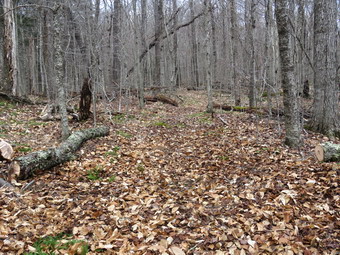 The first .4 miles of the trail are maintained by the snowmobile club and this section of trail was in good shape with only a few branches and one trunk in sections to remove. This short section of trail is an ascent with a 13% grade and I was feeling it! At .4 miles we turned right onto the Long Pond Beaverkill Ridge Trail and began to inspect the trail. The trail was in pretty good shape and we removed a few branches here and there. The trail has been cleared several times to the point where it begins to climb the ridge. Beyond that point there is some clearing and marking to do! The DEC has decided that maintainers cannot put up trail markers any more but they do not get around to marking many trails. We came to one rather large trunk flat on the round and decided to bypass it as it was easy to step over. A little farther up the trail was a much large and older tree across the trail. Fortunately, it was easy enough to get over as it was a little larger than I wanted to cut with hand tools. At 11:30 AM we came to a small mess on the trail. I took some shots before we started. We spent about 10 minutes cleaning up the trail and made only a few cuts to get it cleared. I took my after shots and we continued our hike. At 11:45 we came to another small area to clear. This one took just over 5 minutes including some before and after pictures. We walked on and at 11:50 AM found another slightly larger tree down on the trail. I took some shots and then we got busy clearing a small but long trunk and the branches it had brought down with it. With two of us working the job went quickly and in less than 10 minutes we were done. I was beginning to think there would be no really difficult blowdowns but I was wrong. At 12:10 PM we ran into a mass of branches and a couple of larger trunks on the trail. I took my before pictures and then we both started to clear whatever was loose on the trail. We cleared a few hemlock branches and then some hardwood ones. We used the saw to cut a few benches that remained on the trail and put the ax to work clearing one of the Turks. We lifted and pivoted pieces off the trail until it was clear. After 20 minutes, we were done and we continued along the trail after I took some shots of the work we had done. At 12:35 PM we ran into our most difficult job. I took some pictures of the large trunk that was across the trail. It had many of its own branches and had brought down some from other trees. We started in by clearing everything that was loose and then sing the saw and ax to remove the reaming branches and saplings that were in the way. To get rid of the trunk, we used the saw to make a cut off the trail near the top of the tree. This went pretty quickly as we took turns making the cut. To finish off this job, I began a cut with the ax on the other side of the trail where the trunk was much thicker. Brad and I alternated with Brad doing more of the work until the cut narrowed and we were almost through. We switched to the saw and finished the cut. The section that was still on the trail was heavy but we were able to lift it to the side of the trail. This one had been challenging taking us 30 minutes to dispatch. It was 1:10 PM and the wind was coming up as the skies darkened. We decided to head back which was the right decision. The return trip was mostly downhill and we did not stop. It took us a little over 20 minutes to get back. We were back at the cars at 1:30 PM after hiking 2.5 miles in 2 hours and 30 minutes. Of course, the pace was slow as we had spent over an hour hiking and an hour and a half doing trail work. As we left the parking area, the temperature was 75 degrees but the skies were dark and the wind was coming up.
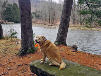
![]()
![]()
![]()
![]()
![]() On Tuesday, April 12th, I wanted to get out for a short hike near home that was not on Round Top. I though maybe Cindy would go with us to the Beaverkill Campgrounds but when I asked her she turned me down. I was interested to see the level of the water in the Beaverkill after the recent rains. There were no ambulance calls during the night so I has able to get some sleep and got up at 9:00 AM. I got some breakfast and started to get ready with the temperature at 50 degrees with the sun shining brightly. As usual, Sheila was excited but was trying to be the "good dog". I put on my Mammut long-sleeved crew top but decided against a baselayer since the temperature was warm and getting warmer. I decided my Columbia Titanium insulated pants would be much too warm so I wore my Railriders hiking pants which are expensive but last along time and have features like deep pockets and a generous cut which I really like. The pants have Velcro closures at the ankles. I decided to wear my old Keen Targhee II hiking boots which are pretty beat up and will soon have to be retired. I was expecting a lot of water and mud so I thought the old shoes would be the best choice. I grabbed my Leki external lock poles which I have been using lately since twist locks have proved unreliable. I also packed a light hat and light gloves even though I was pretty sure I would not need them. I thought I might not even need a jacket but donned my Mammut hoody which has lots of zippers to dump heat if necessary. I put my gear in the back of the car and Sheila in the back seat. We left the house at 9:45 AM as I drove out Old Route 17 toward Roscoe and turned right on Beaverkill Road. As we started the descent into the Beaverkill Valley, I turned left on Campsite Road and followed it down to the parking area near the Beaverkill Covered Bridge. There was one pickup truck in the parking area and the owner was getting a fly rod ready. A glance at the river showed that the level was very high. The water covered the sandy beach and the rock I usually stand on to take pictures was underwater.
On Tuesday, April 12th, I wanted to get out for a short hike near home that was not on Round Top. I though maybe Cindy would go with us to the Beaverkill Campgrounds but when I asked her she turned me down. I was interested to see the level of the water in the Beaverkill after the recent rains. There were no ambulance calls during the night so I has able to get some sleep and got up at 9:00 AM. I got some breakfast and started to get ready with the temperature at 50 degrees with the sun shining brightly. As usual, Sheila was excited but was trying to be the "good dog". I put on my Mammut long-sleeved crew top but decided against a baselayer since the temperature was warm and getting warmer. I decided my Columbia Titanium insulated pants would be much too warm so I wore my Railriders hiking pants which are expensive but last along time and have features like deep pockets and a generous cut which I really like. The pants have Velcro closures at the ankles. I decided to wear my old Keen Targhee II hiking boots which are pretty beat up and will soon have to be retired. I was expecting a lot of water and mud so I thought the old shoes would be the best choice. I grabbed my Leki external lock poles which I have been using lately since twist locks have proved unreliable. I also packed a light hat and light gloves even though I was pretty sure I would not need them. I thought I might not even need a jacket but donned my Mammut hoody which has lots of zippers to dump heat if necessary. I put my gear in the back of the car and Sheila in the back seat. We left the house at 9:45 AM as I drove out Old Route 17 toward Roscoe and turned right on Beaverkill Road. As we started the descent into the Beaverkill Valley, I turned left on Campsite Road and followed it down to the parking area near the Beaverkill Covered Bridge. There was one pickup truck in the parking area and the owner was getting a fly rod ready. A glance at the river showed that the level was very high. The water covered the sandy beach and the rock I usually stand on to take pictures was underwater.
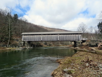 We started out at 10:00 AM by walking out of the parking lot to the bridge with the temperature at 60 decrees with lots of sun. When we got to the other side, I looked at the trail and saw that it was almost dry with a few damp and muddy spots. We turned left on a woods road that parallels the river and started down a short hill. When we came to the spring house, I decided to take a few shots and some more of the bright green water plants next to it. The plants were floating in a small "stream" that extended from the spring house and parallel the trail. I decided I wanted to keep my camera out of the pack and handy to take pictures. I knew I really didn't need my hiking poles on the flat trail so I decided to hide the, in the brush rather than collapse them and tow the in my pack. We continued on the deserted woods road where I could detect no footprints. We came to an area with a little path down to the river. Just passed this area the trail had been eroding due to
the water running down the bank. I was surprised to see that the DEC had replaced a culvert pipe and installed a second. They had also brought in fill and packed it to reconstruct the path. I found this interesting as the campsites along this path are no longer used and are abandoned. I walked down to the edge of the river very carefully as the rocks were slippery and the water looked deep and cold and was flowing swiftly! I took some pictures downstream and some upstream to the bridge. When I was done, we got back on the trail and passed several areas with unused picnic tables. They sit unused and rotting along the road, a testimony to better days. We walked by these tables which had not been used in many years. A little later we came to what was once a bathroom for some campsites that had long since disappeared. There were more tables in this area. I took the opportunity to take some more pictures of random picnic tables and the bathroom. There was a path over to the river so I walked over and found the water was running high but was very clear. I took some pictures of the sun reflecting off the water both upstream and downstream. In several areas the DEC had placed large rocks along the shore and covered them with heavy wire to reduce erosion. At about .7 miles the woods road met the paved road that serves the campsites. We continued on the road through the campsites and along the river. Many of the campsites had a cement block fireplace with a grill but some were upgraded to poured concrete. Everything was very quiet except for the water in the river. This was not surprising as the campsites are closed. It was obvious that some crews had been working to clear downed trees and those that had deteriorated. The trees had been sectioned and piled and they lined the road. I took some pictures of the empty campsites and the campsite road as well as the piles of wood. The skies were blue with some interesting white puffy clouds that make for good pictures so I took some more pictures
We started out at 10:00 AM by walking out of the parking lot to the bridge with the temperature at 60 decrees with lots of sun. When we got to the other side, I looked at the trail and saw that it was almost dry with a few damp and muddy spots. We turned left on a woods road that parallels the river and started down a short hill. When we came to the spring house, I decided to take a few shots and some more of the bright green water plants next to it. The plants were floating in a small "stream" that extended from the spring house and parallel the trail. I decided I wanted to keep my camera out of the pack and handy to take pictures. I knew I really didn't need my hiking poles on the flat trail so I decided to hide the, in the brush rather than collapse them and tow the in my pack. We continued on the deserted woods road where I could detect no footprints. We came to an area with a little path down to the river. Just passed this area the trail had been eroding due to
the water running down the bank. I was surprised to see that the DEC had replaced a culvert pipe and installed a second. They had also brought in fill and packed it to reconstruct the path. I found this interesting as the campsites along this path are no longer used and are abandoned. I walked down to the edge of the river very carefully as the rocks were slippery and the water looked deep and cold and was flowing swiftly! I took some pictures downstream and some upstream to the bridge. When I was done, we got back on the trail and passed several areas with unused picnic tables. They sit unused and rotting along the road, a testimony to better days. We walked by these tables which had not been used in many years. A little later we came to what was once a bathroom for some campsites that had long since disappeared. There were more tables in this area. I took the opportunity to take some more pictures of random picnic tables and the bathroom. There was a path over to the river so I walked over and found the water was running high but was very clear. I took some pictures of the sun reflecting off the water both upstream and downstream. In several areas the DEC had placed large rocks along the shore and covered them with heavy wire to reduce erosion. At about .7 miles the woods road met the paved road that serves the campsites. We continued on the road through the campsites and along the river. Many of the campsites had a cement block fireplace with a grill but some were upgraded to poured concrete. Everything was very quiet except for the water in the river. This was not surprising as the campsites are closed. It was obvious that some crews had been working to clear downed trees and those that had deteriorated. The trees had been sectioned and piled and they lined the road. I took some pictures of the empty campsites and the campsite road as well as the piles of wood. The skies were blue with some interesting white puffy clouds that make for good pictures so I took some more pictures
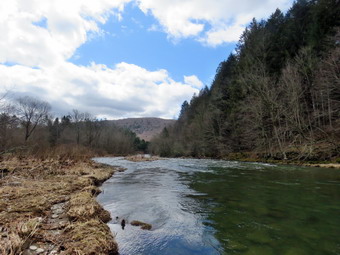 We walked to the last campsite where the trail ends and I walked down to the edge of the river. I was careful to watch where I was walking as I did not want to slip into the cold water. I stopped to take some pictures of the river especially downstream. Sheila decided to take a dip in the cold and rapidly flowing water but stayed close to the shore. I encouraged her to get out and could not believe she would go into the water. We continued a little further passed the last campsite and walked a path along the river. I took some shots downstream where the river turned to the left. The water was very clear with a slight greenish tint from looking through to the bottom. As we walked back passed the last campsite, we stayed to the left of the last bathroom to walk back on the other paved road through the campsites. This road parallels the one we walked out on to make a sort of loop. I took some shots of the bathroom and some more of the piles of wood stacked around the campsites. We returned the way we had come although at a quicker pace. We still had not seen any people on the trails and very few cars had passed by on the roads. On the way back I knew I had to pick up my poles but I apparently had done a good job of hiding them! It took me a few minutes to find them and then we continued to hike. We walked through the bridge and turned right to go back to the car. I decided to drop my jacket at the car and then continue along the near side of the river to the bench near the edge of the rover. We walked by the newest bathhouse and through a gate. In front of us was what looked like a cement sidewalk. An arm of the river used to pass through this area and the "sidewalk" was there so that cars could ford the shallow water. The section of river had been diverted and only the ford remained. As we walked on the woods road we came to some piles of stones used in the campsites. I took some pictures of the stones and then some of another unused bathrooms. We walked down to the edge of the stream and I took a few ore shots. We continued to walk until we came to the stone bench. Sheila jumped up on it and I took a few pictures. We took slightly different route back passing in back of the bathroom. Before returning to the car, we walked to the left and down to the edge of the river. I took pictures of the bridge and the river flowing under it. There weren't many places to stand as the water was so high. When I was done, we walked over to the car. We were back at the car at 11:45 PM having hiked 2.7 miles in 1 hour and 45 minutes with 20 minutes of stopped time. The car's thermometer read 62 degrees and the sun made it feel even warmer.
![]()
![]()
![]()
![]() On Sunday, April 10th I wanted to get in a hike after returning from preaching at a local church. I ate lunch with my woe and then asked if she would like to go across the street to take a short walk on Round Top. It was clear from her equivocating answer that she had little interest in hiking. I have found that even a short hike helps to keep my blood pressure in check so I decided to go with Sheila. As I started to get ready at 1:15 PM the temperature was a cool 36 degrees with a stiff breeze blowing. I also thought I saw a few snowflakes! Sheila was ready to go as she really likes to hike and she was very vocal about hurrying me along. I got dressed in my longsleeved Mammut crew top with a light longsleeved baselayer. I decided to wear my Columbia Titanium insulated pants as it was cool even though I had been using my Railriders recently. I knew that keeping my feet warm and dry would not be an issue so I donned my Vasque Taku hiking boots which fit well and have been discontinued. I made sure I had a pair of Super Green insoles in the shoes to support my arches. I grabbed a pair of Leki external lock poles I have been using all season. Finally, I donned my Mammut hoody which blocks the wind and keeps me warm but has enough zippers to dump heat when needed. I put on a light hat and wore a pair of light gloves. At 1:30 AM we walked out the door to start the hike. I grabbed Sheila's leash from the car and we walked up the driveway. I aimed to hike two figure 8's which I knew from experience should take a little over and hour. We walked out the driveway and crossed the street to walk along the street to the parking lot of the Presbyterian Church.
On Sunday, April 10th I wanted to get in a hike after returning from preaching at a local church. I ate lunch with my woe and then asked if she would like to go across the street to take a short walk on Round Top. It was clear from her equivocating answer that she had little interest in hiking. I have found that even a short hike helps to keep my blood pressure in check so I decided to go with Sheila. As I started to get ready at 1:15 PM the temperature was a cool 36 degrees with a stiff breeze blowing. I also thought I saw a few snowflakes! Sheila was ready to go as she really likes to hike and she was very vocal about hurrying me along. I got dressed in my longsleeved Mammut crew top with a light longsleeved baselayer. I decided to wear my Columbia Titanium insulated pants as it was cool even though I had been using my Railriders recently. I knew that keeping my feet warm and dry would not be an issue so I donned my Vasque Taku hiking boots which fit well and have been discontinued. I made sure I had a pair of Super Green insoles in the shoes to support my arches. I grabbed a pair of Leki external lock poles I have been using all season. Finally, I donned my Mammut hoody which blocks the wind and keeps me warm but has enough zippers to dump heat when needed. I put on a light hat and wore a pair of light gloves. At 1:30 AM we walked out the door to start the hike. I grabbed Sheila's leash from the car and we walked up the driveway. I aimed to hike two figure 8's which I knew from experience should take a little over and hour. We walked out the driveway and crossed the street to walk along the street to the parking lot of the Presbyterian Church.
We began the ascent of the steepest hill behind the church and stopped once or twice as we were setting a fast pace. The hill is short but gets the circulation pumping and is the steepest and longest climb on the "trail." At the top of the hill we stopped to look around. We started on the trail by turning left at the trailhead. The trailhead was bare and that continued even as we entered the woods. I was surprised that the trails were barely damp after the rain we had over the previous two days. At the first trail junction, I followed Sheila as she turned right and started up the woods road which has the gentler approach of the two. There were a few branches on the trail from the winds that had passed through the area. I removed these branches either by dragging them off the trail or by using my poles on the smaller ones. The breeze was varying in intensity and a few flakes continued to fall. We reached the end of the woods road and turned left up the hill on the trail. We continued up the trail to the first trail junction with the upper blue trail and turned left to follow the yellow trail along the base of Round Top. The yellow trail was bare with only a layer of wet leaves and a few branches here and there. At the next junction with the blue trail we turned right and headed up the blue trail toward the summit. When we got to the switchback, we turned right and followed it until it came back to the main blue trail. The fact that the switchback sidehills in places made the walk a little more difficult. We turned right and then continued straight ahead and up the hill toward the summit of Round Top bypassing the white crossover trail. We continued over the summit and down the blue trail toward the junction with the yellow trail. There were a few muddy and slippery places but otherwise the trail was in good shape. We continued down to the yellow trail and turned right and walked the yellow trail along the base of Round Top to the next junction with the blue trail. This time we turned left and walked the yellow trail downhill toward the lookout. We passed the "sitting rock" and were soon at the viewpoint. I took a quick peek at a view I had seen many times before and then turned left to start the steeper downhill. We passed by what used to be a side trail to the lookout that I blocked with brush. This side trail has a gap that hikers have to walk over and it can be dangerous for some people in the winter season. Unfortunately, some 'helpful' person had removed the brush without asking or knowing why it was there. The trip down to the first trail junction went quickly. We turned around and started back up the hill toward the lookout to start our second figure 8.
The trip back up the hill to the lookout was pretty easy and I seemed to have gotten a second wind. At the top of the hill we turned right to follow the yellow trail to the first junction with the blue trail. We turned right to followed the yellow trail around the base of Round Top. At the next junction with the blue trail, we turned left and headed up toward the summit. When we got to the white crossover trail we continued on the blue trail toward the summit. I wanted to do two complete figure 8's rather than cut off some distance on the crossover trail. We continued up and over the summit and started down the other side. The wind has increased in intensity and the skies were much darker. Small ice pellets began to fall albeit briefly. As we descended the other side of the hill, we gain bypassed the white trail but turned left on the switchback in the blue trail. Walking downhill on the switchback was a little tricky as it sidehills in several places. At the end of the switchback we turned left and walked downhill to the trail junction with the yellow trail. We turned left and again followed the yellow trail along the base of Round Top to the junction with the blue trail. This time we turned right and headed down the yellow trail to the woods road that leads to the first trail junction. As we walked down the road, I noticed all the interesting ledges to the right of the trail. At the first trail junction, we turned left and walked out to the trailhead. We turned right and walked down the hill to the church parking lot and over to the driveway to the house. It was 1:40 PM and we had hiked a little over 2 miles in a little over an hour.
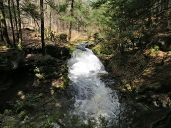
![]()
![]()
![]()
![]()
![]() On Friday, April 8th I planned to go hiking with Cindy at the Beaverkill Campgrounds. We had gotten almost 3 inches of rain day before and I thought it would be nice to see the Beaverkill flowing at high volume. I went on an ambulance call in the morning and by the time I returned Cindy was no loner interested in hiking. I changed my plans and decided to go to at Trout Pond to see Russell Brook Falls. I began getting ready at 12:45 PM with bright blue skies with puffy white clouds and plenty of sun. As I was getting ready the temperature was 52 degrees. Sheila was pretty excited as I started to get ready as she always is when we go hiking. I got dressed in my Mammut crew top but decided against a baselayer. I put on a pair of RailRiders hiking pants which are expensive but last along time and have features like deep pockets and a generous cut which I really like. The pants have Velcro closures at the ankles. I decided to wear my old Keen Targhhe II hiking boots which are pretty beat up and will soon have to be retired. I was expecting a lot of water and mud so I thought the old shoes would be the best choice. I grabbed my Leki external lock poles which I have been using lately since twist locks have proved unreliable. I also packed a light hat and light gloves as I was not sure I would need them. I donned my Mammut hoody which has lots of zippers to dump heat if necessary. I put our gear in the back of the car and Sheila in the back seat. We left Livingston Manor at 1:10 PM as I drove north on the Quickway towards Roscoe. I got off at exit 94 and headed north on Route 206 towards Downsville. After crossing the Rockland Flats and passing the Roscoe Nursing Home, I turned left on Morton Hill Road and drove to the intersection with Russell Brook Road. There was only one car sitting in the "lot" at the intersection of the two roads. People see the open space and park there without thinking about the fact that the land is private. I did not want to have to walk back up Russell Brook Road at the end of the hike so I decided to drive down the road to park in the lower lot. Russell Brook Road is a seasonal maintenance road and it did look like it had recently been maintained. I drove down the road and pulled over on the side of the road near the path down to the upper falls. I let Sheila out of the car and retrieved my camera from my pack. We walked down the path to the viewpoint above the upper falls and found them roaring. The volume of water was greater than I had seen in some time. I took pictures at various zooms and with different settings. I also shot a short video to get a feeling for the volume of water from the sound. I also took pictures of the chute between the two falls and a few of the top of the lower falls. When I was done, we returned to the car and I drove down to the lower parking area. There were three cars already parked and a forest ranger's truck. As I was getting ready to hike, I saw the ranger start to walk down the road toward the falls. I hoped we would meet him as I wanted to discuss a work detail to clear some trails.
On Friday, April 8th I planned to go hiking with Cindy at the Beaverkill Campgrounds. We had gotten almost 3 inches of rain day before and I thought it would be nice to see the Beaverkill flowing at high volume. I went on an ambulance call in the morning and by the time I returned Cindy was no loner interested in hiking. I changed my plans and decided to go to at Trout Pond to see Russell Brook Falls. I began getting ready at 12:45 PM with bright blue skies with puffy white clouds and plenty of sun. As I was getting ready the temperature was 52 degrees. Sheila was pretty excited as I started to get ready as she always is when we go hiking. I got dressed in my Mammut crew top but decided against a baselayer. I put on a pair of RailRiders hiking pants which are expensive but last along time and have features like deep pockets and a generous cut which I really like. The pants have Velcro closures at the ankles. I decided to wear my old Keen Targhhe II hiking boots which are pretty beat up and will soon have to be retired. I was expecting a lot of water and mud so I thought the old shoes would be the best choice. I grabbed my Leki external lock poles which I have been using lately since twist locks have proved unreliable. I also packed a light hat and light gloves as I was not sure I would need them. I donned my Mammut hoody which has lots of zippers to dump heat if necessary. I put our gear in the back of the car and Sheila in the back seat. We left Livingston Manor at 1:10 PM as I drove north on the Quickway towards Roscoe. I got off at exit 94 and headed north on Route 206 towards Downsville. After crossing the Rockland Flats and passing the Roscoe Nursing Home, I turned left on Morton Hill Road and drove to the intersection with Russell Brook Road. There was only one car sitting in the "lot" at the intersection of the two roads. People see the open space and park there without thinking about the fact that the land is private. I did not want to have to walk back up Russell Brook Road at the end of the hike so I decided to drive down the road to park in the lower lot. Russell Brook Road is a seasonal maintenance road and it did look like it had recently been maintained. I drove down the road and pulled over on the side of the road near the path down to the upper falls. I let Sheila out of the car and retrieved my camera from my pack. We walked down the path to the viewpoint above the upper falls and found them roaring. The volume of water was greater than I had seen in some time. I took pictures at various zooms and with different settings. I also shot a short video to get a feeling for the volume of water from the sound. I also took pictures of the chute between the two falls and a few of the top of the lower falls. When I was done, we returned to the car and I drove down to the lower parking area. There were three cars already parked and a forest ranger's truck. As I was getting ready to hike, I saw the ranger start to walk down the road toward the falls. I hoped we would meet him as I wanted to discuss a work detail to clear some trails.
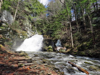 I set my GPS unit and we started our hike at 1:30 PM by walking down the woods road toward the bridge across Russell Brook. The road was wet but not very muddy. As we crossed the bridge, I could see that the brook was very high from the recent rain storms. I decided to go to the falls at the beginning of the hike as the skies were beautiful. The Japanese knotweed had died and was a dead brown color but I knew it would be back later in the spring. The history of this area is very interesting. Russell Brook Falls had been the site of a dam that impounded water for a waterwheel in Butternut Grove. The wheel was still there a few years ago. The area near the register box was the "landing zone" for loggers who cleared the evergreen trees, not for tanning but, for the production of wood alcohol. The trees were transported on narrow gauge railway that ran parallel to Russell Brook. The railway met the mainline O&W near Butternut Grove where the logs were unloaded. There were several acid factories in the area that produced wood alcohol. There was also a factory on the lower part of Russell Brook that produced khaki dye for the uniforms of American troops during World War I. We followed the path out to the falls and turned right to walk down to the streambed. The path and all the rocks and roots were wet making them very slippery.At the bottom of the path, I put down my pack and got out the camera to take pictures of the falls and the stream. The falls were incredibly loud with an enormous volume of water. The spray from the falls made getting pictures difficult but I was able to get some of the falls and the stream. I packed up to continue the hike. We walked back out the path toward the main trail but I thought it would be nice to visit the upper falls. We turned right and walked up the hill to the viewpoint above the falls. This is a flat area which is really beautiful and secluded. I got out the camera and took some pictures of the falls from a different angle. I also got some shot to the pool below the falls and upstream where there was a small rapids. I again packed up and we walked back out to the main trail. On the way out a father and son were walking in toward the falls and I said "hello"> they were the only people we would see on the trails all day.
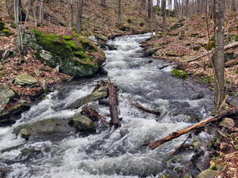 At the main trail, we turned right to head up to the pond. We continued passed the register box and up the main trail toward Trout Pond. The trail was covered in water with several small streams flowing across the trail. The walk seemed to go very quickly as we passed the path to the first primitive campsite. I could hear the outlet stream from Trout Pond and I looked down to see some interesting rapids. I decided we would walk down to the stream and bushwhack up to the pond. As soon as we reached the stream, I saw a place I wanted to take some pictures. I positioned myself and took some shots of the stream and the rapids. We moved a little father upstream and I took some more photographs. We continued to follow this pattern until the bank became too steep and we walked up to the trail just short of the pond. Along the way I managed to bang my shins into some trees and rocks as a memento of the trip. Soon we were at the outlet end of the pond and we walked over to the shore although the water was so high there wasn't much "beach" to stand on. I dropped my pack to take pictures of the lake with the blue sky and puffy white clouds. I was surprised that all the ice was gone from the pond. I took pictures looking for the contrast between the bare trees and the lake and for some interesting reflections in the still waters. Sheila decided not to take a dip as the water was cold. I took the time to take some pictures at the dam which had some water flowing over it. I walked to a point below the dam and took some pictures of the water falling over the dam. I packed up and we returned to the main trail to walk the flat woods road toward the inlet end of the pond. This trail is always damp but on this day it was covered in water that at times was higher than the tops of my boots! Where there wasn't much water there was plenty of mud and in some places there was both. I attempted to bushwhack around some of these areas but a few were so large it was not possible. The small stream just before the trail junction near the leanto has wider and deeper than I had seen it. When we came to the bridge, I stopped to take a few pictures of the pond from just before the bridge and from the bridge itself. I also took some shots upstream of the inlet stream that was wide and deep. We crossed the bridge and stayed to the right on the Mud Pond Trail which would take us over Cherry Ridge and form our loop back to the parking area. There was new beaver activity and a small dam just downstream of the bridge causing the water to back up. The inlet stream had overflowed and the entire trail was more like a stream than a trail. The trail is very rocky and there continued to be a lot of water even as we started to ascend the hill. As we continued up the trail, the water disappeared and I foolishly thought it was a permanent condition. There is a small stream that parallels the trail but it was swollen and I could see and hear it from the trail. I considered walking over to the stream but I was beginning to tire a little. The water came back with a vengeance turning the trail into a stream once again. There had been some very large trees across the trail but they had been cut by a DEC crew or the rangers.
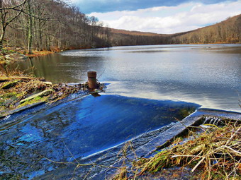 From the bridge at the inlet we had climbed 430 feet over the next .75 miles. The trail headed west from the inlet until turning sharply south at around 2.3 miles. The highest point on the trail was at 2.2 miles after which most of the rest of the hike is downhill. As we started down the other side, the trail had some mud in spots but there was little standing or running water and I, again, hoped that this would last. Unfortunately, the trail again turned into a stream with several large ponds along the way. I tried bushwhacking gain staying away from the edge of the trail. In a few places, I just gave up and waded through the water choosing the shallower spots. We ascended a small hill to the stand of small birch trees and then descended the other side where there was some mud. At 3.7 miles we had descended 420 feet from Cherry Ridge to the snowmobile trail near Mud Pond. I could see that the trail was covered in deep water so I again bushwhack on a line parallel to the trail until it began to ascends on the water turned into a small stream. I ascended a small hill before starting downhill back toward the parking area. This section had some standing water until we began the steeper descent when it again turned into a stream. The stream on the trail was bigger than some of the streams in the forest. Occasionally a strewn would flow across the trail and collect the water flowing down the trail. There was also a stream that paralleled the trail with some interesting rapids and falls. The situation continued on and off all the way down the trail to the last stream that crossed the trail. This stream was wide, fast and deep but I managed to cross it. All told, we dropped another 380 feet over the next .7 miles back to the bridge just before the trail register. Someone had a tent set up at the large campsite to the left of the trail. They were sitting outside and we waved as Sheila and I passed by. We stopped on the bridge over the outlet stream from Trout Pond as it was flowing well. I took a few pictures upstream and downstream before we continued on the trail to the junction. We turned right and continued on the main trail toward the parking area. We continued across the bridge and up the trail to the parking area where there were now 8 cars parked. We were back at the car at 4:20 PM and we had hiked 4.7 miles in 2 hours and 50 minutes with an elevation gain of 1000 feet. We had stopped for 25 minutes.
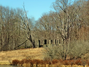
![]()
![]()
![]()
![]()
![]() On Tuesday, April 5th, I wanted to get out and do a longer hike but I had track practice in the afternoon so I knew it would have to be quick. I decided that I wanted to go to Alder Lake to hike to the Beaver Meadow Len-to which would be better named the Beaver Pond lean-to as the beavers have returned. They have built an impressive dam and there are at least two lodges. I asked Cindy if she would like to go and she agreed. We started to get ready at 9:45 AM when the temperature was 42 degrees. Sheila was hovering around me as she can always detect when I am getting ready for a hike. I put on my Mammut long-sleeved crew top with a long-sleeved baselayer since the temperature was cool. I decided to wear my Columbia Titanium insulated pants without any tights underneath. I wore my Vasque Taku boots have seen better days and will soon have to be "retired". I did not expect much snow although the possibility of mud and frozen mud was on my mind. I grabbed my Leki external lock poles which I have been using since twist locks have proved unreliable. I also donned my Mammut hoody which was enough zippers to dump heat when needed. I put on a light hat and also wore a pair of light gloves. At the last minutes, I put on my OR Crocodile gaiters to deal with the snow and mud which I was sure we would find. Cindy and I both made sure our Microspikes were with us just in case they were needed. I got our gear and Sheila in my car and left Livingston Manor at 10:15 AM and drove north and west on Old Route 17 toward Roscoe. Just outside of town I turned right on the Beaverkill Road and headed north. I continued on the Beaverkill Road through Lew Beach and Turnwood toward Alder Creek Road where I made a left. Alder Creek Road had almost washed out in one of the rainstorms in the fall but the Town of Hardenburgh had done a great job and the area that was effected had been reinforced and showed no further signs of erosion. I continued to the end on the road where I turned right toward Alder Lake. The gate to the access road was unlocked so I drove up the access road very slowly as there are some very rough spots. When I got to the parking area there was one pickup parked and I thought they might be fishing. The temperature was still 42 degrees but there was no breeze. There was evidence that the state was cutting some trees and brush to widen the access after the gate and around the remind of the Coykendall Mansion which made me nervous! The skies were bright and sunny with lots of blue but no white clouds to provide contrast. I set my GPS and we started out on the path toward the "lawn" at 10:45 AM.
On Tuesday, April 5th, I wanted to get out and do a longer hike but I had track practice in the afternoon so I knew it would have to be quick. I decided that I wanted to go to Alder Lake to hike to the Beaver Meadow Len-to which would be better named the Beaver Pond lean-to as the beavers have returned. They have built an impressive dam and there are at least two lodges. I asked Cindy if she would like to go and she agreed. We started to get ready at 9:45 AM when the temperature was 42 degrees. Sheila was hovering around me as she can always detect when I am getting ready for a hike. I put on my Mammut long-sleeved crew top with a long-sleeved baselayer since the temperature was cool. I decided to wear my Columbia Titanium insulated pants without any tights underneath. I wore my Vasque Taku boots have seen better days and will soon have to be "retired". I did not expect much snow although the possibility of mud and frozen mud was on my mind. I grabbed my Leki external lock poles which I have been using since twist locks have proved unreliable. I also donned my Mammut hoody which was enough zippers to dump heat when needed. I put on a light hat and also wore a pair of light gloves. At the last minutes, I put on my OR Crocodile gaiters to deal with the snow and mud which I was sure we would find. Cindy and I both made sure our Microspikes were with us just in case they were needed. I got our gear and Sheila in my car and left Livingston Manor at 10:15 AM and drove north and west on Old Route 17 toward Roscoe. Just outside of town I turned right on the Beaverkill Road and headed north. I continued on the Beaverkill Road through Lew Beach and Turnwood toward Alder Creek Road where I made a left. Alder Creek Road had almost washed out in one of the rainstorms in the fall but the Town of Hardenburgh had done a great job and the area that was effected had been reinforced and showed no further signs of erosion. I continued to the end on the road where I turned right toward Alder Lake. The gate to the access road was unlocked so I drove up the access road very slowly as there are some very rough spots. When I got to the parking area there was one pickup parked and I thought they might be fishing. The temperature was still 42 degrees but there was no breeze. There was evidence that the state was cutting some trees and brush to widen the access after the gate and around the remind of the Coykendall Mansion which made me nervous! The skies were bright and sunny with lots of blue but no white clouds to provide contrast. I set my GPS and we started out on the path toward the "lawn" at 10:45 AM.
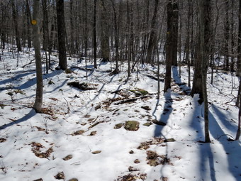 We walked along the path which passes by the stone foundations which marks the last remnants of the Coykendall Mansion. The house had been built as a large hunting lodge and then was gifted to the Boy Scouts of America. When the state took over the property. The mansion fell into disrepair with campers tearing boards away to use for campfires. The state added a fence but it did not deter people so the house was eventually burned to the ground. I walked toward the dam where the sound of the water was thunderous. I took pout my camera and snapped some shots of the spillway and a few more of the lake and the gills around it. The lighting was difficult because of the bright sun and the lack of clouds made the sky look very flat. I walked toward the trail around the left side of the lake to meet Cindy who had headed that way. As we walked along the trail we found a few spots of ice and open water with patches of mud. The brush and branches that had overgrown the trail were now dead and the walking was much easier. Sheila was happy to be out and ran ahead and then returned to us. We began to remove small branches from the trail and moved one larger one. As we approached the bridges, Sheila alerted and I could see one person fishing along the shore and another walking along the edge of the lake. We crossed the bridges on the trail near the head end of the lake and continued on the trail toward the junction with the Millbrook Ridge Trail. At the point where a path leads to the left to some primitive campsite, a some large trees had fallen across the trail. We were able to step over them but it was not easy. I could cut them with my hand tools but it would take a long time! I made a note to call the local ranger to see if we could schedule a time to remove them with a chainsaw. At the trail junction, we turned left to head toward the lean-to on the Millbrook Ridge Trail. The trail was mostly bare but there continued to be wet and muddy spots which required us to pay attention to where we placed our feet. We encountered a few small blowdowns which were all easy to step over but I knew I would need to return with tools to remove them. Some were old but others were the product of recent high winds. I thought about getting get a crew with a sawyer out to remove some of the larger ones from trail. The trail is pretty obvious and the blazes easy to see in most places. There were no tracks from other hikers. For the next 1.5 miles the trail climbed and then leveled off several times. The elevation gain is several hundred feet but the grade is never more than 12% and averages around 6%. There isn't too much to see along the way but this day was very pleasant because there was snow on the hillside across the creek and an increasing amount of snow on the trail. We enjoyed the sounds and sights of Alder Creek as it flows parallel to the trail much of the way as the volume was high. I looked over at the creek and saw that there was a good volume of water and that the rocks were covered in snow and ice. I thought about trying to get down to the creek bed for some shots but decided against it.
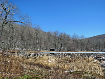 The trail leveled off at a beaver meadow and we crossed a small stream that feeds it. At 2.2 miles we began the last climb and I found that the trail was now covered in snow . At this point Cindy decided to sit on a log and let Sheila and I do the last little climb to the beaver pond on our own. This was disappointing but not surprising. As we started the climb, I was slipping and sliding some but decided I would not stop to put the spikes on as the climb was short. I did take a few pictures of the snowy trail. Soon we arrived at the beaver pond. Where there had once been a beaver meadow, there was now a pond with a dam and a beaver lodge. The pond was much larger than the last time I had visited! As we came to the spot on the trail opposite the beaver dam, we walked off the trail to the right and found a good viewpoint. I took pictures of the pond and the dam even though the skies were still a flat blue. I also took some shots of the beaver lodge with the lean-to in the background. The snow gave the scene the feeling of winter even though the temperatures was pushing 50 degrees. As I looked around I was overcome by the feeling of joy at seeing what God has created! I realized that the return trip would be much easier as it was almost all downhill but that it would be important to watch my foot placements so that I did not fall on steeper descents made slippery by the snow. I stopped at one spot on the way back to take some pictures of Alder Creek. The walk did go quickly and we were soon at a point where we could see Cindy sitting on a log. She whistled for Sheila but Sheila waited until I told her "Find Mom" and the took off running at top speed. We set a faster pace on the way back as Cindy was rested and we were still heading downhill. We had to cross several wet spots and hop a couple of stream but we were soon at the loop trail around Alder Lake where we turned right to return the way we came. When we came to the bridges there was the open view of Cradle Rock Ridge. In the foreground on this scene were some rushes and the beginnings of a small beaver dam. We did not stop as I had taken a few pictures on the way out. We continued on the trail toward the parking area and noticed that the other people we had seen were now on the opposite side of the lake. As the trail came to the "lawn" we turned right and walked up the hill toward the stonework on the mansion. I took some pictures of the mansion site and then we walked back to the car. I considered walking down to the creek to take some pictures of the waterfalls but decided to leave it for another visit. We were back at the car at 1"20 PM after hiking 4.6 miles in 2 hours and 30 minutes with 20 minutes of stopped time. The elevation gain was 675 feet. Our moving speed was 2 MPH.
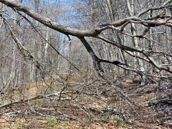
![]()
![]()
![]()
![]()
![]() On Saturday, April 2nd, I had planned to hike the Pelnor Hollow and Little Spring Brook Trail with a friend who needed it for her all Trails Challenge. My wife had agreed to give us a ride as parking is still not allowed on Pelnor Hollow Road! I went out on an early morning ambulance call and found the wind was blowing at about 30 mph. The day that had been forecast to be bright and sunny seemed to be headed for cloudy and windy. I contact my friend and we agreed to postpone the effort for another day. I started to do a few things around the house but noticed the wind was dying down and the sky was clearing. By 11:00 AM I had decided I wanted to get out and asked Cindy if she would like to go to Frick Pond to trim the rest of the blowdowns on the upper part of the Flynn Trail. She said "Yes" and we began to get ready to go with the temperature at 40 degrees. While we began to get ready, Sheila was always nearby making it very clear that she wanted to go. I got dressed in my Mammut crew top and added a long-sleeved baselayer. I decided to wear my Columbia Titanium insulated pants to keep the chill away but decided against wearing tights underneath. I wore my Vasque Taku boots as I did not think I would need an insulated boot. These shoes still fit well but will have to be retired soon as even with insole they do not provide much support. I donned my Mammut hoody which blocks the wind and keeps me warm but has enough zippers to dump heat when needed. I put on a light hat for warmth and donned a pair of light gloves. I made sure my microspikes were in my pack just in case I needed them at some point. I decided to go without hiking poles as I would be carrying tools. I packed my Silky Sugowaza curved fixed blade saw which can handle surprisingly large trees and my Fiskars pack axe which is light but handles bigger trees very well. I also threw some felling wedges in my pack as they can be used if my saw became pinched. We left Livingston Manor at 11:25 AM as I drove out the DeBruce Road about 6 miles to Mongaup Road. I turned left and continued up the road to the point where it splits. I stayed left on Beech Mountain Road and drove to the parking areas on the left. I pulled into the smaller parking area where there was one car parked. The larger lot had fur cars parked but in a pattern that would limit others options for parking! I checked the trail and there was no snow or ice at the beginning of the Flynn Trail. I decided not to set my GPS as most of our time would be spent clearing blowdowns and the route was a familiar one. We got ready to head out on the Flynn Trail with the temperature at 42 degrees. We crossed the road and began our hike at 11:45 AM.
On Saturday, April 2nd, I had planned to hike the Pelnor Hollow and Little Spring Brook Trail with a friend who needed it for her all Trails Challenge. My wife had agreed to give us a ride as parking is still not allowed on Pelnor Hollow Road! I went out on an early morning ambulance call and found the wind was blowing at about 30 mph. The day that had been forecast to be bright and sunny seemed to be headed for cloudy and windy. I contact my friend and we agreed to postpone the effort for another day. I started to do a few things around the house but noticed the wind was dying down and the sky was clearing. By 11:00 AM I had decided I wanted to get out and asked Cindy if she would like to go to Frick Pond to trim the rest of the blowdowns on the upper part of the Flynn Trail. She said "Yes" and we began to get ready to go with the temperature at 40 degrees. While we began to get ready, Sheila was always nearby making it very clear that she wanted to go. I got dressed in my Mammut crew top and added a long-sleeved baselayer. I decided to wear my Columbia Titanium insulated pants to keep the chill away but decided against wearing tights underneath. I wore my Vasque Taku boots as I did not think I would need an insulated boot. These shoes still fit well but will have to be retired soon as even with insole they do not provide much support. I donned my Mammut hoody which blocks the wind and keeps me warm but has enough zippers to dump heat when needed. I put on a light hat for warmth and donned a pair of light gloves. I made sure my microspikes were in my pack just in case I needed them at some point. I decided to go without hiking poles as I would be carrying tools. I packed my Silky Sugowaza curved fixed blade saw which can handle surprisingly large trees and my Fiskars pack axe which is light but handles bigger trees very well. I also threw some felling wedges in my pack as they can be used if my saw became pinched. We left Livingston Manor at 11:25 AM as I drove out the DeBruce Road about 6 miles to Mongaup Road. I turned left and continued up the road to the point where it splits. I stayed left on Beech Mountain Road and drove to the parking areas on the left. I pulled into the smaller parking area where there was one car parked. The larger lot had fur cars parked but in a pattern that would limit others options for parking! I checked the trail and there was no snow or ice at the beginning of the Flynn Trail. I decided not to set my GPS as most of our time would be spent clearing blowdowns and the route was a familiar one. We got ready to head out on the Flynn Trail with the temperature at 42 degrees. We crossed the road and began our hike at 11:45 AM.
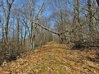 The Flynn Trail is sited along what used to be Beech Mountain Road which was the access for the Beech Mountain Boy Scout Camp. We walked the trail through the woods which was covered in hard-packed snow which was a little slippery on the uphill parts. We turned right on the woods road and set a quick pace up the hill which was almost completely bare. The trail gains a little over 600 feet in 1.7 miles to the highest point at the junction with the Big Rock Trail. The day was cool but the sun was out and the temperature was rising. I began to get warm as we set a quick pace so we stopped so that I could open the zippers on the hoody. We had been clearing a few branches as we walked. At 12:12 PM we came to the first small blowdown across the trail. I took some pictures, grabbed the saw, made 1 or 2 cuts, and pivoted the pieces off the trail. Cindy and I cleaned up what was left and I took some after shots. The whole job took less than 10 minutes and we were off to the next one. We cam to the second blowdown at 12:35 PM. It was a single small trunk. We used the same procedure and again we were done in under 10 minutes. Things were going well and I expected it would not take us long to clear all the blowdowns to the junction with the Big Rock Trail. My optimism was short-lived! At 12:45 PM we came to a new blowdown that had not been there on the last trip. One large tree had broken off up high and had fallen over the trail. A second, smaller tree was hanging over and into the trail. There was a third trunk or large branch on the ground. The mess was not exactly blocking the trail but I wanted to get rid of as much of it as I could. I took my 'before' pictures and then began to inspect the complex blowdown. I looked at the connections of the blowdowns to the main trunks that were still standing and found they looked pretty solid. I tried pushing and pulling on them and they seemed solid. The problem with working with hand tools is that it takes much longer than with a chainsaw. I began cutting the branches off the trunk on the ground and clearing them. Cindy elected to stay clear which made the job that much harder but having one of us out of harm's way was a good idea. I continued to use the saw to cut off pieces of all three trees and then cut them up so that I could make a neat stack just off the trail. I walked to the other side of the mess and cleared some more including cutting overhead so that I could remove some branches that were hanging down. I used the ax to cut up the trunk on the ground to get it out of the way. The going was slow but soon I was done. One blowdown had swung out of the way but had not come down and the biggest was not going anywhere anytime soon. The trail was clear and I took some 'after' photographs to prove it. This one had taken me 40 minutes to finish.
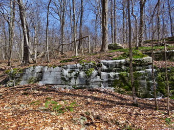 We moved on at 1:25 PM and came to the path to the large clearing on the right. Immediately after this there was another single trunk on the ground. I took a few quick shots and then moved to use the saw to remove the branches at the top of the tree. I threw this piece off of the trail and thought we could pivot the reminder but it was solidly anchored. I made one more cut that allowed Cindy and I to move the trunk to the side. A few 'after' pictures and we were done in less than 10 minutes. I did take a few minutes to record some shots of the ice and icicles on the rocks along the trail. I wasn't sure how many more blowdowns were left but I was beginning to get tired. We ran into two or three large branches in the trail. I didn't even take my pack off for these but used the ax to make a few cuts and move the pieces off the trail. We were nearing the junction iota the Big Rock Trail when we came to another slightly larger blowdown at 2:02 PM. This one required a combination of ax and saw but was pretty easy to remove. In just over 10 minutes we were done including a few final pictures. We moved on only to find another small blowdown almost at the trail junction. Sheila must have been feeling left out as she went and sat in front of the blowdown so that she could get in the 'before' pictures. I used the ax to section the two small trunks. I cut large pieces and dragged them well off the trail. It seemed longer but it took only 10 minutes to complete the last blowdown on the Flynn Trail. At the junction with the Big Rock Trail we turned left and started the long downhill walk. I Dod not have my poles which always help me when walking downhill but I was feeling good after doing so much work. Cindy and I did clear a few branches off the trail before running into a larger dead trunk across the trail. Cindy pointed out that it was cracked in two places. I grabbed the top end and started to move it. A section just the right size broke off and I deposited it off the trail. Cindy and I were able to move the larger section which cracked in just the right place. This one hardly sowed own our walk! We continued down the Big Rock Trail without encountering another obstacle. We did not some large holes on the trail in a few places. At first I thought it might be an animal. A second looked seemed to indicate that the top of a culvert had collapsed and a hole had opened. The Big Rock Trail is tricky as there area several places that appear to be the end of the trail but are not.
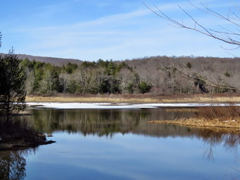 We continued the downhill journey grateful for the sunnier and warmer weather. We were soon at Times Square where we continued our hike by walking straight across Times Square to stay on the Big Rock Trail. The trail had a little snow and several areas with water and mud. We crossed the two small bridges over the inlets to the pond but did not stop to take pictures. The water was high and flowing freely. It was so clear I wanted to get a drink. I did not but Sheila did. When we got to the area that was covered by tall evergreens, I took some pictures even though the light was poor. The wooden boardwalks still had some frozen snow but were not as slippery as they looked and we crossed the bridges quickly. As we were crossing, Sheila alerted and I saw a young couple seated on the walkway with their dog. I had forgotten Sheila's leash but I took her by the collar to cross. The other dog seemed very calm. As we were crossing the young man said "Mr. Bressler" and I realized he was a former student. We stopped to talk for a few m minutes before moving on. The last part of the Big Rock Trail was very muddy in contrast to the Flynn Trail which had been almost dry. We worked our way through the mud but it made me think that our trail crew might address the issue. At the next trail junction, we turned left on the Quick Lake Trail to head for the bridge across the outlet of Frick Pond. The trail continued to be very wet with running and standing water. There was also significant ice on the trail. We walked along the west side of Frick Pond to the bridge across the outlet of the pond. I stopped at the bridge where I have taken hundreds of pictures. The skies were blue but without any clouds for contrast. However, the water on the pond was high and very still with the tress reflected in the water. I took out my camera to capture a few shots of the pond and Beech Mountain. We walked up the hill toward Gravestone Junction and found some ice still present on the trail. We continued to Gravestone Junction finding plenty of mud and water on the trail. We passed the Lobdell memorial marker and found it vertical. The marker is a memorial to two children who died in the 1930's in a fire that consumed their cabin. I had not been cutting out the trail to the marker to discourage vandalism but it had been cleared. Once again "helpful" people were doing unauthorized work. The Quick Lake Trail to the register was partly covered in snow and ice but there was also a lot of mud and water. There were at least three places where small streams were running across the trail. At the trail register we continued straight ahead to follow the woods road out to the car in the small lot. We arrived at the car at 3:30 PM having hiked 4 miles in 3 hours and 45 minutes with an elevation gain of 670 feet. Much of the time was spent doing trail work. The temperature had risen to 48 degrees.
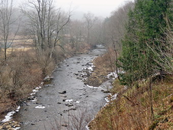
![]()
![]()
![]()
![]()
![]() On Thursday, March 31st I wanted to get out for hike and was considering a couple of longer hikes in the area. The forecast for heavy afternoon thunderstorms changed my mind! By 10:30 AM , it was 50 degrees but the skies were overcast with a heavy mist in the air. I thought about just not going and waiting for a better day but Sheila convinced me otherwise. Her baleful gaze and sharp bark "encouraged" me to continue the hiking plans. I decided we would go hike the Parksville Rail Trail as it was close and has a nice waterfall. The hike is less than 3 miles round trip and it is very flat. I was pretty sure that the recent warm weather had probably eliminated all of the snow and most of the ice. I already had my spikes in my pack but was pretty sure I would not need them. just in case they were needed. I got dressed in my Mammut crew top and added a long-sleeved baselayer. I decided to wear my Columbia Titanium insulated pants to keep the chill away but knew I would not need tights underneath. I wore Keen Targhee II boots which are worn but still good for short hikes. I grabbed a pair of Leki external lock poles I have been using all season. I also put on my OR Crocodile gaiters to keep the mud and water off my lower legs. . Finally, I donned my Mammut hoody which blocks the wind and keeps me warm but has enough zippers to dump heat when needed. I put on a light hat and brought a pair of light gloves. At 11:00 AM I put my gear in the car and Sheila in the back seat. I headed out Old Route 17 across the Flats and then took Old Route 17 and Service Road to the point where they meet Fox Mountain Road. Just after this intersection is the western parking area for the rail trail. The parking lot was free of any snow or ice and there was one other car parked. On the way to the trailhead, light rain or heavy mist had collected on the windshield.
On Thursday, March 31st I wanted to get out for hike and was considering a couple of longer hikes in the area. The forecast for heavy afternoon thunderstorms changed my mind! By 10:30 AM , it was 50 degrees but the skies were overcast with a heavy mist in the air. I thought about just not going and waiting for a better day but Sheila convinced me otherwise. Her baleful gaze and sharp bark "encouraged" me to continue the hiking plans. I decided we would go hike the Parksville Rail Trail as it was close and has a nice waterfall. The hike is less than 3 miles round trip and it is very flat. I was pretty sure that the recent warm weather had probably eliminated all of the snow and most of the ice. I already had my spikes in my pack but was pretty sure I would not need them. just in case they were needed. I got dressed in my Mammut crew top and added a long-sleeved baselayer. I decided to wear my Columbia Titanium insulated pants to keep the chill away but knew I would not need tights underneath. I wore Keen Targhee II boots which are worn but still good for short hikes. I grabbed a pair of Leki external lock poles I have been using all season. I also put on my OR Crocodile gaiters to keep the mud and water off my lower legs. . Finally, I donned my Mammut hoody which blocks the wind and keeps me warm but has enough zippers to dump heat when needed. I put on a light hat and brought a pair of light gloves. At 11:00 AM I put my gear in the car and Sheila in the back seat. I headed out Old Route 17 across the Flats and then took Old Route 17 and Service Road to the point where they meet Fox Mountain Road. Just after this intersection is the western parking area for the rail trail. The parking lot was free of any snow or ice and there was one other car parked. On the way to the trailhead, light rain or heavy mist had collected on the windshield.
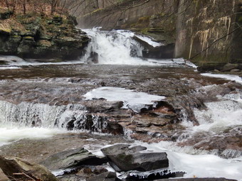 I looked at the trail and it was bare as I expected. I decided to start out with bare boots and carry my spikes until they might be needed. I set my GPS unit and we started on the trail at 11:15 AM with the temperature right at 52 degrees. The trail had some footprints as we walked up the slight grade toward the woods. As we entered the shade of the trees, it immediately seemed a little cooler. As we walked along the trail, there were only a few patches of ice which were easy to avoid. The stream volume looked high and I knew the falls would be roaring. Sheila was taking her own route and following her nose. We were setting a fast pace and I considered walking through to the other end without stopping for pictures. I decided against this option as I knew that the conditions on the way back might not be as good for photography. Along the way, Sheila alerted and I saw a young woman running toward us. I moved to the side of the trail and had Sheila sit beside me. As the runner passed we exchanged greetings and she looked familiar. We were soon at the wooden walkways where I stopped, put my pack down and took out the camera. I took some shots of the stream below but was disappointed that the sky was overcast without any blue patches or white clouds. I put away the camera and picked up my pack to continue over the walkways. The wooden surface was wet and had a coating of mud. This made such a slippery layer I almost fell twice! The problem is that a rock slide has blocked the culvert under the small bridge causing water, mud and stones to be diverted over the walkway. Unblocking the culvert and covering the walkways with some screening would help.
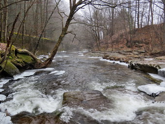 We continued on the trail and came to the falls. I wanted to get down to the streambed so that I could take pictures from in front of the falls. On my previous visit, I started down the path which was untouched and was making good progress until the packed snow started to slide. This time there was no snow at all and it was relatively easy to work my way down the bank to the streambed. I got out the camera and took some shots down stream and the turned my attention to the falls. I took numerous pictures of the falls and the area in front. Sheila, of course, was right with me and making me nervous by getting very close to the cold, rushing water. When I was done, we worked our way back up the bank. I took a few pictures of the falls from the edge of the trail. We continued won the trail to a bench where a path leads down to the stream. I left my pack on the bridge and took the camera with me to the stream's edge. I took shots upstream and downstream with some close-ups right in front of me. I repositioned myself and took some more pictures downstream toward the falls. I finished and walked back to the bench to stow the camera. I saw some impressive ice patches ahead so I took some shots before putting the camera in my pack. We set a quick pace for the rest of the hike to the Parksville end of the trail. Just after the gate at that end, we turned around and headed back to the car without stopping. We were back at the car at 12:20 PM after hiking 2.7 miles in 1 hour and 5 minutes including the stopped time for pictures. There is with virtually no elevation gain on the hike accepted the short trips down to the streambed.
![]()
![]()
![]()
![]() On Tuesday, March 29th I wanted to get in a hike after doing some work for my track team and then going to track practice. Track practice in the afternoon limits my ability to go on longer hikes as I cannot enjoy myself knowing I have to be back at a certain time. As I started to get ready at 10:00 AM the temperature had risen to 38 degrees but it felt much warmer as there was no breeze. From previous trips I thought there would be no snow on Round Top as the recent warn weather had eliminated all the snow and ice even in the woods. It turns out I had forgotten about the short but heavy snowfall on the weekend! I decided I would not need any traction devices to complete a few loops. Sheila was ready to go as she really likes to hike and she was very vocal about hurrying me along. I got dressed in my Patagonia wool 1/4 zip top but decided against a baselayer. I decided to wear my Columbia Titanium insulated pants as it was cool even though I had been using my Railriders recently. I knew that keeping my feet warm and dry would not be an issue so I donned my Vasque Taku hiking boots which fit well and have been discontinued. I made sure I had a pair of Super Green insoles in the shoes to support my arches. I grabbed a pair of Leki external lock poles I have been using all season. Finally, I donned my Mammut hoody which blocks the wind and keeps me warm but has enough zippers to dump heat when needed. I put on a light hat and wore a pair of light gloves. At 10:30 AM we walked out the door to start the hike. I grabbed Sheila's leash from the car and we walked up the driveway. I aimed to hike two figure 8's but knew plans might change depending on the conditions and time. We walked out the driveway and crossed the street to walk along the street to the parking lot of the Presbyterian Church.
On Tuesday, March 29th I wanted to get in a hike after doing some work for my track team and then going to track practice. Track practice in the afternoon limits my ability to go on longer hikes as I cannot enjoy myself knowing I have to be back at a certain time. As I started to get ready at 10:00 AM the temperature had risen to 38 degrees but it felt much warmer as there was no breeze. From previous trips I thought there would be no snow on Round Top as the recent warn weather had eliminated all the snow and ice even in the woods. It turns out I had forgotten about the short but heavy snowfall on the weekend! I decided I would not need any traction devices to complete a few loops. Sheila was ready to go as she really likes to hike and she was very vocal about hurrying me along. I got dressed in my Patagonia wool 1/4 zip top but decided against a baselayer. I decided to wear my Columbia Titanium insulated pants as it was cool even though I had been using my Railriders recently. I knew that keeping my feet warm and dry would not be an issue so I donned my Vasque Taku hiking boots which fit well and have been discontinued. I made sure I had a pair of Super Green insoles in the shoes to support my arches. I grabbed a pair of Leki external lock poles I have been using all season. Finally, I donned my Mammut hoody which blocks the wind and keeps me warm but has enough zippers to dump heat when needed. I put on a light hat and wore a pair of light gloves. At 10:30 AM we walked out the door to start the hike. I grabbed Sheila's leash from the car and we walked up the driveway. I aimed to hike two figure 8's but knew plans might change depending on the conditions and time. We walked out the driveway and crossed the street to walk along the street to the parking lot of the Presbyterian Church.
We began the ascent of the steepest hill behind the church and stopped once or twice as we were setting a fast pace. The hill is short but gets the circulation pumping and is the steepest and longest climb on the "trail." The trail up the hill was bare with no snow or ice. At the top of the hill we stopped to look around. We started on the trail by turning left at the trailhead. The trailhead was bare and that continued even as we entered the woods. At the first trail junction, I followed Sheila as she turned right and started up the woods road which has the gentler approach of the two. There were a few branches on the trail from the winds that had passed through the area. I removed these branches either by dragging them off the trail or by using my poles on the smaller ones. There was no snow or ice on the trail and we could see none in even the shadiest spots. I almost immediately started to get warm so I stopped to open the zippers on my hoody. I don't know why I decided on the very warm wool top. We reached the end of the woods road and turned left up the hill on the trail. We continued up the trail to the first trail junction with the upper blue trail and turned left to follow the yellow trail along the base of Round Top. The yellow trail was bare with only a layer of wet leaves and a few branches here and there. At the next junction with the blue trail we turned right and headed up the blue trail toward the summit. I got a big surprise as the entire hill including the trail was covered in snow! The snow that had fallen on the north and west side of Round Top over the weekend had remained. Climbing even with the snow was very enjoyable as I could still get a good grip in most places. When we got to the switchback, we turned right and followed it until it came back to the main blue trail. The fact that the switchback sidehills in places made the walk a little more difficult. We turned right and then continued straight ahead and up the hill toward the summit of Round Top bypassing the white crossover trail. We continued over the summit, where there was no snow at all, and down the blue trail toward the junction with the yellow trail. There were a few muddy and slippery places but no snow or ice in sight. We continued down to the yellow trail and turned right and walked the yellow trail along the base of Round Top to the next junction with the blue trail. This time we turned left and walked the yellow trail downhill toward the lookout. We passed the "sitting rock" and were soon at the viewpoint. I took a quick peek at a view I had seen many times before and then turned left to start the steeper downhill. We passed by what used to be a side trail to the lookout that I blocked with brush. This side trail has a gap that hikers have to walk over and it can be dangerous for some people in the winter season. Unfortunately, some 'helpful' person had removed the brush without asking or knowing why it was there. The trip down to the first trail junction went quickly. We turned around and started back up the hill toward the lookout to start our second figure 8.
The trip back up the hill to the lookout was pretty easy and I seemed to have gotten a second wind. At the top of the hill we turned right to follow the yellow trail to the first junction with the blue trail. The one short climb along the way was easy and the poles helped. We turned right to followed the yellow trail around the base of Round Top. At the next junction with the blue trail, we turned left and headed up toward the summit. When we got to the white crossover trail we turned left and followed that trail. I wanted to make sure that I had walked all the trails to see how they had faired after some windy days. As we walked the white trail around toward the blue trail, we again started to pick up the snow. We walked to the point where it intersected the blue trail and turned left on the blue trail and then left again on the switchback in blue trail. Walking downhill on the switchback was a little tricky as it sidehills in several places. At the end of the switchback we turned left and walked downhill to the trail junction with the yellow trail. We turned left and again followed the yellow trail along the base of Round Top to the junction with the blue trail. This time we turned right and headed down the yellow trail to the woods road that leads to the first trail junction. As we walked down the road, I noticed all the interesting ledges to the right of the trail. At the first trail junction, we turned left and walked out to the trailhead. We turned right and walked down the hill to the church parking lot and over to the driveway to the house. It was 11:40 AM and we had hiked a little over 2 miles in a little over an hour.
![]()
![]()
![]()
![]() On Friday, March 25th I had not planned to hike as the weather report was for cool and raw conditions with a chance of rain showers. Lisa sent me a text early in the morning asking if we could take a short walk on Round Top as she had been "trapped" inside all week. Lisa is moving her store "Morgan Outdoors" to Hurleyville, another hamlet in Sullivan County. Another couple will be opening an outdoor store in the same space but I will miss Lisa! We agreed to meet at the church at 2:00 PM. I did not have track practice in the afternoon so I was free to do some work in the morning and then hike in the afternoon. As I started to get ready at 1:30 PM the temperature had risen to 52 degrees with overcast skies. I knew from previous trips there was no snow or ice on the trails. Sheila was behaving herself nicely but was always in a position to keep her eye on me. I got dressed in my Mammut crew top but decided against a baselayer as it was warm outside. I put on a pair of RailRiders hiking pants which are expensive but last along time and have features like deep pockets and a generous cut which I really like. The pants have Velcro closures at the ankles. I knew that keeping my feet warm and dry would not be an issue so I donned my Vasque Taku hiking boots which fit well and have been discontinued. I made sure I had a pair of Super Green insoles in the shoes to support my arches. I grabbed a pair of Leki external lock poles I have been using for some time. Finally, I donned my Mammut hoody which blocks the wind and keeps me warm but has enough zippers to dump heat when needed. I put on a light hat and took a pair of light gloves. At 1:55 PM we walked out the door to start the hike. I grabbed Sheila's leash from the car and we walked up the driveway. We walked out the driveway and crossed the street to walk along the street to the parking lot of the Presbyterian Church. Lisa was waiting for us in the parking lot. As soon as Sheila saw Lisa, she fan to strain and pull on her leash. Sheila sometimes takes some time to warm up to people but Lisa is part of her "pack". We all said "Hello" and the started up the hill behind the church.
On Friday, March 25th I had not planned to hike as the weather report was for cool and raw conditions with a chance of rain showers. Lisa sent me a text early in the morning asking if we could take a short walk on Round Top as she had been "trapped" inside all week. Lisa is moving her store "Morgan Outdoors" to Hurleyville, another hamlet in Sullivan County. Another couple will be opening an outdoor store in the same space but I will miss Lisa! We agreed to meet at the church at 2:00 PM. I did not have track practice in the afternoon so I was free to do some work in the morning and then hike in the afternoon. As I started to get ready at 1:30 PM the temperature had risen to 52 degrees with overcast skies. I knew from previous trips there was no snow or ice on the trails. Sheila was behaving herself nicely but was always in a position to keep her eye on me. I got dressed in my Mammut crew top but decided against a baselayer as it was warm outside. I put on a pair of RailRiders hiking pants which are expensive but last along time and have features like deep pockets and a generous cut which I really like. The pants have Velcro closures at the ankles. I knew that keeping my feet warm and dry would not be an issue so I donned my Vasque Taku hiking boots which fit well and have been discontinued. I made sure I had a pair of Super Green insoles in the shoes to support my arches. I grabbed a pair of Leki external lock poles I have been using for some time. Finally, I donned my Mammut hoody which blocks the wind and keeps me warm but has enough zippers to dump heat when needed. I put on a light hat and took a pair of light gloves. At 1:55 PM we walked out the door to start the hike. I grabbed Sheila's leash from the car and we walked up the driveway. We walked out the driveway and crossed the street to walk along the street to the parking lot of the Presbyterian Church. Lisa was waiting for us in the parking lot. As soon as Sheila saw Lisa, she fan to strain and pull on her leash. Sheila sometimes takes some time to warm up to people but Lisa is part of her "pack". We all said "Hello" and the started up the hill behind the church.
We began the ascent of the steepest hill behind the church and stopped once or twice as we were setting a fast pace. The hill is short but gets the circulation pumping and is the steepest and longest climb on the "trail." The trail up the hill was bare with no snow or ice. At the top of the hill we stopped to look around. We started on the trail by turning left at the trailhead. The trailhead was bare and that continued even as we entered the woods. At the first trail junction, we followed Sheila as she continued straight ahead up the hill to the lookout over town. We passed the path to the left that goes out to the lookout and I saw that most of the brush I had placed to block the trail had been removed by some "helpful" people. The path has a gap that could trip up some hikers and I have tried to indicate it is not a trail be removing the blazes and blocking it with brush. When we reached the top of the hill, we followed the yellow trail as it turned to the right and ascended through the woods. The trail continued to be bare with no snow or ice. We followed the yellow trail when it turned right along the base of Round Top at the first junction with the blue trail. Walking was much easier on the flatter ground and allowed us to catch our breath. Sheila was running ahead and then back to us which was fine with me. We continued to follow the yellow trail toward the second junction with the blue trail. Lisa and I always have something to talk about and we had not hiked together for some time. At the next junction with the blue trail, we turned left and started up the hill toward the summit. As we ascended, there were only a few muddy spots which were somewhat slippery. We bypassed the white crossover trail and continued over the summit of Round Top. We walked across the flat summit and started down the hill bypassing the white crossover trail. We turned left on the switchback which sidehills quite a bit. At the end of the switchback, we turned left on the main blue trail and walked down to the junction with the yellow trail. At the junction with the yellow trail, we turned left and walked along the base of Round Top again following the trail. This time when we reached the junction with the yellow trail, we turned right and walked downhill carefully to the woods road. We followed the trail along woods road and back down to the first trail junction. As we walked we took a good look at the ledges that line the trail. Our ambulance corps is scheduled to participate in a low angle rope rescue drill with our fire department and the local forest ranger. I had pointed out to the ranger that many people hike these trails even though the are right in town and there could be a need to rescue someone who was injured. We continued back to the first trail unction. At this point I was ready for another figure 8 but Lisa wanted to finish which was Ok with me. We turned left and walked straight out the trail to the trailhead and turned right to start down the hill to the church parking lot. At the bottom of the hill we walked out to Lisa's car in the parking lot. We said our goodbyes after which Sheila and I walked through the parking lot to Rock Avenue. The roads were bare but we were careful crossing as drivers sometimes exceed the speed limit. After crossing the street to our driveway, we walked back to the house. We were home by 2:45 PM after hiking a little more than a mile in a little more than 45 minutes.
![]()
![]()
![]()
![]() On Tuesday, March 21st I decided it would be appropriate to take my first hike of the spring on Round Top across from my house as I am there so often! I now have track practice in the afternoon which limits my ability to go on longer hikes as I cannot enjoy myself knowing I have to be back at a certain time. As I started to get ready at 10:00 AM the temperature had risen to 42 degrees mad the breeze made it feel cooler. I knew from the day before that there was no snow or ice on the trails. due to the recent warm weather. Sheila was ready to go as she really likes to hike and we had not been out in two day. I got dressed in my Mammut crew top but decided against a baselayer even though I knew I might be a little cool at the beginning. I put on a pair of RailRiders hiking pants which are expensive but last along time and have features like deep pockets and a generous cut which I really like. The pants have Velcro closures at the ankles. I knew that keeping my feet warm and dry would not be an issue so I donned my Vasque Taku hiking boots which fit well and have been discontinued. I made sure I had a pair of Super Green insoles in the shoes to support my arches. I grabbed a pair of Leki external lock poles I have been using for some time. Finally, I donned my Mammut hoody which blocks the wind and keeps me warm but has enough zippers to dump heat when needed. I put on a light hat and took a pair of light gloves. At 10:30 AM we walked out the door to start the hike. I grabbed Sheila's leash from the car and we walked up the driveway. I aimed to hike two figure 8's but knew plans might change depending in the conditions. We walked out the driveway and crossed the street to walk along the street to the parking lot of the Presbyterian Church.
On Tuesday, March 21st I decided it would be appropriate to take my first hike of the spring on Round Top across from my house as I am there so often! I now have track practice in the afternoon which limits my ability to go on longer hikes as I cannot enjoy myself knowing I have to be back at a certain time. As I started to get ready at 10:00 AM the temperature had risen to 42 degrees mad the breeze made it feel cooler. I knew from the day before that there was no snow or ice on the trails. due to the recent warm weather. Sheila was ready to go as she really likes to hike and we had not been out in two day. I got dressed in my Mammut crew top but decided against a baselayer even though I knew I might be a little cool at the beginning. I put on a pair of RailRiders hiking pants which are expensive but last along time and have features like deep pockets and a generous cut which I really like. The pants have Velcro closures at the ankles. I knew that keeping my feet warm and dry would not be an issue so I donned my Vasque Taku hiking boots which fit well and have been discontinued. I made sure I had a pair of Super Green insoles in the shoes to support my arches. I grabbed a pair of Leki external lock poles I have been using for some time. Finally, I donned my Mammut hoody which blocks the wind and keeps me warm but has enough zippers to dump heat when needed. I put on a light hat and took a pair of light gloves. At 10:30 AM we walked out the door to start the hike. I grabbed Sheila's leash from the car and we walked up the driveway. I aimed to hike two figure 8's but knew plans might change depending in the conditions. We walked out the driveway and crossed the street to walk along the street to the parking lot of the Presbyterian Church.
At the first trail junction, I followed Sheila as she continued straight ahead up the hill to the lookout over town. We passed the path to the left that goes out to the lookout and I saw that most of the brush I had placed to block the trail had been removed by some "helpful" people. The path has a gap that could trip up some hikers and I have tried to indicate it is not a trail be removing the blazes and blocking it with brush. When we reached the top of the hill I, decided I did not want to continue to follow the trail as I had been doing that so much lately. I walked up the hill to the right and started to walk along the top of the ledges. After a short distance, I noticed Sheila was not with me and had to call her several times before she came. Sheila often picks her own path and follows animals tracks. We walked along the ledges taking the same path we had often taken before until we came out on the yellow trail at the base of Round Top. I thought we might just bushwhack directly to the summit. I took a few steps into the woods and then realized I had used Sheila's tick repellant on her but had not put any on me nor had I worn gaiters. I decided we would follow the trails so I turned right and followed the yellow trail to the junction with the blue trail. At the junction, we turned left and started up the blue trail, toward the summit. We bypassed the white crossover trail and continued over the summit and down the other side. We gain bypassed the crossover trail but turned left on the switchback in the blue trail. We followed the trail as it turned back toward the main blue trail and I again made a note that this part needed some work to make the walking easier. When we reached the main trail, we turned left and turned left again on the yellow trail at the base of the hill.
We walked along the base of Round Top to the next junction where we turned right to follow the yellow trail downhill toward the first trail junction. We continued to follow the trail as it turned to the right and followed the old woods road back to the first trail junction. We immediately turned around and headed back up the woods road to the junction with the blue trail. We turned left and walked along the base of Round Top on the yellow trail. At the next trail junction with the blue trail, we turned right and headed up the hill. We followed the switchback in the blue trail as it headed right into the woods and then made an almost 180 degree turn to head back to the main blue trail. We turned right and then almost immediately right again on the white crossover trail. These trails were clear of blowdowns but were slippery even though there was no snow or ice due to the with wet leaves. We walked the crossover trail back out to the blue trail where we turned right and walked down to the yellow trail. We turned right and again walked along the yellow trail to the junction with the blue trail. This time we turned left and walked the yellow trail down to the lookout. We continued to follow the yellow trail as it turned left and descended to the first trail junction. We walked out to the trailhead and turned right. We walked to the road through the church parking lot and over to the driveway to the house. It was 11:35 AM and we had hiked a little over 2 miles in a little over an hour.