
What You Missed
Spring 2015
Spring 2015
![]()
![]()
![]()
![]()
![]() On Friday, June 19th, I decided I wanted return to the Finger Lakes Trail to hike a section of the map 19 which is the next map to the west of my completed sections. This section starts at the intersection of Purvis Road and Route 38 just south of Dryden Lake and continues for a little over 18 miles west to Carson Road to the beginning of map 20. Of course, the problem is that I usually have to hike both ways as I have no ride back from the end point. This means hiking, for example, hiking 12 miles to get a 6 mile section of trail. On may hikes I have used other trails of road walks to avoid a strict out-and-back which can be extremely boring! I decided to head west from Marathon on Route 221 and then take Babcock Hollow Road north to Bleck Road. I could then hike the trail to Carson Road and decided whether to us another trail or local roads to return to the car. Sheila was more than ready to hike and I was surprised that she settled down for the long ride very quickly. We left Livingston Manor well before 8:00 AM heading northwest on State Route 17 to Binghamton. From there I took I81 north to the Marathon exit, exit 9. After a brief stop at a gas station, I took Route 221 west for about 11 miles and turned right or north on Babcock Hollow Road. Bleck Road veered off to the right at about 1.8 miles and I began to look for the trail crossing and the parking area. After about 1 mile, I thought I saw signs and the trail crossing but there was no parking area. I turned around and parked near the crossing on the widest shoulder I could find! The temperature was still in the high 60's and I decided to take off the right jacket I was wearing. There was a slight breeze with overcast skies. There were few insects so I decided to eschew the repellent until it was needed. The streams seemed to be running high so I knew I would take the high water bypass along Cortwright Road which paralleled the trail. We crossed the road and began our hike at 9:40 AM. We hiked up a small hill through some pines and I immediately could see that the trail was wet and muddy. Within less than a quarter mile the trail split with the blue Kuzia Cutoff going left. We stayed to the right on the main Finger Lakes Trail and were soon at the point where the trail crosses Cortwright Road. I was surprised to see that the road which was marked on the map was little more than a woods road so we turned left to follow he road and avoid the stream crossing on the trail.
On Friday, June 19th, I decided I wanted return to the Finger Lakes Trail to hike a section of the map 19 which is the next map to the west of my completed sections. This section starts at the intersection of Purvis Road and Route 38 just south of Dryden Lake and continues for a little over 18 miles west to Carson Road to the beginning of map 20. Of course, the problem is that I usually have to hike both ways as I have no ride back from the end point. This means hiking, for example, hiking 12 miles to get a 6 mile section of trail. On may hikes I have used other trails of road walks to avoid a strict out-and-back which can be extremely boring! I decided to head west from Marathon on Route 221 and then take Babcock Hollow Road north to Bleck Road. I could then hike the trail to Carson Road and decided whether to us another trail or local roads to return to the car. Sheila was more than ready to hike and I was surprised that she settled down for the long ride very quickly. We left Livingston Manor well before 8:00 AM heading northwest on State Route 17 to Binghamton. From there I took I81 north to the Marathon exit, exit 9. After a brief stop at a gas station, I took Route 221 west for about 11 miles and turned right or north on Babcock Hollow Road. Bleck Road veered off to the right at about 1.8 miles and I began to look for the trail crossing and the parking area. After about 1 mile, I thought I saw signs and the trail crossing but there was no parking area. I turned around and parked near the crossing on the widest shoulder I could find! The temperature was still in the high 60's and I decided to take off the right jacket I was wearing. There was a slight breeze with overcast skies. There were few insects so I decided to eschew the repellent until it was needed. The streams seemed to be running high so I knew I would take the high water bypass along Cortwright Road which paralleled the trail. We crossed the road and began our hike at 9:40 AM. We hiked up a small hill through some pines and I immediately could see that the trail was wet and muddy. Within less than a quarter mile the trail split with the blue Kuzia Cutoff going left. We stayed to the right on the main Finger Lakes Trail and were soon at the point where the trail crosses Cortwright Road. I was surprised to see that the road which was marked on the map was little more than a woods road so we turned left to follow he road and avoid the stream crossing on the trail.
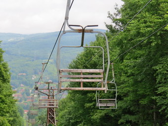
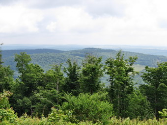 The road was very wet with many muddy spots and pools of standing, stagnant water. It was easier to avoid the water than the slippery mud but neither posed a big problem. There were now clouds of insects around me but they didn't seem to be landing or biting as long as I kept moving. The road continued uphill for about 1.2 miles where Baldwin Road came up on the right. At this point Cortwright Road started to be more navigable and we rejoined the main FLT as it came in from the right. We continued on the road for another .2 miles to 1.6 miles where the trail crossed the ditch on the right on a small bridge and then started an ascent of 1.2 miles to the top of the Greek Peak Ski Area. The trail headed generally northeast with a few twists and turns and even some slight descents on the way. It was very muddy in most spots and crossed several small stream. At 10:50 Am we had hiked 2.75 miles and I could see the ski lifts from the trail. I decided to walk over to see if there was a view. We walked through some briars and high grass and arrived at the ski lift. There was a view where the lift right-of-way had been cut but there wasn't much to see. I took a few pictures before we returned to the trail to begin the walk to Virgil Mountain, the highest peak in the area. The trail remained wet in places but the drop between the two peaks was just over 100 feet. We passed the highest point which had no views and descended to a power line. There were views from here but none were spectacular especially since the power line dominated the views. After taking a few shots, we turned right to follow the right-of-way. There were only a few white splashes of paint on some rocks to follow and I kept looking for the place where the Finger Lakes Trail would turn back into the woods. After about .2 miles, a sign appeared which clear indicated that the main Finger Lakes Trail turned to the left. The yellow blazed Virgil Mountain Trail went off to the right and I had considered returning to the car that way. This would require a second hike to take in the rest of the Finger Lakes Trail from Carson Road back to Virgil Mountain. I was feeling pretty good and the skies had cleared so I decided to push on to Carson Road.
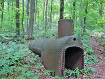 We turned left to stay on the Finger Lakes Trail and had to negotiated some very wet and muddy areas to get on the trail. We started the steepest descent of the day losing 800 feet in the 1.3 miles from the turn to Tone Road at the bottom of the mountain. The trail at first headed ESE but at 4.5 miles turned northeast and the descent became steeper. The trail was muddy in many places and the map showed that we were following an intermittent stream. At one point we came to what looked like a steam boiler so I stopped to take a few pictures. Some stories mentioned that it was from a railroad engine but it looked to me as if it had been part of a stationary installment. As we continued our descent, Sheila alerted and I saw a father and daughter hiking up the mountain toward us. They were dressed for a quick, light hike with minimal equipment. As we parted, I mentioned the mud and the father told me that he did the hike several times a week and it was always muddy! When we reached Tone Road, I got a snack and a drink and stowed my poles fort he road walking ahead. I put Sheila on her leash as we walked north along Tone Road which runs parallel to Route 392 but on the other side of Gridley creek. At 6 miles we crossed the creek on a road bridge, turned left and walked up the road a few hundred feet to Carson Road. I remembered Carson Road from the summer of 2013 when I had hiked many sections of the Finger Lakes Trail. What I didn't remember was that the hike was all uphill for about a mile. It only took 20 minutes for us to hike the 1 miles to the wide spot in the road where the trail enters the woods on the left. We immediately turned around and took another 20 minutes to get back top Route 392.
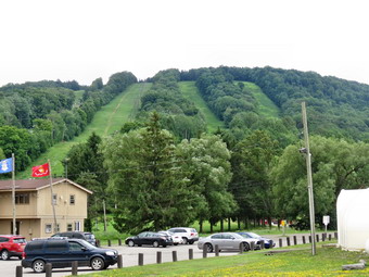 We walked west for 3.2 miles to Vandonsel Road. The route was almost flat and the shoulder of the road was wide although the traffic was always well above the speed limit. Very soon after starting out on Route 392 we passed the Greek Peak Ski Area. There were lodges and a convention center and I could see the chair lifts as they climbed the hill. There was also a small zip line and a few high school age students were using it. Later on we had to cross a one lane bridge which was very narrow but we timed it just right so that no cars were on the bridge at the same time we were there. We also passed a small convenience store but I ha plenty of water and wanted to keep going. At 2:10 PM we arrived at the left turn onto Vandonsel Road for the final push back to the car. We had been hiking at about 1300 feet along Route 392 and I knew the car was at 1580 feet so I had anticipated about a 200 to 300 foot climb. I should have consulted the topo map and GPS more carefully as I looked at the road and found there was a significant climb up and over the ridge we had been on earlier in the hike. The route climbed to Bleck Road which continue to climb before a descent to the car. There was no way to avoid this climb so we got started right away gaining about 420 feet heading southeast for 1.1 miles to the intersection with Bleck Road. This wasn't a steep climb but I was tired and the skies had cleared so that the sun was beating down on us. Sheila did her part by giving me a little extra pull up the hill. t Bleck Road we turned right and began heading south but continuing to climb for the next .25 miles. We finally hit the top and started down with my feet feeling very irrigated on the bottom. I pulled up my socks and ignored the discomfort which soon seemed to go away. At 3:15 PM we were back at the car after hiking for 5 hours and 40 minutes covering 14.3 miles with a 2095 foot elevation gain.
![]()
![]()
![]()
![]()
![]() On Wednesday, June 17th, I needed to get out after a week of track meets and rain. I decided that I was tired of the "local" spots and decided to head to the Neversink Unique Area to hike the loop to Denton and Mullet Falls. I thought that the recent rain might have augmented these waterfalls making them more interesting. I got my equipment ready, put Sheila in the back seat and left Livingston Manor just after around 8:00 AM. Sheila was certainly anxious to get out as both she and I prefer several hikes a week! The temperature was already in the high 60's and I anticipated it going even higher. The humidity wasn't as bad as over the previous few days but was still uncomfortable. I wore a light long-sleeved top and was prepared for biting insects with several different repellant. We arrived at the parking area on Katrina Falls Road at about 8:30 AM and got ready to hike immediately. There was only one other car in the lot and, strangely, it had several clothing items stuffed in the door handle. As we walked down the hill passed the trail register, there was one large blowdown across the trail. It was pretty high up so that I could walk under it but I did not think it was well-supported. I thought this should be removed before it comes down by itself! We turned left at the bottom of the hill to stay on the main trail and came to the small bridge over Wolf Brook. The water was not as high as I had thought it might be and I decided to continue on without taking any pictures. At the top of the next small hill, we stayed to the right to hike the loop counterclockwise hitting Denton Falls on the Neversink first an then the falls on Mullet Brook. Soon we were crossing the lower bridge on Mullet Brook where the water was lower than I expected. I knew that the bridge was in disrepair and wasn't surprised to find nothing had been done to repair it. The DEC insists that it is the entity that must repair and construct bridges but doesn't have enough people to get the job done. This bridge needs to be repaired before it collapses and must be completely replaced. At 1.4 miles we turned right following the yellow spur trail blazes downhill to Denton Falls.
On Wednesday, June 17th, I needed to get out after a week of track meets and rain. I decided that I was tired of the "local" spots and decided to head to the Neversink Unique Area to hike the loop to Denton and Mullet Falls. I thought that the recent rain might have augmented these waterfalls making them more interesting. I got my equipment ready, put Sheila in the back seat and left Livingston Manor just after around 8:00 AM. Sheila was certainly anxious to get out as both she and I prefer several hikes a week! The temperature was already in the high 60's and I anticipated it going even higher. The humidity wasn't as bad as over the previous few days but was still uncomfortable. I wore a light long-sleeved top and was prepared for biting insects with several different repellant. We arrived at the parking area on Katrina Falls Road at about 8:30 AM and got ready to hike immediately. There was only one other car in the lot and, strangely, it had several clothing items stuffed in the door handle. As we walked down the hill passed the trail register, there was one large blowdown across the trail. It was pretty high up so that I could walk under it but I did not think it was well-supported. I thought this should be removed before it comes down by itself! We turned left at the bottom of the hill to stay on the main trail and came to the small bridge over Wolf Brook. The water was not as high as I had thought it might be and I decided to continue on without taking any pictures. At the top of the next small hill, we stayed to the right to hike the loop counterclockwise hitting Denton Falls on the Neversink first an then the falls on Mullet Brook. Soon we were crossing the lower bridge on Mullet Brook where the water was lower than I expected. I knew that the bridge was in disrepair and wasn't surprised to find nothing had been done to repair it. The DEC insists that it is the entity that must repair and construct bridges but doesn't have enough people to get the job done. This bridge needs to be repaired before it collapses and must be completely replaced. At 1.4 miles we turned right following the yellow spur trail blazes downhill to Denton Falls.
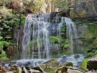 The trail down to the falls is poorly marked and hikers trying to follow it have created new paths which compounds the problem. After hiking 1.65 miles, we were at the rocks near the edge of Denton Falls. The river wasn't as high as I thought it might be but I dropped my pack and started to take some pictures. I noticed that Sheila seemed prepared to jump in and swim to the other side so I discouraged her emphatically. I was able to walk along the rocks to get just below the falls. I took quite a few pictures of the falls and some both upstream and downstream. I made sure that the pictures overlapped since I thought they would make a nice panorama. The falls are hardly three feet high but the volume of water made the trip worthwhile. We headed back up the trail to the main trail and turned right. At the trail junction we kept to the left to start the loop. The trail straight ahead goes down to High Falls. It adds a bit of distance but the falls aren't too different from Denton Falls. After a brief walk uphill, we turned left onto the short trail down to Mullet Brook Falls. The trail has no sign and could be easily missed. In fact, there is signage anywhere! I saw a total of only three yellow blazes on our way down to the falls and on the way back. When the falls came into sight, it was much like the rest of the trip. There was enough water to make it interesting but far less than I had hoped for. I dropped my pack and got out the camera. After a few initial shots, I walked onto the pile of rocks just down from the base of the falls. I had to be careful as the rocks were covered with moss and were wet from the rain and spray from the falls. I took pictures of the falls, the pool, and the outlet to the pool. Eventually it was time to leave and we started back. We walked back out to the main trail and turned left to complete the loop. As we climbed we noticed the rocky ledges to our right. Soon we crossed over another bridge spanning Mullet Brook. After a brief walk we were at a trail junction. Straight ahead on the trail leads to the Wolf Lake Multiple Use Area. We turned left and began to descend off the ridge. I stopped to tie one of my shoes and found this was a mistake as I was swarmed by mosquitoes. I thought about putting on some repellent but in the end decided just to continue to walk quickly. We hiked downhill for some time and eventually came to the trail junction just above the bridge over Wolf Creek. There had been several blowdowns along the way that needed to be cleared and the final part of the trail was covered in smaller branches. I thought about taking a few pictures of Wolf Brook but decided to keep moving to avoid the insects. Once on the other side of the brook we made the right turn on the woods road back to the car and kept a quick pace until we arrived at the parking area at 10:45 AM. We hiked 4.6 miles in just over 2 hours. The car that had been parked was gone and three more were now in the lot. Two young fly fishermen were getting ready to start their day. We discussed the conditions and wished each other a "Good day".
![]()
![]()
![]()
![]() On Wednesday, June 10th, the had stopped in the early morning but I had plans which did not include hiking. Lisa sent me an early email asking if I would like to hike and it sounded like a good idea. We decided to go to the Frick Pond area and hike up the Big Rock Trail to get some "up" into our hike. We agreed to meet at the caboose near the ramps to Route 17 and 8:30 AM. We both arrived on time and Lisa got into my car with her gear. Sheila said "Hello" much too enthusiastically as I drove out the DeBruce Road. I turned left on Mongaup Road and stayed to the left where Beech Mountain Road splits off. I parked in the smaller lot and was not surprised that we were the only hikers since it was before 9:00 AM. We started our hike at 8:50 AM by walking out of the back of the larger parking area on the Quick Lake Trail. I had brought my Silky Sugowaza saw just in case I needed to cut any blowdowns! When we turned onto the woods road that leads to Frick Pond, Lisa signed the register and I inspected the trail. It was very wet with lots of standing water and some mud. I am much more conscious of trail conditions now that I have become hooked on trail maintenance. There were places to walk along the sides of the road that were not quite as wet but I made a one to bring a shovel and pick to clean out, widen and deepen some drainage. The wet areas continued along the trail until we got to Gravestone Junction. The muddy area to the left on the Quick Lake Trail was very wet and I thought how much I was looking forward to building a walkway here. We turned right onto the Loggers Loop and started to walk to Times Square. The first part of this trail had a lot of wet grass but only a few areas with standing water. There were very few branches on the ground since it had recently been cleared. As we crested the little hill and started down the other side, we came across several wet and muddy areas that I had not noticed on my previous trips this year. The worst area was even larger and I beacon to think about building another walkway! We continued to Times Square which we reached after hiking just over one mile.
On Wednesday, June 10th, the had stopped in the early morning but I had plans which did not include hiking. Lisa sent me an early email asking if I would like to hike and it sounded like a good idea. We decided to go to the Frick Pond area and hike up the Big Rock Trail to get some "up" into our hike. We agreed to meet at the caboose near the ramps to Route 17 and 8:30 AM. We both arrived on time and Lisa got into my car with her gear. Sheila said "Hello" much too enthusiastically as I drove out the DeBruce Road. I turned left on Mongaup Road and stayed to the left where Beech Mountain Road splits off. I parked in the smaller lot and was not surprised that we were the only hikers since it was before 9:00 AM. We started our hike at 8:50 AM by walking out of the back of the larger parking area on the Quick Lake Trail. I had brought my Silky Sugowaza saw just in case I needed to cut any blowdowns! When we turned onto the woods road that leads to Frick Pond, Lisa signed the register and I inspected the trail. It was very wet with lots of standing water and some mud. I am much more conscious of trail conditions now that I have become hooked on trail maintenance. There were places to walk along the sides of the road that were not quite as wet but I made a one to bring a shovel and pick to clean out, widen and deepen some drainage. The wet areas continued along the trail until we got to Gravestone Junction. The muddy area to the left on the Quick Lake Trail was very wet and I thought how much I was looking forward to building a walkway here. We turned right onto the Loggers Loop and started to walk to Times Square. The first part of this trail had a lot of wet grass but only a few areas with standing water. There were very few branches on the ground since it had recently been cleared. As we crested the little hill and started down the other side, we came across several wet and muddy areas that I had not noticed on my previous trips this year. The worst area was even larger and I beacon to think about building another walkway! We continued to Times Square which we reached after hiking just over one mile.
The area around Times Square was wet as always and we debated the best way to start to solve the problem. We also talked about the Big Rock Trail around the back of Frick Pond as it also has some areas which needs some car. Lisa and I turned right and started up the Big Rock Trail which is well-drained and has little or no wet or muddy areas. This trail is also a snowmobile trail and I had cleared it recently so we found only a few small branches to remove. Lisa and I walked and talked keeping up a good pace. The sky was blue with only a few clouds and the sun was out. I was glad I had decided to leave my light jacket in the car! I noticed that as soon as we stopped the insects started to swarm and this got worse as the day progressed. The distance from Times Square to the Flynn Trail is 1.1 miles and gains just under 600 feet in elevation. The average grade is less than 10% but seems steep in comparison to the flatter trails in the area. When we arrived at the Flynn Trail, we turned right to head back to the car on the Flynn Trail. I was amazed at how quickly the grass and weeds had sprung up in only a week. I decided that some cutting might be in order at our next Willowemoc Trail Crew work day. As we started down the trail, I pointed out to Lisa the areas where we had cleared some pretty substantial blowdowns. Several were almost impossible to spot which I decided meant we had done a good job. The walk on the Flynn Trail is downhill all the way but usually seems longer than I remember from the last time. When we arrived at the gate, we turned left to finish the hike on the Flynn Trail and avoid the private property around the cabin. We were back at the car by 10:35 AM having taken 1 hour and 45 minutes to hike 3.9 miles and handle about 720 feet of elevation gain. When we were back at the car, I realized I had not taken my camera out of the pack. We had been keeping a fast pace and there really weren't any opportunities for photography.
![]()
![]()
![]()
![]()
![]() On Sunday, June 7th, I was ready for a hike after church and an ambulance call. Cindy was not interested so I decided to head for the Frick Pond area to do a little more trail maintenance. I didn't get started until about 12:15 PM when I left home with Sheila and headed out DeBruce Road. I decided to save some weight and bring only my Silky Sugowaza saw that is a little over a foot long with a curved blade. I also brought two felling wedges. I thought that if I did need the wedges, I could use a rock to hammer them home. When we arrived at the parking area, I was surprised to see no other cars since it was such a nice day with an air temperature of about 70 degrees and a slight breeze. There were only a few clouds in the sky and the sun shown brightly. Even though it had rained there were very few insects which I attributed to the breeze. We started our hike at 12:30 PM by walking to the larger parking area to pick up the Quick Lake Trail toward Frick Pond. When we hit the woods road, we turned left and found that it was very wet and muddy in spots. At Gravestone Junction I checked out the muddy area which spanned the trail and made a note to push my project to construct a walkway over this area. We turned right on the Logger's Loop and walked the trail to Times Square. We had cleared this trail during our first Willowemoc Trail Crew work day and there were only a few branches to pick up. I did make note of a very muddy area which could use a walkway and a few that might be solved with some stepping stones. After hiking a little more than a mile, we arrived at Times Square. This area was very wet with water that drains down the Loggers Loops and collects at the trail junction. I thought about how to solve this problem but an immediate solution did not present itself. We continued straight ahead to stay on the Loggers Loop to Iron Wheel Junction. This is a snowmobile trail and is well-maintained by the club members. There were a few branches and blowdowns to clear but none required cutting. The Loggers Loop is most uphill until the end where the trail descends a little and then comes to Iron Wheel Junction at 2.3 miles.
On Sunday, June 7th, I was ready for a hike after church and an ambulance call. Cindy was not interested so I decided to head for the Frick Pond area to do a little more trail maintenance. I didn't get started until about 12:15 PM when I left home with Sheila and headed out DeBruce Road. I decided to save some weight and bring only my Silky Sugowaza saw that is a little over a foot long with a curved blade. I also brought two felling wedges. I thought that if I did need the wedges, I could use a rock to hammer them home. When we arrived at the parking area, I was surprised to see no other cars since it was such a nice day with an air temperature of about 70 degrees and a slight breeze. There were only a few clouds in the sky and the sun shown brightly. Even though it had rained there were very few insects which I attributed to the breeze. We started our hike at 12:30 PM by walking to the larger parking area to pick up the Quick Lake Trail toward Frick Pond. When we hit the woods road, we turned left and found that it was very wet and muddy in spots. At Gravestone Junction I checked out the muddy area which spanned the trail and made a note to push my project to construct a walkway over this area. We turned right on the Logger's Loop and walked the trail to Times Square. We had cleared this trail during our first Willowemoc Trail Crew work day and there were only a few branches to pick up. I did make note of a very muddy area which could use a walkway and a few that might be solved with some stepping stones. After hiking a little more than a mile, we arrived at Times Square. This area was very wet with water that drains down the Loggers Loops and collects at the trail junction. I thought about how to solve this problem but an immediate solution did not present itself. We continued straight ahead to stay on the Loggers Loop to Iron Wheel Junction. This is a snowmobile trail and is well-maintained by the club members. There were a few branches and blowdowns to clear but none required cutting. The Loggers Loop is most uphill until the end where the trail descends a little and then comes to Iron Wheel Junction at 2.3 miles.
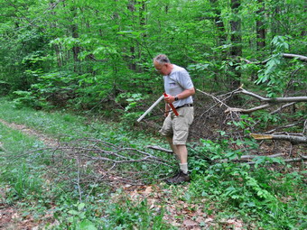
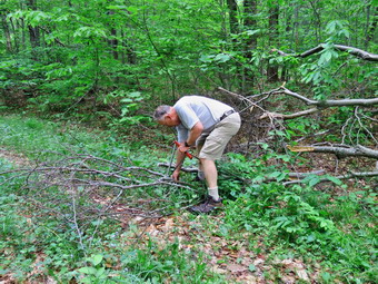
 We continued straight ahead at the junction to continue on the Quick Lake Trail. Cindy and I had cleared this trail earlier in May and there were only a few new branches to remove. Just before Junkyard Junction there was one or two larger branches which I cut back using the saw. By 2:30 PM we had hiked 3.9 miles and had arrived at Junkyard Junction where we turned right on the Flynn Trail. As I looked down the Flynn Trail, I could see there were quite a few branches beginning to encroach on the trail. I got out my saw and began clearing them as we walked along. Many of these branches were small and a lopper would have done a better job than my saw. There were a few larger saplings and branches to be cut so I was glad I had the saw. When we got to the gate on the Flynn Trail, I took a few minutes to clear some branches that were starting to grow into the trail. Soon we were at the point on the trail were a very large tree blocks the route. This tree is too large to cut without a chainsaw so the trail was rerouted to the left. I cut a few sapling out of the way including one larger one that was partly in the trail. I also used the saw to cut some stumps to ground level. As we turned left back onto the main trail, a rather large branch blocked the trail. I took a few pictures of "before" and then got out my saw. I made several cuts so that the pieces were easier to move and pulled them off to the side of the trail. I took some "after" pictures, cleared a few more branches and then stowed the saw.
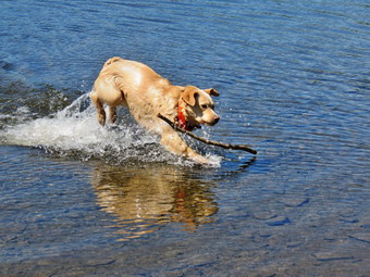 We walked down the trail and stayed to the right to continue to the outlet of Hodge Pond on the Flynn Trail. There were some deep ruts in the trail and some very wet and muddy areas as we approached the open field. At the outlet end of the pond we walked over to the shore and I took a few pictures while Sheila swam. I threw a stick for her to retrieve and she swam out to get it while I snapped a few more shots. It was 3:15 PM and we had hiked 4.8 miles. My feet were hurting a little so I packed up and we headed up the Flynn Trail toward the junction with the Big Rock Trail. The first part of the trail was clear of brush but I picked up a few branches as we passed the gate on the Flynn Trail. The trail junction came up sooner than I expected and I knew we were only 1.7 miles from the car. The trip back to the parking area is all downhill and should go fast but it always seems longer me. There are several spots that look like the end and always seem to fool me. Soon we were at the gate where we turned left to finish the hike on the Flynn Trail and avoid the private property around the cabin. We were back at the car by 4:20 PM having taken 3 hours and 45 minutes to hike 7.3 miles and handle a little over 1000 feet of elevation gain. Of course, this time also included the time needed to clear the trail as we walked.
![]()
![]()
![]()
![]()
![]()
![]() On Friday, June 5th, I was ready to hike after a week of track practice and championship meets. I had also been trying to recover from some foot pain which seemed to improve with rest. I found out, however, that standing for hours on Thursday at a track meet on artificial turf seemed to exacerbate the injury! By Friday morning I was able to get around and decided I wanted to visit the South Beacon fire tower which had been restored since my last visit several years ago. Cindy decided to come along so we got Sheila in the car along with our gear and headed out of Livingston Manor around 9:00 AM. The easiest way to get to the parking area seemed to be to take Route 17 to Middletown and then pick up I84 East to the Newburgh-Beacon Bridge. After crossing the bridge, I took Route 9D south for about 2.5 miles to the parking area on the left. We were surprised to find 8 to 10 cars parked in the lot but knew that many people liked to hike up to the casino lookout and then head back. Our plan was to hike to the lookout and then to the fire tower. After that we could return the same way or hike a loop along Scofield Ridge. The temperature was already in the high 60's and the humidity in the air was noticeable. The forecast did not call for rain but some clouds seemed to indicate that a shower was possible. The Scenic Hudson group is responsible for the trails in the area and for buying and maintaining the land. The two Beacon peaks take their names from their use during the Revolutionary War when American patriots set beacon fires on one or both mountains to send signals that could be seen from some distance. The overlook on North Beacon Mountain was once home to the Beaconrest Hotel and a Casino. The patrons were carried to the top by an Otis Inclined Railway built in 1902. The donkey engines at the top of the mountain pulled the cars up to the top. All that remains of the casino and hotel are remnants of the foundations. Some of the rails and machinery from the railway can still be seen. The brick walls of the building that housed the engines in crumbling and the machines are rusting but it is remarkable to me that anything still remains. We started out up the graveled path just before 10:30 AM and were soon at the metal steps that give access to the trails on the mountain. At this point I realized I did not have my GPS unit. I left Cindy and Sheila and jogged back to the car to find the unit just where I had left it in the trunk. I turned the unit on and started the GPS track at just after 10:45 AM. I caught rejoined Cindy and Sheila and we began the walk up the metal stairs. I still had Sheila on her leash as people were coming down from their morning walk to the overlook. Soon we were at the top of the steps with no one else in sight on the trails and I let Sheila off her leash. I gave her the "With" command which is the equivalent of "Heel" and we started up the trail.
On Friday, June 5th, I was ready to hike after a week of track practice and championship meets. I had also been trying to recover from some foot pain which seemed to improve with rest. I found out, however, that standing for hours on Thursday at a track meet on artificial turf seemed to exacerbate the injury! By Friday morning I was able to get around and decided I wanted to visit the South Beacon fire tower which had been restored since my last visit several years ago. Cindy decided to come along so we got Sheila in the car along with our gear and headed out of Livingston Manor around 9:00 AM. The easiest way to get to the parking area seemed to be to take Route 17 to Middletown and then pick up I84 East to the Newburgh-Beacon Bridge. After crossing the bridge, I took Route 9D south for about 2.5 miles to the parking area on the left. We were surprised to find 8 to 10 cars parked in the lot but knew that many people liked to hike up to the casino lookout and then head back. Our plan was to hike to the lookout and then to the fire tower. After that we could return the same way or hike a loop along Scofield Ridge. The temperature was already in the high 60's and the humidity in the air was noticeable. The forecast did not call for rain but some clouds seemed to indicate that a shower was possible. The Scenic Hudson group is responsible for the trails in the area and for buying and maintaining the land. The two Beacon peaks take their names from their use during the Revolutionary War when American patriots set beacon fires on one or both mountains to send signals that could be seen from some distance. The overlook on North Beacon Mountain was once home to the Beaconrest Hotel and a Casino. The patrons were carried to the top by an Otis Inclined Railway built in 1902. The donkey engines at the top of the mountain pulled the cars up to the top. All that remains of the casino and hotel are remnants of the foundations. Some of the rails and machinery from the railway can still be seen. The brick walls of the building that housed the engines in crumbling and the machines are rusting but it is remarkable to me that anything still remains. We started out up the graveled path just before 10:30 AM and were soon at the metal steps that give access to the trails on the mountain. At this point I realized I did not have my GPS unit. I left Cindy and Sheila and jogged back to the car to find the unit just where I had left it in the trunk. I turned the unit on and started the GPS track at just after 10:45 AM. I caught rejoined Cindy and Sheila and we began the walk up the metal stairs. I still had Sheila on her leash as people were coming down from their morning walk to the overlook. Soon we were at the top of the steps with no one else in sight on the trails and I let Sheila off her leash. I gave her the "With" command which is the equivalent of "Heel" and we started up the trail.
![]() The trail is steep in several places and has a lot of loose dirt and stones which slip under foot. On this day everything was dry which made slipping more likely. At about .4 miles a yellow spur trail joins from the left. This trail can be used as part of a loop from the Fishkill Ridge and Lamb's Hill. At this point we followed a sharp switchback to the right although on previous trips I had continued straight ahead. The entire trail system has many unofficial trails, paths and woods roads all of which eventually lead to the overlook as long as you choose "Up" as the primary direction. We continued to follow the trail meeting a few people on their way down. Each time I would put Sheila on her leash so that she would not bother other people or their dogs. The trail continues to be rocky all the way to the top as we followed the official trail markers despite the numerous other options. Soon we could see the powerhouse to the right and followed the trail to the site of the casino. We walked over to the powerhouse which is unfortunately defaced by graffiti. I took some pictures of the building and the machinery before walking to the overlook which is a little over 1 mile from the parking area. The challenge of the hike is that in a mile the elevation gain is almost 1000 feet with an average grade of over 19%. I dropped my pack and got out my camera to take pictures of the Hudson River below to both the north and south. There was very little haze over the river which is unusual. I took pictures of the Newburgh-Beacon Bridge and other landmarks as I walked along the edge of the overlook. I also took a few shots of the steps for the old casino, the foundation of the hotel and of Cindy and Sheila looking out over the river. I put my camera away and we began the next mile of the hike to the tower by following a woods road southeast as it dipped a little before ascending to another ridge. This part of the trail was a little damper with some mud and standing water. We climbed up some exposed bedrock passing the wrecks of two old cars and turning right to follow the trail at the top of the ridge. As we turned right we noticed that someone had created a "cairn garden" which must have taken some time as many were precariously balanced. I took a few pictures before we continued to follow the woods road.
The trail is steep in several places and has a lot of loose dirt and stones which slip under foot. On this day everything was dry which made slipping more likely. At about .4 miles a yellow spur trail joins from the left. This trail can be used as part of a loop from the Fishkill Ridge and Lamb's Hill. At this point we followed a sharp switchback to the right although on previous trips I had continued straight ahead. The entire trail system has many unofficial trails, paths and woods roads all of which eventually lead to the overlook as long as you choose "Up" as the primary direction. We continued to follow the trail meeting a few people on their way down. Each time I would put Sheila on her leash so that she would not bother other people or their dogs. The trail continues to be rocky all the way to the top as we followed the official trail markers despite the numerous other options. Soon we could see the powerhouse to the right and followed the trail to the site of the casino. We walked over to the powerhouse which is unfortunately defaced by graffiti. I took some pictures of the building and the machinery before walking to the overlook which is a little over 1 mile from the parking area. The challenge of the hike is that in a mile the elevation gain is almost 1000 feet with an average grade of over 19%. I dropped my pack and got out my camera to take pictures of the Hudson River below to both the north and south. There was very little haze over the river which is unusual. I took pictures of the Newburgh-Beacon Bridge and other landmarks as I walked along the edge of the overlook. I also took a few shots of the steps for the old casino, the foundation of the hotel and of Cindy and Sheila looking out over the river. I put my camera away and we began the next mile of the hike to the tower by following a woods road southeast as it dipped a little before ascending to another ridge. This part of the trail was a little damper with some mud and standing water. We climbed up some exposed bedrock passing the wrecks of two old cars and turning right to follow the trail at the top of the ridge. As we turned right we noticed that someone had created a "cairn garden" which must have taken some time as many were precariously balanced. I took a few pictures before we continued to follow the woods road.
![]() At 1.85 miles we found a path that ascended to the tower. This path is not marked and the official white path is a few hundred feet further along the red Casino Trail. We started up the path both and walked over some exposed rock. We both thought it would be an interesting hike in the winter! As we neared the top, we could see the tower and we stopped so that I could take a few pictures before we continued to the summit. We walked up to the summit and found one other hiker present. I dropped my pack and tethered Sheila to one of the tower supports. It was 12:15 PM and we had hiked just over 2 miles and gained 1430 feet to the base of the tower. I knew Cindy wouldn't want to go up very far so I grabbed my camera ad headed for the cab! The tower was reconstructed with all metal components including open grate steps and landings. The cab has an open grate floor which I found a little disconcerting. The cab has openings for windows which give a great 360 degree view but is otherwise "bare bones. I took pictures up and own the river and then to the west and east. After looking around, I descended taking few shots of the tower structure as I came down. Once I was on the ground, Cindy pointed out the large military cargo aircraft circling Stewart Air Force Base waiting to land. While we were at the tower, at least four of these aircraft landed on the field. After a snack and a drink, we started back down the trail to the main Casino Trail. When we arrived at the bottom, we turned right and followed the red blazes for another quarter mile out to the yellow Wilkinson Memorial Trail.
At 1.85 miles we found a path that ascended to the tower. This path is not marked and the official white path is a few hundred feet further along the red Casino Trail. We started up the path both and walked over some exposed rock. We both thought it would be an interesting hike in the winter! As we neared the top, we could see the tower and we stopped so that I could take a few pictures before we continued to the summit. We walked up to the summit and found one other hiker present. I dropped my pack and tethered Sheila to one of the tower supports. It was 12:15 PM and we had hiked just over 2 miles and gained 1430 feet to the base of the tower. I knew Cindy wouldn't want to go up very far so I grabbed my camera ad headed for the cab! The tower was reconstructed with all metal components including open grate steps and landings. The cab has an open grate floor which I found a little disconcerting. The cab has openings for windows which give a great 360 degree view but is otherwise "bare bones. I took pictures up and own the river and then to the west and east. After looking around, I descended taking few shots of the tower structure as I came down. Once I was on the ground, Cindy pointed out the large military cargo aircraft circling Stewart Air Force Base waiting to land. While we were at the tower, at least four of these aircraft landed on the field. After a snack and a drink, we started back down the trail to the main Casino Trail. When we arrived at the bottom, we turned right and followed the red blazes for another quarter mile out to the yellow Wilkinson Memorial Trail.
![]() We turned left on the yellow trail and started a climb to the top of Scofield Ridge which has the highest point in Putnam County. The trail has some nice views but can be hard to follow as it is often overgrown with brush. Soon we ascended to a rock outcrop which overlooks the Beacon Reservoir and looks back at the fire tower. This is one of my favorite views on the east side of the Hudson. I dropped by pack and took out my camera to take some more pictures. I pointed out the trail to Cindy as it descended only to climb the ridge again. My plan was to descend to the road to the reservoir and follow a woods road back to the Casino Trail. Cindy decided she was too tired to walk that route so we turned around and retraced our steps back the way we had come skipping the detour to the fire tower! I dislike retracing my steps but the walk seemed to go faster than I expected. The descent from the casino overlook to the metal steps was miserable as the loose rock made slipping almost inevitable. We met a few people starting their hike as we were coming down and soon we were at the metal steps. We followed the path back to the car arriving in the parking area at 2:50 PM. We had hiked 5.3 miles in 4 hours stopping for 50 minutes along the way with an total vertical gain of 1730 feet.
We turned left on the yellow trail and started a climb to the top of Scofield Ridge which has the highest point in Putnam County. The trail has some nice views but can be hard to follow as it is often overgrown with brush. Soon we ascended to a rock outcrop which overlooks the Beacon Reservoir and looks back at the fire tower. This is one of my favorite views on the east side of the Hudson. I dropped by pack and took out my camera to take some more pictures. I pointed out the trail to Cindy as it descended only to climb the ridge again. My plan was to descend to the road to the reservoir and follow a woods road back to the Casino Trail. Cindy decided she was too tired to walk that route so we turned around and retraced our steps back the way we had come skipping the detour to the fire tower! I dislike retracing my steps but the walk seemed to go faster than I expected. The descent from the casino overlook to the metal steps was miserable as the loose rock made slipping almost inevitable. We met a few people starting their hike as we were coming down and soon we were at the metal steps. We followed the path back to the car arriving in the parking area at 2:50 PM. We had hiked 5.3 miles in 4 hours stopping for 50 minutes along the way with an total vertical gain of 1730 feet.
![]()
![]()
![]()
![]()
![]() On Saturday, May 30th, I was ready for the first work day for the Willowemoc Trail crew. I had prepared by sending out emails and asking others to post information on their sites. Lisa at Morgan Outdoors included the work day in her emails. I also made sure to have the correct paperwork for as many as twenty people since I had gotten a variety of responses to my emails. I was at Morgan Outdoors at 9:00 AM to meet those who wanted to follow me to Frick Pond. By 9:15 AM no volunteers had appeared so I headed to Frick Pond. I parked in the big lot next to a pickup truck. There was no one in the truck so I waited until 9:25 AM when a car pulled up next to me. When the occupants got out, I asked them "Walk or work?" and they responded with "Walk". At the same time someone got out of the pickup and I was happy to see that it was Harry Rampe. Harry had the seat reclined and I had not seen him. We filled out the volunteer applications and the roster for the work day. By the time we finished no one else had appeared so we started our hike up the Flynn Trail. I was disappointed that no one else had shown up but happy to have Harry along. I did some of the first Catskill hikes with Harry and he is one of the most knowledgeable people concerning the Catskill peaks and trails. We walked and talked as we hiked up the Flynn Trail. Occasionally we would pick up some small branches and remove them from the trail but Cindy and I had done a pretty good job of clearing almost all the way to the Big Rock junction. Near the top of the trail we stopped at one of the large trees that Cindy and I had partially cleared. We decided to make one cut to remove the rest of the trunk from the trail. I started in with Harry using the wedges to keep the cut open. We switched jobs with Harry completing the cut. We them rolled the rather large and heavy piece of beech to the side of the trail. We continued on to the Big Rock junction clearing a few more branches on the way.
On Saturday, May 30th, I was ready for the first work day for the Willowemoc Trail crew. I had prepared by sending out emails and asking others to post information on their sites. Lisa at Morgan Outdoors included the work day in her emails. I also made sure to have the correct paperwork for as many as twenty people since I had gotten a variety of responses to my emails. I was at Morgan Outdoors at 9:00 AM to meet those who wanted to follow me to Frick Pond. By 9:15 AM no volunteers had appeared so I headed to Frick Pond. I parked in the big lot next to a pickup truck. There was no one in the truck so I waited until 9:25 AM when a car pulled up next to me. When the occupants got out, I asked them "Walk or work?" and they responded with "Walk". At the same time someone got out of the pickup and I was happy to see that it was Harry Rampe. Harry had the seat reclined and I had not seen him. We filled out the volunteer applications and the roster for the work day. By the time we finished no one else had appeared so we started our hike up the Flynn Trail. I was disappointed that no one else had shown up but happy to have Harry along. I did some of the first Catskill hikes with Harry and he is one of the most knowledgeable people concerning the Catskill peaks and trails. We walked and talked as we hiked up the Flynn Trail. Occasionally we would pick up some small branches and remove them from the trail but Cindy and I had done a pretty good job of clearing almost all the way to the Big Rock junction. Near the top of the trail we stopped at one of the large trees that Cindy and I had partially cleared. We decided to make one cut to remove the rest of the trunk from the trail. I started in with Harry using the wedges to keep the cut open. We switched jobs with Harry completing the cut. We them rolled the rather large and heavy piece of beech to the side of the trail. We continued on to the Big Rock junction clearing a few more branches on the way.
 At the junction, we continued straight ahead to clear the trail to the next junction. Cindy and I had not touched this part and there were quite a few blowdowns although none were very large. Harry had brought a pair of loppers and we sued these to cut branches that were blocking or encroaching on the path. We tried hard to cut several feet above our heads keeping in mind that during the winter there can be two or three feet of snow. It took some time to clear two large areas of blowdowns but soon we were at the next trail junction. We turned around and headed back to the Big Rock Trail where we turned right and headed down the trail to Times Square. The skies were looking darker at this point but we decided to keep clearing the trail. The Big Rock Trail is a snowmobile trail which is well maintained by the snowmobile club so there were only a few branches to remove. At Times Square we turned left on the Logger's Loop to walk back to the car. The area around Times Square was muddy and the WTC will look at ways to correct the water problem.Harry and I cleared a few branches from this section of trail but I was surprised there weren't more. We did come across another very wet area which needs some work. At Gravestone Junction we stopped so that I could show Harry the area that is perpetually wet. I explained the kind of walkway I wanted to build and he agreed it was a good idea. The concept is to make the walk from the parking area around Frick Pond accessible for beginning hikers who may not have waterproof hiking shoes. This requires thinking like an inexperience, beginning hiker rather than someone acquainted with Catskill trails! We continued our hike back to the car arriving in the parking area at 12:45 PM. We had spent 3 hours hiking and clearing trails and had gotten a lot of work accomplished. Our next work day is Sunday , June 21 and I am hoping more volunteers will be able to fit this date into their schedule.
![]()
![]()
![]()
![]()
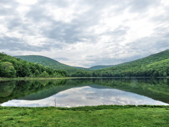
![]() On Tuesday, May 26th, I wanted to get in a hike in the morning since thunderstorms were predicted for the afternoon and I had track practice anyway. The forecast for the rest of the week also called for storms which I knew might limit my hiking. I decided that I needed a hike close to home but wanted to get away from Frick Pond! I thought about a list of options and settled on a hike from Alder Lake to the Beaver Meadow lean-to. I got my gear and Sheila in the car and headed up the Beaverkill Road somewhere around 8:45 AM. When I lifted the pack into the car, it seemed vary light without my tree trimming equipment! I headed toward Turnwood and Alder Creek Road where I made a left and drove to the Alder Lake parking lot. I parked in the Alder Lake parking area at 9:15 AM started our hike almost immediately. There were two other cars in the lot. The temperature was in the 70's with a slight breeze but relatively high humidity. The skies were cloudy indicating the storms that were predicted for later in the day. We headed down to the "lawn" and found a large pile of brush and logs. Another large pile almost blocked the trail across the dam. The logs had been cut from the area near the dam. I made a note to contact the DEC to try to determine when the eyesore might be removed as it spoils a beautiful and popular destination! I took out my camera and took some shots of the mess and then some of the lake. The hills and clouds were reflected on the surface of the almost completely still water. We walked toward the trail around the left side of the lake. As we walked along the trail I kept an eye out for the occupants of the vehicles in the parking area. Brush and branches were beginning to grow into the trail and they needed some pruning. Sheila was happy to be out and kept me company as we hiked on the trail around the lake which was muddy in places. I began to notice pink flowers on some bushes which I thought might be rhododendron. I turn down to the lake on one path and dropped my pack to get it the camera. I took some more pictures of the lake and Cradle Rock Ridge directly across from where I stood. I then turned my attention to the flowers and took a few shots. I was lucky enough to get a butterfly hovering and then landing on the flowers! We crossed the bridges and at about .8 miles turned left to head toward the lean-to on the Millbrook Ridge Trail.
On Tuesday, May 26th, I wanted to get in a hike in the morning since thunderstorms were predicted for the afternoon and I had track practice anyway. The forecast for the rest of the week also called for storms which I knew might limit my hiking. I decided that I needed a hike close to home but wanted to get away from Frick Pond! I thought about a list of options and settled on a hike from Alder Lake to the Beaver Meadow lean-to. I got my gear and Sheila in the car and headed up the Beaverkill Road somewhere around 8:45 AM. When I lifted the pack into the car, it seemed vary light without my tree trimming equipment! I headed toward Turnwood and Alder Creek Road where I made a left and drove to the Alder Lake parking lot. I parked in the Alder Lake parking area at 9:15 AM started our hike almost immediately. There were two other cars in the lot. The temperature was in the 70's with a slight breeze but relatively high humidity. The skies were cloudy indicating the storms that were predicted for later in the day. We headed down to the "lawn" and found a large pile of brush and logs. Another large pile almost blocked the trail across the dam. The logs had been cut from the area near the dam. I made a note to contact the DEC to try to determine when the eyesore might be removed as it spoils a beautiful and popular destination! I took out my camera and took some shots of the mess and then some of the lake. The hills and clouds were reflected on the surface of the almost completely still water. We walked toward the trail around the left side of the lake. As we walked along the trail I kept an eye out for the occupants of the vehicles in the parking area. Brush and branches were beginning to grow into the trail and they needed some pruning. Sheila was happy to be out and kept me company as we hiked on the trail around the lake which was muddy in places. I began to notice pink flowers on some bushes which I thought might be rhododendron. I turn down to the lake on one path and dropped my pack to get it the camera. I took some more pictures of the lake and Cradle Rock Ridge directly across from where I stood. I then turned my attention to the flowers and took a few shots. I was lucky enough to get a butterfly hovering and then landing on the flowers! We crossed the bridges and at about .8 miles turned left to head toward the lean-to on the Millbrook Ridge Trail.
 The trail was wet and muddy in many places and there were both old and new blowdowns to contend with. I was almost sorry I did not have my saws but decided this was work for another day. I thought it would be nice to find out who the maintainer is for the trail and offer to help. For the next 1.5 miles the trail climbs and then levels off several times. The elevation gain is several hundred feet but the grade is never more than 12% and averages around 6%. There isn't too much to see along the way but this day was very pleasant. I enjoyed the sounds and sights of Alder Creek as it flows parallel to the trail much of the way. As we neared the lean-to we passed by a series of beaver meadows and I stopped to take some pictures at each. Soon we arrived at the lean-to. As we approached I saw what I thought was a blue tent in front of the lean-to so I put Sheila on her leash. It turned out to be a blue tarp covering a fireplace full of dry wood. We walked down to the lean-to and I dropped my pack and got out the camera. It had taken a little over an hour to get to the beaver meadow. I walked out to the edge of the beaver meadow and took pictures of the blue sky with white puffy clouds contrasted against the green beaver meadow. I also got a few shots of Sheila sitting on a rock before turning around and snapping a few pictures of the lean-to. As I walked back to my pack I noticed that the privy was almost completely demolished. I decided to hike a short distance along the trail to the next beaver meadow. When we got there, I took some pictures before going back to the trail and hiking back to the lean-to. I did not stop on the way back and the walk went quickly. We were soon at the loop trail around Alder Lake where we turned left to complete the loop around the lake. I wanted to investigate any blowdowns that might be present. I found several very large ones a two smaller. Along the way I noticed a tree growing on top of a rock with its roots wrapped around it. I stopped to take a picture before continuing on the trail. As we approached the outlet end of the lake, I looked to the right and saw an occupied campsite down by the lake. We continued out the trail and crossed the dam passing by the pile of brush. We continued back to the "lawn" and walked back to the car. We were back at 11:30 AM having covered 4.9 miles in 2 hours and 15 minutes. The total elevation gain was 755 feet.
![]() On Sunday, May 24th I wanted to return to the area of Frick and Hodge Ponds to hike. I also wanted to fell a tree that had some branches that were loosely attached at the top and might be a danger to hikers passing by. My son-in-law Brad was happy to go with me so we started out for Frick Pond at about 11:30 AM after attending church. We got ready to go applying bug repellant since the previous days in the area let us know what we would encounter. We got our gear and Sheila in the car and headed out to Frick Pond. When we parked at 11:45 PM there was a car in the large lot but we never encountered the owners. As we got out of the car, there were a few insects but fewer than we had encountered on the previous weekend. The temperature was in the high 60's but the humidity was lower than it had been. We walked to the larger parking area to get on the Quick Lake Trail to Frick Pond. The plan was to hike the Quick Lake Trail to Iron Wheel Junction and then continue on that Trail to the Flynn Trail. When we arrived at the junction with the Logger's Loop, I showed Brad the muddy area and discussed the kind of walkway or bridge I wanted to build. He though the idea would work. We continued down to the bridge across the outlet to the pond. The views were not as good as the last time and I decided to try to leave my camera in the pack on this hike. As we walked around the pond I showed Brad the large cherry tree Cindy and I had cut to clear from the trail. At the first trail junction, we stayed to the left to continue on the Quick Lake Trail. It was nice to walk along the trail and encounter few, if any, blowdowns since Cindy and I had cleaned up most of them. At Iron Wheel Junction we turned left following the Quick Lake Trail. We passed the junction with the snowmobile trail and I began to look for the tree I wanted to remove. I thought it was close to the junction but it was some distance up the trail. We finally found the tree and I dropped my pack to assess the situation. Brad felt we could safely drop the tree and I agreed. One advantage we had was that we didn't care where it fell as long as it wasn't on us! We cut some of the surrounding brush away and then went to work on the tree. I marked a V on one side and Brad began to make the cuts. I finished up the cuts and Brad was able to remove the loose block. I started the cut on the backside and Brad continued it when I got tired. As he cut, I placed a felling wedge and pushed the tree in the direction we want it to fall. We heard a crack and stepped back to watch the tree fall perfectly. Rather than fall across the trail, the tree fell parallel to it and off to the side. We cut of some of the branches and dragged them away and rolled the trunk further off the trail. It was a job well done! We stowed the tools and I picked up my pack as we continued on the Quick Lake Trail to Junkyard Junction. We moved a few branches along the way but mostly we walked and talked. At junkyard Junction I took a look up the Quick Lake trail toward the Bobcat Loop and saw there was some blowdown there as another hiker had told me. We turned right onto the Flynn Trail to walk to Hodge Pond. The Flynn Trail was pretty clean as Cindy and I had done some work there and I pointed out several spots to Brad. We turned right at the gate to stay on the Flynn Trail and passed several blowdowns and the way to the trail around Hodge Pond. We turned right at the next junction to stay on the Flynn Trail to the outlet of Hodge Pond. We walked to the shore of the pond and let Sheila cool off with a short swim before turning around and taking the Flynn Trail up the hill. The pack was getting heavy but we were soon ion the flat part of the flynn1 Trail at the top of the hill. As we walked out to the junction with the Big Rock Trail, I made note of some areas that needed to be cleared. We continued down the Flynn Trail to the car arriving at about 3:30 PM. We had down the 6.4 mile loop in 3.5 hours with a generous amount of time spent working on the trail.
On Sunday, May 24th I wanted to return to the area of Frick and Hodge Ponds to hike. I also wanted to fell a tree that had some branches that were loosely attached at the top and might be a danger to hikers passing by. My son-in-law Brad was happy to go with me so we started out for Frick Pond at about 11:30 AM after attending church. We got ready to go applying bug repellant since the previous days in the area let us know what we would encounter. We got our gear and Sheila in the car and headed out to Frick Pond. When we parked at 11:45 PM there was a car in the large lot but we never encountered the owners. As we got out of the car, there were a few insects but fewer than we had encountered on the previous weekend. The temperature was in the high 60's but the humidity was lower than it had been. We walked to the larger parking area to get on the Quick Lake Trail to Frick Pond. The plan was to hike the Quick Lake Trail to Iron Wheel Junction and then continue on that Trail to the Flynn Trail. When we arrived at the junction with the Logger's Loop, I showed Brad the muddy area and discussed the kind of walkway or bridge I wanted to build. He though the idea would work. We continued down to the bridge across the outlet to the pond. The views were not as good as the last time and I decided to try to leave my camera in the pack on this hike. As we walked around the pond I showed Brad the large cherry tree Cindy and I had cut to clear from the trail. At the first trail junction, we stayed to the left to continue on the Quick Lake Trail. It was nice to walk along the trail and encounter few, if any, blowdowns since Cindy and I had cleaned up most of them. At Iron Wheel Junction we turned left following the Quick Lake Trail. We passed the junction with the snowmobile trail and I began to look for the tree I wanted to remove. I thought it was close to the junction but it was some distance up the trail. We finally found the tree and I dropped my pack to assess the situation. Brad felt we could safely drop the tree and I agreed. One advantage we had was that we didn't care where it fell as long as it wasn't on us! We cut some of the surrounding brush away and then went to work on the tree. I marked a V on one side and Brad began to make the cuts. I finished up the cuts and Brad was able to remove the loose block. I started the cut on the backside and Brad continued it when I got tired. As he cut, I placed a felling wedge and pushed the tree in the direction we want it to fall. We heard a crack and stepped back to watch the tree fall perfectly. Rather than fall across the trail, the tree fell parallel to it and off to the side. We cut of some of the branches and dragged them away and rolled the trunk further off the trail. It was a job well done! We stowed the tools and I picked up my pack as we continued on the Quick Lake Trail to Junkyard Junction. We moved a few branches along the way but mostly we walked and talked. At junkyard Junction I took a look up the Quick Lake trail toward the Bobcat Loop and saw there was some blowdown there as another hiker had told me. We turned right onto the Flynn Trail to walk to Hodge Pond. The Flynn Trail was pretty clean as Cindy and I had done some work there and I pointed out several spots to Brad. We turned right at the gate to stay on the Flynn Trail and passed several blowdowns and the way to the trail around Hodge Pond. We turned right at the next junction to stay on the Flynn Trail to the outlet of Hodge Pond. We walked to the shore of the pond and let Sheila cool off with a short swim before turning around and taking the Flynn Trail up the hill. The pack was getting heavy but we were soon ion the flat part of the flynn1 Trail at the top of the hill. As we walked out to the junction with the Big Rock Trail, I made note of some areas that needed to be cleared. We continued down the Flynn Trail to the car arriving at about 3:30 PM. We had down the 6.4 mile loop in 3.5 hours with a generous amount of time spent working on the trail.
![]() On Friday, May 22nd Cindy and I decided to return to the area of Frick Pond to cut some more blowdowns. I had some chores to do around the house so we didn't get started until after 11:30 AM. We got ready to go applying bug repellant since the previous days in the area let us know what we would encounter. We got our gear and Sheila in our car and headed out to Frick Pond. When we parked at 11:45 PM there was a car in the large lot but we never encountered the owners. As we got out of the car, there were a few insects but fewer than we had encountered on the previous weekend. The temperature was in the high 60's but the humidity was lower than it had been. We walked to the larger parking area to get on the Quick Lake Trail to Frick Pond. The plan was to hike the Quick Lake Trail to Iron Wheel Junction and then continue on that Trail to the Flynn Trail. I knew there were a few blowdowns on the Quick Lake Trail and more on the Flynn Trail. The Quick Lake Trail to Frick Pond was wet and I knew we would have to clear some of the drainage on our next trail crew workday on May 30th. We walked down to the bridge across the outlet to the pond. I dropped my pack to take some pictures even though I had many from the are viewpoint. The sky was very blue with puffy white clouds. The pond was also blue with a lot of green vegetation around it. I took pictures of the pond and a couple of Cindy and Sheila on the bridge. As we walked around the pond we admired our handiwork from previous trips in the form of a large cherry tree that we had cleared from the trail. At the first trail junction, we stayed to the left to continue on the Quick Lake Trail. As we walked along the trail, we picked up a few branches and removed the from the trail but none required the use of the saws. At Iron Wheel Junction we turned left following the Quick Lake Trail. We passed the junction with the snowmobile trail and began to encounter more blowdown including a few that were we had to saw a few branches. One particularly large blowdown all but blocked the trail so we stopped to assess the situation and decided to cut out what we could. The problem was that the top of a tree had broken off and was still attached about 30 feet up the trunk. I cut away all the smaller branches and then attacked the larger ones trying to cut them as far up as I could. Cindy and I dragged the branches as far off the trail as we could. The last few branches were the one supporting the rest of the blowdown and I was careful when I cut these. I did not want the rest of the larger branches to come crashing down on top of me. I looked at the tree and decided the best idea was to simply fell it but Cindy thought otherwise. I was sure I could get it down safely but decided to leave it for another day.
On Friday, May 22nd Cindy and I decided to return to the area of Frick Pond to cut some more blowdowns. I had some chores to do around the house so we didn't get started until after 11:30 AM. We got ready to go applying bug repellant since the previous days in the area let us know what we would encounter. We got our gear and Sheila in our car and headed out to Frick Pond. When we parked at 11:45 PM there was a car in the large lot but we never encountered the owners. As we got out of the car, there were a few insects but fewer than we had encountered on the previous weekend. The temperature was in the high 60's but the humidity was lower than it had been. We walked to the larger parking area to get on the Quick Lake Trail to Frick Pond. The plan was to hike the Quick Lake Trail to Iron Wheel Junction and then continue on that Trail to the Flynn Trail. I knew there were a few blowdowns on the Quick Lake Trail and more on the Flynn Trail. The Quick Lake Trail to Frick Pond was wet and I knew we would have to clear some of the drainage on our next trail crew workday on May 30th. We walked down to the bridge across the outlet to the pond. I dropped my pack to take some pictures even though I had many from the are viewpoint. The sky was very blue with puffy white clouds. The pond was also blue with a lot of green vegetation around it. I took pictures of the pond and a couple of Cindy and Sheila on the bridge. As we walked around the pond we admired our handiwork from previous trips in the form of a large cherry tree that we had cleared from the trail. At the first trail junction, we stayed to the left to continue on the Quick Lake Trail. As we walked along the trail, we picked up a few branches and removed the from the trail but none required the use of the saws. At Iron Wheel Junction we turned left following the Quick Lake Trail. We passed the junction with the snowmobile trail and began to encounter more blowdown including a few that were we had to saw a few branches. One particularly large blowdown all but blocked the trail so we stopped to assess the situation and decided to cut out what we could. The problem was that the top of a tree had broken off and was still attached about 30 feet up the trunk. I cut away all the smaller branches and then attacked the larger ones trying to cut them as far up as I could. Cindy and I dragged the branches as far off the trail as we could. The last few branches were the one supporting the rest of the blowdown and I was careful when I cut these. I did not want the rest of the larger branches to come crashing down on top of me. I looked at the tree and decided the best idea was to simply fell it but Cindy thought otherwise. I was sure I could get it down safely but decided to leave it for another day.
 As we continued to walk up the trail, we encounter more branches in the trail. A few of these were substantial and required some work with the saw while others we were able to drag off without cutting them. The insects were beginning to become more numerous and the temperature was now in the 70's. The work had begun to tire us both but I knew there would be more on the Flynn Trail. By the time we made it to Junkyard Junction it was well passed 2:00 PM. We cleared some branches on the trail and I cut a few to make them easier to drag away. There wasn't as much work as I remembered. As we approached the gate on the Flynn Trail we both saw a rather large tree across the trail. This one was not hung up but had fallen to the ground. It was not as large in diameter as some we had encountered but there were a lot of branches to handle. We both decided with would be the last project we would handle before the hike back to the car! We cut many of the branches and dragged them into the woods. I cut the top way from the main trunk and disposed of it leaving a rather large piece of the main trunk. Fortunately, we were able to twist and roll this piece out of the way without having to lift it. I picked up my pack and we headed through the gate and down toward Hodge Pond. We did pick up a few more branches but ignored the larger ones leaving them for the workday. At the next junction, we turned right to stay on the Flynn Trail to the outlet of Hodge Pond. This woods road had some deep ruts and several very muddy places. We walked through a field and down to the shores of the pond near the outlet. Sheila immediately jumped into the water and I dropped my pack to get out the camera. I took pictures of the pond and some of Sheila retrieving a stick. It was getting late so I picked up the pack and we headed up the Flynn Trail. The walk up the hill seemed long to me and I swore my pack was getting heaver. There were some branches on this section of the Flynn Trail up to the junction with the Big Rock Trail but we ignored them and continued to walk. After the Big Rock junction, we were able to again afire our work from previous trips when we had cut several large blowdowns. We continued back to the car arriving at about 4:45 PM. We had spent 5 hours hiking and working and we were both tired.
![]()
![]()
![]()
![]()
![]() On Wednesday, May 20th Lisa wanted to go on a short, local hike so we decided on the Split Rock Lookout on the Pelnor Hollow Trail. The lookout has some nice views and is close to home. The temperature was in the mid 40's when I picked Lisa up at her house on the Beaverkill Road. I drove across the Beaverkill Covered Bridge to Holiday Brook Road. After turning right on the road, I drove to the parking area for the Mary Smith Trail on the right of the road and parked at 9:00 AM. We ready to hike almost immediately and cross the road to begin. The first part of the trail out to the power lines was damp but the best part was the complete lack of insects which had been prevalent on the last few hikes. We crossed the power line right-of-way and followed a faint path into the woods passing a small rock cairn. The trail remained damp in spots but everything was very green as we hiked. The prickets which dominate this trail in the summer were absent which made the going much more pleasant. The hike to the top of the ridge is about 1.1 miles but is a little steeper in some spots than I remembered. The overall elevation gain is about 500 feet. Along the way we noticed red trail markers which were round with three raised lines emanating from the center. There was no writing on the blazes and neither of us had any idea about their origin. I took a few pictures to show others who might know about them. By 9:45 AM we were at the intersection with the Pelnor Hollow Trail where we turned right. The last descent to the lookout is steep and was slippery in places. We arrived at the lookout at 9:55 AM and I dropped my pack and got out the camera. The sky was overcast without much sun or clouds. The views are limited and there was a little haze hanging over the landscape. I took some pictures of the views from the lookout and some of the trail. I also took some shots of the large rock that stands at the viewpoint. I walked to the right of the split rock and out onto the rock outcrop in front of it for a better view. Sheila follow and we were both surprised when a large vulture took to flight! I took a few more pictures including some of a house that sits on the hill across from the lookout and then returned to my pack. We turned around and followed the same route back to the car climbing the steep ascent back up to the plateau. The descents on the way back were not as tricky as I thought they might be. We did stop once to take a few pictures of an area of dead trees. We were back at the car by 11:00 AM having covered the 2.6 mile trip in just under 2 hours. The vertical gain was around 700 feet.
On Wednesday, May 20th Lisa wanted to go on a short, local hike so we decided on the Split Rock Lookout on the Pelnor Hollow Trail. The lookout has some nice views and is close to home. The temperature was in the mid 40's when I picked Lisa up at her house on the Beaverkill Road. I drove across the Beaverkill Covered Bridge to Holiday Brook Road. After turning right on the road, I drove to the parking area for the Mary Smith Trail on the right of the road and parked at 9:00 AM. We ready to hike almost immediately and cross the road to begin. The first part of the trail out to the power lines was damp but the best part was the complete lack of insects which had been prevalent on the last few hikes. We crossed the power line right-of-way and followed a faint path into the woods passing a small rock cairn. The trail remained damp in spots but everything was very green as we hiked. The prickets which dominate this trail in the summer were absent which made the going much more pleasant. The hike to the top of the ridge is about 1.1 miles but is a little steeper in some spots than I remembered. The overall elevation gain is about 500 feet. Along the way we noticed red trail markers which were round with three raised lines emanating from the center. There was no writing on the blazes and neither of us had any idea about their origin. I took a few pictures to show others who might know about them. By 9:45 AM we were at the intersection with the Pelnor Hollow Trail where we turned right. The last descent to the lookout is steep and was slippery in places. We arrived at the lookout at 9:55 AM and I dropped my pack and got out the camera. The sky was overcast without much sun or clouds. The views are limited and there was a little haze hanging over the landscape. I took some pictures of the views from the lookout and some of the trail. I also took some shots of the large rock that stands at the viewpoint. I walked to the right of the split rock and out onto the rock outcrop in front of it for a better view. Sheila follow and we were both surprised when a large vulture took to flight! I took a few more pictures including some of a house that sits on the hill across from the lookout and then returned to my pack. We turned around and followed the same route back to the car climbing the steep ascent back up to the plateau. The descents on the way back were not as tricky as I thought they might be. We did stop once to take a few pictures of an area of dead trees. We were back at the car by 11:00 AM having covered the 2.6 mile trip in just under 2 hours. The vertical gain was around 700 feet.
![]() On Sunday, May 17th Cindy and I decided to return to the Flynn Trail in the area of Frick Pond to cut some more blowdowns. I preached two services and did not get home until 12:30 PM. We immediately got ready to go applying liberal amounts of bug repellant since the previous day let us know what we would encounter. We got our gear and Sheila in our car and headed out to Frick Pond. When we parked at 1:00 PM there was a car in the small lot and one in the larger lot. As we got out of the car, we were immediately engulfed by a swarm of insects. The temperature was already in the mid 70's and the humidity was high. We walked across the road and headed up the Flynn Trail passing our work from the day before. As we walked we cleared a few small branches and some larger ones which were on the trail. When we were walking, the insects were manageable but each time stopped they flew in a cloud around us. We cleared two larger blowdowns. One was almost flat on the ground while the other was hung up like the one that we cut on Saturday. These went relatively quickly using both saws as appropriate. While cutting one of the trees a couple approached us with a hand drawn map from Morgan Outdoors. We confirmed that they were on the correct trail for the hike they wanted to do. As we approached the junction with the Big Rock Trail, we came to a complex blowdown that required some careful planning. One large trees was across the trail with its top partly hung up in another tree. Adjacent to this tree was another that had broken off near the top. It was supported by one large branch which had jammed into the ground. Where it had broken off it was not clear whether it was held simply by friction or some wood fibers. It was clear that this second tree could come down at any time and that the only safe way to work has to get it out of the way first. I suggested Cindy stand back so that one of us was out of danger. I cut all the small branches until only the supporting branch remained. I tried to pull on this branch to see if I could get the rest of the tree to fall but it was too embedded in the ground with too much weight behind it. I almost decided to leave it until the next wind storm blew it down but then changed my mind. I started to carefully cut the branch near the ground from one side and ten switched over the other. Two things happened simultaneously. I branch cracked and gave way and the tree came crashing down. Fortunately, I had planned well and was out of the way when it fell. It took only a few cuts to get the tree sectioned so that we could pull it out of the way. We turned our attention to the larger tree lying across the trail and cut out the branches near the top. We dragged away all the now loose branches and turned our attention to the main trunk which was still across the trail. The diameter was nearly as large as the cherry tree from the day before but it was not quite as hard. I used the Katanaboy to cut a large section and Cindy kept the cut open with the wedges. After cutting almost all the way through, I removed the saw and cut up from the bottom to complete the cut. We rolled the smaller section from near the top out of the way and looked at what remained. We both decided that we had opened a path that did not require hikers to step over or walk around the large tree. We also had removed a dangerous "widow-maker". It was a little after 3:30 PM and we still had to walk back to the car. We turned around and walked down the Flynn Trail feeling tired but with a real sense of accomplishment.
On Sunday, May 17th Cindy and I decided to return to the Flynn Trail in the area of Frick Pond to cut some more blowdowns. I preached two services and did not get home until 12:30 PM. We immediately got ready to go applying liberal amounts of bug repellant since the previous day let us know what we would encounter. We got our gear and Sheila in our car and headed out to Frick Pond. When we parked at 1:00 PM there was a car in the small lot and one in the larger lot. As we got out of the car, we were immediately engulfed by a swarm of insects. The temperature was already in the mid 70's and the humidity was high. We walked across the road and headed up the Flynn Trail passing our work from the day before. As we walked we cleared a few small branches and some larger ones which were on the trail. When we were walking, the insects were manageable but each time stopped they flew in a cloud around us. We cleared two larger blowdowns. One was almost flat on the ground while the other was hung up like the one that we cut on Saturday. These went relatively quickly using both saws as appropriate. While cutting one of the trees a couple approached us with a hand drawn map from Morgan Outdoors. We confirmed that they were on the correct trail for the hike they wanted to do. As we approached the junction with the Big Rock Trail, we came to a complex blowdown that required some careful planning. One large trees was across the trail with its top partly hung up in another tree. Adjacent to this tree was another that had broken off near the top. It was supported by one large branch which had jammed into the ground. Where it had broken off it was not clear whether it was held simply by friction or some wood fibers. It was clear that this second tree could come down at any time and that the only safe way to work has to get it out of the way first. I suggested Cindy stand back so that one of us was out of danger. I cut all the small branches until only the supporting branch remained. I tried to pull on this branch to see if I could get the rest of the tree to fall but it was too embedded in the ground with too much weight behind it. I almost decided to leave it until the next wind storm blew it down but then changed my mind. I started to carefully cut the branch near the ground from one side and ten switched over the other. Two things happened simultaneously. I branch cracked and gave way and the tree came crashing down. Fortunately, I had planned well and was out of the way when it fell. It took only a few cuts to get the tree sectioned so that we could pull it out of the way. We turned our attention to the larger tree lying across the trail and cut out the branches near the top. We dragged away all the now loose branches and turned our attention to the main trunk which was still across the trail. The diameter was nearly as large as the cherry tree from the day before but it was not quite as hard. I used the Katanaboy to cut a large section and Cindy kept the cut open with the wedges. After cutting almost all the way through, I removed the saw and cut up from the bottom to complete the cut. We rolled the smaller section from near the top out of the way and looked at what remained. We both decided that we had opened a path that did not require hikers to step over or walk around the large tree. We also had removed a dangerous "widow-maker". It was a little after 3:30 PM and we still had to walk back to the car. We turned around and walked down the Flynn Trail feeling tired but with a real sense of accomplishment.
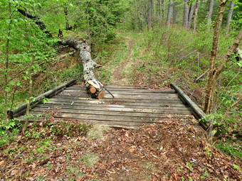
![]() On Saturday, May 16th I wanted to try out my Silky saws on some of the larger blowdowns around Frick Pond. Cindy decided to come with me which pleased me as I knew doing the work alone was not a good idea and help is always appreciated. We left the house at just after 9:00 AM but stopped in town at the Livingston Manor Garden Day to pick up some plants. By the time we took the plants back to the house it was after 9:30 AM as we started up the DeBruce Road. We arrived in the parking to find one other car parked. It was already in the high 60's and the forecast was for even warmer weather so I left my jacket in the car and wore only a long-sleeved shirt. Both of us noticed that there were a lot of insects flying round even at the car. Cindy put on some repellant and we headed out the Quick Lake trail to Frick Pond. It had rained overnight but there was little water on the trail. The area near the junction of the Loggers' Loop and the Quick Lake Trail was already getting muddy which reinforced for me the need for a wooden walkway in this area. Cindy and I both looked at a new sign near the junction and could not figure out the information it was trying to convey. The distances seemed wrong and the one arrow on it seemed to have multiple uses. We walked down to the pond and crossed the bridge continuing on the Quick Lake trail to the second small bridge. A large cherry tree had fallen onto the bridge sometime last fall and needed to be removed. The tree was not a problem throughout the winter as the snow was deep enough to allow hikers to walk over it without even knowing it was there. It was possible to walk over the tree but I wanted to remove as much as I could. The tree was still attached to the trunk which was well over a foot in diameter. I took some before pictures and then got out the tools to start the removal.
On Saturday, May 16th I wanted to try out my Silky saws on some of the larger blowdowns around Frick Pond. Cindy decided to come with me which pleased me as I knew doing the work alone was not a good idea and help is always appreciated. We left the house at just after 9:00 AM but stopped in town at the Livingston Manor Garden Day to pick up some plants. By the time we took the plants back to the house it was after 9:30 AM as we started up the DeBruce Road. We arrived in the parking to find one other car parked. It was already in the high 60's and the forecast was for even warmer weather so I left my jacket in the car and wore only a long-sleeved shirt. Both of us noticed that there were a lot of insects flying round even at the car. Cindy put on some repellant and we headed out the Quick Lake trail to Frick Pond. It had rained overnight but there was little water on the trail. The area near the junction of the Loggers' Loop and the Quick Lake Trail was already getting muddy which reinforced for me the need for a wooden walkway in this area. Cindy and I both looked at a new sign near the junction and could not figure out the information it was trying to convey. The distances seemed wrong and the one arrow on it seemed to have multiple uses. We walked down to the pond and crossed the bridge continuing on the Quick Lake trail to the second small bridge. A large cherry tree had fallen onto the bridge sometime last fall and needed to be removed. The tree was not a problem throughout the winter as the snow was deep enough to allow hikers to walk over it without even knowing it was there. It was possible to walk over the tree but I wanted to remove as much as I could. The tree was still attached to the trunk which was well over a foot in diameter. I took some before pictures and then got out the tools to start the removal.
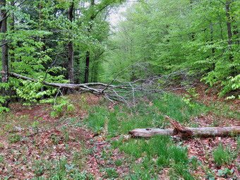 I have a Silky Sugowaza saw that is a little over a foot long and has a curved blade. I also brought a Silky Kanataboy which is a folding saw with a blade almost two feet long and a handle of similar length. Both saws have substantial teeth and cut primarily on the pull stroke. I also brought two felling wedges and a deadfall hammer to help keep the saws from binding. Cindy and I trimmed the smaller branches and got them out of the way while fighting clouds of insects. We continued our work by removing larger branches which the smaller saw did quite nicely. To make a cut in the trunk itself I switched to the large saw. Cherry is hard wood and the sawing was not easy as the angle was difficult. We kept at it using the wedges to keep the cut open and eventually the saw broke through. We removed several large pieces and then stepped back to observe our work. All that was left was the very large trunk of the tree still attached at the stump end. There was a clear path across the bridge. We decided to move on to the Flynn Trail. Before leaving I took some 'after' pictures and a few shots of the saws. They had performed remarkably well. We walked back to the car to find two more cars parked and two couples headed out onto the trails. One couple headed out the Quick Lake Trail as we crossed the road to start up the Flynn Trail. We immediately ran into a small tree across the trail which I cut and removed as the other couple came our way. They asked what we were doing and we explained that the trails are all maintained by volunteers. They also asked about the Flynn Trail and seemed happy the trail had a long but shallow ascent. They continued on as we cleared several more small blowdowns and one large one. At the end of the trail we turned right to walk the woods road that is the Flynn Trail.
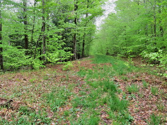 About half a mile up the trail we came to a large tree that had fallen across the trail. It had fallen so that one end was caught up against another tree hike the majority lay on the round. The supported end has high enough off the ground that hikers had made a path under it. I though that this was a bad idea since eventually it would come down. We repeated what we had done earlier. I dropped my pack, took some pictures and then got out the saws and went to work. We cut extraneous branches that were in the way and not supporting the tree. We dragged the branches away to give us a clear field to work. Finally it was time to cut the main trunk. I cut a little more than halfway through and then removed the saw a started to cut up from the bottom to prevent binding. This worked well as I completed the cut and jumped back as the supported end fell to the ground. We dragged away the "top" of the tree and then slowly moved the heavier butt end out of the way. When I stepped back and looked up the trail, it appeared that there had never been and blowdown. This was exactly what we were trying to do. I took some pictures and stowed the tools. We decided we had done enough for the day and headed back down the Flynn Trail to the car. We got back to the car just after 11;00 AM and headed back to Livingston Manor to take in more of Garden Day.
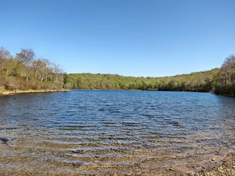
![]()
![]()
![]()
![]()
![]() On Thursday, May 14th I wanted to get a quick hike in before track practice in the afternoon. I decided to go to Hodge and Frick ponds to see what work would need to be done on the first workday of the Willowemoc Trail Crew on Saturday, May 30. I got my gear and Sheila in the car and pulled out of the driveway a little after 8:30 AM. The temperature was already in the 60's and I knew I would be taking off the light jacket I had donned. We arrived in the parking area at 8:50 AM got to hiking immediately. We crossed the road and started up the Flynn Trail and almost immediately ran into some branches and small trees across the trail. I made note of this and we continued. Once we made the right out of the trees and onto the woods road, the walking was considerably easier. There weren't too many insects and I stopped to remove my jacket realizing I should have left it in the car. As we ascended the Flynn Trail, we found several major blowdowns and many smaller ones that would have to be cleared. Some were old and some were new. Two of three of the newer ones had paths under hanging tree trunks which I knew could be a dangerous situation for hikers. By 9:30 AM we had hiked the 1.7 miles to the junction with the Big Rock Trail. We continued straight ahead on the Flynn Trail and found more branches littering the trail. We walked down to the field at the outlet of Hodge Pond and walked over to the shore of the pond. Sheila immediately jumped in an waded and then swam around some. I took a few pictures of the pond and then threw a stick so that Sheila could swim out to retrieve it. I took some pictures of her in the pond and then we continued across the outlet stream following the Flynn Trail.
On Thursday, May 14th I wanted to get a quick hike in before track practice in the afternoon. I decided to go to Hodge and Frick ponds to see what work would need to be done on the first workday of the Willowemoc Trail Crew on Saturday, May 30. I got my gear and Sheila in the car and pulled out of the driveway a little after 8:30 AM. The temperature was already in the 60's and I knew I would be taking off the light jacket I had donned. We arrived in the parking area at 8:50 AM got to hiking immediately. We crossed the road and started up the Flynn Trail and almost immediately ran into some branches and small trees across the trail. I made note of this and we continued. Once we made the right out of the trees and onto the woods road, the walking was considerably easier. There weren't too many insects and I stopped to remove my jacket realizing I should have left it in the car. As we ascended the Flynn Trail, we found several major blowdowns and many smaller ones that would have to be cleared. Some were old and some were new. Two of three of the newer ones had paths under hanging tree trunks which I knew could be a dangerous situation for hikers. By 9:30 AM we had hiked the 1.7 miles to the junction with the Big Rock Trail. We continued straight ahead on the Flynn Trail and found more branches littering the trail. We walked down to the field at the outlet of Hodge Pond and walked over to the shore of the pond. Sheila immediately jumped in an waded and then swam around some. I took a few pictures of the pond and then threw a stick so that Sheila could swim out to retrieve it. I took some pictures of her in the pond and then we continued across the outlet stream following the Flynn Trail.
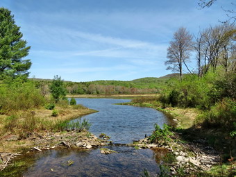 At 2.8 miles we turned to the left and continued to follow the Flynn Trail up the hill to the gate. There was additional blowdown on the trail. The half mile walk from the gate to Junkyard Junction went quickly but we did find a few more trees and branches that I put on my list. At 3.3 miles we reached Junkyard Junction and turned left on the Quick Lake Trail. We walked downhill along the trail and I made note of a few more blowdowns to clear. The day was warm and it was a pleasure to hike. It was almost 40 degrees warmer than the last time I hike this route in March! At 4.9 miles we were at Iron Wheel Junction where we turned right to stay on the Quick Lake Trail. The Logger's Loop continues straight ahead at this junction. We reached the bridge over the outlet to Frick Pond at 5.9 miles. Along the way we passed the large cherry tree that had fallen onto one of the bridges. I knew it had to go but I wasn't sure a hand saw would work on this monster! We stopped at the bridge so that I could take some pictures and then continued up the hill. At the junction of the Quick Lake Trail and Logger's Loop the ground was already getting muddy. I thought about constructing a wooden walkway to span this area with approval from the DEC. We walked out the woods road that is the end of the Quick Lake trail and were at the car at 11:30 AM. We had covered 6.4 miles in 2 hours and 35 minutes with a vertical gain of 920 feet.
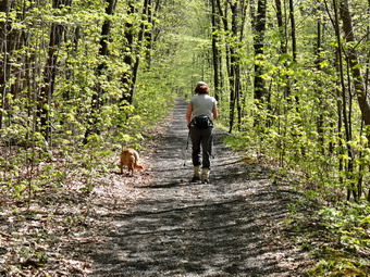
![]()
![]()
![]()
![]()
![]() On Friday, May 8th I was ready to hike after a long week of track meets. Cindy decided she wanted to go with me and I thought it would be a nice day to drive a little farther than usual to hike. I thought about World's End State Park in Pennsylvania but decided the more than 3 hour trip would be better undertaken when we could stay overnight. Watkins Glen and Letchworth fit into the same category. I decided that we would drive to Big Pocono State Park in Pennsylvania which is also the site of the Camelback Mountain Ski Resort. The route given by several online sites and my GPS took us through backroads most of the way and predicted a trip of just over 2 hours. I wanted to get started at 7:00 AM but we usually seem to get delayed and did not start until just after 8:00 AM. We got our gear in the car and ushered an anxious Sheila into the back seat. The weather forecast did not include any rain but did mention sunny skies with temperatures in the 80's! We followed the backroads through Eldred and Shohola before getting on I84 west. We then followed Routes 390 and 611 south passing through Mount Pocono and Mount Airy Lodge. Just after exchange 45 on I80 I turned right on Route 715 and drove about half a mile to Railroad Drive on the right. I turned right and drove 1.2 miles to the trailhead. The trailhead was marked with a sign indicating "Riday Gate" and an arrow showing "Big Pocono State Park". I parked on the right side of the road where there was room for two or three cars. There was also a spot on the opposite side of the road for about the same number of vehicles. The first part of the trail is an old railroad grade and is easy to spot. We both decided to stow our light jackets. Cindy wore short sleeves while I decided to wear a light, long-sleeved shirt. We started out on the trail at about 10:25 AM. Almost immediately I stopped to take a few pictures of the railroad bed as it continued straight as an arrow off into the distance. The trees were all green with most having leaves not just buds as in Sullivan County. The railroad bed was well maintained, flat and smooth. In several places the trail passed through small rock cuts. As we neared the spot were the trail turns up the mountain the railroad bed was built up to span a gully. At 1.3 miles the trail turned off the railroad bed and headed up the mountain in a sharp switchback. We continued to walk straight ahead to investigate the railroad cut through the rocks. This cut was more expansive than the others we had seen with rock extending 30 to 50 feet from the bed to the top. I took a few pictures and marveled at what had been accomplished using mostly hand tools! We returned to the trail and began to climb the mountain.
On Friday, May 8th I was ready to hike after a long week of track meets. Cindy decided she wanted to go with me and I thought it would be a nice day to drive a little farther than usual to hike. I thought about World's End State Park in Pennsylvania but decided the more than 3 hour trip would be better undertaken when we could stay overnight. Watkins Glen and Letchworth fit into the same category. I decided that we would drive to Big Pocono State Park in Pennsylvania which is also the site of the Camelback Mountain Ski Resort. The route given by several online sites and my GPS took us through backroads most of the way and predicted a trip of just over 2 hours. I wanted to get started at 7:00 AM but we usually seem to get delayed and did not start until just after 8:00 AM. We got our gear in the car and ushered an anxious Sheila into the back seat. The weather forecast did not include any rain but did mention sunny skies with temperatures in the 80's! We followed the backroads through Eldred and Shohola before getting on I84 west. We then followed Routes 390 and 611 south passing through Mount Pocono and Mount Airy Lodge. Just after exchange 45 on I80 I turned right on Route 715 and drove about half a mile to Railroad Drive on the right. I turned right and drove 1.2 miles to the trailhead. The trailhead was marked with a sign indicating "Riday Gate" and an arrow showing "Big Pocono State Park". I parked on the right side of the road where there was room for two or three cars. There was also a spot on the opposite side of the road for about the same number of vehicles. The first part of the trail is an old railroad grade and is easy to spot. We both decided to stow our light jackets. Cindy wore short sleeves while I decided to wear a light, long-sleeved shirt. We started out on the trail at about 10:25 AM. Almost immediately I stopped to take a few pictures of the railroad bed as it continued straight as an arrow off into the distance. The trees were all green with most having leaves not just buds as in Sullivan County. The railroad bed was well maintained, flat and smooth. In several places the trail passed through small rock cuts. As we neared the spot were the trail turns up the mountain the railroad bed was built up to span a gully. At 1.3 miles the trail turned off the railroad bed and headed up the mountain in a sharp switchback. We continued to walk straight ahead to investigate the railroad cut through the rocks. This cut was more expansive than the others we had seen with rock extending 30 to 50 feet from the bed to the top. I took a few pictures and marveled at what had been accomplished using mostly hand tools! We returned to the trail and began to climb the mountain.
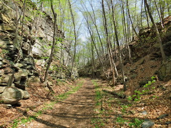 The trails are not very well marked and branch in several places. Sometimes to get to one trail you have to hike part of the way on another. The blazes are not clear and we had not seen any on the railroad bed coming in but they were not really necessary as it was easy to follow. From on guidebook description, I had the idea that we wanted to hike the Indian Trail to the top and then return by the South Trail. We had hiked northeast on the railroad bed but were now heading west and northwest on the trail. At just over 1.6 miles we passed a small pond off the trail on the left and then continued to follow the trail as it turned and continued to climb to a junction at 1.9 miles. I thought we could pick up the Indian Trail here but the signs did not give us that choice. The Indian Trail was supposed to be the steepest climb but the one with the best views. The skies had been hazy all day so I really wasn't that concerned about the views. The temperature was climbing and any exposure to the sun made it even hotter. We decided to head to the right which seemed to be the North Trail. I was hoping for another junction with the Indian Trail. As we hiked, Sheila alerted and a group of three young women came hiking toward us. I asked one if she knew the trail we were on and she replied that is was "the Indian Trail". We continued on but it soon became clear we were on the North Trail which was the wrong trail. I would have turned around but Cindy wanted to continue on ahead. We continued on the trail which was sheltered by the trees but offered no views at all. What the trail did offer was a longer route to the top and a pretty steep climb which made me happier. From the point where the trail stared to ascend to the point where we reached the loop road at the summit, we gained over 600 feet in about .75 miles. Along the way there were several intersections with paths and trails which were quite confusing as there were no signs. We kept bearing right in each case. At one point we came to he edge of one of the ski slopes with a limited view. At 3.1 miles we came to the loop road and crossed it into a parking lot just before noon. The trail seemed to continue straight ahead but we took a detour to the left and walked to the edge of the parking lot to get a view to the south and east. Everything was covered in haze but I took a few shots before we went back to the trail and walked to the summit of the mountain.
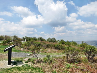 We walked about .2 miles and the trail opened up into a parking area at the top of the mountain at about 3.4 miles. We could see a radio tower to the left and the old park office building next to it. To the right was an open space where a lookout tower once stood. It is still marked as present on many maps. We walked over to a bench and a sign which described the views and the ecosystem of the mountain. Another, smaller sign alerted us to the fact that the park had a "healthy population of timer rattlesnakes". I had suspected that this might be the case as Pennsylvania seems to have a more diverse population than new York. I walked down to another bench and took some pictures before joining Cindy and Sheila. We walked over toward the bathrooms and I noticed a round "table". The table was stainless steel with a stone mosaic on the surface. There was a large arrow and the names of various landmarks. When the opposite end of the arrow encircles the name of a landmark, the other end of the arrow pointed to that landmark. It was very interesting to see that it was an Eagle Scout project. I took some more pictures of the hills and valleys and a few of the old park office. We got a drink and a snack and then headed south and down to a parking area to pick up the South Trail for our return trip at about 12:30 PM. When we got to the parking area, it was hard to find the trail until I saw a sign at the right end of the lot. We walked to the sign, across Rim Road and onto the Vista Trail that connects to the South Trail. The trail was very short and when we hit the South Trail I turned right intending to look for a viewpoint before turning back. We hiked out about .35 miles and I did not see anything that looked like a viewpoint. I also noticed Cindy was looking hot and tired which she confirmed.
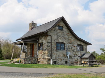 We turned around and walked back to the Vista Trail and stopped at the vista. There were limited views to the south but the haze was very heavy. We got a snack and a drink before starting the return trip which was almost all downhill. The first half mile was flat or a little uphill and the sun was very hot. It occurred to me that it would have been a good idea to reverse the loop and hike out on the South Trail and back on the North Trail! At 4.9 miles we began the descent back to the car. The trail was very rocky and there were several switchbacks. Switchbacks are a blessing and a curse as they mitigate the steep grades but lengthen the hike. At the end of the third switchback my GPS told me we were .3 miles from the car. That .3 miles was VERY steep but I might have attempted it absent the warning about the rattlesnakes. As it was that .3 miles turned into a 2.4 mile walk! As we descended we came to a junction with the Indian Trail and continued to follow the South Trail back to the point where we had turned right onto the north trail earlier. We had now hiked 6.1 miles and turned right to retrace our route back to the car. We walked down to the railroad cut and turned right to follow the railroad bed back to the car. On our way out we passed a group of four people coming toward us. We said "Hello" as we passed each other. I noticed that two had small commercial bottles of water but non had any other equipment. I was sure the temperature was nearly 90 degrees and thought it was a strange time start a hike. The hike out to the car seemed along but we were back by 2:20 PM having covered 7.9 miles in 4 hours. We had stopped for about 40 minutes and had ascended 1300 feet. The car thermometer read 95 degrees but once we were underway it dropped to 88! We returned by taking I80 to Route 209 north to Port Jervis passing through the Delaware Water Gap. If Cindy had not been with me, I would have been tempted to stop at several places so I was glad that she was along!
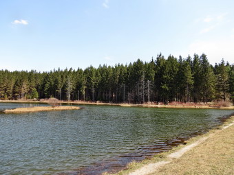
![]()
![]()
![]()
![]()
![]() On Sunday, May 3rd I was ready to hike after a long week of track meets. Cindy decided she wanted to go with me and I thought it would be a nice day to drive to Morgan Hill State Forest northeast of Cortland. This is a two hour drive which is a little farther than we normally go when we go together but the forecast for a bright and sunny day convinced me. We left Livingston Manor at about 8:25 AM with our gear and with Sheila ready to go. Sheila, of course, doesn't care where we hike so she protests when we set out on a long drive! We headed west on State Route 17 to Binghamton and then north on I81 toward Cortland. I took exit 11 and turned north on Route 13 heading toward Truxton. As we passed through Truxton I turned north on Route 91. After just under 4 miles, I turned right on Shackham Road and drove north for about 2 miles to park on the side of the road where the Onondaga Trail crosses the road. This trail is part of the Finger Lakes Trail system and is co-aligned with the North Country Trail which runs from the Missouri River in North Dakota to Lake Champlain in New York! We began our hike at 10:30 AM by crossing the road and hiking up a very muddy trail toward the top of the first ridge. The first .4 miles was all uphill at we gained a little over 150 feet. The trail in this area is pretty generic passing through mostly hardwoods and then some evergreens. The warm weather had brought out the trout lilies, some nice maroon trillium and other assorted windflowers. We descended the other side of the hill and then walked along as the trail rolled a little. At 1.75 miles we were on the shores of Spruce Pond. There were a few people fishing from the dam and we stopped so that I could take a few pictures. We walked along the shore of the pond following the Onondaga Trail which is blazed in light blue and an orange trail that loops around the pond. The trails spilt near the head of the pond and we followed the blue trail. The trail started one of the steepest ascents of the day which was moderated by some switchbacks as we gained 220 feet in about .25 miles.
On Sunday, May 3rd I was ready to hike after a long week of track meets. Cindy decided she wanted to go with me and I thought it would be a nice day to drive to Morgan Hill State Forest northeast of Cortland. This is a two hour drive which is a little farther than we normally go when we go together but the forecast for a bright and sunny day convinced me. We left Livingston Manor at about 8:25 AM with our gear and with Sheila ready to go. Sheila, of course, doesn't care where we hike so she protests when we set out on a long drive! We headed west on State Route 17 to Binghamton and then north on I81 toward Cortland. I took exit 11 and turned north on Route 13 heading toward Truxton. As we passed through Truxton I turned north on Route 91. After just under 4 miles, I turned right on Shackham Road and drove north for about 2 miles to park on the side of the road where the Onondaga Trail crosses the road. This trail is part of the Finger Lakes Trail system and is co-aligned with the North Country Trail which runs from the Missouri River in North Dakota to Lake Champlain in New York! We began our hike at 10:30 AM by crossing the road and hiking up a very muddy trail toward the top of the first ridge. The first .4 miles was all uphill at we gained a little over 150 feet. The trail in this area is pretty generic passing through mostly hardwoods and then some evergreens. The warm weather had brought out the trout lilies, some nice maroon trillium and other assorted windflowers. We descended the other side of the hill and then walked along as the trail rolled a little. At 1.75 miles we were on the shores of Spruce Pond. There were a few people fishing from the dam and we stopped so that I could take a few pictures. We walked along the shore of the pond following the Onondaga Trail which is blazed in light blue and an orange trail that loops around the pond. The trails spilt near the head of the pond and we followed the blue trail. The trail started one of the steepest ascents of the day which was moderated by some switchbacks as we gained 220 feet in about .25 miles.
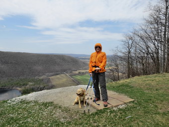 As soon as we reached the top of the hill, we started to descend again losing most of the elevation we had gained and crossing a small stream. Much of the hike to this point had been parallel to one small creek or another and none seemed to have much water. I kept hoping that Tinker Falls would have enough water to make it interesting! As we were hiking to Spruce Pond we were headed mostly northwest. The turn and ascent had directed us WSW and we began hiking on private land. The land is owned by a logging company that has granted permission for hikers to cross their property. We made another ascent and I could see as we got to the top that we were on the ridge that overlooks Labrador Pond. We passed over the top of Jones Hill and at 3.1 miles turned south to walk along the ridge. At 3.25 miles we came to the viewpoint which looks out of Labrador Pond and the valley and hills below. There was a couple seated just below the clearing as I took my camera out to take some pictures. I couldn't avoid including them in most of my shots knowing I could use my software to remove them. I couldn't help but think that Cindy and I would have moved if we had seen someone wanted to take a few pictures! I took some shots of Cindy and Sheba before we got a drink and a snack and continued on the trail. The trail follows the edge of the ridge while a dirt road also descends the hill. The trail winds round and crosses the road before joining it for the final descent. I always wonder in these cases why the trail blazers simply didn't follow the road. We did find an interesting tree on the trail that was split at the bottom and I took some pictures before hiking on. From 3.4 miles to 4.3 miles the trail descended toward Tinker Falls. At 3.9 miles the descent became steeper. We saw people at the falls so I put Sheila on her leash as we walked down to the top of the falls.
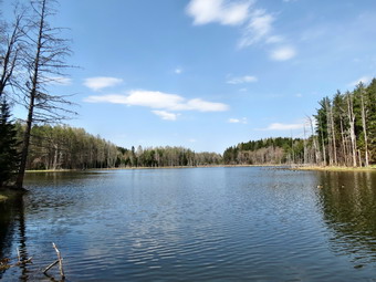 There is a trail to the falls from a parking area on Route 91 which makes access to the base rather easy. In the past there was no way to hike between the top and bottom without following a treacherous and steep path covered in loose dirt and slippery leaves. The Finger Lakes Trail Conference worked on a project to install stone steps on both sides of the falls to allow hikes to travel between the bottom and the top. I left Sheila with Cindy at the top of the falls and walked down the steps until I could get a good look at the falls. I was disappointed that the volume of water was so small. I took a few pictures and returned to the top. We walked over to the stream where I took a few more shots. We walked upstream to the wooden stairs that start the long climb to the top of the next ridge. We met several groups of people coming down the road from the lower parking area on Shackham Road. The .7 mile ascent to the 5.1 mile mark ascends almost 400 feet but has several switchbacks. The switchbacks do moderate the climb but also make the trip longer. Once we were at the top, we began the downhill hike to Shackham Road. We arrived at the road at about 1:55 PM 6.2 miles into the hike. We turned left and began to walk the road back to our car at the upper parking area. It was about 1.5 miles back to the car but we made good time walking on the road despite the fact it was mostly uphill! Along the way we talked to a local resident and met her 7 year old Griffon. While we talked the dogs said "Hello" and seemed to get along well. As we neared the car I asked Cindy if she wanted to walk down to Shackham Pond. She declined so Sheila and I set off on the short .15 mile hike to the pond. We stopped on the dam and I took pictures of the pond and the pair of geese swimming near the shore. On the way back I noticed some headstones and walked over to investigate them. The stones were all for one family including one for an infant whop lived only 18 days. The dates were from the early 18th century. I am always fascinated by the history these stones have to tell but saddened that these people are forgotten. Sheila and I walked back to the car. It was 2:40 PM and we had hiked 8 miles in just over 4 hours. Our elevation gain was 1535 feet and we had stopped for about 30 minutes. We drove to Cortland to eat and then headed home.
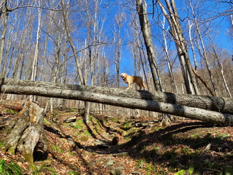
![]()
![]()
![]()
![]()
![]() On Sunday, April 26th I decided that I needed to hike after a busy Friday and Saturday filled with track meets. I wanted something challenging so I decided to head for Tannersville to hike the Devil's Path over Indian Head and Twin. I was able to get out of Livingston Manor a little after 7:30 AM. Sheila was ready to go as we had not hiked in a week. I had decided not to bring snowshoes as I did not think there would be enough snow left to warrant carrying them. I did pout my spikes in my pack to use on any icy or snowy areas that might remain. As I passed Biscuit Brook, Slide and Giant Ledge the parking lots were beginning to fill up and I was reminded that it was a beautiful day and that it was a weekend. When I got to Route 28, I turned right and passed Route 42 deciding to head north on Route 219 out of Phoenicia. I had not been that way in some time and I like variety. As I passed Fox Hollow Road, I thought about hiking the Fox Hollow Trail to Panther as it would have fewer people and it was not a trail I had done very often. I passed the road and decided to stick with my original plan. Within a short distance, I changed my mind, turned around and took Fox Hollow Road north to the parking lot. There were no cars parked there as we pulled in just before 9:00 AM. I parked and saw the sign which indicated that the summit of Panther was almost five miles away. I was surprised it was that far but decided to do it anyway. As we headed out on the trail at 9:00 AM it was still in the low 40's but it seemed warmer due to the sun which was shining brightly from a blue sky with plenty of puffy white clouds. The weather forecast was calling for some rain showers at 1:00 PM but I had a rain jacket and decided we would weather the storm if it came. The trail was relatively dry and absolutely devoid of any snow or ice as we walked parallel to the road and passed the register box. The trail was flat for the first .2 miles but began to climb on a woods road just after the register box as the trail turned northwest away from the road. At .5 miles a spur trail branched off to the right to the spring and a lean-to. We continued on the main trail which started to turn southwest as it climbed. The forest was beginning to show a lot of green as we walked on the trail through hardwood forests. At one point I looked up and saw that a large tree had blown down and was across the trail. There was ample room to pass under it and Sheila was walking across the tree at least six feet in the air. I called for her to stay where she was and took some pictures of her before continuing on.
On Sunday, April 26th I decided that I needed to hike after a busy Friday and Saturday filled with track meets. I wanted something challenging so I decided to head for Tannersville to hike the Devil's Path over Indian Head and Twin. I was able to get out of Livingston Manor a little after 7:30 AM. Sheila was ready to go as we had not hiked in a week. I had decided not to bring snowshoes as I did not think there would be enough snow left to warrant carrying them. I did pout my spikes in my pack to use on any icy or snowy areas that might remain. As I passed Biscuit Brook, Slide and Giant Ledge the parking lots were beginning to fill up and I was reminded that it was a beautiful day and that it was a weekend. When I got to Route 28, I turned right and passed Route 42 deciding to head north on Route 219 out of Phoenicia. I had not been that way in some time and I like variety. As I passed Fox Hollow Road, I thought about hiking the Fox Hollow Trail to Panther as it would have fewer people and it was not a trail I had done very often. I passed the road and decided to stick with my original plan. Within a short distance, I changed my mind, turned around and took Fox Hollow Road north to the parking lot. There were no cars parked there as we pulled in just before 9:00 AM. I parked and saw the sign which indicated that the summit of Panther was almost five miles away. I was surprised it was that far but decided to do it anyway. As we headed out on the trail at 9:00 AM it was still in the low 40's but it seemed warmer due to the sun which was shining brightly from a blue sky with plenty of puffy white clouds. The weather forecast was calling for some rain showers at 1:00 PM but I had a rain jacket and decided we would weather the storm if it came. The trail was relatively dry and absolutely devoid of any snow or ice as we walked parallel to the road and passed the register box. The trail was flat for the first .2 miles but began to climb on a woods road just after the register box as the trail turned northwest away from the road. At .5 miles a spur trail branched off to the right to the spring and a lean-to. We continued on the main trail which started to turn southwest as it climbed. The forest was beginning to show a lot of green as we walked on the trail through hardwood forests. At one point I looked up and saw that a large tree had blown down and was across the trail. There was ample room to pass under it and Sheila was walking across the tree at least six feet in the air. I called for her to stay where she was and took some pictures of her before continuing on.
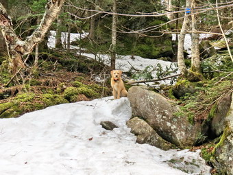 We continued to ascend the trail along the woods road and just before the mile mark started to pass through a large area of blowdowns. Most of this was very old since what was across the trail had been cut some time ago. The area was very large and impressive. I stopped to take some pictures to the east and north as the sun was out and the blowdown made the mountains in those directions visible. I also took off my jacket and hat at this point and got a drink. I promised myself I would hydrate properly to avoid the painful cramps I often get at home! At 1.4 miles the trail began to flatten out some as we hit the ridge. Until this point the grade had averaged 20% and the trail had been very rocky. Around the 1.9 mile mark the trail turned a little more so that we were headed south and just a little to the east. At 2 miles we again began to climb to a false summit at the 3 mile mark there were some limited views here and I took a few pictures to the west. Along the way to the true summit there are at least three of these false summits and after each there is a small descent. These areas are interesting since most contain a small, flat area where there is evidence of campfires and camping. Coming down off these areas usually involves scrambling down some rocks and the traveling next to a rock wall or cliff before hitting open trail again. At about 3100 feet we began to find small patches of snow and ice here and there but I was able to walk over or around these. Sheila, of course, had no problems at all. The trail was rather poorly blazed and I found many of the blazes on trees that ha blown down. There were many trees across the trail, some new and a few old, which also made finding the trail more difficult. I was glad to have Sheila along as she always seems to be able to find the trail. It was taking us longer to hike than I ha planned and I thought about turning around a few times due to the weather forecast. In the end I decided it was more important for me to reach my goal and deal with the rain when and if it came.
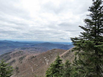 By the time we hit 3400 feet there was more snow and at 4.3 miles we began the final ascent to the summit of Panther. I finally got to a spot where there was a short but steep ascent covered in ice. I stopped here and donned my spikes and kept them on until I was below that spot on the way back. From this point on the trail was mostly covered in snow and ice and the spikes made walking much easier. At 4.6 miles the trail leveled and we continued to walk toward our goal. I noticed a nice rock ledge that had better views then the summit but decided to stop on the way back. At 12:35 PM we finally reached the rock outcrop designated as the summit of Panther. I took off my pack and took out my camera to take a few shots. There was some haze on the mountains and the sky was now almost completely covered with clouds. I put the camera away and finished off one water bottle. We heard voices at the lookout slightly farther along the trail and headed in that direction. Two men were occupying the viewpoint but I knew the pictures from there would not be much better than the viewpoint further down the mountain that I had seen. We talked for a minute and they sainted were hiking through to the lean-to and I told them I was the only car parked at Fox Hollow. As Sheila and I turned around to start the return hike, two more hikers came up from the direction of Giant Ledge. I said "hello" as they followed us to the summit. We started back down the mountain. I was hoping down would be easier than up as I was definitely tires. We stopped at the lookout and I got some good pictures of the valleys below and large areas of snow that still covered the north and west sides of the mountains and lay in protected areas. The first part of the descent through the icy areas was tricky and took some time. Once we were below these areas, I took off the spikes and we started to make better time. The rocks on the trail were a challenge even on the decent but we were soon passing through the large, open blowdown area and then the trail to the lean-to and the finally the trail register. We were back in the parking lot just before 4:00 PM having covered 9.5 miles in almost seven hours! The vertical gain was just over 3400 feet and I could definitely "feel" the hike in my legs. I thought I might stop at the Alamo in Phoenicia but once I started driving I just wanted to get home! The rain had held off and I was happy to have accomplished my goal even with the change in plans.
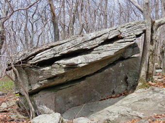
![]()
![]()
![]()
![]()
![]() On Sunday, April 19th I was ready to hike after a long track meet on Saturday. I decided I would go to Ashokan High Point as I expected I would not need to carry my snowshoes as I might on one of the 3500 foot peaks! When I got up at 6:30 AM the temperature was in the mid 30's but it warmed up quickly as the sun came out. The skies were blue with plenty of sun but the extensive cloud formations from the previous day were missing. I was getting ready to leave at about 8:00 AM when the ambulance pager went off and I responded. I arrived back home at about 9:30 AM, got Sheila and my equipment in the car and headed to Liberty and out Route 55 to Grahamsville. I turned left on the Sundown Road continuing on this road through Sundown and passed the Peekamoose parking area. I pulled into the Ashokan High Point parking area at about 10:30 AM and found it was nearly full! I found a place to park and pout Sheila on her leash as there was another dog running loose. I got my gear ready and we quickly crossed the road to begin our hike. I was warm despite the fact that I had not put on a baselayer and I already had all the zippers on my Mammut Hoody opened up. We set a good pace on the flatter part of the trail and I soon had to stop to remove the Hoody and stow it in my pack. The trail parallels Kanape Brook and we could hear the water as it cascaded over the rocks. There was water in the stream but I had expected it to be much higher than it was. We crossed several small streams and eventually a larger one that required a small foot bridge. At 1.5 miles the trail flattened a little and the started a somewhat steeper climb. We crossed another small bridge and entered a tunnel of pine trees. The ground was covered with small twigs broken from theatres and these formed a sort of carpet on the ground. From this point on the trail became much rockier as more water flowed on the trail eroding the soil between the stones. This trail is marked on some maps as the Kanape Jeep Trail. Along the way we met a couple who had camped out over night at the trail junction but had not hiked to the High Point. At 2.7 miles we reached the turn to the left where the trail begins the 1 mile climb to the High Point. It was 11:45 AM and I stopped to take a quick break for water.
On Sunday, April 19th I was ready to hike after a long track meet on Saturday. I decided I would go to Ashokan High Point as I expected I would not need to carry my snowshoes as I might on one of the 3500 foot peaks! When I got up at 6:30 AM the temperature was in the mid 30's but it warmed up quickly as the sun came out. The skies were blue with plenty of sun but the extensive cloud formations from the previous day were missing. I was getting ready to leave at about 8:00 AM when the ambulance pager went off and I responded. I arrived back home at about 9:30 AM, got Sheila and my equipment in the car and headed to Liberty and out Route 55 to Grahamsville. I turned left on the Sundown Road continuing on this road through Sundown and passed the Peekamoose parking area. I pulled into the Ashokan High Point parking area at about 10:30 AM and found it was nearly full! I found a place to park and pout Sheila on her leash as there was another dog running loose. I got my gear ready and we quickly crossed the road to begin our hike. I was warm despite the fact that I had not put on a baselayer and I already had all the zippers on my Mammut Hoody opened up. We set a good pace on the flatter part of the trail and I soon had to stop to remove the Hoody and stow it in my pack. The trail parallels Kanape Brook and we could hear the water as it cascaded over the rocks. There was water in the stream but I had expected it to be much higher than it was. We crossed several small streams and eventually a larger one that required a small foot bridge. At 1.5 miles the trail flattened a little and the started a somewhat steeper climb. We crossed another small bridge and entered a tunnel of pine trees. The ground was covered with small twigs broken from theatres and these formed a sort of carpet on the ground. From this point on the trail became much rockier as more water flowed on the trail eroding the soil between the stones. This trail is marked on some maps as the Kanape Jeep Trail. Along the way we met a couple who had camped out over night at the trail junction but had not hiked to the High Point. At 2.7 miles we reached the turn to the left where the trail begins the 1 mile climb to the High Point. It was 11:45 AM and I stopped to take a quick break for water.
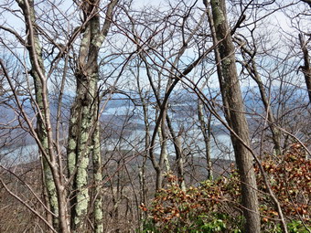 As we were standing at the turn, a hiker and his dog approached from behind us. I got my gear on and we started up the trail. The other hiker was coming up on us rather quickly and I decided I did not want to push as hard as he did. I pulled Sheila off the trail to let them go by us. We talked for a moment and I noticed his English accent and the fact that his female border collie was not very friendly toward Sheila. They passed us and we waited a few minutes and then continued. A little farther up the trail, a small path went off to the right. We followed the path until it became indistinct. I remembered doing this before and not finding any real views. Back on the main trail we continued toward the top. The overall grade averages about 17% with some flatter and some steeper areas. There are no real views along the way until near the very top. There are five different short climbs several of which have stone steps. At one point there is a rock overhang which forms a small shelter. I had passed this many times but this time I noticed I tree seemingly growing out of the very top of the rock. I stopped to take a few pictures before heading for the summit. As we climbed the last ascent I took a few shots of Mombacus and Little Rocky from a rock outcrop on the trail. The skies were hazy and the view was far from clear. As we approached the last climb to the high point, we met a couple coming down the trail toward us. We stopped to talk and they told me they had been to the top and were returning back the way they had come because it was shorter. I asked them if they had been to Little Ashokan but they said they could not find the way. I described it for them in case they wanted to try it in the future since they live in Hastings-on-Hudson. We finished the climb to the High point and found the hiker and his dog at the top. I leashed Sheila and tied her to a tree and the other dog seemed to be satisfied. The other hiker and I talked and I found out he lives in New York city but has hiked some in the Catskills. He said he was surprised to find such nice mountains so close to the city. I described the loop trail back to the base of the High Point. I had decided to do the loop but skip Little Ashokan.
 I took a few pictures from the High Point but the views were too hazy to be really nice. We walked over to the next lookout in the opposite direction but the views were much the same. We started out on the trail to begin the loop back. There are several small depressions that collect water and they were frozen over with layer of ice. When we got to the open fields, we turned right and walked toward the "edge" of the hill. I could see the Ashokan Reservoir through the trees and took a few pictures. From previous trips I knew it was useless to try to find a clear view as there are none! We walked back up to the fire rings in the field where I dropped my pack and took out the camera. The Burroughs Range was clearly visible but the sky was a flat blue without many clouds. I took some shots and allowed the other hiker and his dog to get on the trail before us. We headed to the left and followed the trail as it descended the other side of the High Point. After a short distance the blazes on the trail all but disappeared and there was little in the way of a trail to follow. I was glad Sheila was with me as she seemed to be able to pack out the path. We descended some and found the other hiker headed back toward us as he had lost the trail. I continued on and followed Sheila as she ascended a small hill. I found some red blazes and signaled to the other hiker who was still searching for the trail. Sheila and I set a fast pace to stay ahead as we descended the trail. It continued to be poorly marked and hard for me to follow but Sheila had no problem. At 4.7 miles we made a sharp left turn which changed our heading from west to south as we continued to descend. As we walked the border collie was often right on my heels until her owner whistled and she returned to him. We worked our way through some laurel which was encroaching on the trail and the began a steep rocky descent from about the 5.2 mile to 5.7 mile although it seemed much longer. The descent averaged a 24% grade over loose gravel and larger rocks. We kept a fast pace but it was difficult. The last .5 miles of the loop was slightly uphill and was the wettest part of the hike passing through some laurel and a stand of pine trees. As we approached the end of the loop, we turned right onto the main trail and walked back to the trail junction.
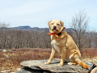 At the trail junction I turned left to walk a few hundred feet out to an area that is used for camping. I took a few pictures and got a drink waiting for the other hiker to make the turn and head down the main trail. We returned to the main trail and kept a good pace back to the car. On the way back we met two men walking up the trail with a black, shaggy dog who seemed very friendly. They asked if I worked for the state since I had on green pants and a "radio" (GPS unit). I said "no" and we continued our separate ways. When the trail started to parallel the brook again, Sheila rushed down to the water, jump in, jumped out and dashed madly up and won the trail. She repeated this at least five times looking very happy and satisfied with herself. In the last half mile of the trail we met another couple headed up the trail. I gathered they were out for a short walk as it was getting late and they had no gear. I stopped at the register box and found that Alan Via and Ralph Ryndak had been on the trail the same day. I was sorry I had not seen them and can only assume they did the loop and were ahead of us. We walked across the bridge and back to the car to find and almost empty lot. It was 3:25 PM and we had spent almost 5 hours hiking the 9.1 mile loop with about 30 minutes of stopped time. The vertical gain was 2470 feet. The temperature at the car was 61 degrees which surprised me as it seemed much warmer.
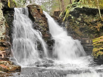
![]()
![]() On Friday, April 17th I left the Neversink Unique Area and drove through Glen Wild, Woodridge, Old Falls and Woodbourne. In Woodbourne I turned left on Route 42 and drove to Grahamsville turning right on Route 55 and then left on Route 55A just before the Rondout Reservoir. I followed Route 55A where it turned and the turned left on the Yagerville Road. After driving up the hill I almost missed the right turn onto Shalom Road. The road was in pretty good shape and I parked at the end at 4:20 PM. The skies were cloudy but there was no rain so we hurried down to Trout Creek. We followed Shalom Road to the top of Angel falls and then turned right on the path that leads along the creek. I found a path down to the streambed which was steep but passable. Soon I was standing on some rocks below the falls while Sheila jumped into the cold water. I was surprised that there wasn't more water in the stream. The falls were flowing with good volume but we were able to stand where I always stand to take pictures. There was still some ice on the cliffs across the stream so I took some pictures and then turned my attention to the falls. I took several shots with different camera settings and then took a few downstream.
On Friday, April 17th I left the Neversink Unique Area and drove through Glen Wild, Woodridge, Old Falls and Woodbourne. In Woodbourne I turned left on Route 42 and drove to Grahamsville turning right on Route 55 and then left on Route 55A just before the Rondout Reservoir. I followed Route 55A where it turned and the turned left on the Yagerville Road. After driving up the hill I almost missed the right turn onto Shalom Road. The road was in pretty good shape and I parked at the end at 4:20 PM. The skies were cloudy but there was no rain so we hurried down to Trout Creek. We followed Shalom Road to the top of Angel falls and then turned right on the path that leads along the creek. I found a path down to the streambed which was steep but passable. Soon I was standing on some rocks below the falls while Sheila jumped into the cold water. I was surprised that there wasn't more water in the stream. The falls were flowing with good volume but we were able to stand where I always stand to take pictures. There was still some ice on the cliffs across the stream so I took some pictures and then turned my attention to the falls. I took several shots with different camera settings and then took a few downstream.
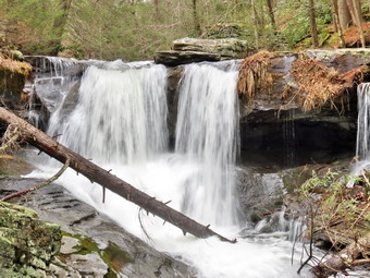 We headed back up the bank to the path and continued along the path and down to the top of the lower falls. I dropped my pack near the top of the lower falls and got out the camera. I took some pictures of the upper drop of the lower falls from several different vantage points. I worked my way down the bank to look at the old foundations at the bottom of the fall and the walked down to the creek bed. From the edge of the stream I took some more pictures and then walked upstream a bit and took a few more. After returning to the top of the upper drop, I took a few more shots and then packed up the camera to start back to the car. As we started up the bank to Shalom Road, I nice and interesting tree with multiple trunks. This required that I get out the camera again to take a few more photographs. We headed back up the bank to the old road and back to the car. It was 4:50 PM when we got back to the car and headed home. The rain had held off and we were returning dry.
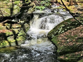
![]()
![]()
![]()
![]()
![]() On Friday, April 17th it had rained all morning and I was not sure I could get out before it rained again in the afternoon. I decided the worst that could happen was I would drive somewhere and not be able to hike and have to drive home. Sometime after 1:00 PM I loaded my gear in the car and got a very eager Sheila in the back seat and headed for the neversink1 Unique area near Rock Hill. I thought that the falls in the area might be nice and that the rain might hold off the farther south I went. I arrived at the trailhead at the end of Katrina Falls Road around 1:45 PM to find blue skies with white clouds. The trail did not have any snow but I left my spikes in the pack just in case. There was only one car in the lot as we started down the trail at 1:50 PM with Sheila leading the way. At the first trail junction we turned left to parallel the river and soon crossed Wolf Brook on the small bridge. We ascended the small hill and then headed left at the next trail junction. This part of the trail was wet but the we worked around the worst areas. Over the next .9 miles we ascended about 400 feet heading first south and then east. The trail was completely bare and I was getting warm as we climbed. I stop to take off my Mammut Hoody which I stowed in the pack. At the top of the hill we stayed on the main trail as it turned to the right or south. At this trail junction a left turn leads out to the parking area at the Wolf Brook Multiple Use Area. I knew the rest of the hike was downhill except for the ascent back up the spur trail that went down to Mullet Brook Falls. We headed south and at 1.65 miles crossed Mullet Brook on a wooden bridge. I thought about taking pictures but there was nothing outstanding about the scenery. Just after the bridge the trail turns west and heads toward the Neversink River still descending.
On Friday, April 17th it had rained all morning and I was not sure I could get out before it rained again in the afternoon. I decided the worst that could happen was I would drive somewhere and not be able to hike and have to drive home. Sometime after 1:00 PM I loaded my gear in the car and got a very eager Sheila in the back seat and headed for the neversink1 Unique area near Rock Hill. I thought that the falls in the area might be nice and that the rain might hold off the farther south I went. I arrived at the trailhead at the end of Katrina Falls Road around 1:45 PM to find blue skies with white clouds. The trail did not have any snow but I left my spikes in the pack just in case. There was only one car in the lot as we started down the trail at 1:50 PM with Sheila leading the way. At the first trail junction we turned left to parallel the river and soon crossed Wolf Brook on the small bridge. We ascended the small hill and then headed left at the next trail junction. This part of the trail was wet but the we worked around the worst areas. Over the next .9 miles we ascended about 400 feet heading first south and then east. The trail was completely bare and I was getting warm as we climbed. I stop to take off my Mammut Hoody which I stowed in the pack. At the top of the hill we stayed on the main trail as it turned to the right or south. At this trail junction a left turn leads out to the parking area at the Wolf Brook Multiple Use Area. I knew the rest of the hike was downhill except for the ascent back up the spur trail that went down to Mullet Brook Falls. We headed south and at 1.65 miles crossed Mullet Brook on a wooden bridge. I thought about taking pictures but there was nothing outstanding about the scenery. Just after the bridge the trail turns west and heads toward the Neversink River still descending.
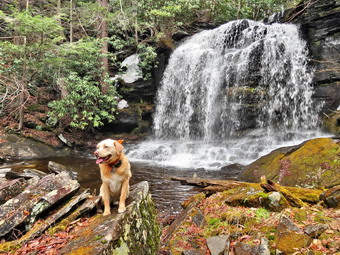 As we headed down the trail I looked off to the right and saw the brook as it descended through the woods to Mullet Brook Falls. The areas was open and I had often thought about bushwhacking to the top of the falls. We headed off the trail and own to the brook. There was a path along the brook and I found several small cascades and rapids. As we worked our way down the path along the brook, I stopped several times to take pictures. Near the top of the falls the brush got thicker but I found an opening with a path that descended along the side of the falls. We took the path and we were soon at the base of the falls. I stopped to take a few pictures of the falls from the base. The amount of water going over the falls was much less than I expected but was enough to make it interesting. As I packed up my camera, I noticed that the skies were beginning to get dark especially to the north. I decided that Denton Falls would probably not be that interesting and that I did not want to get wet. I had planned on bringing a rain jacket but had left it behind. We walked up the spur trail to the main trail and turned left to walk down to the junction with the trail to High Falls. We turned right to head back to the parking area and passed the cutoff to Denton Falls. I thought for a moment about making the trip but one look at the sky changed my mind. We crossed Mullet Brook again on another bridge and I noticed a pronounced tilt to the downstream side. After I crossed, I looked back at the bridge and found the downstream timber to be rotten and cracked in half. I made a note to report the problem as it will be easier to replace the timber now than the whole bridge later! We continued on the trail and set a good pace back toward the car. The last uphill was unwelcome but not too difficult. We were back at the car by 3:30 PM having hiked 3.8 miles and 750 feet of elevation gain in 1 hour and 40 minutes. As I left the parking area, a light rain began to fall. I decided to drive to Angel Falls to see if we could take a short hike in that area.
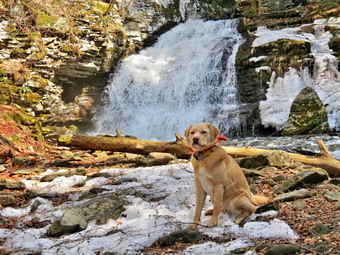
![]()
![]()
![]()
![]()
![]() On Monday, April 13th I was still a little tired from hiking Westkill the day before and had not planned on going anywhere. When Karl came in for breakfast, he asked if I was going to hike somewhere since the day was so beautiful already. I decided to get a few miles in at Trout Pond as I expected Russell Brook Falls to have a high volume of water. I got a late start leaving Livingston Manor just before 10:30 AM and heading north on Route 17 to Roscoe. I took Route 206 to Downsville but turned left onto Morton Hill Road just after the Roscoe Nursing Home. When I got to the intersection with Russell Brook Road, I turned around and parked on the side of the road to avoid parking in the large open space which is marked as private property. Russell Brook Road appeared to have been plowed as was free of snow and ice. I decided not to take my snowshoes but left my Microspikes in my pack. Sheila was ready to go as always and we started down the road just after 10:45 AM. The temperature was already in the 50's and I was glad I had decided to eschew my baselayer as I was already warm. I had also decided not to wear insulated boots and had on my Keen Glarus which give me better support than some others. As we approached the upper parking area, I could see that the road was plowed only to this point and that it was covered with layer of ice and snow. I had been hearing the roar of the brook and could now also detect the sound of the falls which may me anxious to keep going. I did stop long enough to put on my Microspikes before continuing down the road. When we got to the lookout over the upper falls, it was very icy and I had to carefully pick my way down to a spot where I could get some pictures. Sheila is fearless but I kept her by my side as the lower part of the viewpoint was a sheet of ice. The falls was running very high and there were no tree trucks or other debris to spoil the view. I took some shots and then carefully worked my WY back up to the road. The lower parking areas was covered in a mix of snow and ice although it did appear that some vehicles had used it. We walked down the trail to the bridge across Russell Brook.
On Monday, April 13th I was still a little tired from hiking Westkill the day before and had not planned on going anywhere. When Karl came in for breakfast, he asked if I was going to hike somewhere since the day was so beautiful already. I decided to get a few miles in at Trout Pond as I expected Russell Brook Falls to have a high volume of water. I got a late start leaving Livingston Manor just before 10:30 AM and heading north on Route 17 to Roscoe. I took Route 206 to Downsville but turned left onto Morton Hill Road just after the Roscoe Nursing Home. When I got to the intersection with Russell Brook Road, I turned around and parked on the side of the road to avoid parking in the large open space which is marked as private property. Russell Brook Road appeared to have been plowed as was free of snow and ice. I decided not to take my snowshoes but left my Microspikes in my pack. Sheila was ready to go as always and we started down the road just after 10:45 AM. The temperature was already in the 50's and I was glad I had decided to eschew my baselayer as I was already warm. I had also decided not to wear insulated boots and had on my Keen Glarus which give me better support than some others. As we approached the upper parking area, I could see that the road was plowed only to this point and that it was covered with layer of ice and snow. I had been hearing the roar of the brook and could now also detect the sound of the falls which may me anxious to keep going. I did stop long enough to put on my Microspikes before continuing down the road. When we got to the lookout over the upper falls, it was very icy and I had to carefully pick my way down to a spot where I could get some pictures. Sheila is fearless but I kept her by my side as the lower part of the viewpoint was a sheet of ice. The falls was running very high and there were no tree trucks or other debris to spoil the view. I took some shots and then carefully worked my WY back up to the road. The lower parking areas was covered in a mix of snow and ice although it did appear that some vehicles had used it. We walked down the trail to the bridge across Russell Brook.
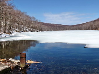 Although I knew my time was limited, I decided to walk over to the falls to take some photographs. The path was completely devoid of snow and ice until we were ready to descend to the streambed. The usual route was very icy so I took another approach and we were soon down to the level of the stream. I could feel the mist coming off the falls as I got out the camera to take a few shots. I stayed a little farther away from the falls than I normally do to avoid the spray but got some nice shots. The volume was as great as I had ever seen. Sheila posed for a few pictures before we made our way back up to the trail and walked out to the main trail to Trout Pond. As we passed the register box, I decided we would walk up to Trout Pond first as we could always walk back down without doing the loop. The trail ahead had some ice but was also bare in spots. As we walked up the trail, I found the bare spots were often very muddy and the ice and snow were rotten and often collapsed as I walked on them. In many places small streams crossed the trail and some where rather wide. As we approached the pond the snow got deeper but wasn't really a problem. At the pond, I took off my pack and got out the camera. The sky was blue with a few wispy clouds and the pond was still frozen except in the areas near the outlet. I took some shots and the realized that Sheila was wading through the ice-cold water without seeming to mind it. We walked over to the dam and I took a few pictures from above down the stream. I decided that I would like to take a few shots from downstream toward the dam, an angle that I had never tried before. We worked our way through some rather deep snow to a point just below the dam where I took some pictures. Back at the pond I put the camera away and decided we would try the loop since I really didn't want to return the way we came. I was a little pressed for time but did not think it would be a problem.
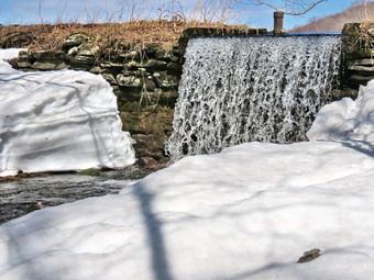 Once we were back on the main trail, we started the walk to the upper end of the pond. The trail is completely flat and was covered by snow and ice and large areas of standing water! I had to switch from one side of the trail to the other to try to avoid the water. By noon we had walked 2.2 miles to the bridge at the inlet and despite my time constraints, I had to take a few quick pictures. Continuing our walk up the trail we encounter a small stream that was using the trail. Sheila had no problem crossing and I found a place to get across. As we started the climb to Cherry Ridge there was more snow on the trail but also plenty of running water and a few bare spots. We made a slight turn to the south and began to climb more and found that the trail was now covered in up to a foot of snow. The snow was soft and wet and my shoes began to give in to the constant contact with water. The temperature had risen to 60 degrees so at least my feet didn't seem that cold. I followed some tracks of another hiker up over the shoulder of Cherry Ridge slipping and sliding as the spikes offered little traction in the snow. Once we headed back down from the highest point on the hike, there was less snow and the trail was almost bare in some places. There did seem to be a lot of branches down on the trail especially near the high point.
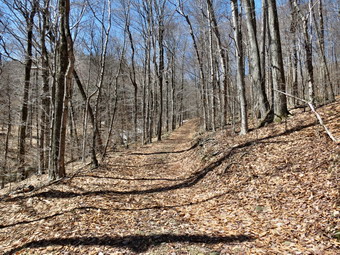 As we walked on the nearly bare trail, water became a problem again as it covered several spots on the trail and extended well into the woods. In other spots water ran down the trail and I had to walk along the "bank". Sheila, of course, had no problems as she happily splashed through water, waded through mud and bounded through the snow. In several spots I just gave up and waded through the shallowest place I could find. By 1:10 PM we had hiked 4 miles are were at the junction with the trail that runs from the register box to the lower part of Russell Brook Road. We turned left to go back to the area of the falls. The trail ascends slightly and there was still a layer of rotten ice over running water with a generous helping of mud thrown in. When we finished the climb to the top of the small hill, we started to descend and I again found the trail almost bare. There was some running water and mud but both could be avoided. At one point I stopped to take a few shots of the trail which was completely bare and belied the amount of ice and snow we had encountered. We turned right at the register box and walked back across the bridge and up the road toward the car. We did meet a fisherman headed down the road and exchanged greetings on this most pleasant day. The walk back up to the car went quickly and we were back at 1:55 PM and the temperature at the car was in the mid-60's. I actually made track practice with time to spare. We had hiked 5.6 miles in 3 hours and 5 minutes with a 1200 foot elevation gain. It was better to be out than to be inside but I would not choose to do this hike again in the near future due to the conditions of the trail.
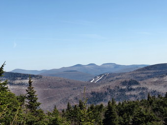
![]()
![]()
![]()
![]()
![]() On Sunday, April 12th, I was ready to hike after almost a week "off" for the Easter holiday. A return to coaching track and relentless rain also curtailed the hiking opportunities. I decided to do another 3500 foot peak since my experience on Hunter had been so enjoyable. I decided to return to that area and hike Westkill. This peak has a special meaning for me as it is where I spread the ashes of my canine hiking companion Sheba. I also like Diamond Notch Falls which is on the way to the peak. I had read many posts on the ADK High Peaks forum and knew that I should take both snowshoes and spikes. Some hikers even advocated crampons but I have seldom need them. I got a later start than I had wanted leaving Livingston Manor at about 8:00 AM. I got Sheila into the car and loaded up my equipment. I headed out DeBruce Road which almost bare. At the end I turned left on Route 47 to head toward Big Indian and Route 28. There were a few cars at the Biscuit Brook parking area and only one or two at Slide Mountain with a few more at Panther. I turned right on Route 28 and then left on Route 42 to head toward Spruceton. On the way from Shandaken to Spruceton on Rt 42 there were no cars at the Halcott parking area. There were some large pieces of ice on the road just north of the parking area which I did not see until the last minute! They appeared to have fallen off one of the cliffs near the road as they were too big to have fallen from the trees. I turned right on the Spruceton Road and found it was full of potholes and bumps especially after it turned to mostly dirt. We arrived at the parking area on the right at about 9:05 AM and I started to get ready to hike. There was only one other car in the parking area. I attached my Tubbs AlpFlex snowshoes to my pack and put my Hillsound spikes in the back pocket of my pack for the walk up the road to the trail. When we got to the snowplow turnaround there was one car parked right under the "No Parking" sign! The trail appeared clear for some distance so we walked over the frozen pile of snow and started up the trail. There was a lot of running water on the trail and several small brooks crossed it to add to the volume of the West Kill. The stream was making quite a noise and I was tempted to stop several times to take pictures. I decided to put this off until the return trip. I wanted to try to make it to the top and back without having to change to snowshoes. This could only happen if we hiked as fast as we could to the peak and then got back down before the sun softened the trail.
On Sunday, April 12th, I was ready to hike after almost a week "off" for the Easter holiday. A return to coaching track and relentless rain also curtailed the hiking opportunities. I decided to do another 3500 foot peak since my experience on Hunter had been so enjoyable. I decided to return to that area and hike Westkill. This peak has a special meaning for me as it is where I spread the ashes of my canine hiking companion Sheba. I also like Diamond Notch Falls which is on the way to the peak. I had read many posts on the ADK High Peaks forum and knew that I should take both snowshoes and spikes. Some hikers even advocated crampons but I have seldom need them. I got a later start than I had wanted leaving Livingston Manor at about 8:00 AM. I got Sheila into the car and loaded up my equipment. I headed out DeBruce Road which almost bare. At the end I turned left on Route 47 to head toward Big Indian and Route 28. There were a few cars at the Biscuit Brook parking area and only one or two at Slide Mountain with a few more at Panther. I turned right on Route 28 and then left on Route 42 to head toward Spruceton. On the way from Shandaken to Spruceton on Rt 42 there were no cars at the Halcott parking area. There were some large pieces of ice on the road just north of the parking area which I did not see until the last minute! They appeared to have fallen off one of the cliffs near the road as they were too big to have fallen from the trees. I turned right on the Spruceton Road and found it was full of potholes and bumps especially after it turned to mostly dirt. We arrived at the parking area on the right at about 9:05 AM and I started to get ready to hike. There was only one other car in the parking area. I attached my Tubbs AlpFlex snowshoes to my pack and put my Hillsound spikes in the back pocket of my pack for the walk up the road to the trail. When we got to the snowplow turnaround there was one car parked right under the "No Parking" sign! The trail appeared clear for some distance so we walked over the frozen pile of snow and started up the trail. There was a lot of running water on the trail and several small brooks crossed it to add to the volume of the West Kill. The stream was making quite a noise and I was tempted to stop several times to take pictures. I decided to put this off until the return trip. I wanted to try to make it to the top and back without having to change to snowshoes. This could only happen if we hiked as fast as we could to the peak and then got back down before the sun softened the trail.
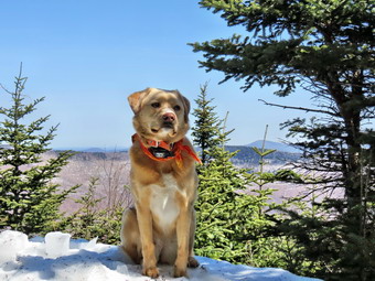 At the falls, we turned right on the Devil's Path and then right again at the end of the bridge. I had still not put on my spikes which was simply stubbornness on my part. The trail still only had a little snow but the sides of the trail showed there was still snow in the woods. As we continued to follow the trail it began to get steeper and icier. Several small streams added to the water on the trail. I finally gave in and stopped to put on my spikes at about 1.3 miles just after a steep, icy section and before the part where the trail begins to travel along the side of a hill. When we reached this section, the comments on the forum about "Whack-a-mole" began to make sense. This section and the rest of the trail to the peak would have been perfect for snowshoes but it was pockmarked with postholes. Some of these holes were almost two feet deep and many where iced over indicating they had been there for some time. This means that they are old and that the hikers who made them were too ignorant or inconsiderate to wear snowshoes. Hermit (Ralph Ryndak) had made a comment about extending the regulation requiring snowshoes to the Catskills. I wondered why Ralph had said this as either of us are that fond of more rules. Once I saw the wreck of a trail I knew why and agree! There was no way I could use snowshoes so I walked along the frozen center of the trail being careful to avoid the deep holes. The situation improved a little for the rest of the hike to the peak but not by much. It didn't take us long to get to the one spot that is usually a sheet of ice. When we got there, it was not as intimidating as it had been in other years. Sheila scrambled up without much trouble and I followed making use of the small amount of snow still present. Once we passed this point there were still some steep areas to conquer. The mile climb from just after the falls to where the trail begins to level averages a 20% grade and can be very tiring in winter. Once we got to the more level part there were still some small climbs and a few descents but the going was easier. From that point to Buck Ridge and the summit is still well over a mile. On our way to the rock overhang or "cave" we passed the 3500 foot sign. I could have sworn the sign used to be just above the overhand but I checked my GPS and the new placement seems more correct.
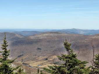 The rock overhang had a large blowdown next to it which was easy to skirt and we were soon above the "cave". We were then at the area where the trail turns almost due west and levels off slightly. I seemed to be having to duck under a lot of tree branches and I realized that I was two to three feet above the level of the trail. I hope I will remember to remind trail maintainers to trim two the three feet higher in the summer than they think is necessary. We continued on our way as I had to pick my way around some more deep holes and stay on the frozen ridge of snow in the middle of the trail. We were soon at the base of the final ascent. We reached Buck Ridge at 11:15 AM and I decided to take some pictures before continuing on to the summit. Hiking to the summit of Westkill is a short trip but serves no purpose other than to allow a hiker to claim they got to the summit. The real attraction of Westkill is the Buck Ridge Lookouts. I took off my pack and got out the camera. It was a beautiful and sunny day but there was quite a bit of haze and very few clouds in the sky. I took a few pictures to the south including some of Sheila sitting on the rock outcrop. We then walked over to the north side and Sheila perched on the rock that Sheba always liked to sit on. I took some pastures of her and then some of the Spruceton Valley which showed very little snow. The trees have started to block the view but it was easy to stand on the snow and ice-covered boulder with my spikes. I was a little sad at this point but happy we had done the hike to Sheba's final resting place. We walked back to my pack and I put away the camera and we started up to the summit of Westkill. It is only about .1 miles and it took us about 15 minutes to get up and back to the lookouts. It was about 11:40 AM as we started back down the trail from Buck Ridge.
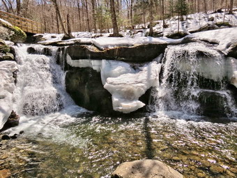 We kept a quick pace on the way down without stopping but the going was even more difficult as I was trying to avoid turning an ankle in the deep holes. The snow was noticeably softer but I was able to stay on top without sinking in as long as I stayed on the center ridge. A few times I stepped off the ridge and promptly sank up to my knees. Descending the icefall proved interesting. I finally decided to throw my poles down ahead of me and use the roots and trees as handholds. I did a "graceful" glissade down to the bottom where I picked up my poles. Before continuing I took a few pictures of the icefall. We continued down the trail and I thought we might meet some other hikers but none appeared. Just before the bridge at the falls, I walked off the trail to the left and took some pictures of the bridge and the falls. We crossed the bridge at the falls and we negotiated the short but steep drop to the base of the falls. Sheila immediately took a dip in the ice-cold water and then began to happily do "laps" around me. The stream has actually changed its course slightly and now flows more on the left rather than the right side of the bed. After taking these photographs, I also took about I one minute video of the falls as the sound was very visceral. We climbed back up the bank to trail and continued back to the car. We did meet two hikers and a dog on the way back. Sheila greeted the dog cordially but had to bark at the owner! I admonished her and we continued back to the car. Along the way I stopped to remove my spikes as the snow and ice had all but disappeared. I also took some pictures of the smaller rapids along the way. Back at the car the temperature had risen to 62 degrees which was significantly warmer than the reading of 36 degrees when we started. We were back in the parking area at 1:50 PM having covered 6.4 miles in 4 hours and 45 minutes with plenty of time allowed for photography. The total ascent was 2104 feet. I was tired but glad we had made the trip. I carried my snowshoes for the whole trip but had no opportunity to use them.
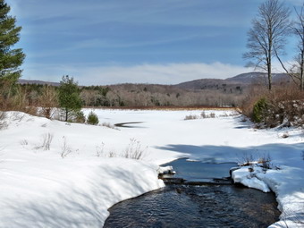
![]()
![]()
![]()
![]() On Monday, March 6th I was ready to get back out on the trails after a long weekend. I led four church services from Good Friday through Easter and had family at the house most of the day on Sunday. All of this was wonderful but tiring. Monday looked liked it would be the best day to hike since the forecast for the rest of the week called for rain. Cindy had not been out in some time but agreed to take a hike at Frick Pond. We got Sheila in the car and loaded our equipment to head out DeBruce Road. We decided that snowshoes would probably be needed as the warm temperatures would make the snow soft on the trails. I decided to bring my Crescent Moon snowshoes this time as they are slightly wider than the other models I have. We left home around 10:15 AM and parked in the larger of the two lots at the end of Beech Mountain Road. There was a layer of snow in the parking lot as we got ready and headed out at 10:45 AM on the Quick Lake Trail. The trail had a new layer of snow which was undisturbed indicating we were the first hikers since Sunday's snowfall. The snow was more consolidated than I thought it might be and we had no trouble staying on top. Off the trail the snow was soft and there was still well over a foot in most places. We turned left onto the woods road following the Quick Lake Trail toward Frick Pond. There were several areas where the snow had melted leaving open water on the trail. We walked along the side of the trail using the snow that remained. At the junction with the Logger's Loop, we stayed to the left and walked down the hill to the bridge. I took off y pack and snapped some shots of the pond which had a small slice of open water. We continued on the Quick Lake Trail and headed left when we got to the junction with the trail round the back of the pond. The higher temperatures and direct sunlight were already starting to soften the snow and I knew that clumping could be a problem. As we continued on the Quick Lake Trail there were several paces where the snow was completely melted and we took to the woods where there was still enough snow. Walking through the unconsolidated snow was much harder but we were soon back on the trail and entering the woods.
On Monday, March 6th I was ready to get back out on the trails after a long weekend. I led four church services from Good Friday through Easter and had family at the house most of the day on Sunday. All of this was wonderful but tiring. Monday looked liked it would be the best day to hike since the forecast for the rest of the week called for rain. Cindy had not been out in some time but agreed to take a hike at Frick Pond. We got Sheila in the car and loaded our equipment to head out DeBruce Road. We decided that snowshoes would probably be needed as the warm temperatures would make the snow soft on the trails. I decided to bring my Crescent Moon snowshoes this time as they are slightly wider than the other models I have. We left home around 10:15 AM and parked in the larger of the two lots at the end of Beech Mountain Road. There was a layer of snow in the parking lot as we got ready and headed out at 10:45 AM on the Quick Lake Trail. The trail had a new layer of snow which was undisturbed indicating we were the first hikers since Sunday's snowfall. The snow was more consolidated than I thought it might be and we had no trouble staying on top. Off the trail the snow was soft and there was still well over a foot in most places. We turned left onto the woods road following the Quick Lake Trail toward Frick Pond. There were several areas where the snow had melted leaving open water on the trail. We walked along the side of the trail using the snow that remained. At the junction with the Logger's Loop, we stayed to the left and walked down the hill to the bridge. I took off y pack and snapped some shots of the pond which had a small slice of open water. We continued on the Quick Lake Trail and headed left when we got to the junction with the trail round the back of the pond. The higher temperatures and direct sunlight were already starting to soften the snow and I knew that clumping could be a problem. As we continued on the Quick Lake Trail there were several paces where the snow was completely melted and we took to the woods where there was still enough snow. Walking through the unconsolidated snow was much harder but we were soon back on the trail and entering the woods.
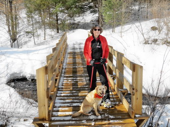 We walked through the woods where the snow was rather well packed and came to the small stream. The volume of the stream had increased with the meting snow and it was a little more challenging to cross than it had been during the winter. As we headed uphill toward Iron Wheel Junction, the snow started to clump on our snowshoes. The sun was out and the air temperature was increasing which softened the trail. In addition, there were several places where water was flowing freely requiring us to detour in what was left of the snow. As we approached the junction, Cindy indicated she wanted to turned right on the Logger's Loop and do a shorter hike. Although I gave her a hard time, I also was tiring and didn't really mind the route she chose. We got to the junction at 11:50 AM after hiking 1.5 miles. I took a few shots of the iron wheel peeking through the snow and then we turned right on the Logger's Loop. The snow was well-packed on this trail sine it also serves as a snowmobile trail and the going was easier. The trail did seem to gain a little more elevation than I remembered but soon we were headed downhill to Times Square. We continued straight across the four-way junction to stay on the Logger's Loop. This part of the hike proved to be the hardest as the trail was not as broken in or packed as well as the others. BY this time the sun had begun to melt the snow and it was hard to follow the track that was there. We began to break through several times as we walked the uphill on the east side of the pond. Eventually we crested the hill, walked across the top of the remaining drifts and hiked the last few hundred feet back to the Quick lake Trail. We turned left of the trail and hiked back to the register box. At the register we turned right and hiked back to the parking area. When we got to the lot, we found that all the snow had melted and the road was clear. It was 1:00 PM and we had hiked 3.8 miles in 2 hours and 15 minutes with about 410 feet of elevation gain.
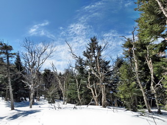
![]()
![]()
![]()
![]()
![]() On Wednesday, April 1stI wanted to do a 3500 foot peak and had decided early in the week it would be Hunter. I looked at the weather forecast and picked the day that seemed to offer cool weather but some bright sun. I wanted the snow to be frozen and hard packed for hiking but also wanted to have some nice views from the fire tower. I had thought I would get started at about 7:00 AM but for various reasons I did not get out of the house until after 8:00 AM. The temperature in the early morning was in the low teens but it was quickly warming into the mid 20's. I got an always eager Sheila into the car and put my gear in the trunk. I was hoping to be able to use only spikes but I brought along my MSR Lightning Ascent snowshoes in case conditions warranted. These are not my favorite snowshoes but they fold almost flat which makes them the best pick when they may have to be strapped to a pack. I headed out DeBruce Road which was snow covered and slippery in spots from some snow the day before. I turned left on Rote 47 to head toward Big Indian and Route 28. There were no cars at the Biscuit Brook parking area and only one or two at Slide and Panther Mountain. I had to keep reminding myself it was only Wednesday! I turned right on Route 28 and then left on Route 42 to head toward Spruceton. On the way from Shandaken to Spruceton on Rt 42 there were no cars at the Halcott parking area. I turned right on the Spruceton Road and found it was full of potholes and bumps especially after it turned to mostly dirt. We arrived at the parking area on the left at about 9:20 AM and I started to get ready to hike. The temperature was still in the 20's and the snow on the trail was hard so I made the decision to wear spikes and leave the snowshoes at the car. I knew this might be a bad decision and could prevent me from getting to the summit but I was willing to take the chance. Another car pulled into the lot and parked right next to mine. A woman younger than I opened the door and said "Hi!" and which time her small dog began to bark. She asked me if Sheila was friendly and I said she usually was. At that point she suggested I let her go first since her dog might think he was chasing us if we were ahead. I patiently declined thinking that she should be able to control her dog. I have to admit I was also peeved at the suggestion that she and her dog could hike faster than Sheila and I. Sheila and I left the parking area at 9:30 AM and I made up my mind to do my best to stay ahead of anyone who would be following us. The snow was well-packed but the trail was covered in a few inches of new powder which showed that no one else had been up the trail lately. The powder hid the fact that there were some rather deep postholes along the way that I would want to try to avoid.
On Wednesday, April 1stI wanted to do a 3500 foot peak and had decided early in the week it would be Hunter. I looked at the weather forecast and picked the day that seemed to offer cool weather but some bright sun. I wanted the snow to be frozen and hard packed for hiking but also wanted to have some nice views from the fire tower. I had thought I would get started at about 7:00 AM but for various reasons I did not get out of the house until after 8:00 AM. The temperature in the early morning was in the low teens but it was quickly warming into the mid 20's. I got an always eager Sheila into the car and put my gear in the trunk. I was hoping to be able to use only spikes but I brought along my MSR Lightning Ascent snowshoes in case conditions warranted. These are not my favorite snowshoes but they fold almost flat which makes them the best pick when they may have to be strapped to a pack. I headed out DeBruce Road which was snow covered and slippery in spots from some snow the day before. I turned left on Rote 47 to head toward Big Indian and Route 28. There were no cars at the Biscuit Brook parking area and only one or two at Slide and Panther Mountain. I had to keep reminding myself it was only Wednesday! I turned right on Route 28 and then left on Route 42 to head toward Spruceton. On the way from Shandaken to Spruceton on Rt 42 there were no cars at the Halcott parking area. I turned right on the Spruceton Road and found it was full of potholes and bumps especially after it turned to mostly dirt. We arrived at the parking area on the left at about 9:20 AM and I started to get ready to hike. The temperature was still in the 20's and the snow on the trail was hard so I made the decision to wear spikes and leave the snowshoes at the car. I knew this might be a bad decision and could prevent me from getting to the summit but I was willing to take the chance. Another car pulled into the lot and parked right next to mine. A woman younger than I opened the door and said "Hi!" and which time her small dog began to bark. She asked me if Sheila was friendly and I said she usually was. At that point she suggested I let her go first since her dog might think he was chasing us if we were ahead. I patiently declined thinking that she should be able to control her dog. I have to admit I was also peeved at the suggestion that she and her dog could hike faster than Sheila and I. Sheila and I left the parking area at 9:30 AM and I made up my mind to do my best to stay ahead of anyone who would be following us. The snow was well-packed but the trail was covered in a few inches of new powder which showed that no one else had been up the trail lately. The powder hid the fact that there were some rather deep postholes along the way that I would want to try to avoid.
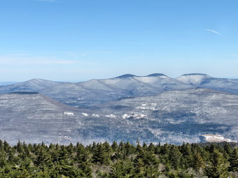 As we hiked, the sun began to warm me and I opened all the zippers I could and took down my hood. There wasn't much snow on the wide woods road that makes up the first part of the trail. We crossed the bridge at .5 miles and shortly after made the hairpin turn where the trail begins to get steeper. There were no obvious tracks going up Rusk. The sun was bright which always puts me in a good mood. As we hiked Sheila was following animal tracks in many different directions as I took in the view of the Westkill Ridge on the right. We made the saddle between Hunter and the Rusk ridge at 10:20 AM after hiking 1.7 miles. I stopped to get a drink and contemplated the fact that we were half way through the trip as far as mileage went. I knew that the hardest part was yet to come. We made the right turn up the mountain and I immediately found it harder to follow the pack trail. I looked for the depression of the trail, and used my poles to guide me. After the turn, the trail got steeper and I remembered that it could be very icy along the way especially at the spring below the lean-to. I was feeling a little more tired than usual since I had not been hiking mountains for some time. I had been concentrating on the Finger Lakes Trail and Long Path with much longer but flatter hikes. I simply decided to cut my pace a little and relax taking a break when I needed. We reached the spring at 2.1 miles and there was little or no ice flow on the trail as I had seen in previous years, We walked passed the trail to the lean-to and I made a note to stop on the way back. There were boot tracks that seemed to come down the mountain and head out the trail to the lean-to. I was able to follow them as we continued up the mountain. I had promised myself I would not stop for pictures until we reached the tower but there were a few places where I had to take shots of the green trees and blue skies with white clouds. At 11:00 AM we passed the trail to the left that goes to the Colonel's Chair, the top of the Hunter Mountain ski complex. We had hiked 2.4 miles and still had about a mile and 450 feet of elevation to go! Even though I had stopped several times there were no signs of anyone following us on the trail
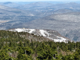 The final mile has a few spots where the trail levels off and a few where there are some sustained climbs. We passed by a small lookout on the left since I knew better things were to come. As we approached the tower clearing, I could see some snowshoe tracks ahead but they turned out to be at least a day old. We walked to the cabin where I dropped my pack and got out my camera. I leashed Sheila to the porch in case others arrived before I was ready to leave. I took some pictures of the tower as the skies were blue with some nice clouds. I headed up the tower to take more pictures. I left my spikes on which turned out to be a good idea since many of the steps were still icy. As soon as I was above the tree line, a sustained wind of at least 20 mph was blowing. The wind chill was making the temperature feel 10 degrees colder than on the ground. I took pictures from just below the cabin on the tower and then came down to another level and took some more. I could see skiers at the Hunter Mountain Ski Area with the zoom on the camera. I took a few shots from the lower levels as I descended the tower. Back on the ground it actually felt MUCH warmer. I went over to the porch to release Sheila and get a drink. I got my gear on and we started back at 11:40 PM. I still had not seen the lady with the dog and wondered if she had decided on another route. I immediately noticed that the snow was softer and was beginning to clump on the bottom of my boots. I tried to stay in the shade where the snow was not as soft but the clumping got worse the further we went. At about 4 miles into the trip and a little before the turn to the Colonel's Chair, Sheila alerted and I saw the woman and her dog coming toward us. I put Sheila on her leash and the woman picked up her dog. As we passed, we said "Hello". I noticed that she had on what looked like high designer boots and did not have snowshoes or spikes. I was glad I had not taken her up on her offer. We continued on down the mountain making good progress as I was still able to slide through much of the powder. At 4.5 miles we were back at the turn to the lean-to and we took the trail as I wanted to take some pastures from he viewpoint in front of the lean-to.
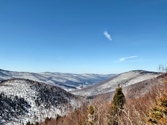 I again noticed the tracks but they looked old. The new site of the lean-to is a great one but the trail down to it can be tricky. The short trail is steep and passes between some rocks and can be a challenge when it is full of ice and snow. As I cleared the rocks, I heard voices and Sheila barked once. There were tow people at the lean-to who were getting ready to head out the lower trail. I out Sheila on her leash as I wanted to talk to the campers but they immediately headed out the trail. I walked to the lean-to, leashed Sheila to a tree and got out my camera. From the viewpoint the entire Spruceton Valley opened up below. I took shots of the valley and the Westkill Ridge on the other side. I also took a few pictures of Rusk and East Rusk before going back to my pack. After a drink, Sheila and I headed back up the cute and out the path to the main trail. We hiked won passed the spring but never saw the other two hikers. The snow clumping on my boots was getting worse but I didn't really want to take off the spikes. We reached the turn onto the odds road at 12:35 PM about 5.1 miles into the hike. This time we did not stop. I was able to find some places where there was almost no snow and others where there was just ice which reduced the clumping and made the descent easier. I was anxious to get back which made the last 1.7 miles seem longer. I was happy to be descending as the turn trip was going much faster than the ascent. After making the sharp turn on the trail, I could see some tracks on the usual path to Rusk which had not been there earlier. As we continued back to the parking area I could see that someone had worn MSR Lightning Ascent snowshoes as I could tell from the imprint. What was odd was that it seemed that they had not worn the snowshoes on the way to Rusk! When we arrived back in the parking area at 1:15 PM there were only two cars. The other hiker must have summitted Rusk and then moved on! We had hiked 6.8 miles and gained 2015 feet in 3 hours and 45 minutes. This was an overall speed of about 1.8 mph with over 20 minutes of stopped time at the tower and lean-to. I was satisfied with the pace especially under the conditions. This hike also made me remember how rewarding climbing the 3500 foot peaks can be! I checked my records and found that the last time I was on Hunter was over two years ago!
![]()
![]()
![]()
![]()
![]() On Monday, March 30th I had made tentative plans to hike with a friend at Frick Pond. When I called him mid-morning, he told me he was running late and would not be bale to make it. I decided that I would go anyway but hike a longer loop. I though I might go up the Flynn Trail as I had not been there for the entire winter. It had snowed some overnight leaving a blanket of one to two inches of fresh white over the melting snow. By the time I got Sheila and my gear in the car it was almost 12:30 PM. The temperature was about 37 degrees which worried me a little since the snow would be close to melting. I headed out DeBruce Road and made the familiar left turn onto Mongaup Road. At the split I headed to the left on Beech Mountain Road and parked in the smaller parking area on the left. When I let Sheila out of the car, she ran in circles around it until I was ready to go. The temperature was 33 degrees and the snow did not seem to be melting at all. We crossed the road and climbed the snow bank to get on the blue blazed Flynn Trail. It was obvious that only a few hikers had attempted the trail as there weren't many snowshoe tracks. In fact, the tracks were hard to follow as the trail was not well set. The snow had hardened as it melted and froze again making following the track almost impossible.
On Monday, March 30th I had made tentative plans to hike with a friend at Frick Pond. When I called him mid-morning, he told me he was running late and would not be bale to make it. I decided that I would go anyway but hike a longer loop. I though I might go up the Flynn Trail as I had not been there for the entire winter. It had snowed some overnight leaving a blanket of one to two inches of fresh white over the melting snow. By the time I got Sheila and my gear in the car it was almost 12:30 PM. The temperature was about 37 degrees which worried me a little since the snow would be close to melting. I headed out DeBruce Road and made the familiar left turn onto Mongaup Road. At the split I headed to the left on Beech Mountain Road and parked in the smaller parking area on the left. When I let Sheila out of the car, she ran in circles around it until I was ready to go. The temperature was 33 degrees and the snow did not seem to be melting at all. We crossed the road and climbed the snow bank to get on the blue blazed Flynn Trail. It was obvious that only a few hikers had attempted the trail as there weren't many snowshoe tracks. In fact, the tracks were hard to follow as the trail was not well set. The snow had hardened as it melted and froze again making following the track almost impossible.
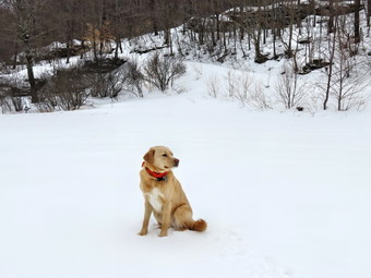 Once we made the right out of the trees and onto the woods road, I simply walked beside the tracks. The snow was hard enough to easily support my weight. I did stop to take few shots since the new snow had made everything pretty again. As we continued our hike, I noticed that the sky was completely overcast and that there were more and more flakes in the air. I didn't mind the snow but I hoped that the temperature wouldn't go up enough for rain showers! It took us about 50 minutes to hike the 1.7 miles to the junction with the Big Rock Trail. We continued straight ahead on the Flynn Trail and I immediately noticed snowmobile tracks despite the "Snowmobiles Prohibited" sign which was prominently displayed. I was aggravated but also saddened that a few people who do not obey the rules can give an entire group a bad name. It was obvious that these new tracks were on top of older ones as the snow was very well packed. This misuse of the trails continued throughout the hike and was the only negative element. At the next trail junction, we headed down the hill on the Flynn Trail to Hodge Pond. The snowmobile tracks turned right on the woods road illegally traveling on OSI property. By 2:00 PM we had hiked 2.5 miles and were near the shore of Hodge Pond. The pond was completely frozen and the ice looked thick. I stopped to take a few pictures as the sky was overcast but interesting. After I put the camera away, we walked across the outlet to Hodge Pond on the Flynn Trail following snowmobile tracks that should not have been there! At 2.8 miles we turned left to stay on the Flynn Trail and walked up to the gate at the top of the hill. We followed the Flynn Trail for another .5 miles until we arrived at Junkyard Junction at 3.3 miles. The Flynn Trail ends, or starts, at this junction with the red-blazed Quick Lake Trail. We turned left and began a long downhill walk on the Quick Lake Trail toward Iron Wheel Junction.
 At 4.7 miles we passed the junction with the snowmobile trail that goes to Quick lake. At this point the sun was peeking through the clouds and it seemed a little warmer. I began to get VERY large clumps of snow under my snowshoes particularly the left one. I kept kicking the snow off or using my poles to clear the clumps but it was annoying and effecting my stride. Just short of Iron Wheel Junction, I took the snowshoes off and carried them to test whether or not the snow would support me. I found that the support was good and that without the snowshoes I was not getting any clumping. We made the turn to the right at Iron Wheel Junction at 4.9 miles around 3:00 PM. We stopped and I did my best to bungee the snowshoes to my pack. The TSL Symbioz snowshoes have great bindings but they do not lie flat. In addition, I had forgotten to bring a second bungee so they mostly hung off the back of the pack. It was not the neatest arrangement but it worked. Unfortunately, the miscreant snowmobiles had turned down the Quick Lake Trail again ignoring the signs. The snow there was not as well packed but I was able to stay on top as we hiked toward Frick Pond. We crossed the small stream and by 3:25 PM we were at the junction with the trail that got around the back of Frick Pond to Times Square. We continued straight ahead toward the bridge across the outlet of Frick Pond. When we arrived at the bridge, I couldn't resist snapping a few pictures of the pond and of Beech Mountain, the highest point in Sullivan County. I put the camera in the pack and carefully walked up the icy trail to the top of the hill. We passed the junction with the Logger's Loop on the left and continued to the trail register. We turned right and were soon back at the car. It was It as 3:50 PM ad we had taken just less than 3 hours to hike 6.4 miles gaining 920 feet along the way. The temperature had risen to 37 degrees but on the way home the weather forecast was calling for lower temperatures the next day and more snow showers.
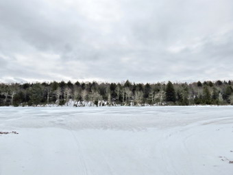
![]()
![]()
![]()
![]()
![]() On Saturday, March 28th I had planned to go to Hunter Mountain and hike from Spruceton to the summit. I wanted to get some views and another snowshoe hike before the snow was gone. When I awoke at 6:00 AM, I looked at the forecast for Spruceton which called for windchills in the single digits for the whole day and for some snow. I decided that I wanted some sunny views if I was going to hike to a fire tower. I do not mind hiking when it is cold since I have the appropriate clothing but Sheila only has one set of clothes and she seems to get a little cold when temperatures less than the mid-teens. As I was thinking about another hike I realized I had not been to Long Pond in some time. I also knew that the trails in this area would be packed by snowmobile traffic. Since I usually walk back on Flugertown Road, I would have to carry my snowshoes if I wore them. If the trails were packed, I could wear my spikes which are easier to carry on the road. I delayed our departure waiting for the temperature to increase a little. After watching the thermometer stay at 20 degrees for some time, I decided to leave the house. I got Sheila and my gear in the car and left the house a little after 10:00 AM. I took both snowshoes and spikes since I did not know exactly what I would find. I drove out DeBruce Road to Flugertown Road in Willowemoc where I turned left. A short distance up the road I turned right into the lot which was completely plowed although no cars were present. This area is part of the extensive network of snowmobile trails and I suspect that may be the reason the lot was so well maintained. I parked and let Sheila out of the car. I walked over the test then trail surface and found it was hard as a rock. I went back to the car, put on my spikes and we started our hike at about 10:35 AM. After crossing the bridge, the trail immediately begins a .7 mile ascent gaining about 360 feet as it goes. This is not a steep climb but it certainly gets the blood pumping at the beginning of the hike. After that, the trail is mostly downhill to 1.1 miles where there is a side trail on the right that goes down to Long Pond. I had almost decided to skip this part of the trip but changed my mind as we approached the trail.
On Saturday, March 28th I had planned to go to Hunter Mountain and hike from Spruceton to the summit. I wanted to get some views and another snowshoe hike before the snow was gone. When I awoke at 6:00 AM, I looked at the forecast for Spruceton which called for windchills in the single digits for the whole day and for some snow. I decided that I wanted some sunny views if I was going to hike to a fire tower. I do not mind hiking when it is cold since I have the appropriate clothing but Sheila only has one set of clothes and she seems to get a little cold when temperatures less than the mid-teens. As I was thinking about another hike I realized I had not been to Long Pond in some time. I also knew that the trails in this area would be packed by snowmobile traffic. Since I usually walk back on Flugertown Road, I would have to carry my snowshoes if I wore them. If the trails were packed, I could wear my spikes which are easier to carry on the road. I delayed our departure waiting for the temperature to increase a little. After watching the thermometer stay at 20 degrees for some time, I decided to leave the house. I got Sheila and my gear in the car and left the house a little after 10:00 AM. I took both snowshoes and spikes since I did not know exactly what I would find. I drove out DeBruce Road to Flugertown Road in Willowemoc where I turned left. A short distance up the road I turned right into the lot which was completely plowed although no cars were present. This area is part of the extensive network of snowmobile trails and I suspect that may be the reason the lot was so well maintained. I parked and let Sheila out of the car. I walked over the test then trail surface and found it was hard as a rock. I went back to the car, put on my spikes and we started our hike at about 10:35 AM. After crossing the bridge, the trail immediately begins a .7 mile ascent gaining about 360 feet as it goes. This is not a steep climb but it certainly gets the blood pumping at the beginning of the hike. After that, the trail is mostly downhill to 1.1 miles where there is a side trail on the right that goes down to Long Pond. I had almost decided to skip this part of the trip but changed my mind as we approached the trail.
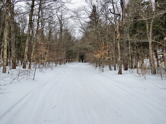 I was a little surprised to see Long Pond completely frozen over with what looked like solid ice. Sheila proved that the ice was solid enough to support her weight as she walked out onto the ice to explore. I took some pictures and noticed that the northern part of the pond which is covered with brightly colored bushes in other seasons was now covered in ice. We returned to the main trail and turned right to continue our hike. At 1.4 miles we came to the trail junction where we usually bear right to continue the "big" loop. I decided that I had not been to the left in some time and we would head that way. My intention was to walk out to Flugertown Road and turn right to complete the loop in the opposite direction. This would also allow us to return on the trail avoiding the road walk at the end. We turned left and head north toward the road. The trail descends almost 200 feet along the way which means some more uphill on the return trip. As we hiked, we could hear snowmobiles to the west but they never came up the trail we were on. We descended to the bridges across the streams and I took my pack off to get my camera out to take a few pictures. I stepped off the trail and promptly went up to me knee in snow! I took some pictures of the snow covered streams and the bridge with Sheila making a few cameo appearances. As I crossed the second bridge there were two different paths to follow. I looked ahead to see if I could spot Flugertown Road. When I could not see the road, I chose the right path and walked a short distance. I found the road but it was entirely covered in snow and ice giving meaning to the phrase "Seasonal Maintenance"! I took a few shots of the road and then turned right to start the loop. The road was even easier to walk than the snowmobile trails and we made good time even though the walk was slightly uphill. In the next .75 miles we gained a little over 100 feet until we were at the spot on the road overlooking the Peters Hunting Camp.
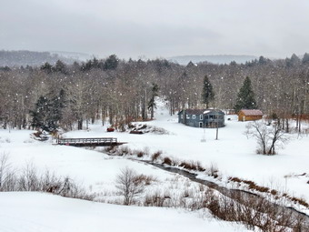 A few flakes had been falling during most of the hike but now they were falling harder and the wind was blowing. Despite this, I stopped to take a few pictures of the valley and the hills beyond as the snow swept in. We continued down the road and crossed the bridge changing direction from northeast to almost due south. As we crossed the small bridge over the outlet of the beaver pond, I took a few more shots and then continued the hike. At 3.6 miles the road split with Basily Road heading left toward Wild Meadow Road and Round Pond. We headed to the right to continue on Flugertown Road. When we reached the 4 mile point, we turned right following the trail that would complete the loop and take us back to the parking area. The trail was again well packed and showed some signs that a snowmobile had passed recently. We walked along and I felt a little warmer as the forest protected us from the wind. We continued to hike southwest and at 4.6 miles came to the trail to the lean-to on the left. We passed by the side trail and continue to 5.1 miles where we completed the loop by arriving at the trail junction where we had turned to start the loop. All that remained was to hike back to the car by reversing our route from earlier. I had been noticing the tracks from some MSR snowshoes which I thought were new since we started but we never saw anyone. We hiked uphill a little passing the turn to Long Pond and at 5.7 miles were at the top of the descent back to the parking area. We were making good time going downhill but as we approached the lot we could hear and then see two snowmobilers getting ready to start out on the trail. I decided to put Sheila on her leash just before we crossed the bridge but the people on the machines waited to start until we were back at the car. There was another truck with a trailer and one car in the lot. It was 12:55 PM and we had hiked 6.3 miles in 2 hours and 20 minutes going about 770 feet along the way.
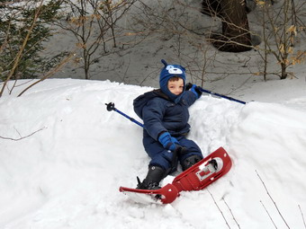
![]() On Friday, March 27th, I wanted to get in a hike but wasn't sure what I wanted to do. I knew it would have to be short and local as I had track practice in the afternoon. Bryce, my 4 year old grandson, was at the house by 9:15 AM and told me he wanted to use his snowshoes before all the snow was gone. I decided we would go to Frick Pond and walk out to the bridge and back. Having Sheila and Bryce along means that much more to manage but I finally got both of them, my equipment and Bryce's poles and snowshoes into the car. It was a little colder than I would have liked with the temperature only in the mid 20's. The parking lots at Frick Pond were empty so I parked in the bigger lot and helped Bryce put on his snowshoes. The MSR Tykers do not have keepers on the front straps but I tucked them under the strap and they seemed OK. While I got my TSL Symbioz snowshoes on, Bryce decided to cross the parking lot and climb the high snow bank. I was surprised when I saw that he could climb the bank without slipping or falling! I got out my camera and took a few pictures before we started our hike. Bryce had no trouble climbing and the descending the bank at the start of the trail. After the warm weather and rain, I was surprised that there was still at least 18 inches of snow on the trail. The snow was hard packed and granular but the snowshoes still got a good bite fro traction. We turned left at the register and headed out the woods road to Frick Pond. Along the way there were several areas of open water but there was snow on the side. Bryce did say he was getting tired so we and songs and counted our steps and I didn't hear any more complaints. I told him there was a bed on the trail and I am not sure he belied me until we neared Frick Pond and I showed him the iron frame of a bunk bed to the left of the trail. The trail down to the pond was very icy so I grabbed Bryce's hand as we walked down to the bridge. There probably was no need to do this as the snowshoes offered good traction on the ice. Bryce posed with Sheila at the beginning of the bridge and I took some pictures. I also took a few shots of the pond and Beech Mountain but the day was very overcast with almost no sun. When Bryce saw the snow drift and the end of the bridge, he asked me if he could climb it. I said "Yes" and he attacked the drift. The drift was very steep and it took several tries before Bryce made it to the top. I took a few pictures before Bryce slid down the bank. He wanted to do it several more times but the wind was blowing and I wanted to start back. The climb up the hill from the pond was tricky but we were soon heading back passed the bed and the junction with the Logger's Loop. Bryce asked me to carry his poles which I did and he seemed to be managing well without them. We walked back to the register and then turned right and walked back to the car. We had covered a little over a mile in a little more than an hour. This was one of the slowest and most enjoyable hike I have ever taken.
On Friday, March 27th, I wanted to get in a hike but wasn't sure what I wanted to do. I knew it would have to be short and local as I had track practice in the afternoon. Bryce, my 4 year old grandson, was at the house by 9:15 AM and told me he wanted to use his snowshoes before all the snow was gone. I decided we would go to Frick Pond and walk out to the bridge and back. Having Sheila and Bryce along means that much more to manage but I finally got both of them, my equipment and Bryce's poles and snowshoes into the car. It was a little colder than I would have liked with the temperature only in the mid 20's. The parking lots at Frick Pond were empty so I parked in the bigger lot and helped Bryce put on his snowshoes. The MSR Tykers do not have keepers on the front straps but I tucked them under the strap and they seemed OK. While I got my TSL Symbioz snowshoes on, Bryce decided to cross the parking lot and climb the high snow bank. I was surprised when I saw that he could climb the bank without slipping or falling! I got out my camera and took a few pictures before we started our hike. Bryce had no trouble climbing and the descending the bank at the start of the trail. After the warm weather and rain, I was surprised that there was still at least 18 inches of snow on the trail. The snow was hard packed and granular but the snowshoes still got a good bite fro traction. We turned left at the register and headed out the woods road to Frick Pond. Along the way there were several areas of open water but there was snow on the side. Bryce did say he was getting tired so we and songs and counted our steps and I didn't hear any more complaints. I told him there was a bed on the trail and I am not sure he belied me until we neared Frick Pond and I showed him the iron frame of a bunk bed to the left of the trail. The trail down to the pond was very icy so I grabbed Bryce's hand as we walked down to the bridge. There probably was no need to do this as the snowshoes offered good traction on the ice. Bryce posed with Sheila at the beginning of the bridge and I took some pictures. I also took a few shots of the pond and Beech Mountain but the day was very overcast with almost no sun. When Bryce saw the snow drift and the end of the bridge, he asked me if he could climb it. I said "Yes" and he attacked the drift. The drift was very steep and it took several tries before Bryce made it to the top. I took a few pictures before Bryce slid down the bank. He wanted to do it several more times but the wind was blowing and I wanted to start back. The climb up the hill from the pond was tricky but we were soon heading back passed the bed and the junction with the Logger's Loop. Bryce asked me to carry his poles which I did and he seemed to be managing well without them. We walked back to the register and then turned right and walked back to the car. We had covered a little over a mile in a little more than an hour. This was one of the slowest and most enjoyable hike I have ever taken.
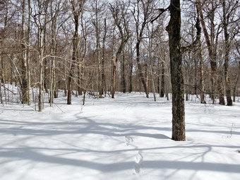
![]()
![]()
![]()
![]()
![]() On Tuesday, March 24th, I was ready for my first hike of the spring season. Lisa had emailed me the night before and we decided to hike Cabot Mountain from Beech hill, a hike we had not attempted in the winter for over three years. The morning started out colder than I had anticipated so we delayed our departure until 9:30 when I picked Lisa up at her house. I drove up the Beaverkill Road to Beech Hill Road where I turned right. I continued 2.6 miles to the trailhead for Cabot Mountain. Even though it was spring, Lisa and I knew we would need snowshoes or spikes for the hike! At the trailhead parking area there was a bank of snow at least 5 feet tall. The parking area really wasn't plowed but a wide pass had been made to open up enough space to get a car off the pavement. I pulled in and we got out to put on our gear. Sheila was excited as she ran up on the snow bank and down the trail as Lisa and I got ready. Before we got out of the car I noted that the temperature was only 17 degrees. After I got out of the car, I noted that the wind was blowing and that my bare hands were freezing. The trail looked as if it had not been used all winter so Lisa and I both put on snowshoes. Lisa opted for a Crescent Moon model while I continued to try out my TSL Symbioz on varying terrain. We hopped up on the snow bank and headed down the woods road at about 9:45 AM. The sun was out and as soon as we entered the trees I began to feel much warmer. The initial quarter mile is a slight descent or reactively flat but after that there is a considerable ascent to handle. We immediately noticed that the trail markers were few and far between. This was similar to the situation I had experienced trying to hike from Big Pond to Little Pond. When there is no snow on the ground, the trail is much easier to spot even if it is not frequently hiked. On this day the snow was completely pristine with only a few animal tracks and it was difficult to pick out the correct route at times. As soon as we started to ascend, I dropped the televators on my snowshoes which really helped me get a grip on the frozen snow and allowed me to climb more easily without outstretching my calf muscles.
On Tuesday, March 24th, I was ready for my first hike of the spring season. Lisa had emailed me the night before and we decided to hike Cabot Mountain from Beech hill, a hike we had not attempted in the winter for over three years. The morning started out colder than I had anticipated so we delayed our departure until 9:30 when I picked Lisa up at her house. I drove up the Beaverkill Road to Beech Hill Road where I turned right. I continued 2.6 miles to the trailhead for Cabot Mountain. Even though it was spring, Lisa and I knew we would need snowshoes or spikes for the hike! At the trailhead parking area there was a bank of snow at least 5 feet tall. The parking area really wasn't plowed but a wide pass had been made to open up enough space to get a car off the pavement. I pulled in and we got out to put on our gear. Sheila was excited as she ran up on the snow bank and down the trail as Lisa and I got ready. Before we got out of the car I noted that the temperature was only 17 degrees. After I got out of the car, I noted that the wind was blowing and that my bare hands were freezing. The trail looked as if it had not been used all winter so Lisa and I both put on snowshoes. Lisa opted for a Crescent Moon model while I continued to try out my TSL Symbioz on varying terrain. We hopped up on the snow bank and headed down the woods road at about 9:45 AM. The sun was out and as soon as we entered the trees I began to feel much warmer. The initial quarter mile is a slight descent or reactively flat but after that there is a considerable ascent to handle. We immediately noticed that the trail markers were few and far between. This was similar to the situation I had experienced trying to hike from Big Pond to Little Pond. When there is no snow on the ground, the trail is much easier to spot even if it is not frequently hiked. On this day the snow was completely pristine with only a few animal tracks and it was difficult to pick out the correct route at times. As soon as we started to ascend, I dropped the televators on my snowshoes which really helped me get a grip on the frozen snow and allowed me to climb more easily without outstretching my calf muscles.
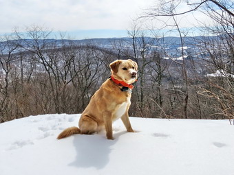 The ascent lasted for about half a mile but seemed longer. The average gradient was 24% but several sections were well over 30%. We were initially heading northeast but as the climb continued we turned more to the right so at the top we were pointed east. From the base of the climb we had gained 650 feet in .5 miles. We began to hike along the ridge losing and finding the trail markers several times. In some areas we had to both scan ahead to find the markers or wander in different directions until we spotted them. The snow continued to be well consolidated allowing us to walk on top breaking through only a few times. Along the ridge there were places were there was fresh powder to a depth of several inches making the hike that much more beautiful. As we walked along the ridge we both commented that the route seemed unfamiliar. I checked my GPS which did not seem to have either Cabot Mountain or Little Pond marked on it. We both KNEW there was no other trail or turns but the feeling persisted. Lisa did remember that the distance was about 1.5 miles so I checked my GPS at intervals to see how far we had hiked. As we hiked along the ridge our direction changed from east to southeast and then almost south. At 1.4 miles we passed over the highest point on Cabot Mountain and the walked to the lookout. The trail had been looking more familiar and the were a few short but steep climbs to negotiate on the way. We stopped short of the viewpoint and took a few pictures of it before I walked out to take some shots of the scenery. It had taken us about 1.5 hours to hike the 1.5 miles but I anticipated a faster return trip. The views from the lookout are becoming limited by the trees as they grow taller. Little Pond was clearly visible as was Touch-Me-Not Mountain and other hills in the distance. The sky was blue with some nice white clouds. There was some sun but the overall views were a little monotonous. I took some pictures, posing Sheila for a few shots, and then we started the return trip. The crusted snow limited the amount of gliding I could get with my snowshoes. This is the trade-off with snowshoes that have an excellent grip! The down hill route seemed to go very quickly although there were a few short climbs before the big downhill. We were back at the car by 12:15 PM having left the viewpoint at 11:30 AM. The return trip took only 45 minutes or about half the time as the climb. Overall we spent Overall we had spent 2.5 hours on the 3 mile hike with several stops and some time wandering around. The vertical gain was just under 1000 feet. After I got Sheila in the car and took off my gear, I took several pictures of Lisa perched high on the snow bank well above the level of the register box.