
What You Missed
Fall 2021
Fall 2021
![]()
![]()
![]()
![]()
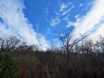
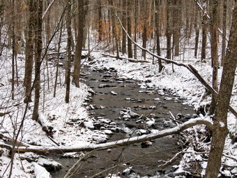
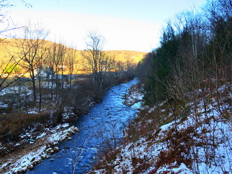
![]() On Friday, December 17th, I was ready to go back to the Logger's Loop at Frick Pond to remove blowdowns on the Logger's Loop and Quick Lake Trails. I did not have track practice in the afternoon so I knew I would have plenty of time to get the work done. I asked Cindy if she would like to go and help and she agreed. We started to get ready at 10:30 AM when the temperature was 45 degrees on the back porch. I suspected it might be cooler at the trailhead. As I started gathering my equipment and getting dressed, Sheila was very quiet but did not let me out of her sight. I put on my Mammut long-sleeved crew top with a long-sleeved baselayer since the temperature was warm in town but might be cooler at the trailhead. I decided to wear my Columbia Titanium insulated pants but didn't bother with a baselayer. I wore my Keen Targhee II boots which pretty beat up but still are good for hiking in the mud! I didn't expect to find any snow but these boots are getting pretty worn so I thought I would get what I could out of them. I decided not to bring poles as I would be carrying tools. I also donned my Mammut hoody which was enough zippers to dump heat when needed. I put on a fleecy orange and wore a light pair of gloves. I also put on my OR Crocodile gaiters to deal with the mud and water that I knew would be present. I made sure my Microspikes were in my pack just in case they were needed. I grabbed my tools including my Silky Sugowaza curved saw which can handle surprisingly large trees, a Silky Katanboy 500, and my Fiskars pack axe which is light but handles bigger trees very well. I also threw some felling wedges in my pack as I would not have any help if my saw became pinched. I got our gear and Sheila in my car and we left Livingston Manor at 10:55 AM. I drove out the DeBruce Road about 6 miles to Mongaup Road and turned left to continue up the road to the point where it splits. I stayed left on Beech Mountain Road and drove to the Frick Pond trailhead. When we arrived at the parking areas, there was one car park in each lot. I pulled into the smaller lot and parked. The skies were bright and blue but without any interesting clouds.
On Friday, December 17th, I was ready to go back to the Logger's Loop at Frick Pond to remove blowdowns on the Logger's Loop and Quick Lake Trails. I did not have track practice in the afternoon so I knew I would have plenty of time to get the work done. I asked Cindy if she would like to go and help and she agreed. We started to get ready at 10:30 AM when the temperature was 45 degrees on the back porch. I suspected it might be cooler at the trailhead. As I started gathering my equipment and getting dressed, Sheila was very quiet but did not let me out of her sight. I put on my Mammut long-sleeved crew top with a long-sleeved baselayer since the temperature was warm in town but might be cooler at the trailhead. I decided to wear my Columbia Titanium insulated pants but didn't bother with a baselayer. I wore my Keen Targhee II boots which pretty beat up but still are good for hiking in the mud! I didn't expect to find any snow but these boots are getting pretty worn so I thought I would get what I could out of them. I decided not to bring poles as I would be carrying tools. I also donned my Mammut hoody which was enough zippers to dump heat when needed. I put on a fleecy orange and wore a light pair of gloves. I also put on my OR Crocodile gaiters to deal with the mud and water that I knew would be present. I made sure my Microspikes were in my pack just in case they were needed. I grabbed my tools including my Silky Sugowaza curved saw which can handle surprisingly large trees, a Silky Katanboy 500, and my Fiskars pack axe which is light but handles bigger trees very well. I also threw some felling wedges in my pack as I would not have any help if my saw became pinched. I got our gear and Sheila in my car and we left Livingston Manor at 10:55 AM. I drove out the DeBruce Road about 6 miles to Mongaup Road and turned left to continue up the road to the point where it splits. I stayed left on Beech Mountain Road and drove to the Frick Pond trailhead. When we arrived at the parking areas, there was one car park in each lot. I pulled into the smaller lot and parked. The skies were bright and blue but without any interesting clouds.
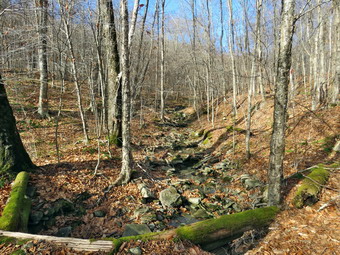
 I set my GPS unit and noted that the temperature was 45 degrees. I grabbed the axe which I would carry by hand with the two saws and wedges in my pack. We started out the woods road to the Quick Lake Trail at the register. From the register on the trail was wet with standing water and some frozen and some soft mud. Since this is a woods road, we were able to avoid most of the water and mud by picking our steps carefully. At Gravestone Junction, we turned right to get on the yellow Logger's Loop heading toward Times Square. The trail was wet and muddy but not quite as bad as the Quick Lake Trail. The trail did look like hikers had been using it and I also saw some mountain bike tracks. Soon we were hiking downhill toward Times Square. We crossed a stream that parallels the Big Rock Trail. The stream was dry in this day but can have a pretty good volume. The source of the water is a mystery although I assume it must be from seasonal springs and runoff. At Times Square we continued straight ahead on the Logger's Loop which was wet and muddy but not as bad as I have seen it in the past. There were a few smaller branches that I removed. We started a slight uphill climb on the trail but the hiking was relatively easy. We came to a small blowdown just before the trail started to flatten. I took a few "before" pictures and then took out the Sugowaza curved saw. I began cutting branches and Cindy and I dragged them off the trail. We tried to pile then neatly and a little off the trail. The cutting a clearing went quickly and I took some "after" shots before packing up to move on. The trail flattened and we came to the small, seasonal pond on the right side of the trail. The pond was almost empty which surprised me as I thought it might be full from the recent rains. There were two small blowdowns across the trail and I got out my camera to take pictures. I again used the saw to cut the small trunk and drag them off the trail almost whole. I continued to cut and clear from both blowdowns until everything was gone. After taking a few pictures of the result, we moved on.
 Shortly, we came to a large tree with many branches across the trail. This one had some large branches and a trunk with a large diameter. I took my "before" shots and then began to examine the blowdown. I used the Sugowaza to start to cut branches and remove them. Some I was able to pile on one side of the trail. The larger ones I pulled well off the trail and out of the way. Two larger section I was able to pivot off the trail. All that was left was the larger trunks that still projected onto the trail. I decided to use the Fiskars axe to remove the trunks finishing with the saw if I needed it. The smaller trunk went quickly and I pulled it off the trail. I started in on the larger trunk which was cherry. I started the cut rather small but the work went quickly and I was sorry I hadn't made the cut a little larger. Near the bottom on the cut, I switched to the saw and quickly cut through the rest of the trunk. I was able to flip the section off the trail. I took a few "after" pictures and then packed up and started up the trail. A little further along there were two more trees. Both of these blowdowns had large diameter trunks but it was easy to step over them. As we continued on the Logger's Loop we came to two large plastic culverts lying ion top of the ground. The DEC has started a project to replace the metal culverts and to install culverts were they were needed but did not exist. That project began at least three years ago but was not completed and the black culverts stand out like a sore thumb. I have no idea whether these have been forgotten or are on a work schedule somewhere. The rest of the Loggers Loop to Iron Wheel Junction had several deep ponds that ran from one side of the trail to the other. We picked my way through them and it wasn't long before we were walking downhill and climbing a small hill to Iron Wheel Junction. There was no snow and the wheels were clearly visible. We turned left to head back toward Frick Pond on the Quick Lake Trail.
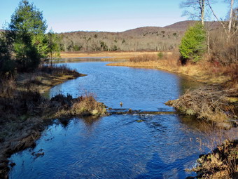
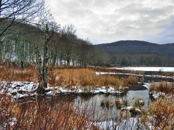
 The trail is slightly downhill which allowed us to keep up a good pace even though we had to work our way around the some water and mud. We came to a blowdown that had what seemed like hundreds of small branches. I put down my pack and got out the camera to take some "before" shots. I pulled away some loose branches and piled them off the trail. I used the saw to begin cutting a few large branches and pulling them into the woods. I continued to cut small branches and methodically pile them off the trail. I was beginning to get tired and bored but finally finished the job. I took a moment to look at what I had done as it always surprises me what I can do with hand tools. I took some final pictures and then we moved on. When we came to the small stream in the woods, we found the water level slightly higher than on our last trip. The stream was a little wider and deeper than I would have liked but we used a stepping stone to get across.Walking through the "spruce tunnel" was easier than some of the rest of the hike as there was little water and mud. There were a few blowdowns that I would eventually have to clear but they were on the ground and I decided to leave them for another trip. Eventually we walked out the other side where the trail was again wet and muddy. We arrived at the junction with the Big Rock Trail and turned right to stay on the Quick Lake Trail and head toward the bridge at Frick Pond. The trail was wet but what had been a huge mud pit was easier to cross due to the work the trail crew had completed. We continued on the Quick Lake Trail to the bridge across the outlet of Frick Pond. We crossed the bridge and started up the hill on the other side. Halfway up the hill a small tree had finally dipped low enough to block the trail. I was tired so I did not bother to take pictures. I cut a few smaller branches off the trunk with the saw and then cut the upper section off. I dragged what I had cut off the trail and then cut the main trunk. I rolled this section aside and packed up to continue out the trail to the car.This section of trail was also muddy and seemed to be getting worse on each trip. At Gravestone Junction, we continued out the Quick Lake Trail and back to the car. We arrived at the car at 2:45 PM having hiked 3.7 miles in 3 hour and 30 minutes with an elevation gain of 375 feet. Our time moving was 1 hour and 40 minutes while our stopped time was 1 hour and 45 minutes! The temperature at the car was till 45 degrees.
![]()
![]()
![]()
![]()
![]() On Tuesday, December 14th, I was ready to get in a hike that was NOT on Round Top near my house. I had track practice in the afternoon so I decided to stay local and hike the Loggers Loop at Frick Pond to see what might have come down in the last wind storm. I started to get ready at 10:15 AM when the temperature was 45 degrees on the back porch. I suspected it would be cooler at the trailhead. As I started gathering my equipment and getting dressed, Sheila was very quiet but did not let me out of her sight. I put on my Mammut long-sleeved crew top with a long-sleeved baselayer since the temperature was warm in town but might be cooler at the trailhead. I decided to wear my Columbia Titanium insulated pants but didn't bother with a baselayer. I wore my Keen Targhee II boots which pretty beat up but still are good for hiking in the mud! I didn't expect to find any snow but these boots are getting pretty worn so I thought I would get what I could out of them. I grabbed my Leki poles with external locks which I trust over the internal twist locks. I also donned my Mammut hoody which was enough zippers to dump heat when needed. I put on a fleecy orange and wore a light pair of gloves. I also put on my OR Crocodile gaiters to deal with the mud and water that I knew would be present. I made sure my Microspikes were in my pack just in case they were needed. I got my gear and Sheila in my car and left Livingston Manor at 10:40 AM. I drove out the DeBruce Road about 6 miles to Mongaup Road and turned left to continue up the road to the point where it splits. I stayed left on Beech Mountain Road and drove to the Frick Pond trailhead. When we arrived at the parking areas, there were no cars parked in either lot. I pulled into the smaller lot and parked. The skies were bright and blue with some interesting clouds.
On Tuesday, December 14th, I was ready to get in a hike that was NOT on Round Top near my house. I had track practice in the afternoon so I decided to stay local and hike the Loggers Loop at Frick Pond to see what might have come down in the last wind storm. I started to get ready at 10:15 AM when the temperature was 45 degrees on the back porch. I suspected it would be cooler at the trailhead. As I started gathering my equipment and getting dressed, Sheila was very quiet but did not let me out of her sight. I put on my Mammut long-sleeved crew top with a long-sleeved baselayer since the temperature was warm in town but might be cooler at the trailhead. I decided to wear my Columbia Titanium insulated pants but didn't bother with a baselayer. I wore my Keen Targhee II boots which pretty beat up but still are good for hiking in the mud! I didn't expect to find any snow but these boots are getting pretty worn so I thought I would get what I could out of them. I grabbed my Leki poles with external locks which I trust over the internal twist locks. I also donned my Mammut hoody which was enough zippers to dump heat when needed. I put on a fleecy orange and wore a light pair of gloves. I also put on my OR Crocodile gaiters to deal with the mud and water that I knew would be present. I made sure my Microspikes were in my pack just in case they were needed. I got my gear and Sheila in my car and left Livingston Manor at 10:40 AM. I drove out the DeBruce Road about 6 miles to Mongaup Road and turned left to continue up the road to the point where it splits. I stayed left on Beech Mountain Road and drove to the Frick Pond trailhead. When we arrived at the parking areas, there were no cars parked in either lot. I pulled into the smaller lot and parked. The skies were bright and blue with some interesting clouds.
 I set my GPS unit and noted that the temperature was 42 degrees with a slight breeze that made me feel cold. we started out the woods road to the Quick Lake Trail at the register. From the register on the trail was wet with standing water and some frozen and some soft mud. Since this is a woods road, I was able to avoid most of the water and mud by picking my steps carefully. At Gravestone Junction, we turned right to get on the yellow Logger's Loop heading toward Times Square. The trail was wet and muddy but not quite as bad as The Quick Lake Trail. The trail did look like hikers had been using it and I also saw some mountain bike tracks. Just after we made the turn, I looked up to see some amazing clouds in the very blue sky. Many times pictures of the sky do not seem to do the scene justice but I just had to take some shots. In a few minutes we started back on the trail. Soon we were hiking downhill toward Times Square. We crossed a stream that parallel's the Big Rock Trail and had a good volume of water. The source of the water is a mystery although I assume it must be from seasonal springs and runoff. At Times Square we continued straight ahead on the Logger's Loop which was wet and muddy but not as bad as I have seen it in the past. Just after Times Square there was a large tree that the snowmobile club had cut into sections and moved off the trail. There were a few other smaller branches that I removed and a few large trunks that I was able to move off the trail without tools. We started a slight uphill climb on the trail but the hiking was relatively easy. The trail flattened and we came to the small, seasonal pond on the right side of the trail. The pond was Almost empty which surprised me as I thought it might be full from the recent rains. We passed by and continued our walk avoiding the water and the mud. I was thinking that I was lucky that there were no major blowdowns across the trail but that was a mistake. Shortly, we came to a large tree with many branches across the trail and then another. Both trees would require tools to remove and I was not sure when the snowmobile club would be able to get around to it as there was not much snow in the forecast. A little further along there were two more tree. Both of these blowdowns had large diameter trunks but it was easy to step over them.
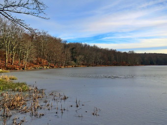
 As we continued on the Logger's Loop we came to two large plastic culverts lying ion top of the ground. The DEC has started a project to replace the metal culverts and to install culverts were they were needed but did not exist. That project began at least three years ago but was not completed and the black culverts stand out like a sore thumb. I have no idea whether these have been forgotten or are on a work schedule somewhere. The rest of the Loggers Loop to Iron Wheel Junction had several deep ponds that ran from one side of the trail to the other. I picked my way through them and it wasn't long before we were walking downhill and climbing a small hill to Iron Wheel Junction. There was no snow and the wheels were clearly visible. We turned left to head back toward Frick Pond on the Quick Lake Trail. The trail is slightly downhill which allowed us to keep up a good pace even though we had to work our way around the some water and mud. There were at least two tree that needed to be cleared and I did what I could without tools. When we came to the small stream in the woods, we found the water level slightly higher than on our last trip. The stream was a little wider and deeper than I would have liked but I used a stepping stone to get across. I took some pictures before we continued the hike on the trail. Walking through the "spruce tunnel" was easier than some of the rest of the hike as there was little water and mud. There were a few blowdowns that I would have to clear. Eventually we walked out the other side where the trail was again wet and muddy. We arrived at the junction with the Big Rock Trail and turned right to stay on the Quick Lake trail and head toward the bridge at Frick Pond. The trail was wet but what had been a huge mud pit was easier to cross due to the work the trail crew had completed. We continued on the Quick Lake Trail to the bridge across the outlet of Frick Pond. We crossed the bridge and stopped at the other side. I dropped my pack to get out the camera despite the fact that I have taken hundreds of pictures from this location. The skies were blue but now there were no clouds but the scene was a little "warmer" than the temperature. I also took shots of the pond and of Beech Mountain. I packed up and we continued up the hill and back to Gravestone Junction. This section of trail was also muddy and seemed to be getting worse on each trip. At Gravestone Junction we continued out the Quick Lake Trail and back to the car. We arrived at the car at 12:45 PM having hiked 3.8 miles in 1 hour and 45 minutes with an elevation gain of 380 feet. Our time stopped was 6 minutes. The temperature at the car had risen to 45 degrees.
![]()
![]()
![]()
![]() On Sunday, December 12th I had planned to come home and rest after preaching in two churches. I came home and started to change and then realized I would feel better if I went out for even a short hike. At 1:30 PM I decided to go across the street to hike on Round Top and Sheila was very happy with that decisions. I started to get dressed with the temperature a rather cool 38 degrees. Sheila was ready to go as she really likes to hike and she was keeping a careful eye on me as we dressed. I got dressed in my Mammut crew top with a long-sleeved baselayer. I decided to wear my Columbia Titanium insulated pants to keep the chill away but decided against wearing tights underneath. I decided to put on my Keen Cascade hiking boots which are new and fit well. I grabbed my Leki external lock poles which I have been using lately since twist locks have proved unreliable. I also added a fleecy orange hat and gloves since it was cool. I donned my Mammut hoody which has lots of zippers to dump heat if necessary. At 1:15 PM we walked out the door to start the hike. I grabbed Sheila's leash from the car and we walked up the driveway. I aimed to hike for about an hour. Sheila was happy to get out as we headed down the driveway and across the street. We crossed the street and walked to the parking area by the Presbyterian Church. We walked to the back of the church and began the ascent of the steepest hill behind the church. The hill is short but gets the circulation pumping and is the steepest and longest climb on the "trail." Sheila helped me along by pulling me up the hill. There was no ice or snow which made the walking easier. At the top of the hill we started on the trail by turning left at the trailhead where I let Sheila off her leash so that she could explore. There was still a layer of wet leaves on the trail but it was much easier walking without the snow and ice.
On Sunday, December 12th I had planned to come home and rest after preaching in two churches. I came home and started to change and then realized I would feel better if I went out for even a short hike. At 1:30 PM I decided to go across the street to hike on Round Top and Sheila was very happy with that decisions. I started to get dressed with the temperature a rather cool 38 degrees. Sheila was ready to go as she really likes to hike and she was keeping a careful eye on me as we dressed. I got dressed in my Mammut crew top with a long-sleeved baselayer. I decided to wear my Columbia Titanium insulated pants to keep the chill away but decided against wearing tights underneath. I decided to put on my Keen Cascade hiking boots which are new and fit well. I grabbed my Leki external lock poles which I have been using lately since twist locks have proved unreliable. I also added a fleecy orange hat and gloves since it was cool. I donned my Mammut hoody which has lots of zippers to dump heat if necessary. At 1:15 PM we walked out the door to start the hike. I grabbed Sheila's leash from the car and we walked up the driveway. I aimed to hike for about an hour. Sheila was happy to get out as we headed down the driveway and across the street. We crossed the street and walked to the parking area by the Presbyterian Church. We walked to the back of the church and began the ascent of the steepest hill behind the church. The hill is short but gets the circulation pumping and is the steepest and longest climb on the "trail." Sheila helped me along by pulling me up the hill. There was no ice or snow which made the walking easier. At the top of the hill we started on the trail by turning left at the trailhead where I let Sheila off her leash so that she could explore. There was still a layer of wet leaves on the trail but it was much easier walking without the snow and ice.
At the first trail junction, I followed Sheila as she turned right and started up the woods road which has the gentler approach of the two. There were a few branches on the trail from the winds that had passed through the area for a few days. There was one large tree that had fallen parallel to the trail just after the left turn off the woods road. Some of the branches were in the trail and would require tools to remove them. We walked up the trail to the first trail junction with the upper blue trail and turned left to follow the yellow trail along the base of Round Top. The trails were bare with only a few new branches here and there. I stopped to remove the branches or used my poles to flick the smaller ones aside. At the next junction with the blue trail we turned right and headed up the blue trail, toward the summit. When we got to the switchback, we turned right and followed it until it came back to the main blue trail. We turned right and then continued straight ahead and up the hill toward the summit of Round Top bypassing the white crossover trail. We walked over the high point and down the blue trail toward the junction with the yellow trail. The mud and leaves were slippery coming down the blue trail and I was glad I had my poles. At the junction with the yellow trail we turned right. We walked the yellow trail along the base of Round Top to the next junction with the blue trail. We turned left and walked down the yellow trail toward the lookout passing the sitting rock. Sheila alerted and I saw two women hiking toward us with their dogs. I pulled Sheila off the trail to let them pass. Since they had no leashes for their dogs, they picked them up and carried them as the y passed by. When we reached the lookout, we turned left to follow the yellow trail downhill to the first trail junction. This descent was slippery but the poles made it manageable. We immediately turned around and started back up the hill to the lookout. At the top of the hill we turned right to follow the yellow trail to the first junction with the blue trail. The one short climb was slippery but the poles helped. We turned right to follow the yellow trail around the base of Round Top. As we neared the trail junction, we could see the two women and their dogs hiking out the woods road. At the next junction with the blue trail, we turned left and headed up toward the summit. When we got to the white crossover trail we turned right and followed it across to the blue trail. There were only a few small branches on this trail. We turned left and almost immediately turned left again in the switchback in the blue trail. Walking downhill on the switchback was a little tricky as it sidehills in several places. At the end of the switchback we turned left and walked downhill to the trail junction with the yellow trail. We turned left and again followed the yellow trail along the base of Round Top to the junction with the blue trail. This time we turned right and headed down the yellow rail to the woods road that leads to the first trail junction. As we walked down the road, I noticed all the interesting ledges to the right of the trail. At the first trail junction, I debated doing another loop of some kind but decided just to head out to the trailhead. We walked out to the trailhead and turned right. We walked out to the road through the church parking lot and over to the driveway to the house. It was 2:20 PM and we had hiked 2 miles in a little over an hour.
![]()
![]()
![]()
![]()
![]() On Thursday, December 9th, I wanted to get out and do a longer hike since I did not have track practice in the afternoon. I decided that I wanted to go to Alder Lake to hike to the Beaver Meadow Len-to which would be better named the Beaver Pond lean-to as the beavers have returned. They have built an impressive dam and there are at least two lodges. I had some work to do for the ambulance corps and was not able to start to get ready until 12:15 PM when the temperature was still only 30 degrees. Sheila was hovering around me as she can always detect when I am getting ready for a hike. I put on my Mammut long-sleeved crew top with a long-sleeved baselayer since the temperature was cool. I knew I might be cold just getting out of the car but that I would warm up as we hiked. I decided to wear my Columbia Titanium insulated pants without any tights underneath. I wore my Salomon B52 winter boots which are supportive, surprisingly roomy and discontinued. I had recently put a pair of Protalus insoles in these shoes and was anxious to see how they performed. The insoles in most hiking boots are a flimsy and flat piece of material. I also applied a new waterproofing and leather preservative which has proved very effective. I did not expect much snow although the possibility of mud and frozen mud was on my mind. I grabbed my Leki external lock poles which I have been using since twist locks have proved unreliable. I also donned my Mammut hoody which was enough zippers to dump heat when needed. I put on a fleecy orange hat since it was cold and hunting season was still in effect. I also wore a pair of light gloves. At the last minutes, I put on my OR Crocodile gaiters to deal with the snow and mud which I was sure we would find. I made sure my Microspikes were in my pack just in case they were needed. I got my gear and Sheila in my car and left Livingston Manor at 12:30 PM and drove north and west on Old Route 17 toward Roscoe. Just outside of town I turned right on the Beaverkill Road and headed north. I continued on the Beaverkill Road through Lew Beach and Turnwood toward Alder Creek Road where I made a left. Alder Creek Road had almost washed out in one of the rainstorms in the fall but the Town of Hardenburgh had done a great job and the area that was effected had been reinforced and showed no further signs of erosion. I continued to the end on the road where I turned right toward Alder Lake. The gate to the access road was unlocked so I drove up the access road very slowly as there are some very rough spots. When I got to the parking area there was one car parked parallel rather than perpendicular. I knew this meant the occupant had never been to Alder Lake before. I was a little surprised there weren't more cars as Alder Lake in popular and has become more popular for the hike to Millbrook Ridge. The temperature was now 28 degrees but the breeze hit me when I got out of the car making it feel colder. The tracks of the other hiker showed there was one person and a dog. The skies were completely overcast with no blue and no sun. I set my GPS and we started out on the path toward the "lawn" at 12:55 PM. The temperature was 28 degrees with a slight breeze.
On Thursday, December 9th, I wanted to get out and do a longer hike since I did not have track practice in the afternoon. I decided that I wanted to go to Alder Lake to hike to the Beaver Meadow Len-to which would be better named the Beaver Pond lean-to as the beavers have returned. They have built an impressive dam and there are at least two lodges. I had some work to do for the ambulance corps and was not able to start to get ready until 12:15 PM when the temperature was still only 30 degrees. Sheila was hovering around me as she can always detect when I am getting ready for a hike. I put on my Mammut long-sleeved crew top with a long-sleeved baselayer since the temperature was cool. I knew I might be cold just getting out of the car but that I would warm up as we hiked. I decided to wear my Columbia Titanium insulated pants without any tights underneath. I wore my Salomon B52 winter boots which are supportive, surprisingly roomy and discontinued. I had recently put a pair of Protalus insoles in these shoes and was anxious to see how they performed. The insoles in most hiking boots are a flimsy and flat piece of material. I also applied a new waterproofing and leather preservative which has proved very effective. I did not expect much snow although the possibility of mud and frozen mud was on my mind. I grabbed my Leki external lock poles which I have been using since twist locks have proved unreliable. I also donned my Mammut hoody which was enough zippers to dump heat when needed. I put on a fleecy orange hat since it was cold and hunting season was still in effect. I also wore a pair of light gloves. At the last minutes, I put on my OR Crocodile gaiters to deal with the snow and mud which I was sure we would find. I made sure my Microspikes were in my pack just in case they were needed. I got my gear and Sheila in my car and left Livingston Manor at 12:30 PM and drove north and west on Old Route 17 toward Roscoe. Just outside of town I turned right on the Beaverkill Road and headed north. I continued on the Beaverkill Road through Lew Beach and Turnwood toward Alder Creek Road where I made a left. Alder Creek Road had almost washed out in one of the rainstorms in the fall but the Town of Hardenburgh had done a great job and the area that was effected had been reinforced and showed no further signs of erosion. I continued to the end on the road where I turned right toward Alder Lake. The gate to the access road was unlocked so I drove up the access road very slowly as there are some very rough spots. When I got to the parking area there was one car parked parallel rather than perpendicular. I knew this meant the occupant had never been to Alder Lake before. I was a little surprised there weren't more cars as Alder Lake in popular and has become more popular for the hike to Millbrook Ridge. The temperature was now 28 degrees but the breeze hit me when I got out of the car making it feel colder. The tracks of the other hiker showed there was one person and a dog. The skies were completely overcast with no blue and no sun. I set my GPS and we started out on the path toward the "lawn" at 12:55 PM. The temperature was 28 degrees with a slight breeze.
 We walked along the path which passes by the stone foundations which marked the last remnants of the Coykendall Mansion. The house had been built as a large hunting lodge and then was gifted to the Boy Scouts of America. When the state took over the property. The mansion fell into disrepair with campers tearing boards away to use for campfires. The state added a fence but it did not deter people so the house was eventually burned to the ground. The skies over Alder Lake were completely overcast and the view was dark. I decided to wait to take pictures on the way back as I was not sure how long my hike would take. We walked toward the trail around the left side of the lake. As we walked along the trail we found a few spots of ice and open water. The brush and branches that had overgrown the trail were now dead and the walking was much easier. Sheila was happy to be out and ran ahead and then returned to us. I began to remove small branches from the trail and moved one larger one. As we approached the bridges, Sheila alerted and I could see a hiker coming toward us with his dog. I walked off the side of the trail with Sheila and waited fro them to pass. We said "Hello" and I asked the other hiker how far he had gone. He replied that he had only hiked around the lake. We crossed the bridges on the trail near the head end of the lake and continued on the trail toward the junction with the Millbrook Ridge Trail. At the point where a path leads to the left to some primitive campsite, a some large trees had fallen across the trail. We were able to step over them but it was not easy. I could cut them with my hand tools but it would take a long time! At the trail junction, we turned left to head toward the lean-to on the Millbrook Ridge Trail. The trail was covered in snow with a few patches of ice here and there. The blowdowns we encountered were all easy to step over but I knew I would need to return with tools to remove them. Some were old but others were the product of recent high winds. I thought about getting get a crew with a sawyer out in the spring to remove them from trail. I did remove a few larger blowdowns by loosening them and pulling them off the trail or by breaking them off. The trail is pretty obvious and the blazes easy to see in most places. There were no tracks from other hikers. For the next 1.5 miles the trail climbed and then leveled off several times. The elevation gain is several hundred feet but the grade is never more than 12% and averages around 6%. There isn't too much to see along the way but this day was very pleasant because the snow adds a beauty to the woods. We enjoyed the sounds and sights of Alder Creek as it flows parallel to the trail much of the way. I looked over at the creek and saw that there was a good volume of water and that the rocks were covered in snow and ice. I thought about trying to get down to the creek bed for some shots but decided against it. The trail leveled off at a beaver meadow and we crossed a small stream that feeds it. At 2.2 miles we began the last climb and I found that the snow had a little more ice underneath it. I was slipping and sliding some but decided I would not stop to put the spikes on as the climb was short.
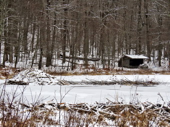
 Soon we arrived at the beaver pond. Where there had once been a beaver meadow, there was now a pond with a dam and a beaver lodge. The pond was much larger than the last time I had visited! We continued passed the dam and followed the yellow blazes over to the path down to the lean-to. It was empty and in disrepair needing at least a roof. The outhouse behind the lean-to had been torn apart by thoughtless campers and needs to be replaced. I have been unable to find out which entity is responsible for the maintenance of this lean to. The lean-to is on DEC land but the Finger lakes trail passes right by it. The NYNJTC could also be the sponsor. I took some pictures of Sheila in the lean-to and then walked to the edge of the pond and took some more shots. After I got a drink, we started back to Alder Lake. I knew the trip back would be quicker than the trip out and that I would have some time for pictures. As we came to the spot on the trail opposite the beaver dam, we walked off the trail to the left and found a good viewpoint. I took pictures of the pond and the dam even though the skies were still gray. I also took some shots of the beaver lodge with the lean-to in the background. As I looked around I was overcome by the feeling of joy at seeing what God has created! I realized that the return trip would be much easier as it was almost all downhill but that it would be important to watch my foot placements so that I did not fall on steeper descents. I stopped at one spot on the way back to take some pictures of Alder Creek. The walk did go quickly and we were soon at the loop trail around Alder Lake where we turned right to return the way we came. When we came to the bridges there was an open view of Cradle Rock Ridge. In the foreground on this scene were some rushes and the beginnings of a small beaver dam. I decided to stop and take a few pictures. When I was done, we continued on the trail toward the parking area. As the trail came to the "lawn" we turned left and walked to the "beach" area. Even though the skies were still overcast I took some pictures of the lake and the surrounding hills. We walked up the hill to the parking area and I considered walking down to the creek to take some pictures of the waterfalls but decided to leave it for another visit. We were back at the car at 3:30 PM after hiking 4.6miles in 2 hours and 35 minutes with 25 minutes of stopped time. The elevation gain was 690 feet. The walk out had taken 1 hour and 20 minutes while the trip back was 1 hour and 15 minutes because of the time to take pictures! Our moving speed was 2 MPH.
![]()
![]()
![]()
![]() On Tuesday, December 7th I wanted to get in a hike but had limited time in between ambulance calls and track practice. By the time I was ready to hike I knew that I only had time to go across the street to hike on Round Top. It was 11:30 AM by the time I started to get dressed with the temperature a rather cool 33 degrees. Sheila was ready to go as she really likes to hike and she was keeping a careful eye on me as we dressed. I got dressed in my Mammut crew top with a long-sleeved baselayer. I decided to wear my Columbia Titanium insulated pants to keep the chill away but decided against wearing tights underneath. I decided to put on my Keen Cascade hiking boots which are relatively new and fit well. I grabbed my Leki external lock poles which I have been using lately since twist locks have proved unreliable. I also added a fleecy orange hat and gloves since it was cool and still hunting season. I donned my Mammut hoody which has lots of zippers to dump heat if necessary. At 11:50 AM we walked out the door to start the hike. I grabbed Sheila's leash from the car and we walked up the driveway. I aimed to hike for about an hour. Sheila was happy to get out as we headed down the driveway and across the street. We crossed the street and walked to the parking area by the Presbyterian Church. We walked to the back of the church and began the ascent of the steepest hill behind the church. The hill is short but gets the circulation pumping and is the steepest and longest climb on the "trail." Sheila helped me along by pulling me up the hill. There was some ice and packed snow which made the footing very poor but I was able to walk around the worst patches. At the top of the hill we started on the trail by turning left at the trailhead where I let Sheila off her leash so that she could explore. There was still some snow on the trail making it slippery on top of a layer of leaves.
On Tuesday, December 7th I wanted to get in a hike but had limited time in between ambulance calls and track practice. By the time I was ready to hike I knew that I only had time to go across the street to hike on Round Top. It was 11:30 AM by the time I started to get dressed with the temperature a rather cool 33 degrees. Sheila was ready to go as she really likes to hike and she was keeping a careful eye on me as we dressed. I got dressed in my Mammut crew top with a long-sleeved baselayer. I decided to wear my Columbia Titanium insulated pants to keep the chill away but decided against wearing tights underneath. I decided to put on my Keen Cascade hiking boots which are relatively new and fit well. I grabbed my Leki external lock poles which I have been using lately since twist locks have proved unreliable. I also added a fleecy orange hat and gloves since it was cool and still hunting season. I donned my Mammut hoody which has lots of zippers to dump heat if necessary. At 11:50 AM we walked out the door to start the hike. I grabbed Sheila's leash from the car and we walked up the driveway. I aimed to hike for about an hour. Sheila was happy to get out as we headed down the driveway and across the street. We crossed the street and walked to the parking area by the Presbyterian Church. We walked to the back of the church and began the ascent of the steepest hill behind the church. The hill is short but gets the circulation pumping and is the steepest and longest climb on the "trail." Sheila helped me along by pulling me up the hill. There was some ice and packed snow which made the footing very poor but I was able to walk around the worst patches. At the top of the hill we started on the trail by turning left at the trailhead where I let Sheila off her leash so that she could explore. There was still some snow on the trail making it slippery on top of a layer of leaves.
At the first trail junction, I followed Sheila as she started directly up the hill toward the lookout. The climb up the hill was slippery but seemed easier than usual. We passed by what used to be a side trail to the lookout that I blocked with brush. This side trail has a gap that hikers have to walk over and it can be dangerous for some people in the winter season. We continued on the yellow trail as it turned to the right and started the gentle ascent through the open woods. When I built the trail I purposely kept it a good distance away from the property line so that hikers would not trespass. I decided on this day that we would bushwhack down to that line and follow it to the summit of Round Top. We turned to the left and walked down to the first posted sign I could find. We walked along the line of posters until I could see a steep incline to the right which I knew was the way to the summit of Round Top. We started up the incline which was actually very steep. When we came to what I thought was the top, there was a flat area and then another climb. We continued to walk up the hill until we came to a well-worn path. It took me a few seconds to realize this was the blue trail heading over the summit of Round Top. We turned left and walked over the summit and down the other side of Round Top to the yellow trail. I decided to continue straight ahead on the yellow trail down to the woods road. There was a large tree that had fallen parallel to the trail but some of the branches were in the trail. I tried to move them or break them off but found I needed a saw. We walked down the woods road to the first trail junction. We immediately turned around and headed back up the woods road to the junction with the blue trail. We turned left and walked along the base of Round Top on the yellow trail. At the next trail junction with the blue trail, we turned right and headed up the hill. We followed the switchback in the blue trail as it headed right into the woods and then made an almost 180 degree turn to head back to the main blue trail. We turned right and then almost immediately right again on the white crossover trail. These trails were clear of blowdowns but were slippery with snow. We walked the crossover trail back out to the blue trail where we turned right and walked down to the yellow trail. We turned right and again walked along the yellow trail to the junction with the blue trail. This time we turned left and walked the yellow trail down to the lookout. We continued to follow the yellow trail as it turned left and descended to the first trail junction. We continued straight out to the trailhead and turned right to start down the hill. When we reached the church parking lot, I put Sheila on her leash and we walked across the street to our driveway and back to the house. It was 12:55 PM and we had hiked around 2 miles in a little over an hour.
![]()
![]()
![]()
![]()
![]() On Sunday, December 5th, Cindy and I left the Beaverkill Campgrounds after a walk that had lasted less than an hour. I had wanted to hike at Alder Lake but settled for the very short walk at Beaverkill. As we were headed home, I asked Cindy if she wanted to stop at Waneta Lake to check it out. She said "Yes" so I pulled into the parking area which was empty. I had only been at this small lake once years ago when the LMFD was having an ice rescue drill. I had driven passed the lake hundreds of times and wanted to see if there were any paths or trails. We all got out of the car. I set my GPS and Cindy and I grabbed our poles. We started our hike by walking over to the dam at 2:45 PM with the sun dropping low in the sky. We immediately came to the dam with no obvious way to get across. I walked downstream from the dam and climbed down the bank. Without much trouble I was able to find some rocks to use to cross the outlet stream which was low anyway. On the other side I climbed the bank and worked through some brush. I found an open clearing on the shore of the lake. I also noticed that there was a road that came in from the Beaverkill Road which would be a much easier way to access the area where I was standing but I did not know if it was on private property. I dropped my pack to take some pictures of the lake which was frozen over. After I took some shots, I noticed Cindy was not with me. I walked back to the dam and found she had some problems crossing. I gave her a few suggestions and she soon joined me. Sheila was very happy so she started zooming around. To my horror, she decided to run out onto the ice! I immediately called her back and admonished her. I went over to test the ice with my pole and found it was quite thick. I picked up my pack and we followed the road as it started around east side of the lake. We gained a little elevation and then the road turned sharply to the left away from the lake. I decided we would start to bushwhack around the lake and see if we could make a complete loop and hike back on the road. I knew the worse that could happen was that we would have to turn back the way we came. We started off through the open woods staying pretty close to the lake. After a few minutes, I looked up to see a yellow DEC trail marker! I took a picture and then looked ahead and saw some more.
On Sunday, December 5th, Cindy and I left the Beaverkill Campgrounds after a walk that had lasted less than an hour. I had wanted to hike at Alder Lake but settled for the very short walk at Beaverkill. As we were headed home, I asked Cindy if she wanted to stop at Waneta Lake to check it out. She said "Yes" so I pulled into the parking area which was empty. I had only been at this small lake once years ago when the LMFD was having an ice rescue drill. I had driven passed the lake hundreds of times and wanted to see if there were any paths or trails. We all got out of the car. I set my GPS and Cindy and I grabbed our poles. We started our hike by walking over to the dam at 2:45 PM with the sun dropping low in the sky. We immediately came to the dam with no obvious way to get across. I walked downstream from the dam and climbed down the bank. Without much trouble I was able to find some rocks to use to cross the outlet stream which was low anyway. On the other side I climbed the bank and worked through some brush. I found an open clearing on the shore of the lake. I also noticed that there was a road that came in from the Beaverkill Road which would be a much easier way to access the area where I was standing but I did not know if it was on private property. I dropped my pack to take some pictures of the lake which was frozen over. After I took some shots, I noticed Cindy was not with me. I walked back to the dam and found she had some problems crossing. I gave her a few suggestions and she soon joined me. Sheila was very happy so she started zooming around. To my horror, she decided to run out onto the ice! I immediately called her back and admonished her. I went over to test the ice with my pole and found it was quite thick. I picked up my pack and we followed the road as it started around east side of the lake. We gained a little elevation and then the road turned sharply to the left away from the lake. I decided we would start to bushwhack around the lake and see if we could make a complete loop and hike back on the road. I knew the worse that could happen was that we would have to turn back the way we came. We started off through the open woods staying pretty close to the lake. After a few minutes, I looked up to see a yellow DEC trail marker! I took a picture and then looked ahead and saw some more.
 I waited until Cindy caught up with me and pointed out the markers. I followed them for a short time and then could not find any more so I returned to a path near the lake. I walked down1 to the shore to rake some shots while Cindy caught up with me. When I returned from the shore, I noticed the path along the shore looked as if it was constructed of laid stones. We continued to walk along the shore using the path of least resistance. It did occur to me that if we could not cross over at the far end we would be walking all the way back! We crossed a few small stream and gained a little elevation before finding a large fire ring and some chairs. I took a few pictures of the site and then we continued through the woods. I could not find a well-defined oath but the walking was easy. I watched Sheila as she walked ahead of me and she soon led us to a path. We followed the path it started to bend around the south end of the lake. The path narrowed until I realized it was actually a narrow causeway between the main lake on the right and a smaller pond or section of the lake on the left. I stopped where there was no brush in the way and took some pictures. After walking across to the other side, I took some pictures of the construction of the causeway. We continued to walk up the path to Beaverkill Road. It was then that I realized I had not bothered to bring Sheila's leash. I decided to walk back on the road without a leash as Sheila knows where to walk and obeys commands very well. The walk on the road was only .4 miles and went quickly for the most part. There were some deer bones lying alongside the road and Sheila insisted on investigating each one. We were back at the car at 3:45 PM after hiking 1.3 miles in an hour with 20 minutes of stopped time. The elevation gain was only 110 feet. I was pleased as this was a hike that I had not done before. It reminded me how much fun exploring can be!
![]()
![]()
![]()
![]() On Sunday, December 5th, I wanted to go for a hike with Cindy after church. I had a rare Sunday off when I was not preaching at a church but we both had some things to do at church after the service. I knew the hike would have to be shorter and flatter than I wanted but I really wanted to go to the lean-to at Alder lake. This hike is about 4.5 miles with some elevation gain but we vas done it many times before. When we arrived home, I proposed the hike and Cindy suggested that Sheila and I go without her. This was not what I wanted to do so I asked Cindy if she would like to go to the Beaverkill Campgrounds and she agreed. We started to get ready a little after 1:00 PM when the temperature was still only 38 degrees. As usual, Sheila was excited and even more so since Cindy was going also. I put on my Mammut long-sleeved crew top with a long-sleeved base layer. I decided to wear my Columbia Titanium insulated pants to keep the chill away but decided against wearing tights underneath. I wore my Vasque Taku boots which have seen better days but still fit well. I thought we might encounter wet and muddy conditions and felt these boots could do the job. I considered wearing my OR Crocodile gaiters to fend the mud and to keep my lower legs warm but let Cindy wear them instead. I donned my Mammut hoody which blocks the wind and keeps me warm but has enough zippers to dump heat when needed. I put on a fleecy orange hat for warmth and put on a light pair of gloves. I grabbed a pair of Leki external lock poles I have been using all season. I put our gear in the back of the car and Sheila in the back seat and left the house at 1:25 PM. I drove out Old Route 17 toward Roscoe and turned right on Beaverkill Road. As we started the descent into the Beaverkill Valley, I turned left on Campsite Road and followed it down to the parking area near the Beaverkill Covered Bridge. As I parked, there was one other car in the lot.
On Sunday, December 5th, I wanted to go for a hike with Cindy after church. I had a rare Sunday off when I was not preaching at a church but we both had some things to do at church after the service. I knew the hike would have to be shorter and flatter than I wanted but I really wanted to go to the lean-to at Alder lake. This hike is about 4.5 miles with some elevation gain but we vas done it many times before. When we arrived home, I proposed the hike and Cindy suggested that Sheila and I go without her. This was not what I wanted to do so I asked Cindy if she would like to go to the Beaverkill Campgrounds and she agreed. We started to get ready a little after 1:00 PM when the temperature was still only 38 degrees. As usual, Sheila was excited and even more so since Cindy was going also. I put on my Mammut long-sleeved crew top with a long-sleeved base layer. I decided to wear my Columbia Titanium insulated pants to keep the chill away but decided against wearing tights underneath. I wore my Vasque Taku boots which have seen better days but still fit well. I thought we might encounter wet and muddy conditions and felt these boots could do the job. I considered wearing my OR Crocodile gaiters to fend the mud and to keep my lower legs warm but let Cindy wear them instead. I donned my Mammut hoody which blocks the wind and keeps me warm but has enough zippers to dump heat when needed. I put on a fleecy orange hat for warmth and put on a light pair of gloves. I grabbed a pair of Leki external lock poles I have been using all season. I put our gear in the back of the car and Sheila in the back seat and left the house at 1:25 PM. I drove out Old Route 17 toward Roscoe and turned right on Beaverkill Road. As we started the descent into the Beaverkill Valley, I turned left on Campsite Road and followed it down to the parking area near the Beaverkill Covered Bridge. As I parked, there was one other car in the lot.
I set my GPS and put Sheila on her leash as we started our hike at 1:45 PM by crossing the bridge to the west side of the river. Just as we started to cross the owner of the other car came running across the bridge but Sheila paid him almost no attention. We turned left on a woods road that parallels the river and started down a short hill. I had expected some snow or ice but the trail was bare. The ground was frozen and my poles were enough to make sure I did not slip. I was not very happy to be hiking such a short flat route so I decided to try to keep my pace high to get some exercise. I also decided that I would not take any pictures as the views had not changed much from our last trip. We walked passed a spring house and continued on the deserted woods road. We came to an area with a little path down to the river where I usually take some pictures but this time I walked on by. I knew Cindy could keep my pace but she chose not to so I decided to keep walking and stop to wait for her at some point. Just after this area, the trail was even more eroded by water running across and under the trail than during our last visit. There was an area with several picnic tables which sit unused and rotting along the road. This was just the first of several similar areas. There was not a single person in sight. We bypassed the first abandoned bathroom and continued on to the next. There was a path over to the river but I kept walking! Just after this spot was another place where the road had been washed away and the DEC had filled in with some gravel. At about .7 miles the woods road met the paved road that serves the campsites. The road was covered in a layer of ice and snow so I bypassed it by walking on the grass. We continued on the road through the campsites and along the river. Many of the campsites had a cement block fireplace with a grill but some were upgraded to poured concrete. Everything was very quiet except for the water in the river. This was not surprising as the campsites are closed.
We walked to the last bathroom where the trail ends. We usually walk out to the river but I decided just to make the turn and head back. We turned to start back and walked the other road through the campsites which parallels the one we walked out on to make a sort of loop. We passed groups of randomly arranged picnic tables that had been collected after the summer and fall camping season. We returned the way we had come keeping a quicker pace. We walked through the bridge and turned right. I walked passed the car toward the end of the parking area. We passed through a gate and walked over a patch of concrete that used to act as a ford through a shallow branch of the Beaverkill. The water had been redirected many years ago so the path was dry. We walked along the path which paralleled the river to a stone bench in a grove of evergreen trees. Cindy sat on the bench for a short break and then we headed back along a woods road. We were back at the car at 2:35 PM having hiked 2.3 miles in 55 minutes with 2 minutes of stopped time. The elevation gain was 150 feet but it was hardly noticeable. Our moving average was 2.7 mph.
![]()
![]()
![]()
![]()
![]() On Friday, December 3rd, I wanted to get in my first hike of December close to home with Cindy. The ambulance pager had been quiet all night until I got up at 9:00 AM. Cindy and I both had work to do before hiking. I took Sheila to the vet as her eye was watering and I always have her treated as soon as possible. The vet diagnosed conjunctivitis and prescribed an eye drop. When I got home, Cindy was still out doing errands. Just before 2:00 PM we started getting ready to hike. We had decided to go to the Parksville Rail Trail as it is flat which is what Cindy like best. As we started to get ready just before 2:00 PM, the temperature on the back porch was 38 degrees and I knew the rail trail was shaded. I put on my Mammut long-sleeved crew top with a long-sleeved base layer. I decided to wear my Columbia Titanium insulated pants to keep the chill away but decided against wearing tights underneath. I wore my Vasque Taku boots which have seen better days but still fit well. I thought we might encounter wet and muddy conditions and felt these boots could do the job. I considered wearing my OR Crocodile gaiters to fend the mud and to keep my lower legs warm but let Cindy wear them instead. I donned my Mammut hoody which blocks the wind and keeps me warm but has enough zippers to dump heat when needed. I put on a fleecy orange hat for warmth and put on a light pair of gloves. I grabbed a pair of Leki external lock poles I have been using all season. We stepped out of the house at 2:10 PM. We put our gear in the back of the car and Sheila in the back seat. We left Livingston Manor and drove out Old Route 17 toward Parksville. Just after Fox Mountain Road, I pulled into the parking area on the right side of the road at 2:25 PM. There were two cars in the lot as we began to get ready. I decided to take my pack since it is the easiest way to carry my camera. I set my GPS and we set off on the trail with the car thermometer reading 38 degrees.
On Friday, December 3rd, I wanted to get in my first hike of December close to home with Cindy. The ambulance pager had been quiet all night until I got up at 9:00 AM. Cindy and I both had work to do before hiking. I took Sheila to the vet as her eye was watering and I always have her treated as soon as possible. The vet diagnosed conjunctivitis and prescribed an eye drop. When I got home, Cindy was still out doing errands. Just before 2:00 PM we started getting ready to hike. We had decided to go to the Parksville Rail Trail as it is flat which is what Cindy like best. As we started to get ready just before 2:00 PM, the temperature on the back porch was 38 degrees and I knew the rail trail was shaded. I put on my Mammut long-sleeved crew top with a long-sleeved base layer. I decided to wear my Columbia Titanium insulated pants to keep the chill away but decided against wearing tights underneath. I wore my Vasque Taku boots which have seen better days but still fit well. I thought we might encounter wet and muddy conditions and felt these boots could do the job. I considered wearing my OR Crocodile gaiters to fend the mud and to keep my lower legs warm but let Cindy wear them instead. I donned my Mammut hoody which blocks the wind and keeps me warm but has enough zippers to dump heat when needed. I put on a fleecy orange hat for warmth and put on a light pair of gloves. I grabbed a pair of Leki external lock poles I have been using all season. We stepped out of the house at 2:10 PM. We put our gear in the back of the car and Sheila in the back seat. We left Livingston Manor and drove out Old Route 17 toward Parksville. Just after Fox Mountain Road, I pulled into the parking area on the right side of the road at 2:25 PM. There were two cars in the lot as we began to get ready. I decided to take my pack since it is the easiest way to carry my camera. I set my GPS and we set off on the trail with the car thermometer reading 38 degrees.
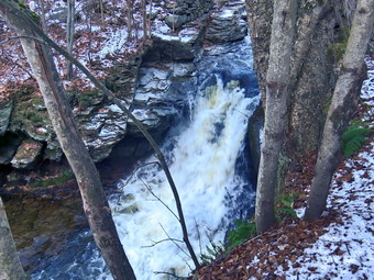 I had considered bringing spikes but had decided against it. I almost regretted my decision as the first part of the trail was ice and packed snow. Once we were on the trail and sheltered by the trees it was a little cooler but I was warm enough in what I was wearing. The trail was wet, icy and muddy in spots from the snow and rain that had fallen several days before. The stream was flowing with a good volume but was not as high as it had been on other previous trip. As we walked we removed sticks and branches from the trail but it was clear of any blowdowns and well-maintained. We came to a nice view down to the Little Beaverkill and I stopped to take a few shots. The sun was pretty low in the sky which gave a golden color to the horizon. Just after this point was a boardwalk and bridge. The approach was wet and there was ice on the bridge. We walked to the other end of the complex noting that heavy rains had carried dirt and rocks onto the bridge and had also blocked the ability of the water to flow under the bridge. We passed several benches placed for people to rest and Sheila alerted. Two hikers were headed toward us with their dogs on leashes. I put Sheila on her leash as the two hikers pulled off the trail and sat on one of the benches. We passed by and struck up a brief conversation. Cindy and I continued on the trail and soon we could hear an increase in the noise from the stream and I knew the falls was just ahead. We stopped to look at the falls which had a good flow of water going over it. The stream was not as high as other times and I considered walking down to the stream bed to take pictures. After looking at the ice and snow on the path, I decided to do my photography from the trail. I took some shots and then repositioned to take a few more. It was hard to get clear shots but I did my best to capture the small rapids below the falls and the two drops of the main falls. When I was done, I packed up and moved to a spot a little farther along just above the falls. I found an interesting rapids there and took a few pictures at different angles and exposures.
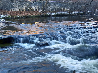 On the far side of the stream there are large open rock shelves and I thought about trying to access them from the other side of the stream. I walked back up to the trail to collect my pack and continue the hike toward the end of the trail in Parksville. As we approached the end of the trail, I put Sheila on her leash as there was a fairly large and aggressive dog on the other side of a fence during our last visit. I was happy to see that most property owners were cleaning up the mess just across the stream. On the Parksville end of the trail we stopped at the small garden which has a very informative sign. The sign listed the businesses and hotels that existed in Parksville during its heyday. The Young's Gap Hotel had room for 600 guests! The sign also explained the role of the railroad in the dairy industry which was a thriving one in all of Sullivan County. The sign made the comment that the area produced 9 million cans of milk annually. There was also a coal scuttle with clinkers and a railroad spike. After a brief pause, we began the walk back on the trail. I decided we would just hike back without any stops as I had taken all the photos I wanted. We walked quickly on the trail and continued back to the car. It seemed a little warmer as we walked and eventually broke out into the sun. We were back at the car at 3:50 PM after hiking 2.7 miles in 1 hour and 25 minutes with only 10 minutes of stopped time. Our moving average was 2.2 mph and the elevation gain was 235 feet which I found very unlikely.
![]()
![]()
![]()
![]() On Tuesday, November 30th I had planned to get up early and do a longer hike but slept in a little later to make up for some overnight ambulance calls. I still wanted to get out for a hike even though I had winter track practice in the afternoon. By the time I was ready to hike I knew that I only had time to go across the street to hike on Round Top. It was 11:00 AM by the time I started to get dressed with the temperature a rather cool 35 degrees. Sheila was ready to go as she really likes to hike and she was keeping a careful eye on me as we dressed. I got dressed in my Mammut crew top with a long-sleeved baselayer. I decided to wear my Columbia Titanium insulated pants to keep the chill away but decided against wearing tights underneath. I decided to put on my Keen Cascade hiking boots which are new and fit well. I grabbed my Leki external lock poles which I have been using lately since twist locks have proved unreliable. I also added a fleecy orange hat and gloves since it was cool. I donned my Mammut hoody which has lots of zippers to dump heat if necessary. At 11:15 AM we walked out the door to start the hike. I grabbed Sheila's leash from the car and we walked up the driveway. I aimed to hike for about an hour. Sheila was happy to get out as we headed down the driveway and across the street. We crossed the street and walked to the parking area by the Presbyterian Church. We walked to the back of the church and began the ascent of the steepest hill behind the church. The hill is short but gets the circulation pumping and is the steepest and longest climb on the "trail." Sheila helped me along by pulling me up the hill. There was a lot of ice and packed snow which made the footing very poor. At the top of the hill we started on the trail by turning left at the trailhead where I let Sheila off her leash so that she could explore. There was still a lot of snow on the trail making it slippery on top of a layer of leaves.
On Tuesday, November 30th I had planned to get up early and do a longer hike but slept in a little later to make up for some overnight ambulance calls. I still wanted to get out for a hike even though I had winter track practice in the afternoon. By the time I was ready to hike I knew that I only had time to go across the street to hike on Round Top. It was 11:00 AM by the time I started to get dressed with the temperature a rather cool 35 degrees. Sheila was ready to go as she really likes to hike and she was keeping a careful eye on me as we dressed. I got dressed in my Mammut crew top with a long-sleeved baselayer. I decided to wear my Columbia Titanium insulated pants to keep the chill away but decided against wearing tights underneath. I decided to put on my Keen Cascade hiking boots which are new and fit well. I grabbed my Leki external lock poles which I have been using lately since twist locks have proved unreliable. I also added a fleecy orange hat and gloves since it was cool. I donned my Mammut hoody which has lots of zippers to dump heat if necessary. At 11:15 AM we walked out the door to start the hike. I grabbed Sheila's leash from the car and we walked up the driveway. I aimed to hike for about an hour. Sheila was happy to get out as we headed down the driveway and across the street. We crossed the street and walked to the parking area by the Presbyterian Church. We walked to the back of the church and began the ascent of the steepest hill behind the church. The hill is short but gets the circulation pumping and is the steepest and longest climb on the "trail." Sheila helped me along by pulling me up the hill. There was a lot of ice and packed snow which made the footing very poor. At the top of the hill we started on the trail by turning left at the trailhead where I let Sheila off her leash so that she could explore. There was still a lot of snow on the trail making it slippery on top of a layer of leaves.
At the first trail junction, I followed Sheila as she turned right and started up the woods road which has the gentler approach of the two. We walked up the road to the first trail junction with the upper blue trail and turned left to follow the yellow trail along the base of Round Top. The trails were snowy and there were a few new branches on the trail. I stopped to remove the branches or used my poles to flick the smaller ones aside. At the next junction with the blue trail we turned right and headed up the blue trail, toward the summit. When we got to the switchback, we turned right and followed it until it came back to the main blue trail. We turned right and then continued straight ahead and up the hill toward the summit of Round Top bypassing the white crossover trail. We walked over the high point and down the blue trail toward the junction with the blue trail. Coming down the blue trail was exciting as it was very slippery. I was glad I had my poles and thought that spikes might have been a good idea. At the junction with the yellow trail we turned right. We walked the yellow trail along the base of Round Top to the next junction with the blue trail. We turned left and walked down the yellow trail toward the lookout passing the sitting rock. There was a good amount of snow left on the forest floor but not much left on the trees because of the wind. When we reached the lookout, we turned left to follow the yellow trail downhill to the first trail junction. This descent was also very slippery and I was glad I had my poles. We immediately turned around and started back up the hill to the lookout. At the top of the hill we turned right to follow the yellow trail to the first junction with the blue trail. The one short climb was slippery but the poles helped. We turned right to follow the yellow trail around the base of Round Top. At the next junction with the blue trail, we turned left and headed up toward the summit. When we got to the white crossover trail we turned right and followed it across to the blue trail. We turned left and almost immediately turned left again in the switchback in the blue trail. Walking downhill on the switchback was tricky as it sidehills in several places. At the end of the switchback we turned left and walked downhill to the trail junction with the yellow trail. We turned left and again followed the yellow trail along the base of Round Top to the junction with the blue trail. This time we turned right and headed down the yellow rail to the woods road that leads to the first trail junction. As we walked down the road, I noticed all the interesting ledges to the right of the trail. At the first trail junction, I debated doing another loop of some kind but decided just to head out to the trailhead. We walked out to the trailhead and turned right. We walked carefully down the hill trying to avoid the ice. We walked out to the road through the church parking lot and over to the driveway to the house. It was 12:25 PM and we had hiked 2 miles in a little over an hour.
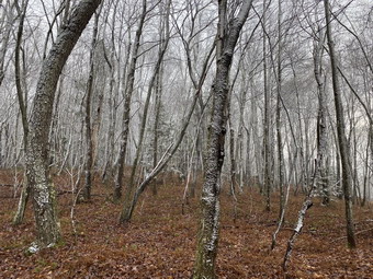
![]()
![]()
![]()
![]()
![]() On Friday, November 26th I wanted to get out for a short hike after sleeping in from some late night ambulance calls. Brad was ready to go with me even though it had been snowing lightly all morning. At 11:30 AM we decided to hike some loops on Round Top. We started to get ready when the temperature was 35 degrees. The skies were overcast and it was still snowing lightly although there were no accumulations. Sheila was ready to go as she really likes to hike and she was keeping a careful eye on me as we dressed. I put on my Mammut long-sleeved crew top with a long-sleeved base layer. I decided to wear my Columbia Titanium insulated pants to keep the chill away but decided against wearing tights underneath. I wore my Vasque Taku boots which have seen better days but still fit well. I thought we might encounter wet and muddy conditions and felt these boots could do the job. I put on my OR Crocodile gaiters to fend the mud and to keep my lower legs warm. I donned my Mammut hoody which blocks the wind and keeps me warm but has enough zippers to dump heat when needed. I put on a fleecy orange hat for warmth and because it was still the beginning of various hunting seasons. I also wore a light pair of gloves. I grabbed a pair of Leki external lock poles I have been using all season. We stepped out of the house at 9:50 AM. I grabbed Sheila's leash from the car and put it on her to safely cross the street. We walked up the driveway and crossed the street. We walked to the church parking lot and to the back of the church. As we started up the hill, I noticed that it was easier climbing the hill as I had been hiking more often.
On Friday, November 26th I wanted to get out for a short hike after sleeping in from some late night ambulance calls. Brad was ready to go with me even though it had been snowing lightly all morning. At 11:30 AM we decided to hike some loops on Round Top. We started to get ready when the temperature was 35 degrees. The skies were overcast and it was still snowing lightly although there were no accumulations. Sheila was ready to go as she really likes to hike and she was keeping a careful eye on me as we dressed. I put on my Mammut long-sleeved crew top with a long-sleeved base layer. I decided to wear my Columbia Titanium insulated pants to keep the chill away but decided against wearing tights underneath. I wore my Vasque Taku boots which have seen better days but still fit well. I thought we might encounter wet and muddy conditions and felt these boots could do the job. I put on my OR Crocodile gaiters to fend the mud and to keep my lower legs warm. I donned my Mammut hoody which blocks the wind and keeps me warm but has enough zippers to dump heat when needed. I put on a fleecy orange hat for warmth and because it was still the beginning of various hunting seasons. I also wore a light pair of gloves. I grabbed a pair of Leki external lock poles I have been using all season. We stepped out of the house at 9:50 AM. I grabbed Sheila's leash from the car and put it on her to safely cross the street. We walked up the driveway and crossed the street. We walked to the church parking lot and to the back of the church. As we started up the hill, I noticed that it was easier climbing the hill as I had been hiking more often.
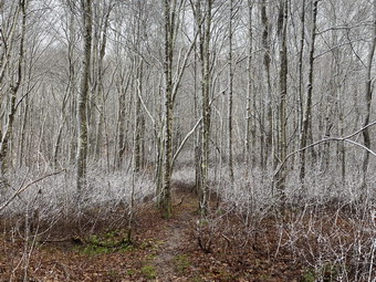 We continued the ascent of the steep hill behind the church. The hill is short but gets the circulation pumping and is the steepest and longest climb on the "trail". I let Sheila pull me up the hill which she was willing to do. At the trailhead, we paused to look around and could see that there was snow beginning to build up on the surrounding hills. It was still snowing lightly where we were but it was melting as it hit the ground. I let Sheila off her leash and she immediately began to bound up the trail. We started on the trail by turning left at the trailhead. I paused to look around and saw that the far hills had a light covering if snow. At the first trail junction, I followed Sheila as she continued straight up the hill toward the viewpoint. There was a slight breeze blowing but I was already getting warm from making the ascent in the hoody. I made sure to open all the zippers I could which made me a little cooler. The climb up the hill was a little easier than usual except for a layer of slippery leaves. At the viewpoint, I noticed that the brush that I had placed in the trail was still there and that someone had added a few more pieces. I wish people would not be so "helpful" as I walk these trails at least once a week. This path has a dangerous spot and we have piled brush on it to discourage people from using it. We continued on the main trail and headed to the right to follow it as it turned and headed up the gentle hill through the hardwood forest. As we made the turn we almost immediately began to run into snow on the trees and on the ground. It was very beautiful but I had not rough a camera! Fortunately, Brad had his cell phone and snapped a few pictures here and throughout the hike. Only a few leaves were hanging on to the trees while the rest formed a slippery blanket under the snow. Sheila was making her own way by staying on the trail sometimes and then running off-trail and chasing game trails.
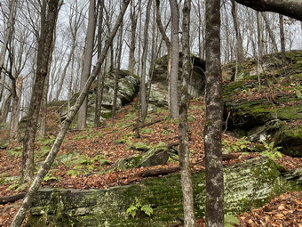 We continued to follow the yellow trail toward the first junction with the blue trail. There were a few branches on the trail that we removed as we hiked. At the first trail junction with the blue trail, we turned followed Sheila as she continued straight up the hill. This is not my usual route but I thought it would be a nice variation. When we came to the switchback on the blue trail, we turned right and followed it as it turned back to the main blue trail farther up the hill. We bypassed the white crossover trail and confined over the summit of Round Top. There was some snow on the trail which, in places, covered up some slippery mud. At the junction with the yellow trail we continued straight ahead downhill to the woods road. We followed the woods road out to the first trail junction. I wanted a little more distance so we turned around and started back up the yellow trail toward the junction with the blue trail. On this side of the hill there was no snow and the trail was simply wet and muddy. At the junction with the blue trail we continued straight ahead toward the summit of Round Top. We bypassed the white crossover trail and again walked over the top. As we headed down the other side we passed the white crossover trail. We turned left on the switchback and walked along the trail until it met the man blue trail. We turned left and walked down to the yellow trail. We continued straight ahead on the yellow trail and followed it passed the "sitting rock" to the lookout. At the lookout, we turned left and followed the yellow trail back to the first trail junction. From here, we walked straight out to the trailhead. We turned right to walk to the bottom of the hill and headed across the church parking lot to the street. After crossing the street to our driveway, we walked back to the house. We were home by 12:45 PM after hiking about 2 miles in just under an hour.
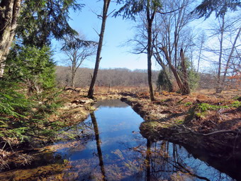
![]()
![]()
![]()
![]()
![]() On Wednesday, November 24th, I wanted to get out for a hike close to home with my son-in-law Brad and grandson Bryce. We began to get ready at 10:00 AM when the temperature was still only 37 degrees but with some blue skies and sun. While we were getting ready, Sheila was always nearby making it very clear that she wanted to go. I got dressed in my Mammut long-sleeved crew top with a long-sleeved thermal baselayer. I decided to wear my Columbia Titanium insulated pants to keep the chill away but decided against wearing tights underneath. I wore my Vasque Taku boots which have seen better days but still fit well. I thought we might encounter wet and muddy conditions and felt these boots could do the job. I did not wear any gaiters as I did not think the conditions warranted them. I donned my Mammut hoody which blocks the wind and keeps me warm but has enough zippers to dump heat when needed. I put on a fleecy orange hat for warmth and because it was the beginning of various hunting seasons. I also wore a light pair of gloves. I grabbed a pair of Leki external lock poles I have been using all season. We left Livingston Manor at 10:20 AM and I drove out the DeBruce Road about 6 miles to Mongaup Road. I turned left and continued up the road to the point where it splits. I stayed left on Beech Mountain Road and drove to the parking areas on the left. I pulled into the smaller parking area which was empty as was the larger lot. I set my GPS as we got ready to head out on the Flynn Trail with the temperature at 35 degrees with a breeze blowing. We crossed the road and began our hike at 10:40 AM.
On Wednesday, November 24th, I wanted to get out for a hike close to home with my son-in-law Brad and grandson Bryce. We began to get ready at 10:00 AM when the temperature was still only 37 degrees but with some blue skies and sun. While we were getting ready, Sheila was always nearby making it very clear that she wanted to go. I got dressed in my Mammut long-sleeved crew top with a long-sleeved thermal baselayer. I decided to wear my Columbia Titanium insulated pants to keep the chill away but decided against wearing tights underneath. I wore my Vasque Taku boots which have seen better days but still fit well. I thought we might encounter wet and muddy conditions and felt these boots could do the job. I did not wear any gaiters as I did not think the conditions warranted them. I donned my Mammut hoody which blocks the wind and keeps me warm but has enough zippers to dump heat when needed. I put on a fleecy orange hat for warmth and because it was the beginning of various hunting seasons. I also wore a light pair of gloves. I grabbed a pair of Leki external lock poles I have been using all season. We left Livingston Manor at 10:20 AM and I drove out the DeBruce Road about 6 miles to Mongaup Road. I turned left and continued up the road to the point where it splits. I stayed left on Beech Mountain Road and drove to the parking areas on the left. I pulled into the smaller parking area which was empty as was the larger lot. I set my GPS as we got ready to head out on the Flynn Trail with the temperature at 35 degrees with a breeze blowing. We crossed the road and began our hike at 10:40 AM.
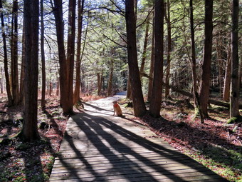 The Flynn Trail is sited along what used to be Beech Mountain Road which was the access for the Beech Mountain Boy Scout Camp. We walked the trail through the woods which was covered in a thick layer of leaves. We turned right on the woods road and set a quick pace up the hill. The trail gains a little over 600 feet in 1.7 miles to the highest point at the junction with the Big Rock Trail. The day was cool and the breeze continued to blow but we were sheltered in the woods. I began to get warm as we set a quick pace so we stopped so that I could open the zippers on the hoody. We passed through the arch Cindy and I had cut through an enormous hemlock that had fallen across the trail. I pointed out to Brad and Bruce the branches I had cut off to eliminate the sharp ends that someone left sticking down into the opening. It is a constant battle to deal with the problems well-meaning hikers leave behind doing unauthorized trail "maintenance". There were some muddy places on the trail but we still were making good time. We had been clearing a few branches and small trunks as we walked. At one point we stopped so that Brad and I could clear a small tree across the trail. We kept walking uphill and talking as we went. Hiking with someone always seems to make the time pass more quickly and we were soon at the junction with the Big Rock Trail. It was 11:25 AM and we had covered the 1.7 miles in 45 minutes including the time to stop and clear the trail. We turned left to walk down the Big Rock Trail. The hike down the trail went quickly since we were setting a fast pace. This trail can be tricky as there are several levels that make it seem like the bottom of the hill. There were a few large blowdowns on the trail but they were not blocking hikers and I knew the snowmobile club would be out to work on them. The trail also showed signs of erosion from the heavy rainstorm the week before.
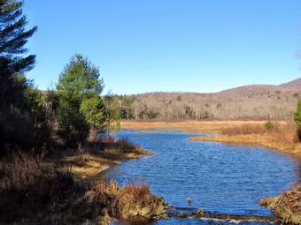 We were soon at Times Square and I thought about turning right to hike up and around the Logger's Loop to add some distance to our hike. I decided against this and we continued our hike by walking straight across Times Square to stay on the Big Rock Trail. The trail had some muddy spots in the low areas. When we reached the two small bridges over the inlets to the pond, we stopped so that I could take some pictures. When we got to the area that was covered by tall evergreens. I took some more shots. The wooden boardwalks looked a little green but they were not slippery. I took some more pictures and then we crossed the bridges quickly. At the next trail junction we turned left on the Quick Lake Trail to head for the bridge across the outlet of Frick Pond. I stopped at the bridge for a minute and took a few more photographs. We walked up the hill toward Gravestone Junction and found areas of trail that were as muddy as any we had encountered but much of the mud was frozen. It is hard to drain this trail and frequent use by a number of people churns up the mud. We continued to Gravestone Junction and passed the Lobdell memorial marker. The marker is a memorial to two children who died in the 1930's in a fire that consumed their cabin. Thankfully, the stone was upright. I had not been cutting out the trail to the marker to discourage vandalism but it had been cleared. Once again "helpful" people were doing unauthorized work. The trail to the register was wet in some spots, muddy in others, and frozen elsewhere. At the trail register we continued straight ahead to follow the woods road out to the car in the small lot. We arrived at the car at 12:35 PM having hiked 4 miles in 1 hour and 55 minutes with an elevation gain of 720 feet.
![]()
![]()
![]()
![]() On Monday, November 22nd I had planned to get up early and do a longer hike but slept in a little later to make up for some overnight ambulance calls. I still wanted to get out for a hike even though I had winter track practice in the afternoon. By the time I was ready to hike I knew that I only had time to go across the street to hike on Round Top. It was 10:00 AM by the time I started to get dressed with the temperature a rather cool 38 degrees. Sheila was ready to go as she really likes to hike and she was keeping a careful eye on me as we dressed. I got dressed in my Mammut crew top with a long-sleeved baselayer. I decided to wear my Columbia Titanium insulated pants to keep the chill away but decided against wearing tights underneath. I decided to put on my Keen Cascade hiking boots which are new and fit well. I grabbed my Leki external lock poles which I have been using lately since twist locks have proved unreliable. I also added a fleecy orange hat and gloves since it was cool. I donned my Mammut hoody which has lots of zippers to dump heat if necessary. At 10:15 AM we walked out the door to start the hike. I grabbed Sheila's leash from the car and we walked up the driveway. I aimed to hike for about an hour. Sheila was happy to get out as we headed down the driveway and across the street. We crossed the street and walked to the parking area by the Presbyterian Church. We walked to the back of the church and began the ascent of the steepest hill behind the church. The hill is short but gets the circulation pumping and is the steepest and longest climb on the "trail." Sheila helped me along by pulling me up the hill. At the top of the hill we started on the trail by turning left at the trailhead where I let Sheila off her leash so that she could explore. The trail was mostly dry with a few muddy spots and layer of wet and slippery leaves.
On Monday, November 22nd I had planned to get up early and do a longer hike but slept in a little later to make up for some overnight ambulance calls. I still wanted to get out for a hike even though I had winter track practice in the afternoon. By the time I was ready to hike I knew that I only had time to go across the street to hike on Round Top. It was 10:00 AM by the time I started to get dressed with the temperature a rather cool 38 degrees. Sheila was ready to go as she really likes to hike and she was keeping a careful eye on me as we dressed. I got dressed in my Mammut crew top with a long-sleeved baselayer. I decided to wear my Columbia Titanium insulated pants to keep the chill away but decided against wearing tights underneath. I decided to put on my Keen Cascade hiking boots which are new and fit well. I grabbed my Leki external lock poles which I have been using lately since twist locks have proved unreliable. I also added a fleecy orange hat and gloves since it was cool. I donned my Mammut hoody which has lots of zippers to dump heat if necessary. At 10:15 AM we walked out the door to start the hike. I grabbed Sheila's leash from the car and we walked up the driveway. I aimed to hike for about an hour. Sheila was happy to get out as we headed down the driveway and across the street. We crossed the street and walked to the parking area by the Presbyterian Church. We walked to the back of the church and began the ascent of the steepest hill behind the church. The hill is short but gets the circulation pumping and is the steepest and longest climb on the "trail." Sheila helped me along by pulling me up the hill. At the top of the hill we started on the trail by turning left at the trailhead where I let Sheila off her leash so that she could explore. The trail was mostly dry with a few muddy spots and layer of wet and slippery leaves.
At the first trail junction, I followed Sheila as she turned right and started up the woods road which has the gentler approach of the two. We walked up the road to the first trail junction with the upper blue trail and turned left to follow the yellow trail along the base of Round Top. The trails were a little damp and there were a few new branches on the trail. I stopped to remove the branches or used my poles to flick the smaller ones aside. At the next junction with the blue trail we turned right and headed up the blue trail, toward the summit. When we got to the switchback, we turned right and followed it until it came back to the main blue trail. We turned right and then continued straight ahead and up the hill toward the summit of Round Top bypassing the white crossover trail. We walked over the high point and down the blue trail toward the junction with the blue trail. At the junction with the yellow trail we turned right. We walked the yellow trail along the base of Round Top to the next junction with the blue trail. We turned left and walked down the yellow trail toward the lookout passing the sitting rock and a sea of dead ferns. When we reached the lookout, we turned left to follow the yellow trail downhill to the first trail junction. There were quite a few slippery leaves on the trail covering areas of slippery mud. We immediately turned around and started back up the hill to the lookout. At the top of the hill we turned right to follow the yellow trail to the first junction with the blue trail. We turned right to follow the yellow trail around the base of Round Top. At the next junction with the blue trail, we turned left and headed up toward the summit. When we got to the white crossover trail we continued straight ahead toward the summit. We walked over the summit and down the other side on the blue trail. We bypassed the white crossover trail but turned left on the switchback in the blue trail. We followed the switchback as it headed out into the woods and then back to the main blue trail. We turned left and walked down the blue trail to the yellow trail. We turned left and again followed the yellow trail along the base of Round Top to the junction with the blue trail. This time we turned right and headed down the yellow rail to the woods road that leads to the first trail junction. As we walked down the road, I noticed all the interesting ledges to the right of the trail. At the first trail junction, I debated doing another loop of some kind but decided just to head out to the trailhead. We walked out to the trailhead and turned right. We walked down the hill and out to the road through the church parking lot. We walked over to the driveway and back to the house. It was 11:15 AM and we had hiked 2 miles in an hour.
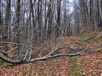
![]() On Friday, November 19th, I had returned home earlier than I expected from a trip to some interesting spots around Ellenville. I decided that I wanted to go to the Frick Pond area to cut a few blowdowns on the trail. There was one particular large one that was close to blocking the trail. I was already wearing my Mammut long-sleeved crew top with a long-sleeved thermal baselayer, my Columbia Titanium insulated pants and Vasque Taku boots. I had put on my OR Crocodile gaiters to keep my lower legs warm and my Mammut hoody to block the wind and keep me warm. I was wearing a fleecy orange hat for warmth and because hunting season was about to begin. I also had a pair of light gloves. The temperature was 36 degrees at the house but the wind was coming up and it looked like it might snow. I saw no reason to change any clothing. I grabbed my tools including my Silky Sugowaza curved saw which can handle surprisingly large trees, a Silky Katanboy 500, and my Fiskars pack axe which is light but handles bigger trees very well. I also threw some felling wedges in my pack as I would not have any help if my saw became pinched. I put my gear in the back of the car and Sheila in the back seat and left my house at 2:15 PM. I drove out the DeBruce Road about 6 miles to Mongaup Road and turned left. I continued up the road to the point where it splits and stayed left on Beech Mountain Road. It was a short drive to the parking areas on the left. Both parking areas were empty. I parked in the smaller lot. We crossed the road at 2:35 PM to begin our hike on the Flynn Trail with the temperature at 33 degrees!
On Friday, November 19th, I had returned home earlier than I expected from a trip to some interesting spots around Ellenville. I decided that I wanted to go to the Frick Pond area to cut a few blowdowns on the trail. There was one particular large one that was close to blocking the trail. I was already wearing my Mammut long-sleeved crew top with a long-sleeved thermal baselayer, my Columbia Titanium insulated pants and Vasque Taku boots. I had put on my OR Crocodile gaiters to keep my lower legs warm and my Mammut hoody to block the wind and keep me warm. I was wearing a fleecy orange hat for warmth and because hunting season was about to begin. I also had a pair of light gloves. The temperature was 36 degrees at the house but the wind was coming up and it looked like it might snow. I saw no reason to change any clothing. I grabbed my tools including my Silky Sugowaza curved saw which can handle surprisingly large trees, a Silky Katanboy 500, and my Fiskars pack axe which is light but handles bigger trees very well. I also threw some felling wedges in my pack as I would not have any help if my saw became pinched. I put my gear in the back of the car and Sheila in the back seat and left my house at 2:15 PM. I drove out the DeBruce Road about 6 miles to Mongaup Road and turned left. I continued up the road to the point where it splits and stayed left on Beech Mountain Road. It was a short drive to the parking areas on the left. Both parking areas were empty. I parked in the smaller lot. We crossed the road at 2:35 PM to begin our hike on the Flynn Trail with the temperature at 33 degrees!
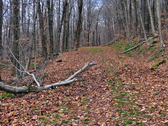 The first part of the trail near the road had become further eroded by the recent rains and there was a stream of water running down the trail. The walk through the woods was relatively easy although there was a thick layer of leaves which made the trail slippery in places. The leaves also hid a few muddy spots on the trail. When we turned right onto what once was Beech Mountain Road, there continued to be a layer of leaves as well as a few new branches on the trail. I removed the branches as we walked. When we came to the "spruce tunnel", I noted the jagged spikes sticking down where someone had broken off branches for some unknown reason. I hoped to clear this up on the way back. I doubt a forest ranger would have done such a careless hob so I suspected someone who had no business doing trail work. We set a fast pace up the Flynn Trail but I was not finding the blowdown I was looking for. I thought the tree was closer to the big spruce but it was actually almost a mile up the trail. When we arrived at the blowdown, I put my pack down and started to get out my camera. I realized I had not started my GPS and turned it on at this time. I took my "before" pictures and then got to work following my usual pattern. I cleared all of the loose branches and then grabbed the Sugowaza saw to remove many of the smaller branches that were in the way. I was concerned that the main trunk had broken off about 12 feet off the ground and was still attached. As I was cutting, it became clear that it was well attached and would not fall on me but I was still careful. I started to use the saw to cut larger branches and dragged them away as I cut them. Eventually, I was left with a couple of larger branches. I got my Fiskars ax and cut one and then the other. The last one had the largest diameter but the cut went quickly with the ax. When the cut was done, I was able to lift and roll the section off the trail. I took some "after" pictures and the packed up. It had taken me 30 minutes to do the job.
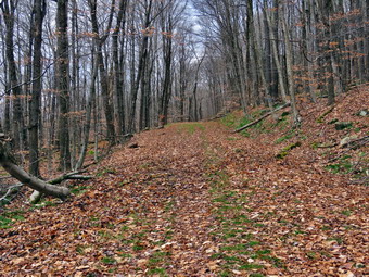 We walked 180 feet up the trail to a dead trunk that had fallen across the trail. I decided not to take pictures and got right to work. One fork of the trunk was broken in two places and I was able to break them off and throw them to the side of the trail leaving only a single trunk. I used the saw to cut the 6 inch trunk and then pivoted it off the trail. I packed up and we started the walk back down the Flynn Trail. As we walked the skies began to get dark, the wind started to blow and a few snowflakes fell. At 3:40 we came to the large spruce that I wanted to "clean up". By now the wind was really blowing and the snow was falling for real. I got out the Katanaboy saw which I was going to use to cut of the wooden spears as they were overhead and this saw has a better reach. I cut a few small branches that were down low and then turned my attention to the larger ones overhead. For a softwood tree the spruce was pretty hard and cutting overhead was not easy for me. I managed to cut four of the worst offenders flush with the trunk of the tree. The snow continued to fall and I decided to pack up and go home. We walked down the trail to the gate and then turned left to stay on the Flynn Trail and avoided the private property around the cabin. We were back at the car at 4:05 PM after hiking around 2 miles in an hour and a half. I felt good about getting the work done.
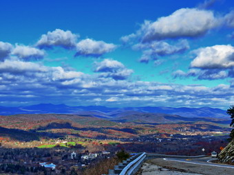
![]() On Friday, November 19th, Cindy and I had visited Hanging Rock Falls. After visiting the falls, we headed for Bear Hill Preserve which is a private preserve in Cragsmoor near Sam's Point. I did an Internet search and found that we should turn onto left onto Road A just before Cragsmoor Road off Route 52 heading south toward Pine Bush. I drove through Ellenville and headed up the mountain on Route 52. As I drove up the mountain, there were several pulloffs offering beautiful views of Ellenville in the valley below. In the distance there were views of the Catskills shrouded I a blue haze. I stopped at one pullout and took some pictures before continuing to Bear Hill. Near the top of the hill I found Road B and then Road A. I turned left and started up the road which was private and heavily rutted by the rainstorms. We came to a point where there were two different ways to go but there was no sign for the Bear Hill Preserve. I tried the roads in both directions but each led to a private home. I gave up and decided to do some more research to find the preserve.
On Friday, November 19th, Cindy and I had visited Hanging Rock Falls. After visiting the falls, we headed for Bear Hill Preserve which is a private preserve in Cragsmoor near Sam's Point. I did an Internet search and found that we should turn onto left onto Road A just before Cragsmoor Road off Route 52 heading south toward Pine Bush. I drove through Ellenville and headed up the mountain on Route 52. As I drove up the mountain, there were several pulloffs offering beautiful views of Ellenville in the valley below. In the distance there were views of the Catskills shrouded I a blue haze. I stopped at one pullout and took some pictures before continuing to Bear Hill. Near the top of the hill I found Road B and then Road A. I turned left and started up the road which was private and heavily rutted by the rainstorms. We came to a point where there were two different ways to go but there was no sign for the Bear Hill Preserve. I tried the roads in both directions but each led to a private home. I gave up and decided to do some more research to find the preserve.
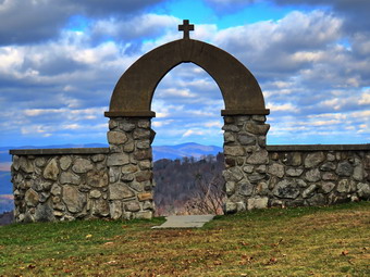 I drove out to Route 52 and asked Cindy if we could visit the Stone Chapel in Cragsmoor. She agreed so I turned left on Route 52 and then left again on Cragsmoor Road. Just after the Cragsmoor Library I continued straight ahead and followed the sign for the "Stone Church". When we arrived there was one other car looking for parking. I pulled over and parked at Te side of the church driveway. There was a construction trailer out front as the ere was work being done on the roof. This was disappointing as it was difficult to get a clear picture of the church. When I got out of the car, I could immediately see the iconic stone arch in back of the church. I took some pictures of it including one with a mountain framed by the arch. As I walked toward the arch, I realized Cindy was still in the car. I walked to the arch and was stunned by the breathtaking views of all of the hills and the Catskills. I took some shots and then turned around and took some obituaries of the church. I walked around the front of the church and tried to get some pictures without the trailer. The chapel was open so I went inside and found it was beautiful with stone walls and a wooden vaulted ceiling. After saying a prayer I returned to the car.
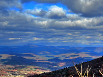 Cindy wanted to get some lunch so we headed back into Ellenville to Gaby's Mexican restaurant. We parked in the lot across from the restaurant, walked in and were seated at a table. Cindy ordered Chimichangas de Carne and I ordered, as I always do, Enchiladas de Mole. We snacked on chips and salsa until our meals came. When the food arrived my dish was spicier than I remembered which is a good thing. I did an internet search for Bear Hill Preserve and found it was actually on Dellenbaugh Road on top of Cragsmoor. I knew the walk was less than 2 miles round trip but I did not know if the preserve would be open. I thought this would be a great walk after our meal so I asked Cindy if we could go. Cindy said that after hiking half a mile and riding in the car she was too tired do hike any more. I knew the day was over and began the drive home. By the time we got home we had driven an hour and a half to hike half a mile! On the drive home I thought about driving back to Ellenville right away but knew I would want to do some other hikes so waiting to another day was the best idea. I also thought about going to the Frick Pond area to cut some blowdowns but decided I would wait until I got home.
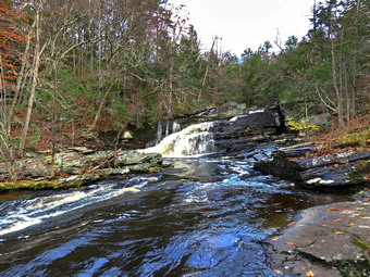
![]()
![]()
![]()
![]()
![]() On Friday, November 19th, I wanted to go somewhere that I knew Cindy could handle. I planned an adventure in the Evansville area to include Hanging Rock Fall, Bear Hill Preserve, Neville Falls, and Buttermilk Falls in Spring Glen. All of these hikes are very short with Bear Hill being the longest at 1.5 miles. They are also relatively flat. I asked Cindy if she wanted to go and she agreed as long as we could eat in Gaby's in Ellenville. When I got up at 8:00 AM it was only 30 degrees on the back porch but I knew the temperature was forecast to rise throughout the day. We started to get ready at 9:15 AM with the skies blue with some puffy white clouds to the south and east but with heavy dark clouds to the north and west. Sheila was pretty excited as I started to get ready as we have not been hiking a lot lately. I got dressed in my Mammut long-sleeved crew top with a long-sleeved thermal baselayer. I decided to wear my Columbia Titanium insulated pants to keep the chill away but decided against wearing tights underneath. I wore my Vasque Taku boots which have seen better days but still fit well. I thought we might encounter wet and muddy conditions and felt these boots could do the job. I put on my OR Crocodile gaiters to keep my lower legs warm. I donned my Mammut hoody which blocks the wind and keeps me warm but has enough zippers to dump heat when needed. I put on a fleecy orange hat for warmth and because it was the beginning of various hunting seasons. I also wore a light pair of gloves but also put a pair of mitts in my pack. I grabbed a pair of Leki external lock poles I have been using all season. I put our gear in the back of the car and Sheila in the back seat and left the house at 9:45 AM.
On Friday, November 19th, I wanted to go somewhere that I knew Cindy could handle. I planned an adventure in the Evansville area to include Hanging Rock Fall, Bear Hill Preserve, Neville Falls, and Buttermilk Falls in Spring Glen. All of these hikes are very short with Bear Hill being the longest at 1.5 miles. They are also relatively flat. I asked Cindy if she wanted to go and she agreed as long as we could eat in Gaby's in Ellenville. When I got up at 8:00 AM it was only 30 degrees on the back porch but I knew the temperature was forecast to rise throughout the day. We started to get ready at 9:15 AM with the skies blue with some puffy white clouds to the south and east but with heavy dark clouds to the north and west. Sheila was pretty excited as I started to get ready as we have not been hiking a lot lately. I got dressed in my Mammut long-sleeved crew top with a long-sleeved thermal baselayer. I decided to wear my Columbia Titanium insulated pants to keep the chill away but decided against wearing tights underneath. I wore my Vasque Taku boots which have seen better days but still fit well. I thought we might encounter wet and muddy conditions and felt these boots could do the job. I put on my OR Crocodile gaiters to keep my lower legs warm. I donned my Mammut hoody which blocks the wind and keeps me warm but has enough zippers to dump heat when needed. I put on a fleecy orange hat for warmth and because it was the beginning of various hunting seasons. I also wore a light pair of gloves but also put a pair of mitts in my pack. I grabbed a pair of Leki external lock poles I have been using all season. I put our gear in the back of the car and Sheila in the back seat and left the house at 9:45 AM.
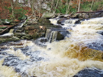 I drove east on State Route 17 and got off at exit 100 heading east on Route 52. I drove through Loch Sheldrake and Woodbourne heading toward Evansville. After passing through Greenfield Park, I began looking for Hacienda Road about 17 miles from the traffic circle at Exit 100 in Liberty. I turned left into Hacienda Road and followed it as it wound up an around to Markus Road on the right. After the right hand turn, I stayed on Marcus Road until it met Ulster Heights Road. I turned right and drove a little more than .3 miles to a pulloff on the right. There were no signs or trail markings to announce the falls but I did see a sign in the woods that said "Please Keep This Place Clean". I parked the car and when I got out I could hear the water running in the Beer Kill. I had read that the stream is called the Beer Kill because the water is slightly yellow and foams as it runs over the rocks. We walked on a path down the hill toward the stream. The path met a woods road and we turned right and continued to walk toward the stream. The path passed over some exposed bedrock and led us to the stream. I was immediately impressed at the width of the stream and the volume of water! I put down my pack and took out my camera. I carefully worked my way out onto some rocks that faced the falls and took my pictures. I had to be careful as the rocks were damp and sloped slightly toward the water. Sheila insisted on walking to the edge to see what was going on! I turned my attention from upstream to downstream and realized that there were more falls in that direction. I took a few shots and the walked back to my pack to stow my camera in preparation for heading downstream.
 I saw Cindy walking back up the path and assumed she was going back to the car. Sheila and I turned off the path and followed a faint track downstream to the next falls. I again inched my way out onto the rocks and took pictures of an even larger falls. As I was photographing, I noticed a ra5her fresh deer carcass on some rocks in the middle of the falls. The deer was a buck with 6 to 8 points. I once again packed up and we worked our way down to the next falls. I looked to see if we could go farther as the last falls dropped down to a pool at some 30 feet below. The drop was nearly vertical. I had the feeling I could find a way down but might not be able to easily make it back up. I settled for taking pictures of the third falls from where I was. I took some pictures of the pool below and then some of the falls. There was some brush in the way and I saw a path to a clear lookout. The problem was that the rocks were wet and slanted toward the stream. I decided to be satisfied with taking pictures from where I was. When I was done, I looked for a way back up to the "main" path. I knew we could go back the way we came but I decided to explore.We walked along the base of some ledges and then turned in a direction that I knew would bring us back to the path, the woods road or the highway. Soon the terrain leveled and I saw the path ahead. When we hit the path, I was about to turn right to go back up to the car but I caught a flash of white in the direction of the falls. I knew I had seen Cindy's jacket so we walked along the path where she was sitting on a rock. I have no idea why she had decided to stay there but we turned around and walked back up the hill to the car. The walk was about half a mile and took 45 minutes. I judge it well worth the time. I decided it was time to try and find Bear Hill Preserve.
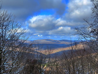
![]()
![]()
![]()
![]()
![]() On Tuesday, November 16th, I wanted to get in a longer hike than I had been doing. Winter Track practices along with ambulance calls had been limiting my hiking. When I got up at 8:00 AM it was only 33 degrees on the back porch but I knew the temperature was forecast to rise throughput the day. I wanted to get out and hike to some elevation to see how much snow there was and to take some pictures effort it disappeared. I decided to head to Beech Mountain where I though there would be some snow and where there are several good viewpoints. I started to get ready at 9:15 AM with the skies blue with some puffy white clouds. Sheila was pretty excited as I started to get ready as we have not been hiking a lot lately. I got dressed in my Mammut long-sleeved crew top with a long-sleeved thermal baselayer. I decided to wear my Columbia Titanium insulated pants to keep the chill away but decided against wearing tights underneath. I wore my Keen Targhee II boots which have seen better days but still fit well. I thought we might encounter wet and muddy conditions and felt these boots could do the job but wondered how they would hold up if there was much snow. I put on my OR Crocodile gaiters to fend off snow and mud and to keep my lower legs warm. I donned my Mammut hoody which blocks the wind and keeps me warm but has enough zippers to dump heat when needed. I put on a fleecy orange hat for warmth and because it was the beginning of various hunting seasons. I also wore a light pair of gloves but also put a pair of mitts in my pack. I grabbed a pair of Leki external lock poles I have been using all season. I put my gear in the back of the car and Sheila in the back seat and left my house at 9:30 AM. I drove out the DeBruce Road about 6 miles to Mongaup Road and turned left. I continued up the road to the point where it splits and stayed left on Beech Mountain Road. It was a short drive to the parking areas on the left. The larger parking areas had one pickup in it. I parked in the smaller lot where there were no cars. There was a good covering of snow but I could see the road surface. I took a few shots before I set my GPS. We crossed the road at 9:50 AM to begin our hike on the Flynn Trail with the temperature at 35 degrees.
On Tuesday, November 16th, I wanted to get in a longer hike than I had been doing. Winter Track practices along with ambulance calls had been limiting my hiking. When I got up at 8:00 AM it was only 33 degrees on the back porch but I knew the temperature was forecast to rise throughput the day. I wanted to get out and hike to some elevation to see how much snow there was and to take some pictures effort it disappeared. I decided to head to Beech Mountain where I though there would be some snow and where there are several good viewpoints. I started to get ready at 9:15 AM with the skies blue with some puffy white clouds. Sheila was pretty excited as I started to get ready as we have not been hiking a lot lately. I got dressed in my Mammut long-sleeved crew top with a long-sleeved thermal baselayer. I decided to wear my Columbia Titanium insulated pants to keep the chill away but decided against wearing tights underneath. I wore my Keen Targhee II boots which have seen better days but still fit well. I thought we might encounter wet and muddy conditions and felt these boots could do the job but wondered how they would hold up if there was much snow. I put on my OR Crocodile gaiters to fend off snow and mud and to keep my lower legs warm. I donned my Mammut hoody which blocks the wind and keeps me warm but has enough zippers to dump heat when needed. I put on a fleecy orange hat for warmth and because it was the beginning of various hunting seasons. I also wore a light pair of gloves but also put a pair of mitts in my pack. I grabbed a pair of Leki external lock poles I have been using all season. I put my gear in the back of the car and Sheila in the back seat and left my house at 9:30 AM. I drove out the DeBruce Road about 6 miles to Mongaup Road and turned left. I continued up the road to the point where it splits and stayed left on Beech Mountain Road. It was a short drive to the parking areas on the left. The larger parking areas had one pickup in it. I parked in the smaller lot where there were no cars. There was a good covering of snow but I could see the road surface. I took a few shots before I set my GPS. We crossed the road at 9:50 AM to begin our hike on the Flynn Trail with the temperature at 35 degrees.
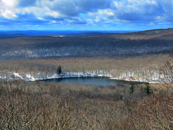 The first part of the trail near the road had become further eroded by the recent rains and there was a stream of water running down the trail. The walk through the woods was relatively easy although there was a thick layer of leaves covered by snow which made the trail slippery in places. The leaves and snow also hid a few muddy spots on the trail. I immediately noticed that someone had ridden a mountain bike on the trail. I don't mind the bikes too much as there are very few of them. The only problem I have is that they do not help machination the trails in this area. When we turned right onto what once was Beech Mountain Road, there continued to be a layer of leaves and snow as well as a few new branches on the trail. I removed the branches as we walked. When we came to the "spruce tunnel", I noticed someone had broken off branches to make the opening wider. This left jagged spikes sticking down which did not make me happy. I doubt a forest ranger would have done such a careless hob so I suspected someone who had no business doing trail work. I began to get warm immediately from the sun shining on my back but was comfortable as we continued up the trail. We set a fast pace up the Flynn Trail which seemed to go quickly as we walked even though the amount of snow kept increasing. A little after the spruce tree there was a large branch on the trail which I moved to the side. A little farther along there was a tree that had broken off 10 or 12 feet up the trunk. I knew I would need tools to clear this one but we were able to get by without a problem. We did stop a couple of times so that I could take some pictures of the snow on the trail and on the impressive ledges on the right side. The Flynn Trail is uphill all the way for the first 1.7 miles to the Big Rock Junction. We passed the mile mark around the point where there is a clearing to the right of the trail. There was another small tree across the trail but I was able to pivot off without a problem. We were soon walking the final uphill section to the junction with the Big Rock Trail. It was 10:45 AM so we had covered the 1.7 mile distance in 55 minutes which was pretty good as it included the time to take pictures and to clear blowdowns. We continued through the junction and passed through the gate which is the boundary between state land and Beaverkill Land Trust property. It was a short walk to the point where the Flynn Trail heads downhill to Hodge Pond. Here we turned to the right on the woods road and walked along the road to the junction of some roads above the pond. At this junction a road turns left to go down to the pond. Just a little further on the road splits with the left fork passing by the site of the former Beech Mountain Boy Scout Camp and ending up on Shin Creek Road in Lew Beach. The camp has been bulldozed by the Land Trust. The road out to Shin Creek Road is now available for hiking and has a nice parking area near Shin Creek Road. We continued up the hill toward the Hodge Pond Lookouts on a woods road that surrounds Flynn's Point on Beech Mountain, the highest point in Sullivan County. As we walked, I could see that there had not been any vehicles on the road as there were no tracks in the snow. Even though there was a deepening layer of slippery snow the hill did not seem to slow us down much.
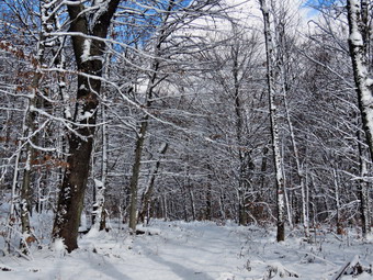 I wasn't really tired so we pushed the pace a little. When we go to the old sand and gravel pit where the trail levels the sun came out and glistened off the snow on the trees. I stopped and took a few pictures before going on. The trail began to gain elevation again and we passed by a spring house on the right where Sheila sometimes likes to dig in the water and get a drink. She decided not to get into the cold water on this day. There are several twists and turns along this road and it is sometimes hard for me to know exactly where I am. At 2.7 miles we came to a lookout on the left of the trail. The lookout had been "cut out" so that the hills and valleys beyond were much more visible. I decided to stop to take a few shots because my experience told me that the view could change by the time we returned. There was a great views to the west of the hills with a covering of snow. There was almost no haze on the hills of in the valleys as I snapped several pictures. When I was done, we followed the road uphill as it made a sharp right turn. Just after this the road turned to the left but another trail branched off to the right. We turned onto this woods road on the right. After a slight incline, the trail leveled. Snow and leaves covered the trail but there was almost no mud except in a spot where a small stream flows off the hill. I walked along the trail following Sheila most of the time. The ledges on the left side of the trail were covered in snow. At 2.9 miles we arrived at the Hodge Pond Lookout. This lookout has also been cut out giving a much better view than in the past. I dropped my pack and took some pictures of the pond below and the hills in the distance. I also took some pictures of Sheila sitting on the lookout with the pond in the background. The view was as clear as I have seen it and, again, the hills and even the area round the pond were covered in snow. When I was done taking pictures, I got a drink and then continued on the woods road traveling counterclockwise around Beech Mountain.
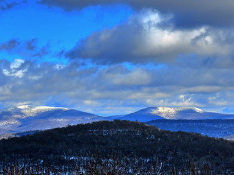 There are some impressive ledges and cliffs on the left side of the trail which blocked the wind that had been blowing on the west side of the mountain. This meant there was even more snow on the trees so I stopped to take a few shots. At 3.1 miles, the trail forked and we stayed to the right to head down to an incredible view to the east. I was hoping there would be some snow on the 3500 foot mountains visible from this viewpoint and I was not disappointed. The panorama from this lookout takes in the Burroughs Range and many of the other Catskill peaks. I got out my camera and took some pictures despite the bright sun which made getting the proper exposure difficult. When I was done, I picked up the pack and we continued on the woods road. We climbed a short hill and started down the other side heading back to the point where we had turned off the road. I noticed a woods road on the left side of the road we were walking and remembered that I had taken it up to a higher level and from there had walked the length of the Beech Mountain ridge. We passed the lookout on the road and followed it as it turned left and started downhill. The trip down was much quicker than the trip up and I avoided slipping on the snow by using my poles. When we reached the bottom of the hill, I thought about walking down to Hodge Pond but decided to make the hike a true out-and-back. I had some tasks to accomplish before track practice and wanted to get back home as quickly as possible. We walked out to the Flynn Trail, turned left and were soon at the junction with the Big Rock Trail at 4.5 miles. We continued straight ahead on the Flynn Trail. The trip down the Flynn Trail can seem to take forever but on this day it went quickly. The large hemlock across the trail came into sight and just after it the gate. We passed through the arch of the tree that Cindy and I had cut through the tree. Just before the gate, we turned left on the Flynn Trail to avoid the private property around the cabin. We walked the trail back to the car arriving at 12:40 PM. There were no cars parked in either lot and the temperature was 38 degrees. We had hiked 6.3 miles in 2 hours and 50 minutes gaining 1076 feet along the way. Our overall speed was 2.2 mph with moving average of 2.5 mph with 20 minutes of stopped time.
![]()
![]()
![]()
![]() On Monday, November5th I wanted to get out for a short hike after sleeping in from some late night ambulance calls. I also had my first winter practice to coach in the afternoon. At 10:30 AM I decided to hike some loops on Round Top. I started to get ready when the temperature was 32 degrees. The skies were overcast and I couldn't tell whether there was any precipitation. Sheila was ready to go as she really likes to hike and she was keeping a careful eye on me as we dressed. I put on my Mammut long-sleeved crew top with a long-sleeved base layer. I decided to wear my Columbia Titanium insulated pants to keep the chill away but decided against wearing tights underneath. I wore my Vasque Taku boots which have seen better days but still fit well. I thought we might encounter wet and muddy conditions and felt these boots could do the job. I put on my OR Crocodile gaiters to fend off snow and mud and to keep my lower legs warm. I donned my Mammut hoody which blocks the wind and keeps me warm but has enough zippers to dump heat when needed. I put on a fleecy orange hat for warmth and because it was the beginning of various hunting seasons. I also wore a light pair of gloves. I grabbed a pair of Leki external lock poles I have been using all season. We stepped out of the house at 10:50 AM. I grabbed Sheila's leash from the car and put it on her to safely cross the street. We walked up the driveway and crossed the street. We walked to the church parking lot and to the back of the church. As we started up the hill, I noticed that it was easier climbing the hill as I had been hiking more often. We continued the ascent of the steep hill behind the church. The hill is short but gets the circulation pumping and is the steepest and longest climb on the "trail". I let Sheila pull me up the hill which she was willing to do. At the trailhead, I let Sheila off her leash and she immediately began to bound up the trail. We started on the trail by turning left at the trailhead. I paused to look around and saw that the far hills were covered in snow and that there was a light layer of snow over the eatery and the hiking trails.
On Monday, November5th I wanted to get out for a short hike after sleeping in from some late night ambulance calls. I also had my first winter practice to coach in the afternoon. At 10:30 AM I decided to hike some loops on Round Top. I started to get ready when the temperature was 32 degrees. The skies were overcast and I couldn't tell whether there was any precipitation. Sheila was ready to go as she really likes to hike and she was keeping a careful eye on me as we dressed. I put on my Mammut long-sleeved crew top with a long-sleeved base layer. I decided to wear my Columbia Titanium insulated pants to keep the chill away but decided against wearing tights underneath. I wore my Vasque Taku boots which have seen better days but still fit well. I thought we might encounter wet and muddy conditions and felt these boots could do the job. I put on my OR Crocodile gaiters to fend off snow and mud and to keep my lower legs warm. I donned my Mammut hoody which blocks the wind and keeps me warm but has enough zippers to dump heat when needed. I put on a fleecy orange hat for warmth and because it was the beginning of various hunting seasons. I also wore a light pair of gloves. I grabbed a pair of Leki external lock poles I have been using all season. We stepped out of the house at 10:50 AM. I grabbed Sheila's leash from the car and put it on her to safely cross the street. We walked up the driveway and crossed the street. We walked to the church parking lot and to the back of the church. As we started up the hill, I noticed that it was easier climbing the hill as I had been hiking more often. We continued the ascent of the steep hill behind the church. The hill is short but gets the circulation pumping and is the steepest and longest climb on the "trail". I let Sheila pull me up the hill which she was willing to do. At the trailhead, I let Sheila off her leash and she immediately began to bound up the trail. We started on the trail by turning left at the trailhead. I paused to look around and saw that the far hills were covered in snow and that there was a light layer of snow over the eatery and the hiking trails.
At the first trail junction, I followed Sheila as she continued straight up the hill toward the viewpoint. There was a slight breeze blowing but I was already getting warm from making the ascent in the hoody. I made sure to open all the zippers I could which made me a little cooler. The climb up the hill was a little easier than usual except for a layer of slippery snow on top of a layer of lapper leaves. The higher we climbed the more snow there was on the trail. It was snowed a little, rained a little and then stopped. This was repeated several times. At the viewpoint, I noticed that the brush that I had placed in the trail was still there and that someone had added a few more pieces. I wish people would not be so "helpful" as I walk these trails at least once a week. This path has a dangerous spot and we have piled brush on it to discourage people from using it. We continued on the main trail and headed to the right to follow it as it turned and headed up the gentle hill through the hardwood forest. What was left of the ferns on the forest floor was covered in snow. Only a few leaves were hanging on to the trees while the rest formed a slippery blanket under the snow. Sheila was making her own way by staying on the trail sometimes and then running off-trail and chasing game trails. We continued to follow the yellow trail toward the first junction with the blue trail. There were a few branches on the trail that I removed as we hiked. At the first trail junction with the blue trail, we turned right and followed the yellow trail along the base of Round Top. This section was in good shape without any blowdowns and the brush and grass had remained at bay. At the next junction, we turned left and started up to the summit of Round Top on the blue trail. We bypassed the white crossover trail and continued up and over the summit. There was one small tree down on the summit which would require a saw to remove it. I decided we would skip the white crossover trail but take the switchback on the blue trail. We followed the switchback as it headed out into the woods and then back to the main trail where we turned left. At the bottom of the hill, we turned left on the yellow trail, and walked along the base of Round Top. At the trail junction with the blue trail, we turned right to walk down to the woods road. It was a snap to walk downhill and out the woods road. It was obvious Sheila felt the same way as she was running and bounding ahead of me and then running back up the trail. At the first trail junction, I turned around and started back up the woods road to the junction with the blue trail. We turned left and walked along the yellow trail following the base of the Round Top summit. At the next junction, we turned right and started up the steeper side of the hill on the blue trail. This time we again took the switchback in the blue trail. At the end of the switch, we turned right and continued on the main blue rail to the summit of Round Top bypassing the white crossover trail. We continued on main blue trail over the top and then down on the other side of the hill. We turned right at the end to take the yellow trail along the base of Round Top once again. At the junction with the blue trail, we turned to the left to stay on the yellow trail to the lookout. At the lookout, we followed the yellow trail as it turned left and descended to the first trail junction. We walked straight out to the trailhead. We turned right to walk to the bottom of the hill and headed across the church parking lot to the street. After crossing the street to our driveway, we walked back to the house. We were home by 11:50 AM after hiking a little over 2 miles in 1 hour.
![]()
![]()
![]()
![]() On Thursday, November 11th, I was still recovering from the day before when we covered five ambulance calls in one day, a personal record for me. My plan for the week had been to hike everyday but there was no time to get out on Wednesday. I got up at 5:15 AM for my men's bible study and returned home by 8:00 AM. I was so tired I was having trouble putting thoughts together so I tried to take a nap. I did get some rest but it was not nearly as satisfying as a full night's sleep. When Cindy returned home from church at noon, I asked her if she wanted to go for a short hike at Frick Pond and she agreed. We dragged our feet and did not start getting ready until 1:15 PM. The temperature was 49 degrees and the skies were getting cloudy. While we were getting ready, Sheila was always nearby making it very clear that she wanted to go. I got dressed in my Mammut long-sleeved crew top with a long-sleeved thermal baselayer. I decided to wear my Columbia Titanium insulated pants to keep the chill away but decided against wearing tights underneath. I wore my Vasque Taku boots which have seen better days but still fit well. I thought we might encounter wet and muddy conditions and felt these boots could do the job. I did not wear any gaiters as I did not think the conditions warranted them. I donned my Mammut hoody which blocks the wind and keeps me warm but has enough zippers to dump heat when needed. I put on a fleecy orange hat for warmth and because it was the beginning of various hunting seasons. I also wore a light pair of gloves. I grabbed a pair of Leki external lock poles I have been using all season. We left Livingston Manor at 1:35 and I drove out the DeBruce Road about 6 miles to Mongaup Road. I turned left and continued up the road to the point where it splits. I stayed left on Beech Mountain Road and drove to the parking areas on the left. I pulled into the smaller parking area which was empty. The larger lot had one car in it. I set my GPS as we got ready to head out on the Flynn Trail with the temperature at 48 degrees with a breeze blowing. We crossed the road and began our hike at 1:50 PM.
On Thursday, November 11th, I was still recovering from the day before when we covered five ambulance calls in one day, a personal record for me. My plan for the week had been to hike everyday but there was no time to get out on Wednesday. I got up at 5:15 AM for my men's bible study and returned home by 8:00 AM. I was so tired I was having trouble putting thoughts together so I tried to take a nap. I did get some rest but it was not nearly as satisfying as a full night's sleep. When Cindy returned home from church at noon, I asked her if she wanted to go for a short hike at Frick Pond and she agreed. We dragged our feet and did not start getting ready until 1:15 PM. The temperature was 49 degrees and the skies were getting cloudy. While we were getting ready, Sheila was always nearby making it very clear that she wanted to go. I got dressed in my Mammut long-sleeved crew top with a long-sleeved thermal baselayer. I decided to wear my Columbia Titanium insulated pants to keep the chill away but decided against wearing tights underneath. I wore my Vasque Taku boots which have seen better days but still fit well. I thought we might encounter wet and muddy conditions and felt these boots could do the job. I did not wear any gaiters as I did not think the conditions warranted them. I donned my Mammut hoody which blocks the wind and keeps me warm but has enough zippers to dump heat when needed. I put on a fleecy orange hat for warmth and because it was the beginning of various hunting seasons. I also wore a light pair of gloves. I grabbed a pair of Leki external lock poles I have been using all season. We left Livingston Manor at 1:35 and I drove out the DeBruce Road about 6 miles to Mongaup Road. I turned left and continued up the road to the point where it splits. I stayed left on Beech Mountain Road and drove to the parking areas on the left. I pulled into the smaller parking area which was empty. The larger lot had one car in it. I set my GPS as we got ready to head out on the Flynn Trail with the temperature at 48 degrees with a breeze blowing. We crossed the road and began our hike at 1:50 PM.
The Flynn Trail is sited along what used to be Beech Mountain Road which was the access for the Beech Mountain Boy Scout Camp. We walked the trail through the woods which was covered in a thick layer of leaves. We turned right on the woods road and set a quick pace up the hill. The trail gains a little over 600 feet in 1.7 miles to the highest point at the junction with the Big Rock Trail. The day was cool but I began to get warm as we set a quick pace even though I had all the zippers on the hoody open. We passed through the arch Cindy and I had cut through an enormous hemlock that had fallen across the trail. Someone had enlarged the opening by breaking off additional branches leaving some sharp ends sticking down into the opening. It is a constant battle to deal with the problems well-meaning hikers leave behind doing unauthorized trail "maintenance". There were some muddy places on the trail but we still were making good time. At one point Sheila alerted and I could see a woman hiking toward us. I ushered Sheila off the trail as she passed. We said "Hello" and the hiker responded telling us 'The trail is good but you can check it out'! I had no idea what she meant. We had been clearing a few branches and small trunks as we walked. When we stopped so that I could clear another small tree across the trail, I took the time to remove and store the Mammut crew top. I thought I might be cool with only the thermal top on under the hoody but I was definitely warm enough. We kept walking uphill and talking as we went. Hiking with someone always seems to make the time pass more quickly and we were soon at the junction with the Big Rock Trail. It was 2:40 PM and we had covered the 1.7 miles in 50 minutes including the time to stop and clear the trail. We turned left to walk down the Big Rock Trail. The hike down the trail went quickly since we were setting a fast pace. This trail can be tricky as there are several levels that make it seem like the bottom of the hill. There were a few large blowdowns on the trail but they were not blocking hikers and I knew the snowmobile club would be out to work on them. The trail also showed signs of erosion from the heavy rainstorm the week before.
We were soon at Times Square and I turned right to hike up and around the Logger's Loop to add some distance to our hike. Cindy immediately let me know she was too tired to follow the plan I had laid out. I am now used to this but I was unhappy we would be doing only about 4 miles! So instead of turning right, we continued our hike by walking straight across Times Square to stay on the Big Rock Trail. The trail had some muddy spots in the low areas. We crossed the two small bridges over the inlets to the pond where the water was high. It was getting dark especially in the area that was covered by tall evergreens. The wooden boardwalks looked a little green but they were nit slippery and we crossed them quickly. At the next trail junction we turned left on the Quick Lake Trail to head for the bridge across the outlet of Frick Pond. I stopped at the bridge for a minute but did not see anything remarkable so I continued across. We walked up the hill toward Gravestone Junction and found areas of trail that were as muddy as any we had encountered. It is hard to drain this trail and frequent use by a number of people churns up the mud. We continued to Gravestone Junction and passed the Lobdell memorial marker. The marker is a memorial to two children who died in the 1930's in a fire that consumed their cabin. Thankfully, the stone was upright. I had not been cutting out the trail to the marker to discourage vandalism but it had been cleared. Once again "helpful" people were doing unauthorized work. The trail to the register was wet in some spots and muddy in others. At the trail register we continued straight ahead to follow the woods road out to the car in the small lot. We arrived at the car at 3:35 PM having hiked 4 miles in 1 hour and 50 minutes with an elevation gain of 680 feet.
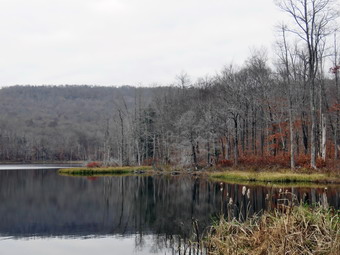
![]()
![]()
![]()
![]()
![]() On Tuesday, November 9th I had planned to hike Giant Ledge and probably throw in Panther. I wanted to do a 3500 foot peak and the parking lot at Giant Ledge was almost empty the day before. I was getting ready at about 8:30 Am when an ambulance call came in. By the time I returned it was noon and I knew that by the time I got to Giant Ledge I would be pushing to finish Panther which is not a feeling I enjoy. I decided to asked Cindy if she wanted to do a more local hike like Huggins Lake and she agreed. We began to get ready at 1:15 PM when the temperature was 56 degrees. As soon as I started to get ready, Sheila began to run around and bark anticipating getting out of the house. I got dressed in my White Sierra long-sleeved crew top and added a short sleeved baselayer. I put on a pair of RailRiders hiking pants which are expensive but last along time and have features like deep pockets and a generous cut which I really like. The pants have Velcro closures at the ankles. I decided not to add gaiters. I have not seen as many ticks as in the past but I know they are out there. I decided to wear my Vasque Taku hiking boots which fit well and have been discontinued. I made sure I had a pair of Super Green insoles in the shoes to support my arches. I grabbed a pair of Leki external lock poles I have been using lately. I donned my Mammut hoody which blocks the wind and keeps me warm but has enough zippers to dump heat when needed. I put on a fleecy orange hat for warmth and because it was the beginning of various hunting seasons. I also packed a light pair of gloves although I did not think I would wear them. I got our gear in the car and Sheila in the backseat. We left Livingston Manor at 1:40 PM and drove north on Old Route 17. I turned right on the Beaverkill Road and left on Campsite Road. At the bottom of the hill I turned right and drove down to the campgrounds parking area and across the Beaverkill Covered Bridge. At the end of the road I turned right and followed Berry Brook Road to the trailhead for Huggins Lake. We arrived at the road to the parking area to find it very rough with a lot erosion. I decided to park on the side of Berry Brook Road where there was a pulloff. We got our equipment ready and I set my GPS as we started off at 2:00 PM. The sun had been out all day but now the sky was clouding up and getting dark. There was no rain in the forecast and I hoped somebody told the clouds that! The temperature was 59 degrees as we headed out on the wide woods road to the lake. The hike isn't long, less than 4 miles, and the trail is maintained by the DEC although we did see a few blowdowns along the way.
On Tuesday, November 9th I had planned to hike Giant Ledge and probably throw in Panther. I wanted to do a 3500 foot peak and the parking lot at Giant Ledge was almost empty the day before. I was getting ready at about 8:30 Am when an ambulance call came in. By the time I returned it was noon and I knew that by the time I got to Giant Ledge I would be pushing to finish Panther which is not a feeling I enjoy. I decided to asked Cindy if she wanted to do a more local hike like Huggins Lake and she agreed. We began to get ready at 1:15 PM when the temperature was 56 degrees. As soon as I started to get ready, Sheila began to run around and bark anticipating getting out of the house. I got dressed in my White Sierra long-sleeved crew top and added a short sleeved baselayer. I put on a pair of RailRiders hiking pants which are expensive but last along time and have features like deep pockets and a generous cut which I really like. The pants have Velcro closures at the ankles. I decided not to add gaiters. I have not seen as many ticks as in the past but I know they are out there. I decided to wear my Vasque Taku hiking boots which fit well and have been discontinued. I made sure I had a pair of Super Green insoles in the shoes to support my arches. I grabbed a pair of Leki external lock poles I have been using lately. I donned my Mammut hoody which blocks the wind and keeps me warm but has enough zippers to dump heat when needed. I put on a fleecy orange hat for warmth and because it was the beginning of various hunting seasons. I also packed a light pair of gloves although I did not think I would wear them. I got our gear in the car and Sheila in the backseat. We left Livingston Manor at 1:40 PM and drove north on Old Route 17. I turned right on the Beaverkill Road and left on Campsite Road. At the bottom of the hill I turned right and drove down to the campgrounds parking area and across the Beaverkill Covered Bridge. At the end of the road I turned right and followed Berry Brook Road to the trailhead for Huggins Lake. We arrived at the road to the parking area to find it very rough with a lot erosion. I decided to park on the side of Berry Brook Road where there was a pulloff. We got our equipment ready and I set my GPS as we started off at 2:00 PM. The sun had been out all day but now the sky was clouding up and getting dark. There was no rain in the forecast and I hoped somebody told the clouds that! The temperature was 59 degrees as we headed out on the wide woods road to the lake. The hike isn't long, less than 4 miles, and the trail is maintained by the DEC although we did see a few blowdowns along the way.
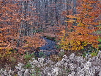 The first 1.2 miles is all uphill and gains almost 700 feet. Sheila was running up and down the trail following game paths into the woods. Cindy and I were both taking it slow as we had no reason to hurry. We both noted that the ascent has several spots which appear to be the top of the climb but are not. I had all the zippers open on my hoody and I was still warm. After the initial climb, the trail descends, levels some and then climbs again until the final descent to Huggins Lake. As we continued, the trail made a sharp turn from southeast to north at about 1.6 miles. We enjoyed the downhill trek to the shores of the pond even though we had to walk around some blowdowns on the trail. I knew we would soon have to turn around and climb back up the hill. When we arrived at the lake, I noticed that the water level was high. I dropped my pack and got out my camera to take pictures of the lake. The sky was cloudy and dark and very "flat". I took some pictures of the lake and the hills that surround it. Also took shots of the outlet stream which was lined with some trees that still had colorful leaves. At the outlet I could immediately see that the beavers had dammed the water flow and that reeds had grown to all but block the outlet flow. I took a few more pictures of the lake before returning to my pack and stowing the camera. Sheila had already taken a dip in the water and had taken a drink! We spent about 10 minutes at the lake and then packed up at 2:20 PM and started up the hill and back to the car. The only negative point about Huggins Lake is that there is only one trail and so there are no variations available. I had thought about bushwhacking around the lake but the ascent on the other side is too steep for Cindy. The ascent on the woods road went smoothly for the most part as we climbed the hill back to the highest point on the trail. From there we started down the other side of the hill on the trail. Downhill was definitely easier than uphill! Sheila seemed very interested in following game trails off the main trail and I had to keep calling her back. It was all downhill to the car. We arrived back at the car at 3:10 PM after hiking 3.9 miles in 2 hours with a total elevation gain of 960 feet.
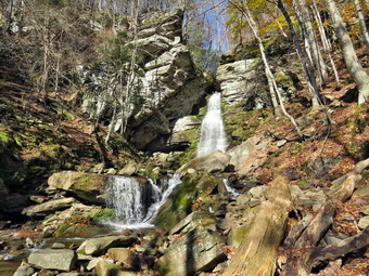
![]()
![]()
![]()
![]()
![]() On Monday, November 8th, I asked Cindy if she would like to hike the Ashokan Quarry Trail and she agreed. Since the trail is only 2 miles, I thought we might go to the Ashokan Promenade afterwards as I had never been. The Promenade is almost flat which Cindy likes. When I got up at 8:00 AM it was only 30 degrees but I knew the temperatures would be rising to almost 60 degrees. We started getting ready at 9:00 AM with Sheila watching us carefully. I put on my long-sleeved White Sierra crew top with a light long-sleeved baselayer underneath as I knew the temperature would rise. I decided to wear my Columbia Titanium insulated pants to keep the chill away but decided against wearing tights underneath. I wore my Vasque Talus boots which have seen better days but still fit well. I thought we might encounter wet and muddy conditions and felt these boots could do the job. I did not wear only gaiters as I did not think the conditions warranted them. I donned my Mammut hoody which blocks the wind and keeps me warm but has enough zippers to dump heat when needed. I put on a fleecy orange hat for warmth and because it was the beginning of various hunting seasons. I also packed a light pair of gloves although I did not think I would wear them. I grabbed a pair of Leki external lock poles I have been using all season. As we left Livingston Manor at 9:35 AM, the sun was shining brightly and the temperature had just reached 50 degrees. I east on State Route 17 to Liberty and then took Route 55 over the Neversink Dam to Grahamsville. Just after the TriValley School, I turned left on Route 55A and continued to the point where it turned to the right over the Rondout Reservoir. I continued straight ahead on Sundown Road which becomes Peekamoose Road. We passed the parking for Peekamoose and the Blue Hole. A little further on a I pulled over to the left and parked at the small lot by Buttermilk Falls. The light was just right so I took my camera and walked to the road bridge and took a few pictures of the falls. I walked back to the car and let Sheila out. We walked over to the falls and I took some more shots from closer to the falls. When I was done, we walked back to the car and I continued the drive. Peekamoose Road passed by Peekamoose Lake which has very steep terrain on both sides. The lake was completely still without even a ripple. The reflection of the trees in the lake made it look like a deep gorge and the effect was mesmerizing. Peekamoose Road turned to Watson Hollow Road until the intersection with Route 28A. I turned right and drove 5 miles to the parking for the Ashokan Quarry Trail. When I pulled into the parking lot, there were only two cars already there. The parking lot is very well done and can accommodate at least 10 cars. I set my GPS and we were off on the trail at 10:50 AM with the temperature at 54 degrees.
On Monday, November 8th, I asked Cindy if she would like to hike the Ashokan Quarry Trail and she agreed. Since the trail is only 2 miles, I thought we might go to the Ashokan Promenade afterwards as I had never been. The Promenade is almost flat which Cindy likes. When I got up at 8:00 AM it was only 30 degrees but I knew the temperatures would be rising to almost 60 degrees. We started getting ready at 9:00 AM with Sheila watching us carefully. I put on my long-sleeved White Sierra crew top with a light long-sleeved baselayer underneath as I knew the temperature would rise. I decided to wear my Columbia Titanium insulated pants to keep the chill away but decided against wearing tights underneath. I wore my Vasque Talus boots which have seen better days but still fit well. I thought we might encounter wet and muddy conditions and felt these boots could do the job. I did not wear only gaiters as I did not think the conditions warranted them. I donned my Mammut hoody which blocks the wind and keeps me warm but has enough zippers to dump heat when needed. I put on a fleecy orange hat for warmth and because it was the beginning of various hunting seasons. I also packed a light pair of gloves although I did not think I would wear them. I grabbed a pair of Leki external lock poles I have been using all season. As we left Livingston Manor at 9:35 AM, the sun was shining brightly and the temperature had just reached 50 degrees. I east on State Route 17 to Liberty and then took Route 55 over the Neversink Dam to Grahamsville. Just after the TriValley School, I turned left on Route 55A and continued to the point where it turned to the right over the Rondout Reservoir. I continued straight ahead on Sundown Road which becomes Peekamoose Road. We passed the parking for Peekamoose and the Blue Hole. A little further on a I pulled over to the left and parked at the small lot by Buttermilk Falls. The light was just right so I took my camera and walked to the road bridge and took a few pictures of the falls. I walked back to the car and let Sheila out. We walked over to the falls and I took some more shots from closer to the falls. When I was done, we walked back to the car and I continued the drive. Peekamoose Road passed by Peekamoose Lake which has very steep terrain on both sides. The lake was completely still without even a ripple. The reflection of the trees in the lake made it look like a deep gorge and the effect was mesmerizing. Peekamoose Road turned to Watson Hollow Road until the intersection with Route 28A. I turned right and drove 5 miles to the parking for the Ashokan Quarry Trail. When I pulled into the parking lot, there were only two cars already there. The parking lot is very well done and can accommodate at least 10 cars. I set my GPS and we were off on the trail at 10:50 AM with the temperature at 54 degrees.
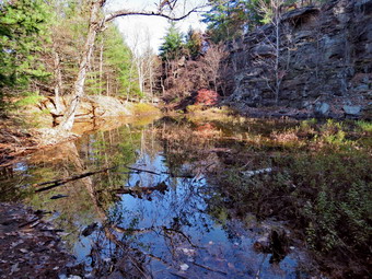 The first part of the trail was covered in angular stones which we both found uncomfortable. Just before the first trail junction at .3 miles, there was an interesting foundation on the left side of the trail. Most stone foundations are laid up from field stone but this one was obviously constructed of quarried stone. As I was taking some pictures, a woman came walking by from the direction of the quarry. When I was finished taking photographs, I packed up and we returned to the trail. We turned left at the first trail junction and started a slight uphill walk. At about .6 miles we came to a nice viewpoint. There were views to the north and west and into the quarry below. The Yale Quarry was used to obtain stone for the building of the dam for the Ashokan Reservoir. There was still some color left on some of the trees but the sky was very flat. After a short stop, we continued along the top of the quarry and I stopped several times to take pictures. We finally dropped down to another level where we had a more open view down into the quarry. The pool of water in the quarry below was much larger than I had ever seen it. I took some pictures and then we followed the trail along the edge of the quarry. Sheila alerted and we looked up to see a woman walking toward us with her leashed dog. I immediately put Sheila on her leash as the woman and her dog passed by. Both dogs looked at each other as if they would have liked to meet. I stopped to take some more shots and then around we walked to the end of the quarry and dropped down toward the quarry floor. At .9 miles, we turned left on a spur trail that ran down to a stone loading platform and some other interesting ruins. The quarried stone was loaded onto railroad cars to be transported to the site of the dam. There was also a stone crushing plant that processed as much as 70 tones of stone an hour. I took pictures of everything and then we walked back up to the main trail. We turned left and almost immediately came to the floor of the quarry. I put down my pack and got out the camera to take pictures of the vernal pool that had formed in the quarry. I also took pictures of the high "walls" that were formed as the stone was removed. We got back on the trail and began passing through an area where there were piles of discarded stone and the dust formed as the stone was quarried. Of course, I had to take more pictures in this area also. Just before we reached the first trail junction, a large stone massif appeared on the right side of the trail. I took a couple of shots and then we walked back to the parking area. It was 12:20 PM and we had hiked 2 miles in 1 hour and 20 minutes. The elevation gain was only 280 feet. The hike was short but the historic interest was worth it.
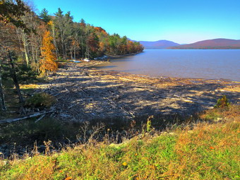 We left the parking area and turned right on Route 28A to head for the parking area of the Ashokan Promenade. I was excited to walk in this area as it was new to me and passes over the dam for the Reservoir. The parking area was less than half a mile on the left. I pulled in and parked. I decided to leave my jacket since I was already warm and my poles as I would have Sheila on her leash. His route was once open to vehicle traffic but now is only accessible to pedestrians. There were some signs left over from the days of vehicle traffic and one small sign that indicated "No dogs". I assumed that the sign was also a "leftover" as there was no obvious reason not to allow dogs. I took a picture of the long promenade and then we began our walk. Almost immediately we were presented with an outstanding view of the reservoir surrounded by hills and mountains. I stopped to take picture before continuing on toward the dam. When we arrived at the dam, new mountains came into view so I took more pictures. As I was about to continue, Cindy said she did not want to go any further. She was worried about having Sheila with us. I was very disappointed as I was looking forward to seeing more but I knew there was no chance of changing her mind. We walked back to the car. I headed west and north on Route 28A toward Route 28. I thought about parking and hiking on the Ashokan Rail Trail but I did not know if dogs were allowed and I did not feel like dealing with people. I decided that we would head toward Big Indian and perhaps hike Rochester Hollow which I though Cindy would enjoy. As we approached Route 47, I asked Cindy if she would like to do that hike but she turned it down. I turned left on Route 47 intending to just head home disappointed. As we came to Giant Ledge, I was surprised to see that there were many spots left in the parking area. I thought about hiking to Giant Ledge but I looked at the time and considered my mood and decided to leave it for another day. I drove a little over 3 hours to hike less than 3 miles.
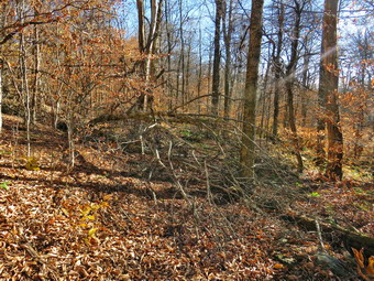
![]()
![]()
![]()
![]()
![]() On Sunday, November 7th, I wanted to go to cut a blowdown on the FLT from Alder Lake toward Big Pond. A hiker had sent an e-mail alerting me to the tree across the trail and I could see the trail was blocked. I had a limited amount of time between the end of church and a hike I had promised to take with Lisa and a group from Morgan Outdoors to the lookout on Round Top. I got home from church later than I expected but started to get ready at 12:30 PM with the temperature in the low 50's. I put on my long-sleeved Mammut crew top with a light long-sleeved baselayer underneath. I decided to wear my Columbia Titanium insulated pants to keep the chill away but decided against wearing tights underneath. I wore my Keen Targhee II boots which have seen better days but still fit well. I thought we might encounter wet and muddy conditions and felt these boots could do the job. I decided not to wear gaiters. I donned my Mammut hoody which blocks the wind and keeps me warm but has enough zippers to dump heat when needed. I put on a fleecy orange hat for warmth and because it was the beginning of various hunting seasons. I also wore a light pair of gloves. I decided to go without hiking poles as I would be carrying tools. I decided to take only one water bottle as the hike is less than 3 miles round trip. I packed my Silky Sugowaza curved saw which can handle surprisingly large trees and my Fiskars pack axe which is light but handles bigger trees very well. I also threw some felling wedges in my pack as I would not have any help if my saw became pinched. As we left Livingston Manor at 12:50 PM, the sun was shining brightly and I hoped for a productive trip. I drove up the Beaverkill Road with Sheila in the back seat more than ready to hike anywhere. I continued through Lew Beech and Turnwood until I got to Alder Creek Road. I turned left and drove to the point where the road makes a sharp right toward the Alder lake access road. I turned around and parked on the side of the road at the point where the FLT crosses. It was 1:15 PM when I set my GPS, grabbed my pack and ax and headed down the bank to cross the creek. Fortunately, the water was just low enough to allow me to use some stepping stones to get to the other side. We continued on the trail and started up a hill that was a little longer and steeper than I remembered. I cleared a few branches on the way but kept moving toward my objective. There were a few large and old blowdowns on the trail that were easy to step over. The day was beautiful with blue skies and plenty of sun.
On Sunday, November 7th, I wanted to go to cut a blowdown on the FLT from Alder Lake toward Big Pond. A hiker had sent an e-mail alerting me to the tree across the trail and I could see the trail was blocked. I had a limited amount of time between the end of church and a hike I had promised to take with Lisa and a group from Morgan Outdoors to the lookout on Round Top. I got home from church later than I expected but started to get ready at 12:30 PM with the temperature in the low 50's. I put on my long-sleeved Mammut crew top with a light long-sleeved baselayer underneath. I decided to wear my Columbia Titanium insulated pants to keep the chill away but decided against wearing tights underneath. I wore my Keen Targhee II boots which have seen better days but still fit well. I thought we might encounter wet and muddy conditions and felt these boots could do the job. I decided not to wear gaiters. I donned my Mammut hoody which blocks the wind and keeps me warm but has enough zippers to dump heat when needed. I put on a fleecy orange hat for warmth and because it was the beginning of various hunting seasons. I also wore a light pair of gloves. I decided to go without hiking poles as I would be carrying tools. I decided to take only one water bottle as the hike is less than 3 miles round trip. I packed my Silky Sugowaza curved saw which can handle surprisingly large trees and my Fiskars pack axe which is light but handles bigger trees very well. I also threw some felling wedges in my pack as I would not have any help if my saw became pinched. As we left Livingston Manor at 12:50 PM, the sun was shining brightly and I hoped for a productive trip. I drove up the Beaverkill Road with Sheila in the back seat more than ready to hike anywhere. I continued through Lew Beech and Turnwood until I got to Alder Creek Road. I turned left and drove to the point where the road makes a sharp right toward the Alder lake access road. I turned around and parked on the side of the road at the point where the FLT crosses. It was 1:15 PM when I set my GPS, grabbed my pack and ax and headed down the bank to cross the creek. Fortunately, the water was just low enough to allow me to use some stepping stones to get to the other side. We continued on the trail and started up a hill that was a little longer and steeper than I remembered. I cleared a few branches on the way but kept moving toward my objective. There were a few large and old blowdowns on the trail that were easy to step over. The day was beautiful with blue skies and plenty of sun.
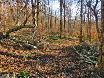 I was getting pretty warm as we passed by the rock ledges that let me know we were nearing the top of the climb. The trail had been dry most of the way except for one muddy spot covered by a layer of leaves. At .65 miles we hit the highest point on the route and began to descend. This area was very muddy and I slipped and almost fell several times. I was beginning to wonder where the blowdown was located as I though we would have run into it before the high point. We continued downhill toward a small stream and a beaver meadow. Just after the beaver meadow the blowdown came into sight. It was much larger than I expected and consisted of at least two different trees. It was definitely blocking the trail and need to be removed. I immediately wondered if I could get it all cleared in the time allotted as it was already 1:45 PM. I put my pack down and took the camera out to take some "before" pictures. After that, I began to remove all the loose branches that I could to clear the area. Some came easily but other were entwined and trapped. I used the Silky Sugowaza saw to cut the smallest branches which I removed. I kept working and within half and hour I stepped back to find that I had reared a pathway through the mess. I decided to keep working for another half hour or so. I began to cut the larger branches that were not supporting the trees. Most of these came away easily even if I had to cut them twice. Both trees were beeches and cut much more easily than the cherries and maples I had been cutting lately. I cut some branches overhead and was careful to stay out of the way as they fell...most of the time. One branch twisted and hit my right shoulder. It hurt a little but I could still move my arm. Finally, there were two large pieces of the trunks to cut. I grabbed the ax and dispatched one easily as it was not supporting any weight. I debated whether or not to cut the last one as it was mot really obstructing the path and looked like it was supporting the larger tree. I decided to cut it and, although it had the largest diameter, the cut went quickly. As I broke through, I got ready to run but the piece simply fell off. The larger trunks were supported by their roots and other large branches resting farther up on the bank. I cleaned up a little and then too the :after pictures. I packed everything and headed back at 2:55 PM after spending over an hour working on the blowdown. We set a fast pace going back but I did stop twice to remove blowdowns from the trail. We were back at the car at 3:25 PM after hiking 2 miles in under and hour and working for an hour and 10 minutes. I had plenty of time to get back to Livingston Manor for the hike to Round Top.
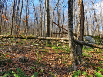
![]()
![]() On Friday, November 5th I planned to hike the Touch-Me-Not Trail from Big Pond to the summit of Touch-Me-Not Mountain to remove some blowdowns that I had found the previous Wednesday. The forecast was for a cool but clear day without any rain so I asked Cindy if she would like to go. She agreed and I made my plans. An overnight ambulance call severely reduced my hours of sleep so I slept in. When I got up at 9:00 AM it was still only 26 degrees on the back porch. Cindy and I had some chores to do around the house so it was 11:15 Am before I started to get ready to hike. I maintain the Finger Lakes Trail from Beech Hill Road over Cabot Mountain over Touch-Me-Not Mountain to big pond and then on to Alder Lake. This is about 7 miles of trail which includes some interesting climbs and some flatter sections. Most of the maintenance involves removing blowdowns and cutting back the nettles and briars. I put on my long-sleeved Mammut crew top with a light long-sleeved baselayer underneath. I decided to wear my Columbia Titanium insulated pants to keep the chill away but decided against wearing tights underneath. I wore my Vasque Talus boots which have seen better days but still fit well. I thought we might encounter wet and muddy conditions and felt these boots could do the job. I also put on my OR Crocodile gaiters. I donned my Mammut hoody which blocks the wind and keeps me warm but has enough zippers to dump heat when needed. I put on a fleecy orange hat for warmth and because it was the beginning of various hunting seasons. I also wore a light pair of gloves but packed a heavier pair. I decided to go without hiking poles as I would be carrying tools. I decided to take only one water bottle as the hike is less than 3 miles round trip. I packed my Silky Sugowaza curved saw which can handle surprisingly large trees, my Silky Katnaboy folding saw for bigger jobs, and my Fiskars pack axe which is light but handles bigger trees very well. I also threw some felling wedges in my pack as I would not have any help if my saw became pinched. As we left Livingston Manor at 11:40 AM, the sun was shining brightly and I hoped for a productive trip. I drove up the Beaverkill Road with Sheila in the back seat more than ready to hike anywhere. We arrived at Big Pond at noon to find no other cars in the lot. I set my GPS and grabbed my axe as we crossed the road to begin the hike. My plan was to hike to a tree that was across the trail and blocking easy passage. This tree was near the highest point ion the trail. I planned to ignore other blowdowns and get as many as I could on the way back.
On Friday, November 5th I planned to hike the Touch-Me-Not Trail from Big Pond to the summit of Touch-Me-Not Mountain to remove some blowdowns that I had found the previous Wednesday. The forecast was for a cool but clear day without any rain so I asked Cindy if she would like to go. She agreed and I made my plans. An overnight ambulance call severely reduced my hours of sleep so I slept in. When I got up at 9:00 AM it was still only 26 degrees on the back porch. Cindy and I had some chores to do around the house so it was 11:15 Am before I started to get ready to hike. I maintain the Finger Lakes Trail from Beech Hill Road over Cabot Mountain over Touch-Me-Not Mountain to big pond and then on to Alder Lake. This is about 7 miles of trail which includes some interesting climbs and some flatter sections. Most of the maintenance involves removing blowdowns and cutting back the nettles and briars. I put on my long-sleeved Mammut crew top with a light long-sleeved baselayer underneath. I decided to wear my Columbia Titanium insulated pants to keep the chill away but decided against wearing tights underneath. I wore my Vasque Talus boots which have seen better days but still fit well. I thought we might encounter wet and muddy conditions and felt these boots could do the job. I also put on my OR Crocodile gaiters. I donned my Mammut hoody which blocks the wind and keeps me warm but has enough zippers to dump heat when needed. I put on a fleecy orange hat for warmth and because it was the beginning of various hunting seasons. I also wore a light pair of gloves but packed a heavier pair. I decided to go without hiking poles as I would be carrying tools. I decided to take only one water bottle as the hike is less than 3 miles round trip. I packed my Silky Sugowaza curved saw which can handle surprisingly large trees, my Silky Katnaboy folding saw for bigger jobs, and my Fiskars pack axe which is light but handles bigger trees very well. I also threw some felling wedges in my pack as I would not have any help if my saw became pinched. As we left Livingston Manor at 11:40 AM, the sun was shining brightly and I hoped for a productive trip. I drove up the Beaverkill Road with Sheila in the back seat more than ready to hike anywhere. We arrived at Big Pond at noon to find no other cars in the lot. I set my GPS and grabbed my axe as we crossed the road to begin the hike. My plan was to hike to a tree that was across the trail and blocking easy passage. This tree was near the highest point ion the trail. I planned to ignore other blowdowns and get as many as I could on the way back.
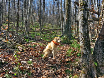 We hiked up the trail taking a few breaks now and then as the saws and ax made my load heavier. In addition, not having poles made hiking harder especially because the trail was slippery with wet leaves and mud. Cindy and I began to notice that the trail was missing many blazes and the ones that were present were few and far between. In the spring and summer the trail is more obvious but with a layer of leaves or a foot of snow it is much harder to find. Volunteers are no longer allowed to places trail markers as the DEC wants this done my rangers or foresters. The problem is that the rangers and foresters depend on volunteer reports! This seems like a cumbersome system which is borne out by the lack of blazes on many trails. As we hiked we came across at least tow large blowdowns that could be removed by hand tools but would more easily be cleared with a chainsaw. We also passed by two other trees I knew that I wanted to remove in the way back. The trail alternates between steeper areas and more level ground and the blowdown I was looking for was a little farther up the trail than I thought. We finally arrived to find a tree across the trail. It was impossible for a hiker to get under it but also difficult to easily get over it. I climbed over and took off my pack. I got out the camera and took some 'before' pictures. I was puzzled because I was sire this was the blowdown I had encountered two days before but it now seemed quite a bit smaller. I go out the Sugowaza and sawed off the end of the trunk near the top that was on one side of the trail just to get it out of the way. I decided to use the ax to cut through the larger diameter of the tree on the other side of the trail. The width of the trunk was about 8 inches and I was soon almost all the way through. I finished with the saw and then flipped the section I had cut off the trail. I took the "after" pictures and then packed up. I decided to continue to the trail junction with the Campground Trail just to make sure there were no other areas that needed attention. We walked to the highest point on the trail and then down to the junction and I found nothing. We turned around and started back down the trail.
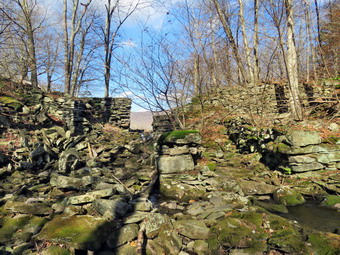 We passed by the blowdown I had cut and continued down the trail to another one. This blowdown consisted of a trunk lying on the ground and a small sapling bent over into the trail. I put down my pack and took some quick "before" pictures. I used the Sugowaza to cut the sapling after which I pulled it off the trail. The trunk looked old and dry but I tried the ax anyway and it seemed to work well. When I was almost through the trunk, I used the Sugowaza to complete the cut. I pulled the section off the trail and took "after" pictures before moving on. We hiked won the trail which was more difficult for me as I had no poles! After descending a couple of levels, we came to a small tree across the trail. I took my "before" shots and then used the saw to cut each small section indictable. I pulled everything off the trail and took my final "after" pictures. We continued down the trail encountering the same blowdowns we had crossed on the way out. The walk back to the car went quickly and we arrived back at the lot at 2:25 PM. We had hiked 2.2 miles in 2 hours and 25 minutes stopping for a little over 1 hour. The vertical gain was 782 feet. We walked over to the shore of Big Pond and I took some pictures. As we walked back to the car I noticed the dam at the end of the pond and decided to investigate as Cindy went back to the car. I walked out onto the dam and took some shots. I thought it might be interesting to take some pictures from downstream of the dam and found a way to get to the stream without falling. I took my shots of the dam with Big Pond and the hills framed by the opening. I noticed that there was more to the stone structure than just a dam and walked further downstream. When I looked back upstream, I could see that the structure looked like it had been a mill of some kind. I took a number of pictures before looking for a way back up to the car. Sheila picked a path and I followed her up to the road and back to the car.
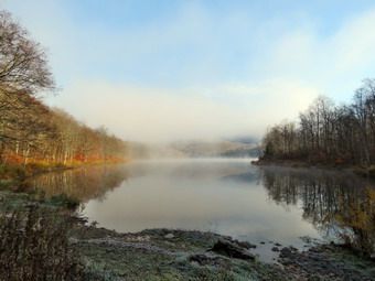
![]()
![]()
![]()
![]()
![]() On Wednesday, November 3rd I wanted to get out for a slightly longer hike with Lisa not too far from home. The forecast was for the temperature not to rise much above 40 degrees and that would be in the afternoon. Lisa needed to be back by 1:30 PM as she was scheduled to help with a cleanup on the Parksville rail trail. We decided to hike from Big Pond over Touch-Me-Not Mountain and down to Little Pond. From there we could choose to hike back over the mountain using the Campground Trail or to use the roads to walk back to the car. When I got up at 7:00 AM the temperature was 25 degrees so I planned to dress warmly as I knew that it would be cooler at the trailhead than in town. When I began to get my gear together Sheila seemed very pleased although we had hiked on Round Top the day before. I put on my long-sleeved Patagonia wool zip top with a light long-sleeved baselayer underneath. I decided to wear my Columbia Titanium insulated pants to keep the chill away but decided against wearing tights underneath. I wore my Keen Targhee II boots which have seen better days but still fit well. I thought we might encounter wet and muddy conditions and felt these boots could do the job. I had recently put a pair of Protalus insoles in these shoes and was anxious to see how they performed. The insoles in most hiking boots are a flimsy and flat piece of material. I grabbed a pair of Leki external lock poles I have been using all season. I also put on my OR Crocodile gaiters. I donned my Mammut hoody which blocks the wind and keeps me warm but has enough zippers to dump heat when needed. I put on a fleecy orange hat for warmth and because it was the beginning of various hunting seasons. I also wore a light pair of gloves but packed a heavier pair. I put my gear in the back and Sheila in the backseat and pulled out of Livingston Manor at 8:45 AM. I drove toward Roscoe on Old Route 17 and turned right on Beaverkill Road after 1.3 miles. I continued north on Beaverkill Road to the top of Johnston Mountain where I picked Lisa up at her house. Sheila was very happy to see Lisa. We pulled out and I headed north for a total of 10.8 miles passing through Lew Beach. As the Beaverkill Road turned right, I turned left onto Barkaboom Road and drove .8 miles to the parking area for Big Pond on the right. There were no other vehicles parked in the lot. As we started to get ready to hike and eagle flew overhead. I grabbed my camera and walked down to Big Pond which was covered in a mist. It was hard to see the surrounding mountains or even the shoreline of the pond. I took a number of pictures before returning to the car to begin our hike. I got ready to hike by setting my GPS. The temperature was 26 degrees.
On Wednesday, November 3rd I wanted to get out for a slightly longer hike with Lisa not too far from home. The forecast was for the temperature not to rise much above 40 degrees and that would be in the afternoon. Lisa needed to be back by 1:30 PM as she was scheduled to help with a cleanup on the Parksville rail trail. We decided to hike from Big Pond over Touch-Me-Not Mountain and down to Little Pond. From there we could choose to hike back over the mountain using the Campground Trail or to use the roads to walk back to the car. When I got up at 7:00 AM the temperature was 25 degrees so I planned to dress warmly as I knew that it would be cooler at the trailhead than in town. When I began to get my gear together Sheila seemed very pleased although we had hiked on Round Top the day before. I put on my long-sleeved Patagonia wool zip top with a light long-sleeved baselayer underneath. I decided to wear my Columbia Titanium insulated pants to keep the chill away but decided against wearing tights underneath. I wore my Keen Targhee II boots which have seen better days but still fit well. I thought we might encounter wet and muddy conditions and felt these boots could do the job. I had recently put a pair of Protalus insoles in these shoes and was anxious to see how they performed. The insoles in most hiking boots are a flimsy and flat piece of material. I grabbed a pair of Leki external lock poles I have been using all season. I also put on my OR Crocodile gaiters. I donned my Mammut hoody which blocks the wind and keeps me warm but has enough zippers to dump heat when needed. I put on a fleecy orange hat for warmth and because it was the beginning of various hunting seasons. I also wore a light pair of gloves but packed a heavier pair. I put my gear in the back and Sheila in the backseat and pulled out of Livingston Manor at 8:45 AM. I drove toward Roscoe on Old Route 17 and turned right on Beaverkill Road after 1.3 miles. I continued north on Beaverkill Road to the top of Johnston Mountain where I picked Lisa up at her house. Sheila was very happy to see Lisa. We pulled out and I headed north for a total of 10.8 miles passing through Lew Beach. As the Beaverkill Road turned right, I turned left onto Barkaboom Road and drove .8 miles to the parking area for Big Pond on the right. There were no other vehicles parked in the lot. As we started to get ready to hike and eagle flew overhead. I grabbed my camera and walked down to Big Pond which was covered in a mist. It was hard to see the surrounding mountains or even the shoreline of the pond. I took a number of pictures before returning to the car to begin our hike. I got ready to hike by setting my GPS. The temperature was 26 degrees.
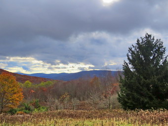 We crossed the road at 9:15 AM to begin our hike up Touch-Me-Not Mountain on the Touch-Me-Not Trail which is part of the Finger Lakes Trail. The first part of the trail is an old woods road, and it is pretty easy to follow. I let Sheila off her leash as we walked up the first hill passing the trail register. Lisa signed in at the register and took the lead. She was picking branches off the trail as we walked leaving some of the larger ones for me. I had not brought any tools when we ran into some larger blowdowns. I made note of then for a future maintenance trip. The trail was wet and muddy in places and the thick layer of leaves hid the trail in some places. I maintain the section of trail from Alder Lake to Beech Hill Road and am the Regional Trail Coordinator for the Finger Lakes Trail Conference covering the FLT from Downsville to the eastern terminus on Slide Mounatin. The first mile of the trail gains about 775 feet with an average grade of 15%. Some places are almost flat which means there are a few steeper places. We began to notice that the blazing of the trail could be better especially when the trail is covered with leaves. Volunteers used to be able to put up trail markers, but the DEC decided that a forester or ranger must now do this. Most blazes were too far apart. Some were very old and faded with others grown into the trees. A few were on the side of the tree meaning they were not visible from either direction on the trail. Several times we just followed Sheila who seems to be able to find the right direction no matter what. It was obvious in several areas that there had been significant rain at some point as the trail was badly eroded and the leaves were displaced. In a few places, the trail traveled along the side of the hill, and this made for some tricky footing with the wet leaves and the mud. As we neared the high point of the trail, we encountered several larger blowdowns which would require tools to remove. I though about coming back in the near future to remove them before the snows. We made good time despite the work we were doing to remove branches and had hiked 1 mile to the highest point on the trail on the shoulder of Touch-Me-Not Mountain in about 50 minutes. After a slight descent, we came to a large blowdown that had once blocked the trail. A good piece of the trunk had been cut away to provide an easy path. We walked down the hill to the next trail junction and turned right to stay on the red Touch-Me-Not Trail.
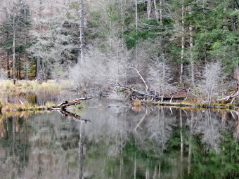 The loop around Little Pond is very popular with campers during the season. At one point the trail passed between two large boulders forming a sort of rock cut. I stopped to take a few shots as this in one of my favorite spots on the trail. We continued along the trail descending another rocky area to find a large tree across the trail. It was obvious hikers had been walking to the left around the butt end of the tree which is what we did. At 1.6 miles we had finally arrived at the point where the Touch-Me-Not Trail continued straight ahead over Cabot Mountain. The signs here were poor with some missing and others too old to read. We thought about summiting Cabot to the vista over Little Pond but in the end we decided not to do this. We continued our hike by turning left to pick up the yellow Little Pond Trail. After a short walk, we came to a large, flat stone on the right side of the trail. I remembered taking pictures of my grandchildren there. As we passed by, I realized how much I missed my grandchildren going on hikes now that they are all in school. At 1.8 miles we arrived in the clearing that acts as a viewpoint. It is hard to see Little Pond from this lookout since the trees have grown up. This is a place that holds many memories as we hiked the loop many times when I was younger. We stopped, and I got out the camera to take pictures of the hills and the blue sky. The scene kept changing as the light played off the hills in different ways. There was still some colorful leaves left on the trees. I packed up, and we continued the hike passing the small foundation of a long-forgotten homestead cabin. I noticed the pond to the right of the trail and decided to inspect it. The pond used to be very small but had gotten larger over the years. It is obvious that it is fed mostly by runoff which is why the water level was high from the recent storms. I took some shots of the pond and the wetlands developing around it. I also noticed a foundation near the pond that I had not seen before and took some shots of it also. We walked back out to the main trail which was covered in water from the outlet of the pond. I stopped to take a few pictures of the stone walls in the area. Ahead of us on the trail was one of the biggest blowdowns I had seen in some time. A huge tree with three different trunks had completely blocked the trail. The DEC had come through with a chainsaw and removed the branches that had been blocking the trail. They cut a path through the trunks so that hikers could pass through. We walked through on the path that had been cut and soon turned left off the woods road. I noticed that the road continued straight ahead and thought it might be nice to follow it sometime.
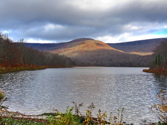 The trail headed down through the forest and was very wet and muddy in most places. It was extremely eroded making the walk difficult. We walked downhill and sound several large blowdowns that had blocked the trail but had been cut by the DEC. We soon came to a large beaver pond where I stopped to take some pictures. There was no indication of new beaver activity but the dam they had constructed was sturdy and still impounded a large volume of water. I took some shots and then packed up to return to the main trail. At the outlet end of the beaver pond, we inspected the dam which is was a good example of how the beavers work. As we walked the short distance to the loop trail around Little Pond I could see that there was a good amount of water in the inlet stream. At the pond, we turned right to walk around the western shore of Little Pond. As we walked along the shore to the boat launch area, we could see Touch-Me-Not Mountain where we had been a short time ago. There were snowflakes in the air despite the sun and I wondered how long it would be until we could snowshoe! We stopped at the boat launch area, and I took some photos of Touch-Me-Not Mountain and the pond. As we walked along the road, I began to see picnic tables leaning on the fireplaces at the campsites. Just before we turned left on a trail to head for the bridge at the outlet of Little Pond there was an employee on a riding lawnmower! We came to and crossed the bridge at the outlet end of the pond. I dropped my pack to take a few pictures before leaving the Little Pond area. The campgrounds were closed so there were no cars in the parking area. We now had a choice to return on the roads or hike back up Touch-Me-Not Mountain on the Campground Trail. I had planned the trail hike but thought better of it as Lisa needed to get back for her appointment. We decided we would walk back to Big Pond using the access road and Barkaboom Road. We walked over to the parking area and turned right to walk out the access road. We walked out to the gatehouse started down the hill toward Barkaboom Road. The walk was very peaceful as there were no cars going to the campgrounds. We walked a little less than a mile down to Barkaboom Road and turned left to hike up the road back to Big Pond. I put Sheila on her leash. She walks very well on her leash although her pace is a little fast for me! The hike back to the car was about .6 miles and it is all uphill so I appreciated Sheila's pull. The stream beside the road had a good volume of water. We walked up the hill and back to the car in the parking area. There were still no cars in the lot. I put Sheila in the car and walked down to the shore of Big Pond to take some pictures without the haze that had been there earlier. I walked back up to the car at 12:10 PM having hiked 4.8 miles in 2 hours and 55 minutes including 30 minutes of stopped time. The elevation gain was about 1010 feet. On the way back to Livingston Manor, I dropped Lisa at her house. The hike was shorter than I would have liked but the climb up Tooch-me-not was good exercise.
![]()
![]()
![]()
![]() On Tuesday, November 2nd I had planned to hike the Pelnor Hollow and Little Spring Brook Trails with a hiking partner, Sharon. When I got up at 6:15 Am the temperature was 30 degrees and there was some freezing rain in the air. The forecast was calling for some showers throughout the day. I consulted Sharon and she agreed that we would postpone. I still wanted to get out for a hike even though I had a cross country practice in the afternoon. I slept a little later as we had an overnight ambulance call. By the time I was ready to hike I knew that I only had time to go across the street to hike on Round Top. It was 10:30 AM by the time I started to get dressed with the temperature a rather cool 48 degrees. Sheila was ready to go as she really likes to hike and she was keeping a careful eye on me as we dressed. I got dressed in my Mammut crew top with a long-sleeved baselayer. I put on a pair of RailRiders hiking pants which are expensive but last a long time and have features like deep pockets and a generous cut which I really like. I decided to put on my Keen Cascade hiking boots which are new and fit well. I grabbed my Leki external lock poles which I have been using lately since twist locks have proved unreliable. I also added a light hat and gloves since it was cool. I donned my Mammut hoody which has lots of zippers to dump heat if necessary. At 11:50 AM we walked out the door to start the hike. I grabbed Sheila's leash from the car and we walked up the driveway. I aimed to hike for about an hour. Sheila was happy to get out as we headed down the driveway and across the street. We crossed the street and walked to the parking area by the Presbyterian Church. We walked to the back of the church and began the ascent of the steepest hill behind the church. The hill is short but gets the circulation pumping and is the steepest and longest climb on the "trail." Sheila helped me along by pulling me up the hill. At the top of the hill we started on the trail by turning left at the trailhead where I let Sheila off her leash so that she could explore. The trail was mostly dry with a few muddy spots and layer of wet and slippery leaves.
On Tuesday, November 2nd I had planned to hike the Pelnor Hollow and Little Spring Brook Trails with a hiking partner, Sharon. When I got up at 6:15 Am the temperature was 30 degrees and there was some freezing rain in the air. The forecast was calling for some showers throughout the day. I consulted Sharon and she agreed that we would postpone. I still wanted to get out for a hike even though I had a cross country practice in the afternoon. I slept a little later as we had an overnight ambulance call. By the time I was ready to hike I knew that I only had time to go across the street to hike on Round Top. It was 10:30 AM by the time I started to get dressed with the temperature a rather cool 48 degrees. Sheila was ready to go as she really likes to hike and she was keeping a careful eye on me as we dressed. I got dressed in my Mammut crew top with a long-sleeved baselayer. I put on a pair of RailRiders hiking pants which are expensive but last a long time and have features like deep pockets and a generous cut which I really like. I decided to put on my Keen Cascade hiking boots which are new and fit well. I grabbed my Leki external lock poles which I have been using lately since twist locks have proved unreliable. I also added a light hat and gloves since it was cool. I donned my Mammut hoody which has lots of zippers to dump heat if necessary. At 11:50 AM we walked out the door to start the hike. I grabbed Sheila's leash from the car and we walked up the driveway. I aimed to hike for about an hour. Sheila was happy to get out as we headed down the driveway and across the street. We crossed the street and walked to the parking area by the Presbyterian Church. We walked to the back of the church and began the ascent of the steepest hill behind the church. The hill is short but gets the circulation pumping and is the steepest and longest climb on the "trail." Sheila helped me along by pulling me up the hill. At the top of the hill we started on the trail by turning left at the trailhead where I let Sheila off her leash so that she could explore. The trail was mostly dry with a few muddy spots and layer of wet and slippery leaves.
At the first trail junction, I followed Sheila as she turned right and started up the woods road which has the gentler approach of the two. We walked up the road to the first trail junction with the upper blue trail and turned left to follow the yellow trail along the base of Round Top. The trails were a little damp and there were a few new branches on the trail. I stopped to remove the branches or used my poles to flick the smaller ones aside. At the next junction with the blue trail we turned right and headed up the blue trail, toward the summit. When we got to the switchback, we turned right and followed it until it came back to the main blue trail. We turned right and then turned right again on the white crossover trail. We walked the crossover trail to the end to the blue trail. We turned right and walked down to the junction with the yellow trail where we turned right. We walked the yellow trail along the base of Round Top to the next junction with the blue trail. We turned left and walked down the yellow trail toward the lookout passing the sitting rock and a sea of now dead ferns. When we reached the lookout, we turned left to follow the yellow trail downhill to the first trail junction. We immediately turned around and started back up the hill to the lookout. At the top of the hill we turned right to follow the yellow trail through the ferns to the first junction with the blue trail. We turned right to follow the yellow trail around the base of Round Top. At the next junction with the blue trail, we turned left and headed up toward the summit. When we got to the white crossover trail we turned left and followed it across the shoulder of Round Top to the main blue trail. We turned left and almost immediately left again on the switchback in the blue trail. We followed the switchback as it headed out into the woods and then back to the main blue trail. We turned left and walked down the blue trail to the yellow trail. We turned left and again followed the yellow trail along the base of Round Top to the junction with the blue trail. This time we turned right and headed down the yellow rail to the woods road that leads to the first trail junction. As we walked down the road, I noticed all the interesting ledges to the right of the trail. At the first trail junction, I debated doing another loop of some kind but decided just to head out to the trailhead. We walked out to the trailhead and turned right. We walked down the hill and out to the road through the church parking lot. We walked over to the driveway and back to the house. It was 12:45 PM and we had hiked a 2 miles in a little under an hour. The weather for the day turned out to be cool but beautiful with no threat of rain until very late in the day!
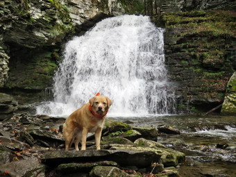
![]()
![]()
![]()
![]()
![]() On Friday, October 29th I planned to go hiking at Trout Pond after several days of ambulance calls and cross country meets. An early morning ambulance call caused me to revise my plans of starting early. I also had to be back by 3:00 PM to represent the ambulance corps at the School for a Halloween event. I decided I would go to Trout Pond and park at the lower parking area to hike the loop around Trout Pond counterclockwise. As I started to get ready at 10:15 AM it was still only 48 degrees with clouds and a breeze. Sheila was pretty excited as I started to get ready as we have not been hiking a lot lately. I got dressed in my Mammut crew top with a long-sleeved baselayer. I put on a pair of RailRiders hiking pants which are expensive but last a long time and have features like deep pockets and a generous cut which I really like. I decided to put on my Keen Targhee II hiking boots which fit well and have been discontinued. I grabbed my Leki external lock poles which I have been using lately since twist locks have proved unreliable. I also added a light hat and gloves since it was already cool and I knew it might be cooler at the trailhead. I donned my Mammut hoody which has lots of zippers to dump heat if necessary. I put my gear in the back of the car and Sheila in the back seat. We left Livingston Manor at 10:35 AM as I drove north on the Quickway towards Roscoe. I got off at exit 94 and headed north on Route 206 towards Downsville. After crossing the Rockland Flats and passing the Roscoe Nursing Home, I turned left on Morton Hill Road and drove to the intersection with Russell Brook Road. We turned left to drive down to the lower parking area and was pleased to find the road in pretty good shape with now trees blocking the way. When we arrived at the lower parking area, there were three cars parked but shortly after we arrived two more cars came driving down the road. I wanted to get ahead of the other hikers and stay ahead of them so I set my GPS and we got ready to start out on our hike at 11:00 AM with the temperature at 50 degrees. Just as we started out two hikers came up to the parking lot from the stream with a dog on a leash. I was happy that Sheila paid no attention and started out on the trail.
On Friday, October 29th I planned to go hiking at Trout Pond after several days of ambulance calls and cross country meets. An early morning ambulance call caused me to revise my plans of starting early. I also had to be back by 3:00 PM to represent the ambulance corps at the School for a Halloween event. I decided I would go to Trout Pond and park at the lower parking area to hike the loop around Trout Pond counterclockwise. As I started to get ready at 10:15 AM it was still only 48 degrees with clouds and a breeze. Sheila was pretty excited as I started to get ready as we have not been hiking a lot lately. I got dressed in my Mammut crew top with a long-sleeved baselayer. I put on a pair of RailRiders hiking pants which are expensive but last a long time and have features like deep pockets and a generous cut which I really like. I decided to put on my Keen Targhee II hiking boots which fit well and have been discontinued. I grabbed my Leki external lock poles which I have been using lately since twist locks have proved unreliable. I also added a light hat and gloves since it was already cool and I knew it might be cooler at the trailhead. I donned my Mammut hoody which has lots of zippers to dump heat if necessary. I put my gear in the back of the car and Sheila in the back seat. We left Livingston Manor at 10:35 AM as I drove north on the Quickway towards Roscoe. I got off at exit 94 and headed north on Route 206 towards Downsville. After crossing the Rockland Flats and passing the Roscoe Nursing Home, I turned left on Morton Hill Road and drove to the intersection with Russell Brook Road. We turned left to drive down to the lower parking area and was pleased to find the road in pretty good shape with now trees blocking the way. When we arrived at the lower parking area, there were three cars parked but shortly after we arrived two more cars came driving down the road. I wanted to get ahead of the other hikers and stay ahead of them so I set my GPS and we got ready to start out on our hike at 11:00 AM with the temperature at 50 degrees. Just as we started out two hikers came up to the parking lot from the stream with a dog on a leash. I was happy that Sheila paid no attention and started out on the trail.
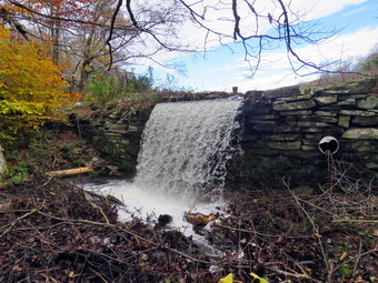 We started out on the Trout Pond Trail along a wide woods road that leads down to and across Russell Brook. As we crossed the bridge, I could see that the brook was very high from the storms that caused flooding in the area on Tuesday and into Wednesday. The sun was peeking out and the sky was blue with a lot of interesting white clouds. I decided to go to the falls on the way out so we turned right on the path to the falls. The Japanese knotweed had almost overgrown the path as the DEC ignores this part of trail maintenance. Fortunately, the knotted was now dying back for the winter. The history of this area is very interesting. Russell Brook Falls had been the site of a dam that impounded water for a waterwheel in Butternut Grove. The wheel was still there a few years ago. The area near the register box was the "landing zone" for loggers who cleared the evergreen trees, not for tanning but, for the production of wood alcohol. The trees were transported on narrow gauge railway that ran parallel to Russell Brook. The railway met the mainline O&W near Butternut Grove where the logs were unloaded. There were several acid factories in the area that produced wood alcohol. There was also a factory on the lower part of Russell Brook that produced khaki dye for the uniforms of American troops during World War I. We followed the path out to the falls and turned right to walk down to the streambed. I put down my pack and got out the camera to take pictures of the falls and the stream. Sheila immediately posed in front of the falls so I took some shots of her. I took some more shots of the falls and some of the stream before packing up. We walked back up to the path out to the main trail. As we walked out, a couple of hikers were coming in to look at the falls and these were the last people we saw on our hike. At the main trail, we turned right to head up to the pond. We continued passed the register box and up the main trail toward Trout Pond. There was water on the trail and mud in many places. It was obvious that a torrent of water had cascaded down the trail as there were leaves that had been disrupted. In addition, the loose gravel and dirt on the trail had been washed away in many places leaving exposed rocks which made the trail harder to hike. I noticed some fresh tire tracks on the trail but could not tell how fresh they were or the vehicle that made them. Soon we were at the outlet end of the pond and we walked over to the shore which was barely a strip since the pond was so full. I dropped my pack to take pictures of the lake with the blue sky overhead. The water was right up to the grass on the shoreline and was overflowing the dam. I took quite a few pictures looking for the contrast between the bare trees, the blue sky with white clouds and the lake. Sheila decided not to take a dip as the water was cold. I took the time to take some pictures at the dam and then walked below the dam to take pictures of the waterfall it created. I packed up and we returned to the main trail. We walked the flat woods road toward the inlet end of the pond which was wet and muddy in many spots. In some places it extended across the trail which made walking more difficult. We crossed the bridge that is just before the lower lean-to and inspected the old trout hatching box. At the trail junction near the lower lean-to we turned to the left on the blue blazed Mud Pond Trail which would take use over Cherry Ridge and form our loop back to the parking area. I took some pictures from the bridge of the pond and the inlet stream. The stream had as large a volume as I had ever seen. There was new beaver activity and a small dam just downstream of the bridge causing the water to back up. I walked down to the shore of the lake and took some more pastures before returning to my pack. We walked over the bridge and turned right to start up the Mud Pond Trail toward Cherry Ridge. The trail was more like a small stream as water was coming down the trail and some was being added from a small stream that came from the larger inlet stream.
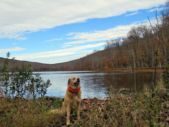 Even though we were gaining elevation, we continued at a good pace. Every now and then I would remove a small branch or a larger trunk from the trail. This part of the trail showed that there had been a lot of water running on the trail but was not very wet. From the bridge at the inlet we began a climb of 430 feet over the next .75 miles. The trail headed west from the inlet until turning sharply south at around 2 miles. Along the way there were several blowdowns that had been cut by a DEC sawyer I met during the summer. The highest point on the trail was at 2.2 miles after which most of the rest of the hike is downhill. As we gained elevation, I began to notice that I was getting warm and sweating profusely due to the hoody. I made sure all the zippers were open which helped some. I also took off my hat. As we started down the other side of the trail had some mud in spots but there was little standing or running water. As we continued the descent we began to find areas of running water and large standing ponds. There were also areas of mud in many spots but all-in-all we were able to get by these areas. We did find several large blowdowns which could be cut with and tools but would be a challenge. At 3.4 miles we had descended 420 feet from Cherry Ridge to the snowmobile trail near Mud Pond. We turned left here to head east and ascended a small hill before starting downhill back toward the parking area. This section was muddy with some running water but I had seen it far worse. The downhill was a little slippery because of the water and mud both of which were plentiful! The small streams flowing across the trail were running high and were overflowing so that water was running down the trail. The largest of these streams required me to use stepping stones although my feet were already soaked. The overflow from this stream continued down the trail until it found another place to exit. All told, we dropped another 380 feet over the next .7 miles back to the bridge just before the trail register. We stopped on the bridge over the outlet stream from Trout Pond as it was very high. I took some shot both upstream and downstream. I picked up my pack and we\ continued on the trail to the junction. We turned left and continued on the main trail toward the parking area. I stopped to take a few pictures of the encroaching knotweed before continuing on. We continued across the bridge and up the trail to the parking area. It was 1:15 PM and we had hiked 4.4 miles in 2 hours and 15 minutes with an elevation gain of 870 feet. We had stopped for 15 minutes.
![]()
![]()
![]()
![]() On Monday, October 25th I wanted to get out for a short hike after sleeping in from some late night ambulance calls. I also had cross country practice to coach and a soccer game to time in the afternoon. At 10:30 AM I decided to hike some loops on Round Top. I asked Cindy if she wanted to go but she declined. We started to get ready when the temperature was 52 degrees. The skies were partly sunny with some impressive puffy white clouds. Sheila was ready to go as she really likes to hike and she was keeping a careful eye on me as we dressed. I put on my Mammut long-sleeved crew top with a short-sleeved base layer. I put on a pair of RailRiders hiking pants which are expensive but last a long time and have features like deep pockets and a generous cut which I really like. I decided to wear my Keen Cascade hiking boots which are new and all-leather which means they need some work to break them in. I decided to take my Leki poles with external locks as the internal twist locks sometimes fail. I also put on my Mammut hoody as it was cool and looked like it might rain. We stepped out of the house at 10:50 AM. I grabbed Sheila's leash from the car and put it on her to safely cross the street. We walked up the driveway and crossed the street. We walked to the church parking lot and to the back of the church. As we started up the hill, I noticed that it was easier climbing the hill as I had been hiking more often. We continued the ascent of the steep hill behind the church. The hill is short but gets the circulation pumping and is the steepest and longest climb on the "trail". I let Sheila pull me up the hill which she was willing to do. At the trailhead, I let Sheila off her leash and she immediately began to bound up the trail. We started on the trail by turning left at the trailhead.
On Monday, October 25th I wanted to get out for a short hike after sleeping in from some late night ambulance calls. I also had cross country practice to coach and a soccer game to time in the afternoon. At 10:30 AM I decided to hike some loops on Round Top. I asked Cindy if she wanted to go but she declined. We started to get ready when the temperature was 52 degrees. The skies were partly sunny with some impressive puffy white clouds. Sheila was ready to go as she really likes to hike and she was keeping a careful eye on me as we dressed. I put on my Mammut long-sleeved crew top with a short-sleeved base layer. I put on a pair of RailRiders hiking pants which are expensive but last a long time and have features like deep pockets and a generous cut which I really like. I decided to wear my Keen Cascade hiking boots which are new and all-leather which means they need some work to break them in. I decided to take my Leki poles with external locks as the internal twist locks sometimes fail. I also put on my Mammut hoody as it was cool and looked like it might rain. We stepped out of the house at 10:50 AM. I grabbed Sheila's leash from the car and put it on her to safely cross the street. We walked up the driveway and crossed the street. We walked to the church parking lot and to the back of the church. As we started up the hill, I noticed that it was easier climbing the hill as I had been hiking more often. We continued the ascent of the steep hill behind the church. The hill is short but gets the circulation pumping and is the steepest and longest climb on the "trail". I let Sheila pull me up the hill which she was willing to do. At the trailhead, I let Sheila off her leash and she immediately began to bound up the trail. We started on the trail by turning left at the trailhead.
At the first trail junction, I followed Sheila as she continued straight up the hill toward the viewpoint. There was a slight breeze blowing but I was already getting warm from making the ascent in the hoody. I made sure to open all the zippers I could which made me a little cooler. The climb up the hill was a little easier than usual. At the viewpoint, I noticed that the brush that I had placed in the trail was still there and that someone had added a few more pieces. I wish people would not be so "helpful" as I walk these trails at least once a week. This path has a dangerous spot and we have piled brush on it to discourage people from using it. We continued on the main trail and headed to the right to follow it as it turned and headed up the gentle hill through the hardwood forest. The ferns covering the forest floor were all brown as the temperatures at night were dipping into the 30's. Most of the leaves were off the trees forming a carpet on the ground. The leaves were slippery in places and in other spots they covered some mud. Sheila was making her own way by staying on the trail sometimes and then running off-trail and chasing game trails. We continued to follow the yellow trail toward the first junction with the blue trail. There were a few branches on the trail that I removed as we hiked. At the first trail junction with the blue trail, we turned right and followed the yellow trail along the base of Round Top. This section was in good shape without any blowdowns and the brush and grass had remained at bay. At the next junction, we turned left and started up to the summit of Round Top on the blue trail. We bypassed the white crossover trail and continued up and over the summit. There was one small tree down on the summit which would require a saw to remove it. I decided we would skip the white crossover trail but take the switchback on the blue trail. We followed the switchback as it headed out into the woods and then back to the main trail where we turned left. At the bottom of the hill, we turned left on the yellow trail, and walked along the base of Round Top. At the trail junction with the blue trail, we turned right to walk down to the woods road. It was a snap to walk downhill and out the woods road. It was obvious Sheila felt the same way as she was running and bounding ahead of me and then running back up the trail. At the first trail junction, I turned around and started back up the woods road to the junction with the blue trail. We turned left and walked along the yellow trail following the base of the Round Top summit. At the next junction, we turned right and started up the steeper side of the hill on the blue trail. This time we again took the switchback in the blue trail. At the end of the switch, we turned right and continued on the main blue rail to the summit of Round Top bypassing the white crossover trail. We continued on the main blue trail over the top and then down on the other side of the hill. We turned right at the end to take the yellow trail along the base of Round Top once again. At the junction with the blue trail, we turned to the left to stay on the yellow trail to the lookout. At the lookout, we followed the yellow trail as it turned left and descended to the first trail junction. We walked straight out to the trailhead. We turned right to walk to the bottom of the hill. We headed across the church parking lot to the street and crossed the street to our driveway. We were home by 11:50 AM after hiking a little over 2 miles in 1 hour.
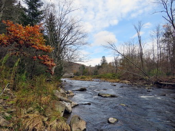
![]()
![]()
![]()
![]()
![]() On Saturday, October 23rd, I wanted to go for a hike with Cindy so I knew it would have to be shorter and flatter than I wanted. I asked Cindy if she would like to go to the Beaverkill Campgrounds and she agreed. We both had some things to do before hiking so we did not start to get ready until 11:00 AM when the temperature was still only 48 degrees. As usual, Sheila was excited and even more so since Cindy was going also. I put on my Mammut long-sleeved crew top with a long-sleeved baselayer since the temperature was still below 50. I put on a pair of RailRiders hiking pants which are expensive but last along time and have features like deep pockets and a generous cut which I really like. The pants have Velcro closures at the ankles I wore my Keen Cascade boots which are new but are pretty well broken in. I decided to take my Leki poles with external locks as the internal twist locks fail. I put on a light hat and packed a pair of light gloves. I put our gear in the back of the car and Bryce and Sheila in the back seat and left the house at 11:20 AM. I drove out Old Route 17 toward Roscoe and turned right on Beaverkill Road. As we started the descent into the Beaverkill Valley, I turned left on Campsite Road and followed it down to the parking area near the Beaverkill Covered Bridge. As I parked, there were two other cars in the lot which was a sharp departure from the crowds that were present this summer. Once car belonged to a fisherman who was "parking challenged" and the couple from the other car were returning and soon left. A glance at the river showed that it had a good amount of water.
On Saturday, October 23rd, I wanted to go for a hike with Cindy so I knew it would have to be shorter and flatter than I wanted. I asked Cindy if she would like to go to the Beaverkill Campgrounds and she agreed. We both had some things to do before hiking so we did not start to get ready until 11:00 AM when the temperature was still only 48 degrees. As usual, Sheila was excited and even more so since Cindy was going also. I put on my Mammut long-sleeved crew top with a long-sleeved baselayer since the temperature was still below 50. I put on a pair of RailRiders hiking pants which are expensive but last along time and have features like deep pockets and a generous cut which I really like. The pants have Velcro closures at the ankles I wore my Keen Cascade boots which are new but are pretty well broken in. I decided to take my Leki poles with external locks as the internal twist locks fail. I put on a light hat and packed a pair of light gloves. I put our gear in the back of the car and Bryce and Sheila in the back seat and left the house at 11:20 AM. I drove out Old Route 17 toward Roscoe and turned right on Beaverkill Road. As we started the descent into the Beaverkill Valley, I turned left on Campsite Road and followed it down to the parking area near the Beaverkill Covered Bridge. As I parked, there were two other cars in the lot which was a sharp departure from the crowds that were present this summer. Once car belonged to a fisherman who was "parking challenged" and the couple from the other car were returning and soon left. A glance at the river showed that it had a good amount of water.
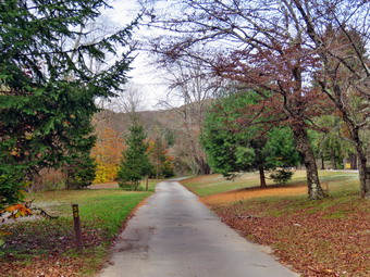 I set my GPS and put Sheila on her leash as we started our hike at 11:40 AM by crossing the bridge to the west side of the river. We turned left on a woods road that parallels the river and started down a short hill. I had left my poles in the car and almost regretted the decision as the leaves were slippery. We walked passed a spring house and continued on the deserted woods road. We came to an area with a little path down to the river. I walked down to the edge of the river and took some pictures downstream and some upstream. Just after this area, the trail was even more eroded by water running across and under the trail than during our last visit. There was an area with several picnic tables which sit unused and rotting along the road. This was just the first of several similar areas. I decided to take pictures that showed the deserted campgrounds which was even more dramatic now that there was not a single person in sight. I took pictures of the picnic tables and, a little later, what was once a bathroom for some campsites that had long since disappeared. I took some more pictures of random picnic tables along our route. At the next bathroom, we stopped so that I could take some more pictures. There was a path over to the river so I walked over and took some pictures of the sun reflecting off the water both upstream and downstream. In several areas the DEC had placed large rocks along the shore and covered them with heavy wire to reduce erosion. Just passed this spot was another place where the road had been washed away and the DEC had filled in with some gravel. The streambed next to the road was now dry but must have had a large volume of water to erode the road. I took some more pictures before we moved on. At about .7 miles the woods road met the paved road that serves the campsites and we continued on the road through the campsites and along the river. Many of the campsites had a cement block fireplace with a grill but some were upgraded to poured concrete. Everything was very quiet except for the water in the river. This was not surprising as the campsites are closed. I took some pictures of the empty campsites and the campsite road. The skies were blue with lots of interesting white puffy clouds.
 We walked to the last campsite where the trail ends and walked down to the edge of the river. There was a strip of sand that made a small "beach" and I stopped to take some pictures. I worked my way out to a rock that jutted into the river and took some more shots up and down the stream. Sheila decided not to take dip but stayed close to the shore. We continued out the path along the river after the last campsite. Once this path became too difficult to walk I stopped to take some pictures. We turned around to start back and walked the other road through the campsites which parallels the one we walked out on to make a sort of loop. We stopped again so that I could take some pictures of the unused bathrooms and groups of randomly arranged picnic tables. I also took a few shots of the roads and the maintenance building. We returned the way we had come although at a quicker pace. I took some pictures upstream before crossing the river on the bridge. We still had not seen any people! We walked through the bridge and turned right to go back to the car. I decided to go down to the river to take some pictures while Cindy and took Sheila back to the car. Unfortunately, Sheila does not like to be separated from me and whined the whole time. I walked to the edge of the river and I took pictures of the bridge and the river flowing under it. I walked downstream a little but the view didn't change so I returned to the car. We were back at the car at 12:45 PM having hiked 2.3 miles in 1 hour and 5 minutes with 7 minutes of stopped time. The elevation gain was 190 feet but it was hardly noticeable. The car's thermometer read 55 degrees. I considered stopping at Waneta Lake on the way home but decided to wait for another day.
![]() On Friday, October 22nd, I wanted to go to Balsam Lake Mountain to remove a large tree trunk across the trail that my maintainer was unable to clear. Most maintainers do not want to cut these larger blowdowns but I like to use my saws and axes. I was not sure of the exact location of this blowdown or its diameter. I asked Cindy if she would like to go and she said "Yes". I hoped that after we cleared the blowdown we could bet in the short hike to Vly Pond. At 11:15 AM we started to get ready with the temperature at only 54 degrees on the back porch. The skies were overcast but I could see areas of blue sky and some sun. Sheila was pretty excited as I started to get ready even though we had hiked the day before. I got dressed in my Mammut crew top with a long-sleeved baselayer. I put on a pair of RailRiders hiking pants which are expensive but last a long time and have features like deep pockets and a generous cut which I really like. I decided to put on my old Vasque Taku hiking boots which fit well and have been discontinued. I grabbed my Leki external lock poles which I have been using lately since twist locks have proved unreliable. I packed a light hat and gloves as I knew it might be cooler at the trailhead. For maintenance equipment I took my Silky Sugowaza saw, Silky Kanaraboy saw, Fiskars pack axe, Council Tools felling ax, and two Oregon splitting wedges. I put all our gear in the car and Sheila jumped into the backseat with some enthusiasm. I headed out the driveway and turned north toward Roscoe on Old Rt 17. I turned right on the Beaverkill Road and continued north toward Lew Beach and Turnwood. The Beaverkill Falls were flowing with a decent volume of water as there had been some rain. The road conditions were pretty good even when the pavement ended. I laughed when I saw the "Rough Road" sign! The town of Hardenburgh had been working on the dirt road by smoothing it with a scraper and widening it slightly. Toward the end the road becomes very narrow and I was glad I did not meet any cars. We arrived at the parking area at 12:25 PM and found four other cars in the lot. I set my GPS and we started out on the trail with both saw, both axes and the felling wedges. The temperature was 52 degrees but the air felt warmer to me.
On Friday, October 22nd, I wanted to go to Balsam Lake Mountain to remove a large tree trunk across the trail that my maintainer was unable to clear. Most maintainers do not want to cut these larger blowdowns but I like to use my saws and axes. I was not sure of the exact location of this blowdown or its diameter. I asked Cindy if she would like to go and she said "Yes". I hoped that after we cleared the blowdown we could bet in the short hike to Vly Pond. At 11:15 AM we started to get ready with the temperature at only 54 degrees on the back porch. The skies were overcast but I could see areas of blue sky and some sun. Sheila was pretty excited as I started to get ready even though we had hiked the day before. I got dressed in my Mammut crew top with a long-sleeved baselayer. I put on a pair of RailRiders hiking pants which are expensive but last a long time and have features like deep pockets and a generous cut which I really like. I decided to put on my old Vasque Taku hiking boots which fit well and have been discontinued. I grabbed my Leki external lock poles which I have been using lately since twist locks have proved unreliable. I packed a light hat and gloves as I knew it might be cooler at the trailhead. For maintenance equipment I took my Silky Sugowaza saw, Silky Kanaraboy saw, Fiskars pack axe, Council Tools felling ax, and two Oregon splitting wedges. I put all our gear in the car and Sheila jumped into the backseat with some enthusiasm. I headed out the driveway and turned north toward Roscoe on Old Rt 17. I turned right on the Beaverkill Road and continued north toward Lew Beach and Turnwood. The Beaverkill Falls were flowing with a decent volume of water as there had been some rain. The road conditions were pretty good even when the pavement ended. I laughed when I saw the "Rough Road" sign! The town of Hardenburgh had been working on the dirt road by smoothing it with a scraper and widening it slightly. Toward the end the road becomes very narrow and I was glad I did not meet any cars. We arrived at the parking area at 12:25 PM and found four other cars in the lot. I set my GPS and we started out on the trail with both saw, both axes and the felling wedges. The temperature was 52 degrees but the air felt warmer to me.
 The trail had a thick layer of fallen leaves covering some pretty deep mud. We picked our way carefully heading toward the register. I looked up and looked ahead to see a tree across the trail just after the register box. We walked up to the tree and I put down my pack to inspect the job. The maintainer had removed all of the branches and hikers could easily step over the tree. The blowdown was between knee and thigh high with a diameter of about 14 inches. I knew I would have to make at least two cuts, one on each side of the trail. I has unsure whether or not I would have to make a third cut to enable us to get the section we removed off the trail. I grabbed by Council Tools felling ax and marked a cut on the upper end of the tree. I thought that I would use the ax to start the cut and then finish it with the saw. I took a few pictures before starting the work. The first couple of blows with the ax indicated the tree was tougher than I thought. I continued to use the ax and found that the wood was saturated with water and that there was a rotten core that was dripping water. This meant that almost every time I struck the wood I was getting splashed. I alternated axes and was almost sorry that I had not made a wider initial cut so that I could finish with an ax. Eventually, I switched to the Katanaboy and alternated with the Sugowaza. When the saws started to bind, I set the wedges and started an undercut. Within minutes I heard a cracking and tearing and the end of the section dropped to the ground. I took a couple of shots and then again inspected the blowdown for my next cut. Unfortunately, the when I made the first cut the blowdown fell so that it was resting on the ground. It seemed to me the only way to make the cut on the other side of the trail was with an ax. I marked my cut and then began with the big Council Tools ax. I made sure the cut was wide as it will always narrow the deeper it is. Swinging the heavy ax was really taking it out of me so I switched to the Fiskars which is lighter and has a much shorter handle. Despite the fact that it is lighter the Fiskars was helping me make good progress as it was taking deeper bites. I alternated axes and was soon nearly through the trunk. Inevitably, the cut got very narrow and I got very tired. I tried using the wedges to finish the jib but some more cutting as in order. I cleared the dirt and debris on either side of the cut and used the Katanaboy top finish the cut as it has a straight blade wile the Sugowaza is curved. I heard cracking and tearing as the final wood fibers and bark let go. There was now a large section of the blowdown lying in the middle of the trail. I took a few shots and decided that although hikers could get over it more easily now it had to go. Fortunately, the trail had a slight downhill grade! Cindy and I were able to roll the section downhill until one end got stuck. This allowed me to pivot the section so that it was well off the trail and parallel to it. We looked back at the trail and it was completely clear. I took my final "after" pictures including some with Cindy and Sheila. We packed up all the tools and headed back to the car.
 When we got to the car, I felt like doing some more hiking and it was obvious that Sheila agreed. I suggested we head out on the Neversink Hardenvurgh Trail to Vly Pond. Cindy was not enthusiastic but agreed to go. We headed out the trail finding a thick layer of leaves and lots of mud underneath. I stopped to take some picture of Balsam Lake Mountain and then we continued on the trail passing the register box. The trail continued to be muddy with a few old blowdowns that were lying flat on the ground making them easy to step over. Cindy remarked that she did not like walking downhill at the beginning of a hike because of the up hill return trip. The trail did continue to lose elevation until we got to the bridge over Black Brook. The views both upstream and downstream were pretty so I took some pictures. We had hiked only about half a mile but Cindy informed me she did not want to continue. I knew that the trip to Vly Pond was only about another mile but I also knew it was useless to try to convince Cindy to go on. She apparently thought we had hiked some significant distance when I knew otherwise. I was terribly disappointed but we turned around and started back. I set a pretty fast pace and we were soon back at the car. We had hiked an embarrassing 1.4 miles. The drive is around 40 minutes and I had hoped to get a real hike in! My consolation was the work we had done in removing the blowdown without having the DEC have to come with a chainsaw!
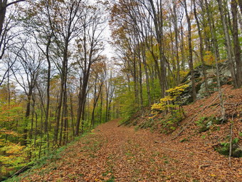
![]()
![]()
![]()
![]()
![]() On Thursday, October 21st, I wanted to get in a longer hike than I had been doing. Cross country meets and practices along with ambulance calls had been limiting my hiking. I had a 6:15 AM men's group at church and decided to stop for breakfast on the way home. When I got home I waited for Cindy to get home from church and asked if she would like to hike to the Hodge Pond Lookouts. I was disappointed she declined but decided I would take Sheila and go even though it was getting late in the day. At 1:15 PM I started to get ready with the temperature at 71 degrees on the back porch. The skies were overcast but I could see areas of blue sky and some sun. Sheila was pretty excited as I started to get ready as we have not been hiking a lot lately. I got dressed in my Mammut crew top with a short-sleeved baselayer. I put on a pair of RailRiders hiking pants which are expensive but last a long time and have features like deep pockets and a generous cut which I really like. I decided to put on my Keen Targhee II hiking boots which fit well and have been discontinued. I grabbed my Leki external lock poles which I have been using lately since twist locks have proved unreliable. I also added my OR floppy hat which I have decided shields me from the sun and allows me to spray some insect repellant on it rather than on me. I did not feel the need for a hat or gloves even though I knew it might be cooler at the trailhead. I put my gear in the back of the car and Sheila in the back seat and left my house at 1:30 PM. I drove out the DeBruce Road about 6 miles to Mongaup Road and turned left. I continued up the road to the point where it splits and stayed left on Beech Mountain Road. It was a short drive to the parking areas on the left. The larger parking areas had one car in it. I parked in the smaller lot where there were no cars. I took the time to set my GPS and we crossed the road at 1:50 PM to begin our hike on the Flynn Trail with the temperature at 67 degrees.
On Thursday, October 21st, I wanted to get in a longer hike than I had been doing. Cross country meets and practices along with ambulance calls had been limiting my hiking. I had a 6:15 AM men's group at church and decided to stop for breakfast on the way home. When I got home I waited for Cindy to get home from church and asked if she would like to hike to the Hodge Pond Lookouts. I was disappointed she declined but decided I would take Sheila and go even though it was getting late in the day. At 1:15 PM I started to get ready with the temperature at 71 degrees on the back porch. The skies were overcast but I could see areas of blue sky and some sun. Sheila was pretty excited as I started to get ready as we have not been hiking a lot lately. I got dressed in my Mammut crew top with a short-sleeved baselayer. I put on a pair of RailRiders hiking pants which are expensive but last a long time and have features like deep pockets and a generous cut which I really like. I decided to put on my Keen Targhee II hiking boots which fit well and have been discontinued. I grabbed my Leki external lock poles which I have been using lately since twist locks have proved unreliable. I also added my OR floppy hat which I have decided shields me from the sun and allows me to spray some insect repellant on it rather than on me. I did not feel the need for a hat or gloves even though I knew it might be cooler at the trailhead. I put my gear in the back of the car and Sheila in the back seat and left my house at 1:30 PM. I drove out the DeBruce Road about 6 miles to Mongaup Road and turned left. I continued up the road to the point where it splits and stayed left on Beech Mountain Road. It was a short drive to the parking areas on the left. The larger parking areas had one car in it. I parked in the smaller lot where there were no cars. I took the time to set my GPS and we crossed the road at 1:50 PM to begin our hike on the Flynn Trail with the temperature at 67 degrees.
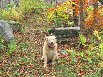 The first part of the trail near the road had become further eroded by the recent rains. After that, the walk through the woods was relatively easy although there was a thick layer of leaves which made the trail slippery in places. The leaves also hood a few muddy spots on the trail. When we turned right onto what once was Beech Mountain Road, there continued to be a layer of leaves as well as a few new branches on the trail. I removed the branches as we walked. When we came to the "spruce tunnel", I noticed someone had broken off branches to make the opening wider. This left jagged spikes sticking down which did not make me happy. I doubt a forest ranger would have done such a careless hob so I suspected someone who had no business doing trail work. I began to get warm immediately from the sun shining on my back but was comfortable as we continued up the trail. We set a fast pace up the Flynn Trail which seemed to go quickly as we walked and talked. We did stop a couple of times so that I could take some pictures of the fallen leaves on the trail and the impressive ledges on the right side. The Flynn Trail is uphill all the way for the first 1.7 miles to the Big Rock Junction. We passed the mile mark around the point where there is a clearing to the right of the trail. We were soon walking the final uphill section to the junction with the Big Rock Trail. It was 2:33 PM so we had covered the 1.7 mile distance in 43 minutes! We continued through the junction and passed through the gate which is the boundary between state land and Beaverkill Land Trust property. It was a short walk to the point where the Flynn Trail heads downhill to Hodge Pond. Here we turned to the right on the woods road and walked along the road to the junction of some roads above the pond. At this junction a road turns left to go down to the pond. Just a little further on the road splits with the left fork passing by the site of the former Beech Mountain Boy Scout Camp and ending up on Shin Creek Road in Lew Beach. The camp has been bulldozed by the Land Trust. The road out to Shin Creek Road is now available for hiking and has a nice parking area near Shin Creek Road. We continued up the hill toward the Hodge Pond Lookouts on a woods road that surrounds Flynn's Point on Beech Mountain, the highest point in Sullivan County. As we walked, I could see that there had been vehicles on the road as the leaves were matted down. The hill did not seem to slow us down much.
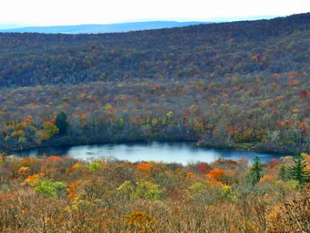 I wasn't really tired so we pushed the pace a little. We passed an old sand and gravel pit where the trail levels some. The trail began to gain elevation again and we passed by a spring house on the right where Sheila likes to dig in the water and get a drink. There are several twists and turns along this road and it is sometimes hard for me to know exactly where I am. At 2.7 miles we came to a lookout on the left of the trail. The lookout had been "cut out" so that the hills and valleys beyond were much more visible. I decided to stop to take a few shots because my experience told me that the view could change by the time we returned. Most of the leaves were off the trees but there were still some bright colors in the leaves on the beaches. There was almost no haze on the hills of in the valleys as I snapped several pictures. We followed the road uphill as it made a sharp right turn. Just after this the road turned to the left but another trail branched off to the right. We turned onto this woods road on the right. After a slight incline, the trail leveled. Leaves covered the trail but there was almost no mud except in a spot where a small stream flows off the hill. I walked along the trail following Sheila most of the time. At 2.9 miles we arrived at the Hodge Pond Lookout. This lookout has also been cut out giving a much better view than in the past. I dropped my pack and took some pictures of the pond below and the hills in the distance. I also took some pictures of Sheila sitting on the lookout with the pond in the background. The view was as clear as I have seen it but, again, most of the leaves were off the trees. When I was done taking pictures, I got a drink and a bar and then continued on the woods road traveling counterclockwise around Beech Mountain.
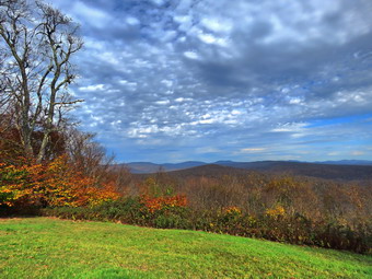 There were some impressive ledges and cliffs on the left side of the trail but I have taken shots if them before. At 3.1 miles, the trail forked and we stayed to the right to head down to the cabin which was an incredible view to the east. I was hoping some leaves would be remaining but when we arrived it was clear almost all of them were down. The panorama from this lookout takes in The Burroughs Range and many of the other Catskill peaks. I got out my camera and took some pictures despite the lack of brilliant colors. When I was done, I picked up the pack and we continued on the woods road. We climbed a short hill and started down the other side heading back to the point where we had turned off the road. I noticed a woods road on the left side of the road we were walking and remembered abet I had taken it up to a higher level and from there had walked the length of the Beech Mountain ridge. We passed the lookout on the road and followed it as it turned left and started downhill. The trip down was much quicker than the trip up and I avoided slipping on the leaves by using my poles. When we reached the bottom of the hill, I thought about walking down to Hodge Pond but decided to make the hike a true out-and-back. We walked out to the Flynn Trail, turned left and were soon at the junction with the Big Rock Trail at 4.5 miles. We continued straight ahead on the Flynn Trail. The trip down the Flynn Trail can seem to take forever but on this day it went quickly. The large hemlock across the trail came into sight and just after it the gate. We passed through the arch of the tree that Cindy and I had cut through the tree. Just before the gate, we turned left on the Flynn Trail to avoid the private property around the cabin. We walked the trail back to the car arriving at 4:30 PM. There was one car parked next to mine and none in the other lot. We had hiked 6.1 miles in 2 hours and 35 minutes gaining 1076 feet along the way. Our overall speed was 2.3 mph with moving average of 2.5 mph with less than 10 minutes of stopped time.
![]()
![]()
![]()
![]() On Wednesday, October 20th I wanted to get out for a short hike after sleeping in from some late night ambulance calls. I also had cross country meet in the afternoon. At 11:30 AM I decided to hike some loops on Round Top. I asked Cindy if she wanted to go and she agreed. We started to get ready when the temperature was 66 degrees. The skies were partly sunny with some impressive puffy white clouds. Sheila was ready to go as she really likes to hike and she was keeping a careful eye on me as we dressed. I put on my Mammut long-sleeved crew top with a short-sleeved base layer. I put on a pair of RailRiders hiking pants which are expensive but last a long time and have features like deep pockets and a generous cut which I really like. I decided to wear my Keen Cascade hiking boots which are new and all-leather which means they need some work to break them in. I decided to take my Leki poles with external locks as the internal twist locks sometimes fail. We stepped out of the house at noon. I grabbed Sheila's leash from the car and put it on her to safely cross the street. We walked up the driveway and crossed the street. We walked to the church parking lot and to the back of the church. As we started up the hill, I noticed that it was easier climbing the hill as I had been hiking more often. We continued the ascent of the steep hill behind the church. The hill is short but gets the circulation pumping and is the steepest and longest climb on the "trail". I let Sheila pull me up the hill which she was willing to do. At the trailhead, I let Sheila off her leash and she immediately began to bound up the trail. We started on the trail by turning left at the trailhead.
On Wednesday, October 20th I wanted to get out for a short hike after sleeping in from some late night ambulance calls. I also had cross country meet in the afternoon. At 11:30 AM I decided to hike some loops on Round Top. I asked Cindy if she wanted to go and she agreed. We started to get ready when the temperature was 66 degrees. The skies were partly sunny with some impressive puffy white clouds. Sheila was ready to go as she really likes to hike and she was keeping a careful eye on me as we dressed. I put on my Mammut long-sleeved crew top with a short-sleeved base layer. I put on a pair of RailRiders hiking pants which are expensive but last a long time and have features like deep pockets and a generous cut which I really like. I decided to wear my Keen Cascade hiking boots which are new and all-leather which means they need some work to break them in. I decided to take my Leki poles with external locks as the internal twist locks sometimes fail. We stepped out of the house at noon. I grabbed Sheila's leash from the car and put it on her to safely cross the street. We walked up the driveway and crossed the street. We walked to the church parking lot and to the back of the church. As we started up the hill, I noticed that it was easier climbing the hill as I had been hiking more often. We continued the ascent of the steep hill behind the church. The hill is short but gets the circulation pumping and is the steepest and longest climb on the "trail". I let Sheila pull me up the hill which she was willing to do. At the trailhead, I let Sheila off her leash and she immediately began to bound up the trail. We started on the trail by turning left at the trailhead.
At the first trail junction, we followed Sheila as she continued straight ahead up the hill toward the viewpoint. There was a slight breeze blowing but I was already getting warm from making the ascent. The climb up the hill was a little easier than usual. At the viewpoint, I noticed that the brush that I had placed in the trail was still there. This path has a dangerous spot and we have piled brush on it to discourage people from using it. We continued on the main trail and headed to the right to follow it as it turned and headed up the gentle hill through the hardwood forest. The ferns covering the forest floor were all brown as the temperatures at night were dipping into the 40's. Most of the leaves were off the trees forming a carpet on the ground. The leaves were slippery in places and in other spots they covered some mud. Sheila was making her own way by staying on the trail sometimes and then running off-trail and chasing game trails. We continued to follow the yellow trail toward the first junction with the blue trail. There were a few branches on the trail that I removed as we hiked. At the first trail junction with the blue trail, we turned right and followed the yellow trail along the base of Round Top. This section was in good shape without any blowdowns and the brush and grass had remained at bay. At the next junction, we turned left and started up to the summit of Round Top on the blue trail. We bypassed the white crossover trail and continued up and over the summit. There was one small tree down on the summit which would require a saw to remove it. The trails were mostly dry with only a few muddy spots. I decided we would skip the white crossover trail but take the switchback on the blue trail. We followed the switchback as it headed out into the woods and then back to the main trail where we turned left. At the bottom of the hill, we turned left on the yellow trail, and walked along the base of Round Top. At the trail junction with the blue trail, we turned right to walk down to the woods road. It was a snap to walk downhill and out the woods road. It was obvious Sheila felt the same way as she was running and bounding ahead of me and then running back up the trail. At the first trail junction, I turned around and started back up the woods road but Cindy was unsure that she wanted to do another loop. I told her we would take it easy and she believed me! We started back up the woods road to the junction with the blue trail at a more relaxed pace. We turned left and walked along the yellow trail following the base of the Round Top summit. At the next junction, we turned right and started up the steeper side of the hill on the blue trail. This time we again took the switchback in the blue trail. At the end of the switch, we turned right and right again on the white-blazed crossover trail. We continued on crossover trail to the blue trail on the other side of the hill. We turned right at the end and walked down to the yellow trail. We turned right on the yellow trail and followed it along the base of Round Top once again. At the junction with the blue trail, we turned to the left to stay on the yellow trail to the lookout. At the lookout, we followed the yellow trail as it turned left and descended to the first trail junction. We walked straight out to the trailhead. We turned right to walk to the bottom of the hill. We headed across the church parking lot to the street and crossed the street to our driveway. We were home by 1:15 PM after hiking a little over 2 miles in 1 hour and 15 minutes.
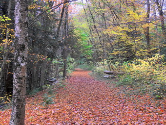
![]()
![]()
![]()
![]()
![]() On Wednesday, October 13th, I wanted to get in a hike close to home with Cindy. The ambulance pager had been going off almost twice a day and I just wanted to get away for a quiet hike. I had cross country practice in the afternoon so I wanted to be finished by no later than 1:00 PM. I suggested a hike of the Parksville Rail Trail since it is flat and short but has a nice waterfall. Cindy agreed that she could handle this hike so we began to get ready at 10:45 M. As we started to get ready, the temperature on the back porch was 66 degrees but I knew the rail trail was shaded. I got dressed in a White Sierra long-sleeved crew top with a short-sleeved baselayer. I put on a pair of RailRiders hiking pants which are expensive but last along time and have features like deep pockets and a generous cut which I really like. These pants have Velcro closures at the ankles to discourage sticks and gravel from getting into my shoes and to combat ticks. I wore my Keen Targhee II hiking boots which are showing some serious wear but fit well. I decided to take my Leki poles with external locks as the internal twist locks sometimes fail. I also added my OR floppy hat which I have decided shields me from the sun and allows me to spray some insect repellant on it rather than on me. We put our gear in the back of the car and Sheila in the back seat. We left Livingston Manor at 11:10 AM and drove out Old Route 17 toward Parksville. Just after Fox Mountain Road, I pulled into the parking area on the right side of the road at 11:25 PM. There were no cars in the lot as we began to get ready. I decided to take my pack since it is the easiest way to carry my camera. I set my GPS and we set off on the trail with the car thermometer reading 68 degrees.
On Wednesday, October 13th, I wanted to get in a hike close to home with Cindy. The ambulance pager had been going off almost twice a day and I just wanted to get away for a quiet hike. I had cross country practice in the afternoon so I wanted to be finished by no later than 1:00 PM. I suggested a hike of the Parksville Rail Trail since it is flat and short but has a nice waterfall. Cindy agreed that she could handle this hike so we began to get ready at 10:45 M. As we started to get ready, the temperature on the back porch was 66 degrees but I knew the rail trail was shaded. I got dressed in a White Sierra long-sleeved crew top with a short-sleeved baselayer. I put on a pair of RailRiders hiking pants which are expensive but last along time and have features like deep pockets and a generous cut which I really like. These pants have Velcro closures at the ankles to discourage sticks and gravel from getting into my shoes and to combat ticks. I wore my Keen Targhee II hiking boots which are showing some serious wear but fit well. I decided to take my Leki poles with external locks as the internal twist locks sometimes fail. I also added my OR floppy hat which I have decided shields me from the sun and allows me to spray some insect repellant on it rather than on me. We put our gear in the back of the car and Sheila in the back seat. We left Livingston Manor at 11:10 AM and drove out Old Route 17 toward Parksville. Just after Fox Mountain Road, I pulled into the parking area on the right side of the road at 11:25 PM. There were no cars in the lot as we began to get ready. I decided to take my pack since it is the easiest way to carry my camera. I set my GPS and we set off on the trail with the car thermometer reading 68 degrees.
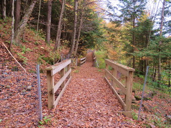 Once we were on the trail and sheltered by the trees it was a little cooler and the long sleeves did not seem too hot. The trail was wet and muddy in spots from the rain that had fallen several days before. The stream was flowing with a good volume but was not as high as it had been on our previous trip. We could see a l tree had fallen across the stream and I wondered what impact it would have in catching debris when the water was higher. As we walked we removed sticks and branches from the trail but it was clear of any blowdowns and well-maintained. We came to a nice view down to the Little Beaverkill and I stopped to take a few shots. The sky was overcast and there was not much blue and no puffy white clouds. The leaves showed some nice colors but the lack on sunlight timed down their brilliance. Just after this point was a boardwalk and bridge. We walks to the other end of the complex and I took some pictures. Heavy rains had carried dirt and rocks onto the bridge and had also blocked the ability of the water to flow under the bridge. The walkway had a lot leaves on it and was slippery from the rain. We passed several benches placed for people to rest but saw no people. Soon, we could hear an increase in the noise from the stream and I knew the falls was just ahead. We stopped to look at the falls which had a good flow of water going over it. The stream was not as high as last time which meant some of my favorite perches to take pictures from near the stream were pone. I walked down the bank and worked my way to an area in front of the falls. I was able to walk out onto some rocks in the stream to take pictures. These rocks had all been covered by high water during our last visit. I took some shots and then repositioned to take a few more. There are two drops to the falls but from the bottom of the lower falls it is hard to see the upper drop.
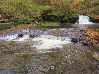 I took some shots downstream and then walked back up the bank and took a picture from above the falls. We walked down the trail a short distance where another path led down to the creek. The water was low enough that I could walk down to a point near the edge of the stream to take pictures. This spot had also been under water the last time we came. I took pictures over the top of the falls and then turned to take some upstream. On the far side of the stream there are large open rock shelves and I thought about trying to access them from the other side of the stream. I walked back up to the trail to collect my pack and continue the hike toward the end of the trail in Parksville. As we approached the end of the trail, I put Sheila on her leash as there was a fairly large and aggressive dog on the other side of a fence. I was happy to see that most property owners were cleaning up the mess just across the stream. On the Parksville end of the trail we stopped at the small garden which has a very informative sign. The sign listed the businesses and hotels that existed in Parksville during its heyday. The Young's Gap Hotel had room for 600 guests! The sign also explained the role of the railroad in the dairy industry which was a thriving one in all of Sullivan County. The sign made the comment that the area produced 9 million cans of milk annually. After a brief pause, we began the walk back on the trail. I stopped at the point where two stream meet and walked down the bank to take my last pictures of the day. After that I walked back up to the trail a we continued back to the car. As we neared the end of the trail my phone sounded to announce an ambulance call. We hiked quickly back to the car but I decided to let MobileMedic take the call as I would be delayed in getting to the building. We were back at the car at 12:50 PM after hiking 2.7 miles in 1 hour and 30 minutes. Our moving average was 2.5 mph and the elevation gain was 235 feet which I doubted.
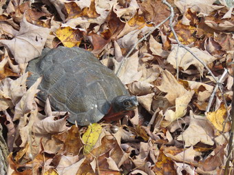
![]()
![]()
![]()
![]()
![]() On Saturday, October 9th I wanted to try a new route to Hodge Pond with my son-in-law Brad who was at our house for the long weekend. The Beaverkill Land Trust has created a parking lot on a woods road off Shin Creek Road in Lew Beach. The woods road leads to Hodge Pond near the site of the former Beech Mountain Boy Scout Camp. We spent some time doing chores around the house and did not start getting ready until 11:15 AM. The temperature was 62 degrees on the back porch but I knew it might be cooler at the trailhead. I put on my White Sierra long-sleeved crew top and a long-sleeved baselayer. I put on a pair of RailRiders hiking pants which are expensive but last along time and have features like deep pockets and a generous cut which I really like. The pants have Velcro closures at the ankles I wore my Keen Targhee II boots which are wearing out but still have a few miles in them. I decided to take my Leki poles with external locks as the internal twist locks fail. I also added my OR floppy hat which I have decided shields me from the sun and allows me to spray some insect repellant on it rather than on me. I also packed a light hat, a pair of gloves, and a light windbreaker. Brad and I got my gear in the car and put an excited Sheila in the back seat. At 11:40 AM I drove north on Old Route 17 to the Beaverkill Road. I drove north to the four corners just after the Beaverkill Valley fire house. I turned right and started up Shin Creek Road. The drive on this road is beautiful but the road soon becomes a seasonal maintenance road and very rough. I did not know exactly where the new parking area was located so when we came to a road on the right I decided to drive a little farther. This proved to be a bad idea as the road became very narrow and rough. We found no parking lot and I finally found a place to turn around to investigate the road we had passed. On the way back we stopped to take a look at a turtle in the road. I took some pictures of the turtle which was not happy about our presence and moved far faster than I had thought it could. I also walked over to the stream which paralleled the road and took some pictures of some small but beautiful cascades. We packed up and I turned left on the dirt road. A few hundred feet in there was a place to pull off on the right side of the road. This didn't look like a parking lot but I decided to park. The temperature was 65 degrees as I set my GPS at 12:25 PM. We started our hike by walking up the wide dirt road.
On Saturday, October 9th I wanted to try a new route to Hodge Pond with my son-in-law Brad who was at our house for the long weekend. The Beaverkill Land Trust has created a parking lot on a woods road off Shin Creek Road in Lew Beach. The woods road leads to Hodge Pond near the site of the former Beech Mountain Boy Scout Camp. We spent some time doing chores around the house and did not start getting ready until 11:15 AM. The temperature was 62 degrees on the back porch but I knew it might be cooler at the trailhead. I put on my White Sierra long-sleeved crew top and a long-sleeved baselayer. I put on a pair of RailRiders hiking pants which are expensive but last along time and have features like deep pockets and a generous cut which I really like. The pants have Velcro closures at the ankles I wore my Keen Targhee II boots which are wearing out but still have a few miles in them. I decided to take my Leki poles with external locks as the internal twist locks fail. I also added my OR floppy hat which I have decided shields me from the sun and allows me to spray some insect repellant on it rather than on me. I also packed a light hat, a pair of gloves, and a light windbreaker. Brad and I got my gear in the car and put an excited Sheila in the back seat. At 11:40 AM I drove north on Old Route 17 to the Beaverkill Road. I drove north to the four corners just after the Beaverkill Valley fire house. I turned right and started up Shin Creek Road. The drive on this road is beautiful but the road soon becomes a seasonal maintenance road and very rough. I did not know exactly where the new parking area was located so when we came to a road on the right I decided to drive a little farther. This proved to be a bad idea as the road became very narrow and rough. We found no parking lot and I finally found a place to turn around to investigate the road we had passed. On the way back we stopped to take a look at a turtle in the road. I took some pictures of the turtle which was not happy about our presence and moved far faster than I had thought it could. I also walked over to the stream which paralleled the road and took some pictures of some small but beautiful cascades. We packed up and I turned left on the dirt road. A few hundred feet in there was a place to pull off on the right side of the road. This didn't look like a parking lot but I decided to park. The temperature was 65 degrees as I set my GPS at 12:25 PM. We started our hike by walking up the wide dirt road.
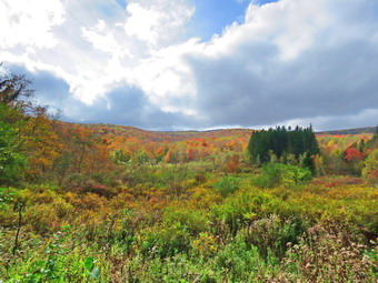 In a short distance we came to a wetland on the right side of the road and we stopped so that I could take some pictures. We continued on and at .3 miles came to a gate and a large, well-constructed parking area on the left side of the road. This was the lot that the Beaverkill Land Trust had constructed and the road to it was in good shape. I took some pictures of the parking area and the gate. We walked over the gate and stopped at the bridge across the creek. I took some shots of the small rapids in the brook and then we continued up the road. We stopped again so that I could take some more pictures of the stream. Just after this point the road turned to the right away from the stream. The road was uphill all the way but the grade was gentle and we kept a fast pace. The surface of the road was covered in leaves and the trees around us were in various stages of changing color. We heard a noise like a car coming up the road and soon it appeared coming from the direction of Shin Creek Road. The car slowed and the occupants said "Hello" as they passed. I assumed they were driving up to the cabin for the long weekend. We continued hiking and talking which made the walk go quickly. At 1.55 miles the road leveled and I recognized the site of the former Beech Mountain Boy Scout Camp. The cabins had deteriorated so much that the Land Trust had them cleared away. We walked out to the road junction and turned right and then right again on the woods road that goes toward Hodge Pond. We walked down the road and turned right on the jeep road that goes around the upper end of Hodge Pond. After walking a short distance we turned left on a path that leads to the shore of the pond. I got out my camera to take some shots of the pond and the colorful trees surrounding it. Sheila decided to take a dip in the pond and I took a picture of her. The leaves were still pretty but were almost past peak. We walked back out to the jeep road and turned left to continue our walk around the pond. As we started up a little hill, the four people from the car that had passed us came walking toward us. I had Sheila sit at the side of the trail as the party went by us.
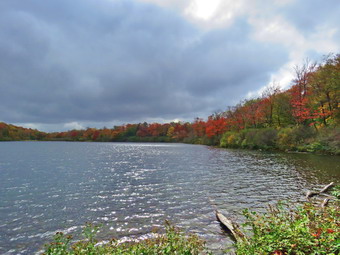 We continued around the pond to the Flynn Trail where we turned left to continue our trip around the pond. The Flynn Trail was a little muddy and we removed two trees that had fallen across the trail. When we broke out into the field where the camp canteen used to be, we stopped so that I could take some more shots of the leaves. We continued along the Flynn Trail through the woods to the clearing at the outlet end of the pond. As we turned to walk toward the pond, we were presented with an unusual sight. Parked in the clearing was the car the other hikers had driven up the road! I was annoyed but then remembered that they could get to the point where they parked on land owned by the Beaverkill Land Trust. We walked to the edge of the pond and I took some more pictures of the pond and the leaves on the trees. When I was done taking pictures, we walked up the hill on the east side of the pond to head back the way we came after finishing the loop of the pond. We heard voices ahead and we knew who it was. I again moved Sheila to the side of the trail to let the four hikers pass and get back to their car. We continued up the hill to the woods road and turned left and left again to walk by the site of the camp. I expected returning would go quickly as it would be all downhill and without any photography. At one point we looked up to see a person on a mountain bike climbing the road at a good clip. We walked a little farther and another bike went passed up. We eventually came to the bridge and the gate and continued down the road to the car. Just as we arrived at the car both bikers zoomed passed us without any notice. We were back a the car at 2:30 PM after hiking 4.5 miles in 2 hours and 5 minutes. Our overall pace was 2.2 mph but out moving speed was 2.5 mph. The elevation gain was 740 feet. Parking at the lot would make the distance 4 miles and the elation gain 680 feet.
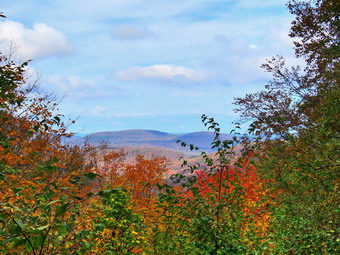
![]()
![]()
![]()
![]()
![]() On Friday, October 8th I wanted to get back to Hodge Pond to see how the colors of fall had progressed at Hodge Pond and the lookouts on Beech Mountain. I planned to get started early as I had a soccer game to time in the afternoon but a late nigh ambulance call caused me to sleep in until 9:30 AM. I almost decided not to go but the sunshine burned off the fog leaving sunny blue skies with beautiful puffy white clouds. Even though I was feeling a little off, I decided hiking would make me feel better. And I started to get ready at 10:15 Am when the temperature was 62 degrees on the back porch. I knew it might be cooler at the trailhead so I put on my White Sierra long-sleeved crew top and a long-sleeved baselayer. I put on a pair of RailRiders hiking pants which are expensive but last along time and have features like deep pockets and a generous cut which I really like. The pants have Velcro closures at the ankles I wore my Keen Targhee II boots which are wearing out but still have a few miles in them. I decided to take my Leki poles with external locks as the internal twist locks fail. I also added my OR floppy hat which I have decided shields me from the sun and allows me to spray some insect repellant on it rather than on me. I also packed a light hat, a pair of gloves, and a light windbreaker. I got my gear in the car and put an excited Sheila in the back seat as I drove out the DeBruce Road toward Frick Pond at 11:40 AM. After about 6 miles, I turned left on the Mongaup Pond and stayed left on Beech Mountain Road at the fork. There was only one cars parked in the big lot and none in the smaller lot as I pulled in at 11:55 AM. I set my GPS and we started our hike by crossing the road and headed out on the Flynn Trail toward Hodge Pond. When we hit the wide woods road that is the Flynn Trail, we turned right and noticed that the grass was wet and there were some muddy spots on the trail. The woods road once led to the Beech Mountain Boy Scouts Camp. The camp was serviced by the extension of Beech Mountain Road which is now the Flynn Trail. The temperature was 60 degrees and I was glad I had worn a baselayer as the breeze made it feel even cooler. The sun was out and there were white, puffy clouds in the sky. We were keeping a pretty fast pace but it didn't seem to bother me. We walked through the arch Cindy and I had cut in a large hemlock tree that had fallen across the trail. At 1.2 miles we passed the clearing on the right side of the trail. I have never heard a definitive explanation for the existence of the clearing but I suspect it was stripped of dirt to build Beech Mountain Road. In most places there is very little topsoil and the bedrock is close to the surface. We continued on the main trail and headed for the junction with the Big Rock Trail. Along the way I removed some large branches that had fallen on the trail. It took us only 43 minutes to reach the first trail junction with the Big Rock Trail at 1.7 miles into the hike. This was close to a record for me an include a stop or two for pictures.
On Friday, October 8th I wanted to get back to Hodge Pond to see how the colors of fall had progressed at Hodge Pond and the lookouts on Beech Mountain. I planned to get started early as I had a soccer game to time in the afternoon but a late nigh ambulance call caused me to sleep in until 9:30 AM. I almost decided not to go but the sunshine burned off the fog leaving sunny blue skies with beautiful puffy white clouds. Even though I was feeling a little off, I decided hiking would make me feel better. And I started to get ready at 10:15 Am when the temperature was 62 degrees on the back porch. I knew it might be cooler at the trailhead so I put on my White Sierra long-sleeved crew top and a long-sleeved baselayer. I put on a pair of RailRiders hiking pants which are expensive but last along time and have features like deep pockets and a generous cut which I really like. The pants have Velcro closures at the ankles I wore my Keen Targhee II boots which are wearing out but still have a few miles in them. I decided to take my Leki poles with external locks as the internal twist locks fail. I also added my OR floppy hat which I have decided shields me from the sun and allows me to spray some insect repellant on it rather than on me. I also packed a light hat, a pair of gloves, and a light windbreaker. I got my gear in the car and put an excited Sheila in the back seat as I drove out the DeBruce Road toward Frick Pond at 11:40 AM. After about 6 miles, I turned left on the Mongaup Pond and stayed left on Beech Mountain Road at the fork. There was only one cars parked in the big lot and none in the smaller lot as I pulled in at 11:55 AM. I set my GPS and we started our hike by crossing the road and headed out on the Flynn Trail toward Hodge Pond. When we hit the wide woods road that is the Flynn Trail, we turned right and noticed that the grass was wet and there were some muddy spots on the trail. The woods road once led to the Beech Mountain Boy Scouts Camp. The camp was serviced by the extension of Beech Mountain Road which is now the Flynn Trail. The temperature was 60 degrees and I was glad I had worn a baselayer as the breeze made it feel even cooler. The sun was out and there were white, puffy clouds in the sky. We were keeping a pretty fast pace but it didn't seem to bother me. We walked through the arch Cindy and I had cut in a large hemlock tree that had fallen across the trail. At 1.2 miles we passed the clearing on the right side of the trail. I have never heard a definitive explanation for the existence of the clearing but I suspect it was stripped of dirt to build Beech Mountain Road. In most places there is very little topsoil and the bedrock is close to the surface. We continued on the main trail and headed for the junction with the Big Rock Trail. Along the way I removed some large branches that had fallen on the trail. It took us only 43 minutes to reach the first trail junction with the Big Rock Trail at 1.7 miles into the hike. This was close to a record for me an include a stop or two for pictures.
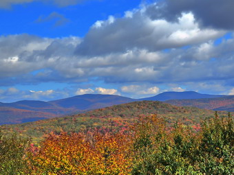 We continued straight ahead on the Flynn Trail until we came to the gate that separates state land from Beaverkill Valley Trust property. We walked around the gate and in a relatively short time, we arrived at the point where the Flynn Trail bears left down to Hodge Pond. We turned right on the woods road toward the site of the Boy Scout camp and the lookouts on Beech Mountain. The woods road we were walking on was once Beech Mountain Road leading to the Beech Mountain Boy Scout Camp. After a short walk, another woods road trail turned off to the left to go down to the pond and the road we were on continued straight ahead. Another road was sandwiched in between the two and leads to the site of the former Boy Scout camp which has been leveled by the Beaverkill Valley Land Trust. We continued straight ahead on the road that started up the hill. The road was covered in leaves which were mostly brown and yellow. We passed a spring house on the right and Sheila stopped to get a drink. The grade became steeper as we climbed the hill and at about 2.6 miles the road made a sharp turn to the right. We stopped so that I could take some pictures from a small viewpoint. As I was practicing my photography, my phone sound with an ambulance call just as it had the last time I was hiking here only a week ago! The call was also for the same patient but sounded more serious. I never like to miss a call and I hoped we could cover it. The were colors in the leafy landscape I could see from the viewpoint were more brilliant and varied than on my previous trip. They looked at near peak color. After I finished my photography, we continued on the road. We followed the road as it made another sharp turn, this time to the left. I planned to return on the trail that went off to the right at this point. The trail circles Beech Mountain which is the highest point in Sullivan County. We walked up hill briefly and then downhill on the road toward another lookout. I had been seeing indications that there had been a truck on the road. When we arrived at the viewpoint, which is near a small cabin, there were some workers doing some construction. This was the first time I had seen anyone at the lookout and I asked them if it was Ok for us to be there. They told me it was fine so I took off my pack to get some pictures. This lookout has views of the Burrough's Range and other major peaks. The leaves were more colorful than during our last visit but there was still plenty of green mixed with the yellows and reds. I took quite a few shots and then we continued our hike by walking uphill on the road in a clockwise direction We passed several tent platforms and then came to a junction. We turned left to continue around Beech Mountain. As we walked there were some impressive ledges on the right side of the woods road.
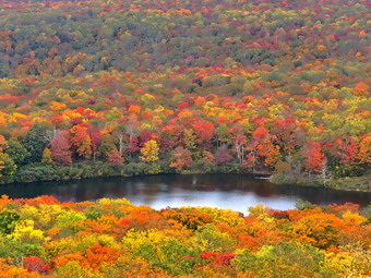 We continued on the path around Flynn's Point on Beech Mountain until we came to the lookout over Hodge Pond on the left. When I walked out to the stone ledge that makes up the viewpoint, I could see some great colors in the trees around Hodge Pond. Some of these trees seems to be loosing their leaves but the trees in the distance were more colorful than they had been on our last trip. I took several pictures at different zooms and at different angles. When I was done, I packed up and we continued in a clockwise direction around Beech Mountain on the woods road. When we came back to the "main" road we turned left and headed back downhill toward Hodge Pond. We continued on the road setting a quick pace down the hill. Sheila again stopped at the spring and this time dug at the opening to the culvert until water was freely flowing through it. On the way down we met two people coming toward us. I recognized one of them as Terry, a friend from Livingston Manor. He and his hiking partner had parked at a new lot on Shin Creek Road. He explained that the Beaverkill Land Trust had built the parking area and were encouraging people to use it and to hike on the woods road to the Hodge Pond area. After a few minutes of conversation, we headed in opposite directions. At the base of the hill, we turned right on the woods road that leads down to Hodge Pond. We turned left when the road intersected a jeep trail and ended up at the outlet end of Hodge Pond. We walked over to the shore of the pond where I dropped my pack and got out the camera. Sheila decided not to go wading or swimming in the pond. The colors I had seen from the lookout were nice but many of the leaves had fallen. The colors were not as bright as I had hoped but I took some shots of the pond concentrating on the leaves. The sky was blue with puffy white clouds. When I was done, I ate a bar and got a drink before picking up and walking to where the Flynn Trail enters the woods. We started climbing the hill back to the junction where we had turned right some time before. This ascent can sometimes seem long but on this day it went quickly. At the top of the hill we stayed to the right on the Flynn Trail and followed the route we had taken out. We passed through the gate and continued on the trail. We were soon approaching the junction with the Big Rock Trail. I thought about whether to return on the Flynn Trail or add a little mileage by taking the Big Rock Trail. I decided that since time was a factor we would return by walking down the Flynn Trail the way we had come. My object was to get back as quickly as possible so we set a fast pace and did not stop. We turned left at the gate at the bottom of the road to stay on the Flynn Trail and avoid the private property around the cabin. By 1:55 PM we were back at the car after hiking 6.7 miles in 2 hours and 55 minutes with 20 minutes of stopped time. This was good for an overall 2.3 mph pace. We also gained 1240 feet of elevation gain
![]()
![]()
![]()
![]() On Wednesday, October 6th I wanted to get out for a hike even though I had a cross country meet at Bear Mountain in the afternoon. I slept a little late as we had an overnight ambulance call. By the time I was ready to hike I knew that I only had time to go across the street to hike on Round Top. It was 10:00 AM by the time I started to get dressed with the temperature a rather "cool" 62 degrees. Sheila was ready to go as she really likes to hike and she was keeping a careful eye on me as we dressed. I put on my White Sierra long-sleeved crew top and a long-sleeved thermal baselayer. I put on a pair of RailRiders hiking pants which are expensive but last along time and have features like deep pockets and a generous cut which I really like. The pants have Velcro closures at the ankles. I decided to wear my Keen Cascade hiking boots which are new and all-leather which means they need some work to break them in. I decided to take my Leki poles with external locks as the internal twist locks sometimes fail. At 10:30 AM we walked out the door to start the hike. I grabbed Sheila's leash from the car and we walked up the driveway. I aimed to hike for about an hour. Sheila was happy to get out as we headed down the driveway and across the street. We crossed the street and walked to the parking area by the Presbyterian Church. We walked to the back of the church and began the ascent of the steepest hill behind the church. The hill is short but gets the circulation pumping and is the steepest and longest climb on the "trail." Sheila helped me along by pulling me up the hill. At the top of the hill we started on the trail by turning left at the trailhead where I let Sheila off her leash so that she could explore. The trail was mostly dry with a few muddy spots. The trail was worn showing that people had been using it.
On Wednesday, October 6th I wanted to get out for a hike even though I had a cross country meet at Bear Mountain in the afternoon. I slept a little late as we had an overnight ambulance call. By the time I was ready to hike I knew that I only had time to go across the street to hike on Round Top. It was 10:00 AM by the time I started to get dressed with the temperature a rather "cool" 62 degrees. Sheila was ready to go as she really likes to hike and she was keeping a careful eye on me as we dressed. I put on my White Sierra long-sleeved crew top and a long-sleeved thermal baselayer. I put on a pair of RailRiders hiking pants which are expensive but last along time and have features like deep pockets and a generous cut which I really like. The pants have Velcro closures at the ankles. I decided to wear my Keen Cascade hiking boots which are new and all-leather which means they need some work to break them in. I decided to take my Leki poles with external locks as the internal twist locks sometimes fail. At 10:30 AM we walked out the door to start the hike. I grabbed Sheila's leash from the car and we walked up the driveway. I aimed to hike for about an hour. Sheila was happy to get out as we headed down the driveway and across the street. We crossed the street and walked to the parking area by the Presbyterian Church. We walked to the back of the church and began the ascent of the steepest hill behind the church. The hill is short but gets the circulation pumping and is the steepest and longest climb on the "trail." Sheila helped me along by pulling me up the hill. At the top of the hill we started on the trail by turning left at the trailhead where I let Sheila off her leash so that she could explore. The trail was mostly dry with a few muddy spots. The trail was worn showing that people had been using it.
At the first trail junction, I followed Sheila as she turned right and started up the woods road which has the gentler approach of the two. We walked up the road to the first trail junction with the upper blue trail and turned left to follow the yellow trail along the base of Round Top. The trails were a little damp and there were a few new branches on the trail. I stopped to remove the branches or used my poles to flick the smaller ones aside. At the next junction with the blue trail we turned right and headed up the blue trail, toward the summit. When we got to the switchback, we turned right and followed it until it came back to the main blue trail. We turned right and then turned right again on the white crossover trail. We walked the crossover trail to the end to the blue trail. We turned right and walked down to the junction with the yellow trail where we turned right. We walked the yellow trail along the base of Round Top to the next junction with the blue trail. We turned left and walked down the yellow trail toward the lookout passing the sitting rock and a sea of now dead ferns. When we reached the lookout, we turned left to follow the yellow trail downhill to the first trail junction. We immediately turned around and started back up the hill to the lookout. At the top of the hill we turned right to follow the yellow trail through the ferns to the first junction with the blue trail. We turned right to follow the yellow trail around the base of Round Top. At the next junction with the blue trail, we turned left and headed up toward the summit. We crossed the summit where there was a small tree that needed a saw for removal. We started down the other side of the hill and bypassed the white crossover trail but turned left on the switchback. We followed the switchback as it headed out into the woods and the back to the main blue trail. We turned left and walked down the blue trail to the yellow trail. We turned left and again followed the yellow trail along the base of Round Top to the junction with the blue trail. This time we turned right and headed down the yellow rail to the woods road that leads to the first trail junction. As we walked down the road, I noticed all the interesting ledges to the right of the trail. At the first trail junction, we turned left to walk out to the trailhead. We turned right, walked down the hill and out to the road through the church parking lot. We walked over to the driveway and back to the house. It was 11:40 AM and we had hiked a little over 2 miles in an hour and 10 minutes.
![]()
![]()
![]()
![]() On Monday, October 4th I wanted to get out for a short hike after sleeping in from some late night ambulance calls. I also had cross country practice in the afternoon. At 11:00 AM I decided to hike some loops on Round Top. I started to get ready when the temperature was 60 degrees. The skies were partly sunny with some impressive puffy white clouds. Sheila was ready to go as she really likes to hike and she was keeping a careful eye on me as we dressed. I put on my White Sierra long-sleeved crew top with a short-sleeved base layer. I put on a pair of RailRiders hiking pants which are expensive but last a long time and have features like deep pockets and a generous cut which I really like. I decided to wear my Keen Cascade hiking boots which are new and all-leather which means they need some work to break them in. I decided to take my Leki poles with external locks as the internal twist locks sometimes fail. We stepped out of the house at 11:30 AM. I grabbed Sheila's leash from the car and put it on her to safely cross the street. We walked up the driveway and crossed the street. We walked to the church parking lot and to the back of the church. As we started up the hill, I noticed that it was easier climbing the hill as I had been hiking more often. We continued the ascent of the steep hill behind the church. The hill is short but gets the circulation pumping and is the steepest and longest climb on the "trail". I let Sheila pull me up the hill which she was willing to do. At the trailhead, I let Sheila off her leash and she immediately began to bound up the trail. We started on the trail by turning left at the trailhead.
On Monday, October 4th I wanted to get out for a short hike after sleeping in from some late night ambulance calls. I also had cross country practice in the afternoon. At 11:00 AM I decided to hike some loops on Round Top. I started to get ready when the temperature was 60 degrees. The skies were partly sunny with some impressive puffy white clouds. Sheila was ready to go as she really likes to hike and she was keeping a careful eye on me as we dressed. I put on my White Sierra long-sleeved crew top with a short-sleeved base layer. I put on a pair of RailRiders hiking pants which are expensive but last a long time and have features like deep pockets and a generous cut which I really like. I decided to wear my Keen Cascade hiking boots which are new and all-leather which means they need some work to break them in. I decided to take my Leki poles with external locks as the internal twist locks sometimes fail. We stepped out of the house at 11:30 AM. I grabbed Sheila's leash from the car and put it on her to safely cross the street. We walked up the driveway and crossed the street. We walked to the church parking lot and to the back of the church. As we started up the hill, I noticed that it was easier climbing the hill as I had been hiking more often. We continued the ascent of the steep hill behind the church. The hill is short but gets the circulation pumping and is the steepest and longest climb on the "trail". I let Sheila pull me up the hill which she was willing to do. At the trailhead, I let Sheila off her leash and she immediately began to bound up the trail. We started on the trail by turning left at the trailhead.
At the first trail junction, I followed Sheila as she continued straight ahead up the hill toward the viewpoint. There was a slight breeze blowing but I was already getting warm from making the ascent. The climb up the hill was a little easier than usual. At the viewpoint, I noticed that the brush that I had placed in the trail was still there. This path has a dangerous spot and we have piled brush on it to discourage people from using it. We continued on the main trail and headed to the right to follow it as it turned and headed up the gentle hill through the hardwood forest. The ferns covering the forest floor were mostly brown as the temperatures at night were dipping into the 40's. Sheila was making her own way by staying on the trail sometimes and then running off-trail and chasing game trails. We continued to follow the yellow trail toward the first junction with the blue trail. There were a few branches on the trail that I removed as we hiked. At the first trail junction with the blue trail, we turned right and followed the yellow trail along the base of Round Top. This section was in good shape without any blowdowns and the brush and grass had remained at bay. At the next junction, we turned left and started up to the summit of Round Top on the blue trail. We bypassed the white crossover trail and continued up and over the summit. There was one small tree down on the summit which would require a saw to remove it. The trails were mostly dry with only a few muddy spots. I decided we would skip the white crossover trail but take the switchback on the blue trail. We followed the switchback as it headed out into the woods and then back to the main trail where we turned left. At the bottom of the hill, we turned left on the yellow trail, and walked along the base of Round Top. At the trail junction with the blue trail, we turned right to walk down to the woods road. It was a snap to walk downhill and out the woods road. It was obvious Sheila felt the same way as she was running and bounding ahead of me and then running back up the trail. At the first trail junction, I turned around and started back up the woods road. We started back up the woods road to the junction with the blue trail at a more relaxed pace. We turned left and walked along the yellow trail following the base of the Round Top summit. At the next junction, we turned right and started up the steeper side of the hill on the blue trail. This time we again took the switchback in the blue trail. At the end of the switch, we turned right and right again on the white-blazed crossover trail. We continued on crossover trail to the blue trail on the other side of the hill. We turned right at the end and walked down to the yellow trail. We turned right on the yellow trail and followed it along the base of Round Top once again. At the junction with the blue trail, we turned to the left to stay on the yellow trail to the lookout. At the lookout, we followed the yellow trail as it turned left and descended to the first trail junction. We walked straight out to the trailhead. We turned right to walk to the bottom of the hill. We headed across the church parking lot to the street and crossed the street to our driveway. We were home by 12:35 PM after hiking a little over 2 miles in 1 hour and 5 minutes.
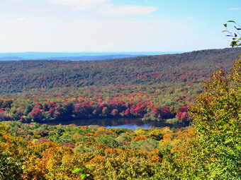
![]()
![]()
![]()
![]()
![]() On Saturday, October 2nd I had committed myself to picking up a hiker at Alder Lake at 8:00 AM and dropping him where the FLT crosses Route 206. I decided I would take Sheila and my gear to go for a hike after I dropped the hiker off. I planned to hike the FLT to the Rock Rift fire tower from the west to remove an old "Trail Closed" sign that was confusing people. At 4:00 AM the ambulance pager went off and I did not get back home until after 6:00 AM. I changed my plan so that I would drop off the hiker, come home and get a few hours of sleep, and then hike to the Hodge Pond lookouts to see some fall colors. I got ready to go to Alder Lake at 7:15 AM and left the house just after 7:30 AM. There was a lot of fog in town as I drove north on Old Route 17 to the Beaverkill Road. Once I turned right and started up the Beaverkill Road the fog disappeared with elevation. As I continued on the road, there were several spots where the fog had gathered in the valleys and the road was high above them. I arrived at Alder Lake at 8:00 AM and Chris was waiting. We said "Hello" and got started on the trip to Route 206. I decided to go back to the Beaverkill Road and drive out Beaverkill Valley Road to Route 206 just north of Roscoe. As I drove Chris and I talked. He is from around Canandaigua Lake, is a tree pathologist and has hiked the Finger Lakes Trail from Allegheny State Park to Route 206. After this weekend, he will have to hike from Alder Lake to Slide Mountain. I turned right on Route 206 and drove over Cat Hollow to the parking area on the left. I dropped Chris off just after 8:30 AM and the headed home through Roscoe. When I got home, I took at 2 hour "nap" getting up at 11:00 AM. I started to get ready at 11:15 AM with Sheila watching my every move. The temperature was 68 degrees on the back porch with some sun but I knew it might be cooler at the trailhead. I put on my White Sierra long-sleeved crew top and a short-sleeved baselayer. I put on a pair of RailRiders hiking pants which are expensive but last along time and have features like deep pockets and a generous cut which I really like. The pants have Velcro closures at the ankles I wore my Keen Targhee II boots which are wearing out but still have a few miles in them. I decided to take my Leki poles with external locks as the internal twist locks fail. I also added my OR floppy hat which I have decided shields me from the sun and allows me to spray some insect repellant on it rather than on me. I also packed a light hat, a pair of gloves, and a light windbreaker. I got my gear in the car and put an excited Sheila in the back seat as I drove out the DeBruce Road toward Frick Pond at 11:40 AM. After about 6 miles, I turned left on the Mongaup Pond and stayed left on Beech Mountain Road at the fork. There were two cars parked in the big lot and two in the smaller lot as I pulled in at 11:55 AM. I set my GPS and we started our hike by crossing the road and headed out on the Flynn Trail toward Hodge Pond. When we hit the wide woods road that is the Flynn Trail, we turned right and noticed that the grass was dry as was the trail bed. The woods road once led to the Beech Mountain Boy Scouts Camp. The camp was serviced by the extension of Beech Mountain Road which is now the Flynn Trail. The temperature was in mid 60's and I was glad I had worn a lighter top and without a jacket. The sun was out and there were white, puffy clouds in the sky. We were keeping a pretty fast pace but it didn't seem to bother me. We walked through the arch Cindy and I had cut in a large hemlock tree that had fallen across the trail. At 1.2 miles we passed the clearing on the right side of the trail. I have never heard a definitive explanation for the existence of the clearing but I suspect it was stripped of dirt to build Beech Mountain Road. In most places there is very little topsoil and the bedrock is close to the surface. We continued on the main trail and headed for the junction with the Big Rock Trail. Along the way I removed some large branches and small trunks that had fallen on the trail. It took us 50 minutes to reach the first trail junction with the Big Rock Trail at 1.7 miles into the hike.
On Saturday, October 2nd I had committed myself to picking up a hiker at Alder Lake at 8:00 AM and dropping him where the FLT crosses Route 206. I decided I would take Sheila and my gear to go for a hike after I dropped the hiker off. I planned to hike the FLT to the Rock Rift fire tower from the west to remove an old "Trail Closed" sign that was confusing people. At 4:00 AM the ambulance pager went off and I did not get back home until after 6:00 AM. I changed my plan so that I would drop off the hiker, come home and get a few hours of sleep, and then hike to the Hodge Pond lookouts to see some fall colors. I got ready to go to Alder Lake at 7:15 AM and left the house just after 7:30 AM. There was a lot of fog in town as I drove north on Old Route 17 to the Beaverkill Road. Once I turned right and started up the Beaverkill Road the fog disappeared with elevation. As I continued on the road, there were several spots where the fog had gathered in the valleys and the road was high above them. I arrived at Alder Lake at 8:00 AM and Chris was waiting. We said "Hello" and got started on the trip to Route 206. I decided to go back to the Beaverkill Road and drive out Beaverkill Valley Road to Route 206 just north of Roscoe. As I drove Chris and I talked. He is from around Canandaigua Lake, is a tree pathologist and has hiked the Finger Lakes Trail from Allegheny State Park to Route 206. After this weekend, he will have to hike from Alder Lake to Slide Mountain. I turned right on Route 206 and drove over Cat Hollow to the parking area on the left. I dropped Chris off just after 8:30 AM and the headed home through Roscoe. When I got home, I took at 2 hour "nap" getting up at 11:00 AM. I started to get ready at 11:15 AM with Sheila watching my every move. The temperature was 68 degrees on the back porch with some sun but I knew it might be cooler at the trailhead. I put on my White Sierra long-sleeved crew top and a short-sleeved baselayer. I put on a pair of RailRiders hiking pants which are expensive but last along time and have features like deep pockets and a generous cut which I really like. The pants have Velcro closures at the ankles I wore my Keen Targhee II boots which are wearing out but still have a few miles in them. I decided to take my Leki poles with external locks as the internal twist locks fail. I also added my OR floppy hat which I have decided shields me from the sun and allows me to spray some insect repellant on it rather than on me. I also packed a light hat, a pair of gloves, and a light windbreaker. I got my gear in the car and put an excited Sheila in the back seat as I drove out the DeBruce Road toward Frick Pond at 11:40 AM. After about 6 miles, I turned left on the Mongaup Pond and stayed left on Beech Mountain Road at the fork. There were two cars parked in the big lot and two in the smaller lot as I pulled in at 11:55 AM. I set my GPS and we started our hike by crossing the road and headed out on the Flynn Trail toward Hodge Pond. When we hit the wide woods road that is the Flynn Trail, we turned right and noticed that the grass was dry as was the trail bed. The woods road once led to the Beech Mountain Boy Scouts Camp. The camp was serviced by the extension of Beech Mountain Road which is now the Flynn Trail. The temperature was in mid 60's and I was glad I had worn a lighter top and without a jacket. The sun was out and there were white, puffy clouds in the sky. We were keeping a pretty fast pace but it didn't seem to bother me. We walked through the arch Cindy and I had cut in a large hemlock tree that had fallen across the trail. At 1.2 miles we passed the clearing on the right side of the trail. I have never heard a definitive explanation for the existence of the clearing but I suspect it was stripped of dirt to build Beech Mountain Road. In most places there is very little topsoil and the bedrock is close to the surface. We continued on the main trail and headed for the junction with the Big Rock Trail. Along the way I removed some large branches and small trunks that had fallen on the trail. It took us 50 minutes to reach the first trail junction with the Big Rock Trail at 1.7 miles into the hike.
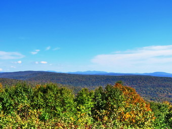 We continued straight ahead on the Flynn Trail until we came to a small tree that had fallen to partly block the trail. I put my pack down and tried to push the tree off the trail. As I was doing this a hiker with a camera walked by on the trail. He passed with a quick "Hi". I tried dragging the sapling off the trail but it was still anchored at the base. I shouldered my pack and we continued on the Flynn Trail passing through the gate that separates state land from Beaverkill Valley Trust property. We could see the other hiker just ahead walking with his camera. After walking for a relatively short time, we arrived at the point where the Flynn Trail bears left down to Hodge Pond. The other hiker turned right and we followed on the woods road toward the site of the Boy Scout camp and the lookout over the pond. The woods road we were walking on was once Beech Mountain Road leading to the Beech Mountain Boy Scout Camp. As we walked I had been removing small branches from the trail by habit. After a short walk, a trail turned off to the left to go down to the pond and the road we were on continued straight ahead. Another road was sandwiched in between the two and leads to the site of the former Boy Scout camp which has been leveled by the Beaverkill Valley Land Trust. We continued straight ahead on the road that started up the hill. The road was covered in leaves which were mostly brown and yellow. We passed a spring house on the right and Sheila stopped to get a drink. She must have been warm as she splashed around a "dug" in the water for several minutes. The grade became steeper as we climbed the hill and at about 2.6 miles the road made a sharp turn to the right. We stopped so that I could take some pictures from a small viewpoint. There were some colors in the leafy landscape but it seemed they were still far from peak color. As I was getting ready to leave the viewpoint, I got a call from one of our EMTs who had taken a call. He needed an access code which I gave him and which, fortunately, worked. After I finished my photography, we continued on the road. As the road made another sharp turn, this time to the left, a trail went off to the right.
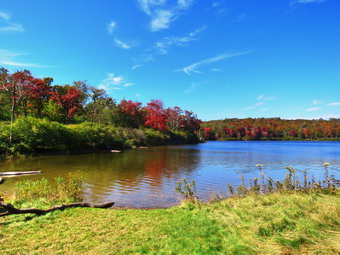 We turned right and walked along the wide path passing some interesting ledge on the left. I stopped to take a few pictures of these impressive stone formations. We continued on the path around Flynn's Point on Beech Mountain until we came to the lookout over Hodge Pond on the right. When I walked out to the stone ledge that makes up the viewpoint, I could see some great color. Most of these colors were around Hodge Pond. I took several pictures at different zooms and at different angles. When I was done, I packed up ad we continued in a counter clockwise direction around Beech Mountain on the woods road. I stopped at one point to take some more pictures of the cliffs and ledges that surround the southern face of Beech Mountain. We started downhill on the woods road and walked a short distance to a beautiful lookout to the east.This lookout has views of the Burrough's Range and other major peaks. I was a little disappointed that the leaves were mostly green with a few patches of yellows and reds. I took quite a few shots and then we continued our hike by walking uphill on the road. I considered bushwhacking to Mongaup Mountain which has some nice views to the north but decided to pass up the opportunity on this hike. We were soon back at the point on the road where he had turned onto the trail around Beech Mountain. We continued on the road and set a quick pace down the hill. Sheila again stopped at the spring and this time dug at the opening to the culvert until water was freely flowing through it. At the base of the hill, we turned right on the woods road that leads down to Hodge Pond. We turned left when the road intersected a jeep trail and ended up at the outlet end of Hodge Pond. We walked over to the shore of the pond where I dropped my pack and got out the camera. Sheila decided to go wading and swimming while I took a look at the pond. The colors I had seen from the lookout were even better from the level of the pond. The colors were not as bright as I had hoped but I looked forward to coming back in a week to see how they developed. I too some shots of the pond concentrating on the leaves. The sky was blue with a few wispy white clouds. I also took some pictures of Sheila in the water. When I was done, I ate a bar and got a drink before picking up and walking to where the Flynn Trail enters the woods. We started climbing the hill back to the junction where we had turned right some time before. This ascent can sometimes seem long but on this day it went quickly. At the top of the hill we stayed to the right on the Flynn Trail and followed the route we had taken out. We passed through the gate and looked up to see some other hikers approaching. I directed Sheila off the trail and she sat down as the others approached. I said "Hello" to the hikers and we struck up a conversation. They are from Livingston Manor and know Lisa Lyons from Morgan Outdoors. I explained my role as a trail supervisor and they let e know they would be interested in doing trail maintenance. As we were talking I got another call form our EMT on a scene asking about the call he was on. We talked for a few moments and then I went back to talking to the hikers. We eventually parted company while Sheila and I continued on the trail.
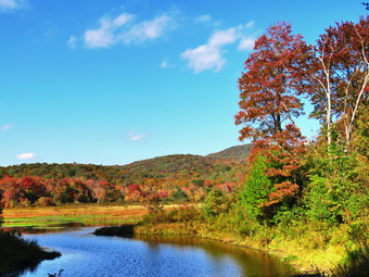 We were soon approaching the junction with the Big Rock Trail. I though about whether to return on the Flynn Trail or add a little mileage by taking the Big Rock Trail. I decided on the Big Rock Trail since it would allow me to check out more trails. We turned right on the Big Rock Trail and started the long downhill hike. The walk down the Big Rock Trail went quickly even though there are several points where it seems the descent has ended only to continue toward Times Square. We were soon at Times Square where we continued straight across to stay on the Big Rock Trail. Times Square which is usually wet and muddy was almost dry. The trails had been almost completely dry up to this time but there were many muddy areas on the Big Rock Trail. As we continued on the trail, we came to the two bridges over the inlet streams. The bridge abutments are beginning to deteriorate and really need to be replaced. I stopped at both bridges to take some shots of the water flowing under the bridges and a few colorful trees. As we continued to hike, we walked through the beautiful spruce forest and over the wooden walkways which also need repair. Some sections of the walkways are poorly supported and some have boards are coming loose. We avoided the mud pit just before the junction with the Quick Lake Trail by following the detour hikers have created. Soon we were at the junction with the Quick Lake Trail where we turned left toward the bridge at the outlet of Frick Pond. The large mud pit that the Willowemoc Trail crew had worked on was still easy to cross due to the increased drainage and stepping stones. Once passed the muddy area, it wasn't long until we were at the bridge. Despite the fact that I have hundreds of pictures from this spot, I took a few more. The trees around the pond were colorful but not quite as far along as the ones around Hodge Pond. I finished my photography and we started up the hill to Gravestone Junction. I noticed that the Lobdell memorial marker was upright. The marker is a memorial to two children who died in the 1930's in a fire that consumed their cabin. As we walked along the Quick Lake Trail back to our cars, I noticed that the trail was pretty wet with surface water and some flowing water. The Willowemoc Trail Crew had done some work here but it is hard to drain the trail as it is the lowest spot in most areas. At the trail register, we continued straight ahead to return to the car in the smaller parking area. By 3:35 PM we were back at the car after hiking 7.3 miles in 3 hours and 40 minutes with 40 minutes of stopped time. This was good for an overall 2.0 mph pace. We also gained 1290 feet of elevation.
![]()
![]()
![]()
![]() On Friday, October 1st I wanted to get out for a short hike between work I had to do at home and cross country practice in the afternoon. At 11:30 AM I asked Cindy if she wanted to go across the street and hike some loops on Round Top but she declined. I started to get ready when the temperature was 62 degrees with a slight breeze blowing. The skies were [partly sunny with some impressive clouds some of which looked a little dark. Sheila was ready to go as she really likes to hike and she was keeping a careful eye on us as we dressed. I put on my White Sierra long-sleeved crew top with no base layer. I put on a pair of RailRiders hiking pants which are expensive but last a long time and have features like deep pockets and a generous cut which I really like. I decided to wear my Keen Cascade hiking boots which are new and all-leather which means they need some work to break them in. I decided to take my Leki poles with external locks as the internal twist locks sometimes fail. I donned my Mammut hoody as the temperature and the breeze made it feel cool. We stepped out of the house at noon. I grabbed Sheila's leash from the car and put it on her to safely cross the street. We walked up the driveway and crossed the street. We walked to the church parking lot and to the back of the church. As we started up the hill, I noticed the number of headstone that were still "down" due to "hillside creep" and a few holes that were opening up. I hope that the town will take the responsibility to maintain the cemetery. We continued the ascent of the steep hill behind the church. The hill is short but gets the circulation pumping and is the steepest and longest climb on the "trail". I let Sheila pull me up the hill which she was willing to do. At the trailhead, I let Sheila off her leash and she immediately began to bound up the trail. We started on the trail by turning left at the trailhead. I knew that other people were using the trails from comments on Facebook and because the trails were becoming well-worn as more and more people use them.
On Friday, October 1st I wanted to get out for a short hike between work I had to do at home and cross country practice in the afternoon. At 11:30 AM I asked Cindy if she wanted to go across the street and hike some loops on Round Top but she declined. I started to get ready when the temperature was 62 degrees with a slight breeze blowing. The skies were [partly sunny with some impressive clouds some of which looked a little dark. Sheila was ready to go as she really likes to hike and she was keeping a careful eye on us as we dressed. I put on my White Sierra long-sleeved crew top with no base layer. I put on a pair of RailRiders hiking pants which are expensive but last a long time and have features like deep pockets and a generous cut which I really like. I decided to wear my Keen Cascade hiking boots which are new and all-leather which means they need some work to break them in. I decided to take my Leki poles with external locks as the internal twist locks sometimes fail. I donned my Mammut hoody as the temperature and the breeze made it feel cool. We stepped out of the house at noon. I grabbed Sheila's leash from the car and put it on her to safely cross the street. We walked up the driveway and crossed the street. We walked to the church parking lot and to the back of the church. As we started up the hill, I noticed the number of headstone that were still "down" due to "hillside creep" and a few holes that were opening up. I hope that the town will take the responsibility to maintain the cemetery. We continued the ascent of the steep hill behind the church. The hill is short but gets the circulation pumping and is the steepest and longest climb on the "trail". I let Sheila pull me up the hill which she was willing to do. At the trailhead, I let Sheila off her leash and she immediately began to bound up the trail. We started on the trail by turning left at the trailhead. I knew that other people were using the trails from comments on Facebook and because the trails were becoming well-worn as more and more people use them.
At the first trail junction, I followed Sheila as she continued straight ahead up the hill toward the viewpoint. There was a slight breeze blowing but I was already getting warm from wearing the hoody and making the ascent. The climb up the hill was a little more tiring than usual. At the viewpoint, I noticed that the brush that I had placed in the trail was still there. This path has a dangerous spot and we have piled brush on it to discourage people from using it. We continued on the main trail and headed to the right to follow it as it turned and headed up the gentle hill through the hardwood forest. The forest was green but the ferns covering the forest floor were beginning to turn brown as the temperatures at night were dipping into the 40's. Sheila was making her own way by staying on the trail sometimes and then running off-trail and chasing game trails. We continued to follow the yellow trail toward the first junction with the blue trail. There were a few branches on the trail that I removed as we hiked. At the first trail junction with the blue trail, we turned right and followed the yellow trail along the base of Round Top. This section was in good shape without any blowdowns and the brush and grass had remained at bay. At the next junction, we turned left and started up to the summit of Round Top on the blue trail. We bypassed the white crossover trail and continued up and over the summit. There was one small tree down on the summit which would require a saw to remove it. The trails were mostly dry with only a few muddy spots. I decided we would skip the white crossover trail but take the switchback on the blue trail. We followed the switchback as it headed out into the woods and then back to the main trail where we turned left. At the bottom of the hill, we turned left on the yellow trail, and walked along the base of Round Top. At the trail junction with the blue trail, we turned right to walk down to the woods road. It was a snap to walk downhill and out the woods road. It was obvious Sheila felt the same way as she was running and bounding ahead of me and then running back up the trail. At the first trail junction, I turned around and started back up the woods road. We started back up the woods road to the junction with the blue trail at a more relaxed pace. We turned left and walked along the yellow trail following the base of the Round Top summit. At the next junction, we turned right and started up the steeper side of the hill on the blue trail. This time we again took the switchback in the blue trail. At the end of the switch, we turned right and right again on the white-blazed crossover trail. We continued on crossover trail to the blue trail on the other side of the hill. We turned right at the end and walked down to the yellow trail. We turned right on the yellow trail and followed it along the base of Round Top once again. At the junction with the blue trail, we turned to the left to stay on the yellow trail to the lookout. At the lookout, we followed the yellow trail as it turned left and descended to the first trail junction. We walked straight out to the trailhead. We turned right to walk to the bottom of the hill. We headed across the church parking lot to the street and crossed the street to our driveway. We were home by 1:05 PM after hiking a little over 2 miles in 1 hour and 5 minutes.
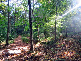
![]()
![]()
![]()
![]()
![]() On Wednesday, September 29th, I wanted to get out for a hike which was a little harder than I had been doing. Lisa wanted to get out for a hike and we decided she would come to my house at 9:00 AM and that we would hike to the Red Hill fire tower from the newer trailhead on Denning Road. The trailhead on Dinch-Coons Road is difficult to access in the winter as the road is not cleared and it is equally different when it is muddy. Many people park at the top of the hill where there is limited parking. It is a half mile downhill to the trailhead parking lot. The return trip can be nearly impossible if there is ice, packed snow or mud on the road. The new trailhead and parking area is on Denning Road a little less than 2 miles from the Claryville Post Office. When I awoke, the temperature was 44 degrees but the sun was out and I knew that would cause the temperature to rise. At 8:30 AM I began to get ready with Sheila keeping a close watch on my movements. I put on my Mammut long-sleeved crew top with a short-sleeved baselayer since the temperature was already cool and I thought it might be cooler at the trailhead. I put on a pair of RailRiders hiking pants which are expensive but last a long time and have features like deep pockets and a generous cut which I really like. I decided to put on my Keen Targhee II hiking boots which fit well and have been discontinued. I grabbed my Leki external lock poles which I have been using since the spring since twist locks have proved unreliable. I also donned my Mammut hoody which was enough zippers to dump heat when needed. I packed a light hat and a pair of light gloves. Lisa arrived at 9:00 AM and I went out to meet her. I put our gear in the back of the car and Sheila in the back seat and we left Livingston Manor at 9:10 AM. I headed out the DeBruce Road passing through DeBruce and Willowemoc. At the end of the road I turned right on Route 47 and drove out to the Denning Road. Here I turned left and drove through Claryville. Two miles after the Claryville Post Office, we came to the new parking area on the right side of the road and pulled into the lot. There is a sign hanging from the support on the side of the road to designate the parking area and a kiosk with a description and maps. There were no other cars parked. I set my GPS unit and we walked to the back of the parking area and started up the trail at 9:35 AM with the temperature standing at 46 degrees.
On Wednesday, September 29th, I wanted to get out for a hike which was a little harder than I had been doing. Lisa wanted to get out for a hike and we decided she would come to my house at 9:00 AM and that we would hike to the Red Hill fire tower from the newer trailhead on Denning Road. The trailhead on Dinch-Coons Road is difficult to access in the winter as the road is not cleared and it is equally different when it is muddy. Many people park at the top of the hill where there is limited parking. It is a half mile downhill to the trailhead parking lot. The return trip can be nearly impossible if there is ice, packed snow or mud on the road. The new trailhead and parking area is on Denning Road a little less than 2 miles from the Claryville Post Office. When I awoke, the temperature was 44 degrees but the sun was out and I knew that would cause the temperature to rise. At 8:30 AM I began to get ready with Sheila keeping a close watch on my movements. I put on my Mammut long-sleeved crew top with a short-sleeved baselayer since the temperature was already cool and I thought it might be cooler at the trailhead. I put on a pair of RailRiders hiking pants which are expensive but last a long time and have features like deep pockets and a generous cut which I really like. I decided to put on my Keen Targhee II hiking boots which fit well and have been discontinued. I grabbed my Leki external lock poles which I have been using since the spring since twist locks have proved unreliable. I also donned my Mammut hoody which was enough zippers to dump heat when needed. I packed a light hat and a pair of light gloves. Lisa arrived at 9:00 AM and I went out to meet her. I put our gear in the back of the car and Sheila in the back seat and we left Livingston Manor at 9:10 AM. I headed out the DeBruce Road passing through DeBruce and Willowemoc. At the end of the road I turned right on Route 47 and drove out to the Denning Road. Here I turned left and drove through Claryville. Two miles after the Claryville Post Office, we came to the new parking area on the right side of the road and pulled into the lot. There is a sign hanging from the support on the side of the road to designate the parking area and a kiosk with a description and maps. There were no other cars parked. I set my GPS unit and we walked to the back of the parking area and started up the trail at 9:35 AM with the temperature standing at 46 degrees.
 As we began the walk up the trail, it was obvious that the trail was pretty dry with only a few damp spots. I wasn't sure this would continue to the summit as there had been some rain during the week. We almost immediately came to a set of stone steps. They were well constructed and in just the right place to help out hikers. I also noticed that a woods road ran off to the right and thought about walking up it some other time. We continued on the trail which was still in good shape even after it had been in place for over a year. The treadway was wide and flat with few obstacles. There were several switchbacks and it was obvious that one requirement of the construction was a moderate grade. The forest at these lower elevations was primarily evergreen which is unusual in the Catskills. We did run across a few branches on the trail which we removed. There was one very large tree across the trail which was easy enough to get over but will require a sawyer crew to remove. At .4 miles the trail turned sharply to the left in one of its many switchback and we entered an area of hardwoods. There was a small stream that ran across the trail and the construction crew had create a deep ditch along the side of the trail. The ditch directed the water across the trail and at that point there was a stone construction to allow the water to cross the trail and hikers to easily cross the water. This was repeated several other times on the trail. We stopped to take a few pictures of the trail. Shortly, we ran into the one wet spot on the trail but it was easily avoided. At .7 miles I could see a series of ledges ahead and stone steps that wound between them. I stopped to take some pictures but knew that this would be repeated several more times over the next quarter mile. Each time I stopped to take pictures and each time Sheila posed nicely for some shots. At 1.3 miles we came to a trail junction with the trail that comes in from the Dinch-Coons Road trailhead. There were new signs and one sign indicated the Dinch Road trailhead was .8 miles to the left and the fire tower was .6 miles to the right. We stopped for a few minutes to get a drink and then continued toward the tower.
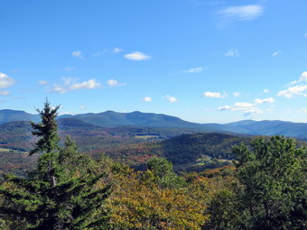 After walking about quarter mile, there was a spur trail to a spring on the right side of the trail and then a short switchback. The grade increased from a consistent 10% to a steeper 20% and I could feel it. Fortunately, there was still very little mud but there were plenty of rocks and roots to trip over. There was plenty of sun which made me feel good but was also contributing to making me pretty warm. The last .3 miles averages a little over a 20% grade and is challenging but did not seem too bad. Lisa and I talked as we walked which made the hike go much more quickly. At 11:00 AM we arrived at the tower clearing which we had to ourselves. I dropped my pack and got out my camera to take some pictures of the tower. I decided not to tether Sheila to a picnic table knowing she would follow me up the tower. Unlike some dogs, Sheila has no problem climbing up and down the open steps. Lisa and I started to climb the tower with Sheila right behind me. Without looking, I could tell when I was above the treeline as the wind hit me. We eventually made it to the landing below the cab. I began to take pictures of the surrounding scenery in all directions. There was no haze in any direction and the views were good in all directions. When there is no haze or fog, the views of the Catskill peaks from this tower are spectacular. The leaves were just beginning to change color but were far from spectacular. After taking quite a few shots, we descended the tower. I noticed the shadow of the tower in the clearing a took a picture as well as some pictures of the cabin. I got a drink before starting the hike back down the mountain at 11:15 PM. It had taken us 1.5 hours to hike to the summit and I hoped we would make the trip back go faster. We moved quickly down the steeper section of the trail to the junction. We made the left turn onto the new trail and continued to keep a fast pace. The trail surface was excellent and allowed us to keep moving. As we started through the bottom section, Sheila began to alert and we saw an older couple hiking toward us. I pulled Sheila off the trail to allow them to pass by. A little further on Sheila again altered and almost immediately a loose dog came up the trail followed closely by another dog and the owner. The first dog wanted to "play" with Sheila but Sheila was not interested. I pulled her off the trail and the owner of the other dogs got them leashed. She passed by with an apology and we continued down the trail. Soon we were descending the last few steps to the parking area. It was 12:15 PM and we had hiked 3.7 miles in 2 hours and 30 minutes with 35 minutes of stopped time. The trip up took an hour and 25 minutes but the return trip only took us an hour. Our elevation gain was 1200 feet. The temperature had risen to 52 degrees.
![]()
![]()
![]()
![]() On Monday, September 27th I wanted to get out for a hike after several days of being away from the trails. A combination of rain, cross country meets, and ambulance calls had kept me away from the activity that relaxes me the most. I slept a little late as we had an overnight ambulance call. By the time I was ready to hike I knew that I only had time to go across the street to hike on Round Top. It was 11:00 AM by the time I started to get dressed with the temperature a rather "cool" 64 degrees. Sheila was ready to go as she really likes to hike and she was keeping a careful eye on me as we dressed. I put on my White Sierra long-sleeved crew top but decided against a baselayer. I put on a pair of RailRiders hiking pants which are expensive but last along time and have features like deep pockets and a generous cut which I really like. The pants have Velcro closures at the ankles. I decided to wear my Keen Cascade hiking boots which are new and all-leather which means they need some work to break them in. I decided to take my Leki poles with external locks as the internal twist locks sometimes fail. At 11:30 AM we walked out the door to start the hike. I grabbed Sheila's leash from the car and we walked up the driveway. I aimed to hike for about an hour. Sheila was happy to get out as we headed down the driveway and across the street. We crossed the street and walked to the parking area by the Presbyterian Church. We walked to the back of the church and began the ascent of the steepest hill behind the church. The hill is short but gets the circulation pumping and is the steepest and longest climb on the "trail." Sheila helped me along by pulling me up the hill. I looked at the many headstones that have tipped over and the holes developing. I hoped the town would take responsibility to do some repairs on the headstones that have fallen over and the holes that have developed. At the top of the hill we started on the trail by turning left at the trailhead where I let Sheila off her leash so that she could explore. The trail was mostly dry with a few muddy spots. The trail was worn showing that people had been using it.
On Monday, September 27th I wanted to get out for a hike after several days of being away from the trails. A combination of rain, cross country meets, and ambulance calls had kept me away from the activity that relaxes me the most. I slept a little late as we had an overnight ambulance call. By the time I was ready to hike I knew that I only had time to go across the street to hike on Round Top. It was 11:00 AM by the time I started to get dressed with the temperature a rather "cool" 64 degrees. Sheila was ready to go as she really likes to hike and she was keeping a careful eye on me as we dressed. I put on my White Sierra long-sleeved crew top but decided against a baselayer. I put on a pair of RailRiders hiking pants which are expensive but last along time and have features like deep pockets and a generous cut which I really like. The pants have Velcro closures at the ankles. I decided to wear my Keen Cascade hiking boots which are new and all-leather which means they need some work to break them in. I decided to take my Leki poles with external locks as the internal twist locks sometimes fail. At 11:30 AM we walked out the door to start the hike. I grabbed Sheila's leash from the car and we walked up the driveway. I aimed to hike for about an hour. Sheila was happy to get out as we headed down the driveway and across the street. We crossed the street and walked to the parking area by the Presbyterian Church. We walked to the back of the church and began the ascent of the steepest hill behind the church. The hill is short but gets the circulation pumping and is the steepest and longest climb on the "trail." Sheila helped me along by pulling me up the hill. I looked at the many headstones that have tipped over and the holes developing. I hoped the town would take responsibility to do some repairs on the headstones that have fallen over and the holes that have developed. At the top of the hill we started on the trail by turning left at the trailhead where I let Sheila off her leash so that she could explore. The trail was mostly dry with a few muddy spots. The trail was worn showing that people had been using it.
At the first trail junction, I followed Sheila as she turned right and started up the woods road which has the gentler approach of the two. We walked up the road to the first trail junction with the upper blue trail and turned left to follow the yellow trail along the base of Round Top. The trails were a little damp and there were quite a few new benches on the trail. I stopped to remove the branches or used my poles to flick the smaller ones aside. At the next junction with the blue trail we turned right and headed up the blue trail, toward the summit. When we got to the switchback, we turned right and followed it until it came back to the main blue trail. We turned right and passed by the white crossover trail. We passed over the summit and continued on the blue trail down the other side of the hill. We passed the white crossover trail and then turned right on the yellow trail. We again followed the yellow trail along the base of Round Top to the junction with the blue trail. This time we turned left and followed the yellow trail downhill passing the "Resting Rock" to the lookout. The forest floor was becoming covered with leaves that had fallen from the trees. Most of these leaves had gone from green to brownout passing through the brilliant colors that make autumn in the Catskills so beautiful! Many the ferns were starting to turn brown as the nights are getting cooler. At the viewpoint, we turned left and started to follow the yellow trail downhill to the first trail junction. I noticed that there was still some brush blocking the path to the viewpoint. People who are just trying to "help" sometimes clear the brush but it just means that I have to find branches and brush to throw on the path to block it. The path has a potentially dangerous gap especially in the winter. We started down the steep hill toward the first trail junction. At the bottom of the hill we turned around to start back up the hill to the viewpoint. At the top of the hill we followed the yellow trail as it turned right and started uphill. At the first junction with the blue trail, we turned right and followed the yellow trail along the base of Round Top. At the next junction with the blue trail, we turned left and headed up the blue trail toward the summit. We came to the white crossover trail again and turned left to take it over to the main blue trail. We turned left and then left again on the switchback. We walked the switchback toward the main blue trail and turned left to continue downhill on the blue trail toward the junction with the yellow trail. We turned left and walked along the base of Round Top on the yellow trail to the next junction with the blue trail. This time we turned right and walked down the yellow trail to the woods road that took us back to the first trail junction. We turned left and walked out to the trailhead at the top of the cemetery hill. On the way out we met a woman coming toward us with two small dogs. She picked up the smaller one as it was barking and snarling. The other she allowed to walk along the trail without a leash saying 'That one is friendly.' I noticed two cars parked at the trailhead and asked if one ones hers. At first she said one was and then denied it. I mentioned we did not advise people to park there as they block the road which is inconsiderate. At the trailhead, I noticed that one car had a woman in the drivers' seat. She waved at me and I shook my head and waved back. We walked down the hill and out to the road through the church parking lot. We walked over to the driveway and back to the house. It was 12:25 PM and we had hiked a little over 2 miles in an hour.
![]()
![]()
![]()
![]() On Wednesday, September 22nd I wanted to continue my string of consecutive days of hiking. I had planned another longer hike but circumstances intervened. The morning proved to be a bust as I had work to do a the ambulance building. When I finished stocking the rigs, a call came in to finish off the morning and start the afternoon. At 1:00 I asked Cindy if she wanted to go across the street and hike some loops on Round Top and she agreed. We started to get ready when the temperature was 71 degrees with a slight breeze blowing. The skies looked like it might rain which was the forecast. Sheila was ready to go as she really likes to hike and she was keeping a careful eye on us as we dressed. I put on my White Sierra long-sleeved crew top with no base layer. I put on a pair of RailRiders hiking pants which are expensive but last a long time and have features like deep pockets and a generous cut which I really like. I decided to wear my Keen Cascade hiking boots which are new and all-leather which means they need some work to break them in. I decided to take my Leki poles with external locks as the internal twist locks sometimes fail. We stepped out of the house at 1:45 PM. I grabbed Sheila's leash from the car and put it on her to safely cross the street. We walked up the driveway and crossed the street. We walked to the church parking lot and to the back of the church. As we started up the hill, Cindy and I noticed the number of headstone that had fallen over from "hillside creep" and a few holes that were opening up. We discussed our hope that the town would take the responsibility to maintain the cemetery. We continued the ascent of the steep hill behind the church. The hill is short but gets the circulation pumping and is the steepest and longest climb on the "trail". I let Sheila pull me up the hill which she was willing to do. At the trailhead, I let Sheila off her leash and she immediately began to bound up the trail. We started on the trail by turning left at the trailhead. I knew that other people were using the trails from comments on Facebook and because the trails were becoming well-worn as more and more people use them.
On Wednesday, September 22nd I wanted to continue my string of consecutive days of hiking. I had planned another longer hike but circumstances intervened. The morning proved to be a bust as I had work to do a the ambulance building. When I finished stocking the rigs, a call came in to finish off the morning and start the afternoon. At 1:00 I asked Cindy if she wanted to go across the street and hike some loops on Round Top and she agreed. We started to get ready when the temperature was 71 degrees with a slight breeze blowing. The skies looked like it might rain which was the forecast. Sheila was ready to go as she really likes to hike and she was keeping a careful eye on us as we dressed. I put on my White Sierra long-sleeved crew top with no base layer. I put on a pair of RailRiders hiking pants which are expensive but last a long time and have features like deep pockets and a generous cut which I really like. I decided to wear my Keen Cascade hiking boots which are new and all-leather which means they need some work to break them in. I decided to take my Leki poles with external locks as the internal twist locks sometimes fail. We stepped out of the house at 1:45 PM. I grabbed Sheila's leash from the car and put it on her to safely cross the street. We walked up the driveway and crossed the street. We walked to the church parking lot and to the back of the church. As we started up the hill, Cindy and I noticed the number of headstone that had fallen over from "hillside creep" and a few holes that were opening up. We discussed our hope that the town would take the responsibility to maintain the cemetery. We continued the ascent of the steep hill behind the church. The hill is short but gets the circulation pumping and is the steepest and longest climb on the "trail". I let Sheila pull me up the hill which she was willing to do. At the trailhead, I let Sheila off her leash and she immediately began to bound up the trail. We started on the trail by turning left at the trailhead. I knew that other people were using the trails from comments on Facebook and because the trails were becoming well-worn as more and more people use them.
At the first trail junction, we followed Sheila as she continued straight ahead up the hill toward the viewpoint. There was a slight breeze blowing and Cindy remarked that it was keeping us cool and blowing the insects away. The climb up the hill was a little more tiring than usual. At the viewpoint, I noticed that the brush that I had placed in the trail was still there. This path has a dangerous spot and we have piled brush on it to discourage people from using it. We continued on the main trail and headed to the right to follow it as it turned and headed up the gentle hill through the hardwood forest. The forest was green but the ferns covering the forest floor were beginning to turn brown with the coming of fall. Sheila was making her own way by staying on the trail sometimes and then running off-trail and chasing game trails. We continued to follow the yellow trail toward the first junction with the blue trail. There were a few branches on the trail that we removed as we hiked. At the first trail junction with the blue trail, we turned right and followed the yellow trail along the base of Round Top. This section was in good shape without any blowdowns and the brush and grass had remained at bay. At the next junction, we turned left and started up to the summit of Round Top on the blue trail. We bypassed the white crossover trail and continued up and over the summit. The trails were mostly dry with only a few muddy spots. I decided we would skip the white crossover trail but take the switchback on the blue trail. We followed the switchback as it headed out into the woods and then back to the main trail where we turned left. At the bottom of the hill, we turned left on the yellow trail, and walked along the base of Round Top. At the trail junction with the blue trail, we turned right to walk down to the woods road. It was a snap to walk downhill and out the woods road. It was obvious Sheila felt the same way as she was running and bounding ahead of us and then running back up the trail. At the first trail junction, I turned around and started back up the woods road. Cindy was unsure she wanted to continue but I was able to convince her to come along. We started back up the woods road to the junction with the blue trail at a more relaxed pace. We talked about many things as we took our time walking. We turned left and walked along the yellow trail following the base of the Round Top summit. At the next junction, we turned right and started up the steeper side of the hill on the blue trail. This time we again took the switchback in the blue trail. At the end of the switch, we turned right and right again on the white-blazed crossover trail. We continued on crossover trail to the blue trail on the other side of the hill. We turned right at the end and walked down to the yellow trail. We turned right on the yellow trail and followed it along the base of Round Top once again. At the junction with the blue trail, we turned to the left to stay on the yellow trail to the lookout. At the lookout, we followed the yellow trail as it turned left and descended to the first trail junction. We walked straight out to the trailhead. The skies were beginning to cloud over and a few drops of rain fell from the sky. We turned right to walk to the bottom of the hill. We headed across the church parking lot to the street. We crossed the street to our driveway and were home by 2:55 PM after hiking a little over 2 miles in 1 hour and 10 minutes.