
What You Missed
Fall 2015
Fall 2015
![]()
![]()
![]()
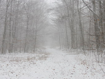
![]() On Saturday, December 19th, I knew that I had to get out for a hike after almost two weeks of various commitments and a nagging cold! Every time I left the house Sheila would smell my clothes and then go lay down on the couch. She was ready to get out and run! I decided to go to Frick Pond as I didn't know how far I could hike with my breathing limited by my congestion. After completing various chores around the house, I got Sheila in the car and headed for Frick Pond sometime after 1:00 PM. In Livingston Manor the sun was out but there was a slight breeze and the temperature was in the high 30's. I decided to wear a warm outfit including tights under my Winter Wander pants and a long-sleeved baselayer with a light wool top. As I drove out DebRuce Road the temperature seemed to drop quickly and there was snow on the road. By the time I got to the Frick Pond parking area the temperature was barely 30 degrees and there was more than a dusting of snow. The skies were very cloudy and some snow was beginning to fall as we started out the Quick Lake Trail toward Frick Pond. The trail was very wet from several days of rain but some of it was frozen due to the low temperatures since then. By the time we got to the bridge at the outlet of Frick Pond the snow was beginning to swirl. I looked out at the pond and decided not to stop to take pictures. Although we had been hiking for some minutes which usually warms me up, I was glad to have worn the warmer layers and felt no need to open any zippers. We continued on around the pond and stayed on the Quick Lake Trail at the next junction. The trail continued to be wet and we had to walked around some spots which were flooded. We crossed the small stream in the woods and headed up to Iron Wheel Junction. By the time we got to there the snow was really coming down and there was about an inch on the ground. I stopped to take a few pictures and decided to turn right on the Logger's Loop. We turned right and started on the Logger's Loop for Times Square.The snow intensified until it was almost a whiteout. I stopped one more time on the Logger's Loop to take a few more pictures. Soon we were at Tomes Square and I considered the various options. I decided1 to simply continue on the Logger's Loop back to Gravestone Junction. We walked uphill and crossed the "bridge" I had helped build during the summer of trail maintenance. As we broke out of the woods and headed to Gravestone Junction, the sun came out and the skies were blue. I stopped to take a few pictures since I though the rapidly changing conditions were interesting. The sun sparkled off the snow on the ground and on the trees. We continued to the junction and turned left on the Quick Lake Trail to head back to the car. We arrived back at the car at 2:05 Pm having hiked 3.7 miles in an hour and 20 minutes. As I was putting my equipment in the car, the wind started to blow again and snow began the swirl. Driving down the Mongaup Pond Road I came to one spot where there was a complete whiteout. When I reached Livingston Manor there was no snow in the air or on the ground.
On Saturday, December 19th, I knew that I had to get out for a hike after almost two weeks of various commitments and a nagging cold! Every time I left the house Sheila would smell my clothes and then go lay down on the couch. She was ready to get out and run! I decided to go to Frick Pond as I didn't know how far I could hike with my breathing limited by my congestion. After completing various chores around the house, I got Sheila in the car and headed for Frick Pond sometime after 1:00 PM. In Livingston Manor the sun was out but there was a slight breeze and the temperature was in the high 30's. I decided to wear a warm outfit including tights under my Winter Wander pants and a long-sleeved baselayer with a light wool top. As I drove out DebRuce Road the temperature seemed to drop quickly and there was snow on the road. By the time I got to the Frick Pond parking area the temperature was barely 30 degrees and there was more than a dusting of snow. The skies were very cloudy and some snow was beginning to fall as we started out the Quick Lake Trail toward Frick Pond. The trail was very wet from several days of rain but some of it was frozen due to the low temperatures since then. By the time we got to the bridge at the outlet of Frick Pond the snow was beginning to swirl. I looked out at the pond and decided not to stop to take pictures. Although we had been hiking for some minutes which usually warms me up, I was glad to have worn the warmer layers and felt no need to open any zippers. We continued on around the pond and stayed on the Quick Lake Trail at the next junction. The trail continued to be wet and we had to walked around some spots which were flooded. We crossed the small stream in the woods and headed up to Iron Wheel Junction. By the time we got to there the snow was really coming down and there was about an inch on the ground. I stopped to take a few pictures and decided to turn right on the Logger's Loop. We turned right and started on the Logger's Loop for Times Square.The snow intensified until it was almost a whiteout. I stopped one more time on the Logger's Loop to take a few more pictures. Soon we were at Tomes Square and I considered the various options. I decided1 to simply continue on the Logger's Loop back to Gravestone Junction. We walked uphill and crossed the "bridge" I had helped build during the summer of trail maintenance. As we broke out of the woods and headed to Gravestone Junction, the sun came out and the skies were blue. I stopped to take a few pictures since I though the rapidly changing conditions were interesting. The sun sparkled off the snow on the ground and on the trees. We continued to the junction and turned left on the Quick Lake Trail to head back to the car. We arrived back at the car at 2:05 Pm having hiked 3.7 miles in an hour and 20 minutes. As I was putting my equipment in the car, the wind started to blow again and snow began the swirl. Driving down the Mongaup Pond Road I came to one spot where there was a complete whiteout. When I reached Livingston Manor there was no snow in the air or on the ground.
![]()
![]()
![]()
![]() On Monday, December 7th, I decided I wanted get out and do a hike close to home since the weather was nice and the rest of the week was looking very busy. I decided to go to Trout Pond since it is close and offers some nice views and since I had been to Frick Pond so many times in the last few weeks. I had encountered hunters at Trout Pond in past years but they were few. Cindy decided she would go with us so we got dress, put our gear in the trunk and an overjoyed Sheila in the back seat. We left Livingston Manor just after 9:30 AM and headed to Roscoe on State Route 17. I got on Route 206 and followed it across the Delaware County line to Morton Hill Road. After a left turn on Morton Hill Road, I drove to the intersection with Russell Brook Road. I turned around and parked on the side of the road to avoid the parking area which is private. We began our hike down Russell Brook Road at 10:05 AM. The air still seemed cold to me so I wore my Mammut Hoody, a hat and light gloves. I had put on a pair of tights under my MH Winter Wander pants and wore a long-sleeved baselayer with a long-sleeved light wool top. We continued on down Russell Brook Road to the overlook of the falls. There was some water in the stream and the upper falls had a good flow. I decided not to stop for pictures on the way out and we continued down toward the parking area. There was one car parked in the lot just above the upper falls but there were none in the lower lot. We got on the woods road that goes down to the bridge that crosses the brook. As we crossed the bridge, I noted that the bridge had a thin layer of frost and was slippery. We decided not to walk to the falls and continued on the main trail to the register. At the trail junction just after the register we turned to the left to climb the steeper hill toward Mud Pond. The trail was rather wet with running water and a few muddy spots. The ascent went quickly and I showed Cindy several spots where we had cleared blowdowns on a previous visit. The sun was out and it was getting warmer but there was a slight breeze blowing. I decided to open up the zippers on my Hoody but to keep it on. We reached the top of the hill at 10:40 AM after hiking 1.4 miles and as we started down the other side we heard gunshots. The gunshots were pretty far away but they reminded us to keep a watch for hunters nearer to us. The woods road had new ruts from a vehicle that appeared to be a pickup truck. The only access is through the locked gate at the lower parking area which made the tracks somewhat of a mystery. At 1.6 miles we made a right to follow the trail up to the shoulder of Cherry Ridge. We kept hiking on the relatively wet trail trying to avoid the numerous muddy areas.
On Monday, December 7th, I decided I wanted get out and do a hike close to home since the weather was nice and the rest of the week was looking very busy. I decided to go to Trout Pond since it is close and offers some nice views and since I had been to Frick Pond so many times in the last few weeks. I had encountered hunters at Trout Pond in past years but they were few. Cindy decided she would go with us so we got dress, put our gear in the trunk and an overjoyed Sheila in the back seat. We left Livingston Manor just after 9:30 AM and headed to Roscoe on State Route 17. I got on Route 206 and followed it across the Delaware County line to Morton Hill Road. After a left turn on Morton Hill Road, I drove to the intersection with Russell Brook Road. I turned around and parked on the side of the road to avoid the parking area which is private. We began our hike down Russell Brook Road at 10:05 AM. The air still seemed cold to me so I wore my Mammut Hoody, a hat and light gloves. I had put on a pair of tights under my MH Winter Wander pants and wore a long-sleeved baselayer with a long-sleeved light wool top. We continued on down Russell Brook Road to the overlook of the falls. There was some water in the stream and the upper falls had a good flow. I decided not to stop for pictures on the way out and we continued down toward the parking area. There was one car parked in the lot just above the upper falls but there were none in the lower lot. We got on the woods road that goes down to the bridge that crosses the brook. As we crossed the bridge, I noted that the bridge had a thin layer of frost and was slippery. We decided not to walk to the falls and continued on the main trail to the register. At the trail junction just after the register we turned to the left to climb the steeper hill toward Mud Pond. The trail was rather wet with running water and a few muddy spots. The ascent went quickly and I showed Cindy several spots where we had cleared blowdowns on a previous visit. The sun was out and it was getting warmer but there was a slight breeze blowing. I decided to open up the zippers on my Hoody but to keep it on. We reached the top of the hill at 10:40 AM after hiking 1.4 miles and as we started down the other side we heard gunshots. The gunshots were pretty far away but they reminded us to keep a watch for hunters nearer to us. The woods road had new ruts from a vehicle that appeared to be a pickup truck. The only access is through the locked gate at the lower parking area which made the tracks somewhat of a mystery. At 1.6 miles we made a right to follow the trail up to the shoulder of Cherry Ridge. We kept hiking on the relatively wet trail trying to avoid the numerous muddy areas.
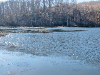
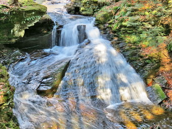 The ascent continued for the next 1.2 miles until at 2.7 miles into the hike when we were at the highest point and ready to start the descent to Trout Pond. We had hiked the southern exposure and there was absolutely no ice or snow on the trail or in the woods. I had taken some pictures of the bare trail hoping to contrast them with the northern exposure which I thought might have some wintry deposits. There were a few small branches across the trail and some large pieces that I was able to remove without tools. As we descended toward Trout Pond the were two major blowdowns that would require an axe and saw to clear. The trail remained relatively wet requiring us to watch our footing in the slippery mud and on the slippery leaves. As we approached the inlet we saw a man standing on the bridge wearing a very bright orange jacket. He had no rifle or any other equipment for that matter. He asked us if we had walked all the way around and we told him we were finishing the loop. I again decided not to stop as there was nothing remarkable to photograph. We continued on the main trail toward the outlet of the pond and when we looked back the man was gone. The trail remained wet and muddy with some deep ruts but we had no problem working around them. As we approached the outlet end of the pond, we could hear a slight jingling noise. We finally decided that the thin layer of ice on the pond was breaking up with the slight breeze and increased temperature from the sun. The small pieces of ice were hitting each other making a sound almost like breaking glass or small bells. I tried to take some pictures of the ice but the magic was in being there to hear and see this unusual event. At the lower end of the pond I looked at the skies which were devoid of any clouds and bypassed this stop. It was obvious that the pond was very low as the water was not even lapping at the outlet dam and on the far shore I could see some old stumps sticking up. The hike from the outlet to the trail junction is all downhill and really did go quickly. We were soon back at the register box where we continued on the main trail toward the parking area. There was now one car in the lot. As we walked up the road back to the car, I stopped at the overlook and decided to walk down to take a few shots of the upper falls. I returned to the road and we finished with the hike up Russell Brook Road back to the car. We arrived back at 12:30 PM having covered 5.5 miles and 1120 vertical feet in 2 hours and 25 minutes.
![]()
![]()
![]()
![]()
![]() On Saturday, December 5th I had decided that I wanted to get away from the Frick Pond area and hike in an area where hunting is not permitted. I though of Harriman State Park but knew I would have to choose an out of the way location as the park is mobbed on weekends. The forecast was for sunny skies and temperatures in the high 40's which I knew would make the area even more attractive. I decided I wanted to hike south of Route 106 to the west of Little Long Pond. I was not sure of my route but thought I would take in Tom Jones Mountain and Parker Cabin Mountain. This was my plan when I went to bed. The fire siren and ambulance pager sounded at 12:30 AM for a working structure fire. There were no injuries at the scene but we stayed to "rehab" some fire-fighters and I did not get back to bed until 3:00 AM. I slept until 8:00 AM but could not get back to sleep. When I got up the temperature was in the high 30's and the sun was out. I decided I would go on the hike even though I was tired. I was 15 minutes away from leaving when the pager again sounded and we responded on a call. By the time I got back I questioned whether I should attempt to execute my plan but in the end decided to go. I left sometime before 11:00 AM and headed down Route 17 toward Middletown. After stopping in Goshen for gas, I continued on and took Long Mountain Parkway (Route 6) to the traffic circle. From there I picked up Seven Lakes Drive and continued to the Kanawauke Circle where I picked up Route 106 heading west. I was immediately confronted by a sign announcing "Road Closed Ahead"! I knew that a bridge had been declared unsafe but it had been at least two years and it was still not fixed. I pulled into the parking area and weighed my options. I could park and walk over a mile on the road to where I wanted to start the hike. I could drive back to the Tiorati Circle and head toward Pyngyp Mountain. I could just go home and rest. I finally decided to park at Silvermine Lake and hike to Black Mountain. This seemed like q good choice as I had noticed only a few cars in the parking lot when we passed by. I drove back out Seven Lakes Drive to Silvermine Lake and parked at 12:15 PM. I got ready to hike by putting Sheila on her leash. I left on my Mammut Hoody as there was a breeze and it still seemed a little cool.
On Saturday, December 5th I had decided that I wanted to get away from the Frick Pond area and hike in an area where hunting is not permitted. I though of Harriman State Park but knew I would have to choose an out of the way location as the park is mobbed on weekends. The forecast was for sunny skies and temperatures in the high 40's which I knew would make the area even more attractive. I decided I wanted to hike south of Route 106 to the west of Little Long Pond. I was not sure of my route but thought I would take in Tom Jones Mountain and Parker Cabin Mountain. This was my plan when I went to bed. The fire siren and ambulance pager sounded at 12:30 AM for a working structure fire. There were no injuries at the scene but we stayed to "rehab" some fire-fighters and I did not get back to bed until 3:00 AM. I slept until 8:00 AM but could not get back to sleep. When I got up the temperature was in the high 30's and the sun was out. I decided I would go on the hike even though I was tired. I was 15 minutes away from leaving when the pager again sounded and we responded on a call. By the time I got back I questioned whether I should attempt to execute my plan but in the end decided to go. I left sometime before 11:00 AM and headed down Route 17 toward Middletown. After stopping in Goshen for gas, I continued on and took Long Mountain Parkway (Route 6) to the traffic circle. From there I picked up Seven Lakes Drive and continued to the Kanawauke Circle where I picked up Route 106 heading west. I was immediately confronted by a sign announcing "Road Closed Ahead"! I knew that a bridge had been declared unsafe but it had been at least two years and it was still not fixed. I pulled into the parking area and weighed my options. I could park and walk over a mile on the road to where I wanted to start the hike. I could drive back to the Tiorati Circle and head toward Pyngyp Mountain. I could just go home and rest. I finally decided to park at Silvermine Lake and hike to Black Mountain. This seemed like q good choice as I had noticed only a few cars in the parking lot when we passed by. I drove back out Seven Lakes Drive to Silvermine Lake and parked at 12:15 PM. I got ready to hike by putting Sheila on her leash. I left on my Mammut Hoody as there was a breeze and it still seemed a little cool.
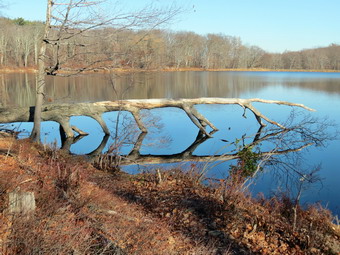
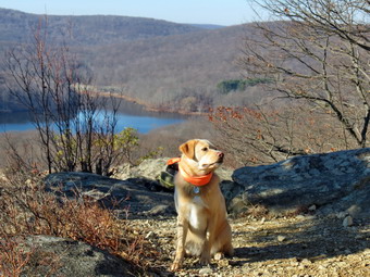 We walked out of the parking area toward the lake. I remembered that the yellow Menomine Trail was to the right and followed the western shore heading south. We easily picked up the trail and started out along the reactively flat but very rocky trail. The sky was blue and the sun was shining and all that was missing were some white, puffy clouds in the sky. We stopped on the shore of the lake so that I could take a few pictures and then we continued our hike. At about .9 miles the trail began to gain some elevation. I realized that I had never done the hike from this direction but had always descended this part of the trail. As we climbed. Sheila alerted and I looked up to see a group of about a dozen hikers coming down the trail. I put Shei8la on her leash and waited for the group to pass. I said "hello" as they walked by. While I waited, I took off my Mammut Hoody and put on a lighter windbreaker. I hesitated in even donning another jacket but the breeze was still blowing and I was sweaty. After the group passed, we continued our climb and soon were near the top. I could hear more voices ahead and check my map to find we were near the Brien Shelter. I put Sheila back on her leash as we approached the Shelter to find several groups of hikers including a scout troop of a bout a dozens young men and two leaders. I wanted to get passed the group and ahead of them on the trail. As I made a left turn on the Ramapo-Dunderberg Trail, several, of the boys surged around us eager to start their climb. This made Sheila nervous until the leaders called them back and we were able to climb the rocky trail to the more level spot at the top. In the .7 miles from the start of the climb passed the shelter we had gained 400 feet. We were now headed ENE and the trail dropped and the climbed again. At 1.9 miles we began a descent of 250 feet over .4 miles to the Silvermine Ski Road. On the way down we caught up to another hiker who met a friend at the woods road. I said "Hello" but didn't wait too long since the climb up Black Mountain was next. I was still ahead of the Boy Scouts and I wanted it to stay that way! The climb starts off steeply and then alternates between flatter sections and steeper ones with a rock scramble right at the top. At about 2.4 miles there is a nice viewpoint that overlooks Silvermine Lake. We stopped so that I could take a few pictures and I noticed a group of hikers with a small dog ahead on the next lookout. I took some pictures of the lake and a few of a pine tree perched on the rocks. I took a few more with Sheila before heading up the trail The other hikers did not have their dog on a leash and as we passed with Sheila on her leash the dog came over to growl at her.
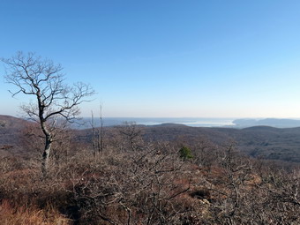 We continued up the trail until we were at the short rock scrambled to the top of Black Mountain. To the right I could see a faint path that leads down to a mine that was cut into the face of the cliffs. I elected not to bushwhack down to that mine. Once on top we walked a little farther until I put down my pack. I got a drink and took out may camera. Sheila and I walked some paths and I soon found a small pit on top of the mountain that was part of a series of pits dug to mine either iron or, less likely, silver. The mines must not have been very productive as there are almost no tailings. I took some pictures and then looked east and south toward the Hudson River. There was a haze hanging over the river but I took few shots anyway. I walked back to my pack, took a few shots of some trees and then packed up. It was 1:50 PM and I had to decide what to do next. My original plan was to hike down the other side of Black Mountain and find some trails or roads to form a loop. It was getting late and I didn't now how long this would take so I decided to head back. We retraced our steps back toward the Silvermine Ski Road. As we came down from the top of he mountain, we met the scouts hiking toward us and then just after them the pair of older hikers I had met earlier. I exchanged greetings with tem all and asked them if they knew about the mines. I was surprised that they did not and I gave each group a brief explanation. As we descended the last steep section to the ski road, we met two more hikers at a little stream. They asked about the availability of water on the mountain and I told them there was none. We walked out to the ski road and turned right to follow it back to Seven Lakes Drive. The road is interesting and obviously well-constructed. I assume it dates back to when the entire park belonged to the Harriman family. I couldn't resists taking a few last pictures. We followed the road as it descended toward the lake and parallel it until we neared the outlet of the lake. The road then turned from north to northeast and followed the brook until crossing it on a bridge. We continued to follow the ski road until it intersected Seven Lakes Drive. We turned left and walked the road .6 miles back to the car. We were back in the parking area at 3:00 PM having hiked 5 miles in 2 hours and 35 minutes. Our elevation gain was 990 feet. I was glad to get in the hike but wished we had been able to start earlier and do the hike I had originally planned!
![]()
![]()
![]()
![]()
![]() On Friday, December 4th I decided it was time to get out hiking again after three days of rainy weather. The forecast was for sunny skies with highs in the mid 40's. I did not have track practice but did have to time a basketball game at 5:30 PM. This gave me a little more time to hike. I decided to go to Frick Pond and clear the one blowdown I had found on the Quick lake Trail on Monday. I felt this was also the safest choice since it was still file season in the Catskills and the Frick Pond area is not heavily hunted. Cindy wanted to go so we got our gear ready, put Sheila in the car and left the house a little before 10:30 AM. Since there was only one blowdown of medium size, I took only my Silky saw and felling wedges. When we arrived at the trailhead there were six vehicles in the main lot and we both got the impressions they were hunters. So much for the idea that we would not have to contend with those looking for deer. I made sure Sheila's blaze neckerchief was showing and I put on a blaze hat while Cindy had a red vest. As we got ready to start our hike, we both noticed that the air felt raw and there was no sign of the sun. I left on my Mammut hoody and my gloves. We crossed the road and headed up the Flynn Trail at 10:40 AM keeping a watchful eye for hunters and reminding Sheila to stay on the trail. As we gained elevation, we began to see a sprinkling of snow and then more and more of it covering the ground. We set a good pace as we headed for the junction with the Big Rock Trail. We arrived at the junction at 11:30 AM and stopped to get a snack and so that I could take a few pictures. While we were stopped, we both began to cool off so we started out again on the Flynn Trail heading toward Hodge Pond. We walked down the hill toward the pond and Sheila alerted. I looked to our left and saw a hunter leaning against a tree. I said "Hello" and Cindy had a short conversation before we continued to Hodge Pond. I took a few pictures of the bleak scene before we continued across the outlet stream staying on the Flynn Trail. The mud that had been frozen on Monday was now thawed and parts of the trail were wet and muddy. I noticed that my feet were a little cold although any wetness seemed to be from sweat. We followed the Flynn Trail when it headed left and up the hill to the gate. After the gate, the trail is relatively flat and we spent some time trying to avoid the mud.
On Friday, December 4th I decided it was time to get out hiking again after three days of rainy weather. The forecast was for sunny skies with highs in the mid 40's. I did not have track practice but did have to time a basketball game at 5:30 PM. This gave me a little more time to hike. I decided to go to Frick Pond and clear the one blowdown I had found on the Quick lake Trail on Monday. I felt this was also the safest choice since it was still file season in the Catskills and the Frick Pond area is not heavily hunted. Cindy wanted to go so we got our gear ready, put Sheila in the car and left the house a little before 10:30 AM. Since there was only one blowdown of medium size, I took only my Silky saw and felling wedges. When we arrived at the trailhead there were six vehicles in the main lot and we both got the impressions they were hunters. So much for the idea that we would not have to contend with those looking for deer. I made sure Sheila's blaze neckerchief was showing and I put on a blaze hat while Cindy had a red vest. As we got ready to start our hike, we both noticed that the air felt raw and there was no sign of the sun. I left on my Mammut hoody and my gloves. We crossed the road and headed up the Flynn Trail at 10:40 AM keeping a watchful eye for hunters and reminding Sheila to stay on the trail. As we gained elevation, we began to see a sprinkling of snow and then more and more of it covering the ground. We set a good pace as we headed for the junction with the Big Rock Trail. We arrived at the junction at 11:30 AM and stopped to get a snack and so that I could take a few pictures. While we were stopped, we both began to cool off so we started out again on the Flynn Trail heading toward Hodge Pond. We walked down the hill toward the pond and Sheila alerted. I looked to our left and saw a hunter leaning against a tree. I said "Hello" and Cindy had a short conversation before we continued to Hodge Pond. I took a few pictures of the bleak scene before we continued across the outlet stream staying on the Flynn Trail. The mud that had been frozen on Monday was now thawed and parts of the trail were wet and muddy. I noticed that my feet were a little cold although any wetness seemed to be from sweat. We followed the Flynn Trail when it headed left and up the hill to the gate. After the gate, the trail is relatively flat and we spent some time trying to avoid the mud.
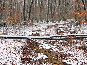
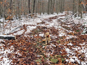 By 12:10 PM we had made it to Junkyard Junction where we turned left on the Quick Lake Trail. There was still quite a bit of snow but this started to disappear as we headed down the hill. We were 3.8 miles into the hike at 12:20 PM when we came to the blowdown across the trail. It was covered in a fine layer of snow and was a little bigger than I remembered! I put down my pack and got out the camera to take the "before" pictures. After that, I got out my saw and trimmed some of the branches near the top. I dragged a few off the trail and left the rest as they were off the trail. As I cut the last branch, the trunk settled a little and I realized it might have been a better idea to cut the larger part of the trunk first while it was more off the group. Since I was now committed, I cleared some leaves and dirt from under the trunk where I wanted to cut it and swept the snow off the top. I began making the cut an alternated sides until I was about tow-thirds through. The saw began to bind so I got the felling wedges and pounded them into the cut with a custom made branch. I finished the cut and was left with a substantial section as wide as the trail. I thought I might have to make another cut but I was able to pivot the section off the trail. I put my saw and wedges away and took some "after" pictures before we headed down the trail. To generate some heat we kept up a good pace passing the snowmobile trail and arriving at Iron Wheel Junction at 1:05 PM after hiking 4.9 miles. We turned right to stay on the Quick Lake Trail and began the walk to Frick Pond. The trail was wet and muddy in spots. There was water in some of the small creeks that had not had water all summer. We crossed the stream across the trail and were soon at the bridge on the outlet of Frick Pond. Despite the fact that the scene was much the same as dozen's of times before, I took a few pictures before we continued our hike. We walked up the hill to Gravestone Junction and continued on out the Quick lake Trail to the parking area. As we walked, we spotted three hunters on the trail ahead. As we approached they moved a little to let us pass. We walked out the trail to the parking area arriving at 1:50 PM after covering 6.4 miles in 3 hours with an elevation gain of 930 feet.
![]()
![]()
![]() On Monday, November 30th I looked at the weather forecast and knew that I would probably not be1hiking on Tuesday or Wednesday due to the forecast for rain both days. I decided to get out for a hike after working a little in the morning on some web projects. I finished my work at about 10:15 Am and looked at the thermometer to find that the temperatures was still below freezing! I knew I would have to hike near home because I had track practice in the afternoon. Hunting season also limited the number of places to choose from so I just decided to head for Frick and Hodge Ponds. I got dressed, got my gear together and put an eager Sheila in the car. I headed out the DeBruce Road just after 13:00 AM. When we arrived at the trailhead there were no cars parked in the lot. As we got ready to start our hike, I decided to keep on my Mammut Hoody as it was only 31 degrees. I wore Cindy's blaze orange hat just in case anyone was hunting in the area and wore light gloves as my hands were cold. We headed out on the Quick Lake Trail at 10:50 AM and turned left at Gravestone Junction to follow the Quick Lake Trail to the bridge over the outlet of Frick Pond. The Quick Lake trail was wet all the way to Gravestone Junction. When we crossed the bridge, I took a quick look at the view and decided the scene was not that different from the many times I had photographed it before. At that point I made up my mind that something very special would have to reveal itself for me to slow down to take pictures. We kept a quick pace as we hiked the Quick Lake Trail toward Iron Wheel Junction. The trail was wet but much of the water and mud was frozen. This was a little uncomfortable because I often took a step which initially seemed sound but then sank into the frozen mud. I started to warm up as I hiked and opened the zippers on my hoody to let some heat escape. At Iron Wheel Junction, we turned left to stay on the Quick Lake Trail toward Junkyard Junction. The walk is all uphill but the grade is only slight to moderate. At about 2.6 miles I looked up to see another new blowdown across the trail. I made a note of the location and the fact that it wasn't too big. I knew I could easily get it with my saw and the smaller Fiskar's axe. We continued walking quickly and arrived at Junkyard Junction at 12:05 PM after hiking 3.1 miles.
On Monday, November 30th I looked at the weather forecast and knew that I would probably not be1hiking on Tuesday or Wednesday due to the forecast for rain both days. I decided to get out for a hike after working a little in the morning on some web projects. I finished my work at about 10:15 Am and looked at the thermometer to find that the temperatures was still below freezing! I knew I would have to hike near home because I had track practice in the afternoon. Hunting season also limited the number of places to choose from so I just decided to head for Frick and Hodge Ponds. I got dressed, got my gear together and put an eager Sheila in the car. I headed out the DeBruce Road just after 13:00 AM. When we arrived at the trailhead there were no cars parked in the lot. As we got ready to start our hike, I decided to keep on my Mammut Hoody as it was only 31 degrees. I wore Cindy's blaze orange hat just in case anyone was hunting in the area and wore light gloves as my hands were cold. We headed out on the Quick Lake Trail at 10:50 AM and turned left at Gravestone Junction to follow the Quick Lake Trail to the bridge over the outlet of Frick Pond. The Quick Lake trail was wet all the way to Gravestone Junction. When we crossed the bridge, I took a quick look at the view and decided the scene was not that different from the many times I had photographed it before. At that point I made up my mind that something very special would have to reveal itself for me to slow down to take pictures. We kept a quick pace as we hiked the Quick Lake Trail toward Iron Wheel Junction. The trail was wet but much of the water and mud was frozen. This was a little uncomfortable because I often took a step which initially seemed sound but then sank into the frozen mud. I started to warm up as I hiked and opened the zippers on my hoody to let some heat escape. At Iron Wheel Junction, we turned left to stay on the Quick Lake Trail toward Junkyard Junction. The walk is all uphill but the grade is only slight to moderate. At about 2.6 miles I looked up to see another new blowdown across the trail. I made a note of the location and the fact that it wasn't too big. I knew I could easily get it with my saw and the smaller Fiskar's axe. We continued walking quickly and arrived at Junkyard Junction at 12:05 PM after hiking 3.1 miles.
We turned right at the junction onto the Flynn Trail which is relatively flat at this point. The trail was wet and icy in spots where there is exposed bedrock. At the gate we followed the trail to the right and down toward the shore of Hodge Pond. As we neared the pond we turned right to stay on the Quick lake Trail to the outlet of Hodge Pond. The woods road was rutted and had some water but the muddiest spots were easily avoided. We were soon at the outlet end of Hodge Pond. I decided not to go to the shore of the pond since the scene here was also very familiar. We turned right and started up the hill staying on the Flynn Trail. The walk up the hill seemed to go very quickly and soon we were on the flat part of the Flynn Trail headed toward the junction with the Big Rock Trail. As we were ascending the hill I saw some partridge cross the trail. Sheila saw them also and chased after them. The partridge seemed to hesitate and Sheila came very close to nabbing one! We continued on the Flynn Trail passing through the gate to the trail junction. We didn't stop at the trail junction but kept walking on The Flynn Trail. From this high point on the hike, the trail descends 1.7 miles to the parking area. We kept up a fast pace on the descent which seemed to drag just a little. The day had grown slightly warmer with sun and almost no clouds. Soon we were headed down the hill to the gate where we turned left to stay on then Flynn Trail. We walked down the short section of trail I had refurbished and then hiked through the woods back to the parking area. It was 1:15 when we returned. We had covered 6.4 miles in 2 hours and 20 minutes with only 1 minute of stopped time. The elevation gain was a modest 910 feet.
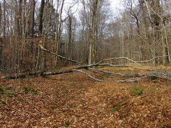
![]() On Friday, November 27th I had not decided where I would go to hike. Every time I thought of a location it was too far away or one that was heavily hunted. The morning temperature was mild compared to the previous days and was well above freezing when I got up. Just before 7:00 AM the ambulance pager sounded for a mutual aid call to Roscoe. The patient wanted to go to the hospital in Walton and by the time I got back home it was after 9:30 AM. I decided to return to the Frick Pond area to remove blowdowns on the Logger's Loop and Big Rock Trail. Cindy said she would go with me so we got dressed and I got my gear together for the work I was going to do. I again took my Council Tools Velvicut felling axe and my Silky saw and threw in some felling wedges just in case. We put our gear and an eager Sheila in the car and headed out the DeBruce Road just before 10:00 AM. When we arrived at the trailhead there were a few cars already parked in the lot. I assumed some were hunters and the others were hikers. We got ready to start our hike. Since the temperature had risen into the high 40's, I put on a light windbreaker and Cindy's blaze orange hat. I stowed my gloves in my pocket as we headed out. We headed out on the Quick Lake Trail at 10:10 AM and turned right at Gravestone Junction to follow the Logger's Loop Trail to Times Square. The Quick Lake trail was wet and there was some mud on the Logger's Loop. At Times Square we continued straight ahead on the Logger's Loop. After climbing the hill to a level portion of the trail, Sheila alerted and I saw a hunter coming toward us. I put Sheila on her leash and said "Hello" to the hunter. He greeted us and it seemed to me he was more interested in a walk in the woods than a serious hunt. At about 1.3 miles we came to the blowdown. It was a little complicated since one tree had fallen and taken a smaller one with it. I careful inspected the situation looking for stresses on the branches before getting to work. I put my pack down and got out my tools. Before starting to work I took some pictures of the mess. I removed all the loose branches and got them out of the way and then used the saw to clear some smaller branches. My father taught me to always clear away anything that might be in the way as that was the safest way to proceed. I then cut some larger branches with the saw and worked on reducing the size of the smaller tree. Dragging the branches away proved harder than making the cuts. I used the axe to cut a few larger branches and then used the saw to cut down the smaller tree which came down without too much trouble. I sectioned it with the saw and pulled way the pieces. I then turned my attention to the larger tree and cut the top section off. I moved it to the side of the trail and then looked at the trunk that remained. I decided to cut the trunk near the side of the trail at the point where it started to get much larger. I used the axe effectively to cut almost all the way through the trunk and finished with the saw as there were rocks underneath. The section I removed was very heavy but I was able to swing it off to the side of the trail. I took a few "after" pictures and then put my gear away.
On Friday, November 27th I had not decided where I would go to hike. Every time I thought of a location it was too far away or one that was heavily hunted. The morning temperature was mild compared to the previous days and was well above freezing when I got up. Just before 7:00 AM the ambulance pager sounded for a mutual aid call to Roscoe. The patient wanted to go to the hospital in Walton and by the time I got back home it was after 9:30 AM. I decided to return to the Frick Pond area to remove blowdowns on the Logger's Loop and Big Rock Trail. Cindy said she would go with me so we got dressed and I got my gear together for the work I was going to do. I again took my Council Tools Velvicut felling axe and my Silky saw and threw in some felling wedges just in case. We put our gear and an eager Sheila in the car and headed out the DeBruce Road just before 10:00 AM. When we arrived at the trailhead there were a few cars already parked in the lot. I assumed some were hunters and the others were hikers. We got ready to start our hike. Since the temperature had risen into the high 40's, I put on a light windbreaker and Cindy's blaze orange hat. I stowed my gloves in my pocket as we headed out. We headed out on the Quick Lake Trail at 10:10 AM and turned right at Gravestone Junction to follow the Logger's Loop Trail to Times Square. The Quick Lake trail was wet and there was some mud on the Logger's Loop. At Times Square we continued straight ahead on the Logger's Loop. After climbing the hill to a level portion of the trail, Sheila alerted and I saw a hunter coming toward us. I put Sheila on her leash and said "Hello" to the hunter. He greeted us and it seemed to me he was more interested in a walk in the woods than a serious hunt. At about 1.3 miles we came to the blowdown. It was a little complicated since one tree had fallen and taken a smaller one with it. I careful inspected the situation looking for stresses on the branches before getting to work. I put my pack down and got out my tools. Before starting to work I took some pictures of the mess. I removed all the loose branches and got them out of the way and then used the saw to clear some smaller branches. My father taught me to always clear away anything that might be in the way as that was the safest way to proceed. I then cut some larger branches with the saw and worked on reducing the size of the smaller tree. Dragging the branches away proved harder than making the cuts. I used the axe to cut a few larger branches and then used the saw to cut down the smaller tree which came down without too much trouble. I sectioned it with the saw and pulled way the pieces. I then turned my attention to the larger tree and cut the top section off. I moved it to the side of the trail and then looked at the trunk that remained. I decided to cut the trunk near the side of the trail at the point where it started to get much larger. I used the axe effectively to cut almost all the way through the trunk and finished with the saw as there were rocks underneath. The section I removed was very heavy but I was able to swing it off to the side of the trail. I took a few "after" pictures and then put my gear away.
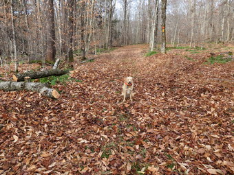 I was a little tired but we decided to head back to Times Square and then up the Big Rock Trail to get the other blowdown. When we got to Times Square, we turned left and headed up the Big Rock Trail. Neither of us had poles and I was carrying a felling axe that kept getting heavier. The Big Rock Trail is all uphill but it never gets close to a 20% grade but both of us were a little "winded". About .3 miles from Times Square or 2 miles into the hike, we arrived at the second blowdown. This was a pretty thick trunk of a dead tree that had fallen across the trail. I put down my pack, took pictures and got out my tools. My first strikes with the axe went well since the tree was very rotten. I got about 2/3 of the way through before hitting any resistance. Once I did hit some resistance, the wood was surprisingly hard to cut. The trunk was saturated with water some of which was frozen. In other places the axe just seemed to "thud" into the wood. Cindy and I rolled the trunk and I took a few more swings with the axe and finished the cut with the saw. I was able to roll the upper portion of the trunk off the trail. I got the lower portion rolling downhill and was able to direct it to the side of the trail. I took pictures and then we continued our hike up to the Flynn Trail. We turned right on the Flynn Trail and headed down the trail toward the car. The temperature seemed to be above 50 degrees by now and I was warm even in my light jacket. As we were walking, Sheila alerted and we saw a group of hikers coming up the trail toward us with a dog. I put Sheila on her leash and we passed the large group without a problem. As we were nearing the gate at the bottom of the trail, we met the hunter we had seen on the Logger's Loop along with a friend. We talked for a few minutes and then continued in our separate directions. We followed the Flynn Trail through the wood and back to the parking area which was now almost filled with cars. It was 1:20 PM and we had covered 4.5 miles in a little over 3 hours but this included the two stops to clear the trail. The elevation gain was 808 feet with most of it being on the Big Rock Trail.
![]()
![]()
![]()
![]()
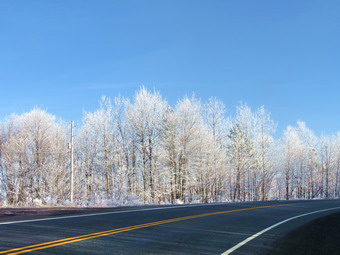
![]() On Wednesday, November 25th I decided that I wanted to return to Riddell SP see if I could find and hike the Blue Trail which we had missed on our previous visit. The park is relatively new but has over a 1000 acres and mile of trails. The part south of I88 has more trails and is near the Hartwick College Pine Lake Environmental Campus. About 380 acres of the park once belong to the college but now is state land. We left home at around 9:30 AM when the temperature was still in the id 30's. I drove north on Route 17 to Roscoe and then followed Route 206 into Downsville. I took the Telford Hollow Road out of Downsville. As we gained elevation, the trees became covered with hoar frost. I stopped at the top of Telford Hollow and took pictures before continuing to Route 10 where I turned right and headed toward Delhi. In Delhi I followed Route 10 to Route 28 and turned left to stay on Route 28 north to Merridale. In Merridale I turned right on the Merridale-Davenport Road. After crossing Route 23 IN Davenport Center, I followed Pine Lake Road to Charlotte Creek Road where I turned left. The Hartwick Pine Lake Center was .3 miles down the road on the left. There was no one around to ask about parking but I had parked before without a problem. I parked just before 10:30 AM and got my gear ready to go. As usual Sheila was crazed but I put her on her leash to get across the road to begin the hike. We started up a hill following the trail that was marked Mud Lake. At the top of the hill we turned left and continued to follow the woods road toward where I thought the Mud Lake Trail intersected it. It was a cool day with temperatures barely above freezing so I was wearing a long-sleeved top over a long-sleeved baselayer. I had tights on and topped it all off with my Mammut Hoody. The sun was out and I walked passed the spring in the right side of the road and continued up the hill. The walk seemed to be a little too long and I soon came to a STOP sign and saw posters for private property. I knew I had gone passed the turn for the Mud Lake Trail but did not remember seeing any signs. I turned around and walked back looking for some signs or blazes. There were several paths, trails and woods roads but none were marked. I decided to walk back to the sign for Mud Lake which was the Tornado Trail. After walking about .8 miles out of the way we turned uphill on the Tornado Trail and walked about .5 miles to the intersection with the Mud Lake Trail. This reinforced by belief that this park is NOT ready for casual hikers! The trails are poorly marked and the blazes do not match the colors of the trails on the map! There also does not seem be any trail maintenance either!
On Wednesday, November 25th I decided that I wanted to return to Riddell SP see if I could find and hike the Blue Trail which we had missed on our previous visit. The park is relatively new but has over a 1000 acres and mile of trails. The part south of I88 has more trails and is near the Hartwick College Pine Lake Environmental Campus. About 380 acres of the park once belong to the college but now is state land. We left home at around 9:30 AM when the temperature was still in the id 30's. I drove north on Route 17 to Roscoe and then followed Route 206 into Downsville. I took the Telford Hollow Road out of Downsville. As we gained elevation, the trees became covered with hoar frost. I stopped at the top of Telford Hollow and took pictures before continuing to Route 10 where I turned right and headed toward Delhi. In Delhi I followed Route 10 to Route 28 and turned left to stay on Route 28 north to Merridale. In Merridale I turned right on the Merridale-Davenport Road. After crossing Route 23 IN Davenport Center, I followed Pine Lake Road to Charlotte Creek Road where I turned left. The Hartwick Pine Lake Center was .3 miles down the road on the left. There was no one around to ask about parking but I had parked before without a problem. I parked just before 10:30 AM and got my gear ready to go. As usual Sheila was crazed but I put her on her leash to get across the road to begin the hike. We started up a hill following the trail that was marked Mud Lake. At the top of the hill we turned left and continued to follow the woods road toward where I thought the Mud Lake Trail intersected it. It was a cool day with temperatures barely above freezing so I was wearing a long-sleeved top over a long-sleeved baselayer. I had tights on and topped it all off with my Mammut Hoody. The sun was out and I walked passed the spring in the right side of the road and continued up the hill. The walk seemed to be a little too long and I soon came to a STOP sign and saw posters for private property. I knew I had gone passed the turn for the Mud Lake Trail but did not remember seeing any signs. I turned around and walked back looking for some signs or blazes. There were several paths, trails and woods roads but none were marked. I decided to walk back to the sign for Mud Lake which was the Tornado Trail. After walking about .8 miles out of the way we turned uphill on the Tornado Trail and walked about .5 miles to the intersection with the Mud Lake Trail. This reinforced by belief that this park is NOT ready for casual hikers! The trails are poorly marked and the blazes do not match the colors of the trails on the map! There also does not seem be any trail maintenance either!
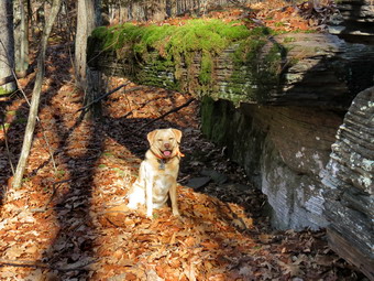 There are really no signs for the Blue Trail but Cindy and I had looked around on a previous trip and found where it started across from the Tornado Trail. I walked down through the woods to pick up the white blazes on the Blue Trail. The blazes were far apart and some were missing so I was constantly guessing where I should go. Fortunately my GPS track seemed to match the trail marked on the map and Sheila was a great help finding the trail. The site of an old steam mill was marked on the map but we walked right through the area and I saw nothing. Just passed this area the trail started to follow a woods road and it became more distinct with somewhat better blazing. I hoped that this would continue. It did not! Eventually the blazes all but disappeared although there was some old flagging which helped some. Once again the GPS track and compass helped but the biggest aid was Sheila how seemed to be able to pick out the trail despite its lack of use. The trail generally headed north and uphill. At one point there was a rock shelf overhang and we stopped so that I could get a drink and a snack. I took some pictures of the overhang and then some more with Sheila. From that point on the trail was almost impossible to find. Finally at 2.45 miles we started to swing more northeast. As I was walking and trying to spot blazes we suddenly came to a wide trail. It took me a moment to realize this was the trail that led to Mud Lake. I walked up and down the trail to see if the intersection with the Blue Trail was marked in any way. It was not. For this reason I would suggest that anyone trying to walk the trail walk from south to north as I did! I thought about turning left and walking around Mud Lake to the north. I decided against that route as Cindy and I had done it and it is NOT marked. We turned right and followed the Mud Lake Trail back to the junction with the Tornado Trail. From here we walked straight out to the woods road we had been on earlier in the morning. Once we were on the road, I looked back and could see no blazes or markings! We turned left and continued down the road and back to the car. We arrived back at 1:3) PM having hiked 5.9 miles in 3 hours with an elevation gain of 858 feet.
![]()
![]()
![]()
![]() On Tuesday, November 24th, I decided I wanted to get out and hike close to home before heading to the pep rally and track practice. When I woke up at 6:00 AM the temperature was 19 degrees and the high for the day was only supposed to get to 35 degrees! I did some chores around the house and then got the mail. I received an annoying letter which required me to handle a situation so I didn't leave for the hike until after 10:30 AM. I got my gear in the car, put Sheila in the back seat and then headed out to Frick Pond. I wore a long-sleeved baselayer underneath a light but warm Icebreaker top. I wore a hat and gloves and even put a pair of light tights on underneath my MH Winter Wander pants! Of course, this was all topped off by my Mammut Hoody.Wwe parked just before 11:00 AM and were on the trail a few minutes later. We headed across the road and started up the Flynn Trail. The day was still cold but the sun was bright and Sheila was having a great time running around. I had several things to think about and must have left a good pace because before I knew it we had walked the 1.7 miles to the junction with the Big Rock Trail. I checked the GPS and found I had kept a pace of 3 mph up the long hill. We turned left to walk down the hill to Times Square. Once again I got lost in my thoughts which made the walk seem exceptionally short. I did find a new blowdown across the Big Rock Trail. It was a single trunk and it looked like I might be able to lift it out of the way. Looks can be deceiving! I noted where it was and decided to make a later trip to remove it. After hiking 2.8 miles we arrived at Times Square. Without hesitation, I turned right and headed up the Logger's Loop. Not long after climbing the initial hill, I found another new blowdown across the trail. This one had a rather large trunk and a lot of branches. I added it to the list of things to do on a work trip. We continued on the trail arriving at Iron Wheel Junction where we turned left to head back toward Frick Pond. The walk is mostly downhill and we were soon at the small stream through the woods. It still had a good flow of water. Sheila got a drink while I swung across. Just after the pine promenade the trail became wet and muddy but it was easy to work around the worse spots. We walked over the bridge at the outlet of Frick Pond. There was nothing remarkable about the view so we continued back to the car. We were back at 1:00 PM having covered 5.5 miles in 2 hours with an elevation gain of 907 feet.
On Tuesday, November 24th, I decided I wanted to get out and hike close to home before heading to the pep rally and track practice. When I woke up at 6:00 AM the temperature was 19 degrees and the high for the day was only supposed to get to 35 degrees! I did some chores around the house and then got the mail. I received an annoying letter which required me to handle a situation so I didn't leave for the hike until after 10:30 AM. I got my gear in the car, put Sheila in the back seat and then headed out to Frick Pond. I wore a long-sleeved baselayer underneath a light but warm Icebreaker top. I wore a hat and gloves and even put a pair of light tights on underneath my MH Winter Wander pants! Of course, this was all topped off by my Mammut Hoody.Wwe parked just before 11:00 AM and were on the trail a few minutes later. We headed across the road and started up the Flynn Trail. The day was still cold but the sun was bright and Sheila was having a great time running around. I had several things to think about and must have left a good pace because before I knew it we had walked the 1.7 miles to the junction with the Big Rock Trail. I checked the GPS and found I had kept a pace of 3 mph up the long hill. We turned left to walk down the hill to Times Square. Once again I got lost in my thoughts which made the walk seem exceptionally short. I did find a new blowdown across the Big Rock Trail. It was a single trunk and it looked like I might be able to lift it out of the way. Looks can be deceiving! I noted where it was and decided to make a later trip to remove it. After hiking 2.8 miles we arrived at Times Square. Without hesitation, I turned right and headed up the Logger's Loop. Not long after climbing the initial hill, I found another new blowdown across the trail. This one had a rather large trunk and a lot of branches. I added it to the list of things to do on a work trip. We continued on the trail arriving at Iron Wheel Junction where we turned left to head back toward Frick Pond. The walk is mostly downhill and we were soon at the small stream through the woods. It still had a good flow of water. Sheila got a drink while I swung across. Just after the pine promenade the trail became wet and muddy but it was easy to work around the worse spots. We walked over the bridge at the outlet of Frick Pond. There was nothing remarkable about the view so we continued back to the car. We were back at 1:00 PM having covered 5.5 miles in 2 hours with an elevation gain of 907 feet.
![]()
![]()
![]()
![]()
![]() On Saturday, November 21st I decided that I wanted to hike somewhere that deer hunting was prohibited. The Catskill Mountain Club had suggested Riddell State Park near Davenport Center. The park is relatively new but has over a 1000 acres and mile of trails. The part south of I88 has more trails and is near the Hartwick College Pine Lake Environmental Campus. About 380 acres of the park once belong to the college but now is state land. Cindy wanted to go with me but we had to stay in Livingston Manor until the first few hours of rifle season had passed. This always seems to be the time that most accidents occur in the woods. We left home at around 9:30 AM when the temperature was still in the id 30's. I drove north on Route 17 to Roscoe and then followed Route 206 into Downsville. I took the Telford Hollow Road out of Downsville to Route 10 where I turned right and headed toward Delhi. In Delhi I followed Route 10 to Route 28 and turned left to stay on Route 28 north to Merridale. In Merridale I turned right on the Merridale-Davenport Road. After crossing Route 23 IN Davenport Center, I followed Pine Lake Road to Charlotte Creek Road where I turned left. The Hartwick Pine Lake Center was .3 miles down the road on the left. There was no one around to ask about parking but a passing student said it was Ok to park in the lot. We parked just before 11:00 AM and as we were about to leave a group of three hikers pulled up. They told us they were going to do the same route we had planned so Cindy and I got going right away. We crossed the road and started up a hill following the trail that was marked Mud Lake. At the top of the hill we turned left and continued to follow the Mud Lake signs. I began to notice that the trails were poorly marked and the blazes did not match the colors of the trails on the map! There did not seem be any trail maintenance either and this theme would continue throughout the day. This park is NOT ready for casual hikers!
On Saturday, November 21st I decided that I wanted to hike somewhere that deer hunting was prohibited. The Catskill Mountain Club had suggested Riddell State Park near Davenport Center. The park is relatively new but has over a 1000 acres and mile of trails. The part south of I88 has more trails and is near the Hartwick College Pine Lake Environmental Campus. About 380 acres of the park once belong to the college but now is state land. Cindy wanted to go with me but we had to stay in Livingston Manor until the first few hours of rifle season had passed. This always seems to be the time that most accidents occur in the woods. We left home at around 9:30 AM when the temperature was still in the id 30's. I drove north on Route 17 to Roscoe and then followed Route 206 into Downsville. I took the Telford Hollow Road out of Downsville to Route 10 where I turned right and headed toward Delhi. In Delhi I followed Route 10 to Route 28 and turned left to stay on Route 28 north to Merridale. In Merridale I turned right on the Merridale-Davenport Road. After crossing Route 23 IN Davenport Center, I followed Pine Lake Road to Charlotte Creek Road where I turned left. The Hartwick Pine Lake Center was .3 miles down the road on the left. There was no one around to ask about parking but a passing student said it was Ok to park in the lot. We parked just before 11:00 AM and as we were about to leave a group of three hikers pulled up. They told us they were going to do the same route we had planned so Cindy and I got going right away. We crossed the road and started up a hill following the trail that was marked Mud Lake. At the top of the hill we turned left and continued to follow the Mud Lake signs. I began to notice that the trails were poorly marked and the blazes did not match the colors of the trails on the map! There did not seem be any trail maintenance either and this theme would continue throughout the day. This park is NOT ready for casual hikers!
 As we hiked toward Mud Lake the trail followed wide woods roads. When we got to a T at .7 miles, we turned right following the Mud Lake signed carved into a log on the ground! At .9 miles we turned right off the main Mud Lake Trail to follow the Jacy Henderson Memorial Trail which was created in 2004. The "trail" consisted of yellow paint splashed on trees and not much more! There were trees across much of the trail and the paint blazes were hard to see. The trail doesn't get much use so the trail bed is hard to follow. At one point the trail comes very close to private property and we passed by a hunter. As the trail turned from northeast to northwest it ran through some briars and the blazes disappeared. We picked the blazes up as we descended the hill heading north and then tried to follow them as they crosses a stream and marshy area. Finally, at 2.1 miles we were back on the main trail. This trail now had some white paint as blazes and random orange markers. At 2.4 miles, as we approached the pond, a sign post point to Mud lake one way and Route 58 in the opposite direction. We turned right and headed to Mud Lake. When we got to the lake a few of the orange disks seemed to point us on a path toward the shore of the lake. The area was very marshy but some boards and sticks had been thrown down haphazardly. As we approached the shore of the lake I realized that we were walking on a thick layer of sphagnum moss and that the whole area was a bog. As I stepped large areas moved with me! I found the direst spot and took a few pictures. We walked back to the point where we had walked off the main trail.
 The park map showed a trail circling the north end of the lake but we could find no blazes. I did find sort of a trail and some old pink and orange flagging. We began to follow this hoping it would bring us to a blazed trail but that did not happen. I decided we would follow the path and the flagging since I had a good idea of where we might be going and we could always turn back. The flagging faltered in several spots but we continued to follow path looking for a connector trail on the left which would take us southeast and back toward the lake to complete the loop. I knew if we did not find the connector trail we might end up at I88! Fortunately, the trail improved some and at 3.4 miles there was a set of signs at a trail junction. We turned left on the connector trail back toward Mud Lake. We began to look for the junction with the Blue Trail since I did not want to simply hike back the way we had come. At 4 miles we were back at the junction with the Mud Lake Trail where we had been earlier in the day! The had been no marked junction with a Blue Trail which by this time did not surprise me. I wanted to go back to look for the trail but Cindy wanted to continue on the Mud Lake Trail. We turned right and started back toward the car. At 4.3 miles we were at the point where the Jacy Henderson Memorial Trail branched off but we stayed on the Mud Lake Trail to cover some ground we had not covered on the way out. The trail here was again wide woods roads although there were some very muddy areas. At 5.2 miles we passed the memorial and the beginning of the trail. As we continued on, we met some hikers with two very unruly dogs. Both dogs were leashed but they made quite a fuss. We passed them and at 5.4 miles arrived at the Tornado Trail which we had taken up from the parking area. We decided to continue on the Mud Lake Trail back to the car. Before we continued, we looked around for the Blue Trail which was supposed to begin in this area. We finally found it marked with white blazes. It was totally unmaintained with numerous blowdowns. I knew this was why we also couldn't find the other end! We walked down the Mud Lake Trail which eventually became a road. As we walked down the woods road, we were surprised to find a pickup truck headed up the road towards us. We continued down the road turning right and walking back down to the car. I put my gear in the car but took my camera out and walked down to Pine Lake. I took a few pictures before returning to the car. It was 2:30 PM and we had hiked 6.1 miles in 3 hours and 25 minutes gaining 1040 feet along the way.
![]()
![]()
![]()
![]()
![]() On Friday, November 20th I decided that I wanted to return to Beacon to hike to the flag on Fishkill Ridge. I wanted to hike from the trailhead on Pocket Road since this was a new route for me. The weather report was for sunny skies with some clouds and highs reaching into the mid 50's. When I got up in the morning, the temperatures was in the low 30's and there was ice on the car windows. I got my gear and Sheila in the car at a little after 9:00 AM and drove east and south on Route 17 to Middletown where I picked up I84 east. After crossing over the Newburgh-Beacon Bridge, I took exit 11 and headed south on Route 9D. I took a left on Main St and followed it to E Main Street and then to Pocket Road. Pocket Road is a dead end street and near the end is a gate that controls access to part of the City of Beacon's water supply. I was able to park in a turnout just before he gate but the number of parking spaces is very limited. There was one other vehicle parked. When I got ready to hike at 10:25 AM, the temperature had risen so I wore a light windbreaker instead of my heavier Mammut hoody. It was not immediately clear to me where the trail, started but I quickly realized that I should walk through the gate and up an access road. The road passed by a large water storage tank and then a small reservoir. After the reservoir, the trail began to follow Dry Brook which actually had a pretty good flow. The trail grade was averaging about 15% with some steeper spots. We met two hikers who had gotten an early start coming down the trail. Not too long into the climb I stopped to take off the light jacket and as I was doing this a young man passed us hiking rapidly up the trail. There were several spots on the trail that were eroded and others than required walking along slanted rocks. I thought this would not be the best trail for hiking in the winter! We crossed Dry Brook several times and at .75 miles we crossed it for the last time as we continued east. At this point the brook is flowing from the south out of Beacon Reservoir and there is a series of cascades with a waterfall at the top. We stopped so that I could take some pictures. The light was not the best and there was some brush in the way. It was definitely one of those scenes that was better to just enjoy rather than to photograph but that didn't stop me from taking multiple shots!
On Friday, November 20th I decided that I wanted to return to Beacon to hike to the flag on Fishkill Ridge. I wanted to hike from the trailhead on Pocket Road since this was a new route for me. The weather report was for sunny skies with some clouds and highs reaching into the mid 50's. When I got up in the morning, the temperatures was in the low 30's and there was ice on the car windows. I got my gear and Sheila in the car at a little after 9:00 AM and drove east and south on Route 17 to Middletown where I picked up I84 east. After crossing over the Newburgh-Beacon Bridge, I took exit 11 and headed south on Route 9D. I took a left on Main St and followed it to E Main Street and then to Pocket Road. Pocket Road is a dead end street and near the end is a gate that controls access to part of the City of Beacon's water supply. I was able to park in a turnout just before he gate but the number of parking spaces is very limited. There was one other vehicle parked. When I got ready to hike at 10:25 AM, the temperature had risen so I wore a light windbreaker instead of my heavier Mammut hoody. It was not immediately clear to me where the trail, started but I quickly realized that I should walk through the gate and up an access road. The road passed by a large water storage tank and then a small reservoir. After the reservoir, the trail began to follow Dry Brook which actually had a pretty good flow. The trail grade was averaging about 15% with some steeper spots. We met two hikers who had gotten an early start coming down the trail. Not too long into the climb I stopped to take off the light jacket and as I was doing this a young man passed us hiking rapidly up the trail. There were several spots on the trail that were eroded and others than required walking along slanted rocks. I thought this would not be the best trail for hiking in the winter! We crossed Dry Brook several times and at .75 miles we crossed it for the last time as we continued east. At this point the brook is flowing from the south out of Beacon Reservoir and there is a series of cascades with a waterfall at the top. We stopped so that I could take some pictures. The light was not the best and there was some brush in the way. It was definitely one of those scenes that was better to just enjoy rather than to photograph but that didn't stop me from taking multiple shots!
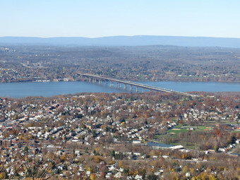 We continued walking east on the trail, gaining elevation until we crossed the road to the reservoirs at .9 miles. We turned left on the road and then almost immediately right into the forest. Sheila alerted and I could see a man walking with his dog on the road below. We continued on the trail as it began to ascend an unnamed hill. Over the next .3 miles we gained 380 feet which was an average grade of 24% despite the switchbacks! At 1.2 mile we were at the junction with the trail that ascends from the Sunnyside Road trailhead. We continued heading east as the trail rolled over several small hills before climbing to the top of Lambs Hill at 1.7 miles. I stopped to take a few pictures even though there wasn't much difference from the previous week. This time we continued over the top of Lambs Hill and descended the other side to Dozer Junction at 1.9 miles. Dozer Junction gets its name from a bulldozer parked at the junction. The white Fishkill Ridge Trail continues straight ahead but we turned right on a short blue connector trail. I did stop to take a few pictures of the bulldozer! The blue trail was very wet with water running out of sight under a thick layer of leaves! At 2.2 miles we hit a low spot and then arrived at the yellow Wilkinson Memorial Trail. We turned right to follow the trail to the southwest and I knew I would soon have to start looking for the unmarked trail to the hill with the flag. At 2.5 miles the Wilkinson Memorial Trail mad a sharp left heading eastward. I continued straight ahead and found the unmarked but prominent trail on the right. We walked up hill and at a fork stayed to the right until I could see the flag waving in the breeze.
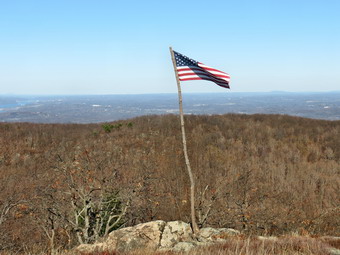 I walked down to the flag with my pack to get a GPS reading for its location. It was much easier to find than I remembered. I walked back up the hill a little and dropped my pack to take pictures. The flag wasn't very large but the thought of the dedication of the family that maintains it had a profound effect one me. I took some still and then a 30 second video. I tried not to shake and to remain quiet so that all that could be heard was the snapping of the flag in the breeze. It was 12:25 PM when I was ready to leave and I was prepared to hike out the Fishkill Ridge to add some mileage. I decided to call my son Kurt who is a layer in Poughkeepsie and he suggested we meet at the Maya Caf� in Fishkill for a meal. I agreed and decided to simply hike back the way I had come. The descent was not that much quicker than the ascent since there were still some hills to be climbed and the slippery leaves slowed my pace. I met several hikers on the way down. When I crossed the road to the reservoir, I noticed a vehicle coming up the road and wondered if it was legal to do so. Just after we turned onto the trail, I met a young lady from Beacon hiking toward me. I asked here about the vehicle and she said it was permitted up to a certain spot. We continued in our separate directions. I met another couple hiking up near the cascades. Near the bottom of the trail we stopped and I took a picture of a conglomerate boulder. Sheila insisted on posing so I took another shot. As we continued down the trail, we met a man hiking up with two small dogs. One dog was a blind Chihuahua that we was carrying! Sheila and I stopped at the small reservoir and I took a few last shots. We were back at the car at 2:10 PM after hiking 5.1 miles in 3 hours and 45 minutes. Our elevation gain was 2025 feet. We got in the car and I took I84 to exit 13 and the Maya Caf�. Kurt arrived soon after I did and we had some good food and great conversation.
![]() On Tuesday, November 17th I decided that I would return to the Quick Lake Trail at Frick Pond to remove two new blowdowns on the trail. I slept in and did not get up until 8:00 AM. The temperature was still below freezing and I knew it was expected to rise slowly into the high 40's. I got my gear and an eager Sheila in the car and headed out the DeBruce Road about 10:10 AM. When we arrived at the trailhead there were no cars in the lot and the temperature was right at 40 degrees. I decided to keep on my Mammut Hoody and a light hat. I stowed my gloves in my pack as we headed out. For tools I had brought my smaller Silky saw and my Council Tools Velvicut felling axe. This is the heaviest axe I have and the last time I used it I had mixed feelings about its performance. I brought it this time to try it out again and because some of the trees were a pretty good size. We headed out on the Quick Lake Trail at 10:35 AM and continued to follow it over the bridge at the outlet end of Frick Pond. At the next trail junction we stayed to the left to fo0llow the Quick Lake Trail and after a short stretch we arrived at the blowdown I wanted to clear. It was actually larger and more complex than I thought. A tree with a double trunk had fallen across the trail taking the upper part of another tree with it. I put my pack down and got out my tools. Before starting to work I took some pictures of the mess. I removed all the loose branches and got them out of the way and then used the saw to clear some smaller branches. My father taught me to always clear away anything that might be in the way as that was the safest way to proceed. I then cut some larger branches with the saw and the tops of two of the trees. Dragging these away proved harder than making the cuts. I used the axe to cut a few larger branches and then turned to the larger trunk. As I swung the axe I found that it bit deeply and the chips really began to fly. I began to wonder what I had against this wonderful tool. I do think that I have honed my technique and am a little stronger than the last time I used the axe. I quickly cut through the trunk and was able to remove most of one tree. I cut the other trunk and was soon finished with the first part of the blowdown. I started in on the second part using the same technique and was able to remove most of it with the saw. A final cut of the trunk with the axe left only some final cleanup. I took some "after" pictures and then put my equipment away. We headed back on the Quick Lake trail to handle the blowdown near the trailhead.
On Tuesday, November 17th I decided that I would return to the Quick Lake Trail at Frick Pond to remove two new blowdowns on the trail. I slept in and did not get up until 8:00 AM. The temperature was still below freezing and I knew it was expected to rise slowly into the high 40's. I got my gear and an eager Sheila in the car and headed out the DeBruce Road about 10:10 AM. When we arrived at the trailhead there were no cars in the lot and the temperature was right at 40 degrees. I decided to keep on my Mammut Hoody and a light hat. I stowed my gloves in my pack as we headed out. For tools I had brought my smaller Silky saw and my Council Tools Velvicut felling axe. This is the heaviest axe I have and the last time I used it I had mixed feelings about its performance. I brought it this time to try it out again and because some of the trees were a pretty good size. We headed out on the Quick Lake Trail at 10:35 AM and continued to follow it over the bridge at the outlet end of Frick Pond. At the next trail junction we stayed to the left to fo0llow the Quick Lake Trail and after a short stretch we arrived at the blowdown I wanted to clear. It was actually larger and more complex than I thought. A tree with a double trunk had fallen across the trail taking the upper part of another tree with it. I put my pack down and got out my tools. Before starting to work I took some pictures of the mess. I removed all the loose branches and got them out of the way and then used the saw to clear some smaller branches. My father taught me to always clear away anything that might be in the way as that was the safest way to proceed. I then cut some larger branches with the saw and the tops of two of the trees. Dragging these away proved harder than making the cuts. I used the axe to cut a few larger branches and then turned to the larger trunk. As I swung the axe I found that it bit deeply and the chips really began to fly. I began to wonder what I had against this wonderful tool. I do think that I have honed my technique and am a little stronger than the last time I used the axe. I quickly cut through the trunk and was able to remove most of one tree. I cut the other trunk and was soon finished with the first part of the blowdown. I started in on the second part using the same technique and was able to remove most of it with the saw. A final cut of the trunk with the axe left only some final cleanup. I took some "after" pictures and then put my equipment away. We headed back on the Quick Lake trail to handle the blowdown near the trailhead.
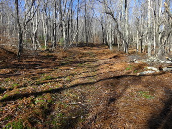 The blowdown near the parking area consisted of two rather rotten trunk that had fallen across the trail taking a few saplings with them. I took some pictures and the got out my tools to start the work. The size of the trunks made using the axe a must. I though the fact that the wood was rotten would make the work go faster and it did for a time. I cut from both sides of the log until I was almost through and the work got harder. There was a rock underneath the log which I did not want to hit with the axe. I was able to roll the log and finish the cut. The rotten would did make the sections a little lighter and I was able to flip the sections out of the way. I turned my attention to the second log which was larger and found a spot that seemed cracked. I started to make my cut but the log was wet and the axe seemed to "bounce". I persisted and was able to cut almost all the way through. I used the saw to finish the cut and then it was time to move the section. As I hefted the first section I was not sure I could manage it by myself but I finally got it off the trail. The second section was even heavier but I was able to move it also. I cleaned up a few sapling and branches and the took the "after" pictures. I packed up and walked up to the car at 12:35 PM. It had taken only two hours for one person to clear to major blowdowns with hand tools!
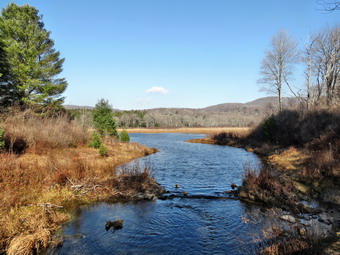
![]()
![]()
![]()
![]()
![]() On Monday, November 16th I decided that the rest of my week was looking pretty busy and between commitments and the weather I should take a hike. I had a limited amount of time before afternoon track practice so I decided to head to Frick Pond. When I got up the temperature was only 33 degrees but I knew that the forecast was for warmer weather as the day progressed. By the time I got my gear ready to go and got Sheila in the car it was already after 10:00 AM. I drove out the DeBRuce Road to Mongaup Pond Road where I turned left. I continued to follow the road bearing left onto Beech Mountain Road at the fork. When we arrived in the parking area there were no other cars which did not surprise me. Sheila was acting as if she hadn't hiked in a month as I got myself ready to go. The temperature was in the high 40's so I left my Mammut Hoody behind and put on a light windbreaker. I had traded in my Leki Micro Vario poles for a pair of even lighter Black Diamond poles which are best on easy trails. By 10:30 Am we were ready and headed out the back of the large parking area on the Quick Lake Trail. Two large tree trunks were lying across the trail but they were easy enough to get around. I knew I would have to bring an axe to cut them into section so that I could roll them off the trail. When we got to the woods road and turned left, I found it was very wet with both standing and flowing water. At Gravestone Junction we turned left to head down to Frick Pond. The day was beautiful with sun and blue skies. The only drawback was that the sky1 had only a few clouds and appeared very flat. Despite the lack of clouds, I stopped at the bridge to take some pictures. The water level in the pond was high and the stream was flowing freely necessitating a few more shots. We continued on the Quick Lake Trail around the pond bearing left at the next trail junction to stay on the red trail. This part of the trail was also very wet and there were a lot of new branches down on the trail from the wind the previous night.
On Monday, November 16th I decided that the rest of my week was looking pretty busy and between commitments and the weather I should take a hike. I had a limited amount of time before afternoon track practice so I decided to head to Frick Pond. When I got up the temperature was only 33 degrees but I knew that the forecast was for warmer weather as the day progressed. By the time I got my gear ready to go and got Sheila in the car it was already after 10:00 AM. I drove out the DeBRuce Road to Mongaup Pond Road where I turned left. I continued to follow the road bearing left onto Beech Mountain Road at the fork. When we arrived in the parking area there were no other cars which did not surprise me. Sheila was acting as if she hadn't hiked in a month as I got myself ready to go. The temperature was in the high 40's so I left my Mammut Hoody behind and put on a light windbreaker. I had traded in my Leki Micro Vario poles for a pair of even lighter Black Diamond poles which are best on easy trails. By 10:30 Am we were ready and headed out the back of the large parking area on the Quick Lake Trail. Two large tree trunks were lying across the trail but they were easy enough to get around. I knew I would have to bring an axe to cut them into section so that I could roll them off the trail. When we got to the woods road and turned left, I found it was very wet with both standing and flowing water. At Gravestone Junction we turned left to head down to Frick Pond. The day was beautiful with sun and blue skies. The only drawback was that the sky1 had only a few clouds and appeared very flat. Despite the lack of clouds, I stopped at the bridge to take some pictures. The water level in the pond was high and the stream was flowing freely necessitating a few more shots. We continued on the Quick Lake Trail around the pond bearing left at the next trail junction to stay on the red trail. This part of the trail was also very wet and there were a lot of new branches down on the trail from the wind the previous night.
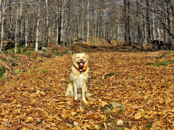 As we continued along, we came to a large tree that had blown down across the trail and nearly blocked it. I had no tools no I worked my way through it. I knew that I would return soon with tools to clear the obstructions from the trail. We continued through the "pine promenade" and came to the little stream1 through the woods. This stream had been almost dry all summer but now was filled with water. I took a few shots while Sheila got a drink. As we continued along the trail I removed some small branches and a few large ones until we arrived at Iron Wheel Junction at 1.6 miles. We turned left on the Quick Lake Trail and started the long uphill climb toward Junkyard Junction. The trail continued to be wet and I found more branches to remove. Somewhere along the way before the junction there was another tree down across the trail. I knew the snowmobile club would remove it but that I could also get it with an axe. At 3.2 miles we arrived at Junkyard Junction and turned right onto the blue Flynn Trail. The Flynn Trail is almost flat and on this day it was wet and muddy in spots. There were no major blowdowns but I continued to removed branches that littered the trail. When we got to the gate, we turned right to stay on the trail and head down to Hodge Pond. At 3.75 miles the Flynn Trail heads right but we turned left to walk on the jeep trail around the head end of Hodge Pond. At one point I walked down to the shore and took a few shots of the pond. We continued on the jeep trail and walked down the hill to the outlet end of Hodge Pond.
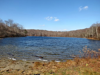 I walked over to the shore with Sheila right behind. I dropped my pack and got out the camera to take some pictures. Sheila did not seem anxious to enter the cold water and I did not blame her. I got a snack and then picked up my pack to head up the hill away from Hodge Pond once again back on the Flynn Trail. The walk up the hill seemed long but not arduous. At the top of the hill we followed the Flynn Trail as it turned slightly left toward Big Rock Junction. At 5.1 miles we passed Big Rock Junction and started the 1.7 mile descent on the Flynn Trail. At 5.6 miles we came to a place where there is a pile of logs that are dressed. They have been there for some time and nobody knows who cut them or what purpose they were to serve. We turned left and walk up through the woods to an open area. This "field" is interesting as the bedrock is close to the surface and there are areas of sphagnum moss covering a good part of the area. A woods road runs from the Flynn Trail to this open area but, again, no one knows the history of the spot. I took a few photographs and the walked back to the Flynn Trail. As we approached the gate, we turned left to avoid the private property around the cabin and to stay on the trail. On a previous trip I had cleared and reblazed the old trail and I could see that it was easy to follow. We finished our walk and were back at the car by 1:40 PM. We had covered .9 miles in 3 hours and 15 minutes with an elevation gain of 1005 feet. The temperature on the car display read 54 degrees.
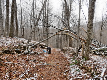
![]() On Saturday, November 14th I was part of a Trail U training session sponsored by the New York Jersey Trail Conference and instructed by Doug Senterman. The purpose of the training session was to acquaint people with the proper way to maintain trails and the regulations that govern maintenance. The forecast for the day was not looking good the night before with rain or snow showers likely to appear at about 11:00 AM. The initial meeting took place at Morgan Outdoors in Livingston Manor where a group of eager volunteers met to meet each other and Doug. When I parked in town, I noticed several cars covered with layer of snow indicating that the higher elevations had already seen some snowfall. Some people who had registered did not show up while a few other people were able to attend making eight in total. Some people were local but one volunteer drove from Oneonta while another came from central New Jersey! Doug explained the need for trail maintainers and the paperwork requirements. He then brought out an array of tools and described their uses. Doug was able to field questions from various people before we headed to Trout Pond. Several volunteers wanted to car pool so we got in the cars and headed to Roscoe on Route 17. From Roscoe we took Route 206 to just passed the Roscoe Nursing Home where we turned left on Morton Hill Road. As we drove the three miles to Russell Brook Road, we began to see more and more snow as the elevation increased. When we arrived at the intersection with Russell Brook Road, we turned left and drove down the road to the lower parking area. I was surprised that there were already half a dozen cars parked in the lot. Ranger Joe Bink from Region 4 was also there checking to see if there were any hunters. Doug and I stopped to talk with him while we waited for some others to arrive.
On Saturday, November 14th I was part of a Trail U training session sponsored by the New York Jersey Trail Conference and instructed by Doug Senterman. The purpose of the training session was to acquaint people with the proper way to maintain trails and the regulations that govern maintenance. The forecast for the day was not looking good the night before with rain or snow showers likely to appear at about 11:00 AM. The initial meeting took place at Morgan Outdoors in Livingston Manor where a group of eager volunteers met to meet each other and Doug. When I parked in town, I noticed several cars covered with layer of snow indicating that the higher elevations had already seen some snowfall. Some people who had registered did not show up while a few other people were able to attend making eight in total. Some people were local but one volunteer drove from Oneonta while another came from central New Jersey! Doug explained the need for trail maintainers and the paperwork requirements. He then brought out an array of tools and described their uses. Doug was able to field questions from various people before we headed to Trout Pond. Several volunteers wanted to car pool so we got in the cars and headed to Roscoe on Route 17. From Roscoe we took Route 206 to just passed the Roscoe Nursing Home where we turned left on Morton Hill Road. As we drove the three miles to Russell Brook Road, we began to see more and more snow as the elevation increased. When we arrived at the intersection with Russell Brook Road, we turned left and drove down the road to the lower parking area. I was surprised that there were already half a dozen cars parked in the lot. Ranger Joe Bink from Region 4 was also there checking to see if there were any hunters. Doug and I stopped to talk with him while we waited for some others to arrive.
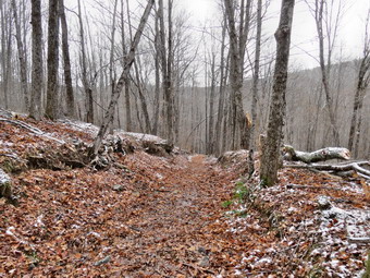 The last car did not arrive so we headed down the trail to the bridge over Russell Brook Road and then stayed to the left at the trail junction to head up the hill toward mud pond. We kicked a few branches out of the way and removed a few logs lying on the trail. Soon we came to the first blowdown and assessed the safest way to remove it. Doug emphasized safety and how to watch for stresses on the trees and branches to be cut. I took a few "before" pictures and the we got to work. We cleared away all the loose material and then used a saw to finish the job. As we were near the end of clearing, the last three volunteers came walking up the trail. We continued on to three other smaller blowdowns. I used my Fiskars axe to cut two of them while others helped clear away the branches. The last blowdown near the top of the hill was so dry that we did not need to cut it. We simply broke the branches and moved them to the side of the trail. We continued on over the top of the hill staying on the Mud Pond Trail. We stopped several times so that Doug could point out some things and answer questions. Along the way several volunteers cleared a culvert and created a dam to direct the water off the trail. We turned around a little after 2:00 PM and headed back to our cars. The day was very productive and will hopefully generate more people to care for our trail.
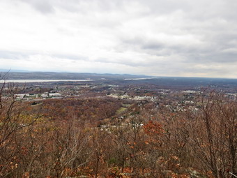
![]()
![]()
![]()
![]()
![]() On Friday, November 13th I planned to hike to the flag on Fishkill Ridge since I had missed hiking there on Veteran's Day due to bad weather. I also thought I might hike a big loop including other parts of Fishkill Ridge or Beacon Mountain. I decided to hike from Sunnyside Road on the Overlook Trail which I had never been on before. Cindy said she would like to go so I immediately began to think of ways to alter the plan. I decided we might go to the flag and then do the Fishkill Ridge Loop or just go to the flag and return. It was windy and starting to rain when we left Livingston Manor just before 9:00 AM. The forecast for Fishkill was for temperatures in the mid 50's but with a strong wind. The forecast put the chance of rain at 0%! I drove down Route 17 to Middletown where I picked up I84 east to exit 12. I turned right on Route 52 and drove .2 miles to Old Glenham Road where I turned left. After .9 miles, I took a left on Maple Street and followed it as it became Washington Avenue. I turned left on Old Town Road and drove .4 miles to Sunnyside Road. I drove to the end of Sunnyside Road and turned left into the well-marked parking area. There was only one other car in the lot when we began our hike at 10:15 AM. The temperature was 54 degrees but there was a sustained wind of 15 mph and it was gusty to at least 25 mph. I decided to leave on my Mammut Hoody and put on a light hat. As usual, Sheila was ready to go and ran around the parking area sniffing all the new smells. We walked out the end of the parking area passed a kiosk which gave some interesting information about the Fishkill Ridge. The first part of the trail was a woods road that began with a gentle grade. There was a plethora of oak leave carpeting the trail and they were wet from the recent rain making for some slippery conditions. We soon turned left and began to parallel a deep ravine to our right as we started to climb. At around .3 miles we stopped at a large conglomerate boulder. Sheila climbed to the top and I took a few pictures. I also took some shots of the boulder since I thought the cementing of very large particles was interesting. Just after the boulder we turned left away from the ravine and continued to climb with grades over 20%. Soon the trail abruptly turned right back toward the ravine. We walked on the level for a short distance and then walked downhill to cross the ravine. Walking downhill after walking uphill and before walking more uphill is not one of my favorite parts of a hike!
On Friday, November 13th I planned to hike to the flag on Fishkill Ridge since I had missed hiking there on Veteran's Day due to bad weather. I also thought I might hike a big loop including other parts of Fishkill Ridge or Beacon Mountain. I decided to hike from Sunnyside Road on the Overlook Trail which I had never been on before. Cindy said she would like to go so I immediately began to think of ways to alter the plan. I decided we might go to the flag and then do the Fishkill Ridge Loop or just go to the flag and return. It was windy and starting to rain when we left Livingston Manor just before 9:00 AM. The forecast for Fishkill was for temperatures in the mid 50's but with a strong wind. The forecast put the chance of rain at 0%! I drove down Route 17 to Middletown where I picked up I84 east to exit 12. I turned right on Route 52 and drove .2 miles to Old Glenham Road where I turned left. After .9 miles, I took a left on Maple Street and followed it as it became Washington Avenue. I turned left on Old Town Road and drove .4 miles to Sunnyside Road. I drove to the end of Sunnyside Road and turned left into the well-marked parking area. There was only one other car in the lot when we began our hike at 10:15 AM. The temperature was 54 degrees but there was a sustained wind of 15 mph and it was gusty to at least 25 mph. I decided to leave on my Mammut Hoody and put on a light hat. As usual, Sheila was ready to go and ran around the parking area sniffing all the new smells. We walked out the end of the parking area passed a kiosk which gave some interesting information about the Fishkill Ridge. The first part of the trail was a woods road that began with a gentle grade. There was a plethora of oak leave carpeting the trail and they were wet from the recent rain making for some slippery conditions. We soon turned left and began to parallel a deep ravine to our right as we started to climb. At around .3 miles we stopped at a large conglomerate boulder. Sheila climbed to the top and I took a few pictures. I also took some shots of the boulder since I thought the cementing of very large particles was interesting. Just after the boulder we turned left away from the ravine and continued to climb with grades over 20%. Soon the trail abruptly turned right back toward the ravine. We walked on the level for a short distance and then walked downhill to cross the ravine. Walking downhill after walking uphill and before walking more uphill is not one of my favorite parts of a hike!
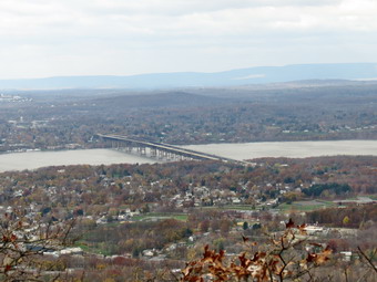 After crossing the small creek in the ravine, we made a sharp right and started to climb. The trail was well marked which was fortunate since there were many paths and woods roads that crossed the trail at different spots. We began to see some views of the Hudson River through the trees and I began to wonder if we would ever get any clear views. So many hike descriptions and maps include viewpoints that are no longer viewpoints as trees have long ago grown up to block them! At about 1.1 miles we began to ascend an open rock face and I was concentrating on getting good hand and foot placements. When I looked back to the west, there was an amazing open view of the Hudson River! We walked a little farther to the top of the climb and stopped so that I could take some pictures. I took a few of Cindy coming up the rock face and the turned my attention to the scenery. The Newburgh-Beacon Bridge was below with the Mid-Hudson Bridge visible farther north. It was still cloudy and a little dark but I took quite a few shots. We continued to hike and I noticed Cindy was getting tired of climbing. At 1.4 miles the trail leveled a little and rolled some until at 1.7 miles we came to another nice overlook. The sun had begun to peek through the clouds so I took a few more photographs before we pushed to the top of the hill. Just after the viewpoint, the Overlook Trail ended at the white Fishkill Ridge Trail. We turned left to head toward Lambs Hill and eventually to the hill with the flag just to the southwest.
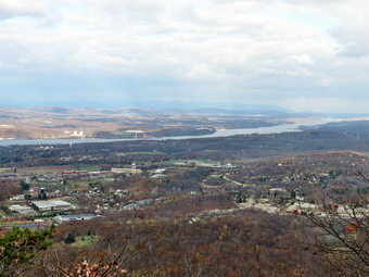 Over the next .3 miles we descended one small hill and climbed another until at 2.0 miles we were at the base of Lambs Hill. I remembered coming down off Lambs Hill but had never climbed up. The trail headed right for a cliff and the paralleled the cliff before making a sharp right to go over the top. After climbing over the cliff, we climbed up an open rock face to the top of Lamb's Hill. There were some nice views from the top of the hill including the Hudson to the west and the Beacon Reservoir hidden in the trees to the southwest. I was ready to go on to find the flag since I knew it was less than a mile farther. Cindy told me I would have to go on without her! I was disappointed that we would not reach my goal and that the hike would be less than 5 miles but we turned around and started back together. I could tell that my wife was very tired as she was lagging behind despite our slow pace. When we started to descend I heard her exclaim and looked back to see she had slipped and fallen on the wet leaves. She got up but fell two or three more times on the way down. It was then that I realized that the amount of hiking that I do puts me in good shape for hiking! I was feeling fine and could have done the hike again while Cindy was completely out of gas. I decided that I could return another day and park at a different trailhead to hike to the flag. I tried to look at it as another opportunity to explore someplace I had not visited. We had to hike down into the ravine and back up but soon we were on the final leg on the woods road back to the car. We arrived back at the car at 1:40 PM having hiked only 4.3 miles in 3 hours and 25 minutes. The elevation gain was 1635 feet. We decided to stop in the Maya Caf� in Fishkill for lunch and had a nice meal before returning home.
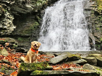
![]()
![]()
![]()
![]()
![]() On Wednesday, November 11th I had planned to hike to the flag on Fishkill Ridge since it was Veteran's Day. The weather would simply not cooperate as a persistent storm hung over the Hudson valley until after noon. Since I did not know the exact conditions and since I wanted to take some pictures, I decided to put off the hike until later in the week. The skies around Livingston Manor began to clear and the chance of rain seemed less and less likely so I asked Cindy if she water to rake an afternoon walk. She agreed and suggested we go to Trout Pond and hike. We got our gear in the car and left Livingston Manor with an ecstatic Sheila in the back seat at about 1:25 PM. We were looking forward to seeing if Russell Brook Falls had a higher volume of water after the rain during the week. We headed north on Route 17 to Roscoe and took Route 206 toward Downsville but turned left onto Morton Hill Road just after the Roscoe Nursing Home. When we got to the intersection with Russell Brook Road, I turned around and parked on the side of the road to avoid parking in the large open space which is marked as private property. Sheila was ready to go as always and we started down the road at 1:45 M. The temperature was in the mid 50's when we started so I opted to take off my Mammut Hoody and wear a light windbreaker. I did choose to wear a hat. As we walked down the road, the stream was making a lot of noisy and we could see quite a bit of water even in the under brook. I walked down the bank at the viewpoint over the upper falls and found that there was a lot of water going over the falls. I got out my camera and took a few shots from different angle at different settings. I packed up and we headed down the road to the lower parking area. As we approached the lower parking area, we could see that there were no cars in the lot. We walked down to the main trail and then across the bridge over Russell Brook. The knotweed that we had trimmed back a few weeks was now almost completely dead . We walked the path over to the lower falls and down the bank to the streambed. The water was not especially Hugh but was flowing with enough volume to make some pictures worthwhile. I took some shots of the falls and then had Sheila sit on the rocks in front and took some more. We walked back out to the main trail and passed the register box heading up to Trout Pond.
On Wednesday, November 11th I had planned to hike to the flag on Fishkill Ridge since it was Veteran's Day. The weather would simply not cooperate as a persistent storm hung over the Hudson valley until after noon. Since I did not know the exact conditions and since I wanted to take some pictures, I decided to put off the hike until later in the week. The skies around Livingston Manor began to clear and the chance of rain seemed less and less likely so I asked Cindy if she water to rake an afternoon walk. She agreed and suggested we go to Trout Pond and hike. We got our gear in the car and left Livingston Manor with an ecstatic Sheila in the back seat at about 1:25 PM. We were looking forward to seeing if Russell Brook Falls had a higher volume of water after the rain during the week. We headed north on Route 17 to Roscoe and took Route 206 toward Downsville but turned left onto Morton Hill Road just after the Roscoe Nursing Home. When we got to the intersection with Russell Brook Road, I turned around and parked on the side of the road to avoid parking in the large open space which is marked as private property. Sheila was ready to go as always and we started down the road at 1:45 M. The temperature was in the mid 50's when we started so I opted to take off my Mammut Hoody and wear a light windbreaker. I did choose to wear a hat. As we walked down the road, the stream was making a lot of noisy and we could see quite a bit of water even in the under brook. I walked down the bank at the viewpoint over the upper falls and found that there was a lot of water going over the falls. I got out my camera and took a few shots from different angle at different settings. I packed up and we headed down the road to the lower parking area. As we approached the lower parking area, we could see that there were no cars in the lot. We walked down to the main trail and then across the bridge over Russell Brook. The knotweed that we had trimmed back a few weeks was now almost completely dead . We walked the path over to the lower falls and down the bank to the streambed. The water was not especially Hugh but was flowing with enough volume to make some pictures worthwhile. I took some shots of the falls and then had Sheila sit on the rocks in front and took some more. We walked back out to the main trail and passed the register box heading up to Trout Pond.
 The trail was pretty wet in places but the walk went quickly. The sky was still filled with dark cloud in places but in other spots there was some blue and the sun was peeking through. At the pond, I took off my pack and got out the camera. We were surprised that the water level was still low with the shore being at least six feet from the outlet of the dam. I took some shots of the pond against the dark clouds. I made sure I got a few pictures of the shore and then we continued up the trail, toward the head end of the pond. Just before the small bridge, I walked to the shore and took a few more shots. The sky was still mostly covered in clouds but I managed to get a few pictures with blue sky. The trees without their leaves and the dark sky made a few shots look almost black and white. We didn't stay too long before getting back on the main trail and starting toward the upper end of the pond. The trail is completely flat and was wet and muddy in spots. I decided to skip taking pictures from the bridge and we continued our walk on the main trail. As we started to climb Cherry Ridge one of the blowdowns I had found last time had been cut and removed from the trail making me think someone had done some trail maintenance. Along the way were several large blowdowns which we could not clear without an axe and saw. We made a slight turn to the south and began to climb more but the ascent seemed to go quickly. Sheila was roaming the brush near the trail and seemed to always be on a scent trail. At one point when she returned I saw that she had found something odoriferous to roll in! I cleaned her up as best I could and knew a bath would be the order oft he day when we got home! We hit the high point on the hike and started down the other side. There was a lot of water on the trail and we had to walk on the side to avoid the deeper pools. After a short ascent to the "forest of numerous small trees", we walked down to the woods road and snowmobile trail and turned left to complete our loop. There were several large puddles on the trail and the leaves had been displaced showing the water had flowed down the trail with some force. We began to descend to the trail junction by the register box and found several more trees across the trail. We passed the large campsite on the left at the bottom of the hill and walked back to the trail junction where we turned right to walk back to the lower parking area. There were still no cars in the lot. We walked up the road back to our car arriving at 4:30 PM. We had hiked 5.6 miles in 2 hours and 45 minutes gaining 1125 feet.
On Monday, November 9th, I had a lot of "errands" to do early in the morning and they took longer than I expected. When I finally broke free, it was already late morning. I decided to head to Frick Pond to finish some trail work on the Flynn Trail. I got my gear in the car and took along a lawn rake and a weed whip. Of course, Sheila was ready to go and she jumped in the back seat along with the extra equipment. We arrived at the parking area at about 11:00 AM to find one other car parked in the lot. I got the tools I needed for the Flynn Trail before heading out. I didn't take my pack as I expected to come back to the car after the work to get in a short hike. The last time I worked on the Flynn Trail I cleared the old route for the trail near the point where it turns from the trail onto the woods road near the gate. Today I used the rake to clear some leaves to define the path. I also used the weed whip to remove some weeds that had grown in the path. I piled some brush on the route hikers had been using and removed the "TRAIL" sign someone had put on a tree. I used some blue markers to blaze the turn in both directions and added a few more markers to make the trail easier to follow. This required the removal of some old markers. I also took down a small, dead tree that was in the way. Sheila and I returned to the car. I put my tools away and got out my pack to start the pleasure part of our hike at 11:30 AM.
I decided we would hike out the Quick Lake Trail to the Logger's Loop and then follow it all the way around to Iron Wheel Junction. From here we would use the Quick Lake Trail to get back to the car. As we walked out the Quick Lake Trail, I found the woods road after the trail register to be wet with some muddy spots. When we reached Gravestone Junction, we stayed to the right on the yellow Logger's Loop. The walk along the grassy trail went quickly. We passed over the spot where I had installed a wooden and stone "bridge" over a muddy spot. It was wet and muddy but the "bridge" was still not required. After hiking almost exactly 1 miles, we were at Times Square. We continued straight ahead to stay on the Logger's Loop. The trail begins to climb as it heads north until it turns west and the south at 1.9 miles. The elevation change is about 200 feet and there are several areas where the trail level before climbing again. We passed several areas where I had cleared blowdowns that had blocked the trails. The walk was very pleasant and the Logger's Loop was completely clear of any obstructions. When we got to Iron Wheel Junction, we turned left to head back to Frick Pond. At one point Sheila was out ahead of me and she started to bark. I called her back and pout her on her leash when I saw two people off to the side of the trail. It turned out it was a couple of hikers taking a rest before continuing their hike. The stream in the woods was still high but I could cross by getting one boot wet. The trail from the stream to the next trail junction was wet and muddy in places. We crossed the bridge over the outlet of Frick Pond. I usually stop for pictures but the sky had no clouds and the scene did not inspire me. We walked back to car arriving in the lot at 12:55 PM. We had covered 3.7 miles in just under 1.5 hours with an elevation gain of 410 feet.
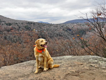
![]()
![]()
![]()
![]()
![]() On Saturday, November 7th, I asked Cindy if she would like to take a hike somewhere and she said "Yes". After talking about some spots we decided to go to North South Lake as we had not been there in some time. I knew that this was a popular destination but thought that the number of visitors would be decreased as the park was closed, the leaves well past their peak and the weather questionable. The forecast was for a cloudy morning with the sun coming out after noon and the temperature rising. As I chose clothing for the hike, I decided to leave my Mammut Hoody home and wear a light windbreaker. I did wear my MH inter Wander pants as they seem to be ideal for any but the warmest or coldest conditions. I packed gloves and a hat and even threw in a rain jacket just in case the forecast was wrong! We delayed leaving home until just before 9:00 AM thinking we would try to get some of the hike in after the sun came out. I drove from Livingston Manor up the Beaverkill Road and over the Barkaboom Road to the Pepacton Reservoir. From there I took BWS 9 to Margaretville to get on Route 28. I followed Route 28 to Phoenicia where I picked up Route 214 north to Route 23A. We were surprised to see the number of cars at Notch Lake and I began to wonder if there would be a number of people at North South Lake. We headed east on Route 23A to Haines Falls and turned left on North Lake Road. As we approached the park, I turned right on Scutt Road and drove to the parking area. The lot was already full so I drove back out to the main road and turned right to drive into the park. There were parking spaces open near the entrance and I pulled into one of these. The temperature on the car read 46 degrees but when we stepped out of the car the wind chill made it feel even colder. I knew that once we got moving and were in the shelter of the trees I would be warmer but I was certainly cold standing by the car. We got our gear together and left the car at 10:40 AM. We walked back out on the main road, turned left on Scutt Road and then left across from the parking area onto the blue blazed Escarpment Trail. As we started out on the Escarpment Trail there were several areas that were damp and the entire trail was covered in slippery oak leaves. I left my poles in the car as I thought I would have to keep Sheila on her leash much of the time. As soon as we got on the trail I did have to use the leash as a group approached us with their unleashed dog! After we passed them, I let Sheila loose for a little while and she stayed close by.
On Saturday, November 7th, I asked Cindy if she would like to take a hike somewhere and she said "Yes". After talking about some spots we decided to go to North South Lake as we had not been there in some time. I knew that this was a popular destination but thought that the number of visitors would be decreased as the park was closed, the leaves well past their peak and the weather questionable. The forecast was for a cloudy morning with the sun coming out after noon and the temperature rising. As I chose clothing for the hike, I decided to leave my Mammut Hoody home and wear a light windbreaker. I did wear my MH inter Wander pants as they seem to be ideal for any but the warmest or coldest conditions. I packed gloves and a hat and even threw in a rain jacket just in case the forecast was wrong! We delayed leaving home until just before 9:00 AM thinking we would try to get some of the hike in after the sun came out. I drove from Livingston Manor up the Beaverkill Road and over the Barkaboom Road to the Pepacton Reservoir. From there I took BWS 9 to Margaretville to get on Route 28. I followed Route 28 to Phoenicia where I picked up Route 214 north to Route 23A. We were surprised to see the number of cars at Notch Lake and I began to wonder if there would be a number of people at North South Lake. We headed east on Route 23A to Haines Falls and turned left on North Lake Road. As we approached the park, I turned right on Scutt Road and drove to the parking area. The lot was already full so I drove back out to the main road and turned right to drive into the park. There were parking spaces open near the entrance and I pulled into one of these. The temperature on the car read 46 degrees but when we stepped out of the car the wind chill made it feel even colder. I knew that once we got moving and were in the shelter of the trees I would be warmer but I was certainly cold standing by the car. We got our gear together and left the car at 10:40 AM. We walked back out on the main road, turned left on Scutt Road and then left across from the parking area onto the blue blazed Escarpment Trail. As we started out on the Escarpment Trail there were several areas that were damp and the entire trail was covered in slippery oak leaves. I left my poles in the car as I thought I would have to keep Sheila on her leash much of the time. As soon as we got on the trail I did have to use the leash as a group approached us with their unleashed dog! After we passed them, I let Sheila loose for a little while and she stayed close by.
 We crossed the two railroad grades and crossed Spruce Creek on the footbridge. Just after the bridge we came to the junction with the Scutt Road Trail and turned right down a woods road to stay on the blue blazed Escarpment Trail. The water in the creek was higher than I expected and as we approached the old dam a group of four walked out to the trail from the dam. The got on the trail before us as we turned left across from the bridge to stay on the Escarpment Trail. We soon passed that group and continued on the trail heading for the Layman Memorial. The trail to the memorial is downhill and the memorial is almost 500 feet below the elevation of the parking lot. The leaves on the descent were slippery and I found myself hanging onto rock and trees without the aid of my poles. We stopped briefly at the monument dedicated to a fire fighter who died in 1900 fighting a forest fire in the area. The view from the memorial was better than I remembered and it looked as if someone had cleared a few small trees. We could see down to the parking area for Kaaterskill Falls which was already full. Work may have been done to improve the trail to the falls and increase the safety for hikers but getting from the parking area to the trailhead may be the most dangerous part of the hike! The trail from the monument ascends back up to the escarpment and there are several short rock scrambles and high steps along the way. At some point my right foot went into a hole and I felt some pain in my heal. It wasn't too severe but I felt it for the rest of the hike. We were able to ascend without much problem to the area where the Escarpment Trail flattens some. It had been several years since I had taken this route and I had forgotten how beautiful and breathtaking the views can be. There are several famous named spots along the way but there are other, smaller lookouts that are just as nice. We passed the yellow shortcut trail at about 1.8 miles into the hike. Shortly after this we arrived at Sunset Rock and then Inspiration Point. Along the way I had warmed up and opened up the zipper on my jacket. I left my hat on but removed my gloves. When we were in exposed areas, the breeze made me feel little cool but otherwise I was comfortable.
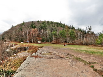 The view from the trail is to the south and the sun was just beginning to make taking pictures difficult. Despite this we could look up the Clove and see the Hunter Mountain Ski Area behind the houses of Twilight Park. The houses seem to hang on the side of the mountain and they must have spectacular views. Of course, Kaaterskill High peak and Round Top are visible across the way. I could also see several stream drainages as they snaked there way down the mountain. From Inspiration Point we got our first look at the Hudson River. At 12:25M we had hike 2.8 miles and arrived at the junction with the horse trail that leads down to the Palenville Lookout and the Harding Road Trail. We turned left to continue to follow the Escarpment Trail. From the junction the Escarpment Trail heads more "inland" to the area of the site of the Kaaterskill Hotel. The trail has been rerouted in this area due to erosion but is well marked. At the top of a short climb the trail flattens and the walking becomes the easiest on the entire route. After a brief detour from the escarpment, the trail returns to the edge of the cliffs making a large bend to pass Split Rock and Boulder Rock. We passed the area known as Split Rock where several large slabs of bedrock have split off from the main mass of bedrock. We arrived at Boulder Rock to find a family of four gathered around and on the rock. I wanted to take some pictures and had to wait until they were done climbing up the rock several times! Finally, the mother got the idea that they were monopolizing the site and they left. I took few shots of Boulder Rock and then a few more with Cindy and Sheila. The rock is a large erratic perched on the edge of the escarpment. I also took some pictures of the Hudson and the valley but there was a lot of haze hanging low. We continued along the trail stopping at another lookout with more open views of the Hudson. I took a few pictures from here before we headed down the trail toward the site of the Catskill Mountain House.
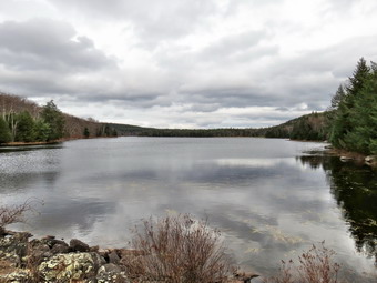 The trail was covered in oak leaves and I had to pick my foot plants carefully to avoid falling. We worked our way down the trail to the open field that was once the site of the Catskill Mountain House. I leashed Sheila to a picnic table and got out the camera. I took pictures of the open space with a few well constructed benches. I also photographed the view and tried to imagine the hotel and its clientele at the height of its popularity. I took more pictures of the valley and found some spots that still had some colorful leaves. I went back to get Sheila and put my camera away after which we started down the access road toward North Lake. We stayed on the access road rather than follow the trail and came to a parking area. I had hoped to walk a little farther and return by way of the Mary's Glen Trail and the trail on the north side of the lakes. I asked Cindy and she said she preferred to return to the car. I knew this would mean walking a lot on the roads but we turned left and started back. At 5.7 miles we were at the south end of South Lake. The clouds were still hanging low in the sky and a little rain was beginning to fall. We stopped so that I could take some pictures and then decided to get back to the car just in case the rain picked up. The gate was closed just before the road crossed the dam and there were many cars parked in the area. We walked up the hill and back to the car. We arrived back in the parking area at 2:15 PM having hiked 6.2 miles in 3 hours and 35 minutes with a little over 30 minutes of stopped time. Our elevation gain was just under 1200 feet. As we started the drive back home, we both decided it would be nice to stop at Pancho Villa's in Tannersville for a meal. The town was as busy as I have seen it in the late fall and quite a few table were occupied in the restaurant.
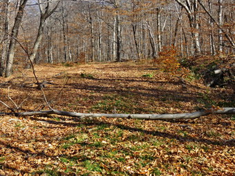
![]() On Wednesday, November 4th, I decided to return to the Flynn Trail to remove the two remaining blowdowns we had not cleared on Tuesday and to clear the trees at the beginning of the woods road. When I got up the temperature was relatively mild hovering in the mid 40's. I got my gear and an always excited Sheila into the car and headed out the DeBruce Road for Frick Pond just before 10:00 AM. I was still looking for a pair of boots to replace my Keen Glarus that had finally worn out. The previous day I had put on a pair of Vasque Taku GTX boots and found that they seemed a little wide but could be snugged up with the laces. I turned left on Mongaup Road and stayed to the left where Beech Mountain Road splits off. I parked in the smaller lot and was not surprised that we were the only hikers. Before we started the hike I made the decision to leave my Mammut Hoody in the car and bring only a light windbreaker in my pack. I also left my hat and gloves in the pack as the temperature was climbing into the high 50's and I knew the walk up the Flynn Trail would keep me warm. We crossed the road to started our hike at 10:10 AM by walking through the woods on the Flynn Trail. I hadn't decided whether to hike to the last blowdown and work my way down the trail or to handle them as I came to them. The day really was beautiful and Sheila and I were enjoying the walk. We passed the first two blowdowns we had cleared the day before and continued up the trail. At 1.2 miles we came to a small tree on the right side of the trail that was hanging over the trail. I decided to continue on and soon after at 1.3 miles came to the next blowdown. This was a small tree stretched across the trail. We continued walking to the junction with the Big Rock Trail and then started back down. When we came to the small tree across the trail, I dropped my pack and prepared to clear the obstacle. I took a few pictures of the blowdown and then got out my axe and saw. This time I had brought along a German pattern Mueller felling axe which has a little more weight in the bit. I cut some of the branches with the saw and dragged them away. I used the axe to section the trunk which went very quickly. Soon the tree was cleared. I took some pictures, packed up the gear and headed to the next area. Cutting the next set of branches meant cutting down the small tree hanging over the trail. I took a few "before" shots and then took the axe and cleared some of the brush around the tree. It only took a few swings to sever the trunk. I put down the axe and simply dragged the trunk far enough back into the woods to clear the trail. Before packing up I took a few more pictures and then headed down the trail again.
On Wednesday, November 4th, I decided to return to the Flynn Trail to remove the two remaining blowdowns we had not cleared on Tuesday and to clear the trees at the beginning of the woods road. When I got up the temperature was relatively mild hovering in the mid 40's. I got my gear and an always excited Sheila into the car and headed out the DeBruce Road for Frick Pond just before 10:00 AM. I was still looking for a pair of boots to replace my Keen Glarus that had finally worn out. The previous day I had put on a pair of Vasque Taku GTX boots and found that they seemed a little wide but could be snugged up with the laces. I turned left on Mongaup Road and stayed to the left where Beech Mountain Road splits off. I parked in the smaller lot and was not surprised that we were the only hikers. Before we started the hike I made the decision to leave my Mammut Hoody in the car and bring only a light windbreaker in my pack. I also left my hat and gloves in the pack as the temperature was climbing into the high 50's and I knew the walk up the Flynn Trail would keep me warm. We crossed the road to started our hike at 10:10 AM by walking through the woods on the Flynn Trail. I hadn't decided whether to hike to the last blowdown and work my way down the trail or to handle them as I came to them. The day really was beautiful and Sheila and I were enjoying the walk. We passed the first two blowdowns we had cleared the day before and continued up the trail. At 1.2 miles we came to a small tree on the right side of the trail that was hanging over the trail. I decided to continue on and soon after at 1.3 miles came to the next blowdown. This was a small tree stretched across the trail. We continued walking to the junction with the Big Rock Trail and then started back down. When we came to the small tree across the trail, I dropped my pack and prepared to clear the obstacle. I took a few pictures of the blowdown and then got out my axe and saw. This time I had brought along a German pattern Mueller felling axe which has a little more weight in the bit. I cut some of the branches with the saw and dragged them away. I used the axe to section the trunk which went very quickly. Soon the tree was cleared. I took some pictures, packed up the gear and headed to the next area. Cutting the next set of branches meant cutting down the small tree hanging over the trail. I took a few "before" shots and then took the axe and cleared some of the brush around the tree. It only took a few swings to sever the trunk. I put down the axe and simply dragged the trunk far enough back into the woods to clear the trail. Before packing up I took a few more pictures and then headed down the trail again.
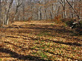 The next stop was the large tree I had removed the day before. There was plenty of room to walk through on the trail but I wanted to clean up a little more. I took the axe and saw and cleared the top of the tree pulling the branches from the side of the trail into the woods. I wanted to test the Mueller axe on the large trunk by cutting one more section out of the way. The face of the tree falling had buried it in the ground. I didn't want to take the chance of hitting a rock with the axe or saw so I tried using a large limb to pry the try up. I got nowhere since the remaining trunk was both large in diameter and long. I decided the job would have to wait until I had some help. I took an "after" picture and started the walk back to the gate on the Flynn Trail. We were soon at the point where the trail turns left into the woods. Some time ago two trees fell across the trail and hikers "unofficially" rerouted the trail. Someone even placed a sign to indicate the turn. O dropped my pack and got out the axe to remove the first tree. It wasn't a very large trunk and it was very dry so the work went quickly. I removed the sections from the trail and dragged them away. I turned my attention to a smaller sapling that still was across the trail The saw took this one out but when I tried to pull it off the trail I got a nasty surprise. The sapling was thorn apple and after a couple of pokes I became more respectful! The second tree was larger but just as easy to cut with the German axe. I cut the tree near the base and the tried to remove the bottom section from the trail. I found that the roots were still holding it in the ground. Fortunately I was able to get it free and roll it onto the new section of trail I wanted to block. I was done for the day. I still have to return to remove the "Trail" sign and add a few blazes. I will also use a weed whip to clear some of the brush to make the original trail more visible.
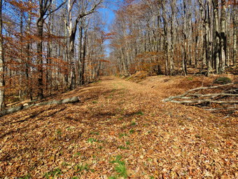
![]() On Tuesday, November 3rd, I wanted to return to the Flynn Trail to remove the four blowdowns I had found on Monday. Bryce was at our house so I decided to take him along and Cindy wanted to go as well. When I got up the temperature was relatively mild hovering in the low 40's. We waited for Bryce to arrive, had breakfast and then got ready to go. I got my gear and an always excited Sheila into the car and headed out the DeBruce Road for Frick Pond at about 10:20 AM. I was still looking for a pair of boots to replace my Keen Glarus that had finally worn out. The previous day I had put on a pair of Vasque Summit boots and found that they were probably more suited for heavy backpacking. This time I tried a pair of Vasque Taku GTX and found they were lighter and more suited to the task. They did feel a little big but I found that I could adjust this with the lacing. I turned left on Mongaup Road and stayed to the left where Beech Mountain Road splits off. I parked in the smaller lot and was not surprised that we were the only hikers. Before we started the hike I made the decision to leave my Mammut Hoody in the car and bring only a light windbreaker in my pack. I also left my hat and gloves in the pack as the temperature was climbing into the 50's and I knew the walk up the Flynn Trail would keep me warm. We crossed the road to started our hike at 10:40 AM by walking through the woods on the Flynn Trail. Bryce couldn't decide whether or not he "needed" a hiking pole. Cindy shortened one of hers and let him use it but he eventually gave it back. Bryce and I were picking up branches and small sticks and throwing them to the side of the trail. After a walking a little farther than I thought we arrived at the first blowdown at about .75 miles. This was a small tree that partially blocked the trail. I dropped my pack and took out my camera to take a few "before" shots. For a few pictures I had Bryce stand in front of the tree to get some perspective on its size. I decided that this tree was small enough to use the saw to cut it. I took my curved Silky saw out of its scabbard and went to work. As I cut the tree near its base, the saw started to bind. I had Bryce bring me the wedges and these helped keep it open as I finished the cut. Before trying to move the tree, I cut some of the branches off and Bryce and I removed them to the side of the trail. Bryce helped me move the larger part of the tree and we were ready to move on to the next obstacle. I took some "after" pictures with Bryce standing in the middle of the now empty trail. After that, I returned the saw to the scabbard and packed up so that we could move on.
On Tuesday, November 3rd, I wanted to return to the Flynn Trail to remove the four blowdowns I had found on Monday. Bryce was at our house so I decided to take him along and Cindy wanted to go as well. When I got up the temperature was relatively mild hovering in the low 40's. We waited for Bryce to arrive, had breakfast and then got ready to go. I got my gear and an always excited Sheila into the car and headed out the DeBruce Road for Frick Pond at about 10:20 AM. I was still looking for a pair of boots to replace my Keen Glarus that had finally worn out. The previous day I had put on a pair of Vasque Summit boots and found that they were probably more suited for heavy backpacking. This time I tried a pair of Vasque Taku GTX and found they were lighter and more suited to the task. They did feel a little big but I found that I could adjust this with the lacing. I turned left on Mongaup Road and stayed to the left where Beech Mountain Road splits off. I parked in the smaller lot and was not surprised that we were the only hikers. Before we started the hike I made the decision to leave my Mammut Hoody in the car and bring only a light windbreaker in my pack. I also left my hat and gloves in the pack as the temperature was climbing into the 50's and I knew the walk up the Flynn Trail would keep me warm. We crossed the road to started our hike at 10:40 AM by walking through the woods on the Flynn Trail. Bryce couldn't decide whether or not he "needed" a hiking pole. Cindy shortened one of hers and let him use it but he eventually gave it back. Bryce and I were picking up branches and small sticks and throwing them to the side of the trail. After a walking a little farther than I thought we arrived at the first blowdown at about .75 miles. This was a small tree that partially blocked the trail. I dropped my pack and took out my camera to take a few "before" shots. For a few pictures I had Bryce stand in front of the tree to get some perspective on its size. I decided that this tree was small enough to use the saw to cut it. I took my curved Silky saw out of its scabbard and went to work. As I cut the tree near its base, the saw started to bind. I had Bryce bring me the wedges and these helped keep it open as I finished the cut. Before trying to move the tree, I cut some of the branches off and Bryce and I removed them to the side of the trail. Bryce helped me move the larger part of the tree and we were ready to move on to the next obstacle. I took some "after" pictures with Bryce standing in the middle of the now empty trail. After that, I returned the saw to the scabbard and packed up so that we could move on.
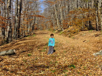 We walked a little farther up the hill to .85 miles and came to the biggest of the four blowdowns that needed to be cleared. The tree trunk stretched across the entire trail and was at least 12 inches in diameter. I used my Fiskars axe to remove a few small limbs. We dragged what I had cut to the side of the trail and then I got out the saw, I was able to cut some of the branches from the top and remove some of the bigger ones so that we could pull them away. Now it was time to attack the trunk itself. I decided the quickest way was to use the axe so I picked a spot closer to the top of the tree and started in. The wood was hard and the light Fiskars axe meant I had to provide a lot of the muscle. I did cut a wide enough V this time, barely, and was able to section the log. I tried to move the section I had cut and immediately knew I had a job on my hands there were a few protruding branches which made it hard to roll. I was able to flip it end-for-end once and then called Bryce over to help. Bryce is four years old but was able to help me roll the section of trunk to the side of the trail. I measured off another section and started to make my cut. This time I picked a smaller length but the chopping wasn't getting any easier. I like the fact that the Fiskars is light and easy to carry and it does a great job climbing and cutting smaller trees. As I worked my way through this larger log I found myself wishing I had one of my larger felling axes with some weight in the bit and a wider face. I eventually cut through the section and we were able to roll it off the trail. I wanted to cut another section but knew I needed a different axe and a little more energy. I took some pictures of the area we had cleared and then put everything back in the pack. It was noon and we decided to head back to the car. The walk down the Flynn Trail went quickly. At one point Cindy spotted something run across the trail. I have seen bears in this area more than once and we quickened our pace. As we turned off the road to stay on the Flynn Trail, I thought about removing the trees that blocked the original trail creating a short reroute. I decided this was definitely a job for anther day. We were back in the care by 12:40 PM. By the time we were on the DeBruce Road, Bryce was napping in the backseat!
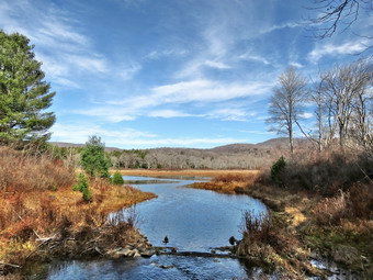
![]()
![]()
![]()
![]()
![]() On Monday, November 2nd, I decided to get out hiking somewhere close to home as it appeared the day would be beautiful. When I got up the temperature was below freezing but by 9:30 Am it had risen to the low 40's. I got my gear and an always excited Sheila into the car and headed out the DeBruce Road for Frick Pond. My Keen Glarus boots had finally worn to the point that I had to replace them. I put on a pair of Vasque Summit boots and found that they were probably more suited for heavy backpacking. I decided to wear them anyway since I did not plan a long hike. I immediately noticed that the top of the boot rubbed on the lower part of my ankle but only on the right side. I turned left on Mongaup Road and stayed to the left where Beech Mountain Road splits off. I parked in the smaller lot and was not surprised that we were the only hikers. Before we started the hike I made the decision to keep on my Mammut Hoody but to open the pitzips to allow some air circulation. I also wore a light hat and gloves. We walk out the back of the large parking area at 10:10 AM to begin our hike on the Quick Lake Trail. When we turned left onto the woods road that leads to Frick Pond, I inspected the trail and found it was wet with some standing and some running water. I am much more conscious of trail conditions now that I have become hooked on trail maintenance. There were places to walk along the sides of the road that were not quite as wet . The wet areas continued along the trail until we got to Gravestone Junction. The muddy area to the left on the Quick Lake Trail was wet but the stepping stones were still not really needed. We turned left and walked down to the bridge across the outlet of Frick Pond. The scene was not much different the it always is in the fall but I had to take a few shots. There were a few clouds in the blue sky but most of the leaves were off the trees. The water level in the pond was high enough to supply some for the creek. Sheila decided to jump into the water and then run around to dry off. I took a few pictures of her on the bridge before we continued. At the next junction we stayed to the left on the Quick Lake Trail. After a short distance I took off the Hoody and hat but kept in the gloves. This area of the trail was very wet and looked like it had recently been wetter. When we arrived at the small stream after the "pine promenade", I was surprised to see that it was full. I had to walk upstream a little to cross easily. Sheila again took advantage of the high water to get a drink and a little swim.
On Monday, November 2nd, I decided to get out hiking somewhere close to home as it appeared the day would be beautiful. When I got up the temperature was below freezing but by 9:30 Am it had risen to the low 40's. I got my gear and an always excited Sheila into the car and headed out the DeBruce Road for Frick Pond. My Keen Glarus boots had finally worn to the point that I had to replace them. I put on a pair of Vasque Summit boots and found that they were probably more suited for heavy backpacking. I decided to wear them anyway since I did not plan a long hike. I immediately noticed that the top of the boot rubbed on the lower part of my ankle but only on the right side. I turned left on Mongaup Road and stayed to the left where Beech Mountain Road splits off. I parked in the smaller lot and was not surprised that we were the only hikers. Before we started the hike I made the decision to keep on my Mammut Hoody but to open the pitzips to allow some air circulation. I also wore a light hat and gloves. We walk out the back of the large parking area at 10:10 AM to begin our hike on the Quick Lake Trail. When we turned left onto the woods road that leads to Frick Pond, I inspected the trail and found it was wet with some standing and some running water. I am much more conscious of trail conditions now that I have become hooked on trail maintenance. There were places to walk along the sides of the road that were not quite as wet . The wet areas continued along the trail until we got to Gravestone Junction. The muddy area to the left on the Quick Lake Trail was wet but the stepping stones were still not really needed. We turned left and walked down to the bridge across the outlet of Frick Pond. The scene was not much different the it always is in the fall but I had to take a few shots. There were a few clouds in the blue sky but most of the leaves were off the trees. The water level in the pond was high enough to supply some for the creek. Sheila decided to jump into the water and then run around to dry off. I took a few pictures of her on the bridge before we continued. At the next junction we stayed to the left on the Quick Lake Trail. After a short distance I took off the Hoody and hat but kept in the gloves. This area of the trail was very wet and looked like it had recently been wetter. When we arrived at the small stream after the "pine promenade", I was surprised to see that it was full. I had to walk upstream a little to cross easily. Sheila again took advantage of the high water to get a drink and a little swim.
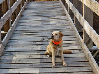 We continued on the trail and soon arrived at Iron Wheel junction about 1.5 miles into the hike. We turned right on the Logger's Loop and I noted that the large blowdown had been cleared. The Sullivan County Trails Association had a workday and removed some large blowdowns with chainsaws. The walk along the Logger's Loop was uneventful and pleasant. The sun was now shining through the trees. There were a few branches on the trail which I instinctively picked up and threw aside. It was nice to look at the yellow trail markers that Cindy and I had placed on a previous hike. After 2.75 miles of hiking, we arrived at Times Square where I had to make a decision. It was only 11:25 Am so I knew I had plenty of time to hike p the Big Rock Trail and down the Flynn Trail to the car. I had been concerned about the new boots but they seemed to wearing nicely. I certainly found them overkill for the kind of hiking I was doing! I turned left on the Big Rock Trail and began the 1.1 mile climb to the Flynn Trail. This uphill sometimes seems very long but on this day it went quickly. I did find several blowdowns on the trail that the snowmobile club had just cleared. Many were rotten wood and I assumed they came down ion the recent rain and wind. We hit the junction with the Flynn Trail at 3.9 miles and turned right to begin the 1.7 mile descent to the car. By now I was feeling the weight of the heavy boots but at least we were headed downhill. The trip went quickly but I did find at least four blowdowns that needed an axe and saw to clear. I made a note to return as soon as possible to clear them. We continued our walk and soon arrived at the gate across the trail where we turned left to stay on the Flynn Trail and avoid the private property around the cabin. By 12:30 PM we were back at the car having covered 5.6 miles in 2 hours and 20 minutes. The vertical gain was 905 ft.
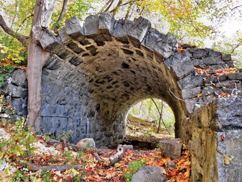
![]()
![]()
![]()
![]() On Saturday, October 31st, I decided I wanted to go south to hike some part of Harriman State Park. On Friday I had been there for our league cross country championship and the leaves were still on the trees and very colorful. Cindy agreed to go and we decided on a loop on the Dunderberg Ridge to the Timp. I thought this would be less crowded than other parts of the park. When I looked at my records, I found I had not been there in 4 years! I wanted to leave home early to make sure we got a parking spot but that didn't happen as we left after 9:30 AM. I drove down the Quickway to Harriman and then took Long Mountain Parkway to the traffic circle. From there I headed toward Bear Mountain State Park on Route 6 East and took Exit 19 on to Seven Lake Drive. As we drove through the park the leave were bright and beautiful. The first parking area on the right was already full and cars were parked along both skies of the road. People were wandering in and out of the roadway taking pictures which made the situation even more dangerous. Perkins Drive to the summit of Bear Mountain was still open but below it more cars were pulled over in places where there is no room to get the view of the Hudson River. There were bicyclists on both sides of the road and some were paying attention to traffic while others were not. When we came to the small Bear Mountain traffic circle, I took the first exit onto Route 202/9W heading south towards Tompkins Cove. The parking area for Bald Mountain was also packed with cars parked everywhere. Some people were stopped in the middle of the road apparently trying to determine where to park! I drove about 4 miles to just passed Jones Point and pulled into the first empty parking space I could find. Although there were quite a few cars parked it was a lot less crowded than anything else we had seen and we were both happy to leave the chaos behind. We got ready to hike by losing our heavier jackets and donning light windbreakers. I wore my hat as the air was still cool with a slight breeze. Several groups asked us where the trail started as they did not seem to have maps of any kind. Maps are important in Harriman since ether are so may different marked trails and unmarked roads, paths and trail that criss-cross each other! We gave directions and then started our hike by walking a little south on Route 202 with Sheila on her leash.
On Saturday, October 31st, I decided I wanted to go south to hike some part of Harriman State Park. On Friday I had been there for our league cross country championship and the leaves were still on the trees and very colorful. Cindy agreed to go and we decided on a loop on the Dunderberg Ridge to the Timp. I thought this would be less crowded than other parts of the park. When I looked at my records, I found I had not been there in 4 years! I wanted to leave home early to make sure we got a parking spot but that didn't happen as we left after 9:30 AM. I drove down the Quickway to Harriman and then took Long Mountain Parkway to the traffic circle. From there I headed toward Bear Mountain State Park on Route 6 East and took Exit 19 on to Seven Lake Drive. As we drove through the park the leave were bright and beautiful. The first parking area on the right was already full and cars were parked along both skies of the road. People were wandering in and out of the roadway taking pictures which made the situation even more dangerous. Perkins Drive to the summit of Bear Mountain was still open but below it more cars were pulled over in places where there is no room to get the view of the Hudson River. There were bicyclists on both sides of the road and some were paying attention to traffic while others were not. When we came to the small Bear Mountain traffic circle, I took the first exit onto Route 202/9W heading south towards Tompkins Cove. The parking area for Bald Mountain was also packed with cars parked everywhere. Some people were stopped in the middle of the road apparently trying to determine where to park! I drove about 4 miles to just passed Jones Point and pulled into the first empty parking space I could find. Although there were quite a few cars parked it was a lot less crowded than anything else we had seen and we were both happy to leave the chaos behind. We got ready to hike by losing our heavier jackets and donning light windbreakers. I wore my hat as the air was still cool with a slight breeze. Several groups asked us where the trail started as they did not seem to have maps of any kind. Maps are important in Harriman since ether are so may different marked trails and unmarked roads, paths and trail that criss-cross each other! We gave directions and then started our hike by walking a little south on Route 202 with Sheila on her leash.
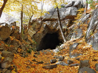 After a short walk we turned onto the beginning of the Timp-Torne Trail marked in blue and the Ramapo-Dunderberg Trail marked with a red dot on white background. There were two young women ahead of us so I kept Sheila on her leash as we started up the trail through the heavy vegetation. We stopped at the first railroad tunnel and I waited for the women to take their pictures and then took some of my own. This tunnel is constructed out of laid-up stone and is at the base of the ridge. I walked through the tunnel to the other side, something I had never done before, and found that the other side was unfinished. As I returned, another group of hikers was approaching from below so I got my gear together and we hurried up the trail to the junction where the trails split. After passing through a cut in the rocks, we waited for the others to make their turn. They were younger and we thought they probably wanted to move faster than us. This group had asked us where the trail started when we were still in the parking lot. They now wanted to know the way to The Timp. I showed them my map and told them to turn left onto the blue Timp-Torne Trail. After they left, I let Sheila off her leash and we followed behind them. We worked our way up through and over some rocks until we were walking on one rail bed. The trail then took us up to the next level and at about 1.1 miles we came to a railroad tunnel blasted into the solid rock of the ridge. The tunnel was never finished and is partly filled with water. I took some pictures of the tunnel and the railroad bed before we continued along the raised bed. Rock blasted out of the mountain for tunnels and cuts was used to form a solid bed on which tracks would have been placed if the project had not been canceled. At 1.5 miles the trail turned from heading southwest to northeast forming a switchback to make the climb easier. At this point we had already gained almost 800 feet from the start of the hike. As we walked along the switchback, there were some nice views down to the river including a look at the Indian Point nuclear power plant. I got out my camera and took some pictures of the river and some of the brightly colored trees below us on the ridge. There was some haze on the river but the views were still wonderful. At 1.75 miles the trail turned abruptly to the southwest again. The trail continued to climb but the grade was much gentler.
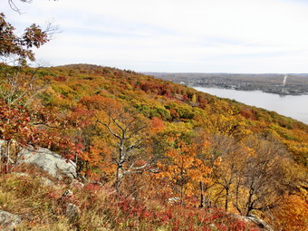 The area we started to walk through was not effected by the construction of the Dunderberg Spiral Railway. It still has impressive rock formations but there are also areas of open woods. We continued to travel southwest along the trail meeting a few people going in both directions. When we crossed the 1777 Trail, I knew we were getting closer to The Timp and starting looking for the point where we would cross the Ramapo-Dunderberg Trail. At 2.5 miles we began a steep but short descent and then passed through and area which had multiple paths and roads. From 2.7 mils to 3 miles we climbed to a high point that is incorrectly marked as the Timp on some maps. There is no view from this high, rocky area so we continued passed it and dropped elevation to the junction with the Ramapo-Dunderberg Trail. We continued on the Timp-Torne Trail for another .2 miles until we had climbed to the top of the Timp. There were a few people coming down as we were ascending. When we reached the top, I dropped my pack and took out the camera. Cindy was impressed with the views! To the south we could see the New York City skyline in the distance. The view was hazy but the outlines of the buildings were unmistakable. To the north was West Mountain with its rock shelter where we could see some people. Farther to the north was the Perkins Tower on top of Bear Mountain and a little to the east the Bear Mountain Bridge. Interspersed between all of this were areas of brilliant fall foliage. It took numerous shots in all directions. A few people appeared from both directions on the trail as we were about to leave, Cindy and I discussed our options and decided to continue with the original plan of hiking a loop even though it would be longer than going back the way we had come. It was 1:10 Pm when we left the Timp and we had hiked 3.4 miles. We descended to the trail junction and turned left on the Ramapo-Dunderberg Trail to head for Bald Mountain.
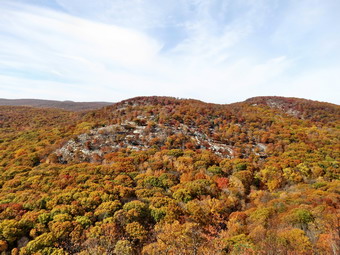 The trail we were on parallels the Timp-Torne Trail for some distance and we climbed over a few bumps crossing the 1777 Trail in the process. At one point we saw hikers ahead and pulled off the trail as we usually do. We were both surprised when more than a dozen people passed us with many of them making nice comments about Sheila. At 4.25 miles we came to a small stream and stopped as a group of four crossed the stream and stopped to ask us questions. They were walking in the opposite direction of their objective but seemed happy to walk a big loop. We crossed the stream and were soon ascending Bald Mountain. There were two couple at the top of the mountain and the view was as impressive as I remembered. The Perkins Tower and Bear Mountain Bridge just to the north looked close enough to touch. I took several shots before deciding that we needed to get moving. One couple asked me to take their picture which I did. We followed them down the trail until just before the junction with the Cornell Mine Trail. They stopped there and seemed confused about which trail to take. We tried to help them and they eventually decided to go back over the top of Bald Mountain. I decided to bypass a visit to the Cornell Mine since it was getting later in the day. We continued on the Ramapo-Dunderberg Trail passed the junction with the Cornell Mine Trail. The trail rolled a little and then at 5.4 miles began a serious descent. I knew that we would have a few more short ascents to go but I was not looking forward to them nor was Cindy.
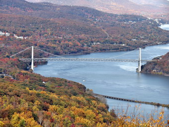 At 5.9 miles we made our last ascent and then began the final descent at 6.25 miles. We were still heading east at this point but at 6.9 miles we made the turn south to head back to the car. At the turn there is a short spur trail that leads to a nice viewpoint. Although the sun was getting low, I took some shots from here of the river and the marina on the other side. The trail began to follow the railroad bed again and at 7.4 miles we reached the point where the stationary engines were to be placed to pull the railroad cars up the 22% incline. Stationary engines were needed since the maximum grade for railroad tracks in about 4% with cog engines being able to handle only 10% inclines. The cars were to be pulled to the top of the mountain by the stationary engines. For the trip down gravity would take over and the cars would follow a spiral descent through at least two tunnels much like an amusement park ride! Walking down this grade is not an easy task since it is still littered with large, angular stone which was to be the base for the tracks. We finally arrived at the junction with the Timp-Torne Trail and turned left to follow the trails back to the parking area. We were both glad when we arrived back at the car at 4:20 PM having hiked 8 miles in 5 hours and 45 minutes with over an hour of stopped time. The vertical gain was 2235 feet. We stopped at El Bandido in Middletown on the way back for a well-deserved meal.
![]()
![]()
![]()
![]() On Tuesday, October 27th, I decided I wanted get out and do a hike close to home before going to cross country practice. I decided to go to Walnut Mountain in Liberty and try to hike all the trails that are not single track bike trails. I wanted get done as early as possible so I got Sheila and my gear in the car to head for Liberty a little after 9:00 AM. I decided to park at the main lot off Route 55 and arrived to find only one other car in the lot. I parked and we were ready to hike by 9:25 AM. I decided to walk down passed the ballfield to the north to pick up the Walnut Loop East. As I walked through the very wet grass, I realized that I should have walked around the field to cover the entire trail. We walked on the wide trail north toward the West Lake Street parking area. The leaves were mostly off the trees and on the ground. The temperature was still in the 30's and a slight breeze was blowing. It was beautiful! As we approached the parking area, we turned left onto the Walnut Loop North and starting heading back to the south. This trail started climbing almost immediately and I pushed the pace to get some aerobic work. Over the .7 miles to the junction with the Walnut Loop West the trail gained a little over 280 feet. When we got to the trail junction we turned right on the Walnut Loop West which soon turned south on the west side of the mountain. At about 1.6 miles the trail began a steep little uphill for about .2 miles to the lower set of picnic tables. We continued passed the tables to get on the Walnut Loop South. I began to hear a lot of barking and whining below and was convinced there was a pack of coyotes or wild dogs waiting for us. I put Sheila on her loop as we descended to the area of the old quarry and the new disk golf course. We never saw any dogs and were soon back at the parking area. I headed down the access road to the beginning of the Walnut Loop East and followed it to where we had entered the woods at the beginning of the hike. My GPS showed we had covered a total of 2.6 miles. I decided to walk back up through the field to the parking area to get to the rest of the trails.
On Tuesday, October 27th, I decided I wanted get out and do a hike close to home before going to cross country practice. I decided to go to Walnut Mountain in Liberty and try to hike all the trails that are not single track bike trails. I wanted get done as early as possible so I got Sheila and my gear in the car to head for Liberty a little after 9:00 AM. I decided to park at the main lot off Route 55 and arrived to find only one other car in the lot. I parked and we were ready to hike by 9:25 AM. I decided to walk down passed the ballfield to the north to pick up the Walnut Loop East. As I walked through the very wet grass, I realized that I should have walked around the field to cover the entire trail. We walked on the wide trail north toward the West Lake Street parking area. The leaves were mostly off the trees and on the ground. The temperature was still in the 30's and a slight breeze was blowing. It was beautiful! As we approached the parking area, we turned left onto the Walnut Loop North and starting heading back to the south. This trail started climbing almost immediately and I pushed the pace to get some aerobic work. Over the .7 miles to the junction with the Walnut Loop West the trail gained a little over 280 feet. When we got to the trail junction we turned right on the Walnut Loop West which soon turned south on the west side of the mountain. At about 1.6 miles the trail began a steep little uphill for about .2 miles to the lower set of picnic tables. We continued passed the tables to get on the Walnut Loop South. I began to hear a lot of barking and whining below and was convinced there was a pack of coyotes or wild dogs waiting for us. I put Sheila on her loop as we descended to the area of the old quarry and the new disk golf course. We never saw any dogs and were soon back at the parking area. I headed down the access road to the beginning of the Walnut Loop East and followed it to where we had entered the woods at the beginning of the hike. My GPS showed we had covered a total of 2.6 miles. I decided to walk back up through the field to the parking area to get to the rest of the trails.
From the lower end of the parking area we got on the Vista Way heading north. This trail was a little over .3 miles and ended at the Walnut Loop North. I decided to turn left and walk back toward the mountain. This time when we got to the Walnut Loop West we turned left and walked down to the Mountain Overlook Trail where we turned right to head south. After .4 miles we were at the upper picnic tables and the lookout. There was a couple of hikers at the overlook and I knew the view wasn't that good anyway. We made a hard right onto the Sunset Trail and stayed on it as it swung around the west side of the mountain a little higher up than the Walnut Loop West. We continued to follow the Sunset Trail until it started to descend and the Mountain House trail turned off to the right. We followed this trail up over the mountain through a switchback and then down to the Sunset Trail near the overlook. The hikers were still at the overlook so we turned left and headed back down the Mountain Overlook Trail toward the parking area. As we approached the junction with the Sunset Trail, I decided to shoot up to the junction with the Mountain House Trail to say that we had covered all the trails. We came back down to the Mountain House Trail and followed it all the way back to the car. We made it back by 11:30 AM having covered 5.5 miles in 2 hours with an overall elevation gain of 950 feet.
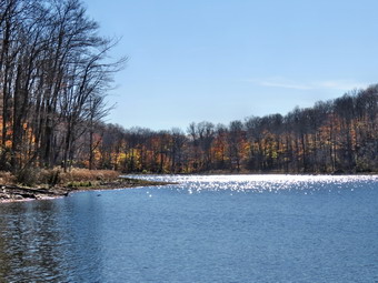
![]()
![]()
![]()
![]() On Monday, October 26th, I decided I wanted get out and do a hike close to home before going to cross country practice. I decided to go to Trout Pond since it is close and offers some nice views. I delayed our departure somewhat as the temperature continued to rise into the 40's. I got Sheila and my gear in the car and left Livingston Manor to head to Roscoe on State Route 17. I got on Route 206 and followed it across the Delaware County line to Morton Hill Road. After a left turn on Morton Hill Road, I drove to the intersection with Russell Brook Road. I turned around and parked on the side of the road to avoid the parking area which is private. We began our hike down Russell Brook Road at 10:20 AM. The air still seemed cold to me so I wore my Mammut Hoody, a hat and light gloves. We continued on down Russell Brook Road to the overlook of the falls. There was not much water in the stream and the upper falls was just trickle. I decided not to stop for pictures and we continued down toward the parking area. An SUV came down the road and passed us. When we got to the parking area, one car was present but the SUV was nowhere to be seen! We got on the woods road that goes down to the bridge that crosses the brook. As we crossed the bridge I noted that the invasive Japanese knotweed was now dying off after several hard frosts. The path that I had carved to the falls was still wide open. I decided not to walk to the falls and continued on the main trail to the register. At the trail junction just after the register we turned to the left to climb the steeper hill toward Mud Pond. The trail was rather dry with only a few wet spots and the ascent went quickly. The sun was out and it was getting warmer but there was a slight breeze blowing. I decided to stop and switch to a lighter windbreaker and stowed the Hoody in my pack. We reached the top of the hill at 10:50 AM after hiking 1.4 miles and started down the other side. At 1.6 miles we made a right to follow the trail up to the shoulder of Cherry Ridge. We kept hiking on the relatively dry trail and found only a few areas with water.
On Monday, October 26th, I decided I wanted get out and do a hike close to home before going to cross country practice. I decided to go to Trout Pond since it is close and offers some nice views. I delayed our departure somewhat as the temperature continued to rise into the 40's. I got Sheila and my gear in the car and left Livingston Manor to head to Roscoe on State Route 17. I got on Route 206 and followed it across the Delaware County line to Morton Hill Road. After a left turn on Morton Hill Road, I drove to the intersection with Russell Brook Road. I turned around and parked on the side of the road to avoid the parking area which is private. We began our hike down Russell Brook Road at 10:20 AM. The air still seemed cold to me so I wore my Mammut Hoody, a hat and light gloves. We continued on down Russell Brook Road to the overlook of the falls. There was not much water in the stream and the upper falls was just trickle. I decided not to stop for pictures and we continued down toward the parking area. An SUV came down the road and passed us. When we got to the parking area, one car was present but the SUV was nowhere to be seen! We got on the woods road that goes down to the bridge that crosses the brook. As we crossed the bridge I noted that the invasive Japanese knotweed was now dying off after several hard frosts. The path that I had carved to the falls was still wide open. I decided not to walk to the falls and continued on the main trail to the register. At the trail junction just after the register we turned to the left to climb the steeper hill toward Mud Pond. The trail was rather dry with only a few wet spots and the ascent went quickly. The sun was out and it was getting warmer but there was a slight breeze blowing. I decided to stop and switch to a lighter windbreaker and stowed the Hoody in my pack. We reached the top of the hill at 10:50 AM after hiking 1.4 miles and started down the other side. At 1.6 miles we made a right to follow the trail up to the shoulder of Cherry Ridge. We kept hiking on the relatively dry trail and found only a few areas with water.
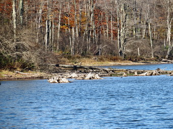 The ascent continued for the next 1.2 miles until at 2.7 miles into the hike when we were at the highest point and ready to start the descent to Trout Pond. There were a few small branches across the trail and one or two major blowdowns that would require an axe and saw to clear. The trail remained relatively dry and easy to negotiate even in spots than can be muddy or have running water at other times of the year. We descended the rest of the way to Trout Pond and found a few more obstructions on the trail. As we approached the inlet I again decided not to stop as there was nothing remarkable to photograph. We continued on the main trail toward the outlet of the pond. Along the way I the trail remained almost dry which was much more pleasant than trying to negotiate the mud that is often present. Along the way I noticed the sun sparkling off the pond and walked out to the shore to snap a few pictures. As we approached the lower end of the pond I looked at the skies which were devoid of any clouds and almost bypassed this stop. We did stop at the outlet end so that I could take a few more shots. It was obvious that the pond was very low as the water was not even lapping at the outlet dam. On the far shore I could see some old stumps sticking up and took a few pictures of them. The hike from the outlet to the trail junction is all downhill and really did go quickly. We were soon back at the register box where we continued on the main trail to the parking area. We finished with the hike up Russell Brook Road back to the car. We arrived back at 12:30 PM having covered 5.5 miles and 1100 vertical feet in 2 hours and 15 minutes.
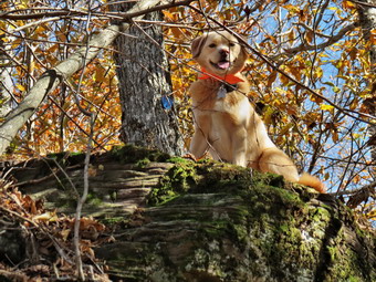
![]()
![]()
![]()
![]() On Friday, October 23rd, I wanted to get in a hike not too far from home but with some elevation gain. I decided that hiking Dry Brook Ridge from Hill Road fit the bill. I wait until later in the morning to leave home since the temperature was still in the high 30's but was predicted to rise to almost 50 degrees. Sheila and I left Livingston Manor at 8:45 AM and headed up State Route 17 to Roscoe. I took Route 206 to the Pepacton Reservoir and turned right on Route 30 to head toward Margaretville. At the Dunraven Bridge I turned right onto BWS 9 instead of following Route 30. The reservoir was very low exposing a lot of land near the shore. The leaf colors around the reservoir were very bright in places and I decided I would stop on the way back to take some shots. I continued to follow BWS 9 around the reservoir to the intersection with BWS 10 and the Barkaboom Road. I turned left on BWS 10 and followed it until it changed to Southside Road just outside Margaretville. I continued on Southside to Huckleberry Brook Road where I turned right. Shortly after the turn I turned left on Hill Road and 1.3 miles to the parking pulloff on the right. The day was cool with temperatures still in the low 40's so I kept on my Mammut hoody and even wore a hat and gloves. We crossed the road and began our hike just before 11:20 AM. The first part of the hike is a nice wide trail that ascends through a red pine plantation. The ascent continues for about 1.9 miles when the trail levels off after gaining 1130 feet. The sun through the pines was beautiful and it seemed warm despite the temperature. After passing through the pines we entered a predominantly hardwood forest before passing again through some pines. Wherever there were hardwood trees the ground was covered in leaves. Sheila seemed to delight in racing away from me through the rustling leaves and then careening headlong back toward me. Along the way I removed my Hoody and traded it for a light windbreaker since the climbing had warmed me up more than enough. After that, the trail opened up a little and we ran into some briars growing in the sunnier spots. At one point Sheila alerted but I did not spot anything or hear any voices. I was hoping it was not a bear and soon I could hear hikers approaching. I put Sheila on her leash as two men appeared. One was carrying a bow saw so I assumed they were doing some trail maintenance. We spoke briefly and then headed on in opposite directions. After .9 miles, the trail leveled off and we walked to the junction with the blue Dry Brook Ridge Trail at 2.3 miles. As we turned right on this trail, I noticed the sign that said the Hill Road parking was 1.7 miles away. I had to laugh! I expect distances to vary some but .6 miles is a pretty big gap.
On Friday, October 23rd, I wanted to get in a hike not too far from home but with some elevation gain. I decided that hiking Dry Brook Ridge from Hill Road fit the bill. I wait until later in the morning to leave home since the temperature was still in the high 30's but was predicted to rise to almost 50 degrees. Sheila and I left Livingston Manor at 8:45 AM and headed up State Route 17 to Roscoe. I took Route 206 to the Pepacton Reservoir and turned right on Route 30 to head toward Margaretville. At the Dunraven Bridge I turned right onto BWS 9 instead of following Route 30. The reservoir was very low exposing a lot of land near the shore. The leaf colors around the reservoir were very bright in places and I decided I would stop on the way back to take some shots. I continued to follow BWS 9 around the reservoir to the intersection with BWS 10 and the Barkaboom Road. I turned left on BWS 10 and followed it until it changed to Southside Road just outside Margaretville. I continued on Southside to Huckleberry Brook Road where I turned right. Shortly after the turn I turned left on Hill Road and 1.3 miles to the parking pulloff on the right. The day was cool with temperatures still in the low 40's so I kept on my Mammut hoody and even wore a hat and gloves. We crossed the road and began our hike just before 11:20 AM. The first part of the hike is a nice wide trail that ascends through a red pine plantation. The ascent continues for about 1.9 miles when the trail levels off after gaining 1130 feet. The sun through the pines was beautiful and it seemed warm despite the temperature. After passing through the pines we entered a predominantly hardwood forest before passing again through some pines. Wherever there were hardwood trees the ground was covered in leaves. Sheila seemed to delight in racing away from me through the rustling leaves and then careening headlong back toward me. Along the way I removed my Hoody and traded it for a light windbreaker since the climbing had warmed me up more than enough. After that, the trail opened up a little and we ran into some briars growing in the sunnier spots. At one point Sheila alerted but I did not spot anything or hear any voices. I was hoping it was not a bear and soon I could hear hikers approaching. I put Sheila on her leash as two men appeared. One was carrying a bow saw so I assumed they were doing some trail maintenance. We spoke briefly and then headed on in opposite directions. After .9 miles, the trail leveled off and we walked to the junction with the blue Dry Brook Ridge Trail at 2.3 miles. As we turned right on this trail, I noticed the sign that said the Hill Road parking was 1.7 miles away. I had to laugh! I expect distances to vary some but .6 miles is a pretty big gap.
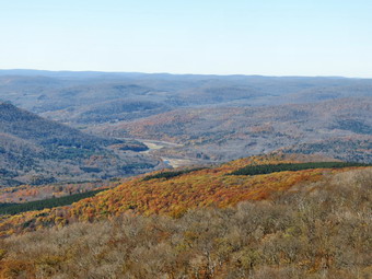 The trail along the ridge follows the edge until about 2.7 miles where it veers away and heads a little to the east and northeast. Initially the trail ascends a small bump and then descends the other side before leveling off for a while. We were soon climbing the last of three short ascents to the area of the lookout. From 2.95 miles to the lookout the trail gains just under 200 feet in elevation and begins to follow the edge of the escarpment. We were at the viewpoint around 1:00 PM. I was glad I had kept my windbreaker on as there was a breeze blowing on the exposed rock face. The views were good but the brilliant colors I had scene from the Dunraven Bridge were not apparent from the lookout. The sky was flat with only a little blue and no defined clouds. I took some pictures of the viewpoint and of Sheila. I took some more shots oft he scenery including some zoomed pictures that showed the low water level in the Pepacton Reservoir. After some minutes at the lookout, we turned around and headed back the way we had come. The trip back to the trail junction went quickly and we were soon headed back down the trail to the parking area. The trip down always seems to go quickly as it is all downhill or level. I stopped just before the road in the red pine plantation and took some pictures of the sky through the pines and some of the trail. Everything looked so warm but the temperature was only in the high 40's. We arrived back at the car at 2:30 PM. We had hiked 6.6 miles in 3 hours and 10 minutes with an elevation gain of 1625 feet. The trip down was about 1o minutes shorter than the trip up.
![]()
![]()
![]()
![]()
![]() On Wednesday, October 21st I wanted to get in a hike before cross country practice in the afternoon. I had a few things to get done in the early morning and by the time I could leave I knew that 'closer was better'. I got my gear and Sheila in the car and left Livingston Manor a little before 10:00 AM to head for Frick Pond. The sky was overcast and I had already decided that this would be a fast hike without any stops! We were at the parking area and out on the Quick Lake Trail by 10:15 AM. Sheila was more than ready to get going. The temperature was in the high 40's with a slight breeze so I wore a light windbreaker. The sky seemed to threaten rain but none was in the forecast. The trail was damp but there was no standing or running water. At Gravestone Junction we stayed to the left on the red Quick Lake Trail crossing the stepping stones the Willowemoc Trail Crew had installed later in the year. I wondered when these stones would actually become necessary again! We walked down to the pond and crossed the bridge over the outlet. Looking at the pond I wasn't at all sorry I had decided to skip the photography. At the next trail junction we headed left to stay on the Quick Lake Trail. We were keeping a pretty steady pace as we headed for Iron Wheel Junction. Sheila was running around us following game trails and chasing a few chipmunks and squirrels. When we arrived at Iron Wheel Junction, we turned left to head toward Hodge Pond.
On Wednesday, October 21st I wanted to get in a hike before cross country practice in the afternoon. I had a few things to get done in the early morning and by the time I could leave I knew that 'closer was better'. I got my gear and Sheila in the car and left Livingston Manor a little before 10:00 AM to head for Frick Pond. The sky was overcast and I had already decided that this would be a fast hike without any stops! We were at the parking area and out on the Quick Lake Trail by 10:15 AM. Sheila was more than ready to get going. The temperature was in the high 40's with a slight breeze so I wore a light windbreaker. The sky seemed to threaten rain but none was in the forecast. The trail was damp but there was no standing or running water. At Gravestone Junction we stayed to the left on the red Quick Lake Trail crossing the stepping stones the Willowemoc Trail Crew had installed later in the year. I wondered when these stones would actually become necessary again! We walked down to the pond and crossed the bridge over the outlet. Looking at the pond I wasn't at all sorry I had decided to skip the photography. At the next trail junction we headed left to stay on the Quick Lake Trail. We were keeping a pretty steady pace as we headed for Iron Wheel Junction. Sheila was running around us following game trails and chasing a few chipmunks and squirrels. When we arrived at Iron Wheel Junction, we turned left to head toward Hodge Pond.
We kept a quick pace up the hilly part of the trail. At one point I heard a plane overhead and looked up to see if I could identify the type. It was a four engine airplane but the engines were definitely propeller driven! I could not see it well enough to identify any marking but I got the impression it was a military aircraft. We continued on our way up the trail and arrived at Junkyard Junction. At this intersection, the Quick Lake Trail bears to the left and continues on to Quick Lake. We turned right and headed across the Flynn Trail toward Hodge Pond. The Flynn Trail is usually damp but today it was almost dry. We turned down the Flynn Trail toward the pond when we got to the gate. We reached the shores of the pond and turned left to follow the jeep trail around the back of the pond. The sky was still overcast and some dark clouds were moving in. On the other side of the pond I turned up the hill toward the ruins of the Beech Mountain Boy Scout Camp. The climb up this trail is steeper than the trail from the outlet of Hodge Pond but it is also shorter! When we got to the top of the hill, we turned right to head back toward the Flynn Trail. Once we were back at the Flynn Trail, we turned left for a straight shot back to the car. We set a fast pace to the junction with the Big Rock Trail and then had about 1.7 miles to go to get back to the car. I must have been deep in thought as the hike to the car seemed to go so quickly. We followed the Flynn Trail to the woods and back to the car arriving at 12:30 PM. We hiked 6.5 miles in 2 hours and 15 minutes with 980 feet of elevation gain. This was one of the few hikes where our average moving and overall speed were the same.
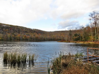
![]()
![]()
![]()
![]()
![]() On Sunday, October 18th it had snowed enough in the morning to cover the ground but I wanted to get out for a short, local hike. I called Lisa to see if she was available and she was but not until 4:00 PM. We decided that I would pick her up at her store, Morgan Outdoors, and we would hike to Huggins Lake. I got my gear in the car along with Sheila who seemed thrilled to be out in the 36 degree weather and picked Lisa up a little after 4:00 PM. I drove up the Beaverkill Road and took the Campsite Road down toward the Beaverkill Covered Bridge. Since this bridge was closed for repairs, I turned left onto Craigie Claire Road and crossed the Beaverkill on the steel bridge. I turned right onto Berry Brook Road to head for the parking area at Huggins Lake. As we drove along Berry Brook Road, we could see the brook was low but had increased in volume some in recent days. At the intersection with the Covered Bridge Road there was a sign that stated the road was closed 5 miles ahead. I knew that was well beyond the Huggins Lake area so we continued and in a couple of miles turned right onto the access road to the parking area. As we had suspected we were the only car there. We began our hike by walking up the wide woods road at 4:30 PM. The sky was overcast and as we walked snow began to fall. I was cold at first even though I had worm by Mountain Hardware WinterWander pants and Mammut Hoody. The trail is not marked on any map and I watched this time to see if I could spot any blazes. There were no blazes of any kind to indicate that the road is a hiking or snowmobile trail. The DEC has maintained the trail but I do not know to what end. I do know that I always think of this as an easy hike and am always surprised that the first part is all uphill. Over the first 1.25 miles the elevation gain is about 625 feet. This averages under a 10% grade but it seems like more. It didn't take long before I was opening zippers on the Hoody despite the cool weather. Sheila seemed happy to be out and she stayed near us as we climbed the hill. Along the way we cleared a few branches from the trail. There were two larger blowdowns that did not impede our walk but should be cleared for the trail. At the top of the hill we began to walk along some high ground that looks down on Huggins Lake. In the winter, the lake is clearly visible but the leaves hide it during the other seasons.
On Sunday, October 18th it had snowed enough in the morning to cover the ground but I wanted to get out for a short, local hike. I called Lisa to see if she was available and she was but not until 4:00 PM. We decided that I would pick her up at her store, Morgan Outdoors, and we would hike to Huggins Lake. I got my gear in the car along with Sheila who seemed thrilled to be out in the 36 degree weather and picked Lisa up a little after 4:00 PM. I drove up the Beaverkill Road and took the Campsite Road down toward the Beaverkill Covered Bridge. Since this bridge was closed for repairs, I turned left onto Craigie Claire Road and crossed the Beaverkill on the steel bridge. I turned right onto Berry Brook Road to head for the parking area at Huggins Lake. As we drove along Berry Brook Road, we could see the brook was low but had increased in volume some in recent days. At the intersection with the Covered Bridge Road there was a sign that stated the road was closed 5 miles ahead. I knew that was well beyond the Huggins Lake area so we continued and in a couple of miles turned right onto the access road to the parking area. As we had suspected we were the only car there. We began our hike by walking up the wide woods road at 4:30 PM. The sky was overcast and as we walked snow began to fall. I was cold at first even though I had worm by Mountain Hardware WinterWander pants and Mammut Hoody. The trail is not marked on any map and I watched this time to see if I could spot any blazes. There were no blazes of any kind to indicate that the road is a hiking or snowmobile trail. The DEC has maintained the trail but I do not know to what end. I do know that I always think of this as an easy hike and am always surprised that the first part is all uphill. Over the first 1.25 miles the elevation gain is about 625 feet. This averages under a 10% grade but it seems like more. It didn't take long before I was opening zippers on the Hoody despite the cool weather. Sheila seemed happy to be out and she stayed near us as we climbed the hill. Along the way we cleared a few branches from the trail. There were two larger blowdowns that did not impede our walk but should be cleared for the trail. At the top of the hill we began to walk along some high ground that looks down on Huggins Lake. In the winter, the lake is clearly visible but the leaves hide it during the other seasons.
 After the top of the hill, the trail descends gentle at first until at 1.7 miles it turns sharply left and drops a little more steeply to the shore of the lake. The trail was slippery with a light coating of snow on top of the wet leaves. When we arrived at the lake, we could see that there were some colors present but they were not very bright. Many of the leaves had already fallen. I dropped my pack and took some pictures. Some of the best colors were in the flowers and shrubs surrounding the pond but the sky was overcast. I did take some pictures of the snow on the trail and around the lake. I also snapped some shots of the cattails near the shore. I picked up my pack and we headed back up the trail. The only negative point about Huggins Lake is that there is only one trail and so there are no variations available. I have tried bushwhacking around the pond but the bushes get pretty thick. We climbed the hill back to the highest point on the trail and then started down the other side. As we continued to descend, Lisa and I both remarked about the beauty of the setting sun and that it was great to get out. We had hiked 3.8 miles in 1 hour and 40 minutes with a total elevation gain of 950 feet. As we left the parking area, I turned left on Berry Brook road and headed back to Livingston Manor the way we had come.
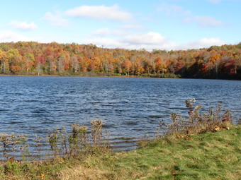
![]()
![]()
![]()
![]()
![]() On Thursday, October 15th, I wanted to get in a quick hike close to home and decided to hike Hodge and Frick Ponds by starting up the Flynn Trail and returning on the Quick Lake Trail. When we left Livingston Manor just before 9:00 AM, the sun was beginning to peak through and the temperature was in the high 50's. At the parking area the sun was out and the my was blue with some puffy white clouds. I wanted to hike quickly but knew I would have to stop at the ponds for a few pictures. We walked across the road and started up the Flynn Trail at 9:10 AM. Once on the main trail I set a quick pace which, of course, Sheila exceeded at every point. She tends to roam off the trail following her nose but never too far and will come when called. It was nice to hike up the Flynn Trail unimpeded by blowdowns and know that I had helped clear them all! We hit the Big Rock junction at 9:50 PM making the 1.7 miles in about 40 minutes. The trail from that point is flat and then downhill to the pond so our pace increased. We walked through the field by the pond and went to the shore. Sheila did not seem interested in jumping in the cold water. I dropped my pack and took out the camera to take some shots of the pond. The leaves had changed colors a little more but were still subdued. After a few more shots, I picked up my pack and we headed up and around to the right to circle the pond. As we reached the head end of the lake, I walked down to the shore and took a few more pictures before returning to the trail.
On Thursday, October 15th, I wanted to get in a quick hike close to home and decided to hike Hodge and Frick Ponds by starting up the Flynn Trail and returning on the Quick Lake Trail. When we left Livingston Manor just before 9:00 AM, the sun was beginning to peak through and the temperature was in the high 50's. At the parking area the sun was out and the my was blue with some puffy white clouds. I wanted to hike quickly but knew I would have to stop at the ponds for a few pictures. We walked across the road and started up the Flynn Trail at 9:10 AM. Once on the main trail I set a quick pace which, of course, Sheila exceeded at every point. She tends to roam off the trail following her nose but never too far and will come when called. It was nice to hike up the Flynn Trail unimpeded by blowdowns and know that I had helped clear them all! We hit the Big Rock junction at 9:50 PM making the 1.7 miles in about 40 minutes. The trail from that point is flat and then downhill to the pond so our pace increased. We walked through the field by the pond and went to the shore. Sheila did not seem interested in jumping in the cold water. I dropped my pack and took out the camera to take some shots of the pond. The leaves had changed colors a little more but were still subdued. After a few more shots, I picked up my pack and we headed up and around to the right to circle the pond. As we reached the head end of the lake, I walked down to the shore and took a few more pictures before returning to the trail.
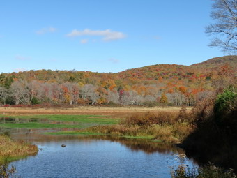 On the other side we turned right and negotiated our way uphill passed some areas where I had cleared some major blowdowns that has blocked the trail. We continued to follow the blue Flynn Trail and passed through the gate at the top of the hill. The rest of the Flynn Trail had was damp in places but those areas were easily avoided. At 10:35 AM we were at Junkyard Junction where we turned left to head down the Quick Lake Trail. There was one large log on the trail by the junction but I decided that it was a job for the chainsaws of the snowmobile club! We had gone 3.6 miles in 1 hour and 25 minutes. The Quick Lake Trail was mostly downhill but was wet and a little slippery in places. We turned right at Iron Wheel Junction to stay on the Quick Lake Trail. The trip back to Frick Pond went quickly but some areas of the trail after the "pine promenade" were still wet. Soon we were at the bridge over the outlet of Frick Pond. I stopped to take a few pictures as this is one of my favorite spots in the Catskills! After taking a few shots, I put the camera away and we continued on to Gravestone Junction. The stepping stones we had placed were still there but the "mud pit" was dry. We stayed on the red Quick Lake trail back to the trail register. We turned right after the register and walked the Quick Lake Trail back to the car. We were back at the parking area at 11:45 AM having covered 6.7 miles in 2 hours and 30 minutes with a vertical gain of 960 feet.
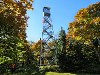
![]()
![]()
![]()
![]() On Monday, October 12th, Cindy and I were happy to be going on a hike with our son Karl, his wife Kathleen and their children. Bryce is 4 years old while Luke and Lilly who are twins are 2 years old. We decided to go to the Red Hill fire tower since Bryce had hiked there before. The hike is a short one with a rounder distance of about 2.6 miles but the elevation gain is over 800 feet. We agreed to meet at 9:30 AM at the trailhead but expected the rest of the family to be a little late since getting three young children ready is always challenging. As it was Cindy and I left Livingston Manor a little late with an excited Sheila in the back seat. I drove out DeBruce Road to Route 47 where I turned right. When I reached the intersection with the Claryville Road I turned left and drove through the hamlet for about 2 miles to Red Hill Road on the right. Red Hill Road ascends Red Hill and has some nice views along the way. After driving 3 miles, I turned left on Coons-Dinch Road which is a dirt and gravel covered washboard. This road extends 1.2 miles to the parking area for the Red Hill fire tower. After passing Rudolf Road on the right, the road becomes "Seasonal Maintenance" and is very rough. I parked at 9:15 AM and we were the only car in the lot. Shortly after, the rest of the family arrived and we were on the trail by 9:30 AM. The kids seemed eager to hike and led the way. The trail is rocky in places and has a lot of roots but we seemed to negotiate them with only a few mishaps. Bryce took the lead and I followed him taking Sheila along with us. Along the way one man passed us and I thought he looked like one of the fire tower volunteers that I know. He had an old-fashioned basket on his back for a pack which was another clue. We continued to hike with the kids excitedly calling out "Marker!" whenever they saw a yellow trail marker. Another couple passed us on one of the flatter spots. The trail has a few steep spots at the beginning but then levels out a little before beginning the final climb at about 1 mile. Bryce was pointing out the different kinds of mosses on the rock as we hiked the last .3 miles which averages a little over an 18% grade. At 10:30 AM we arrived at the tower clearing.
On Monday, October 12th, Cindy and I were happy to be going on a hike with our son Karl, his wife Kathleen and their children. Bryce is 4 years old while Luke and Lilly who are twins are 2 years old. We decided to go to the Red Hill fire tower since Bryce had hiked there before. The hike is a short one with a rounder distance of about 2.6 miles but the elevation gain is over 800 feet. We agreed to meet at 9:30 AM at the trailhead but expected the rest of the family to be a little late since getting three young children ready is always challenging. As it was Cindy and I left Livingston Manor a little late with an excited Sheila in the back seat. I drove out DeBruce Road to Route 47 where I turned right. When I reached the intersection with the Claryville Road I turned left and drove through the hamlet for about 2 miles to Red Hill Road on the right. Red Hill Road ascends Red Hill and has some nice views along the way. After driving 3 miles, I turned left on Coons-Dinch Road which is a dirt and gravel covered washboard. This road extends 1.2 miles to the parking area for the Red Hill fire tower. After passing Rudolf Road on the right, the road becomes "Seasonal Maintenance" and is very rough. I parked at 9:15 AM and we were the only car in the lot. Shortly after, the rest of the family arrived and we were on the trail by 9:30 AM. The kids seemed eager to hike and led the way. The trail is rocky in places and has a lot of roots but we seemed to negotiate them with only a few mishaps. Bryce took the lead and I followed him taking Sheila along with us. Along the way one man passed us and I thought he looked like one of the fire tower volunteers that I know. He had an old-fashioned basket on his back for a pack which was another clue. We continued to hike with the kids excitedly calling out "Marker!" whenever they saw a yellow trail marker. Another couple passed us on one of the flatter spots. The trail has a few steep spots at the beginning but then levels out a little before beginning the final climb at about 1 mile. Bryce was pointing out the different kinds of mosses on the rock as we hiked the last .3 miles which averages a little over an 18% grade. At 10:30 AM we arrived at the tower clearing.
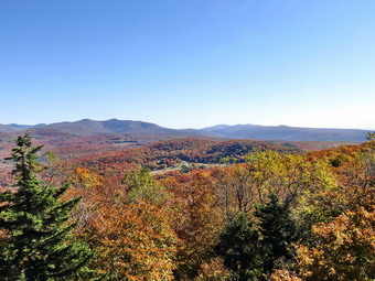 I dropped my pack and tethered Sheila to a tree near the first picnic table. Unlike some dogs, Sheila has no problem climbing up and down the open steps and I didn't want her following us to the top. In a few minutes the rest of the family arrived which made Sheila happy. What didn't make her happy was being tied to a tree while we went to the tower. Bryce and I headed up first although he said he didn't make it to the top the last time he was on Red Hill. this time he led the way and had no problem going all the way up into the cab! The fire tower volunteer was indeed someone who I knew and we talked while looking at the view. The view from the tower was beautiful with a lot of reds and yellows in all directions. Being able to see the Burroughs Range and so may other prominent peaks was fun. We even got a look at the Rondout Reservoir to the south. I took quite a few pictures and then we started down the steps. I took a few more shots from the landings as I like to get different angles and include the tower supports in the picture. Once on the ground I took a few more shots up through the tower. I also took a few pictures of the cabin and of Sheila. We gathered the family on the porch of the cabin and I took some pictures. The cabin was open and we walked in to read some of the history of the tower. The tower was in active operation from 1920 to 1990 and was used to spot fires. There was even an old radio that the spotters used to call in the location of suspicious smoke. By 11:10 AM had eaten a snack and had a drink and were ready to get back on the trail to begin the hike back to the car. Bryce was even faster descending than on the climb. We met two more pairs of hikers coming up the trail but I was surprised that there weren't more people, present. Doug, the tower volunteer, said there had been 50 people at the tower on Sunday ! Bryce and I waited for the others to catch up. Luke and Lilly had made it almost all the way to the top before getting a ride from Mom and Dad. They also needed a little help on the way down. We were back at the car at 12:10 PM. We had hiked 2.6 miles in 2 hours and 40 minutes with about 45 minutes of stopped time a the summit. The vertical gain was 840 feet which is a lot for little legs. This was a much shorter hike than we have been doing but it was a nice to be out with our family.
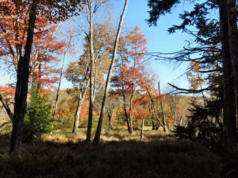
![]() On Sunday, October 11th Cindy and I wanted to hike after church. By the time we got out of church and went to the Roscoe Farmer's Market it was getting too late to go very far. We decided to go to Frick Pond and blaze the Logger's Loop Trail. I had placed and replaced markers on the Quick Lake and Flynn Trails on Thursday but thought it might be nice to do this trail which would leave only the Big rock Trail to blaze. On our Thursday trip we had found many missing markers and some so old they were hard to spot. I had just hiked the Logger's Loop and had removed all the blowdowns so I knew I would not need an axe or a saw. I drove out the DeBruce Road to the Mongaup Pond Road where I turned left and drove to the Frick Pond trailhead on Beech Mountain Road. When we arrived at 12:25 PM, we were surprised to see that both parking lots were almost full and we were lucky to find a spot that opened up as a car left. I knew that Lisa from Morgan Outdoors had a "Lark in the Park" hike scheduled and wondered if that group would have anywhere to park! I put some yellow markers in one pocket and nails in the other and we headed out the Quick Lake Trail at the back of the larger parking area. Having Sheila in tow on her leash was quite a chore especially sine I was carrying a hammer in the other hand. I wondered what some people might think! When we reached the trail register, we found a young couple who ask for some directions. We told them what they wanted to know and found ourselves giving advice throughout the day. We walked out the woods road to Gravestone Junction encountering a few wet spots on the trail and a few more people. We walked down to the bridge across the outlet to Frick Pond and I took some pictures since I find this view irresistible! The leaf colors were nice but not much different than Thursday. We walked back up the hill to Gravestone Junction and turned left on the Logger's Loop. At this point we heard some people making some very loud noises. We could hear them until we got to Times Square and continued on the Logger's Loop. We never saw them or found out why they had to be so inconsiderate of others. As we walked along the trail, I stopped to nail up some markers where none had been and replaced a few old one. the snowmobile markers were very old and there were a few cross country skiing markers present also. By 1:00 PM we arrived at Times Square and continued straight ahead on the Logger's Loop.
On Sunday, October 11th Cindy and I wanted to hike after church. By the time we got out of church and went to the Roscoe Farmer's Market it was getting too late to go very far. We decided to go to Frick Pond and blaze the Logger's Loop Trail. I had placed and replaced markers on the Quick Lake and Flynn Trails on Thursday but thought it might be nice to do this trail which would leave only the Big rock Trail to blaze. On our Thursday trip we had found many missing markers and some so old they were hard to spot. I had just hiked the Logger's Loop and had removed all the blowdowns so I knew I would not need an axe or a saw. I drove out the DeBruce Road to the Mongaup Pond Road where I turned left and drove to the Frick Pond trailhead on Beech Mountain Road. When we arrived at 12:25 PM, we were surprised to see that both parking lots were almost full and we were lucky to find a spot that opened up as a car left. I knew that Lisa from Morgan Outdoors had a "Lark in the Park" hike scheduled and wondered if that group would have anywhere to park! I put some yellow markers in one pocket and nails in the other and we headed out the Quick Lake Trail at the back of the larger parking area. Having Sheila in tow on her leash was quite a chore especially sine I was carrying a hammer in the other hand. I wondered what some people might think! When we reached the trail register, we found a young couple who ask for some directions. We told them what they wanted to know and found ourselves giving advice throughout the day. We walked out the woods road to Gravestone Junction encountering a few wet spots on the trail and a few more people. We walked down to the bridge across the outlet to Frick Pond and I took some pictures since I find this view irresistible! The leaf colors were nice but not much different than Thursday. We walked back up the hill to Gravestone Junction and turned left on the Logger's Loop. At this point we heard some people making some very loud noises. We could hear them until we got to Times Square and continued on the Logger's Loop. We never saw them or found out why they had to be so inconsiderate of others. As we walked along the trail, I stopped to nail up some markers where none had been and replaced a few old one. the snowmobile markers were very old and there were a few cross country skiing markers present also. By 1:00 PM we arrived at Times Square and continued straight ahead on the Logger's Loop.
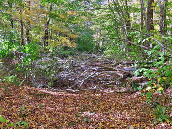 I continued to nail up yellow markers so that anyone hiking could confirm they were on the right trail. The day was really beautiful with temperatures in high 60's. As we walked we picked up a few small branches but there wasn't much else blocking the trail until we were about .5 miles from Times Square. At this point large beech tree had fallen across the trail taking several smaller trees with it. I kick myself for neglecting to bring a saw with me as that would easily have taken care of the mess. Since I didn't have any tools we had to walk around the blowdown having it in place. As we continued on toward Iron Wheel Junction I though about when I would have time to come clear the blowdown so that hikers could pass freely. I placed a few more markers and soon we were approaching the trail junction. Just before the junction we found a large, old tree trunk lying partly in the trail. It was similar to the one on the Quick Lake trail and would require at least an axe to clear. Both of these are on snowmobile trails and the snowmobile club had no restriction on the use of chain saws! We turned left at Iron Wheel and head back toward Frick Pond on the Quick Lake Trail. Sheila had been looking for a place to get wet and to get a drink and finally found it in the small stream that crosses the trail before the "pine tunnel". We continued to hike at a good pace and I decided I might have enough time to take Cindy and Sheila home, get my tools and return to clear the blowdown before dusk. Soon we were crossing the bridge at the outlet of Frick Pond. We walked back on the woods road stopping only to help a few people. We were back at the parking area by 2:20 PM. I drove home and grabbed my curved Silky saw and Fiskars axe and headed back to Frick Pond.
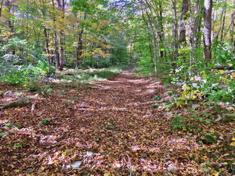 The parking areas were still jammed but I parked on the end of a row and was out on the Quick lake Trail at 2:55 PM. Now I was carrying an axe instead of a hammer and although I got some funny looks no one asked why I was carrying an axe! I walked as fast as I could to Gravestone Junction where I stayed to the right on the Logger's Loop. I continued the fast pace to Times Square and then up the hill on the Logger's Loop. I wasn't sure exactly how far I had to go but I knew I was making good time. As I reached the top of the hill the trail flattened and I saw a couple approaching who I had given directions earlier. We said "Hello" and I again took several minutes to make suggestions. Once I started up again I came to the blowdown rather quickly. At 3:25 PM I dropped my park and got my tools ready to go. I took a few pictures of the blowdown and then got to work dismantling the mess. I alternated between saw and axe and found the hardest work was dragging away what I cut as I tend to section large pieces. I started to cut one branch with Te saw and almost immediately got it pinched. It took a few minutes to work the saw out without damaging it but after that the work went quickly. I took a few pictures of the open trail and them packed up to head back. I was surprised that it had only taken 30 minutes to clear the trail. I decided to hike back to Times Square and then loop around Frick Pond on the wooden walkways. When I arrived at the trail junction, I turned right and walked along the trail observing that it was well-blazed and would not require additional markers. As I approached the first bridge, I looked up to find two hikers and their dog. I recognized the woman with the camera as an art teacher from Liberty HS where I taught. I stopped to talk and she introduced me to her husband and her dog. The shadows were beginning to get long and the lighting made the trees look brighter. I took a few pictures and then we continued in our opposite directions. I came to the Frick Pond bridge and stopped to take a few shots before continuing back to the car. As I approached the trail register I saw the same couple I had spoken to twice before. I said "Hello" and we walked out to the parking area together. They asked some questions about hiking which I answered and referred them to my website. I was back at the car for the second time at 4:40 PM. I had hike a total of 7 miles in 3.5 hours with a total elevation gain of about 720 feet.
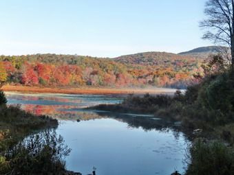
![]()
![]()
![]()
![]() On Thursday, October 8th I had scheduled a trip with Ken and Lisa to reblaze the Quick Lake and Flynn Trails that loop around Frick and Hodge Ponds. Lisa wanted to get an early start so that she could get some trail maintenance in before opening her store so we agreed to meet at 8:00 Am at the trailhead. The temperature was in the low 40;s when I awoke at 6:30 Am and I wished I had gotten out some warmer pants! By the time I got my gear in the car and was leaving Livingston Manor at 7:45 AM the air seemed much warmer. I felt very guilty as I had to leave Sheila home! I arrived at the Frick Pond parking area just before 8:00 AM and Lisa and Ken were there soon after. We spent a few minutes filling out paperwork and then started out on the Quick Lake Trail toward Frick Pond. The trail was damp but after we made the left turn onto the woods road the areas of standing and running water I found on the previous hike were gone. As we walked along the trail, we watched for red blazes and added a few when none were present. Lisa and Ken made sure the blazes were visible and trimmed some branches where necessary. We continued our work until we got to Gravestone Junction where we stayed to the left on the Quick Lake Trail and walked down the hill to the bridge across the outlet to Frick Pond. The amount of water in the pond was visibly lower than the last time I hiked and there was less volume in the stream. The leaves around the pond had changed color to a greater extent than I had seen the week before. I stopped to take a few shots before continuing around to the next trail junction. We continued to put up a few trail markers and I showed Ken the large cherry tree we had removed from the bridge. We stayed to the left at the trail junction and found the trail to the "pine promenade" was wet but had no standing or running water. Along the way we removed one larger blowdown handling the axe. We removed a few more branches from the trail and trimmed those hanging overhead. Lisa left us to go to work as we continued toward Ironwheel Junction. We added a few markers and looked at the "widowmaker" hanging over the trail just before the junction. We decided there was nothing we could do until it came down in a windstorm. When we arrived at Ironwheel Junction, we turned left to stay on the Quick Lake trail to Junkyard Junction.
On Thursday, October 8th I had scheduled a trip with Ken and Lisa to reblaze the Quick Lake and Flynn Trails that loop around Frick and Hodge Ponds. Lisa wanted to get an early start so that she could get some trail maintenance in before opening her store so we agreed to meet at 8:00 Am at the trailhead. The temperature was in the low 40;s when I awoke at 6:30 Am and I wished I had gotten out some warmer pants! By the time I got my gear in the car and was leaving Livingston Manor at 7:45 AM the air seemed much warmer. I felt very guilty as I had to leave Sheila home! I arrived at the Frick Pond parking area just before 8:00 AM and Lisa and Ken were there soon after. We spent a few minutes filling out paperwork and then started out on the Quick Lake Trail toward Frick Pond. The trail was damp but after we made the left turn onto the woods road the areas of standing and running water I found on the previous hike were gone. As we walked along the trail, we watched for red blazes and added a few when none were present. Lisa and Ken made sure the blazes were visible and trimmed some branches where necessary. We continued our work until we got to Gravestone Junction where we stayed to the left on the Quick Lake Trail and walked down the hill to the bridge across the outlet to Frick Pond. The amount of water in the pond was visibly lower than the last time I hiked and there was less volume in the stream. The leaves around the pond had changed color to a greater extent than I had seen the week before. I stopped to take a few shots before continuing around to the next trail junction. We continued to put up a few trail markers and I showed Ken the large cherry tree we had removed from the bridge. We stayed to the left at the trail junction and found the trail to the "pine promenade" was wet but had no standing or running water. Along the way we removed one larger blowdown handling the axe. We removed a few more branches from the trail and trimmed those hanging overhead. Lisa left us to go to work as we continued toward Ironwheel Junction. We added a few markers and looked at the "widowmaker" hanging over the trail just before the junction. We decided there was nothing we could do until it came down in a windstorm. When we arrived at Ironwheel Junction, we turned left to stay on the Quick Lake trail to Junkyard Junction.
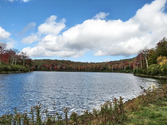 The trail ascends all the way from IronWheel Junction to Junkyard Junction although never steeply. We kept a good pace interrupted only by a few pauses to remove branches and to replace old markers and place new ones. We were trying to strike a balance between markers being too close together and absent for long stretches. Ken and I seemed to click on this point and we had a good time talking about various hiking experiences. At about 2.8 miles we made the turn to the northeast and ran into the large tree trunk across the trail that I had found on my last trip. We decided to let the snowmobile club handle this one as they are equipped with chainsaws. Soon we were at Junkyard Junction where I exchanged the red trail markers in my pocket for blue ones from my pack. We turned right on the Flynn Trail and although it was wet there were none of the pools of water that had been present last week. We continued to reblaze the trail as we headed for Hodge Pond. At the gate we turned right to descend to the pond. When we reached the point where the trail turns right, we added markers to make the direction clear. At this same point a jeep trail turns to the left and goes around the back of Hodge Pond. This area of the trail has been wet in the past but was just a little damp and muddy in most places with only one area where water was still present. We continued to walk along the Flynn Trail to the outlet of Hodge Pond. When we reached Hodge Pond, we walked to the shore and I took some pictures of the pond and was surprised to find that the leaves had not changed as much as the ones at Frick Pond. I picked up my pack and we headed up the hill toward the junction with the Big Rock Trail. It was hard to place blazes as the trail is wide and there are few large trees along the edge. There was also no way to adequately mark the turn to the right at the top of the hill but we placed blazes immediately after the turn. When we arrived at the Big Rock Junction, we added a few markers and the continued down the Flynn Trail toward the parking area. We didn't need to add too many blazes as there were already quite a few along this section of the trail. The 1.7 miles downhill sometimes seems to take longer than it should but I didn't notice it as we moved quickly down the trail. At the gate we turned left and stayed on the trail until were back at the trailhead. We were back at 12:15 PM heaving spent 4 hours hiking 6.5 miles with an elevation gain of 925 feet.
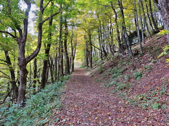
![]() On Wednesday, October 7th I wanted to go somewhere locally to hike but did not want to go to my usual haunts around Livingston Manor. I remembered that I had not been to Walnut Mountain in liberty for some time and thought walking the trail loops there would reveal some fall colors. I took care of some business and then got my gear and Sheila in the car to head for Liberty a little after 10:00 AM. We arrived at the main parking lot for the park at 10:30 and immediately started up the trail that winds around the mountain. I noticed a new kiosk with maps and as I started to hike it was obvious the trail marking which had been lacking was now upgraded. In addition, the bike trail are now marked with arrows and a sign for the level of difficulty. The main walking trails are now marked with colored diamonds and an abbreviation for the name of the trail. When we got to the first trail junction we turned left on the Mountain Overlook Trail which was marked in orange. After about .6 miles, we arrived at the upper picnic tables with a nice, open view toward Swan Lake and the old Stevensville Hotel. I was disappointed that the leaves did not seem to have changed color and there were only a few bright areas. I took a few pictures and then we continued counterclockwise around the mountain on the yellow Sunset Trail. I began to think about laying out a 5K running course for training my runners and for a race sometime in the future. As we started to descend the Sunset Trail, the red Mountain House Trail turned to the right and we followed that for .4 miles through some switchbacks over the shoulder of the mountain and back to the Sunset Trail. We turned right and followed the Sunset Trail for .5 miles back to the orange Mountain Overlook Trail. We turned right and at the next trail junction stayed to the left and ended up at the lower picnic tables with a similar view to the one from the upper lookout. We turned left and followed the Walnut Loop Trail back through the quarry to the car. Along the way we passed through the new disk golf course that has been set up. I checked my GPS at the car and found the route was short so I headed to the other end of the parking area. This really wasn't enough distance and would mean runners would have to pass through the parking area at the start of the race. I walked down the park road toward the soccer field. and found this was a better choice for the start of a rcaewalked1 back to the car and I found we had only covered a little over 3 miles. I also realized that the course I had set out did not cover the long will on the west side of the park. I really wanted to include this hill in the 5K course so we set off back up the trail. This time at the first trail junction we continued straight ahead and were soon on the red trail which is part of the Walnut Loop Trail. About 1.2 miles from the parking area we were at the base of the hill which we ascended to the lower picnic area. From there we turned left and walked to the Mountain Overlook Trail where we turned right and walked back to the parking area and the car. We had hiked 5 moles in under 2 hours with a total elevation gain of 820 feet. When I got home, I used by computer software to piece together a 5K course using the best trails on the mountain. Later in the afternoon I went to coach my cross country team at Liberty HS. I took the team to Walnut Mountain and they ran my new 5K course. They did a good job following the route for the first time with only a few mistakes.
On Wednesday, October 7th I wanted to go somewhere locally to hike but did not want to go to my usual haunts around Livingston Manor. I remembered that I had not been to Walnut Mountain in liberty for some time and thought walking the trail loops there would reveal some fall colors. I took care of some business and then got my gear and Sheila in the car to head for Liberty a little after 10:00 AM. We arrived at the main parking lot for the park at 10:30 and immediately started up the trail that winds around the mountain. I noticed a new kiosk with maps and as I started to hike it was obvious the trail marking which had been lacking was now upgraded. In addition, the bike trail are now marked with arrows and a sign for the level of difficulty. The main walking trails are now marked with colored diamonds and an abbreviation for the name of the trail. When we got to the first trail junction we turned left on the Mountain Overlook Trail which was marked in orange. After about .6 miles, we arrived at the upper picnic tables with a nice, open view toward Swan Lake and the old Stevensville Hotel. I was disappointed that the leaves did not seem to have changed color and there were only a few bright areas. I took a few pictures and then we continued counterclockwise around the mountain on the yellow Sunset Trail. I began to think about laying out a 5K running course for training my runners and for a race sometime in the future. As we started to descend the Sunset Trail, the red Mountain House Trail turned to the right and we followed that for .4 miles through some switchbacks over the shoulder of the mountain and back to the Sunset Trail. We turned right and followed the Sunset Trail for .5 miles back to the orange Mountain Overlook Trail. We turned right and at the next trail junction stayed to the left and ended up at the lower picnic tables with a similar view to the one from the upper lookout. We turned left and followed the Walnut Loop Trail back through the quarry to the car. Along the way we passed through the new disk golf course that has been set up. I checked my GPS at the car and found the route was short so I headed to the other end of the parking area. This really wasn't enough distance and would mean runners would have to pass through the parking area at the start of the race. I walked down the park road toward the soccer field. and found this was a better choice for the start of a rcaewalked1 back to the car and I found we had only covered a little over 3 miles. I also realized that the course I had set out did not cover the long will on the west side of the park. I really wanted to include this hill in the 5K course so we set off back up the trail. This time at the first trail junction we continued straight ahead and were soon on the red trail which is part of the Walnut Loop Trail. About 1.2 miles from the parking area we were at the base of the hill which we ascended to the lower picnic area. From there we turned left and walked to the Mountain Overlook Trail where we turned right and walked back to the parking area and the car. We had hiked 5 moles in under 2 hours with a total elevation gain of 820 feet. When I got home, I used by computer software to piece together a 5K course using the best trails on the mountain. Later in the afternoon I went to coach my cross country team at Liberty HS. I took the team to Walnut Mountain and they ran my new 5K course. They did a good job following the route for the first time with only a few mistakes.
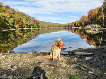
![]()
![]()
![]()
![]()
![]() On Monday, October 5th Cindy and I had planned to hike Dry Brook Ridge from Hill Road. When I got up at 6:00 Am the temperature had dropped to 35 degrees and there was a persistent fog hanging in the valley. I decided to get a little more sleep and then go to Trout Pond and hike. We got our gear in the car and left Livingston Manor with an ecstatic Sheila in the back seat. We were looking forward to seeing some fall colors at Trout pond and we expected Russell Brook Falls to have a high volume of water after the rain the previous week. We headed north on Route 17 to Roscoe and took Route 206 toward Downsville but turned left onto Morton Hill Road just after the Roscoe Nursing Home. When we got to the intersection with Russell Brook Road, I turned around and parked on the side of the road to avoid parking in the large open space which is marked as private property. Sheila was ready to go as always and we started down the road at 9:35 AM. The temperature was still in the 40's when we started but I opted to take off my Mammut Hoody and wear a light windbreaker. I did choose to wear a hat and gloves I wore my old Keen Glarus which are beginning to lose their outer soles and need to be replaced but still have a few miles left. As we walked down the road, it was hard to hear the stream which surprised me since I expected a good volume of water. I walked down the bank at the viewpoint over the upper falls and found very little water in the stream. I decided not to stop to take pictures and knew that visiting he lower falls would also be unnecessary. As we approached the lower parking area, we could see that there were no cars in the lot. We walked down to the main trail and then across the bridge over Russell Brook. The knotweed that we had trimmed back a few weeks earlier was beginning to grow back. As we passed the register box, I decided we would walk up to Trout Pond first as we were looking forward to seeing how much the leaves had changed.
On Monday, October 5th Cindy and I had planned to hike Dry Brook Ridge from Hill Road. When I got up at 6:00 Am the temperature had dropped to 35 degrees and there was a persistent fog hanging in the valley. I decided to get a little more sleep and then go to Trout Pond and hike. We got our gear in the car and left Livingston Manor with an ecstatic Sheila in the back seat. We were looking forward to seeing some fall colors at Trout pond and we expected Russell Brook Falls to have a high volume of water after the rain the previous week. We headed north on Route 17 to Roscoe and took Route 206 toward Downsville but turned left onto Morton Hill Road just after the Roscoe Nursing Home. When we got to the intersection with Russell Brook Road, I turned around and parked on the side of the road to avoid parking in the large open space which is marked as private property. Sheila was ready to go as always and we started down the road at 9:35 AM. The temperature was still in the 40's when we started but I opted to take off my Mammut Hoody and wear a light windbreaker. I did choose to wear a hat and gloves I wore my old Keen Glarus which are beginning to lose their outer soles and need to be replaced but still have a few miles left. As we walked down the road, it was hard to hear the stream which surprised me since I expected a good volume of water. I walked down the bank at the viewpoint over the upper falls and found very little water in the stream. I decided not to stop to take pictures and knew that visiting he lower falls would also be unnecessary. As we approached the lower parking area, we could see that there were no cars in the lot. We walked down to the main trail and then across the bridge over Russell Brook. The knotweed that we had trimmed back a few weeks earlier was beginning to grow back. As we passed the register box, I decided we would walk up to Trout Pond first as we were looking forward to seeing how much the leaves had changed.
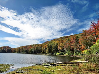 At the pond, I took off my pack and got out the camera. We were very surprised that the water level was so low with the shore being at least six feet from the outlet of the dam. The sky was blue with some very interesting clouds. The leaves showed some nice colors but had not completely changed. Everything was reflected in the glassy, still water. I took some shots and asked Sheila to pose with the pond in the background. We didn't stay too long before getting back on the main trail and starting toward the upper end of the pond. The trail is completely flat and is often wet and muddy but on this day it was dry. At the first lean-to, I checked out the privy and found it unusable! This is a relatively new installation and I was sad to see it had been treated so poorly by those it was put there to serve. At the bridge over the inlet I dropped my pack and took the camera down to the shore. I had to take a few quick pictures since the view was quite different than from the outlet end. We continued our walk on the main trail and started the climb to Cherry Ridge. Along the way were several large blowdowns which we could not clear. We made a slight turn to the south and began to climb more but the ascent seemed to go quickly. Sheila was roaming the brush near the trail and seemed to always be on a scent trail. We hit the high point on the hike and started down the other side. After a short ascent to the "forest of numerous small trees", we walked down to the woods road and snowmobile trail and turned left to complete our loop. We began to descend to the trail junction by the register box and found that the ground was covered by fallen leaves. The leaves were not very colorful but were very dry. As we passed the large campsite on the left at the bottom of the hill a single gunshot rang out. I immediately yelled a "Hallo" but got no response but at least there were no more shots! We quickly walked out to the register box, turned right and walked up the trail to the parking area. There was now one car in the lot but we did not see anyone. We walked up the road back to our car arriving at 12:05 PM. We had hiked 5.5 miles in 2 hours and 30 minutes gaining 1105 feet.
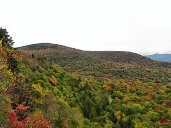
![]()
![]()
![]()
![]() On Friday, October 2nd, I wasn't planning to hike very far since I had gotten out the day before. I got up early and found cloudy skies but check the forecast and found no rain predicted. The leaves around Livingston Manor were beginning to change so I thought I would go somewhere that had a view to find some fall colors. I decided it was time to hike a 3500 peak and decided on Panther. Panther Mountain itself has limited views but to get there from Route 47 the trail passes over Giant ledge which was a great view of Panther Mountain, the entire Burroughs Range and the valleys below. I had been to Panther in April but from the Fox Hollow trailhead. The last time I had done the mountain from Route47 was more than year ago! When I looked at the temperature in the early morning is was barely 40 degrees and by the time we left it had only risen a few degrees. I put on my Mammut Hoody and packed a hat and gloves as well as a light windbreaker. I remembered how rocky the trail was and decided to wear my Asolo Powermatic boots even though they are very heavy. We arrived at the parking area on Route 47 at 9:00 AM to find only one other car parked in the lot. It was a cool morning with an air temperature of about 41 degrees so I kept my Mammut hoody on over a long-sleeved shirt. Sheila and I got started pretty quickly by crossing the road and heading out the trail. The rain that had fallen during the weak made the trail wet with some standing and some running water. I let Sheila off the leash almost immediately after crossing the road and she was behaving by staying on the trail. At the kiosk I found a sign that mentioned a marathon trail run from Fox Hollow that also took in the Burroughs Range and the new trail over Romer Mountain although I had heard nothing about the run. As we crossed the bridge over the small stream, there was a good volume of water running. We kept up a good pace but I forgot how annoying the many rocks that cover the trail to the turnoff can be! In addition, there are several short climbs and each one seems to be the last. I stopped at the base of one climb and removed my Hoody to stow it in the pack. I decided not to put on a jacket but to continue wearing the hat and gloves. Despite the fact that we had been hiking double digit miles all summer, I wondered how I would feel climbing again. I had no problem getting up the scrambles to the turnoff and, in fact, enjoyed the elevation gain all day. On the way up we met one young male hiker coming down the trail. We finished the sixth short climb and arrived at the turn to Giant Ledge and Panther at about 9:35 AM. I didn't feel like we were going slow but it took 30 minutes to walk the .75 miles from the road, one of our slower times.
On Friday, October 2nd, I wasn't planning to hike very far since I had gotten out the day before. I got up early and found cloudy skies but check the forecast and found no rain predicted. The leaves around Livingston Manor were beginning to change so I thought I would go somewhere that had a view to find some fall colors. I decided it was time to hike a 3500 peak and decided on Panther. Panther Mountain itself has limited views but to get there from Route 47 the trail passes over Giant ledge which was a great view of Panther Mountain, the entire Burroughs Range and the valleys below. I had been to Panther in April but from the Fox Hollow trailhead. The last time I had done the mountain from Route47 was more than year ago! When I looked at the temperature in the early morning is was barely 40 degrees and by the time we left it had only risen a few degrees. I put on my Mammut Hoody and packed a hat and gloves as well as a light windbreaker. I remembered how rocky the trail was and decided to wear my Asolo Powermatic boots even though they are very heavy. We arrived at the parking area on Route 47 at 9:00 AM to find only one other car parked in the lot. It was a cool morning with an air temperature of about 41 degrees so I kept my Mammut hoody on over a long-sleeved shirt. Sheila and I got started pretty quickly by crossing the road and heading out the trail. The rain that had fallen during the weak made the trail wet with some standing and some running water. I let Sheila off the leash almost immediately after crossing the road and she was behaving by staying on the trail. At the kiosk I found a sign that mentioned a marathon trail run from Fox Hollow that also took in the Burroughs Range and the new trail over Romer Mountain although I had heard nothing about the run. As we crossed the bridge over the small stream, there was a good volume of water running. We kept up a good pace but I forgot how annoying the many rocks that cover the trail to the turnoff can be! In addition, there are several short climbs and each one seems to be the last. I stopped at the base of one climb and removed my Hoody to stow it in the pack. I decided not to put on a jacket but to continue wearing the hat and gloves. Despite the fact that we had been hiking double digit miles all summer, I wondered how I would feel climbing again. I had no problem getting up the scrambles to the turnoff and, in fact, enjoyed the elevation gain all day. On the way up we met one young male hiker coming down the trail. We finished the sixth short climb and arrived at the turn to Giant Ledge and Panther at about 9:35 AM. I didn't feel like we were going slow but it took 30 minutes to walk the .75 miles from the road, one of our slower times.
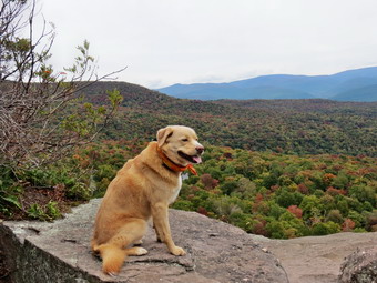 The trail after the turn was also wet and I made use of the stepping stones along the way. Sheila did not! We met another couple hiking toward us and I talked to them briefly before we continued in opposite directions. They told me they were the car in the parking area which made me wonder what route the other hiker was taking. When the climb began we pushed the pace. Just before the last climb to Giant Ledge a large tree had fallen blocking the usual path but other hikers had found a way around it. As we walked we could hear a trail whistle in the distance and continued to hear it throughout the hike. I assumed this was the Ulster and Delaware sight-seeing train. We climbed up the last rocky ascent and walked to the first lookout arriving at about 10:05 AM after the 1.5 mile climb. There was no one at the first viewpoint so we walked down to take in the view. Sheila is fearless about heights and sometimes scares me a little when she walks right to the edge of the cliffs and looks down! I got out my camera to take some pictures of the great views of the valley below and the mountains beyond. The leaves were changing but were not yet at their peak and the color variation was interesting. I took shots of the Burroughs Range and Panther. I also took a few pictures of the area just below the ridge and the mountain outlined in the background. The only drawback was that the sky was a solid gray! We continued on the main trail, descended to the col and began the climb up Panther. Parts of the Panther trail get a little steep at times but there always seems to be a switchback or flatter area. The trail was damp or wet the whole way with muddy spots and some very slippery rocks. Sheila and I continued up the trail with Sheila checking out some of the paths that lead to limited viewpoints along the way. We stopped at one and walked out to a rock which had a good view of the entire Burroughs Range with only a few small trees in the way. I took some pictures before we went back to the main trail. We were soon up the steeper climbs with only a final, short ascent of Panther to go. We arrived at the summit of Panther at 11:15 AM after hiking 3.2 miles. The view from the summit is very limited and the day was still cloudy but I took a few pictures before walking back to the viewpoint just below the summit. We ascended the rock which acts as the lookout and I took a few shots of the scenery and then Sheila and I got back on the trail. Sheila was very energetic as we turned back as if she knew that we would be going down the mountain.
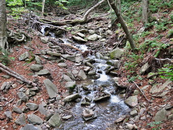 We met no one on the trail as we descended Panther. I tried to keep a good pace but found the descent more difficult that the climb up! When we had finally made the ascent to Giant Ledge we could hear hikers approaching from in front of us. I stepped off the trail but they walked out to the lookout and Sheila and I passed them. Several groups of young hikers approached us for a total of 10 in all. We continued along the trail meeting a few more people until we finally got to the descent off the Ledge. The views from Giant Ledge were largely the same as on the way out so we didn't stop. We made it down most of the descent without meeting anyone else but ran into several groups of hikers on the flats on the way to the trail junction. We continued down the trail and were soon at the turn. I was glad to be at this point but knew we still had several rocky areas to negotiate. After walking back to the bridge, I decided that this trail might be the rockiest in the Catskills! I stopped at the bridge and took some pictures of the stream while Sheila it a drink. We continued out to Route 47 and the parking area which was full. We were back at the car at 1:25 PM having covered 6.3 miles in 4 hours and 20 minutes including numerous stops. The elevation gain was 2100 feet.
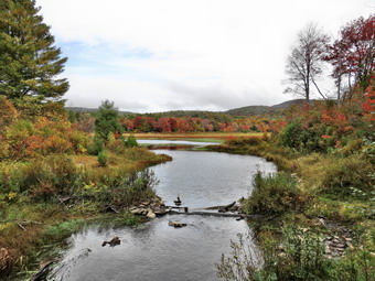
![]()
![]()
![]()
![]() On Thursday, October 1st I was ready to hike after a week of rainy weather and other commitments. I had been in contact with the Forrester for DEC Region 3 about the signage around Frick and Hodge Ponds and he asked for specific documentation of what needed to be replaced. I decided to combine "work" with pleasure and got my gear and Sheila in the car leaving Livingston Manor at 9:45 Am. We arrived at the Frick Pond parking area at 10:00 Am to find only one car in the large parking area. We were on the trail immediately leaving the large parking area on the Quick Lake Trail toward Frick Pond. The trail was damp and when we made the left turn onto the woods road there were areas of standing and running water. The water was not deep and it was hard to see how it could be droned effectively since it was so ubiquitous. I took a few pictures of the trail since the leaves were beginning to change and some were even falling onto the ground. At Gravestone Junction I took pictures of the sign which is incorrect in several ways. I also inspected the stepping stones we had placed across the mud pit. The ground was wetter than it had been all summer but the stones still really weren't needed. We stayed on the Quick Lake Trail and walked down the hill to the bridge across the out let to Frick Pond. The amount of water in the pond was visibly higher and there was a good volume in the stream. I was surprised to see that the leaves around the pond had change color. Although there were only a few bright colors it was still pretty. I stopped to take a few shots before continuing around to the next trail junction. I dutifully took pictures of the signs and then stayed to the left. The section of the trail from The junction to the "pine promenade" was extremely wet with both standing and running water. I looked at the possibility of draining this but it seemed I would be almost impossible. I did move a few blowdowns which I could easily pick up and cast aside. When we arrived at Ironwheel Junction, I took pictures of the signs and then we turned left to stay on the Quick Lake trail to Junkyard Junction.
On Thursday, October 1st I was ready to hike after a week of rainy weather and other commitments. I had been in contact with the Forrester for DEC Region 3 about the signage around Frick and Hodge Ponds and he asked for specific documentation of what needed to be replaced. I decided to combine "work" with pleasure and got my gear and Sheila in the car leaving Livingston Manor at 9:45 Am. We arrived at the Frick Pond parking area at 10:00 Am to find only one car in the large parking area. We were on the trail immediately leaving the large parking area on the Quick Lake Trail toward Frick Pond. The trail was damp and when we made the left turn onto the woods road there were areas of standing and running water. The water was not deep and it was hard to see how it could be droned effectively since it was so ubiquitous. I took a few pictures of the trail since the leaves were beginning to change and some were even falling onto the ground. At Gravestone Junction I took pictures of the sign which is incorrect in several ways. I also inspected the stepping stones we had placed across the mud pit. The ground was wetter than it had been all summer but the stones still really weren't needed. We stayed on the Quick Lake Trail and walked down the hill to the bridge across the out let to Frick Pond. The amount of water in the pond was visibly higher and there was a good volume in the stream. I was surprised to see that the leaves around the pond had change color. Although there were only a few bright colors it was still pretty. I stopped to take a few shots before continuing around to the next trail junction. I dutifully took pictures of the signs and then stayed to the left. The section of the trail from The junction to the "pine promenade" was extremely wet with both standing and running water. I looked at the possibility of draining this but it seemed I would be almost impossible. I did move a few blowdowns which I could easily pick up and cast aside. When we arrived at Ironwheel Junction, I took pictures of the signs and then we turned left to stay on the Quick Lake trail to Junkyard Junction.
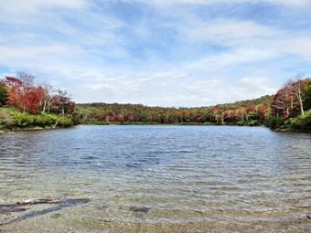 The trail ascends all the way from IronWheel Junction to Junkyard Junction although never steeply. We kept a good pace interrupted only by me pausing to move a few branches. At about 2.8 miles we made the turn to the northeast and found large tree trunk across the trail. This was the second major blowdown we had encountered. I decided to return in the near future with a peavey or a cant hook to roll the log out of the way. At 11:25 Am we had hiked 3.2 miles and were at Junkyard Junction where I dutifully took more pictures of signs. We turned right on the Flynn Trail and immediately ran into significant pools of water. This continued for the length of the trail to the gate where we turned right to descend to Hodge Pond. This area of the trail has been wet in the past but I was surprised that the amount of rain that fell accumulated rather than infiltrating the dry ground. We continued to walk along the Flynn Trail to the outlet of Hodge Pond finding more puddles and muddy areas along the way. When we reached Hodge Pond, we walked to the shore and I was surprised to see that Sheila did not go into the water! I took some pictures of the pond and was surprised to find that the leaves had not changed as much as the ones at Frick Pond. There was an interesting accumulation of foam on the shore which was worth a few more shots. I picked up my pack and e headed up the hill toward the junction with the Big rock Trail. I sometimes find this hill tedious but on this day it seemed to go very quickly. When we arrived at the Big Rock junction, I took some more pictures of the signs before continuing down the Flynn Trail to the parking area. The 1.7 miles downhill sometimes seems to take longer than it should but I didn't notice it as we moved quickly down the trail. At the gate we turned left and stayed on the trail until we were back at the trailhead. I put Sheila in the car and took my last pictures of signs. We were back at 12:45 PM heaving spent 2 hours and 45 minutes hiking 6.5 miles with an elevation gain of 925 feet.
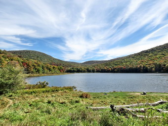
![]()
![]()
![]()
![]()
![]() On Sunday, September 27th I wanted to get out on a beautiful fall day to hike somewhere near to home after church. I also wanted to go somewhere to evaluate the state of the fall colors. I asked Cindy if she would like to go to Alder Lake and she agreed. I planned to hike to the Beaver Meadow Lean-to and the decide how much further to go. The hike to the Beecher lake Vista is over 9 miles so I thought that might be a stretch. We left Livingston Manor sometime after 11:00 AM and stopped in Roscoe at the Farmer's Market. From There we took Route 206 to Berry Brook Road then picked up the Craig Claire Road. This eventually took us back to the Beaverkill Road which we followed through Turnwood. After passing through that small hamlet, I turned left on Alder Creek Road and drove to the access road for Alder Lake. When we arrived, the parking area was almost full but we were able to find a spot. I considered going somewhere else but knew that most people would be around the lake and not on the trail to Millbrook Ridge. I put Sheila on her leash and we headed out the trail toward the lake. I was disappointed to see that no maintenance had been done by the DEC! The "lawn" had not been mowed and it was hard to see the picnic tables through the long grass. The logs that the DEC had cleared from the stream below the spillway were still in a ragged pile on the lawn. What was once a beautiful place to come and enjoy an equally beautiful view was now a shambles. I don't know what the DEC "plan" for the area may be but it appears they have abandoned this very popular spot. I took a few pictures of the lake and the hills around it. The trees showed very noticeable change especially on Cradle Rock Ridge and Millbrook Ridge. I also took a few shots of the mess. We stayed to the left as we walked along the trail on the northern side of the lake. The trail was dry in most places but there were a few damp areas. In fact, at the upper end of the lake between the two footbridges there was an area where water was flowing over the trail. At .8 miles we turned left onto the Millbrook Ridge Trail that ends on Balsam Lake Mountain. The temperature was perfect and there was plenty of sun with a slight breeze. I was glad I had decided to wear short sleeves. As we hiked up the trail, I noticed a few large blowdowns where someone had cut branches off to easy passage but had left the major part of the tree in the trail. I made a note that I might want to bring one of my axes to work on these next time!
On Sunday, September 27th I wanted to get out on a beautiful fall day to hike somewhere near to home after church. I also wanted to go somewhere to evaluate the state of the fall colors. I asked Cindy if she would like to go to Alder Lake and she agreed. I planned to hike to the Beaver Meadow Lean-to and the decide how much further to go. The hike to the Beecher lake Vista is over 9 miles so I thought that might be a stretch. We left Livingston Manor sometime after 11:00 AM and stopped in Roscoe at the Farmer's Market. From There we took Route 206 to Berry Brook Road then picked up the Craig Claire Road. This eventually took us back to the Beaverkill Road which we followed through Turnwood. After passing through that small hamlet, I turned left on Alder Creek Road and drove to the access road for Alder Lake. When we arrived, the parking area was almost full but we were able to find a spot. I considered going somewhere else but knew that most people would be around the lake and not on the trail to Millbrook Ridge. I put Sheila on her leash and we headed out the trail toward the lake. I was disappointed to see that no maintenance had been done by the DEC! The "lawn" had not been mowed and it was hard to see the picnic tables through the long grass. The logs that the DEC had cleared from the stream below the spillway were still in a ragged pile on the lawn. What was once a beautiful place to come and enjoy an equally beautiful view was now a shambles. I don't know what the DEC "plan" for the area may be but it appears they have abandoned this very popular spot. I took a few pictures of the lake and the hills around it. The trees showed very noticeable change especially on Cradle Rock Ridge and Millbrook Ridge. I also took a few shots of the mess. We stayed to the left as we walked along the trail on the northern side of the lake. The trail was dry in most places but there were a few damp areas. In fact, at the upper end of the lake between the two footbridges there was an area where water was flowing over the trail. At .8 miles we turned left onto the Millbrook Ridge Trail that ends on Balsam Lake Mountain. The temperature was perfect and there was plenty of sun with a slight breeze. I was glad I had decided to wear short sleeves. As we hiked up the trail, I noticed a few large blowdowns where someone had cut branches off to easy passage but had left the major part of the tree in the trail. I made a note that I might want to bring one of my axes to work on these next time!
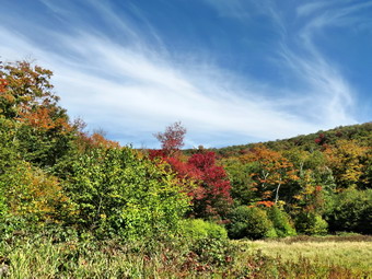 Over the next 1.4 miles we gained about 530 feet as we walked on the trail which parallels the brook. We could hear the brook at times but a visual inspection showed very little water. Around 2.2 miles the trail leveled off as we approached the lean-to. I could hear hikers coming toward us so I put Sheila on her leash. Soon the other hikers appeared with three dogs. The first dog was unleashed and aggressively approached Sheila. I do not appreciate inconsiderate dog owners and let the other party know that I was not happy. The second dog was leashed and the owner of the third held it by the collar. We walked to the lean-to where I dropped my pack and walked out toward the beaver meadow to take some pictures. As I walked out the short trail I saw a Trent illegally pitched net to the stream that passes through the meadow. Why anyone would camp illegally when the lean-to was available was beyond my comprehension. After taking some shots, Cindy and I shared a drink and a protein bar and then walked back out to the main trail. A couple approached from the west but cut down to the lean-to. We continued hiking east on the trail to the next beaver meadow. I took some pictures here and then we continued our hike. The trail began to gain some elevation as we climbed toward Millbrook Ridge. Cindy let me know she couldn't do too much more hiking so I knew I might have to hike to the high point quickly and then return to her. We passed by some huge and interesting boulders and glacial erratics. The layers in the sedimentary rock were very clear. It was interesting that many of these rocks had trees growing on top of them in only and few inches of soil. At one point I though we had reached the final climb but I was mistaken. We had not hiked this trail in some time and the distance and the amount of elevation gain were greater than I remembered.
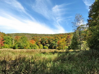 Around 2:00 PM I started to hike faster and gained the high point on Millbrook Ridge at about 2:20 PM. I started back almost immediately thinking Cindy had either stopped or turned back. I was surprised when I saw her hiking toward me only a few hundred feet from the summit! She was tired and we shared a drink before starting back to Alder Lake. I though that the descent would be much quicker than the ascent but the time was only marginally shorter. The first part of the descent to the beaver meadows was steep and covered in leaves and loose stones which slowed our progress. On the way back we bypassed the lean-to and kept a good pace to the trail junction wit the loop trail around Alder Lake. We turned right to retrace our path to the parking area. Just after the second footbridge was a campsite occupied by several campers who we had seen dragging their gear and canoes to the lake when we started our hike. A little farther down the trail I took off my pack and walk toward the lakeshore with camera in had. I took a few shots across the lake to Cradle Rock Ridge and then packed up and headed back to the car. We arrived back in the parking area at 4:15 PM. We had hiked 7.1 miles in just over 4 hours with several stops along the way. The elevation gain was 1480 feet.
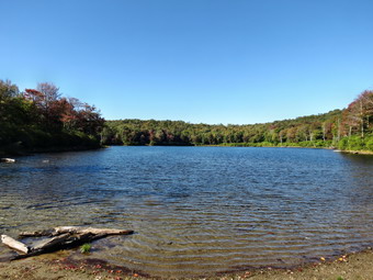
![]()
![]()
![]()
![]()
![]() On Wednesday, September 23rd I had hiked High Knob near Schunnemunk Mountain with my wife Cindy. She didn't want to hike any further after the steep uphill so we turned around and headed back to the car. The total mileage was about 3.3 miles and I wanted to hike some more miles! We arrived home at about 2:30 PM and I immediately transferred my gear and Sheila to my car to go to Hodge and Frick Ponds for a 6 mile loop. We arrived at the parking area at 2:50 PM to find one other car in the lot. The temperature was about 65 degrees but it was sunny with a slight breeze. The conditions were ideal for a quick hike on the first day of fall. At 2:55 PM we crossed the road and started up the Flynn Trail. I thought I might be a little tired but I felt great and we set a quick pace with Sheila running back and forth and into the woods to chase chipmunks. There weren't any insects and the weather was perfect. I did notice how dry the woods remain after only a few rain showers over the last few weeks. It was rewarding to see how clear the trail was after we had worked hard to remove all the blowdowns. By 3:30 PM we had hiked the 1.7 miles to the junction with the Big Rock Trail. We continued straight ahead on the Flynn Trail and walked down to the field at the outlet of Hodge Pond. When we were near the shore of the pond, Sheila immediately jumped in an waded and then swam around some. I took a few pictures of the pond since the leaves were beginning to change. The only drawback was that there were no white, puffy clouds in the sky. I threw a stick so that Sheila could swim out to retrieve it. I took some pictures of her in the pond and then we continued across the outlet stream following the Flynn Trail.
On Wednesday, September 23rd I had hiked High Knob near Schunnemunk Mountain with my wife Cindy. She didn't want to hike any further after the steep uphill so we turned around and headed back to the car. The total mileage was about 3.3 miles and I wanted to hike some more miles! We arrived home at about 2:30 PM and I immediately transferred my gear and Sheila to my car to go to Hodge and Frick Ponds for a 6 mile loop. We arrived at the parking area at 2:50 PM to find one other car in the lot. The temperature was about 65 degrees but it was sunny with a slight breeze. The conditions were ideal for a quick hike on the first day of fall. At 2:55 PM we crossed the road and started up the Flynn Trail. I thought I might be a little tired but I felt great and we set a quick pace with Sheila running back and forth and into the woods to chase chipmunks. There weren't any insects and the weather was perfect. I did notice how dry the woods remain after only a few rain showers over the last few weeks. It was rewarding to see how clear the trail was after we had worked hard to remove all the blowdowns. By 3:30 PM we had hiked the 1.7 miles to the junction with the Big Rock Trail. We continued straight ahead on the Flynn Trail and walked down to the field at the outlet of Hodge Pond. When we were near the shore of the pond, Sheila immediately jumped in an waded and then swam around some. I took a few pictures of the pond since the leaves were beginning to change. The only drawback was that there were no white, puffy clouds in the sky. I threw a stick so that Sheila could swim out to retrieve it. I took some pictures of her in the pond and then we continued across the outlet stream following the Flynn Trail.
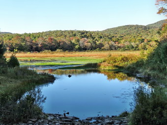 At 2.8 miles we turned to the left and continued to follow the Flynn Trail up the hill to the gate. It was a pleasure to be able to walk the trail where I had removed three major blowdowns allowing hikers to simply walk up the trail unimpeded. The half mile walk from the gate to Junkyard Junction went quickly. At 3.3 miles we reached Junkyard Junction and turned left on the Quick Lake Trail. We walked downhill along the trail as the sun was starting to drop a little lower and the shadows were getting longer. There seemed to be plenty of chipmunks for Sheila to chase and she put up several partridge along the way. At 4.9 miles we were at Iron Wheel Junction where we turned right to stay on the Quick Lake Trail. The Logger's Loop continues straight ahead at this junction. When we reached the small stream across the trail before the spruce tunnel, we found it almost completely dry with only a few pools of water. We reached the bridge over the outlet to Frick Pond at 5.9 miles. We stopped at the bridge so that I could take some pictures even though I have hundreds of pictures from this area. The angle of the sun light gave a warm glow to the pond and the trees whose leaves were just beginning to change. After a few minutes, we continued up the hill. We walked out the woods road that is the end of the Quick Lake trail and were at the car at 5:20 PM. We had covered 6.4 miles in 2 hours and 25 minutes with a vertical gain of 920 feet. This brought my mileage for the day to just under 10 miles which made me happy.
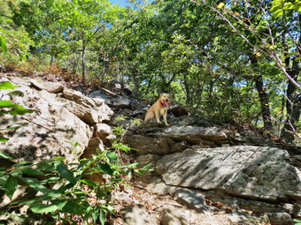
![]()
![]()
![]()
![]()
![]() On Wednesday, September 23rd I asked Cindy if she wanted to hike and she agreed. I wanted to go to someplace interesting and thought she might like the view from High Knob which is on the Long Path from Route 32 in Highland Mills to the Schunemunk Ridge. We wanted to make sure the fog had burned off and were in no hurry to leave the house too early as the temperature at 6:30 AM was 43 degrees! We got our gear together, put it and Sheila in the car and headed south on Route 17 at a little before 9:30 AM. I drove all the way to the last exit before the Thruway and headed north on Route 32 through Woodbury and Highland Mills. We passed under the Conrail trestle and looked for a place to park. The Long Path crosses just north of the trestle but there is no place to park there. When I hiked this section of the Long Path I parked my car in Monroe and had someone drop me off at the trestle. Just passed the trestle was an antique store with some parking. I asked the owner if we could park to hike and he generously agreed. We started our hike at 10:50 Am by hiking back toward the trestle and the crossing the road to get on the Long Path. I had worm a light jacket but left it in the car leaving me with only a short-sleeved shirt. The temperature was already in the mid-60's and there was plenty of sun. On this day I wore my Keen Glarus hiking boots as I remembered the trail to High Knob was very rocky. We walked up the stone stairs to the road that runs under the trestle. We crossed the road and walked up the incline next to the trestle. I was surprised to find a crew of Conrail workers installing chain link fence along the right-of-way to discourage people from crossing over the tracks. The fence ended after a short distance by flaring up the bank from the tracks. I asked the workers if we could pass around the end of the fence to continue on the Long Path. They indicated that we could not but that there was a trail through the fields on the left. We walked out into the fields and followed the trail which at first paralleled the tracks but then began to head too far to the west. Fortunately at about .4 miles we found a trail that headed north so we turned right and in .1 miles were back on the Long Path. The trail began to climb almost immediately. The surface was well-worn as this is a popular hike. It was also very dry with many loose stones.
On Wednesday, September 23rd I asked Cindy if she wanted to hike and she agreed. I wanted to go to someplace interesting and thought she might like the view from High Knob which is on the Long Path from Route 32 in Highland Mills to the Schunemunk Ridge. We wanted to make sure the fog had burned off and were in no hurry to leave the house too early as the temperature at 6:30 AM was 43 degrees! We got our gear together, put it and Sheila in the car and headed south on Route 17 at a little before 9:30 AM. I drove all the way to the last exit before the Thruway and headed north on Route 32 through Woodbury and Highland Mills. We passed under the Conrail trestle and looked for a place to park. The Long Path crosses just north of the trestle but there is no place to park there. When I hiked this section of the Long Path I parked my car in Monroe and had someone drop me off at the trestle. Just passed the trestle was an antique store with some parking. I asked the owner if we could park to hike and he generously agreed. We started our hike at 10:50 Am by hiking back toward the trestle and the crossing the road to get on the Long Path. I had worm a light jacket but left it in the car leaving me with only a short-sleeved shirt. The temperature was already in the mid-60's and there was plenty of sun. On this day I wore my Keen Glarus hiking boots as I remembered the trail to High Knob was very rocky. We walked up the stone stairs to the road that runs under the trestle. We crossed the road and walked up the incline next to the trestle. I was surprised to find a crew of Conrail workers installing chain link fence along the right-of-way to discourage people from crossing over the tracks. The fence ended after a short distance by flaring up the bank from the tracks. I asked the workers if we could pass around the end of the fence to continue on the Long Path. They indicated that we could not but that there was a trail through the fields on the left. We walked out into the fields and followed the trail which at first paralleled the tracks but then began to head too far to the west. Fortunately at about .4 miles we found a trail that headed north so we turned right and in .1 miles were back on the Long Path. The trail began to climb almost immediately. The surface was well-worn as this is a popular hike. It was also very dry with many loose stones.
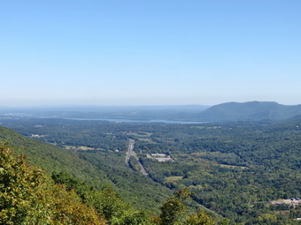 The trail was easy to follow and we made good time at least at the beginning. The temperature was warming up but there was a slight breeze and it was an almost perfect day to hike. At 1.25 miles we were hiking by the area called Little Knob and had already gained over 600 feet. It had been uphill all the way with a few flatter spots but it was about to get a lot steeper! We didn't stop at Little Knob since I knew that the best views were on the trail up High Knob and from the top. Over the next .3 miles we gained 420 feet until the trail finally leveled approaching the highest spot on High Knob. This is an average of a 28% grade and some spots were even steeper! As we climbed the view to the south and west came into view. Immediately below was the village of Kiryas Joel with rows of neatly placed houses. Beyond were mountains and hills still shrouded in a haze. I stopped to take some pictures of the landscape and of the stunted pines which were now more prevalent. I also took a few pictures of Sheila perched on the rocks above me and some of Cindy making here way up the path. We continued up until the trail leveled and we were on top. I forgot how nice the views from the top are especially those looking north and east. To the north I could see the Newburgh-Beacon Bridge and North Beacon Mountain with its transmission towers. I took quite a few pictures but wished that there were some nice white clouds to break up the blue sky. We had a drink and shared a snack. Cindy asked where we were going next and I said that I thought we would head to the Schunemunk Ridge and the Megaliths since it was only another 2 miles. After we started off in that direction, she let me know that she didn't want to go any farther. I walked another hundred feet to a lookout along the trail. I took some pictures and then turned around to head back to the car. I was disappointed that we would only get in a hike of less than 4 miles but I understood. I had never hiked down High Knob and expected the going to be rough. I was surprised that it was reactively easy. The rest of the return trip went quickly and we were back at the car at 1:15 PM having hiked only 3.4 miles in 2 hours and 25 minutes. However, the vertical gain was 1240 feet! We headed back home and as I drove I began to think about doing another hike close to home to extend my mileage.