
What You Missed
Fall 2011
Fall 2011
![]()
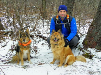
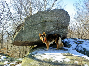
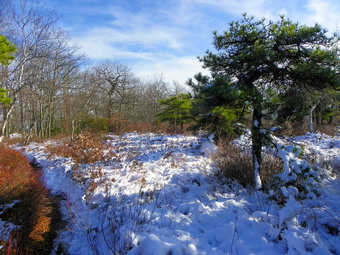
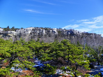
![]() On Tuesday, December 20th, I decided to keep my string of December 3500 hikes going. I looked at my grid and thought about the Blacks. I decided that I had been there in late November and the drive was a little more than I wanted to do. Westkill was available and I had not been there for some time due to the various road closures. I got out of town around 8:10 AM which was my original plan. I had heard that Route 47 was now open through to Big Indian on Route 28 and I decided to find out. The DeBruce Road was covered with a light coating of snow and was slippery in spots. When I turned right on to Route 47, the sign stating that the road was closed was gone. As I drove along the damage was obvious from the rough places to the new pavement in spots. The river appeared to have changed its course in several places and a lot of debris remained in place. We passed the parking areas for Slide and Panther Mountains without much problem. As I rounded a turn just after the Panther parking area I started to see construction equipment and the I saw what they were repairing. The road had simply disappeared leaving at least a 40 foot gap in the road. There was a single-lane bridge constructed on I beams and some decking spanning the stream below. To get across the bridge requires driving down a steep little hill to it and then up the other side. I did not stop to take pictures but thought I might on the return trip. At this point I was still considering a longer hike to include Hunter or a side trip to Prattsville. One I reached Big Indian I went straight across the intersection and took the "back way" to Route 42 toward Spruceton. Just before the Notch there was still a sign indicating that the road was closed 9 miles ahead. I knew from other trip reports that I could at least get to the Spruceton Road so I drove around the sign. I stopped briefly at the falls at the Halcott parking area and then drove on. Just after the parking area I noticed that the guardrail was missing and that one of the small "ponds" on the right of the road was filled with dirt and rocks. When I looked to my left, I saw that the entire hillside had slid and blocked the road. I did not stop nut though about taking pictures on the way back. As I got closer to Spruceton, there were several crews till doing road repair. Several of the bridges on the Spruceton Road showed signs of damage and one ha been replaced with a temporary structure. There were several areas of very rough road. Many of the bridges over the Westkill had been destroyed and a few replaced. We arrived at the trailhead at about 9:45 AM and started to hike almost immediately.
On Tuesday, December 20th, I decided to keep my string of December 3500 hikes going. I looked at my grid and thought about the Blacks. I decided that I had been there in late November and the drive was a little more than I wanted to do. Westkill was available and I had not been there for some time due to the various road closures. I got out of town around 8:10 AM which was my original plan. I had heard that Route 47 was now open through to Big Indian on Route 28 and I decided to find out. The DeBruce Road was covered with a light coating of snow and was slippery in spots. When I turned right on to Route 47, the sign stating that the road was closed was gone. As I drove along the damage was obvious from the rough places to the new pavement in spots. The river appeared to have changed its course in several places and a lot of debris remained in place. We passed the parking areas for Slide and Panther Mountains without much problem. As I rounded a turn just after the Panther parking area I started to see construction equipment and the I saw what they were repairing. The road had simply disappeared leaving at least a 40 foot gap in the road. There was a single-lane bridge constructed on I beams and some decking spanning the stream below. To get across the bridge requires driving down a steep little hill to it and then up the other side. I did not stop to take pictures but thought I might on the return trip. At this point I was still considering a longer hike to include Hunter or a side trip to Prattsville. One I reached Big Indian I went straight across the intersection and took the "back way" to Route 42 toward Spruceton. Just before the Notch there was still a sign indicating that the road was closed 9 miles ahead. I knew from other trip reports that I could at least get to the Spruceton Road so I drove around the sign. I stopped briefly at the falls at the Halcott parking area and then drove on. Just after the parking area I noticed that the guardrail was missing and that one of the small "ponds" on the right of the road was filled with dirt and rocks. When I looked to my left, I saw that the entire hillside had slid and blocked the road. I did not stop nut though about taking pictures on the way back. As I got closer to Spruceton, there were several crews till doing road repair. Several of the bridges on the Spruceton Road showed signs of damage and one ha been replaced with a temporary structure. There were several areas of very rough road. Many of the bridges over the Westkill had been destroyed and a few replaced. We arrived at the trailhead at about 9:45 AM and started to hike almost immediately.
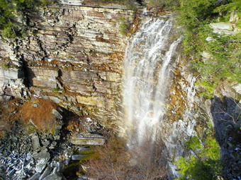
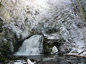
 We hiked the mile to Diamond Notch Falls rather quickly. I took a look at the falls and decided to walk down to the stream bed to get some pictures. Once in the stream bed, I dropped my pack and got out the camera. The sun was just coming out and I was careful to try to avoid the direct light into the lens. The falls were frozen in places and it seemed that the flow had changed some since the last time I was there. The largest volume of water was now coming from the left side of the falls rather than the right. After a few shots, I realized there was another difference. I could not see the bridge across the top of the falls! Sheba and I hiked up to the main trail and walked to the "bridge". All I found was the approach on both side and NOTHING else. The bridge was completely gone as if it had never been there! I guessed that I should have paid more attention to trip reports and the NYNJTC website. I considered altering my plans to do Hunter instead but I really wanted to go to Westkill. We walked back down into the stream bed and I spent the next 15 minutes throwing large rocks into the deep water. Sheba was looking at me from the opposite shore! I was able to cross without a problem except for the icy rocks. We climbed up the bank to the Devil's Path and headed up the trail toward Westkill. For me this peak always hikes "long" no matter the season. The trail was covered with a thin layer of snow which increased in depth with altitude. Some of this snow hid patches of ice. I thought I was going to be overdressed but the temperature was 28 degrees at the trailhead and dropped steadily with altitude despite the sun. Even so the exercise began to generate some heat so I took the time to open the pitzips and front zippers.
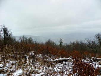
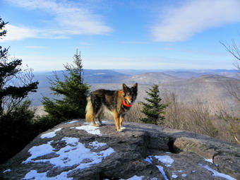
 After the falls, the trail begins a continuous ascent for some time. At one point the trail clings to a sidehill which as pretty easy to hike this day but can be much harder when covered with some snow. The trail levels some and actually descends a little before a second ascent to the Buck Ridge Lookouts. Along the way there are several steep climbs. One in particular is almost vertical and is always covered in ice. I have bushwhack around this part of the trail many times but decided to go straight up this time. Sheba was ahead of me and almost all the way to the top when she decided to turn around and fly past me on the way down. Once I was up I got her to the top and we continued the hike. It crossed my mind that putting on the Xtremes I had in my pack would be a good idea. As we approached the rock shelter there were several areas of blowdown. Some I remembered from a previous hike and some were new. The blowdown is large enough to require a chainsaw and the DEC has not gotten around to it yet. Hikers are beginning to reroute the trail around these areas. We walked passed the rock shelter and the 3500 foot sign just above it. After this, we covered the flat area and slight descent just before the last climb to the lookouts. Soon we were at the lookouts and I knew I could take some good photographs. I decided to hike to the summit and back before taking pictures. We accomplished this quickly and were soon back at Buck Ridge. It was 11:50 AM and we had hiked 3.2 miles.
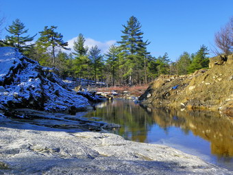
 The sun was peaking in and out from behind the clouds and I took pictures from one side of the lookout and then from the other. We got lunch and a drink before starting back. I decided at this point to don my Xtremes and a warmer pair of gloves. I also was getting cold so I zipped up before starting the descent. The Xtremes were a good idea and I was able to almost run over the ice. I could hear the points digging into the ice. I consciously avoided the bare rocks and roots looking for ice and packed snow. I waited until there was almost no snow or ice to remove the spikes and put them in my pack. Soon we were at the crossing for the Westkill. I walked up to the site of the bridge and took some pictures before hiking back to the car. It was 1:45 PM and we had covered 6.3 miles in just under 4 hours. I decided to drive back the way I had come. On the way back I stopped to take pictures of the bridges on the Westkill and of the slide on Route 42. On Route 47 I stopped to take pictures of the missing part of the road before heading home.
![]()
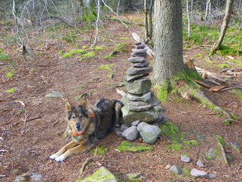
![]() On Saturday, December 17th, Karl was free to go on a hike. I asked him where he wanted to go and he listed a number of peaks. I decided that it would be a good idea to hike Bearpen and Vly since I needed them for the month on December. Karl was at the house early in the morning but I had a few chores to do before we left. By 9:15 Am I was ready to go and we left Livingston Manor to head toward Fleischmanns. Although both the Peekamoose Road and Route 47 passed Frost Valley were open, I decided it would be easiest to go through Roscoe and take Route 30 around the Pepacton Reservoir. When we got to Route 28, I turned right and drove through Margaretville and Arkville to get to Fleischmanns. Once in town, I turned left to head toward Halcott Center. I sometimes have trouble remembering the various turns but not this day. At the final Y I stayed to the right on Route 3 and drove to the end of the paved road. We arrived at trailhead around 10:30 AM and parked in the snowplow turnaround where there was one other car. The car had a New Jersey license plate and an ADK sticker so we were pretty sure it was another hiker. I had been a little reluctant to hike these two mountains as they are heavily hunted and black powder season did not end for a few days. We started to hike up the road which is the beginning of the trail at about 10:35 AM. Our two dogs, Maggie and Sheba, seemed very glad to be out of the house. As we walked up the road, I realized that it was a little steeper than I thought. After about .85 miles and 20 minutes, we were at the hunter's shack in the col between the two mountains. We decided that Vly was a bit harder and turned right onto the herd path.
On Saturday, December 17th, Karl was free to go on a hike. I asked him where he wanted to go and he listed a number of peaks. I decided that it would be a good idea to hike Bearpen and Vly since I needed them for the month on December. Karl was at the house early in the morning but I had a few chores to do before we left. By 9:15 Am I was ready to go and we left Livingston Manor to head toward Fleischmanns. Although both the Peekamoose Road and Route 47 passed Frost Valley were open, I decided it would be easiest to go through Roscoe and take Route 30 around the Pepacton Reservoir. When we got to Route 28, I turned right and drove through Margaretville and Arkville to get to Fleischmanns. Once in town, I turned left to head toward Halcott Center. I sometimes have trouble remembering the various turns but not this day. At the final Y I stayed to the right on Route 3 and drove to the end of the paved road. We arrived at trailhead around 10:30 AM and parked in the snowplow turnaround where there was one other car. The car had a New Jersey license plate and an ADK sticker so we were pretty sure it was another hiker. I had been a little reluctant to hike these two mountains as they are heavily hunted and black powder season did not end for a few days. We started to hike up the road which is the beginning of the trail at about 10:35 AM. Our two dogs, Maggie and Sheba, seemed very glad to be out of the house. As we walked up the road, I realized that it was a little steeper than I thought. After about .85 miles and 20 minutes, we were at the hunter's shack in the col between the two mountains. We decided that Vly was a bit harder and turned right onto the herd path.
 We could see the footprints of a solo hiker in the light snow as we followed the yellow and blue markers up the mountain. The paint markers used to mark the property boundaries before the state purchased both Bearpen and Vly. It was snowing lightly and this would continue for most of the day. There was some ice along the way which made several of the sections of the trail a little tricky. I had a pair of Yak Extremes with me and considered putting them in but decided to leave them for the trip down. We made our way through a few rock scrambles and reached the flatter section before the final climb. We continued to follow the footprints although I had done this before and found that not everyone knows where they are going! This section of the path becomes a little less distinct with several paths crossing the main one. As we hiked, we saw another hiker coming toward us. When we met, he introduced himself as Rockysummit from the ADK Forum and asked if I was Ralph. I am sure that he must have recognized Sheba! We talked for a few minutes and he said that the trail up ahead was not particularly icy. I did notice that he had his MicroSpikes on. Karl and I continued along and started up the final climb to Vly. We had talked for almost the entire hike as we walked along and I was surprised at how quickly we reached the flat part of the summit. We reached top and walked a short distance to the canister. It was 11:37 AM and we had covered about 1.65 miles.
 I reached up and got the book out of the canister and signed our names. We had been working hard on the way up and I was sweating. I had opened my pitzips to vent some heat but now I was getting chilly. There was a slight wind blowing that made it a little bit cooler at the top. We decided not to stay very long. We walked out of the small boulder that serves as a lookout but the view was blocked by the trees and the fog on the peaks. In addition, the rock was covered in ice. I decided not to jump up on it to take pictures and we headed back to the canister. We decided not to stay any longer but did get a drink and a snack before heading down the mountain. I considered putting my spikes on to make the trip down but decided I would try the descent without them. The trip down actually went very quickly although there were a few slips and slides. We made it down the mountain by 12:25 PM after covering about 2.45 miles. When we reached the hunting shack, we went straight across and started on the woods road that leads to the summit of Bearpen. Actually it is a series of roads and snowmobile that can be confusing. We were still following Rockysummit's steps most of the way. The first part of the trail is flat but then we made a left turn where the road quickly gets steeper. The trail continues to follows mostly woods roads and the hike is much easier than it was in the past. There are also some snowmobile trails that cut through some of the worst parts of the brush and briars. Again we talked as we hiked and time passed quickly. There was some snow on the trail but nothing very deep as we approached the final climb to the summit. Along the way we again met Rockysummit. After a brief conversation, we went our separate ways.
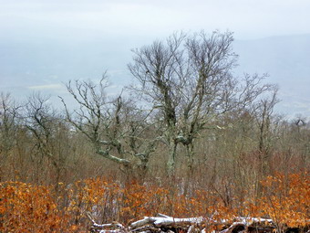
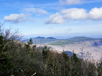
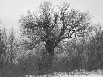 We continued to follow the footprints and at one point I noticed that we had turned on a slightly different path than I had taken before. I decided that we would continue to follow his footsteps and soon we were on the woods road that leads directly to the summit. As we walked along, we could see down into the valley and it seemed that the fog had cleared. When we finally did reach the first lookout it was 1:15 PM and we had hiked about 4 miles. The fog had closed in again obscuring all of the landmarks to the north. I did take some pictures but it was hard to see anything distinctly. The Schoharie Reservoir was visible as were the outlines of Huntersfield and Richmond. I wanted to walk over to the next lookout to show Karl the old rope tow for the ski area. Here again most of the views were blocked. I did take some pictures of some of the interesting trees at the summit. We got lunch and then decided that we would turn around and start back and following the same path. The hike back went very quickly and we managed to avoid all the icy spots. We arrived back oat the shack in the Col at 2:00 PM about 5.5 miles into the hike. We turned right down the road and hiked the .85 miles back to the car. The hike back to the car seemed to go very quickly and we arrived in the parking area at 2:20 PM. We completed the 6.4 mile hike in about three hours and 45 min. Although the forecast was for temperatures high 30s, I don't think that they ever were above freezing for the entire day.
![]()
![]() On Wednesday, December 14th I wanted to again hike some of the Catskill 3500 foot peaks. The weather forecast for Thursday was poor so I decided to head for Peekamoose and Table and hike them from the Sundown-West Shokan Road. When I got to Sundown just before 9:00 AM, there was no sign warning that the road was closed. I knew that it was supposed to be repaired and took this as a good sign. As I drove toward the trailhead, there were only a few rough spots in the road. We arrived at the parking area just before 9:00 AM and got hiking almost immediately. The temperature still seemed cold and it did not occur to me that this was because the trailhead is shaded and by the river. At the start of the hike the trail gains elevation almost immediately and between the exertion and the sun starting to hit the trail I got warm quickly. After a short distance I stopped briefly to open the pitzips and neck zippers on my jacket and tops. The first part of the trail looked like late fall with only a light coating of snow or frost on the leaves. We walked up the woods about .8 miles until the trail turned right away from the road. A little further along there were several large trees blown down across the trail. Someone had cut a notch in the low tree and left the chuck cut out as a step. The trail continues to gain elevation and at several different places there are steeper rock outcrops to negotiate. After 1.5 miles, we stopped so that I could remove a layer of clothing before I was completely soaked in sweat. I decided that since the wind was not blowing, I would take off my Mammut hoody and hike in my long sleeved Icebreaker GT200 Chase. This was good choice and I never put the jacket on again! At 2.2 miles we arrived at Reconnoiter Rock and stopped to take some pictures. This rock is a glacial erratic precariously balanced on other rocks. I took some pictures with and without Sheba before moving on.
On Wednesday, December 14th I wanted to again hike some of the Catskill 3500 foot peaks. The weather forecast for Thursday was poor so I decided to head for Peekamoose and Table and hike them from the Sundown-West Shokan Road. When I got to Sundown just before 9:00 AM, there was no sign warning that the road was closed. I knew that it was supposed to be repaired and took this as a good sign. As I drove toward the trailhead, there were only a few rough spots in the road. We arrived at the parking area just before 9:00 AM and got hiking almost immediately. The temperature still seemed cold and it did not occur to me that this was because the trailhead is shaded and by the river. At the start of the hike the trail gains elevation almost immediately and between the exertion and the sun starting to hit the trail I got warm quickly. After a short distance I stopped briefly to open the pitzips and neck zippers on my jacket and tops. The first part of the trail looked like late fall with only a light coating of snow or frost on the leaves. We walked up the woods about .8 miles until the trail turned right away from the road. A little further along there were several large trees blown down across the trail. Someone had cut a notch in the low tree and left the chuck cut out as a step. The trail continues to gain elevation and at several different places there are steeper rock outcrops to negotiate. After 1.5 miles, we stopped so that I could remove a layer of clothing before I was completely soaked in sweat. I decided that since the wind was not blowing, I would take off my Mammut hoody and hike in my long sleeved Icebreaker GT200 Chase. This was good choice and I never put the jacket on again! At 2.2 miles we arrived at Reconnoiter Rock and stopped to take some pictures. This rock is a glacial erratic precariously balanced on other rocks. I took some pictures with and without Sheba before moving on.
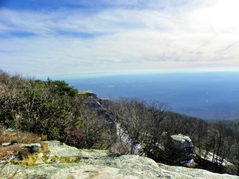
 We had been making good time but there always seems to be a change in conditions after Reconnoiter Rock and this day was no exception. We began to run into around 6 inches of snow and quite a bit of ice on the trail. The snow was packed down by previous hikers and the ice in most spots could be avoided. At about 3.0 miles we reached the flat plateau before the final climb up Peekamoose. Just at the to of this climb is a nice lookout to the east. Despite some haze the views were good and I stopped to take pictures. The sun was now out from behind the clouds and it seemed warm even though there was quite a bit of snow and ice on the trail. We continued toward the summit without stopping at some of the other viewpoints which are not as open as the first. From the viewpoints to the summit is about .8 miles with a gain of 350 feet. The first part is flatter with a steeper ascent as you approach the summit. On the steeper part we met two young men coming down. They had spent the night at the lean-to and were headed back down. They aid there was snow and ice between the peaks but nothing too bad. I still had not put on any traction device out of pure stubbornness. We said goodbye to the two descending hikers and headed toward the summit. Soon we were at the large rock that marks the summit. It was 11:15 AM and we had covered 3.75 miles. We stopped to take some pictures and then headed for table.
 The distance between the summits of the two mountains is less than a mile and the drop into the col is just over 200 feet. I was feeling good and never gave a second thought to heading for Table. There was a lot of snow going down Peekamoose and several steep and slippery parts. I don't like putting on the spikes since they WILL stop you short as you descend and I like to slide down. When we started to ascend Table, I found most of the snow had melted as it was exposed to the sun. There were some icy patches on the steeper ascent to the flat summit of Table. Once on the top we continued to walk through the highest point and down the other side. Sheba gave me an "Are you are look?" but I wanted to go to the lookout on the left side of the trail just as it starts down toward the lean-to. This lookout is to the south and west and has completely different views than the one before the Peekamoose summit. When we got to the rock that makes up the viewpoint, I found it covered in ice and snow. I took pictures but was sure to watch my footing as I did so. It was still sunny but not so much so that in ruined the shots. After taking pictures we got a drink and ate lunch before starting back. It was just before noon and we had hiked 4.6 miles. The trip back went quickly as we descended Table and climbed through the col to Peekamoose. Somewhere along the way I checked my GPS and found it turned off. I turned it back on an waited for it to go off again suspecting a malfunction. The unit continued to function properly which led me to believe the malfunction was mine. As we passed the rock at the summit I noticed footprints and a trail to the left. I had not seen this on the way up. We walked out to another viewpoint that someone had obviously cut out. It offered a very nice view to the east and north. None of the cuts looked new so I was surprised I could not remember being here before. I have mixed feelings about these "new" viewpoints that are springing up. They certainly allow better views from the peaks but they are NOT natural. After visiting the viewpoint and taking pictures, we headed back to the main trail and down Peekamoose. As we started to descend I finally decided to put on my Yak Xtremes to handles the ice and packed snow. They really did make a difference and allowed me to hike much more quickly than without them. I did have to remember to step ON the snow and ice and not on the rocks and dirt! I finally took them off just after Reconnoiter Rock. We continued to set a fast pace back down the mountain. This is a longer hike than I remember but we were back at the car by 2:15 PM covering 9.1 miles in just over 5 hours.
![]()
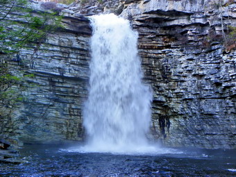
![]() On Monday, December 12th I got up early as I planned to hike Peekamoose and Table. The temperature was 14 degrees and I knew I would have to wait a bit since numbers that low are hard on Sheba's feet! Around 7:15 AM, as we were getting ready to leave, the ambulance pager sent me to the school. I got back home just after 9:00 AM which was, I felt, a little late to start on two 3500 foot peaks. I decided instead to go somewhere that had a view since the sun was out and the skies clear despite the 20 degree temperatures. After I twisted here arm Cindy agreed that Sams Point near Ellenville was a nice place to visit. By the time we finished some errands, it was after 11:00 AM and the temperature had crept to near 30 degrees. We arrived at the Conservation Center at about 12:00 PM. I have to say that the numerous signs posted around the Center seemed unfriendly and almost hostile. I know that many people probably violate the rules but we don't. One sign told us that we would be locked in if we did not leave by 5:00 PM. Another told us that the Ice Caves and Greater Ice Caves were closed. Despite the closings, the parking fee was still $10. There was no one at the Center to ask about a yearly pass and the fee payment was on the "honor system". A sign by the book warned about the consequences of not paying! By 12:15 PM we were headed up the loop road to Sams Point. The road was very icy and Cindy decided to don her Stabilicers which she wore for the rest of the hike. This was a good decision. We stopped at the lookout below Sams Point and I took some pictures. There was some haze hanging over the valley but several of the pictures had an interesting quality. I was warm despite the cool temperatures and decided to take off my outer layer and stow it in the pack. We walked up the main trail and decided to go out to Sams Point even though the view from there isn't too different than the one from below. I too some more shots before we headed back to the loop road. After a short walk, we turned right on the road down to the ice caves and then left on the trail to the falls. This trail had obviously been traveled but was sill icy in places. We passed through the scrub pine and low shrubs. At different points we could see nice views to the east of Lake Awosting, Castle Point and Hamilton Point.
On Monday, December 12th I got up early as I planned to hike Peekamoose and Table. The temperature was 14 degrees and I knew I would have to wait a bit since numbers that low are hard on Sheba's feet! Around 7:15 AM, as we were getting ready to leave, the ambulance pager sent me to the school. I got back home just after 9:00 AM which was, I felt, a little late to start on two 3500 foot peaks. I decided instead to go somewhere that had a view since the sun was out and the skies clear despite the 20 degree temperatures. After I twisted here arm Cindy agreed that Sams Point near Ellenville was a nice place to visit. By the time we finished some errands, it was after 11:00 AM and the temperature had crept to near 30 degrees. We arrived at the Conservation Center at about 12:00 PM. I have to say that the numerous signs posted around the Center seemed unfriendly and almost hostile. I know that many people probably violate the rules but we don't. One sign told us that we would be locked in if we did not leave by 5:00 PM. Another told us that the Ice Caves and Greater Ice Caves were closed. Despite the closings, the parking fee was still $10. There was no one at the Center to ask about a yearly pass and the fee payment was on the "honor system". A sign by the book warned about the consequences of not paying! By 12:15 PM we were headed up the loop road to Sams Point. The road was very icy and Cindy decided to don her Stabilicers which she wore for the rest of the hike. This was a good decision. We stopped at the lookout below Sams Point and I took some pictures. There was some haze hanging over the valley but several of the pictures had an interesting quality. I was warm despite the cool temperatures and decided to take off my outer layer and stow it in the pack. We walked up the main trail and decided to go out to Sams Point even though the view from there isn't too different than the one from below. I too some more shots before we headed back to the loop road. After a short walk, we turned right on the road down to the ice caves and then left on the trail to the falls. This trail had obviously been traveled but was sill icy in places. We passed through the scrub pine and low shrubs. At different points we could see nice views to the east of Lake Awosting, Castle Point and Hamilton Point.
 In a little less than an hour we had hiked 1,8 miles. At this point we passed through an area where there still was some snow. The snow on the high grasses and the twisted dwarf pines was beautiful. I took some pictures before we crossed the outlet stream from Lake Maratanza and headed on toward the falls. This walk is always a little longer than I remember but was made more exciting this time by the numerous patches of ice and several areas where water had accumulated on the trail! At one point we looked up to see a man and a woman headed toward us. I asked them how the falls was and they replied that they hadn't made it that far. I told them it was less than a mile and was worth the walk but they decided to leave it for another time. Cindy and I continued on working our way down the last rocky section of trail to the falls. As we approached I was surprised that I did not hear a louder roar from the falls which I expected to have the kind of volume I had found two days before at Minnewaska. I took the little side trail out to the viewpoint on the near side and dropped my pack to take pictures. It was almost 2:00 PM and we had walked 3 miles. One glance at the falls left me a little disappointed. The water flow was adequate but no where near the volume of Awosting Falls. As I was stetting up to take a few photographs, the couple that had turned around showed up. They had changed their minds and hiked to the falls. I hoped that they would not be disappointed. I finished taking my pictures and went to find Cindy.
 Cindy was waiting by the stream as she had decided not to come down to the viewpoint. Since the other hikers had crossed with only one fall, we decided to go over to the other side. Crossing above the falls was no problem and soon we were at the viewpoint on the other side. I got out something to drink and our lunch. As we were eating, I took some shots of the falls and the surrounding cliffs. There was a rather nice rainbow near the bottom of the falls but it was much more impressive in person than on the photographs. Cindy and I discussed our next move and agreed that we could make it around the entire escarpment loop but did not want to have to race back as we have done before. We decided to head back the way we came with a possible loop around Maratanza or a side trip to Indian Rock. We stayed at the falls for about 15 minutes and then headed back the way we had come. On the trip back we talked and walked and time passed quickly. By 3:10 PM we had hiked 4.8 miles and were back at the road. We decided we would walk back to the car as it was growing late and our hike had been very enjoyable. As we walked back, the sun disappeared behind some clouds and the temperature dropped noticeably. We were back at the car by 3:40 PM having covered 6 miles in 3 hours and 20 minutes.
![]()
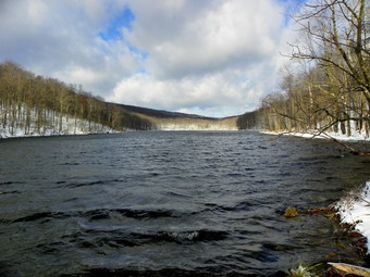
![]() On Saturday, December 10th I knew that I wanted to do a LONG hike. I had been thinking of hiking over Acra Point and then the Blacks but had recently been there. Table and Peekamoose seemed like a good idea but Karl wants to hike there soon. I also was not thrilled with the hassle of carrying snowshoes and another traction device as I was not sure what conditions would be like at the summits. I decided that I would go to Minnewaska and do some long loop around Awosting and Minnewaska and maybe even out to Gertrude's Nose. I roughly calculated about 15 miles which would suit me just fine. As we left the house the sun was coming out and there was a slight wind. The weather forecast was for the temperature to rise into the low 40's at Minnewaska and I was prepared with lighter gloves and hat in the pack. We arrived at the gatehouse and I paid the $8 fee and another $5 for a new map. I didn't need the map but I collect maps and the money support the park. The attendant informed me that the Lower Awosting Carriageway was still closed as the causeway that was washed out during Irene and Lee was still a gaping hole. She said I could get on the Mossy Glen Trail so I didn't see a problem in changing my route a little. Sheba and I started out on the carriageway just after a pack of trail runners. They went down the carriageway and we turned left almost immediately onto the Mossy Glen Trail. At the beginning of the trail was a sign that stated that the bridge over the Peter's Kill was out. This was something the attendant had failed to mention! I decided that we would hike the trail which parallels the carriageway and take a look at crossing without the bridge. There was only a sprinkling of snow on the trail and in the woods but it was still cold. We hiked for abut .6 miles until we were at the site of the former bridge. NOTHING was left of the bridge which had been swept cleanly away. In addition, the Peter's Kill was too high to cross. One of the reason's I had come to Minnewaska was to see what the falls looked like after the rain of the previous week and now that rain was working against us. We walked back up to the top of the hill and out to the carriageway. After a little more than a mile of uphill walking, we came to the spot where the Huckleberry Run Trail leaves the carriageway. The beginning of this trail also had a sign indicating the bridge was out. We walked down to find almost exactly the same situation son the Mossy Glen Trail. It was as if the bridge had never existed. At this point there were only two choices. We could turn around and walk back to the car and start gain on the Upper Carriageway or we could continue and see if we could ford the stream at the site of the destroyed causeway. I decided on the later and in another mile we were at the causeway. This was truly an impressive site as there is a gaping hole about 40 feet wide where the earthen causeway used to be. The source of the destruction, the Peter's Kill, lies placidly below. We walked to the right of the causeway and down to the stream. It was fairly easy to cross on some rocks and get to the other side. Climbing the snow-covered bank was a little harder but soon we were at the top. I stopped to take some pictures before moving on. It was clear that the amount of snow was directly dependent on the exposure with the south of things being clear and the north side covered with snow.
On Saturday, December 10th I knew that I wanted to do a LONG hike. I had been thinking of hiking over Acra Point and then the Blacks but had recently been there. Table and Peekamoose seemed like a good idea but Karl wants to hike there soon. I also was not thrilled with the hassle of carrying snowshoes and another traction device as I was not sure what conditions would be like at the summits. I decided that I would go to Minnewaska and do some long loop around Awosting and Minnewaska and maybe even out to Gertrude's Nose. I roughly calculated about 15 miles which would suit me just fine. As we left the house the sun was coming out and there was a slight wind. The weather forecast was for the temperature to rise into the low 40's at Minnewaska and I was prepared with lighter gloves and hat in the pack. We arrived at the gatehouse and I paid the $8 fee and another $5 for a new map. I didn't need the map but I collect maps and the money support the park. The attendant informed me that the Lower Awosting Carriageway was still closed as the causeway that was washed out during Irene and Lee was still a gaping hole. She said I could get on the Mossy Glen Trail so I didn't see a problem in changing my route a little. Sheba and I started out on the carriageway just after a pack of trail runners. They went down the carriageway and we turned left almost immediately onto the Mossy Glen Trail. At the beginning of the trail was a sign that stated that the bridge over the Peter's Kill was out. This was something the attendant had failed to mention! I decided that we would hike the trail which parallels the carriageway and take a look at crossing without the bridge. There was only a sprinkling of snow on the trail and in the woods but it was still cold. We hiked for abut .6 miles until we were at the site of the former bridge. NOTHING was left of the bridge which had been swept cleanly away. In addition, the Peter's Kill was too high to cross. One of the reason's I had come to Minnewaska was to see what the falls looked like after the rain of the previous week and now that rain was working against us. We walked back up to the top of the hill and out to the carriageway. After a little more than a mile of uphill walking, we came to the spot where the Huckleberry Run Trail leaves the carriageway. The beginning of this trail also had a sign indicating the bridge was out. We walked down to find almost exactly the same situation son the Mossy Glen Trail. It was as if the bridge had never existed. At this point there were only two choices. We could turn around and walk back to the car and start gain on the Upper Carriageway or we could continue and see if we could ford the stream at the site of the destroyed causeway. I decided on the later and in another mile we were at the causeway. This was truly an impressive site as there is a gaping hole about 40 feet wide where the earthen causeway used to be. The source of the destruction, the Peter's Kill, lies placidly below. We walked to the right of the causeway and down to the stream. It was fairly easy to cross on some rocks and get to the other side. Climbing the snow-covered bank was a little harder but soon we were at the top. I stopped to take some pictures before moving on. It was clear that the amount of snow was directly dependent on the exposure with the south of things being clear and the north side covered with snow.
 Just on the other side of the causeway is a turn to the left for the Long Path. My plan was to cut across to the Upper Carriageway and pass by Rainbow Falls. This falls is impressive but only after a good rainfall so this was a good time to go there. Since the bridges were out on the other two trails, this was the next best choice.We turned and walked down to the stream so that I could take some pictures of the breach in the causeway from that side. We went back to the Long Path and started to walk through the brush and then up an exposed rock face gaining a little elevation as we went. The rock appeared wet and I was trying to be careful when my feet went out from under me and I took hard fall. The "wet" was actually some VERY slick ice on the rock. I picked myself up and, not having the good sense to turn around, continued up the Long Path. Once again I carefully approached an area that looked wet, and once again I fell. I knew it couldn't happen three times in a row and I could here the stream just ahead. Fortunately I did not fall again but unfortunately the Peters Kill flowing out of Lake Awosting was a raging torrent. The water was deep, moving swiftly and spears out over an large area. We turned around and managed NOT to fall on the way back to the carriageway. We did meet tow trail runners and we spoke briefly as I warned that about what was ahead. They decided to see for themselves. Back on the carriageway Sheba and I climbed the short hill to the shores of the lake. At this point I had to decide what route to take. My original plan was to take the trail on the other side of the lake so that we could visit Murray Hill, Margaret Cliffs, the Wolf's Jaw and the Tunnel. After slipping and falling, I decided staying on the carriageways and off the open rock faces was the best idea. We turned right and started to head around the lake when the two trail runners appeared. They, too, had decided to play it safe and we parted ways as they ran ahead. As we started around the lake the sun was high in the sky and the lake was blue and beautiful. Near the far end of the lake we stopped so that I could get some pictures. Two women ran by conforming that this was definitely the day for trail running! I was around 11:00 AM and we were 4.7 miles into our hike.
 As we continued around the lake, the loop trail was shadowed from the sun and the surface became icy and covered in snow. Recently, I had walked around the lake and had been surprised by how far it was so I was prepared for the long walk. We stopped several times on peninsulas that stick out into the lake. From these vantage points I was able to take pictures up and down the lake and of the cliffs at The Battlements and Castle Point. Soon we were at the beach on the other side of the lake. I was dreading this moment as the beach is a rocky slab that is often covered with layers of ice. On this day there was almost no ice and we made it across without mishap. We continued to walk around the lake and I got a few shots from high up. When the loop trail intersected the yellow Hamilton Point Carriageway, I decide to forgo the lookouts to the left and turned right to head toward Castle Point. Soon the impressive cliffs loomed before us. We walked out to a lookout where I took some photographs of Lake Awosting. The best pictures from this viewpoint however were of the cliffs. At the junction with the Castle Point Carriageway we turned left and headed up to the Battlements. I usually turn right and then take the steep section of the Long Path up to Castle Point but this was not a good day to that route! We passed under massive, overhanging structures that I had not seen for some time as I had taken the other route. Soon we rounded the switchback and were on top of the cliffs with some nice views toward the lake, the cliffs below and the Catskills to the north. The rocks there were covered in ice and the trail was much the same. I took pictures but knew the best views were from castle Point just beyond. In a few minutes we were at Castle Point and I dropped my pack to get a snack and a drink. I took many pictures before putting the camera away and starting down the carriageway toward Lake Minnewaska. It was about 12:30 PM and we had hiked 7.8 miles already. My feet were beginning to get irritated at the heel and on the ball of the foot. Winter always seemed to do this and I have to remember to tape my feet and use liner socks!
 We walked along the carriageway and I looked for other spots to take photos. There were some but the views were not too different than from Castle Point and I just didn't see the need to stop at every gap in the trees. As we approached Kempton Ledge I decided to stop and take some pictures of the Palmaghatt Ravine and the cliffs on the other side. I also took some shots of Patterson's Pellet,, a large glacial erratic on the other side of the ravine. I had already decided that a trip to Gertrude's Nose would be too far. The possibility of an icy path also helped make this decision easier. The new plan was to hike to Minnewaska and then down the Sunset Carriageway to Awosting Falls and then to the car. I decided to take the time to tape my feet as the sun was shining on the ledge. This was a little aggravating but proved to be the decision as it improved my mood greatly. We continued our walk toward the lake and made only one stop. An open field was covered in snow and gave a great views of the mountains to the north. When we got to the loop trail around the lake, we turned left and then walked down to the beach. From the beach I took pictures down the lake. I also took some shots of the cliffs and the cliff house on the other side. The sun was at an angle that flooded one side with light while the other was in shadow. We walked up the loop trail and started down the Sunset Carriageway at about 2:00 PM 11.4 miles into the hike. The walk down to the Peters Kill went quickly and we turned right to head to the bottom of the falls. I was tempted to stop and take pictures of the stream and the upper part of the falls but knew that better things awaited below. When we arrived at the base of the falls, there was more water going over the falls than I had ever seen before. There was also a fence across the rest of the trail since much of that trail no longer existed! I took many pictures of the falls from different angles before I was able top drag myself away. Sheba and I walked back up the trail to the gatehouse and then out the road to the far parking field where the car was waiting. It was 2:35 PM and we had covered 13 miles in 5 hours and 20 minutes. My GPS calculated a moving average of 3 mph and an overall of 2.5 mph. My feet were happy to be back in the car!
![]()
![]() On Thursday, December 8th we woke up to find that the prediction of 6 to 10 inches of snow resulted in about 4 inches of rather wet snow at our house. Since the roads had been warm, they were mostly clear. I decided not to press my luck since the forecast for the northern Catskills was for more snow and I didn't know how much had fallen there. I knew the recent rains would have made the creeks high and the waterfalls beautiful so the Trout Pond loop with Russell Brook Falls was a natural choice. Cindy decided to go with us and we headed out just after 9:20 AM. The roads were good until Morton Hill Road which did not look like it had been plowed more than once. We parked in a few inches of snow at the top of Russell Brook Road to start our hike at about 9:45 AM. The snow on the trees was SO BEAUTIFUL we been took some pictures from the parking lot! As we walked down Russell Brook Road, I knew I was going to have trouble keeping the camera in my pack for any length of time! All the way down the road we could hear Russell Brook and, as we approached the upper falls it got even louder. I wasn't going to go down the bank to the area above the falls since it looked slippery but I carefully worked my way down the vantage point opposite the cascading water, I took many pictures before working my way back up the bank. We walked down to the parking lot and found one pickup truck there. We took more pictures and then headed down the trail to the bridge and the lower falls. I worked my way down the short but steep path to the stream bed. I again took many shots of the falls and surroundings covered in snow. I have seen the falls with a greater volume but this water was clear. Back on the main trail, we met a hunter walking back from the pond. He asked "Do you have a gun?" I wasn't sure how to respond but said I did not. He told us he had seen a bear and that we should be careful. I thanked him and continued up the trail. I didn't want to tell him how many bears I had seen on the trails and how many bears had probably seen me!
On Thursday, December 8th we woke up to find that the prediction of 6 to 10 inches of snow resulted in about 4 inches of rather wet snow at our house. Since the roads had been warm, they were mostly clear. I decided not to press my luck since the forecast for the northern Catskills was for more snow and I didn't know how much had fallen there. I knew the recent rains would have made the creeks high and the waterfalls beautiful so the Trout Pond loop with Russell Brook Falls was a natural choice. Cindy decided to go with us and we headed out just after 9:20 AM. The roads were good until Morton Hill Road which did not look like it had been plowed more than once. We parked in a few inches of snow at the top of Russell Brook Road to start our hike at about 9:45 AM. The snow on the trees was SO BEAUTIFUL we been took some pictures from the parking lot! As we walked down Russell Brook Road, I knew I was going to have trouble keeping the camera in my pack for any length of time! All the way down the road we could hear Russell Brook and, as we approached the upper falls it got even louder. I wasn't going to go down the bank to the area above the falls since it looked slippery but I carefully worked my way down the vantage point opposite the cascading water, I took many pictures before working my way back up the bank. We walked down to the parking lot and found one pickup truck there. We took more pictures and then headed down the trail to the bridge and the lower falls. I worked my way down the short but steep path to the stream bed. I again took many shots of the falls and surroundings covered in snow. I have seen the falls with a greater volume but this water was clear. Back on the main trail, we met a hunter walking back from the pond. He asked "Do you have a gun?" I wasn't sure how to respond but said I did not. He told us he had seen a bear and that we should be careful. I thanked him and continued up the trail. I didn't want to tell him how many bears I had seen on the trails and how many bears had probably seen me!
 The scenery up to the pond continued to be beautiful although the woods road itself was rather wet in places. As we approached the pond, the wind began to pickup and I zipped up some of the layers that I had unzipped to dump heat. At the outlet end of the pond we stopped to take some pictures. The sky was bright in some places and covered with dark clouds in others. This made for some interesting effects as the light kept changing. The trail from the outlet to the lean-tos had several large puddles that we had to negotiate around. Ruts from the state pickups that had been used to install the new bridge didn't help. Several places along the trail we noticed paths in the snow perpendicular to the trail. It seems the beavers are still active as I found a tree with some signs of teeth marks at the end of one of the Se paths. We stopped at the inlet where I took some pictures and Cindy had a bite to eat at the lean-to. We crossed the new bridge to find a stream on the other side! This seemed to be a "branch" of the stream that flows under the bridge. There was also water flowing down the trail. We started up the trail to Cherry Ridge and encountered low hanging branches all along the route. I led the way and tapped most of the branches to remove the snow at which point they snapped up to clear the trail. More than once I was a little close and was hit my the snow. Working our way up and over the ridge proved tiring. On the other side of the highest point the trail was again obstructed by standing and flowing water. It was odd to see so much water surrounded by the snow. In this area the direction of the snowfall was evident as the north sides of the trees were covered and the south sides had almost no snow. We finally made it down to the woods road that heads back to the area of the falls. There was water on this road in many places and I was surprised to find that there were still many low hanging branches. Going downhill was a little easier than going up and we were soon back at the trail junction. From there we walked back to the lower parking and up the road to the car. The sun was still peeking in and out from behind the clouds and the temperature was in the mid to high 30's. It was 12:45 PM and we had taken about 3 hours to cover the 5.1 mile route.
![]()
![]() On Monday, December 5th I wanted to hike off some of the calories I had taken in over the weekend. Hiking burns the calories and it also removes me from sources of food. I wanted to go to the Blackheads again to hike over Acra Point and then up to Blackhead. I then could decide how much further I wanted to go. My list for December is wide open so hitting three peaks was attractive even though I had been in the area last month. I got up early and was on schedule to leave at 6:00 AM when the ambulance pager went off and I was headed out the door on a call. My the time I got back I had decided that I did not have enough time to be able to drive two hours to the Blackhead Range. This didn't bother me too much as the skies were completely overcast and I was interested in taking pictures on the hike. I thought about peaks WITHOUT great views. Immediately Eagle and Balsam came to mind! These are two of my least favorite peaks especially Eagle with a long walk to a flat summit with no view. I decided to head to Rider Hollow since the Segar trail head is fine for Eagle but makes Balsam a long walk. In addition, I remembered that the Segar trail crosses and recrosses Shandaken Brook and I did not want to deal it. I REALLY hate water crossings even small ones and will do almost anything to get out of them, I headed to Route 30 around the Pepacton Reservoir and made a right on the Millbrook Road. I drove all the way to the end and turned left on Dry Brook Road, right on Todd Mountain Road and then right again on Rider Hollow Road. These roads still showed the damage from Hurricanes Irene and Lee especially the Rider Hollow Road. We arrived in the parking area at 9:30 AM to find no other cars. The temperature had risen on the drive and it was already in the low 40's. I removed my midlayer and We immediately hit the trail.
On Monday, December 5th I wanted to hike off some of the calories I had taken in over the weekend. Hiking burns the calories and it also removes me from sources of food. I wanted to go to the Blackheads again to hike over Acra Point and then up to Blackhead. I then could decide how much further I wanted to go. My list for December is wide open so hitting three peaks was attractive even though I had been in the area last month. I got up early and was on schedule to leave at 6:00 AM when the ambulance pager went off and I was headed out the door on a call. My the time I got back I had decided that I did not have enough time to be able to drive two hours to the Blackhead Range. This didn't bother me too much as the skies were completely overcast and I was interested in taking pictures on the hike. I thought about peaks WITHOUT great views. Immediately Eagle and Balsam came to mind! These are two of my least favorite peaks especially Eagle with a long walk to a flat summit with no view. I decided to head to Rider Hollow since the Segar trail head is fine for Eagle but makes Balsam a long walk. In addition, I remembered that the Segar trail crosses and recrosses Shandaken Brook and I did not want to deal it. I REALLY hate water crossings even small ones and will do almost anything to get out of them, I headed to Route 30 around the Pepacton Reservoir and made a right on the Millbrook Road. I drove all the way to the end and turned left on Dry Brook Road, right on Todd Mountain Road and then right again on Rider Hollow Road. These roads still showed the damage from Hurricanes Irene and Lee especially the Rider Hollow Road. We arrived in the parking area at 9:30 AM to find no other cars. The temperature had risen on the drive and it was already in the low 40's. I removed my midlayer and We immediately hit the trail.
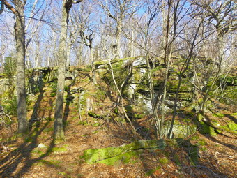 We walked along the trail as it paralleled the brook and within a short distance there was...a water crossing. It all came back to me that this trail was as bad as the Segar Trail in this aspect. The streams were high from recent rains but we found a spot where someone had placed several logs across. As I stepped on the logs they became submerged in the stream but I made it across, Sheba took a little dip and was soon on the other side. We walked along the trail until...the trail disappeared. It took me a minute to understand that the stream had simply cut a new channel and obliterated the trail! The best option, although not a great one, was to sidehill along the left bank to get around the most eroded area. The loose dirt and slippery leaves made this an adventure! We picked up the trail on the other side and I noticed a "no camping" sign on a tree that was now in the middle of the widened stream channel. When we came to the trail junction between the Rider Hollow and Mine Hollow Trails, we stayed to the right on the red Rider Hollow Trail. I thought we might come back by way of the other trail. At least the water crossing here had a bridge. This odd bridge has a steel frame and the wooden decking had recently been replaced. We walked up the trail to the lento. The trail is more eroded and rockier than ever. Just passed the lean-to, I lost the trail again on the right bank of the stream. A path seemed to follow the right bank but I saw no blazes. I finally picked up the blazes...on the other side of the wide stream. I was able to find a fallen tree to get me across and Sheba had no problem making it to the other side. The trail on the other side follows a woods road and begins to gain elevation as it moves away from the main stream. On the way to the col between Eagle and Balsam, we made four more stream crossings but these were easy. At about 1.23 miles into the hike, the trail becomes steeper and remains that way to the col gaining 750 feet in .7 miles. We were at the col by 10:30 AM.
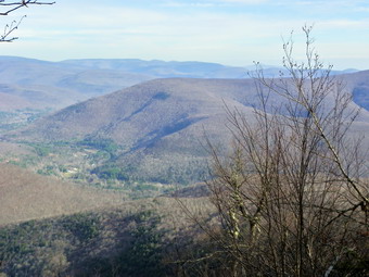 When we reached the blue Pine Hill-West Branch Trail we turned right and headed for Eagle. There is another ascent over the next .7 miles which gains around 400 feet to the top of Haynes Mountain. Haynes tops out at just less than 3500 feet and once at the top the tail descends before climbing Eagle. The weather was now sunny at times and then the sun would hide behind some clouds. There was a slight breeze and overall the hiking was enjoyable. Some volunteers had worked on the trail in this area over the summer and fall and it showed as the trail was wide and easy to walk. As we started to descend Haynes, I looked ahead to see Eagle, It looked high. Once in the col we started up Eagle. The climb is more of a walk with no rock scrambles and a rather gentle ascent. Over .7 miles the elevation gain is about 340 feet. The highest point on Eagle is not on the trail and usually I don't really care. There is a well-defined path with a cairn on the flat part of the trail near the summit and we turned to the right on this path. After a short walk, we found a larger cairn which someone had erected presumably to mark the summit. I thought I could see higher ground slightly north and west so we headed off in that direction. When I could see no higher ground, I resalable course back to the cairn. I took some pictures and I broke out lunch even though it was still before noon. We walked back out to the main trail and started back to the col. We arrived at the trail junction at 12:30 PM with 6.3 miles already hiked.
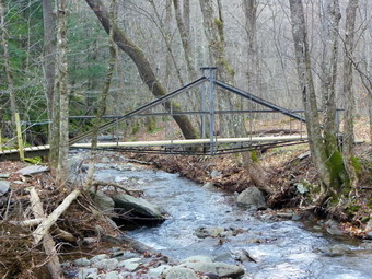 From the Col the summit of Balsam is only .7 miles with a gain of 560 feet in elevation. Here, again, there are no rock scrambles but there area few interesting ascent through some ledges. This part went quickly and the only problem was that I forgot that the viewpoint is on the other side of the summit as you begin your descent. We stopped at the viewpoint and I took some pictures before going back to the main trail. The trail now descends over 700 feet in the next .7 miles to the junction with the yellow Mine Hollow Trail. Several switchbacks along the way make the slope seem less steep. We turned left on the yellow Mine Hollow Trail and continued going down dropping another 750 feet over .9 miles. The trail follows a wide woods road down to and then along the brook. Near the bridge, the trail again disappeared into the stream. We bushwhack over some blowdown and sidehilled briefly before I decided to cross the creek. This was fairly easy at this point as we picked up the red Rider Hollow Trail on the other side and crossed the bride. Of course, we still had to deal with the "missing" part of the trail and the final water crossing. By 2:30 PM we were back at the car having covered 9.7 miles in under 5 hours. On the way back I decided to take the Dry Brook Road into Arkville and pick up Route 28. This was a BAD decision as the bridge is still out. I backtracked to Todd Mountain Road and used that to get to Route 28.
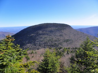
![]()
![]() On Thursday, December 1st I was in the mood to bag another 3500 foot peak...or two. When I looked at my grid, December was nearly bare so I decided to go to Tannersville and hike Indian Head and Twin. I had thoughts of including Sugarloaf in the hike but I knew that probably wouldn't happen. I had just done Sugarloaf in November and I had some things to take care of at home. I did get started a little earlier this time and decided to take the route I had taken previously through Grand Gorge. It turns out that this is a nice alternative but it is further and takes longer than other routes. We arrived at the Prediger Road trail head just before 9:30 AM to find only one car. The temperature was in the mid 30's and a slight wind was blowing. It wasn't long before we were on the trail and I started to warm up. I have never liked the trail to Jimmy Dolan Notch but this time it didn't seem to bad. It IS rough and eroded with many roots to step around and over on the lower part. There was a lot of standing water but the stream crossing was easy. The mud in many places was frozen and there were opportunities to walk around the worst sections. It seemed that we were soon on the steeper section which has many more rocks and requires some care. The problem was the ice on the rocks! This ice was not the friable kind that crunches under foot. This was hard ice that varied from a spot here and there to large sheets. I was careful not to repeat my performance from Sugarloaf several weeks earlier. This ice was to be avoided. Any type of traction device would be useless as the ice patches were so spotty. The trail did not have a lot of blowdown and soon we were on the flat portion of the trail just before the notch. We arrived at the notch at 10:30 AM. This meant we had hiked 2 miles in about and hour with a gain of 1100 feet! I was felling great but had to make some choices. I decided to head up Indian Head first and then Twin. This is the way I almost always go but it left open the possibility of doing Sugarloaf after Twin.
On Thursday, December 1st I was in the mood to bag another 3500 foot peak...or two. When I looked at my grid, December was nearly bare so I decided to go to Tannersville and hike Indian Head and Twin. I had thoughts of including Sugarloaf in the hike but I knew that probably wouldn't happen. I had just done Sugarloaf in November and I had some things to take care of at home. I did get started a little earlier this time and decided to take the route I had taken previously through Grand Gorge. It turns out that this is a nice alternative but it is further and takes longer than other routes. We arrived at the Prediger Road trail head just before 9:30 AM to find only one car. The temperature was in the mid 30's and a slight wind was blowing. It wasn't long before we were on the trail and I started to warm up. I have never liked the trail to Jimmy Dolan Notch but this time it didn't seem to bad. It IS rough and eroded with many roots to step around and over on the lower part. There was a lot of standing water but the stream crossing was easy. The mud in many places was frozen and there were opportunities to walk around the worst sections. It seemed that we were soon on the steeper section which has many more rocks and requires some care. The problem was the ice on the rocks! This ice was not the friable kind that crunches under foot. This was hard ice that varied from a spot here and there to large sheets. I was careful not to repeat my performance from Sugarloaf several weeks earlier. This ice was to be avoided. Any type of traction device would be useless as the ice patches were so spotty. The trail did not have a lot of blowdown and soon we were on the flat portion of the trail just before the notch. We arrived at the notch at 10:30 AM. This meant we had hiked 2 miles in about and hour with a gain of 1100 feet! I was felling great but had to make some choices. I decided to head up Indian Head first and then Twin. This is the way I almost always go but it left open the possibility of doing Sugarloaf after Twin.
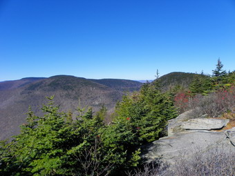 We turned left and started up the Devil's Path to Indian Head. The climb up Indian Head mixes some flatter spots with a few steeper areas. There was some water on the lower areas and then ice. In one spot a scramble up and over some rocks was covered in ice and looked a little too hard to negotiate. I decided to look for a way around. We bushwhacked to the right of the rock and found a way up and around the ice. After this point we walked to the rock that most consider the summit and then passed it until we started to go down. At this point, we turned around and started back just before 11:00 AM. The return to the Col went faster than I expected and we were soon headed up Twin. The wind was still blowing but the sun was out. I had expected to find little or no ice on the approach to Twin but the trail swings to the north. The exposure meant there was some ice. I always seem to remember the glorious view from Twin but not the ascent. Climbing up to the first lookout is a workout with some nasty little climbs. Many of these have workarounds but several were icy. One little ledge proved to be particularly challenging but I made it without a problem. We stopped at the lookout to Indian Head and I took some pictures. Back on the trail we climbed the last section and walked to the open rock face that forms the lookout from the east peak of Twin. This is one of the nicest spots in the Catskills. The sun was in the south where I wanted to photograph but it was almost noon and it was high in the sky. The wind was still blowing and I was getting a little cool. I took some shots and then we headed for the western peak which is the higher of the two.
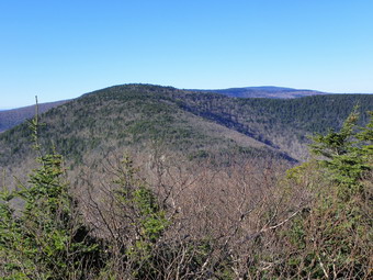 To get to the higher peak there is a descent to a col and then a longer ascent up the other side. At one point I caught glimpse of the western peak and thought it looked pretty high. Actually the distance between the two peaks is only .6 miles with a drop of 100 feet and a gain of 155 ft. We arrived at the western peak at 12:05 PM about 3.9 miles into the hike. I took some pictures and we had some water as I looked over at Sugarloaf and decided it would wait for another day! We had a snack before heading back. Again, going down was easier than I thought it might be and we were approaching Jimmy Dolan Notch when I heard voices. Two young men from Connecticut were relaxing at the Notch. They had parked at Spruceton and taken a cab to Prediger Road. They wanted to hike the Devil's path from end to end with an overnight stay. Unfortunately, they had come up to Jimmy Dolan Notch on the BLUE trail. This meant they had missed the start of the Devil's Path and the summit of Indian Head. I left them mulling over what they should do next. Even though I dislike the hike to this notch, the trip back was downhill and we were able to avoid most of the ice. The ground was still frozen which kept the mud under control. We kept a good pace back to the parking area and I thought about taking a trip to Kaaterskill Falls to take pictures. Along the way we met only one other hiker. We were back at the car by 1:55 PM having covered the 6.8 mile trek in 4 hours and 20 minutes. I was ready to return home and I am sure Kaaterskill Falls will be there the next time I visit.
![]() On Monday, November 28th the skies were overcast and there was a hint of mist in the air. The good news was that the temperature was almost 60 degrees. As I was about to leave for Frick Pond an ambulance call came in and by the time I returned it was about 10:15 AM. I decided to head up to Frick Pond since it is close and I knew I could finish before I had to be at school to time basketball games. Sheba and I arrived at the parking area just before 11:00 Am to find two pickup trucks already parked. I thought that it was likely that the belonged to hunters so I knew we would have to be careful. By 11:00 AM we were crossing the road and heading up the Flynn Trail. The last time I was hiking at Frick Pond it was October and I was on snowshoes! This day I was wearing a short sleeved shirt and was still sweating as we climbed the 1.7 miles on the Flynn Trail to the junction with the Big Rock Trail. I checked my GPS ant this point and found we were averaging over 3 mph. It was then that I decided to see how fast we could finish without stopping but without jogging! I decided to head out the woods road that goes to the old boy scout camp and then cut down the hill and around the back of Hodge Pond. On the other side of the pond we picked up the Flynn Trail again and headed toward Junkyard Junction. The Flynn Trail in this area is almost flat but that means it is usually wet and on this day there was plenty of water and black mud. At Junkyard I thought about extending the hike out toward Quick Lake but decided to stick to my plan. We turned right and headed down the Quick Lake Trail toward Frick Pond. At some point I looked up to see a hunter sitting by the side of the trail. We said a brief "Hello" and I continued on. After a short distance, there was another hunter on the left side of the trail. As we approached Wagon Wheel Junction, the was another hunter sitting on the right side of the trail. This hunter told me that some others were "driving" toward us. I excused myself and Sheba and I hurried to the trail junction where we turned right. This section of the Quick Lake trail is in poor shape. There are many trees blocking the trail and forcing hikers to make new trails around them. In addition, there are few markers along the way. Soon Sheba and I were approaching Frick Pond and then we were headed back to the car. We arrived back in the parking lot at 12:59 PM. We had covered 6.45 miles in 1 hour and 58 minutes with a total stopped time of 1 minute!
On Monday, November 28th the skies were overcast and there was a hint of mist in the air. The good news was that the temperature was almost 60 degrees. As I was about to leave for Frick Pond an ambulance call came in and by the time I returned it was about 10:15 AM. I decided to head up to Frick Pond since it is close and I knew I could finish before I had to be at school to time basketball games. Sheba and I arrived at the parking area just before 11:00 Am to find two pickup trucks already parked. I thought that it was likely that the belonged to hunters so I knew we would have to be careful. By 11:00 AM we were crossing the road and heading up the Flynn Trail. The last time I was hiking at Frick Pond it was October and I was on snowshoes! This day I was wearing a short sleeved shirt and was still sweating as we climbed the 1.7 miles on the Flynn Trail to the junction with the Big Rock Trail. I checked my GPS ant this point and found we were averaging over 3 mph. It was then that I decided to see how fast we could finish without stopping but without jogging! I decided to head out the woods road that goes to the old boy scout camp and then cut down the hill and around the back of Hodge Pond. On the other side of the pond we picked up the Flynn Trail again and headed toward Junkyard Junction. The Flynn Trail in this area is almost flat but that means it is usually wet and on this day there was plenty of water and black mud. At Junkyard I thought about extending the hike out toward Quick Lake but decided to stick to my plan. We turned right and headed down the Quick Lake Trail toward Frick Pond. At some point I looked up to see a hunter sitting by the side of the trail. We said a brief "Hello" and I continued on. After a short distance, there was another hunter on the left side of the trail. As we approached Wagon Wheel Junction, the was another hunter sitting on the right side of the trail. This hunter told me that some others were "driving" toward us. I excused myself and Sheba and I hurried to the trail junction where we turned right. This section of the Quick Lake trail is in poor shape. There are many trees blocking the trail and forcing hikers to make new trails around them. In addition, there are few markers along the way. Soon Sheba and I were approaching Frick Pond and then we were headed back to the car. We arrived back in the parking lot at 12:59 PM. We had covered 6.45 miles in 1 hour and 58 minutes with a total stopped time of 1 minute!
![]()
![]() On Saturday, November 26th Karl wanted to hike and he was able to bring Bryce along with him. Having the 8 month old grandson along is fun but it means a shorter hike since he and his carrier now weigh right around 30 pounds! By the time Karl arrived and we decide to go it was 10:00 AM. The weather was beautiful and I wanted to go somewhere with a view and where we would not be interfering with too many hunters. Giant Ledge certainly fit the bill but Route 47 that goes to Frost Valley still had a ROAD CLOSED sign. We decided to try it anyway since the breech in the road seemed to be passed the parking area on the hairpin turn. We took two cars since 3 adults, 2 dogs, Bryce and his "equipment" were too much for one vehicle! When we made the left turn from Pole Road onto Route 47, it was the first time I had been on the road since Hurricanes Irene and Lee. As we drove along the road it was obvious that the Neversink had destroyed the road in several places. It was also obvious that the road crews had done a great job of reconstructing it so quickly. In some places it was not the river but small tributaries that did the damage. We drove passed Frost Valley without a problem. There were no cars at the Biscuit Brook parking area but there were about eight at Slide Mountain. The road down from Winnisook showed the damage from the storm but was entirely passable. We arrived at the parking are at 11;30 AM to find a couple cars. Getting ready to go with Bryce takes a few minutes extra but we were hiking across the road by 11:40 AM.
On Saturday, November 26th Karl wanted to hike and he was able to bring Bryce along with him. Having the 8 month old grandson along is fun but it means a shorter hike since he and his carrier now weigh right around 30 pounds! By the time Karl arrived and we decide to go it was 10:00 AM. The weather was beautiful and I wanted to go somewhere with a view and where we would not be interfering with too many hunters. Giant Ledge certainly fit the bill but Route 47 that goes to Frost Valley still had a ROAD CLOSED sign. We decided to try it anyway since the breech in the road seemed to be passed the parking area on the hairpin turn. We took two cars since 3 adults, 2 dogs, Bryce and his "equipment" were too much for one vehicle! When we made the left turn from Pole Road onto Route 47, it was the first time I had been on the road since Hurricanes Irene and Lee. As we drove along the road it was obvious that the Neversink had destroyed the road in several places. It was also obvious that the road crews had done a great job of reconstructing it so quickly. In some places it was not the river but small tributaries that did the damage. We drove passed Frost Valley without a problem. There were no cars at the Biscuit Brook parking area but there were about eight at Slide Mountain. The road down from Winnisook showed the damage from the storm but was entirely passable. We arrived at the parking are at 11;30 AM to find a couple cars. Getting ready to go with Bryce takes a few minutes extra but we were hiking across the road by 11:40 AM.
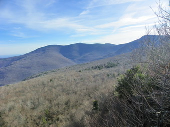 The bridge across the stream right after the register box is still missing. Several large steel I-beams were lying on the ground ready to form the support for a new bridge. The stream was easy to cross and we made our way up the trail. Bryce was having a great time as was everybody else. Maggie, Karl's dog, doesn't get out as much as she would like and Sheba seemed pleased to be away ROM the new puppy. Within half a mile I stopped to take off my jacket and hat. For the rest of the hike I wore just a light long sleeved Mammut shirt. Although Giant Ledge is not a 3500 foot peek it is on the CHH list and the hike is short but not easy. There are several short ascents with flatter areas in between. We were keeping up a good pace and made the trail junction by 12:10 PM. As we made the left turn to head up to Giant Ledge we met two people coming back from the ledges. The rest of the hike to the ledges went quickly with a few muddy areas to avoid and a few climbs along the way. By the time we got to the last climb, Karl was beginning to feel the weight on his back. We hit the top of the climb and relaxed a little as we approached the first viewpoint. There were three hikers there enjoying the view. They had come up from Brooklyn to hike Slide but decided on Giant Ledge instead. I took some pictures from the viewpoint of the Burroughs Range, Panther Mountain, the hills beyond and the valley below. The shots were pretty good but despite the sunny day and blue sky there is a certain bleakness to the landscape.
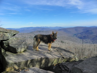 I decide to walk a little further to some of the other lookouts while Karl and Cindy relaxed and fed Bryce. Sheba and I hit several more of the viewpoints and I took some more shots. Each lookout has as lightly different angle on the scenery but after a while the view isn't all that different. I returned to the rest of the family and paused to get a drink. Two hikers coming back from Panther walked passed us but seemed very confused about where the trail went. It almost seemed to me that they didn't know about the blazes that mark the trail! Soon we were headed back down. Even before we got to the first descent we met several groups of hikers headed up on this beautiful day. We passed the group of three on the way down the first steep descent and as we continued down Bryce began to cry. He stopped at the bottom which made us speculate that he was a little scared of the steep descent. From that point on it we just continued at a comfortable pace back to the trail junction and then to the parking area. We met several groups along the way. Even when we got to the car there were two people walking up the road from the direction of Oliverea. It was about 2:00 PM and we all thought it a little late to start up to Giant Ledge. We finished the 3.3 mile hike in just under 2.5 hours and had great fun doing it.
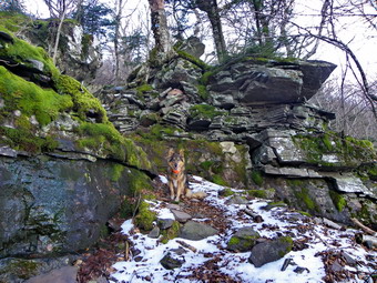
![]()
![]() On Friday, November 25th I was in the mood to bag another 3500 foot peak after the Thanksgiving holiday and a large Thanksgiving meal. I wanted to do Kaaterskill from Palenville but was not sure whether or not Route 23 was closed. Rather than driving there to find I would have to drive back, I decided to climb the peak from Platte Clove.I thought I got up early enough but didn't leave town until after 8:15 AM. I CANNOT convince myself that the road closures and longer route require an earlier start. I am beginning to think that this is simply me not wanting to get up earlier and I guess I am OK with that. I made pretty good time driving and we were at the parking area just before 9:35 AM. There were no other cars in the lot but the gate was open. There are a couple of private inholdings in this area and I was concerned about hunters. I don't like to disturb others in the pursuit of hat they like to do but I felt that if we stayed on the trails we would be OK. We started hiking right away be walking up the dirt road. I was surprised to find some dry spots on the road! This road and trail are always wet even when it is dry elsewhere! The stream to the right of the trail was swollen with water from the recent rains and I could hear the water flowing over the rocks. I walked up the bank that lines the road and looked down at the stream. I could see some small falls and rapids and made a note to investigate at some time. The walk on the road was not unpleasant and I was already getting warm by the time we reached the yellow trail to Huckleberry Point. We had hiked a mile and gained 500 feet. I took off my midlayer but again kept on the orange jacket. The road continues passed this point but eventually turns into more of a trail. As we gained elevation the trail became drier but there were still areas of running water where the trail looked more like a stream bed. There were also some muddy places and spots where there was standing water. All of these were easily avoided and we where moving along very nicely.
On Friday, November 25th I was in the mood to bag another 3500 foot peak after the Thanksgiving holiday and a large Thanksgiving meal. I wanted to do Kaaterskill from Palenville but was not sure whether or not Route 23 was closed. Rather than driving there to find I would have to drive back, I decided to climb the peak from Platte Clove.I thought I got up early enough but didn't leave town until after 8:15 AM. I CANNOT convince myself that the road closures and longer route require an earlier start. I am beginning to think that this is simply me not wanting to get up earlier and I guess I am OK with that. I made pretty good time driving and we were at the parking area just before 9:35 AM. There were no other cars in the lot but the gate was open. There are a couple of private inholdings in this area and I was concerned about hunters. I don't like to disturb others in the pursuit of hat they like to do but I felt that if we stayed on the trails we would be OK. We started hiking right away be walking up the dirt road. I was surprised to find some dry spots on the road! This road and trail are always wet even when it is dry elsewhere! The stream to the right of the trail was swollen with water from the recent rains and I could hear the water flowing over the rocks. I walked up the bank that lines the road and looked down at the stream. I could see some small falls and rapids and made a note to investigate at some time. The walk on the road was not unpleasant and I was already getting warm by the time we reached the yellow trail to Huckleberry Point. We had hiked a mile and gained 500 feet. I took off my midlayer but again kept on the orange jacket. The road continues passed this point but eventually turns into more of a trail. As we gained elevation the trail became drier but there were still areas of running water where the trail looked more like a stream bed. There were also some muddy places and spots where there was standing water. All of these were easily avoided and we where moving along very nicely.
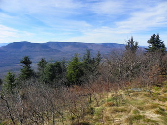 At about 2 miles into the hike the water began to show up in earnest. At 2.25 miles we passed the cairn that marks the bushwhack up to the snowmobile trail that runs around the base of the peak. For a moment I though about taking the path and using the snowmobile trail to pick up the path to the summit from the south. I had never used that approach and really wanted to try it. I decided not to bushwhack since it was hunting season and I had found it difficult to follow the path last time I used it. From this point the trail actually flattens some and descends. This allows water to accumulate and we went through almost half a mile of ponds and streams on the trail! Some of these areas were deep with no way to get through them so we found ways around them which looked as if they had been used by others. This section of the trail is over a mile long and seemed longer and very tedious. At about 3.3 miles the hiking trail continued straight ahead toward the waterfalls and Poet's Ledge. We turned left and walked up the snowmobile trail to the loop trail around the peak. After a short climb to the loop trail, we turned right on the loop, walked a short distance and turned left on the herd path that leads up to the peak. Technically, Kaaterskill is a trailless peak since there is no maintained or blazed trail to the summit. The herd path is very clear in most places although more than once I had to rely on Sheba to stay on it. As we made the turn, we were on the north side of the peak and the mountain blocked the sun. It did seem colder here and there was some snow and ice on the rocks. I climbed carefully as I had made up my mind to take it easy and stay in one piece.
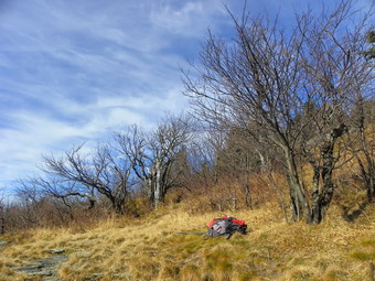 The path to the top is less than half a mile but it took us over 40 minutes to climb it. It IS steep in places but what really slowed us down was the snow and ice. Sheba, of course, had no problems but there were places where I almost turned back. One section required a steep little scramble over some rocks and then a walk along a narrow, snow-covered ledge! Just after this the trail leveled out some and the snow cover abated. There were a few more little climbs but soon we were at the summit. It was 11:55 AM and we had taken an hour and 10 minutes to hike the 4 miles. Since the summit has no view, we continued on to Hurricane Ledge which has a great view! It is only about .25 miles to the ledges but always seems longer to me. I dropped my pack and got out the camera. Unfortunately, due to my late start, it was hard to get good pictures of the Devil's Path to the south. The sun was high in the sky but was a little too bright. We walked around the various different ledges and I took a few shots from each as they have different views. It was warm in the sun and the wasn't a hint of any snow. We stayed around for some time as I took photographs and we got a drink and snack. I was not looking forward to the trip back but by 12:15 PM we were on the way back to the summit and down the other side. I tried to find a viewpoint to the north but there were none worth stopping to take pictures. I descended across the little ledge slipping and sliding along! At that point I decided to don my Yak XTRs to get down the next section. They worked well and I chose a line that was more snow on dirt than rock. At the bottom of that short section I took them off and carried them briefly before towing them in the pack. There was more ice and snow ahead but I made it down without mishap. At the bottom of the path we made the right onto the loop and then a left down the snowmobile trail to the Long Path.
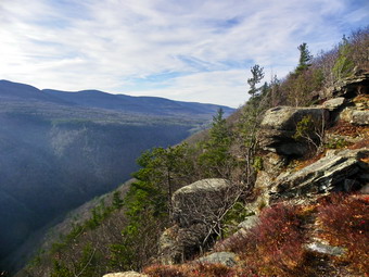 The hike back seemed to go quickly despite the need to again walk around the water. In a few places I simply used stepping stones and walked through. I still felt fresh and knew the hike would be about 8 miles. I wanted more! By 2:00 PM we were back at the trail to Huckleberry Point after completing about 7.3 miles. I decided to hike out to Huckleberry Point to get the view and to add some miles. I remembered that the hike seemed long for 1.4 miles but that it was mostly flat with a "roll" or two. I was right on the first count and dead wrong on the second. This trail started out relatively flat and then began to roll up and down. The trail was also wet in places and muddy in others. As we neared the end of the trail I heard voices and a few hikers showed up and then a few more. I assumed they were with a club or group hike and we talked briefly. We continued in our separate directions and Sheba and I were soon at the viewpoint. Again, the sun was in the wrong spot for pictures but I managed to get a few good shots. As we got ready to start back, I remembered the group and decided that I would challenge myself to catch them. Sheba and I started off at a breathtaking pace and with half a mile we caught up to them. I struck up a conversation with two of the hikers and found that they were 11 members of a family. They were gathered in Delmar for the holidays and decided to come down to the Catskills to hike! I walked along with the group for a while and talked to them about other places to hike and some of the interesting attractions. When we reached the main trail again, they waited for the group and Sheba and I struck off on our own. I wanted to get back to Livingston Manor to go to Morgan Outdoors so Sheba and I hurried down the trail to the car. We arrived back at 3:35 PM having taken just under 6 hours to hike 11 miles!
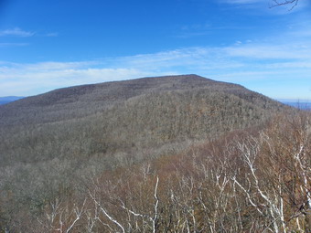
![]()
![]() On Monday, November 22nd I was in the mood to bag another 3500 foot peak after a long weekend off. I decided to go to the Big Hollow Valley and hike Windham since I had not done that approach very many times. I thought that I might hike over Acra Point and Burnt Knob on the way to Windham but was willing to wait until I arrived to make that decision. As has been the case lately, I got a late start and did not leave town until about 8:45 Am. Somehow I always forget that it was always a long ride to the northern Catskills and is now even longer due to the remaining road closures. When I got to Margaretville, I decided to take Route 30 north to Grand Gorge rather than once again go through Phoenicia. My plan was to take Route 23 to Route 23C and head over toward Maplecrest. In Grand Gorge I picked up Route 23 and headed toward Prattsville. As I approached the town, I saw that the road had been recently patched and that the bed of the Schoharie Creek was much wider and had numerous areas filled with debris. As I drive into Prattsville, the destruction that I had heard about became obvious. Words and even pictures can not adequately describe the destruction in the town. One building looked intact until I realized it was sitting on the ground NEXT to its foundation. Other homes and businesses were obviously destroyed. There were no lawns to speak of only patches of dirt. The buildings that survived like the post office are constructed of stone. Many buildings have red X's to mark them for demolition. I drove through slowly out of awe and respect. On the other side of town Route 23 makes a left hand turn while Route 23A to Hunter continues straight ahead. Route 23 was closed at this point due to a missing bridge so I continued into Hunter on Route 23A and then turned north on Route 296. At the four corners I turned right on Route 23C and then made a left on Maplecrest Road. I drove out the Big Hollow Valley on a road that still showed signs of the flooding. By the time I parked at the Batavia Kill parking area it was nearing 11:00 Am. There were several other cars in the lot and I wondered how many were hiking and how many were hunting. I could hear the creek and it sounded loud. I remembered that the water crossing can be difficult. I decided that I would hike up the Black Dome Trail to the Escarpment Trail and turn left. This would take us over Burnt Knob and then to Windham. The round trip to the car would still be over 7 miles. I though that I might still do Acra Point on the way back if I had time. As we started out the temperature was about 37 degrees but the skies were partly sunny with a light breeze. The forecast was for sunnier skies as the day went on and I felt strong and ready to hike.
On Monday, November 22nd I was in the mood to bag another 3500 foot peak after a long weekend off. I decided to go to the Big Hollow Valley and hike Windham since I had not done that approach very many times. I thought that I might hike over Acra Point and Burnt Knob on the way to Windham but was willing to wait until I arrived to make that decision. As has been the case lately, I got a late start and did not leave town until about 8:45 Am. Somehow I always forget that it was always a long ride to the northern Catskills and is now even longer due to the remaining road closures. When I got to Margaretville, I decided to take Route 30 north to Grand Gorge rather than once again go through Phoenicia. My plan was to take Route 23 to Route 23C and head over toward Maplecrest. In Grand Gorge I picked up Route 23 and headed toward Prattsville. As I approached the town, I saw that the road had been recently patched and that the bed of the Schoharie Creek was much wider and had numerous areas filled with debris. As I drive into Prattsville, the destruction that I had heard about became obvious. Words and even pictures can not adequately describe the destruction in the town. One building looked intact until I realized it was sitting on the ground NEXT to its foundation. Other homes and businesses were obviously destroyed. There were no lawns to speak of only patches of dirt. The buildings that survived like the post office are constructed of stone. Many buildings have red X's to mark them for demolition. I drove through slowly out of awe and respect. On the other side of town Route 23 makes a left hand turn while Route 23A to Hunter continues straight ahead. Route 23 was closed at this point due to a missing bridge so I continued into Hunter on Route 23A and then turned north on Route 296. At the four corners I turned right on Route 23C and then made a left on Maplecrest Road. I drove out the Big Hollow Valley on a road that still showed signs of the flooding. By the time I parked at the Batavia Kill parking area it was nearing 11:00 Am. There were several other cars in the lot and I wondered how many were hiking and how many were hunting. I could hear the creek and it sounded loud. I remembered that the water crossing can be difficult. I decided that I would hike up the Black Dome Trail to the Escarpment Trail and turn left. This would take us over Burnt Knob and then to Windham. The round trip to the car would still be over 7 miles. I though that I might still do Acra Point on the way back if I had time. As we started out the temperature was about 37 degrees but the skies were partly sunny with a light breeze. The forecast was for sunnier skies as the day went on and I felt strong and ready to hike.
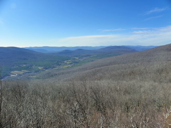 We walked own the road to the beginning of the Black Dome Trail and crossed the Batavia Kill on a new bridge. The crossing of the next stream does not have a bridge but the water level was low and we had no problem. The first part of the trail is somewhat flat and it was wet and very muddy. As we gained elevation the trail dried out and the biggest problem was a think carpet of slippery oak leaves! The trail was clear of any blowdown and we made good time. On our way up the trail, we met one hiker headed back toward the parking area. We hit the Escarpment Trail after about a mile of hiking at 11:20 AM. I stopped to take off my midlayer leaving only my baselayer and light softshell on. I considered taking off the jacket but it was the only orange thing I had on! We made the turn and began the climb up Burnt Knob. The climb is only about .35 miles but it does gain 260 feet. There are a few rocks to climb through and in places the trail is barely cut into the side of the hill. Part way up the trail makes an almost 170 degree turn and then continues on up to the flatter part near the viewpoint. Cindy and I tried to negotiate this part of snowshoes one winter and found out the difference "mountain" snowshoes can make. I had my new pair of MSR Lightning Ascents while Cindy had a pair of Tubs meant to stay on flat or rolling terrain. We turned back that day and I ordered her a pair of more aggressive shoes. Sheba and I stopped at the viewpoint and I took a few shots. Since I had gotten such a late start the sun was almost directly above the Blacks just to the south. The position of the sun made taking pictures very difficult. We got back on the trail and headed across Burnt Knob and down the other side. The walk across Burnt Knob is almost .5 miles and then there is a descent to a nice lookout at about 2 miles into the hike. We stopped and I took a few pictures. There was a lot of hazed and low clouds in the distance to the north and I knew that a clear view of Albany was out of the question on this day. The conditions in the northwest were a little better and I took a few more pictures before we got back on the trail. From this point the trail rolls up and down enough to make me think that the summit is near. This happens two or three times. From the viewpoint the trail skirts a hill and descends more than 100 feet on the other side only to climb again. I don't like to DESCEND when I am trying to CLIMB a mountain!
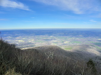 At about 3.1 miles the final climb up Windham starts. There are no really steep places but there are a few rocks to climb over and around. About two-thirds of the way up I looked ahead to see a hiker and his dog coming our way, I recognized the dog and THEN the hiker. Shiloh was out for a hike and brought Bill along. We talked briefly before continuing in our opposite directions which made both of our dogs happy. By 12:50 PM we had made the 400 foot climb over about .5 miles to the viewpoint. We continued on passing through the summit to the viewpoint that looks south to the Blacks. The light conditioned were still not optimal but the sun ha disappeared behind the clouds so I took some shots. I did notice that contrary to the forecast the skies were growing more cloudy NOT more sunny! Back on the main trail we stopped at another viewpoint facing north before continuing back to the open rock face that makes up the best viewpoint on Windham We stopped so that I could take some photographs and to get a drink and a snack. It was 1:00 PM and we were 3.85 miles into the hike. I began to think that hiking over Acra Point would have to wait but decided to wait until we were back at the trail junction to finalize that decision. On the way back we simply hiked at a steady, fast pace and did not stop. We arrived back at the trail junction by 2:20 PM after hiking 6.3 miles. I wasn't sure exactly of the distance of the loop over Acra Point. I though about hiking the .7 miles up to the viewpoint and then returning. In the end, I decided to turn right and head back to the car. It was cloudy and the sun was in the west. Both of these factors would make taking good pictures from the viewpoint impossible. I also was not too keen on hiking with a headlamp should the distance prove longer than I thought. On the way back down we met one more hiker just before the stream crossings. We were back at the car at 2:50 PM having covered 7.4 miles in just under 4 hours.
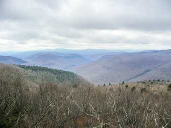
![]()
![]() On Thursday, November 17th I was itching to get out after three days of rain and work and a weekend of work coming up. I wanted to go back to Plateau and "bag" the mountain I had missed TWICE on the weekend. I decided to do it from the Notch Lake approach which is one of the steepest climbs around. I had to do some chores in the morning so I got a later start but the skies were supposed to clear by late morning so I thought I would be OK. I again had to take the route through Margaretville and Phoenicia due to the ongoing road closures and repairs. As I drove, I though about bagging Indian Head after Plateau but knew that I would have a hard time motivating myself to do it. We arrived at he parking area to find no other cars and were on the trail by 10:40 AM. After the first 2. miles the entire hike to the Plateau lookout and the plateau is all up. There are a few switchbacks but they don't do much to help. There isn't much of a view on the way up except in two or three areas where there are slides and I was committed to making the fastest possible time up to the lookout. Sheba and I set a fast pace and I only stopped once to open up the zippers on my tops to vent some heat. There wasn't much of a breeze and the skies did not seem to be clearing. We made the lookout by 11:30 AM which meant we spent 50 minutes hiking 1.2 miles with a 1700 foot elevation gain! I had hoped for a little faster time but the climb is not easy. We stopped for a minute to get a drink and I took some pictures from the lookout. We got back on the trail and headed along the plateau which is very flat. IN around 5 minutes we were at the next lookout where I took some more shots. Kaaterskill High Peak and Round Top are visible from this spot but the skies were still cloudy and everything had a haze over it. The trail was a little muddy as we walked toward the summit. My intent was to walk passed the Warner Creek Trail and over the summit to the viewpoint toward Sugarloaf. From here we would turn around and retrace our route.
On Thursday, November 17th I was itching to get out after three days of rain and work and a weekend of work coming up. I wanted to go back to Plateau and "bag" the mountain I had missed TWICE on the weekend. I decided to do it from the Notch Lake approach which is one of the steepest climbs around. I had to do some chores in the morning so I got a later start but the skies were supposed to clear by late morning so I thought I would be OK. I again had to take the route through Margaretville and Phoenicia due to the ongoing road closures and repairs. As I drove, I though about bagging Indian Head after Plateau but knew that I would have a hard time motivating myself to do it. We arrived at he parking area to find no other cars and were on the trail by 10:40 AM. After the first 2. miles the entire hike to the Plateau lookout and the plateau is all up. There are a few switchbacks but they don't do much to help. There isn't much of a view on the way up except in two or three areas where there are slides and I was committed to making the fastest possible time up to the lookout. Sheba and I set a fast pace and I only stopped once to open up the zippers on my tops to vent some heat. There wasn't much of a breeze and the skies did not seem to be clearing. We made the lookout by 11:30 AM which meant we spent 50 minutes hiking 1.2 miles with a 1700 foot elevation gain! I had hoped for a little faster time but the climb is not easy. We stopped for a minute to get a drink and I took some pictures from the lookout. We got back on the trail and headed along the plateau which is very flat. IN around 5 minutes we were at the next lookout where I took some more shots. Kaaterskill High Peak and Round Top are visible from this spot but the skies were still cloudy and everything had a haze over it. The trail was a little muddy as we walked toward the summit. My intent was to walk passed the Warner Creek Trail and over the summit to the viewpoint toward Sugarloaf. From here we would turn around and retrace our route.
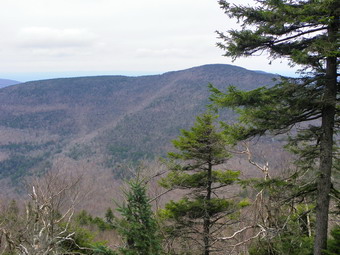 After walking about 1.5 miles from the lookout, we came to the Warner Creek Trail on the right. One sign said "Mount Tremper Fire Tower 10.4 miles". I decided this might an interesting car shuttle at some point since the trail head for Mount Tremper is just outside Phoenicia! We passed the turn off and continued about .5 miles to the highest point on the trail and another .1 miles to the lookout.The last part is a short descent and it was very wet with some large pools of standing water. We arrived at the lookout about 12:30 PM and 3.3 miles into the hike. The viewpoint was a little disappointing since the skies had not changed. We got a drink and a snack. I took a few pictures and we left. On the way back I noticed the temperature seemed colder and that a few snowflakes were falling. On the way back we simply hiked as fast as we could. Sheba was full of energy often charging ahead so that I had to call her back. When we got to the lookout, we did not bushwhack around the rock scrambled but jumped down. From there we hurried down the steep descent just because there isn't much to see. I was in no real hurry but a quick descent seemed to be the best amusement. A few times my right knee let me know that I should be careful about my foot placement but otherwise the descent seemed to go quickly. We crossed the road and were back at the car by 2:30 PM having covered 6.6 miles in 3 hours and 45 minutes. It was too late to start for Indian Head and I was glad as I didn't think I had it in me.'
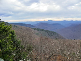
![]()
![]() On Sunday, November 13th I wanted to go back to Plateau and "bag" the mountain I had not done the day before. I decided to do it from the Notch Lake approach which is one of the steepest climbs around. I asked Cindy if she would like to go almost without thinking and she responded "Yes" in the same way. Cindy really doesn't like climbs so I don't know what either of us was thinking! We got going as soon after church as possible but due to the road closures we did not arrive until 12:40 PM. The hike started innocently enough as we crossed the road and started up. The problem is that after the first 2. miles the entire hike to the Plateau lookout and the plateau is all up. There are a few switchbacks but they don't do much to help. There isn't much of a view on the way up except in two or three areas where there are slides. We met one other hiker on the way up as he was coming down. Our going was very slow and I knew we were probably not going to get to do the loop using the Warner Creek trail. I had wanted to do the loop as my right knee was still painful from the beating it took the day before. About two-thirds of the way up I asked Cindy if she would like to go back but she insisted on at least getting to the top. The wind was picking up as we ascended and it was looking like a storm might be blowing in early. We finally reached the area just below the lookout just before 2:00 PM. We took some pictures in the protected area there and then bushwhacked around the lookout to get to the top. The wind was howling with gust up to 40 mph and it was cold. I took some pictures from the viewpoint and many had a dark, ominous feeling to them. We decided to go back down which, at this point, was the only choice! A young couple was headed up as we started down. They didn't seem to know much about the route and we helped them out. The loose rock and slippery leaves made descending on the steep return "exciting". We were being "chased" by the other couple and I think neither of us wanted them to pass. We were back at the car at 3:00 PM having taken 2 hours and 15 minutes to cover the 2.4 miles. This meant we took about a hour and 15 minutes up and 45 minutes down. We climbed over 100 feet in the 1.2 mile ascent with an average grade of 30% and grades approaching 40% in spots. Back at the lake I took some pictures of the lake and the dam. There was evidence of recent beaver activity but no sign of the beavers or their lodge. I vowed to return and defeat Plateau!
On Sunday, November 13th I wanted to go back to Plateau and "bag" the mountain I had not done the day before. I decided to do it from the Notch Lake approach which is one of the steepest climbs around. I asked Cindy if she would like to go almost without thinking and she responded "Yes" in the same way. Cindy really doesn't like climbs so I don't know what either of us was thinking! We got going as soon after church as possible but due to the road closures we did not arrive until 12:40 PM. The hike started innocently enough as we crossed the road and started up. The problem is that after the first 2. miles the entire hike to the Plateau lookout and the plateau is all up. There are a few switchbacks but they don't do much to help. There isn't much of a view on the way up except in two or three areas where there are slides. We met one other hiker on the way up as he was coming down. Our going was very slow and I knew we were probably not going to get to do the loop using the Warner Creek trail. I had wanted to do the loop as my right knee was still painful from the beating it took the day before. About two-thirds of the way up I asked Cindy if she would like to go back but she insisted on at least getting to the top. The wind was picking up as we ascended and it was looking like a storm might be blowing in early. We finally reached the area just below the lookout just before 2:00 PM. We took some pictures in the protected area there and then bushwhacked around the lookout to get to the top. The wind was howling with gust up to 40 mph and it was cold. I took some pictures from the viewpoint and many had a dark, ominous feeling to them. We decided to go back down which, at this point, was the only choice! A young couple was headed up as we started down. They didn't seem to know much about the route and we helped them out. The loose rock and slippery leaves made descending on the steep return "exciting". We were being "chased" by the other couple and I think neither of us wanted them to pass. We were back at the car at 3:00 PM having taken 2 hours and 15 minutes to cover the 2.4 miles. This meant we took about a hour and 15 minutes up and 45 minutes down. We climbed over 100 feet in the 1.2 mile ascent with an average grade of 30% and grades approaching 40% in spots. Back at the lake I took some pictures of the lake and the dam. There was evidence of recent beaver activity but no sign of the beavers or their lodge. I vowed to return and defeat Plateau!
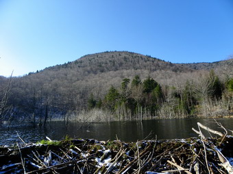
![]()
![]() On Saturday, November 12th I was ready to hike some more 35's and after looking at my grid chose Sugarloaf and Plateau. My plan was to park at Roaring Kill and hike up the eastern side of Sugarloaf. After hiking over the summit and down the western slope to Mink Hollow, I could decide whether or not I wanted to try Plateau. The weather report was for temperatures in the 50's with partly cloudy skies. I, as usual, delayed my start since it was so foggy at home. I started out at about 8:30 Am and remembered that I would have to again take the long way around. So it was Roscoe to Downsville to Margaretville and the Route 28 all the way to Phoenicia. The main Route 30 bridge in Margaretville had been repaired but work was still being down all along Route 28. Heading north through Chichester on Route 214 there was a lot of road work including several places where the road was down to one lane. By 9:50 AM I was at the trailhead with a few other cars. Sheba and I were on the trail by (;55 AM and set out at a good pace. The first part of the trail to Pecoy Notch was muddy but mostly frozen. At about 10:10 AM we had hiked the 1 mile to the viewpoint to Kaaterskill High Peak. We stopped so that I could take some shots of KHP and Roundtop. I also took pictures of the Catskill Community and the rest of the valley. Sheba sat on one of the stone chairs and I took some photographs of her and the stonework before continuing. I knew that the beaver pond was not too far along and we arrived there at 10:45 Am about 1.5 miles into the hike. There was evidence the beavers had been at work recently. I stopped to get some pictures. It was difficult to get pictures of the whole pond and impossible to shoot Twin because of the position of the sun. I did get some nice photographs of Sugarloaf before attempting to cross the area below the dam. Since the dam had been reinforced, the stream below it had little water and crossing was easy. We continued on our way and arrived at the notch at 11:05 Am. Getting there was a little difficult as the upper part of the trail had some major blowdowns to negotiate. The trees across the trail all but obliterated it in spots and it was difficult to find trail markers. The trail will probably have to be rerouted and remarked since these are very large trees. At the notch we met a lone hiker who is the volunteer trail maintainer for part of the trail on Sugarloaf. He is from Ravena and had come down to continue is work clearing the trail. I thanked him and we made a right turn on the Devil's Path to continue up to the summit.
On Saturday, November 12th I was ready to hike some more 35's and after looking at my grid chose Sugarloaf and Plateau. My plan was to park at Roaring Kill and hike up the eastern side of Sugarloaf. After hiking over the summit and down the western slope to Mink Hollow, I could decide whether or not I wanted to try Plateau. The weather report was for temperatures in the 50's with partly cloudy skies. I, as usual, delayed my start since it was so foggy at home. I started out at about 8:30 Am and remembered that I would have to again take the long way around. So it was Roscoe to Downsville to Margaretville and the Route 28 all the way to Phoenicia. The main Route 30 bridge in Margaretville had been repaired but work was still being down all along Route 28. Heading north through Chichester on Route 214 there was a lot of road work including several places where the road was down to one lane. By 9:50 AM I was at the trailhead with a few other cars. Sheba and I were on the trail by (;55 AM and set out at a good pace. The first part of the trail to Pecoy Notch was muddy but mostly frozen. At about 10:10 AM we had hiked the 1 mile to the viewpoint to Kaaterskill High Peak. We stopped so that I could take some shots of KHP and Roundtop. I also took pictures of the Catskill Community and the rest of the valley. Sheba sat on one of the stone chairs and I took some photographs of her and the stonework before continuing. I knew that the beaver pond was not too far along and we arrived there at 10:45 Am about 1.5 miles into the hike. There was evidence the beavers had been at work recently. I stopped to get some pictures. It was difficult to get pictures of the whole pond and impossible to shoot Twin because of the position of the sun. I did get some nice photographs of Sugarloaf before attempting to cross the area below the dam. Since the dam had been reinforced, the stream below it had little water and crossing was easy. We continued on our way and arrived at the notch at 11:05 Am. Getting there was a little difficult as the upper part of the trail had some major blowdowns to negotiate. The trees across the trail all but obliterated it in spots and it was difficult to find trail markers. The trail will probably have to be rerouted and remarked since these are very large trees. At the notch we met a lone hiker who is the volunteer trail maintainer for part of the trail on Sugarloaf. He is from Ravena and had come down to continue is work clearing the trail. I thanked him and we made a right turn on the Devil's Path to continue up to the summit.
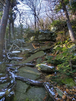 After making the turn, we began to encounter a thin layer of snow and ice on the rocks. This is due partly to elevation but also to the fact that the trail at this point has a northern exposure. As I was hiking along, I was thinking of other things and was not paying attention to the trail. I slipped, bumped my right knew and as I tried to right myself slipped again and managed to hit my forehead on a rock. The "blow" was just a tap but could have been much worse. This was not to be my last mishap on the day. Sugarloaf is one of the mountains that I always underestimate despite my checkered history on its slopes. I always think of it as a relatively easy hike and it is until the turn on the Devil's Path. After that turn, the next .5 miles average a 26% grade with some places being nearly vertical. Sheba was scampering ahead of me and doing a good jib in most places of showing me a good line. As we climbed I though back to the previous winter when we had done this route out and back on snowshoes. We were breaking trail in 3 feet of snow which seems almost impossible! At around 11:20 AM we made it to a lookout toward Twin and I took pictures through the trees of the mountain and the talus slope on the western side. At this point some hikers from Hudson Valley Hikers appeared and we spoke briefly. They had parked at Devil's Tombstone (Notch Lake) at 8:30 Am and were headed over Indian Head. They told me that a larger group was behind but that some might chose an "early out". Sheba and I continued through some more steep places and then the trail leveled slightly as we approached the summit. We met two more groups of two from HVH before passing the summit at 12:05 PM at about 3 miles. There was about an inch of snow in places and some ice but it was all manageable on the fairly level areas near the top.
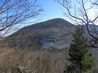 We started to head down the other side and I noticed that going down was VERY slippery. Just a few hundred feet passed the summit is a spur trail to the right which gives views to the south. I was disappointed when we arrived as the views were mostly blocked by trees. Anything that was visible was obscured by a haze. I took only a few shots before we continued on. Standing on the open stone ledge was very cold as the air temperature had dropped and the wind was howling. Back on the Devil's Path we turned left and continued our descent...into the abyss. Around 12:20 PM we arrived at the lookout to Plateau about 3.3 miles into the hike. There was a lot of ice around the rocks that make up the viewpoint continuing on around the corner. I took some pictures and then decided to don my Yak XTRs for the trip down. I got them out and pout the first one on. I was unimpressed by the fit and wondered if O had gotten the right size. The second one fit much better and after I turned the first around it also fit nicely! In the middle of all of this the last four people from HVH arrived with a large dog. This French Mastiff was well-behaved and after greeting Sheba returned to his hike. I spoke to the other hikers and they assured me the conditions got better below the viewpoint. We parted and Sheba and I started down. The XTRs are like MicroSpikes but the spike are a little longer with antisnow plates. Below the viewpoint the ice became intermittent but there was plenty of snow and wet rocks. The spikes are a liability unless they have something to bite into so I took them off. I had to walk very carefully down the trail watching each step and using the sides of the trail where I could. I wondered why the other hikers had felt the conditions were better but then I remembered up and down are very different directions! There are several nearly vertical spots on the descent which require rock scrambling and holding on to the available trees. Sheba was doing fine but I was taking a mental and, sometimes, physical beating. We finally got to a spot that requires you to step across a gap in the rock and then negotiate a 10 or 15 foot drop. Sheba jumped own to the first level and I began to think about how I would get her down the rest of the way. I didn't have to worry as she launched herself off the icy rock shelf, ran down the rocks and stood below looking up at me. I made it down and we continued our hike passing cliffs with loads of icicles. In one pot there is a walk along a narrow cliff and then there is a short "tunnel" to get through. At around 3000 feet I noticed that the snow was gone and hiking was fun again!
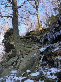 At 1:30 PM we arrived at the junction with the blue Mink Hollow trail about 4 miles into the hike. I contemplated hiking up Plateau and back down. The summit of Plateau was only 1.2 miles ahead but there was over 1200 feet of climbing. This was one time my body said "We can do this!" and my mind said "You have got to be kidding!" The slipping and sliding down Sugarloaf made we want to go back to the car and try Plateau another day! We turned right on the Mink Hollow trail and started back. I remembered that I didn't like this trail back to the parking area very much but on this day it seemed great. Along the way I met three hikers heading out and we talked briefly. The trail was muddy in places but not as bad as I have seen it. We stopped so Sheba could drink out of a small stream. I remember thinking that the water over the rocks and the algae looked very slippery. I guess I thought it would be a good idea to teat my theory so I stepped onto the rocks and...promptly fell on my back. I got right up but was pretty wet with some mud thrown in. All I could do was laugh since the temperature was in the high 40's and I knew I was nearing the car. The Mink Hollow Trail is 2.6 miles long from the Devil's Path back to the Roaring Kill Trail. It mostly follows the contours along the shoulder of Sugarloaf. In places it descends to avoid cliff bands but then ascend back to the same elevation. In one place the ascent is over 200 feet. By 2:45 PM we were back at the Roaring Kill Trail where we turned left and walked the last .25 miles out to the parking area. The parking area was overflowing with cars! We were at the car by 2:50 PM having covered 6.8 miles in just under 5 hours. As I have said before, climbing the 35's can be a humbling experience.
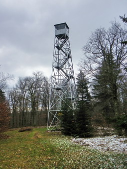
![]()
![]() On Friday, November 11th we wanted to do a "family" hike so that Karl and Kathleen could bring Bryce along. We decided that Red Hill was close enough and about the right length. At about 9:00 AM Karl and I decided we would meet at the trailhead around 10:15 AM. In retrospect, this was a bad idea since Karl and Kathleen had never driven to the trail head and we did not add "baby time". Cindy and I got ready almost immediately and were out of the house by 9:20 AM. I decided to drive out De Brice Road and through Claryville to get to Red Hill Road that way. For us this is shorter than going through Grahamsville.Once on Red Hill Road there is a long uphill drive since Coons/Dinch Road is almost at the other end of the road where it meets Sugarloaf Road. We turned up the road and drove to the DEAD END/SEASONAL ROAD sign. From that point to the trailhead is about a mile and the road is a little rougher. We parked at the trailhead around 9:45 AM to wait for the rest of the family. Of course, this area had no cell phone coverage, so when they had not arrived by 10:30 AM we drove back out to Red Hill Road and waited at the intersection. Within a few minutes they arrived and we headed back to the trail head. By the time we had Bryce in his carrier and were ready to head out it was about 11:00 AM. The trail was only a little damp with a few muddy spots but otherwise it was in good shape. We walked along at a good pace as the trail ascends but not steeply over the first mile.
On Friday, November 11th we wanted to do a "family" hike so that Karl and Kathleen could bring Bryce along. We decided that Red Hill was close enough and about the right length. At about 9:00 AM Karl and I decided we would meet at the trailhead around 10:15 AM. In retrospect, this was a bad idea since Karl and Kathleen had never driven to the trail head and we did not add "baby time". Cindy and I got ready almost immediately and were out of the house by 9:20 AM. I decided to drive out De Brice Road and through Claryville to get to Red Hill Road that way. For us this is shorter than going through Grahamsville.Once on Red Hill Road there is a long uphill drive since Coons/Dinch Road is almost at the other end of the road where it meets Sugarloaf Road. We turned up the road and drove to the DEAD END/SEASONAL ROAD sign. From that point to the trailhead is about a mile and the road is a little rougher. We parked at the trailhead around 9:45 AM to wait for the rest of the family. Of course, this area had no cell phone coverage, so when they had not arrived by 10:30 AM we drove back out to Red Hill Road and waited at the intersection. Within a few minutes they arrived and we headed back to the trail head. By the time we had Bryce in his carrier and were ready to head out it was about 11:00 AM. The trail was only a little damp with a few muddy spots but otherwise it was in good shape. We walked along at a good pace as the trail ascends but not steeply over the first mile.
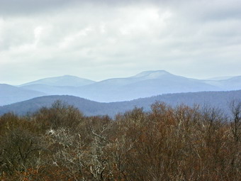 The trail starts by heading almost northwest out of the parking area but gradually turns west and then southwest. At about 1.0 mile it turns south and then southeast and begins to get steeper. There are no rock scrambles or anything extreme along the way and the grade is seldom over 20%. The length and the grade make it a good choice for a beginner or family hike. The reward for the hike is the well-maintained fire tower at the top of the hill. A group of volunteers has done a lot of work to restore the tower and the cabin and to keep it open during the summer months. We arrived at the top at 11:40 PM. There was some snow sprinkled around and the temperature was definitely lower than at the trailhead. With the temperature in the mid-40's and a 20 mph wind it seemed pretty cold.I started up the tower and the wind velocity increased. As soon as I was above the treetops the wind really kicked in. I took a few shots on the way up but wanted to wait until the top to take most of my pictures. As I started to take photographs from the landing just under the cab my camera batteries died! I always try to wring the last little bit out of the batteries but the cold has a very negative effect. I had not brought the case with extra batteries so it was back down the tower to change them and then back up for more pictures! The bleak landscape is interesting especially with some of the trees that grow at the top. I took pictures from 360 degrees before descending back to the bottom of the tower. I took a few family photos and then we decided to get going again. On the way down the noon whistle blew and Bryce decided it was time to eat. We stopped as he was very insistent and continued after he had "lunch. We were back at the car by 12:40 PM having covered 2,6 miles in 1 hour and 44 minutes. We decided that the adults needed lunch also and headed for Yiasou Café in Liberty. I have tried to eat there several times and each time it was closed. Cindy eats there regularly and highly recommended it. She was right! The Greek food is very good and the owner frequents the dining room to check up on how things are going.
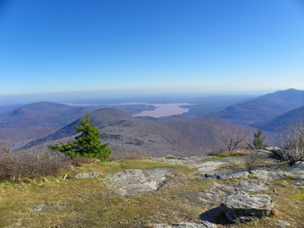
![]()
![]() On Wednesday, November 9th I wasn't sure I was ready to hike a third day in a row but the weather report was for a gorgeous day so I wanted to try. I knew that bad weather was rolling in for the end of the week and decided I needed a challenge if I might have to take a day off. I looked at my grid and found Wittenberg and Cornell available for November. I hung around the house a little too long since there was heavy fog even though the temperatures were warm. I finally got moving and realized when Pulled out of the driveway that I would have to go the long way around since Route 47 was still close. I headed off toward Roscoe to take Route 206 to the Pepacton Reservoir and then Route 30 and the city roads to Route 28. The trip seemed to be taking longer than I thought it would. As I passed Margaretville, I noticed the main bridge was open. Soon I was passing through Arkville and Big Indian on my way to the Woodland Valley Road. I turned onto the road and began to see some of the remaining signs of destruction from the flood. The road surveillance was in pretty good shape but the creek showed just how bad the flood had been. I parked the car at 9;25 AM and we were ready to cross the road at about 9:30 AM. A large piece of construction equipment was being maneuvered into place and for a moment I though the footbridge was out! The bridge was in great shape but the approach was littered with trees and rocks. Sheba and I worked our way over and around these and were soon climbing up toward the trail register. I have made this hike enough times to remember most parts including the brutal climb right at the start! What I tend to forget is that the approach to Wittenberg is LONG. After the initial climb the trail levels out some and alternates between some steep, rocky areas and wide trails that follow woods roads. Along the way I found a few lookouts I had not seen before but only one offered any opportunity for pictures. I was getting so warm that I took off my softshell and was going to hike in short sleeves. I though better of that and put on a light windbreaker but stowed the hat and gloves for the rest of the hike.
On Wednesday, November 9th I wasn't sure I was ready to hike a third day in a row but the weather report was for a gorgeous day so I wanted to try. I knew that bad weather was rolling in for the end of the week and decided I needed a challenge if I might have to take a day off. I looked at my grid and found Wittenberg and Cornell available for November. I hung around the house a little too long since there was heavy fog even though the temperatures were warm. I finally got moving and realized when Pulled out of the driveway that I would have to go the long way around since Route 47 was still close. I headed off toward Roscoe to take Route 206 to the Pepacton Reservoir and then Route 30 and the city roads to Route 28. The trip seemed to be taking longer than I thought it would. As I passed Margaretville, I noticed the main bridge was open. Soon I was passing through Arkville and Big Indian on my way to the Woodland Valley Road. I turned onto the road and began to see some of the remaining signs of destruction from the flood. The road surveillance was in pretty good shape but the creek showed just how bad the flood had been. I parked the car at 9;25 AM and we were ready to cross the road at about 9:30 AM. A large piece of construction equipment was being maneuvered into place and for a moment I though the footbridge was out! The bridge was in great shape but the approach was littered with trees and rocks. Sheba and I worked our way over and around these and were soon climbing up toward the trail register. I have made this hike enough times to remember most parts including the brutal climb right at the start! What I tend to forget is that the approach to Wittenberg is LONG. After the initial climb the trail levels out some and alternates between some steep, rocky areas and wide trails that follow woods roads. Along the way I found a few lookouts I had not seen before but only one offered any opportunity for pictures. I was getting so warm that I took off my softshell and was going to hike in short sleeves. I though better of that and put on a light windbreaker but stowed the hat and gloves for the rest of the hike.
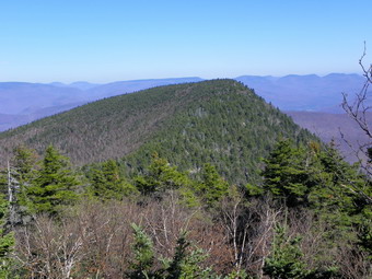 At about 1 mile into the hike, the trail turns sharply left and begins to climb a rocky path. These rocks are the WORST part of the hike and they persist in one form or the other over a good part of the trail. From here the trail rolls a bit but generally gains elevation until 2.5 miles where the trail to Terrace Mountain cuts off to the left. I had thoughts of hiking this trail on the way back. After the turn the trail passes along a woods road which was very muddy in several spots. The trail goes through a few switchbacks but then hits a series of ledges where the fun really begins! For the next .8 miles to the summit there are rock scrambles and boulders to climb over. Some of these a short but almost vertical and I helped Sheba in a few places. The last part after the 3500 foot sign was wet as always. We passed by the spot where you can bushwhack to the cave or rock shelter and I though about doing this on the way back. At 11:45 AM about 3.75 miles into the hike we broke out onto the rock outcrop at the top of Wittenberg. The view is always breathtaking but I was a little disappointed today as there was still some haze and the sun's angle was not the best. We had a snack and a drink and I took some pictures. Even though I had an evening commitment, I was confident we could make Cornell so we headed that way. The .8 miles between the two mountains is one of the most interesting in the Catskills. First, there is a 320 foot descent into the col between the two mountains and then a 350 ascent up Cornell. Of course, this is repeated on the way back! On the ascent of Cornell there are at least three "interesting" areas which are nearly vertical ending with the "Cornell Crack". When we got to the Crack, it was wet and slippery and I decided to see if I could find the workaround. This was partly due to the fact that my only companion was Sheba and partly because I wanted to see if I could find it. We walked around to the left of the cliffs and found a narrow path leading up along the edge. At the top of this path there was actually a viewpoint over the Ashokan and I took a few shots. From there it was only a short distance out to the trail. We turned right and walked to the ledge above the Crack. I took some photographs of Wittenberg and the reservoir before we turned around and headed toward the summit of Cornell.
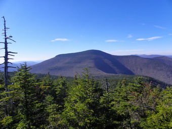 At 12:30 PM we were 4.6 miles into the hike and standing in the clearing near the summit. The view was almost completely blocked by trees and I didn't even stop to take pictures. Back on the main trail we turned left to walk toward Slide. I wanted to get a few pictures and we soon were at a viewpoint toward Slide. The pictures I took here were some of the best of the day since the haze had cleared and the sun was behind me. Now it was time to head back to the car as fast as possible. We worked our way back down around the crack and headed toward Wittenberg. I was feeling a little tired but I only noticed it on the ups and most of what was ahead was down! We stopped briefly again on Wittenberg and then headed down at 1:05 PM. It is hard to make good time down near the top since there are so many scrambles with we rocks. Further down there are many areas with rocks strewn across the trail which also make keeping a fast pace difficult. I walked right by the bushwhack to the cave and had already decided Terrace Mountain would have to wait. We met another hiker coming up part of the way down from the top of Wittenberg. Once we got on the woods road we sped up some and made the turn at the Terrace Junction at 1:50 PM. I kept up as fast a pace as possible over the rocky portions. We met a couple and some kind of "toy" dog sitting on a rock. It didn't look like to dog or the people were going to make it up the mountain. On the footbridge, we stopped a minute so I could take some shots and then headed back to the car. We arrived at the car at 3:10 PM having covered 9.2 mountainous miles in 5 hours and 45 minutes. The total elevation gain was 3650 feet!
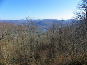
![]()
![]() On Tuesday, November 8th it was such a beautiful day that Cindy and I wanted to get out for a short hike. We had some chores to do around the house but headed out right around noon. I thought about investigate the woods road near Alder Lake but the maps showed it was barely .5 miles long. I thought about the Mongaup Hardenburgh Trail so we headed in that direction. When we got to Lew Beach, I suggested going to Little Pond to see if it was open so that we could park and hike over Touch-Me-Not Mountain to the vista on Cabot Mountain. The gates were open but when we arrived at the gatehouse we were told we would have to park down by the main road and walk in. This didn't appeal to either of use so we headed for the parking area on Beech Hill Road.I knew that the hike to the viewpoint and back would only be about 3 miles but that the first part was very steep. We arrived at about 12:45 PM and found only a pickup truck parked in the lot. The bowhunter was just leaving as we parked. We immediately got on the trail to start the hike. I was wearing short sleeves and had brought along a light windbreaker, hat and gloves which I was sure I would not need. The temperature was in the mid 50's and still climbing. The first part of the trail is flat and actually descends a little and it was very wet as it had been last time I was here. At about .25 miles into the hike the trail starts the ascent and gains 575 feet over the next .5 miles. The grade is around 25% in most places! At this point the trail flattens out and rolls a little along the way to the viewpoint. At .85 miles I noticed what looked like a road off the trail on the left. I walked up to that area and it did look very much like a road. Back on the main trail we continued without much change in elevation to 1.25 miles where the trail ascended again and then dropped a little to the vista at 1.6 miles. We stopped at 1:55 PM and took a few pictures before turning around to retrace our steps. The challenge on the way back was to descend safely on the steeper slopes through clouds of slippery leaves. We were back at the car by 2:40 PM having covered 3.2 miles in just under 2 hours. The trip up took 1 hour and 10 minutes. The return journey was completed in 45 minutes.
On Tuesday, November 8th it was such a beautiful day that Cindy and I wanted to get out for a short hike. We had some chores to do around the house but headed out right around noon. I thought about investigate the woods road near Alder Lake but the maps showed it was barely .5 miles long. I thought about the Mongaup Hardenburgh Trail so we headed in that direction. When we got to Lew Beach, I suggested going to Little Pond to see if it was open so that we could park and hike over Touch-Me-Not Mountain to the vista on Cabot Mountain. The gates were open but when we arrived at the gatehouse we were told we would have to park down by the main road and walk in. This didn't appeal to either of use so we headed for the parking area on Beech Hill Road.I knew that the hike to the viewpoint and back would only be about 3 miles but that the first part was very steep. We arrived at about 12:45 PM and found only a pickup truck parked in the lot. The bowhunter was just leaving as we parked. We immediately got on the trail to start the hike. I was wearing short sleeves and had brought along a light windbreaker, hat and gloves which I was sure I would not need. The temperature was in the mid 50's and still climbing. The first part of the trail is flat and actually descends a little and it was very wet as it had been last time I was here. At about .25 miles into the hike the trail starts the ascent and gains 575 feet over the next .5 miles. The grade is around 25% in most places! At this point the trail flattens out and rolls a little along the way to the viewpoint. At .85 miles I noticed what looked like a road off the trail on the left. I walked up to that area and it did look very much like a road. Back on the main trail we continued without much change in elevation to 1.25 miles where the trail ascended again and then dropped a little to the vista at 1.6 miles. We stopped at 1:55 PM and took a few pictures before turning around to retrace our steps. The challenge on the way back was to descend safely on the steeper slopes through clouds of slippery leaves. We were back at the car by 2:40 PM having covered 3.2 miles in just under 2 hours. The trip up took 1 hour and 10 minutes. The return journey was completed in 45 minutes.
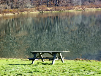
![]()
![]() On Monday, November 7th I wanted to hike somewhere nearer to home. Cindy was not interested so I chose the hike from Alder Lake to the viewpoint over Beecher Lake on Millbrook Ridge. I seemed to recall this being a little over 6 miles so it was a good length. I had heard that the bridge on the trail around the left side of Alder Lake was out from the flooding so I planned to go around the right side by crossing the dam. Alder Creek Road was in pretty good shape as was the road in to Alder Lake. The access road has been difficult in the past but was now smoothed out with the holes filled in. I drove into the first parking area to investigate a possible trail that parallels Cross Mountain Road. I had seen this from the road but never investigated it before. A rather wide and open woods road leaves the parking area and I thought I might investigate this after my planned hike. I drove out to the main parking area where there were two other vehicles parked. We wasted no time getting ready to hike. I took my camera out since I knew I wanted to take some pictures of the Coykendall Mansion ruins. The temperature was still in the 40's but the sun was coming out and the day seemed like it would be bright and beautiful. I took some shots of the stonework that is the remains of the mansion. We walked around front and I took some more shots before turning my attention to the lake. The water was a deep blue with some green grass in the foreground. Although the hills were mostly gray since the leaves were off the trees, the scene was still very beautiful. After taking some pictures, we started down to the dam and crossed to the other side. I took a few more photographs of the lake from this different angle and a few more of the frost and snow on the ground. I put the camera away as we started to walk around the lake. I chose to walk the lower unmarked oath as it is closer to the water than the higher, marked hiking trail. We stopped several times for me to get the camera out to take some more pictures. Eventually the path became less distinct and we walked on an angle up the hill to the hiking trail. Once on the trail it was only a short walk to the bridge over the inlet stream where I got my first surprise. THIS bridge was destroyed and was pushed onto the opposite bank of the creek. It took a little work but I crosses some debris to get to the other side where Sheba was ready waiting. By 9:25 AM we had managed to get to the turn for the rail to Millbrook Ridge and headed right on the trail. I though that we might return around the other side of the lake to see how the bridges on that side had fared during the floods.
On Monday, November 7th I wanted to hike somewhere nearer to home. Cindy was not interested so I chose the hike from Alder Lake to the viewpoint over Beecher Lake on Millbrook Ridge. I seemed to recall this being a little over 6 miles so it was a good length. I had heard that the bridge on the trail around the left side of Alder Lake was out from the flooding so I planned to go around the right side by crossing the dam. Alder Creek Road was in pretty good shape as was the road in to Alder Lake. The access road has been difficult in the past but was now smoothed out with the holes filled in. I drove into the first parking area to investigate a possible trail that parallels Cross Mountain Road. I had seen this from the road but never investigated it before. A rather wide and open woods road leaves the parking area and I thought I might investigate this after my planned hike. I drove out to the main parking area where there were two other vehicles parked. We wasted no time getting ready to hike. I took my camera out since I knew I wanted to take some pictures of the Coykendall Mansion ruins. The temperature was still in the 40's but the sun was coming out and the day seemed like it would be bright and beautiful. I took some shots of the stonework that is the remains of the mansion. We walked around front and I took some more shots before turning my attention to the lake. The water was a deep blue with some green grass in the foreground. Although the hills were mostly gray since the leaves were off the trees, the scene was still very beautiful. After taking some pictures, we started down to the dam and crossed to the other side. I took a few more photographs of the lake from this different angle and a few more of the frost and snow on the ground. I put the camera away as we started to walk around the lake. I chose to walk the lower unmarked oath as it is closer to the water than the higher, marked hiking trail. We stopped several times for me to get the camera out to take some more pictures. Eventually the path became less distinct and we walked on an angle up the hill to the hiking trail. Once on the trail it was only a short walk to the bridge over the inlet stream where I got my first surprise. THIS bridge was destroyed and was pushed onto the opposite bank of the creek. It took a little work but I crosses some debris to get to the other side where Sheba was ready waiting. By 9:25 AM we had managed to get to the turn for the rail to Millbrook Ridge and headed right on the trail. I though that we might return around the other side of the lake to see how the bridges on that side had fared during the floods.
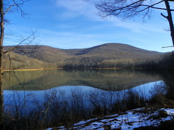 The trail begins to climb almost immediately as it parallels the stream but the grade is minimal. There are at least three beaver meadows along the way and I stopped at them all! The first beaver meadow is just off the trail at 1.85 miles and we stopped there briefly at 9:45 AM. I took only a few shots and then moved on. After gaining about 200 feet over the next .4 miles the trail levels and there are two more beaver meadows. The first in this pair was a lean-to at one end but the sun was at the wrong angle for pictures from that location. I walked out to the other end of the meadow and took a few shots before going back to the trail and walking passed the lean-to. The final beaver meadow may be my favorite. It is practically on the trail and was pointed away from the sun at this time of day. I took pictures of the meadow and the hill behind it. Some areas were still covered with snow. Just after the meadow the trail begins a more serious ascent. The highest point on the ridge is around 3480 feet meaning that only 20 more feet of elevation would make it a contender for the Catskill 3500 list. This part of the trail was a little longer than I remembered with several different climbs making me think we were at the top. After 1.2 miles and over 700 feet of ascent we were at the highest point on the ridge! It was 10:45 Am at we had hiked a total of 3.65 miles. We began the descent down the other side of the hill and ran into 6 to 8 inches of snow on the northern exposure. It was surprising but lasted only a few hundred feet. The descent was much greater than I remembered and the walk a little longer. We lost 350 feet over the next .5 miles until the trail began to climb again. I already knew that my second mistake was the length of the hike. I wasn't tired but was again disgusted that I had not checked my own website! The trail began to ascend at this point and along the way there were several interesting rock formations. Again both the ascent and the distance were a little more than I remembered. The trail meandered back and forth until I was almost convinced I had somehow missed the viewpoint. After regaining 250 feet over .5 miles we were at the lookout. It was 11:15 AM and we had covered 4.8 miles!
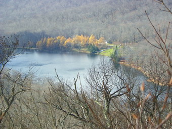 Somewhere along the way the sunny skies had given away to overcast and then clouds. The wind had come up a little and the whole change gave a sinister look to the landscape. Beecher Lake and the monastery were visible below since most of the leaves were off the trees. I took pictures down to the lake and across at the hills both near and far. After a drink and a snack, Sheba and I began a rapid return to the car. The only ascent on the way back is the one up to the highest point on Millbrook Ridge and we made short work of that. We did not stop along the way at any time and by 12:50 PM we had made the 3.8 miles back to the red Alder Lake Loop Trail. We turned right to go around the lake. As we approached the first bridge, three bow hunters emerged from the woods and headed away from us. Both bridges were in good shape and Sheba and I kept up our pace. I tried to slow down a little so that we would not overtake the hunters but they gave up and stepped aside as we walked passed them. Back at the "lawn" of the mansion I had Sheba wade in the water to wash her muddy feet and then it was back to the car. It was 1:05 PM and we had covered 9.3 miles and climbed 2100 feet in just over 4 hours. I decided to save the exploration of the road for another day.
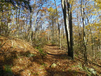
![]()
![]() On Saturday, November 5th Kurt wanted to hike somewhere near the Hudson since the trip from Lagrangeville would be shorter. There were several choices of places that Cindy and I had been that Kurt would enjoy but I wanted to go somewhere that I had not been before. I looked at the maps and thought that The Canada Hill area of the Hudson Highlands park looked interesting. I planned to park on South Mountain Pass Road and hike the AT out over Canada Hill to White Rock. To make a loop we would use other trails to return with a side trip to Sugarloaf Hill. I had no idea of the exact length of the hike but calculated that it would be around 8 miles. There seemed to be several short and steep climbs but lots of latter hiking along the ridges with some rolling terrain in between. We agreed to meet Kurt at the parking area on South Mountain Pass Road at about 9:30 AM. Although I had never parked there,. I had walked out to the parking area when I was hiking all the approaches to Anthony's Nose. The Phelps Mine is very close to this parking areas well. Cindy and I got a late start and had to stop for fuel. I called Kurt as we were ready to get on Route 6 and he was already in the area. I told him we would be there soon. It didn't take us long to cross the Bear Mountain Bridge and turn north on Route 9D. Manitou Road or South Mountain Pass Road are both right turns of the main road.The roads meet and continue up the hill as South Mountain Pass Road. The road is narrow and has a rough dirt surface but the trip is short. We parked at 9:40 AM and found Kurt waiting. After a short greeting, we walked up the road and turned left into the woods to begin hiking on the AT. The first .2 miles of the trail was a little steep gaining about 160 feet. There was also several areas of blowdowns to work around. The AT turned right and continued to climb steeply for another .2 miles gaining around 300 feet from the start of the hike. In several places the trail blazes all but disappeared so that staying on the trail was difficult. Once we were up on the ridge the trail became a wide woods road for some distance. Although the temp was in the mid 40's and headed up a slight breeze kept things cool. There weren't too many views from the ridge but the open forest especially near the top of Canada Hill was very pretty. There were still a lot of leaves on the trees although the colors were muted. We passed by Canada Hill at about .8 miles and continued toward the northeast.
On Saturday, November 5th Kurt wanted to hike somewhere near the Hudson since the trip from Lagrangeville would be shorter. There were several choices of places that Cindy and I had been that Kurt would enjoy but I wanted to go somewhere that I had not been before. I looked at the maps and thought that The Canada Hill area of the Hudson Highlands park looked interesting. I planned to park on South Mountain Pass Road and hike the AT out over Canada Hill to White Rock. To make a loop we would use other trails to return with a side trip to Sugarloaf Hill. I had no idea of the exact length of the hike but calculated that it would be around 8 miles. There seemed to be several short and steep climbs but lots of latter hiking along the ridges with some rolling terrain in between. We agreed to meet Kurt at the parking area on South Mountain Pass Road at about 9:30 AM. Although I had never parked there,. I had walked out to the parking area when I was hiking all the approaches to Anthony's Nose. The Phelps Mine is very close to this parking areas well. Cindy and I got a late start and had to stop for fuel. I called Kurt as we were ready to get on Route 6 and he was already in the area. I told him we would be there soon. It didn't take us long to cross the Bear Mountain Bridge and turn north on Route 9D. Manitou Road or South Mountain Pass Road are both right turns of the main road.The roads meet and continue up the hill as South Mountain Pass Road. The road is narrow and has a rough dirt surface but the trip is short. We parked at 9:40 AM and found Kurt waiting. After a short greeting, we walked up the road and turned left into the woods to begin hiking on the AT. The first .2 miles of the trail was a little steep gaining about 160 feet. There was also several areas of blowdowns to work around. The AT turned right and continued to climb steeply for another .2 miles gaining around 300 feet from the start of the hike. In several places the trail blazes all but disappeared so that staying on the trail was difficult. Once we were up on the ridge the trail became a wide woods road for some distance. Although the temp was in the mid 40's and headed up a slight breeze kept things cool. There weren't too many views from the ridge but the open forest especially near the top of Canada Hill was very pretty. There were still a lot of leaves on the trees although the colors were muted. We passed by Canada Hill at about .8 miles and continued toward the northeast.
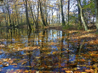 Around .9 miles, the Osborn Loop Trail appeared on the right but we struck with the plan to stay on the AT. At 1.3 miles, a yellow trail came in from the left but we continued on the AT. Along the way there seemed to be the possibility of some viewpoints but all were blocked by the trees. At 2.4 miles, the blue trail appeared straight ahead and the AT turned right. We turned and started down off the ridge looking for the yellow Carriage Connector Trail. After a short walk, I checked the GPS and saw we were approaching a road. Assuming we had missed the yellow trail we headed back up the junction with the blue trail. At the junction I walked out the blue trail a short distance and then came back. We voted and decided to continue down the AT since we thought we had simply not gone far enough! We made the turn and started down and down an down and did not fond the yellow trail. We stopped to reassess our decision and met a couple and their dog hiking up toward us. They assured us that the yellow trail did exist and was just down the hill. On this stretch of the AT we found a metal AT marker which looked a little like a USGS elevation marker. I had never seen one before and then we found another not much further along! We continued on down and picked up the yellow trail on the "road" that was marked on the GPS. This was a wide woods road and I was disgusted that I had AGAIN let the GPS display fool me. The map showed a path or unmarked trail from the yellow trail up to a looked out labeled White Rock. The problem was that we would have to hike more than a half mile north to pick up the path and then back a half mile on the path to the viewpoint. Since the viewpoint seemed to be just above us, we decided to take the more direct route and bushwhack up. We turned right off the trail and began a rather steep ascent through some brush that was thick at times. After hitting the top of the first climb, a band of cliffs showed a less promising ascent. Fortunately the path on the map lay between us and the cliffs. We turned right on the path and were soon at the top. The viewpoint looked south across Camp Smith and Anthony's Nose. The Hudson was visible. The only problem was that the sun was sitting to the south making photography difficult. I took some pictures and we grabbed a snack and a drink before heading around the top of the hill on the path. When the path gave out, we bushwhacked down the hill and picked up the path again. We followed the path which followed a road back to the yellow trail
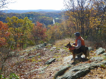 As we walked along the yellow trail, we noticed that the road was supported by a stone wall on the right side. The construction was old but had stood the test of time. Further along the stone wall support changed to the left side of the trail where a stream would have cut into the road. The wall was higher and much more impressive here. The yellow trail ended and at about 4.3 miles around 12:35 PM we continued straight ahead on the blue trail. Almost immediately we could see stone pillars with pipe railing on the left side of the road near a 90 degree turn. The pillars had depressions on top that acted as planters and flowers had been planted earlier in the season. On a small hill to the right of the trail was a wooden gazebo with a stone foundation. It seems that the east side of the Hudson always "had money". As we continued the hike we came to a junction with the red trail to Sugarloaf Hill. I wanted to see what the viewpoint at the end of this long hill/ridge looked like. The problem was that the trail is a dead end and the climb looked steep! Kurt and Cindy reluctantly agreed and we started the 200 foot climb over .2 miles. After the climb, the trail flattened and it was another .25 miles to the end of the hill and the viewpoint. The lookout pointed south and the sun was again a factor. There were a few annoying trees in the way but I thought the effort worthwhile. The Bear Mountain Bridge was visible but it seemed pretty far away! After a few pictures we headed back down the hill. At the trail junction, we looked around for the blue trail back toward the car. The trail was not easy to find as there were few blazes and a lot of blowdown obscured the trail. We did find the right turn and headed out on the trail at around 1:20 PM and 5.5 miles into the hike. The blue trail ran between the hills and along a brook but at about 6 miles it started to climb the ridge again. At 7.0 miles we continued on the yellow trail toward Curry Pond.
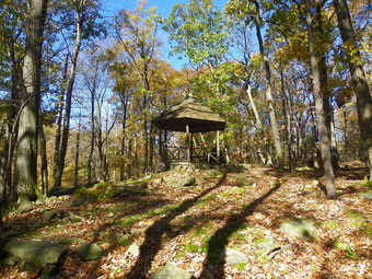 Curry Pond was small but pretty with some ducks swimming around. My bad luck with the angle of the sun continued and pictures were difficult to get. I didn't mind too much as the pond was nice but nothing too special. All three of us were now anxious to get back to the car so we walked around the pond and followed the yellow trail as it started the final ascent back to the AT on the ridge. The trail passed through some dense laurel and blowdowns continued to be a problem. We crossed small stream and then the trail made a short but steep ascent through a cleft in the rock ledge. It flattened at the top and at 7.8 miles around 2:40 PM we were back on the AT. There was about 1.3 miles of hiking left. Since we knew where we were going and had no reason to stop we quickened our pace and climbed over Canada Hill. From here it was all downhill to the car. The AT was better marked in this direction and we had an idea where it went from the trip out. We were back at the car by 3:20 PM having taken 5.5 hours to cover 9.3 miles and a surprising 2130 feet of vertical gain. Some of the other attractions in the area would have to wait until next time!
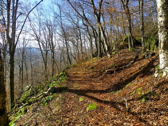
![]()
![]() On Thursday, November 3rd I decided I wanted a real challenge which almost always means a 3500 foot peak! Since the Slide Mountain trail head on Route 47 is officially closed, I decided to take the opportunity to hike in from the Denning trailhead and up the Curtis-Ormsbee Trail. I had all day so the 10+ mile distance didn't bother me. I waited a little while in the morning until the temperature rose and then got Sheba and headed out DeBruce Road. The sign on Route 47 was still there and still confuses me. "Road closed!" "Open for guests of Frost Valley." "Local traffic only. No through traffic." How can a road be open for some and not others? I turned right and headed to the Claryville Road where I turned left toward the Denning trailhead. The road past the Frost Valley farm still shows the effects of the flooding. Actually, the road is in pretty good shape but both side have major damage. We arrived to find no other cars in the lot. The temperature was in the high 40's with a slight breeze and overcast skies. I looked around and saw only a faint covering of snow and decided to leave the snowshoes in the car but keep the Yaks in the pack. We were on the trail and hiking by 9:40 AM. The first part of the trail is an old woods road and it is wide with very few rocks. Some of the blowdown that was present last time had been cleared and the walk to the Table Mountain Trail went quickly. There was no snow in the woods and hardly any under the trees. We made the 1.2 mile trip in about 20 minutes. It was 10:00 AM. We continued to make good time after passing the turnoff. The road began to get steeper and much rockier in places. There was still almost no snow but the wet leaves provided plenty of excitement. Along the way the road begins to hug the side of a hill with ledges to the left and a dropoff to the river on the right. The trees had very few leaves left and it was easy to see down into the river valley and across at the other hills. At one point there was a nice view of our destination!
On Thursday, November 3rd I decided I wanted a real challenge which almost always means a 3500 foot peak! Since the Slide Mountain trail head on Route 47 is officially closed, I decided to take the opportunity to hike in from the Denning trailhead and up the Curtis-Ormsbee Trail. I had all day so the 10+ mile distance didn't bother me. I waited a little while in the morning until the temperature rose and then got Sheba and headed out DeBruce Road. The sign on Route 47 was still there and still confuses me. "Road closed!" "Open for guests of Frost Valley." "Local traffic only. No through traffic." How can a road be open for some and not others? I turned right and headed to the Claryville Road where I turned left toward the Denning trailhead. The road past the Frost Valley farm still shows the effects of the flooding. Actually, the road is in pretty good shape but both side have major damage. We arrived to find no other cars in the lot. The temperature was in the high 40's with a slight breeze and overcast skies. I looked around and saw only a faint covering of snow and decided to leave the snowshoes in the car but keep the Yaks in the pack. We were on the trail and hiking by 9:40 AM. The first part of the trail is an old woods road and it is wide with very few rocks. Some of the blowdown that was present last time had been cleared and the walk to the Table Mountain Trail went quickly. There was no snow in the woods and hardly any under the trees. We made the 1.2 mile trip in about 20 minutes. It was 10:00 AM. We continued to make good time after passing the turnoff. The road began to get steeper and much rockier in places. There was still almost no snow but the wet leaves provided plenty of excitement. Along the way the road begins to hug the side of a hill with ledges to the left and a dropoff to the river on the right. The trees had very few leaves left and it was easy to see down into the river valley and across at the other hills. At one point there was a nice view of our destination!
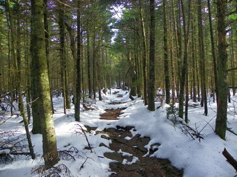 As we approached the turn for the Curtis-Ormsbee Trail, I began to second guess my snowshoe decision. There was some snow on the trail and a lot more in the woods. It seemed that the exposure to the sun made the most difference. We made the turn at 10:50 AM about 3 miles and only 1 hour and 10 minutes into the hike. The trail changed dramatically from the wide and gently sloping woods road free of snow to a steeper, narrower trail with snow cover. Almost immediately we ran into the first set of ledges which I remembered from previous hikes. The trail leads up through the ledges and we stopped so that I could take some pictures. On up we went with the trail presenting a series of climbs through ledges interspersed with flatter sections. The snow made it important to pay attention to your footing but never got never got too deep. At about 11:15 AM we walked up through a set of ledges and to a nice lookout to the west. I stopped for some pictures before continuing on to the next lookout just .15 miles further on. This viewpoint was to the south and was a little more blocked by trees than the previous one. We were right at the 3500 foot elevation and the trees began to change to evergreens. The ground flattened some here and we had to walk around several large puddles of water. Eventually the trail began to climb again along the edge of the mountain and through some beautiful evergreens. At 4.5 miles into the hike around 11:50 AM we turned right on the main Slide Mountain Trail. As we walked the .7 miles to the summit, I took a few pictures of the quartz sand that makes up the base of much of the trail. Just before the summit rock, we stopped at the viewpoint over Giant Ledge and Panther so that I could take some photographs. It was still overcast but the pictures were good. We arrived at the top of Slide at 12:10 PM. I took a few pictures and we had some lunch. I realized how very still and peaceful it was at the top.
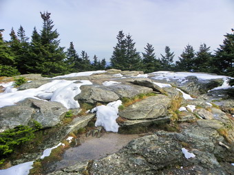 We started down the other side of the mountain toward the spring since I wanted to get a shot toward Cornell. I had considered hiking over at least that far but thought better of it. The rock scrambles down to the spring were all wet, icy or snow covered. Sheba showed me a few easier routes and soon we were at the top of the first ladder. I got my picture of Cornell and one of the snow covered ladder. We turned around and headed back to the top. From the top it was just a matter of retracing our steps without the breaks for photography. As always, going down the steeper portions was harder than climbing up.Even places that seemed dry were covered with a thin film of water and my boots also wet. We were at the woods road by 1:50 PM at about 7.7 miles into the hike. I figured we had about 3 more miles to go and we quickened our pace. I wanted a 2.0 mph overall speed and we were close to it. The rocky part of the road went unappreciated but soon we hit the cutoff to Table. From this point on the trail has fewer rocks and is a breeze despite the fact that it is always longer than I anticipate. We were back at the car by 2:55 PM. There were two other vehicles in the parking lot although we had seen no one on the trails. We had covered 10.6 miles in 5 hours and 15 minutes.
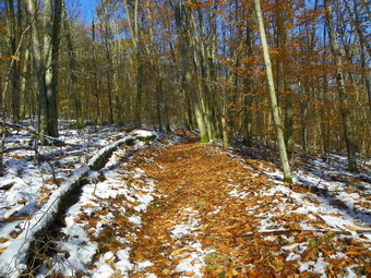
![]()
![]() On Tuesday, November 1st I was looking for something close to home to get in a hike before practice. I have been doing this so much lately that I have begun to run out of places to go! I decided to head toward Downsville on Route 206 and park where the Campbell Mountain Trail crosses the road. From there I planned to hike to Campbell Mountain Road, pick up the Trout Pond Trail and hike to Campbell Brook Road. From there I could hike back on the trail or walk the roads to the car. I did not know whether snowshoes would be necessary since the snow had begun to melt but I took them with me anyway. I parked at the pulloff and we were on the trail by 9:45 AM. I had decided to leave the snowshoes in the car but take my Yak Extremes in case I needed some traction. There was some snow on the ground as we walked down to the brook and there was quiet a bit of water. We walked passed the foundations and, as I looked over in the woods to my right, I saw another foundation I had never seen before. There were tracks from some other people who had walked on the trail after the snowfall. We crossed the bridge and began the walk up Campbell Mountain. The snow began to get deeper with the increased elevation but the amount of snow seemed to be controlled more by the exposure. Snow on the south and east sides of the hills was all but gone. The areas on the north and west still had 6 or 8 inches of snow. We arrived at the lean-to at around 0:15 AM about 1.25 miles into the hike. That meant our pace was 2.5 mph uphill. Not bad! We went through the next ,6 miles in less than 30 minutes and arrived at the highest point on the trail at 10:45 AM with 1.85 miles behind us.
On Tuesday, November 1st I was looking for something close to home to get in a hike before practice. I have been doing this so much lately that I have begun to run out of places to go! I decided to head toward Downsville on Route 206 and park where the Campbell Mountain Trail crosses the road. From there I planned to hike to Campbell Mountain Road, pick up the Trout Pond Trail and hike to Campbell Brook Road. From there I could hike back on the trail or walk the roads to the car. I did not know whether snowshoes would be necessary since the snow had begun to melt but I took them with me anyway. I parked at the pulloff and we were on the trail by 9:45 AM. I had decided to leave the snowshoes in the car but take my Yak Extremes in case I needed some traction. There was some snow on the ground as we walked down to the brook and there was quiet a bit of water. We walked passed the foundations and, as I looked over in the woods to my right, I saw another foundation I had never seen before. There were tracks from some other people who had walked on the trail after the snowfall. We crossed the bridge and began the walk up Campbell Mountain. The snow began to get deeper with the increased elevation but the amount of snow seemed to be controlled more by the exposure. Snow on the south and east sides of the hills was all but gone. The areas on the north and west still had 6 or 8 inches of snow. We arrived at the lean-to at around 0:15 AM about 1.25 miles into the hike. That meant our pace was 2.5 mph uphill. Not bad! We went through the next ,6 miles in less than 30 minutes and arrived at the highest point on the trail at 10:45 AM with 1.85 miles behind us.
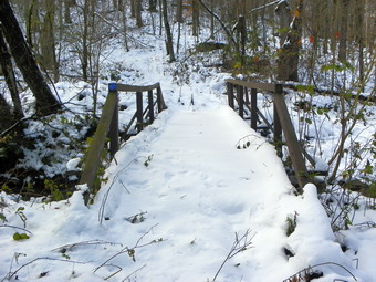 From this highest point we walked down to Campbell Mountain Road and crossed over to get on the Trout Pond Trail to Campbell Brook Road. At this point it was 11:00 Am and I debated whether to cut the hike short since I had a 2:00 PM meeting. I decided to stick to the original plan and walk back on the roads. We had been moving quickly but as we started out on the Trout Pond Trail I increased our pace even more! We immediately ran into deeper snow but not so deep that snowshoes were needed. The tracks we had been following stopped at the deeper snow. We crossed Campbell Brook on the bridge and began a 1 mile climb to the highest point on the Trout Pond Trail at 2510 feet. We made it over the hill at 11:30 AM and stared down the other side through more snow. The conditions were almost like spring except for the leaves still on the trees. we hit Campbell Brook Road at 11;45 AM and 4.3 miles into the hike. I knew at that point that we would easily make it back to the car in time. I am not fond of walking on roads instead of trails but these roads are pretty deserted. Most of the building along this route are hunting camps or summer homes with only a few permanent residences. Only one car passed us on the 2.5 mile walk out to Route 206. The walk on 206 was all downhill for .7 miles. We were back at the car by 12:40 PM covering 7.5 miles in under 3 hours.
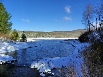
![]()
![]() On Sunday, October 30th 8 inches of snow covered our lawn in Livingston Manor. Cindy and I decided to go to hike at Frick and Hodge Ponds since the roads were good and hiking in a heavy October snow seemed like something we did not want to miss. I knew there would be more snow at the higher elevation so I threw our snowshoes in the car just in case. Cindy dressed warmly while I was still in my fall attire. We did both wear our Salomon boots which are warmer and fit the snowshoes well. DeBruce Road was still covered in snow and ice but at least Mongaup Road was plowed as was the Beech Mountain Road to the trailhead. We parked just before 9:30 Am and took a few minutes to assess the situation. We decided that snowshoes would definitely be OK by the looks of the conditions in the parking lot. They might even be necessary at the higher elevations on the Flynn Trail! BY the time I had my snowshoes on I was feeling a little cold and considered putting something else on. I decided against it as I always get warmer as we hike. We headed out on the Quick Lake Trail toward Frick Pond in about 8 inches of snow. Along the trail there was open water in places and our snowshoes quickly became caked with wet snow. It took about 20 minutes to get to the pond since we kept stopping to take pictures. There were no other cars, no other tracks and no other people! The view at Frick Pond was interesting since there was so much snow and NO ICE on the pond! I took shots of the pond and some of the trees with snow and leaves. I took some pictures of Beech Mountain from the bridge and then some photographs of Cindy and Sheba on the bridge. I noticed that the wind off the pond was really cold so we packed up and started back up the Quick Lake Trail. The snowshoeing was fun but NOT EASY. Even when the shoes weren't wet the snow was wet and heavy and clung to the bottom and laid on top of the shoes.
On Sunday, October 30th 8 inches of snow covered our lawn in Livingston Manor. Cindy and I decided to go to hike at Frick and Hodge Ponds since the roads were good and hiking in a heavy October snow seemed like something we did not want to miss. I knew there would be more snow at the higher elevation so I threw our snowshoes in the car just in case. Cindy dressed warmly while I was still in my fall attire. We did both wear our Salomon boots which are warmer and fit the snowshoes well. DeBruce Road was still covered in snow and ice but at least Mongaup Road was plowed as was the Beech Mountain Road to the trailhead. We parked just before 9:30 Am and took a few minutes to assess the situation. We decided that snowshoes would definitely be OK by the looks of the conditions in the parking lot. They might even be necessary at the higher elevations on the Flynn Trail! BY the time I had my snowshoes on I was feeling a little cold and considered putting something else on. I decided against it as I always get warmer as we hike. We headed out on the Quick Lake Trail toward Frick Pond in about 8 inches of snow. Along the trail there was open water in places and our snowshoes quickly became caked with wet snow. It took about 20 minutes to get to the pond since we kept stopping to take pictures. There were no other cars, no other tracks and no other people! The view at Frick Pond was interesting since there was so much snow and NO ICE on the pond! I took shots of the pond and some of the trees with snow and leaves. I took some pictures of Beech Mountain from the bridge and then some photographs of Cindy and Sheba on the bridge. I noticed that the wind off the pond was really cold so we packed up and started back up the Quick Lake Trail. The snowshoeing was fun but NOT EASY. Even when the shoes weren't wet the snow was wet and heavy and clung to the bottom and laid on top of the shoes.
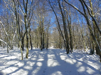 It wasn't long before we were marching through the stretch of pines on the trail trying not to get too snowy as we were bombarded by snow from the tree. We worked through or around several blowdowns on the trail, crossed the stream and headed into a small clearing. A tree here still had some colorful leaves and we took pictures before continuing to Iron Wheel Junction. We were at Iron Wheel by 10:30 AM which was much slower than our normal hiking pace. At the junction we turned left to stay on the Quick Lake Trail to Junkyard Junction and the Flynn Trail. Just before the junction where the snowmobile trail heads to Quick Lake, I noticed small large footprints in the snow. They might have been from a bear but the snow on the tress and brush did not seem very disturbed. We continued up the trail. The snow was beautiful but there were some areas of open water to try to avoid. We stopped several times to use the camera. The last time I hiked this which was only a few weeks before I remember thinking that the section of trail from Iron Wheel to Junkyard is much longer than I thought. This day, with the heavy snow, emphasized this fact. We arrived at Junkyard Junction at 11:45 AM which meant the 1.6 mile section from Iron Wheel had taken almost an hour and 15 minutes. Along the way my legs really began to hurt especially my quads and inner thighs. I found that taking exaggerated steps and not shuffling I could make the going easier and get some of the snow off the shoes. We turned right on the Flynn Trail to head toward Hodge Pond. The slight downhills felt great and did not bother my sore legs. Soon we were at the gate and then near the shores of the pond. Neither of us wanted to extend the hike by going around the back of the pond, so we turned right and walked toward the outlet. More water wet the snowshoes again and Sheba had HUGE snowballs clinging to her fur from the deeper snow on the Flynn Trail. I stopped at the shore of the pond at 12:20 PM to take a few pictures before starting back to the car. I was struck by the deep blue color of the open water.
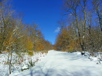 As we started up the Flynn Trail to the junction with the Big Rock Trail, the snow got deeper and my legs more tired. I tried "high stepping" again which worked to some extent. I knew that once we hit the top of the Flynn Trail there would be no more climbing and I put that in my mind and pressed on. Soon the trail leveled and we were at the junction. I had though about going down the Big Rock Trail and around the back of Frick Pond. I love the big downhill and the walk around Frick is pretty. This route would add almost mile to the hike so we continued straight ahead and down the Flynn Trail to the car. I thought about stopping at the open area near the top of the Flynn Trail but opted to just get back as soon a s possible! At least the 1.7 mile march down the Flynn Trail had no uphills but it did seem long.I was very happy to see the gate and even more pleased when I was at the car removing the snowshoes. The 6.5 mile trek had taken 4.5 hours. Two weeks before the same hike was just over 2 hours and 15 minutes!
![]() On Sunday, October 30th I got up early to shovel around the house and then head across the street to shovel out the church. The walks around the house had very little snow as they had been warm when it first started to fall. My car had about 6 inches on it and the lawn maybe inches. I shoveled the walks at the church but the parking lot was another matter. It has a thick layer of ice over water and was unusable. After making some calls, we decided to cancel services and I headed home. Once home I grabbed my camera and headed back over to the hill behind the church to take some picture of snow-covered Livingston Manor. The sun was just rising and I walk around the cemetery on the hill taking pictures. I walked back to the church and took a few shots before returning home. I decided the day was too nice to waste and that the roads were in decent condition. I asked Cindy if she would like to snowshoe in October and she said "Yes". We decided on Frick and Hodge Ponds.
On Sunday, October 30th I got up early to shovel around the house and then head across the street to shovel out the church. The walks around the house had very little snow as they had been warm when it first started to fall. My car had about 6 inches on it and the lawn maybe inches. I shoveled the walks at the church but the parking lot was another matter. It has a thick layer of ice over water and was unusable. After making some calls, we decided to cancel services and I headed home. Once home I grabbed my camera and headed back over to the hill behind the church to take some picture of snow-covered Livingston Manor. The sun was just rising and I walk around the cemetery on the hill taking pictures. I walked back to the church and took a few shots before returning home. I decided the day was too nice to waste and that the roads were in decent condition. I asked Cindy if she would like to snowshoe in October and she said "Yes". We decided on Frick and Hodge Ponds.
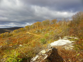
![]()
![]() On Tuesday, October 25th I decided to head for Bear Spring Wildlife Management Area between Downsville and Walton. I have hiked almost all the trails in this area multiple times but I had an idea for a new loop and wanted to try it out. The weather report was for cloudy skies but there was no mention of rain. As we left Livingston Manor, the sun was actually beginning to peek through and I hoped for a good day. My plan was to park on East Trout Brook Road at Middle Pond and hike up to the Ridge on Trail 4. From here I wanted to head north to the main parking area just off route 206. I planned to hike over to Wilson Hollow Road and then use Trail 11 to go down to Launt Pond. Another trail would take us from the pond, along the creek and back to the car. All of the trails at Bear Spring are constructed with horses and snowmobiles in mind. This means there are NO BRIDGES so some water crossing can be tricky. It also means that the trail are wide and well maintained but without the traditional hiking blazes. There is an overview map at the main parking area at the top of Bear Spring Mountain and there may be maps in holders along the way at trail junctions. We arrived at the small parking area at about 8:35 AM and were on the trail by 8:40 AM. We crossed the road and started up Trail 4. The trail rises 750 feet from the road to the ridge over 1.2 miles. At the top of the ridge we turned right or northwest to hike along the Fork Mountain ridge. At about 9:30 AM and a little more than 2 miles into the hike we were at the first of three clear cut areas on the hike. No one has been able to tell me the reason for theses clear cuts but they are all done with state approval. There were still some leaves on the trees and the skies was overcast with patches of blue. I took some pictures before we started to hike again and headed back to the shelter of the tress.
On Tuesday, October 25th I decided to head for Bear Spring Wildlife Management Area between Downsville and Walton. I have hiked almost all the trails in this area multiple times but I had an idea for a new loop and wanted to try it out. The weather report was for cloudy skies but there was no mention of rain. As we left Livingston Manor, the sun was actually beginning to peek through and I hoped for a good day. My plan was to park on East Trout Brook Road at Middle Pond and hike up to the Ridge on Trail 4. From here I wanted to head north to the main parking area just off route 206. I planned to hike over to Wilson Hollow Road and then use Trail 11 to go down to Launt Pond. Another trail would take us from the pond, along the creek and back to the car. All of the trails at Bear Spring are constructed with horses and snowmobiles in mind. This means there are NO BRIDGES so some water crossing can be tricky. It also means that the trail are wide and well maintained but without the traditional hiking blazes. There is an overview map at the main parking area at the top of Bear Spring Mountain and there may be maps in holders along the way at trail junctions. We arrived at the small parking area at about 8:35 AM and were on the trail by 8:40 AM. We crossed the road and started up Trail 4. The trail rises 750 feet from the road to the ridge over 1.2 miles. At the top of the ridge we turned right or northwest to hike along the Fork Mountain ridge. At about 9:30 AM and a little more than 2 miles into the hike we were at the first of three clear cut areas on the hike. No one has been able to tell me the reason for theses clear cuts but they are all done with state approval. There were still some leaves on the trees and the skies was overcast with patches of blue. I took some pictures before we started to hike again and headed back to the shelter of the tress.
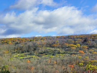 The trail continued northwest over a few bumps but the pace was quick. By 9:50 AM we were 3.3 miles into the hike and crossed West Trout Brook Road to continue on the trail. Up to this point there had been some muddy and wet areas but the next section of the trail was especially boggy. We continued almost directly north now toward Route 206 working our way around the puddles and mud pits. At 10:15 AM we crossed the road again and walked to the main parking area. From here we followed the very familiar trail that parallels Route 206, crosses East Trout Brook Road an then ascends slightly before dropping to Wilson Hollow Road. This woods road is a grassy track and has never been paved but shows up on many maps with the same prominence as Route 206! At this point we were at the second and largest clear cut area. The skies were still a strange mix of dark clouds, puffy white clouds and patches of blue.I decided to get a different view by walking down to the edge of the cut rather than staying on the road. I ended up on a road through the cut. We walked and I took pictures for some distance. We finally ran across a road that took us almost all the way back up to Wilson Hollow Road. The last few feet were rough as the road ended and some very nasty briars began. Back on the road we continued the hike and I took a few more shots before the road entered the woods. I was looking for Trail 11 which I had missed several times before. At some point I decided that I had missed it again when it appeared on the right at about 6.8 miles into the hike. It was 11:10 AM and I decided that we would continue along the ridge and use another trail to get back down to the car.
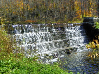 The next trail down was within .6 miles of Trail 11 but I had been on this trail several times recently so we continued to the McCoy Hill Shortcut at 7.7 miles. This trail turns right and runs along the edge of a field before descending through the forest to the last clear cut. The walk down was a little better than I expected and the view from the top of the cut a little worse. We walked out into a small field and I took some photographs before returning to the trail. At 11:45 AM we hit another trail junction and we stopped so that I could take a few more shots. From here it was only .6 miles back to the car. We stopped at the bridge at the outlet of Middle Pond before returning to the car at noon. We covered 9.3 miles in 3 hours and 20 minutes. Before returning home I decided to drive up East Trout Brook Road and stop at Launt Pond. I parked by the exit near the dam and grabbed the camera to take some photographs. The colors were muted and most of the leaves were gone but there was a nice quality to the pictures. I drove up to Route 206 and turned left to go to West Trout Brook Road. After turning and passing the main parking area I turned right on Beers Brook Road and drove down to Russ Gray Pond. The road is unpaved but well maintained. I parked at the pulloff by the pond and got out to take some pictures. I walked over to the small dam and took some pictures of the water as it cascaded over the dam. Back in the car I drove down Beers Brook Road to Route 10. After determining that left was the WRONG direction to turn I headed the other way into Walton and then back home.
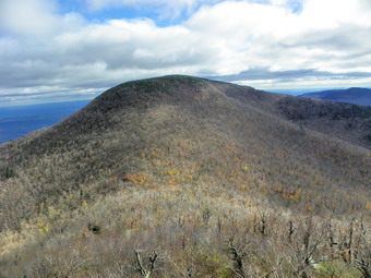
![]()
![]() On Friday, October 21st I had canceled XC practice after school to give the runners a little time to "heal". Since I had all day to hike, I decided I wanted to do some Catskill 35 peaks and preferably several at one time. I looked at my grid and was surprised to see it very open. I knew that it might be hard to get to some peaks so I chose the Blackheads from the Batavia Kill parking area. All that I had read indicated the Road from Maplecrest to the parking area was open. Sheba and I left Livingston Manor at about 8:20 AM anticipating a 10:00 AM start. I knew that Route 47 passed Frost Valley was closed as was the Peekamoose-West Shokan Road so I headed for Route 30 around the Pepacton Reservoir. Things went well but, as I passed through Margaretville, Arkville and Fleischmanns, I was reminded that people in this area are still impacted by the floods from Irene and Lee. There are detours on many roads and I saw many road crews at work. The main bridge into Margaretville is closed and the train tracks in Arkville are undermined and twisted. Driving along Route 28, we finally got to Route 42 which I always take north from Shandaken to Lexington. I made the turn knowing that the Spruceton Road was closed but not suspecting what I would find ahead. Just before the Halcott parking area was a sign announcing the road ahead was closed to through traffic. I always obey these signs but questioned why another sign at the run off Route 28 was not in place! I drove back to Route 28 and headed for Phoenicia to take Route 214 north through the Notch to Hunter. It was obvious that Phoenicia still had problems from the flooding as I turned on Route 214. This road was a mass of dips and potholes. In several places there were barriers on the stream side while in others crews had the road down to one lane as they worked to repair the damage. The road improved as I approached Notch Lake and I had no trouble from there to Maplecrest. Crews were working on the road to the Batavia Kill parking area. The stream here is normally pretty tame but the damage it did during the floods was evident. In particular, the lake at the small park on the left was gone. We finally arrived at the parking area at around 10:30 AM. We were the only car and we got started right away. My plan was to hike Black Dome and Thomas Cole first and then hike over Blackhead and down the steep eastern side. I thought if I had enough time I might also go on over Acra Point. I was concerned about the status of the bridges along the way. On the way in I saw that the bridge to Acra Point and Burnt Knob had been replaced.
On Friday, October 21st I had canceled XC practice after school to give the runners a little time to "heal". Since I had all day to hike, I decided I wanted to do some Catskill 35 peaks and preferably several at one time. I looked at my grid and was surprised to see it very open. I knew that it might be hard to get to some peaks so I chose the Blackheads from the Batavia Kill parking area. All that I had read indicated the Road from Maplecrest to the parking area was open. Sheba and I left Livingston Manor at about 8:20 AM anticipating a 10:00 AM start. I knew that Route 47 passed Frost Valley was closed as was the Peekamoose-West Shokan Road so I headed for Route 30 around the Pepacton Reservoir. Things went well but, as I passed through Margaretville, Arkville and Fleischmanns, I was reminded that people in this area are still impacted by the floods from Irene and Lee. There are detours on many roads and I saw many road crews at work. The main bridge into Margaretville is closed and the train tracks in Arkville are undermined and twisted. Driving along Route 28, we finally got to Route 42 which I always take north from Shandaken to Lexington. I made the turn knowing that the Spruceton Road was closed but not suspecting what I would find ahead. Just before the Halcott parking area was a sign announcing the road ahead was closed to through traffic. I always obey these signs but questioned why another sign at the run off Route 28 was not in place! I drove back to Route 28 and headed for Phoenicia to take Route 214 north through the Notch to Hunter. It was obvious that Phoenicia still had problems from the flooding as I turned on Route 214. This road was a mass of dips and potholes. In several places there were barriers on the stream side while in others crews had the road down to one lane as they worked to repair the damage. The road improved as I approached Notch Lake and I had no trouble from there to Maplecrest. Crews were working on the road to the Batavia Kill parking area. The stream here is normally pretty tame but the damage it did during the floods was evident. In particular, the lake at the small park on the left was gone. We finally arrived at the parking area at around 10:30 AM. We were the only car and we got started right away. My plan was to hike Black Dome and Thomas Cole first and then hike over Blackhead and down the steep eastern side. I thought if I had enough time I might also go on over Acra Point. I was concerned about the status of the bridges along the way. On the way in I saw that the bridge to Acra Point and Burnt Knob had been replaced.
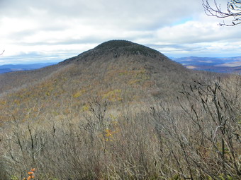 As we began our hike along the Batavia Kill, it was clear that the recent rain had again swollen the creek. The water was roaring down the mountain. At the first bridge crossing, we found a brand new bridge to replace the other that was washed out. I took a few shots and then we continued. I stopped a few places along the way just to take some photographs of the creek at the same "waterfalls" that had developed. The second bridge was not completely new but had been extensively repaired. We reached the trail junction at about 10:50 AM only .65 miles into the hike. I decided to head right toward Lockwood Gap and Black Dome which was my original plan. I looked at the water crossing we would have to make on the way back and knew that it was possible and that by that time we would be close to the car. The walk up the trail was pleasant and I removed my softshell in favor of a light windbreaker. The climb begins to get steeper at about 1.15 miles and continues to the col at 2.0 miles. There are several switchbacks and both Black Dome and Blackhead are visible. Each time I hike this route I am impressed by these mountains. Despite the fact that I have done them many times, it always seems impossible until I am on the top or back in the car! With the leaves off the trees, the site was even more impressive. We hit the col at 11:40 AM and just made the right turn and continued to climb. I was feeling very fit at this point! We stopped after the one rock scramble at the rock shelf that looks over at Blackhead. The skies were cloudy but there was some sun and the conditions seemed just right for some good shots. After getting the pack back on we headed up the trail to the summit and stopped at the open rock that acts as a lookout to the south at about 12:10 PM. We had a drink and a bite to eat. The sun's angle made taking pictures difficult but I took some anyway.
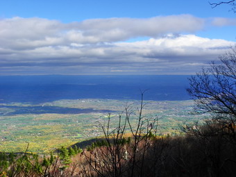 We left for Thomas Cole at about 12:15 PM and arrived there at 12:40 PM. There isn't too much to see along the way but there are a few rock scrambles. An occasional view of Cole through the trees reminded me that it IS a 3Catskill 3500 foot peak! The distance is about .8 miles and the drop is just over 200 feet. We turned around once the trail started to descend on the other side of Cole and headed back for the Lockwood Gap without stopping. We were there by 1:30 PM at about 4.6 miles into the hike. Up Blackhead we went stopping twice for pictures back to Black Dome and out across the valleys. The distance to the summit is only about .6 miles but the elevation gain is over 500 feet. The trail flattens some after the climb and then leads to the large flat rock that marks the summit. Here we intersected the blue Escarpment Trail and started down the steep, eastern side of Blackhead. There are no views from the summit but there are limited views on the way down. Two different stops allow views north and west toward Acra Point and Burnt Knob and east and south toward Arizona. The descent is open rock in some cases and in other places there is loose rock. Everything was wet and covered with a layer of wet leaves. We were careful and did stop for pictures but made it down by 2:45 PM. This was .8 miles and over 1650 feet of vertical drop. On the way down I was still feeling remarkably good but knew that the extra trip over Acra Point would be about 3 miles more. I decided to save this for another day and head back to the car. At the trail junction we met the only people we would see all day. These two artists from New York City were enjoying there first trip to the Catskills and had just come over Acra Point! We talked some before parting and I hope they have many more hikes. From the trail junction we descended another 500 feet over the next mile to the trail junction. Along the way we passed the Batavia Kill lento. At the trail junction we had to walk upstream a little before I could find a place to cross. It wasn't all that bad but slipping on the wet rocks would have been a very wet and cold experience. From here it was just another .7 miles back to the car. We arrived at 3:35 PM having taken just 5 hours for the 7.8 mile trip.
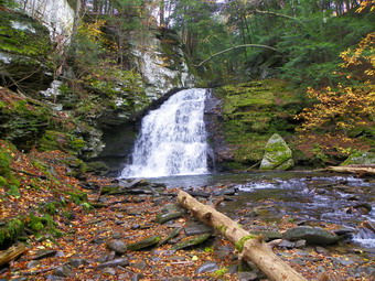
![]()
![]() On Wednesday, October 19th I wanted to get in a "fitness hike" before going to school and cross country practice. It was raining on and off and the forecast did not promise any improvement. I decided to head toward Trout Pond and see what the weather looked like there. As I parked the car at about 10:30 AM it was still raining but only lightly. I donned my Outdoor Research Revel jacket and Sheba and I started down Russell Brook Road at about 10:35 AM. There was only a slight mist in the air and I soon was becoming wet from the sweat inside the jacket. I had decided NOT to stop by the falls but couldn't help myself. I walked across the bridge and then took the path to the falls. I walked down into the stream bed to take some pictures and then returned to the trail. We walked straight ahead up to Trout Pond as I had taken the loop the other way the last time we hiked. As we hiked I alternated between looking at the beauty around me and my own inner thoughts. We stopped at the outlet end if the pond so that I could get some pictures. I have taken these pictures so many times but they always seem a little different. Back on the main trail I started to notice some deep, muddy ruts on the trail. On the way up to the pond I had seen tracks but the trail was much firmer in that location. I inwardly cursed the people who can't read the signs and stay off the trail with their ATVs. As we approached the inlet end of the pond, I began to here some noise and looked ahead to see two pickup trucks. It took a moment for the scene to register. The pickups belonged to a DEC crew from Walton who were replacing the bridge across the inlet. I apologized for my "evil" thoughts and we talked for a few moments. They were putting in a rather substantial snowmobile bridge which would be more than enough to serve hikers. I walked to the edge of the pond to take more pictures.
On Wednesday, October 19th I wanted to get in a "fitness hike" before going to school and cross country practice. It was raining on and off and the forecast did not promise any improvement. I decided to head toward Trout Pond and see what the weather looked like there. As I parked the car at about 10:30 AM it was still raining but only lightly. I donned my Outdoor Research Revel jacket and Sheba and I started down Russell Brook Road at about 10:35 AM. There was only a slight mist in the air and I soon was becoming wet from the sweat inside the jacket. I had decided NOT to stop by the falls but couldn't help myself. I walked across the bridge and then took the path to the falls. I walked down into the stream bed to take some pictures and then returned to the trail. We walked straight ahead up to Trout Pond as I had taken the loop the other way the last time we hiked. As we hiked I alternated between looking at the beauty around me and my own inner thoughts. We stopped at the outlet end if the pond so that I could get some pictures. I have taken these pictures so many times but they always seem a little different. Back on the main trail I started to notice some deep, muddy ruts on the trail. On the way up to the pond I had seen tracks but the trail was much firmer in that location. I inwardly cursed the people who can't read the signs and stay off the trail with their ATVs. As we approached the inlet end of the pond, I began to here some noise and looked ahead to see two pickup trucks. It took a moment for the scene to register. The pickups belonged to a DEC crew from Walton who were replacing the bridge across the inlet. I apologized for my "evil" thoughts and we talked for a few moments. They were putting in a rather substantial snowmobile bridge which would be more than enough to serve hikers. I walked to the edge of the pond to take more pictures.
 After taking some shots, Sheba and I walked upstream a little and crossed over to the other side. It was about 11:35 AM and blacker clouds were starting to gather over the pond. We set a good pace on the way up to Cherry Ridge. Somewhere along the way the moisture changed from mist to sprinkle. I tried to ignore this until the sprinkle changed to rain and I decided to get out the rain jacket again and put the camera in a plastic bag. As we continued to walk the rain never got worse but continued to come down. We made the turn to the left at Mud Pond and headed down the wide woods road that is also a snowmobile trail. The trail was soft and muddy but worst spots could be avoided. Soon we were back down at the trail junction near the falls. To complete the hike we walked back up Russell Brook Road to the car on Morton Hill Road. The 5.6 mile hike took at 2.5 hours and we were back just after 1:00 PM.
![]()
![]() On Sunday, October 16th I wanted to get out to hike but I also wanted to be with my family. I solved the problem by calling Karl and Kathleen and asking them if they would like to hike at the Neversink Unique area in Rock Hill. Of course, they were to bring Bryce (grandson) and Maggie (dog). They agreed to meet us and I called after church to confirm that we would meet at the parking area at the end of Katrina Falls Road. The hike almost had to be canceled since Bryce's Merrells went missing but since he is only 7 months old we decided to take a chance. Cindy, Sheba and I arrived first but the rest of the party was right behind. There was only one car parked in the lot but we had seen some hunters on the way down Katrina Falls Road. Bryce need a snack before we started and then we were off at right around noon! Bryce has his own pack to ride on Karl's back and seemed very happy since he gave his father directions several times. The temperature was cool and a slight breezy was blowing. The skies were variable on the way down with some areas of blue with clouds and other, more ominous areas. My plan was to walk directly to Denton Falls on the Neversink and then to Mullet Falls on Mullet Brook. From here we would complete the loop back to the main trail and the car. Wolf Brook was high as we stopped to take some pictures. We bypassed the two side trails down to the river in favor of the direct route to the falls. The walk seemed a little longer and a little steeper than I remembered.
On Sunday, October 16th I wanted to get out to hike but I also wanted to be with my family. I solved the problem by calling Karl and Kathleen and asking them if they would like to hike at the Neversink Unique area in Rock Hill. Of course, they were to bring Bryce (grandson) and Maggie (dog). They agreed to meet us and I called after church to confirm that we would meet at the parking area at the end of Katrina Falls Road. The hike almost had to be canceled since Bryce's Merrells went missing but since he is only 7 months old we decided to take a chance. Cindy, Sheba and I arrived first but the rest of the party was right behind. There was only one car parked in the lot but we had seen some hunters on the way down Katrina Falls Road. Bryce need a snack before we started and then we were off at right around noon! Bryce has his own pack to ride on Karl's back and seemed very happy since he gave his father directions several times. The temperature was cool and a slight breezy was blowing. The skies were variable on the way down with some areas of blue with clouds and other, more ominous areas. My plan was to walk directly to Denton Falls on the Neversink and then to Mullet Falls on Mullet Brook. From here we would complete the loop back to the main trail and the car. Wolf Brook was high as we stopped to take some pictures. We bypassed the two side trails down to the river in favor of the direct route to the falls. The walk seemed a little longer and a little steeper than I remembered.
 We turned right at the top of a small climb to head down to the falls at about 12:45 PM and 1.35 miles into the hike. The trail is still new and not "worn in" in all spots. It was a little wet and does get narrow in places. It only rook about 10 minutes to negotiate the .3 mile distanced own to the river. There was a lot of water going over the falls making for a pleasant visual and auditory experience. These "falls" are not very high, perhaps three or four feet, and are more of a rapids but they are still pretty. There was some color to the leaves and I took pictures of the falls and the river in both directions. I decided to bushwhack a little upstream while the rest of the family walked the trail back to the main trail. Sheba and I found a path that ran along the shore of the river and we were soon at the point where Mullet Brook enters the river. The high water made the crossing look difficult but I knew I could find a place to cross if I really wanted. I decided to stay on the near bank of the creek and follow it upstream. There were some nice points along the stream and I even took a few shots. I found a steep bank to climb back to the trail and met the rest of the family just as they were coming up the trail. We all walked out the trail to the main trail and turned right to start our loop toward Mullet Falls. I remembered that this climb was the hardest of all even though it did not compare to any that ascend the mountains in the Catskills. I was wondering how Karl was doing with baby and pack but he said he was Ok.
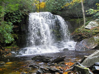 Soon we were at the left turn that goes down to Mullet Falls. We turned and walked along the path until the falls came into view at 1:30 PM or about 2.4 miles into the hike. These falls can be reduced to only a trickle when there hasn't been much rain but this day they were magnificent. The water drops 20 feet into a small pool below. From the pool and other small falls carries the water over some large walks to the stream bed below. I dropped my pack and walked out onto the slippery rocks. I took many pictures from this spot and then moved in closer to capture the plunge pool. I also recorded a video for the sound. After this, I crossed over to the side of the falls to take some photographs at another angle. Now it was time to go back to the main trail and complete the loop to get back to the car. On our way out we met a man carrying a short step ladder. He was placing official NYNJTC markers on the trail. We turned left at the main trail and continued to ascend. The gain in elevation from the river to the highest point on the trail is 500 feet! Near the top the trail leveled off and we crossed Mullet Brook again on a bridge. Just upstream from the bridge was an interesting area of pooled water. The water drains a swamp and is dark brown due to the tannins from the evergreens. The trail after this is mostly flat and then start downhill. Just before the downhill portion is the right turn to the Wolf lake parking area. We stayed to the right and down to the trail we had come in on earlier. It was about 2:30 and it had taken a little less than an hour to walk the 1.7 miles from the falls trail. As we approached that trail we met two dogs with their owners trailing farther behind. The dogs seemed friendly and we do let our own dogs run but we always call them when approaching other hikers and other dogs. These owners did not seemed concerned so we made the best of thins. We were back at the car at 2:50 PM having covered about 4.8 enjoyable miles in about 2 hours and 45 minutes. Bryce did not see the last part of the hike as he was asleep.

![]()
![]() On Friday, October 14th I wanted to get in some more hiking after the short walk around Bear Hole Brook. The day had been sort of a disappointment and a successful trip to Vernooy Kill Falls was just what I needed. The problem was that I was not sure if I could remember how to get there and I had not brought a map since this trip was not in my plans. I headed away from Ellenville on Route 209 and drove through Kerhonksen. Just outside of town I drove up a hill and turned left on Samsonville Road. After 1.3 miles, I turned left on Cherrytown Road. I drove 3.5 miles and took the left onto Upper Cherrytown Road. In about 3.0 miles I saw the parking area on the right and pulled in at 12:45 PM. The trail is just across the road. The trail is a wide woods road almost all the way to the falls. It is marked as a snowmobile trail, a hiking trail and the Long Path. The problem is that the markings are very few and far between. In fact, the ONLY blaze I saw for the Long Path was the one at the beginning of the trail just off the road. This has been a recurring theme for many of the trails I have been hiking recently especially those that do not access the 3500 foot peaks. I had not been to Vernooy Kill Falls in some time and the trail gains much more elevation than I remember. In about a mile it gains over 500 feet which is by no means excessive and at no time is the trail steep. A good part of the trail is covered in loose rock which always makes the hiking more difficult. After about a mile the trail is almost level and the highest point is at about 1.3 miles. From that point the trail drops slightly to the falls at 1.7 miles. The stream crossing near the falls was easy due to some stepping stones.
On Friday, October 14th I wanted to get in some more hiking after the short walk around Bear Hole Brook. The day had been sort of a disappointment and a successful trip to Vernooy Kill Falls was just what I needed. The problem was that I was not sure if I could remember how to get there and I had not brought a map since this trip was not in my plans. I headed away from Ellenville on Route 209 and drove through Kerhonksen. Just outside of town I drove up a hill and turned left on Samsonville Road. After 1.3 miles, I turned left on Cherrytown Road. I drove 3.5 miles and took the left onto Upper Cherrytown Road. In about 3.0 miles I saw the parking area on the right and pulled in at 12:45 PM. The trail is just across the road. The trail is a wide woods road almost all the way to the falls. It is marked as a snowmobile trail, a hiking trail and the Long Path. The problem is that the markings are very few and far between. In fact, the ONLY blaze I saw for the Long Path was the one at the beginning of the trail just off the road. This has been a recurring theme for many of the trails I have been hiking recently especially those that do not access the 3500 foot peaks. I had not been to Vernooy Kill Falls in some time and the trail gains much more elevation than I remember. In about a mile it gains over 500 feet which is by no means excessive and at no time is the trail steep. A good part of the trail is covered in loose rock which always makes the hiking more difficult. After about a mile the trail is almost level and the highest point is at about 1.3 miles. From that point the trail drops slightly to the falls at 1.7 miles. The stream crossing near the falls was easy due to some stepping stones.
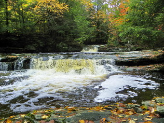 We arrived at the falls around 1:30 PM. I was a little worried about rattlesnakes at the falls but thought that the colder temperatures at night may have caused them to "den up". By the time we reached the falls the temperature had risen but the skies were still cloudy. It seemed very humid but there was no rain. before we ever got to the falls< I could hear the thunderous roar of the water. I dropped my pack and poles by the register box and grabbed my camera. I stood on the bridge to take shots of the falls upstream. After taking some shots, I headed downstream from the bridge to stand on some rocks to take pictures of the bridge and the falls beneath it. The rocks were wet and slippery and covered with leaves. After returning to the bridge, I walked upstream along a well-defined path. There were several side paths down to the stream and I stopped at each to take pictures of the individual falls and rapids along the way. There was a lot of interesting foam on the water. A few trees had some colorful leaves but in general most of the leaves were on then ground. At about 1:50 PM we started back toward the car. There was a little sun out by now and it was even warmer. The return trip is mostly downhill and we were back in the parking area before 2:30 PM. The hike is about 3.5 miles and it took us a little over 1.5 hours including the time at the falls for pictures.
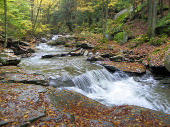
![]() On Friday, October 14th I decided to go out on a hike despite the weather forecast of rain and thunderstorms. I though I might hike to Giant Ledge and on the way inspect the damage to Route 47. I knew the bridge to Giant Ledge had been reported as missing but thought I could get across that stream without a problem. At the end of Pole Road, I started to turn onto Route 47 and saw a ROAD CLOSED sign. Since it also indicated that Frost Valley "guests" could proceed I decided I would also. Within a hundred feet I saw that there was heavy equipment working on trying to reconstruct the road. I thought to myself that even "Frost Valley guests" would have a hard time getting through the mess. It was raining lightly but I decided to head to Claryville and over Red Hill Road to check out a hike to the fire tower. I turned right on Red Hill Road and began the climb to Coons Road. It was like driving into a cloud! By the time I got to the turn to the fire tower I was in a cloud and it was time to change plans again. I headed down Sugarloaf Road toward the road to Sundown. When I got to Sundown, I intended to drive up the Peekamoose Road to photograph some waterfalls. This road also had a ROAD CLOSED sign but I decided to go as far as I could. As I drove along the road the damage from the storms was still very evident. In every spot where there was a small stream it was clear that the road had been washed away. All the campsites near Peekamoose were marked NO CAMPING. At about 11:30 AM I stopped at Bear Hole Brook and Sheba and I walked to the falls. I took some pictures and then walked back to the car. I donned my pack and we hiked up the far side of the stream until the next small falls came into view. I took some more pictures and then returned to the car. The high water made going further upstream unsafe if not impossible. I rove passed the Peekamoose trailhead and just around the bend again ran into road construction. I deiced to drive back to Sundown and out the reservoir through Yagerville. When I got to Yagerville, I decided it was too early to end the day and got the idea I would head to Vernooy Kill Falls by way of Upper Cherrytown Road.
On Friday, October 14th I decided to go out on a hike despite the weather forecast of rain and thunderstorms. I though I might hike to Giant Ledge and on the way inspect the damage to Route 47. I knew the bridge to Giant Ledge had been reported as missing but thought I could get across that stream without a problem. At the end of Pole Road, I started to turn onto Route 47 and saw a ROAD CLOSED sign. Since it also indicated that Frost Valley "guests" could proceed I decided I would also. Within a hundred feet I saw that there was heavy equipment working on trying to reconstruct the road. I thought to myself that even "Frost Valley guests" would have a hard time getting through the mess. It was raining lightly but I decided to head to Claryville and over Red Hill Road to check out a hike to the fire tower. I turned right on Red Hill Road and began the climb to Coons Road. It was like driving into a cloud! By the time I got to the turn to the fire tower I was in a cloud and it was time to change plans again. I headed down Sugarloaf Road toward the road to Sundown. When I got to Sundown, I intended to drive up the Peekamoose Road to photograph some waterfalls. This road also had a ROAD CLOSED sign but I decided to go as far as I could. As I drove along the road the damage from the storms was still very evident. In every spot where there was a small stream it was clear that the road had been washed away. All the campsites near Peekamoose were marked NO CAMPING. At about 11:30 AM I stopped at Bear Hole Brook and Sheba and I walked to the falls. I took some pictures and then walked back to the car. I donned my pack and we hiked up the far side of the stream until the next small falls came into view. I took some more pictures and then returned to the car. The high water made going further upstream unsafe if not impossible. I rove passed the Peekamoose trailhead and just around the bend again ran into road construction. I deiced to drive back to Sundown and out the reservoir through Yagerville. When I got to Yagerville, I decided it was too early to end the day and got the idea I would head to Vernooy Kill Falls by way of Upper Cherrytown Road.
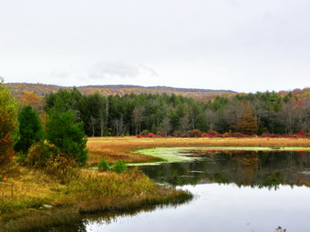
![]()
![]() On Wednesday, October 12th I needed to get out for a quick hike for some exercise. The weather forecast was for showers early and then showers late with a break in between. The early showers did not develop but I decided to stay close to home by heading to Frick and Hodge Ponds. Although this is probably he hike I have done the most, I had not been there in some time. I was hoping for some fall leaf color and thought I might try to find the waterfalls on the outlet stream from Mongaup Pond. We arrived at 9:00 AM and headed out the Quick Lake Trail to Frick Pond. The trail was wet and muddy all the way to the pond. I was disappointed as We got to the bridge at the outlet. There weren't many leaves left on the trees and those that remained were dull. The skies were overcast but the temperature was about 60 degrees. I was warm in my light windbreaker even though I had short sleeves on underneath. I only took a few pictures before continuing on the Quick Lake Trail. The blowdowns on this trail are multiplying each time I hike it. Most will require a good sized chainsaw and a "crew" of more than one to clear! The trail was damp in places but not too bad as we made Wagon Wheel Junction by 9:40 after covering 1.5 miles. We turned left to stay on the Quick Lake Trail which is also a snowmobile trail at this point. The trail gains some elevation and was not as wet as the lower part. It was longer than I remember but the sun came out a little along the way which always raises my spirits.
On Wednesday, October 12th I needed to get out for a quick hike for some exercise. The weather forecast was for showers early and then showers late with a break in between. The early showers did not develop but I decided to stay close to home by heading to Frick and Hodge Ponds. Although this is probably he hike I have done the most, I had not been there in some time. I was hoping for some fall leaf color and thought I might try to find the waterfalls on the outlet stream from Mongaup Pond. We arrived at 9:00 AM and headed out the Quick Lake Trail to Frick Pond. The trail was wet and muddy all the way to the pond. I was disappointed as We got to the bridge at the outlet. There weren't many leaves left on the trees and those that remained were dull. The skies were overcast but the temperature was about 60 degrees. I was warm in my light windbreaker even though I had short sleeves on underneath. I only took a few pictures before continuing on the Quick Lake Trail. The blowdowns on this trail are multiplying each time I hike it. Most will require a good sized chainsaw and a "crew" of more than one to clear! The trail was damp in places but not too bad as we made Wagon Wheel Junction by 9:40 after covering 1.5 miles. We turned left to stay on the Quick Lake Trail which is also a snowmobile trail at this point. The trail gains some elevation and was not as wet as the lower part. It was longer than I remember but the sun came out a little along the way which always raises my spirits.
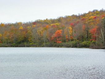 By 10:00 Am we were at Junkyard Junction having covered around 2.7 miles. Our quick pace was enjoyable and I took it as a challenge to keep it up.We tuned right on the Flynn Trail and immediately ran back into a wet and muddy trail. In addition, there was more blowdown on this trail than I have seen before. As we dropped down from the gate on the Flynn Trail to Hodge Pond, I decided to go right and go around the front of the pond for a change. After 4 miles of hiking, we arrived at Hodge Pond at 10:30 AM. The leaves around the pond were no better than at Frick but I took pictures anyway. We turned around and headed up the Flynn Trail to Big Rock Junction and then down the Flynn Trail to the parking area. Even this part of the Flynn Trail has several trees down which make hiking less enjoyable than before. Back at the car I decided that I had enough time to search for the water falls. It was 11:20 AM and we had finished the 6.7 mile hike in 2 hours and 20 minutes!
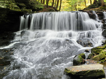 I drive down the Beech Mountain Road to the intersection with the Mongaup Pond Road. I parked on the side of the road and found the Old Hunter Road that runs down to the stream. We walked down to the bridge over the stream and I could hear the rushing water. I was disappointed to find water rushing under the bridge but no real falls. I could see a path along the far side of the stream and decided to follow it downstream. After only a short distance I found the falls! The falls have two nice drops and there was enough water to make them interesting. I took shots of the upper falls from the bank and then from a flat rock in the stream bed. I worked my way downstream and down a bank to an area below the lower falls. This allowed me to get more pictures from almost directly in front of the falls. This is a very nice place to visit and popular during warmer weather.
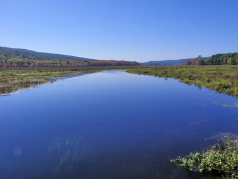
![]()
![]() On Sunday, October 9th Cindy and I wanted to hike somewhere since is was such a gorgeous day. I was planning to hike Rusk with Doug Garrity and a few others on Monday and wanted an easy route. We decided that this was the day to go to the Basha Kill. Cindy and I had lived most of our lives in Sullivan County and had never visited this 2400 acre wildlife preserve in the southern part of the county. I knew that a rail trail ran along the eastern shore. It is all that remains of the Port Jervis to Kingston branch of the O&W. On the western shore are the remains of the D&H Canal and its towpath. The two can be combined for a loop using Haven Road to cross the marsh on the northern end and Otisville Road to swing around the southern end. We drove down Route 17 after church and got off at exit 113 heading south on Route 209. After about 1.7 miles Haven Road appears on the left. I was not sure where the towpath was SOS we drove down Haven road and passed the parking area. Once we got to the bridge it was clear we had gone too far so we headed back to the parking area on the north side of Haven Road and parked there. The only trails I could find were NOT the towpath so we drove back out toward Route 209. Towpath Road was on the left almost all the way back out to the main road. We returned to the parking area and parked the car to begin our hike. We were both wearing light jackets but left them in the car as the temperature was in the high 60's or low 70's. At around 12:20 PM we started our hike by walking east on Haven Road through the marsh toward the rail trail on the eastern shore. We stopped on Haven Road to take some pictures of the marsh to the north and south. There was some color on the trees but not too much. There was evidence that the road had been flooded during the last storms. After saying "Hello" to someone fishing from the bridge, we continued to the rail trail and turned left or north. Within a few hundred feet we met some women from the Sullivan County Audubon Society. They knew my father and we talked. They were observing birds and migration patterns by sitting in the same spot for 24 hours. We thought it strange that they had seen over 40 species of birds but no eagles! One of the women told us that there was an observation "tower" to the north on the trail and we headed in that direction. The trail was relatively dry and the leaves were pretty in this area. After about a mile, we were at the trail to the tower and we turned left. Within .1 miles we were at the tower which was more of an observation platform. There we nice views over the marsh to the north and west. After taking some pictures, we walked a short loop back to the rail trail and headed back to Haven Road.
On Sunday, October 9th Cindy and I wanted to hike somewhere since is was such a gorgeous day. I was planning to hike Rusk with Doug Garrity and a few others on Monday and wanted an easy route. We decided that this was the day to go to the Basha Kill. Cindy and I had lived most of our lives in Sullivan County and had never visited this 2400 acre wildlife preserve in the southern part of the county. I knew that a rail trail ran along the eastern shore. It is all that remains of the Port Jervis to Kingston branch of the O&W. On the western shore are the remains of the D&H Canal and its towpath. The two can be combined for a loop using Haven Road to cross the marsh on the northern end and Otisville Road to swing around the southern end. We drove down Route 17 after church and got off at exit 113 heading south on Route 209. After about 1.7 miles Haven Road appears on the left. I was not sure where the towpath was SOS we drove down Haven road and passed the parking area. Once we got to the bridge it was clear we had gone too far so we headed back to the parking area on the north side of Haven Road and parked there. The only trails I could find were NOT the towpath so we drove back out toward Route 209. Towpath Road was on the left almost all the way back out to the main road. We returned to the parking area and parked the car to begin our hike. We were both wearing light jackets but left them in the car as the temperature was in the high 60's or low 70's. At around 12:20 PM we started our hike by walking east on Haven Road through the marsh toward the rail trail on the eastern shore. We stopped on Haven Road to take some pictures of the marsh to the north and south. There was some color on the trees but not too much. There was evidence that the road had been flooded during the last storms. After saying "Hello" to someone fishing from the bridge, we continued to the rail trail and turned left or north. Within a few hundred feet we met some women from the Sullivan County Audubon Society. They knew my father and we talked. They were observing birds and migration patterns by sitting in the same spot for 24 hours. We thought it strange that they had seen over 40 species of birds but no eagles! One of the women told us that there was an observation "tower" to the north on the trail and we headed in that direction. The trail was relatively dry and the leaves were pretty in this area. After about a mile, we were at the trail to the tower and we turned left. Within .1 miles we were at the tower which was more of an observation platform. There we nice views over the marsh to the north and west. After taking some pictures, we walked a short loop back to the rail trail and headed back to Haven Road.
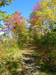 At Haven Road we crossed to the other side and tried to follow the rail trail south. The trail was completely covered with water for more than a quarter mile and we had to cross from one side to the other and use the banks to make it through this area. The banks were covered in barberry and some other thorny brush making the progress slow and painful. At some point I asked Cindy if she wanted to try to make the loop around the Basha Kill or return the way we came. We decided to go on around and walk the canal towpath back to the car. The rail trail dried out some with only a few muddy spots along the way. There were views of the marsh all along the way with some color. The trail is extremely straight which is not surprising given that it is the old railroad bed. At 3.7 miles we were at one of the larger parking areas just off South Road and near the Basha Kill Winery. There were quite a few people here and we stopped to take some pictures. The water is more open in this area and three or four kayaks were completing a trip and returning to shore. We left the parking area and continued on the trail which soon became wetter and muddier. In about .4 miles the Long Path markings appeared to head to the right off the rail trail so we followed them through a very muddy stretch. Another hiker, coming from the opposite direction, told us that the trail was a dead end the way we were going. We turned around and headed south on the rail trail again finding a sign that said "Long Path" at one point. At about 4.3 miles the trail again became impossibly wet and muddy so we backtracked and walked out to South Road to continue the hike.
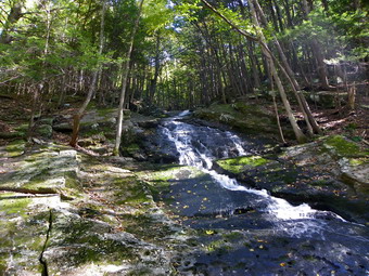 At 4.5 miles we were about to cross a small stream on the road when I looked to the left and saw a waterfall. We walked to the base of the falls and it was even better than it appeared from the road. The water was flowing down over a wall of rock and was very pretty. I took some pictures before we walked back out to the road to continue. Walking on the road went quickly and in about another mile at 5.5 miles into the hike there was a small parking area on the right. We stopped and walked down to an observation deck. The deck gave a nice view of a stream flowing out of the Basha Kill. I noticed a road bridge just downstream and we headed in that direction after a few photographs. We turned right onto Otisville Road which, according to the map I had, runs out to Route 209. We began to look for some sign of the D&H towpath that the map showed turning off the road just before Route 209. We got to the main road after walking after walking almost .5 miles without seeing the towpath. We decided to walk down to the Stonefield Parking Area where we knew we could get on the towpath. After only .2 miles on the road, I saw a sign for the Basha Kill and we turned right and headed down this dirt road. As we approached a flat area a path turn left and I could see a car a short distance into the field. When we got to the car, I asked the couple who were there about the towpath. They were very familiar with the area and said we were headed in the right direction. In just a few hundred feet we entered the woods and climbed onto an wide, elevated "road".
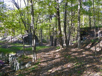 The canal and the towpath have an interesting history and I am sorry to say I don't know enough about it. The canal ran to the left or west of the towpath and in many places the canal was very obvious. There are still stone walls on either side of the canal and even the trees that now grow in it cannot hide it. We headed north and then east to get around a hill before heading north for most of the rest of the trip. The canal is now dry in most places but in some areas there is water which hints at the original purpose. In a few places we found bridges of rock built across the canal. After the canal was no longer in use, these bridges were built across it to reach the towpath and the Basha Kill. At 7.5 miles we reached the road that runs down to the Stonefield parking area and this continued for about .35 miles. We continued on the towpath and at 8.25 miles came across a bridge that was built over the canal. The span of the bridge no longer exists but the stonework that made up the abutments is still there. Also present are the stone walls that lined the lane that leads up to the bridge. A little further on the trail crosses a chasm on a wood bridge. Just to the left is another stone bridge that crossed the canal. By this time we both realized that the trip was a lot longer than we had expected. Despite the fact that the terrain was pretty flat we were a little tired. Finally at 10.1 miles we came to a gate which led out onto Towpath Road. This short road soon intersected Haven Road and we walked the .3 miles back to the car. What had started as a short stroll turned into a 10.4 mile hike lasting 4 hours! This was a fast pace especially since we were hindered by the wet, muddy and poorly marked trails. Despite the pace we got to see some scenic and historical points of interest along the way.
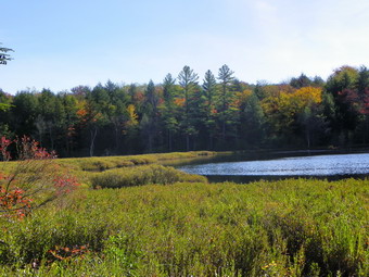
![]()
![]() On Thursday, October 6th I wanted to get in another hike before at least two days of commitments that would not leave time for my favorite hobby! I was a little sore after the forced march from the day before and wanted to stay close to home. I decided to go to Long Pond and park at the trailhead on Flugertown Road to hike the loop using Basily Road. Sheba and I arrived at the parking area at 9:45 AM and started out right away. The temperature was in the mid 50's and the sun was out. I had on my light softshell, gloves and hat but knew I would be taking them off shortly after beginning the hike. The first part of the hike is THE uphill and after that it is relatively flat. On the way up the first hill there was a very large evergreen tree across the path. This one is going to take a crew to remove and a trail is already developing around it. After .7 miles of hiking we had gained 360 feet to an elevation of about 2210 feet which is the highest point on the hike. By 1.1 miles we were at he turn down to Long Pond. I wanted to take some pictures from the shores of the pond but it was hard to get close because of the high water from the rain. After taking some shots, I removed jacket, hat and gloves and we walked back out to the main trail. At 1.4 miles we passed by the trail junction which allows a "shortcut" out to Flugertown Road. We turned right and headed out for the longer loop. The next section of trail was wet in places with a few new ponds developing. At 1.8 mile we passed the spur trail to the lean-to.
On Thursday, October 6th I wanted to get in another hike before at least two days of commitments that would not leave time for my favorite hobby! I was a little sore after the forced march from the day before and wanted to stay close to home. I decided to go to Long Pond and park at the trailhead on Flugertown Road to hike the loop using Basily Road. Sheba and I arrived at the parking area at 9:45 AM and started out right away. The temperature was in the mid 50's and the sun was out. I had on my light softshell, gloves and hat but knew I would be taking them off shortly after beginning the hike. The first part of the hike is THE uphill and after that it is relatively flat. On the way up the first hill there was a very large evergreen tree across the path. This one is going to take a crew to remove and a trail is already developing around it. After .7 miles of hiking we had gained 360 feet to an elevation of about 2210 feet which is the highest point on the hike. By 1.1 miles we were at he turn down to Long Pond. I wanted to take some pictures from the shores of the pond but it was hard to get close because of the high water from the rain. After taking some shots, I removed jacket, hat and gloves and we walked back out to the main trail. At 1.4 miles we passed by the trail junction which allows a "shortcut" out to Flugertown Road. We turned right and headed out for the longer loop. The next section of trail was wet in places with a few new ponds developing. At 1.8 mile we passed the spur trail to the lean-to.
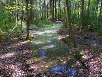 We continued to walk on almost flat trail through some muddy areas and passed a few woods roads that crossed the trail. At 2.9 miles the trail met Basily Road and we turned left to head back to Flugertown Road and the car. A right here leads to Black Bear Road and Round Pond. After a short walk we were at the beaver pond, which was high. Crossing would have been difficult but the addition of a footbridge has made the crossing easier. I took some pictures and was again surprised at the almost total lack of leaf color! We crossed the brook and headed back to the car on Flugertown Road. I stopped a few times to take pictures of the stream and soon we were on a paved surface. We were back at the car just before noon having covered the 6.1 mile hike in a little more than 2 hours for an overall pace of 3 mph.
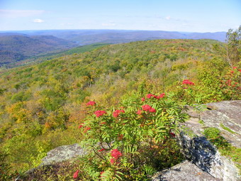
![]()
![]() On Wednesday, October 5th Karl and I decided to get in a hike before my cross country practice. I was thinking about Slide from the Denning trailhead using the Curtis-Ormsbee Trail but the 10 mile distance was a little longer than we could comfortably hike in the time we had. We settled on hiking to the Penguin Rocks on the Dry Brook Ridge Trail from the Millbrook trailhead. I though this would be challenging but short enough so that we could easily finish before my practice started at 3:00 PM. Although I thought we got an early start, the drive was longer than I remembered particularly the distance along Millbrook Road. At one point we were stopped by road repair near the Grants Mills covered Bridge. I was glad to see the bridge seemed undamaged but the low-lying areas of the road took a hit. The temperature was in the low 50's which was an improvement over the high 30's in Livingston manor early in the morning! The skies were blue with a few clouds. We did see some leaf color on the drive but nothing spectacular. We arrived at the parking area just before 9:30 AM and started our hike immediately. The climbing gets started right away with the first .8 miles gaining 450 feet to an elevation over 3000 feet. There are some impressive ledges along the way but the trail skillfully passes through them. Most of the rocks had a nice green, mossy covering and the walk was very pleasant. Karl and I were both glad to be out and the dogs were obviously having a good time. Sheba ignores all wildlife but Maggie has to investigate every chipmunk. After the initial climb there is a drop over the next .5 miles to the lean-to where the trail turns slightly right and heads north. Over the next mile there is a 700 foot gain to about 3430 feet making Dry Brook Ridge #37 on the Catskill Highest Hundred list.
On Wednesday, October 5th Karl and I decided to get in a hike before my cross country practice. I was thinking about Slide from the Denning trailhead using the Curtis-Ormsbee Trail but the 10 mile distance was a little longer than we could comfortably hike in the time we had. We settled on hiking to the Penguin Rocks on the Dry Brook Ridge Trail from the Millbrook trailhead. I though this would be challenging but short enough so that we could easily finish before my practice started at 3:00 PM. Although I thought we got an early start, the drive was longer than I remembered particularly the distance along Millbrook Road. At one point we were stopped by road repair near the Grants Mills covered Bridge. I was glad to see the bridge seemed undamaged but the low-lying areas of the road took a hit. The temperature was in the low 50's which was an improvement over the high 30's in Livingston manor early in the morning! The skies were blue with a few clouds. We did see some leaf color on the drive but nothing spectacular. We arrived at the parking area just before 9:30 AM and started our hike immediately. The climbing gets started right away with the first .8 miles gaining 450 feet to an elevation over 3000 feet. There are some impressive ledges along the way but the trail skillfully passes through them. Most of the rocks had a nice green, mossy covering and the walk was very pleasant. Karl and I were both glad to be out and the dogs were obviously having a good time. Sheba ignores all wildlife but Maggie has to investigate every chipmunk. After the initial climb there is a drop over the next .5 miles to the lean-to where the trail turns slightly right and heads north. Over the next mile there is a 700 foot gain to about 3430 feet making Dry Brook Ridge #37 on the Catskill Highest Hundred list.
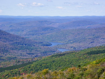 Once we were on the ridge the trail flattened some with a few ups and downs here and there. The woods were pretty open and the trail had a few prickers but nothing very extraordinary. There wasn't much blowdown and the walking was easy enough that we kept up a good pace. As we approached 3.2 miles I began to have some questions. From my previous trip report we should be getting near the viewpoints but from the surroundings I knew we weren't even close! At about 3.3 miles we were at the trail junction with the Huckleberry Loop Trail coming up from Ploutz Road and I knew something was wrong. To make matters worse I had left both map and compass on my desk. It was 11:15 AM which meant we had already spent an hour and 45 minutes hiking. This was a good pace and I knew that going back would be quicker but I was worried about getting to practice on time. I reasoned that the viewpoints couldn't be that far ahead and I didn't want to hike over 6 miles without reaching my goal. We stepped up our pace even more as we headed for the Penguin Rocks! The trail now had a lot more brush and areas of prickers. At times it would wander very close to the edge of the ridge and I would think we were approaching our destination. I had only been to the viewpoints two or three times from this direction and that didn't help any. After teasing us a little, the trail would head back toward the jungle at the middle of the ridge. As it got later and later I began to second guess my decision and I know Karl was questioning my sanity!
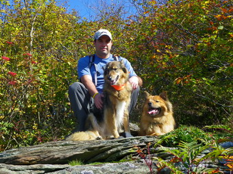 Finally, things began to look familiar and we arrived at a viewpoint...but not the one I wanted. I thought the main lookout couldn't be too much further so I upped the pace to a trail jog. Another viewpoint appeared and I kept going. I passed by another viewpoint which I KNEW was the last one before the main lookout that I wanted. This time I was right and we were at the lookout. It was 1.4 miles from the trail junction to the lookouts and it was 11:45 AM. We had average almost 3 miles per hour over difficult terrain. The trip up had taken two hours and 15 minutes and I knew we would have to be quick on the way back for me to make my commitment in the afternoon. Unfortunately, the leaf colors from the viewpoint were almost absent. A few yellows here and there with some reds but not what I had hoped for. The best colors were the bushes right near the viewpoints! I took some shots of the scenery including the Pepacton Reservoir since there was very little haze. I also shot some photographs of Karl and the dogs. After a brief stay, we packed up and got ready to hurry back to the car. There were a few places I would have stopped along the way but the time constraint made that impossible. We started back at 11:55 AM and were back at the car at 1:55 PM making the return trek 15 minutes shorter. It seemed like we were going even faster but some of the steeper descents slowed us down. We covered 9.4 miles in 4.5 hours. I saved some time by driving back on the Barkaboom Road and made practice on time, barely. I still wondered why the hike was almost 3 miles longer than my previous trip report. After I cam back from school, I reread my report more carefully. It clearly stated that the description was for a hike that stopped at the trail junction and that the lookouts were about 1.4 miles beyond. I just hadn't read what I had written carefully the first time!
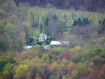
![]()
![]() On Monday, October 3rd Cindy and I were ready to get out of the house after a week of rain and family commitments that kept us out of the woods. We decided to hike to look for some fall colors which are nonexistent in Livingston Manor. We discussed and debated until it was getting late and we decided to stay as close to home as possible by hiking from Mary Smith Road over Mary Smith hill to Holiday Brook Road and back. A previous trip report showed about a 5.4 mile hike and I didn't remember it being more than a little hilly. The weather forecast was for cloudy skies with showers on and off throughout the day. We arrived at the trail head just before 10:00 AM and got started quickly. The temperature in town in the morning was a about 40 degrees. It had warmed slightly but I wore a light softshell, hat and gloves! My trip report said :be ready for some climbing in the first half mile!" I was right! the trail starts up an unnamed hill which is part of the Middle Mountain "range". In the first .45 miles the trail gains just less than 500 feet. As I had suspected the trail had recently been cleared which is what we found on the other end when we came in from Route 206. We did find some large trees down across the trail in places and some smaller ones that seemed new. After a little more than 15 minutes of hiking our blood was pumping and I was sweating. The trail leveled briefly and we stopped at the Middle Mountain lookout. This is a fairly open viewpoint and offers nice views to the east and south. On this day there wasn't much to see as the skies were overcast and the leaves had no color!
On Monday, October 3rd Cindy and I were ready to get out of the house after a week of rain and family commitments that kept us out of the woods. We decided to hike to look for some fall colors which are nonexistent in Livingston Manor. We discussed and debated until it was getting late and we decided to stay as close to home as possible by hiking from Mary Smith Road over Mary Smith hill to Holiday Brook Road and back. A previous trip report showed about a 5.4 mile hike and I didn't remember it being more than a little hilly. The weather forecast was for cloudy skies with showers on and off throughout the day. We arrived at the trail head just before 10:00 AM and got started quickly. The temperature in town in the morning was a about 40 degrees. It had warmed slightly but I wore a light softshell, hat and gloves! My trip report said :be ready for some climbing in the first half mile!" I was right! the trail starts up an unnamed hill which is part of the Middle Mountain "range". In the first .45 miles the trail gains just less than 500 feet. As I had suspected the trail had recently been cleared which is what we found on the other end when we came in from Route 206. We did find some large trees down across the trail in places and some smaller ones that seemed new. After a little more than 15 minutes of hiking our blood was pumping and I was sweating. The trail leveled briefly and we stopped at the Middle Mountain lookout. This is a fairly open viewpoint and offers nice views to the east and south. On this day there wasn't much to see as the skies were overcast and the leaves had no color!
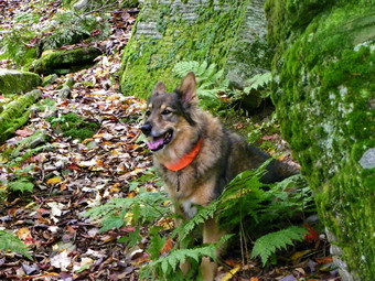 From the lookout the trail continued to rise to 2910 feet at .9 miles. This is the highest point on the hike and has more elevation than Mary Smith Hill! From this high point the trail descends about 240 feet over the next 1.0 miles. At this point there is another lookout through the trees to the south and west. Again, there wasn't much to see since the leaves had no color. After the viewpoint, the trail drops slightly into an area with a LOT of prickers. We were particularly thankful that someone had taken the time to beat back the brush. From here we started up Mary Smith hill but the climb was not as steep as the one from the car up the first climb. The top of the hill was only .25 miles and 120 vertical feet from the Col. We then dropped down the other side and headed toward the turn around point on Holiday Brook Road. At about 2.7 miles into the hike there was a large tree blocking the trail. I had to take off my pack and shimmy under the blowdown since working around it would have meant a trek through some mean looking briars! Cindy decided she did not want to make the attempt and would wait until Sheba and I returned. It was also clear that my previous GPS track was wrong since we were not at the road as the track indicated. Sheba and I started down the hill to the road which I estimated was a little less than .5 miles. The descent was steep and covered with wet and slippery leaves making speed...dangerous. The trail passed through and around several mossy green ledges but I just wanted to get down and back as soon as possible. There were several more areas of blowdowns that required detours until the trail leveled near the bottom, passed the edge of a field and ended up at the parking area and road. We had made the descent of in about 18 minutes. We turned around and had to face the return ascent. I did stop once to take some pictures of the ledges. We were back with Cindy at around 12:25 PM which meant we had gone UP faster than we had gone DOWN especially considering the stop for photos. Cindy was rested and I was tired but we started out at a fast pace back to the car. I did not want to be late for practice! I took off my jacket as I was VERY warm. We did not stop on the way back and arrived at the car at 1:40 PM. We had taken 2 hours to get to the point where Cindy stopped and an hour and 15 minutes to get back! We covered the 6.3 mile hike in 3.5 hours.
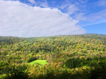
![]()
![]() On Monday, September 26th Cindy and I decided to hike to look for some fall colors. After some of the colors I found the day before at Balsam Lake Mountain and Vly Pond, I was anxious to find some ore. We decided to go to Bear Spring where we saw some of the best falls colors last year. I thought that we would be early but that it would be interesting to get some pictures before peak colors and make a comparison. Bear Spring is pretty close to Livingston Manor and doesn't have to much elevation change which pleases Cindy. My plan was to park at the main lot and hike east to a wide woods road that overlooks a clearcut area. We would then follow this road south to a trail that would take us north to Launt Pond. From there East Trout Brook Road would get us back to the trail to the car. On the way to Bear Spring there was a lot of fog and low hanging clouds and I began to wonder if we would get the chance to see anything on the hike. As we climbed Bear Spring Mountain from Downsville, the fog began to disappear and my mood improved. I parked in the lot and we were on the trail by 9:30 AM. The grass was very wet with dew and there was standing water on the trail. The trails at Bear Spring are designed for horses and there was ample evidence that they had been ridden recently! This also means the trails aren't marked for hiking and few maps exist.
On Monday, September 26th Cindy and I decided to hike to look for some fall colors. After some of the colors I found the day before at Balsam Lake Mountain and Vly Pond, I was anxious to find some ore. We decided to go to Bear Spring where we saw some of the best falls colors last year. I thought that we would be early but that it would be interesting to get some pictures before peak colors and make a comparison. Bear Spring is pretty close to Livingston Manor and doesn't have to much elevation change which pleases Cindy. My plan was to park at the main lot and hike east to a wide woods road that overlooks a clearcut area. We would then follow this road south to a trail that would take us north to Launt Pond. From there East Trout Brook Road would get us back to the trail to the car. On the way to Bear Spring there was a lot of fog and low hanging clouds and I began to wonder if we would get the chance to see anything on the hike. As we climbed Bear Spring Mountain from Downsville, the fog began to disappear and my mood improved. I parked in the lot and we were on the trail by 9:30 AM. The grass was very wet with dew and there was standing water on the trail. The trails at Bear Spring are designed for horses and there was ample evidence that they had been ridden recently! This also means the trails aren't marked for hiking and few maps exist.
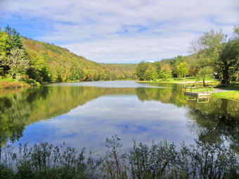 We hiked east and crossed a field before heading down to a trail that crossed East Trout Brook Road. After crossing the road, we stayed to the left and hiked up a hill on the trail that parallels Route 206/7. At the next T junction we turned left and headed down to the wide woods road. I could see that up ahead there was some color and some interesting low hanging clouds in the valleys. Once we got to the road, we both began taking pictures as we walked. It was walk a short distance, take a picture and repeat for almost half a mile. As we walked our angle kept changing as did the angle of the sun.The fall colors were not quite ready in this area but we both felt they would be there in a week or 10 days. After about .5 miles, we entered the woods and the views disappeared. We hiked up a small hill and at about 2.85 miles we turned right on another woods road that we had hiked the last time we were at Bear Spring. This trail drops almost 550 feet over the next 1.4 miles. At 3 miles into the hike the trail turns nearly 180 degrees changing direction from southeast to northwest. Along the way there is a break in the trees that reveals another clearcut area. The trail ends at a parking area on East Trout Brook Road just south of Launt Pond. We made a right and walked .3 miles up to the pond. Last year the trees around the pond were on fire with color. On this day the colors were starting to change but were not quite there. After a few pictures we headed back out to the road. I had used East Trout Brook Road to hike a loop before but I had walked down it! This time we had to walk back up the road. The walk was about a mile but gained around 300 feet. When we reached the trail, we turned left and followed our path from earlier back to the car. We were back by 12:00 PM having covered 6 miles in 2.5 hours.
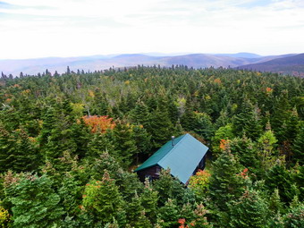
![]()
![]() On Sunday, September 25th I was very depressed when I awoke to find a beautiful fall day reminiscent of "Indian summer" and not the rain that was predicted. One look at weather only made things worse since no rain was approaching and only a few clouds seemed to be on the way. My anxiety stemmed from the fact that I was scheduled to instruct a CPR class ALL AFTERNOON after church. When I got home from church, I gathered my materials and met the other instructor at the firehouse. I was supposed to be a small class and by the appointed time only two people had appeared. We decided to try another day and I was very happy! After considering some options I remembered that two friends, Cindy and Brian. were supposed to be at the Balsam Lake fire tower and I decided to head that way. I knew they might have to leave early so I drove quickly up the Beaverkill Road to the trailhead. The leaves were already beginning to change and so far they were not the bright colors we hope for. By the time we arrived at the parking area the temperature was in the 70's and it was more humid than I had expected. The road was passable but still showed some damaged from the flooding. There was only one other car in the lot when we headed out on the trail at 1:20 PM. The first part of the trail was wet and muddy and I hoped this would not continue for the entire hike. There was no register in the trail box. This situation is now common place and I still wonder whose responsibility it is to collect the old registers and place new ones. I know they have never been used for missing persons but they are important in determining trail usage! There continued to be some water on the trail and a few blowdowns but otherwise it was in good shape. Sheba and I kept up a good pace and we made the first turn at 1:42 PM taking about 20 minutes for the .9 mile walk.
On Sunday, September 25th I was very depressed when I awoke to find a beautiful fall day reminiscent of "Indian summer" and not the rain that was predicted. One look at weather only made things worse since no rain was approaching and only a few clouds seemed to be on the way. My anxiety stemmed from the fact that I was scheduled to instruct a CPR class ALL AFTERNOON after church. When I got home from church, I gathered my materials and met the other instructor at the firehouse. I was supposed to be a small class and by the appointed time only two people had appeared. We decided to try another day and I was very happy! After considering some options I remembered that two friends, Cindy and Brian. were supposed to be at the Balsam Lake fire tower and I decided to head that way. I knew they might have to leave early so I drove quickly up the Beaverkill Road to the trailhead. The leaves were already beginning to change and so far they were not the bright colors we hope for. By the time we arrived at the parking area the temperature was in the 70's and it was more humid than I had expected. The road was passable but still showed some damaged from the flooding. There was only one other car in the lot when we headed out on the trail at 1:20 PM. The first part of the trail was wet and muddy and I hoped this would not continue for the entire hike. There was no register in the trail box. This situation is now common place and I still wonder whose responsibility it is to collect the old registers and place new ones. I know they have never been used for missing persons but they are important in determining trail usage! There continued to be some water on the trail and a few blowdowns but otherwise it was in good shape. Sheba and I kept up a good pace and we made the first turn at 1:42 PM taking about 20 minutes for the .9 mile walk.
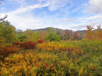 The trail up the mountain was not wet except for the part by the spring. We kept a good pace up the trail as I wanted to try to get their while the tower was still open. We were soon on the summit plateau. The leaves near the top were already starting to change colors and the smell of the balsam fir was very strong. As we approached the tower we heard voices. We entered the clearing at 2:10 PM covering the 1.75 miles in 50 minutes. I talked to the two couples who had hiked in from Millbrook but the tower was closed! The other hikers had a husky with them that they put on a leash. I regretted not bringing a leash for Sheba but she was not interested in the other dog. I took her to the first landing on the tower and then headed up. The skies were still partly sunny but the clouds were starting to roll in. The leaves were already changing in most places I could see. I took some pictures, checked to see that Sheba was where I told her to stay and took some more pictures. After that, I headed down the tower and we were on the trail down the other side of the mountain by 2:20 PM. This trail was wet and muddy in several spots especially were it leveled off. I walked around the muddiest places carefully and by 2:35 PM we made the right turn on the trail back to the car. The trail was still clear of most brush but all the rocks were wet and slippery. I tried to get some views down into the Gulf of Mexico or across to the next set of hills but there were no good ones and the sky was now almost completely overcast. We arrived at the lower trail junction at 3:00 PM and were at the car by 3:20 PM. We had covered about 4.3 miles in 2 hours. At this point I was still fresh and it was still early. Although the skies we cloudy, I did not think it would rain so I decided to hike to Vly Pond.
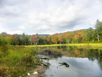 Vly Pond is just a few hundred feet of bushwhacking off the trail and the backdrop is Graham Mountain. As we started out on the trail, I stopped in the field to take some pictures. The colors here were more vibrant than anywhere else and Balsam Lake Mountain was in the background. After taking several pictures from different angles, we continued on our way. The trail descends along a woods road and there was a LOT of new and some old blowdown that should be cleared. The descent is about .5 miles to where the trail crosses Black Brook on a bridge. The bridge was in good shape with no signs of damage from the flooding. Over the next ,4 miles the trail ascends and then moves up and down while heading generally east northeast. As we hiked I began to recall that the majority of the hike to the two ponds, Vly and Tunis, was the distance from the trail head to Vly! at 5.7 miles we were at the bridge across the Gulf of Mexico Brook which also was in good shape. It was missing one side rail which has been gone for over a year! Just after a short uphill we were at the outlet brook for Vly Pond. I decided to stay on the near side and Sheba and I bushwhacked up to the shore of the pond near the beaver dam. We arrived at about 4:05 PM and I was surprised that with all the rain the beaver pond was not overflowing. The dam was intact but the water looked a little stagnant. The colors around the pond were excellent and reflected nicely in the water. The mountains formed a perfect backdrop. The only problem was the now nearly complete overcast. I would have preferred some blue sky and clouds but took a number of pictures anyway. We didn't stay long and were soon on our way back. The trip back went quickly. At one point I thought I might try walking out to the Beaverkill Road on a woods road that crosses the trail. I looked at my map and noticed the enormous bow in the road that would add miles to the trip which was not what I was looking for! We followed the trail back to the car and were in the parking area just before 5:00 PM having covered 7.6 miles in 3.5 hours including a number of photographic stops.