
| Pick a Catskill 35 Peak: |
Panther Mountain
| Trailhead Coordinates | |
|---|---|
| Name | Coordinates |
| Route 47 (Panther PA) | N42.0266 W74.4037 |
| Fox Hollow | N42.0986 W74.3914 |
| Woodland Valley | N42.0361 W74.3575 |
| Quick Look - Panther from Rt 47 | ||||
|---|---|---|---|---|
| Difficulty | Round trip | Total climb | Location | Internet Maps |
| 6.3 mi. | 2105 ft. | N42.0564 W74.3950 | AllTrails | |
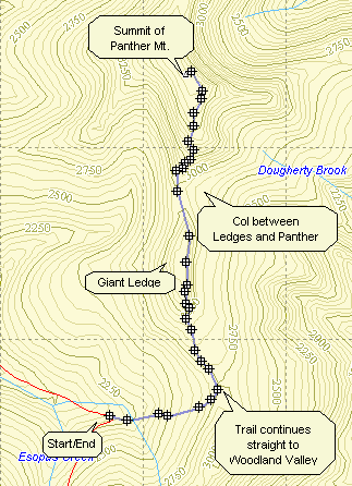
Park at the trailhead on the Frost Valley Road just after Winisook Lake on the hairpin turn. Find
the yellow-blazed Phoenicia-East Branch trail and hike .65 miles to the blue-blazed Giant Ledge -
Panther Mountain Trail. This ascent is rather gradual with a few short, steep areas thrown in. After
about .75 miles, you reach Giant Ledge. Here there are a series of ledges that look to the east and
offer a view of Wittenberg and Slide. Continuing on for about .4 miles you begin a descent from the
Ledges. This has several areas that can be tricky when wet or icy but are otherwise fine. In .9
miles you are at the summit of Panther where there is a pretty but limited view of the valleys
below. Reverse your trip back to the parking lot.
| Quick Look - Panther from Fox Hollow | ||||
|---|---|---|---|---|
| Difficulty | Round trip | Total climb | Location | Internet Maps |
| 8.5 mi. | 2850 ft. | N42 03.38 W74 23.68 | AllTrails | |
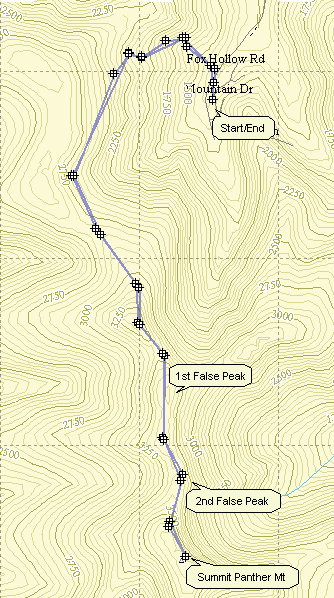
Park at the trailhead on Fox Hollow Road which is off Route 28 between Shandaken and Allaben. Find the blue-blazed Giant Ledge - Panther trail and begin your ascent. A side trail to the Fox Hollow lean-to and a spring occurs after just .5 miles. The trail is not very well used and would be hard to follow except for the blue trial markers. The trail ascends gradually with a few rock scrambles until the 3500' sign. This sign suddenly appears in a place where the trail makes a very shallow ascent. There are several false peaks before this sign which makes a GPS a valuable tool. If you have not been to the summit of Panther before, these false peaks could easily fool you into thinking you are at the actual summit. From the 3500' sign up there are several rather steep ascents and rock scrambles. Before the summit there is another lookout that is worth a stop. The signs say the trail is 4.9 miles, my GPS says even less. Based on the speed I normally walk and the time it took me to hike, the distance is a little more than 5 miles! At the top there is a fine view to the east. To return, reverse your direction to the trailhead. An interesting through hike to County Rt 47 would require another car at the hairpin turn on that road right after Winisook Lake.
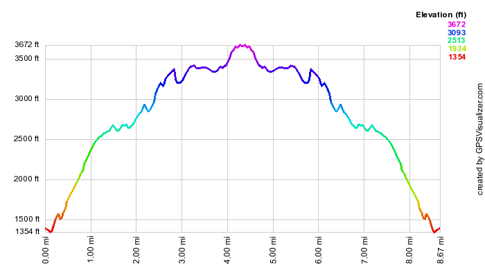
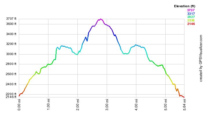
(The image above is the vertical profile for the hike.)