
What You Missed
Spring 2007
Spring 2007
![]()
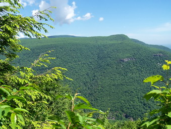
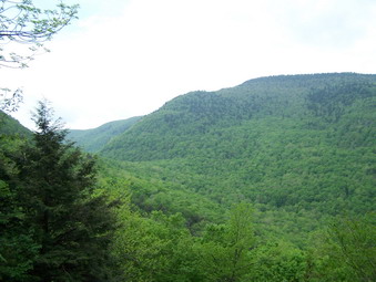
![]() On Saturday, June 16th I wanted to hike to the Kaaterskill High Peak from Palenville. This was the hike I had planned two weeks ago and then abandoned. This never sits well with me so I was anxious to conquer this trail! Sheba and I got to Malden Avenue off Route 23A at 10:00 AM and parked just across from the bridge over the creek. We were hiking by 10:15 and really moving along. We walked down Malden Avenue and then turned right where the Long Path cuts up the woods road. We were really moving! The sun was out and despite the 30% chance of thunderstorms I had a good feeling. When we arrived at the lookout before Poet's Ledge, the view was clearer than last time. I took some pictures and we got right back on the trail.
On Saturday, June 16th I wanted to hike to the Kaaterskill High Peak from Palenville. This was the hike I had planned two weeks ago and then abandoned. This never sits well with me so I was anxious to conquer this trail! Sheba and I got to Malden Avenue off Route 23A at 10:00 AM and parked just across from the bridge over the creek. We were hiking by 10:15 and really moving along. We walked down Malden Avenue and then turned right where the Long Path cuts up the woods road. We were really moving! The sun was out and despite the 30% chance of thunderstorms I had a good feeling. When we arrived at the lookout before Poet's Ledge, the view was clearer than last time. I took some pictures and we got right back on the trail.
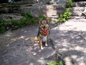 When we arrived at the Poet's Ledge trail we kept moving. My intention was to visit it on the way back. First I wanted to make sure we got to the High Peak. When we arrived at the first falls, I realized it was NOT Wildcat Falls as I had thought last time. This falls is on Hillyer Ravine. We continued on the trail to Wildcat Falls and were there in just a short time. The view from here is much the same as from the other lookout. The other side of the clove is visible. I took some pictures but the low volume of water was disappointing.
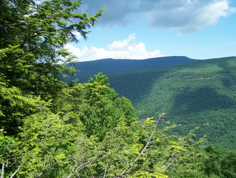 We stopped again at Buttermilk Falls which is the highest and potentially must interesting of the three. From what I can see there is an initial long drop followed by another, smaller falls below. There seemed to be a path that lead down but I was on a mission. The trail turns sharply left after the falls and begins to ascend. The ascent is broken by some switchbacks but is still steep at times. There are many short climbs over and through rocky areas. In a short distance the trail again turns left. I remember coming in from the other direction and almost missing the turn onto the snowmobile trail. This time I was careful to look for the sign. We turn up the snowmobile trail and hiked the short, steep incline to the snowmobile trail that surrounds both Kaaterskill and Round Top. After turning right it was only a few hundred feet to the now well-marked herd path. The path is getting wider and a stone cairn marks its beginning.
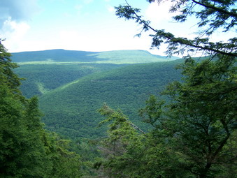 Throughout the hike the skies had been getting darker and at this point a heard the first rumble of thunder. The smart thing would have been to turn around. We continued! The herd path is quite obvious and very steep in places. Much of it is rocky. We met a husband and wife team coming off the peak as they sat under a rocky overhang. Their intention was to get out of the rain which had just started. Sheba and I headed up as the thunder rolls increased and the sprinkles became rain. We struggled to get to the top since what had been dry, sure footing was now slippery as the rain increased. At the top we walked around looking for a view. Several flashes of lightning convinced me to retreat. I hoped to hook up with the couple we had met but they were already gone. Sheba and I slipped and slid down to the snowmobile trail and retraced out steps.
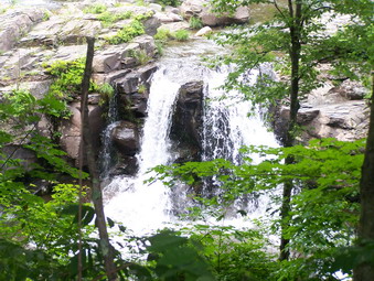
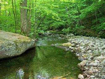
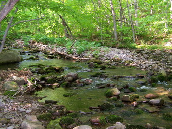
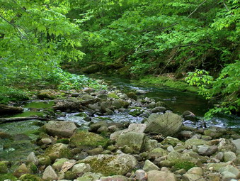
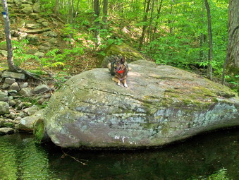
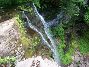 The rain became torrents and I put on my Marmot Precip jacket. I also put the camera and GPS in a waterproof baggy. The rain continued and the flashes of lightning and the sound of thunder were continuous. IT WAS MISERABLE! It was gloomy and dark blue markers are hard to see. Sheba saved me from making mistakes on the trail at least twice. I don't know what sense she uses but she is GOOD. Just after Hillyer Ravine we met the husband from the couple we had seen on the High Peak. His wife was just ahead. We decided to hike together which made things a little more bearable. By this time the only dry part of me was under the Precip which worked surprisingly well despite the warm air temperature. Somewhere near Poet's Ledge and the lookout, the rain let up and then stopped! The sun even came out. By this time my boots and socks were soaked. I could feel several areas of irritation on my feet but I didn't have much choice but to continue. We part ways a Malden Avenue as Sheba and I turned left to go back to the cat. I stopped to take some pictures of a waterfall on Malden Avenue. Later on, near the bridge I went down to the creek and took some pictures of another waterfall.
 Back at the car I dried the dog off as best I could. She was a muddy mess and smelled like ... wet dog. I didn't bring many clothes to change into. I did have a pair of damp socks in my pack. When I took off my boot and socks, it was clear why my feet hurt. I think I may take it easy on Father's Day. We had hiked for 6 and half hours, over 10 miles and 4400 feet of vertical climb!
![]()
![]() On Thursday, June 14th I headed home from work a little late but decided to do the hike at Long Pond which we had planned for the day before. I also wanted to try to complete the loop around using Basily Road. My wife and I had stopped at the beaver pond during the winter since it was not clear how deep the water was. Sheba and I got right on the trail and started up the hill. The hill out of the parking area is the only real uphill on the whole hike but it is long and challenging.We moved VERY quickly up the hill and across the trail toward Long Pond.
On Thursday, June 14th I headed home from work a little late but decided to do the hike at Long Pond which we had planned for the day before. I also wanted to try to complete the loop around using Basily Road. My wife and I had stopped at the beaver pond during the winter since it was not clear how deep the water was. Sheba and I got right on the trail and started up the hill. The hill out of the parking area is the only real uphill on the whole hike but it is long and challenging.We moved VERY quickly up the hill and across the trail toward Long Pond.
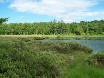
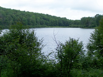
 At the cutoff to Long Pond we went down to the pond for a few minutes to take pictures. This is another pond with mountains in the background. The contrast of the greens and blues was stunning. This pond is being filled in and one area to the left is already turning into a beaver meadow. When we got back on the trail, we turned right at the T to head toward the lean-to and Basily Road. We didn't stop at the lean-to but pressed on. At the end of the road we turned left onto Basily. A little further on Basily Road cuts right to Black Bear Road. We continued on around to the left to make the loop.
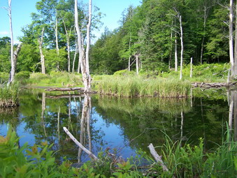
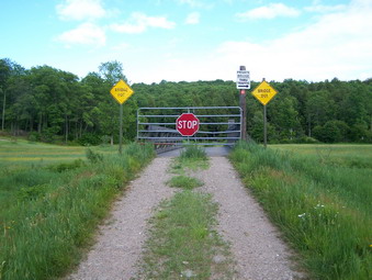 When we reached the beaver pond, the water was higher than I would have liked but I crossed on the small dam without getting wet. I don't like trespassing on private property and this area is posted. I stayed on the "road" and headed across the field to the bridge. The bridge is a private bridge and the sign points to a "ford" across the creek. I actually used the bridge to cross and then continued on the road. The road at this point is unpaved but wide and fairly flat. It runs right along the creek and the sound of the water was pleasant. At some point Basily road gives way to Flugertown Road and paving appears.
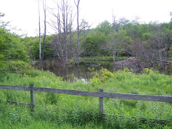 As we walked down Flugertown a deer jumped out into the road. Sheba flinched but did not chase it. The deer seemed confused about how to get back into the woods and bounded down the road for some distance. Further down the road the beavers have dammed the creek again. Evidence of recent activity included some freshly gnawed trees. We were back at the car in under two hour for about 6 miles including stops.
![]()
![]() On Wednesday, June 13th I headed home from work a little early and stopped by the pharmacy where my wife works. She is out early on Wednesday so, despite the ominous black clouds, we decided to hike at Long Pond. I went home to get ready and she arrived a few minutes later. We got dressed, grabbed the dog and headed out. As we passed by the turn to Mongaup Pond, we decided Hodge and Frick Ponds were closer so we made a last minute change in our plans. We parked at the parking area and immediately began the hike up the Flynn Trail to Hodge. We were really moving. At the junction we went straight ahead toward Hodge. Shortly after that we turned right on the side trail that leads to the Sullivan County high point. After a short distance we turned left and headed down toward the pond. A trail leads off to the right and we thought it probably went around the pond. We were right and we got to see the lower end of the pond from the upper end for the first time.
On Wednesday, June 13th I headed home from work a little early and stopped by the pharmacy where my wife works. She is out early on Wednesday so, despite the ominous black clouds, we decided to hike at Long Pond. I went home to get ready and she arrived a few minutes later. We got dressed, grabbed the dog and headed out. As we passed by the turn to Mongaup Pond, we decided Hodge and Frick Ponds were closer so we made a last minute change in our plans. We parked at the parking area and immediately began the hike up the Flynn Trail to Hodge. We were really moving. At the junction we went straight ahead toward Hodge. Shortly after that we turned right on the side trail that leads to the Sullivan County high point. After a short distance we turned left and headed down toward the pond. A trail leads off to the right and we thought it probably went around the pond. We were right and we got to see the lower end of the pond from the upper end for the first time.
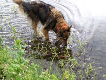 After hiking around the pond, we stopped at the lower end as we always do. Sheba was thirsty and took a drink from the pond. It seemed strange but someone had mowed the trail around the pond which made walking that much easier! The skies were looking more and more like rain so we hurried on. Hodge Pond was pretty full of water even though it was been very dry. The trails were only damp in places. At the junction with Big Rock we turned right and headed DOWN. We were moving and negotiated the distance to Times Square quickly. In several places along the trail it looked like "improvements" were being made. At Times Square we turned left and headed for Frick.
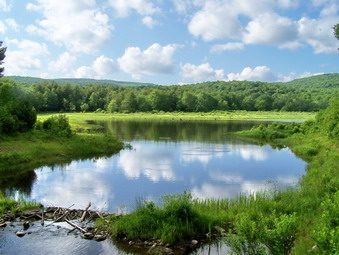 When we arrived at Frick, we turned right to go to the pond. A tree has fallen across the path making what resembles a bower. You can walk under or around the tree. Frick Pond is a beautiful small pond in almost pristine condition. Depending on the amount of water, it may look more like a meadow or a pond or a lake. Today the contrast of greens and blues with the white clouds in the sky was beautiful. The mountains that surround the pond offer a contrast in relief that is remarkable.
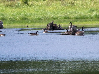 As we approached the pond, I noticed some waterfowl swimming on the surface near some tree stumps. I took several pictures of these Canadian geese making a stop at the pond. They looked so peaceful gracefully floating on the surface. Sheba did not bark to scare them and we left the pond as we had found it. We returned to the car in exactly 2 hours. I would guess the distance was between 5 and 6 miles.
![]()
![]() On Tuesday, June 12th there was a severe thunderstorm watch in effect as I left school. The skies were cloudy in Liberty but got even worse as I headed home. A perfect time for a short, quick hike with the dog at Trout Pond! As we headed for Roscoe, the skies looked even worse and I debated how intelligent my decision was. When we arrived at the parking area, I though we might only get down to the trailhead before turning around. I decided a little hiking was better than none at all. I had put on my low-cut Merrell Chameleon II Stretch shoes for this hike since the trail isn't very rocky. The light shoes felt great as we headed down Russell Brook Road.
On Tuesday, June 12th there was a severe thunderstorm watch in effect as I left school. The skies were cloudy in Liberty but got even worse as I headed home. A perfect time for a short, quick hike with the dog at Trout Pond! As we headed for Roscoe, the skies looked even worse and I debated how intelligent my decision was. When we arrived at the parking area, I though we might only get down to the trailhead before turning around. I decided a little hiking was better than none at all. I had put on my low-cut Merrell Chameleon II Stretch shoes for this hike since the trail isn't very rocky. The light shoes felt great as we headed down Russell Brook Road.
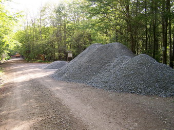
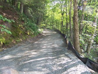 As we neared the lower parking area, I saw some construction equipment and a large pile of gravel. It looked like someone was paving the road down to the waterfalls! I read a sign posted at the trailhead that said a new bridge was being installed. I personally thought the old bridge was fine but headed down the trail to see what was going on. Gravel has been spread and packed by a roller down to the brook. The biggest surprise waited me at the brook! The old bridge has been torn out and replaced with a large metal plate over the brook. Black plastic has been placed as a fence. It looks TERRIBLE! ON the other side the "paving" continues almost up to the register. I hope they intend to stop at this point and leave the rest of the trail in its natural condition! Maybe it will look better when it is done but for now it is a disaster.
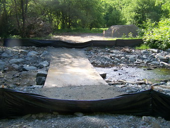 We headed up the steep hill toward Mud Pond with the skies alternating between partly sunny and totally overcast. We moved quickly since I wanted to see how much hike we could get in before the rains came. After only half and hour we were at Mud and turned toward Trout. As we came up the hill toward Mud, a large bird swooped down on us calling a warning. I did not see where it came from or what species it was. It landed in another tree and continued its call until we were well away. We continued to move quickly and made the lean-to on Trout in an hour! There is still no bridge across the inlet but it has been so dry that it is not needed. We just walked across on dry rocks. The pond is still high from the beaver dam. Many of the trees at the waters edge are dying as there roots "drown" in the high water. The beavers have cut down other trees and girdled some. I know they are a part of nature but I am not thrilled with their work. We were back at the register in no time and arrived at the car in 1 hour 45 minutes after covering 6 miles.
![]()
![]() On Sunday, June 10th my wife decided she did not have the time to go hiking or the energy. I was going to do a shorter, flatter hike with her but I changed my plans. Sheba and I headed for the Peekamoose Parking Area on the Shandaken Road outside of Grahamsville. We parked at 1:50 PM and immediately got going. It had rained on the drive over and the weather was still unsettled. The air temperature was in the 70's but it felt much more uncomfortable due to the humidity. I was convinced that we might only make it to Reconnoiter Rock before the rains came. I had filled the Camelbak and in addition had two liter Nalgenes. This trail is notoriously dry and I wanted to have plenty of water for myself and the dog. I was wearing a new Outdoor Research Sequence SS top which is made of a light wool fabric. I found on the hike that this is an excellent shirt! It wicks better than most synthetics and limits odor well. Wool is great for climate control and is not always warm as most people assume.
On Sunday, June 10th my wife decided she did not have the time to go hiking or the energy. I was going to do a shorter, flatter hike with her but I changed my plans. Sheba and I headed for the Peekamoose Parking Area on the Shandaken Road outside of Grahamsville. We parked at 1:50 PM and immediately got going. It had rained on the drive over and the weather was still unsettled. The air temperature was in the 70's but it felt much more uncomfortable due to the humidity. I was convinced that we might only make it to Reconnoiter Rock before the rains came. I had filled the Camelbak and in addition had two liter Nalgenes. This trail is notoriously dry and I wanted to have plenty of water for myself and the dog. I was wearing a new Outdoor Research Sequence SS top which is made of a light wool fabric. I found on the hike that this is an excellent shirt! It wicks better than most synthetics and limits odor well. Wool is great for climate control and is not always warm as most people assume.
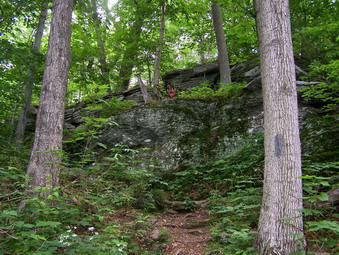
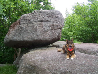 The beginning part of the trail is rather challenging with a pretty steep grade. The trail is over an old woods road and is wide but strewn with the typical Catskill assortment of rocks, leaves and sticks. Some group has done a GREAT JOB of clearing ALL the new blowdown and some of the old. They have also installed water bars to direct runoff away from the trail. The trail is clear for its entire length! The register box is a ways from the parking area. In about .8 miles the trail turns right off the woods road and continues through the forest. It is well marked and easy to follow. For midafternoon the forest was quite dark as the clouds and mists persisted. The few glimpses I could get off the trail were like looking into a cloud. The trail varies between flat areas and steep climbs through rocky areas and over dirt patches. In a little over two miles you arrive at Reconnoiter Rock. On good days the view here is limited by the foliage. Today there was no view. After a drink and a few pictures we headed for the summit of Peekamoose.
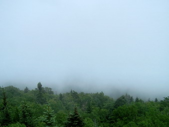 The trail climbs upward and then levels off and then repeats this pattern. After a short climb there is a rock ledge that looks off into the valley. There is usually a nice view from this point. This day I only got the "inside of a cloud" view. Several more climbs, some of them steep and rocky, brought us to the big boulder that marks the top of Peekamoose. Somewhere along the way the sun had actually come out briefly. This buoyed my spirits a little until it again disappeared. Since the rain had not stared, I decided to head for Table. The drop into the col is no more than 200 feet and the distance is less than a mile. The "peak" marked on the trail map is actually well passed the highest spot.
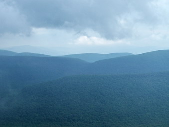 The descents into the col and the climb up to the Table plateau are both steep but short. The walk to the summit is almost flat but is long. I walked to the marked summit and noticed a trail to a lookout. I don't remember ever being on this rocky ledge before. Today there was a limited view of some of the other mountains. The mist rising off the peaks, descending into the valleys and swirling around the trees was an interesting sight. I took a few pictures and then looked at my watch. It was not even 3:00. We had made Table in just 2 hours. We turned around and hurried back the way we had come. I wanted to try to avoid the rain that I felt would fall at any minute. Getting caught in the lightning and thunder on Kaaterskill had been enough for me!
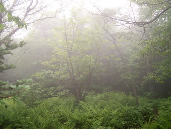 The walk back for pretty uneventful as we made VERY good time. When we reached the area below Peekamoose a few drops of rain fell. From there on it was like walking in a cloud. The mists surrounded us and swirled around us. My clothes and pack were wet just from this moisture. At the lower elevations the vegetation was wet giving evidence it had rained if only briefly. We returned to the parking area just before 6:00 PM. A 9 plus mile hike in 4 hours including several stops! After investigating the rapids and falls in the brook across from the parking area, we returned home.
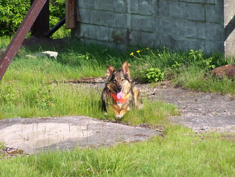
![]() On Saturday, June 9th I was home from the NYS Track Championships by 3:00 PM. I decided to get in a quick hike even though it was late in the day and Sheba agreed. On Thursday I did Balsam Lake but skipped Graham. I though it was only fair to do Graham and we headed back up the Beaverkill Road to the parking area. We arrived in the parking area at 3:35 PM. I was a little concerned about the time factor. I was thinking about 4 hours for the hike bringing me to 7:30 PM. This left little cushion for any mishaps. Although I have a headlamp and other essential I did not want to have to use them! I decided to move quickly and we got right on the trail.
On Saturday, June 9th I was home from the NYS Track Championships by 3:00 PM. I decided to get in a quick hike even though it was late in the day and Sheba agreed. On Thursday I did Balsam Lake but skipped Graham. I though it was only fair to do Graham and we headed back up the Beaverkill Road to the parking area. We arrived in the parking area at 3:35 PM. I was a little concerned about the time factor. I was thinking about 4 hours for the hike bringing me to 7:30 PM. This left little cushion for any mishaps. Although I have a headlamp and other essential I did not want to have to use them! I decided to move quickly and we got right on the trail.
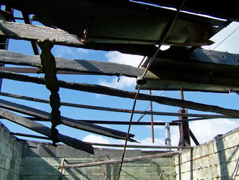 We made the Balsam Lake turnoff in about 15 minutes and took another 15 to get to the turnoff to the herd path to Graham. The herd path is pretty hard to miss at the beginning. Along the way there is quite a bit of blowdown both old and new. Much of it doesn't get cleared since it is on private land. The herd path now has several "permanent" paths around the major blockages. In spots, it is hard to see exactly where the trail goes. This is where the dog comes in handy. She will put her nose to the trail and seldom loses it. I just follow her blaze orange neckerchief. I just have to be careful when she ducks under something and takes advantages of her dog height. We moved quickly up the trail and were soon at the last, slightly steeper climb to the top. We made the summit in 1.5 hours! This is the quickest I have ever done this trail. The black flies and mosquitoes were THICK at the top so I took a few pictures and we headed back.
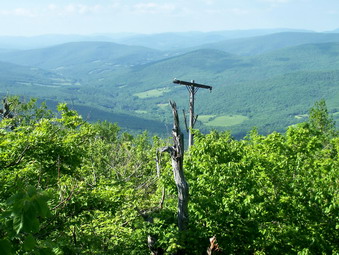 On the way up I missed the turn off the trail to the telephone pole lookout. I found it on the way down and stopped for a minute or two. After a drink and a few more pictures we headed back. I was trying to make it back in 1.5 hours or less. Some of the descents are rocky so I took the time to be careful. We did make it back in under 1.5 hours making the 7.5 mile round trip in under 3 hours!
![]()
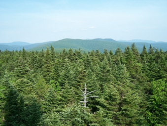
![]() On Thursday, June 7th I decided to that I preferred to hike after work rather than run or bike. I came home at 3:30 PM, changed clothes, got my pack, grabbed the dog and headed for Balsam Lake Mountain. We got on the trail at about 4:15 PM and moved pretty quickly over the wide woods road to the turn up the steeper part of Balsam Lake. The weather was warm and humid but it felt cooler on the trail than it did in downtown Livingston Manor. We turned on the trail up the steeper side of the mountain and headed for the fire tower. The day seemed so clear that I was hoping for some pictures without the usual haze on the surrounding peaks. No such luck! When I climbed the fire tower, most of the peaks were shrouded in haze. I did take some pictures before scurrying down the tower and continuing on the hike. Sheba was moving right along as always and the hike down the other side took only a few minutes. We were back at the car by 6:00 PM after traveling 4 miles! This may be the first mountain that I climb in all 12 months of the year!
On Thursday, June 7th I decided to that I preferred to hike after work rather than run or bike. I came home at 3:30 PM, changed clothes, got my pack, grabbed the dog and headed for Balsam Lake Mountain. We got on the trail at about 4:15 PM and moved pretty quickly over the wide woods road to the turn up the steeper part of Balsam Lake. The weather was warm and humid but it felt cooler on the trail than it did in downtown Livingston Manor. We turned on the trail up the steeper side of the mountain and headed for the fire tower. The day seemed so clear that I was hoping for some pictures without the usual haze on the surrounding peaks. No such luck! When I climbed the fire tower, most of the peaks were shrouded in haze. I did take some pictures before scurrying down the tower and continuing on the hike. Sheba was moving right along as always and the hike down the other side took only a few minutes. We were back at the car by 6:00 PM after traveling 4 miles! This may be the first mountain that I climb in all 12 months of the year!
![]()
![]() On Saturday, June 2nd my wife and I decided to go to Palenville to hike the Long Path toward Kaaterskill High Peak. I had never done this route before and was excited to try it. Many of the guidebooks describe it as challenging and I was anxious to see if they were right. The drive from home takes over an hour. We took the "back roads" to Hunter, Tannersville, Haines Falls and, finally, Palenville. The directions I had said that it was possible to park on the north side of Malden Avenue but I never found this street. We parked on Route 23A just before it crosses Kaaterskill Creek. The weather was hot and humid with temperatures into the 80's. The forecast was for possible afternoon thunderstorms so we got started as soon as possible. Next time I will leave the house even earlier since we started the hike at 10:30 which is at least an hour and a half too late! As we started, there were several other groups of people getting ready to hike.
On Saturday, June 2nd my wife and I decided to go to Palenville to hike the Long Path toward Kaaterskill High Peak. I had never done this route before and was excited to try it. Many of the guidebooks describe it as challenging and I was anxious to see if they were right. The drive from home takes over an hour. We took the "back roads" to Hunter, Tannersville, Haines Falls and, finally, Palenville. The directions I had said that it was possible to park on the north side of Malden Avenue but I never found this street. We parked on Route 23A just before it crosses Kaaterskill Creek. The weather was hot and humid with temperatures into the 80's. The forecast was for possible afternoon thunderstorms so we got started as soon as possible. Next time I will leave the house even earlier since we started the hike at 10:30 which is at least an hour and a half too late! As we started, there were several other groups of people getting ready to hike.
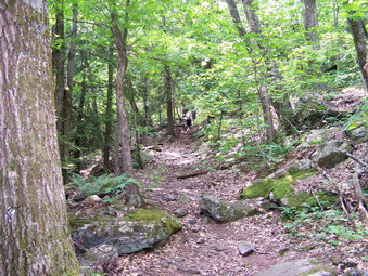
 We walked on 23A toward Palenville and took the right just before Kaaterskill Creek. I gather that this was once Malden Avenue but is now closed to traffic. The aqua blazes of the Long Path are evident here. We continued down a path until we again hit a paved street open to cars. A little father down the road the blazes turned to the right on a short street. The blazes and blue markers again turn right off this street and mark the beginning of the trail to Kaaterskill High peak. The first part of this trail is on a wide and fairly smooth woods road. The trail gains elevation quickly. After a short, continuous climb the trail leaves the road and turns up into the woods.
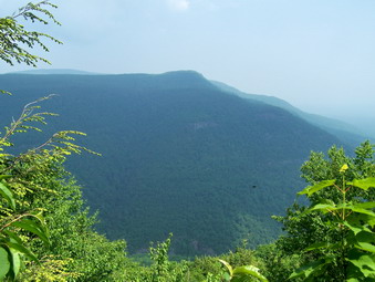
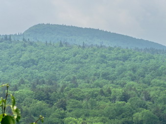 From this point the trail has many switchbacks to make an impossibly steep climb a little easier. The switchbacks can be annoying since they add to the distance you must hike but your "up" muscles will thank you. In about 1.25 miles there is a break in the forest to the right and a small ledge that looks out over part of The Kaaterskill Clove. In another half mile is a sign indicating the spur trail to Poet's Ledge. We took the spur trail and immediately noticed that it starts to descend. This means you will have to walk back up from the ledge but the side trip is well worth it! In less than half a mile we arrived at an open space with several fire circles. Walking toward the edge reveals a view of the surrounding mountains. This is NOT Poet's Ledge. Continuing on the yellow trail we descended through some rocks and then arrived at Poet's Ledge. This is a rock ledge that reveals a beautiful view of the Clove below. South Mountain is on the right. Looking UP and to the left you can see Kaaterskill High Peak still over 1000 feet of climbing above you. The only drawback is that Route 23A splits the Clove and traffic is noisy at times.
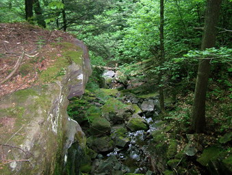 When we left the ledge and returned to the main trail it was obvious that the sky had grown more cloudy and that the air was changing. We suspected a storm was on the way. We decided not to try the peak but to go as far as Wildcat Falls, another half a mile or so. The path to the falls is almost flat but is partially blocked in several places by blowdowns. It is also a little wetter than the trail had been so far. We arrived at Wildcat Ravine and found the falls to be barely a trickle. By the look of the falls it is probably worth seeing when more water is passing over it. We turned around and walked quickly back along the path in the direction we had come.
We passed Poet's Ledge and the lookout just before the Ledge. The Clove was still hazy but the skies were darker. As we continued to hike light rain began to fall. Initially the rain was so light it failed to penetrate the foliage. This was about to change! Within minutes the rain intensified. We could hear thunder and see bright bolts of lightening. We were still above 1000 feet. We quicken our pace, at times jogging down the path. Once we were on the woods road the rain increased in strength and thoroughly drenched us. Wet and hunched over we retraced our steps down Malden Ave. to Route 23A. The road is open and offers little protection from the rain. The temperature had drop and I suspected hail was on the way. The way back to the car is all uphill adding to the misery. At the car we quickly through our gear in, covered the seats and took refuge. Cindy, the smart, one had brought a partial change of clothes. My hiking clothing did dry but that took a while. As we drove away the rain continued to pour down. The section of Route 23A from Palenville to Haines Falls was covered with runoff and it was difficult to see the road. Despite this, several drivers seemed in a hurry and passed where the lanes double for a short distance. The rain ended abruptly on the Tannersville side of Haines Falls and the skies in Tannersville were only cloudy. We hike was over 7 miles. We had taken about 3 hours to climb up and just over one hour to get back!
![]()
![]() On Monday, May 28th my wife and I participated in the Livingston Manor Memorial Day Parade with our volunteer ambulance corps. After the parade we left the house and headed for the Trapps. I wanted to hike Millbrook Ridge with my wife as she had never done it from the Trapps end. As we passed Minnewaska a sign said 'Watch for Congestion'. The Minnewaska lots were filling up before midday. At the Trapps Bridge parking the lot was full and actually beyond a safe capacity. We went back to the West Trapps lot but they wanted $18 for two people to hike. I was willing to pay but my wife thought otherwise. We ended up parking in the New York State owned Peters Kill Parking area. This changed our hiking plans. The temperatures were in the high 60's or low 70's so I was wearing my UnderArmor CoolGear short sleeve shirt under a Mountain Hardwear Wicked T short sleeved shirt. I find the double shirts wick well and since one moves against the other I never get any chafing from the pack. I wore my standard Gander Mountain nylon pants. I have rediscovered the joys of my Asolo Fugitives which are lighter than the Asolo TPS 520. I wore most of the winter. I still haven't made a final decision on the ultimate socks but I wore the Wigwam Silk/Wool hikers which work as well as any. I used an Osprey Atmos 50 most of the winter since it carries so much and fits so well. I am now using my Marmot Vapor 30 which is much lighter and fits about as well. The harness on the Vapor actually fits better than the Atmos but the Atmos contours better to my back. I have been carrying a 3 liter bladder in the pack and 2 one liter bottles to make sure I and anyone with me has enough water.
On Monday, May 28th my wife and I participated in the Livingston Manor Memorial Day Parade with our volunteer ambulance corps. After the parade we left the house and headed for the Trapps. I wanted to hike Millbrook Ridge with my wife as she had never done it from the Trapps end. As we passed Minnewaska a sign said 'Watch for Congestion'. The Minnewaska lots were filling up before midday. At the Trapps Bridge parking the lot was full and actually beyond a safe capacity. We went back to the West Trapps lot but they wanted $18 for two people to hike. I was willing to pay but my wife thought otherwise. We ended up parking in the New York State owned Peters Kill Parking area. This changed our hiking plans. The temperatures were in the high 60's or low 70's so I was wearing my UnderArmor CoolGear short sleeve shirt under a Mountain Hardwear Wicked T short sleeved shirt. I find the double shirts wick well and since one moves against the other I never get any chafing from the pack. I wore my standard Gander Mountain nylon pants. I have rediscovered the joys of my Asolo Fugitives which are lighter than the Asolo TPS 520. I wore most of the winter. I still haven't made a final decision on the ultimate socks but I wore the Wigwam Silk/Wool hikers which work as well as any. I used an Osprey Atmos 50 most of the winter since it carries so much and fits so well. I am now using my Marmot Vapor 30 which is much lighter and fits about as well. The harness on the Vapor actually fits better than the Atmos but the Atmos contours better to my back. I have been carrying a 3 liter bladder in the pack and 2 one liter bottles to make sure I and anyone with me has enough water.
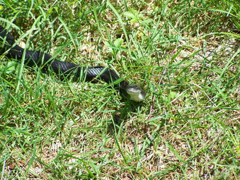 Cindy, Sheba and I got a quick start on the red blazed Peter's Kill loop trail heading right at the fork right out of the parking area. We stopped briefly to inspect the "Climbers only!" area and then headed down to the Peters Kill. At the bottom of the hill we turned right onto the yellow trail. My wife suddenly exclaimed and I looked back to see a black snake sunning itself next to the path. It was in a "threatening" posture. I took some pictures and we continued on down the Kill. At the junction with the blue Peters Kill High Trail we had to make a decision. Right leads to Lost City which I had never seen. Left goes across the Kill and up the ridge. Even though I had been to the left before, I decided that my wife might like the view from up above and the waterfalls along the path.
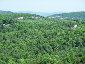 We ascended the trail toward the top meeting several other hikers coming down our way. The trail is steep in places but short. Once on the top the trail winds along the gorge cut by the Peters Kill. It is almost impossible to see down to the water once the foliage is on the trees. There are beautiful views of the opposing rim of the gorge. In addition, certain viewpoints allow a look over to the Trapps and Mohonk beyond. The warm weather increases the haze in the air and the view was not as clear as I have seen it. As we meandered along the ridge I took a few pictures. The trees and shrubs are in full array despite the obvious lack of rain in the area. The trail over the ridge always seems along especially when it leaves the rim and enters the woods.
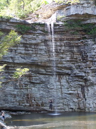 Eventually we came to the point where the trail meets Routes 44/55. Here we crossed into the lower Minnewaska Parking Area and headed down the road to the gatehouse. From here we took the trail down to Awosting Falls. VERY little water is going over the falls at this point but the view is still worth the walk. One young man was attempting to scale the rock face directly under the falls. We didn't stick around to see his progress but we did not hear any sirens for the rest of the day! We walked along the Peters Kill until the point where it dives under the road. At this point we went up to the road and crossed over to follow the Kill down through Sheldon and Peters Kill Falls. There is no marked trail in this area but the route along the Kill is obvious.
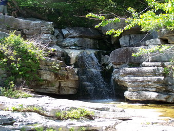 Sheldon Falls is a series of cascades and today there were several families and other groups sunning themselves on the rocks or wading in the cool water. The path down the Kill is fairly easy most of the way with several interesting areas that require some balance, jumping ability and faith that one can land on their feet. We did find a ledge leading out to one of the cascades which I had not been on before. At the base of the falls is a structure that is the remains of an old COAL FIRED power plant that provided electricity for some of the now long forgotten boarding houses that dotted this area many years ago. A large pipe descends into the plant. Even though it has stood idle for many years, some of the machinery is still present.
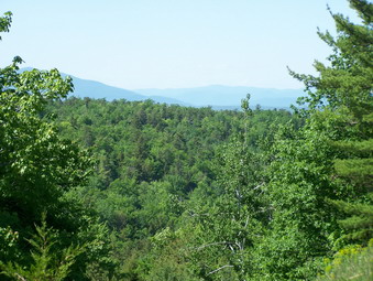 We continued on down the Peters Kill along an unmarked but well-defined path. Eventually we met up with the red trail that is part of the Peters Kill Loop Trail. I wanted to continue back to the blue trail and out to the Lost City. After almost three hours my wife was growing tired and I agreed that there would be another day. At the junction of the red and yellow trail we turned right up the hill we had descended at the beginning of the hike. It was a little harder getting up the hill than it was coming down. A three hour hike over 4.5 miles with stops and lots of pictures capped a great weekend of hiking!
![]()
![]() On Sunday, May 27th I wanted took the dog and headed out after church. We didn't get to the Biscuit Brook parking area until well after 1:00 PM. I had downloaded my last track covering these mountains into my GPS and decided to see if I could use it to follow the same route. I thought we would just do Big Indian and was encouraged in this by the weather. The sky would cloud over at times and threaten to rain. I have been on the mountains in heavy thunderstorms and it has never been pleasant. As it turned out we included Fir Mountain in our hike without much of a problem. We immediately got on the trail and I noticed that my muscles were tired from the previous day. This trail starts out with some pretty easy "ups" that allowed me to get ready for the work to come. The temperatures were in the high 60's or low 70's so I was wearing my UnderArmor Cool Gear short sleeve shirt under a Columbia Titanium short sleeved shirt. I find the double shirts wick well and since one moves against the other I never get any chafing from the pack. I wore my standard Gander Mountain nylon pants. I have rediscovered the joys of my Asolo Fugitives which are lighter than the Asolo TPS 520 I wore most of the winter. I still haven't made a final decision on the ultimate socks but I wore the Rohner hikers which work as well as any. I used an Osprey Atmos 50 most of the winter since it carries so much and fits so well. I am now using my Marmot Vapor 30 which is much lighter and fits about as well. The harness on the Vapor actually fits better than the Atmos but the Atmos contours better to my back. I have been carrying a 3 liter bladder in the pack and 2 one liter bottles to make sure I and anyone with me has enough water.
On Sunday, May 27th I wanted took the dog and headed out after church. We didn't get to the Biscuit Brook parking area until well after 1:00 PM. I had downloaded my last track covering these mountains into my GPS and decided to see if I could use it to follow the same route. I thought we would just do Big Indian and was encouraged in this by the weather. The sky would cloud over at times and threaten to rain. I have been on the mountains in heavy thunderstorms and it has never been pleasant. As it turned out we included Fir Mountain in our hike without much of a problem. We immediately got on the trail and I noticed that my muscles were tired from the previous day. This trail starts out with some pretty easy "ups" that allowed me to get ready for the work to come. The temperatures were in the high 60's or low 70's so I was wearing my UnderArmor Cool Gear short sleeve shirt under a Columbia Titanium short sleeved shirt. I find the double shirts wick well and since one moves against the other I never get any chafing from the pack. I wore my standard Gander Mountain nylon pants. I have rediscovered the joys of my Asolo Fugitives which are lighter than the Asolo TPS 520 I wore most of the winter. I still haven't made a final decision on the ultimate socks but I wore the Rohner hikers which work as well as any. I used an Osprey Atmos 50 most of the winter since it carries so much and fits so well. I am now using my Marmot Vapor 30 which is much lighter and fits about as well. The harness on the Vapor actually fits better than the Atmos but the Atmos contours better to my back. I have been carrying a 3 liter bladder in the pack and 2 one liter bottles to make sure I and anyone with me has enough water.
 The woods are very dry but there were a few wet spots here and there along the trail. Several areas had small areas of running water and there are a few small streams to cross before Biscuit Brook. The trail ascends more steeply in some places but has nothing to compare with the climbs from yesterday! The trail has the appearance of an old woods road in places as it skirts the Frost Valley property. The first hiker we met claimed that he had walked for several hours and had not found the lean-to. I think he just missed the spur trail since we were there several minutes after leaving him. I took very few pictures on this hike since there is little to distinguish it from any other trail. There are NO VIEWPOINTS along the way. At times you can see Doubletop or another peak or ridge through the trees but nothing is clear. Above 3000 feet the blowdowns became more frequent requiring us to leave the trail and then return.
 The trail levels after a steady climb as the main trail skirts the highest point of the mountain on the right of the trail. The 3500 foot sign is oddly placed right in the middle of a broad, flat area. Big Indian has very little evergreen growth at the top as the hardwoods persist. I followed the track on the GPS up Big Indian but remembered that last time I had gone a little too far in search of a herd path to the canister. Big Indian is technically a peak without a trail and counts as a bushwhack. This is despite the fact that bushwhack is only a few hundred meters. I cut up into the woods short of the point shown on the GPS. We headed for the high ground and found the canister almost immediately.
 From the canister I followed my GPS track along the Catskill Divide toward Fir. This was much harder than the last time. During the winter there is a better view of what is ahead without the leaves to block the path. In addition, last time I had met Scott the Can Man at the Big Indian canister and followed his tracks through the snow right to Fir! The trek to Fir was difficult due to the blowdown and was without any view. This part of the hike always seems the longest although it actually cuts some mileage compared to retracing your track from Big Indian. From Fir we simply went down and roughly followed the track on my GPS. There seemed to be less blowdown or else the fact that we were going down made it seem easier. We ended up almost directly at the Biscuit Brook crossing. here I paused to get some pictures and then crossed the brook and headed back to the car. The trail back to the car retraces the first part of the hike and is pretty boring. It was getting late and I just wanted to be back. The trail seems to go on forever but Sheba is good company. We did around 9 miles in 4 and a half hours which is pretty fast considering the bushwhacking. I guess limiting the pictures helps.
![]()
![]() On Saturday, May 26th I wanted to see how much of the Devil's Path I could hike. I want to attempt the whole length in one day this summer. Sheba and I headed for Tannersville and parked at the Roaring Kill parking area at about 10:00 AM. I had intended to get there earlier but felt we still had enough time to get in Plateau and Sugarloaf. The last time I tried this with Karl, it was so hot that we only did Plateau. The weather prediction was for temperatures in the 80's but it seemed cool at the parking area. We talked to a group in the parking area and then started on the trail. There were several other cars already parked and I wondered how many people we would see on the hike. Sugarloaf is a very popular destination! The temperatures were in the high 60's or low 70's so I was wearing my UnderArmor Cool Gear short sleeve shirt under a Arc'teryx Emissary short sleeved shirt. I find the double shirts wick well and since one moves against the other I never get any chafing from the pack. I wore my standard Gander Mountain nylon pants. I have rediscovered the joys of my Asolo Fugitives which are lighter than the Asolo TPS 520 I wore most of the winter. I still haven't made a final decision on the ultimate socks but I wore the Dahlgren Alpaca socks which work as well as any. I used an Osprey Atmos 50 most of the winter since it carries so much and fits so well. I am now using my Marmot Vapor 30 which is much lighter and fits about as well. The harness on the Vapor actually fits better than the Atmos but the Atmos contours better to my back. I have been carrying a 3 liter bladder in the pack and 2 one liter bottles to make sure I and anyone with me has enough water.
On Saturday, May 26th I wanted to see how much of the Devil's Path I could hike. I want to attempt the whole length in one day this summer. Sheba and I headed for Tannersville and parked at the Roaring Kill parking area at about 10:00 AM. I had intended to get there earlier but felt we still had enough time to get in Plateau and Sugarloaf. The last time I tried this with Karl, it was so hot that we only did Plateau. The weather prediction was for temperatures in the 80's but it seemed cool at the parking area. We talked to a group in the parking area and then started on the trail. There were several other cars already parked and I wondered how many people we would see on the hike. Sugarloaf is a very popular destination! The temperatures were in the high 60's or low 70's so I was wearing my UnderArmor Cool Gear short sleeve shirt under a Arc'teryx Emissary short sleeved shirt. I find the double shirts wick well and since one moves against the other I never get any chafing from the pack. I wore my standard Gander Mountain nylon pants. I have rediscovered the joys of my Asolo Fugitives which are lighter than the Asolo TPS 520 I wore most of the winter. I still haven't made a final decision on the ultimate socks but I wore the Dahlgren Alpaca socks which work as well as any. I used an Osprey Atmos 50 most of the winter since it carries so much and fits so well. I am now using my Marmot Vapor 30 which is much lighter and fits about as well. The harness on the Vapor actually fits better than the Atmos but the Atmos contours better to my back. I have been carrying a 3 liter bladder in the pack and 2 one liter bottles to make sure I and anyone with me has enough water.
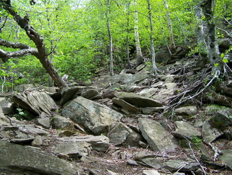
 The first part of the Mink Hollow trail gains elevation rather slowly and tends to "roll". There are a few ups and a few downs. We caught up with a passed a hiker who had started just before us. We passed each other several times as I stopped to take a few pictures. At times Plateau Mountain is visible on your right and is quite impressive. At the junction with the Devil's Path, we met two more hikers. Everyone was turning up Sugarloaf so I decided to head up Plateau first! I remember this part being steep and difficult but it was more difficult than I remembered. Several blowdowns blocked the trail in inconvenient spots but we were able to work around them. At times the trail becomes VERY steep and Sheba and I worked together to get us both up.
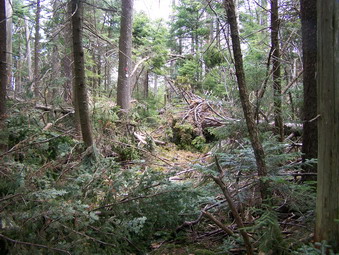 Just before the trail levels off and heads for the summit, there is a large rock that looks out over Sugarloaf. I decided to go to the summit if Plateau and then return to the rock to take a short rest. The trail from this rock to the summit was littered with evergreens, victims of the early spring ice and high winds. The trail was completely blocked in several places. We finally found are way to the summit so that we could say we were at the summit. There is no view and no other spectacular reward. On the way back I did find some SNOW lurking beneath some evergreens in a small hollow. We stopped at the rock and I took some pictures of Sugarloaf. At this point I was still not sure I would have enough left to climb it after coming down off Plateau. The descent of Plateau was not easy but was certainly quicker than going up! Back at the junction with the Mink Hollow Trail, I decided to go up Sugarloaf.
 This trail is nearly as steep as Plateau in places and the vertical elevation gain of 1200 feet is the same as Plateau's in about the same distance! We met several groups of hikers and a couple of individuals along the way. They were headed down in the opposite direction. The actual summit of the mountain has no view to speak of. Before the summit, however, is a rock similar to the one on Plateau. Here I met the group of three that I had spoken to in the parking lot. There was also another couple present with their dog. The three had been to the top of Sugarloaf and were tired enough to head back without attempting Plateau. Sheba and I rested for a few minutes while I took some pictures. We hit the summit of Sugarloaf without too much trouble. This is where I made a critical decision.
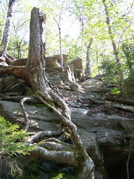 I had never been up Twin Mountain from the west or Sugarloaf side. My wife and I had tried it one time but were stopped at a large, smooth expanse of stone which seemed too dangerous to climb. I decided that Twin was so close that I had to at least try! We descended into Pecoy Notch and then continued on the Devil's Path toward the summit. Almost immediately we were met by a group of five or six people coming down with camping gear. This buoyed my spirits as it made me believe that Sheba and I could make the top! The trail starts out easy enough and then goes CRAZY! There are places where you must climb over sheer sheets of rock. A few have workarounds but not all! In other places the trail seems to end. In these places you must look up to see that it ascends nearly vertically. Sheba needed some help in spots and I could have used some also. This climbing and scrambling over the rocks is some of the most difficult I have done lately and was made harder from the previous climbs. I was in Heaven!
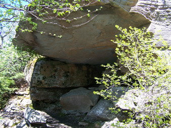 Near the summit the trail flattens a little and there is a "cave" formed by and overhanging rock ledge. Just beyond the cave is a narrow passage that requires a vertical leap up. When we arrived at the top there were several hikers sunning themselves on the rocks. The view of the other peaks including Sugarloaf and Plateau is magnificent. We didn't stay long as we were tired and still had the descent to Pecoy Notch and the walk back to the parking area. The descent went quickly save for the vertical areas which were as difficult going down as up. At Pecoy Notch we turned right onto the Pecoy Notch trail and headed back to the car. This trail starts out with a lot of rocks to negotiate but becomes easier as it descends into the woods below. On this path are several abandoned stone quarries. Various hikers have used the discarded bluestone to build tables and chairs. One spot offers a particularly nice view of the valley below. We covered around nine miles in about seven hours. This included over 4300 feet of climbing! The hike made the Devil's Path in one day seem possible!
![]()
![]() On Wednesday, May 23rd I had a track meet in the afternoon. I didn't want to "waste the morning, so I took Sheba and headed for Balsam Lake Mountain. This is the closest 3500 to my house and is the one I go to when time is limited. I often include Graham but didn't have enough time. We climbed up the steeper side without much trouble and kept a quick pace. There were a few blowdowns along the way but nothing compared what I had seen on Slide and further north.
On Wednesday, May 23rd I had a track meet in the afternoon. I didn't want to "waste the morning, so I took Sheba and headed for Balsam Lake Mountain. This is the closest 3500 to my house and is the one I go to when time is limited. I often include Graham but didn't have enough time. We climbed up the steeper side without much trouble and kept a quick pace. There were a few blowdowns along the way but nothing compared what I had seen on Slide and further north.
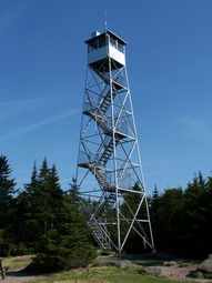
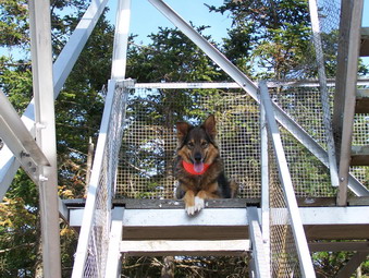 We paused a the fire tower briefly. Sheba actually started up before me but quickly decided to wait until I cam down. For such a clear day down below, it was surprisingly hazy on the far peaks and ridges. We hurried own and met no one else along the way. A quick trip in less than two hours. The drive takes almost that long!
![]()
![]() On Saturday, May 12th I wanted to take a LONG hike and get in a couple of mountains. I had hoped that Karl would go with me but he was busy with wedding plans. So Sheba and I headed for The Giant Ledge Parking Area and the beginning of a LONG hike. I decided to do the loop from the parking area to Woodland Valley, over Wittenberg, Cornell and Slide and then back to the car. We arrived at 9:00 AM under sunny skies and temperatures in the high 50's or low 60's. The prediction was for the weather to stay warm and sunny. We got started immediately. We made good time to the Giant Ledge Trail Junction and continued on toward Woodland Valley.
On Saturday, May 12th I wanted to take a LONG hike and get in a couple of mountains. I had hoped that Karl would go with me but he was busy with wedding plans. So Sheba and I headed for The Giant Ledge Parking Area and the beginning of a LONG hike. I decided to do the loop from the parking area to Woodland Valley, over Wittenberg, Cornell and Slide and then back to the car. We arrived at 9:00 AM under sunny skies and temperatures in the high 50's or low 60's. The prediction was for the weather to stay warm and sunny. We got started immediately. We made good time to the Giant Ledge Trail Junction and continued on toward Woodland Valley.
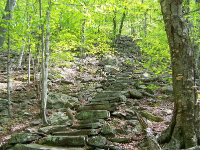
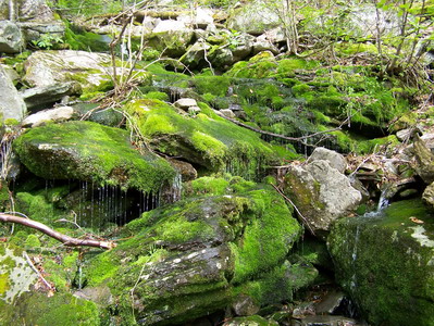 The trail to Woodland Valley is very pretty and always seems to have something new is store. This time it was a small cascade of water down the side of a hill over some mossy rocks. Spring is really if full swing and everything is so green. The mossy rocks almost proved to be my undoing as I forgot that despite their beauty, they are slippery. This trail also always seems to have a variety of sounds; birds sing, squirrels chatter, brooks babble. From the Giant Ledge junction the trail loses elevation until a dry brook. At this point there is a rather steep climb to 2700 feet which is helped by some well-constructed stone steps. The trail then plunges down into Woodland Valley. The campsite was open with several sites occupied. This also meant that the bathrooms were open!
 The climb up to the Wittenberg trail register is almost a quarter mile and gains several hundred feet of elevation. This helps to prevent easy access and tampering. It also warns potential novice hikers that this trail isn't just a pleasant walk in the woods. The trail up Wittenberg snakes back and forth alternating between steep climbs over rocky fields and flatter walks through groves of trees. Along the way we met one younger hiker relaxing for a moment. He got up after we left and followed us. The dog and I can really move and we didn't see him again all day. The winding, meandering trail can be annoying at times since it loses then gains some elevation and I would rather just take a direct route.
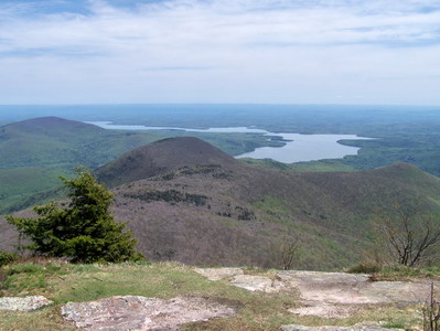
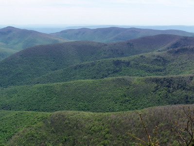 As we approached the junction with the spur trail to Terrace Mountain, we encountered another hiker who was well-equipped for an overnight stay at the campsites near Slide. We talked for a minute and then headed off making the right to begin the final approach to Wittenberg. Along the way are several STEEP climbs and several near vertical ascents. They are short but I did have to boost the dog a couple of times. She could have found her way around by a different route but that always takes time. As we neared the summit of Wittenberg there were a few trees and branches in the path but we worked our way around them. By the number of cars in the lot, I expected to find a few people taking in the view from the open summit. When we finally arrived, there was no one else there! I took pictures, gave the dog a treat and some water and ate and drank myself. We didn't spend a lot of time there but no one had appeared by the time we left.
 The trip from Wittenberg to Cornell is very short and the drop into the col isn't great. This is probably because Cornell is higher. There are some challenging rock scrambles and climbs up Cornell. One climb is a near vertical chimney where I always remove my pack and place it on the ledge above. I was wondering if I could get the dog up this one! I didn't need to worry as the dog went ahead of me and made it by herself! I took some pictures from a little rock ledge just above this chimney and then continued on. I took the spur trail to the Cornell summit and took some more pictures. When I looked at the time and estimated how much hike remained, I realized that I had misjudged the trip and had been over optimistic about how quickly I could complete it. As we got back on the main trail, we met two other hikers who warned us about some blowdowns ahead and the poor condition of the trail on Slide.
 The descent into the Cornell-Slide col was long and wet in many spots. The drop is significant which makes the climb up Slide harder! The descent seemed to go forever but finally I could see the ascent begin. On the way down Slide Mountain is visible through the trees. It is VERY imposing. I wish that there was somewhere to take a clear picture but it seems that the mountain hides behind the vegetation. More downed trees were evident as we started the ascent and required us to find a way around. The ascent has several rock scrambles and climbs which are short but challenging. My legs were beginning to feel tired. As we neared the base of the steep ascent to the spring, we encountered ANOTHER group of hikers coming down. Fortunately, the spring was running well and the water was clear and cold. One other hiker was getting water. I took some pictures, took a drink and filled the water bottles. As we climbed the wooden ladders and started up through the rocks, we met the hiker that had been at the spring. We talked some as we worked our way around the blowdowns and over the patches of ice. Yes, there was still ice in the shady areas and this made getting a sure footing on some of the scrambles very difficult.
 At the viewpoint on Slide a group of five or six people were eating lunch. They told me how bad the trail down Slide was with snow and utter devastation of many trees. I only stayed for a few minutes as it was getting late. As Sheba and I descended we encountered many trees and branches across the trail requiring many off trail excursions. Where there were no trees the trail had snow or ice. This abated once we reached the Curtis-Ormsbee turnoff but there were areas all the way down to 3500 feet. We met two more solo hikers with camping gear and then a party of nine in two groups. I don't like the rocks on Slide but I kept up a good pace until the junction with the Phoenicia-East Branch trail. We quickened our pace some as the trail flattened and descended through the rock field on the trail to the Slide parking area. Crossing the Neversink was relatively easy despite the rain the on Thursday.
 From the Slide parking area we got on the road and walked the two miles back to the car. The first part of this is a rather long uphill grade to Winnisook Lake but the rest is all downhill. BOTH the dog and I were tired at this point and it felt good to get back to the car at 6:00 PM. The hike was almost 14 miles in 9 hours. Tomorrow is Mother's Day and I think this would be an excellent excuse to take a day off!
![]()
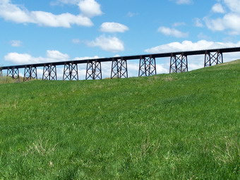
![]() On Sunday, May 6th I took the dog and headed for Orange County after church. My wife was busy in the afternoon and I wanted to take a long, fast hike. We parked on Otterkill Road near the train trestle. After getting the equipment prepared, we started up the road and into the woods. The weather was beautiful with temperatures in the 60's and a light breeze blowing. A few clouds dotted the sky. What a change from the last time I visited this area! Last time it was overcast and raining and the only view was the one immediately in front of your face. This also made the rocks on the ridges slippery. The wind on the ridges made the cool temperatures feel cold. This time I wore my UnderArmor SS Heat Gear with only a Mountain Hardwear Long Sleeve Wicked T over it. I packed several light jackets but they never came out of the pack. I wore my Asolo TPS 520 boots which seem to be completely waterproof. I was worried about some of the stream crossings and walking through Barton Swamp. This really wasn't a problem since the area seemed VERY dry! It was a delight to carry NO crampons, NO poles and NO snowshoes!
On Sunday, May 6th I took the dog and headed for Orange County after church. My wife was busy in the afternoon and I wanted to take a long, fast hike. We parked on Otterkill Road near the train trestle. After getting the equipment prepared, we started up the road and into the woods. The weather was beautiful with temperatures in the 60's and a light breeze blowing. A few clouds dotted the sky. What a change from the last time I visited this area! Last time it was overcast and raining and the only view was the one immediately in front of your face. This also made the rocks on the ridges slippery. The wind on the ridges made the cool temperatures feel cold. This time I wore my UnderArmor SS Heat Gear with only a Mountain Hardwear Long Sleeve Wicked T over it. I packed several light jackets but they never came out of the pack. I wore my Asolo TPS 520 boots which seem to be completely waterproof. I was worried about some of the stream crossings and walking through Barton Swamp. This really wasn't a problem since the area seemed VERY dry! It was a delight to carry NO crampons, NO poles and NO snowshoes!
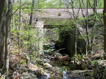 At the first junction the Trestle Trail bears right up the hill but we headed slightly to the left along a red-blazed trail. Someone had told be that this path would lead to a bridge across Baby Brook. In the same location is an interesting tunnel where Baby Brook goes under the tracks. They were right! There is even a small falls at this point. We turned right over the bridge to pick up the yellow-blazed Jessup Trail which I knew would get me on top of the eastern ridge. This trail parallels Baby Brook and is a constantly climb. In some places it is steep! As you near the next junction the trail turns left and goes up. To your right is a small cascade which was very pretty even though the amount of water was small.
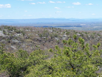 When we reached the next junction, we turned left to stay on the yellow trail and ascend to the ridge. The ascent is steep at times and winds its way across rock outcroppings and narrow ridges of stone. As you ascend, you can look back over your shoulder and see the western ridge. Several birds were riding the thermal currents making an interesting site. We continued ascend and I began to take pictures of the countryside. This was all new to me since the previous time I had hiked here there was NO VIEW since everything was hidden by the rain and fog. The views of the valleys below and the mountains in the distance were spectacular. Most of the pictures I took do NOT begin to show the beauty. We did meet several groups of people along the way as we wound our way up the trail.
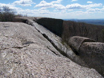 Eventually we arrived at the point where a short spur trail breaks off to the left and leads to the Megaliths. The trail is very short on these large blocks of stone are worth a visit. These blocks have broken off from the surrounding rock layers and lie like sleeping giants. The views from the Megaliths are also interesting. We retraced our steps to the main path and in a short distance were at a painted mark on the rock. The 1664 indicates the highest point on the ridge. There is another "sign" that shows where the fire tower used to stand. I decided at this point to continue on the Jessup Trail until it split off to the left. I would then follow the aqua-blazed Long Path back to the western ridge. After walking for some distance it became clear to me that the loop was bigger than I though so I turned around and went back to where the Western Ridge Trail branches off.
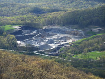 We followed the Western Ridge Trail as it descends first gently and then very steeply into Barton Swamp. The swamp separates the two ridges and it is possible to walk between them on the Barton Swamp Trail. The swamp was almost dry except for a few damp, muddy areas. After following the Barton Swamp Trail for a short distance we ascended to the western ridge and got on the Long Path. This ascent is short but steep. Once on the ridge the rocks and trees are similar to the eastern ridge. The other ridge is clearly visible as it is higher than the western ridge. Several birds circled overhead. The view to the west were similar to the views to the east. I did take a few pictures of a sand and gravel quarry. Eventually the Long Path turns left and goes down the ridge to the valley floor toward Clove Rd. We continued on the other path until the point where the Trestle Trail bears left. The Trestle Trail is covered with sharp rock shards and is steep in places. My feet were aching by the time we had descended back to Otterkill Rd. As we walked down the road to the car, I took a picture of a beautiful purple tree. At that moment a train started over the trestle and I snapped one last shot. Around 8 miles in about 4 and a half hours. I will have to bring Cindy next time and try another trail variation
![]() On Sunday, April 29th my son and his fiancee were up from Virginia. We all decided a hike after church would be nice despite the unsettled weather. All four of us got in the SUV along with Sheba and headed for Panther Mountain. I wanted to do one last 3500 in April and Panther is relatively close. It also has no major water crossings and the stream are now pretty high! When we parked there was a light mist in the air and the temperature was in the low to mid 50's. I had anticipated some snow and ice so I had packed two sets of crampons and my wife and I carried our poles. I have begun to use my poles more and more. They provide balance and make descents easier on my knees. The Leki Makalu Ultralite Ti poles that I use are light and collapsible. The only drawback is that you must twist them tightly to prevent a collapse a the wrong time!
On Sunday, April 29th my son and his fiancee were up from Virginia. We all decided a hike after church would be nice despite the unsettled weather. All four of us got in the SUV along with Sheba and headed for Panther Mountain. I wanted to do one last 3500 in April and Panther is relatively close. It also has no major water crossings and the stream are now pretty high! When we parked there was a light mist in the air and the temperature was in the low to mid 50's. I had anticipated some snow and ice so I had packed two sets of crampons and my wife and I carried our poles. I have begun to use my poles more and more. They provide balance and make descents easier on my knees. The Leki Makalu Ultralite Ti poles that I use are light and collapsible. The only drawback is that you must twist them tightly to prevent a collapse a the wrong time!
 Even the beginning part of the trail was muddy and the first water crossing showed that avoiding crossings without bridges was a good idea. Fortunately this bridge is well-maintained and we quickly began the ascent toward the junction with the blue trail. This part of the trail always fools me as I think that each rocky ascent is the last to the junction! I was surprised that the ice flows that normally cover this part of the trail were COMPLETELY gone although the corresponding areas were very wet with standing and running water. We were at the junction quickly and turned left toward Giant Ledge rather than continuing on to Woodland Valley. The flat areas of the trail immediately after this point were very muddy and the stepping stones came in very handy.
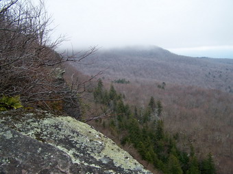
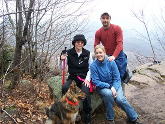 The ascent up to Giant Ledge was uneventful and this part of the trail was a little drier. The ice flows on this part of the trail that had all but blocked the ascent during the winter had also disappeared but a small amount of snow remained in shaded areas. The views on the climb were limited as they always are and the heavy mist did nothing to improve them. The views from the various lookouts along the ledges were also limited. There was a hint of sunshine in the distance that suggested a better view might be coming on the way back. We stopped to eat a sandwich and get a drink. We took some pictures and then continued on across the flat area at the top of the Ledges. The descent from the Ledges into the col was damp but not too slippery. Several large areas of snow remained where drifts had piled the snow during the winter. As Karl and I began the ascent of Panther, Cindy and Kathleen lingered behind. They were not as interested in getting to the summit. We decided that Karl and I would continue on to the top and that they would return to the car.
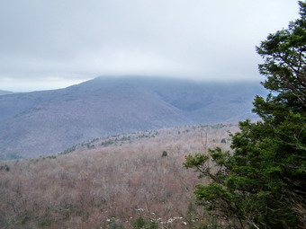
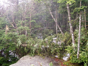 The ascent up Panther becomes steep at times and some areas were wet and slippery. There was much less snow than I though there would be with most of it relegated to shaded areas. The higher we went the more branches and blowdowns blocked the trail. The ice and high winds of last week had taken their toll even here! The temperature began to drop a little and the wind picked up. We had to bushwhack several times to get around areas where the trail was blocked. At the lookout there was no view. Looking out from the small rock ledge was like looking out into a cloud. We quickly turned around and started back down the mountain.
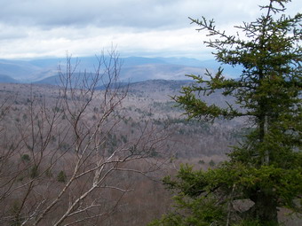 As we began our descent, the sun began to peek through the clouds and mist. By the time we got to the ledges the view had improved considerably and the air temperature was increasing. We stopped to take some pictures and then continued on down. The longer we hiked the sunnier it became. By the time we reached the car, the partly sunny weather we had expected all day has arrived. Cindy and Kathleen were waiting for us and had been for some time. Karl and I completed the round trip in about 5 hours. This was much longer than we normally taking. This attests to the difficulty of negotiating the trail when it is blocked by falling limbs! I wore a short sleeved UnderArmor Heat Gear SS Top underneath a Mountain Hardwear Offwidth jacket. This new jacket provided plenty of warmth and protection against all but the strongest blasts of wind. It is very stretchy which allows ease of movement. My Asolo TPS 520 boots with a pair of Wigwam Wool/Silk socks provided cushioning and warm for the feet. At times I wore a pair of Outdoor Research PL150 gloves and a Mountain Hardwear Transition Hat for a little added warmth.
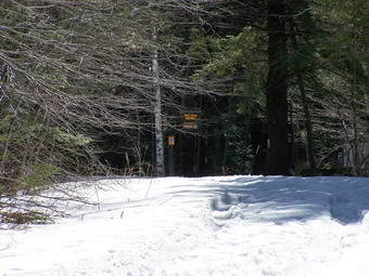
![]()
![]() On Sunday, April 22nd my wife and I took the dog and headed for Windham. I coach spring track and we attend invitationals on Saturdays during April and May. I enjoy coaching but it cuts into the hiking time! There was little snow to speak of on the way to Windham except on the highest peaks. The last time we parked on Big Hollow Road an attempted Windham we ran into nearly impassable conditions and hiked Acra Point instead. Surprisingly the snow conditions on Big Hollow were nearly the same as a month ago. The road up to the actual parking area is not clear and the parking area is unplowed. I packed crampons for both of us and we took our poles. The weather was in the high 60's and sunny with just a little breeze. I wore just a pRana Nitro long sleeve shirt over my UnderArmor Heat Gear short sleeve. I wore my heavier pants but no tights underneath. My wife wore a Mountain Hardwear long sleeve shirt with her Mountain Hardwear Windstopper Tech vest on top. Neither of us wore gloves but we did put on gaiters. I wore my Asolo Fugitive boots while she wore her Asolo Styngers.
On Sunday, April 22nd my wife and I took the dog and headed for Windham. I coach spring track and we attend invitationals on Saturdays during April and May. I enjoy coaching but it cuts into the hiking time! There was little snow to speak of on the way to Windham except on the highest peaks. The last time we parked on Big Hollow Road an attempted Windham we ran into nearly impassable conditions and hiked Acra Point instead. Surprisingly the snow conditions on Big Hollow were nearly the same as a month ago. The road up to the actual parking area is not clear and the parking area is unplowed. I packed crampons for both of us and we took our poles. The weather was in the high 60's and sunny with just a little breeze. I wore just a pRana Nitro long sleeve shirt over my UnderArmor Heat Gear short sleeve. I wore my heavier pants but no tights underneath. My wife wore a Mountain Hardwear long sleeve shirt with her Mountain Hardwear Windstopper Tech vest on top. Neither of us wore gloves but we did put on gaiters. I wore my Asolo Fugitive boots while she wore her Asolo Styngers.
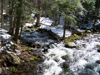 We ran into problems as soon as we crossed the bridge over the Batavia Kill. The snow was only several inches deep in most places but up to several feet in others. Where there wasn't much snow the ground was wet and swampy. The trail crosses back over a stream just after the bridge but the water was too high to cross safely. We walked upstream but the bank gets steep and no immediate crossing was evident. We decided to bushwhack up the west side of the stream until we hit Burnt Knob or the Escarpment Trail. The bushwhacking wasn't too bad except for the very wet areas which seemed to be unrelenting! When we found the blue-blazed Escarpment Trail our troubles SHOULD have been over.
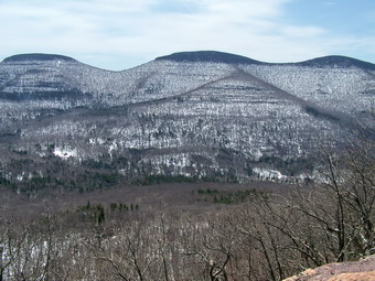 Windham, like all of the Catskills, had an ice storm which coated the trees with a heavy layer of ice. Several areas had high winds following this. The entire Escarpment Trail up and over Burnt Knob was littered with branches big and small. At times, it was impossible to push through these and stay on the trail and this required numerous detours. Near the top of Burnt Knob, the slippery, slushy snow made ascending very difficult. Once on top of the Knob there is a nice viewpoint of Acra Point. A short walk brought us to a rock ledge that juts out of Burnt Knob. This offers an open view of the Black Dome Valley, the Blackhead Range and Acra Point. We ate here and then pushed on toward Windham. This area of the trail was littered with broken branches and deep pools of melted snow. We stopped at the viewpoint of Windham just before the trail descends into the Col. We decided at three hours of hiking up was enough and turned around.
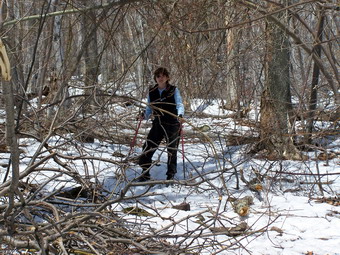 We decided to take the Escarpment Trail back to the Black Dome Trail and take our chances crossing the swollen streams. The Black Dome trail was almost impossible to follow at times because of dark red markers and the ice storm damage. At the first water crossing of at least two, my wife suggested bushwhacking west in an attempt to make only one water crossing. We were soon at one branch of the Batavia Kill and found a place to cross without too much effort. We bushwhacked up and out of the ravine and caught the track we had taken up the mountain. I wandered around a little trying to avoid water but finally found the line back to the trail register. We cut almost an hour off the return trip!
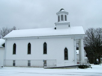
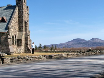 On the way back we stopped at the stone church above Tannersville. Our son and his fiancee will be married here on June 30th. The church is constructed of stone with wooden roof. The building was open so we went inside. The altar, pipe organ and beautiful stained glass windows make an unforgettable setting. The view from the front of the church is magnificent. Immediately across the road is an arboretum with a greening lawn, trees and shrubs. The backdrop is an unobstructed view of the Devil's Path! After eating at Pancho Villa's in Tannersville, we headed home.
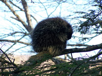 On our way home, just passed Frost Valley, my wife saw something in a tree by the side of the road. I turned around and went back to find a large porcupine sitting on a tree branch. I got out to snap some pictures before taking DeBruce Road back to Livingston Manor. We hope to have many more days like this one.
![]() On Monday, April 16th school was closed due to a Nor'easter that dropped rain, snow and sleet on Sullivan County. I didn't want to drive to a mountain or trail to hike since the roads were not in good shape. I took Sheba and headed for the hills across from my house. The area, Round Top, was where we had snowshoed during the winter. I didn't take snowshoes or crampons since the snow wasn't that deep. I intended to take the same route we snowshoed but to add a little to lengthen the hike.
On Monday, April 16th school was closed due to a Nor'easter that dropped rain, snow and sleet on Sullivan County. I didn't want to drive to a mountain or trail to hike since the roads were not in good shape. I took Sheba and headed for the hills across from my house. The area, Round Top, was where we had snowshoed during the winter. I didn't take snowshoes or crampons since the snow wasn't that deep. I intended to take the same route we snowshoed but to add a little to lengthen the hike.
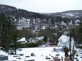 The cemetery was covered in several inches of snow. The view of town from the high cemetery hill was beautiful. I took pictures of the school from the overlook and then continued on up the hill. I took a slightly different line this time but ended up in the same place. Sheba and I slipped and slid our way down the hills to just above the Quickway. From here we walked a little further down the path eastward but stopped after a short distance due to the wetness of the path. We turned around and started up the hill on the path that parallels the road.
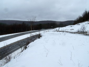 As we descended the other side of the hills, I decided to go down to the rocky ledges that overlook the Quickway. The hill was steep and sliding down was no problem. I wondered how the return trip would be. We walked around on the ledges, watched the traffic go by, took some pictures and then started back up the hill. This snow, rain, sleet combination was slippery but I made it back up to the path with the help of my poles. I crossed the path and then continued on up to the woods road that exits the forest to a spot overlooking the bridge at exit 96.
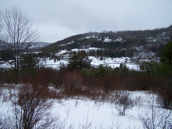 I stopped to look at the hills and mountains that are visible from this overlook. The hills and trees covered with snow were pretty. As I walked along the edge of the field I decided to continue passed where we normally cut back into the woods and up the hill. After a short distance, I did enter the woods since the trail in the field became very wet and was posted. This ascent is shorter but steeper than the one we normally use. There wasn't much of a problem going this way and we were soon on top of the hill overlooking the town.From here we worked out way back to the cemetery. The hike was between two and three hours. I had wanted more but this was MUCH BETTER than nothing. Since the weather kept changing from cloudy to rain to snow I wanted to wear something that would protect me and keep me warm. I donned a pair of Mountain Hardwear Winter Wander pants with Terramar Elite tights underneath. I now know why my wife LOVES these pants! They shed moisture even though they are not waterproof. They fit well and dry quickly. I found out I really didn't need the long underwear to stay warm. On top I wore a PolarMax Max Survival 1/4 Zip Top and my Mountain Hardwear Manticore jacket. This combination was also too warm but I took advantage of the zippers on both to make things more comfortable.
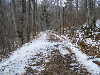
![]()
![]() On Saturday, April 14th my vacation from school was ending and the weather prediction for Sunday and Monday was unclear. The prediction for the higher elevations of the Catskills was from 7 to 12 inches of heavy, wet snow. My wife and I decided to do a 35 and Hunter seemed like a good idea. We got up early but somehow got started late and did not arrive until 11:00 AM at the Spruceton parking area. I packed my crampons and my wife had her Yaks. We both took poles. Sheba had her four-leg dog-nail traction working! The parking lot and the lower part of the trail was clear but I was worried about ice and snow further up the trail. We set off keeping a rapid pace.
On Saturday, April 14th my vacation from school was ending and the weather prediction for Sunday and Monday was unclear. The prediction for the higher elevations of the Catskills was from 7 to 12 inches of heavy, wet snow. My wife and I decided to do a 35 and Hunter seemed like a good idea. We got up early but somehow got started late and did not arrive until 11:00 AM at the Spruceton parking area. I packed my crampons and my wife had her Yaks. We both took poles. Sheba had her four-leg dog-nail traction working! The parking lot and the lower part of the trail was clear but I was worried about ice and snow further up the trail. We set off keeping a rapid pace.
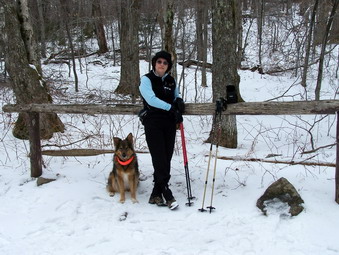 We stopped at the turn up the mountain to get a snack, take a drink, snap some pictures and allow me to remove a layer. I also switched to lighter gloves. At this point the trail had significant packed snow. My biggest concern was the overflow from the spring on up the trail. It has been so bad in the past that full crampons of a work-around were necessary. We worked our way up quickly and there was NO ICE evident. The spring was encased in ice forming an interesting site.
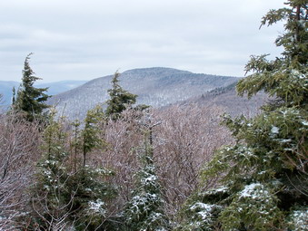 We did not stop at the spring but pressed on to the area near the lean-to. Here there were some nice views from the rocks that act as a lookout. We made a brief stop for some pictures since we did not know what views would be available from the top of Hunter.
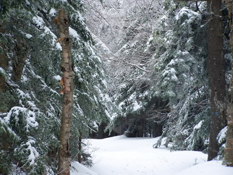 We pushed on and passed the turn to the Colonel's Chair. I have been on this trail several times and have NEVER made it out on this spur. Maybe next time! The snow got deeper as the elevation increased and at times there was 3 to 5 inches of loose snow on top of the packed base. This section of the trail is much longer than I anticipate and there are several fairly steep portions.
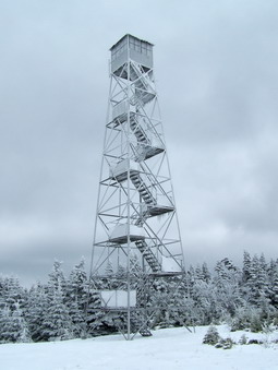 We finally arrived at the tower. The tower and the surrounding trees were covered in a thick coating of ice making for a beautiful scene. There was a group of 9 from SUNY Oneonta and two young men from Ithaca at the top. We ate lunch and didn't stay too long. For Hunter, the air was calm but stopping for any length of time always emphasizes how much heat you can generate hiking. We made the summit in just two hours and were ready to go back in 20 minutes.
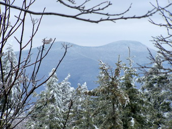 The way down is always quicker but this time we outdid ourselves. By sliding on the snow and using the poles for balance we made it back in just over an hour! I tried out some new clothing and was very pleased. I wore the OR Tour gloves again but change to lighter gloves as my hands were so warm. I wore a Smartwool Bent Crew underneath an Arc'teryx Covert Crew. over this I wore my Mountain Hardwear Windstopper Tech Jacket as I often do. The other two layers proved to be unbelievably warm. I stowed the jacket and was warm most of the time even though neither blocks the wind. I was only a little chilly when we stopped.
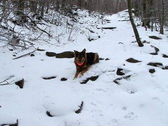
![]()
![]() On Friday, April 13th I decided to do a 35 after track practice. Starting a little later in the day means picking a mountain close to home. Sheba and I arrived at the Slide Mountain Parking area on Route 47 at 12:45. The temperature was 35 degrees but a stiff breeze was starting to blow. The weather prediction for later in this weekend varies from 6 to 12 inches of heavy wet snow so I wanted to make sure I got in a peak this day. There was more snow than I expected at the parking area but I decided to leave the snowshoes behind, pack the crampons and start out using the poles.
On Friday, April 13th I decided to do a 35 after track practice. Starting a little later in the day means picking a mountain close to home. Sheba and I arrived at the Slide Mountain Parking area on Route 47 at 12:45. The temperature was 35 degrees but a stiff breeze was starting to blow. The weather prediction for later in this weekend varies from 6 to 12 inches of heavy wet snow so I wanted to make sure I got in a peak this day. There was more snow than I expected at the parking area but I decided to leave the snowshoes behind, pack the crampons and start out using the poles.
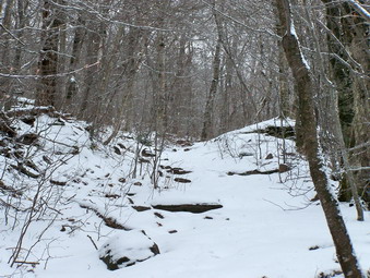 We got right on the trail and it was clear that the extra traction that the poles offer would be needed. There was a dusting of new snow over a packed and crunchy layer of old snow and ice. The Neversink was rather low and offered no real problem. In no time we arrived at the turn to go Slide Mountain. The lower parts of the trail were covered with just a little snow and some areas were almost clear. I was a little tired but we hurried to get up the mountain. I had no idea what the weather held in store since the sun would shine at times and then go under the clouds. The snow increased as we ascended as did the howl of the wind. I stopped at 3500 feet to take some pictures.
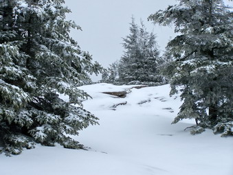 Above 3500 feet the trail was covered with 3 or more inches of new powder. The trees had more ice and snow covering them. At times the depth of the snow and the branches hanging down made narrow tunnel which was hard to get through. We pressed on until the junction with the Curtis-Ormsbee Trail. This is where I always get "fooled" on Slide Mountain. I never can remember than there is still a good hike from the CO junction to the summit! I stopped at one place to take a few pictures. At the lookout before the summit not much was visible since a hazy fog had settled in. The view or lack of view was the same from the rock ledge at the top of Slide. I made the summit in an hour and 45 minutes with several stops for pictures. I knew the return trip would be faster.
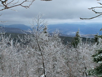 On the way down I didn't stop at all for pictures but pressed ahead. Sheba seemed anxious to move on since she was constantly ahead of me. The wind kept blowing and the temperature seemed cooler. This is the first time I finished a hike without shedding some clothing. I wore a Capilene 3 shirt which is much warmer than its weight would indicate. I also had on a Capilene El Cap fleece. On top I wore a Manticore Jacket from Mountain Hardwear. This jacket is very light but warm and blocks the wind completely! I did not use the hood although I though about it several times as the wind picked up. The OR Tour Gloves were very warm but stayed flexible and did not get wet. The trip down took only and hour so we finished the whole trip in under 3 hours! I considered this a good pace for the conditions.
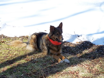
![]()
![]() On Wednesday, April 11th Lisa Lyons and I went to Trout Pond to hike. Lisa us the owner of the Morgan Outdoors hiking store in Livingston Manor. She is writing an article for the Town of Rockland visitors guide. She wanted to pick an area that allows many options in distance and difficulty so that people can choose the route that is right for them. Another requirement was that the hike have some "points of interest" and Trout Pond fits the bills both ways. We met at the coffee shop in town and I drove to the parking area on Morton Hill Road just outside of Roscoe. Although Russell Brook Road was open and bare of snow we decided to park on Morton Hill Road and walk down to the trail head area. This allows one option to be a hike from the upper parking area down to the falls on Russell Brook and back.
On Wednesday, April 11th Lisa Lyons and I went to Trout Pond to hike. Lisa us the owner of the Morgan Outdoors hiking store in Livingston Manor. She is writing an article for the Town of Rockland visitors guide. She wanted to pick an area that allows many options in distance and difficulty so that people can choose the route that is right for them. Another requirement was that the hike have some "points of interest" and Trout Pond fits the bills both ways. We met at the coffee shop in town and I drove to the parking area on Morton Hill Road just outside of Roscoe. Although Russell Brook Road was open and bare of snow we decided to park on Morton Hill Road and walk down to the trail head area. This allows one option to be a hike from the upper parking area down to the falls on Russell Brook and back.
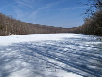 We decided to inspect the falls on the way back an signed in at the trail register. We decided to hike up to Trout Pond first rather than to Mud Pond since the trail to Trout is a very gentle uphill. The wide trail had almost no snow, a stark contrast to the hike to Cabot Mountain yesterday! Lisa and I talked about our different approaches to hiking and in no time we were at the pond. Most of the lower end was still covered with ice and the "groaning" of its melting filled the air. We stopped briefly to take pictures and then continued along the flat trail to the upper end of the pond. Stopping here and returning by the same path could be a second option for a hike.
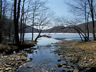 There are two lean-tos at the upper end of the pond each with its own outhouse. They are in good repair and offer adequate shelter for an overnight camp out or protection from a sudden rain shower. The Trout Pond trail continues on to Campbell Brook Road but we crossed over the inlet and headed for Mud Pond.
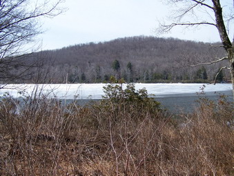 This trail ascends a little more steeply and requires a certain increased fitness level. Once at the top of the climb the trail "rolls" some before the descent to Mud Pond. One area has some very young saplings which are probably the result of a fire or some other disturbance in the area. We walked down to Mud Pond and were surprised to see to men fishing from the banks of the pond. There is still some ice on this pond as the season change from winter to spring.
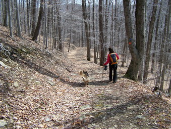 We continued on down the Mud Pond trail to the trail register by the falls. This part of the trail is a long downhill and is the reward for the earlier climbing. Those who are in good physical shape may want to climb this hill first and reverse the route we took. The last time I was on this trail it was covered with ice and snow and was tricky to descend. Today most of the slipperiness came from some mud in places.
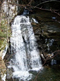 We took some time to investigate the falls which actually consist of two or three different cataracts. We walk up the trail on the left side of the falls first and took some pictures. I had never been on this side before and the view is beautiful. There was still some ice in shaded areas of the falls which added to the scene.
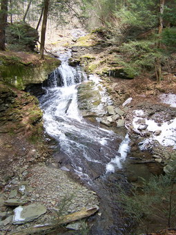 As we walked back up the trail toward the car the upper falls could be seen through the trees. I took some pictures and then decided to descend the short but steep hill to a vantage point between the two parts of the falls. This was a very pretty area and I took several pictures. After a short time, we headed back to the car and investigated some other parking areas for a possible bike-hike adventure.
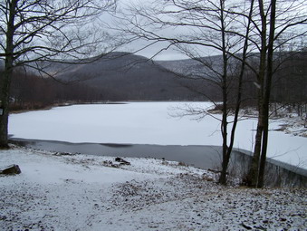
![]()
![]() On Tuesday, April 10th my wife wanted to hike at
Frick Pond but I countered with Cabot Mountain promising a great vista. I had done this hike in the summer and was plagued by nettles for the entire ascent of Cabot. I guess this made me forget that it is quite a steep ascent. Fortunately, my wife was in a good mood before and AFTER the hike. We took Sheba and parked at Big Pond at about 10:30 and immediately got on the trail. The first part of this trail ascends sharply from the road up to the register and beyond. It then flattens slightly and gently ascends for some distance.
On Tuesday, April 10th my wife wanted to hike at
Frick Pond but I countered with Cabot Mountain promising a great vista. I had done this hike in the summer and was plagued by nettles for the entire ascent of Cabot. I guess this made me forget that it is quite a steep ascent. Fortunately, my wife was in a good mood before and AFTER the hike. We took Sheba and parked at Big Pond at about 10:30 and immediately got on the trail. The first part of this trail ascends sharply from the road up to the register and beyond. It then flattens slightly and gently ascends for some distance.
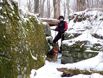 Eventually the trail makes several short but steep ascents to the top of Touch-Me-Not Mountain. Some of these ascents were a little tricky as they run along a side hill. There was no snow in Livingston Manor when we left but as we climbed we ran into an ever increasing amount on the trails. At the top of the trail we met up with the loop trail that runs around Little Pond. We hiked this MANY times with our kids when picnicking at Little Pond. We turned left and descended to the junction with the trail to Beech Hill which goes over Cabot Mountain.
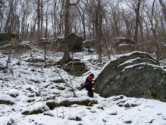 The trail begins innocently enough with some flat portions and gentle rises. After a short distance, the climbing becomes much more serious with several VERY steep areas. The good news was that there were no nettles! The bad news was that the snow covering the rocks was slippery in all the wrong places. As we climbed more and more of the surrounding mountains and the valley below were revealed. Unfortunately, there are few clear areas from which to take pictures. At the top of the climb the trail flattens somewhat before a final rise to the plateau.
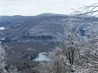 On the plateau it is only a short walk to the Beaverkill Vista. This small rock ledge gives an unobstructed view of Little pond and the surrounding mountains. We stopped for a while to eat and drink. I also took some pictures before we turned around to attempt the descent of Cabot.
 On the way down the sun came out and started to melt the ice on the trees, The sun shining on and through the ice on the branches offered and opportunity for some nice pictures. We descended Cabot slowly and carefully and without mishap. My intention was to retrace our steps which is the shortest route back. Instead we opted to take the loop trail to Little Pond and then the roads back to the parking area. This, I think, was quicker. We completed 6.5 miles in about 4 hours.
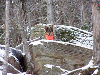
![]()
![]() On Monday, April 9th I decided to hike part of the Devil's Path near Tannersville. The weather was partly sunny with temperatures in the mid 30's. A light wind was blowing as Sheba and I left the house. I decided to park on Prediger Road and hike the Devil's Path to the east ascent of Indian Head. I planned to include Twin since like many of these "doubles" most of the effort is getting to the higher elevation. The beginning of this hike is NOT the way I like to start. The first part of the trail is relatively flat and rolls slightly gaining some elevation. I like to start almost immediately on a climb. The more direct route to these two mountains is to go up the Jimmy Dolan Notch trail to the Col between the mountains. I like the other route because of the steep climb up the east side of Indian Head. This was almost my undoing!
On Monday, April 9th I decided to hike part of the Devil's Path near Tannersville. The weather was partly sunny with temperatures in the mid 30's. A light wind was blowing as Sheba and I left the house. I decided to park on Prediger Road and hike the Devil's Path to the east ascent of Indian Head. I planned to include Twin since like many of these "doubles" most of the effort is getting to the higher elevation. The beginning of this hike is NOT the way I like to start. The first part of the trail is relatively flat and rolls slightly gaining some elevation. I like to start almost immediately on a climb. The more direct route to these two mountains is to go up the Jimmy Dolan Notch trail to the Col between the mountains. I like the other route because of the steep climb up the east side of Indian Head. This was almost my undoing!
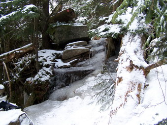 After the initial part of the trail there is a short walk along the trail to Echo Lake and Overlook Mountain. The Devil's Path quickly takes a sharp right. The sign says 1389 foot climb which really doesn't completely describe what is ahead. The lower half of the trail goes through a series of short climbs alternating with flat areas. At this point I was bare booting and carrying my poles. Gradually the trail increases in steepness and the flat parts become nonexistent. I was following some tracks of people from the day before. It was obvious that they had been wearing Yaks so I didn't expect to have too bad a time. I began to use the poles to get some traction and steady myself on the slippery, rocky climbs. As I neared the top of one ascent, there was an ice flow across the trail. Up until this time there had been ice with an inch or more of freshly fallen powder on top. Some care in foot placement and some workarounds had taken care of those areas. This ice flow was thick and slick since some melting was occurring. Even the surefooted Sheba could not get over it. We tried to the left and we tried to the right but there was no way to get up. At this point I decided to don my Stubai crampons which I seldom use. These are the kind that attach with straps. It really didn't take long to get them on and they were just the thing! They bite into the ice and hold wonderfully. I gave Sheba a little boost and we were up and over in no time! I decided to leave them on. This proved to be the correct decision. We encountered several other icy areas along the way.
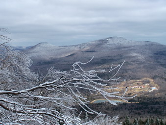 The trail grows increasingly steep and the ice got worse so that most of the trail was one big ice flow. Near summit ridge there are at least two climbs which are near vertical and they were ice covered. The people with the Yaks apparently turned back just before the first of these. This was probably the correct decision for them but I am sure it was disappointing. I had a little trouble negotiating some of the ascents since the crampons DO NOT grip well on bare rock. At several points there are good lookouts and a couple of GREAT ones. The day was perfect for taking pictures. The ice and snow on the trees near and far added to the natural beauty of the scenery.
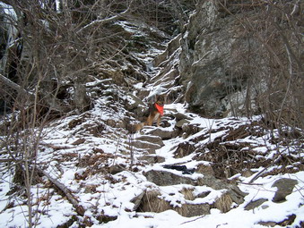 Once on the summit ridge of Indian Head there is a short walk to the highest point. We continued on to the west side and began the descent into Jimmy Dolan Notch. This side of the mountain was a river of ice from the top to the notch. I saw no other footprints on the trail. Anything is possible but I think any attempt at going up or down the west side of Indian Head should be with full, aggressive crampons! At one point on the descent, there is an open spot that reveals Twin Mountain ahead. It looks quite imposing and the ascent is not easy. As soon as we hit the notch, we pressed on up the trail. Several people had been up in the days before and the most recent tracks looked like bare boots.
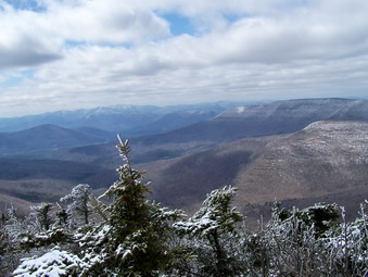 The lower part of the trail was rocky and without much ice. I had almost decided to take off the crampons when the ice started in again. This was almost as bad as on Indian Head. After several steep climbs and some stops at viewpoints for pictures, we were at the lookout on the eastern, lower peak of Twin. The skies were mostly sunny now with a few clouds and the conditions were almost ideal for taking pictures. After a short break, we continued on to the higher peak.
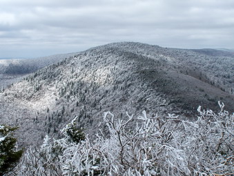 The drop between the two peaks is NOT trivial and the ascent up the western peak while short did provide a few exciting moments. I stopped briefly at the lookout on the western edge to take some pictures. I had considered continuing on down the other side and going out to Elka Park Road. After consulting the map, I decided this was too far and we reversed our course. We descended back into the notch and took the Jimmy Dolan Trail back down to the intersection of the Devil's Path. I often get lost on this trail and just bushwhack but there were new markers which helped. Now I know WHY I get lost. The trail winds back and forth all over the place. This trail was also very icy near the top and many areas showed glissade marks. I left the crampons on until I was sure that the ice had ended. At the Devil's Path we turned back to the parking lot. The hike had taken 6 hours and 15 minutes!
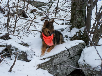
![]()
![]() On Friday, April 6th I had planned to go to the northern Catskills and
hike Thomas Cole, Black Dome and
Blackhead from the Barnum Road parking area. I had never gone this way and wanted to see what it was like. I
was especially interested in the Camel's Hump since most people believe it is above 3500 feet. However, when I woke
up the temperatures had dropped into the low twenties and there was a stiff breeze! I decided this was just the kind
of weather for a "spring" hike. I dressed more warmly than usual, packed some extra items for warmth, grabbed the dog
and started out. Snow was falling heavily as I passed the Slide parking area but abated some as I drove into Greene
County. At the parking area I decided to leave the snowshoes behind, pack the crampons and use the poles. The trail
register is about .3 miles up the trail. The beginning trail is on an old road which is now heavily rutted and eroded.
It acts as a perfect stream bed and was very icy.
On Friday, April 6th I had planned to go to the northern Catskills and
hike Thomas Cole, Black Dome and
Blackhead from the Barnum Road parking area. I had never gone this way and wanted to see what it was like. I
was especially interested in the Camel's Hump since most people believe it is above 3500 feet. However, when I woke
up the temperatures had dropped into the low twenties and there was a stiff breeze! I decided this was just the kind
of weather for a "spring" hike. I dressed more warmly than usual, packed some extra items for warmth, grabbed the dog
and started out. Snow was falling heavily as I passed the Slide parking area but abated some as I drove into Greene
County. At the parking area I decided to leave the snowshoes behind, pack the crampons and use the poles. The trail
register is about .3 miles up the trail. The beginning trail is on an old road which is now heavily rutted and eroded.
It acts as a perfect stream bed and was very icy.
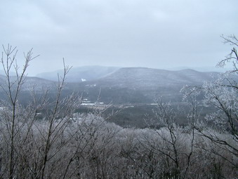 After the trail register, the trail begins to ascend, gently at first and then more steeply. There are several
switchbacks to moderate the climb. In a couple of different places on the trail there were ice flows that had to
be carefully negotiated or avoided. After a steep but short climb up the Caudal, a viewpoint was available off to the
right. This gave the first indication of how beautiful the hills were. The previous days weather had cloaked the trees
in the higher elevations with ice and then snow and further wrapped their branches. We proceeded up the rest of the
Caudal and then on to the Camel's Hump.
 The area between the Caudal and the Hump was a winter wonderland in April. There was little or no wind and the
woods were quiet. All of the trees had the coating that you could see on the far hills. Ice covered the branches. Snow
had somehow mixed with the ice and formed a crystalline structure an inch high in some cases. I decided to take
pictures on the way back since I wanted to keep hiking while I was fresh. On the way up the Camel's Hump we met a couple and their dog coming down from the viewpoint on the Hump. Sheba and their dog met and it was clear that they were not going to get along. We parted company quickly. The weather was still very cold and my feet, hands and nose were feeling the effects. I did, however, remove the fleece I was wearing underneath my Mountain Hardwear Windstopper Jacket. This jacket is the best single piece of equipment I have purchased!
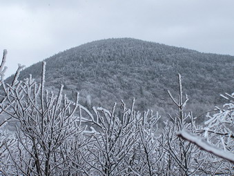 The ascent up the Hump is a little steep in places but it should be. Most people agree that the Hump is over 3500 feet and far enough away from Thomas Cole to be labeled a different mountain. The problem may be that the change in elevation between the two is not great enough. At the top there is a well-used lookout to the south. The view from here showed more hillsides with trees encased in ice and snow. Although the mountains in the distance were shrouded in haze they were clearly distinguishable. After a short descent from the Hump, the trail passes across a Col on the way to Thomas Cole. Parts of the area are very open and at one point Thomas Cole is visible directly in front. I stopped here to take some pictures and to change to warmer mittens and a neck gaiter. A group of three young men were coming down off Thomas Cole after spending the night at the Batavia Kill lean-to. We talked for a moment and then walked on.
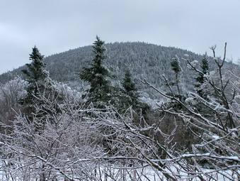 The ascent up Thomas Cole from this direction has some steep areas. These areas were covered by an inch or two of fresh powder. Underneath there was hard-packed snow and ice! Each step had to be carefully placed and the poles were invaluable. I should have stopped several times to put on the crampons but decided to just keep pressing on. The summit has no real view but the snow covering the spruce trees made a pretty scene. At this point I was tired but decided Black Dome was too close to pass up. Blackhead would wait for another day. I remembered that the descent into Lockwood Gap was VERY steep and having to come back up it made the whole thing less appealing. In addition, I had not anticipated so much snow and did not wax Sheba's feet. She was beginning to develop ice balls.
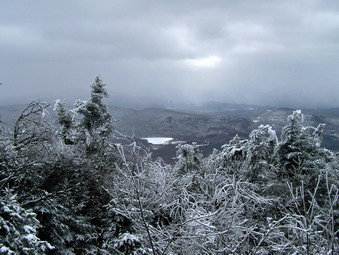 The descent of the Black Dome side of Thomas Cole was steeper than I remembered and every bit was covered in ice! The "nice" part was that you couldn't see the ice since it was covered in snow. The col between the two mountains was windy but very short. The ascent up Black Dome was much like the other slopes. There were areas that were steep and icy. Each time I went up over one of these places I was thinking about coming down. Once at the top of Black Dome there is a short walk to the summit which passes another lookout on the right of the trail. I walked a little passed the summit to see what Blackhead looked like. I stopped short of that goal since there was too much "down" to make it worthwhile. On the way back we stopped at the lookout and took a short break. Some ice covered spruce trees were interesting. I took some pictures of the hills in the distance and then we started back for the car. The trip all the way up had taken almost exact three hours to complete but this included several stops.
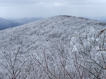 On the way back I found another lookout between Thomas Cole and the Hump. This one appeared to be far less used but no less beautiful! Even though this viewpoint also faces south the hills I saw from here somehow seemed different. On one
mountain you could distinctly see the spruce trees and just as distinctly see their ice and snow covering. If I wasn't
walking through similar conditions, it would have been hard to believe.
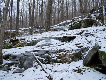 The way back proved to be easier in most cases as long as I watched my step and paid attention. I have never had much trouble with branches in the face but this day my right eye suffered several attacks. The parts that were icy on the way up were icy on the way down. The ascent of Cole from The Black Dome side had several challenges where ice covered every inch of everything. By this time the temperatures had warmed and I was not as cold. Sheba's feet seemed better. The slight increase in temperatures and brought down some of the ice from the trees making the trail "crunchy" and adding a little traction. The only times that I came close to falling were on relatively flat stretches were I relaxed and failed to pay attention to the footing. I guess my balance is still good since I recovered before going down both times. We arrived back at the car at 5:45 PM making it back in 2.5 hours.
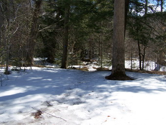
![]()
![]() On Tuesday, April 3rd I again had track practice but I got out early AND
I had everything packed and ready to go. I decided on trying Table and maybe Peekamoose. I had not seen the new
bridge over Deer Shanty Brook and these two mountains are relatively close to my house. Sheba and I arrived at the
parking area at 12:15. The parking area was clear of snow and ice and also of any other cars. I could see that the
trail was covered with snow and ice! The snow and ice alternated with clear patches where the sunshine had
come through the trees. This held true all the way to the bridge. I had crampons and snowshoes in the car but felt they
would not be needed. I did bring the poles. The temperature was in the high fifties and I removed my light windbreaker
at the bridge and continued wearing my UnderArmor CoolGear top.
On Tuesday, April 3rd I again had track practice but I got out early AND
I had everything packed and ready to go. I decided on trying Table and maybe Peekamoose. I had not seen the new
bridge over Deer Shanty Brook and these two mountains are relatively close to my house. Sheba and I arrived at the
parking area at 12:15. The parking area was clear of snow and ice and also of any other cars. I could see that the
trail was covered with snow and ice! The snow and ice alternated with clear patches where the sunshine had
come through the trees. This held true all the way to the bridge. I had crampons and snowshoes in the car but felt they
would not be needed. I did bring the poles. The temperature was in the high fifties and I removed my light windbreaker
at the bridge and continued wearing my UnderArmor CoolGear top.
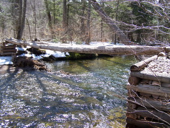 The bridge is an engineering marvel! It consists of two large logs at least 6 feet above the running water. At each
end these logs lie on a crib of other logs and stone. It looks to me as if this bridge may last through some high
water when the next flood comes through. There are a couple problems. When the water is high, crossing the little
stream BEFORE the bridge can be tricky. The bridge has no rail or guide rope. The logs that make up the bridge
flex differently. This makes crossing it an exercise in balance at best. I would think that even a dusting of snow
would have me looking for another way across.
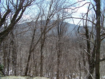 After crossing the bridge, Sheba and I headed up the trail and had to make another tricky water crossing. Following
that the trail ascends through a camping area and then through some boulders. Much of the trail was icy at this
point especially where hikers had packed down the snow all winter. Some areas were almost bare of snow and icy while
others still had several inches of snow. This trail can be discouraging since there are several places where it
seems that the summit is just ahead. After attaining the rise ahead, it becomes clear that the actual summit is still
ahead. In several paces views are possible through the trees of the surrounding peaks. It is hard to photograph them
through the trees and capture their beauty. At one point at the top of a rise, Table is revealed. As I descended to the base of the climb, it ran through my mind that this WAS a 3500+ foot mountain.
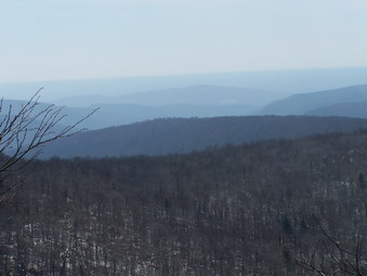 On the way up Table there is a rock shelf just off the trail to the right. The snow had cleared by this time and the
walking had become easier. We stopped at this point to take in the beautiful view. I took some pictures, ate a snack,
drank some water and fed the dog. When we started back on the trail, the snow returned for real. From this point on to
both peaks the snow was at least a foot deep and in places I sank in up to my knee. This made the hiking VERY tiring.
The ice on some of the rocky ascents made for an adventure filled hike. On the final ascent up Table passed the spring
and lean-to the trail in on a side hill. By this time the sun had warmed and loosened the snow making the walking here
a real chore. Finally we reached the top of Table! There really isn't much to see.
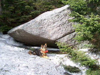 At this point I was tired and it was after 2:00 PM. I decided that I WOULD go on to Peekamoose since I had already
done the majority of the work. The map say .86 miles. My GPS read .52 miles. I headed out along the plateau that makes
up the top of Table. After a few minutes, I made the steep descent into the col between the two mountains. Again, the
snow and ice over the shaded parts of the trail made paying attention essential! The climb up to Peekamoose is not
as steep in most places. There are a few steep spots that I knew would be "challenging" on the way back. At the
summit Sheba and I stopped next to the large rock and then quickly turned around and headed back. Going down is
definitely easier except for the steeper icy sections. I used a combination of sliding on my boots and running to get
down quickly. The journey to Peekamoose and back took only about 40 minutes and was well worth the time and effort.
We were back at the car by 5:45 PM with plenty of light to spare! Just less than 9 miles in 5 and a half hours!
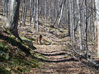
![]()
![]() On Monday, April 2nd I had track practice in the morning and couldn't
get started on a hike until almost noon. Sheba was ready to go so I headed for McKinley Hollow intending to do Eagle.
I had been there only once. Because of the limited time and changing weather I decided to do Balsam instead. The
temperatures were mild and in the fifties. The sun was very bright and it wasn't long until I was hiking in only my
UnderArmor top. As we started out, the trail was pretty well covered by ice and some melting snow. It was slippery and
hard to walk on! The water crossings were easily negotiated and by the time we got to the lean-to the snow was gone.
The trail for the most of the rest of the way was free of snow and ice until the col between the two mountains.
On Monday, April 2nd I had track practice in the morning and couldn't
get started on a hike until almost noon. Sheba was ready to go so I headed for McKinley Hollow intending to do Eagle.
I had been there only once. Because of the limited time and changing weather I decided to do Balsam instead. The
temperatures were mild and in the fifties. The sun was very bright and it wasn't long until I was hiking in only my
UnderArmor top. As we started out, the trail was pretty well covered by ice and some melting snow. It was slippery and
hard to walk on! The water crossings were easily negotiated and by the time we got to the lean-to the snow was gone.
The trail for the most of the rest of the way was free of snow and ice until the col between the two mountains.
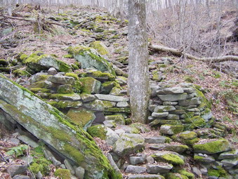 After the lean-to, the trail begins to climb immediately and at first is a gentle slope. Very soon the trail gets much
steeper and this part seems to go on forever. A small stream on the right of the trail adds visual beauty and audio
distractions but the climb still seems very long. In one of the steepest sections a set of stone "steps" makes the going
a little easier. At the top of the steepest part, the trail levels somewhat but still climbs to the col. It seems
more level and easier because of the steep part behind you.
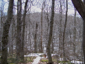 When I reached the col I made my final decision to go to Balsam. The 2.1 miles to Eagle and then back were cutting
it too close. There was quiet a bit on snow and icy at the "four corners". Some of the ice was overlying some standing
water as I found out! We made the turn onto the trail to Balsam. At this point the mountain in straight ahead and
can easily be seen through the trees. The climb up to the summit had some areas of snow and icy usually strategically
placed on the steepest, rockiest portion. The top of the mountain offers little in the way of views. Several places
seem to offer views but walking there proves futile since trees still block a clear view of anything.
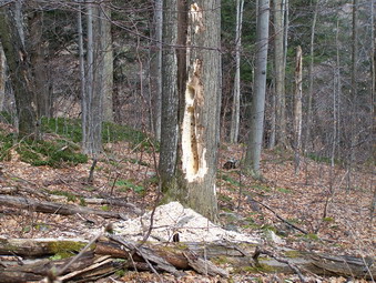 Going down was certainly a pleasure since the descent has no "ups" at all. A few portions of the trail required
careful negotiation as they were steep and slippery. On the way down I noticed several trees with holes in them made
by some woodland creatures. I first noticed this because of the extensive piles of wood chips on the ground. I assume
the woodpeckers had been hard and worm although the wood was soft enough for porcupines to hollow out. We got
back to the car with plenty of time to spare. I was ALMOST sorry I had not tried Eagle.
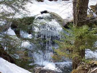
![]()
![]() On Saturday, March 31st I wanted to get a 3500 in for the month of March. I
didn't think my wife was interested but I was wrong. We packed up the SUV and the dog and headed for Westkill. This
mountain was a LITTLE harder than I remembered. When we arrived at the parking area the ground was clear with puddles
and mud. One look at the trail showed that there was still some snow at the lower elevations. One look at the
mountains showed there was even more snow up higher. We decided that carrying the snowshoes just for the traction
was impractical. My wife doesn't have crampons so she suggested we just take the poles. I didn't think they would
be much help but they are light so I agreed. They proved to be just the thing! Diamond Notch Falls was beautiful as
always. The water flowing through and around the ice was a wonderful site.
On Saturday, March 31st I wanted to get a 3500 in for the month of March. I
didn't think my wife was interested but I was wrong. We packed up the SUV and the dog and headed for Westkill. This
mountain was a LITTLE harder than I remembered. When we arrived at the parking area the ground was clear with puddles
and mud. One look at the trail showed that there was still some snow at the lower elevations. One look at the
mountains showed there was even more snow up higher. We decided that carrying the snowshoes just for the traction
was impractical. My wife doesn't have crampons so she suggested we just take the poles. I didn't think they would
be much help but they are light so I agreed. They proved to be just the thing! Diamond Notch Falls was beautiful as
always. The water flowing through and around the ice was a wonderful site.
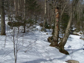 After the falls, the snow on the trail really began to deepen. In the morning the snow was still hard packed as long
as we stayed on the trail. The trail begins to climb almost immediately and varies from shallow to relatively steep in
places. This part was much longer than I remembered. As the snow was exposed to the warm temperatures and sun, it
began to melt. This made the going tougher and trickier in places where there was ice. The poles were just the thing.
They helped stabilize and added much needed traction.
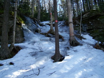 A combination of the poles and careful attention to foot placement were able to get us up most of the trail. One spot,
however, proved impossible to negotiate. At one point the trail becomes very steep for a short run through and over
some rocks and tree roots. This area is exposed to sun so the snow and ice melt and refreeze. Some of the ice here was
an inch thick. I decided to bushwhack and easily found a satisfactory way around this roadblock which we used on the way up and down.
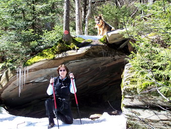 After a continuous ascent, the trail flattens for a while and travels along a plateau. The trail then ascends again and
along the way is a rock overhang that has been used as a shelter during sudden mountain storms. We stopped for a minute to
get a drink and a snack. Sheba had other ideas as she wanted to continue hiking. Once we started back on the trail the
lookouts and the summit were only a short distance away.
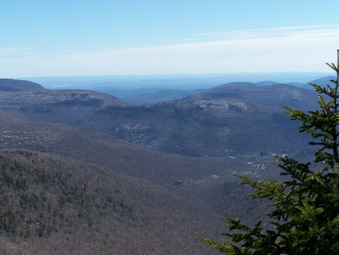 The views from the Buck Ridge lookouts this day were fantastic. There is always some haze on the farthest mountain tops
but the rest of the view was clear. Sheba and I hiked up to the summit of Westkill which is unremarkable but does have
a small sign marking it. We came back down and rested for a while. I took MANY pictures from the lookouts since the
views were as good as I had ever seen. We retraced our steps to the parking area. The trip up had taken almost three hours.
The trip back was under two!
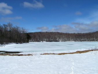
![]()
![]() On Sunday, March 25th I wanted some more exercise so I took the dog and headed
for Hodge and Frick Ponds. The weather was cloudy when we started out but changed to bright sun in the short time it
took us to drive and park. The parking area was clear down to bare dirt but one look at the
Flynn Trail showed there was still some snow. I carried the shoes to the beginning of the trail, put them on and started
out. The climb to the junction of the Flynn and Big Rock Trails is never steep but it IS uphill all the way. We
stopped at the junction, took some pictures and I decided to head for Hodge to get some pictures before all the snow
disappeared. Hodge Pond was beautiful with the surrounding hills still partially covered with snow.
On Sunday, March 25th I wanted some more exercise so I took the dog and headed
for Hodge and Frick Ponds. The weather was cloudy when we started out but changed to bright sun in the short time it
took us to drive and park. The parking area was clear down to bare dirt but one look at the
Flynn Trail showed there was still some snow. I carried the shoes to the beginning of the trail, put them on and started
out. The climb to the junction of the Flynn and Big Rock Trails is never steep but it IS uphill all the way. We
stopped at the junction, took some pictures and I decided to head for Hodge to get some pictures before all the snow
disappeared. Hodge Pond was beautiful with the surrounding hills still partially covered with snow.
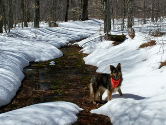 At this point Sheba and I decided to go the long way around since the weather was so beautiful. I still had some irritation
on my left heel from wearing snowshoes so often but I couldn't resist! We headed out on the Flynn Trail to continue
on to the Junkyard. The trail alternated between being completely covered with snow and open areas of standing or
flowing water. Sheba didn't seem to mind since the day was warm and she could get a drink! At Junkyard we turned right onto
the Quick Lake Trail to head back for the parking area.
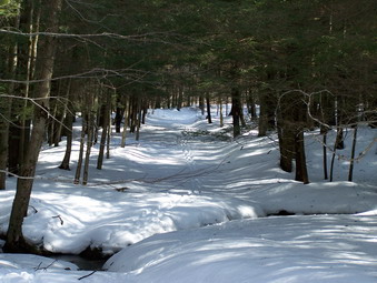 This trail was well-packed by snowmobiles which was a relief since slogging through the heavy, melting snow was beginning to
be a chore. We did meet two snowmobilers along the way on their last ride of the season. At one point the spruce trees were so
dense that very little melting had occurred. This formed a beautiful tunnel with a floor of snow. The only problem was the
rather wide "stream" running across the trail. I normally don't jump very well and snowshoes don't help. As I vaulted over the
stream, I realized that where I was landing was a thin snow and ice shelf with running water underneath. The shelf broke and I
fell! I injured my thumb, bumped my left knee and got pretty wet. The air temperature was warm or I might have been very
cold hiking back. Sheba came over to lick my wounds. I put snow on the thumb and was off after a short pause.
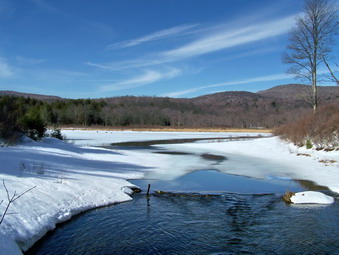 We continued on the Quick Lake trail to Iron Wheel Junction where I decided to turn right, stay on the Quick Lake Trail
and take the shorter way back. It seemed in no time we were at Frick Pond. The near side of the bridge over the outlet
still has a large mound of snow almost blocking it! I stood on the bridge to take some pictures of Frick Pond. The
snow can still be seen on some of the hills. Part of the pond is iced over but the area near the outlet is open. The
water is a beautiful blue. We headed back to the car completing a little over 6 miles in about 3 hours!
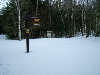
![]()
![]() On Saturday, March 24th my wife and I decided to snowshoe an "easy" 3500. I
had only climbed Windham once from the Peck Rd. route so we headed north. This time we parked near the Black Dome
parking area with the intention of using the Black Dome Trail to the Escarpment Trail and on to Windham. As you can see
from the picture this road is definitely "seasonal". The parking area is seldom, if ever, plowed and parking along
the shoulder of the road can get crowded. We headed out on the Black Dome Trail which climbs steadily, but not steeply,
toward a junction with the Escarpment Trail. The temperature was in the forties and the snow was very loose. Snowshoes
provided traction and some flotation in areas of heavier snow.
On Saturday, March 24th my wife and I decided to snowshoe an "easy" 3500. I
had only climbed Windham once from the Peck Rd. route so we headed north. This time we parked near the Black Dome
parking area with the intention of using the Black Dome Trail to the Escarpment Trail and on to Windham. As you can see
from the picture this road is definitely "seasonal". The parking area is seldom, if ever, plowed and parking along
the shoulder of the road can get crowded. We headed out on the Black Dome Trail which climbs steadily, but not steeply,
toward a junction with the Escarpment Trail. The temperature was in the forties and the snow was very loose. Snowshoes
provided traction and some flotation in areas of heavier snow.
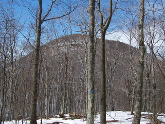 We turned left on the Escarpment Trail and headed toward Windham by way of Burnt Knob. It was immediately clear that
the signage was wrong since it indicated 1.5 miles to Burnt Knob and 2.0 miles to Windham. Burnt Knob is hard to
miss at this point since it LOOMS right in front of you. The distance is really .5 miles to Burnt Knob and another
1.5 miles to Windham. We started the climb up Burnt Knob and it proved to be quite challenging. It is steep in most
places with several rock outcroppings to negotiate. As we came around the hill and started up again, I began to
slip even though my Lightning Ascents are usually good under any conditions. My wife was having MORE trouble with
her Tubbs! The snow was just too loose to continue and make hiking any fun. I went a little further and then we
decided to go back to the trail junction and go over Acra Point. I had never been on that part of the trail but
the decision proved an excellent one. The hiking was easier but not easy and the views were spectacular!
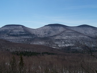 The hike to the top of Acra Point was less than a mile and the snow coverage was spotty. There were places with no
snow at all followed by areas where snow had drifted to several feet. Near the top a short side trail emerges on a
rocky shelf. The view from here is one of the best I have seen and was particularly nice on this day as the sun
was shining. From this point you can look across and see the Blacks. They appear close enough to touch. The Col
between Blackhead and Black Dome is easily visible. The Camel's Hump to the west of Thomas Cole stands out. The
view down the valley is breathtaking.
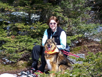 We decided to stop here briefly to enjoy the view and take some pictures. We don't stop often and never for long but
this was just too good to pass up. Even Sheba, who normally whines when we aren't on the trail didn't seem to mind.
She does walk very close to the edge of these lookouts which makes us nervous. The sun was warm and I was afraid to
linger too long as a nap didn't seem to be out of the question!
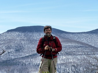 I usually eschew pictures but Cindy convinced me that she should snap of a few of me using the Blacks as a
backdrop. The pictures she took almost seem to be faked. It is as if I were in a studio and some backdrop was
lowered behind me. I assure you this is not the case. In fact, I am very close to the edge of a 50+ foot drop.
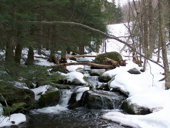 Near the end of the hike a bridge crosses the Batavia Kill. The running water from the melting snow is finally
free to cascade down the mountains. The picture here is looking upstream on the Batavia Kill. In several places we
were walking on packed snow that had running water underneath. In other places we were walking beside a creek. I am
sure the volume of these rivulets will increase with the increasing temperatures. This make spring hiking in the
Catskills exciting since you never know when you will have to cross a swollen stream near the end of a long hike.
We covered between 5 and 6 miles in 4 or so hours counting the aborted attempt up Burnt Knob. As we were
coming down the trail to the carry a few drops of rain fell. When we pulled away from the parking area, large
drops began pelting the windshield. This continued on and off, harder at times until we returned home.