
What You Missed
Winter 2016-2017
Winter 2016-2017
![]()
![]()
![]()
![]()
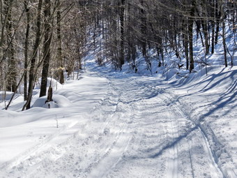
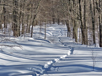
![]() On Sunday, March 19th I had planned to go to Frick Pond again and break out some more trails. I knew this would be a sort of futile effort since the temperatures during the week would reduce the amount of snow drastically. I still though it would be fun. Cindy had a meeting after church but said she wanted to go with me. I drove home and Sheila and I waited for her to get home. Cindy returned at about 1:30 PM and we got ready to head out. I decided to dress a little more lightly tan on the previous few trips as the temperature was hovering around 40 degrees. I was concerned that the higher temperatures would melt the snow and make it even more difficult to hike but decided to try it anyway. My plan was to hike up the Flynn Trail and down the Big Rock Trail. At Times Square we would hike the Logger's Loop back to the Quick Lake Trail and the parking area. As of Saturday the Flynn Trail was untouched and I expected it to be that way when we arrived. Sheila was ready to go ay any time and Cindy got herself dressed as we left Livingston Manor just before 2:00 PM. After driving out the DeBruce Road and up the Mongaup Pond Road we arrived at the Frick pond trailhead parking area at 2:10 PM and got ready to hike. There appeared to be only one car in the lot but as we were getting ready another car arrived. We crossed the road an 2:15 PM and started out by hiking up the Flynn Trail toward the junction with the Big Rock Trail. MY fears concerning the softening snow were conformed as we hiked the rail through the woods where there was less snow. Less snow should have meant an easier hike but the softened snow was heavier and more difficult to walk through. The sun was warm but there was a slight breeze. As we turned right onto the woods road following the blue blazes of the Flynn Trail, we were met by completely pristine snow! I took a few pictures and then we started up the trail. It was tough going as the trail is all uphill with only a few spots that flatten some. I started to count my steps so that when I took a rest I could try to beat my "record". Occasionally I would stop for a longer time to take a few pictures. I kept thinking we were farther along than we were and at one point I pulled out my GPS to find we were still short of a mile. I knew that I could make the next .8 miles but that it would be slow going. We passed the "meadow" on the right of the trail and I knew there was about half a mile to go. Right after this point there was a slight downhill that felt really good but it was followed by more climbing. As we approached the junction with the Big Rock Trail, Cindy decided to pass me and break the trail. I'm sure she was trying to help but it left me feeling defeated and deflated. I had hoped that I could break trail all the way to the junction and missing by .15 miles was disappointing. I reached the junction at 4:30 PM after hiking 1.7 miles and was VERY happy to find the Big Rock Trail was packed by snowmobiles. I knew this would make the trip back much easier! I took a small break and then turned left to follow Cindy down the hill on the Big Rock Trail.
On Sunday, March 19th I had planned to go to Frick Pond again and break out some more trails. I knew this would be a sort of futile effort since the temperatures during the week would reduce the amount of snow drastically. I still though it would be fun. Cindy had a meeting after church but said she wanted to go with me. I drove home and Sheila and I waited for her to get home. Cindy returned at about 1:30 PM and we got ready to head out. I decided to dress a little more lightly tan on the previous few trips as the temperature was hovering around 40 degrees. I was concerned that the higher temperatures would melt the snow and make it even more difficult to hike but decided to try it anyway. My plan was to hike up the Flynn Trail and down the Big Rock Trail. At Times Square we would hike the Logger's Loop back to the Quick Lake Trail and the parking area. As of Saturday the Flynn Trail was untouched and I expected it to be that way when we arrived. Sheila was ready to go ay any time and Cindy got herself dressed as we left Livingston Manor just before 2:00 PM. After driving out the DeBruce Road and up the Mongaup Pond Road we arrived at the Frick pond trailhead parking area at 2:10 PM and got ready to hike. There appeared to be only one car in the lot but as we were getting ready another car arrived. We crossed the road an 2:15 PM and started out by hiking up the Flynn Trail toward the junction with the Big Rock Trail. MY fears concerning the softening snow were conformed as we hiked the rail through the woods where there was less snow. Less snow should have meant an easier hike but the softened snow was heavier and more difficult to walk through. The sun was warm but there was a slight breeze. As we turned right onto the woods road following the blue blazes of the Flynn Trail, we were met by completely pristine snow! I took a few pictures and then we started up the trail. It was tough going as the trail is all uphill with only a few spots that flatten some. I started to count my steps so that when I took a rest I could try to beat my "record". Occasionally I would stop for a longer time to take a few pictures. I kept thinking we were farther along than we were and at one point I pulled out my GPS to find we were still short of a mile. I knew that I could make the next .8 miles but that it would be slow going. We passed the "meadow" on the right of the trail and I knew there was about half a mile to go. Right after this point there was a slight downhill that felt really good but it was followed by more climbing. As we approached the junction with the Big Rock Trail, Cindy decided to pass me and break the trail. I'm sure she was trying to help but it left me feeling defeated and deflated. I had hoped that I could break trail all the way to the junction and missing by .15 miles was disappointing. I reached the junction at 4:30 PM after hiking 1.7 miles and was VERY happy to find the Big Rock Trail was packed by snowmobiles. I knew this would make the trip back much easier! I took a small break and then turned left to follow Cindy down the hill on the Big Rock Trail.
 Cindy was keeping up a quick pace downhill as she always does and I just wanted to take it easy and recover. At one point she stepped off to the side of the trail and indicated I should go ahead. I didn't see the point but did not want to argue. I started down the hill stopping at one point to take some pictures of the trail broken by the machines. As we neared the bottom of the hill, we came to a large tree across the trail. Some machines had apparently gone over the tree while oaths had gone around. I went around the right end of the blow down and then heard snowmobiles coming. We stepped off the trail to the right and three machines game by us slowing as they passed. We continued own the hill arriving at Times Square. We had taken about 30 minutes to descend the 1.2 miles on the Big Rick Trail while the 1.7 mile ascent of the Flynn Trail had taken 2 hours and 15 minutes! Cindy decided we would turn left and walk the Logger's Loop back to Gravestone Junction. The skies were more overcast now and there was a little less sun. This part of the Logger's Loop is only .6 miles long but has a little uphill grade for the first part. My legs were very tired especially around the hips but at least the trail was well-packed. We had walked the trail the day before breaking fresh snow and then others had walked it to pack the snow even more. Even though it wasn't as well groomed as the Big Rock Trail it was much easier walking in the set track that it was the day before. It was also much easier than our long haul up the Flynn Trail. At 5:20 PM we were back at Gravestone Junction after hiking only 3.5 miles. We turned left and hiked the Quick Lake Trail back to the register and then continued on the woods road back to the car. When we arrived in the parking area at 5:30 PM all; the other cars were gone. We had hiked 4 miles in 3 hours and 15 minutes for an overall rate of 1.2 mph! This was slow but acceptable given the brutal conditions.
![]()
![]()
![]()
![]()
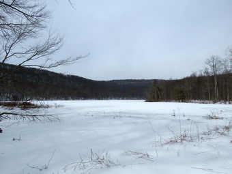
![]() On Saturday, March 18th I wanted to get in a slightly longer hike than I had over the passed few days. There was still a lot of snow on the ground from the over two feet that fell on Tuesday and Wednesday. I though that by this time the lots at Frick Pond should be plowed so I decided to go there. Sheila was ready as always and Cindy also wanted to go. The temperature when I got up at 6:00 AM was 10 degrees but it began to rise and was just below 30 degrees when we left the house at 10:15 AM and headed out to Frick Pond. Sheila was happy to be in the backseat as we headed out the DeBruce Road. After about six miles I turned left on Mongaup road and headed toward Frick Pond. At the fork in the road I stayed left on Beech Mountain Road. At the trailhead we found both lots were well plowed but no other cars were parked when we pulled in at 10:30 AM. I let Sheila out of the car while we put on my snowshoes. There was a broken trail from the smaller lot out the woods road toward Frick Pond but I did not know how far it went. My plan was to hike around the pond using the Quick Lake, Big Rock and Logger's Loop Trails. I knew this would be quite a challenge if the rail was not broken as neither Cindy nor Sheila can break trail for too long. We both wore our Tubbs Alp Flex VRT snowshoes which go on very quickly as the bindings are easy to use. We began our hike at about 10:35 AM by hiking out the woods road toward Frick Pond. I stopped to take a few pictures of the undisturbed snow on the Logger's Loop Trail near Gravestone Junction. The skies were a bright blue with some sun and puffy white clouds. The trail was well broken out to the pond and when we got to the bridge over the outlet I took off my pack and got out the camera. I took a picture of the bridge which had almost no snow on it except at the far end where the snow always drifts. From the bridge I took a few pictures of the pond and the outlet stream. I picked up my pack and we started around the pond following the trail broken in the snow. The snow alternated between having a hard crust in some places and fluffy drifts in others. At the junction of the Quick Lake Trail and the Big Rock Trail the broken trail stopped and it was obvious whoever had hiked there had turned around and returned the same way they had come. We turned right to get on the Big Rock Trail around the back of the pond with me leading and breaking the trail through the snow. My hips still hurt from the hike on Round Top on Thursday but I really wanted to complete what we had started. Under the tall evergreen trees there was less snow but it still averaged well over a foot. When we got to the wooden causeways, they were covered in well over a foot of snow and I stopped to take a few pictures. Some snow had melted and fallen through the openings between the boards which made a sort of lattice work on the bridge.
On Saturday, March 18th I wanted to get in a slightly longer hike than I had over the passed few days. There was still a lot of snow on the ground from the over two feet that fell on Tuesday and Wednesday. I though that by this time the lots at Frick Pond should be plowed so I decided to go there. Sheila was ready as always and Cindy also wanted to go. The temperature when I got up at 6:00 AM was 10 degrees but it began to rise and was just below 30 degrees when we left the house at 10:15 AM and headed out to Frick Pond. Sheila was happy to be in the backseat as we headed out the DeBruce Road. After about six miles I turned left on Mongaup road and headed toward Frick Pond. At the fork in the road I stayed left on Beech Mountain Road. At the trailhead we found both lots were well plowed but no other cars were parked when we pulled in at 10:30 AM. I let Sheila out of the car while we put on my snowshoes. There was a broken trail from the smaller lot out the woods road toward Frick Pond but I did not know how far it went. My plan was to hike around the pond using the Quick Lake, Big Rock and Logger's Loop Trails. I knew this would be quite a challenge if the rail was not broken as neither Cindy nor Sheila can break trail for too long. We both wore our Tubbs Alp Flex VRT snowshoes which go on very quickly as the bindings are easy to use. We began our hike at about 10:35 AM by hiking out the woods road toward Frick Pond. I stopped to take a few pictures of the undisturbed snow on the Logger's Loop Trail near Gravestone Junction. The skies were a bright blue with some sun and puffy white clouds. The trail was well broken out to the pond and when we got to the bridge over the outlet I took off my pack and got out the camera. I took a picture of the bridge which had almost no snow on it except at the far end where the snow always drifts. From the bridge I took a few pictures of the pond and the outlet stream. I picked up my pack and we started around the pond following the trail broken in the snow. The snow alternated between having a hard crust in some places and fluffy drifts in others. At the junction of the Quick Lake Trail and the Big Rock Trail the broken trail stopped and it was obvious whoever had hiked there had turned around and returned the same way they had come. We turned right to get on the Big Rock Trail around the back of the pond with me leading and breaking the trail through the snow. My hips still hurt from the hike on Round Top on Thursday but I really wanted to complete what we had started. Under the tall evergreen trees there was less snow but it still averaged well over a foot. When we got to the wooden causeways, they were covered in well over a foot of snow and I stopped to take a few pictures. Some snow had melted and fallen through the openings between the boards which made a sort of lattice work on the bridge.
 We continued on the Big Rock Trail as it wound around the back of Frick Pond heading toward Times Square. The snow was deeper in some spots than others but the going was never easy. We stopped briefly on the last two smaller bridges and I took some shots before continuing on towards Times Square. Once we were out of the protection of the evergreen trees the snow was much deeper and had drifted in spots. I wondered at this point if I could continue to break trail on the Logger's Loop which is slightly uphill and always had large drifts. At 11:50 AM we arrived at Times Square after hiking 1.2 miles at an overall average speed of 1 mph! We stopped to get a snack and to drink some water. After a few minutes and a few pictures, I shouldered my pack and simply headed out to the right on the Logger's Loop back to Gravestone junction. I was surprised to see that no snowmobiles had passed through on the Big Rock Trail and Logger's Loop since there was plenty of snow and it was Saturday. The further we went the more my legs were tiring from lifting and breaking trail. Sheila seemed to be unaffected by the cold but she was smart enough to stay behind me and in front of Cindy most of the time. Although she looks like a yellow lab she has a longer coat from a dose of Husky blood. She never seems to get cold. The Logger's Loop climbs slightly from Times Square and I noticed this as I continued to break the trail. Soon we were on flatter ground heading back toward Gravestone Junction but the snow drifts in this area were almost 3 feet high. Some of the drifts were so consolidated that they would support our weight for a short distance and then we would sink almost up to our knees. By this time I was tired but in good spirits since the broken trail was only a short distemper away. I thought about taking a few more pictures but there was nothing really interesting to photograph and the sky was now almost completely overcast. At Gravestone Junction we turned left to head back to the car on the Quick Lake Trail. Not too far along we saw a young couple headed toward us with snowshoes and no poles. They wore MSR snowshoes which were probably rented from Morgan Outdoors in Livingston Manor. I pulled Sheila off the trail and we waited until they passed. We let them know the trail was broken around the pond but I got the feeling they might not get that far. We did notice another pair of hikers approaching from behind us. As we passed the register, Sheila alerted and I could see a young couple starting out from the parking lot. We walked a little farther before I walked to the side of the trail with Sheila to let them pass. They also had MSR snowshoes but had no poles. We informed them that the trail around the pond was broken and they thanked us. The found lady bemoaned their lack of gaiters and I thought that poles would have been a good idea also! We were back at the car at 1:00 PM having hiked about 2.2 miles in almost 2.5 hours with an elevation gain of 175 feet. Our average moving speed was only 1.2 mph. I put Sheila in the car and our gear in the trunk. There were now 5 cars parked in the other lot with one leaving and another starting out. I checked the beginning of the Flynn Trail and found it had not been touched. Maybe tomorrow!
![]()
![]()
![]()
![]()
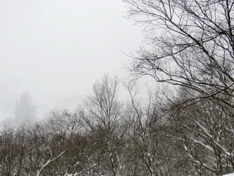
![]() On Thursday, March 16th I wanted to get out for the third day in a row to take advantage of the over two feet of snow that had fallen from Tuesday into Wednesday. I thought about going to Frick Pond but was not sure the lot would be plowed or that I could make much headway by myself. I decided to go up on Round Top and hike the upper trail which was not yet broken out. I though this might be reasonable since the other parts of the trail were already set which would make the overall hike easier. I got my gear together and headed out of the house with Sheila at 11:00 AM. After putting on the snowshoes, I put Sheila on her leash and started out the driveway and across the street. No snow was falling but the wind was blowing a little and the air temperatures was about 28 degrees. We crossed the street and fought our way over the bank left by the snowplows. Looking across the small field I could not see any track from the day before as the wind had caused the snow to drift and fill it completely. After walking through the field to the base of the cemetery hill, I was able to pick up my track up the hill and the going was much easier. We began the ascent of the steepest hill which is short but really gets the circulation pumping! When we got to the top of the hill, I dropped my pack to take some pictures. The view was much the same as other times but I decided to take a few shots anyway. The views were much clearer than the previous two days and the sun was out. The sky was blue with some puffy white clouds. I picked up my pack and we entered the woods where my previous track was very clear and the walking was much easier than the previous days. At the first trail junction we turned right to follow the woods road and begin the figure 8 route in a counterclockwise direction. This part of the trail had only been traveled once so I concentrated on packing the snow and widening the track slightly. At the sharp left turn we follow the yellow blazes to the left and continued on relatively flat ground to the point where the trail again turns left. Here we turned right to follow the green ribbons that mark the proposed upper trail. Now the going got much harder as there was no track to follow and the snow was over two feet deep. I raised the heel lifts on the snowshoes which gave me a much better bite into the snow and eased the strain on my calf muscles. Although it was hard work, we were soon at the flat summit plateau. I worked my way across the summit but somehow missed the ribbons marking the start of the trail down the other side of the hill. I corrected my mistake and was soon headed down the hill toward the lower trail. I couldn't get a real glide since I kept gliding under the thick layer of snow but going down was much easier than the ascent.
On Thursday, March 16th I wanted to get out for the third day in a row to take advantage of the over two feet of snow that had fallen from Tuesday into Wednesday. I thought about going to Frick Pond but was not sure the lot would be plowed or that I could make much headway by myself. I decided to go up on Round Top and hike the upper trail which was not yet broken out. I though this might be reasonable since the other parts of the trail were already set which would make the overall hike easier. I got my gear together and headed out of the house with Sheila at 11:00 AM. After putting on the snowshoes, I put Sheila on her leash and started out the driveway and across the street. No snow was falling but the wind was blowing a little and the air temperatures was about 28 degrees. We crossed the street and fought our way over the bank left by the snowplows. Looking across the small field I could not see any track from the day before as the wind had caused the snow to drift and fill it completely. After walking through the field to the base of the cemetery hill, I was able to pick up my track up the hill and the going was much easier. We began the ascent of the steepest hill which is short but really gets the circulation pumping! When we got to the top of the hill, I dropped my pack to take some pictures. The view was much the same as other times but I decided to take a few shots anyway. The views were much clearer than the previous two days and the sun was out. The sky was blue with some puffy white clouds. I picked up my pack and we entered the woods where my previous track was very clear and the walking was much easier than the previous days. At the first trail junction we turned right to follow the woods road and begin the figure 8 route in a counterclockwise direction. This part of the trail had only been traveled once so I concentrated on packing the snow and widening the track slightly. At the sharp left turn we follow the yellow blazes to the left and continued on relatively flat ground to the point where the trail again turns left. Here we turned right to follow the green ribbons that mark the proposed upper trail. Now the going got much harder as there was no track to follow and the snow was over two feet deep. I raised the heel lifts on the snowshoes which gave me a much better bite into the snow and eased the strain on my calf muscles. Although it was hard work, we were soon at the flat summit plateau. I worked my way across the summit but somehow missed the ribbons marking the start of the trail down the other side of the hill. I corrected my mistake and was soon headed down the hill toward the lower trail. I couldn't get a real glide since I kept gliding under the thick layer of snow but going down was much easier than the ascent.
 When we reached the lower trail we turned right and walked along the flat ground back to the point where the trail turns left. We continued to follow the yellow blazes and passed by a large boulder where I took a few shots including a few with Sheila. As we approached the lookout, I could feel that there was a strong wind blowing and the evidence was the snow drifting over the trail. I turned left at the upper lookout and walked down to the spur trail. I turned right and walked out to the lower ledges which gave me a nice view of the town including the school. The amount of snow was clear from this view and I took a few shots before packing up and retreating back to the main trail where there was less wind. We continued down the hill to the first trail junction. I got a pretty good glide going as the trail was already broken from previous days. When we arrived at the trail junction, I was tired but thought I had enough energy left to hike a little more. We turned around and started back up the hill to the lookout. I knew I could just walk the lower loop but I hoped I could do another figure 8 in the opposite direction. I thought this might be possible since every part of the trail now had been broken out at least once. This time we did not stop at the viewpoint but continued to follow the yellow blazes of the lower trail. The trail here is slightly uphill and it is hardly noticeable when the trail isn't covered by two feet of snow! Even with the trail packed down some the work load was noticeably higher. We continued to follow the trail as it turned right and followed a woods road around the base of Round Top. When we got to the next right turn, we turned left instead and headed up the hill toward the summit following the track I had broken out a short time before. I again put up the heel lifters as this side of the hill is every bit as steep as the other. Since the track was partly broken, it was easier to get to the top but I did take some time to pack and widen the track properly. We followed the track across the top and won the other side to the lower trail. Again I got a glide following the trail I had broken. At the lower trail we turned left and followed the trail to the next right turn. After making the turn to the right, we headed downhill to the woods road that heads out to the first trail junction. This is a gentle downhill but I welcomed it as by this time I was getting tired. At the trail junction we turned left to head out to the trailhead at the top of the cemetery. We turned right to descend the hill toward the church with me gliding and most running down the hill. At the base of the hill we continued across the field to our driveway and back to the house. The track we had made earlier was completely drifted in by wind-driven snow! We had been out for about two hours and had hiked a little under 2 miles.
![]()
![]()
![]()
![]()
![]() On Wednesday, March 15th I had planned to hike the loop on Round Top using snowshoes to combat the over two feet of snow that had fallen the day before. I had hiked to the lookout during the storm on Tuesday and found that breaking a track through the snow by myself was exhausting. I had contacted two friends who said they wanted to go and I was hopeful that having four people, Cindy said she wanted to go also, and one dog would make the going easier and we could break the trail around the entire lower loop. The plan was to meet at my house at 9:00 AM. An early morning ambulance call in Willowemoc left be exhausted so I wasn't unhappy when one of my friends asked to postpone the hike until 11:00 AM. I got some rest and when I came downstairs there was a text from the other person say8ing they had other things to do. Soon the person who asked for the postponement called and cancelled their participation. I was disappointed since I knew I would be breaking the trail alone and was not sure I could get all the way around the loop. Cindy and I got our gear ready and dressed warmly as the temperature was 18 degrees and the wind was blowing snow across the yard. Sheila was ecstatic to get in two days in a row as we headed out the driveway to Round Top. We crossed the road and climbed the high snow bank on the other side caused by the snowplows clearing the road. Out track from the day before had been obliterated by the freshly fallen snow and wind driven rifts. We slogged our way across the field and there seemed to be more snow than the day before. There were large drifts behind the church and at the bottom of the cemetery hill. We made the turn up the hill and we could see a pretty good track from the day before. Despite the track, the going was slow as we walked up the hill to the top and the beginning of the trail. At the top of the hill, I dropped my pack to take some pictures. The view of town and the surrounding hills was similar to other snowy days but at least there was something to see as it was not snowing at the time. The headstone in the cemetery were topped by over a foot of snow. I took pictures and then noticed the wind was blowing and decided to enter the woods. The track from the previous day was still there and it made walking easier than breaking a fresh track. I began to notice that Sheila was not out in front but was satisfied to walk just behind me with Cindy bringing up the rear. At the first trail junction I decided to continue straight ahead to the lookout. The climb went a little more quickly than the day before as there was a broken track.
On Wednesday, March 15th I had planned to hike the loop on Round Top using snowshoes to combat the over two feet of snow that had fallen the day before. I had hiked to the lookout during the storm on Tuesday and found that breaking a track through the snow by myself was exhausting. I had contacted two friends who said they wanted to go and I was hopeful that having four people, Cindy said she wanted to go also, and one dog would make the going easier and we could break the trail around the entire lower loop. The plan was to meet at my house at 9:00 AM. An early morning ambulance call in Willowemoc left be exhausted so I wasn't unhappy when one of my friends asked to postpone the hike until 11:00 AM. I got some rest and when I came downstairs there was a text from the other person say8ing they had other things to do. Soon the person who asked for the postponement called and cancelled their participation. I was disappointed since I knew I would be breaking the trail alone and was not sure I could get all the way around the loop. Cindy and I got our gear ready and dressed warmly as the temperature was 18 degrees and the wind was blowing snow across the yard. Sheila was ecstatic to get in two days in a row as we headed out the driveway to Round Top. We crossed the road and climbed the high snow bank on the other side caused by the snowplows clearing the road. Out track from the day before had been obliterated by the freshly fallen snow and wind driven rifts. We slogged our way across the field and there seemed to be more snow than the day before. There were large drifts behind the church and at the bottom of the cemetery hill. We made the turn up the hill and we could see a pretty good track from the day before. Despite the track, the going was slow as we walked up the hill to the top and the beginning of the trail. At the top of the hill, I dropped my pack to take some pictures. The view of town and the surrounding hills was similar to other snowy days but at least there was something to see as it was not snowing at the time. The headstone in the cemetery were topped by over a foot of snow. I took pictures and then noticed the wind was blowing and decided to enter the woods. The track from the previous day was still there and it made walking easier than breaking a fresh track. I began to notice that Sheila was not out in front but was satisfied to walk just behind me with Cindy bringing up the rear. At the first trail junction I decided to continue straight ahead to the lookout. The climb went a little more quickly than the day before as there was a broken track.
 We continued up the hill and Sheila and I followed the spur trail out to the viewpoint on the lower ledges where I took off my pack and got out the camera. Crossing the little gap in the trail proved interesting since by this time I could hardly see anything through my glasses and there were huge drifts. I got out my camera and took some shots of the viewpoint and then some down into town. From this viewpoint the town including the school and post office were visible below unlike the day before when the heavy snow falling had blocked any views. I took a few shots just to show the contrast with other pictures. I also took some shots of the ledges before putting away the camera. I walked back out the spur trail as walking directly up to the upper ledges looked too difficult with all the snow. Back at the main trail I tuned left to walk to the upper ledges to meet Cindy. I decided we would head out on the lower trail in a clockwise direction thinking that we could always turn around and walk downhill on the broken track if the going was too tough. I followed the yellow blazes hoping that once we got further into the woods the snow drifts would lessen and the depth would be more manageable. We found that this was not the case and that the depth of snow was always at least two feet. I was walking few steps and taking a short break and then walking a few more steps. The snow was so deep that I could not lift my snowshoes straight up and put them down. I had to lift my snowshoes and then push ahead into the snow which was very tiring. I stopped to take a few pictures of the snow and the rocks with snow on them. We climbed the last short hill with some difficulty due to the drifting and followed the trail as it made a sharp right turn. We were now on flatter ground and the going should have been easier but I was tired and the snow was deep. Sheila was still right behind me. We finally came to the next sharp right turn where the trail heads downhill. I had looked forward to the downhill as I can usually get a glide. The snow remained deep and the glide was limited as I tended to glide under the deep snow. Going down hill was easier though and soon we made the last right turn onto the wide woods road that led back to the first trail junction to complete the loop. The snow was just as deep here but the views of the ledges were interesting and I knew we would soon be back to broken track, When we hit t5he trail junction, I took a few pictures of the broken track before we turned left to head back out to the trailhead. We turned right on the cemetery road and got a glide going on the way back to the bottom of the hill. Our tracks across the field had started to fill in but at least we could see them. We crossed the road and walked back home on the driveway. We had hiked a little more than a mile about two hours! I am hoping to get to Frick Pond tomorrow and find the parking lots plowed!
![]()
![]()
![]()
![]()
![]() On Tuesday, March 14th the weather forecast was calling for a blizzard with at least two feet of snow in Livingston Manor! When I got up at 6:00 AM we were well on our way to meeting or exceeding that forecast. I went out to begin to clear some of the snow and found my two neighbors already working on getting the driveway clear so that I could respond on an ambulance call when it came. I took some pictures of the snow and joined in the effort to clear the driveway and liberate our cars. By noon after several hours of work, most of the driveway was clear and I could move my car. I had promised Sheila we would go outside but I was too tired to go for a hike. When I went back into the house, there was Sheila waiting to go out. She didn't seem to understand broken promises so I got a pair of snowshoes from the cellar and put my camera in the pack. We went outside and Sheila immediately started bounding through the snow which was up to her back in most places. I got a leash out of my car, put Sheila on the leash, donned my snowshoes and headed out the driveway to Round Top. The rate of snowfall seemed to be more than an inch an hour but the roads were pretty well plowed although the snow continued to accumulate. The air temperature was 20 degrees but there was some wind that cut through my clothing. We crossed the road and climbed the snow bank on the other side. I had to remind myself that when I went to bed we had NO SNOW on the ground. Sheila started out ahead of me bouncing up and down through the deep snow that had drifted in the field. I dropped my pack and took out my camera to take a short video of her antics as I called her back to me. We continued our walk across the field to the base of the cemetery hill. We began the ascent of the steepest hill which is short. As I looked around I could see that all the trees were covered with a layer of snow making a beautiful scene. Sheila continued to break a track going up the hill without stopping. She does like to wander back and forth but I made a relatively straight track since following her would have made me appear intoxicated. At the top of the hill, I dropped my pack to take some pictures. The view of town and the surrounding hills was completely blocked by the falling snow. The headstone in the cemetery were topped by over a foot of snow. I took pictures and then noticed the wind was blowing and decided to enter the woods. I hoped the snow depth would be a little less in the woods but we found just the opposite. In places my poles sank almost two feet. I kept thinking that my snowshoes were sinking pretty deeply but this was the most snow I had seen in two winters! The going was slow for me and as we approached the first trail junction I decided to continue straight ahead to the lookout.
On Tuesday, March 14th the weather forecast was calling for a blizzard with at least two feet of snow in Livingston Manor! When I got up at 6:00 AM we were well on our way to meeting or exceeding that forecast. I went out to begin to clear some of the snow and found my two neighbors already working on getting the driveway clear so that I could respond on an ambulance call when it came. I took some pictures of the snow and joined in the effort to clear the driveway and liberate our cars. By noon after several hours of work, most of the driveway was clear and I could move my car. I had promised Sheila we would go outside but I was too tired to go for a hike. When I went back into the house, there was Sheila waiting to go out. She didn't seem to understand broken promises so I got a pair of snowshoes from the cellar and put my camera in the pack. We went outside and Sheila immediately started bounding through the snow which was up to her back in most places. I got a leash out of my car, put Sheila on the leash, donned my snowshoes and headed out the driveway to Round Top. The rate of snowfall seemed to be more than an inch an hour but the roads were pretty well plowed although the snow continued to accumulate. The air temperature was 20 degrees but there was some wind that cut through my clothing. We crossed the road and climbed the snow bank on the other side. I had to remind myself that when I went to bed we had NO SNOW on the ground. Sheila started out ahead of me bouncing up and down through the deep snow that had drifted in the field. I dropped my pack and took out my camera to take a short video of her antics as I called her back to me. We continued our walk across the field to the base of the cemetery hill. We began the ascent of the steepest hill which is short. As I looked around I could see that all the trees were covered with a layer of snow making a beautiful scene. Sheila continued to break a track going up the hill without stopping. She does like to wander back and forth but I made a relatively straight track since following her would have made me appear intoxicated. At the top of the hill, I dropped my pack to take some pictures. The view of town and the surrounding hills was completely blocked by the falling snow. The headstone in the cemetery were topped by over a foot of snow. I took pictures and then noticed the wind was blowing and decided to enter the woods. I hoped the snow depth would be a little less in the woods but we found just the opposite. In places my poles sank almost two feet. I kept thinking that my snowshoes were sinking pretty deeply but this was the most snow I had seen in two winters! The going was slow for me and as we approached the first trail junction I decided to continue straight ahead to the lookout.
 I very seldom stop to take pictures along the trail itself since one part looks much like the next. On this day I stopped after entering the woods and took a few shots. Climbing the hill even with Sheila breaking the track was tiring and I stopped a be times to rest briefly. I had almost decided at this point that the lookout would be our endpoint. We continued up the hill and followed the spur trail out to the viewpoint on the lower ledges where I took off my pack and got out the camera. Crossing the little gap in the trail proved interesting since by this time I could hardly see anything through my glasses. I took a moment to wipe off some of the snow before getting out my camera. From this viewpoint the town including the school and post office are usually visible below. On this day there was simply a wall of white as the snow continued to fall. I took a few shots just to show the contrast with other pictures. I also took a few shots of the ledges before putting away the camera and heading back down the hill. Going down was much easier than coming up and I was able to get a nice glide for most of the way down to the first trail junction. We walked back out to the trailhead and turned right to start down toward the church. Snow was still falling and there were no views. I was able to glide most of the way down the hill. We walked behind the church and back across the field where our tracks were barely visible. We crossed the road and walked back home on the driveway. We had hiked a little less than a mile in around 90 minutes. It was still snowing and the wind was picking up causi8ng the snow to drift. I cannot recall more snow falling in such a short period of time since we have lived in Livingston Manor. All county schools were closed and most are closed already for Wednesday. I guess I will just have to go out tomorrow and see how far I can get.
![]()
![]()
![]()
![]()
![]() On Sunday, March 12th I decided I wanted to get out to hike locally after church. I usually take it easy on Sunday afternoon but track practice has started and a major snow storm is forecast to move in for Tuesday and Wednesday. I decided to go to Huggins Lake after looking at a route at Mongaup Pond which was over 8 miles. I decided to leave that one for later. Huggins Lake is not my favorite but I chose it for its shorter length, under 4 miles, and for the fact that it was not Frick Pond or Trout Pond. I headed out a little before 1:30 PM with Sheila in the backseat. I have come to the realization that she would like to be out everyday and we had not hiked since Thursday! I drove up the Beaverkill Road and down the Campsite Road to find the covered bridge STILL closed. I detoured to the steel bridge at Craigie Claire and then drove out Berry Brook Road to the trailhead. Along the way I noticed that Dundas Castle was clearly visible from the road and thought about taking pictures on the way back. We arrived at the road to the parking area to find it snow covered and very rough. I chose to chance it and easily made it to the small lot parking at 1:45 PM. As I got my equipment ready I noticed that there was at least an inch of snow on the ground. I also could here one of the trees which sounded like it was about to crack and found it splintered and high enough to hit my car if it came down! There were no other cars in the lot when we headed out at 1:50 PM on the wide woods road to the lake. The temperature was 15 degrees and the wind was blowing so I was glad I had decided on a baselayer top and bottom. I also wore a heavier Patagonia wool top, my insulated Salomon Nytro boots and a warm pair of gloves. There was very little sun and the skies were mostly overcast as we started the climb up the hill. The hike isn't long and the trail was well-maintained. The first 1.2 miles is all uphill and gains almost 700 feet. Sheila was running up and down the trail and following game paths into the woods as I did my best to keep up a fast pace up the hill. I stopped along the way to take a few shots of the snow on the trail. At one point I had to tell Sheila to stop chasing a little mouse that she had found outside its burrow. After the initial climb, the trail descends to Huggins Lake making a sharp turn from southeast to north at about 1.6 miles. Sheila alerted at the turn but I could not see what she saw and we continued to descend to the lake.
On Sunday, March 12th I decided I wanted to get out to hike locally after church. I usually take it easy on Sunday afternoon but track practice has started and a major snow storm is forecast to move in for Tuesday and Wednesday. I decided to go to Huggins Lake after looking at a route at Mongaup Pond which was over 8 miles. I decided to leave that one for later. Huggins Lake is not my favorite but I chose it for its shorter length, under 4 miles, and for the fact that it was not Frick Pond or Trout Pond. I headed out a little before 1:30 PM with Sheila in the backseat. I have come to the realization that she would like to be out everyday and we had not hiked since Thursday! I drove up the Beaverkill Road and down the Campsite Road to find the covered bridge STILL closed. I detoured to the steel bridge at Craigie Claire and then drove out Berry Brook Road to the trailhead. Along the way I noticed that Dundas Castle was clearly visible from the road and thought about taking pictures on the way back. We arrived at the road to the parking area to find it snow covered and very rough. I chose to chance it and easily made it to the small lot parking at 1:45 PM. As I got my equipment ready I noticed that there was at least an inch of snow on the ground. I also could here one of the trees which sounded like it was about to crack and found it splintered and high enough to hit my car if it came down! There were no other cars in the lot when we headed out at 1:50 PM on the wide woods road to the lake. The temperature was 15 degrees and the wind was blowing so I was glad I had decided on a baselayer top and bottom. I also wore a heavier Patagonia wool top, my insulated Salomon Nytro boots and a warm pair of gloves. There was very little sun and the skies were mostly overcast as we started the climb up the hill. The hike isn't long and the trail was well-maintained. The first 1.2 miles is all uphill and gains almost 700 feet. Sheila was running up and down the trail and following game paths into the woods as I did my best to keep up a fast pace up the hill. I stopped along the way to take a few shots of the snow on the trail. At one point I had to tell Sheila to stop chasing a little mouse that she had found outside its burrow. After the initial climb, the trail descends to Huggins Lake making a sharp turn from southeast to north at about 1.6 miles. Sheila alerted at the turn but I could not see what she saw and we continued to descend to the lake.
 When we arrived at the lake, I noticed that the water level was very high and most of the pond had a coating of ice. It was clear the ice near the dam was thicker and had been blown there by the wind. Across the pond I could see open water. I dropped my pack and got out the camera to take some pictures even though the skies were flat and there was little color anywhere. We walked the path to the outlet and I could, immediately see that the beavers had dammed the outlet causing the level of the water to rise. I took a few more pictures of the lake before returning to my pack, stowing the camera and starting back up the hill. I did take some pictures of the snow on the trail and around the lake. The only negative point about Huggins Lake is that there is only one trail and so there are no variations available. I have tried bushwhacking around the pond but the bushes get pretty thick. We climbed the hill back to the highest point on the trail and then started down the other side. I was surprised that I had labored a little climbing the hill at the beginning of the hike but felt very fresh on the way back. As we continued to descend, I was a little sorry I didn't have more time to be out hiking. When we arrived back at the car, we had hiked 3.7 miles in 1 hour and 35 minutes with a total elevation gain of 940 feet. As we left the parking area, I turned left on Berry Brook road and headed back to Livingston Manor the way we had come. On the way back I stopped on the road and took some pictures of Dundas Castle through the trees. I would like to get some pictures from nearer the castle but it is private property and I have not been able to get permission.
![]()
![]()
![]()
![]()
![]() On Thursday, March 9th I had planned to stay inside due to the high wind advisory. The wind did seem substantial when I was driving to my men's Bible study at 6:15 AM and seemed unabated on the way home at 7:30 AM. After I arrived home, I went downtown to get some breakfast and by the time I returned the wind had died down some with just a few gusts. I convinced myself that I would feel better if I went out to hike and Sheila seemed to support that decision. I got my gear together having decided to head to the Frick Pond area and left the house at about 9:15 AM. My plan was to hike the Quick Lake Trail to Iron Wheel Junction. From here we would hike the Logger's Loop to Times Square an then ascend the Big Rock Trail to The Flynn Trail to get back to the car. Although the temperature in the morning as in the low 30's I knew it would warm up throughout the day as the sun came out. I decided to wear my Mammut hoody and warmer Columbia Titanium pants. The hoody has lots of zippers to help regulate temperature. I wore a baselayer on top but decided to forego tights under the pants. I had my spikes in my pack but knew I probably would not need them as there was little snow or ice left. Sheila was happy to be going anywhere and crouched in the back seat with her head on the console. I drove out DeBruce Road and turned left on Mongaup Road. Where the road splits I stayed left on Beech Mountain Road and parked in the smaller lot at 9:35 AM. It didn't take us long to walk out to the Quick Lake Trail to start our hike. As we started to hike I wondered about my choice of clothing as I felt a little cool since the temperature was only 35 degrees and the wind had picked up some. On the way to the register box it was obvious the wind had brought down a lot of smaller branches and some larger branches and small trees. The woods road out to Frick pond was also littered with blowdowns and still had some water although uh less than the week before. We stayed left at Graveyard Junction to stay on the Quick Lake Trail. When we arrived at the bridge across the outlet, I decided to stop and take pictures despite the fact that I have hundreds from this location. There was still some snow around in this area. I took some shots and then we continued on around the pond. We stayed left at the trail junction to stay on the Quick Lake Trail and found that most of the water on the trail had either drained off or dried up due to the wind. There were more branches along the trail. We continued on our hike passing through the "Spruce Tunnel". The small stream through the woods was running freely with slightly less water than the week before. By 10:15 AM we had walked the 1.5 miles to Iron Wheel Junction. At the trail junction we turned right on the Logger's Loop Trail. The Logger's Loop is mostly downhill in this direction and we made good time but encountered more blowdowns along the way. This trail also was much drier which made the walking easier. Just before starting the descent to Times Square, we stopped at a small pond on the left side of the trail so that I could take some pictures. This pond is seasonal but has been growing in size for several years. By 10:40 AM we were at Times Square and about 2.7 miles into the hike.
On Thursday, March 9th I had planned to stay inside due to the high wind advisory. The wind did seem substantial when I was driving to my men's Bible study at 6:15 AM and seemed unabated on the way home at 7:30 AM. After I arrived home, I went downtown to get some breakfast and by the time I returned the wind had died down some with just a few gusts. I convinced myself that I would feel better if I went out to hike and Sheila seemed to support that decision. I got my gear together having decided to head to the Frick Pond area and left the house at about 9:15 AM. My plan was to hike the Quick Lake Trail to Iron Wheel Junction. From here we would hike the Logger's Loop to Times Square an then ascend the Big Rock Trail to The Flynn Trail to get back to the car. Although the temperature in the morning as in the low 30's I knew it would warm up throughout the day as the sun came out. I decided to wear my Mammut hoody and warmer Columbia Titanium pants. The hoody has lots of zippers to help regulate temperature. I wore a baselayer on top but decided to forego tights under the pants. I had my spikes in my pack but knew I probably would not need them as there was little snow or ice left. Sheila was happy to be going anywhere and crouched in the back seat with her head on the console. I drove out DeBruce Road and turned left on Mongaup Road. Where the road splits I stayed left on Beech Mountain Road and parked in the smaller lot at 9:35 AM. It didn't take us long to walk out to the Quick Lake Trail to start our hike. As we started to hike I wondered about my choice of clothing as I felt a little cool since the temperature was only 35 degrees and the wind had picked up some. On the way to the register box it was obvious the wind had brought down a lot of smaller branches and some larger branches and small trees. The woods road out to Frick pond was also littered with blowdowns and still had some water although uh less than the week before. We stayed left at Graveyard Junction to stay on the Quick Lake Trail. When we arrived at the bridge across the outlet, I decided to stop and take pictures despite the fact that I have hundreds from this location. There was still some snow around in this area. I took some shots and then we continued on around the pond. We stayed left at the trail junction to stay on the Quick Lake Trail and found that most of the water on the trail had either drained off or dried up due to the wind. There were more branches along the trail. We continued on our hike passing through the "Spruce Tunnel". The small stream through the woods was running freely with slightly less water than the week before. By 10:15 AM we had walked the 1.5 miles to Iron Wheel Junction. At the trail junction we turned right on the Logger's Loop Trail. The Logger's Loop is mostly downhill in this direction and we made good time but encountered more blowdowns along the way. This trail also was much drier which made the walking easier. Just before starting the descent to Times Square, we stopped at a small pond on the left side of the trail so that I could take some pictures. This pond is seasonal but has been growing in size for several years. By 10:40 AM we were at Times Square and about 2.7 miles into the hike.
 At Times Square we turned left to start up the Big Rock Trail. From Times Square to The Flynn Trail is about 1.1 miles but the elevation gain is around 600 feet averaging a 10% grade. The route has three different climbs with some flatter areas between them. We set a pretty fast pace on the climb and I found that although my heart rate was elevated I felt good. Not very far up the trail we encounter a very large tree across the trail. I have learned that I can clear almost anything with axe and hand saw but this was a very large diameter! We reached the Flynn Trail at 11:10 PM after hiking 3.8 miles and I stopped to take a few pictures and get a drink. The snow that had persisted here was now completely gone. We turned right to walk down the Flynn Trail back to the parking area. There were a few large branches on or near the trail but there and there was one large blowdown a little further along. Sheila was still excited at this point and was running up the trail and back to me. She was taking a few excursions off the trail to follow animal tracks but was pretty close so I let her explore. She started to grab some rather large branches so I picked up a stick and threw it several times for here to retrieve. The trip down the Flynn Trail went quickly and we were soon near the gate that blocks Beech Mountain Road. We turned left to stay on the Flynn Trail as it continues through the woods to avoid the private property around the cabin. We continued down to the parking area on the trail. We were back at 11:45 AM having covered 5.5 miles in 2 hours and 10 minutes with a vertical gain of 905 feet. The average speed of 2.5 mph including stops surprised and pleased me.
![]()
![]()
![]()
![]()
![]() On Monday, Mar 6th I wanted to get in a longer hike close to home before the first spring track practice in the afternoon. Since I had been at Trout Pond and Frick Pond recently, I decided to go to Long Pond and repeat a hike I had done only once before. My intention was to hike a figure 8 loop to extend the mileage and take in some spots I had not visited in some time. I wanted to walk as fast as I could and only take a few pictures along the way. I got Sheila in the car with my gear and headed out DeBruce Road for about 8 miles to Flugertown Road where I made a left. I parked in the lot a short distance up the road on the right. It was 10:15 AM and the temperature was only in the mid 30's with a slight breeze. I had decided to dress warmly with a baselayer both top and bottom. I had a light hat and gloves and wore my Mammut hoody. I opted to wear my Keen Glarus boots which are not insulated and I had not brought any gaiters. I had my spikes in my pack but did not expect to use them. When I parked and looked around, I was surprised to see some snow banks and a layer of ice on the trail. The trail is a snowmobile trail and the obvious use by the machines had packed the snow which had turned to ice. We started our hike by walking over the bridge and up the hill. There wasn't much ice on the trail after the bridge and I made good time up the hill. The first .6 miles gains about 350 feet to the highest point on the hike. It isn't very steep but does act as a nice warm-up! I took a few shots on the way up the trail. Near the top of the hill two large evergreen trees had blown down across the trail blocking it almost completely. The trees were large enough that they might require a chainsaw to cut them. There was more ice and snow coverage at the top of the trail as we approached the spur trail to Long Pond. At 1.1 miles we were at the spur trail that leads down to the shore of Long Pond. We turned right and walked down to the shore of the pond where I sternly warned Sheila to "Stay"! I walked down to the shore to take some pictures. The pond is not very picturesque but I took a few shots anyway. The pond appeared to be frozen over with only a few open spots near the shore. I returned to my pack and we headed out to the main trail where we turned right to continue our hike. At the first trail junction at 1.3 miles, we turned left to hike out to the road as part of the figure 8 I had planned.
On Monday, Mar 6th I wanted to get in a longer hike close to home before the first spring track practice in the afternoon. Since I had been at Trout Pond and Frick Pond recently, I decided to go to Long Pond and repeat a hike I had done only once before. My intention was to hike a figure 8 loop to extend the mileage and take in some spots I had not visited in some time. I wanted to walk as fast as I could and only take a few pictures along the way. I got Sheila in the car with my gear and headed out DeBruce Road for about 8 miles to Flugertown Road where I made a left. I parked in the lot a short distance up the road on the right. It was 10:15 AM and the temperature was only in the mid 30's with a slight breeze. I had decided to dress warmly with a baselayer both top and bottom. I had a light hat and gloves and wore my Mammut hoody. I opted to wear my Keen Glarus boots which are not insulated and I had not brought any gaiters. I had my spikes in my pack but did not expect to use them. When I parked and looked around, I was surprised to see some snow banks and a layer of ice on the trail. The trail is a snowmobile trail and the obvious use by the machines had packed the snow which had turned to ice. We started our hike by walking over the bridge and up the hill. There wasn't much ice on the trail after the bridge and I made good time up the hill. The first .6 miles gains about 350 feet to the highest point on the hike. It isn't very steep but does act as a nice warm-up! I took a few shots on the way up the trail. Near the top of the hill two large evergreen trees had blown down across the trail blocking it almost completely. The trees were large enough that they might require a chainsaw to cut them. There was more ice and snow coverage at the top of the trail as we approached the spur trail to Long Pond. At 1.1 miles we were at the spur trail that leads down to the shore of Long Pond. We turned right and walked down to the shore of the pond where I sternly warned Sheila to "Stay"! I walked down to the shore to take some pictures. The pond is not very picturesque but I took a few shots anyway. The pond appeared to be frozen over with only a few open spots near the shore. I returned to my pack and we headed out to the main trail where we turned right to continue our hike. At the first trail junction at 1.3 miles, we turned left to hike out to the road as part of the figure 8 I had planned.
 This part of the trail is relatively flat and there were some large areas of water with ice covering them. I probably should have put on my spikes at this point but continued to walk the trail without them. At 1.6 miles the trail began to descend to cross a long bridge across the stream. The descent was very slippery but I worked my way down to the bridge. I stopped on the bridge and took some pictures of the stream which had some ice. Downstream I could see a small "waterfall" formed by the ice. I walked down to a spot near the waterfall and took a few shots. We crossed the bridge and walked off the trail to the left so that I was directly across from the waterfall. I took a few more shots here and then walked back out to the trail. We walked out to the main road and found it was completely covered in snow and ice. I took some pictures, got a drink and decided it would be easiest to put on my spikes for the walk along the road. At 2.1 miles we turned right and began to hike toward Basily Road. We continued along the road with my spikes giving me a good grip. We gained a little elevation along the road until we broke out of the woods near the Peter's Hunting Camp. The road ahead was clear of snow so I removed my spikes. We stopped for a moment and I took a few pictures of the valley before continuing on the road. When we arrived at the private bridge, I stopped to take a few pictures of the stream. After taking these shots, we continued along the trail along the edge of some tilled ground at the camp toward the beaver pond. We walked over the small footbridge and stopped so that I could take a few pictures of the beaver pond. The break didn't last long as we continued on the road to finish the upper loop. The road continued to gain elevation and there were large stretches of snow and ice which I was able to work around. Sheila had no trouble with her four paw drive!
 At 3.6 miles we stayed to the right as Basily Road headed left to Wild Meadow Road. Shortly after this we turned right into the woods on the snowmobile and hiking trail. This part of the trail is pretty flat which means that standing water was pooled in several places. Most of these spots were frozen over. The were also spots on the trail where the mud had frozen but collapsed under foot. In at least two places trees had fallen across the trail but were hung up an suspended over the trail. These types of blowdowns are the most dangerous to clear. The easiest solution is to let them fall to the ground when the wind blows them down. We passed the spur trail on the left to the lean-to at 4.7 miles. We continued on the main trail and at 5.1 miles we were back at the first trail junction where we had started the figure 8 earlier. We turned right and again followed the trail toward Flugertown Road. This time when we arrived at the bridges I decided to put on my spikes. We then continued to walk along the trail to the road where we turned left. The hike was a little longer than I had remembered and I wanted to set up a quick pace to return to the car. The road was covered in ice but there were a few bare spots along the way. The spikes gave me a good grip on the ice and I was able to find enough ice and snow to walk by the bare spots. Soon we were on the well paved road and I removed my spikes to head back to the car. I did not put Sheila on her leash but told her "With!" to keep her near me. We crossed the bridge over a small stream and I could not resist stopping for a few final pictures. We turned left into the parking area and walked back to the car. We were back at the car at 1:35 PM having hiked 7.3 miles in 3 hours and 25 minutes with an elevation gain of 750 feet. This indicates a pretty flat hike! An average speed of over 2 mph surprised me because of the numerous stops we made.
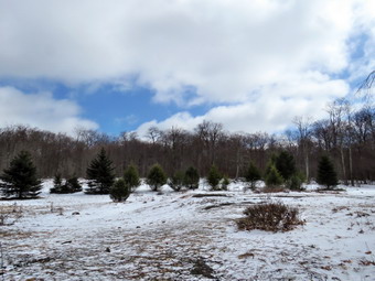
![]()
![]()
![]()
![]()
![]() On Thursday, March 2nd I was scheduled to hike with my brother-in-law Jeff and son Kurt. Jeff wanted to hike to the site of the old Beech Mountain Boy Scout Camp near Hodge Pond. He attended the camp in the 1960's as a member of the Boy Scout troop in Monticello. I had been to the site several times and knew there were a few building still standing. When I got up at 5:30 AM, the wind was blowing at least 20 mph and I almost contacted Jeff and Kurt to offer to postpone the hike. I decided against calling them and waited to see if they contacted me. When I returned from my church men's group at 8:00 AM, neither Jeff nor Kurt had called so I knew we would be hiking. Kurt did text me later and say he would be delayed to about 10:00 AM so when Jeff arrived at 9:30 AM we sat down to talk. Kurt showed up just after 10:00 AM and we got all our gear together and loaded my car to start out the DebRuce Road. The temperature was right around 30 degrees but the wind made it feel MUCH colder. I put on a baselayer under a heavy Patagonia wool top and wore tights under my Columbia Omniheat pants. I wore my Salomon Nytro boots which seem to have just the right amount of insulation. I knew there wouldn't be much snow so I didn't bother with snowshoes or spikes. I donned my Mammut hoody which I wear in almost all conditions where a jacket is needed. When we arrived at the trailhead, there were no vehicles in the main lot. Both lots were almost bare although there was a light coating of new snow that had fallen overnight and into the early morning. At 10::35 AM we crossed the road and started out on the Flynn Trail. It was about 30 degrees but seemed much colder due to the wind although the sun was shining from a bright blue sky. I was glad I had brought a warm hat and gloves. There was a layer of snow on the trail through the woods but it was bare in spots. When we got to the woods road, we turned right and I stopped to take some pictures of the trail with a thin layer of snow. I took some shots and looked across the road to see if I could find the Old Flynn Road that Fred Fries had described and could see it without a problem. As we gained elevation, there was a little more snow on the trail. We set a good pace as we headed for the junction with the Big Rock Trail. At 1.1 miles we turned right off the trail and walked to an open area that covers several acres. The area has a thin layer of dirt over bedrock but there is no indication of how it formed. There is a woods road that runs from the Flynn Trail which was once Beech Mountain Road to the south ends of this area. Some people have suggested that dirt and gravel was taken from this area when the road was built. I took some pictures while Jeff and Kurt explored the area. They returned to where I was standing and I packed up my camera and we returned to the Flynn Trail.
On Thursday, March 2nd I was scheduled to hike with my brother-in-law Jeff and son Kurt. Jeff wanted to hike to the site of the old Beech Mountain Boy Scout Camp near Hodge Pond. He attended the camp in the 1960's as a member of the Boy Scout troop in Monticello. I had been to the site several times and knew there were a few building still standing. When I got up at 5:30 AM, the wind was blowing at least 20 mph and I almost contacted Jeff and Kurt to offer to postpone the hike. I decided against calling them and waited to see if they contacted me. When I returned from my church men's group at 8:00 AM, neither Jeff nor Kurt had called so I knew we would be hiking. Kurt did text me later and say he would be delayed to about 10:00 AM so when Jeff arrived at 9:30 AM we sat down to talk. Kurt showed up just after 10:00 AM and we got all our gear together and loaded my car to start out the DebRuce Road. The temperature was right around 30 degrees but the wind made it feel MUCH colder. I put on a baselayer under a heavy Patagonia wool top and wore tights under my Columbia Omniheat pants. I wore my Salomon Nytro boots which seem to have just the right amount of insulation. I knew there wouldn't be much snow so I didn't bother with snowshoes or spikes. I donned my Mammut hoody which I wear in almost all conditions where a jacket is needed. When we arrived at the trailhead, there were no vehicles in the main lot. Both lots were almost bare although there was a light coating of new snow that had fallen overnight and into the early morning. At 10::35 AM we crossed the road and started out on the Flynn Trail. It was about 30 degrees but seemed much colder due to the wind although the sun was shining from a bright blue sky. I was glad I had brought a warm hat and gloves. There was a layer of snow on the trail through the woods but it was bare in spots. When we got to the woods road, we turned right and I stopped to take some pictures of the trail with a thin layer of snow. I took some shots and looked across the road to see if I could find the Old Flynn Road that Fred Fries had described and could see it without a problem. As we gained elevation, there was a little more snow on the trail. We set a good pace as we headed for the junction with the Big Rock Trail. At 1.1 miles we turned right off the trail and walked to an open area that covers several acres. The area has a thin layer of dirt over bedrock but there is no indication of how it formed. There is a woods road that runs from the Flynn Trail which was once Beech Mountain Road to the south ends of this area. Some people have suggested that dirt and gravel was taken from this area when the road was built. I took some pictures while Jeff and Kurt explored the area. They returned to where I was standing and I packed up my camera and we returned to the Flynn Trail.
 We continued on the trail and at one point we came across a large tree across the trail. Several branches had broken off but I knew it would take an axe or a saw to completely clear the mess. There were quite a few branches on the trail and it was obvious the recent high winds had been responsible. We arrived at the junction at 11:36 AM and stopped to take a few pictures. There was snow covering the trails and the entire junction. We started out again on the Flynn Trail heading toward Hodge Pond. At the next trail junction we stayed right to walk on the woods road heading toward the site of the old Beech Mountain Boy Scout Camp. In about half a mile we passed the left turn down to Hodge Pond. We stayed on the road and came to a Y where we stayed left to get to the camp site. We walked off the road to inspect some of the remaining buildings. Jeff was pretty sure that the buildings were ones that were used for the activities that led to merit badges. After fifty years it was hard for him to orient himself and to remember exactly where other parts of the camp had been located. One larger building appeared to be the residence of the caretaker of the camp. We went back out to the road and walked a little farther northwest before turning around and heading back passed the camp. We walked to the road down to Hodge Pond and took a right to walk downhill toward the water. When we got to the road around the pond, we turned left to walk down to the open area at the outlet end of the pond. As we walked into the open area, we were hit by a blast of cold wind. Jeff and Hurt went to explore the outlet stream and I walked over to the fire ring. I dropped my pack and got out my camera to take a few pictures of the pond. There was some blue sky and clouds but the scene was much the same as many times when I had been there before. I noticed that my hands were very cold so I put away the camera and we walked into the woods on the Flynn Trail heading south and up the hill. The walk up the hill can seem long but having people to talk to made it seem much shorter. At the trail junction I explained the options and we decided to head down the Big Rock Trail to Times Square, We turned right and started own the trail making good time on the descent. About half way down we came to a large beech tree that had blown down across the trail. I knew the diameter was more than two feet and cutting it with a hand saw and axe would be challenging. The Big Rock Trail is also used by snowmobiles and I made a note to mention this obstacle to some friends in the local snowmobile club. The snowmobile club is allowed to use chainsaws while the hiking trail maintainers are limited to hand tools!
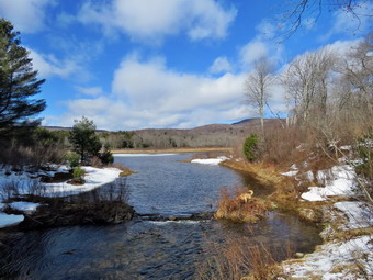 We arrived at Times Square at 1:15 PM after hiking 5.1 miles. I led the others straight ahead on the Big Rock Trail around the north and west side of Frick Pond. I did notice that Times Square was not as wet as in the past and that much of the water was passing through the culvert instead of flowing over the trail. We continued on the trail passing over the two small bridges that carry the trail over the inlet streams. We passed under some evergreen trees and crossed the long wooden walkways that still had some ice and snow on them. As we came out of the woods, Sheila alerted and we saw a single hiker coming toward us. I took Sheila by the collar and walked off the side of the trail to let him pass. He had a camera with a large lens but his dress seemed strangely out of place for hiking on this cold day. We followed the Big Rock Trail to the junction with the Quick Lake trail where we turned left. Soon we were walking over the bridge at the outlet of Frick Pond. I dropped my pack and got out the camera as this is a spot that I cannot resist. I took pictures of the pond and the water downstream from the bridge. I also got some shots of Jeff, Kurt and Sheila on the bridge. We walked up the hill to Gravestone Junction and continued straight ahead on the Quick Lake trail. As we passed the Lobdell gravestone, I related the story of the two children killed in a cabin fire in 1933. The walk back to the car went quickly even though we had to avoid some wet spots on the trail. We passed the trail register and continue on the woods road back to the car. We arrived back in the parking area at 2:00 Pm after hiking6.2 miles in 3 hours and 20 minutes with an elevation gain of 980 feet. The temperature was still only 33 degrees and the wind continued to blow but the sun shone brightly making it feel warmer.
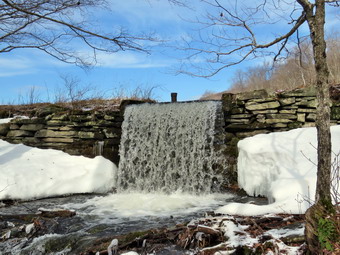
![]()
![]()
![]()
![]()
![]() On Monday, February 27th I wanted to get out for a slightly longer hike since the forecast for the next few days included some rain. I decided that I would go to Trout Pond as I had not been there in some time. I wore a baselayer up top but decided I didn't need tights since the forecast was for temperatures into the high 40's. I did take a light pair of gloves and a hat. I wore my Keen Glarus boots as I did not think I would Ned the insulation of the Saloon Nytro boots. I wrapped myself in my Mammut hoody and headed out the door right around 11:00 AM. Sheila as always was ready to get going and bounded out of the door behind me leaping into the backseat as soon as I opened the door. I headed north and west on Route 17 toward Roscoe. Sheila could hardly contain herself in the back seat as she really loves hiking. I got of at exit 94 and headed north toward Downsville on Route 206. I turned left onto Morton Hill Road and drove to the intersection with Russell Brook Road. I turned around and parked on the side of the road to avoid parking in the large open space which is marked as private property. The temperature was 38 degrees when I parked and it was only a few minutes before Sheila and I started down Russell Brook Road at 11:25 AM. The sun was out but a breeze made it feel cool. I knew I would not need snowshoes but was surprised that the road was a sheet of ice! I started down the hill slipping and sliding and decided I would stop to don my Microspikes. It was much easier walking after that and we made good time walking down the road. As we walked down the road, the stream was making a lot of noise so I expected the falls to have a good volume. There were a few spots without ice as we continued down the road but the spikes were still handy. As we passed the lookout over the falls, I found the volume to be higher than it had been since the early spring but I decided to wait for the trip back to take pictures. We headed down to the lower parking area where there were no cars. We walked down to the woods road that is the main trail and crossed the bridge over Russell Brook. I stopped to take a few pictures of the snow-covered bridge and the brook upstream and downstream of the bridge. We walked passed the stand of Japanese knotweed that looked harmless and completely dead. I decided to save the visit the falls for the trip back and walked to the register box to head up to Trout Pond. The trail had some running water in places but there was only a little snow and ice. I took off my spikes and stowed them in my pack. The blue sky still had some puffy white clouds and some sun as we continued up the trail toward the pond. Most of the trail continued to have almost no snow or ice and mud became a bigger problem. At the pond, I took off my pack and got out the camera. The water level was high enough for water to pour over the spillway. I took some pictures from above and then walked down to a point below the small waterfalls to take some pictures. There were some interesting ice formations and I was pleased with the shots. We walked back up to the shore of the pond which was covered in a layer of ice that was showing open spots around the edges. The rest of the ice did not look sturdy enough to support people but Sheila showed it would support a medium sized dog! I took a few pictures of the pond and noticed that the ice and water had a deep blue quality that I hoped would show up in the final product. The sky was also blue but the clouds were wispy without much body. I packed up and we continued up the trail toward the head end of the pond.
On Monday, February 27th I wanted to get out for a slightly longer hike since the forecast for the next few days included some rain. I decided that I would go to Trout Pond as I had not been there in some time. I wore a baselayer up top but decided I didn't need tights since the forecast was for temperatures into the high 40's. I did take a light pair of gloves and a hat. I wore my Keen Glarus boots as I did not think I would Ned the insulation of the Saloon Nytro boots. I wrapped myself in my Mammut hoody and headed out the door right around 11:00 AM. Sheila as always was ready to get going and bounded out of the door behind me leaping into the backseat as soon as I opened the door. I headed north and west on Route 17 toward Roscoe. Sheila could hardly contain herself in the back seat as she really loves hiking. I got of at exit 94 and headed north toward Downsville on Route 206. I turned left onto Morton Hill Road and drove to the intersection with Russell Brook Road. I turned around and parked on the side of the road to avoid parking in the large open space which is marked as private property. The temperature was 38 degrees when I parked and it was only a few minutes before Sheila and I started down Russell Brook Road at 11:25 AM. The sun was out but a breeze made it feel cool. I knew I would not need snowshoes but was surprised that the road was a sheet of ice! I started down the hill slipping and sliding and decided I would stop to don my Microspikes. It was much easier walking after that and we made good time walking down the road. As we walked down the road, the stream was making a lot of noise so I expected the falls to have a good volume. There were a few spots without ice as we continued down the road but the spikes were still handy. As we passed the lookout over the falls, I found the volume to be higher than it had been since the early spring but I decided to wait for the trip back to take pictures. We headed down to the lower parking area where there were no cars. We walked down to the woods road that is the main trail and crossed the bridge over Russell Brook. I stopped to take a few pictures of the snow-covered bridge and the brook upstream and downstream of the bridge. We walked passed the stand of Japanese knotweed that looked harmless and completely dead. I decided to save the visit the falls for the trip back and walked to the register box to head up to Trout Pond. The trail had some running water in places but there was only a little snow and ice. I took off my spikes and stowed them in my pack. The blue sky still had some puffy white clouds and some sun as we continued up the trail toward the pond. Most of the trail continued to have almost no snow or ice and mud became a bigger problem. At the pond, I took off my pack and got out the camera. The water level was high enough for water to pour over the spillway. I took some pictures from above and then walked down to a point below the small waterfalls to take some pictures. There were some interesting ice formations and I was pleased with the shots. We walked back up to the shore of the pond which was covered in a layer of ice that was showing open spots around the edges. The rest of the ice did not look sturdy enough to support people but Sheila showed it would support a medium sized dog! I took a few pictures of the pond and noticed that the ice and water had a deep blue quality that I hoped would show up in the final product. The sky was also blue but the clouds were wispy without much body. I packed up and we continued up the trail toward the head end of the pond.
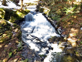 The trail remained much the same but now had a few large areas of standing water which was difficult to avoid in some spots. I did stop at one point to take a few more pictures before continuing toward the outlet. We walked across the bridge and I decided to walk off the trail toward the pond to take a few shots. The skies to the south of the pond were much cloudier with almost no blue showing through which was an interesting contrast to the view from the outlet end. We continued our walk on the main trail and started the ascent up the shoulder of Cherry Ridge. The trail became a stream bed and there was a little more snow especially in the woods. I had been following some foot prints which I could still see in the snow. The footprints looked rather fresh and I thought perhaps they were from the previous day. I expected that as we gained elevation there might be more snow but it never materialized. Along the way were several large blowdowns and many smaller one which were new. I picked up a few branches but most could not cleared without an axe and saw. Since I have begun to do trail maintenance, I always think how much easier it would be if everyone who hiked would just pick up a branch here and there. We made a slight turn to the south and began to climb some more. Sheila was roaming the brush near the trail and seemed to always be on a scent trail. We hit the high point on the hike and started down the other side. There was actually a little more snow on the southern exposure and quite a bit of water on the trail both standing and running. We continued to find blowdowns and branches on the trail. After a short ascent to the "forest of numerous small trees", we walked down to the woods road and snowmobile trail and turned left to complete our loop. The slight ascent had some ice but was mostly mud and running water. I was able to walk on the sides of the trail to try to avoid the mud and water. The descent to the trail junction was wet in many spots but was completely devoid of snow and ice. I stopped to take a few pictures of the nearly bare trail. As we walked down the hill the skies continued to be bright and blue with sun shining. We passed the large campsite on the left at the bottom of the hill and walked over the bridge. We turned right at the trail junction to walk back toward the lower parking area. I really wanted to visit the lower falls so we turned left and walked the path toward the falls. I carefully descended the bank which had a glaze of ice. I dropped my pack and got out the camera. The sun was shining brightly off the deluge of water cascading liver the falls so taking pictures was tricky. I took some pictures of the falls and then a video. Along the banks there were areas where ice had fallen off the trees and had accumulated below. I took some pictures of the trees still encased in ice and the ice piled below them. I also took a few shots of Sheila since she posed for me in front of the falls without asking. I packed up and made it back up to the path and walked out to the trail. There seemed to be less ice but I decided putting on my Microspikes couldn't hurt. We started the walk back up the road back toward the car. There was much less ice on this southern exposure and the sun felt warm ion my back. At the viewpoint for the upper falls, I walked off the road to the left and down to the lookout. The volume of wearer here was even more impressive so I put down my pack and got out the camera. I took various shots before putting the camera away and walked back up to the road. Once we topped the hill there didn't seem to be much difference in the amount of ice and I was glad I had the spikes on. We arrived back at the car at 2:15 PM. We had hiked 5.5 miles in 2 hours and 50 minutes gaining 1090 feet of elevation. Our moving average was 2 mph which I considered good under the conditions. The temperature was 48 degrees of 10 degrees warmer than when we had set out and the sun made it seem even warmer. A forest ranger's truck was parked at the intersection but no one was in it. I wondered if it was Joe Bink from Region 4 and what he was doing out on a beautiful day. Hiking perhaps?
![]()
![]()
![]()
![]() On Saturday, February 25th I was prepared to go out for a short walk for a third day in a row. The sun was out and the temperatures by late morning were pushing into the 60's. I asked Cindy if she wanted to go across the street and hike on Round Top and she agreed. We were both trying to recover from a cold that had plagued her for several weeks. We decided to head across the street to Round Top with Sheila around 11:00 AM. I decided to forego the pack since most of the snow was gone and what was left behind wasn't very pretty. I did not put on a baselayer and wore a lighter Columbia long-sleeved shirt under a light windbreaker. My Nytro boots were wet from the previous days slog around Hodge and Frick Ponds and I didn't really need the insulation nay way. I put on my Keen Glarus boots and decided not to wear gaiters. Cindy and I both grabbed a set of poles but knew we would not need snowshoes or spikes. I put Sheila on her leash and started out the driveway and across the street. We crossed the street and walked through the field to the base of the cemetery hill. There was very little snow in the field which early in the week had at least 10 inches. There was some snow behind the church but the cemetery hill was showing only pavement. We began the ascent of the steepest hill which is short but really gets the circulation pumping! When we got to the top of the hill, we turned left and entered the woods. I noticed there was NO snow on the trail and very little in the woods. At the first trail junction Sheila headed straight and up the hill to the lookout so I decide to follow. The hill had no snow at all and it looked like a summer day! When we got to the top, I took a quick look at town and then continued to follow the trail as it turned right and continued through the woods. There was no snow on the trail in this location. It was clear that the higher temperatures and direct sunlight had eliminated almost all the snow.
On Saturday, February 25th I was prepared to go out for a short walk for a third day in a row. The sun was out and the temperatures by late morning were pushing into the 60's. I asked Cindy if she wanted to go across the street and hike on Round Top and she agreed. We were both trying to recover from a cold that had plagued her for several weeks. We decided to head across the street to Round Top with Sheila around 11:00 AM. I decided to forego the pack since most of the snow was gone and what was left behind wasn't very pretty. I did not put on a baselayer and wore a lighter Columbia long-sleeved shirt under a light windbreaker. My Nytro boots were wet from the previous days slog around Hodge and Frick Ponds and I didn't really need the insulation nay way. I put on my Keen Glarus boots and decided not to wear gaiters. Cindy and I both grabbed a set of poles but knew we would not need snowshoes or spikes. I put Sheila on her leash and started out the driveway and across the street. We crossed the street and walked through the field to the base of the cemetery hill. There was very little snow in the field which early in the week had at least 10 inches. There was some snow behind the church but the cemetery hill was showing only pavement. We began the ascent of the steepest hill which is short but really gets the circulation pumping! When we got to the top of the hill, we turned left and entered the woods. I noticed there was NO snow on the trail and very little in the woods. At the first trail junction Sheila headed straight and up the hill to the lookout so I decide to follow. The hill had no snow at all and it looked like a summer day! When we got to the top, I took a quick look at town and then continued to follow the trail as it turned right and continued through the woods. There was no snow on the trail in this location. It was clear that the higher temperatures and direct sunlight had eliminated almost all the snow.
We continued to follow the trail as it made a sharp right turn and headed around Round Top. The north side of the hill had a few small patches of snow and ice but none were of any significance. At the next sharp right turn, we turned left and followed the green ribbons marking the proposed upper trail to the summit. There was almost no snow on this part of the trail. At the summit we continued following the green ribbons as they led downhill and back to the main lower trail. There were a few slippery spots along the way but the decent went smoothly for the most part. At the main trail we turned left and followed the lower trail to the sharp right turn where we headed right. We walked down the trail to the woods road and stopped at the first trail junction. We had walked a figure 8 and this was all Cindy wanted to do. I considered doing at least another figure 8 until a few drops of rain hit my face. The forecast was for rain and violent thunderstorms in the afternoon and evening so I decided I would walk back to the house with Cindy. We turned left and walked the trail out to the trailhead. We turned right and walked down the cemetery hill to the back of the church. From here we crossed the field and walked back to our driveway. We walked back to the house after walking about 1.5 miles in a little less than an hour.
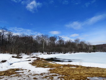
![]()
![]()
![]()
![]()
![]() On Friday, February 24th I decided it was time to get out hiking to make it two days in a row. I was still getting over a cold that had bothered me for over a week and noticed that I was short of breath on my three mile hike on Round Top the day before. I wanted to try a slightly longer hike and thought that the hike to Hodge and Frick Ponds would be a good one. Although I have done this hike many times I had not done it since the snow had fallen. I got up a little later than usual and finished some things around the house before getting ready to leave. The forecast was for sunny skies with highs in the low 60's but with a chance of ruin around noon. I consulted the radar and it seems that the main part of the incoming storm would pass well north of us. I got my gear ready, put Sheila in the car and left the house a little after 9:30 AM. Given the forecast, I did not put on a baselayer and wore a lighter Mammut pullover instead of the wool I had been wearing for the colder weather. I wore my Salomon Nytro boots which seem to have just the right amount of insulation. I didn't know how much snow there would be so I wanted the extra grip and height of these boots. I donned my Mammut hoody although I thought it might be a little too heavy as the sun made the day feel even warmer than the temperature. I grabbed a set of poles but decided against snowshoes or even spikes. When we arrived at the trailhead there were no vehicles in the main lot. Both lots were almost bare although there was still snow in the woods. At 10::00 AM we crossed the road and started out on the Flynn Trail. It was about 42 degrees but seems much warmer as the sun was shining. I left on my Mammut hoody but kept my hat and gloves in the pack. There was a layer of snow on the trail through the woods but it was bare in spots. When we got to the woods road, we turned right and I stopped to take some pictures of the completely bare trail. The road faces south and its upward slope is exposed to the direct rays of the sun. I took some shots and looked across the road to see if I could find the Old Flynn Road that Fred Fries had described. Last time I could not find the road under the snow but this time it was quite visible. I almost decided to follow the road but deiced to stay with my original plan. As we gained elevation, there was more and more snow on the trail. We set a good pace as we headed for the junction with the Big Rock Trail. At one point we came across a large tree across the trail. Several branches had broken off but I knew it would take an axe or a saw to completely clear the mess. We arrived at the junction at 10:50 AM and stopped to take a few pictures. There was still snow covering the trails and the entire junction. To the south the skies were beginning to cloud over and I worried about the forecast of rain. The skies to the north were still blue and sunny. We started out again on the Flynn Trail heading toward Hodge Pond. There were snowmobile tracks on the Flynn Trail even though it is clearly marked as 'no snowmobiles". At the gate I could see that the gap to the right of the gate was large enough to allow the machines to pass unhindered. I made note that my trail crew would have to do some work to move large boulders to block the gap since the signs do not deter those who want to ignore the signs. At the next trail junction we stayed left to walk down the hill toward the pond. As we broke out of the woods and walked toward the pond, we ran across drifts of at least 10 inches of snow. This made walking a little difficult. We walked over to the pond and I dropped my pack so that I could take some pictures. I took a few pictures of the pond and the blue sky with white clouds. I picked up my pack and headed back to the Flynn Trail continuing across the outlet stream staying on the Flynn Trail. There was several inches of snow on the trail but there were also some wet and muddy areas also. We followed the Flynn Trail when it headed left and up the hill to the gate. After the gate, the trail is relatively flat.
On Friday, February 24th I decided it was time to get out hiking to make it two days in a row. I was still getting over a cold that had bothered me for over a week and noticed that I was short of breath on my three mile hike on Round Top the day before. I wanted to try a slightly longer hike and thought that the hike to Hodge and Frick Ponds would be a good one. Although I have done this hike many times I had not done it since the snow had fallen. I got up a little later than usual and finished some things around the house before getting ready to leave. The forecast was for sunny skies with highs in the low 60's but with a chance of ruin around noon. I consulted the radar and it seems that the main part of the incoming storm would pass well north of us. I got my gear ready, put Sheila in the car and left the house a little after 9:30 AM. Given the forecast, I did not put on a baselayer and wore a lighter Mammut pullover instead of the wool I had been wearing for the colder weather. I wore my Salomon Nytro boots which seem to have just the right amount of insulation. I didn't know how much snow there would be so I wanted the extra grip and height of these boots. I donned my Mammut hoody although I thought it might be a little too heavy as the sun made the day feel even warmer than the temperature. I grabbed a set of poles but decided against snowshoes or even spikes. When we arrived at the trailhead there were no vehicles in the main lot. Both lots were almost bare although there was still snow in the woods. At 10::00 AM we crossed the road and started out on the Flynn Trail. It was about 42 degrees but seems much warmer as the sun was shining. I left on my Mammut hoody but kept my hat and gloves in the pack. There was a layer of snow on the trail through the woods but it was bare in spots. When we got to the woods road, we turned right and I stopped to take some pictures of the completely bare trail. The road faces south and its upward slope is exposed to the direct rays of the sun. I took some shots and looked across the road to see if I could find the Old Flynn Road that Fred Fries had described. Last time I could not find the road under the snow but this time it was quite visible. I almost decided to follow the road but deiced to stay with my original plan. As we gained elevation, there was more and more snow on the trail. We set a good pace as we headed for the junction with the Big Rock Trail. At one point we came across a large tree across the trail. Several branches had broken off but I knew it would take an axe or a saw to completely clear the mess. We arrived at the junction at 10:50 AM and stopped to take a few pictures. There was still snow covering the trails and the entire junction. To the south the skies were beginning to cloud over and I worried about the forecast of rain. The skies to the north were still blue and sunny. We started out again on the Flynn Trail heading toward Hodge Pond. There were snowmobile tracks on the Flynn Trail even though it is clearly marked as 'no snowmobiles". At the gate I could see that the gap to the right of the gate was large enough to allow the machines to pass unhindered. I made note that my trail crew would have to do some work to move large boulders to block the gap since the signs do not deter those who want to ignore the signs. At the next trail junction we stayed left to walk down the hill toward the pond. As we broke out of the woods and walked toward the pond, we ran across drifts of at least 10 inches of snow. This made walking a little difficult. We walked over to the pond and I dropped my pack so that I could take some pictures. I took a few pictures of the pond and the blue sky with white clouds. I picked up my pack and headed back to the Flynn Trail continuing across the outlet stream staying on the Flynn Trail. There was several inches of snow on the trail but there were also some wet and muddy areas also. We followed the Flynn Trail when it headed left and up the hill to the gate. After the gate, the trail is relatively flat.
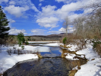 The Flynn Trail had pools and streams of water along the entire length from the gate to Junkyard Junction. It was difficult to walk on the side of the trail sine the water was so prevalent. Eventually we made it to Junkyard Junction and turned left on the Quick Lake Trail. We had hiked 3.4 miles and it was 11:45 AM when we made the turn onto the packed snow of the Quick Lake Trail. The trail alternated between areas that were completely covered in snow and areas with standing and running water. I stopped several times to take pictures of the trail conditions. We kept up a good pace passing the snowmobile trail to Quick Lake and arriving at Iron Wheel Junction at 12:30 PM after hiking 4.9 miles. We turned right to stay on the Quick Lake Trail and began the walk to Frick Pond. The trail was covered in snow in some areas but wet and muddy in other spots. We came to the stream across the trail which had enough water to make crossing it difficult. I walked upstream to narrow spot and easily crossed to the other side. I walked back downstream to the trail and out down my pack to take some pictures. I took pictures of the trail and the stream. I also took some shots of the small "waterfall" a little upstream. I shouldered my pack and we continued on the trail. We continued to run across wet spots on the trail. We also began to hear gunshots but it was difficult to determine their origin. We were soon walking down the trail toward Frick Pond and we passed the Big Rock Trail on the left. As we approached the bridge over the outlet of Frick Pond Sheila alerted and I heard voices. I put Sheila on her leash. As the bridge cam into sight, I could see two men standing on the bridge. I said "hello" and led Sheila over the bridge and tied her to a tree. I put down my pack, got out the camera and walked back to the bridge. The scene was the same as many of the times I had been there before but I still wanted to take some shots. I took several pictures of the pond and Flynn's Point. I also took pictures of the stream below the bridge. I talked to the two men and found out the were from Long Island near Stony Brook. I attended Stony Brook University and lived in the area fro seven years while teaching at Harborfields. I walked over to Sheila and took her off her leash. I took a few pictures of Sheila before shouldering my pack and starting up the hill. We walked up the hill to Gravestone Junction and continued on out the Quick lake Trail to the parking area. This part of the trail was also covered with water with quite a bit running down the trail to drain into the stream. We walked out the trail to the register and turned right to stay on the Quick Lake Trail to the parking area. We arrived back at the car at 1:30 PM after covering 6.5 miles in 3 and a half hours with an elevation gain of 930 feet. The temperature at the car was 62 degrees or 20 degrees higher than at the beginning of the hike.
![]()
![]()
![]()
![]() On Thursday, February 23rd I awoke to find the temperature already in the low 40's. I had a few things to take care of in the morning and some basketball games to time in the afternoon. I decided to head across the street to Round Top with Sheila around 11:00 AM when the temperature had risen into the mid 40's. The day was overcast and the snow was a mess from the high temperatures so I decided to forego the pack. I did not put on a baselayer and wore a lighter Mammut pullover instead of the wool I had been wearing for the colder weather. I wore my Salomon Nytro boots which seem to have just the right amount of insulation. I didn't know how much snow there would be so I wanted the extra grip and height of these boots. I donned my Mammut hoody although I thought it might be a little too heavy as the sun made the day feel even warmer than the temperature. I grabbed a set of poles but decided against snowshoes or even spikes. I put Sheila on her leash and started out the driveway and across the street. We crossed the street and walked through the field to the base of the cemetery hill. There was very little snow in the field which early in the week had at least 10 inches. There was some snow behind the church but the cemetery hill was showing only pavement. We began the ascent of the steepest hill which is short but really gets the circulation pumping! When we got to the top of the hill, we turned left and entered the woods. I noticed there was hardly any snow on the trail. At the first trail junction Sheila headed straight and up the hill to the lookout so I decide to follow. The hill had no snow at all and it looked like a summer day! When we got t the top, I took a quick look at town and then continued to follow the trail as it turned right and continued through the woods. There was quite a bit of snow on the trail in this location. It was clear that the amount of direct sunlight had the most impact on the amount of snow as this part f the trail faces north.
On Thursday, February 23rd I awoke to find the temperature already in the low 40's. I had a few things to take care of in the morning and some basketball games to time in the afternoon. I decided to head across the street to Round Top with Sheila around 11:00 AM when the temperature had risen into the mid 40's. The day was overcast and the snow was a mess from the high temperatures so I decided to forego the pack. I did not put on a baselayer and wore a lighter Mammut pullover instead of the wool I had been wearing for the colder weather. I wore my Salomon Nytro boots which seem to have just the right amount of insulation. I didn't know how much snow there would be so I wanted the extra grip and height of these boots. I donned my Mammut hoody although I thought it might be a little too heavy as the sun made the day feel even warmer than the temperature. I grabbed a set of poles but decided against snowshoes or even spikes. I put Sheila on her leash and started out the driveway and across the street. We crossed the street and walked through the field to the base of the cemetery hill. There was very little snow in the field which early in the week had at least 10 inches. There was some snow behind the church but the cemetery hill was showing only pavement. We began the ascent of the steepest hill which is short but really gets the circulation pumping! When we got to the top of the hill, we turned left and entered the woods. I noticed there was hardly any snow on the trail. At the first trail junction Sheila headed straight and up the hill to the lookout so I decide to follow. The hill had no snow at all and it looked like a summer day! When we got t the top, I took a quick look at town and then continued to follow the trail as it turned right and continued through the woods. There was quite a bit of snow on the trail in this location. It was clear that the amount of direct sunlight had the most impact on the amount of snow as this part f the trail faces north.
We continued to follow the trail as it made a sharp right turn and headed around Round Top. At the next sharp right turn, we turned left and followed the green blazes of the proposed upper trail to the summit. There was a little less snow on this part. At the summit we continued following the green ribbons as they led downhill and back to the main lower trail. Again, there was more snow in this are and the descent was slippery in spots. At the main trail we turned left and followed the lower trail to the sharp right turn where we headed right. We walked down the trail to the woods road and stopped at the first trail junction. We had walked a figure 8 and I decided to turn around and walk a figure 8 in the opposite direction. We turned around and started up the wood road back Ti the sharp left turn. We made the turn and continued to follow the trail until it made a sharp left. At this point we turned right and followed the green ribbons to the summit of Round Top. The ascent was slippery as there was still snow on the north side of the hill. We followed the rakes across the summit and back down to the main lower trail. We turned right on the main trail and followed the yellow blazes back down to the lookout. We turned left at the lookout and walked down the hill to the first trail junction. At this point we had completed two figure 8's but I still wanted to hike a little more. We turned around and hiked back up the hill to the viewpoint and followed the trail in a clockwise direction back around to the first trail junction. The loop is about half a mile. When we arrived at the first trail junction, we turned around and hiked the same lower loop in a counterclockwise direction. Once we were back at the first trail junction, we continued straight out the trail to the trailhead. We turned right and walked down the cemetery hill to the back of the church. From here we crossed the field and walked back to our driveway. We walked back to the house after walking about 3 miles in an hour and a half.
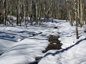
![]()
![]()
![]()
![]()
![]() On Monday, February 20th, I was ready to get a hike in even though I was still suffering the effects of a cold. I had not been out since the previous Wednesday due to work and family commitments. The weather had changed from over a foot of snow the week before to temperatures in the 50's which reduced amount of snow and increased the amount if water on the trails. I don't like these conditions very much but the forecast showed they would be around for the rest of the week! My daughter, Krista, and her husband, Brad, were visiting and Brad decided to go with me. We decided to Rae snowshoes along and make a division about using them at the trail head. Sheila would like to go out everyday and was more than ready to go for a hike. When I looked at the temperature just before 11:00 AM, it was already 38 degrees so I opted for one layer top and bottom and wore my Mammut hoody. We got our gear in the car and headed out the DeBruce Road. I turned left on the Mongaup Pond Road to head toward the Frick Pond trailhead. I stayed to the left where the road spilt and headed up Beech Mountain Road to the trailhead. This road had been plowed but was now a mess from thawing which produced muddy ruts. Both parking areas were well plowed with some ice and some completely bare spots. There was one car parked in the smaller lot where we pulled in. I got put to inspect the trail toward Frock Pond and found quite a bit of snow remaining. The snow was hard packed and icy in spots so I suggested we wear snowshoes if only for the grip they would provide. There was a slight breeze at the trailhead and I was a little chilly as we started out. We headed down the woods road toward the register. There was some ice and the hard-packed snow was just as bad. It was clear that quite a few people had taken advantage of the nice weather to snowshoe the loop around Frick Pond. The woods road from the register out to Gravestone Junction had snow but also several areas of standing and running water. We made the best of it by striding over the water or walking in the snow that remained on either side of the road. We stayed to the left at Gravestone Junction and walked down the hill to Frick Pond. By the time we got to the pond, the breeze was still blowing and the view was much the same as it had been on recent hikes. I decided to forego the pictures from the bridge and we continued on the Quick Lake trail around the west side of the pond.
On Monday, February 20th, I was ready to get a hike in even though I was still suffering the effects of a cold. I had not been out since the previous Wednesday due to work and family commitments. The weather had changed from over a foot of snow the week before to temperatures in the 50's which reduced amount of snow and increased the amount if water on the trails. I don't like these conditions very much but the forecast showed they would be around for the rest of the week! My daughter, Krista, and her husband, Brad, were visiting and Brad decided to go with me. We decided to Rae snowshoes along and make a division about using them at the trail head. Sheila would like to go out everyday and was more than ready to go for a hike. When I looked at the temperature just before 11:00 AM, it was already 38 degrees so I opted for one layer top and bottom and wore my Mammut hoody. We got our gear in the car and headed out the DeBruce Road. I turned left on the Mongaup Pond Road to head toward the Frick Pond trailhead. I stayed to the left where the road spilt and headed up Beech Mountain Road to the trailhead. This road had been plowed but was now a mess from thawing which produced muddy ruts. Both parking areas were well plowed with some ice and some completely bare spots. There was one car parked in the smaller lot where we pulled in. I got put to inspect the trail toward Frock Pond and found quite a bit of snow remaining. The snow was hard packed and icy in spots so I suggested we wear snowshoes if only for the grip they would provide. There was a slight breeze at the trailhead and I was a little chilly as we started out. We headed down the woods road toward the register. There was some ice and the hard-packed snow was just as bad. It was clear that quite a few people had taken advantage of the nice weather to snowshoe the loop around Frick Pond. The woods road from the register out to Gravestone Junction had snow but also several areas of standing and running water. We made the best of it by striding over the water or walking in the snow that remained on either side of the road. We stayed to the left at Gravestone Junction and walked down the hill to Frick Pond. By the time we got to the pond, the breeze was still blowing and the view was much the same as it had been on recent hikes. I decided to forego the pictures from the bridge and we continued on the Quick Lake trail around the west side of the pond.
 At the next trail junction we stayed to the left to follow the Quick Lake Trail through the "Spruce Tunnel" to Iron Wheel Junction. I definitely felt that the snowshoes were giving us the grip we needed but spikes might have been just as good as the snow here was packed also. The last time I had been in the area the Quick Lake Trail to Ironwheel Junction was untouched but now showed use by several snowshoers. There was some water on the trail in this area but we easily walked around it. There was still quite a bit of snow in the woods away from the trail averaging from 6 to 8 inches. We stopped in the "Spruce Tunnel" where I took a few shots and then came to the small stream which was running freely with water from the rain and melting snow. I took some pictures and then we hopped across the stream. We continued up to Iron Wheel Junction still having to avoid water along the way. When we arrived at Iron Wheel Junction, I turned right to get on the Logger's Loop and head toward Times Square. I could feel that I was tired from fighting the cold I had contracted and was not in shape to take on a longer route. The Logger's Loop is part of the snowmobile trail and was well packed which made walking very easy. The sign told us that Times Square was about 1.2 miles away but I knew that we would go through a series of ups and downs along the way before hitting the highest point at 1.8 miles. We stopped so that I could take a few pictures of the packed trail and the untouched snow further off in the woods. The sun was out now and was making the snow sparkle as well as warming us. Once we hit the high point it was all downhill to Times Square. At Times Square I took a quick look up the Big Rock Trail but decided to simply continue out the Logger's Loop. Brad offered no objections as he also had been fighting a cold for over a week. This part of the trail has a slight uphill but is probably the easiest way back to the parking area from Times Square. All along our hike we had been noticing the areas where we had cleared blowdowns. We also noted that the new trail markers we had put up on all the trails were clearly visible even through the snow. Some places on the Logger's Loop were a little wet but the 2+ foot drifts we had found on our last pouting had been reduced by the warm weather. When we crested the small hill and started down to Gravestone Junction I was very happy and my legs felt a little better. At Gravestone Junction we turned left on the Quick Lake Trail and began the walk back to the car. On the way back Sheila alerted and I saw a young couple headed toward us. We talked to them briefly and I asked if they had rented the snowshoes they were wearing at Morgan Outdoors. They had and I am glad that Lisa offers this service as it keeps the trail in good shape. We were back at the car at 1:05 PM having taken 2 hours to hike 3.6 miles with an elevation gain of only 386 feet.
![]()
![]()
![]()
![]()
![]() On Wednesday, February 15th I had decided to stay inside and see if I could recover from the cold that had come on quickly. I had hiked several days in a row and thought I wouldn't miss going out for a day or two. In the mid-afternoon, around 2:45 PM a storm moved in and snow began to fall rapidly. The rate of snowfall slowed and very large flakes began to come down. The wet snow was sticking to the branches of the trees and bushes coating them in a robe of white. The view from my window was pretty but I knew it would be even nicer if I was outside. I knew I should stay inside but decided to go across the street to Round Top to get a few pictures before the sun came out or the wind began to blow which would ruin the scene. The air temperature was 34 degrees and there was no wind so I knew I wouldn't be too cold. I decided not to wear a baselayer but did put on gaiters and snowshoes as the snow depth on Round Top warranted some traction. Sheila immediately understood what I was doing and demanded to go with me. I took my gear outside, donned my snowshoes and shouldered my pack. I put Sheila on her leash and we headed down the driveway and crossed the street at around 3:00 PM. We walked across the field to the base of the cemetery hill. We began the ascent of the steepest hill which is short. As I looked around I could see that all the trees were covered with a layer of snow and ice making a uniquely beautiful scene. At the top of the hill, I dropped my pack to take some pictures. The town was almost completely covered in newly fallen snow but snow was also still falling obscuring the far hills. I took a lot of shots of the trees from different angles and different zooms before picking up my pack and entering the woods. There was now enough snow that wearing snowshoes made the hiking easier but the snow was a little wetter and heavier than on previous days. The snow depth varied in most places from 6 to 10 inches with some much deeper drifts.
On Wednesday, February 15th I had decided to stay inside and see if I could recover from the cold that had come on quickly. I had hiked several days in a row and thought I wouldn't miss going out for a day or two. In the mid-afternoon, around 2:45 PM a storm moved in and snow began to fall rapidly. The rate of snowfall slowed and very large flakes began to come down. The wet snow was sticking to the branches of the trees and bushes coating them in a robe of white. The view from my window was pretty but I knew it would be even nicer if I was outside. I knew I should stay inside but decided to go across the street to Round Top to get a few pictures before the sun came out or the wind began to blow which would ruin the scene. The air temperature was 34 degrees and there was no wind so I knew I wouldn't be too cold. I decided not to wear a baselayer but did put on gaiters and snowshoes as the snow depth on Round Top warranted some traction. Sheila immediately understood what I was doing and demanded to go with me. I took my gear outside, donned my snowshoes and shouldered my pack. I put Sheila on her leash and we headed down the driveway and crossed the street at around 3:00 PM. We walked across the field to the base of the cemetery hill. We began the ascent of the steepest hill which is short. As I looked around I could see that all the trees were covered with a layer of snow and ice making a uniquely beautiful scene. At the top of the hill, I dropped my pack to take some pictures. The town was almost completely covered in newly fallen snow but snow was also still falling obscuring the far hills. I took a lot of shots of the trees from different angles and different zooms before picking up my pack and entering the woods. There was now enough snow that wearing snowshoes made the hiking easier but the snow was a little wetter and heavier than on previous days. The snow depth varied in most places from 6 to 10 inches with some much deeper drifts.
 I very seldom stop to take pictures along the trail itself since one part looks much like the next. On this day I stopped almost immediately after entering the woods and took a few shots. At the first trail junction I again stopped to snap a few pictures before continuing straight ahead up the hill to the viewpoint. I follows the spur trail out to the viewpoint on the lower ledges where I took off my pack and got out the camera. From this viewpoint town was covered in snow and the falling snow had begun again. I took shots of the upper ledge with the trees encased in snow and then took shots down into town. I put my camera back in the pack and walked up to the upper ledges to continue on the mainliner trail around the loop. Again I was so impressed by the beauty of the snow on the trees I stopped to take a few photographs. We walked uphill and turned right where the trail joins and woods road. The bushes here were completely encased in snow and deserved, I thought, to be the subject of a few pictures. After taking those shots we walked to the next right turn and started downhill. When we reached the next woods road we followed the marked trail as it continued downhill on another woods road. The ledges on our right were interesting but I kept the camera in the pack. At the first trail junction we turned left and walked out to the trailhead. We turned right band walked down the hill to the church and across the filed to our driveway. We had hiked a little over a mile in around 45 minutes. After we arrived home it wasn't long before the wind began to blow knocking most of the snow off the trees!
![]()
![]()
![]()
![]()
![]() On Tuesday, February 14th I was scheduled to hike at Frick Pond with Lisa. We wanted to get out in the deep snow before any warming trend could take it away. When I went to bed, I felt the beginnings of a cold but thought I would be Ok for a short hi8ke in the morning. In the morning I felt worse and texted Lisa that I would have to back out of our hike. After I got something to eat and was awake for a while, I felt much better and texted Lisa to see if she was still available and would forgive me. She agreed to come to y house at 10:30 AM and then go to Frick Pond to hike. Lisa arrived and we loaded our gear into my car for the drive to Frock Pond. Of course, Sheila went along! She was happy to see Lisa but tried to control her enthusiasm. The temperature was in the high 20 so I opted for a baselayer top and bottom but wore my Lighter Mammut shirt rather than a heavier wool top. I drove out DeBruce Road under partly sunny skies and stayed left at the fork in the road. After a short drive on Beech Mountain Road, I parked at the trailhead where both lots had been completely plowed. Lisa and I got out of the car and I let Sheila out of backseat of the car. We put on my snowshoes and I opted for warm gloves with a lighter pair in my pack. The sun was really shining through as we headed over to the larger parking area to access the Quick Lake Trail. My Tubbs Alp Flex VRT snowshoes go on very quickly as the bindings are easy to use. The snowshoes also stay in place and have incredible gripping power. As we stared out the Quick Lake Trail at 11:00 AM, we noticed that the snow was untouched as other hikers had used the woods road from the smaller parking area. It was fun being on freshly fallen and unused snow. When we reached the woods road and the trail register, Lisa signed us in and we headed out toward Frick Pond. There was a pretty good track broken along the woods road to Graveyard Junction. We both commented on the amount of water running across and beside the trail. I stopped to take a few pictures on the undisturbed snow on the Quick Lake Trail. We stayed left on the Quick Lake Trail at the junction and walked down to Frick Pond. When we got to the bridge over the outlet I took off my pack and got out the camera. I took a pictures of Frick Pond with Flynn's Point in the background. The day was much sunnier than it had been at the start of the week. I also took some shots of the water on both sides of the bridge. The water level in the pond was much higher and water was freely flowing in the outlet stream. I picked up my pack and we started around the pond. At the junction of the Quick Lake Trail and the Big Rock Trail I suggested we follow the Quick Lake trail to Iron Wheel Junction and then use the Logger's Loop to get back to Times Square. Lisa wanted to simply hike around the pond. This was a little short for me but I agreed so we turned right on the Big Rock Trail around the back of the pond. Under the tall evergreen trees there was less snow but it still averaged over 6 inches. When we got to the wooden causeways, they were covered in snow and I stopped to take a few pictures.
On Tuesday, February 14th I was scheduled to hike at Frick Pond with Lisa. We wanted to get out in the deep snow before any warming trend could take it away. When I went to bed, I felt the beginnings of a cold but thought I would be Ok for a short hi8ke in the morning. In the morning I felt worse and texted Lisa that I would have to back out of our hike. After I got something to eat and was awake for a while, I felt much better and texted Lisa to see if she was still available and would forgive me. She agreed to come to y house at 10:30 AM and then go to Frick Pond to hike. Lisa arrived and we loaded our gear into my car for the drive to Frock Pond. Of course, Sheila went along! She was happy to see Lisa but tried to control her enthusiasm. The temperature was in the high 20 so I opted for a baselayer top and bottom but wore my Lighter Mammut shirt rather than a heavier wool top. I drove out DeBruce Road under partly sunny skies and stayed left at the fork in the road. After a short drive on Beech Mountain Road, I parked at the trailhead where both lots had been completely plowed. Lisa and I got out of the car and I let Sheila out of backseat of the car. We put on my snowshoes and I opted for warm gloves with a lighter pair in my pack. The sun was really shining through as we headed over to the larger parking area to access the Quick Lake Trail. My Tubbs Alp Flex VRT snowshoes go on very quickly as the bindings are easy to use. The snowshoes also stay in place and have incredible gripping power. As we stared out the Quick Lake Trail at 11:00 AM, we noticed that the snow was untouched as other hikers had used the woods road from the smaller parking area. It was fun being on freshly fallen and unused snow. When we reached the woods road and the trail register, Lisa signed us in and we headed out toward Frick Pond. There was a pretty good track broken along the woods road to Graveyard Junction. We both commented on the amount of water running across and beside the trail. I stopped to take a few pictures on the undisturbed snow on the Quick Lake Trail. We stayed left on the Quick Lake Trail at the junction and walked down to Frick Pond. When we got to the bridge over the outlet I took off my pack and got out the camera. I took a pictures of Frick Pond with Flynn's Point in the background. The day was much sunnier than it had been at the start of the week. I also took some shots of the water on both sides of the bridge. The water level in the pond was much higher and water was freely flowing in the outlet stream. I picked up my pack and we started around the pond. At the junction of the Quick Lake Trail and the Big Rock Trail I suggested we follow the Quick Lake trail to Iron Wheel Junction and then use the Logger's Loop to get back to Times Square. Lisa wanted to simply hike around the pond. This was a little short for me but I agreed so we turned right on the Big Rock Trail around the back of the pond. Under the tall evergreen trees there was less snow but it still averaged over 6 inches. When we got to the wooden causeways, they were covered in snow and I stopped to take a few pictures.
 We continued on the Big Rock Trail as it wound around the back of Frick Pond heading toward Times Square. I stopped again to take a few pictures on the bridges over the inlet streams and noticed how much sun was shining. There were a few wet spots under the snow but the temperature was still in the high 20's or low 30's. As we approached Times Square two snowmobiles came down the Logger's Loop and headed up the Big Rock Trail. I again hinted that we could take the Logger's Loop as it was well-packed but Lisa insisted on continuing around the pond! We turned to the right to get on the Logger's Loop to complete the loop around Frick Pond. By this time the sun was shining brightly and beginning to soften the snow. The softer snow made lifting the snowshoes harder and some of it clumped on the bottoms of the snowshoes. Sheila seemed to be unaffected by the cold or the snow and continued to bound ahead of us and then come racing back helping to break trail and keep us entertained. Although she looks like a yellow lab she has a longer coat from a dose of Husky blood. She never seems to get cold. Sheila was following her nose and frequently wound bury it in the snow digging slightly. I never saw what attracted her attention but it was very humorous to see her bury her head! The Logger's Loop climbs slightly from Times Square and I noticed this as I continued to break the trail. When we got to the top of the hill on flatter ground, we ran into some impressive snowdrifts. The winds blow across Frick Pond and some of the snow gets through the trees to form these drifts. We had been following a track set by previous snowshoers but this track disappeared into the drifts only to reappear on the other side. I took some pictures and then we continued on toward Gravestone Junction. At Gravestone Junction we turned left to head back to the car on the Quick lake Trail. We noticed that there were tracks made my cross country skiers after we had hiked the trail earlier. I couldn't tell whether it was one or two sets of skies. At the register, Lisa looked in the book to find the names of the skiers. We turned right to stay on the Quick Lake Trail and retrace or route back to the car. The snow in the larger parking lot had melted quite a bit exposing bare pavement. We were back at the car around 12:45 PM having hiked about 2.4 miles in an hour and 45 minutes. The elevation gain was only 230 feet.
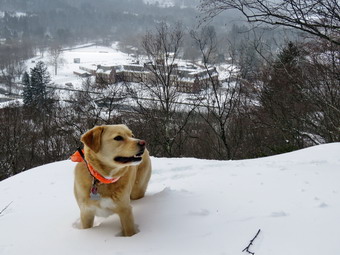
![]()
![]()
![]()
![]()
![]() On Monday, February 13th I awoke to find several inches of new snow on the ground and a little more falling as predicted. The total snowfall from Sunday morning through Monday was about 10 inches depending on location and elevation. Most of the schools ion Sullivan County were closed due to the poor condition of the roads and the forecast for sustained winds of over 20 mph with 40 mph gusts. I ha decided to stay home and hike the next day at Frick Pond with Lisa especially since the winds were living up to the forecast. I went downtown to get the mail and found it didn't seem too cold to hike. When I got home, Cindy said she would like to go for a short hike across the street. This was encouraging since she had been sick for almost two weeks. We decided the best choice was to simply go across the street and snowshoe on Round Top as we could walk directly from our house and avoid driving on the questionable roads. I wanted to take some pictures and the most convenient way is just to carry my pack. I again decided to use the Tubbs Alp Flex VRT snowshoes which are overkill for the short hike on hilly terrain but are my favorite snowshoes at this time. These snowshoes have the "boa" system which is supposed to allow tightening the front part of the binding with just a twist a knob. Cindy also decided to try out her new snowshoes which I got her for Christmas. Hers are the women's version of the same Tubbs Alp Flex VRT that I have! Sheila was ready to go as soon as we started getting our gear out but tried to be the well-behaved dog. It didn't take long to get ready and I put Sheila on her leash for the walk across the street. The snow was still falling lightly as we crossed the street at noon and walked across the field to the base of the cemetery hill. We began the ascent of the steepest hill which is short but really gets the circulation pumping! When we got to the top of the hill, I dropped my pack to take some pictures. The town was almost completely covered in newly fallen snow. I picked up my pack and we entered the woods. There was now enough snow that wearing snowshoes made the hiking easier. The snow depth varied in most places from 8 to 12 inches with some much deeper drifts. At the trail junction Cindy decided we would turn right to follow the trail up the old woods road. The trail I had set yesterday was still visible and walking on it was somewhat easier than in the freshly fallen snow. When we reached the sharp left turn, I suggested we continue up the proposed new trail to the summit of Round Top but Cindy felt she couldn't make the climb. We turned left and followed the yellow-blazed lower trail. The trail flattened and then turned left to head back out to the lookout. At the viewpoint I walked down from the upper ledges to the lower ledges. The lower ledges offer a better view of the town and school and I dropped my pack to get out the camera. The wind was more noticeable on the open ledge but it wasn't as cold as I thought it might be. I took some pictures and then packed up to start home. Crossing the small gap in the trail was a little tricky since the snow had blocked the view of the trail. I walked out to the main trail to meet Cindy and we walked down the hill to the first trail junction. We continued straight ahead to the trail head and then walked down the hill to the church. We crossed the field to our driveway. We had hiked a little over a mile in a little less than an hour
On Monday, February 13th I awoke to find several inches of new snow on the ground and a little more falling as predicted. The total snowfall from Sunday morning through Monday was about 10 inches depending on location and elevation. Most of the schools ion Sullivan County were closed due to the poor condition of the roads and the forecast for sustained winds of over 20 mph with 40 mph gusts. I ha decided to stay home and hike the next day at Frick Pond with Lisa especially since the winds were living up to the forecast. I went downtown to get the mail and found it didn't seem too cold to hike. When I got home, Cindy said she would like to go for a short hike across the street. This was encouraging since she had been sick for almost two weeks. We decided the best choice was to simply go across the street and snowshoe on Round Top as we could walk directly from our house and avoid driving on the questionable roads. I wanted to take some pictures and the most convenient way is just to carry my pack. I again decided to use the Tubbs Alp Flex VRT snowshoes which are overkill for the short hike on hilly terrain but are my favorite snowshoes at this time. These snowshoes have the "boa" system which is supposed to allow tightening the front part of the binding with just a twist a knob. Cindy also decided to try out her new snowshoes which I got her for Christmas. Hers are the women's version of the same Tubbs Alp Flex VRT that I have! Sheila was ready to go as soon as we started getting our gear out but tried to be the well-behaved dog. It didn't take long to get ready and I put Sheila on her leash for the walk across the street. The snow was still falling lightly as we crossed the street at noon and walked across the field to the base of the cemetery hill. We began the ascent of the steepest hill which is short but really gets the circulation pumping! When we got to the top of the hill, I dropped my pack to take some pictures. The town was almost completely covered in newly fallen snow. I picked up my pack and we entered the woods. There was now enough snow that wearing snowshoes made the hiking easier. The snow depth varied in most places from 8 to 12 inches with some much deeper drifts. At the trail junction Cindy decided we would turn right to follow the trail up the old woods road. The trail I had set yesterday was still visible and walking on it was somewhat easier than in the freshly fallen snow. When we reached the sharp left turn, I suggested we continue up the proposed new trail to the summit of Round Top but Cindy felt she couldn't make the climb. We turned left and followed the yellow-blazed lower trail. The trail flattened and then turned left to head back out to the lookout. At the viewpoint I walked down from the upper ledges to the lower ledges. The lower ledges offer a better view of the town and school and I dropped my pack to get out the camera. The wind was more noticeable on the open ledge but it wasn't as cold as I thought it might be. I took some pictures and then packed up to start home. Crossing the small gap in the trail was a little tricky since the snow had blocked the view of the trail. I walked out to the main trail to meet Cindy and we walked down the hill to the first trail junction. We continued straight ahead to the trail head and then walked down the hill to the church. We crossed the field to our driveway. We had hiked a little over a mile in a little less than an hour
![]()
![]()
![]()
![]() On Sunday, February 12th I awoke to find that the forecast for overnight snow had been correct and that there was at least 8 inches on the ground with snow still falling heavily. Church was cancelled so I waited until the snow abated and went out to shovel the walks and driveway. I shoveled a little and then used a neighbor's snow-blower to clear part of the driveway. When I went back into the house at around 1:30 PM, Sheila was frantic to get out in the snow. I was already dressed to hike so I decided we would go across the street and hike on Round Top. Since precipitation was still falling I decided to forego the pack. I had on a baselayer and heavier Patagonia wool top and tights underneath my Columbia Titanium Ominsheild pants. I wore my Salomon Nytro boots which seems to have just the right amount of insulation and put on gaiters. I donned my Mammut hoody and grabbed a set of poles and my Tubbs Alp Flex VRT snowshoes with the boa bindings. I stepped out on the porch and put on the snowshoes, I put Sheila on her leash and started out the driveway and across the street. We crossed the street and walked through the field to the base of the cemetery hill. We began the ascent of the steepest hill which is short but really gets the circulation pumping! When we got to the top of the hill, we turned left and entered the woods. I noticed there was significantly more snow than I the last time I had been on the trail. There was now enough snow to so that snowshoes made hiking easier. At the first trail junction turned right and headed up the woods road that is part of the lower trail. This part of the trail ascends gently but continuously to a sharp left turn onto another woods road. We turned left and followed the trail around to the point where it makes another sharp left turn. At this point we turned right to follow the green ribbons marking the proposed upper trail to the summit of Round Top. This climb is steep and the snowshoes certainly helped maintain traction on the climb.
On Sunday, February 12th I awoke to find that the forecast for overnight snow had been correct and that there was at least 8 inches on the ground with snow still falling heavily. Church was cancelled so I waited until the snow abated and went out to shovel the walks and driveway. I shoveled a little and then used a neighbor's snow-blower to clear part of the driveway. When I went back into the house at around 1:30 PM, Sheila was frantic to get out in the snow. I was already dressed to hike so I decided we would go across the street and hike on Round Top. Since precipitation was still falling I decided to forego the pack. I had on a baselayer and heavier Patagonia wool top and tights underneath my Columbia Titanium Ominsheild pants. I wore my Salomon Nytro boots which seems to have just the right amount of insulation and put on gaiters. I donned my Mammut hoody and grabbed a set of poles and my Tubbs Alp Flex VRT snowshoes with the boa bindings. I stepped out on the porch and put on the snowshoes, I put Sheila on her leash and started out the driveway and across the street. We crossed the street and walked through the field to the base of the cemetery hill. We began the ascent of the steepest hill which is short but really gets the circulation pumping! When we got to the top of the hill, we turned left and entered the woods. I noticed there was significantly more snow than I the last time I had been on the trail. There was now enough snow to so that snowshoes made hiking easier. At the first trail junction turned right and headed up the woods road that is part of the lower trail. This part of the trail ascends gently but continuously to a sharp left turn onto another woods road. We turned left and followed the trail around to the point where it makes another sharp left turn. At this point we turned right to follow the green ribbons marking the proposed upper trail to the summit of Round Top. This climb is steep and the snowshoes certainly helped maintain traction on the climb.
At the top of the hill we followed the green ribbons across the plateau and down the other side. On the descent I got a nice glide on the new snow. We joined the lower trail and turned right walking back to the sharp left turn. This time we followed the yellow marking of the lower trail toward the lookout. We turned left at the viewpoint and started down the hill toward the first trail junction. A quick glance from the lookout showed the town almost completely covered by snow. The view was not much different than in previous days. This viewpoint offers a great view of the school and the buildings downtown.When we reached the first trail junction, I decided we would hike some more. We turned around and hiked back up the steeper hill to the viewpoint. From the lookout we followed the lower trail as it turned right and continued to ascend gently. Where the lower trail turned right, we followed it to the right and walked to the sharp right turn where the trail turns back toward the first trail junction. At this point we turned left and followed the green ribbons and our previous tracks up to the summit of Round Top. We continued to follow the green ribbons across the summit and down the other side. The steep descent provided another opportunity to "ski" down the hill. When we reached the lower trail, we turned left and again followed the yellow markers around to the sharp right turn. This time we turned right and followed the trail down to the woods road and back to the first trail junction. At the junction we turned left and walked back out to the trailhead. Some kind of wintry mix was falling combining rain, sleet and snow! I was glad I had decided to head home. We walked back down the hill to the church and then across the field to the driveway. We walked back to our house after hiking for an hour and 20 minutes and a distance of around 2 miles.
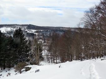
![]()
![]()
![]()
![]()
![]() On Thursday, February 9th I awoke to find that the forecast for overnight snow had been correct and that there was at least 6 inches of the ground with snow still falling heavily. The wind was blowing so I waited until about 11:00 AM to go out to shovel the walks and driveway. The snow had stopped but the wind was still blowing making the 18 degrees air temperature seem much lower. I finished what I could do and came back inside to find Sheila begging to go out for a hike. I decided that we would go across the street and hike some in the fresh snow on Round Top. I put on a baselayer and heavier Patagonia wool top but skipped the tights as we would not be going too far. I wore my Salomon Nytro boots which seems to have just the right amount of insulation and put on gaiters. I decided to take my pack so that I could carry my camera to take pictures. I donned my Mammut hoody and grabbed a set of poles and my Tubbs Alp Flex VRT snowshoes with the boa bindings. I stepped out on the porch to a vicious gust of wind. After putting on the snowshoes, I put Sheila on her leash and started out the driveway and across the street. No snow was falling but the wind was still blowing as we crossed the street and walked through the field to the base of the cemetery hill. We began the ascent of the steepest hill which is short but really gets the circulation pumping! When we got to the top of the hill, I dropped my pack to take some pictures. The view was much the same as other times but I decided to rake a few shots anyway. I picked up my pack and we entered the woods. I noticed there was significantly more snow than I the last time I had been on the trail. There may not have been enough snow to require snowshoes but there was recently enough snow to use them effectively. At the first trail junction we continued straight ahead up the steeper section to the lookout. When we neared the top, I turned left to walk out to the lower lookout. I didn't want to encourage others to take this route but I did want the pictures. Crossing the little open gulf in the path was easier with my snowshoes than with bare boots. I again got out the camera and took pictures of the town from another angle. This viewpoint offers a great view of the school and the buildings downtown.
On Thursday, February 9th I awoke to find that the forecast for overnight snow had been correct and that there was at least 6 inches of the ground with snow still falling heavily. The wind was blowing so I waited until about 11:00 AM to go out to shovel the walks and driveway. The snow had stopped but the wind was still blowing making the 18 degrees air temperature seem much lower. I finished what I could do and came back inside to find Sheila begging to go out for a hike. I decided that we would go across the street and hike some in the fresh snow on Round Top. I put on a baselayer and heavier Patagonia wool top but skipped the tights as we would not be going too far. I wore my Salomon Nytro boots which seems to have just the right amount of insulation and put on gaiters. I decided to take my pack so that I could carry my camera to take pictures. I donned my Mammut hoody and grabbed a set of poles and my Tubbs Alp Flex VRT snowshoes with the boa bindings. I stepped out on the porch to a vicious gust of wind. After putting on the snowshoes, I put Sheila on her leash and started out the driveway and across the street. No snow was falling but the wind was still blowing as we crossed the street and walked through the field to the base of the cemetery hill. We began the ascent of the steepest hill which is short but really gets the circulation pumping! When we got to the top of the hill, I dropped my pack to take some pictures. The view was much the same as other times but I decided to rake a few shots anyway. I picked up my pack and we entered the woods. I noticed there was significantly more snow than I the last time I had been on the trail. There may not have been enough snow to require snowshoes but there was recently enough snow to use them effectively. At the first trail junction we continued straight ahead up the steeper section to the lookout. When we neared the top, I turned left to walk out to the lower lookout. I didn't want to encourage others to take this route but I did want the pictures. Crossing the little open gulf in the path was easier with my snowshoes than with bare boots. I again got out the camera and took pictures of the town from another angle. This viewpoint offers a great view of the school and the buildings downtown.
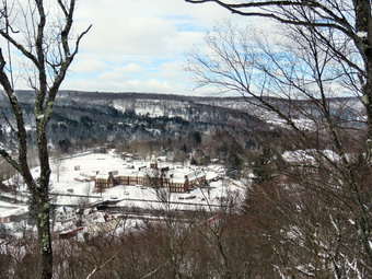 From the viewpoint we continued on the trail in a clockwise direction checking to make sure the yellow blazes were visible and spaced the correct distance apart. When we got to the green ribbons marking the proposed upper trail, we followed them up the hill to the summit. As we walked across the summit plateau the wind was blowing hard and I was glad to drop down the other side. When the proposed upper trail met the lower trail, we turned left and then right to walk the lower trail and woods road back down to the first trail junction. The downhill isn't very steep but I got a nice glide on my snowshoes. When we reached the first trail junction, I decided I wanted to hike a little more so we turned around and retraced our route back up the woods road to the point where the lower trail makes a sharp left. We continued straight ahead and followed the green ribbons back up to the summit of Round top. We crossed the summit and continued to follow the ribbons back down to the lower trail. Along the way Sheila decided to begin her rampage! She flew by me going down the hill and then turned and ran at full speed back up and around me. She repeated this several times. At the lower trail we turned right to head toward the lookout turning left at the viewpoint to walk back down to the first trail junction. I again gout a nice glide heading down the hills. We walked out to the trail head and turned right to descend the hill toward the church. At the base of the hill I put Sheila on her leash to safely cross Rock Avenue. At the church we continued across the field to our driveway and back to the house. We had been out for about an hour and had hiked a little under 2 miles.
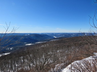
![]()
![]()
![]()
![]()
![]() On Saturday, February 4th, I wasn't sure I wanted to hike again after a cold day at Frick Pond the day before. I looked at the temperature and windchill and decided to wait until later in the day to get started. I got my gear together and got dressed to leave the house at just after 11:00 AM so that I could begin a hike from Hill Road near Margaretville to the Penguin Rocks lookout on Dry Brook Ridge. I dressed warn with tights underneath my Colombia Titanium pants. On top I had a Patagonia Capilene baselayer with a heavier Patagonia wool top. As always I had my Mammut Hoody as my top layer. I wore heavier gloves and rough a pair of mitts in my pack. I was not sure how much snow I would find so I put my Microspikes in my pack and brought along my Tubbs Alp Flex VRT snowshoes. When I left the house it was still only 18 degrees with a breeze blowing. I headed out old Route 17 to the Beaverkill Road where I turned right and drove toward Lew Beach. I continued through Lew Beach and turned left on the Barkaboom Road just before Turnwood. The road was snow covered in pots and icy but I eventually came to the intersection with BWS 10 where I turned left. I followed BWS 10 until it changed to Southside Road just outside Margaretville. I continued on Southside Road to Huckleberry Brook Road where I turned right. Shortly after the turn I turned left on Hill Road and 1.3 miles to the parking pulloff on the right. The temperature was 18 degrees when I parked and there was a breeze blowing. I checked the snow depth and found only about an inch of fresh powder over packed snow and ice on the trail. I decided not to wear of carry my snowshoes so we crossed the road and began our hike at noon. The first part of the hike is a nice wide trail that ascends through a red pine plantation. The ascent continues for about 1.9 miles when the trail levels off after gaining 1130 feet. Although the day was cold, I began to warm up immediately because of the climb. As we walked there were several blowdowns across the trail from near the bottom until the trail leveled. Two were very large and probably require the trail to be rerouted around them while the others could be removed. The sun through the pines was beautiful and it seemed warm despite the temperature. After passing through the pines we entered a predominantly hardwood forest before passing again through some pines. Sheila seemed to delight in racing away from me through the snow and then careening headlong back toward me. There were a lot of animal tracks along the trail and some crossing it and Sheila was busy investigating these tracks. Along the way I open the zippers on my hoody and took down the hood. After 1.9 miles, the trail leveled off and Turned almost 90 degrees from northeast to southeast. We walked across a flat area dipping down a little to the junction with the blue Dry Brook Ridge Trail at 2.3 miles. All the way up I had been debating in my mind whether or not I would walk to the lookouts or not as I was both physically and mentally tired. My legs were tired from hiking the day before and An early morning ambulance call had robbed me of some sleep. We stopped and I got a much needed drink. I also took some pictures of the snow on the trail which had increased to from 4 to 6 inches on the ridge. I was still not sure what I was going to do but decided to turn right and walk south toward the viewpoint. I reasoned that I could turn around after walking for a little while or complete the trip to the lookout.
On Saturday, February 4th, I wasn't sure I wanted to hike again after a cold day at Frick Pond the day before. I looked at the temperature and windchill and decided to wait until later in the day to get started. I got my gear together and got dressed to leave the house at just after 11:00 AM so that I could begin a hike from Hill Road near Margaretville to the Penguin Rocks lookout on Dry Brook Ridge. I dressed warn with tights underneath my Colombia Titanium pants. On top I had a Patagonia Capilene baselayer with a heavier Patagonia wool top. As always I had my Mammut Hoody as my top layer. I wore heavier gloves and rough a pair of mitts in my pack. I was not sure how much snow I would find so I put my Microspikes in my pack and brought along my Tubbs Alp Flex VRT snowshoes. When I left the house it was still only 18 degrees with a breeze blowing. I headed out old Route 17 to the Beaverkill Road where I turned right and drove toward Lew Beach. I continued through Lew Beach and turned left on the Barkaboom Road just before Turnwood. The road was snow covered in pots and icy but I eventually came to the intersection with BWS 10 where I turned left. I followed BWS 10 until it changed to Southside Road just outside Margaretville. I continued on Southside Road to Huckleberry Brook Road where I turned right. Shortly after the turn I turned left on Hill Road and 1.3 miles to the parking pulloff on the right. The temperature was 18 degrees when I parked and there was a breeze blowing. I checked the snow depth and found only about an inch of fresh powder over packed snow and ice on the trail. I decided not to wear of carry my snowshoes so we crossed the road and began our hike at noon. The first part of the hike is a nice wide trail that ascends through a red pine plantation. The ascent continues for about 1.9 miles when the trail levels off after gaining 1130 feet. Although the day was cold, I began to warm up immediately because of the climb. As we walked there were several blowdowns across the trail from near the bottom until the trail leveled. Two were very large and probably require the trail to be rerouted around them while the others could be removed. The sun through the pines was beautiful and it seemed warm despite the temperature. After passing through the pines we entered a predominantly hardwood forest before passing again through some pines. Sheila seemed to delight in racing away from me through the snow and then careening headlong back toward me. There were a lot of animal tracks along the trail and some crossing it and Sheila was busy investigating these tracks. Along the way I open the zippers on my hoody and took down the hood. After 1.9 miles, the trail leveled off and Turned almost 90 degrees from northeast to southeast. We walked across a flat area dipping down a little to the junction with the blue Dry Brook Ridge Trail at 2.3 miles. All the way up I had been debating in my mind whether or not I would walk to the lookouts or not as I was both physically and mentally tired. My legs were tired from hiking the day before and An early morning ambulance call had robbed me of some sleep. We stopped and I got a much needed drink. I also took some pictures of the snow on the trail which had increased to from 4 to 6 inches on the ridge. I was still not sure what I was going to do but decided to turn right and walk south toward the viewpoint. I reasoned that I could turn around after walking for a little while or complete the trip to the lookout.
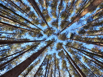 As we turned right on this trail, I noticed the sign that said the Hill Road parking was 1.7 miles away. I had to laugh! I expect distances to vary some but .5 miles is a pretty big gap. The trail along the ridge follows the edge until about 2.7 miles where it veers away and heads a little to the east and northeast. Initially the trail ascends a small bump and then descends the other side before leveling off for a while. We were soon climbing the last of three short ascents to the area of the lookout. The total elevation gain from the trail junction to the lookouts is 285 feet and the short ascents were all slippery and covered in snow. I was bale to use my poles to get up each of these but wondered how they would be on the way back down! From 2.95 miles to the lookout the trail gains just under 200 feet in elevation and begins to follow the edge of the escarpment turning almost due south. The snow depth continued to increase and we were regularly walking through drifts of 18 inches. When we arrived at the viewpoint at 2:10 PM, the wind was blowing at about 20 mph. The open rocks that bake up the viewpoint were covered in snow and ice so I stayed on the ridge and took pictures from there. The sky was not very interesting with an odd blue color and no puffy clouds. The Pepacton Reservoir was clearly visible and the view showed the low volume of water. I noticed that my hands were getting very cold so I got a drink and out a bar in my breast pocket to warm up. I also closed the zippers on my hoody to begin the descent on the way back. I was satisfied that we had made it to the viewpoint but concerned that I had overdone It. We turned around and headed back the way we had come. The trip back to the trail junction went more quickly than I had expected and I was able to "ski" down the steeper descents without much problem. I did notice that the few small ascents were taking atoll on my legs. We stopped again at the trail junction so that I could get a drink and then we turned left to head back down the trail to the parking area. The trip down always seems to go quickly as it is mostly downhill or level. I stopped just before the road in the red pine plantation and took some pictures of the sky through the pines and some of the trail. We arrived back at the car at 4:00 PM. We had hiked 6.5 miles in 4 hours with an elevation gain of 1625 feet. The trip down was about 25 minutes shorter than the trip up. I was happy with the pace under difficult conditions. I decided to use Route 30 back to Route 206 to get home as the back roads had been so slick and this worked out well.
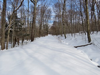
![]()
![]()
![]()
![]()
![]() On Friday, February 3rd, I decided I wanted to get out and hike close to home before heading to Liberty to pick up my grandson at 3:00 PM. The temperature when I woke up at 6:00 AM was 13 degrees but the forecast had it rising throughout the day. I got my gear together and left the house just after 10:00 AM heading for Frick Pond. As always Sheila was in the back seat pretending we hadn't hiked in a month! I had dressed for cold weather by putting on tights and wearing a heavier Patagonia wool top under my Mammut hoody. I took my new favorite Tubbs Alp Flex VRT snowshoes along with me since I did not know how much snow there would be. We parked just before 10:30 AM and I went to check out the amount of snow. I decided that snowshoes would not be necessary bit could be fun and put them on. The bindings have the Boa system and are the easiest bindings I have used, the most secure and easy to adjust. We were on the trail a few minutes later crossing the road to the Flynn Trail at 10:30 AM. We started up the Flynn Trail which initially had only a few inches of new snow on top of a packed base. The day was still cold but the sun was shining and Sheila was having a great time running around. She was easily getting too far ahead of me and then heading off the hiking trail to follow animal tracks. I had met a local historian at the gas stations and he had told me the route to the Frick homestead. As we hit the old Beech Mountain Road, I looked for the road he described as the old Flynn Road but could not find it. We turned right and began to climb the long hill to the junction of the Flynn Trail and the Big Rock Trail. I stopped once on the way up to take a few pictures of the snowy trail. I had followed some footsteps up the woods road but they ended a short distance beyond the gate with a small snow castle. I assumed a family group had been out walking and that this was as far as they had hiked! Beyond that point the snow was all fresh with only a few animal tracks. I had several things to think about and must have kept a good pace because before I knew it we had walked the 1.7 miles and 600 vertical feet to the junction with the Big Rock Trail. There were snowmobile tracks coming down the hill from Mongaup Pond and continuing on the Big Rock Trail. There were also snowmobile tracks heading out the Flynn Trail toward Hodge Pond. The trail is clearly marked as "No Motorized Vehicles" but apparently they snowmobilers couldn't read or, more likely, just didn't care. It is a shame that a few irresponsible people can give an entire group a bad name!
On Friday, February 3rd, I decided I wanted to get out and hike close to home before heading to Liberty to pick up my grandson at 3:00 PM. The temperature when I woke up at 6:00 AM was 13 degrees but the forecast had it rising throughout the day. I got my gear together and left the house just after 10:00 AM heading for Frick Pond. As always Sheila was in the back seat pretending we hadn't hiked in a month! I had dressed for cold weather by putting on tights and wearing a heavier Patagonia wool top under my Mammut hoody. I took my new favorite Tubbs Alp Flex VRT snowshoes along with me since I did not know how much snow there would be. We parked just before 10:30 AM and I went to check out the amount of snow. I decided that snowshoes would not be necessary bit could be fun and put them on. The bindings have the Boa system and are the easiest bindings I have used, the most secure and easy to adjust. We were on the trail a few minutes later crossing the road to the Flynn Trail at 10:30 AM. We started up the Flynn Trail which initially had only a few inches of new snow on top of a packed base. The day was still cold but the sun was shining and Sheila was having a great time running around. She was easily getting too far ahead of me and then heading off the hiking trail to follow animal tracks. I had met a local historian at the gas stations and he had told me the route to the Frick homestead. As we hit the old Beech Mountain Road, I looked for the road he described as the old Flynn Road but could not find it. We turned right and began to climb the long hill to the junction of the Flynn Trail and the Big Rock Trail. I stopped once on the way up to take a few pictures of the snowy trail. I had followed some footsteps up the woods road but they ended a short distance beyond the gate with a small snow castle. I assumed a family group had been out walking and that this was as far as they had hiked! Beyond that point the snow was all fresh with only a few animal tracks. I had several things to think about and must have kept a good pace because before I knew it we had walked the 1.7 miles and 600 vertical feet to the junction with the Big Rock Trail. There were snowmobile tracks coming down the hill from Mongaup Pond and continuing on the Big Rock Trail. There were also snowmobile tracks heading out the Flynn Trail toward Hodge Pond. The trail is clearly marked as "No Motorized Vehicles" but apparently they snowmobilers couldn't read or, more likely, just didn't care. It is a shame that a few irresponsible people can give an entire group a bad name!
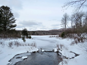 We turned left to walk down the hill to Times Square. I had hoped to be able to "ski" Dow the hill but the packed snow on the snowmobile track prevented this. The walking was still very easy on the packed track. Once again I got lost in my thoughts which made the walk seem exceptionally short. This is one of those trails that is MUCH shorter on the decent than the ascent! After hiking 2.8 miles we arrived at Times Square. Without hesitation, I turned right and headed up the Logger's Loop which was also packed my snowmobiles. The trail begins A rolling ascent over the next .8 miles. At about 3.3 miles there is an area on the right which is sometimes marshy and often looks like a small pond. The water had collected in this area and partly flooded the trail but we easily worked our way around it. A little further along there were some more wet spots on the trail which we bypassed. We continued on the trail arriving at Iron Wheel Junction at 4 miles. I stopped to take a few pictures and then we turned left to head back toward Frick Pond. The snow here was untouched as no one had hiked the trail and it is too narrow for snowmobiles. The walk is mostly downhill and we were soon at the small stream through the woods. It still had a good flow of water and while Sheila easily jumped across, I walked upstream to a narrower spot to cross. We walked through the pine promenade and the trail became wet in spots on the other side. At the next trail junction we continued straight ahead to stay on the Quick Lake Trail. We walked over the bridge at the outlet of Frick Pond and even though there was nothing remarkable about the view, I took some pictures anyway. We continued back to the car along the Quick Lake trail finding only a few wet spots hidden by the snow. We were back at 1:25 PM having covered 5.5 miles in 2 hours and 55 minutes with an elevation gain of 890 feet. The temperature at the car was about 26 degrees with a slight breeze making it feel cooler.
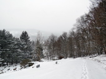
![]()
![]()
![]()
![]()
![]() On Tuesday, January 31st I awoke to find snow falling heavily at times and beginning to accumulate on the ground. I was reluctant to head out for a hike as the snow usually brings an ambulance call or two. I also did not want to go too far away as I did not know how much snow would fall or the condition of the roads. I went downtown early and found the streets and roads were in very poor shape. As the day progressed the temperature rose a few degrees but stayed below freezing allowing the snow to accumulate. Sheila seemed bound to convince me to go out for a hike and around 3:00 PM I finally conceded. I decided we would walk across the street and hike the trails on Round Top as they are close and we didn't have too much time. I knew I wouldn't need snowshoes and doubted I would use my spikes. I did decide to take my pack as I though I might want to take some pictures as the snow continued to fall. It didn't take long to get ready and I put Sheila on her leash for the walk across the street. The snow was still falling at a pretty rapid rate as we crossed the street and walked across the field to the base of the cemetery hill. We began the ascent of the steepest hill which is short but really gets the circulation pumping! When we got to the top of the hill, I dropped my pack to take some pictures. The town was almost completely hidden by the falling snow but I took a few shots anyway. I picked up my pack and we entered the woods. I noticed there was significantly more snow than I the last time I had been on the trail but not enough to require snowshoes. At the first trail junction we decided to go straight ahead up the steeper section to the lookout. When we neared the top, I turned left to walk out to the lower lookout. I didn't want to encourage others to take this route but I did want the pictures. Crossing the little open gulf in the path was tricky without anything on my boots! I again got out the camera and took pictures of the town from another angle. Again, much of the view was obscured by the falling snow. This viewpoint offers a great view of the school and the buildings downtown.
On Tuesday, January 31st I awoke to find snow falling heavily at times and beginning to accumulate on the ground. I was reluctant to head out for a hike as the snow usually brings an ambulance call or two. I also did not want to go too far away as I did not know how much snow would fall or the condition of the roads. I went downtown early and found the streets and roads were in very poor shape. As the day progressed the temperature rose a few degrees but stayed below freezing allowing the snow to accumulate. Sheila seemed bound to convince me to go out for a hike and around 3:00 PM I finally conceded. I decided we would walk across the street and hike the trails on Round Top as they are close and we didn't have too much time. I knew I wouldn't need snowshoes and doubted I would use my spikes. I did decide to take my pack as I though I might want to take some pictures as the snow continued to fall. It didn't take long to get ready and I put Sheila on her leash for the walk across the street. The snow was still falling at a pretty rapid rate as we crossed the street and walked across the field to the base of the cemetery hill. We began the ascent of the steepest hill which is short but really gets the circulation pumping! When we got to the top of the hill, I dropped my pack to take some pictures. The town was almost completely hidden by the falling snow but I took a few shots anyway. I picked up my pack and we entered the woods. I noticed there was significantly more snow than I the last time I had been on the trail but not enough to require snowshoes. At the first trail junction we decided to go straight ahead up the steeper section to the lookout. When we neared the top, I turned left to walk out to the lower lookout. I didn't want to encourage others to take this route but I did want the pictures. Crossing the little open gulf in the path was tricky without anything on my boots! I again got out the camera and took pictures of the town from another angle. Again, much of the view was obscured by the falling snow. This viewpoint offers a great view of the school and the buildings downtown.
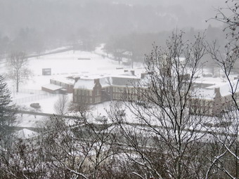 From the viewpoint we continued on the trail in a clockwise direction checking to make sure the yellow blazes were visible and spaced the correct distance apart. When we got to the green ribbons marking the proposed upper trail, I continued on the lower trail on around to where the trail makes a sharp right turn. Here we turned left to follow the green ribbons to the summit of Round Top. Once on the top we continued to follow the ribbons as they headed left and back down to the lower trail. The descent is steep in spots and the snow was pretty slippery. Once we were back at the lower trail we turned left to walk back to the sharp right turn. This time we thieved right and followed the yellow blazes back to the first trail junction. We had now formed a rough figure 8 and I decided we would do it again in the opposite direction. I had not turned on my GPS for the first figure 8 but did so this time knowing I could reconstruct the whole route from the single recording. We turned around and started back up the trail we had just descended. At the sharp left turn we continued to follow the yellow blazes of the lower trail around to the left. When the trail again turned left and the ribbons were on the right we turned right. We followed the ribbons up the steep slope to the top of Round Top and then back down to the lower trail. We turned right on the lower trail, and continued to follow the yellow blazes back to the viewpoint. From the viewpoint we continued down to the first trail junction and out to the trail head. At the trailhead we turned right and descended the hill toward the church. I put Sheila on her leash when we saw that a family was sledding on the hill. At the church we contend across the field to our driveway and back to the house. We had been out for about a little over and hour and had hiked around 2 miles.
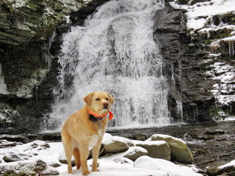
![]()
![]()
![]()
![]()
![]() On Saturday, January 28th I was ready to hike again after a nice hike in the Neversink Unique area the day before. I wanted to get in a longer hike and had planned to tackle a 3500 on the Devil's Path or a loop to Dry Brook Ridge. When I awoke in the morning the skies were completely overcast and it was snowing at a pretty good rate. I decided that I would gain hike locally as I did not want to make the effort to go on a hike with a nice view if I could not take advantage of the view. I got my gear together and got Sheila in the back seat and headed out to Trout Pond at about 10:30 AM. The temperature was still in the high 20's with a brisk wind. The closer I got to Roscoe on Route 17, the more snow was falling. I took exit 94 off the Quickway and headed out the Rockland Flats on Route 206. Just after entering Delaware County I turned left on Morton Hill Road which was covered in at least an inch of snow. When I arrived at the intersection with Russell Brook Road, I found 4 cars parked in the private lot. The lot is clearly marked as private property and the owner does not like people to park there. I parked on the side of the road on the public right-of-way and as far off the pavement as possible. I was glad I had decided to wear a heavier Patagonia wool top under my Mammut hoody. I also had put on a pair of tights. This time I also had on my gaiters and brought along my Microspikes. As soon as I parked, I could see that the parking area was very icy and decided to put on my Microspikes. I had decided to hike from the intersection of Russell Brook Road and Morton Hill Road around Trout Pond and then take the Trout Pond Trail to Campbell Brook Road. I would hike out Campbell Brook Road to Morton Hill Road and then back to the car. I started down Russell Brook Road at 11:05 AM with snow still falling. The small streams were overflowing with water and I stopped for a minute to take a few pictures before continuing down the road. As we approached the upper viewpoint over the falls I could hear the water roaring and looked down to see a large volume of water flowing over the falls. I decided to go down to the viewpoint to take pictures of the upper falls. The descent looked slippery and it seems that someone had been there before me and had slid won the hill. I worked my way down to the lookout and removed my pack. I got out my camera and took some pictures of the falls. After finishing my photography, I worked my way up to the road and continued down to the lower parking area. We walked down the woods road and crossed the bridge on Russell Brook. When we reached the trail on the right to the lower falls, we turned onto the trail and walked over to the falls. I decided to work my way down the bank into the streambed. The Microspikes and my poles certainly helped get me down the slippery slope. Sheila had no trouble at all! I took some pictures of the falls which had a good volume. There wasn't much ice next to the falls as there usually is during the winter. I took a few shots of Sheila and then put my camera away and climbed back up to the trail. When we got back to the main trail, we turned right and at the first trail junction we kept left to walk up the hill toward Mud Pond. The walk up the hill is about .8 miles and gains 400 feet. This isn't really steep but it does get the blood flowing right away.
On Saturday, January 28th I was ready to hike again after a nice hike in the Neversink Unique area the day before. I wanted to get in a longer hike and had planned to tackle a 3500 on the Devil's Path or a loop to Dry Brook Ridge. When I awoke in the morning the skies were completely overcast and it was snowing at a pretty good rate. I decided that I would gain hike locally as I did not want to make the effort to go on a hike with a nice view if I could not take advantage of the view. I got my gear together and got Sheila in the back seat and headed out to Trout Pond at about 10:30 AM. The temperature was still in the high 20's with a brisk wind. The closer I got to Roscoe on Route 17, the more snow was falling. I took exit 94 off the Quickway and headed out the Rockland Flats on Route 206. Just after entering Delaware County I turned left on Morton Hill Road which was covered in at least an inch of snow. When I arrived at the intersection with Russell Brook Road, I found 4 cars parked in the private lot. The lot is clearly marked as private property and the owner does not like people to park there. I parked on the side of the road on the public right-of-way and as far off the pavement as possible. I was glad I had decided to wear a heavier Patagonia wool top under my Mammut hoody. I also had put on a pair of tights. This time I also had on my gaiters and brought along my Microspikes. As soon as I parked, I could see that the parking area was very icy and decided to put on my Microspikes. I had decided to hike from the intersection of Russell Brook Road and Morton Hill Road around Trout Pond and then take the Trout Pond Trail to Campbell Brook Road. I would hike out Campbell Brook Road to Morton Hill Road and then back to the car. I started down Russell Brook Road at 11:05 AM with snow still falling. The small streams were overflowing with water and I stopped for a minute to take a few pictures before continuing down the road. As we approached the upper viewpoint over the falls I could hear the water roaring and looked down to see a large volume of water flowing over the falls. I decided to go down to the viewpoint to take pictures of the upper falls. The descent looked slippery and it seems that someone had been there before me and had slid won the hill. I worked my way down to the lookout and removed my pack. I got out my camera and took some pictures of the falls. After finishing my photography, I worked my way up to the road and continued down to the lower parking area. We walked down the woods road and crossed the bridge on Russell Brook. When we reached the trail on the right to the lower falls, we turned onto the trail and walked over to the falls. I decided to work my way down the bank into the streambed. The Microspikes and my poles certainly helped get me down the slippery slope. Sheila had no trouble at all! I took some pictures of the falls which had a good volume. There wasn't much ice next to the falls as there usually is during the winter. I took a few shots of Sheila and then put my camera away and climbed back up to the trail. When we got back to the main trail, we turned right and at the first trail junction we kept left to walk up the hill toward Mud Pond. The walk up the hill is about .8 miles and gains 400 feet. This isn't really steep but it does get the blood flowing right away.
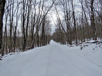 From the top of the hill we descended slightly and then turned right to go north along the west side of Trout Pond. I had been following some fresh footprints but they turned off the trail toward Mud Pond. As we hiked along the trail there were quite a few spots where there was water and slush underneath the snow. This caused the snow to clump on the bottom on my shoes and Microspikes. After spending some time knocking the clumps off, I removed the Microspikes and put them in my pack. Over the next 1.2 miles we gained another 400 feet to the highest pot on the hike on the shoulder of Cherry Ridge. From that point the trail descends 450 feet over .8 miles to the bridge at the inlet of Trout Pond. I stopped briefly to take a few pictures of the pond but the skies were overcast and the pictures just average. We turned left on the Trout Pond Trail to start the hike toward Campbell Brook Road at 3.6 miles. From the lean-tos the trail rises 435 feet over .8 miles to the col between two hills to an elevation almost as great as the shoulder of Cherry Ridge. The trail then descends the same amount over the same distance. At 5.2 miles we crossed the bridge over a small stream and a quarter mile later we were on Campbell Brook Road. I put Sheila on her leash for the road walk as we turned right on the road. Campbell Brook Road climbs a little to the intersection with Morton Hill Road. After that intersection, Morton Hill Road is downhill or flat the rest of the way. Along Morton Hill Road there was several inches of snow abs more was falling as we walked. I was surprised that no vehicles passed us as we hiked on the road. There wasn't too much to look at as the skies were overcast and the snow kept falling. I decided not to stop and we set a quick pace as we returned to the parking area. The walk on Morton Hill Road was about 2.7 miles and took us an hour! We were back at the car at 3:10 PM having covered 8.6 miles in 4 hours and 5 minutes with 1680 feet of ascent. There was a DEC truck parked in the lot and I assumed the forest ranger was going to check out anyone ice fishing on Mud Pond or Cables Lake.
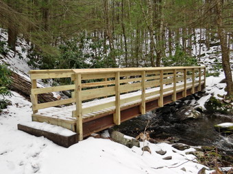
![]()
![]()
![]()
![]()
![]() On Friday, January 27th, I wanted to do a hike close to home as the windchill temperatures were supposed to be in the low teens and show showers were forecast throughout the day. I decided to go to the Neversink Unique Area since I had not been there in some time and I had exhausted the other hikes in the Livingston Manor area. Cindy wanted to come along so we got our gear together and left home a little before 10:30 AM. Due to the forecast I wore a heavier Patagonia wool top under my Mammut hoody. I also put on a pair of tights. I had not planned on there being much snow I did not bring my gaiters or snowshoes but brought along my Microspikes. Sheila seemed very happy that all of us were going somewhere as she was very alert in the back seat. I got on Route 17 and started for Rock Hill. I got off the Quickway at exit 109 and turned right on Katrina Falls Road. I drove to the end of the road and parked at 10:50 AM in the small parking area. There were no other cars present but we were surprised at the amount of snow still present. As we got ready to hike we found that the parking area was very icy and we decided to put on our Microspikes. I regretted that I had not brought gaiters to prevent snow from entering over the tops of my boots. We started down the woods road toward the river intending to hike the loop to Denton and Mullet Falls. I thought that the recent rain might have augmented the waterfalls making them more interesting. Sheila was certainly anxious to get going as both she and I prefer several hikes a week! The temperature was in the high 20's and the breeze made it seem a little colder. As we walked down the hill passed the trail register, I was glad I had my Microspikes as there was still some ice and hard-packed snow. We turned left at the bottom of the hill to stay on the main trail and came to the small bridge over Wolf Brook. The water was as high as it had been in some time and I stopped to take a few pictures before continuing on the main trail. At the top of the next small hill, we stayed to the right to hike the loop counterclockwise hitting Denton Falls on the Neversink first and then the falls on Mullet Brook. It didn't take long for us to arrive at the lower bridge over Mullet Brook. As we approached, I was surprised to see that the old bridge which was is disrepair had been replaced. The new bridge has a pair of steel I-beams as its main support and should last a long time. I was glad the repairs had been made as this bridge is used heavily by those hiking the trails in the Neversink Unique Area. At 1.4 miles we turned right following the yellow spur trail blazes downhill to Denton Falls.
On Friday, January 27th, I wanted to do a hike close to home as the windchill temperatures were supposed to be in the low teens and show showers were forecast throughout the day. I decided to go to the Neversink Unique Area since I had not been there in some time and I had exhausted the other hikes in the Livingston Manor area. Cindy wanted to come along so we got our gear together and left home a little before 10:30 AM. Due to the forecast I wore a heavier Patagonia wool top under my Mammut hoody. I also put on a pair of tights. I had not planned on there being much snow I did not bring my gaiters or snowshoes but brought along my Microspikes. Sheila seemed very happy that all of us were going somewhere as she was very alert in the back seat. I got on Route 17 and started for Rock Hill. I got off the Quickway at exit 109 and turned right on Katrina Falls Road. I drove to the end of the road and parked at 10:50 AM in the small parking area. There were no other cars present but we were surprised at the amount of snow still present. As we got ready to hike we found that the parking area was very icy and we decided to put on our Microspikes. I regretted that I had not brought gaiters to prevent snow from entering over the tops of my boots. We started down the woods road toward the river intending to hike the loop to Denton and Mullet Falls. I thought that the recent rain might have augmented the waterfalls making them more interesting. Sheila was certainly anxious to get going as both she and I prefer several hikes a week! The temperature was in the high 20's and the breeze made it seem a little colder. As we walked down the hill passed the trail register, I was glad I had my Microspikes as there was still some ice and hard-packed snow. We turned left at the bottom of the hill to stay on the main trail and came to the small bridge over Wolf Brook. The water was as high as it had been in some time and I stopped to take a few pictures before continuing on the main trail. At the top of the next small hill, we stayed to the right to hike the loop counterclockwise hitting Denton Falls on the Neversink first and then the falls on Mullet Brook. It didn't take long for us to arrive at the lower bridge over Mullet Brook. As we approached, I was surprised to see that the old bridge which was is disrepair had been replaced. The new bridge has a pair of steel I-beams as its main support and should last a long time. I was glad the repairs had been made as this bridge is used heavily by those hiking the trails in the Neversink Unique Area. At 1.4 miles we turned right following the yellow spur trail blazes downhill to Denton Falls.
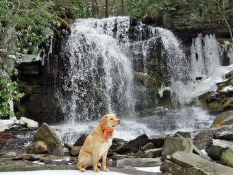 The trail down to the falls is not well marked and hikers trying to follow it have created new paths which compounds the problem. After hiking 1.65 miles, we were at the rocks near the edge of Denton Falls. The descent to the river was icy and the Microspikes helped us to get safely to the river's edge. The river was high and the falls roaring as I dropped my pack and started to take some pictures. Sheila seemed smart enough not to try to jump into the cold and fast-moving water. I was able to walk along the rocks to get just below the falls. I took quite a few pictures of the falls and some both upstream and downstream. Cindy sat on a rock and I was able to get a few "candid" pictures of her and Sheila. The falls are hardly three feet high but the volume of water made the trip worthwhile. We headed back up the spur trail to the main trail and turned right. At the trail junction I asked Cindy if she wanted to hike down to High Falls which adds about 4 miles round trip to the hike. She declined the offer so we kept to the left to start the loop. After a brief walk uphill, we turned left onto the short trail down to Mullet Brook Falls. The trail has no sign and could be easily missed. In fact, there is no signage anywhere in the area! I saw a total of only three yellow blazes on our way down to the falls and on the way back. When the falls came into sight, I was pleased with the amount of water in the stream. I dropped my pack where the trail ended and grabbed my camera to take some pictures. I carefully walked out onto the rocks below the falls. I took some shots of the falls and the pool below. I was disappointed there wasn't very much ice near the falls as there had been in previous years. it was much like the rest of the trip. There was enough water to make it interesting but far less than I had hoped for. I dropped my pack and got out the camera. After a few initial shots, I walked onto the pile of rocks just down from the base of the falls. I had to be careful as the rocks were covered with moss and were wet from the rain and spray from the falls. I took pictures of the falls but the pool that is normally at the bottom was missing! In fact, it was hard to find any flow in the stream below the falls. Eventually it was time to leave. I put away my camera and shoulder my pack to head back out the spur trail. We walked back out to the main trail and turned left to complete the loop. As we climbed we noticed the rocky ledges to our right and I thought about exploring them at some time in the future. Soon we crossed over the upper bridge spanning Mullet Brook. I stopped on the bridge to take a few shots both up and down stream. After a brief walk we were at a trail junction. Walking straight ahead on the trail leads to the Wolf Lake Multiple Use Area. We turned left and began to descend off the ridge. We hiked downhill for some time and eventually came to the trail junction just above the bridge over Wolf Creek. We continued to walk straight ahead to return to the parking area. Once on the other side of the brook we made the right turn on the woods road back to the car and kept a quick pace until we arrived at the parking area at 1:35 PM. We hiked 4.6 miles in just over 2 hours and 45 minutes including the stops at the two falls. The vertical gain was only about 930 feet. The temperature had risen slightly into the low 30's and the wind had subsided.
![]()
![]()
![]()
![]() On Monday, January 23rd I was scheduled to play racquetball with some friends but these plans were cancelled by an ambulance call. When I returned from the call, I found my track meet had been cancelled due to the forecast for a wintry mix in the afternoon. I decided I wanted to get in a hike before the bad weather arrived. I suggested to Cindy that we go across the street to hike the trails on Round Top. Cindy agreed to go with me and Sheila seemed to be happy going anywhere. We headed out at 10:50 AM with Sheila on her leash to cross the street. There was no snow remaining in the field next to the church and only some in the snow banks around the church parking lot. The temperature was in the mid-30's but felt cooler due to a stiff breeze. I had decided not to bring my pack as I did not intend to take pictures as the day was overcast and dreary. We walked around the back of the church and started up the hill. The hill is short but steep but we made good time as there was no snow or ice. We turned left into the woods at the trailhead and walked along the woods road which did not have any snow. At the first trail junction, we continued straight ahead and up the steep hill to the lookout over town. There was no snow on the woods road all the way to the viewpoint. A quick look at the view showed there wasn't much difference from previous trips. We followed the yellow blazes as the trail turned to the right and continued gently uphill. After a short distance, we picked up the string smell of a skunk and I called Sheila to my side. We continued on the trail to the sharp right turn. At this point we continued straight ahead following the bright green ribbons which marked the proposed upper trail. There was still an inch or more of snow on this side of the hill and it was slippery going uphill. When we reached the top, we continued to follow the ribbons across the summit plateau and down the other side. Soon we were back at the lower trail where we turned left and the quickly right to follow the lower trail down to the first trail junction. When we arrived at the trail junction, Cindy decided to head home. Sheila and I turned right and began to hike another loop.
On Monday, January 23rd I was scheduled to play racquetball with some friends but these plans were cancelled by an ambulance call. When I returned from the call, I found my track meet had been cancelled due to the forecast for a wintry mix in the afternoon. I decided I wanted to get in a hike before the bad weather arrived. I suggested to Cindy that we go across the street to hike the trails on Round Top. Cindy agreed to go with me and Sheila seemed to be happy going anywhere. We headed out at 10:50 AM with Sheila on her leash to cross the street. There was no snow remaining in the field next to the church and only some in the snow banks around the church parking lot. The temperature was in the mid-30's but felt cooler due to a stiff breeze. I had decided not to bring my pack as I did not intend to take pictures as the day was overcast and dreary. We walked around the back of the church and started up the hill. The hill is short but steep but we made good time as there was no snow or ice. We turned left into the woods at the trailhead and walked along the woods road which did not have any snow. At the first trail junction, we continued straight ahead and up the steep hill to the lookout over town. There was no snow on the woods road all the way to the viewpoint. A quick look at the view showed there wasn't much difference from previous trips. We followed the yellow blazes as the trail turned to the right and continued gently uphill. After a short distance, we picked up the string smell of a skunk and I called Sheila to my side. We continued on the trail to the sharp right turn. At this point we continued straight ahead following the bright green ribbons which marked the proposed upper trail. There was still an inch or more of snow on this side of the hill and it was slippery going uphill. When we reached the top, we continued to follow the ribbons across the summit plateau and down the other side. Soon we were back at the lower trail where we turned left and the quickly right to follow the lower trail down to the first trail junction. When we arrived at the trail junction, Cindy decided to head home. Sheila and I turned right and began to hike another loop.
Sheila and I hiked up the hill again to the viewpoint where we turned right and continued to follow the trail to the point where it turns sharply right. This time we continued to follow the lower trail picking up some branches along the way. When we reached the sharp right turn, we turned right and walked down the trail and then the woods road to the trail junction. At the trail junction, we turned around and walked back up the woods road the way we had come. At the sharp left turn in the trail we continued straight ahead following the bright green ribbons of the proposed upper trail to the summit of Round Top. We turned left on the summit following the ribbons down the slippery hill to the lower trail. We turned right on the trail and walked down to the viewpoint. At the lookout we turned left and headed back down to the trail junction. I decided at this point to complete one more small loop so we headed back up the woods road to the left. This time we turned left at the sharp turn and followed the lower trail on around and back to the viewpoint. Sheila and I kept up a good pace and continued down the hill and back out to the trailhead. We turned right and walked down the hill to the church and then across the field to our driveway. We arrived back at home after hiking a total of 2.6 miles and 930 vertical feet in and hour and 20 minutes. Our pace was just 2 mph which seemed slow but I was satisfied with our hike.
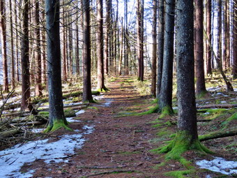
![]()
![]()
![]()
![]()
![]() On Saturday, January 21st I wanted to get in a hike after Cindy returned from a church meetings round noon. I had gotten in from our track meet the night before at 1:30 AM and had been out on an ambulance call at 6:30 AM so I was not in nay hurry to rush out of the house. When Cindy got home I suggested we go to hike at Kelly Hollow as we had not been there in over two years! The hike is only about 4 miles but there are some interesting sites including a stream that runs between the trail out and the trail back. There is also a beaver pond on the trail with a lean-to. We got Sheila and our gear in the car and headed to Roscoe on Route 17 at about 12:45 PM. Cindy likes to stay off the small back roads as much as possible so I took Route 206 out of Roscoe to Route 30 near the Pepacton Reservoir. As we hit the top of Cat Hollow, there was a lot of fog caused by the warm air temperature and the cold snow still on the ground. Once we turned right on Route 30 and started around the Pepacton, the fog cleared and there was some sun. Every view we had of the reservoir showed that the level was still VERY low despite the days of rain and the snow melt. At the Dunraven Bridge I stayed on the BWS roads passing the intersection with the Barkaboom Road. After a few miles I turned right on Millbrook Road and drove to the parking area for Kelly Hollow which is marked with the yellow on brown signs used in the Forest Preserve. There was no other cars in the lot when we parked and we began our hike at 1:20 PM. The temperature at the parking area seemed cooler than when we had left Livingston Manor but was still right around 40 degrees. There was some snow in the parking area where it had been plowed but the rest of the ground was bare and muddy in spots. We decided to walk the trail in a clockwise direction and entered the woods crossing a small stream.
On Saturday, January 21st I wanted to get in a hike after Cindy returned from a church meetings round noon. I had gotten in from our track meet the night before at 1:30 AM and had been out on an ambulance call at 6:30 AM so I was not in nay hurry to rush out of the house. When Cindy got home I suggested we go to hike at Kelly Hollow as we had not been there in over two years! The hike is only about 4 miles but there are some interesting sites including a stream that runs between the trail out and the trail back. There is also a beaver pond on the trail with a lean-to. We got Sheila and our gear in the car and headed to Roscoe on Route 17 at about 12:45 PM. Cindy likes to stay off the small back roads as much as possible so I took Route 206 out of Roscoe to Route 30 near the Pepacton Reservoir. As we hit the top of Cat Hollow, there was a lot of fog caused by the warm air temperature and the cold snow still on the ground. Once we turned right on Route 30 and started around the Pepacton, the fog cleared and there was some sun. Every view we had of the reservoir showed that the level was still VERY low despite the days of rain and the snow melt. At the Dunraven Bridge I stayed on the BWS roads passing the intersection with the Barkaboom Road. After a few miles I turned right on Millbrook Road and drove to the parking area for Kelly Hollow which is marked with the yellow on brown signs used in the Forest Preserve. There was no other cars in the lot when we parked and we began our hike at 1:20 PM. The temperature at the parking area seemed cooler than when we had left Livingston Manor but was still right around 40 degrees. There was some snow in the parking area where it had been plowed but the rest of the ground was bare and muddy in spots. We decided to walk the trail in a clockwise direction and entered the woods crossing a small stream.
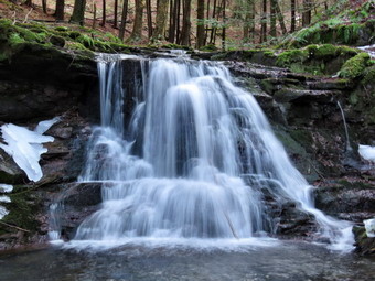 Just after the stream we came to a woods road and turned right heading south and ascending slightly. Along the way the trail was wet in spots and there were some patches of ice. We avoid the ice easily and at .5 miles came to the cutoff to the right for the Short Loop hike. I decided to walk down the cutoff trail to the bridge to take some pictures. The bridge was a little loose and the wet boards were slippery. I took a few shots and then decided to work my way downstream a little to take some pictures of a few small waterfalls. Cindy did not want to bother with this bushwhack so she walked back up to the main trail to wait for us. Sheila and I walked down the bank and along the stream which was difficult as the bank was wet and slippery. I settled on a spot below a set of small falls and took some pictures from there. I packed up my camera and headed back up the bank with some difficulty. I joined Cindy on the main trail and we immediately encountered some large patches of ice. We were able to walk up the side of the trail but then began to find more snow on the trail. Looking across the stream to the bank on the other side showed more snow on that side. The trail passes through a mix of evergreens and hardwoods with higher land to the left and the stream on the right. At about 1 mile Cindy stopped to put on her Microspikes which was a good idea. At 1.2 miles we crossed a bridge over the stream and started to walk along the bank opposite where we had been. It had been so long since I had hiked at Kelly Hollow, I began to wonder if we had someone missed a turn since it seemed we were headed in the wrong direction. We decided to simply let things play out and continued along the trail now heading north. To avoid climbing over the shoulder of a hill the trail headed north and eventually west. At 1.6 miles we came to the spot where I had at one time turned left and bushwhacked up to the top of Millbrook Ridge. From the top of the ridge it isn't far to Alder Lake!
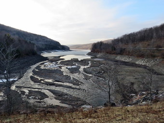 The trail turned around the hill and at 1.75 miles headed southwest as we approached the lean-to and beaver pond at the apex of the trail system. The lean-to and its privy were in good shape. I took a few pictures of Cindy and Sheila at the lean-to and then walked to the shore of the beaver pond. We were surprised to see how low the water level had fallen. I expected the volume to be low but there was hardly any water. The edges of the pond were very dry and grassy indicating the condition had existed for some time. The beaver house was well above water and the beavers had abandoned the area. I took some pictures to document the conditions. The sky was blue with some white clouds and the trees around the pond were stark without their leaves. We walked a little around the pond and I took a few more shots before stowing the camera for the return trip. The trail around the pond eventually meets up with another woods road which leads back to the parking area. From the apex of the trail back to Millbrook Road is about 1.3 miles with the trail heading mostly north. It wanders a little to avoid some hills and is always parallel to a stream. At 2.7 miles I spotted another waterfall and started to look for a way down the bank to the streambed. I managed to get down to the level of the stream to take some pictures of a waterfall. I worked my way back up to the trail and Cindy and I crossed another bridge on the way back to the car. Shortly after the bridge we arrived at the trail that forms the short loop. At 3.3 miles the woods road leads to a small cemetery which we had visited before. Some of the grave markers, especially the ones on the hill, are very old and it seems it has been a long time since it has been used for a burial. Several of the graves are from men who fought in the Civil War and there is at least one with a Revolutionary War designation. We decided to walk out the access road to Millbrook Road. Once at Millbrook Road, we turned right and walked .25 miles back to the car. It was 3:40 PM and we had completed the 3.8 mile hike in 2 hours and 20 minutes. The elevation gain was only 630 feet. We drove back to Livingston Manor the way we had come and stopped once to take some pictures of the reservoir.
![]()
![]()
![]()
![]() On Friday, January 20th I wanted to get out after several days of rainy weather. An early morning ambulance call and some rain in the morning delayed my plans to go on a longer hike. I changed plans and decided to go across the street to hike on the Round Top trails before I had to leave for an evening track meet. Cindy agreed to go with me and Sheila seemed to be happy going anywhere. We headed out at 11:00 AM with Sheila on her leash to cross the street. There was only a little snow in the field next to the church and some in the snow banks around the church parking lot. The temperature was in the mid-30's but almost felt warm and I wore the lighter version of my winter clothing. I had decided not to bring my pack as I did not intend to take pictures as the day was overcast and dreary. We walked around the back of the church and started up the hill. The hill is short but steep but we made good time as there was no snow or ice. We turned left into the woods at the trailhead and walked along the woods road which did have some snow. At the first trail junction, we turned right to walk up the more gentle slope in the lower loop. There was very little snow on the woods road until we got to the turn up the hill where we encountered significantly more snow. When we got to the sharp left turn, I suggested we continue on the new upper trail that I had laid out. The trail is only flagged with green tape but the path is pretty clear. The trail is a rather direct route to the top of the hill and an equally direct route down the other side. The final trail when constructed may contain some switchbacks to help mediate the steepness. We walked up to the summit of Round Top where there was still some snow and then started down the other side still following the bright green ribbons. This side of the hill faces north so there was till several inches of snow and the steep slope allowed us to glide down in our boots. We were soon back at the yellow-blazed lower trail where we turned right to head toward the viewpoint from the ledges facing town. When we arrived at the ledges, we took a quick look from the upper part of the lookout. The sky was overcast and there was some mist or fog hanging over town. We continued on the main trail down the hill to complete the loop at the first trail junction. At this point, Cindy decided to return home and I decided to do the loop in the opposite direction. Sheila and I turned around and hiked back up the steep hill to the lookout. We didn't stop and continued on around the loop at a quickened pace. As the main lower trail turned right, we walked straight ahead and up the hill toward the summit following the bright green ribbons again. Hiking up through two inches of slippery, wet, icy snow was a challenge but we soon reached the top and started back down. When we arrived at the moan trail, we turned left and then right to follow the trail back down to the first trail junction. We had been out for about an hour and I decided to turn left and walk back out to the trailhead at the top of the cemetery. From the trail head we walked back down the hill to the back of the church and across the field to our driveway.
On Friday, January 20th I wanted to get out after several days of rainy weather. An early morning ambulance call and some rain in the morning delayed my plans to go on a longer hike. I changed plans and decided to go across the street to hike on the Round Top trails before I had to leave for an evening track meet. Cindy agreed to go with me and Sheila seemed to be happy going anywhere. We headed out at 11:00 AM with Sheila on her leash to cross the street. There was only a little snow in the field next to the church and some in the snow banks around the church parking lot. The temperature was in the mid-30's but almost felt warm and I wore the lighter version of my winter clothing. I had decided not to bring my pack as I did not intend to take pictures as the day was overcast and dreary. We walked around the back of the church and started up the hill. The hill is short but steep but we made good time as there was no snow or ice. We turned left into the woods at the trailhead and walked along the woods road which did have some snow. At the first trail junction, we turned right to walk up the more gentle slope in the lower loop. There was very little snow on the woods road until we got to the turn up the hill where we encountered significantly more snow. When we got to the sharp left turn, I suggested we continue on the new upper trail that I had laid out. The trail is only flagged with green tape but the path is pretty clear. The trail is a rather direct route to the top of the hill and an equally direct route down the other side. The final trail when constructed may contain some switchbacks to help mediate the steepness. We walked up to the summit of Round Top where there was still some snow and then started down the other side still following the bright green ribbons. This side of the hill faces north so there was till several inches of snow and the steep slope allowed us to glide down in our boots. We were soon back at the yellow-blazed lower trail where we turned right to head toward the viewpoint from the ledges facing town. When we arrived at the ledges, we took a quick look from the upper part of the lookout. The sky was overcast and there was some mist or fog hanging over town. We continued on the main trail down the hill to complete the loop at the first trail junction. At this point, Cindy decided to return home and I decided to do the loop in the opposite direction. Sheila and I turned around and hiked back up the steep hill to the lookout. We didn't stop and continued on around the loop at a quickened pace. As the main lower trail turned right, we walked straight ahead and up the hill toward the summit following the bright green ribbons again. Hiking up through two inches of slippery, wet, icy snow was a challenge but we soon reached the top and started back down. When we arrived at the moan trail, we turned left and then right to follow the trail back down to the first trail junction. We had been out for about an hour and I decided to turn left and walk back out to the trailhead at the top of the cemetery. From the trail head we walked back down the hill to the back of the church and across the field to our driveway.
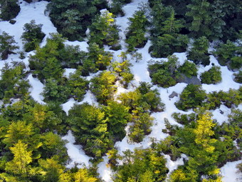
![]()
![]()
![]()
![]()
![]() On Monday, January 16thI wanted to do a 3500 foot peak and decided the night before to do Hunter from Spruceton. I like the trail and it is relatively easy which is what I wanted as I had not done a 3500 is some time. The temperature was forecast to start out cold but rise to the high 30's by early afternoon. When I woke up in the morning at 6:00 AM, it was 10 degrees and I knew decided to delay my departure. I left Livingston Manor at about 8:00 AM under clear and sunny skies. The temperature was still around 10 degrees but I hoped it would rise on the way to my destination. Sheila was eager to go but laid down to rest in the backseat after a few miles of driving on the DeBruce Road. The further I drove the lower the temperature became until it was 5 degrees near Round Pond. I considered turning back but did not. I turned left on Route 47 to head toward Big Indian and Route 28. There was one car at the Biscuit Brook parking area and only one or two at Slide and Panther Mountain. As I came to Route 28 in Big Indian, the Route 28 detour was gone so I turned right and headed for Shandaken. I turned left on Route 42 toward Lexington and continued north on Route 42 to Spruceton where I turned right on the Spruceton Road. We arrived at the parking area on the left at about 9:40 AM and almost immediately got on the trail to hike. There were no other cars in the lot and the temperature was now about 18 degrees. I had decided to wear tights under my Columbia Omniheat pants along with my insulated Salomon Nytro boots. On top I had on a Patagonia underlayer with a Patagonia wool top over it. As always, I wore my Mammut hoody. I had not even brought snowshoes but was surprised to find almost no snow on the ground! I decided to keep my Microspikes in my packs until I really needed them. The Spruceton Trail to Hunter has several areas that usually have ice flows that cover most of the trail. Sheila and I left the parking area and I made up my mind to keep a constant but not necessarily fast pace. There was good amount of water in the brook which made the hike pleasant. There were a few small patches of ice that were easily avoided as we walked up the trail. We crossed the bridge at .5 miles and shortly after made the hairpin turn where the trail begins to get steeper. There was a pretty obvious path heading in the direction of Rusk and I wondered how well defined it remained further toward the summit.
On Monday, January 16thI wanted to do a 3500 foot peak and decided the night before to do Hunter from Spruceton. I like the trail and it is relatively easy which is what I wanted as I had not done a 3500 is some time. The temperature was forecast to start out cold but rise to the high 30's by early afternoon. When I woke up in the morning at 6:00 AM, it was 10 degrees and I knew decided to delay my departure. I left Livingston Manor at about 8:00 AM under clear and sunny skies. The temperature was still around 10 degrees but I hoped it would rise on the way to my destination. Sheila was eager to go but laid down to rest in the backseat after a few miles of driving on the DeBruce Road. The further I drove the lower the temperature became until it was 5 degrees near Round Pond. I considered turning back but did not. I turned left on Route 47 to head toward Big Indian and Route 28. There was one car at the Biscuit Brook parking area and only one or two at Slide and Panther Mountain. As I came to Route 28 in Big Indian, the Route 28 detour was gone so I turned right and headed for Shandaken. I turned left on Route 42 toward Lexington and continued north on Route 42 to Spruceton where I turned right on the Spruceton Road. We arrived at the parking area on the left at about 9:40 AM and almost immediately got on the trail to hike. There were no other cars in the lot and the temperature was now about 18 degrees. I had decided to wear tights under my Columbia Omniheat pants along with my insulated Salomon Nytro boots. On top I had on a Patagonia underlayer with a Patagonia wool top over it. As always, I wore my Mammut hoody. I had not even brought snowshoes but was surprised to find almost no snow on the ground! I decided to keep my Microspikes in my packs until I really needed them. The Spruceton Trail to Hunter has several areas that usually have ice flows that cover most of the trail. Sheila and I left the parking area and I made up my mind to keep a constant but not necessarily fast pace. There was good amount of water in the brook which made the hike pleasant. There were a few small patches of ice that were easily avoided as we walked up the trail. We crossed the bridge at .5 miles and shortly after made the hairpin turn where the trail begins to get steeper. There was a pretty obvious path heading in the direction of Rusk and I wondered how well defined it remained further toward the summit.
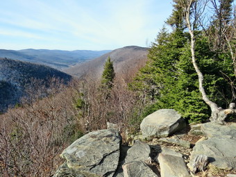 The sun was out and the temperature was beginning to rise as we hiked up the trail and there was still no snow. I was watching for some views of Westkill to the right but they were all blocked by the trees. As we hiked Sheila was following animal tracks in many different directions. The trail was a little longer than I remembered but we made the saddle between Hunter and the Rusk ridge at 10:30 AM after hiking 1.7 miles. Along the way we had come across a few areas of snow on the left side of the trail and I had stopped to open up the zippers on my clothing as I was getting warm. I stopped to get a drink and contemplated the fact that we were half way through the trip as far as mileage went. I knew that the hardest part was yet to come. We made the right turn up the mountain and I immediately noticed that the grade increased. In a short distance we began to encounter ice on the trail but I stubbornly refused to stop on don my Microspikes. I kept a good pace which had me sweating and breathing a little more than I had been. The ice flows began to get larger stretching across the trail and covering large areas. I decided to simply walk on the snow at the side of the trail or bushwhack a little. We continued to climb and came to the area just below the spring. The ice flows here were impressive and the spring was encased in ice. I had decided to refrain from taking pictures until we reached the summit. The spur trail to the lean-to was a little father away than I remembered! I was feeling a little more tired than usual since I had not been hiking mountains for some time. I had been concentrating on the Finger Lakes Trail and Long Path with much longer but flatter hikes. I simply decided to cut my pace a little and relax taking a break when I needed. We passed the trail to the lean-to and I decided to visit it on the return trip. At 11:00 AM we passed the trail to the left that goes to the Colonel's Chair, the top of the Hunter Mountain ski complex. We had hiked 2.5 miles and still had about a mile and 450 feet of elevation to go! Even though I had stopped several times there were no signs of anyone following us on the trail.
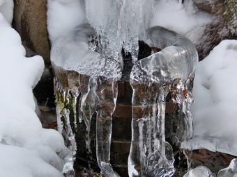 The final mile has a few spots where the trail levels off and a few where there are some sustained climbs. We passed by a small lookout on the left since I knew better things were to come. Along the way, Sheila alerted and I turned around to see a young man hiking at a faster pace than we were setting. Sheila and I stepped off to the side of the trail to let him pass. We continued on our way hiking the last ascent where the trail was mostly covered in packed snow. As we approached the tower clearing, I could see there was no one at the cabin or on the tower and wondered why the hiker who had passed us had decided not to visit the fire tower. We walked to the cabin where I dropped my pack and got out my camera. I took a few shots of the tower and cabin and then leashed Sheila to the picnic table so that she would not follow me up the tower. I headed up the tower to take more pictures. As soon as I was above the tree line, I noticed a sustained breeze that made me a little cool. I took pictures from just below the cabin on the tower and then came down to another level and took some more. I could see the Hunter Mountain Ski Area with the zoom on the camera and there did no seem to be much activity although there was some snow on the slopes. I took a few shots from the lower levels as I descended the tower including a few of a pitiful dog looking up at me! The skies were a rather solid blue and but had a few clouds that added a nice touch. I went over to the picnic table and released Sheila and got a drink. I looked around for Sheila and saw her halfway up the open stairs on the tower! When I called her, she fearlessly bounded down the steps to the ground. I checked the thermometer at the cabin and found it was just at 32 degrees. I decided to put on my Microspikes for the trip down as I felt it would not only increase my security but also my speed. I got my gear on and we started back at down the Spruceton Trail. I had considered doing the loop to Southwest Hunter but I decided against it for the sake of time. We kept a faster pace down the mountain but I had to slow down for the larger ice flows. The ice was hard and thick and the Microspikes are not very sharp. In addition, my poles were not getting a very good "bite". I stopped a few times to take pictures on the trail. We came to the spur trail to the lean-to at 12:25 PM and turned left to visit the lean-to and the lookout over true Spruceton Valley. I had expected an ice flow on the path to the lean-to but everything was pretty clear. I dropped my pack at the lean-to and walked out to the lookout. The view was beautiful and I took pictures of the valley. I also snapped some shots of Westkill and Rusk. I had Sheila sit on the rocks and took a few photographs of her. After returning to the lean-to for a few more pictures, I shouldered my pack and we headed back out to the main trail. We turned left an I carefully made my way down the icy trail taking few pictures on the way. When we reached the spring, I stopped and took a few shots before continuing down the trail avoiding more ice. We were soon at the left turn where I stopped to remove my Microspikes. We picked up the pace down the wide woods road making the sharp right turn and crossing the bridge. I took a few pictures of the brook and the Sheila alerted again. A couple was walking up the trail with their dog on a leash. I leashed Sheila and we passed each other with a "hello" and not dogs straining to meet each other. We were back at the parking area at 1:45 PM after hiking 6.8 miles in 4 hours with an elevation gain of 2010 feet.
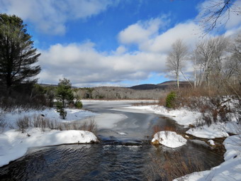
![]()
![]()
![]()
![]()
![]() On Friday, January 13th, I was ready to get a hike in after spending the overnight and early morning hours on ambulance calls. The previous two days had seen temperature in the 40's with rain so I knew the trails would be a mess. By Friday at noon the temperature had evened out at about 30 degrees. Cindy said she would go for a walk and we decided to go to Frick Pond as it is close and I had an afternoon basketball game to time. My plan was to go to Frick Pond and hike the big loop around Frick and Hodge Ponds. We got our gear and Sheila in the car and left Livingston Manor a little after noon. We had decided to take our Microspikes but leave the snowshoes at home as we expected there to be very little snow and what was present would be packed. Since it seemed warmer than when I had last been out on Tuesday, I decided not to wear insulated boots and did not put on a wool top or tights under my pants. I drove out the DeBruce Road which was well cleared and then turned left on the Mongaup Pond Road to head toward the Frick Pond trailhead. I stayed to the left where the road spilt and headed up Beech Mountain Road to the trailhead. This road had been plowed but was now a mess from thawing agreeing which produced ruts and a layer of ice. Both parking areas were a sheet of ice so I parked in the smaller lot and pulled in to reach some bare ground. There was already one car parked as we got ready to hike. We decided not to put on our spikes immediately and left the parking area heading down the woods road toward the register. I thought about going up the Flynn Trail but Cindy had other ideas so I followed her. I was not enthusiastic about hiking the Quick Lake Trail from the register to Frick Pond twice since there are a lot of rock and some water which proved to be the case this time. There was a lot of ice and the packed snow was just as bad. Just after the register Cindy began to slip on the ice and stopped to put her spikes on. While I was standing waiting for her, I noticed that the stiff breeze was making me cold and that my feet were colder than normal. I began to regret not upgrading my gear to handle the cooler temperatures. As we approached the trail junction, Sheila alerted and we saw two women headed toward us with their dog. I took Sheila by the collar and stepped off the side of the trail while they politely leashed there dog and passed by us. We stayed to the left at Gravestone Junction and walked down the hill to Frick Pond. By the time we got to the pond, the wind was blowing and as I got out the camera my hands were chilly. The scene was beautiful s there were puffy white clouds in a blue sky and the water level in the pond was up. I took a few pictures from the bridge and the packed up to get back to the hike.
On Friday, January 13th, I was ready to get a hike in after spending the overnight and early morning hours on ambulance calls. The previous two days had seen temperature in the 40's with rain so I knew the trails would be a mess. By Friday at noon the temperature had evened out at about 30 degrees. Cindy said she would go for a walk and we decided to go to Frick Pond as it is close and I had an afternoon basketball game to time. My plan was to go to Frick Pond and hike the big loop around Frick and Hodge Ponds. We got our gear and Sheila in the car and left Livingston Manor a little after noon. We had decided to take our Microspikes but leave the snowshoes at home as we expected there to be very little snow and what was present would be packed. Since it seemed warmer than when I had last been out on Tuesday, I decided not to wear insulated boots and did not put on a wool top or tights under my pants. I drove out the DeBruce Road which was well cleared and then turned left on the Mongaup Pond Road to head toward the Frick Pond trailhead. I stayed to the left where the road spilt and headed up Beech Mountain Road to the trailhead. This road had been plowed but was now a mess from thawing agreeing which produced ruts and a layer of ice. Both parking areas were a sheet of ice so I parked in the smaller lot and pulled in to reach some bare ground. There was already one car parked as we got ready to hike. We decided not to put on our spikes immediately and left the parking area heading down the woods road toward the register. I thought about going up the Flynn Trail but Cindy had other ideas so I followed her. I was not enthusiastic about hiking the Quick Lake Trail from the register to Frick Pond twice since there are a lot of rock and some water which proved to be the case this time. There was a lot of ice and the packed snow was just as bad. Just after the register Cindy began to slip on the ice and stopped to put her spikes on. While I was standing waiting for her, I noticed that the stiff breeze was making me cold and that my feet were colder than normal. I began to regret not upgrading my gear to handle the cooler temperatures. As we approached the trail junction, Sheila alerted and we saw two women headed toward us with their dog. I took Sheila by the collar and stepped off the side of the trail while they politely leashed there dog and passed by us. We stayed to the left at Gravestone Junction and walked down the hill to Frick Pond. By the time we got to the pond, the wind was blowing and as I got out the camera my hands were chilly. The scene was beautiful s there were puffy white clouds in a blue sky and the water level in the pond was up. I took a few pictures from the bridge and the packed up to get back to the hike.
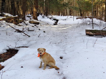 At the next trail junction we stayed to the left to follow the Quick Lake Trail through the "Spruce Tunnel" to Iron Wheel Junction. I could definitely feel that I was working harder trying to stay on the side of the trail in the snow to avoid the water and ice that covered the center of the trail. It surprised us that there was still quite a bit of snow in the woods averaging from 4 to 8 inches. I stubbornly refused to put on my spikes and Cindy was having an easier time not having to avoid the ice. We stopped in the "Spruce Tunnel" where I took a few shots and then came to the small stream which was running freely with water from the rain and melting snow. I walked upstream a little and crossed easily. Once on the other side we had to cross a small tributary which had been dry for some time but now had quite a bit of water. We continued up to Iron Wheel Junction still having to avoid ice and water along the way. When we arrived at Iron Wheel Junction, we stopped and I asked Cindy which way she wanted to go. Her reply was "The shortest way!" So we turned right to head toward Times Square on the Logger's Loop. The sign told us that Times Square was about 1.2 miles away but I knew that we would go through a series of ups and downs along the way before hitting the highest point at 1.8 miles. The Logger's Loop is a snowmobile trail which was now an icy glaze as the packed snow had thawed and frozen again to form sort of a skating rink. I continued to resist the obvious solution and Cindy had a much easier time with her spikes on. Once we hit the high point it was all downhill to Times Square but the downhill did not feel as good as I expected since I had to continue to watch out for the icy patches on the way down. At Times Square there were three choices and Cindy chose to continue straight ahead on the Logger's Loop. I knew this trail had a slight uphill but I wanted a good GPS track of the whole Logger's Loop. All along our hike we had been noticing the areas where we had cleared blowdowns. We also noted that the new trail markers we had put up on all the trails were clearly visible even through the snow. Some places on the Logger's Loop were a little wet and the small "bridge" we had built helped us easily get across one of those areas. When we crested the small hill and started down to Gravestone Junction I was very happy and my legs felt a little better. At Gravestone Junction we turned left on the Quick Lake Trail and began the walk back to the car. It seemed that there were more wet areas on the trail and we suspected that the temperate had increased some since we began the hike. We were back at the car at 2:30 PM having taken 2 hours to hike 3.6 miles with an elevation gain of only 386 feet.
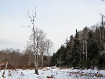
![]()
![]()
![]()
![]()
![]() On Tuesday, January 10th I wanted to get for a hike close to home before track practice in the afternoon. Since I had been visited Trout Pond and Frick Pond a number of times recently, I decided to go to Long Pond and do the big loop in a counterclockwise direction. The recent weather had included high temperatures in the teens and I had avoided hiking with Sheila because of the cold. When I awoke in the morning, the temperature was 9 degrees so I decided to wait until it was a little "warmer" to leave for the hike. By 10:00 AM the temperature had risen to 18 degrees so I decided it was time to head out. I decided to dress warmly with a Patagonia wool top and tights underneath my Columbia Omniheat pants. As always, I wore my Mammut hoody which gives me more options for layering. Since there was very little snow, I decided not to bring snowshoes but I did put my Microspikes in my pack. I got Sheila in the car with my gear and headed out DeBruce Road for about 8 miles to Flugertown Road where I made a left. I parked in the lot a short distance up the road on the right. The temperature was 18 degrees when I parked and the skies were overcast. There was more snow in the parking area than in town and there was ice beneath the snow. I set my GPS and decided not to put on my Microspikes until I needed them. I could see the trail up the hill was covered in packed snow from snowmobiles. I felt the snow would give me some traction. A slight breeze made things even cooler as we started our hike at 10:40 AM by walking over the bridge and up the hill. The first .6 miles gains about 350 feet to the highest point on the hike. It isn't very steep but does act as a nice warm-up! The trail was icy going up the hill but I was able to find traction on the packed snow. At 1.1 miles we were at the spur trail that leads down to the shore of Long Pond. I decided to turn right and go down to the pond to take some pictures. At the shores of the pond I dropped my pack and got out my camera to take some pictures. Sheila immediately ran out onto the ice so I took a few pictures of her. The skies were overcast but I still snapped a few pictures before going back to my pack. We returned to the main trail and turned right at the first trail junction. By 11:35 AM we had walked 1.8 miles and were passing the spur trail to the lean-to.
On Tuesday, January 10th I wanted to get for a hike close to home before track practice in the afternoon. Since I had been visited Trout Pond and Frick Pond a number of times recently, I decided to go to Long Pond and do the big loop in a counterclockwise direction. The recent weather had included high temperatures in the teens and I had avoided hiking with Sheila because of the cold. When I awoke in the morning, the temperature was 9 degrees so I decided to wait until it was a little "warmer" to leave for the hike. By 10:00 AM the temperature had risen to 18 degrees so I decided it was time to head out. I decided to dress warmly with a Patagonia wool top and tights underneath my Columbia Omniheat pants. As always, I wore my Mammut hoody which gives me more options for layering. Since there was very little snow, I decided not to bring snowshoes but I did put my Microspikes in my pack. I got Sheila in the car with my gear and headed out DeBruce Road for about 8 miles to Flugertown Road where I made a left. I parked in the lot a short distance up the road on the right. The temperature was 18 degrees when I parked and the skies were overcast. There was more snow in the parking area than in town and there was ice beneath the snow. I set my GPS and decided not to put on my Microspikes until I needed them. I could see the trail up the hill was covered in packed snow from snowmobiles. I felt the snow would give me some traction. A slight breeze made things even cooler as we started our hike at 10:40 AM by walking over the bridge and up the hill. The first .6 miles gains about 350 feet to the highest point on the hike. It isn't very steep but does act as a nice warm-up! The trail was icy going up the hill but I was able to find traction on the packed snow. At 1.1 miles we were at the spur trail that leads down to the shore of Long Pond. I decided to turn right and go down to the pond to take some pictures. At the shores of the pond I dropped my pack and got out my camera to take some pictures. Sheila immediately ran out onto the ice so I took a few pictures of her. The skies were overcast but I still snapped a few pictures before going back to my pack. We returned to the main trail and turned right at the first trail junction. By 11:35 AM we had walked 1.8 miles and were passing the spur trail to the lean-to.
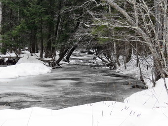 After passing the trail to the lean-to, we picked up the pace and continued on the main trail to the point where it intersected a woods road at 2.6 miles. We turned left and followed the road until the intersection with Basily Road at 2.85 miles. The roads were icy and seemed to have been traveled by snowmobiles and ATVS but I was able to keep walking on the snow and avoid using spikes. We continued on Basily Road by bearing to the left. As we approached the Peters Hunting Camp, I got ready to put Sheila on her leash. The area near the footbridge across the outlet to the beaver pond had freely flowing water and I stopped on the bridge to take some pictures. I took a few shots of the beaver pond and marsh. I also took a few close-ups of the water flowing beneath the ice. We continued on the main trail and crossed the bridge to continue the trip back to the car. Just after the bridge, I stopped to take a few pictures of the bridge and the stands of corn. Further along, I took a few shots of the valley which looked peaceful under a covering of snow. There were no tracks to the Peters Hunting Camp so no one had visited in some time. The roads continued to be icy as Basily Road changed to Flugertown Road. Along the way I stopped to take some pictures of the stream which was partly covered in ice. Eventually the road became paved and there was no ice or snow. We walked quickly down the road back to the parking area without meeting anyone. There was a blue pickup parked along the road but we did not see the owner. At 1:20 PM we were back at the car having hiked 6.0 miles in 2 hours and 35 minutes. The elevation gain was only about 550 feet most of which was at the beginning of the hike.
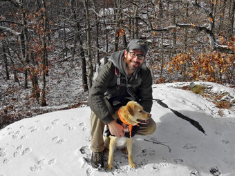
![]()
![]()
![]()
![]()
![]() On Friday, January 6th I was planning to hike with Kurt along the Palisades section of the Long Path. I wanted to hike a loop from the State Line Lookout to include the Giant Steps and Peanut Leap falls which I had missed the last time I hiked the Long Path in the area. After watching the weather forecast, I found that it was calling fro snow in New Jersey. The forecast was for only about an inch but I did not want to be part of a 20 car pileup on the Palisades Parkway due to the carelessness of other drivers. I weighed the options and decided that hiking Fishkill Ridge might be nice since it is close to Kurt's house in Poughkeepsie. I had never hiked to the ridge from Route 9 although I remembered seeing the trail the few times I had hiked around Fishkill Fudge. I called Kurt the night before and told him to meet me a Nicola's Restaurant about 3 miles south of I-84 and Route 9. I set my alarm for 6:30 AM as I knew the drive would take me about and hour and a half. I awoke at about 6:00 AM to the sound of a snowplow on the street! We had gotten an unexpected inch of snow and I wondered how much had fallen on the east side of the Hudson River. Kurt sent me a text indicating they got only a coating and we agreed there was no reason to postpone our hike. I got my gear together and watched Sheila as she danced around the house. I decided to take my spikes and gaiters but was pretty sure I wouldn't need them. The temperature was only 20 degrees when I left the house so I decided to upgrade my clothing by wearing a Patagonia wool top and tights underneath my Columbia Titanium Omniheat pants. I always wear my Mammut hoody which is made of Gortex Windstopper but has no insulation. This allows me to adjust my temperature by layering and opening or closing the zippers on the hoody. I also packed a heavier hat and mittens. We left Livingston Manor at 7:30 AM and headed south and east on the State Rt 17. The local roads still had a little snow but the main roads were completely clear all the way to Middletown. I took I-84 east across the Newburgh-Beacon Bridge toward Fishkill. I got off at exit 13 for Route 9 south. As I approached the meeting point, I was a little early so I turned right on Old Albany Post Road to see if I could find the trailhead. In about a quarter of a mile I found Reservoir Road on the right and three yellow markers indicating the beginning of the yellow Wilkinson Memorial Trail. There did not appear to be a good place to park. There were several signs placed by residents indicating parking along the side of the road was discouraged. I knew there was a public right-of-way but didn't really want to upset anyone by parking where I was not wanted. I drove out to Route 9 and pulled into the parking lot for Nicola's Restaurant. Kurt arrived a little after 9:00 AM and I suggested we park at the restaurant. I have done this before in various places and no one seems to mind as long as the car is out of the way. We got our gear ready and allowed Sheila time to grant Kurt. I out Sheila on her leash and we carefully crossed Route 9 at 9:10 AM. We walked north on Route 9 and then turned left on Old Albany Post Road. After just less than half a mile, we turned right on Reservoir Road to start hiking on the actual trail. After a short distance, we came to a gate blocking the road. To the right was a DEC facility but it's purpose was not clear. We passed through the gate and started into the forest starting our climb toward the ridge heading west. There was a dusting of snow on the ground but it didn't effect our hiking.
On Friday, January 6th I was planning to hike with Kurt along the Palisades section of the Long Path. I wanted to hike a loop from the State Line Lookout to include the Giant Steps and Peanut Leap falls which I had missed the last time I hiked the Long Path in the area. After watching the weather forecast, I found that it was calling fro snow in New Jersey. The forecast was for only about an inch but I did not want to be part of a 20 car pileup on the Palisades Parkway due to the carelessness of other drivers. I weighed the options and decided that hiking Fishkill Ridge might be nice since it is close to Kurt's house in Poughkeepsie. I had never hiked to the ridge from Route 9 although I remembered seeing the trail the few times I had hiked around Fishkill Fudge. I called Kurt the night before and told him to meet me a Nicola's Restaurant about 3 miles south of I-84 and Route 9. I set my alarm for 6:30 AM as I knew the drive would take me about and hour and a half. I awoke at about 6:00 AM to the sound of a snowplow on the street! We had gotten an unexpected inch of snow and I wondered how much had fallen on the east side of the Hudson River. Kurt sent me a text indicating they got only a coating and we agreed there was no reason to postpone our hike. I got my gear together and watched Sheila as she danced around the house. I decided to take my spikes and gaiters but was pretty sure I wouldn't need them. The temperature was only 20 degrees when I left the house so I decided to upgrade my clothing by wearing a Patagonia wool top and tights underneath my Columbia Titanium Omniheat pants. I always wear my Mammut hoody which is made of Gortex Windstopper but has no insulation. This allows me to adjust my temperature by layering and opening or closing the zippers on the hoody. I also packed a heavier hat and mittens. We left Livingston Manor at 7:30 AM and headed south and east on the State Rt 17. The local roads still had a little snow but the main roads were completely clear all the way to Middletown. I took I-84 east across the Newburgh-Beacon Bridge toward Fishkill. I got off at exit 13 for Route 9 south. As I approached the meeting point, I was a little early so I turned right on Old Albany Post Road to see if I could find the trailhead. In about a quarter of a mile I found Reservoir Road on the right and three yellow markers indicating the beginning of the yellow Wilkinson Memorial Trail. There did not appear to be a good place to park. There were several signs placed by residents indicating parking along the side of the road was discouraged. I knew there was a public right-of-way but didn't really want to upset anyone by parking where I was not wanted. I drove out to Route 9 and pulled into the parking lot for Nicola's Restaurant. Kurt arrived a little after 9:00 AM and I suggested we park at the restaurant. I have done this before in various places and no one seems to mind as long as the car is out of the way. We got our gear ready and allowed Sheila time to grant Kurt. I out Sheila on her leash and we carefully crossed Route 9 at 9:10 AM. We walked north on Route 9 and then turned left on Old Albany Post Road. After just less than half a mile, we turned right on Reservoir Road to start hiking on the actual trail. After a short distance, we came to a gate blocking the road. To the right was a DEC facility but it's purpose was not clear. We passed through the gate and started into the forest starting our climb toward the ridge heading west. There was a dusting of snow on the ground but it didn't effect our hiking.
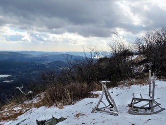 Kurt almost immediately noticed that the trees were huge both in height and in girth. Some were so large that they appeared to be first growth. At .9 miles we came to a small reservoir or lake. Part of the lake was frozen over with ice thick enough to support a medium sized dog! Sheila fearlessly walked out onto the ice perhaps attracted by the ducks in the open water beyond. I took some pictures and then we walked around to the north shore where I took a few more shots. After this, I put away the camera and we continued to hike. The trees actually seemed to be bigger as we passed around the north side of the lake continuing west and up. From the lake to 1.45 miles the trail was almost flat Rolling a little but after that it began to climb. At 1.6 miles we began to walk through some switchbacks which made the climb a little easier. The grade still averaged 19% until we hit Fishkill Ridge at 2 miles. At this point the Wilkinson memorial Trail turned left but we headed right on the white Fishkill Ridge Trail.We began walking on the trail following it northeast as it actually descended some until we crossed a stream at 2.8 miles. Along the way we noticed some fantastic stone walls and I stopped to take a few pictures. I was looking for a spur trail to a viewpoint or for some views along the main trail but could not find them. At 2.8 miles we began to climb a little more than I remember still heading northeast and still without any views suitable for photography. We continued to see stone walls and other evidence the area was settled at some time. At 3.0 miles the trail began a sweeping turn to the north and at 3.3 miles it made a sharp turn so that we were heading southwest but still gaining elevation. There were some areas on the trail which had quite a bit of ice and some ice covered rocks that made the climb tricky. As we climbed, we could see we were approaching what looked like it would be an open vista. Soon we were at the top of Bald Hill, the highest point on the hike at 1490 feet, with an almost 360 degree view. Although this elevation pales in comparison to the Catskills it is over 1200 feet above the valley. The skies were interesting as there was some blue sky in one direction and dark skies in another direction. There were even a few snow flakes in the air. I had considered dropping a layer of clothing along the way but was glad that I had not as we stood exposed to the wind on the top of the hill. The views were fantastic and I got out my camera to take pictures. Perhaps the most surprising sight was a small table and rustic rocking chair on the top of the hill. I took several pictures of them with the dark sky in the background. In the valley to the east of the ridge there is a massive sand and gravel operation with terraces cut into the hill. I took done shots in that direction and them tried to get a few of the Hudson river to the south and west. We walked a little farther and got some different angles of the same views. I took a few pictures of Sheila with Kurt and then we packed up and started back on the trail. From the top of the hill the rest of the hike was mostly downhill with a few small climbs along the way. There were no more significant viewpoints which let us concentrate on our hiking.
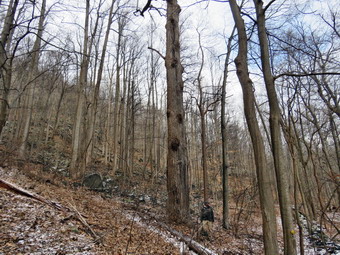 At 4.6 miles we came to an open rock that at one point may have had a view. It was not clear to any of us exactly where the trail went from here. We wandered off in different direction and Kurt found Dozer Junction a little over 200 feet to the west. I found the actual trail to the south and followed it as Kurt caught up. The trail looped clockwise around the rock and ended up in a short but tricky descent to Dozer Junction. The junction is named for a bulldozer that sits at the junction. I took a few shots including one of Kurt in the driver's seat! I have been unable, despite several research attempts, to find out why the bulldozer was abandoned there. We turned left onto the blue trail and headed downhill over some very slippery spots following the blue trail to the yellow Wilkinson Memorial Trail. As we hiked we found more stone walls, several foundations, extensive woods roads and some farm equipment including disk and spring-tooth harrows. When we reached the yellow trail, we turned left to follow the trail back to the car. As we approached the junction with the white Fishkill Ridge Trail, we were walking along a relatively narrow portion of the trail with a high rock wall on the left and a dropoff on the right. The trail took us up and over some rocks which were wet with snow that had melted. This part of the trail had a southeasterly exposure and almost all the snow from earlier in the morning was gone. I took a few shots and then we continued along the trail where, at 5.4 miles, we eventually came to the junction we had been at on the way up from the valley. I had though the descent on the trail might be slippery from the accumulated snow but most of it was gone. Wherever a tree was located on the right side, there was a stripe on snow across the trail since the temperature was still below freezing and only the direct sunlight had caused the snow to sublimate. The descent went quickly but Kurt and I kept noticing the huge trees. There were several across the trail that were at least four feet in diameter with seemingly enough rings to indicate an age of over 100 years. We stopped to observe one monster and Kurt went over to stand by it to give some indication of scale. I snapped a few shots and then we started back toward the reservoir. As we passed through the gate and onto Reservoir Lane, we noticed a large "kettle" by the side of the road. It was iron and perhaps four feet in diameter. Its use was a mystery since there were no ruins around to put it in perspective. We walked back out to Route 9 and from there back to our cars. We were back at 2:30 Pm having spent 5 hours and 20 minutes hiking 7.2 miles with an elevation gain of 1850 feet. We spent almost an hour stopped so I was not too disappointed with the seemingly slow pace. We were both hungry and decided that we would stop at the Maya Caf� which is at the junction of Route 9 and I-84!
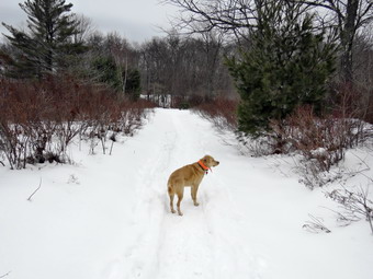
![]()
![]()
![]()
![]()
![]() On Monday, January 2nd I was ready to go out for the first hike of 2017. Even though the weekend had been a little tiring, I wanted to get in a longer hike. I checked the weather forecast and found we were supposed to get freezing rain by non so I decided to modify my plans and just head to Frick Pond one more time! When I awoke in the morning the temperature was just above 20 degrees so I was not too eager to get a very early start. I did a few things around the house and then decided to get going before the rain arrived. Because the temperature was only a little over 20 degrees, I decided to wear my Mammut hoody and warmer Columbia Titanium pants with a long-sleeved Patagonia Capilene baselayer. The hoody has lots of zippers to help regulate temperature and I knew I could always take it off. Sheila was happy to be going anywhere and crouched in the back seat with her head on the console. Just after 9:30 AM I headed out the DeBruce Road and it wasn't long before rain started to fall on the windshield and freeze! I almost turned back but kept going as the weather citations often change rapidly and are many times different at Frick Pond than in town. I also thought I could still get a short hike in even if it was raining. By the time we had arrived at the parking area, the rain had stopped but the temperature was only 25 degrees. The lot had been plowed once but new snow had accumulated. There were no other cars in the lot but there were a lot of snowshoe tracks! I put on my Tubbs Alp Flex VRT snowshoes which have become my new favorites. These snowshoes have the "Boa" system which is supposed to allow tightening the front part of the binding with just a twist a knob. I found ether was a left and a right and put the snowshoes on. I found there was a "stopper" up front which limited how far forward the boot can go which I like. The strap around the back seemed to tighten very smoothly and the Boa system did allow me to tighten the binding very easily. We headed out to the Quick Lake Trail passing the trail register and heading toward Frick Pond. At Gravestone Junction we turned right to get on the yellow Logger's Loop heading toward Times Square. We made good time on the trail as it headed slightly downhill. I was surprised that there were a few muddy spots on the trail as everything else was covered in snow. A good snowshoe track had been laid down by multiple people traveling the same route. It is important when snowshoeing to keep the same track as others and to improve and widen it as you go. At Times Square we continued straight ahead to stay on the Logger's Loop and began to climb an uphill. The trail was well packed by snowmobiles and almost immediately we could hear some machines coming from the direction of Mongaup Pond. Sheila ran right over to me and we both walked off the trail. As the machines approached and saw us, they slowed down to a crawl. We waved as they passed us and accelerated. Some elope complain about the smell of the exhaust but it has never really bothered me. I realized that to me it smells like the exhaust from chainsaws which brings back a lot of good memories from when I was logging with my father 50 years ago. We continued our hike as the trail continued to rise and then flattened a little. It was a pleasure to walk on the packed trail and we ewer soon at Iron Wheel Junction. I stopped to take a few pictures of the contrast between the packed snowmobile trail and the fresh and untouched snow on the Quick lake trail. As I was getting ready to continue, we could hear another snowmobile approaching from the direction of Quick Lake. I assumed it was the machines returning but when it appeared it was a different machine. We waved and then headed back on the Quick Lake Trail.
On Monday, January 2nd I was ready to go out for the first hike of 2017. Even though the weekend had been a little tiring, I wanted to get in a longer hike. I checked the weather forecast and found we were supposed to get freezing rain by non so I decided to modify my plans and just head to Frick Pond one more time! When I awoke in the morning the temperature was just above 20 degrees so I was not too eager to get a very early start. I did a few things around the house and then decided to get going before the rain arrived. Because the temperature was only a little over 20 degrees, I decided to wear my Mammut hoody and warmer Columbia Titanium pants with a long-sleeved Patagonia Capilene baselayer. The hoody has lots of zippers to help regulate temperature and I knew I could always take it off. Sheila was happy to be going anywhere and crouched in the back seat with her head on the console. Just after 9:30 AM I headed out the DeBruce Road and it wasn't long before rain started to fall on the windshield and freeze! I almost turned back but kept going as the weather citations often change rapidly and are many times different at Frick Pond than in town. I also thought I could still get a short hike in even if it was raining. By the time we had arrived at the parking area, the rain had stopped but the temperature was only 25 degrees. The lot had been plowed once but new snow had accumulated. There were no other cars in the lot but there were a lot of snowshoe tracks! I put on my Tubbs Alp Flex VRT snowshoes which have become my new favorites. These snowshoes have the "Boa" system which is supposed to allow tightening the front part of the binding with just a twist a knob. I found ether was a left and a right and put the snowshoes on. I found there was a "stopper" up front which limited how far forward the boot can go which I like. The strap around the back seemed to tighten very smoothly and the Boa system did allow me to tighten the binding very easily. We headed out to the Quick Lake Trail passing the trail register and heading toward Frick Pond. At Gravestone Junction we turned right to get on the yellow Logger's Loop heading toward Times Square. We made good time on the trail as it headed slightly downhill. I was surprised that there were a few muddy spots on the trail as everything else was covered in snow. A good snowshoe track had been laid down by multiple people traveling the same route. It is important when snowshoeing to keep the same track as others and to improve and widen it as you go. At Times Square we continued straight ahead to stay on the Logger's Loop and began to climb an uphill. The trail was well packed by snowmobiles and almost immediately we could hear some machines coming from the direction of Mongaup Pond. Sheila ran right over to me and we both walked off the trail. As the machines approached and saw us, they slowed down to a crawl. We waved as they passed us and accelerated. Some elope complain about the smell of the exhaust but it has never really bothered me. I realized that to me it smells like the exhaust from chainsaws which brings back a lot of good memories from when I was logging with my father 50 years ago. We continued our hike as the trail continued to rise and then flattened a little. It was a pleasure to walk on the packed trail and we ewer soon at Iron Wheel Junction. I stopped to take a few pictures of the contrast between the packed snowmobile trail and the fresh and untouched snow on the Quick lake trail. As I was getting ready to continue, we could hear another snowmobile approaching from the direction of Quick Lake. I assumed it was the machines returning but when it appeared it was a different machine. We waved and then headed back on the Quick Lake Trail.
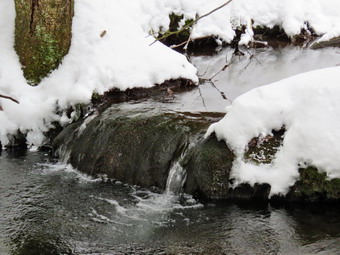 As we started out on the Quick Lake Trail, I was breaking trail through about 6 inches of new snow. The consistency of the snow and the air temperature combined to give the snow and almost "silky" feel. None of the snow stuck to my snowshoes and it was easy to glide along with ease. The trail is slightly downhill and we made good time heading toward Frick Pond. I stopped at the small stream in the woods and took a few shots of the stream and some small waterfalls upstream. There was quite a bit of water in the stream but Sheila cleared it in one leap and I managed to get across without falling in. We walked through the "spruce tunnel" and out the other side. On the way to the pond we encountered several areas where there was water under the snow of no snow and just open, wet areas. When we came to the junction with the Big Rock Trail around the back of the pond I decided to continue to the bridge at the outlet of Frick Pond. My plan was to make another loop around the pond using the Loggers Loop and Big Rock Trail. Despite the fact that I have taken hundreds of pictures ROM the bridge, I stopped to take a few more. I packed up and we continued up the hill and back to Gravestone Junction. We turned left and started another loop by hiking out on the Logger's Loop to Times Square. It was about 11:45 AM but there was no sign of any rain which made me very happy. At Times Square we turned left onto the Big Rock Trail to loop around Frick Pond. This was the route most of the snowshoers had taken as it was well broken in. The walk around the back of the pond was pleasant but I decided not to take any pictures as the scenes were not much different from my previous trip. At the trail junction with the Quick lake Trail we turned left, passed across the bridge and up the hill to Gravestone Junction. This time we continued out the Quick Lake trail and back to the car. We arrived at the car at 12:25 PM having hike 4.8 miles in 2 hours and 25 minutes with an elevation gain of 480 feet. Our moving average of 2.2 mph was better than I had expected.
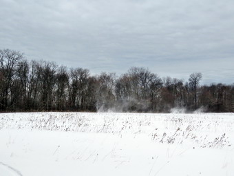
![]()
![]()
![]()
![]()
![]() On Saturday, December 31st I had decided to hike at Bread Spring Wildlife Management Area since we had aborted an attempted several days before. I hoped that there would be more snow there than in Sullivan County and that snowshoes would be appropriate. The forecast was for temperatures reaching almost up to freezing but with a stiff breeze. There SW also a mention of snow in the afternoon. After straightening some things around the house, I asked Cindy if she would like to go. She declined and I got ready to go by replenishing my pack and getting my other gear ready. I wondered whether or not I should wear something a little warmer than my usual outfit but decided that once I got moving I would be OK. I got my gear in the car, let Sheila jump in the backseat and set out from Livingston Manor at about 11:30 AM. The temperature was in the high 20's as I drove north on Route 17 to Roscoe where I took Route 206 through Downsville toward Walton and almost to the top of Bear Spring Mountain. I turned left on East Trout Brook Road and drove passed Launt Pond to the pulloff near Middle Pond. The parking area had not been plowed but there was only a few inches of light snow. I pulled over and parked without a problem. I got my snowshoes on and set my electronics before releasing a crazed Sheila from the backseat. We set out down the trail to the pond at about 11:55 AM. The first thing I noticed was that there was far LESS snow than in my backyard! We crossed the bridge at the outlet of the pond and came to a trail junction. The trails showed that some snowmobiles had been active as the snow was well-packed. I started up the trail toward McCoy Hill but the wind was blowing hard and making me pretty cold. I knew there was a trail to the left that paralleled the brook and the road and would cut down on the wind. I came to a path to the left and took it even though it was not marked in nay way. It was an immediate relief to get out of the wind. At .4 miles the trail broke out into a field and I could not see where it went. We continued across the field and followed the tree line as I looked for the path. I didn't see a clear trail so I turned around and walked back toward the brook. I found a little path and started to follow it. The path eventually became a game path. I began to bushwhack along the brook. At times the way was pretty open and at others I was pushing through some dense brush. There were several places where we crossed wet areas and small tributaries of the main brook. I decided that as lone as I stayed between the brook and the rising land on my right I had to find the snowmobile trail eventually. Most of the time I could see East Trout Brook Road and an occasional car. At about 1.3 miles I caught a glimpse of the trucks in the parking area and made one final stream crossing to get to the lot. There were three trucks with snowmobile trailers and one machine sitting in the lot. We headed across the parking area to the gate which was open and started up the snowmobile trail. The first part of the trail was very steep averaging a 20% grade but only for about .15 miles. There still wasn't much snow but the snowshoes offered good traction. I flipped the heel supports up and won as needed since this is very easy on these snowshoes. At one point we heard the snowmobile start up and a moment later it came up the trail. We got over to the side and the driver slowed almost to a stop as he passed us.
On Saturday, December 31st I had decided to hike at Bread Spring Wildlife Management Area since we had aborted an attempted several days before. I hoped that there would be more snow there than in Sullivan County and that snowshoes would be appropriate. The forecast was for temperatures reaching almost up to freezing but with a stiff breeze. There SW also a mention of snow in the afternoon. After straightening some things around the house, I asked Cindy if she would like to go. She declined and I got ready to go by replenishing my pack and getting my other gear ready. I wondered whether or not I should wear something a little warmer than my usual outfit but decided that once I got moving I would be OK. I got my gear in the car, let Sheila jump in the backseat and set out from Livingston Manor at about 11:30 AM. The temperature was in the high 20's as I drove north on Route 17 to Roscoe where I took Route 206 through Downsville toward Walton and almost to the top of Bear Spring Mountain. I turned left on East Trout Brook Road and drove passed Launt Pond to the pulloff near Middle Pond. The parking area had not been plowed but there was only a few inches of light snow. I pulled over and parked without a problem. I got my snowshoes on and set my electronics before releasing a crazed Sheila from the backseat. We set out down the trail to the pond at about 11:55 AM. The first thing I noticed was that there was far LESS snow than in my backyard! We crossed the bridge at the outlet of the pond and came to a trail junction. The trails showed that some snowmobiles had been active as the snow was well-packed. I started up the trail toward McCoy Hill but the wind was blowing hard and making me pretty cold. I knew there was a trail to the left that paralleled the brook and the road and would cut down on the wind. I came to a path to the left and took it even though it was not marked in nay way. It was an immediate relief to get out of the wind. At .4 miles the trail broke out into a field and I could not see where it went. We continued across the field and followed the tree line as I looked for the path. I didn't see a clear trail so I turned around and walked back toward the brook. I found a little path and started to follow it. The path eventually became a game path. I began to bushwhack along the brook. At times the way was pretty open and at others I was pushing through some dense brush. There were several places where we crossed wet areas and small tributaries of the main brook. I decided that as lone as I stayed between the brook and the rising land on my right I had to find the snowmobile trail eventually. Most of the time I could see East Trout Brook Road and an occasional car. At about 1.3 miles I caught a glimpse of the trucks in the parking area and made one final stream crossing to get to the lot. There were three trucks with snowmobile trailers and one machine sitting in the lot. We headed across the parking area to the gate which was open and started up the snowmobile trail. The first part of the trail was very steep averaging a 20% grade but only for about .15 miles. There still wasn't much snow but the snowshoes offered good traction. I flipped the heel supports up and won as needed since this is very easy on these snowshoes. At one point we heard the snowmobile start up and a moment later it came up the trail. We got over to the side and the driver slowed almost to a stop as he passed us.
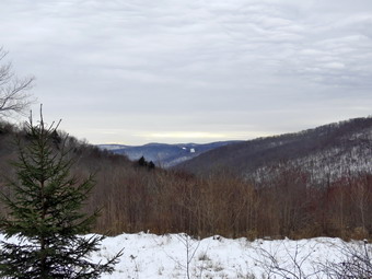 At 1.5 miles the trail turned southeast but continued to climb for the next .5 miles at about a 10% grade. I started to notice a tightness in my right leg and didn't know whether it was just normal tiredness or the beginning of a cramp. I stopped and got out a bar and drank about a 1/3 of a liter of water. At 2 miles the trail stopped climbing and actually descended slightly before flattening out and following the contour of the hill for .4 miles. This made my legs feel better but I was pretty sure we still would have to climb to the top of the ridge to make the loop back to Middle Pond. At 2.4 miles the trail began to climb again and short after turned sharply to the left heading north. This only lasted for about .3 miles when we came to the "main" trail on the ridge. I was familiar with our location and we turned right to follow the trail toward the McCoy Hill Cutoff. The trail was mostly flat which my legs appreciated very much. At 2.95 miles we were at the turnoff for the McCoy Hill Cutoff. I dropped my pack and got out the camera to take a few shots of the trail and of Sheila pulling on a buried stick. The signs indicated that Middle Pond was 1.3 miles away by the Cutoff of 2.4 miles on the main trail. I was feeling pretty good at this point except I was a little cold. This was the first hike of the year when I had experienced feeling cold. I decided that we would take the Cutoff as it was flat and then all downhill. We made the turn into the field and headed toward the woods on the other side. I noticed the unusual sky and decided to take a picture. As I snapped a few shots, several "snow devils" kicked up in the field. I took a few pictures hoping that I could capture the effect. I picked up my pack and we headed down the hill toward Middle Pond. The next 1.25 miles was all downhill at a comfortable 10% grade. When we broke out into an open area, I took a few pictures down the valley. As we walked down the trail there was a large blowdown across the trail but Sheila led me around it. At 3.8 miles the main trail came in from the left and I had a moment of regret that we had not traveled the extra mile or so. As we continued down the hill, I stopped to take a few shots of a small pond. A little further along on the trail we came to another trail on the right. Idealized that this was the trail I had meant to take at the beginning of the hike! I did not regret what I did since the bushwhack adventure was nice. Once we were on the bridge at Middle Pond I took a few pictures of the pond, the beaver dam and the brook below the dam. From the bridge we walked up to the car in the parking area. It was 2:25 PM and we had covered 4.4 miles and 940 feet of ascent in 2.5 hours. Our moving average was 2 mph which was good considering the bushwhack and the climb to the ridge.
![]()
![]()
![]()
![]() On Friday, December 30th Bryce was over for the morning and the early part of the afternoon. Now that he is in school I miss having him at the house and decided we should go snowshoeing on Round Top. The last time we had gone out was more than a year ago sine there was no snow last winter. At that time Bryce was only mildly enthusiastic and I wondered if that had changed now that he is almost 6 years old. When I mentioned snowshoeing, he seemed very interested and we decided to head out a little after 11:00 AM. Sheila was ready to go with us so I got my gear on while Bryce dressed. Cindy helped him put on his snowshoes and got his poles ready. I walked outside and put mine on and we were ready to go. I had decided to, leave the pack at home just to make things simpler. We walked out the driveway with Sheila on her leash and carefully crossed Rock Avenue. The tracks that Cindy and I had laid down the day before were almost completely filled. Bryce seemed to be making good time as we walked around the back of the church and started up the hill. The hill I short but steep and I worried Bryce would complain about the climb. He seemed to have no problem handling the ascent and we made it quickly to the top. We turned left into the woods at the trailhead and walked along the woods road. Suddenly Bryce spoke up saying "Grampy, I lost a snowshoe!" I expected the snowshoe to be just behind him but a quick look along the trail proved fruitless. We walked back out to the cemetery hill and I looked down the hill but could not see the snowshoe. I told Bryce to stay put and I rapidly descended the hill finally finding the snowshoe in the field almost to the street. I grabbed the snowshoe and turned around to start back to Bryce. I could not believe he had not noticed this problem earlier! I walked back up the hill and put the snowshoe on making sure both had snug and secure bindings. We headed back into the woods and continued straight ahead at the first trail junction to head up to the lookout. Again, Bryce did not seem to have a problem negotiating the uphill even though it is rather steep and difficult on snowshoes. At the upper ledges we walked close to the edge so we could get a good look at Livingston Manor from above. Bryce immediately pointed out the school, Peck's Market and the post office. After a few minutes, we turned around and walked back to the trail to continue our clockwise loop. As we walked up the trail, Bryce asked "When will we get to the tower?" I asked him what we meant and found that when I had said "lookout" he had thought of a tower which is sometimes the case. I explained we didn't have a tower...yet. We continued on the trail which continues to gain elevation. Bryce periodically informed me that he still had on both snowshoes and pointed out the yellow paint blazes. We reached the spot where the trail turns right and I asked Bryce if he wanted to hike up the steep trail to the summit. Bryce politely declined the offer and we continued on the main lower trail. We followed the trail as it made a sharp right and started to descend to the first trail junction. Once we started downhill Bryce was pressing me from behind. At the trail junction we turned left and headed back out to the cemetery. As we started to descend the cemetery hill, I let Bryce go first. He moved very quickly down the hill and I found it hard to keep up. He is much more coordinated and has much more endurance than two winters ago. We walked around the back of the church and through the field to cross the street. Out tracks from earlier were almost filled in by the blowing snow. Back at the house I looked at my watch and found we had been out over and hour!
On Friday, December 30th Bryce was over for the morning and the early part of the afternoon. Now that he is in school I miss having him at the house and decided we should go snowshoeing on Round Top. The last time we had gone out was more than a year ago sine there was no snow last winter. At that time Bryce was only mildly enthusiastic and I wondered if that had changed now that he is almost 6 years old. When I mentioned snowshoeing, he seemed very interested and we decided to head out a little after 11:00 AM. Sheila was ready to go with us so I got my gear on while Bryce dressed. Cindy helped him put on his snowshoes and got his poles ready. I walked outside and put mine on and we were ready to go. I had decided to, leave the pack at home just to make things simpler. We walked out the driveway with Sheila on her leash and carefully crossed Rock Avenue. The tracks that Cindy and I had laid down the day before were almost completely filled. Bryce seemed to be making good time as we walked around the back of the church and started up the hill. The hill I short but steep and I worried Bryce would complain about the climb. He seemed to have no problem handling the ascent and we made it quickly to the top. We turned left into the woods at the trailhead and walked along the woods road. Suddenly Bryce spoke up saying "Grampy, I lost a snowshoe!" I expected the snowshoe to be just behind him but a quick look along the trail proved fruitless. We walked back out to the cemetery hill and I looked down the hill but could not see the snowshoe. I told Bryce to stay put and I rapidly descended the hill finally finding the snowshoe in the field almost to the street. I grabbed the snowshoe and turned around to start back to Bryce. I could not believe he had not noticed this problem earlier! I walked back up the hill and put the snowshoe on making sure both had snug and secure bindings. We headed back into the woods and continued straight ahead at the first trail junction to head up to the lookout. Again, Bryce did not seem to have a problem negotiating the uphill even though it is rather steep and difficult on snowshoes. At the upper ledges we walked close to the edge so we could get a good look at Livingston Manor from above. Bryce immediately pointed out the school, Peck's Market and the post office. After a few minutes, we turned around and walked back to the trail to continue our clockwise loop. As we walked up the trail, Bryce asked "When will we get to the tower?" I asked him what we meant and found that when I had said "lookout" he had thought of a tower which is sometimes the case. I explained we didn't have a tower...yet. We continued on the trail which continues to gain elevation. Bryce periodically informed me that he still had on both snowshoes and pointed out the yellow paint blazes. We reached the spot where the trail turns right and I asked Bryce if he wanted to hike up the steep trail to the summit. Bryce politely declined the offer and we continued on the main lower trail. We followed the trail as it made a sharp right and started to descend to the first trail junction. Once we started downhill Bryce was pressing me from behind. At the trail junction we turned left and headed back out to the cemetery. As we started to descend the cemetery hill, I let Bryce go first. He moved very quickly down the hill and I found it hard to keep up. He is much more coordinated and has much more endurance than two winters ago. We walked around the back of the church and through the field to cross the street. Out tracks from earlier were almost filled in by the blowing snow. Back at the house I looked at my watch and found we had been out over and hour!
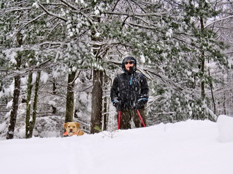
![]()
![]()
![]()
![]()
![]() On Thursday, December 29th I awoke to find several inches of snow on the ground and more falling as predicted. I went downtown early and found the streets and roads were in very poor shape. I wanted to go snowshoeing but decided to wait to see what the storm would do. As the day progressed the temperature began to rise. Cindy and I decided to go out before the snow stopped and turned to ice or rain. We decided the best choice was to simply go across the street and snowshoe on Round Top as we could walk directly from our house and avoid driving. I wanted to take some pictures and the most convenient way is just to carry my pack. I again decided to use the Tubbs Alp Flex VRT snowshoes which I had not had the chance to use last year due to the lack of snow. These snowshoes have the "Boa" system which is supposed to allow tightening the front part of the binding with just a twist a knob. I found ether was a left and a right and put the snowshoes on. I found there was a "stopper" up front which limited how far forward the boot can go which I like. The strap around the back seemed to tighten very smoothly and the Boa system did allow me to tighten the binding very easily. I knew these snowshoes were overkill for the easy trail on Round Top but I wanted to try them again. Cindy also decided to try out her new snowshoes which I got her for Christmas. Hers are the women's version of the same Tubbs Alp Flex VRT that is have! Sheila was ready to go as soon as we started betting my gear out but tried to be the well-behaved dog. It didn't take long to get ready and I put Sheila on her leash for the walk across the street. The snow was still falling at a pretty rapid rate as we crossed the street and walked across the field to the base of the cemetery hill. I stopped to take a shot up the hill and then we beacon the ascent of the steepest hill. The hill is short but really gets the circulation pumping! When we got to the top of the hill, I dropped my pack to take some pictures. The town was almost completely hidden by the falling snow but I took a few shots anyway. I picked up my pack and we entered the woods. I noticed there was significantly more snow than I the last time I had been on the trail. There was enough snow to prevent any damage to the snowshoes and the extra grip made walking easier. The new snow depth varied in most places from 3 to 5 inches. At the trail junction we decided to go straight ahead up the steeper section to the lookout. An the way up I tried flipping up the heel elevators on the snowshoes and they went up and down very easily. When we neared the top, I turned left to walk out to the lower lookout. I didn't want to encourage others to take this route but I did want the pictures. Crossing the little open gulf in the path seemed easier with the grip of snowshoes. I again got out the camera and took pictures of the town from another angle. Again, much of the view was obscured by the falling snow. This viewpoint offers a great view of the school and the buildings downtown. I also took a few shots of Cindy and Sheila on the higher ledge. After taking some shots, I put away the camera and walked up to the higher ledge.
On Thursday, December 29th I awoke to find several inches of snow on the ground and more falling as predicted. I went downtown early and found the streets and roads were in very poor shape. I wanted to go snowshoeing but decided to wait to see what the storm would do. As the day progressed the temperature began to rise. Cindy and I decided to go out before the snow stopped and turned to ice or rain. We decided the best choice was to simply go across the street and snowshoe on Round Top as we could walk directly from our house and avoid driving. I wanted to take some pictures and the most convenient way is just to carry my pack. I again decided to use the Tubbs Alp Flex VRT snowshoes which I had not had the chance to use last year due to the lack of snow. These snowshoes have the "Boa" system which is supposed to allow tightening the front part of the binding with just a twist a knob. I found ether was a left and a right and put the snowshoes on. I found there was a "stopper" up front which limited how far forward the boot can go which I like. The strap around the back seemed to tighten very smoothly and the Boa system did allow me to tighten the binding very easily. I knew these snowshoes were overkill for the easy trail on Round Top but I wanted to try them again. Cindy also decided to try out her new snowshoes which I got her for Christmas. Hers are the women's version of the same Tubbs Alp Flex VRT that is have! Sheila was ready to go as soon as we started betting my gear out but tried to be the well-behaved dog. It didn't take long to get ready and I put Sheila on her leash for the walk across the street. The snow was still falling at a pretty rapid rate as we crossed the street and walked across the field to the base of the cemetery hill. I stopped to take a shot up the hill and then we beacon the ascent of the steepest hill. The hill is short but really gets the circulation pumping! When we got to the top of the hill, I dropped my pack to take some pictures. The town was almost completely hidden by the falling snow but I took a few shots anyway. I picked up my pack and we entered the woods. I noticed there was significantly more snow than I the last time I had been on the trail. There was enough snow to prevent any damage to the snowshoes and the extra grip made walking easier. The new snow depth varied in most places from 3 to 5 inches. At the trail junction we decided to go straight ahead up the steeper section to the lookout. An the way up I tried flipping up the heel elevators on the snowshoes and they went up and down very easily. When we neared the top, I turned left to walk out to the lower lookout. I didn't want to encourage others to take this route but I did want the pictures. Crossing the little open gulf in the path seemed easier with the grip of snowshoes. I again got out the camera and took pictures of the town from another angle. Again, much of the view was obscured by the falling snow. This viewpoint offers a great view of the school and the buildings downtown. I also took a few shots of Cindy and Sheila on the higher ledge. After taking some shots, I put away the camera and walked up to the higher ledge.
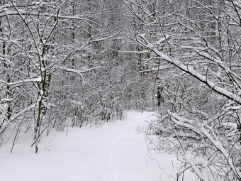 From the viewpoint we continued on the trail in a clockwise direction checking to make sure the yellow blazes were visible and spaced the correct distance apart. When we got to the green ribbons marking the proposed upper trail, I wanted to follow them to the summit of Round Top but Cindy declined the offer so we continued on the main lower trail. I stopped a few more times to take some pictures since the trees with the snow on them were so beautiful. We followed the trail as it made a sharp right turn and headed back to the first trail junction to close the loop. Being the first people to walk on the trail through the freshly fallen snow was somehow special. The downhill walk passed the ledges went quickly and we were soon at the trail junction. Cindy turned left to go back out to the trailhead and then home. I took Sheila and turned around to follow the trail back up passed the ledges to start the trail in reverse or counterclockwise. When we reached the sharp left turn that makes a loop of the trail, we continued straight ahead following the green ribbons that I had used to mark the proposed trail to the summit. The ribbons were harder to follow than I thought they would be as many were covered in snow. Some of the branches along the route were heavy with snow and hung down in the path. When we reached the top I followed the ribbons but lost them on the descent. I kept searching for them and found them a little to my left where I picked them up and followed them back to the lower trail. We turned right and followed the trail back out to the lookout where the view wasn't much different than before. I decided I wanted to stay out a little longer and turned left into the woods roughly following the edge of the ledges. I didn't get too near the edge of the cliffs and eventually wound up on the lower trail. We turned left and headed north a short distance before turning right or east and back up the trail to the summit of Round Top. This time I carefully followed the green ribbons and found I had only gone wrong by a few feet on the previous descent. At the top of the hill we continued to follow the ribbons as they led us southwest off the summit and back to the lower trail. We followed the lower trail downhill to the first trail junction. At this point we had been out for about and hour and a half which seemed like enough time. W earned left and followed the trail back out to the trail head. I took a few more pictures of town since the snow had abated. After taking a few shots, I shouldered my pack and headed back down the hill to the back of the church and then home. We had been out for about 1.5 hours and had hiked around 3 miles.
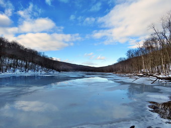
![]()
![]()
![]()
![]()
![]() On Tuesday, December 27th I knew that I had to get in a hike after a long weekend of celebration and the ice storm on Monday. Cindy wanted to go too but we had some work to do around the house. Just before noon we decided it was time to get going and headed north and west on Route 17 toward Roscoe. Sheila could hardly contain herself in the back seat as she really loves it when we both go on a hike with her. I got of at exit 94 and headed north toward Downsville on Route 206. Our plan was to hike at Bear Spring WMA between Downsville and Walton as I though there might be enough snow on the mountain to let us use our snowshoes. The further north went, the darker the sky became. Cindy felt it was possible that there might be rain falling and neither of us wanted to drive that far and then turn back. We decided to turn around and go back to Trout Pond where the skies had looked more favorable. As soon as we turned around and started to drive back to Roscoe we could see sun and blue skies which buoyed our spirits. I turned right on Morton Hill Roadand drove to the intersection with Russell Brook Road, I turned around and parked on the side of the road to avoid parking in the large open space which is marked as private property. Unfortunately, two vehicles were already parked in the pulloff and I doubted they had permission from the property owner! The temperature was in the mid 30's when we parked just before 1:00 PM. I knew we would not need snowshoes but Cindy decided to don her Microspikes while I thought I would wait to see if I needed them. Sheila was ready to go as always and as we started down the road which was covered in snow, ice and slush. It was easier for Cindy but I had no trouble walking in the snow. It was obvious that someone had decided to try driving down the road. They abandoned that idea when they got to the first steep descent! As we walked down the road, the stream was making a lot of noise so I expected the falls to have a good volume as they did the last time I had visited. As we passed the lookout over the falls, we found the volume to be about the same as my last visit and I did not see the need to take pictures. We headed down to the lower parking area and encountered three people walking up the road. We said "Hello" and the continued in opposite directions. From their dress and lack of any equipment, I assumed they had visited the falls and were on the way back. walked down to the woods road that is the main trail. We crossed the bridge over Russell Brook and walked passed the stand of Japanese knotweed that looked harmless. We decided not to visit the falls on the way out and walked to the register box and headed up to Trout Pond.
On Tuesday, December 27th I knew that I had to get in a hike after a long weekend of celebration and the ice storm on Monday. Cindy wanted to go too but we had some work to do around the house. Just before noon we decided it was time to get going and headed north and west on Route 17 toward Roscoe. Sheila could hardly contain herself in the back seat as she really loves it when we both go on a hike with her. I got of at exit 94 and headed north toward Downsville on Route 206. Our plan was to hike at Bear Spring WMA between Downsville and Walton as I though there might be enough snow on the mountain to let us use our snowshoes. The further north went, the darker the sky became. Cindy felt it was possible that there might be rain falling and neither of us wanted to drive that far and then turn back. We decided to turn around and go back to Trout Pond where the skies had looked more favorable. As soon as we turned around and started to drive back to Roscoe we could see sun and blue skies which buoyed our spirits. I turned right on Morton Hill Roadand drove to the intersection with Russell Brook Road, I turned around and parked on the side of the road to avoid parking in the large open space which is marked as private property. Unfortunately, two vehicles were already parked in the pulloff and I doubted they had permission from the property owner! The temperature was in the mid 30's when we parked just before 1:00 PM. I knew we would not need snowshoes but Cindy decided to don her Microspikes while I thought I would wait to see if I needed them. Sheila was ready to go as always and as we started down the road which was covered in snow, ice and slush. It was easier for Cindy but I had no trouble walking in the snow. It was obvious that someone had decided to try driving down the road. They abandoned that idea when they got to the first steep descent! As we walked down the road, the stream was making a lot of noise so I expected the falls to have a good volume as they did the last time I had visited. As we passed the lookout over the falls, we found the volume to be about the same as my last visit and I did not see the need to take pictures. We headed down to the lower parking area and encountered three people walking up the road. We said "Hello" and the continued in opposite directions. From their dress and lack of any equipment, I assumed they had visited the falls and were on the way back. walked down to the woods road that is the main trail. We crossed the bridge over Russell Brook and walked passed the stand of Japanese knotweed that looked harmless. We decided not to visit the falls on the way out and walked to the register box and headed up to Trout Pond.
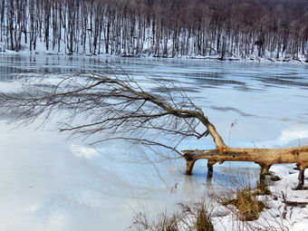 The trail still had some running water in places but it was mostly covered in snow and ice. The blue sky still had some puffy white clouds and some sun as we continued up the trail toward the pond. At the pond, I took off my pack and got out the camera. The water level was much higher nearly reaching the spillway and the pond was covered in a layer of ice. There were some breaks in the ice near the shore and it did not look sturdy enough to support people. I took a few pictures of the pond and noticed that the ice and water had a deep blue quality that I hoped would show up in the final product. I packed up and we continued up the trail toward the head end of the pond. The trail remained much the same but now had a few areas of standing water. I did stop at one point to take a few more pictures before continuing toward the outlet. Sheila alerted as we approached the lower lean-to as there was a young man walking form the bridge back to the lean-to. He did not seem interested in talking to us. We walked across the bridge and I decided to walk off the trail toward the pond to take a few shots. The skies were now growing a little more overcast and there was less sun. We continued our walk on the main trail and started the ascent up the shoulder of Cherry Ridge. As we started to climb Cherry Ridge the walking became more difficult as the snow was deeper on the northern exposure. The snow was wet and very slippery and each time I planted my foot I would slide back some. Along the way were several large blowdowns which we could not clear without an axe and saw. There were a few branches down which we picked up and moved to the side of the trail. Since I have begun to do trail maintenance, I always think how much easier it would be if everyone who hiked would just pick up a branch here and there. We made a slight turn to the south and began to climb some more. Sheila was roaming the brush near the trail and seemed to always be on a scent trail. We hit the high point on the hike and started down the other side. There was much less snow on the shouter exposure and quite a bit of water on the trail both standing and running. We continued to find blowdowns and branches on the trail. After a short ascent to the "forest of numerous small trees", we walked down to the woods road and snowmobile trail and turned left to complete our loop. The slight ascent was covered in ice and I almost gave in and put on my Microspikes. I was able to walk on the sides of the trail in the snow while Cindy simply confidently walked up the middle of the trail! The descent to the trail junction was wet in many spots with a few bare places and lots of ice. As we walked down the will the skies continued to grow darker and the wind came up. We passed the large campsite on the left at the bottom of the hill and walked over the bridge which had as much snow as any other place on the trail. I looked up to see the young man who had been at the lean-to walking passed the trail register. We turned right at the trail junction to walk back to the lower parking area. We decided not to visit the lower falls due to the hour and the fact that it would not be much different than my last visit. We walked up the road back to our car. We arrived back at the car at 3:45 PM. We had hiked 5.5 miles in 2 hours and 50 minutes gaining 1090 feet of elevation. Our moving average was 2 mph which I considered good under the conditions.
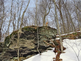
![]()
![]()
![]()
![]()
![]() On Saturday, December 23rd, I was ready to get out for the second official hike of the winter which started on Wednesday, December 21. Of course, there isn't much difference between fall and winter at this time of year and there had been snow on the ground for some time. I thought about going to Jensen ledges since the walk is relatively short and Cindy wanted to come with me. The view from the Ledges is spectacular but Cindy pointed put is was already late morning and we did not know the condition of the road that leads to the parking area for Jensen ledges. She suggested we hike Cabot Mountain from Beech Hill Road which surprised me since this is a relatively short but steep hike. The suggestion suited me since I like the difficultly of the climb and because I maintain the section of trail from Big Pond to Beech Hill Road for the Finger Lakes Trail and had not been on it since early fall. By the time we were ready to go and got our gear in the car along with Sheila it was 11:45 AM. We decided to forego the snowshoes as the rain had diminished some of the snow but we took along our Microspikes just in case we ran into any ice or packed snow along the way. We started for Lew Beach on the Beaverkill Road and turned left on Beach Hill Road just outside of Lew Beach. I continued 2.6 miles to the trailhead for Cabot Mountain. When we arrived the parking area had not been plowed but there was enough room for me to pull into the soft snow bank on the side of the road. The temperature was about 34 degrees when we got out of the car but it felt a little colder as a slight breeze was blowing. I had on a short sleeved baselayer with a Mammut top and my Mammut Hoody. I wore my Columbia Paso Alto pants with the OmniHeat lining which really does seem to reflect body heat. There was a good coating of snow at the trailhead amounting to several inches. We started out on the woods road at 12:20 PM and immediately found one rather large tree across the trail which made me wonder how many more there would be. The tree was large but I judged it could be removed with axe and saw. As we started through the woods the lower trail was wet in paces with standing water in some areas and running water in others. The water was pretty easy to avoid but we had to be careful of the ice.It was obvious that someone had hiked the trail since the snow had fallen but the tracks were not recent and had been filled ion with snow. At .25 miles the trail began to climb and over the next .5 miles we gained 580 feet with the grade averaging 21%! We found one more tree down across the trail rather early on the slope and one a little higher up. The latter I removed by dragging it of to the side. The patches of ice continued to be a bother and we had to be careful of our footing although Sheila did not seem to be having a problem. At one point I stopped to take some pictures of large sedimentary outcroppings and a few of Sheila on the trail. As I was about to put away my camera, Sheila walked behind one of the outcroppings and climbed to the top to survey the landscape. I took a few shot of her and then we continued to climb. The trail was in pretty good shape and only a few areas would need some lopping
On Saturday, December 23rd, I was ready to get out for the second official hike of the winter which started on Wednesday, December 21. Of course, there isn't much difference between fall and winter at this time of year and there had been snow on the ground for some time. I thought about going to Jensen ledges since the walk is relatively short and Cindy wanted to come with me. The view from the Ledges is spectacular but Cindy pointed put is was already late morning and we did not know the condition of the road that leads to the parking area for Jensen ledges. She suggested we hike Cabot Mountain from Beech Hill Road which surprised me since this is a relatively short but steep hike. The suggestion suited me since I like the difficultly of the climb and because I maintain the section of trail from Big Pond to Beech Hill Road for the Finger Lakes Trail and had not been on it since early fall. By the time we were ready to go and got our gear in the car along with Sheila it was 11:45 AM. We decided to forego the snowshoes as the rain had diminished some of the snow but we took along our Microspikes just in case we ran into any ice or packed snow along the way. We started for Lew Beach on the Beaverkill Road and turned left on Beach Hill Road just outside of Lew Beach. I continued 2.6 miles to the trailhead for Cabot Mountain. When we arrived the parking area had not been plowed but there was enough room for me to pull into the soft snow bank on the side of the road. The temperature was about 34 degrees when we got out of the car but it felt a little colder as a slight breeze was blowing. I had on a short sleeved baselayer with a Mammut top and my Mammut Hoody. I wore my Columbia Paso Alto pants with the OmniHeat lining which really does seem to reflect body heat. There was a good coating of snow at the trailhead amounting to several inches. We started out on the woods road at 12:20 PM and immediately found one rather large tree across the trail which made me wonder how many more there would be. The tree was large but I judged it could be removed with axe and saw. As we started through the woods the lower trail was wet in paces with standing water in some areas and running water in others. The water was pretty easy to avoid but we had to be careful of the ice.It was obvious that someone had hiked the trail since the snow had fallen but the tracks were not recent and had been filled ion with snow. At .25 miles the trail began to climb and over the next .5 miles we gained 580 feet with the grade averaging 21%! We found one more tree down across the trail rather early on the slope and one a little higher up. The latter I removed by dragging it of to the side. The patches of ice continued to be a bother and we had to be careful of our footing although Sheila did not seem to be having a problem. At one point I stopped to take some pictures of large sedimentary outcroppings and a few of Sheila on the trail. As I was about to put away my camera, Sheila walked behind one of the outcroppings and climbed to the top to survey the landscape. I took a few shot of her and then we continued to climb. The trail was in pretty good shape and only a few areas would need some lopping
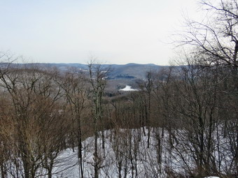 As we reached the top of the main climb, I looked at my watch and found it had taken 45 minutes to go a little more than .7 miles. The trail leveled off a little but there were still a few downs and ups along the way. The snow depth on the ridge was between 2 inches and two feet where the snow had drifted. We followed trail as it turned from northeast to almost east. At times the trail was barely distinguishable as there were only a few markers and the trail bed was covered by snow. The further we went and the higher we climbed, the more snow we found. This continued until about 1.25 miles where the final climb to Cabot Mountain began. At about 1 mile the trail had turned southeast and began to follow the edge of the mountain. Cindy did not care whether or not she got to the lookout over Little Pond so I went ahead with Sheila at a very fast pace. I had forgotten how far the lookout was from the road and resolved to go just until I hit 1.5 miles to make a respectable round trip. At some point I found the trail packed by people coming from the other direction. This made walking much easier and we continued up to the summit at 1.4 miles and then descended slightly to the viewpoint at 1.5 miles. I dropped my pack and took some pictures of Sheila on the lookout. I stepped over to the lookout and took shots of Little Pond and some of the mountains in the other direction. I got a quick drink and the shouldered my pack to head back at 1:45 PM. Sheila and I kept a quicker pace than on the way up in an effort to get to Cindy. The fact that the trail was covered in snow made some of the hiking easier and some harder. I was not sure if Cindy was waiting or had turned around to go back. I kept calling to Sheila to stay with me but let her go she I could see Cindy seated on a stump up ahead. I hurried ahead and found she had caught up with Cindy who had waited for us. Cindy had tried to put on her Microspikes but found one chain saw broken which I did not remember from last year. She decided to wear the one but I thought I would wait to see if I really needed the. The way back was quicker for the most part but there were some tricky descents that were slippery from the snow and ice. I descended rather quickly sometimes going off the trail to take advantage of the traction in the snow and to avid the ice. Cindy was a little slows but we both made it down to the flatter part at the base without incident. As we were walking out I heard Cindy call out and turned to find her on the ground after slipping on some ice! Cindy got up and we hiked the rest of the way back to the car arriving at 2:45 PM. We had spent 2 hours and 25 minutes on the 3 mile hike. The vertical gain was 900 feet. It had taken an hour and 25 minutes to go up but only one hour to come down.
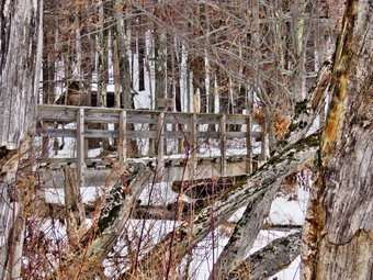
![]()
![]()
![]()
![]()
![]() On Thursday, December 22nd, I was ready to get out for the first official hike of the winter which started the day before. Of course, there isn't much difference between fall and winter at this time of year and there had been snow on the ground for some time. I wanted to stay close to home and avoid a long drive but also wanted to get away from Round Top and Frick Pond. I decided to head to Trout pond since I had not been there in some time and was excited to see what the recent snow and rain had done to the water levels in Russell Brook. I was hoping the falls would have some water which would make taking some pictures worthwhile. I had some things to do around the house and was also waiting to see whether the skies would clear after some early morning snow. At about 10:45 AM the skies did clear and became blue with white clouds. There was even some sun although the temperature was still in the high 20's. I put my gear in the trunk and an overjoyed Sheila in the back seat and headed to Roscoe on State Route 17. I got on Route 206 and followed it across the Delaware County line to Morton Hill Road. After a left turn on Morton Hill Road, I drove to the intersection with Russell Brook Road. I turned around and parked on the side of the road to avoid the parking area which is private. I had decided to bring only my Microspikes as I did not think I would need snowshoes. We began our hike down Russell Brook Road at 11:15 AM. The air still seemed cool to me so I wore my Mammut Hoody, a hat and light gloves. I had on my Columbia Passo Alto pants with the reflective OmniHeat lining but decided I did not need tights underneath. I wore a long-sleeved crew neck Mammut shirt which is a little heavier than some I have and a short sleeved baselayer. Russell Brook Road was not plowed but it looked as if some snowmobiles had been using it. There were areas of packed snow and ice so I was careful to walk in the looser snow which worked just fine. We continued on down Russell Brook Road to the overlook over the upper falls. There was more water in the stream than I had seen since the spring and the upper falls had a volume that made taking pictures a must. I decided to skip the pictures on the way out and take them when I returned. We continued down toward the parking area and got on the woods road that goes down to the bridge that crosses the brook. I decided not to walk to the falls and continued on the main trail to the register. At the trail junction just after the register we turned to the left to climb the steeper hill toward Mud Pond. The trail was covered in snow in most places but also had bare areas and areas with ice! The sun was out and as soon as we started to climb the hill, I stopped to open up the zippers on my hoody. The ascent went quickly and I was glad to see there were no new blowdowns on this part of the trail. We reached the top of the hill at 11:55 AM after hiking 1.4 miles. The woods road was covered in snow over a layer of ice which made negotiating the trail very hazardous. I again used the snow on the side of the road to get some traction and at 1.6 miles we made a right to follow the trail up to the shoulder of Cherry Ridge.
On Thursday, December 22nd, I was ready to get out for the first official hike of the winter which started the day before. Of course, there isn't much difference between fall and winter at this time of year and there had been snow on the ground for some time. I wanted to stay close to home and avoid a long drive but also wanted to get away from Round Top and Frick Pond. I decided to head to Trout pond since I had not been there in some time and was excited to see what the recent snow and rain had done to the water levels in Russell Brook. I was hoping the falls would have some water which would make taking some pictures worthwhile. I had some things to do around the house and was also waiting to see whether the skies would clear after some early morning snow. At about 10:45 AM the skies did clear and became blue with white clouds. There was even some sun although the temperature was still in the high 20's. I put my gear in the trunk and an overjoyed Sheila in the back seat and headed to Roscoe on State Route 17. I got on Route 206 and followed it across the Delaware County line to Morton Hill Road. After a left turn on Morton Hill Road, I drove to the intersection with Russell Brook Road. I turned around and parked on the side of the road to avoid the parking area which is private. I had decided to bring only my Microspikes as I did not think I would need snowshoes. We began our hike down Russell Brook Road at 11:15 AM. The air still seemed cool to me so I wore my Mammut Hoody, a hat and light gloves. I had on my Columbia Passo Alto pants with the reflective OmniHeat lining but decided I did not need tights underneath. I wore a long-sleeved crew neck Mammut shirt which is a little heavier than some I have and a short sleeved baselayer. Russell Brook Road was not plowed but it looked as if some snowmobiles had been using it. There were areas of packed snow and ice so I was careful to walk in the looser snow which worked just fine. We continued on down Russell Brook Road to the overlook over the upper falls. There was more water in the stream than I had seen since the spring and the upper falls had a volume that made taking pictures a must. I decided to skip the pictures on the way out and take them when I returned. We continued down toward the parking area and got on the woods road that goes down to the bridge that crosses the brook. I decided not to walk to the falls and continued on the main trail to the register. At the trail junction just after the register we turned to the left to climb the steeper hill toward Mud Pond. The trail was covered in snow in most places but also had bare areas and areas with ice! The sun was out and as soon as we started to climb the hill, I stopped to open up the zippers on my hoody. The ascent went quickly and I was glad to see there were no new blowdowns on this part of the trail. We reached the top of the hill at 11:55 AM after hiking 1.4 miles. The woods road was covered in snow over a layer of ice which made negotiating the trail very hazardous. I again used the snow on the side of the road to get some traction and at 1.6 miles we made a right to follow the trail up to the shoulder of Cherry Ridge.
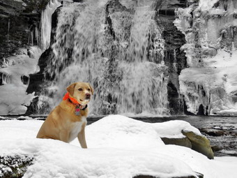 This trail was also covered in snow and the more elevation we gained the deeper the snow became. Except for a few drifts the snow depth was never more than 8 inches and I was glad I had opted not to wear snowshoes. We avoided a few icy areas and crossed a few small streams and some standing water. The ascent continued for the next 1.2 miles until at 2.7 miles into the hike when we were at the highest point and ready to start the descent to Trout Pond. Along the way we had come across two or three new major blowdowns but were able to easily hike around them. One concerned me as it was a large branch precariously arched over the trail with little support at the upper end. We had been hiking the southern exposure and as we started down the other side there was a little more snow on the trail. I also noticed that the skies were now grey and the sun had disappeared. Some precipitation was falling from the sky which appeared to be almost snow and almost rain. As we descended toward Trout Pond there were three major blowdowns that would require an axe and saw to clear. The trail remained snowy and slippery as we approached the bridge at the inlet end of the pond. I decided to stop and take some pictures even though there was nothing remarkable about the scene. We continued on the main trail toward the outlet of the pond and the trail remained snow covered with ice in spots. At the lower end of the pond I again stopped to take pictures of a scene I had photographed many times! The water level in the pond was much higher than it had been all summer and fall and the pond was covered in a layer of ice. The skies were still overcast but the precipitation had stopped. The hike from the outlet to the trail junction is all downhill but I had to be careful to avoid many icy spots. Sheila did not seem to mind the icy or snow! By 1:35 PM we had hiked 4.7 miles and were back at the trail junction and register box. I decided that I wanted to walk over to the falls and we turned left on the path to the falls. We walked up the path toward the lower falls and then down the bank to the streambed. There was a lot of snow and ice on the little descent and I slid on my backside the last few feet. I was happy when I saws that the falls was flowing freely and had a "mirror" of ice on the right side. I took a few quick pictures of falls including a few with Sheila and some of the ice in the stream. We walked back up the bank which was not easy as I had only one clean foothold. I found it is important to be able to lift your body weight and pack with the muscles of one leg! We walked out to the main trail to continue our hike back to the car. As we walked up the road back to the car, I stopped at the overlook and decided to walk down to take a few shots of the upper falls. I played with some settings to try to get different pictures of the water. Getting back up to the road wasn't difficult and we continued up the road and back to the car. We arrived back at 2:05 PM having covered 5.5 miles and 1120 vertical feet in 2 hours and 30 minutes.