
What You Missed
Summer 2017
Summer 2017
![]()
![]()
![]()
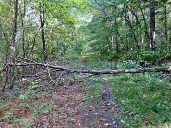
![]() On Thursday, September 21st I decided I wanted to go to the Round Top Trails and remove some small "stumps" and roots that remained in the trail. The trails were due to have their "official" opening on Sunday and I did not ant anybody to trip. Around 11:00 AM I put a round pointed shovel and a pick mattocks in my trunk. I put Sheila in the back seat and rove across the street to the cemetery and up the hill to the trailhead. I let Sheila out and grabbed the two tools from the trunk. We walked into the woods on the trail and turned right at the first trail junction to head up the yellow trail. Where the yellow trail turned left we continued straight ahead on the blue trail toward the summit of Round Top. As we climbed I stopped several times to remove some stumps and a few roots that ran across the trail. Most of the roots were easy to cut with the pick mattocks which did not seem that sharp but did a nice job. In a few cases I used the shovel to cut and then fill in some of the dirt that was removed. We continued up to the summit where I found a few more roots to removed. Some stumps proved stubborn as they were thicker than the rest but I persevered and was able to remove them all. There were a few well-formed stumps that were just two big to remove. I tried to remove what I could from these in an effort to allow rain to seep in and accelerate their breakdown. Soon we were back down at the lower yellow trail where we turned right and walked down to the lookout. From there we walked down to the first trail junction and back out to the car. It had taken just less than and hour to do the work and I still had enough time and energy to do more. Since the work was done, I decided to return home knowing I had accomplished all that I could.
On Thursday, September 21st I decided I wanted to go to the Round Top Trails and remove some small "stumps" and roots that remained in the trail. The trails were due to have their "official" opening on Sunday and I did not ant anybody to trip. Around 11:00 AM I put a round pointed shovel and a pick mattocks in my trunk. I put Sheila in the back seat and rove across the street to the cemetery and up the hill to the trailhead. I let Sheila out and grabbed the two tools from the trunk. We walked into the woods on the trail and turned right at the first trail junction to head up the yellow trail. Where the yellow trail turned left we continued straight ahead on the blue trail toward the summit of Round Top. As we climbed I stopped several times to remove some stumps and a few roots that ran across the trail. Most of the roots were easy to cut with the pick mattocks which did not seem that sharp but did a nice job. In a few cases I used the shovel to cut and then fill in some of the dirt that was removed. We continued up to the summit where I found a few more roots to removed. Some stumps proved stubborn as they were thicker than the rest but I persevered and was able to remove them all. There were a few well-formed stumps that were just two big to remove. I tried to remove what I could from these in an effort to allow rain to seep in and accelerate their breakdown. Soon we were back down at the lower yellow trail where we turned right and walked down to the lookout. From there we walked down to the first trail junction and back out to the car. It had taken just less than and hour to do the work and I still had enough time and energy to do more. Since the work was done, I decided to return home knowing I had accomplished all that I could.
![]()
![]()
![]()
![]() On Tuesday, September 19th, I had decided I would stay home and do some work around the house. On Monday night I got an e-mail from Lisa asking if I would like to go for a hike in the morning. I said I would go and she suggested a hike to Hodge Pond. I had been in this area several times recently but agreed to go with her. We decided to meet at 9:30 AM at my house. In the morning I got a few things done by getting up early and waited for Lisa. She appeared promptly at my house at 9:30 AM. I went out to meet her with an excited Sheila bounding out ahead of me. It was already very warm and a little humid. We loaded up our gear, put Sheila in the backseat and headed out the DeBruce Road. After about 6 miles, I turned left on Mongaup Road and drove to where the road split. I stayed left at the Y and drove up Beech Mountain Road to the parking area. There were no other cars when we parked at 9:50 AM in the smaller lot. I set my electronics and we crossed the road to begin our hike at 9:55 AM. We hiked the Flynn Trail passed the register toward the woods road that would take us to Hodge Pond. We kept a quick pace up the trail as we talked about various subjects we have in common. One specific discussion concerned the ribbon cutting ceremony on Sunday to "officially" open the trails on Round Top. We made the 1.7 mile climb to the junction with the Big Rock Trail in less than 40 minutes. Along the way I pointed out some of the blowdowns I had cleared recently. At the next split in the trail we stayed left to continue to Hodge Pond on the Flynn Trail. When we reached the clearing, we walked over to the shore of the pond. I had been there the day before and not much had changed. Sheila took a brief dip in the pond. It was very sunny and quite warm. Lisa wanted to see what OSI had done to the Flynn Trail on the west side of Hodge Pond so we walked out the Flynn Trail in that direction. I showed her how the trail and been scraped leaving dirt behind which had turned into mud. We walked through the field to the spot where the trail again enters the trees. At this point we could hear machinery and Lisa went to investigate. I had no desire to slog through the mud so Sheila and I waited for her. She came back after talking to the person running the machinery. He explained that he had been told to scrape the trail and then replant grass seed. This seemed odd as the grass that had been there was in great shape! He did tell Lisa that someone else had come in with a vehicle and left tracks and deep ruts which had ruined his work. We walked back on the Flynn Trail to the clearing at the outlet end of Hodge and then started back up the hill. Both of us had mentioned hiking back along the outlet stream from Hodge Pond but we decided to leave it for another day. We hiked up the hill from the pond and back along the Flynn Trail. We continued on to the junction with the Big Rock trail arriving there at 11:20 AM. We started down the Flynn Trail which is all downhill from the junction and did not stop at all along the way. Near the gate we followed the Flynn Trail into the woods to the left to avoid the roseate property around the cabin. Lisa signed the register and we walked back out to the car arriving at 11:55 AM. We had hiked 5.2 miles in 2 hours with an elevation gain of 808 feet.
On Tuesday, September 19th, I had decided I would stay home and do some work around the house. On Monday night I got an e-mail from Lisa asking if I would like to go for a hike in the morning. I said I would go and she suggested a hike to Hodge Pond. I had been in this area several times recently but agreed to go with her. We decided to meet at 9:30 AM at my house. In the morning I got a few things done by getting up early and waited for Lisa. She appeared promptly at my house at 9:30 AM. I went out to meet her with an excited Sheila bounding out ahead of me. It was already very warm and a little humid. We loaded up our gear, put Sheila in the backseat and headed out the DeBruce Road. After about 6 miles, I turned left on Mongaup Road and drove to where the road split. I stayed left at the Y and drove up Beech Mountain Road to the parking area. There were no other cars when we parked at 9:50 AM in the smaller lot. I set my electronics and we crossed the road to begin our hike at 9:55 AM. We hiked the Flynn Trail passed the register toward the woods road that would take us to Hodge Pond. We kept a quick pace up the trail as we talked about various subjects we have in common. One specific discussion concerned the ribbon cutting ceremony on Sunday to "officially" open the trails on Round Top. We made the 1.7 mile climb to the junction with the Big Rock Trail in less than 40 minutes. Along the way I pointed out some of the blowdowns I had cleared recently. At the next split in the trail we stayed left to continue to Hodge Pond on the Flynn Trail. When we reached the clearing, we walked over to the shore of the pond. I had been there the day before and not much had changed. Sheila took a brief dip in the pond. It was very sunny and quite warm. Lisa wanted to see what OSI had done to the Flynn Trail on the west side of Hodge Pond so we walked out the Flynn Trail in that direction. I showed her how the trail and been scraped leaving dirt behind which had turned into mud. We walked through the field to the spot where the trail again enters the trees. At this point we could hear machinery and Lisa went to investigate. I had no desire to slog through the mud so Sheila and I waited for her. She came back after talking to the person running the machinery. He explained that he had been told to scrape the trail and then replant grass seed. This seemed odd as the grass that had been there was in great shape! He did tell Lisa that someone else had come in with a vehicle and left tracks and deep ruts which had ruined his work. We walked back on the Flynn Trail to the clearing at the outlet end of Hodge and then started back up the hill. Both of us had mentioned hiking back along the outlet stream from Hodge Pond but we decided to leave it for another day. We hiked up the hill from the pond and back along the Flynn Trail. We continued on to the junction with the Big Rock trail arriving there at 11:20 AM. We started down the Flynn Trail which is all downhill from the junction and did not stop at all along the way. Near the gate we followed the Flynn Trail into the woods to the left to avoid the roseate property around the cabin. Lisa signed the register and we walked back out to the car arriving at 11:55 AM. We had hiked 5.2 miles in 2 hours with an elevation gain of 808 feet.
![]()
![]()
![]()
![]()
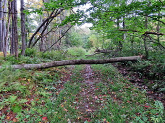
![]() On Monday, September 18th I had decided that I wanted to go to the Hodge and Frick Pond area to do a fitness hike and clear a blowdown on the Flynn Trail that I kept forgetting to cut. The weather forecast was calling for high humidity and temperatures approaching 80 degrees. I got my gear together to go do some trail maintenance taking only my Silky Sugowaza saw in my pack. I got dressed and then put Sheila in the back seat and my gear in the trunk. We left the house a little after 9:30 AM and drove out the DeBruce Road for about six miles. I turned left on Mongaup Pond Road and stayed to the left on Beech Mountain Road when it split. When we arrived at the trailhead, there were no vehicles in either parking area. The temperature was 64 degrees when I set my GPS and we crossed the road at 10:05 AM to begin our hike. We quickly walked along the Flynn Trail to the woods road that was once the extension of Beech Mountain Road. We turned right on the woods road and started the long climb toward the junction with the Big Rock Trail. A one point there was a branch that had partially broken off a tree and was in the trail. I moved it off the trail. We continued up the trail with me picking up big and small branches and throwing them off the trail. At about 1.25 miles we came to the point where I sometimes turn off the trail to visit an interesting clearing. Just after this point there was a tree across the trail which I did not remember from previous hikes. The trunk was only about 8 inches in diameter but there were some branches that ended to be cut before I could remove three rest of the tree. I put down my pack and got out the saw and started to trim beaches and clear away those that were loose. I took some before pictures and a few as I finished various stages. Eventually I had only the main trunk to cut. The work went quickly but I was sorry I had not rough my wedges to prevent the saw from binding. It took a little more than 15 minutes to clear the mess. We continued up the trail to the Big Rock Junction at 11:10 AM after hiking 1.8 miles. As we passed through the junction, I noticed that there were vehicle tracks on the trail. It looked too wide for an ATV but could have been a side-by-side with tractor tires.
On Monday, September 18th I had decided that I wanted to go to the Hodge and Frick Pond area to do a fitness hike and clear a blowdown on the Flynn Trail that I kept forgetting to cut. The weather forecast was calling for high humidity and temperatures approaching 80 degrees. I got my gear together to go do some trail maintenance taking only my Silky Sugowaza saw in my pack. I got dressed and then put Sheila in the back seat and my gear in the trunk. We left the house a little after 9:30 AM and drove out the DeBruce Road for about six miles. I turned left on Mongaup Pond Road and stayed to the left on Beech Mountain Road when it split. When we arrived at the trailhead, there were no vehicles in either parking area. The temperature was 64 degrees when I set my GPS and we crossed the road at 10:05 AM to begin our hike. We quickly walked along the Flynn Trail to the woods road that was once the extension of Beech Mountain Road. We turned right on the woods road and started the long climb toward the junction with the Big Rock Trail. A one point there was a branch that had partially broken off a tree and was in the trail. I moved it off the trail. We continued up the trail with me picking up big and small branches and throwing them off the trail. At about 1.25 miles we came to the point where I sometimes turn off the trail to visit an interesting clearing. Just after this point there was a tree across the trail which I did not remember from previous hikes. The trunk was only about 8 inches in diameter but there were some branches that ended to be cut before I could remove three rest of the tree. I put down my pack and got out the saw and started to trim beaches and clear away those that were loose. I took some before pictures and a few as I finished various stages. Eventually I had only the main trunk to cut. The work went quickly but I was sorry I had not rough my wedges to prevent the saw from binding. It took a little more than 15 minutes to clear the mess. We continued up the trail to the Big Rock Junction at 11:10 AM after hiking 1.8 miles. As we passed through the junction, I noticed that there were vehicle tracks on the trail. It looked too wide for an ATV but could have been a side-by-side with tractor tires.
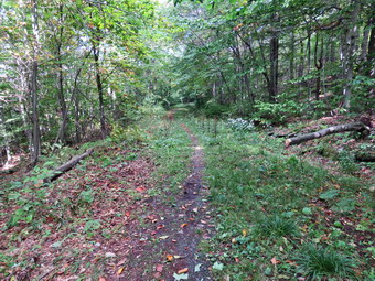 We continued along the Flynn Trail and found the blowdown I had wanted to cut just before the trail split. I did take pictures of this one before attacking it with the saw. There wasn't too much to clear so we moved on after I took some "after" pictures. At the next trail junction, we stayed to the left to follow the Flynn Trail down to Hodge Pond. The grass on the trail had been mowed which was a big improvement from the tall grass on the first part of the Flynn Trail. We walked out into the field by Hodge Pound and then over to the fire circle near the shore. The circle neatest the shore had been cleaned up. Sheila immediately went for a swim while I took some pictures of the pond. The sky was blue with nice white clouds which made for some nice shots. I was hoping for some bright colors in the leaves but they were just beginning to turn and were still dull. I had though we might take the jeep trail to avoid the muddy mess that OSI had created on the Flynn Trail but decided I wanted to stay on the hiking trails. After a drink, we walked back to the Flynn Trail and continued on the west side of Hodge Pond. The mud was worse than before with deep ruts caused by some machinery. At the next trail junction we stayed to the left to take the Flynn Trail up the hill rather than the jeep road around the back of the pond. We passed through the gate and found the trail was still wet with muddy patches along the way. The trees and bushes were beginning to close in on the trail and really needed several people with loppers to cut them back. I cut a few of the worst until we came to the Quick Lake Trail at Junkyard Junction. It was 11:55 AM and we had hiked 3.5 miles which is almost exactly halfway through the hike. We turned left to start the loop back. The trail initially rolls some but eventually descends toward Iron Wheel Junction. The trail was wet and muddy in many places and the vehicle racks were even more pronounced. Whatever ha passed over the trail had really chewed it up in spots. I picked up a few branches and chucks of wood along the trail but there were no major blowdowns.
 At 12:30 PM we turned right at Iron Wheel Junction after hiking 5.1 miles. The turn allowed us to stay on the Quick Lake Trail heading for Frick Pond. As we walked, I continued to pick up branches and cut a few that were in the trail. We came to and crossed the small stream through the woods. Despite the act that the trails were wet, the stream was very low although Sheila took a quick dip. There was a large hardwood tree down across the trail in the "spruce tunnel" but it was flat on the ground. I decided to leave that one for another day since it would take a lot of work with the axe. There was another older tree a little farther along. We walked out of the spruce tunnel and found some more branches on the trail which was no match for the Silky saw. This part of the trail was as wet and muddy as it had been all summer. We passed by the junction with the Big Rock Trail on the left and were soon at the bridge over the Frick Pond Outlet. I dropped my pack and got out the camera. I have taken hundreds of pictures form the bridge but can't resist stopping to take a few more. The beaver dam was still out but it looked like a few sticks had been replaced. I still have not been able to determine who removed the am. Several other people had noticed this vandalism and are as mad as I am about it! It was getting late so I stowed the camera and shouldered the pack. We walked up the hill from Frick Pond to Gravestone Junction and continued straight ahead on the Quick Lake Trail. The trail was still wet for almost the entire way back to the car. We passed by the register and turned right to stay on the Quick Lake Trail back out to the car. There was now one other car in the lot. We were back at the car at 1:15 Pm having hiked 6.6 miles in 3 hours and 5 minutes with a vertical gain of 908 feet. This is very slow but included half an hour of stopped time.
![]()
![]()
![]()
![]()
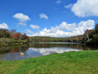
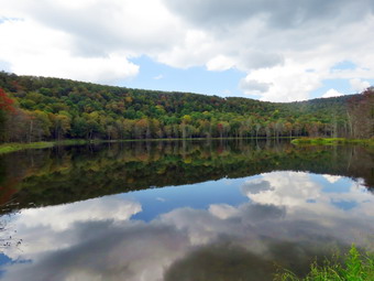
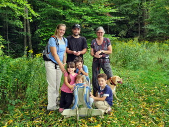
![]() On Sunday, September 16 I decided I wanted to get out to hike locally after church and thought a quick hike to Huggins Lake might be nice. I was hoping to find some nice fall colors in the leaves. Huggins Lake is not my favorite but I chose it for its shorter length, under 4 miles, and for the fact that it was not Frick Pond or Trout Pond. When I saw my grandchildren in Sunday School I got the idea that we should ALL go on the hike. I asked Kathleen and she was in favor of the idea as were the kids. I left it up the Kathleen to break the news to Karl. I saw Kathleen after Sunday School and she said Karl had agreed and would bring appropriate clothing for everyone and would meet us in Livingston Manor after church. After church we all headed to our house and waited for Karl. We got the kids some lunch and Karl soon arrived. We got everyone dressed and out the gear in the car. Sheila seemed extra energetic as if she didn't ant to get left behind in the confusion. We loaded everyone into the cars and headed out a little after 1:00 PM with Sheila in the backseat. I have come to the realization that she would like to be out everyday! I drove up the Beaverkill Road and down the Campsite Road to cross the covered bridge. At the end of the road we turned right and followed Berry Brook Road to the trailhead. We arrived at the road to the parking area to find it very rough with some erosion and a high ridge in the middle. I chose to chance it and easily made it to the small lot parking jut before 1:30 PM. I got my equipment ready and set my GPS while Karl got Brynn the backpack. There were no other cars in the lot when we headed out at 1:30 PM on the wide woods road to the lake. The kids love to hike but it is a good idea to keep them occupied to prevent the whining! The temperature was in the high 60's but the humidify was high making it a little uncomfortable to hike. There was some sun and the skies were mostly blue as we started the climb up the hill. The hike isn't long and the trail is well-maintained. The first 1.2 miles is all uphill and gains almost 700 feet. Sheila was running up and down the trail and following game paths into the woods. The kids did pretty well stopping to look at some efts on the trail as well as some beech nuts. As we continued to climb there were a few complaints but they were quashed with pleas to help the adults hike and a few goldfish crackers. After the initial climb, the trail descends levels some and then climbs again until the final descent to Huggins Lake. The trail makes a sharp turn from southeast to north at about 1.6 miles. Everyone enjoyed the downhill trek to the shores of the pond.
On Sunday, September 16 I decided I wanted to get out to hike locally after church and thought a quick hike to Huggins Lake might be nice. I was hoping to find some nice fall colors in the leaves. Huggins Lake is not my favorite but I chose it for its shorter length, under 4 miles, and for the fact that it was not Frick Pond or Trout Pond. When I saw my grandchildren in Sunday School I got the idea that we should ALL go on the hike. I asked Kathleen and she was in favor of the idea as were the kids. I left it up the Kathleen to break the news to Karl. I saw Kathleen after Sunday School and she said Karl had agreed and would bring appropriate clothing for everyone and would meet us in Livingston Manor after church. After church we all headed to our house and waited for Karl. We got the kids some lunch and Karl soon arrived. We got everyone dressed and out the gear in the car. Sheila seemed extra energetic as if she didn't ant to get left behind in the confusion. We loaded everyone into the cars and headed out a little after 1:00 PM with Sheila in the backseat. I have come to the realization that she would like to be out everyday! I drove up the Beaverkill Road and down the Campsite Road to cross the covered bridge. At the end of the road we turned right and followed Berry Brook Road to the trailhead. We arrived at the road to the parking area to find it very rough with some erosion and a high ridge in the middle. I chose to chance it and easily made it to the small lot parking jut before 1:30 PM. I got my equipment ready and set my GPS while Karl got Brynn the backpack. There were no other cars in the lot when we headed out at 1:30 PM on the wide woods road to the lake. The kids love to hike but it is a good idea to keep them occupied to prevent the whining! The temperature was in the high 60's but the humidify was high making it a little uncomfortable to hike. There was some sun and the skies were mostly blue as we started the climb up the hill. The hike isn't long and the trail is well-maintained. The first 1.2 miles is all uphill and gains almost 700 feet. Sheila was running up and down the trail and following game paths into the woods. The kids did pretty well stopping to look at some efts on the trail as well as some beech nuts. As we continued to climb there were a few complaints but they were quashed with pleas to help the adults hike and a few goldfish crackers. After the initial climb, the trail descends levels some and then climbs again until the final descent to Huggins Lake. The trail makes a sharp turn from southeast to north at about 1.6 miles. Everyone enjoyed the downhill trek to the shores of the pond.
 When we arrived at the lake, I noticed that the water level was a little lower than normal. There was a wet area and patches of mud on the trail just before it goes out along the shore. We avoided the mud and walked out along the dam. The leaves had not really changed colors and the sun had gone under some clouds. In fact, the clouds had gathered and it seems they were threatening rain although it had not been in the forecast! I dropped my pack and got out the camera to take some pictures of the blue sky with some white clouds in one direction and the blacker clouds in the other. At the outlet I could immediately see that the beavers had dammed the water flow. I took a few more pictures of the lake before returning to my pack and stowing the camera. Sheila decided to dive into the pond water several times until a stern warning stopped her. The kids explored the edge of the pond until raindrops started falling and we started back up the hill. The rain continued briefly and then stopped. The only negative point about Huggins Lake is that there is only one trail and so there are no variations available. The kids were not too thrilled about hiking back UP the trail but they didn't complain too much and the ascent went smoothly for the most part. We climbed the hill back to the highest point on the trail and then started down the other side. I was surprised that I had labored a little climbing the hill at the beginning of the hike but felt very fresh on the way back. The kids really like to hike downhill and they were ahead of the adults most of the time. When we arrived back at the car, we had hiked 3.8 miles in 2 hours with a total elevation gain of 960 feet.
![]() On Friday, September 15th I decided that I wanted to go to the Frick Pond area to clear a major blowdown on the Loggers Loop a short distance from Gravestone Junction. Cindy agreed to go with me to help so we got our gear together including my KatanaBoy Silky saw and Council Tool felling axe. I also put in my felling wedges to make sure the saw would not bind. We put all the gear in the car and put Sheila in the back seat. We left the house a little after 12:20 PM and drove out the DeBruce Road for about six miles. I turned left on Mongaup Pond Road and stayed to the left on Beech Mountain Road when it split. When we arrived at the trailhead, there were no vehicles in either parking area. We got our gear out of the trunk and started out on the woods road to the trail register at about 12:40 PM. We continued out to Gravestone Junction on the Quick Lake Trail. We turned right on the Logger's Loop and walked about a quarter mile to the blowdown I wanted to clear. There was one large trunk across the trail, another one beyond this and several trees leaning over the trail. I took some before pictures and then began to work on the trunk. I used the axe to split the trunk in the middle. Cindy and I moved that piece off the trail and then I started to cut another piece off the trunk with the saw. The larger saw did a good job of cutting through the trunk and I used the wedges to keep the kerf open. Once the trunk was cut all the way through, I was able to flip the piece I had cut off the trail. I took some "after" pictures and then turned my attention to the next part of the blowdown. At this point another hiker appeared coming from Gravestone Junction with his dog. Sheila seemed to want to meet this dog so the hiker decided it would be best to Reese his dog from the leash. Fortunately, the dogs did seem to get along well. The hiker asked us if we knew who had removed the beaver dam at Frick Pond. I told him I had contacted a number of people at the DEC and none could answer that question. When Cindy told him our names, we found out he knew our son who is a lawyer and had done some work for him. He thanked us for our work and continued on his way.I cut a few branches and pieces off this blowdown until I felt the trail was clear. I decided that the one tree hanging over the trail had to go as it was nearly dead and might fall at any time. I cleared some brush out of the way and then used the saw to cut down the tree. Unfortunately the saw became bound up in the cut and was hard to clear. I ended up using the axe to make a cut to free the saw. This also brought down the tree which was a little taller than I thought.I began to use the axe to trim branches and piled them off the trail as I went. I then used the saw to cut up the trunk into pieces I could move off the trail. When I was done I took a few pictures. By this time the skies had gotten much darker and a few raindrops began to fall. We decided to walk back to the car. The rain never came down very hard but some began to fall as we headed back to the car. We were back at the car at 2:35 PM after spending about 2 hours working on the trail.
On Friday, September 15th I decided that I wanted to go to the Frick Pond area to clear a major blowdown on the Loggers Loop a short distance from Gravestone Junction. Cindy agreed to go with me to help so we got our gear together including my KatanaBoy Silky saw and Council Tool felling axe. I also put in my felling wedges to make sure the saw would not bind. We put all the gear in the car and put Sheila in the back seat. We left the house a little after 12:20 PM and drove out the DeBruce Road for about six miles. I turned left on Mongaup Pond Road and stayed to the left on Beech Mountain Road when it split. When we arrived at the trailhead, there were no vehicles in either parking area. We got our gear out of the trunk and started out on the woods road to the trail register at about 12:40 PM. We continued out to Gravestone Junction on the Quick Lake Trail. We turned right on the Logger's Loop and walked about a quarter mile to the blowdown I wanted to clear. There was one large trunk across the trail, another one beyond this and several trees leaning over the trail. I took some before pictures and then began to work on the trunk. I used the axe to split the trunk in the middle. Cindy and I moved that piece off the trail and then I started to cut another piece off the trunk with the saw. The larger saw did a good job of cutting through the trunk and I used the wedges to keep the kerf open. Once the trunk was cut all the way through, I was able to flip the piece I had cut off the trail. I took some "after" pictures and then turned my attention to the next part of the blowdown. At this point another hiker appeared coming from Gravestone Junction with his dog. Sheila seemed to want to meet this dog so the hiker decided it would be best to Reese his dog from the leash. Fortunately, the dogs did seem to get along well. The hiker asked us if we knew who had removed the beaver dam at Frick Pond. I told him I had contacted a number of people at the DEC and none could answer that question. When Cindy told him our names, we found out he knew our son who is a lawyer and had done some work for him. He thanked us for our work and continued on his way.I cut a few branches and pieces off this blowdown until I felt the trail was clear. I decided that the one tree hanging over the trail had to go as it was nearly dead and might fall at any time. I cleared some brush out of the way and then used the saw to cut down the tree. Unfortunately the saw became bound up in the cut and was hard to clear. I ended up using the axe to make a cut to free the saw. This also brought down the tree which was a little taller than I thought.I began to use the axe to trim branches and piled them off the trail as I went. I then used the saw to cut up the trunk into pieces I could move off the trail. When I was done I took a few pictures. By this time the skies had gotten much darker and a few raindrops began to fall. We decided to walk back to the car. The rain never came down very hard but some began to fall as we headed back to the car. We were back at the car at 2:35 PM after spending about 2 hours working on the trail.
![]()
![]()
![]()
![]()
![]() On Wednesday, September 13th I wanted to get in a hike close to home before cross country practice in the afternoon. We had not hiked since Friday due to my family and work commitments so both Sheila and I were ready to get out! I decided to go to the Frick Pond area and hike out the loggers loop to Iron Wheel, up the Quick Lie trail to Junkyard Junction, over to Hodge Pond on the Flynn Trail, up the Flynn Trail to the Big Rock junction, down the Big Rock Trail to the Quick Lake Trail and then back out to the car. I thought it would be about 8 miles which was good with me. The weather was beautiful with bright sun and blue skies but with highs in the high 50's. I saw no reason to wait and Sheila agreed so I got ready to leave and pulled out of the driveway at 9:15 AM. Sheila was certainly ready to hike as she jumped in the back seat and perched on the console. I drove out DeBruce Road and turned left on Mongaup Road. When we arrived there were no other cars in the lots. I got my equipment ready and set my GPS. We started out to the trail register on the woods road. The trail was damp and muddy in spots and the one tree hanging over the trail looked even lower than in the past. The Quick Lake trail from the register to Gravestone Junction was wet with standing water. It was muddy in places and it looked as if a vehicle had passed down the trail recently. Near Gravestone Junction the bushes started to close in and I made a note to bring a pair of lopper and hedge trimmers in the near future to open up the trail. We turned right on the Loggers Loop and began to walk the trail. After a short distance I had to stop and take some pictures of the blue sky and white clouds. The trees were beginning to start to change colors and the scene was beautiful. We continued along the trail and soon found some new blowdowns across the trail. There was one large tree squarely across the trail which I knew would have to be cut at least three times to be able to clear it and move the pieces. There were other smaller trunks and branches that could be easily cut and moved. I took a few pictures and then continued on the hike. The entire Loggers Loop was wet and muddy in many places. Ironically, when we reached Times Square the trail was relatively dry and the Loggers Loop after Times Square was in pretty good shape. I continued to pick up some small branches and moves some larger pieces of debris off the trail. The first part of the Loggers Loop is uphill as it heads north and northwest for about .85 miles gaining 195 feet. The trail was wet in places but any muddy spots were easy to avoid. The grass was wet which made my boots wet but I had no complaints as it felt so good to be out. We crested a small hill and then walked the rest of the way downhill slightly to Iron Wheel Junction.
On Wednesday, September 13th I wanted to get in a hike close to home before cross country practice in the afternoon. We had not hiked since Friday due to my family and work commitments so both Sheila and I were ready to get out! I decided to go to the Frick Pond area and hike out the loggers loop to Iron Wheel, up the Quick Lie trail to Junkyard Junction, over to Hodge Pond on the Flynn Trail, up the Flynn Trail to the Big Rock junction, down the Big Rock Trail to the Quick Lake Trail and then back out to the car. I thought it would be about 8 miles which was good with me. The weather was beautiful with bright sun and blue skies but with highs in the high 50's. I saw no reason to wait and Sheila agreed so I got ready to leave and pulled out of the driveway at 9:15 AM. Sheila was certainly ready to hike as she jumped in the back seat and perched on the console. I drove out DeBruce Road and turned left on Mongaup Road. When we arrived there were no other cars in the lots. I got my equipment ready and set my GPS. We started out to the trail register on the woods road. The trail was damp and muddy in spots and the one tree hanging over the trail looked even lower than in the past. The Quick Lake trail from the register to Gravestone Junction was wet with standing water. It was muddy in places and it looked as if a vehicle had passed down the trail recently. Near Gravestone Junction the bushes started to close in and I made a note to bring a pair of lopper and hedge trimmers in the near future to open up the trail. We turned right on the Loggers Loop and began to walk the trail. After a short distance I had to stop and take some pictures of the blue sky and white clouds. The trees were beginning to start to change colors and the scene was beautiful. We continued along the trail and soon found some new blowdowns across the trail. There was one large tree squarely across the trail which I knew would have to be cut at least three times to be able to clear it and move the pieces. There were other smaller trunks and branches that could be easily cut and moved. I took a few pictures and then continued on the hike. The entire Loggers Loop was wet and muddy in many places. Ironically, when we reached Times Square the trail was relatively dry and the Loggers Loop after Times Square was in pretty good shape. I continued to pick up some small branches and moves some larger pieces of debris off the trail. The first part of the Loggers Loop is uphill as it heads north and northwest for about .85 miles gaining 195 feet. The trail was wet in places but any muddy spots were easy to avoid. The grass was wet which made my boots wet but I had no complaints as it felt so good to be out. We crested a small hill and then walked the rest of the way downhill slightly to Iron Wheel Junction.
 At the trail junction we continued straight ahead toward Junkyard Junction beginning a long and uphill climb. The trail climbs about 500 feet in 1.6 miles as it heads primarily north. At 3.3 miles the trail, turns northeast and continues uphill to Junkyard Junction. At 3.8 miles we reached the junction and turned right on the Flynn Trail heading southeast toward Hodge Pond. After passing through the gate, we walked downhill toward the shore of Hodge Pond. At this point I could hear machinery operating on the other side of the pond. I assumed it was OSI mowing the trails which they often do but for reasons I do not understand. I decided to turn left to follow the jeep trail round the head end of the pond. After a short walk, we turned right and walked down to the edge of the water. It was a beautiful scene with sun shining on the blue pond. The skies had some nice white clouds and a few of the trees had begun to change colors. I took quite a few pictures from different angles before packing up and continuing along the jeep trail. We turned right and continued down the trail and woods road to the outlet end of Hodge Pond. This was also a nice view so I put down my pack and got out my camera. OSI had removed one fire ring to clear the filed but had left another one. I took more pictures of Hodge Pond while Sheila took a quick dip. When she came out of the pond, she decided to run around wildly on shore. I got a drink, packed up and headed toward the Flynn Trail where it heads up the hill from Hodge Pond. This half mile stretch gains only 150 feet but sometimes seems very tiring. On this day it seemed to go quickly and we were soon turning right to stay on the Flynn Trail as it heads toward the junction with the Big Rock Trail. This section of the trail is very flat and we were soon at the junction. We turned right at 5.6 miles and started down the Big Rock Trail heading west to 5.8 miles where the trail turned south. In the 1.1 miles from the junction with the Flynn Trail to Times Square the Big Rock Trail drops 600 feet. It was a pleasure to walk downhill and south toward Times Square. The trail was mostly clear and I only had to pick up a few blowdowns along the way. At 5.6 miles we passed straight through Times Square continuing on the Big Rock Trail around the back of Frick Pond. The trail was wet and muddy which made the steeping stones we had installed come in handy. I stopped at the first bridge to take some pictures as the trees in the area were changing colors. We walked along the boardwalks and I stopped again to take some shots of these walkways. We continued out to the end of the big Rock Trail and turned left on the Quick Lake Trail. It was a short hike to the bridge over the outlet stream at Frick Pond. I have hundreds of pictures from this one spot but almost always stop to take another. I put down my pack and got out the camera. Some trees were changing color and the blue sky had a few white clouds. The beavers seem to have given up on the dam if they are even still in the area. This is one of saddest things I have seen and I wish I could find out who is responsible for destroying their dam! I packed up again and we headed up the hill to Gravestone Junction. At the junction we stayed to the right on the Quick Lake Trail and walked back to the car. We arrived back at 12:50 PM after hiking 7.8 miles in 3 hours and 15 minutes for an average speed of 2.5 mph. Pour elevation gain was 1102 feet. The temperature at the car was 73 degrees.
![]() On Friday, September 8th I decided to go to Walnut Mountain to make sure the cross country course was in good shape and to mark it with white arrows for our home meet against Eldred on Tuesday, September 12th. I had laid out the course last year and made sure it was exactly 5K which translates to 16,404.2 feet. Bryce was with us so he and Cindy came along to help with the work. We headed toward Liberty with Sheila in the back seats with Bryce and parked at 11:00 AM. The runners had told me there was a tree down on the Sunset Trail and I wanted to clear it and the trail between the Sunset Trail and the West Lake Trail-North first. We grabbed the loppers, rake, Fiskars axe and Silky saw and started up the main Mountain Overlook Trail which is really a carriage path. Where the trail turned left we followed it until the Sunset Trail turned right. We trued right onto the Sunset Trail and followed it as it climbed and then leveled off. We passed the point where the trail comes up from the West Lake-North Trail and continued along. I began to wonder if we would ever find a tree. After a short walk, I looked ahead And saw a large tree blocking about three-quarters of the trail. There was enough room to get by but I thought it would be best to remove as much as I could. I sized up the tree and found it was water-logged and rotten. I used the axe to cut almost all the way through and then finished it off with the saw. Bryce and I rolled the piece of trunk off the trail. We returned to the trail down to the West Lake-North trail and I took the rake from Cindy and started to rake small branches and leaves off the trail. Cindy trimmed some overhanging branches and Bryce went ahead to remove some larger branches. I didn't think the trail would need much clearing but I was wrong. There were a lot of leaves on the trail and many small branches. There were also some nasty roots ready to trip runners. I cut these with the loppers or just pulled them out of the dirt. The skies were getting darker but I really wanted to finish the work. I finally reached the bottom of the trail. We turned right on the West Lake-North Trail and began to walk back to the car. As we walked, we picked up some branches on the trail. T one point Cindy trimmed a few branches and I picked them up off the trail. We came to a few pine trees near the intersection with the Mountain Overlook Trail and I took some time to trim them back out of the way. We walked back down the hill to the parking area. I put away the tools and got two cans of paint to start marking the trails. At this point Cindy and Bryce decided they were too tired to continue to help me!
On Friday, September 8th I decided to go to Walnut Mountain to make sure the cross country course was in good shape and to mark it with white arrows for our home meet against Eldred on Tuesday, September 12th. I had laid out the course last year and made sure it was exactly 5K which translates to 16,404.2 feet. Bryce was with us so he and Cindy came along to help with the work. We headed toward Liberty with Sheila in the back seats with Bryce and parked at 11:00 AM. The runners had told me there was a tree down on the Sunset Trail and I wanted to clear it and the trail between the Sunset Trail and the West Lake Trail-North first. We grabbed the loppers, rake, Fiskars axe and Silky saw and started up the main Mountain Overlook Trail which is really a carriage path. Where the trail turned left we followed it until the Sunset Trail turned right. We trued right onto the Sunset Trail and followed it as it climbed and then leveled off. We passed the point where the trail comes up from the West Lake-North Trail and continued along. I began to wonder if we would ever find a tree. After a short walk, I looked ahead And saw a large tree blocking about three-quarters of the trail. There was enough room to get by but I thought it would be best to remove as much as I could. I sized up the tree and found it was water-logged and rotten. I used the axe to cut almost all the way through and then finished it off with the saw. Bryce and I rolled the piece of trunk off the trail. We returned to the trail down to the West Lake-North trail and I took the rake from Cindy and started to rake small branches and leaves off the trail. Cindy trimmed some overhanging branches and Bryce went ahead to remove some larger branches. I didn't think the trail would need much clearing but I was wrong. There were a lot of leaves on the trail and many small branches. There were also some nasty roots ready to trip runners. I cut these with the loppers or just pulled them out of the dirt. The skies were getting darker but I really wanted to finish the work. I finally reached the bottom of the trail. We turned right on the West Lake-North Trail and began to walk back to the car. As we walked, we picked up some branches on the trail. T one point Cindy trimmed a few branches and I picked them up off the trail. We came to a few pine trees near the intersection with the Mountain Overlook Trail and I took some time to trim them back out of the way. We walked back down the hill to the parking area. I put away the tools and got two cans of paint to start marking the trails. At this point Cindy and Bryce decided they were too tired to continue to help me!
I walked down to the starting line and headed out the West Lake-East trail toward the West Lake parking area. As the trail entered the woods, I used a spray can to place a white arrow although there was really no other way to go. I decided I would use as little paint as possible by marking areas where other trails crossed the course and places where the course turned. I also decided to put a few marks on long stretches just to reassure runners they were on the right trail. I put a few more marks down and then marked the turn to the left onto the West Lake-North Trail. I continued along the trail placing arrows where they were needed. I had previously cut out the trail and it was in good shape. There were two small muddy areas along the way but that makes a good cross country course. Just before the trail entered the trees there was a stretch where the weeds were leaning onto the course. It was passable but I thought I might bring my string trimmer to widen that area. I started up the hill and placed an arrow marking the turn to the left onto the Vista Way Trail. Several bike trail cross the Vista Way so I put down arrows to indicate to runners that they needed to continue straight ahead. As we neared a small footbridge I put an arrow indicating a turn to the left following the Vista Way over the bridge. I walked a little farther and put a 1 on the trail to mark the first mile. From there I followed the trail as it continued toward the main parking area. The gate was closed into the parking lot so I marked the route just to the right of the fence and made note to trim the grass and weeds in this area. I continued marking into the picnic area and toward the main Mountain Overlook Trail. Just as I started through the gate, the first can of paint ran out. I went back to the car and got another can and Bryce decided to join me for the last part of the course. I was happy because I knew things would go much faster if I had someone to talk to me. We walked up the Mountain Overlook Trail marking double headed arrows since this is the only part of the course that runners traverse in both directions. We continued to follow the trail until the intersection where it turned left. I marked an arrow to go straight ahead on a short section of trail that leads to the West Lake-North Trail. We continued along with me putting marks where they were needed. We came to the trail that goes up the mountain to the Sunset Trail and I placed a big arrow showing a left turn. The trail looked well-maintained after I had spent time raking it. I marked a couple of roots and rocks along the way. At the Sunset Trail i put a big arrow showing the right turn and shortly after that a 2 to mark the second mile. I told Bryce that there was only one small uphill and then it was all downhill. As we neared the end of the Sunset Trail, I had to place several arrows as there are a couple of different trails come together here. At the end of the trail Bryce noticed the overlook and I told him to go take a look while I put down a left turn arrow onto the
We immediately turned left and started up the gentler slope in the same direction we had gone on the first lap. This time when the yellow trail turned left we continued to follow it along the base of Round Top. At the next trail junction we turned left again following the yellow trail. At the lookout we turned left and walked down to the first trail junction. We had now completed a long loop and a short loop. I started back up the trail by turning left but Sheila started out to the trailhead. She saw me start back up the trail and followed me. We walked another long loop exactly the same way we had walked the first. When we arrived back at the first trail junction, Sheila ran ahead of me toward the trailhead. I made the left turn intending to do one more short loop. Sheila was pretty far along the trail to the trailhead and did not want to turn around. I made up my mid that I would win this battle and continued up the trail. Before long Sheila ran by me and I could almost hear her sigh. I don�t think she was tired but just bored. We completed the short loop and this time we headed out to the trailhead. I put Sheila on her leash and we walked down the cemetery hill and across the field by the church to the driveway and home. We had taken about 1 hour and 5 minutes to hike 3 miles. It was not an interesting hike by it was good exercise.
We turned left on the Quick Lake Trail and started the long uphill climb toward Junkyard Junction. The trail was almost dry all the way to Junkyard Junction 3.2 miles. The sun was starting to come through the clouds but it was still playing hide and seek. We turned right onto the blue Flynn Trail which is almost flat. It too was only damp with a few spots of mud which were easily avoided. There were no major blowdowns but I continued to remove branches that littered the trail. The entire trail does need to have some branches lopped to make a clear path. When we got to the gate, we turned right to stay on the trail and head down toward Hodge Pond. At 3.75 miles the Flynn Trail heads right and we followed it toward the outlet end of Hodge Pond. This part of the Flynn Trail which is a woods road had less water than other places and was not as muddy as the previous trip. It looked like OSI had decided to smooth out the trail by using a grader to dig it up and level it off. The problem is that this removed all the grass that held the dirt together and left behind an unpacked dirt surface. This surface can absorb a lot of water to form muddy areas. The field was still wet from the dew and after walking through it the trail again had been "improved" and was muddy. The open field is the spot where the mess hall and family camping area for the Beech Mountain Boy Scout Camp once stood. When we came to the clearing at the outlet end of the pond, I again decided to skip the pictures. We turned right to continue on the Flynn Trail climbing up the hill. I was feeling quite fresh and concentrated on using my poles to help set a quick pace up the hill. At the top of the hill we stayed to the right to continue on the Flynn Trail. A left turn follows a woods road out to what remains of the Beech Mountain Boy Scout Camp. Just after the turn there was a small tree across the trail. The Flynn Trail is relatively flat to the junction with the Big Rock Trail at 4.5 miles. We continued straight through this junction to follow the Flynn Trail back to the car. The walk is pretty but has no remarkable views or features so we walked quickly. As we approached the gate on the woods road, we turned left to avoid the private property around the cabin and to stay on the trail. On a previous trip I had cleared and reblazed the old trail and I could see that it was easy to follow. We finished our walk and were back at the car by 12:15 PM. We had covered 6.2 miles in 2 hours and 20 minutes with an elevation gain of 900 feet. Our average overall speed was 2.7 mph and we had stopped for less than 2 minutes.
![]()
![]()
![]()
![]() On Thursday, September 7th I knew I needed to get out after several days of family commitments but I had to do it before my cross country meet. I decided to simply head across the street to Round Top and do some figure 8's just for the exercise. Sheila was happy to get out as we headed down the driveway and across the street for a hike on Round Top at about 10:40 AM. We crossed the street with Sheila on her leash and walked to the back of the church. We began the ascent of the steepest hill behind the church. The hill is short but really gets the circulation pumping and is the steepest and longest climb on the "trail". Sheila helped me along by pulling me up the hill. When we got to the top of the hill, we started out on the trail by turning left at the trailhead. As soon as we entered the trees I released Sheila from her leash. At the first trail junction we continued straight ahead to walk the steeper path to the viewpoint. At the lookout I noted that there was no garbage and everything was in order. We followed the trail to the right and started the gentle climb through the woods. When we reached the next trail junction, we stayed to the right to follow the lower trail around the base of Round Top to the next junction. At this junction we turned left and started up to the summit of Round Top on the steeper blue trail. Along the way I noticed several stumps sticking up and a few rocks and roots that could trip hikers. I decided we would return another day to eliminate these hazards. We walked across the summit of Round Top and down the other side which is also a little steep. When we got to the yellow trail, we turned left to follow it to the second trail junction. This time we turned right and followed the yellow trail back to the very first trail junction. We turned around and retraced our steps taking the more gentle path this time. When the yellow trail turned left, we followed it to the next trail junction were we turned right and headed up the blue trail to the summit. We walked over the top and down the other side to the yellow trail again. We turned right and followed the trail along the base of Round Top. Where the yellow trail turned left, we followed it to the left and down to the lookout. From the lookout we walked down hill to the first trail junction. Since I had done three figure 8's with grandson Bryce the last time he was with me, I thought it might be nice to try for four this time. It takes me about 20 minutes to do one. We repeated the frost two figure 8's with me taking time to think about various topics. Sheila was pretty good staying with me most of the time except on the final round. She decided to go absolutely crazy and dash up and down the trail as she sometimes does. After finishing the last figure 8 8, we walked out to the trailhead. I put Sheila on her leash and we walked down the cemetery hill and across the field to our driveway. It was 12:10 PM and we had hiked about 3.3 miles in 1 hour and 30 minutes. It must have been a good workout as I was tired.
On Thursday, September 7th I knew I needed to get out after several days of family commitments but I had to do it before my cross country meet. I decided to simply head across the street to Round Top and do some figure 8's just for the exercise. Sheila was happy to get out as we headed down the driveway and across the street for a hike on Round Top at about 10:40 AM. We crossed the street with Sheila on her leash and walked to the back of the church. We began the ascent of the steepest hill behind the church. The hill is short but really gets the circulation pumping and is the steepest and longest climb on the "trail". Sheila helped me along by pulling me up the hill. When we got to the top of the hill, we started out on the trail by turning left at the trailhead. As soon as we entered the trees I released Sheila from her leash. At the first trail junction we continued straight ahead to walk the steeper path to the viewpoint. At the lookout I noted that there was no garbage and everything was in order. We followed the trail to the right and started the gentle climb through the woods. When we reached the next trail junction, we stayed to the right to follow the lower trail around the base of Round Top to the next junction. At this junction we turned left and started up to the summit of Round Top on the steeper blue trail. Along the way I noticed several stumps sticking up and a few rocks and roots that could trip hikers. I decided we would return another day to eliminate these hazards. We walked across the summit of Round Top and down the other side which is also a little steep. When we got to the yellow trail, we turned left to follow it to the second trail junction. This time we turned right and followed the yellow trail back to the very first trail junction. We turned around and retraced our steps taking the more gentle path this time. When the yellow trail turned left, we followed it to the next trail junction were we turned right and headed up the blue trail to the summit. We walked over the top and down the other side to the yellow trail again. We turned right and followed the trail along the base of Round Top. Where the yellow trail turned left, we followed it to the left and down to the lookout. From the lookout we walked down hill to the first trail junction. Since I had done three figure 8's with grandson Bryce the last time he was with me, I thought it might be nice to try for four this time. It takes me about 20 minutes to do one. We repeated the frost two figure 8's with me taking time to think about various topics. Sheila was pretty good staying with me most of the time except on the final round. She decided to go absolutely crazy and dash up and down the trail as she sometimes does. After finishing the last figure 8 8, we walked out to the trailhead. I put Sheila on her leash and we walked down the cemetery hill and across the field to our driveway. It was 12:10 PM and we had hiked about 3.3 miles in 1 hour and 30 minutes. It must have been a good workout as I was tired.
![]()
![]()
![]()
![]() On Monday, September 4th I decided I wanted to get out and hike before attending a family reunion in the afternoon. Rather than spend time driving somewhere, I decided to simply go across the street to Round Top and hike some loops for an hour or so. It was 70 degrees at the house and a little humid when I put Sheila on her leash and started down the driveway. I elected to leave my pack behind but to take my hiking poles to prevent �sausage fingers�. We crossed the street and the field by the church and started up the hill to the top of the cemetery. Sheila was willing to pull so I let her help me up the steep but short hill. At the trailhead we turned left into the forest and after a few feet I let Sheila off her leash. It was a little cooler out of the direct sun but not much cooler. At the first trail junction I decided to let Sheila chose the way. She turned right and started up the more gentle slope of the trail and I followed. When the lower trail made a sharp left, we continued straight ahead on the upper trail. The trail was easy to follow with the bright blue blazes. Some places did need some trimming and there were a few stumps and roots that I will have to remove. We followed the trail across the flat summit and down the other side to the lower trail. We turned right to continue on the lower trail. We continued downhill to the lookout where I found no garbage or recent indications of fires. We turned left to follow the lower trail back to the first trail junction. We had completed one long loop.
On Monday, September 4th I decided I wanted to get out and hike before attending a family reunion in the afternoon. Rather than spend time driving somewhere, I decided to simply go across the street to Round Top and hike some loops for an hour or so. It was 70 degrees at the house and a little humid when I put Sheila on her leash and started down the driveway. I elected to leave my pack behind but to take my hiking poles to prevent �sausage fingers�. We crossed the street and the field by the church and started up the hill to the top of the cemetery. Sheila was willing to pull so I let her help me up the steep but short hill. At the trailhead we turned left into the forest and after a few feet I let Sheila off her leash. It was a little cooler out of the direct sun but not much cooler. At the first trail junction I decided to let Sheila chose the way. She turned right and started up the more gentle slope of the trail and I followed. When the lower trail made a sharp left, we continued straight ahead on the upper trail. The trail was easy to follow with the bright blue blazes. Some places did need some trimming and there were a few stumps and roots that I will have to remove. We followed the trail across the flat summit and down the other side to the lower trail. We turned right to continue on the lower trail. We continued downhill to the lookout where I found no garbage or recent indications of fires. We turned left to follow the lower trail back to the first trail junction. We had completed one long loop.
![]()
![]()
![]()
![]()
![]() On Friday, June 24th, I wanted to do a more challenging hike close to home. Cindy and I had taken the previous two Saturdays to visit mansions In Milford, PA and Ringwood. NJ. We liked this so much that I tried to plan another such trip but the tours for most of the mansions were sold out due to the fact that it was Labor day weekend. We knew that other popular hiking spots would be busy so we agreed on hiking Graham and Balsam Lake Mountains. I knew that the 8+ mile hike would be difficult but satisfying. Graham Mountain is on private property. Make sure you call the caretaker to get permission before hiking. It was very cool in the morning so we waited to leave the house until 10:15 AM which made Sheila a little crazy. I put on my usual summer clothing but forgot to bring along a jacket. I drove out Old Route 17 and turned right and headed up the Beaverkill Road. It wasn't long before I got behind a slow moving car and I kept wishing they would pull over. The car turned into a driveway just after the Beaverkill Valley Inn and I made better time. The drive always seems so long and I thought about the fact that the entire area including the near side of Balsam Lake Mountain is in our ambulance district! There were two or three cars in the lot when I parked at 11:00 AM and I got all my gear ready to hike. I had along my Suunto Traverse watch and made sure to set it correctly although I did not set the altitude. I also set my Garmin handheld unit for comparison. We got right on the trail at 11:05 AM. The temperature was barely 60 degrees and I though I might regret not having a jacket. We didn't hurry but we kept a good pace making the first trail junction in about 25 minutes. The trail was a little muddy in places but it was easy to avoid them. We continued straight ahead on the trail toward the Millbrook trailhead. I was surprised to see that the trail had been well-maintained with few branches, briars and nettles encroaching. We kept our pace but I did not remember that the mile of trail between the two trail junctions gains over 400 feet of elevation. It was getting warmer or at least I was getting warmer as we hiked. As we hiked, Sheila occasionally ran ahead and started into the woods to chase birds and chipmunks. The sky was very blue with puffy white clouds and I was happy to be out. By 12:05 PM we were at the second junction with the trail up Balsam Lake Mountain. We had hiked 1.8 miles and gained 760 feet! We continued on the woods road toward the herd path to Graham Mountain. In .25 miles we were approaching the herd path and I though I saw hikers turning onto the path. We turned right onto what has become a very obvious path.
On Friday, June 24th, I wanted to do a more challenging hike close to home. Cindy and I had taken the previous two Saturdays to visit mansions In Milford, PA and Ringwood. NJ. We liked this so much that I tried to plan another such trip but the tours for most of the mansions were sold out due to the fact that it was Labor day weekend. We knew that other popular hiking spots would be busy so we agreed on hiking Graham and Balsam Lake Mountains. I knew that the 8+ mile hike would be difficult but satisfying. Graham Mountain is on private property. Make sure you call the caretaker to get permission before hiking. It was very cool in the morning so we waited to leave the house until 10:15 AM which made Sheila a little crazy. I put on my usual summer clothing but forgot to bring along a jacket. I drove out Old Route 17 and turned right and headed up the Beaverkill Road. It wasn't long before I got behind a slow moving car and I kept wishing they would pull over. The car turned into a driveway just after the Beaverkill Valley Inn and I made better time. The drive always seems so long and I thought about the fact that the entire area including the near side of Balsam Lake Mountain is in our ambulance district! There were two or three cars in the lot when I parked at 11:00 AM and I got all my gear ready to hike. I had along my Suunto Traverse watch and made sure to set it correctly although I did not set the altitude. I also set my Garmin handheld unit for comparison. We got right on the trail at 11:05 AM. The temperature was barely 60 degrees and I though I might regret not having a jacket. We didn't hurry but we kept a good pace making the first trail junction in about 25 minutes. The trail was a little muddy in places but it was easy to avoid them. We continued straight ahead on the trail toward the Millbrook trailhead. I was surprised to see that the trail had been well-maintained with few branches, briars and nettles encroaching. We kept our pace but I did not remember that the mile of trail between the two trail junctions gains over 400 feet of elevation. It was getting warmer or at least I was getting warmer as we hiked. As we hiked, Sheila occasionally ran ahead and started into the woods to chase birds and chipmunks. The sky was very blue with puffy white clouds and I was happy to be out. By 12:05 PM we were at the second junction with the trail up Balsam Lake Mountain. We had hiked 1.8 miles and gained 760 feet! We continued on the woods road toward the herd path to Graham Mountain. In .25 miles we were approaching the herd path and I though I saw hikers turning onto the path. We turned right onto what has become a very obvious path.
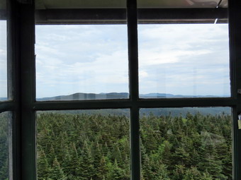 The herd path has become more of a trail over the years and it even seems that someone is clearing some of the blowdowns, nettles and briars along the way. We did no see any hikers ahead of us as we started toward Graham. For the first 1.2 miles the path heads almost due east and is flat or even descends some. It is rocky in places and has some blowdowns which are easily walked around or over. At 3.2 miles into the hike we reached the base of the climb up Graham as the path heads a little more toward the southeast. The distance to the summit from here is only .8 miles but gains 625 feet in elevation. There are a few switchbacks and flatter spots along the way which help make the grade only 15%. As we hiked up, we met one man hiking down toward us. There are many spots along the way that look like the final ascent to the summit. We finally passed a path on the left to what used to be a viewpoint and I knew we were near the top. This viewpoint ion now blocked by trees and bushes and there isn't much to see. On the final climb we were surprised by two young girls running down the trail. They were followed by their parents and another sibling. We said "Hello" and in the course of conversation they informed us that all three children had complete the 3500 foot peaks! By 1:30 PM we had hiked the 4 miles to the summit. I dropped my pack to get a drink and a protein bar while Cindy sat on some cinder blocks. I also took out the camera to take a few pictures. The views are now mostly blocked by the vegetation but I took some pictures of the ruins at the top. Someone decided to dismantle part of the old radio station at the top! There is no reason to do this especially since it is on private property. After a few minutes, I could hear people, on the other side of the building but they did not come around to say "hello" and I didn't want to see what they might be doing. We took a break Effie starting back down the mountain. When we got to the lookout to the north, I decided not to stop as it is now completely blocked by trees. The trip down seemed to go fast and by 2:30 PM we had hiked 6.0 miles and were back at the main trail. We turned left and started to walk back towed the trail up Balsam Lake Mountain. Along the way we met several groups of three to six people headed back to the Millbrook trailhead. At the next junction with the trail that heads up to the fire tower I turned right to start up the Mountain. I though Cindy might be too tired but she followed right after me. I was happy to be hiking a longer and more difficult hike but wondered how easy the steep descent on the other side would be. My legs felt surprisingly fresh as we made our way up the trail. As we were going up we met several groups of Korean hikers headed down the mountain.
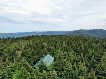 Since the trail junction is already more than 430 feet above the lower trail junction, there is less climbing to do than if yon start at the trailhead. The slope is also much more gentle averaging about 12%. Sheila and I kept hiking and I was surprised at the pace we were able to maintain and that my legs felt fine. We stopped to wait for Cindy a few times. I definitely had an advantage as I put Sheila on her leash and she pulled me up the trail. Right around the 3500 foot sign I caught the unmistakable smell of balsam fir as we transitioned from hardwood to softwood forest. Soon I could hear some noise from the area of the tower and we broke through to the clearing. Another dog immediately came over to visit and I tied Sheila to a tree. I wish people with dogs would be courteous enough to keep them on a leash. I love all dogs but not all hikers appraise a strange animal approaching them! There were half a dozen hikers at the top sitting or standing around talking. One of those people was Laurie Rankin and we recognized each other immediately. Laurie's father was a fire tower observer in the late 50's and my grandfather, Ralph Phillips, was anew York State forest Ranger. He was responsible for an area in southern Sullivan County including the Conklin Hill Fire tower near the Toronto Reservoir. We said "Hello" and caught up on what we were doing before I ascended the tower. I grabbed my camera from my pack and headed up the tower. As I climbed I noticed the wind and the chill that it brought. Laurie's husband Tom had the cab open and I was the only visitor. I took some pictures from the cab and spent some time talking to Tom who showed me some points of interest. I dropped down to a lower landing to take a few more picture unobscured by the windows of the cab. I continued to descend and once on the ground I spent a few minutes talking to the group of hikers. We said "Goodbye" and started down the steep side on the mountain. The first section wasn't too bad but as we approached the spring the rocks were very wet and slippery making getting a good foot plant and pole placement important. Below the side rail to the lean-to the trail got much steeper. The hike down to the trail junction was only about .5 miles but the loss in elevation was 730 feet for an average grade of over 28%! The trail was dry most of the rest of the way after the spring making less of a problem. As we descended we met several groups of people coming up the mountain. Once back at the main trail we turned right and headed back to the car. This part of the trail was all downhill or flat which was a welcome relief from the steep descent. On the way out we met two young parents with two children no more than 5 years old. They asked us about the lean-to and we told them we had not visited it. We were back at the car at 4:25 PM having hiked 8.5 miles in 5 hours and 20 minutes with a stop at the top of Graham and at the fire tower. The vertical gain was 2213 feet. I was surprised that the detour to Balsam Lake Mountain had only lengthen the trip by about .6 miles. It did increase the ascending by over 500 feet! On the drive back to Livingston Manor it began to rain.
![]()
![]()
![]()
![]() On Friday, September 1st my grandson Bryce was again at our house. Bryce is extremely intelligent and can carry one conversations about many topics. He is also energetic and athletic and likes to hike. We did some work around the house and played some games. Around 11:00 AM we headed across the street for a hike on Round Top. We crossed the street with Sheila on her leash and walked to the back of the church. We began the ascent of the steepest hill behind the church. The hill is short but really gets the circulation pumping and is the steepest and longest climb on the "trail". Sheila helped me along by pulling me up the hill. When we got to the top of the hill, we started out on the trail by turning left at the trailhead. As soon as we entered the trees I released Sheila from her leash. At the first trail junction we continued straight ahead to walk the steeper path to the viewpoint. At the lookout I noted that there was no garbage and everything was in order. We followed the trail to the left and started the gentle climb through the woods. Bryce and I started to tell each other Bible stories and what the meant which pleased both of us. As we reached the next trail junction, we stayed to the right to follow the lower trail around the base of Round Top to the next junction. At this junction we turned left and started up to the summit of Round Top on the steeper blue trail. Along the way we noticed several stump sticking up and a few rocks and roots that could trip hikers. We decided we would return another day to eliminate these hazards. We walked across the summit of Round Top and down the other side which is also a little steep. When we got to the yellow trail, we turned left to follow it to the second trail junction. This time we turned right and followed the yellow trail back to the very first trail junction. We had not decided exactly how many figure 8's we would do but three sounded like a good idea. We turned around and retraced our steps taking the more gentles pat this time. When the yellow trail turned left, we followed it to the next trail junction were we turned right and headed up the blue trail to the summit. We walked over the top and down the other side to the yellow trail again. We turned right and follow the trail along the base of Round Top. Where the yellow trail turned left, we followed it to the left and down to the lookout. From the lookout we walked down hill to the first trail junction. We immediately turned around and started back up the steep trail to the lookout to repeat the first figure 8. Once we were back at the first trail junction again, we ended our adventure by turning left and walking out to the trail head. I put Sheila on her leash and we walked down the cemetery hill and across the field to our driveway. It was 12:15 PM and we had hiked about 2.75 miles in 1 hour and 15 minutes.
On Friday, September 1st my grandson Bryce was again at our house. Bryce is extremely intelligent and can carry one conversations about many topics. He is also energetic and athletic and likes to hike. We did some work around the house and played some games. Around 11:00 AM we headed across the street for a hike on Round Top. We crossed the street with Sheila on her leash and walked to the back of the church. We began the ascent of the steepest hill behind the church. The hill is short but really gets the circulation pumping and is the steepest and longest climb on the "trail". Sheila helped me along by pulling me up the hill. When we got to the top of the hill, we started out on the trail by turning left at the trailhead. As soon as we entered the trees I released Sheila from her leash. At the first trail junction we continued straight ahead to walk the steeper path to the viewpoint. At the lookout I noted that there was no garbage and everything was in order. We followed the trail to the left and started the gentle climb through the woods. Bryce and I started to tell each other Bible stories and what the meant which pleased both of us. As we reached the next trail junction, we stayed to the right to follow the lower trail around the base of Round Top to the next junction. At this junction we turned left and started up to the summit of Round Top on the steeper blue trail. Along the way we noticed several stump sticking up and a few rocks and roots that could trip hikers. We decided we would return another day to eliminate these hazards. We walked across the summit of Round Top and down the other side which is also a little steep. When we got to the yellow trail, we turned left to follow it to the second trail junction. This time we turned right and followed the yellow trail back to the very first trail junction. We had not decided exactly how many figure 8's we would do but three sounded like a good idea. We turned around and retraced our steps taking the more gentles pat this time. When the yellow trail turned left, we followed it to the next trail junction were we turned right and headed up the blue trail to the summit. We walked over the top and down the other side to the yellow trail again. We turned right and follow the trail along the base of Round Top. Where the yellow trail turned left, we followed it to the left and down to the lookout. From the lookout we walked down hill to the first trail junction. We immediately turned around and started back up the steep trail to the lookout to repeat the first figure 8. Once we were back at the first trail junction again, we ended our adventure by turning left and walking out to the trail head. I put Sheila on her leash and we walked down the cemetery hill and across the field to our driveway. It was 12:15 PM and we had hiked about 2.75 miles in 1 hour and 15 minutes.
![]()
![]()
![]()
![]() On Wednesday, August 30th I decided that I wanted to go for a hike close to home. The big loop around Frock and Hodge ponds has become my "go to" hike for a quick walk close to home so I decided to head there. Sheila sniffed my clothes and immediately knew we were hiking. She began to run around the house bouncing against the furniture but always keeping a close eye on me. I put my gear in the car and an excited Sheila in the back seat and drove out the DeBruce Road at 9:40 AM. At Mongaup Pond Road I turned left and continued to follow the road bearing left onto Beech Mountain Road at the fork. When we arrived in the parking area there were no other cars parked. Sheila was acting as if she hadn't hiked in a month as she ran around and headed for the trail. The temperature was 57 degrees and I was a little cool as I got my gear ready to go. The skies were overcast and there was a breeze blowing . We headed out the path to the register on Quick Lake Trail at 10:00 AM. The Quick Lake Trail was wet with some muddy spots which we tried to avoid. At Gravestone Junction we turned left to head down to Frick Pond. The water level in the pond was low due to the fact that someone had completely pulled out the beaver dam across the outlet stream. I was disappointed to see that the beavers had not begun to rebuild the dam. Either they had moved on or someone had trapped them. The DEC rangers and the wildlife division claim no knowledge of this action so my conclusion is that someone is doing this on their own for reasons I cannot understand! I hope someone catches these vandals in the act. The sky was still overcast so I decided I would pass up taking pictures and go for a fast hike. We continued on the Quick Lake Trail around the pond bearing left at the next trail junction to stay on the red trail. This part of the trail was drier than the last time I had walked the trail but it was still damp in spots with some mud. We were setting a fast pace despite having to avoid the water and the mud. We soon came to the "pine promenade" and the little stream through the woods. This water level in the stream was higher than it had been and Sheila was able to get a drink and take a "dip". She immediately began a mad dash up and won the trail at a very high speed. As we continued along the trail I removed some small branches and a few large ones until we arrived at Iron Wheel Junction at 1.6 miles.
On Wednesday, August 30th I decided that I wanted to go for a hike close to home. The big loop around Frock and Hodge ponds has become my "go to" hike for a quick walk close to home so I decided to head there. Sheila sniffed my clothes and immediately knew we were hiking. She began to run around the house bouncing against the furniture but always keeping a close eye on me. I put my gear in the car and an excited Sheila in the back seat and drove out the DeBruce Road at 9:40 AM. At Mongaup Pond Road I turned left and continued to follow the road bearing left onto Beech Mountain Road at the fork. When we arrived in the parking area there were no other cars parked. Sheila was acting as if she hadn't hiked in a month as she ran around and headed for the trail. The temperature was 57 degrees and I was a little cool as I got my gear ready to go. The skies were overcast and there was a breeze blowing . We headed out the path to the register on Quick Lake Trail at 10:00 AM. The Quick Lake Trail was wet with some muddy spots which we tried to avoid. At Gravestone Junction we turned left to head down to Frick Pond. The water level in the pond was low due to the fact that someone had completely pulled out the beaver dam across the outlet stream. I was disappointed to see that the beavers had not begun to rebuild the dam. Either they had moved on or someone had trapped them. The DEC rangers and the wildlife division claim no knowledge of this action so my conclusion is that someone is doing this on their own for reasons I cannot understand! I hope someone catches these vandals in the act. The sky was still overcast so I decided I would pass up taking pictures and go for a fast hike. We continued on the Quick Lake Trail around the pond bearing left at the next trail junction to stay on the red trail. This part of the trail was drier than the last time I had walked the trail but it was still damp in spots with some mud. We were setting a fast pace despite having to avoid the water and the mud. We soon came to the "pine promenade" and the little stream through the woods. This water level in the stream was higher than it had been and Sheila was able to get a drink and take a "dip". She immediately began a mad dash up and won the trail at a very high speed. As we continued along the trail I removed some small branches and a few large ones until we arrived at Iron Wheel Junction at 1.6 miles.
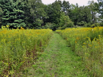
![]()
![]()
![]()
![]()
![]() On Monday, August 28th I planned to again go to the Hornell area to hike a part of the Finger Lakes Trail on Map 9. The section of trail from Bishopville Rd to Webb Rd had been relocated just as I was hiking it a little more than a week ago. The old route turned left on Bishopville Road and then ducked into the woods before coming out onto Wilson Karr Road. From there it was a road walk over Wilson Karr Road, Bishopville Road and Pennsylvania Hill Road where the trail again entered the woods. The new section of trail turned right on Bishopville Road and then followed dirt Hopkins road to a new trail along the right of way for I86 into Kanakadea Park. The trail again followed the I86 right of way before turning left on dirt Fitzgerald Road. From Fitzgerald Road the trail went through the forest before breaking out into a field and crossing Webb Road. From there the trail rejoined the old portion of the trail and headed east. I wanted to hike this new section before part of it closed on September 1st for hunting. I set my alarm for 5:00 AM but was awakened at 2:30 AM for an ambulance call. I got back home a little after 4:00 PM and decided that I would simply leave for the hike as soon as I could get ready. I was a little tired but thought I could safely do the drive and hike. I got my gear together and got dressed. I had to calla sleepy and confused Sheila from upstairs as she could not believe we were leaving so early! I had on my summer/fall pants and a light baselayer with my Columbia long-sleeved pullover shirt. I decided to try my Keen Glarus boots even though on a previous hike they had bruised my left ankle a little. I made sure I put in two full water bottles and had my water purifier with me. I also wore a light windbreaker as the temperature was in the mid 40's when I left the house at 4:45 Am. The drive is more than 3 hours but I knew a good part of the route from previous trips and did not have to worry much about directions. At 6:00 AM, we headed north and west on Route 17/I86 toward Binghamton. It was very foggy all the way to Binghamton and beyond. I stopped in Windsor at 6:45 AM to get some gas and breakfast and then continued on I86. I headed west toward Hornell but went one more exit west to Almond getting off at exit 33. I turned left off the exit onto Route 2 and then left onto Bishopville Road. After a short distance I turned right onto dirt McIntosh Road and drove to where it ended at the intersection with dirt Hopkins Road. I immediately saw the new section of the Finger Lakes Trail. I had decided to park here since the there was no parking available where the trial met Bishopville Road. My plan was to first hike from the car to the point where the trail met Bishopville road and then turn around and hike back to the car. I would then hike out to Webb Road and back. When I got out of the car, the skies looked okay but there was no sun and the temperature was 48 degrees. I decided to keep my windbreaker on and to leave my pack in the car for the hike out to the point where the trail met Bishopville Road and back to the car. I set my electronics including my Garmin GPS handheld and Suunto Traverse GPS watch. We began our hike at 8:00 AM by hiking .5 miles north on Hopkins Road and then turning right on Bishopville Road and hiking another .4 miles to where the trail met the road. We kept up a very fast pace and immediately turned around a hiked back to the car. We covered the 1.7 miles in 30 minutes for a speed of 3.4 mph.
On Monday, August 28th I planned to again go to the Hornell area to hike a part of the Finger Lakes Trail on Map 9. The section of trail from Bishopville Rd to Webb Rd had been relocated just as I was hiking it a little more than a week ago. The old route turned left on Bishopville Road and then ducked into the woods before coming out onto Wilson Karr Road. From there it was a road walk over Wilson Karr Road, Bishopville Road and Pennsylvania Hill Road where the trail again entered the woods. The new section of trail turned right on Bishopville Road and then followed dirt Hopkins road to a new trail along the right of way for I86 into Kanakadea Park. The trail again followed the I86 right of way before turning left on dirt Fitzgerald Road. From Fitzgerald Road the trail went through the forest before breaking out into a field and crossing Webb Road. From there the trail rejoined the old portion of the trail and headed east. I wanted to hike this new section before part of it closed on September 1st for hunting. I set my alarm for 5:00 AM but was awakened at 2:30 AM for an ambulance call. I got back home a little after 4:00 PM and decided that I would simply leave for the hike as soon as I could get ready. I was a little tired but thought I could safely do the drive and hike. I got my gear together and got dressed. I had to calla sleepy and confused Sheila from upstairs as she could not believe we were leaving so early! I had on my summer/fall pants and a light baselayer with my Columbia long-sleeved pullover shirt. I decided to try my Keen Glarus boots even though on a previous hike they had bruised my left ankle a little. I made sure I put in two full water bottles and had my water purifier with me. I also wore a light windbreaker as the temperature was in the mid 40's when I left the house at 4:45 Am. The drive is more than 3 hours but I knew a good part of the route from previous trips and did not have to worry much about directions. At 6:00 AM, we headed north and west on Route 17/I86 toward Binghamton. It was very foggy all the way to Binghamton and beyond. I stopped in Windsor at 6:45 AM to get some gas and breakfast and then continued on I86. I headed west toward Hornell but went one more exit west to Almond getting off at exit 33. I turned left off the exit onto Route 2 and then left onto Bishopville Road. After a short distance I turned right onto dirt McIntosh Road and drove to where it ended at the intersection with dirt Hopkins Road. I immediately saw the new section of the Finger Lakes Trail. I had decided to park here since the there was no parking available where the trial met Bishopville Road. My plan was to first hike from the car to the point where the trail met Bishopville road and then turn around and hike back to the car. I would then hike out to Webb Road and back. When I got out of the car, the skies looked okay but there was no sun and the temperature was 48 degrees. I decided to keep my windbreaker on and to leave my pack in the car for the hike out to the point where the trail met Bishopville Road and back to the car. I set my electronics including my Garmin GPS handheld and Suunto Traverse GPS watch. We began our hike at 8:00 AM by hiking .5 miles north on Hopkins Road and then turning right on Bishopville Road and hiking another .4 miles to where the trail met the road. We kept up a very fast pace and immediately turned around a hiked back to the car. We covered the 1.7 miles in 30 minutes for a speed of 3.4 mph.
 Back at the car I took off the windbreaker although it was still only 50 degrees. I shouldered my pack and we started out at 8:37 AM on the trail which was a wide swathe mowed in the grass. We walked down a short, steep bank to a wide trail cut next to the I86 right-of-way which opened up into a field. The trail was new but the goldenrod was already beginning to lean over and encroach on the newly cut area. We could hear the traffic on I86 an but it was hard to see it until we were almost ready to enter the woods once again. Just before two miles we began to descend a series of switchbacks to a small stream which turned out to be the lowest point on the hike. We paralleled the stream for a little while and then began to ascend the bank on another series of well-planned switchbacks. The trail began to look more defined and the surface was packed possibly indicating the FLT was not following a trail that had already existed. At 2.2 miles we came to the Kanakadea Lean-to with a fire pit out front and an outhouse in back. The outhouse seemed to be constructed of composite sheets rather than wood. The lean-to was large but the front was very high off the ground requiring a ladder to enter. Also, the front supports of the lean-to looked at little worse for wear giving it a somewhat unstable appearance. We were now walking through Kanakadea County park, a park maintain by Steuben County. The park borders Canacadea State Forest. The trail flattened out a little but only for a short distance when a long descent began lasting for .35 miles and losing 240 feet. Even though the park has existing blazed trails the FLT was clearly marked with white blazes. The turns were marked but in the non-standard way with one blazes directly below another so that no direction is given. Just before 3.o0 miles, we descended to cross another little stream and then ascended the opposite bank. On the left side of the trail was an impressive construction not marked on the map. Someone had collected many branches and placed them between standing trees to create walls on three sides. The shelter was large with some branches supporting a tarp to form a roof. It wasn't clear whether this structure is on park or private property. Soon after this we came to the fence which is the boundary of the I86 right-of-way and began a .8 mile section of almost perfectly straight trail heading northeast toward Fitzgerald Road. This trail definitely followed a pre-existing trail as some of the white blazes clearly were painted over older blue blazes. Unlike the previous section along I86 which was in the open, this section tabled through a predominately pine forest. Unfortunately, the trail builders relied on the previous trail and did not do much to clear this part of the trail. There were numerous spots with trees across the trail and others with untrimmed brush encroaching on the trail.
 At 3.3 miles we came down to cross another stream and the bank was very steep on both sides and needed some work. We continued waking the trail with me dodging overhanging brush and branches. At 3.8 miles we came to a small stream with a bridge across it which was further evidence that there had been a trail there before at some time. The bridge was built by a summer BOCES class in 2012. The western end of the bridge was almost suspended in the air as the stream had eroded the dirt supporting it. This allowed the whole bridge to twist. If there is any more erosion, this bridge will be unsafe. Like so many things, a little work ahead of time can save a lot of work later. We turned left on dirt Fitzgerald Road and began another uphill climb watching for the point where the trail would enter the woods again on the right. We walked about .8 miles north and then followed the trail to the right into the woods. The trail started to head northeast climbing through the mixed pine and hardwood forest. This section is the one that closes on September 1st but the bypass is too simply walk up Fitzgerald Road and then east on Webb Road. It was a short walk until we came to an open area that had been mowed and then to an open field. We walked along the west side of the field still climbing without benefit of any blazes. There were round bales in the field to the right and a large Christmas tree farm on the left. It was just beginning to get sunny as we topped the hill in the field at 4.4 miles and started downhill to Webb Road. We crossed Webb Road where there was a cemetery on the right. The trail descended through some hardwoods to a wetland crossed by several streams. The banks of the streams were almost vertical and there were no bridges to cross. I found a place to jump across but it was not the ideal situation. Again, the trail is now blazed but it needs some work to complete it.
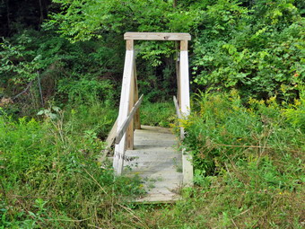 We continued through the woods along a woods road and I checked my Avenza app to make sure we would intersect the trail I had already hiked. The app showed that trail was just ahead and when we got to the spot I recognized it. At 10:00 AM we turned around to hike back to the car. We walks down the woods road to the wetland. I thought getting backs cross the stream would be easier but it wasn't. I had decided to take a few pictures n the way back so I stopped at the wetland for a few shots. We hiked back up hill to the cemetery where I spent a few minutes looking an the inscriptions on the headstones and taking some pictures. We crossed Webb Road and walked along the edge of the field. I stopped to take a few pictures but the skies where still overcast without color or clouds. Further along we turned right from the field and entered the forest. The trip downhill certainly went faster than the uphill journey earlier. We turned left onto Fitzgerald Road, walked downhill to the end and came to the bridge. I took a few pictures and then we continued on the trail retracing our route from earlier. The section of trail parallel to I86 went quickly and we were soon back at the shelter in the woods. I stopped to take some pictures of this inventive project and then we got back on the trail. The walk back up the hill to the Kanakadea Lean-to seemed longer and more difficult than it really was. We stopped at the lean-to so that I could take some pictures since this one was a little different than others I had seen. Sheila managed to climb the steep ladder so I had her pose and I too a few shots. Soon we were back on the open trail next to I86. I stopped to take a few pictures of the trail surrounded by goldenrod. We walked back to the car arriving at 11:30 AM after hiking 8 miles in 3.5 hours for a speed of 2.3 mph including stops. The elevation gain was a modest 1560 feet. I was surprised that we were done so early and I would have found some more hiking to do but I had to be back for cross country practice.
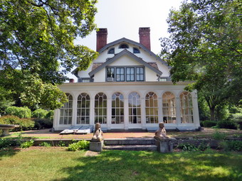
![]()
![]()
![]()
![]()
![]() On Saturday, August 26th I had planned to visit Ringwood Manor in Ringwood, New Jersey with Cindy. After visiting the house and grounds, I though we might hike the 3 mile loop trail in back of the manor house. The first tour of the house was at 11:00 AM so we did not hurry to leave the house. As we were getting ready, Sheila was excited until I explained she could not go on this adventure. I always feel bad when I leave her behind but we had been on a long hike the day before and I promised to take her out after church on Sunday. We left Livingston Manor at 10:00 AM and headed south and east on State Route 17 to exit 131 at Harriman. From here we took Route 17 south through Tuxedo to the village of Sloatsburg. I turned right on Sterling Mine Road and continued until I saw the sign for Ringwood Manor on the right. We drove in paying only $7 to park in the lot which was almost empty at about 11:40 AM. We walked over to the park office and bought tickets for the noon tour for $3 each. While we were waiting we strolled around the house and I took some pictures of the buildings and the garden. On the front lawn we found some interesting articles. There was a large chain which I knew was supposed to be from the chain use to block the Hudson River during the Revolution but was a fake. There was a Civil War era mortar with an iron base which made it sturdier than those made with a wooden base. There was also a small cannon from the USS Constitution, Old Ironsides. Promptly at noon our guide opened the door to the house and all five of us who were on the tour gathered around. After a few preliminary comments we entered the house. I was disappointed that photography was not allowed inside! The Ringwood area produced much of the iron for the American colonies throughout the Revolution and after it as well. The once belonged to Robert Erskine who was the cartographer for Washington during the Revolution. After his death, the land was sold to the Ryerson family who built a modest 10 room house in 1810 and continued to mine iron. This part of the house still stands. In 1853 the 19,000 acres of land was purchased by Peter Cooper and this included the Ringwood Manor area. Cooper bought the land to exploit the iron mining and to add it to the holdings of the very successful Cooper Hewett Company. At some point Mrs. Hewett decided to expand the existing house starting in 1864 until it had over 50 rooms and more than 20 fireplaces. Her hand in the design can be seen in most of the rooms as Mr. Hewett had a say in only three of the rooms! The Hewetts also improved the grounds of the manor with gardens. The house was lighted by gas lamps been after electricity became popular. At one time the family owned 40 custom made carriages of different types. As we toured the rooms of the first and second floors, Cindy and I were both impressed. The building from the outside is not that impressive but the inside is magnificent. Much of the building and the furnishing are original as are the numerous collections the family accumulated. The guide was very informative about the house, the ground and the people who lived there. It is definitely a place to visit and I would go back to see the whole thing again! The family donated the house and grounds to the State of New Jersey in 1938. The tour lasted almost exactly and hour an 15 minutes but I easily could have listened for another hour. After the tour concluded we decided to hike the blue Ringwood Manor Loop Trail to the north of the Manor.
On Saturday, August 26th I had planned to visit Ringwood Manor in Ringwood, New Jersey with Cindy. After visiting the house and grounds, I though we might hike the 3 mile loop trail in back of the manor house. The first tour of the house was at 11:00 AM so we did not hurry to leave the house. As we were getting ready, Sheila was excited until I explained she could not go on this adventure. I always feel bad when I leave her behind but we had been on a long hike the day before and I promised to take her out after church on Sunday. We left Livingston Manor at 10:00 AM and headed south and east on State Route 17 to exit 131 at Harriman. From here we took Route 17 south through Tuxedo to the village of Sloatsburg. I turned right on Sterling Mine Road and continued until I saw the sign for Ringwood Manor on the right. We drove in paying only $7 to park in the lot which was almost empty at about 11:40 AM. We walked over to the park office and bought tickets for the noon tour for $3 each. While we were waiting we strolled around the house and I took some pictures of the buildings and the garden. On the front lawn we found some interesting articles. There was a large chain which I knew was supposed to be from the chain use to block the Hudson River during the Revolution but was a fake. There was a Civil War era mortar with an iron base which made it sturdier than those made with a wooden base. There was also a small cannon from the USS Constitution, Old Ironsides. Promptly at noon our guide opened the door to the house and all five of us who were on the tour gathered around. After a few preliminary comments we entered the house. I was disappointed that photography was not allowed inside! The Ringwood area produced much of the iron for the American colonies throughout the Revolution and after it as well. The once belonged to Robert Erskine who was the cartographer for Washington during the Revolution. After his death, the land was sold to the Ryerson family who built a modest 10 room house in 1810 and continued to mine iron. This part of the house still stands. In 1853 the 19,000 acres of land was purchased by Peter Cooper and this included the Ringwood Manor area. Cooper bought the land to exploit the iron mining and to add it to the holdings of the very successful Cooper Hewett Company. At some point Mrs. Hewett decided to expand the existing house starting in 1864 until it had over 50 rooms and more than 20 fireplaces. Her hand in the design can be seen in most of the rooms as Mr. Hewett had a say in only three of the rooms! The Hewetts also improved the grounds of the manor with gardens. The house was lighted by gas lamps been after electricity became popular. At one time the family owned 40 custom made carriages of different types. As we toured the rooms of the first and second floors, Cindy and I were both impressed. The building from the outside is not that impressive but the inside is magnificent. Much of the building and the furnishing are original as are the numerous collections the family accumulated. The guide was very informative about the house, the ground and the people who lived there. It is definitely a place to visit and I would go back to see the whole thing again! The family donated the house and grounds to the State of New Jersey in 1938. The tour lasted almost exactly and hour an 15 minutes but I easily could have listened for another hour. After the tour concluded we decided to hike the blue Ringwood Manor Loop Trail to the north of the Manor.
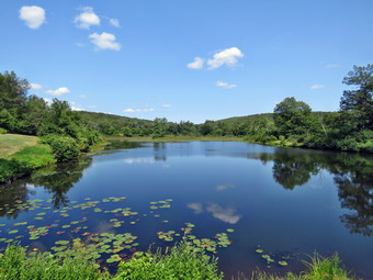 Cindy went to the car to change into hiking shoes and to lose her sweater. I decided not to take my pack and to just carry my camera. We walked to the back of the manor house to a gate in the fence. The Avenza app on my phone came in handy to tell us we were in the right spot. I turned the GPS tracking on in the app so that I did not have to carry a separate GPS unit. The results from the app are very good but it does use a lot of battery. We started off heading west until the blazes directed us to turn right or north at .1 miles. The trail started uphill gently as a wide and almost flat trail. We passed by some very large trees and at .25 miles the white connector trail headed off to the right as we stayed left on the blue trail. It was nice to walk the trail but there wasn't much to look at. At .5 miles the rail headed west and then at .7 miles it turned southwest. We crossed a couple of small streams and then approached the area where the yellow Hasenclever Iron Trail crosses the blue trail. This trail connects many of the iron mines in northern New Jersey and there was one marked on the map that I though I might like to visit. Just before the point where the trail crossed I spotted a pit that was not marked on the map. It looked very much like a small mine except I could see no tailings. I took a picture and then continued along the main trail to 1.15 miles where the yellow trail crossed. Just beyond this point we crossed a larger stream without any problems. The trail ran parallel to the stream for a short distance and then turned more to the southwest and began to climb. At 1.55 miles we hit the highest spot on the trail at which point we began to descend and head due south. The trail was rocky in places which made walking difficult. When we reached 1.9 miles the trail made a loop so that at 2.1 miles we were headed northwest on a woods road. The road continued to descend and I was desperately looking for something interesting to see. At 2.5 miles the trail came out from under the trees and we could see a pond off to the right. We walked over to the pond which had a rather substantial stone dam. On the map it was labeled as Sally's Pond after one of the Hewett children but it served as a mill pond. I took pictures of the dam and the pond. We then walked back up towed the road and spotted the cemetery a little further on. When we got to the cemetery, I took some pictures and then walked over to two graves surrounded my an iron fence. These were the graves of Robert Erskine and one of his workers. We walked won toward the shore of the pond and found the graves of some of the Hewett family. Abram and Sarah Hewett are buried in Green-Wood Cemetery in New York City as he was mayor and a three term congressman. We continued back to the point that we started on the blue trail and from there went to the car. We had spent 1 hour and 20 minutes hiking 3.1 miles and exploring the pond and the cemetery. As we drove away from the manor, we took a moment to stop at the carriage house. The carriage house was well laid out with three different carriages in good condition and several displays related to equestrian events. I took pictures and then we returned to the car for the drive home.
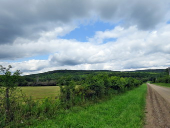
![]()
![]()
![]()
![]()
![]() On Friday, August 25th I awoke to my alarm at 5:00 AM to get ready to hike the westernmost section of Map 9 of the Finger Lakes Trail. Map 9 runs from Slader Creek Road southwest of Canaseraga to Hornell and has more north to south hiking than west to east. My plan was to park at Access 1 on Slader Creek Road and have a taxi pick me up there and drop me further south at Access 6 on Bully Hill Road. I would then hike back to my car. I would have preferred to hike in the opposite direction as that is the way the FLT sets up their map descriptions but there is no place to park on Bully Hill Road! The forecast for the Hornell area showed no chance of rain but clouds mixed with sun and highs only in the low 70's. This is almost ideal hiking weather! I was tired from a number of serious ambulance calls during the week an thought about postponing the trip. In the end I decided to go since I knew I would feel better once I was on the road. I got all my gear together while Sheila hovered around me making sure that she was going on the hike. I put on my summer/fall pants and a light baselayer with my Columbia long-sleeved pullover shirt. I decided to try my Keen Glarus boots even though on a previous hike they had bruised my left ankle a little. I made sure I put in two full water bottles and had my water purifier with me. The drive is mare than 3 hours but I knew a good part of the route from previous trips and did not have to worry much about directions. At 6:00 AM, we headed north and west on Route 17/I86 toward Binghamton. The temperature was in the high 50's but I knew it would get warmer. It was very foggy all the way to Binghamton and beyond. I stopped in Bath at 9:00 AM to get some gas and to call Village Taxi to pick me up on Slader Creek Road southwest of the village of Canaseraga. I gave specific directions for the route of travel and then hewed back out onto i86 heading west toward Hornell. I took exit 34B toward Arkport on Route 36 north. In Arkport I turned left or west on West Avenue which is Route 961F on some maps and Route 70 on others. I headed north toward the village of Canaseraga looking for Tildon Hill Road on the left. After 3.8 miles I turned left on Tildon Hill Road and drove west to County Route 13. I turned right or north and drove north only .7 miles to Slader Creek Road (Route 13C) on the left. I followed this road until I came to the Finger Lakes Trail trailhead just before the road meets Gas Spring Road. I parked on the right shoulder to wait for the taxi at about 9:40 AM. While I was waiting I decided to go check out how wide and deep Slade Creek was at this point. The map description warned that it could be deep enough to require wading at times. I walked across the road, opened the pasture gate, closed it behind me and walked down to Slader Creek which ran through the pasture. When I saw the stream, I had a good laugh as I would have trouble getting the bottom of my boots wet since there was so little water. I returned to the car to wait but by 10:00 Am the taxi had not appeared and I had no cell service. I began to plan alternate ways to hike but decided to see if I could find cell service somewhere. I drove up a hill and found service to call the taxi company. For some reason the taxi had driven to the village of Canaseraga ignoring my directions. I gave the driver explicit instructions to get to my location and drove back to park a the trail head. Within 15 the taxi appeared and I transferred my gear and Sheila to the taxi. There were several routes to get to Bully Hill Road but the shortest seemed to be via Gas Spring Road. We drove to the end of Slader Creek and turned south on Gas Springs Road. The pavement lasted only a few hundred feet when the road turned to dirt. After a short distance it became a seasonal use road with ruts and rocks. I mentioned to the driver t5hat we could turn around but he continued. Eventually we made it to paved Route 32 and turned left to head east. After taking a look at another side road, I decided we would take the longer route along paved road. We continued east on Route 32 and then took Bishopville Road South to Route 2 or Karr Valley Road. From here we headed west a few miles to Bull Hill Road. We turned right to head north on the road for .7 miles. We pulled over and the driver took my money and departed after I unloaded Sheila and my gear. It is an interesting feeling to know you are over 10 mile from your car and have no choice but to hike all the way back to it! The skies looked good and the temperature was only in the mid 60'. I set my electronics including my Garmin GPS handheld and Suunto Traverse GPS watch. We began our hike at 10:45 by hiking a short distance north on Bully Hill Road and then turning left into the woods.
On Friday, August 25th I awoke to my alarm at 5:00 AM to get ready to hike the westernmost section of Map 9 of the Finger Lakes Trail. Map 9 runs from Slader Creek Road southwest of Canaseraga to Hornell and has more north to south hiking than west to east. My plan was to park at Access 1 on Slader Creek Road and have a taxi pick me up there and drop me further south at Access 6 on Bully Hill Road. I would then hike back to my car. I would have preferred to hike in the opposite direction as that is the way the FLT sets up their map descriptions but there is no place to park on Bully Hill Road! The forecast for the Hornell area showed no chance of rain but clouds mixed with sun and highs only in the low 70's. This is almost ideal hiking weather! I was tired from a number of serious ambulance calls during the week an thought about postponing the trip. In the end I decided to go since I knew I would feel better once I was on the road. I got all my gear together while Sheila hovered around me making sure that she was going on the hike. I put on my summer/fall pants and a light baselayer with my Columbia long-sleeved pullover shirt. I decided to try my Keen Glarus boots even though on a previous hike they had bruised my left ankle a little. I made sure I put in two full water bottles and had my water purifier with me. The drive is mare than 3 hours but I knew a good part of the route from previous trips and did not have to worry much about directions. At 6:00 AM, we headed north and west on Route 17/I86 toward Binghamton. The temperature was in the high 50's but I knew it would get warmer. It was very foggy all the way to Binghamton and beyond. I stopped in Bath at 9:00 AM to get some gas and to call Village Taxi to pick me up on Slader Creek Road southwest of the village of Canaseraga. I gave specific directions for the route of travel and then hewed back out onto i86 heading west toward Hornell. I took exit 34B toward Arkport on Route 36 north. In Arkport I turned left or west on West Avenue which is Route 961F on some maps and Route 70 on others. I headed north toward the village of Canaseraga looking for Tildon Hill Road on the left. After 3.8 miles I turned left on Tildon Hill Road and drove west to County Route 13. I turned right or north and drove north only .7 miles to Slader Creek Road (Route 13C) on the left. I followed this road until I came to the Finger Lakes Trail trailhead just before the road meets Gas Spring Road. I parked on the right shoulder to wait for the taxi at about 9:40 AM. While I was waiting I decided to go check out how wide and deep Slade Creek was at this point. The map description warned that it could be deep enough to require wading at times. I walked across the road, opened the pasture gate, closed it behind me and walked down to Slader Creek which ran through the pasture. When I saw the stream, I had a good laugh as I would have trouble getting the bottom of my boots wet since there was so little water. I returned to the car to wait but by 10:00 Am the taxi had not appeared and I had no cell service. I began to plan alternate ways to hike but decided to see if I could find cell service somewhere. I drove up a hill and found service to call the taxi company. For some reason the taxi had driven to the village of Canaseraga ignoring my directions. I gave the driver explicit instructions to get to my location and drove back to park a the trail head. Within 15 the taxi appeared and I transferred my gear and Sheila to the taxi. There were several routes to get to Bully Hill Road but the shortest seemed to be via Gas Spring Road. We drove to the end of Slader Creek and turned south on Gas Springs Road. The pavement lasted only a few hundred feet when the road turned to dirt. After a short distance it became a seasonal use road with ruts and rocks. I mentioned to the driver t5hat we could turn around but he continued. Eventually we made it to paved Route 32 and turned left to head east. After taking a look at another side road, I decided we would take the longer route along paved road. We continued east on Route 32 and then took Bishopville Road South to Route 2 or Karr Valley Road. From here we headed west a few miles to Bull Hill Road. We turned right to head north on the road for .7 miles. We pulled over and the driver took my money and departed after I unloaded Sheila and my gear. It is an interesting feeling to know you are over 10 mile from your car and have no choice but to hike all the way back to it! The skies looked good and the temperature was only in the mid 60'. I set my electronics including my Garmin GPS handheld and Suunto Traverse GPS watch. We began our hike at 10:45 by hiking a short distance north on Bully Hill Road and then turning left into the woods.
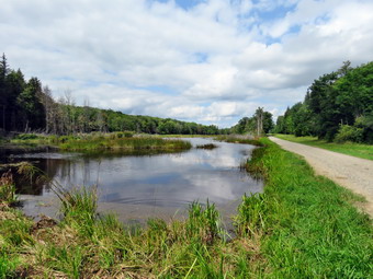 The first 1.5 miles of the trail paralleled Bully Hill Road heading northwest and uphill. The trail was muddy in spots but very well marked and the track was very obvious. The trail also was parallel to a deeply cut stream bed which showed a lot of erosion but was absolutely dry. At one point we crossed over the stream bed an then began to walk parallel to another deeply cut gorge but this one had some water in it. As we neared our first turn we walked through one of the many red pine plantations found along the Finger Lakes Trail. I was sweating a little from the uphill hiking but the temperature was still cool and the humidity low. A slight breeze was blowing and it seemed like the sun was obscured by clouds much of the time. When we reached Karr Road which is a dirt road at this point, I found a turn marked but with the typical FLT blaze that lets the hiker guess which way to turn. I looked both ways and saw no blazes! After a more careful search, I could see blazes far up the road on the left. We turned left and walked a few hundred feet on the dirt road before walking straight into the woods on a woods road that began a steeper climb. The trail was easily visible and well marked but was littered with stick and branches which no one had seen fit to clear. It seemed like this portion of the trail went on longer than it did and soon we were at another dirt road. We walled almost straight ahead onto this road and followed the white blazes walking along the almost flat road until turning right into the forest at about 2.0 miles. We walked along another woods road which eventually turned left to head toward Mike Dixon Road. After a little more than an hour, I checked my Garmin GPS and found we had hiked 2.4 miles which was a good pace. For some reason my watch had not recorded so I reset it and it seemed to work OK. We walked over some small bridges over a wet area and crossed the road at 2.4 miles. The trail was directly across from us and paralleled the road before turning and heading northwest. The walk was now through hardwood forests and we began a rather long descent which concerned me as I knew what goes down must go up again at some point! The trail was very rocky reminding me of some spots in the Catskills as we continued to follow some impressive streambeds. At 3.2 miles we passed a spot that used to be a bivouac area but now had a nice new lean-to. I did not visit as lean-tos tend to look much the same and I wanted to continue along the main trail. At 3.7 miles we came out onto Bush Road and turned right to walk down to Route 32. The road is a dirt road but in good shape. There hadn't been many photographic opportunities so far but I stopped to take a few shots of the rolling farmland and the blue skies with puffy white clouds. When I put my pack on the straps caught on my watch and I found out why the watch had not been running at the start of the hike. The buttons on the watch are so poorly designed that the watch will pause if they are accidentally pressed as happens when they catch on a pack strap. I reacted the watch and we walked down the road. A man was working at a house and we waved to each other. He was the only person I saw at any point on the hike. Just before we hit the paved road we crossed a bridge over a substantial stream which the map labeled as the Canisteo River. This was also the lowest point on the hike.
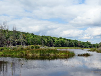 We turned left on paved Route 32 and walked west for about .2 miles. I didn't bother to put Sheila on her leash as she walks so nicely next to me and is very careful when there is traffic. When we got to Gas Springs Road we turned right and started to hike uphill on this forest access road with Klipnocky State Forest on the left and private land on the right. Just after the turn there were some snowmobile trails crossing the road but the white blazes of the FLT continued up the road. We walked up hill for about .3 miles until at 4.6 miles the trail left the road to the right. The trail was sighted along a woods road which was eroded and covered in branches and small tree trunks. This is a choice that FLT trail builders make that I will never understand. It would have been far easier to walk on the access road which has no vehicle traffic than to walk on this unmaintained trail. We crossed a small road and the trail turned into a drainage which made the hiking even more unappealing. At about 5.0 miles the trail veered away from Gas Springs Road to the right along a woods road. At 5.2 miles we entered a stand of nettles where the trail turned right and descended on a few switchbacks to cross a small stream. After heading east briefly the trail turned northeast and then north at about 5.6 miles as we continued to ascend toward another dirt road. When we got to the road we crossed it diagonally to the left and continued hiking north. The trail was very rocky in this area as we made a steep descant for .3 miles to cross a stream and then immediately regained that elevation on the other side. At about 6.9 miles the trail passed what looked like a stone quarry. The quarry was old and it was impossible to get any pictures that would show what it was. A quarry was marked on the map but as we walked I found two or three separate places that looked as if they had been quarried. Perhaps the map marked them as one because they had been part of the same operation. At 7.0 miles we turned right onto roots road and walked east briefly before turning left or north on Bill Morris Forest Road. In a short distance the road came to a nice pond. I dropped my pack and got out the camera to take some pictures. I also got another drink and a snack at this point before continuing north on the road. The skies were very blue and there were some clouds but the darker clouds that I thought might bring a shower had disappeared.
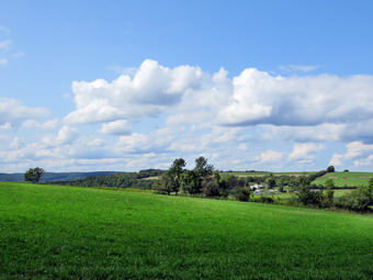 We walked along the road for about .4 miles until the trail turned left on an access road at 7.6 miles. We followed the road to a small bivouac area on the shore of a pond. I checked out the pond but jut was not as nice as the previous one so we continued north on the trail transitioning from Klipnocky SF to Gas Springs SF. This part of the trail headed almost due north but rolled a little through hardwood forest. It was very generic and had no really memorable sections. The trail continued to be well blazed and the track was worn in enough to follow even without a map. At 9.1 miles we came to a trail register which had fallen off a tree. At trail lead to the right o a camping area which must be popular by the number of tracks leading to it. From this point on the blazes on the trees faded and were hard to find. The trail had some muddy spots and quite a few branches across the trail. This seemed strange as the area is so near to an access point. We were descending most of the time and soon I could see a cabin in the woods. The trail passed the cabin and continued to meander between one woods road and the next always heading north and descending. At about 9.8 miles we broke out into some fields passing through an open gate. The farmer asks that all gates be left as they were found so I left the gate open. I stopped to take a few pictures and then continued won a farm lane on the edge of the field. The next gate was closed with a chain and tied with a rope. I didn't want to take the time to undo everything just to redo it so I slipped underneath. The farm lane now passed through a more wooded area leading down to a pasture and Slade Creek. As we crossed Slader Creek, I could see the farmer's cows downstream. We passed through the gate by the road and walked over to the car. It was 3:25 PM and we had hiked 10.2 miles in 4 hours and 40 minutes with only 15 minutes of stopped time and an overall pace of 2.2 mph. The total ascent was 1562 feet but I was surprised to find the beginning and ending elevations were identical! The temperature was just 70 degrees and it was still very pleasant. This hike was a nice walk through the woods but it may have been the least memorable hike I have taken in some time. I may return to the area one more time in the bear future as the trail from Bully Hill Toad to Hornell had a recent reroute of about 3 miles that I would like to hike as an out and back.
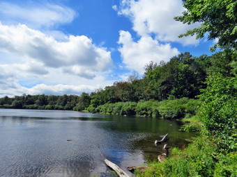
![]()
![]()
![]()
![]()
![]() On Wednesday, August 23rd I wanted to get in a hike close to home and, after trying to come up with a new hike, I decided to head for Frick Pond To hike the Flynn and Quick Lake Trails to Hodge and Frick Ponds. The weather was beautiful with bright sun and blue skies but with highs in the low 60's. I saw no reason to wait and Sheila agreed so I got ready to leave and pulled out of the driveway sometime after 10:15 AM. Sheila was certainly ready to hike as she jumped in the back seat and perched on the console. I drove out DeBruce Road and turned left on Mongaup Road. When we arrived there were two other cars in the bigger lot. We crossed the road to get onto the Flynn Trail at 10:35 AM. The trail seemed a little damp as we walked through the woods from the rain we had over the previous couple of days. We turned right onto the woods road as we came out of the woods and the trail continued to be wet and was now muddy. It wasn't long before I looked up to see another hiker headed down the trail in our direction. I put Sheila on her leash and the hiker stopped to talk. His name was Marv and he was from New Jersey. He was in the area to finish the trails around Frick Pond that he had not covered for the CMC All Trails Challenge. I told him that I was #2 on that list. We talked about other lists and he said he was working on the grid of the Catskill 3500 foot peaks. We talked about the Long Path, the Finger Lakes Trail and the Catskill Highest Hundred before heading in our opposite directions. I was happy Sheila behaved even when we shook hands! I had been feeling a little sluggish but meeting another hiker with similar goals energized me so that I picked up the pace of my hike. Soon we were at the junction with the big Rock Trail where we continued straight ahead on the Flynn Trail. We kept up a quick pace as we passed through the gate marking the boundary with the Open Spaces Institute property. At the next junction we stayed to the right to walk the woods road which is not part of the Flynn Trail. OSI had decided to level the Flynn Trail from Frick Pond to where the trail turned into the woods and it was a muddy mess the last time I passed through. I hoped to avoid this. At the next trail unction we turned left to walk down the hill toward the pond and found they had made the same strange decision to remove all the grass on this trail and allow erosion to wash away the soil! At the bottom of the hill we turned right to follow the old jeep road around the northern end of Hodge Pond. I had almost decided not to stop to take any pictures but the view was so nice I turned off the trail and walked to the shore to take a few shots. Sheila jumped in the pond to get a drink and take a dip. She came out and started to dash madly around me running in tight circles for the pure joy of it. We walked back to the main trail and continued to the point where the Flynn trail turns up into the woods. We walked up the hill and through the gate that marks the end of the OSI property.
On Wednesday, August 23rd I wanted to get in a hike close to home and, after trying to come up with a new hike, I decided to head for Frick Pond To hike the Flynn and Quick Lake Trails to Hodge and Frick Ponds. The weather was beautiful with bright sun and blue skies but with highs in the low 60's. I saw no reason to wait and Sheila agreed so I got ready to leave and pulled out of the driveway sometime after 10:15 AM. Sheila was certainly ready to hike as she jumped in the back seat and perched on the console. I drove out DeBruce Road and turned left on Mongaup Road. When we arrived there were two other cars in the bigger lot. We crossed the road to get onto the Flynn Trail at 10:35 AM. The trail seemed a little damp as we walked through the woods from the rain we had over the previous couple of days. We turned right onto the woods road as we came out of the woods and the trail continued to be wet and was now muddy. It wasn't long before I looked up to see another hiker headed down the trail in our direction. I put Sheila on her leash and the hiker stopped to talk. His name was Marv and he was from New Jersey. He was in the area to finish the trails around Frick Pond that he had not covered for the CMC All Trails Challenge. I told him that I was #2 on that list. We talked about other lists and he said he was working on the grid of the Catskill 3500 foot peaks. We talked about the Long Path, the Finger Lakes Trail and the Catskill Highest Hundred before heading in our opposite directions. I was happy Sheila behaved even when we shook hands! I had been feeling a little sluggish but meeting another hiker with similar goals energized me so that I picked up the pace of my hike. Soon we were at the junction with the big Rock Trail where we continued straight ahead on the Flynn Trail. We kept up a quick pace as we passed through the gate marking the boundary with the Open Spaces Institute property. At the next junction we stayed to the right to walk the woods road which is not part of the Flynn Trail. OSI had decided to level the Flynn Trail from Frick Pond to where the trail turned into the woods and it was a muddy mess the last time I passed through. I hoped to avoid this. At the next trail unction we turned left to walk down the hill toward the pond and found they had made the same strange decision to remove all the grass on this trail and allow erosion to wash away the soil! At the bottom of the hill we turned right to follow the old jeep road around the northern end of Hodge Pond. I had almost decided not to stop to take any pictures but the view was so nice I turned off the trail and walked to the shore to take a few shots. Sheila jumped in the pond to get a drink and take a dip. She came out and started to dash madly around me running in tight circles for the pure joy of it. We walked back to the main trail and continued to the point where the Flynn trail turns up into the woods. We walked up the hill and through the gate that marks the end of the OSI property.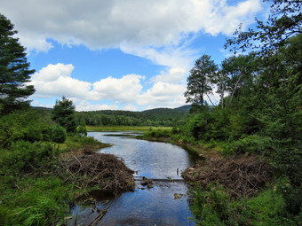 We found the trail continued to have some wet and muddy spots but wasn't any worse than the last time we had walked the trail. I had been picking up branches as we hiked and had moved several large ones off the trail. It seemed that Junkyard Junction came up quickly and we turned left on the red Quick Lake Trail to start our loop back. The Quick Lake Trail is mostly downhill and we made good time after getting passed some very wet spots on the flat area right after the junction. We walked downhill to Iron Wheel Junction finding the trail almost dry. At the junction we turned right to stay on the Quick Lake Trail and ran into some more wet spots along the way. We were soon at the small stream just before the "Spruce Tunnel" and I crossed it with ease. The stream was low but Sheila was able to get a drink and get another dip. We continued on toward the outlet bridge at Frick Pond. We continued to stop so that I could remove branches and other debris from the trail. The trail was wet but passable to the junction with the Big Rock Trail. At the bridge over the outlet stream to Frick Pond I stopped to take a few pictures which I thought might be interesting. The sky was blue with puffy white clouds and the highest part of Flynn's Point was clearly visible. It was disturbing that the beavers had not begun to rebuild the dam which some vandals had removed. No one at the DEC seemed to know about this so I assume it was a private citizen who for some reason thought it was a good idea. We walked up the hill to Gravestone Junction. The trail back to the parking area was a little wet and muddy in places but we had no problems. As we passed the register box, we turned right to stay on the trail and caught up to an older woman from Phoenicia. We talked at we walked and were soon in the bigger parking area. Two young men sat on some stones and we exchanged greetings. We were back a the car at 1:10 PM hiked 6.4 miles in 2 hours 35 minutes gaining 920 feet along the way. The temperature at the trailhead was now 64 degrees.
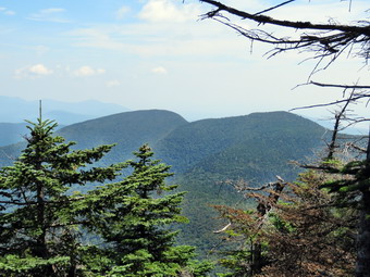
![]()
![]()
![]()
![]()
![]() On Monday, August 21st, I decided I wanted to hike Slide Mountain as I had not been there is a year and it is close to home. I like to throw in a 3500 foot peak every now and then for the challenge and to prove to myself I can still hike elevation as well as distance. I asked Cindy if she wanted to go and was a little surprised when she said yes. The start of the day was very foggy and we decided to wait a little while before heading out. This was also the day of the long awaited solar eclipse but tat was supposed to occur in the mid afternoon. As we started to get ready Sheila was very excited and indicated she didn't care where we went as long as we got out of the house. I headed out the DeBruce Road at about 10:00 AM and drove passed Round Pond and down to Route 47. I turned left and drove toward Frost Valley. After passing the YMCA camp, I watched for the parking area for Slide Mountain. The Biscuit Brook parking area had six cars in it and I wondered if Slide would be crowded. I pulled in just before 10:30 AM and found three cars in the lot. Another car pulled in just as we were getting ready to leave. I set my electronics and we got on the trail right away. Starting out on the main trail we immediately crossed the Neversink River which had some water flowing in it. This was the first time in a long time I had seen water there. The other small streams along the trail were also flowing freely. A crew from the ADK had done some work on the trail and I was looking for the results of their efforts. The e-mail said they had worked on a new rock staircase, drainage strictures and wooden steps but did not specify where. In just less than half a mile we turned right on the woods road and hiked passed the first piped spring which was running well. The trail was wet with some standing and some running water and some muddy areas. At .7 miles we turned left and started up the main trail to Slide Mountain which, according to the sign, was 2 miles away. The trailhead for Slide has a relatively high elevation so, although it is the highest peak in the Catskills, the elevation gain and grade are relatively modest. I was really feeling pretty good as we hiked even though I had been doing flat hikes on smooth trails. Sheila alerted and a pair of hikers passed us coming down from the summit. We said "Hello" as we passed and commented on the beautiful weather. This happened several more times along the trail until we were sure we would have the summit to ourselves. By the time we reached the designated campsite at 1.2 miles the grade was getting steeper and I was still feeling fresh although Cindy had slowed down a little. The trail was every bit as rocky as it ever was which makes ascending difficult and descending worse. We kept a good pace up the trail and I kept looking for the 3500 foot sign. Soon we started to enter the transition zone from Hardwoods to evergreens and I asked Cindy if she had seen the sign. She told me she had and it was sometime back. The spring on the left had some water in it since I could hear Sheila getting a drink. The glimpses I could get of the sky showed bright blue with white clouds and the plenty of sun. At 1.7 miles the trail started to level some and was covered with fine quartz sand. The Catskills including Slide Mountain are a plateau that was once under an ocean and have been pushed up to form what are called mountains.
On Monday, August 21st, I decided I wanted to hike Slide Mountain as I had not been there is a year and it is close to home. I like to throw in a 3500 foot peak every now and then for the challenge and to prove to myself I can still hike elevation as well as distance. I asked Cindy if she wanted to go and was a little surprised when she said yes. The start of the day was very foggy and we decided to wait a little while before heading out. This was also the day of the long awaited solar eclipse but tat was supposed to occur in the mid afternoon. As we started to get ready Sheila was very excited and indicated she didn't care where we went as long as we got out of the house. I headed out the DeBruce Road at about 10:00 AM and drove passed Round Pond and down to Route 47. I turned left and drove toward Frost Valley. After passing the YMCA camp, I watched for the parking area for Slide Mountain. The Biscuit Brook parking area had six cars in it and I wondered if Slide would be crowded. I pulled in just before 10:30 AM and found three cars in the lot. Another car pulled in just as we were getting ready to leave. I set my electronics and we got on the trail right away. Starting out on the main trail we immediately crossed the Neversink River which had some water flowing in it. This was the first time in a long time I had seen water there. The other small streams along the trail were also flowing freely. A crew from the ADK had done some work on the trail and I was looking for the results of their efforts. The e-mail said they had worked on a new rock staircase, drainage strictures and wooden steps but did not specify where. In just less than half a mile we turned right on the woods road and hiked passed the first piped spring which was running well. The trail was wet with some standing and some running water and some muddy areas. At .7 miles we turned left and started up the main trail to Slide Mountain which, according to the sign, was 2 miles away. The trailhead for Slide has a relatively high elevation so, although it is the highest peak in the Catskills, the elevation gain and grade are relatively modest. I was really feeling pretty good as we hiked even though I had been doing flat hikes on smooth trails. Sheila alerted and a pair of hikers passed us coming down from the summit. We said "Hello" as we passed and commented on the beautiful weather. This happened several more times along the trail until we were sure we would have the summit to ourselves. By the time we reached the designated campsite at 1.2 miles the grade was getting steeper and I was still feeling fresh although Cindy had slowed down a little. The trail was every bit as rocky as it ever was which makes ascending difficult and descending worse. We kept a good pace up the trail and I kept looking for the 3500 foot sign. Soon we started to enter the transition zone from Hardwoods to evergreens and I asked Cindy if she had seen the sign. She told me she had and it was sometime back. The spring on the left had some water in it since I could hear Sheila getting a drink. The glimpses I could get of the sky showed bright blue with white clouds and the plenty of sun. At 1.7 miles the trail started to level some and was covered with fine quartz sand. The Catskills including Slide Mountain are a plateau that was once under an ocean and have been pushed up to form what are called mountains.
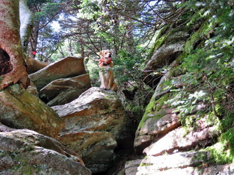 We continued up the trail and I began to notice that some of the blowdowns had been cleared from the trail. There were still quiet a few trees leaning over the trail which I do not think is a good situation. Some trees were low and had branches cut in such a way that the remaining pieces formed "spears" that pointed downward. I imagine some taller hikers may have had problems with these. There were several lookouts along the way bit most were not interesting and what I could see was very hazy. Soon the trail leveled again as we had done most of the climbing. At 2 miles we passed the Curtis-Ormsbee Trail as it came in from the left from the Denning trailhead. The trail leveled some here and I enjoyed walking along the path strewn with pine needles. The trail continued to be muddy which was unusual this high up on Slide. Soon we were approaching the last climb and I found a viewpoint that clearly showed Cornell and Wittenberg and the col between them. After taking a few shots, I returned to the main trail and at 2.6 miles we were at the viewpoint toward Panther and Giant Ledge. I decided to stop and take a few shots even though the trees in front of the lookout have all but obscured the view. Based on the number of cars in the lot and the people coming down the mountain, I judged that the summit would be empty. We passed by the highest point on Slide where a cement block marks the location where a fire tower once stood and continued to the rock outcropping to find it deserted. It was 12:20 PM and we had covered 2.7 miles. I made sure I hydrated although I wasn't very thirsty. I tried to take a few pictures of the Ashokan Reservoir, Cornell and Wittenberg and found the views were more open than the last time I had been at the top. There was a haze hanging over the far peaks but I still took a few pictures. I decided I wanted to go down to the spring since I had not yet seen any of the work the ADK crew had done and I knew the only wooden steps were on the Cornell side of Slide! Cindy did not want to go so I left my poles with her since there are several rock scrambles and the poles get in the way. Sheila and I headed down the trail to the spring. We made our way through three or four rock scrambles and I bypassed several picture taking opportunities which I decided I would take damage of on the way back. We finally got to the wooden ladders and at first glance they seemed unchanged. On closer inspection, the had hewn logs which had been rotting away were replaced with new 4by4's making it much safer. I had intended just to go to the steps but changed my mind and headed down to the spring. I could hear it running and I could hear Sheila getting a drink. When I arrived, Sheila was frolicking in the outflow and drinking the cool water. I took a few pictures and then we started back.
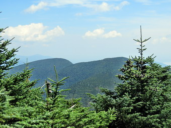 And the way up I kept looking for viewpoint and I found a few good ones with views toward Cornell and Wittenberg. I also took a few pictures of Sheila posed on the ladders and above me at the rock scrambles. Our last stop on the way up was a small campsite on the right where someone had pushed down a few trees to make a nice viewpoint. After taking a few shots, we continued up the main trail to the summit. As we approached the summit, I could hear Cindy talking to someone and I pout Sheila on her leash. As we cleared the trees, I saw a very large white dog above us and two young men talking to Cindy. We continued up to the rocks at the summit where the two dogs said "hello" in dog fashion. Cindy was ready to go but the hikers had a few questions about the other peaks. I gave them the distances and route to Cornell and Wittenberg and they decided to stay at the summit of Slide and wait for the eclipse. We said "goodbye" and headed back done the mountain at 1:00 PM. We knew the eclipse was supposed to start at about 1:45 PM and reach its peak at 2:45 PM. As we passed the viewpoint on the right there was a couple taking in the view. I had hoped to make quick work of the descent but the rocks make the descent difficult to accomplish safely. As we hiked own we met several groups of people headed up the mountain and some of them also had dogs with them.
I always hike with poles even when it seems I don't need the. On this hike I was very glad I had them with me. Sheila decided that she would dash madly up and own the trail for no reason other than sheer joy! We passed the 3500 foot sign and continued down the trail. On the ascent I thought there seemed to be less rolling rocks than I remembered but they were all there on the descent. Near the bottom of the trail Cindy remarked that she hoped the intersection was coming up soon. It did! We turned right on the woods road and hiked along the wet and muddy trail to the left that leads back to the parking area. This last part of the trail seemed very rocky but we made good time back to the river bed. I stopped to take a few pictures of the water in the river before returning to the car. We had noticed that the light seemed odd and that the eclipse was in progress but we could not get a good look through the trees. We arrived at the car at 2:30 PM having covered 6.0 miles in 4 hours with 2072 feet of elevation gain. On the way home Cindy and I both caught a glimpse of the eclipse and I pulled over to take a picture. By the time I got the camera out, the sun had gone behind a cloud!
And the way up I kept looking for viewpoint and I found a few good ones with views toward Cornell and Wittenberg. I also took a few pictures of Sheila posed on the ladders and above me at the rock scrambles. Our last stop on the way up was a small campsite on the right where someone had pushed down a few trees to make a nice viewpoint. After taking a few shots, we continued up the main trail to the summit. As we approached the summit, I could hear Cindy talking to someone and I pout Sheila on her leash. As we cleared the trees, I saw a very large white dog above us and two young men talking to Cindy. We continued up to the rocks at the summit where the two dogs said "hello" in dog fashion. Cindy was ready to go but the hikers had a few questions about the other peaks. I gave them the distances and route to Cornell and Wittenberg and they decided to stay at the summit of Slide and wait for the eclipse. We said "goodbye" and headed back done the mountain at 1:00 PM. We knew the eclipse was supposed to start at about 1:45 PM and reach its peak at 2:45 PM. As we passed the viewpoint on the right there was a couple taking in the view. I had hoped to make quick work of the descent but the rocks make the descent difficult to accomplish safely. As we hiked own we met several groups of people headed up the mountain and some of them also had dogs with them.
I always hike with poles even when it seems I don't need the. On this hike I was very glad I had them with me. Sheila decided that she would dash madly up and own the trail for no reason other than sheer joy! We passed the 3500 foot sign and continued down the trail. On the ascent I thought there seemed to be less rolling rocks than I remembered but they were all there on the descent. Near the bottom of the trail Cindy remarked that she hoped the intersection was coming up soon. It did! We turned right on the woods road and hiked along the wet and muddy trail to the left that leads back to the parking area. This last part of the trail seemed very rocky but we made good time back to the river bed. I stopped to take a few pictures of the water in the river before returning to the car. We had noticed that the light seemed odd and that the eclipse was in progress but we could not get a good look through the trees. We arrived at the car at 2:30 PM having covered 6.0 miles in 4 hours with 2072 feet of elevation gain. On the way home Cindy and I both caught a glimpse of the eclipse and I pulled over to take a picture. By the time I got the camera out, the sun had gone behind a cloud!
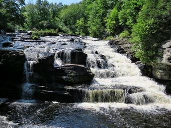
![]() On Saturday, August 19th Cindy and I had spent some time at Grey Towers in Milford, PA and were on the way home via Route 6 to Shohola. I asked her if she would like to stop by Shohola Falls as it was on the way. She agreed and we turned left onto Route 6 from the Old Owego turnpike and headed west. The turn for Shohola Falls is a left about 9.6 miles from the Owego Turnpike at the sign for then Shohola Falls Inn. We turned left and drove up the road until a left turn led us down to the parking area for Shohola Lake. We parked and I got my camera to take some pictures. I really didn't know what to expect as it seemed dry in the area but I could see water leaving the spillway of the dam. We walked down the steps to the rock shelves that line the edge of the falls. New wooden steps with railings had replaced the old slippery stone steps. There was quite a bit of water flowing over the falls and I took several pictures from the side before walking down over the rocks to get some more shots. The water flows over bedrock at about a 45 degrees angle before dropping 20 feet to the pool below. I found the narrow path that skirts the edge of the gorge and walked along it until I was directly opposite the falls. This was a great vantage point to take pictures of the falls head on. I took some shots and the realized Cindy was not with me. She was still on the rocks where we had first stopped. This didn't surprise me much as she does not like to get hear the edge of any cliffs and the path was a little narrow. I walked back to her and we ascended the stairs to the top. Cindy went back to the car while I walked over to the clearing just below the dam and took a few pictures of the dam. I then walked a path from the lower parking area toward the shore of the lake. As I approached a blue heron flew up from the lake and crossed over to the other shore. The lake is large with marshland all around a several small islands. I took a variety of shots before heading back to the car. It was still hot with some humidity so we decided to head home after two great adventures for the day.
On Saturday, August 19th Cindy and I had spent some time at Grey Towers in Milford, PA and were on the way home via Route 6 to Shohola. I asked her if she would like to stop by Shohola Falls as it was on the way. She agreed and we turned left onto Route 6 from the Old Owego turnpike and headed west. The turn for Shohola Falls is a left about 9.6 miles from the Owego Turnpike at the sign for then Shohola Falls Inn. We turned left and drove up the road until a left turn led us down to the parking area for Shohola Lake. We parked and I got my camera to take some pictures. I really didn't know what to expect as it seemed dry in the area but I could see water leaving the spillway of the dam. We walked down the steps to the rock shelves that line the edge of the falls. New wooden steps with railings had replaced the old slippery stone steps. There was quite a bit of water flowing over the falls and I took several pictures from the side before walking down over the rocks to get some more shots. The water flows over bedrock at about a 45 degrees angle before dropping 20 feet to the pool below. I found the narrow path that skirts the edge of the gorge and walked along it until I was directly opposite the falls. This was a great vantage point to take pictures of the falls head on. I took some shots and the realized Cindy was not with me. She was still on the rocks where we had first stopped. This didn't surprise me much as she does not like to get hear the edge of any cliffs and the path was a little narrow. I walked back to her and we ascended the stairs to the top. Cindy went back to the car while I walked over to the clearing just below the dam and took a few pictures of the dam. I then walked a path from the lower parking area toward the shore of the lake. As I approached a blue heron flew up from the lake and crossed over to the other shore. The lake is large with marshland all around a several small islands. I took a variety of shots before heading back to the car. It was still hot with some humidity so we decided to head home after two great adventures for the day.
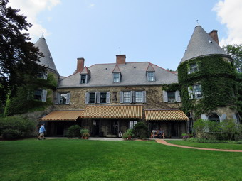
![]() On Saturday, August 19th I was tired from the FLT hike I had done the day before near Hornell. The 9.7 miles hike wasn't too hard but the temperature was in the high 80's with a handily level to match it. Also, the round trip drive is almost 400 miles which is more tiring than the hike. I wanted to do something with Cindy and suggest we go to Grey Towers in Milford, PA. Grey Towers is a National Historical site maintained by the US Forestry Service. The mansion was built in 1886 by James Pinchot as a summer house. James Pinchot made a fortune selling imported wallpapers and curtains to the wealthy in New York. Gifford Pinchot, James' son, inherited Grey Towers in 1914 was the person responsible for developing the idea of the National Forestry Service. He was also the first director of the USFS. Gifford Pinchot later served as the Governor of Pennsylvania. He and his wife Cornelia made several changes to the mansion to accommodate new ideas and to entertain many important guests. Gifford's son Gifford Bryce inherited the mansion and 120 acre grounds in 1960 but did not use it much. In 1963 he donated it to the USFS. On September 24, 1963, President John Kennedy dedicated Grey Towers speaking to a crowd of over 10,000 gather in the amphitheater and on the grounds. President Kennedy was assassinated only two months later. Grey Towers does not open until 11:00 AM so Cindy and I decided to go to Milford and eat at 11:00 AM before continuing on to Grey Towers for a tour of the mansion and a walk around the grounds. We left a sad Sheila at home and headed out of Livingston Manor at 9:50 AM. I drove east on State Route 17 to Monticello where I picked up Route 42 south to Port Jervis. We crossed the river and drove through Matamoras to pick up I84 west to Milford. The drive on I84 was quick and after getting off at the Milford exit, I drove into town on Route 6. We had decided to eat at the Tequila Sunrise Mexican restaurant and found it easily. It was a few minutes before 11:00 Am so we waited and they opened on time. We went inside and found the place to be small but the food excellent. After eating our meal, we headed back north and west on Route 6 to the Old Owego Turnpike. I turned left and stayed to the left at the next sign for Grey Towers. I parked in the lower lot. Cindy took her fanny pack and I grabbed my camera as we started up the stairs toward the mansion. We stopped at the bathrooms at the entrance and then continue up the path to the mansion hoping to get in on the noon mansion tour. When we arrived, we waited in line and found that the noon tour was filled. I paid for the 1:00 PM tour using my senior citizens discount for the first time! Since we had about an hour to kill, we decided not to sit around but to do some walking around the grounds.
On Saturday, August 19th I was tired from the FLT hike I had done the day before near Hornell. The 9.7 miles hike wasn't too hard but the temperature was in the high 80's with a handily level to match it. Also, the round trip drive is almost 400 miles which is more tiring than the hike. I wanted to do something with Cindy and suggest we go to Grey Towers in Milford, PA. Grey Towers is a National Historical site maintained by the US Forestry Service. The mansion was built in 1886 by James Pinchot as a summer house. James Pinchot made a fortune selling imported wallpapers and curtains to the wealthy in New York. Gifford Pinchot, James' son, inherited Grey Towers in 1914 was the person responsible for developing the idea of the National Forestry Service. He was also the first director of the USFS. Gifford Pinchot later served as the Governor of Pennsylvania. He and his wife Cornelia made several changes to the mansion to accommodate new ideas and to entertain many important guests. Gifford's son Gifford Bryce inherited the mansion and 120 acre grounds in 1960 but did not use it much. In 1963 he donated it to the USFS. On September 24, 1963, President John Kennedy dedicated Grey Towers speaking to a crowd of over 10,000 gather in the amphitheater and on the grounds. President Kennedy was assassinated only two months later. Grey Towers does not open until 11:00 AM so Cindy and I decided to go to Milford and eat at 11:00 AM before continuing on to Grey Towers for a tour of the mansion and a walk around the grounds. We left a sad Sheila at home and headed out of Livingston Manor at 9:50 AM. I drove east on State Route 17 to Monticello where I picked up Route 42 south to Port Jervis. We crossed the river and drove through Matamoras to pick up I84 west to Milford. The drive on I84 was quick and after getting off at the Milford exit, I drove into town on Route 6. We had decided to eat at the Tequila Sunrise Mexican restaurant and found it easily. It was a few minutes before 11:00 Am so we waited and they opened on time. We went inside and found the place to be small but the food excellent. After eating our meal, we headed back north and west on Route 6 to the Old Owego Turnpike. I turned left and stayed to the left at the next sign for Grey Towers. I parked in the lower lot. Cindy took her fanny pack and I grabbed my camera as we started up the stairs toward the mansion. We stopped at the bathrooms at the entrance and then continue up the path to the mansion hoping to get in on the noon mansion tour. When we arrived, we waited in line and found that the noon tour was filled. I paid for the 1:00 PM tour using my senior citizens discount for the first time! Since we had about an hour to kill, we decided not to sit around but to do some walking around the grounds.
 We walked around the back of the mansion and I took a few pictures of the impressive towers before walking up a set of steps looking for the Forest Adventure Trail. We walked up a paved roadway and found the sign indicating the trail but could not tell whether we were supposed to turn onto the trail at that point or continue up the pavement. We turned right and started walking on a well-groomed trail through a pine forest. We came to a gate that allowed us to pass through a high wire fence. The sign stated that people were allowed in but not deer. We walked along the trail ascending the hill using several switchbacks. The trail was pleasant but we didn't feel that sense of adventure. As the trail levels off at the top we came to a large canvas tent which is a recreation of how Yale Forestry students lived over 100 years ago. Further along several signs explained the diseases and parasites that are killing many of the trees. Just before we started back on the pavement, there was a wooden water tower partially collapsed at the side of the trail. This was the original water tower that supplied the mansion. We walked back down the hill and sued the steps to get back down to the mansion. Since we still had a few minutes before the tour, we walked won to the walled garden in front of the house. The wall now separates public and private property but through the gate we could see some magnificent urns. I took some pictures through the gate before we headed up to the east terrace to wait for the tour to begin. While waiting, I took pictures of the mansion from this vantage point as well as some pictures of the view. The tour guide appeared promptly at 1:00 PM and gave some interesting background information to our group of 24 people.
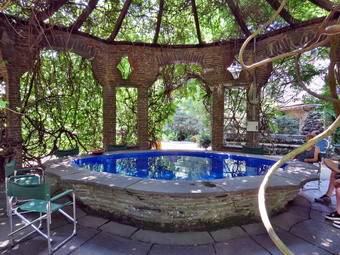 After completing her introduction, the guide led us around to the front of the house and through the massive oak door into the Great Hall. The room would have been very dark but had some artificial lighting and was very cool. We were allowed to look around before the guide began to explain the various features of the room and its furniture. I took some pictures and waited until the group started to me into the library to take a few more. The library was created by Cornelia Pinchot in the 1920's and has a more "modern" look than some of the other rooms. There were some very interesting original books and a lobe that is about 100 years old. Various pieces of furniture of different eras were in the room. Gifford Pinchot's study was a small room off to the side. I again took as many pictures as I could knowing that the lighting conditions were far from ideal. We then made our way to the sitting room which had several large couches and a huge fireplace. There was a small dining table but the family preferred to eat outdoors whenever possible. The walls had several murals with nautical themes which had to be completely restored after 1963 due to extensive water damage. Doors in the room led to the kitchen and pantry and to an elevator to the upper floors. We walked out the door and around to the side of the house where there was a patio originally constructed of marble. When the marble deteriorated it was replaced with granite which in turn in showing wear. In the center of the patio is a stone engraved with the outline of a ship. The ship is the Mary Pinchot which took the family on a South Seas adventure. From here we passed to a somewhat circular, raised pool about three feet above ground and 15 feet across. Chairs were set around the pool which was known as the "finger Bowl" and severed as the dining "table". Food was passed by floating it across the pool in wooden bowls! The whole was enclosed by a stone structure with a wooden frame over the top. This was covered in wisteria which was quiet impressive. Our final stop o the tour was outside the Letter Box a building used by Gifford Pinchot' staff when he was Governor of Pennsylvania. This building is now used for a series of film clips about the mansion and grounds. The Bait Box was constructed as a play house for the Pinchot family and is now being restored. Below the Bait box was a small forge to allow Gifford Bryce to practice his iron working skills. Leading from the Letter Box to the Bait Box is a long pool called the Long Garden. Water was leaking from the pool so it was drained and is being repaired. The guide also mentioned the immense European copper beech trees that Gifford Pinchot planted. The tour was very informative and we would like to go again when the upper two floors are open.
 After completing the tour we walked down the lawn passed the moat where I took a few shots. We ended up passing through the amphitheater and walking to the upper part of the entrance building. I took some pictures from and of this vantage point before walking out the back. We turned right and followed the signs toward the Laurel Hill Cemetery which was the first cemetery for Milford. Many of the Pinchot family are buried here while some are interred at the newer cemetery. The grounds are fenced to keep the deer out and there is an extensive project in progress to identify both the marked and unmarked graves and to restore headstones whenever possible. We walked around looking at the graves stones and many "Possible site of an unmarked greave" markers. We also noticed some VERY tall oak trees whose first branches were very high off the ground. I continued to take a lot of pictures as we walked. Soon we had circled the grounds and headed back to the gate for the walk back to the car. The whole trip and tour had been worth the time and we would both go again. As we left Grey Towers, I suggested we head home on Route 6 and visit Shohola Falls and, to my surprise, Cindy agreed.
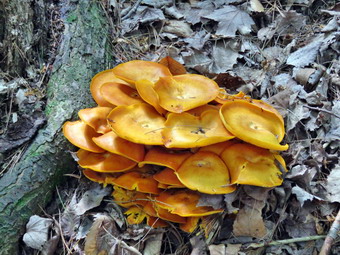
![]()
![]()
![]()
![]()
![]() On Friday, August 18th I awoke to my alarm at 5:30 AM to get ready to hike the easternmost section of Map 9 of the Finger Lakes Trail. Map 9 runs from Slader Creek Road southwest of Canaseraga to Hornell and has more north to south hiking than west to east. The forecast from the night before for the Hornell area showed an almost 40% chance of showers until 11:00 AM. The forecast remained the same in the morning but the radar seems to indicate a higher probability. Saturday looked better at least until the mid-afternoon so after much deliberation I decided to put the hike off until Saturday. I went back to bed but could not sleep and thought more an more about my decision. In the end I decided to go and take my chances. I got all my gear together while Sheila hovered around me making sure that she was going on the hike. I knew I would have to dress for the warm weather and put on my summer/fall pants and a light baselayer with my Columbia long-sleeved pullover shirt. I decided to try my Keen Glarus boots even though on a previous hike they had bruised my left ankle a little. I made sure I put in two full water bottles and had my water purifier with me. The drive is almost 3 hours but I knew a good part of the route from previous trips and did not have to worry much about directions. Around 7:30 AM, we headed north and west on Route 17/I86 toward Binghamton. The temperature was in the high 60's but I knew it would get warmer. The bigger concern was that it was raining all the way to Binghamton and beyond. I seriously considered turning around but stuck to my plan and the rain ended somewhere west of Corning. It seemed that it had not rain at all and the skies were sunny and bright blue with puffy white clouds. I stopped in Bath at 10:30 AM to get some gas and to call Village Taxi to pick me up in Hornell. He was already on another call but told me it would only be 15 minutes/ I continued west on 17/I86 and took exit 34 to Hornell. After getting off the exit I turned right on Route 66 and drove to the railroad tracks where I parked in the new parking area. I let Sheila out and walked her on her line for a few minutes and then went back to the car. Just as I was about to call, the taxi pulled up at 11:00 AM. He had another fare with him that we had to drop off in Hornell which did not thrill me. Fortunately the dropoff went smoothly and we were soon on Route 21 south To Almond. We turned west on Route 2 and the north on Bully Hill Road. As we drove north on the road I used my Avenza app to pinpoint the exact location of the trail which was .7 miles from Route 2. The driver took my money and I gave him a map of the next hike. I unloaded Sheila and my gear and got ready to start. The skies still looked good but it was hotter and very humid. I set my electronics including my Garmin GPS handheld and Suunto Traverse GPS watch. The trail began to climb immediately although not too steeply and it paralleled a stream which was almost dry. The trail was much drier than I had expected and even the muddy areas were drying out. I immediately notice that the trails were well maintained and well marked. This was a stark comparison to the poorly maintained and poorly marked trails on Map 10 to the east in Steuben County! At 1.0 mile we crossed Karr Road and continued on an old woods road on the other side. The trail was well-marked and level and it was a pleasure to walk through the woods.
On Friday, August 18th I awoke to my alarm at 5:30 AM to get ready to hike the easternmost section of Map 9 of the Finger Lakes Trail. Map 9 runs from Slader Creek Road southwest of Canaseraga to Hornell and has more north to south hiking than west to east. The forecast from the night before for the Hornell area showed an almost 40% chance of showers until 11:00 AM. The forecast remained the same in the morning but the radar seems to indicate a higher probability. Saturday looked better at least until the mid-afternoon so after much deliberation I decided to put the hike off until Saturday. I went back to bed but could not sleep and thought more an more about my decision. In the end I decided to go and take my chances. I got all my gear together while Sheila hovered around me making sure that she was going on the hike. I knew I would have to dress for the warm weather and put on my summer/fall pants and a light baselayer with my Columbia long-sleeved pullover shirt. I decided to try my Keen Glarus boots even though on a previous hike they had bruised my left ankle a little. I made sure I put in two full water bottles and had my water purifier with me. The drive is almost 3 hours but I knew a good part of the route from previous trips and did not have to worry much about directions. Around 7:30 AM, we headed north and west on Route 17/I86 toward Binghamton. The temperature was in the high 60's but I knew it would get warmer. The bigger concern was that it was raining all the way to Binghamton and beyond. I seriously considered turning around but stuck to my plan and the rain ended somewhere west of Corning. It seemed that it had not rain at all and the skies were sunny and bright blue with puffy white clouds. I stopped in Bath at 10:30 AM to get some gas and to call Village Taxi to pick me up in Hornell. He was already on another call but told me it would only be 15 minutes/ I continued west on 17/I86 and took exit 34 to Hornell. After getting off the exit I turned right on Route 66 and drove to the railroad tracks where I parked in the new parking area. I let Sheila out and walked her on her line for a few minutes and then went back to the car. Just as I was about to call, the taxi pulled up at 11:00 AM. He had another fare with him that we had to drop off in Hornell which did not thrill me. Fortunately the dropoff went smoothly and we were soon on Route 21 south To Almond. We turned west on Route 2 and the north on Bully Hill Road. As we drove north on the road I used my Avenza app to pinpoint the exact location of the trail which was .7 miles from Route 2. The driver took my money and I gave him a map of the next hike. I unloaded Sheila and my gear and got ready to start. The skies still looked good but it was hotter and very humid. I set my electronics including my Garmin GPS handheld and Suunto Traverse GPS watch. The trail began to climb immediately although not too steeply and it paralleled a stream which was almost dry. The trail was much drier than I had expected and even the muddy areas were drying out. I immediately notice that the trails were well maintained and well marked. This was a stark comparison to the poorly maintained and poorly marked trails on Map 10 to the east in Steuben County! At 1.0 mile we crossed Karr Road and continued on an old woods road on the other side. The trail was well-marked and level and it was a pleasure to walk through the woods.
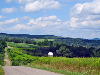 The trail started to descend traveling east and ENE toward Bishopville Road. There were a few places on the descent that could have been marked better and a long stretch where the trail builders chose to sidehill rather than pick a woods road. Along the way I took my first pictures of an interesting orange fungus. The trail descended steeply at times following an old barbed wire fence until we reached Bishopville Road at 2.1 miles. It seemed that we were making good time which made me happy since we had gotten a late start. We had lost 440 feet since the top of the hill and I knew we would have to regain some of that along the hike. We turned left on the road and walked north crossing a creek on a road bridge. Just passed the bridge was the FLT sign and some white blazes but the trail was a mass of weeds. We pushed our way through until the trail entered the woods where it was more clearly defined. The trail headed north but only for .4 miles where it met a dirt road used by the highway department. We turned left on the road and continued to walk downhill to the intersection with Bishopville Road and Wilson Karr Road. We made a hard right onto Wilson Karr Road which had a road sign. The map description stated that it was a dirt road but it was paved for its entire length. We walked due north and uphill before starting down the other side. I stopped to take some pictures of the green countryside and the blue sky with interesting white clouds. We continued down the hill to Bishopville Road which was not marked with a sign and did not have any FLT blazes! We turned right and started to walk north to Pennsylvania Hill Road, The walk was only .8 miles and was downhill but the sun beating down on us made it feel longer. My watch said the temperature was over 80 degrees and I believed it! We turned right on Pennsylvania Hill Road which, true to its name, was an uphill climb. I kept getting hotter but promised myself we would get a drink once we were back on the trail in the woods. It was about .4 miles up the hill until the trail cut into the woods on the left. We walked up a little hill into the trees and it immediately was noticeably cooler with a slight breeze. I stopped and gave Sheila water and drank quite a bit myself. We continued on the trail as it wound through some brush and then began to climb gently in the woods. At 4.8 miles a path led to the left to the edge of a field. We walked out and I took some more pictures of the fields and the sky. Around 5.1 miles we crossed another woods road or farm lane and continued along a woods road in the forest. I noticed that there were no blazes and backtracked a few steps to find the turn I had missed. Eventually the trail started to open up and I could see a field ahead. The trail was choked with weeds but we got to the field where I saw a tree with a blaze to the left. We turned left and walked uphill along the edge of the field following the path to Fitzgerald Road. The trail was direct across from us so we crossed the road an continued on the trail.
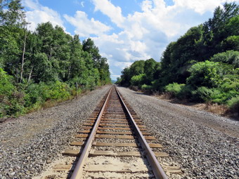 After crossing Fitzgerald Road our troubles began. The trail was not well defined or maintained and was poorly marked in many places. We had crossed from Allegany County into Steuben County and I wondered if that made any difference. Within a short distance the white blazes disappeared completely. I noticed some orange ribbons that are sometimes used for trail reroutes and followed them to the blazes. Next we came to a field where the blazes seemed to indicate a left turn to walk along the edge of the field. There were some old and faded blazes along the edge of the field but it was not clear exactly where the trail was located. My Sheila CPS chose to walk to the left into then high grass which was fortunate since that is where the trail was located. We walked in the woods for a while and then came to another field with no indication of where to go. I caught a glimpse of a white blaze at the northern edge of the field so we headed through the tall grass to the blaze which brought us to a woods road heading east. At 6.7 miles we began to cross some small stream or one stream several times. The map mentioned beaver ponds and a electric fence but we saw neither. After the third crossing, we walked up a steep bank to Webb Road at 6.8 miles. We turned left on Webb Road and then right on Doorley Road to cross over I86. At 7.2 miles we turned left on Route 66 which had a lot of traffic. We walked uphill on the shoulder to the top of a small hill and then down the other side to 7.6 miles. We quickly and carefully crossed the road to head south on what the FLT map described as a tractor lane. This lane was covered in weeds which had not been cut making the climb even more difficult. I stooped in the shade to take a last drink for the final push over the hill. At 8.0 miles the trail entered the woods which eliminated the weed problem and turned east. It continued to climb reaching a little over 1700 feet at 8.25 miles. From the high point the trail descended for .7 miles to the railroad tracks. The elevation drop was 540 feet which made the descent rather steep which bothered my already hot and aching feet. I wondered it the light Zamberlain Airbounds would have been a better idea. The trail was reasonably well-marked but could have used a few more blazes in spots. Just before the tracks, the trail opened up some and we again had to fight our way through weeds, brush and briars. We crossed the tracks carefully and I took a few pictures before turning left on the rail trail to walk back to the car. The rail trail follows the railbed of the old Pittsburg Shawmut and Northern RR for .7 miles back to the parking area near Route 66. Walking the flat rail trail was easy but very boring. This is an example of taking the trail off the road but adding little value to the experience. The 2 mile stretch of trail "avoided" a .7 mile walk along Route 66! We were back at the car at 3:40 PM having hiked 9.7 miles in 4 hours and 15 minutes with only 15 minutes of stopped time. Our overall average was 2.3 mph and we had 1600 feet of ascent but 2005 feet of descent on this one-way hike. We encountered no rain but the temperature was 88 degrees as we pulled out of Hornell.
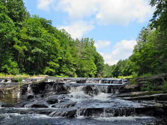
![]()
![]()
![]()
![]()
![]() On Wednesday, August 16th, I wanted to do a hike close to home with my grandson Bryce. Cindy said she wanted to go also so I picked the Neversink Unique Area from Katrina Falls Road since it is a relatively short drive and is around 5 miles of hiking. Also, Bryce had not been there before and I thought the two waterfalls might interest him. Bryce arrived and seemed very enthusiastic about the hike. We got our gear together and left home at 10:30 AM. Sheila seemed very happy that all of us were going somewhere as she was very alert in the back seat. I got on Route 17 and started for Rock Hill. I got off the Quickway at exit 109 and turned right on Katrina Falls Road. I drove to the end of the road and parked at 10:50 AM in the small parking area. There was one other car in the parking area and that had a DEC logo on the door. As we were about to leave another car pulled up. Eventually the driver and assenter got out to look at the map on the kiosk. The man asked me about the trails and I gave him the best advice I could based on what they were wearing and the time they had to hike. I set my GPS and we started down the woods road toward the river intending to hike the loop to Denton and Mullet Falls. I thought that the recent rain might have augmented the waterfalls making them more interesting. Sheila was certainly anxious to get going as both she and I prefer several hikes a week! The temperature was in the low 70's and the breeze made it seem a little colder. As we walked down the hill passed the trail register, I got out a small voice recorder I had recently purchased. It is a 4 GB USB drive with a microphone and an On-Off switch. It starts to record when you switch it on and saves a WAV file each time you turn it off. The WAV files can be played on your computer. It is very basic and very easy to use. We turned left at the bottom of the hill to stay on the main trail and came to the small bridge over Wolf Brook. The water was not as high as I had expected so I did not stop to take pictures. The condition of the bridge continues to deteriorate and soon will be impassable. . At the top of the next small hill, we stayed to the right to hike the loop counterclockwise hitting Denton Falls on the Neversink first and then the falls on Mullet Brook. It didn't take long for us to arrive at the lower bridge over Mullet Brook. The bridge has been replaced with a new one that has a pair of steel I-beams as its main support and should last a long time. We stopped and I took a few pictures of the bridge and the stream. I also posed Cindy, Bryce and Sheila for a couple of shots. At 1.4 miles we turned right following the yellow spur trail blazes downhill to Denton Falls.
On Wednesday, August 16th, I wanted to do a hike close to home with my grandson Bryce. Cindy said she wanted to go also so I picked the Neversink Unique Area from Katrina Falls Road since it is a relatively short drive and is around 5 miles of hiking. Also, Bryce had not been there before and I thought the two waterfalls might interest him. Bryce arrived and seemed very enthusiastic about the hike. We got our gear together and left home at 10:30 AM. Sheila seemed very happy that all of us were going somewhere as she was very alert in the back seat. I got on Route 17 and started for Rock Hill. I got off the Quickway at exit 109 and turned right on Katrina Falls Road. I drove to the end of the road and parked at 10:50 AM in the small parking area. There was one other car in the parking area and that had a DEC logo on the door. As we were about to leave another car pulled up. Eventually the driver and assenter got out to look at the map on the kiosk. The man asked me about the trails and I gave him the best advice I could based on what they were wearing and the time they had to hike. I set my GPS and we started down the woods road toward the river intending to hike the loop to Denton and Mullet Falls. I thought that the recent rain might have augmented the waterfalls making them more interesting. Sheila was certainly anxious to get going as both she and I prefer several hikes a week! The temperature was in the low 70's and the breeze made it seem a little colder. As we walked down the hill passed the trail register, I got out a small voice recorder I had recently purchased. It is a 4 GB USB drive with a microphone and an On-Off switch. It starts to record when you switch it on and saves a WAV file each time you turn it off. The WAV files can be played on your computer. It is very basic and very easy to use. We turned left at the bottom of the hill to stay on the main trail and came to the small bridge over Wolf Brook. The water was not as high as I had expected so I did not stop to take pictures. The condition of the bridge continues to deteriorate and soon will be impassable. . At the top of the next small hill, we stayed to the right to hike the loop counterclockwise hitting Denton Falls on the Neversink first and then the falls on Mullet Brook. It didn't take long for us to arrive at the lower bridge over Mullet Brook. The bridge has been replaced with a new one that has a pair of steel I-beams as its main support and should last a long time. We stopped and I took a few pictures of the bridge and the stream. I also posed Cindy, Bryce and Sheila for a couple of shots. At 1.4 miles we turned right following the yellow spur trail blazes downhill to Denton Falls.
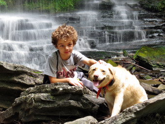 The trail down to the falls is not well marked and hikers trying to follow it have created new paths which compounds the problem. After hiking 1.65 miles, we were at the rocks near the edge of Denton Falls. The descent to the river was wet and muddy. The river was at medium volume and the falls were making some noise as I dropped my pack and started to take some pictures. Sheila seemed smart enough not to try to jump into the fast-moving water. I was able to walk along the rocks to get just below the falls. I took quite a few pictures of the falls and some both upstream and downstream. Cindy on Bryce sat on a rock and ate a snack. The falls are hardly three feet high but the volume of water made the trip worthwhile. Just before we were getting ready to start back up the trail, a fisherman appeared and Sheila had a fit. I apologized to the startled man and he was very understanding. I informed Sheila that this was not acceptable behavior. We headed back up the spur trail to the main trail with Bryce lagging just a bit. At the top we turned right. At the trail junction I asked Bryce which way he wanted to go. After I informed him that the right fork led to High Falls which adds about 4 miles round trip to the hike, he decided the left fork was the better choice! After a brief walk uphill, we turned left onto the short trail down to Mullet Brook Falls and immediately met a couple chime up from the falls. They said it was their first time and that the falls were nice. The trail has no sign and could be easily missed. In fact, there is no signage anywhere in the area! I saw a total of only three yellow blazes on our way down to the falls and on the way back. When the falls came into sight, I was pleased with the amount of water in the stream. I dropped my pack where the trail ended and grabbed my camera to take some pictures. I carefully walked out onto the rocks below the falls taking Bryce with me. Sheila had already run ahead and was cavorting in the water. I took some shots of the falls and the pool below. There was enough water to make it interesting but far less than I had hoped for. Eventually it was time to leave. I put away my camera and shouldered my pack to head back out the spur trail. We walked back out to the main trail and turned left to complete the loop. As we climbed we noticed the rocky ledges to our right and I thought about exploring them at some time in the future. Soon we crossed over the upper bridge spanning Mullet Brook. I stopped on the bridge to show bridge the beginning of the large swamp on the right. After a brief walk we were at a trail junction. Walking straight ahead on the trail leads to the Wolf Lake Multiple Use Area. We turned left and began to descend off the ridge. As we started to walk downhill Bryce said "that's a relief!" We hiked downhill for some time and eventually came to the trail junction just above the bridge over Wolf Creek. We continued to walk straight ahead to return to the parking area. Once on the other side of the brook we made the right turn on the woods road back to the car. None of us were enthusiastic about the uphill walk back to the car. We arrived at the parking area at 1:55 PM. We hiked 4.7 miles in 2 hours and 55 minutes including the stops at the two falls. The vertical gain was only about 980 feet.
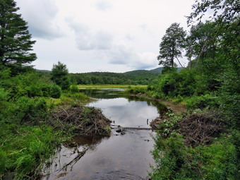
![]()
![]()
![]()
![]()
![]() On Monday, August 14th I decided that I wanted to go for another hike and Brad was also up for a walk. The weather for the rest of my week was looking variable with showers or moderators possible on several days. We had been up for ambulance calls the night before so we got up rather late. After eating breakfast, we got our gear ready and got dressed. Sheila sniffed our clothes and immediately knew we were hiking. She began to run around the house bouncing against the furniture but always keeping a close eye on us. We put our gear in the car and an exited Sheila in the back seat and drove out the DeBruce Road a little before 10:30 AM. At Mongaup Pond Road I turned left and continued to follow the road bearing left onto Beech Mountain Road at the fork. When we arrived in the parking area there were two other cars parked in the bigger lot. Sheila was acting as if she hadn't hiked in a month as she ran around and headed for the trail. The temperature was in the low 70's but the humidity seemed a little high. The skies were sunny and blue with some white clouds. We headed out the path to the register on Quick Lake Trail at about 11:45 AM. The Quick Lake Trail was very wet with a lot of muddy spots which we tried to avoid. Just before the register we looked up to see a young couple walking toward us with a very small dog on a leash. The dog started to make a lot of noise when it saw Sheila so they picked it up as we passed. At Gravestone Junction we turned left to head down to Frick Pond. The water level in the pond was low due to the fact that someone had completely pulled out the beaver dam across the outlet stream. The DEC rangers and the wildlife division claim no knowledge of this action so my conclusion is that someone is doing this on their own for reasons I cannot understand! I hope the beavers rebuild the dam quickly and someone catches these vandals in the act. I stopped to tale a few pictures including some of the destroyed dam. We continued on the Quick Lake Trail around the pond bearing left at the next trail junction to stay on the red trail. This part of the trail was very wet even in places where it did not look wet. We were setting a fast pace despite having to avid the water and the mud. We soon came to the "pine promenade" and the little stream through the woods. This water level in the stream was higher than it had been and Sheila was able to get a drink and take a "dip". She immediately began a mad dash up and won the trail at a very high speed. As we continued along the trail we removed some small branches and a few large ones until we arrived at Iron Wheel Junction at 1.6 miles. We turned left on the Quick Lake Trail and started the long uphill climb toward Junkyard Junction. The trail continued to be wet along the way with evidence that a large volume of water had been flowing down the trail. At 3.2 miles we arrived at Junkyard Junction and turned right onto the blue Flynn Trail. The Flynn Trail is almost flat and on this day it was wet and muddy in many spots. There were no major blowdowns but I continued to remove branches that littered the trail. The entire trail does need to have some branches lopped to make a clear path. When we got to the gate, we turned right to stay on the trail and head down toward Hodge Pond. At 3.75 miles the Flynn Trail heads right and we follows it toward the outlet end of Hodge Pond.
On Monday, August 14th I decided that I wanted to go for another hike and Brad was also up for a walk. The weather for the rest of my week was looking variable with showers or moderators possible on several days. We had been up for ambulance calls the night before so we got up rather late. After eating breakfast, we got our gear ready and got dressed. Sheila sniffed our clothes and immediately knew we were hiking. She began to run around the house bouncing against the furniture but always keeping a close eye on us. We put our gear in the car and an exited Sheila in the back seat and drove out the DeBruce Road a little before 10:30 AM. At Mongaup Pond Road I turned left and continued to follow the road bearing left onto Beech Mountain Road at the fork. When we arrived in the parking area there were two other cars parked in the bigger lot. Sheila was acting as if she hadn't hiked in a month as she ran around and headed for the trail. The temperature was in the low 70's but the humidity seemed a little high. The skies were sunny and blue with some white clouds. We headed out the path to the register on Quick Lake Trail at about 11:45 AM. The Quick Lake Trail was very wet with a lot of muddy spots which we tried to avoid. Just before the register we looked up to see a young couple walking toward us with a very small dog on a leash. The dog started to make a lot of noise when it saw Sheila so they picked it up as we passed. At Gravestone Junction we turned left to head down to Frick Pond. The water level in the pond was low due to the fact that someone had completely pulled out the beaver dam across the outlet stream. The DEC rangers and the wildlife division claim no knowledge of this action so my conclusion is that someone is doing this on their own for reasons I cannot understand! I hope the beavers rebuild the dam quickly and someone catches these vandals in the act. I stopped to tale a few pictures including some of the destroyed dam. We continued on the Quick Lake Trail around the pond bearing left at the next trail junction to stay on the red trail. This part of the trail was very wet even in places where it did not look wet. We were setting a fast pace despite having to avid the water and the mud. We soon came to the "pine promenade" and the little stream through the woods. This water level in the stream was higher than it had been and Sheila was able to get a drink and take a "dip". She immediately began a mad dash up and won the trail at a very high speed. As we continued along the trail we removed some small branches and a few large ones until we arrived at Iron Wheel Junction at 1.6 miles. We turned left on the Quick Lake Trail and started the long uphill climb toward Junkyard Junction. The trail continued to be wet along the way with evidence that a large volume of water had been flowing down the trail. At 3.2 miles we arrived at Junkyard Junction and turned right onto the blue Flynn Trail. The Flynn Trail is almost flat and on this day it was wet and muddy in many spots. There were no major blowdowns but I continued to remove branches that littered the trail. The entire trail does need to have some branches lopped to make a clear path. When we got to the gate, we turned right to stay on the trail and head down toward Hodge Pond. At 3.75 miles the Flynn Trail heads right and we follows it toward the outlet end of Hodge Pond.
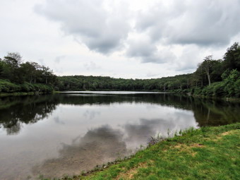 This part of the Flynn Trail which is a woods road had less water than other places but was very muddy. It looked like OSI had decided to smooth out the trail by using a grader to dig it up and level it off. The problem is that this removed all the grass that held the dirt together and left behind an unpacked dirt surface. This surface absorbed a lot of water to form a see of mud! We did our best to stay to the side of the trail until we got to the clearing at the end. The field was also wet and after walking through it the trail again had been "improved" and was very muddy. The open field is the spot where the mess hall and family camping area for the Beech Mountain Boy Scout Camp once stood. After negotiating the mud, we came to the clearing at the outlet end of the pond. We walked over to the shore so that I could take a few pictures. Sheila immediately jumped into the water and after taking a few shots I found a stick. I threw the stick into the water and Sheila immediately retrieved it. On the second throw I got a little more distance and the stick promptly sunk. Sheila swam around and around trying to find it before coming back to shore. We turned around and continued on the Flynn Trail climbing up the hill. I was feeling quite fresh and concentrated on using my poles to help set a quick pace up the hill. Brad is younger and did not seem to be having a problem on the ascent. At the top of the hill we stayed to the right to continue on the Flynn Trail. A left turn follows a woods road out to what remains of the Beech Mountain Boy Scout Camp. Just after the turn there was a small tree across the trail. We tried to move it but it wouldn't budge. We broke some branches off and I made a note to return with a saw. The Flynn Trail is relatively flat to the junction with the Big Rock Trail at 4.5 miles. We continued straight through this junction to follow the Flynn Trail back to the car. The walk is pretty but has no remarkable views or features so we walked quickly. As we approached the gate on the woods road, we turned left to avoid the private property around the cabin and to stay on the trail. On a previous trip I had cleared and reblazed the old trail and I could see that it was easy to follow. We finished our walk and were back at the car by 2:25 PM. We had covered 6.2 miles in 2 hours and 35 minutes with an elevation gain of 900 feet. Our average overall speed was 2.4 mph and we had stopped for less than 5 minutes. We covered the last 1.7 miles in 36 minutes for a speed just under 3 mph.
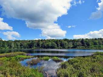
![]()
![]()
![]()
![]()
![]() On Sunday, August 13th I wanted to get for a hike close to home after church in the morning. Krista and Brad were staying with us for a few days and we went to eat at Madison's after church. This meant we got a late start to go on a hike. I asked Brad if he wanted to go and he said "Yes". It's always fun to hike with Brad because he is a great guy and we have a lot in common despite the age difference. I decided to head for Long Pond as I had not been there in some time. I thought doing the big loop in a counterclockwise direction would be long enough but get us back for dinner on time. The recent weather had included some rain so I knew the trails might be wet. When we left the house at about 2:15 the skies were partly sunny and the temperature was in the low 70's. I got Sheila in the car and we put our gear in the trunk and headed out DeBruce Road for about 8 miles to Flugertown Road where I made a left. I parked in the lot a short distance up the road on the right. Sheila had not hiked in two days and she was ready to go when we got to the parking lot. I set my GarminGPS and we started out on the trail at 2:35 PM. There was a slight breeze and the humidity seemed manageable so there weren't too many insects around to bother us. There was one truck in the parking area with a trailer as we crossed the bridge and headed up the hill. Right from the start the trail was wet and muddy and we walked to the side in several places to avoid the wettest spots. The first .6 miles gains about 350 feet to the highest point on the hike. It isn't very steep but does act as a nice warm-up! At 1.1 miles we were at the spur trail that leads down to the shore of Long Pond. We turned right and went down to the pond so that I could take some pictures. At the shores of the pond I dropped my pack and got out my camera to take some pictures. Sheila tried to follow me through the mud but we discouraged her. The skies were very blue with towering, puffy, white clouds so I snapped a few pictures before going back to my pack. We returned to the main trail and turned right at the first trail junction at 1.3 miles. By 3:25 PM we had walked 1.8 miles and were passing the spur trail to the lean-to.
On Sunday, August 13th I wanted to get for a hike close to home after church in the morning. Krista and Brad were staying with us for a few days and we went to eat at Madison's after church. This meant we got a late start to go on a hike. I asked Brad if he wanted to go and he said "Yes". It's always fun to hike with Brad because he is a great guy and we have a lot in common despite the age difference. I decided to head for Long Pond as I had not been there in some time. I thought doing the big loop in a counterclockwise direction would be long enough but get us back for dinner on time. The recent weather had included some rain so I knew the trails might be wet. When we left the house at about 2:15 the skies were partly sunny and the temperature was in the low 70's. I got Sheila in the car and we put our gear in the trunk and headed out DeBruce Road for about 8 miles to Flugertown Road where I made a left. I parked in the lot a short distance up the road on the right. Sheila had not hiked in two days and she was ready to go when we got to the parking lot. I set my GarminGPS and we started out on the trail at 2:35 PM. There was a slight breeze and the humidity seemed manageable so there weren't too many insects around to bother us. There was one truck in the parking area with a trailer as we crossed the bridge and headed up the hill. Right from the start the trail was wet and muddy and we walked to the side in several places to avoid the wettest spots. The first .6 miles gains about 350 feet to the highest point on the hike. It isn't very steep but does act as a nice warm-up! At 1.1 miles we were at the spur trail that leads down to the shore of Long Pond. We turned right and went down to the pond so that I could take some pictures. At the shores of the pond I dropped my pack and got out my camera to take some pictures. Sheila tried to follow me through the mud but we discouraged her. The skies were very blue with towering, puffy, white clouds so I snapped a few pictures before going back to my pack. We returned to the main trail and turned right at the first trail junction at 1.3 miles. By 3:25 PM we had walked 1.8 miles and were passing the spur trail to the lean-to.
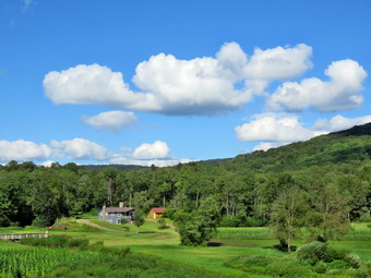 After passing the trail to the lean-to, we picked up the pace and continued on the main trail to the point where it intersected a woods road at 2.6 miles. This part of the trail was also very wet and there were some pretty large "ponds" on the trail. There were also some muddy areas which we tried to avoid. We turned left on the woods road and followed the road until the intersection with Basily Road at 2.85 miles. The roads were wet and a little muddy in spots. We continued on Basily Road by bearing to the left. As we approached the Peters Hunting Camp, I got ready to put Sheila on her leash. The area near the footbridge across the outlet to the beaver pond had freely flowing water and the bridge seemed to be almost superfluous with weeds growing around it. The bridge is starting to show its age and is not in good shape. I stopped to take some pictures before we continued on the trail. I took a few shots of the beaver pond and marsh. We continued on the main trail to the bridge and found it blocked with 2 by 4's with the remaining gate closed. The deck of the bridge is showing a lot of wear with some rotting boards. We crossed the stream to continue the trip back to the car. The ford downstream of the bridge looked like it had been getting a lot of use by vehicles but the water can be a little deep and wide for foot traffic. It was not clear whether the bridge will be replaced or not! As we started up the little hill from the hunting camp, I took a few shots of the valley which looked peaceful with the nice skies behind it. From this point on the roads are packed dirt and gravel and they were dry which made hiking faster. We kept a fast pace on the roads and eventually the road became paved. I had forgotten Sheila's leash but she stayed near us as we walked quickly down the road back to the parking area without meeting anyone. The pickup with the trailer was gone but there were now three or four other cars in the lot. We were back at the car at 5:00 PM having hiked 6.0 miles in 2 hours and 25 minutes. The elevation gain was only about 525 feet most of which was at the beginning of the hike.
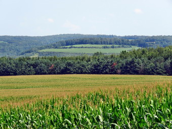
![]()
![]()
![]()
![]()
![]() On Thursday, August 10th I wanted to hike the remaining section of Map 10 of the Finger Lakes Trail. Map 10 runs from Hornell to Hughes Road south of Howard, NY. I had already hiked from Upper Glen Ave and Lain Road to Hughes Road and Turnpike Road so the reaming section was from The parking area near the railroad tracks in Hornellsville to Upper Glen Ave. The distance is only 5.1 miles so I planned to hike out and back. I planned to get up at 5:30 AM and get going as soon as possible. The forecast was for temperatures reaching into the low 80's with sun in the morning giving way to clouds. Much of the hike appeared to be on roads which would make it go faster as I planned to hike out and back on the same route. I woke up a little earlier than 5:30 AM and got ready to go. I knew I would have to dress for the weather and put on my summer/fall pants and a light baselayer with my Columbia long-sleeved pullover shirt. On the hike two days before my Keen Glarus boots had bruised my left ankle a little making it painful to wear high boots. My choice was to put off the hike or wear low shoes. I chose to wear a pair of Zamberlain Airound GTX trail shoes which are cut low enough to prevent further irritation of my foot. I made sure I had taken out the footbeds and put in my Superfeet Green insoles to stop my overpronation. Sheila was anxious to get going as she had not been out in three days. I made sure I put in two full water bottles and had my water purifier with me. The drive is almost 3 hours but I knew a good part of the route from previous trips and did not have to worry much about directions. Around 6:00 AM, we headed north and west on Route 17/I86 toward Binghamton. The temperature was still only in the high 50's but I knew it would get warmer. After a long drive, I took exit 34 to Hornell. After getting off the exit I turned right on Route 66 and looked for a parking spot. I had to drive all the way to the railroad tracks where I found a new paring area with plenty of room. When I consulted the map and the Avenza app I found that this was exactly the place I was supposed to be! I turned on my Suunto Traverse watch which found satellites immediately. When I turned on my Garmin GPSmap 64st, it had trouble finding satellites. I waited but it was still having problems so I put it in my backpack assuming it would straighten itself out en route. I compared my printed map which I had photocopied from an old set of FLT maps to the newer map on Avenza and found a major change. Instead of hiking on the roads there was now a trail that avoided some of the road walk. This was good news and bad news as it is more fun to hike on trails but also more difficult which translates into a longer hike. We started off by hiking east on Route 66 to a traffic light on Route 36. We crossed the intersection and continued on Route 66 looking for a turn on Seneca Road North. There were no blazes so I overshot the turn by a little. We walked back to the intersection and turned south to hike along Seneca Road North crossing a branch of the Canisteo River. At .9 miles we turned left into the driveway of the Econolodge to hike the section of trail that eliminated the road walk.
On Thursday, August 10th I wanted to hike the remaining section of Map 10 of the Finger Lakes Trail. Map 10 runs from Hornell to Hughes Road south of Howard, NY. I had already hiked from Upper Glen Ave and Lain Road to Hughes Road and Turnpike Road so the reaming section was from The parking area near the railroad tracks in Hornellsville to Upper Glen Ave. The distance is only 5.1 miles so I planned to hike out and back. I planned to get up at 5:30 AM and get going as soon as possible. The forecast was for temperatures reaching into the low 80's with sun in the morning giving way to clouds. Much of the hike appeared to be on roads which would make it go faster as I planned to hike out and back on the same route. I woke up a little earlier than 5:30 AM and got ready to go. I knew I would have to dress for the weather and put on my summer/fall pants and a light baselayer with my Columbia long-sleeved pullover shirt. On the hike two days before my Keen Glarus boots had bruised my left ankle a little making it painful to wear high boots. My choice was to put off the hike or wear low shoes. I chose to wear a pair of Zamberlain Airound GTX trail shoes which are cut low enough to prevent further irritation of my foot. I made sure I had taken out the footbeds and put in my Superfeet Green insoles to stop my overpronation. Sheila was anxious to get going as she had not been out in three days. I made sure I put in two full water bottles and had my water purifier with me. The drive is almost 3 hours but I knew a good part of the route from previous trips and did not have to worry much about directions. Around 6:00 AM, we headed north and west on Route 17/I86 toward Binghamton. The temperature was still only in the high 50's but I knew it would get warmer. After a long drive, I took exit 34 to Hornell. After getting off the exit I turned right on Route 66 and looked for a parking spot. I had to drive all the way to the railroad tracks where I found a new paring area with plenty of room. When I consulted the map and the Avenza app I found that this was exactly the place I was supposed to be! I turned on my Suunto Traverse watch which found satellites immediately. When I turned on my Garmin GPSmap 64st, it had trouble finding satellites. I waited but it was still having problems so I put it in my backpack assuming it would straighten itself out en route. I compared my printed map which I had photocopied from an old set of FLT maps to the newer map on Avenza and found a major change. Instead of hiking on the roads there was now a trail that avoided some of the road walk. This was good news and bad news as it is more fun to hike on trails but also more difficult which translates into a longer hike. We started off by hiking east on Route 66 to a traffic light on Route 36. We crossed the intersection and continued on Route 66 looking for a turn on Seneca Road North. There were no blazes so I overshot the turn by a little. We walked back to the intersection and turned south to hike along Seneca Road North crossing a branch of the Canisteo River. At .9 miles we turned left into the driveway of the Econolodge to hike the section of trail that eliminated the road walk.
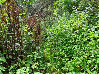 As we walked up the driveway there were some blazes on the trees and poles to follow. We continued to the right of the motel on paved road and then the blazes disappeared. I chose to continue up the hill and found a blaze behind some vines on a pole. We walked up the hill passing the Hornell Water Filtration plant and a large water tank farther up the hill. I was able to let Sheila off her leash which pleased us both. At this point my Garmin GPS had been beeping as it found and lost satellites so I turned it off and decided to rely on the Suunto watch. We continued up the hill which was challenging but not very difficult. There were places where other roads branched off but the trail was clearly marked until we got to the top of the hill. I continued straight ahead while Sheila turned left into the woods. Sheila was correct as we followed the trail through a bower. We headed generally northeast and the east through mixed hardwood and evergreen trees and at 1.7 miles hit the highest point on this section. We had gained 480 feet in .8 miles and now started to descend toward Route 70A. We were on a wide woods road but as I looked ahead I saw no blazes. I noticed a well-worn path to the left but did not see any blazes for a turn. I looked ahead and saw white blazes and then looked at the trees on the woods road to find some faded and hidden blazes for the turn. At 1.8 miles we turned right and began the descent through the woods. This turn is NOT mentioned on the description that comes with the map. When we arrived at Route 70A, I put Sheila on her leash and we turned right to walk down the road. I knew we had to turn left but at the first road I did not see any blazes. At the next road there was an FLT sign and blazes. At 2.4 miles we made a hard left and started up the hill on Beltz Road. After a short distance the trail turned to the left off the road following an old woods road. The road began to parallel a streambed but there was little or no water in the stream. There were wide gullies that seemed to have been cut by a lot of running water but none was present on this day. There was even a pretty good sized bridge on the trail. The trail had few blazes and there were a lot of blowdowns and branches that no one had bothered to remove but the worst was yet to come. As the woods road opened up a little weeds and briars completely blocked the trail. I was lucky to have Sheila along as she led me through this mess. I beat back the vegetation the best I could while ducking under low-hanging trees. It was obvious no one had done any maintenance on this part of the trail this year and perhaps not for several years. We ducked back into the woods and then at 3.5 miles we turned right on a farm lane. The lane headed south until 3.7 miles when it turned east. At 4.0 miles it turned south and met up with Dewey Road. Hiking along the lane and Dewey Road there were some nice views to the north and cornfields on both sides of the road. Dewey Road met Upper Glen Road at 4.7 miles where we turned right and walked uphill passed some houses to the highest point on the hike at 4.8 miles. From here we walked down Upper Glen Avenue to the intersection with Lain Road at 5.1 miles. This complete the out part of the hike.
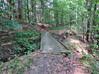 We stopped for a few minutes at the intersection so that I could get a drink and let Sheila have one. I also ate a bar since it was almost 11:30 AM and I had last eaten at 6:00 AM. I got out my Garmin GPS and turned it on but it was still having problems finding satellites. I tried a few different settings and found one that worked so I reset it and put it in my pack for the trip back. We turned around and headed back up the hill on Upper Glen Avenue retracing our steps to Dewey Road. I stopped on the corner to take a few pictures and then we continued to the farm lanes through the fields with a problem. We turned left into the woods and started back down the hill on the woods road. Going downhill through the weeds that clogged the trail was easier but I stop to take some pictures of the mess. When we cleared the weeds, I stopped to check my watch and the Garmin GPS unit. The Garmin was working fine but the watch had stopped recording the trail at the corner of Dewey Road and Upper Glen Avenue. I hoped that I could piece together tracks from the two units to get one that represented the whole hike. This failure of electronic devices illustrates why all hikers should carry printed maps and a standard compass. All hikers should also know how to use these two invaluable aids. We continued down the woods road stopping to take a few pictures at the bridge. We came out on Beltz Road and hiked down to the intersection with Route 70A at the base of the hill. I decided we would walk the roads back as it was warm but not really hot. The walk back on the roads was only 2.5 miles and was downhill or flat the whole way. I put Sheila on her leash and turned left onto Route 70A at 7.7 miles. It was only .9 miles to Seneca Road North and the walk seemed to go very quickly. We turned right and started to hike back toward Hornellsville. The road had a wide shoulder in most places and we kept a good pace. We passed the Econolodge, crossed the river and at 9.6 miles turned left onto Route 66. We walked back to the car arriving at 1:25 PM. I put Sheila in the car and my gear in the back. I took a few pictures of the rail trail and the railroad tracks. We had hiked 10.5 miles in 4 hours and 10 minted with an elevation gain of 1400 feet. Our overall average was 2.4 mph with a moving average of 2.8 mph. We did the last 2.5 miles in 44 minutes for a speed of 3.3 mph! I will now have to decide how I will hike the rest of the rail as 6 hours of driving is too much driving.
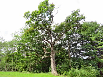
![]()
![]()
![]()
![]()
![]() On Tuesday, August 8th I wanted to hike the Finger Lakes Trail again so I looked at Map 10 which is immediately to the west of the section I had just complete. Map 10 runs from Hornell to Hughes Road south of Howard, NY. When I saw that the distance was 15.7 miles I knew it might take three trips. It bothered me that spotting a car would allow me to do it on one trip but I had no one else that would go with me! I decided to call Village Taxi in Bath as they had given me rides for a very reasonable cost last year. When I called, I got the owner, Mike Weaver, who remembered me from last fall. He said he would be happy to pick me up at Hughes Road and drop me off at the intersection of Upper Glen Avenue and Laine Road near Hornell. I told him that I would be in Bath between 9:00 AM and 10:00 AM and that I would contact them at that time. I planned to get up at 5:30 AM and get going as soon as possible. The forecast was for temperatures reaching into the mid 70's with fog and cloudy skies in the morning but clearing as the day went on. I woke up a little earlier than 5:30 AM and got ready to go. I knew I would have to dress for the weather on put on my summer/fall pants and a light baselayer with my Columbia long-sleeved pullover shirt. I took along a light rain jacket but did not expect to use it. I wore my newer pair of Keen Glarus which seem to work as well as any shoe but tend to be not as waterproof as I would like. I had just treated them with NikWax which I hoped would do the trick as it had just rained and I expected wet and muddy trails and wet grass . I made sure I had taken out the Keen footbeds and put in my Superfeet Green insoles to stop my overpronation. Sheila was anxious to get going as she had not been out in three days. I made sure I put in two full water bottles and had my water purifier with me. The drive is almost 3 hours but I knew a good part of the route from previous trips and did not have to worry much about directions. Around 6:00 AM, we headed north and west on Route 17/I86 toward Binghamton. The temperature was still only in the high 50's but I knew it would get warmer. After a long drive, I took exit 38 to Bath and stopped to get gas and call the taxi company. When Mr. Weaver answered, I told him I was in Bath and he told me he was already waiting for me at the pickup point. It took me a few minutes to plan my route and set the GPS. I went back out to I86 and took it to exit 35 for Howard. From there I headed south on Route 27 to Turnpike Road. I turned left on Turnpike road and drove less than a mile to Hughes Rd where I found the taxi waiting. I said "hello" and put my gear in the taxi. I led Sheila over and she got right in and after a few words of encouragement laid down for the trip to out drop off point. We headed west on Turnpike Road and as we drove it seemed like a long ride. I almost told the driver to let us off at a closer drop off but knew I could hike the 11 miles. We turned right on Laine Road and drove to the intersection with Upper Glen road. I did not see the sign for the Finger Lakes Trail but knew I could find it. I paid the $18 fee plus a tip which I thought was very reasonable. I got Sheila and my gear out of the taxi and said "good bye". It is an interesting feeling watching the taxi pull away knowing the only choice is to hike back to the car. I set my Garmin GPSMAP64st handheld GPS and my Suunto Traverse GPS watch. I decided not to record the track on my iPhone to save the battery. I would use the Avenza app on the phone to locate my position on the Finger Lakes Trail.
On Tuesday, August 8th I wanted to hike the Finger Lakes Trail again so I looked at Map 10 which is immediately to the west of the section I had just complete. Map 10 runs from Hornell to Hughes Road south of Howard, NY. When I saw that the distance was 15.7 miles I knew it might take three trips. It bothered me that spotting a car would allow me to do it on one trip but I had no one else that would go with me! I decided to call Village Taxi in Bath as they had given me rides for a very reasonable cost last year. When I called, I got the owner, Mike Weaver, who remembered me from last fall. He said he would be happy to pick me up at Hughes Road and drop me off at the intersection of Upper Glen Avenue and Laine Road near Hornell. I told him that I would be in Bath between 9:00 AM and 10:00 AM and that I would contact them at that time. I planned to get up at 5:30 AM and get going as soon as possible. The forecast was for temperatures reaching into the mid 70's with fog and cloudy skies in the morning but clearing as the day went on. I woke up a little earlier than 5:30 AM and got ready to go. I knew I would have to dress for the weather on put on my summer/fall pants and a light baselayer with my Columbia long-sleeved pullover shirt. I took along a light rain jacket but did not expect to use it. I wore my newer pair of Keen Glarus which seem to work as well as any shoe but tend to be not as waterproof as I would like. I had just treated them with NikWax which I hoped would do the trick as it had just rained and I expected wet and muddy trails and wet grass . I made sure I had taken out the Keen footbeds and put in my Superfeet Green insoles to stop my overpronation. Sheila was anxious to get going as she had not been out in three days. I made sure I put in two full water bottles and had my water purifier with me. The drive is almost 3 hours but I knew a good part of the route from previous trips and did not have to worry much about directions. Around 6:00 AM, we headed north and west on Route 17/I86 toward Binghamton. The temperature was still only in the high 50's but I knew it would get warmer. After a long drive, I took exit 38 to Bath and stopped to get gas and call the taxi company. When Mr. Weaver answered, I told him I was in Bath and he told me he was already waiting for me at the pickup point. It took me a few minutes to plan my route and set the GPS. I went back out to I86 and took it to exit 35 for Howard. From there I headed south on Route 27 to Turnpike Road. I turned left on Turnpike road and drove less than a mile to Hughes Rd where I found the taxi waiting. I said "hello" and put my gear in the taxi. I led Sheila over and she got right in and after a few words of encouragement laid down for the trip to out drop off point. We headed west on Turnpike Road and as we drove it seemed like a long ride. I almost told the driver to let us off at a closer drop off but knew I could hike the 11 miles. We turned right on Laine Road and drove to the intersection with Upper Glen road. I did not see the sign for the Finger Lakes Trail but knew I could find it. I paid the $18 fee plus a tip which I thought was very reasonable. I got Sheila and my gear out of the taxi and said "good bye". It is an interesting feeling watching the taxi pull away knowing the only choice is to hike back to the car. I set my Garmin GPSMAP64st handheld GPS and my Suunto Traverse GPS watch. I decided not to record the track on my iPhone to save the battery. I would use the Avenza app on the phone to locate my position on the Finger Lakes Trail.
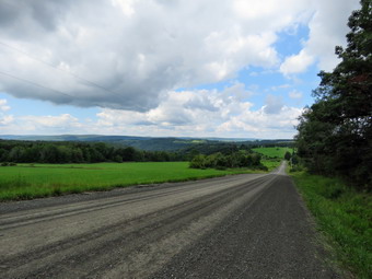 We started our hike at 9:45 AM by hiking east on Lain road a short distance and then turning right or south into the woods. There was a nice pine plantation here and I would have stopped to take pictures but I was to anxious to get into the hike. The skies were very dark and there was a stiff breeze. I hoped the forecast of no rain would hold! We walked into a hardwood forest and downhill crossing Lower Glen Road and .5 miles and then starting an ascent toward Turnpike Road. We broke into a field and continued to walk uphill with some nice views except for the clouds and fog. I decided to take a few shots and stopped in the field at about 1.2 miles. After taking a few pictures we continued through the wet grass and turned into the woods just before Turnpike Road. After a brief walk in the pines, we came out on Turnpike Road where I put Sheila on her leash so that we could walk east to Laine Road. We turned south on Laine Road and began to ascend to a hilltop. A little after the turn I noticed an interesting tree on the other side of the road and took a few pictures. I noticed that the long, straight road was interesting and that the skies were still dark and cloudy in one direction but clearing to the north. I stopped to take a few pictures and get a drink before continuing downhill to the next turn. At 2.4 miles we turned left off Laine Road heading east through the woods descending through a hardwood forest. When we reached Cunningham Creek Road we had traveled .6 miles from Laine Road and lost 400 feet of elevation. The FLT emerged next to Cider Creek Hard Cider in Canisteo but I could see no indication of where the trail went from there. After consulting the map and the description, I turned right on the road and walked less than .1 miles to the point where the FLT turns left on an ATV trail. This is just one of the many examples of the poor markings on the trail since I had to look at papers to find out where the trail went. More of these situations were to come! The ATV track was one of the steeper climbs on the hike at 19% but it only lasted about .2 miles. I missed the turn for the trial and continued up the woods road for a short distance. I didn't see any blazes but the FLT has the attitude that if you are on a woods road then there will be very few blazes. When I couldn't find any blazes, I consulted Avenza and backtracked down the hill where the trail turned left. The trail followed Cunningham Creek for about a mile with the creek far below and to the west. At 4.2 miles we turned right onto a logging road and started uphill before turning left on another woods road which seemed flat but was slightly uphill. We passed a tree that was across the trail and had been cut by a chainsaw. The tree had some ribbons on it and as I passed I found they might be a warning. Where the tree had been cut I could see an extensive honeycomb with bees still using it! I imagined that cutting into this was quite a surprise for the sawyer. The trails had been damp and muddy in places until now but the logging road was very wet with many areas of deep mud. It wasn't very pleasant to hike along this and I was glad that it soon ended when the trail came to a field. I continued to follow the road out into the field even though I did not see any blazes. I wasn't too concerned since it is difficult to put blazes in fields. After few minutes, I consulted Avenza and could see we were off the trail. We walked back to the point where the trail came out of the woods and found some faded blazes indicating a turn to the left. We followed the blazes as they led us through the woods very near the edge of some fields and up toward Windfall Road. This trail was poorly marked and the showed little signs of use. There was almost no track to follow so I let Sheila lead the way. At 5.3 miles we came to Windfall Road as described on the map and found some nice views. I took out my camera and took a few shots and also got a drink and a bar.
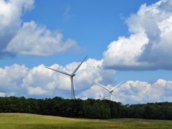 We crossed Windfall Road and walked along the edge of a field until we entered the woods and turned left following the trail. We were now headed east and crossed Burt Hill Road at 5.6 miles traveling along the northern boundary of Burt Hill State Forest. We entered another red pine plantation and I stopped to take a few shots of the tall, straight trees. The trail was muddy and there were a lot of roots along the way. The trail began to descend and at 6.2 miles we passed the spur trail to the right to a lean-to. At 6.4 miles we crossed South Woods Road and continued straight ahead on Spencer Hill Road which is a seasonal use road. I was getting tired of climbing so I put Sheila on her leash and let her pull me to the top of the hill. When we reached the top of the hill the wind farm came into view and I stopped to take some pictures. A little farther along ion the right was a small "park" with some signs explaining how the wind farm operated. We were at the highest point on the hike and now continued down the hill passing a farmhouse on the left. The trail continued to follow Spenser Hill Road until just before it met Stephens Gulch Road. The trail went off the road to the left following a shady path next to a creek. As we neared Stephens Gulch Road I heard a snort and looked up to see a horse walking over to the fence to see what we were doing. I looked a little to the left and saw some goat faces looking down at use. Next to a barn was a shaggy burro looking at us with interest. I took pictures of the menagerie and then continued down to the road. I didn't see any blazes so I asked two men working by a barn it the farm lane ahead of me was the trail. They confirmed my choice and told me there was a well with water a little farther along. Since we had descended over 550 feet from the top of Spender Hill, I knew there was some climbing to do to get back to the car. When we came to the well, I wasn't going to stop but decided to fill my one almost empty bottle. The water was cold and very refreshing. We continued up the farm lane until it met Burleson Road where we turned left. There were some nice views here so I took a few more shots before turning right on the trail. The trail followed a path cut through a brushy field until it again entered the woods. From this point on the trail was poorly maintained and poorly marked. There were few blazes and they seemed to be randomly spread through the woods. There was almost no path to follow as the trail had not been cleared of branches and looked much like the rest of the forest. At 8.8 miles the trail came out of the woods to a junction where paths led in three directions. A blaze indicated a turn but I could not find any more blazes. Finally I let Sheila lead me and she found the trail without a problem. The turn was more than 90 degrees and was the least obvious of the choices.
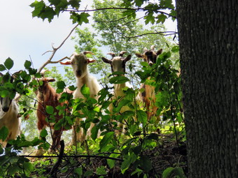 We were now headed east walking uphill on a steep but short ascent through the forest. At 9 miles the trail turned north and began to follow the contour lines so there was less climbing. In about a quarter mile the trail came out to an open area with mowed paths. There were, again, several ways to go but no blazes to guide us. I turned right but found no trail. I tried going left and then right on the paths and finally found a blaze. We walked along the edge of the field until the mowed path started to curve to the right. This didn't seem like the right way so I walked back to a break in the woods. I started to walk down this path even though there were only some ribbons and no blazes. After a short distance, there were white blazes and we again started to follow the trail. At 9.5 miles we descended to a small stream where a blaze indicated a right turn. The trail was completely washed out and no blazes were visible on the other side. I guessed right and found a blaze to follow which led us along the west bank of a stream. The trail turned north briefly and then at 9.6 miles it turned east continuing toward Hughes Road. We wandered through the woods trying to find blazes until we made it out to the road at 10.1 miles. The sun was hot and we still had to walk north on Hughes Road to the car. The last .35 miles were downhill or flat and seemed to go quickly. We were back at the car at 3:10 PM after hiking 10.5 miles on the trails or a total of 11.3 miles including the misdirections. The hike had taken 5 hours and 20 minutes with 48 minutes of stopped time. The elevation gain was 2244 feet which surprised me as there were no large climbs. I hope to complete this map soon and then will have to decide what to do next as the drive time is getting too long!
On Saturday, August 5th, I had planned to attend a hiking pole demonstration at Morgan Outdoors and then go with the group for a short hike on Round Top. This all changed when I read a news release from the DEC that said a hiker was lost. The 60 year old man had left his home on Dry Brook Ridge on Tuesday morning apparently headed into the Big Indian Wilderness which covers 33,500 acres and is bounded by the Slide Mountain Wilderness and Balsam Lake Wild Forest. On Tuesday at about 6:30 PM the hiker used his cell phone to call 911 in Delaware County. The control center could not determine the hiker's location and turned the information over to the DEC. Searchers began to look for the hiker who was reported last seen around the Seager Trailhead at the end of Dry Brook Road. The search continued through Wednesday, Thursday and Friday directed by the Forest Rangers with members of local fire departments and search teams assisting. Search teams from as far away as Gloversville joined the search. I texted one of the rangers in charge on Saturday morning and asked if they could use another searcher. He texted me back almost immediately and I got my gear ready and headed for Margaretville. I arrived at the Margaretville Fire Department at about 10:30 AM. I reported to the ranger who introduced me to my operant who is the Assistant Forest Ranger at Alder Lake. She is 21 years old and a senior at ESF in Syracuse and I immediately wondered if I could keep up with her and how we would work together. I will say right now that this young lady was a pleasure to work with and a great hiking companion. We drove from Margaretville east on Route 28 to Route 47 and turned right. We passed Clove Road and McKenley Hollow Road and turned right on Burnham Hollow Road. I had never been on this road as there are no trails and some of the area is private property. We drove to the end of Burnham Road where the private "trails" begin and continued straight ahead on the Huron Trail to where we thought we belonged. I turned on my GPS unit and found we should have parked right at the end of Burnham Road. We drove back to that parking spot and got out of the car. It wasn't completely clear where we should go but we decided to start on the road marked as the Algonquin Trail. We turned right to follow the road which led us passed two houses on the right and then ended at the edge of the forest.
We began to bushwhack through the woods following no path or trail in particular. We knew we had to parallel the stream but gain elevation to make it to the ridge where Eagle Mountain is located. At times we found some woods roads and followed them as far as we could. At one point we ran out of paths and ran into a sea of nettles at least two feet tall. We decided to gain some elevation and headed up and slightly north. We eventually found a path under the trees which limited the amount of nettles. The going was slow because of the heavy brush, downed trees and numerous drainages we had to work around. We stopped to get a drink at about 12:55 PM and each of us ate a protein bar. I was beginning to feel each step and tried to drink as much as I could. We started in again walking through high weeds and over and under large trees lying on the ground. We tried to head west but the ground kept getting steeper. From 1.5 miles to 2.0 miles the grade averaged 23%. Just after this there was a short and flatter area and then a climb up a 42% grade. At this point we were about half a mile from the Pine Hill-West Branch trail that passes by Eagle Mountain but we had at least 700 feet to climb in this short distance. We decided to backtrack and see if there was an easier way up to the ridge. My partner turned on her radio and we almost immediate heard "the subject has been located. It is unconfirmed." Minutes later we got the confirmation and the call to return but there was no indication of whether the hiker was dead or alive! We started back with partner leading. She was able to stay almost exactly on the track we had taken on the way out but avoided some of the worst nettles on the return trip. We found a few more woods roads we could follow and were able to drop down to the level of the stream since we no longer had to stay on the ridge. Soon we could see houses and we walked back out to the Algonquin Trail. We talked to a resident and them walked back to the car. We had hiked about 5 miles in 4 hours and 10 minutes with an elevation gain of 1620 feet! We drove back to the fire house and parked. We were immediately told that the hiker had walked out of the woods on his own to Hiram Todd Road near which is just off Dry Brook Road near the Segar Trailhead. He was without shoes and a little confused but we were told his vital signs were good. We went upstairs to the command post for a quick debriefing and so that my GPS could be downloaded. I ate a tasty burrito supplied by the Salvation Army and grabbed two Powerades before heading home. We were all very happy at the outcome.
![]()
![]()
![]()
![]() On Tuesday, August 1st I decided to go back to Trout Pond for a fourth and what I hoped would be the final time. I put my Silky saw, hedge trimmers and loppers in my pack. I decided to forego my poles. As I knew I would be carrying some trimming tool for most of the hike. Sheila was on my heels the whole time sensing we would be going out. We left the house at 8:35 AM and headed north and west on State Route 17 toward Roscoe. I got off at exit 94 and headed north on Route 206 passing through Roscoe and then Rockland. Just after the Roscoe Nursing Home I turned left on Morton Hill Road and followed it for 3 miles to the intersection with Russell Brook Road. I drove down to the lower parking area since I had gear to carry and I knew I would not want to hike up Russell Brook Road at the end of the hike. There were two cars in the lower lot and a car parked at the upper camping area. The temperature was about 70 degrees when I got my gear out of the car at 8:55 AM to start my adventure. We got on the woods road that leads down to the bridge and crossed the stream. We passed the knotweed I had cut on a previous hike and the path to the falls. Both looked like work had been done and both were in better shape than we had found them We continued on the main trail and turned left at the trial junction to start up the steep hill toward Mud Pond. Near the bridge over the small stream there were some weeds to trim but I decided I wanted to leave them for later. On the way up the hill there were a few more branches sticking out into the trail than I remembered. I got out the loppers and started to trim them as I went. We continued up the hill to the highest point trimming branches, brush and small trees the whole way. The air was beginning to warm up and I was really beginning to feel the heat. At the top of the hill there is a more open area and there were quite a few briars and weeds growing here. I walked through and then dropped my pack exchanging the loppers for the hedge trimmers. I started cutting down the weeds, briars and occasional bush. The work seemed to go quickly at first and then monotony set in as well as some lower back pain. I stopped for a moment to get an ibuprofen and the started in again. Finally the work in this areas was done and I stow the clippers, got out the loppers, took a drink and shouldered my pack. We walked downhill a little to the junction with the trail to Trout Pond trimming a few branches here and there and moving others. The trail was drier than it had been a few days ago. We turned right and started up the trail and I immediately started picking up loose branches and throwing them off the trail. I trimmed a few branches but this area was pretty clean.
On Tuesday, August 1st I decided to go back to Trout Pond for a fourth and what I hoped would be the final time. I put my Silky saw, hedge trimmers and loppers in my pack. I decided to forego my poles. As I knew I would be carrying some trimming tool for most of the hike. Sheila was on my heels the whole time sensing we would be going out. We left the house at 8:35 AM and headed north and west on State Route 17 toward Roscoe. I got off at exit 94 and headed north on Route 206 passing through Roscoe and then Rockland. Just after the Roscoe Nursing Home I turned left on Morton Hill Road and followed it for 3 miles to the intersection with Russell Brook Road. I drove down to the lower parking area since I had gear to carry and I knew I would not want to hike up Russell Brook Road at the end of the hike. There were two cars in the lower lot and a car parked at the upper camping area. The temperature was about 70 degrees when I got my gear out of the car at 8:55 AM to start my adventure. We got on the woods road that leads down to the bridge and crossed the stream. We passed the knotweed I had cut on a previous hike and the path to the falls. Both looked like work had been done and both were in better shape than we had found them We continued on the main trail and turned left at the trial junction to start up the steep hill toward Mud Pond. Near the bridge over the small stream there were some weeds to trim but I decided I wanted to leave them for later. On the way up the hill there were a few more branches sticking out into the trail than I remembered. I got out the loppers and started to trim them as I went. We continued up the hill to the highest point trimming branches, brush and small trees the whole way. The air was beginning to warm up and I was really beginning to feel the heat. At the top of the hill there is a more open area and there were quite a few briars and weeds growing here. I walked through and then dropped my pack exchanging the loppers for the hedge trimmers. I started cutting down the weeds, briars and occasional bush. The work seemed to go quickly at first and then monotony set in as well as some lower back pain. I stopped for a moment to get an ibuprofen and the started in again. Finally the work in this areas was done and I stow the clippers, got out the loppers, took a drink and shouldered my pack. We walked downhill a little to the junction with the trail to Trout Pond trimming a few branches here and there and moving others. The trail was drier than it had been a few days ago. We turned right and started up the trail and I immediately started picking up loose branches and throwing them off the trail. I trimmed a few branches but this area was pretty clean.
I continued to walk along the trail trimming as I went. Some areas needed more attention than others. On the last trip over this trail we did not have loppers so some of the branches that I had not been able to cut with the hedge trimmers remained for me to deal with this time. The trail continued to climb and we eventually reached the area where I had cut down a lot of briars. There were still a few standing so I cut them and then continued up the trail. As we approached the high point, I decided to do something I seldom do and sit down on a rock for a drink and a break. After a short time, I started out again and realized that there was still a lot of trimming to do. We had gone in the same direction on the last trip and as we grew tired we trimmed less! I continued won the hill trimming branches as I went. I trimmed a lot of branches. Fortunately, as we turned to the right and began to head down to the pond ether were fewer branches to trim and most were not really blocking the trail. I tried not to give up and leave anything behind that needed to be removed. I even reached up as high as I could to bring down some branches. We finally came out to the bridge at the inlet end of the pond. There was some grass and weeds that could be trimmed here but I was too tired. We walked across the bridge and turned right to head down the woods road along the east side of Trout pond. After crossing over another small bridge, we came to a campsite on the left of the trail. Two young men had their tent set up and a fire burning. They seemed to be enjoying themselves. As we approached the "beach" at the outlet end, I decided to walk over and take a short break. I put my pack down as Sheila rushes to take a swim ion the pond. We didn't stay very long before walking back out to the main trail and turning right to head down the hill. The skies were growing a little darker and I was concerned it might rain before we got back. There wasn't much to see along the trail so we kept a good pace down the hill. As we passed the trail junction, I remembered that there were some weeds that needed trimming near the lower bridge. I decided that it was too late and I was too tired. We followed the trail across Russell Brook and back up to the car. It was 2:05 PM when we arrived at the car. We had spent about 5 hours and 15 minutes hiking and working. About 12 and a half hours was stopped time for work and our overall speed was barely 1 mile per hour. The elevation gain was 810 feet. When I looked at the thermometer on the car is was over 80 degrees! I could feel my muscles starting to cramp so I drank the rest of the water in my bottle before leaving the parking area.
![]() On Monday, July 31st Cindy and I head to Trout Pod again to do some trimming on the trails that we had not done on Saturday. I put my Silky saw and hedge trimmers in my pack and made sure Cindy had the loppers this time. I decided to carry the hedge trimmers and forego my poles. Sheila was on my heels the whole time sensing we would be going out. We left the house at 10:00 AM and headed north and west on State Route 17 toward Roscoe. I got off at exit 94 and headed north on Route 206 passing through Roscoe and then Rockland. Just after the Roscoe Nursing Home I turned left on Morton Hill Road and followed it for 3 miles to the intersection with Russell Brook Road. I drove down to the lower parking area since we had gear to carry and I knew we would not want to hike up Russell Brook Road but the road at the end of the hike. There was only one car in the lower lot but there was a car parked at the upper camping area. The temperature was in the low 80's when I got my gear out of the car and was ready to start at 10:30 AM. We got on the woods road that leads down to the bridge and crossed the stream. We passed the knotweed we had cut on another trip and the path to the falls. Both looked like work had been done and both were in better shape than we had found them. We continued on the main trail continued straight ahead toward Trout Pond. I had intended to walk up the trail and to start trimming after the bridge at the inlet. I began to notice some brush along the trail up to the pond and some weeds along the sides. Cindy started to use the loppers on the stray branches and I used the hedge trimmers on the brush and weeds. I soon found that bending over to do the trimming as starting to make my back ache. At some point Cindy went ahead of me and I was left alone. I have found that when I do this type of hard work I like to have someone to talk to so the work goes faster. Being alone was a little discouraging. I was cutting briars, nettles and weeds as well as some brush. Doing the cutting made the walk up the trail seem MUCH longer. I finally saw the pond and Cindy who was waiting for me. I was tired and very hot and decided I was done for the day. We turned around and headed back down the trail. I was a little disappointed that some of the trimming looked a little haphazard and incomplete. We were back at the car at 12:30 PM having spent two hours trimming about a mile of trail.
On Monday, July 31st Cindy and I head to Trout Pod again to do some trimming on the trails that we had not done on Saturday. I put my Silky saw and hedge trimmers in my pack and made sure Cindy had the loppers this time. I decided to carry the hedge trimmers and forego my poles. Sheila was on my heels the whole time sensing we would be going out. We left the house at 10:00 AM and headed north and west on State Route 17 toward Roscoe. I got off at exit 94 and headed north on Route 206 passing through Roscoe and then Rockland. Just after the Roscoe Nursing Home I turned left on Morton Hill Road and followed it for 3 miles to the intersection with Russell Brook Road. I drove down to the lower parking area since we had gear to carry and I knew we would not want to hike up Russell Brook Road but the road at the end of the hike. There was only one car in the lower lot but there was a car parked at the upper camping area. The temperature was in the low 80's when I got my gear out of the car and was ready to start at 10:30 AM. We got on the woods road that leads down to the bridge and crossed the stream. We passed the knotweed we had cut on another trip and the path to the falls. Both looked like work had been done and both were in better shape than we had found them. We continued on the main trail continued straight ahead toward Trout Pond. I had intended to walk up the trail and to start trimming after the bridge at the inlet. I began to notice some brush along the trail up to the pond and some weeds along the sides. Cindy started to use the loppers on the stray branches and I used the hedge trimmers on the brush and weeds. I soon found that bending over to do the trimming as starting to make my back ache. At some point Cindy went ahead of me and I was left alone. I have found that when I do this type of hard work I like to have someone to talk to so the work goes faster. Being alone was a little discouraging. I was cutting briars, nettles and weeds as well as some brush. Doing the cutting made the walk up the trail seem MUCH longer. I finally saw the pond and Cindy who was waiting for me. I was tired and very hot and decided I was done for the day. We turned around and headed back down the trail. I was a little disappointed that some of the trimming looked a little haphazard and incomplete. We were back at the car at 12:30 PM having spent two hours trimming about a mile of trail.
![]()
![]()
![]()
![]() On Sunday, July 30th I met Don and Alyce at 1:00 PM by the Presbyterian Church for some work on the Round Top trails. I drove up with my car and the tools while Don and Elise chose to walk up to the trail head. I parked my car at the trailhead and met them. We got started immediately by trimming some of the branches from the evergreens at the beginning of the trail. We walked along the trail to the first junction and found a pile of "firewood" on the left side of the trail. It was unclear who put the pile of sticks in a neat pile or why they did it. We decided we did not want them on the trail and moved them off to the left side. We started to hike up to the viewpoint and encountered a thick layer of leaf cover. Don volunteered to rake these leaves off the path while Alyce and I continued on around the lower trail trimming branches. I was happy to see no more damage had been done at the trailhead and I pointed out the trees that had been cut by vandals. We made the right turn and headed up the trail. It seemed that the trail has gotten some use as it was more distinct. I had thought about brining the string trimmer to cut out the path but decided most of the plants were ferns and not much of a threat to hikers. When we reached the right turn we continued to follow the lower trail with the yellow blazes. There were some branches to lop here and Alyce and I took turns leapfrogging each other to trim the brush. We tried to trim as high as we could so that the trail would be ready for snowshoeing this winter. When we got to the next right turn, we decided to go back and see how Don was doing with the raking. When we walked back to the lookout, Don was just finishing up his work. We decided to walk on the blue trail over the summit of Round Top. We walked back up the yellow trail away from the viewpoint and at the right turn we continued straight ahead on the upper blue trail. There wasn't much to trim but we did catch a few branches here and there. We walked across the top and then started down the other side clipping a few stray branches as we went. We talked about the possibility of putting a switchback on the upper trail but decided there is not enough room. The total distance up the trail is less than 500 feet although the grade is about 18%. When we reached the lower yellow we turned right and walked back to the lookout. As we started down the trail from the lookout, I noticed that Don had raked the leaves right down to the underlying dirt! We walked out to the trailhead and talked for a few minutes before heading home. It was 2:30 PM and we had spent 2.5 hours working on the trails for a total of 7.5 man-hours!
On Sunday, July 30th I met Don and Alyce at 1:00 PM by the Presbyterian Church for some work on the Round Top trails. I drove up with my car and the tools while Don and Elise chose to walk up to the trail head. I parked my car at the trailhead and met them. We got started immediately by trimming some of the branches from the evergreens at the beginning of the trail. We walked along the trail to the first junction and found a pile of "firewood" on the left side of the trail. It was unclear who put the pile of sticks in a neat pile or why they did it. We decided we did not want them on the trail and moved them off to the left side. We started to hike up to the viewpoint and encountered a thick layer of leaf cover. Don volunteered to rake these leaves off the path while Alyce and I continued on around the lower trail trimming branches. I was happy to see no more damage had been done at the trailhead and I pointed out the trees that had been cut by vandals. We made the right turn and headed up the trail. It seemed that the trail has gotten some use as it was more distinct. I had thought about brining the string trimmer to cut out the path but decided most of the plants were ferns and not much of a threat to hikers. When we reached the right turn we continued to follow the lower trail with the yellow blazes. There were some branches to lop here and Alyce and I took turns leapfrogging each other to trim the brush. We tried to trim as high as we could so that the trail would be ready for snowshoeing this winter. When we got to the next right turn, we decided to go back and see how Don was doing with the raking. When we walked back to the lookout, Don was just finishing up his work. We decided to walk on the blue trail over the summit of Round Top. We walked back up the yellow trail away from the viewpoint and at the right turn we continued straight ahead on the upper blue trail. There wasn't much to trim but we did catch a few branches here and there. We walked across the top and then started down the other side clipping a few stray branches as we went. We talked about the possibility of putting a switchback on the upper trail but decided there is not enough room. The total distance up the trail is less than 500 feet although the grade is about 18%. When we reached the lower yellow we turned right and walked back to the lookout. As we started down the trail from the lookout, I noticed that Don had raked the leaves right down to the underlying dirt! We walked out to the trailhead and talked for a few minutes before heading home. It was 2:30 PM and we had spent 2.5 hours working on the trails for a total of 7.5 man-hours!
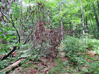
![]()
![]()
![]()
![]()
![]() On Saturday, July 29th I had planned to work with some people on Round Top but had postponed the work until Sunday since the forecast was for rain on Saturday. When I went to bed on Friday night the forecast had changed to partly sunny with no rain on Saturday. In the morning I drove to Goshen to get the hood scoop on my Mitsubishi Lancer Ralliart replaced. I was back by 9:45 AM and Cindy was home soon after. I asked her if she wanted to return to Trout Pond to clear the trail loop and she agreed. I put my Silky saw and hedge trimmers in my pack and asked Cindy to bring the loppers. I decided to carry my Fiskars axe and forego my poles. Sheila was on my heels the whole time sensing we would be going out. We left the house at 10:15 AM and headed north and west on State Route 17 toward Roscoe. I got off at exit 94 and headed north on Route 206 passing through Roscoe and then Rockland. Just after the Roscoe Nursing Home I turned left on Morton Hill Road and followed it for 3 miles to the intersection with Russell Brook Road. I drove down to the lower parking area since we had gear to carry and I knew we would not want to hike up Russell Brook Road but the road at the end of the hike. There was only one car in the lower lot but there was a tent near the beginning of the road and a car parked at the upper camping area. The temperature was about 66 degrees when I got my gear out of the car and it almost felt chilly. We got on the woods road that leads down to the bridge and crossed the stream. We passed the knotweed we had cut the day before and the path to the falls. Both looked like work had been done and both were in better shape than we had found them We continued on the main trail and turned left at the trial junction to start up the steep hill toward Mud Pond. There were a few barnacle sticking out into the trail so I asked Cindy to us the loppers to cut them off. It was then that I found out that she had not brought the loppers which was a real blow since they were the best tool to do much of the work I had planned! We continued up the hill to the highest point and then walked downhill a little to the junction with the trail to Trout Pond. The trail was almost dry compared to three days before when we had walked the same trail and found it wet with standing and running water. I wondered if the rest of the trail would be the same. We turned right and started up the trail and I immediately started picking up loose branches and throwing them off the trail. When we got to the new growth forest, there were several small saplings across the trail. Most of these we were able to pick up and drag off the trail or throw into the surrounding forest. We continued along the trail clearing a few bigger branches here and there. After a short walk I found a large branch hanging over the trail. I cut the branch which promptly hung up in another tree. I pulled and yanked on it until it came down. I cleaned up the whole mess as Cindy watched. It was then I began to realize she was mostly there for the walk and to watch me work!
On Saturday, July 29th I had planned to work with some people on Round Top but had postponed the work until Sunday since the forecast was for rain on Saturday. When I went to bed on Friday night the forecast had changed to partly sunny with no rain on Saturday. In the morning I drove to Goshen to get the hood scoop on my Mitsubishi Lancer Ralliart replaced. I was back by 9:45 AM and Cindy was home soon after. I asked her if she wanted to return to Trout Pond to clear the trail loop and she agreed. I put my Silky saw and hedge trimmers in my pack and asked Cindy to bring the loppers. I decided to carry my Fiskars axe and forego my poles. Sheila was on my heels the whole time sensing we would be going out. We left the house at 10:15 AM and headed north and west on State Route 17 toward Roscoe. I got off at exit 94 and headed north on Route 206 passing through Roscoe and then Rockland. Just after the Roscoe Nursing Home I turned left on Morton Hill Road and followed it for 3 miles to the intersection with Russell Brook Road. I drove down to the lower parking area since we had gear to carry and I knew we would not want to hike up Russell Brook Road but the road at the end of the hike. There was only one car in the lower lot but there was a tent near the beginning of the road and a car parked at the upper camping area. The temperature was about 66 degrees when I got my gear out of the car and it almost felt chilly. We got on the woods road that leads down to the bridge and crossed the stream. We passed the knotweed we had cut the day before and the path to the falls. Both looked like work had been done and both were in better shape than we had found them We continued on the main trail and turned left at the trial junction to start up the steep hill toward Mud Pond. There were a few barnacle sticking out into the trail so I asked Cindy to us the loppers to cut them off. It was then that I found out that she had not brought the loppers which was a real blow since they were the best tool to do much of the work I had planned! We continued up the hill to the highest point and then walked downhill a little to the junction with the trail to Trout Pond. The trail was almost dry compared to three days before when we had walked the same trail and found it wet with standing and running water. I wondered if the rest of the trail would be the same. We turned right and started up the trail and I immediately started picking up loose branches and throwing them off the trail. When we got to the new growth forest, there were several small saplings across the trail. Most of these we were able to pick up and drag off the trail or throw into the surrounding forest. We continued along the trail clearing a few bigger branches here and there. After a short walk I found a large branch hanging over the trail. I cut the branch which promptly hung up in another tree. I pulled and yanked on it until it came down. I cleaned up the whole mess as Cindy watched. It was then I began to realize she was mostly there for the walk and to watch me work!
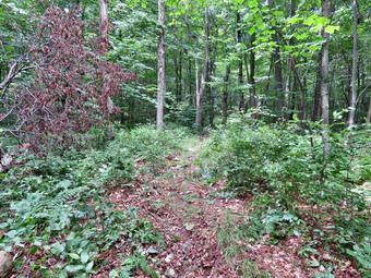 The next obstacle consisted of two small trees that were bending over the trail. Trying to cut just the part hanging over the trail would have required a pole saw. Both trees were small enough to allow me to "legally" cut them and I made short work of them with Silky saw. To get them off the trail I had to cut them up a little but this also went quickly. I was glad the temperature seemed to still be in the 60's as this was "hot" work. The next thing I stopped to cut was not actually blocking the trail but I wanted to cut it to improve the look. It was a trunk and some branches on the side of the trail> I removed the loose branches and dragged them away by myself. I started to cut up the cherry branches and the work went pretty quickly. When I was done, I got out the hedge trimmers and cut some branches and briars impinging on the trail which I knew was a precursor to what was coming up. After walking a short distance there was another trunk that had fallen so that the upper branches were across the trail. I took some pictures and the removed what I could. I cut the two major branches and was lucky they fell easily as both cuts were above my head. To get them off the trail I had to make some more cuts to make the removal easier. Each one of these efforts was not too hard by itself but I was beginning to feel the cumulative effect. We walked a little farther and found a large cherry tree that had fallen almost parallel to the trail but with several branches blocking it. I followed the same procedure of taking "before" pictures and clearing anything that was loose. I began to cut the branches and drag them off into the woods well away from the trail. I noticed the strong scent from the cherry and stopped a minute take it in. Soon I had cleared everything and after taking some pictures I moved on. As we began to near the highest point on the trail, we started to run into brush and briars starting to overgrow the trail. I dropped my pack and got out the hedge trimmers. I used the trimmers to cut what was near the trail and throw it back as far as I could. Without any help this was a tough job! I also cut some of the longer canes which had not reached the trail but would soon do so. I continued up the trail cutting both side until I reached a spot in the shade of the trees where there were fewer briars. I went back to et my pack, picked up the hedge trimmers on the way by and continued up the trail to the next stand of briars. I was a little dismayed to find that this area was the bigger and denser than the previous. I put my pack down and got out the trimmers determined not to give up and let the briars beat me! It seemed that Cindy had tried to do some work here but without the right tools it was hard for her to make much headway. Although I was tired and my back was hurting, I trimmed a pretty wide swath on either side of the trail even though some of the briars were over my head. I continued until the end of the patch and then walked back toward my pack cutting as I went. I stowed everything in my pack and the walked back up the trail. I found Cindy resting in a shady spot on a rock.
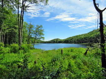 We continued on the trail until we started to walk through some brush and briars. At first it wasn't too bad so I left it alone. After a while the briars grew thicker so I dropped my pack and got out the trimmers. I trimmed back up the trail clearing most of the worst of the briars. I picked up my pack and we walked further on the trail, starting downhill, until we came to the largest tree of the day which lay directly across the trail. I took pictures and then developed a strategy to clear this blowdown. I cut the three biggest branches well off the trail so that they were out of the way. This left the trunk of the tree still across the trail. I tried to lift and pivot the whole thing off the trail but it was much too heavy. I got my Fiskar's axe and chose a spot on the trunk near the edge of the trail where I could make a cut. This time I made sure the cut was at least as wide as the diameter of the log. The chopping went fairly well and I changed side to even out it out. I was soon all the way through the trunk. The upper, smaller piece I muscled off the trail by lifting one end and flipping it into the woods. When I tried lifting and pivoting the remaining piece, it was heavier than I thought. I finally got the grip that I wanted and was able to get it off the trail. We continued down the hill and cut a large branch and two more saplings off the trail on the way down. I though we were don but we came to a spot where there were some small trees with branches nearly blocking the trail. I knew I would have to come back one more time with loppers to finish the job but I just couldn't leave these branches. I took off my pack and got out the hedge trimmers to cut these branches. There were more than I thought with another small stand beyond the first. It was hard to have to cut and pick up the branches to dispose of them all by myself. As I was working two young men with cameras passed with a "hello" but no other comment. I finished what I was doing and knew I could not start any other real work. We walked down the trail removing a few small branches. Sheila alerted and I put her on her leash as a man and a woman approached. They immediately realized what I was doing and said "thank you for the trail maintenance." We walked down the hill and were soon at the inlet bridge. The skies were sunny and blue with white clouds. I took a few shots from the bridge and then we walked down the east side of the pond. The trail to this point had been almost dry with a few damp spots where pools had been three days before. This flat trail along the pond was no exception as it was also only damp. As we neared the "beach" at the outlet, we could see a family group getting ready to leave the area. They made it to the main trail before we could pass but moved to one side of the trail to let us go by. I did not need to visit the inlet end of the pond so we kept a quick pace down the trail to the first trail junction. We continued straight ahead and were soon climbing the road toward the car. Where we met six more people who seemed to be headed down to the falls. We turned up the path to the parking area and found it almost full. Two cars were unpacking with what looked like enough equipment afford to last a week! It was 3:15 PM and we had spent 4 and a half hours hiking and clearing the trail. At this point I was exhausted and was again glad the temperature was just 70 degrees. The distance we had covered was about 4.5 miles with an elevation gain of 875 feet including some backtracking along the way.
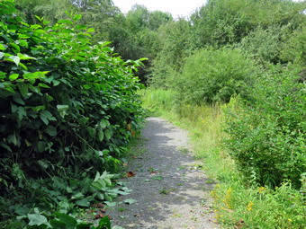
![]() On Friday, July 28th I decided to go to Trout Pond to cut out the trail to Russell Brook Falls and to beat back the Japanese knotweed that threatened to overrun the trail. I decided that I would use my Stihl string trimmer to cut out the grass, briars and weeds on the path to the falls and then handle the knotweed with a machete and loppers. Cindy agreed to go with me and we took Sheila even though we would have to tie her up for most of the time. I loaded all the supplies for the trimmer and the trimmer into the Outlander and also put in my regular pack with my Silky saw and machete. We left the house at 12:30 PM and headed north and west on State Route 17 toward Roscoe. I got off at exit 94 and headed north on Route 206 passing through Roscoe and then Rockland. Just after the Roscoe Nursing Home I turned left on Morton Hill Road and followed it for 3 miles to the intersection with Russell Brook Road. I turned left and drove down Russell Brook Road to the lower parking area since we would have to have access to the car to change tools and I did not want to carry the trimmer any farther than necessary. We arrived at 10:45 AM to find only one car parked in the lot. I got out the trimmer and the pack with the gas and we headed down the road to the falls. When we arrived in the area of the knotweed, we leashed Sheila to a tree. I gassed up the trimmer and started in on the path to the falls which was barely a foot wide and bordered by briars and weeds. As I began to cut, I realized that most of the weeds had very woody stems and there were a lot of old and thick briar canes. I had to keep bumping the trimmer for more line and trying to cut high and then low. About a third of the way down the path I realized I had not taken any "before" pictures so I asked Cindy to get the camera from the car.Since the trimmer had just run out of line, I rewound lien on the reel as Cindy retrieved the camera. Before I started in again on the trail, I took a few pictures. The trimmer was doing a good job of cutting down the briars and weeds as long as I remembered to bump it as the line got shorter. I even found it would cut through the knotweed with no problem.
On Friday, July 28th I decided to go to Trout Pond to cut out the trail to Russell Brook Falls and to beat back the Japanese knotweed that threatened to overrun the trail. I decided that I would use my Stihl string trimmer to cut out the grass, briars and weeds on the path to the falls and then handle the knotweed with a machete and loppers. Cindy agreed to go with me and we took Sheila even though we would have to tie her up for most of the time. I loaded all the supplies for the trimmer and the trimmer into the Outlander and also put in my regular pack with my Silky saw and machete. We left the house at 12:30 PM and headed north and west on State Route 17 toward Roscoe. I got off at exit 94 and headed north on Route 206 passing through Roscoe and then Rockland. Just after the Roscoe Nursing Home I turned left on Morton Hill Road and followed it for 3 miles to the intersection with Russell Brook Road. I turned left and drove down Russell Brook Road to the lower parking area since we would have to have access to the car to change tools and I did not want to carry the trimmer any farther than necessary. We arrived at 10:45 AM to find only one car parked in the lot. I got out the trimmer and the pack with the gas and we headed down the road to the falls. When we arrived in the area of the knotweed, we leashed Sheila to a tree. I gassed up the trimmer and started in on the path to the falls which was barely a foot wide and bordered by briars and weeds. As I began to cut, I realized that most of the weeds had very woody stems and there were a lot of old and thick briar canes. I had to keep bumping the trimmer for more line and trying to cut high and then low. About a third of the way down the path I realized I had not taken any "before" pictures so I asked Cindy to get the camera from the car.Since the trimmer had just run out of line, I rewound lien on the reel as Cindy retrieved the camera. Before I started in again on the trail, I took a few pictures. The trimmer was doing a good job of cutting down the briars and weeds as long as I remembered to bump it as the line got shorter. I even found it would cut through the knotweed with no problem.
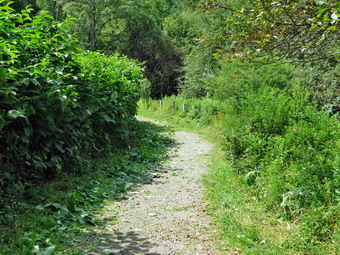 I finished cutting the path to the falls and decided not to cut the one that led down to the stream as there was no safe way to get over to the falls from there. One the way back I cut the remaining stalks closer to the ground to make the path smoother and wider. Cindy had already started in on the knotweed with her loppers. She was cutting stalks and throwing them on the other side of the road to let them dry and die in the sun. I walked passed her and used the trimmer to cut some of the knotweed. It did a good job of cutting some of the vegetation to expose the larger stalks underneath. I also trimmed some weeds near the bridge and on the other side of the road. Eventually, I put down the trimmer and started using the machete to cut the knotweed. It was a little harder work but I have to admit the quite was appreciated. The machete is the ideal took to cut the knotweed stalks as I can use one hand to fold the stalks and the other to swing the machete. I keep the machete very sharp and the knotweed offers little resistance. Once I had a handful of stalks, I walked to the other side of the road and three them as far as I could. Cindy and I continued to work this way until we had cut the knotweed back so that it would not annoy hikers walking by. We trimmer a little more by the bridge and the picked up all the remaining stalks that we had cut. I wished that I had brought a rake but our cleanup job was pretty good. It was 12:15 PM when we finished and I was ready to start on the trail loop to cut blowdowns. Cindy said she was tired so we packed up and left. On the way home I though about dropping Cindy off and returning to Trout Pond. When we arrived at home, I realized I did not feel like driving all the way back and working for another 3 to 4 hours. Clearing the loop would have to wait until another day! We spent and hour and a half doing a large amount of work and hiking very little.
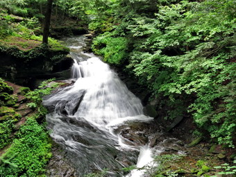
![]()
![]()
![]()
![]()
![]() On Wednesday, July 26th I wanted to get in a hike since the weather forecast for the rest of the week was questionable. Since it had rained, I asked Cindy if she wanted to go to Trout Pond and see how high the water was at Russell Brook Falls. She agreed even though we knew the trail would be wet. In the morning when I awoke there was actually some sun peeking through the clouds and the forecast was only calling for partly sunny skies. I got some things done around the house and got out my gear while Cindy got ready to go. Sheila was on my heels the whole time sensing we would be going out. We left the house at 12:30 PM and headed north and west on State Route 17 toward Roscoe. I got off at exit 94 and headed north on Route 206 passing through Roscoe and then Rockland. Just after the Roscoe Nursing Home I turned left on Morton Hill Road and followed it for 3 miles to the intersection with Russell Brook Road. I considered driving down to the lower parking area but the road can be washed out at times. I also like the hike down the road as it parallels Russell Brook. I turned around and parked on the side of the road near a large pulloff that looks like a parking area. This pulloff is on private property and the owner does not like people parking on his land. I got my gear and electronics ready and we started our hike at 12:50 PM with Sheila leading the way down Russell Brook Road. The temperature was in the high 60's and felt very comfortable compared to the previous week. The road was a little damp but did not appear to be washed out. I could hear what sounded like a large volume of water in the brook as we descended toad the lower parking area. As we walked down the road, I could see that the water level was high. When we got to the viewpoint for the upper falls, I decided to walk down to the lookout to take some pictures. I dropped my pack and took some shots of the large volume of water going over the falls. After finishing my photography, I packed up and headed back to the road. We walked down to the parking area where there were two cars with one pulling in right behind us. There was also a forest ranger's truck in the lot and I wondered which ranger in was and if he had hiked the trails. We got on the woods road that leads down to the bridge. We crossed the bridge over Russell Brook and walked along the woods road. I noticed the knotweed was back and already was green and growing nicely. In some places it was almost across the trail! I decided to walk over to the falls as the light was good. We turned right onto the path to the falls which was almost overgrown by tall grass and briars. We found the path that leads down to the stream bed and found that it is becoming more distinct as more and more people access it. The rocks were slippery as there was a lot of spray from the falls and the wind was blowing downstream. We all worked our way down to the stream where I put my pack down and got out the camera. I took shots of the falls and the stream from different angles and zooms and with different exposures. I also took a few of Sheila posing in front of the falls. When I was done, I changed the battery in the camera and the stowed it in my pack. Two women had walked to the path that leads to a little overlook of the falls so I put Sheila on her leash. It appeared the other hikers were not going to attempt the descant to the streambed. We walked back up the bank and out to the main trail. We turned right on the main trail and then walked straight ahead at the trail junction to go directly up the hill to Trout Pond. This was the direction I had gone on the last hike here but Cindy and I both thought we would have the best chance of meeting the ranger if we hiked in this direction.
On Wednesday, July 26th I wanted to get in a hike since the weather forecast for the rest of the week was questionable. Since it had rained, I asked Cindy if she wanted to go to Trout Pond and see how high the water was at Russell Brook Falls. She agreed even though we knew the trail would be wet. In the morning when I awoke there was actually some sun peeking through the clouds and the forecast was only calling for partly sunny skies. I got some things done around the house and got out my gear while Cindy got ready to go. Sheila was on my heels the whole time sensing we would be going out. We left the house at 12:30 PM and headed north and west on State Route 17 toward Roscoe. I got off at exit 94 and headed north on Route 206 passing through Roscoe and then Rockland. Just after the Roscoe Nursing Home I turned left on Morton Hill Road and followed it for 3 miles to the intersection with Russell Brook Road. I considered driving down to the lower parking area but the road can be washed out at times. I also like the hike down the road as it parallels Russell Brook. I turned around and parked on the side of the road near a large pulloff that looks like a parking area. This pulloff is on private property and the owner does not like people parking on his land. I got my gear and electronics ready and we started our hike at 12:50 PM with Sheila leading the way down Russell Brook Road. The temperature was in the high 60's and felt very comfortable compared to the previous week. The road was a little damp but did not appear to be washed out. I could hear what sounded like a large volume of water in the brook as we descended toad the lower parking area. As we walked down the road, I could see that the water level was high. When we got to the viewpoint for the upper falls, I decided to walk down to the lookout to take some pictures. I dropped my pack and took some shots of the large volume of water going over the falls. After finishing my photography, I packed up and headed back to the road. We walked down to the parking area where there were two cars with one pulling in right behind us. There was also a forest ranger's truck in the lot and I wondered which ranger in was and if he had hiked the trails. We got on the woods road that leads down to the bridge. We crossed the bridge over Russell Brook and walked along the woods road. I noticed the knotweed was back and already was green and growing nicely. In some places it was almost across the trail! I decided to walk over to the falls as the light was good. We turned right onto the path to the falls which was almost overgrown by tall grass and briars. We found the path that leads down to the stream bed and found that it is becoming more distinct as more and more people access it. The rocks were slippery as there was a lot of spray from the falls and the wind was blowing downstream. We all worked our way down to the stream where I put my pack down and got out the camera. I took shots of the falls and the stream from different angles and zooms and with different exposures. I also took a few of Sheila posing in front of the falls. When I was done, I changed the battery in the camera and the stowed it in my pack. Two women had walked to the path that leads to a little overlook of the falls so I put Sheila on her leash. It appeared the other hikers were not going to attempt the descant to the streambed. We walked back up the bank and out to the main trail. We turned right on the main trail and then walked straight ahead at the trail junction to go directly up the hill to Trout Pond. This was the direction I had gone on the last hike here but Cindy and I both thought we would have the best chance of meeting the ranger if we hiked in this direction.
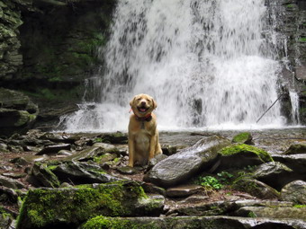 The trail to Trout Pond was wet for almost the entire length. In some places the water was directed in channels but in others the entire trail was wet. Soon we were at the pond and we walked over to the shore by the outlet. The water level was not as high as I thought it would be and no water was flowing over the spillway at the dam. There were a few ducks by the spillway and Sheila dove in to make friends! The ducks were not friendly ducks and moved away quickly. I got out my camera and took pictures of the pond and the shores even though the sky was a little cloudy. I threw a stick in the pond for Sheila to retrieve but she only did it once. It was at this time that Sheila decided to dash madly back and forth. I tried to capture a few pictures of her and then packed up to get back on the main trail. The trail from the outlet end of the lake to the lean-tos was covered in water most of the way and it was sometimes impossible to easily avoid the puddles. As we passed by a large unoccupied campsite on the right, we could hear people at the lower lean-to. I put Sheila on her leash as we approached and found RnagerDylan McCartney just starting toward us. Trout Pond is in Dec Region 4 and Ranger McCartney is stationed in Stamford, NY. We talked about trail maintenance and the problem of the knotweed before heading in opposite directions. We walked over to the bridge over the inlet stream and I decided not to stop for pictures. The trail to the right up the hill had a stream running down the middle. After a short distance, the stream headed off to the left and the trail was drier. We climbed the trail heading toward the shoulder of Cherry Ridge. There were some new blowdowns along the way and several older larger logs. All should be cleared but the larger logs might need a chainsaw crew. I knew once we hit the top of the hill and started down that the trail would be very wet. I picked up quite a few branches and small limbs off the trail and even moved some larger logs that had broken onto section. I was right about the trail down to Mud Pond as it was covered in standing water in places and ran like a stream in others. We had to walk on the sides of the trail and, at times, well off the trail. We came across one large branch that had broken off a tree and had one end lodged in the ground. The other end was hung up high in s small tree. It looked very dangerous and I know it will be hard to safely remedy the situation. Eventually we were walking through the area where there are a lot of small white birches. We descended the hill to the trail that runs past Mud Pond. We turned left here to head back to the car by completing the loop. The trail was wet with surface water which also made it very muddy so we used the sides of the trail in places. We hit the top of the small hill and started the long descent back to the register box. The trail remained wet and muddy with several small streams flowing across it. The stream to the right of the trail had a volume greater than I had ever seen in it. When we arrived at the trail register, we turned right and walked back out the trail to the lower parking area. From here we walked back up Russell Brook Road to the car without seeing another vehicle or person for the entire trip. We were back at the car at 3:45 PM after hiking 5.5 miles in 2 hours and 55 minutes. The elevation gain was 1115 feet.
![]()
![]()
![]()
![]() On Tuesday, July 25th I decided I wanted to check the trails on Round Top and get out after spending the early part of the day chained to a computer. The weather forecast was calling for rain when I got dressed and ready to go at 1:30 PM but the skies I could see looked only a little cloudy. I put Sheila on her leash as we started down the driveway and I looked north toward Roscoe. The skies were grey and almost black and I nearly decided to turn around. In the end we continued by crossing the road and walking through the field by the church. We started up the steep hill along the edge of the cemetery. I elected to leave my pack behind and to go without hiking poles. My heart was beating faster when we got to the top of the hill even though Sheila helped by pulling me up the hill. We turned left into the forest and I let Sheila off her leash. As we walked the woods road to the first trail junction, I picked up a few branches that had fallen in the wind over the past few days. At the trail junction we continued straight ahead up the steep little climb to the viewpoint. I continued to remove a few branches here and there. At the lookout I found no more vandalism so we followed the trail to the right. I noted that the ferns had grown up some and would soon need a good whacking. Where the lower trail turned right we continued straight ahead following the blue paint blazes up toward the summit of Round top. I was glad to see that the blazes had held up well to the rain but had dried a little darker than I expected. As we climbed the hill a cleared a few spots. We continued across the summit and descended the other side. At the bottom of the hill we continued straight ahead on the woods road back to the first trail junction. Since we had missed a section of the lower trail, we turned around and hiked back up the woods road to the sharp left turn. We followed the lower trail this time as it skirted Round Top. Along the way I noticed that the bushes were starting to close in and needed to be trimmed back. We continued to follow the yellow trail as it turned left and headed down to the lookout. At the lookout we turned left and completed the loop back to the first trail junction. I was a little bored doing repeated loops but thought about doing at least one figure 8. As I was trying to make my decision a few drops of rain began to fall. I don't mind a little train but I remembered the dark clouds I had seen and thought it would be better to head home. We continued straight ahead back to the beginning of the trail. I put Sheila on her leash and we walked back down the cemetery hill, across the field and down the driveway. We had spent 45 minutes walking and doing some minor trail work.
On Tuesday, July 25th I decided I wanted to check the trails on Round Top and get out after spending the early part of the day chained to a computer. The weather forecast was calling for rain when I got dressed and ready to go at 1:30 PM but the skies I could see looked only a little cloudy. I put Sheila on her leash as we started down the driveway and I looked north toward Roscoe. The skies were grey and almost black and I nearly decided to turn around. In the end we continued by crossing the road and walking through the field by the church. We started up the steep hill along the edge of the cemetery. I elected to leave my pack behind and to go without hiking poles. My heart was beating faster when we got to the top of the hill even though Sheila helped by pulling me up the hill. We turned left into the forest and I let Sheila off her leash. As we walked the woods road to the first trail junction, I picked up a few branches that had fallen in the wind over the past few days. At the trail junction we continued straight ahead up the steep little climb to the viewpoint. I continued to remove a few branches here and there. At the lookout I found no more vandalism so we followed the trail to the right. I noted that the ferns had grown up some and would soon need a good whacking. Where the lower trail turned right we continued straight ahead following the blue paint blazes up toward the summit of Round top. I was glad to see that the blazes had held up well to the rain but had dried a little darker than I expected. As we climbed the hill a cleared a few spots. We continued across the summit and descended the other side. At the bottom of the hill we continued straight ahead on the woods road back to the first trail junction. Since we had missed a section of the lower trail, we turned around and hiked back up the woods road to the sharp left turn. We followed the lower trail this time as it skirted Round Top. Along the way I noticed that the bushes were starting to close in and needed to be trimmed back. We continued to follow the yellow trail as it turned left and headed down to the lookout. At the lookout we turned left and completed the loop back to the first trail junction. I was a little bored doing repeated loops but thought about doing at least one figure 8. As I was trying to make my decision a few drops of rain began to fall. I don't mind a little train but I remembered the dark clouds I had seen and thought it would be better to head home. We continued straight ahead back to the beginning of the trail. I put Sheila on her leash and we walked back down the cemetery hill, across the field and down the driveway. We had spent 45 minutes walking and doing some minor trail work.
![]()
![]()
![]()
![]() On Sunday, July 23rd I decided that the weather for the rest of my week was looking pretty lousy with rain and thunderstorms almost every day. It was also my birthday and I thought I hike would be nice. The most important consideration was that I had hiked the previous two days without Sheila and had promised her a hike on Sunday. When we returned from church, we got our gear ready and got dressed. Sheila sniff our clothes and immediately knew we were hiking. She began to run around the house bouncing against the furniture but always keeping a close eye on us. We put our gear in the car and an exited Sheila in the back seat and drove out the DeBruce Road a little after 12:30 PM. It wasn't long before we got behind a caravan of cars traveling at about 30 mph. At Mongaup Pond Road I turned left behind the other cars which also made the turn. They unfortunately were headed to Mongaup Pound but didn't seem to know you drive until you run out of road! I continued to follow the road bearing left onto Beech Mountain Road at the fork. When we arrived in the parking area there were two other cars in the lot and one car following behind us. I pulled in and parked and the other car started to drive up to the cabin but then backed up. The drive hailed me and I went over to talk to him. He was an attorney from Liberty and he and his friend had attended the Beech Mountain Boy Scout Camp back in the 1960's. I had to tell him that the road no longer went to the camp and it was about a 3 mile hike. He pulled into a parking spot and we talked for some time until Sheila insisted we had to hike. She was acting as if she hadn't hiked in a month as she pulled me toward the trail. The temperature was in the high 70's and the humidity was a little lower than the previous days. We headed out the path to the register on Quick Lake Trail at about 1:10 PM. The Quick Lake Trail was quite dry with only a few muddy spots so we made good time. At Gravestone Junction we turned left to head down to Frick Pond. The day was pleasant but the skies were overcast and there was some haze which made me decided to keep hiking without taking pictures. The water level in the pond was high due to the beaver dam across the outlet stream. This time it looked like no one had disturbed the dam and that the beavers had added to it. We continued on the Quick Lake Trail around the pond bearing left at the next trail junction to stay on the red trail. This part of the trail was also relatively dry with only a few muddy patches. We were setting a fast pace and soon came to the "pine promenade" and the little stream through the woods. This water level in the stream was lower than it had been but Sheila was able to get a drink and take a "dip". As we continued along the trail I removed some small branches and a few large ones until we arrived at Iron Wheel Junction at 1.6 miles. We turned left on the Quick Lake Trail and started the long uphill climb toward Junkyard Junction. The trail continued to be almost dry which was surprise given the amount of rain that had fallen. At 3.2 miles we arrived at Junkyard Junction and turned right onto the blue Flynn Trail. The Flynn Trail is almost flat and on this day it was dry with a few muddy spots. There were no major blowdowns but I continued to removed branches that littered the trail. The entire trail does need to have some branches lopped to make a clear path. When we got to the gate, we turned right to stay on the trail and head down toward Hodge Pond. At 3.75 miles the Flynn Trail heads right and we follows it toward the outlet end of Hodge Pond.
On Sunday, July 23rd I decided that the weather for the rest of my week was looking pretty lousy with rain and thunderstorms almost every day. It was also my birthday and I thought I hike would be nice. The most important consideration was that I had hiked the previous two days without Sheila and had promised her a hike on Sunday. When we returned from church, we got our gear ready and got dressed. Sheila sniff our clothes and immediately knew we were hiking. She began to run around the house bouncing against the furniture but always keeping a close eye on us. We put our gear in the car and an exited Sheila in the back seat and drove out the DeBruce Road a little after 12:30 PM. It wasn't long before we got behind a caravan of cars traveling at about 30 mph. At Mongaup Pond Road I turned left behind the other cars which also made the turn. They unfortunately were headed to Mongaup Pound but didn't seem to know you drive until you run out of road! I continued to follow the road bearing left onto Beech Mountain Road at the fork. When we arrived in the parking area there were two other cars in the lot and one car following behind us. I pulled in and parked and the other car started to drive up to the cabin but then backed up. The drive hailed me and I went over to talk to him. He was an attorney from Liberty and he and his friend had attended the Beech Mountain Boy Scout Camp back in the 1960's. I had to tell him that the road no longer went to the camp and it was about a 3 mile hike. He pulled into a parking spot and we talked for some time until Sheila insisted we had to hike. She was acting as if she hadn't hiked in a month as she pulled me toward the trail. The temperature was in the high 70's and the humidity was a little lower than the previous days. We headed out the path to the register on Quick Lake Trail at about 1:10 PM. The Quick Lake Trail was quite dry with only a few muddy spots so we made good time. At Gravestone Junction we turned left to head down to Frick Pond. The day was pleasant but the skies were overcast and there was some haze which made me decided to keep hiking without taking pictures. The water level in the pond was high due to the beaver dam across the outlet stream. This time it looked like no one had disturbed the dam and that the beavers had added to it. We continued on the Quick Lake Trail around the pond bearing left at the next trail junction to stay on the red trail. This part of the trail was also relatively dry with only a few muddy patches. We were setting a fast pace and soon came to the "pine promenade" and the little stream through the woods. This water level in the stream was lower than it had been but Sheila was able to get a drink and take a "dip". As we continued along the trail I removed some small branches and a few large ones until we arrived at Iron Wheel Junction at 1.6 miles. We turned left on the Quick Lake Trail and started the long uphill climb toward Junkyard Junction. The trail continued to be almost dry which was surprise given the amount of rain that had fallen. At 3.2 miles we arrived at Junkyard Junction and turned right onto the blue Flynn Trail. The Flynn Trail is almost flat and on this day it was dry with a few muddy spots. There were no major blowdowns but I continued to removed branches that littered the trail. The entire trail does need to have some branches lopped to make a clear path. When we got to the gate, we turned right to stay on the trail and head down toward Hodge Pond. At 3.75 miles the Flynn Trail heads right and we follows it toward the outlet end of Hodge Pond.
This part of the Flynn Trail was the wettest and muddiest we had encountered. It also looked like OSI had used a large tractor to mow the trail and this left large ruts behind! After walking through the field were the mess hall and family camping area for the Boy Scout Camp once stood we came to the clearing at the outlet end of the pond. I looked over at the pond and saw no spectacular picture opportunities. I decided to continue on the Flynn Trail without stopping. We turned right and began the climb up the hill. I was feeling quite fresh and concentrated on using my poles to help set a quick pace up the hill. At the top of the hill we stayed to the left to continue on the Flynn Trail. A right turn follows a woods road out to what remains of the Beech Mountain Boy Scout Camp. Just after the turn there was a small tree across the trail. I tried to move it but it wouldn't budge. I broke some branches off and made a note to return with me saw. The Flynn Trail is relatively flat to the junction with the Big Rock Trail at 4.5 miles. We contused straight through this junction to follow the Flynn Trail back to the car. Cindy is fast on the downhill so I set a very quick pace downhill on the Flynn Trail. The walk is pretty but has no remarkable views or features. As we neared the end I saw two people headed our way. As we got closer I could hear music playing. I put Sheila of her leash and as I was about to pass the other hikers they asked how far it was to the pond. I told them it was about two miles. They seemed a little hesitant and wondered if they had meant to go to Frick Pond which is much closer to the parking area. As we approached the gate on the woods road, we turned left to avoid the private property around the cabin and to stay on the trail. On a previous trip I had cleared and reblazed the old trail and I could see that it was easy to follow. We finished our walk and were back at the car by 3:45 PM. We had covered 6.2 miles in 2 hours and 35 minutes with an elevation gain of 890 feet. Our average overall speed was 2.4 mph and we had stopped for only 6 minutes. We covered the last 1.6 miles in 34 minutes for a speed just under 3 mph.
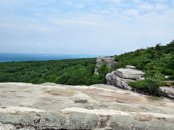
![]()
![]()
![]()
![]()
![]() On Saturday, July 22nd Cindy and I planned to hike at Sam's Point with members from the Grooville Free Methodist Church. We had not hiked there in some time and wondered what the area would look like after the massive fire that burned so many acres in April of 2016. Many of the trails were still closed including the High Point Trail and the trail to Verkeerderkill Falls. The Long Path had to be rerouted and now comes up the South Gully Trail from Route 52. When the trail meets the Loop Road, the Long Path turns left and follows the Loop Road to the High Point Carriage Road. It then follows the carriage road to the Berrypickers Path and the Upper Mine Hole Trail which finally leads down to Berme Road. The church group wanted to hike from the visitor's center to Sam's Point and then down to the Ice Caves and back. I planned to extend the hike fro Cindy and myself by walking around Lake Maratanza and visiting Indian Rock. When we got up in the morning, there was a lot of fog but it soon started to clear. For the second day in a row I could not take Sheila with us which made both of us sad. I promised here a short hike on Sunday! Cindy and I got dressed and got our gear ready and then drove down to Peck's Supermarket to meet the rest of the group at 9:00 AM. Unfortunately, the "rest of the group" was just one other person, Mary. We decided to drive our respective cars to the pastor's house in Liberty. We arrived in Liberty at about 9:30 AM to find Pastor Paul and his wife Sherri ready to go along with another hiker, Ray. Mary rode with us and Ray got in the pastor's car. I led the way as we drove out of Liberty. I was busy talking and drove toward Grahamsville instead of toward Woodbourne which is the quicker way. The way I chose is a little longer but very scenic. We took Route 55 to Route 209 where we turned right and headed into Ellenville. Here we turned left on canal Street which is also Route 52. We followed Route 52 up the mountain and turned left on Cragsmoor Road. In Cragsmoor we turned right onto Sam's Point Road and soon arrived at the parking at the visitor's center. We pulled into some free spaces although the parking lot was beginning to fill up. I went to the window to pay where the attendant took my $10 and handed me a ten dollar bill to feed into the machine outside! The machine took my money and gave me a parking slip for my windshield. I wondered what purpose the attendant served. By 10:30 AM we were ready to start up the loop road toward Sam's Point. The temperature was already in the mid 70's and the humidity was high.
On Saturday, July 22nd Cindy and I planned to hike at Sam's Point with members from the Grooville Free Methodist Church. We had not hiked there in some time and wondered what the area would look like after the massive fire that burned so many acres in April of 2016. Many of the trails were still closed including the High Point Trail and the trail to Verkeerderkill Falls. The Long Path had to be rerouted and now comes up the South Gully Trail from Route 52. When the trail meets the Loop Road, the Long Path turns left and follows the Loop Road to the High Point Carriage Road. It then follows the carriage road to the Berrypickers Path and the Upper Mine Hole Trail which finally leads down to Berme Road. The church group wanted to hike from the visitor's center to Sam's Point and then down to the Ice Caves and back. I planned to extend the hike fro Cindy and myself by walking around Lake Maratanza and visiting Indian Rock. When we got up in the morning, there was a lot of fog but it soon started to clear. For the second day in a row I could not take Sheila with us which made both of us sad. I promised here a short hike on Sunday! Cindy and I got dressed and got our gear ready and then drove down to Peck's Supermarket to meet the rest of the group at 9:00 AM. Unfortunately, the "rest of the group" was just one other person, Mary. We decided to drive our respective cars to the pastor's house in Liberty. We arrived in Liberty at about 9:30 AM to find Pastor Paul and his wife Sherri ready to go along with another hiker, Ray. Mary rode with us and Ray got in the pastor's car. I led the way as we drove out of Liberty. I was busy talking and drove toward Grahamsville instead of toward Woodbourne which is the quicker way. The way I chose is a little longer but very scenic. We took Route 55 to Route 209 where we turned right and headed into Ellenville. Here we turned left on canal Street which is also Route 52. We followed Route 52 up the mountain and turned left on Cragsmoor Road. In Cragsmoor we turned right onto Sam's Point Road and soon arrived at the parking at the visitor's center. We pulled into some free spaces although the parking lot was beginning to fill up. I went to the window to pay where the attendant took my $10 and handed me a ten dollar bill to feed into the machine outside! The machine took my money and gave me a parking slip for my windshield. I wondered what purpose the attendant served. By 10:30 AM we were ready to start up the loop road toward Sam's Point. The temperature was already in the mid 70's and the humidity was high.
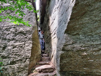 We walked to the beginning of the loop road and stayed to the right to walk uphill to Sam's Point first. We met two groups of hikers on the way down and could hear others on the other branch of the loop road. Soon we were just below Sam's Point with a nice lookout on the right of the trail. Even though the view is better from on top, I wanted to stop and take some pictures from this lower lookout. I walked out onto the rock, dropped my pack and took out my camera. It was then that I found out that more than one member of the group did not appreciate heights. After taking a few pictures, I packed up and we continued up to the main lookout turning left at the top of the hill. Since Sam's Point is now part of Minnewaska State Park some of the "unnatural" additions have been removed including the low stone wall around the edge of Sam's Point. The wooden bridge over the crack between the two parts viewpoint remains. I understand the point of leaving things as natural as possible but I don't see the difference between a rock wall and a wooden bridge. I took some more pictures from Sam's Point although it was very hazy and difficult to see the Catskills to the north. I mentioned a few points of interest to the members of our group before we turned around and walked back out to the loop road. We turned left and started hiking to our next turn which was the road down to the ice caves. When I was in grade school, we came to the ice caves for class trips. At that time the area was privately owned and cars could drive all the way to a parking area at the beginning of the trail down to the caves. As we walked, I wondered where the fire had burned as we saw now evidence of it. In a little less than half a mile we arrived at the road to the ice caves and found all the trees on the right side of the loop road and the left side of the Ice Caves Road burned. Many of the trees were showing some new growth. It was obvious that the extra sunlight had favored the undergrowth as the blueberries were flourishing. We walked down the hill meeting a few group coming back up and overtaking some going down. The trail to Verkeerderkill Falls was blocked off with signs indicating it was closed. Soon we reached the trail down to the caves. The "caves" are not actually caverns but were formed when tectonic forces pulled pieces of rock away from the bedrock. We started down the steps which led to more stone stairs with wooden hand rails. The rocks were smooth and dripping water and condensation made them very slippery. On the way down we took a few pictures. As we descended the drop in the air temperature was perceptible. At the bottom we walked back out into the sun and along the base of the high stone cliffs. In some areas small streams ran directly out of the rock with clear, cold water. In other areas there were wooden walkways over some muddy areas. We walked through a rather dark tunnel which led to a narrow crack. In some places we had to duck under low hanging rock or scramble over other rocks. There were several wooden ladders to help over the biggest scrambles. We soon arrived at the "caves" and I was disappointed to see that the state had removed the wooden door leading into the caves. We walked in and found the lights and wooden walkways were still present. I did not try to take any pictures as the lighting is too poor. The walk was short and we were soon walking up the last ladder to the rocky outcrops that form a viewpoint at the end of the caves. From the viewpoint both Castle Point and Hamilton Point near Minnewaska and Awosting were visible. I took some more pictures before we walked uphill on the path to what used to be the parking lot. From here we had to walk back on Ice Caves Road which is all uphill. Several in the group were almost at the end of their energy. When we reached the junction with the Loop Road, we arranged for Mary to go back in the other car as Cindy and I wanted to extend our walk. It was 12:30 PM and we had only hiked 2.6 miles!
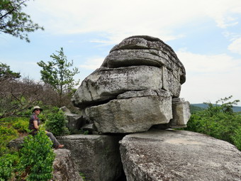 We left the group and turned right on the Loop Road passing by the burned trees on the right. We caught up to two couples who had their Rhodesian Ridgeback with them. He was extremely calm and well-behaved and I offered a compliment. We continued along the road until Lake Maratanza came along. This lake is one of the "sky lakes" most of which have a pH of around 4 which is very acidic and prevents the growth of most organisms. As we approached a young boy and his father were looking at something at the side of the road. It was a dark brown snake about two feet long. It was obvious it was not a rattlesnake from the shape of its head and the lack of any rattles. We took some pictures before the snake disappeared into a bush. I also took a few shots of the lake before we moved on. At 3.5 miles we turned right onto the High Point Carriageway and started walking north toward the Indian Rock Trail. The trail went uphill slightly and then dipped until at 3.9 miles we came to the trail. The road was lined with underbrush that had been trimmed some time ago and was simply left on the road. We turned left onto the trail and began to walk over some wooden walkways through berry bushes loaded with blueberries. After a little while we began to see that some of the trees were blackened but not completely burned. Several groups were coming toward us and we moved over to let them pass. The trail was very narrow and overgrown with brush. I began to wonder how New York State was using my $10At about 4 miles we came to the point where the trail begins to descend more steeply and there is a rock that offers a view. From this lookout we could see that all the trees below us were completed burned by the fire last April. I took some pictures including a long distance shot of Indian Rock which was clearly visible. We worked our way along the path passing some people resting on the open rock faces and some hiking back toward the main carriageway. We walked across an open rock face and down a crack in the rock and arrived at Indian Rock. I was glad there were no other people there at the time as it was easier to take some pictures. After a few minutes we headed back up the trail retracing our steps to the High Point Carriageway. I knew at this point it was just a matter of making the long and not very interesting walk back to the car. We hiked the carriageway out to the loop road and turned right to complete the loop around the lake. The loop road is mostly flat but descends some to get back to the parking area. In two places it passes the remains of some old shacks that were used by people who picked blueberries. This was a thriving industry at one time and the sites are the subject of an archaeological study. At 6.25 miles we passed by the South Gully Trail on the right which is part of both the Long Path and Shawangunk Ridge Trail. From there it was a short walk to the parking area which was now overflowing with cars. It was 2:20 PM and we had walked 6.6 miles in 3 hours and 50 minutes with a modest 875 foot elevation gain. After the hike we again visited Gaby's Mexican restaurant in Ellenville. Cindy and I both enjoyed the food.
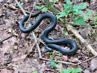
![]()
![]()
![]()
![]()
![]() On Friday, July 21st I planned to hike somewhere with my two sons, Karl and Kurt, for my birthday which is on Sunday. Kurt lives in Poughkeepsie so we decided to meet at Minnewaska State Park which is about half way between us. We agreed to meet at the Jenny Lane Parking Area at 9:30 AM to do a hike. My plan was to door the jenny lane trail to get another part of the SRT completed. When I started to plan the hike, I found I had already done this section of trail. I changed the plan to hike the loop around the Peters Kill as I did not think either of the boys had been there before. The weather forecast was for a warm humid day with highs in that area approaching 90 degrees but at least there were no thunderstorms in the forecast. Karl had to be back in Callicoon for a closing at 4:00 Pm so I though the 6 mile distance would be good. Karl picked me up in Livingston Manor at 8:30 AM. As we left the house without Sheila, she seemed very sad to be left behind. We usually stop for a meal after hiking and it would be too hot to leave her in the car. I was also concerned about the possibility of encountering a rattlesnake on the hike which has happened in the past! Karl drove south on State Route 17 getting off at the Liberty exit. He took Route 52 through Woodbourne to Route 209 in Ellenville. He drove north on Route 209 to Route 44/55 and the turned right to head toward New Paltz. Just before the main entrance to Minnewaska State Park, I directed him to turn left into the Jenny Lane parking are. There were three other cars parked but there was plenty of room for us and Kurt. We arrived at 0:15 AM and waited for Kurt who appeared at 9:35 AM. We got ready to hike and left the parking area at 9:45 AM heading east on Jenny Lane. After .15 miles we turned right on the Old Minnewaska Trail heading south and southeast. This trail is more of a road for a short distance. Just before the road turned into a trail, we found a large pile of logs stacked to the right of the trail. The logs had been there for some time and were covered by a black netting. We could not come up for a reason for this! We starred out on the trail stopping at about .35 miles for a cellophane call. Just before we started out, Kurt pointed out a 30 inch black snake lying along a branch on the ground. It did not have the head of a rattlesnake nor did its tail appear to have rattles. It seemed annoyed at our presence and shook its tail in the leaves making and unsettling "rattle". It also curled up a little and raised its head. We decided to leave the snake to warm up in the sun and started up the hill in front of us. At .95 miles the Old Minnewaska Trail ended at Route 55 where the High Peters Kill Trail began. We ducked back into the woods and started following the red blazes heading east still gaining some elevation to 1.4 miles. The trail heads northeast and parallels Route 55 to about 1.6 miles where the trail continues northeast and the road turns more to the east. Along the way there were some opportunities to walk to the edge of the escarpment and get some views to the south and east. Neither of the boys enjoys being very near the edge of the rocks which doesn't bother me very much.We could even see the Smiley Tower at the Mohonk Preserve in the distance .
On Friday, July 21st I planned to hike somewhere with my two sons, Karl and Kurt, for my birthday which is on Sunday. Kurt lives in Poughkeepsie so we decided to meet at Minnewaska State Park which is about half way between us. We agreed to meet at the Jenny Lane Parking Area at 9:30 AM to do a hike. My plan was to door the jenny lane trail to get another part of the SRT completed. When I started to plan the hike, I found I had already done this section of trail. I changed the plan to hike the loop around the Peters Kill as I did not think either of the boys had been there before. The weather forecast was for a warm humid day with highs in that area approaching 90 degrees but at least there were no thunderstorms in the forecast. Karl had to be back in Callicoon for a closing at 4:00 Pm so I though the 6 mile distance would be good. Karl picked me up in Livingston Manor at 8:30 AM. As we left the house without Sheila, she seemed very sad to be left behind. We usually stop for a meal after hiking and it would be too hot to leave her in the car. I was also concerned about the possibility of encountering a rattlesnake on the hike which has happened in the past! Karl drove south on State Route 17 getting off at the Liberty exit. He took Route 52 through Woodbourne to Route 209 in Ellenville. He drove north on Route 209 to Route 44/55 and the turned right to head toward New Paltz. Just before the main entrance to Minnewaska State Park, I directed him to turn left into the Jenny Lane parking are. There were three other cars parked but there was plenty of room for us and Kurt. We arrived at 0:15 AM and waited for Kurt who appeared at 9:35 AM. We got ready to hike and left the parking area at 9:45 AM heading east on Jenny Lane. After .15 miles we turned right on the Old Minnewaska Trail heading south and southeast. This trail is more of a road for a short distance. Just before the road turned into a trail, we found a large pile of logs stacked to the right of the trail. The logs had been there for some time and were covered by a black netting. We could not come up for a reason for this! We starred out on the trail stopping at about .35 miles for a cellophane call. Just before we started out, Kurt pointed out a 30 inch black snake lying along a branch on the ground. It did not have the head of a rattlesnake nor did its tail appear to have rattles. It seemed annoyed at our presence and shook its tail in the leaves making and unsettling "rattle". It also curled up a little and raised its head. We decided to leave the snake to warm up in the sun and started up the hill in front of us. At .95 miles the Old Minnewaska Trail ended at Route 55 where the High Peters Kill Trail began. We ducked back into the woods and started following the red blazes heading east still gaining some elevation to 1.4 miles. The trail heads northeast and parallels Route 55 to about 1.6 miles where the trail continues northeast and the road turns more to the east. Along the way there were some opportunities to walk to the edge of the escarpment and get some views to the south and east. Neither of the boys enjoys being very near the edge of the rocks which doesn't bother me very much.We could even see the Smiley Tower at the Mohonk Preserve in the distance .
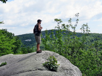 At 1.7 miles we could see where the Peters Kill crosses beneath the roadway. From 1.7 miles to 2.7 miles the trail continued to head northeast and downhill. There weren't too many more views as the trail dropped 480 feet in a mile. At 2.7 miles the trail turned south and down a steep hill to cross the Peters Kill on two bridges at 2.8 miles. This was the lowest point on the hike and we would have to do some climbing to get back to the car. I stopped to take some pictures of the Peters Kill but was disappointed that there was so little water. I didn't expect the levels to match the ones during the spring but I thought the recent rains would have contributed to the flow! After crossing the bridges we turned right or south to follow the yellow blazes along the stream. We began to encounter people sunning themselves and taking a dip in the water. I understand the attraction but their presence spoiled the opportunity to get some pictures in some spots. A group of young people cam down the trail and started to walk up the stream bed. They were loud but were obviously having a good time. I remembered from previous trips that the trail along the stream are not very distinct and do not parallel the Peters Kill all the way to where it crosses the road. At about 3.2 miles into the hike the yellow trail ended and another red trail started. The red trail immediately branched with the left fork heading for the Peters Kill parking area and park office. We stayed to the right to follow the bench of the trail that paralleled the stream. Occasionally we would walk out to the stream to take some pictures but the lack of water limited the opportunities. We even walked up the streambed for some distance as the water was so low. At 3,4 miles the red trail started off to the left and up to the parking area. We continued along the edge of the stream taking some pictures at one of the falls. Soon we came to Sheldon Falls. Sheldon Falls is a series of cascades and today there were several families and other groups sunning themselves on the rocks or wading in the cool water. I took some pictures of we are happy to would have been a falls if there had been sufficient water. We worked our way up the bank to a structure at the base of Sheldon Falls. It is the remains of an old COAL FIRED power plant that provided electricity for some of the now long forgotten boarding houses that dotted this area many years ago. A large pipe descends into the plant. Even though it has stood idle for many years, some of the machinery is still present and I took a few pictures before moving on. We followed one of the informal paths to a point where I could get a few pictures of Peters Kill Falls. Had the water level been higher I would have walked out to the falls but time was growing short. We followed a steep path up to the road and walked back toward the point where the stream crosses under the road.
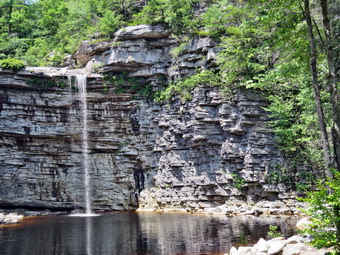 We crossed the road and got on the Awosting Falls Carriageway. The closer we got to the falls the more people we encountered. At 4.5 miles we were at the falls which was a zoo! There were people lining the edges of the pool and a group from a camp hanging from the trees near the falls. One of the counselors was yelling at some children at the top of the falls to stay back from the edge. I could see two young women in bathing suits walking across the slippery rocks at the top of the falls. During all of this activity, there were no park personnel present to warn people of their stupidly dangerous behavior! I took some pictures of the falls trying to cut out the people as much as possible. There was very little water going over the falls so we quickly moved on. The walk to the top of the falls is steep but short and there were even more people coming down this path. We walked out to the park road and turned right and then left to follow the road to the Awosting parking area. The entrance to the park has been redone to allow cars to get into the park before they pay the fee. This keep scars from blocking route 55. We walked across the parking area and out to the road. We turned left and headed northwest and then north on the shoulder of the road for .9 miles back to the parking area. We arrived back at the cars at 1:30 PM walking 6.3 miles in 3 hours and 45 minutes with about 45 minutes of stopped time. The elevation gain was 1050 feet. We decided to eat at Gabby's, a Mexican restaurant, in Ellenville. The food was very good and I would recommend it highly
![]()
![]()
![]()
![]() On Wednesday, July 19th, I planned to return to the Touch-Me-Not Trail from Big pond to Cabot Mountain to finish the trail clearing we had started on Saturday and Sunday. I had taken two days off to rest and recuperate and to tend to some work around the house. I had been using my son Karl's string dimmer but had grown frustrated with it in several ways. The bottom line was that it was not built to be used for the heavy-duty work I was doing clearing two foot tall nettles, briars and brush from the trails. I began to research string trimmers and found two highly recommended brand were Stihl and Husqvarna. Fortunately, there is a dealer in my area and I was convinced it would be worth the extra cost to buy from him to gain the expert advice. This dealer also maintains a top-notch repair shop which was a deciding factor. On Monday I headed over to his place of business and told him my problem. I needed a trimmer to stand up to the work I was doing but one that would not be too heavy to carry at least two miles along a trail. He recommended the Stihl FS 131 which is a professional grade trimmer with a straight shaft and a gearbox that would prevent vegetation from wrapping around the head and binding. The machine also has a 36cc 4-cycle engine which takes a 50:1 gas-oil mixture and handles 10 feet of .095 inch line on an upper and lower reel. The starting procedure is quick and reliable and it was a lot of power. The only drawback is that it is longer and heavier than the trimmers I have previously used. The dealer recommended a double harness which I bought. One of the employees spent time with me to walk me through all the procedures for using the trimmer. I walked away mostly satisfied but wondering if I had bought a little more trimmer than I needed. I was not enthusiastic about carrying the gas powered string trimmer almost two miles up and over Touch-Me-Not Mountain but it was the quickest way to get to the place where I wanted to start to trim. In the morning we got dressed to work and I got my old pack that I use for carrying equipment ready by adding some more gas to the container I carry. I also included a water bottle and a multitool as well as some extra line for the trimmer. As we were getting dressed Sheila wasn't far away making sure we could not get out of the house without her! We took the SUV since the new straight shaft trimmer take sup too much space in my sedan. We left Livingston Manor around 9:30 AM and drove north on Old Route 17 before turning right on the Beaverkill Road. We passed through Lew Beach and turned left on the Barkaboom Road just before Turnwood. I drove up the road less than a mile intending to park in the lot next to Big Pond. When we arrived there was only one car parked and I pulled into an empty space and parked at 9:50 AM. I got the trimmer ready making sure it would start. I put on the double harness for the trimmer and adjusted it to hold the trimmer a little high on my right side. I was able to put on my backpack over the harness with no problem. After hooking in the trimmer, we headed across the road to the beginning of the Touch-Me-Not Trail. My plan was to walk to the trail junction with the Campground Trail from Little Pond and then bear right to continue on the Touch-Me-Not Trail to a spot on Cabot Mountain where we had stopped clearing on Sunday. The walk went better than I expected and the harness allowed me to use one hand to keep the head elevated with most of the weight on the harness. As we walked along it was nice to admire our work from the previous days. We arrived at the trail junction and started down the other side of the mountain to the junction with the Little Pond Trail at about 1.6 miles. At this junction we continued straight ahead on the Touch-Me-Mot Trail toward Cabot Mountain. The trail here passes mostly through woods and there was little to trim.
On Wednesday, July 19th, I planned to return to the Touch-Me-Not Trail from Big pond to Cabot Mountain to finish the trail clearing we had started on Saturday and Sunday. I had taken two days off to rest and recuperate and to tend to some work around the house. I had been using my son Karl's string dimmer but had grown frustrated with it in several ways. The bottom line was that it was not built to be used for the heavy-duty work I was doing clearing two foot tall nettles, briars and brush from the trails. I began to research string trimmers and found two highly recommended brand were Stihl and Husqvarna. Fortunately, there is a dealer in my area and I was convinced it would be worth the extra cost to buy from him to gain the expert advice. This dealer also maintains a top-notch repair shop which was a deciding factor. On Monday I headed over to his place of business and told him my problem. I needed a trimmer to stand up to the work I was doing but one that would not be too heavy to carry at least two miles along a trail. He recommended the Stihl FS 131 which is a professional grade trimmer with a straight shaft and a gearbox that would prevent vegetation from wrapping around the head and binding. The machine also has a 36cc 4-cycle engine which takes a 50:1 gas-oil mixture and handles 10 feet of .095 inch line on an upper and lower reel. The starting procedure is quick and reliable and it was a lot of power. The only drawback is that it is longer and heavier than the trimmers I have previously used. The dealer recommended a double harness which I bought. One of the employees spent time with me to walk me through all the procedures for using the trimmer. I walked away mostly satisfied but wondering if I had bought a little more trimmer than I needed. I was not enthusiastic about carrying the gas powered string trimmer almost two miles up and over Touch-Me-Not Mountain but it was the quickest way to get to the place where I wanted to start to trim. In the morning we got dressed to work and I got my old pack that I use for carrying equipment ready by adding some more gas to the container I carry. I also included a water bottle and a multitool as well as some extra line for the trimmer. As we were getting dressed Sheila wasn't far away making sure we could not get out of the house without her! We took the SUV since the new straight shaft trimmer take sup too much space in my sedan. We left Livingston Manor around 9:30 AM and drove north on Old Route 17 before turning right on the Beaverkill Road. We passed through Lew Beach and turned left on the Barkaboom Road just before Turnwood. I drove up the road less than a mile intending to park in the lot next to Big Pond. When we arrived there was only one car parked and I pulled into an empty space and parked at 9:50 AM. I got the trimmer ready making sure it would start. I put on the double harness for the trimmer and adjusted it to hold the trimmer a little high on my right side. I was able to put on my backpack over the harness with no problem. After hooking in the trimmer, we headed across the road to the beginning of the Touch-Me-Not Trail. My plan was to walk to the trail junction with the Campground Trail from Little Pond and then bear right to continue on the Touch-Me-Not Trail to a spot on Cabot Mountain where we had stopped clearing on Sunday. The walk went better than I expected and the harness allowed me to use one hand to keep the head elevated with most of the weight on the harness. As we walked along it was nice to admire our work from the previous days. We arrived at the trail junction and started down the other side of the mountain to the junction with the Little Pond Trail at about 1.6 miles. At this junction we continued straight ahead on the Touch-Me-Mot Trail toward Cabot Mountain. The trail here passes mostly through woods and there was little to trim.
After a little over an hour we came to the stretch of trail that I had cleared on nettles on Sunday. There were places I saw that I wanted to cut closer to the ground but I decided to save them for later. We push on to where the trail started to climb and were soon at the place where we had stopped clearing. I started the new trimmer without a problem and began cutting nettles, briars and brush. I was surprised at the power and ease-of-use of the new machine! Nothing seemed to slow it down except small saplings. The bump feed worked well and the difference between the ,095 inch line and the .080 line I had been using was obvious. It wasn't long before I reached a stand of small saplings and brush that I knew I could not cut with the trimmer. I called on Cindy and she came to cut out that section of the trail as well as some overhanging branches in different spots. I went to the next area of nettles and started cutting again. I was surprised there was still gas in the tank and line on the reel. I continued to cut as the trail began a steeper climb up the mountain. Eventually I came to a place where the trail began to get very steep and where no more nettles were visible. I knew there might be the need for some trimming farther up the trail but could not carry the trimmer up the very steep slope. I knew that I could start at the other end of the trail since the Beech Hill side is not as steep. I turned around and continued to trim some tings I had missed on the way up. When I got back to the patch of brush Cindy had trimmed I could see the trimmer was low on gas so I stopped it. I refueled the trimmer, got a drink and a bar. I asked Cindy for the clippers and spent 20 minutes cutting back some more brush and branches in spot. I returned to the trimmer and started it up again to trim some things I had missed on Sunday. I was careful to get the nettle stalks trimmed close to the ground and back from the edge of the trail. Just before entering the woods I cleare3d a few areas of light brush and then stopped the trimmer. We walked out to the junction with the Little Pond Trail and the continued straight ahead on the Touch-Me-Not Trail. Although we were climbing toward the junction with the Campground Trail, carrying the trimmer didn't seem too bad. I was also buoyed by the fact that we had finished the job after three tries! Soon we were at the top of the mountain and ready to start down the other side. Here and there I saw a few plants that could be trimmed but I didn't bother with them. We reached a spot where I had trimmed nettles on Saturday and I decided to break up the return trip by cutting them closer to the ground. I started the trimmer and was immediately ready to work. I cut for some time eliminating a few nettles near the trail and cutting any reaming stems very close to the ground. When I ran out of things to cut, I shut off the trimmer and we picked up the pace back to the car. We arrived back at the car just before 2:00 PM having spent just under4 hours on our trip. The temperature was in the high 70's and the predicted humidity had stayed away. I was tired but happy that I had proved I could carry the new trimmer a good distance and work with it efficiently. Now I suppose Cindy will want me to use it around the house! I am planning to hike from Beech Hill to Cabot soon to assess anything that needs to be cleared on the last section of the trail.
![]()
![]()
![]()
![]() On Sunday, July 16th, I planned to return to the Touch-Me-Not Trail from Big pond to Cabot Mountain to finish the trail clearing we had started the day before. I was not enthusiastic about carrying the gas powered string trimmer over a mile up, Touch-Me-Not Mountain but jut was the quickest way to get to the place where I wanted to start to trim. After church, I asked Cindy if she wanted to go and she agreed. There was no rain in the forecast so that was a plus. I did wonder if we would be able to get near Big Pond since there were well over thirty cars parked there the day before. When we arrived home, we ate a quick lunch and then got dressed to work. I got my old pack that I use for carrying as ready by adding some more gas to the container I carry. I also included a water bottle and a multitool as well as some extra line for the trimmer. As we were getting dressed Sheila wasn't far away making sure we could not get out of the house without her! After church we had gone all the way to Monticello to get the oil Ryobi suggested for the trimmer. I made sure I added the oil to the trimmer before putting it in the car. I was glad I did as it was nearly empty. We left Livingston Manor around 1:30 PM and drove north on Old Route 17 before turning right on the Beaverkill Road. We passed through Lew Beach and turned left on the Barkaboom Road just before Turnwood. I drove up the road less than a mile intending to park in the lot next to Big Pond. As we approached, I was anticipating a scene like the day before but we found only a few cars parked in the lot by the pond. I pulled into an empty space and parked at 1:50 PM. I got the trimmer ready making sure it would start and we headed across the road to the beginning of the Touch-Me-Not Trail. My plan was to walk to the trail junction with the Campground Trail from Little Pond where I would begin trimming. The walk went well although not as quickly as I had hoped due to the steep sections of the trail. It was nice to admire our work from the day before. We arrived at the trail junction at about 2:40 PM. I put the trimmer down, fueled it and started it up without a problem. Along the first part of the trail wasn't much to trim but soon we entered sections with briars and brush and then nettles. I took care of the smaller instruction while Cindy used her clippers to remove larger branches. When the trimmer ran out of line, I quickly reaped it and added some gas to the tank. At one point a father approached us from the trail junction with his young daughter. They had started at Little Pond and climbed the Campground Trail. They were now looking for the Little Pond Trail to return to the campsites. We talked to them and made sure they knew the route and that there was a nice lookout on the trail. It is only half a mile between the two trail junctions but it seemed much longer with some sections that needed no trimming and others that took some time to clear. I also noticed that the trail was all downhill losing about 270 feet. I knew that later I would have to climb this section of trail to get back to the car! Soon we were at the trail junction and I continued straight ahead on the Touch-Me-Not Trail.M/p>
On Sunday, July 16th, I planned to return to the Touch-Me-Not Trail from Big pond to Cabot Mountain to finish the trail clearing we had started the day before. I was not enthusiastic about carrying the gas powered string trimmer over a mile up, Touch-Me-Not Mountain but jut was the quickest way to get to the place where I wanted to start to trim. After church, I asked Cindy if she wanted to go and she agreed. There was no rain in the forecast so that was a plus. I did wonder if we would be able to get near Big Pond since there were well over thirty cars parked there the day before. When we arrived home, we ate a quick lunch and then got dressed to work. I got my old pack that I use for carrying as ready by adding some more gas to the container I carry. I also included a water bottle and a multitool as well as some extra line for the trimmer. As we were getting dressed Sheila wasn't far away making sure we could not get out of the house without her! After church we had gone all the way to Monticello to get the oil Ryobi suggested for the trimmer. I made sure I added the oil to the trimmer before putting it in the car. I was glad I did as it was nearly empty. We left Livingston Manor around 1:30 PM and drove north on Old Route 17 before turning right on the Beaverkill Road. We passed through Lew Beach and turned left on the Barkaboom Road just before Turnwood. I drove up the road less than a mile intending to park in the lot next to Big Pond. As we approached, I was anticipating a scene like the day before but we found only a few cars parked in the lot by the pond. I pulled into an empty space and parked at 1:50 PM. I got the trimmer ready making sure it would start and we headed across the road to the beginning of the Touch-Me-Not Trail. My plan was to walk to the trail junction with the Campground Trail from Little Pond where I would begin trimming. The walk went well although not as quickly as I had hoped due to the steep sections of the trail. It was nice to admire our work from the day before. We arrived at the trail junction at about 2:40 PM. I put the trimmer down, fueled it and started it up without a problem. Along the first part of the trail wasn't much to trim but soon we entered sections with briars and brush and then nettles. I took care of the smaller instruction while Cindy used her clippers to remove larger branches. When the trimmer ran out of line, I quickly reaped it and added some gas to the tank. At one point a father approached us from the trail junction with his young daughter. They had started at Little Pond and climbed the Campground Trail. They were now looking for the Little Pond Trail to return to the campsites. We talked to them and made sure they knew the route and that there was a nice lookout on the trail. It is only half a mile between the two trail junctions but it seemed much longer with some sections that needed no trimming and others that took some time to clear. I also noticed that the trail was all downhill losing about 270 feet. I knew that later I would have to climb this section of trail to get back to the car! Soon we were at the trail junction and I continued straight ahead on the Touch-Me-Not Trail.M/p>
There wasn't much to trim so I shut off the engine to get a drink and then carry it to the beginning of what I knew would be a big stand of nettles. When I explained the plan to Cindy, she seemed to hesitate and I was not sure what she was going to do. I knew I wanted to try to finish the work so Sheila and I continued on the trail. As the trail passed through the trees there wasn't much to cut and we made good time. When we broke out into the sunlight I looked ahead and saw an incredible sea of nettles! I also saw three hikers coming toward me. The two men a one woman were members of the FLTC and were hiking the trail as part of the Finger Lakes Trail. The woman is the End-to-End coordinator for the FLTC. We spoke briefly and they confirmed the nettles went on for some distance. They asked if they could take a picture and I agreed. They were surprised when Sheila sat down and posed for the shot. I got the trimmer ready and called several times to see if Cindy was coming. I got no answer so I started the trimmer and began to work. The nettles were very plentiful and very high. As I cut they wound around the trimmer head and I had to stop to clear it. I noticed that the head was hot as was the engine. This was not surprising as I had been cutting almost continuously for and hour and a half. Sheila alerted and I saw that Cindy had finally caught up with us. I tried to remove the trimmer head but it would not budge so I decided to continue as best I could. I explained to Cindy that I wanted to finish clearing the nettles. She pointed out that it was almost 5:00 PM. I started the trimmer and continued trimming as the trail began to climb up Cabot Mountain. Every time I would turn a corner there were more nettles to cut along with other weeds and brush. Eventually I stopped the trimmer and walked up the trail to scout how much more there was to cut. There were still a lot of nettles and they extended farther than I could see. There was also a small stand of brush that was encroaching on the trail and I knew it was more than the trimmer could handle. I really did not want to return for a third trip but knew I had no choice if I wanted to get the job done right. I walked back to the trimmer picked it up and started back on the trail at around 4:55 PM. The feeling of accomplishment I felt was mixed with the knowledge that I would have to come back and that there was quite a bit of work left to do. Once we hit the junction with the Little Pond Trail, we began the half mile climb up to the junction with the Campground Trail. Half a mile and a 270 foot gain in elevation would normally be easy but carrying the trimmer made it much more difficult. We came to the trail junction and turned left to stay on the Touch-Me-Not Trail back to Big Pond. Since the trail was downhill all the way, we were able to keep a pretty good pace. I slowed down a couple times for a brief rest and to pick my way through the muddiest and slipperiest places. We were back at the car at 5:55 PM after spending 4 hours walking and working. When we got home, I enlisted the help of my neighbor to see if we could loosen the reel on the trimmer. We eventually had to break off the knob and remove the bolt to get the reel off. The head would not come off but I had enough parts to put together a complete working head. My neighbor said he had the same problem with the Ryobi he had and with other string trimmers. They are designed with plastic parts which easily overheat when sued for hard work. I will return one more time this week to, hopefully, finish the job!
![]()
![]()
![]()
![]() On Saturday, July 15th, I planned to hike to do some more trail clearing from Big Pond to the slopes of Cabot Mountain. The last time I had hiked the route there were too many nettles to easily pass through the trail after about .7 miles where the ascent begins to get steep. Cindy decided to go with me which I appreciated as I would be working with the gas powered string trimmer. I got my old pack that I use for carrying as ready by adding some more gas to the container I carry. I also included a water bottle and a multitool as well as some extra line for the trimmer. As we were getting dressed Sheila wasn't far away making sure we could not get out of the house without her! I was concerned that it might rain but did not feel like taking a jacket. I left Livingston Manor just before 10:00 AM and drove north on Old Route 17 before turning right on the Beaverkill Road. I passed through Lew Beach and turned left on the Barkaboom Road just before Turnwood. I drove up the road less than a mile intending to park in the lot next to Big Pond. As we approached, we found cars parked on both sides of the road and I wondered if I would find a parking spot. As luck would have it, someone pulled out of the lot and I pulled in. I go the trimmer ready making sure it would start and we headed across the road to the beginning of the Touch-Me-Not Trail. My pan was to trim all the way to the top of the mountain and then continue on the trail to the junction with the Little Pond Trail. I would decide then if I had enough energy to trim up the side of Cabot Mountain. I intended to return on the Little Pond trail to Little Pond. I would leave the trimmer at Little Pond and walked the road back to the car. I could then return to Little Pond to get the trimmer. I wanted to avoid retuning on the Touch Me not trail as it requires reclimbing the mountain and then descending the slippery, steep trail to Big Pond. As we started out there were some ferns on the trail but I decided to hold off on starting to use the trimmer until the worst sections further up the trail. Cindy let Sheila go and she stayed near us with a few forays off trail to follow her nose. After a little more than half a mile, some nettles began to pop up so I started the trimmer and began to cut. There were some pretty thick places starting closer to the trailhead than I remembered. Soon we came to the first steep little incline which was also very muddy and slippery. At this point the trimmer stopped cutting so I turned it off and found that I had run out of line. I took time to remove the vegetation that had wrapped around the spool and then reloaded the line. Loading the line went quickly. I filled the gas tank and put my pack back on and started the trimmer. There was a small strength of trail that did not need much trimming and then the nettles began in earnest at about .7 miles. Just as I began to cut I saw two people coming toward me. I stepped off the side of the trail and Cindy Grabbed Sheila to allow the hikers to pass. One was wearing shorts and I resisted the temptation to ask him about his choice. I started cutting again along the section of trail that was thick with nettles on both sides. In some places the nettles had completely overgrown the trail and I had to slow down to allow the trimmer to cut the heavy vegetation. Once again I found that being pelted by pieces of nettle was an uncomfortable experience. The trail began to gain elevation and I found cutting and climbing to be challenging. As I was cutting I looked up to find a lone woman hiking toward us. Cindy grabbed Shei8la and I moved over to let her pass. This hiker thanked us for our work. I thanked her and advised her to take a look at the nettles she would avoid! As we started to get near the top of the mountain the vegetation changed from nettles to briars. The trimmer handled these well along with some other plants along the trail. The amount of briars was nothing compared to two years ago when I needed the power scythe to cut through the almost impenetrable patch. This is why I like to cut the trail at least four feet wide since it seem to last for a season and discourage growth the next year. The briars didn't last long and we were soon at the highest point on the trail. I stopped the trimmer and replaced the line and added gas to the tank. I continued to cut some ferns and brush while Cindy used loppers to cut some branches. I cut all the way to the junction with the Campground Trail and cut out the intersection. It was 12:30 PM. For the entire time the skies had grown dark and threatened rain and then the sun came out. This was repeated several times and the skies were dark again. I did not want to get wet but I also did not want to lug the trimmer up the mountain again on another day. Cindy wanted to return and I have learned it is easier to do what she wants. We turned around and started back down the trail. I was unhappy as I knew I would have to spend another day carrying around the trimmer to cut the rest of the trail! I did get to look at the work I had done which was good in most places. There were a few places where I stopped and used the trimmer to cut a few patches I had missed. As we got to the lower part of the trail, I used the trimmer to cut back some ferns and other brush which were encroaching on the trail. I continued to do this all the way to the road. We were back at the car around 1:30 PM. There were now even more cars parked at Big Pond. The skies which had been dark were now bright and sunny which made me regret the decision to turn around even more. We had hike about 2.3 miles in 3 hours and 15 minutes> The hike up the mountain took 2 hours and 15 minutes but the walk back was only 1 hour. Of course, t5here was a lot of time taken to cut and trim the trail. I decided to return the next afternoon to complete the job.
On Saturday, July 15th, I planned to hike to do some more trail clearing from Big Pond to the slopes of Cabot Mountain. The last time I had hiked the route there were too many nettles to easily pass through the trail after about .7 miles where the ascent begins to get steep. Cindy decided to go with me which I appreciated as I would be working with the gas powered string trimmer. I got my old pack that I use for carrying as ready by adding some more gas to the container I carry. I also included a water bottle and a multitool as well as some extra line for the trimmer. As we were getting dressed Sheila wasn't far away making sure we could not get out of the house without her! I was concerned that it might rain but did not feel like taking a jacket. I left Livingston Manor just before 10:00 AM and drove north on Old Route 17 before turning right on the Beaverkill Road. I passed through Lew Beach and turned left on the Barkaboom Road just before Turnwood. I drove up the road less than a mile intending to park in the lot next to Big Pond. As we approached, we found cars parked on both sides of the road and I wondered if I would find a parking spot. As luck would have it, someone pulled out of the lot and I pulled in. I go the trimmer ready making sure it would start and we headed across the road to the beginning of the Touch-Me-Not Trail. My pan was to trim all the way to the top of the mountain and then continue on the trail to the junction with the Little Pond Trail. I would decide then if I had enough energy to trim up the side of Cabot Mountain. I intended to return on the Little Pond trail to Little Pond. I would leave the trimmer at Little Pond and walked the road back to the car. I could then return to Little Pond to get the trimmer. I wanted to avoid retuning on the Touch Me not trail as it requires reclimbing the mountain and then descending the slippery, steep trail to Big Pond. As we started out there were some ferns on the trail but I decided to hold off on starting to use the trimmer until the worst sections further up the trail. Cindy let Sheila go and she stayed near us with a few forays off trail to follow her nose. After a little more than half a mile, some nettles began to pop up so I started the trimmer and began to cut. There were some pretty thick places starting closer to the trailhead than I remembered. Soon we came to the first steep little incline which was also very muddy and slippery. At this point the trimmer stopped cutting so I turned it off and found that I had run out of line. I took time to remove the vegetation that had wrapped around the spool and then reloaded the line. Loading the line went quickly. I filled the gas tank and put my pack back on and started the trimmer. There was a small strength of trail that did not need much trimming and then the nettles began in earnest at about .7 miles. Just as I began to cut I saw two people coming toward me. I stepped off the side of the trail and Cindy Grabbed Sheila to allow the hikers to pass. One was wearing shorts and I resisted the temptation to ask him about his choice. I started cutting again along the section of trail that was thick with nettles on both sides. In some places the nettles had completely overgrown the trail and I had to slow down to allow the trimmer to cut the heavy vegetation. Once again I found that being pelted by pieces of nettle was an uncomfortable experience. The trail began to gain elevation and I found cutting and climbing to be challenging. As I was cutting I looked up to find a lone woman hiking toward us. Cindy grabbed Shei8la and I moved over to let her pass. This hiker thanked us for our work. I thanked her and advised her to take a look at the nettles she would avoid! As we started to get near the top of the mountain the vegetation changed from nettles to briars. The trimmer handled these well along with some other plants along the trail. The amount of briars was nothing compared to two years ago when I needed the power scythe to cut through the almost impenetrable patch. This is why I like to cut the trail at least four feet wide since it seem to last for a season and discourage growth the next year. The briars didn't last long and we were soon at the highest point on the trail. I stopped the trimmer and replaced the line and added gas to the tank. I continued to cut some ferns and brush while Cindy used loppers to cut some branches. I cut all the way to the junction with the Campground Trail and cut out the intersection. It was 12:30 PM. For the entire time the skies had grown dark and threatened rain and then the sun came out. This was repeated several times and the skies were dark again. I did not want to get wet but I also did not want to lug the trimmer up the mountain again on another day. Cindy wanted to return and I have learned it is easier to do what she wants. We turned around and started back down the trail. I was unhappy as I knew I would have to spend another day carrying around the trimmer to cut the rest of the trail! I did get to look at the work I had done which was good in most places. There were a few places where I stopped and used the trimmer to cut a few patches I had missed. As we got to the lower part of the trail, I used the trimmer to cut back some ferns and other brush which were encroaching on the trail. I continued to do this all the way to the road. We were back at the car around 1:30 PM. There were now even more cars parked at Big Pond. The skies which had been dark were now bright and sunny which made me regret the decision to turn around even more. We had hike about 2.3 miles in 3 hours and 15 minutes> The hike up the mountain took 2 hours and 15 minutes but the walk back was only 1 hour. Of course, t5here was a lot of time taken to cut and trim the trail. I decided to return the next afternoon to complete the job.
![]()
![]()
![]()
![]() On Friday, July 14th my grandson Bryce was again at our house. Bryce is extremely intelligent and can carry one conversations about many topics. He is also energetic and athletic and likes to hike. We did some work around the house and played some games. After lunch I asked Bryce if he would like to go across the street for a hike on Round Top and he readily agreed. Just before 1:00 PM Bryce and I crossed the street with Sheila on her leash and walked to the back of the church. We began the ascent of the steepest hill behind the church. The hill is short but really gets the circulation pumping and is the steepest and longest climb on the "trail". When we got to the top of the hill, we started out on the trail by turning left at the trailhead. As soon as we entered the trees I released Sheila from her leash. At the first trail junction we turned right to walk the more gentle trail following the yellow blazes. At the sharp left turn at the top of the trail we turned left to follow the lower trail as it skirted the base of Round Top. Where the trail turned left again, we turned right on the blue blazed upper trail which leads to the summit of Round Top. The trail is steeper than the lower loop but Bryce had no problem walking up the hill to the summit. We continued over the top and down the other side with Bryce picking up branches and removing them from the trail. At the bottom of the hill we turned right on the yellow trail and retraced our route back to the next sharp left turn. This time we turned left and followed the lower trail downhill toward the viewpoint. After discovering the vandalism here last week, I have been holding my breath as I approach the lookout. Fortunately, there were no more trees cut down and we continued to follow the trail down the hill to the first trail junction. Bryce wanted to go home but I encouraged him to do another figure 8 in the opposite direction. I must have been persuasive as we turned around and headed back up to the viewpoint. We followed the trail to the right and uphill to the beginning of the blue trail. We turned right to stay on the lower trail until we got to the other end of the blue trail. Here we turned left and started up over Round Top in the opposite direction. Bryce sometimes seems surprised at our location and how the trails fit together! We hike up the hill with Bryce leading the way by a large margin. We walked across the summit and down the other side. Bryce can hike uphill with no problem but loves to almost run down the hills. When we got to the lower trail Bryce was in the lead and turned right which was the wrong way. I turned left and quickened my pace to see how long it would take him to realize his mistake. It did not take along until he came running after me in hot pursuit. I started to jog and then for run staying ahead of Bryce but only barely. He caught up where the yellow trail turns down the hill to the woods road. We walked together down the trail to the woods road that leads back to the first trail junction. Along the way Sheila decided to go crazy running down the trail at top speed and then back toward us. Bryce thought this was very funny. At the first trail junction we turned left and walked out to the trailhead. I out Sheila on her leash and we walked down the cemetery hill and across the field by the church to our driveway. I think Bryce will soon be ready for his first 3500 foot peak!
On Friday, July 14th my grandson Bryce was again at our house. Bryce is extremely intelligent and can carry one conversations about many topics. He is also energetic and athletic and likes to hike. We did some work around the house and played some games. After lunch I asked Bryce if he would like to go across the street for a hike on Round Top and he readily agreed. Just before 1:00 PM Bryce and I crossed the street with Sheila on her leash and walked to the back of the church. We began the ascent of the steepest hill behind the church. The hill is short but really gets the circulation pumping and is the steepest and longest climb on the "trail". When we got to the top of the hill, we started out on the trail by turning left at the trailhead. As soon as we entered the trees I released Sheila from her leash. At the first trail junction we turned right to walk the more gentle trail following the yellow blazes. At the sharp left turn at the top of the trail we turned left to follow the lower trail as it skirted the base of Round Top. Where the trail turned left again, we turned right on the blue blazed upper trail which leads to the summit of Round Top. The trail is steeper than the lower loop but Bryce had no problem walking up the hill to the summit. We continued over the top and down the other side with Bryce picking up branches and removing them from the trail. At the bottom of the hill we turned right on the yellow trail and retraced our route back to the next sharp left turn. This time we turned left and followed the lower trail downhill toward the viewpoint. After discovering the vandalism here last week, I have been holding my breath as I approach the lookout. Fortunately, there were no more trees cut down and we continued to follow the trail down the hill to the first trail junction. Bryce wanted to go home but I encouraged him to do another figure 8 in the opposite direction. I must have been persuasive as we turned around and headed back up to the viewpoint. We followed the trail to the right and uphill to the beginning of the blue trail. We turned right to stay on the lower trail until we got to the other end of the blue trail. Here we turned left and started up over Round Top in the opposite direction. Bryce sometimes seems surprised at our location and how the trails fit together! We hike up the hill with Bryce leading the way by a large margin. We walked across the summit and down the other side. Bryce can hike uphill with no problem but loves to almost run down the hills. When we got to the lower trail Bryce was in the lead and turned right which was the wrong way. I turned left and quickened my pace to see how long it would take him to realize his mistake. It did not take along until he came running after me in hot pursuit. I started to jog and then for run staying ahead of Bryce but only barely. He caught up where the yellow trail turns down the hill to the woods road. We walked together down the trail to the woods road that leads back to the first trail junction. Along the way Sheila decided to go crazy running down the trail at top speed and then back toward us. Bryce thought this was very funny. At the first trail junction we turned left and walked out to the trailhead. I out Sheila on her leash and we walked down the cemetery hill and across the field by the church to our driveway. I think Bryce will soon be ready for his first 3500 foot peak!
![]()
![]()
![]()
![]() On Wednesday, July 12th, I had planned to hike to do some more trail clearing on the slopes of Cabot Mountain. The last time I had hiked the route there was some brush on the ascent from Little Pond but I did not have my machete to clear it. I got my pack and tools together including my small Silky saw and my machete. As I was getting dressed Sheila wasn't far away making sure I could not get out of the house without her! I was concerned that it might rain but did not feel like taking a jacket. I left Livingston Manor just after 8:30 AM and drove north on Old Route 17 before turning right on the Beaverkill Road. Work crews were still ditching and cutting trees on the Beaverkill Road but is was not delayed. I passed through Lew Beach and turned left on the Barkaboom Road just before Turnwood. I drove up the road less than a mile and parked at Big Pond around 9:00 AM. As soon as I got out of the car I felt the heat and humidity and found my glasses fogging. I thought about putting on some insect repellant but decided to hold off until it was really needed. I set my electronics and we walked across the road to begin our hike just after 9:00 AM. The first part of the trail is a little steep but I stopped to pick up some branches and throw them off the trail. There were some ferns encroaching on the trail but I felt they did no harm and left them alone. I did notice that the trail was very wet and the tree leaves were covered in water. Just passed the trail register was a tree leaning across the trail. I had identified this and several others to be cut with a chainsaw last year but the promised help never materialized. The tree doesn't really block the trail but I worry that some day it has to come down. We continued to walk up the trail with me stopping to pick up some branches lying in the trail. I identified some branches that needed to be trimmed back but thought I would wait until the return trip. I began to encounter some nettles but they were easy to pass. As I began to start the climb up Touch-Me-Not Mountain, I found one newly fallen tree across the trail. The main trunk was on the ground but a large branch arched up to block the trail. I stopped, got out my Silky saw and quickly dispatched the branch and dragged it off the trail. We continued on the trail through several muddy areas which were very slippery. Several times it began to rain but each showers lasted only minutes. The further I walled along the trail, the more nettles I found until they were completely overgrowing the trail. It became clear to me that I would need to come back with the string trimmer to remove the nettles and, most likely, the briars further along on the trail. At this point it did not make sense to push through to cut the small patch of brush on Cabot Mountain so I decided to turn around a little less then a mile along the trail. On the way back I got out my machete and cut back the branches that were on the trail or near the trail. Most branches were easily cut but some required a little extra effort. Every time I cut a branch the water on the leaves fell on me like a rain shower. On the way back I finished cutting the one tree trunk I had left on the trail. I used the saw to make two cuts and dragged the pieces off the trail. There is still a large trunk left on the trail but it is split into two pieces and does not block the trail. I continued down the trail cutting branches as I walked. By the time we were back at the car at 10:45 AM I was very wet and my pack was soaked on the outside. The forecast for Thursday and Friday does not look promising so I may try trimming with the string trimmer on Saturday.
On Wednesday, July 12th, I had planned to hike to do some more trail clearing on the slopes of Cabot Mountain. The last time I had hiked the route there was some brush on the ascent from Little Pond but I did not have my machete to clear it. I got my pack and tools together including my small Silky saw and my machete. As I was getting dressed Sheila wasn't far away making sure I could not get out of the house without her! I was concerned that it might rain but did not feel like taking a jacket. I left Livingston Manor just after 8:30 AM and drove north on Old Route 17 before turning right on the Beaverkill Road. Work crews were still ditching and cutting trees on the Beaverkill Road but is was not delayed. I passed through Lew Beach and turned left on the Barkaboom Road just before Turnwood. I drove up the road less than a mile and parked at Big Pond around 9:00 AM. As soon as I got out of the car I felt the heat and humidity and found my glasses fogging. I thought about putting on some insect repellant but decided to hold off until it was really needed. I set my electronics and we walked across the road to begin our hike just after 9:00 AM. The first part of the trail is a little steep but I stopped to pick up some branches and throw them off the trail. There were some ferns encroaching on the trail but I felt they did no harm and left them alone. I did notice that the trail was very wet and the tree leaves were covered in water. Just passed the trail register was a tree leaning across the trail. I had identified this and several others to be cut with a chainsaw last year but the promised help never materialized. The tree doesn't really block the trail but I worry that some day it has to come down. We continued to walk up the trail with me stopping to pick up some branches lying in the trail. I identified some branches that needed to be trimmed back but thought I would wait until the return trip. I began to encounter some nettles but they were easy to pass. As I began to start the climb up Touch-Me-Not Mountain, I found one newly fallen tree across the trail. The main trunk was on the ground but a large branch arched up to block the trail. I stopped, got out my Silky saw and quickly dispatched the branch and dragged it off the trail. We continued on the trail through several muddy areas which were very slippery. Several times it began to rain but each showers lasted only minutes. The further I walled along the trail, the more nettles I found until they were completely overgrowing the trail. It became clear to me that I would need to come back with the string trimmer to remove the nettles and, most likely, the briars further along on the trail. At this point it did not make sense to push through to cut the small patch of brush on Cabot Mountain so I decided to turn around a little less then a mile along the trail. On the way back I got out my machete and cut back the branches that were on the trail or near the trail. Most branches were easily cut but some required a little extra effort. Every time I cut a branch the water on the leaves fell on me like a rain shower. On the way back I finished cutting the one tree trunk I had left on the trail. I used the saw to make two cuts and dragged the pieces off the trail. There is still a large trunk left on the trail but it is split into two pieces and does not block the trail. I continued down the trail cutting branches as I walked. By the time we were back at the car at 10:45 AM I was very wet and my pack was soaked on the outside. The forecast for Thursday and Friday does not look promising so I may try trimming with the string trimmer on Saturday.
![]()
![]()
![]()
![]() On Tuesday, July 11th Lisa contacted me to hike Round Top to inspect the damage done by some vandals. I told her that Bryce was coming to our house and she agreed to wait for him to hike. Bryce arrived just after 9:00 AM and we agreed to meet at 9:30 AM to hike. Just before 9:30 AM Bryce and I crossed the street with Sheila on her leash to meet Lisa in the church parking lot. I had decided not to bring my pack as I did not want to carry the extra weight and wanted to have the "freedom" from taking pictures. After a few minutes we began the ascent of the steepest hill behind the church. The hill is short but really gets the circulation pumping and is the steepest and longest climb on the "trail". When we got to the top of the hill, we started out on the trail by turning left at the trailhead. As soon as we entered the trees I released Sheila from her leash. At the first trail junction we continued straight ahead to the lookout. I was relieved to find there was no more damage to the trees there. I showed Lisa the stumps I had cut off and the material I had removed from the viewpoint. We continued our hike by following the yellow blazes to the right and slightly uphill until we came to the sharp right turn. We continued to follow the yellow trail around the base of Round Top to the next right turn. At this point we turned left to follow the blue blazes on the trail over the summit. Bryce didn't seem to have any trouble getting up the hill! We walked across the summit and started down the other side. The trails were very clean with almost no new branches on them. Bryce seemed to almost run down the hill being unable to restrain himself. At the end of the blue trail we turned left on the yellow trail and walked around to the sharp right turn. This time we turned right and walked down the trail to the woods road that took us back to the first trail junction. At the trail junction I was ready to do another figure 8 but Bryce did not seem interested. I decided not to press him so we turned left and walked back out to the trailhead. I put Sheila on her leash and we walked down the hill to the church. We said goodbye to Lisa and walked across the field to our driveway.
On Tuesday, July 11th Lisa contacted me to hike Round Top to inspect the damage done by some vandals. I told her that Bryce was coming to our house and she agreed to wait for him to hike. Bryce arrived just after 9:00 AM and we agreed to meet at 9:30 AM to hike. Just before 9:30 AM Bryce and I crossed the street with Sheila on her leash to meet Lisa in the church parking lot. I had decided not to bring my pack as I did not want to carry the extra weight and wanted to have the "freedom" from taking pictures. After a few minutes we began the ascent of the steepest hill behind the church. The hill is short but really gets the circulation pumping and is the steepest and longest climb on the "trail". When we got to the top of the hill, we started out on the trail by turning left at the trailhead. As soon as we entered the trees I released Sheila from her leash. At the first trail junction we continued straight ahead to the lookout. I was relieved to find there was no more damage to the trees there. I showed Lisa the stumps I had cut off and the material I had removed from the viewpoint. We continued our hike by following the yellow blazes to the right and slightly uphill until we came to the sharp right turn. We continued to follow the yellow trail around the base of Round Top to the next right turn. At this point we turned left to follow the blue blazes on the trail over the summit. Bryce didn't seem to have any trouble getting up the hill! We walked across the summit and started down the other side. The trails were very clean with almost no new branches on them. Bryce seemed to almost run down the hill being unable to restrain himself. At the end of the blue trail we turned left on the yellow trail and walked around to the sharp right turn. This time we turned right and walked down the trail to the woods road that took us back to the first trail junction. At the trail junction I was ready to do another figure 8 but Bryce did not seem interested. I decided not to press him so we turned left and walked back out to the trailhead. I put Sheila on her leash and we walked down the hill to the church. We said goodbye to Lisa and walked across the field to our driveway.
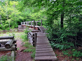
![]()
![]()
![]()
![]()
![]() On Monday, July 10th I had planned to hike Table and Peekamoose from the Denning trailhead. A busy evening of ambulance calls left me tired and I slept later than normal. By the time I got up my initial thought was that it was too late to go but I decided to try as there was rain in the forecast for the rest of the week. I got dressed which signaled to Sheila that we were going on a hike! I made sure I included two water bottles as I knew the hike was over 8 miles with plenty of climbing which I had not done in some time. When Sheila and I left Livingston Manor at around 10:20 AM the air temperature was in the high 60's and the forecast was for highs in the mid 70's. It was a little humid but I was happy about the moderate temperatures. I drove out DeBruce Road to Rt 47 and turned right to go toward Claryville. I turned left onto the Claryville Road and continued toward the Denning trailhead. The road became dirt at one point but was in generally good shape. The drive was longer than I remembered and we arrived in the parking area at 10:50 AM. There were several cars already parked as I set my electronics and got ready to hike. A pickup truck pulled up and parked and the driver got out to take pictures of the house at the end of the road which has interesting architecture. We left the trailhead at 10:55 AM and headed out the Phoenicia-East Branch Trail which is also the eastern end of the Finger Lakes Trail. It was hard to tell how many people were ahead of us. The trail was drier in most places than I had anticipated with only a few wet spots. Some of the small streams that are usually running were dried up. As we hiked Sheila alerted and I looked up to see a group of young men approaching. The were divided into several sections so I pulled Sheila to the side of the trail and waited until they all had passed. Most said "Hello" which was nice. As we approached the junction with the Table-Peekamoose Trail, we caught up to a solo make hiker some years older than I. I made a little noise to make sure we don't surprise him as we passed. He continued on the Phoenicia-East Branch Trail and we turned right at 1.2 miles to descend toward the river. The trails are getting more eroded which means the rocks are even more prominent. Soon we were near the river crossing a small stream. The bridge across the Neversink was in good shape and beginning to look a little old. We crossed and put down my pack and got out the camera. I took some pictures of the bridge and of Sheila playing in the river. I grabbed my pack and we walked to the next bridge to cross another small stream. This bridge consist of two logs and a cable as a guide. It is usually very icy in the winter which makes it difficult to cross. Once we were on the other side I took a few shots before continuing on. I could see a tent set up along the river which is not a designated campsite.We passed the beginning of the informal path along the river called the Fisherman's Path. We passed another designated campsite and at 1.7 miles began our climb by negotiating a very rocky area.
On Monday, July 10th I had planned to hike Table and Peekamoose from the Denning trailhead. A busy evening of ambulance calls left me tired and I slept later than normal. By the time I got up my initial thought was that it was too late to go but I decided to try as there was rain in the forecast for the rest of the week. I got dressed which signaled to Sheila that we were going on a hike! I made sure I included two water bottles as I knew the hike was over 8 miles with plenty of climbing which I had not done in some time. When Sheila and I left Livingston Manor at around 10:20 AM the air temperature was in the high 60's and the forecast was for highs in the mid 70's. It was a little humid but I was happy about the moderate temperatures. I drove out DeBruce Road to Rt 47 and turned right to go toward Claryville. I turned left onto the Claryville Road and continued toward the Denning trailhead. The road became dirt at one point but was in generally good shape. The drive was longer than I remembered and we arrived in the parking area at 10:50 AM. There were several cars already parked as I set my electronics and got ready to hike. A pickup truck pulled up and parked and the driver got out to take pictures of the house at the end of the road which has interesting architecture. We left the trailhead at 10:55 AM and headed out the Phoenicia-East Branch Trail which is also the eastern end of the Finger Lakes Trail. It was hard to tell how many people were ahead of us. The trail was drier in most places than I had anticipated with only a few wet spots. Some of the small streams that are usually running were dried up. As we hiked Sheila alerted and I looked up to see a group of young men approaching. The were divided into several sections so I pulled Sheila to the side of the trail and waited until they all had passed. Most said "Hello" which was nice. As we approached the junction with the Table-Peekamoose Trail, we caught up to a solo make hiker some years older than I. I made a little noise to make sure we don't surprise him as we passed. He continued on the Phoenicia-East Branch Trail and we turned right at 1.2 miles to descend toward the river. The trails are getting more eroded which means the rocks are even more prominent. Soon we were near the river crossing a small stream. The bridge across the Neversink was in good shape and beginning to look a little old. We crossed and put down my pack and got out the camera. I took some pictures of the bridge and of Sheila playing in the river. I grabbed my pack and we walked to the next bridge to cross another small stream. This bridge consist of two logs and a cable as a guide. It is usually very icy in the winter which makes it difficult to cross. Once we were on the other side I took a few shots before continuing on. I could see a tent set up along the river which is not a designated campsite.We passed the beginning of the informal path along the river called the Fisherman's Path. We passed another designated campsite and at 1.7 miles began our climb by negotiating a very rocky area.
 Some parts of the trail looked familiar and other parts did not. I will admit that the climb was longer and harder than I remembered. We had headed south from the river until at 2.25 miles we descended some and the trail turned east. I despise walking downhill when I know there is so much uphill ahead. Along the way we met a man and his Portuguese water dog headed toward us. He pulled his dog over and I put Sheila on her leash to pass them. The dogs seemed to want to meet so we allowed them a quick sniff and then headed in opposite directions. A breeze was blowing most of the time but it still seemed hot ands I was sweating to prove it. I remembered that I need to drink and stopped several times to get a drink and give Sheila one also. I knew there was a spring near the lean-to but I did not know how reliable it might be. At 2.8 miles an informal path led to the right to a viewpoint and we walked out to it. The views were good and unobstructed but the day was hazy. I took pictures anyway and got us a drink before returning to the main path. We had been climbing constantly with a few flatter areas where I could catch my breath before the next ascent. At 3.o miles ether was another short descent and then we were climbing again. At 3.45 miles there was a trail on the left with a sign that said "Spring" so we walked over to the water source. There was a pipe driven into the side of the hill with a trickle of water coming out. I had emptied one water bottle so I filled it from the spring. The water seemed very cold but I toted it with my Steripen before putting the bottle back in the pack. While the Steripen was working, I took a few shots of the spring. Back on the main trail we almost immediately passed the sign for the lean-to on the right. We had been averaging a 20% grade on the climbs but the last .4 miles was 23% and it was tiring me out. I had pretty much ruled out Peekamoose at this point. We finally made it to the top of the climb and walked along the trail toward the point that I considered the summit. The Name Table is a good description of the top of the mountain! As we approached that point, I saw that there were three hikers sitting and enjoying a snack. I put Sheila on her leash and passed them with a greeting. I decided to walk a little farther to see If i could find a lookout to the north. As we walked I began to feel better and decided than Peekamoose was less than a mile away with a minimal drop between the peaks. There was a lot of damage from wind at the top of the mountain in several different places. I did find a path off to the left but was now fixed on the trip to Peekamoose.
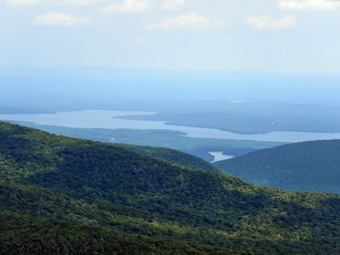 At 4.15 miles we began the steep descent into the col between the two peaks which lasted for about a quarter mile. We had been traveling southeast of east for some time but at this point the trailed turned south on the way to Peekamoose. There was a short, flat spot at the bottom and then we started to climb again. The climb up Peekamoose was about as steep as the descent from table but it lasted only about a quarter mile until the trail began to level. Soon we were at the large rock that I have always taken to be the summit but I wanted to walk passed that point until the trail began to descend. In a few minutes I was satisfied that we had hit the high point and turned around. I noticed a path that appeared to go to viewpoint on the east side of the trail. We walked out to it and there were some nice views but, again, it was hazy. I took some pictures and then we walked back to the big rock. Sheila immediately climbed to the top of the rock so I took some shots of her. She got down and posed in front of the rock so I took some more pictures. It was 2:00 PM and we had already hiked 4.7 miles when we turned around to start back. The descent of Peekamoose went quickly but the ascent to Table took a little longer. The walk across the almost flat top of Table in only ,3 miles but it seemed to take forever until we reached the descent. Just as we began to descend at 5.55 miles I saw a path to the left and decided to follow it. It led to another nice viewpoint to the west and I decided to take a few pictures despite the haze. When I was finished, we walked back to the main trail and started the steep descent which did not go as quickly as I had hoped. Walking downhill on steep terrain with rocks and loose gravel requires some care and I slipped a few times. I check the time and aimed at keeping 2 mph as my speed. After an hour I checked my watch and found we had only gone 1.8 miles! We continued to descend and at 6.25 miles and 6.95 miles we hit some small ascents. These should not have been a problem but I was pretty tired at this point. As we continued down, Sheila and I both began to hear voices ahead. It took a little time but we soon could see the three people we had met at the summit of Table working their way down the trail. We were moving faster and soon caught up to them and they let us pass through. I slowed a little and asked where they were from and they said Eldred and Callicoon. I expressed my surprise because the answer is most often New Jersey or New York City!
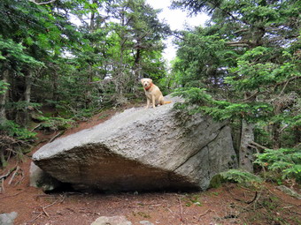 One of the women quickened her pace and stayed with me as we separated from her friends. We began to talk and she told me that she and the other woman were training to hike Kilimanjaro, a 19341 foot peak in Kenya, in October. We talked about her trip and topics related to hiking at higher altitudes. Soon I noticed we had passed through the rocky area of the descent and were nearing the river. She decided to wait for her companions and we parted company. I was very grateful for the company as it made the final part of the descent pass by much faster. Sheila had been good the whole way off her leash apparently accepting the other woman as part of her pack. I continued to walk toward the river passing some campsites and the beginning of the Fisherman's Path. I noticed that my lower back was starting to hurt and I wasn't sure if I had twisted it during a slip or whether this was just a more challenging hike than I had done in some time. We crossed both bridges with Sheila taking time to cool off in the water and get a drink. The short ascent to the Phoenicia-East Branch trail left my back hurting a little more. We turned left at the top of the ascent to begin the final 1.3 mile trek back to the car. While this part of the trail is downhill most of the way there area a few small uphill that I did not appreciate. Sheila decided to jump into one more stream and came out with her legs and belly covered in black mud! I explained to her that this had not been a good idea and stopped at a small stream to try to wash off some of the mud. At about 4:40 PM I could finally see the gate at the end of the trail ahead and new it would only be a few more minutes until we were done. Sitting by the gate and in the parking lot were the boys I had met much earlier n the hike. They told me they were from a wilderness camp and were waiting for their bus. There wasn't much i could do but I wondered if the bus would find them. There is no cell service at the trailhead and it is very isolated. We walked back to the car arriving at 4:55 PM after hiking almost exactly 6 hours and covering 9.4 miles with a 2745 foot elevation gain! I felt every one of those miles and was disappointed that our moving speed was 1.8 mph. This was definitely the most difficult hike I had done in some time but also the most satisfying.
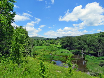
![]()
![]()
![]()
![]()
![]() On Sunday, July 9th I wanted to go somewhere to hike after church as the weather was so nice. I asked Cindy if she would like to go and she said "yes". I planned to take her to Andes to hike the Rail trail and the Bullet Hole Spur Trail. Cindy had not been on this hike before and I thought she might enjoy it. After we finished in Andes, I thought we would stop by the Pepacton Reservoir and hike the Shavertown Trail to the pond. When we got home from church, we changed clothes, got a quick bite to eat and put all our gear in the car. Sheila jumped in the back seat and we left Livingston Manor just after 12:30 PM for the drive to Andes. Sheila acted as if we hadn't hiked in a week although we been out only two days ago! I decided to take Route 17 to Roscoe and then Route 206 to the Pepacton Reservoir. At the intersection with Route 30, I turned right to head for the bridge at Dunraven. I crossed the Pepacton Reservoir on the bridge and at the end of the bridge I turned left on Tremperskill Road and followed it into Andes. I turned left and drove less than a quarter mile to the sign that said "Andes Rail Trail" on the left. There wasn't really a parking area and I questioned whether or not I should park in front of the gate. In the end I did park trying to leave enough for someone to get through the gate if they needed to do so. We started our hike at 1:30 PM as I walked Sheila through the gate on her leash. Ahead of us was the Andes Depot which was rather modern looking. It was donated by the Decker family and may be on the site of the original depot but has been completely refurbished. A kiosk near the depot explained a little about the rail trail which follows the railroad bed of the Delaware and Northern Railroad. Someone is doing some work on the depot and seems to be matching the style that is already there. As we walked I noticed it was already hot and humid especially when we were not beneath the trees. Shortly after the depot, we came to a wooden walkway that spanned the only really wet spot on the trail. A couple was walking toward us and he said "hello". They were the only people we would meet. A little after that we broke out into the open to a nice view down the Tremperskill. At this point there was a "high road" and a "low road" with the suggestion that we use the high road when the main trail was muddy. This occurred several other places along the trail. We stopped so that I could take a few pictures before continuing on the main trail. I had been keeping Sheila on her leash but I had seen no other hikers and we were some distance from town so I released her. We hiked under the trees for a short time and then broke out into the open to another nice view and an interpretive sign. The sign explained that the foundation was the remains of the Andes turntable that was used to turn engines around. No pictures exist of the original structure but it was called an "Armstrong turntable" since the engineer and fireman had to use their "strong arms" to pivot the engine! I took a few shot before we continued.
On Sunday, July 9th I wanted to go somewhere to hike after church as the weather was so nice. I asked Cindy if she would like to go and she said "yes". I planned to take her to Andes to hike the Rail trail and the Bullet Hole Spur Trail. Cindy had not been on this hike before and I thought she might enjoy it. After we finished in Andes, I thought we would stop by the Pepacton Reservoir and hike the Shavertown Trail to the pond. When we got home from church, we changed clothes, got a quick bite to eat and put all our gear in the car. Sheila jumped in the back seat and we left Livingston Manor just after 12:30 PM for the drive to Andes. Sheila acted as if we hadn't hiked in a week although we been out only two days ago! I decided to take Route 17 to Roscoe and then Route 206 to the Pepacton Reservoir. At the intersection with Route 30, I turned right to head for the bridge at Dunraven. I crossed the Pepacton Reservoir on the bridge and at the end of the bridge I turned left on Tremperskill Road and followed it into Andes. I turned left and drove less than a quarter mile to the sign that said "Andes Rail Trail" on the left. There wasn't really a parking area and I questioned whether or not I should park in front of the gate. In the end I did park trying to leave enough for someone to get through the gate if they needed to do so. We started our hike at 1:30 PM as I walked Sheila through the gate on her leash. Ahead of us was the Andes Depot which was rather modern looking. It was donated by the Decker family and may be on the site of the original depot but has been completely refurbished. A kiosk near the depot explained a little about the rail trail which follows the railroad bed of the Delaware and Northern Railroad. Someone is doing some work on the depot and seems to be matching the style that is already there. As we walked I noticed it was already hot and humid especially when we were not beneath the trees. Shortly after the depot, we came to a wooden walkway that spanned the only really wet spot on the trail. A couple was walking toward us and he said "hello". They were the only people we would meet. A little after that we broke out into the open to a nice view down the Tremperskill. At this point there was a "high road" and a "low road" with the suggestion that we use the high road when the main trail was muddy. This occurred several other places along the trail. We stopped so that I could take a few pictures before continuing on the main trail. I had been keeping Sheila on her leash but I had seen no other hikers and we were some distance from town so I released her. We hiked under the trees for a short time and then broke out into the open to another nice view and an interpretive sign. The sign explained that the foundation was the remains of the Andes turntable that was used to turn engines around. No pictures exist of the original structure but it was called an "Armstrong turntable" since the engineer and fireman had to use their "strong arms" to pivot the engine! I took a few shot before we continued.
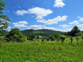 We entered the woods again and crossed a small bridge. I began to notice the regular "bumps" on the trail which signs said were the railroad ties which had not been removed. I wondered about his until I saw a couple of exposed ties! Another interpretive sign explained that there had been two trestles on the rail line in the area. Both had been featured in movies from the early 20th century! After walking a little farther, we came to the end of the flat rail trail and the beginning of the Bullet Hole Spur Trail. We continued on the trail which immediately began to climb and I knew the easy walking was behind us. This part of the trail needed some work in cutting back briars and removing branches. We had been headed south but now a major switchback took us north before heading south again and always climbing. The trail passed through some hardwoods and then entered a hemlock forest as it climbed to the shoulder of Hemlock Knoll. There were some interesting rock formations along the way and I stopped to take a few pictures. Sheila climbed onto the largest glacial erratic and I took a few pictures of her on gaud duty. We began the descent of Hemlock Knoll and entered a area covered in ferns which Cindy thought was particularly beautiful. We continued until we came to a stone wall. A break in the wall signaled a place to get view of the surrounding hills which was very pretty. I took some pictures and then we passed over the stone wall where it had been turned into steps and came to the loop at the end of the Bullet Hole Spur Trail. Since I had continued straight ahead to last time we turned right to do the loop in a counterclockwise direction. We walked downhill on a trail which eventually joined a woods road that paralleled the Temperskill. I wanted to walk down to the stream but there was private property between the trail and the streambed. The loop was only half a mile long so we were soon back at the point where it started after walking through a red pine Plantation. The return trip was now and out and back so we stepped up our pace. This part of the trail was much hillier than I remembered and the climb up Hemlock Knoll was taxing. The return trip seemed to go very quickly and we did not meet any more people on our way to the flat part of the rail trail. We arrived back at the car at 3:15 PM covering 3.7 miles in 1 hour and 45 minutes with an elevation gain of 700 feet. After getting a drink and sitting in the air conditioned car, I decided I felt fresh enough to hike the Shavertown Trail. However, Cindy said she was too tired to hike any more. I was disappointed as I do not like to change plans but knew that meant I could plan a longer hike for Monday!
![]()
![]()
![]()
![]() On Friday, July 7th I had not planned to hike at all after several strenuous days clearing the Big Pond to Alder Lake Trail. As the afternoon rolled around, I realized that it was a beautiful day and I was encouraged by Sheila to go for a hike. I decided to head across the street to Round Top since it was close and I had not been there to inspect the trails in over a week. I got dressed, grabbed my poles and put Sheila on her leash to walk down the driveway and cross the street at just after 3:00 PM. I had decided not to bring my pack as I did not want to carry the extra weight and wanted to have the "freedom" from taking pictures. We walked across the field to the back of the church to begin the ascent of the steepest hill behind the church. The hill is short but really gets the circulation pumping and is the steepest and longest climb on the "trail". When we got to the top of the hill, we started out on the trail by turning left at the trailhead. As soon as we entered the trees I released Sheila from her leash. At the first trail junction Sheila chose the trail to the right which is the less strenuous climb. At the sharp left turn at the top of the hill we turned left and followed the yellow blazed lower trail as it skirted Round Top. When the trail turned left again, we turned right and started up the hill to the summit of Round Top on the new blue blazed upper trail. The trails and only a few new sticks on them which I picked up as we walked. Sheila feels comfortable on these trails and ranges a little too far for my comfort. We followed the trail across the summit and down the other side. There were a few places where some lopping was needed and several where the string trimmer might be sued to cut the ferns and grass. When we came down to the yellow trail, we turned right and followed the trails around to the sharp left turn. This time we turned left and walked downhill through the ferns toward the lookout. As we approached the viewpoint something looked amiss to me. On closer inspection there were8 or 9 trees that had been cut down! Whoever cut them used something like a hatchet since it was obvious many strikes were needed to cut the trees. Most were small but there was one cherry tree that was at least 8 inches in diameter. The trees had been left where they fell and there was evidence of a small fire on the viewpoint. I was appalled that someone would vandalize a public forest and trail system in this way. Several possibilities went through my mind. W walked down the hill to the first trail junction and out to the trailhead. I had intended to do several more loops but I knew my first priority was to report this act. At the trailhead we turned right and walked down the hill to the church and across the field to our driveway. I put Sheila in the house and called the town supervisor to make my report. He seemed disgusted that someone would spoil a public attraction for no apparent reason. I promised him I would clean up the mess on Saturday.
On Friday, July 7th I had not planned to hike at all after several strenuous days clearing the Big Pond to Alder Lake Trail. As the afternoon rolled around, I realized that it was a beautiful day and I was encouraged by Sheila to go for a hike. I decided to head across the street to Round Top since it was close and I had not been there to inspect the trails in over a week. I got dressed, grabbed my poles and put Sheila on her leash to walk down the driveway and cross the street at just after 3:00 PM. I had decided not to bring my pack as I did not want to carry the extra weight and wanted to have the "freedom" from taking pictures. We walked across the field to the back of the church to begin the ascent of the steepest hill behind the church. The hill is short but really gets the circulation pumping and is the steepest and longest climb on the "trail". When we got to the top of the hill, we started out on the trail by turning left at the trailhead. As soon as we entered the trees I released Sheila from her leash. At the first trail junction Sheila chose the trail to the right which is the less strenuous climb. At the sharp left turn at the top of the hill we turned left and followed the yellow blazed lower trail as it skirted Round Top. When the trail turned left again, we turned right and started up the hill to the summit of Round Top on the new blue blazed upper trail. The trails and only a few new sticks on them which I picked up as we walked. Sheila feels comfortable on these trails and ranges a little too far for my comfort. We followed the trail across the summit and down the other side. There were a few places where some lopping was needed and several where the string trimmer might be sued to cut the ferns and grass. When we came down to the yellow trail, we turned right and followed the trails around to the sharp left turn. This time we turned left and walked downhill through the ferns toward the lookout. As we approached the viewpoint something looked amiss to me. On closer inspection there were8 or 9 trees that had been cut down! Whoever cut them used something like a hatchet since it was obvious many strikes were needed to cut the trees. Most were small but there was one cherry tree that was at least 8 inches in diameter. The trees had been left where they fell and there was evidence of a small fire on the viewpoint. I was appalled that someone would vandalize a public forest and trail system in this way. Several possibilities went through my mind. W walked down the hill to the first trail junction and out to the trailhead. I had intended to do several more loops but I knew my first priority was to report this act. At the trailhead we turned right and walked down the hill to the church and across the field to our driveway. I put Sheila in the house and called the town supervisor to make my report. He seemed disgusted that someone would spoil a public attraction for no apparent reason. I promised him I would clean up the mess on Saturday.
The more I though about the situation the more I knew I wanted to clean it up immediately. I got my pack with my small Silky saw and machete. I also grabbed my Council Tools felling axe and my bigger KatanaBoy Silky saw. I put Sheila in the backseat and my tools in the trunk and drove across the road to the top of the cemetery. I parked there, let Sheila out of the back seat and retried my tools from the trunk. We headed up the trail directly to the lookout. I leashed Sheila to a tree and put my tools down. Just before I started, I realized I had not brought a camera and pictures would have been nice. As usual I surveyed the job and formed a plan. I would cut and drag away the trees closest to the edge of the clearing. As I did this I made sure to drag the first trees far back into the woods so that I would have room for all of them. Some were small enough that I could just drag them away whole while others needed one or more cuts. The work was going faster than I expected but I was saving the biggest trees for last. The last tree I cut was a cherry tree with a diameter of about 8 inches at the base. For this one I used the felling axe. I am used to the Fiskars axe and was surprised that the Council Tools Velvicut, although much heavier, did not cut much better than the Fiskars. Once the cut was made I carried away the butt end of the tree which was almost heavier than I could handle. I used a saw to make another cut so that I could remove another piece of the trunk. Now that all the trees were cut up and dragged away, I turned my attention to the jagged stumps left behind. I grabbed the KatanaBoy and sawed all the stumps off at ground level and threw the pieces onto the brush piles. I looked at my watch and found it had taken about an hour to do the work. I will be making more frequent trips to the trails but it doesn't take someone very long to do this kind of damage. I hope the report to the State Police and Sheriff's Department will help find the culprits or at least dissuade then from doing any more damage. I also let several people, around town know what happened and asked them to let me know if they hear anything.
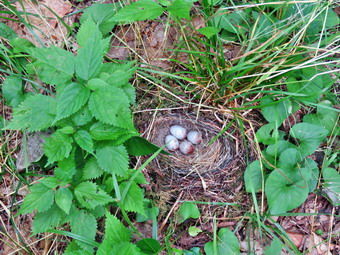
![]()
![]()
![]()
![]()
![]() On Thursday, July 6th I headed to Frick Pond after working for an hour and a half at Big Pond Trimming the trail toward Alder Lake. My plan was to hike up the Flynn Trail and clear a tree from the trail about a mile up. I would then walk down the Big Rock Trail and inspect the large blowdown that had been partly cleared by the snowmobile club with a chainsaw. I would pick up sticks and branches along the way and clear any other blowdown that I found. At Times Square I would decided whether to turn right on the Logger's Loop or continue straight ahead on the Big Rock Trail back to the Quick Lake Trail and the parking area. From Livingston Manor I drove out the DeBruce Road and up the Mongaup Pond Road. I stayed left at the Y in the road and drove up the Beech Mountain Road to the small parking area at the Frick Pond. We arrived at the trailhead parking area at 12:05 PM and got ready to hike. As I was getting ready I noticed two deer that had been near the edge of the parking area were walking into the woods. Sheila spotted them but I cautioned her to leave them alone. There were no other cars in the lot as we headed across the road to start up the Flynn Trail. The trail was clean all the way to the woods road where we turned right and started up the hill. My regular pack is a lot heavier than the gasoline pack I had been carrying but it was a pleasure not to be lugging the string trimmer. I did have my Fiskars axe, machete and Silky saw. The grass on the trail was not as high as it had been and looked as if it had been cut. I reached down to pick up and handful and it still seemed rooted so its condition was a mystery. We found a blowdown on the trail just passed the path that leads to a large clearing on the right. The blowdown was not a tree but a large branch that had fallen. I took some "before" pictures and then went over to see what I was going to do. I got my Silky saw and began to cut off a few branches and throw them to the side of the trail. It is always easier to make these cuts and drag some branches out of the way rather than move pieces that are too large. I continue to cut and drag until only the large main part of the branch was left. I decided to try to move it off the trail in one piece rather than to make another cut. Fortunately it was just within my limit to lift and I was able to lift and pivot and roll it off the trail. The whole operation had taken around 15 minutes. I took my "after" shots and then put my pack back together and headed on up the trail toward the junction with the Big Rock Trail.
On Thursday, July 6th I headed to Frick Pond after working for an hour and a half at Big Pond Trimming the trail toward Alder Lake. My plan was to hike up the Flynn Trail and clear a tree from the trail about a mile up. I would then walk down the Big Rock Trail and inspect the large blowdown that had been partly cleared by the snowmobile club with a chainsaw. I would pick up sticks and branches along the way and clear any other blowdown that I found. At Times Square I would decided whether to turn right on the Logger's Loop or continue straight ahead on the Big Rock Trail back to the Quick Lake Trail and the parking area. From Livingston Manor I drove out the DeBruce Road and up the Mongaup Pond Road. I stayed left at the Y in the road and drove up the Beech Mountain Road to the small parking area at the Frick Pond. We arrived at the trailhead parking area at 12:05 PM and got ready to hike. As I was getting ready I noticed two deer that had been near the edge of the parking area were walking into the woods. Sheila spotted them but I cautioned her to leave them alone. There were no other cars in the lot as we headed across the road to start up the Flynn Trail. The trail was clean all the way to the woods road where we turned right and started up the hill. My regular pack is a lot heavier than the gasoline pack I had been carrying but it was a pleasure not to be lugging the string trimmer. I did have my Fiskars axe, machete and Silky saw. The grass on the trail was not as high as it had been and looked as if it had been cut. I reached down to pick up and handful and it still seemed rooted so its condition was a mystery. We found a blowdown on the trail just passed the path that leads to a large clearing on the right. The blowdown was not a tree but a large branch that had fallen. I took some "before" pictures and then went over to see what I was going to do. I got my Silky saw and began to cut off a few branches and throw them to the side of the trail. It is always easier to make these cuts and drag some branches out of the way rather than move pieces that are too large. I continue to cut and drag until only the large main part of the branch was left. I decided to try to move it off the trail in one piece rather than to make another cut. Fortunately it was just within my limit to lift and I was able to lift and pivot and roll it off the trail. The whole operation had taken around 15 minutes. I took my "after" shots and then put my pack back together and headed on up the trail toward the junction with the Big Rock Trail.
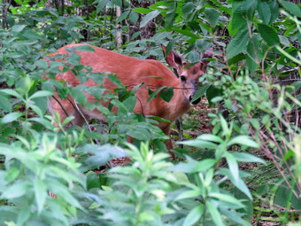 After hiking 1.7 miles, we reached the junction with the Big Rock Trail and turned left to walk downhill toward Times Square. I picked up a few sticks along the way but the trail was pretty clean. Walking downhill was a pleasure as there was a slight breeze and the temperature was in the mid 70's. At one point I noticed Sheila was sniffing at something in the middle of the trail. I called her off and walked up to see she had found a bird's nest! It looked like it belonged there as it was well positioned with four eggs in the nest. The eggs were large than a robin's and were white with sprinkles of red. I was able to get some good pictures before continuing on down the trail. The Big Rock Trail has several "steps" in it which look very much the same and sometimes fool me into thinking I am after along than I am. As we neared the final descent to Times Square, we came to the very large tree that had blocked the trail. The tree was at least 2 feet in diameter and had been cut four places by the snowmobilers. They had left the chunks of wood near the trail and had not cleared some branches that were near the trail. I took some "before" shots and then got to work. I was able to roll the sections of trunk they had cut off the trail. I decided I wanted to hit something with my axe and the largest branch still protruding from the trunk fit the bill. The branch was at an odd angle so I did my best to cut through it. I cut from the ground on one side but had to stand on the trunk to cut from the other. It took me longer than expected but I got through it. I used the saw to strip of branches and throw them well off the trail. Once I had the main branch stripped I was able to rotate it off the trail as well. Knowing I could not cut through the main trunk I settled for what I had done. I took some more pictures and then walked down to Times Square. I decided to continue straight ahead on the Big Rock Trail. I negotiated the muddy areas around the trail junction but it was drier than I had expected. We continued around the head end of Frick Pond where there were some very deep muddy spots. Hikers had effectively rerouted the trail around these spots. Sheila ran ahead to the first bridge and dove into the water. From that point on she was racing ahead and the running back toward me as she often does after a swim. I understood she wanted to cool off but the water she chose had a certain odor! We walked out the Big Rock Trail crossing the wooden causeways. At the Quick Lake Trail we trend left to head toward the bridge at the outlet end of the pond. I walked across the bridge and got my camera out to take some pictures. I was surprised to see that the center of the beaver dam seemed "thinner" than last time and was filled with knew cuttings. There were two piles of stick on either side and it looked as if someone had tried to remove the dam! I like Frick Pond as a pond and I hope that the DEC has not decided to get rid of the beavers. I put the camera back in the pack and we headed out the Quick Lake Trail toward the parking area. The trail was only wet in a few places and we made good time. We were back at the car at 2"05 PM. I put my gear in the car and looked up to see two deer standing in the trees just off the parking area. I put Sheila in the car and slammed the door but the deer did not move. I got out my camera and took some pictures before getting in the car to drive home. We had spent about 2 hours hiking 4 miles and stopping several times to do trail work.
On Thursday, July 6th I wanted to return to the Big Pond to cut the nettles and weeds about a half mile in on the trail to Alder Lake. Sheila was happy to be going and jumped into the back seat of my car. We left Livingston Manor at about 9:30 AM and drove out Old Rt 17 to the Beaverkill Road where we turned right. At the intersection with the Barkaboom Road we stayed to the left on Barkaboom Road until we came to the right turn into the upper parking area for Big Pond. As we drove up the access road, I could see that there was only one car parked in the lot so I pulled in next to it and got my gear ready. I got the pack with new gasoline container in ready by putting in a water bottle, my multitool and some new trimmer line. We walked over to the trailhead at 10:00 Am and started hiking through the field I had cut toward Alder Lake. We walked through some ferns and grass that I thought I might cut later. As we headed up the hill there were some more ferns to cut but I wanted to make sure I cut all the nettles up ahead. Soon the trail leveled a little and turned almost south. Pretty soon I could see a stretch of nettles up ahead that was longer than I had remembered. I put the trimmer down and started it right up. I began to cut the nettles, ferns and other weeds along the way making sure to cut them back from the trail so that as they grew back the trail would still be clear. At one point the trimmer stopped cutting so I stopped the engine and saw there was no more line. I set the trimmer down and got out a new length of line and crossed my fingers. I tried to insert the line from one side of the spool and it would not go in. When I tried from the other side, it slid in easily and I pulled it half way through. I twisted the reel as instructed and it wasn't long before all the line was on the reel. I started the trimmer up again and it cut perfectly and fed out more line when I bumped it. I continued uphill slightly cutting as I went. In total I cut a little over 500 feet on both sides of the trail until it made a sharp left turn. I knew that I had not seen anything that needed cutting beyond that. I left the trimmer on as I headed back down the trail to pick up a few areas I had missed. As we started down the hill, I turns the trimmer off but started it again as we encountered ferns and a few nettles. I trimmed all the way down the hill and across the flat area and uphill to the field. In the field I cut a few areas that were longer than the rest and then turned the trimmer off. Sheila alerted and I saw a woman with a Golden Retriever on a leash approaching us. Both dogs seemed friendly and sniffed each other as they passed. I walked back to the car and put away my tools. It was 11:30 AM and I had already done and hour and a half worth of work. I decided that there was still time to go to The Flynn Trail at Frick Pond to remove at least one tree a friend had said was on the trail just after the open field on the right. I drove back out the Barkaboom Road and retraced my route back to Livingston Manor.
![]() On Tuesday, July 4th I wanted to go to the Big Pond end of the trail from Big Pond to Alder Lake to finish cutting the briar patch that I had started the day before. I know trail maintenance is not the way most people spend July 4th but I wanted to get the work done! The briar patch is closer to Big Pond so my plan was to park at Big Pond and walk to the patch to finish it up. I thought on the way back I might have time to cut some other places on the trail. The only cutting that would then remain would be from Alder Lake to the stream where there were still a few spots that needed work. I asked Cindy If she wanted to go and she said "Yes". I was not concerned about the weather as the forecast included no rain but the highs were supposed to rise to the mid 70's. Sheila was happy to be going for a second day in a row and jumped into the back seat of my car. We left Livingston Manor at about 9:00 AM and drove out Old Rt 17 to the Beaverkill Road where we turned right. At the intersection with the Barkaboom Road we stayed to the left on Barkaboom Road until we came to the access road for the upper parking area At Big Pond. I turned left and drove up the road and was lucky enough to find somebody leaving. I immediately pulled into the empty spot and about 9:30 AM. I got the pack with new gasoline container in ready by putting in a water bottle and my multitool. We walked over to the trailhead and started out on the trail. We found almost all of the campsites occupied and most people were up and active. As we walked I began to see some spots that could use some trimming but I stuck to my plan of cutting the briar patch first. Soon we were starting uphill through an evergreen forest at about 1 mile. Just after that we broke out into the open where the briar patch starts. I dropped my pack and put the trimmer on the ground to start it. I followed the directions and it immediately started. I began to cut the grass, weeds and briars while Cindy kept Sheila back from the trimming. The woody stems on the briars tend to hurt when they hit! The trimmer was doing a great job of cutting everything. I even tipped it so that the strings were vertical and trimmed back the briars even more. I wanted to make sure that the trimming lasted well into the summer season. The trimming was going great as I neared the top of the hill with quite a bit of the briar patch still to cut. At this point the trimmer made a funny noise and stopped cutting! The curse struck again! I stopped the trimmer and removed the housing from the reel. It seemed as if the bolt had melted part of the reel. I soon found out why when I gingerly touched the bolt and found it very hot! I got out my multitool to trying to loosen the bolt but several tries showed this would not be possible. I couldn't believe I would have to leave this section uncut again. We turned around and head back to the car. The return trip went quickly as I was not trimming as was very annoyed. We were back a the car by 11:00 AM after hiking around 2 miles and working for an hour and half. I drove back to Livingston Manor and decided to Go to Home Depot in Monticello to see what they could do about the bolt on the trimmer.
On Tuesday, July 4th I wanted to go to the Big Pond end of the trail from Big Pond to Alder Lake to finish cutting the briar patch that I had started the day before. I know trail maintenance is not the way most people spend July 4th but I wanted to get the work done! The briar patch is closer to Big Pond so my plan was to park at Big Pond and walk to the patch to finish it up. I thought on the way back I might have time to cut some other places on the trail. The only cutting that would then remain would be from Alder Lake to the stream where there were still a few spots that needed work. I asked Cindy If she wanted to go and she said "Yes". I was not concerned about the weather as the forecast included no rain but the highs were supposed to rise to the mid 70's. Sheila was happy to be going for a second day in a row and jumped into the back seat of my car. We left Livingston Manor at about 9:00 AM and drove out Old Rt 17 to the Beaverkill Road where we turned right. At the intersection with the Barkaboom Road we stayed to the left on Barkaboom Road until we came to the access road for the upper parking area At Big Pond. I turned left and drove up the road and was lucky enough to find somebody leaving. I immediately pulled into the empty spot and about 9:30 AM. I got the pack with new gasoline container in ready by putting in a water bottle and my multitool. We walked over to the trailhead and started out on the trail. We found almost all of the campsites occupied and most people were up and active. As we walked I began to see some spots that could use some trimming but I stuck to my plan of cutting the briar patch first. Soon we were starting uphill through an evergreen forest at about 1 mile. Just after that we broke out into the open where the briar patch starts. I dropped my pack and put the trimmer on the ground to start it. I followed the directions and it immediately started. I began to cut the grass, weeds and briars while Cindy kept Sheila back from the trimming. The woody stems on the briars tend to hurt when they hit! The trimmer was doing a great job of cutting everything. I even tipped it so that the strings were vertical and trimmed back the briars even more. I wanted to make sure that the trimming lasted well into the summer season. The trimming was going great as I neared the top of the hill with quite a bit of the briar patch still to cut. At this point the trimmer made a funny noise and stopped cutting! The curse struck again! I stopped the trimmer and removed the housing from the reel. It seemed as if the bolt had melted part of the reel. I soon found out why when I gingerly touched the bolt and found it very hot! I got out my multitool to trying to loosen the bolt but several tries showed this would not be possible. I couldn't believe I would have to leave this section uncut again. We turned around and head back to the car. The return trip went quickly as I was not trimming as was very annoyed. We were back a the car by 11:00 AM after hiking around 2 miles and working for an hour and half. I drove back to Livingston Manor and decided to Go to Home Depot in Monticello to see what they could do about the bolt on the trimmer.
When I got to Home Depot, I entered the store with the entire lower part of the trimmer and the head I had bought there the day before. At the Service Desk I was directed to Tool Rental where a former student of mine went to work on the trimmer. I wandered around the store and when I came back she told me she could not get the bolt loose. Her supervisor happened to be present and he also tried unsuccessfully to loosen the bolt. He finally told me that they could not do anything. I informed him that I expected an entire new curved shaft trimmer since I had installed the part I bought in their store on a trimmer that had also been purchased in their store. He again repeated that he could not give me the part but then relented and told me to go to the gardening department to get the new one. I think it might have been the look on my face or the tone of my voice that let him know I would not give up. I went to gardening and they eventually found a similar part that look a different diameter line. I explained that I had just purchased from them a pack of line and would now need different line.The manager of the department told me to take as much line as I needed. I selected a reasonable package. The clerk marked everything as "Customer Satisfaction" and I left the store with the new shaft and the old one. I later found out the shaft sells for about $70 and the string was $20 so I was pleased at the resolution to the problem. I drove home and on the way called Cindy to see if she wanted to go back out to do some more cutting. To y surprise she said "Yes" and was ready when I got home. Sheila was very excited when she realized we were going out twice in one day! We left the house at about 2:15 PM and headed for the Alder Lake trailhead. My plan was to cut the nettles, briars, grass and brush along the trail to the stream. E would then turn around and go back to the car and drive to Big Pond. From there we would repeat the walk we took in the morning so that I could finally finish cutting the briar patch. On the way back I would then cut a few stands of nettles on the trail. I drove out Old Rt 17 to the Beaverkill Road where we turned right. At the intersection with the Barkaboom Road we stayed to the right on Beaverkill Road until we came to the left turn for Alder Creek Road. After turning left, I drove to the end of Alder Creek road, turned around and parked near the trailhead. I got the pack with the gasoline container in ready by putting in a water bottle and my multitool. We walked over to the trailhead and started out on the trail around 2:45 PM. The first part of the trail needed no trimming. Eventually we came to an area with briars and nettles so I started the trimmer and began cutting with the new lower shaft and head. Everything went well even though the line was a little thinner than I had been suing. I had brought along more line in case I ran out as I wanted this to be the last attempt to clear the briar patch! At about .5 miles we entered the woods and I turned off the trimmer. We passed through the grassy patch I had cut the day before and followed the trail as it turned left onto a woods road. I began to see some nettles and briars so I again started the trimmer and cut those. We walked downhill passing the first beaver meadow and at 1.2 miles we were at the spring. I cut a stand of nettles and then told Cindy we were turning around to go to Big Pond. Cindy had another plan which involved hiking farther, adding another hill and walking through several muddy areas. We followed her plan and continued across the stream and up the hill that I had already cut the day before. Since I had already done all the cutting, there was about .7 miles of walking before we entered the briar patch. During this time we slipped and slid through the mud and I got to concentrate on just how heavy the trimmer was becoming. Eventually we reached the spot were I had run out of string the day before and I knew I had to cut uphill to the place we had stopped in the morning. I didn't think this would be more than 150 feet but I was very wrong as it was almost .2 miles! I took off the pack and started up the trimmer. The trimmer was working well and I was careful to stop occasionally to clear the weeds that got wound around the shaft. While I was working, Cindy sat on a log to rest. I kept thinking I would have to change the string at some point since some of the briars were very old and thick. I ran out of gas first and had to walk all the way back to my pack to get the container. I walked back uphill and filled the trimmer and stowed the gas container beside the trail. I walked uphill to where I had stopped in the morning and started trimming back to where I had just been. I thought I was in trouble as the trimmer was sputtering and not cutting very well. It perked up and I came to the conclusion that I had let some air get into the fuel line. I continued on down the trail toward my pack trimming a few spots I had missed. When I got to the pack, I trimmed a little more and then shut the trimmer off. I walked back up the trail to retrieve the gas container and then returned to the pack. I shouldered the pack and started back toward the car with Cindy and Sheila just ahead. I started the trimmer one more time to clean up some errant nettles, briars and ferns and then turned it off for good. Of course on the way back we had to cross the muddy areas again. In one of these areas Cindy took a fall banging her knee on a rock but once she got up everything seemed to be OK. We continued on the trail down the hill to the stream. As we crossed the stream, I knew that we would have to ascend a hill for the next half mile. This normally would not be any challenge but it was hot and the trimmer now seemed twice as heavy as it had on the way out. I admit that I was not in a good mood as we passed through the grassy patch and had to ascend the short, steep hill. However, once we were at the top of the hill the trail leveled and started to descend. The only obstacle left was an enormous tree across the path which I elected to straddle and climb over. We continued down the trail to the car. We arrived at the car at 6:10 PM having hiked over 4 miles in about 3 hours and 15 minutes. I was glad I had finished cutting the briar patch and that the only trimming to do was between the Big Pond trailhead and the 1 mile out mark.
![]() On Monday, July 3rd I wanted to go to the Alder Lake end of the trail from Alder Lake to Big Pond to work on cutting grass patch about .7 miles from the beginning of the trail. After that I wanted to cut the briars, nettles and weeds from the small stream at about 1.2 miles. For a little over a mile the trail was bounded by nettles and briars that were slowly closing in making hiking a less than pleasant experience. I asked Cindy If she wanted to go but she said she was tired and would stay home. I was not concerned about the weather as the forecast included no rain but the highs were supposed to rise to the mid 80's. Sheila was happy to be going after a Sunday of "rest" and jumped into the back seat of my car. We left Livingston Manor at about 9:00 AM and drove out Old Rt 17 to the Beaverkill Road where we turned right. At the intersection with the Barkaboom Road we stayed to the right on Beaverkill Road until we came to the left turn for Alder Creek Road. After turning left, I drove to the end of Alder Creek road, turned around and parked near the trailhead. I got the pack with the gasoline container in ready by putting in a water bottle and my multitool. We walked over to the trailhead and started out on the trail around 9:30 AM. As we walked I began to see some spots that could use some trimming but I stuck to my plan and soon we were on the slight downhill where the grassy patch was located. I dropped my pack and put the trimmer on the ground to start it. I followed the directions and it immediately started. I began to cut the grass and weeds and was surprised that Sheila stayed close by. As I walked down the hill the grass got thicker where there was plenty of sunlight. I continued to cut widening the trail beyond the one foot required by the Finger Lakes Trail Conference so that I would not have to come back to cut it again until much later in the summer. It didn't take too long until I had reached the forest and this part of the job was done. I walked back up to the pack and put it on and we started walking back down the trail toward the small stream which was my next objective. At about 1.2 miles we came to the stream and crossed it. Just after crossing, I started the string trimmer and for the next half mile or so I did not turn it off. I cut a lot of nettles and a few briars walking uphill the whole time. I also cut some ferns and grass so that the trail can be walked without getting a drenching in the early morning. Along the way we crossed several muddy areas. The first area as the worst but I found some stepping stones a little upstream from where most people had been crossing. After this area, there were several stands of dense nettles that had grown very tall. They were no match for the trimmer but I did find that some pieces would get thrown my way every now and then. These pieces retained their "stinging" capability and my hands began to burn and itch. We entered an area under the trees where there were only ferns and I let them stand as I wanted to make sure I cut the open area that was thick with briars. A little before 2 miles we came to that area and I fired up the trimmer and began to cut the mix of briars, brush, nettles and grass. The trimming was going well until I noticed that the trimmer was no longer cutting. I stopped it and looked at the reel only to find I had run out of string! I felt cursed since there always seemed to be something wrong with the trimmer. I got ready to turn around and noticed that my pack was releasing a strong smell of gas. I found that the nozzle despite being closed was leaking gasoline. I knew that I had to replace it but could do nothing about it on the trail. I filled the trimmer to reduce the volume in the container and we started back. Since I wasn't trimming then trip back went quickly. As we started down the hill toward the stream, Sheila and I both noticed a young couple approaching. I put the trimmer down and took Sheila by the collar. As the hikers passed they complimented Sheila and thanked me for clearing the trail. We continued in our opposite directions and I kept a good pace despite the fact that the trail is uphill from the stream back to the patch of grass I had cut before. Fortunately, the last .7 miles is all downhill as my arms were getting tired from carrying the trimmer. We were back at the car at 2:00 PM after hiking about 4 miles. We had spent 4.5 hours walking and clearing the trail. When I got back to Livingston Manor I asked Karl how to replace the string in the trimmer. The summary of his answer was "I don't know" so I dropped Sheila off at the house and headed for Home Depot in Monticello assuming they would have replacement reels of string. When I got to Home Depot the best I could find was a new quick loading reel and string to load into it. I made the purchase including a small gas container and headed back home. Cindy and I sat ion the front porch trying to replace the old trimmer head with the new one. We eventually got the job done despite the misleading directions on the package. I started the trimmer and cut some grass with no problem. I knew I was ready to finish my cutting the next day.
On Monday, July 3rd I wanted to go to the Alder Lake end of the trail from Alder Lake to Big Pond to work on cutting grass patch about .7 miles from the beginning of the trail. After that I wanted to cut the briars, nettles and weeds from the small stream at about 1.2 miles. For a little over a mile the trail was bounded by nettles and briars that were slowly closing in making hiking a less than pleasant experience. I asked Cindy If she wanted to go but she said she was tired and would stay home. I was not concerned about the weather as the forecast included no rain but the highs were supposed to rise to the mid 80's. Sheila was happy to be going after a Sunday of "rest" and jumped into the back seat of my car. We left Livingston Manor at about 9:00 AM and drove out Old Rt 17 to the Beaverkill Road where we turned right. At the intersection with the Barkaboom Road we stayed to the right on Beaverkill Road until we came to the left turn for Alder Creek Road. After turning left, I drove to the end of Alder Creek road, turned around and parked near the trailhead. I got the pack with the gasoline container in ready by putting in a water bottle and my multitool. We walked over to the trailhead and started out on the trail around 9:30 AM. As we walked I began to see some spots that could use some trimming but I stuck to my plan and soon we were on the slight downhill where the grassy patch was located. I dropped my pack and put the trimmer on the ground to start it. I followed the directions and it immediately started. I began to cut the grass and weeds and was surprised that Sheila stayed close by. As I walked down the hill the grass got thicker where there was plenty of sunlight. I continued to cut widening the trail beyond the one foot required by the Finger Lakes Trail Conference so that I would not have to come back to cut it again until much later in the summer. It didn't take too long until I had reached the forest and this part of the job was done. I walked back up to the pack and put it on and we started walking back down the trail toward the small stream which was my next objective. At about 1.2 miles we came to the stream and crossed it. Just after crossing, I started the string trimmer and for the next half mile or so I did not turn it off. I cut a lot of nettles and a few briars walking uphill the whole time. I also cut some ferns and grass so that the trail can be walked without getting a drenching in the early morning. Along the way we crossed several muddy areas. The first area as the worst but I found some stepping stones a little upstream from where most people had been crossing. After this area, there were several stands of dense nettles that had grown very tall. They were no match for the trimmer but I did find that some pieces would get thrown my way every now and then. These pieces retained their "stinging" capability and my hands began to burn and itch. We entered an area under the trees where there were only ferns and I let them stand as I wanted to make sure I cut the open area that was thick with briars. A little before 2 miles we came to that area and I fired up the trimmer and began to cut the mix of briars, brush, nettles and grass. The trimming was going well until I noticed that the trimmer was no longer cutting. I stopped it and looked at the reel only to find I had run out of string! I felt cursed since there always seemed to be something wrong with the trimmer. I got ready to turn around and noticed that my pack was releasing a strong smell of gas. I found that the nozzle despite being closed was leaking gasoline. I knew that I had to replace it but could do nothing about it on the trail. I filled the trimmer to reduce the volume in the container and we started back. Since I wasn't trimming then trip back went quickly. As we started down the hill toward the stream, Sheila and I both noticed a young couple approaching. I put the trimmer down and took Sheila by the collar. As the hikers passed they complimented Sheila and thanked me for clearing the trail. We continued in our opposite directions and I kept a good pace despite the fact that the trail is uphill from the stream back to the patch of grass I had cut before. Fortunately, the last .7 miles is all downhill as my arms were getting tired from carrying the trimmer. We were back at the car at 2:00 PM after hiking about 4 miles. We had spent 4.5 hours walking and clearing the trail. When I got back to Livingston Manor I asked Karl how to replace the string in the trimmer. The summary of his answer was "I don't know" so I dropped Sheila off at the house and headed for Home Depot in Monticello assuming they would have replacement reels of string. When I got to Home Depot the best I could find was a new quick loading reel and string to load into it. I made the purchase including a small gas container and headed back home. Cindy and I sat ion the front porch trying to replace the old trimmer head with the new one. We eventually got the job done despite the misleading directions on the package. I started the trimmer and cut some grass with no problem. I knew I was ready to finish my cutting the next day.
![]() On Saturday, July 1st I wanted to return to the Big Pond to cut the grass and weeds which clog the beginning of the trail from Big Pond To Alder Lake. Cindy and I had tried this the day before but I could not get the string trimmer I had to start. When I got up in the morning, I went to the garage and tried it again and it started up with no problem. I asked Cindy If she wanted to go and she agreed. We were concerned about the weather as we looked outside and saw some very dark clouds. I checked the forecast and the radar and nothing was supposed to be in our area until later in the afternoon. We agreed we would go on see what the weather was like at Big Pond. Sheila was happy to be going and jumped into the back seat of my car. We left Livingston Manor at about 10:30 AM and drove out Old Rt 17 to the Beaverkill Road where we turned right. At the intersection with the Barkaboom Road we stayed to the left on Barkaboom Road until we came to the right turn into the upper parking area for Big Pond. As we drove up the access road, we could see that all the parking spots were taken. I turned around and parked off the side of the road. We walked over to the trailhead and I put the trimmer on the ground to start it. I followed the directions and it immediately started. I began to cut the grass near the beginning of the trail even though I had used the weed whip to knock down some of it. The string trimmer allowed me to cut it closer and farther back from the trail. I also worked on the briars a little. Soon I was at the tree where I had stopped cutting any grass. The trimmer was working just fine and I was able to cut a wide swath and open up the trail. I had to admit that although it was noisy and the vibration was considerable it was much easier than cutting with the weed whip. I did notice that it would cut the woodier brush but that the pieces that hit me stung a little! I was making good progress with Cindy and Sheila following behind. I noticed that I was running low on gas and that the string was getting short. Cindy volunteered to go back for the gas container. I tried bouncing the trimmer on the ground to get more string but that didn't work to well. When Cindy returned, I stopped the trimmer and filled it with gas. We manually lengthened the string and Cindy cleared some weeds that had built up on the head. From that point on bouncing the head let out more string and I was able to trim all the way to the entrance into the forest. I went a little farther to trim some ferns and nettles and the returned to the open filed I had just cut. I kept the trimmer running on the way back to cut a few places that I had missed. When I got to the beginning of the trail, I shut the trimmer of and walked over to the car. We packed up and headed out. I decided to drive over to Alder Creek Road and see what the weather looked like there. When we arrived at the trailhead, I decided I would come back another day since the clouds were getting darker and rain was starting to fall. We drove back to Livingston Manor after putting in about an hour and a half of work.
On Saturday, July 1st I wanted to return to the Big Pond to cut the grass and weeds which clog the beginning of the trail from Big Pond To Alder Lake. Cindy and I had tried this the day before but I could not get the string trimmer I had to start. When I got up in the morning, I went to the garage and tried it again and it started up with no problem. I asked Cindy If she wanted to go and she agreed. We were concerned about the weather as we looked outside and saw some very dark clouds. I checked the forecast and the radar and nothing was supposed to be in our area until later in the afternoon. We agreed we would go on see what the weather was like at Big Pond. Sheila was happy to be going and jumped into the back seat of my car. We left Livingston Manor at about 10:30 AM and drove out Old Rt 17 to the Beaverkill Road where we turned right. At the intersection with the Barkaboom Road we stayed to the left on Barkaboom Road until we came to the right turn into the upper parking area for Big Pond. As we drove up the access road, we could see that all the parking spots were taken. I turned around and parked off the side of the road. We walked over to the trailhead and I put the trimmer on the ground to start it. I followed the directions and it immediately started. I began to cut the grass near the beginning of the trail even though I had used the weed whip to knock down some of it. The string trimmer allowed me to cut it closer and farther back from the trail. I also worked on the briars a little. Soon I was at the tree where I had stopped cutting any grass. The trimmer was working just fine and I was able to cut a wide swath and open up the trail. I had to admit that although it was noisy and the vibration was considerable it was much easier than cutting with the weed whip. I did notice that it would cut the woodier brush but that the pieces that hit me stung a little! I was making good progress with Cindy and Sheila following behind. I noticed that I was running low on gas and that the string was getting short. Cindy volunteered to go back for the gas container. I tried bouncing the trimmer on the ground to get more string but that didn't work to well. When Cindy returned, I stopped the trimmer and filled it with gas. We manually lengthened the string and Cindy cleared some weeds that had built up on the head. From that point on bouncing the head let out more string and I was able to trim all the way to the entrance into the forest. I went a little farther to trim some ferns and nettles and the returned to the open filed I had just cut. I kept the trimmer running on the way back to cut a few places that I had missed. When I got to the beginning of the trail, I shut the trimmer of and walked over to the car. We packed up and headed out. I decided to drive over to Alder Creek Road and see what the weather looked like there. When we arrived at the trailhead, I decided I would come back another day since the clouds were getting darker and rain was starting to fall. We drove back to Livingston Manor after putting in about an hour and a half of work.
![]()
![]()
![]()
![]()
![]() On Friday, June 30th I wanted to return to the trail between Alder Lake and Big Pond to cut some of the grass, nettles, briars and weeds on the trail. I asked to borrow Karl's string trimmer and he brought it to me in the morning. I started it right up and cut some weeds around the house. I turned it off and went to the garage to get a small gas container which I filled halfway and put into an old North Face pack that I use ion these occasions. The trimmer has a four cycle engine so there is no need to mix oil with the gas. I put my other pack in the car is case I needed something from it. I was a little concerned that we were getting a late start because the forecast was calling for thunderstorms in the afternoon. Sheila was happy to be going and jumped into the back seat of my car. Our plan was to park Cindy's car at the trailhead near Alder Lake and then drive back to Big Pond in my car. This way we would only have to walk about 3 miles in one direction carrying the trimmer. My experience is that these tools continue to get heavier the farther you carry them! We left Livingston Manor at about 10:30 AM in separate cars and drove out Old Rt 17 to the Beaverkill Road where we turned right. At the intersection with the Barkaboom Road we stayed to the right on the Beaverkill Road until we came to Alder Creek Road on the left. We turned onto Alder Creek Road and drove almost to the end where it meets Cross Mountain Road and the access road to Alder Lake. We turned around and Cindy parked her car near where the trail crosses the road. She got into my car and we drove back to the Barkaboom Road, turned right and drove up the hill to the upper parking area at Big Pond. There was one other car in the lot when we pulled in at 10:45 AM. It seemed they were camping as the car was packed. I got out the pack with the gas and retrieved the string trimmer from the trunk. We walked over to the trailhead and I put the trimmer on the ground to start it. It would not start no matter what I did! After 15 minutes of frustration, I put the trimmer in the trunk of my car and switched packs. We decided we would hike to Cindy's car so that the day would not be a waste. I knew I could cut a few more briars and nettles wit the machete. I set my GPS and we left the parking area at 11:05 AM heading toward Alder Lake. The temperature was nearing 80 degrees and the humidity was very high. This time the insects were out to pester us as we hiked. Cindy had forgotten her poles but she didn't let that stop her. We set a good pace after walking through the wet grass at the beginning of the hike. We walked and I picked up a few branches here and there and cut a few others. I pointed out the areas I had cleaned on Tuesday to Cindy. At a about a mile we entered an evergreen forest and I pointed out where Bryce and I had turned around on Wednesday when we hiked from the other end of the trail near Alder Lake. A little farther on the trail turned northwest and began a slight ascent. We broke out into a clearing where there are briars lining both sides of the trail. I had cut some with Bryce but I got out my machete and cut a few more as we passed through. By the time we again entered the forest there were no more briars but the nettles began. Cutting nettles with the machete is difficult as I also seem to bet "stung" on my hands! We started to encounter muddy patches but crossed these without too many problems. We descended to the stream which connects the two beaver meadows and then began to ascend the final hill. It was very warm and humid and the skies were starting to darken. I pointed out to Cindy a few more spots Bryce and I had cleared. At 2.2 miles the trail turned right heading almost due east. There was an open patch of grass which was thick and wet and needed trimming. We continued to the top of the hill where the trail leveled briefly and then began a long descent to the car. We kept up a good pace as we heard some thunder in the distance. The last .6 miles was almost all downhill until the we crossed the creek and ascended the bank to the car. We arrived at Cindy's car at 12:55 PM after hiking 3 miles in 1 hour and 45 minutes. The elevation gain was 745 feet on the one way hike. I noticed that Alder Lake is about 100 feet higher than Big Pond. We got in the car and drove back to my car at Big Pond. I hoped I could get the string trimmer to work but that proved to be a vain hope. I am hoping that a "rest" will be good for it and I can try again soon. There was a van parked in the lot with a leader and eight teenagers. The leader told me they were hiking to Cabot Mountain on Saturday and then would camp at Alder Lake. He thanked me for my trail work which was nice. Cindy and I got in our cars and headed home.
On Friday, June 30th I wanted to return to the trail between Alder Lake and Big Pond to cut some of the grass, nettles, briars and weeds on the trail. I asked to borrow Karl's string trimmer and he brought it to me in the morning. I started it right up and cut some weeds around the house. I turned it off and went to the garage to get a small gas container which I filled halfway and put into an old North Face pack that I use ion these occasions. The trimmer has a four cycle engine so there is no need to mix oil with the gas. I put my other pack in the car is case I needed something from it. I was a little concerned that we were getting a late start because the forecast was calling for thunderstorms in the afternoon. Sheila was happy to be going and jumped into the back seat of my car. Our plan was to park Cindy's car at the trailhead near Alder Lake and then drive back to Big Pond in my car. This way we would only have to walk about 3 miles in one direction carrying the trimmer. My experience is that these tools continue to get heavier the farther you carry them! We left Livingston Manor at about 10:30 AM in separate cars and drove out Old Rt 17 to the Beaverkill Road where we turned right. At the intersection with the Barkaboom Road we stayed to the right on the Beaverkill Road until we came to Alder Creek Road on the left. We turned onto Alder Creek Road and drove almost to the end where it meets Cross Mountain Road and the access road to Alder Lake. We turned around and Cindy parked her car near where the trail crosses the road. She got into my car and we drove back to the Barkaboom Road, turned right and drove up the hill to the upper parking area at Big Pond. There was one other car in the lot when we pulled in at 10:45 AM. It seemed they were camping as the car was packed. I got out the pack with the gas and retrieved the string trimmer from the trunk. We walked over to the trailhead and I put the trimmer on the ground to start it. It would not start no matter what I did! After 15 minutes of frustration, I put the trimmer in the trunk of my car and switched packs. We decided we would hike to Cindy's car so that the day would not be a waste. I knew I could cut a few more briars and nettles wit the machete. I set my GPS and we left the parking area at 11:05 AM heading toward Alder Lake. The temperature was nearing 80 degrees and the humidity was very high. This time the insects were out to pester us as we hiked. Cindy had forgotten her poles but she didn't let that stop her. We set a good pace after walking through the wet grass at the beginning of the hike. We walked and I picked up a few branches here and there and cut a few others. I pointed out the areas I had cleaned on Tuesday to Cindy. At a about a mile we entered an evergreen forest and I pointed out where Bryce and I had turned around on Wednesday when we hiked from the other end of the trail near Alder Lake. A little farther on the trail turned northwest and began a slight ascent. We broke out into a clearing where there are briars lining both sides of the trail. I had cut some with Bryce but I got out my machete and cut a few more as we passed through. By the time we again entered the forest there were no more briars but the nettles began. Cutting nettles with the machete is difficult as I also seem to bet "stung" on my hands! We started to encounter muddy patches but crossed these without too many problems. We descended to the stream which connects the two beaver meadows and then began to ascend the final hill. It was very warm and humid and the skies were starting to darken. I pointed out to Cindy a few more spots Bryce and I had cleared. At 2.2 miles the trail turned right heading almost due east. There was an open patch of grass which was thick and wet and needed trimming. We continued to the top of the hill where the trail leveled briefly and then began a long descent to the car. We kept up a good pace as we heard some thunder in the distance. The last .6 miles was almost all downhill until the we crossed the creek and ascended the bank to the car. We arrived at Cindy's car at 12:55 PM after hiking 3 miles in 1 hour and 45 minutes. The elevation gain was 745 feet on the one way hike. I noticed that Alder Lake is about 100 feet higher than Big Pond. We got in the car and drove back to my car at Big Pond. I hoped I could get the string trimmer to work but that proved to be a vain hope. I am hoping that a "rest" will be good for it and I can try again soon. There was a van parked in the lot with a leader and eight teenagers. The leader told me they were hiking to Cabot Mountain on Saturday and then would camp at Alder Lake. He thanked me for my trail work which was nice. Cindy and I got in our cars and headed home.
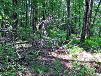
![]()
![]()
![]()
![]()
![]() On Wednesday, June 28th I wanted to return to the trail between Alder Lake and Big Pond to clear the trail from Alder Creek Road to the point I had where I had ended the previous day. I knew I needed some help and recruited my 6 year-old grandson, Bryce. Bryce is big for his age and is capable of hiking at least 6 miles although we have generally walked a little less. He also is strong enough and has enough endurance to remove branches and help clear the trails. Bryce arrived sometime after 9:00 AM and we got our gear together. Sheila was ready to go since she would hike everyday if given the chance. I took along my Silky saw, Battle Horse machete, the Fiskars axe and a weed whip. We left Livingston Manor at about 10:00 AM as I drove out Old Rt 17 to the Beaverkill Road where I turned right. There were crews working on the trees along the road which slowed me down a little. At the intersection with the Barkaboom Road I stayed to the right on the Beaverkill Road until I came to Alder Creek Road on the left. I turned onto Alder Creek Road and drove almost to the end where it meets Cross Mountain Road and the access road to Alder Lake. I turned around and parked near where the trail crosses the road so that we did not have to carry the tools all the way from the Alder Lake parking area. I handed the weed whip to Bryce and we walked down the trail to Alder Creek. The stream wasn't very high and we crossed on some stepping stones just wetting the bottoms of our shoes. The trail turned left and paralleled the stream and we soon ran into a small tree that was hanging over the trail. It was hung up on another tree and I thought I might have to cut both. I tried tugging on the tree that was hanging over the trail and to my surprise I was able to pull it down and out of the trail. We followed the trail as it turned right and started up a hill. Somewhere along the way we decided we did not need the weed whip and we left it on the side f the trail. We continued up the hill removing many smaller branches as we walked. Bryce is a pleasure to be around as he is very mature for his age and we have interesting conversations. At about .75 miles the woods opened up and we walked through a grassy area that could use some trimming. Just after this the trail turns southwest and starts to descend. We ran into a tree across the trail with a lot of branches that were intertwined. I took some "before" pictures and then we got busy clearing the mess. We removed the loose branches and then I began to cut with the saw while Bryce cleared what I had cut. It didn't take long before we had cleared the trail. I took some pictures of Bryce and Sheila on the trail we had just cleared before we moved on. We continued to descend and came to a beaver meadow on the right. A stream leaves this area and runs south emptying into another beaver meadow.
On Wednesday, June 28th I wanted to return to the trail between Alder Lake and Big Pond to clear the trail from Alder Creek Road to the point I had where I had ended the previous day. I knew I needed some help and recruited my 6 year-old grandson, Bryce. Bryce is big for his age and is capable of hiking at least 6 miles although we have generally walked a little less. He also is strong enough and has enough endurance to remove branches and help clear the trails. Bryce arrived sometime after 9:00 AM and we got our gear together. Sheila was ready to go since she would hike everyday if given the chance. I took along my Silky saw, Battle Horse machete, the Fiskars axe and a weed whip. We left Livingston Manor at about 10:00 AM as I drove out Old Rt 17 to the Beaverkill Road where I turned right. There were crews working on the trees along the road which slowed me down a little. At the intersection with the Barkaboom Road I stayed to the right on the Beaverkill Road until I came to Alder Creek Road on the left. I turned onto Alder Creek Road and drove almost to the end where it meets Cross Mountain Road and the access road to Alder Lake. I turned around and parked near where the trail crosses the road so that we did not have to carry the tools all the way from the Alder Lake parking area. I handed the weed whip to Bryce and we walked down the trail to Alder Creek. The stream wasn't very high and we crossed on some stepping stones just wetting the bottoms of our shoes. The trail turned left and paralleled the stream and we soon ran into a small tree that was hanging over the trail. It was hung up on another tree and I thought I might have to cut both. I tried tugging on the tree that was hanging over the trail and to my surprise I was able to pull it down and out of the trail. We followed the trail as it turned right and started up a hill. Somewhere along the way we decided we did not need the weed whip and we left it on the side f the trail. We continued up the hill removing many smaller branches as we walked. Bryce is a pleasure to be around as he is very mature for his age and we have interesting conversations. At about .75 miles the woods opened up and we walked through a grassy area that could use some trimming. Just after this the trail turns southwest and starts to descend. We ran into a tree across the trail with a lot of branches that were intertwined. I took some "before" pictures and then we got busy clearing the mess. We removed the loose branches and then I began to cut with the saw while Bryce cleared what I had cut. It didn't take long before we had cleared the trail. I took some pictures of Bryce and Sheila on the trail we had just cleared before we moved on. We continued to descend and came to a beaver meadow on the right. A stream leaves this area and runs south emptying into another beaver meadow.
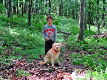 We continued on the trail heading southwest and descending until we came to another branch that had fallen across the trail. This one was smaller and it only took a few cuts to remove it. We did find a rather large log just beyond the branches that we cleared. I was able to break it into two pieces and we rolled it off the trail. At 1.3 miles we crossed the stream and began to climb up a hill. It was here that I introduced Bryce to stinging nettles! There were patches of them growing along the trail in the damp and shaded areas. As we walked up the hill we passed some stone walls and a stone foundation. We had a discussion about the purpose of the walls and the use of the land is the past. We soon came to one of the wettest areas on the trail which is the first but worst of several. As we were trying to find a way to cross without sinking into the mud, Sheila started barking at an approaching hiker. I had not noticed the young man approaching as we were concentrating on the mud and I apologized and called Sheila back. I always out her in her leash when other hikers are around. We got our shoes covered in mud on the way across but stopped to talk to the young hiker. He was hiking a section of the Finger Lakes Trail and was planning to stay at the lean-to east of Alder Lake. We parted ways heading in opposite directions. Bryce and I braved the nettles and a few more muddy areas without doing more than picking up a few branches. I was beginning to wonder where the turn around point was but Bryce seemed not to mind. We broke out into an area with fewer trees where stands of briars dominated the trail. We pushed on as I wanted to get to the pint I had been to the day before from the other end of the trail. We hit a high point and started to descend which did not make me happy. Within less than a quarter mile I recognized the trail and knew we could turn around. I noticed a large spruce tree off the trail and had Bryce measure it by "hugging" the tree with outstretched arms. It was 3 and a half Bryces around! We turned around at 12:40 Pm after hiking 2.3 miles . On the way back I took some time to use the machete to cut back some of the briars along the path. After that we set a good pace knowing that the final stretch was downhill. We found a better way across the muddiest spot using stepping stones that I found. We did stop to take a picture of the old foundation and then descended to the stream. From the stream there was a final half mile of climb on a 10% grade. From the top of the hill it was less than a lie back to the car and all downhill. At the bottom of the hill we could see the road. Bryce suddenly reminded me that we had failed to pick up the weed whip we had left behind at the beginning of the hike. We turned around and walked halfway back up the hill until we found the tool. We turned around and walked back to the car. We arrived at the car at 2:15 Pm after hiking 4.7 miles in 3 hours and 45 minutes including an hour of stopped time to work. The elevation gain was 1084 feet.
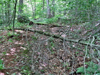
![]()
![]()
![]()
![]()
![]() On Tuesday, June 27th I had decided that I wanted to head to Big Pond and inspect the trail conditions on the trail to Alder Lake. Recently accepted the responsibility of maintain this section of trail for the Finger Lakes Trail Conference and wanted to see the condition of the trail. This trail has had some problems in the past and has several sections of briars and nettles as well as some muddy spots. I now have the Finger Lakes Trail from Alder Creek Road to Beech Hill Road. I decided I would start at Big Pond and hike about half way and then turn around and head back. This would allow me to clear the trail in both directions. If I had time, I would go to the Alder Lake end and do the same thing. I was a little concerned about the forecast for showers but after checking the radar, I did not think I would have a problem. I had some work to do around the house and wasn't able to leave until after 11:00 AM. I dressed for warm weather and work. I took along my Silky saw, Battle Horse machete, the Fiskars axe and a weed whip. I drove out Old Rt 17 to the Beaverkill Road where I turned right. There were crews working on the trees along the road which slowed me down a little. By 11:20 AM I was at the intersection with the Barkaboom Road where I turned left. I headed up the hill passed the Little Pond Campsites and turned into the upper parking area for Big Pond. There were two other cars parked in the lot and I suspected they might be camping at the primitive campsites on Big Pond. I got an excited Sheila out of the car and set my electronics. I decided to take all the tools as we headed out the back right corner of the parking area where the trail began. I immediately ran into briars overgrowing the path on the right side but decided that I would get them on the way back. The first part of the trail had a lot of high grass and, again, I decided to leave that until later. As we entered the trees I knew that I would not need the grass whip so I hid it behind a tree. As we continued on we came to a place where some small trees were hanging over the trail forcing hikers to walk around. I got out my saw and cut some branches to restore the original path. We climbed a small hill and found a pretty good sized tree across the trail. I took a few pictures and then used the saw to cut away a few branches. I then cut the trunk into pieces and moved it off the trail. We continued to follow the trail as it followed a woods road and then struck off through the forest. Long the way I picked up small branches and sticks. I also removed some larger logs that other maintainers had left to rot ion the trail. They weren't blocking the trail but their presence bothered me. The trail was better marked than before and was easy to follow.
On Tuesday, June 27th I had decided that I wanted to head to Big Pond and inspect the trail conditions on the trail to Alder Lake. Recently accepted the responsibility of maintain this section of trail for the Finger Lakes Trail Conference and wanted to see the condition of the trail. This trail has had some problems in the past and has several sections of briars and nettles as well as some muddy spots. I now have the Finger Lakes Trail from Alder Creek Road to Beech Hill Road. I decided I would start at Big Pond and hike about half way and then turn around and head back. This would allow me to clear the trail in both directions. If I had time, I would go to the Alder Lake end and do the same thing. I was a little concerned about the forecast for showers but after checking the radar, I did not think I would have a problem. I had some work to do around the house and wasn't able to leave until after 11:00 AM. I dressed for warm weather and work. I took along my Silky saw, Battle Horse machete, the Fiskars axe and a weed whip. I drove out Old Rt 17 to the Beaverkill Road where I turned right. There were crews working on the trees along the road which slowed me down a little. By 11:20 AM I was at the intersection with the Barkaboom Road where I turned left. I headed up the hill passed the Little Pond Campsites and turned into the upper parking area for Big Pond. There were two other cars parked in the lot and I suspected they might be camping at the primitive campsites on Big Pond. I got an excited Sheila out of the car and set my electronics. I decided to take all the tools as we headed out the back right corner of the parking area where the trail began. I immediately ran into briars overgrowing the path on the right side but decided that I would get them on the way back. The first part of the trail had a lot of high grass and, again, I decided to leave that until later. As we entered the trees I knew that I would not need the grass whip so I hid it behind a tree. As we continued on we came to a place where some small trees were hanging over the trail forcing hikers to walk around. I got out my saw and cut some branches to restore the original path. We climbed a small hill and found a pretty good sized tree across the trail. I took a few pictures and then used the saw to cut away a few branches. I then cut the trunk into pieces and moved it off the trail. We continued to follow the trail as it followed a woods road and then struck off through the forest. Long the way I picked up small branches and sticks. I also removed some larger logs that other maintainers had left to rot ion the trail. They weren't blocking the trail but their presence bothered me. The trail was better marked than before and was easy to follow.
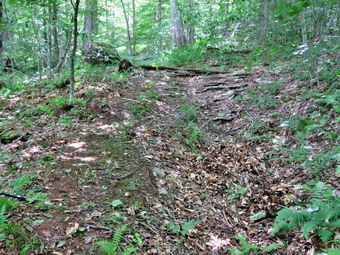 The further we went, the darker the skies ahead of us became and this was accompanied by an increase in the wind. We came to an area where two larger trees had fallen across the trail. They were low to the ground but I felt I wanted to remove them. I went to the second one and took some pictures and then began to work. I cut away one smaller branch and then went to work on the trunk with my axe. The wood was surprisingly tough in places but I was soon through the log. I knew I would have to cut it again as my attempt to slide, push, pull or swinging the trunk off the trail proved futile. I spotted a crack in the log just off the trail and decided to work on it a little. I was able to widen the crack and break the log with just a few swings of the axe. There was still a large portion left but I was able to manhandle it off the trail. Although the skies were getting darker, I walked back t the first log, took pictures and begin to work on it with the axe. I handled this one much like the other. I cut it on one side of the trail and found a crack on the other which allowed me to easily cut a chunk out and rotate it off the trail. I decided to continue a little further on the trail despite the darkening skies. I picked up my tools and started up the trail. In just a few minutes some drops of rain began to fall. O decided I did not want to get wet or get caught in a thunderstorm. I have been out in storms with lightening hitting too close for comfort and I did not want to repeat the experience. We turned around and started a quick pace back the way we had come. I could see that the skies ahead were blue and soon there was no more rain falling. I didn't know if the rain had stopped or we had just walked out of it! I didn't really care so we continued back toward the car. I retrieved the weed whip on the way and walked back to the car to dump my pack. Since the sky was blue and it was not raining, I decided to attack the briars and the beginning of the trail. I used the machete to hack at the briars and it took some effort as the older canes were very resistant. S I was working I heard a few peals of thunder in the distance. I finished cutting back the briars and then decided to use the weed whip to clear some of the grass which had grown pretty high along the trail. This effort was a little less successful as it was difficult to get a clear swing. I did get some of the trail cleared starting at the trailhead to a particular tree but decided power tools would be necessary. The power scythe is heavy to carry for almost 4 miles along with fuel but a string trimmer would probably work well. My plan is to park two cars, start at one end and work my way to the other.
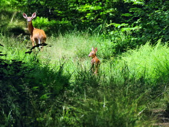
![]()
![]()
![]()
![]()
![]() On Sunday, June 25th I had decided that I wanted to go to the Hodge and Frick Pond area after church to clear some of the trail obstructions my friend and I had found on the previous day. When I returned from church the weather forecast was calling for thunderstorms and the skies were dark. I had some lunch thinking that the best I could do was go across the street to hike on Round Top again between storms. By the time I had finished lunch the skies had cleared and the radar showed that the storms were unlikely to effect our area. I decided to take chance and got my gear together to go do some trail maintenance. I took with me my Fiskars axe and Silky Sugowaza saw. The saw I put in my pack but I decided to carry the axe instead of poles. I got dressed and then out Sheila in the back seat and my gear in the trunk. We left the house a little after 1:00 PM and drove out the DeBruce Road for about six miles. I turned left on Mongaup Pond Road and stayed to the left on Beech Mountain Road when it split. When we arrived at the trailhead, there were two vehicles in the small lot and I parked between them. The temperature was in the high 60's when I set my GPS and we crossed the road at 1:35 AM to begin our hike. A short distance after the trail register there was a small tree down across the trail. I knew it would go quickly so I didn't take pictures. I used the axe to cut the trunk twice and pulled everything off the trail. I packed up and we continued up the trail to the woods road that was once the extension of Beech Mountain Road. We turned right on the woods road and started the long climb toward the junction with the Big Rock Trail. A one point there was a branch that had partially broken off a tree and was in the trail. I tried to pull it down but that didn't work. I was able to cut the branch and then pull it over to the side of the trail. We continued up the trail until Sheila alerted. There was a doe and a single fawn further up the trail. I immediately put Sheila on her leash which she protested. I explained she could not chase the fawn and I got out my camera. The deer were standing still looking back at us as I sued the 65x zoom to try to get pictures. Using the zoom at very long range requires a steady hand or a support. I had no support so I tried to steady myself and take some shots. Eventually the deer began to trot up the trail and then turn left down over the bank. I left Sheila on her leash as we headed up the trail and she was very active as she got the scent of the deer on the ground. I only let her off the leash once we were well passed the point where the deer had left the trail. We continued up the trail with me picking up big and small branches and throwing them off the trail. We reached the Big Rock Junction at 2:35 PM after hiking 1.7 miles. As we passed through the junction Sheila again alerted and I looked up to see an unleashed dog approaching. I immediately put Sheila on her leash as a courtesy. The two women who were with the other dog did NOT put their dog on the leash saying "Oh, she's friendly!" Unfortunately, Sheila was not feeling that friendly as the other dog approached her. I wish all dog owners would do the right thing but they often do not.
On Sunday, June 25th I had decided that I wanted to go to the Hodge and Frick Pond area after church to clear some of the trail obstructions my friend and I had found on the previous day. When I returned from church the weather forecast was calling for thunderstorms and the skies were dark. I had some lunch thinking that the best I could do was go across the street to hike on Round Top again between storms. By the time I had finished lunch the skies had cleared and the radar showed that the storms were unlikely to effect our area. I decided to take chance and got my gear together to go do some trail maintenance. I took with me my Fiskars axe and Silky Sugowaza saw. The saw I put in my pack but I decided to carry the axe instead of poles. I got dressed and then out Sheila in the back seat and my gear in the trunk. We left the house a little after 1:00 PM and drove out the DeBruce Road for about six miles. I turned left on Mongaup Pond Road and stayed to the left on Beech Mountain Road when it split. When we arrived at the trailhead, there were two vehicles in the small lot and I parked between them. The temperature was in the high 60's when I set my GPS and we crossed the road at 1:35 AM to begin our hike. A short distance after the trail register there was a small tree down across the trail. I knew it would go quickly so I didn't take pictures. I used the axe to cut the trunk twice and pulled everything off the trail. I packed up and we continued up the trail to the woods road that was once the extension of Beech Mountain Road. We turned right on the woods road and started the long climb toward the junction with the Big Rock Trail. A one point there was a branch that had partially broken off a tree and was in the trail. I tried to pull it down but that didn't work. I was able to cut the branch and then pull it over to the side of the trail. We continued up the trail until Sheila alerted. There was a doe and a single fawn further up the trail. I immediately put Sheila on her leash which she protested. I explained she could not chase the fawn and I got out my camera. The deer were standing still looking back at us as I sued the 65x zoom to try to get pictures. Using the zoom at very long range requires a steady hand or a support. I had no support so I tried to steady myself and take some shots. Eventually the deer began to trot up the trail and then turn left down over the bank. I left Sheila on her leash as we headed up the trail and she was very active as she got the scent of the deer on the ground. I only let her off the leash once we were well passed the point where the deer had left the trail. We continued up the trail with me picking up big and small branches and throwing them off the trail. We reached the Big Rock Junction at 2:35 PM after hiking 1.7 miles. As we passed through the junction Sheila again alerted and I looked up to see an unleashed dog approaching. I immediately put Sheila on her leash as a courtesy. The two women who were with the other dog did NOT put their dog on the leash saying "Oh, she's friendly!" Unfortunately, Sheila was not feeling that friendly as the other dog approached her. I wish all dog owners would do the right thing but they often do not.
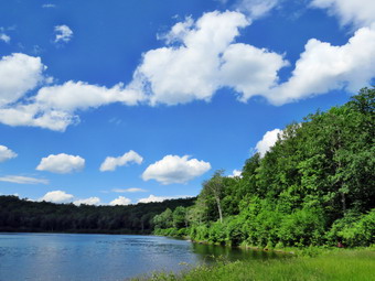 We continued along the Flynn Trail and found another blowdown. I did take pictures of this one before attacking it with the saw. There wasn't too much to clear so we moved on after I took some "after" pictures. At the next trail junction, we stayed to the left to follow the Flynn Trail down to Hodge Pond. I cut back a few bushes on the way and found one large blowdown that had been cleared by the OSI people. The grass on the trail had been mowed which was a big improvement from the tall grass on the first part of the Flynn Trail. We walked out into the filed by Hodge Pound and then over to the fire circle near the shore. Sheila immediately went for a swim while I took some pictures of the pond. The sky was blue with nice white clouds which made for some nice shots. I threw a stick into the water for Sheila and took some pictures of her retrieving it. After a drink, we walked back to the Flynn Trail and continued on the west side of Hodge Pond. At the next trail junction we stayed to the left to take the Flynn Trail up the hill rather than the jeep road around the back of the pond. I cut a few branches on the way UPI to the gate and a few more after the gate. The trail was still wet with muddy patches along the way. The trees and bushes were beginning to close in on the trail and really need several people with loppers to cut them back. I cut a few of the worst until we came to the Quick Lake Trail at Junkyard Junction. It was 3:40 PM and we had hiked 3.3 miles which is almost exactly halfway through the hike. We turned left to start the loop back and the trail which initially rolls some but eventually descends toward Iron Wheel Junction. At about 3.9 miles we came to perhaps the most challenging cleanup of the day. There was a rather large tree with multiple branches down across the trail. I cleared what I could and then got to work with the saw. It was simply a matter of cutting branches and then removing them until everything was cleared. I found it easier to make multiple cuts so that the branches I had to move were smaller and easier to manage. It took a little less than 20 minutes to clear everything and take some pictures.
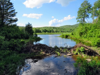 I packed up and then picked up my pack and headed down the trail. At 4.6 miles we ran into another set up small trees across the trail. The trunks were small but they were intertwined and putting pressure on each other. I was careful to choose my cuts wisely and still got some kickback. It took less than 15 minutes to clear this mess and we were in motion again. It was getting late and I could not remember any other major blowdowns on the trails. At 4:55 PM we turned right at Iron Wheel Junction after hiking 5.1 miles. The turn allowed us to stay on the Quick Lake trail heading for Frick Pond. As we walked, I continued to pick up branches and cut a few that were in the trail. We came to and crossed the small stream through the woods. There was a large hardwood tree down across the trail in the "spruce tunnel" but it was flat on the ground. I decided to leave that one for another day. We walked out of the spruce tunnel and found another big branch which was no match for the Silky saw. We passed by the junction with the Big Rock Trail on the left and were soon at the bridge over the Frick Pond Outlet. I dropped my pack and got out the camera. I have taken hundreds of pictures form the bridge but can't resist stopping to take a few more. The pond was high from the beaver dam just upstream of the bridge. I saw movement in the water but couldn't get a picture of the beaver that made it. It was getting late so I stowed the camera and shouldered the pack. We walked up the hill from Frick Pond to Gravestone Junction and continued straight ahead on the Quick Lake Trail. The trail was still wet for almost the entire way back to the car. We passed by the register and walked the woods road back out to the car. The only car in the lot was one I know well as it belongs to JP, the friend that hiked with me the day before! We were back at the car at 5:35 Pm having hiked 6.6 miles in 4 hours with a vertical gain of 908 feet. This is very slow but included over an hour of stopped time.
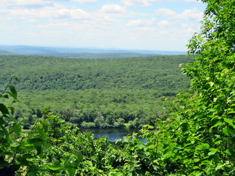
![]()
![]()
![]()
![]()
![]() On Saturday, June 24th I wanted to get in a longer hike and thought about getting away from Livingston Manor to do it. I looked at the weather forecast and the best scenario still called for showers wherever I wanted to go. I was not willing to travel a long distance to hike in poor weather. In addition, we had an early morning ambulance call which pushed back my start time. On the call I mentioned hiking to my partner and friend JP and he expressed a desire to go with me. We decided to meet at Frick Pond at 11:00 AM to hike. My plan was to hike a loop up the Flynn Trail to the Hodge Pond Lookout and then back on the Flynn an Quick lake Trails. We had a few sprinkles of rain in the morning but by 10:00 AM it was sunny and clear with a blue sky and white clouds. I got some work done and then got my gear ready to go hiking. Sheila was happy to be going as I loaded everything into the car. Given the temperatures I wore light pants and a light long-sleeved shirt over a baselayer. I did put my machete in the pack in case I needed to cut back some brush although this was not my primary purpose. On the way up DeBruce Road I got behind some very slow drivers that were headed for Mongaup Pond. I arrived at the parking area just after 11:00 AM to find JP already waiting for me. Sheila was ready to go and we crossed the road to head up the Flynn Trail at about 11:10 AM. The temperature was just 70 degrees and there was a slight breeze blowing. Since I was not overwhelmed by insects at the trailhead, I decided to forego the insect repellant. We kept a quick pace up the Flynn Trail but stopped occasionally to remove branches from the trail. We ran into one new blowdown that will require a saw to clear. When we reached the point on the trail where there is a clearing on the right, we headed off the trail and climbed the little hill to the edge of the clearing. JP was impressed as was I since everything was very green which contrasted nicely with the blue sky and white clouds. JP was looking for signs of deer in woods and had found several places where bucks had rubbed their horns. After taking some pictures we returned to the Flynn Trail and headed toward Hodge Pond. We found another blowdown on the Flynn Trail before the Big Rock Junction and one after. We passed through the junction at 12:05 PM having hiked about 1.7 miles. As we headed toward Hodge Pond on the Flynn Trail, I pointed out the gap next to the gate that allows snowmobiles through and told JP my crew would be working on moving some stones to block it. At the next junction we veered to the right following a woods road instead of the Flynn Trail which stays to the left. Soon we were in the area near the old Beech Mountain Boy Scout Camp and continued straight ahead as the woods road ascended the hill. Some new tire tracks were clear and it appeared a pickup truck had driven in from Shin Creek Road in Lew Beach. This part of the road was damp and I was surprised that there wasn't more water on the trails after the recent rain.
On Saturday, June 24th I wanted to get in a longer hike and thought about getting away from Livingston Manor to do it. I looked at the weather forecast and the best scenario still called for showers wherever I wanted to go. I was not willing to travel a long distance to hike in poor weather. In addition, we had an early morning ambulance call which pushed back my start time. On the call I mentioned hiking to my partner and friend JP and he expressed a desire to go with me. We decided to meet at Frick Pond at 11:00 AM to hike. My plan was to hike a loop up the Flynn Trail to the Hodge Pond Lookout and then back on the Flynn an Quick lake Trails. We had a few sprinkles of rain in the morning but by 10:00 AM it was sunny and clear with a blue sky and white clouds. I got some work done and then got my gear ready to go hiking. Sheila was happy to be going as I loaded everything into the car. Given the temperatures I wore light pants and a light long-sleeved shirt over a baselayer. I did put my machete in the pack in case I needed to cut back some brush although this was not my primary purpose. On the way up DeBruce Road I got behind some very slow drivers that were headed for Mongaup Pond. I arrived at the parking area just after 11:00 AM to find JP already waiting for me. Sheila was ready to go and we crossed the road to head up the Flynn Trail at about 11:10 AM. The temperature was just 70 degrees and there was a slight breeze blowing. Since I was not overwhelmed by insects at the trailhead, I decided to forego the insect repellant. We kept a quick pace up the Flynn Trail but stopped occasionally to remove branches from the trail. We ran into one new blowdown that will require a saw to clear. When we reached the point on the trail where there is a clearing on the right, we headed off the trail and climbed the little hill to the edge of the clearing. JP was impressed as was I since everything was very green which contrasted nicely with the blue sky and white clouds. JP was looking for signs of deer in woods and had found several places where bucks had rubbed their horns. After taking some pictures we returned to the Flynn Trail and headed toward Hodge Pond. We found another blowdown on the Flynn Trail before the Big Rock Junction and one after. We passed through the junction at 12:05 PM having hiked about 1.7 miles. As we headed toward Hodge Pond on the Flynn Trail, I pointed out the gap next to the gate that allows snowmobiles through and told JP my crew would be working on moving some stones to block it. At the next junction we veered to the right following a woods road instead of the Flynn Trail which stays to the left. Soon we were in the area near the old Beech Mountain Boy Scout Camp and continued straight ahead as the woods road ascended the hill. Some new tire tracks were clear and it appeared a pickup truck had driven in from Shin Creek Road in Lew Beach. This part of the road was damp and I was surprised that there wasn't more water on the trails after the recent rain.
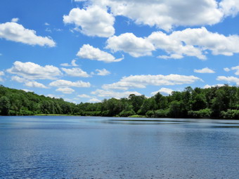 As we climbed the hill we passed a spring house and Sheila stopped to get a drink. At 12:30 PM we stopped at a little lookout and I took some pictures to the north and west. As we were getting ready to leave we heard some voices and two mountain bikes came up the hill. I don't know where they came from but the hiking trail are not multiuse trails. Since we were on OSI property, I did not comment to the bikers who seemed to be harmless. I put Sheila on her leash and we walked a little farther up the hill and turned right on a path that leads to the lookout over Hodge Pond. After the bikers went passed us, I let Sheila off her leash. The path was so wide and so clear I wasn't sure it was the right one. Soon I saw a familiar rock and just passed that the lookout. We stopped at the viewpoint and I took some pictures. I got out a bar to and shared with JP. We decided to follow the path around the hill which is Flynn's Point, the highest spot in Sullivan County. The entire loop is just less than a mile. When we arrived back at e woods road, we turned left and walked back down the hill to the area of the Beech Mountain Boy Scout Camp. When we arrived back at the area near the remains of the boy scout camp, we turned right on the woods road and walked out to what remains of the camp. Most of the buildings in the area were used for merit badge and craft work. JP looked around while I took some pictures. When we were done we walked back out to the road and turned right and then right again at the next junction. We followed the woods road down to the jeep trail on the right that goes around the back of Hodge Pond. We descended a small hill and then walked off on a path to the left to the shores of the pond. Before I could get my pack off, Sheila was in the water swimming around and cooling off. I took some pictures and then threw a stick for her to retrieve. I took some shots of her in the water and then a few more of the pond. I packed up the camera, got a drink and returned to the jeep trail.
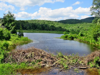 We took the next right to get back on the Flynn Trail heading for Junkyard Junction. I pointed out some of the larger blowdown I had cut with axe and saw to JP. The trails were relatively clear of any new obstructions and we made good time to the gate at the top of the hill. At this point the Flynn Trail flattens out and this is where we finally found where all the rain had accumulated. The Flynn Trail in this area seemed to be one long bog interrupted by small pools. Walking on the side of the trail helped in some places but it did slow us down some. At 2:00 PM we had finally hiked the 5.5 miles to Junkyard Junction where the Flynn Trail ends at the Quick Lake Trail. We turned left to head down the hill and back toward the parking area. The first part of the Quick Lake Trail rolls a little and it also was wet in spots. We continue to clear branches from the trail and a few large logs. As we began to descend the trail became drier for the most part. When we reached Iron Wheel Junction at 7.1 miles, we turned right to stay on the Quick Lake trail back to Frick Pond. This trail was also wet in spots but these places were easier to avoid for the most part. There were some additional blowdown and we moved what we could be hand. The stream through the woods was running with a reasonable volume. As I started to cross by stepping on a rock, a trout jumped over my boot and swam downstream! We were soon crossing the bridge at the outlet to Frick Pond. We stopped to rest minute and so that I could take some pictures. The beavers had continued to build their dam which had raised the water level so that the body of water could be called a pound again. We walked up the hill to Graveyard Junction and then out the Quick Lake trail to the register. I was surprised to see that the register on the Flynn Trail and the one on the Quick Lake trail had been moved slightly and replaced. It struck me that there was other work that need attention like a way to block car driving down the Quick lake Trail! We turned right to stay on the Quick Lake Trail and continued back to the parking area and the cars. I was surprised to find only one other vehicle parked in the small lot as it was such a beautiful day. We were back at the car at 3:30 PM having covered 8.7 miles in 4 hours and 20 minutes with a total elevation gain of 1465 feet.
![]()
![]()
![]()
![]() On Thursday, June 22nd I wanted to get out for a short hike after attending a funeral in Liberty for a member of our church. I called Karl to see if my grandson Bryce could come along on then hike after his half day of kindergarten. Karl said he would bring him to our house and I was excited about hiking with him. Bryce arrived at about 1:00 PM and I started to get ready. Cindy called and said she was coming home in few minutes and wanted to hike with us. Cindy came home and we all got ready to hike. I put Sheila on her leash and made sure Bryce had his poles as we headed down the driveway and across the street at about 1:45 PM. I had decided not to bring my pack as I did not want to carry the extra weight and wanted to have the "freedom" from taking pictures. We walked across the field to the back of the church to begin the ascent of the steepest hill behind the church. The hill is short but really gets the circulation pumping and is the steepest and longest climb on the "trail". Bryce was almost running up the hill and I knew it would be hard to hold back an energetic and athletic 6 year old! When we got to the top of the hill, we started out on the trail by turning left at the trailhead. I started my Suunto Traverse GPS watch to record the route I intended to take. As soon as we entered the trees I released Sheila from her leash as she was the only one capable of staying with Bryce. At the first trail junction Bryce continued straight ahead toward the lookout and we followed. The trail here has excess leaves and could use a little raking. At the lookout Bryce and Cindy walked out to the viewpoint and then rejoined me on the main trail. I told Bryce we might investigate what was BELOW the viewpoint later in the hike. We turned right to follow the yellow blazes of the trail. The trail has been worn in some and it was pretty easy to follow. At the sharp right turn I pointed out the new blue trail but we continued to follow the lower trail as if skirted Round Top. At the next sharp right turn we turned left to start on the upper trail. The trail was very obvious and the blue blazes very visible. At the top we headed across the flat summit following the trail we had cleared. Bryce had no problem picking out the treadway or the blazes. We descended the other side of the hill following the blue blazes. At the lower trail we turned left and followed the yellow blazes around to the brush pile and the sharp right turn. We followed the lower trail down to the woods road that brings the trail to the first trail junction. When we arrived at the junction, I was ready to turn around and do another figure 8 but Cindy wanted to go home. Bryce and I turned around and started back up the woods road we had just descended as Cindy headed out to trailhead. Sheila came with us but kept looking back to see where Cindy had gone. At the sharp left turn at we continued to follow the yellow trail to the left until it again turned sharply left. At this point we turned right to follow the blue trail up and over Round Top in the opposite direction from our first figure 8. When we came down the other side to the yellow trail we turned right to follow the yellow trail along the base of the hill. This time we made the sharp left turn and walked downhill to the viewpoint. I was about to turn left and second to the first trail junction when I remembered my promise to explore below the viewpoint. Bryce seemed to still have a lot of energy so we went out to the lookout and found a steep path down between the rocks. We left Bryce's poles on top as this was a real rock scramble. Without too much effort we were able to descend the path and walk under the viewpoint. The lookout is really not a cliff but a rock ledge that hangs out in the air! We explored some of the rocks in the overhand below the viewpoint before retracing our path back to the main trail. We headed down the hill to the first trail junction and then continued straight ahead out to the trailhead. I put Sheila on her leash and we turned right to walk down the cemetery hill and back to our driveway. We had been out for about and hour and a half and even though the hike on Round Top was only 1.7 miles we had walked farther.
On Thursday, June 22nd I wanted to get out for a short hike after attending a funeral in Liberty for a member of our church. I called Karl to see if my grandson Bryce could come along on then hike after his half day of kindergarten. Karl said he would bring him to our house and I was excited about hiking with him. Bryce arrived at about 1:00 PM and I started to get ready. Cindy called and said she was coming home in few minutes and wanted to hike with us. Cindy came home and we all got ready to hike. I put Sheila on her leash and made sure Bryce had his poles as we headed down the driveway and across the street at about 1:45 PM. I had decided not to bring my pack as I did not want to carry the extra weight and wanted to have the "freedom" from taking pictures. We walked across the field to the back of the church to begin the ascent of the steepest hill behind the church. The hill is short but really gets the circulation pumping and is the steepest and longest climb on the "trail". Bryce was almost running up the hill and I knew it would be hard to hold back an energetic and athletic 6 year old! When we got to the top of the hill, we started out on the trail by turning left at the trailhead. I started my Suunto Traverse GPS watch to record the route I intended to take. As soon as we entered the trees I released Sheila from her leash as she was the only one capable of staying with Bryce. At the first trail junction Bryce continued straight ahead toward the lookout and we followed. The trail here has excess leaves and could use a little raking. At the lookout Bryce and Cindy walked out to the viewpoint and then rejoined me on the main trail. I told Bryce we might investigate what was BELOW the viewpoint later in the hike. We turned right to follow the yellow blazes of the trail. The trail has been worn in some and it was pretty easy to follow. At the sharp right turn I pointed out the new blue trail but we continued to follow the lower trail as if skirted Round Top. At the next sharp right turn we turned left to start on the upper trail. The trail was very obvious and the blue blazes very visible. At the top we headed across the flat summit following the trail we had cleared. Bryce had no problem picking out the treadway or the blazes. We descended the other side of the hill following the blue blazes. At the lower trail we turned left and followed the yellow blazes around to the brush pile and the sharp right turn. We followed the lower trail down to the woods road that brings the trail to the first trail junction. When we arrived at the junction, I was ready to turn around and do another figure 8 but Cindy wanted to go home. Bryce and I turned around and started back up the woods road we had just descended as Cindy headed out to trailhead. Sheila came with us but kept looking back to see where Cindy had gone. At the sharp left turn at we continued to follow the yellow trail to the left until it again turned sharply left. At this point we turned right to follow the blue trail up and over Round Top in the opposite direction from our first figure 8. When we came down the other side to the yellow trail we turned right to follow the yellow trail along the base of the hill. This time we made the sharp left turn and walked downhill to the viewpoint. I was about to turn left and second to the first trail junction when I remembered my promise to explore below the viewpoint. Bryce seemed to still have a lot of energy so we went out to the lookout and found a steep path down between the rocks. We left Bryce's poles on top as this was a real rock scramble. Without too much effort we were able to descend the path and walk under the viewpoint. The lookout is really not a cliff but a rock ledge that hangs out in the air! We explored some of the rocks in the overhand below the viewpoint before retracing our path back to the main trail. We headed down the hill to the first trail junction and then continued straight ahead out to the trailhead. I put Sheila on her leash and we turned right to walk down the cemetery hill and back to our driveway. We had been out for about and hour and a half and even though the hike on Round Top was only 1.7 miles we had walked farther.
![]()
![]()
![]()
![]() On Wednesday, June 21st I decided I wanted to check the trail marking Cindy and I had done on Saturday to see how the paint held up to the rain. I also wanted to make sure we had completely cleared the new, upper trail. I wanted to make the first hike of the summer a little more memorable but a morning ambulance call limited my time before teaching a CPR class in the afternoon. Around 12:30 PM I got changed into my hiking gear which pleased Sheila. I grabbed my machete and a leash for Sheila and we headed out our driveway and across the street with Sheila pulling on her leash. We crossed the lied by the church and started up the steep hill along the edge of the cemetery. I elected to leave my pack behind and to go without hiking poles. My heart was beating faster when we got to the top of the hill and turned left into the forest. I let Sheila off her leash and cut a few beaches from the pine trees that frame the entrance to the trail. As we followed the woods road to the first trail junction, I picked up a few branches that had fallen in the wind over the past few days. At the trail junction we continued straight ahead up the steep little climb to the viewpoint. I continued to remove a few branches here and there. At the lookout we followed the trail to the right and I noted that the ferns had grown up some and would need a good whacking. Where the lower trail turned right we continued straight ahead following the blue paint blazes up toward the summit of Round top. I was glad to see that the blazes had held up well to the rain but had dried a little darker than I expected. As we climbed the hill a cleared a few spots. We continued across the summit where I cut some brush. As we descended the other side I removed a few of the raining green ribbons that we had missed on the blazing hike. At the bottom of the hill we continued straight ahead on the woods road back to the first trail junction. Since we had missed a section of the lower trail, we turned around and hiked back u the woods road to the sharp left turn. We followed the lower trail this time as it skirted Round Top. Along the way I cut a few branches that had started to encroach on the trail. We continued to follow the yellow trail as it turned left and headed down to the lookout. At the lookout we turned left and completed the loop back to the first trail junction. I was a little bored doing repeated loops so we continued straight ahead back to the beginning of the trail. I put Sheila on her leash and we walked back down the cemetery hill, across the field and down the driveway. We had spent a little over an hour walking and doing some minor trail work.
On Wednesday, June 21st I decided I wanted to check the trail marking Cindy and I had done on Saturday to see how the paint held up to the rain. I also wanted to make sure we had completely cleared the new, upper trail. I wanted to make the first hike of the summer a little more memorable but a morning ambulance call limited my time before teaching a CPR class in the afternoon. Around 12:30 PM I got changed into my hiking gear which pleased Sheila. I grabbed my machete and a leash for Sheila and we headed out our driveway and across the street with Sheila pulling on her leash. We crossed the lied by the church and started up the steep hill along the edge of the cemetery. I elected to leave my pack behind and to go without hiking poles. My heart was beating faster when we got to the top of the hill and turned left into the forest. I let Sheila off her leash and cut a few beaches from the pine trees that frame the entrance to the trail. As we followed the woods road to the first trail junction, I picked up a few branches that had fallen in the wind over the past few days. At the trail junction we continued straight ahead up the steep little climb to the viewpoint. I continued to remove a few branches here and there. At the lookout we followed the trail to the right and I noted that the ferns had grown up some and would need a good whacking. Where the lower trail turned right we continued straight ahead following the blue paint blazes up toward the summit of Round top. I was glad to see that the blazes had held up well to the rain but had dried a little darker than I expected. As we climbed the hill a cleared a few spots. We continued across the summit where I cut some brush. As we descended the other side I removed a few of the raining green ribbons that we had missed on the blazing hike. At the bottom of the hill we continued straight ahead on the woods road back to the first trail junction. Since we had missed a section of the lower trail, we turned around and hiked back u the woods road to the sharp left turn. We followed the lower trail this time as it skirted Round Top. Along the way I cut a few branches that had started to encroach on the trail. We continued to follow the yellow trail as it turned left and headed down to the lookout. At the lookout we turned left and completed the loop back to the first trail junction. I was a little bored doing repeated loops so we continued straight ahead back to the beginning of the trail. I put Sheila on her leash and we walked back down the cemetery hill, across the field and down the driveway. We had spent a little over an hour walking and doing some minor trail work.