
What You Missed
Summer 2016
Summer 2016
![]()
![]()
![]()
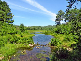
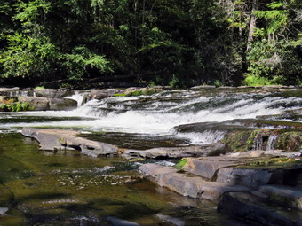
![]() On Tuesday, September 20th I wanted to get in hike before leaving the house early to go to a cross country meet in TriValley. I knew I had to stay local and decided to head to Hodge and Frick Ponds and hike then "big loop" which is very familiar. I was in no real hurry until I realized it was getting late and that I did have to levee early for the meet! I got Sheila and my gear in the car and started out from the house at about 10:00 AM. The temperature was only 60 degrees but I knew that the highs for the day were forecast to be in the high 70's. I drove out DeBruce Road and turned left on Mongaup Road. When we arrived there were no other cars in the lot and we crossed the road to get onto the Flynn Trail at 10:25 AM. I had on a long sleeved shirt over a baselayer and light hiking pants. The walk up the Flynn Trail seemed to go very quickly and we made no stops passing through the junction with the Big Rock Trail and continuing straight ahead of the Flynn Trail. We kept up a quick pace as we passed through the gate marking the boundary with the Open Spaces property. At the next junction we stayed to the left to keep on the Flynn Trail and head directly down to Hodge Pond. When we broke out into the clearing at the outlet end of Hodge Pond, I kept Sheila near since I did not want her swimming as I had just applied Advantix. The pond was pretty but little different than the last dozens times I had been there. The sky was a nice blue but devoid of clouds and given my time limitations I decided to pass on the pictures.
On Tuesday, September 20th I wanted to get in hike before leaving the house early to go to a cross country meet in TriValley. I knew I had to stay local and decided to head to Hodge and Frick Ponds and hike then "big loop" which is very familiar. I was in no real hurry until I realized it was getting late and that I did have to levee early for the meet! I got Sheila and my gear in the car and started out from the house at about 10:00 AM. The temperature was only 60 degrees but I knew that the highs for the day were forecast to be in the high 70's. I drove out DeBruce Road and turned left on Mongaup Road. When we arrived there were no other cars in the lot and we crossed the road to get onto the Flynn Trail at 10:25 AM. I had on a long sleeved shirt over a baselayer and light hiking pants. The walk up the Flynn Trail seemed to go very quickly and we made no stops passing through the junction with the Big Rock Trail and continuing straight ahead of the Flynn Trail. We kept up a quick pace as we passed through the gate marking the boundary with the Open Spaces property. At the next junction we stayed to the left to keep on the Flynn Trail and head directly down to Hodge Pond. When we broke out into the clearing at the outlet end of Hodge Pond, I kept Sheila near since I did not want her swimming as I had just applied Advantix. The pond was pretty but little different than the last dozens times I had been there. The sky was a nice blue but devoid of clouds and given my time limitations I decided to pass on the pictures.
 We made the left turn to continue our hike on the Flynn Trail. This section of the trail was muddy with some standing water in places but it was easily negotiated. The rains during the night had added to the standing water and it didn't help that OSI was mowing the grass with a large tractor that leaves huge ruts along the trail. We stayed left at the next junction with the jeep trail around the back of Hodge Pond and continued up the hill on the blue Flynn Trail. We passed through the gate from OSI property to state land and found the trail continued to have some wet and muddy spots. It seemed that Junkyard Junction came up quickly and we turned left on the red Quick Lake Trail to start our loop back. The Quick Lake Trail is mostly downhill and we made good time. I stopped several times to remove branches and other debris from the trail. We walked downhill to Iron Wheel Junction and turned right to stay on the Quick Lake Trail. We were soon at the small stream just before the "Spruce Tunnel" and I was surprised that despite the rain it was lower than it had been earlier in the year when it was much drier. In fact, this part of the trail was only slightly damp and sections that are usually wet were completely dry. It almost looked as if it had rained hard on one side of the pond and little or not at all on the other. Even though the stream was very low Sheila was able to get her feet wet and take a drink. We continued on to the outlet bridge at Frick Pond. Again, I decided to skip the pictures and we walked up the hill to Gravestone Junction. The trail back to the parking area was a little damp in places but we had no problems. As we passed the register box, we turned right to stay on the trail. When we got back to the car at 12:40 PM there was one other car in the lot. We had walked 6.4 miles in 2 hours and 15 minutes gaining 900 feet along the way. We had stopped for just over 2 minutes! The temperature at the trail head was still only 70 degrees.
![]()
![]()
![]()
![]() On Friday, September 16th I wanted to hike a portion of Map 13 on the Finger Lakes Trail west of Watkins Glen. I decided I would park at Access 4 at the intersection of County Route 17 and Moss Hill Road and then hike northeast to Access 5 on Sexton Hollow Road. I planned to hike back on local roads and then decide if I wanted to hike from the same intersection to Route 226 to add mileage to the hike and subtract mileage from the next hike. Since the drive is at least 2 and a half hours, I planned to get up at 6:00 AM and be out of the house by 7:00 AM. Cindy told me the night before she did not want to ride that far to hike so Sheila and I were on our own. Surprisingly we were out of the house before 7:00 AM and on our way north and west on State Route 17. I knew a good part of the route from previous trips and did not have to worry much about directions except near the very end. The temperature was in the high 40's and there was a layer of fog in most places. The further we went to the north and the later in the day the bluer the skies became and the more the fog dissipated. After a long drive, I took exit 41 and turned right and then left on Clawson Road which shortly became County Route 17. After 6.6 miles, I found Moss Hill Road on the right but the shoulder was marked with NO PARKING signs. I turned around and parked on the opposite side of the road as there were no signs there. I made sure I was off the pavement as far as I could get and got all my gear ready. I kept on my light windbreaker as the temperature was still only 52 degrees! It seemed like the weather would cooperate as the humidity was much lower than on previous hikes. At 9:40 AM we walked across Route 17 to Moss Hill Road and began to hike south on the paved surface. After only a short distance the pavement ended and we continued our hike on a woods road. This road was obviously once part of Moss Hill road but was now abandoned. The trail followed the road and then veered off only to return several times. I do not know why the people who created the trail insisted on doing this! At least the blazes on this section of trail were very clear. There wasn't much to see as we hiked but the walk was pleasant as it was all downhill as we headed south to the Moss Hill Lean-to. After 1.7 miles we arrived in the area of the lean-to after dropping 490 feet. A short spur trail led to the lean-to and the blazes for the Crystal Hills Branch Trail were also visible.
On Friday, September 16th I wanted to hike a portion of Map 13 on the Finger Lakes Trail west of Watkins Glen. I decided I would park at Access 4 at the intersection of County Route 17 and Moss Hill Road and then hike northeast to Access 5 on Sexton Hollow Road. I planned to hike back on local roads and then decide if I wanted to hike from the same intersection to Route 226 to add mileage to the hike and subtract mileage from the next hike. Since the drive is at least 2 and a half hours, I planned to get up at 6:00 AM and be out of the house by 7:00 AM. Cindy told me the night before she did not want to ride that far to hike so Sheila and I were on our own. Surprisingly we were out of the house before 7:00 AM and on our way north and west on State Route 17. I knew a good part of the route from previous trips and did not have to worry much about directions except near the very end. The temperature was in the high 40's and there was a layer of fog in most places. The further we went to the north and the later in the day the bluer the skies became and the more the fog dissipated. After a long drive, I took exit 41 and turned right and then left on Clawson Road which shortly became County Route 17. After 6.6 miles, I found Moss Hill Road on the right but the shoulder was marked with NO PARKING signs. I turned around and parked on the opposite side of the road as there were no signs there. I made sure I was off the pavement as far as I could get and got all my gear ready. I kept on my light windbreaker as the temperature was still only 52 degrees! It seemed like the weather would cooperate as the humidity was much lower than on previous hikes. At 9:40 AM we walked across Route 17 to Moss Hill Road and began to hike south on the paved surface. After only a short distance the pavement ended and we continued our hike on a woods road. This road was obviously once part of Moss Hill road but was now abandoned. The trail followed the road and then veered off only to return several times. I do not know why the people who created the trail insisted on doing this! At least the blazes on this section of trail were very clear. There wasn't much to see as we hiked but the walk was pleasant as it was all downhill as we headed south to the Moss Hill Lean-to. After 1.7 miles we arrived in the area of the lean-to after dropping 490 feet. A short spur trail led to the lean-to and the blazes for the Crystal Hills Branch Trail were also visible.
Of course, every descent has its ascent and we began to ascend from the lean-to heading generally north and east. Again, there were no views or specific attractions but I was now warm enough to remove my windbreaker. At 2.8 miles we crossed Dennis Road which had a dirt surface after gaining back 470 feet of elevation. The trail then began to descend again heading for Sexton Hollow Road. At 3.4 miles the trail began to head east rather than north and also began to descend a rather steep grade. There were several switchbacks that helped make the descent easier. There were many side paths and woods roads in the area but the marking remained good throughout and Sheila seemed to know where she was going. At 3.8 miles we crossed what the map designated as a reliable stream but it was almost dry. When we reached 4 miles, I could look up and see Sexton Hollow Road. The trail paralleled the road for a short distance until it crossed the road where we had started our hike on a previous trip. I got a drink and a snack and stowed my collapsed poles in my pack. With Sheila on her leash we started the road walk back toward the car. We walked .85 miles north on Monterey Road gaining elevation as we went. At the end we turned left on Route 17 and walked about a mile back to the intersection with Route 18. I could see the car but we had walked only 6 miles at this point so I decided we would hike out to Route 226 as I had planned earlier. We walked a little more uphill on Route 18 and arrived at what was billed as a viewpoint on the Finger Lakes Trail map. The view was nice but no different than many others in the area. The road started to descend and at 6.6 miles turned sharply left. The trail continued straight ahead on Bozak Road which was labeled as "Seasonal Maintenance" but looked more like "No Maintenance". I let Sheila off her leash and started to use my poles again as my feet were starting to bother me. The gravel road started to descend and at 7.2 miles it turned left while the trail turned right onto a woods road through the forest. We were still descending which meant the return trip would be mostly uphill. At one point Sheila alerted and I put her on her leash as another hiker approached. The hiker wanted to make friends with Sheila but Sheila did not want to be friendly! He was a local gentleman out for some exercise and we went our separate ways. At about 8 miles we came back out onto pavement near Sutryk Road but the trail almost immediately turned left back into the woods. We followed the trail as it continued to descend toward Route 226. This part of the trail was one of the few places where the trail was not following a woods road of some kind. At 8.8 miles we arrived at Route 226 which happened to be the lowest point on the hike. We turned around and retraced our route ascending all the way! When we reached Route 18, I stowed my poles again and put Sheila on her leash for the short walk back to the car. We were back at 2:15 PM having covered 11.8 miles in 4.5 hours with a total elevation gain of 1185 feet. The temperature had risen into the low 70's but the breeze made it feel cooler and very pleasant.
![]()
![]()
![]()
![]()
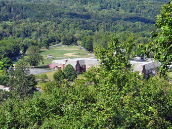
![]() On Thursday, September 15th it had been about a week since the Town of Rockland crew had cut some trees to open the viewpoint over the hamlet of Livingston Manor. This was also the day Cindy and I had used yellow paint to blaze the trail. We had marked a short spur trail out to the viewpoint but it still needed to be cleared. The supervisor of the town mentioned that he might bring some board members to hike the trail before the board meeting on Thursday evening. I decided to head over to check the condition of the trail, take a few pictures and clear the spur trail to the viewpoint. I drove my car to the top of the cemetery as I had a few tools I Ned to take with me. I carried my saw and machete but also brought a garden rake. Sheila was anxious to get out so I brought he along. I decided to clear the spur trail first so we walked up the steep section of trail toward the viewpoint. I put down my pack and started by cutting some branches and a small tree that were blocking the trail. I removed some other branches that were lying around and then got out the machete to cut some ferns and other plants to make the trail clear. I finished by using the rake to remove some leaves. The only part I did not like was the small gully that passes between two rocks and runs across the trail. My future plans include a small walkway or bridge to make this area safer. I put my tools in my pack and walked back to the car. I put the rake in the car and got out my camera with the intention of walking the trail to take pictures. It was really too sunny for this but I thought I would try anyway. I took my pack with me so that I would have my saw and machete in case I needed them. We headed out on the trail with me stopping to take a picture every 30 feet or so. My intention was to create an album of the entire trail. We walked up to the viewpoint and then started to walk the loop in a clockwise direction. There were very few new branches on the trail but I did find a few leftover ribbons to remove. We complete the loop back to the trail junction where it begins. The junction still needs a few signs but otherwise the trail is in good shape.
On Thursday, September 15th it had been about a week since the Town of Rockland crew had cut some trees to open the viewpoint over the hamlet of Livingston Manor. This was also the day Cindy and I had used yellow paint to blaze the trail. We had marked a short spur trail out to the viewpoint but it still needed to be cleared. The supervisor of the town mentioned that he might bring some board members to hike the trail before the board meeting on Thursday evening. I decided to head over to check the condition of the trail, take a few pictures and clear the spur trail to the viewpoint. I drove my car to the top of the cemetery as I had a few tools I Ned to take with me. I carried my saw and machete but also brought a garden rake. Sheila was anxious to get out so I brought he along. I decided to clear the spur trail first so we walked up the steep section of trail toward the viewpoint. I put down my pack and started by cutting some branches and a small tree that were blocking the trail. I removed some other branches that were lying around and then got out the machete to cut some ferns and other plants to make the trail clear. I finished by using the rake to remove some leaves. The only part I did not like was the small gully that passes between two rocks and runs across the trail. My future plans include a small walkway or bridge to make this area safer. I put my tools in my pack and walked back to the car. I put the rake in the car and got out my camera with the intention of walking the trail to take pictures. It was really too sunny for this but I thought I would try anyway. I took my pack with me so that I would have my saw and machete in case I needed them. We headed out on the trail with me stopping to take a picture every 30 feet or so. My intention was to create an album of the entire trail. We walked up to the viewpoint and then started to walk the loop in a clockwise direction. There were very few new branches on the trail but I did find a few leftover ribbons to remove. We complete the loop back to the trail junction where it begins. The junction still needs a few signs but otherwise the trail is in good shape.
 When I returned home from cross country practice at 5:30 PM there was a phone message saying that the town supervisor and at least one councilman would be at the trailhead at 6:00 PM. I got a bite to eat and headed over to the trailhead. We met at the top of the cemetery at 6:00 PM and started the walk around the loop. Both men were impressed with the job that had been done and we talked about various improvements and some of the next steps to expand the project. I have another "upper trail" GPS track that needs to be placed on the property maps by the NYNJTC cartographer. Once that is done and I can confirm we are on public land I will ask for volunteers to start to construct this trail. The grade is steep and the brush thick so this route will require some careful planning, a few switchbacks and a lot of work. I began to think about how the trail(s) would fit into a walk around Livingston Manor. When I got back to my car after finishing the walk, I drove to the municipal parking lot and measured the mileage by odometer from the traffic light up Pearl St to Rock Avenue. I turned left on Rock Avenue and then right on Orchard Street and drove to the trailhead. The distance was about .6 miles. I then drove back down to Orchard Street and turned right on Rock Avenue to the intersection with Main Street. I turned left on Main Street and returned to the parking lot. The total distance was 1.2 miles. I began to think of a walking tour along these streets with descriptions of important places along the route. The name "Town and Trail" came to mind!
![]()
![]()
![]()
![]()
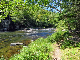
![]() On Monday, September 12th I wanted to hike a close to Livingston Manor but without going either Trout Pond or Frick Pond. Cindy was having lunch with a friend so I decided to take Sheila and head for the Neversink Unique Area. I wasn't sure when I left Livingston Manor at 9:45 AM which route I would hike but I could tell Sheila didn't care as long as we were going somewhere! It was 59 degrees when I left the house so I had on a longsleeved shirt with a light baselayer and a light windbreaker. I drove south and east on Route 17 and took the Rock Hill exit turning right on Katrina Falls Road. I drove to the end of the road and parked in the lot where there were no other cars parked. I had decided on the way down that I would not hike to High Falls as it was a little too long. My plan was to hike the loop to Mullet Falls and Denton Falls and then head back to the car to complete the loop. There were two other spur trails leading down to the Neversink which I had not hiked lately so I thought I might throw them in as well. The temperature had risen to the low 60's and I knew it would continue to rise and I would generate heat on the hike. I ditched the windbreaker in the trunk and we started out on the trail at 10:20 AM. We walked downhill on the woods road and I noticed that some blowdowns had been cleared on the trail. The trail is highly eroded leaving many large round rocks behind which does not make an easy walk. After .5 miles, we turned left to follow the blue trail. We came to the small bridge over Wolf Brook and found that the water was very low. During the spring the water rushes through this area and under the bridge but in this day there was only a trickle. The bridge is in bad shape and I don't know if anyone has a plan to replace it. We continued up the hill after the bridge and turned left on the red trail. I had decided I would rather make the long climb and visit Mullet Brook Falls first. From the turn onto the red trail to the highest point on the hike at 1.5 miles we hiked .85 miles and gained almost 400 feet. The grade is less than 10% and the hike was generally pleasant. I did keep running into spider webs which is not my favorite pastime and there were a few threes on the trail. As we reached the highest point, the yellow trail from the Wolf Brook Multiple Use Area came in from the left.
On Monday, September 12th I wanted to hike a close to Livingston Manor but without going either Trout Pond or Frick Pond. Cindy was having lunch with a friend so I decided to take Sheila and head for the Neversink Unique Area. I wasn't sure when I left Livingston Manor at 9:45 AM which route I would hike but I could tell Sheila didn't care as long as we were going somewhere! It was 59 degrees when I left the house so I had on a longsleeved shirt with a light baselayer and a light windbreaker. I drove south and east on Route 17 and took the Rock Hill exit turning right on Katrina Falls Road. I drove to the end of the road and parked in the lot where there were no other cars parked. I had decided on the way down that I would not hike to High Falls as it was a little too long. My plan was to hike the loop to Mullet Falls and Denton Falls and then head back to the car to complete the loop. There were two other spur trails leading down to the Neversink which I had not hiked lately so I thought I might throw them in as well. The temperature had risen to the low 60's and I knew it would continue to rise and I would generate heat on the hike. I ditched the windbreaker in the trunk and we started out on the trail at 10:20 AM. We walked downhill on the woods road and I noticed that some blowdowns had been cleared on the trail. The trail is highly eroded leaving many large round rocks behind which does not make an easy walk. After .5 miles, we turned left to follow the blue trail. We came to the small bridge over Wolf Brook and found that the water was very low. During the spring the water rushes through this area and under the bridge but in this day there was only a trickle. The bridge is in bad shape and I don't know if anyone has a plan to replace it. We continued up the hill after the bridge and turned left on the red trail. I had decided I would rather make the long climb and visit Mullet Brook Falls first. From the turn onto the red trail to the highest point on the hike at 1.5 miles we hiked .85 miles and gained almost 400 feet. The grade is less than 10% and the hike was generally pleasant. I did keep running into spider webs which is not my favorite pastime and there were a few threes on the trail. As we reached the highest point, the yellow trail from the Wolf Brook Multiple Use Area came in from the left.
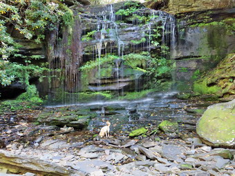
 We followed the red trail as it turned sharply right and descended to 1.7 miles where a bridge crosses Mullet Brook. I was surprised to see that the brook was absolutely dry and that the wetlands upstream also seemed to have no water! I took a few pictures and then we continued to hike. I knew that we would visit Mullet Brook Falls but I didn't expect much water to be going over the falls. As we hiked down the trail and neared the brook in several places I did hear some water and I assumed that there was another small tributary or some springs that fed into Mullet Brook. At 2.25 miles we had dropped 275 feet as we came to the yellow spur trail to Mullet Brook falls on the right. We turned and walked mostly downhill to the falls. As we approached I could see that there was only a trickle of water going over the falls. I took off my pack and got out the camera. I was able to easily walk out to the rocks at the base of the falls without worrying about the spray that sometimes makes the rocks slippery. I stood in front of the falls and took some shots and the moved to the side to take a few more. I tried to zoom in as much as I could to cut out some of the sunlight coming from behind the falls. After Sheila got a drink, we returned to my pack and started back out to the red trail. At 2.7 miles we turned right on the blue trail and walked a few feet before turning left on the yellow spur trail down to Denton Falls on the Neversink River. We walked down the hill toward the river following the yellow markers and avoiding some muddy spots on the way. We walked out onto the rocky outcrop at the edge of the river and I took off my pack and got out my camera. I took a few pictures upstream and then was able to work my way down some rocks to a position below the falls. From here I took a few shots of the falls, some pictures downstream and a few more upstream. I went back to my pack and we headed back up the spur trail to the blue trail where we turned left.
 Within a short distance we came to the lower bridge over Mullet Brook. The bridge has been in poor shape no for over a year and it continues to deteriorate. It is an important bridge as it allows hikers to walk a loop in the area. Unfortunately, no one seems to be willing to make a decision to repair it before it collapses completely and must be replaced. At 3.5 miles we came to the next spur trail down to the river and turned left on the yellow trail. It was a pleasant quarter mile walk down to the water. There are some rapids on the river here but nothing like Denton falls or High Falls. I took a few pictures and the we returned to the blue trail. We walked another .7 miles passing the turnoff for the red trail and the bridge over Wolf Brook. This brought us to the final yellow spur trail on the left. We walked down toward the river and as we got near the water we ran out of markers. There was a road on the right but I chose to continue straight ahead down to the river. This was another nice spot and I took a few pictures. As I picked up my pack, I noticed a path leading upstream and decided to explore some. We walked along the river alternating between a path that followed a stone wall and one that was right at the edge of the water. At times the path seemed to disappear but then we found it again. After walking a quarter mile, I decided to turn around as I had no idea how far the path went or whether I was still in the Neversink Unique Area. We followed a path back and came out on the woods road I had noticed earlier. We turned left and walked back up to the blue trail which we followed back to the car. It was 1:05 PM and we had covered 6 miles in 2 hours and 45 minutes with an elevation gain of 1260 feet.
![]()
![]()
![]()
![]()
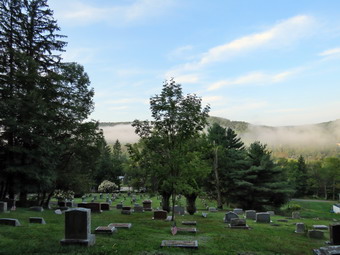
![]() On Friday, September 9th I had planned to head to the area west of Watkins Glen to work on map 13 of the Finger Lakes Trail. I got up at 6:00 AM and took a final look at the weather report for that area. There was no rain in the forecast but the forecast was calling for temperatures in the high 80's and high humidity driving the "Feels Like" temperature well into the 90's. I really wanted to go but deiced that the 14 miles I wanted to hike would be better attempted on a cooler day! I got a few things done around the house and then got my gear in the car and tried to contain an ecstatic Sheila. I drove out the DeBruce Road toward Frick Pond. turning left on the Mongaup Pond after about 6 miles. Where the road split, I stayed left on Beech Mountain Road and pulled into the parking area just before 10:00 AM. There was only one car parked in the lot. I got my gear ready to go and headed out the Quick Lake Trail toward Frick Pond. The day was cooler than I had thought it would be and the humidity seemed high but manageable. I noticed a few insects flying around and decided to apply insect repellant. I wore a light pair of hiking pants and short-sleeved shirt with a light baselayer. I like the double top setup as I think it causes less friction on my back from the pack. . We hiked out to the trail register and turned left to stay on the Quick Lake Trail as it follows a woods road. The trail was damp from the rain overnight but there was little water or mud on the trail. We turned left at Gravestone Junction to follow the Quick Lake Trail to the bridge over the outlet of Frick Pond. When we got to the bridge, I took off my pack and got out my camera to take pictures as this is one of my favorite spots. We got started again after I allowed Sheila to take a quick dip in the cool water. At the next junction with the Big Rock Trail, we stayed to the left on the Quick Lake Trail. We kept a quick pace as we hiked the Quick Lake Trail toward Iron Wheel Junction even though we had to work our way around several wet and muddy areas. We crossed the small stream in the forest which had enough water this time for Sheila to take a dip. She ran through the water at top speed several times and the did her rampage up and down the trail many times. There were a few branches in the trail and I removed them as we headed toward Iron Wheel Junction. There was one place where some branches were down in the trail and I made a note to bring my saw the next time I came. At Iron Wheel Junction, we turned left to stay on the Quick Lake Trail toward Junkyard Junction. The walk is all uphill but the grade is only slight to moderate. This part of the trail was mostly dry but badly eroded by running water. We passed some of the blowdowns that I had cleared with various other people and it made me feel good to see the work. There was one very large log that I had cleared to make a path but I thought should be eliminated completely. I made a note to ask someone from the snowmobile club to clear it with a chainsaw. Sheila was ranging far and wide to explore the opportunities to chase small, furry creatures. After walking 3.1 miles, we arrived at Junkyard Junction at 11:15 AM.
On Friday, September 9th I had planned to head to the area west of Watkins Glen to work on map 13 of the Finger Lakes Trail. I got up at 6:00 AM and took a final look at the weather report for that area. There was no rain in the forecast but the forecast was calling for temperatures in the high 80's and high humidity driving the "Feels Like" temperature well into the 90's. I really wanted to go but deiced that the 14 miles I wanted to hike would be better attempted on a cooler day! I got a few things done around the house and then got my gear in the car and tried to contain an ecstatic Sheila. I drove out the DeBruce Road toward Frick Pond. turning left on the Mongaup Pond after about 6 miles. Where the road split, I stayed left on Beech Mountain Road and pulled into the parking area just before 10:00 AM. There was only one car parked in the lot. I got my gear ready to go and headed out the Quick Lake Trail toward Frick Pond. The day was cooler than I had thought it would be and the humidity seemed high but manageable. I noticed a few insects flying around and decided to apply insect repellant. I wore a light pair of hiking pants and short-sleeved shirt with a light baselayer. I like the double top setup as I think it causes less friction on my back from the pack. . We hiked out to the trail register and turned left to stay on the Quick Lake Trail as it follows a woods road. The trail was damp from the rain overnight but there was little water or mud on the trail. We turned left at Gravestone Junction to follow the Quick Lake Trail to the bridge over the outlet of Frick Pond. When we got to the bridge, I took off my pack and got out my camera to take pictures as this is one of my favorite spots. We got started again after I allowed Sheila to take a quick dip in the cool water. At the next junction with the Big Rock Trail, we stayed to the left on the Quick Lake Trail. We kept a quick pace as we hiked the Quick Lake Trail toward Iron Wheel Junction even though we had to work our way around several wet and muddy areas. We crossed the small stream in the forest which had enough water this time for Sheila to take a dip. She ran through the water at top speed several times and the did her rampage up and down the trail many times. There were a few branches in the trail and I removed them as we headed toward Iron Wheel Junction. There was one place where some branches were down in the trail and I made a note to bring my saw the next time I came. At Iron Wheel Junction, we turned left to stay on the Quick Lake Trail toward Junkyard Junction. The walk is all uphill but the grade is only slight to moderate. This part of the trail was mostly dry but badly eroded by running water. We passed some of the blowdowns that I had cleared with various other people and it made me feel good to see the work. There was one very large log that I had cleared to make a path but I thought should be eliminated completely. I made a note to ask someone from the snowmobile club to clear it with a chainsaw. Sheila was ranging far and wide to explore the opportunities to chase small, furry creatures. After walking 3.1 miles, we arrived at Junkyard Junction at 11:15 AM.
 We turned right at the junction onto the Flynn Trail which is relatively flat at this point. The trail had some wet and muddy spots but most were drying up. They are all lower than the ground surrounding them so it is hard to get them to drain. There isn't much to see along the Flynn Trail so we kept up a quick pace. At the gate we followed the trail to the right and down toward the shore of Hodge Pond. As we neared the pond, we turned right to stay on the Flynn Trail to the outlet of Hodge Pond. The woods road was rutted by a large tractor used by OSI to mow the grass but the muddiest spots were easily avoided. We passed the area where Cindy and I had removed a large blowdown the last time we were there. We were soon at the outlet end of Hodge Pond. We turned left and walked over to the fire ring by the shore of Hodge Pond. I took off my pack and got out my camera to take a few shots. After taking some pictures of the pond, I picked up a stick and threw it into the water so that Sheila could swim to retrieve it but she did not seem that interested. The pond had some blue sky and white clouds over it. When I turned around I saw huge dark clouds in the opposite direction. I thought we should get moving since I thought those clouds might bring rain. I went back to my pack and got a drink and a snack. We headed toward the opening in the woods where the Flynn Trail follows another woods road. We started up the hill staying on the Flynn Trail and the walk up the hill seemed to go very quickly. Soon we were on the flat part of the Flynn Trail headed toward the junction with the Big Rock Trail. This section of the trail all the way back to the parking area was once an extension of Beech Mountain Road that was paved and led to the Beech Mountain Boy Scout Camp. In some areas the pavement is still visible under the grass and moss that has covered it. Just before the gate we passed the point where Cindy and I had removed a smaller blowdown. We continued on the Flynn Trail passing through the gate and walking on to the trail junction with the Big Rock Trail and the snowmobile trail that comes over from Mongaup Pond. By this time the skies had cleared and there was some blue and no black clouds! We didn't stop at the trail junction but continued straight ahead on the Flynn Trail. From this high point in the hike, the trail descends 1.7 miles to the parking area. We kept up a fast pace on the descent but this final section seemed to drag a little. It is downhill but there isn't much to see and it is very familiar. We continued on the trail and soon were headed down the hill to the gate where we turned left to stay on then Flynn Trail. We walked down the short section of trail I had refurbished and then hiked through the woods back to the parking area. It was 12:30 PM when we returned. We had covered 6.3 miles in 2 hours and 35 minutes. The elevation gain was a modest 910 feet.
![]()
![]()
![]()
![]()
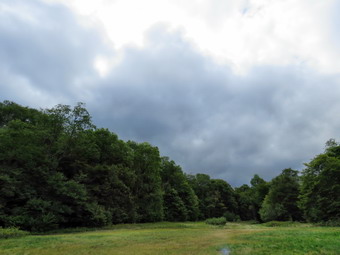
![]() On Thursday, September 8th I had agreed to meet some workers from the Town of Rockland Highway Department at 8:00 AM on Round Top to cut some trees blocking the viewpoint. I got up early and decided to go to Round Top before the appointed time. I walked over with my camera and climbed the hill to the top of the cemetery. There was still a heavy layer of fog over town so I took out the camera and snapped a few shots. I walked into the woods on the new trail we were creating and came to the junction. At this point visitors can walk directly up the steeper part of the trail to the viewpoint or they can turn to the right and walk a loop to the viewpoint along a gentler incline. I decided I would take pictures of the trail and started at the intersection. I took pictures as I walked up to the viewpoint. At the viewpoint I took some shots that would act as "before" pictures. With leaves on the trees, there wasn't much to see. Since it was still before 8:00 AM, I decided to continue out on the loop to take a few more pictures. I made the turn at the viewpoint and headed out the new section of trail Doug Sentermann and I had created a few weeks before. I took pictures as I went and walked as far as the turn onto the woods road. It was now nearing 8:00 AM so I walked back to the viewpoint to meet the workers who would be cutting the trees. No one was there so I decided to walk back out to the start of the trail where I found the workers waiting with the Town of Rockland Supervisor. They got their equipment ready and we walked to the viewpoint. We looked at the view and talked about the trees that would have to be removed to expand the view. The sawyers walked down below the viewpoint and began to decide which trees to drop. I was very impressed at the skill of Terry as he was able to drop several trees and clear a view very quickly. The view from the top of the lookout was still somewhat blocked but the view from the lower ledge was very good. After another tree or two Rob, the town supervisor, decided that enough trees had been cut for the day. If he had not been present, I probably would have asked for a few more to be cut but I was happy with the work that had been done. The workers started back out to their trucks. I decided that I would walked the rest of the trail and finishing taking my pictures. I walked back out the new trail to the point where I had stopped. I continued to walk and take pictures as I completed the whole loop. When I got back to the intersection, I turned left to walk back out to the cemetery. As I walked out, I turned around and took a few pictures of the trail into the intersection so that I could put together an entire sequence. I walked back across the street to my house.
On Thursday, September 8th I had agreed to meet some workers from the Town of Rockland Highway Department at 8:00 AM on Round Top to cut some trees blocking the viewpoint. I got up early and decided to go to Round Top before the appointed time. I walked over with my camera and climbed the hill to the top of the cemetery. There was still a heavy layer of fog over town so I took out the camera and snapped a few shots. I walked into the woods on the new trail we were creating and came to the junction. At this point visitors can walk directly up the steeper part of the trail to the viewpoint or they can turn to the right and walk a loop to the viewpoint along a gentler incline. I decided I would take pictures of the trail and started at the intersection. I took pictures as I walked up to the viewpoint. At the viewpoint I took some shots that would act as "before" pictures. With leaves on the trees, there wasn't much to see. Since it was still before 8:00 AM, I decided to continue out on the loop to take a few more pictures. I made the turn at the viewpoint and headed out the new section of trail Doug Sentermann and I had created a few weeks before. I took pictures as I went and walked as far as the turn onto the woods road. It was now nearing 8:00 AM so I walked back to the viewpoint to meet the workers who would be cutting the trees. No one was there so I decided to walk back out to the start of the trail where I found the workers waiting with the Town of Rockland Supervisor. They got their equipment ready and we walked to the viewpoint. We looked at the view and talked about the trees that would have to be removed to expand the view. The sawyers walked down below the viewpoint and began to decide which trees to drop. I was very impressed at the skill of Terry as he was able to drop several trees and clear a view very quickly. The view from the top of the lookout was still somewhat blocked but the view from the lower ledge was very good. After another tree or two Rob, the town supervisor, decided that enough trees had been cut for the day. If he had not been present, I probably would have asked for a few more to be cut but I was happy with the work that had been done. The workers started back out to their trucks. I decided that I would walked the rest of the trail and finishing taking my pictures. I walked back out the new trail to the point where I had stopped. I continued to walk and take pictures as I completed the whole loop. When I got back to the intersection, I turned left to walk back out to the cemetery. As I walked out, I turned around and took a few pictures of the trail into the intersection so that I could put together an entire sequence. I walked back across the street to my house.
 The next step in preparing the trail was to replace the ribbons with painted blazes. I asked Cindy if she would like to go over and mark the trail since there was plenty of time left in the day. She said "Yes" so I went downtown and bought a quart of bright yellow paint and a few sponge brushes to apply the blazes. I decided to leave the camera home and take pictures another day when the sun was not so bright. We did take Sheila with us since she was so anxious to go! We took a plastic takeout container for the paint and headed across the street. We walked to the top of the cemetery hill where I poured some paint into the container. I had wondered if a quart of paint would be enough as I had marked trail before but had never purchased the paint. I marked the beginning of the trail with three blazes and then started out on the trail. I wanted to place blazes close enough so that visitors could easily follow the trail but not too close to distract from the beauty of the forest. At the intersection I continued straight ahead placing blazes with Cindy encouraging me to put the paint higher on the tree and to mark both sides. At the top of the hill, I marked a turn out to the lower ledge which has the best view. I placed a few more blazes and then walked back to the main trail. We would have to wait for another day to clear the trail although there isn't too much work to do. We walked through the upper ledge placing a few blazes and then started out on the new section of trail. As we moved along, we removed all the ribbons that Doug and I had placed as I put up the paint blazes. We were moving quickly but taking time to turn around to make sure the blazes were easily visible. As we turned right on the woods road, we had to pick places for paint carefully as there were fewer trees and more bushes. When we came to the turn to the right I was careful to mark the turn on both sides of the tree. After making the turn, We continued down the woods road to the intersection marking as we went. At the trail junction, we talked about how to mark turns at this junction. We decided that the best approach was to leave the paint blazes as they were an to mark the intersection with signs. Sine our work was done, we turned left and walked back out to the start of the trail. I had paint left over in the container and enough in the can to mark another 10 trails! There is still some work to do on the lower trail but it will easily be ready for an October 1st opening. Our next phase is to mark an upper trail to the lower summit of Round Top taking into consideration the steepness of the terrain.
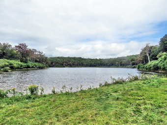
![]() On Tuesday, September 6th I decided to go to Walnut Mountain to use a wheel to measure the cross country course I had laid out. I had already measured it twice with two different GPS units but wanted to make sure it was exactly 5K which translates to 16,404.2 feet. The GPS units tend to "wander" even when I am standing still. I have stood in one spot for a few minutes and the GPS unit shows I have traveled .1 miles. I borrowed a wheel from Liberty CSD and headed over to Walnut Mountain. I parked and walked down to the starting line south of the baseball filed near the beginning of the Walnut Loop Trail - East. I began measuring the course from the starting line just north of a tree in the middle of the trail. The wheel has a counter and three pegs spaced 1 foot apart. Each time the peg hits the counter it records another foot of travel. I walked down the Walnut Loop Trail - East and made the left turn onto the Walnut Loop Trail - North. I noted that the half mile mark was just after the turn. I continued on the Walnut Loop Trail - North up the hill until the left turn onto the Vista Way. As I walked I noted that some of the paint marks I had put down were beginning to fade. I continued on the Vista Way across the bridge. The 1 mile mark was a little passed the bridge near the point where a new bike trail was being constructed. Soon I was at the northern end of the main parking area where I cut through the fence and headed toward the picnic grove. As I passed through the grove I noted that it was about 1.25 miles from the start line. I turned right up the access road and started up the hill on the Mountain Overlook Trail. I continued up this trail as it made several turns and arrived at the trail junction where the Mountain Overlook Trail turns left. I continued straight ahead eventually passing the point where the Walnut Loop Trail - North joins. At this point I was on the Walnut Loop Trail - West and was walking around the "back" of the mountain. After a short distance, I turned left up the connector trail that Cindy and I had spent so much time grooming. At the top of the trail I turned right on the Sunset Trail. After a hundred feet or so I came to the 2 mile mark and reset the counter. The walk along the sunset trail was very pleasant and I ascended a little hill to the upper lookout. I turned left and finally started downhill on the Mountain Overlook Trail. This trail is mostly red shale but it is not very steep. At the point where the Sunset Trail joins the Mountain Overlook Trail, I turned right on an unnamed path over a grass field. The trail here was steep but eventually the grade flattened. I was worried that the course would be too long but I knew there were ways I could adjust the distance. When I arrived back at the Mountain Overlook Trail, I turned right and walked back down to the picnic grove on the access road. I crossed the road and headed for the start of the Walnut Loop Trail - South noting I was still under the distance I wanted. As I walked through the woods, I hit three miles just before the trail broke out into the road running through an old quarry. I continued to walk until I got to 16,404.2 feet and marked the finish line. I was satisfied I had the most accurate measurement of the trail possible!
On Tuesday, September 6th I decided to go to Walnut Mountain to use a wheel to measure the cross country course I had laid out. I had already measured it twice with two different GPS units but wanted to make sure it was exactly 5K which translates to 16,404.2 feet. The GPS units tend to "wander" even when I am standing still. I have stood in one spot for a few minutes and the GPS unit shows I have traveled .1 miles. I borrowed a wheel from Liberty CSD and headed over to Walnut Mountain. I parked and walked down to the starting line south of the baseball filed near the beginning of the Walnut Loop Trail - East. I began measuring the course from the starting line just north of a tree in the middle of the trail. The wheel has a counter and three pegs spaced 1 foot apart. Each time the peg hits the counter it records another foot of travel. I walked down the Walnut Loop Trail - East and made the left turn onto the Walnut Loop Trail - North. I noted that the half mile mark was just after the turn. I continued on the Walnut Loop Trail - North up the hill until the left turn onto the Vista Way. As I walked I noted that some of the paint marks I had put down were beginning to fade. I continued on the Vista Way across the bridge. The 1 mile mark was a little passed the bridge near the point where a new bike trail was being constructed. Soon I was at the northern end of the main parking area where I cut through the fence and headed toward the picnic grove. As I passed through the grove I noted that it was about 1.25 miles from the start line. I turned right up the access road and started up the hill on the Mountain Overlook Trail. I continued up this trail as it made several turns and arrived at the trail junction where the Mountain Overlook Trail turns left. I continued straight ahead eventually passing the point where the Walnut Loop Trail - North joins. At this point I was on the Walnut Loop Trail - West and was walking around the "back" of the mountain. After a short distance, I turned left up the connector trail that Cindy and I had spent so much time grooming. At the top of the trail I turned right on the Sunset Trail. After a hundred feet or so I came to the 2 mile mark and reset the counter. The walk along the sunset trail was very pleasant and I ascended a little hill to the upper lookout. I turned left and finally started downhill on the Mountain Overlook Trail. This trail is mostly red shale but it is not very steep. At the point where the Sunset Trail joins the Mountain Overlook Trail, I turned right on an unnamed path over a grass field. The trail here was steep but eventually the grade flattened. I was worried that the course would be too long but I knew there were ways I could adjust the distance. When I arrived back at the Mountain Overlook Trail, I turned right and walked back down to the picnic grove on the access road. I crossed the road and headed for the start of the Walnut Loop Trail - South noting I was still under the distance I wanted. As I walked through the woods, I hit three miles just before the trail broke out into the road running through an old quarry. I continued to walk until I got to 16,404.2 feet and marked the finish line. I was satisfied I had the most accurate measurement of the trail possible!
I finished measuring the trail at about 4:30 PM and my team was scheduled to arrive at 6:00 PM for practice along with the team from Eldred CSD. I was eager of the Eldred team and coaches to run on the course to get another opinion of the surface, length and difficulty. Since I had time, I decided to take some cans of paint and remark the areas where the paint as faded as I wanted anyone to be able to follow the course without a map. I went back to the starting line and began walking the course again. Some areas were easy to mark while others were more difficult. In some places the only place to spray the paint was on the dusty ground where the paint simply scattered the dust! I took extra care to mark the major turns and the area by the bridge which had several different trails. In places where bike trails crossed I added extra arrows to avoid a mistake on the part of runners. I stopped at the car to get another can of paint as I walked through the picnic grove. I continued along the course marking the turns and straightaways and placing number at the mile marks. I decided to avoid placing a long white mark for the starting and finishing lines. I finished just as some of my team and the Eldred team was arriving. We waited until everyone arrived and then the coaches sent the runners out on the course. The Eldred coaches and I walked down to the starting line and began to walk the course. This would be my third time walking the course in one day! I pointed out some possible pitfalls to the other coaches but they were very happy with the course. They thought it would be challenging but did not object that it was really "cross country". I was happy and relieved that they liked the course. The runners also found it difficult but fair. My team had a race the next day so I dismissed them as Eldred stayed a little longer to complete a workout.
![]()
![]()
![]()
![]() On Monday, September 5th I wanted to hike a portion of Map 13 on the Finger Lakes Trail west of Watkins Glen. I decided I would park at Access 5 on Sexton Hollow Road and then hike northeast to Access 6 on Switzer Hill Road. The hike on the trail would be a little more than 5 miles but I knew I would have to hike back on the trail since a route on the local roads added too much mileage. The description of the hike included several areas of numerous switchbacks and at lest two major ascents in each direction. Since the drive is at least 2 and a half hours, I planed to get up at 6:00 AM and be out of the house by 7:00 AM. Cindy told me the night before she did not want to ride that far to hike so Sheila and I were on our own. On two previous hikes Cindy succumbed to Sheila's begging but I was pretty sure she would stick to her guns this time! Surprisingly we were out of the house before 7:00 Am and after a stop for gas we left Livingston Manor by 7:05 AM. I knew a good part of the route from previous trips and did not have to worry much about directions except near the very end. We headed north and west on Route 17/I86 toward Binghamton. The temperature was still in the high 50's and there was a layer of fog in most places. The further we went to the north and the later in the day the bluer the skies became and the more the fog dissipated. After a long drive, I took exit 42 and got almost immediately turned right or northeast on Route 16 toward Monterrey. After 7.6 miles, I turned left on Sexton Hollow Road which turned to dirt and gravel and then back to pavement. I watched for FLT signs and found them just after the road became paved again and changed names to Monterrey Road. I pulled over on the shoulder of the road just passed the trail entrance and made sure I was off the pavement I got all my gear ready and kept on my light windbreaker as the temperature was still only 59 degrees. It seemed like the weather would cooperate as the humidity was much lower than on previous hikes. At 9:35 AM we walked down the road to the trail entrance and headed northeast up the hill.
On Monday, September 5th I wanted to hike a portion of Map 13 on the Finger Lakes Trail west of Watkins Glen. I decided I would park at Access 5 on Sexton Hollow Road and then hike northeast to Access 6 on Switzer Hill Road. The hike on the trail would be a little more than 5 miles but I knew I would have to hike back on the trail since a route on the local roads added too much mileage. The description of the hike included several areas of numerous switchbacks and at lest two major ascents in each direction. Since the drive is at least 2 and a half hours, I planed to get up at 6:00 AM and be out of the house by 7:00 AM. Cindy told me the night before she did not want to ride that far to hike so Sheila and I were on our own. On two previous hikes Cindy succumbed to Sheila's begging but I was pretty sure she would stick to her guns this time! Surprisingly we were out of the house before 7:00 Am and after a stop for gas we left Livingston Manor by 7:05 AM. I knew a good part of the route from previous trips and did not have to worry much about directions except near the very end. We headed north and west on Route 17/I86 toward Binghamton. The temperature was still in the high 50's and there was a layer of fog in most places. The further we went to the north and the later in the day the bluer the skies became and the more the fog dissipated. After a long drive, I took exit 42 and got almost immediately turned right or northeast on Route 16 toward Monterrey. After 7.6 miles, I turned left on Sexton Hollow Road which turned to dirt and gravel and then back to pavement. I watched for FLT signs and found them just after the road became paved again and changed names to Monterrey Road. I pulled over on the shoulder of the road just passed the trail entrance and made sure I was off the pavement I got all my gear ready and kept on my light windbreaker as the temperature was still only 59 degrees. It seemed like the weather would cooperate as the humidity was much lower than on previous hikes. At 9:35 AM we walked down the road to the trail entrance and headed northeast up the hill.
The first part of the trail headed northeast and climbed a hill for .6 miles gaining 275 feet with several switchbacks along the way. I worked up quite a sweat but appreciated the uphill on the way out as I knew it would be nice to walk this part downhill on the way back. I stopped to remove my windbreaker and then continued down the other side of the hill on a woods road which now headed north. All along this woods road there were almost no blazes and I kept wondering if I was on the trail. Just as I was about to give up a blaze appeared. As I started down a steeper part of the woods road, I came to a trail with white blazes that ran perpendicular to the trail I was on! I was surprised but turned left and followed a switchback down the hill. The switchback crossed the woods road several times and it occurred to me it would have been easier to stay on the woods road! At 1.1 miles the trail turned east and then at 1.5 miles it turned south. Along the way we crossed a few small stream that had some water. At one point the trail emptied out onto a gas well access road. We turned left and walked uphill on the road briefly before turning left into the woods again. At around 2 mile we had been paralleling a stream bed for some time and were approaching Corbett Hollow Road. I look down toward the stream through and opening and saw...two gray wolves! My mind immediately began to process the situation to figure out what to do and I was relieved when the owner showed up to manage her dogs. We walked down to Corbett Hollow Road at 2.1 miles and made a sharp left turn. The road wasn't much of a road as it was dirt with a lot of grass which became more and more eroded the further we went. I passed by the dogs and their owner who did not see the need for leashes! Sheila found the turn to the right off the "road" and we entered the woods to continue the hike. The map description indicated a bivouac site north of the turn at the turn around point on the road. I don't know what would be turning around on the road as it looked completely inaccessible. I did not investigate the bivouac area. The map description now describe a section of trail with 12 switchbacks. I am not usually a big fan of switchbacks as they simply lengthen the trail but the slope ahead did look steep. We walked along a stream bed and the started the first switchback at about 2.6 miles. There were a lot of switchbacks although I did not count the number. Over about 1.3 miles from Corbett Hollow Road to the top of the climb we gained 640 feet averaging a 10% grade. At the top of the climb we crossed a gas well access road and walked the flat summit before starting to descend the other side.
We descended the east side of the hill for about .7 miles losing 400 vertical feet to a small stream bed. The stream bed was highly eroded and it was difficult climbing the opposite bank. On the other side was a set a steps and a switchback that led to Goundry Hill Road. We crossed the dirt and gravel road and continued to descend through mixed hardwood and pine forest. At 5 miles we came out onto Switzer Hill Road at an elevation of 1390 feet. We turned left and walked a short distance north to the point where the trail reentered the woods. We stopped to get a drink and a snack before turning around and heading back. The trip back had more ascent than descent since the car was parked at 1550 feet. For the most part the hike back went quickly and even the climbs didn't seem to bad because of the switchbacks. It was interesting that I noticed different aspects of the trail on the return trip. As we neared the point where I was confused about the trail perpendicular to the woods road, I followed the trail across the woods road and found that it was a switchback. This meant that the woods road was not part of the official trail and should not have had any blazes. At the end of the switchback I looked to see if the turn was marked. It was marked and I had missed it because the blazes were old and faded and because the people who mark the Finger Lakes Trail use a non-standard method of indicating turns. A turn should be indicted with a blaze above another blaze. The top blaze should be offset in the direction of the turn. The Finger Lakes Trail Conference simply puts one blaze directly above the other and lets the hiker guess the direction of the turn. Some blazes have been retrofitted with an arrow below the blazes but many have not been changed. I noticed that I was very thirsty and stopped to get a drink and give Sheila one also. He both drank quite a bit and then continued back to the car. There was more uphill than I remembered and less downhill at the end than I thought. We were back at the car at 2:15 PM having covered 10.2 miles in 4 hours and 35 minutes with an elevation gain of 2270 feet! We had stopped for about 20 minutes along the way but our overall average speed was over 2.2 mph which I considered good for the amount of climbing we did.
![]()
![]()
![]()
![]()
![]() On Saturday, September 3rd I wanted to hike a portion of Map 13 on the Finger Lakes Trail west of Watkins Glen. I decided I would park at Maple Lane where I had parked on a previous hike and then hike west and south to Access 6 on Switzer Hill Road. The hike on the trail would be a little more than 6 miles but I knew we could hike back on snowmobile trail and local roads and cut the distance to 5 miles with a less difficult hike making the round trip between 11 and 12 miles. Since the drive is almost 3 hours, I planed to get up at 6:00 AM and be out of the house by 6:30 AM. Cindy told me the night before she did not want to drive that far to hike so Sheila and I were on our own. I got up on time and was getting ready when Cindy cam downstairs and asked about going with us. I knew that once again Sheila and "begged" her and she had given in! Surprisingly we were out of the house and away from Livingston Manor by 7:15 AM. I knew a good part of the route from previous trips and did not have to worry much about directions. We headed north and west on Route 17/I86 toward Binghamton. The temperature was still in the high 50's and there was a layer of fog in most places. The further we went to the north and the later in the day the bluer the skies became and the more the fog dissipated. After a long drive, I took exit 52A and got on Route 14 north toward Watkins Glen. I caught Johnson Hollow Road and headed for Route 414 to head west toward our destination. We turned north on Bronson Hill Road and passed by the Watkins Glen International racetrack. At Route 16 we turned left and after a short distance passed Townsend Road where we had turned on a previous hike. We continued on to Route 21 where we turned right to head north to Sugar Hill Road. We continued to follow Route 21 until it turned north where we continued straight ahead on Sugar Hill Road. The road quickly turned to dirt and gravel and was marked "CLOSED" . I knew the sign was in error and continued on until I found Maple Lane on the right. I drove .75 miles north to a small parking area on the right side of the road. I pulled in a turned around so that I was facing out before parking. We got all our gear ready and both of us kept on light windbreakers as the temperature was still only 62 degrees. It seemed like the weather would cooperate as the humidity was much lower than on previous hikes. At 10:10 AM we crossed Maple Lane and headed out on the trail.
On Saturday, September 3rd I wanted to hike a portion of Map 13 on the Finger Lakes Trail west of Watkins Glen. I decided I would park at Maple Lane where I had parked on a previous hike and then hike west and south to Access 6 on Switzer Hill Road. The hike on the trail would be a little more than 6 miles but I knew we could hike back on snowmobile trail and local roads and cut the distance to 5 miles with a less difficult hike making the round trip between 11 and 12 miles. Since the drive is almost 3 hours, I planed to get up at 6:00 AM and be out of the house by 6:30 AM. Cindy told me the night before she did not want to drive that far to hike so Sheila and I were on our own. I got up on time and was getting ready when Cindy cam downstairs and asked about going with us. I knew that once again Sheila and "begged" her and she had given in! Surprisingly we were out of the house and away from Livingston Manor by 7:15 AM. I knew a good part of the route from previous trips and did not have to worry much about directions. We headed north and west on Route 17/I86 toward Binghamton. The temperature was still in the high 50's and there was a layer of fog in most places. The further we went to the north and the later in the day the bluer the skies became and the more the fog dissipated. After a long drive, I took exit 52A and got on Route 14 north toward Watkins Glen. I caught Johnson Hollow Road and headed for Route 414 to head west toward our destination. We turned north on Bronson Hill Road and passed by the Watkins Glen International racetrack. At Route 16 we turned left and after a short distance passed Townsend Road where we had turned on a previous hike. We continued on to Route 21 where we turned right to head north to Sugar Hill Road. We continued to follow Route 21 until it turned north where we continued straight ahead on Sugar Hill Road. The road quickly turned to dirt and gravel and was marked "CLOSED" . I knew the sign was in error and continued on until I found Maple Lane on the right. I drove .75 miles north to a small parking area on the right side of the road. I pulled in a turned around so that I was facing out before parking. We got all our gear ready and both of us kept on light windbreakers as the temperature was still only 62 degrees. It seemed like the weather would cooperate as the humidity was much lower than on previous hikes. At 10:10 AM we crossed Maple Lane and headed out on the trail.
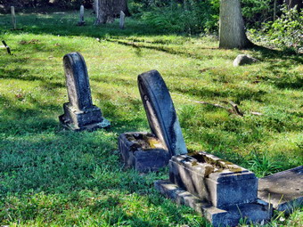 The first part of the trail wandered west through some red pines and then hardwoods all the while descending until we crossed a DEC dirt road at .9 miles. Both Cindy and I knew that a downhill at the beginning of a hike feels good but means there will be an uphill at the end! The trail turned a little north and then west again as we continued to descend. We crossed two branches of Meads Creek which did have a little water in them. After crossing the second creek we began to ascend and crossed Route 22 at 1.5 miles. The trail ascended steeply for a short time before meeting a woods road at 1.6 miles. The trail turned to the left but we turned right and walked a short distance to the very old Six Nations Cemetery where there was a spectacular view to the northwest over Lake Lamoka and Lake Waneta. I dropped my pack and got out my camera to take pictures of the lakes and I also snapped a few of the cemetery. The stones in the cemetery are very old, hard to read and in very poor shape. We walked back to the Finer Lakes Trail which now followed a woods road slightly downhill and to the south. There were no marks or blazes anywhere to be seen but I checked PDFMaps and we were headed in the right direction. We walked and talked without seeing a turn even though we knew one should be coming up. I checked PDFMaps on my iPhone again and found we had gone passed the turn. We walked back with me looking at my phone and finally found the turn. It was pretty clearly marked but we, as experienced hikers, had missed it because of the total lack of any blazes before the turn! We had hiked and little over a half mile put of our way which annoyed both of us. We turned west and started up a steep but short climb over a small hill. We hiked down the other side of the hill and eventually broke out into a field. The blazes here were hard to find and required sharp eyes as there were several turns along the edges of different fields. Many of the blazes were old and the brush had over grown them making it difficult to find the way. At one point we came to another nice view over the surrounding valleys and I took a few shots before continuing on. We finished a descent along the edge of a field and followed a woods road out to Sugar Hill Road at 3.6 miles. Just ahead on the other side of the road was a very large oak tree. There had been some large trees on the hike but this was the biggest so I took a few shots. We crossed the road an walked along the edge of someone's lawn which annoyed their dog greatly.
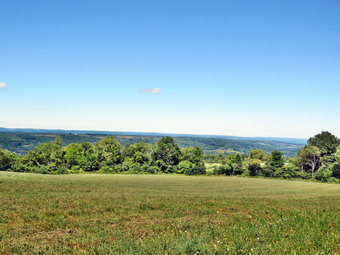 From this point the trail on the map headed due south and was very straight for some time. I guessed it either followed an old road or traveled along a ridge line. I was right on both accounts. The trail ascended to a ridge following a woods road and was wide, well maintained and decently marked. On the initial climb we gained 260 feet in .4 miles along a 13% grade. After this, the trail descended a little and then leveled moving off the road and back onto it. We passed one well marked snowmobile trail and I started to look for the second one which I intended to use on the return trip. At 5 miles the trail started to descend and I was worried there would be no second snowmobile trail. At 5.6 miles the trail appeared on our left. I had intended to hike out to access point 6 on Switzer Hill Road but Cindy was getting tired. Hiking to the access point would be about a mile out and a mile back and I wasn't sure how many miles would be left after that. I decided we would turn left on the snowmobile trail. I could hike the remaining section from Switzer Hill Road later in the day or leave it for another time. We turned left on the snowmobile trail and started a short ascent before the trail began a half mile descent toward Route 22. The descent was steep at 13% and we lost almost 350 feet along the way. At 6.1 miles we were ready to cross a bridge over Meads Creek when we heard voices ahead. I put Sheila on her leash and we were surprised as a group of 8 riders on horseback appeared. Sheila was unfazed by the horses but wanted to ay "Hello" to the dog that accompanied them. We waited for the horses to pass and talked to the riders as they went by. We crossed the bridge and walked out to Route 22. My plan was to take Route 22 north to Sugar Hill Road and then walk east to Maple Lane. We would be on the road and Sheila would have to be on her leash but it seemed to be the quickest and easiest way. Cindy suggested that we cross the road and stay on the snowmobile trail since we would be in the shade and Sheila could run free. We crossed the road at 1:10 PM and stayed on the marked snowmobile trail heading toward Maple Lane. Unfortunately, as we headed northeast the snowmobile trail started to climb to another ridge. The climb was not difficult but went on for .7 miles. As we neared a junction, we could hear voices and we could see another group of horses ahead. I put Sheila on her leash and we walked up to the junction. I asked the riders the best way to Maple Lane and they indicated we should turn left or north since we wanted to head in that direction. We took their advice although none of the trail were marked on my map! I was hoping to head east to Maple Lane but the snowmobile trail headed north and, at times, northwest. This did not make me happy as there were no turns to the east to get us to Maple Lane. For some time we paralleled Maple Lane but then the trail turned away from it. We had no choice but to follow it and I knew that we would eventually come to Maple Lane or Sugar Hill Road. We were still walking uphill when the trail turned northeast and then east at 8.5 miles. Soon I could see Sugar Hill Road and at 8.65 miles we came to the intersection of Sugar Hill Road and Maple Lane. We crossed Sugar Hill Road and began our walk up maple Lane for .8 miles. We were back at the car at 2:30 PM after hiking 9.5 miles in 4 hours and 20 minutes with an elevation gain of 1500 feet. We had made a .5 mil mistake that is included in these figures
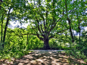 After finishing the hike, Cindy was very tired but I was still feeling that I had a few more miles in me. Cindy agreed we could drive to Switzer Hill Road and that I could hike the mile out and back that we had missed. We headed west on Sugar Hill Road to Route 22 and then south on Route 22 to Route 16. I turned right or west on Route 16 and passed through the hamlet on Monterey. Just after this I found Switzer Hill Road on the right so I turned north to follow it to Access 6. Like many of the roads in the area, this one turned to dirt and gravel pretty quickly. The total drive up Switzer Hill was about 1.6 miles and the Finger Lakes Trail sign was very obvious on the right. I parked the car on the side of the road and Sheila and I got ready to hike. We walked into the woods heading east through some red pine. We almost immediately came to the informal bivouac area mentioned on the map next to Pine Creek. The area didn't appear to be very well used as I saw no fire circle or any other signs. The map mentioned that Pine Creek was highly eroded and it was right! The creek was almost dry but the bank on the other side was three to four feet above the creek bed. Sheila had no trouble and I grabbed onto some roots to get up. We followed the white blazes of the Finger Lakes Trail east fro about .4 miles as the trail started to ascend to the ridge we had been on earlier in the day. At this point the trail made a 90 degree turn to the left and continued to ascend the ridge. At exactly 1 mile we came to the snowmobile trail where we had turned earlier. We turned around and headed back to the car. When we got back to the car, I found it had taken us less than 45 minutes to hike the two miles and 350 feet of elevation which brought my total for the day to 11.5 miles in 5 hours with an 1850 foot elevation gain.
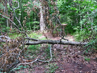
![]()
![]()
![]()
![]()
![]() On Tuesday, August 30th I decided I wanted to go to Hodge Pond on the Flynn Trail and clear the two blowdowns I had found the day before. Cindy said she would come with me so we got ready and, after doing some errands around town, we headed toward the Frick Pond area. I had brought my smaller Silky saw and Fiskars axe to take care of the blowdowns and decided we would not worry about some of the minor trimming that needed to be done in a few places. We arrived at the parking area just before 10:30 AM and started out almost immediately. We crossed the road and picked up the Flynn Trail and almost immediately found a new branch to clear off the trail. When we reached the woods road, we turned right and headed up the hill toward the junction with the Big Rock Trail. What is now a woods road was once the extension of the Beech Mountain Road which led to the Beech Mountain Boy Scout Camp. The Flynn Trail climbs for 1.7 mile climb to the junction with the Big Rock Trail. The grass was a little wet from the dew and the rocks were slippery to step on. Sheila was roaming around running up and down the rail and Cindy and I were both lost in thought. We hiked the 1.7 miles uphill in about 45 minutes including a few stops to remove branches from the trail and one small blowdown which I quickly cut. At one point we both decided that the insects were too annoying and we applied some repellant which did help some. We continued on the Flynn Trail toward Hodge Pond and passed through the gate that marks the beginning of the OSI property. Just after the gate there was a small tree across the trail. I dropped my pack and got out my Silky saw to begin clearing the mess. The branches were smaller than I remembered and I easily cut them and then dragged them out of the way. In less than 15 minutes the job was done and we continued on toward Hodge Pond. At the junction with the jeep trail, we turned left to stay on the Flynn Trail to Hodge Pond. As we approached the pond we stayed to the left on the Flynn Trail rather than go to the shore of the pond. I promised Sheila we would stop on the way back so she could swim!
On Tuesday, August 30th I decided I wanted to go to Hodge Pond on the Flynn Trail and clear the two blowdowns I had found the day before. Cindy said she would come with me so we got ready and, after doing some errands around town, we headed toward the Frick Pond area. I had brought my smaller Silky saw and Fiskars axe to take care of the blowdowns and decided we would not worry about some of the minor trimming that needed to be done in a few places. We arrived at the parking area just before 10:30 AM and started out almost immediately. We crossed the road and picked up the Flynn Trail and almost immediately found a new branch to clear off the trail. When we reached the woods road, we turned right and headed up the hill toward the junction with the Big Rock Trail. What is now a woods road was once the extension of the Beech Mountain Road which led to the Beech Mountain Boy Scout Camp. The Flynn Trail climbs for 1.7 mile climb to the junction with the Big Rock Trail. The grass was a little wet from the dew and the rocks were slippery to step on. Sheila was roaming around running up and down the rail and Cindy and I were both lost in thought. We hiked the 1.7 miles uphill in about 45 minutes including a few stops to remove branches from the trail and one small blowdown which I quickly cut. At one point we both decided that the insects were too annoying and we applied some repellant which did help some. We continued on the Flynn Trail toward Hodge Pond and passed through the gate that marks the beginning of the OSI property. Just after the gate there was a small tree across the trail. I dropped my pack and got out my Silky saw to begin clearing the mess. The branches were smaller than I remembered and I easily cut them and then dragged them out of the way. In less than 15 minutes the job was done and we continued on toward Hodge Pond. At the junction with the jeep trail, we turned left to stay on the Flynn Trail to Hodge Pond. As we approached the pond we stayed to the left on the Flynn Trail rather than go to the shore of the pond. I promised Sheila we would stop on the way back so she could swim!
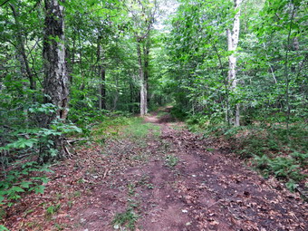 We passed through the open field on the Flynn Trail and then reentered the woods. After a short walk, we encountered the large blowdown that I wanted to clear. The trunk was actually a little larger than I thought and I regretted not brining my Silky KatanaBoy saw! The blowdown had been there for at least a month so I was pretty sure that OSI was not going to clear it. After I put down my pack I took a few "before" pictures and then looked at the blowdown to form a plan. As always I cut away the branches first and Cindy dragged them so distance off the trail and out of the way. I had to be careful as the large tree had brought down several smaller saplings that were very springy. I cut the top branches off the tree and was left with a pretty substantial trunk. I felt that I could make one cut dividing the trunk into two pieces. These pieces might en too large to carry off the trail but I thought they could be rolled out of the way. The cut went more quickly than I thought and I was actually able to lift the top section and get it well off the trail. The lower section was much heavier and I initially rolled it to one side of the trail. It decided it would roll back onto the trail so I lifted one end and then the other until I was able to get it off the trail as well. I took a few after pictures and after getting a drink and a snack we continued around the back of the pond on the old jeep trail. We decided to continue all the way around the pond to the "beach" so that Sheila could have a swim. At the fire ring, I put down my pack and got out the camera. I took a few pictures of Hodge Pond concentrating on the large but wispy white clouds against the blue sky. I picked up a stick a threw it into the water for Sheila to retrieve. I did this many times until Sheila and I were both tired of the game. We picked up and started toward the opening in the woods where the Flynn Trail climbs back up to the junction with the Big Rock Trail. At the junction we knew we had 1.7 miles of downhill ahead of us and we set quick pace. Along the way we met a couple hiking toward us. The gentleman asked if he could pet Sheila but I declined the offer as Sheila can be very protective when Cindy is with us. The hike back to the car was uneventful and we arrived at 1:30 PM. We had spent about 3 hours hiking 5.5 miles and clearing several blowdowns from the trail.
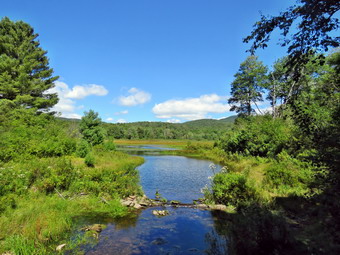
![]()
![]()
![]()
![]()
![]() On Monday, August 29th Sheila and I were ready to get out of the house after a busy Sunday had kept us out of the woods. As we were about to leave an ambulance call came in and I responded postponing our hike for about 2 hours. When I returned home. I got my gear in the car and tried to contain an ecstatic Sheila as I drove out the DeBruce Road toward Frick Pond. I had thought about going somewhere else but the hike around the two ponds is familiar and seemed like enough exercise before cross country practice in the evening. After about 6 miles, I turned left on the Mongaup Pond and stayed left on Beech Mountain Road at the fork. There were several cars in the parking area as I pulled in just before noon. I got my gear ready to go and headed out the Quick Lake Trail toward Frick Pond at exactly 12:00 PM. The day was cooler than it had been with the temperature at about 70 degrees. I noticed a few insects flying around but decided not to apply insect repellant. I wore a light pair of hiking pants and short-sleeved shirt with a light baselayer. I like the double top setup as I think it causes less friction on my back from the pack. . We hiked out to the trail register and turned left to stay on the Quick Lake Trail as it follows a woods road. The trail was wet and muddy but these spots were easily avoided. We turned left at Gravestone Junction to follow the Quick Lake Trail to the bridge over the outlet of Frick Pond. When we got to the bridge, I took off my pack and got out my camera to take pictures as this is one of my favorite spots. We got started again after I allowed Sheila to take a quick dip in the cool water. At the next junction with the Big Rock Trail, we stayed to the left on the Quick Lake Trail. We kept a quick pace as we hiked the Quick Lake Trail toward Iron Wheel Junction even though we had to work our way around several wet and muddy areas. We crossed the small stream in the forest which had enough water this time for Sheila to get her feet wet. There were a few branches in the trail and I removed them as we headed toward Iron Wheel Junction. At Iron Wheel Junction, we turned left to stay on the Quick Lake Trail toward Junkyard Junction. The walk is all uphill but the grade is only slight to moderate. This part of the trail was mostly dry but badly eroded by running water. We passed some of the blowdowns that I had cleared with various other people and it made me feel good to see the work. There was one very large log that I had cleared to make a path but I thought should be eliminated completely. I made a note to ask someone from the snowmobile club to clear it with a chainsaw. Sheila was ranging far and wide to explore the opportunities to chase small, furry creatures. After walking 3.1 miles, we arrived at Junkyard Junction at 1:15 PM.
On Monday, August 29th Sheila and I were ready to get out of the house after a busy Sunday had kept us out of the woods. As we were about to leave an ambulance call came in and I responded postponing our hike for about 2 hours. When I returned home. I got my gear in the car and tried to contain an ecstatic Sheila as I drove out the DeBruce Road toward Frick Pond. I had thought about going somewhere else but the hike around the two ponds is familiar and seemed like enough exercise before cross country practice in the evening. After about 6 miles, I turned left on the Mongaup Pond and stayed left on Beech Mountain Road at the fork. There were several cars in the parking area as I pulled in just before noon. I got my gear ready to go and headed out the Quick Lake Trail toward Frick Pond at exactly 12:00 PM. The day was cooler than it had been with the temperature at about 70 degrees. I noticed a few insects flying around but decided not to apply insect repellant. I wore a light pair of hiking pants and short-sleeved shirt with a light baselayer. I like the double top setup as I think it causes less friction on my back from the pack. . We hiked out to the trail register and turned left to stay on the Quick Lake Trail as it follows a woods road. The trail was wet and muddy but these spots were easily avoided. We turned left at Gravestone Junction to follow the Quick Lake Trail to the bridge over the outlet of Frick Pond. When we got to the bridge, I took off my pack and got out my camera to take pictures as this is one of my favorite spots. We got started again after I allowed Sheila to take a quick dip in the cool water. At the next junction with the Big Rock Trail, we stayed to the left on the Quick Lake Trail. We kept a quick pace as we hiked the Quick Lake Trail toward Iron Wheel Junction even though we had to work our way around several wet and muddy areas. We crossed the small stream in the forest which had enough water this time for Sheila to get her feet wet. There were a few branches in the trail and I removed them as we headed toward Iron Wheel Junction. At Iron Wheel Junction, we turned left to stay on the Quick Lake Trail toward Junkyard Junction. The walk is all uphill but the grade is only slight to moderate. This part of the trail was mostly dry but badly eroded by running water. We passed some of the blowdowns that I had cleared with various other people and it made me feel good to see the work. There was one very large log that I had cleared to make a path but I thought should be eliminated completely. I made a note to ask someone from the snowmobile club to clear it with a chainsaw. Sheila was ranging far and wide to explore the opportunities to chase small, furry creatures. After walking 3.1 miles, we arrived at Junkyard Junction at 1:15 PM.
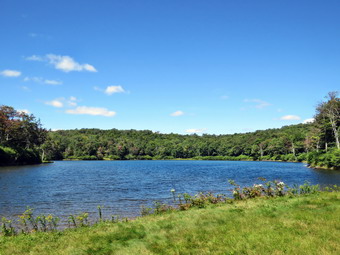 We turned right at the junction onto the Flynn Trail which is relatively flat at this point. The trail had some wet and muddy spots but most were drying up. They are all lower than the ground surrounding them so it is hard to get them to drain. There isn't much to see along the Flynn Trail so we kept up a quick pace. At the gate we followed the trail to the right and down toward the shore of Hodge Pond. As we neared the pond we turned right to stay on the Flynn Trail to the outlet of Hodge Pond. The woods road was rutted and had some water but the muddiest spots were easily avoided. There was one large blowdown that had been there since the last time I hiked. I thought someone from OSI might remove it but I made a note to return to remove it as soon as possible. We were soon at the outlet end of Hodge Pond. We turned left and walked over to the fire ring by the shore of Hodge Pond. I took off my pack and got out my camera to take a few shots. After taking some pictures of the pond, I picked up a stick and threw it into the water so that Sheila could swim to retrieve it. I did this quite a few times taking pictures of Sheila. Eventually, I went back to my pack and got a drink and a snack. We headed toward the opening in the woods where the Flynn Trail follows another woods road. We started up the hill staying on the Flynn Trail and the walk up the hill seemed to go very quickly. Soon we were on the flat part of the Flynn Trail headed toward the junction with the Big Rock Trail. This section of the trail all the way back to the parking area was once an extension of Beech Mountain Road that was paved and led to the Beech Mountain Boy Scout Camp. In some areas the pavement is still visible under the grass and moss that has covered it. Just before the gate was another smaller blowdown which would need a saw. We continued on the Flynn Trail passing through the gate and walking on to the trail junction with the Big Rock Trail and the snowmobile trail that comes over from Mongaup Pond. We didn't stop at the trail junction but continued straight ahead the Flynn Trail. From this high point in the hike, the trail descends 1.7 miles to the parking area. We kept up a fast pace on the descent but this final section seemed to drag a little. It is downhill but there isn't much to see and it is very familiar. We continued on the trail and soon were headed down the hill to the gate where we turned left to stay on then Flynn Trail. We walked down the short section of trail I had refurbished and then hiked through the woods back to the parking area. It was 2:30 PM when we returned. We had covered 6.3 miles in 2 hours and 30 minutes. The elevation gain was a modest 910 feet.
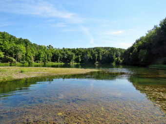
![]()
![]()
![]()
![]()
![]() On Saturday, August 27th I planned to get up at 6:00 AM, get ready and leave to hike the final section of Map 14 of the Finger Lakes Trail from Templar Road to the train trestle in Watkins Glen State Park. I estimated the round trip mileage would be between 9 and 10 miles and that I would have to hike out and back on the trail since the road routes would make the hike much longer. I asked Cindy the night before if she wanted to go and she declined. I got up at 6:00 AM and got my gear ready and at 6:30 AM Cindy came down the stairs asking if she could go! I, of course, was delighted so we got ready and left Livingston Manor around 7:15 AM. There was no rain in the forecast but the "Feels Like" temperature in the afternoon was predicted to be over 90 degrees. As we drove north on Route 17, the fog was heavy and this continued almost all the way to our destination. After a long drive, I exited at exit 52A and got on Route 14 north toward Watkins Glen. I caught Johnson Hollow Road and headed for Route 414 to head west toward our destination. We turned north on Bronson Hill Road and passed by the racetrack. At Route 16 we turned left and after a short distance turned right on Townsend Road. When Townsend Road headed right, we continued straight ahead on VanZandt Hollow Road to the intersection with dirt Templar Road. We turned left on Templar Road and drove about .2 miles to where the Finger Lakes Trail crossed the road just east of Ebenezer's Crossing. I parked the car on the side of the road and we got ready to hike. I turned on all my electronics and put Sheila on her leash. We crossed the road at 10:00 Am to begin our hike. We climbed up the steep bank until the trail leveled off and then descended and crossed VanZandt Hollow Road at .4 miles. The trail entered the woods on the other side for only about .1 miles and then came back out to VanZandt Hollow Road where we turned left and walked up the hill a few steps to an Finger Lakes Trail sign. It wasn't clear where to go and we could see no blazes anywhere! Some parts of the Finger Lakes Trail are well-marked but this was not one of them. There was a mowed lane next to a field which looked promising so we began to walk along it but saw no signs or blazes. This didn't bother me too much as private landowners sometimes give permission for the trail to cross their land but don't want a lot of paint on their trees. I kept getting the feeling we should be closer to the stream to our left but every time I looked into the woods for white blazes I came up empty. I finally got out my iPhone and looked at the Finger Lakes Trail map on the PDFMaps app. It showed we were too far south and too far from the stream bed but we decided to continue. Eventually, after walking over half a mile from VanZandt Hollow Road, we decided to bushwhack north to see if we could pick up the trail. We kept walking north and kept looking for the trail and the white blazes without much luck. Finally, after walking .2 miles through the woods, we could see the rim of the glen and then came to the trail right at its edge. I couldn't wait to hike back on the trail at the end of the hike and see where we were supposed to go!
On Saturday, August 27th I planned to get up at 6:00 AM, get ready and leave to hike the final section of Map 14 of the Finger Lakes Trail from Templar Road to the train trestle in Watkins Glen State Park. I estimated the round trip mileage would be between 9 and 10 miles and that I would have to hike out and back on the trail since the road routes would make the hike much longer. I asked Cindy the night before if she wanted to go and she declined. I got up at 6:00 AM and got my gear ready and at 6:30 AM Cindy came down the stairs asking if she could go! I, of course, was delighted so we got ready and left Livingston Manor around 7:15 AM. There was no rain in the forecast but the "Feels Like" temperature in the afternoon was predicted to be over 90 degrees. As we drove north on Route 17, the fog was heavy and this continued almost all the way to our destination. After a long drive, I exited at exit 52A and got on Route 14 north toward Watkins Glen. I caught Johnson Hollow Road and headed for Route 414 to head west toward our destination. We turned north on Bronson Hill Road and passed by the racetrack. At Route 16 we turned left and after a short distance turned right on Townsend Road. When Townsend Road headed right, we continued straight ahead on VanZandt Hollow Road to the intersection with dirt Templar Road. We turned left on Templar Road and drove about .2 miles to where the Finger Lakes Trail crossed the road just east of Ebenezer's Crossing. I parked the car on the side of the road and we got ready to hike. I turned on all my electronics and put Sheila on her leash. We crossed the road at 10:00 Am to begin our hike. We climbed up the steep bank until the trail leveled off and then descended and crossed VanZandt Hollow Road at .4 miles. The trail entered the woods on the other side for only about .1 miles and then came back out to VanZandt Hollow Road where we turned left and walked up the hill a few steps to an Finger Lakes Trail sign. It wasn't clear where to go and we could see no blazes anywhere! Some parts of the Finger Lakes Trail are well-marked but this was not one of them. There was a mowed lane next to a field which looked promising so we began to walk along it but saw no signs or blazes. This didn't bother me too much as private landowners sometimes give permission for the trail to cross their land but don't want a lot of paint on their trees. I kept getting the feeling we should be closer to the stream to our left but every time I looked into the woods for white blazes I came up empty. I finally got out my iPhone and looked at the Finger Lakes Trail map on the PDFMaps app. It showed we were too far south and too far from the stream bed but we decided to continue. Eventually, after walking over half a mile from VanZandt Hollow Road, we decided to bushwhack north to see if we could pick up the trail. We kept walking north and kept looking for the trail and the white blazes without much luck. Finally, after walking .2 miles through the woods, we could see the rim of the glen and then came to the trail right at its edge. I couldn't wait to hike back on the trail at the end of the hike and see where we were supposed to go!
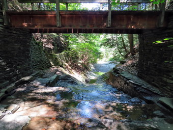 The trail now was wide and well-kept for some time and at 1.6 miles we began a steep descent down into a glen. Sheila decided to run off to chase some birds and we waited until she was ready to come back. At 1.8 miles we came to Julie's Crossing which the map stated could be difficult when there was high water. The crossing was VERY POORLY marked with few blazes but we worked our way along the stream bed to the left until there was a wide open space to cross. We were confused by some orange flagging which served some unknown purpose. As we crossed, we tried to find the white blazes but it wasn't easy! Eventually we found the trail and began a slow ascent out of the glen. The trail climbed a little then levels and then climbed a little more. At 2.1 miles we noticed a body of water on the left of the trail and a path leading down to it. We decided to explore and walked out to what looked like a small pond or lake. Sheila took a swim and got a drink and I had a drink as well. I also took pictures of the water and some geese that were standing on a sandbar. We packed up and walked back to the main trail to continue our hike. A little further on we noticed the body was larger than we thought and then we saw the dam. The dam was a least 40 feet high which we knew meant the lake was a lot deeper than we had thought. The curious thing was that it was not marked on any map and the Finger Lakes Trail descriptions never mentioned it. The trail now was definitely headed downhill and at 2.8 miles we passed by Hidden Valley Camp. Less than a half mile after the camp we were surprised to find some stonework and a stone walkway like the ones found in the main glen. There was a wooden bridge across Hamilton Creek and some more stonework on the other side. We stopped and I took some pictures of the water flowing over the smooth bedrock under the bridge. I walked down into the creek bed and took some shot upstream and downstream under the bridge. We continued on our hike but saw no more of the stone walkways. We both found it interesting that there was this one bridge and stone walkway far away from the main glen. We continued to walk along the rim of the glen until at 3.4 miles we came to Whites Hollow Road where we turned right and walked up the hill about .1 miles before turning left on an old park road. There was a parking area here and the road was flat with a good surface.
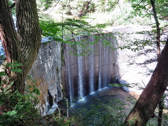 Soon the trail turned left off the road and followed the rim of the gorge until we got to a clearing with a large pavilion with a fire place. There were some other hikers there with a dog so I put Sheila on her leash. I took some pictures of Punch Bowl Lake and the pavilion and got ready to hike another half mile or so to the train trestle. I discussed this with Cindy and she elected to stay at the pavilion until we returned. Sheila and I headed off on the Finger Lakes Trail toward the dam for the lake. The trail was again poorly marked but we were soon passing by the dam. I stopped to take a few pictures and then continued on the trail as it rolled onward gaining and losing some elevation as it went. At 4.8 miles I passed under the Norfolk Southern trestle and took a few shots. I continued on for another .1 miles to make sure I overlapped my previous efforts and then turned around and walked quickly back to the pavilion to reunite with Cindy. From the pavilion we headed back along the trail retracing our steps as we went. The uphills were beginning to bother me but I knew each step was getting us closer to the car. When we got to Julie's Crossing we got to the other side and followed the orange ribbon which apparently marks an alternate trail! The climb up to the rim of the glen was the steepest on the hike. We continued on our way interested to see where and why we had gone wrong at the beginning of the hike. At about 8.3 miles I began to notice that things did not look familiar and knew that this was the part of the trail we had missed earlier. There were several signs that said "Private Property - Stay on the trail at all times"! Both Cindy and I remarked that it would be easier to stay on the trail if it was properly marked. There were some short and steep little uphills along the way and at one point the trail came very close to the rim of the gorge. We stopped to take some pictures and get a drink. The trail from this point on was poorly maintained and poorly marked. We had to push our way through brush that had overgrown the trail. Eventually we came out into the open and could see the lane we had mistakenly walked earlier. There was one post with a white blaze but no indication of where we should go from there. I guessed and we headed for an opening in the tree line ahead where I finally found a white blaze. We continued walking and were soon at the point where we had turned off VanZandt Hollow Road and followed the lane. There was NO INDICATION at this point where Ti turn or what path to follow. We had technically trespassed on someone's property because the Finger Lakes Trail was so poorly marked! Once on the road we followed it down to Templar Road where we took a left and hiked back to our car. It was 2:50 PM and we had hiked 9.4 miles in 4 hours and 50 minutes. The elevation gain was a modest 1920 feet.
![]() On Wednesday, August 24th, I decided I wanted to go back to Walnut Mountain in Liberty to plan some more possible cross country courses. Cindy was willing to help so we left Livingston Manor just before 10:00 AM. We headed for the main entrance to the park off Route 55 between Liberty and Swan Lake. As we drove up the access road to the parking lot, I could see only one other car and hoped for a quiet day. I got Sheila out of the car and put her on her leash. My plan was to clear a tree on the Mountain Overlook Trail and then to rake and lop branches on the connector trail between the Sunset Trail and the Walnut Loop West. We took with use a garden rake, weed whip, loppers a Silky saw and a machete. As we walked up the trail, we trimmed some branches and weeds as we walked. We continued to follow the Mountain Overlook Trail when it turned left but could not find the blowdown as someone had already cleared it. We continued up to the upper viewpoint trimming a lot of small branches as we went. At the top we turned right on the Subset Trail and continued to clear anything that protruded into the trail. Sheila was having a great time ranging far and wide and I had to call her back several times to curb her enthusiasm. Eventually we made it to the connector trail which was easier to find than I thought it would be. I started raking down the trail removing leaves and larger rocks while Cindy went ahead and trimming some branches and brush. Occasionally we cut some roots that I exposed with the rake. We came to an area that was overgrown so I used the weed whip to cut the weeds and brush to make the trail more obvious. We continued down the trail and it seemed much longer than I remembered when I last walked up it. There were several places where I removed rocks and filled in some holes. There were also places with accumulated leaves which I raked to the side of the trail. I finally made it down to the Walnut Loop West where Cindy was waiting. We turned right and headed north trimming and lopping as we went. There were several trees that had been broken and twisted off the trail and we cut them and pulled them off the trail. We passed the large puddle on the trail which I had thought about draining. I knew that I was too tired to work on this job on this day. I decided to leave it for later and began to think the puddle might just stay as it was. We continued to trim until we reached the junction with the Walnut Loop North. We turned left and continued along that trail heading for the Vista Way. We trimmed a little as we descended the steep hill to the Vista Way where we turned right. The Vista way is a much narrower trail than the wider carriageways. We trimmed a few branches and removed some that were laying on the ground. We cut one blowdown that was partially blocking the trail and some larger branches that were hanging down. When we arrived at the bridge, we measured the opening caused buy the collapsed board of the decking. We continued along the trail back to the parking area trimming some branches as we walked. We decided we had done enough work for the day as it was 1:15 PM. We stopped in Liberty to talk to the Town of Liberty Parks and Recreation Director about the bridge. We told me he was headed up to the park and would take a look at the situation.
On Wednesday, August 24th, I decided I wanted to go back to Walnut Mountain in Liberty to plan some more possible cross country courses. Cindy was willing to help so we left Livingston Manor just before 10:00 AM. We headed for the main entrance to the park off Route 55 between Liberty and Swan Lake. As we drove up the access road to the parking lot, I could see only one other car and hoped for a quiet day. I got Sheila out of the car and put her on her leash. My plan was to clear a tree on the Mountain Overlook Trail and then to rake and lop branches on the connector trail between the Sunset Trail and the Walnut Loop West. We took with use a garden rake, weed whip, loppers a Silky saw and a machete. As we walked up the trail, we trimmed some branches and weeds as we walked. We continued to follow the Mountain Overlook Trail when it turned left but could not find the blowdown as someone had already cleared it. We continued up to the upper viewpoint trimming a lot of small branches as we went. At the top we turned right on the Subset Trail and continued to clear anything that protruded into the trail. Sheila was having a great time ranging far and wide and I had to call her back several times to curb her enthusiasm. Eventually we made it to the connector trail which was easier to find than I thought it would be. I started raking down the trail removing leaves and larger rocks while Cindy went ahead and trimming some branches and brush. Occasionally we cut some roots that I exposed with the rake. We came to an area that was overgrown so I used the weed whip to cut the weeds and brush to make the trail more obvious. We continued down the trail and it seemed much longer than I remembered when I last walked up it. There were several places where I removed rocks and filled in some holes. There were also places with accumulated leaves which I raked to the side of the trail. I finally made it down to the Walnut Loop West where Cindy was waiting. We turned right and headed north trimming and lopping as we went. There were several trees that had been broken and twisted off the trail and we cut them and pulled them off the trail. We passed the large puddle on the trail which I had thought about draining. I knew that I was too tired to work on this job on this day. I decided to leave it for later and began to think the puddle might just stay as it was. We continued to trim until we reached the junction with the Walnut Loop North. We turned left and continued along that trail heading for the Vista Way. We trimmed a little as we descended the steep hill to the Vista Way where we turned right. The Vista way is a much narrower trail than the wider carriageways. We trimmed a few branches and removed some that were laying on the ground. We cut one blowdown that was partially blocking the trail and some larger branches that were hanging down. When we arrived at the bridge, we measured the opening caused buy the collapsed board of the decking. We continued along the trail back to the parking area trimming some branches as we walked. We decided we had done enough work for the day as it was 1:15 PM. We stopped in Liberty to talk to the Town of Liberty Parks and Recreation Director about the bridge. We told me he was headed up to the park and would take a look at the situation.
I returned to Walnut Mountain at about 5:00 PM for cross country practice as I wanted my team to run the new course. Since practice was not until 6:00 PM, I decided to walk the part of the course Cindy and I had not been on earlier in the day. I walked down to the point where the Walnut Loop East starts and walked along the treeline to the point where the trail enters the woods and heads for the West Lake parking area. I trimmed a few branches and removed some from the trail. At .5 miles I turned left onto the Walnut Loop North. There were a few branches and weeds encroaching on the trail and I took the time to trim most of the. When I reached the Vista Way, I turned left to get back to the parking area to meet my team. I trimmed a branch or two on the way. When I reached the bridge, I was surprised to see that the hole caused by the collapsed board had been filled with a gravel mixture which had been packed down forming a very effective patch. I was very happy with the cooperation and support of the Parks and Recreation Department! I continued back up to the parking lot to meet my team.
On Tuesday, August 23rd Doug Senterman from the NYNJTC was scheduled to come to Livingston Manor at 10:00 AM to work on the new trail on Round Top. Cindy and I went over to Round Top and decided to start cleaning up the garbage at the viewpoint while we waited fro Doug. We parked at the top of the hill at the entrance to the trail and took some tools, a plastic sled and a blue tarp up to the viewpoint. The temperature at 10:00 AM was still in the 60's which was perfect for doing some work. We gathered up some of the various bottles and cans and other loose junk and put it in the sled. We loaded the tarp with the old tents and blankets to get it ready for the trip down the hill to Doug's pickup. While we were working Doug appeared with his dog Bailey. We stopped to talk briefly and then started back in on our work. Doug and brought garbage bags so we transferred the loose junk to the bags and packed up some more of the loose blankets. Doug and I pulled the now full tarp down the hill to his pickup where we loaded it into the back ready to take it to the transfer station. We walked back up the hill and loaded some bags onto the sled. Doug grabbed hold of an old mattress, I grabbed a rather heavy bag of garbage and Cindy pulled the sled as we again headed for the truck. We loaded all of it into the truck. Doug and I headed to the transfer station while Cindy went back up to do some more work. Doug and I emptied the truck and the returned to the top of the cemetery hill. We walked back up to the viewpoint and found that Cindy had broken down the two fire circles and scattered the stones. We removed a few logs that were at the viewpoint and then thought about our next task. We decided to walk from the viewpoint toward the woods road that we had already cleared farther up the hill. I used the geospatial PDF I had produced from my previous walk modifying our route only slightly as we picked the easiest path. Doug followed using bright pink ribbon to flag the position of the trail. Soon we were near the point where we had cleared the woods road and after a few tries found best path to connect to it. We walked along the woods road with Doug adding some flagging and the turned down the woods road to travel along the cliffs. The flagging was to act as temporary marking until someone decided how the trail should be marked. Once we were back at the trail junction with the path to the viewpoint, Cindy headed home and Doug and I headed back up to the viewpoint.
We got a drink and a snack since the noon whistle had already blown. We decided to "brush out" the trail. We fell into an effective pattern which helped us efficiently do the work. I walked ahead picking up branches and old logs and throwing them out of the way. I also used my machete to cut some small sapling and brush and my Silky saw to cut bigger obstacles. Doug followed using the grass whip to cut the weeds and ferns along the trail as well as some woody brush. When I looked back, I was surprised to see that what was behind us looked like a trail with bright pink markings! Along the way we found two rocks that looked like perfect places for people walking the trail to rest. The slow pace made me appreciate how beautiful the area really is. At one point we climbed a small incline as we approached the junction with the woods road. I cut one large blowdown across the trail. It wasn't too long before we connected with the area that had already been cleared. We walked along the woods road trimming a few branches as we went and adding a little more flagging. As we walked below the cliffs we talked about exploring the possibility of a spur trail. When we came to the trail junction, we once again turned right and climbed back up to the viewpoint. We had talked earlier about scouting a path to the lower summit of Round Top which is on public property. I had a possible route mapped out but it was steep and needed a few switchbacks. Since it was after 3:00 PM, we decided to leave that trip for another day. Having my track placed on the tax map by the NYNJTC cartographer would also help. We did spend a few minutes looking at the viewpoint and spotting the trees that would need to be cut to open it up. As we gathered our tools and walked back to Doug's truck we talked about how much work we had accomplished. Doug promised to contact the Town of Rockland supervisor to inform him of the work we had done and to arrange for sawyers to come and cut some trees for the viewpoint. He also agreed to ask about the type of mares for the trail. We set October 1st as a goal for the date to open the trail to the public.
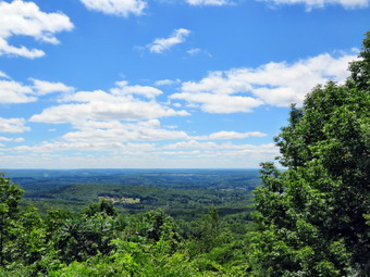
![]() On Monday, August 22nd, I decided I wanted to go back to Walnut Mountain in Liberty to plan some more possible cross country courses. Cindy was busy babysitting a grandchild so Sheila and I headed out of Livingston Manor alone just before 11:00 AM. We headed for the main entrance to the park off Route 55 between Liberty and Swan Lake. As we drove up the access road to the parking lot, I could see only one other car and hoped for a quiet day. I got Sheila out of the car and put her on her leash. I also grabbed my poles and put on my pack. We headed down to the area behind the baseball diamond where the Walnut Loop Trail East begins. This is a nice wide area that is a perfect starting place for a cross country race. When we got to the appropriate area, I set my Suunto GPS watch and my Garmin handheld GPS and we started to walk north on the Walnut Loop Trail East. The day was cooler than it had been with temperatures still in the 60's and low humidity. As we headed out on the trail we stayed fairly close to the treeline. We entered the woods at about .1 miles and then started downhill toward the West Lake parking area. The trail surface had some round cobbles but also some areas of grass. At .5 miles we turned left just short of the parking area on the Walnut Loop Trail North. This trail started out as mostly grass with a slight uphill until .75 miles where the trail turned to dirt and started to climb. I wanted to avoid the VERY steep hill ahead so we turned left at .85 miles onto the Vista Way trail which I knew headed back to the parking area. This part of the trail was narrower and rolled a little. We crossed a small bridge with one board missing and I made a note to measure the dimensions I would need to replace it. At about 1.15 miles we were at the north end of the parking area where we enter the lot and then cut through the fence in an opening on the left. We followed the fence to the small building and then cut across under the trees and started up the access road to the Mountain Overlook Trail which is the entrance to the main trail system. We passed through the gate at 1.25 miles and followed the trail as it started to climb. At the first intersection we continued straight ahead on the connector trail that would take use to the Walnut Loop Trail West. We passed by true junction with the Walnut Loop Trail North at 1.6 miles and started around the west side of the mountain on the Walnut Loop Trail West. We came across a small "pond" on the trail and I made a mental note to see if I could drain it. At 1.8 miles we turned left on a connector trail that climbs to the Sunset Trail. I found the connector trail in need of some maintenance including raking, lopping and wee whacking. The trail is a short but challenging up hill that led to the Sunset Trail at 2 miles. We turned right on the Sunset Trail which has a nice soft surface. The trail is flat for a little while and the ascends to the lower lookout at 2.25 miles. We turned left here onto the Mountain Overlook Trail and started the downhill portion of the course. At 2.65 miles we turned right at the trail junction to continue back down to the gate and the beginning of the Mountain Overlook Trail. We continued through the gate to the access road where we turned right through an opening in the fence. We walked under the pine trees to the start of the Walnut Loop Trail South and walked along this trail until it opened into the old quarry. We continued along the trail to the area of the Ultimate Frisbee course to the finish line at 3.1 miles. I was happy with the start and the finish and the course between these two points.
On Monday, August 22nd, I decided I wanted to go back to Walnut Mountain in Liberty to plan some more possible cross country courses. Cindy was busy babysitting a grandchild so Sheila and I headed out of Livingston Manor alone just before 11:00 AM. We headed for the main entrance to the park off Route 55 between Liberty and Swan Lake. As we drove up the access road to the parking lot, I could see only one other car and hoped for a quiet day. I got Sheila out of the car and put her on her leash. I also grabbed my poles and put on my pack. We headed down to the area behind the baseball diamond where the Walnut Loop Trail East begins. This is a nice wide area that is a perfect starting place for a cross country race. When we got to the appropriate area, I set my Suunto GPS watch and my Garmin handheld GPS and we started to walk north on the Walnut Loop Trail East. The day was cooler than it had been with temperatures still in the 60's and low humidity. As we headed out on the trail we stayed fairly close to the treeline. We entered the woods at about .1 miles and then started downhill toward the West Lake parking area. The trail surface had some round cobbles but also some areas of grass. At .5 miles we turned left just short of the parking area on the Walnut Loop Trail North. This trail started out as mostly grass with a slight uphill until .75 miles where the trail turned to dirt and started to climb. I wanted to avoid the VERY steep hill ahead so we turned left at .85 miles onto the Vista Way trail which I knew headed back to the parking area. This part of the trail was narrower and rolled a little. We crossed a small bridge with one board missing and I made a note to measure the dimensions I would need to replace it. At about 1.15 miles we were at the north end of the parking area where we enter the lot and then cut through the fence in an opening on the left. We followed the fence to the small building and then cut across under the trees and started up the access road to the Mountain Overlook Trail which is the entrance to the main trail system. We passed through the gate at 1.25 miles and followed the trail as it started to climb. At the first intersection we continued straight ahead on the connector trail that would take use to the Walnut Loop Trail West. We passed by true junction with the Walnut Loop Trail North at 1.6 miles and started around the west side of the mountain on the Walnut Loop Trail West. We came across a small "pond" on the trail and I made a mental note to see if I could drain it. At 1.8 miles we turned left on a connector trail that climbs to the Sunset Trail. I found the connector trail in need of some maintenance including raking, lopping and wee whacking. The trail is a short but challenging up hill that led to the Sunset Trail at 2 miles. We turned right on the Sunset Trail which has a nice soft surface. The trail is flat for a little while and the ascends to the lower lookout at 2.25 miles. We turned left here onto the Mountain Overlook Trail and started the downhill portion of the course. At 2.65 miles we turned right at the trail junction to continue back down to the gate and the beginning of the Mountain Overlook Trail. We continued through the gate to the access road where we turned right through an opening in the fence. We walked under the pine trees to the start of the Walnut Loop Trail South and walked along this trail until it opened into the old quarry. We continued along the trail to the area of the Ultimate Frisbee course to the finish line at 3.1 miles. I was happy with the start and the finish and the course between these two points.
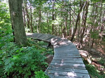 I was almost ready to go home at this point but decided to add some mileage by walking to the summit of Walnut Mountain. I knew I would have to put Sheila on her leash since there were now more cars in the lot and we had already met many families and camp groups hiking the trails. Sheila and I continued on the Walnut Loop Trail South heading up toward the lower viewpoint. When we got to the lower viewpoint, the scene was nice with blue skies and white clouds. I decided to walk to the upper viewpoint and take some pictures from there. We turned right on the short connector trail and then turned left on the Mountain Overlook Trail. When we got to the viewpoint, There was a rather large number of adults and children. I leashed Sheila to a tree and took some pictures from the viewpoint. It always seems that there is a haze in the direction of Swan Lake and the lake was almost out of view behind the trees. I gave Sheila a drink and got one myself before heading out the Sunset Trail. As we approached the junction with Te Mountain House Trail, a large group of campers came walking toward us. We turned right up the Mountain House Trail and started to climb. I hoped the campers would not follow us and they did not. At the top of the Mountain House Trail where it leveled off I took the bike trail to the right and then another bike trail to the summit plateau. We headed around the summit counterclockwise and soon came to the "bridge" the bike club had built. It is constructed of wooden slats with a wire screen for traction and is very sturdy. A sign before the bridge warns riders to "Dismount" before crossing but I think a few may not take the suggestion. I took some pictures of the bridge and then we continued around the summit on the trail. A short distance beyond we cut to the right down through the ledges to an informal path. I stopped to take some pictures of the rocks and the we walked around to where we had started. I did stop to take a few shot of the foundation of the old Mountain Hose before walking back out to the Mountain House Trail. We turned left to continue down the mountain. At 4.6 miles we turned right on the Sunset Trail and walked down to the Mountain Overlook Trail where we turned left. We follows that trail to the next junction where we turned right and walked back down the trail to the gate and then to the parking lot. We were back at 1:30 Pm having hiked 5.1 miles in 2 hours and 15 minutes with an elevation gain of 900 feet. I drove to the Town of Liberty Parks and Recreation Office to talk to the director about the cross country course. He was very helpful and gave permission for me to prepare the course and mark it appropriately!
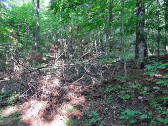
![]()
![]()
![]()
![]()
![]() On Saturday, August 20th, I had scheduled a work day for the Willowemoc Trail crew at Trout Pond. I had though about having the workday on Thursday or Friday but a nagging muscle pull from Wednesday's racquetball had left me a little lame. I was still feeling the leg when I went to bed Friday night but on Saturday morning I barely felt a twinge. The plan was to meet Steve, Judy and Shaun at 9:00 AM at Trout Pond and hike the loop around Trout Pond in a clockwise direction clearing as much as we could on the way. I thought it might take about 4 hours to get a majority of the work done. The weather forecast included no rain for a change and called for partly sunny skies. Cindy and I left Livingston Manor a little after 8:30 AM. I put my gear in the trunk and an overjoyed Sheila in the back seat. We had decided to take Sheila and tether her to a tree as we worked. I had brought a variety of trimming tools included my two Silky saws, two loppers, hedge trimmers, felling wedges, my LT Wright machete and a my full-sized Council Tools felling axe. I didn't think we would need all the tools but wanted to give everyone a choice. We headed to Roscoe on State Route 17 and then took Route 206 across the Delaware County line to Morton Hill Road. After a left turn on Morton Hill Road, I drove to the intersection with Russell Brook Road which I noticed no longer had a road sign. The road did have a "Seasonal Maintenance" sign which should mean there is some maintenance during the summer. As we drove down the road it was hard to see that ANY maintenance had been done with large holes in the road and areas of erosion. When we arrived at the lower lot Steve was waiting for us and the lot was almost completely filled with vehicles. I found a place to park and we got out of the car to say "Hello" to Steve. We chatted while waiting for Judy and found Steve had brought his own tools and was ready to go. A t 9:15 Am we left the parking to begin our hike assuming Judy was not coming since she is always on time. I knew that Shaun was going to try to meet us later as he had a meeting in the morning. The air temperature was cooler than on previous days but was still "heavy" with humidity. I wore a long-sleeved Mountain Hardwear crew neck over an Underarmour baselayer. We got on the woods road that goes down to the bridge that crosses the brook. As we crossed the bridge I could see that the knotweed we had cut back had grown out again to impinge on the path. We decided that we would tackle the heavier work and leave the knotweed for later. We continued on the main trail to the register box. At the trail junction just after the register, we turned to the left to climb the steeper hill toward Mud Pond. The trail was wet and muddy in spots which made the going slippery. The sun was out and as soon as we started to climb the hill, I noticed how warm it seemed. As we climbed, we took it easy and stopped a few times to clear smaller branches and sticks from the path. We also lopped some branches as high as we could hoping to clear the way for snowshoe season! We came across the large blowdown that was blocking the trail where hikers had started to walk around it forming a new trail that encourages erosion. We stopped and started to clean out the blowdown by cutting off a few branches. Steve took control of the Silky Katana Boy saw and quickly cut through the main trunk of the tree. I cut another few branches and Cindy and I cleared away some more branches. As we were finishing up Judy came walking up the trail. I had given her directions to Trout Pond which mentioned Russell Brook Road thinking there was still a road sign on the corner. She eventually found the right turn and I was glad she joined us. Clearing the whole blowdown went much faster than I thought and we were soon packing up to continue up the hill to the next blowdown. We continued to lop a few branches an clear remove loose branches from the trail. The next challenge was to clear what looked like a rather large single truck angled up across the trail. Steve again took the Katana Boy and cut the trunk high on one side of the trail. The cutting went easier than we expected. I made a cut on the other end near the trunk and we rolled the center section off the trail. We continued up the trail toward Mud Pond. As we finally reached the top, we found some briars and other weeds crowding the trail. I used my machete to widen the trail and it once again performed very well. We walked down the trail toward the junction where we turned right to head over Cherry Ridge toward Trout Pond.
On Saturday, August 20th, I had scheduled a work day for the Willowemoc Trail crew at Trout Pond. I had though about having the workday on Thursday or Friday but a nagging muscle pull from Wednesday's racquetball had left me a little lame. I was still feeling the leg when I went to bed Friday night but on Saturday morning I barely felt a twinge. The plan was to meet Steve, Judy and Shaun at 9:00 AM at Trout Pond and hike the loop around Trout Pond in a clockwise direction clearing as much as we could on the way. I thought it might take about 4 hours to get a majority of the work done. The weather forecast included no rain for a change and called for partly sunny skies. Cindy and I left Livingston Manor a little after 8:30 AM. I put my gear in the trunk and an overjoyed Sheila in the back seat. We had decided to take Sheila and tether her to a tree as we worked. I had brought a variety of trimming tools included my two Silky saws, two loppers, hedge trimmers, felling wedges, my LT Wright machete and a my full-sized Council Tools felling axe. I didn't think we would need all the tools but wanted to give everyone a choice. We headed to Roscoe on State Route 17 and then took Route 206 across the Delaware County line to Morton Hill Road. After a left turn on Morton Hill Road, I drove to the intersection with Russell Brook Road which I noticed no longer had a road sign. The road did have a "Seasonal Maintenance" sign which should mean there is some maintenance during the summer. As we drove down the road it was hard to see that ANY maintenance had been done with large holes in the road and areas of erosion. When we arrived at the lower lot Steve was waiting for us and the lot was almost completely filled with vehicles. I found a place to park and we got out of the car to say "Hello" to Steve. We chatted while waiting for Judy and found Steve had brought his own tools and was ready to go. A t 9:15 Am we left the parking to begin our hike assuming Judy was not coming since she is always on time. I knew that Shaun was going to try to meet us later as he had a meeting in the morning. The air temperature was cooler than on previous days but was still "heavy" with humidity. I wore a long-sleeved Mountain Hardwear crew neck over an Underarmour baselayer. We got on the woods road that goes down to the bridge that crosses the brook. As we crossed the bridge I could see that the knotweed we had cut back had grown out again to impinge on the path. We decided that we would tackle the heavier work and leave the knotweed for later. We continued on the main trail to the register box. At the trail junction just after the register, we turned to the left to climb the steeper hill toward Mud Pond. The trail was wet and muddy in spots which made the going slippery. The sun was out and as soon as we started to climb the hill, I noticed how warm it seemed. As we climbed, we took it easy and stopped a few times to clear smaller branches and sticks from the path. We also lopped some branches as high as we could hoping to clear the way for snowshoe season! We came across the large blowdown that was blocking the trail where hikers had started to walk around it forming a new trail that encourages erosion. We stopped and started to clean out the blowdown by cutting off a few branches. Steve took control of the Silky Katana Boy saw and quickly cut through the main trunk of the tree. I cut another few branches and Cindy and I cleared away some more branches. As we were finishing up Judy came walking up the trail. I had given her directions to Trout Pond which mentioned Russell Brook Road thinking there was still a road sign on the corner. She eventually found the right turn and I was glad she joined us. Clearing the whole blowdown went much faster than I thought and we were soon packing up to continue up the hill to the next blowdown. We continued to lop a few branches an clear remove loose branches from the trail. The next challenge was to clear what looked like a rather large single truck angled up across the trail. Steve again took the Katana Boy and cut the trunk high on one side of the trail. The cutting went easier than we expected. I made a cut on the other end near the trunk and we rolled the center section off the trail. We continued up the trail toward Mud Pond. As we finally reached the top, we found some briars and other weeds crowding the trail. I used my machete to widen the trail and it once again performed very well. We walked down the trail toward the junction where we turned right to head over Cherry Ridge toward Trout Pond.
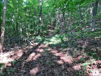 We didn't hurry our hiking and very much enjoyed the sunny weather with a slight breeze. We passed through the area where there is a forest of very small trees and continued on the main trail. Soon, we ran across our next blowdown which was blocking the trail and forcing hikers to walk around it. We used the same method to clear this blockage as we had before. We removed a few branches and threw them to the side of the trail and then went to work on the trunk. A few cuts and less than 15 minutes later we were ready to continue. It was becoming very clear how much easier the job is when a small group works together. We came across a single birch trunk and made one cut to clear it from the trail before continuing our uphill trek. A little after 10:30 AM we came what appeared to be an easily removed large cherry branch. As we were making our plan, Shaun caught up to us and pitched in with his bow saw on the thickest part of the branch. Steve and I attacked the upper branches finding that the blowdown was a little more complex than we had originally thought. After clearing the top, we helped Shaun saw through the larger portion of the branch and then cleared everything from the trail. As we were finishing, Cindy, who was up ahead, announced there was another jog waiting. The tree was a large dead trunk with a few smaller trees that it had taken down. We cleared the smaller branches and then took a look at the trunk. Steve decided to use the saw to cut the trunk which looked very solid. We took turns working the saw and the trunk gave way quicker than we expected. We were able to muscle the large trunk off the trail and finish the cleanup. We aborted to hike again and in less than 10 minutes came across another blowdown that seemed complex. We cleared away some branches and found that we only needed to make one cut as the rest of the branches had split an were easily removed. It took less than 10 minutes to clear the whole area. By this time is has after 11:00 AM and we were are beginning to tire. As we started up the final section of the trail to the highest point, we entered an area where blackberry briars were starting t overrun the trail. The others used their loppers but I got out my machete and, after putting on gloves, started to hack away at the briars. The LT Wright machete worked well and we had soon worked our way through the area. We walked up the trail and sat to take a short break and get a snack. There was a large blowdown on the trail but it was easy to walk around. We decided that we were through working and would simply hike out to the parking area. I was happy that we had gotten so much work done. On the way down the trail from the shoulder of Cherry Ridge we came across one blowdown that needed to be cleared but left it for another day. There were also several large logs partly on the trail but they could be walked around. As we descended toward the pond, I could see several people carrying a log, so I put Sheila on her leash. As we walked over the bridge, I had to stop to take a few pictures of the pond. I quickly took my shots and then caught up with the others who were headed down the woods road toward the outlet of the pond. We walked and talked which made the time go very quickly. We met a few family groups on the flat part of the trail. The water in Trout Pond looked high but there was still no water going over the dam. As we continuing downhill toward the falls, we began to meet more and more people coming up the trail and a few headed in the same direction we were. We were soon back at the bridge over Russell Brook and then it was just a short walk up to the cars. It was 1:45 PM and we had hiked 5.5 miles in 4 hours and 15 minutes with a lot of work done along the way!
On Friday, August 19th, I was trying to rest my left leg which I had "tweaked" on Wednesday during racquetball. I decided I wanted to go to Walnut Mountain in Liberty to plan some possible cross country courses. Cindy said she wanted to come and, as always, Sheila was ready to go. We arrived at the main parking area at about 10:35 AM. I needed to find a starting line so we walked over to the area of the Ultimate Frisbee course and we found a wide area on the grass although it was a little uneven. I set my Suunto Traverse watch and Garmin UPS unit and we started to walk a possible course. We walked out the Walnut Loop Trail South to the playground area and then turned and walked under the pines to the beginning of the main trail loops at the gate to the Mountain Overlook Trail. We walked up the trail as it headed uphill winding around to the first trail junction. The trail surface was mostly red shale rock with some grassy areas. We continued straight ahead on the connector trail to the Walnut Loop Trail West. This part of the trail was mostly grass and as we passed by the junction with the Walnut Trail Loop North at .56 miles. We were now on a surface that was sandy with small stones and at about 1 mile we began a steep uphill to a viewpoint. At the top of the hill we turned left on a connector trail that took us up to the Mountain Overlook Trail again. We turned left and were soon at the upper lookout where we turned right on the Sunset Trail. At the next junction we turned right and continued uphill on the Mountain House Trail. At 1.6 miles we hit the highest point on the course and continued to follow the Mountain House Trail downhill until the Mountain House Trail ended at the Sunset Trail. We turned right and followed the Sunset Trail downhill to the Mountain Overlook Trail. We turned left and then left again at the next junction at 2 miles to repeat the loop on the Walnut Loop Trail West. We continued around and back up the hill to the lower lookout. At this point we continued straight ahead through an open, grassy clearing on the Walnut Loop Trail South. The course from this point was all downhill to the finish. We walked down a steep part of the trail which had some loose rock and then the trail began to level out. We continued along the trail to the finish at 3.1 miles just short of the start. We walked back to the car for a break.
I was not thrilled with the uneven start so I looked around fro a better area to begin our cross country races. We walked down toward the entrance to the beginning of the Walnut Loop Trail East. There was a nice grassy area which would be a much better starting area for a cross country race. I again reset my GPS devices and we headed out on the trail staying fairly close to the treeline. We entered the woods at about .1 miles and then started downhill toward the West Lake parking area. The trail surface had some round cobbles but also some areas of grass. At .5 miles we turned left just short of the parking area on the Walnut Loop Trail North. This trail started out as mostly grass with a slight uphill until .75 miles where we began to climb .2 miles up a 17% grade! At .87 miles we passed the turnoff for the Vista Way Trail on the left and continued up the hill. At .95 miles we hit the top of the steepest part of the trail and the surface turned back to grass from dirt. We continued on the Walnut Loop Trail North which was still uphill to the junction with the Walnut Loop Trail West. At this point Cindy returned to the car while Sheila and I turned right around the back of Walnut Mountain on the Walnut Loop Trail West. We climbed the hill at 1.6 miles to the lower lookout. We turned left on the connector trail and then left again on the Mountain Overlook Trail to the upper lookout. We were then on the Sunset Trail and we continued to follow it around the back of the mountain. This trail had a nice soft surface and was a pleasure to walk. We continued on the Sunset Trail until it ended at 2.5 miles on the Mountain Overlook Trail. We turned left and then right at the next junction to follow the Mountain Overlook Trail back to the gate near the parking area. To get to the finish we turned right under the pine trees and walked to the Walnut Loop Trail South. We walked out the trail to the old quarry and to a spot exactly 3.1 miles from the start. I now had two possible courses to present to my cross country team.
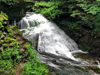
![]()
![]()
![]()
![]()
![]() On Monday, August 15th, I had planned to leave very early to hike the remaining section of map 14 on the Finger Lakes Trail near Watkins Glen. When my alarm went off at 5:00 AM, I thought about the fact that I had my first cross country practice in the evening and would not be able to really enjoy the hike. I decided I wanted get out and do a hike closer to home since the temperature had finally dropped a little although it was still humid. The weather forecast included no rain for a change and called for partly sunny skies. I decided to go to Trout Pond since it is close and offers some nice views and since I had been to Frick Pond so many times in the last few weeks. I had some things to take care of in the morning so I didn't get out of Livingston Manor until after 10:30 AM. I put my gear in the trunk and an overjoyed Sheila in the back seat and headed to Roscoe on State Route 17. I got on Route 206 and followed it across the Delaware County line to Morton Hill Road. After a left turn on Morton Hill Road, I drove to the intersection with Russell Brook Road. I turned around and parked on the side of the road to avoid the parking area which is private. We began our hike down Russell Brook Road at 11:05 AM. The air temperature was cooler than on previous days but was still "heavy" with humidity. I wore a short-sleeved Mountain Hardwear crew neck over an Underarmour baselayer. We continued on down Russell Brook Road to the overlook of the falls. On the way down the road we could hear very loud Latin music coming from the first campsite on the left. As we passed some people seemed to be setting up a large tent. I cannot understand why anyone would come to the quiet of an area like Trout Pond and then spoil it by blasting any music! At the falls overlook I could hear and see a large volume of water going over the upper falls. I stopped to take a few pictures and varied the camera modes in an attempt to get the soft, wispy pictures of the water that I like. I was careful as everything was slippery from the days of rain. We continued down toward the parking area where there were two cars parked in the lower lot. We got on the woods road that goes down to the bridge that crosses the brook. As we crossed the bridge I could see that the knotweed we had cut back had grown out again to impinge on the path. I made a note to plan another trip just to cut it back. I decided to walk to the falls and turned right on the path which was also beginning to grow over. We walked along the path to the falls and then down to the stream bed. A good volume of water was going over the falls but it was not as great as I have seen it. I took some pictures including a few of Sheila. Sheila was enthusiastically running into the water and then dashing around. We walked back up the bank and out to the main trail where we turned right to pass the register box. At the trail junction just after the register, we turned to the left to climb the steeper hill toward Mud Pond. The trail was wet and muddy in spots which made the going slippery. The sun was out and as soon as we started to climb the hill, I noticed how warm it seemed. As we climbed, we came across one large blowdown that was blocking the trail. Hikers had started to walk around this forming a new trail that encourages erosion. I put this on my list as something I would need to clear. It was not the last blowdown I would find on the path to the trail junction near Mud Pond. It seemed that I was constantly leaning down to pick up a branch and in some cases a rotten tree trunk to move them off the trail. If every hiker took the time to remove a few of these, the trails would be in much better shape! We reached the top of the hill at 11:55 AM after hiking 1.6 miles. The woods road had some ruts from a vehicle that appeared to be a pickup truck but none were new. The trail was very wet with some standing water in places. At 1.8 miles we made a right to follow the trail up to the shoulder of Cherry Ridge.
On Monday, August 15th, I had planned to leave very early to hike the remaining section of map 14 on the Finger Lakes Trail near Watkins Glen. When my alarm went off at 5:00 AM, I thought about the fact that I had my first cross country practice in the evening and would not be able to really enjoy the hike. I decided I wanted get out and do a hike closer to home since the temperature had finally dropped a little although it was still humid. The weather forecast included no rain for a change and called for partly sunny skies. I decided to go to Trout Pond since it is close and offers some nice views and since I had been to Frick Pond so many times in the last few weeks. I had some things to take care of in the morning so I didn't get out of Livingston Manor until after 10:30 AM. I put my gear in the trunk and an overjoyed Sheila in the back seat and headed to Roscoe on State Route 17. I got on Route 206 and followed it across the Delaware County line to Morton Hill Road. After a left turn on Morton Hill Road, I drove to the intersection with Russell Brook Road. I turned around and parked on the side of the road to avoid the parking area which is private. We began our hike down Russell Brook Road at 11:05 AM. The air temperature was cooler than on previous days but was still "heavy" with humidity. I wore a short-sleeved Mountain Hardwear crew neck over an Underarmour baselayer. We continued on down Russell Brook Road to the overlook of the falls. On the way down the road we could hear very loud Latin music coming from the first campsite on the left. As we passed some people seemed to be setting up a large tent. I cannot understand why anyone would come to the quiet of an area like Trout Pond and then spoil it by blasting any music! At the falls overlook I could hear and see a large volume of water going over the upper falls. I stopped to take a few pictures and varied the camera modes in an attempt to get the soft, wispy pictures of the water that I like. I was careful as everything was slippery from the days of rain. We continued down toward the parking area where there were two cars parked in the lower lot. We got on the woods road that goes down to the bridge that crosses the brook. As we crossed the bridge I could see that the knotweed we had cut back had grown out again to impinge on the path. I made a note to plan another trip just to cut it back. I decided to walk to the falls and turned right on the path which was also beginning to grow over. We walked along the path to the falls and then down to the stream bed. A good volume of water was going over the falls but it was not as great as I have seen it. I took some pictures including a few of Sheila. Sheila was enthusiastically running into the water and then dashing around. We walked back up the bank and out to the main trail where we turned right to pass the register box. At the trail junction just after the register, we turned to the left to climb the steeper hill toward Mud Pond. The trail was wet and muddy in spots which made the going slippery. The sun was out and as soon as we started to climb the hill, I noticed how warm it seemed. As we climbed, we came across one large blowdown that was blocking the trail. Hikers had started to walk around this forming a new trail that encourages erosion. I put this on my list as something I would need to clear. It was not the last blowdown I would find on the path to the trail junction near Mud Pond. It seemed that I was constantly leaning down to pick up a branch and in some cases a rotten tree trunk to move them off the trail. If every hiker took the time to remove a few of these, the trails would be in much better shape! We reached the top of the hill at 11:55 AM after hiking 1.6 miles. The woods road had some ruts from a vehicle that appeared to be a pickup truck but none were new. The trail was very wet with some standing water in places. At 1.8 miles we made a right to follow the trail up to the shoulder of Cherry Ridge.
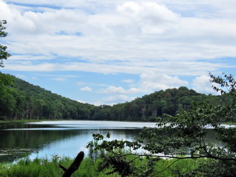 This trail was also very wet for most of the way to the highest point on the hike. There were areas of both standing and running water and some were deep enough for Sheila to immerse her whole body. This, of course, started a new round of mad dashes up and down the trail. We avoided a few muddy areas and crossed a few small streams. There were quite a few blowdowns on the trail and I removed what I could. Most needed tools to clear them. There were also many areas where branches needed to be lopped to open up the trail and several places where briars and weeds needed removal. The ascent continued for the next 1.2 miles until at 3.0 miles into the hike when we were at the highest point and ready to start the descent to Trout Pond. This part of the trail was drier but there were still more branches to remove and several large blowdowns. The little stream next to the trail actually had enough water to allow Sheila to get a drink and play some. As we approached the bridge at the inlet end of the pond, we could hear people coming down from the upper lean-to. The trail at the bottom of the hill and just before the bridge was very wet. I stopped at the bridge to allow the three young men time to get ahead of us and we never saw them again. I took a few pictures from the bridge and then started the hike back. There were two people at the lower lean-to and we waved to each other as we started down the trail on the eastern shore of Trout Pond. This trail is usually very wet but it was drier than other sections thus time. When we got to the outlet end of the pond, I could see that the sky was a dull gray and I decided to skip the pictures. I did notice that despite the rain the level of the water in the pond was still low and no water was going over the dam. The hike from the outlet to the trail junction is all downhill and really did go quickly. Near the upper end of the trail, we met a single woman and I took Sheila by the collar so the hiker could pass. She seemed oblivious to the gesture and wandered off to pick and eat some berries so we continued down the hill. I was surprised that the stream next to the trail sounded like it had a good volume of water. I could only surmise that the dam leaks of that it was all runoff. As we passed the designated campsite area on the right of the trail, I could see that no one was using it.We did meet four hikers coming up the trail and I made sure I put Sheila on her leash as they had a golden retriever with them. We passed by with a brief "hello". By 1:45 PM we had hiked 5.1 mikes and were back at the trail junction and register box. We continued our hike on the main trail to Russell Brook Road. There were now four cars in the lot. As we walked up the road back to the car, I noticed that the campers who had been at the campsite playing their music were now gone. They had been breaking down the site not setting it up! We finished the hike up Russell Brook Road back to the car. We arrived back at 2:00 PM having covered 5.8 miles and 1120 vertical feet in 3 hours.
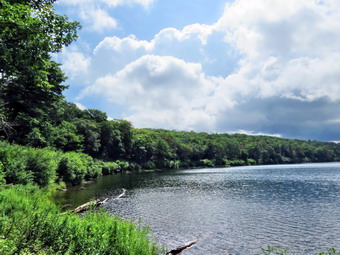
![]()
![]()
![]()
![]()
![]() On Friday, August 12th I wanted to get in a hike close to home since the forecast for most of the area included thunderstorms sometime in the afternoon. After some morning showers, I decided to head to the Frick and Hodge Pond area to do some sort of hike. I was still recovering from twisting my foot during racquetball on Wednesday so I knew I wanted a relatively flat hike of no more than 6 miles. I got my gear and Sheila in the car at about 10:30 AM and headed out the DevRuce Road to Mongaup Pond Road. I turned left and headed up toward Mongaup Pond but stayed to the left on Beech Mountain Road where the road forks. I parked in the smaller parking area t the trailhead and crossed the road to start the hike at 10:45 Am. It was already hot and the humidity made the air feel warmer and "heavy". On the initial trail through the woods I found one small blowdown that I would have to return to cut and a few branches on the trail which I removed. We turned right on the woods road which was once the excision of the Beech Mountain Road and started the 1.7 mile climb up the Flynn Trail to the junction with the Big Rock Trail. The grass was wet from the recent showers and the rocks were slippery to step on. Sheila was roaming around running up and down the rail and I was lost in thought. My foot seemed a little stiff but walking actually made it feel better. We hiked the 1.7 miles uphill in less than 45 minutes including a few stops to remove branches from the trail. There was at least one more blowdown which I would have to come back to cut. We continued on the Flynn Trail toward Hodge Pond and passed through the gate that marks the beginning of the OSI property. At the junction with the jeep trail, we turned right to walk the jeep trail toward the old Beech Mountain Boy Scout Camp. At 2.2 miles we turned left to walk down the hill toward Hodge Pond. After descending the short hill, we headed around the back of the Pond on the jeep trail. I had not intended to take pictures but as we rounded the back of the pond I could see the billowing clouds and decided to stop.
On Friday, August 12th I wanted to get in a hike close to home since the forecast for most of the area included thunderstorms sometime in the afternoon. After some morning showers, I decided to head to the Frick and Hodge Pond area to do some sort of hike. I was still recovering from twisting my foot during racquetball on Wednesday so I knew I wanted a relatively flat hike of no more than 6 miles. I got my gear and Sheila in the car at about 10:30 AM and headed out the DevRuce Road to Mongaup Pond Road. I turned left and headed up toward Mongaup Pond but stayed to the left on Beech Mountain Road where the road forks. I parked in the smaller parking area t the trailhead and crossed the road to start the hike at 10:45 Am. It was already hot and the humidity made the air feel warmer and "heavy". On the initial trail through the woods I found one small blowdown that I would have to return to cut and a few branches on the trail which I removed. We turned right on the woods road which was once the excision of the Beech Mountain Road and started the 1.7 mile climb up the Flynn Trail to the junction with the Big Rock Trail. The grass was wet from the recent showers and the rocks were slippery to step on. Sheila was roaming around running up and down the rail and I was lost in thought. My foot seemed a little stiff but walking actually made it feel better. We hiked the 1.7 miles uphill in less than 45 minutes including a few stops to remove branches from the trail. There was at least one more blowdown which I would have to come back to cut. We continued on the Flynn Trail toward Hodge Pond and passed through the gate that marks the beginning of the OSI property. At the junction with the jeep trail, we turned right to walk the jeep trail toward the old Beech Mountain Boy Scout Camp. At 2.2 miles we turned left to walk down the hill toward Hodge Pond. After descending the short hill, we headed around the back of the Pond on the jeep trail. I had not intended to take pictures but as we rounded the back of the pond I could see the billowing clouds and decided to stop.
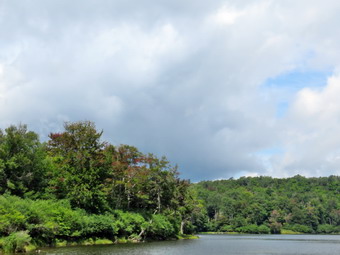 We walked down to the shore and Sheila promptly jumped in to swim. I took out the camera and took some shots of the pond and the towering clouds. The clouds were not very dark but the wind was starting to blow and I decided to get going. Back on the main trail we walked toward the Flynn Trail where we turned left to complete the loop around the pond. On the way toward the outlet, we encountered another large blowdown and I took a quick picture. I could remove this one if the people from OSI did not get to it first. At the clearing near the outlet we walked over toward the shore and I again stopped to take pictures. In the few minutes since we had left the upper end of the pond the clouds had grown darker in some places and the wind was turning the leaves over. I decided to walk up the hill next to the pond to walk back up the jeep trail and then out to the Flynn Trail. The trail was a little longer than I remembered but not as steep and we were soon back at the Flynn Trail. We turned left to head for the junction with the Big Rock Trail. We hiked passed the gate and by 12:25 PM we were back at the highest point on the hike. I had originally planned to head down the Big Rock Trail and then walk the Logger's Loop to extend the distance of the hike. I had not heard any thunder yet but I definitely did not want to hike in the rain! I decide to simply hike back down the Flynn Trail which would give me about 5.5 miles of hike which I deemed enough for the day. Then Flynn Trail is all downhill on the way back and I set a pretty fast pace. I did have to keep calling Sheila back as she was setting an even faster pace. Soon we were descending the last part of the hill to the gate. We followed the Flynn Trail through the woods and back to the car. There was one other car parked in the lot. The skies looked blue and sunny but I was glad to finish early. Surprisingly the descent had taken only a few minutes less than the ascent and we had made no stops. We were backs t the car at 1:05 PM having hiked 5.7 miles in 2 hours and 15 minutes gaining 820 feet along the way.
![]()
![]()
![]()
![]()
![]() On Monday, August 8th I was tired after hiking 10.5 miles to cover a section of the Finger Lakes Trail from Maple Lane to Templar Road. I decided as long as I was in the area I would go to the Sugar Hill Fire Tower since the walk seemed very short. I drove north on Maple Lane traveling slowly as the road was all gravel and dirt. At the end I turned right or east on Tower Hill Road and within .2 miles came to the access road to the fire tower and a parking area. I decided to walk up to the tower from the access road even though you can drive directly to the tower. The road is not open at all times and I wanted to know the distance of the walk. I took my pack out of the car even though it was a short walk since it is the easiest way to carry my camera. I put Sheila on her leash as there were some rather unruly dogs in the lot. We headed over to the access road at 3:00 PM and began the walk to the tower. The temperature was in the mid 80's but a breeze made it seem cooler. There was a track in the grass beside the road and we walked most of the way along that track. As we approached the tower there was a loop around the top and we headed to the right even though we could have gone directly to the tower across the grass. At the top of the hill there is a nice recreation area and ample parking. Once at the top we headed over to the tower and I tied Sheila to the sign at the base. I took a few pictures of the tower and then began to climb. As I climbed up each step my leg muscles let me know they were not happy. This tower is a 67'6" International Derrick model 1937 tower and was erected in 1941 by CCC. It was staffed by volunteers until 1951, and then by the State until 1979. When I got to the top of the tower, I found the cab was closed and from my reading this is true all year. Even though I could not get into the cab, the view from the top was still good. On this day there was a lot of green and I imagined how beautiful the view would be during the fall when the leaves change color. The most notable feature was the blue water of Seneca Lake only 6 miles to the east. I took some pictures and then descended the tower. I was surprised Sheila was not barking but she was waiting quietly at the bottom for me. Before leaving, I let her off her leash for a minute and had her pose on the steps of the tower. Sheila would be perfectly willing to climb the steps all the way to the top as she is not afraid of the open steps. I packed up and we walked across the grass to the access road. On the way I saw a USGS marker which indicated the elevation of the hill was officially 2096 feet. The trip down seemed much easier than the trip up. We were back at the car at after hiking .7 miles in 25 minutes with an elevation gain of only 104 feet.
On Monday, August 8th I was tired after hiking 10.5 miles to cover a section of the Finger Lakes Trail from Maple Lane to Templar Road. I decided as long as I was in the area I would go to the Sugar Hill Fire Tower since the walk seemed very short. I drove north on Maple Lane traveling slowly as the road was all gravel and dirt. At the end I turned right or east on Tower Hill Road and within .2 miles came to the access road to the fire tower and a parking area. I decided to walk up to the tower from the access road even though you can drive directly to the tower. The road is not open at all times and I wanted to know the distance of the walk. I took my pack out of the car even though it was a short walk since it is the easiest way to carry my camera. I put Sheila on her leash as there were some rather unruly dogs in the lot. We headed over to the access road at 3:00 PM and began the walk to the tower. The temperature was in the mid 80's but a breeze made it seem cooler. There was a track in the grass beside the road and we walked most of the way along that track. As we approached the tower there was a loop around the top and we headed to the right even though we could have gone directly to the tower across the grass. At the top of the hill there is a nice recreation area and ample parking. Once at the top we headed over to the tower and I tied Sheila to the sign at the base. I took a few pictures of the tower and then began to climb. As I climbed up each step my leg muscles let me know they were not happy. This tower is a 67'6" International Derrick model 1937 tower and was erected in 1941 by CCC. It was staffed by volunteers until 1951, and then by the State until 1979. When I got to the top of the tower, I found the cab was closed and from my reading this is true all year. Even though I could not get into the cab, the view from the top was still good. On this day there was a lot of green and I imagined how beautiful the view would be during the fall when the leaves change color. The most notable feature was the blue water of Seneca Lake only 6 miles to the east. I took some pictures and then descended the tower. I was surprised Sheila was not barking but she was waiting quietly at the bottom for me. Before leaving, I let her off her leash for a minute and had her pose on the steps of the tower. Sheila would be perfectly willing to climb the steps all the way to the top as she is not afraid of the open steps. I packed up and we walked across the grass to the access road. On the way I saw a USGS marker which indicated the elevation of the hill was officially 2096 feet. The trip down seemed much easier than the trip up. We were back at the car at after hiking .7 miles in 25 minutes with an elevation gain of only 104 feet.
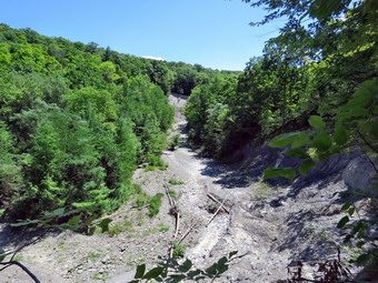
![]()
![]()
![]()
![]()
![]() On Monday, August 8th I wanted to hike and Cindy didn't feel she was up to it. After considering several options, I decided to make the long trip to the Finger Lakes Trail west of Watkins Glen and hike east toward the point where I had left off. After looking at the maps, the distances and the weather forecast for temperatures in the mid to high 80's, I decided to go to the western end of map 14 and hike from Access Point1 on Maple Lane in Orange, NY to Access Point 3 on Templar Road. The hike on the trail would be a little more than 6 miles but I knew we could hike back on local roads and cut the distance to 4 miles with a less difficult hike. Since the drive is almost 3 hours, I planed to get up at 6:00 AM and be out of the house by 6:30 AM. I got up on time but several little problems delayed my departure until just after 7:00 AM. One problem was that Google Maps would not print out a complete set of directions no matter what I did. I switched to MapQuest which would print out the complete directions but had a different route. When I put the destination into the car's GPS, I got a different route. When I left town, I wasn't sure what set of directions I would follow! As I drove north on Route 17, the fog was heavy and this continued all the way to Hancock. As I neared Hancock, signs began to appear that there was an accident ahead and that Route 17 was closed. This was just the first of several annoyances during the day. I got off the exit for Cadosia and took Route 268 north to Route 10. I turned left on Route 10 and followed some very slow traffic along the Cannonsville Reservoir to Deposit where I was able to get back on Route 17. After a long drive, I exited at exit 52A and got on Route 14 north toward Watkins Glen. I caught Johnson Hollow Road and headed for Route 414 to head west and north toward my destination. I began to see more and more traffic including many large trucks. The lettering NASCAR on the side reminded me that there had been a race at the track this weekend and the teams were finally leaving. After a few delays, I got by the racetrack and deiced to follow the car's GPS. I made the turns as indicated but soon found I was headed too far west. I stopped to figure out where the GPS was taking me and the route was the most round about way to get to where I wanted to be. I decided that I was committed and continued to follow the directions until I was close to Sugar Hill and then used my own sense of direction. Once I was on Sugar Hill Road, I found Maple Lane without much of a problem. I turned north an drove .75 miles to a small parking area on the right side of the road. A motorcycle was parked in the entrance and the rider sat on a stone taking break. He didn't seem to want to move so I edged between him and his bike with only a little room to spare. I turned around and parked and let Sheila out of the car. The rider spoke to me and turned out to be a very nice guy. The Finger Lakes Trail left the back of the parking lot and as we finally got on the trail at 10:45 Am we wished each other a good day.
On Monday, August 8th I wanted to hike and Cindy didn't feel she was up to it. After considering several options, I decided to make the long trip to the Finger Lakes Trail west of Watkins Glen and hike east toward the point where I had left off. After looking at the maps, the distances and the weather forecast for temperatures in the mid to high 80's, I decided to go to the western end of map 14 and hike from Access Point1 on Maple Lane in Orange, NY to Access Point 3 on Templar Road. The hike on the trail would be a little more than 6 miles but I knew we could hike back on local roads and cut the distance to 4 miles with a less difficult hike. Since the drive is almost 3 hours, I planed to get up at 6:00 AM and be out of the house by 6:30 AM. I got up on time but several little problems delayed my departure until just after 7:00 AM. One problem was that Google Maps would not print out a complete set of directions no matter what I did. I switched to MapQuest which would print out the complete directions but had a different route. When I put the destination into the car's GPS, I got a different route. When I left town, I wasn't sure what set of directions I would follow! As I drove north on Route 17, the fog was heavy and this continued all the way to Hancock. As I neared Hancock, signs began to appear that there was an accident ahead and that Route 17 was closed. This was just the first of several annoyances during the day. I got off the exit for Cadosia and took Route 268 north to Route 10. I turned left on Route 10 and followed some very slow traffic along the Cannonsville Reservoir to Deposit where I was able to get back on Route 17. After a long drive, I exited at exit 52A and got on Route 14 north toward Watkins Glen. I caught Johnson Hollow Road and headed for Route 414 to head west and north toward my destination. I began to see more and more traffic including many large trucks. The lettering NASCAR on the side reminded me that there had been a race at the track this weekend and the teams were finally leaving. After a few delays, I got by the racetrack and deiced to follow the car's GPS. I made the turns as indicated but soon found I was headed too far west. I stopped to figure out where the GPS was taking me and the route was the most round about way to get to where I wanted to be. I decided that I was committed and continued to follow the directions until I was close to Sugar Hill and then used my own sense of direction. Once I was on Sugar Hill Road, I found Maple Lane without much of a problem. I turned north an drove .75 miles to a small parking area on the right side of the road. A motorcycle was parked in the entrance and the rider sat on a stone taking break. He didn't seem to want to move so I edged between him and his bike with only a little room to spare. I turned around and parked and let Sheila out of the car. The rider spoke to me and turned out to be a very nice guy. The Finger Lakes Trail left the back of the parking lot and as we finally got on the trail at 10:45 Am we wished each other a good day.
 I had turned on both my Garmin Map 64st GPS unit and my Sunnto Traverse GPS watch to compare their tracks. I also had my cellphone with map 14 loaded into PDFMaps. I have found this app valuable when hiking the Finger Lakes Trail since the trail blazes are sometimes few and far between. The app works by using GPS satellite signals rather than cellphone signal from towers and can therefore work well under most conditions. We walked through a red pine plantation as the trail descended a little. The sun was bright but we were shaded under the trees and there was a slight breeze. Several unmarked trail crossed the Finger Lakes Trail but at .4 miles a blue trail with a "Lean-to" sign headed off to the right. That trail descended to the Parks Hollow lean-to. We followed the Finger Lakes Trail as it stayed on contour around a hill. We had been heading north and northeast but at 1.7 miles we descended to cross a dry creek bed and then the trail bent back to head first south and then east. At 1.8 miles we crossed the Mohawk Trail and at around 2 miles there was a sign on the right that indicated another lean-to and a pond. I thought about taking the trail just to see the pond but continued straight ahead on the main trail. After 2 miles the trail turned south but soon swung east descending all the way. At 2.9 miles we crossed Route 21 where there was room to park along the side of the road. There was no traffic so we crossed quickly and continued heading east and descending. A caution on the FLT map indicated the stream crossing near the end of this section could be a problem if the water was high but everything we had seen so far indicated this would not be a problem. As we walked we came to a spot where there was a large pile of fieldstones. It was the first remarkable feature so I took a few pictures. The trail up to this point was well-marked and maintained but after this location there were stretches with few blazes. Much of the trail in this area was overgrown and there were a few blowdowns. There were also a series of wooden walkways meant to bridge muddy areas but all of these areas were very dry. This section of the trail headed almost due east. We crossed the abandoned part of Locust Lane at 4.5 miles but it was hardly recognizable as a road anymore. There was an old foundation in the area.
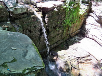 We continued to head east as the trail continued to descend. I knew that all the descending meant we would have to regain that elevation to get back to the car. At 4.8 miles the trail turned south-southeast along Glen Creek. At about 5 miles there was a viewpoint over the creek and I took some pictures from it of the completely dry creek bed below. It was hard to believe that this creek was the one that cut the gorge I was looking at and Watkins Glen. As the trail started to turn away from Glen Creek, I noticed a solid rock foundation. I had never seen anything like it before and assumed it might have been part of a bridge across the creek. This was also the lowest point on the hike at 1237 feet. The car was parked at 1920 feet! At 5.5 miles we passed the Buck Settlement lean-to on the left side of the trail. We followed the trail along what looked like an old road and then crossed a small stream that had once cut a deep bed. Right after the crossing we turned left on an old road. The road descended to a branch of Glen Creek where there were some picnic tables at a small waterfall. This was "Ebenezer's Crossing" where we met the only other hikers we would see all day. A young couple and their Golden Doodle were hiking west from Watkins Glen toward Maple Lane where I was parked. We talked and I took a few pictures before heading up to Templar Road. The water fall looked like the discharge from a garden hose but I saw the potential for a difficult crossing during high water. When we got to the road, I stowed my poles and put Sheila on her leash for the road walk back to the car. We turned right on Templar Road which was covered with gravel. There was little traffic but we were more exposed to the hot sun. The hike on Templar Road was 1.4 miles and all of it was uphill. We continued straight ahead on Route 21 for .4 miles and it was all uphill but paved. When Route 21 turned right to head north, we continued straight ahead on Sugar Hill Road. I found out why there was a "hill" in the name of the road as we hiked another .9 miles uphill. Before we started to descend, we stopped so that I could give Sheila a drink and get one myself. Sheila seemed very hot and I began to think that I might cut into the woods rather than stay on the roads.
We walked another .4 miles downhill until the access road for the Perkins Hollow lean-to came up on the right. We turned right and started to walk down the road. There was a gate and just outside the gate there was a four-wheeler with no rider. I thought we might encounter the owner but we never did. The access road descended to cross a small stream near the new lean-to site. I saw a sign that said "To FLT" so we followed it as it headed first north and then west climbing the whole way. It wasn't a steep climb but my legs were tired. At about 10 miles the Mohawk Trail headed north toward the Sugar Hill Fire Tower and at 10.1 miles we were back at the main Finger Lakes Trail. We turned left and retraced our steps from earlier in the day. We were back at the car at 2:50 PM having hiked 10.5 miles in 4 hours and 5 minutes. The total elevation gain was 1596 feet. After getting drink and enjoying the air conditioning, I headed north on Maple Lane to go to the Sugar Hill Fire Tower.
We continued to head east as the trail continued to descend. I knew that all the descending meant we would have to regain that elevation to get back to the car. At 4.8 miles the trail turned south-southeast along Glen Creek. At about 5 miles there was a viewpoint over the creek and I took some pictures from it of the completely dry creek bed below. It was hard to believe that this creek was the one that cut the gorge I was looking at and Watkins Glen. As the trail started to turn away from Glen Creek, I noticed a solid rock foundation. I had never seen anything like it before and assumed it might have been part of a bridge across the creek. This was also the lowest point on the hike at 1237 feet. The car was parked at 1920 feet! At 5.5 miles we passed the Buck Settlement lean-to on the left side of the trail. We followed the trail along what looked like an old road and then crossed a small stream that had once cut a deep bed. Right after the crossing we turned left on an old road. The road descended to a branch of Glen Creek where there were some picnic tables at a small waterfall. This was "Ebenezer's Crossing" where we met the only other hikers we would see all day. A young couple and their Golden Doodle were hiking west from Watkins Glen toward Maple Lane where I was parked. We talked and I took a few pictures before heading up to Templar Road. The water fall looked like the discharge from a garden hose but I saw the potential for a difficult crossing during high water. When we got to the road, I stowed my poles and put Sheila on her leash for the road walk back to the car. We turned right on Templar Road which was covered with gravel. There was little traffic but we were more exposed to the hot sun. The hike on Templar Road was 1.4 miles and all of it was uphill. We continued straight ahead on Route 21 for .4 miles and it was all uphill but paved. When Route 21 turned right to head north, we continued straight ahead on Sugar Hill Road. I found out why there was a "hill" in the name of the road as we hiked another .9 miles uphill. Before we started to descend, we stopped so that I could give Sheila a drink and get one myself. Sheila seemed very hot and I began to think that I might cut into the woods rather than stay on the roads.
We walked another .4 miles downhill until the access road for the Perkins Hollow lean-to came up on the right. We turned right and started to walk down the road. There was a gate and just outside the gate there was a four-wheeler with no rider. I thought we might encounter the owner but we never did. The access road descended to cross a small stream near the new lean-to site. I saw a sign that said "To FLT" so we followed it as it headed first north and then west climbing the whole way. It wasn't a steep climb but my legs were tired. At about 10 miles the Mohawk Trail headed north toward the Sugar Hill Fire Tower and at 10.1 miles we were back at the main Finger Lakes Trail. We turned left and retraced our steps from earlier in the day. We were back at the car at 2:50 PM having hiked 10.5 miles in 4 hours and 5 minutes. The total elevation gain was 1596 feet. After getting drink and enjoying the air conditioning, I headed north on Maple Lane to go to the Sugar Hill Fire Tower.
On Sunday, August 7th Cindy and I decided we would do some more work on Round Top just across the street from our house in Livingston Manor. We had started clearing a trail and wanted to do some more work to get it ready. Our friend Debbie wanted to help also but could not start until 2:00 PM. After church, Cindy and I ate lunch and I decided to head over to Round Top to scout out the correct route for the trail. Cindy and Debbie would join me later. I had a track from a previous trip so I turned it into a geospatial PDF which I could use on the PDFMaps app on my iPhone. I took my saw and wedges and walked across the street with Sheila around 1:00 PM. We walked up the steep road along the side of the cemetery and then turned left into the woods at the top of the hill. I admired the work we had done the day before as we hiked up to the trail junction. We turned right and walked up the woods road below the cliffs to our left. When the woods road turned left we followed it to the spot where Cindy and I had finished clearing. Ribbons marking a possible trail headed off into the woods on the left but I was pretty sure we could follow the woods road to another further up the trail. I got out my iPhone and found that I was right. At the end of the woods road leading up the hill we turned right on another and followed it which kept us right on the track I had on my phone. The farther we went the more the woods road was obscured by branches and weeds. I turned west where the track indicated but tried to stay a little more north since I wanted to lengthen the trail and I was pretty sure I would be on the public land. I continued to walk and soon found I had not turned soon enough and missed the viewpoint. I ended up on the same woods road I had ascended earlier. I walked back up that road to the spot where Cindy and I had stopped and dripped my pack. I got out my saw and started to cut the larger branches and a few blowdowns across the trail. I also picked up sticks and branches that were in the trail. I made the turn at the top and continued along the woods road wishing that I had brought loppers since they were best for some clearing. I continued to work until I reached a larger birch tree that lay embedded on the path. I turned around and walked back to my pack. Sheila alerted as Cindy and Debbie walked up the path. After a short rest, we got busy clearing more of the trail and widening it. Cindy and I used the loppers while Debbie cleared some of what we cut and pulled out other obstructions. It was humid and we were tired but we kept working until we got to the birch log. At this point I decide to leave it where it was and to cut another patch of brush that almost completely obscured the trail. After finishing that job, we decided to walk the loop as I had done before. We started out walking about the same route I had walked and I again missed the correct turn! We hit the woods road below the ledges and turned right to head back to the cemetery.
Along the way we decided to go to Madison's for dinner but it was not quite 4:00 PM. Cindy and Debbie decided to go back to the house to get cleaned up. I decided I wanted one more shot at finding a route from the viewpoint to the trail we had been clearing. This time I walked up to the viewpoint first and then headed east from there. For some reason walking in the direction was easier for me and I ended up on the extension of the woods road we had been clearing. I decided to follow a herd path that I had found to the highest point on Round Top that is on public land. I found the path and started up but it soon became hard to follow. I had been up the hill before and found one path after another and was soon at the top. The problem was that this climb averaged over 20% which would not be appropriate for most hikers. As I started down, I decided to stay a little more to the north and closer to State Route 17 since this was a gentler slope. I watched for "posted" signs to my right and did not see any and was soon on the woods road extension. I turned south and followed the path we had cleared all the way back to the main trail up to the viewpoint and then out to the cemetery. I turned off my GPS devices convinced that I had a good track. When I got home I edited some of my mistakes off the track and then sent it to Doug at the NYNJTC. I knew he could have his cartographer overlay the track on the tax maps to make sure I had stayed on public land. If my track is a good one, we will get a group together to help lay out the trail to connect the end of the woods road with the view point. This trail will have to be cleared and then the whole trail will have to be marked. We will also get a group together to hike to the high point on Round Top and look at possible routes to make a loop.
On Saturday, August 6th Cindy and I took our trail tools and headed across the street with Sheila to the hill called Round Top. On Thursday night the Town of Rockland Board had passed a resolution to create a trail network on the 14 acres of woodland adjacent to the Orchard Street cemetery. The Board seemed very enthusiastic about the project. Doug Senterman, the NYNJTC Program Coordinator, was present to explain some of the details and to offer the support of the trail conference. Lisa Lyons also spoke about the importance of the trail network. The initial trail on Round Top will primarily follow existing woods roads which will require only minimal clearing to "build" the trail. A longer trail will be added that goes to the summit of Round Top. The trail leads to an viewpoint that overlooks the hamlet of Livingston Manor and the Livingston Manor School. Some trees will be removed at the viewpoint to allow an unobstructed view. It is hoped that the initial trail project on Round Top will lead to other project including a River Walk and a rail trail. All of these will be in easy walking distance of the center of town.
Cindy and I waited until some early morning showers had passed and then headed across the street with various tools including axes, saws and loppers. We walked up the steep hill to the beginning of the trail where some stone steps signal the start. We cut out the branches that obscured the start of the trail and continued to do so as we walked into the woods. There were a few blowdowns across the trail and a few larger branches to cut as we continued straight ahead and up the trail to the lookout. The lookout has long been used by individuals who illegal start campfires and leave garbage at the location. Cindy and I noted the amount of garbage that would have to be removed by a team of workers. The lookout has no view with leaves on the trees and I spotted three or four trees that could be cut to improve the view. Cindy and I walked back down to the area where the trail splits and headed up the other side of the loop. We cut a few branches here and there and removed some loose material from the trail. As we neared the end of the woods road, we turned left and continued on another woods road. There were a few more branches to cut here and some thorn apple to remove. We came to s spot where I was not sure of the track I wanted to take. We decided that I would put my previous track on a GPS device so that, on another day, we could clear the correct path. We hadn't been out too long but the humidity was very high so we decided to return home. We will be back to clear the rest of the trail and to walk a route for another trail to the summit of Round Top. The NYNJTC has cartographers who can easily superimpose my GPS tracks on the tax maps to make sure the trails are all on town property. We will also be getting together a crew to clear garbage from the lookout. Our tentative plan is to have the trails completed and blazed and the lookout cleared by October 1st in time for the fall colors!
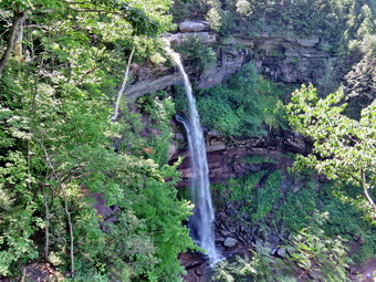
![]()
![]()
![]()
![]()
![]() On Friday, August 5th I wanted to due a shorter destination hike since I had a slight foot injury from my 11+ mile hike in Chenango County two days before. I decided to visit Kaaterskill Falls as I had not been there in a while and I knew that there had been many changes. In an effort to prevent injuries and deaths the DEC had hired ADK crews to build a viewing platform for the upper falls, install fencing in some of the most dangerous areas and construct a trail from the bottom of the lower falls to the top of the upper falls. Despite these efforts a 17 year old New Jersey youth fell from the top of the falls in late July and died from his injuries. We got our gear ready and put it in the car with Sheila and started out from Livingston Manor a little after 9"00 AM. I chose to drive out DevRuce Road to Route 47 were I turned left to drive passed the Frost Valley YMCA camp. At Route 28 in Big Indian I continued straight ahead on the Route 28 detour to Route 42. I turned north on Route 42 and drove to Route 23A in Lexington. I turned right and drove through Hunter, Tannersville and Haines Falls arriving at the parking area for the falls at about 10:45 AM. We were surprised that it was Friday and the lot was more than full. Cars were trying to find places to park were there were none. We decided to park at the end of Laurel House Road and at least get a look at the upper falls even if the trail to the lower falls was not yet complete. When we arrived at the parking area, I was surprised to see that it had been enlarged and upgraded. The last time I had visited the rail trail had been constructed which included leveling and the application of crushed stone. Now there was also a trail that seemed to head down toward the falls which was also leveled and covered in crushed gravel. We got ready and started our hike at about 11:00 AM. I put Sheila on her leash where she stayed most of the day and I did not take my poles as I would not be able to use them while holding the leash. We started down the older dirt path that leads most directly to the top of the falls and crossed the new gravel path twice. We soon arrived at the path that leads passed the new fencing and down to the viewpoint that looks out from the top f the upper falls and to the pool below. There were signs that warned hikers to be careful but several people were walking around in questionable footwear where a fall would have been fatal. I put down my pack and handed the leash to Cindy as I got out my camera. I took several pictures out over the clove and a few of the falls and Spruce Creek. We were both happy there was enough water in the creek to make viewing the falls worthwhile. I walked back up Spruce Creek on the path along the rocks of the creek. I was looking for blazes on the other side but did not find any so I returned to Cindy. I was disappointed that there was no trail down to the lower falls but I knew we could come back in midweek and park on Route 23A to visit the lower falls.
On Friday, August 5th I wanted to due a shorter destination hike since I had a slight foot injury from my 11+ mile hike in Chenango County two days before. I decided to visit Kaaterskill Falls as I had not been there in a while and I knew that there had been many changes. In an effort to prevent injuries and deaths the DEC had hired ADK crews to build a viewing platform for the upper falls, install fencing in some of the most dangerous areas and construct a trail from the bottom of the lower falls to the top of the upper falls. Despite these efforts a 17 year old New Jersey youth fell from the top of the falls in late July and died from his injuries. We got our gear ready and put it in the car with Sheila and started out from Livingston Manor a little after 9"00 AM. I chose to drive out DevRuce Road to Route 47 were I turned left to drive passed the Frost Valley YMCA camp. At Route 28 in Big Indian I continued straight ahead on the Route 28 detour to Route 42. I turned north on Route 42 and drove to Route 23A in Lexington. I turned right and drove through Hunter, Tannersville and Haines Falls arriving at the parking area for the falls at about 10:45 AM. We were surprised that it was Friday and the lot was more than full. Cars were trying to find places to park were there were none. We decided to park at the end of Laurel House Road and at least get a look at the upper falls even if the trail to the lower falls was not yet complete. When we arrived at the parking area, I was surprised to see that it had been enlarged and upgraded. The last time I had visited the rail trail had been constructed which included leveling and the application of crushed stone. Now there was also a trail that seemed to head down toward the falls which was also leveled and covered in crushed gravel. We got ready and started our hike at about 11:00 AM. I put Sheila on her leash where she stayed most of the day and I did not take my poles as I would not be able to use them while holding the leash. We started down the older dirt path that leads most directly to the top of the falls and crossed the new gravel path twice. We soon arrived at the path that leads passed the new fencing and down to the viewpoint that looks out from the top f the upper falls and to the pool below. There were signs that warned hikers to be careful but several people were walking around in questionable footwear where a fall would have been fatal. I put down my pack and handed the leash to Cindy as I got out my camera. I took several pictures out over the clove and a few of the falls and Spruce Creek. We were both happy there was enough water in the creek to make viewing the falls worthwhile. I walked back up Spruce Creek on the path along the rocks of the creek. I was looking for blazes on the other side but did not find any so I returned to Cindy. I was disappointed that there was no trail down to the lower falls but I knew we could come back in midweek and park on Route 23A to visit the lower falls.
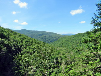 We finally left the top of the falls and headed back along the path. We decided to follow the new trail as it started down the western side of the falls gorge. There was a sign that said "Viewing platform" and the trial wound down to a viewpoint with a new viewing platform. The platform looked out over the clove and have a great side view of the upper falls. It was a much safer alternative to standing at the top of the falls and the view of the falls was certainly better! I took a picture of the platform and then stepped out to take some more shots. I took some pictures down the clove and several of the upper falls from the side. As we got ready to leave I noticed an Assistant Forest Ranger sitting on the rock wall. I asked him when the trail to the bottom of the falls would be ready and he replied "It is already almost completed." The final plan is to install a 120 foot bridge over Spruce Creek upstream from the falls in the area of the previous bridge which is now in ruins. He suggested that we walk upstream and cross the creek to access the new trail. He explained that there would be signs in this area. Cindy and I took Sheila and headed up the stream walking on the rocks since the creek was low. There is also a trail higher up the bank which leads to the same area. Sooner than I expected, we were at the old bridge and we crossed over the stream pretty easily on some rocks. We found a sign that said "To Top of Falls" but could not find any sign of the new trail the AFR had mentioned. Another couple was standing on the blue Escarpment Trail talking about where they would hike next. They asked me some questions which I answered. I asked them about the trail to the bottom of the falls and they told us to get on the Escarpment Trail heading toward the Layman Memorial and we would find the yellow blazed trail to the bottom! We were both happy that we would get to see the rest of the falls. I was happy to be able to create a track for other hikers and add the trail to my list to say I had really hiked ALL the trails in the Catskills. We started to walk out on the Escarpment Trail and in a little more than .1 miles we found the yellow trail on the right. We turned right and followed the trail as it made its way down the steep slope using switchbacks at places to mitigate the grade. The crew had expertly sited the trail and added some crushed stone for drainage. There were several groups of people hiking in the direction we were going and several groups coming up from below.
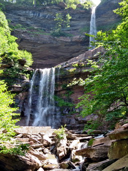 After a walk of about .25 miles we came to the top of the stone staircase installed by the ADK crew. The crew placed 200 steps imported from another site to build a set of steps on the steepest part of the slope. A little over .4 miles from where we started by the "bridge" there was a side trail to the upper pool. Again, the ADK crew had done a very professional job of widening a leveling the existing path. As we hiked along the damp path, it was obvious that the rocks and dirt were slippery and that anyone hiking here should have proper hiking footwear and be extremely careful. Despite this we saw numerous people in sneakers and sandals walking the trails. Above the official trail another old path goes to a point above the upper pool. We could see young children with adults on this hazardous and illegal pathway. Walking these informal trails increases erosion and endangers the hiker. I thought about the family of the most recent fatal mistake and the rescuers that had to retrieve his broken body. Despite the fences, signs, new trails and view platform there is no way to prevent stupid and careless people from putting themselves and others in danger! We walked out the path to the upper pool and I got me camera out to take some pictures. The position of the sun above the falls and the spray made getting pictures difficult. I took a few more of the gorge below the pool and then return to Cindy and Sheila. We headed down the remaining steps to the pool below the lower falls. I again got out the camera and took some shots of the lower falls and pool. I also tried to get the best angle to block some of the bright sun and to get a shot of both falls at the same time. After taking my pictures, I packed up and we headed down the trail toward Route 23A and Bastion Falls. Our plan was to turn around and Route 23A and hike back up the trail to the car as the hike along Route 23A back to Laurel House Road would be long and dangerous! As we headed down the trail there were numerous people coming up toward the lower falls. The trail was damp and wet in some places. I was surprised that little work had been done on this part of the trail and it was a stark contrast to the new trail and steps we had just used. At one point we came to a new set of wooden steps and the ADK crew taking their lunch break below. I stopped to ask them about the line they had strung across the creek and the project they were doing. They explained the line was to help set the stones that made up the rock retaining wall they were completing. The existing steps had been the victim of erosion and had been aging at least six inches in the air where the creek had eroded the bank. I thanked them for their work and asked if any other projects were planned. They said the only other approved project was the placement of the bridge across Spruce Creek. I was hoping that the trail from Route 23A to the lower falls would also be improved but they said they were unaware of any such plans.
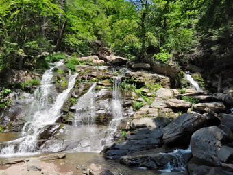 We continued down the trail toward the Route 23A trailhead followed by at least one band of people. At the bottom we found a photographer was setting up a tripod in the stream directly in front of Bastion Falls. This was another example of someone thinking only of themselves! It was a dangerous move and meant anyone else trying to take pictures would have to shoot around him. To add to the surreal nature of the scene, a rather large man in swim trunks decided to wade into the pool at the base of Bastion Falls. I just marveled at the selfishness of these people and got out my camera to try to shoot around them. I took some shots from near the creek bed and then walked up to the Route 23A bridge and took a few pictures from there. When I walked back down to meet Cindy and Sheila, it was time to pack up and get started back to the car. I did not plan to stop much along the way and we headed back at about 12:40 PM. We walked back to the lower falls as fast as possible until we were at the base of the 200 steps. We started up the steps and met several groups of people coming down. Each time we met a group I would pull Sheila to the side of the trail to allow others to pass. Eventually we made it to the top of the steps and continued to walk the new trail uphill to the Escarpment Trail. We considered hiking a little more but I had to be back for cross country practice so we decided to head back to the car. When we got to the old bridge, we had several choices about how to return. We could walk back down the creek reversing our route from earlier. We could walk up Schutt Road to the access road to North South Lake and then walk down Laurel House Road to the car. We chose to cross the stream by the bridge and walk up a path which I felt would be the access once the new bridge was installed. We walked up the path and found ourselves on the new trail from the parking area at Laurel House Road. I had no idea that we would be that close to the car after crossing the creek. We walked back to the car arriving at 1:30 PM. I decided I wanted to walk the entire new trail so I could get an accurate GPS track of the "right" way to go. I headed down the new gravel covered trail and followed it passed the cutoff to the old bridge and down to the view platform. From here I walked back up the trail to the cutoff to the bridge. I turned right here and walked down the bank to the creek, cross on stepping stones and walked up to the Escarpment Trail. At this point I turned around and recrossed the stream and followed the trail back up to the car. It was 1:45 PM and I had hiked 4.2 miles in 2 hours and 40 minutes with and elevation gain of 1165 feet. We thought about stopping at Poncho Vila's in Tannersville but decided we did not want to leave Sheila in the car that long.
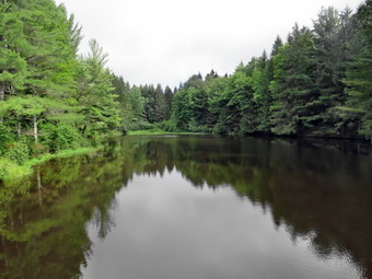
![]()
![]()
![]()
![]()
![]() On Wednesday, August 3rd I was ready to get out of the house again after almost a weak of rainy weather! For my first hike of August, I decided to head north to Chenango County to hike a section of the Finger Lakes Trail from Jackson Pond on John Smith Road north of North Pharsalia to Fred Stewart Road south of North Pharsalia. I intended to hike south on the trail and then hike back to the car using local roads. I estimated the hike out would be just over 7 miles and the hike back would be only 4 miles for a total of around 11 miles. I chose this hike for several reasons. This section of trail was recently rerouted off roads onto newly constructed trails and included a new bridge. In addition, this was the route of the most recent "named hike" of the FLTC. The hike was the EdSidote hike and my route would pass the bench dedicated to "Mr. FLT" who always said "Happy Hiking". I had planned to do this hike on the previous Saturday with the group but was denied permission to bring my dog. There was really no decision for me since I hike everywhere with Sheila. I had headed north to do the hike with her on Saturday but when I got to Norwich the rain was falling and I turned around and drove home. Now I was ready to try in again with a forecast of fog in the morning and partly sunny skies the rest of the day. I got up early but delayed my departure until just after 7:30 AM so I would be at the beginning of the hike by 9:30 AM. I headed to Deposit on Route 17 and took Route 8 north to Sidney. Just north of Sidney I took the route to Norwich where I picked up Route 23 West. I drove through North Pharsalia and followed the map on my cell phone to John Smith Road just a little to the west. The road started as a gravel road, turned to a paved road briefly and then turned back to gravel. I drove a little less than a mile to a small parking area on the left side of the road. I parked at 9:30 AM and when I got out of the car felt a little cool as the temperature was only 63 degrees. I was glad I had worn a long-sleeved top with a baselayer but I knew it would probably warm up during the day. I let Sheila out of the car, set up all my electronic devices and started the hike at 9:35 Am by walking a little north on the road to where the Finger Lakes Trail crossed. We turned right to head east and were off on our hike. The trail was exceptionally well-maintained which may have something to do with the "named" hike on Saturday. The first mile was downhill and was the same as the previous route. We passed by the remains of the old CCC camp but I decided not to take any pictures as what is left is hard to distinguish even in person. I did stop to take a picture of a magnificent fungus at the base of a tree. At 1.0 miles the trail met Elmer Jackson Road and we turned right or south to follow the road to Lower Pond. I remembered this pond and the small dam at the outlet. I dropped my pack to get out the camera and took some pictures of the dam and then worked by way down the bank of the stream so that I was below the dam. I took some pictures from various angles before walking back up to my pack. At this point the old route passed across the dam and headed out to Grover Brown Road. The new route took us further down Elmer Jackson Road.
On Wednesday, August 3rd I was ready to get out of the house again after almost a weak of rainy weather! For my first hike of August, I decided to head north to Chenango County to hike a section of the Finger Lakes Trail from Jackson Pond on John Smith Road north of North Pharsalia to Fred Stewart Road south of North Pharsalia. I intended to hike south on the trail and then hike back to the car using local roads. I estimated the hike out would be just over 7 miles and the hike back would be only 4 miles for a total of around 11 miles. I chose this hike for several reasons. This section of trail was recently rerouted off roads onto newly constructed trails and included a new bridge. In addition, this was the route of the most recent "named hike" of the FLTC. The hike was the EdSidote hike and my route would pass the bench dedicated to "Mr. FLT" who always said "Happy Hiking". I had planned to do this hike on the previous Saturday with the group but was denied permission to bring my dog. There was really no decision for me since I hike everywhere with Sheila. I had headed north to do the hike with her on Saturday but when I got to Norwich the rain was falling and I turned around and drove home. Now I was ready to try in again with a forecast of fog in the morning and partly sunny skies the rest of the day. I got up early but delayed my departure until just after 7:30 AM so I would be at the beginning of the hike by 9:30 AM. I headed to Deposit on Route 17 and took Route 8 north to Sidney. Just north of Sidney I took the route to Norwich where I picked up Route 23 West. I drove through North Pharsalia and followed the map on my cell phone to John Smith Road just a little to the west. The road started as a gravel road, turned to a paved road briefly and then turned back to gravel. I drove a little less than a mile to a small parking area on the left side of the road. I parked at 9:30 AM and when I got out of the car felt a little cool as the temperature was only 63 degrees. I was glad I had worn a long-sleeved top with a baselayer but I knew it would probably warm up during the day. I let Sheila out of the car, set up all my electronic devices and started the hike at 9:35 Am by walking a little north on the road to where the Finger Lakes Trail crossed. We turned right to head east and were off on our hike. The trail was exceptionally well-maintained which may have something to do with the "named" hike on Saturday. The first mile was downhill and was the same as the previous route. We passed by the remains of the old CCC camp but I decided not to take any pictures as what is left is hard to distinguish even in person. I did stop to take a picture of a magnificent fungus at the base of a tree. At 1.0 miles the trail met Elmer Jackson Road and we turned right or south to follow the road to Lower Pond. I remembered this pond and the small dam at the outlet. I dropped my pack to get out the camera and took some pictures of the dam and then worked by way down the bank of the stream so that I was below the dam. I took some pictures from various angles before walking back up to my pack. At this point the old route passed across the dam and headed out to Grover Brown Road. The new route took us further down Elmer Jackson Road.
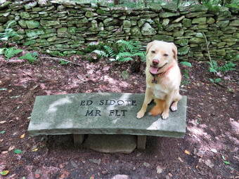 The walk down the road was about .6 miles until we found where the trail turned left into the woods. The new trail was well done and seemed to follow existing paths. We were only on the trail for .4 miles when it again came out to the road and followed it south for .1 miles until entering the woods on the right side of the road. The trail headed east and then turned south descending now toward Route 23. Some places were a little rocky and rough but most seemed to follow well-defined trails. At the end of the descent we came to a newly-constructed set of bridges across Canasawacta Creek. The first was a simple flat bridge without railings. The second, spanning the main creek, was a beautiful kingpost bridge. I stopped to take a few pictures and the crossed the bridges and headed up to the road. The trail crossed the road and started up the bank on the other side. This part of the trail was a steep climb but it didn't last very long. We were still on the new reroute of the trail and it is a job well done! The trail continued south over the top of a hill and down the other side crossing gravel covered Center Road at 3.8 miles. At 4.1 miles it turned east and then south again at 4.8 miles near a bivouac area. The old trail was marked in blue here and apparently headed out to the bivouac. We continued on the trail which was now the same as the old trail to Nine Mile DEC Truck Trail at 5.7 miles. We turned left and followed the road briefly before following the trail as it turned into the woods on the right. We continued to walk south and slightly downhill to 6.2 miles where the trial turned east. Much of the trail is what I call "roots, rocks, trees" and, while pretty, has no real remarkable features. The trail turned south again at 6.7 miles and I knew the Ed Sidote bench would be coming up soon. When we got to the bench, we stopped and I took some pictures of the bench and Sheila. This is also the point where a spur trail leads west to the Pharslia Woods Lean-to. After getting drink, we continued on the main trail east to Fred Stewart Road.
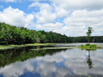 I was now ready for the return trip to the car using local roads so I put Sheila on her leash and collapsed my poles to store them in my pack. We turned left on Fred Stewart Road to head north. After a short distance, we turned left on the DEC Road heading northwest toward North Road. We walked by the area where we had crossed the road earlier and at 8.8 miles we were at North Road. We turned right here to head north toward Route 23. The sun was now behind us and it was much hotter than at any other point on the hike. Sheila was doing a good job of pulling me along and at 9.3 miles we crossed Center Road and hit the paved part of North Road. From where we descended for .5 miles to Route 23. We turned left and walked west meeting only a few cars on the usually busy highway. As we walked along Route 23, I noticed the beautiful blue sky filled with puffy white clouds and the farm that we were approaching. It was the kind of idyllic scene that is becoming less common as more and more farms are abandoned. After walking .4 miles of Rote 23, we turned right and started the final hike up John Smith Road to the car. The first part of the road was uphill and my legs were starting to hurt. I also was feeling a hotspot on the bottom of my left foot. Fortunately, there was a slight breeze nabbing and we were soon at the top of the hill and in the shade. As we approached the car, I checked my GPS watch and found it was 11.01 miles. I decided to take the access trail down to Jackson Pond where I had been before. The Finger Lakes Trail cuts below the dam but we walked out on the dam to get a better look at the pond. A blue heron took off from the area of the dam and flew north toward the upper end of the water. I got out my camera and took a few shots of the pond with the reflections of the sky and clouds. There is a small island in the pond which broke up the water and made the shots more interesting. We walked back up the road to the car and started our trip home. We had walked 11.3 miles in 4 hours and 10 minutes with an elevation gain of 1030 feet.
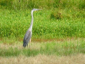
![]()
![]()
![]()
![]()
![]() On Thursday, July 28th I wanted to get in a hike close to home after finishing some work around the house in the morning. I got my gear including my Silky saw to remove at least one lowdown I knew about. Sheila was eager to get in the car and we left Livingston Manor around 10:30 AM to head for Frick Pond. The sky was a little overcast without the nice blue hues and puffy white clouds I like for pictures. I had already decided that I would limit my photography to the before and after pictures of the slowdowns I cleared. We were at the parking area and out on the Quick Lake Trail by 10:45 AM. Sheila was more than ready to get going even though we had hiked Monday and Tuesday. The temperature was in the high 70's and it was very humid. I had brought along my MSR Swift 3 poles to give them a try after using the Leki Micro Vario poles almost exclusively for a year. The Swift 3 poles are very light but don't seem quite as sturdy as others I have. They also have a limited number of length adjustments. The woods road passed the register box to Frick Pond was damp but there was no standing or running water. Just before the trail junction I cut one branch. At Gravestone Junction we stayed to the left on the red Quick Lake Trail crossing the stepping stones the Willowemoc Trail Crew had installed last year. I wondered when these stones would actually become necessary again! As we walked down to the pond, I cut another branch that was across the trail. We crossed the bridge over the outlet and the scene was much the same as always. . Looking at the pond I wasn't moved to take any pictures until some birds took off from the pond and one of them was a Great Blue Heron. The heron circled and landed again in the wetlands at the edge of the pond. My CanonSX^) HS has a 65x zoom lens and I used it to my advantage to snap several shots. I took a few more pictures of the pond and then packed up to continue our hike. At the next trail junction we headed left to stay on the Quick Lake Trail. We were keeping a pretty steady pace as we headed for Iron Wheel Junction. Sheila was running around following game trails and chasing a few chipmunks and squirrels. I removed a few branches from the trail as I walked along. When we arrived at Iron Wheel Junction, we turned left to head toward Hodge Pond.
On Thursday, July 28th I wanted to get in a hike close to home after finishing some work around the house in the morning. I got my gear including my Silky saw to remove at least one lowdown I knew about. Sheila was eager to get in the car and we left Livingston Manor around 10:30 AM to head for Frick Pond. The sky was a little overcast without the nice blue hues and puffy white clouds I like for pictures. I had already decided that I would limit my photography to the before and after pictures of the slowdowns I cleared. We were at the parking area and out on the Quick Lake Trail by 10:45 AM. Sheila was more than ready to get going even though we had hiked Monday and Tuesday. The temperature was in the high 70's and it was very humid. I had brought along my MSR Swift 3 poles to give them a try after using the Leki Micro Vario poles almost exclusively for a year. The Swift 3 poles are very light but don't seem quite as sturdy as others I have. They also have a limited number of length adjustments. The woods road passed the register box to Frick Pond was damp but there was no standing or running water. Just before the trail junction I cut one branch. At Gravestone Junction we stayed to the left on the red Quick Lake Trail crossing the stepping stones the Willowemoc Trail Crew had installed last year. I wondered when these stones would actually become necessary again! As we walked down to the pond, I cut another branch that was across the trail. We crossed the bridge over the outlet and the scene was much the same as always. . Looking at the pond I wasn't moved to take any pictures until some birds took off from the pond and one of them was a Great Blue Heron. The heron circled and landed again in the wetlands at the edge of the pond. My CanonSX^) HS has a 65x zoom lens and I used it to my advantage to snap several shots. I took a few more pictures of the pond and then packed up to continue our hike. At the next trail junction we headed left to stay on the Quick Lake Trail. We were keeping a pretty steady pace as we headed for Iron Wheel Junction. Sheila was running around following game trails and chasing a few chipmunks and squirrels. I removed a few branches from the trail as I walked along. When we arrived at Iron Wheel Junction, we turned left to head toward Hodge Pond.
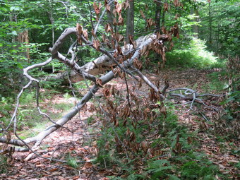 We kept a quick pace up the hilly part of the trail. Just after the junction with the snowmobile trail, we came to the large blowdown I planned to remove. My memory had not served me well as it was a lot larger than I remembered. I took some before pictures and then got busy sawing off a few smaller branches and dragging them to the side of the trail. I cut the final supporting branch and as it released it flew up just missing my leg! I wasn't satisfied that the trail was clear enough so I cut about three feet off the main trunk leaving the rest for a felling axe at a later date. I packed up and we continued up the hilly part of the trail. We continued on the trail until it leveled off an descended slightly to Junkyard Junction. At this intersection, the Quick Lake Trail bears to the left and continues on to Quick Lake. We turned right and headed across the Flynn Trail toward Hodge Pond. The Flynn Trail was surprisingly damp and slippery with mud in some places. The trip across this part of the Flynn Trail went quickly and we were soon at the trail junction. We reached the shores of the pond and turned left to follow the jeep trail around the back of the pond. The sky was still overcast but there were a few areas of blue and some wispy clouds. We stopped at the upper end of the pond and walked down to the shore. Sheila got in a brief swim and I took a few pictures. On the other side of the pond I turned left up the hill toward the ruins of the Beech Mountain Boy Scout Camp. The climb up this trail is steeper than the trail from the outlet of Hodge Pond but it is also shorter! When we got to the top of the hill, we turned right to head back toward the Flynn Trail. Once we were back at the Flynn Trail, we turned left for a straight shot back to the car. We set a fast pace to the junction with the Big Rock Trail and then had about 1.7 miles to go to get back to the car. I must have been deep in thought as the hike to the car seemed to go so quickly. We followed the Flynn Trail to the woods and back to the car arriving at 1:35 PM. We hiked 6.6 miles in 2 hours and 50 minutes with 935 feet of elevation gain. This included the stops for pictures and trail maintenance. Our moving average was 2.8 mph!
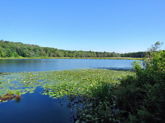
![]()
![]()
![]()
![]()
![]() On Tuesday, July 26th I wanted to go back to Shaupeneak Ridge where Kurt and I had hiked some of the trails on Monday. My plan was to hike the rest of the trails finish before the temperature rose into the 90's! Shaupeneak Ridge which is located on Popletown Road off Old Post Road just off Route 9W in Esopus. From the previous day I knew the drive was shorter than indicate online and that I could make it in just over and hour. I got up early in the morning and got all my gear ready. Sheila was ready to go and we left home a little after 8:00 AM. The temperature was 63 degrees when we left but I knew that it would rise quickly and that it is always warmer and more humid near the Hudson. The forecast called for a heat index of over 90 degrees in Kingston. At least the forecast did not include any thunderstorms for the area and I was glad since we had gotten soaked the day before! I drove to liberty on Route 17 and then took Route 52 to Ellenville where I picked up Route 209 north toward Kingston. After passing through Accord, I looked for the sign for Rosendale and turned right or east on Route 213. I drove through Rosendale and continued on Route 213 looking for Cow Hough Road. I found it and turned right and then stayed left on Dashville Road which became Old Post Road. I drove until the road made a sharp right turn and I turned left on Popletown Road. I drove up the road until I found the sign for the parking area for Shaupeneak Ridge on the left. I turned into the parking area and immediately got me gear ready for the hike. I set all my electronics and we left the parking area on the blue trail at 9:10 AM heading southwest to complete a clockwise loop around the pond. The trail started off as a gravel path which was very even and well groomed. Almost immediately there was an area with two benches and I walked over to take a few shots of Louisa Pond. We continued along the blue trail and found the kayak launch a few hundred feet further along. We walked down to the shore and I took a few more pictures of the pond including the lily pads and a beaver lodge. When we got back on the blue trail we walked over a wooden walkway after which the trail became more like a trail rather than a path. We walked through a rocky area and then entered a pine forest at the outlet end of the lake to the southwest. Everything was wet and slippery from the rain the day before and the humidity so getting good foot placement was important. At about .4 miles we came to the beaver dam that impounds the water for the pond. There was a nice view over the entire pond so I took a few more shots before we continued on around the pond. We walked up a hill and started heading northeast. I found the blazes for the orange trail and made note of where they were but my plan was to finish the blue trail first. We continued along the trail and passed the second junction with the orange trail and the beginning of the green trail. I was being bothered by biting insects but not so badly I wanted to stop and apply repellent. We continued on the more familiar part of the blue trail and by 9:50 AM we were back at the parking area after covering 1.35 miles.
On Tuesday, July 26th I wanted to go back to Shaupeneak Ridge where Kurt and I had hiked some of the trails on Monday. My plan was to hike the rest of the trails finish before the temperature rose into the 90's! Shaupeneak Ridge which is located on Popletown Road off Old Post Road just off Route 9W in Esopus. From the previous day I knew the drive was shorter than indicate online and that I could make it in just over and hour. I got up early in the morning and got all my gear ready. Sheila was ready to go and we left home a little after 8:00 AM. The temperature was 63 degrees when we left but I knew that it would rise quickly and that it is always warmer and more humid near the Hudson. The forecast called for a heat index of over 90 degrees in Kingston. At least the forecast did not include any thunderstorms for the area and I was glad since we had gotten soaked the day before! I drove to liberty on Route 17 and then took Route 52 to Ellenville where I picked up Route 209 north toward Kingston. After passing through Accord, I looked for the sign for Rosendale and turned right or east on Route 213. I drove through Rosendale and continued on Route 213 looking for Cow Hough Road. I found it and turned right and then stayed left on Dashville Road which became Old Post Road. I drove until the road made a sharp right turn and I turned left on Popletown Road. I drove up the road until I found the sign for the parking area for Shaupeneak Ridge on the left. I turned into the parking area and immediately got me gear ready for the hike. I set all my electronics and we left the parking area on the blue trail at 9:10 AM heading southwest to complete a clockwise loop around the pond. The trail started off as a gravel path which was very even and well groomed. Almost immediately there was an area with two benches and I walked over to take a few shots of Louisa Pond. We continued along the blue trail and found the kayak launch a few hundred feet further along. We walked down to the shore and I took a few more pictures of the pond including the lily pads and a beaver lodge. When we got back on the blue trail we walked over a wooden walkway after which the trail became more like a trail rather than a path. We walked through a rocky area and then entered a pine forest at the outlet end of the lake to the southwest. Everything was wet and slippery from the rain the day before and the humidity so getting good foot placement was important. At about .4 miles we came to the beaver dam that impounds the water for the pond. There was a nice view over the entire pond so I took a few more shots before we continued on around the pond. We walked up a hill and started heading northeast. I found the blazes for the orange trail and made note of where they were but my plan was to finish the blue trail first. We continued along the trail and passed the second junction with the orange trail and the beginning of the green trail. I was being bothered by biting insects but not so badly I wanted to stop and apply repellent. We continued on the more familiar part of the blue trail and by 9:50 AM we were back at the parking area after covering 1.35 miles.
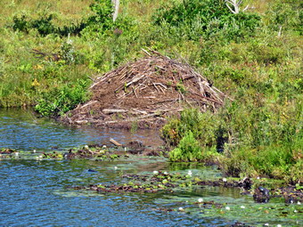 The other trail that leaves from the parking area is the yellow trail which we tackled next. This trail parallels the blue trail around the pond but is a little further away and travels along a series of rock ledges. As we started up the trail, there was a sign that explained the significance of stone walls. I at first thought this was obvious but then realized it might be interesting information for some people. This trail had a series of these signs with some being more informative and understandable than others. The trail was short and we were soon descending to meet the blue trail after hiking the complete length of the .3 mile yellow trail. We turned left and started clockwise around the lake again. At 1.85 miles we turned left onto the orange trail which headed south and then turned west. At 2.15 miles we came to a deep gorge and the trail swung north to loop around the top of this area. We followed the trail continuing to gain elevation as it eventually headed west and then south again along the ravine. Eventually we were at a point directly across from where we had started the loop. We had walked a little over .3 miles to get to a point 170 feet away from where we had been! The trail went west a short distance and then headed north. I was watching for the crossover trail that connected the orange to the green trail. We had missed this trail the day before and I wanted to use it to get to the aqua trail. At 2.75 miles the crossover trail marked in orange and green markers turned off to the left and we followed it. The crossover trail headed north to the green trail and dropped elevation for its entire .2 mile length. When we hit the green trail, we had dropped 100 feet. We turned left and followed the green trail to 3.1 miles where the aqua trail began on the left. We turned left and followed the trail until it split within a few hundred feet. I decided to head left first so we started out on the trail in that direction heading south. It was getting significantly warmer and the humidity was high since none of the sweat was evaporating from my body!
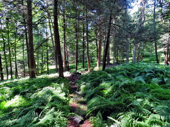 The trail soon came to an open forest where the forest floor was covered in ferns. It was so pretty I dropped my pack and got out my camera to take a few shots. I was immediately swarmed by mosquitoes and decided it was time to apply repellant! I also got a drink and gave Sheila one before we continued south to about 3.6 miles where the trail made an almost 180 degree turn north. At 3.85 miles the trail made a large loop to the west before heading northeast. The aqua trail was another trail that, like the green trail, was created for both mountain biking and hiking. There were some impressive rock ledges along the way which made the walk interesting despite the lack of expansive views. Near the end of the loop I found a large pile of stones but I could not determine its purpose or its age. At 4.4 miles we were back at the point where the aqua trail had split. We walked out to the green trail and turned right to retrace our steps back to the crossover trail. This time when we got to the crossover trail, we had to climb out of the hollow that we were in to the top of the ridge. Once we were back at the junction with the orange trail, we turned left to complete the loop of this trail. This trail also had no views but was an interesting walk along a high set of rock ledges. As we approached the end of the orange trail, we both could hear voices approaching. I put Sheila on her leash and soon four hikers/walkers appeared. They were quite a bit older than I am and did not seem to be outfitted for the rougher trails ahead! We walked passed and soon were at the junction with the blue trail. I had a choice to make and decided to turn left to go around the northern end of the wetland since this was a better part of the blue trail. The last .4 miles of the hike went quickly. We were back at the parking area by 11:50 Am having hiked 5.8 miles in 2.5 hours with an elevation gain of only 825 feet. The temperature was now 83 degrees or about 10 degrees warmer than when we had started the hike.
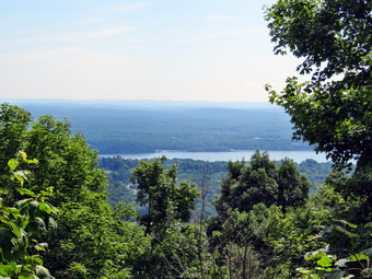
![]()
![]()
![]()
![]()
![]() On Monday, July 25th I had plans to hike with my son Kurt somewhere near his home in Poughkeepsie starting at around 10;00 AM. I always prefer to try a new hike if it is possible and I began to look for one. I settled on Shaupeneak Ridge which is located on Old Post Road just off Route 9W in Esopus. The drive seemed to be almost an hour and a half for me but only held an hour for Kurt. Kurt agreed to meet me there at 10:00 AM. I got up early in the morning and got all my gear ready. Sheila had seen my leave the house on both Friday and Saturday in my hiking clothes without taking here along and she did not let me out of her sight until I opened the door for her! When we left Livingston Manor at about 9:35 AM the temperature was already in the low 70's and the humidity was high. The forecast called for a heat index of over 100 degrees in Kingston by 2:00 PM so I knew we would have to be finishing around that time! There was also a chance of thunderstorms to arrive in the late afternoon. I drove to liberty on Route 17 and then took Route 52 to Ellenville where I picked up Route 209 north toward Kingston. After passing through Accord, I looked for the sign for Rosendale and turned right or east on Route 213. I drove through Rosendale and continued on Route 213 looking for Cow Hough Road. I found it and turned right and then stayed left on Dashville Road which became Old Post Road. I drove almost to Route 9W and found the sign for the parking area for Shaupeneak Ridge on the left just before the train tracks. I turned into the parking area and left the car running to take advantage of the air conditioning. I was surprised it was only a little after 9:30 AM! I stepped out of the car to get a trail map at the kiosk and was hit by a blast of warm, humid air. When I got back in the car, I saw that the temperature was now in the low 80's. Kurt and I conferred by cellphone and I helped to guide him to the parking area. He arrived a little after 10:00 AM and we spent a few minutes getting ready to hike. We left the parking area on the white trail at 10:15 AM. The trail was well packed and traveled first through an open area and then entered the woods. We immediately started to gain elevation although the trail was not steep. At .65 miles a purple trail branched off to the right and we followed it about several hundred feet where it ended. The trail guide description said there would be a waterfall at the end. We could see a rocky stream bed and the rock which the water would fall over. The only problem was there were only a few drips of water coming off the rock! I took a few shots and we returned to the white trail, turned right and continued to climb.
On Monday, July 25th I had plans to hike with my son Kurt somewhere near his home in Poughkeepsie starting at around 10;00 AM. I always prefer to try a new hike if it is possible and I began to look for one. I settled on Shaupeneak Ridge which is located on Old Post Road just off Route 9W in Esopus. The drive seemed to be almost an hour and a half for me but only held an hour for Kurt. Kurt agreed to meet me there at 10:00 AM. I got up early in the morning and got all my gear ready. Sheila had seen my leave the house on both Friday and Saturday in my hiking clothes without taking here along and she did not let me out of her sight until I opened the door for her! When we left Livingston Manor at about 9:35 AM the temperature was already in the low 70's and the humidity was high. The forecast called for a heat index of over 100 degrees in Kingston by 2:00 PM so I knew we would have to be finishing around that time! There was also a chance of thunderstorms to arrive in the late afternoon. I drove to liberty on Route 17 and then took Route 52 to Ellenville where I picked up Route 209 north toward Kingston. After passing through Accord, I looked for the sign for Rosendale and turned right or east on Route 213. I drove through Rosendale and continued on Route 213 looking for Cow Hough Road. I found it and turned right and then stayed left on Dashville Road which became Old Post Road. I drove almost to Route 9W and found the sign for the parking area for Shaupeneak Ridge on the left just before the train tracks. I turned into the parking area and left the car running to take advantage of the air conditioning. I was surprised it was only a little after 9:30 AM! I stepped out of the car to get a trail map at the kiosk and was hit by a blast of warm, humid air. When I got back in the car, I saw that the temperature was now in the low 80's. Kurt and I conferred by cellphone and I helped to guide him to the parking area. He arrived a little after 10:00 AM and we spent a few minutes getting ready to hike. We left the parking area on the white trail at 10:15 AM. The trail was well packed and traveled first through an open area and then entered the woods. We immediately started to gain elevation although the trail was not steep. At .65 miles a purple trail branched off to the right and we followed it about several hundred feet where it ended. The trail guide description said there would be a waterfall at the end. We could see a rocky stream bed and the rock which the water would fall over. The only problem was there were only a few drips of water coming off the rock! I took a few shots and we returned to the white trail, turned right and continued to climb.
 Much of the hike seemed to be of the "roots, rocks, trees" variety although it was very pretty. When we started the biting insect were pretty thick but they seemed to diminish in numbers as we got further into the hike. Over the final mile of the white trail, we climbed 560 feet for an average of about a 10% grade. At the top of the white trail we turned right on the red trail and immediately came to a lookout to the Hudson River. Unfortunately the trees have grown up to block much of the view and the Hudson always seems to have a haze hanging over it. I took a few shots and then asked Kurt to pose with Sheila while I took a few more pictures. It was 11:15 AM left the viewpoint to continue on the red trail hiking west and descending some. At 2.4 miles we came to the blue trail and turned left to try to walk to the shore of the wetlands at the north end of Louisa Pond. We couldn't get very close so we turned around and followed true blue trail as it headed northwest around the north end of the pond. At 2.5 miles we came to the beginning of the green trail and turned right to take this trail which is a loop constructed by mountain bikers. The description included some rock ledges. We began a short descent along what looked like a woods road. On our right was an extensive network of stone walls and, at one point, a road built up of rock near a small pond. We continued along the green trail until it forked and we turned right at 2.6 miles to take the more northern route. The trail began to ascend slightly and it headed southwest. Along the way we passed through an area that had some very tall trees where the ground was covered with a dense layer of ferns. I could help but take a few pictures. As we continued there were some nice rock ledges and some stone paved steps. There were also some logs that had been flattened on top for the more skilled bike riders. At one point I looked at a boulder that had a small "cave" at the bottom and saw...a garden gnome. I took a picture but Kurt and I could not discover why it had been placed there. At 3.4 miles the green trail made an almost 180 degree turn to head back toward its origin and the aqua trail branched to the right. I decided I would have to come back to hike the aqua, orange and blue trails so we followed the green trail. At about this time we noticed that there were some dark clouds in the sky but I knew the forecast said the storms would hold off until at least 4:00 PM when we would be long gone!
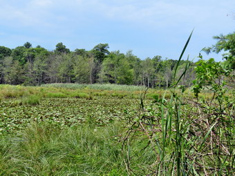 As I looked at the map, I saw a crossover trail from the green to the orange trail which looked like the shortest way back to the car. We knew the trail was not far after the turn and we began to look for it. We hiked and talked and continued to look for the crossover. Soon we were hiking up a slight incline when Kurt and I both noticed that the trail looked very familiar. We saw the stone road and the small pond and knew we had hiked the entire green loop! We continued on the green trail back to the blue trail where we turned left to follow the trail down the east shore of Louisa Pond. As we hiked, I stepped off the trail twice to try to get some shots of the wetland and the pond. Soon we were at the parking area for Shaupeneak Ridge on Popletown Road. We turned left and walked out to the entrance of the lot and crossed the road to pick up the more southern branch of the red trail at 4.65 miles. We walked .55 miles over this part of the red trail which rolled a little but gained some elevation. The skies continued to darken and we heard some noise which I tried to pretend was an airplane. At 5.2 miles we reached the white trail and turned right to follow it southeast back to the cars. The trail was a descent all the way except for one small climb. As we hurried along the thunder increased and then it started to sprinkle. I knew from experience that it was best to prepare for harder rain and I immediately out all by electronics in my pack and got out the cover. As soon as I got the pack on my pack, the heavens opened and we were hike through a deluge. Getting really wet really fast was bad enough but the lightening was much more localized than it had been. I knew there was no option but to keep hiking. Soon we were crossing the small bridge near the bottom of the white trail. I hoped the rain would let up but it did not. We broke out into the open and hurried back to the cars. As we arrived at the parking area, the rain abated and then all but stopped! I got Sheila in the backseat and accepted Kurt's offer of a blanket to cover the driver's seat. I was completely soaked! We said our goodbyes and headed out. It was 2:10 PM and we had hiked 6.8 miles in just under 4 hours gaining 1345 feet along the way. I decided to take Route 9W to Kingston to visit Beer World even though it was a little out of my way. The side-trip was definitely worth the bother!
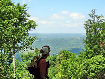
![]()
![]()
![]()
![]()
![]() On Friday, July 22nd I decided to respond to a call for help from the Catskill Mountain Club to help do some last minute maintenance on the Bramley Mountain Trails before they officially open on Friday, July 29. Most of the work involved cutting grass, weeds and briars in the more open spots along the trails. The meeting time was 10:00 AM so I left Livingston Manor just after 8:30 AM to make sure I would be on time. I left behind a very disappointed Sheila who always wants to go with me. I felt that since we would be using glowered equipment and sharp blades that she might be in the way. I decided to take the back roads since this was the shortest way. I drove up the Beaverkill Road and took Beech Hill Road to Route 30 where I turned right. Soon I was at the Dunraven Bridge. At the end of the bridge I turned left on Tremperskill Road and followed it into Andes where I turned left on Route 28 North. After 7.5 miles, I turned right on Glen Burnie Road and drove 2.8 miles to the parking area for Bramley Mountain. The parking area is small and it helped that I had been there before. I pulled into the parking area, turned around and parked at 9:40 AM. No other cars were present so I waited for someone else to appear. Just before 10:00 AM Wendell, drove up and I got out to talk to him. I immediately found that the insect problem was still present so I applied a liberal dose of repellent. It was warm and very humid! Wendell and I didn't have to wait too long before Bob and John showed up. We got out the equipment, fuel it and tested it and be that time Brian, the last participant, drove up. The plan was to walk out the Quarry Trail and then take a "shortcut" to the top where most of the work need to be done. We got started at about 10:30 Am by walking out the woods road toward the quarry. Each of us carried a power scythe or a weed whacker plus a few hand tools. After half a mile we arrived at a woods road that headed up the mountain. The road began in an open clearing where the trail was covered in tall grass and a few briars. Wendell decided we would cut this patch and we made short work of the area. We started up the woods road and I immediately noticed that the "shortcut" was still pretty steep especially carrying power equipment!
On Friday, July 22nd I decided to respond to a call for help from the Catskill Mountain Club to help do some last minute maintenance on the Bramley Mountain Trails before they officially open on Friday, July 29. Most of the work involved cutting grass, weeds and briars in the more open spots along the trails. The meeting time was 10:00 AM so I left Livingston Manor just after 8:30 AM to make sure I would be on time. I left behind a very disappointed Sheila who always wants to go with me. I felt that since we would be using glowered equipment and sharp blades that she might be in the way. I decided to take the back roads since this was the shortest way. I drove up the Beaverkill Road and took Beech Hill Road to Route 30 where I turned right. Soon I was at the Dunraven Bridge. At the end of the bridge I turned left on Tremperskill Road and followed it into Andes where I turned left on Route 28 North. After 7.5 miles, I turned right on Glen Burnie Road and drove 2.8 miles to the parking area for Bramley Mountain. The parking area is small and it helped that I had been there before. I pulled into the parking area, turned around and parked at 9:40 AM. No other cars were present so I waited for someone else to appear. Just before 10:00 AM Wendell, drove up and I got out to talk to him. I immediately found that the insect problem was still present so I applied a liberal dose of repellent. It was warm and very humid! Wendell and I didn't have to wait too long before Bob and John showed up. We got out the equipment, fuel it and tested it and be that time Brian, the last participant, drove up. The plan was to walk out the Quarry Trail and then take a "shortcut" to the top where most of the work need to be done. We got started at about 10:30 Am by walking out the woods road toward the quarry. Each of us carried a power scythe or a weed whacker plus a few hand tools. After half a mile we arrived at a woods road that headed up the mountain. The road began in an open clearing where the trail was covered in tall grass and a few briars. Wendell decided we would cut this patch and we made short work of the area. We started up the woods road and I immediately noticed that the "shortcut" was still pretty steep especially carrying power equipment!
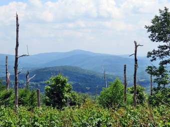 As we walk up the woods roads we made a couple of turns and at .75 miles joined the Quarry Trail as it ascends the mountain. We walked some and then stopped for a rest and to wait for everyone to get together before starting up again. I made sure to drink more than I normally would as the day was both hot and humid with highs forecast to be in the high 80's. We didn't do much work on the way up except to remove a few branches in the trail. At At 1.4 miles we finally hit the top of the climb and just after that the Table and viewpoint to the west. In just over .9 miles we had climbed over 800 feet with an average grade of just over 6%. We stopped at the viewpoint and I took a few pictures of the view and some of the other workers. After getting a snack and a drink, Brian and I pushed on to the top and cut the short path from the edge of the summit to the area of the fire tower. I had to stop cutting a fix the line on my weed whacker as it was wound incorrectly. This would become a problem on and off throughout the hike. After fixing the line, I got out my camera and took some pictures from the summit viewpoint to the south. I decided to hike down the summit trail following Bob who had a power scythe while the others finished at the summit. On the way down I trimmed some tall grass on the road and then cut some at the turn onto the woods road across the ridge. Bob was ahead of me cutting mostly the woody brambles on the side of the trail while I took care of the tall grass and weeds on the trail. Shortly the others came down from the top and we spaced ourselves apart so the we could cut a section of trail and then leapfrog the others to another spot. Wendell let me know that we did not have to cut each blade of grass but just provide a track for hikers to easily follow! Every now and then we would stop to refuel the machines and ourselves. We were making good progress but it was hot and sweaty work. I WA able to extend the line on my machine a couple of times by tapping it on the ground but at other times I had to stop to disassemble it.
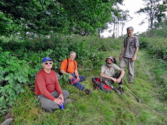 At one point Wendell went on ahead to see if he could find a place to cut a viewpoint to the south and east along the ridge. The rest of us continued to do we are happy to we had been doing and I could see we were approaching the end of the open trail on the ridge. I cam across Wendell who had cut a very nice viewpoint through a lot of briars. After getting some fuel< I continued to cut along the open trail until I got to the edge of the woods. I could see John up ahead starting to descend the trail but still cutting as he went. I decided to go back and find the rest of the group cutting the sides of the trail as I went. I found them at the viewpoint Wendell had cut an took the opportunity to get a drink and take some pictures. I took shots from the viewpoint of the Pisgahs which at one time were the site of the Bobcat Ski Area. We discussed what other mountains might be in our view. Since John had arrived, I took a shot of the group relaxing which was the only time we had taken an extended break from the work. We pick up our equipment and started down the trail convinced the work was done. We walked through some grass on the trail but decided it did not need to be cut. We began to run into a few open spots with more grass and a lot of weeds on the trail. Therese areas also had briars encroaching from the sides. We decided to fire up the machines again and trim this part of the trail. We all picked a section to work on and started cutting. I looked at my fuel tank at one point and saw I was almost out of fuel. I tapped the weed whacker on the ground as it was not cutting very well but this did not help. I stopped the machine and found I had almost no line. I took it apart but could not pull then twisted line off the spool. I got out my multitool but the pliers really didn't help. Wendell came along but he couldn't free the line either. We decided to continue on down the trail and we walked and talked until we were well into the woods. We stopped until Bob came along and told us Brian had just a little more to trim. The tree of us continued on down the trail and made the right turn to take us back to the car. We arrived in the parking area around 3:15 PM. I had walked a total of 3.7 miles and gained over 1000 feet in 4 hours and 45 minutes. This, of course, didn't begin to tell the story of how much work we had done.
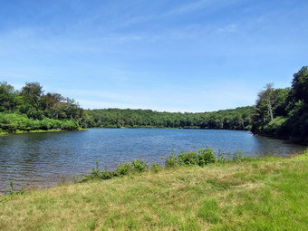
![]()
![]()
![]()
![]()
![]() On Thursday, July 21st I was ready to hike after taking a couple of days off. I decided to stay local and head to Hodge and Frick Ponds since I was nursing some blisters I got from a recent racquetball match. I was in no real hurry to get started and left the house at about 10:00 AM. The temperature was only 67 degrees but I knew that the highs for the day were forecast to be in the high 80's. I drove out DeBruce Road and turned left on Mongaup Road. When we arrived there were no other cars in the lot and we crossed the road to get onto the Flynn Trail at 10:20 AM. I have been wearing a pair of Vasque Taku boots which seem to fit well and are no longer sold by Vasque! The walk up the Flynn Trail seemed to go very quickly and we made no stops passing through the junction with the Big Rock Trail and continuing straight ahead of the Flynn Trail. We kept up a quick pace as we passed through the gate marking the boundary with the Open Spaces property. At the next junction we stayed to the left to keep on the Flynn Trail and head directly down to Hodge Pond. When we broke out into the clearing at the outlet end of Hodge Pond, I kept Sheila near since I did not want here swimming as I had just applied Advantix. I walked over to the fire ring and dropped my pack. A quick check of my blister showed the bandage I had applied was in place. I picked up my camera and took a few shots even though I had thought I might be able to resist.
On Thursday, July 21st I was ready to hike after taking a couple of days off. I decided to stay local and head to Hodge and Frick Ponds since I was nursing some blisters I got from a recent racquetball match. I was in no real hurry to get started and left the house at about 10:00 AM. The temperature was only 67 degrees but I knew that the highs for the day were forecast to be in the high 80's. I drove out DeBruce Road and turned left on Mongaup Road. When we arrived there were no other cars in the lot and we crossed the road to get onto the Flynn Trail at 10:20 AM. I have been wearing a pair of Vasque Taku boots which seem to fit well and are no longer sold by Vasque! The walk up the Flynn Trail seemed to go very quickly and we made no stops passing through the junction with the Big Rock Trail and continuing straight ahead of the Flynn Trail. We kept up a quick pace as we passed through the gate marking the boundary with the Open Spaces property. At the next junction we stayed to the left to keep on the Flynn Trail and head directly down to Hodge Pond. When we broke out into the clearing at the outlet end of Hodge Pond, I kept Sheila near since I did not want here swimming as I had just applied Advantix. I walked over to the fire ring and dropped my pack. A quick check of my blister showed the bandage I had applied was in place. I picked up my camera and took a few shots even though I had thought I might be able to resist.
I put the camera away and picked up my pack to continue our hike on the Flynn Trail. This section of the trail was muddy with some standing water in places but it was easily negotiated. We stayed left at the next junction to continue up the hill on the blue Flynn Trail. We passed through the gate from OSI property to state land and found the trail continued to have some wet and muddy spots. It seemed that Junkyard Junction came up quickly and we turned left on the red Quick Lake Trail to start our loop back. The Quick Lake Trail is mostly downhill and we made good time. I stopped several times to remove branches and other debris from the trail. Just before the snowmobile trail branched to the right toward Quick Lake, a large tree was partly blocking the trail. I made note that this one would require a saw and an axe to remove. We walked downhill to Iron Wheel Junction and turned right to stay on the Quick Lake Trail. We were soon at the small stream just before the "Spruce Tunnel" and I crossed it with ease. The stream was very low but Sheila was able to get her feet wet and take a drink. We continued on to the outlet bridge at Frick Pond. I stopped to take a few pictures and then we walked up the hill to Gravestone Junction. The trail back to the parking area was a little damp in places but we had no problems. As we passed the register box, we turned right to stay on the trail. When we got back to the car at 12:55 PM we were still the only car in the lot. We had walked 6.5 miles in 2.5 hours gaining 928 feet along the way. The temperature at the trail head was now above 80 degrees but the humidity seemed better than on some days.
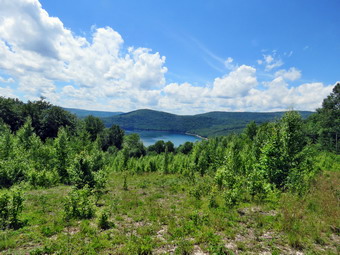
![]()
![]()
![]()
![]()
![]() On Sunday, July 17th, Cindy and I had decided to hike the Shavertown Trail near the Dunraven Bridge across the Pepacton Reservoir after church. I asked Cindy if I should invite Debbie, a friend from church, and she quickly agreed. Even though it was VERY short notice, Debbie agreed and we arranged for her to meet us at our house at around 1:00 PM. We went home a got ready and Debbie arrived promptly at 1:00 PM. After a short introduction to Sheila, we got our gear in Cindy's car and left Livingston Manor. I was glad Debbie was OK with sharing the backseat with Sheila and Sheila for her part behaved well. The Shavertown Trail is one area where trails have been constructed by the Catskill Mountain Club on land opened to public use by the DEP. The trail descriptions has a pond with a view of the reservoir and another trail through the forest along some old access roads. The total distance is about 5 miles. I took Route 17 west to exit 94 at Roscoe and then took Route 206 north toward Downsville. I turned right on Route 30 at the intersection near the Pepacton Reservoir and headed for the bridge across the reservoir. After crossing the bridge, I turned left and found the trailhead about .15 miles up the road. I turned around and parked off the side of the road a little north of the beginning of the trail. We were ready to go almost immediately and crossed the road at 1:50 PM to start our hike. The first .25 miles of trail climbs 200 feet as it heads directly north and up the side of Perch Lake Mountain. Cindy loaned Debbie one of her hiking poles as we climbed the steepest part of the hike. I was surprised at how quickly we arrived at the right turn onto the old access road. We continued to climb through the forest for another .25 miles until we broke out into a field and the trail leveled a little. The skies were blue with puffy white clouds and the temperature was warm with some humidity. We were bothered by some persistent insect that buzzed around us as we walked despite various insect repellents. Along the open part of the trail we found some meteorological instruments with solar panels for power. One had a snow scale next to it while the other had a device to measure rainfall and other data. After some more climbing, the trail turned northeast and descended to the edge of a small pond at .85 miles. The pond was full and had some cattails and white water lilies growing in it. We stopped and I took some pictures as Sheila decided to go for a swim. Debbie threw a stick into the water but Sheila declined the invitation to retrieve it. We walked around the pond on the west side and down to the lower bench where we stopped for a "photo op". I took a few pictures of the reservoir and some of Debbie and Cindy. I walked to the upper each and took a few shots of the pond and some more of the Pepacton. There was little haze and the skies were still nice and blue with contrasting clouds.
On Sunday, July 17th, Cindy and I had decided to hike the Shavertown Trail near the Dunraven Bridge across the Pepacton Reservoir after church. I asked Cindy if I should invite Debbie, a friend from church, and she quickly agreed. Even though it was VERY short notice, Debbie agreed and we arranged for her to meet us at our house at around 1:00 PM. We went home a got ready and Debbie arrived promptly at 1:00 PM. After a short introduction to Sheila, we got our gear in Cindy's car and left Livingston Manor. I was glad Debbie was OK with sharing the backseat with Sheila and Sheila for her part behaved well. The Shavertown Trail is one area where trails have been constructed by the Catskill Mountain Club on land opened to public use by the DEP. The trail descriptions has a pond with a view of the reservoir and another trail through the forest along some old access roads. The total distance is about 5 miles. I took Route 17 west to exit 94 at Roscoe and then took Route 206 north toward Downsville. I turned right on Route 30 at the intersection near the Pepacton Reservoir and headed for the bridge across the reservoir. After crossing the bridge, I turned left and found the trailhead about .15 miles up the road. I turned around and parked off the side of the road a little north of the beginning of the trail. We were ready to go almost immediately and crossed the road at 1:50 PM to start our hike. The first .25 miles of trail climbs 200 feet as it heads directly north and up the side of Perch Lake Mountain. Cindy loaned Debbie one of her hiking poles as we climbed the steepest part of the hike. I was surprised at how quickly we arrived at the right turn onto the old access road. We continued to climb through the forest for another .25 miles until we broke out into a field and the trail leveled a little. The skies were blue with puffy white clouds and the temperature was warm with some humidity. We were bothered by some persistent insect that buzzed around us as we walked despite various insect repellents. Along the open part of the trail we found some meteorological instruments with solar panels for power. One had a snow scale next to it while the other had a device to measure rainfall and other data. After some more climbing, the trail turned northeast and descended to the edge of a small pond at .85 miles. The pond was full and had some cattails and white water lilies growing in it. We stopped and I took some pictures as Sheila decided to go for a swim. Debbie threw a stick into the water but Sheila declined the invitation to retrieve it. We walked around the pond on the west side and down to the lower bench where we stopped for a "photo op". I took a few pictures of the reservoir and some of Debbie and Cindy. I walked to the upper each and took a few shots of the pond and some more of the Pepacton. There was little haze and the skies were still nice and blue with contrasting clouds.
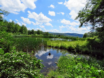 We continued around the pond and I took some more pictures of the pond, the lilies and the cattails. Cindy spotted some fish in the pond and I managed to get one picture. We continued on the trail around the back of the pond and walked back to the trail that we had descended to the pond. We walked back along the trail and then turned left at the sign that marked the turn for the extra 1.5 miles through the woods. This trail followed another woods road and gained a little over 200 feet in the next .5 miles. At times it was hard to see the next marker but we knew we where we were going from previous trips. We had a great time talking with Debbie. At around 1.5 miles into the hike the trail dipped to the left off the woods road to travel through an area with large boulders. I took some pictures as the sedimentary layers were so clear on the rocks. Many were also covered by interesting mosses and lichens. Once the trail rejoined the road it remained pretty flat for the next .8 miles. The trail began to turn around the mountain heading a little to the east. It seems as if it would continue east and then head south to loop around the mountain but that route is blocked by private property. We followed the markers until we came to the spot where they split to form a small loop at the end of the trail. We headed to the right to do the .3 mile loop. Soon we were back where the loop started and one our way back ion the main trail. We followed the trail and woods road back to the pond and then took the access road back to the trail. We made the left on the trail and were soon back at the car. The trip back went much faster as it was mostly downhill. We were back at the car at 4:30 PM having covered 5.1 miles in 2 hours and 40 minutes with about a 1080 feet of ascent along the way. Debbie said she enjoyed the trip and would like to do an other one soon!
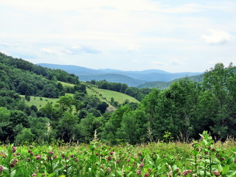
![]()
![]()
![]()
![]()
![]() On Saturday, July 16th I wanted to continue my hiking for the day after completing the 3.7 mile Andes Rail Trail and Bullet Hole Spur Trail in Andes. I left 266 Depot Street in Andes and drove eat on Route 28 South. Around two miles from town I started watching for Finkle Road on the left. It was easy to find as there are signs for the Palmer Hill lookout. I parked and got out of the car to take some pictures from the viewpoint. The view from the parking area was great. A signboard showed a picture of the view with all the peaks and hills labeled. All the peaks from Balsam Lake and Graham through Doubletop and Balsam were visible. There was less haze in the air than I had seen on other visits. The temperature was in the high 70's and the humidity seemed high. There were only two other cars in the lot when Sheila and I walked out he upper end of the parking area to begin our hike at 11:30 AM. The first half mile of the trail descends to a small brook. The trail passes through wide corridors which have been mowed through the grass and then enters the woods on an old road. I could see a pair of hikers ahead and they had a dog with them. As we approached the brook FOUR dogs came running toward us since the owners had not bothered to have the courtesy tout them on a leash. The dogs also did not listen to their owners when they called them so I raised my poles and got ready to encourage them to go away. Fortunately, the dogs made some noise but were mostly friendly. I passed by quickly wondering how some people could be so irresponsible! Just after the brook crossing are the foundations from a farm and then the first trail junction.
On Saturday, July 16th I wanted to continue my hiking for the day after completing the 3.7 mile Andes Rail Trail and Bullet Hole Spur Trail in Andes. I left 266 Depot Street in Andes and drove eat on Route 28 South. Around two miles from town I started watching for Finkle Road on the left. It was easy to find as there are signs for the Palmer Hill lookout. I parked and got out of the car to take some pictures from the viewpoint. The view from the parking area was great. A signboard showed a picture of the view with all the peaks and hills labeled. All the peaks from Balsam Lake and Graham through Doubletop and Balsam were visible. There was less haze in the air than I had seen on other visits. The temperature was in the high 70's and the humidity seemed high. There were only two other cars in the lot when Sheila and I walked out he upper end of the parking area to begin our hike at 11:30 AM. The first half mile of the trail descends to a small brook. The trail passes through wide corridors which have been mowed through the grass and then enters the woods on an old road. I could see a pair of hikers ahead and they had a dog with them. As we approached the brook FOUR dogs came running toward us since the owners had not bothered to have the courtesy tout them on a leash. The dogs also did not listen to their owners when they called them so I raised my poles and got ready to encourage them to go away. Fortunately, the dogs made some noise but were mostly friendly. I passed by quickly wondering how some people could be so irresponsible! Just after the brook crossing are the foundations from a farm and then the first trail junction.
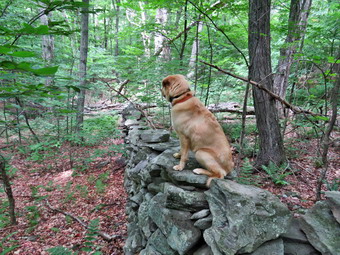 The trail junction is sort of a "times square" since at this point you can choose to do the upper meadow or lower meadow loops. I decided that any climbing that had to be done should be at the beginning of the hike as I was already a little tired and very warm. We turned left to start the upper meadow loop with me hoping the other hikers would be smart enough to take the lower loop first. The trail shortly entered the woods and began a half mile ascent to the highest point on the hike. Unfortunately, I could here the other hikers and their dog pack following us to the upper meadow loop! The vertical gain was only about 250 feet and the average grade was around 9%. There were a few steeper areas which were between 15% and 20% for short distances. Along the way we saw some nice stone walls as we looped in a clockwise direction. At the high point we broke out into a field with some since views of the surrounding hills and I stopped to take a few pictures. The trail then began to descend for about .4 miles back to the trail junction losing around 200 feet. We turned left at the junction and almost immediately came to another split in the trail. I chose to take the left fork and started to ascend along the paths mowed through the field. This trail was more out in the open and as we approached the first set of trees I could hear the other hikers calling one of their dogs as if it was lost. I continued to hear them calling as we entered the woods and hoped they would find the lost dog. Irresponsible behavior on the part of owners should not have unfortunate consequences for the dog! We hike through the trees for a while and then broke back into the open turning left and climbing again through the open fields. We eventually hit a high point and then turned right to descend along a powerline right-of-way. At 2.8 miles we completed the 1.4 mile lower meadow loop and turned left to start back to the parking area. We stopped at the stream and I allowed Sheila to play in the water and get a drink. We continued on the main trail through the trees and then through the open trail passed the register to the car. At the register a couple with a dog were signing out. The dog was panting pretty heavily and seemed overheated. We were back at the car at 12:55 PM having covered 3.3 miles in a little under 1.5 hours. The vertical gain was only 650 feet. It was even hotter and more humid so I decided to return home and save the Shavertown Trail for the next day!
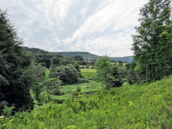
![]()
![]()
![]()
![]()
![]() On Saturday, July 16th I wanted to go to Andes to hike the Rail trail and the Bullet Hole Spur Trail. I had thought about doing this the day before after Cindy and I had hiked Bramley Mountain but she was not up for it and I was pretty tired myself. I got all my gear in the car, put Sheila in the back seat and left Livingston Manor just after 8:30 AM for the drive to Andes. Sheila acted as if we hadn't hiked in a week although we been out only yesterday! I decided to take Route 17 to Roscoe and then Route 206 to the Pepacton Reservoir. At the intersection with Route 30, I turned right to head for the bridge at Dunraven. I crossed the Pepacton Reservoir on the bridge and at the end of the bridge I turned left on Tremperskill Road and followed it into Andes. I turned left and drove less than a quarter mile to the sign that Said "Andes Rail Trail" on the left. There wasn't really a parking area and I questioned whether or not I should park in front of the gate. In the end I did park trying to leave enough for someone to open the gate if they needed to do so. We started our hike at 9:25 AM as I walked Sheila through the gate on her leash. Ahead of us was the Andes Depot which was rather modern looking. It was donated by the Decker family and may be on the site of the original depot but has been completely refurbished. A kiosk near the depot explained a little about the rail trail which follows the railroad bed of the Delaware and Northern Railroad. As we walked I noticed it was already hot and humid especially when we were not beneath the trees. Shortly after the depot, we came to a wooden walkway that spanned the only really wet spot on the trail. A little after that we broke out into the open to a nice view down the Tremperskill. At this point there was a "high road" and a "low road" with the suggestion that we use the high road when the main trail was muddy. This occurred several other places along the trail. We stopped so that I could take a few pictures before continuing on the main trail. I had been keeping Sheila on her leash but I had seen no other hikers and we were some distance from town so I released her. We hiked under the trees for a short time and then broke out into the open to another nice view and an interpretive sign. The sign explained that the foundation was the remains of the Andes turntable that was used to turn engines around. No pictures exist of the original structure but it was called an "Armstrong turntable" since the engineer and fireman had to use their "strong arms" to pivot the engine! I took a few shot before we continued.
On Saturday, July 16th I wanted to go to Andes to hike the Rail trail and the Bullet Hole Spur Trail. I had thought about doing this the day before after Cindy and I had hiked Bramley Mountain but she was not up for it and I was pretty tired myself. I got all my gear in the car, put Sheila in the back seat and left Livingston Manor just after 8:30 AM for the drive to Andes. Sheila acted as if we hadn't hiked in a week although we been out only yesterday! I decided to take Route 17 to Roscoe and then Route 206 to the Pepacton Reservoir. At the intersection with Route 30, I turned right to head for the bridge at Dunraven. I crossed the Pepacton Reservoir on the bridge and at the end of the bridge I turned left on Tremperskill Road and followed it into Andes. I turned left and drove less than a quarter mile to the sign that Said "Andes Rail Trail" on the left. There wasn't really a parking area and I questioned whether or not I should park in front of the gate. In the end I did park trying to leave enough for someone to open the gate if they needed to do so. We started our hike at 9:25 AM as I walked Sheila through the gate on her leash. Ahead of us was the Andes Depot which was rather modern looking. It was donated by the Decker family and may be on the site of the original depot but has been completely refurbished. A kiosk near the depot explained a little about the rail trail which follows the railroad bed of the Delaware and Northern Railroad. As we walked I noticed it was already hot and humid especially when we were not beneath the trees. Shortly after the depot, we came to a wooden walkway that spanned the only really wet spot on the trail. A little after that we broke out into the open to a nice view down the Tremperskill. At this point there was a "high road" and a "low road" with the suggestion that we use the high road when the main trail was muddy. This occurred several other places along the trail. We stopped so that I could take a few pictures before continuing on the main trail. I had been keeping Sheila on her leash but I had seen no other hikers and we were some distance from town so I released her. We hiked under the trees for a short time and then broke out into the open to another nice view and an interpretive sign. The sign explained that the foundation was the remains of the Andes turntable that was used to turn engines around. No pictures exist of the original structure but it was called an "Armstrong turntable" since the engineer and fireman had to use their "strong arms" to pivot the engine! I took a few shot before we continued.
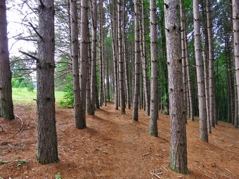 We entered the woods again and crossed a small bridge. I began to notice the regular "bumps" on the trail which signs said were the railroad ties which had not been removed. I wondered about his until I saw a couple of exposed ties! Another interpretive sign explained that there had been two trestles on the rail line ion the area. Both had been featured in movies from the early 20th century! After walking a little farther, we came to the end of the flat rail trail and the beginning of the Bullet Hole Spur Trail. We continued on the trail which immediately began to climb and I knew the easy walking was behind us. We had been headed south but now a major switchback took us north before heading south again and always climbing. The trail passed through some hardwoods and then entered a hemlock forest as it climbed to the shoulder of Hemlock Knoll. There were some interesting rock formations along the way and I stopped to take a few pictures. As we began to descend off Hemlock Knoll, Sheila alerted and I saw two hikers coming toward us with a dog. We both out our dogs an their leashes and we passed each other with a brief "Hello". Sheila and I continued until we came to a stone wall. A break in the wall signaled a place to get view of the surrounding hills which was not impressive but pretty. We passed over the stone wall where it had been turned into steps and came to the loop at the end of the Bullet Hole Spur Trail. WE continued straight ahead and walked through a planted red pine plantation. The trail eventually joined a woods road that paralleled the Temperskill. I wanted to walk down to the stream but there was private property between the trail and the streambed. The loop was only half a mile long so we were soon back at the point where it started. The return trip was now and out and back so we stepped up our pace. On the way across Hemlock Knob we met a small family group followed closely by three young women out for some exercise. The return trip seemed to go very quickly and we did not meet any more people on our way to the flat part of the rail trail. On our way back we did meet several groups of hikers. Several groups looked like they might try the spur trail while it was obvious that others were only headed to the end of the flat part of the trail. We arrived back at the depot just before 11:00 AM and I took a few pictures of the depot and kiosk before walking back to the car. It was 11"05 Am and we had covered 3.7 miles in 1 hour and 45 minutes with an elevation gain of 735 feet. After getting a drink and sitting in the air conditioned car, I decided I felt fresh enough to continue my day at Palmer Hill.
![]()
![]()
![]()
![]()
![]() On Friday, July 15th I wanted to get away from Livingston Manor to hike and decided that the new trails on Bramley Mountain near Delhi would be a good destination. The new trails are scheduled to open in a few weeks and I thought I would like a preview. My wife and I had hiked there a few years ago before there were any trails and had an interesting time fighting through the briars to the summit where a fire tower once stood. I asked Cindy if she would like to go and she agreed but had reservations about the heat and possible thunderstorms. We tried to get out of the house early and did leave Livingston Manor just before 9:00 AM for the hours drive to Bramley Mountain. Sheila acted as if we hadn't hiked in a week although we had only missed one day! I decided to take the back roads since this was the shortest way. I drove up the Beaverkill Road and took Barkaboom Road to BWS 8. I turned left and followed the road to Route 30 and crossed the Pepacton Reservoir on the bridge. At the end of the bridge I turned left on Tremperskill Road and follows it into Andes where I turned left on Route 28 North. After 7.5 miles, I turned right on Glen Burnie Road and drove 2.8 miles to the parking area for Bradley Mountain. The parking area is small and it helped that we had been there before. I pulled into the parking area, turned around and parked at 10:00 AM. When we got out of the car, we both noticed that it was warm and very humid! It didn't take us long to get on the trail. We had two choices to start the hike. The red Summit Trail went to the right directly to the summit over 1.8 miles. We chose to go straight ahead on the blue Quarry Trail which passes through a quarry and then wends its way to the summit over 2.1 miles. The woods road was very open but damp and muddy in some places. The biggest problem was the cloud of insects that surrounded us both! This was the worst the bugs had been all season. We walked along the road through the woods and eventually broke out into an open clearing where the grass was long and wet. My boots got soaked but it did not seem to penetrate through to my feet. At about .8 miles we came to the quarry and I stopped to take a few pictures and apply some insect repellant. When we started out again, we came to a spot where the trail seemed to split with blue markers going both left and right. There was also a sign that said "Summit 1.2 miles" but it was not clear which way it was pointing. We decided to head to the right as we knew the summit was in that direction.
On Friday, July 15th I wanted to get away from Livingston Manor to hike and decided that the new trails on Bramley Mountain near Delhi would be a good destination. The new trails are scheduled to open in a few weeks and I thought I would like a preview. My wife and I had hiked there a few years ago before there were any trails and had an interesting time fighting through the briars to the summit where a fire tower once stood. I asked Cindy if she would like to go and she agreed but had reservations about the heat and possible thunderstorms. We tried to get out of the house early and did leave Livingston Manor just before 9:00 AM for the hours drive to Bramley Mountain. Sheila acted as if we hadn't hiked in a week although we had only missed one day! I decided to take the back roads since this was the shortest way. I drove up the Beaverkill Road and took Barkaboom Road to BWS 8. I turned left and followed the road to Route 30 and crossed the Pepacton Reservoir on the bridge. At the end of the bridge I turned left on Tremperskill Road and follows it into Andes where I turned left on Route 28 North. After 7.5 miles, I turned right on Glen Burnie Road and drove 2.8 miles to the parking area for Bradley Mountain. The parking area is small and it helped that we had been there before. I pulled into the parking area, turned around and parked at 10:00 AM. When we got out of the car, we both noticed that it was warm and very humid! It didn't take us long to get on the trail. We had two choices to start the hike. The red Summit Trail went to the right directly to the summit over 1.8 miles. We chose to go straight ahead on the blue Quarry Trail which passes through a quarry and then wends its way to the summit over 2.1 miles. The woods road was very open but damp and muddy in some places. The biggest problem was the cloud of insects that surrounded us both! This was the worst the bugs had been all season. We walked along the road through the woods and eventually broke out into an open clearing where the grass was long and wet. My boots got soaked but it did not seem to penetrate through to my feet. At about .8 miles we came to the quarry and I stopped to take a few pictures and apply some insect repellant. When we started out again, we came to a spot where the trail seemed to split with blue markers going both left and right. There was also a sign that said "Summit 1.2 miles" but it was not clear which way it was pointing. We decided to head to the right as we knew the summit was in that direction.
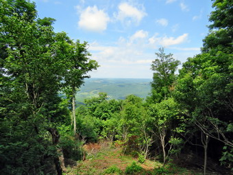 The trail entered the woods and immediately turned almost 180 degrees. As we walked along the trail it would head up the mountain at points and then parallel the ridge leaving me to wonder if we were actually on the trail to the summit. Eventually the trail turned at began a steady climb up to the summit. The trail was obviously new but very well cleared and constructed. It passed by several interesting ledges and rock formations. There were numerous switchbacks which made the walk longer but mitigated some of the steeper climbs. Near the top the trail passed around and went through some rock ledges and the trail crew had expertly created some steps out of natural materials. Both of us noticed the heat and the humidity as we climbed but, as we neared the top, there was a slight breeze and fewer insects. At 1.9 miles and just before the summit was a nice viewpoint with a stone bench. We stopped and I took a few pictures before we hike the last few hundred feet to the top. Over the 1.1 miles from the quarry we gained 770 feet with and overall average grade of 13% despite the many switchbacks. When we reached the summit, I dropped my pack and took out the camera. I took some shots of the old pilings for the fire tower and then walked over to the lookout. There was more haze than I had hoped for but I took some shots anyway. To the south and southeast I could see the Pisgahs near Andes which were once the site of a ski area. I walked down to the lower part of the lookout and took a few more pictures. When I was finished, I returned to the summit where we all had a drink and a snack before starting down. We walked in the direction that the arrow pointed and found the markers for the red Summit Trail that we would take back to the parking area.
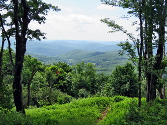 We started down the Summit Trail which starts out as wide woods road but at .15 miles from the summit markers clearly indicated a right turn. The trail follows another woods road but one that is covered in long grass. We walked for a while until we recognized the trail from our previous visit. I stopped to take a few pictures of the trail and a nice view off to the left. As I was taking pictures I noticed a "bulge" on the branches of a tree on the right. When I zoomed in with my camera, I found this was a hawk and I took several pictures of this raptor. I packed up the camera and we continued to follow the woods road as it entered the woods. There were less insects at this point and the road was dry although the descent was a little steep. We had returned this way on our last visit so I knew this road led out to the upper parking area. I was waiting for the trail to turn right into the woods to connect to the lower parking area. Soon we were almost to the road and I finally saw where the trail entered the woods and started downhill to the car. This part of the trail was soft and easy walking but only lasted .15 miles. As we approached our car, I saw an NYC truck at the gate and the occupants were getting out. One of the men greeted us and I immediately recognized him as a friend from Livingston Manor. We talked for a while before Cindy and I headed over to our car. It was 12:30 Pm and we had hiked 3.7 miles in 2.5 hours with over 40 minutes of time stopped. The elevation gain was 940 feet. To get to the summit the red Summit Trail is both shorter and easier. The blue Quarry Trail and its extension is harder but also more interesting! On the way home we headed toward Delhi and crossed the stream at Fitches Crossing. There is a covered bridge here which was moved from Delhi to its present location. I stopped and took a few pictures of the bridge both exterior and interior.
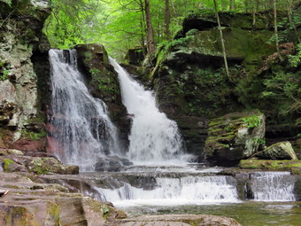
![]()
![]() On Wednesday, July 13thI left the Giant Ledge parking area to head for Angle falls in Yagerville to see how much water was going over the falls. I debated my route and decided to take the backboard through Claryville, over Red Hill and out Sugarloaf Road to Route 55A. At the end of Sugarloaf Road I turned right and then left to take Route 55A to Yagerville Road. There was construction on the main road and on 55A but it only held me up for a few minutes. I drove 4.25 Niles on Route %%A before turning left on Yagerville Road. I continued 1.2 miles to Sholam Road and turned right to drive to the dead end. I parked at the end by a pile of dirt under the powerlines at 11:25 Am and immediately got out of the car to hike. We walked along what is oft of Sholam Road which deteriorates more every year. I was surprised that I could hear a roar coming from the falls apparently indicating a good volume of water. We walked to where a path turned right at the top of the falls and parallels Trout Creek. I looked down at the falls and saw that it was about as high as usual which surprised me. All of the falls I had visited recently had very limited water volume due to the lack of snow this winter and a limited amount of rainfall. Trout Creek is rather long extending around 5 miles from Balsam Swamp. Over its course it picks up a few tributaries. We walked along the path until a steep and slippery path turned to the left to head down to the creek bed. We worked our way down the bank and to some rocks at the base of the falls. All the rocks were slippery which did not bother Sheila but concerned me. I was able to get out my camera and walk out on some of the rocks to get a good view of the falls. I took shots of the falls and some downstream. To capture the volume and character of the falls, I shot a short video before packing up and heading back up to the main trail. Although the trail isn't really maintained, someone had cut a few of the trees that had been across the trail. We continued down the path heading toward the lower falls.
On Wednesday, July 13thI left the Giant Ledge parking area to head for Angle falls in Yagerville to see how much water was going over the falls. I debated my route and decided to take the backboard through Claryville, over Red Hill and out Sugarloaf Road to Route 55A. At the end of Sugarloaf Road I turned right and then left to take Route 55A to Yagerville Road. There was construction on the main road and on 55A but it only held me up for a few minutes. I drove 4.25 Niles on Route %%A before turning left on Yagerville Road. I continued 1.2 miles to Sholam Road and turned right to drive to the dead end. I parked at the end by a pile of dirt under the powerlines at 11:25 Am and immediately got out of the car to hike. We walked along what is oft of Sholam Road which deteriorates more every year. I was surprised that I could hear a roar coming from the falls apparently indicating a good volume of water. We walked to where a path turned right at the top of the falls and parallels Trout Creek. I looked down at the falls and saw that it was about as high as usual which surprised me. All of the falls I had visited recently had very limited water volume due to the lack of snow this winter and a limited amount of rainfall. Trout Creek is rather long extending around 5 miles from Balsam Swamp. Over its course it picks up a few tributaries. We walked along the path until a steep and slippery path turned to the left to head down to the creek bed. We worked our way down the bank and to some rocks at the base of the falls. All the rocks were slippery which did not bother Sheila but concerned me. I was able to get out my camera and walk out on some of the rocks to get a good view of the falls. I took shots of the falls and some downstream. To capture the volume and character of the falls, I shot a short video before packing up and heading back up to the main trail. Although the trail isn't really maintained, someone had cut a few of the trees that had been across the trail. We continued down the path heading toward the lower falls.
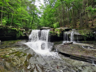 The trail was overgrown with weeds which surprised me as this is a popular spot for people in the area. I was happy that there was almost no broken glass around the area. I dropped my pack near the top of the lower falls and got out the camera. I took some pictures of the upper drop of the lower falls from several different vantage points. I was able to get put on a rock in front of the falls and then switched to a rock outcropping that was nearer the top of the falls. Next, I worked my way down the bank to look at the old foundations at the bottom of the falls and then walked down to the creek bed. From the edge of the stream I took some more pictures and then walked upstream a bit and took a few more. I was able to squeeze between some tree trunks near the edge of the stream and stand on a rock to get a good view. I leaned on one large trunk and found that it moved significantly! The end of the trunk was floating on the water and it was precariously balanced near the middle on another tree! I carefully made my way back t the stream bank and returned to where I had left my pack. I took a few shots of the foundations and then headed back to the car. We headed back up the bank to the old road arriving at the car at 11:55 AM. The rain had held off and we were returning dry after hiking just .7 miles in 45 minutes with 180 feet of elevation gain.
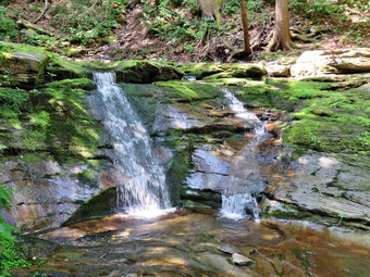
![]()
![]() On Wednesday, July 13th I wanted to go in search of a waterfall! While hiking Giant Ledge and Panther the day before two different hikers asked me about Otter Falls and I had to say I never heard of it. One hiker showed me a website that talked about the falls so I was able to do some research when I got home. Several websites gave the location as about .5 miles from the Giant ledge parking area toward Big Indian along the stream on the left side of the road. This stream on the maps is labeled as Esopus Creek which seems to originate at Winnisook Lake. The descriptions include a thirty foot drop into a pool below which is 6' to 8' deep even in dry conditions. One website had a description from someone who had actually been there and the directions included looking for a telephone pole labeled 167 1/2. I got my gear and Sheila in the car and left Livingston Manor a little after 9:00 AM. When I left home the temperature was still in the low 60's but I knew this would rise on the hike. I drove out the DeBruce Road and eventually passed Round Pond. At the end of the road, I turned left on Route 47 and drove passed Frost Valley and the Slide Mountain trailhead. We arrived at the parking area on Route 47 at 9:50 AM to find a no other cars parked there. I got my gear ready including setting up both my Suunto Traverse watch and my Garmin 64st handheld unit. We started to walk downhill on Route 47 toward Big Indian. I checked the label on a pole and it read 176 which indicated we had some distance to go. As we walked I found POSTED signs along the left side of the road. I could also see that the maple trees were connected by plastic tubing indicating a substantial sugaring operation. We continued to walk and I continued to check my GPS watch and the pole numbers. We passed .5 miles and the pole numbers were still too high and the POSTED signs were still on the trees.
On Wednesday, July 13th I wanted to go in search of a waterfall! While hiking Giant Ledge and Panther the day before two different hikers asked me about Otter Falls and I had to say I never heard of it. One hiker showed me a website that talked about the falls so I was able to do some research when I got home. Several websites gave the location as about .5 miles from the Giant ledge parking area toward Big Indian along the stream on the left side of the road. This stream on the maps is labeled as Esopus Creek which seems to originate at Winnisook Lake. The descriptions include a thirty foot drop into a pool below which is 6' to 8' deep even in dry conditions. One website had a description from someone who had actually been there and the directions included looking for a telephone pole labeled 167 1/2. I got my gear and Sheila in the car and left Livingston Manor a little after 9:00 AM. When I left home the temperature was still in the low 60's but I knew this would rise on the hike. I drove out the DeBruce Road and eventually passed Round Pond. At the end of the road, I turned left on Route 47 and drove passed Frost Valley and the Slide Mountain trailhead. We arrived at the parking area on Route 47 at 9:50 AM to find a no other cars parked there. I got my gear ready including setting up both my Suunto Traverse watch and my Garmin 64st handheld unit. We started to walk downhill on Route 47 toward Big Indian. I checked the label on a pole and it read 176 which indicated we had some distance to go. As we walked I found POSTED signs along the left side of the road. I could also see that the maple trees were connected by plastic tubing indicating a substantial sugaring operation. We continued to walk and I continued to check my GPS watch and the pole numbers. We passed .5 miles and the pole numbers were still too high and the POSTED signs were still on the trees.
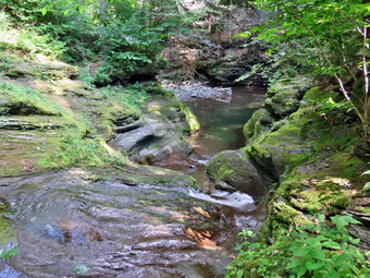 At around .75 miles I noticed that the POSTED signs had given way to State Forest Preserve signs. A short distance further I found Pole 167 1/2 and just a little farther along a rather well-defined leading into the woods. The path remained easy to follow as we walked west into the woods and toward the stream for about 600 feet. I could see the waterfall and walked out on a little overhang to try to get some pictures. I wanted a head-on view but couldn't find quite the right angle. The light was also behind the falls which did not help. We walked back up to the trail and to the brink of the falls. I guess the TOTAL drop may be 30 feet but the water does not fall as much as it runs over the rocks to the pool below. Even though it was very dry and only a little water was going over the falls, the pool was deep and filled with water. I did not test it but Sheila did and pronounced it good! I took some more pictures of the stream and the falls before packing up and heading back out to the road. I put Sheila on her leash and hiked back to hotter which was uphill all the way. The temperature was rising and the humidity made it seem even warmer. We were back at the car by 10:40 Am having hiked 2 miles in 45 minutes with an elevation gain of 320 feet. It may be possible to park on the side of the road near the falls but it is a short walk from the parking area which is a safer option. Since the hike was so short, I decided to head for Angel Falls in Yagerville just to see how much water was going over the falls.
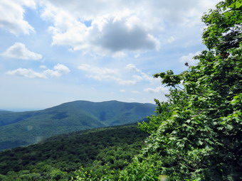
![]()
![]()
![]()
![]()
![]() On Tuesday, July 12, I wasn't planning to hike very far since I had gotten out the day before and hiked 8 miles with Cindy at Morgan Hill State Forest. I got up early and found partly cloudy skies but checked the forecast and found no rain predicted. One of the foresters from DEC Region 3 had told me that the ADK crew had completed their work on the stone steps at Giant Ledge so I decided to go and check out their work. I slept a little later than usual and didn't get started until about 9:30 AM. On the way I decided it was time to hike another 3500 peak and decided to continue from Giant Ledge on to Panther. Panther Mountain itself has limited views but to get there from Route 47 the trail passes over Giant ledge which was a great view of Panther Mountain, the entire Burroughs Range and the valleys below. When I left home the temperature was still in the mid 60's but I knew this would rise on the hike. I drove out the DeBruce Road and eventually passed Round Pond. At the end of the road, I turned left on Route 47 and drove passed Frost Valley and the Slide Mountain trailhead. We arrived at the parking area on Route 47 at 10:15 AM to find a few cars parked there. Two young women were getting out of one car and we talked briefly. They were from Buffalo and were visiting family in Poughkeepsie. They had hiked Breakneck Ridge the day before and were now ready to try their first Catskill 3500 foot peak. They had one light pack between them but seemed fit and ready to hike. Sheila and I got started pretty quickly by crossing the road and heading out the trail with the two young women right behind. The rain that had fallen during the week made the trail wet in places but most of the trail seemed dry. I let Sheila off the leash almost immediately after crossing the road and she was behaving by staying on the trail. As we crossed the bridge over the small stream, there almost no water running in the stream. I pointed out the flow to the two hikers and mentioned that the bridge had been washed away by the same stream. They were obviously faster than I was and I let them go ahead. They soon disappeared although their pace looked very natural for them. Sheila and I kept up a good pace but I forgot how annoying the many rocks that cover the trail to the turnoff can be! In addition, there are several short climbs and each one seems to be the last. I did notice that everything looked the same as it had and that no work had been done. Either I had misunderstood the forester or he had some incorrect information! Despite the fact that I had been hiking, I noticed that making good time up the climbs was tiring although I enjoyed the elevation gain. On the way up we met two hikers coming down the trail and I said "Hello" as we passed. We finished the sixth short climb and arrived at the turn to Giant Ledge and Panther at about 10:40 AM. I didn't feel like we were going slow but it took 35 minutes to walk the .75 miles from the road, one of our slower times. I had problems with my new Suunto Traverse GPS watch the day before but it seemed to be recording my track correctly.
On Tuesday, July 12, I wasn't planning to hike very far since I had gotten out the day before and hiked 8 miles with Cindy at Morgan Hill State Forest. I got up early and found partly cloudy skies but checked the forecast and found no rain predicted. One of the foresters from DEC Region 3 had told me that the ADK crew had completed their work on the stone steps at Giant Ledge so I decided to go and check out their work. I slept a little later than usual and didn't get started until about 9:30 AM. On the way I decided it was time to hike another 3500 peak and decided to continue from Giant Ledge on to Panther. Panther Mountain itself has limited views but to get there from Route 47 the trail passes over Giant ledge which was a great view of Panther Mountain, the entire Burroughs Range and the valleys below. When I left home the temperature was still in the mid 60's but I knew this would rise on the hike. I drove out the DeBruce Road and eventually passed Round Pond. At the end of the road, I turned left on Route 47 and drove passed Frost Valley and the Slide Mountain trailhead. We arrived at the parking area on Route 47 at 10:15 AM to find a few cars parked there. Two young women were getting out of one car and we talked briefly. They were from Buffalo and were visiting family in Poughkeepsie. They had hiked Breakneck Ridge the day before and were now ready to try their first Catskill 3500 foot peak. They had one light pack between them but seemed fit and ready to hike. Sheila and I got started pretty quickly by crossing the road and heading out the trail with the two young women right behind. The rain that had fallen during the week made the trail wet in places but most of the trail seemed dry. I let Sheila off the leash almost immediately after crossing the road and she was behaving by staying on the trail. As we crossed the bridge over the small stream, there almost no water running in the stream. I pointed out the flow to the two hikers and mentioned that the bridge had been washed away by the same stream. They were obviously faster than I was and I let them go ahead. They soon disappeared although their pace looked very natural for them. Sheila and I kept up a good pace but I forgot how annoying the many rocks that cover the trail to the turnoff can be! In addition, there are several short climbs and each one seems to be the last. I did notice that everything looked the same as it had and that no work had been done. Either I had misunderstood the forester or he had some incorrect information! Despite the fact that I had been hiking, I noticed that making good time up the climbs was tiring although I enjoyed the elevation gain. On the way up we met two hikers coming down the trail and I said "Hello" as we passed. We finished the sixth short climb and arrived at the turn to Giant Ledge and Panther at about 10:40 AM. I didn't feel like we were going slow but it took 35 minutes to walk the .75 miles from the road, one of our slower times. I had problems with my new Suunto Traverse GPS watch the day before but it seemed to be recording my track correctly.
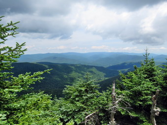 The trail after the turn was also wet and muddy in spots but we made use of the stepping stones along the way. When the climb began we pushed the pace. We climbed up the last rocky ascent and walked to the first lookout arriving at about 11:10 AM after the 1.5 mile climb. Just before we walked down the path to the first lookout, we met a couple who seemed confused about the way to Panther Mountain. I pointed them in the right direction and walked down to the lookout where I met the two girls from earlier and another, older couple. I put Sheila on her leash and attached it to a tree nearby so that she would not bother the other hikers. Sheila is fearless about heights and sometimes scares me a little when she walks right to the edge of the cliffs and looks down! I dropped my pack and got out my camera to take some pictures of the great views of the valley below and the mountains beyond. I talked to the girls about there hiking experience and pointed out the mountains in view. The other couple left and said they were heading toward Panther. I took a few more pictures, got a drink and gave one to Sheila. The girls headed out just before us and were soon out of sight. As we hiked along the ledges, I stopped briefly to look at the other views but decide not to stop on the way out. We continued on the main trail and caught up with the couple that had just left the viewpoint as they were starting down into the col and we walked together for a while and talked. As we worked our way down to the col we met the "confused" couple heading back up. They had decided that they did not want to descend into the col, climb Panther and then have to climb back up to the ledges. I said "Goodbye" to the other couple and quicken my pace through the Col and started the climb up Panther. Parts of the Panther trail get a little steep at times but there always seems to be a switchback or flatter area. The trail was mostly dry with a few muddy spots and some slippery rocks. Sheila and I continued up the trail with Sheila checking out some of the paths that lead to limited viewpoints along the way. We stopped at one and walked out to a rock which had a good view of the entire Burroughs Range with only a few small trees in the way. I took some pictures before we went back to the main trail. We were soon up the steeper climbs with only a final, short ascent of Panther to go. One the way we met the two girls headed back down to their car. They asked me about Otter Falls which a website indicated was only a half mile from the parking area. I told them I had never heard of the falls and we went our separate ways. We arrived at the summit of Panther at 12:25 PM after hiking 3.2 miles. The view from the summit is limited but somewhat better than during our last visit. I took a couple of shots of the scenery and a few of Sheila by my pack. We walked back to the viewpoint just below the summit and ascended the rock which acts as the lookout. I took a few shots of the scenery and then Sheila and I got back on the trail. Sheila was very energetic as we turned back as if she knew that we would be going down the mountain. I was on the lookout for the other couple that had headed up behind me.
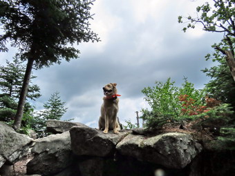 We met no one on the trail as we descended Panther. I tried to keep a good pace but found the descent as difficult as the climb up! When we had finally made the ascent to Giant Ledge we could hear hikers approaching from in front of us. I stopped at one of the lookouts to take a few more pictures before getting back on the main trail. A family group was approaching and they had a dog that was not on a leash. I put Sheila on her leash and they leashed their dog. As we passed each other, they asked about the next viewpoint and I told them that there were several. We continued along the trail and I could see that the first lookout had a few people. We finally got to the descent off the Ledge and met a woman who was checking here cell phone. She also asked me about Otter Falls and showed me the website that mentioned it as a swimming hole. I told her I had not heard about the falls but I knew I would have to check it out when I got home. As we were talking, a group of four young hikers entered the area just below the climb and discussed the falls with us. Sheila and I made our way down the rocks and continued down the main trail. Just after we made the turn to get back to the car we caught up with the couple who was following us up Panther. They had turned around when it was obvious the climb would be too difficult. We again walked together briefly meeting another pair of young men coming up the trail. Sheila and I continued on ahead through the descents without meeting anyone else. After walking back to the bridge, I decided that this trail might be the rockiest in the Catskills! As we crossed the bridge, Sheila got a drink and cooled off in the stream. We continued out to Route 47 and the parking area which was full. We were back at the car at 2:25 PM having covered 6.4 miles in 4 hours and 10 minutes including numerous stops. The elevation gain was 2348 feet. When I got home, I downloaded the track from the Suunto Traverse watch and my Garmin 64st and found they were very close. I also searched for Otter Falls and found that it is located about .5 miles down the Route 47 toward Big Indian on state land. I will be investigating this very soon!
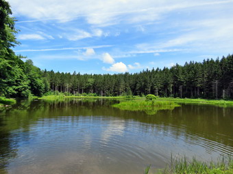
![]()
![]()
![]()
![]()
![]() On Monday, July 11th I wanted to get away from Livingston Manor to hike and decided that Morgan Hill State Forest northeast of Cortland would be a good choice. I was hoping that the recent rain would have increased the volume of Tinker Falls to make it more interesting. Beside the falls Morgan Hill has several small ponds and a nice view from Jones Hill. Cindy decided she wanted to go with me since she agreed getting away would be fun. Morgan Hill is a two hour drive which is a little farther than we normally go when we go together but the forecast for a bright and sunny day convinced us it was a good idea. We left Livingston Manor a little before 9:00 AM with our gear and with Sheila ready to go. Sheila, of course, doesn't care where we hike so she protests when we set out on a long drive! We headed west on State Route 17 to Binghamton and then north on I81 toward Cortland. I took exit 11 and turned north on Route 13 heading toward Truxton. As we passed through Truxton I turned north on Route 91. After just under 4 miles, I turned right on Shackham Road and drove north for about 2 miles to park on the side of the road where the Onondaga Trail crosses the road. This trail is part of the Finger Lakes Trail system and is co-aligned with the North Country Trail which runs from the Missouri River in North Dakota to Lake Champlain in New York! I set both my Suunto Traverse GPS watch and my Garmin 64st GPS unit and we were off. We began our hike at 11:00 AM by crossing the road and hiking up the trail toward the top of the first ridge. The beginning of this section is usually very muddy but on this day it was dry and much easier to hike. The first .4 miles was all uphill at we gained a little over 150 feet. The trail in this area is pretty generic passing through mostly hardwoods and then some evergreens. The warm weather had brought out the trout lilies, some nice maroon trillium and other assorted windflowers. We descended the other side of the hill and then walked along as the trail rolled a little. At 1.75 miles we were on the shores of Spruce Pond. There was no one at the pond and Sheila jumped right in for a swim. We stopped so that I could take a few pictures. We walked along the shore of the pond following the Onondaga Trail which is blazed in light blue and an orange trail that loops around the pond. The trails spilt near the head of the pond and we followed the blue trail. The trail started one of the steepest ascents of the day which was moderated by some switchbacks as we gained 220 feet in about .25 miles or about a 19% grade.
On Monday, July 11th I wanted to get away from Livingston Manor to hike and decided that Morgan Hill State Forest northeast of Cortland would be a good choice. I was hoping that the recent rain would have increased the volume of Tinker Falls to make it more interesting. Beside the falls Morgan Hill has several small ponds and a nice view from Jones Hill. Cindy decided she wanted to go with me since she agreed getting away would be fun. Morgan Hill is a two hour drive which is a little farther than we normally go when we go together but the forecast for a bright and sunny day convinced us it was a good idea. We left Livingston Manor a little before 9:00 AM with our gear and with Sheila ready to go. Sheila, of course, doesn't care where we hike so she protests when we set out on a long drive! We headed west on State Route 17 to Binghamton and then north on I81 toward Cortland. I took exit 11 and turned north on Route 13 heading toward Truxton. As we passed through Truxton I turned north on Route 91. After just under 4 miles, I turned right on Shackham Road and drove north for about 2 miles to park on the side of the road where the Onondaga Trail crosses the road. This trail is part of the Finger Lakes Trail system and is co-aligned with the North Country Trail which runs from the Missouri River in North Dakota to Lake Champlain in New York! I set both my Suunto Traverse GPS watch and my Garmin 64st GPS unit and we were off. We began our hike at 11:00 AM by crossing the road and hiking up the trail toward the top of the first ridge. The beginning of this section is usually very muddy but on this day it was dry and much easier to hike. The first .4 miles was all uphill at we gained a little over 150 feet. The trail in this area is pretty generic passing through mostly hardwoods and then some evergreens. The warm weather had brought out the trout lilies, some nice maroon trillium and other assorted windflowers. We descended the other side of the hill and then walked along as the trail rolled a little. At 1.75 miles we were on the shores of Spruce Pond. There was no one at the pond and Sheila jumped right in for a swim. We stopped so that I could take a few pictures. We walked along the shore of the pond following the Onondaga Trail which is blazed in light blue and an orange trail that loops around the pond. The trails spilt near the head of the pond and we followed the blue trail. The trail started one of the steepest ascents of the day which was moderated by some switchbacks as we gained 220 feet in about .25 miles or about a 19% grade.
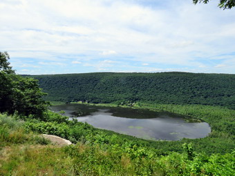 As soon as we reached the top of the hill, we started to descend again losing most of the elevation we had gained and crossing a small stream. Much of the hike to this point had been parallel to one small creek or another and none seemed to have much water. I kept hoping that Tinker Falls would have enough water to make it interesting! As we were hiking to Spruce Pond we were headed mostly northwest. The turn and ascent had directed us WSW and we began hiking on private land. The land is owned by a logging company that has granted permission for hikers to cross their property. We made another ascent and I could see as we got to the top that we were on the ridge that overlooks Labrador Pond. We passed over the top of Jones Hill and at 2.9 miles turned south to walk along the ridge. At 3.1 miles we came to the viewpoint which looks out of Labrador Pond and the valley and hills below. There was no one else at the viewpoint as I took my camera out to take some pictures. I took some shots of Cindy and Sheila before we got a drink and a snack and continued our hike. The trail follows the edge of the ridge while a dirt road also descends the hill. I decided to simply walk down the road and pick up the trail where it crosses. We turned left onto the trail and shortly met two young men looking for "Hang Glider Hill" which describes the viewpoint on Jones hill. From 3.0 miles to 4.1 miles the trail descended toward Tinker Falls losing almost 500 feet in the process. As we neared the falls, the descent became steeper. We saw people at the falls so I put Sheila on her leash as we walked down to the top of the falls.
 There is a trail to the falls from a parking area on Route 91 which makes access to the base rather easy. In the past there was no way to hike between the top and bottom without following a treacherous and steep path covered in loose dirt and slippery leaves. The Finger Lakes Trail Conference worked on a project to install stone steps on both sides of the falls to allow hikes to travel between the bottom and the top. I left Sheila with Cindy at the top of the falls and walked down the steps until I could get a good look at the falls. I was disappointed that the volume of water was so small. There was a group of young children in the area behind the falls. The amount of erosion evident t the falls shows that at some point there was a great volume of water in the stream but I have not found the season when this is the case. I took a few pictures and returned to the top. We walked over to the stream where I took a few more shots. We walked upstream to the wooden stairs that start the long climb to the top of the next ridge. The .7 mile ascent to the 5.1 mile mark ascends almost 400 feet but has several switchbacks. The switchbacks do moderate the climb but also make the trip longer. Some hikers have begun to take shortcuts to cutoff the switchbacks which increases erosion for very little gain! Once we were at the top Of the ridge, we began the downhill hike to Shackham Road. In about .7 miles we lost 430 feet with some of the sections being steep and slippery. We arrived at the road at about 2:05 PM about 5.8 miles into the hike. We turned left and began to walk the road back to our car at the upper parking area. It was about 1.5 miles back to the car but we made good time walking on the road despite the fact it was mostly uphill! Along the way we found several places where there was active logging with loads coming out of the woods to a landing area. Several trucks were being loaded and heading out on Shackham Road. As we neared the car I asked Cindy if she wanted to walk down to Shackham Pond. She declined so I decided to forgo the trip this time. It was 2:30 PM and we had hiked 7.6 miles in just over 3.5 hours. Our elevation gain was 1370 feet and we had stopped for only about 10 minutes.
![]()
![]()
![]()
![]()
![]() On Friday, July 8th, I had planned to go to Trout Pond and hike a loop down Russell Brook and around Mud Pond and Cables Lake. I had not hiked down Russell Brook Road passed the lower parking area for some time and did not know what to expect as the "road" has been in disrepair for years. I did know that the 8+ miles was exactly what I was looking for as far as a distance. Before I went to bed the night before, I got a text from Lisa asking me if I was available to do some trail maintenance cutting the Japanese knotweed at Trout Pond. Even though Lisa wanted to begin at 10:30 AM, late for me, I could not turn down the request for help and agreed. I woke early in the morning and got some things done around the house but by 9:30 AM I could wait no longer. I got Sheila and my tools in the car and headed up Route 17 toward Roscoe. I took with me my Silky saw, Wetterlings axe, Weed whip and new LT Wright machete. I had used the machete only a little but suspected it might be just right for the knotweed. I got off at exit 94 and took Route 206 out the Rockland Flats and turned left on Morton Hill Road just passed the Roscoe Community Nursing Home. I drove up Morton Hill Road to the intersection with Russell Brook Road and turned left to go down Russell Brook Road to the lower parking area. There were no cars in the lot when we parked at about 10:00 AM so I grabbed tools and pack and we headed down to the area of the bridge across Russell Brook. As we crossed the bridge I could see the knotweed had grown out Ito the trail and that the path to the falls was almost overgrown. I dropped my pack and tools and took out the camera to get some "before" pictures. I started by taking the machete to some of the knotweed near the path to the falls. It worked better than I had hoped. The machete easily cut through the knotweed and all the other grasses and weeds around. I cut some and stacked some until I had cut out most of the path and a good part of the main trail. I decided to walk to the beginning of the stand of knotweed and cut from there. I could hear cars on the road and assumed it was Lisa and Beth since was just past the time they were to arrive. Sheila stayed near but was very careful o stay away from the swinging machete. I continued to work and soon Beth and Lisa came walking down the trail. They began working with their loppers and I continued with the machete. After a little bit, I started to move the piles of what I had cut throwing them into the weeds on the other side of the trail. I tried using the grass whip on some of the grass on the path to the falls but found the machete much more efficient. Lisa brought a rake to clear some of the cuttings we had left behind. By 11:40 AM we were finished and started to pick up to walk back to the cars. An older couple walked by and complimented the work we had done. Lisa needed to get back to her shop but I wanted to do a little hiking and Beth agreed to go with me. I stowed my tools and got out my poles. After setting my GPS watch and GPS unit, Beth and I started down Russell Brook Road to do a hike around Mud pond and back to the parking which I estimated was just less than 5 miles.
On Friday, July 8th, I had planned to go to Trout Pond and hike a loop down Russell Brook and around Mud Pond and Cables Lake. I had not hiked down Russell Brook Road passed the lower parking area for some time and did not know what to expect as the "road" has been in disrepair for years. I did know that the 8+ miles was exactly what I was looking for as far as a distance. Before I went to bed the night before, I got a text from Lisa asking me if I was available to do some trail maintenance cutting the Japanese knotweed at Trout Pond. Even though Lisa wanted to begin at 10:30 AM, late for me, I could not turn down the request for help and agreed. I woke early in the morning and got some things done around the house but by 9:30 AM I could wait no longer. I got Sheila and my tools in the car and headed up Route 17 toward Roscoe. I took with me my Silky saw, Wetterlings axe, Weed whip and new LT Wright machete. I had used the machete only a little but suspected it might be just right for the knotweed. I got off at exit 94 and took Route 206 out the Rockland Flats and turned left on Morton Hill Road just passed the Roscoe Community Nursing Home. I drove up Morton Hill Road to the intersection with Russell Brook Road and turned left to go down Russell Brook Road to the lower parking area. There were no cars in the lot when we parked at about 10:00 AM so I grabbed tools and pack and we headed down to the area of the bridge across Russell Brook. As we crossed the bridge I could see the knotweed had grown out Ito the trail and that the path to the falls was almost overgrown. I dropped my pack and tools and took out the camera to get some "before" pictures. I started by taking the machete to some of the knotweed near the path to the falls. It worked better than I had hoped. The machete easily cut through the knotweed and all the other grasses and weeds around. I cut some and stacked some until I had cut out most of the path and a good part of the main trail. I decided to walk to the beginning of the stand of knotweed and cut from there. I could hear cars on the road and assumed it was Lisa and Beth since was just past the time they were to arrive. Sheila stayed near but was very careful o stay away from the swinging machete. I continued to work and soon Beth and Lisa came walking down the trail. They began working with their loppers and I continued with the machete. After a little bit, I started to move the piles of what I had cut throwing them into the weeds on the other side of the trail. I tried using the grass whip on some of the grass on the path to the falls but found the machete much more efficient. Lisa brought a rake to clear some of the cuttings we had left behind. By 11:40 AM we were finished and started to pick up to walk back to the cars. An older couple walked by and complimented the work we had done. Lisa needed to get back to her shop but I wanted to do a little hiking and Beth agreed to go with me. I stowed my tools and got out my poles. After setting my GPS watch and GPS unit, Beth and I started down Russell Brook Road to do a hike around Mud pond and back to the parking which I estimated was just less than 5 miles.
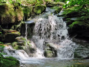 We planned to walk down Russell Brook Road to see if we could get to the lower trailhead and then pick up the trail to Mud Pond from there. The road has been devastated by several floods and is closed just passed the main parking area where the state has placed some large boulders. Just passed this roadblock there is the first of several deep cuts across the road caused by the erosion of water running off the ridge on the left. We walked through the first and then another larger cut. Sheila was happily running down to the stream to get wet and then coming back up to the trail to shower us. We soon came to a spot where the road had been completely eroded by the stream. We tried walking along the bank but it was too steep and slippery so we started to pick our way across the rooks in the stream as the water was low enough to allow this. We slipped a little in places but were soon back on the "road". Since very few people hike this route it is very overgrown with weeds and brush and has a few major blowdowns. At 1.4 miles we were able to cross the stream on a few stepping stones since the water level was so low. In another .2 miles we crossed under the power lines and turned right on the trail. I was surprised to find what looked like a new sign at this "trailhead". Lisa had asked us to look for giant hogweed as someone had reported it along Russell Brook but we had not found any. The trail begins with a short but somewhat steep ascent but then levels off some as it passes by a beaver pond. The trail needs maintenance as the weeds are high and the trail markers very scarce in areas. There were quite a few nettles along most of the trail and Beth was wearing shorts. The trail was pretty wet and everything was damp from the rain and humidity so the insects were out. I finally gave up and stopped to apply some insect repellant. We passed by the beaver pond which was very low and stagnant. The trail remained level as it followed the base of a ridge until about 2.2 miles where it began to climb. The ascent went on for .6 miles and gained 420 feet. The trail was parallel to the stream that flows out of Mud Pond. As we neared the top of the hill we could see Mud Pond through the trees and I was watching for the path that leads to the outlet end of the pond. Somehow I missed the path and we simply continued on the main trail and soon the hiking trail turned right while a snowmobile trail went off to the left. We continued on the trail which was now following an old woods road passing the left turn to the trail around Trout Pond at 3.6 miles. We walked up the short hill and then started down the other side. By the time we were at the trail register box we had "lost" the elevation we had gained walking up the hill to Mud Pond. I decided not to go to the falls as there was so little water in the stream. It was a short walk out to the parking area. We were back at the car by 2:00 PM having hiked 4.6 miles in 2 hours and 10 minutes with an elevation gain of 735 feet.
![]()
![]()
![]()
![]() On Wednesday, July 6th, I had planned to hike with Lisa at Long Pond. Lisa was meeting me at my house so that we could ride together to Long Pond. The ambulance pager went off at 8:55 AM and I called Lisa to notify her before responding on the call. Due tog the nature of the call, I was back at home by 9:45. I called Lisa but got no answer and assumed she was out hiking. I decided to take Sheila and do the hike at Long Pond. Sheila was ready to go as we left the house a little after 10:00 AM. The temperature was in the 70's and the humidity stemmed high as I drove out DeVruce Road to Willowemoc. I tuned left on Flugertown Road and drove a short distance to the parking area on the right. When I pulled into the lot at 10:20 Am, we were the only hikers. We got right to hiking by walking out to Flugertown Road and turning right to hike in the direction opposite to the one I normally take. I put Sheila on her leash since there always seems to be some traffic on this back road. The first part of the hike is virtually flat but then starts to climb very gently for some distance. The final descent back to the parking area is the steepest part the of the hike. The first .5 miles follows the paved portion of Flugertown Road. Once we were on the unpaved, dirt road, I kept Sheila on her leash for a little longer until I felt the chance of meeting a vehicle was minimal and then I let her off the leash. Sheila was good about staying on the road which is important to me . The road was shaded by the trees making it a little cooler than the road walk. It seemed to be getting warmer as we kept up a very fast pace passing the first trail junction and the informal campsites along the way. I did see one illegal campsite right next to the stream but there were no people present nor was there a vehicle in the area. We continued on to the point where Flugertown Road turns into Basily Road and heads over a small hill and down to the Peters Hunting Club. The hunting club has a private bridge over the creek and at one point denied access to hikers. The bridge is now open and the snowmobile trail passes over it so I have hiked it many times. The camp has also repaired some boards that were missing on the bridge. It was 11:05 Am and we had covered 2.5 miles.
On Wednesday, July 6th, I had planned to hike with Lisa at Long Pond. Lisa was meeting me at my house so that we could ride together to Long Pond. The ambulance pager went off at 8:55 AM and I called Lisa to notify her before responding on the call. Due tog the nature of the call, I was back at home by 9:45. I called Lisa but got no answer and assumed she was out hiking. I decided to take Sheila and do the hike at Long Pond. Sheila was ready to go as we left the house a little after 10:00 AM. The temperature was in the 70's and the humidity stemmed high as I drove out DeVruce Road to Willowemoc. I tuned left on Flugertown Road and drove a short distance to the parking area on the right. When I pulled into the lot at 10:20 Am, we were the only hikers. We got right to hiking by walking out to Flugertown Road and turning right to hike in the direction opposite to the one I normally take. I put Sheila on her leash since there always seems to be some traffic on this back road. The first part of the hike is virtually flat but then starts to climb very gently for some distance. The final descent back to the parking area is the steepest part the of the hike. The first .5 miles follows the paved portion of Flugertown Road. Once we were on the unpaved, dirt road, I kept Sheila on her leash for a little longer until I felt the chance of meeting a vehicle was minimal and then I let her off the leash. Sheila was good about staying on the road which is important to me . The road was shaded by the trees making it a little cooler than the road walk. It seemed to be getting warmer as we kept up a very fast pace passing the first trail junction and the informal campsites along the way. I did see one illegal campsite right next to the stream but there were no people present nor was there a vehicle in the area. We continued on to the point where Flugertown Road turns into Basily Road and heads over a small hill and down to the Peters Hunting Club. The hunting club has a private bridge over the creek and at one point denied access to hikers. The bridge is now open and the snowmobile trail passes over it so I have hiked it many times. The camp has also repaired some boards that were missing on the bridge. It was 11:05 Am and we had covered 2.5 miles.
We crossed the outlet to the beaver pond by walking on the road as it was not necessary to use the small footbridge due to the dry conditions. The only water on the road was the overflow from the beaver pond which had a well-constructed dam. From that point the road began to ascend slightly but I increased my effort to keep up the pace. The skies were blue with some clouds and it was definitely warmer than when we had left the car. Soon we were approaching the point were we would turn right onto the trail back to Long Pond. We made the right turn and sacred to hike back on the snowmobile trail. Parts of the trail were very muddy which I found strange since the rest of the trail was so dry. There were also tire tracks but I could not tell how old they were. We walked along the trail ands Sheila did a good job of staying close. We passed the trail to the lean-to at 11:40 AM about 4.1 miles into the hike. It wasn't long before we were at the spur trail down to the shore of Long Pond. I decided to let Sheila decide which way we would go and she avoided the spur and stayed on the main trail. As we hiked the final leg of the trail I began to notice hundreds of miniature frogs or toads covering the trail especially in the damper spots. I have seen this before at Long Pond but cannot recall it anywhere else. The last part of the hike went quickly as we descended the hill back to the parking area. We were back at the car by 12:15 PM having covered 5.8 miles in just under 2 hours with a 530 foot elevation gain.
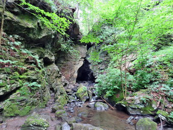
![]()
![]()
![]()
![]()
![]() On Tuesday, July 5th I asked Cindy if she would like to go to the Dover Stone Church which our son Kurt had highly recommended. This is a grotto or cave near Dover Plains that was formed as Stone Church Brook wore through the bedrock in the area to form a 30 foot waterfall inside a cavern. New hiking trails had recently been added and I thought it might be nice to visit even though it is about a 2 hour drive from home. Cindy said "Yes" so I planned our route and read a little more about the area. The weather forecast included showers for the night perhaps extending into the morning so we were not in a hurry to leave. The forecast for Dover Plains was for clearing around noon so we left Livingston Manor a little after 9:30 AM with an eager Sheila in the back seat. The route I planned was through Ellenville and then over Route 44/55 to New Paltz. We made pretty good time on these secondary roads with a few slow cars and some road construction. From New Paltz we headed over the Mid Hudson Bridge through Poughkeepsie and then followed Route 44 before taking some even smaller back roads into Dover Plains. We parked at the Dover Plains Elementary School as suggested on several websites as there is no parking at the entrance to the Dover Stone Church area. We arrived at 11:50 Am and found plenty of parking at the school. When we arrived it was already in the high 70's and the humidity seemed to be at least 75%. We walked out to Route 22, turned right and walked north about 250 feet to a yellow on blue historical sign. We turned left here and walked up a private, gravel driveway. At the top we found the sign for the beginning of the Dover Stone Church area. The Shape of the sign reflected the shape of the opening of the Dover Stone Church grotto! What lay before us was a beautiful lane or walkway lined with maple trees. There were stone steps at either end. We walked down the steps and continued to the other end of the lane to climb the other steps. A short path led us to a sign and kiosk that explained the historical significance of the area and showed a map of the trails. We began to follow the trail along The Stone Church Brook and it was obvious that the trail was well used. As we approached a bridge over the brook a group of hikers approached with an unleashed dog. Fortunately they quickly controlled their pet and we passed each other without incident. They were the only people we saw for the rest of the day. Just after the bridge, there was a sign directing us to the red, blue or yellow trails. Strangely, there was no sign for the Stone Church but I knew it had to be straight ahead along the creek. We began to work our way along the rocks beside the creek which were all wet and slippery from the rain, humidity and water from the brook. In a very short distance we could see the opening to the grotto. I stopped to take a few pictures of the creek and of the opening. The sky had cleared and the sun was little bright to get good shots. We continued to walk along the side of the creek on the stones and entered the grotto where it was very dark. I worked my way around inside and finally found a high spot to place my pack and get out the camera. I took quite a few shots but knew this was one of those places you really have to see in person. The volume of the creek was very low which made it easy to get into the grotto but made the waterfall pretty tame. I thought about returning with water shoes when the volume in the creek was greater! I grabbed my pack and exited the grotto stopping outside to take a few last pictures. We walked back along the slippery rocks to the trail signs and turned right to begin walking the new trails. My intent was to cover all the trails and I thought I had a good plan to do so.
On Tuesday, July 5th I asked Cindy if she would like to go to the Dover Stone Church which our son Kurt had highly recommended. This is a grotto or cave near Dover Plains that was formed as Stone Church Brook wore through the bedrock in the area to form a 30 foot waterfall inside a cavern. New hiking trails had recently been added and I thought it might be nice to visit even though it is about a 2 hour drive from home. Cindy said "Yes" so I planned our route and read a little more about the area. The weather forecast included showers for the night perhaps extending into the morning so we were not in a hurry to leave. The forecast for Dover Plains was for clearing around noon so we left Livingston Manor a little after 9:30 AM with an eager Sheila in the back seat. The route I planned was through Ellenville and then over Route 44/55 to New Paltz. We made pretty good time on these secondary roads with a few slow cars and some road construction. From New Paltz we headed over the Mid Hudson Bridge through Poughkeepsie and then followed Route 44 before taking some even smaller back roads into Dover Plains. We parked at the Dover Plains Elementary School as suggested on several websites as there is no parking at the entrance to the Dover Stone Church area. We arrived at 11:50 Am and found plenty of parking at the school. When we arrived it was already in the high 70's and the humidity seemed to be at least 75%. We walked out to Route 22, turned right and walked north about 250 feet to a yellow on blue historical sign. We turned left here and walked up a private, gravel driveway. At the top we found the sign for the beginning of the Dover Stone Church area. The Shape of the sign reflected the shape of the opening of the Dover Stone Church grotto! What lay before us was a beautiful lane or walkway lined with maple trees. There were stone steps at either end. We walked down the steps and continued to the other end of the lane to climb the other steps. A short path led us to a sign and kiosk that explained the historical significance of the area and showed a map of the trails. We began to follow the trail along The Stone Church Brook and it was obvious that the trail was well used. As we approached a bridge over the brook a group of hikers approached with an unleashed dog. Fortunately they quickly controlled their pet and we passed each other without incident. They were the only people we saw for the rest of the day. Just after the bridge, there was a sign directing us to the red, blue or yellow trails. Strangely, there was no sign for the Stone Church but I knew it had to be straight ahead along the creek. We began to work our way along the rocks beside the creek which were all wet and slippery from the rain, humidity and water from the brook. In a very short distance we could see the opening to the grotto. I stopped to take a few pictures of the creek and of the opening. The sky had cleared and the sun was little bright to get good shots. We continued to walk along the side of the creek on the stones and entered the grotto where it was very dark. I worked my way around inside and finally found a high spot to place my pack and get out the camera. I took quite a few shots but knew this was one of those places you really have to see in person. The volume of the creek was very low which made it easy to get into the grotto but made the waterfall pretty tame. I thought about returning with water shoes when the volume in the creek was greater! I grabbed my pack and exited the grotto stopping outside to take a few last pictures. We walked back along the slippery rocks to the trail signs and turned right to begin walking the new trails. My intent was to cover all the trails and I thought I had a good plan to do so.
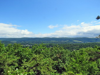 All of the trails start out together and begin to climb. The blue trail is the Overlook Point Trail and I knew we would tackle that first. It is marked as 1.75 miles out and back. The elevation at the parking lot was about 400 feet so I knew that any elevation gain could produce a viewpoint. As we climbed the heat and humidity combined to make the ascent seem oppressive. The trail followed a woods road until the very last portion which was a trail cut through the woods and along the edge of an escarpment. The trail headed south before looping southwest and then north with a final turn to the south. After .7 miles on this trail we had gained about 420 feet and were at the lookout. The trail seemed to end at a point where the view was limited. Some unmarked paths led to a rock ledge that was lower but offered a less obstructed view. I took some pictures and thought about how nice this would be in the fall. Cindy said that she was thinking the same things. We got a drink and a snack and headed back at 12:55 PM. We followed the Blue trail back to the upper junction with the yellow Upper Loop Trail and turned right at 1.95 miles to hike this trail. The trail rolled a little as it dropped and then climbed to the top of a little hill. At 2.2 miles there was a partial viewpoint and then the trail began to drop back down to meet they blue trail. The walk was pleasant and descending seemed cooler. At 2.5 miles we were back at the point where all the trails came together. We continued straight ahead to walk the red trail which was marked as the Lower Loop Trail. The first part of this trail passed through some open areas with lots of weeds that needed to be trimmed. It was obvious that the main attraction was the Stone Church with the Overlook Trail a distant second. The Upper and Lower loop trails eked hardly used. We followed the red trail as it headed south ascended a few small hills. At 2.9 miles it made an almost 180 degree turn and headed back to the north. Soon we were back at the trail junction where we headed back down to the brook. We followed the trail back out to the kiosk and then to the lane lined with maples. This area was so pretty I stopped to take a few pictures before packing up and heading back t the car. We were back at the car at 2:30 PM after hiking about 3.7 miles in 2 hours and 10 minutes. The elevation gain was about 830 feet. The temperature was now in the high 80's and the humidity was even higher! The Stone Church was well worth a visit but for those driving long distance I would suggest a visit to another attraction like Ferncliff Forest near Rhinebeck since both hikes are short.
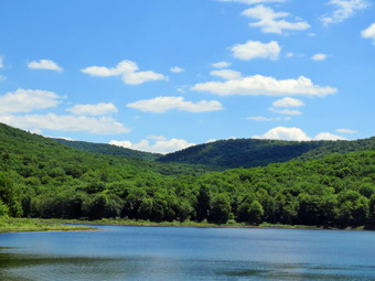
![]()
![]()
![]()
![]()
![]() On Monday, July 4th I had planned to hike Eagle and Balsam as I have decided to do some of the Catskill 3500's this summer. An early morning ambulance call left me feeling less than fit for that expedition so Cindy and I decided to go for a more local hike. She mentioned she had never hiked east from Big Pond To Alder Lake so I agreed to that hike although I had done it several times recently. We thought this was a good choice since we knew areas like Little Pond and Alder Lake would be packed on the Fourth of July! We got a late start leaving home a little after 10:00 AM with an "as always" excited Sheila in the back seat. I headed out of town on Old Rt 17 and then turned north on the Beaverkill Road and headed toward Lew Beach. I drove through the hamlet of Lew Beach and continued on to Turnwood. As the Beaverkill Road made a turn to the right, I continued straight ahead on Barkaboom Road toward Big Pond. After less than a mile, I turned right into the upper parking area for Big Pond and found cars already parked along the edge of the access road. When I drove up to the parking area, there were a lot of cars but there were also a few empty spaces. It looked like everyone was camped at the primitive camping sites along the pond or back in the woods. The temperature was already in the high 60's and the humidity was high as we started out on the trail toward Alder Lake. We had to pull off the trail several times to let campers who were leaving get by. It seemed they had a LOT of gear for being so close to the parking area! Although the trail has several ups and downs, it is sited so that it travels around the higher ridges in the area and sticks to the lower spots on the shoulders of those ridges. Just after the start of the hike, we began to ascend along a woods road where there were a few blowdowns that would have to be cleared on another day. We continued to walk uphill through a pine forest. The trail had been worked on the previous fall after years of neglect and was in good shape and well-marked. I was surprised that in the month since I last hiked the trail that the nettles and briars were starting to seriously encroach on the trail. It is difficult to keep up with the vegetation especially in the late spring and early summer and I am not sure if there is a volunteer maintainer assigned to this section of trail. It reminded me that I needed to check my section of trail from Big Pond to Beech Hill and be prepared to do some work! There were a few large blowdowns that were easily avoided or easy to climb over. We passed through a more open area where many of the trees were dead from previous years when the tent caterpillars and gypsy moths destroyed many trees. In this area which was exposed to the sun the trail was even more clogged with vegetation. We also walked through some wet spots which surprised me since the rest of the trail was so dry. Some well placed stepping stones helped in these areas. At about a mile we began to descend on another woods road to an area that was once a small pond but is now mostly wetlands. Along the way I pointed out to Cindy the many stonewalls and a few foundations in the area. At 1.75 miles we were at the small stream bed that connects two different wetland areas. In April the stream had enough water to produce small waterfalls but now it was completely dry!
On Monday, July 4th I had planned to hike Eagle and Balsam as I have decided to do some of the Catskill 3500's this summer. An early morning ambulance call left me feeling less than fit for that expedition so Cindy and I decided to go for a more local hike. She mentioned she had never hiked east from Big Pond To Alder Lake so I agreed to that hike although I had done it several times recently. We thought this was a good choice since we knew areas like Little Pond and Alder Lake would be packed on the Fourth of July! We got a late start leaving home a little after 10:00 AM with an "as always" excited Sheila in the back seat. I headed out of town on Old Rt 17 and then turned north on the Beaverkill Road and headed toward Lew Beach. I drove through the hamlet of Lew Beach and continued on to Turnwood. As the Beaverkill Road made a turn to the right, I continued straight ahead on Barkaboom Road toward Big Pond. After less than a mile, I turned right into the upper parking area for Big Pond and found cars already parked along the edge of the access road. When I drove up to the parking area, there were a lot of cars but there were also a few empty spaces. It looked like everyone was camped at the primitive camping sites along the pond or back in the woods. The temperature was already in the high 60's and the humidity was high as we started out on the trail toward Alder Lake. We had to pull off the trail several times to let campers who were leaving get by. It seemed they had a LOT of gear for being so close to the parking area! Although the trail has several ups and downs, it is sited so that it travels around the higher ridges in the area and sticks to the lower spots on the shoulders of those ridges. Just after the start of the hike, we began to ascend along a woods road where there were a few blowdowns that would have to be cleared on another day. We continued to walk uphill through a pine forest. The trail had been worked on the previous fall after years of neglect and was in good shape and well-marked. I was surprised that in the month since I last hiked the trail that the nettles and briars were starting to seriously encroach on the trail. It is difficult to keep up with the vegetation especially in the late spring and early summer and I am not sure if there is a volunteer maintainer assigned to this section of trail. It reminded me that I needed to check my section of trail from Big Pond to Beech Hill and be prepared to do some work! There were a few large blowdowns that were easily avoided or easy to climb over. We passed through a more open area where many of the trees were dead from previous years when the tent caterpillars and gypsy moths destroyed many trees. In this area which was exposed to the sun the trail was even more clogged with vegetation. We also walked through some wet spots which surprised me since the rest of the trail was so dry. Some well placed stepping stones helped in these areas. At about a mile we began to descend on another woods road to an area that was once a small pond but is now mostly wetlands. Along the way I pointed out to Cindy the many stonewalls and a few foundations in the area. At 1.75 miles we were at the small stream bed that connects two different wetland areas. In April the stream had enough water to produce small waterfalls but now it was completely dry!
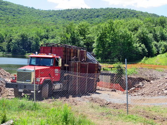 We crossed the stream bed and began to ascend to the shoulder of another ridge from the low wetlands. At 2.2 miles the trail turned right heading east toward Alder Lake. Shortly after that we began to descend for .6 miles to Alder Creek.There was some water in Alder Creek but much less than in April. Sheila got a drink and found one deep pool where she could cool off. We crossed Alder Creek Road and began to walk up the access road to Alder Lake. Along the way a convoy of cars started up the road traveling a little too fast and bottoming out several times. We continued toward the lake on the access road and arrived at the parking area at 12:10 PM. The parking lot was full of cars with some parking along the access road leaving little room for the cars parked in the lot to get out. We decided to hike down toward the lake to take some pictures and to see how the construction was coming along. We hiked down to the "lawn" in front of the remains of the Coykendall Mansion and found the same pile of wood spoiling the view. The picnic tables were out but the grass was not mowed. I spoke personally to the forester for Region 3 who seemed to indicate that the mess would be cleared up once the construction on the dam was finished. The chain link fence surrounding two excavators and a truck working on the dam was still there. The dam had always looked pretty sturdy and secure but the Region 3 forester indicated that it was not up to code and had been undermined in several areas. The water level in the lake was low more due to the dry weather than the dam work. Several groups of people were down by the shore. It was not clear if there was a path over the dam so hiking a loop of the lake could be a problem and easy access the campsites on the southern shore could be in jeopardy. I dropped my pack and got out the camera to take a few shots before heading back up to the parking area. We continued through the parking area and back down the access road toward Alder Creek Road. We crossed the road and entered the trail. I had kept Sheila on her leash until we crossed Alder Creek Road and the stream. I let her off the leash and she spent a few moments playing in the water. At 4.6 miles we followed the trail as it turned left and began to descend to the wetlands area. We stopped at the dry stream bed at 5 miles to get a drink and a snack. We began to ascend the woods road keeping a good pace and negotiating the few very muddy areas. The trip back seemed to be going fast but the few uphill areas slowed Cindy down a little. At 5.7 miles we followed the trail as it turned to head west toward Big Pond and started our descent. We walked through the pine forest and followed the woods road down toward the pond. We could hear people at the primitive campsites and at the lake. We arrived at the parking area at 1:55 PM to find far fewer cars than when we had parked. We had covered 6.7 miles in 3.5 hours with a total elevation gain of 1530 feet.
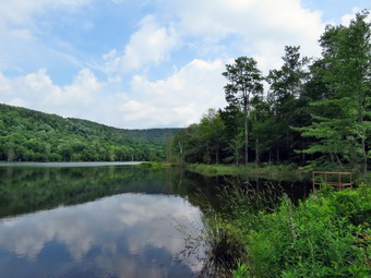
![]()
![]()
![]()
![]()
![]() On Friday, July 1st our grandson Bryce was at our house for a few hours. Cindy and I decided to take him to Huggins Lake to hike since it is close and about 4 miles round trip. It is also NOT Frick Pond where we had hiked with him several times! I got my gear in the car along with Sheila who seemed thrilled to be going out. Cindy and Bryce got in the car and I drove out Old Route 17 heading toward Roscoe and turning right on the Beaverkill Road. I took the Campsite Road down toward the Beaverkill Covered Bridge. Since this bridge was closed for repairs, I turned left onto Craige Claire Road and crossed the Beaverkill on the steel bridge. I turned right onto Berry Brook Road to head for the parking area at Huggins Lake. As we drove along Berry Brook Road, we could see the brook was low but had increased in volume some in recent days.We continued on the road toward the parking area for Huggins Lake area where I turned right onto the access road to the parking area. There were no cars in the lot when we parked at 10:05 AM. It took me a while to get my electronics set and Cindy and Bryce began the hike up the woods road that is the "trail" to Huggins Lake. The sky was overcast with some sun shining through and a slight breeze with temperatures in the mid 60's. The trail is not marked on any map but there is a trail register at the start by a gate that blocks the road. I watched this time to see if I could spot any blazes as I hiked quickly to catch up. There were no blazes of any kind to indicate that the road is a hiking or snowmobile trail. The DEC has maintained the trail but I do not know to what end. I do know that I always think of this as an easy hike and am always surprised that the first part is all uphill. Over the first 1.25 miles the elevation gain is about 625 feet. This averages under a 10% grade but it seems like more. It didn't take too long before I caught up with Cindy and Bryce and we started talking about what we were seeing. The key to keeping Bryce happy is to keep him busy and we pointed out some red efts that were sprinkled along the trail. Sheila seemed happy to be out and she stayed near us as we climbed the hill. Along the way we cleared a few branches from the trail. There was one larger blowdown that did not impede our walk but should be cleared for the trail. At the top of the hill we began to walk along some high ground that looks down on Huggins Lake. In the summer, the lake is not clearly visible as the leaves hide it.
On Friday, July 1st our grandson Bryce was at our house for a few hours. Cindy and I decided to take him to Huggins Lake to hike since it is close and about 4 miles round trip. It is also NOT Frick Pond where we had hiked with him several times! I got my gear in the car along with Sheila who seemed thrilled to be going out. Cindy and Bryce got in the car and I drove out Old Route 17 heading toward Roscoe and turning right on the Beaverkill Road. I took the Campsite Road down toward the Beaverkill Covered Bridge. Since this bridge was closed for repairs, I turned left onto Craige Claire Road and crossed the Beaverkill on the steel bridge. I turned right onto Berry Brook Road to head for the parking area at Huggins Lake. As we drove along Berry Brook Road, we could see the brook was low but had increased in volume some in recent days.We continued on the road toward the parking area for Huggins Lake area where I turned right onto the access road to the parking area. There were no cars in the lot when we parked at 10:05 AM. It took me a while to get my electronics set and Cindy and Bryce began the hike up the woods road that is the "trail" to Huggins Lake. The sky was overcast with some sun shining through and a slight breeze with temperatures in the mid 60's. The trail is not marked on any map but there is a trail register at the start by a gate that blocks the road. I watched this time to see if I could spot any blazes as I hiked quickly to catch up. There were no blazes of any kind to indicate that the road is a hiking or snowmobile trail. The DEC has maintained the trail but I do not know to what end. I do know that I always think of this as an easy hike and am always surprised that the first part is all uphill. Over the first 1.25 miles the elevation gain is about 625 feet. This averages under a 10% grade but it seems like more. It didn't take too long before I caught up with Cindy and Bryce and we started talking about what we were seeing. The key to keeping Bryce happy is to keep him busy and we pointed out some red efts that were sprinkled along the trail. Sheila seemed happy to be out and she stayed near us as we climbed the hill. Along the way we cleared a few branches from the trail. There was one larger blowdown that did not impede our walk but should be cleared for the trail. At the top of the hill we began to walk along some high ground that looks down on Huggins Lake. In the summer, the lake is not clearly visible as the leaves hide it.
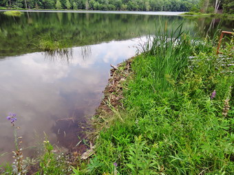 After the top of the hill, the trail descends gentle at first until at 1.7 miles it turns sharply left and drops a little more steeply to the shore of the lake. When we arrived at the lake, we could see that the water level was high and I suspected we would find that the beavers had dammed up the outlet. I dropped my pack and took some pictures since there was some blue sky and puffy white clouds. I also snapped some shots of the dam the beavers had thrown up at the outlet which was preventing the water from draining properly. I looked for signs of a lodge but did not see one anywhere. I had tried to keep Sheila out of the water but she managed to take a swim coming out smelling less than fresh. I picked up my pack and headed back to the beginning of the climb where Cindy and Bryce were enjoying a snack. The only negative point about Huggins Lake is that there is only one trail and so there are no variations available. I have tried bushwhacking around the pond but the bushes get pretty thick. We climbed the hill back to the highest point on the trail and then started down the other side. We started playing a game naming animals with Bryce so he would forget about being a little tired and the hike went quickly. Since the downhill part of the hike is rather gentle and the road is well-maintained, we could maintain a pretty fast pace down. We again spotted some efts on the way back and identified some birds from their call. As we approached the register and gate two other hikers were standing around. I thought about asking them if they needed help but they seemed very busy looking at a cell phone! We were back at the car at 12:00 PM after hiking 3.9 miles in 1 hour and 50 minutes with a total elevation gain of 955 feet. As we left the parking area, I turned left on Berry Brook Road and headed back to Livingston Manor through Roscoe.
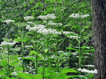
![]()
![]()
![]()
![]()
![]() On Wednesday, June 29th I wanted to get out on a beautiful summer day to hike somewhere! I had again thought about going to Indian head and Twin but got up a little too late to make that trip. I decided to hike nearer to home and chose to go to Alder lake to hike Millbrook Ridge to the Beecher Lake lookout. We left Livingston Manor sometime after 10:30 AM and drove up the Beaverkill Road through Lew Beach and Turnwood. I turned left on Alder Creek Road and drove to the end where turned right onto the access road to Alder Lake. The road was very rough but soon we were at the parking lot where there was only one car present. I parked at got Sheila out of the car. After setting up all my electronic gear, we headed out toward the lake. The construction crew that was "fixing" the dam was wiring and they did seem to be making progress. I did want to ask someone what they were doing but they seemed pretty busy. I had Sheila on her leash as we walked down the left side of the lawn to get on the trail on the north side of the lake. I was AGAIN disappointed to see that no maintenance had been done by the DEC! The "lawn" had not been mowed and it was hard to see the picnic tables through the long grass. The logs that the DEC had cleared from the stream below the spillway were still in a ragged pile on the lawn. What was once a beautiful place to come and enjoy an equally beautiful view was now a shambles. I don't know what the DEC "plan" for the area may be but it appears they have abandoned this very popular spot. As we walked along the trail on the northern side of the lake, we could hear someone at a campsite to our right. There were two men setting up a site and they seemed to behaving a good time. We continued walking along the trail until we came to the bridges across two small streams that run into the lake. I looked at the plants growing there and immediately called Sheila back to me. There were some very tall plants that looked a little like Queen Anne's lace but much taller and with very large leaves. I was pretty sure they were giant hog weed! This plant produces a sap that burns the skin badly when exposed to light! I tool some pictures and then had Sheila follow directly behind me as we worked our way to the other side of the bridges. I was hoping we would not see any more examples of this plant and we didn't. I thought we might return by walking round the lake in the opposite direction butt then realized we might not be able to cross the dam and would have to return the same way. The trail was damp in most places from the rain the night before which I knew might be a problem on the steeper parts of the trail later in the hike. At .8 miles we turned left onto the Millbrook Ridge Trail that ends on Balsam Lake Mountain. The temperature was perfect at about 63 degrees and there was plenty of sun with a slight breeze. The sky was blue with a lot of puffy white clouds. As we hiked up the trail, I noticed a few large blowdowns where someone had cut branches off to easy passage but had left the major part of the tree in the trail. I made a note that I might want to bring one of my axes to work on these next time!
On Wednesday, June 29th I wanted to get out on a beautiful summer day to hike somewhere! I had again thought about going to Indian head and Twin but got up a little too late to make that trip. I decided to hike nearer to home and chose to go to Alder lake to hike Millbrook Ridge to the Beecher Lake lookout. We left Livingston Manor sometime after 10:30 AM and drove up the Beaverkill Road through Lew Beach and Turnwood. I turned left on Alder Creek Road and drove to the end where turned right onto the access road to Alder Lake. The road was very rough but soon we were at the parking lot where there was only one car present. I parked at got Sheila out of the car. After setting up all my electronic gear, we headed out toward the lake. The construction crew that was "fixing" the dam was wiring and they did seem to be making progress. I did want to ask someone what they were doing but they seemed pretty busy. I had Sheila on her leash as we walked down the left side of the lawn to get on the trail on the north side of the lake. I was AGAIN disappointed to see that no maintenance had been done by the DEC! The "lawn" had not been mowed and it was hard to see the picnic tables through the long grass. The logs that the DEC had cleared from the stream below the spillway were still in a ragged pile on the lawn. What was once a beautiful place to come and enjoy an equally beautiful view was now a shambles. I don't know what the DEC "plan" for the area may be but it appears they have abandoned this very popular spot. As we walked along the trail on the northern side of the lake, we could hear someone at a campsite to our right. There were two men setting up a site and they seemed to behaving a good time. We continued walking along the trail until we came to the bridges across two small streams that run into the lake. I looked at the plants growing there and immediately called Sheila back to me. There were some very tall plants that looked a little like Queen Anne's lace but much taller and with very large leaves. I was pretty sure they were giant hog weed! This plant produces a sap that burns the skin badly when exposed to light! I tool some pictures and then had Sheila follow directly behind me as we worked our way to the other side of the bridges. I was hoping we would not see any more examples of this plant and we didn't. I thought we might return by walking round the lake in the opposite direction butt then realized we might not be able to cross the dam and would have to return the same way. The trail was damp in most places from the rain the night before which I knew might be a problem on the steeper parts of the trail later in the hike. At .8 miles we turned left onto the Millbrook Ridge Trail that ends on Balsam Lake Mountain. The temperature was perfect at about 63 degrees and there was plenty of sun with a slight breeze. The sky was blue with a lot of puffy white clouds. As we hiked up the trail, I noticed a few large blowdowns where someone had cut branches off to easy passage but had left the major part of the tree in the trail. I made a note that I might want to bring one of my axes to work on these next time!
 Over the next 1.4 miles we gained about 530 feet as we walked on the trail which parallels the brook. We could hear the brook at times and a visual inspection showed more water in the stream than there had been for some time. The trail was wet and slippery in spots especially on the slanted rocks. Everything was very green given the season and the recent rain. We passed by the first beaver meadow and I didn't want to stop as the hike was rat5her long. Around 2.2 miles the trail leveled off as we approached the lean-to. We walked passed the spur trail to the lean-to and continued on the main trail toward the next beaver meadow. I decided that we would stop on the way back if I wanted to do so. The trail began to gain some elevation as we climbed toward Millbrook Ridge which is on the Catskill Highest Hundred list. We passed by some huge and interesting boulders and glacial erratics. The layers in the sedimentary rock were very clear. It was interesting that many of these rocks had trees growing on top of them in only and few inches of soil. At one point I though we had reached the final climb but I was mistaken. We had not hiked this trail in some time and the distance and the amount of elevation gain were greater than I remembered. The rocks were still damp and since this part of the trail is less used the moss made them extra slippery. At 11:55 AM we hit the highest point on the trail after hiking 3.5 miles. We continued on the trail as it began to descend off the ridge. Over the next .6 miles the trail dipped about 360 feet before again climbing toward the lookout. Rather than continuing directly east along the edge of the ridge the trail heads north and then loops around to the viewpoint. This reminds me a lot of hiking Dry Brook Ridge. After hiking 4.5 miles we arrived at the viewpoint at 12:30 PM.
 I took off my pack and got out the camera. I had to stand on the rock at the lookout to get any view of Beecher Lake. Like ,many viewpoints in the Catskills, this one has been blocked as trees below grow taller. I did take a few shots of the lake and the white clouds in the sky. I also snapped two pictures of Sheila sitting on the rock. I got a drink, gave Sheila one and got out a bar for a snack as I packed up to start back. On the way back I was making good time but had to slow down on several of the descents due to the slippery conditions. The climb back up to the high point on Millbrook Ridge seemed long but I was surprised that I was able to keep a good pace. I took a few pictures along the way of some of the rocks. We also stopped at several of the beaver meadows including the one by the lean-to. Once we were at the lean-to the remaining part of the hike seemed to go very quickly and by 2:45 PM we had hiked 8.3 miles back t the loop trail around the lake. We turned right and followed the trail back through the giant hog weed. I did walk out one of the paths to the edge of the lake to take a few shots of the lake and Cradle Rock Ridge on the south shore of the lake. As I stepped out to the lake shore, I saw a mature, male bald eagle takeoff and begin to circle the lake. By the time I got the camera focused, he was too far away to get a good picture. I did take a few pictures of red-wing blackbird that was hopping around on the mud flats. After the photography session, we walked back to the main trail and continued to the parking area. We had covered 9.1 miles in 5 hours with a 2070 foot elevation gain. I am still experimenting with my Suunto Traverse GPS watch especially when it comes to the accuracy setting which effects battery life. I had set the watch for 1 minute recording intervals on the way out. When we arrived at the viewpoint readings I got disagreed with my Garmin unit and I suspected that the recording interval was not able to able the winding trail. I set the watch for 1 second intervals and the results were dramatically different. When I transferred the track to my computer is was obvious the 1 minute interval was "smoothing" the turns in the trail too much as was shortening the route. I will continue to experiment with this very interesting watch.
![]()
![]()
![]()
![]() On Monday, June 27th Bryce was at our house for the day so Cindy and I decided we should go for a hike rather than sit in front of the TV or computers all day! When our grandson Bryce arrived early we asked him if he would like to go for a hike. His enthusiastic "Yes!" convinced me that we all should go to Frick Pond and hike up the Flynn Trail and down the Big Rock Trail. At Times Square we could hike the Logger's Loop back to the Quick Lake trail and the parking area. Sheila was ready to go at any time and Cindy got herself dressed and we left Livingston Manor at 10:00 AM. After driving out the DeBruce Road and up the Mongaup Pond Road we arrived at the Frick pond trailhead parking area at 10:15 AM and got ready to hike. A couple of friends approached us from the area of the cabin and I hoped they had permission to hike through the private property. They also had an unruly dog with them so I put my unruly dog on her leash! We crossed the road and started out by hiking up the Flynn Trail toward the junction with the Big Rock Trail. The day was warm with temperatures in the mid-70's and a little humid with a slight breeze blowing. We allowed Bryce to set the pace and he did a good job. Hiking with a five year old Bryce is almost like hiking with another adult. Bryce notices everything and has lots of questions but also contributes to the discussion. At one point he showed us a tree that he thought was a paper birch and explained his reasoning. He was absolutely correct. We came across some coyote scat which he correctly identified and then made a series howls and yelps that made Sheila turn her head. When Bryce gives Sheila commands, he uses a voice that makes her listen to his command most of the time. As we walked up the long ascent, we did begin to hear some comments like "When will we be there?" We told Bryce it was a little longer and then distracted him until we had hiked the 1.7 miles to the junction with the Big Rock Trail. It was 11:15 AM and we stopped to get a drink, have a snack and take a few pictures.
On Monday, June 27th Bryce was at our house for the day so Cindy and I decided we should go for a hike rather than sit in front of the TV or computers all day! When our grandson Bryce arrived early we asked him if he would like to go for a hike. His enthusiastic "Yes!" convinced me that we all should go to Frick Pond and hike up the Flynn Trail and down the Big Rock Trail. At Times Square we could hike the Logger's Loop back to the Quick Lake trail and the parking area. Sheila was ready to go at any time and Cindy got herself dressed and we left Livingston Manor at 10:00 AM. After driving out the DeBruce Road and up the Mongaup Pond Road we arrived at the Frick pond trailhead parking area at 10:15 AM and got ready to hike. A couple of friends approached us from the area of the cabin and I hoped they had permission to hike through the private property. They also had an unruly dog with them so I put my unruly dog on her leash! We crossed the road and started out by hiking up the Flynn Trail toward the junction with the Big Rock Trail. The day was warm with temperatures in the mid-70's and a little humid with a slight breeze blowing. We allowed Bryce to set the pace and he did a good job. Hiking with a five year old Bryce is almost like hiking with another adult. Bryce notices everything and has lots of questions but also contributes to the discussion. At one point he showed us a tree that he thought was a paper birch and explained his reasoning. He was absolutely correct. We came across some coyote scat which he correctly identified and then made a series howls and yelps that made Sheila turn her head. When Bryce gives Sheila commands, he uses a voice that makes her listen to his command most of the time. As we walked up the long ascent, we did begin to hear some comments like "When will we be there?" We told Bryce it was a little longer and then distracted him until we had hiked the 1.7 miles to the junction with the Big Rock Trail. It was 11:15 AM and we stopped to get a drink, have a snack and take a few pictures.
We turned left on the Big Rock Trail and began the descent to Times Square. We all liked the descent and we found that Bryce stopped frequently to clear branches from the trail. We talked and walked so that I hardly knew where we were or how long it was taking. At 11:45 AM we arrived at Times Square after hiking 2.9 miles. We continue straight ahead on the Big Rock trail to walk around the back of Frick pond on the wooden walkways. We had covered this part of the trail on our Father's Day hike and Bryce really liked it. As we walked toward the boardwalks, the trail was relatively dry. We stopped at the first two bridges to look for fish swimming in the streams and saw a few. Tend to gather under the bridge and swim out when someone hikes over the water. We continued our walk through the evergreen forest and turned left on the Quick Lake Trail when the Big Rock Trail ended. We stopped briefly at the bridge over the outlet to Frick Pond to get a drink and a snack. I decided not to take pictures as there was nothing remarkable about the scene on this day. We walked up the hill and through Gravestone Junction. Bryce was doing pretty well and we told him to watch for the trail register box. He found the box and we turned right to follow the Quick Lake Trail back to the parking lot and the car. We did pass a couple headed out to Frick Pond with a small but aggressive dog! We were back at the car at 12:20 PM after hiking 4 miles and gaining just under 700 feet. I wasn't sure I would like the Suunto Traverse GPS watch but it is quickly becoming a favorite! It is very convenient to have it on my wrist and it provides a LOT of information. I just have to remember to set the time between readings to 5 seconds or 1 minute from the default 1 second. The default Setting makes it very accurate but uses up the battery quickly.
![]()
![]()
![]()
![]()
![]() On Friday, June 24th, I wanted to do a challenging hike close to home. I had planned to go north to do Indian Head and Twin but just couldn't bring myself to drive that far to hike alone. I need to get motivated again! I decided than the 8+ miles to Graham Graham Mountain is on private property. Make sure you call the caretaker to get permission before hiking. and Balsam Lake would have to do. I had to go to Liberty before the hike so I put my gear and Sheila in the car and rove to Liberty. After I completed my business, I headed back to Livingston Manor and start out Old Route 17 at just after 9:30 AM. I turned right and headed up the Beaverkill Road. It wasn't long before I got behind a slow moving truck and trailer and I kept wishing they would pull over. The truck soon turned into one of the roads that goes to a hunting camp and I made better time. The drive always seems so long and the tire area including the near side of Balsam Lake Mountain are in our ambulance district! There was only one car in the lot when I parked and I got all my gear ready to hike. I had along my new Suunto Traverse watch and made sure to set it correctly although I did not set the altitude. I put Sheila on her leash and got right on the trail by 10:20 AM. The temperature was already warmer than I expected and was pushing 7 degrees. Sheila and I didn't hurry but we kept a good pace making the first trail junction in about 20 minutes. We continued straight ahead on the trail toward the Millbrook trailhead. I was surprised to see that the trail had not been maintained in some time with branches, briars and nettles encroaching in some places. We kept our pace but I did not remember that the mile of trail between the two trail junctions gains over 400 feet of elevation. It was warm and but not too humid and I regretted not wearing short-sleeved shirt. As we hiked Sheila ran ahead and started into the woods to chase birds and chipmunks. The sky was very blue with puffy white cuds and I was happy to be out. By 11:10 AM we were at the second junction with the trail up Balsam Lake Mountain. We had hiked 1.8 miles and gained 720 feet! We continued on the woods road toward her path to Graham Mountain. We walled another .25 miles and turned right onto what has become a very obvious path.
On Friday, June 24th, I wanted to do a challenging hike close to home. I had planned to go north to do Indian Head and Twin but just couldn't bring myself to drive that far to hike alone. I need to get motivated again! I decided than the 8+ miles to Graham Graham Mountain is on private property. Make sure you call the caretaker to get permission before hiking. and Balsam Lake would have to do. I had to go to Liberty before the hike so I put my gear and Sheila in the car and rove to Liberty. After I completed my business, I headed back to Livingston Manor and start out Old Route 17 at just after 9:30 AM. I turned right and headed up the Beaverkill Road. It wasn't long before I got behind a slow moving truck and trailer and I kept wishing they would pull over. The truck soon turned into one of the roads that goes to a hunting camp and I made better time. The drive always seems so long and the tire area including the near side of Balsam Lake Mountain are in our ambulance district! There was only one car in the lot when I parked and I got all my gear ready to hike. I had along my new Suunto Traverse watch and made sure to set it correctly although I did not set the altitude. I put Sheila on her leash and got right on the trail by 10:20 AM. The temperature was already warmer than I expected and was pushing 7 degrees. Sheila and I didn't hurry but we kept a good pace making the first trail junction in about 20 minutes. We continued straight ahead on the trail toward the Millbrook trailhead. I was surprised to see that the trail had not been maintained in some time with branches, briars and nettles encroaching in some places. We kept our pace but I did not remember that the mile of trail between the two trail junctions gains over 400 feet of elevation. It was warm and but not too humid and I regretted not wearing short-sleeved shirt. As we hiked Sheila ran ahead and started into the woods to chase birds and chipmunks. The sky was very blue with puffy white cuds and I was happy to be out. By 11:10 AM we were at the second junction with the trail up Balsam Lake Mountain. We had hiked 1.8 miles and gained 720 feet! We continued on the woods road toward her path to Graham Mountain. We walled another .25 miles and turned right onto what has become a very obvious path.
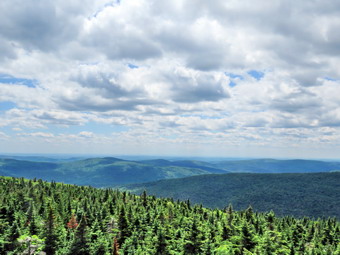 The herd path has become more of a trail over the years and it even seems that someone is clearing some of the blowdowns, nettles and briars along the way. I meant to ask the caretaker about this but forgot. When we reached the herd path, it was in good shape but there were some nettles and briars encroaching on it as well as some additional blowdowns along the way. I hope no one clears these unless they get permission to do so! For the first 1.15 miles the heard path heads almost due east and is flat or even descends some. It is rocky in places and has some blowdowns which are easily walked around. At 3.2 miles into the hike we reached the base of the final climb up Graham as the herd path heads a little more toward the southeast. The distance to the summit from here is only .8 miles but gains 600 feet in elevation. There are a few switchbacks along the way which help make the grade only 15%. By 12:10 PM we had hiked the 4 miles to the summit. I dropped my pack to get a drink and a protein bar. I also took out the camera to take a few pictures. The views are now mostly blocked by the vegetation but I took some pictures of the ruins at the top. Someone decided to dismantle part of the old radio station at the top! There is no reason to do this especially since it is on private property. After a few minutes, I could hear people, on the other side of the building but they did not come around to say "hello" and I didn't want to see what they might be doing. Their dog did amble around to visit us and fortunately it was friendly as the owners did not seem the least bit concerned! There was still a lot of haze in the air so we didn't stay long but headed back down the mountain. When we got to the lookout to the north, I decided not to stop as it is now completely block by trees. The trip down seemed to go fast and by 1:25 PM we had hiked 6.1 miles and were back at the junction with the trail that heads up to the fire tower. I decided we would extend our hike a little so we turned right and started the ascent to the tower. On the last part of the climb up Graham my legs seemed to be tired so I wondered how they would feel climbing another mountain!
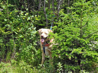 Since the trail junction is already more than 400 feet above the lower trail junction, there is less climbing to do than if yon start at the trailhead. Sheila and I kept hiking and I was surprised at the pace we were able to maintain and that my legs felt fine. Soon I could hear some noise from the area of the tower. There were half a dozen hikers at the top sitting or standing around talking. We said "Hello" and I leashed Sheila to a tree so she would not bother anybody and got her a drink. I also got a drink before climbing the tower. I grabbed my camera from my pack and headed up the tower to the landing just below the cab. I took some pictures from the upper landing and then dropped down to a lower landing to take a few more. Once on the ground I spent a few minutes talking to the group of hikers who were from Sound Beach on the north fork of Long Island. After a nice conversation, I said "Goodbye" and Sheila and I started down the steep side on the mountain. The first section wasn't too bad and at one point Sheila took off to chase some grouse which seem very plentiful this year. At 7.1 miles we started the steeper descent passed the spring and Sheila got a drink at the spring. We continued down . The hike down to the trail junction was only about .5 miles but the loss in elevation is almost 700 feet among for an average grade of over 25%! The trail was damp near the spring but was dry most of the rest of the way making slipping a real problem. Once back on the main trail we turned right and headed back to the car. We were back at the car at 3:00 PM having hiked 8.7 miles in 4 hours and 35 minutes with a stop at the top of Graham and at the fire tower. The vertical gain was 2223 feet. I was surprised that the detour to Balsam Lake Mountain had only lengthen the trip by about .6 miles. It did increase the ascending by over 500 feet.
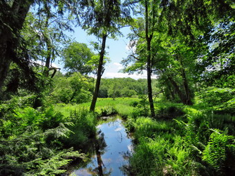
![]() On Wednesday, June 22nd, I had planned to go to Frick Pond with Lisa to do some light trail maintenance including lopping a few branches and removing one blowdown. We frequently do this kind of work but we were especially interested in making sure everything was well-maintained for the events of June 30. On that day Governor Andrew Cuomo has challenged legislators and staff members to do something in the Catskills. There are several voices including paddling on the reservoirs, trail running and mountain biking. One choice is hiking through the Mongaup Pond Campgrounds and around Frick Pond. Lisa was coming to the house at 9:30 AM and Cindy decided she wanted to go also. When Lisa arrived we got in Cindy car and headed out the DeBruce Road to Frick Pond. We parked at the trail head and I got all my electronics ready! In addition to my GPS unit I use my cell phone with the Avenza app and on this day I was trying out my new Suunto Traverse GPS watch. The watch has a lot of features and I have made myself a promise that I will get to know them unlike my GPS unit and camera. started our hike by walking out the Quick Lake Trail to the woods road that heads out to Frick Pond. Lisa had a pair of loppers and I had my Silky saw. As we walked we trimmed a few branches, removed others from the trail and moved a few rocks. We crossed the bridge across the outlet of Frick Pond and noted the extremely low water levels. At the next trail junction with the Big Rock Trail our intent was to follow the Big Rock Trail around the pond but I wanted to clear a blowdown further along on the Quick lake Trail. We headed to the left to stay on the Quick Lake trail and walked thought the "spruce tunnel". W crossed the small stream in the woods and passed through a small filed where we found the blowdown on the other side of the field. I used my Silky saw to section the tree into pieces that were easy to move off the trail. Of course, I took before and after pictures to document our efforts. We turned around and walked back to the junction with the Big Rock Trail where we turned left to continue around the pond.
On Wednesday, June 22nd, I had planned to go to Frick Pond with Lisa to do some light trail maintenance including lopping a few branches and removing one blowdown. We frequently do this kind of work but we were especially interested in making sure everything was well-maintained for the events of June 30. On that day Governor Andrew Cuomo has challenged legislators and staff members to do something in the Catskills. There are several voices including paddling on the reservoirs, trail running and mountain biking. One choice is hiking through the Mongaup Pond Campgrounds and around Frick Pond. Lisa was coming to the house at 9:30 AM and Cindy decided she wanted to go also. When Lisa arrived we got in Cindy car and headed out the DeBruce Road to Frick Pond. We parked at the trail head and I got all my electronics ready! In addition to my GPS unit I use my cell phone with the Avenza app and on this day I was trying out my new Suunto Traverse GPS watch. The watch has a lot of features and I have made myself a promise that I will get to know them unlike my GPS unit and camera. started our hike by walking out the Quick Lake Trail to the woods road that heads out to Frick Pond. Lisa had a pair of loppers and I had my Silky saw. As we walked we trimmed a few branches, removed others from the trail and moved a few rocks. We crossed the bridge across the outlet of Frick Pond and noted the extremely low water levels. At the next trail junction with the Big Rock Trail our intent was to follow the Big Rock Trail around the pond but I wanted to clear a blowdown further along on the Quick lake Trail. We headed to the left to stay on the Quick Lake trail and walked thought the "spruce tunnel". W crossed the small stream in the woods and passed through a small filed where we found the blowdown on the other side of the field. I used my Silky saw to section the tree into pieces that were easy to move off the trail. Of course, I took before and after pictures to document our efforts. We turned around and walked back to the junction with the Big Rock Trail where we turned left to continue around the pond.
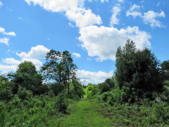 As we walked the trail there wasn't very much to trim. The wooden walkways were in good shape. I did stop to take a few shots of the upper end of the Frick Pond wetlands and of a few small trout in the water. As we continued toward Times Square, we found a small tree fallen by the side of the trail. Not much of the tree was blocking the trail but I decided the dead leaves were aesthetically unpleasing. Cindy and Lisa had walked ahead so I worked on the blowdown by myself. I sectioned it and removed the pieces to clear it completely. I repacked my gear after takings few shots and then walked to Times Square where the other two were waiting. We elected to continue around the pond on the Logger's Loop rather than climb the Big Rock Trail. The Logger's Loop was recently mowed by the DEC and there was very little trimming to do. As we approached Gravestone Junction There was a nice view of the blue sky with the puffy cuds I had been looking for so I stopped to take a few pictures. We, continued on to the Quick lake Trail and turned left to walk back to the parking area. On the way back we did meet a couple who are just hiking out to the pond and I felt good that our work meant they could have a nice hike. The Suunto Traverse worked well except for my blunder when I paused it at one point in the hike. I was easily able to download the information to the Suunto website and to then export it to a GPX file for my computer.
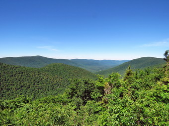
![]()
![]()
![]()
![]()
![]() On Tuesday, June 21stI wanted to do a 3500 foot peak and had decided early in the week that I would do Indian Head and Twin. I got a text from Lisa asking if I had time for a hike and I told her my plans. To my surprise she said she would be at my house at 8:00 AM the next morning. I was excited since I knew it would be nice to have someone else along. I awoke early the next day and soon got a text from Lisa indicating she was bowing out. I was very disappointed as I had planned on the hike but deiced that I would go anyway. Before I left the house, I decided that I would change my plans to hike Hunter from Spruceton mostly because it was closer and I had an afternoon commitment. I had hiked Slide the week before and all had gone well so I thought I would have no problems with the hike from Spruceton which is a well-maintained hiking and horse trail. I left Livingston Manor a little before 8:00 Am with a fully charged Sheila in the back seat. I had decided to wear light summer clothing despite the fact that the temperature was only in the high 50's when I left the house. I headed out DeBruce Road and turned left on Route 47 to head toward Big Indian and Route 28. There were no cars at the Biscuit Brook parking area and only one or two at Slide and Panther Mountain. I had to keep reminding myself it was only Tuesday! As I came to Route 28 in Big Indian, there was a sign indicated that Route 28 was closed and the detour was straight ahead. This was not a problem as this road connects to Route 42 north from Shandaken which is where I needed to be anyway. After driving to the end of the road, I turned left on Route 42 toward Lexington and immediately ran into bridge construction on this road. After a brief delay, I continued north on Route 42 to Spruceton where I turned right on the Spruceton Road. There were signs for some ditch cleaning and mowing on this road! We arrived at the parking area on the left at about 9:15 AM and immediately got on the trail to hike. There were no other cars in the lot and the temperature was still cool. Sheila and I left the parking area and I made up my mind to keep a constant but not necessarily fast pace. There was some water in the brook which made the hike pleasant. The trail showed some grooming and maintenance by machine including water bars and some crushed stone in places. We crossed the bridge at .5 miles and shortly after made the hairpin turn where the trail begins to get steeper. There was a pretty obvious path heading in the direction of Rusk and I wondered how well defined it remained.
On Tuesday, June 21stI wanted to do a 3500 foot peak and had decided early in the week that I would do Indian Head and Twin. I got a text from Lisa asking if I had time for a hike and I told her my plans. To my surprise she said she would be at my house at 8:00 AM the next morning. I was excited since I knew it would be nice to have someone else along. I awoke early the next day and soon got a text from Lisa indicating she was bowing out. I was very disappointed as I had planned on the hike but deiced that I would go anyway. Before I left the house, I decided that I would change my plans to hike Hunter from Spruceton mostly because it was closer and I had an afternoon commitment. I had hiked Slide the week before and all had gone well so I thought I would have no problems with the hike from Spruceton which is a well-maintained hiking and horse trail. I left Livingston Manor a little before 8:00 Am with a fully charged Sheila in the back seat. I had decided to wear light summer clothing despite the fact that the temperature was only in the high 50's when I left the house. I headed out DeBruce Road and turned left on Route 47 to head toward Big Indian and Route 28. There were no cars at the Biscuit Brook parking area and only one or two at Slide and Panther Mountain. I had to keep reminding myself it was only Tuesday! As I came to Route 28 in Big Indian, there was a sign indicated that Route 28 was closed and the detour was straight ahead. This was not a problem as this road connects to Route 42 north from Shandaken which is where I needed to be anyway. After driving to the end of the road, I turned left on Route 42 toward Lexington and immediately ran into bridge construction on this road. After a brief delay, I continued north on Route 42 to Spruceton where I turned right on the Spruceton Road. There were signs for some ditch cleaning and mowing on this road! We arrived at the parking area on the left at about 9:15 AM and immediately got on the trail to hike. There were no other cars in the lot and the temperature was still cool. Sheila and I left the parking area and I made up my mind to keep a constant but not necessarily fast pace. There was some water in the brook which made the hike pleasant. The trail showed some grooming and maintenance by machine including water bars and some crushed stone in places. We crossed the bridge at .5 miles and shortly after made the hairpin turn where the trail begins to get steeper. There was a pretty obvious path heading in the direction of Rusk and I wondered how well defined it remained.
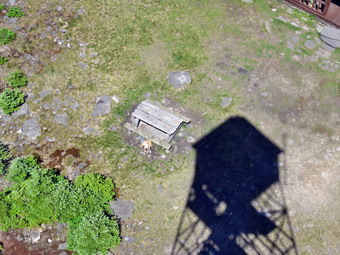 The sun was out and the temperature was beginning to rise as we hiked up the trail. I was watching for some views of Westkill to the right but they were all blocked by the leaves on the trees. As we hiked Sheila was following animal tracks in many different directions. The trail was a little longer than I remembered but we made the saddle between Hunter and the Rusk ridge at 10:00 AM after hiking 1.7 miles. I stopped to get a drink and contemplated the fact that we were half way through the trip as far as mileage went. I knew that the hardest part was yet to come. We made the right turn up the mountain and I immediately noticed that the grade increased. I kept a good pace which had me sweating and breathing a little more than I had been. The trail continued to be in good shape and I began to think whether or not I would stop at the lean-to on the way up or save it for the way back. We continued to climb and the spur trail to the lean-to was a little father away than I remembered! I was feeling a little more tired than usual since I had not been hiking mountains for some time. I had been concentrating on the Finger Lakes Trail and Long Path with much longer but flatter hikes. I simply decided to cut my pace a little and relax taking a break when I needed. We reached the spring at 2.1 miles and Sheila got a drink while I continued up the trail. When we got to the trail to the lean-to, I decided to visit it and turned right to follow the spur trail down through the rocks to the lean-to. There was no one camped in the area and I dropped my pack to take some pictures. The view was as pretty as always although a few big, puffy clouds would have been nice! After taking some shots, I went back and took a few pictures of the trail through the rocks and then returned to my pack. I got us a drink and a snack before picking up the pack and heading back t the main trail. At 10:35 AM we passed the trail to the left that goes to the Colonel's Chair, the top of the Hunter Mountain ski complex. We had hiked 2.5 miles and still had about a mile and 450 feet of elevation to go! Even though I had stopped several times there were no signs of anyone following us on the trail.
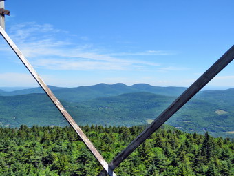 The final mile has a few spots where the trail levels off and a few where there are some sustained climbs. We passed by a small lookout on the left since I knew better things were to come. As we approached the tower clearing, I could see there was no one at the cabin or on the tower. Sometimes I meet people who have hiked up from Notch Lake or have sued the Becket Hollow Trail to get to the summit. We walked to the cabin where I dropped my pack and got out my camera. I took a few shots of the tower and cabin and then leashed Sheila to the picnic table so that she would not follow me up the tower. I headed up the tower to take more pictures. As soon as I was above the tree line, I noticed a sustained breeze that made me a little cool. I took pictures from just below the cabin on the tower and then came down to another level and took some more. I could see the deserted Hunter Mountain Ski Area with the zoom on the camera. I took a few shots from the lower levels as I descended the tower including a few of a pitiful dog looking up at me! The skies were a rather solid blue and lacked the clouds that add a nice touch. I went over to the picnic table and released Sheila and got a drink. I looked around for Sheila and saw her halfway up the open stairs on the tower! When I called her, she fearlessly bounded down the steps to the ground. I got my gear on and we started back at down the Spruceton Trail. I had considered doing the loop to Southwest Hunter but I decided against it for the sake of time. We kept a fast pace down the mountain which would have been faster except for the many small stones strewn on the trail. We passed the spur trail to the lean-to at 11:35 AM. Just after this a mother grouse started the "broken wing dance" and Sheila went crazy chasing her and some chicks. I gave her a few minuets and then called her back so we could continue our hike. We were soon at the left turn where we picked up the pace down the wide woods road. As we approached the brook, Sheila decided to dive in, get out, run around like a maniac and then shale herself of as close to me as she could get. She did this several times. We were back at the parking area at 12:30 PM and there were still no other cars. We had hiked 6.7 miles in 3 hours and 15 minutes with an elevation gain of 2000 feet.