
What You Missed
Spring 2018
Spring 2018
![]()
![]()
![]()
![]()
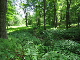
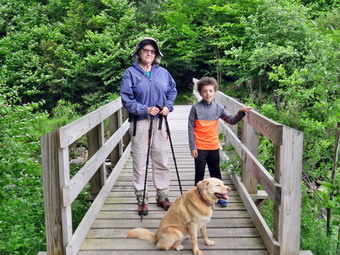
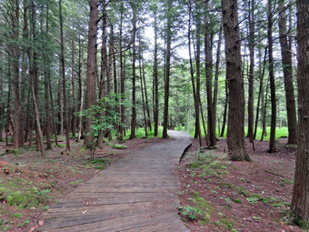
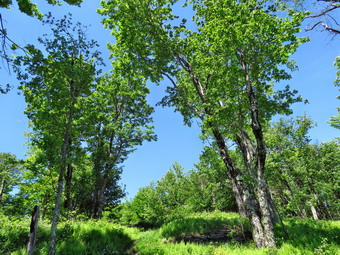
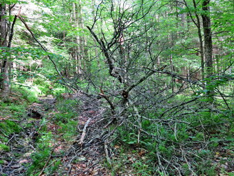
![]() On Sunday, June 17th I wanted to get in a hike for Father's Day after church with my son Karl. After eating lunch at our house, Karl and I began to get ready to go for a hike from Big Pond to Alder Lake and back. I maintain this section of trail for the Finger Lakes Trail Conference and wanted to see what shape it was in after the winter and spring storms. Last year the trail needed extensive trimming to beat back the briars and nettles. While we were getting ready, Sheila was always nearby making it very clear that she wanted to go. I packed my Silky Sugowaza saw just in case there were some small blowdowns that could be cleared easily. I got dressed in a long-sleeved crew top with a short-sleeved baselayer. I put on a pair of RailRiders hiking pants which are expensive but last along time and have features like deep pockets and a generous cut which I really like. The pants have Velcro closures at the ankles which I hoped would mean I did not need gaiters. The ticks have been very numerous so far this season especially farther south. I decided to wear my Keen Glarus hiking boots which I had recently waterproofed as I knew the trails might be damp. We left Livingston Manor at about 1:15 PM as I drove out Old Rt 17 to the Beaverkill Road where I turned right. At the intersection with the Barkaboom Road I stayed to the left on Barkaboom Road until I came to the access road to the upper parking area at Big Pond. The parking area was not as full as I expected but the large van that was carelessly parked took up several spaces. We got out of the car and were ready to hike almost immediately and started off at 1:40 PM. The temperature was 86 degrees and the humidity seemed high. There were more insects around than any previous hike this year as we started out on the trail toward Alder Creek Road. The initial part of the trail was covered in high grass and I knew I would have to get the string trimmer out to handle this job. We walked passed the primitive campsites and entered the woods where we immediately began picking up loose branches and kicking small trunks to the side of the trail. Soon the trail began to climb on an old woods road and we cut one or two blowdown that were blocking the trail. Several other were a little bigger and I knew I would need a bigger saw or an axe to clear them. We continued to climb up the hill and ran into another blowdown which we removed. From the point where we began to ascend to the top of the hill was .8 miles and we gained 440 feet. It was very hot and humid and we stopped to get a drink several times. I was reminded that I need to pack more water now that the heat has returned! I really enjoy hiking with Karl and we discussed a variety of topics as we hiked which distracted us from the heat. As we ascended the hill and started down the other side we ran into some tall grass and plenty of briars and nettles on the trail. I could see myself carrying the string trimmer and its supplies for the three miles from Big Pond To alder!
On Sunday, June 17th I wanted to get in a hike for Father's Day after church with my son Karl. After eating lunch at our house, Karl and I began to get ready to go for a hike from Big Pond to Alder Lake and back. I maintain this section of trail for the Finger Lakes Trail Conference and wanted to see what shape it was in after the winter and spring storms. Last year the trail needed extensive trimming to beat back the briars and nettles. While we were getting ready, Sheila was always nearby making it very clear that she wanted to go. I packed my Silky Sugowaza saw just in case there were some small blowdowns that could be cleared easily. I got dressed in a long-sleeved crew top with a short-sleeved baselayer. I put on a pair of RailRiders hiking pants which are expensive but last along time and have features like deep pockets and a generous cut which I really like. The pants have Velcro closures at the ankles which I hoped would mean I did not need gaiters. The ticks have been very numerous so far this season especially farther south. I decided to wear my Keen Glarus hiking boots which I had recently waterproofed as I knew the trails might be damp. We left Livingston Manor at about 1:15 PM as I drove out Old Rt 17 to the Beaverkill Road where I turned right. At the intersection with the Barkaboom Road I stayed to the left on Barkaboom Road until I came to the access road to the upper parking area at Big Pond. The parking area was not as full as I expected but the large van that was carelessly parked took up several spaces. We got out of the car and were ready to hike almost immediately and started off at 1:40 PM. The temperature was 86 degrees and the humidity seemed high. There were more insects around than any previous hike this year as we started out on the trail toward Alder Creek Road. The initial part of the trail was covered in high grass and I knew I would have to get the string trimmer out to handle this job. We walked passed the primitive campsites and entered the woods where we immediately began picking up loose branches and kicking small trunks to the side of the trail. Soon the trail began to climb on an old woods road and we cut one or two blowdown that were blocking the trail. Several other were a little bigger and I knew I would need a bigger saw or an axe to clear them. We continued to climb up the hill and ran into another blowdown which we removed. From the point where we began to ascend to the top of the hill was .8 miles and we gained 440 feet. It was very hot and humid and we stopped to get a drink several times. I was reminded that I need to pack more water now that the heat has returned! I really enjoy hiking with Karl and we discussed a variety of topics as we hiked which distracted us from the heat. As we ascended the hill and started down the other side we ran into some tall grass and plenty of briars and nettles on the trail. I could see myself carrying the string trimmer and its supplies for the three miles from Big Pond To alder!
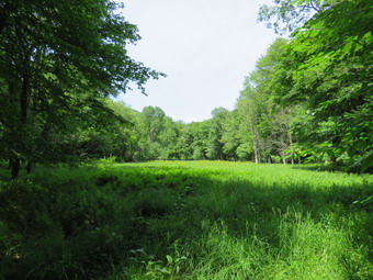 On the descent of the hill we ran into several wet and muddy areas with plenty of nettles. I knew we were headed down to a small stream. Along the way we passed several stones walls and old foundations. When we got to the stream, I was surprised to find that there was no water. I stopped to take a few shots but left quickly as the insects were hovering in a cloud around my head. We began to follow an old woods road and passed by a beaver meadow where I took a few more shots. At 2.2 miles we turned east and completed the climb to the top of the hill. There were some more blowdowns in this area but I decided to leave them for another trip. Once again we began to descend a hill as we headed for Alder Creek Road. Eventually the trail flattened out and we came to Alder Creek. We crossed it easily and walked up to the road. Karl pointed out that it was getting late so we got a quick drink and turned around to retrace our steps to the car. We now had to walk up all the hills we walked down on the way out! We set a pretty fast pace and did not stop for pictures. At 3.6 miles we descended a hill and made a left turn to head south passed the beaver meadow. Sheila alerted and we looked up to see a mother bear and cub heading away from us in the forest on the other side of the swale. I immediately called Sheila and out her on her leash as she was determined to go investigate. We made the turn and continue to hike downhill. After crossing the dry streambed, I finally let her off her leash. We continued our quick pace stopping only a few times for water. It was hotter than ever and we were both tired. At 4.8 miles we hit the top of the last hill and we both were glad that the rest of the trip was downhill. We were back at the car at 4:55 PM after hiking 5,8 miles in 3 hours ad 15 minutes. The total elevation gain was 1380 feet. As we pulled away from the parking area the temperature read 90 degrees!
![]()
![]()
![]()
![]()
![]() On Saturday, June 16th, my son Kurt called to say he and granddaughter Ariana wanted to come to Livingston Manor to go for a hike. I decided we would return to Frick Pond and Hike the loop we had done the day before with grandson Bryce. This time we would hike the loop in the opposite direction. Kurt arrived at about 11:00 and we took some time to get going. The temperature was in the mid 70's which felt comfortable. While we were getting ready, Sheila was always nearby making it very clear that she wanted to go. I got dressed in a long-sleeved crew top with a short-sleeved baselayer. I put on a pair of RailRiders hiking pants which are expensive but last along time and have features like deep pockets and a generous cut which I really like. The pants have Velcro closures at the ankles which I hoped would mean I did not need gaiters. The ticks have been very numerous so far this season especially farther south. I decided to wear my Keen Glarus hiking boots which I had recently waterproofed as I knew the trails might be damp. We left Livingston Manor at about 11:305 AM and I drove out the DeBruce Road about 6 miles to Mongaup Road. I turned left and continued up the road to the point where it splits. I stayed left on Beech Mountain Road and drove to the parking areas on the left. The road was smooth and hard packed after the Town of Rockland had worked on it. I pulled into the larger parking area as the smaller one had a horse trailer parked in it! There were also a few cars in the larger lot. Horses are allowed in the Willowemoc Wild Forest but NOT on marked hiking trails. This means there are very few places that horses can legally be ridden. I like horses but they can be a problem on hiking trails. Heavy usage can increase trail erosion and riders never clean up what their mounts leave behind. We got ready to head out on the Flynn Trail with a few insects circling our heads. I set my GPS and we walked across the road to get on the Flynn Trail. This trail is sited along what used to be Beech Mountain Road which was the access for the Beech Mountain Boy Scout Camp. We walked the trail through the woods and then turned right on the woods road. The trail gains a little over 600 feet in 1.75 miles to the highest point at the junction with the Big Rock Trail. The day was warm and humid but we had a good time as we hi8ked up the trail. We passed through the arch Cindy and I had cut through an enormous hemlock that had fallen across the trail. Along the way Sheila alerted and I looked ahead to see two horses coming toward us. I put Sheila on her leash and as we passed I mentioned the regulation about horses. The rider, a woman I knew from Livingston Manor, seemed genuinely surprised and I felt guilty that I may have upset her.
On Saturday, June 16th, my son Kurt called to say he and granddaughter Ariana wanted to come to Livingston Manor to go for a hike. I decided we would return to Frick Pond and Hike the loop we had done the day before with grandson Bryce. This time we would hike the loop in the opposite direction. Kurt arrived at about 11:00 and we took some time to get going. The temperature was in the mid 70's which felt comfortable. While we were getting ready, Sheila was always nearby making it very clear that she wanted to go. I got dressed in a long-sleeved crew top with a short-sleeved baselayer. I put on a pair of RailRiders hiking pants which are expensive but last along time and have features like deep pockets and a generous cut which I really like. The pants have Velcro closures at the ankles which I hoped would mean I did not need gaiters. The ticks have been very numerous so far this season especially farther south. I decided to wear my Keen Glarus hiking boots which I had recently waterproofed as I knew the trails might be damp. We left Livingston Manor at about 11:305 AM and I drove out the DeBruce Road about 6 miles to Mongaup Road. I turned left and continued up the road to the point where it splits. I stayed left on Beech Mountain Road and drove to the parking areas on the left. The road was smooth and hard packed after the Town of Rockland had worked on it. I pulled into the larger parking area as the smaller one had a horse trailer parked in it! There were also a few cars in the larger lot. Horses are allowed in the Willowemoc Wild Forest but NOT on marked hiking trails. This means there are very few places that horses can legally be ridden. I like horses but they can be a problem on hiking trails. Heavy usage can increase trail erosion and riders never clean up what their mounts leave behind. We got ready to head out on the Flynn Trail with a few insects circling our heads. I set my GPS and we walked across the road to get on the Flynn Trail. This trail is sited along what used to be Beech Mountain Road which was the access for the Beech Mountain Boy Scout Camp. We walked the trail through the woods and then turned right on the woods road. The trail gains a little over 600 feet in 1.75 miles to the highest point at the junction with the Big Rock Trail. The day was warm and humid but we had a good time as we hi8ked up the trail. We passed through the arch Cindy and I had cut through an enormous hemlock that had fallen across the trail. Along the way Sheila alerted and I looked ahead to see two horses coming toward us. I put Sheila on her leash and as we passed I mentioned the regulation about horses. The rider, a woman I knew from Livingston Manor, seemed genuinely surprised and I felt guilty that I may have upset her.
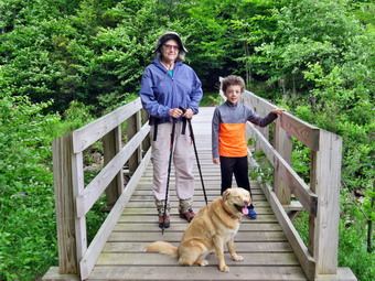
 At about a mile Ariana began to complain a little but we encouraged her and we were soon at the junction. We told Ariana that the hike back was downhill or flat and that seemed to cheer her up. We turned left to walk down the Big Rock Trail. I compared the trip down to the trip up the day before and decide I liked down a lot better. Ariana also asked about the ditch and the rocks on the trail and I explained that a hard rain had turned the trail into a stream temporarily. The hike down the trail went quickly and we were soon at Times Square. Ariana wanted to sit on a rock and take a break so I asked Kurt and Cindy to pose with her and Sheila while I took a few pictures. I began to notice the insects swarming so I continued our hike by walking straight across Times Square to stay on the Big Rock Trail. The others followed me along the trail which had some muddy spots in the low areas. We crossed two small bridges over the inlets to the pond. I took a few pictures in the area under the pines and then we started walking on the boardwalks. Ariana like the boardwalks and the green moss growing everywhere. At the next trail junction we turned left on the Quick Lake Trail to head for the bridge across the outlet of Frick Pond. I stopped at the bridge to take a few shots. Kurt was surprised at the height of the water but I told him it had been higher until someone destroyed the beaver dam! We walked up the hill to Gravestone Junction and continued to the register on the trail. At the register we turned right and followed the Quick Lake Trail back to the car. We arrived at the car at 2:05 Pm having hiked 4 miles in 2 hours and 10 minutes with an elevation gain of 680 feet. On the way home we stopped at the state fish hatchery. We walked around the "tanks" and saw some fingerling trout and some larger trout used for stoke streams. I walked over to the covered pools where they keep the breeding stock and called everyone else over. The pools are dark but there is always a shaft of sunlight shining through . When one of the very large fish swims near or through the sunlight it is truly amazing!
![]()
![]()
![]()
![]()
![]() On Friday, June 15th, my grandson, Bryce, had a half of school. He said he wanted to go hiking so Cindy and I planned to go to Frick Pond and do a loop there. Bryce arrived at our house around noon. We had a quick lunch and then got ready to hike. The temperature was in the low 70's which actually felt a little cool. While we were getting ready, Sheila was always nearby making it very clear that she wanted to go. I got dressed in a long-sleeved crew top with a short-sleeved baselayer. I put on a pair of RailRiders hiking pants which are expensive but last along time and have features like deep pockets and a generous cut which I really like. The pants have Velcro closures at the ankles which I hoped would mean I did not need gaiters. The ticks have been very numerous so far this season especially farther south. I decided to wear my Keen Glarus hiking boots which I had recently waterproofed as I knew the trails might be damp. We left Livingston Manor at about 12:30 PM as I drove out the DeBruce Road about 6 miles to Mongaup Road. I turned left and continued up the road to the point where it splits. I stayed left on Beech Mountain Road and drove to the parking areas on the left. The road was smooth and hard packed after the Town of Rockland had worked on it. I pulled into the empty parking area and we got ready to head out. I set my GPS and we walked out the woods road to the Quick Lake Trail at the register. The woods road was a little damp with a few muddy spots that we avoided easily. Within a short distance I looked up to see two dogs coming our way and I immediately pout Sheila on her leash. The other dogs were off leash and coming straight for Sheila with their owners calling them to no avail. Once again we had run into irresponsible dog owners who just didn't care that their dogs were bothering other people. They never put their dogs on a leash and one of them followed us for some distance with the owner calling it to no avail. A little farther along there were two more people with a small whippet that they had picked up so it did not bother us. At Gravestone Junction we stayed left to walk down to Frick Pond. At the bridge I decided to take a few pictures. As I was taking some shots we noticed that there were fish feeding but taking a picture was not easy. I took a couple of pictures of Bryce, Cindy and Sheila on the bridge before continuing our hike. As we walked around the west side of the pond, I noted that the usually wet spots were almost dry. At the next trail junction we turned right on the Big Rock Trail to walk around the pond on the wooden boardwalks. As we walked I was impressed that Bryce was picking up branches off the trail and throwing them to the side. I wish all hikers would do this as it would make trail maintenance so much easier.
On Friday, June 15th, my grandson, Bryce, had a half of school. He said he wanted to go hiking so Cindy and I planned to go to Frick Pond and do a loop there. Bryce arrived at our house around noon. We had a quick lunch and then got ready to hike. The temperature was in the low 70's which actually felt a little cool. While we were getting ready, Sheila was always nearby making it very clear that she wanted to go. I got dressed in a long-sleeved crew top with a short-sleeved baselayer. I put on a pair of RailRiders hiking pants which are expensive but last along time and have features like deep pockets and a generous cut which I really like. The pants have Velcro closures at the ankles which I hoped would mean I did not need gaiters. The ticks have been very numerous so far this season especially farther south. I decided to wear my Keen Glarus hiking boots which I had recently waterproofed as I knew the trails might be damp. We left Livingston Manor at about 12:30 PM as I drove out the DeBruce Road about 6 miles to Mongaup Road. I turned left and continued up the road to the point where it splits. I stayed left on Beech Mountain Road and drove to the parking areas on the left. The road was smooth and hard packed after the Town of Rockland had worked on it. I pulled into the empty parking area and we got ready to head out. I set my GPS and we walked out the woods road to the Quick Lake Trail at the register. The woods road was a little damp with a few muddy spots that we avoided easily. Within a short distance I looked up to see two dogs coming our way and I immediately pout Sheila on her leash. The other dogs were off leash and coming straight for Sheila with their owners calling them to no avail. Once again we had run into irresponsible dog owners who just didn't care that their dogs were bothering other people. They never put their dogs on a leash and one of them followed us for some distance with the owner calling it to no avail. A little farther along there were two more people with a small whippet that they had picked up so it did not bother us. At Gravestone Junction we stayed left to walk down to Frick Pond. At the bridge I decided to take a few pictures. As I was taking some shots we noticed that there were fish feeding but taking a picture was not easy. I took a couple of pictures of Bryce, Cindy and Sheila on the bridge before continuing our hike. As we walked around the west side of the pond, I noted that the usually wet spots were almost dry. At the next trail junction we turned right on the Big Rock Trail to walk around the pond on the wooden boardwalks. As we walked I was impressed that Bryce was picking up branches off the trail and throwing them to the side. I wish all hikers would do this as it would make trail maintenance so much easier.
 The boardwalks were dry but there were a few muddy areas further along the trail as we approached Times Square. We continued straight ahead on the Big Rock Trail up the hill. From Times Square to the Flynn Trail junction the Big Rock Trail rises 625 feet in 1.1 miles. This doesn't sound like much but it always seems to be a little farther and a little longer than I remember. I started to quiz Bryce on several different subjects which makes the time pass more quickly. A little less than half way up the trail there is a deep ditch along the side of the trail. Bryce asked about the ditch and the rocks and I told him a large amount of erosion had occurred and there were a lot of large stones that had washed down the trail. This was from a heavy rainstorm that caused flooding in Livingston Manor. There are three different "tiers" to the trail and we told Bryce to watch for the "Caution" sign. Soon we had walked 2.2 miles and were at the junction with the Flynn Trail. We turned right to head down the Flynn Trail to the car. This return trip always seems longer than the 1.7 miles that is posted which is the correct distance. The trail is pretty but has no views. On this day it seemed to go much faster as we had Bryce who was interested in everything. Bryce was getting a little tired as we neared the end of the trail so I told him to watch for the "arch" Cindy and I had created through an enormous he lock tree that had fallen across the trail. We told him that right after that he would see the gate and the car was very near. We continued on the Flynn Trail back down to the car staying to the left at the gate to avoid the private property around the cabin. We arrived in the parking area at 2:45 PM having covered 4.0 miles in 1 hour and 55 minutes with and elevation gain of 700 feet.
![]()
![]()
![]()
![]()
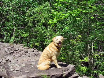
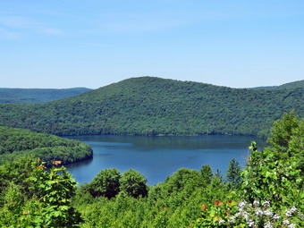
![]() On Tuesday, June 12th I decided to visit Bramley Mountain after hiking the newly relocated trail at Shavertown. I set the GPS on my car for Glen Burnie Road and followed the directions it gave me. Out of the parking area I turned left on Tremperskill Road and followed it into Andes where I turned left on Route 28 North. After 7.5 miles, I turned right on Glen Burnie Road and drove 2.8 miles to the parking area for Bramley Mountain. The parking area is small but is well marked and it helped that we had been there before. I pulled into the parking area, turned around and parked at 12:20 PM. When we got out of the car, I noticed that it was warmer and more humid! The car's thermometer read 72 degrees as I set my GPS and started to hike. I had two choices to start the hike. The red Summit Trail went to the right directly to the summit over 1.8 miles. I chose to go straight ahead on the blue Quarry Trail which passes through a quarry and then wends its way to the summit over 2.1 miles. The woods road was very open but damp and muddy in some places. I expected a great cloud of insects to surround me but they mostly stayed away. We walked along the road through the woods and eventually broke out into an open clearing where there was a lot of tall grass which was fortunately dry for the most part. At about .8 miles we came to the quarry and I decided not to stop to take a pictures. When we started out again, we came to a spot where the trail seemed to split with blue markers going both left and right. There was also a sign that said "Summit 1.2 miles" but it was not clear which way it was pointing. I had been here before and knew the trail went right. I followed the trail to the left and to a small hill overlooking part of the quarry. I took a few shots including a few of Sheila before going back down and following the main trail to the right. At this point I was not feeling well with some pain in the left shoulder. I was also feeling weary but decided to complete what I had started!
On Tuesday, June 12th I decided to visit Bramley Mountain after hiking the newly relocated trail at Shavertown. I set the GPS on my car for Glen Burnie Road and followed the directions it gave me. Out of the parking area I turned left on Tremperskill Road and followed it into Andes where I turned left on Route 28 North. After 7.5 miles, I turned right on Glen Burnie Road and drove 2.8 miles to the parking area for Bramley Mountain. The parking area is small but is well marked and it helped that we had been there before. I pulled into the parking area, turned around and parked at 12:20 PM. When we got out of the car, I noticed that it was warmer and more humid! The car's thermometer read 72 degrees as I set my GPS and started to hike. I had two choices to start the hike. The red Summit Trail went to the right directly to the summit over 1.8 miles. I chose to go straight ahead on the blue Quarry Trail which passes through a quarry and then wends its way to the summit over 2.1 miles. The woods road was very open but damp and muddy in some places. I expected a great cloud of insects to surround me but they mostly stayed away. We walked along the road through the woods and eventually broke out into an open clearing where there was a lot of tall grass which was fortunately dry for the most part. At about .8 miles we came to the quarry and I decided not to stop to take a pictures. When we started out again, we came to a spot where the trail seemed to split with blue markers going both left and right. There was also a sign that said "Summit 1.2 miles" but it was not clear which way it was pointing. I had been here before and knew the trail went right. I followed the trail to the left and to a small hill overlooking part of the quarry. I took a few shots including a few of Sheila before going back down and following the main trail to the right. At this point I was not feeling well with some pain in the left shoulder. I was also feeling weary but decided to complete what I had started!
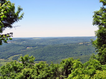 The trail entered the woods and immediately turned almost 180 degrees. As we walked along the trail it would head up the mountain at points and then parallel the ridge. I stopped to take a be pictures of an impressive stone wall and then continued on the trail. Eventually the trail turned at began a steady climb up to the summit. The trail passed by several interesting ledges and rock formations and I stopped in one spot for some pictures. There were numerous switchbacks which made the walk longer but mitigated some of the steeper climbs. Near the top the trail passed around and went through some rock ledges and the trail crew had expertly created some steps out of natural materials. Three times the trail crossed woods roads that climbed the mountain. At 1.9 miles and just before the summit was a nice viewpoint with a few logs for seats. We stopped and I took a few pictures before we hiked the last few hundred feet to the top. Over the 1.1 miles from the quarry we gained over 800 feet with and overall average grade of 14% despite the many switchbacks. When we reached the summit, I saw the old pilings for the fire tower and hoped that the rumors about reconstructing the tower were true. We walked over to the lookout and down to the edge of a small cliff. There was more haze than I had hoped for and almost no clouds but I took some shots anyway. To the south and southeast I could see the Pisgahs near Andes which were once the site of a ski area. I walked down to the lower part of the lookout and took a few more pictures. When I was finished, I returned to the summit where I had a drink and gave Sheila some water. I was feeling better now that I knew it was all downhill! We walked in the direction that the arrow pointed and found the markers for the red Summit Trail that we would take back to the parking area.
 We started down the Summit Trail which starts out as wide woods road but at .15 miles from the summit markers clearly indicated a right turn. The trail follows another woods road but one that is covered in long grass which needs to be cut. The grass here was also pretty dry. There was a nice view off to the left but it was not much different than the view from the summit. We continued to follow the woods road as it entered the woods and led out to the upper parking area. Along the way there was one major blowdown which completely blocked the trail. Hikers had made a detour but the blowdown should be cleared even though it looks like a tough job. I was waiting for the trail to turn right into the woods to connect to the lower parking area. Soon we were almost to the road and I finally saw where the trail entered the woods and started downhill to the car. This part of the trail was soft and easy walking but only lasted .15 miles. We were soon back at the car. It was 2:15 PM and we had hiked 3.6 miles in just under 2 hours with only 10 minutes of time stopped. The elevation gain was 1015 feet. To get to the summit the red Summit Trail is both shorter and easier. The blue Quarry Trail and its extension is harder but also more interesting! On the way home we headed toward Delhi and crossed the stream at Fitches Crossing. Once we were in Delhi, I followed familiar route home over Telford Hollow and through Downsville.
![]()
![]()
![]()
![]()
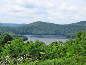
![]() On Tuesday, Jun12th, I had decided to hike the Shavertown Trail near the Dunraven Bridge across the Pepacton Reservoir to get a GPS track of the relocated trail. The DEP is allowing a contractor to log part of the property and they will be using the road on which part of the trail is located for access. Logging typically leaves the area being logged a mess and meeting a logging truck on a narrow road can be disconcerting. Cindy and I had worked on the relocation the previous Friday. Some of the other volunteers were going to do some blazing and other work on Sunday and Monday. When i awoke on Friday morning at 6:30 AM it was only 45 degrees but it was clear the day would get warmer. I decided to do some things around the house and wait for the temperature to warm some. Eventually I got dressed in a long-sleeved crew top with a short-sleeved baselayer. I put on a pair of RailRiders hiking pants which are expensive but last along time and have features like deep pockets and a generous cut which I really like. The pants have Velcro closures at the ankles which I hoped would mean I did not need gaiters. The ticks have been very numerous so far this season especially farther south. I decided to wear my Keen Glarus hiking boots which I had recently waterproofed as I knew the trails might be damp. I also put on a light jacket knowing I could remove it at any time. I asked Cindy if she wanted to go but she declined. Sheila was sure to stay close so that I would not forget her! We left Livingston Manor at about 10:00 AM after visiting the post office and filling the gas tank. I took Old Route 17 north and west to the Beaverkill Road where I turned right to head north. I followed the road through Lew Beach and into Ulster County. Where the road makes a sweeping right in Turnwood, I turned left on Barkaboom Road to head toward the Pepacton. The road was in good shape and when we got to the junction with BWS 8 and BWS 9, I turned left. I drove to the bridge, turned right to cross it and turned left at the other end and pulled into he parking area. The temperature had risen into the low 60's so I decided not to wear my jacket. I discovered I had forgotten to put on Sheila's neckerchief but, more importantly, I had left my poles behind! We were ready to go almost immediately so I set my GPS and we started to hike north On the road toward the trailhead at 10:30 AM. The sign for the trail was only a few hundred feet up the road so we crossed and started to hike on the trail. There were several wooden sticks at the register box and although I prefer a pair of poles I decided one stick was better than none. The first .25 miles of trail climbs 200 feet as it heads directly north and up the side of Perch Lake Mountain. As we walked I removed several large branches from the trail. There were several wet and muddy spots but they were bridged or easily avoided. I was surprised at how quickly we arrived at the gravel access road. The new trail is directly across the road and avoids using the road which will soon be used for logging. We crossed the road and climbed a few makeshift "steps" up the bank to start on the new trail through the woods.
On Tuesday, Jun12th, I had decided to hike the Shavertown Trail near the Dunraven Bridge across the Pepacton Reservoir to get a GPS track of the relocated trail. The DEP is allowing a contractor to log part of the property and they will be using the road on which part of the trail is located for access. Logging typically leaves the area being logged a mess and meeting a logging truck on a narrow road can be disconcerting. Cindy and I had worked on the relocation the previous Friday. Some of the other volunteers were going to do some blazing and other work on Sunday and Monday. When i awoke on Friday morning at 6:30 AM it was only 45 degrees but it was clear the day would get warmer. I decided to do some things around the house and wait for the temperature to warm some. Eventually I got dressed in a long-sleeved crew top with a short-sleeved baselayer. I put on a pair of RailRiders hiking pants which are expensive but last along time and have features like deep pockets and a generous cut which I really like. The pants have Velcro closures at the ankles which I hoped would mean I did not need gaiters. The ticks have been very numerous so far this season especially farther south. I decided to wear my Keen Glarus hiking boots which I had recently waterproofed as I knew the trails might be damp. I also put on a light jacket knowing I could remove it at any time. I asked Cindy if she wanted to go but she declined. Sheila was sure to stay close so that I would not forget her! We left Livingston Manor at about 10:00 AM after visiting the post office and filling the gas tank. I took Old Route 17 north and west to the Beaverkill Road where I turned right to head north. I followed the road through Lew Beach and into Ulster County. Where the road makes a sweeping right in Turnwood, I turned left on Barkaboom Road to head toward the Pepacton. The road was in good shape and when we got to the junction with BWS 8 and BWS 9, I turned left. I drove to the bridge, turned right to cross it and turned left at the other end and pulled into he parking area. The temperature had risen into the low 60's so I decided not to wear my jacket. I discovered I had forgotten to put on Sheila's neckerchief but, more importantly, I had left my poles behind! We were ready to go almost immediately so I set my GPS and we started to hike north On the road toward the trailhead at 10:30 AM. The sign for the trail was only a few hundred feet up the road so we crossed and started to hike on the trail. There were several wooden sticks at the register box and although I prefer a pair of poles I decided one stick was better than none. The first .25 miles of trail climbs 200 feet as it heads directly north and up the side of Perch Lake Mountain. As we walked I removed several large branches from the trail. There were several wet and muddy spots but they were bridged or easily avoided. I was surprised at how quickly we arrived at the gravel access road. The new trail is directly across the road and avoids using the road which will soon be used for logging. We crossed the road and climbed a few makeshift "steps" up the bank to start on the new trail through the woods.
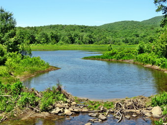
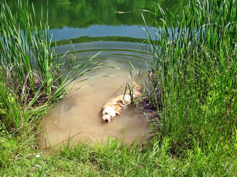 The first part of the new trail from the road runs through some pine trees and there is some additional trimming that needs to be done. I was surprised that there were no blazes on the trees as I thought the were going to be placed on Sunday. The trail from the road is only about .35 miles but it gains 250 feet at a 15% grade. The temporary ribbons were still present and the trail bed was clear in most places. The trail needs to be raked and some weeds, ferns and grass cut in some places to make the path more obvious. We soon broke out of the woods and climbed to Snake Pond crossing two small bridges we had placed on the previous Friday. Once we got to the shore of the pond, I put down my pack and I could hear Sheila jumping in for a swim. I took out my camera and took some shots of the Pepacton Reservoir and a few of the pond. The day was pretty clear but there were no white, puffy clouds which always seem to set off the sky. I took a few pictures of Sheila in the pond before packing up to continue the hike. The pond was full and had some cattails growing in it. There were quite a few redwing blackbirds flying around the pond as this is their preferred habitat. We continued around the pond in a clockwise direction crossing the small bridge at the upper end and conning through a grassy area to the woods road. We turned right and walked back down to the trail where we had come up from below. I though that cutting the grass around the pond would make the trail obvious and allow a better experience for hikers. The upper trail that extended out into the woods is now closed for logging so we started back down the trail. The descent went even more quickly than the ascent and we were soon nearing the gravel road. Sheila and I both heard voices and I immediately pout her on her leash as I assumed it was loggers preparing the road. As we approached, a dog barked and someone called out "teddy". I knew this meant that Rick and Wendell were working on the trail. Sheila and Teddy got acquainted and I talked to the two men about the work they were doing. They were going to mark the trail with blazes and place one more bridge. Wendell had already deepened the cuts for the steps and placed some treads. After a brief conversation, Sheila and I continued down the trail back to the car. I decided to "borrow" he hiking stick for the rest of the day as I knew I was not yet down hiking. We were back at the car at 11:40 AM having covered only 1.6 miles in 1 hour and 10 minutes with about a 530 feet of ascent along the way. I considered the other hiking options nearby including the Andes Trail and Palmer Hill. I decided I wanted to hike a mountain and set the GPS for Glen Burnie Road, The site of Bramley Mountain.
![]()
![]()
![]()
![]()
![]() On Monday, June 11th, I was ready to get a hike with some maintenance included. I find that hiking relieves stress but swinging and axe relieves even MORE stress! It wasn't quite 60 degrees when I got up at 7:00 AM but the temperature was going up. I wanted to get an early start so I started gathering my equipment and getting dressed. I put on a long-sleeved crew top with a short-sleeved baselayer. I wore a pair of RailRiders hiking pants which are expensive but last along time and have features like deep pockets and a generous cut which I really like. The pants have Velcro closures at the ankles which I hoped would mean I did not need gaiters. The ticks have been very numerous so far this season especially farther south. I decided to wear my Keen Glarus hiking boots which I had recently waterproofed as I knew the trails might be damp. I also put on a light jacket knowing I could remove it at any time. I packed both my Silky Katanaboy and Sugowaza saws and brought along my Council Tools Velvicut felling axe. The Sugowaza is a 17" curved and fixed blade which fits in a scabbard. The Katana Boy is almost two feet long and is a folding saw with a nylon carrier. Both are remarkably sharp and can take care of some large tree trunks. I brought a light Fiskars axe leaving the full-sized Council Tools Velvicut at home. The latter has a 4 pound head so I don't bring it unless I don't have to carry it very far. I left my poles at home knowing I would be carrying the tools the whole way to do trail work. I got my gear in the car and Sheila in the backseat and left Livingston Manor just before 8:30 AM. I drove out the DeBruce Road about 6 miles to Mongaup Road. I turned left and continued up the road to the point where it splits. I stayed left on Beech Mountain Road and almost immediately ran into a sign indicating road work. Ahead of me was a road grader making a serious effort to smooth the dirt road by removing a good chunk of the top layer. The grader was moving slowly but the trailhead parking is a short way up the road. I pulled into the empty parking area and got ready to head out. It was warm enough that I left my jacket behind. There were a few insects and the temperature had risen Tao bout 60 degrees with some humidity in the air. We walked out the woods road to the Quick Lake Trail at the register. There were a few branches hanging in the trail but I left those for lopping at a later date. As usual, the trail was damp and a little muddy in places. At Gravestone Junction we turned left to walk down to the pond. The spot near the junction where we had placed stepping stones was nearly dry. At the bridge over the outlet I dropped my pack to take some pictures even though I have hundreds from the same spot. The water in the pond seemed low even though the beaver dam looked as if some layers had been added. After taking some shot, I packed up and we continued around the west shore of the pond. Another wet spot that had been a large puddle the week before was now just a little muddy. At the next trail junction we stayed left on the Quick Lake trail heading toward Iron Wheel Junction.
On Monday, June 11th, I was ready to get a hike with some maintenance included. I find that hiking relieves stress but swinging and axe relieves even MORE stress! It wasn't quite 60 degrees when I got up at 7:00 AM but the temperature was going up. I wanted to get an early start so I started gathering my equipment and getting dressed. I put on a long-sleeved crew top with a short-sleeved baselayer. I wore a pair of RailRiders hiking pants which are expensive but last along time and have features like deep pockets and a generous cut which I really like. The pants have Velcro closures at the ankles which I hoped would mean I did not need gaiters. The ticks have been very numerous so far this season especially farther south. I decided to wear my Keen Glarus hiking boots which I had recently waterproofed as I knew the trails might be damp. I also put on a light jacket knowing I could remove it at any time. I packed both my Silky Katanaboy and Sugowaza saws and brought along my Council Tools Velvicut felling axe. The Sugowaza is a 17" curved and fixed blade which fits in a scabbard. The Katana Boy is almost two feet long and is a folding saw with a nylon carrier. Both are remarkably sharp and can take care of some large tree trunks. I brought a light Fiskars axe leaving the full-sized Council Tools Velvicut at home. The latter has a 4 pound head so I don't bring it unless I don't have to carry it very far. I left my poles at home knowing I would be carrying the tools the whole way to do trail work. I got my gear in the car and Sheila in the backseat and left Livingston Manor just before 8:30 AM. I drove out the DeBruce Road about 6 miles to Mongaup Road. I turned left and continued up the road to the point where it splits. I stayed left on Beech Mountain Road and almost immediately ran into a sign indicating road work. Ahead of me was a road grader making a serious effort to smooth the dirt road by removing a good chunk of the top layer. The grader was moving slowly but the trailhead parking is a short way up the road. I pulled into the empty parking area and got ready to head out. It was warm enough that I left my jacket behind. There were a few insects and the temperature had risen Tao bout 60 degrees with some humidity in the air. We walked out the woods road to the Quick Lake Trail at the register. There were a few branches hanging in the trail but I left those for lopping at a later date. As usual, the trail was damp and a little muddy in places. At Gravestone Junction we turned left to walk down to the pond. The spot near the junction where we had placed stepping stones was nearly dry. At the bridge over the outlet I dropped my pack to take some pictures even though I have hundreds from the same spot. The water in the pond seemed low even though the beaver dam looked as if some layers had been added. After taking some shot, I packed up and we continued around the west shore of the pond. Another wet spot that had been a large puddle the week before was now just a little muddy. At the next trail junction we stayed left on the Quick Lake trail heading toward Iron Wheel Junction.
 This part of the trail is often wet but seemed to have died up some. Even the grass was almost dry! We came across our first job which consisted of one small trunk across the trail. I took some before pictures and then use a saw to cut the trunk at one end and drag it off the trail. I cleaned up a few more pieces and then moves up the trail a little to another blowdown. This one was larger with many branches. I always use the same method which means I cut away the branches that are in the way and drag them off the trail before cutting the main trunks of the tree. This took a little longer than I expected as there were more branches and they were intertwined. I finally got them all cut and took some after pictures. I collected my gear and we continued to walked along the trail. We entered the "spruce tunnel" and came to the main job of the day. There was a large branching tree that had fallen onto the trail parallel to the trail. This meant a lot more cutting than for some other blowdowns. I again took some pictures before starting and then began cutting off smaller branches to expose the larger trunks I needed to cut. The tree that fell also took a few smaller trees down and I cut them all and dragged them well off the trail. Soon I was down to some large trunks which I though I would start with the axe and finish with the saw. As it turned out the chopping went so well I was able to use the axe to do most of the work. When I was done, the trail was clear but I did not like the way the trunk was lying so close to the trail. I attacked it again with the axe to get another piece further off the track. I took my after pictures and then packed up and walked to the stream through the woods. The water level was low but a small tree had fallen across the stream. Its branches were collecting leaves and other detritus which was blocking the stream. I made a few cuts and dragged the tree out of the stream. I cleaned out most of the leaves to open up the stream and then continued on. A short way up the trail we ran into another set of small trees that were bent over the trail by a larger branch. I took some shots and then got to work. This wood was greener and the trees had a lot more spring which made cutting them more dangerous. I took my time and soon had almost everything cleared. I pulled down a few low-hanging branches and cut them off to clear the trail. I took some after shots and then we walked to Iron Wheel Junction.
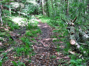 As we walked we continued to clear some small branches. At the trail junction we turned right on the Logger's Loop as a way to loop back to the car. I did not intend to do too much work as it was getting late and I had an afternoon-evening commitment. Shortly after the turn, we ran into another tree blocking part of the trail and I decided I had enough time to clear it. I began by taking pictures and then working on what turned out to be a slightly more complex job than I thought. I kept cutting branches and dragging them aside until Sheila alerted and I saw another dog approaching. I put Sheila on her leash and tied her to a tree. The owners, who had English accents, called their dog and approached us. They apologized for their dog barking which I appreciated. I was a little too busy for conversation as 5 or 6 people passed by. I finally finished the work, took my final pictures and packed up to hurry along the trail. We continued to Times Square and found only one more blowdown near the side of the trail which I made note to clear later. We passed through Times Square which was as wet as always with plenty of mud. The problem of properly draining this area has escaped me as there is surface runoff after it rains and some spring which keep things wet. We continued straight head on the Logger's Loop and I could see another tree down across the trail up ahead. The tree was high enough in the air to allow hikers to pass underneath it but I knew I would return to clear it as I think these situations could be disastrous. We continued the slight uphill hike on the Logger's Loop which was wet in spots. After cresting the hill, we continued out to Gravestone Junction. By now there were some nice puffy white clouds in the sky but I was in a hurry to get home. We turned left at the trail junction and headed back to the car. When we reached the parking area, there was a roller packing the dirt on the road. I don't know whether they will pave the surface but their work had greatly improved the road. It was 12:35 PM and we had spent 3 hours and 45 minutes hiking 4.2 miles and doing a lot of trail work. The elevation gain was a modest 350 feet. The temperature was in the mid-70's as I pulled away from the parking area.
![]()
![]()
![]()
![]()
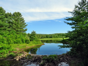
![]() On Friday, June 8th Cindy and I had committed to helping the Catskill Mountain Club relocate the upper part of the Shavertown Trail. The DEP is allowing a contractor to log part of the property and they will be using the road on which part of the trail is located for access. Logging typically leaves the area being logged a mess and meeting a logging truck on a narrow road can be disconcerting. When we awoke on Friday morning at 6:30 AM it was only 56 degrees but it was clear the day would get warmer. We had to drop my car at the body shop at 8:00 AM in Harris to finally get the hail damage fixed. From there we intended to drive directly to the parking area on near the Shavertown Bridge across the Pepacton Reservoir which is near the trail head. I got dressed in a long-sleeved crew top with a short-sleeved baselayer. I put on a pair of RailRiders hiking pants which are expensive but last along time and have features like deep pockets and a generous cut which I really like. The pants have Velcro closures at the ankles which I hoped would mean I did not need gaiters. The ticks have been very numerous so far this season especially farther south. I decided to wear my Keen Glarus hiking boots which I had recently waterproofed as I knew the trails might be damp. I also put on a light jacket knowing I could remove it at any time. I put our tools in the car including my two Silky saws, a Fiskars axe, two different loppers, a mattock, and a shovel. I had to explain to a very disappointed Sheila that she could not go with us as there would be power tools and too many other people. She was NOT happy! I got in my new car and Cindy followed me to the body shop. We arrived early and after a short wait we were able to leave at about 8:00 AM to drive north and west on State Route 17. I intended to take the Beaverkill and Barkaboom Roads to the Shavertown Bridge but we has to make a detour home for Cindy to get some things. After the stop, I drove north on Old Route 17 to the BevaerkillRoad where turned right. I followed the road through Lew Beach and into Ulster County. Where the road makes a sweeping right in Turnwood, I turned left on Barkaboom Road to head toward the Pepacton. The road was in good shape and when we got to the junction with BWS 8 and BWS 9, I turned right. After driving a few miles, I realized I had turned the wrong way. I turned around and drove back to the junction and turned right on BWS 8. I drove to the bridge, turned right to cross it and turned left at the other end and pulled into he parking area. Wendell, the exceptive director of the CMC was already there with two other people. We talked for a minute a hen Wendell suggested we drive the gravel road up to Snake Pond as most of the work needed to be done in that area. Rick, the CMC president, and Bob had already driven up with the bridges that needed to be placed. We got in our cars and followed Wendell up the gravel road. The road was a little rough but passable. We dropped one car at the point where the trail crosses and then continued up to the pond. We met Rick and Bob, said "Hello" and started to work. Rick had his younger beagle, Teddy, with him and Teddy seemed to have a mind of his own. Beagles tend to find a track and follow their nose as far as the scent goes. I went with Rick and Bob to place a bridge over the overflow to the pond to make it easier to walk around the pond. We also placed a small bridge on the other side of the pond over a small ditch. I was now time to get busy cutting out the trail that had already been flagged.
On Friday, June 8th Cindy and I had committed to helping the Catskill Mountain Club relocate the upper part of the Shavertown Trail. The DEP is allowing a contractor to log part of the property and they will be using the road on which part of the trail is located for access. Logging typically leaves the area being logged a mess and meeting a logging truck on a narrow road can be disconcerting. When we awoke on Friday morning at 6:30 AM it was only 56 degrees but it was clear the day would get warmer. We had to drop my car at the body shop at 8:00 AM in Harris to finally get the hail damage fixed. From there we intended to drive directly to the parking area on near the Shavertown Bridge across the Pepacton Reservoir which is near the trail head. I got dressed in a long-sleeved crew top with a short-sleeved baselayer. I put on a pair of RailRiders hiking pants which are expensive but last along time and have features like deep pockets and a generous cut which I really like. The pants have Velcro closures at the ankles which I hoped would mean I did not need gaiters. The ticks have been very numerous so far this season especially farther south. I decided to wear my Keen Glarus hiking boots which I had recently waterproofed as I knew the trails might be damp. I also put on a light jacket knowing I could remove it at any time. I put our tools in the car including my two Silky saws, a Fiskars axe, two different loppers, a mattock, and a shovel. I had to explain to a very disappointed Sheila that she could not go with us as there would be power tools and too many other people. She was NOT happy! I got in my new car and Cindy followed me to the body shop. We arrived early and after a short wait we were able to leave at about 8:00 AM to drive north and west on State Route 17. I intended to take the Beaverkill and Barkaboom Roads to the Shavertown Bridge but we has to make a detour home for Cindy to get some things. After the stop, I drove north on Old Route 17 to the BevaerkillRoad where turned right. I followed the road through Lew Beach and into Ulster County. Where the road makes a sweeping right in Turnwood, I turned left on Barkaboom Road to head toward the Pepacton. The road was in good shape and when we got to the junction with BWS 8 and BWS 9, I turned right. After driving a few miles, I realized I had turned the wrong way. I turned around and drove back to the junction and turned right on BWS 8. I drove to the bridge, turned right to cross it and turned left at the other end and pulled into he parking area. Wendell, the exceptive director of the CMC was already there with two other people. We talked for a minute a hen Wendell suggested we drive the gravel road up to Snake Pond as most of the work needed to be done in that area. Rick, the CMC president, and Bob had already driven up with the bridges that needed to be placed. We got in our cars and followed Wendell up the gravel road. The road was a little rough but passable. We dropped one car at the point where the trail crosses and then continued up to the pond. We met Rick and Bob, said "Hello" and started to work. Rick had his younger beagle, Teddy, with him and Teddy seemed to have a mind of his own. Beagles tend to find a track and follow their nose as far as the scent goes. I went with Rick and Bob to place a bridge over the overflow to the pond to make it easier to walk around the pond. We also placed a small bridge on the other side of the pond over a small ditch. I was now time to get busy cutting out the trail that had already been flagged.
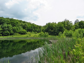 Rick likes to use the power scythe so he took command of it. Bob had a chainsaw in case we ran into any large trees on the trail. I planned to use my Silky Sugowaza most of the time and the rest of the group had various types of loppers. After cutting through some weeds and brush we came to one more wet spot that needed a bridge. Bob and I went to the truck to get the bridge and place it across the wet area. It fit almost perfectly. Rick and Cindy went ahead cutting what they could with the power scythe and loppers. The power scythe tends to leave stubs behind which then require lopping anyway. My job was to cut some of the small trees that remained in the trail or hanging over the trail. Wendell and I also removed some older and rotten tree trunks in the trail. We continued on down the trail following the flagging and what Rick had cut. Occasionally we would hear Rick calling Teddy who was, for some reason, staying near us. As we descended the hill and neared the gravel road, we came across two small streams across the trail. These were easily crossed but Wendell decided to create a "bridge" from rocks. This was a good idea for those who might hike with less than adequate foot gear. The only problem is that wet rocks become slippery. I continued down the trail cutting a few small trees and trimming the branches on the pines near the road. The problem with loppers is that it is hard to cut close to the tree trunks. This can leave "spikes" sticking out from the trunks which can be dangerous should someone stumble against them. I continued to cut these spikes and branches until one hit me in the left temple. I put my hand to the affected area and came away with some blood. I couldn't tell if it was a scratch or a deeper cut so I called for Cindy. By the time she arrived, the bleeding had stopped and she told me it was only a small scratch. I continued to cut the branches heading for the road while Cindy supervised my work. Once I got to the road, we turned around and walked back up the trail to the small streams where the others were taking a lunch break. Cindy and I decided to head back up to the car to go home as most of the day's work was done. Wendell talked about cutting some steps from the road up the bank but we decided we had worked enough for the day. We walked back up to the pond with Bob. I took a few pictures of the pond and some from the lookout over the Pepacton. We walked back to the car and started down the road at 1:00 PM. We had spent about four hours helping with a very worthwhile project. The logging will eliminate access to the upper trail that wandered through some beautiful woods and will leave the walk considerably shorter than it was.
![]()
![]()
![]()
![]() On Wednesday, June 6th I wanted to get in a hike close to home after my appointment for a dental cleaning in the morning. Track season had concluded so I had as much time as I wanted to hike. I was home by 11:00 AM and I got ready to leave. It felt good to leave the tools behind which lightened my pack considerably. I got dressed in a long-sleeved crew top with a short-sleeved baselayer. I put on a pair of RailRiders hiking pants which are expensive but last along time and have features like deep pockets and a generous cut which I really like. The pants have Velcro closures at the ankles which I hoped would mean I did not need gaiters. The ticks have been very numerous so far this season especially farther south. I decided to wear my Keen Glarus hiking boots which I had recently waterproofed as I knew the trails might be damp. The temperature was in the mid 60's as I got ready so I put on a light jacket knowing I could remove it at any time. The skies were completely overcast and it looked like it could rain at any minute but the forecast did not include any showers. Sheila was eager to get in the car and we left Livingston Manor around 11:25 AM to head for Frick Pond. I had already decided that I would limit my photography and perhaps avoid stopping at all to take pictures. We were at the parking area and out on the Quick Lake Trail by 11:45 AM. There were no other cars so I did not expect to meet anyone. Sheila was more than ready to get going even though we had hiked the day before. Despite the cooler temperature it was very humid but there did not seem to be many insects around. The woods road passed the register box to Frick Pond was damp but there were only a few areas of standing and running water and only a little mud. At Gravestone Junction we stayed to the left on the red Quick Lake Trail crossing the stepping stones the Willowemoc Trail Crew had installed. We walked down to the pond and crossed the bridge over the outlet. The scene was much the same as always and there was nothing distinguishing to photograph. I stayed with my plan and continued on the trail. As we walked on the trail along the west side of the pond there was one puddle that I though could be drained. I put it on the list of things to do on our trail maintenance hike on Saturday, June 30. At the next trail junction we headed left to stay on the Quick Lake Trail. We were keeping a pretty steady pace as we headed for Iron Wheel Junction. Sheila was running around following game trails and chasing a few chipmunks and squirrels. I removed a few branches from the trail as I walked along. The trail was drier than I expected . Once we got to the "spruce tunnel" there were several trees down on the trail. It looked to me like they would be relatively easy to clear with hand tools. I removed some old trunks that had fallen across the trail. A tree had fallen into the little stream through the woods and was blocking the water forming a pool. This was another task that will have to be handled. When we arrived at Iron Wheel Junction, we turned left to head toward Hodge Pond staying on the Quick Lake Trail.
On Wednesday, June 6th I wanted to get in a hike close to home after my appointment for a dental cleaning in the morning. Track season had concluded so I had as much time as I wanted to hike. I was home by 11:00 AM and I got ready to leave. It felt good to leave the tools behind which lightened my pack considerably. I got dressed in a long-sleeved crew top with a short-sleeved baselayer. I put on a pair of RailRiders hiking pants which are expensive but last along time and have features like deep pockets and a generous cut which I really like. The pants have Velcro closures at the ankles which I hoped would mean I did not need gaiters. The ticks have been very numerous so far this season especially farther south. I decided to wear my Keen Glarus hiking boots which I had recently waterproofed as I knew the trails might be damp. The temperature was in the mid 60's as I got ready so I put on a light jacket knowing I could remove it at any time. The skies were completely overcast and it looked like it could rain at any minute but the forecast did not include any showers. Sheila was eager to get in the car and we left Livingston Manor around 11:25 AM to head for Frick Pond. I had already decided that I would limit my photography and perhaps avoid stopping at all to take pictures. We were at the parking area and out on the Quick Lake Trail by 11:45 AM. There were no other cars so I did not expect to meet anyone. Sheila was more than ready to get going even though we had hiked the day before. Despite the cooler temperature it was very humid but there did not seem to be many insects around. The woods road passed the register box to Frick Pond was damp but there were only a few areas of standing and running water and only a little mud. At Gravestone Junction we stayed to the left on the red Quick Lake Trail crossing the stepping stones the Willowemoc Trail Crew had installed. We walked down to the pond and crossed the bridge over the outlet. The scene was much the same as always and there was nothing distinguishing to photograph. I stayed with my plan and continued on the trail. As we walked on the trail along the west side of the pond there was one puddle that I though could be drained. I put it on the list of things to do on our trail maintenance hike on Saturday, June 30. At the next trail junction we headed left to stay on the Quick Lake Trail. We were keeping a pretty steady pace as we headed for Iron Wheel Junction. Sheila was running around following game trails and chasing a few chipmunks and squirrels. I removed a few branches from the trail as I walked along. The trail was drier than I expected . Once we got to the "spruce tunnel" there were several trees down on the trail. It looked to me like they would be relatively easy to clear with hand tools. I removed some old trunks that had fallen across the trail. A tree had fallen into the little stream through the woods and was blocking the water forming a pool. This was another task that will have to be handled. When we arrived at Iron Wheel Junction, we turned left to head toward Hodge Pond staying on the Quick Lake Trail.
We kept a quick pace up the hilly part of the trail. The trail was washed out in several places and I continued to remove small obstacles. We continued on the trail until it leveled off and descended slightly to Junkyard Junction. At this intersection, the Quick Lake Trail bears to the left and continues on to Quick Lake. We turned right and headed across the Flynn Trail toward Hodge Pond. The Flynn Trail was damp and slippery with mud in some places but not as wet as it normally is this time of year. The trip across this part of the Flynn Trail went quickly. At one point I was not paying attention and stepped on a wet and mossy flat rock. I narrowly avoided a nasty fall! Soon we were at the gate where the trail turns right and heads down toward Hodge Pond. We reached the area near the shore of the pond and turned left to follow the jeep trail around the back of the pond. The sky was still overcast but I did stop for a few moments at the head of the pond. The pond was very placid and there were almost no sounds. On the other side of the pond I turned left up the hill toward the ruins of the Beech Mountain Boy Scout Camp. The climb up this trail is steeper than the trail from the outlet of Hodge Pond but it is also shorter! When we got to the top of the hill, we turned right to head back toward the Flynn Trail. Once we were back at the Flynn Trail, we turned left for a straight shot back to the car. We set a fast pace to the junction with the Big Rock Trail and then had about 1.7 miles to go to get back to the car. This stretch can often seem long and boring but I must have been deep in thought as the hike to the car seemed to go so quickly. The grass was wet along this trail but there was a pretty definite track to follow. Everything was very green. As we neared the gate, we came to the huge spruce tree that lies across the trail. Cindy and I had cut an opening through it to allow hikers to pass. This was still in good shape and allowed us to pass easily. We followed the Flynn Trail to the gate and then turned left to continue on the rail to avoid the private property around the cabin. We followed the trail through the woods and back to the car arriving at 2:30 PM. We hiked 6.2 miles in 2 hours and 45 minutes with 888 feet of elevation gain. We stopped for only 4 minutes and our overall and moving average speeds were both 2.3 mph.
![]()
![]()
![]()
![]() On Monday, June 4th I wanted to get out on a hike after serving as the high school nurse during the day. Track season had concluded so I came home right after school. I already knew that I was going to be the nurse on Tuesday and that we were cleaning up the track after school so I wanted to get out for some exercise. Even in the afternoon it was a little cooler than it had been with the temperature hovering in the mid 60's. I asked Cindy if she wanted to go across the street to hike on Round Top. She said "Yes" so we got dressed and walked out the door at about 3:30 PM. By this time half the sky was blue and sunny and the other half, especially to the west and north, was full of dark clouds. We decided that we were close enough to home to make a run for it if the rain started to fall. Sheila seemed thrilled at the decision to hike and was very excited that we all were going. As I got dressed I decided to put on a long-sleeved crew top with no baselayer. I put on a pair of RailRiders hiking pants which are expensive but last along time and have features like deep pockets and a generous cut which I really like. The pants have Velcro closures at the ankles which I hoped would mean I did not need gaiters. The ticks have been very numerous so far this season especially farther south. I decided to wear my Keen Glarus hiking boots which I had recently waterproofed as I knew the trails might be damp. Sheila would not leave my side as I was getting ready as she wanted to make sure she was going too! As we left the house Sheila made a mad dash for two young woodchucks that were foolish enough to be in our backyard. I raised my voice to Sheila and gave her some encouragement with her training collar which made her return to me. I did not want her harming the woodchucks nor did I want them to bite her. They were surprisingly aggressive in their won defense! We crossed the street with Sheila on her leash and walked to the back of the church to begin the ascent of the steepest hill behind the church. The hill is short but really gets the circulation pumping and is the steepest and longest climb on the "trail". Sheila responds well to the command "Pull" and the Siberian husky in her makes her well-suited for the job. When we got to the top of the hill, we started out on the trail by turning left at the trailhead. I let Sheila off her leash and she bounded ahead of me following her nose. When we arrived at the area where a large blowdown had blocked the trail, I Pointed out my work to Cindy. I had cleared a large tree by myself using only hand tools! At the first trail junction we followed Sheila as she turned right and continued up the trail. It was really a pleasure to walk on the trails and we found there were no major blowdowns. We did spend quite a bit of time clearing sticks and small branches from the trail which was damp from the rain during the day.
On Monday, June 4th I wanted to get out on a hike after serving as the high school nurse during the day. Track season had concluded so I came home right after school. I already knew that I was going to be the nurse on Tuesday and that we were cleaning up the track after school so I wanted to get out for some exercise. Even in the afternoon it was a little cooler than it had been with the temperature hovering in the mid 60's. I asked Cindy if she wanted to go across the street to hike on Round Top. She said "Yes" so we got dressed and walked out the door at about 3:30 PM. By this time half the sky was blue and sunny and the other half, especially to the west and north, was full of dark clouds. We decided that we were close enough to home to make a run for it if the rain started to fall. Sheila seemed thrilled at the decision to hike and was very excited that we all were going. As I got dressed I decided to put on a long-sleeved crew top with no baselayer. I put on a pair of RailRiders hiking pants which are expensive but last along time and have features like deep pockets and a generous cut which I really like. The pants have Velcro closures at the ankles which I hoped would mean I did not need gaiters. The ticks have been very numerous so far this season especially farther south. I decided to wear my Keen Glarus hiking boots which I had recently waterproofed as I knew the trails might be damp. Sheila would not leave my side as I was getting ready as she wanted to make sure she was going too! As we left the house Sheila made a mad dash for two young woodchucks that were foolish enough to be in our backyard. I raised my voice to Sheila and gave her some encouragement with her training collar which made her return to me. I did not want her harming the woodchucks nor did I want them to bite her. They were surprisingly aggressive in their won defense! We crossed the street with Sheila on her leash and walked to the back of the church to begin the ascent of the steepest hill behind the church. The hill is short but really gets the circulation pumping and is the steepest and longest climb on the "trail". Sheila responds well to the command "Pull" and the Siberian husky in her makes her well-suited for the job. When we got to the top of the hill, we started out on the trail by turning left at the trailhead. I let Sheila off her leash and she bounded ahead of me following her nose. When we arrived at the area where a large blowdown had blocked the trail, I Pointed out my work to Cindy. I had cleared a large tree by myself using only hand tools! At the first trail junction we followed Sheila as she turned right and continued up the trail. It was really a pleasure to walk on the trails and we found there were no major blowdowns. We did spend quite a bit of time clearing sticks and small branches from the trail which was damp from the rain during the day.
We followed the blazes for the yellow trail up to the trail junction. We turned left at the trail junction and followed the yellow trail along the base of Round Top. At the next trail junction, we turned right on the blue trail and headed up the steepest hill to the summit of Round Top. On the summit we followed the trail over the top and then down the other side. This part went quickly. At the yellow trail we turned right and then left at the next trail junction to head down to the lookout. At the lookout we turned left and descended the hill to the first trail junction. I knew we had not hiked enough so I suggested that we hike another figure 8. Cindy is not always enthusiastic about this but she agreed. We turned around and headed back up the hill to the lookout. We turned right at the top following the yellow trail on the long, gentle climb to the junction with the blue trail. We turned right and followed the yellow trail along the base of Round Top to the next junction. Here we turned left and followed the blue trail to the summit. At some point I decided to speed up our pace and Cindy stayed right behind me. By doing this we can get more work done and increase our aerobic capacity. This must have worked since I was breathing faster and my heart rate was increased when I reached the flatter summit. We continued on the trail and once again we crossed the summit and started down the other side. We turned left on the yellow trail and then right at the next trail junction. It was enjoyable following the old woods road back down to the first trail junction. At the trail junction we turned left and followed the trail back out to trailhead. At the trailhead we turned right and descended the hill. We walked across the field to the driveway and home. The skies were still black with clouds to the north but it had not rained a drop. We had spent about an hour walking a little more than 2 miles. The walk was just what I needed to get out of the house!
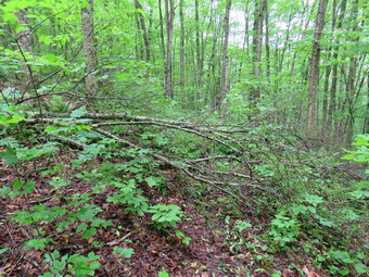
![]()
![]()
![]()
![]()
![]() On Saturday, June 2nd I wanted to celebrate National Trails Day by doing some trail maintenance, being a trail angel and hiking. When I got up, the temperature was in the mid 60's but the humidity was very high. The forecast called for some showers throughout the day but I decided to go an get as much work and hiking as I could. After finishing some trail work at Alder Lake, Sheila and I got in the car and I drove back down Alder Creek Road to the Beaverkill Road. I turned right and drove back to the four corners in Lew Beach. I turned right on Mary Smith Hill Road and drove up the paved road until it turned to dirt and gravel. I continued to drive carefully until I reached the point where the Mary Smith Hill Trail crosses the road. I pulled into the small lot on the right at noon. My main task was to drop off several gallons of water for a group of hikers headed west to east on a section of the Finger Lakes Trail. I had purchased the water at Peck's Market earlier before heading to Alder Lake. The group would end up at the bivouac area where the trail crosses Mary Smith Hill Road. From their stay the night before at the Campbell Mountain Lean-to there are no water sources along the way. I decided I would hike to the top of Mary Smith Hill and maybe even to Holiday Brook Road. From what I could gather, I would probably meet the group somewhere along the way and hike back with them to my car. Looking at the skies was confusing since there was sun in one direction and dark clouds in another. I set my GPS and took my smaller saw with me just in case I needed to cut anything along the way. The temperature was now in the mid 70's but the humidity had to me almost 100%! We crossed the road and started out on the trail which begins and ascent rather quickly. Almost immediately we ran into a small tree down across the trail. I took a few quick pictures, cut the tree off the trail, took a few more shots and moved on. From the sign at the beginning of the trail the round trip to Holiday Brook Road would be 6.6 miles. The trail starts up an unnamed hill which is part of the Middle Mountain "range". In the first .45 miles the trail gains just less than 500 feet. As I had suspected the trail was very wet which made it very slippery. I was glad I had my poles. I stopped in several places to move trunks and branches off the trail. I was sweating no matter whether I was just hiking or clearing blowdowns and none of the sweat was evaporating to make me cooler. To make matters worse I had only brought one liter of water! The trail leveled briefly and we stopped at the Middle Mountain lookout. This was once a fairly open viewpoint offering nice views to the east and south. As with many of the lookouts it was grown in to limit what can be seen even on a clear day. On this day there wasn't much to see as the skies were overcast and there was a haze over the mountains!
On Saturday, June 2nd I wanted to celebrate National Trails Day by doing some trail maintenance, being a trail angel and hiking. When I got up, the temperature was in the mid 60's but the humidity was very high. The forecast called for some showers throughout the day but I decided to go an get as much work and hiking as I could. After finishing some trail work at Alder Lake, Sheila and I got in the car and I drove back down Alder Creek Road to the Beaverkill Road. I turned right and drove back to the four corners in Lew Beach. I turned right on Mary Smith Hill Road and drove up the paved road until it turned to dirt and gravel. I continued to drive carefully until I reached the point where the Mary Smith Hill Trail crosses the road. I pulled into the small lot on the right at noon. My main task was to drop off several gallons of water for a group of hikers headed west to east on a section of the Finger Lakes Trail. I had purchased the water at Peck's Market earlier before heading to Alder Lake. The group would end up at the bivouac area where the trail crosses Mary Smith Hill Road. From their stay the night before at the Campbell Mountain Lean-to there are no water sources along the way. I decided I would hike to the top of Mary Smith Hill and maybe even to Holiday Brook Road. From what I could gather, I would probably meet the group somewhere along the way and hike back with them to my car. Looking at the skies was confusing since there was sun in one direction and dark clouds in another. I set my GPS and took my smaller saw with me just in case I needed to cut anything along the way. The temperature was now in the mid 70's but the humidity had to me almost 100%! We crossed the road and started out on the trail which begins and ascent rather quickly. Almost immediately we ran into a small tree down across the trail. I took a few quick pictures, cut the tree off the trail, took a few more shots and moved on. From the sign at the beginning of the trail the round trip to Holiday Brook Road would be 6.6 miles. The trail starts up an unnamed hill which is part of the Middle Mountain "range". In the first .45 miles the trail gains just less than 500 feet. As I had suspected the trail was very wet which made it very slippery. I was glad I had my poles. I stopped in several places to move trunks and branches off the trail. I was sweating no matter whether I was just hiking or clearing blowdowns and none of the sweat was evaporating to make me cooler. To make matters worse I had only brought one liter of water! The trail leveled briefly and we stopped at the Middle Mountain lookout. This was once a fairly open viewpoint offering nice views to the east and south. As with many of the lookouts it was grown in to limit what can be seen even on a clear day. On this day there wasn't much to see as the skies were overcast and there was a haze over the mountains!
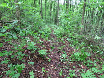 From the lookout the trail continued to rise to 2910 feet at .9 miles. This is the highest point on the hike and has more elevation than Mary Smith Hill! From this high point the trail descends about 240 feet over the next 1.0 miles. At this point there was another lookout through the trees to the south and west but this has grown in so much that I did not stop. The trail was very wet and muddy in spots and I began to see foot prints in the mud. It was hard to tell how new they were or what direction they were going. I kept expecting to hear voices ahead but either Sheila nor I could hear anything. I began to wonder if the group had traveled faster than expected and had already passed by Mary Smith Hill Road or if they had been delayed. There was no way to get in contact with them so I just kept hiking. After the viewpoint, the trail drops slightly before starting up Mary Smith Hill. The climb was not as steep as the one from the car up the first climb but I was beginning to tire in the heat. The top of the hill was only .25 miles and 120 vertical feet from the col. We then dropped down the other side and headed toward the turn around point on Holiday Brook Road. Sheila and I started down the hill to the road which I estimated was a little more than .5 miles. I knew the descent was steep and covered with wet and slippery leaves making speed...dangerous. I listened again for voices and did not hear any. I checked the skies which were growing darker and decided we would turn around in an effort to avoid getting drenched. I knew the descent back down to the car would be even more difficult if it rained! It was 1:55 PM when we turned around and we had hiked 2.4 miles. I hoped the return trip would go quicker without any stops for pictures or trail clearing. The woods were very green and pretty but also very wet. My shoes were soaked through but at least they were warm. We kept up a good pace up and down the small hills on the ridge passing both lookouts quickly. I kept my eyes on the skies which got darker and darker as we approached the final descent. I slipped and slid in several places and took one real fall on a steep gravel area. The last .4 miles averages over a 20% grade which I found harder descending than ascending! We did not stop on the way back and arrived at the car at 3:20 PM without getting wet! We had taken 3 hours and 20 minutes to covered the 4.8 miles with an elevation gain of 1170 feet. I left three gallons of water at the bivouac area hoping the hiking group would find it. A text message I sent was not delivered so I have to hope they are OK.
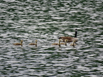
![]()
![]()
![]()
![]()
![]() On Saturday, June 2nd I wanted to celebrate National Trails Day by doing some trail maintenance, being a trail angel and hiking. When I got up, the temperature was in the mid 60's but the humidity was very high. The forecast called for some showers throughout the day but I decided to go an get as much work and hiking as I could. I took care of some work around the house and started to get dressed around 9:00 AM. Sheila was underfoot as she was eager to go and did not want me to forget her. I put on my Railriders pants that are a little heavy but stand up well to the trail work I do. I put on a short-sleeved baselayer and a long-sleeved crew top over it. This may be a little warm especially when working but I have found it offers a degree of protection I like. I wore my Keen Glarus boots knowing that I would soon have to find a replacement as Keen has discontented them! I took along a light rain jacket but knew I probably would not use it as I would rather get wet from rain rather than swelter in my own sweat while wearing a jacket. I left the house at about 9:30 AM with a very happy Sheila in the backseat. I had packed both my Silky Katanaboy and Sugowaza saws and brought along my Council Tools Velvicut felling axe. The Sugowaza is a 17" curved and fixed blade which fits in a scabbard. The Katana Boy is almost two feet long and is a folding saw with a nylon carrier. Both are remarkably sharp and can take care of some large tree trunks. I often carry a light Fiskars axe but bring the Velvicut or another full-sized axe when I don't have to carry it too far. I brought my poles hoping I would get in a hike after some trail work. My first stop was at Peck's Market to pick up three gallons of water for some hikers doing a west to east hike along the Finger Lakes Trail. They would end up at the bivouac area where the trail crosses Mary Smith Hill Road. From their stay the night before at the Campbell Mountain Lean-to there are no water sources along the way. After buying water, I headed out Old Rt 17 toward Roscoe and turned right or north on the Beaverkill Road to head toward Alder Lake where I wanted to check out a tree that had come down across one of the bridges. At the intersection with the Barkaboom Road I stayed to the right on Beaverkill Road until we came to the left turn for Alder Creek Road. After turning left, I drove to the end of Alder Creek Road and turned right to pass through the gate to Alder Lake. There were quite a few cars in the lot and I suspected many had been there overnight as Alder Lake is a popular camping spot. I set my GPS and got my tools ready to go. I put Sheila on her leash and we walked out the driveway to the lake. I noticed that the portable toilet that the DEC had placed at the entrance did not have a handle to lock the door. I sometimes wonder who is in charge and why they allow things like this to slip by. As we walked down the lawn toward the lake I noticed a family of geese swimming on the lake. I put down my pack and got out my camera to take a few shots. The skies were completely overcast with a mist or fog in the air. After taking my pictures, I packed up and we started out on the trail along the western shore of the pond. Three young men approached but headed along the shore toward the dam. One complimented me on my axe and asked if it was a Grandfors Bruks. I told him I had left that one home and that he was the first person ever to notice the axe I was carrying. Sheila and I continued along the path. The bushes and weeds along the path definitely need trimming and I was getting wet from the dew and rain. The trail was a little muddy but not as wet as I though it might be. All along the path we could hear and see people at various campsites. There were also two boats on the lake with fishermen.
On Saturday, June 2nd I wanted to celebrate National Trails Day by doing some trail maintenance, being a trail angel and hiking. When I got up, the temperature was in the mid 60's but the humidity was very high. The forecast called for some showers throughout the day but I decided to go an get as much work and hiking as I could. I took care of some work around the house and started to get dressed around 9:00 AM. Sheila was underfoot as she was eager to go and did not want me to forget her. I put on my Railriders pants that are a little heavy but stand up well to the trail work I do. I put on a short-sleeved baselayer and a long-sleeved crew top over it. This may be a little warm especially when working but I have found it offers a degree of protection I like. I wore my Keen Glarus boots knowing that I would soon have to find a replacement as Keen has discontented them! I took along a light rain jacket but knew I probably would not use it as I would rather get wet from rain rather than swelter in my own sweat while wearing a jacket. I left the house at about 9:30 AM with a very happy Sheila in the backseat. I had packed both my Silky Katanaboy and Sugowaza saws and brought along my Council Tools Velvicut felling axe. The Sugowaza is a 17" curved and fixed blade which fits in a scabbard. The Katana Boy is almost two feet long and is a folding saw with a nylon carrier. Both are remarkably sharp and can take care of some large tree trunks. I often carry a light Fiskars axe but bring the Velvicut or another full-sized axe when I don't have to carry it too far. I brought my poles hoping I would get in a hike after some trail work. My first stop was at Peck's Market to pick up three gallons of water for some hikers doing a west to east hike along the Finger Lakes Trail. They would end up at the bivouac area where the trail crosses Mary Smith Hill Road. From their stay the night before at the Campbell Mountain Lean-to there are no water sources along the way. After buying water, I headed out Old Rt 17 toward Roscoe and turned right or north on the Beaverkill Road to head toward Alder Lake where I wanted to check out a tree that had come down across one of the bridges. At the intersection with the Barkaboom Road I stayed to the right on Beaverkill Road until we came to the left turn for Alder Creek Road. After turning left, I drove to the end of Alder Creek Road and turned right to pass through the gate to Alder Lake. There were quite a few cars in the lot and I suspected many had been there overnight as Alder Lake is a popular camping spot. I set my GPS and got my tools ready to go. I put Sheila on her leash and we walked out the driveway to the lake. I noticed that the portable toilet that the DEC had placed at the entrance did not have a handle to lock the door. I sometimes wonder who is in charge and why they allow things like this to slip by. As we walked down the lawn toward the lake I noticed a family of geese swimming on the lake. I put down my pack and got out my camera to take a few shots. The skies were completely overcast with a mist or fog in the air. After taking my pictures, I packed up and we started out on the trail along the western shore of the pond. Three young men approached but headed along the shore toward the dam. One complimented me on my axe and asked if it was a Grandfors Bruks. I told him I had left that one home and that he was the first person ever to notice the axe I was carrying. Sheila and I continued along the path. The bushes and weeds along the path definitely need trimming and I was getting wet from the dew and rain. The trail was a little muddy but not as wet as I though it might be. All along the path we could hear and see people at various campsites. There were also two boats on the lake with fishermen.
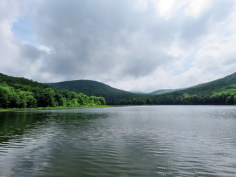 We were soon at the trail junction with the Millbrook Ridge Trail on the left. We stayed to the right on the loop trail and soon came to the bridge over Alder Creek. The bridge is relatively new with steel I-beam supports. A Large cherry tree had fallen perpendicular to the bridge breaking the railings on both sides and obstructing easy passage over the bridge. I put my pack down and took some pictures before assessing the work to be done. I had to admit that there were a lot of factors that pointed to waiting for a DEC crew to clear the mess. The trees was at least two feet in diameter on one end and the way it had fallen would make cutting it with an axe or hand saw difficult. I decided to try to cut a little if I could. The surface of the bridge was wet and very slippery adding to the difficulty. I got my axe and started to cut. The wood was easier to cut than I thought but this is the adage of a full-sized axe with a four pound bit! The problem was that it was difficult to get the right angles to make the cut wide enough. I decided to cut what I could with the axe and finish off with the Katanaboy. I kept working and soon had cut through the large branch which was about a foot in diameter. One end of the truck was still on the bridge and the rest was in the stream. I knew I would have to cut some of the branches if I was going to get it off the bridge. At this point Sheila alerted and I saw the AFR for Alder Lake approaching. I think he was surprised to see me working and we struck up a conversation. He told me Forester Ian Dunn had been told about the problem and was trying to schedule a crew to clean it up. I told him I was a volunteer who maintained trails which, I think, eased his mind. I told him I would try to clear what I had cut and then rely on the Dec to clean up the rest. I did not tell him that the DEC is often very slow to do this kind of work! I went down to the stream level and cut some branches and removed them from the stream. When I tried to move the large trunk, it was clear it would take more cutting or some more people! I decided that the bridge was passable and that the DEC crew might handle it expeditiously. I took some pictures and then packed up to move on. We continued over the bridge and around the loop trail on the east side of the lake. There were fewer campers on the east side. We did run across several large blowdown but hikers had already created walkarounds for these. As we approached the south end of the lake, we found that the bridge on the trail had been completely destroyed by a tree falling on it. This seemed to be old and I remembered that I had not been on this trail for some time. I thought that this was another example of the DEC failing to maintain the trails. We continued on the trail until it broke out into a filed at the south end of the lake near the dam. We stopped at the dam so that I could take some pictures. The skies were a little sunnier but it was still overcast. As we walked up the hill toward the parking area, I noticed at group gathered just in front of the remains of the Coykendall Mansion. The once beautiful mansion was burned by the state as it had fallen into disrepair. The group was from Morgan Outdoors and was a hike around Alder lake in honor of National Trails Day. Lisa Lyons, the owner, had arranged fro Heather Housekeeper to lead a hike to examine edible and medicinal plants in the area. Heather hiked the entire main Finger Lakes Trail and all the branch trails in one continuous trip. I listened to the discussion and said "Hello" to Lisa as the group started out around the lake. Sheila and I walked back to the car to get ready for the next part of our day.
![]() On Wednesday, May 30th I wanted to go to Big Pond and do some trail maintenance on the Touch-Me-Not Trail that leads over the mountain toward Little Pond. I maintain this trail from Big Pond over Touch-Me-Not and Cabot mountains to Beech Hill Road for the Finger Lakes Trail Conference. I left Livingston Manor a little before 9:00 AM and headed up the Beaverkill Road with an excited Sheila in the back seat. The temperature was pushing toward 70 degrees and the humidity was high. I wore a lighter long-sleeved top with a short-sleeved baselayer. I chose a pair of Railrider pants which are well-constructed and tough. I wore my Keen Glarus boots knowing that I would soon have to find a replacement as Keen has discontented them! I had packed both my Silky Katanaboy and Sugowaza saws and brought along my Fiskars light axe. The Sugowaza is a 17" curved and fixed blade which fits in a scabbard. The Katana Boy is almost two feet long and is a folding saw with a nylon carrier. Both are remarkably sharp and can take care of some large tree trunks. I chose a Fiskars axe with a composite handle and rather small head. It is light an easy to carry for many miles. It also lives up to the "hype" as it is easy to keep sharp and cut well despite its small head. If I know I will be working close to a trailhead I may take my Council Tools felling axe that weighs in excess of 5 lbs! I also brought along two plastic wedges to help when a saw binds. We arrived in the parking area by Big Pond at 9:15 AM and got started almost immediately. The temperature was in the low 70's with a higher than normal humidity. I noticed that there were low clouds or fog hanging over Big Pond. There were no other cars parked in the lot as I set my electronics and headed across the road to get on the red Touch-Me-Not Trail. The trail starts with a nice little ascent to get the heart pumping and then levels off some. The trails were quite wet from the rain the day before making the leaves slippery and leaving patches of mud. There were a few small branches in the trail which I brushed aside with my poles. We stopped at one of the larger small trees across the trail which I had been unable to move off the trail on a previous visit. I took a few quick before pictures and then got to work. It didn't take very long to cut the soft wood in two places with the axe. I pulled both pieces off the trail and took a few shots before continuing on the trail. I continued to remove a few branches here and there but knew I wanted to get to a particular set of trunks blocking the trail. On the way up the steeper sections of the climb the mud became quite annoying but we made it without a problem. There were a few places where trees were hanging over the trail but they were too big for me to tackle and most had been there for some time. Over the first mile we gained 770 feet to the shoulder of Touch-Me-Not Mountain. There were several large blowdowns that were old and laying on the ground. I had asked that the Finger Lakes Trail conference to send someone to help remove them with a chainsaw but that had not happened despite several specific requests. I made a note to reiterate those requests and to speak to the NYNJTC and the DEC forester to see if someone could get the job done!
On Wednesday, May 30th I wanted to go to Big Pond and do some trail maintenance on the Touch-Me-Not Trail that leads over the mountain toward Little Pond. I maintain this trail from Big Pond over Touch-Me-Not and Cabot mountains to Beech Hill Road for the Finger Lakes Trail Conference. I left Livingston Manor a little before 9:00 AM and headed up the Beaverkill Road with an excited Sheila in the back seat. The temperature was pushing toward 70 degrees and the humidity was high. I wore a lighter long-sleeved top with a short-sleeved baselayer. I chose a pair of Railrider pants which are well-constructed and tough. I wore my Keen Glarus boots knowing that I would soon have to find a replacement as Keen has discontented them! I had packed both my Silky Katanaboy and Sugowaza saws and brought along my Fiskars light axe. The Sugowaza is a 17" curved and fixed blade which fits in a scabbard. The Katana Boy is almost two feet long and is a folding saw with a nylon carrier. Both are remarkably sharp and can take care of some large tree trunks. I chose a Fiskars axe with a composite handle and rather small head. It is light an easy to carry for many miles. It also lives up to the "hype" as it is easy to keep sharp and cut well despite its small head. If I know I will be working close to a trailhead I may take my Council Tools felling axe that weighs in excess of 5 lbs! I also brought along two plastic wedges to help when a saw binds. We arrived in the parking area by Big Pond at 9:15 AM and got started almost immediately. The temperature was in the low 70's with a higher than normal humidity. I noticed that there were low clouds or fog hanging over Big Pond. There were no other cars parked in the lot as I set my electronics and headed across the road to get on the red Touch-Me-Not Trail. The trail starts with a nice little ascent to get the heart pumping and then levels off some. The trails were quite wet from the rain the day before making the leaves slippery and leaving patches of mud. There were a few small branches in the trail which I brushed aside with my poles. We stopped at one of the larger small trees across the trail which I had been unable to move off the trail on a previous visit. I took a few quick before pictures and then got to work. It didn't take very long to cut the soft wood in two places with the axe. I pulled both pieces off the trail and took a few shots before continuing on the trail. I continued to remove a few branches here and there but knew I wanted to get to a particular set of trunks blocking the trail. On the way up the steeper sections of the climb the mud became quite annoying but we made it without a problem. There were a few places where trees were hanging over the trail but they were too big for me to tackle and most had been there for some time. Over the first mile we gained 770 feet to the shoulder of Touch-Me-Not Mountain. There were several large blowdowns that were old and laying on the ground. I had asked that the Finger Lakes Trail conference to send someone to help remove them with a chainsaw but that had not happened despite several specific requests. I made a note to reiterate those requests and to speak to the NYNJTC and the DEC forester to see if someone could get the job done!
 At 1.1 miles we came to the spot where the trail was effectively block by some trunks. As I assessed them it was clear the lower one was a bit large to clear by myself. I decided I could cut the upper one out of the way which would make it easier for hikers to pass. I put down my pack and took some pictures before I got started. Because the upper trunk was pretty far up in the air, I decided to use the Katanaboy to cut it. I cut the top on one side and almost got the saw stuck as I finished the cut. I dragged that piece off the trail and noticed that Sheila was alert. I didn't see or hear anyone so I went back to work. I began to cut the other end of the trunk which was considerably larger. I had to take a few breaks as the heat and humidity were taking their toll. Sheila became more agitated as a couple hiking approached us. I put Sheila on her leash and got her off the trail. The couple asked if I was a trail maintainer and I answered in the affirmative. They thanked me and said they were headed for Cabot Mountain. As they continued on the trail I got back to work. I cut through the trunk and managed to wrestle it off the trail. I turned my attention to the larger trunk which was nearly two feet in diameter. I knew I could cut it with the saw and axe but didn't know if I could on this day. As I started to cut with the saw, I knew that this would not be the day I would conquer this log! I decided that I would score and flatten the top by hewing it. This would make a better surface for those going over the trunk. I use the saw to make several cuts perpendicular to the trunk. I then used the axe to hew the top of the log. I was surprised that the small Fiskars axe did so well at this job. I worked for 20 minutes until I thought I had done a good enough job. I intend to return with more energy and a partner or two top complete the job! I took some pictures of the work and the decided I had done enough for the day. I packed up and we started the walk back to the car. I was surprised how tired I was but I attributed it to my being out of shape and the high heat and humidity. We were back at the car at 11:55 AM having spent 2 hours and 35 minutes hiking 2.4 miles and working on the trail. The time was almost evenly split between walking and working. The elevation gain was 750 feet.
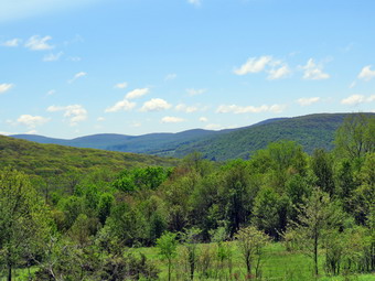
![]()
![]()
![]()
![]()
![]() On Wednesday, May 23rd I wanted to get in a local hike and decided to check out the TouchMeNot Trail which I maintain for the Finger Lakes Trail. I had thought about other options including Trout Pond but wanted to examine the trail to determine the work that might be needed to get it ready for the hiking season. I wanted to start at Big Pond and walk a loop returning on the Little Pond Trail and the roads. I left Livingston Manor a little after 9:30 AM and headed up the Beaverkill Road with an excited Sheila in the back seat. Even though the temperature was pushing toward 60 degrees I chose to wear my Mammut hoody since it was lots of zippers to dump heat and extra pockets. I did wear a lighter long-sleeved top with a short-sleeved baselayer. I wore a pair of Railrider pants which are well-constructed and tough. We arrived in the parking area by Big Pond at 10:05 AM and got started almost immediately. The temperature was 57 degrees and I noticed that there were low clouds or fog hanging over Big Pond. I got out the camera and took some pictures. There were no other cars parked in the lot as I set my electronics and headed across the road to get on the red Touch-Me-Not Trail to hike over the hill toward little Pond and Cabot Mt. The trail starts with a nice little ascent to get the heart pumping and then levels off some. The trails were quite wet from the rain the day before making the leaves slippery and leaving patches of mud. There were a few small branches in the trail which I brushed aside with my poles and several large ones that I was able to drag out of the way. There were also a few larger trunks that were broken making it easier for me to move them to the side of the trail. On the way up the steeper sections of the climb the mud became quite annoying but we made it without a problem. There were a few places where trees were hanging over the trail but they were too big for me to tackle and most had been there for some time. Over the first mile we gained 770 feet to the shoulder of Touch-Me-Not Mountain. There was one spot where the trail was effectively block by some trunks but it looked as if I could clear them with hand tools. There were several large blowdowns that were old and laying on the ground. I had asked that the Finger Lakes Trail conference to send someone to help remove them with a chainsaw but that had not happened despite several specific requests. I made a note to reiterate those requests and to speak to the NYNJTC and the DEC forester to see if someone could get the job done! As we approached the junction with e blue Campground Trail we came to a tree that had split three ways. One large trunk lay across the trail while another hung over the trail. I noticed that hikers had begun to hike around this mess and thought about rerouting the trail slightly the next time I was in the area. We continued to the junction with blue Campground Trail where we kept to the right on the Touch-Me-Not Trail and continued our descent. We ran across several large trees across the trail but they were old and had been there for some time. There were a few other rotten trunks that had fallen into the trail and I took the time to move tem and clean up the area. As we approached the trail junction Sheila alerted and I put her on her leash even though I did not see or hear anything. After a few minutes, I could see THREE dogs headed our way with no owner in sight. They came right for us and the young lady who was there owner came running behind. At least one of the dogs got into an argument with Sheila and I had to encourage it to leave with my poles. The young lady tried to explain why they were off their leashes but I was a little too annoyed to listen!
On Wednesday, May 23rd I wanted to get in a local hike and decided to check out the TouchMeNot Trail which I maintain for the Finger Lakes Trail. I had thought about other options including Trout Pond but wanted to examine the trail to determine the work that might be needed to get it ready for the hiking season. I wanted to start at Big Pond and walk a loop returning on the Little Pond Trail and the roads. I left Livingston Manor a little after 9:30 AM and headed up the Beaverkill Road with an excited Sheila in the back seat. Even though the temperature was pushing toward 60 degrees I chose to wear my Mammut hoody since it was lots of zippers to dump heat and extra pockets. I did wear a lighter long-sleeved top with a short-sleeved baselayer. I wore a pair of Railrider pants which are well-constructed and tough. We arrived in the parking area by Big Pond at 10:05 AM and got started almost immediately. The temperature was 57 degrees and I noticed that there were low clouds or fog hanging over Big Pond. I got out the camera and took some pictures. There were no other cars parked in the lot as I set my electronics and headed across the road to get on the red Touch-Me-Not Trail to hike over the hill toward little Pond and Cabot Mt. The trail starts with a nice little ascent to get the heart pumping and then levels off some. The trails were quite wet from the rain the day before making the leaves slippery and leaving patches of mud. There were a few small branches in the trail which I brushed aside with my poles and several large ones that I was able to drag out of the way. There were also a few larger trunks that were broken making it easier for me to move them to the side of the trail. On the way up the steeper sections of the climb the mud became quite annoying but we made it without a problem. There were a few places where trees were hanging over the trail but they were too big for me to tackle and most had been there for some time. Over the first mile we gained 770 feet to the shoulder of Touch-Me-Not Mountain. There was one spot where the trail was effectively block by some trunks but it looked as if I could clear them with hand tools. There were several large blowdowns that were old and laying on the ground. I had asked that the Finger Lakes Trail conference to send someone to help remove them with a chainsaw but that had not happened despite several specific requests. I made a note to reiterate those requests and to speak to the NYNJTC and the DEC forester to see if someone could get the job done! As we approached the junction with e blue Campground Trail we came to a tree that had split three ways. One large trunk lay across the trail while another hung over the trail. I noticed that hikers had begun to hike around this mess and thought about rerouting the trail slightly the next time I was in the area. We continued to the junction with blue Campground Trail where we kept to the right on the Touch-Me-Not Trail and continued our descent. We ran across several large trees across the trail but they were old and had been there for some time. There were a few other rotten trunks that had fallen into the trail and I took the time to move tem and clean up the area. As we approached the trail junction Sheila alerted and I put her on her leash even though I did not see or hear anything. After a few minutes, I could see THREE dogs headed our way with no owner in sight. They came right for us and the young lady who was there owner came running behind. At least one of the dogs got into an argument with Sheila and I had to encourage it to leave with my poles. The young lady tried to explain why they were off their leashes but I was a little too annoyed to listen!
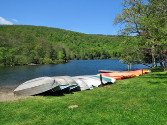 After about 1.6 miles we arrived at the junction with the yellow Little Pond Trail on the left. I decided to make the left and hike a loop back to Big Pond as I did not feel that I had the time to ascend and descend Cabot. We turned left on the Little Pond Trail to start the loop back. Once we got to Little Pond we could follow the campground access road and Barkaboom Road back to the car. There were a couple of trees across the trail and quite a few branches but I decided not to do much work as this was someone else's responsibility. We continued hiking and were soon in the field on the Little Pond Trail that acts as a nice lookout over the valley below. I stopped to take a few pictures of the scenery as the sky was now clear with a few clouds. The leaves were green but there were also some yellow and red hues. Unfortunately, the area is beginning to grow up and the smaller trees and brush are beginning to obscure the view. After the field, we continued along the woods road passing a foundation on the left. The tiger lilies were growing but had not put up and spikes to flower yet. A little further along, we walked off the main trail to the right to a small pond. This pond was once very seasonal but now seems to have some water in it mall year. I took some pictures before returning to the main trail. The trail was wet as the out let from the pond crossed it. After a short walk, we turned left onto the trail that would take us down to Little Pond. The trail was very wet in most places requiring small detours to stay out of the mud. Along the way we came to what was once a beaver meadow but now has been transformed back into a beaver pond. I stopped to take a few shots and then continued on the trail. I did not see any freshly cut sticks and there was no lodge in the small pond that had formed behind the dam. I did take a few picture of the dam which has grown rather large. We continued down to the loop trail and turned left to start toward the gatehouse. We crossed a bridge and continued around Little Pond stopping at the "deck" so that I could take some pictures. As we neared the bathhouses, I put Sheila on her leash. Row boats, canoes and kayaks were lined up on the beach and the ropes were out to delineate the swimming area. The first big day of the camping season is Memorial Day weekend. We walked to the bridge over the dam and I took a few more pictures of Little Pond with Cabot Mountain in the background. The water was high and freely flowing at the outlet under the bridge. I stowed my poles for the walk out passed the gatehouse and down the access road to Barkaboom Road. This downhill section went quickly and soon we turned left on Barkaboom Road to begin the .6 mile uphill hike back to the car. We were back at about 12:50 PM having spent 2 hours and 40 minutes hiking around 5.0 miles with some time for trail maintenance and photography! The elevation gain was a modest 1010 feet.
![]()
![]()
![]()
![]() On Friday, May 18th I wanted to get out on a hike after several days of storms and a bad cold. It was a little cooler than it had been with the temperature hovering in the low 60's as I began to get ready to head across the street to Round Top at 11:00 AM. I asked Cindy if she would like to go and she agreed. I needed the exercise but thought it would be a good opportunity to see how the high wins from Tuesday had effected the trails. Sheila seemed thrilled at the decision and couldn't wait to get going especially since we had not been out of the house since Monday. As I got dressed I decided to put on a long-sleeved crew top with no baselayer and a very light windbreaker. I put on a pair of RailRiders hiking pants instead of my Columbia Omniheat winter pants. These pants are expensive but last along time and have features like deep pockets and a generous cut which I really like. The pants have Velcro closures at the ankles which I hoped would mean I did not need gaiters. The ticks have been very numerous so far this season especially farther south. I decided to wear my Keen Glarus hiking boots which I had recently waterproofed as I knew the trails might be wet. Sheila would not leave my side as I was getting ready as she wanted to make sure she was going too! We stepped out onto the back porch and headed out the driveway at 11:00 AM. We crossed the street with Sheila on her leash and walked to the back of the church to begin the ascent of the steepest hill behind the church. The hill is short but really gets the circulation pumping and is the steepest and longest climb on the "trail". Sheila responds well to the command "Pull" and the Siberian husky in her makes her well-suited for the job. When we got to the top of the hill, we started out on the trail by turning left at the trailhead. I let Sheila off her leash and she bounded ahead of me following her nose. When we arrived at the area where a large blowdown had blocked the trail, I admired my work. I had cleared a large tree by myself using only hand tools! At the first trail junction we followed Sheila as she turned right and continued up the trail. It was really a pleasure to walk on the trails and I found it strange that there did not seem to be any major blowdown. We did spend quite a bit of time clearing sticks and small branches from the trail. On the way up this woods road I pointed out to Cindy the area where I had cleared one tree trunk that had fallen and had been hanging over the trail.
On Friday, May 18th I wanted to get out on a hike after several days of storms and a bad cold. It was a little cooler than it had been with the temperature hovering in the low 60's as I began to get ready to head across the street to Round Top at 11:00 AM. I asked Cindy if she would like to go and she agreed. I needed the exercise but thought it would be a good opportunity to see how the high wins from Tuesday had effected the trails. Sheila seemed thrilled at the decision and couldn't wait to get going especially since we had not been out of the house since Monday. As I got dressed I decided to put on a long-sleeved crew top with no baselayer and a very light windbreaker. I put on a pair of RailRiders hiking pants instead of my Columbia Omniheat winter pants. These pants are expensive but last along time and have features like deep pockets and a generous cut which I really like. The pants have Velcro closures at the ankles which I hoped would mean I did not need gaiters. The ticks have been very numerous so far this season especially farther south. I decided to wear my Keen Glarus hiking boots which I had recently waterproofed as I knew the trails might be wet. Sheila would not leave my side as I was getting ready as she wanted to make sure she was going too! We stepped out onto the back porch and headed out the driveway at 11:00 AM. We crossed the street with Sheila on her leash and walked to the back of the church to begin the ascent of the steepest hill behind the church. The hill is short but really gets the circulation pumping and is the steepest and longest climb on the "trail". Sheila responds well to the command "Pull" and the Siberian husky in her makes her well-suited for the job. When we got to the top of the hill, we started out on the trail by turning left at the trailhead. I let Sheila off her leash and she bounded ahead of me following her nose. When we arrived at the area where a large blowdown had blocked the trail, I admired my work. I had cleared a large tree by myself using only hand tools! At the first trail junction we followed Sheila as she turned right and continued up the trail. It was really a pleasure to walk on the trails and I found it strange that there did not seem to be any major blowdown. We did spend quite a bit of time clearing sticks and small branches from the trail. On the way up this woods road I pointed out to Cindy the area where I had cleared one tree trunk that had fallen and had been hanging over the trail.
We followed the blazes for the yellow trail up to the trail junction. We turned left at the trail junction and followed the yellow trail along the base of Round Top. The trail was pretty open as I had done some maintenance to remove the blowdowns from the winter storms. At the next trail junction, we turned right on the blue trail and headed up the steepest hill to the summit of Round Top. On the summit we followed the trail over the top and then down the other side. This part went quickly. At the yellow trail we turned right and then left at the next trail junction to head down to the lookout. At the lookout we turned left and descended the hill to the first trail junction. I knew we had not hiked enough so we turned around and headed back up the hill to the lookout. We turned right at the top following the yellow trail on the long, gentle climb to the junction with the blue trail. We turned right and followed the yellow trail along the base of Round Top to the next junction. Here we turned left and followed the blue trail to the summit. We continued on the trail and once again we crossed the summit and started down the other side. We turned left on the yellow trail and then right at the next trail junction. It was enjoyable following the old woods road back down to the first trail junction. At the trail junction I suggested to Cindy that we do a short loop over the cliffs but she declined. We turned left and followed the trail back out to trailhead. At the trailhead we turned right and descended the hill. We walked across the field to the driveway and home. We had spent a little over an hour walking a little more than 2 miles. The walk was just what I needed to get out of the house!
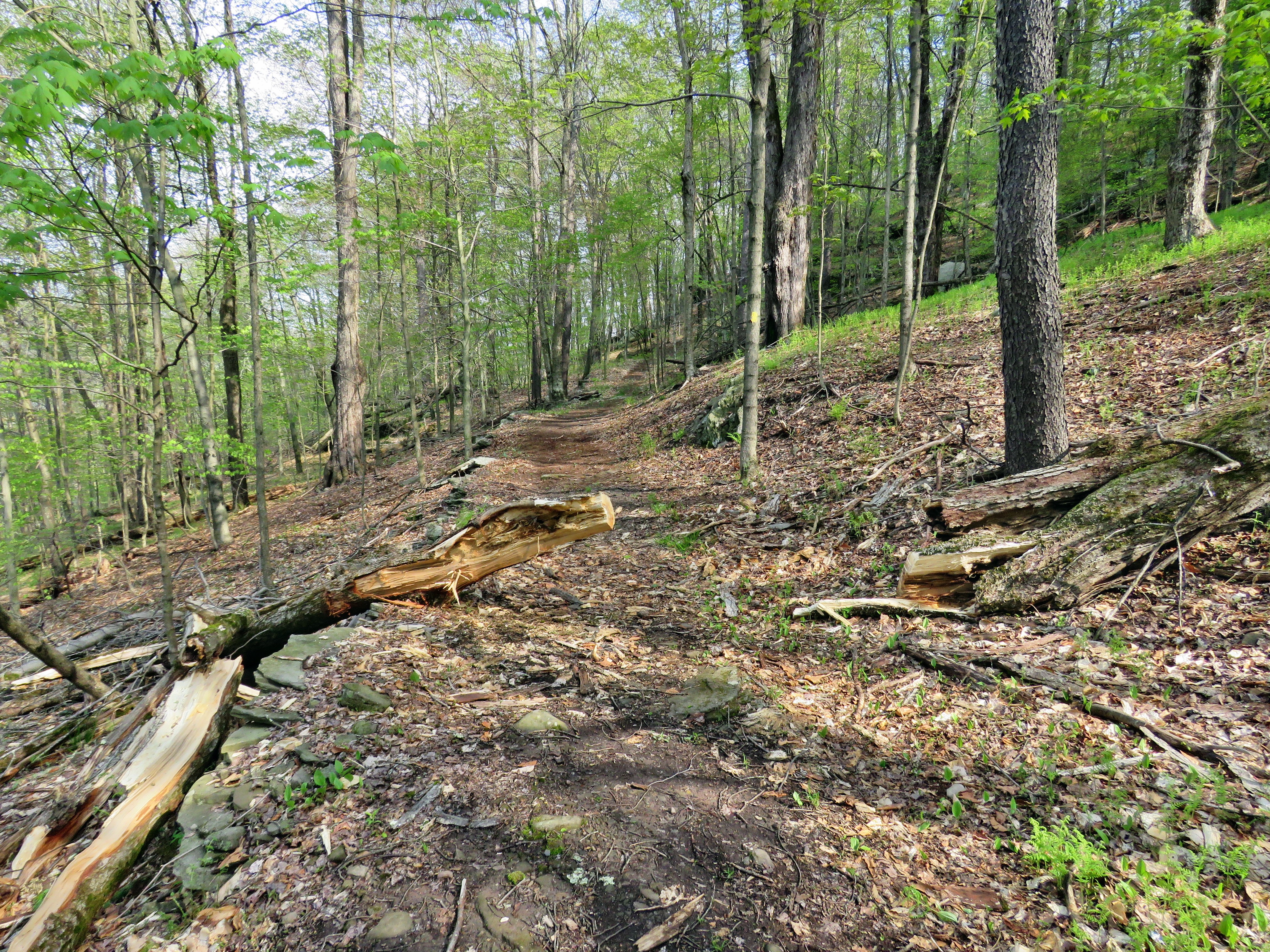
![]() On Tuesday, May 15th I wanted to go over to Round Top and do some trail work based on what I had seen the day before. There wasn't much work to do but I like to keep the trail as clear as possible. I got up early but had a few things to take care of before venturing out. I started to get dressed just before 9:00 AM when the temperature was in the mid 60's with plenty of sun. The forecast was for thunderstorms in the afternoon so I wanted to get out and get the work done. Sheila was thrilled at the decision and couldn't wait to get going. As I got dressed I decided to put on a long-sleeved crew top without a baselayer and a very light windbreaker. I put on a pair of RailRiders hiking pants. These are expensive but last along time and have features like deep pockets and a generous cut which I really like. I decided to wear my Keen Glarus hiking boots which I had recently waterproofed as I knew the trails might be wet. The pants have Velcro closures at the ankles which I hoped would mean I did not need gaiters. The ticks have been very numerous so far this season especially farther south. I brought my pack as I like to take pictures of the work. I packed both my Silky Katanaboy and Sugowaza saws and brought along my Council Tools Velvicut felling axe. The Sugowaza is a 17" curved and fixed blade which fits in a scabbard. The Katana Boy is almost two feet long and is a folding saw with a nylon carrier. Both are remarkably sharp and can take care of some large tree trunks. I often carry a light Fiskars axe but bring the Velvicut or another full-sized axe when I don't have to carry it too far. I left my poles home as I did not intend to hike much. I stepped out onto the back porch and headed out the driveway at 9:10 AM. We crossed the street with Sheila on her leash and walked to the back of the church to begin the ascent of the steepest hill behind the church. The hill is short but really gets the circulation pumping and is the steepest and longest climb on the "trail". Sheila responds well to the command "Pull" and the Siberian husky in her makes her well-suited for the job. When we got to the top of the hill, we started out on the trail by turning left at the trailhead. I let Sheila off her leash and she bounded ahead of me following her nose. When we arrived at the area where a large blowdown had blocked the trail, I admired my work. I put down my pack and got out the camera to take pictures of a trunk that was till protruding into the trail. I grabbed my axe and walked over to begin on the tree. My intent was to cut part way through with the axe and finish with a saw. I cleared away some brush and started in. The Velvicut is very different from the Fiskars as it has a longer handle and a bit that weighs almost twice as much. I have it sharpened to a razor's edge. I began the cut making sure to start at least as wide as the diameter of the trunk. The axe bit deeply with each stroke and I decided to cut all the way through with it and skip the saw. As always, my initial cut was a little narrow and my angle a little too steep but it didn't take long to cut all the way through the log. Fortunately, although the log was large, it was balanced on the edge of a dropoff and I was able to easily tip it up and off the trail. I took a few "after" pictures and then packed up to continue.
On Tuesday, May 15th I wanted to go over to Round Top and do some trail work based on what I had seen the day before. There wasn't much work to do but I like to keep the trail as clear as possible. I got up early but had a few things to take care of before venturing out. I started to get dressed just before 9:00 AM when the temperature was in the mid 60's with plenty of sun. The forecast was for thunderstorms in the afternoon so I wanted to get out and get the work done. Sheila was thrilled at the decision and couldn't wait to get going. As I got dressed I decided to put on a long-sleeved crew top without a baselayer and a very light windbreaker. I put on a pair of RailRiders hiking pants. These are expensive but last along time and have features like deep pockets and a generous cut which I really like. I decided to wear my Keen Glarus hiking boots which I had recently waterproofed as I knew the trails might be wet. The pants have Velcro closures at the ankles which I hoped would mean I did not need gaiters. The ticks have been very numerous so far this season especially farther south. I brought my pack as I like to take pictures of the work. I packed both my Silky Katanaboy and Sugowaza saws and brought along my Council Tools Velvicut felling axe. The Sugowaza is a 17" curved and fixed blade which fits in a scabbard. The Katana Boy is almost two feet long and is a folding saw with a nylon carrier. Both are remarkably sharp and can take care of some large tree trunks. I often carry a light Fiskars axe but bring the Velvicut or another full-sized axe when I don't have to carry it too far. I left my poles home as I did not intend to hike much. I stepped out onto the back porch and headed out the driveway at 9:10 AM. We crossed the street with Sheila on her leash and walked to the back of the church to begin the ascent of the steepest hill behind the church. The hill is short but really gets the circulation pumping and is the steepest and longest climb on the "trail". Sheila responds well to the command "Pull" and the Siberian husky in her makes her well-suited for the job. When we got to the top of the hill, we started out on the trail by turning left at the trailhead. I let Sheila off her leash and she bounded ahead of me following her nose. When we arrived at the area where a large blowdown had blocked the trail, I admired my work. I put down my pack and got out the camera to take pictures of a trunk that was till protruding into the trail. I grabbed my axe and walked over to begin on the tree. My intent was to cut part way through with the axe and finish with a saw. I cleared away some brush and started in. The Velvicut is very different from the Fiskars as it has a longer handle and a bit that weighs almost twice as much. I have it sharpened to a razor's edge. I began the cut making sure to start at least as wide as the diameter of the trunk. The axe bit deeply with each stroke and I decided to cut all the way through with it and skip the saw. As always, my initial cut was a little narrow and my angle a little too steep but it didn't take long to cut all the way through the log. Fortunately, although the log was large, it was balanced on the edge of a dropoff and I was able to easily tip it up and off the trail. I took a few "after" pictures and then packed up to continue.
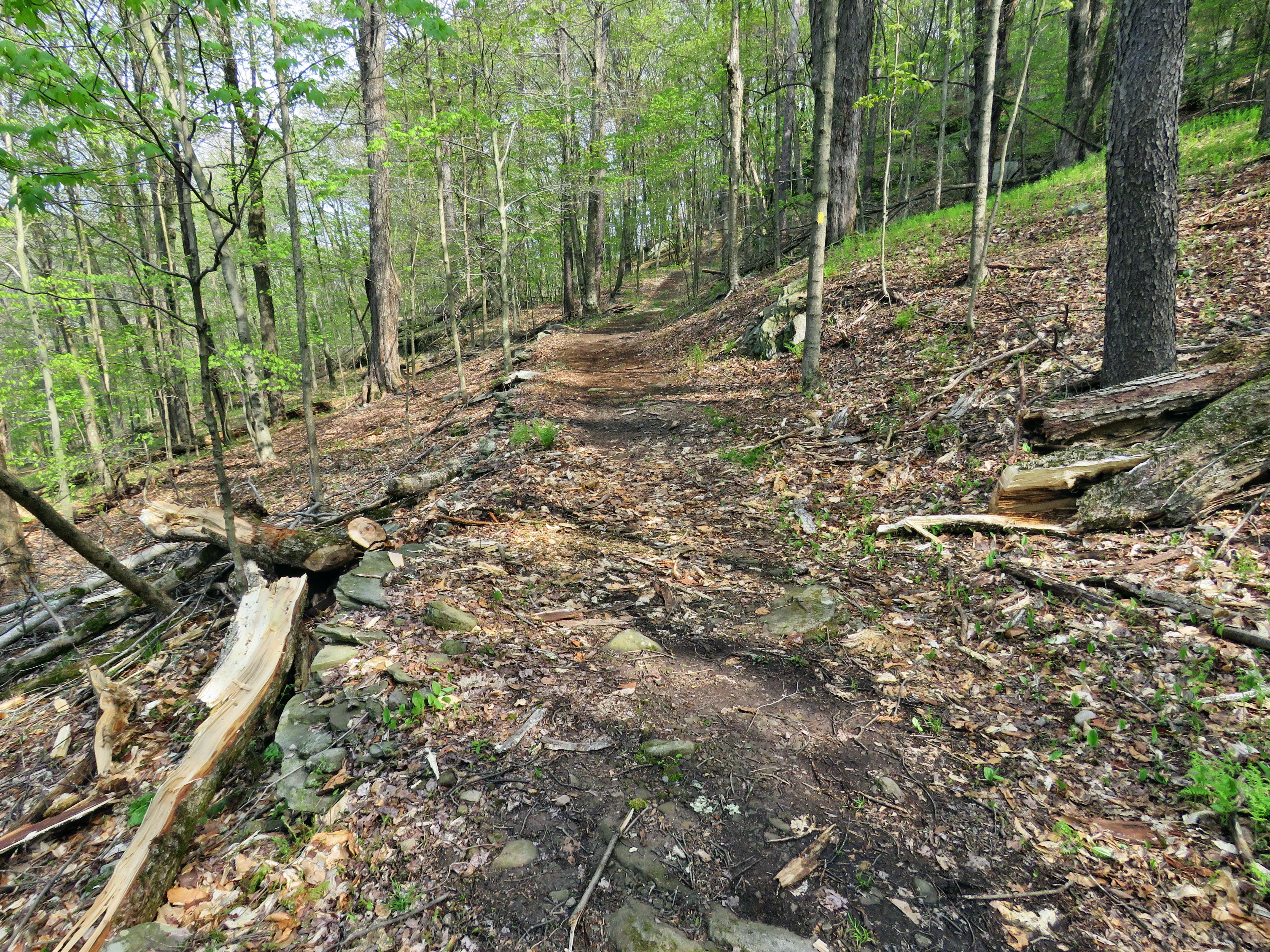 At the first trail junction we turned right and continued up the trail. It was really a pleasure to walk on the trails and it got me looking forward to more appropriate spring weather and to summer. As I walked, I removed a few loose branches that had blown down in the last wind. On the way up this woods road there was an area where one large branch or small trunk had fallen and caught in another tree. The branch was hanging over the trail. There were also two other small trunks hanging over the trail which I wanted to remove. I took a few pictures and then got out the Katanaboy to cut the overhead branch. This went very quickly and I was able to drag the piece I cut off the trail. I walked up the trail and cut a small tree that was bent over the trail. It only took a few strokes to get rid of it. There was one more tree that I had hoped to be able to drag off the trail but there was too much pressure holding it to the ground. I used the saw to cut the tree and as it separated one part brushed my right shoulder. This did not injure me but made me realize that it could have and that I have to be more careful especially when working alone. I dragged both parts off the trail and took some "after" pictures. I packed up and we headed up the trail. I followed the blazes for the yellow trail up to the trail junction. I stopped at the junction and got out a saw to remove a small tree just ahead on the blue trial. After cutting the tree, I dragged it off the trail and returned to my pack. I turned left at the trail junction and followed the yellow trail along the base of Round Top. The trail was pretty open as I had done some maintenance to remove the blowdowns. We stopped at one small tree across the trail which was too long to remove without cutting. I got out a saw and cut a few surrounding busses. I then cut the tree and dragged it off the trail. I cut a few more branches that were starting to encroach on the trail before packing up to continue. At the next trail junction, we turned left to stay on the yellow trail and down to the lookout. There were no other trees or branches to clear along the way. At the lookout we turned left and headed down the hill to the first trail junction. We had been out for about an hour and I was tired from doing all the clearing so I decided to walk out to the trailhead. At the trailhead I put Sheila or her leash and we turned right to descend the hill. We walked across the field to the driveway and home. We had spent a little over an hour walking and clearing the trail.
![]()
![]()
![]()
![]() On Monday, May 14th I wanted to get out on a hike but didn't have much time to spend. It was a little cooler than the previous days but at 9:00 AM it was in the low 60's. I had work to do around the house a did not decide to head out until after 11:00 Am when the temperature had risen into the mid 60's. I decided just to head across the street and hike on Round Top. Sheila seemed thrilled at the decision and couldn't wait to get going. As I got dressed I decided to put on a crew top over a short-sleeved baselayer and put on a very light windbreaker. I put on a pair of RailRiders hiking pants instead of my Columbia Omniheat winter pants. These pants are expensive but last along time and have features like deep pockets and a generous cut which I really like. I decided to wear my Keen Glarus hiking boots which I had recently waterproofed as I knew the trails might be wet. The pants have Velcro closures at the ankles which I hoped would mean I did not need gaiters. The ticks have been very numerous so far this season especially farther south. Sheila would not leave my side as I was getting ready as she wanted to make sure she was going too! I stepped out onto the back porch and headed out the driveway at 11:20 AM. We crossed the street with Sheila on her leash and walked to the back of the church to begin the ascent of the steepest hill behind the church. The hill is short but really gets the circulation pumping and is the steepest and longest climb on the "trail". Sheila responds well to the command "Pull" and the Siberian husky in her makes her well-suited for the job. When we got to the top of the hill, we started out on the trail by turning left at the trailhead. I let Sheila off her leash and she bounded ahead of me following her nose. When we arrived at the area where a large blowdown had blocked the trail, I admired my work but was bothered by the one trunk still protruding into the trail. It was easy enough to walk around this trunk but it still bothered me and I knew I would be getting rid of it soon. I had cleared a large tree by myself using only hand tools and would do the same for this one! At the first trail junction we turned right and continued up the trail. It was really a pleasure to walk on the trails and it got me looking forward to more appropriate spring weather and to summer. As I walked, I removed a few loose branches that had blown down in the last wind. On the way up this woods road there was an area where one large branch or small trunk had fallen and caught in another tree. The branch was hanging over the trail and I knew it would have to go. There were also two other small trunks hanging over the trail which would have to be cleared.
On Monday, May 14th I wanted to get out on a hike but didn't have much time to spend. It was a little cooler than the previous days but at 9:00 AM it was in the low 60's. I had work to do around the house a did not decide to head out until after 11:00 Am when the temperature had risen into the mid 60's. I decided just to head across the street and hike on Round Top. Sheila seemed thrilled at the decision and couldn't wait to get going. As I got dressed I decided to put on a crew top over a short-sleeved baselayer and put on a very light windbreaker. I put on a pair of RailRiders hiking pants instead of my Columbia Omniheat winter pants. These pants are expensive but last along time and have features like deep pockets and a generous cut which I really like. I decided to wear my Keen Glarus hiking boots which I had recently waterproofed as I knew the trails might be wet. The pants have Velcro closures at the ankles which I hoped would mean I did not need gaiters. The ticks have been very numerous so far this season especially farther south. Sheila would not leave my side as I was getting ready as she wanted to make sure she was going too! I stepped out onto the back porch and headed out the driveway at 11:20 AM. We crossed the street with Sheila on her leash and walked to the back of the church to begin the ascent of the steepest hill behind the church. The hill is short but really gets the circulation pumping and is the steepest and longest climb on the "trail". Sheila responds well to the command "Pull" and the Siberian husky in her makes her well-suited for the job. When we got to the top of the hill, we started out on the trail by turning left at the trailhead. I let Sheila off her leash and she bounded ahead of me following her nose. When we arrived at the area where a large blowdown had blocked the trail, I admired my work but was bothered by the one trunk still protruding into the trail. It was easy enough to walk around this trunk but it still bothered me and I knew I would be getting rid of it soon. I had cleared a large tree by myself using only hand tools and would do the same for this one! At the first trail junction we turned right and continued up the trail. It was really a pleasure to walk on the trails and it got me looking forward to more appropriate spring weather and to summer. As I walked, I removed a few loose branches that had blown down in the last wind. On the way up this woods road there was an area where one large branch or small trunk had fallen and caught in another tree. The branch was hanging over the trail and I knew it would have to go. There were also two other small trunks hanging over the trail which would have to be cleared.
I followed the blazes for the yellow trail up to the trail junction. I turned left at the trail junction and followed the yellow trail along the base of Round Top. The trail was pretty open as I had done some maintenance to remove the blowdowns. There was one small tree across the trail which was too long to remove. At the next trail junction, we turned right on the blue trail and headed up the steepest hill to the summit of Round Top. On the summit we followed the trail over the top and then down the other side. This part went quickly. At the yellow trail we turned right and then left at the next trail junction to head down to the lookout. At the lookout we turned left and descended the hill to the first trail junction. I knew we had not hiked enough so we turned around and headed back up the hill to the lookout. We turned right at the top following the yellow trail on the long, gentle climb to the junction with the blue trail. We turned right and followed the yellow trail along the base of Round Top to the next junction. Here we turned left and followed the blue trail to the summit. At the beginning of the blue trail was another small tree which was too long to drag off the trail. We continued on the trail and once again we crossed the summit and started down the other side. On the steep descent to the yellow trail I had to watch my footing as the leaves were wet. We turned left on the yellow trail and then right at the next trail junction. It was enjoyable following the old woods road back down toward the first trail junction. When we came to the path I had made up from the trailhead to avoid the blowdown, Sheila automatically turned left even though the trail was not very distinct. I called her back and we continued on to the trail junction. We turned left and followed the trail back out to trailhead. At the trailhead we turned right and descended the hill. We walked across the field to the driveway and home. We had spent a little over an hour walking a little more than 2 miles. The walk was a good workout even though I feel I could do it blindfolded!
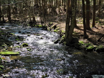
![]()
![]()
![]()
![]()
![]() On Tuesday, May 8th, I wanted to get in a hike close to home but wanted to get away from going across the street to Round Top. I also wanted to get in at least 6 miles and, preferably, do something I had not done before. My plan was to park at Frick Pond and then hike the roads to Mongaup Pond. From there I would take the park roads to the snowmobile trail which goes over the mountain to the junction with the Flynn and Big Rock Trails. From here I could return on the Flynn Trail or use the Big Rock Trail to get to Frick Pond. The temperature at 10:30 AM was already in the high 50's so I knew I would not have to dress too warmly. I decided just to put on a crew top over a short-sleeved baselayer and put on a very light windbreaker. I put on a pair of RailRiders hiking pants instead of my Columbia Omniheat winter pants. These pants are expensive but last along time and have features like deep pockets and a generous cut which I really like. I decided to wear my Keen Glarus hiking boots which I had recently waterproofed as I knew the trails might be wet. The pants have Velcro closures at the ankles which I hoped would mean I did not need gaiters. The ticks have been very numerous so far this season especially farther south. Sheila was crazed as usual since we had not been out in several days. We left Livingston Manor just before 10:00 AM to head out the Debruce Road. At six miles I turned left onto Mongaup Pond Road and where the road split I stayed left on Beech Mountain Road. The Town of Rockland was working at the intersection to improve the drainage in the ditches. I parked in the small lot which was empty. There was one car in the bigger lot. I was concerned about bugs and there were a few as we got ready to hike. I decided to wait to apply repellant as I prefer not to use it if it is not needed. I set my electronics, put Sheila on her leash and started back down Beech Mountain Road at 10:10 AM. The walk down the hill went quickly and Sheila behaved herself at the intersection where we turned left on the road to Mongaup Pond. The walk is mostly uphill and parallels the outlet stream from the pond. At one point the sunlight reflecting off the water caught my eye. I stopped to take a few pictures of the stream before continuing on to the park.
On Tuesday, May 8th, I wanted to get in a hike close to home but wanted to get away from going across the street to Round Top. I also wanted to get in at least 6 miles and, preferably, do something I had not done before. My plan was to park at Frick Pond and then hike the roads to Mongaup Pond. From there I would take the park roads to the snowmobile trail which goes over the mountain to the junction with the Flynn and Big Rock Trails. From here I could return on the Flynn Trail or use the Big Rock Trail to get to Frick Pond. The temperature at 10:30 AM was already in the high 50's so I knew I would not have to dress too warmly. I decided just to put on a crew top over a short-sleeved baselayer and put on a very light windbreaker. I put on a pair of RailRiders hiking pants instead of my Columbia Omniheat winter pants. These pants are expensive but last along time and have features like deep pockets and a generous cut which I really like. I decided to wear my Keen Glarus hiking boots which I had recently waterproofed as I knew the trails might be wet. The pants have Velcro closures at the ankles which I hoped would mean I did not need gaiters. The ticks have been very numerous so far this season especially farther south. Sheila was crazed as usual since we had not been out in several days. We left Livingston Manor just before 10:00 AM to head out the Debruce Road. At six miles I turned left onto Mongaup Pond Road and where the road split I stayed left on Beech Mountain Road. The Town of Rockland was working at the intersection to improve the drainage in the ditches. I parked in the small lot which was empty. There was one car in the bigger lot. I was concerned about bugs and there were a few as we got ready to hike. I decided to wait to apply repellant as I prefer not to use it if it is not needed. I set my electronics, put Sheila on her leash and started back down Beech Mountain Road at 10:10 AM. The walk down the hill went quickly and Sheila behaved herself at the intersection where we turned left on the road to Mongaup Pond. The walk is mostly uphill and parallels the outlet stream from the pond. At one point the sunlight reflecting off the water caught my eye. I stopped to take a few pictures of the stream before continuing on to the park.
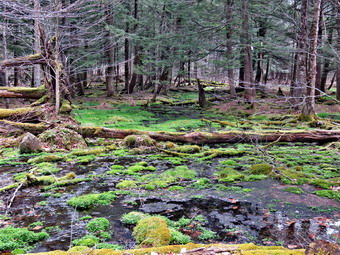 When we arrived at the park entrance, we walked through the entrance and stayed left to take the road on the west side of the pond. About a quarter mile from the entrance, 1.7 miles into the hike, we came to the observation deck on the right. We had walked about 1.6 miles in just over 30 minutes for a speed of around 3 mph! I let Sheila off her leash and walked out onto the deck to take pictures. This was one of the first days in a long time where the sky was blue and filled with white billowing clouds. The rest of the pond wasn't very interesting but I took quite a few pictures of the sky. As we were about to leave a truck appeared and I put Sheila back on her leash. The gate to the rest of the park was still closed so we walked around it. In a few minutes there was another nice place to take pictures on the pond. I walk over to a bench, released Sheila and took out my camera. The pictures from this viewpoint were much the same as the ones from the deck with a slightly different angle. The predominant feature of these shots were the clouds in the blue sky. After taking the pictures, I got a drink and then packed up to continue the hike. A few hundred feet up the road we turned left onto an access road and then quickly left again onto the snowmobile trail. I had walked this loop before but always in the opposite direction so I was anxious to see what it was like to walk uphill. The trail in this area passes by a swampy area and it was very wet and very green. I again stopped to take a few pictures. As we continued I found the problem was that the trail seemed to be part of the swamp which made travel a little difficult. Sheila didn't mind at all and I was able to walk on one side of the trail or other until we were through the area. At 2.7 miles the trail began to head northwest instead of north and the climb began. I looked down to see the first trout lilies of the year for me so I had to stop on take a few shots. The sun was out and the air was warm. The woods were beautiful and green with many spots covered in flowers. I almost didn't notice the fact that the hike was all uphill. At 3.3 miles the trail made a sharp turn and started heading south but continued to climb. Another turn at 3.7 miles sent us eastward toward the Flynn Trail. At 4.1 miles the trail turned north continuing its meanders. At 4.5 miles two things happened as the trail turned east again and we finally came to the high point on the hike. It was noon and we had ascended over 700 feet over 1.8 miles averaging over 2 mph! I was glad to continue over the top and down to the junction with the Flynn and Big Rock Trails. I now had to choose between the quicker trip back by the Flynn Trail or the longer but more scenic route down the Big Rock Trail and around Frick Pond. I decided on the later and Sheila and I continued straight through the junction and down the hill on the Big Rock Trail. My feet were feeling a little irritated on the descent but I ignored them and the situation never got too bad.
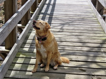 The trip down the Big Rock Trail did go quickly and seemed shorter than usual. In several places, where large trees had fallen across the trail the snowmobile club had completely removed them. There are three places where the trail drops quickly and then levels off. The last place brought us right to Times Square where the Logger's Loop and Big Rock Trail cross. This area is almost always wet and this day was no exception. We walked straight across Time Square to continue on the Big Rock Trail around the back of Frick Pond. This trail was wet in places but most people have chosen to follow the slight reroute on higher ground. When we came to the two bridges across the inlet stream, I did not notice anything too extraordinary so we kept going. The wooden walkways were dry but covered in small branches and pine needles. These walkways are in bad shape as the support underneath them continues to rot away. My concerns to the DEC have so far gone unanswered. Without these walkways the hike would be considerably less enjoyable! We arrived at the end of the Big Rock Trail at the Quick Lake trail where we turned left to head toward the bridge at the outlet of Frick Pond. The trail was damp with one area of water but otherwise was in good condition. Some lopping needs to be done but there is a workday for the Willowemoc Trail Crew scheduled for Saturday, May 19. When we arrived at the bridge, the scene was little different than the many times I have been there before but I decided to take pictures anyway. I dropped my pack, got out my camera and walked out onto the bridge to take shots of the pond, Flynn's Point and the beautiful white clouds. Sheila took a short dip on the water and then came up to the bridge for some pictures. It wasn't long before I stowed the camera and we head out the Quick Lake Trail to the car. The trail was wet as always but the water was shallow in most spots. Where the water was a little deeper on the trail, I walks around it. When we arrived at the register, I decided to turn right and walk out the Quick Lake Trail to the larger parking area. I had cleared this trail recently after the winter had littered it with blowdowns and branches. The trail was still clear as we walked up to the parking area and the car. The vehicle in the larger lot was gone but a car was parked in the smaller lot. It was 1:05 PM and we had spent 2 hours and 55 minutes hiking 7 miles with an elevation gain of 1035 feet. The bugs had not been bad enough to bug me. I was tired but felt I had accomplished a "real" hike.
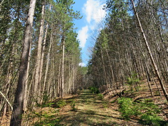
![]()
![]()
![]()
![]()
![]() On Saturday, May 5th I wanted to get away from Livingston Manor for a hike and Cindy and Sheila agreed. Of course, Sheila always agrees as long as we are going outside! I talked to Cindy the night before about Morgan Hill State Forest or Huntersfield Mountain but we did not make a decision. When I got up at 7:00 AM, the temperature was already in the mid 50's. I had wanted to get an early started but just wasn't motivated to get moving. The ambulance pager sounded and I called in and got ready to go. No one else had time to respond so I had to stand down which always puts me in a bad mood. I hoped hiking would help. I decided we would hike from the parking area just off Huntersfield Road and perhaps take a walk over to Ashland Pinnacle. I knew Cindy might not be prepared for a longer hike so I also thought about hiking a loop over Huntersfield which I had never done. The Long Path used to go over Huntersfield but has been rerouted to avoid a "dead end" that occurred when the Long Path came to some private property on one of the nearly mountains. I decided just to put on a crew top over a short-sleeved baselayer and put on a very light windbreaker. I put on a pair of RailRiders hiking pants instead of my Columbia Omniheat winter pants. These pants are expensive but last a.ong time and have features like deep pockets and s generous cut which I really like. I decided to wear my Keen Glarus hiking boots and a new pair of OR BugOut low gaiters. The ticks have been very numerous so far this season and I hoped going north would be better. We left Livingston Manor a little before 9:00 AM and headed toward Roscoe where we picked up Route 206 toward the Pepacton Reservoir. At the reservoir I turned right on Route 30 and headed toward Margaretville on the BWS roads. In Margaretville where I picked up Route 30 north through Roxbury and Grand Gorge where I got on Route 23 to Prattsville. Although I had not been to Huntersfield in some time, I remembered the route without any problems. I turned left onto Washington Street which soon became Route 10. I drove up and through some impressive mountains and at the Y and I turned left on Route 11. Route 11 turned into Marv Rion Road and at the end I turned right on Huntersfield Road. We passed by the Huntersfield Christian Training Center which has some beautiful views of mountains to the south. The paved road ends at a "DEAD END" sign and the dirt road begins. The dirt road was not in very good condition but I knew the drive was very short. My new Mitsubishi Eclipse Cross sits higher than my Lancer and we had no problems driving up to where I wanted to park. I turned around and parked the car and we got ready to hike at 10:30 AM.
On Saturday, May 5th I wanted to get away from Livingston Manor for a hike and Cindy and Sheila agreed. Of course, Sheila always agrees as long as we are going outside! I talked to Cindy the night before about Morgan Hill State Forest or Huntersfield Mountain but we did not make a decision. When I got up at 7:00 AM, the temperature was already in the mid 50's. I had wanted to get an early started but just wasn't motivated to get moving. The ambulance pager sounded and I called in and got ready to go. No one else had time to respond so I had to stand down which always puts me in a bad mood. I hoped hiking would help. I decided we would hike from the parking area just off Huntersfield Road and perhaps take a walk over to Ashland Pinnacle. I knew Cindy might not be prepared for a longer hike so I also thought about hiking a loop over Huntersfield which I had never done. The Long Path used to go over Huntersfield but has been rerouted to avoid a "dead end" that occurred when the Long Path came to some private property on one of the nearly mountains. I decided just to put on a crew top over a short-sleeved baselayer and put on a very light windbreaker. I put on a pair of RailRiders hiking pants instead of my Columbia Omniheat winter pants. These pants are expensive but last a.ong time and have features like deep pockets and s generous cut which I really like. I decided to wear my Keen Glarus hiking boots and a new pair of OR BugOut low gaiters. The ticks have been very numerous so far this season and I hoped going north would be better. We left Livingston Manor a little before 9:00 AM and headed toward Roscoe where we picked up Route 206 toward the Pepacton Reservoir. At the reservoir I turned right on Route 30 and headed toward Margaretville on the BWS roads. In Margaretville where I picked up Route 30 north through Roxbury and Grand Gorge where I got on Route 23 to Prattsville. Although I had not been to Huntersfield in some time, I remembered the route without any problems. I turned left onto Washington Street which soon became Route 10. I drove up and through some impressive mountains and at the Y and I turned left on Route 11. Route 11 turned into Marv Rion Road and at the end I turned right on Huntersfield Road. We passed by the Huntersfield Christian Training Center which has some beautiful views of mountains to the south. The paved road ends at a "DEAD END" sign and the dirt road begins. The dirt road was not in very good condition but I knew the drive was very short. My new Mitsubishi Eclipse Cross sits higher than my Lancer and we had no problems driving up to where I wanted to park. I turned around and parked the car and we got ready to hike at 10:30 AM.
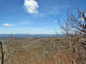 We started out almost immediately with the air temperature in the low 60's and the sun shining with only a few clouds in the sky. The trail was poorly marked which unfortunately has become common lately. The DEC decided that vo9lunteers were no longer allowed to post trail markers which would have to be done by DEC foresters. Since the DEC foresters never get out to mark the trails, the result is poorly marked trails. This is not the fault of the foresters who are busy doing many other jobs. The first part of the trail paralleled a small stream and then crossed it. The trail did not appear to be much used with a few branches here and there. The trail was also very wet from the storms that had rolled through the night before. I stopped to take a few pictures of the stream and then we continued on. In a very short distance we turned left onto a woods road and entered a red pine plantation. The thought crossed my mind that bushwhacking a direct route would be quicker but I decided to stay on woods road to respect property rights and the environment. The trees were very tall and the road well defined but without many blazes.There were several large puddles or small ponds on the trail but they were easy to walk around. I was afraid there might be a lot of insects but there were far less than I expected. At about 1 mile into the hike, the trail turned right into the woods. We had been hiking almost due north and now the trail started to head east and southeast up a ridge leading to the summit. The walking was relatively easy with only a few wet patches along the way but the lack of appropriate blazes was, at times, puzzling. At 1.25 miles I saw a viewpoint to the right and walked over to take a look. There was a nice view to the south and west so I took some pictures of the mountains in that direction. As we hiked up the trail there were many good views through the trees but none that offered photographic opportunities. All along the way I looked for other viewpoints but none seemed evident and the reports I knew that some were available from points on the summit. We passed several rock outcroppings and ledges and intersected at least one woods road. Several times Cindy and I both thought we were near the top only to find there was some more climbing to do.
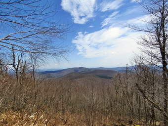 Eventually we reached the flat and wooded summit of the mountain and continued to walk over the top. Cindy was a little behind me so I stopped and looked down to see a USGS benchmark that poised for a picture. We continued across the summit to the junction with the yellow trail to the leant-to. The red trail continued east toward Ashland Pinnacle and looked to be in good shape. We turned right on the yellow trail and almost immediately came across a viewpoint to the east. We stopped so that I could take some pictures toward the Ashland Pinnacle and Richmond Mountain. We returned to the trail and were at the lean-to in only a few minutes. The view here was to the south into the heart of the Catskills. The mountains of the Devil's Path were clearly visible but Slide Mountain in the distance dominated the view. From here it looked more impressive than ever. I took several pictures but we didn't stay too long. I noticed that the yellow trail continued passed the lean-to and we decided to follow it. I brought up the Avenza app on my iPhone which confirmed we were headed down an unmarked woods road which would allow us to hike a loop rarer than and out-and-back. As we continued south and southwest on the woods road, the yellow blazes turned right to go back towards the summit. We continued on the woods road. The sun was out and it was warm. The walk was easy on the wide woods road and it was all downhill! At 3.6 miles we came to a large pile of red shale and walked out to a dirt road. We were at the junction of Jim Cleveland Road coming up from the south and Huntersfield Road. We turned right to walk the woods road back to the car. The road was in good shape and I knew that I could have driven my car on it. As we were hiking down the road, Sheila Alerted and I could hear a pickup truck headed up the road toward us. He slowed and waved as he passed. We continued down the road and Sheila alerted again for a young man hiking up the road toward us. Just behind him was another truck which happened to be a forest ranger. We passed by with a "hello" and a wave. Cindy thought it was the same ranger we had met last year on Windham! We continued to follow the woods road until we spotted the car. We were back at the car at 1:20 PM after hiking 4.4 miles in 2 hours and 50 minutes. The elevation gain was 1240 feet. I suggested a few shorter hikes we might do on the way back but Cindy declined. I was a little disappointed as I had planned on a least 6 miles. I did return by way of the Barkaboom Road to Lew Beach. I stopped at Tompkins Falls which was flowing nicely. Cindy and Sheila stayed in the car while I took 15 minutes to snap some shots.
![]()
![]()
![]()
![]() On Thursday, May 3rd I wanted to get out on a hike but didn't have much time to spend. I decided just to head across the street and hike on Round Top. Sheila seemed thrilled at the decision and couldn't wait to get going I had a few things to do first and wee did not get started until 9:30 AM. The temperature was very warm hovering in the high 60's so I decided just to put on a crew top and a very light windbreaker. For the first time since last fall, I put on a pair of lighter Columbia hiking pants instead of my Columbia Omniheat winter pants. Sheila would not leave my side as I was getting ready as she wanted to make sure she was going too! I stepped out onto the back porch and headed out the driveway at 10:30 AM. We crossed the street with Sheila on her leash and walked to the back of the church. We began the ascent of the steepest hill behind the church. The hill is short but really gets the circulation pumping and is the steepest and longest climb on the "trail". Sheila helped me along by pulling me up the hill. When we got to the top of the hill, we started out on the trail by turning left at the trailhead. As soon as we entered the trees I released Sheila from her leash. At the first trail junction we continued straight ahead to walk the steeper path to the viewpoint. At the lookout we turned to the right and we continued our hike on the yellow lower trail. It was really a pleasure to be out and an even greater pleasure that it was warm. We followed the trail and started the gentle climb through the woods. When we reached the next trail junction, we stayed to the right to follow the lower trail around the base of Round Top to the next junction. At this junction we turned left and started up to the summit of Round Top on the steeper blue trail. We walked across the summit of Round Top and down the other side which is also a little steep. I picked up a few branches along the way but found only one small blowdown on the yellow trail that would require a saw. When we got to the yellow trail, we turned left to follow it to the second trail junction. This time we turned right and followed the yellow trail back to the very first trail junction to complete a figure 8.
On Thursday, May 3rd I wanted to get out on a hike but didn't have much time to spend. I decided just to head across the street and hike on Round Top. Sheila seemed thrilled at the decision and couldn't wait to get going I had a few things to do first and wee did not get started until 9:30 AM. The temperature was very warm hovering in the high 60's so I decided just to put on a crew top and a very light windbreaker. For the first time since last fall, I put on a pair of lighter Columbia hiking pants instead of my Columbia Omniheat winter pants. Sheila would not leave my side as I was getting ready as she wanted to make sure she was going too! I stepped out onto the back porch and headed out the driveway at 10:30 AM. We crossed the street with Sheila on her leash and walked to the back of the church. We began the ascent of the steepest hill behind the church. The hill is short but really gets the circulation pumping and is the steepest and longest climb on the "trail". Sheila helped me along by pulling me up the hill. When we got to the top of the hill, we started out on the trail by turning left at the trailhead. As soon as we entered the trees I released Sheila from her leash. At the first trail junction we continued straight ahead to walk the steeper path to the viewpoint. At the lookout we turned to the right and we continued our hike on the yellow lower trail. It was really a pleasure to be out and an even greater pleasure that it was warm. We followed the trail and started the gentle climb through the woods. When we reached the next trail junction, we stayed to the right to follow the lower trail around the base of Round Top to the next junction. At this junction we turned left and started up to the summit of Round Top on the steeper blue trail. We walked across the summit of Round Top and down the other side which is also a little steep. I picked up a few branches along the way but found only one small blowdown on the yellow trail that would require a saw. When we got to the yellow trail, we turned left to follow it to the second trail junction. This time we turned right and followed the yellow trail back to the very first trail junction to complete a figure 8.
Sheila and I turned around and retraced our steps taking the more gentle path this time. When the yellow trail turned left, we followed it to the next trail junction where we turned right and headed up the blue trail to the summit. We walked over the top and down the other side to the yellow trail again. I was beginning to get bored and my time was limited as we turned right and followed the trail along the base of Round Top. Where the yellow trail turned left, we continued to follow the trail to the left and down to the lookout. From the lookout we walked down hill to the first trail junction. I decided that since I had not spent an hour walking that we would turn around and do a big loop to finish up. We headed up to the lookout on the steeper trail and turned right to follow the yellow trail. When we arrived at the junction with the blue trail we continued straight ahead up to and across the summit. We walked back down the other side and at the junction continued straight ahead on the yellow trail back down to the first trail junction, It was time to head home so we turned left and walked out to the trailhead. At the trailhead, I put Sheila on her leash and we walked down the cemetery hill and across the field to our driveway. It was a little after 11:30 AM and we had hiked a around 2 miles in just over 1 hour. It must have been a good workout as I was tired after a few days without an activity.
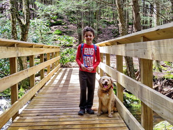
![]()
![]()
![]()
![]()
![]() On Saturday, April 28th, I had planned to get up early and hike Hunter and maybe Plateau. I got up a little later than I thought I might and found a heavy fog hanging over the valley. I didn't want to hike mountains only to find no view so I decided to change plans. I called Karl and asked where he wanted to hike with his family and we agreed on the Neversink Unique Area at the end of Katrina Falls Road in Rock Hill. We set 10:30 AM as the tentative time to meet but I knew that with four children they might be a little late. Even though the temperatures were supposed to rise it was still cool in the morning but I decided not to put on a baselayer and just wear my Mammut crew neck shirt on top. I wore my Columbia Omniheat pants knowing that they would probably be a little warm. I decided to wear my Keen Glarus hiking boots as I knew I would not need any insulation. I had used some waterproof polish on the boots the night before as they had been wetting through on previous hikes. I decided not to bother with gaiters but took along a light hat and gloves. I had been the school nurse for two days during the week and we had not been hiking since Sunday so Sheila was more than ready to go! I got my gear in the car and Sheila in the back seat and we went downtown to make a few stops. We left Livingston Manor just before 10:00 AM with a very happy Sheila who seemed very happy to be going somewhere as she was very alert in the back seat. I got on Route 17 and started for Rock Hill. I got off the Quickway at exit 109 and turned right on Katrina Falls Road to drive to the end of the road. I parked at 10:15 AM in the small parking area where there were three other cars. Just after I parked another car entered the lot parking so that they took up two spots! I had brought a book with me to read while I waited. Around 10:30 AM the family arrived and it took a few minutes to get everyone ready to hike. I set my GPS and we started down the woods road toward the river. I knew that Bryce who is 7 years old could hike the loop to Denton and Mullet Falls but that Luke and Lilly who are 5 and Brynn who is 2 wouldn't be able to go that far. The trail was clear of all snow and was drier than I thought it might be. We didn't push the pace so that we could all stay together. At the bottom of the hill we turned left to stay on the main blue trail. At this point a yellow spur trail goes down to the river. Just after the turn we came to a small bridge over Wolf Brook. I dropped my pack to take some pictures which didn't take too long. As I packed up, I noticed the poor condition of the bridge.
On Saturday, April 28th, I had planned to get up early and hike Hunter and maybe Plateau. I got up a little later than I thought I might and found a heavy fog hanging over the valley. I didn't want to hike mountains only to find no view so I decided to change plans. I called Karl and asked where he wanted to hike with his family and we agreed on the Neversink Unique Area at the end of Katrina Falls Road in Rock Hill. We set 10:30 AM as the tentative time to meet but I knew that with four children they might be a little late. Even though the temperatures were supposed to rise it was still cool in the morning but I decided not to put on a baselayer and just wear my Mammut crew neck shirt on top. I wore my Columbia Omniheat pants knowing that they would probably be a little warm. I decided to wear my Keen Glarus hiking boots as I knew I would not need any insulation. I had used some waterproof polish on the boots the night before as they had been wetting through on previous hikes. I decided not to bother with gaiters but took along a light hat and gloves. I had been the school nurse for two days during the week and we had not been hiking since Sunday so Sheila was more than ready to go! I got my gear in the car and Sheila in the back seat and we went downtown to make a few stops. We left Livingston Manor just before 10:00 AM with a very happy Sheila who seemed very happy to be going somewhere as she was very alert in the back seat. I got on Route 17 and started for Rock Hill. I got off the Quickway at exit 109 and turned right on Katrina Falls Road to drive to the end of the road. I parked at 10:15 AM in the small parking area where there were three other cars. Just after I parked another car entered the lot parking so that they took up two spots! I had brought a book with me to read while I waited. Around 10:30 AM the family arrived and it took a few minutes to get everyone ready to hike. I set my GPS and we started down the woods road toward the river. I knew that Bryce who is 7 years old could hike the loop to Denton and Mullet Falls but that Luke and Lilly who are 5 and Brynn who is 2 wouldn't be able to go that far. The trail was clear of all snow and was drier than I thought it might be. We didn't push the pace so that we could all stay together. At the bottom of the hill we turned left to stay on the main blue trail. At this point a yellow spur trail goes down to the river. Just after the turn we came to a small bridge over Wolf Brook. I dropped my pack to take some pictures which didn't take too long. As I packed up, I noticed the poor condition of the bridge.
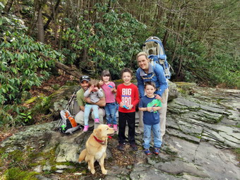 At the next trail, junction at the top of a short hill, we stayed to the right on the blue trail and descended through a wet area before starting up another small hill. At 1.2 miles another hello spur trail headed down to the river but we stayed on the blue trail. at 1.4 miles we came to the first bridge across Mullet Brook. The bridge was recently replaced with iron i-beams instead of logs for support. We stopped so that I could take some pictures of the ridge and then a few of Bryce and Sheila on the bridge. The rest of the family caught up and we discussed our options. We decided to hike down to the Neversink River and then back up to the main trail. At this point we would split with Bryce and I continuing on the loop and the rest of the family returning the way we came. I took this opportunity to stow my Mammut hoody in my pack as I was very warm. After crossing, the bridge we turned right on the yellow spur trail that goes down to the river at Denton Falls. As we hiked, I was surprised we did not see any other people since there had been several cars in the lot. The trail down to the river is steep and was damp the whole way with some very wet spots. We were careful to keep our footing walk around the wettest places. At 11:45 we had hiked 1.65 miles and we were at the edge of the river. We walked out onto the rocks by the river and warned the kids to stay away from the water. I grabbed my camera and took pictures upstream and then worked my way to the rocks below the falls. From here I was able to take pictures of the falls and a few downstream. Several fishermen were in the water on the other side of the river. Before we left the river, we got the kids a snack and I took a group picture. We walked back up the steep trail to the main blue trail and I was surprised that the kids did so well. Bryce, Sheila and I turned right to start continue the loop as the others started back. At the top of the hill I offered Bryce the option of going to High Falls further downstream. When I told him it would be over 8 miles, he chose to do the shorter loop this time. We stayed to the left to start up the hill.
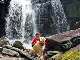 After a brief walk uphill of .15 miles, we turned left onto the short trail down to Mullet Brook Falls. I was excited to see what Mullet Brook Falls might look like after the recent rain. Soon they came into sight, I was pleased to find that the waterfall had a good amount of water flowing over it but not as much as I expected. The water comes from a large swamp further upstream and is full of tannins which give it a brown color. I dropped my pack where the trail ended and grabbed my camera to take some pictures. The problem was that the route to the area in front of the falls was wet and slippery from the spray from the falls. We all worked my way across the stream and over the rocks. I took some pictures of the falls and then posed Bryce and Sheila. I took a quick picture as they were getting wet from the spray. I took a few more shots of the falls and a few downstream before heading back to the pack. I put away my camera and shouldered my pack to head back out the spur trail. We walked back out to the main trail and turned left to complete the loop. As we climbed we noticed the rocky ledges to our right and I thought about exploring them at some time in the future. The uphill walk was tiring for me but I didn't hear Bryce say anything. It was clear the temperature was rising as the snow continued to get softer. Soon we crossed over the upper bridge spanning Mullet Brook. I stopped on the bridge to show Bryce the beginning of the large swamp on the right. From the bridge the trail is flat or downhill for some time. After a brief walk we were at a trail junction. Walking straight ahead on the trail leads to the Wolf Lake Multiple Use Area. We turned left and began to descend off the ridge. As we started to walk downhill, Bryce picked up the pace considerably so that I had to really exert myself to keep up. As we hiked downhill, there were several areas of the trail that had brush beginning to encroach on the trail and there were several trees that needed to be removed. We walked downhill for some time and eventually came to the trail junction near the bridge over Wolf Creek where we had started the loop earlier. We continued to walk straight ahead to return to the parking area. Once on the other side of the brook we made the right turn on the woods road back to the car. I was not enthusiastic about the uphill walk back to the car but as soon as Bryce saw the gate in the distance he decided to run ahead uphill! We arrived at the parking area at 1:45 PM having hiked 4.7 miles in 3 hours and 5 minutes including the stops at the two falls. The vertical gain was only about 990 feet. I got my gear in the car followed by Bryce and Sheila. It was then that I noticed the ticks on Sheila most of which were still crawling on her fur. I removed at least ten and remembered that I had not applied Advantix for some time! I check myself and Bryce and vowed to apply the anti-tick medication to Sheila when we got home. I headed back out Katrina Falls Road to take Bryce home. By the time we were on the Quickway, Bryce was asleep.
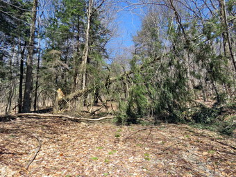
![]() On Sunday, April 22nd, I wanted to do some trail maintenance on The Flynn Trail at Frick Pond after church. I asked Cindy if she wanted to go and she agreed. I knew there were several blowdowns that needed to be cleared and some large branches to move off the trail. My plan was to ascend the Flynn Trail clearing blowdowns on the way out. After the last blowdown, we would turn around and hike back to the car. When we got back from church, we ate a quick lunch and got ready to go. The temperature was already 50 degrees and it was sunny. I found myself wondering how much snow would be left on the trail as two days earlier there was several inches! I decided not to put on tights under my Columbia Omniheat pants. I did wear a Mammut pullover over a short-sleeved baselayer. I put on my Mammut Ultimate Hoody which I wear most of the time. I made sure I brought along a light hat and gloves. Sheila was crazed as usual since even though we had been two days earlier. I like using my axes and hand saws to clear trees on the trails as it reminds me of working with my father and uncles when is was younger. We logged a lot for firewood and often used hand tools as chainsaws were cumbersome and expensive. I have two Silky saws which are Japanese and cut on the pull stroke. The Sugowaza is a 17" curved and fixed blade which fits in a scabbard. The Katana Boy is almost two feet long and is a folding saw with a nylon carrier. Both are remarkably sharp and can take care of some large tree trunks. I usually carry a Fiskars axe with a composite handle and rather small head. It is light an easy to carry for many miles. It also lives up to the "hype" as it is easy to keep sharp and cut well despite its small head. If I know I will be working close to a trailhead I may take my Council Tools felling axe that weighs in excess of 5 lbs! I also brought along two plastic wedges to help when a saw binds. We left Livingston Manor at about 1:00 PM to head out the Debruce Road. There was no snow on the ground along the DeBruce Road. At six miles I turned left onto Mongaup Pond Road which was completely clear. Where the road split I stayed left on Beech Mountain Road and parked in the small lot where three other cars were parked. There was no snow to be seen anywhere. I set my electronics and we crossed the road at 1:15 PM to face our first blowdown. A large branch had fallen across the trail and we immediately began to clear it. I took before pictures and the started to use the axe to cut off a few smaller branches which Cindy removed. I continued to cut branches until I was down to the largest ones. I cut the branches and dragged them off the trail. After cleaning up a little more, I took a few after pictures and then started up the Flynn Trail. We made the right turn onto the woods road and there was no snow to be seen. It was a real contrast to the condition of the trail two days earlier when there was 2 to 3 inches of snow! Within a short distance we ran across the VERY large hemlock across the trail and I decided that I would cut a "tunnel" through the tree rather than try to remove the whole thing. I put down my pack and took pictures before beginning to work. Cindy began to clear some loose branches while I used the axe to cut up a small tree that was across the trail. I cut it into three pieces and removed them. Many of the branches that I wanted to cut where too high to get with the axe. I got out the Boy saw which is long and I was able to reach some of the higher branches and remove them. We continued to work until we had cut a wide opening through the tree, We cleared some more branches and made sure there were no sharp protrusions to snag unwary hikers. I took some pictures to show the work we had done and the we continued up the trail.
On Sunday, April 22nd, I wanted to do some trail maintenance on The Flynn Trail at Frick Pond after church. I asked Cindy if she wanted to go and she agreed. I knew there were several blowdowns that needed to be cleared and some large branches to move off the trail. My plan was to ascend the Flynn Trail clearing blowdowns on the way out. After the last blowdown, we would turn around and hike back to the car. When we got back from church, we ate a quick lunch and got ready to go. The temperature was already 50 degrees and it was sunny. I found myself wondering how much snow would be left on the trail as two days earlier there was several inches! I decided not to put on tights under my Columbia Omniheat pants. I did wear a Mammut pullover over a short-sleeved baselayer. I put on my Mammut Ultimate Hoody which I wear most of the time. I made sure I brought along a light hat and gloves. Sheila was crazed as usual since even though we had been two days earlier. I like using my axes and hand saws to clear trees on the trails as it reminds me of working with my father and uncles when is was younger. We logged a lot for firewood and often used hand tools as chainsaws were cumbersome and expensive. I have two Silky saws which are Japanese and cut on the pull stroke. The Sugowaza is a 17" curved and fixed blade which fits in a scabbard. The Katana Boy is almost two feet long and is a folding saw with a nylon carrier. Both are remarkably sharp and can take care of some large tree trunks. I usually carry a Fiskars axe with a composite handle and rather small head. It is light an easy to carry for many miles. It also lives up to the "hype" as it is easy to keep sharp and cut well despite its small head. If I know I will be working close to a trailhead I may take my Council Tools felling axe that weighs in excess of 5 lbs! I also brought along two plastic wedges to help when a saw binds. We left Livingston Manor at about 1:00 PM to head out the Debruce Road. There was no snow on the ground along the DeBruce Road. At six miles I turned left onto Mongaup Pond Road which was completely clear. Where the road split I stayed left on Beech Mountain Road and parked in the small lot where three other cars were parked. There was no snow to be seen anywhere. I set my electronics and we crossed the road at 1:15 PM to face our first blowdown. A large branch had fallen across the trail and we immediately began to clear it. I took before pictures and the started to use the axe to cut off a few smaller branches which Cindy removed. I continued to cut branches until I was down to the largest ones. I cut the branches and dragged them off the trail. After cleaning up a little more, I took a few after pictures and then started up the Flynn Trail. We made the right turn onto the woods road and there was no snow to be seen. It was a real contrast to the condition of the trail two days earlier when there was 2 to 3 inches of snow! Within a short distance we ran across the VERY large hemlock across the trail and I decided that I would cut a "tunnel" through the tree rather than try to remove the whole thing. I put down my pack and took pictures before beginning to work. Cindy began to clear some loose branches while I used the axe to cut up a small tree that was across the trail. I cut it into three pieces and removed them. Many of the branches that I wanted to cut where too high to get with the axe. I got out the Boy saw which is long and I was able to reach some of the higher branches and remove them. We continued to work until we had cut a wide opening through the tree, We cleared some more branches and made sure there were no sharp protrusions to snag unwary hikers. I took some pictures to show the work we had done and the we continued up the trail.
 The weather was beautiful and I considered removing my jacket. Instead I opened the zippers as we continued up the trail removi9ng small blanches as we walked. We came to an area where there were a few bigger branches across the trail and I took a few shots before we removed them from the trail. There were some branches along the side of the trail and I decided to get rid of those also. I was feeling pretty confident with the axe and did all of my work with it. I took a few shots to show the cleared trail and then we moved on. Sheila alerted and we saw tow men walking toward us with small dogs. As they approached they picked up there dogs and I put Sheila on her leash. I cleared a few branches as they passed. We said a brief "hello" as they passed. We continued up the trail removing a few branches as we walked. We came to a rather large tree across the trail and I took a few shots using Sheila for perspective. I used the axe to clean off some of the smaller branches and Cindy dragged them away. I cut the top of the tree in several places and removed these branches. This left the main trunk of the tree. I decided it was easier to make several cuts and drag away smaller pieces. I worked on the smaller parts of the trunk until only the two main parts were left. I cut each of these and moved them off the trail. I had hoped I could pivot the remaining trunk but if has much too heavy. I decided it was far enough off the trail. I took pictures of the clear trail and the trunks I had cut. We headed on up the Flynn Trail as I knew there was one more major blowdown to clear. We came to one small tree and I dispatched it with ease. Finally we came to the last tree that I was going to clear for the day. I was now tired and I knew this tree would be a problem. The tree had broken off fairly high up and had twisted. I knew I would probably have to cut the vertical trunk which was on an angle. I fell into my routine. I took pictures before starting to work and the used the axe to cut off branches and to "top" the tree. Cindy was now too tired to help so I had to drag away all the branches by myself. I was soon down to the main trunk. I tried to cut it loose up high but could not safely swing the axe that far above my head. With some effort I was able to "fell" the tree by cutting through the trunk and bringing it to the ground. I still had to cut pieces of the trunk small enough to drag away. I made several cuts with the axe through the thick trunk and moved each piece off the trail. I finished about the time I ran out of energy. I took some final pictures before we turned around to return down the Flynn Trail to the car. I was glad we were descending and the walk which sometimes seems long went more quickly than I expected. It was satisfying to see the work we had done. We were back at the car at 5:00 PM having covered 3.8 miles in 3 hours and 45 minutes with an elevation gain of 600 feet. I was puzzled at the distance as it seemed too long. Cindy pointed out that I walked around quite a bit clearing trees on the way out with my pack on which probably extended the mileage.
![]()
![]()
![]()
![]()
![]() On Friday, April 20th, I wanted to get in a hike close to home but wanted to get away from going across the street to Round Top. Some snow had fallen in town on Thursday but had melted by Friday morning. My plan was to ascend the Flynn Trail and then get the long descent on the Big Rock Trail. The temperature at 11:00 AM was in the low 30's as I was about to get dressed. I decided to put on tights under my Columbia Omniheat pants. I wore a Mammut pullover over my long-sleeved baselayer. I put on my Mammut Ultimate Hoody which I wear most of the time. I made sure I brought along a hat and gloves. Sheila was crazed as usual since we had not been out in several days. We left Livingston Manor at about 11:20 AM to head out the Debruce Road. There was no snow on the ground along the DeBruce Road. At six miles I turned left onto Mongaup Pond Road which had some snow on it but had been well sanded. Where the road split I stayed left on Beech Mountain Road and parked in the small lot which was plowed. There were no cars in the lot and no tracks indicating anyone had been there recently. There was a coating of snow on the ground and I began to wonder how deep the snow would get as I ascended the Flynn Trail. I set my electronics and we crossed the road at 11:45 AM to start up the Flynn Trail. The temperature was 33 degrees as we hit the trail. The beginning of the Flynn Trail still had a tree across the middle of the trail and I made a note that it would have to be cleared sooner than later. I decided to go "low" around the tree and then back to the trail. The first part of the Flynn Trail through the woods is narrow and I removed a few small branches as we walked. Once we made the right turn into the woods road the going was easier but I was surprised ether was more snow as this part of the trail gets a lot of sun. We ran across the VERY large hemlock across the trail and I decided that I would be able to cut a "tunnel" through the tree rather than try to remove the whole thing. As we gained some elevation, the snow got deeper until there was two to three inches which was a real surprise. I stopped to take a few pictures before continuing on. We ran across several large branches on the trail and several blowdowns that would require tools to clear. We continued up the Flynn Trail toward the junction with the Big Rock Trail.
On Friday, April 20th, I wanted to get in a hike close to home but wanted to get away from going across the street to Round Top. Some snow had fallen in town on Thursday but had melted by Friday morning. My plan was to ascend the Flynn Trail and then get the long descent on the Big Rock Trail. The temperature at 11:00 AM was in the low 30's as I was about to get dressed. I decided to put on tights under my Columbia Omniheat pants. I wore a Mammut pullover over my long-sleeved baselayer. I put on my Mammut Ultimate Hoody which I wear most of the time. I made sure I brought along a hat and gloves. Sheila was crazed as usual since we had not been out in several days. We left Livingston Manor at about 11:20 AM to head out the Debruce Road. There was no snow on the ground along the DeBruce Road. At six miles I turned left onto Mongaup Pond Road which had some snow on it but had been well sanded. Where the road split I stayed left on Beech Mountain Road and parked in the small lot which was plowed. There were no cars in the lot and no tracks indicating anyone had been there recently. There was a coating of snow on the ground and I began to wonder how deep the snow would get as I ascended the Flynn Trail. I set my electronics and we crossed the road at 11:45 AM to start up the Flynn Trail. The temperature was 33 degrees as we hit the trail. The beginning of the Flynn Trail still had a tree across the middle of the trail and I made a note that it would have to be cleared sooner than later. I decided to go "low" around the tree and then back to the trail. The first part of the Flynn Trail through the woods is narrow and I removed a few small branches as we walked. Once we made the right turn into the woods road the going was easier but I was surprised ether was more snow as this part of the trail gets a lot of sun. We ran across the VERY large hemlock across the trail and I decided that I would be able to cut a "tunnel" through the tree rather than try to remove the whole thing. As we gained some elevation, the snow got deeper until there was two to three inches which was a real surprise. I stopped to take a few pictures before continuing on. We ran across several large branches on the trail and several blowdowns that would require tools to clear. We continued up the Flynn Trail toward the junction with the Big Rock Trail.
 As we hiked the snow continued to melt on my boots which were getting wet. My right foot was also becoming cold. As we approached the trail junction I had to make a decision on whether to continue on the big loop all the way to Hodge Pond or cut the hike short. I started toward Hodge Pond and then decided I did not need to battle cold wet feet! We turned left to start down the Big Rock Trail to Times Square. The snow on the Big Rock Trail was somewhat less than on the Flynn Trail but I slipped and almost fell several times on the descent. There were several blowdowns along the way which are usually cleared by the snowmobile club. Since their season was over, I knew I would have to clear them! I knew that the downhill would go fast but I was getting a little tired! The trip down the Big Rock Trail did go quickly and seemed shorter than usual. In several places, where large trees had fallen across the trail the snowmobile club had completely removed them. There are three places where the trail drops quickly and then levels off. The last place brought us right to Times Square where the Logger's Loop and Big Rock Trail cross. Sheila was having a great time and did not seem to be bothered in any way by the snow or temperature. She kept going off the trail to follow animals tracks but returned quickly when I called. It was 1:00 PM when we continued straight ahead at Times Square to go around the back of Frick Pond. Here the snow was again covering the trail in most places except where there was some water on the trail. The hike around the pond is a favorite and is one promoted by Lisa at Morgan Outdoors in Livingston Manor. As we approached the bridges and wooden walkways there were some nice views of the upper reaches of Frick Pond but I did not feel like stopping to take pictures. The wooden walkways were covered in a layer of snow and I did stop to take a few pictures before continuing on toward Frick Pond. We continued to walk until we came to the junction with the Quick Lake Trail. Here we turned left and headed for the bridge across the outlet of Frick Pond. We stopped briefly at the bridge and I took a few pictures of the pond and Flynn's Point. We walked up the hill to Gravestone Junction to head back to the parking area and I felt even this short uphill in my legs. The trail was well covered in snow But there were many areas that were open and several spots with water on the trail. It wasn't pretty but we made it to the trail register without any problems. At the register we turned right to walk the rest of the Quick Lake Trail back to the parking area. As we approached the parking lot, I admired the trail clearing work Cindy and I had done to make the loath more evident and easier to follow. We were back at the car at 1:40 PM having covered 4.0 miles in 1 hour and 55 minutes with an elevation gain of 690 feet.
![]()
![]()
![]()
![]() On Tuesday, April 17th I wanted to get out on a hike but didn't have much time to spend. There had been a few "warm" days in a row with cold nights so I expected the snow on Round Top to be pretty much gone altogether. I decided just to head across the street and hike on Round Top. Sheila seemed thrilled at the decision and couldn't wait to get going. I had a few things to do first and we did not get started until 11:00 AM. The temperature was in the high 30's as I started to get dressed. As I got dressed I decided to put on a pair of tights under my Columbia Omniheat pants even though I knew I would probably be warm once I started hiking. I also put on a light, long-sleeved baselayer under my Mammut crew neck shirt. I put on my Mammut Ultimate hoody and wore a hat and a pair of gloves. I donned my Keen Glarus hiking boots as they are easier to walk in when additional insulation is not needed. Sheila would not leave my side as I was getting ready as she wanted to make sure she was going too! I stepped out onto the back porch and headed out the driveway at 11:00 AM. We crossed the street with Sheila on her leash and walked to the back of the church where I released Sheila from her leash. There was no snow in the field and the road up to the top of the cemetery was completely bare. The only snow was in a few small banks where the parking lots had been plowed. We began the ascent of the steepest hill behind the church. The hill is short but really gets the circulation pumping and is the steepest and longest climb on the "trail". When we got to the top of the hill, we started out on the trail by turning left at the trailhead. There no snow in the woods and the trails were clear. When we arrived at the area where a large blowdown had blocked the trail, I admired my work. I had cleared the large tree by myself using only hand tools! At the first trail junction we turned right and continued up the trail. It was really a pleasure to walk on the trails without snow and it got me looking forward to more appropriate spring weather and to summer. As I walked, I removed a few loose branches from the trail that had been hidden under the snow.
On Tuesday, April 17th I wanted to get out on a hike but didn't have much time to spend. There had been a few "warm" days in a row with cold nights so I expected the snow on Round Top to be pretty much gone altogether. I decided just to head across the street and hike on Round Top. Sheila seemed thrilled at the decision and couldn't wait to get going. I had a few things to do first and we did not get started until 11:00 AM. The temperature was in the high 30's as I started to get dressed. As I got dressed I decided to put on a pair of tights under my Columbia Omniheat pants even though I knew I would probably be warm once I started hiking. I also put on a light, long-sleeved baselayer under my Mammut crew neck shirt. I put on my Mammut Ultimate hoody and wore a hat and a pair of gloves. I donned my Keen Glarus hiking boots as they are easier to walk in when additional insulation is not needed. Sheila would not leave my side as I was getting ready as she wanted to make sure she was going too! I stepped out onto the back porch and headed out the driveway at 11:00 AM. We crossed the street with Sheila on her leash and walked to the back of the church where I released Sheila from her leash. There was no snow in the field and the road up to the top of the cemetery was completely bare. The only snow was in a few small banks where the parking lots had been plowed. We began the ascent of the steepest hill behind the church. The hill is short but really gets the circulation pumping and is the steepest and longest climb on the "trail". When we got to the top of the hill, we started out on the trail by turning left at the trailhead. There no snow in the woods and the trails were clear. When we arrived at the area where a large blowdown had blocked the trail, I admired my work. I had cleared the large tree by myself using only hand tools! At the first trail junction we turned right and continued up the trail. It was really a pleasure to walk on the trails without snow and it got me looking forward to more appropriate spring weather and to summer. As I walked, I removed a few loose branches from the trail that had been hidden under the snow.
I followed the blazes for the yellow trail up to the trail junction. I turned left at the trail junction and followed the yellow trail along the base of Round Top. The trail was pretty open as I had done some maintenance to remove the blowdowns. At the next trail junction, we turned right on the blue trail and headed up the steepest hill to the summit of Round Top. I saw a few patches of snow here and there but the trail was mostly clear. On the summit we followed the trail over the top an then down the other side. This part went quickly went quickly. At the yellow trail we turned right and then left at the next trail junction to head down to the lookout. At the lookout we turned left and descended the hill to the first trail junction. This hill had no snow as it is most exposed to the sun. We turned around and headed back up the hill to the lookout. We turned right at the top following the yellow trail on the long, gentle climb to the junction with the blue trail. We turned right and followed the yellow trail along the base of Round Top to the next junction. Here we turned left and followed the blue trail to the summit. Once again we crossed the summit and started down the other side. On the steep descent to the yellow trail I had to watch my footing as the leaves were wet and there were a few patches of snow left. We turned left on the yellow trail and then right at the next trail junction. It was enjoyable following the old woods road back down toward the first trail junction. When we came to the path I had made up from the trailhead to avoid the blowdown, Sheila automatically turned left even though the trail was not very distinct. I called her back and we continued on to the trail junction. We turned left and followed the trail back out to trailhead. At the trailhead we turned right and descended the hill. We walked across the field to the driveway and home. We had spent a little over an hour walking a little more than 2 miles. The walk was a good workout even though I feel I could do it blindfolded!
![]()
![]()
![]()
![]()
![]() On Friday, April 13th I decided I wanted to hike somewhere near home but for at least 6 miles without doing any trail work. I asked Cindy if she wished to hike and she agreed as long as we did not have to drive very far. We talked about different possibilities and I suggested we head for Long Pond to do the big loop which is about 6 miles. We had not been to Long Pond in some time so I was anxious to see how the trails had faired over the late winter months. Just before 10:00 AM we started to get ready and Sheila was there to watch my every move. The temperature was still in the high 3's1 as we were getting early so I decided to wear a baselayer on top with my Mammut pullover. I did wear my Mammut Ultimate hoody and Columbia Omniheat pants with tights underneath as a baselayer. I opted to wear a regular pair of hiking boots rather than winter boots. My Keen Glarus boots are a great fit and more comfortable than any insulated winter boots I have. I also decided to use a pair of Leki Khumbu with external locks as my Leki graphite poles have twist locks which are unreliable. Every hike when I have used these poles they have shortened despite my best efforts to keep them tight! When we left the house at about 10:00 AM the skies were partly sunny. I got Sheila in the car and we put our gear in the trunk and headed out DeBruce Road for about 8 miles to Flugertown Road where I made a left. I parked in the lot a short distance up the road on the right where we found one other car. As we pulled in someone was walking across the road toward the car. Sheila put up a fuss so I left her inside as I opened the trunk to get out my pack. The man approached my car to ask me about fishing streams along the trail to Long Pond. I told him there were no streams and it was a better choice to fish the in the stream along Flugertown Road or in the Willowemoc. HE thanked me and departed so that I was able to let Sheila out of the car. Sheila had not hiked in two days and she was ready to go when we got to the parking lot. There was some snow where the lot had been plowed and a little ice on the trail but Cindy and I elected to carry our spikes rather than put them on immediately. I set my GarminGPS and we started out on the trail at 10:20 AM. Right from the start the trail was wet and somewhat muddy with some ice and snow along the way. We walked to the side in several places to avoid the icy spots. The first .6 miles gains about 350 feet to the highest point on the hike. It isn't very steep but does act as a nice warm-up! We had to be careful to avoid the ice which wasn't easy in some spots. Once the trail leveled it was easier walking but the amount snow and ice increased dramatically. There was several inches of snow on the trail and as much off the trail in the woods. At 1.1 miles we were at the spur trail that leads down to the shore of Long Pond. We turned right and went down to the pond so that I could take some pictures. At the shores of the pond I dropped my pack and got out my camera to take some pictures. Sheila tried to follow me through the mud but we discouraged her. The skies were overcast with some blue showing through and a few white clouds. The pond was frozen over with only a little open water neat the shore. I took a few shots anyway before going back to my pack. We returned to the main trail and arrived at the first trail junction. We turned right at the junction at 1.3 miles. We found plenty of ice in spots and quite a bit of snow but the walking was easier as the ground was flat. By 11:30 AM we had walked 1.8 miles and were passing the spur trail to the lean-to.
On Friday, April 13th I decided I wanted to hike somewhere near home but for at least 6 miles without doing any trail work. I asked Cindy if she wished to hike and she agreed as long as we did not have to drive very far. We talked about different possibilities and I suggested we head for Long Pond to do the big loop which is about 6 miles. We had not been to Long Pond in some time so I was anxious to see how the trails had faired over the late winter months. Just before 10:00 AM we started to get ready and Sheila was there to watch my every move. The temperature was still in the high 3's1 as we were getting early so I decided to wear a baselayer on top with my Mammut pullover. I did wear my Mammut Ultimate hoody and Columbia Omniheat pants with tights underneath as a baselayer. I opted to wear a regular pair of hiking boots rather than winter boots. My Keen Glarus boots are a great fit and more comfortable than any insulated winter boots I have. I also decided to use a pair of Leki Khumbu with external locks as my Leki graphite poles have twist locks which are unreliable. Every hike when I have used these poles they have shortened despite my best efforts to keep them tight! When we left the house at about 10:00 AM the skies were partly sunny. I got Sheila in the car and we put our gear in the trunk and headed out DeBruce Road for about 8 miles to Flugertown Road where I made a left. I parked in the lot a short distance up the road on the right where we found one other car. As we pulled in someone was walking across the road toward the car. Sheila put up a fuss so I left her inside as I opened the trunk to get out my pack. The man approached my car to ask me about fishing streams along the trail to Long Pond. I told him there were no streams and it was a better choice to fish the in the stream along Flugertown Road or in the Willowemoc. HE thanked me and departed so that I was able to let Sheila out of the car. Sheila had not hiked in two days and she was ready to go when we got to the parking lot. There was some snow where the lot had been plowed and a little ice on the trail but Cindy and I elected to carry our spikes rather than put them on immediately. I set my GarminGPS and we started out on the trail at 10:20 AM. Right from the start the trail was wet and somewhat muddy with some ice and snow along the way. We walked to the side in several places to avoid the icy spots. The first .6 miles gains about 350 feet to the highest point on the hike. It isn't very steep but does act as a nice warm-up! We had to be careful to avoid the ice which wasn't easy in some spots. Once the trail leveled it was easier walking but the amount snow and ice increased dramatically. There was several inches of snow on the trail and as much off the trail in the woods. At 1.1 miles we were at the spur trail that leads down to the shore of Long Pond. We turned right and went down to the pond so that I could take some pictures. At the shores of the pond I dropped my pack and got out my camera to take some pictures. Sheila tried to follow me through the mud but we discouraged her. The skies were overcast with some blue showing through and a few white clouds. The pond was frozen over with only a little open water neat the shore. I took a few shots anyway before going back to my pack. We returned to the main trail and arrived at the first trail junction. We turned right at the junction at 1.3 miles. We found plenty of ice in spots and quite a bit of snow but the walking was easier as the ground was flat. By 11:30 AM we had walked 1.8 miles and were passing the spur trail to the lean-to.
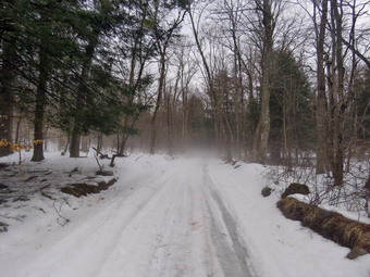 After passing the trail to the lean-to, we continued to find ice and snow on the trail but there was a little less than before. There isn't much to see on this section of trail but we kept busy by avoiding the icy and wet spots. I stopped to take some pictures of the fog rising from the snow along the trail and in the woods. We continued on the main trail to the point where it intersects a woods road at 2.6 miles. We turned left on the woods road and found it to be very wet with icy patches. I was glad the ground was still partly frozen or this would have been a muddy mess. We followed the road until the intersection with Basily Road at 2.85 miles where we continued on Basily Road by bearing left. This section of road was icy and had covered in packed snow. The ice continued for some time and then abated somewhat. Along the way the it began to rain and this continued fro some time. The rain varied from a few drops to a light shower. I finally decided to put on the pack cover to protect my camera and other electronics. As we approached the Peters Hunting Camp, I got ready to put Sheila on her leash. The area near the footbridge across the outlet to the beaver pond had freely flowing water and the beaver dam looked like it needed some repair. The bridge is starting to show its age and is not in good shape. I stopped to take some pictures of the beaver pond before we continued on the trail. The old bridge over the stream had deteriorated to the point that the hunting camp had to replace it. The new bridge is already showing signs of wear from snowmobiles passing over it even though there is a sign that states "Private Bridge". We crossed the bridge to continue the trip back to the car. The ford downstream of the bridge looked like it had been getting a lot of use by vehicles but the water can be a little deep and wide for foot traffic. As we started up the little hill from the hunting camp, the ice and snow on returned. I took a few shots of the valley which looked peaceful with the nice skies behind it. From this point on the ice returned and there was a significant amount of snow in the woods. In several spots I wanted to take some pictures but decided against it because it was still raining and I had my pack cover on. The creek was high and running fast as we continued down the road. We kept a fast pace even thought it was icy and eventually the road became paved. We continued down the road toward the car. As we approached the road bridge over the creek we could see quite a few trees had been gnawed down by beavers. The dam just downstream of the bridge was larger than before and was impounding a larger amount of water. We continued on the road back to the parking area. We were back at the car at 1:20 PM having hiked 6.0 miles in 2 hours and 55 minutes with 13 minutes of stopped time. The elevation gain was only about 540 feet most of which was at the beginning of the hike.
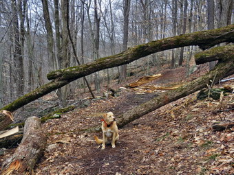
![]() On Wednesday, April 11th I wanted to go do some more trail maintenance on Round Top to see if I could clear the rest of a large blowdown that had blocked the trail. On Monday I had done enough work to allow hikers to easily duck under a trunk and walk on the trail but I wanted to completely remove the blockage. I like using my axes and hand saws to clear trees on the trails as it reminds me of working with my father and uncles when is was younger. We logged a lot for firewood and often used hand tools as chainsaws were cumbersome and expensive. I have two Silky saws which are Japanese and cut on the pull stroke. The Sugowaza is a 17" curved and fixed blade which fits in a scabbard. The Katana Boy is almost two feet long and is a folding saw with a nylon carrier. Both are remarkably sharp and can take care of some large tree trunks. I usually carry a Fiskars axe with a composite handle and rather small head. It is light an easy to carry for many miles. It also lives up to the "hype" as it is easy to keep sharp and cut well despite its small head. If I know I will be working close to a trailhead I may take my Council Tools felling axe that weighs in excess of 5 lbs! I got my gear together as Sheila watched carefully and made sure I would not leave her behind. I did not intend to hike much but I knew she would rather by outside than in the house. We headed out the driveway a little after 10:30 AM with the air temperature in the low 30's. I had decided to wear tights and a baselayer on top under a Mammut crew neck pullover. I wore my Columbia Omniheat pants and, as always, my Mammut hoody. I decided to put on my Keen Glares hiking boots as I suspected the remaining snow would be gone. I added a pair of gloves and a hat. I knew I might be warm working but had options to open pit zips or remove some layers. We walked out the driveway and crossed the field by the church and headed up the hill by the cemetery to the trailhead. Sheila pulled me most of the way to the top where we trend left into the woods. I let her off her leash and we walked to the area where the trees were blocking the trail. There wasn't too much left to cut but it was all big and I knew I would have to make several cuts to get pieces I could move off the trail. I began by taking some "before" pictures of the mess. Sheila posed by the trees so that I could show some perspective as to the size of the trunks. I got out the saws, axes and felling wedges and got to work. I started by cutting the end off the trunk that remained high off the ground. I cut it with the saw and it went quickly. It was already off the trail so that was no problem. The other end of the trunk near the roots was thicker and over my head. I knew cutting it with the saw would be difficult but was reluctant to work with the axe over my head. I decided to cut as much as I could with the axe and them switch to the saw to finish the job. This proved to be a good plan and although it was tiring it went more quickly than I thought it might. The large piece of trunk fell to the ground and then I had to find a way to get it off the trail. I dragged it a short distance and then was able to roll it downhill off the trail.
On Wednesday, April 11th I wanted to go do some more trail maintenance on Round Top to see if I could clear the rest of a large blowdown that had blocked the trail. On Monday I had done enough work to allow hikers to easily duck under a trunk and walk on the trail but I wanted to completely remove the blockage. I like using my axes and hand saws to clear trees on the trails as it reminds me of working with my father and uncles when is was younger. We logged a lot for firewood and often used hand tools as chainsaws were cumbersome and expensive. I have two Silky saws which are Japanese and cut on the pull stroke. The Sugowaza is a 17" curved and fixed blade which fits in a scabbard. The Katana Boy is almost two feet long and is a folding saw with a nylon carrier. Both are remarkably sharp and can take care of some large tree trunks. I usually carry a Fiskars axe with a composite handle and rather small head. It is light an easy to carry for many miles. It also lives up to the "hype" as it is easy to keep sharp and cut well despite its small head. If I know I will be working close to a trailhead I may take my Council Tools felling axe that weighs in excess of 5 lbs! I got my gear together as Sheila watched carefully and made sure I would not leave her behind. I did not intend to hike much but I knew she would rather by outside than in the house. We headed out the driveway a little after 10:30 AM with the air temperature in the low 30's. I had decided to wear tights and a baselayer on top under a Mammut crew neck pullover. I wore my Columbia Omniheat pants and, as always, my Mammut hoody. I decided to put on my Keen Glares hiking boots as I suspected the remaining snow would be gone. I added a pair of gloves and a hat. I knew I might be warm working but had options to open pit zips or remove some layers. We walked out the driveway and crossed the field by the church and headed up the hill by the cemetery to the trailhead. Sheila pulled me most of the way to the top where we trend left into the woods. I let her off her leash and we walked to the area where the trees were blocking the trail. There wasn't too much left to cut but it was all big and I knew I would have to make several cuts to get pieces I could move off the trail. I began by taking some "before" pictures of the mess. Sheila posed by the trees so that I could show some perspective as to the size of the trunks. I got out the saws, axes and felling wedges and got to work. I started by cutting the end off the trunk that remained high off the ground. I cut it with the saw and it went quickly. It was already off the trail so that was no problem. The other end of the trunk near the roots was thicker and over my head. I knew cutting it with the saw would be difficult but was reluctant to work with the axe over my head. I decided to cut as much as I could with the axe and them switch to the saw to finish the job. This proved to be a good plan and although it was tiring it went more quickly than I thought it might. The large piece of trunk fell to the ground and then I had to find a way to get it off the trail. I dragged it a short distance and then was able to roll it downhill off the trail.
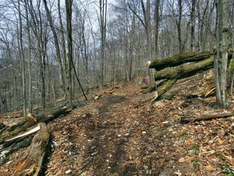 Just beyond the first blowdown was another piece of the tree that littered the trail. It was easy to walk around but I wanted to clean it up a little. I cut a section that was lying on the trail and was able to coax it off by moving it down hill. What remained were some harp points projecting from a remaining piece. I cut them off with the saw so that they were less likely to injure anyone. I though I was done but I looked back at the main blowdown and saw one more trunk lying partly ion the ground and partly buried in it. This part could easily be walked over or around but I decided the job would not be complete without removing it. I started by cutting off a piece near the top of the tree which require I move some brush first. I chose to cut it with the axe and it went quickly. I then went back to the end near the roots where I had cut the first trunk earlier. This time the problem was that making the cut might pinch the saw as the two parts of the trunk were pinched together. I decided to use the axe to start and the finish with the saw. Cutting with the axe was hard because the angle was wrong but I removed enough wood to make using the saw pretty easy. After this cut I had a large piece of trunk, partly embedded in the ground, which I could not move. I tried freeing one end from under a larger piece of trunk. I tried removing some of the dirt from around the art that was buried. I finally decided to use the axe to cut the trunk in half. As I started this work, Sheila began to bark and I saw someone walking toward us. I think Sheila and I recognized that it was Lisa at about the same time. Sheila happily went to greet her and I stopped my work long enough to talk for a few minutes. Lisa continued on the trail to lop some branches. I sued the axe to divide the log which went very quickly. I was able to move both pieces off the trail and fill in the reining "ditch" with some dirt. When I was done, I actually shouted "And that's how it's done!" I picked up my tools and pout them in the pack. Before leaving I took some "after" pictures. I did notice one more piece of trunk I may have to cut. We walked down the cemetery hill with Sheila on her leash and crossed the road to our driveway. We were home by 12:30 PM after spending 2 hours working. I was tired but satisfied with the work I had done.
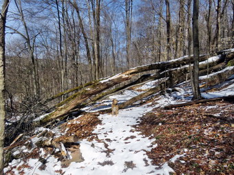
![]() On Monday, April 9th I wanted to go do some more trail maintenance after a trip to Frick Pond to do some trail clearing on the previous Saturday. I like using my axes and hand saws to clear trees on the trails as it reminds me of working with my father and uncles when is was younger. We logged a lot for firewood and often used hand tools as chainsaws were cumbersome and expensive. I have two Silky saws which are Japanese and cut on the pull stroke. The Sugowaza is a 17" curved and fixed blade which fits in a scabbard. The Katana Boy is almost two feet long and is a folding saw with a nylon carrier. Both are remarkably sharp and can take care of some large tree trunks. I usually carry a Fiskars axe with a composite handle and rather small head. It is light an easy to carry for many miles. It also lives up to the "hype" as it is easy to keep sharp and cut well despite its small head. If I know I will be working close to a trailhead I may take my Council Tools felling axe that weighs in excess of 5 lbs! I decided I would go to Round top across from my house in Livingston Manor to tackle several large trees that had fallen less than 100 feet in from the trailhead and were blocking the trail. I got my gear together as Sheila watched carefully and made sure I would not leave her behind. I did not intend to hike much but I knew she would rather by outside than in the house. We headed out the driveway a little after 10:30 AM with the air temperature in the high 20's. I had decided to wear tights and a baselayer on top under a Mammut crew neck pullover. I wore my Columbia Omniheat pants and, as always, my Mammut hoody. I decided to put on my reliable Salomon B52 boots but left the gaiters home. I added a pair of gloves and a hat. I knew I might be warm working but had options to open pit zips or remove some layers. We crossed the field by the church and headed up the hill by the cemetery to the trailhead. Sheila pulled me most of the way to the top where we trend left into the woods. I let her off her leash and we walked to the area where the trees were blocking the trail. They were a little larger than I remembered and the job was complex. I began by taking some "before" pictures of the mess. Sheila posed by the trees so that I could show some perspective as to the size of the trunks. I got out the saws, axes and felling wedges and got to work. I first removed all the loose branches that I could and then cut away a few small branches to get everything cleared for the real work. I went to the far side of the mess and cut a few small branches away and then cut a larger branch that ran through the middle. My first thought was to create an arch so that people could easily walk under and over the remaining larger trunks.
On Monday, April 9th I wanted to go do some more trail maintenance after a trip to Frick Pond to do some trail clearing on the previous Saturday. I like using my axes and hand saws to clear trees on the trails as it reminds me of working with my father and uncles when is was younger. We logged a lot for firewood and often used hand tools as chainsaws were cumbersome and expensive. I have two Silky saws which are Japanese and cut on the pull stroke. The Sugowaza is a 17" curved and fixed blade which fits in a scabbard. The Katana Boy is almost two feet long and is a folding saw with a nylon carrier. Both are remarkably sharp and can take care of some large tree trunks. I usually carry a Fiskars axe with a composite handle and rather small head. It is light an easy to carry for many miles. It also lives up to the "hype" as it is easy to keep sharp and cut well despite its small head. If I know I will be working close to a trailhead I may take my Council Tools felling axe that weighs in excess of 5 lbs! I decided I would go to Round top across from my house in Livingston Manor to tackle several large trees that had fallen less than 100 feet in from the trailhead and were blocking the trail. I got my gear together as Sheila watched carefully and made sure I would not leave her behind. I did not intend to hike much but I knew she would rather by outside than in the house. We headed out the driveway a little after 10:30 AM with the air temperature in the high 20's. I had decided to wear tights and a baselayer on top under a Mammut crew neck pullover. I wore my Columbia Omniheat pants and, as always, my Mammut hoody. I decided to put on my reliable Salomon B52 boots but left the gaiters home. I added a pair of gloves and a hat. I knew I might be warm working but had options to open pit zips or remove some layers. We crossed the field by the church and headed up the hill by the cemetery to the trailhead. Sheila pulled me most of the way to the top where we trend left into the woods. I let her off her leash and we walked to the area where the trees were blocking the trail. They were a little larger than I remembered and the job was complex. I began by taking some "before" pictures of the mess. Sheila posed by the trees so that I could show some perspective as to the size of the trunks. I got out the saws, axes and felling wedges and got to work. I first removed all the loose branches that I could and then cut away a few small branches to get everything cleared for the real work. I went to the far side of the mess and cut a few small branches away and then cut a larger branch that ran through the middle. My first thought was to create an arch so that people could easily walk under and over the remaining larger trunks.
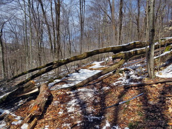 I removed the middle branch rather quickly and made sure I got it well out of the way. The next trunk I handled was a larger one running right through the middle of the opening. I attacked this with the saws and was able to cut off the end nearest the top of the tree and move that piece out of the way. I then made another cut nearer the root end of the tree and on the right side of the trail. The trunk was much larger here but eventually succumbed to the saws. This piece was much harder to move out of the way as it had and odd shape and would not roll easily. Eventually I coaxed it off the trail and thought that perhaps I was done. I noticed that one of the remaining pieces of trunk had some sharp points and decided to cut them off. I started to saw them off and noticed the saw was not cutting as it should. I moved some wood aside to find that I was cutting into a rock that was embedded in the trunk! The saw still seemed sharp but did not cut well. I decided to cut off the entire trunk which was by far the thickest I had tried so far. I knew getting through the whole trunk with a saw would be difficult so I decided to cut it part way through with the axe and finish with the Katana Boy. I began to chop the trunk and eventually found that the heartwood was somewhat rotten. After a few more chops, I broke through the heartwood and a stream of dark fluid started to flow out. The tree was bleeding! Chopping became messy so I cut a channel to drain the fluid and chopped a little more. After this I started with the saw and although it was slow going, I was able to complete the cut. I had to use the axe as a lever to roll this one off the trail. I surveyed my work and was satisfied that people could now walk through by just ducking under the remaining trunk. I decided to leave that one for another day. I took my "after pictures" and then packed up to head home. We walked down the cemetery hill with Sheila on her leash. Another large dog whose owner had no control cam over to bother us all the way to the road. We crossed the road and were home by 1:00 PM after spending 2 and a half hours working. I was tired but satisfied with the work I had done.
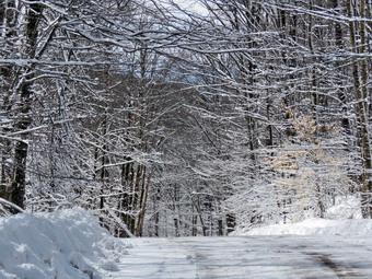
![]() On Saturday, April 7th when I got up I found several inches of snow had fallen overnight although the roads seemed almost clear. I wanted to go to Frick Pond to do some "emergency" tree clearing as there were several spots on the trail that were almost blocked by blowdowns. I wasn't sure I wanted to battle the snow and the trees but I decided to go to see what could be done. I asked Cindy if she wanted to go and she agreed. We started to get ready around 9:45 AM under the watchful eye of Sheila who did not want us to forget her. The temperature was only 28 degrees so I decided to wear tights and a baselayer on top under a Mammut crew neck pullover. I wore my Columbia Omniheat pants and, as always, my Mammut hoody. I decided to put on my reliable Salomon B52 boots, gaiters and added a pair of gloves and a hat. We had decided we would not take our snowshoes as the weather had been warm during the week and the new snowfall was not very deep. I did elect to carry spikes to give me some choices as I did not know the trail conditions. I packed both my Silky saws, a Fiskars ax and two felling wedges. The two Silky saws are Japanese and cut on the pull stroke. The Sugowaza is a 17" curved and fixed blade which fits in a scabbard. The Katana Boy is almost two feet long and is a folding saw with a nylon carrier. Both are remarkably sharp and can take care of some large tree trunks. The Fiskars axe has a composite handle and rather small head. It is light an easy to carry for many miles. It also lives up to the "hype" as it is easy to keep sharp and cut well despite its small head. If I know I will be working close to a trailhead I may take my Council Tools felling axe that weighs in excess of 5 lbs! We got our gear in the car and Sheila in the back seat and headed out the DeBruce Road at about 10:15 AM. The farther we drove the more snow there seemed to be! After 6 miles, at Mongaup Pond Road, I turned left and continued to follow the road bearing left onto Beech Mountain Road at the fork. When we arrived in the parking area there were two other cars the smaller lot which was barely plowed. The larger lot had not been touched. One man and his dog were getting ready to hike up the Flynn Trail and I suspected that the occupants of the pickup truck had also gone that way. My plan was to head out the Quick Lake Trail to Graveyard Junction where we would turn right on the Logger's Loop to address a major blowdown blocking the trail. There was at least 5 inches of snow which made the scene quite beautiful but would not help as we tried to do our work. I knew that there would be a lot of snow falling onto us as we worked. I took some pictures at the parking area and then we headed over to the larger lot. We started out on the Quick Lake trail toward the trail register.
On Saturday, April 7th when I got up I found several inches of snow had fallen overnight although the roads seemed almost clear. I wanted to go to Frick Pond to do some "emergency" tree clearing as there were several spots on the trail that were almost blocked by blowdowns. I wasn't sure I wanted to battle the snow and the trees but I decided to go to see what could be done. I asked Cindy if she wanted to go and she agreed. We started to get ready around 9:45 AM under the watchful eye of Sheila who did not want us to forget her. The temperature was only 28 degrees so I decided to wear tights and a baselayer on top under a Mammut crew neck pullover. I wore my Columbia Omniheat pants and, as always, my Mammut hoody. I decided to put on my reliable Salomon B52 boots, gaiters and added a pair of gloves and a hat. We had decided we would not take our snowshoes as the weather had been warm during the week and the new snowfall was not very deep. I did elect to carry spikes to give me some choices as I did not know the trail conditions. I packed both my Silky saws, a Fiskars ax and two felling wedges. The two Silky saws are Japanese and cut on the pull stroke. The Sugowaza is a 17" curved and fixed blade which fits in a scabbard. The Katana Boy is almost two feet long and is a folding saw with a nylon carrier. Both are remarkably sharp and can take care of some large tree trunks. The Fiskars axe has a composite handle and rather small head. It is light an easy to carry for many miles. It also lives up to the "hype" as it is easy to keep sharp and cut well despite its small head. If I know I will be working close to a trailhead I may take my Council Tools felling axe that weighs in excess of 5 lbs! We got our gear in the car and Sheila in the back seat and headed out the DeBruce Road at about 10:15 AM. The farther we drove the more snow there seemed to be! After 6 miles, at Mongaup Pond Road, I turned left and continued to follow the road bearing left onto Beech Mountain Road at the fork. When we arrived in the parking area there were two other cars the smaller lot which was barely plowed. The larger lot had not been touched. One man and his dog were getting ready to hike up the Flynn Trail and I suspected that the occupants of the pickup truck had also gone that way. My plan was to head out the Quick Lake Trail to Graveyard Junction where we would turn right on the Logger's Loop to address a major blowdown blocking the trail. There was at least 5 inches of snow which made the scene quite beautiful but would not help as we tried to do our work. I knew that there would be a lot of snow falling onto us as we worked. I took some pictures at the parking area and then we headed over to the larger lot. We started out on the Quick Lake trail toward the trail register.
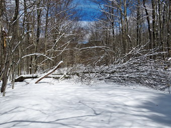 The last time I had been on this part of the trail Lisa and I were coming from the other direction and we totally lost the trail. With the blazes being few and far between and the numerous blowdowns and branches it was hard to find the trail. It doesn't help that in winter the trail bed is almost impossible to see. Just after walking down the steps, Cindy and I encountered the first set of branches blocking the trail. I took my "before" pictures and then I knocked the snow off and cut them with the saw while Cindy used the loppers to cut others. We dragged everything off the trail and, after taking some more pictures, we moved on. There was really quite a bit of snow but not enough to warrant snowshoes. We cleared several more spots before the register and then turned left on the woods road. This part of the trail was pretty clear and we picked up a few branches and lopped several others. I knocked the snow off some low hanging evergreen branches and most sprang upwards off the trail. We came to a spot where there were a few small trees across the trail so I documented it with some photos and got to work. I cut some small trunks and got them off the trail. While we were working, Sheila began to bark and we could see two hikers coming toward us from the trail register. We put Sheila on her leash and the couple stopped to say "Hello". Their British accent was obvious and they told us they had relocated to New York City from England because they like the Catskills so much! We talked a little more and I suggested they take a look at this website to get an idea of other places to hike. They were wearing snowshoes for the first time and there was enough snow to get an idea of how they work. They had rented the snowshoes for the day from Morgan Outdoors in Livingston Manor. Cindy and I finished our work at that location and after I took some pictures we continued on toward Gravestone Junction. We took some time to lop a few branches just before the junction and then turned right on the Logger's Loop. I took some pictures just after the turn since the sky was blue with white clouds and the snow still blanketed many of the trees. We continued for about .3 miles to the large blowdown I wanted to clear. The mess was much larger than I remembered with two trunks and lots of branches to remove.
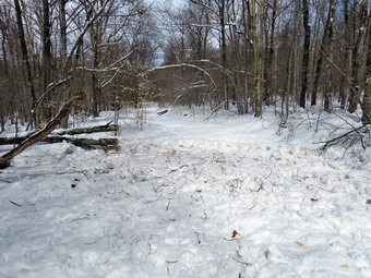 The mess was much larger than I remembered with two trunks and lots of branches to remove. I took lots of "before" pictures and then surveyed the job to develop a plan. I started by cutting all the branches I could and dragging them well into the woods. Many of the branches were frozen deep into the snow and I had to pull on them to get them loose. Other times I would cut a branch and find it was pinned underneath another branch that was in turn pinned by another. I kept working and working on the branches until all were gone leaving only two large trunks behind. I took a few more pictures. As we were working another couple came toward us from Times Square. They looked ill-prepared for the snow but were cheerful in their greeting. I cut the top trunk twice as I knew I would not be able to move the pieces otherwise. As it was I struggled to get them off the trail. I was very tired by this time and contemplated leaving the final trunk as it was easy to step over or around. I decided I wanted to complete the job and started in on the last trunk. I had to cut this one twice also. Since part of it was almost on the ground I used the axe to sever it. As I tried to move it I found there was another branch hidden under the snow which was connected to the piece I was moving. I cut this branch and dug it out of the snow and then moved both off the trail. I finally started to cut the largest trunk with the saw. My arms were so tired I had to stop after every few strokes! I knew I would get the job done but it was tough going. Finally the last piece fell and I had just enough strength to roll it off the trail. I cleaned up the last few branches and then packed up my tools. I took my "after" pictures of what thought was a job well done! I had planned on clearing another tree on the Flynn Trail but knew that would not be possible on this day. I had started the work at 12:15 PM and finished at 2:20 PM! We walked back on the Logger's Loop to Gravestone Junction where I considered going down to Frick Pond but just turned left and headed back out the Quick Lake Trail to the car. It was 2:40 PM and we had spent 4 hours hiking 2 miles making it one of the slowest hikes I have ever done!
![]()
![]()
![]()
![]() On Wednesday, April 4th I wanted to get out on a hike but didn't have much time to spend. There had been a few "warm" days in a row with cold nights so I expected the snow on Round Top to by pretty hard especially on the packed trails or perhaps gone altogether. I decided just to head across the street and hike on Round Top. Sheila seemed thrilled at the decision and couldn't wait to get going. I had a few things to do first and we did not get started until 11:00 AM. The temperature was in the low 30's as I started to get dressed. As I got dressed I decided to put on a pair of tights under my Columbia Omniheat pants even though I knew I would probably be warm once I started hiking. I also put on a light, long-sleeved baselayer under my Mammut crew neck shirt. I put on my Mammut Ultimate hoody and wore a hat and a pair of gloves. I donned my Salomon B52 boots but decided I did not need gaiters. Sheila would not leave my side as I was getting ready as she wanted to make sure she was going too! I stepped out onto the back porch and headed out the slippery driveway at 11:00 AM. We crossed the street with Sheila on her leash and walked to the back of the church where I released Sheila from her leash. There was very little snow in the field and the road up to the top of the cemetery was almost completely bare. We began the ascent of the steepest hill behind the church. The hill is short but really gets the circulation pumping and is the steepest and longest climb on the "trail". When we got to the top of the hill, we started out on the trail by turning left at the trailhead. There was a little more snow in the woods but no more than a few inches and it was pretty well packed. When we arrived at the large blowdown blocking the trail, I decided to work my way through it rather than walk around it as we had been doing when there was more snow. It wasn't hard to sneak through the opening and it let me get a good look at the mess. I came to the conclusion that clearing the blowdown would be a real challenge. At the first trail junction we turned right and continued up the trail. There was still some snow on the trail but not enough to require any traction devices. As I walked, I removed a few loose branches from the trail and tried to free some of the trees that were still bent over.
On Wednesday, April 4th I wanted to get out on a hike but didn't have much time to spend. There had been a few "warm" days in a row with cold nights so I expected the snow on Round Top to by pretty hard especially on the packed trails or perhaps gone altogether. I decided just to head across the street and hike on Round Top. Sheila seemed thrilled at the decision and couldn't wait to get going. I had a few things to do first and we did not get started until 11:00 AM. The temperature was in the low 30's as I started to get dressed. As I got dressed I decided to put on a pair of tights under my Columbia Omniheat pants even though I knew I would probably be warm once I started hiking. I also put on a light, long-sleeved baselayer under my Mammut crew neck shirt. I put on my Mammut Ultimate hoody and wore a hat and a pair of gloves. I donned my Salomon B52 boots but decided I did not need gaiters. Sheila would not leave my side as I was getting ready as she wanted to make sure she was going too! I stepped out onto the back porch and headed out the slippery driveway at 11:00 AM. We crossed the street with Sheila on her leash and walked to the back of the church where I released Sheila from her leash. There was very little snow in the field and the road up to the top of the cemetery was almost completely bare. We began the ascent of the steepest hill behind the church. The hill is short but really gets the circulation pumping and is the steepest and longest climb on the "trail". When we got to the top of the hill, we started out on the trail by turning left at the trailhead. There was a little more snow in the woods but no more than a few inches and it was pretty well packed. When we arrived at the large blowdown blocking the trail, I decided to work my way through it rather than walk around it as we had been doing when there was more snow. It wasn't hard to sneak through the opening and it let me get a good look at the mess. I came to the conclusion that clearing the blowdown would be a real challenge. At the first trail junction we turned right and continued up the trail. There was still some snow on the trail but not enough to require any traction devices. As I walked, I removed a few loose branches from the trail and tried to free some of the trees that were still bent over.
I followed the blazes for the yellow trail up to the trail junction. I turned left at the trail junction and followed the yellow rail along the base of Round Top. The trail was pretty open as I had done some maintenance to remove the blowdowns. At the next trail junction, we turned right on the blue trail and headed up the steepest hill to the summit of Round Top. Here there was a little more snow and I thought having microspikes would have been a good idea. On the summit we followed the trail over the top an then down the other side. This part went quickly went quickly . At the yellow trail we turned right and then left at the next trail junction to head down to the lookout. At the lookout we turned left and descended the hill to the first trail junction. This hill had a little less snow than elsewhere as it is most exposed to the sun. I was tired but knew I needed at least an hour of exercise. We turned around and headed back up the hill to the lookout. We turned right at the top following the yellow trail on the long, gentle climb to the junction with the blue trail. We turned right and followed the yellow trail along the base of Round Top to the next junction. Here we turned left and followed the blue trail to the summit. Once again we crossed the summit and started down the other side. On the steep descent to the yellow trail I had to watch my footing as the packed snow was a little slippery. We turned left on the yellow trail and then right at the next trail junction. It was enjoyable following the old woods road back down toward the first trail junction. When we came to the path I had made up from the trailhead to avoid the blowdown, Sheila automatically turned left even though the trail was not very distinct. I called her back and we continued on to the trail junction. I still wanted a little more distance so we turned around and walked back up the woods road on the yellow trail to the junction with the upper blue trail. This time we continued straight ahead up to the summit. We crossed the summit and then headed down the steeper side toward the lower yellow trail. At the junction we continued straight ahead back down to the lookout. At the viewpoint we turned left to follow the yellow teal back down to the first trail junction. We continued straight ahead and walked back out to trailhead passing through the blowdown again. At the trailhead we turned right and descended the hill. We walked across the field to the driveway and home. We had spent a little over an hour walking a little more than 2 miles. The walk was a good workout even though I feel I could do it blindfolded!
![]()
![]()
![]()
![]()
![]() On Saturday, March 31st I got up at 7:00 AM to drive to Berry Brook Road to meet two hikers at the Mary Smith Trail trailhead. Kevin and Brian are from Canandaigua and are hiking the Finger Lakes Trail. I saw Kevin's post on the FLT Yahoo group and volunteered to give them a ride. From hiking the Finger Lakes Trail farther upstate, I know how great it is to get a ride so that a hike can be all trail without the return trip. I drove from Livingston Manor out Old Route 17 and then north on the Beaverkill Road. I turned right to take Campground Road down to the Beaverkill Covered Bridge. After driving through the bridge, I turned right on Berry Brook Road which eventually becomes Holiday Brook Road. I drove north toward the Pepacton Reservoir passing the trailhead for Huggins Lake. As I pulled up to the parking area, I could see a pickup with two men so I stopped and got out of the car. It was about 7:45 AM and I was glad we had found each other without a problem. After a short introduction, we got in the car. I turned around and stayed on Berry Brook Road all the way out to Route 206. I turned right and headed north again toward the reservoir. After the top of Cat Hollow, I found Jug Tavern Road on the left. I turned and drove to Campbell Mountain Road where I turned right. The road is dirt and had plenty of frozen ruts and the temperature was only 26 degrees. We were soon at the point where the trail crosses the road. I stopped to let Kevin and Brian out. I wished them "Good luck" and then headed home through Roscoe. When I got home, I had a few chores to do. It was just before 11:00 AM when I finished so I asked Brad if he wanted to hike. He said "Yes" so we started to get ready to go. The temperature was in the mid 30's so I decided not to wear a baselayer. I put on my Columbia Omniheat pants and a Mammut crew neck pullover. I wore my Mammut hoody and a lighter hat and gloves. I put my Microspikes but decided the recent warm temperatures and two days of rains had reduced the snow pack making snowshoes unnecessary. I decided to wear gaiters but pit on my Keen Glarus boots which are regular hiking boots. Brad and I got our gear and Sheila in the car and headed out the DeBruce Road. Sheila had been very quiet but did not let me out of her sight as I was getting ready. After 6 miles, at Mongaup Pond Road, I turned left and continued to follow the road bearing left onto Beech Mountain Road at the fork. When we arrived in the parking area there were several other cars in both lots. A couple of groups of people were getting ready to hike and all of them seemed to be heading up the Flynn Trail. It had been my plan to go that way but I immediately decided to head out the Quick Lake Trail to avoid the crowd. Before we left, I advised one couple who were headed toward the cabin that they might want to start at the beginning of the Flynn Trail. As we started out the woods road toward Frick Pond, it became immediately obvious to me that we were going to be in trouble without snowshoes. There was still at least a foot of snow in the woods and almost as much on the trail. There were a few open spots with running water on the trail to Frick Pond but the rest of the trail was covered in snow and ice. The temperature had risen to 40 degrees and there was a bright sun in a cloudless sky. This contributed to very soft snow in many places. We were able to avoid sinking in too much but I knew this would get worse. At Gravestone Junction we turned left to head down to Frick Pond. The water level in the pond was a little higher than it had been and there was a pretty solid looking sheet of ice over much of the pond. I had thought I would not stop to take pictures but I couldn't resist the blue sky and icy pond. After taking a few shots, I put the camera in the pack and we continued on the Quick Lake Trail around the pond bearing left at the next trail junction to stay on the red trail. This part of the trail was wet and the snow continued to be soft. I began to think that I would cut the hike short at Iron Wheel Junction by taking the Logger's Loop back to the car! soon came to the "pine promenade" and the little stream through the woods. The water level in the stream was higher than it had been in some time and I had to walk upstream to cross without getting wet. I stopped to take a few pictures before we continued on the trail toward Iron Wheel Junction. I did remove a few loose sticks along the way but left a larger blowdown which would require a saw. Just before the junction there was a large branch and a pile of smaller ones on the trail. These branches had been hung up for some time and had finally come down in the strong winds. We arrived at Iron Wheel Junction at 1.6 miles.
On Saturday, March 31st I got up at 7:00 AM to drive to Berry Brook Road to meet two hikers at the Mary Smith Trail trailhead. Kevin and Brian are from Canandaigua and are hiking the Finger Lakes Trail. I saw Kevin's post on the FLT Yahoo group and volunteered to give them a ride. From hiking the Finger Lakes Trail farther upstate, I know how great it is to get a ride so that a hike can be all trail without the return trip. I drove from Livingston Manor out Old Route 17 and then north on the Beaverkill Road. I turned right to take Campground Road down to the Beaverkill Covered Bridge. After driving through the bridge, I turned right on Berry Brook Road which eventually becomes Holiday Brook Road. I drove north toward the Pepacton Reservoir passing the trailhead for Huggins Lake. As I pulled up to the parking area, I could see a pickup with two men so I stopped and got out of the car. It was about 7:45 AM and I was glad we had found each other without a problem. After a short introduction, we got in the car. I turned around and stayed on Berry Brook Road all the way out to Route 206. I turned right and headed north again toward the reservoir. After the top of Cat Hollow, I found Jug Tavern Road on the left. I turned and drove to Campbell Mountain Road where I turned right. The road is dirt and had plenty of frozen ruts and the temperature was only 26 degrees. We were soon at the point where the trail crosses the road. I stopped to let Kevin and Brian out. I wished them "Good luck" and then headed home through Roscoe. When I got home, I had a few chores to do. It was just before 11:00 AM when I finished so I asked Brad if he wanted to hike. He said "Yes" so we started to get ready to go. The temperature was in the mid 30's so I decided not to wear a baselayer. I put on my Columbia Omniheat pants and a Mammut crew neck pullover. I wore my Mammut hoody and a lighter hat and gloves. I put my Microspikes but decided the recent warm temperatures and two days of rains had reduced the snow pack making snowshoes unnecessary. I decided to wear gaiters but pit on my Keen Glarus boots which are regular hiking boots. Brad and I got our gear and Sheila in the car and headed out the DeBruce Road. Sheila had been very quiet but did not let me out of her sight as I was getting ready. After 6 miles, at Mongaup Pond Road, I turned left and continued to follow the road bearing left onto Beech Mountain Road at the fork. When we arrived in the parking area there were several other cars in both lots. A couple of groups of people were getting ready to hike and all of them seemed to be heading up the Flynn Trail. It had been my plan to go that way but I immediately decided to head out the Quick Lake Trail to avoid the crowd. Before we left, I advised one couple who were headed toward the cabin that they might want to start at the beginning of the Flynn Trail. As we started out the woods road toward Frick Pond, it became immediately obvious to me that we were going to be in trouble without snowshoes. There was still at least a foot of snow in the woods and almost as much on the trail. There were a few open spots with running water on the trail to Frick Pond but the rest of the trail was covered in snow and ice. The temperature had risen to 40 degrees and there was a bright sun in a cloudless sky. This contributed to very soft snow in many places. We were able to avoid sinking in too much but I knew this would get worse. At Gravestone Junction we turned left to head down to Frick Pond. The water level in the pond was a little higher than it had been and there was a pretty solid looking sheet of ice over much of the pond. I had thought I would not stop to take pictures but I couldn't resist the blue sky and icy pond. After taking a few shots, I put the camera in the pack and we continued on the Quick Lake Trail around the pond bearing left at the next trail junction to stay on the red trail. This part of the trail was wet and the snow continued to be soft. I began to think that I would cut the hike short at Iron Wheel Junction by taking the Logger's Loop back to the car! soon came to the "pine promenade" and the little stream through the woods. The water level in the stream was higher than it had been in some time and I had to walk upstream to cross without getting wet. I stopped to take a few pictures before we continued on the trail toward Iron Wheel Junction. I did remove a few loose sticks along the way but left a larger blowdown which would require a saw. Just before the junction there was a large branch and a pile of smaller ones on the trail. These branches had been hung up for some time and had finally come down in the strong winds. We arrived at Iron Wheel Junction at 1.6 miles.
 We soon came to the "pine promenade" and the little stream through the woods. The water level in the stream was higher than it had been in some time and we walked upstream to cross without getting too wet. As we continued on the trail toward Iron Wheel Junction, the conditions continued to be difficult as we would walk on top of the snow for a few steps and then break through. This was very tiring and tough on the leg muscles! We arrived at Iron Wheel Junction at 1.6 miles and found the snowmobile trail packed but softer than I would have liked. I consulted with Brad and we both agreed to try the big loop up the Quick Lake Trail toward Hodge Pond. We turned left on the Quick Lake Trail and started the long uphill climb toward Junkyard Junction. The trail here was a little more solid in most places but there was still the "suspense" of breaking through occasionally. I realized that I was sweating a lot so I stopped to take some pictures of the trail. I got a drink and opened all of the zippers on my Mammut hoody. I also took off my hat and gloves as I was very warm. The long climb and slippery conditions continued to wear on me so I was glad to have Brad along. We were headed for Junkyard Junction at 3.2 miles as Sheila followed a few game trails. On previous hikes the snow had been so deep that she had been following in my snowshoe tracks most of the time. On this day she was making up for it! We turned right onto the blue Flynn Trail. I had hoped that someone had broken and packed the trail or that the snowmobiles had made a few passes. We had no such luck as the trail was completely untouched! There was plenty of snow broken up by areas of standing water and the walking was miserable. By this time my feet were completely soaked and I was glad the day was getting warmer. There were no major blowdowns but we continued to remove branches that littered the trail. When we got to the gate, we turned right to stay on the trail and head down toward Hodge Pond. At 3.75 miles the Flynn Trail heads right and we followed it toward the outlet end of Hodge Pond. This part of the trail was a little more packed until we broke out into the field where the sun had completely softened the snow. The trail broke out into a field which we crossed and continued to follow the Flynn Trail toward the outlet of the pond. We walked through the clearing at the outlet end of the pond almost to the shore where I dropped my pack and got out my camera. This area was mostly clear of snow which was a welcome respite. The pond was covered in a layer of ice. I took shots of the pond with the blue skies . Before packing up, I got out a bar and offered one to Brad. I also took a long drink as my muscles were starting to feel like they might cramp.
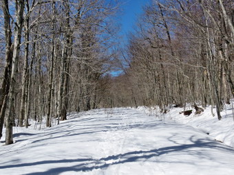 I packed up and we walked back to the Flynn Trail to the point where it re-enters the woods. The snow always drifts here and I could see several drifts. Unfortunately the drifts were all soft and we kept sinking through. As we walked up the hill on the Flynn Trail the snow was soft under the direct rays of the sun. We kept talking to try to keep from thinking about the difficult conditions. At the top of the hill we stayed to the right to follow the Flynn Trail. A left turn follows a woods road out to what remains of the Beech Mountain Boy Scout Camp. The Flynn Trail is relatively flat to the junction with the Big Rock Trail at 4.5 miles. Along the way we met one hiker coming toward us on snowshoes with his dog. We passed with a quick "Hello" and I envied his footwear. I hoped when we got to the junction with the Big Rock that the Flynn Trail would be packed by snowshoers. We continued straight through the junction with the Big Rock Trail to follow the Flynn Trail back to the car. It was clear that the snow was even softer now and not packed at all by snowshoes. Fortunately, the snow was only a few inches deep in most places and we were going downhill most of the way. I was surprised that we did not see any of the other people who had headed up the Flynn Trail. It wasn't even clear whether or not we were seeing their snowshoe tracks. At least my feet could not get any wetter and they were not cold. We continued our descent until the gate was finally in sight. Just before the gate we turned left to follow the Flynn Trail and to avoid the private property around the cabin. The final part of the Flynn Trail through the woods did not have too much snow. When we arrived back at the parking lot there were only two other cars present. We were back at the car by 2:55 PM having covered 6.4 miles in 3 and a half hours with an elevation gain of 910 feet. I think we were both happy to be back at the car. As I drive away the car thermometer read 48 degrees.
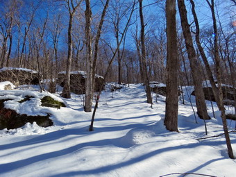
![]()
![]()
![]()
![]() On Monday, March 26th, I had planned to hike somewhere and thought about going to Trout Pond. In the morning I had an e-mail from a person who wanted to hike from Campbell Mountain over Cabot Mountain and was asking about snow conditions. I responded that I though there was plenty of snow and that snowshoes would be a good idea. After sending the e-mail, I decided that I would go and hike Cabot Mountain from Beech Hill Road and see for myself. I maintain this section of trail for the Finger Lakes Trail Conference and also wanted to evaluate the condition of the trail to see how much work I would have to do to get it in shape. When I got up the temperature was only 25 degrees but I knew that the snow conditions would be better at lower temperatures. I decided to wear tights and a baselayer on top under a Mammut crew neck pullover. I wore my Columbia Omniheat pants and, as always, my Mammut hoody. I decided to put on my reliable Salomon B52 boots, gaiters and added a pair of gloves and a hat. We had decided we would take our snow shows and carry spikes to give us some choices as we did not know the trail conditions. We both chose our Tubbs Alp Flex VTR snowshoes which are a little smaller than some and have the BOA binding system. I knew we wouldn't need the flotation since the trails were pretty well packed even though the snow depth was still over a foot. The BOA system uses a dial to tighten a thin but strong wire and seems to evenly tighten the binding around my foot. Sheila was ready to go as we pulled out of Livingston Manor at 9:25 AM. I drove north on Old Route 17 before turning right on the Beaverkill Road. I passed through Lew Beach and turned left on Beech Hill Road Road. I drove up the road about 2.6 miles to the small pullout on the right side of the road at the beginning of the trail but found it was not plowed. I found a wider spot in the road just before the parking area and got the car off the road as far as possible. From the amount of snow at the trailhead it was obvious that I would be wearing the snowshoes for the whole trip. The temperature was still in the high 20's and when I got out of the car a slight breeze was blowing. I put on my snowshoes and set my electronics and we walked up the side of the road on the snow banks from the plow at 9:40 AM. We turned down through the field where there was well over a foot of snow. I was able to walk on top of the snow without a problem although the sun was shinny brightly in a cloudless, blue sky. We entered the woods where the first part of the trail is flat but with a few wet spots. I avoided the water as in makes the snow stick to the snowshoes. We walked along a stone wall trying to follow the sparse blazes. In other seasons the trail bed helps guide hikers in the right direction but it is hard to find when the snow is on the ground. The DEC has decreed that volunteers may no longer mark trails. This job falls on the foresters who have many other tasks to perform. Unfortunately, the trail marking has suffered as a result. At .2 miles the trail begins to climb and in about half a mile it gains almost 600 feet averaging a 20% grade. This is not as steep as the other side but is plenty challenging. I immediately engaged the lifts on my snowshoes which help take some strain off the calf muscles. I was still walking on top of the snow which made the climbing easier but not easy. We continued up the trail which has a few switchbacks and several flatter areas. The climb seemed shorter than I expected but there were a few shorter climbs which I did not remember.
On Monday, March 26th, I had planned to hike somewhere and thought about going to Trout Pond. In the morning I had an e-mail from a person who wanted to hike from Campbell Mountain over Cabot Mountain and was asking about snow conditions. I responded that I though there was plenty of snow and that snowshoes would be a good idea. After sending the e-mail, I decided that I would go and hike Cabot Mountain from Beech Hill Road and see for myself. I maintain this section of trail for the Finger Lakes Trail Conference and also wanted to evaluate the condition of the trail to see how much work I would have to do to get it in shape. When I got up the temperature was only 25 degrees but I knew that the snow conditions would be better at lower temperatures. I decided to wear tights and a baselayer on top under a Mammut crew neck pullover. I wore my Columbia Omniheat pants and, as always, my Mammut hoody. I decided to put on my reliable Salomon B52 boots, gaiters and added a pair of gloves and a hat. We had decided we would take our snow shows and carry spikes to give us some choices as we did not know the trail conditions. We both chose our Tubbs Alp Flex VTR snowshoes which are a little smaller than some and have the BOA binding system. I knew we wouldn't need the flotation since the trails were pretty well packed even though the snow depth was still over a foot. The BOA system uses a dial to tighten a thin but strong wire and seems to evenly tighten the binding around my foot. Sheila was ready to go as we pulled out of Livingston Manor at 9:25 AM. I drove north on Old Route 17 before turning right on the Beaverkill Road. I passed through Lew Beach and turned left on Beech Hill Road Road. I drove up the road about 2.6 miles to the small pullout on the right side of the road at the beginning of the trail but found it was not plowed. I found a wider spot in the road just before the parking area and got the car off the road as far as possible. From the amount of snow at the trailhead it was obvious that I would be wearing the snowshoes for the whole trip. The temperature was still in the high 20's and when I got out of the car a slight breeze was blowing. I put on my snowshoes and set my electronics and we walked up the side of the road on the snow banks from the plow at 9:40 AM. We turned down through the field where there was well over a foot of snow. I was able to walk on top of the snow without a problem although the sun was shinny brightly in a cloudless, blue sky. We entered the woods where the first part of the trail is flat but with a few wet spots. I avoided the water as in makes the snow stick to the snowshoes. We walked along a stone wall trying to follow the sparse blazes. In other seasons the trail bed helps guide hikers in the right direction but it is hard to find when the snow is on the ground. The DEC has decreed that volunteers may no longer mark trails. This job falls on the foresters who have many other tasks to perform. Unfortunately, the trail marking has suffered as a result. At .2 miles the trail begins to climb and in about half a mile it gains almost 600 feet averaging a 20% grade. This is not as steep as the other side but is plenty challenging. I immediately engaged the lifts on my snowshoes which help take some strain off the calf muscles. I was still walking on top of the snow which made the climbing easier but not easy. We continued up the trail which has a few switchbacks and several flatter areas. The climb seemed shorter than I expected but there were a few shorter climbs which I did not remember.
 At about .7 miles the trail levels off and then rolls over several bumps to the Cabot Mountain Vista at 1.6 miles. A few of the spots on these shorter climbs were exposed to the sun and were beginning to get soft. In other spots the snow had drifted and was not quite as consolidated as on the steeper climb. I began to break through the top layer of snow which made the hiking harder. I was happy that I was not sinking in very far as in most places there was between 18 and 24 inches of snow. Sheila meanwhile was having a great time bounding ahead and them coming back to find me. She occasionally followed some game trail but this meant she had to wade through deep snow. We finally arrived at the lookout at 10:55 AM after what seemed like a very long walk along the ridge. The sun was bright but high in the sky so I took some pictures. The view was good but there isn't too much to see except the mountains in the background and Little Pond below. I got a drink and a bar and started back after only a short break. As I expected the snow was now melting in the areas exposed to the direct sunlight and it was beginning to stick to the snowshoes. I hoped this wouldn't be too much of a problem especially on the steepest descent. I knew that the trip back should go more quickly than the trip up but that I would be hampered by the consistency of the snow. The walk across the ridge seemed to go quickly and the snow was not as sticky as I thought. We were soon at the steep descent which did go quickly as I was able to stay on top of the snow. The only problem was that this pout a lot of pressure on my feet as they slipped forward in the boots. Once we got to the flatter area at the base of the descent, I knew we were almost back to the car. The snow in the open field was still supportive and we were back at the car at noon. We spent 2 hours and 15 minutes hiking 3.0 miles with an elevation gain of 900 feet! I was definitely tired but could easily have done a few more miles given the same conditions. I would not want to do this hike without snowshoes.
![]()
![]()
![]()
![]()
![]() On Friday, March 23rd, I wanted to hike a 3500 foot peak for the first hike of spring and was thinking of Slide. I mentioned this to Cindy and she assured me she would not hike Slide. I didn't want to go too far from home so I countered with Balsam lake Mountain and she agreed. I wasn't sure of the condition of the Beaverkill Road above the monastery and suggested we hike from the Millbrook trailhead which is right on Millbrook Road and is usually plowed. When I got up in the morning it was only 25 degrees so I was in no hurry to get started although I didn't want to wait too long as I was afraid the snow would get too soft later in the day. Cindy and I got dressed and got our gear ready to go. It was still in the high 20's a little after 10:00 AM so I decided to wear tights and a baselayer on top under a Mammut crew neck pullover. I wore my Columbia Omniheat pants and, as always, my Mammut hoody. I decided to put on my reliable Salomon B52 boots and gaiters and added a pair of gloves and a hat. We had decided we would take our snowshoes and carry spikes to give us some choices as we did not know the trail conditions. We both chose our Tubbs Alp Flex VTR snowshoes which are a little smaller than some and have the BOA binding system. I knew we wouldn't need the flotation since the trails were pretty well packed even though the snow depth was still over a foot. The BOA system uses a dial to tighten a thin but strong wire and seems to evenly tighten the binding around my foot. As usual Sheila was very excited as we put her in the backseat. We headed up the Quickway and took Route 206 towards Downsville. This route is a little longer than the Beaverkill Road but has less twists and turns. It seemed that every time we passed a spot where we had hiked before Sheila began to whine as if to say "Let's stop here!" I took a right on Route 30 when we reached the reservoir and then took the BWS roads to Millbrook Road. I turned right and drove passed Kelly Hollow and soon after pulled into the parking lot that serves Balsam Lake Mountain and Dry Brook Ridge. There was only one other car in the lot and we both parked parallel rather than pulling in because of the impressive snow banks. One check of the trail convinced me that we would be wearing snowshoes the whole way. I set my electronics and we put on our snowshoes. As we were getting ready a stiff breeze picked up and both if us felt chilly. we started the hike by crossing the road at 11:30 AM and climbing up the high and hard snow bank to get onto the trail. Unlike the climb from the Beaverkill Road which starts out almost flat, the ascent from Millbrook starts with an uphill gaining over 200 feet in the first half mile. The temperature at the parking area was 28 degrees but once we were on the trail, we both were comfortable and began to warm up on the ascent. The trail is really a wide woods road which is passable by a high clearance vehicle. There was a well-packed trail which showed the tracks of many snowshoes, at least one cross country skier and a snowmobile or two. Not far into the ascent Sheila alerted and we saw another hiker with a dog coming toward us. E both put our dogs and leashes. As the other hiker passed with a beautiful Irish Setter, I tried to strike up a conversation but Sheila was barking and growling at the other dog. Sheila only does this when Cindy is along!
On Friday, March 23rd, I wanted to hike a 3500 foot peak for the first hike of spring and was thinking of Slide. I mentioned this to Cindy and she assured me she would not hike Slide. I didn't want to go too far from home so I countered with Balsam lake Mountain and she agreed. I wasn't sure of the condition of the Beaverkill Road above the monastery and suggested we hike from the Millbrook trailhead which is right on Millbrook Road and is usually plowed. When I got up in the morning it was only 25 degrees so I was in no hurry to get started although I didn't want to wait too long as I was afraid the snow would get too soft later in the day. Cindy and I got dressed and got our gear ready to go. It was still in the high 20's a little after 10:00 AM so I decided to wear tights and a baselayer on top under a Mammut crew neck pullover. I wore my Columbia Omniheat pants and, as always, my Mammut hoody. I decided to put on my reliable Salomon B52 boots and gaiters and added a pair of gloves and a hat. We had decided we would take our snowshoes and carry spikes to give us some choices as we did not know the trail conditions. We both chose our Tubbs Alp Flex VTR snowshoes which are a little smaller than some and have the BOA binding system. I knew we wouldn't need the flotation since the trails were pretty well packed even though the snow depth was still over a foot. The BOA system uses a dial to tighten a thin but strong wire and seems to evenly tighten the binding around my foot. As usual Sheila was very excited as we put her in the backseat. We headed up the Quickway and took Route 206 towards Downsville. This route is a little longer than the Beaverkill Road but has less twists and turns. It seemed that every time we passed a spot where we had hiked before Sheila began to whine as if to say "Let's stop here!" I took a right on Route 30 when we reached the reservoir and then took the BWS roads to Millbrook Road. I turned right and drove passed Kelly Hollow and soon after pulled into the parking lot that serves Balsam Lake Mountain and Dry Brook Ridge. There was only one other car in the lot and we both parked parallel rather than pulling in because of the impressive snow banks. One check of the trail convinced me that we would be wearing snowshoes the whole way. I set my electronics and we put on our snowshoes. As we were getting ready a stiff breeze picked up and both if us felt chilly. we started the hike by crossing the road at 11:30 AM and climbing up the high and hard snow bank to get onto the trail. Unlike the climb from the Beaverkill Road which starts out almost flat, the ascent from Millbrook starts with an uphill gaining over 200 feet in the first half mile. The temperature at the parking area was 28 degrees but once we were on the trail, we both were comfortable and began to warm up on the ascent. The trail is really a wide woods road which is passable by a high clearance vehicle. There was a well-packed trail which showed the tracks of many snowshoes, at least one cross country skier and a snowmobile or two. Not far into the ascent Sheila alerted and we saw another hiker with a dog coming toward us. E both put our dogs and leashes. As the other hiker passed with a beautiful Irish Setter, I tried to strike up a conversation but Sheila was barking and growling at the other dog. Sheila only does this when Cindy is along!
 At .8 miles we began a switchback which eventually brought us to a flatter area at about 1.25 miles. I had not hiked from this direction many times but it seemed longer than I remembered. The tradeoff between the two starts is that the Beaverkill start is flat for some time and then has a steep climb. The hike from the Millbrook side climbs from the beginning but is not as steep as from the Beaverkill Road. Along the way there were some interesting rocks including some that had been eroded so that there were only a few "pillars" left separating some layers. I stopped to take a picture or two and also took a few of the trail. The trail remained well-packed all the way and we were making pretty good time for the conditions. At 2.1 miles we came to the turnoff to the left for Graham and I knew the trail to the summit of Balsam Lake split off just ahead. The pat to Gram showed far less use than the one we were on. My plan had been to continue straight ahead and walk down to the steeper trail up the mountain. I like the challenge and this would allow us to make a sort of lollipop loop out of the hike. When we got to the point where the trail split, I could see Cindy needed the shortest and easiest approach possible. At 2.3 miles we turned right and started up the trail to the fire tower. Just after the start of the trail there is a metal gate and the fact that our feet were nearly even with the top of the gate attested to the snow depth. The sun had come out and the skies were a clear blue. The snow was beginning to soften and was just short of clumping on the snowshoes. I wondered what it would be like on the way back. The climb alternates between steeper and more level sections and it was tough going on both. I slowed to stay with Cindy and used the lifts on my snowshoes to make the steeper climbs easier. They go up and down easily by using poles so I kept putting them up where needed and collapsing them on the flats. We continued on our ascent and soon came to the 3500 foot sign. There were some pretty impressive drifts along the way. I noticed that the trail blazes were much lower than I remembered. I put my pole next to one and had Sheila pose while I took a picture. Walking through some of the areas where there were balsam fir was interesting as the snow depth and the low boughs combined to form a narrow passage. Just a short distance from the cabin I turned around to find that I could not see Cindy. I waited a few minutes and then walked back to find her. She wasn't too far back but told me she had gone as far as she could. I knew that the cabin and tower were just minutes ahead but I also knew she had made up her mind. I decided to continue to the summit. Soon I could see the cabin and just after that we broke out into the clearing with the tower.
 It was 1:45 PM and we had hiked 3.1 miles. There was nobody else at the tower and the clear was very sunny with sparkling white snow. I was surprised that the door to the cabin was blocked by snow as if no one had sued it in some time. I walked over to the picnic table to get ready to climb the tower. The top of the table was just a little bit BELOW the level of the snow! I posed Sheila and the table and took some pictures. I removed my snowshoes to climb the tower but decided not to put on my spikes. I walked over to the tower sinking over my knee in one spot where the snow was soft. As I started to climb the steps, I realized that spikes would have been good idea as there was a lot of ice and snow! Sheila started to climb the steps with me but I told her to "Stay!" As I climbed the steps and rose above the treeline, I was hit by a gusting wind that chilled me immediately. I continued to the upper landing just below the cab and began to take pictures in all direction. I would have liked to see some puffy, white clouds in the sky but the mountains were beautiful. I took a lot of shots before realizing that someone else was with me. Sheila had quietly climbed all the way to the top of the tower. I was ready to leave anyway because of the chill wind and was surprised that Sheila had no problem negotiating the steps on the decent. I did have some problems as the icy steps were harder to handle going down than coming up. I took a few pictures of Sheila and the returned to my gear at the table. I donned my pack and we headed back down the trail to reunite with Cindy. She was right where we had left her which was farther away than I thought. We started back on the trail and it was definitely easier going down than up. Cindy did take one spill when her snowshoes lost traction due to the clumping snow. This was also a problem for me as the snow was very soft. Once we made the left turn onto the trail back to Millbrook Road we picked up the pace a little but we were really in no hurry. Once we passed the turn to Gram the snow was not quite as soft on the descent. This was because this area was not getting as much direct sun and because the skies were cloudy over. In fact, the skies were becoming a little grey and the wind was picking up. We kept up a good pace which was made easier as the snow was not clumping. After passing the trail register, Cindy slowed as her knees were bothering her on the long descent. When I got to the road, I waited and for some time before she appeared on the final descent. We hopped up on the snow bank and then crossed the road with a few snowflakes in the air! We were back at 3:30 PM after hiking 6.0 miles in 4 hours and 5 minutes with a 1275 foot elevation gain. The trip out took us about 2 hours and 15 minutes but the return took only 1 hour and 35 minutes.